

2008 ISGS Annual Report - University of Illinois at Urbana-Champaign
2008 ISGS Annual Report - University of Illinois at Urbana-Champaign
2008 ISGS Annual Report - University of Illinois at Urbana-Champaign

Create successful ePaper yourself
Turn your PDF publications into a flip-book with our unique Google optimized e-Paper software.
area. Specific parts <strong>of</strong> the display discuss the depositional history <strong>of</strong><br />
the geologic m<strong>at</strong>erials as interpreted from the sediment sequence<br />
encountered in the borehole. Also discussed is the install<strong>at</strong>ion <strong>of</strong><br />
the observ<strong>at</strong>ion well and how it will be used to better understand the<br />
behavior <strong>of</strong> the aquifers in the area. An aerial photographic history<br />
<strong>of</strong> the Vehe Farm area from 1939 to present is shown. The local and<br />
regional geology and hydrogeology are discussed in separ<strong>at</strong>e panels,<br />
which include graphics illustr<strong>at</strong>ing groundw<strong>at</strong>er flow, the hydrologic<br />
cycle, types <strong>of</strong> aquifers, and terminology commonly used in discussions<br />
concerning groundw<strong>at</strong>er.<br />
The exhibit is intended to provide a basic understanding <strong>of</strong> geological<br />
issues for the layperson. Additionally, two types <strong>of</strong> drill bits used<br />
during the borehole drilling are displayed on a shelf especially constructed<br />
for our exhibit. Samples <strong>of</strong> the sediment encountered during<br />
the drilling are shown as well. Samples <strong>of</strong> the modern soil, diamicton,<br />
sand, silt, and bedrock—cut from the original core—are on display,<br />
and their core position is described. A 4-minute video <strong>of</strong> the drilling,<br />
sediment retrieval, and well install<strong>at</strong>ion is available for play in a kiosk<br />
in the visitor welcome area. This video was recorded during the drilling<br />
in l<strong>at</strong>e 2006 by the <strong>ISGS</strong> staff photographer. Additional m<strong>at</strong>erials<br />
suitable for community teachers are being prepared. Already, local<br />
schools have expressed interest in w<strong>at</strong>er sampling from the well and<br />
inform<strong>at</strong>ion about groundw<strong>at</strong>er resources and glacial history.<br />
Field Trip on Geology and<br />
Earthquakes in Southwestern <strong>Illinois</strong><br />
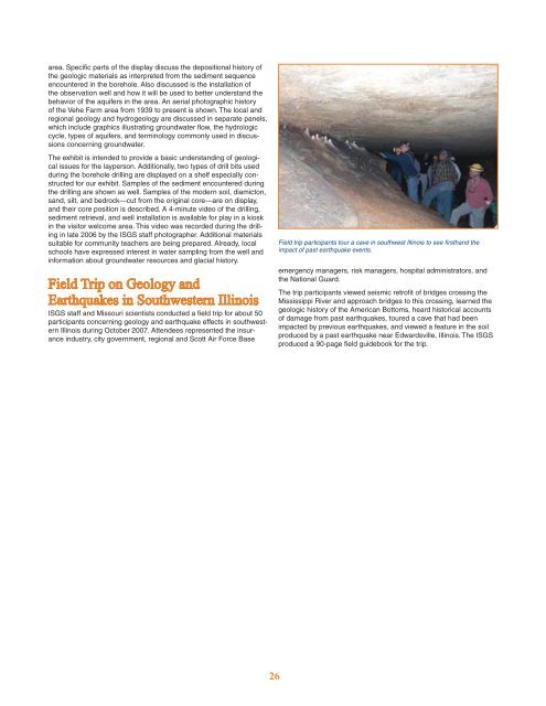
<strong>ISGS</strong> staff and Missouri scientists conducted a field trip for about 50<br />
participants concerning geology and earthquake effects in southwestern<br />
<strong>Illinois</strong> during October 2007. Attendees represented the insurance<br />
industry, city government, regional and Scott Air Force Base<br />
26<br />
Field trip participants tour a cave in southwest <strong>Illinois</strong> to see firsthand the<br />
impact <strong>of</strong> past earthquake events.<br />
emergency managers, risk managers, hospital administr<strong>at</strong>ors, and<br />
the N<strong>at</strong>ional Guard.<br />
The trip participants viewed seismic retr<strong>of</strong>it <strong>of</strong> bridges crossing the<br />
Mississippi River and approach bridges to this crossing, learned the<br />
geologic history <strong>of</strong> the American Bottoms, heard historical accounts<br />
<strong>of</strong> damage from past earthquakes, toured a cave th<strong>at</strong> had been<br />
impacted by previous earthquakes, and viewed a fe<strong>at</strong>ure in the soil<br />
produced by a past earthquake near Edwardsville, <strong>Illinois</strong>. The <strong>ISGS</strong><br />
produced a 90-page field guidebook for the trip.


