

2008 ISGS Annual Report - University of Illinois at Urbana-Champaign
2008 ISGS Annual Report - University of Illinois at Urbana-Champaign
2008 ISGS Annual Report - University of Illinois at Urbana-Champaign

You also want an ePaper? Increase the reach of your titles
YUMPU automatically turns print PDFs into web optimized ePapers that Google loves.
the agriculturally<br />
domin<strong>at</strong>ed land<br />
between Chicago<br />
and the Mississippi.<br />
Samples<br />
were collected on<br />
a seasonal basis<br />
from 14 sites<br />
along the <strong>Illinois</strong><br />
River and from<br />
selected tributaries.<br />
Samples<br />
were also<br />
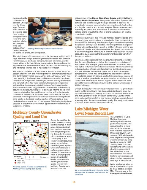
collected from Filtering w<strong>at</strong>er samples for isotopes <strong>of</strong> nitr<strong>at</strong>es.<br />
tre<strong>at</strong>ed wastew<strong>at</strong>er<br />
plants, tile drains, and precipit<strong>at</strong>ion.<br />
The total nitrogen (N) concentr<strong>at</strong>ions in the river were as high as 11.7<br />
mg/L near the Chicago area and generally decreased with distance<br />
from Chicago, as discharge from groundw<strong>at</strong>er, tributaries, and tile<br />
drains added to the river. Nitr<strong>at</strong>e concentr<strong>at</strong>ions decreased most during<br />
the summer, when flow r<strong>at</strong>es were low, field tiles were usually dry,<br />
and tributaries showed little to no nitr<strong>at</strong>e concentr<strong>at</strong>ion.<br />
The isotopic composition <strong>of</strong> the nitr<strong>at</strong>e in the <strong>Illinois</strong> River varied by<br />
season and river flow r<strong>at</strong>e, reflecting different dominant source inputs<br />
and denitrific<strong>at</strong>ion trends. During winter and early spring, when flow<br />
r<strong>at</strong>es were high, the isotopic composition was domin<strong>at</strong>ed by nitr<strong>at</strong>e<br />
from fertilizer nitrogen and soil nitrogen sources. During l<strong>at</strong>e summer<br />
and early fall, when flow r<strong>at</strong>es were low, the isotopic composition<br />
indic<strong>at</strong>ed th<strong>at</strong> the dominant nitr<strong>at</strong>e input was from tre<strong>at</strong>ed wastew<strong>at</strong>er.<br />
Most <strong>of</strong> the d<strong>at</strong>a suggested th<strong>at</strong> denitrific<strong>at</strong>ion predominantly<br />
occurred in the groundw<strong>at</strong>er prior to discharge into the <strong>Illinois</strong> River.<br />
However, during low flow conditions, a positive shift in the isotopic<br />
composition between the upper and lower portions <strong>of</strong> the river was<br />
observed, reflecting denitrific<strong>at</strong>ion or fraction<strong>at</strong>ion due to significant<br />
biota uptake in the broad shallow reaches <strong>of</strong> Peoria Lake, a manmade<br />
lake in the central part <strong>of</strong> river system. This finding is significant<br />
because in-stream denitrific<strong>at</strong>ion has typically not been observed in<br />
larger river systems.<br />
McHenry County Groundw<strong>at</strong>er<br />
Quality and Land Use<br />
During the past few decades,<br />
McHenry County<br />
has transitioned in many<br />
areas from agricultural<br />
land use into urban use<br />
with fast-growing housing<br />
demands. Croplands<br />
still domin<strong>at</strong>e rural areas.<br />
The majority <strong>of</strong> the<br />
county’s w<strong>at</strong>er resources<br />
comes from shallow<br />
sand and gravel aquifers,<br />
which are vulnerable to<br />
surface-contamin<strong>at</strong>ion<br />
sources. To evalu<strong>at</strong>e the<br />
effect <strong>of</strong> changing land<br />
use on groundw<strong>at</strong>er<br />
quality, approxim<strong>at</strong>ely<br />
38,000 groundw<strong>at</strong>er<br />
quality records from<br />
Historical records <strong>of</strong> nitr<strong>at</strong>e concentr<strong>at</strong>ions for<br />
McHenry County during 1981 to 2002.<br />
McHenry County were<br />
retrieved from the<br />
16<br />
d<strong>at</strong>a archives <strong>of</strong> the <strong>Illinois</strong> St<strong>at</strong>e W<strong>at</strong>er Survey and the McHenry<br />
County Health Department. Geographic Inform<strong>at</strong>ion Systems (GIS)<br />
s<strong>of</strong>tware was used to analyze this large d<strong>at</strong>a set. In addition, 30<br />
groundw<strong>at</strong>er samples were collected from priv<strong>at</strong>e wells (both drilled<br />
and dug) for chemical and isotopic analyses. These d<strong>at</strong>a were used<br />
to identify the distribution and sources <strong>of</strong> elev<strong>at</strong>ed nitr<strong>at</strong>e concentr<strong>at</strong>ions<br />
and to evalu<strong>at</strong>e the effect <strong>of</strong> changing land use on shallow<br />
groundw<strong>at</strong>er quality.<br />
Historical groundw<strong>at</strong>er d<strong>at</strong>a revealed th<strong>at</strong> total dissolved solids, chloride,<br />
and nitr<strong>at</strong>e concentr<strong>at</strong>ions in groundw<strong>at</strong>er have increased since<br />
the mid-1960s, indic<strong>at</strong>ing deterior<strong>at</strong>ion <strong>of</strong> groundw<strong>at</strong>er quality during<br />
the previous century’s last decades. The timing <strong>of</strong> these changes coincides<br />
with rapid popul<strong>at</strong>ion growth in McHenry County and the use<br />
<strong>of</strong> road salt. Sp<strong>at</strong>ial analysis revealed th<strong>at</strong> the highest concentr<strong>at</strong>ions<br />
in all three c<strong>at</strong>egories were found in shallow wells less than 100 feet<br />
deep, strongly suggesting th<strong>at</strong> the contaminant sources were from<br />
the ground surface.<br />
Chemical and isotopic d<strong>at</strong>a from the groundw<strong>at</strong>er samples indic<strong>at</strong>e<br />
th<strong>at</strong> the type <strong>of</strong> land use controlled the type and concentr<strong>at</strong>ions <strong>of</strong><br />
ions present. For example, groundw<strong>at</strong>er samples from urban areas<br />
had higher sodium and chloride concentr<strong>at</strong>ions, which was <strong>at</strong>tributed<br />
to the applic<strong>at</strong>ion <strong>of</strong> road salt. Samples from facilities in rural areas<br />
and near livestock facilities had higher nitr<strong>at</strong>e and total nitrogen<br />
concentr<strong>at</strong>ions, which was <strong>at</strong>tributed to the applic<strong>at</strong>ion <strong>of</strong> fertilizer<br />
on croplands. Based on isotopic results, the predominant sources <strong>of</strong><br />
nitr<strong>at</strong>e in shallow groundw<strong>at</strong>er samples collected from both rural and<br />
urban areas were fertilizer and soil organic m<strong>at</strong>ter due to the widespread<br />
fertiliz<strong>at</strong>ion <strong>of</strong> croplands surrounding isol<strong>at</strong>ed urban areas in<br />
McHenry County.<br />
Overall, the results <strong>of</strong> this investig<strong>at</strong>ion revealed th<strong>at</strong> (1) groundw<strong>at</strong>er<br />
quality in McHenry County has deterior<strong>at</strong>ed significantly since the<br />
mid-1960s due to the increasing applic<strong>at</strong>ion <strong>of</strong> road salt and fertilizer<br />
and th<strong>at</strong> (2) land use in an area such as McHenry County, where<br />
sand and gravel domin<strong>at</strong>e the near-surface geology, can rapidly and<br />
adversely affect the local groundw<strong>at</strong>er quality. The study results were<br />
published as <strong>ISGS</strong> Open File Series 2007-6.<br />
Lake Michigan W<strong>at</strong>er<br />
Level Nears Record Low<br />
The w<strong>at</strong>er level <strong>of</strong> Lake<br />
Michigan has been<br />
declining slowly over the<br />
past several months. The<br />
gradual decline is more<br />
than would be expected<br />
from seasonal fluctu<strong>at</strong>ions.<br />
On several days in early<br />
January <strong>2008</strong>, wind conditions<br />
displaced enough lake<br />
w<strong>at</strong>er to temporarily bring<br />
lake level below its 1995<br />
January record low. The<br />
lake remains within inches<br />
<strong>of</strong> setting a new record<br />
low. W<strong>at</strong>er level is now<br />
more than two feet below<br />
the long-term average and<br />
about five feet below the record<br />
high <strong>of</strong> January 1987.<br />
Ice along the Lake Michigan shoreline during<br />
January <strong>2008</strong> when w<strong>at</strong>er level was near the<br />
record low.<br />
W<strong>at</strong>er levels were a key issue<br />
in a present<strong>at</strong>ion given<br />
by <strong>ISGS</strong> coastal geologist<br />
Mike Chrzastowski <strong>at</strong> the<br />
Chicago Cultural Center


