

2008 ISGS Annual Report - University of Illinois at Urbana-Champaign
2008 ISGS Annual Report - University of Illinois at Urbana-Champaign
2008 ISGS Annual Report - University of Illinois at Urbana-Champaign

You also want an ePaper? Increase the reach of your titles
YUMPU automatically turns print PDFs into web optimized ePapers that Google loves.
view these aerial time capsules, yet securing funding to complete this<br />
archive has been, and will continue to be, a challenge. The hope is to<br />
complete the st<strong>at</strong>ewide archive so th<strong>at</strong> once again the first picture <strong>of</strong><br />
<strong>Illinois</strong> will be available for all to see.<br />
<strong>Illinois</strong> Height Moderniz<strong>at</strong>ion<br />
Program Begins<br />
Every engineering<br />
project and many<br />
land-use planning efforts<br />
require accur<strong>at</strong>e<br />
height measurement,<br />
which, in turn,<br />
requires a d<strong>at</strong>umconsistentvertical<br />
and horizontal<br />
st<strong>at</strong>ewide network <strong>of</strong><br />
survey benchmarks<br />
and a st<strong>at</strong>ewide<br />
high-resolution digital<br />
elev<strong>at</strong>ion model<br />
(DEM) <strong>of</strong> the Earth’s<br />
surface. Unfortun<strong>at</strong>ely,<br />
<strong>Illinois</strong> currently<br />
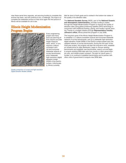
Quality comparison <strong>of</strong> current and high-resolution<br />
Digital Elev<strong>at</strong>ion Models (DEMs).<br />
20<br />
falls far short <strong>of</strong> both goals and is ranked in the bottom ten st<strong>at</strong>es in<br />
the quality <strong>of</strong> its elev<strong>at</strong>ion d<strong>at</strong>a.<br />
The N<strong>at</strong>ional Geodetic Survey (NGS), part <strong>of</strong> the N<strong>at</strong>ional Oceanic<br />
and Atmospheric Administr<strong>at</strong>ion, provides funding to st<strong>at</strong>es<br />
through the Height Moderniz<strong>at</strong>ion Program to improve the quality <strong>of</strong><br />
elev<strong>at</strong>ion d<strong>at</strong>a using global positioning s<strong>at</strong>ellite (GPS) technology in<br />
conjunction with traditional leveling, gravity, and modern remote sensing.<br />
Thanks to a budget initi<strong>at</strong>ive through Represent<strong>at</strong>ive Timothy<br />
Johnson’s <strong>of</strong>fice, <strong>Illinois</strong> joined this program in July <strong>2008</strong>.<br />
The long-term goal <strong>of</strong> the <strong>Illinois</strong> Height Moderniz<strong>at</strong>ion Program is<br />
to establish (1) a d<strong>at</strong>um-consistent vertical and horizontal st<strong>at</strong>ewide<br />
network <strong>of</strong> survey benchmarks, and (2) a st<strong>at</strong>ewide high-resolution<br />
digital elev<strong>at</strong>ion model (DEM) <strong>of</strong> the Earth’s surface based upon the<br />
upd<strong>at</strong>ed network <strong>of</strong> survey benchmarks. During the first year <strong>of</strong> this<br />
multi-year project, the program will plan the long-term work, establish<br />
an infrastructure for d<strong>at</strong>a distribution, begin to recover existing<br />
benchmarks and establish new benchmarks, search out and begin<br />
to acquire existing DEM d<strong>at</strong>a sets from county or other governmental<br />
units, and initi<strong>at</strong>e project outreach. The plan for future years, if<br />
funded, is to continue to establish benchmarks and to partner with<br />
other units <strong>of</strong> government to acquire new DEM d<strong>at</strong>a.


