

2008 ISGS Annual Report - University of Illinois at Urbana-Champaign
2008 ISGS Annual Report - University of Illinois at Urbana-Champaign
2008 ISGS Annual Report - University of Illinois at Urbana-Champaign

You also want an ePaper? Increase the reach of your titles
YUMPU automatically turns print PDFs into web optimized ePapers that Google loves.
Traditions in Transition<br />
<strong>Annual</strong> <strong>Report</strong> <strong>2008</strong><br />
Institute <strong>of</strong> N<strong>at</strong>ural Resource Sustainability<br />
ILLINOIS STATE GEOLOGICAL SURVEY
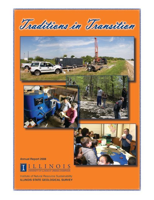
Cover photography: (1) Mahomet aquifer drill site north <strong>of</strong> Ludlow. Photograph from Al Wehrmann, <strong>Illinois</strong> St<strong>at</strong>e W<strong>at</strong>er Survey.<br />
(2) Horseshoe Lake field trip participants <strong>at</strong> Orchard Creek, Rock Springs Hollow Section, examining exposures <strong>of</strong> Upper<br />
Ordovician age Girardeau Limestone. Photograph by Michael Knapp. (3) Xu Chen and K<strong>at</strong>hy Henry <strong>at</strong> the <strong>ISGS</strong> Applied Research<br />
Lab with the transportable bench sorbent activ<strong>at</strong>ion process (SAP) unit, a p<strong>at</strong>ented technology developed <strong>at</strong> the <strong>ISGS</strong>.<br />
Photograph by Joel Dexter. (4) Bob Vaiden’s Build <strong>Illinois</strong> exhibit is a major draw <strong>at</strong> the <strong>2008</strong> <strong>ISGS</strong> Open House. Photograph by<br />
Joel Dexter.<br />
3<br />
Acknowledgments<br />
Thanks are expressed to the following individuals for their articles: Daniel Adomaitis, Michael Barnhardt, Robert Bauer, Sheena Beaverson,<br />
Richard Berg, Cynthia Briedis, Steven Brown, Keith Carr, Cheri Chenoweth, Melissa Chou, Michael Chrzastowski, Mark Collier, Brandon Curry,<br />
Brett Denny, William Dey, Jane Domier, Scott Elrick, Anne Erdmann, Robert Finley, Wayne Frankie, Sallie Greenberg, Keith Hackley, Beverly<br />
Herzog, Randy Hughes, Hue-Hwa Hwang, Ahmed Ismail, Philip Johanek, Charles Knight, Yevgeniy Kontar, David Larson, Timothy Larson,<br />
Zakaria Lasemi, Andrew Louchios, Donald Luman, Deette Lund, Donald McKay, Xiaodong Miao, James Miner, David Morse, Alan Myers,<br />
John Nelson, Cheryl Nimz, Jennifer Obrad, Samuel Panno, Andrew Phillips, Eric Plankell, Massoud Rostam-Abadi, Steven Sargent, Barbara<br />
Stiff, Christopher Stohr, Andrew Stumpf, Hong Wang, and Timothy Young.<br />
Thanks are given also to those individuals who provided photographs and images for this public<strong>at</strong>ion, including Robert Bauer, Steven Brown,<br />
Daniel Byers, Keith Carr, Melissa Chou, Michael Chrzastowski, Brandon Curry, Brett Denny, Joel Dexter, Anne Erdmann, Wayne Frankie,<br />
Beverly Herzog, Hue-Hwa Hwang, Michael Knapp, Yevgeniy Kontar, Timothy Larson, Zakaria Lasemi, Donald Luman, Donald McKay,<br />
Xiaodong Miao, James Miner, Cheryl Nimz, Thomas Rice, Samuel Panno, Steven Sargent, and Al Wehrmann (<strong>Illinois</strong> St<strong>at</strong>e W<strong>at</strong>er Survey).<br />
1<br />
© <strong>2008</strong> Board <strong>of</strong> Trustees <strong>of</strong> the <strong>University</strong> <strong>of</strong> <strong>Illinois</strong>. All rights reserved.<br />
For permissions inform<strong>at</strong>ion, contact the <strong>Illinois</strong> St<strong>at</strong>e Geological Survey.<br />
2<br />
4
Traditions in Transition<br />
<strong>Annual</strong> <strong>Report</strong> <strong>2008</strong><br />
Institute <strong>of</strong> N<strong>at</strong>ural Resource Sustainability<br />
William W. Shilts, Executive Director<br />
ILLINOIS STATE GEOLOGICAL SURVEY<br />
E. Donald McKay III, Interim Director<br />
615 East Peabody Drive<br />
<strong>Champaign</strong>, <strong>Illinois</strong> 61820-6964<br />
217-333-4747<br />
www.isgs.illinois.edu
Contents<br />
Traditions in Transition ....................................................1<br />
Awards and Honors ......................................................3<br />
In the News . . . . . . . . . . . . . . . . . . . . . . . . . . . . . . . . . . . . . . . . . . . . . . . . . . . . . . . . . . . . 5<br />
Energy and Earth Resources . . . . . . . . . . . . . . . . . . . . . . . . . . . . . . . . . . . . . . . . . . . . . . 7<br />
Land and W<strong>at</strong>er Resource Mapping . . . . . . . . . . . . . . . . . . . . . . . . . . . . . . . . . . . . . . . . 13<br />
D<strong>at</strong>a Preserv<strong>at</strong>ion and Use ...............................................19<br />
Landslide and Seismic Hazards . . . . . . . . . . . . . . . . . . . . . . . . . . . . . . . . . . . . . . . . . . . 21<br />
Wetlands and Environmental Assessments . . . . . . . . . . . . . . . . . . . . . . . . . . . . . . . . . . 23<br />
Public Outreach ........................................................24<br />
Pr<strong>of</strong>essional Meetings ...................................................27<br />
Active Projects .........................................................29<br />
Public<strong>at</strong>ions ...........................................................33<br />
Contact Inform<strong>at</strong>ion .....................................................38
Traditions in Transition<br />
Just three years into its second<br />
century, the <strong>Illinois</strong> St<strong>at</strong>e Geological<br />
Survey (<strong>ISGS</strong>) has been<br />
swept up in a major change in<br />
the administr<strong>at</strong>ive structure <strong>of</strong><br />
taxpayer-supported science<br />
done in public service to <strong>Illinois</strong>.<br />
After having been part <strong>of</strong> st<strong>at</strong>e<br />
government for 103 years, the<br />
<strong>ISGS</strong> and the other <strong>Illinois</strong><br />
scientific surveys (<strong>Illinois</strong> N<strong>at</strong>ural<br />
History Survey, <strong>Illinois</strong> St<strong>at</strong>e<br />
W<strong>at</strong>er Survey, and the Waste<br />
Management and Research<br />
Center) were merged with the<br />
<strong>University</strong> <strong>of</strong> <strong>Illinois</strong> <strong>at</strong> <strong>Urbana</strong>-<br />
<strong>Champaign</strong> on July 1, <strong>2008</strong>. At<br />
5:30 p.m. on June 30, Governor<br />
Blagojevich signed legisl<strong>at</strong>ion<br />
authorizing the transfer effective<br />
<strong>at</strong> midnight th<strong>at</strong> same night. Thus, the Surveys left their home <strong>of</strong> the<br />
past 13 years, the <strong>Illinois</strong> Department <strong>of</strong> N<strong>at</strong>ural Resources, and<br />
began a major transition.<br />
Four months have passed, and, <strong>at</strong> this juncture, it is clear th<strong>at</strong> the<br />
change is the most significant since the <strong>Illinois</strong> scientific surveys were<br />
organized under a single Board <strong>of</strong> N<strong>at</strong>ural Resources and Conserv<strong>at</strong>ion<br />
(BNRC) in 1917. Without changing physical loc<strong>at</strong>ion, the Surveys<br />
have become divisions <strong>of</strong> a newly formed <strong>University</strong> <strong>of</strong> <strong>Illinois</strong> Institute<br />
<strong>of</strong> N<strong>at</strong>ural Resource Sustainability (INRS). Former <strong>ISGS</strong> Chief<br />
Bill Shilts is the Institute’s founding Executive Director, and he reports<br />
to Interim Vice Chancellor for Research, Ravi Iyer. We all report to<br />
the <strong>University</strong> Board <strong>of</strong> Trustees. Thus placed appropri<strong>at</strong>ely within the<br />
<strong>University</strong> structure and having the strong support <strong>of</strong> senior <strong>University</strong><br />
leadership, the Surveys are poised to continue our work, to grow,<br />
to thrive, and to enhance the <strong>University</strong> mission.<br />
Merger <strong>of</strong> the Surveys with the <strong>University</strong> <strong>of</strong> <strong>Illinois</strong> has happened<br />
<strong>at</strong> a time when transitions are under way globally, politically, and<br />
economically. Crises are raising questions about our collective future.<br />
From local to global scales, uncertainty about the future <strong>of</strong> w<strong>at</strong>er and<br />
energy supplies, the pace and impacts <strong>of</strong> clim<strong>at</strong>e change, the availability<br />
and suitability <strong>of</strong> land and mineral resources to meet societal<br />
needs, the maintenance and expansion <strong>of</strong> our infrastructure, and<br />
the health <strong>of</strong> the world economy and ecosystems has reached new<br />
levels <strong>of</strong> urgency. So it is particularly important now th<strong>at</strong> the Surveys<br />
carry our knowledge, expertise, d<strong>at</strong>abases, and mission through our<br />
administr<strong>at</strong>ive transition intact and ready to be applied to important<br />
aspects <strong>of</strong> these global changes. It is up to us in the Geological<br />
Survey to help <strong>Illinois</strong>, and thereby the world, define and <strong>at</strong>tain a sustainable<br />
future for our n<strong>at</strong>ural environment, resource and raw m<strong>at</strong>erial<br />
needs, and energy and w<strong>at</strong>er supplies, while contributing to a healthy<br />
economy.<br />
The move <strong>of</strong> the Surveys to the <strong>University</strong> is much more than<br />
administr<strong>at</strong>ive window dressing. The Surveys’ loc<strong>at</strong>ions, staffing,<br />
budgets, and responsibilities remain largely the same. Historic<br />
legisl<strong>at</strong>ive mand<strong>at</strong>es regarding the n<strong>at</strong>ure and mainly <strong>Illinois</strong> focus<br />
<strong>of</strong> our research and service are embedded in Survey tradition and<br />
were rest<strong>at</strong>ed in the new authorizing legisl<strong>at</strong>ion. Yet we have readily<br />
adapted to <strong>University</strong> governance, policies, and outlook, and those<br />
<strong>of</strong>fer us options. We now feel closer to our <strong>University</strong> colleagues and<br />
they to us. Faculty and students approach us with the enthusiasm <strong>of</strong><br />
a newly found friend. New and expanded research collabor<strong>at</strong>ions are<br />
under discussion, and some are beginning. We are rapidly shedding<br />
our image as an “allied agency” and becoming an integral element <strong>of</strong><br />
the <strong>University</strong> community in perception and in reality.<br />
1<br />
Having entered into the university community <strong>of</strong> scholars and<br />
researchers, the Surveys will have opportunities for gre<strong>at</strong>er involvement<br />
in educ<strong>at</strong>ion. Student particip<strong>at</strong>ion in Survey research, always<br />
an advantage <strong>of</strong> our campus loc<strong>at</strong>ion, will increase. There will be<br />
opportunities to increase our role in teaching. New opportunities to<br />
examine research questions and apply our knowledge in regional,<br />
n<strong>at</strong>ional, or global contexts will be explored. Broader opportunities to<br />
<strong>at</strong>tract external funding will open via avenues available to <strong>University</strong><br />
entities.<br />
Governance provided formerly by the Board <strong>of</strong> N<strong>at</strong>ural Resources<br />
and Conserv<strong>at</strong>ion (BNRC) has been replaced by the <strong>University</strong> Board<br />
<strong>of</strong> Trustees. The Institute will bring together a new advisory body, the<br />
<strong>Illinois</strong> Board <strong>of</strong> N<strong>at</strong>ural Resource Sustainability (IBNRS). Plans are<br />
to retain the members <strong>of</strong> the former BNRC and to add st<strong>at</strong>e agency<br />
and <strong>University</strong> participants.<br />
For its part, the <strong>University</strong> <strong>of</strong> <strong>Illinois</strong> took on a huge task in transferring<br />
nearly 600 Survey staff members into the <strong>University</strong> human<br />
resource and payroll systems. Despite the <strong>University</strong>’s size, absorption<br />
<strong>of</strong> th<strong>at</strong> many additional staff members was characterized as “a<br />
large chunk to swallow.” The complex mechanics <strong>of</strong> the merger were<br />
wedged into a very short time span, but they went well. And, more<br />
than just smoothing the transfer, <strong>University</strong> staff members received<br />
us into the <strong>University</strong> community with positive, helpful, friendly, and<br />
collegial <strong>at</strong>titudes everywhere.<br />
Throughout the transition, the Geological Survey staff has performed<br />
commendably, sustaining all <strong>of</strong> our research and service programs,<br />
many <strong>of</strong> which are highlighted in this document. In Dec<strong>at</strong>ur, <strong>Illinois</strong>,<br />
we continued to develop the world-w<strong>at</strong>ched test <strong>of</strong> CO 2 sequestr<strong>at</strong>ion<br />
technology in collabor<strong>at</strong>ion with Archer Daniels Midland (ADM),<br />
the U.S. Department <strong>of</strong> Energy, the <strong>Illinois</strong> Department <strong>of</strong> Commerce<br />
and Economic Opportunity, and many others. Rel<strong>at</strong>ed efforts under<br />
way <strong>at</strong> several sites injected CO 2 into coal beds and into partially<br />
depleted oil reservoirs. Detailed geologic mapping in priority areas,<br />
largely in populous areas <strong>of</strong> northeastern and southwestern <strong>Illinois</strong>,<br />
is proceeding. Our staff members are publishing geologic maps <strong>at</strong><br />
an unprecedented r<strong>at</strong>e. Our support <strong>of</strong> the <strong>Illinois</strong> Department <strong>of</strong><br />
Transport<strong>at</strong>ion’s infrastructure expansion and upkeep is ongoing.<br />
Culmin<strong>at</strong>ion <strong>of</strong> major efforts in support <strong>of</strong> <strong>Illinois</strong>’ bid for FutureGen<br />
in December 2007 appeared to have been successful in bringing<br />
th<strong>at</strong> commercial-scale, zero-emissions, coal-fired, power st<strong>at</strong>ion with<br />
sequestr<strong>at</strong>ion to M<strong>at</strong>toon—until the project was delayed indefinitely<br />
by the federal government. Perhaps the final chapter <strong>of</strong> th<strong>at</strong> story has<br />
not been written. St<strong>at</strong>e budget challenges thre<strong>at</strong>ened a significant<br />
program <strong>of</strong> applied research in support <strong>of</strong> w<strong>at</strong>er supply planning<br />
just as the Surveys entered the <strong>University</strong>. It has been gr<strong>at</strong>ifying th<strong>at</strong><br />
county and local governments and institutions stepped up on short<br />
notice to directly support the project with their funds. As <strong>of</strong> this d<strong>at</strong>e,<br />
the project continues in large part because <strong>of</strong> th<strong>at</strong> support, for which<br />
we are gr<strong>at</strong>eful.<br />
So it is th<strong>at</strong> I can report here th<strong>at</strong> the Geological Survey’s transition<br />
into the <strong>University</strong> <strong>of</strong> <strong>Illinois</strong> is one th<strong>at</strong> has honored our traditions,<br />
kept our mand<strong>at</strong>es intact, and retained our name—<strong>Illinois</strong> St<strong>at</strong>e<br />
Geological Survey—a significant point <strong>of</strong> pride for us. We retained<br />
our staff, facilities, responsibilities, strong sense <strong>of</strong> purpose, and most<br />
<strong>of</strong> our budget. Thus, the traditions <strong>of</strong> <strong>ISGS</strong> research and service for<br />
the benefit <strong>of</strong> the people <strong>of</strong> <strong>Illinois</strong>, discharged ably for the past 103<br />
years, have not only survived the transition but also have remained<br />
our highest and most urgent objectives. At the same time, we gained<br />
flexibility th<strong>at</strong> we will use to explore opportunities, to expand our traditional<br />
role, to develop new research, and to venture into new areas.<br />
We are still in transition in the sense the Survey has always been in<br />
transition, changing as we ask ourselves basic questions. How can<br />
we expand our service to <strong>Illinois</strong>? How can we increase our collabo-
<strong>at</strong>ions with faculty, students, and other researchers and Surveys?<br />
Wh<strong>at</strong> new research capabilities and applied programs should be<br />
developed to meet coming needs? How can the <strong>ISGS</strong> and the INRS<br />
in partnership with our Survey and <strong>University</strong> colleagues make major<br />
contributions in the applic<strong>at</strong>ion <strong>of</strong> the geological sciences to the<br />
2<br />
benefit <strong>of</strong> <strong>Illinois</strong> and beyond? These are large questions th<strong>at</strong> our new<br />
situ<strong>at</strong>ion allows us to pursue with renewed enthusiasm.<br />
–E. Donald McKay III<br />
Interim Director
<strong>ISGS</strong> Honors Awarded<br />
Eleven individuals and one company were honored <strong>at</strong> the 2007<br />
<strong>Illinois</strong> St<strong>at</strong>e Geological Survey awards program, held December<br />
7, 2007. The awards were presented by <strong>ISGS</strong> Chief Bill Shilts in<br />
recognition <strong>of</strong> the outstanding contributions <strong>of</strong> these individuals and<br />
companies for the benefit <strong>of</strong> the people <strong>of</strong> <strong>Illinois</strong>. The awards and<br />
their recipients are listed here.<br />
Outstanding Cooper<strong>at</strong>or<br />
Gallagher Drilling Company was honored in appreci<strong>at</strong>ion <strong>of</strong> its<br />
engineering, geological, and field logistical support as lead oper<strong>at</strong>or<br />
in the CO 2 Injection into Coal Demonstr<strong>at</strong>ion Project.<br />
<strong>ISGS</strong> Coal Section Head David Morse accepts Outstanding Cooper<strong>at</strong>or Award<br />
for the Gallagher Drilling Company.<br />
David L. Gross, the first recipient <strong>of</strong> the Outstanding Alumni Contributions<br />
Award, in the company <strong>of</strong> Scott Elrick and Chief Bill Shilts.<br />
Awards and Honors<br />
3<br />
Outstanding Advoc<strong>at</strong>e<br />
Bernard and Naomi Podolsky were recognized in appreci<strong>at</strong>ion <strong>of</strong><br />
their outstanding and long-enduring support <strong>of</strong> <strong>ISGS</strong> programs, as<br />
demonstr<strong>at</strong>ed by their contacts on the Survey’s behalf, service on<br />
n<strong>at</strong>ional and st<strong>at</strong>e committees, and generous financial support.<br />
Bernard Podolsky receives the Outstanding Advoc<strong>at</strong>e Award from Scott Elrick<br />
and Chief Bill Shilts.<br />
Distinguished Achievement Award<br />
Debra A. Griest was recognized for her<br />
outstanding leadership and counsel in finance<br />
and human resources, especially during difficult<br />
financial times.<br />
Debra A. Griest<br />
Outstanding Alumni Contributions<br />
David L. Gross was named the first recipient <strong>of</strong> this new award in<br />
appreci<strong>at</strong>ion <strong>of</strong> his post-retirement dedic<strong>at</strong>ion to the <strong>ISGS</strong> through his<br />
contributions to the Centennial celebr<strong>at</strong>ion, service on the Board <strong>of</strong><br />
N<strong>at</strong>ural Resources and Conserv<strong>at</strong>ion, advocacy with elected <strong>of</strong>ficials,<br />
and generous financial contributions. Richard A. Cahill<br />
Lifetime Achievement Award<br />
W. John Nelson was<br />
honored for his nearly<br />
thirty-five years <strong>of</strong> outstanding<br />
research on bedrock,<br />
coal, and structural<br />
geology.<br />
Outstanding Contribution to<br />
Survey Health and Safety<br />
Richard A. Cahill was<br />
honored for his contributions<br />
to the <strong>ISGS</strong> Safety<br />
Committee, especially his<br />
chemical inventory and<br />
disposal efforts.<br />
W. John Nelson
Brent E. Lemke and Alison B. Lecouris hold the Special Achievement by a<br />
Team Awards they received from Chief Bill Shilts. Daniel O. Nelson, the third<br />
member <strong>of</strong> the team, was not present for the photograph.<br />
Special Achievement by a Team<br />
The NAD83 Conversion Team, Daniel O. Nelson, Alison B.<br />
Lecouris, and Brent E. Lemke, were recognized for their outstanding<br />
contributions in converting <strong>ISGS</strong> d<strong>at</strong>a from the Lambert projection<br />
to the North American D<strong>at</strong>um <strong>of</strong> 1983.<br />
Outstanding New Staff Member<br />
Two new staff members were honored this<br />
year. Yongqi Lu was recognized for his<br />
outstanding contributions to the <strong>ISGS</strong> through<br />
the development <strong>of</strong><br />
innov<strong>at</strong>ive technologies<br />
for air pollutant control,<br />
such as mercury and<br />
CO 2 emissions, from<br />
coal-fired power plants.<br />
Jason F. Thomason<br />
Staff Recognition<br />
Jason F. Thomason<br />
was honored for his outstanding<br />
contributions Yongqi Lu<br />
to three-dimensional<br />
mapping <strong>of</strong> the glacial lithostr<strong>at</strong>igraphy for the<br />
Gre<strong>at</strong> Lakes Geological Mapping Coalition in<br />
northeastern <strong>Illinois</strong>.<br />
Map Posters Reach Wide Audience<br />
At the request <strong>of</strong> ESRI co-founder and president J. Dangermond,<br />
<strong>Illinois</strong> St<strong>at</strong>e Geological Survey geologist Barbara J. Stiff provided a<br />
digital copy <strong>of</strong> a poster showing the use <strong>of</strong> ESRI products. The poster<br />
was originally presented <strong>at</strong> the 2005 Geological Society <strong>of</strong> America<br />
workshop, Three-dimensional Geological Mapping for Groundw<strong>at</strong>er<br />
4<br />
Barbara J. Stiff<br />
Applic<strong>at</strong>ions, during the 2005 ESRI Intern<strong>at</strong>ional<br />
Users Conference. Stiff was contacted<br />
because one <strong>of</strong> her two award-winning posters<br />
(ESRI best poster award) was on display <strong>at</strong> the<br />
ESRI Redlands headquarters. Several <strong>of</strong> Stiff’s<br />
posters and maps have been submitted to the<br />
Library <strong>of</strong> Congress as part <strong>of</strong> the ESRI archive,<br />
including the poster fe<strong>at</strong>uring the stacked<br />
sequence <strong>of</strong> <strong>Illinois</strong> maps th<strong>at</strong> became part <strong>of</strong><br />
<strong>ISGS</strong> <strong>Illinois</strong> Map 10.<br />
Master’s Degree Earned<br />
Congr<strong>at</strong>ul<strong>at</strong>ions are<br />
extended to Ge<strong>of</strong>frey E. Pociask <strong>of</strong> the <strong>Illinois</strong><br />
St<strong>at</strong>e Geological Survey Wetlands Geology<br />
Section on the completion <strong>of</strong> his master <strong>of</strong> science<br />
degree in geography from the <strong>University</strong><br />
<strong>of</strong> <strong>Illinois</strong> <strong>at</strong> <strong>Urbana</strong>-<strong>Champaign</strong>. Pociask’s<br />
thesis is titled “An Evalu<strong>at</strong>ion <strong>of</strong> Bendway<br />
Weirs: Effects on Stream Channel Migr<strong>at</strong>ion<br />
and Cross-sectional Geometry.”<br />
Completing Terms in<br />
Pr<strong>of</strong>essional Associ<strong>at</strong>ions<br />
Beverly L. Herzog completed her two-year<br />
term as Chair <strong>of</strong> the Associ<strong>at</strong>ion <strong>of</strong> Ground<br />
W<strong>at</strong>er Scientists and Engineers (AGWSE) and Vice President <strong>of</strong> the<br />
N<strong>at</strong>ional Ground W<strong>at</strong>er<br />
Associ<strong>at</strong>ion (NGWA) <strong>at</strong><br />
the Ground W<strong>at</strong>er Expo<br />
in Orlando, Florida,<br />
on December 6, 2007.<br />
NGWA has more than<br />
14,000 members, most<br />
from North America, and<br />
AGWSE is its largest<br />
division, with more than<br />
9,000 members. In addition<br />
to the AGWSE and<br />
NGWA boards, Herzog<br />
served on the board <strong>of</strong><br />
the N<strong>at</strong>ional Ground W<strong>at</strong>er<br />
Research and Educa-<br />
Beverly L. Herzog receives a plaque from Vicki<br />
Kretsinger, Past Chair <strong>of</strong> the Associ<strong>at</strong>ion <strong>of</strong><br />
Ground W<strong>at</strong>er Scientists and Engineers<br />
(AGWSE). Herzog was recognized for her service<br />
to the N<strong>at</strong>ional Ground W<strong>at</strong>er Associ<strong>at</strong>ion<br />
(NGWA) and the AGWSE.<br />
Ge<strong>of</strong>frey E. Pociask<br />
tion Found<strong>at</strong>ion and more<br />
than 15 committees or<br />
work groups, several<br />
<strong>of</strong> which she chaired.<br />
Past Chair AGWSE<br />
Vicki Kretsinger noted<br />
th<strong>at</strong> “. . . Bev has been<br />
instrumental in the step-by-step approaches taken to build rel<strong>at</strong>ionships<br />
th<strong>at</strong> are leading to more specific requests for financial support<br />
to accomplish n<strong>at</strong>ionwide monitoring and groundw<strong>at</strong>er resources<br />
evalu<strong>at</strong>ion goals. We have continued to persuade congressional staff<br />
members <strong>of</strong> the importance <strong>of</strong> groundw<strong>at</strong>er . . . . The AGWSE Board<br />
gre<strong>at</strong>ly appreci<strong>at</strong>es her tireless efforts and continued contributions as<br />
a Board member, then Secretary, and Chair.”
Several <strong>ISGS</strong> research project areas made headlines this past year,<br />
including stories about w<strong>at</strong>er supply, the April <strong>2008</strong> earthquake in<br />
southern <strong>Illinois</strong>, carbon capture and sequestr<strong>at</strong>ion, karst terrane in<br />
Jo Daviess County’s dairyland, and earth science educ<strong>at</strong>ion. Discover<br />
Magazine called the discovery <strong>of</strong> the fossilized rain forest near<br />
Danville one <strong>of</strong> the top 100 science stories <strong>of</strong> 2007. An important<br />
recent story was the administr<strong>at</strong>ive move <strong>of</strong> the <strong>ISGS</strong> and its three<br />
sister agencies from the <strong>Illinois</strong> Department <strong>of</strong> N<strong>at</strong>ural Resources to<br />
the Institute <strong>of</strong> N<strong>at</strong>ural Resource Sustainability <strong>at</strong> the <strong>University</strong> <strong>of</strong><br />
<strong>Illinois</strong> <strong>at</strong> <strong>Urbana</strong>-<strong>Champaign</strong>.<br />
From Bill Hammack’s Engineering & Life, September 25, <strong>2008</strong>...<br />
Four-part Special <strong>Report</strong> on the W<strong>at</strong>er Supply<br />
http://www.engineerguy.com<br />
From Newswise, September 24, <strong>2008</strong>...<br />
Stalagmites May Predict Next Big One Along the New Madrid Seismic<br />
Zone<br />
http://www.newswise.com/articles/view/544603/<br />
From the Northwest Herald, September 14, <strong>2008</strong>...<br />
Work set to begin on well system<br />
http://www.nwherald.com/articles/<strong>2008</strong>/09/14/news/local/doc48ccdd1a53eb5277741896.txt<br />
From the St<strong>at</strong>e Journal-Register, September 5, <strong>2008</strong>...<br />
<strong>Illinois</strong> N<strong>at</strong>ural History Survey gets a new home<br />
http://www.sj-r.com/fe<strong>at</strong>ures/x1001333692/<strong>Illinois</strong>-N<strong>at</strong>ural-History-<br />
Survey-gets-a-new-home<br />
From the Chicago Tribune, August 18, <strong>2008</strong>...<br />
McHenry County picks up funding for 3-D w<strong>at</strong>er map<br />
http://www.chicagotribune.com/news/local/chi-mchenry-w<strong>at</strong>er-mapboth-19aug19,0,7635769.story<br />
From the Energy Efficiency News, August 4, <strong>2008</strong>...<br />
US pledges $36 million to advance carbon capture<br />
http://www.energyefficiencynews.com/power-gener<strong>at</strong>ion/i/905/<br />
From the United Press Intern<strong>at</strong>ional, August 1, <strong>2008</strong>...<br />
Energy Department: More funds for CO2<br />
http://www.upi.com/Energy_Resources/<strong>2008</strong>/08/01/Energy_Department_More_funds_for_CO2/UPI-55401217620910/<br />
From the News Blaze, July 31, <strong>2008</strong>...<br />
DOE to Provide $36 Million to Advance Carbon Dioxide Capture<br />
http://newsblaze.com/story/<strong>2008</strong>0731072823tsop.nb/topstory.html<br />
From the Telegraph Herald, July 30, <strong>2008</strong>...<br />
No decision in ‘mega dairy’ case<br />
http://www.thonline.com/article.cfm?id=210592<br />
From the St. Louis Post-Disp<strong>at</strong>ch, July 25, <strong>2008</strong>...<br />
The Prize: <strong>Illinois</strong> oilman strikes paydirt again<br />
http://www.stltoday.com/stltoday/business/stories.nsf/0/D369F06812B<br />
A00E286257491000F85A7?OpenDocument<br />
From the Galena Gazette, July 22, <strong>2008</strong>...<br />
Megadairy hearings<br />
http://www.galenagazette.com/main.asp?SectionID=142&SubSection<br />
ID=344&ArticleID=12236&TM=59108.71<br />
From the News-Gazette, July 22, <strong>2008</strong>...<br />
UI trustees to combine four surveys into new institute<br />
http://www.news-gazette.com/news/local/<strong>2008</strong>/07/22/ui_trustees_to_<br />
combine_four_surveys_into_new_institute<br />
From United Press Intern<strong>at</strong>ional, July 21, <strong>2008</strong>...<br />
Energy Resources: Midwest coal project moves forward (Requires<br />
free registr<strong>at</strong>ion to read.)<br />
http://www.upi.com/Energy_Resources/<strong>2008</strong>/07/21/Midwest_demonstr<strong>at</strong>es_carbon_storage/UPI-42191216651964/<br />
In the News<br />
5<br />
From the Telegraph Herald, Dubuque, IA, July 19, <strong>2008</strong>...<br />
‘Mega dairy’ litigants to wait<br />
http://www.thonline.com/article.cfm?id=209525<br />
From the Bloomington Pantagraph, July 1, <strong>2008</strong>...<br />
Some DNR jobs shifted to U <strong>of</strong> I control<br />
http://www.pantagraph.com/articles/<strong>2008</strong>/07/01/news/doc486aaea7781b3753154603.txt<br />
From the Rockford Register Star, June 16, <strong>2008</strong>...<br />
Jo Daviess mega-farm plan still faces court b<strong>at</strong>tle<br />
http://www.rrstar.com/news/x849707911/Jo-Daviess-mega-farm-planstill-faces-court-b<strong>at</strong>tle<br />
From the Kane County Chronicle, May 26, <strong>2008</strong>...<br />
U <strong>of</strong> I extension: Thre<strong>at</strong> <strong>of</strong> earthquake real<br />
http://www.kcchronicle.com/articles/<strong>2008</strong>/05/26/news/local/doc483a88dd78264865491345.txt<br />
From the News-Gazette, May 24, <strong>2008</strong>...<br />
<strong>Urbana</strong> man has cre<strong>at</strong>ed his own n<strong>at</strong>ure preserve<br />
http://www.news-gazette.com/news/local/<strong>2008</strong>/05/24/urbana_man_<br />
has_cre<strong>at</strong>ed_his_own_n<strong>at</strong>ure_preserve<br />
From the Medill <strong>Report</strong>, May 22, <strong>2008</strong>...<br />
IDOA weighs request for 10,000-cow dairy, amid worries over w<strong>at</strong>er<br />
contamin<strong>at</strong>ion<br />
http://www.news-gazette.com/news/local/<strong>2008</strong>/05/24/urbana_man_<br />
has_cre<strong>at</strong>ed_his_own_n<strong>at</strong>ure_preserve<br />
From the River Front Times, May 7, <strong>2008</strong>...<br />
Through the Earthquake Hazard Mapping Project, local scientists can<br />
predict the far-reaching effects <strong>of</strong> rumblers<br />
http://www.riverfronttimes.com/<strong>2008</strong>-05-07/news/through-the-earthquake-hazard-mapping-project-local-scientists-can-predict-the-farreaching-effects-<strong>of</strong>-rumblers/<br />
From The Southern Illinoian, May 4, <strong>2008</strong>...<br />
On Shaky Ground?<br />
http://www.southernillinoisan.com/articles/<strong>2008</strong>/05/04/front_<br />
page/24331012.txt<br />
From the Belleville News-Democr<strong>at</strong>, April 16, <strong>2008</strong>...<br />
N<strong>at</strong>ural Disasters Big Part <strong>of</strong> Belleville’s History<br />
http://www.bnd.com/living/story/300129.html<br />
From the St. Louis Post-Disp<strong>at</strong>ch, April 8. <strong>2008</strong>...<br />
Grafton b<strong>at</strong>tles mudslide<br />
http://www.stltoday.com/stltoday/news/stories.nsf/illinoisnews/story/25<br />
CD37088AC657AE862574250011FA8C?OpenDocument<br />
From the News-Gazette, March 23, <strong>2008</strong>...<br />
Movement Looking to Ditch Streams’ Many Names<br />
http://www.news-gazette.com/news/local/<strong>2008</strong>/03/23/movement_<br />
looking_to_ditch_streams_many<br />
From the Telegraph Herald, March 21, <strong>2008</strong>...<br />
‘Karst’ Enters Dairy Deb<strong>at</strong>e<br />
http://www.thonline.com/article.cfm?id=195188<br />
From Discover Magazine, January 15, <strong>2008</strong>...<br />
Fossils <strong>of</strong> a 300-Million-Year-Old Forest found<br />
http://discovermagazine.com/<strong>2008</strong>/jan/fossils-<strong>of</strong>-a-300-million-yearold-forest-found<br />
From the News-Gazette, January 13, <strong>2008</strong>...<br />
Underground project key to making fuels more Earth-friendly<br />
http://www.news-gazette.com/news/<strong>2008</strong>/01/13/knowledge_is_power_underground_project_a
From the Journal Gazette and Times-Courier, January 4, <strong>2008</strong>...<br />
Sequestr<strong>at</strong>ion project in works <strong>at</strong> ADM; effort is similar to th<strong>at</strong><br />
planned for FutureGen<br />
http://www.jg-tc.com/articles/<strong>2008</strong>/01/04/news/<br />
doc477daa5c2edd0528350999.txt<br />
From Reuters, January 4, <strong>2008</strong>...<br />
ADM to bury carbon from ethanol plant<br />
http://www.reuters.com/article/companyNewsAndPR/idUSW-<br />
NAS5659<strong>2008</strong>0104<br />
From the News-Gazette, December 19, 2007...<br />
Group gets grant for sequestr<strong>at</strong>ion project<br />
http://www.news-gazette.com/news/local/2007/12/19/group_gets_<br />
grant_for_sequestr<strong>at</strong>ion<br />
From the Journal Gazette and Times-Courier, December 18,<br />
2007...<br />
St<strong>at</strong>e scientist says <strong>Illinois</strong> has best geology for FutureGen plant<br />
http://www.jg-tc.com/articles/2007/12/18/news/<br />
doc476803aa5190e924643201.txt<br />
6<br />
From MyWebTimes.com, December 12, 2007...<br />
SHERIDAN: Residents report loud ‘boom’ and rumbling<br />
http://mywebtimes.com/archives/ottawa/display.php?id=350004<br />
From the News-Gazette, December 3, 2007...<br />
Area rallies in support <strong>of</strong> FutureGen<br />
http://www.news-gazette.com/news/local/2007/12/03/area_rallies_in_<br />
support_<strong>of</strong>_plant<br />
From the Journal Gazette and Times-Courier, December 2, 2007...<br />
St<strong>at</strong>e Geologists: <strong>Illinois</strong> sites best for CO2 storage<br />
http://www.jg-tc.com/articles/2007/12/03/news/<br />
doc47538463387f3160579373.txt<br />
From the Journal Gazette and Times-Courier, December 2, 2007...<br />
Attitude towards science class found to shape performance outcomes<br />
http://media.www.dailyvidette.com/media/storage/paper420/<br />
news/2007/12/03/News/Attitude.Towards.Science.Class.Found.<br />
To.Shape.Performance.Outcomes-3126852.shtml<br />
From the News-Gazette, November 28, 2007...<br />
FutureGen backers schedule rally<br />
http://www.news-gazette.com/news/local/2007/11/28/plant_backers_schedule_rally
Energy and Earth Resources<br />
Sequestr<strong>at</strong>ion Potential<br />
<strong>of</strong> Mt. Simon Sandstone<br />
<strong>Illinois</strong> is eminently qualified for the development <strong>of</strong> clean coal technologies.<br />
The st<strong>at</strong>e’s vast coal resources and an excellent potential<br />
sequestr<strong>at</strong>ion resource, the Mt. Simon Sandstone, make the unique<br />
combin<strong>at</strong>ion <strong>of</strong> clean-coal energy production and sequestr<strong>at</strong>ion a<br />
viable opportunity for the future <strong>of</strong> coal energy in <strong>Illinois</strong>.<br />
The sequestr<strong>at</strong>ion potential <strong>of</strong> the Mt. Simon Sandstone continues<br />
to be studied through a $66.7 million contract from the U.S. Department<br />
<strong>of</strong> Energy–N<strong>at</strong>ional Energy Technology Labor<strong>at</strong>ory<br />
(USDOE-NETL) supplemented by co-funding from Archer Daniels<br />
Midland Company (ADM), Schlumberger Carbon Services, and<br />
other corpor<strong>at</strong>e and St<strong>at</strong>e resources.<br />
ADM, Dec<strong>at</strong>ur, <strong>Illinois</strong>.<br />
The Midwest Geological Sequestr<strong>at</strong>ion Consortium (MGSC),<br />
<strong>ISGS</strong>, and ADM are working together on the <strong>Illinois</strong> Basin–Dec<strong>at</strong>ur<br />
carbon sequestr<strong>at</strong>ion project, which will involve the capture and<br />
storage <strong>of</strong> carbon dioxide (CO 2 ) from ADM’s ethanol plant in Dec<strong>at</strong>ur,<br />
<strong>Illinois</strong>. The project is designed to confirm the ability <strong>of</strong> the Mt. Simon<br />
Sandstone, a major regional saline reservoir in <strong>Illinois</strong>, to accept<br />
and store 1 million metric tonnes <strong>of</strong> CO 2 over a period <strong>of</strong> three years.<br />
Carbon dioxide from ADM’s ethanol plant will be injected into a well<br />
drilled to depths exceeding 7,500 feet into the Mt. Simon Sandstone,<br />
where the compressed, liquid-like CO 2 will be stored in the pores<br />
<strong>of</strong> the rock form<strong>at</strong>ion, which is presently s<strong>at</strong>ur<strong>at</strong>ed with w<strong>at</strong>er th<strong>at</strong><br />
is several times saltier than sea w<strong>at</strong>er. The safety and effectiveness<br />
<strong>of</strong> the storage will be monitored by the MGSC through an extensive<br />
monitoring, mitig<strong>at</strong>ion, and verific<strong>at</strong>ion (MMV) program.<br />
The technical qualific<strong>at</strong>ions <strong>of</strong> the Dec<strong>at</strong>ur, <strong>Illinois</strong>, site include one<br />
<strong>of</strong> the best saline reservoirs for carbon sequestr<strong>at</strong>ion in the Midwest,<br />
possibly even in the n<strong>at</strong>ion. The Mt. Simon Sandstone is a thick reservoir,<br />
has a good primary shale seal, and is overlain by two additional<br />
shale units th<strong>at</strong> can act as backup seals. Scientists are confident in<br />
the site and are preparing to conduct a three-dimensional seismic<br />
survey to image the Mt. Simon reservoir to (1) understand the reservoir’s<br />
structural configur<strong>at</strong>ion and (2) correl<strong>at</strong>e its properties to d<strong>at</strong>a<br />
7<br />
from an injection well to better understand the surrounding rock th<strong>at</strong><br />
will contain the carbon dioxide plume. This inform<strong>at</strong>ion will (3) serve<br />
as a baseline for future surveys defining the loc<strong>at</strong>ion <strong>of</strong> the CO 2 in<br />
detail. Such a survey is an essential step to ensure the safety and<br />
integrity <strong>of</strong> any specific geological carbon sequestr<strong>at</strong>ion site and also<br />
to understand the regional configur<strong>at</strong>ion <strong>of</strong> the Mt. Simon.<br />
This knowledge would benefit future bi<strong>of</strong>uels and clean coal projects<br />
loc<strong>at</strong>ed in central <strong>Illinois</strong> as well. The Mt. Simon Sandstone is a major<br />
<strong>Illinois</strong> resource supporting development <strong>of</strong> integr<strong>at</strong>ed coal gasific<strong>at</strong>ion<br />
and sequestr<strong>at</strong>ion. The <strong>Illinois</strong> Basin contains abundant coal<br />
resources suitable for gasific<strong>at</strong>ion, and the more th<strong>at</strong> is understood<br />
about the Mt. Simon, the more assurance there will be th<strong>at</strong> the need<br />
for carbon sequestr<strong>at</strong>ion can be effectively addressed as those coal<br />
resources are being developed.<br />
The <strong>ISGS</strong> has been a leader in geological carbon sequestr<strong>at</strong>ion<br />
research since 2001 and has been researching <strong>Illinois</strong> Basin geology<br />
since the Survey’s formal inception in 1905. The <strong>ISGS</strong>’ extensive<br />
expertise in sequestr<strong>at</strong>ion, Basin geology, environmental geology,<br />
reservoir geology, oil and gas, and coal geology positioned the<br />
Survey to win the USDOE-NETL contract and supported the St<strong>at</strong>e<br />
<strong>of</strong> <strong>Illinois</strong>’ Department <strong>of</strong> Commerce and Economic Opportunity<br />
(DCEO) bid for FutureGen.<br />
The Survey contribution to the FutureGen competition included more<br />
than 40 scientists and staff members who provided geological assessment,<br />
GIS d<strong>at</strong>a, public outreach, general inform<strong>at</strong>ion, and overall<br />
technical support for four <strong>of</strong> the project sites. The <strong>ISGS</strong> helped screen<br />
the 28 original preliminary sites to select the four sites proposed by<br />
<strong>Illinois</strong>, two <strong>of</strong> which were selected as semi-finalists (M<strong>at</strong>toon and<br />
Tuscola). <strong>ISGS</strong> scientists modeled the projected carbon dioxide<br />
plume in the subsurface and conducted two-dimensional seismic<br />
surveys with interpret<strong>at</strong>ion for the selected sites. On December<br />
17, 2007, the FutureGen Alliance selected M<strong>at</strong>toon, <strong>Illinois</strong>, as the<br />
preferred site for the project. Although the project has been temporarily<br />
delayed, the <strong>ISGS</strong> continues to provide technical support for the<br />
preferred selected site <strong>at</strong> M<strong>at</strong>toon, <strong>Illinois</strong>, including evalu<strong>at</strong>ion <strong>of</strong> new<br />
geophysical d<strong>at</strong>a.<br />
Installing Wells for Groundw<strong>at</strong>er<br />
Monitoring and Modeling<br />
Significant progress was made <strong>at</strong> all three active carbon sequestr<strong>at</strong>ion<br />
sites during <strong>2008</strong> as part <strong>of</strong> the Midwest Geological Sequestr<strong>at</strong>ion<br />
Consortium Project, Phase II. At the coal bed site, the third<br />
coal monitor well and<br />
the carbon dioxide<br />
(CO 2 ) injection well in<br />
the Wabash County<br />
project were drilled,<br />
cored, logged, and<br />
cased. Springfield<br />
Coal core samples<br />
from the new monitor<br />
well were placed in<br />
desorption canisters to<br />
evalu<strong>at</strong>e differences in<br />
methane gas content<br />
based on coal maceral<br />
type. Springfield Coal<br />
core from the injection<br />
well was preserved<br />
for use in a display.<br />
<strong>ISGS</strong> drilling and well install<strong>at</strong>ion <strong>at</strong> the ADM site<br />
for the monitoring, mitig<strong>at</strong>ion, and verific<strong>at</strong>ion portion<br />
<strong>of</strong> the deep saline reservoir pilot program.<br />
In June, the wells<br />
were perfor<strong>at</strong>ed, coal<br />
permeability was<br />
measured with w<strong>at</strong>er
injection pressure transient tests, and all four wells were logged with<br />
Schlumberger’s cased hole resistivity tool. The CO 2 injection began in<br />
l<strong>at</strong>e June with 8- to 24-hour pulses, followed by no injection for similar<br />
time periods, as pressure changes in all four wells were continuously<br />
monitored. More sustained injection/fall-<strong>of</strong>f pulses followed. W<strong>at</strong>er<br />
and gas samples were collected to monitor gener<strong>at</strong>ed methane and<br />
then CO 2 buildup. Similar samples collected from the four groundw<strong>at</strong>er<br />
monitoring wells showed no leaked methane or CO 2 . As <strong>of</strong> l<strong>at</strong>e fall<br />
<strong>2008</strong>, 70 tons <strong>of</strong> CO 2 have been injected.<br />
Nine groundw<strong>at</strong>er monitoring wells were installed <strong>at</strong> the Archer<br />
Daniels Midland plant, Dec<strong>at</strong>ur, <strong>Illinois</strong>. These wells are being used<br />
in the monitoring, mitig<strong>at</strong>ion, and verific<strong>at</strong>ion (MMV) program for the<br />
deep saline reservoir pilot th<strong>at</strong> is part <strong>of</strong> the Phase III CO 2 geologic<br />
sequestr<strong>at</strong>ion program funded by the U.S. Department <strong>of</strong> Energy–<br />
N<strong>at</strong>ional Energy Technology Labor<strong>at</strong>ory. The monitoring wells provide<br />
groundw<strong>at</strong>er quality d<strong>at</strong>a needed for compliance with the <strong>Illinois</strong><br />
Environmental Protection Agency Underground Injection Control<br />
permit th<strong>at</strong> will be issued to Archer Daniels Midland.<br />
<strong>ISGS</strong> geochemists continue to model the groundw<strong>at</strong>er and brine<br />
w<strong>at</strong>er quality d<strong>at</strong>a collected from the enhanced oil recovery huff-npuff<br />
pilot loc<strong>at</strong>ed in the Loudon oil field near St. Elmo, <strong>Illinois</strong>, the<br />
third CO 2 sequestr<strong>at</strong>ion site. The chemical composition <strong>of</strong> the brine<br />
samples has continued to become more acidic since the termin<strong>at</strong>ion<br />
<strong>of</strong> CO 2 injection. The concentr<strong>at</strong>ions <strong>of</strong> iron, manganese, and<br />
potassium initially increased in brine samples collected from the CO 2<br />
injection well and are now decreasing. The possible effect <strong>of</strong> sorption/<br />
desorption reactions on the fluid composition are being modeled. The<br />
effects <strong>of</strong> sorption reactions can play an important role in determining<br />
fluid composition and, because <strong>of</strong> the rel<strong>at</strong>ively rapid kinetics, are<br />
likely to be one <strong>of</strong> the first aspects <strong>of</strong> fluid chemistry affected by the<br />
introduction <strong>of</strong> CO 2 . Sorption onto hem<strong>at</strong>ite, possibly available in the<br />
subsurface as a cement or grain co<strong>at</strong>ing, can be used to explain the<br />
decrease in sulfur and the increase in manganese concentr<strong>at</strong>ion after<br />
the introduction <strong>of</strong> CO 2 . The change in concentr<strong>at</strong>ions is a reflection<br />
<strong>of</strong> the decrease in pH caused by the dissolution <strong>of</strong> CO 2 in form<strong>at</strong>ion<br />
w<strong>at</strong>er. As the pH decreases, the type <strong>of</strong> ion th<strong>at</strong> is preferentially<br />
sorbed on the hem<strong>at</strong>ite surface changes. There is also some dissolution<br />
<strong>of</strong> iron, but the predicted values need to increase more for the<br />
model to m<strong>at</strong>ch the field d<strong>at</strong>a.<br />
Sequestr<strong>at</strong>ion Field Efforts Continue<br />
Jennifer Lewicki from Lawrence Berkeley N<strong>at</strong>ional Labor<strong>at</strong>ory and<br />
Ivan Krapac from the <strong>ISGS</strong> installed an Eddy Covariance Tower <strong>at</strong><br />
the <strong>Illinois</strong> Basin–Dec<strong>at</strong>ur site mid-August <strong>2008</strong>. The tower contains<br />
a complete we<strong>at</strong>her st<strong>at</strong>ion to monitor vertical and horizontal<br />
wind speed and direction, temper<strong>at</strong>ure, rel<strong>at</strong>ive humidity, solar and<br />
photosynthetic radi<strong>at</strong>ion, rain, and <strong>at</strong>mospheric carbon dioxide (CO 2 )<br />
concentr<strong>at</strong>ions. D<strong>at</strong>a collected from these instruments will allow monitoring<br />
<strong>of</strong> the CO 2 <strong>at</strong>mospheric flux downwind <strong>of</strong> the CO 2 injection well.<br />
This inform<strong>at</strong>ion will be used to monitor for potential CO 2 seepage <strong>at</strong><br />
the site and is one <strong>of</strong> many techniques being used in the monitoring,<br />
mitig<strong>at</strong>ion, and verific<strong>at</strong>ion (MMV) program. The MMV program will<br />
deploy various monitoring techniques to determine the loc<strong>at</strong>ion <strong>of</strong> the<br />
CO 2 plume in the injection reservoir. The monitoring is to determine<br />
whether there are impacts from injection activities on human health<br />
and the environment and to develop mitig<strong>at</strong>ion plans should unexpected<br />
results occur during the project.<br />
<strong>ISGS</strong> geochemists Bracken Wimmer and Abbas Iranmanesh continue<br />
to collect groundw<strong>at</strong>er and gas samples from the enhanced<br />
coal bed methane (ECBM) and oil recovery (EOR) pilot projects.<br />
These samples are used to monitor groundw<strong>at</strong>er quality to determine<br />
whether CO 2 injection oper<strong>at</strong>ions are affecting shallow groundw<strong>at</strong>er<br />
quality. To d<strong>at</strong>e, the w<strong>at</strong>er quality d<strong>at</strong>a indic<strong>at</strong>e th<strong>at</strong> project activities<br />
have not had an impact on local w<strong>at</strong>er quality. Monitoring gas concentr<strong>at</strong>ions<br />
in project wells will determine the performance <strong>of</strong> the coal<br />
seam with respect to CO 2 injection.<br />
8<br />
Bedrock geologists Hannes Leetaru and John McBride (Brigham<br />
Young <strong>University</strong>) and Marcia L. Couëslan (Schlumberger Carbon<br />
Services) worked on developing geophysical parameters for acquiring<br />
new seismic reflection d<strong>at</strong>a <strong>at</strong> the <strong>Illinois</strong> Basin–Dec<strong>at</strong>ur site.<br />
Capturing Carbon from<br />
Coal-Fired Power Plants<br />
The U.S. Department <strong>of</strong> Energy (U.S. DOE) has selected the<br />
<strong>ISGS</strong> to develop a technology to capture carbon dioxide (CO 2 ) from<br />
coal-fired power plants. In the United St<strong>at</strong>es, coal-fired power plants<br />
emitted about 1.96 billion metric tonnes <strong>of</strong> CO 2 in 2005. In the <strong>Illinois</strong><br />
Basin, 126 power plants emitted about 273 million metric tonnes <strong>of</strong><br />
CO 2 in 2005, <strong>of</strong> which 98% was contributed by the coal-fired plants.<br />
Yongqi Lu, principal investig<strong>at</strong>or and <strong>ISGS</strong> chemical engineer, will<br />
lead the 3-year, $700,000 U.S. DOE project.<br />
Calgon Carbon Corpor<strong>at</strong>ion (CCC) has also committed an additional<br />
$100,000 for in-kind contributions in support <strong>of</strong> this project.<br />
The <strong>ISGS</strong> team <strong>of</strong> Yongqi Lu and Massoud Rostam-Abadi will collabor<strong>at</strong>e<br />
with the CCC and Pr<strong>of</strong>essor Mark Rood, Department <strong>of</strong><br />
Civil and Environmental Engineering <strong>at</strong> the <strong>University</strong> <strong>of</strong> <strong>Illinois</strong><br />
<strong>at</strong> <strong>Urbana</strong>-<strong>Champaign</strong>, to advance an integr<strong>at</strong>ed vacuum carbon<strong>at</strong>e<br />
absorption process (IVCAP) for post-combustion CO 2 capture. The<br />
development <strong>of</strong> the IVCAP was initi<strong>at</strong>ed in 2004 by <strong>ISGS</strong> chemical<br />
engineers Yongqi Lu, Scott Chen, and Massoud Rostam-Abadi with<br />
support from the Midwest Geological Sequestr<strong>at</strong>ion Consortium<br />
(MGSC). A U.S. p<strong>at</strong>ent applic<strong>at</strong>ion describing the process is pending.<br />
The U.S. DOE award will allow the <strong>ISGS</strong> to advance the IVCAP to an<br />
industrial-scale technology for potential pilot-scale or full-scale testing<br />
<strong>at</strong> a utility site after the conclusion <strong>of</strong> the three-year project. The team<br />
has proposed performing an experimental study (1) to test the pro<strong>of</strong><strong>of</strong>-concept<br />
<strong>of</strong> the IVCAP process, (2) to identify an effective c<strong>at</strong>alyst/<br />
additive for acceler<strong>at</strong>ing the CO 2 absorption r<strong>at</strong>e and reducing the<br />
stripping he<strong>at</strong>, (3) to evalu<strong>at</strong>e a modified IVCAP for combined SO 2<br />
and CO 2 removal, and (4) to analyze the technological and economic<br />
performance <strong>of</strong> the process for industrial applic<strong>at</strong>ions.<br />
Energy Technology<br />
Critical to W<strong>at</strong>er Issues<br />
The U.S. Department<br />
<strong>of</strong> Energy (U.S. DOE)<br />
selected the <strong>ISGS</strong> to<br />
develop technologies<br />
to reuse produced w<strong>at</strong>er<br />
from CO 2 enhanced<br />
oil recovery, coal-bed<br />
methane recovery,<br />
and mine pool w<strong>at</strong>er<br />
by coal-based power<br />
plants. The threeyear<br />
$830,000 DOE<br />
award and a $230,000<br />
grant from the <strong>Illinois</strong><br />
Department <strong>of</strong> Commerce<br />
and Economic<br />
Opportunity (DCEO),<br />
Office <strong>of</strong> Coal Development<br />
and Market-<br />
ing, will allow the<br />
<strong>ISGS</strong> an opportunity<br />
to address the critical<br />
w<strong>at</strong>er issues facing the<br />
energy sector. <strong>ISGS</strong><br />
From left: <strong>ISGS</strong> chemical engineers Seyed Dastgheib<br />
and Yongqi Lu will lead a project to develop<br />
technologies to conserve w<strong>at</strong>er used in energy<br />
production.<br />
chemical engineers Seyed Dastgheib and Yongqi Lu (co-principal investig<strong>at</strong>ors)<br />
will lead the project. Participants <strong>of</strong> this project are <strong>ISGS</strong>
principal scientist Massoud Rostam-Abadi, three pr<strong>of</strong>essors from<br />
the <strong>University</strong> <strong>of</strong> <strong>Illinois</strong> <strong>at</strong> <strong>Urbana</strong>-<strong>Champaign</strong> (Mark Shannon,<br />
Mechanical Engineering Sciences; Richard Masel, Chemical and<br />
Biomolecular Engineering; Charles Werth, Civil and Environmental<br />
Engineering), Midwest Geological Sequestr<strong>at</strong>ion Consortium, BPI<br />
Energy Inc., and White County Coal, LLC.<br />
Coal power plants are the second largest user <strong>of</strong> fresh w<strong>at</strong>er in the<br />
United St<strong>at</strong>es. In <strong>Illinois</strong>, the thermoelectric power sector accounts for<br />
about 84% <strong>of</strong> the estim<strong>at</strong>ed 14 billion gallons per day <strong>of</strong> fresh-w<strong>at</strong>er<br />
withdrawals and one-third <strong>of</strong> the st<strong>at</strong>e’s total 1 billion gallons per day<br />
<strong>of</strong> fresh-w<strong>at</strong>er consumption. <strong>Illinois</strong> electric power gener<strong>at</strong>ion capacity<br />
is projected to expand 30% by 2030, increasing w<strong>at</strong>er consumption<br />
by 55 to 160%. The U.S. DOE and DCEO awards will be used<br />
to evalu<strong>at</strong>e the feasibility <strong>of</strong> reusing the three types <strong>of</strong> nontraditional<br />
w<strong>at</strong>er sources for cooling or process w<strong>at</strong>er for coal-based power<br />
plants in the <strong>Illinois</strong> Basin. Tasks will include evalu<strong>at</strong>ing the quantity<br />
and quality <strong>of</strong> the produced w<strong>at</strong>er, investig<strong>at</strong>ing and developing suitable<br />
tre<strong>at</strong>ment technologies, and conducting detailed economic and<br />
benefits analyses. The research will provide critical inform<strong>at</strong>ion for<br />
the use <strong>of</strong> these nontraditional w<strong>at</strong>er sources for power plant makeup<br />
w<strong>at</strong>er, which would allow for increased use <strong>of</strong> nontraditional w<strong>at</strong>ers in<br />
the <strong>Illinois</strong> Basin and n<strong>at</strong>ionally.<br />
Sorbent Activ<strong>at</strong>ion Process<br />
for Mercury Control<br />
<strong>Illinois</strong> St<strong>at</strong>e Geological Survey (<strong>ISGS</strong>) chemical engineers worked<br />
with engineers from Apogee Scientific, Inc., Electric Power Research<br />
Institute (EPRI), and Maxwell Engineering and Consulting<br />
to design a full-scale sorbent activ<strong>at</strong>ion process (SAP) unit to<br />
be fabric<strong>at</strong>ed by He<strong>at</strong> Transfer Specialists, Pekin, <strong>Illinois</strong>. SAP is<br />
a st<strong>at</strong>e-<strong>of</strong>-the-art, p<strong>at</strong>ented technology developed <strong>at</strong> the <strong>ISGS</strong>. This<br />
one-<strong>of</strong>-a-kind technology is expected to reduce the cost <strong>of</strong> mercury<br />
control removal from coal power plants by more than 50%. The SAP<br />
unit will be used for on-site production <strong>of</strong> activ<strong>at</strong>ed carbon from<br />
<strong>Illinois</strong> coal <strong>at</strong> Ameren’s Meredosia power plant during September<br />
through December <strong>2008</strong>. The engineering design d<strong>at</strong>a were obtained<br />
from the Applied Research Labor<strong>at</strong>ory <strong>at</strong> the <strong>ISGS</strong> using a benchscale<br />
SAP unit.<br />
The <strong>ISGS</strong> engineering team has designed, fabric<strong>at</strong>ed, and is currently<br />
testing a transportable SAP unit to demonstr<strong>at</strong>e the technology<br />
<strong>at</strong> several utility sites.<br />
Xu Chen and K<strong>at</strong>hy Henry <strong>at</strong> the <strong>ISGS</strong> Applied Research Lab with the transportable<br />
bench sorbent activ<strong>at</strong>ion process (SAP) unit, a p<strong>at</strong>ented technology<br />
developed <strong>at</strong> the <strong>ISGS</strong>.<br />
9<br />
This p<strong>at</strong>ented technology is a result <strong>of</strong> an <strong>Illinois</strong> mand<strong>at</strong>e to cut<br />
mercury emissions from coal-burning power plants by 90% by mid-<br />
July 2009. The SAP process will help reduce the oper<strong>at</strong>ing cost <strong>of</strong><br />
activ<strong>at</strong>ed carbon (AC) injection processes for mercury control. The<br />
technology involves the on-site production <strong>of</strong> AC from the same coal<br />
as th<strong>at</strong> burned by the utility. The SAP unit can produce 1 to 4 pounds<br />
<strong>of</strong> AC per hour and can be <strong>at</strong>tached to a sorbent test device, which<br />
will allow the performance <strong>of</strong> the AC products to be tested in the<br />
slipstream <strong>of</strong> an actual flue gas.<br />
The SAP unit is the result <strong>of</strong> more than five years <strong>of</strong> research and<br />
development efforts supported by EPRI. In October 2007, <strong>Illinois</strong><br />
Clean Coal Institute (ICCI) awarded <strong>ISGS</strong> a grant to evalu<strong>at</strong>e the<br />
performance <strong>of</strong> the SAP <strong>at</strong> a utility site burning <strong>Illinois</strong> coal. EPRI and<br />
<strong>ISGS</strong> are seeking support from industry to test the SAP <strong>at</strong> several<br />
other utility sites during <strong>2008</strong> and 2009. <strong>ISGS</strong> engineers are currently<br />
performing optimiz<strong>at</strong>ion tests with the SAP unit <strong>at</strong> the <strong>ISGS</strong> Applied<br />
Research Labor<strong>at</strong>ory.<br />
New Class <strong>of</strong> Carbon-Based<br />
Adsorbents Developed<br />
<strong>ISGS</strong> chemical engineers, along with faculty and students from<br />
the <strong>University</strong> <strong>of</strong> <strong>Illinois</strong> <strong>at</strong> <strong>Urbana</strong>-<strong>Champaign</strong>, Department <strong>of</strong><br />
Chemistry and Environmental Engineering, have developed a<br />
process for synthesizing a new class <strong>of</strong> carbon-based m<strong>at</strong>erials. The<br />
energy and environmental applic<strong>at</strong>ions <strong>of</strong> these carbon products are<br />
currently being investig<strong>at</strong>ed. An invention disclosure describing the<br />
process, products, and potential uses <strong>of</strong> these novel carbons has<br />
been prepared for submission to the Office <strong>of</strong> Technology Management<br />
<strong>at</strong> the <strong>University</strong> <strong>of</strong> <strong>Illinois</strong> and to the Electric Power<br />
Research Institute.<br />
Waste Gypsum Conversion<br />
Process Inform<strong>at</strong>ion Provided<br />
<strong>Illinois</strong> St<strong>at</strong>e Geological Survey scientists have seen an increase<br />
in the number <strong>of</strong> requests for inform<strong>at</strong>ion about an <strong>ISGS</strong> process<br />
for producing value-added products from waste synthetic gypsum.<br />
The <strong>ISGS</strong> conversion process produces two value-added products,<br />
fertilizer and high-quality calcium carbon<strong>at</strong>e, from waste gypsum.<br />
The requests come from electric and rel<strong>at</strong>ed companies in the United<br />
St<strong>at</strong>es and abroad th<strong>at</strong> gener<strong>at</strong>e large quantities <strong>of</strong> waste gypsum<br />
during their routine oper<strong>at</strong>ion. The companies are seeking to use the<br />
process to produce value-added products th<strong>at</strong> can be used for wet<br />
flue gas desulfuriz<strong>at</strong>ion. The <strong>ISGS</strong> research and development project<br />
th<strong>at</strong> developed the conversion process occurred during 1996 to 1999<br />
with support from the <strong>Illinois</strong> Clean Coal Institute and the U.S.<br />
Department <strong>of</strong> Energy.<br />
Limestone Inform<strong>at</strong>ion Requests<br />
Zak Lasemi <strong>of</strong> the <strong>ISGS</strong><br />
Industrial Minerals and<br />
Resource Economics<br />
Section has responded<br />
to a number <strong>of</strong> requests<br />
regarding high-calcium<br />
limestone resources in<br />
<strong>Illinois</strong>. Lasemi, Massoud<br />
Rostam-Abadi, and Yongqi<br />
Lu also met with represent<strong>at</strong>ives<br />
from a major<br />
lime company to discuss<br />
Zak Lasemi and Rod Norby<br />
examine limestone <strong>at</strong> Tuscola<br />
Quarry.
high-calcium limestone resources and the reactivities <strong>of</strong> various limestones.<br />
High-calcium limestone is sought for use in desulfuriz<strong>at</strong>ion<br />
in existing and potential coal-burning power plants. Limestone also<br />
may be used to capture a significant amount <strong>of</strong> mercury during the<br />
scrubbing process. As a result, there has been a gre<strong>at</strong> deal <strong>of</strong> interest<br />
in obtaining geological inform<strong>at</strong>ion about high-calcium limestone<br />
resources in central <strong>Illinois</strong>.<br />
Although Pennsylvanian age limestones are mined in a number <strong>of</strong><br />
quarries in central <strong>Illinois</strong>, the limestone beds are rel<strong>at</strong>ively thin, and<br />
production barely meets the demand for road construction limestone.<br />
Agricultural limestone also is produced in these quarries as by-product<br />
fines during the crushing <strong>of</strong> limestone. Although this limestone<br />
could be suitable for desulfuriz<strong>at</strong>ion, the quarries can barely meet increasing<br />
demands for agricultural limestone by the farming industry in<br />
central <strong>Illinois</strong>. Explor<strong>at</strong>ion <strong>of</strong> the availability <strong>of</strong> high-quality limestone<br />
in the south and southwestern parts <strong>of</strong> the st<strong>at</strong>e is extensive. As part<br />
<strong>of</strong> ongoing <strong>ISGS</strong> projects, maps are being developed to show the<br />
distribution <strong>of</strong> high-calcium limestone resources in <strong>Illinois</strong>. Another<br />
project, currently funded by the <strong>Illinois</strong> Clean Coal Institute, is<br />
investig<strong>at</strong>ing the suitability <strong>of</strong> limestone fines (agricultural lime) from<br />
quarries as a source <strong>of</strong> sorbent for desulfuriz<strong>at</strong>ion in coal-fired power<br />
plants.<br />
<strong>Annual</strong> Review <strong>of</strong> <strong>Illinois</strong><br />
Industrial Minerals<br />
<strong>Illinois</strong> St<strong>at</strong>e Geological Survey (<strong>ISGS</strong>) geologists have completed<br />
the annual review <strong>of</strong> <strong>Illinois</strong> industrial minerals for the Society <strong>of</strong><br />
Mining Engineers’ Mining Engineering magazine and the U. S. Geological<br />
Survey’s (USGS) Minerals Yearbook. Two extended abstracts<br />
were also published in the abstract volume <strong>of</strong> the 44th Forum on the<br />
Geology <strong>of</strong> Industrial Minerals.<br />
Billion dollars<br />
1.5<br />
1<br />
0.5<br />
0<br />
Industrial Minerals<br />
Coal<br />
Oil and Gas<br />
2005 2006<br />
The value <strong>of</strong> <strong>Illinois</strong> fuel and nonfuel minerals, 2005–2006.<br />
Of the industrial minerals mined or manufactured in <strong>Illinois</strong>, those<br />
th<strong>at</strong> have the highest value include crushed stone, cement, sand and<br />
gravel, and industrial sand. Crushed stone and sand and gravel aggreg<strong>at</strong>e<br />
m<strong>at</strong>erials combined continue to account for more than 60%<br />
<strong>of</strong> the value <strong>of</strong> <strong>Illinois</strong>’ nonfuel industrial minerals. Dolomite, mined<br />
from the Silurian and Ordovician carbon<strong>at</strong>es in northern <strong>Illinois</strong>, accounted<br />
for most <strong>of</strong> the total stone production.<br />
In terms <strong>of</strong> value, industrial minerals continue to be <strong>Illinois</strong>’ leading<br />
mineral resource commodities, totaling $1.22 billion. According to<br />
the USGS mineral industry pr<strong>of</strong>ile, <strong>Illinois</strong> ranked 16th among the 50<br />
st<strong>at</strong>es in total value <strong>of</strong> nonfuel mineral production. By value, crushed<br />
stone was the st<strong>at</strong>e’s leading industrial mineral, accounting for about<br />
47% ($573 million) <strong>of</strong> the total, followed by portland cement, 25%<br />
10<br />
($308 million); construction sand and gravel, about 14% ($176 million);<br />
and industrial sand, about 8% ($102 million). Lime, fuller’s earth<br />
(absorbent clay), tripoli (microcrystalline silica), and other nonfuel<br />
minerals, in decreasing order, accounted for most <strong>of</strong> the remaining<br />
5% ($63 million). Economic analysis indic<strong>at</strong>es th<strong>at</strong>, because <strong>of</strong> their<br />
large impact on construction and transport<strong>at</strong>ion infrastructure, every<br />
dollar’s worth <strong>of</strong> industrial minerals consumed in <strong>Illinois</strong> contributes<br />
$550 directly and indirectly to <strong>Illinois</strong>’ gross st<strong>at</strong>e product.<br />
Road maintenance and improvement are major sources <strong>of</strong> demand<br />
for the st<strong>at</strong>e’s crushed stone, sand and gravel aggreg<strong>at</strong>e, and cement.<br />
According to the <strong>Illinois</strong> Department <strong>of</strong> Transport<strong>at</strong>ion,<br />
<strong>Illinois</strong> has the third-largest network <strong>of</strong> st<strong>at</strong>e and local roads and the<br />
sixth-largest interst<strong>at</strong>e highway system in the country. The st<strong>at</strong>e also<br />
has more than 26,000 bridges, 8,227 <strong>of</strong> which are in the st<strong>at</strong>e highway<br />
system, which is heavily used. A significant number <strong>of</strong> bridges<br />
need repair or replacement, as do many stretches <strong>of</strong> the interst<strong>at</strong>e<br />
highway system and many st<strong>at</strong>e and secondary highways and roads.<br />
Large amounts <strong>of</strong> construction aggreg<strong>at</strong>es are required to keep<br />
interst<strong>at</strong>e highways in top condition, maintain major highways, and<br />
improve congested urban and rural highways.<br />
<strong>Illinois</strong> is experiencing a dram<strong>at</strong>ic increase in demand for high-calcium<br />
limestone, mainly in response to environmental regul<strong>at</strong>ions set by<br />
st<strong>at</strong>e and federal governments th<strong>at</strong> made it necessary for coal-fired<br />
power plants to be equipped with limestone-based scrubber systems<br />
to reduce sulfur dioxide (SO 2 ) and mercury emissions. Stringent<br />
pollution control requirements have acceler<strong>at</strong>ed install<strong>at</strong>ion <strong>of</strong><br />
limestone-based flue gas desulfuriz<strong>at</strong>ion (FGD) systems in coal-fired<br />
power plants. This trend toward increasing numbers <strong>of</strong> FGD units<br />
is expected to continue. Because <strong>of</strong> the importance <strong>of</strong> high-calcium<br />
limestone as a scrubbing agent, it is essential to address issues<br />
associ<strong>at</strong>ed with the transport, availability, and suitability <strong>of</strong> highcalcium<br />
limestone resources for use in FGD power plants. Nearby<br />
sources <strong>of</strong> suitable limestone raw m<strong>at</strong>erial must be found to feed<br />
existing and new scrubber install<strong>at</strong>ions and to aid in the selection <strong>of</strong><br />
proper resources for desulfuriz<strong>at</strong>ion systems in the future. The <strong>ISGS</strong><br />
is continuing to map and characterize <strong>Illinois</strong> high-calcium limestone<br />
resources th<strong>at</strong> are suitable for controlling SO 2 and mercury emission<br />
in coal-fired power plants.<br />
Map <strong>of</strong> Lee County Sand<br />
Distribution Nearing Completion<br />
A map showing the<br />
surficial eolian and<br />
outwash sand distribution<br />
<strong>of</strong> Lee County<br />
has been completed<br />
and is near release.<br />
Sand and gravel<br />
deposits are found<br />
in southwestern Lee<br />
County (part <strong>of</strong> the<br />
Green River Lowland)<br />
and are also in the<br />
northeastern part<br />
<strong>of</strong> the county. Sand<br />
in Lee County has<br />
two major origins:<br />
(1) windblown eolian<br />
sand and (2) w<strong>at</strong>er-<br />
lain glacial and fluvial<br />
outwash sand.<br />
Sand distribution map <strong>of</strong> Lee County, <strong>Illinois</strong>.<br />
Eolian sand, previously classified as the Parkland Sand, consists <strong>of</strong><br />
topographically distinct dune sand and rel<strong>at</strong>ively fl<strong>at</strong> sand sheets in<br />
interdune areas. Eolian sand is very well sorted and medium to fine<br />
grained, containing no gravels. Soil formed in eolian sand is exces-
sively well drained due to the sand’s texture. In contrast, thick glacial<br />
and fluvial outwash sand and gravel classified as B<strong>at</strong>avia Member <strong>of</strong><br />
Henry Form<strong>at</strong>ion was deposited by meltw<strong>at</strong>er from the ice front th<strong>at</strong><br />
built the Bloomington Morainic System in Lee County. Outwash sand<br />
can vary in grain size and <strong>of</strong>ten coexists with gravel.<br />
The geologic significance <strong>of</strong> the Lee County map is th<strong>at</strong> it shows the<br />
distribution <strong>of</strong> eolian sand in rel<strong>at</strong>ion to outwash sand. The sands<br />
are not mutually exclusive <strong>at</strong> some localities because eolian sand is<br />
generally above glacial and fluvial outwash sand in the Green River<br />
Lowland. Classific<strong>at</strong>ions <strong>of</strong> eolian versus glacial and fluvial sands are<br />
based on d<strong>at</strong>a from topography, parent m<strong>at</strong>erials <strong>of</strong> soil reported in<br />
the U.S. Department <strong>of</strong> Agriculture Soil Survey, w<strong>at</strong>er and rel<strong>at</strong>ed<br />
well records, and grain size. Previous differenti<strong>at</strong>ion <strong>of</strong> eolian and<br />
outwash sand has been <strong>at</strong> the st<strong>at</strong>ewide scale, and the new county<br />
map will provide much more detailed inform<strong>at</strong>ion. The map improves<br />
the understanding <strong>of</strong> the distribution and use <strong>of</strong> this sand and gravel<br />
resource and the eolian and the glacial and fluvial processes.<br />
Completion <strong>of</strong> this new map will complete the mapping <strong>of</strong> the sand<br />
distribution <strong>of</strong> the entire Green River Lowland (Bureau, Henry, Lee,<br />
Rock Island, and Whiteside Counties). A similar map <strong>of</strong> Bureau<br />
County has been completed, and the surficial geology <strong>of</strong> Henry, Rock<br />
Island, and Whiteside Counties has been mapped by Richard Anderson,<br />
Augustana College. Collective inform<strong>at</strong>ion from these mapping<br />
projects will provide a clear picture <strong>of</strong> sand distribution in the Green<br />
River Lowland.<br />
Assessment <strong>of</strong> a Geophysical Coal<br />
Explor<strong>at</strong>ion Method Completed<br />
The final technical<br />
report for the assessment<br />
<strong>of</strong> a geophysical<br />
coal explor<strong>at</strong>ion<br />
method was submitted<br />
to the <strong>Illinois</strong><br />
Clean Coal Institute.<br />
The report contains<br />
d<strong>at</strong>a pertaining to<br />
coal thickness, depth<br />
to coals, chemical<br />
analyses <strong>of</strong> coal,<br />
geophysical models,<br />
and str<strong>at</strong>igraphic<br />
correl<strong>at</strong>ions in Saline<br />
County, approxim<strong>at</strong>ely<br />
5 miles southeast <strong>of</strong><br />
Harrisburg, <strong>Illinois</strong>.<br />
Coal mine loc<strong>at</strong>ions in the study area, approxim<strong>at</strong>ely<br />
5 miles southeast <strong>of</strong> Harrisburg, <strong>Illinois</strong>, in<br />
Saline County.<br />
The focus <strong>of</strong> the<br />
project described in<br />
the report was to accur<strong>at</strong>ely and cost effectively predict the geology<br />
<strong>of</strong> a coal field. More geologic d<strong>at</strong>a generally yield a better geological<br />
model <strong>of</strong> the coal field, and advances in geophysical methods may<br />
provide tools to supplement the traditional methods <strong>of</strong> coal explor<strong>at</strong>ion.<br />
In this study, two seismic methods, multi-channel analysis <strong>of</strong> surface<br />
waves (MASW) and shear wave (SH-wave) analysis, were evalu<strong>at</strong>ed<br />
to determine their usefulness as coal explor<strong>at</strong>ion tools. It was<br />
determined th<strong>at</strong> the MASW method was useful to model the relief <strong>of</strong><br />
the bedrock surface. Because the geophone spacing was 5 feet, the<br />
mapping <strong>of</strong> the unconsolid<strong>at</strong>ed m<strong>at</strong>erial thickness was much more<br />
accur<strong>at</strong>e than results using a typical coal explor<strong>at</strong>ion program. The<br />
method was not useful in modeling below the bedrock surface due to<br />
its poor vertical resolution and limited depth <strong>of</strong> penetr<strong>at</strong>ion.<br />
The project results also showed th<strong>at</strong> the SH-wave survey was able to<br />
accur<strong>at</strong>ely model bedrock down to 150 to 200 feet below the surface.<br />
11<br />
Amplitude change, or the tuning effect, was useful to image the existing<br />
thin (less than 5 feet) coal layers. The method also allowed prediction<br />
<strong>of</strong> loc<strong>at</strong>ions <strong>of</strong> igneous dikes, which intrude through the coal<br />
seams in this region. Two-dimensional geologic models constructed<br />
with this method were very useful in visualizing complex fault zones.<br />
<strong>Illinois</strong> Coal Bed<br />
Methane Cores Don<strong>at</strong>ion<br />
BPI Energy, the major developer <strong>of</strong> coal bed methane in <strong>Illinois</strong>,<br />
don<strong>at</strong>ed cores, logs, and d<strong>at</strong>a from their explor<strong>at</strong>ion efforts to the<br />
<strong>ISGS</strong>. The cores, from approxim<strong>at</strong>ely 12 wells from various areas<br />
<strong>of</strong> southern <strong>Illinois</strong>, are being described by Coal Section members.<br />
Several cores are continuous for several hundreds <strong>of</strong> feet and provide<br />
valuable document<strong>at</strong>ion <strong>of</strong> the vari<strong>at</strong>ions <strong>of</strong> Pennsylvanian str<strong>at</strong>igraphy,<br />
particularly coals, in the <strong>Illinois</strong> Basin.<br />
Abandoned Mine Maps<br />
Delivered to IDOT<br />
Mapping <strong>of</strong> abandoned<br />
mines has<br />
been completed for<br />
13 quadrangles in<br />
Jackson, Williamson,<br />
Franklin, Hamilton,<br />
and White Counties.<br />
The 7.5-minute maps<br />
for those quadrangles,<br />
accompanied by<br />
directories containing<br />
detailed inform<strong>at</strong>ion<br />
on the mine histories<br />
and sources <strong>of</strong><br />
inform<strong>at</strong>ion, have<br />
been delivered in<br />
both paper and digital<br />
form<strong>at</strong>s to the <strong>Illinois</strong><br />
Department <strong>of</strong><br />
Transport<strong>at</strong>ion, the<br />
project sponsor, and<br />
have been released<br />
to the public.<br />
One <strong>of</strong> the <strong>2008</strong> abandoned mine maps produced<br />
by the Coal Section <strong>of</strong> the <strong>ISGS</strong>: Coal Mines in<br />
<strong>Illinois</strong>, De Soto Quadrangle, Jackson, Williamson &<br />
Franklin Counties, <strong>Illinois</strong>, Herrin Coal.<br />
The new maps are for the Carbondale, De Soto, Gorham, Oraville,<br />
Pomona, Christopher, Sesser, Ewing, Norris City, McLeansboro,<br />
Thackeray, Macedonia, and Enfield Quadrangles. The maps and<br />
directories will help government planners, developers, and priv<strong>at</strong>e<br />
citizens to identify areas th<strong>at</strong> have been undermined.<br />
Combustion By-Product Research<br />
Receives Additional Funding<br />
<strong>Illinois</strong> St<strong>at</strong>e Geological Survey researchers have received additional<br />
funding from Duke Energy to conduct scale-up production test runs<br />
for the U.S. Department <strong>of</strong> Energy coal combustion by-product<br />
research project. The scientists also received support from Tampa<br />
Electric Inc. and ConocoPhillips to conduct coal combustion<br />
by-product utiliz<strong>at</strong>ion research. An invention disclosure rel<strong>at</strong>ed to<br />
manufacturing autoclaved aer<strong>at</strong>ed concrete (AAC) utilizing fly ash<br />
has been filed with the <strong>University</strong> <strong>of</strong> <strong>Illinois</strong> <strong>at</strong> <strong>Urbana</strong>-<strong>Champaign</strong>.<br />
Additionally, two papers, one rel<strong>at</strong>ed to power plant slag utiliz<strong>at</strong>ion<br />
and the other rel<strong>at</strong>ed to AAC production utilizing fly ash, have been<br />
presented to the 23rd Intern<strong>at</strong>ional Conference on Solid Waste Technology<br />
and Management, which was held in Philadelphia, Pennsylvania,<br />
March 29 to April 2, <strong>2008</strong>.
Commercial-Scale Tests<br />
<strong>of</strong> Fly-Ash Blocks<br />
Researchers <strong>at</strong> the <strong>ISGS</strong> have successfully<br />
completed commercial-scale production <strong>of</strong><br />
autoclaved aer<strong>at</strong>ed concrete (AAC) blocks<br />
using Class C fly ash from the Baldwin<br />
power plant. The compressive strength<br />
testing <strong>of</strong> the final blocks was conducted <strong>at</strong><br />
a labor<strong>at</strong>ory <strong>of</strong> the <strong>University</strong> <strong>of</strong> <strong>Illinois</strong> <strong>at</strong><br />
<strong>Urbana</strong>-<strong>Champaign</strong>. The AAC blocks produced<br />
with Class C fly ash without additives<br />
met commercial quality standards. Further<br />
testing to evalu<strong>at</strong>e the effect <strong>of</strong> silica sand<br />
additive on compressive strength <strong>of</strong> AAC<br />
blocks is in progress.<br />
Commercial-scale, autoclaved<br />
aer<strong>at</strong>ed concrete<br />
blocks made using Class<br />
C fly ash from the Baldwin<br />
power plant.<br />
12<br />
Fired Bricks Containing<br />
Spent Equilibrium-C<strong>at</strong>alyst<br />
<strong>Illinois</strong> St<strong>at</strong>e Geological Survey scientists completed bench-scale<br />
production test runs making fired bricks containing spent equilibriumc<strong>at</strong>alyst<br />
(e-c<strong>at</strong>) solid waste m<strong>at</strong>erial. The fluid c<strong>at</strong>alytic cracking process<br />
in an oil refinery uses a metal c<strong>at</strong>alyst co<strong>at</strong>ed on silica-alumina<br />
clay or zeolite (c<strong>at</strong>alyst support m<strong>at</strong>erial). The c<strong>at</strong>alyst can convert<br />
heavy hydrocarbons to light hydrocarbons, but a small fraction <strong>of</strong><br />
the c<strong>at</strong>alyst is continually replaced with a fresh c<strong>at</strong>alyst to maintain<br />
activity. In North America, more than 400 tons <strong>of</strong> this spent e-c<strong>at</strong> are<br />
gener<strong>at</strong>ed daily, most <strong>of</strong> which is disposed <strong>of</strong> in municipal landfills<br />
and on-site facilities. MCAT Services LLC, an <strong>Illinois</strong>-based processing<br />
plant, is currently recovering metals from the spent e-c<strong>at</strong> received<br />
from oil refineries. The residue from their recovery process was used<br />
in a brick-making evalu<strong>at</strong>ion <strong>at</strong> the <strong>ISGS</strong>. Successful bench-scale<br />
results have been completed, and the next step is to conduct testing<br />
<strong>at</strong> a larger scale.
Land and W<strong>at</strong>er Resource Mapping<br />
STATEMAP Products Completed<br />
Each year the <strong>Illinois</strong> St<strong>at</strong>e Geological Survey (<strong>ISGS</strong>) particip<strong>at</strong>es<br />
in the STATEMAP component <strong>of</strong> the N<strong>at</strong>ional Cooper<strong>at</strong>ive Geologic<br />
Mapping Program (http://ncgmp.usgs.gov/), which provides<br />
federal funds for detailed two-dimensional geologic mapping to st<strong>at</strong>e<br />
geologic surveys. The U.S. Geological Survey (USGS) administers<br />
the program, and funds are distributed to st<strong>at</strong>e geological surveys<br />
on a competitive basis. The program also includes a federal component,<br />
FEDMAP, and an educ<strong>at</strong>ional component, EDMAP. The <strong>ISGS</strong><br />
encourages universities to particip<strong>at</strong>e in the EDMAP component and<br />
welcomes their cooper<strong>at</strong>ion with ongoing <strong>ISGS</strong> mapping projects.<br />
Overall, the <strong>ISGS</strong> ranks ninth among st<strong>at</strong>e surveys in federal dollars<br />
received under this program, having received more than $2.45 million<br />
for geologic mapping in the st<strong>at</strong>e’s high-priority areas since the<br />
program’s inception in 1993.<br />
The high-priority areas include the metropolitan Chicago area,<br />
where there is gre<strong>at</strong> demand for groundw<strong>at</strong>er resources; southern<br />
<strong>Illinois</strong>, where mapping has focused on identifying economic mineral<br />
resources such as coal, high calcium carbon<strong>at</strong>e, and other minerals;<br />
and the St. Louis Metropolitan East area, in order to meet the societal<br />
needs <strong>of</strong> the gre<strong>at</strong>er St. Louis region. Prioritiz<strong>at</strong>ion <strong>of</strong> the map areas<br />
for the STATEMAP program involves dialogue with the <strong>Illinois</strong> Geologic<br />
Mapping Advisory Committee, which includes represent<strong>at</strong>ion<br />
from local, st<strong>at</strong>e, and federal government, priv<strong>at</strong>e industry, and higher<br />
educ<strong>at</strong>ion.<br />
The <strong>ISGS</strong> recently completed and delivered to the USGS seven new<br />
geologic maps <strong>of</strong> the following 7.5-minute quadrangles <strong>at</strong> a scale <strong>of</strong><br />
1:24,000: Wheeling, New<br />
Athens East, New Athens<br />
West, Herod, Brussels, Winfield,<br />
and Nutwood. These maps<br />
will now receive further review<br />
and be released as part <strong>of</strong> a<br />
formal <strong>ISGS</strong> map se-<br />
ries. New geologic<br />
field mapping has<br />
just begun in the following<br />
quadrangles:<br />
Zion, Aurora<br />
South, Pader-<br />
born, Redbud,<br />
Altenburg,<br />
Gorham, and<br />
Shetlerville. A<br />
new proposal<br />
will be submitted<br />
in November<br />
<strong>2008</strong> to map in the<br />
ROCK ISLAND<br />
MERCER<br />
WARREN<br />
following quadrangles:<br />
Waukegan, Highland<br />
Park, Naperville,<br />
Yorkville, Plano, Foley,<br />
Hamburg, Karbers Ridge, and<br />
Oregon. Additionally, St. Clair<br />
County will be proposed as a<br />
compil<strong>at</strong>ion project, based on<br />
completed detailed maps.<br />
JO DAVIESS STEPHENSON WINNEBAGO<br />
HENRY<br />
KNOX<br />
MC DONOUGH FULTON<br />
HANCOCK<br />
ADAMS<br />
HENDERSON<br />
PIKE<br />
SCHUYLER<br />
BROWN<br />
CASS<br />
SCOTT MORGAN<br />
GREENE<br />
JERSEY<br />
MONROE<br />
CARROLL OGLE<br />
WHITESIDE<br />
STARK<br />
PEORIA<br />
MASON<br />
MADISON<br />
ST. CLAIR<br />
MENARD<br />
RANDOLPH<br />
<strong>Illinois</strong> quadrangles mapped through the<br />
STATEMAP component <strong>of</strong> the N<strong>at</strong>ional Cooper<strong>at</strong>ive<br />
Geologic Mapping Program.<br />
CALHOUN<br />
BUREAU<br />
TAZEWELL<br />
SANGAMON<br />
LEE<br />
PUTNAM<br />
MARSHALL<br />
WOODFORD<br />
LOGAN<br />
CHRISTIAN<br />
MACOUPIN MONTGOMERY<br />
BOND<br />
CLINTON<br />
WASHINGTON<br />
PERRY<br />
JACKSON<br />
ALEXANDER<br />
BOONE<br />
DE KALB<br />
LA SALLE<br />
MC LEAN<br />
MC HENRY<br />
KANE<br />
KENDALL<br />
GRUNDY<br />
LIVINGSTON<br />
LAKE<br />
DU PAGE<br />
COOK<br />
FORD<br />
DEWITT CHAMPAIGN<br />
MACON<br />
FAYETTE<br />
MARION<br />
SHELBY<br />
JEFFERSON<br />
FRANKLIN<br />
WILLIAMSON<br />
PIATT<br />
MOULTRIE<br />
EFFINGHAM<br />
CLAY<br />
DOUGLAS<br />
COLES<br />
CUMBERLAND<br />
WAYNE<br />
HAMILTON<br />
UNION JOHNSON POPE<br />
PULASKI MASSAC<br />
WILL<br />
SALINE GALLATIN<br />
KANKAKEE<br />
IROQUOIS<br />
JASPER CRAWFORD<br />
RICHLAND<br />
LAWRENCE<br />
WHITE<br />
HARDIN<br />
EDWARDS<br />
VERMILION<br />
WABASH<br />
EDGAR<br />
CLARK<br />
13<br />
The STATEMAP mapping team includes Joe Devera, Brett Denny,<br />
Mary Seid, Mike Barnhardt, Andy Stumpf, Drew Philips, Dave Grimley,<br />
Brandon Curry, and Steve Brown.<br />
<strong>2008</strong> Quadrangle Map Releases<br />
During this reporting period, 21 <strong>Illinois</strong> Geologic Quadrangle maps<br />
and nine <strong>Illinois</strong> Preliminary<br />
Geologic Maps were<br />
released to the public. The<br />
bedrock geology <strong>of</strong> southern<br />
and southwestern <strong>Illinois</strong><br />
domin<strong>at</strong>ed the <strong>Illinois</strong> Geologic<br />
Quadrangle<br />
map releases:<br />
Bandana, Carrier<br />
Mills, Columbia, Crab<br />
Orchard, Crab Orchard<br />
Lake, Elsah,<br />
Herrin, Johnston<br />
City, Joppa,<br />
Karnak, Marion,<br />
Mt. Pleasant,<br />
Pittsburg, Renault,<br />
W<strong>at</strong>erloo,<br />
and Welge.<br />
Sinkhole density<br />
maps were cre<strong>at</strong>ed<br />
also for three quad-<br />
ROCK ISLAND<br />
MERCER<br />
WARREN<br />
rangles in karst topography:<br />
Columbia, Renault,<br />
and W<strong>at</strong>erloo Quadrangles. A<br />
surficial geology map and d<strong>at</strong>a<br />
point map were cre<strong>at</strong>ed for<br />
the Hampshire Quadrangle in<br />
northeastern <strong>Illinois</strong>.<br />
New releases in the <strong>Illinois</strong> Preliminary<br />
Geologic Map series include<br />
Chillicothe, Lacon, Monks Mound, and<br />
Putnam surficial geology maps and<br />
Fishhook, Kellerville, Murphysboro, and<br />
Pomona Quadrangles bedrock geology<br />
maps.<br />
JO DAVIESS STEPHENSON WINNEBAGO<br />
CARROLL OGLE<br />
WHITESIDE<br />
Mapping the Lake Calumet<br />
Region, South Chicago<br />
The <strong>Illinois</strong> St<strong>at</strong>e Geological Survey has initi<strong>at</strong>ed a project to map the<br />
three-dimensional (3-D) geology <strong>of</strong> the Lake Calumet Quadrangle in<br />
south Chicago. This urban geology project will be part <strong>of</strong> the Gre<strong>at</strong><br />
Lakes Geologic Mapping Coalition (GLGMC) mapping effort in<br />
northeastern <strong>Illinois</strong>. Mapping will (1) deline<strong>at</strong>e deposits th<strong>at</strong> lie<br />
between the land surface and the uppermost bedrock, (2) determine<br />
the n<strong>at</strong>ure <strong>of</strong> the shallow Silurian bedrock, including its thickness and<br />
degree <strong>of</strong> fracturing, (3) evalu<strong>at</strong>e the deeper bedrock units, and (4)<br />
ascertain the exchange <strong>of</strong> groundw<strong>at</strong>er between glacial aquifers and<br />
the underlying bedrock aquifer. The most important aspect <strong>of</strong> this<br />
project will be the 3-D mapping <strong>of</strong> all m<strong>at</strong>erials in the study area to<br />
determine their engineering properties and their potential for transmitting<br />
contaminants.<br />
Beginning in the l<strong>at</strong>e 1800s, the Lake Calumet region was transformed<br />
from an area <strong>of</strong> sand dunes and low-lying marshes to one<br />
HENRY<br />
KNOX<br />
MC DONOUGH FULTON<br />
HANCOCK<br />
ADAMS<br />
HENDERSON<br />
PIKE<br />
SCHUYLER<br />
BROWN<br />
CALHOUN<br />
CASS<br />
SCOTT MORGAN<br />
GREENE<br />
JERSEY<br />
MONROE<br />
STARK<br />
PEORIA<br />
MASON<br />
MADISON<br />
ST. CLAIR<br />
MENARD<br />
BUREAU<br />
TAZEWELL<br />
SANGAMON<br />
LEE<br />
PUTNAM<br />
MARSHALL<br />
WOODFORD<br />
LOGAN<br />
CHRISTIAN<br />
MACOUPIN MONTGOMERY<br />
RANDOLPH<br />
BOND<br />
CLINTON<br />
WASHINGTON<br />
PERRY<br />
JACKSON<br />
ALEXANDER<br />
BOONE<br />
DE KALB<br />
LA SALLE<br />
MC LEAN<br />
MC HENRY<br />
KANE<br />
KENDALL<br />
GRUNDY<br />
LIVINGSTON<br />
LAKE<br />
DU PAGE<br />
COOK<br />
FORD<br />
DEWITT CHAMPAIGN<br />
MACON<br />
FAYETTE<br />
MARION<br />
SHELBY<br />
JEFFERSON<br />
FRANKLIN<br />
WILLIAMSON<br />
PIATT<br />
MOULTRIE<br />
EFFINGHAM<br />
CLAY<br />
DOUGLAS<br />
COLES<br />
CUMBERLAND<br />
WAYNE<br />
HAMILTON<br />
UNION JOHNSON POPE<br />
PULASKI MASSAC<br />
WILL<br />
SALINE GALLATIN<br />
KANKAKEE<br />
IROQUOIS<br />
JASPER CRAWFORD<br />
RICHLAND<br />
LAWRENCE<br />
WHITE<br />
HARDIN<br />
EDWARDS<br />
VERMILION<br />
WABASH<br />
EDGAR<br />
CLARK<br />
<strong>2008</strong> quadrangle map releases.
<strong>of</strong> heavy industry, residential development, and numerous dumping<br />
grounds for industrial and municipal waste. In 1893, for example, the<br />
Army Corps <strong>of</strong> Engineers reported th<strong>at</strong> a milling company loc<strong>at</strong>ed <strong>at</strong><br />
the mouth <strong>of</strong> the Calumet River deposited so much slag and dredge<br />
th<strong>at</strong> the area around it grew <strong>at</strong> a r<strong>at</strong>e <strong>of</strong> four acres per year.<br />
Land degrad<strong>at</strong>ion continued into the 1980s as steel mills closed, cre<strong>at</strong>ing<br />
numerous brownfields, and there were further plans to continue<br />
filling in most <strong>of</strong> the lake to provide land for priv<strong>at</strong>e developers. About<br />
th<strong>at</strong> time, though, environmental groups began to promote conserv<strong>at</strong>ion<br />
and cleanup. The most significant strides began in 1996 with <strong>at</strong>tempts<br />
to establish Calumet Ecological Park. In 2001, a new Calumet<br />
initi<strong>at</strong>ive was announced th<strong>at</strong> advoc<strong>at</strong>ed the restor<strong>at</strong>ion and enhancement<br />
<strong>of</strong> open spaces while revitalizing economic opportunities.<br />
The current land use <strong>of</strong> the quadrangle is public parks, ecological<br />
restor<strong>at</strong>ion areas, industrial holdings, waste disposal and contamin<strong>at</strong>ed<br />
sites, infrastructure development, and residential and commercial<br />
establishments, all on top <strong>of</strong> filled and n<strong>at</strong>ural land. Once the <strong>ISGS</strong><br />
has mapped the geology in a detailed 3-D view, contamin<strong>at</strong>ed problem<br />
areas will be deline<strong>at</strong>ed, engineering properties <strong>of</strong> fill and n<strong>at</strong>ural<br />
m<strong>at</strong>erials will be identified to assist in construction designs and<br />
hazard avoidance, and large-scale groundw<strong>at</strong>er flow models will be<br />
developed, which may assist in pumpand-tre<strong>at</strong><br />
decontamin<strong>at</strong>ion processes.<br />
This inform<strong>at</strong>ion could lead to the<br />
implement<strong>at</strong>ion by decision makers <strong>of</strong><br />
cost-effective plans with future lower<br />
liabilities for economic development,<br />
environmental protection, and remedi<strong>at</strong>ion<br />
and redevelopment.<br />
The mapping <strong>of</strong> the Lake Calumet<br />
Quadrangle will first involve the careful<br />
review and compil<strong>at</strong>ion <strong>of</strong> existing<br />
geologic maps and other d<strong>at</strong>a for the<br />
study area, including subsurface d<strong>at</strong>a<br />
from thousands <strong>of</strong> existing w<strong>at</strong>er-well<br />
logs on file <strong>at</strong> the <strong>ISGS</strong> and from<br />
engineering borings for found<strong>at</strong>ions,<br />
highways, bridges, utilities, and remedi<strong>at</strong>ion<br />
activities. Then explor<strong>at</strong>ory<br />
drilling and geophysical activities will be conducted to better understand<br />
the depth, thickness, distribution, character, and continuity <strong>of</strong><br />
subsurface n<strong>at</strong>ural and fill deposits. All d<strong>at</strong>a (including old maps) will<br />
be put into electronic form<strong>at</strong>s and entered into the <strong>ISGS</strong> Geographic<br />
Inform<strong>at</strong>ion Systems (GIS) d<strong>at</strong>abase, and 3-D views <strong>of</strong> the geology<br />
will be constructed. Proposed maps will show the (1) distribution, elev<strong>at</strong>ion,<br />
and thickness <strong>of</strong> the various glacial, postglacial, and artificial<br />
fill deposits in the study area; (2) topography <strong>of</strong> the bedrock surface;<br />
and (3) bedrock lithology. Once these maps are completed, interpretive<br />
maps for aquifer sensitivity and engineering conditions and other<br />
maps can be developed.<br />
The mapping <strong>of</strong> the Lake Calumet Quadrangle will be a multi-year<br />
effort with partial funding by the GLGMC, but most funding will come<br />
from St<strong>at</strong>e <strong>of</strong> <strong>Illinois</strong> appropri<strong>at</strong>ions to the <strong>ISGS</strong>. Additional federal<br />
and st<strong>at</strong>e dollars would enhance d<strong>at</strong>a collection and significantly<br />
reduce the time required to complete the mapping effort.<br />
Geology Department Contribution<br />
Enhances Outcrop Studies<br />
A Leica reflectorless total st<strong>at</strong>ion with integr<strong>at</strong>ed scanner and robotic<br />
surveyor and accompanying advanced GPS receivers are graciously<br />
being made available to the <strong>ISGS</strong> by pr<strong>of</strong>essor Jim Best <strong>of</strong> the <strong>University</strong><br />
<strong>of</strong> <strong>Illinois</strong> Geology Department. Chris Stohr <strong>at</strong> the <strong>ISGS</strong> will<br />
process <strong>ISGS</strong> inform<strong>at</strong>ion and familiarize the Geology Department<br />
staff with the use <strong>of</strong> this advanced technology.<br />
14<br />
The <strong>ISGS</strong> is using the equipment for detailed document<strong>at</strong>ion and<br />
analysis <strong>of</strong> outcrops for preparing three-dimensional maps <strong>of</strong> facies,<br />
lithologic contacts, and textural changes.<br />
Using this equipment, Chris Stohr, Steve Brown, and Don Keefer<br />
already have photographed glacial deposits exposed <strong>at</strong> the Wedron<br />
Silica facility in LaSalle County, <strong>Illinois</strong>. The borrowed instruments<br />
should improve the inform<strong>at</strong>ion obtained in this three-dimensional<br />
geologic mapping project. Additionally, the equipment benefits the<br />
students who are being trained in the use <strong>of</strong> these st<strong>at</strong>e-<strong>of</strong>-the-art<br />
instruments for geologic investig<strong>at</strong>ions.<br />
New Field Work Adds to the<br />
Knowledge <strong>of</strong> the Mahomet Aquifer<br />
The Mahomet aquifer and the shallower aquifers in the Glasford<br />
Form<strong>at</strong>ion th<strong>at</strong> overlie it are the focus <strong>of</strong> a continuing field investig<strong>at</strong>ion.<br />
As part <strong>of</strong> the project, six observ<strong>at</strong>ion wells have been installed<br />
<strong>at</strong> four sites. Two <strong>of</strong> wells are in the Mahomet aquifer; the other four<br />
wells are in Glasford Form<strong>at</strong>ion sand and gravel aquifers. Continuous<br />
core was collected <strong>at</strong> two <strong>of</strong> the sites, and drill cuttings were collected<br />
Mahomet aquifer drill site north <strong>of</strong> Ludlow. Photograph from Al Wehrmann, <strong>Illinois</strong> St<strong>at</strong>e W<strong>at</strong>er Survey.<br />
from the drilling fluid <strong>at</strong> other sites. The deepest boreholes <strong>at</strong> four<br />
<strong>of</strong> the sites were logged using gamma-ray logging. As <strong>of</strong> the end <strong>of</strong><br />
2007, a total <strong>of</strong> 17 additional observ<strong>at</strong>ion wells have been installed<br />
in the Mahomet aquifer and the overlying aquifers in the Glasford<br />
Form<strong>at</strong>ion. Additionally, resistivity d<strong>at</strong>a have been collected along<br />
a quarter-mile line <strong>at</strong> the River Bend <strong>Champaign</strong> County Forest<br />
Preserve in Mahomet.<br />
Preliminary analysis <strong>of</strong> the results showed the presence <strong>of</strong> three<br />
units within a depth <strong>of</strong> 150 feet. The units seem to correl<strong>at</strong>e with<br />
alluvial sand and silt, glacial outwash, and till. The units were seen<br />
in the core th<strong>at</strong> was collected <strong>at</strong> a site along the Mahomet Forest<br />
Preserve transect. Resistivity d<strong>at</strong>a were also collected along two<br />
transects <strong>at</strong> Lodge Park in the Pi<strong>at</strong>t County Forest Preserve, north<br />
<strong>of</strong> Monticello, to identify a suitable site for installing observ<strong>at</strong>ion wells<br />
to measure hydraulic head in Illinoian age (Glasford) sediments and<br />
the pre-<strong>Illinois</strong> Mahomet aquifer. Seismic d<strong>at</strong>a were collected along<br />
a transect over the Pesotum Bedrock Valley. Analysis <strong>of</strong> these d<strong>at</strong>a<br />
better characterized the sediments infilling the valley and the bedrock<br />
surface along the seismic pr<strong>of</strong>ile. Two observ<strong>at</strong>ion wells were installed<br />
<strong>at</strong> a site near the center <strong>of</strong> the seismic transect. The borehole<br />
sediment description and the downhole gamma log d<strong>at</strong>a helped the<br />
scientists interpret d<strong>at</strong>a from the seismic pr<strong>of</strong>ile.<br />
Although the Pesotum Bedrock Valley is filled predominantly with<br />
fine-grained sediment, the additional d<strong>at</strong>a suggest a more complex<br />
geology. Many different sediment types, representing several glacial<br />
episodes and <strong>at</strong> least one preglacial episode, were recovered from<br />
the borehole. The geologists grouped these m<strong>at</strong>erials into three
general units to aid in the interpret<strong>at</strong>ion <strong>of</strong> the seismic d<strong>at</strong>a. Unit 1<br />
includes glacial till and several sand and gravel layers. Unit 2 includes<br />
mainly hard glacial till <strong>of</strong> uniform texture. Unit 3 consists <strong>of</strong> layers <strong>of</strong><br />
gravel, sand, and silt and clay th<strong>at</strong> directly overlie we<strong>at</strong>hered bedrock.<br />
Aquifer m<strong>at</strong>erials in the lower part <strong>of</strong> Unit 3 are <strong>at</strong> about the same<br />
elev<strong>at</strong>ion as the Mahomet aquifer. The geologic and hydrogeologic<br />
rel<strong>at</strong>ionships between the Pesotum Bedrock Valley and the Mahomet<br />
aquifer will be further explored.<br />
Geophysics for Community<br />
W<strong>at</strong>er Development<br />
The <strong>ISGS</strong>, along with Heneghan & Associ<strong>at</strong>es, Jerseyville, and<br />
Kohnen Concrete Products (drilling contractor), Germantown,<br />
drilled test holes and geophysically logged four loc<strong>at</strong>ions based on<br />
the results <strong>of</strong> an electrical earth resistivity (EER) survey performed<br />
during summer 2007. The survey was a follow-up study from a 1960<br />
<strong>ISGS</strong> EER survey completed by staff member Merlin Buehle th<strong>at</strong><br />
loc<strong>at</strong>ed the existing wells and well field for the Village <strong>of</strong> Kane. The<br />
surveys identified a coarse-grained, alluvial (riverine) sand and gravel<br />
channel paralleling the existing floodplain and river. However, low<br />
d<strong>at</strong>a density from the 1960 EER study limited explor<strong>at</strong>ory drilling to a<br />
north-south line from the existing wells.<br />
The 2007 study developed an EER grid th<strong>at</strong> covered a 60-acre parcel<br />
to further deline<strong>at</strong>e the channel deposit identified by the 1960 survey.<br />
The four loc<strong>at</strong>ions selected for test drilling were based on the 1960<br />
results. The two surveys had very similar results except for a line<br />
immedi<strong>at</strong>ely north <strong>of</strong> the existing wells, which differed sharply. The<br />
exact explan<strong>at</strong>ion for the difference has not been determined, but the<br />
presence <strong>of</strong> drainage tile might be a possibility.<br />
The most recent test drilling and logging indic<strong>at</strong>ed th<strong>at</strong> the alluvial<br />
aquifer was indeed limited and contained r<strong>at</strong>her well-defined<br />
boundaries, which corrobor<strong>at</strong>ed the results <strong>of</strong> the two earlier surveys.<br />
Gamma and resistivity logs were strongly correl<strong>at</strong>ed with the surface<br />
d<strong>at</strong>a, and, considered with the test drilling, confirmed the presence<br />
<strong>of</strong> a bedrock channel and the coarser-grained m<strong>at</strong>erial. The bottom<br />
5 feet <strong>of</strong> unconsolid<strong>at</strong>ed m<strong>at</strong>erial was a dense till r<strong>at</strong>her than coarse<br />
sand and gravel. Overall, the sand and gravel <strong>at</strong> the favorable loc<strong>at</strong>ions<br />
was twice as thick as <strong>at</strong> the unfavorable loc<strong>at</strong>ions. The EER surveys<br />
showed the bottom elev<strong>at</strong>ion <strong>of</strong> the alluvial deposit was higher,<br />
and the texture was finer, <strong>at</strong> the less favorable loc<strong>at</strong>ions.<br />
Since the initial EER study, the land containing the wells has been<br />
sold, and the new owner has expressed less interest in developing<br />
new community wells on the property. The engineering firm and<br />
community are working with the landowner to reconsider allowing the<br />
community to expand its well field. This landowner <strong>at</strong>titude has become<br />
much more prevalent during the past five years than previously<br />
when farmers and landowners were much more willing to give up a<br />
few acres for wells. Competition for resources, ethanol production,<br />
and the price <strong>of</strong> corn and soybeans have forced small communities<br />
such as Kane to consider buying larger tracts <strong>of</strong> land.<br />
<strong>ISGS</strong> Geophysics Supports Delaware<br />
Mapping<br />
For the past five years, the Geophysics Section <strong>of</strong> the <strong>ISGS</strong> has been<br />
developing a new method for rapidly collecting seismic reflection d<strong>at</strong>a<br />
using the land streamer. Similar in concept to geophone streamers<br />
towed behind bo<strong>at</strong>s for normal ocean surveys, this streamer is towed<br />
behind a car on land. Although the technique was developed for<br />
mapping along country roads in <strong>Illinois</strong>, the technique is applicable<br />
in many other areas as well. During spring <strong>2008</strong>, <strong>ISGS</strong> staff member<br />
Steve Sargent took the land streamer east to assist the Delaware<br />
15<br />
<strong>ISGS</strong> crew g<strong>at</strong>hers d<strong>at</strong>a with their land<br />
streamer to assist the Delaware Geological<br />
Survey and <strong>University</strong> <strong>of</strong> Delaware.<br />
Geological Survey and<br />
<strong>University</strong> <strong>of</strong> Delaware<br />
in their investig<strong>at</strong>ion <strong>of</strong><br />
the regional Cretaceous<br />
aquifer. Although the<br />
sediments were much<br />
thicker than those previously<br />
imaged in <strong>Illinois</strong>,<br />
the land streamer system<br />
worked well and helped<br />
the scientists visualize<br />
sediments several<br />
hundred meters deep.<br />
Delaware Geological<br />
Survey scientists were<br />
pleased with the level <strong>of</strong><br />
detail the land streamer<br />
revealed.<br />
<strong>ISGS</strong> Sediment Labor<strong>at</strong>ory Reopens<br />
The Sediment Labor<strong>at</strong>ory <strong>of</strong> the <strong>Illinois</strong> St<strong>at</strong>e Geological Survey<br />
reopened <strong>of</strong>ficially during fall 2007 after 5 years <strong>of</strong> being closed.<br />
Hue-Hwa Hwang, the Sediment Labor<strong>at</strong>ory director, has been working<br />
on rebuilding the lab th<strong>at</strong> in the past had <strong>of</strong>fered a substantial<br />
amount <strong>of</strong> technical service<br />
to both the scientific and<br />
engineering communities.<br />
Particle size analysis <strong>of</strong><br />
sediment samples is now<br />
available to <strong>ISGS</strong> staff and<br />
to the public. The labor<strong>at</strong>ory<br />
has completed hundreds<br />
<strong>of</strong> particle size analyses <strong>of</strong><br />
samples since November<br />
2007. Most <strong>of</strong> the samples<br />
are <strong>of</strong> glacial and postglacial<br />
sediments drilled as part <strong>of</strong><br />
geologic mapping funded by<br />
the N<strong>at</strong>ional Cooper<strong>at</strong>ive<br />
Geologic Mapping Program<br />
(STATEMAP) and the<br />
Central Gre<strong>at</strong> Lakes Geologic<br />
Mapping Coalition.<br />
Internal labor<strong>at</strong>ory standards<br />
help the <strong>ISGS</strong> staff optimize<br />
the quality <strong>of</strong> analysis. The<br />
standard devi<strong>at</strong>ion for sand,<br />
<strong>ISGS</strong> Sediment Labor<strong>at</strong>ory reopens for<br />
sample analyses.<br />
silt, and clay fractions <strong>of</strong> <strong>ISGS</strong> internal reference standards is better<br />
than 1%, which is an excellent achievement for the hydrometer<br />
method used for particle size analysis. Labor<strong>at</strong>ory staff will continue<br />
to work toward improving the service capability and quality <strong>of</strong> the<br />
<strong>ISGS</strong> Sediment Labor<strong>at</strong>ory in order to meet the needs <strong>of</strong> both <strong>ISGS</strong><br />
programs and public demand.<br />
Sources and F<strong>at</strong>e <strong>of</strong><br />
Nitr<strong>at</strong>e in the <strong>Illinois</strong> River<br />
The <strong>Illinois</strong> River is a main tributary <strong>of</strong> the upper Mississippi River<br />
and has one <strong>of</strong> the largest nitrogen fluxes in the Mississippi River<br />
basin. The <strong>Illinois</strong> River w<strong>at</strong>ershed drains about 44% <strong>of</strong> <strong>Illinois</strong>, which<br />
is domin<strong>at</strong>ed by row crop agriculture. Using chemical and isotopic<br />
analyses, geologists <strong>at</strong> the <strong>ISGS</strong> investig<strong>at</strong>ed the sources and f<strong>at</strong>e<br />
– <strong>of</strong> nitr<strong>at</strong>e (NO ) in the <strong>Illinois</strong> River from Chicago to the Mississippi<br />
3<br />
River. The major nitr<strong>at</strong>e sources were assumed to be tre<strong>at</strong>ed wastew<strong>at</strong>er,<br />
primarily from the Chicago area, and synthetic fertilizer from
the agriculturally<br />
domin<strong>at</strong>ed land<br />
between Chicago<br />
and the Mississippi.<br />
Samples<br />
were collected on<br />
a seasonal basis<br />
from 14 sites<br />
along the <strong>Illinois</strong><br />
River and from<br />
selected tributaries.<br />
Samples<br />
were also<br />
collected from Filtering w<strong>at</strong>er samples for isotopes <strong>of</strong> nitr<strong>at</strong>es.<br />
tre<strong>at</strong>ed wastew<strong>at</strong>er<br />
plants, tile drains, and precipit<strong>at</strong>ion.<br />
The total nitrogen (N) concentr<strong>at</strong>ions in the river were as high as 11.7<br />
mg/L near the Chicago area and generally decreased with distance<br />
from Chicago, as discharge from groundw<strong>at</strong>er, tributaries, and tile<br />
drains added to the river. Nitr<strong>at</strong>e concentr<strong>at</strong>ions decreased most during<br />
the summer, when flow r<strong>at</strong>es were low, field tiles were usually dry,<br />
and tributaries showed little to no nitr<strong>at</strong>e concentr<strong>at</strong>ion.<br />
The isotopic composition <strong>of</strong> the nitr<strong>at</strong>e in the <strong>Illinois</strong> River varied by<br />
season and river flow r<strong>at</strong>e, reflecting different dominant source inputs<br />
and denitrific<strong>at</strong>ion trends. During winter and early spring, when flow<br />
r<strong>at</strong>es were high, the isotopic composition was domin<strong>at</strong>ed by nitr<strong>at</strong>e<br />
from fertilizer nitrogen and soil nitrogen sources. During l<strong>at</strong>e summer<br />
and early fall, when flow r<strong>at</strong>es were low, the isotopic composition<br />
indic<strong>at</strong>ed th<strong>at</strong> the dominant nitr<strong>at</strong>e input was from tre<strong>at</strong>ed wastew<strong>at</strong>er.<br />
Most <strong>of</strong> the d<strong>at</strong>a suggested th<strong>at</strong> denitrific<strong>at</strong>ion predominantly<br />
occurred in the groundw<strong>at</strong>er prior to discharge into the <strong>Illinois</strong> River.<br />
However, during low flow conditions, a positive shift in the isotopic<br />
composition between the upper and lower portions <strong>of</strong> the river was<br />
observed, reflecting denitrific<strong>at</strong>ion or fraction<strong>at</strong>ion due to significant<br />
biota uptake in the broad shallow reaches <strong>of</strong> Peoria Lake, a manmade<br />
lake in the central part <strong>of</strong> river system. This finding is significant<br />
because in-stream denitrific<strong>at</strong>ion has typically not been observed in<br />
larger river systems.<br />
McHenry County Groundw<strong>at</strong>er<br />
Quality and Land Use<br />
During the past few decades,<br />
McHenry County<br />
has transitioned in many<br />
areas from agricultural<br />
land use into urban use<br />
with fast-growing housing<br />
demands. Croplands<br />
still domin<strong>at</strong>e rural areas.<br />
The majority <strong>of</strong> the<br />
county’s w<strong>at</strong>er resources<br />
comes from shallow<br />
sand and gravel aquifers,<br />
which are vulnerable to<br />
surface-contamin<strong>at</strong>ion<br />
sources. To evalu<strong>at</strong>e the<br />
effect <strong>of</strong> changing land<br />
use on groundw<strong>at</strong>er<br />
quality, approxim<strong>at</strong>ely<br />
38,000 groundw<strong>at</strong>er<br />
quality records from<br />
Historical records <strong>of</strong> nitr<strong>at</strong>e concentr<strong>at</strong>ions for<br />
McHenry County during 1981 to 2002.<br />
McHenry County were<br />
retrieved from the<br />
16<br />
d<strong>at</strong>a archives <strong>of</strong> the <strong>Illinois</strong> St<strong>at</strong>e W<strong>at</strong>er Survey and the McHenry<br />
County Health Department. Geographic Inform<strong>at</strong>ion Systems (GIS)<br />
s<strong>of</strong>tware was used to analyze this large d<strong>at</strong>a set. In addition, 30<br />
groundw<strong>at</strong>er samples were collected from priv<strong>at</strong>e wells (both drilled<br />
and dug) for chemical and isotopic analyses. These d<strong>at</strong>a were used<br />
to identify the distribution and sources <strong>of</strong> elev<strong>at</strong>ed nitr<strong>at</strong>e concentr<strong>at</strong>ions<br />
and to evalu<strong>at</strong>e the effect <strong>of</strong> changing land use on shallow<br />
groundw<strong>at</strong>er quality.<br />
Historical groundw<strong>at</strong>er d<strong>at</strong>a revealed th<strong>at</strong> total dissolved solids, chloride,<br />
and nitr<strong>at</strong>e concentr<strong>at</strong>ions in groundw<strong>at</strong>er have increased since<br />
the mid-1960s, indic<strong>at</strong>ing deterior<strong>at</strong>ion <strong>of</strong> groundw<strong>at</strong>er quality during<br />
the previous century’s last decades. The timing <strong>of</strong> these changes coincides<br />
with rapid popul<strong>at</strong>ion growth in McHenry County and the use<br />
<strong>of</strong> road salt. Sp<strong>at</strong>ial analysis revealed th<strong>at</strong> the highest concentr<strong>at</strong>ions<br />
in all three c<strong>at</strong>egories were found in shallow wells less than 100 feet<br />
deep, strongly suggesting th<strong>at</strong> the contaminant sources were from<br />
the ground surface.<br />
Chemical and isotopic d<strong>at</strong>a from the groundw<strong>at</strong>er samples indic<strong>at</strong>e<br />
th<strong>at</strong> the type <strong>of</strong> land use controlled the type and concentr<strong>at</strong>ions <strong>of</strong><br />
ions present. For example, groundw<strong>at</strong>er samples from urban areas<br />
had higher sodium and chloride concentr<strong>at</strong>ions, which was <strong>at</strong>tributed<br />
to the applic<strong>at</strong>ion <strong>of</strong> road salt. Samples from facilities in rural areas<br />
and near livestock facilities had higher nitr<strong>at</strong>e and total nitrogen<br />
concentr<strong>at</strong>ions, which was <strong>at</strong>tributed to the applic<strong>at</strong>ion <strong>of</strong> fertilizer<br />
on croplands. Based on isotopic results, the predominant sources <strong>of</strong><br />
nitr<strong>at</strong>e in shallow groundw<strong>at</strong>er samples collected from both rural and<br />
urban areas were fertilizer and soil organic m<strong>at</strong>ter due to the widespread<br />
fertiliz<strong>at</strong>ion <strong>of</strong> croplands surrounding isol<strong>at</strong>ed urban areas in<br />
McHenry County.<br />
Overall, the results <strong>of</strong> this investig<strong>at</strong>ion revealed th<strong>at</strong> (1) groundw<strong>at</strong>er<br />
quality in McHenry County has deterior<strong>at</strong>ed significantly since the<br />
mid-1960s due to the increasing applic<strong>at</strong>ion <strong>of</strong> road salt and fertilizer<br />
and th<strong>at</strong> (2) land use in an area such as McHenry County, where<br />
sand and gravel domin<strong>at</strong>e the near-surface geology, can rapidly and<br />
adversely affect the local groundw<strong>at</strong>er quality. The study results were<br />
published as <strong>ISGS</strong> Open File Series 2007-6.<br />
Lake Michigan W<strong>at</strong>er<br />
Level Nears Record Low<br />
The w<strong>at</strong>er level <strong>of</strong> Lake<br />
Michigan has been<br />
declining slowly over the<br />
past several months. The<br />
gradual decline is more<br />
than would be expected<br />
from seasonal fluctu<strong>at</strong>ions.<br />
On several days in early<br />
January <strong>2008</strong>, wind conditions<br />
displaced enough lake<br />
w<strong>at</strong>er to temporarily bring<br />
lake level below its 1995<br />
January record low. The<br />
lake remains within inches<br />
<strong>of</strong> setting a new record<br />
low. W<strong>at</strong>er level is now<br />
more than two feet below<br />
the long-term average and<br />
about five feet below the record<br />
high <strong>of</strong> January 1987.<br />
Ice along the Lake Michigan shoreline during<br />
January <strong>2008</strong> when w<strong>at</strong>er level was near the<br />
record low.<br />
W<strong>at</strong>er levels were a key issue<br />
in a present<strong>at</strong>ion given<br />
by <strong>ISGS</strong> coastal geologist<br />
Mike Chrzastowski <strong>at</strong> the<br />
Chicago Cultural Center
on January 10, <strong>2008</strong>. The present<strong>at</strong>ion focused on the history <strong>of</strong><br />
building parkland along the Chicago north lakefront and the need to<br />
know how low w<strong>at</strong>er will impact priv<strong>at</strong>e property along the northernmost<br />
two miles <strong>of</strong> the Chicago lakefront.<br />
The talk was sponsored by Chicago Friends <strong>of</strong> the Parks, as part<br />
<strong>of</strong> its Last Four Miles project. The project will address how lakefront<br />
parkland could be constructed along the last four miles <strong>of</strong> Chicago<br />
lakefront without public access. The planning is a prelude to the 2009<br />
centennial celebr<strong>at</strong>ion <strong>of</strong> the public<strong>at</strong>ion <strong>of</strong> Plan <strong>of</strong> Chicago. The most<br />
recent efforts have focused on planning for the future <strong>of</strong> the Rogers<br />
Park neighborhood, which has shoreline <strong>at</strong> the far northern limit <strong>of</strong><br />
the Chicago lakefront.<br />
From W<strong>at</strong>ershed to the Global Ocean<br />
The <strong>Illinois</strong> St<strong>at</strong>e Geological Survey organized and conducted a<br />
scientific session, “Groundw<strong>at</strong>er Inputs to the Ocean, From the<br />
W<strong>at</strong>ershed to the Global Ocean,” <strong>at</strong> a recent scientific meeting sponsored<br />
by the American Geophysical Union, American Society <strong>of</strong><br />
Limnology and Oceanography, The Oceanography Society, and<br />
the Estuarine Research Feder<strong>at</strong>ion. The meeting was held March 2<br />
to 7, <strong>2008</strong>, in Orlando, Florida. A main goal <strong>of</strong> the <strong>ISGS</strong> session was<br />
to build a consortium <strong>of</strong> scientists to discuss and prepare a research<br />
program to study groundw<strong>at</strong>er and surface w<strong>at</strong>er interactions and to<br />
recognize the importance <strong>of</strong> groundw<strong>at</strong>er to the Gre<strong>at</strong> Lakes Region.<br />
The pilot project <strong>of</strong> this program is titled, A Study <strong>of</strong> the Subsurface<br />
W<strong>at</strong>er Role in the W<strong>at</strong>er Resources <strong>of</strong> Lake Michigan: Ecological<br />
Policy, Assessment, and Prediction.<br />
Understanding Past<br />
Ecology <strong>at</strong> <strong>Illinois</strong> Site<br />
A recently completed study took place <strong>at</strong> Pr<strong>at</strong>t’s Wayne Woods Forest<br />
Preserve <strong>at</strong> a site near Brewster Creek in northwestern DuPage<br />
County. The study determined th<strong>at</strong> deposition <strong>of</strong> loess, the windblown<br />
silt th<strong>at</strong> is the parent m<strong>at</strong>erial <strong>of</strong> <strong>Illinois</strong>’ rich soils, ceased <strong>at</strong> th<strong>at</strong> loc<strong>at</strong>ion<br />
about 14,670 years ago. The study also documented paleoecological<br />
and environmental changes during the transition from the last<br />
glacial period.<br />
Qu<strong>at</strong>ernary geologists<br />
studied an 8-m-long<br />
core obtained from<br />
near the deepest part<br />
<strong>of</strong> a wetland kettle<br />
basin. The basin acted<br />
as an archive <strong>of</strong> the<br />
fossils and sediment<br />
th<strong>at</strong> were deposited<br />
during the transition<br />
from the last glacial<br />
to interglacial<br />
period (about 17,000<br />
to 10,500 calibr<strong>at</strong>ed<br />
years ago). Radiocarbon<br />
d<strong>at</strong>ing indic<strong>at</strong>ed<br />
th<strong>at</strong> the sediment succession<br />
(from bottom<br />
to top) <strong>of</strong> silt, marl,<br />
and pe<strong>at</strong> corresponds<br />
with the major clim<strong>at</strong>ic<br />
events interpreted<br />
from Greenland ice<br />
cores. The r<strong>at</strong>e <strong>of</strong><br />
sediment accumul<strong>at</strong>ion<br />
varied and was<br />
slowest <strong>at</strong> the base <strong>of</strong><br />
the major rock units.<br />
1 mm<br />
0.5 mm<br />
Scanning electron micrographs <strong>of</strong> a carapace <strong>of</strong><br />
the ostracode Limnocythere verrucosa.<br />
17<br />
Additional kettle basin cores showed th<strong>at</strong> the zones <strong>of</strong> slow sediment<br />
accumul<strong>at</strong>ion grade shoreward to unconformities th<strong>at</strong> are in places<br />
marked by deposits <strong>of</strong> fine sand and, occasionally, fossil remains,<br />
such as a recently discovered mastodon.<br />
The pollen record <strong>at</strong> Brewster Creek differs from th<strong>at</strong> <strong>at</strong> other sites<br />
in the region, which indic<strong>at</strong>es th<strong>at</strong> veget<strong>at</strong>ion varied significantly<br />
between sites under the same clim<strong>at</strong>ic regime. During the waning<br />
parts <strong>of</strong> the last glaci<strong>at</strong>ion, the dominant plant types included spruce,<br />
fir, and black ash. Other species, including pine, birch, oak, and elm,<br />
became important l<strong>at</strong>er during the transition. Spruce pollen persisted<br />
until about 10,800 years ago <strong>at</strong> Brewster Creek, which is about 1,000<br />
years longer than <strong>at</strong> other sites in the area, such as Nelson Lake<br />
in Kane County. Evidence from fossil ostracodes and di<strong>at</strong>oms, both<br />
microscopic lake dwelling organisms, indic<strong>at</strong>es th<strong>at</strong> Brewster Creek<br />
initially was a lake with w<strong>at</strong>er enriched in sulf<strong>at</strong>e and bicarbon<strong>at</strong>e<br />
ions. At the beginning <strong>of</strong> the transition to the last interglacial period,<br />
the lake was depleted in sulf<strong>at</strong>e ions (probably because <strong>of</strong> bacterial<br />
activity) and stayed th<strong>at</strong> way for the remainder <strong>of</strong> the record. The<br />
evidence for the change in w<strong>at</strong>er chemistry coincides with a change<br />
in lithology from smectite-bearing silt to marl.<br />
Clim<strong>at</strong>ic reconstructions based on ostracodes indic<strong>at</strong>e th<strong>at</strong> temper<strong>at</strong>ures<br />
were similar to th<strong>at</strong> <strong>of</strong> west-central Minnesota (mean annual<br />
temper<strong>at</strong>ure about 5°C) through the transition and increased to<br />
about 8°C <strong>at</strong> the beginning <strong>of</strong> the last interglaci<strong>at</strong>ion. Average rainfall<br />
increased from about 650 to 700 mm/yr to 850 to 950 mm/yr. Present<br />
conditions include an average annual temper<strong>at</strong>ure <strong>of</strong> 9°C and an<br />
average annual precipit<strong>at</strong>ion <strong>of</strong> 950 mm.<br />
These research results are now published in the <strong>ISGS</strong> Circular 571,<br />
The L<strong>at</strong>e Glacial and Early Holocene Geology, Paleoecology, and<br />
Paleohydrology <strong>of</strong> the Brewster Creek Site, a Proposed Wetland<br />
Restor<strong>at</strong>ion Site, Pr<strong>at</strong>t’s Wayne Woods Forest Preserve and James<br />
“P<strong>at</strong>e” Philip St<strong>at</strong>e Park, Bartlett, <strong>Illinois</strong>, by B.B. Curry, E.C. Grimm,<br />
J.E. Sl<strong>at</strong>e, B.C. Hansen, and M.E. Konen.<br />
Unraveling a Half-Century Mystery<br />
In 1957, Arthur Andrew, a local resident <strong>of</strong> Adams County, <strong>Illinois</strong>,<br />
noticed a large “elephant tooth” poking from a bluff several miles<br />
southeast <strong>of</strong> Lima near the former bed <strong>of</strong> Lima Lake. As the Quincy<br />
Herald-Whig described on Sunday, April 20, <strong>2008</strong>, “Andrew took<br />
the tooth home, and the mystery began sprouting. For 51 years,<br />
residents <strong>of</strong> the Lima Lake area have been hearing about the local<br />
mastodon tooth and wondering how old it might be.” The director<br />
<strong>of</strong> the North American Archaeological Institute in Quincy, Steve<br />
Tieken, received permission from the tooth’s current owner to d<strong>at</strong>e<br />
the giant cre<strong>at</strong>ure using the radiocarbon d<strong>at</strong>ing method.<br />
Hong Wang, director <strong>of</strong> the Radiocarbon D<strong>at</strong>ing Labor<strong>at</strong>ory <strong>at</strong> the<br />
<strong>ISGS</strong>, took on this project. Together with Stanley Ambrose, anthropology<br />
pr<strong>of</strong>essor, Wang used<br />
a pencil-size drill with a diamond<br />
bit to grind a half-inch<br />
piece <strong>of</strong> tooth enamel from<br />
a corner <strong>of</strong> the tooth into<br />
fine powder. Of the typical<br />
chemical compounds in teeth<br />
th<strong>at</strong> can be used in the aged<strong>at</strong>ing<br />
process, the scientists<br />
selected bio-ap<strong>at</strong>ite. Bioap<strong>at</strong>ite<br />
is made up <strong>of</strong> calcium<br />
phosph<strong>at</strong>e crystals th<strong>at</strong>, during<br />
the growth <strong>of</strong> the tooth,<br />
trap carbon dioxide within<br />
the tooth structure (carbon<strong>at</strong>e).<br />
Wang combined the<br />
tooth enamel sample with an<br />
extremely weak acid (0.1 M<br />
acetic acid) for over 20 hours<br />
Radiocarbon d<strong>at</strong>ing method proves useful<br />
in determining the age <strong>of</strong> this mammoth<br />
tooth fossil.
to prepare it for analysis. Afterward, the remaining sample m<strong>at</strong>erial<br />
was mixed with a stronger acid to release the carbon in the bio-ap<strong>at</strong>ite.<br />
This released carbon was used to d<strong>at</strong>e the mastodon tooth.<br />
The analytical results d<strong>at</strong>ed the sample <strong>at</strong> 10,775 � 35 radiocarbon<br />
years before present. Surprisingly, this mastodon specimen is the<br />
youngest ever d<strong>at</strong>ed, suggesting it could represent the “last mastodon<br />
standing” on the North America continent.<br />
On June 1, <strong>2008</strong>, the Quincy Herald-Whig reported this result. Now<br />
Lima Lake residents wonder wh<strong>at</strong> caused the demise <strong>of</strong> the furry<br />
mastodon. Steve Tieken is currently examining clues such as scr<strong>at</strong>ch<br />
marks on a vertebr<strong>at</strong>e found next to the mastodon tooth th<strong>at</strong> suggest<br />
human butchering <strong>of</strong> the carcass. <strong>ISGS</strong> scientists have <strong>of</strong>fered to<br />
analyze this bone specimen to confirm the age <strong>of</strong> the mastodon and<br />
verify whether it is the youngest known mastodon found in North<br />
America.<br />
Searching for Buried Steambo<strong>at</strong>s<br />
On the evening <strong>of</strong> April 25,1840, the Bedford, a rel<strong>at</strong>ively small sidewheel<br />
steambo<strong>at</strong>, was descending the Missouri River near its mouth,<br />
bound for St Louis, when she struck a snag and sank in less than five<br />
minutes in deep w<strong>at</strong>er. Over the ensuing decades, the Missouri River<br />
channel has shifted to the south so much th<strong>at</strong> the site <strong>of</strong> the Bedford’s<br />
wreck is now bene<strong>at</strong>h dry land. During June 2007, under the<br />
auspices <strong>of</strong> the U.S. Army Corps <strong>of</strong> Engineers, St. Louis District,<br />
<strong>ISGS</strong> geophysicist Tim Larson conducted a magnetometer survey<br />
looking for the Bedford and two other wrecks. The iron boilers and<br />
engines from the old steambo<strong>at</strong>s should produce a large magnetic<br />
anomaly even if the wrecks lie 30 to 40 feet below ground.<br />
After a week <strong>of</strong> trekking through corn fields, sloughs, and cottonwood<br />
saplings with a magnetometer and GPS unit mounted on his back,<br />
the geologist loc<strong>at</strong>ed a telltale anomaly not far from the reported loc<strong>at</strong>ion<br />
<strong>of</strong> the Bedford wreck. Unfortun<strong>at</strong>ely, the other wreck sites could<br />
not be loc<strong>at</strong>ed. The large magnetic anomaly was found in a swale<br />
on the “back side” <strong>of</strong> wh<strong>at</strong> once was Mobile Island. This swale could<br />
have been a short cut channel near the mouth <strong>of</strong> the Missouri River,<br />
and the magnetic anomaly is consistent with 8 to 12 tons <strong>of</strong> iron<br />
buried <strong>at</strong> a depth <strong>of</strong> 35 to 40 feet. The site is loc<strong>at</strong>ed within Missouri<br />
Department <strong>of</strong> N<strong>at</strong>ural Resources (DNR) Confluence Point St<strong>at</strong>e<br />
Park. Archeologists from the Missouri DNR are developing a plan to<br />
collect drill core from the site to determine whether the Bedford has<br />
finally been found.<br />
Assisting Archeological Dig<br />
<strong>at</strong> <strong>Urbana</strong>’s Founder’s Park<br />
<strong>Illinois</strong> St<strong>at</strong>e Geological Survey Qu<strong>at</strong>ernary geologists Steve Brown<br />
and Mike Barnhardt and geophysicist Tim Larson assisted <strong>University</strong><br />
<strong>of</strong> <strong>Illinois</strong> archeologists and town <strong>of</strong>ficials by identifying and describing<br />
the sediments and buried structures <strong>at</strong> three sites adjacent to<br />
Boneyard Creek in downtown <strong>Urbana</strong>. The loc<strong>at</strong>ions are thought to<br />
be near the site <strong>of</strong> a cabin built by one <strong>of</strong> <strong>Urbana</strong>’s founding f<strong>at</strong>hers.<br />
The site is to become the loc<strong>at</strong>ion for a new city park, Founder’s Park,<br />
in celebr<strong>at</strong>ion <strong>of</strong> the <strong>Urbana</strong>’s 175th anniversary.<br />
Sediment from six boreholes (two hand-bucket augers and four<br />
PowerProbe) ranging from 7.5 feet to 24 feet in depth was described.<br />
Sediment was identified as artificial fill <strong>of</strong> variable texture (generally<br />
from 7 to 10 feet below the land surface) overlying black, organic, and<br />
clay-rich silt (about 7 to 12 feet below the land surface) <strong>at</strong>op sand and<br />
gravel deposits. The fill is the result <strong>of</strong> many decades <strong>of</strong> construction<br />
and changing land use, and brick, sand, and gravel have been incorpor<strong>at</strong>ed<br />
into the fill. Also present are small pieces <strong>of</strong> slag, coal, and<br />
fine sand th<strong>at</strong> may be the evidence <strong>of</strong> past industrial activities near<br />
18<br />
Loc<strong>at</strong>ion <strong>of</strong> study area <strong>at</strong> the confluence <strong>of</strong> the Missouri and Mississippi Rivers.<br />
Areas A and B are the loc<strong>at</strong>ions <strong>of</strong> the two magnetic surveys <strong>at</strong> Cora Island<br />
Chute and the Mobile Island Areas. Note how the present river channels differ<br />
from those mapped by the Public Land Surveys <strong>of</strong> 1815–1817.<br />
the site. The organic rich silt probably represents the land surface <strong>of</strong><br />
the Boneyard Creek floodplain <strong>at</strong> the time <strong>of</strong> modern settlement. The<br />
sand and gravel appear to represent n<strong>at</strong>ural deposition by the creek,<br />
possibly in a point bar loc<strong>at</strong>ion. The core and sediment samples were<br />
examined, identified, and interpreted by the Survey geologists. Based<br />
on examin<strong>at</strong>ion and interpret<strong>at</strong>ion <strong>of</strong> the samples, the geologists<br />
prepared two cross sections and a brief interpret<strong>at</strong>ive document for<br />
the archeologists.<br />
Additionally, two <strong>of</strong> the<br />
sites were surveyed<br />
in a grid p<strong>at</strong>tern using<br />
a ground-penetr<strong>at</strong>ing<br />
radar unit to help<br />
identify buried contacts<br />
and buried structures<br />
th<strong>at</strong> may be rel<strong>at</strong>ed to<br />
both human activity<br />
and n<strong>at</strong>ural landscape<br />
processes. This survey<br />
provided real time<br />
views <strong>of</strong> the subsurface<br />
and suggested areas<br />
for additional investig<strong>at</strong>ion.<br />
The processed<br />
radar d<strong>at</strong>a indic<strong>at</strong>ed the<br />
presence <strong>of</strong> disturbed<br />
ground <strong>at</strong> one site th<strong>at</strong><br />
possibly is rel<strong>at</strong>ed to<br />
past human activity.<br />
<strong>ISGS</strong> scientists drill boreholes <strong>at</strong> the site <strong>of</strong><br />
<strong>Urbana</strong>’s Founder’s Park in search <strong>of</strong> evidence<br />
<strong>of</strong> early settlers.<br />
Radar images <strong>at</strong> the other site suggested the loc<strong>at</strong>ions <strong>of</strong> old building<br />
found<strong>at</strong>ions. Two descriptive posters <strong>of</strong> the radar work were prepared<br />
for the archeologists. Based on the preliminary drilling and geophysical<br />
work <strong>at</strong> the site, the archeologists decided to excav<strong>at</strong>e in one area.
D<strong>at</strong>a Preserv<strong>at</strong>ion and Use<br />
Bridge Consultants Use<br />
<strong>ISGS</strong> Core Inform<strong>at</strong>ion<br />
When a new Mississippi River bridge project was scaled back,<br />
revised design plans required the reloc<strong>at</strong>ion <strong>of</strong> the pylons for the fourlane,<br />
cable-stayed bridge. The alter<strong>at</strong>ion will require new, expensive<br />
borings, but pertinent inform<strong>at</strong>ion about the site is contained in the<br />
original bedrock cores from the original borings. Consultants asked to<br />
examine those cores, which are stored in <strong>ISGS</strong> facilities, to see wh<strong>at</strong><br />
rock types, fractures, bedding, and other details are revealed. Core<br />
examin<strong>at</strong>ion will give them some idea <strong>of</strong> wh<strong>at</strong> they can expect to find<br />
from the new boreholes in the Mississippi River.<br />
The <strong>ISGS</strong> obtained the core and jar samples from the <strong>Illinois</strong><br />
Department <strong>of</strong> Transport<strong>at</strong>ion (IDOT) District 8 and from Hanson<br />
Engineers, Springfield, <strong>Illinois</strong>, when IDOT ran out <strong>of</strong> storage<br />
space in 2004. All parties recognized the value <strong>of</strong> the samples. The<br />
IDOT transfer was for temporary storage <strong>at</strong> the <strong>ISGS</strong> for 10 years.<br />
Ve’Niecy Pearman Green, M<strong>at</strong>erials Section <strong>at</strong> District 8 in Collinsville<br />
provided copies <strong>of</strong> the borehole logs for use in conjunction<br />
with the examin<strong>at</strong>ion <strong>of</strong> the physical core.<br />
Providing Flood Imagery<br />
Scientists from the <strong>Illinois</strong><br />
St<strong>at</strong>e Geological Survey,<br />
the <strong>Illinois</strong> St<strong>at</strong>e W<strong>at</strong>er<br />
Survey, the <strong>Illinois</strong><br />
N<strong>at</strong>ural History Survey,<br />
and geography faculty from<br />
<strong>Illinois</strong> St<strong>at</strong>e <strong>University</strong><br />
are collabor<strong>at</strong>ing to process<br />
and interpret s<strong>at</strong>ellite imagery<br />
collected over <strong>Illinois</strong><br />
during June and early July<br />
<strong>2008</strong>. <strong>Illinois</strong>, Indiana, Iowa,<br />
Missouri, and Wisconsin<br />
experienced significant<br />
flooding during this period.<br />
As a result <strong>of</strong> this n<strong>at</strong>ural<br />
disaster, on June 10, <strong>2008</strong>,<br />
the U.S. Geological Survey<br />
(USGS) activ<strong>at</strong>ed the<br />
Intern<strong>at</strong>ional Charter.<br />
Color infrared image collected along the<br />
Mississippi River between Warsaw, <strong>Illinois</strong>,<br />
and La Grange, Iowa, by the French Spot<br />
s<strong>at</strong>ellite.<br />
The Intern<strong>at</strong>ional Charter<br />
aims <strong>at</strong> providing a unified<br />
system <strong>of</strong> space d<strong>at</strong>a<br />
acquisition and delivery to<br />
those affected by n<strong>at</strong>ural<br />
or man-made disasters<br />
through authorized users.<br />
Each member agency has<br />
committed resources to<br />
support the provisions <strong>of</strong> the Charter and thus is helping to mitig<strong>at</strong>e<br />
the effects <strong>of</strong> disasters on human life and property (http://www.disasterscharter.org/).<br />
Through cooper<strong>at</strong>ive rel<strong>at</strong>ionships established between the U.S. Geological<br />
Survey, the N<strong>at</strong>ional Geosp<strong>at</strong>ial Agency, the Department <strong>of</strong><br />
Defense, the Department <strong>of</strong> Homeland Security, and other federal<br />
and intern<strong>at</strong>ional agencies, a variety <strong>of</strong> imaging s<strong>at</strong>ellites have been<br />
acquiring daily both medium- and high-resolution imagery over floodimpacted<br />
areas <strong>of</strong> these five st<strong>at</strong>es. In <strong>Illinois</strong>, this image collection<br />
has been primarily focused over the Mississippi River floodplain from<br />
Rock Island County to the confluence <strong>of</strong> the Mississippi and Ohio<br />
Rivers in Alexander County.<br />
19<br />
Early Aerial Photos<br />
Available on <strong>ISGS</strong> Web Site<br />
During the past decade,<br />
the <strong>Illinois</strong> St<strong>at</strong>e Geological<br />
Survey (<strong>ISGS</strong>)<br />
has been engaged in<br />
an ongoing project to<br />
digitize the earliest aerial<br />
photographs <strong>of</strong> <strong>Illinois</strong><br />
and to place them in a<br />
digital archive for online<br />
distribution through the<br />
<strong>Illinois</strong> N<strong>at</strong>ural Resources<br />
Geosp<strong>at</strong>ial D<strong>at</strong>a<br />
Clearinghouse (<strong>Illinois</strong><br />
Clearinghouse). Funding<br />
from the <strong>2008</strong> Library<br />
Services and Technology<br />
Act (LSTA) grant allowed<br />
the <strong>ISGS</strong> Library to<br />
Funding st<strong>at</strong>us <strong>of</strong> early<br />
air photograph digitiz<strong>at</strong>ion.<br />
digitize 953 photographs<br />
from four additional counties<br />
(Alexander, Jackson,<br />
Perry, and Randolph) and<br />
add them to the <strong>Illinois</strong><br />
Clearinghouse. Through the ongoing collabor<strong>at</strong>ive efforts <strong>of</strong> the <strong>ISGS</strong><br />
Library and the <strong>Illinois</strong> St<strong>at</strong>e Library, 62 <strong>of</strong> 102 <strong>Illinois</strong> counties are<br />
now Internet accessible.<br />
As the <strong>ISGS</strong> and <strong>Illinois</strong> St<strong>at</strong>e Library worked toward completing the<br />
<strong>Illinois</strong> Historical Aerial Photography (ILHAP) project, more history<br />
about the aerial photograph collection was discovered. For instance,<br />
although the first aerial picture <strong>of</strong> <strong>Illinois</strong> was considered complete<br />
in 1939, further research revealed th<strong>at</strong> two additional years were<br />
actually needed to get a “good” picture <strong>of</strong> the entire st<strong>at</strong>e. During<br />
the first four years <strong>of</strong> the original aerial photography, several new<br />
and improved aerial photographic techniques were established and<br />
standardized, leading to retakes <strong>of</strong> several thousand photographs in<br />
1940 and 1941 over counties th<strong>at</strong> were originally completed in 1936<br />
and 1937. Well over 50,000 photographs were taken between 1936<br />
and 1941, but only about 33,000 photographic prints from th<strong>at</strong> period<br />
remain.<br />
The original photographic prints were placed into controlled collections<br />
used by various government agencies and learning institutions.<br />
The U.S. Department <strong>of</strong> Agriculture (USDA) retained the immense<br />
collection <strong>of</strong> original cellulose nitr<strong>at</strong>e film neg<strong>at</strong>ives until the 1960s<br />
when it transferred the collection to the N<strong>at</strong>ional Archives and<br />
Records Administr<strong>at</strong>ion (NARA) for safekeeping. Nitr<strong>at</strong>e neg<strong>at</strong>ives,<br />
however, are unstable unless stored in clim<strong>at</strong>e-controlled areas. After<br />
a fire <strong>at</strong> a NARA storage facility in 1978, NARA decided it no longer<br />
wanted to store nitr<strong>at</strong>e-based film and began a program to copy the<br />
original large-form<strong>at</strong> nitr<strong>at</strong>e film onto much safer, small-form<strong>at</strong> acet<strong>at</strong>e<br />
film.<br />
Unfortun<strong>at</strong>ely, the original neg<strong>at</strong>ives th<strong>at</strong> were destroyed were the<br />
early <strong>Illinois</strong> aerial photographs. Many <strong>of</strong> the resulting small-form<strong>at</strong><br />
duplic<strong>at</strong>e neg<strong>at</strong>ives are <strong>of</strong> poor quality and produce unusable photographic<br />
prints. Thus, the existing contact prints made directly from<br />
the original neg<strong>at</strong>ives are the only reliable high-quality images th<strong>at</strong><br />
<strong>Illinois</strong> has as a record <strong>of</strong> its first st<strong>at</strong>ewide aerial picture, and these<br />
are deterior<strong>at</strong>ing.<br />
In March 2001, the ILHAP project was initi<strong>at</strong>ed <strong>at</strong> the <strong>ISGS</strong> to digitally<br />
capture these existing original prints using exacting standards and<br />
make those digitized images Internet accessible to an expanded<br />
audience. Today there is an overwhelming interest by the public to
view these aerial time capsules, yet securing funding to complete this<br />
archive has been, and will continue to be, a challenge. The hope is to<br />
complete the st<strong>at</strong>ewide archive so th<strong>at</strong> once again the first picture <strong>of</strong><br />
<strong>Illinois</strong> will be available for all to see.<br />
<strong>Illinois</strong> Height Moderniz<strong>at</strong>ion<br />
Program Begins<br />
Every engineering<br />
project and many<br />
land-use planning efforts<br />
require accur<strong>at</strong>e<br />
height measurement,<br />
which, in turn,<br />
requires a d<strong>at</strong>umconsistentvertical<br />
and horizontal<br />
st<strong>at</strong>ewide network <strong>of</strong><br />
survey benchmarks<br />
and a st<strong>at</strong>ewide<br />
high-resolution digital<br />
elev<strong>at</strong>ion model<br />
(DEM) <strong>of</strong> the Earth’s<br />
surface. Unfortun<strong>at</strong>ely,<br />
<strong>Illinois</strong> currently<br />
Quality comparison <strong>of</strong> current and high-resolution<br />
Digital Elev<strong>at</strong>ion Models (DEMs).<br />
20<br />
falls far short <strong>of</strong> both goals and is ranked in the bottom ten st<strong>at</strong>es in<br />
the quality <strong>of</strong> its elev<strong>at</strong>ion d<strong>at</strong>a.<br />
The N<strong>at</strong>ional Geodetic Survey (NGS), part <strong>of</strong> the N<strong>at</strong>ional Oceanic<br />
and Atmospheric Administr<strong>at</strong>ion, provides funding to st<strong>at</strong>es<br />
through the Height Moderniz<strong>at</strong>ion Program to improve the quality <strong>of</strong><br />
elev<strong>at</strong>ion d<strong>at</strong>a using global positioning s<strong>at</strong>ellite (GPS) technology in<br />
conjunction with traditional leveling, gravity, and modern remote sensing.<br />
Thanks to a budget initi<strong>at</strong>ive through Represent<strong>at</strong>ive Timothy<br />
Johnson’s <strong>of</strong>fice, <strong>Illinois</strong> joined this program in July <strong>2008</strong>.<br />
The long-term goal <strong>of</strong> the <strong>Illinois</strong> Height Moderniz<strong>at</strong>ion Program is<br />
to establish (1) a d<strong>at</strong>um-consistent vertical and horizontal st<strong>at</strong>ewide<br />
network <strong>of</strong> survey benchmarks, and (2) a st<strong>at</strong>ewide high-resolution<br />
digital elev<strong>at</strong>ion model (DEM) <strong>of</strong> the Earth’s surface based upon the<br />
upd<strong>at</strong>ed network <strong>of</strong> survey benchmarks. During the first year <strong>of</strong> this<br />
multi-year project, the program will plan the long-term work, establish<br />
an infrastructure for d<strong>at</strong>a distribution, begin to recover existing<br />
benchmarks and establish new benchmarks, search out and begin<br />
to acquire existing DEM d<strong>at</strong>a sets from county or other governmental<br />
units, and initi<strong>at</strong>e project outreach. The plan for future years, if<br />
funded, is to continue to establish benchmarks and to partner with<br />
other units <strong>of</strong> government to acquire new DEM d<strong>at</strong>a.
Grafton Landslide Investig<strong>at</strong>ed<br />
An earth slump landslide occurred<br />
within m<strong>at</strong>erials on a<br />
bench <strong>of</strong> limestone bedrock in<br />
Grafton. An <strong>ISGS</strong> engineering geologist,<br />
Bob Bauer, responded to<br />
an urgent request to evalu<strong>at</strong>e the<br />
setting for the <strong>Illinois</strong> Emergency<br />
Management Agency (IEMA).<br />
The mayor <strong>of</strong> Grafton had closed<br />
St<strong>at</strong>e Route 100 until the thre<strong>at</strong><br />
<strong>of</strong> potential landslides onto the<br />
road was assessed. M<strong>at</strong>erial from<br />
high on the slope flowed down<br />
Photographs <strong>of</strong> the landslide<br />
<strong>at</strong> Grafton, <strong>Illinois</strong>.<br />
Landslide and Seismic Hazards<br />
the slope, as did the thin<br />
soil on the bedrock face<br />
below the bench, and<br />
part <strong>of</strong> the lower part <strong>of</strong><br />
the slide pressed up against the back <strong>of</strong> a house. The geologist supplied<br />
the city engineering firm and IEMA with inform<strong>at</strong>ion regarding<br />
the setting, borehole inform<strong>at</strong>ion, and diagrams and provided a list <strong>of</strong><br />
possible mitig<strong>at</strong>ion issues to investig<strong>at</strong>e.<br />
The engineering geologist also provided pictures, loc<strong>at</strong>ions, and<br />
descriptions <strong>of</strong> <strong>Illinois</strong> landslides to the U.S. Geological Survey<br />
Landslide Center after its staff saw press coverage <strong>of</strong> the Grafton<br />
landslide. Among the described images was a rock fall event along<br />
the Mississippi River north <strong>of</strong> Savanna and historic pictures <strong>of</strong> rock<br />
slumps in the same area in the 1920s. Also, pictures <strong>of</strong> landslides<br />
th<strong>at</strong> damaged houses west <strong>of</strong> Peoria, <strong>Illinois</strong>, were provided.<br />
While mapping in Calhoun County, <strong>Illinois</strong>, for the STATEMAP program,<br />
two <strong>ISGS</strong> geologists visited a landslide loc<strong>at</strong>ed on a property<br />
just below Tara Point Inn in Grafton. A scarp had developed in the<br />
Hannibal Shale, which is about 50 to 60 feet thick in this area and<br />
overlies Silurian age dolomite. The Hannibal Shale can turn into a<br />
greenish claystone and become very unstable. A perched groundw<strong>at</strong>er<br />
table, due to a large amount <strong>of</strong> rainfall and a small pond,<br />
contributed to the slide. Jointing <strong>of</strong> the carbon<strong>at</strong>e rocks above the<br />
Hannibal Shale yielded a gre<strong>at</strong> deal <strong>of</strong> w<strong>at</strong>er, which further exagger<strong>at</strong>ed<br />
the slump.<br />
Earthquake Preparedness<br />
Inform<strong>at</strong>ion for<br />
Winnebago County<br />
During fall 2007, engineering geologists<br />
<strong>at</strong> the <strong>ISGS</strong> produced a report<br />
and several maps for consultants to<br />
Winnebago County to use for their<br />
county hazard mitig<strong>at</strong>ion plan. Using<br />
existing maps <strong>of</strong> the layers and<br />
N<strong>at</strong>ional Earthquake Hazard Response<br />
Program (NEHRP) soil types superimposed<br />
over the bedrock elev<strong>at</strong>ion map<br />
for Winnebago County.<br />
21<br />
thickness <strong>of</strong> m<strong>at</strong>erials resting on bedrock, the geologists produced a<br />
map th<strong>at</strong> indic<strong>at</strong>ed how much these m<strong>at</strong>erials will amplify earthquake<br />
ground motions. The customized map was specifically designed to be<br />
used in a computer loss estim<strong>at</strong>ion program to provide estim<strong>at</strong>es for<br />
damage to buildings and infrastructure from earthquakes. The report<br />
outlined the techniques th<strong>at</strong> were used to gener<strong>at</strong>e the map.<br />
Imaging Process Enhances<br />
Seismic Hazards Assessment<br />
The <strong>ISGS</strong> Geophysics<br />
Section continues to<br />
broaden applic<strong>at</strong>ions for<br />
near-surface geophysics,<br />
including seismic reflection,<br />
ground-penetr<strong>at</strong>ing<br />
radar, and electrical,<br />
magnetic, and other<br />
geophysical methods for<br />
str<strong>at</strong>igraphic imaging. New<br />
improvements in d<strong>at</strong>a<br />
acquisition, processing, interpret<strong>at</strong>ion,<br />
and modeling<br />
have led to larger surveys<br />
with higher temporal and<br />
sp<strong>at</strong>ial resolution.<br />
The new techniques for<br />
processing and visual-<br />
<strong>ISGS</strong> Geophysics Section staff g<strong>at</strong>her geophysical<br />
d<strong>at</strong>a.<br />
iz<strong>at</strong>ion <strong>of</strong> large amounts <strong>of</strong> d<strong>at</strong>a have enabled more sophistic<strong>at</strong>ed<br />
str<strong>at</strong>igraphic interpret<strong>at</strong>ion. For example, the seismic group acquires<br />
an average <strong>of</strong> 35 miles <strong>of</strong> seismic d<strong>at</strong>a along secondary roads in<br />
<strong>Illinois</strong> every year using the multi-channel land streamers they built.<br />
The acquired d<strong>at</strong>a are processed and interpreted in conjunction with<br />
complementary inform<strong>at</strong>ion from shallow drill holes, samples, and an<br />
understanding <strong>of</strong> m<strong>at</strong>erials to provide the best possible image <strong>of</strong> the<br />
upper 150 m <strong>of</strong> the shallow subsurface.<br />
The quality and efficiency <strong>of</strong> seismic d<strong>at</strong>a acquisition were recently<br />
enhanced by the adoption <strong>of</strong> an advanced self-oriented downhole<br />
geophone and new downhole seismic analysis s<strong>of</strong>tware. The acquisition<br />
and processing <strong>of</strong> downhole seismic d<strong>at</strong>a are now almost three<br />
times faster than before. The measured downhole seismic d<strong>at</strong>a<br />
(seismic P-wave and S-wave velocity vs. depth) will be used initially<br />
to calibr<strong>at</strong>e the seismic reflection d<strong>at</strong>a. <strong>ISGS</strong> staff also intend to<br />
integr<strong>at</strong>e the d<strong>at</strong>a acquired from each surveyed site to describe the<br />
velocity structure <strong>of</strong> the major glacial units <strong>at</strong> the loc<strong>at</strong>ion. This new<br />
characteriz<strong>at</strong>ion <strong>of</strong> the glacial sediments will provide key inform<strong>at</strong>ion<br />
for seismic hazards assessment studies.<br />
April 18, <strong>2008</strong>, Mt. Carmel,<br />
<strong>Illinois</strong>: Magnitude 5.2 Earthquake<br />
and Aftershocks<br />
At 4:37 a.m. on April 18, <strong>2008</strong>, <strong>Illinois</strong> experienced a 5.2 magnitude<br />
earthquake th<strong>at</strong> was felt in 18 st<strong>at</strong>es. The quake epicenter<br />
was loc<strong>at</strong>ed about six miles northwest <strong>of</strong> Mt. Carmel, <strong>Illinois</strong>, in the<br />
Wabash Valley Seismic Zone. This area was the loc<strong>at</strong>ion <strong>of</strong> previous<br />
magnitude 5 earthquakes in 1968 and 1987. The 1968 magnitude<br />
5.3 earthquake was the largest recorded in the central United St<strong>at</strong>es<br />
since 1895.<br />
On the day <strong>of</strong> the quake, <strong>ISGS</strong> staff provided inform<strong>at</strong>ion to the<br />
Governor’s Office, <strong>Illinois</strong> Emergency Management Agency<br />
(IEMA), and the public through approxim<strong>at</strong>ely 20 press interviews
and continuous upd<strong>at</strong>es to<br />
the <strong>ISGS</strong> Web site. <strong>ISGS</strong><br />
staff coordin<strong>at</strong>ed deployment<br />
<strong>of</strong> portable recording<br />
seismographs near<br />
the main shock epicenter<br />
by represent<strong>at</strong>ives <strong>of</strong> the<br />
Center for Earthquake<br />
Research and Inform<strong>at</strong>ion,<br />
<strong>University</strong> <strong>of</strong><br />
Memphis, and by Indiana<br />
<strong>University</strong>. The damage<br />
in towns within about 30<br />
miles <strong>of</strong> the earthquake<br />
was documented. Over two<br />
dozen aftershocks <strong>of</strong> magnitude<br />
1.0 or gre<strong>at</strong>er were<br />
recorded, and <strong>ISGS</strong> staff<br />
continue to monitor these<br />
events and communic<strong>at</strong>e<br />
inform<strong>at</strong>ion to the public.<br />
1904 Berry School, Mt. Carmel, <strong>Illinois</strong>,<br />
showing the collapsed chimney and missing<br />
bricks th<strong>at</strong> resulted from the April <strong>Illinois</strong><br />
earthquake.<br />
The <strong>ISGS</strong> had a staff member <strong>at</strong> the St<strong>at</strong>e Emergency Oper<strong>at</strong>ions<br />
Center in Springfield who helped write several press releases for the<br />
Governor’s <strong>of</strong>fice and IEMA. Text was also provided for IEMA and<br />
Department <strong>of</strong> Homeland Security Web sites. Additionally, <strong>ISGS</strong><br />
staff, the IEMA director, and a represent<strong>at</strong>ive from the Department<br />
<strong>of</strong> Insurance particip<strong>at</strong>ed in the St<strong>at</strong>e’s press conference. Historical<br />
earthquake inform<strong>at</strong>ion about the area <strong>of</strong> the earthquake and expect<strong>at</strong>ions<br />
for aftershocks were also communic<strong>at</strong>ed to the represent<strong>at</strong>ives<br />
in the St<strong>at</strong>e Emergency Oper<strong>at</strong>ions Center.<br />
Damage in <strong>Illinois</strong> was recorded by two <strong>ISGS</strong> geologists on the day<br />
<strong>of</strong> the main shock. The geologists documented the nonstructural<br />
damage to chimneys, parapets, grave markers, and television antennas<br />
in many towns in roughly a 30-mile radius <strong>of</strong> the epicenter. They<br />
documented one building where brick walls fell inward, causing the<br />
apartment building to be condemned.<br />
Earthquake Preparedness<br />
Planning Continues<br />
After the April <strong>2008</strong> earthquake and as part <strong>of</strong> its ongoing planning<br />
efforts, the <strong>ISGS</strong> particip<strong>at</strong>ed in the meeting <strong>of</strong> the Federal Emergency<br />
Management Agency (FEMA) New Madrid C<strong>at</strong>astrophic<br />
Planning project in <strong>Champaign</strong>, <strong>Illinois</strong>. This meeting <strong>of</strong> the Mid-<br />
America Earthquake Center, FEMA, George Washington <strong>University</strong>,<br />
Central United St<strong>at</strong>es Earthquake Consortium (CUSEC),<br />
CUSEC St<strong>at</strong>e Geologists, and U.S. Geological Survey reviewed<br />
the progress and direction <strong>of</strong> a New Madrid earthquake scenario<br />
impact on eight st<strong>at</strong>es. The eight st<strong>at</strong>es involved are <strong>Illinois</strong>, Indiana,<br />
Kentucky, Tennessee, Missouri, Arkansas, Mississippi, and Alabama.<br />
<strong>ISGS</strong> engineering geologist Bob Bauer serves as the CUSEC st<strong>at</strong>e<br />
geologists’ represent<strong>at</strong>ive for the FEMA planning. Since January, the<br />
<strong>ISGS</strong> has been working with represent<strong>at</strong>ives from the eight st<strong>at</strong>es in<br />
the area to produce two maps for each st<strong>at</strong>e showing how the soils<br />
overlying bedrock would behave during an earthquake. Maps showing<br />
soil classified by its susceptibility to amplific<strong>at</strong>ion and liquefaction<br />
were completed and form<strong>at</strong>ted for use in an earthquake loss estim<strong>at</strong>ion<br />
computer program. The estim<strong>at</strong>ion for this project will show<br />
22<br />
impacts in each <strong>of</strong> the four FEMA regions in the area and will also<br />
be used in a few years as the basis for a New Madrid earthquake<br />
exercise for the eight-st<strong>at</strong>e region.<br />
<strong>ISGS</strong> engineering geologist Bob Bauer made two hour-long present<strong>at</strong>ions<br />
<strong>at</strong> the New Madrid Fault Region Earthquake Preparedness<br />
Conference, sponsored by the <strong>University</strong> <strong>of</strong> <strong>Illinois</strong> Extension<br />
Office and held in Metropolis, <strong>Illinois</strong>, on May 6, <strong>2008</strong>. The present<strong>at</strong>ions<br />
covered the history and impact <strong>of</strong> earthquakes in the central<br />
United St<strong>at</strong>es. Handouts to the 150 meeting participants included<br />
links to various online public<strong>at</strong>ions rel<strong>at</strong>ed to preparedness and mitig<strong>at</strong>ion<br />
for homeowners and facilities. Additionally, the staff member<br />
was interviewed by two television st<strong>at</strong>ions in Paducah, Kentucky,<br />
about preparedness and about the April 18, <strong>2008</strong>, <strong>Illinois</strong> earthquake.<br />
A present<strong>at</strong>ion also was made to the <strong>Illinois</strong> Community College<br />
Board in Godfrey, <strong>Illinois</strong>, on the history and impacts <strong>of</strong> earthquakes<br />
in the central United St<strong>at</strong>es. Inform<strong>at</strong>ion was distributed on evalu<strong>at</strong>ing<br />
potential earthquake impacts on college campuses and mitig<strong>at</strong>ion<br />
techniques.<br />
Post-Earthquake Inform<strong>at</strong>ion<br />
Management System<br />
Robert Bauer was an invited participant in a workshop on July 22–23,<br />
<strong>2008</strong>, in Chicago for the <strong>University</strong> <strong>of</strong> <strong>Illinois</strong> Civil Engineering<br />
Department project to cre<strong>at</strong>e a Post-Earthquake Inform<strong>at</strong>ion Management<br />
System. The workshop included experts from across the<br />
country who are involved in post-earthquake response and recovery.<br />
Bauer is involved with the Central U.S. Earthquake Consortium<br />
St<strong>at</strong>e Geologists in setting up post-earthquake technical clearinghouses<br />
in each st<strong>at</strong>e following a large earthquake. The July workshop<br />
will result in a scoping document on how to move forward on such a<br />
project to produce the inform<strong>at</strong>ion system. One <strong>of</strong> the suggestions<br />
was to use such a system in the clearinghouses or headquarters<br />
during the proposed 2011 New Madrid earthquake exercise in the<br />
central United St<strong>at</strong>es.<br />
April 18, <strong>2008</strong>, earthquake and aftershock graph.
Wetlands and Environmental Assessments<br />
Tollway Run<strong>of</strong>f Monitoring<br />
Project Begins<br />
Wetland scientists <strong>at</strong> the<br />
<strong>Illinois</strong> St<strong>at</strong>e Geological<br />
Survey began a 3-year<br />
project monitoring w<strong>at</strong>er<br />
quality for the <strong>Illinois</strong> St<strong>at</strong>e<br />
Toll Highway Authority.<br />
The project goal is to<br />
determine the effectiveness<br />
<strong>of</strong> bioswales th<strong>at</strong> are now<br />
under construction along<br />
a section <strong>of</strong> I-294, which is<br />
being widened.<br />
Bioswales, or veget<strong>at</strong>ed<br />
wetland drainageways, are<br />
intended to lessen the impact<br />
<strong>of</strong> contaminants from<br />
tollway run<strong>of</strong>f on groundw<strong>at</strong>er<br />
quality. The bioswales<br />
are intended to increase<br />
run<strong>of</strong>f contact time with<br />
Charles Knight, <strong>ISGS</strong> scientist in the Wetlands<br />
Section, collects discharge d<strong>at</strong>a from a<br />
roadside ditch <strong>at</strong> the future site <strong>of</strong> a bioswale<br />
along I-294 in Des Plaines, <strong>Illinois</strong>.<br />
wetland veget<strong>at</strong>ion and soils, which transform nutrients and remove<br />
suspended sediment and certain other pollutants.<br />
The first phase <strong>of</strong> this project involves the emplacement <strong>of</strong> autom<strong>at</strong>ed<br />
samplers, flow meters, and w<strong>at</strong>er-quality d<strong>at</strong>a loggers <strong>at</strong> three st<strong>at</strong>ions<br />
along the tollway. The inform<strong>at</strong>ion provided by these instruments<br />
will help the scientists to monitor run<strong>of</strong>f prior to construction <strong>of</strong> the<br />
bioswales and to establish the baseline loads <strong>of</strong> target contaminants<br />
leaving the roadway onto adjacent lands owned by the Forest<br />
Preserve District <strong>of</strong> Cook County or directly into the Des Plaines<br />
River. L<strong>at</strong>er phases will measure the effectiveness <strong>of</strong> the bioswales<br />
after construction and compare the quality <strong>of</strong> run<strong>of</strong>f discharged by the<br />
bioswales to the present load.<br />
Preliminary Site Assessments<br />
The Environmental Site Assessments Section <strong>of</strong> the <strong>ISGS</strong> conducts<br />
preliminary environmental site assessments for the <strong>Illinois</strong> Department<br />
<strong>of</strong> Transport<strong>at</strong>ion (IDOT). These assessments are designed to<br />
provide IDOT with environmental inform<strong>at</strong>ion early in project planning<br />
stages, so th<strong>at</strong> St<strong>at</strong>e infrastructure projects can be completed on<br />
time and on budget. Site assessments are conducted in all nine IDOT<br />
districts and can range in scope from work <strong>at</strong> intersections to major<br />
bridge and highway projects. Potential hazards identified by <strong>ISGS</strong><br />
work can then be avoided, remedi<strong>at</strong>ed, or mitig<strong>at</strong>ed, depending on<br />
IDOT project needs. During the period covered by this annual report,<br />
the section completed 107 site assessments for IDOT.<br />
Interst<strong>at</strong>e 355 Extension Opens<br />
<strong>Illinois</strong> St<strong>at</strong>e Geological Survey staff members played a large role<br />
in the environmental studies for the I-355 tollway south extension<br />
from I-55 to I-80, which opened on November 11, 2007. Beginning in<br />
1989, various proposed alignments were evalu<strong>at</strong>ed for their potential<br />
23<br />
Site assessment equipment during the environmental<br />
studies along the I-355 extension route<br />
from I-55 to I-20.<br />
for hazardous waste,<br />
and the results <strong>of</strong> those<br />
studies were used in<br />
alignment selection.<br />
The studies continued<br />
through 2002, when<br />
specific parcels to be acquired<br />
were assessed for<br />
potential environmental<br />
hazards in a cooper<strong>at</strong>ive<br />
agreement between the<br />
<strong>Illinois</strong> Department <strong>of</strong><br />
Transport<strong>at</strong>ion and the<br />
<strong>Illinois</strong> St<strong>at</strong>e Toll Highway<br />
Authority.<br />
Significant delays in construction<br />
were caused<br />
by the presence <strong>of</strong> the<br />
Hines emerald dragonfly,<br />
a federally endangered<br />
insect th<strong>at</strong> inhabits seeps along the tollway route in the lower Des<br />
Plaines River valley. Scientists <strong>at</strong> the <strong>ISGS</strong> were involved in several<br />
phases <strong>of</strong> habit<strong>at</strong> planning for the tollway. Involvement began in the<br />
early 1990s with a study on the impacts on dragonfly habit<strong>at</strong> from the<br />
potential reduction <strong>of</strong> seep discharge caused by the loss <strong>of</strong> infiltr<strong>at</strong>ion<br />
from new impermeable roadway surfaces. Routing and design alter<strong>at</strong>ions<br />
were suggested <strong>at</strong> th<strong>at</strong> time. The <strong>ISGS</strong> is currently working to<br />
help mitig<strong>at</strong>e the tollway’s impacts on the dragonflies by studying the<br />
hydrology and geochemistry <strong>of</strong> the current dragonfly habit<strong>at</strong>s to help<br />
design new dragonfly habit<strong>at</strong> restor<strong>at</strong>ion areas.<br />
<strong>ISGS</strong> Provides Environmental<br />
Work for Mississippi River Bridge<br />
On Monday, December 17, 2007, the McKinley Bridge, which connects<br />
Venice, <strong>Illinois</strong>, to St. Louis, Missouri, reopened to traffic. Built<br />
in 1910 for rail lines, the<br />
bridge was closed in 2001<br />
for major reconstruction.<br />
<strong>ISGS</strong> Environmental<br />
Site Assessments staff<br />
conducted environmental<br />
studies for the <strong>Illinois</strong> Department<br />
<strong>of</strong> Transport<strong>at</strong>ion<br />
prior to the rehabilit<strong>at</strong>ion<br />
<strong>of</strong> the bridge, which<br />
included evalu<strong>at</strong>ion <strong>of</strong><br />
potential excav<strong>at</strong>ion sites<br />
for the presence <strong>of</strong> hazardous<br />
waste. Formerly a<br />
toll bridge, the bridge has<br />
reopened as a toll-free<br />
bridge and now has lanes<br />
devoted to bicycle and<br />
pedestrian traffic.<br />
McKinley Bridge connecting Venice, <strong>Illinois</strong>, to<br />
St. Louis, Missouri.
<strong>2008</strong> <strong>ISGS</strong> Open House<br />
Attracts Large Crowd<br />
More than 1,500 visitors enjoyed 34 exhibits, demonstr<strong>at</strong>ions, and<br />
hands-on activities presented by <strong>Illinois</strong> St<strong>at</strong>e Geological Survey<br />
scientists and others <strong>at</strong> the <strong>2008</strong> <strong>ISGS</strong> Open House held on Friday,<br />
March 7, and S<strong>at</strong>urday, March 8. More than 450 students, teachers,<br />
and chaperones had advance reserv<strong>at</strong>ions for Friday. These class<br />
field trips were only a portion <strong>of</strong> the visitors who g<strong>at</strong>hered during the<br />
most heavily <strong>at</strong>tended Friday morning in <strong>ISGS</strong> Open House history.<br />
The kids loved the exhibits, the teachers were interested and entertained,<br />
and the exhibitors were excited to share their pr<strong>of</strong>essional<br />
expertise with visitors.<br />
Bill Dey demonstr<strong>at</strong>es how groundw<strong>at</strong>er<br />
moves through the subsurface.<br />
In addition to more than 100 <strong>ISGS</strong><br />
staff participants, exhibitors included<br />
represent<strong>at</strong>ives from the <strong>Illinois</strong><br />
Department <strong>of</strong> Commerce and<br />
Economic Opportunity, the <strong>Illinois</strong><br />
Clean Coal Institute, the <strong>Illinois</strong><br />
N<strong>at</strong>ural History Survey Mobile<br />
Science Center, and the <strong>University</strong><br />
<strong>of</strong> <strong>Illinois</strong> Geology Department.<br />
Invited guests in <strong>at</strong>tendance<br />
included St<strong>at</strong>e Sen<strong>at</strong>ors Michael<br />
Frerichs and Dale Righter, St<strong>at</strong>e<br />
Represent<strong>at</strong>ive Naomi Jakobsson, represent<strong>at</strong>ives from the <strong>of</strong>fices <strong>of</strong><br />
Sen<strong>at</strong>or Barack Obama and Sen<strong>at</strong>or Dick Durbin, and <strong>University</strong> <strong>of</strong><br />
<strong>Illinois</strong> Chancellor Richard Herman.<br />
At 8:00 a.m. on S<strong>at</strong>urday, with the wind chill factor hovering near zero,<br />
almost 200 runners and walkers braved the cold and lined up for the<br />
first <strong>ISGS</strong> Earth, Wind, and Fire 5K Run and 2.5K Walk. This was an<br />
amazing level <strong>of</strong> particip<strong>at</strong>ion for a first-time event. Andy Derks <strong>of</strong><br />
Charleston finished the run in first place with a time <strong>of</strong> 15:50. Elane<br />
Jones <strong>of</strong> Savoy won first place for the walkers. <strong>Illinois</strong> Sen<strong>at</strong>or Dale<br />
Righter was the Overall Male Masters winner.<br />
Public Outreach<br />
24<br />
Festival <strong>of</strong> Maps Chicago<br />
Bob Vaiden’s Build <strong>Illinois</strong> exhibit is a major draw <strong>at</strong> the <strong>2008</strong> <strong>ISGS</strong><br />
Open House.<br />
A portion <strong>of</strong> the <strong>ISGS</strong><br />
exhibit <strong>at</strong> the Richard<br />
J. Daley Civic Center,<br />
downtown Chicago, as<br />
part <strong>of</strong> the citywide Festival<br />
<strong>of</strong> Maps Chicago.<br />
The exhibit ran from<br />
November 5 through<br />
December 5, <strong>2008</strong>.<br />
“Geological Maps:<br />
Understanding the<br />
Complic<strong>at</strong>ed World<br />
Bene<strong>at</strong>h Our Feet”<br />
was the title <strong>of</strong><br />
the <strong>ISGS</strong> exhibition<br />
th<strong>at</strong> began<br />
November 5, 2007,<br />
and continued<br />
through December<br />
5, 2007, <strong>at</strong> the Richard J. Daley Civic Center, 50 West Washington,<br />
Chicago, <strong>Illinois</strong>. The <strong>ISGS</strong> was one <strong>of</strong> 30 institutions particip<strong>at</strong>ing in<br />
the citywide Festival <strong>of</strong> Maps Chicago, which ran from November 3,<br />
2007 into <strong>2008</strong>. The Festival was a “citywide celebr<strong>at</strong>ion <strong>of</strong> humanity’s<br />
gre<strong>at</strong>est discoveries and the maps th<strong>at</strong> record our boldest explor<strong>at</strong>ions”<br />
th<strong>at</strong> aimed to inspire and educ<strong>at</strong>e the public.<br />
Several <strong>ISGS</strong> scientists worked<br />
with <strong>ISGS</strong> editors and designers<br />
to produce the broad range <strong>of</strong> map<br />
m<strong>at</strong>erials for the exhibit. Included in<br />
the 30-panel display, and <strong>of</strong> special<br />
interest to Chicago residents, were<br />
the historic and current aerial images<br />
<strong>of</strong> the Chicago Loop area, a recent<br />
geologic map <strong>of</strong> Chicagoland, and<br />
inform<strong>at</strong>ion and images <strong>of</strong> Lake<br />
Michigan shoreline mapping, the<br />
meteorite impact area th<strong>at</strong> touches<br />
O’Hare, and the Chicago flood. Also<br />
included was a visual history <strong>of</strong><br />
st<strong>at</strong>ewide geological maps from the<br />
1800s to the present. Other maps<br />
pertained to global clim<strong>at</strong>e change;<br />
energy, mineral, and w<strong>at</strong>er resources;<br />
potential engineering and earthquake<br />
hazards; and areas susceptible to<br />
groundw<strong>at</strong>er contamin<strong>at</strong>ion.<br />
The maps on display represented only a tiny fraction <strong>of</strong> the detailed<br />
inform<strong>at</strong>ion th<strong>at</strong> is available from the <strong>Illinois</strong> St<strong>at</strong>e Geological Survey<br />
for use by <strong>Illinois</strong> citizens. The exhibit was intended to raise awareness,<br />
especially in the Chicago metropolitan area, <strong>of</strong> the existence<br />
and scope <strong>of</strong> this inform<strong>at</strong>ion and its critical importance as the found<strong>at</strong>ion<br />
for informed resource decision making.<br />
The <strong>ISGS</strong> was the only downst<strong>at</strong>e agency represented in the Festival.<br />
Some <strong>of</strong> the most well-known other participants were Adler Planetarium,<br />
The Art Institute <strong>of</strong> Chicago, Brookfield Zoo, Chicago
Botanic Garden, Chicago History Museum, The Field Museum,<br />
<strong>Illinois</strong> St<strong>at</strong>e Museum Chicago Gallery, Museum <strong>of</strong> Science and<br />
Industry, Newberry Library, and <strong>University</strong> <strong>of</strong> Chicago.<br />
After the festival, 26 <strong>of</strong> the <strong>ISGS</strong> exhibit panels were installed on<br />
the first floor <strong>of</strong> the N<strong>at</strong>ural Resources Building on the <strong>University</strong> <strong>of</strong><br />
<strong>Illinois</strong> <strong>Urbana</strong>-<strong>Champaign</strong> campus to inform visitors to the <strong>ISGS</strong><br />
headquarters <strong>of</strong> the scope <strong>of</strong> the <strong>ISGS</strong> mapping program.<br />
<strong>ISGS</strong> Public Field Trips<br />
Approxim<strong>at</strong>ely 100 people <strong>at</strong>tended each <strong>of</strong> the <strong>ISGS</strong> Geological<br />
Science Field Trips <strong>of</strong>fered during fall 2007 and spring <strong>2008</strong>. The fall<br />
2007 trip, <strong>of</strong>fered in September and again in October, highlighted<br />
Participants on the Pere Marquette field<br />
trip listen to the legend <strong>of</strong> the Piasa<br />
Bird, as they view its image on the<br />
limestone bluffs <strong>at</strong> Piasa Park, Alton,<br />
<strong>Illinois</strong>.<br />
the geology and n<strong>at</strong>ural resources<br />
<strong>of</strong> Pere Marquette St<strong>at</strong>e Park and<br />
the surrounding areas in Jersey and<br />
Madison Counties. The participants<br />
on this trip learned much about the<br />
history <strong>of</strong> the limestone industry and<br />
Horseshoe Lake field trip participants <strong>at</strong> Orchard Creek, Rock Springs Hollow<br />
its importance to the development <strong>of</strong><br />
Section, examining exposures <strong>of</strong> Upper Ordovician age Girardeau Limestone.<br />
the area <strong>at</strong> stops visiting active and<br />
abandoned limestone quarries, historic<br />
Grafton, and Piasa Park. Piasa Park also <strong>of</strong>fered the opportunity<br />
for the visitors to learn about the history <strong>of</strong> the Piasa Bird image.<br />
The group had a chance to view displays about the historical and<br />
cultural significance and the ecological, transport<strong>at</strong>ion, and commercial<br />
importance <strong>of</strong> the Mississippi, Missouri, and <strong>Illinois</strong> Rivers <strong>at</strong> the<br />
N<strong>at</strong>ional Gre<strong>at</strong> Rivers Museum and the Melvin Price Locks and Dam<br />
south <strong>of</strong> Alton. Along the trip route, participants had the opportunity<br />
to collect fossils, including Gravicalymene celebra, one <strong>of</strong> the most<br />
famous trilobites in the Midwest, and mineral specimens, including<br />
geodes. Evidence <strong>of</strong> ancient faulting and folding <strong>of</strong> rocks and the rel<strong>at</strong>ionship<br />
between geology and biodiversity were seen and discussed<br />
along the Go<strong>at</strong> Cliff Trail <strong>at</strong> Pere Marquette St<strong>at</strong>e Park.<br />
The spring field trip, held in April and again in May <strong>2008</strong>, was to the<br />
Horseshoe Lake St<strong>at</strong>e Conserv<strong>at</strong>ion Area within Alexander County.<br />
The trip stops focused on river processes and the many faults and<br />
fractures in the area. Participants viewed the landscape changes th<strong>at</strong><br />
followed the Santa Fe Levee breach during the Gre<strong>at</strong> Flood <strong>of</strong> 1993.<br />
At Horseshoe Lake, they learned th<strong>at</strong> this oxbow lake was formed<br />
approxim<strong>at</strong>ely 6,000 years ago when the Mississippi River changed<br />
course, cutting <strong>of</strong>f a large meander. Participants then stopped to<br />
see an excellent view <strong>of</strong> the ancient Ohio River valley and had an<br />
25<br />
opportunity to discuss the geological history and changing course<br />
<strong>of</strong> the Ohio River. They also were able to see a number <strong>of</strong> faults and<br />
fractures and examine a rare exposure <strong>of</strong> a graben (a downthrown<br />
block <strong>of</strong> bedrock bounded by two faults) within the quarry highwall.<br />
Quarry stops also provided opportunities to collect ag<strong>at</strong>es and loess<br />
kindchen (unusually shaped calcareous concretions th<strong>at</strong> form in<br />
loess deposits) and to learn about the limestone, novaculite, and<br />
tripoli industries. As expected, given the number <strong>of</strong> faults seen on the<br />
trip route, among the questions answered by the <strong>ISGS</strong> geologists<br />
were several concerning southern <strong>Illinois</strong>’ 5.2-magnitude April <strong>2008</strong><br />
earthquake and its rel<strong>at</strong>ionship to the New Madrid Seismic Zone.<br />
Geologic Mapping Effort Contributes<br />
to Local Community Educ<strong>at</strong>ion<br />
Geologists and hydrogeologists working on the Gre<strong>at</strong> Lakes Geologic<br />
Mapping Coalition project are mapping the surficial geology <strong>of</strong><br />
Lake County, <strong>Illinois</strong>. The goal <strong>of</strong> the project is to map, in three dimensions,<br />
the geology from land surface to top <strong>of</strong> bedrock. To accomplish<br />
this, an extensive program <strong>of</strong> drilling is being used to acquire continuous<br />
high-quality core samples <strong>of</strong> the sediment. At each borehole loc<strong>at</strong>ion<br />
where significant deposits <strong>of</strong> sand and gravel are encountered,<br />
a groundw<strong>at</strong>er observ<strong>at</strong>ion well is installed to monitor long-term w<strong>at</strong>er<br />
levels in the aquifer. Several<br />
dozen wells are now emplaced<br />
throughout the county. One such<br />
observ<strong>at</strong>ion well was installed<br />
<strong>at</strong> the Deer Park village hall site<br />
near a historic barn th<strong>at</strong> has<br />
been restored to serve as a<br />
facility for village hall meetings<br />
and community events and as a<br />
museum and educ<strong>at</strong>ion center.<br />
Following discussions with Mike<br />
Barnhardt, the <strong>ISGS</strong> project<br />
leader, staff from the educ<strong>at</strong>ion<br />
center invited the <strong>ISGS</strong> to<br />
provide m<strong>at</strong>erial for a display<br />
<strong>at</strong> the site. In response, several<br />
<strong>ISGS</strong> staff members prepared a<br />
multi-panel poster for permanent<br />
display th<strong>at</strong> illustr<strong>at</strong>es the<br />
glacial history, sediments, and<br />
hydrogeology <strong>at</strong> county scale<br />
and also <strong>of</strong> the local Vehe Farm<br />
<strong>ISGS</strong> exhibit <strong>at</strong> Vehe Farm, illustr<strong>at</strong>ing the glacial history, sediments, and<br />
hydrogeology <strong>of</strong> the area.
area. Specific parts <strong>of</strong> the display discuss the depositional history <strong>of</strong><br />
the geologic m<strong>at</strong>erials as interpreted from the sediment sequence<br />
encountered in the borehole. Also discussed is the install<strong>at</strong>ion <strong>of</strong><br />
the observ<strong>at</strong>ion well and how it will be used to better understand the<br />
behavior <strong>of</strong> the aquifers in the area. An aerial photographic history<br />
<strong>of</strong> the Vehe Farm area from 1939 to present is shown. The local and<br />
regional geology and hydrogeology are discussed in separ<strong>at</strong>e panels,<br />
which include graphics illustr<strong>at</strong>ing groundw<strong>at</strong>er flow, the hydrologic<br />
cycle, types <strong>of</strong> aquifers, and terminology commonly used in discussions<br />
concerning groundw<strong>at</strong>er.<br />
The exhibit is intended to provide a basic understanding <strong>of</strong> geological<br />
issues for the layperson. Additionally, two types <strong>of</strong> drill bits used<br />
during the borehole drilling are displayed on a shelf especially constructed<br />
for our exhibit. Samples <strong>of</strong> the sediment encountered during<br />
the drilling are shown as well. Samples <strong>of</strong> the modern soil, diamicton,<br />
sand, silt, and bedrock—cut from the original core—are on display,<br />
and their core position is described. A 4-minute video <strong>of</strong> the drilling,<br />
sediment retrieval, and well install<strong>at</strong>ion is available for play in a kiosk<br />
in the visitor welcome area. This video was recorded during the drilling<br />
in l<strong>at</strong>e 2006 by the <strong>ISGS</strong> staff photographer. Additional m<strong>at</strong>erials<br />
suitable for community teachers are being prepared. Already, local<br />
schools have expressed interest in w<strong>at</strong>er sampling from the well and<br />
inform<strong>at</strong>ion about groundw<strong>at</strong>er resources and glacial history.<br />
Field Trip on Geology and<br />
Earthquakes in Southwestern <strong>Illinois</strong><br />
<strong>ISGS</strong> staff and Missouri scientists conducted a field trip for about 50<br />
participants concerning geology and earthquake effects in southwestern<br />
<strong>Illinois</strong> during October 2007. Attendees represented the insurance<br />
industry, city government, regional and Scott Air Force Base<br />
26<br />
Field trip participants tour a cave in southwest <strong>Illinois</strong> to see firsthand the<br />
impact <strong>of</strong> past earthquake events.<br />
emergency managers, risk managers, hospital administr<strong>at</strong>ors, and<br />
the N<strong>at</strong>ional Guard.<br />
The trip participants viewed seismic retr<strong>of</strong>it <strong>of</strong> bridges crossing the<br />
Mississippi River and approach bridges to this crossing, learned the<br />
geologic history <strong>of</strong> the American Bottoms, heard historical accounts<br />
<strong>of</strong> damage from past earthquakes, toured a cave th<strong>at</strong> had been<br />
impacted by previous earthquakes, and viewed a fe<strong>at</strong>ure in the soil<br />
produced by a past earthquake near Edwardsville, <strong>Illinois</strong>. The <strong>ISGS</strong><br />
produced a 90-page field guidebook for the trip.
Pr<strong>of</strong>essional Meetings<br />
Conference on <strong>Illinois</strong><br />
River System Management<br />
The 11th Biennial Governor’s Conference on Management <strong>of</strong> the<br />
<strong>Illinois</strong> River System <strong>at</strong>tracted more than 400 participants, a record<br />
number, from federal, st<strong>at</strong>e, and local agencies and the general public.<br />
The <strong>ISGS</strong>, one <strong>of</strong> the conference sponsors, was active in several<br />
aspects. The <strong>ISGS</strong> staff particip<strong>at</strong>ed in a technology workshop on<br />
mapping applic<strong>at</strong>ions and d<strong>at</strong>a available from the <strong>ISGS</strong>. Staff also<br />
organized a topical session, presenting two talks, one on the geologic<br />
and cultural history <strong>of</strong> the <strong>Illinois</strong> River and a second on the monitoring<br />
efforts <strong>of</strong> a floodplain restor<strong>at</strong>ion project <strong>at</strong> the mouth <strong>of</strong> the La<br />
Grange River. The <strong>ISGS</strong> also sponsored a general inform<strong>at</strong>ion booth.<br />
<strong>University</strong> Efforts in<br />
Hydrologic Advancement<br />
Three staff members <strong>at</strong>tended the Consortium <strong>of</strong> Universities for<br />
the Advancement <strong>of</strong> Hydrologic Sciences, Inc. (CUAHSI) regional<br />
meeting in Deerfield, <strong>Illinois</strong>, on October 12, 2007. The consortium<br />
is seeking collabor<strong>at</strong>ors for the Geophysics Module <strong>of</strong> its Hydrologic<br />
Measurement Facility (HMF-Geophysics), based on experience<br />
from a pilot project funded by the N<strong>at</strong>ional Science Found<strong>at</strong>ion.<br />
The objective <strong>of</strong> HMF-Geophysics is to enable hydrologists to better<br />
use near-surface geophysical techniques as an integral part <strong>of</strong> their<br />
research. The primary role <strong>of</strong> HMF-Geophysics collabor<strong>at</strong>ors will be<br />
to perform short-term feasibility studies to assess the applicability <strong>of</strong><br />
various geophysical techniques for hydrologic problems. Additional<br />
services include consulting with hydrologists on possible approaches;<br />
educ<strong>at</strong>ion <strong>of</strong> the hydrologic community about near-surface geophysics<br />
through present<strong>at</strong>ions <strong>at</strong> pr<strong>of</strong>essional meetings, development <strong>of</strong><br />
educ<strong>at</strong>ional m<strong>at</strong>erials, and organiz<strong>at</strong>ion <strong>of</strong> workshops; and identific<strong>at</strong>ion<br />
and engagement <strong>of</strong> geophysicists <strong>at</strong> other institutions who are<br />
interested in collabor<strong>at</strong>ing with hydrologists on projects.<br />
At the meeting, the <strong>ISGS</strong> staff met with CUAHSI Executive Director<br />
Rick Hooper to discuss opportunities for the <strong>ISGS</strong> Geophysics<br />
Section to collabor<strong>at</strong>e with CUAHSI institutions in solving hydrologic<br />
problems rel<strong>at</strong>ed to groundw<strong>at</strong>er-surface w<strong>at</strong>er interactions and<br />
shallow groundw<strong>at</strong>er contamin<strong>at</strong>ion. The extensive <strong>ISGS</strong> expertise<br />
in shallow geophysical methods to map and characterize aquifers<br />
should be <strong>of</strong> value to CUAHSI field projects, and the project will<br />
provide opportunities for <strong>ISGS</strong> scientists to collabor<strong>at</strong>e with other top<br />
U.S. geophysicists and hydrologists on problems involving the characteriz<strong>at</strong>ion<br />
<strong>of</strong> shallow geology. The collabor<strong>at</strong>ion should also provide<br />
opportunities for developing new methods and in-house expertise<br />
th<strong>at</strong> can be directly applied to other <strong>ISGS</strong> projects.<br />
<strong>ISGS</strong> Researchers Active<br />
<strong>at</strong> North-Central GSA<br />
Four <strong>ISGS</strong> geologists co-led two field trips for the North-Central<br />
Geological Society <strong>of</strong> America (GSA) meeting in Evansville,<br />
Indiana. Thirty people from Maryland, Ohio, Pennsylvania, Nebraska,<br />
Missouri, Iowa, Indiana, and Kentucky <strong>at</strong>tended the first trip, which<br />
covered the <strong>Illinois</strong>-Kentucky Fluorite District in southern <strong>Illinois</strong> and<br />
northwestern Kentucky. One <strong>of</strong> the trip highlights was the stop <strong>at</strong> the<br />
Hastie Mining Company quarry, the only place in <strong>Illinois</strong> where fluorite<br />
is currently mined as a by-product <strong>of</strong> the limestone quarry oper<strong>at</strong>ion.<br />
The second field trip, which focused on conodont loc<strong>at</strong>ions, was<br />
organized by the Pander Society, a group <strong>of</strong> conodont enthusiasts<br />
organized in 1967. Conodonts are <strong>of</strong> gre<strong>at</strong> value in biostr<strong>at</strong>igraphy,<br />
particularly in Silurian through Pennsylvanian age rocks. Conodonts<br />
undergo successive color changes with temper<strong>at</strong>ure <strong>of</strong> burial and can<br />
27<br />
Thick Peoria Silt loess near Owensboro, Kentucky, is being studied to correl<strong>at</strong>e<br />
the paleosols with similar loess-paleosol sequences in southern <strong>Illinois</strong>. This<br />
loess was deposited between 25,000 and 11,000 years ago.<br />
be used as an index to evalu<strong>at</strong>e hydrocarbon-bearing rock. The field<br />
trip visited four sites in southwestern Indiana where conodonts are<br />
known to occur in Pennsylvanian rocks. These sites were an outcrop<br />
<strong>of</strong> the Lead Creek Limestone, a surface coal mine showing Middle<br />
Pennsylvanian coal-bearing rocks, a box cut serving as the portal<br />
to an underground mine where Middle Pennsylvanian rocks are exposed,<br />
and the type outcrop <strong>of</strong> the West Franklin Limestone. The field<br />
trip was co-led by a retiree from the Indiana Geological Survey and<br />
a coal geologist who works as a consultant for Marshall Miller Co. in<br />
Evansville. For this trip, an <strong>ISGS</strong> geologist led the stop th<strong>at</strong> discussed<br />
aspects <strong>of</strong> Pennsylvanian str<strong>at</strong>igraphy, sediment<strong>at</strong>ion, and conodonts<br />
in southwestern Indiana.<br />
Contributions<br />
to American<br />
Geophysical<br />
Union Focus<br />
Groups<br />
The <strong>ISGS</strong> Geophysics Section<br />
is involved in st<strong>at</strong>e, n<strong>at</strong>ional,<br />
and intern<strong>at</strong>ional programs<br />
rel<strong>at</strong>ed to geologic risks and<br />
n<strong>at</strong>ural and human-induced<br />
geologic hazards. The impacts<br />
<strong>of</strong> such hazards continue to<br />
increase around the world. The<br />
growth <strong>of</strong> human societies and<br />
their escal<strong>at</strong>ing complexity and<br />
a changing clim<strong>at</strong>e will cause<br />
the risk associ<strong>at</strong>ed with geohazards<br />
to be even gre<strong>at</strong>er in the<br />
From left to right: Yevgeniy Kontar, <strong>Illinois</strong><br />
St<strong>at</strong>e Geological Survey; Ramesh<br />
Singh, Indian Institute <strong>of</strong> Technology;<br />
and Frank Rack, ANDRILL, <strong>University</strong> <strong>of</strong><br />
Nebraska-Lincoln, are among those scientists<br />
meeting on the topic <strong>of</strong> geologic<br />
risks and n<strong>at</strong>ural and human-induced<br />
geologic hazards.
future. The <strong>ISGS</strong> Geophysics Section is contributing to the understanding<br />
<strong>of</strong> these issues in several ways. One response includes the<br />
Geophysics Section’s particip<strong>at</strong>ion in the new Intern<strong>at</strong>ional N<strong>at</strong>ural<br />
and Human-Induced Environmental Hazards and Disasters<br />
Research Program, which would focus on environmental hazards<br />
rel<strong>at</strong>ed to geophysical trigger events. This program is supported by<br />
the American Geophysical Union (AGU) Near Surface Geophysics<br />
Focus Group, which was formed two years ago and now has<br />
approxim<strong>at</strong>ely 2,000 members. Many members in the focus group<br />
had an interest in applying geophysical methods to assess n<strong>at</strong>ural<br />
hazards. In response, a new AGU focus group, the N<strong>at</strong>ural Hazards<br />
Focus Group, was organized during fall 2007.<br />
Staff in the <strong>ISGS</strong> Geophysics Section significantly contributed to the<br />
activities <strong>of</strong> both AGU focus groups by conducting oral and poster<br />
present<strong>at</strong>ion sessions and by organizing and convening sessions on<br />
the impact <strong>of</strong> n<strong>at</strong>ural and human-induced hazards th<strong>at</strong> addressed<br />
topics from around the world.<br />
Hosting the 54th Friends <strong>of</strong><br />
the Pleistocene Field Conference<br />
The <strong>Illinois</strong> St<strong>at</strong>e Geological<br />
Survey hosted<br />
about 115 geologists for<br />
the 54th Friends <strong>of</strong> the<br />
Pleistocene Field Conference,<br />
The Deglacial<br />
History <strong>of</strong> Northeastern<br />
<strong>Illinois</strong>. The conference<br />
was based in DeKalb,<br />
<strong>Illinois</strong>. The field trip<br />
led by Brandon Curry<br />
included stops th<strong>at</strong><br />
fe<strong>at</strong>ured topics ranging<br />
from Paleozoic cave<br />
fills containing fossils<br />
<strong>of</strong> the earliest conifers;<br />
beds <strong>of</strong> sand and gravel<br />
folded and faulted<br />
by overriding glacial<br />
stresses about 18,000<br />
years ago; and the<br />
Attendees examine glacial deposits <strong>at</strong> one <strong>of</strong> the<br />
field trip stops <strong>at</strong> the <strong>ISGS</strong>-hosted Friends <strong>of</strong> the<br />
Pleistocene field trip.<br />
Aurora mastodons <strong>at</strong> Phillips Park, including three remarkably well<br />
preserved skulls and toothed jaws th<strong>at</strong> have recently been radiocarbon<br />
d<strong>at</strong>ed.<br />
The trip included discussions <strong>of</strong> multiple deglacial floods th<strong>at</strong> affected<br />
the geomorphology and sediments <strong>of</strong> the <strong>Illinois</strong> River valley.<br />
The group looked <strong>at</strong> evidence <strong>of</strong> the oldest known torrent <strong>of</strong> 19,000<br />
year ago—a large, linear gap across the Marseilles Moraine loc<strong>at</strong>ed<br />
between the towns <strong>of</strong> Oswego and Yorkville. The gap is underlain by<br />
30 feet <strong>of</strong> lake sediment containing fossils <strong>of</strong> tundra plants, which<br />
provided m<strong>at</strong>erial for the radiocarbon d<strong>at</strong>ing <strong>of</strong> the event. Also fe<strong>at</strong>ured<br />
was a stop <strong>at</strong> a DeKalb mound. Thought to be the deposit <strong>of</strong><br />
an ice-walled lake, this landform and other DeKalb mounds loc<strong>at</strong>ed<br />
throughout northeastern <strong>Illinois</strong> have yielded fossil tundra plants th<strong>at</strong><br />
have been radiocarbon d<strong>at</strong>ed. The results are providing new details<br />
and new insight into the deglacial history <strong>of</strong> northeastern <strong>Illinois</strong>. For<br />
example, stable isotopic r<strong>at</strong>ios ( 18 O/ 16 O) indic<strong>at</strong>e th<strong>at</strong> the lakes were<br />
filled with w<strong>at</strong>er other than glacial meltw<strong>at</strong>er.<br />
28<br />
Wedron Quarry was also visited to allow field trip participants to examine<br />
the type section <strong>of</strong> the Wedron Group, the unit th<strong>at</strong> comprises<br />
tills and rel<strong>at</strong>ed deposits <strong>of</strong> the last glaci<strong>at</strong>ion. Fe<strong>at</strong>ured <strong>at</strong> this stop<br />
was a discussion <strong>of</strong> the glacial stresses th<strong>at</strong> resulted in evidence <strong>of</strong><br />
strain during sediment<strong>at</strong>ion. An introduction to the geology <strong>of</strong> northeastern<br />
<strong>Illinois</strong> and discussion <strong>of</strong> the geology <strong>of</strong> the field trip stops<br />
were published as <strong>ISGS</strong> Open File Series <strong>2008</strong>-1.<br />
Addressing Geologic Hazards<br />
through Intern<strong>at</strong>ional Ocean<br />
Drilling Program Workshop<br />
The <strong>Illinois</strong> St<strong>at</strong>e Geological Survey contributes to the Intern<strong>at</strong>ional<br />
Ocean Drilling Geo Hazard Program (IODP) by developing the<br />
Coastal Zone Geo Hazard Geophysical Observ<strong>at</strong>ion System<br />
based on <strong>of</strong>fshore drilling pl<strong>at</strong>forms. As was dram<strong>at</strong>ically shown by<br />
the Sum<strong>at</strong>ra earthquake and associ<strong>at</strong>ed tsunami <strong>of</strong> l<strong>at</strong>e 2004, the<br />
oceans are the source <strong>of</strong> some <strong>of</strong> the most severe geologic hazards.<br />
The workshop, which convened in Portland, Oregon, August 26 to<br />
30, 2007, was designed to establish the current st<strong>at</strong>e <strong>of</strong> community<br />
knowledge and activity in the area <strong>of</strong> submarine geologic hazards<br />
and to address a series <strong>of</strong> focused questions. In particular, investig<strong>at</strong>ions<br />
<strong>of</strong> geologic hazards through scientific ocean drilling still face<br />
many obstacles. The understanding <strong>of</strong> the necessary conditions and<br />
triggers for c<strong>at</strong>astrophic geologic events (e.g., landslides, earthquakes,<br />
and tsunamis) is incomplete, and instruments for making in<br />
situ or remote measurements <strong>of</strong> the geotechnical and other m<strong>at</strong>erial<br />
properties <strong>of</strong> the rocks and sediments involved are limited.<br />
Key goals <strong>of</strong> the workshop were to define outstanding research<br />
questions th<strong>at</strong> can be addressed through scientific ocean drilling,<br />
establish scientific priorities, identify potential drilling targets, evalu<strong>at</strong>e<br />
existing technologies and scientific approaches, and formul<strong>at</strong>e str<strong>at</strong>egies<br />
to overcome anticip<strong>at</strong>ed scientific and engineering challenges.<br />
The workshop enhanced intern<strong>at</strong>ional collabor<strong>at</strong>ions and stimul<strong>at</strong>ed<br />
teams <strong>of</strong> proponents who are expected to develop competitive IODP<br />
proposals addressing oceanic geologic hazards.<br />
Petroleum Technology Transfer<br />
Council Workshops<br />
The Petroleum Technology Transfer Council (PTTC) held two<br />
workshops co-sponsored by the Midwest Region PTTC and the<br />
<strong>Illinois</strong> Geological Society on February 18 and March 5, <strong>2008</strong>. The<br />
February workshop was held in Mt. Vernon, <strong>Illinois</strong>, with 65 <strong>at</strong>tendees.<br />
Jon Olson, an American Associ<strong>at</strong>ion <strong>of</strong> Petroleum Geologists (AAPG)<br />
<strong>2008</strong> Distinguished Lecturer and Pr<strong>of</strong>essor <strong>of</strong> Petroleum Engineering,<br />
<strong>University</strong> <strong>of</strong> Texas <strong>at</strong> Austin, presented inform<strong>at</strong>ion on modern<br />
fractured reservoir theory and fractured reservoir characteriz<strong>at</strong>ion<br />
methods and provided examples <strong>of</strong> applic<strong>at</strong>ions th<strong>at</strong> can be helpful in<br />
dealing with the challenges in a wide array <strong>of</strong> <strong>Illinois</strong> Basin reservoirs.<br />
The second PTTC workshop highlighted findings from a threeyear<br />
U.S. Department <strong>of</strong> Energy-funded contract. The workshop<br />
focused on lower Paleozoic reservoirs in the <strong>Illinois</strong> Basin. The March<br />
workshop was conducted in Evansville, Indiana, as a pre-convention<br />
workshop <strong>of</strong> the annual <strong>Illinois</strong> Oil and Gas Associ<strong>at</strong>ion Meeting.<br />
There were 118 <strong>at</strong>tendees who heard 11 present<strong>at</strong>ions by <strong>ISGS</strong> staff,<br />
including present<strong>at</strong>ions about five newly completed reservoir studies.
Office <strong>of</strong> the Director<br />
Economic Costs and Benefits <strong>of</strong> the <strong>ISGS</strong> Geologic Mapping Program.<br />
S. Wald.<br />
Height Moderniz<strong>at</strong>ion (Year 1). B. Herzog, S. Beaverson, D. Luman,<br />
C. Stohr, L. Young, S. Wald.<br />
Three-dimensional Geologic Mapping along the Middle <strong>Illinois</strong> River<br />
Valley. R. Berg, D. Mckay, J. Carrell, J. Domier, C. Nimz.<br />
Geophysics<br />
Applic<strong>at</strong>ion <strong>of</strong> W<strong>at</strong>erborne Geophysics in <strong>Illinois</strong>: Perspectives and<br />
Challenges. Y. Kontar.<br />
Bedrock Geophysical Borehole D<strong>at</strong>abase. C. Blakley.<br />
Active Projects<br />
Characteriz<strong>at</strong>ion <strong>of</strong> Bedrock Hydrogeology for Northeastern <strong>Illinois</strong><br />
W<strong>at</strong>er Supply Planning. C. Blakley, D. Keefer, D. Larson, J. Thomason.<br />
Digitiz<strong>at</strong>ion <strong>of</strong> Historic Electrical Earth Resistivity Survey <strong>Report</strong>s and<br />
Files. T. Larson, T. Young.<br />
Geophysical Characteriz<strong>at</strong>ion <strong>of</strong> Crystal Lake Basin and Margins.<br />
T. Larson.<br />
Ground-Penetr<strong>at</strong>ing Radar Assessment <strong>of</strong> Buried Infrastructure along<br />
the Beachfront <strong>at</strong> <strong>Illinois</strong> Beach St<strong>at</strong>e Park North Unit, Phase I, Scoping<br />
and Testing. T. Larson.<br />
Groundw<strong>at</strong>er Explor<strong>at</strong>ion for the Community <strong>of</strong> Philo (Aqua <strong>Illinois</strong>).<br />
T. Young, R. Bundy.<br />
Hard-rock Dike Detection in Southern <strong>Illinois</strong> Using Seismic Reflection<br />
Surveys. T. Larson.<br />
<strong>Illinois</strong> Geophysical Risk and Sustainability. Y. Kontar.<br />
Low-Frequency Ground-Penetr<strong>at</strong>ing Radar Demonstr<strong>at</strong>ion Project.<br />
T. Larson, A. Ismail, C. Blakley.<br />
Mt. Carmel Earthquake Response. T. Larson, R. Bauer, J. Devera,<br />
S. Elrick, J. Nelson, J. McBride (Brigham Young <strong>University</strong>).<br />
Resistivity Survey <strong>of</strong> Drift Ridges near Vandalia, <strong>Illinois</strong>. T. Larson.<br />
Seismic Imaging and Hydrogeologic Characteriz<strong>at</strong>ion <strong>of</strong> the Cretaceous<br />
Form<strong>at</strong>ion. S. Sargent.<br />
Three-dimensional Reconstruction <strong>of</strong> Till Str<strong>at</strong>igraphy to Develop Till<br />
Depositional Models and Understand Aquifer Recharge and Quality<br />
Protection. A. Ismail, S. Sargent.<br />
Geoscience Outreach<br />
<strong>2008</strong>–2009 Public Geological Science Field Trips. W. Frankie,<br />
R. Jacobson, M. Knapp, C. Nimz, S. Cromwell, L. Benner, S. Denhart.<br />
Publishing, Design, and Photography<br />
<strong>ISGS</strong> Open House, 2009. C. Briedis, S. Denhart, B. Frahm, J. Hines,<br />
M. Knapp, T. Montgomery, W. Roy, C. Abert, W. Dey, J. Domier,<br />
K. Henry, D. Luman, M. Thompson, T. Vaughn, M. Barnhart, R. Bauer,<br />
P. Carrillo, W. Frankie, J. Jach, J. Martin, C. Nimz, E. Plankell,<br />
J. Thomason, L. Young, T. Young, S. Wald.<br />
Production <strong>of</strong> Geology <strong>of</strong> <strong>Illinois</strong>. C. Nimz, C. Briedis, P. Carrillo,<br />
J. Hines, M. Knapp, J. Dexter, D. Kol<strong>at</strong>a, A. Huber, J. McBride<br />
(Brigham Young <strong>University</strong>), D. Mikulic, J. Devera, J. Nelson,<br />
D. McKay, B. Curry, K. Hackley, H. Wang, S. Panno, G. Dreher,<br />
W. Roy, B. Seyler, B. Huff, Z. Lasemi, D. Larson, B. Herzog, R. Berg,<br />
M. Barnhardt, W.-J. Su, M. Chrzastowski, R. Cahill, P. Weibel,<br />
R. Bauer, T. Larson, W. Shilts.<br />
29<br />
Three-dimensional Mapping Programs<br />
Assessment and Potential <strong>of</strong> the USDA-NASS Cropland D<strong>at</strong>a Layer<br />
for St<strong>at</strong>ewide <strong>Annual</strong> Land Use/Land Cover Applic<strong>at</strong>ions. D. Luman,<br />
D. Lund, S. Beaverson, T. Tweddale (INHS).<br />
Friends <strong>of</strong> the Pleistocene Field Excursion and Guidebook. R. Berg.<br />
<strong>Illinois</strong> from above and <strong>at</strong> the Ground Level: Images <strong>of</strong> the Gre<strong>at</strong><br />
Depression and New Deal Era. D. Luman, J. Dexter.<br />
Surficial Geological Mapping <strong>of</strong> the Henry Quadrangle, Marshall and<br />
Putnam Counties. R. Berg, D. McKay.<br />
Three-dimensional Geological Mapping along the Middle <strong>Illinois</strong> River<br />
Valley. R. Berg, J. Carrell, D. McKay, J. Domier, C. Nimz.<br />
Three-dimensional Space Portrait <strong>of</strong> <strong>Illinois</strong>. D. Luman.<br />
Urban Geologic Mapping in Chicago: Lake Calumet Region. R. Berg,<br />
D. Ortiz, S. Brown.<br />
Energy and Earth Resources Center<br />
Assessment <strong>of</strong> Geological Carbon Sequestr<strong>at</strong>ion Options in the<br />
<strong>Illinois</strong> Basin, Phase II and Phase III. R. Finley, S. Frailey, D. Ekberg,<br />
H. Leetaru, D. Morse, I. Krapac, E. Mehnert, P. Cookus, J. Grube,<br />
B. Huff, M. Rostam, W. Roy, B. Seyler, C. Stohr, R. Bauer, K. Hackley,<br />
T. Larson, D. Luman, A. Lecouris, B. Renfrew, D. Thurston, T. Young,<br />
S. Denhart, H. Wang, D. Nelson, D. Keefer, S. Elrick.<br />
Carbon Sequestr<strong>at</strong>ion Educ<strong>at</strong>ional Initi<strong>at</strong>ive: Supporting the Governor’s<br />
Energy Plan and FutureGen by Making Sequestr<strong>at</strong>ion Science<br />
Easy to Understand. S. Greenberg, D. Byers, M. Dodd.<br />
Bedrock Geology<br />
Geologic Mapping <strong>of</strong> the Shetlerville, Gorham, and Altenburg Quadrangles.<br />
J. Devera, M. Seid, B. Denny, J. Aud.<br />
Geology <strong>of</strong> the Elsah, Grafton, and Alton 7.5-minute Quadrangles.<br />
B. Denny, D. Grimley, J. Devera, Z. Lasemi, E. Smith.<br />
<strong>Illinois</strong> 2007 STATEMAP Geologic Mapping/Bedrock Geology <strong>of</strong><br />
Southern <strong>Illinois</strong>. J. Devera, M. Seid, B. Denny.<br />
Coal<br />
Cle<strong>at</strong> and Other Fracture Developments in <strong>Illinois</strong> Coals. D. Morse,<br />
R. Bauer.<br />
Feasibility Study <strong>of</strong> Integr<strong>at</strong>ed Gasific<strong>at</strong>ion Combined-Cycle Slag for<br />
Fired Brick Manufacturing. M. Chou, L. Chen, J. Chou.<br />
Geologic Map <strong>of</strong> Cache and Cairo Quadrangles. J. Nelson.<br />
Geologic Map <strong>of</strong> Millstadt Quadrangle (Revised). J. Nelson, J. Domier.<br />
Photographic History <strong>of</strong> Coal Mining in <strong>Illinois</strong>. C. Chenoweth,<br />
C. Nimz, P. Carrillo.<br />
<strong>Illinois</strong> Basin Coal Correl<strong>at</strong>ion Project. S. Elrick, D. Morse.<br />
Interactive Map Services for Coal Mined Areas and Resource D<strong>at</strong>a.<br />
C. Korose, S. Elrick, A. Myers, A. Louchios, S. Beaverson.<br />
Maintenance <strong>of</strong> Coal Resource and Mine D<strong>at</strong>a, Office <strong>of</strong> Mines and<br />
Minerals. S. Elrick, A. Louchios, C. Korose, D. Morse.<br />
Making Fired Bricks with Spent Equilibrium C<strong>at</strong>alyst: A Technical Feasibility<br />
Study. M. Chou, L. Chen, Y. Lai, J. Chou.<br />
Management <strong>of</strong> <strong>Illinois</strong> Coal Resources D<strong>at</strong>a FY2005 to FY2010:<br />
Contributions to N<strong>at</strong>ional Coal Resources D<strong>at</strong>a System. S. Elrick,<br />
A. Louchios.
Manufacturing Fired Bricks with Class F Fly Ash and Advanced Coal<br />
Combustion By-products. M. Chou, J. Chou, L. Chen.<br />
Market for Sulfur from Coal Gasific<strong>at</strong>ion Facilities in <strong>Illinois</strong> and Surrounding<br />
St<strong>at</strong>es. M. Chou, L. Chen, R. Hoeft (UI).<br />
Prepar<strong>at</strong>ion <strong>of</strong> 7.5-minute Quadrangle Maps and Directories <strong>of</strong> Mined<br />
Areas. C. Chenoweth, J. Obrad, A. Myers.<br />
Energy and Environmental Engineering<br />
Characteriz<strong>at</strong>ion and Feasibility <strong>of</strong> Using Produced W<strong>at</strong>er from CO 2<br />
Enhanced Oil Recovery, Coal Bed Methane, and Coal Mines in <strong>Illinois</strong><br />
in Coal-based Power Gener<strong>at</strong>ion Industry. S. Dastgheib,<br />
M. Rostam-Abadi, Y. Lu.<br />
On-site Production <strong>of</strong> Activ<strong>at</strong>ed Carbon for Mercury Control from Coal<br />
Power Plants. M. Rostam-Abadi, Y. Lu, K. Henry, R. Morrical (MaxWell<br />
Engineering).<br />
Studies <strong>of</strong> Mercury Sorbents. M. Rostam. Y. Lu, R. Morrical (MaxWell<br />
Engineering).<br />
Geochemistry<br />
Antibiotic Resistance Genes and Residues in W<strong>at</strong>er and Soil in Close<br />
Proximity to Swine Production Facilities. I. Krapac, W. Dey, R. Mackie<br />
(UI), J. Chee-Sanford (USDA), T. Yarnell (UI), Y. Lin (ISWS).<br />
Radioactive Elements in Coal Combustion Products: Disposal and<br />
Utiliz<strong>at</strong>ion Issues. W. Roy, R. Cahill, R. Zielinski (USGS), R. Affolter<br />
(USGS).<br />
Sediment Quality and Sediment<strong>at</strong>ion R<strong>at</strong>es in Lakes in <strong>Illinois</strong>.<br />
R. Cahill.<br />
Industrial Minerals and Resource Economics<br />
<strong>Annual</strong> Review <strong>of</strong> <strong>Illinois</strong> Fuel (Coal) and Nonfuel Minerals.<br />
Z. Lasemi, D. Mikulic, X. Miao, S. Elrick.<br />
<strong>Annual</strong> Review <strong>of</strong> <strong>Illinois</strong> Mineral Industry. Z. Lasemi.<br />
Geology <strong>of</strong> the Bedrock Aggreg<strong>at</strong>e Industry <strong>of</strong> Northern <strong>Illinois</strong>.<br />
D. Mikulic.<br />
Limestone Fines: An Economically Viable Source <strong>of</strong> Sorbents for<br />
Desulfuriz<strong>at</strong>ion? Z. Lasemi, D. Mikulic, M. Rostam-Abadi, Y. Lu,<br />
S. Butler.<br />
Mapping <strong>Illinois</strong> High-Calcium Limestone Resources. Z. Lasemi.<br />
Sand and Gravel from Ridged Drift along the Kaskaskia River.<br />
X. Miao.<br />
Sand Dunes in the Green River Lowland. X. Miao, D. McKay,<br />
H. Wang.<br />
Silurian Geology <strong>of</strong> West-Central <strong>Illinois</strong>. D. Mikulic, R. Norby.<br />
Subsurface Silurian Lithostr<strong>at</strong>igraphy <strong>of</strong> Northeastern <strong>Illinois</strong>.<br />
D. Mikulic.<br />
Oil and Gas<br />
<strong>Annual</strong> Compil<strong>at</strong>ion and <strong>Report</strong> <strong>of</strong> <strong>Illinois</strong> Oil Field St<strong>at</strong>istics. B. Huff.<br />
Characteriz<strong>at</strong>ion and Regional Analysis <strong>of</strong> Cypress and Pennsylvanian<br />
Sandstone Reservoirs. B. Seyler, J. Grube, B. Huff.<br />
Digital Archiving and Internet Access to Geologic Records <strong>at</strong> the <strong>Illinois</strong><br />
St<strong>at</strong>e Geological Survey on the ILOIL Web Site. B. Seyler,<br />
B. Lemke, B. Huff.<br />
Digital Portfolio <strong>of</strong> Plays in Underexplored Lower Paleozoic Rocks.<br />
B. Seyler, J. Crockett, B. Huff, J. Grube, Z. Lasemi, S. Frailey, H. Leet-<br />
30<br />
aru, D. Harris (Kansas Geological Survey), B. Keith (Indiana Geological<br />
Survey), A. Lecouris, P. Johanek, Z. Askari Khorasgani.<br />
Electronic W<strong>at</strong>erflood D<strong>at</strong>a Collection. B. Huff, B. Seyler, P. Johanek,<br />
D. Nelson, S. Denhart.<br />
Facies Analysis, Depositional Environment, and Reservoir Development<br />
<strong>of</strong> the Silurian (Niagaran) Deposits in the Sangamon Arch,<br />
West-Central <strong>Illinois</strong>. Y. Lasemi, B. Seyler, Z. Askari Khorasgani.<br />
Geographic Inform<strong>at</strong>ion Systems Approach for Play Portfolios in the<br />
<strong>Illinois</strong> Basin. B. Seyler, P. Johanek, S. Beaverson, C. Korose.<br />
New Albany Shale Digital D<strong>at</strong>a Access. B. Seyler, J. Crockett, B. Huff.<br />
Petroleum Technology Transfer Council. B. Seyler, J. Crockett.<br />
Prepare Springfield East Oil Field <strong>Report</strong> for Outside Public<strong>at</strong>ion.<br />
B. Huff, R. Knepp.<br />
Regional Facies and Sequence Str<strong>at</strong>igraphic Analyses <strong>of</strong> the Productive<br />
Middle Devonian Intervals in <strong>Illinois</strong>. Y. Lasemi, B. Seyler,<br />
Z. Lasemi.<br />
Systems Approach to Identifying Explor<strong>at</strong>ion and Development<br />
Opportunities in the <strong>Illinois</strong> Basin: Digital Portfolios <strong>of</strong> Plays in<br />
Underexplored Lower Paleozoic Rocks/St<strong>at</strong>ewide Contoured Structure<br />
Maps <strong>of</strong> Major Paleozoic Horizons in <strong>Illinois</strong>. B. Seyler,<br />
P. Johanek, J. Crockett, J. Grube, B. Huff.<br />
Geologic Mapping and<br />
Hydrogeology Center<br />
Northeastern <strong>Illinois</strong> W<strong>at</strong>er Supply Planning Support. J. Thomason,<br />
D. Keefer, D. Larson, C. Blakley, S. Brown, D. Lund.<br />
Engineering and Coastal Geology<br />
<strong>2008</strong> Chicago <strong>Annual</strong> Meeting—American Shore and Beach Preserv<strong>at</strong>ion<br />
Associ<strong>at</strong>ion. M. Chrzastowski.<br />
CUSEC St<strong>at</strong>e Geologists Mapping Efforts in Midwest and USGS<br />
Urban Hazard Mapping Areas. R. Bauer, W.-J. Su.<br />
Development <strong>of</strong> Engineering D<strong>at</strong>abase and Methodology for Seismic<br />
Microzon<strong>at</strong>ion in the Metro-East St. Louis Area Using GIS, D<strong>at</strong>abase,<br />
and Shake 2000. W.-J. Su, R. Bauer, D. Ortiz.<br />
FEMA New Madrid C<strong>at</strong>astrophic Planning. R. Bauer, W.-J. Su.<br />
Geologic Evolution <strong>of</strong> the Chicago River. M. Chrzastowski.<br />
<strong>Illinois</strong> Coastal Management Program/Planning and Development.<br />
M. Chrzastowski.<br />
Long-Term Coastal Management <strong>at</strong> <strong>Illinois</strong> Beach St<strong>at</strong>e Park.<br />
M. Chrzastowski.<br />
Revision and Upd<strong>at</strong>e <strong>of</strong> Public<strong>at</strong>ion, Planned Coal Mine Subsidence<br />
in <strong>Illinois</strong>—A Public Inform<strong>at</strong>ion Booklet. R. Bauer.<br />
Geosp<strong>at</strong>ial Analysis and Modeling<br />
D<strong>at</strong>abase Design and Applic<strong>at</strong>ion Programming for Replacing the<br />
Current Project Plan D<strong>at</strong>abase. A. Lecouris, S. Denhart, D. Griest.<br />
Digital Bedrock Surface Topography Map. C. Abert, P. Weibel.<br />
Digital Contour Map Archive D<strong>at</strong>abase. C. Abert, D. Keefer, D. Nelson,<br />
R. Klass.<br />
GIS D<strong>at</strong>abase Development. D. Nelson, J. Domier, J. Carrell.<br />
<strong>Illinois</strong> Height Moderniz<strong>at</strong>ion Program: Archival and Distribution <strong>of</strong><br />
High-Resolution Light Detection and Ranging (LiDAR) Elev<strong>at</strong>ion D<strong>at</strong>a.<br />
S. Beaverson, R. Krumm, D. Luman, D. Nelson, S. Denhart.
Public<strong>at</strong>ion <strong>of</strong> Unpublished STATEMAP Maps from 1993 to 2003.<br />
J. Domier, J. Carrell, J. Devera, B. Denny, M. Barnhardt, D. Grimley,<br />
A. Phillips, S. Brown, J. Nelson.<br />
Upgrade <strong>of</strong> ArcSDE and ArcIMS Servers to Version 9.2. D. Nelson,<br />
S. Beaverson, D. Thurston, S. Denhart, A. Lecouris, C. Korose.<br />
Hydrogeology<br />
Estim<strong>at</strong>ion <strong>of</strong> Groundw<strong>at</strong>er Recharge in Northeastern <strong>Illinois</strong>, Year 5.<br />
E. Mehnert, T. Kemmis (EarthTech), D. Kelleher (EarthTech), P. Kesich<br />
(Fermilab).<br />
Evalu<strong>at</strong>ion <strong>of</strong> Analytical Element Groundw<strong>at</strong>er Flow Modeling to<br />
Improve Geologic Mapping, Year 5. E. Mehnert, W. Dey, G. Roadcap<br />
(ISWS).<br />
Hydrogeologic Assessment <strong>of</strong> Brine Discharge from <strong>Illinois</strong> Basin<br />
Aquifers to Shallow Groundw<strong>at</strong>er or Surface W<strong>at</strong>er, Year 4. E. Mehnert,<br />
S. Panno.<br />
Hydrogeologic Characteriz<strong>at</strong>ion and Analysis for Lake County.<br />
D. Larson.<br />
Hydrogeologic Mapping for Kendall County. E. Smith, D. Larson,<br />
R. Vaiden, B. Curry, J. Devera, T. Larson, A. Ismail, T. Young, C. Blakley,<br />
D. Mikulic.<br />
Mapping Mahomet Aquifer Below <strong>Champaign</strong> County. W. Dey, D. Larson,<br />
A. Stumpf, S. Brown, A. Phillips, A. Ismail, S. Sargent, T. Young,<br />
C. Blakley.<br />
Redesign <strong>of</strong> Hydrogeology Section’s Web Site. D. Larson, R. Rice.<br />
Regional Groundw<strong>at</strong>er Assessment: Metro East Region. E. Smith.<br />
W<strong>at</strong>er Resource Investig<strong>at</strong>ion for Kane County, <strong>Illinois</strong>. W. Dey,<br />
B. Curry, C. Nimz, S. Meyer (ISWS), D. Walker (ISWS).<br />
Inform<strong>at</strong>ion Technology<br />
Redesign and Reorganiz<strong>at</strong>ion <strong>of</strong> Staff Only Web Site. S. Denhart,<br />
J. Hines, C. Briedis, C. Nimz.<br />
Isotope Geochemistry<br />
Applic<strong>at</strong>ion <strong>of</strong> Nitrogen and Oxygen Isotopes <strong>of</strong> Nitr<strong>at</strong>e to Identify the<br />
Sources and the Degree <strong>of</strong> Denitrific<strong>at</strong>ion <strong>of</strong> Nitr<strong>at</strong>e Levels in <strong>Illinois</strong><br />
Groundw<strong>at</strong>er. K. Hackley, P. Carrillo, G. Roadcap (ISWS).<br />
Calcified Rootlets and the Significance to Terrestrial Clim<strong>at</strong>e and<br />
Environment Changes in <strong>Illinois</strong> During the Last Glaci<strong>at</strong>ion. H. Wang.<br />
D<strong>at</strong>ing <strong>of</strong> Cave Sediments and Speleothems. S. Panno, B. Curry,<br />
K. Hackley, C. Lundstom (UI).<br />
Effect <strong>of</strong> Urban Growth on Groundw<strong>at</strong>er Quality in McHenry County<br />
Based on Chemical and Isotopic Assessment. H.-H. Hwang, K. Hackley,<br />
S. Panno.<br />
Effects <strong>of</strong> Land Applic<strong>at</strong>ion <strong>of</strong> Untre<strong>at</strong>ed and Tre<strong>at</strong>ed Swine Slurry on<br />
Crop Production and Subsurface W<strong>at</strong>er Quality. K. Hackley, S. Panno,<br />
W. Kelly (ISWS).<br />
Establishing the <strong>ISGS</strong> Optical Stimul<strong>at</strong>ed Luminescence D<strong>at</strong>ing<br />
Labor<strong>at</strong>ory. H. Wang.<br />
Hydrogeochemistry <strong>of</strong> <strong>Illinois</strong>. S. Panno, K. Hackley, H.-H. Hwang.<br />
Improvement <strong>of</strong> Carbon-14 D<strong>at</strong>ing Methods for Buried Charcoal and<br />
Bone Samples. H. Wang, S. Ambrose (UI).<br />
Investig<strong>at</strong>ion <strong>of</strong> the Groundw<strong>at</strong>er Evolution in the Mahomet Valley<br />
Aquifer Using Geochemical Techniques. K. Hackley, S. Panno,<br />
P. Carrillo.<br />
31<br />
Long Loess Record in Southern <strong>Illinois</strong>: Five Interglacial, Two Rel<strong>at</strong>ively<br />
Strong Interstadial Paleosols, and Five Loess Units. H. Wang.<br />
Prepar<strong>at</strong>ion <strong>of</strong> Labor<strong>at</strong>ory Manual for Nitr<strong>at</strong>e Isotope Analytical Procedure.<br />
H.-H. Hwang.<br />
Sinkhole Density, Bedrock Topography, W<strong>at</strong>er Table, Drift Thickness,<br />
and Loess Thickness Maps <strong>of</strong> the Columbia, W<strong>at</strong>erloo, and Renault<br />
Quadrangles. S. Panno, B. Stiff, J. Domier.<br />
Qu<strong>at</strong>ernary Geology<br />
2009 SEPM Gre<strong>at</strong> Lakes Section Field Conference: Ancient Landscapes<br />
<strong>of</strong> the Shawnee Hills. P. Weibel, L. Follmer, D. Johnson (UI).<br />
Book Chapter on Compar<strong>at</strong>ive Testing <strong>of</strong> Ostracods. B. Curry.<br />
Clay Mineral D<strong>at</strong>abase. M. Killey, H. Glass.<br />
Detailed Outcrop Description for Three-dimensional Models. C. Stohr,<br />
J. Thomason, J. Carrell, A. Stumpf.<br />
East-Central <strong>Illinois</strong> W<strong>at</strong>er Supply Planning Support. A. Stumpf,<br />
W. Dey, D. Keefer, D. Larson, S. Brown, A. Phillips, B. Herzog,<br />
A. Ismail, T. Larson, K. Hackley, S. Panno, H. Wang, E. Mehnert,<br />
D. Lund, J. Duncan, J. Kempton.<br />
Friends <strong>of</strong> the Pleistocene Field Conference, <strong>2008</strong>. B. Curry.<br />
Geologic Mapping in the Peoria Metropolitan Area: Geology <strong>of</strong> the<br />
Dunlap Quadrangle. P. Weibel, J. Domier.<br />
Geologic Mapping in the Peoria Metropolitan Area: Geology <strong>of</strong> the<br />
Oak Hill Quadrangle. P. Weibel, J. Domier.<br />
Geologic Maps <strong>of</strong> the Big Rock Quadrangle, Kane, Kendall, and<br />
DeKalb Counties. B. Curry, J. Carrell, J. Domier.<br />
Geologic Maps <strong>of</strong> the Marengo South Quadrangle, McHenry,<br />
DeKalb, and Kane Counties. B. Curry, J. Carrell, J. Domier.<br />
Ice-Walled Lakes: Genesis, Age, Paleoecology, and Hydrogeological<br />
Function. B. Curry, T. Larson.<br />
<strong>Illinois</strong> River Basin Restor<strong>at</strong>ion Project: W<strong>at</strong>ershed and Pool Assessments.<br />
A. Phillips, G. Pociask, J. Carrell, A. Stumpf, B. White (ISWS),<br />
G. Sass (INHS).<br />
Mapping and Characteriz<strong>at</strong>ion <strong>of</strong> Till Units <strong>at</strong> Fermilab, B<strong>at</strong>avia,<br />
<strong>Illinois</strong>. B. Curry, D. Keefer.<br />
Mapping Geochemical Trends <strong>of</strong> Surficial M<strong>at</strong>erials in <strong>Illinois</strong>.<br />
P. Weibel, A. Dixon-Warren, A. Stumpf, R. Cahill.<br />
Non-analog Reconstructions <strong>of</strong> Paleoclim<strong>at</strong>e from the Younger Dryas.<br />
B. Curry.<br />
Paleoclim<strong>at</strong>ic and Paleoenvironmental Studies <strong>of</strong> Qu<strong>at</strong>ernary Deposits<br />
in Southern <strong>Illinois</strong>. D. Grimley, H. Wang, E. Geiger, A. Peters,<br />
R. Counts (Kentucky Geological Survey), J. Rech (Miami <strong>University</strong><br />
<strong>of</strong> Ohio).<br />
Particle Size D<strong>at</strong>abase for the <strong>Illinois</strong> St<strong>at</strong>e Geological Survey.<br />
H.-H. Hwang, R. Klass.<br />
Qu<strong>at</strong>ernary D<strong>at</strong>abase Development. B. Stiff.<br />
Origin <strong>of</strong> the Ridged Drift in the Kaskaskia River Valley Region,<br />
Southwestern <strong>Illinois</strong>. D. Grimley, A. Phillips, X. Miao, N. Webb,<br />
E. Geiger, A. Peters.<br />
Rel<strong>at</strong>ions among Soil Magnetic Susceptibility, Soil Drainage, and N<strong>at</strong>ive<br />
Veget<strong>at</strong>ion. D. Grimley, J. Dawson (UI-NRES), D. Liebert (<strong>Urbana</strong><br />
Park District).<br />
<strong>Report</strong> <strong>of</strong> Madison County Surficial Geology and Rel<strong>at</strong>ed Societal<br />
Issues. D. Grimley, A. Phillips, E. Smith, R. Bauer, H. Wang.
Surficial Geology Map <strong>of</strong> the Aurora South Quadrangle. B. Curry.<br />
STATEMAP: Surficial Geologic Mapping <strong>of</strong> the New Athens East and<br />
New Athens West Quadrangles. D. Grimley, A. Phillips, N. Webb.<br />
STATEMAP: Surficial Geologic Mapping <strong>of</strong> the Red Bud and Paderborn<br />
Quadrangles. D. Grimley, A. Phillips, J. Aud, J. Duncan, N. Webb.<br />
STATEMAP: Surficial Geology <strong>of</strong> the Wheeling Quadrangle. M. Barnhardt,<br />
J. Thomason, S. Brown, J. Carrell, B. Stiff.<br />
STATEMAP: Surficial Geology <strong>of</strong> the Zion Quadrangle. M. Barnhardt,<br />
S. Brown, A. Stumpf, B. Stiff, V. Amacher, J. Carrell.<br />
Summary <strong>of</strong> <strong>Illinois</strong> River Basin Landforms and Topographic Regions.<br />
A. Phillips.<br />
Three-dimensional Geologic Mapping for the Central Gre<strong>at</strong> Lakes<br />
Geologic Mapping Coalition, Lake County. M Barnhardt, R. Berg,<br />
A. Stumpf, J. Thomason, B. Stiff, V. Amacher, D. Larson, W. Dey,<br />
S. Brown, J. Carrell.<br />
Vincennes Mapping Project. M. Barnhardt, J. Carrell.<br />
Williamson County Qu<strong>at</strong>ernary Mapping. L. Follmer, J. Nelson,<br />
S. Indorante (USDA-NRCS), M. McCauley (USDA-NRCS), J. Domier,<br />
J. Carrell.<br />
32<br />
Transport<strong>at</strong>ion and<br />
Environment Center<br />
Environmental Site Assessments<br />
Preliminary Environmental Site Assessment Program for the <strong>Illinois</strong><br />
Department <strong>of</strong> Transport<strong>at</strong>ion. A. Erdmann, D. Adomaitis, P. Bannon-<br />
Nilles, C. Beccue, J. Bodamer, R. Bryant, M. Collier, C. Decker, S.<br />
Ellis, B. Ettlie, J. Geiger, M. Hart, C. Henderson, G. Kientop, A. Leininger,<br />
D. Schmidt, M. Spaeth, C. Trask, M. Yacucci.<br />
Wetlands Geology<br />
Compil<strong>at</strong>ion and Interpret<strong>at</strong>ion <strong>of</strong> Hydrogeologic and Geochemical<br />
D<strong>at</strong>a: Proposal to the <strong>Illinois</strong> St<strong>at</strong>e Toll Highway Authority, 2006.<br />
J. Miner, K. Carr, E. Plankell, C. Knight.<br />
Hydrogeologic and Geochemical Investig<strong>at</strong>ion <strong>of</strong> Spring Bluff N<strong>at</strong>ure<br />
Preserve. J. Miner, C. Knight.<br />
Providing Hydrogeologic Assistance to the <strong>Illinois</strong> Department <strong>of</strong><br />
Transport<strong>at</strong>ion Regarding Wetlands and Other Issues. J. Miner,<br />
C. Fucciolo, S. Benton, K. Carr, K. Bryant, G. Pociask, E. Plankell,<br />
C. Knight, R. Cahill, J. Bodamer.<br />
Providing Hydrogeologic Assistance to the <strong>Illinois</strong> N<strong>at</strong>ure Preserves<br />
Commission and the <strong>Illinois</strong> Department <strong>of</strong> N<strong>at</strong>ural Resources.<br />
J. Miner, C. Knight, R. Locke (ISWS).
Public<strong>at</strong>ions<br />
<strong>ISGS</strong> Series<br />
<strong>Annual</strong> <strong>Report</strong><br />
<strong>Illinois</strong> Geology: Science Serving Society, 2007: <strong>Illinois</strong> St<strong>at</strong>e Geological<br />
Survey, <strong>Annual</strong> <strong>Report</strong> 2007, 58 p.<br />
Calendar<br />
<strong>2008</strong> <strong>ISGS</strong> Calendar, 2007, 11 � 17 inches, two sides.<br />
Circulars<br />
Circular 570 Hackley, K.C., S.V. Panno, H.-H. Hwang, and W.R. Kelly,<br />
2007, Groundw<strong>at</strong>er Quality <strong>of</strong> Springs and Wells <strong>of</strong> the Sinkhole Plain<br />
in Southwestern <strong>Illinois</strong>: Determin<strong>at</strong>ion <strong>of</strong> the Dominant Sources <strong>of</strong><br />
Nitr<strong>at</strong>e: <strong>Illinois</strong> St<strong>at</strong>e Geological Survey, 39 p.<br />
Circular 571 Curry, B.B., E.C. Grimm, J.E. Sl<strong>at</strong>e, B.C. Hansen, and<br />
M.E. Konen, <strong>2008</strong>, The L<strong>at</strong>e Glacial and Early Holocene Geology,<br />
Paleoecology, and Paleohydrology <strong>of</strong> the Brewster Creek Site, A<br />
Proposed Wetland Restor<strong>at</strong>ion Site, Pr<strong>at</strong>t’s Wayne Woods Forest<br />
Preserve and James “P<strong>at</strong>e” Philip St<strong>at</strong>e Park, Bartlett, <strong>Illinois</strong>: <strong>Illinois</strong><br />
St<strong>at</strong>e Geological Survey, 51 p.<br />
Circular 572 Chenoweth, C., A.R. Myers, and J.M. Obrad, <strong>2008</strong>,<br />
Photographic History <strong>of</strong> Coal Mining Practices in <strong>Illinois</strong>: <strong>Illinois</strong> St<strong>at</strong>e<br />
Geological Survey, 178 p.<br />
Circular 573 Bauer, R.A., <strong>2008</strong>, Planned Coal Mine Subsidence in<br />
<strong>Illinois</strong>: A Public Inform<strong>at</strong>ion Booklet: <strong>Illinois</strong> St<strong>at</strong>e Geological Survey,<br />
19 p. Also available for download.<br />
Geological Science Field Trip Guidebooks<br />
FTGB 2007B Frankie, W.T., and D.G. Mikulic, 2007, Guide to the<br />
Geology <strong>of</strong> Pere Marquette St<strong>at</strong>e Park and Surrounding Area, Jersey<br />
and Madison Counties, <strong>Illinois</strong>: <strong>Illinois</strong> St<strong>at</strong>e Geological Survey, 60 p.<br />
FTGB <strong>2008</strong>A Frankie, W.T., J.A. Devera, and M. Seid, <strong>2008</strong>, Guide<br />
to the Geology <strong>of</strong> the Horseshoe Lake St<strong>at</strong>e Conserv<strong>at</strong>ion Area and<br />
Surrounding Area, Alexander County, <strong>Illinois</strong>: <strong>Illinois</strong> St<strong>at</strong>e Geological<br />
Survey, 48 p.<br />
Guidebook<br />
GB 35 McKay, E.D. III, R.C. Berg, A.K. Hansel, T.J. Kemmis, and A.J.<br />
Stumpf, <strong>2008</strong>, Qu<strong>at</strong>ernary Deposits and History <strong>of</strong> the Ancient Mississippi<br />
River Valley, North-Central <strong>Illinois</strong>: Fifty-first Midwest Friends<br />
<strong>of</strong> the Pleistocene Field Trip, An <strong>ISGS</strong> Centennial Field Trip, May<br />
13–15, 2005: <strong>Illinois</strong> St<strong>at</strong>e Geological Survey, 98 p.<br />
<strong>Illinois</strong> Geological Quadrangle Maps<br />
IGQ Bandana-G Nelson, W.J., 2007, Geology <strong>of</strong> Bandana Quadrangle,<br />
Pulaski and Massac Counties, <strong>Illinois</strong>: <strong>Illinois</strong> St<strong>at</strong>e Geological<br />
Survey, 1:24,000; report, 8 p.<br />
IGQ Carrier Mills-BG Nelson, W.J., 2007, Bedrock Geology <strong>of</strong> Carrier<br />
Mills Quadrangle, Williamson and Saline Counties, <strong>Illinois</strong>: <strong>Illinois</strong><br />
St<strong>at</strong>e Geological Survey, 2 sheets, 1:24,000.<br />
IGQ Columbia-BT Panno, S.V., J.C. Angel, D.A. Grimley, C.P. Weibel,<br />
and B.J. Stiff, <strong>2008</strong>, Bedrock Topography <strong>of</strong> Columbia Quadrangle,<br />
Monroe and St. Clair Counties, <strong>Illinois</strong>: <strong>Illinois</strong> St<strong>at</strong>e Geological Survey,<br />
1:24,000.<br />
IGQ Columbia-SD Panno, S.V., J.C. Angel, D.O. Nelson, C.P. Weibel,<br />
and D.E. Luman, <strong>2008</strong>, Sinkhole Distribution and Density <strong>of</strong> Columbia<br />
Quadrangle, Monroe and St. Clair Counties, <strong>Illinois</strong>: <strong>Illinois</strong> St<strong>at</strong>e<br />
Geological Survey, 1:24,000; report, 6 p.<br />
33<br />
IGQ Crab Orchard-BG Nelson, W.J., 2007, Bedrock Geology <strong>of</strong><br />
Crab Orchard Quadrangle, Williamson County, <strong>Illinois</strong>: <strong>Illinois</strong> St<strong>at</strong>e<br />
Geological Survey, 2 sheets, 1:24,000.<br />
IGQ Crab Orchard Lake-BG Nelson, W.J., 2007, Bedrock Geology<br />
<strong>of</strong> Crab Orchard Lake Quadrangle, Williamson County, <strong>Illinois</strong>: <strong>Illinois</strong><br />
St<strong>at</strong>e Geological Survey, 2 sheets, 1:24,000.<br />
IGQ Elsah-BG Denny, F.B., and J.A. Devera, <strong>2008</strong>, Bedrock Geology<br />
<strong>of</strong> Elsah Quadrangle, Jersey and Madison Counties, <strong>Illinois</strong>: <strong>Illinois</strong><br />
St<strong>at</strong>e Geological Survey, 2 sheets, 1:24,000.<br />
IGQ Hampshire-DP Curry, B.B., <strong>2008</strong>, D<strong>at</strong>a Point Loc<strong>at</strong>ions <strong>of</strong><br />
Hampshire Quadrangle, DeKalb and Kane Counties, <strong>Illinois</strong>: <strong>Illinois</strong><br />
St<strong>at</strong>e Geological Survey, 1:24,000.<br />
IGQ Hampshire-SG Curry, B.B., <strong>2008</strong>, Surficial Geology <strong>of</strong> Hampshire<br />
Quadrangle, DeKalb and Kane Counties, <strong>Illinois</strong>: <strong>Illinois</strong> St<strong>at</strong>e<br />
Geological Survey, 2 sheets, 1:24,000; report, 13 p.<br />
IGQ Herrin-BG Nelson, W.J., 2007, Bedrock Geology <strong>of</strong> Herrin<br />
Quadrangle, Williamson and Franklin Counties, <strong>Illinois</strong>: <strong>Illinois</strong> St<strong>at</strong>e<br />
Geological Survey, 2 sheets, 1:24,000.<br />
IGQ Johnston City-BG Nelson, W.J., 2007, Bedrock Geology <strong>of</strong><br />
Johnston City Quadrangle, Williamson and Franklin Counties, <strong>Illinois</strong>:<br />
<strong>Illinois</strong> St<strong>at</strong>e Geological Survey, 2 sheets, 1:24,000.<br />
IGQ Joppa-G Nelson, W.J., and J.M. Masters, <strong>2008</strong>, Geology <strong>of</strong><br />
Joppa Quadrangle, Massac County, <strong>Illinois</strong>: <strong>Illinois</strong> St<strong>at</strong>e Geological<br />
Survey, 2 sheets, 1:24,000; report, 11 p.<br />
IGQ Karnak-G Nelson, W.J., and J. Hintz, 2007, Geology <strong>of</strong> Karnak<br />
Quadrangle, Johnson, Pulaski, and Massac Counties, <strong>Illinois</strong>: <strong>Illinois</strong><br />
St<strong>at</strong>e Geological Survey, 2 sheets, 1:24,000, report, 8 p.<br />
IGQ Marion-BG Nelson, W.J., 2007, Bedrock Geology <strong>of</strong> Marion<br />
Quadrangle, Williamson County, <strong>Illinois</strong>: <strong>Illinois</strong> St<strong>at</strong>e Geological<br />
Survey, 2 sheets, 1:24,000.<br />
IGQ Mt. Pleasant-BG Nelson, W.J., and J.A. Devera, 2007, Bedrock<br />
Geology <strong>of</strong> Mt. Pleasant Quadrangle, Union and Johnson Counties,<br />
<strong>Illinois</strong>: <strong>Illinois</strong> St<strong>at</strong>e Geological Survey, 2 sheets, 1:24,000.<br />
IGQ Pittsburg-BG Nelson, W.J., 2007, Bedrock Geology <strong>of</strong> Pittsburg<br />
Quadrangle, Williamson and Franklin Counties, <strong>Illinois</strong>: <strong>Illinois</strong> St<strong>at</strong>e<br />
Geological Survey, 2 sheets, 1:24,000.<br />
IGQ Renault-BT Panno, S.V., J.C. Angel, C.P. Weibel, and B.J. Stiff,<br />
<strong>2008</strong>, Bedrock Topography <strong>of</strong> Renault Quadrangle, Monroe County,<br />
<strong>Illinois</strong>: <strong>Illinois</strong> St<strong>at</strong>e Geological Survey, 1:24,000.<br />
IGQ Renault-SD Panno, S.V., J.C. Angel, D.O. Nelson, C.P. Weibel,<br />
D.E. Luman, and J.A. Devera, <strong>2008</strong>, Sinkhole Distribution and Density<br />
<strong>of</strong> Renault Quadrangle, Monroe County, <strong>Illinois</strong>: <strong>Illinois</strong> St<strong>at</strong>e Geological<br />
Survey, 1:24,000; report, 6 p.<br />
IGQ W<strong>at</strong>erloo-BT Panno, S.V., F.B. Denny, and J.E. Crockett, <strong>2008</strong>,<br />
Bedrock Topography <strong>of</strong> W<strong>at</strong>erloo Quadrangle, Monroe County, <strong>Illinois</strong>:<br />
<strong>Illinois</strong> St<strong>at</strong>e Geological Survey, 1:24,000.<br />
IGQ W<strong>at</strong>erloo-SD Panno, S.V., J.C. Angel, D.O. Nelson, C.P. Weibel,<br />
D.E. Luman, and F.B. Denny, <strong>2008</strong>, Sinkhole Distribution and Density<br />
<strong>of</strong> W<strong>at</strong>erloo Quadrangle, Monroe County, <strong>Illinois</strong>: <strong>Illinois</strong> St<strong>at</strong>e Geological<br />
Survey, 1:24,000; report, 6 p.<br />
IGQ Welge-BG Nelson, W.J., 2007, Bedrock Geology <strong>of</strong> Welge<br />
Quadrangle, Randolph and Jackson Counties, <strong>Illinois</strong>: <strong>Illinois</strong> St<strong>at</strong>e<br />
Geological Survey, 2 sheets, 1:24,000; report, 3 p.<br />
<strong>Illinois</strong> Preliminary Geologic Maps<br />
IPGM Chillicothe-SG McKay, E.D. III, R.C. Berg, A.J. Stumpf, and<br />
C.P. Weibel, 2007, Surficial Geology <strong>of</strong> Chillicothe Quadrangle,
Peoria, Marshall, and Woodford Counties, <strong>Illinois</strong>: <strong>Illinois</strong> St<strong>at</strong>e Geological<br />
Survey, 1:24,000.<br />
IPGM Fishhook-BG Jacobson, R.J., and Z. Lasemi, <strong>2008</strong>, Bedrock<br />
Geology <strong>of</strong> Fishhook Quadrangle, Adams, Brown, and Pike Counties,<br />
<strong>Illinois</strong>: <strong>Illinois</strong> St<strong>at</strong>e Geological Survey, 2 sheets, 1:24,000; report, 3 p.<br />
IPGM Kellerville-BG Jacobson, R.J., and Z. Lasemi, <strong>2008</strong>, Bedrock<br />
Geology <strong>of</strong> Kellerville Quadrangle, Adams and Brown Counties, <strong>Illinois</strong>:<br />
<strong>Illinois</strong> St<strong>at</strong>e Geological Survey, 2 sheets, 1:24,000; report, 3 p.<br />
IPGM Lacon-SG McKay, E.D. III, R.C. Berg, A.J. Stumpf, and C.P.<br />
Weibel, 2007, Surficial Geology <strong>of</strong> Lacon Quadrangle, Marshall<br />
County, <strong>Illinois</strong>: <strong>Illinois</strong> St<strong>at</strong>e Geological Survey, 1:24,000.<br />
IPGM Monks Mound-SG Grimley, D.A., A.C. Phillips, and S.W.<br />
Lepley, 2007, Surficial Geology <strong>of</strong> Monks Mound Quadrangle, Madison<br />
and St. Clair Counties, <strong>Illinois</strong>: <strong>Illinois</strong> St<strong>at</strong>e Geological Survey, 2<br />
sheets, 1:24,000; report, 8 p.<br />
IPGM Murphysboro-BG Jacobson, R.J., F.B. Denny, and G.W. Griffith,<br />
2007, Bedrock Geology <strong>of</strong> Murphysboro Quadrangle, Jackson<br />
County, <strong>Illinois</strong>: <strong>Illinois</strong> St<strong>at</strong>e Geological Survey, 2 sheets, 1:24,000;<br />
report, 6 p.<br />
IPGM Murphysboro-BT Griffith, G.W., F.B. Denny, and R.J. Jacobson,<br />
<strong>2008</strong>, Bedrock Topography <strong>of</strong> Murphysboro Quadrangle, Jackson<br />
County, <strong>Illinois</strong>: <strong>Illinois</strong> St<strong>at</strong>e Geological Survey, 1:24,000.<br />
IPGM Pomona-BG Seid, M.J., W.J. Nelson, and J.A. Devera, 2007,<br />
Bedrock Geology <strong>of</strong> Pomona Quadrangle, Jackson County, <strong>Illinois</strong>:<br />
<strong>Illinois</strong> St<strong>at</strong>e Geological Survey, 2 sheets, 1:24,000.<br />
IPGM Putnam-SG McKay, E.D. III, R.C. Berg, A.J. Stumpf, and C.P.<br />
Weibel, 2007, Surficial Geology <strong>of</strong> Putnam Quadrangle, Bureau, Putnam,<br />
and Marshall Counties, <strong>Illinois</strong>: <strong>Illinois</strong> St<strong>at</strong>e Geological Survey,<br />
1:24,000.<br />
Open File Series<br />
OFS 2007-5 Fucciolo, C.S., S.E. Benton, K.W. Carr, C.W. Knight, J.J.<br />
Miner, E.T. Plankell, G.E. Pociask, and B.J.R. Sperling, 2007, <strong>Annual</strong><br />
<strong>Report</strong> for Active Wetland Compens<strong>at</strong>ion and Hydrologic Monitoring<br />
Sites, September 1, 2006 to September 1, 2007: <strong>Illinois</strong> St<strong>at</strong>e<br />
Geological Survey, 194 p.<br />
OFS 2007-6 Hwang, H.-H., S.V. Panno, K.C. Hackley, and D. Walgren,<br />
2007, Chemical and Isotopic D<strong>at</strong>abase for McHenry County Study on<br />
Groundw<strong>at</strong>er Quality and Land Use: <strong>Illinois</strong> St<strong>at</strong>e Geological Survey,<br />
26 p.<br />
OFS 2007-7 Dey, W.S., A.M. Davis, B.B.Curry, D.A. Keefer, and C.C.<br />
Abert, 2007, Kane County W<strong>at</strong>er Resources Investig<strong>at</strong>ions: Final<br />
<strong>Report</strong> on Geologic Investig<strong>at</strong>ions: <strong>Illinois</strong> St<strong>at</strong>e Geological Survey,<br />
114 p.<br />
OFS 2007-8 Morse, D.G., and I. Demir, 2007, Resource Assessment<br />
and Production Testing for Coalbed Methane in <strong>Illinois</strong>: <strong>Illinois</strong> St<strong>at</strong>e<br />
Geological Survey, 170 p.<br />
OFS <strong>2008</strong>-1 Curry, B.B. (ed.), <strong>2008</strong>, The Deglacial History and<br />
Paleoenvironments <strong>of</strong> Northeastern <strong>Illinois</strong>: <strong>Illinois</strong> St<strong>at</strong>e Geological<br />
Survey, 175 p.<br />
Curry, B., K. Befus, and J. Clark, <strong>2008</strong>, Stop 4: Oswego Channel,<br />
the 15,770 C 14 yr BP Oswego Channel and Evidence <strong>of</strong> Its Syn-<br />
chronous Form<strong>at</strong>ion with Other Overflow Channels, in B.B. Curry,<br />
ed., The Deglacial History and Paleoenvironments <strong>of</strong> Northeastern<br />
<strong>Illinois</strong>: <strong>Illinois</strong> St<strong>at</strong>e Geological Survey, p. 88–94.<br />
Curry, B., M. Konen, and T. Larson, <strong>2008</strong>, Stop 7: DeKalb<br />
Mounds—Archives <strong>of</strong> Deglacial History and Postglacial Environ-<br />
ments, in B.B. Curry, ed., The Deglacial History and Paleoenviron-<br />
ments <strong>of</strong> Northeastern <strong>Illinois</strong>: <strong>Illinois</strong> St<strong>at</strong>e Geological Survey,<br />
p. 138–151.<br />
34<br />
Curry, B., J. Saunders, and D. Voorhees, <strong>2008</strong>, Stop 5: Mastodon<br />
Lake <strong>at</strong> Phillips Park, Aurora—History, Educ<strong>at</strong>ion Outreach, Mast-<br />
odons, Cosmic Dust(?), and Geology, in B.B. Curry, ed., The<br />
Deglacial History and Paleoenvironments <strong>of</strong> Northeastern <strong>Illinois</strong>:<br />
<strong>Illinois</strong> St<strong>at</strong>e Geological Survey, p. 95–122.<br />
Fox, N., J. Thomason, B. Curry, and D. Grimley, <strong>2008</strong>, Stop 2b:<br />
Wedron Silica Company Quarry, Sedimentological and Paleonto-<br />
logical Evidence for Evolving Lacustrine Environments prior to the<br />
Last Glacial Maximum, Wedron Southeast Section, in B.B. Curry,<br />
ed., The Deglacial History and Paleoenvironments <strong>of</strong> Northeastern<br />
<strong>Illinois</strong>: <strong>Illinois</strong> St<strong>at</strong>e Geological Survey, p. 73–78.<br />
Hajic, E., and B. Curry, <strong>2008</strong>, Stop 1: Buffalo Rock St<strong>at</strong>e Park:<br />
Large Floods and Rapid Deglaci<strong>at</strong>ion <strong>of</strong> the Lake Michigan Lobe<br />
and Environs, in B.B. Curry, ed., The Deglacial History and<br />
Paleoenvironments <strong>of</strong> Northeastern <strong>Illinois</strong>: <strong>Illinois</strong> St<strong>at</strong>e Geologi-<br />
cal Survey, p. 62–67.<br />
Jacobs, P., M. Konen, and B. Curry, <strong>2008</strong>, Stop 6: LaFarge Sand<br />
and Gravel Pit—A Buried C<strong>at</strong>ena <strong>of</strong> the Farmdale Sangamon<br />
Geosol Complex, Elburn, <strong>Illinois</strong>, in B.B. Curry, ed., The Deglacial<br />
History and Paleoenvironments <strong>of</strong> Northeastern <strong>Illinois</strong>: <strong>Illinois</strong><br />
St<strong>at</strong>e Geological Survey, 123–137.<br />
Stohr, C., T. Kemmis, A. Stumpf, J. Thomason, and B. Curry, <strong>2008</strong>,<br />
Stop 9: Thelen Sand and Gravel Pits—Sedimentology <strong>of</strong> Kame<br />
Terrace Deposits, Northwestern Lake County, <strong>Illinois</strong>, in B.B. Curry,<br />
ed., The Deglacial History and Paleoenvironments <strong>of</strong> Northeastern<br />
<strong>Illinois</strong>: <strong>Illinois</strong> St<strong>at</strong>e Geological Survey, p. 164–175.<br />
Thomason, J., <strong>2008</strong>, Stop 2a: Wedron Silica Company Quarry:<br />
Str<strong>at</strong>igraphic Succession <strong>of</strong> Glacial Deposits <strong>at</strong> Wedron, IL, in B.B.<br />
Curry, ed., The Deglacial History and Paleoenvironments <strong>of</strong> North-<br />
eastern <strong>Illinois</strong>: <strong>Illinois</strong> St<strong>at</strong>e Geological Survey, p. 68–73.<br />
Reprints<br />
RPR 2007A Berg, R.C., H.A.J. Russell, and L.H. Thorleifson, 2007,<br />
Introduction to a Special Issue on Three-dimensional Geological<br />
Mapping for Groundw<strong>at</strong>er Applic<strong>at</strong>ions: Journal <strong>of</strong> Maps, v. 2007, p.<br />
211–218.<br />
RPR 2007B Stumpf, A.J., and D.E. Luman, 2007, An Interactive 3-D<br />
Geologic Map for Lake County, <strong>Illinois</strong>, United St<strong>at</strong>es <strong>of</strong> America:<br />
Journal <strong>of</strong> Maps, v. 2007, p. 254–261.<br />
Web Release<br />
Bowen, E., 2007, Surficial Geology <strong>of</strong> Long Point Quadrangle, La<br />
Salle and Livingston Counties, <strong>Illinois</strong>: Normal, <strong>Illinois</strong>, <strong>Illinois</strong> St<strong>at</strong>e<br />
<strong>University</strong>, EDMAP, 1:24,000.<br />
Bowen, E., 2007, Surficial Geology <strong>of</strong> the Troy Grove Quadrangle, La<br />
Salle County, <strong>Illinois</strong>: Normal, <strong>Illinois</strong>, <strong>Illinois</strong> St<strong>at</strong>e <strong>University</strong>, EDMAP,<br />
1:24,000.<br />
Crause, L.M., 2007, Surficial Map <strong>of</strong> the Stre<strong>at</strong>or North 7.5-Minute<br />
Quadrangle, La Salle County, <strong>Illinois</strong>: Normal, <strong>Illinois</strong>, <strong>Illinois</strong> St<strong>at</strong>e<br />
<strong>University</strong>, EDMAP, 1:24,000.<br />
Curry, B.B., 2007, Surficial Geology <strong>of</strong> West Chicago Quadrangle,<br />
Du Page County, <strong>Illinois</strong>: <strong>Illinois</strong> St<strong>at</strong>e Geological Survey, STATEMAP,<br />
1:24,000, 2 sheets.<br />
Devera, J.A., and W.J. Nelson, 2007, Geology <strong>of</strong> Cypress Quadrangle,<br />
Union, Johnson, and Pulaski Counties: <strong>Illinois</strong> St<strong>at</strong>e Geological<br />
Survey, STATEMAP, 1:24,000, 2 sheets.<br />
Ferguson, J.K., D.H. Malone, W.E. Shields, and R.S. Nelson, 2007,<br />
Surficial Geology <strong>of</strong> Prairie Center Quadrangle, La Salle County, <strong>Illinois</strong>:<br />
Normal, <strong>Illinois</strong>, <strong>Illinois</strong> St<strong>at</strong>e <strong>University</strong>, EDMAP, 1:24,000.
Frohling, D., A. East, W.E. Shields, and D.H. Malone, 2007, Surficial<br />
Geology <strong>of</strong> Ransom Quadrangle, La Salle County, <strong>Illinois</strong>: Normal,<br />
<strong>Illinois</strong>, <strong>Illinois</strong> St<strong>at</strong>e <strong>University</strong>, EDMAP, 1:24,000.<br />
Grimley, D.A., and G.A. Sh<strong>of</strong>ner, 2007, Surficial Geology <strong>of</strong> Ames<br />
Quadrangle, Monroe County: <strong>Illinois</strong> St<strong>at</strong>e Geological Survey,<br />
STATEMAP, 1:24,000, 2 sheets.<br />
Johnson, B.A., J. Stravers, M. Konen, and M. Wright, <strong>2008</strong>, Qu<strong>at</strong>ernary<br />
Geologic Map <strong>of</strong> Blackhawk Quadrangle: DeKalb, <strong>Illinois</strong>, Northern<br />
<strong>Illinois</strong> <strong>University</strong>, EDMAP, 1:24,000, 2 sheets.<br />
Nelson, S., W.E. Shields, and D.H. Malone, 2007, Surficial Geology<br />
<strong>of</strong> the Mackinaw 7.5-Minute Quadrangle, McLean, Tazewell, and<br />
Woodford Counties, <strong>Illinois</strong>: Normal, <strong>Illinois</strong>, <strong>Illinois</strong> St<strong>at</strong>e <strong>University</strong>,<br />
EDMAP, 1:24,000.<br />
Phillips, A.C., 2007, Surficial Geology <strong>of</strong> Freeburg Quadrangle, St.<br />
Clair County, <strong>Illinois</strong>: Normal, <strong>Illinois</strong>, <strong>Illinois</strong> St<strong>at</strong>e Geological Survey,<br />
STATEMAP, 1:24,000, 2 sheets.<br />
Stumpf, A.J., 2007, Surficial Geology <strong>of</strong> Streamwood Quadrangle,<br />
Kane and Cook Counties: <strong>Illinois</strong> St<strong>at</strong>e Geological Survey,<br />
STATEMAP, 1:24,000, 2 sheets.<br />
Thomason, J.F., and M.L. Barnhardt, 2007, Surficial Geology <strong>of</strong> Barrington<br />
Quadrangle, Lake, McHenry, Cook, and Kane Counties, <strong>Illinois</strong>:<br />
<strong>Illinois</strong> St<strong>at</strong>e Geological Survey, STATEMAP, 1:24,000, 2 sheets.<br />
White, J., W.E. Shields, and D.H. Malone, 2007, Surficial Geology<br />
<strong>of</strong> La Salle County, <strong>Illinois</strong>: Normal, <strong>Illinois</strong>, <strong>Illinois</strong> St<strong>at</strong>e <strong>University</strong>,<br />
EDMAP, 1:24,000.<br />
Outside Public<strong>at</strong>ions<br />
Journals and Books<br />
Bokuniewicz, H., M. Taniguchi, T. Ishitoibi, M. Charette, M. Allen, and<br />
Y. Kontar, <strong>2008</strong>, Direct Measurements <strong>of</strong> Submarine Groundw<strong>at</strong>er<br />
Discharge (SGD) Over a Fractured Rock Aquifer in Flamengo Bay<br />
Brazil: Journal <strong>of</strong> Estuarine, Coastal and Shelf Science, v. 76, no. 3,<br />
p. 466–472.<br />
Chrzastowski, M.J., 2007, The <strong>Illinois</strong> Coast <strong>of</strong> Lake Michigan: Future<br />
Management <strong>of</strong> a Sand-Starved Coast: Coastal Voice, Newsletter <strong>of</strong><br />
the American Shore and Beach Preserv<strong>at</strong>ion Associ<strong>at</strong>ion, p. 10–14.<br />
(http://www.asbpa.org/1007asbpa.pdf)<br />
Denny, F.B., A. Goldstein, J.A. Devera, D.A. Williams, Z. Lasemi,<br />
and W.J. Nelson, <strong>2008</strong>, The <strong>Illinois</strong>-Kentucky Fluorite District, Hicks<br />
Dome, and Garden <strong>of</strong> the Gods in Southeastern <strong>Illinois</strong> and Northwestern<br />
Kentucky, in A.H. Maria and R.C. Counts, eds., From the Cincinn<strong>at</strong>i<br />
Arch to the <strong>Illinois</strong> Basin: Geological Field Excursions along<br />
the Ohio River Valley: Geological Society <strong>of</strong> America, North-Central<br />
Section, Field Guide 12, p. 11–24.<br />
Grimley, D.A., and N.K. Arruda, 2007, Observ<strong>at</strong>ions <strong>of</strong> Magnetite Dissolution<br />
in Poorly Drained Soils: Soil Science, v. 172, p. 968–982.<br />
Koike, S., I.G. Krapac, H.D. Oliver, A.C. Yannarell, J.C. Sanford, R.I.<br />
Aminov, and R.I. Mackie, 2007, Monitoring and Source Tracking <strong>of</strong><br />
Tetracycline Resistance Genes in Lagoons and Groundw<strong>at</strong>er Adjacent<br />
to Swine Production Facilities over a 3-year Period: Applied and<br />
Environmental Microbiology, v. 73, no. 15, p. 4813–4823.<br />
Lasemi, Y., and H. Amin-Rasouli, 2007, Archaeocy<strong>at</strong>han Buildups<br />
within An Entirely Siliciclastic Succession: New Discovery in the<br />
Toyonian Lalun Form<strong>at</strong>ion <strong>of</strong> Northern Iran, the Proto-Paleotethys<br />
Passive Margin <strong>of</strong> Northern Gondwana: Sedimentary Geology, v. 201,<br />
p. 302–320.<br />
Lasemi, Z., D.G. Mikulic, and S.D. Elrick, <strong>2008</strong>, <strong>Annual</strong> Mining Review:<br />
<strong>Illinois</strong>: Mining Engineering, v. 60, no. 5, p. 69–72.<br />
Lasemi, Z., D.G. Mikulic, and S.D. Elrick, <strong>2008</strong>, <strong>Illinois</strong> Minerals, Year<br />
in Review: Mining Engineering Magazine, May <strong>2008</strong>, p. 89–92.<br />
35<br />
Povinec, P.P., H. Bokuniewicz, W.C. Burnett, J. Cable, M. Charette,<br />
J.-F. Comanducci, Y.A. Kontar, W.S. Moore, J.A. Oberdorfer, J. de Oliveira,<br />
R. Peterson, T. Stieglitz, and M. Taniguchi, <strong>2008</strong>, Isotope Tracing<br />
<strong>of</strong> Submarine Groundw<strong>at</strong>er Discharge Offshore Ub<strong>at</strong>uba, Brazil:<br />
Results <strong>of</strong> the IAEA-UNESCO SGD project: Journal <strong>of</strong> Environmental<br />
Radioactivity, June <strong>2008</strong>, p. 1–26.<br />
Roy, W.R., L.A. Khan, J.H. Goodwin, C. Manrique, J. Kaineg, J. Chambers<br />
and J. Hirschi, 2007, The Motorless-Rotorless Flot<strong>at</strong>ion Cell:<br />
Coal Prepar<strong>at</strong>ion Society <strong>of</strong> America Journal, v. 6, p. 27–29.<br />
Stohr, C., 2007, Conventional Elev<strong>at</strong>ion and Loc<strong>at</strong>ion Accuracy <strong>of</strong><br />
Boreholes Used for Geologic and Hydrogeologic Studies: Guest<br />
Editorial: AEG News, v. 50, no. 4, p. 24–25.<br />
Taniguchi, M., W. Burnett, H. Dulaiova, F. Siringan, J. Foronda, G.<br />
W<strong>at</strong>taykorn, S. Rungsupa, Y. Kontar, and T. Ishitobi, <strong>2008</strong>, Groundw<strong>at</strong>er<br />
Discharge as an Important Land-Sea P<strong>at</strong>hway into Manila Bay,<br />
Philippines: Journal <strong>of</strong> Coastal Research, v. 24, no. 1A, p. 15–24.<br />
Treworgy, J.D., J.J. Saunders, and D.A. Grimley, 2007, Mammoth<br />
(Mammuthus sp.) Excav<strong>at</strong>ion on a College Campus in Western <strong>Illinois</strong>,<br />
USA: Qu<strong>at</strong>ernary Intern<strong>at</strong>ional, v.169–170, p. 24–28.<br />
Wang, J.-S., D.A. Grimley, X. Chonggang, and J.O. Dawson, <strong>2008</strong>,<br />
Soil Magnetic Susceptibility Reflects Soil Moisture Regimes and the<br />
Adaptability <strong>of</strong> Tree Species to These Regimes: Forest Ecology and<br />
Management, v. 255, p. 1664–1673.<br />
Wehrmann, H.A., W.R. Kelly, T.R. Holm, and K.W. Carr, 2007, An<br />
Assessment <strong>of</strong> Metals Distribution and Transport in Groundw<strong>at</strong>er<br />
Bene<strong>at</strong>h the Diked Sediment Disposal Area, DePue Wildlife Management<br />
Area, <strong>Illinois</strong>: <strong>Champaign</strong>, <strong>Illinois</strong>, <strong>Illinois</strong> Waste Management<br />
and Research Center, Research <strong>Report</strong> 110, 273 p.<br />
Abstracts and Proceedings<br />
Baricot, M., S.A. Dastgheib, J. Font, A. Fortuny, F. Stüber, C. Bengoa,<br />
A. Fabreg<strong>at</strong>, and L. Le Coq. Influence <strong>of</strong> Textural Properties and Iron<br />
Content on the Activ<strong>at</strong>ed Carbon Performance for C<strong>at</strong>alytic Wet Air<br />
Oxid<strong>at</strong>ion <strong>of</strong> Phenol: European Congress <strong>of</strong> Chemical Engineering<br />
(ECCE-6), Copenhagen, 16–20 September 2007, Book <strong>of</strong> Abstracts,<br />
v. 2, p. 723–724.<br />
Chou, M.-I.M., L.-M. Chen, S.-F.J. Chou, and J.W. Stucki, <strong>2008</strong>, Successful<br />
Production <strong>of</strong> Fired Bricks Using IGCC Slag—A preliminary<br />
technical feasibility study: 23rd Intern<strong>at</strong>ional Conference on Solid<br />
Waste Technology and Management, March 30–April 2, <strong>2008</strong>, Philadelphia,<br />
PA, Abs. 2A, p. 16.<br />
Chou, M.-I. M., and S.-F. J. Chou, <strong>2008</strong>, Future Building Blocks—<br />
Energy Efficient Concrete with Class F Fly Ash: 23rd Intern<strong>at</strong>ional<br />
Conference on Solid Waste Technology and Management, March<br />
30–April 2, <strong>2008</strong>, Philadelphia, PA, p.616–618. CD-ROM.<br />
Counts, R.C., H. Wang, D.A. Grimley, and S.A. Mahan, <strong>2008</strong>, Luminescence<br />
and Radiocarbon Chronology <strong>of</strong> Loess-Paleosol Sequences<br />
in the Lower Ohio River Valley: Geological Society <strong>of</strong> America,<br />
North-Central Section, Abstracts with Programs, v. 40, no. 5, p. 49.<br />
Curry, B.B., <strong>2008</strong>, Qualit<strong>at</strong>ive Moisture and Temper<strong>at</strong>ure Trend Assessment<br />
Using Same Core Ostracode and Pollen Records, <strong>Illinois</strong>,<br />
United St<strong>at</strong>es: European Geosciences Union General Assembly,<br />
Vienna, Geophysical Research Abstracts 10, EGU<strong>2008</strong>-A-12337.<br />
Curry, B.B., S.E. Brown, E. Hajic, and M. Konen, 2007, Large Floods<br />
and Rapid Deglaci<strong>at</strong>ion <strong>of</strong> the Lake Michigan Lobe and Environs,<br />
ca. 19 to 18 ka: Eos Transactions, v. 88, no. 52, AGU Fall Meeting<br />
Supplement, Abstract U13B.<br />
Dastgheib, S.A., Y. Lu, M. Rostam-Abadi, and M.A. Shannon, <strong>2008</strong>,<br />
W<strong>at</strong>er Consumption in an IGCC Plant for Co-gener<strong>at</strong>ion <strong>of</strong> Hydrogen<br />
and Power: Abstracts <strong>of</strong> the Joint Meeting <strong>of</strong> American Chemical<br />
Society (ACS) and American Institute <strong>of</strong> Chemical Engineers (AIChE)<br />
in New Orleans, LA, April 6–10, <strong>2008</strong>. CD-ROM.
Ekberg, D.W., and J.P Grube, <strong>2008</strong>, Secondary Porosity Development<br />
in the Galena (Trenton) Dolomite <strong>of</strong> Northern <strong>Illinois</strong>: Implic<strong>at</strong>ions<br />
for Regional Fluid Flow and Hydrocarbon Accumul<strong>at</strong>ion:<br />
American Associ<strong>at</strong>ion <strong>of</strong> Petroleum Geologists, <strong>Annual</strong> Convention<br />
and Exhibition, April 20–23, San Antonio, Texas, Abstract Volume.<br />
Elrick, S.D., W.J. Nelson, and W.A. DiMichele, <strong>2008</strong>, Split Coal Origin<br />
as Flo<strong>at</strong>ing Pe<strong>at</strong> M<strong>at</strong>s: Springfield Coal, <strong>Illinois</strong>: Geological Society <strong>of</strong><br />
America, North-Central Section, Abstracts with Programs, v. 40, no.<br />
5, p. 81.<br />
Goble, R.J., J.A. Mason, J.B. Swinehart, D. Loope, X.-D. Miao, and<br />
P.R. Hanson, <strong>2008</strong>, Sp<strong>at</strong>ial Trends in Optical Ages and Chemistry for<br />
Dune Sand and Loess, Nebraska Sand Hills: Geological Society <strong>of</strong><br />
America, North-Central Section, Abstracts with Programs, v. 40, no.<br />
5, p. 58.<br />
Greenberg, S.E., R.J. Finley, S.M. Frailey, J. Rupp, B.C. Nuttall,<br />
H.E. Leetaru, D. Morse, C. Korose, I. Krapac, and J.P. Grube, <strong>2008</strong>,<br />
Carbon Sequestr<strong>at</strong>ion in the <strong>Illinois</strong> Basin: Geological Society <strong>of</strong><br />
America, North-Central Section, Abstracts with Programs, v. 40, no.<br />
5, p. 82.<br />
Grimley, D.A., H. Wang, and R.C. Counts, <strong>2008</strong>, A Record <strong>of</strong> Last<br />
Glacial Clim<strong>at</strong>e Changes and Paleoecology from a Loess-Paleosol<br />
Record in Western Kentucky: Geological Society <strong>of</strong> America, North-<br />
Central Section, Abstracts with Programs, v. 40, no. 5, p. 49.<br />
Güneralp, I., B.L. Rhoads, A.C. Phillips, and G.E. Pociask, 2007,<br />
GIS-based Analysis <strong>of</strong> Aerial Photography to Evalu<strong>at</strong>e the Response<br />
<strong>of</strong> Meandering Rivers to Human Modific<strong>at</strong>ion: Examples from <strong>Illinois</strong>,<br />
USA: Abstracts with Program, <strong>Annual</strong> Meeting <strong>of</strong> the Geological Society<br />
<strong>of</strong> America, Denver, Colorado, October 28–31, p. 106.<br />
Hackley, K.C., S.V. Panno, W.R. Kelly, and H.-H. Hwang, 2007,<br />
Sources and F<strong>at</strong>e <strong>of</strong> Nitr<strong>at</strong>e in the <strong>Illinois</strong> River: Abstracts with Program,<br />
<strong>Annual</strong> Meeting <strong>of</strong> the Geological Society <strong>of</strong> America, Denver,<br />
Colorado, October 28–31, p. 219.<br />
Ismail, A., and N. Anderson, 2007, Near-Surface Characteriz<strong>at</strong>ion<br />
<strong>of</strong> a Geotechnical Site in North-East Missouri Using Shear-Wave<br />
Velocity Measurements: Near Surface Geophysics Journal, European<br />
Associ<strong>at</strong>ion <strong>of</strong> Geoscientists and Engineers, v. 5, no. 5, p. 331–336.<br />
Keefer, D.A., 2007, A Framework and Methods for Characterizing<br />
Uncertainty in Geologic Maps, in L.H. Thorleifson, R.C. Berg, and<br />
H.A.J. Russell, eds., Three-dimensional Geologic Mapping for<br />
Groundw<strong>at</strong>er Applic<strong>at</strong>ions: Minnesota Geological Survey, Open-File<br />
<strong>Report</strong> 07-4, p. 23–26.<br />
Keefer, D.A., J.E. Carrell, D.I. Byers, and J.F. Thomason, 2007, Development<br />
<strong>of</strong> an Interactive 3-D Geologic Map: Abstracts with Program,<br />
<strong>Annual</strong> Meeting <strong>of</strong> the Geological Society <strong>of</strong> America, Denver, Colorado,<br />
October 28–31, p. 119.<br />
Keefer, D.A., J.E. Carrell, and J.F. Thomason, 2007, Evolution <strong>of</strong> the<br />
Geologic Map: Abstracts with Program, <strong>Annual</strong> Meeting <strong>of</strong> the Geological<br />
Society <strong>of</strong> America, Denver, Colorado, October 28–31, p. 161.<br />
Kluessendorf, J., and D.G. Mikulic, The Cement Th<strong>at</strong> Made Milwaukee<br />
Famous: Geological Society <strong>of</strong> America, North-Central Section,<br />
Abstracts with Programs, v. 40, no. 5, p. 65.<br />
Knepp, R., J.P. Grube, J.R. Damico, and B. Seyler, <strong>2008</strong>, Using<br />
CO 2 Flooding to Rejuven<strong>at</strong>e Old Fields in a M<strong>at</strong>ure Basin: History,<br />
Results, and Lessons Learned: American Associ<strong>at</strong>ion <strong>of</strong> Petroleum<br />
Geologists, <strong>Annual</strong> Convention and Exhibition, April 20–23, San<br />
Antonio, Texas, abstract volume, p. 36.<br />
Kontar, Y.A., 2007, Development <strong>of</strong> New Approaches <strong>of</strong> Coastal Geo-<br />
Hazards Observ<strong>at</strong>ion and Warning Systems: AGU Fall Meeting, San<br />
Francisco, California, December 10–14, 2007, Abstract OS23B.<br />
Kontar, Y. A., 2007, Development <strong>of</strong> Oper<strong>at</strong>ional System for Monitoring<br />
and Studying Groundw<strong>at</strong>er Discharge and Seaw<strong>at</strong>er Intrusion in<br />
36<br />
Coastal Zones, in P.K. Aggarwal, K.M. Kulkarni, P.P. Povinec, eds.,<br />
Nuclear and Isotopic Techniques for the Characteris<strong>at</strong>ion <strong>of</strong> Submarine<br />
Groundw<strong>at</strong>er Discharge in Coastal Zones: Springer, Intern<strong>at</strong>ional<br />
Atomic Energy Agency.<br />
Larson, T.H., and F.T. Norris, <strong>2008</strong>. Magnetometer Survey for Buried<br />
Steambo<strong>at</strong>s near the Mouth <strong>of</strong> the Missouri River: Proceedings <strong>of</strong><br />
Environmental and Engineering Geologists Society, <strong>Annual</strong> Meeting,<br />
Philadelphia, Pennsylvania, p. 65–74.<br />
Lasemi, Z., <strong>2008</strong>, High-Calcium Limestone Resources <strong>of</strong> <strong>Illinois</strong>: Reserves<br />
and Rising Demand: 44th Forum on the Geology <strong>of</strong> Industrial<br />
Minerals, May 11–16, <strong>2008</strong>, Program Abstracts, p. 18.<br />
Lasemi, Z., D.G. Mikulic, and X. Miao, <strong>2008</strong>, An Overview <strong>of</strong> the<br />
Industrial Minerals <strong>of</strong> <strong>Illinois</strong>: 44th Forum on the Geology <strong>of</strong> Industrial<br />
Minerals, May 11–16, <strong>2008</strong>, Program Abstracts, p. 34–35.<br />
Lasemi, Y., and B. Seyler, <strong>2008</strong>, Sangamon Arch Reef Play: An<br />
Important Explor<strong>at</strong>ion Target in Central <strong>Illinois</strong>: Geological Society <strong>of</strong><br />
America, North-Central Section, Abstracts with Programs, v. 40, no.<br />
5, p. 12.<br />
Leetaru, H.E., S.M. Frailey, J. Damico, R.J. Finley, J.H. McBride, and<br />
D.G. Morse, <strong>2008</strong>, Developing a Geological Model for the Phase III<br />
(ADM) Saline Sequestr<strong>at</strong>ion Valid<strong>at</strong>ion Site: Seventh <strong>Annual</strong> Conference<br />
on Carbon Capture and Sequestr<strong>at</strong>ion, Sher<strong>at</strong>on <strong>at</strong> Sher<strong>at</strong>on<br />
St<strong>at</strong>ion, Pittsburgh, Pennsylvania, May 5–8, <strong>2008</strong>, Poster 446. CD-<br />
ROM.<br />
Leetaru, H.E., D.G. Morse, S.M. Frailey, and J. McBride, 2007, Using<br />
a Petroleum System Approach for Evalu<strong>at</strong>ion <strong>of</strong> CO 2 Sequestr<strong>at</strong>ion<br />
Potential in Saline Reservoirs: Eastern Section <strong>of</strong> the American Associ<strong>at</strong>ion<br />
<strong>of</strong> Petroleum Geologists, <strong>Annual</strong> Meeting Abstracts, September<br />
16–18, Lexington, Kentucky, p. 43.<br />
Leetaru, H.E., D.G. Morse, S.M. Frailey, and J. McBride, <strong>2008</strong>, Using<br />
a Petroleum System Approach for Evalu<strong>at</strong>ion <strong>of</strong> CO 2 Sequestr<strong>at</strong>ion<br />
Potential in Saline Reservoirs: American Associ<strong>at</strong>ion <strong>of</strong> Petroleum<br />
Geologists, <strong>Annual</strong> Convention and Exhibition, April 20–23, San<br />
Antonio, Texas, abstract volume, p. 117.<br />
Locke, R.A. II, and J.J. Miner, 2007, Geochemical Responses <strong>at</strong> Lake<br />
in the Hills Fen N<strong>at</strong>ure Preserve to Aggreg<strong>at</strong>e Mine Reclam<strong>at</strong>ion: Abstracts<br />
<strong>of</strong> the <strong>Illinois</strong> Groundw<strong>at</strong>er Associ<strong>at</strong>ion Fall Meeting, October<br />
4, 2007, Naperville, <strong>Illinois</strong>.<br />
Lu, Y., M. Rostam-Abadi, and S. Chen, <strong>2008</strong>, A Generic Analysis <strong>of</strong><br />
Energy Use and Solvent Selection for CO 2 Separ<strong>at</strong>ion from Postcombustion<br />
Flue Gases: Abstracts <strong>of</strong> the Joint Meeting <strong>of</strong> American<br />
Chemical Society (ACS) and American Institute <strong>of</strong> Chemical Engineers<br />
(AIChE) in New Orleans, LA, on April 6–10, <strong>2008</strong>. CD-ROM.<br />
McBride, J.H., H.E. Leetaru, and R.W. Keach, <strong>2008</strong>, Seismic characteriz<strong>at</strong>ion<br />
<strong>of</strong> Deep <strong>Illinois</strong> Basin Reservoirs as Possible Targets for<br />
Carbon Sequestr<strong>at</strong>ion: American Associ<strong>at</strong>ion <strong>of</strong> Petroleum Geologists,<br />
<strong>2008</strong> <strong>Annual</strong> Convention and Exposition, April 20–23, San<br />
Antonio, Texas, Abstracts Volume, p. 136. CD-ROM.<br />
McBride, J.H., H.E. Leetaru, W.R. Keach, and W.J. Nelson, 2007,<br />
Subtle Fault Detection and Mapping for Carbon Sequestr<strong>at</strong>ion Assessment<br />
in the <strong>Illinois</strong> Basin: Abstracts with Program, <strong>Annual</strong> Meeting<br />
<strong>of</strong> the Geological Society <strong>of</strong> America, Denver, Colorado, October<br />
28–31, p. 470.<br />
McKay, E.D. III, and R.C. Berg, <strong>2008</strong>, Optical Ages Spanning Two<br />
Glacial-Interglacial Cycles from Deposits <strong>of</strong> the Ancient Mississippi<br />
River: Geological Society <strong>of</strong> America, North-Central Section, Abstracts<br />
with Programs, v. 40, no. 5, p. 78.<br />
Meyer, S.C., Y.-F. Lin, G.S. Roadcap, D.D. Walker, W.S. Dey, and V.H.<br />
Knapp, <strong>2008</strong>, Investig<strong>at</strong>ions <strong>of</strong> W<strong>at</strong>er Availability in Northeastern <strong>Illinois</strong>:<br />
Geological Society <strong>of</strong> America, North-Central Section, Abstracts<br />
with Programs, v. 40, no. 5, p. 31.
Miao, X., H. Wang, and P. Hanson, <strong>2008</strong>, Optical and Radiocarbon<br />
Ages <strong>of</strong> Eolian Sand in the Green River Lowland, Northwestern <strong>Illinois</strong>:<br />
Geological Society <strong>of</strong> America, North-Central Section, Abstracts<br />
with Programs, v. 40, no. 5, p. 74.<br />
Mikulic, D.G., and J. Kluessendorf, <strong>2008</strong>, The Building Stone Industry<br />
<strong>of</strong> Grafton, <strong>Illinois</strong>, and Its Impact on Nineteenth-Century St. Louis:<br />
Geological Society <strong>of</strong> America, North-Central Section, Abstracts with<br />
Programs, v. 40, no. 5, p. 32.<br />
Morse, D.G., A. Anderson, S. Frailey, M. Mastalerz, J. Rupp, and S.<br />
Harpalani, <strong>2008</strong>, Carbon Dioxide Sequestr<strong>at</strong>ion in <strong>Illinois</strong> Basin Coal:<br />
American Associ<strong>at</strong>ion <strong>of</strong> Petroleum Geologists, <strong>2008</strong> <strong>Annual</strong> Convention<br />
and Exhibition, April 20–23, San Antonio, Texas, Abstracts<br />
Volume, p. 144.<br />
Nelson, W.J., S.D. Elrick, and W.A. Di Michele, <strong>2008</strong>, Evolution <strong>of</strong> a<br />
Pe<strong>at</strong>-Contemporaneous Channel: Gal<strong>at</strong>ia Channel, Pennsylvanian<br />
<strong>of</strong> <strong>Illinois</strong>: Geological Society <strong>of</strong> America, North-Central Section,<br />
Abstracts with Programs, v. 40, no. 5, p. 81.<br />
Panno, S.V., K.C. Hackley, W.R. Kelly, and H.-H. Hwang, 2007, Identific<strong>at</strong>ion<br />
<strong>of</strong> the Sources <strong>of</strong> Chloride from Road Salt and Tre<strong>at</strong>ed Waste<br />
W<strong>at</strong>er in the <strong>Illinois</strong> River Using Halides: Abstracts with Program, <strong>Annual</strong><br />
Meeting <strong>of</strong> the Geological Society <strong>of</strong> America, Denver, Colorado,<br />
October 28–31, p. 113.<br />
Paradis, J., C. Richardson, M. Rostam-Abadi, Y. Lu, and R. Chang,<br />
2007, Impact <strong>of</strong> Fuel, Boiler Type, and Plant Configur<strong>at</strong>ion on Mercury<br />
Removal by Fly Ash: Abstracts <strong>of</strong> Air Quality VI, September 24,<br />
2007, Arlington, Virginia.<br />
Rexroad, C.B., P. Meighen, and W.J. Nelson, <strong>2008</strong>, Aspects <strong>of</strong> Pennsylvanian<br />
Str<strong>at</strong>igraphy, Sediment<strong>at</strong>ion, and Conodonts in Southwestern<br />
Indiana, in A.H. Maria and R.C. Counts, eds., From the Cincinn<strong>at</strong>i<br />
Arch to the <strong>Illinois</strong> Basin, Geological Field Excursions along the Ohio<br />
River Valley: Geological Society <strong>of</strong> America, North-Central Section,<br />
Field Guide 12, p. 1–9.<br />
Rostam-Abadi, M., Y. Lu, R. Chang, C. Richardson, and J. Paradis,<br />
<strong>2008</strong>, Mercury Capture from Coal Combustion Flue Gas by Fly Ash:<br />
Impact <strong>of</strong> Coal and Boiler: Abstracts <strong>of</strong> the Joint Meeting <strong>of</strong> American<br />
Chemical Society (ACS) and American Institute <strong>of</strong> Chemical Engineers<br />
(AIChE) in New Orleans, LA, on April 6–10, <strong>2008</strong>. CD-ROM.<br />
Seyler, B., J.E. Crockett, J. Grube, P.M. Johanek, B.G. Huff, Y. Lasemi,<br />
J. Brenizer, Z. Khorasgani Askari, and D. Ekberg, <strong>2008</strong>, <strong>Illinois</strong> Basin:<br />
Potential <strong>of</strong> Under-explored Lower Paleozoic Str<strong>at</strong>a: American Associ<strong>at</strong>ion<br />
<strong>of</strong> Petroleum Geologists, <strong>Annual</strong> Convention and Exposition,<br />
April 20–23, San Antonio, Texas.<br />
37<br />
Shaffer, N.R., K.H. Sowder, C.P. Weibel, C.P. Wolfe, and R.L. Paylor,<br />
2007, Map Showing Industrial Minerals Oper<strong>at</strong>ions and Carbon<strong>at</strong>e<br />
Regions Affected by Solution Fe<strong>at</strong>ures in <strong>Illinois</strong>, Indiana, Kentucky,<br />
and Ohio: Indiana Geological Survey, Open-File Study, OFS07-02,<br />
1:1,000,000.<br />
Stohr, C., R.G. Darmody, B. Wimmer, K. Hackley, A. Iranmanesh,<br />
I. Krapac, D. Byers, A. Stumpf, D. Luman, and S. Brown, <strong>2008</strong>,<br />
Thermal Infrared Detection <strong>of</strong> Simul<strong>at</strong>ed CO 2 Leakage in Cropland:<br />
Applic<strong>at</strong>ion to Post Injection Deep Sequestr<strong>at</strong>ion: Geological Society<br />
<strong>of</strong> America, North-Central Section, Abstracts with Programs, v. 40,<br />
no. 5, p. 83.<br />
Stohr, C., T. Kemmis, A. Stumpf, and J. Thomason, <strong>2008</strong>. Using a Reflectorless<br />
Total St<strong>at</strong>ion to Remotely Describe a Deltaic Kame Terrace<br />
Sequence in the Fox River Valley, Northeastern <strong>Illinois</strong>: Geological<br />
Society <strong>of</strong> America, North-Central Section, Abstracts with Programs,<br />
v. 40, no. 5, p. 12.<br />
Thomason, J.F., M.L. Barnhardt, and B.J. Stiff, 2007, 3-D Mapping <strong>of</strong><br />
Glacigenic Deposits in North-East <strong>Illinois</strong>: Integr<strong>at</strong>ing Modeling and<br />
Visualiz<strong>at</strong>ion S<strong>of</strong>tware, D<strong>at</strong>abases, and Drilling: Abstracts with Program,<br />
<strong>Annual</strong> Meeting <strong>of</strong> the Geological Society <strong>of</strong> America, Denver,<br />
Colorado, October 28–31, p. 162.<br />
Viehberg, F.A., B.B. Curry, and F. Mezquita, <strong>2008</strong>, Transfer Function<br />
Approaches in Paleoclim<strong>at</strong>ic Reconstructions Using Qu<strong>at</strong>ernary<br />
Ostracod Records: European Geosciences Union General Assembly,<br />
Vienna, Geophysical Research Abstracts 10, EGU<strong>2008</strong>-A-10873.<br />
Vlack, V.A., J.E. Ortiz, B.B. Curry, J.T. Haynes, N.K. Grant, and E.H.<br />
Carlson, <strong>2008</strong>, Applicability <strong>of</strong> Diffuse Spectral Reflectance for Clay<br />
Mineral Identific<strong>at</strong>ion in Sedimentary Sequences: American Associ<strong>at</strong>ion<br />
<strong>of</strong> Petroleum Geologists, <strong>Annual</strong> Convention and Exposition,<br />
April 20–23, San Antonio, Texas.<br />
Vlack, V.A., J.E. Ortiz, J.T. Haynes, B.B. Curry, E.H. Carlson, and N.K.<br />
Grant, <strong>2008</strong>, Identifying Clays in Sedimentary Sequences Utilizing a<br />
New Clay Mixture Spectral Library Developed with Diffuse Spectral<br />
Reflectance: Geological Society <strong>of</strong> America, North-Central Section,<br />
Abstracts with Programs, v. 40, no. 5, Paper 40-12.<br />
Wang, H., and D.A. Grimley, <strong>2008</strong>, A Long Loess Record in Southern<br />
<strong>Illinois</strong>: 5 Interglacial, 2 Prominent Interstadial Paleosols and 5<br />
Loess Units: Geological Society <strong>of</strong> America, North-Central Section,<br />
Abstracts with Programs, v. 40, no. 5, p. 49.<br />
Webb, N.D., and D.A. Grimley, <strong>2008</strong>, Mapping <strong>of</strong> Qu<strong>at</strong>ernary Deposits<br />
and Bedrock Topography in the Kaskaskia Valley Region, Southwest<br />
<strong>Illinois</strong>: Geological Society <strong>of</strong> America, North-Central Section, Abstracts<br />
with Programs, v. 40, no. 5, p. 57.
Institute <strong>of</strong> N<strong>at</strong>ural Resource Sustainability<br />
William W. Shilts, Executive Director<br />
607 East Peabody Drive<br />
<strong>Champaign</strong>, IL 61820-6964<br />
217-333-5111<br />
shilts@illinois.edu<br />
For More Inform<strong>at</strong>ion<br />
<strong>Illinois</strong> St<strong>at</strong>e Geological Survey<br />
615 East Peabody Drive<br />
<strong>Champaign</strong>, IL 61820-6964<br />
217-333-4747<br />
http://www.isgs.illinois.edu<br />
Director’s Office<br />
E. Donald McKay III, Interim Director<br />
217-333-0044<br />
mckay@isgs.illinois.edu<br />
Richard C. Berg, Coordin<strong>at</strong>or 3-D Mapping Programs<br />
217-244-2776<br />
berg@isgs.illinois.edu<br />
Anne L. Erdmann, Director<br />
Transport<strong>at</strong>ion and Environment Center<br />
217-244-2502<br />
erdmann@isgs.illinois.edu<br />
Robert J. Finley, Director<br />
Energy and Earth Resources Center<br />
217-244-8389<br />
finley@isgs.illinois.edu<br />
Debra A. Griest, Assistant Director for Administr<strong>at</strong>ion<br />
217-244-2390<br />
griest@isgs.illinois.edu<br />
Beverly L. Herzog, Assistant to the Director for<br />
Environmental Initi<strong>at</strong>ives<br />
217-244-2788<br />
herzog@isgs.illinois.edu<br />
Donald A. Keefer, Director<br />
Geologic Mapping and Hydrogeology Center<br />
217-244-2786<br />
keefer@isgs.illinois.edu<br />
Cheryl K. Nimz, Public<strong>at</strong>ions<br />
217-265-5194<br />
nimz@isgs.illinois.edu<br />
Stephen M. Wald, Assistant to the Director for<br />
Policy and Communic<strong>at</strong>ions<br />
217-244-3796<br />
wald@isgs.illinois.edu<br />
Business and Finance<br />
Debra A. Griest<br />
217-244-2390<br />
griest@isgs.illinois.edu<br />
Coal<br />
David G. Morse<br />
217-244-5527<br />
morse@isgs.illinois.edu<br />
Computing Services<br />
217-244-0365<br />
Contract Accounting<br />
Torie L. Strole<br />
217-244-2392<br />
strole@isgs.illinois.edu<br />
Drilling, Shop Services, and Vehicle Oper<strong>at</strong>ions<br />
Jack R. Aud<br />
217-244-5006<br />
aud@isgs.illinois.edu<br />
Energy and Environmental Engineering<br />
Massoud Rostam-Abadi<br />
217-244-4977<br />
massoud@isgs.illinois.edu<br />
Contact Inform<strong>at</strong>ion<br />
38<br />
Engineering and Coastal Geology<br />
Robert A. Bauer<br />
217-244-2502<br />
bauer@isgs.illinois.edu<br />
Environmental Site Assessments<br />
Anne L. Erdmann<br />
217-244-2502<br />
erdmann@isgs.illinois.edu<br />
Geochemistry<br />
Ivan G. Krapac<br />
217-333-6442<br />
krapac@isgs.illinois.edu<br />
Geological Records Unit<br />
217-333-5109<br />
Geological Samples Library<br />
217-333-3567<br />
Geophysics<br />
Yevgeniy A. Kontar<br />
217-265-5438<br />
kontar@isgs.illinois.edu<br />
Geoscience Outreach<br />
Wayne T. Frankie<br />
217-244-2427<br />
frankie@isgs.illinois.edu<br />
Geosp<strong>at</strong>ial Analysis and Modeling<br />
Daniel S. Thurston<br />
217-244-2514<br />
thurston@isgs.illinois.edu<br />
Hydrogeology<br />
David R. Larson<br />
217-244-2770<br />
dlarson@isgs.illinois.edu<br />
Human Resources<br />
217-244-2401<br />
Industrial Minerals and Resource Economics<br />
Zakaria Lasemi<br />
217-244-6944<br />
lasemi@isgs.illinois.edu<br />
Inform<strong>at</strong>ion and Sales Office<br />
217-244-2414<br />
Isotope Geochemistry<br />
Keith C. Hackley<br />
217-244-2396<br />
hackley@isgs.illinois.edu<br />
Library<br />
Anne M. Huber<br />
217-333-5110<br />
huber@isgs.illinois.edu<br />
Network/Work St<strong>at</strong>ions, Web Development<br />
Sally L. Denhart<br />
217-333-5102<br />
denhart@isgs.illinois.edu<br />
Oil and Gas<br />
Beverly Seyler<br />
217-244-2389<br />
seyler@isgs.illinois.edu<br />
Publishing, Design, and Photography<br />
Cheryl K. Nimz<br />
217-265-5194<br />
nimz@isgs.illinois.edu<br />
Qu<strong>at</strong>ernary Geology<br />
Steven E. Brown<br />
217-333-5143<br />
brown@isgs.illinois.edu<br />
Wetlands Geology<br />
James J. Miner<br />
217-244-5786<br />
miner@isgs.illinois.edu


