2009 Issue 1 - Sabre Airline Solutions
2009 Issue 1 - Sabre Airline Solutions
2009 Issue 1 - Sabre Airline Solutions

You also want an ePaper? Increase the reach of your titles
YUMPU automatically turns print PDFs into web optimized ePapers that Google loves.
profile<br />
14<br />
cost information in the flight planning system,<br />
including fuel costs.<br />
To determine the optimum route and<br />
altitude for a particular flight, the Air New<br />
Zealand flight planning engine uses the latest<br />
wind and temperature information, plus highly<br />
reliable direct-operating-cost data. The carrier<br />
then calculates the cost of flight time crossreferenced<br />
against the cost of fuel and eventually<br />
arrives at a cost index that will result in the<br />
minimum total cost for the flight.<br />
The cost-index data correspond to the<br />
performance data in the aircraft’s flight management<br />
computer and provide guidance to<br />
the flight crew as to the performance profiles<br />
to use in the climb, cruise and descent flight<br />
phases.<br />
As a result, variable cost-index calculations<br />
can be computed preflight as well as<br />
while the aircraft is en route — every six<br />
hours, when wind and temperature updates<br />
are received. The flight-plan route, winds,<br />
temperatures and cost-index setting are sent<br />
to the aircraft’s flight management computer<br />
via datalink communications.<br />
In addition to its Dispatch Manager<br />
flight-planning capability, Air New Zealand uses<br />
aircraft situation display technology via the<br />
<strong>Sabre</strong> ® Flight Explorer ® System to graphically<br />
view and track a flight’s progress in real time<br />
while the aircraft is en route from takeoff to<br />
landing.<br />
The aircraft situation display, in addition<br />
to the flight-planning system, can also be used<br />
to guide Air New Zealand flight dispatchers<br />
in determining optimum routes by using the<br />
system’s weather-overlay capabilities plus satellite<br />
imagery to compare and take into consideration<br />
graphical forecast weather conditions<br />
along the route, including potential turbulence<br />
and icing as well as areas of thunderstorm<br />
activity in relation to the planned route.<br />
In addition to the optimization provided<br />
by the flight planning system, an Air New<br />
Zealand flight dispatcher can assess the overall<br />
route and determine if it needs to be adjusted<br />
at certain points due to locally adverse weather<br />
conditions.<br />
All of the factors are in place, then, to<br />
allow flight planners to take into consideration<br />
not only a vast array of weather variations that<br />
can affect a flight, but to allow the planners to<br />
construct a route with both fuel savings and<br />
minimal CO2 emissions in mind. And in the<br />
preflight stage, Air New Zealand uses Dispatch<br />
Manager to determine the most economical<br />
flight route — looking to identify a route requiring<br />
the least amount of fuel and generating the<br />
lowest CO2 emissions.<br />
As a key element in this process, Air<br />
New Zealand defines for the flight a userpreferred<br />
route, or UPR. UPRs have been<br />
operational in the South Pacific oceanic airspace<br />
for a number of years, enabling carriers<br />
to plan optimized routes based on better flight<br />
ascend<br />
efficiency in taking advantage of the benefits<br />
of prevailing wind patterns rather than simply<br />
being required to fly fixed city/pair routes.<br />
Fixed routes — whether in the form<br />
of permanently defined tracks or flex-tracks<br />
(flex-tracks, effectively, are fixed tracks defined<br />
daily) — are not essential in the Auckland<br />
oceanic flight information region (managed by<br />
the government agency Airways New Zealand<br />
using its oceanic control system, or OCS) and<br />
the Oakland flight information region (managed<br />
by the FAA using its Ocean21 system).<br />
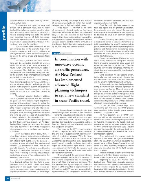
HiGHlight<br />
In coordination with<br />
innovative oceanic<br />
air traffic procedures,<br />
Air New Zealand<br />
has implemented<br />
advanced flight<br />
planning techniques<br />
to set a new standard<br />
in trans-Pacific travel.<br />
In the pre-departure phase for Air New<br />
Zealand’s flight from Auckland to San Francisco<br />
— using the calculated cost index and the latest<br />
enroute upper-air wind and temperature forecast<br />
— the carrier used Dispatch Manager to<br />
calculate the track between Auckland and San<br />
Francisco that would most effectively minimize<br />
fuel usage and emissions.<br />
This route is the UPR, implementation<br />
of which requires air traffic control systems<br />
that are able to support aircraft operating outside<br />
of predefined airways. With Air New<br />
Zealand’s OCS and the FAA’s Ocean21 — as<br />
well as their real-time conflict-probe capabilities,<br />
which instantly probe for conflicting factors with<br />
regard to any revision of flight profile — there<br />
is no requirement for traffic to maintain fixed<br />
routes in order for air traffic controllers to be<br />
able to identify conflicts.<br />
Once calculated, the user-preferred route<br />
is digitally uplinked to the aircraft, inclusive of<br />
the wind and temperature data for loading into<br />
the aircraft flight management computer. The<br />
fuel saved on this flight through the implementation<br />
of UPR amounted to approximately 420<br />
U.S. gallons and UPR was also accountable for<br />
approximately 4,015 kilograms of reduced CO 2<br />
emissions (emission reductions and fuel savings<br />
across the entire flight).<br />
Other factors in the initial stages of the<br />
flight also figured into the greater fuel equation.<br />
In an aircraft’s climb after takeoff, for example,<br />
there are numerous disparate factors that must<br />
be balanced to arrive at an optimum operating<br />
procedure.<br />
When considering climb power, the use of<br />
a derate climb power, or a power setting that is up<br />
to 20 percent below the aircraft’s maximum climb<br />
power, serves to significantly improve engine life<br />
potential and thereby lower maintenance costs,<br />
but the use of derate climb power also effectively<br />
increases the overall amount of fuel consumed<br />
during this flight phase.<br />
Even under the effects of fairly recent higher<br />
fuel prices, however, the savings to a carrier in<br />
terms of engine maintenance costs would still<br />
exceed by more than double the cost of fuel that<br />
could be saved in this flight phase. Thereby, derate<br />
climb power has remained Air New Zealand’s<br />
preferred option.<br />
Climb speeds on Air New Zealand aircraft,<br />
incidentally, are set automatically through the<br />
mechanism of a cost-index factor that is entered<br />
into the aircraft’s flight management computer.<br />
And some of the things that figured in later<br />
during the Auckland-San Francisco flight took on<br />
even greater significance. Once at cruising altitude,<br />
for instance, the flight gained an advantage<br />
through the six-hourly update of the upper air wind<br />
and temperature forecasts received through the<br />
flight planning system. A process called dynamic<br />
airborne reroute procedure, or DARP, is applied in<br />
effectively re-planning the flight en route.<br />
On the Air New Zealand flight from<br />
Auckland to San Francisco, the DARP process<br />
was completed twice, thereby saving approximately<br />
70 U.S. gallons of fuel.<br />
Air New Zealand’s use of DARP commences<br />
with an aircraft-datalink request for a<br />
DARP to the Air New Zealand flight dispatch office<br />
in Auckland. Immediately, the latest wind and<br />
temperature forecast becomes available, and the<br />
Air New Zealand flight dispatcher uses Dispatch<br />
Manager to recalculate the optimum track from<br />
a predetermined point just ahead of the current<br />
aircraft airborne position.<br />
Once calculated, the revised route is<br />
uplinked to the aircraft for flight crew consideration.<br />
The crew then downlinks a request for the<br />
revised route to New Zealand’s oceanic control<br />
center and, once approved, accepts the revised<br />
route into the active side of the flight management<br />
computer.<br />
Another advanced air traffic procedure that<br />
now benefits Air New Zealand operations in the<br />
Pacific oceanic region is 30/30 separation.<br />
Beginning in 2005, the Airways New<br />
Zealand and Airservices Australia agencies<br />
reduced the required separation between aircraft<br />
in their oceanic airspace to 30 nautical miles<br />
longitude and 30 nautical miles latitude — the first<br />
such reduced separation in international airspace