

Download the 2012 Buyers Guide - Cactus Navigation ...
Download the 2012 Buyers Guide - Cactus Navigation ...
Download the 2012 Buyers Guide - Cactus Navigation ...

You also want an ePaper? Increase the reach of your titles
YUMPU automatically turns print PDFs into web optimized ePapers that Google loves.
6<br />
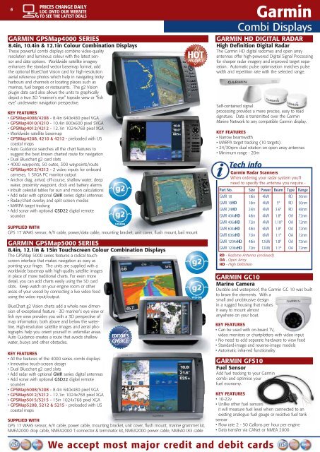
GARMIN GPSMap4000 SERIES<br />
8.4in, 10.4in & 12.1in Colour Combination Displays<br />
These powerful combi displays combine video-quality<br />
resolution and luminous colour with <strong>the</strong> latest sensor<br />
and data options. Worldwide satellite imagery<br />
enhances <strong>the</strong> standard vector basemap format, add<br />
<strong>the</strong> optional BlueChart Vision card for high-resolution<br />
aerial reference photos which help in navigating tricky<br />
harbours and channels or locating places such as<br />
marinas, fuel barges or restaurants. The g2 Vision<br />
plugin data card also allows <strong>the</strong> units to graphically<br />
depict a true 3D “mariner’s eye” topside view or “fish<br />
eye” underwater navigation perspective.<br />
KEY FEATURES<br />
• GPSMap4008/4208 - 8.4in 640x480 pixel VGA<br />
• GPSMap4010/4210 - 10.4in 800x600 pixel SVGA<br />
• GPSMap4012/4212 - 12.1in 1024x768 pixel XGA<br />
• Worldwide satellite basemap<br />
• GPSMap4208, 4210 & 4212 - preloaded with US<br />
coastal maps<br />
• Auto Guidance searches all <strong>the</strong> chart features to<br />
suggest <strong>the</strong> best known charted route for navigation<br />
• Dual Bluechart g2 card slots<br />
• 4000 waypoints, 50 outes, 300 waypoints/route<br />
• GPSMap4012/4212 - 2 video inputs for onboard<br />
cameras, 1 SVGA PC monitor output<br />
• Anchor drag, arrival, off-course, shallow water, deep<br />
water, proximity waypoint, clock and battery alarms<br />
• Inbuilt celestial tables for sun and moon calculations<br />
• Add radar with optional GMR series digital antennas<br />
• Radar/chart overlay and split screen modes<br />
• MARPA target tracking<br />
• Add sonar with optional GSD22 digital remote<br />
sounder<br />
HOT<br />
PRODUCT<br />
SUPPLIED WITH<br />
GPS 17 WAAS sensor, A/V cable, power/data cable, mounting bracket, unit cover, flush mount, bail mount<br />
GARMIN GPSMap5000 SERIES<br />
8.4in, 12.1in & 15in Touchscreen Colour Combination Displays<br />
The GPSMap 5000 series features a radical touchscreen<br />
interface that makes navigation as easy as<br />
pointing your finger. The units are supplied with a<br />
worldwide basemap with high-quality satellite images<br />
in place of more traditional charts. For even more<br />
detail, you can add charts easily using <strong>the</strong> SD card<br />
slots. Keep watch on your engine room or o<strong>the</strong>r<br />
areas of your vessel by connecting a live video feed<br />
using <strong>the</strong> video input/output.<br />
BlueChart g2 Vision charts add a whole new dimension<br />
of exceptional feature - 3D mariner’s eye view or<br />
fish eye view provides you with a 3D perspective of<br />
map information, both above and below <strong>the</strong> waterline.<br />
High-resolution satellite images and aerial photographs<br />
help you orient yourself in unfamiliar areas.<br />
Auto Guidance creates a route that avoids shallow<br />
water, buoys and o<strong>the</strong>r obstacles.<br />
KEY FEATURES<br />
• All <strong>the</strong> features of <strong>the</strong> 4000 series combi displays<br />
• Innovative touch-screen design<br />
• Dual Bluechart g2 card slots<br />
• Add radar with optional GMR series digital antennas<br />
• Add sonar with optional GSD22 digital remote<br />
sounder<br />
• GPSMap5008/5208 - 8.4in 640x480 pixel VGA<br />
• GPSMap5012/5212 - 12.1in 1024x768 pixel XGA<br />
• GPSMap5015/5215 - 15in 1024x768 pixel XGA<br />
• GPSMap5208, 5212 & 5215 - preloaded with US<br />
coastal maps<br />
EDITOR’S<br />
CHOICE<br />
SUPPLIED WITH<br />
GPS 17 WAAS sensor, A/V cable, power cable, mounting bracket, unit cover, flush mount, marine grommet kit,<br />
NMEA2000 drop cable, NMEA2000 T-connector & terminator kit, NMEA2000 power cable, NMEA0183 cable<br />
We accept most major credit and debit cards<br />
Garmin<br />
Combi Displays<br />
GARMIN HD DIGITAL RADAR<br />
High Definition Digital Radar<br />
The Garmin HD digital radomes and open array<br />
antennas offer high-powered Digital Signal Processing<br />
for sharper radar imagery and improved target separation.<br />
Automatic pulse optimisation matches pulse<br />
width and repetition rate with <strong>the</strong> selected range.<br />
Self-contained signal<br />
processing provides a more precise, easy to read<br />
signature. Data is transmitted over <strong>the</strong> Garmin<br />
Marine Network to any compatible Garmin display.<br />
KEY FEATURES<br />
• Narrow beamwidth<br />
• MARPA target tracking (10 targets)<br />
• 24/30rpm dual rotation on open array antennas<br />
• Minimum range - 20m<br />
Tech info<br />
Garmin Radar Scanners<br />
When ordering your radar system you’ll<br />
need to specify <strong>the</strong> antenna you require -<br />
Part No. Size Power Beam Type Range<br />
GMR 18 18in 4kW RD 36nm<br />
GMR 18HD 18in 4kW 5º RD 36nm<br />
GMR 24HD 24in 4kW 3.6º RD 48nm<br />
GMR 404xHD 48in 4kW 1.8º OA 72nm<br />
GMR 406xHD 72in 4kW 1.18º OA 72nm<br />
GMR 604xHD 48in 6kW 1.8º OA 72nm<br />
GMR 606xHD 72in 6kW 1.1º OA 72nm<br />
GMR 1204xHD 48in 12kW 1.8º OA 72nm<br />
GMR 1206xHD 72in 12kW 1.1º OA 72nm<br />
RD - Radome Antenna (enclosed)<br />
OA - Open Array<br />
HD - High Definition<br />
GARMIN GC10<br />
Marine Camera<br />
Durable and waterproof, <strong>the</strong> Garmin GC 10 was built<br />
to brave <strong>the</strong> elements. With a<br />
small and unobtrusive design<br />
in a rugged housing that makes<br />
it easy to mount almost<br />
anywhere on your boat.<br />
KEY FEATURES<br />
• Can be used with on-board TV,<br />
video monitors or chartplotters with video input<br />
• No need to add separate hardware to view feed<br />
• Standard-image and reverse-image models<br />
• Automatic infra-red functionality<br />
GARMIN GFS10<br />
Fuel Sensor<br />
Add fuel tracking to your Garmin<br />
combi and optimise your<br />
fuel economy.<br />
KEY FEATURES<br />
• 10-22v<br />
• Unlike o<strong>the</strong>r fuel sensors<br />
it will measure fuel level when connected to an<br />
existing analogue fuel gauge or resistive fuel tank<br />
sensor<br />
• Flow rate 2 - 50 Gallons per hour per engine<br />
• Data transfer via CANet or NMEA 2000