Common Ground - Western Reserve Land Conservancy
Common Ground - Western Reserve Land Conservancy
Common Ground - Western Reserve Land Conservancy

You also want an ePaper? Increase the reach of your titles
YUMPU automatically turns print PDFs into web optimized ePapers that Google loves.
© DAVID LIAM KYLE
Advisory board members<br />
Karen Adair<br />
The Nature <strong>Conservancy</strong><br />
Yetty Alley<br />
ODNR - Division of Coastal Management<br />
David Beach<br />
Cleveland Museum of Natural History<br />
Amy Bowman-Moore<br />
Erie MetroParks<br />
Lisa Brohl<br />
Lake Erie Islands Chapter of the Black Swamp <strong>Conservancy</strong>,<br />
Lake Erie Islands Nature and Wildlife Center<br />
John Debo<br />
<strong>Conservancy</strong> for Cuyahoga Valley National Park<br />
Roger Gettig<br />
Holden Arboretum<br />
Scott Hill<br />
<strong>Western</strong> <strong>Reserve</strong> <strong>Land</strong> <strong>Conservancy</strong><br />
John Mack<br />
Cleveland Metroparks<br />
Elizabeth Mather<br />
<strong>Western</strong> <strong>Reserve</strong> <strong>Land</strong> <strong>Conservancy</strong><br />
Keith McClintock<br />
Geauga County Park District<br />
Andy McDowell<br />
<strong>Western</strong> <strong>Reserve</strong> <strong>Land</strong> <strong>Conservancy</strong><br />
Tori Mills<br />
Doan Brook Watershed Partnership<br />
Nathan Paskey<br />
Ashtabula Soil and Water Conservation District<br />
John Pogacnik<br />
Lake Metroparks<br />
Gary Popotnik<br />
The Wilderness Center<br />
Brett Rodstrom<br />
<strong>Western</strong> <strong>Reserve</strong> <strong>Land</strong> <strong>Conservancy</strong><br />
Justin Rogers<br />
Mill Creek MetroParks<br />
Keith Shy<br />
Metro Parks, Serving Summit County<br />
Mathew Smith<br />
ODNR - Division of Watercraft, Scenic Rivers<br />
Vince Urbanski<br />
Lake Metroparks<br />
Leah Whidden<br />
Shaker Heights Garden Club<br />
Ann Whitney<br />
Gates Mills <strong>Land</strong> <strong>Conservancy</strong><br />
Ken Wood<br />
<strong>Western</strong> <strong>Reserve</strong> <strong>Land</strong> <strong>Conservancy</strong><br />
Authors<br />
Elizabeth Mather<br />
Ken Wood<br />
<strong>Western</strong> <strong>Reserve</strong> <strong>Land</strong> <strong>Conservancy</strong><br />
3850 Chagrin River Road<br />
Moreland Hills, Ohio 44022<br />
(440) 528-4150<br />
info@wrlandconservancy.org<br />
Design<br />
Jeri Leigh Hruby<br />
Lighthouse Graphics<br />
Cover Photo<br />
David Liam Kyle<br />
Blue Hen Falls, Cuyahoga Valley National Park<br />
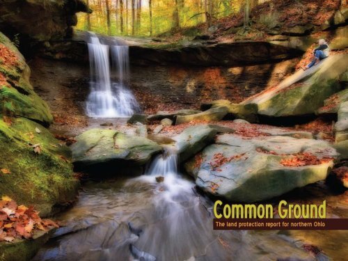
<strong>Common</strong> <strong>Ground</strong><br />
The land protection report for northern Ohio<br />
December 2012<br />
In 2012, a group that included local conservation professionals, representatives of nonprofit organizations and park<br />
officials set out to create the first-ever report on the state of land preservation in northern Ohio. <strong>Common</strong> <strong>Ground</strong> is<br />
the result of those efforts. This report examines the protection of natural areas, farmland and urban properties in a<br />
14-county region, current trends in land preservation and the challenges facing our region as we move forward. It<br />
also contains stories about some of northern Ohio’s conservation milestones and success stories.<br />
The report was a collaborative, regional effort assisted by the many groups and agencies that supplied data and an<br />
advisory board that helped determine the focus of the publication. Publication of the report was coordinated by<br />
<strong>Western</strong> <strong>Reserve</strong> <strong>Land</strong> <strong>Conservancy</strong>.<br />
Support provided by<br />
The Alton F. and Carrie S. Davis Fund<br />
The Sandra L. & Dennis B. Haslinger Family Foundation
© DAVID LIAM KYLE<br />
4<br />
TABLE OF CONTENTS<br />
Why preserve our land?<br />
page 6<br />
Where we stand<br />
page 10<br />
How and why land is preserved<br />
page 22<br />
Stories of conservation<br />
page 32<br />
The benefits of land conservation<br />
page 34<br />
Challenges and opportunities loom<br />
page 44<br />
Conclusions and summary<br />
page 58<br />
. . . . . . . . . . . . . .<br />
Special thanks<br />
page 62
INTRODUCTION<br />
Why we did this report<br />
The people of northern Ohio live in a region blessed with an abundance of<br />
natural resources.<br />
In our own back yard are prime soils, healthy hardwood forests, picturesque<br />
river valleys and the great Lake Erie. In order to preserve these resources,<br />
we need to protect their lifeblood – the land itself. But how do we gauge<br />
how much land should be preserved? Are some types of conservation more<br />
important than others? Where has land preservation taken a step forward?<br />
Where is it lagging?<br />
Never before has there been an attempt to gather and analyze data about<br />
all the land-preservation work done by the conservation community in<br />
northern Ohio and tell some of the most compelling stories about these<br />
largely under-the-radar efforts. In this report, <strong>Common</strong> <strong>Ground</strong>, we present<br />
an up-to-date depiction of the state of land protection in the region as<br />
well as an analysis of the opportunities and challenges facing conservation<br />
here. We reached out to park systems, land conservancies, nonprofit<br />
organizations, government agencies and individuals in a 14-county area in<br />
northern Ohio, asking them to share land-preservation statistics, stories and<br />
trends. Their cooperation made this report possible.<br />
We want to inspire readers to envision this region as a healthy, vibrant place<br />
filled with beautiful parks, clean rivers and lakes, productive farmland and<br />
amazing natural lands. Hopefully, you will see what we see: The opportunity<br />
to conserve our land for future generations and to create a region whose<br />
natural amenities provide residents the same high-quality health benefits as<br />
our world-class medical facilities.<br />
We hope you find the report interesting, enlightening and inspiring.<br />
5
© DAVID LIAM KYLE<br />
At A Glance<br />
* Since land is a finite resource, preserving it<br />
* 95% of the region’s farmland remains<br />
* Our region has more than 400 unique<br />
* The net cost to taxpayers – revenue vs.<br />
* Open space contributes to a person’s<br />
is vital. Cuyahoga County went from being<br />
semi-rural in 1950 to completely developed<br />
in 2000 – while its population remained<br />
unchanged.<br />
unprotected, so the rich soils on these<br />
properties could one day be underneath<br />
houses or shopping centers.<br />
species, including 16 known federally<br />
endangered species and 41 known federally<br />
threatened species.<br />
the tab for providing services – is less<br />
for preserved land than for residential<br />
developments.<br />
physical, psychological and emotional health.<br />
66 CHAPTER CHAPTER 1 1 WHY PRESERVE PRESERVE OUR OUR LAND LAND<br />
CHAPTER 1<br />
Why preserve our land?<br />
S ince land is so plentiful, why all the fuss about<br />
preserving it?<br />
It is a fair question. In a survey, we asked those who do<br />
conservation work in northern Ohio what they felt were the<br />
most important reasons to protect or restore land.<br />
“Once the land is developed,” one respondent wrote, “it is<br />
incredibly difficult to ‘un-develop’ it.”<br />
Another noted, “Conserving land allows us to have a<br />
special place to retreat to enjoy the outdoors and explore<br />
nature. For health reasons, it is imperative that we have a<br />
place where we can relieve stress, walk and hike with our<br />
families, and understand the importance of the abundant<br />
natural resources we have in our communities.”<br />
Others viewed land preservation as a way to combat urban<br />
sprawl, to maintain biodiversity, to protect watersheds<br />
and to stem the loss of valuable farmland. One respondent<br />
stated, “If we do not conserve land, it will be fully<br />
developed and paved over. Look at Cuyahoga County. It is<br />
the first county in Ohio to be 100% developed. Everything<br />
not protected or in parks was paved over.” Another<br />
person concluded: “There is no such thing as ‘too much’<br />
conservation of the natural environment.”<br />
Turns out there are plenty of reasons to preserve our land.<br />
This is the only land we have<br />
It seems obvious, but it bears repeating: <strong>Land</strong> is a finite<br />
resource – they aren’t making it any more. Look no further<br />
than Cuyahoga County, which went from being semi-rural<br />
in 1950 to completely developed in 2000 – while its<br />
population remained unchanged.<br />
There are more than four million acres in the 14-county<br />
region we studied for this report. That seems like a lot of<br />
land. But only 7% of that land – roughly 300,000 acres<br />
– is currently protected. Local conservation professionals<br />
we surveyed consider 10% a minimum level for land<br />
preservation, with most favoring a 15% standard. “It is the<br />
only land that we have,” one respondent noted. “We can’t<br />
create more land when it is all used up.”<br />
A healthy place for plants<br />
and wildlife<br />
By preserving land, we also protect the plants and wildlife<br />
of our region. If we do not protect the very best of our<br />
region’s natural areas, important habitats will be lost<br />
forever.<br />
In northern Ohio, we sometimes take for granted the<br />
extraordinary variety of plants, fish and animals living<br />
in our back yard. The most important step we can take<br />
toward maintaining this diversity is preserving the lands<br />
where plants and wildlife thrive. Locally, we have seen<br />
how protecting habitats have helped save species such as<br />
the bald eagle, the Lake Erie water snake and the Eastern<br />
massasauga rattlesnake. And we are fortunate that groups<br />
like the Cleveland Museum of Natural History and the Lake<br />
Erie Allegheny Partnership for Biodiversity are leading<br />
efforts to protect sensitive areas. <strong>Land</strong> preservation remains<br />
the most significant step we can take to protect our plants<br />
and animals.<br />
The Natural Heritage Database for our region lists more<br />
than 400 unique species, including 16 known federally<br />
endangered species and 41 known federally threatened<br />
species.
Conservation is good for business<br />
<strong>Land</strong> preservation contributes to the local economy in<br />
several ways.<br />
Numerous studies show that preserving the right land is<br />
less costly to taxpayers than allowing it to be developed.<br />
For example, a study in Lake County showed that for<br />
every dollar one community received in tax revenue from<br />
residential properties, it spent $1.24 providing services to<br />
those lands. In contrast, the same community spent 33<br />
cents providing services to farm and forest land for every<br />
dollar it received from those properties.<br />
In addition, natural resource-based economic development<br />
has become increasingly important to northern Ohio. The<br />
region is blessed with our great Lake Erie, which provides<br />
clean drinking water and is a regional tourism destination;<br />
prime agricultural soils that help make farming the<br />
single largest industry in the state; streams that provide<br />
unrivaled steelhead trout fishing; and world-class duck,<br />
deer and wild turkey hunting.<br />
Keeping farms, curbing sprawl<br />
<strong>Land</strong> conservation keeps prime agricultural land in<br />
production and, in the process, helps curb sprawl. Our<br />
local agricultural economy is strongly dependent on our<br />
exceptional regional farmland and prime soils. Yet farmland<br />
is being lost at an alarming rate in our region.<br />
Northern Ohio has a burgeoning local foods movement and<br />
has been rated as one of the top regions in the country<br />
for farmers’ markets. There is evidence that people are<br />
becoming increasingly interested in where their food<br />
comes from and are choosing from local sources. At<br />
the same time, a startling 95% of the region’s farmland<br />
remains unprotected, so the rich soils on these properties<br />
could one day be underneath houses or shopping centers.<br />
Agriculture is Ohio’s number one industry and contributes<br />
11% of the state’s total economy. One in seven jobs in the<br />
state are agricultural. This land is the basis for these jobs<br />
and must be preserved for this sector to thrive.<br />
Healthy places, healthy people<br />
Preserved land creates a healthy environment for people.<br />
Having places for recreation contributes to the mental and<br />
© DAVID LIAM KYLE<br />
Ohio’s first park district remains a treasure today<br />
With the construction of steel mills,<br />
the discovery of coal and the arrival<br />
of the railroad, Youngstown was<br />
industrializing at a rapid pace in the<br />
late 1800s. In this gritty setting, a<br />
visionary lawyer named Volney Rogers<br />
came up with a wholesome idea:<br />
preserve the natural wonders of the<br />
Mill Creek valley and create a healthy<br />
place for Youngstown residents who<br />
were being increasingly exposed to<br />
noise, smoke and congestion.<br />
Rogers knew Mill Creek well, having<br />
explored it on foot and on horseback.<br />
He was determined to preserve its<br />
hemlock-covered gorges, spectacular<br />
views and delightful waterfalls.<br />
Drawing on his own experience in<br />
helping establish Niagara Falls as New<br />
York’s first state park, he crafted Ohio<br />
legislation allowing for the creation<br />
of local park districts. In 1891, voters<br />
approved Youngstown Township Park<br />
District (Mill Creek Park) as the state’s<br />
first park district.<br />
Rogers, who was raised on a Columbiana<br />
County farm, donated all his legal<br />
services to the park system and studied<br />
landscape architecture and engineering<br />
so he could work along side the experts<br />
hired to create what is now the 4,400acre<br />
Mill Creek MetroParks system in<br />
Mahoning County. His passion for Mill<br />
Creek still resonates with park-goers.<br />
“The legacy of<br />
Volney Rogers<br />
goes beyond<br />
the preserved<br />
and enhanced<br />
lands and<br />
waters,” wrote<br />
authors Carol<br />
Potter and Rick<br />
Shale in their<br />
book, Historic<br />
Mill Creek Park.<br />
“(H)is lessons in stewardship travel home<br />
with every inspired visitor, giving support<br />
to those who strive to save our valuable<br />
environmental treasures. His philosophy<br />
was a century ahead of its time.”<br />
CHAPTER 1 WHY PRESERVE OUR LAND<br />
7
In 1905, Cleveland was the nation’s<br />
sixth-largest city but not exactly a<br />
sprawling metropolitan area. Parma,<br />
Strongsville and Solon were filled with<br />
farms. Even then, William Stinchcomb,<br />
Cleveland’s 27-year-old chief engineer<br />
of parks, envisioned what was coming.<br />
Stinchcomb, writing in Cleveland’s<br />
1905 annual report, recommended<br />
“establishing an outer system of parks<br />
and boulevards” through the Rocky and<br />
Chagrin River valleys to preserve “some<br />
of the finest stretches of natural park<br />
lands to be found in the northern part<br />
of Ohio. While all this is now entirely<br />
outside of the city, it will be but a<br />
short time before they will be inside<br />
or very near the limits of a ‘Greater<br />
Cleveland’ and it seems to me that<br />
such fine stretches of natural parkway<br />
should be secured for the benefit of the<br />
entire public before private enterprise<br />
or commercial industry places them<br />
beyond reach.”<br />
Four years later, Stinchcomb reiterated<br />
his plea.<br />
“The importance of conserving<br />
our natural resources is now well<br />
recognized,” he wrote. “Cannot it<br />
8 CHAPTER 1 WHY PRESERVE OUR LAND<br />
Extraordinary foresight created Emerald Necklace<br />
courtesy Cleveland Press Collection/Cleveland State University<br />
© DAVID LIAM KYLE<br />
be truly said that these natural wild<br />
beautiful valleys and glens which lie<br />
adjacent to our rapidly growing urban<br />
centers are a kind of ‘natural resource’<br />
of ever increasing value to the public?”<br />
Flash forward to today. The 22,000acre<br />
Cleveland Metroparks stands as a<br />
testament to Stinchcomb’s vision – and<br />
as a community treasure in now fully<br />
developed Cuyahoga County.<br />
The Cleveland-born Stinchcomb became<br />
the first engineer and executive<br />
director of the Cleveland Metropolitan<br />
Park System, now known as Cleveland<br />
Metroparks. Stinchcomb’s vision began<br />
to take shape when he hired the<br />
nationally acclaimed Olmsted Brothers<br />
landscape architecture firm to provide<br />
assistance in designing what would<br />
later be known as The Emerald<br />
Necklace. The plan encouraged those<br />
who owned land considered unsuitable<br />
for typical development, such as glens<br />
of rivers, to donate these areas to the<br />
park.<br />
Today, 16 Cleveland Metroparks<br />
reservations encircle Cleveland from<br />
North Chagrin to Brecksville to<br />
Huntington Beach in Bay Village. They<br />
are permanently preserved for the<br />
public’s enjoyment – thanks to the<br />
foresight of William Stinchcomb.<br />
physical health of the community. In addition, it improves<br />
quality of life for all and contributes to the region’s<br />
scenic beauty: Who hasn’t marveled at the sight of rolling<br />
farmland in Wayne County, the Lake Erie shoreline, the fall<br />
colors in the Cleveland Metroparks or the daily wildlife<br />
show in the Grand River Lowlands?<br />
Preserved land also safeguards our clean drinking water<br />
and air, protects against flooding and creates opportunities<br />
for people to be outdoors. In turn, we derive physical,<br />
psychological and emotional benefits from our natural<br />
areas. One of our survey respondents noted: “Without a<br />
landscape that provides our region with a healthy habitat<br />
for people, plants and animals, our region will become<br />
distressed and suffer. By preserving and restoring land and<br />
water resources to create a healthy habitat, we can help<br />
our region thrive today and into the future.”
Cuyahoga County <strong>Land</strong> Use 1948<br />
Developed Areas Parks & Preserved Areas Undeveloped Areas Cuyahoga County Major Roads<br />
Cuyahoga County <strong>Land</strong> Use 2005<br />
Developed Areas Parks & Preserved Areas Undeveloped Areas Cuyahoga County Major Roads<br />
Population 1950: 1,389,532<br />
Source: U.S. Census<br />
Population 2000: 1,393,978<br />
Source: U.S. Census<br />
© DAVID LIAM KYLE<br />
CHAPTER 1 WHY PRESERVE OUR LAND<br />
9
AMANDA SKINGEL<br />
At A Glance<br />
* About 7% of all land in northern Ohio – or<br />
* At our current rate of protection, it will take<br />
* Public funding has been critical to land con-<br />
* Nearly 28% of our region’s residents live<br />
* <strong>Land</strong> trusts, outdoor clubs and private<br />
about 300,000 acres – has been permanently<br />
preserved. In a survey, local conservation<br />
professionals indicated at least 10% and<br />
preferably 15% should be protected.<br />
30 years to reach the 10% preservation level.<br />
servation in northern Ohio.<br />
within what is considered a “walkable” distance<br />
– ½ mile – from protected land.<br />
landowners have made significant contributions<br />
to the amount of preserved land in the<br />
region.<br />
10 10 CHAPTER CHAPTER 2 2 WHERE WHERE WE WE STAND STAND<br />
CHAPTER 2<br />
Where we stand:<br />
the current state of land protection<br />
A number of factors help us to gauge the success of land<br />
conservation in our region.<br />
In a non-scientific survey conducted of land conservation<br />
professionals in our region, the quality of land conserved<br />
ranked as the most important measure of our success.<br />
While we would like to be able to base this report largely<br />
on the quality of our protected landscape, we lack a<br />
comprehensive method for such an approach at this time.<br />
The total number of acres preserved also ranked highly in<br />
the survey, followed by perception of the health of our<br />
habitat or land.<br />
To assess our land-protection efforts to date, it helps to go<br />
back in time.<br />
Northern Ohio ceased being an untouched wilderness well<br />
over a century ago. Early land conservation efforts in<br />
our region began in the second half of the 19th century<br />
when people began to really feel the loss of not only the<br />
wilderness but the decline of species and loss of open<br />
space. Ohio became a state in 1803; by 1850, it was<br />
already leading the nation in all kinds of farming. By<br />
this time, many of the large predators had already been<br />
eliminated from Ohio. In 1857, the first state law was<br />
enacted to protect fish. In 1891, Volney Rogers helped<br />
to establish Mill Creek Park, outside of Youngstown, to<br />
preserve it before urban sprawl and resource extraction<br />
could destroy it.<br />
In a region where land conservation has gone hand-inhand<br />
with industrial, agricultural, business and residential<br />
growth, striking a healthy balance between development<br />
and open space has always been a challenge.<br />
Pondering the 15% solution<br />
Most of the protected land in our region has been preserved<br />
within the last 100 years. The pace of land conservation<br />
increased through the 1940s, when much of the state<br />
parkland was acquired. It peaked in that decade, with<br />
more than 1.5% of our region protected during those 10<br />
years. During the development boom of the 1950s, the<br />
pace of conservation dropped. But in the 2000s, the pace<br />
of conservation again increased, rising to more than 1%<br />
during the decade.<br />
As of the end of 2012, a total of 295,322 acres in<br />
northern Ohio are parkland, under legal protection, or<br />
otherwise owned as open space by local, regional, state<br />
or federal government. This accounts for nearly 7% of all<br />
land in the region.<br />
But how much is enough?<br />
There is no consensus in the regional land conservation<br />
community, no acreage or percentage figure that is widely<br />
accepted. In our survey of land conservation professionals,<br />
more than 92% of respondents indicated that at least 10%<br />
of our region should be protected. Of those, nearly 70%<br />
believe that at least 15% of our region should be protected.<br />
If we can maintain the current rate of 1% of the region’s<br />
land protected per decade, it will take us 30 more years<br />
– until 2043 – to reach a 10% goal and an additional 50<br />
years – until 2093 – to reach the 15% mark.<br />
More than 60% of our survey respondents feel that the<br />
current pace of conservation is too slow. Since development<br />
has now slowed dramatically, there appears to be a chance<br />
to increase the pace of conservation, at least in the near
1.80%<br />
1.60%<br />
1.40%<br />
1.20%<br />
1.00%<br />
0.80%<br />
0.60%<br />
0.40%<br />
0.20%<br />
0.00%<br />
Source: <strong>Western</strong> <strong>Reserve</strong> <strong>Land</strong> <strong>Conservancy</strong><br />
16,000<br />
14,000<br />
12,000<br />
10,000<br />
8,000<br />
6,000<br />
4,000<br />
2,000<br />
0.45%<br />
% of Region Protected by decade<br />
0.07%<br />
0.00%<br />
0.07%<br />
Pace of Conservation<br />
0.32% 0.34%<br />
Annual New Privately-Owned Residential Building Permits<br />
0<br />
1990 1991 1992 1993 1994 1995 1996 1997 1998 1999 2000 2001 2002 2003 2004 2005 2006 2007 2008 2009 2010 2011<br />
Source: U.S. Census<br />
1.57%<br />
0.35%<br />
0.77%<br />
0.50%<br />
0.35%<br />
0.96%<br />
Unknown Pre-1900 1900s 1910s 1920s 1930s 1940s 1950s 1960s 1970s 1980s 1990s 2000s<br />
1.11%<br />
© DAVID LIAM KYLE<br />
Farmers plant roots in national park<br />
Former teacher Daniel Greenfield is now a farmer.<br />
Youngstown native Daniel Greenfield<br />
has a doctorate in the cultural<br />
foundations of education. He once<br />
taught in the Stow-Munroe Falls City<br />
School District. So why did he and<br />
his wife, Michele, choose to become<br />
berry farmers in the Cuyahoga Valley<br />
National Park?<br />
“It really comes from a long-standing<br />
love of nature,” says a smiling<br />
Greenfield, whose 20-acre Greenfield<br />
Berry Farm near Peninsula produces<br />
organic vegetables, blueberries,<br />
strawberries and red raspberries as<br />
well as such signature products as<br />
hickory bark syrup.<br />
The Greenfields have operated the<br />
farm for about six years.<br />
The pick-your-own farm in Boston<br />
Township is part of a Countryside<br />
<strong>Conservancy</strong> program that is unique<br />
in North America. The Countryside<br />
Initiative focuses on rehabilitating<br />
and revitalizing the old farms within<br />
the boundaries of the national park,<br />
and Greenfield’s property is one of<br />
11 farms now operating under the<br />
program.<br />
The first pilot farms were established<br />
in 2002, with others created since<br />
then. The farms pursue small,<br />
diversified crop and livestock<br />
operations that target local specialty<br />
and niche markets. There are farms<br />
in Boston Township, Bath Township,<br />
Peninsula, Brecksville, Valley View and<br />
Cuyahoga Falls.<br />
Greenfield is still an environmental<br />
educator – one who now uses his<br />
farm as the ultimate visual aid. He<br />
recalls how one group of high school<br />
students responded to a visit.<br />
“They were great,” he says. “They<br />
asked very insightful questions, and I<br />
came away feeling that I had made an<br />
impact.”<br />
CHAPTER 2 WHERE WE STAND<br />
11
AMANDA SKINGEL<br />
term. According to the U.S. Census, the current economy<br />
has reduced the annual construction rate to around 3,000<br />
new privately-owned residential building permits in northern<br />
Ohio. This is down from more than 13,000 permits regionally<br />
in 2004. Paired with this reduced rate of development are<br />
unusually low property values; this creates a potential<br />
opportunity for the region to increase the pace of<br />
conservation considerably. <strong>Land</strong> once eyed for development<br />
might instead be preserved.<br />
In addition to protecting our region’s land, there is a strong<br />
need to quantify its health and restore some of the altered<br />
natural areas, including our degraded streams and wetlands.<br />
Examples of this include The Nature <strong>Conservancy</strong>’s work<br />
to control invasive species in the Grand River Lowlands,<br />
the restoration of the former Orchard Hills Golf Course by<br />
Geauga Park District and <strong>Western</strong> <strong>Reserve</strong> <strong>Land</strong> <strong>Conservancy</strong><br />
and the reclamation of the former Coliseum site by the<br />
Trust for Public <strong>Land</strong> and the National Park Service. Other<br />
restoration projects are featured throughout this report.<br />
12 CHAPTER 2 WHERE WE STAND<br />
So who is conserving land in our region?<br />
There are a number of government agencies, nonprofit<br />
organizations, schools, clubs and individuals working<br />
throughout our region to protect land.<br />
Federal government agencies that own or protect land in<br />
northern Ohio include the National Park Service, NASA, U.S.<br />
Fish and Wildlife Service and U.S. Department of Agriculture’s<br />
Natural Resources Conservation Service. They own or protect<br />
land for different reasons, but each contributes to the overall<br />
matrix of open land in our region. In northern Ohio, NRCS<br />
largely protects land in voluntary partnership with private<br />
landowners through Farm Bill programs.<br />
The Ohio Department of Natural Resources and the Ohio<br />
Department of Agriculture own or protect a large amount of<br />
$6,000,000<br />
$5,000,000<br />
$4,000,000<br />
$3,000,000<br />
$2,000,000<br />
$1,000,000<br />
$0<br />
$15,935<br />
$1,333,823<br />
Source: National Park Service<br />
$864,840<br />
$1,782,122<br />
$660,438<br />
$5,227,463<br />
$580,214<br />
<strong>Land</strong> and Water Conservation Funding for Region<br />
$2,697,284<br />
$1,181,098<br />
$2,131,375<br />
$3,143,506<br />
$2,000,776<br />
$1,426,462<br />
$2,634,209<br />
$16,496<br />
$2,217,405<br />
$1,812,702<br />
$1,066,015<br />
$1,797,698<br />
land in the region. Each agency holds or preserves land for<br />
different reasons, including recreation, resource protection,<br />
wildlife habitat and agricultural use, but all contribute to<br />
our region’s open-land totals.<br />
County park districts were first made possible through<br />
legislation in 1917. Since that time, each county in the<br />
region has established a park board and most have opened<br />
up parks within their districts. Ohio’s 88 Soil and Water<br />
Conservation Districts provide assistance to urban and<br />
agricultural land users. SWCDs specialize in soil erosion<br />
prevention and water management, and several districts in<br />
our region work with landowners to voluntarily protect their<br />
land through the use of conservation easements.<br />
Some of the first land-preservation efforts came from local<br />
groups.<br />
$530,349<br />
$464,625<br />
$53,400<br />
$263,614<br />
$245,868<br />
$331,328<br />
$123,027<br />
$121,950<br />
$98,881<br />
$225,000<br />
$850,883<br />
$10,000<br />
$59,535<br />
$200,000<br />
$517,254<br />
1968<br />
1969<br />
1970<br />
1971<br />
1972<br />
1973<br />
1974<br />
1975<br />
1976<br />
1977<br />
1978<br />
1979<br />
1980<br />
1981<br />
1982<br />
1983<br />
1984<br />
1985<br />
1986<br />
1987<br />
1988<br />
1989<br />
1990<br />
1991<br />
1992<br />
1993<br />
1994<br />
1995<br />
2001<br />
2002<br />
2003<br />
2004<br />
2005<br />
2006<br />
2007<br />
2008<br />
2009<br />
2010<br />
2011<br />
2012<br />
$54,895<br />
$189,784<br />
$0<br />
$103,849<br />
$808,949<br />
$75,250<br />
No LWCF funding in region from 1996-2000
The cities and villages of our region were among the<br />
earliest organizations to set aside land for parks in urban<br />
or small-town settings. In 1796, Cleveland’s Public Square<br />
was planned as a 9.5-acre open space intended to serve<br />
as a common grazing area and meeting place. This was<br />
modeled on a traditional New England town plan. In 1866,<br />
DeRivera Park was established on South Bass Island as<br />
a village park. The donation by Jose de Rivera St. Jurgo<br />
came with a prohibition on building of any kind. It still<br />
serves the people of South Bass Island today. Over time,<br />
dozens of cities and villages added these types of parks for<br />
their residents.<br />
A wide range of nonprofits engage in land protection in<br />
northern Ohio. These range from very local groups who<br />
have organized to protect resources in their neighborhoods,<br />
such as the Gates Mills <strong>Land</strong> <strong>Conservancy</strong> and the West<br />
Creek Preservation Committee, to organizations like the<br />
Cleveland Museum of Natural History, which protects land<br />
as living showplaces for dynamic, rare and endangered<br />
habitats and species. Other nonprofits like the Trust for<br />
Public <strong>Land</strong>, The Nature <strong>Conservancy</strong> and <strong>Western</strong> <strong>Reserve</strong><br />
<strong>Land</strong> <strong>Conservancy</strong> help to obtain land for public parks and<br />
work with private landowners to establish conservation<br />
easements on their land.<br />
Hunting and fishing clubs also play a key role in land<br />
protection. Organizations such as the South Cuyahoga<br />
Sportsmen Club, which has properties in North Royalton and<br />
Medina County’s Chatham Township, and the Winous Point<br />
Shooting Club in Port Clinton, own and manage land for<br />
recreation and education. Others, such as Ducks Unlimited,<br />
own property and raise money to protect additional<br />
land; last year, for example, DU, in partnership with six<br />
conservation organizations, was awarded a $1 million grant<br />
through the North American Wetlands Conservation Act to<br />
conserve 1,909 acres of wetlands and associated habitats in<br />
Northeast Ohio.<br />
Colleges and universities also play a role. A number of them<br />
own land they use for research and investigation into our<br />
regional natural resources. These include Hiram College,<br />
Kent State University, and the Ohio State University’s<br />
Agricultural Research and Development Center. Hiram<br />
College has established and continued to expand its field<br />
station in Portage County. Kent State conducted research in<br />
the Stumpy Basin area of the Cuyahoga Valley National Park<br />
Ducks Unlimited, partners preserve pristine wetlands<br />
One of the state’s largest wetlands<br />
protection projects was launched in<br />
2011 when Ducks Unlimited and its<br />
partners were awarded a $1 million<br />
grant through the North American<br />
Wetlands Conservation Act to conserve<br />
1,909 acres of marshland and associated<br />
wildlife habitat in Northeast Ohio.<br />
The project area encompasses two<br />
premier waterfowl areas managed by the<br />
Ohio Department of Natural Resources<br />
Division of Wildlife: the 7,400-acre<br />
Grand River Waterfowl Area and the<br />
9,000-acre Mosquito Creek Waterfowl<br />
Area, which contain several of Ohio’s<br />
largest and most pristine wetlands.<br />
More than three million people – 43%<br />
of the state population – live within<br />
35 miles of this project area, which<br />
includes parts of Ashtabula, Geauga,<br />
Portage, Lake and Trumbull counties.<br />
Agriculture and urban development<br />
dominate the landscape and continue<br />
to result in wetland drainage,<br />
forest fragmentation, stream bank<br />
erosion and excessive nutrient loads<br />
in streams. The NAWCA grant will<br />
permanently protect wetlands, habitat<br />
and associated uplands, and the<br />
increased connectivity of these areas<br />
will benefit waterfowl and other<br />
wildlife, water quality, waterfowl<br />
hunters and other recreational users.<br />
DU’s partners in the project include<br />
the Cleveland Museum of Natural<br />
History, Geauga Park District,<br />
Trumbull County MetroParks, Portage<br />
Park District, <strong>Western</strong> <strong>Reserve</strong> <strong>Land</strong><br />
<strong>Conservancy</strong> and U.S. Fish and<br />
Wildlife Service.<br />
CHAPTER 2 WHERE WE STAND<br />
13
KEN WOOD<br />
Bruce Springsteen played there. So<br />
did Frank Sinatra. And Michael Jordan.<br />
But when the Richfield Coliseum closed<br />
its doors in 1994, the building’s future<br />
was punctuated with far more question<br />
marks than stars. What do you do with<br />
a vacant 20,000-seat arena, a hulking<br />
concrete structure in the middle of a<br />
Summit County meadow?<br />
Some 60 parties approached Coliseum<br />
owners George and Gordon Gund about<br />
buying the 327-acre site. There were<br />
proposals for a mega-mall, an office<br />
park and a housing development –<br />
each of which posed a threat to the<br />
neighboring Cuyahoga Valley National<br />
Recreation Area, now the Cuyahoga<br />
Valley National Park. A National Park<br />
Service study showed that a shopping<br />
center would bring another 15,000 cars<br />
a day to the area.<br />
At the urging of local residents and<br />
leaders, The Trust for Public <strong>Land</strong><br />
acquired the property, demolished the<br />
vacant arena, and transferred ownership<br />
to the national park. Today, the grassy<br />
14 CHAPTER 2 WHERE WE STAND<br />
Birders now<br />
flock<br />
to place<br />
that once<br />
rocked<br />
Courtesy Cleveland Press Collection/Cleveland State University<br />
The Richfield Coliseum, above, and the property as it<br />
looks today, top.<br />
meadow is popular with birders; the<br />
Eastern meadowlark, American kestrel,<br />
red-tailed hawk, bobolink, turkey<br />
vulture, Henslow’s sparrow, Savannah<br />
sparrow, grasshopper sparrow, sedge<br />
wren and American goldfinch have been<br />
spotted there.<br />
“By returning the land to its natural<br />
state, we helped ease the imminent<br />
threat of sprawl that would have<br />
impacted the small CVNP communities<br />
and the surrounding area,” says Pamela<br />
A. Carson, director of TPL’s Ohio office.<br />
The Coliseum project is one of nearly<br />
100 completed by TPL since it began<br />
working in Ohio in 1974.<br />
2010s<br />
2000s<br />
1990s<br />
1980s<br />
1970s<br />
1960s<br />
1950s<br />
1940s<br />
1930s<br />
1920s<br />
1910s<br />
1900s<br />
Pre-1900<br />
Unknown<br />
<strong>Land</strong> Protected & the Events that Influenced <strong>Land</strong> Protection<br />
CleanOhioprogram approved by Ohio voters - 2000<br />
Ohio legislationallows landowners to create agricultural districts - 1982<br />
Nonprofit Groups start holding conservation easements - 1980’s<br />
Cuyahoga Valley National Recreation Area created - 1974<br />
Creation of Federal <strong>Land</strong> and Water Conservation Fund - 1964<br />
Ohio Department of Natural Resources established - 1949<br />
First Ohio wildlife area purchased with hunting/fishing license fee money - 1920<br />
Cleveland Metroparks becomes first metropolitan park district - 1917<br />
Ohio Commission of Fish & Game responsible for lakes & public parks-1902<br />
First park district -Mill Creek Park -established - 1891<br />
Ohio Fish Commission established - 1873<br />
0 50,000 100,000 150,000 200,000 250,000 300,000 350,000
even before it was a National Recreational Area. OARDC in<br />
Wooster is a national leader in agricultural innovation.<br />
Private land owners have been critical to the preservation,<br />
protection and enhancement of Ohio’s resources. Many have<br />
worked with local, regional, state or federal agencies to create<br />
parkland on their properties either through sales or donations.<br />
Other landowners have maintained ownership while donating<br />
or selling conservation easements restricting the development<br />
rights on the properties in perpetuity. Still others contribute<br />
to conservation through volunteering with land-protection<br />
agencies or organizations and through monetary donations for<br />
land-preservation projects.<br />
Public funding milestones<br />
Public funding has been critical to land conservation in our<br />
region throughout our history. Some of the earliest parks were<br />
established and maintained through government agencies,<br />
including the city parks in our region.<br />
In 1917, through the efforts of William Stinchcomb and the<br />
Cleveland Metroparks, Ohio passed a law allowing for the<br />
formation of regional park districts that included the authority<br />
to levy taxes to pay for their operations. Since the law was<br />
passed, each county in our study area has established a<br />
park board. Many, but not all, of these park boards are levy<br />
supported. In the counties that are levy supported, citizens<br />
value the districts so strongly that they regularly vote to tax<br />
themselves to build and maintain the parks.<br />
Much of our region’s state park land was acquired starting in<br />
the 1930s and 1940s. At this time, many of the large lakes<br />
were being built to expand fishing opportunities in the state,<br />
so some of the park funding was generated through the sale<br />
of hunting and fishing licenses. This type of revenue stream<br />
continues to support our state’s open spaces.<br />
In 1965, the federal government enacted the <strong>Land</strong> and<br />
Water Conservation Fund. Its purpose is to “help preserve,<br />
develop, and assure access to outdoor recreation facilities<br />
to strengthen the health of U.S. citizens.” Northern Ohio<br />
has received LWCF funding for projects since 1968. Funds<br />
from this source were used by local, regional and state<br />
park districts to continue protecting land in the Cuyahoga<br />
Valley prior to the creation of the Cuyahoga Valley National<br />
Recreation Area. This money has also been used through the<br />
area to create and expand other public parks, including Euclid<br />
© DAVID LIAM KYLE<br />
$45,000,000<br />
$40,000,000<br />
$35,000,000<br />
$30,000,000<br />
$25,000,000<br />
$20,000,000<br />
$15,000,000<br />
$10,000,000<br />
$5,000,000<br />
$0<br />
Source: Clean Ohio<br />
Clean Ohio Funding for Region<br />
2002 2003 2004 2005 2006 2007 2008 2009 2010 2011<br />
Year Clean Ohio $<br />
2002 - $ 30,865,886<br />
2003 - $ 22,528,993<br />
2004 - $ 3,210,311<br />
2005 - $ 30,514,292<br />
2006 - $ 12,633,945<br />
2007 - $ 29,257,101<br />
2008 - $ 5,356,826<br />
2009 - $ 40,585,270<br />
2010 - $ 33,738,021<br />
2011 - $ 8,480,540<br />
CHAPTER 2 WHERE WE STAND<br />
15
Greenway<br />
now links<br />
Ashtabula,<br />
Warren<br />
A former railroad rightof-way<br />
in Ashtabula and<br />
Trumbull counties has<br />
been transformed into<br />
one of the region’s lesserknown<br />
recreational gems<br />
– a 43-mile multipurpose<br />
trail.<br />
The completed <strong>Western</strong><br />
<strong>Reserve</strong> Greenway, which<br />
stretches from Ashtabula<br />
to Warren, is part of a<br />
larger project that will link Lake Erie<br />
to the Ohio River. The Great Ohio<br />
Lake-to-River Greenway will run<br />
from the city of Ashtabula through<br />
Ashtabula, Trumbull, Mahoning<br />
and Columbiana counties to East<br />
Liverpool. Seventy percent of the 100mile<br />
trail is complete.<br />
The <strong>Western</strong> <strong>Reserve</strong> Greenway’s<br />
completion is unusual in that it<br />
was accomplished by two county<br />
park districts – Ashtabula County<br />
Metroparks and Trumbull County<br />
MetroParks – that don’t have full-time<br />
employees or tax levies. The districts<br />
used volunteers, donations and grants<br />
to build the trail on what was once<br />
the Penn Central 714 rail line.<br />
16 CHAPTER 2 WHERE WE STAND<br />
The right-of-way is now owned by the<br />
state and leased to the parks.<br />
Charles Kohli, president of the<br />
Ashtabula County Board of Park<br />
Commissioners and one of the original<br />
supporters of the rails-to-trails plan,<br />
said he is pleased that the greenway<br />
has been completed and is being used<br />
by so many people. He said he hopes<br />
the 100-mile GOLRG will eventually<br />
become “a conduit to the natural<br />
resources of our county.”<br />
The flat, north-south <strong>Western</strong> <strong>Reserve</strong><br />
Greenway is now a haven for bicyclists,<br />
joggers, hikers, skaters and equestrians.<br />
The 10-foot-wide trail runs through<br />
grassy meadows, forests and wetlands,<br />
including the Mosquito Creek State<br />
Wildlife Area. On any given day trailusers<br />
might see a bald eagle, wild<br />
turkeys, white-tailed deer, rabbits<br />
and ducks.<br />
Kohli said partnerships with<br />
federal, state and local agencies,<br />
conservation groups and other<br />
local organizations, particularly the<br />
Civic Development Corporation of<br />
Ashtabula County, were critical to<br />
the success of the trail project. He<br />
said the greenway “really shows off<br />
the variety of natural resources in<br />
Ashtabula County – creeks, fields,<br />
forests, wetlands.”<br />
Beach, Kelleys Island State Park, Quail Hollow State Park<br />
and Penitentiary Glen. Our regional LWCF funding peaked<br />
in 1973 at about $5.3 million. In 2011, $808,949 of LWCF<br />
funds were awarded to our region.<br />
Since 2000, the most influential public funding source<br />
in our region for land protection projects has been<br />
the Clean Ohio Fund. This voter-approved fund has<br />
made significantly more money available for brownfield<br />
revitalization, farmland preservation, green space<br />
conservation and recreational trails throughout the state.<br />
Support for Clean Ohio has been strong. In 2000, 57%<br />
of Ohio voters endorsed the $400 million bond issue<br />
that created the Clean Ohio program. Since that time, it<br />
has been used to clean up 175 abandoned and polluted<br />
sites, preserve 26,000 acres of natural areas, protect<br />
39,000 acres of family farms and create 216 miles of new<br />
recreational trails. In 2008, Ohio voters overwhelming<br />
supported a renewal of this bond issue. Locally, more than<br />
$217 million has been awarded to our region since the<br />
beginning of the program.<br />
Although the voters have renewed the bond issue,<br />
funding, unfortunately, is not guaranteed. The state<br />
legislature must still appropriate money for the program,<br />
leaving the future of the funding uncertain.<br />
The availability of public funding has clearly driven<br />
the rate of land protection in Ohio from the early<br />
establishment of our state parks, through the monumental<br />
creation of Cuyahoga Valley National Park and the growth<br />
in public parkland and farmland preservation in the last<br />
decade, the latter due in part to the support of Clean<br />
Ohio. Without this public funding support, our region<br />
would not be as strong nor as healthy.<br />
Uneven preservation patterns<br />
While nearly 7% of the land in our region is under<br />
conservation easement, protected as park or other publicly<br />
held open space, the quantity of the land protected<br />
or reserved by county varies from more than 15% in<br />
Portage County (including the Ravenna Arsenal) to less<br />
than 1.5% in Huron County, which is predominately<br />
agricultural. While Huron County has the lowest percent<br />
of protected land in our region, it also has the lowest<br />
percent of developed land with less than 9% of the<br />
acreage developed in 2006. Cuyahoga County is the
90%<br />
80%<br />
70%<br />
60%<br />
50%<br />
40%<br />
30%<br />
20%<br />
10%<br />
0%<br />
70%<br />
60%<br />
50%<br />
40%<br />
30%<br />
20%<br />
10%<br />
0%<br />
4.5%<br />
10.99%<br />
1.8%<br />
22.12%<br />
9.9%<br />
78.25%<br />
5.3%<br />
9.3%<br />
33.56%<br />
20.31%<br />
County <strong>Land</strong> Protected and Developed<br />
12.6%<br />
16.63%<br />
Watershed <strong>Land</strong> Protected and Developed<br />
10.8%<br />
57.18%<br />
1.4%<br />
8.86%<br />
13.7%<br />
46.58%<br />
9.9%<br />
52.27%<br />
4.6%<br />
7.3%<br />
10.58%<br />
27.03%<br />
Ashtabula Cuyahoga Erie Geauga Huron Lake Lorain Mahoning Medina Portage Stark Summit Trumbull Wayne<br />
2.1%<br />
9.84%<br />
10.8%<br />
25.40%<br />
Percent of Watershed Acres Protected<br />
Percent Developed<br />
8.8%<br />
11.10%<br />
Ashtabula Black-Rocky Chagrin Cuyahoga Grand Huron-Vermilion Mahoning Shenango Tuscarawas Walhonding<br />
Sources: 2006 NLCD and <strong>Western</strong> <strong>Reserve</strong> <strong>Land</strong> <strong>Conservancy</strong><br />
3.7%<br />
30.11%<br />
4.0%<br />
20.70%<br />
15.5%<br />
17.60%<br />
2.8%<br />
31.95%<br />
Percent Protected<br />
Percent Developed<br />
12.7%<br />
56.61%<br />
2.2%<br />
30.53%<br />
9.5%<br />
20.43%<br />
4.0%<br />
2.4%<br />
12.97%<br />
14.05%<br />
© DAVID LIAM KYLE<br />
Conservation boosted<br />
by record-setting merger<br />
The largest-ever merger of land<br />
trusts took place in 2006 when<br />
eight northern Ohio conservation<br />
organizations joined forces to form<br />
<strong>Western</strong> <strong>Reserve</strong> <strong>Land</strong> <strong>Conservancy</strong>.<br />
The merger created the largest land<br />
conservancy in the state, one that<br />
operates in a 14-county region<br />
extending from the Pennsylvania<br />
border to the Lake Erie Islands, and<br />
from Cleveland’s lakefront to Wayne<br />
and Stark counties. Merging were<br />
Chagrin River <strong>Land</strong> <strong>Conservancy</strong>,<br />
Bratenahl <strong>Land</strong> <strong>Conservancy</strong>,<br />
Firelands <strong>Land</strong> <strong>Conservancy</strong>,<br />
Headwaters <strong>Land</strong> Trust, Hudson<br />
<strong>Land</strong> <strong>Conservancy</strong>, Medina Summit<br />
<strong>Land</strong> <strong>Conservancy</strong>, Portage <strong>Land</strong><br />
Association for Conservation and<br />
Education and Tinkers Creek <strong>Land</strong><br />
<strong>Conservancy</strong>. In 2009, a second<br />
merger saw Grand River Partners<br />
join the <strong>Land</strong> <strong>Conservancy</strong>.<br />
At the time of the 2006 merger, the<br />
merging organizations had together<br />
preserved about 8,000 acres. Six<br />
years later, the <strong>Land</strong> <strong>Conservancy</strong><br />
had topped the 30,000-acre mark.<br />
Rand Wentworth, president of the<br />
Washington, D.C.-based <strong>Land</strong> Trust<br />
Alliance, which represents more than<br />
1,700 land trusts across the country,<br />
said it was evident the mergers “bore<br />
extraordinary fruit.” He also said<br />
the regional approach taken by the<br />
<strong>Land</strong> <strong>Conservancy</strong> is an example of<br />
“neighbors working with neighbors”<br />
for the community’s good.<br />
The <strong>Land</strong> <strong>Conservancy</strong> works with<br />
local governments, farmers, other<br />
private landowners and conservation<br />
groups to permanently preserve<br />
land. It has also launched Thriving<br />
Communities Institute, a program<br />
designed to help revitalize the<br />
region’s urban areas.<br />
CHAPTER 2 WHERE WE STAND<br />
17
60%<br />
50%<br />
40%<br />
30%<br />
20%<br />
10%<br />
0%<br />
49.1%<br />
Open Water<br />
4.4%<br />
Developed, Open Space<br />
18 CHAPTER 2 WHERE WE STAND<br />
1.5%<br />
Developed, Low Intensity<br />
1.2%<br />
Developed, Medium Intensity<br />
Protected Areas by<br />
<strong>Land</strong> Cover Type<br />
Sources: 2006 NLCD <strong>Western</strong> <strong>Reserve</strong> <strong>Land</strong> <strong>Conservancy</strong><br />
Amount of <strong>Land</strong> Protected By Cover Type<br />
0.4%<br />
Developed, High Intensity<br />
Pasture/Hay, 3.8%<br />
Grassland/Herbaceous,<br />
2.3%<br />
Shrub/Scrub, 0.8%<br />
Mixed Forest, 0.1%<br />
Evergreen Forest, 1.3%<br />
3.1%<br />
Barren <strong>Land</strong> (Rock/Sand/Clay)<br />
12.6%<br />
Deciduous Forest<br />
Cultivated Crops,<br />
7.9%<br />
20.0%<br />
Evergreen Forest<br />
19.8%<br />
Mixed Forest<br />
Emergent Herbaceous<br />
Wetlands, 1.0%<br />
Woody Wetlands,<br />
9.2%<br />
10.7%<br />
Shrub/Scrub<br />
7.4%<br />
Grassland/Herbaceous<br />
2.5%<br />
Pasture/Hay<br />
2.1%<br />
Cultivated Crops<br />
21.7%<br />
Woody Wetlands<br />
Open Water, 12.2% Developed,<br />
Open Space, 7.9%<br />
Developed,<br />
Low Intensity, 2.2%<br />
Deciduous Forest,<br />
50.7%<br />
40.1%<br />
Developed,<br />
Medium Intensity, 0.5%<br />
Developed,<br />
High Intensity, 0.1%<br />
Barren <strong>Land</strong><br />
(Rock/Sand/Clay), 0.1%<br />
Emergent Herbaceous Wetlands<br />
most-developed county in our region with 78% of the land<br />
developed and nearly 10% protected.<br />
<strong>Land</strong>, water and trees<br />
Sitting in both the Ohio/Mississippi River Watershed and the<br />
Lake Erie/Great Lakes Watershed (the dividing line snakes<br />
its way through northern Ohio and right through the city<br />
of Akron), we have access to and responsibility for a large<br />
amount of fresh water resources. The land cover and our land<br />
use within these watersheds has a direct impact on the quality<br />
of our water. One way to view the effect we are having on<br />
our region’s water resources is to look at what land we have<br />
protected and developed by watershed region.<br />
Of the large watersheds in our study area, the Cuyahoga<br />
River has the highest percent of watershed area protected at<br />
more than 13.5%. At the same time, the watershed is more<br />
than 46% developed. The Ashtabula River Watershed has the<br />
least amount of land protection at less than 2% and is 22%<br />
developed. The Grand River Watershed is only 10.5% developed<br />
and has more than 7% of its land protected.<br />
Using the 2006 National <strong>Land</strong> Cover Dataset we estimate that<br />
more than 52% of the region’s protected land is forested. More<br />
than 11.5% of our protected land is in agricultural use.<br />
It is also important to look at the amount of protection<br />
different land cover types have throughout northern Ohio.<br />
Nearly 50% of the land covered by open water occurs on park,<br />
protected or other government open space. In contrast, less<br />
than 5% of our farmland has protection.<br />
The importance of ‘walkability’<br />
In a region with four million people, our access and proximity<br />
to open space, recreational opportunities, nature and food<br />
production are central to the health and well-being of the<br />
larger community.<br />
The rule of thumb for “walkability” is a distance of 1/2 mile,<br />
or approximately a 10-minute walk. More than 20% of our<br />
region is within a 1/2 mile of protected land. When we take<br />
into account where people live within our region in relation to<br />
these travel distances to parks, we see that nearly 99% of our<br />
region’s people are within five miles of park or protected land.<br />
Nearly 28% of residents are within that potentially walkable<br />
distance of 1/2 mile. More than half the people living within<br />
our cities are within that 1/2 mile distance.
© DAVID LIAM KYLE<br />
Distance to Park, Protected, or Managed <strong>Land</strong><br />
Source: 2010 U.S. Census<br />
Distance From Parks or Protected <strong>Land</strong><br />
for Northern Ohio Residents<br />
2 -5 miles<br />
18.7%<br />
1 -2 miles<br />
28.3%<br />
5 -10 miles<br />
1.1%<br />
> 10 miles<br />
0.01%<br />
< 100'<br />
4.4%<br />
100 -500'<br />
2.8%<br />
500' -1/4 mile<br />
7.1%<br />
1/2 -1 mile<br />
24.0%<br />
1/4 -1/2 mile<br />
13.6%<br />
CHAPTER 2 WHERE WE STAND<br />
19
© DAVID LIAM KYLE<br />
20 CHAPTER 2 WHERE WE STAND<br />
Two visionaries,<br />
one milestone<br />
One of northern Ohio’s natural treasures<br />
would not exist today if not for a<br />
remarkable effort by two congressmen<br />
whose passion for the outdoors trumped<br />
any political differences.<br />
The 33,000-acre Cuyahoga Valley National<br />
Park, which straddles the Cuyahoga River<br />
between the cities of Cleveland and<br />
Akron, now thrives due to the vision of<br />
the late U.S. Rep. John Seiberling, a<br />
Democrat from Bath Township, and the<br />
tenacious funding efforts of former U.S.<br />
Rep. Ralph Regula, a Republican from<br />
Stark County.<br />
In 1974, Seiberling pushed through<br />
Congress a bill establishing the CVNP,<br />
which is now one of the most-visited<br />
national parks in the country. Regula,<br />
who co-sponsored the legislation, helped<br />
secure more than $200 million in federal<br />
funds for the park over his 36-year career.<br />
“I believe a good characterization of<br />
their joint pivotal roles for this park is to<br />
describe John Seiberling as the father of<br />
the national park, and Ralph Regula as<br />
its provider,” said John Debo, a former<br />
CVNP superintendent who worked with<br />
both congressmen.<br />
Seiberling, whose grandfather founded<br />
the Goodyear Tire & Rubber Co., is<br />
considered one of America’s great<br />
conservationists. During his 16 years<br />
in Congress, he played a key role in<br />
preserving 69 million acres of wilderness,<br />
including 54 million acres in Alaska, plus<br />
59 million acres of other federal parks,<br />
forests and preserves across the country.<br />
But Seiberling, who died in 2008, is best<br />
remembered for the creation of CVNP at<br />
a time when many questioned whether<br />
the Cuyahoga River Valley deserved<br />
federal protection. Even after the bill<br />
was approved by Congress, it faced a<br />
possible veto from President Gerald Ford;<br />
Ford ultimately signed the measure after<br />
Seiberling enlisted the help of Regula,<br />
then-U.S. Sens. Robert Taft Jr. and<br />
Howard Metzenbaum, then-Chairman of<br />
the Republican National Committee Ray<br />
Bliss and former Goodyear Chairman E.J.<br />
Thomas.<br />
Seiberling was also able to protect CVNP<br />
in the 1980s, when James Watt, secretary<br />
of the interior under President Ronald<br />
Reagan, wanted to eliminate it as a<br />
national park.<br />
Regula, a former teacher and principal<br />
who retired from Congress in 2009, was<br />
tenacious and successful in his efforts<br />
to provide funding for CVNP. He sat on<br />
the subcommittee that had responsibility<br />
for national park appropriations, a<br />
position in which he was able to secure<br />
money for CVNP land acquisition, capital<br />
development and operations.<br />
“CVNP would have been a park on paper,<br />
but not on the ground had it not been<br />
for Regula’s extraordinary role in securing<br />
funding for the national park,” Debo said.<br />
In 1996, Regula sponsored legislation<br />
to create the Ohio & Erie Canalway, a<br />
110-mile national heritage area from<br />
Cleveland to New Philadelphia that<br />
extends the Towpath Trail and Cuyahoga<br />
Valley Scenic Railroad. The Canalway<br />
physically connects CVNP to local parks<br />
and 40 communities. In 2000, Regula<br />
helped get the park’s name changed from<br />
Cuyahoga Valley National Recreation Area<br />
to Cuyahoga Valley National Park, making<br />
it more recognizable as a unit of the<br />
National Park System.
Types of land protection<br />
Parkland: <strong>Land</strong> with clumps of trees and shrubs in cultivated condition that<br />
is used as or is suitable for use as a park. The first known use of the term<br />
was in 1862.<br />
Park: A protected area, in its natural or semi-natural state, or planted, and<br />
set aside for human recreation and enjoyment, or for the protection of<br />
wildlife or natural habitats. The first parks were deer parks, land set aside<br />
for hunting by royalty and the aristocracy in medieval times. These game<br />
preserves evolved into landscaped parks set around mansions and country<br />
houses from the 16th century onwards. As cities became crowded, the<br />
private hunting grounds became places for the public. With the Industrial<br />
Revolution, parks took on a new meaning. Areas were set aside to preserve<br />
a sense of nature in the cities and towns. Sporting activity came to be a<br />
major use for these urban parks. Areas of outstanding natural beauty were<br />
also set aside as national parks to prevent them from being spoiled by<br />
uncontrolled development.<br />
Wilderness or wildland: This is a natural environment that has not been<br />
significantly modified by human activity.<br />
Preserve: A nature reserve (also a natural reserve, nature preserve or natural<br />
preserve) that is a protected area of importance for wildlife, flora, fauna or<br />
features of geological or other special interest. Preserves are reserved and<br />
managed for conservation and to provide special opportunities for study or<br />
research.<br />
Conservation easement: An encumbrance — sometimes including a transfer<br />
of usage rights (easement) — that creates a legally enforceable land<br />
preservation agreement between a landowner and a government agency<br />
(municipality, county, state, federal) or a qualified land protection<br />
organization (often called a “land trust”), for the purposes of conservation.<br />
It restricts real estate development, commercial and industrial uses, and<br />
certain other activities on a property to a mutually agreed upon level. The<br />
land remains the private property of the landowner.<br />
Drinking water protection: Areas protected from development and pollution<br />
for the express purpose of maintaining drinking water quality.<br />
Deed restriction: A restrictive covenant that is a legal obligation imposed<br />
in a deed by the seller upon the buyer of real estate to do or not to<br />
do something. Such restrictions frequently “run with the land” and are<br />
enforceable on subsequent buyers of the property.<br />
COMMON GROUND * WHERE WE STAND 21
At A Glance<br />
* The number of acres of farmland in our study<br />
* In 1999, Ohio created both the Agricultural<br />
* The sources of public parkland funding in<br />
* Northern Ohio’s rich fresh water resources<br />
* In the region covered by this report, Cuya-<br />
area has dropped to less than 1.5 million –<br />
less than half the total we had in 1935.<br />
Easement Donation Program and the Agricultural<br />
Easement Purchase Program to encourage<br />
farmland preservation.<br />
northern Ohio are diverse and include local<br />
park levies, individual donations, state and<br />
federal appropriations, the Clean Ohio fund,<br />
foundations and many others.<br />
are split evenly between the Ohio/Mississippi<br />
River Watershed and the Lake Erie/Great<br />
Lakes Watershed.<br />
hoga, Erie, Lorain, Trumbull, Mahoning, Summit,<br />
Portage, Stark and Lake counties have<br />
created land banks to help revitalize urban<br />
neighborhoods and re-use vacant lots.<br />
22 22 CHAPTER CHAPTER 3 3 HOW HOW AND AND WHY WHY LAND LAND IS IS PRESERVED PRESERVED<br />
CHAPTER 3<br />
How and why land is preserved<br />
T he arguments for preserving land are best made by<br />
considering the consequences of not protecting it.<br />
In parts of northern Ohio, this scenario has already been<br />
played out. Housing subdivisions have sprung up from the<br />
prime soils that once produced corn and wheat. For every<br />
new park that enhances the quality of life in our region,<br />
several other tracts have been lost to sprawl and unplanned<br />
development. When they aren’t recognized and protected,<br />
natural areas vanish along with the plant and animal<br />
habitats they provide. Rivers and lakes become polluted<br />
and unhealthy when watersheds aren’t protected. Our urban<br />
neighborhoods will decay if we don’t make good decisions<br />
about re-using vacant parcels.<br />
Valuing our farmland<br />
Farming has been important to Ohio since before European<br />
settlement. By 1850, Ohio was the number one producer of<br />
corn and the number two producer of wheat in the United<br />
States. The earliest industrialization in Ohio was related to<br />
agricultural processing and farm machinery manufacturing.<br />
While the number of farms and the quantity of farmland has<br />
steadily decreased in Ohio since the 1930s, Ohio is still an<br />
important source of farm products for the nation. According<br />
to JobsOhio, the agricultural industry is responsible for one<br />
in seven jobs in the state.<br />
Ohio’s early farmland preservation efforts grew out of the<br />
Great Dust Bowl, the dirty storms of the 1930s. The state’s<br />
88 Soil and Water Conservation Districts were established<br />
in response to the Dust Bowl and the need to conserve our<br />
agricultural soils from wind and water erosion. Ohio’s SWCDs<br />
continue to provide education and conservation assistance<br />
to farmers and other landowners.<br />
<strong>Land</strong> conversion from agricultural uses to various developed<br />
uses is the largest threat to farming in our area. At the time<br />
of the 2007 National Agricultural Statistics Service survey,<br />
the acres of farmland in our study area had dropped to less<br />
than 1.5 million – less than half the agricultural acreage we<br />
had in 1935.<br />
Steps have been taken to combat the problem. In the<br />
1980s and 1990s, there was a statewide, grass-roots<br />
movement to slow the loss of farmland. By the late 1990s,<br />
the Ohio Department of Agriculture had created the Office<br />
of Farmland Preservation, and in 1999 the state created<br />
both the Agricultural Easement Donation Program and the<br />
Agricultural Easement Purchase Program. These programs<br />
allow landowners to donate or sell development rights of<br />
their land to the state or local governments as a tool for<br />
protecting productive farmland. AEPP did not have funding<br />
until the Clean Ohio Fund bill passed and was signed into<br />
law in 2001. AEPP is a popular program and requests for<br />
funding routinely exceed available funds.<br />
In addition, farm production has benefited from research<br />
done right here in our back yard.<br />
Northern Ohio is home to the Ohio Agricultural Research<br />
and Development Center, the largest agbioscience research<br />
facility in the United States. The center, established in the<br />
early 1880s and centered near Wooster since 1892, has 230<br />
scientists who conduct more than 400 research projects<br />
each year.<br />
On the Farmland Preservation front, OARDC’s Agroecosystems<br />
Management Program has helped to establish an<br />
advisory council for improving agricultural communities<br />
in Wayne, Holmes and Ashland counties. One of AMP’s<br />
accomplishments is the establishment of a coordinator of
9.0%<br />
8.0%<br />
7.0%<br />
6.0%<br />
5.0%<br />
4.0%<br />
3.0%<br />
2.0%<br />
1.0%<br />
0.0%<br />
Source: NEO CANDO<br />
1910 1920<br />
Source: NASS<br />
Residential Vacancies<br />
2006 2007 2008 2009 2010 2011 2012<br />
1925 1930 1935 1940 1945 1950 1954 1959 1964<br />
Farmland Acres Over Time<br />
1969 1974 1978 1982 1987 1992 1997 2002 2007<br />
Region-wide<br />
Cuyahoga Co.<br />
Trumbull Co.<br />
4,000,000<br />
3,500,000<br />
3,000,000<br />
2,500,000<br />
2,000,000<br />
1,500,000<br />
1,000,000<br />
500,000<br />
0<br />
Walking the walk for farmland preservation<br />
© DAVID LIAM KYLE<br />
Brian and Daniel Smith at home in Huron County.<br />
Soft-spoken Brian Smith, 43, of Huron<br />
County, has become one of northern<br />
Ohio’s most effective ambassadors for<br />
farmland preservation because he does<br />
more than preach.<br />
Smith has preserved his own farmland<br />
while urging others to do the same.<br />
“This is a way to make sure, going<br />
forward, that for my son and hopefully<br />
my grandchildren, it will always be a<br />
farm,” he said. “I will never have to<br />
look at productive land and wildlife<br />
habitat turned into a row of houses.”<br />
Smith has permanently preserved about<br />
380 acres of his own farmland with<br />
conservation easements and has helped<br />
make connections that have led to<br />
the protection of another 750 acres,<br />
according to Andy McDowell, western<br />
field director for <strong>Western</strong> <strong>Reserve</strong> <strong>Land</strong><br />
<strong>Conservancy</strong>.<br />
Smith most recently permanently<br />
protected three parcels totaling 137<br />
acres in New Haven Township, east of<br />
Willard, under the state’s Agricultural<br />
Easement Purchase Program. It<br />
was the first AEPP award in Huron<br />
County, the top-ranked county in<br />
Ohio for growing vegetables.<br />
A farmer as well as a crop insurance<br />
agent for Lund and Smith Insurance<br />
Services, Smith is well-known in<br />
the farming circles both in and<br />
outside Huron County. He is a<br />
fourth-generation owner of the<br />
original 87-acre family farm, which<br />
was purchased in 1863. Brian and<br />
his wife of 24 years, Denise, a<br />
veterinarian, are now helping son<br />
Daniel, 18, operate a hay business.<br />
Smith said he was pleasantly<br />
surprised when his son wanted to<br />
farm.<br />
In addition to advocating for<br />
farmland preservation, Smith<br />
maintains that farmers do a good job<br />
of conserving resources. “We want<br />
the land to have a high fertility – we<br />
don’t want to see our topsoil going<br />
down the creek,” he said.<br />
CHAPTER 3 HOW AND WHY LAND IS PRESERVED<br />
23
24 CHAPTER 3 HOW AND WHY LAND IS PRESERVED<br />
Protected land is key for native brook trout<br />
In 1972, Dr. Andrew White of<br />
John Carroll University found two<br />
reproducing populations of native brook<br />
trout in the headwaters of the Chagrin<br />
River in Geauga County.<br />
At the time, it was believed that all of<br />
Ohio’s native brook trout – fish that<br />
can survive in only the coldest and<br />
cleanest water – had died off due to<br />
pollution and development.<br />
Subsequent DNA testing confirmed that<br />
these fish were the remnants of the<br />
original brook trout that lived in Ohio’s<br />
streams and rivers after the glaciers<br />
retreated some 10,000 years ago.<br />
State and local researchers wondered:<br />
Could there be even more?<br />
No additional populations were found<br />
when the state surveyed streams in<br />
the Chagrin, Grand and Rocky River<br />
watersheds. But the study found 15<br />
suitable sites for reintroduction of<br />
brook trout – very small, spring-fed<br />
streams that are completely forested.<br />
From 1996 to 2004, native brook trout<br />
– raised first in a private hatchery<br />
at University School and then at a<br />
state-operated one in Castalia – were<br />
reintroduced to those creeks.<br />
courtesy Ohio Division of Wildlife<br />
Ohio Division of Wildlife biologists have discovered there are seven streams in northern Ohio with<br />
reproducing populations of native brook trout, top left. The species was once believed to have<br />
died off due to pollution and development.<br />
Today, seven of the streams – six<br />
in the Chagrin River watershed in<br />
Geauga County, the other in the Rocky<br />
River watershed in Summit County –<br />
still have reproducing populations of<br />
native brook trout, according to state<br />
monitoring reports. In nearly each<br />
case, the properties containing the<br />
streams have been protected by parks,<br />
conservation easements or both.<br />
“Long term protection of these<br />
streams is really the key,” said Curtis<br />
Wagner, a program monitor and a<br />
fisheries biologist with the Ohio<br />
Division of Wildlife.<br />
The goal of the brook trout<br />
reintroduction program was to return<br />
a habitat-sensitive, native fish to its<br />
former range, not to produce a sport<br />
fishery. In fact, these trout rarely<br />
exceed 8-10 inches in length. The<br />
project has reinforced the need for<br />
collaboration and land-protection<br />
in conservation efforts; in this<br />
instance, partners included the<br />
state of Ohio, Geauga Park District,<br />
Cleveland Metroparks, the Brook<br />
Trout Advisory Committee, <strong>Western</strong><br />
<strong>Reserve</strong> <strong>Land</strong> <strong>Conservancy</strong>, University<br />
School and the Trout Club of the<br />
Cleveland Museum of Natural History.<br />
long-term programming and support for farmers and related<br />
businesses with the Wayne Economic Development Council.<br />
AMP knows that to maintain healthy farms in Ohio, we<br />
need to preserve more than just farmland. The health of the<br />
social and business agricultural communities must also be<br />
fostered. Economically healthy farms are easier to preserve<br />
and maintain in the long term.<br />
Heightened interest in local foods and urban farming has<br />
also given a boost to land conservation efforts.<br />
The local foods movement has grown quickly in northern<br />
Ohio in recent years. The website SustainLane recently<br />
ranked Cleveland as the second-best local-food city in the<br />
United States, pointing to a nearly 600% increase in the<br />
number of farmers’ markets and a “sizeable increase” in<br />
community gardens since 2006. The region’s current local<br />
food movement also in Community Supported Agriculture<br />
programs, urban farms and restaurants that use locally<br />
sourced ingredients. In the Cuyahoga Valley National Park,<br />
11 small farms have been established under a bold initiative<br />
launched by the Countryside <strong>Conservancy</strong>.<br />
The local foods trend has not gone unnoticed by the larger<br />
agricultural community. Susan Crowell, who has edited the<br />
influential Salem, Ohio-based Farm and Dairy newspaper for<br />
the past 23 years, says she has “never seen as much interest<br />
from the general consumer as to where their food comes<br />
from.”<br />
Farming has emerged as a creative solution to the problem<br />
of vacant urban land.<br />
Such farming got its start in northern Ohio after World War<br />
II, when some school yards were used to grow food for local<br />
neighborhoods. The use of the gardens dropped off over<br />
time as interest waned. But urban farming came into focus<br />
once again when the foreclosure crisis made more inner-city<br />
land available.<br />
In 2005, City Fresh and Ohio State University Extension<br />
developed an urban-market-garden training program. Urban<br />
farmers in the program began turning urban vacant land<br />
into business opportunities. By 2010, even more ambitious<br />
operations started to take root, and it became clear that<br />
urban farms were here to stay. In 2012, Cleveland’s Michael<br />
Walton became the first urban farmer to testify before the<br />
U.S. House Agriculture Committee in Washington, D.C.
Public parks, healthy communities<br />
Most people love living near a well-maintained park.<br />
Real-estate listings brag about a particular home’s close<br />
proximity to parkland. It is no secret why: Parks offer<br />
passive and active recreation opportunities, including<br />
recreational sports, hiking, biking, running, horsebackriding,<br />
boating and canoeing, bird-watching, viewing<br />
wildlife, picnicking, fishing and other activities.<br />
For children growing up in an urban or suburban setting,<br />
local parks within walking or biking distance open a world<br />
of outdoor opportunities from discovering salamanders by<br />
a creek to finding a tree with the nook they can fit into to<br />
playing a pickup baseball game without fear of breaking<br />
the neighbor’s window. In other words, public parks allow<br />
people of any age a place to play, explore, imagine, interact<br />
and learn.<br />
In northern Ohio, parkland has been created through the<br />
cooperation of a number of agencies, organizations, funders<br />
and individuals.<br />
One of the ways that land has become parkland is through<br />
the generosity of individuals. An example of this is the very<br />
popular Virginia Kendall portion of Cuyahoga Valley National<br />
Park. This area was originally donated to the state of Ohio<br />
in 1929 by Hayward Kendall with the stipulation that the<br />
“property should be perpetually used for park purposes.”<br />
A more recent example is Thomas Williams Metro Park in<br />
Erie County, which was created through the donation of a<br />
conservation easement by Thomas and Judy Williams.<br />
Our region is lucky to have parkland owned and managed<br />
by a variety of government agencies, including the National<br />
Park Service, Ohio Department of Natural Resources -<br />
Division of Parks and Recreation, county and metropolitan<br />
park districts serving most of our counties, township park<br />
districts and many municipal park districts. For years these<br />
organizations have been creating and maintaining parks for<br />
public use.<br />
In addition to these government agencies, several nonprofit<br />
organizations work as partners to negotiate purchases,<br />
raise funds and write grants to create additional parkland<br />
for our region. Two of the first organizations to do this<br />
were the Trust for Public <strong>Land</strong>, which began its northern<br />
‘Urban<br />
farmers<br />
are real<br />
farmers’<br />
Cleveland’s Michael<br />
Walton broke new<br />
ground in 2012 when<br />
he became the first<br />
urban farmer to testify<br />
before the U.S. House<br />
Agriculture Committee in<br />
Washington, D.C. Walton,<br />
who co-owns Shaker<br />
Heights-based Tunnel<br />
Vision Hoops, urged a subcommittee to<br />
consider the needs of non-traditional<br />
farmers in the Farm Bill and in USDA<br />
credit programs.<br />
He said current rules favor family farms<br />
and land that has previously been farmed.<br />
“That is not a model that works for<br />
urban farmers,” said Walton, who grows<br />
food at Cleveland’s Kinsman Farm and at<br />
another tract on at East 79th Street and<br />
Superior Avenue. “Urban farmers are real<br />
farmers who can create jobs and grow<br />
fresh produce to help our cities. We need<br />
and deserve the same assistance given to<br />
rural farmers so we can grow and thrive.”<br />
Walton is a busy guy. In addition to<br />
farming, operating his hoop-house<br />
business with partners Carlton Jackson<br />
and Todd Alexander, and working as a<br />
chemical dependency counselor, Walton<br />
and his wife, Veronica, run the NEO<br />
Restoration Alliance, a nonprofit<br />
grassroots organization dedicated to<br />
revitalizing lives and land in Northeast<br />
Ohio.<br />
Walton’s own interest in small-scale<br />
urban agriculture was piqued when he<br />
attended several workshops offered<br />
by Growing Power, the organization<br />
founded by noted Milwaukee urban<br />
farmer Will Allen. He also completed<br />
Ohio State University Extension’s Market<br />
Gardening Class.<br />
He and his partners started Tunnel<br />
Vision Hoops at LaunchHouse, the<br />
Shaker Heights business incubator.<br />
The firm, which was formed in 2010,<br />
designs, builds and installs sturdy<br />
structures for four-season farming in<br />
northern Ohio. The USDA is now funding<br />
the installation of 40 hoop houses in<br />
Cuyahoga County, and Walton hopes<br />
his firm can produce some of them.<br />
Curved metal pipes, wood support<br />
framing and thick plastic – also called<br />
greenhouse film – are used to make<br />
hoop houses that support Walton’s<br />
goals: “year-round fresh food and<br />
year-round agricultural jobs.”<br />
Walton said he was grateful that U.S.<br />
Rep. Marcia Fudge, a ranking member<br />
of the House Agriculture Committee,<br />
invited him to testify before Congress<br />
and has been encouraged by the<br />
response.<br />
“I believe urban agriculture is<br />
something that should be supported,”<br />
he said.<br />
CHAPTER 3 HOW AND WHY LAND IS PRESERVED<br />
25
<strong>Land</strong>owners, state<br />
protect<br />
Pymatuning Creek<br />
corridor<br />
26 CHAPTER 3 HOW AND WHY LAND IS PRESERVED<br />
A joint effort between private<br />
landowners, the state and conservation<br />
groups is helping preserve the<br />
Pymatuning Creek corridor through<br />
portions of Ashtabula and Trumbull<br />
counties.<br />
Much of the corridor is managed by the<br />
Ohio Department of Natural Resources<br />
Division of Wildlife as the Shenango<br />
Wildlife Area, with a mixture of<br />
marshland, brush, open land and<br />
wet second-growth woodland. The<br />
Shenango Wildlife Area is leased from<br />
the U.S. Army Corps of Engineers as<br />
part of the Shenango River Reservoir<br />
project, with a dam and reservoir in<br />
Pennsylvania.<br />
In addition, hundreds of acres of<br />
farmland and natural areas in the<br />
corridor have now been permanently<br />
preserved by property owners with<br />
conservation easements held by<br />
Ashtabula Soil and Water Conservation<br />
District and other groups. <strong>Land</strong> in and<br />
near the corridor was included in the<br />
largest private conservation project in<br />
state history, the preservation of 3,100<br />
acres in Trumbull, Ashtabula and Mercer<br />
(Pa.) counties in 2011 by Richard and<br />
Rhonda Thompson, a Kinsman couple<br />
who worked with the nonprofit <strong>Western</strong><br />
<strong>Reserve</strong> <strong>Land</strong> <strong>Conservancy</strong>.<br />
Pymatuning Creek is the only place in<br />
Northeast Ohio inhabited by the stateendangered<br />
clubshell mussel.<br />
According to the National Audubon<br />
Society, large numbers of migrant<br />
waterfowl pass through the region<br />
in spring and fall, and the area is a<br />
historical Black-throated Blue Warbler<br />
nesting site. Breeding species include<br />
the Sandhill Crane, Bald Eagle, Northern<br />
Waterthrush, Veery, Hooded Merganser,<br />
Pied-billed Grebe, Sora, Virginia Rail,<br />
<strong>Common</strong> Moorhen, Alder Flycatcher and<br />
Least Flycatcher.<br />
ODNR has developed and managed<br />
several hundred acres of grain crops and<br />
meadows, primarily for food and nesting<br />
of upland game and waterfowl. Natural<br />
succession is allowing some open land<br />
to return to woodland. Development<br />
is limited by U.S. Corps of Engineers’<br />
restrictions.
Ohio work within the Cuyahoga Valley, and The Nature<br />
<strong>Conservancy</strong>, which has worked to preserve unique<br />
natural areas in our region, with some becoming publicly<br />
accessible as parkland or preserves. The Trust for Public<br />
<strong>Land</strong> has completed nearly 100 projects in Ohio. The<br />
Nature <strong>Conservancy</strong> has helped to protect 35,000 acres of<br />
public land in Ohio. <strong>Western</strong> <strong>Reserve</strong> <strong>Land</strong> <strong>Conservancy</strong> has<br />
also been a contributor by helping to create 6,500 acres of<br />
public parkland in northern Ohio.<br />
The sources of public parkland funding in northern Ohio<br />
are diverse. Individual donations, local and national<br />
foundations, the Federal <strong>Land</strong> and Water Conservation<br />
Fund, federal appropriations, the Clean Ohio Fund,<br />
local park levies, local government operating budgets,<br />
hunting, fishing, and other sporting clubs, North American<br />
Conservation Act funds and many other sources provide<br />
money to acquire land for parks. But few park districts<br />
have all these sources at their disposal, so funding a new<br />
project can be challenging.<br />
The case for preserving natural areas<br />
Some land is protected not necessarily for public use but<br />
because of the property’s unusual features.<br />
Preserves or parks with the primary purpose of protected<br />
natural resources can include the protection of rare or<br />
endangered species, intact or remnant ecosystems and<br />
unusual geologic features. There are a number of different<br />
perspectives on why natural areas should be preserved,<br />
including: conserving systems and species for current and<br />
future scientific study; the existing and potential economic<br />
benefit of wild species and ecosystems; aesthetic and<br />
cultural benefits; and ethical reasons. Regardless of the<br />
reasons, natural area preserves intend to protect an area<br />
and its resources from development and disintegration<br />
permanently or well into the future.<br />
Regional natural area preserves have been established and<br />
managed by the U.S. Fish and Wildlife Service, the Ohio<br />
Department of Natural Resources’ Division of Natural Areas<br />
and Preserves, ODNR’s Division of Wildlife, The Nature<br />
<strong>Conservancy</strong>, the Cleveland Museum of Natural History’s<br />
Division of Natural Areas and Preserves, various National<br />
Audubon Society chapters, local and regional hunting,<br />
fishing, and recreation clubs, to name just a few. At the<br />
88-acre Cleveland Lakefront Nature Preserve, also known as<br />
2010s<br />
2000s<br />
1990s<br />
1980s<br />
1970s<br />
1960s<br />
1950s<br />
1940s<br />
1930s<br />
1920s<br />
1910s<br />
Pre-1910<br />
County Parkland & the Events that Influenced <strong>Land</strong> Protection<br />
Portage and Wayne County Park Districts Established -1991<br />
Mill Creek becomes Mill Creek MetroParks -1989<br />
Huron MetroParks Established -1973<br />
Erie MetroParks Established -1968<br />
Stark Parks Established -1967<br />
Medina Parks Established -1965<br />
Geauga and Trumbull Parks Established -1961<br />
Ashtabula Metroparks Established -1959<br />
Lake Metroparks Established -1958<br />
Akron Metroparks/Metroparks Serving Summit County Established -1921<br />
Metroparks defined through Ohio Revised Code -1917<br />
Cleveland Metroparks Established -1912<br />
Mill Creek Park Established -1891<br />
Unknown<br />
0 10,000 20,000 30,000 40,000 50,000 60,000 70,000 80,000 90,000<br />
CHAPTER 3 HOW AND WHY LAND IS PRESERVED<br />
27
© DAVID LIAM KYLE<br />
Dike 14, about a dozen organizations formed an educational<br />
collaborative that uses the property as a teaching tool.<br />
In addition, some local and regional park districts also<br />
maintain preserve areas that are primarily for the protection<br />
of their natural features.<br />
Water resource protection: a success story<br />
From the notorious burning of the Cuyahoga River in 1969<br />
– an event that led to the passage of the federal Clean<br />
Water Act – through today, northern Ohio has done a lot to<br />
preserve and restore water quality. Those actions not only<br />
impact our drinking water but also the water quality as far<br />
away as the Gulf of Mexico and the Atlantic Ocean.<br />
Northern Ohio’s rich fresh water resources are split evenly<br />
between the Ohio/Mississippi River Watershed and the Lake<br />
Erie/Great Lakes Watershed. The Great Lakes are the world’s<br />
28 CHAPTER 3 HOW AND WHY LAND IS PRESERVED<br />
largest supply of surface fresh water, and the Ohio River<br />
is part of the largest river system in North America, the<br />
Mississippi River Watershed.<br />
So how does land protection figure into this?<br />
It is one of the tools used to keep our water resources<br />
healthy. Many of our regional watersheds have Watershed<br />
Action Plans, Remedial Action Plans and/or Balanced<br />
Growth Initiatives that, among other things, call for the<br />
preservation of stream corridors. Many of these planning<br />
efforts have been largely funded through federal and state<br />
money from the U.S. Environmental Protection Agency, the<br />
Ohio Environmental Protection Agency and ODNR.<br />
Watershed coordinators, through the Watershed Action Plan,<br />
work to develop and implement watershed action plans<br />
with input from stakeholders. The goal of each plan is to<br />
restore and maintain the chemical, physical and biological<br />
integrity of water resources within the watershed. One of<br />
the implementation methods may include the protection of<br />
high quality resources through easement purchase and other<br />
voluntary set-aside programs.<br />
Remedial Action Plans are an effort by the U.S. and Ohio<br />
EPAs to address the most polluted and environmentally<br />
impacted rivers in Ohio’s Lake Erie watershed. There are four<br />
RAPs in Ohio: Ashtabula River, Black River, Cuyahoga River<br />
and Maumee River. All but the Maumee River watershed are<br />
located in this report’s study area.<br />
The Balanced Growth Initiative in the Lake Erie Watershed<br />
focuses on land use and development planning and its<br />
relationship to the health of watershed and the Lake. The<br />
process helps to locally determine Priority Conservation<br />
Areas and Priority Development Areas in each watershed.<br />
Another watershed model used in the region is the model of<br />
a watershed conservancy district. This is a much older model
Towpath Trail:<br />
a national treasure<br />
The first section of the Ohio & Erie Canal<br />
Towpath Trail opened in 1993. Almost<br />
immediately, visitation doubled in the<br />
Cuyahoga Valley National Park. The park<br />
became a destination.<br />
Today, more than 80 percent of the 101mile,<br />
Cleveland-to-Dover multipurpose trail<br />
has been completed through collaborative<br />
efforts involving the national park,<br />
four county park districts – Cleveland<br />
Metroparks, Metro Parks, Serving Summit<br />
County, Stark County Park District and<br />
Tuscarawas County Parks Department<br />
— two founding organizations — Ohio<br />
Canal Corridor and Ohio & Erie Canalway<br />
Coalition — and a host of supporting<br />
partners. Together, those groups have built,<br />
maintained and promoted Ohio’s most<br />
popular trail.<br />
The Towpath Trails run through the Ohio &<br />
Erie Canalway National Heritage Area, which<br />
extends from Lake Erie to the Tuscarawas<br />
River, through four counties. The Towpath<br />
is one of three major pathways through the<br />
Canalway, the others being the Cuyahoga<br />
Valley Scenic Railroad and America’s Byway,<br />
a distinctive collection of roads.<br />
In a statement, Tim Donovan and Dan Rice,<br />
the co-executive directors of the Ohio &<br />
Erie Canalway National Heritage Area, said<br />
the Towpath Trail “has proven to be one<br />
of Northeast Ohio’s major success stories.<br />
This regional project, developed and<br />
implemented by local partnerships under<br />
the guidance of the Ohio & Erie Canalway<br />
Coalition and Ohio Canal Corridor, now<br />
claims 81 miles of restored Towpath Trail<br />
© DAVID LIAM KYLE<br />
within an expanding greenway system. The<br />
popularity of the project is best defined<br />
through its growing user base, now topping<br />
2.5 million annual visitors.”<br />
The Towpath Trail follows the historic route<br />
of the Ohio & Erie Canal, which was built<br />
between 1825 and 1832 and provided a way<br />
to transport goods and passengers from<br />
Cleveland to Portsmouth on the Ohio River.<br />
Canal boats were towed by mules using the<br />
path that is now the Towpath Trail, and<br />
remnants of the old locks can still be<br />
seen along the way.<br />
The railroads lessened the need for the<br />
canal, and it was abandoned after a major<br />
flood in 1913. It was not until the 1980s<br />
that the idea of turning the path into a<br />
recreation trail was discussed. Most of the<br />
existing trail is level and consists of hardpacked<br />
crushed limestone.<br />
The Towpath Trail is a major attraction<br />
in the Cuyahoga Valley National Park.<br />
CHAPTER 3 HOW AND WHY LAND IS PRESERVED<br />
29
© DAVID LIAM KYLE<br />
The more than 3,200 trees owned by the city of<br />
Wooster provide $270,153 in environmental benefits<br />
to the municipality, or about $83 per tree, according<br />
to a study done by the Ohio Agricultural Research<br />
and Development Center. In 2010, OARDC Researcher<br />
Alejandro Chiriboga inventoried Wooster’s trees,<br />
then used a U.S. Forest Service software program<br />
to calculate their value in terms of providing<br />
environmental services.<br />
Chiriboga concluded that the municipal trees<br />
provided $85,310 in aesthetic and related benefits,<br />
$83,343 in energy conservation, $77,457 in<br />
stormwater remediation, $13,361 in air-pollution<br />
removal and $10,682 worth of carbon (646 tons)<br />
removed from the atmosphere.<br />
“Essential environmental benefits of trees and their<br />
associated monetary values tend to be overlooked<br />
30 CHAPTER 3 HOW AND WHY LAND IS PRESERVED<br />
What’s a tree worth?<br />
OARDC can tell you<br />
and frequently underestimated,” Chiriboga said.<br />
Such research is the hallmark of OARDC, which is<br />
the research institution of the Ohio State University<br />
College of Food, Agricultural and Environmental<br />
Sciences and has its main campus in Wooster.<br />
OARDC is committed to safe, healthy, and affordable<br />
food and agricultural products; sustainable food<br />
and agricultural systems; strong rural and urban<br />
communities; stewardship of natural resources and the<br />
environment; and keeping Ohio positioned favorably<br />
in a global economy. The 130-year-old institution<br />
has pioneered research in everything from new apple<br />
cultivars to the removal of lead contamination in soil,<br />
and has been a valuable resource for farmers, rural and<br />
urban communities, conservationists and producers of<br />
consumer products.<br />
of a watershed organization with the primary purposes of<br />
flood control, conservation and recreation. One example<br />
is the Muskingum Watershed <strong>Conservancy</strong> District, which<br />
covers a region that includes all or part of Wayne, Stark,<br />
Summit, Medina, Portage and Ashland counties.<br />
Vacant lots filled with opportunity<br />
When we examine our region, the numbers don’t lie: Fewer<br />
people are using more land.<br />
The population of northern Ohio peaked in 1970 at 4.2<br />
million. Since that time, population has declined regionally<br />
to 3.96 million, according to the 2010 U.S. Census, but the<br />
amount of developed land has continued to increase.<br />
The recent foreclosure crisis has had a particularly bad<br />
effect on our region’s urban areas. According to figures<br />
from Northeast Ohio Community and Neighborhood Data<br />
for Organizing, nearly 49,000 homes in Cuyahoga County<br />
– or 7.6% of all homes – were vacant as of early 2012. In<br />
Mahoning County, 6.2% of the homes – a total of 6,785<br />
homes – were vacant. While this trend has been devastating<br />
in many neighborhoods, it has also produced a number<br />
of opportunities to re-envision land use in cities such as<br />
Cleveland, Youngstown, Warren, Akron, Canton and Lorain.<br />
The establishment of county land banks, which safely<br />
hold vacant and tax-foreclosed properties until they can<br />
be returned to productive use, has helped. In the region<br />
covered by this report, Cuyahoga, Erie, Lorain, Trumbull,<br />
Mahoning, Summit, Portage, Stark and Lake counties had<br />
created land banks by the end of 2012 with the help of<br />
Thriving Communities Institute (a program of <strong>Western</strong><br />
<strong>Reserve</strong> <strong>Land</strong> <strong>Conservancy</strong>) and its director, former Cuyahoga<br />
County Treasurer Jim Rokakis. “An important key to our<br />
region’s health is its land and how we use it – and reuse<br />
it,” says Rokakis, who has also been instrumental in getting<br />
state, federal and local funding for the demolition of vacant<br />
houses in blighted neighborhoods.<br />
The vacant urban land can be repurposed for effective storm<br />
water management, urban farming, parkland, greenways,<br />
walking and bike paths. In some of our region’s old<br />
industrial areas, buildings are being re-imagined for new<br />
creative uses, and nearby empty lots are being converted<br />
into unusual gardens with the bounty used to feed people<br />
and to make art. Some re-use efforts are underway, while<br />
others are still developing.
© DAVID LIAM KYLE<br />
CHAPTER 3 HOW AND WHY LAND IS PRESERVED 31
32<br />
Stories of conservation<br />
1. The 1,300-acre East Sandusky Bay Nature<br />
Preserve in Huron, established by the Trust for<br />
Public <strong>Land</strong>, the Sandusky/Erie County Community<br />
Foundation, the Ohio Department of Natural<br />
Resources, Erie MetroParks and The Nature<br />
<strong>Conservancy</strong>, protects a three-mile stretch of<br />
sensitive wetlands.<br />
© DAVID LIAM KYLE<br />
4. The 1,018-acre Babcock farm near Wellington,<br />
which was established in 1832, has been<br />
permanently preserved with a conservation easement<br />
held by <strong>Western</strong> <strong>Reserve</strong> <strong>Land</strong> <strong>Conservancy</strong>.<br />
6. More than 100 species of<br />
birds, including sand hill cranes,<br />
egrets and bald eagles, can be<br />
found at the Lorain County Metro<br />
Parks Sandy Ridge Reservation<br />
in North Ridgeville.<br />
7. More than 80% of the 101-mile Ohio & Erie Canal<br />
Towpath Trail between Cleveland and Dover has been<br />
completed. Partners include the Cuyahoga Valley National<br />
Park, four county park districts – Cleveland Metroparks,<br />
Metro Parks, Serving Summit County, Stark County Park<br />
District and Tuscarawas County Parks Department — and<br />
two founding organizations, the Ohio Canal Corridor and<br />
Ohio & Erie Canalway Coalition.<br />
© DAVID LIAM KYLE<br />
© DAVID LIAM KYLE<br />
2. The 32-acre Erie Sand<br />
Barrens State Nature Preserve<br />
in Erie County is made up of the<br />
sandy beach ridges of glacial<br />
Lake Warren, a predecessor to<br />
modern Lake Erie.<br />
5. The Medina County Park District’s 248-acre<br />
Alderfer-Oenslager Wildlife Sanctuary and Wolf<br />
Creek Environmental Center was created by a<br />
family donation, one made with the stipulation that<br />
the land be used for environmental education with<br />
an emphasis on programming for children.<br />
© DAVID LIAM KYLE<br />
8. MetroParks, Serving Summit County and the<br />
Trust for Public <strong>Land</strong> worked together to preserve<br />
Springfield Bog, a 256-acre property filled with<br />
fragile plants and kettle bogs, when the land was<br />
targeted for development.<br />
1<br />
2<br />
© DAVID LIAM KYLE<br />
© DAVID LIAM KYLE<br />
3. The 419-acre Cleveland<br />
Lakefront State Park, which<br />
includes Edgewater Park (shown),<br />
features sand beaches, picnic<br />
areas and panoramic views.<br />
9. Brothers Leo and Garry Summers of Stark<br />
County worked with <strong>Western</strong> <strong>Reserve</strong> <strong>Land</strong><br />
<strong>Conservancy</strong> to donate conservation easements<br />
totaling 245 acres. The land has been in the family<br />
for five generations, and the original homestead<br />
deed is signed by President James Madison.<br />
4<br />
6<br />
5<br />
3
7<br />
10<br />
14<br />
15 16<br />
8<br />
9<br />
12<br />
11<br />
13<br />
KEN WOOD<br />
17<br />
© DAVID LIAM KYLE<br />
© DAVID LIAM KYLE<br />
15. The Trust for Public <strong>Land</strong> and the National<br />
Park Service worked together to make the site<br />
of the former Richfield Coliseum a part of the<br />
Cuyahoga Valley National Park.<br />
10. The Cleveland Metroparks South Chagrin<br />
Reservation helps protect the State Scenic<br />
Chagrin River as it flows through southeastern<br />
Cuyahoga County.<br />
12. One of the region’s largest nesting colonies of<br />
great blue heron can be found at The Rookery, the<br />
Geauga Park District’s 562-acre park in Munson Township.<br />
14. The 33,000-acre Cuyahoga Valley National Park,<br />
which was created in 1974, straddles the Cuyahoga River<br />
between the cities of Cleveland and Akron. It is one of<br />
the most-visited national parks in the United States.<br />
© DAVID LIAM KYLE<br />
16. Herrick Fen Nature Preserve, a 140-acre<br />
tract owned by The Nature <strong>Conservancy</strong> and Kent<br />
State University, is home to more than two dozen<br />
species that are considered rare or endangered.<br />
11. <strong>Western</strong> <strong>Reserve</strong> <strong>Land</strong> <strong>Conservancy</strong>’s Ashcroft<br />
Woods Preserve in Ashtabula County is part of a<br />
1,400-acre network of protected land in the Grand<br />
River Lowlands, one that also includes the Rome<br />
State Nature Preserve and Conant Wildlife Area.<br />
13. The 43-mile <strong>Western</strong> <strong>Reserve</strong> Greenway,<br />
a multipurpose trail, stretches from Ashtabula to<br />
Warren in Ashtabula and Trumbull counties. It is<br />
part of a larger project that will link Lake Erie to<br />
the Ohio River.<br />
© DAVID LIAM KYLE<br />
17. Youngstown’s Mill Creek Park is the anchor<br />
for the state’s first park system, the 4,400-acre<br />
Mill Creek MetroParks system in Mahoning County.<br />
STORIES OF CONSERVATION<br />
33
At A Glance<br />
* A study showed that the 2.5 million visitors<br />
* Agriculture is Ohio’s number one industry.<br />
* The forests and vegetation in the Cleveland<br />
* Of our region’s tallest trees – those more<br />
* The 2010 Knight Soul of the Community<br />
to the Cuyahoga Valley National Park in 2007<br />
contributed $38 million to the local economy<br />
and supported nearly 1,000 jobs.<br />
One in seven jobs in the state are agricultural.<br />
Metroparks system create a value of $63.9<br />
million per year in air pollution removal.<br />
than 90 feet high -- nearly 30% grow on<br />
park, protected or managed land.<br />
study, which examined the ways in which<br />
people attached to their communities, found<br />
that one of Akron’s strengths was its parks.<br />
34 34 CHAPTER CHAPTER 4 4 THE THE BENEFITS OF OF LAND LAND CONSERVATION<br />
CHAPTER 4<br />
The benefits of land conservation<br />
L and preservation matters in ways that are obvious – and<br />
not so obvious.<br />
OK, so it is probably not a surprise that land conservation<br />
has a positive impact on the vitality of our forests and the<br />
survival of species such as the native brook trout and the<br />
Eastern massasauga rattlesnake. But land protection also<br />
makes good economic sense for businesses, farmers and<br />
homeowners, providing direct and indirect savings compared<br />
to the costs in a region that is mostly or fully developed.<br />
In addition, the health and social benefits derived from<br />
preserved land are significant. Studies have shown that<br />
today’s workers choose to live in places that provide ample<br />
outdoor recreation opportunities.<br />
<strong>Land</strong> protection is good for business...<br />
and people<br />
The economic impact of land conservation in northern Ohio<br />
is multifaceted. <strong>Land</strong> conservation offers direct income,<br />
direct savings and environmental infrastructure savings to<br />
the people and communities of our region.<br />
Direct income benefits include increased and maintained<br />
properties values, as well as revenue from both tourism and<br />
agriculture.<br />
A 2011 study performed by the Cleveland Metroparks shows<br />
how living near a park boosts property values. The study<br />
found that in 2010 there was an annual cumulative property<br />
tax revenue benefit of nearly $7 million from parcels in<br />
close proximity to a Cleveland Metroparks Reservation as<br />
compared to parcels farther away.<br />
Tourism spending is another direct income benefit of land<br />
conservation.<br />
Northern Ohio has many sought-after recreational resources,<br />
including world-class fishing (steelhead and walleye),<br />
hunting (duck and white-tailed deer) and birding, plus<br />
top-notch hiking and biking trails. These amenities are a<br />
significant draw for the growing regional tourism industry,<br />
which attracts 30 million visitors each year and pumps<br />
more than $9 billion into the local economy, according to<br />
Cleveland Plus.<br />
An economic impact study showed that the 2.5 million<br />
visitors to the Cuyahoga Valley National Park in 2007<br />
contributed $38 million to the local economy and supported<br />
nearly 1,000 jobs. In 2010, overnight visitors to Ohio<br />
State Parks contributed $265 million to local and statewide<br />
businesses<br />
Our local agricultural economy is strongly dependent on<br />
our exceptional farmland. Agriculture is Ohio’s number one<br />
industry and accounts for 11% of the state’s total economy.<br />
One in seven jobs in the state are agricultural. Nationally,<br />
Ohio is a major producer of soybeans, corn, eggs, dairy and<br />
swine. In our region, the National Agricultural Statistics<br />
Service put the value of agricultural products sold in 2007<br />
at more than $1 billion.<br />
In northern Ohio, the nursery, landscaping and horticulture<br />
industry plays a large role in our economy. For example, a<br />
2009 survey of the Lake County nursery business showed the<br />
industry accounted for 1,327 jobs, $30 million in payroll<br />
and $87.5 million in sales. The survey and analysis was<br />
done by Ohio Sea Grant in partnership with Lake Soil and<br />
Water Conservation District. Counties such as Lorain and<br />
Geauga also have major nursery operations.<br />
Our local agricultural economy is dependent on our rich<br />
farmland, so land-use change is a threat to the industry.
© DAVID LIAM KYLE<br />
According to the National Agricultural Statistic Service, our<br />
region lost 13% of its productive farmland acreage between<br />
1974 and 2007.<br />
<strong>Land</strong> conservation provides direct and indirect savings for<br />
residents.<br />
Residents are able to use parks and related facilities for free or<br />
at a reduced rate. The Cleveland Metroparks’ study showed the<br />
park system provided an economic value of nearly $69 million in<br />
recreational facilities and services to park users in 2010; these<br />
benefits came from the use of the zoo, golf courses, nature<br />
centers, picnic areas, swimming areas, parkways, various types<br />
of trails, skiing, sledding areas and other facilities.<br />
Northern Ohio residents also derive health benefits from the<br />
preservation of land. Local and regional trails offer people four<br />
seasons of free physical activity, whether it is hiking, running,<br />
bicycling or cross country skiing. The region’s nationally<br />
acclaimed health-care providers have made a point of including<br />
outdoor recreation in wellness programs. In November 2007,<br />
the Cleveland Clinic created the first chief wellness officer<br />
position with the appointment of Dr. Michael F. Roizen, and<br />
in 2008 established its Wellness Institute. Southwest General<br />
Health Center is partnering with Cleveland Metroparks on the<br />
development of a trail app that will make it easier for people to<br />
locate routes. Health professionals acknowledge the benefits of<br />
LEAP helps protect<br />
region’s natural areas<br />
For many, Lake County’s Arcola Creek and<br />
Huron’s Old Woman Creek are just squiggly<br />
lines on a map. Others know these streams<br />
contain some of the few remaining examples<br />
of high-quality emergent deep marshes,<br />
which are important breeding areas for many<br />
Lake Erie fish.<br />
An organization called LEAP is helping to<br />
bridge such knowledge gaps.<br />
LEAP – Lake Erie Allegheny Partnership for<br />
Biodiversity – is a consortium of about<br />
50 organizations in Ohio, Pennsylvania<br />
and New York now working to identify,<br />
protect and restore biodiversity in the<br />
region and increase public awareness of<br />
natural areas through the support of its<br />
member groups. Its geographic boundary<br />
includes the glaciated lands and waters<br />
south of Canada from Sandusky Bay to the<br />
Allegheny Mountains, and its members<br />
have collectively protected nearly a quarter<br />
million acres through ownership, easement<br />
or contract.<br />
This region – where mile-high glaciers<br />
stopped their advance some 18,000 years ago<br />
– contains diverse habitats and rare ecosystems<br />
that harbor many unique and uncommon species.<br />
These natural communities are found on public and<br />
private lands throughout the glaciated region of<br />
northeastern Ohio, northwestern Pennsylvania, and<br />
western New York.<br />
Natural communities within the region include<br />
Beech-Maple Forests, Kettlehole Bogs, Lake Plain<br />
Prairies, Lake Plain Swamp Forests and Lake Erie<br />
Open Water Communities.<br />
LEAP was formed to recognize and collectively<br />
address what impedes member organizations from<br />
conducting their work and achieving their shared<br />
goal. The collaborative initiates research, shares<br />
technical information and conducts public education<br />
and outreach efforts.<br />
The partnership has also established the Conservation<br />
Fund at the National Fish and Wildlife Foundation to<br />
finance projects that promote and protect our region’s<br />
biodiversity. The goal of the Conservation Fund is to<br />
attract monies for conservation projects from sources<br />
not previously available to LEAP’s individual members<br />
and to distribute these funds through a collaborative,<br />
community-driven process. The Fund is positioned<br />
to capture environmental settlement funds that<br />
might otherwise leave the region, plus corporate,<br />
philanthropic and personal donations.<br />
CHAPTER 4 THE BENEFITS OF LAND CONSERVATION<br />
35
© DAVID LIAM KYLE<br />
an active lifestyle and the positive effect trails and other<br />
recreational resources can have on our well-being.<br />
Park systems are partnering to connect trails, creating<br />
networks within the region. An example is the Stark County<br />
Park District, which has meshed its own trails with a host<br />
of others, including the Ohio & Erie Canal Towpath Trail,<br />
to create one of the best systems in the region for hikers,<br />
bicyclists and joggers. In mid-2012, the park district<br />
opened the Hoover Trail in North Canton and the Middle<br />
Branch Trail in Plain Township, effectively creating a 10mile<br />
path. It took 11 years to complete.<br />
<strong>Land</strong> conservation also brings additional economic benefits<br />
through environmental savings. The bottom line is that<br />
it is less expensive to preserve the features that keep<br />
water and air clean than it is to complete post-pollution<br />
remedies.<br />
Natural streams and wetlands clean and filter our water<br />
and absorb stormwater runoff. Engineering systems to<br />
provide these same services cost us more money to build<br />
and maintain. Maintaining existing natural networks<br />
and restoring systems to natural functions saves our<br />
communities money.<br />
For example, the Cleveland Metroparks study puts the<br />
total annual value of natural hydrologic services of all its<br />
reservations at $884,325. The annual value of stormwater<br />
retention is an additional $2.4 million.<br />
Undeveloped, protected land also helps clean our air.<br />
How? Forests and natural vegetation cover help clean the<br />
36 CHAPTER 4 THE BENEFITS OF LAND CONSERVATION<br />
Source: NASS<br />
1924 1940 1945 1950<br />
1954<br />
Value of Farm Products Sold<br />
1969 1974 1978 1982 1987 1992 1997 2002 2007<br />
$1,200,000,000<br />
$1,000,000,000<br />
$800,000,000<br />
$600,000,000<br />
$400,000,000<br />
$200,000,000<br />
$0
Editor has<br />
the pulse of<br />
farming<br />
community<br />
In 1985, recent Kent State University<br />
journalism graduate Susan Crowell was<br />
staffing a booth at the Holmes County<br />
Fair when she met the then-editor of Farm<br />
and Dairy, the weekly newspaper covering<br />
agriculture in eastern Ohio, western<br />
Pennsylvania, western New York and the<br />
northern panhandle of West Virginia. She<br />
asked him about job openings.<br />
A month later, Crowell started work as a<br />
reporter for the publication. Twenty-seven<br />
years later, Crowell is still writing about<br />
the issues that matter most to those in the<br />
farming community. Since 1989, she has<br />
been editor of Farm and Dairy, which has a<br />
circulation of about 31,000 and is one of<br />
the region’s leading voices when it comes<br />
to farmland preservation and conservation.<br />
“I think Farm and Dairy is well-respected<br />
in the farming community because we<br />
cover the issues our readers count on us to<br />
cover,” Crowell says. “I am not a PR person.<br />
I am not a cheerleader.”<br />
Crowell was raised on a small farm in<br />
Holmes County and understands the<br />
arguments in favor of agricultural<br />
easements to preserve farmland as well as<br />
those for allowing farmers to do whatever<br />
they want with their land. “My parents<br />
were land-rich and cash-poor, like so many<br />
farmers are,” she says.<br />
Crowell, who was the first female editor<br />
of Farm and Dairy, has been writing about<br />
KRISTY FOSTER SEACHRIST/FARM AND DAIRY<br />
Farm and Dairy Editor Susan Crowell has been covering agriculture in our region for 27 years.<br />
the loss of farmland since the issue surfaced<br />
in western Pennsylvania in the late 1980s and<br />
was among the first to question why Ohio did<br />
not have an agricultural easement purchase<br />
program like the one in the Keystone State.<br />
Ohio has subsequently established the Clean<br />
Ohio Agricultural Easement Purchase Program;<br />
Crowell says while the AEPP has helped<br />
preserve thousands of acres of farmland in<br />
the state, she wishes it would receive more<br />
funding.<br />
The public is more aware than ever about<br />
the benefits of buying locally produced food,<br />
according to Crowell. She says that attitude<br />
should ultimately help get more farmland<br />
preserved.<br />
“I’ve never seen as much interest from the<br />
general consumer as to where their food<br />
comes from,” Crowell says. “I think that is a<br />
very good thing. It starts the conversation<br />
about the importance of agriculture and the<br />
farms that are in our own back yard.”<br />
CHAPTER 4 THE BENEFITS OF LAND CONSERVATION<br />
37
A family’s generosity has permanently<br />
preserved one of Ohio’s largest and<br />
best remaining old-growth forests.<br />
Johnson Woods, a 155-acre tract<br />
in Wayne County, was a gift to the<br />
Ohio Division of Natural Areas and<br />
Preserves from Clela Johnson and<br />
her family in memory of Clela’s late<br />
husband, Andrew C. Johnson. In<br />
addition to the gift, the family sold<br />
51 acres of adjacent old-growth<br />
forest to the state; the land was<br />
purchased with donations from the<br />
checkoff on Ohio Income Tax forms.<br />
According to the Ohio Department<br />
of Natural Resources, many trees in<br />
Johnson Woods rise 40-50 feet before<br />
the first limbs are present. Several<br />
trees are more than 400 years old.<br />
Some trees in this forest are 120 feet<br />
tall and have a diameter of 4 to 5<br />
feet; the largest trees are white oaks,<br />
red oaks and hickories.<br />
The site survived the sawmills of<br />
the Depression era of America due<br />
to Anna (Graber) Johnson, the<br />
mother of Andrew Johnson. While<br />
the property today is commonly<br />
referred to as the “Big Woods,” the<br />
woodland historically was known as<br />
Graber Woods. Its significance was<br />
recognized by renowned ecologist<br />
Dr. E. Lucy Braun, who studied the<br />
property.<br />
Some trees in Johnson Woods, right, are<br />
more than 400 years old.<br />
38 CHAPTER 4 THE BENEFITS OF LAND CONSERVATION<br />
Saving ‘Big Woods’ was a family affair<br />
© DAVID LIAM KYLE<br />
air and provide oxygen. And the benefits are significant:<br />
Cleveland Metroparks reservations together create a value of<br />
$63.9 million per year in air pollution removal.<br />
The economic benefits of land conservation can often be<br />
hard to quantify. At this time, there is no one study that can<br />
be used to fully identify the economic value of our preserved<br />
land to our region. The examples above do give an idea of<br />
the benefits in some local areas that can be extrapolated for<br />
our larger region.<br />
Preserved land, preserved wildlife<br />
Northern Ohio is rich in wildlife and wild species.<br />
The Natural Heritage Database for our region lists more<br />
than 400 unique species, including 16 known federally<br />
endangered species and 41 known federally threatened<br />
species. Sixty-seven percent of the 3,376 natural heritage<br />
records – known locations of rare plant and animal species –<br />
for our region occur on park, protected or managed land.<br />
Northern Ohio’s success with the recovery of declining<br />
and extirpated species, including brook trout, Lake Erie<br />
water snake, the bald eagle, the snowshoe hare and the<br />
Eastern massasauga rattlesnake, is in part attributed to the<br />
preservation of natural habitats. Black bear have been seen<br />
in the eastern portion of the region.<br />
There is a reason why Cleveland, in the heart of our region,<br />
is known as The Forest City. If not for preserved land,<br />
however, the forests that catch the attention of first-time<br />
visitors to the region might be far less impressive.<br />
Fifty-two percent of the forest land in our region is on park,<br />
protected or managed land, based on the 2006 National<br />
<strong>Land</strong> Cover Dataset. Our region’s mature forests -- those<br />
with canopy heights of 90 feet or taller – cover less than<br />
1% of our land. An additional 12% of our land has canopy<br />
heights between 60 and 90 feet. Of our region’s tallest trees<br />
– those more than 90 feet high -- nearly 30% grow on park,<br />
protected or managed land.<br />
What does conservation have to do<br />
with community?<br />
A community’s livability is based on many things, but the<br />
existence of parks, open space and agricultural land is<br />
always a positive factor. Farmland and parks are a tangible
History museum’s Bissell<br />
champions conservation<br />
One of northern Ohio’s most respected<br />
and accomplished conservationists<br />
works for an institution better known<br />
for its skeletal cast displays of dinosaurs<br />
and human ancestors.<br />
Dr. James Bissell, director of<br />
conservation for the Cleveland<br />
Museum of Natural History’s Center for<br />
Conservation & Biodiversity, has been a<br />
force for the preservation of the region’s<br />
natural areas throughout his 41-year<br />
career with the museum. Field work<br />
done by Bissell, who grew up on a farm<br />
in Austinburg Township and still lives in Ashtabula County, and<br />
his staff has led to the preservation of thousands of acres in<br />
northern Ohio.<br />
In 2004, Bissell won the prestigious Natural Areas Association<br />
George B. Fell Award, which honors a person who exemplifies<br />
life-long dedication to the preservation and stewardship of<br />
natural areas. He has also received EcoCity Cleveland’s Lifetime<br />
Achievement Award.<br />
The museum’s efforts to help protect and steward the region’s<br />
native biodiversity began in the mid-1950s, when then-Director<br />
William Scheele envisioned CMNH obtaining the best remaining<br />
natural lands before urban sprawl fragmented or degraded them.<br />
In 1956, the museum purchased its first natural area, Fern Lake<br />
Bog in Geauga County. Under Bissell’s leadership, the museum<br />
has evolved into a regional conservation leader by continuing<br />
to find and acquire natural areas, care for existing properties<br />
with an active stewardship program and help other nonprofit<br />
conservation organizations with field surveys.<br />
In 2011, the museum’s Natural Areas Program, which has<br />
permanently protected more than 5,000 acres in northern<br />
Ohio, received the 2011 Scenic Ohio Award. The annual award<br />
recognizes communities, public agencies, private corporations,<br />
nonprofits, individuals and others who preserve or enhance<br />
Ohio’s scenic resources.<br />
© DAVID LIAM KYLE<br />
CHAPTER 4 THE BENEFITS OF LAND CONSERVATION<br />
39
© DAVID LIAM KYLE<br />
Each November, an unusual harvest takes place in an<br />
unusual place – the back lot of what was once a machine<br />
shop on East 47th Street in Cleveland.<br />
The nonprofit Morgan Conservatory, which now occupies<br />
the building, invites the community to help cut down<br />
the 5- to 8-foot-tall Kozo, or Japanese Mulberry, trees<br />
that flourish there. Volunteers at The Morgan – the only<br />
papermaking center of its kind between New York and<br />
Chicago – then steam, peel and hand-clean the inner<br />
cellulose layer of the bark. Once these harvest steps are<br />
complete, the dried, prepared inner bark can be set aside<br />
for future pulp preparation.<br />
The end result is a beautifully textured, hand-made paper<br />
that is sought after by artists internationally. Not all of<br />
the papers made by The Morgan come from the backyard<br />
Kozo garden, but the harvest is a testament to the power<br />
of conserving even tiny urban lots.<br />
“It’s an amazing thing to watch Mother Nature do her<br />
40 CHAPTER 4 THE BENEFITS OF LAND CONSERVATION<br />
Urban garden has high-fiber diet<br />
Papermaker John Entsminger is shoulder high in Kozo trees.<br />
thing, right here in Midtown Cleveland,” said a smiling<br />
John Entsminger, papermaker and gardener for the center.<br />
In the November harvest, the trees are cut to nearly<br />
ground level. The straightest and widest tree branches<br />
yield the most Kozo paper, but nothing is wasted:<br />
“seconds” of the fiber are used to make a different quality<br />
paper, and water from the papermaking goes back into the<br />
garden. The center consults with the Cleveland Botanical<br />
Gardens to keep its garden healthy.<br />
The Morgan is able to make the Kozo paper the Korean<br />
way because it possesses the only Hanji Studio – a<br />
squarish wooden vat with a wooden beam across the<br />
top – in the United States. It was built by artist Aimee<br />
Lee during her residency at the Morgan with the help of<br />
Executive Director Tom Balbo and several interns. Lee has<br />
since returned to teach classes there annually.<br />
reflection of the quality of life in a community.<br />
Surveys of community livability frequently cite park and<br />
recreation services as one of the most important factors.<br />
The 2010 Knight Soul of the Community study, which<br />
examined the ways in which people attached to their<br />
communities, found that one of Akron’s strengths was its<br />
parks. The three-year study of Akron and 25 other U.S.<br />
cities was conducted by Gallup World Poll with funding<br />
from the John S. and James L. Knight Foundation.<br />
In an era of increased transportation costs, access to<br />
locally grown foods also adds to a community’s livability<br />
rating. In our region, the surge in farmers’ markets,<br />
for example, is a certainly a reflection of the demand<br />
for fresh, local food, but the movement would not be<br />
successful without the farms that provide the goods.<br />
Community cohesion is the interconnection of people<br />
within a neighborhood or community. The more<br />
interconnected people are, the stronger, safer and<br />
more successful a community will be. Parks and other<br />
conservation efforts can play a large role in both<br />
building and maintaining communities. Sometimes land<br />
preservation efforts galvanize residents: A good example<br />
in northern Ohio is Parma’s West Creek Preservation<br />
Committee, which started as a group trying to protect<br />
one of the city’s natural resources.<br />
Parks serve as gathering places for families, groups<br />
and individuals regardless of age or economic status.<br />
People are intricately linked to land protection. The rate<br />
of population growth in our region is mirrored in the<br />
amount of land protected over time.<br />
People use and love parks. In many counties, they<br />
routinely vote to tax themselves for the operation and<br />
sometimes expansion of their local park districts and<br />
programs. Typically, this is done through property tax<br />
levies.<br />
Given the number of park users in our region, the levy<br />
support is perhaps not surprising.<br />
In 2011, for the county park districts reporting user<br />
data, there were nearly 24 million visits in an area<br />
with a population of about 2.6 million – an average of<br />
nine park visits per person per year. Also in 2011, the<br />
Cuyahoga Valley National Park hosted more than 2.1
© DAVID LIAM KYLE<br />
County Boundaries Height<br />
Vegetation Height<br />
< 20 feet 20-60 feet 60-90 feet > 90 feet<br />
Population Growth and <strong>Land</strong> Protected Over Time<br />
Sources: U.S. Census and data compiled by <strong>Western</strong> <strong>Reserve</strong> <strong>Land</strong> <strong>Conservancy</strong><br />
CHAPTER 4 THE BENEFITS OF LAND CONSERVATION<br />
41
© DAVID LIAM KYLE<br />
42 CHAPTER 4 THE BENEFITS OF LAND CONSERVATION<br />
<strong>Land</strong> trust gets results in Killbuck watershed<br />
Killbuck Watershed <strong>Land</strong> Trust has preserved farmland and natural areas in seven counties.<br />
A relatively small land trust is making<br />
a big difference in one part of Ohio.<br />
Since its incorporation 12 years ago,<br />
Killbuck Watershed <strong>Land</strong> Trust has<br />
executed conservation easements<br />
protecting more than 6,600 acres<br />
of productive farm and forest land,<br />
wetlands and natural and recreational<br />
areas in Wayne, Holmes, Coshocton,<br />
Ashland, Richland, Tuscarawas and<br />
Stark counties. KWLT’s activities<br />
are centered in the Killbuck Creek<br />
watershed.<br />
The organization currently monitors<br />
and protects 1,300 acres in Wayne<br />
County and co-holds easements on<br />
another 323 acres there through the<br />
Clean Ohio Agricultural Easement<br />
Purchase Program. In Ashland County,<br />
KWLT holds or co-holds easements on<br />
2,677 acres. The organization’s protected<br />
acreage figures in other counties<br />
are Holmes (463), Richland (1,215),<br />
Tuscarawas (440) and Stark (43).<br />
A gem of KWLT is the rustic, 114-acre<br />
Brinkhaven Oak Barrens in southwestern<br />
Holmes County. Purchased in 2004 with<br />
funding from the Clean Ohio program<br />
and private contributions, the Barrens is<br />
predominantly mixed oak woodland with<br />
two prairie-like openings, each about<br />
5 acres. The site, which uses volunteer<br />
labor and controlled burns to keep<br />
the prairie areas open, has rare plant<br />
communities that attract biology classes<br />
and nature-related groups. The Holmes<br />
County Rails to Trails property abuts the<br />
eastern edge of the Barrens.<br />
© DAVID LIAM KYLE<br />
KWLT is governed by a 12member<br />
board with apportioned<br />
representation from Wayne, Holmes<br />
and Coshocton counties along with<br />
members at large. The current officers<br />
are President Maryann Biggio of<br />
Wooster, Vice President Neal Caldwell<br />
of Coshocton, Secretary Linda Bush of<br />
Big Prairie and Treasurer Ron Holtman<br />
of Wooster.<br />
million visits, making it one of the most-visited national<br />
parks in the United States.<br />
Down on the farm, the continued existence of productive<br />
agricultural land stabilizes communities.<br />
Farmland preservation can help to maintain the social<br />
stability of a farming community, just as the social<br />
stability of a farming community largely influences the<br />
feasibility of farmland preservation. It is infinitely easier<br />
to preserve an economically viable farm than one that<br />
is not. And a farm is more likely to be economically<br />
viable when it is located within a community of other<br />
farms and farm-support businesses and has access to an<br />
appropriate market. Farmland is more likely to remain in<br />
active production within a community that appears to<br />
be committed to maintaining the necessary community<br />
support.<br />
In the publication “Ohio’s Food Systems – Farms at the<br />
Heart of it All,” author Ken Meter contends that “(farm)<br />
communities that are the most effectively networked will<br />
be those that can be the most resilient.”<br />
<strong>Land</strong> and health<br />
Some of the earliest justifications for public parks were<br />
the health benefits associated with them: from the<br />
benefits of physical activity to the psychological and<br />
emotional benefits of time spent outside to the clean air<br />
and water that natural lands provide.<br />
In short, healthy people need healthy environments –<br />
environments that include ample open space.<br />
At the opening of the Hoover Trail in 2012, Stark County<br />
Park District Director Bob Fonte told the online news<br />
outlet North Canton Patch, “It’s been proven that having<br />
recreational access less than three miles away, you’re<br />
going to have a healthier lifestyle. It improves your<br />
property value. It improves your overall quality of life by<br />
attaining and attracting jobs.”<br />
Five months later, Stark County voters approved a 1-mill,<br />
eight-year levy for the parks – one that included an<br />
increase in millage.
© DAVID LIAM KYLE<br />
CHAPTER 4 THE BENEFITS OF LAND CONSERVATION 43
At A Glance<br />
* The scarcity of public funding was identified<br />
* Hydraulic fracturing and directional drilling<br />
* Our region’s population peaked in 1970 at<br />
* Restoring degraded natural systems is more<br />
* One study shows that if we moved our share<br />
* The demolition of homes in urban neigh-<br />
by 81% of our survey respondents as one of<br />
the biggest challenges facing land conservation<br />
over the next three years.<br />
in the Utica Point Pleasant formation are<br />
creating one of the largest challenges ever<br />
for conservation in northern Ohio.<br />
more than 4.2 million people. While the<br />
population has declined since that time, we<br />
have continued to develop 8% more of our<br />
land, according to land cover surveys.<br />
expensive than preserving and managing<br />
intact ones.<br />
of locally sourced food from the current 1%<br />
to 25%, we could create 27,000 new jobs.<br />
borhoods will give us a second chance to<br />
establish more green space, farm in unconventional<br />
areas and otherwise look at our<br />
land use in creative and innovative ways.<br />
44 CHAPTER 5 CHALLENGES AND OPPORTUNITIES LOOM<br />
CHAPTER 5<br />
Challenges and opportunities loom<br />
T he land conservation community clearly faces major<br />
challenges as it looks to the future.<br />
In our survey, we asked the land-protection partners in the<br />
region what they saw as the biggest challenges or obstacles<br />
facing land protection and restoration over the next three<br />
years. Eighty-one percent of the respondents indicated the<br />
biggest issue was the scarcity of available public funds.<br />
It was by far the most common answer, followed by the<br />
scarcity of philanthropic funds, which was identified by<br />
44.4% of the respondents.<br />
But it would be a mistake to assume all would be right with<br />
the regional land-protection world if we solved those two<br />
problems.<br />
A host of other challenges – some emerging, some longstanding<br />
– are looming: oil and gas drilling, sprawl, a lack<br />
of coordination among conservation groups, climate change,<br />
poor government and public works policies, environmental<br />
insensitivity and a lack of public awareness of the value<br />
of land protection. One respondent described the biggest<br />
challenge as “economic development at any cost and the<br />
general ecological illiteracy of the culture.”<br />
Many survey respondents saw significant opportunities to<br />
improve land protection over the next three years. Nearly<br />
63% of our respondents indicated the key was increasing<br />
landowner awareness of the conservation-easement option,<br />
while nearly 55% said the region’s conservation groups<br />
need to create a common goal and plan. “I think a strong<br />
message about the value of protection needs to be agreed<br />
upon and actively promoted,” one wrote.<br />
How the conservation community responds to challenges<br />
will largely determine how successful we are in preserving<br />
vital natural resources, farmland and other key properties<br />
over the next decade.<br />
The public’s view of conservation<br />
There is a varying degree of public support for land<br />
protection throughout our region.<br />
Based on our survey of land protection professionals, 58%<br />
of our local communities are moderately to extremely<br />
supportive of land conservation. Less than 10% have<br />
reported local communities that are moderately opposed to<br />
land conservation. Counties with levy-backed park districts<br />
tend to be well supported by the people they serve. But five<br />
of the 14 counties in our service area (36%), have no levy<br />
support for their county park district.<br />
The Clean Ohio program continues to get strong voter<br />
support for continued funding, even during difficult<br />
economic times. In a survey of Ohio voters conducted by<br />
Public Opinion Strategies during late spring 2011, 55% of<br />
voters in the Cleveland media market expressed a desire to<br />
maintain funding for the Clean Ohio while 37% opposed<br />
it. Nationally, conservation has gained some traction. For<br />
example, during the November 2010 election, 28 of the 35<br />
proposals for conservation funding were passed by voters,<br />
an 80% approval rate. This amounted to approximately $2<br />
billion for conservation work nationally, according to the<br />
Trust for Public <strong>Land</strong> and the Hewlett Foundation.<br />
Government policies, funding are critical<br />
It is not financially feasible for most landowners to donate<br />
their land or conservation easements, so public funding<br />
programs that support land and easement purchases<br />
plus “bargain sales” – sales made at below-market value<br />
for the purpose of making a donation – are essential<br />
to the protection of special places in our communities.<br />
Conservation easements, which severely limit or prohibit
Former dredging site now<br />
an urban ‘oasis’<br />
One reason why land is so precious is they aren’t making it<br />
any more.<br />
But a qualified exception is the Cleveland Lakefront<br />
Nature Preserve, a unique, man-made 88-acre peninsula<br />
created with sediment dredged from the Cuyahoga River<br />
and Cleveland harbor over a 20-year period. The preserve<br />
– technically not “new” land but acreage created by<br />
relocating soil – is now an important, publicly accessible<br />
urban wildlife habitat.<br />
In early 2012, the Cleveland-Cuyahoga County Port<br />
Authority officially opened the preserve, formerly known<br />
as Dike 14 and located on the Lake Erie shoreline at the<br />
northern end of Martin Luther King Jr. Boulevard. Citizen<br />
scientists conducted a census of the area in 2000 and<br />
observed 280 species of birds, 16 species of mammals,<br />
including red fox, coyotes and mink, numerous butterflies<br />
and dragonflies and more than 30 types of plants, trees<br />
and shrubs.<br />
For more than 10 years, collaborating local organizations<br />
are promoting the unusual educational opportunities at<br />
the preserve. The Cleveland Lakefront Nature Preserve<br />
(Dike 14) Environmental Education Collaborative includes<br />
the Cleveland Botanical Garden, Cleveland Metroparks,<br />
Cleveland Museum of Natural History, Cuyahoga Soil and<br />
Water Conservation District, Cuyahoga Valley National Park<br />
Association, Earth Day Coalition, Lake Erie Nature and<br />
Science Center, The Nature Center at Shaker Lakes, Garden<br />
Club of Cleveland, Ohio Lepidopterists, Ohio Department of<br />
Natural Resources and <strong>Western</strong> Cuyahoga Audubon Society.<br />
WCAS President Tom Romito said the preserve is one of the<br />
few remaining urban green spaces along Lake Erie and an<br />
ideal outdoor classroom for children. Each member of the<br />
collaborative specializes in one or more aspects of nature.<br />
“The preserve has been good for education and it will<br />
continue to be good,” Romito said.<br />
© DAVID LIAM KYLE<br />
Visitors to the Cleveland Lakefront Nature Preserve get a great view of the Cleveland<br />
skyline, above, and trail access to the man-made 88-acre peninsula, right.<br />
Sediment from the river and harbor was dumped within the<br />
dike walls from 1979 to 1999. After dumping was stopped,<br />
nature took hold, resulting in diverse habitats that include<br />
grasslands, a forest area, meadows, mudflats (although<br />
they no longer exist today), shrub lands and wetlands. The<br />
environment drew birds and animals – and people who wanted<br />
to see the site opened to the public on a regular basis,<br />
particularly for bird-watching and hiking.<br />
When the preserve was opened to the public, Cuyahoga County<br />
Executive Ed FitzGerald called it “a perfect example of how we<br />
can redevelop our lakefront property and create an oasis in the<br />
middle of an urban metropolis.”<br />
© DAVID LIAM KYLE<br />
CHAPTER 5 CHALLENGES AND OPPORTUNITIES LOOM<br />
45
KEN WOOD<br />
She keeps watch<br />
over our islands<br />
46 CHAPTER 5 CHALLENGES AND OPPORTUNITIES LOOM<br />
Lisa Kutschbach-Brohl’s love affair<br />
with nature began in the rolling<br />
hills of southern Ohio, where, as<br />
a child, she picked mushrooms<br />
and blackberries, watched birds<br />
with her grandmothers and fished<br />
with her father. But Brohl made<br />
her mark in conservation in a very<br />
different setting – the Lake Erie<br />
Islands.<br />
Brohl, a year-round resident of<br />
South Bass Island and a Putin-Bay<br />
Township Park District<br />
commissioner, has worked<br />
tirelessly to preserve land on the<br />
islands, which are an important<br />
stopover for hundreds of species of<br />
migratory birds, and to advocate<br />
for nature-based education. In<br />
2000, she helped found the Lake<br />
Erie Islands Chapter of the Black<br />
Swamp <strong>Conservancy</strong>, which is<br />
dedicated to the conservation and<br />
protection of the islands’ natural<br />
and agricultural lands for the<br />
benefit of future generations.<br />
In 2010, Brohl received the<br />
prestigious Ohio Cardinal Award<br />
from the Ohio Department of<br />
Natural Resources. Then-ODNR<br />
Director Sean Logan called her<br />
“the epitome of an effective Ohio<br />
conservationist.” She also received<br />
the Wildlife Diversity Conservation<br />
Award in 2010.<br />
Brohl’s work with LEIC has included<br />
coordinating numerous key land<br />
acquisition and conservation<br />
easements of Lake Erie Island<br />
properties, including the 9-acre<br />
Scheeff East Point Nature Preserve<br />
(with <strong>Western</strong> <strong>Reserve</strong> <strong>Land</strong><br />
<strong>Conservancy</strong>) on South Bass and<br />
the 8-acre Middle Bass Island East<br />
Point Preserve (with the Trust for<br />
Public <strong>Land</strong>).<br />
Brohl has been an instructor at<br />
the Ohio State University Stone<br />
Laboratory on South Bass, a<br />
certified facilitator for several<br />
top nature-education programs,<br />
a biological technician with the<br />
U. S. Geological Survey at its Lake<br />
Erie Biological Field Station and<br />
with the U. S. Dept. of Agriculture’s<br />
Wildlife Research station in<br />
Sandusky. She currently operates<br />
a Nature Camp for kids on South<br />
and Middle Bass and works as an<br />
environmental consultant.<br />
Lisa Brohl, top, has been honored for her<br />
conservation work on South Bass Island, left,<br />
and other Lake Erie Islands.<br />
development of a parcel and run with the land, and<br />
property acquisitions remain as the two primary tools used<br />
to permanently conserve land and water resources.<br />
Federal funding for these programs is important but<br />
has not kept pace with the need. Spending on land,<br />
water, and wildlife programs comprises just 1.26% of<br />
the federal budget and has grown just 2% over the last<br />
30 years. Federal funding for programs that support land<br />
conservation has decreased overall during the last five to<br />
10 years, although some individual programs have seen an<br />
increase.<br />
• Farm and Ranchland Protection Program: FRPP provides<br />
matching funds for land trusts and government entities<br />
to purchase easements from willing landowners, keeping<br />
productive farm and ranchland in agricultural use in<br />
perpetuity.<br />
• <strong>Land</strong> and Water Conservation Fund: LWCF distributes<br />
revenue from off-shore oil and gas leases back to states<br />
to conserve land and water resources and provide<br />
recreation opportunities to all Americans. In addition<br />
to benefitting national parks and wildlife refuges,<br />
LWCF grants are used to fund state and local parks plus<br />
recreational facilities.<br />
• Coastal and Estuarine <strong>Land</strong> Conservation Program: CELCP<br />
provides state and local governments with matching<br />
funds to purchase significant coastal and estuarine<br />
lands, or conservation easements on such lands,<br />
from willing sellers. <strong>Land</strong>s or conservation easements<br />
acquired with CELCP funds are protected in perpetuity.<br />
While coasts represent just 17% of the country’s land,<br />
more than half the nation’s population lives in a coastal<br />
zone.<br />
• Great Lakes Restoration Initiative: The GLRI is a<br />
fairly new budget initiative that has already invested<br />
hundreds of millions of additional dollars in restoration<br />
and conservation work throughout the region. <strong>Land</strong><br />
conservation can help address three of GLRI’s five<br />
priorities: promoting nearshore health by protecting<br />
watersheds from polluted runoff; restoring wetlands and<br />
other habitats; and cleaning up toxics and delisting<br />
areas of concern.<br />
• Federal tax incentives for conservation easements:<br />
From 2006 to 2011, an enhanced income tax deduction<br />
allowed family farmers, ranchers and other moderate-
Controlling invasives<br />
is key to<br />
swamp’s future<br />
The Nature <strong>Conservancy</strong>’s management of<br />
the 1,400-acre Morgan Swamp Preserve,<br />
one of the largest privately protected<br />
wetlands in Ohio, is considered a model for<br />
conservation organizations and landowners<br />
looking to keep freshwater and forest<br />
resources healthy.<br />
Located in Ashtabula County within the<br />
Grand River watershed, Morgan Swamp is<br />
part of an ancient glacial valley known<br />
today as the Grand River Lowlands. Some<br />
12,000 years ago, portions of northeastern<br />
Ohio’s Ashtabula and Trumbull counties<br />
were occupied by a large glacial lake,<br />
which deposited a thick layer of silt and<br />
clay ranging in depth from five to 50 feet.<br />
These watertight clay soils resulted in<br />
the formation of swamp forest, marshes,<br />
sphagnum bogs and sedge meadows. These<br />
abundant and diverse wetlands are what<br />
make the Grand River Lowlands so unique<br />
today.<br />
The Grand River – designated by the state<br />
as a Wild and Scenic River – is a major<br />
and important tributary to Lake Erie and<br />
its wetlands, like Morgan Swamp, are<br />
critical to the protection of this freshwater<br />
resource. The Nature <strong>Conservancy</strong> has<br />
identified the biggest threats to Morgan<br />
Swamp Preserve as the destruction of<br />
adjacent wetlands; logging within the<br />
Grand River floodplain and upland forest<br />
communities; and invasive species. The<br />
<strong>Conservancy</strong> is combating these threats<br />
through restoration – including the control<br />
MARTY SEDLUK<br />
Morgan Swamp is part of an ancient glacial valley.<br />
of invasive species – land acquisition<br />
and education.<br />
According to experts, invasive species<br />
such as common reed grass (commonly<br />
known as phragmites), reed canary grass,<br />
non-native cattail, garlic mustard, purple<br />
loosestrife and others, are expanding<br />
rapidly in wetlands and floodplains<br />
throughout the Lake Erie Basin. These<br />
plants take over an area quickly,<br />
crowding out native plants, eliminating<br />
wildlife habitat, and sometimes changing<br />
the way water flows over the land and<br />
into the lake.<br />
“The protection and management of our<br />
natural areas is incredibly important,<br />
especially in a place like Morgan<br />
Swamp,” says Karen Adair, The Nature<br />
<strong>Conservancy</strong>’s Northeast Ohio Projects<br />
Manager. “Its abundant wetlands and<br />
swamp forests are home to a wide<br />
variety of plants, animals and natural<br />
communities and play a key role in<br />
safeguarding the Grand River’s clean<br />
waters.”<br />
The Morgan Swamp Preserve features<br />
walking trails (including a wheelchair<br />
accessible trail), winter trails and canoe<br />
access. Over the last six years, The Nature<br />
<strong>Conservancy</strong> has expanded the preserve by<br />
more than 400 acres, including a generous<br />
donation of 60 acres in 2011 from the<br />
Cleveland-based City Mission.<br />
CHAPTER 5 CHALLENGES AND OPPORTUNITIES LOOM<br />
47
© DAVID LIAM KYLE<br />
A grave marker at Foxfield.<br />
This preserved land<br />
is hallowed ground<br />
A former farm in Stark County is challenging<br />
conventional notions about land conservation.<br />
Foxfield Preserve, operated by The Wilderness<br />
Center, a nonprofit nature center and land<br />
conservancy located near Wilmot, is the only<br />
nature preserve cemetery in Ohio. It allows<br />
only natural burials in which the person is laid<br />
to rest in a biodegradable container, without<br />
the use of vaults or embalming fluid. There<br />
are only 100 to 200 plots per acre, compared<br />
to more than 1,000 per acre at a conventional<br />
cemetery, and families who visit like the idea of<br />
connecting with nature. In fact, grave-closings<br />
are typically done by friends and family<br />
members, not by unconnected laborers.<br />
“The idea of naturally rejoining the earth<br />
really appeals to people,” said Sara Starr, the<br />
preserve’s steward.<br />
Foxfield, which opened in 2008, is a 43-acre<br />
property with breathtaking views of the Sugar<br />
Creek valley. It bears no resemblance to a<br />
48 CHAPTER 5 CHALLENGES AND OPPORTUNITIES LOOM<br />
© DAVID LIAM KYLE<br />
Foxfield Preserve bears no resemblance to a conventional cemetery.<br />
conventional cemetery; instead of manicured lawns<br />
there are prairie grasses and trees, and in most cases<br />
you must push aside foliage just to see the flat grave<br />
markers.<br />
So far, Foxfield has sold about 150 plots and has had<br />
40 burials. The natural setting seems to bring comfort<br />
to visitors.<br />
“Each visit to Foxfield is special, moving, healing,”<br />
said Ken Buzzelli of Brecksville, whose wife, Laura,<br />
is buried in the cemetery. “Foxfield is peaceful, an<br />
oasis that encourages tranquil thoughts and fond<br />
memories. Every time I visit Foxfield I thank Laura<br />
for bringing me to such a wonderful place – I feel<br />
it is a gift from her each time I visit.”<br />
The Wilderness Center, which was founded in 1964<br />
and is adjacent to Foxfield, actively preserves land.<br />
The center currently owns 1,599 acres, including<br />
Lash’s Bog State Nature Preserve, and holds<br />
conservation easements on 1,288 acres in Stark,<br />
Wayne, Carroll, Holmes and Tuscarawas counties. Its<br />
most ambitious current project involves protection<br />
of the Sugar Creek corridor.
income landowners to get a significant tax benefit<br />
for donating a conservation easement on their land.<br />
Conservation easements allow private landowners<br />
to permanently retire development rights to<br />
protect significant natural resources. The enhanced<br />
conservation easement tax incentive opened the<br />
door to voluntary, landowner-led conservation on<br />
millions of acres of important wildlife habitat and<br />
scenic open space across the country. The incentive<br />
also encouraged the aforementioned bargain sales<br />
of easements purchased by local, state and federal<br />
conservation agencies. A survey by the <strong>Land</strong> Trust<br />
Alliance showed that this incentive helped America’s<br />
1,700 land trusts increase the pace of conservation by<br />
a third – to more than a million acres a year<br />
• State programs that are critical to land conservation<br />
in Ohio includes the Water Resources Restoration<br />
Sponsor Program, which helps fund the preservation<br />
and restoration of aquatic habitat; the Clean Ohio<br />
fund, which restores, protects and connects the state’s<br />
important natural and urban places; and NatureWorks,<br />
a grant program that helps create parks.<br />
A significant portion of our region’s protected land could<br />
not have been preserved without public funding. In<br />
an area of declining public funding opportunities, the<br />
challenge will be to keep these programs funded so we<br />
can maintain the current pace of land conservation.<br />
Oil and gas: a major force<br />
The technological advances that are allowing the<br />
extraction of vast amounts of oil and gas from the Utica<br />
Point Pleasant shale formation are also creating one of<br />
the largest challenges ever for conservation in northern<br />
Ohio.<br />
Hydraulic fracturing and directional drilling in the Utica<br />
Point Pleasant formation, which underlies much of eastern<br />
Ohio, is expected to change our landscape for the next<br />
generation. Wells drilled in Carroll and Harrison counties<br />
are producing massive amounts of oil, natural gas and<br />
by-products more valuable than anything yielded by<br />
traditional drilling in Ohio. Because of the economics, it<br />
is unlikely that this activity will stop any time soon.<br />
Best available estimates from the oil and gas industry tell<br />
us that between 80% and 90% of land in Northeast Ohio<br />
Resolute suburban<br />
residents<br />
preserve a creek –<br />
and more<br />
One of the most successful grassroots<br />
conservation efforts in northern Ohio<br />
took place in 1997, when Parma<br />
residents banned together to block the<br />
development of West Creek.<br />
Residents – galvanized by plans to<br />
develop scenic land off Ridgewood Drive<br />
into an 18-hole golf course, homes<br />
and a shopping center – formed the<br />
West Creek Preservation Committee and<br />
gathered enough signatures to get a<br />
land-preservation issue on a citywide<br />
ballot. In 1998, the fledgling committee<br />
scored a victory for conservation when<br />
Parma voters approved making 160 acres<br />
of city-owned land along West Creek a<br />
municipal nature preserve.<br />
Two years later, another ballot issue<br />
added another 72 acres.<br />
“We needed to show there was a better<br />
use for the land, that there was a need<br />
to protect it,” said David M. Lincheck,<br />
an original committee member who is<br />
now the group’s executive director.<br />
Mission accomplished. WCPC has<br />
grown and expanded its service area –<br />
originally the 9-mile West Creek and its<br />
watershed – to include all of Greater<br />
Cleveland. Today, WCPC has preserved<br />
700 acres in seven communities in the<br />
Cuyahoga and Rocky River watersheds.<br />
KEN WOOD<br />
Trails now wind through West Creek Reservation.<br />
West Creek supporters reached a<br />
milestone in 2006, when Cleveland<br />
Metroparks assumed management of the<br />
West Creek Reservation. This reservation<br />
includes the property that volunteers<br />
sought to preserve when they placed the<br />
ballot initiative before voters in 1998.<br />
For the past 10 years, WCPC has been<br />
coordinating efforts to develop the West<br />
Creek Greenway Trail, an approximately<br />
15-mile trail system through Brooklyn<br />
Heights, Independence, Parma and<br />
Seven Hills. The trail will connect to<br />
the Ohio & Erie Canal Towpath Trail in<br />
the Cuyahoga Valley National Park at<br />
two points, one from the north and the<br />
other from the south. Lincheck said the<br />
trail system is also envisioned to have<br />
spurs into neighborhoods, business<br />
districts, historical landmarks and other<br />
public parks.<br />
The organization is also doing urban<br />
projects: It helped acquire land for<br />
Kinsman Farm, where a block of<br />
vacant property was restored to<br />
productive agricultural use. In<br />
addition, it has acquired and is<br />
now restoring – in conjunction with<br />
several partners, including the city<br />
of Independence, the Northeast<br />
Ohio Regional Sewer District and<br />
The Trust for Public <strong>Land</strong> – a 10acre<br />
former big-box retail site at the<br />
confluence of West Creek and the<br />
Lower Cuyahoga River.<br />
Lincheck said he believes there<br />
is more popular support for land<br />
preservation than there was when<br />
West Creek volunteers gathered in<br />
his living room back in 1997. He<br />
said there is a growing awareness<br />
that preserved land helps protect<br />
waterways and alleviate flooding.<br />
“I think attitudes are changing,<br />
and conservation is gaining a lot of<br />
traction,” Lincheck said.<br />
CHAPTER 5 CHALLENGES AND OPPORTUNITIES LOOM<br />
49
Population 1970: 4,219,345<br />
Source: U.S. Census<br />
has been leased for oil and gas extraction. Many of these<br />
leases date to the 1980s or before.<br />
These older mineral leases were very general and vague.<br />
They did not differentiate between the various geological<br />
formations, did not contemplate changes in technology,<br />
and often did not limit the surface area that could be<br />
disturbed. Historically, the drilling activities associated with<br />
these leases caused small localized impacts, but left the<br />
land around in fairly natural conditions. Park managers and<br />
land stewards have learned to manage around such issues<br />
because much of the conservation land owned or under<br />
conservation easements by park districts and conservation<br />
organizations in northern Ohio is subject to such leases.<br />
Many of these leases on their face have the possibility<br />
of allowing for deep horizontal wells to be placed on the<br />
properties. This is true of currently conserved land as well as<br />
for land that may in the future be conserved.<br />
The development of the Utica Point Pleasant formation will<br />
present our region with many threats of an environmental<br />
nature. Fragmentation of our landscape, water quality<br />
50 CHAPTER 5 CHALLENGES AND OPPORTUNITIES LOOM<br />
1976 <strong>Land</strong> Use/Cover<br />
Source: U.S. Geological Survey<br />
Population 2010: 3,957,883<br />
Source: U.S. Census<br />
degradation, loss of wildlife habitat, loss of prime farmland<br />
soils, air quality impacts and loss of rural character of<br />
our area all are possible results of this development. As<br />
a conservation community concerned with the vitality of<br />
our natural and human communities, these impacts are of<br />
utmost concern.<br />
The conservation community can serve a vital – and maybe<br />
even a transforming – role in regional shale dynamics.<br />
How might we collectively preserve hundreds of thousands<br />
of acres of wildlife habitat, watershed lands and prime<br />
soils over the next 10 to 20 years at a pace and in places<br />
that protects the best of the best, even in the face of the<br />
wave of drilling and pipelines and peripheral development<br />
that will follow? How might we fund an increased pace<br />
of land protection with this urgency bearing down on us?<br />
How might we guide the industry and regulators away from<br />
potential impacts on our most critical resources? How might<br />
we avoid, minimize or mitigate for the impacts we foresee?<br />
Nature adapts and changes over time. In our collective<br />
answers to these questions and others like them lies our<br />
2006 <strong>Land</strong> Use/Cover<br />
Source: National <strong>Land</strong> Cover Database<br />
County Boundaries Developed Water Agricultural Use Natural Areas<br />
County Boundaries<br />
Developed Open Water Agricultural Use Natural Areas<br />
opportunity to adapt and intelligently respond to this new<br />
force in our region.<br />
Because of the cost of Utica Point Pleasant wells -- $6<br />
million to $12 million each – and given the learning that<br />
is taking place in the industry, it will be decades before<br />
wells are planned for many properties that are or will be<br />
conserved. Before fully developing a property, the energy<br />
companies generally drill test wells and analyze the data.<br />
They are most likely to drill one well on a property and<br />
move on to another in order to gather more information<br />
and test new techniques in different areas of the Utica<br />
Point Pleasant formation. Most old leases do not allow<br />
for the landowner or others to dictate well placement.<br />
Therefore, the potential surface impacts cannot be<br />
accurately delineated until the lessee agrees. They are<br />
unlikely to agree to delineate a well site until they are<br />
nearly ready to drill, which may be years in the future.<br />
The newer technology allows the resources to be accessed<br />
from a remote wellhead, where as many as six to 12, or<br />
potentially even more, wells can be drilled directionally
How a golf course<br />
became a county park<br />
The 237-acre Orchard Hills Park in Chester<br />
Township was a golf course before Geauga<br />
Park District, <strong>Western</strong> <strong>Reserve</strong> <strong>Land</strong><br />
<strong>Conservancy</strong> and others joined forces to<br />
preserve the property. The park has since<br />
undergone a remarkable transformation, one<br />
that has turned culverts into free-flowing<br />
streams, putting greens into meadows and<br />
cart paths into walking trails.<br />
Make no mistake about it, this project was not<br />
par for the course.<br />
“This was one of the only cases we could find<br />
in the entire nation in which a golf course<br />
was being restored to its natural state,” said<br />
Tom Curtin, the park system’s deputy director.<br />
The <strong>Land</strong> <strong>Conservancy</strong> helped the park system<br />
acquire the property after the golf course<br />
ceased operations at the end of 2006 and the<br />
district needed the funding to compete with<br />
a condominium developer’s bid. A subsequent<br />
restoration project has made the property look<br />
much more like what was once there before<br />
tee boxes – a mature, beech-maple forest<br />
ecosystem with clean headwater streams<br />
and wetlands for the Chagrin River. Matthew<br />
McCue, senior park planner for the district,<br />
said the work included “daylighting” and<br />
restoring approximately 1,890 linear feet of<br />
stream and planting about 2,000 trees.<br />
The project was funded through two grants<br />
from the Ohio Environmental Protection<br />
Agency, one through the Section 319 Program<br />
© DAVID LIAM KYLE<br />
Work involved turning cart paths into hiking trails, above,<br />
and daylighting streams that had been hidden in culverts.<br />
designed to restore water quality to Ohio<br />
streams and the other through the Water<br />
Resource Restoration Sponsor Program.<br />
The Northeast Ohio Regional Sewer District<br />
made it possible for the park district to<br />
take advantage of this program by acting<br />
as the project’s sponsor. The WRRSP funded<br />
restoration work and a portion of the<br />
property’s purchase price.<br />
Today, Orchard Hills, which attracts hikers,<br />
joggers, bicyclists and nature lovers as well<br />
as patrons of the adjacent Patterson Fruit<br />
Farm, is one of the most popular parks in<br />
the district.<br />
© DAVID LIAM KYLE<br />
CHAPTER 5 CHALLENGES AND OPPORTUNITIES LOOM<br />
51
52 CHAPTER 5 CHALLENGES AND OPPORTUNITIES LOOM<br />
from the same place. This reduces overall surface impacts<br />
and allows for sensitivity in placing the wells.<br />
In the meantime, valuable watershed, wetland, forest and<br />
buffer land can be conserved, with the vast bulk of it<br />
unlikely to be touched by future drilling. In fact, the land<br />
is less likely to be impacted than under older technologies.<br />
Using directional drilling, it is standard to drain a square<br />
mile (640 acres) or even more of hydrocarbons using a<br />
single well pad of between four and six acres. Adding<br />
possible driveways and utility disturbances, the surface use<br />
during active drilling and well completion may be slightly<br />
larger, say seven to 10 acres. This is roughly 1.5% of the<br />
land area drained by the well. To drain a square mile of<br />
hydrocarbons using older technology, with a typical unit<br />
size of 40 acres, there would be 16 separate well sites with<br />
driveways and utilities, disturbing two acres each, for a<br />
total impact of 32 acres, or roughly 5% of the land area.<br />
Given this decreased land area needed for extraction, and<br />
given the concentration of the impacts, which would tend<br />
to lead to less fragmentation than older technology, it may<br />
be that the Utica Point Pleasant shale development leads to<br />
better conservation outcomes than the older technology.<br />
Sprawl remains a threat<br />
Sprawl is a situation in which fewer people are consuming<br />
more land, making it a threat to land conservation. It is a<br />
real concern in northern Ohio, where a declining population<br />
has been paired with increased development.<br />
Our population peaked in 1970 at more than 4.2 million<br />
people. During the population decline since that time, we<br />
have continued to develop 8% more of our land, according<br />
to land cover surveys. The good news is that we have<br />
an opportunity to take advantage of the current slow<br />
building rate and unusually low property values to protect<br />
appropriate land and to plan for development in the right<br />
places before the pace picks up again. In 2004, there were<br />
13,000 new residential building permits issued in northern<br />
Ohio, according to the U.S. Census. Currently, this number<br />
has decreased to around 3,000 new permits. This reduced<br />
rate of development, plus unusually low property values,<br />
creates a potential opportunity for the region to increase<br />
the pace of conservation considerably while planning for<br />
balanced growth.<br />
<strong>Land</strong> conservation and climate change<br />
Climate change has the potential to alter the suitability<br />
of our region to support the native species that live here<br />
and the crops that we grow, according to David Beach,<br />
director of the Cleveland Museum of Natural History’s<br />
GreenCityBlueLake Institute. The rate at which the changes<br />
occur and the ability of our species and crops to adapt will<br />
play a large role in what our future landscape becomes.<br />
There are two main ways in which land conservation can<br />
play a role in climate change in our region: mitigation and<br />
adaptation.<br />
Mitigation refers to actions that reduce greenhouse gases<br />
and slow climate change. <strong>Land</strong> protection can mitigate<br />
climate change if there is carbon capture and storage in the<br />
biomass. Protection in urban areas can help reduce urban<br />
heat island effect, which reduces the need to use energy<br />
to cool our spaces. Strategic land protection that reduces<br />
sprawling development patterns may also be able to reduce<br />
transportation energy use and encourage household energy<br />
efficiency.<br />
Adaptation refers to actions that allow us (both human and<br />
non-human) to cope with the effects of climate change.<br />
Wildlife corridors that allow species dispersal can help to<br />
transport species from one area that is no longer suitable<br />
habitat to another that is. There is also a need to protect<br />
land to act as climate refuge for certain species. Flood<br />
protection can also be enhanced by preserving land. If we<br />
can protect or expand our pervious areas, we can reduce<br />
the flood risks associated with the increase in intense rain<br />
events caused by climate change.<br />
Beach says that while climate change is a large challenge for<br />
our region, land conservation efforts offer us an opportunity<br />
to both mitigate the effects of climate change and find ways<br />
to adapt to cope with the effects.<br />
Invaders in a natural world<br />
Invasive species are a huge threat to our region, and<br />
controlling them will be an integral part of land management<br />
now and in the foreseeable future. These controls are critical<br />
to managing a property once it has been protected.<br />
From zebra mussels in Lake Erie, to the Emerald Ash Borer<br />
decimating our ash trees, to Phragmites choking out and<br />
drying up our wetlands, the battle to reduce – let alone
Acres of Farmland (Thousands)<br />
Source: NASS<br />
2,000<br />
1,800<br />
1,600<br />
1,400<br />
1,200<br />
1,000<br />
800<br />
600<br />
400<br />
200<br />
0<br />
eliminate – non-native , aggressive species requires a lot<br />
of work and a lot of money. The problems with invasive<br />
species include: displacement of native species, reduction<br />
in biological diversity and, in some cases, a change in local<br />
ecosystems hydrologic function.<br />
In the Grand River Lowlands, The Nature <strong>Conservancy</strong> has<br />
identified invasive species such as Phragmites, reed canary<br />
grass, non-native cattail and garlic mustard as among the<br />
biggest threats to the ecosystem and has taken steps to<br />
control them. These plants can take over an area quickly,<br />
crowding out native plants, eliminating wildlife habitat and<br />
sometimes changing the way water flows over the land and<br />
into Lake Erie.<br />
Farmland Acreage & Farmland Product Value<br />
Value of Products Sold Acres of Farmland<br />
1969 1974 1978 1982 1987 1992 1997 2002 2007<br />
$1,200<br />
$1,000<br />
$800<br />
$600<br />
$400<br />
$200<br />
Other threats loom. Asian carp have been found in the<br />
Illinois River, which connects the Mississippi River to<br />
Lake Michigan. Due to their large size and rapid rate of<br />
reproduction, these fish could pose a significant risk to the<br />
Great Lakes Ecosystem; an electric fence serves as a barrier<br />
between the fish and Lake Michigan. Samples taken in<br />
August 2011 from Sandusky Bay and Maumee Bay recently<br />
tested positive for Asian carp DNA, prompting the Ohio<br />
Department of Natural Resources, Michigan Department of<br />
Natural Resources and the U.S. Fish and Wildlife Service to<br />
conduct followup monitoring. Netting in those areas over<br />
the summer found no indication of Asian carp presence, but<br />
the monitoring will continue.<br />
$0<br />
Value of Farm Products Sold (Millions)<br />
Rising value of farm products, land<br />
The rising value of agricultural commodities has had a<br />
positive impact on our region’s farmers – and on farmland<br />
preservation.<br />
Farms are more profitable, giving farmers less reason to sell<br />
their land for non-farm use, such as residential development.<br />
The increased profitability of the farms may also keep<br />
younger generations of the communities interested in<br />
farming as a career. In addition, higher values may lead<br />
to more farmers being interested in taking advantage of<br />
federal income tax benefits associated with the donation of<br />
conservation easements. These easements, in turn, increase<br />
the amount of protected farmland in northern Ohio.<br />
There are some land-protection challenges associated with<br />
the rising value of agricultural commodities as well. To<br />
expand production and take greater advantage of the rising<br />
values, some farmers may choose to farm land that they<br />
had previously set aside by clearing woodlots, removing<br />
fence rows or reducing stream or ditch buffer distances. The<br />
rising value of farm products also increases property values,<br />
making it more difficult for newer or younger farmers to<br />
purchase land.<br />
Managing what has been preserved<br />
There is a consensus among northern Ohio conservationists<br />
that protecting land through acquisition or conservation<br />
easement is only the beginning of conservation.<br />
The next step is management of this land. This is an ongoing<br />
responsibility that can include: removing and controlling<br />
invasive species; restoring natural communities or soils<br />
in a given area to mitigate previous incompatible landuse<br />
practices; preserving buffer areas to ensure long-term<br />
protection of resources; regular biological monitoring of<br />
protected properties; and enforcing laws and easement terms<br />
to prevent trespassing, encroachment and illegal activities.<br />
Many management issues need to be handled through<br />
multiple and integrated strategies, which often require<br />
cooperation among multiple organizations and/or funding<br />
sources. Funding is one of the biggest challenges for<br />
building and maintaining land management programs for our<br />
conserved land; it is perhaps the most important element<br />
in achieving successful and sustainable land conservation.<br />
This includes both funding for management on public and<br />
CHAPTER 5 CHALLENGES AND OPPORTUNITIES LOOM<br />
53
nonprofit-owned lands, as well as for individual landowners<br />
on privately protected land. In addition, there is a need to<br />
educate decision-makers and the public on the importance<br />
of management work.<br />
Managing our preserved lands offers our region the<br />
opportunity to maintain and improve our resources, but we<br />
are faced with the challenge of valuing, prioritizing and<br />
funding this work in order to use resources where they are<br />
most needed and effective.<br />
Restoring degraded systems<br />
Restoring degraded natural systems is more expensive than<br />
preserving and managing intact ones. But in a region as<br />
fragmented as northern Ohio, restoration is an important<br />
tool for reconnecting and strengthening our region as well<br />
as returning our degraded systems to a state in which they<br />
are functioning and thriving.<br />
According a study commissioned by the U.S. EPA, the<br />
average cost of wetland restoration ranged from $1,000 per<br />
acre to $77,900 per acre, depending on the type of wetland<br />
54 CHAPTER 5 CHALLENGES AND OPPORTUNITIES LOOM<br />
and work to be done. Agricultural wetlands cost the least to<br />
restore, while forested wetlands cost the most, according<br />
to Dennis King and Curtis Bohlen, authors of the 1994<br />
study. Brookhaven Laboratory, an institution within the U.S.<br />
Department of Energy, concluded that wetlands restoration<br />
costs ranged from $3,500 per acre to $80,000 per acre.<br />
Regionalism and conservation<br />
Given how connected many of our communities and cities<br />
are in northern Ohio, collaborating on projects and services<br />
where possible can save us money and produce better results<br />
than individual community actions.<br />
Good examples of collaborations between local, state<br />
and federal governments and nonprofits include the<br />
establishment of <strong>Western</strong> <strong>Reserve</strong> Greenway in Ashtabula<br />
and Trumbull counties and the creation of the Ohio & Erie<br />
Canal Towpath trail in four counties.<br />
In addition, the Northeast Ohio Regional Sewer District’s<br />
participation in the state-initiated Water Resource<br />
Restoration Sponsor Program has provided funding for<br />
environmental improvements – both restoration and<br />
preservation – across the region. Projects funded under this<br />
program have included the Springfield Bog Project (Metro<br />
Parks, Serving Summit County), Grand River/Trumbull Creek<br />
Corridor Protection Project (Cleveland Museum of Natural<br />
History), Rocky River East Branch Ecosystem Protection<br />
(Cleveland Metroparks), Orchard Hills Park Restoration and<br />
Preservation Project (Geauga Park District and <strong>Western</strong><br />
<strong>Reserve</strong> <strong>Land</strong> <strong>Conservancy</strong>), the Burton D. and Margaret<br />
Clark Morgan Preserve (Portage Park District) and West Creek<br />
Confluence Project (West Creek Preservation Committee).<br />
These are examples of work that could not have been done<br />
without regional collaboration.<br />
Locally produced: the initiatives<br />
From the local foods movement to the local arts scene to<br />
Amish-made furniture, northern Ohio has embraced its<br />
resources and strengthened its communities through its<br />
“locally produced” initiatives. Critical to the continued<br />
success of these initiatives is the preservation of land for<br />
new urban and rural farms.<br />
The region’s local foods network includes farmers, farmers’<br />
markets, produce auctions, community gardens, nurseries<br />
and greenhouses, CSAs (Community Supported Agriculture),<br />
restaurants, groceries, co-ops and caterers that source locally,<br />
as well as organizations that support, promote, connect and<br />
network.<br />
A 2010 report on the local foods movement showed there are<br />
significant economic and health benefits to be derived if we<br />
moved our share of locally sourced food from the current 1%<br />
to 25%. “The 25% Shift – The Benefits of Food Localization<br />
for Northeast Ohio & How to Realize Them,” compiled by<br />
Brad Masi, Leslie Schaller, and Michael H. Shuman, said the<br />
benefits could include:<br />
• Creating more than 27,000 new jobs;<br />
• Increasing annual regional output by $4.2 billion;<br />
• Expanding state and local tax collections by $126 million;<br />
• Increasing our food security;<br />
• Reducing levels of obesity and Type 2 diabetes;<br />
• Improving air and water quality;<br />
• Lowering the region’s carbon footprint; and<br />
• Attracting tourists
© DAVID LIAM KYLE<br />
According to the authors, one of the obstacles in the way of<br />
reaching the 25% goal would be the land needed for the<br />
new farms. Others would include new workforce training, new<br />
entrepreneurship enterprises, the need for nearly $1 billion<br />
in new capital and the need to educate the region’s<br />
consumers about local foods.<br />
Urban land re-use, revitalization<br />
Northern Ohio has an enormous issue to deal with: the large<br />
number of abandoned and vacant houses and commercial<br />
properties within our urban and suburban areas. This is<br />
a challenge for our region because the presence of even<br />
one vacant house on a street can significantly reduce the<br />
property values in a neighborhood.<br />
The number of abandoned and vacant homes was a problem<br />
even before the foreclosure crisis.<br />
Today, it threatens the health of many cities in our region.<br />
According to figures from Northeast Ohio Community and<br />
Neighborhood Data for Organizing, there were 121,429<br />
vacancies in our study area – nearly 6% of the total<br />
addresses – in our region during the first quarter of 2012.<br />
This is up from 88,181 vacancies (4.46%) in the same<br />
quarter of 2006.<br />
This trend is a challenge to northern Ohio but also an<br />
opportunity to re-imagine what our region will look like.<br />
It gives us a second chance to establish more green space,<br />
farm in unconventional areas and otherwise look at our<br />
land use in creative and innovative ways. <strong>Land</strong> banks have<br />
been established in Cuyahoga, Erie, Trumbull, Mahoning,<br />
Summit, Portage, Stark and Lake counties, and there have<br />
been successful efforts to earmark house-demolition funding<br />
Source: U.S. Census<br />
Vacant Residential Addresses in Our Region<br />
CHAPTER 5 CHALLENGES AND OPPORTUNITIES LOOM<br />
55
56 CHAPTER 5 CHALLENGES AND OPPORTUNITIES LOOM<br />
at the state, federal and county levels. Ohio Attorney<br />
General Mike DeWine’s Moving Ohio Forward program<br />
and the Thriving Communities Institute headed by Jim<br />
Rokakis have been particularly active in this effort.<br />
Public understanding: a work in progress<br />
Many people have a clear understanding of public land<br />
protection as it pertains to parks and preserves. There<br />
is less understanding about other methods of private<br />
land protection, such as conservation easements and<br />
deed restrictions – and the power the landowner has in<br />
crafting these tools to meet his or her needs.<br />
Since the motivations for land conservation are multifaceted<br />
(farmland preservation, parkland, natural areas<br />
preservation, water resource protection, urban land<br />
reclamation and the economic benefits and realities<br />
related to each of these), the public’s understanding is<br />
also multi-layered.<br />
Most local conservationists agree that you must reach<br />
each individual using the motivation and reasoning that<br />
resonates with him or her. In the past, much of the<br />
discussion – and therefore public understanding – has<br />
come from the perspective of ecological health or water<br />
quality. These are still valid arguments and motivation<br />
for many individuals and should be maintained. But<br />
there is an increasing trend and additional need to reach<br />
out to the public from an economic and infrastructure<br />
perspective. Some examples might include:<br />
• <strong>Land</strong> conservation can help to maintain and increase<br />
individual home and property values by creating<br />
desirable communities -- places where people want to<br />
live and stay.<br />
• <strong>Land</strong> conservation helps to maintain property values<br />
and, more importantly, a stable tax base, which in<br />
turn supports the health of local school systems, fire<br />
departments and police forces.<br />
• <strong>Land</strong> conservation protects and maintain critical flood<br />
storage and ground water recharge areas, which helps<br />
reduce flooding and property damage and limits tax<br />
expenditures for flood-control and related projects.<br />
<strong>Land</strong> conservation can help to transfer wealth from<br />
Year<br />
Park District Established First Levy<br />
Mill Creek Metroparks 1891 2001<br />
Cleveland Metroparks 1912 1917<br />
Metro Parks, Serving Summit County 1921 1928<br />
Lorain County Metro Parks 1957 1961<br />
Lake Metroparks 1958 1962<br />
Ashtabula County Metroparks 1959 No Levy<br />
Geauga Park District 1961 1965<br />
Trumbull County MetroParks 1961 No Levy<br />
Medina County Park District 1965 1989<br />
StarkParks 1967 1988<br />
Erie MetroParks 1968 1986<br />
Huron Park District - nominal only 1973 No Levy<br />
Portage Park District 1991 No Levy<br />
Wayne County Park District 1991 No Levy<br />
one generation to the next by avoiding or lessening<br />
burdensome inheritance taxes.<br />
Public support for land conservation bridges the political<br />
divide. While some view land protection primarily as a<br />
way to preserve natural areas and the environment, others<br />
see it as a means to maintain and grow opportunities<br />
for hunting, fishing and other outdoor sports. Smallerscale<br />
farmers with a locally-grown focus support<br />
land conservation in our region, as do large-acreage,<br />
conventional row-crop farmers. Community leaders and<br />
planners are now also seeing the benefits that land<br />
conservation brings to the economic well-being of their<br />
communities as they truly understand the real costs that<br />
overdevelopment brings to their constituents.<br />
<strong>Land</strong>-protection professionals seem to agree that steppedup<br />
education efforts are needed to increase understanding<br />
and support for conservation. As one survey respondent<br />
wrote, “I would say (that) where education is strong,<br />
support is strong.”
© DAVID LIAM KYLE<br />
CHAPTER 5 CHALLENGES AND OPPORTUNITIES LOOM 57
© DAVID LIAM KYLE<br />
58 CHAPTER 6 CONCLUSIONS AND SUMMARY<br />
CHAPTER 6<br />
Conclusions and summary<br />
N orthern Ohio, which is blessed with beautiful landscapes,<br />
rolling farmland, scenic rivers and the great Lake Erie, would<br />
be a decidedly different place if not for land-protection work<br />
over the past 100 years. Those efforts created park systems,<br />
protected rich soils and preserved breathtaking views.<br />
For that, the land conservation community can take a bow.<br />
But at the same time, it is clear that the need to wisely<br />
preserve the best of our undeveloped land has never been<br />
more urgent. The difference between successfully protecting<br />
another 100,000 to 300,000 acres in northern Ohio and<br />
settling for the status quo may be the difference between<br />
living in a dynamic, vibrant region and living in one that<br />
is, well, less than that. Our collective actions will be<br />
the difference-maker: how our government officials view<br />
conservation, where we spend our philanthropic dollars,<br />
how we value open space and if we develop a heightened<br />
appreciation for the sources of our food and water.<br />
Here are some of the key findings in this report:<br />
• Seven percent of all land in our 14-county study area –<br />
295,322 acres – has been protected. In our survey of local<br />
conservation partners, 92% of the respondents said the<br />
minimum goal for preservation should be 10%; more than<br />
two-thirds believed the standard should be 15%.<br />
• The region is now preserving land at a rate of about 1%<br />
per decade, meaning that at the current pace it would<br />
take 30 years to protect 10% of our land and 80 years to<br />
reach the 15% level.<br />
• Northern Ohio is blessed with prime soils, but the number<br />
of farmland acres in our study area has dropped to less<br />
than 1.5 million – less than half the agricultural acreage<br />
we had in 1935. More productive land is at risk: Ninetyfive<br />
percent of the farmland in our study area is not<br />
protected, meaning it could one day be developed for<br />
houses or businesses.<br />
• While sprawl has been slowed by a diminished housing<br />
market, it remains a threat to the region’s health.<br />
Northern Ohio’s population has declined since peaking<br />
at 4.2 million people in 1970, yet we have continued to<br />
develop 8% more of our land, according to land cover<br />
surveys.<br />
• A prime example of sprawl’s effects is Cuyahoga County,<br />
which went from being semi-rural in 1950 to completely<br />
developed in 2000 – while its population remained<br />
unchanged.<br />
• Nearly 28% of our region’s residents live within what is<br />
considered a “walkable” distance – ½ mile – from a park<br />
or other protected land. More than half the people living<br />
within our cities are within that distance.<br />
• Oil and gas drilling in the Utica Point Pleasant formation<br />
is one of the largest forces ever faced by the land<br />
conservation community in northern Ohio. Our response<br />
to this force will largely determine whether we can<br />
increase the pace of land protection, minimize potential<br />
impacts on our most critical natural resources and<br />
improve the quality of life in our region.<br />
• The Natural Heritage Database for our region lists more<br />
than 400 unique species, including 16 known federally<br />
endangered species and 41 known federally threatened<br />
species. Sixty-seven percent of the 3,376 natural<br />
heritage records – known locations of rare plant and<br />
animal species – for our region occur on park, protected<br />
or managed land.<br />
• Many people have a clear understanding of public land<br />
protection as it pertains to parks and preserves. There
Visionary<br />
Oberlin Project<br />
includes land<br />
conservation<br />
<strong>Land</strong> conservation and the creation of<br />
a robust local foods economy are key<br />
elements in an ambitious plan to create<br />
a sustainable base for economic and<br />
community development in and around<br />
Oberlin.<br />
One of the goals of The Oberlin Project,<br />
a joint effort by the city of Oberlin,<br />
Oberlin College and a host of private<br />
and institutional partners, is to conserve<br />
20,000 acres of green space and to<br />
develop a robust local foods economy –<br />
one strong enough to meet 70 percent<br />
of the community’s consumption. Since<br />
the plan identifies land as “a vital part of<br />
the innovative vision for post-fossil fuel<br />
communities,” leaders are working with<br />
<strong>Western</strong> <strong>Reserve</strong> <strong>Land</strong> <strong>Conservancy</strong> and local<br />
landowners to identify land within a sixcounty<br />
region that might be permanently<br />
protected to support food, energy, and<br />
carbon sequestration projects.<br />
The idea behind the land-protection plan<br />
is to preserve the significant farm, fiber,<br />
biodiversity, recreational and energy assets<br />
and transform a region where farms are<br />
threatened by urban sprawl to one in which<br />
there is vibrant, profitable agriculture and<br />
forestry production.<br />
“We are building a model of an urban-rural<br />
partnership that builds a profitable local<br />
farm economy, preserves farmland, and<br />
© DAVID LIAM KYLE<br />
The Oberlin Project aims to preserve 20,000 acres of green space and help create a thriving local food economy.<br />
enhances the quality of life throughout<br />
the region,” said David W. Orr, the Oberlin<br />
College professor who envisioned and<br />
founded the project.<br />
Other goals of The Oberlin Project include:<br />
creating one of the first “climate positive”<br />
cities in America; creating new and<br />
supporting existing business ventures in<br />
energy efficiency and solar deployment,<br />
food and agriculture and the sustainable<br />
use of local resources; creating an<br />
educational alliance between the college,<br />
the Oberlin schools, the Lorain County<br />
Joint Vocational School and Lorain County<br />
Community College; developing a 13-acre<br />
Green Arts District in Oberlin; and serving<br />
as a model that can be replicated in other<br />
communities.<br />
The project was formed from Orr’s vision<br />
for full-spectrum sustainability and is one<br />
of 18 such efforts being funded worldwide<br />
by the Clinton Foundation Climate Positive<br />
Development Program. Oberlin is one of only<br />
three U.S. cities in the program; the others are<br />
Portland and San Francisco. The project’s aim<br />
is to revitalize the local economy, eliminate<br />
carbon emissions, restore local agriculture,<br />
food supply and forestry, and create a new,<br />
sustainable base for economic and community<br />
development.<br />
CONNIE ONEY<br />
CHAPTER 6 CONCLUSIONS AND SUMMARY<br />
59
60 CHAPTER 6 CONCLUSIONS AND SUMMARY<br />
is less understanding about other methods of private<br />
land protection, such as conservation easements and<br />
deed restrictions – and the power the landowner has in<br />
crafting these tools to meet his or her needs.<br />
• Re-using the vacant land opened up by home demolitions<br />
will be critical to the revitalization of our urban<br />
neighborhoods. Thousands of vacant and abandoned<br />
homes in our region need to be demolished, and their<br />
existence today threatens the health of our cities.<br />
According to figures from Northeast Ohio Community and<br />
Neighborhood Data for Organizing, there were 121,429<br />
vacancies in our study area – nearly 6% of the total<br />
addresses – in our region during the first quarter of 2012.<br />
This is up from 88,181 vacancies (4.46%) in the same<br />
quarter of 2006.<br />
• Federal funding for land preservation is important but<br />
has not kept pace with the need. Spending on land,<br />
water, and wildlife programs comprises just 1.26% of<br />
the federal budget and has grown just 2% over the last<br />
30 years. Federal funding for programs that support land<br />
conservation has decreased overall during the last five to<br />
10 years, although some individual programs have seen<br />
an increase.<br />
• There are innovative land-use programs in our region that<br />
will bear watching as we move forward. These include the<br />
Countryside Initiative, which focuses on rehabilitating<br />
and revitalizing the old farms within the boundaries of<br />
the Cuyahoga Valley National Park; the various urban<br />
farming opportunities that have cropped up throughout<br />
northern Ohio; Thriving Communities Institute, which is<br />
helping counties establish land banks; and The Oberlin<br />
Project, a wide-ranging initiative that includes land<br />
conservation and the creation of a robust local foods<br />
economy.<br />
The window of opportunity for preserving the best of<br />
our region’s natural resources is closing fast. It cannot<br />
be reopened. The land preservation community must<br />
act quickly, decisively and collaboratively to answer the<br />
formidable challenges now facing northern Ohio. The stakes<br />
are huge: We can work together to help shape a vibrant,<br />
livable region with natural amenities that others envy, or we<br />
can work in silos and hope for the best. The choice is ours.
CHAPTER 6 CONCLUSIONS AND SUMMARY<br />
61
62<br />
Thank you We<br />
Ashland County Park District<br />
Ashtabula County Metroparks<br />
Ashtabula Soil and Water Conservation<br />
District<br />
Ashtabula Township<br />
Atwater Township<br />
Audubon Society of Greater Cleveland<br />
Bath Township<br />
Black Swamp <strong>Conservancy</strong><br />
Brimfield Township<br />
Canton Township<br />
Central Catholic High School<br />
Charleston Township<br />
City of Akron<br />
City of Alliance<br />
City of Ashland<br />
City of Aurora<br />
City of Avon<br />
City of Bay Village<br />
City of Bedford<br />
City of Bedford Heights<br />
City of Berea<br />
City of Brecksville<br />
City of Broadview Heights<br />
City of Brook Park<br />
City of Brooklyn<br />
City of Canal Fulton<br />
City of Canton<br />
City of Cleveland<br />
City of Cleveland Heights<br />
City of Cuyahoga Falls<br />
City of East Cleveland<br />
City of Elyria<br />
City of Euclid<br />
City of Fairview Park<br />
City of Garfield Heights<br />
City of Green<br />
City of Highland Heights<br />
City of Hudson<br />
City of Huron<br />
City of Independence<br />
City of Kent<br />
City of Lakewood<br />
City of Louisville<br />
City of Lyndhurst<br />
City of Maple Heights<br />
City of Massillon<br />
City of Mayfield Heights<br />
City of Medina<br />
City of Mentor<br />
City of Middleburg Heights<br />
City of North Canton<br />
City of North Olmsted<br />
City of North Royalton<br />
are grateful to the following people and organizations for preserving land in northern Ohio and/or helping us tell the story of regional conservation<br />
in <strong>Common</strong> <strong>Ground</strong>. Names in boldface either provided us with information for the report or were featured in it.<br />
City of Oberlin<br />
City of Olmsted Falls<br />
City of Parma<br />
City of Parma Heights<br />
City of Ravenna<br />
City of Richmond Heights<br />
City of Salem<br />
City of Seven Hills<br />
City of Shaker Heights<br />
City of Solon<br />
City of South Euclid<br />
City of Stow<br />
City of Streetsboro<br />
City of Strongsville<br />
City of Twinsburg<br />
City of University Heights<br />
City of Vermilion<br />
City of Wadsworth<br />
City of Warrensville Heights<br />
City of Westlake<br />
City of Wooster<br />
City of Youngstown<br />
Cleveland Lakefront Nature Preserve (Dike 14)<br />
Environmental Education Collaborative<br />
Cleveland Metroparks<br />
Cleveland Museum of Natural History<br />
Conneaut Township<br />
Countryside <strong>Conservancy</strong><br />
Coventry Township<br />
Crawford County Game Protective Association<br />
Crooked Creek Conservation Club<br />
Cuyahoga Soil and Water Conservation District<br />
Danbury Township<br />
The Alton F. and Carrie S. Davis Fund<br />
Deerfield Township<br />
Doan Brook Watershed Partnership<br />
Ducks Unlimited<br />
Edinburg Township<br />
Erie MetroParks<br />
Farm and Dairy<br />
Franklin Township<br />
Freedom Township<br />
Gardenview Horticultural Park<br />
Gates Mills <strong>Land</strong> <strong>Conservancy</strong><br />
Geauga County Park District<br />
Geneva Township<br />
Glen Area Flood Control Inc.<br />
Greenfield Berry Farm<br />
The Sandra L. & Dennis B. Haslinger Family<br />
Foundation<br />
Hiram College<br />
Holden Arboretum<br />
Howland Township<br />
Hunters Point<br />
Izaak Walton League<br />
Jackson Township<br />
Kent State University<br />
Killbuck Watershed <strong>Land</strong> Trust<br />
Lake Erie Allegheny Partnership for Biodiversity<br />
Lake Erie Islands Chapter of the Black Swamp <strong>Conservancy</strong><br />
Lake Erie Islands Nature and Wildlife Center<br />
Lake Metroparks<br />
Lake Soil and Water Conservation District<br />
<strong>Land</strong> Trust Alliance<br />
Lorain County Chapter Izaak Walton League<br />
Lorain County Metro Parks<br />
Mahoning County<br />
Mantua Township<br />
Medina Chapter Izaak Walton League<br />
Medina County Park District<br />
Metro Parks, Serving Summit County<br />
Mill Creek MetroParks<br />
Morgan Art of Papermaking Conservatory and Educational Foundation<br />
Muskingum Watershed <strong>Conservancy</strong> District<br />
NASA<br />
National Audubon Society<br />
National Park Service<br />
Nelson Township<br />
North Bay Shooting Club Inc.<br />
Oak Harbor Conservation Wildlife Restoration<br />
Oberlin College<br />
Ohio Agricultural Research and Development Center<br />
Ohio & Erie Canalway National Heritage Area<br />
Ohio Department of Agriculture<br />
Ohio Department of Natural Resources-Division of Coastal Management<br />
Ohio Department of Natural Resources-Division of Forestry<br />
Ohio Department of Natural Resources-Division of Natural Areas and Preserves<br />
Ohio Department of Natural Resources-Division of Parks<br />
Ohio Department of Natural Resources-Division of Soil and Water Resources<br />
Ohio Department of Natural Resources-Division of Watercraft<br />
Ohio Department of Natural Resources-Division of Wildlife<br />
Ottawa Shooting Club<br />
Palmyra Township<br />
Paris Township<br />
Perry Township<br />
Plain Township<br />
Portage Park District<br />
Portage Soil and Water Conservation District<br />
Carol Potter<br />
Put-in-Bay Township<br />
Randolph Township<br />
Rootstown Township<br />
Sam Wharram Nature Club<br />
Sandusky County Park District<br />
Shaker Heights Garden Club<br />
Shaker Heights Nature Center<br />
Rick Shale<br />
Shalersville Township<br />
StarkParks<br />
Suffield Lions Club<br />
The Nature <strong>Conservancy</strong><br />
The Oberlin Project<br />
The Trust for Public <strong>Land</strong><br />
The Wilderness Center<br />
Thompson Township<br />
Toussaint Shooting Club<br />
Trumbull County MetroParks<br />
Trumbull Soil and Water Conservation District<br />
Tunnel Vision Hoops<br />
U.S. Army Corps of Engineers<br />
U.S. Fish & Wildlife Service<br />
Union Town Community Park Association<br />
University of Akron<br />
USDA - Natural Resource Conservation Service<br />
Village of Brady Lake<br />
Village of Bratenahl<br />
Village of Brewster<br />
Village of Brooklyn Heights<br />
Village of Chagrin Falls<br />
Village of Cuyahoga Heights<br />
Village of East Canton<br />
Village of East Sparta<br />
Village of Garrettsville<br />
Village of Gates Mills<br />
Village of Glenwillow<br />
Village of Greenwich<br />
Village of Hartville<br />
Village of Hunting Valley<br />
Village of Magnolia<br />
Village of Mantua<br />
Village of Marblehead<br />
Village of Mayfield<br />
Village of Minerva<br />
Village of Navarre<br />
Village of New London<br />
Village of Newburgh Heights<br />
Village of Oakwood<br />
Village of Orange<br />
Village of Poland<br />
Village of Valley View<br />
Village of Walton Hills<br />
Village of Waynesburg<br />
Village of Windham<br />
Waite Hill <strong>Land</strong> <strong>Conservancy</strong><br />
Walsh University<br />
Washington Township<br />
West Creek Preservation Committee<br />
<strong>Western</strong> <strong>Reserve</strong> <strong>Land</strong> <strong>Conservancy</strong><br />
Wings & Water Marsh, Ltd.<br />
Winous Point Shooting Club<br />
YMCA
© DAVID LIAM KYLE<br />
63
64<br />
Printed on recycled paper with soy based inks.