

The Summer of Living Dangerously (But Safely) - California Land ...
The Summer of Living Dangerously (But Safely) - California Land ...
The Summer of Living Dangerously (But Safely) - California Land ...

You also want an ePaper? Increase the reach of your titles
YUMPU automatically turns print PDFs into web optimized ePapers that Google loves.
Retracing the Sonoma County –<br />
Napa County Boundary<br />
TThhee MMoonnuummeenntt PPrreesseerrvvaattiioonn<br />
FFuunndd PPuuttss SSuurrvveeyyoorrss TToo WWoorrkk<br />
Article by Paul M. Brown, PLSpage<br />
16<br />
CHANGE SERVICE REQUESTED<br />
<strong>The</strong> <strong>California</strong> Surveyor<br />
526 So E. Street, Santa Rosa, CA 95404<br />
<strong>The</strong> <strong>Summer</strong> <strong>of</strong> <strong>Living</strong><br />
<strong>Dangerously</strong> (<strong>But</strong> <strong>Safely</strong>)<br />
Article by Carl C.de Baca, PLS<br />
page 26<br />
<strong>The</strong> <strong>Land</strong> Surveyor and<br />
the Preliminary Report<br />
Article by Joe Kooyers, PLS, page 10
2010 Board <strong>of</strong> Directors<br />
CLSA Officers 2010<br />
Aaron R. Smith, President<br />
William R. H<strong>of</strong>ferber, President-Elect<br />
Frank R. Lehmann, Secretary<br />
Thomas A. Taylor, Treasurer<br />
Matthew J. Vernon, Immediate Past President<br />
Dorothy Calegari, Executive Director<br />
Chapter Representatives<br />
BAKERSFIELD CHAPTER<br />
Rolland VanDeValk<br />
CASCADE CHAPTER<br />
Jeff S. Steffan • Leslie J. Gross<br />
CENTRAL COAST CHAPTER<br />
James Randal Ellison • Ian E. McClain<br />
CENTRAL VALLEY CHAPTER<br />
Michael D. Jones • Keith W. Spencer<br />
CHANNEL ISLANDS CHAPTER<br />
Debora L. Naves • Lawrence Paul Cook<br />
DESERT CHAPTER<br />
Douglas E. Redlin<br />
EAST BAY CHAPTER<br />
Harold B. Davis • Janine L. Hampton • Steven J. Martin<br />
GOLD COUNTRY CHAPTER<br />
Marc R. Van Zuuk<br />
HUMBOLDT CHAPTER<br />
Pete Jackson<br />
LAKE/MENDOCINO CHAPTER<br />
Michael Gilmore<br />
LOS ANGELES CHAPTER<br />
Stephen M. Hughey • Jay K. Seymour • Diane W. Wells<br />
MARIN CHAPTER<br />
Lionel K. Vincent<br />
MONTEREY BAY CHAPTER<br />
Christopher Bateman<br />
MOTHER LODE CHAPTER<br />
John P. Gnipp<br />
NORTHERN COUNTIES CHAPTER<br />
Roger Keith Hanlin<br />
ORANGE COUNTY CHAPTER<br />
Anthony Charles Cuomo • David W. Hill<br />
Michael Simon • Jerry L. Uselton • David E. Woolley<br />
RIVERSIDE/SAN BERNARDINO CHAPTER<br />
James A. Drenon • Delia K. Smith • William T. Smith<br />
SACRAMENTO CHAPTER<br />
Robert M. McMillan • William E. Telling<br />
SAN DIEGO CHAPTER<br />
David W. Ambler • Sean C. Englert • Anne Louise Hoppe • Gary L. Hus<br />
Andrew G. Karydes • Donald D. Woolley<br />
SAN JOAQUIN VALLEY CHAPTER<br />
Ted J. Kerber<br />
SANTA CLARA/SAN MATEO CHAPTER<br />
Paul W. Lamoreaux • Keith L. N<strong>of</strong>ield<br />
SONOMA COUNTY CHAPTER<br />
Howard W. Brunner • Mike Jones
<strong>The</strong> quarterly publication <strong>of</strong> the <strong>California</strong> <strong>Land</strong> Surveyors<br />
Association, Inc. and is published as a service to the land surveying pr<strong>of</strong>ession<br />
<strong>of</strong> <strong>California</strong>. It is mailed to all Licensed <strong>Land</strong> Surveyors in the<br />
State <strong>of</strong> <strong>California</strong> as well as to all members <strong>of</strong> the <strong>California</strong> <strong>Land</strong><br />
Surveyors Association, Inc. <strong>The</strong> <strong>California</strong> Surveyor is an open forum for<br />
all Surveyors, with an editorial policy predicated on the preamble to the<br />
Articles <strong>of</strong> Incorporation <strong>of</strong> the <strong>California</strong> <strong>Land</strong> Surveyors Association,<br />
Inc. and its stated aims and objectives, which read:<br />
“Recognizing that the true merit <strong>of</strong> a pr<strong>of</strong>ession is determined by the<br />
value <strong>of</strong> its services to society, the <strong>California</strong> <strong>Land</strong> Surveyors Association<br />
does hereby dedicate itself to the promotion and protection <strong>of</strong> the pr<strong>of</strong>ession<br />
<strong>of</strong> land surveying as a social and economic influence vital to the welfare<br />
<strong>of</strong> society, community, and state.”<br />
“<strong>The</strong> purpose <strong>of</strong> this organization is to promote the common good<br />
and welfare <strong>of</strong> its members in their activities in the pr<strong>of</strong>ession <strong>of</strong> land surveying,<br />
to promote and maintain the highest possible standards <strong>of</strong> pr<strong>of</strong>essional<br />
ethics and practices, to promote pr<strong>of</strong>essional uniformity, to promote<br />
public faith and dependence in <strong>Land</strong> Surveyors and their work.”<br />
<strong>Summer</strong> 2010<br />
PERSONNEL<br />
OWNER<br />
<strong>California</strong> <strong>Land</strong> Surveyors Association, Inc.<br />
CENTRAL OFFICE<br />
526 So. E Street<br />
Santa Rosa, CA 95404<br />
E-Mail address: clsa@californiasurveyors.org<br />
CLSA Homepage: www.californiasurveyors.org<br />
EDITOR<br />
John P. Wilusz, PLS, PE<br />
ASSISTANT EDITORS<br />
Paul Brown, PLS – Jill Van Houten, PLS<br />
CONTRIBUTING WRITERS<br />
Levi Cox, PLS<br />
Michael P. Durkee, Esq.<br />
Richard R. Hertzberg, CPUC, ARM<br />
Ian Wilson, PLS<br />
David E. Woolley, PLS<br />
DESIGN AND PRODUCTION<br />
Tony Monaco<br />
ADVERTISING<br />
Commercial advertising is accepted by <strong>The</strong> <strong>California</strong> Surveyor.<br />
Advertising rates and information can be obtained by contacting<br />
CLSA 526 So. E Street, Santa Rosa, CA 95404,<br />
Tel. (707) 578-6016 - Fax (707) 578-4406. Circulation: 4,800.<br />
EDITORIAL MATERIAL<br />
All articles reports, letters, and contributions are accepted and will<br />
be considered for publication regardless <strong>of</strong> the author’s affiliation with the<br />
<strong>California</strong> <strong>Land</strong> Surveyors Association, Inc. Contributions should be<br />
emailed to clsa@californiasurveyors.org. We can accept WordPerfect or<br />
Micros<strong>of</strong>t Word files. We can accept ASCII text files or word processor<br />
files from the following programs: WordPerfect or Micros<strong>of</strong>t Word.<br />
EDITOR’S ADDRESS<br />
John P. Wilusz, PLS, PE<br />
E-mail: johnwilusz@gmail.com<br />
DEADLINE DATES<br />
Spring . . . . . . . . February 10 <strong>Summer</strong> . . . . . . . May 10<br />
Fall . . . . . . . . . August 10 Winter . . . . . . . . November 10<br />
Articles, reports, letters, etc., received after the above mentioned<br />
date will be considered for the next edition.<br />
Opinions expressed by the editor or individual writers are not necessarily<br />
endorsed by the <strong>California</strong> <strong>Land</strong> Surveyors Association Officers or<br />
its Board <strong>of</strong> Directors. Original articles may be reprinted with due credit<br />
given to the source and written notification to the <strong>California</strong> <strong>Land</strong><br />
Surveyors Association, unless otherwise noted.<br />
Inside This Issue:<br />
Features:<br />
<strong>The</strong> <strong>Land</strong> Surveyor and the Preliminary Report<br />
By: Joe Kooyers, PLS . . . . . . . . . . . . . . . . . . . . . . . . . . . . . . . . . .10<br />
NSPS Area 9 Director’s Report<br />
By: Carl C.de Baca, PLS . . . . . . . . . . . . . . . . . . . . . . . . . . . . . . . . .12<br />
Retracing the Sonoma County – Napa County<br />
Boundary<br />
By: Paul M. Brown, PLS . . . . . . . . . . . . . . . . . . . . . . . . . . . . . . . . .16<br />
<strong>The</strong> <strong>Summer</strong> <strong>of</strong> <strong>Living</strong> <strong>Dangerously</strong> (<strong>But</strong> <strong>Safely</strong>)<br />
By: Carl C.de Baca, PLS . . . . . . . . . . . . . . . . . . . . . . . . . . . . . . . . .26<br />
Thinking Outside the Box<br />
By: Robert M. McMillan, PLS . . . . . . . . . . . . . . . . . . . . . . . . . . . . .34<br />
Real Risk Management Can Be Surreal<br />
By: Richard Hertzberg, CPCU, ARM . . . . . . . . . . . . . . . . . . . . . . . .35<br />
<strong>The</strong> Coast Mappers, by Taylor Morrison<br />
Book Review<br />
By: Timothy R. Case, PLS . . . . . . . . . . . . . . . . . . . . . . . . . . . . . . . .36<br />
SMA Expert Q&A<br />
By: Michael P. Durkee, Esq. . . . . . . . . . . . . . . . . . . . . . . . . . . . . . .38<br />
Department:<br />
From the Editor- NSPS award, Nepal . . . . . . . . . . . . . . . . . . .6<br />
President’s Message . . . . . . . . . . . . . . . . . . . . . . . . . . . . . . . .8<br />
Kids Korner . . . . . . . . . . . . . . . . . . . . . . . . . . . . . . . . . . . . . . .9<br />
Letters to the Editor . . . . . . . . . . . . . . . . . . . . . . . . . . . . . . . .9<br />
<strong>The</strong> More Things Change . . . . . . . . . . . . . . . . . . . . . . . . . . .25<br />
TechTips . . . . . . . . . . . . . . . . . . . . . . . . . . . . . . . . . . . . . . . .32<br />
Index <strong>of</strong> Advertisers . . . . . . . . . . . . . . . . . . . . . . . . . . . . . . .39<br />
Welcome New CLSA Members . . . . . . . . . . . . . . . . . . . . . .39<br />
Crossword Puzzle . . . . . . . . . . . . . . . . . . . . . . . . . . . . . . . . .40<br />
Sustaining Members . . . . . . . . . . . . . . . . . . . . . . . . . . . . . . .42<br />
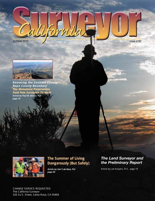
On <strong>The</strong> Cover:<br />
Kris Vonderscheer – Surveying at Sunset<br />
submitted by Mike Jones, PLS<br />
5
John Wilusz in Kathmandu, Nepal.<br />
Excellence in Journalism<br />
On April 25th the National Society <strong>of</strong> Pr<strong>of</strong>essional Surveyors (NSPS)<br />
presented the <strong>California</strong> Surveyor with the award “Excellence in<br />
Journalism – Best Printed Pr<strong>of</strong>essional Publication.” <strong>The</strong> news arrived as<br />
Issue #161 went to press so I didn’t get a chance to mention it in my editorial,<br />
but we ran a photograph <strong>of</strong> the award on page 43. If you missed it<br />
go back and have a look. Thanks again to our prize-winning team, starting<br />
with Crissy Willson, <strong>of</strong>fice manager extraordinaire. Thanks to Tony<br />
Monaco for graphic design that puts us miles ahead <strong>of</strong> the competition.<br />
And thanks to our contributing writers who continue to submit content<br />
that is educational, interesting, and relevant to pr<strong>of</strong>essional practice for<br />
<strong>California</strong>’s Surveyors.<br />
Kathmandu, Nepal<br />
April was an exciting<br />
month all the way<br />
around for me. I spent<br />
the first half <strong>of</strong> the<br />
month in England and<br />
the second half in<br />
Kathmandu, the capital<br />
city <strong>of</strong> Nepal.<br />
Nepal is sometimes<br />
called the top <strong>of</strong><br />
world because it is<br />
home to Mount<br />
Everest and the<br />
Himalayas. I had orig-<br />
<strong>The</strong> all-seeing eyes <strong>of</strong> the Buddha.<br />
inally planned to do<br />
some trekking in the<br />
mountains, but by the time I arrived in country I was already worn out<br />
from trekking the streets <strong>of</strong> London. On top <strong>of</strong> that, I was still recovering<br />
from the flu-like side effects <strong>of</strong> a typhoid vaccination. So I adjusted my<br />
sights and set out to explore the cultural geography <strong>of</strong> Nepal instead.<br />
According to Wikipedia Kathmandu’s population is about 950,000 and its<br />
elevation is 1,400 meters. It is situated in the Kathmandu Valley and surrounded<br />
by sister cities that, though they date back to antiquity, have in<br />
modern times merged into the greater metropolitan area. One such community<br />
is Swayambhu, also known as the Monkey Temple.<br />
Swayambhu<br />
<strong>The</strong> dominant religions in Nepal are Hinduism and Buddhism and<br />
they seem to coexist peacefully. In fact they are represented side by side<br />
in the religious iconography at Swayambhu, an extravagant temple com-<br />
6<br />
By: John P. Wilusz, PLS, PE - Editor<br />
John Wilusz, PLS, PE, works in the Delta Levees Program<br />
at the <strong>California</strong> Department <strong>of</strong> Water Resources in<br />
Sacramento, CA<br />
From the Editor<br />
Niraj Manandhar at Swayambhu Temple.<br />
plex on the west side <strong>of</strong> the city. Swayambhu is also called the Monkey<br />
Temple and sure enough there are monkeys roaming freely there. This<br />
took some getting used to. <strong>The</strong> last time I was that close to a monkey was<br />
at the zoo and there was a fence between us. According to the Lonely<br />
Planet the earliest confirmed activity on the site was in AD 460; it has<br />
been a spiritual center for a very long time. Legend has it that the<br />
Kathmandu Valley was once a lake and the hill now topped by the<br />
Monkey Temple rose spontaneously above the waters. From that event<br />
came the name Swayambhu, which means “self-arisen.” Geologists agree<br />
that the valley was formerly under water. Surveyors, I was about to discover,<br />
confirmed the part about the self-arising.<br />
While strolling through the plaza, enjoying the shrines and statutes<br />
and the incense in the air, I came upon a familiar sight: a yellow tripod<br />
with a GPS antenna on top. Surveyors at work! <strong>The</strong> funny thing is this: I<br />
was hoping to meet a surveyor on my trip but didn’t expect it would be so<br />
easy. Nor did I expect to find one at a temple. I walked over and introduced<br />
myself to the boss. Niraj Manandhar is a Chief Survey Officer with<br />
the Geodetic Survey Branch <strong>of</strong> the Government <strong>of</strong> Nepal, Ministry <strong>of</strong><br />
<strong>Land</strong> Management. He told me that he and his crews were making GPS<br />
observations as part <strong>of</strong> an on-going crustal dynamics study. It turns out<br />
that Nepal is still growing, and I mean that literally. <strong>The</strong> self-arising<br />
Swayambhu is still rising at the rate <strong>of</strong> about 2 cm per year. Even though<br />
he was busy at work, my new friend took the time to chat with me and<br />
answer my questions.<br />
Continued on next page<br />
www.californiasurveyors.org
Geodetic Survey Branch<br />
Niraj invited me to visit him at his <strong>of</strong>fice and I took him up on it. We<br />
met several days later on the campus <strong>of</strong> the Survey Department in downtown<br />
Kathmandu. I wanted to learn about surveying in Nepal. I thought<br />
others might like to know too so I kept notes. <strong>The</strong> Survey Department is<br />
part <strong>of</strong> the Ministry <strong>of</strong> <strong>Land</strong> Management. It includes geodetic, topographic,<br />
and cadastral branches. <strong>The</strong> Geodetic Survey Branch (GSB), the<br />
branch Niraj works in, is responsible for providing geodetic control for<br />
cadastral mapping and infrastructure development. It also performs deformation<br />
studies like the one at Swayambhu. It is planning more <strong>of</strong> the same<br />
throughout the country if it can find the resources. GSB surveyors hope<br />
to someday build a network <strong>of</strong> continuously operating reference stations<br />
across Nepal. <strong>The</strong> objective is to collect data and observe the rate <strong>of</strong><br />
change <strong>of</strong> ground movement. Nepal, like <strong>California</strong>, is seismically active.<br />
<strong>The</strong>se studies may ultimately help to predict earthquakes. Unlike<br />
<strong>California</strong>, Nepal is poor and lacks the resources to do the work. Besides<br />
funding they need training and equipment. In short, they need a benefactor<br />
in the international community who appreciates what this project<br />
could contribute to global science.<br />
Another ambitious project the GSB is working on is<br />
improving Nepal’s geoid model. In 2009 the government<br />
entered into an agreement with the Danish Technological<br />
University <strong>of</strong> Denmark to work jointly on a nationwide<br />
airborne gravity survey. <strong>The</strong>re have been many set<br />
backs along the way, not the least <strong>of</strong> which is getting<br />
permission to fly along the international boundaries<br />
with China (Tibet) and India. If all goes well they<br />
will begin the flights in 2010. Niraj hopes to use the<br />
project for his Ph.D. His education already includes<br />
a Master <strong>of</strong> Engineering from the School <strong>of</strong><br />
Geomatics Engineering, University <strong>of</strong> New South<br />
Wales, Australia. <strong>The</strong> topic <strong>of</strong> his master’s thesis is<br />
geoid studies for Nepal.<br />
Nepalese Journal on Geoinformatics<br />
<strong>The</strong> Survey Department publishes a journal - Nepalese Journal on<br />
Geoinformatics. It is written in English and the current issue contains<br />
interesting articles on topics you’ll recognize: geoid modeling, GIS,<br />
cadastral mapping, surveying education, and pr<strong>of</strong>essional licensing. One<br />
article recounts the proud history <strong>of</strong> our pr<strong>of</strong>ession, beginning with the<br />
code <strong>of</strong> Hammurabi and continuing through the surveying careers <strong>of</strong><br />
George Washington and Abraham Lincoln. Can you believe it? <strong>The</strong>y<br />
know about Washington and Lincoln in Nepal. We have more in common<br />
than I thought. If you think I’m making this up you can read it for yourself<br />
at the Survey Department’s website: http://www.dos.gov.np/nepalesejournal8.php.<br />
Institute <strong>of</strong> Chartered Surveyors<br />
I was surprised to learn that Nepal has no licensing requirements for<br />
land surveyors. However, that may soon change. In 2008 Niraj and others<br />
from the Survey Department formed the Institute <strong>of</strong> Chartered Surveyors.<br />
<strong>The</strong> Institute is a pr<strong>of</strong>essional association that advocates for land surveyors.<br />
Among other things, it promotes the idea that surveyors should be<br />
licensed and it proposes a definition <strong>of</strong> pr<strong>of</strong>essional practice. It is the definition<br />
<strong>of</strong> pr<strong>of</strong>essional practice that is creating some difficulties. <strong>The</strong><br />
membership would like to include land valuation as a regulated activity<br />
for surveyors. <strong>The</strong> problem is that land valuation currently belongs to the<br />
civil engineers and the engineers don’t want to give it up. Imagine that –<br />
a turf war between land surveyors and civil engineers. Membership in the<br />
Institute is voluntary, but the requirements to become a chartered member<br />
are rigorous. One must have 10 years <strong>of</strong> qualifying experience, be a<br />
<strong>Summer</strong> 2010<br />
Continued from previous page<br />
graduate <strong>of</strong> a surveying curriculum (or equivalent), and pass an examination.<br />
<strong>The</strong>se are also the requirements the Institute is recommending for<br />
licensure as well, when that day comes. Today there are only 27 chartered<br />
surveyors in Nepal and Niraj Manandhar is one <strong>of</strong> them.<br />
Before I left he asked if we have a similar pr<strong>of</strong>essional association in<br />
<strong>California</strong>. I assured him we do. “<strong>The</strong> Institute <strong>of</strong> Chartered Surveyors is<br />
very new,” he said, “and we would like to build relationships with similar<br />
institutions in the international community. We would be happy to share<br />
information with CLSA, about our activities and projects, and maybe we<br />
could cooperate in one way or another in the future.”<br />
One <strong>of</strong> the great pleasures <strong>of</strong> traveling is meeting people from different<br />
cultures and finding common ground. Beautiful views are nice too,<br />
and it would have been great to see the Himalayas, if only from a distance<br />
(heavy smog squashed my plans for that). <strong>But</strong> sometimes peak experiences<br />
have nothing to do mountains. If you’re a traveler too you know<br />
exactly what I mean. <br />
You can read my interview with Niraj Manandhar at<br />
http://www.amerisurv.com/content/view/7575/1/<br />
Hindu temple in Bhaktapur, Kathmandu Valley.<br />
Flowers used for devotional purposes.<br />
7
President’s Message<br />
Our pr<strong>of</strong>ession has been evolving for hundreds <strong>of</strong> years, and the technology<br />
and tools we use today have taken on the look <strong>of</strong> an exponential<br />
curve. Surveyors in our legacy, 300-years ago, were using the<br />
compass and chain. Two hundred years later we were using a transit to<br />
measure our angles and still a chain for our distances. <strong>The</strong>n for the next<br />
forty years we migrated to a theodolite and electronic distance measurer.<br />
That’s when technology really started to take <strong>of</strong>f and we moved into total<br />
stations and now we have GPS that can measure tolerances down to less<br />
than an inch, and LiDAR that can get incredible results….What’s Next?<br />
<strong>The</strong>se remarks aren’t intended to be accurate, in which we have migrated<br />
with our technology, but remind us that we are evolving more and more<br />
rapidly with our technology.<br />
We have the capabilities <strong>of</strong> generating millions <strong>of</strong> bites <strong>of</strong> data for a<br />
project; we can measure tolerances to hundredths and report facts that<br />
were probably far reaching from just 30 years ago. We have grown from<br />
5-person crews schlepping equipment through the mountains, to a 1-person<br />
crew with a 4-wheel drive truck, and an ATV equipped with a GPS<br />
receiver, attached to it, loaded in the back <strong>of</strong> the truck. We’re making<br />
measurements in a day, when it used to take a week or longer, and the<br />
accuracy, precision and redundancy is unbelievable.<br />
With all this technology, and the capabilities to measure and sort<br />
data, let’s not lose sight <strong>of</strong> the need to service our clients and protect the<br />
public. All <strong>of</strong> these scenarios and pieces <strong>of</strong> equipment I just mentioned<br />
are nothing more than a new tool in our toolbox. In our daily activities we<br />
must remain cognizant <strong>of</strong> the fact that we are Pr<strong>of</strong>essionals, and we<br />
should go about our work each and every day remembering that. We have<br />
a duty to our client and our employers, whether you work in the private<br />
industry or the public. Whether you are working on acquisitions for a new<br />
roadway, a section breakdown for a rancher, or a development in town,<br />
keep in mind that we play a critical role in how our communities are<br />
shaped. We need to plan for the future and leave a legacy that our children<br />
and grandchildren can be proud <strong>of</strong>, not a community in turmoil.<br />
<strong>The</strong> public has a right to rely on our work and the results <strong>of</strong> our survey,<br />
so make sure you perform the necessary checks and balances, and be<br />
aware that the general pubic, for the most part, does not know or understand<br />
what we do. Take time to educate your clients, and the public while<br />
performing the survey. If you survey a fence that is not on the title line,<br />
discuss it with the client and neighbor(s), just don’t map it and walk away,<br />
leaving the problem in the hands <strong>of</strong> those who are unsure what to do next.<br />
8<br />
By: Aaron R. Smith, PLS - President<br />
While collecting the topographic measurements for a new highway,<br />
bridge, or other improvement, understand the end result so you can be <strong>of</strong><br />
greatest value to the team. Provide input and suggestions on alternative<br />
solutions, be the eyes and ears on the ground for the project engineer, or<br />
the lead consultant. Remember, our survey is the base foundation and the<br />
success <strong>of</strong> the project is dependant on your survey.<br />
Together we can build a pr<strong>of</strong>ession that is bigger and stronger, and<br />
gain the respect <strong>of</strong> those who are unaware <strong>of</strong> what we provide to our communities.<br />
We should choose to be problem solvers for our clients and<br />
project leaders and give them the knowledge and feedback needed to<br />
make the right decisions, so let’s do so.<br />
I give you my thoughts because in today’s tough economic climate,<br />
decision-makers are looking for those who can provide value and be a<br />
benefit to the project. No one wants to hear the news <strong>of</strong> a problem,<br />
whether it is a vertical issue on the construction <strong>of</strong> Highway 101, a<br />
boundary problem from poorly written deeds, or new regulations that<br />
might put a halt on the development. However, those are all real issues we<br />
face each day with each project, but the true pr<strong>of</strong>essional will come to the<br />
table with solutions and ideas to keep the project on track. Let’s try to<br />
keep an open mind and think outside the box, you never know what you<br />
might stumble across. No one can ever know everything, but collectively<br />
we can combine our skills and expertise and solve just about anything. Try<br />
and keep an open mind and listen, you never know what you might learn.<br />
As I leave you with this message, remember that your toolbox can be<br />
filled with some <strong>of</strong> the newest and coolest tools, but if you forget the one<br />
tool that can solve the problems and save your client and their dreams,<br />
your tools may be for not. As you learn how to solve problems, take the<br />
time to pass that knowledge on and educate someone else, and in the<br />
meantime, don’t be afraid to ask for help. <strong>The</strong> mind is a wonderful thing,<br />
keep exercising it, and don’t be afraid to use it, especially when you’ve<br />
been invited to the table. <br />
www.californiasurveyors.org
Letters<br />
to the Editor<br />
Dear John,<br />
As usual - another great issue <strong>of</strong> the <strong>California</strong><br />
Surveyor, save, that damned Danskin article! And<br />
your cover shot looks like a pro, John!<br />
Rick Marshall <strong>of</strong> the County Surveyor’s Office was<br />
kind enough to write ‘n correct me . . . that Napa<br />
County is processing Certificates <strong>of</strong> Compliance.<br />
We had a nice telephone chat and Rick set me<br />
straight. So . . . my apologies for misinforming my<br />
surveyor cousins about Napa County Certificates <strong>of</strong><br />
Compliance. <strong>The</strong>y’re ready willing and able to<br />
process ‘em.<br />
Take care ‘n keep up the good work!<br />
Respectfully yours,<br />
Phil Danskin<br />
<strong>Summer</strong> 2010<br />
Do you have a picture <strong>of</strong> a “junior surveyor” in your<br />
family that you would like to share? Send it in and<br />
we will put it in the Kids Korner.<br />
Kids<br />
Korner<br />
Kate Klima <strong>of</strong> Klima <strong>Land</strong> Surveys doesn't need<br />
a blankie or a pacifier ... just the Cal Surveyor.<br />
Submitted by her dad, Kris Klima, PLS.<br />
9
What is the purpose <strong>of</strong> the Preliminary Report as it relates to the<br />
boundary <strong>of</strong> a parcel?<br />
Do the Pr<strong>of</strong>essional <strong>Land</strong> Surveyor and the title company share a<br />
common purpose?<br />
Is the Preliminary Report’s legal description a trustworthy resource<br />
upon which a land surveyor should place the reliability <strong>of</strong> a boundary<br />
determination?<br />
THE PRELIMINARY REPORT<br />
<strong>The</strong> Preliminary Report, sometimes referred to as a<br />
Preliminary Title Report or “PR”, is part <strong>of</strong> an insurance product.<br />
<strong>The</strong> Preliminary Report expresses what the title company will<br />
insure: that a parcel is marketable; that the title has continuous<br />
evidence <strong>of</strong> ownership; and that the property is free from defects,<br />
liens, claims, encumbrances and exclusions to the title insurance<br />
except as to those items that are listed as exceptions. <strong>The</strong> title<br />
insurance policy will guarantee the ownership and marketability <strong>of</strong><br />
the parcel as described as <strong>of</strong> the effective date. After the<br />
Preliminary Report is examined by all parties, and after possible<br />
further negotiations, an insurance policy is prepared, a premium<br />
paid, and the policy issued. If defects <strong>of</strong> title are subsequently discovered<br />
that are not shown as <strong>of</strong> the policy date, the title company<br />
will pay all costs within the terms <strong>of</strong> the title insurance policy.<br />
For the purposes <strong>of</strong> this article we will focus on the legal<br />
description in the Preliminary Report. <strong>The</strong> legal description is<br />
based on a chain <strong>of</strong> title which is a written history <strong>of</strong> the public<br />
records documenting conveyances from the original vesting grant<br />
or patent. Based on the chain <strong>of</strong> title, the title company will define<br />
the boundary <strong>of</strong> the parcel in the legal description. <strong>The</strong> title company<br />
will list those rights <strong>of</strong> others and encumbrances within the<br />
defined limits <strong>of</strong> the parcel that it wishes to exclude from insurance<br />
coverage. Additionally, the title company may list some <strong>of</strong> the rights<br />
in favor <strong>of</strong> the parcel to be insured within the property <strong>of</strong> others.<br />
ENTER THE LAND SURVEYOR<br />
One way for a title company to limit risk <strong>of</strong> non-public or unrecorded<br />
rights is to include an ALTA/ACSM field survey as a basis <strong>of</strong> the<br />
policy. A field survey may show evidence <strong>of</strong> the rights <strong>of</strong> others<br />
not noted in the public record. <strong>The</strong> title company then identifies<br />
those risks and notes them in the Preliminary Report. When a survey<br />
is not made, the Preliminary Report will reflect the survey<br />
exclusion. Without a survey, the location <strong>of</strong> the boundary will not<br />
be guaranteed. With a survey the boundary will be guaranteed<br />
only according to the terms <strong>of</strong> the insurance policy.<br />
Yet, the question remains: Does it matter to the Pr<strong>of</strong>essional<br />
<strong>Land</strong> Surveyor if the boundary as described in the legal description<br />
is guaranteed by the title company?<br />
10<br />
By: Joe Kooyers, PLS<br />
<strong>The</strong> <strong>Land</strong> Surveyor and<br />
the Preliminary Report<br />
Joe Kooyers, PLS, is a 23-year consultant to <strong>California</strong> counties and cities for boundary<br />
determination and mapping standards, and he is a participating Subject Matter Expert<br />
with BPELS and NCEES. He wishes to thank Tom Votel, Senior Title Officer with Chicago<br />
Title Co. and Vince Sincek , Attorney, PLS, RCE with Epsten, Grinnell & Howell for their<br />
contributions to the article. All work in San Diego County.<br />
RESEARCH AND PRIMARY EVIDENCE<br />
<strong>The</strong> land surveyor also begins with document research. As<br />
provided in the <strong>California</strong> Board <strong>of</strong> Pr<strong>of</strong>essional Engineers and<br />
<strong>Land</strong> Surveyors, (“BPELS” or the “Board”) Rule No. 425(e)(8),<br />
qualifying training for the prospective land surveyor may include<br />
the research <strong>of</strong> public and private records to obtain survey and<br />
title data. <strong>The</strong> research and the analysis <strong>of</strong> the written documents,<br />
vesting deeds <strong>of</strong> the client and the descriptions <strong>of</strong> the adjoining<br />
properties can reveal sequential conveyances, senior rights, and<br />
gaps and overlaps.<br />
<strong>The</strong> land surveyor generally reviews the same documents as<br />
the title company and looks for evidence <strong>of</strong> title, the property location,<br />
the shape <strong>of</strong> the parcel, and evidence <strong>of</strong> monumentation. <strong>The</strong><br />
continuity <strong>of</strong> the wording <strong>of</strong> the legal descriptions is important for<br />
the land surveyor to research since changes <strong>of</strong> meaning or calls<br />
may be introduced in subsequent deeds. <strong>The</strong> quality and completeness<br />
<strong>of</strong> the land surveyor’s research will directly affect the<br />
quality and correctness <strong>of</strong> the decisions made in the boundary<br />
determination process.<br />
THE CAVEAT<br />
Although the title company may have done extensive<br />
research to determine continuity <strong>of</strong> title and may have prepared a<br />
Preliminary Report with a legal description for the insurance policy,<br />
any use <strong>of</strong> that legal description by the land surveyor would be<br />
the use <strong>of</strong> secondary evidence. <strong>The</strong> Preliminary Report legal<br />
description is very useful and helpful. In many instances the<br />
Preliminary Report legal description notes all the relevant vesting<br />
deeds and exceptions. <strong>The</strong> Preliminary Report and legal description<br />
are supported with copies <strong>of</strong> the original documents. <strong>But</strong>, to<br />
accept the Preliminary Report legal description at face value is to<br />
accept expertise <strong>of</strong> uncertain diligence or knowledge. <strong>The</strong><br />
Preliminary Report legal description is an aid to understanding but<br />
should not be regarded as infallible.<br />
THE SIGNIFICANT DIFFERENCE<br />
<strong>The</strong> qualifying training provided in the Board Rule 425(e)(9)<br />
also may include the prospective land surveyor performing<br />
boundary analysis and determination using record descriptions,<br />
survey and title data. Regarding the report that follows research, it<br />
will be noted that the title company follows its research with a<br />
Preliminary Report, while the land surveyor follows the research<br />
with a map. <strong>The</strong> land surveyor follows research and boundary<br />
determination with a visual report, a map. Subdivision Map Act,<br />
section 66441 states that the land surveyor, or the civil engineer<br />
who is authorized to practice land surveying, is responsible for the<br />
survey and the preparation <strong>of</strong> the final map. <strong>The</strong> map will reflect<br />
the thoroughness <strong>of</strong> the research and the quality <strong>of</strong> the informed<br />
Continued Continued on on next next page page<br />
www.californiasurveyors.org
Continued from previous page<br />
decision-making for the boundary determination. As noted in the<br />
National Society <strong>of</strong> Pr<strong>of</strong>essional Surveyors, Model Standards for<br />
Property Surveys, Section 5(h), the map should include….”sufficient<br />
data to indicate the theory <strong>of</strong> location applied in formulating<br />
the opinions as to the probable location <strong>of</strong> the boundaries and<br />
corners <strong>of</strong> the property. “<br />
PROFESSIONAL STANDARD OF CARE<br />
<strong>The</strong> land surveyor locates the boundary according to written<br />
documents. <strong>The</strong> legality <strong>of</strong> the documents is determined by attorneys,<br />
including those <strong>of</strong> the title company, and ultimately by the<br />
courts. <strong>The</strong> land surveyor does not guarantee the location, but<br />
rather the land surveyor is held to a pr<strong>of</strong>essional standard <strong>of</strong> care.<br />
Referencing the Pr<strong>of</strong>essional Code <strong>of</strong> Conduct as stated in the<br />
Board Rule No. 476 (c.)(7) a land surveyor shall only express pr<strong>of</strong>essional<br />
opinions that have a basis in fact or experience or<br />
accepted land surveying principles. <strong>Land</strong> surveyors are required<br />
to use the same care that is ordinarily exercised in like cases by<br />
competent, knowledgeable land surveyors and consistent with<br />
the Board Rule No. 476.<br />
Local support and pr<strong>of</strong>essional advice can be found through<br />
in the <strong>California</strong> <strong>Land</strong> Surveyors Association (“CLSA”)<br />
Pr<strong>of</strong>essional Practices Committees. <strong>The</strong> CLSA San Diego Chapter<br />
bylaws state that its Joint Pr<strong>of</strong>essional Practices Committee has<br />
been formed, in part, to ”encourage a high ethical standard <strong>of</strong><br />
practice in the land surveying pr<strong>of</strong>ession [and to] encourage com-<br />
<strong>Summer</strong> 2010<br />
pliance with the PLSA and other applicable laws.” For instance,<br />
the committee can provide an open, local forum to test whether<br />
one’s interpretation <strong>of</strong> a grant deed is based on solid evidence or<br />
whether it is tainted by advocacy for the client.<br />
CONCLUSION – THE NECESSITY OF PRIMARY EVIDENCE<br />
<strong>Land</strong> surveyors construe documents for original intent. Primary<br />
evidence takes precedence over secondary evidence. To the land<br />
surveyor, the original vesting deed and resultant chain <strong>of</strong> title take<br />
precedence over the summary report <strong>of</strong> the title company. In a highly<br />
technical pr<strong>of</strong>ession which advances on the remarkable ingenuity<br />
applied to earth science, geometry and spatial recognition, the<br />
pr<strong>of</strong>ession is sometimes hesitant in assigning importance to those<br />
land surveyor functions which can be performed by candlelight.<br />
Diligent research, the accumulation <strong>of</strong> boundary determination<br />
knowledge and the application <strong>of</strong> accepted principles are ready and<br />
timeless tools to be used and respected. <br />
Further Reading:<br />
Robillard, Wilson and Brown, Evidence and Procedures for<br />
Boundary Location, Fifth Edition, Wiley & Sons, 2006 Chapter 14;<br />
Williams, Mitchell G., editor, <strong>Land</strong> Surveys, A Guide for Lawyers<br />
and Other Pr<strong>of</strong>essionals, Second Edition, ABA Publishing, 1999,<br />
Chapters 13, 14, 17, and 18; Woolley, David E., “<strong>The</strong> Pr<strong>of</strong>essional<br />
Practices Committee Surveyor’s Friend or Foe?” <strong>California</strong><br />
Surveyor, <strong>Summer</strong>, 2009, Issue 159<br />
11
During the last week in April the NSPS, ACSM and the other member<br />
organizationsi (MOs) <strong>of</strong> the ACSM met at the Phoenix<br />
Convention Center in down town Phoenix, Arizona. It is not possible<br />
to attend every meeting that goes on at the annual ACSM / NSPS conference.<br />
I think however that if you consider this report in conjunction<br />
with that <strong>of</strong> your governor, a fairly complete picture can be stitched<br />
together. Over the course <strong>of</strong> five days, the <strong>of</strong>ficers, directors, governors<br />
and committee people that run the NSPS and ACSM have dozens<br />
<strong>of</strong> different meetings completely separate from the workshops and<br />
seminars that typically draw surveyors and vendors from across the<br />
nation. (Sad to say it is not generally feasible to take in any <strong>of</strong> these<br />
great classes and workshops while serving as a director or governor.)<br />
<strong>The</strong> NSPS holds meetings <strong>of</strong> most <strong>of</strong> its committees including:<br />
Membership, Public Relations, Mines and Minerals, Standards,<br />
Private Practice, Youth Outreach, Education, TrigStar, the Certified<br />
Survey Technician and the Hydrographer Certification Boards. <strong>The</strong><br />
governors also caucus semi-formally in their respective geographic<br />
areas, so the western governors meet in the Western State Governors’<br />
Council, the southern governors meet in the Area 3-4 Governors’<br />
meeting and the rest meet in the Great Lakes Council <strong>of</strong> Governors.<br />
Alongside the NSPS meetings, the ACSM holds meetings <strong>of</strong> the Joint<br />
Government Affairs committee, the ALTA committee, the FIG<br />
Delegation, the Awards committee, the Publications committee and a<br />
few others. <strong>The</strong>re are also a day-long NSPS Board <strong>of</strong> Governors<br />
(BOG) meeting, a day-long Board <strong>of</strong> Directors meeting and a finalday<br />
meeting <strong>of</strong> the ACSM congress.<br />
I said all that to give a flavor <strong>of</strong> what goes on at one <strong>of</strong> these<br />
soirees, and also as a way to reinforce something that I have mentioned<br />
before: the NSPS does a lot <strong>of</strong> heavy lifting on items that affect<br />
every US surveyor, whether they are a member or not. This is not particularly<br />
well publicized but true nonetheless. As noted above, no one<br />
can possibly take in all these meetings so you try to attend the ones <strong>of</strong><br />
obvious importance and stick your head in the door <strong>of</strong> as many as you<br />
can after that. I apologize in advance for the length <strong>of</strong> this report.<br />
Several items <strong>of</strong> significance came up during the course <strong>of</strong> the conference<br />
and I will do my best to explain them to you. If after reading<br />
this you still have questions or need further information on anything I<br />
touched upon, feel free to contact me – my email address is alidade.nv@sbcglobal.net.<br />
Membership Committee / Public Relations Committee<br />
<strong>The</strong> NSPS faces declining membership this year. This is not surprising<br />
given the fragile state <strong>of</strong> the economy. <strong>The</strong> number is still<br />
robust and we still have national credibility and a strong voice when<br />
meeting with federal agencies, Congress and other pr<strong>of</strong>essional<br />
organizations. <strong>But</strong> we could do better. <strong>The</strong> membership has been<br />
declining for the last couple <strong>of</strong> years. Thus the Membership / Public<br />
Relations meeting spent several hours discussing various strategies to<br />
increase membership. Finding a way to foster closer relations with the<br />
state societies and developing the kind <strong>of</strong> benefits that would allow us<br />
to entice and capture their members seems to be one strategy that we<br />
12<br />
By: Carl C. de Baca, PLS<br />
Carl C.de Baca is the owner <strong>of</strong> Alidade, Inc., Elko, Nevada.<br />
He is a past editor <strong>of</strong> the <strong>California</strong> Surveyor, and is the<br />
current NSPS Area 9 Director.<br />
National Society <strong>of</strong> Pr<strong>of</strong>essional Surveyors<br />
Area 9 Director’s Report<br />
would all like to explore. <strong>The</strong> relationship between NSPS and ACSM<br />
was also discussed at length and this topic is <strong>of</strong> such significance that<br />
I will discuss it at length later in this report.<br />
Western States Governors’ Council<br />
<strong>The</strong> WSGC, chaired by the Washington governor, Bill Glassey, is<br />
relatively new. It only became a formal group five years ago and was<br />
chaired first by Chuck Paddack <strong>of</strong> Arizona and then Matt Vernon <strong>of</strong><br />
<strong>California</strong>. This is a good group and a great place to sound out ideas<br />
and thoughts before taking them on to the Board <strong>of</strong> Governors meeting.<br />
It is important to discuss what’s going on in your state with the<br />
other states around you to see if they have similar issues and perhaps<br />
solutions you may not have considered. As with all <strong>of</strong> the meetings,<br />
this one is open to anyone and we had as many guests as members <strong>of</strong><br />
the council. At this meeting we talked about each state’s economic<br />
condition, got an update on the Railroad Documentation legislation<br />
and discussed the NSPS / ACSM identity issue. Vernon discussed<br />
CLSA’s Safety Tailgate manual, its development and it was suggested<br />
that he introduce it at the Board <strong>of</strong> Governors meeting.<br />
Mines and Minerals Committee<br />
Area 9 has some mining going on – maybe not much in Hawaii<br />
but a little in <strong>California</strong> and a whole bunch in Nevada. (Did I mention<br />
that northern Nevada is the third largest gold producing region in the<br />
world?) This is a committee in which I have a personal interest and<br />
which has vexed me for some time with its apparent lack <strong>of</strong> motivation.<br />
To be fair, it has been a committee <strong>of</strong> two for quite a while and<br />
has received no interest or input from NSPS. Its mission has withered<br />
to the point where it serves only as a liaison to the international mine<br />
surveying community. I hope to inject new life into the committee and<br />
at this meeting we discussed producing materials and workshops <strong>of</strong><br />
interest to US mine surveyors as well as finding a way to track down<br />
these folks and persuade them to join NSPS and participate.<br />
Student Competition<br />
Every year NSPS hosts a student competition. Teams <strong>of</strong> surveying<br />
students from various universities compete in a format that requires a<br />
paper, a poster and a field competition. This year the topic was forensic<br />
surveying and the field competition was a one-hour presentation to an<br />
audience and a panel <strong>of</strong> judges, <strong>of</strong> which I was one. Seven schools competed<br />
this year and I congratulate each one for their outstanding efforts.<br />
However, I continue to be puzzled why no schools from Area 9 competed<br />
– there are at least three with baccalaureate degrees in surveying.<br />
Where are you guys? Are you chicken?<br />
Big Issue No. 1<br />
NSPS faces many issues right now, but none as critical as that <strong>of</strong><br />
identity. Last year we voted to have the ACSM commission a marketing<br />
firm to study the ACSM and the member organizations. <strong>The</strong><br />
report delivered a message that a few people had been thinking for<br />
quite a while. <strong>The</strong> structure <strong>of</strong> the ACSM as an umbrella, under which<br />
Continued on next page<br />
www.californiasurveyors.org
Continued from previous page<br />
the MO’s such as NSPS reside, is confusing, misleading and inefficient.<br />
We suffer from an identity crisis. Take Lobby Day for example:<br />
<strong>The</strong> event is organized and managed by the Joint Government Affairs<br />
committee, an ACSM committee that is chaired by an NSPS member.<br />
Thus ACSM schedules appointments and provides information to<br />
Congress, while NSPS members actually attend the appointments – confusing<br />
indeed. Apparently many people even within the geospatial community<br />
are unsure <strong>of</strong> who does what with respect to NSPS and ACSM.<br />
<strong>The</strong> marketing report suggests that we should reorganize so that<br />
there is only one national society. <strong>The</strong> member organizations should<br />
be working groups within the single organization, such as the hydrographers<br />
group within the NSPS. Too, there are layers <strong>of</strong> overhead, if<br />
you will, that can be eliminated in such a restructuring. At the present<br />
time, NSPS members make up some 85 percent <strong>of</strong> the total ACSM<br />
membership. Dues to run ACSM are assessed to the MOs proportionately<br />
based on membership so we provide 85 percent <strong>of</strong> the funding<br />
for ACSM. Yet the congress is made up <strong>of</strong> 2 delegates from each MO<br />
so at the present time we have 2 out <strong>of</strong> 8 delegates or 25 percent <strong>of</strong><br />
the vote. We pay for bank accounts and audits for NSPS and 85 percent<br />
<strong>of</strong> the cost for bank accounts and audits for ACSM, etc. Some<br />
costs could be eliminated with the suggested restructuring. CaGIS,<br />
one <strong>of</strong> the four MOs, voted to withdraw last year and at the end <strong>of</strong> this<br />
year they are out. <strong>The</strong> proportionate costs to fund ACSM from NSPS<br />
will rise accordingly. At that time we will be paying 93 percent <strong>of</strong><br />
ACSM funding and will have 33 percent <strong>of</strong> the vote at the congress.<br />
<strong>Summer</strong> 2010<br />
<strong>The</strong> NSPS core <strong>of</strong>ficers group mulled this report over during the<br />
last few months and came to the conclusion that we should follow the<br />
suggestion <strong>of</strong> the report. <strong>The</strong> most expedient way to accomplish this<br />
is for NSPS to withdraw from ACSM and become a stand-alone<br />
organization at long last. An obvious and unfortunate side effect <strong>of</strong><br />
this would be the death <strong>of</strong> ACSM, since its funding source would be<br />
gone. We could <strong>of</strong>fer to take the other two remaining MOs on as<br />
working groups within NSPS and we could absorb the central <strong>of</strong>fice<br />
too. This would make for a leaner and less confusing organization. A<br />
motion to withdraw from ACSM and use the two-year withdrawal<br />
period to study how best to restructure was subsequently developed<br />
and brought forward at the BOG meeting.<br />
Big Issue No. 2<br />
As previously discussed, our membership is declining. <strong>The</strong> economic<br />
times have conspired to make many surveyors choose between<br />
their state society membership and their NSPS membership. With the<br />
headaches that face surveyors today, membership and participation in<br />
our organization is more important than ever, yet fewer surveyors see<br />
it that way every year.<br />
<strong>The</strong> aforementioned marketing study also suggested that the<br />
national society should be unified as possible with the state societies.<br />
<strong>The</strong>re are approximately 60,000 pr<strong>of</strong>essional surveyors in the U.S.<br />
<strong>The</strong> state societies combined have about 35,000 members. If we could<br />
capture that membership then our clout with federal agencies, other<br />
Continued on next page<br />
13
Continued from previous page<br />
pr<strong>of</strong>essional organizations and Congress would increase significantly.<br />
<strong>The</strong> problem lies in that the state societies are independent, well run<br />
and as concerned about maintaining their membership as we are about<br />
ours. <strong>The</strong> bigger states <strong>of</strong>fer benefits that are the equal <strong>of</strong> the ones that<br />
NSPS <strong>of</strong>fers and the smaller ones are concerned that our dues are too<br />
high. If we suggested a combined dues structure that allowed members<br />
<strong>of</strong> one to be members <strong>of</strong> both, the fear is that the cost would price<br />
some people out <strong>of</strong> joining or rejoining. Newly installed NSPS president<br />
Wayne Harrison created an ad hoc committee comprised <strong>of</strong> 4<br />
area directors, including myself, plus the state executives from 3 state<br />
societies to explore what we could do to develop closer relations and<br />
hopefully share membership. Everything is on the table, dues included.<br />
Board <strong>of</strong> Governors (BOG) Meeting<br />
This meeting was dominated by the withdrawal issue. <strong>The</strong> motion<br />
to withdraw was made and passed on a very close vote, 26 to 21 with<br />
2 abstentions. <strong>The</strong> reason for the close vote had more to do with the<br />
method <strong>of</strong> delivery rather than the message itself. This suggestion to<br />
withdraw was delivered to the ears <strong>of</strong> the directors and governors alike<br />
in the first day’s meetings. It was the first time many <strong>of</strong> them had<br />
heard it. <strong>The</strong> typical reaction was strong and negative at first, but as<br />
the idea had a chance to sink in, opposition generally faded.<br />
Unfortunately for all involved, the well was poisoned to a certain<br />
degree by introducing the concept to the governors at large while at<br />
the same time coordinating with one governor to bring forth the<br />
motion to withdraw. This gave many <strong>of</strong> the governors the impression<br />
<strong>of</strong> a conspiracy.<br />
Matt Vernon, the <strong>California</strong> governor, reacting to the fact that a<br />
motion was made without the governors really having a chance to<br />
think about it and without giving the state time to consider the proposal,<br />
made a competing motion to postpone withdrawing until the<br />
fall meeting to give the states a chance to study the idea. In a painful<br />
example <strong>of</strong> the way that parliamentary procedure can be manipulated<br />
to produce something quite different from the original motion, an<br />
amendment was suggested, debated and subsequently passed that<br />
added language to Vernon’s motion calling for the withdrawal while<br />
the state study the issue concurrently. This modified motion passed 36<br />
to 5 with 5 abstentions (somebody left the room after the 1st motion),<br />
giving the directors something to chew on the next day: two similar<br />
motions pointing out the need for debate at the Board <strong>of</strong> Directors<br />
meeting.<br />
On a more pleasant note, the ad hoc governors committee on<br />
Machine Guidance was reconstituted with a new chair and they are<br />
still charged with developing an NSPS position on the surveyor’s role<br />
in the machine guidance process. This will doubtless lead to discussion<br />
with engineers and contractors groups and, hopefully, vendors<br />
with the goal <strong>of</strong> carving out a position that all can agree on.<br />
Board <strong>of</strong> Directors Meeting<br />
As with the governors meeting the previous day, this too was<br />
dominated by the withdrawal issue. <strong>The</strong> audience included a large<br />
number <strong>of</strong> governors sticking around another day to see how their will<br />
would be interpreted. <strong>The</strong> BOG’s first motion was considered, including<br />
the uncomfortably close vote that passed it. This motion was recognized<br />
as being inferior to their second motion in terms <strong>of</strong> wording<br />
and it was summarily voted down. <strong>The</strong> second motion, being the modified<br />
Vernon motion was lengthily debated and passed 11 to 5. We<br />
have two years to work out the details on withdrawal and on the new<br />
14<br />
Area 9 Director’s Report<br />
structure and this is critical: if at any time the circumstances change<br />
or if a workable restructure eludes us we can terminate the withdrawal<br />
and remain as we are.<br />
Other Important Issues<br />
<strong>The</strong> Railroad Monumentation committee is still trying to get legislation<br />
introduced. <strong>The</strong> reception in Congress is encouraging and it is<br />
a matter <strong>of</strong> timing more than anything else.<br />
• <strong>The</strong> legislative earmark for TrigStar was rejected. TrigStar is<br />
<strong>of</strong> course sufficiently funded currently. <strong>The</strong> hope was to secure<br />
funding for an aggressive expansion. Congress’s taste for ear<br />
marks has markedly declined in the last couple years. We will<br />
keep trying.<br />
• <strong>The</strong> Board <strong>of</strong> Directors voted to grant up to $20,000 toward<br />
creation <strong>of</strong> a monument that tells the correct story <strong>of</strong> the<br />
establishment <strong>of</strong> the ‘Four Corners’ monument common to<br />
Utah, Colorado, Arizona and New Mexico. This is greeted<br />
warmly by the Navajo upon whose land the four corners<br />
monument lies and who are getting tired <strong>of</strong> debunking the<br />
recently reported myth that the original corner was set in<br />
correctly and is <strong>of</strong>f by 2.5 miles. This is a good public<br />
relations move for the surveying pr<strong>of</strong>ession.<br />
• NSPS has completed a Crisis Management Manual and it will<br />
soon be available to the members.<br />
• <strong>The</strong> ALTA committee is working toward another periodic<br />
update <strong>of</strong> the ACSM / ALTA standards<br />
• Lobby Day will be handled at congressional home <strong>of</strong>fices in<br />
the states in August this year in a partnership between NSPS<br />
and the state societies. This could be the biggest one ever!<br />
• <strong>The</strong> Governors and Directors voted to invite the Cayman<br />
Islands surveyors’ organization to join NSPS.<br />
• This year’s fall meeting is in Orlando in conjunction with the<br />
ASPRS and AutoCarto conferences.<br />
• Next year’s conference will be in San Diego in July in<br />
conjunction with ESRI’s Survey Summit.<br />
- Respectfully submitted for consideration by all in Area 9.<br />
i <strong>The</strong> four member organizations <strong>of</strong> the ACSM are the NSPS, the American Association<br />
<strong>of</strong> Geodetic Surveying (AAGS), the Cartography and Geographic Information Society<br />
(CaGIS), and the Geographic and <strong>Land</strong> information Society (GLIS).<br />
www.californiasurveyors.org
As time goes on evidence <strong>of</strong> historic surveyed lines can become clouded,<br />
lost, obliterated, destroyed. That is a fact with which the survey<br />
community is intimately familiar, whether we work in the public or private<br />
sectors. In Sonoma and Napa counties one such line is the common<br />
boundary between them. Those <strong>of</strong> us in the private sector have long<br />
known that surveying boundaries adjacent to the county line can be difficult<br />
and expensive due to the lack <strong>of</strong> sufficient evidence. Original monumentation<br />
dates back to 1877 and was sparsely set, generally a mile apart,<br />
in <strong>of</strong>ten fairly rugged terrain.<br />
16<br />
By: Paul M. Brown, PLS<br />
Licensed in 1982, Paul M. Brown founded Adobe Associates, Inc., a <strong>Land</strong> Surveying/Civil<br />
Engineering company in Santa Rosa, CA. When not surveying you will usually find him serving<br />
as a per diem Hospice Chaplain, tracking down family genealogy, or digging into local history<br />
and trying to piece together one story or another.<br />
Retracing the Sonoma County – Napa<br />
County Boundary<br />
TThhee MMoonnuummeenntt PPrreesseerrvvaattiioonn FFuunndd PPuuttss<br />
SSuurrvveeyyoorrss TToo WWoorrkk<br />
J.T. KINGSBURY 1877 HISTORIC LINE RE-TRACEMENT<br />
From copies <strong>of</strong> the field notes for this line, on file in the <strong>of</strong>fice <strong>of</strong> the<br />
Sonoma County Recorder and the State <strong>Land</strong>s Commission, we know, J.<br />
T. Kingsbury, Deputy Surveyor under direction <strong>of</strong> the <strong>California</strong> State<br />
Surveyor General, William Minis, began his survey <strong>of</strong> the Sonoma/Napa<br />
<strong>The</strong> beginning <strong>of</strong> the line on Mount St. Helena.<br />
county line at the summit <strong>of</strong> Mount St. Helena and set iron stakes 3 feet<br />
long, 3 inches wide and 3/4 inches thick, with an “S” cut with a cold chisel<br />
on one side and an “N” on the other side. Where available he also<br />
blazed trees with three notches cut across the blaze. 52 iron stakes were<br />
set along the 52 miles <strong>of</strong> his survey, generally one per mile. His beginning<br />
Continued on next page<br />
www.californiasurveyors.org
iron stake was set at the summit <strong>of</strong> the mountain, 107 feet southeast <strong>of</strong> the<br />
US Coast Survey Signal Station set the previous year (1876) as a fine drill<br />
hole and cross, cut on top <strong>of</strong> a 1/2 inch copper bolt cemented in bedrock<br />
and projecting 1/4 inch. This station was last recovered in 2003, as<br />
described, and is designated as National Geodetic Survey PID (point identification<br />
number) JT2703.<br />
Some <strong>of</strong> the original 52 monuments set by J. T. Kingsbury in 1877<br />
have been destroyed by construction <strong>of</strong> fire trails and other activities<br />
along the ridge. A few <strong>of</strong> these monuments have been found intact, some<br />
found destroyed and their positions re-established (not always clear how)<br />
and appear on recorded maps <strong>of</strong> individual boundary surveys. However<br />
the distance between original monuments still remaining has rendered<br />
their re-construction more expensive than most property owners have<br />
been willing to take on. In at least one location a boundary line agreement<br />
between vineyard owners on both sides <strong>of</strong> the line was entered into due to<br />
the “excessive” cost <strong>of</strong> locating the line, “until such time as a more definitive<br />
survey could be undertaken”.<br />
For many years, it has been the desire <strong>of</strong> the Sonoma County<br />
Surveyor’s <strong>of</strong>fice to re-construct this historic line. In order to do this, it<br />
would be necessary to locate original monuments and any other evidence <strong>of</strong><br />
the original survey (where still existing), re-construct evidence where missing,<br />
re-run the approximately 52 mile line, and provide additional new monumentation.<br />
This would perpetuate the original survey for use by the private<br />
surveying community, for current and future surveying along the dividing<br />
ridge, as well as providing accurate controls for use up and down the<br />
Sonoma and Napa Valleys. A survey <strong>of</strong> this magnitude would be difficult to<br />
fund, require extensive research, and certainly be beyond the scope <strong>of</strong> most<br />
private firms, at least without substantial public funding. Some initial investigation<br />
was begun by county staff some years ago and it was thought the<br />
County <strong>of</strong> Sonoma would undertake the endeavor, but funding, personnel<br />
and other priorities kept the survey from moving forward.<br />
So the challenge <strong>of</strong> financing a re-establishment survey <strong>of</strong> the entire<br />
historic line was going to be difficult, but that issue would need to be<br />
addressed, if the survey was ever going to be undertaken. As it turns out<br />
such a source already existed.<br />
<strong>The</strong> Sonoma County Board <strong>of</strong> Supervisors established the<br />
“SURVEY MONUMENT PRESERVATION FUND” in fiscal<br />
year 1990-1991, by ordinance No. 4182, in conformance with<br />
Section 27585 <strong>of</strong> the Government Code. Government Code<br />
Section 27584 states “<strong>The</strong> board may establish a survey monument<br />
preservation fund to pay the necessary expenses incurred or<br />
authorized by the county surveyor in any retracement or remonument<br />
survey <strong>of</strong> major historical land division lines upon which later<br />
surveys are based, such as, but not limited to, government section<br />
lines, rancho lines, grant lines, rancho section lines, acreage subdivision<br />
lot lines, and subdivision boundary lines within such county.<br />
<strong>The</strong> county surveyor may authorize a city engineer to perform such<br />
surveys within subject city or may contract with any surveyor in private<br />
practice to perform such surveys.”<br />
As an aid to the use <strong>of</strong> this fund, the Sonoma County Chapter<br />
<strong>of</strong> the <strong>California</strong> <strong>Land</strong> Surveyor’s Association established a “MON-<br />
UMENT PRESERVATION FUND COMMITTEE” to work with the<br />
County Surveyor, in an advisory capacity. Through the activities <strong>of</strong><br />
this committee and the County Surveyor, a formal process was established<br />
for application by private survey firms, for the funding <strong>of</strong><br />
“appropriate” projects, to preserve monuments and lines <strong>of</strong> significant<br />
public value. In normal practice, local surveyors aren’t usually looking<br />
to create work, but are busy serving existing clients. As a result, the<br />
fund has not <strong>of</strong>ten been used.<br />
<strong>Summer</strong> 2010<br />
Continued from previous page<br />
So, in order to move the discussion <strong>of</strong> reconstructing this historic<br />
line forward, in early 2009 application was made by Adobe Associates,<br />
Inc., through Paul M. Brown, PLS, principal, for the gathering <strong>of</strong> background<br />
research and documentation, and preparation <strong>of</strong> a “draft” proposal<br />
for the retracement <strong>of</strong> the 1877 J.T. Kingsbury survey <strong>of</strong> the<br />
Sonoma/Napa county line. <strong>The</strong> contract for this application was signed in<br />
early April 2009 and in late April 2009 the “PROPOSAL FOR SONO-<br />
MA/NAPA COUNTY LINE RE-TRACEMENT SURVEY” was delivered<br />
to Gary O’Connor, Sonoma County Surveyor for review. <strong>The</strong> report<br />
called for establishment <strong>of</strong> a control network <strong>of</strong> monuments along the<br />
length <strong>of</strong> the dividing ridge, followed by re-construction <strong>of</strong> the surveyed<br />
line with appropriate mapping and reports being filed in both counties.<br />
Recommended specifications for a GPS control network were included.<br />
Integral to the proposal was utilizing multiple private survey firms for<br />
prosecuting the work, with suggestions as to how many firms might be<br />
coordinated in undertaking the effort. Considerable time savings would be<br />
gained by using multiple firms, and coordination <strong>of</strong> these firms, while<br />
potentially difficult, was not considered insurmountable. Each section <strong>of</strong><br />
work would be set up to be run as independently as possible to ease the<br />
coordination challenges. As independent as surveyors usually are, a common<br />
purpose was thought to trump that bent. At least that was the hope.<br />
What a novel idea: many different firms working on the same project,<br />
coordinated by the County Surveyor.<br />
Following review and approval <strong>of</strong> the draft project report by the<br />
Sonoma County Surveyor and the CLSA Monument Preservation Fund<br />
Committee, the County Surveyor obtained the support for the project and<br />
its’ funding by the Board <strong>of</strong> Supervisors <strong>of</strong> Sonoma County and the rest<br />
<strong>of</strong> the pertinent county staff. Once that was in place, the county surveyor<br />
called for submission <strong>of</strong> STATEMENTS OF QUALIFICATIONS from<br />
any private survey firms in Sonoma County (including a few from Napa<br />
County known to have surveyed along the ridge) interested in participating<br />
in the project. Firms from outside the area would not be considered.<br />
County funds should stay in the county. Napa County, without a monument<br />
preservation fund, was unable to assist in funding <strong>of</strong> the project but<br />
the Napa County Surveyor’s <strong>of</strong>fice agreed to waive fees for processing <strong>of</strong><br />
required “Records <strong>of</strong> Survey”, as that county’s participation (as it happens,<br />
not a small amount).<br />
Anita Moreno <strong>of</strong> Adobe Associates, Inc., near the middle <strong>of</strong><br />
Kingsbury’s line.<br />
Continued on next page<br />
17
Continued from previous page<br />
So, for those <strong>of</strong> you readers with a penchant for history and “evidence”<br />
let me fill in some <strong>of</strong> the background for this particular project,<br />
following which I will return to this story.<br />
History <strong>of</strong> the Boundary<br />
On January 4, 1850, the <strong>California</strong> constitutional committee recommended<br />
the formation <strong>of</strong> 18 counties. <strong>The</strong> current number <strong>of</strong> counties was<br />
achieved over time by subdivision <strong>of</strong> many <strong>of</strong> the larger counties into<br />
smaller ones. <strong>The</strong> last county to have been established is Imperial County<br />
in 1907. Napa County is one <strong>of</strong> the original counties, created in 1850 with<br />
parts <strong>of</strong> the county’s territory, together with parts <strong>of</strong> Mendocino County,<br />
being given to create Lake County in 1861.<br />
<strong>The</strong> State Surveyor General was a Constitutional <strong>of</strong>ficer elected by<br />
the voters <strong>of</strong> the state. As outlined in the <strong>California</strong> Constitution <strong>of</strong> 1849<br />
the duties <strong>of</strong> the Surveyor General included:<br />
“He shall make an accurate and complete survey by astronomic<br />
observations and linear surveys, <strong>of</strong> the boundaries <strong>of</strong> the State; He shall<br />
make an accurate map <strong>of</strong> the State; He shall survey and, when necessary,<br />
designate by plainly visible marks, or monuments, and shall describe on<br />
the map <strong>of</strong> the State, the boundaries <strong>of</strong> the several Counties; <strong>The</strong> Surveyor<br />
General shall be chief engineer and commissioner <strong>of</strong> internal improvements;<br />
He shall deliver to the Governor annually his report.” <strong>The</strong> <strong>of</strong>fice<br />
<strong>of</strong> Surveyor General was eliminated by Chapter 516, Statutes <strong>of</strong> 1929,<br />
with the duties being transferred to the Division <strong>of</strong> State <strong>Land</strong>s in the<br />
newly created Department <strong>of</strong> Finance. In 1938, all responsibilities <strong>of</strong> the<br />
former <strong>of</strong>fice <strong>of</strong> the Surveyor General, and which from 1929 to 1938<br />
were held by the Department <strong>of</strong> Finance, were transferred to a new independent<br />
agency – the <strong>California</strong> State <strong>Land</strong>s Commission.<br />
As the state legislature was given the responsibility to establish the<br />
counties, the following contain the pertinent portions <strong>of</strong> the legislative<br />
descriptions <strong>of</strong> the counties <strong>of</strong> Napa and Sonoma:<br />
NAPA COUNTY: According to the <strong>California</strong> Statutes (23128)<br />
“<strong>The</strong> boundaries <strong>of</strong> Napa County are as follows: Beginning at the southwestern<br />
corner, at a point in Huichica Creek where the said creek empties<br />
into San Pablo Bay, thence east to the mountains dividing Napa Valley<br />
from Suisun Valley, forming the southeastern corner;.........thence southwesterly<br />
along the southern line <strong>of</strong> Lake to its intersection with the eastern<br />
line <strong>of</strong> Sonoma; thence southeasterly on said line <strong>of</strong> Sonoma to the<br />
western branch <strong>of</strong> the headwaters <strong>of</strong> Huichica Creek; thence westerly to<br />
the main ridge that divides the Huichica Valley from the Sonoma Valley;<br />
thence southerly along the said dividing ridge to the tule bordering on<br />
San Pablo Bay; thence southerly to the center <strong>of</strong> the Huichica Creek;<br />
thence down said creek to its mouth, the place <strong>of</strong> beginning.”<br />
SONOMA COUNTY: According to the <strong>California</strong> Statutes (23149)<br />
“<strong>The</strong> boundaries <strong>of</strong> Sonoma County are as follows: Commencing at a<br />
point in the Pacific Ocean, three miles due west <strong>of</strong> a point in the center <strong>of</strong><br />
the channel at the mouth <strong>of</strong> the Gualala River, thence due east three miles<br />
to said point in the center <strong>of</strong> the channel at the mouth <strong>of</strong> said Gualala<br />
River;.........thence southerly along the Mayacamas Mountains, and on<br />
the western lines <strong>of</strong> Lake and Napa, to the westerly branch <strong>of</strong> headwaters<br />
<strong>of</strong> Huichica Creek; thence westerly on the line <strong>of</strong> Napa to the top <strong>of</strong> the<br />
main ridge that divides the Huichica Valley from the Sonoma Valley;<br />
thence southerly along the said dividing ridge to the tule bordering on<br />
San Pablo Bay; thence southerly to the center <strong>of</strong> Huichica Creek; thence<br />
down said creek to its mouth, which is the southwest corner <strong>of</strong> Napa;”<br />
On December 23, 1861 H.A. Higley, Surveyor General submitted<br />
his annual report to John G. Downey, Governor which included the<br />
following entry:<br />
“At the request <strong>of</strong> the Board <strong>of</strong> Supervisors <strong>of</strong> Napa and Sonoma<br />
Counties, I last summer established the boundary line between the two<br />
18<br />
Retracing the Sonoma County – Napa County Boundary<br />
counties; and also a portion <strong>of</strong> the line between Napa and Solano. As usual,<br />
I found difficulty in executing the work, arising from the ambiguity and<br />
careless wording <strong>of</strong> the statutes defining boundaries. <strong>The</strong>se statutes should<br />
be revised. <strong>The</strong> expenses <strong>of</strong> survey were born by the counties.”<br />
In the files at the <strong>of</strong>fice <strong>of</strong> the Sonoma County Recorder I found the<br />
following letter:<br />
“To the Hon.<br />
<strong>The</strong> Board <strong>of</strong> Supervisors <strong>of</strong> Sonoma County<br />
I have the honor to transmit herewith a map and field notes <strong>of</strong> a survey<br />
<strong>of</strong> the boundary line between Napa and Sonoma Counties. <strong>The</strong> survey<br />
was made in strict conformity to the Statute. I found that the ridge dividing<br />
Clear Lake and Russian River Valleys was at the nearest point about<br />
six miles from the Fitch Ranch. I suppose from what Mr. Nathan Coombs<br />
told me and my own observations that the ridge intended by Napa as the<br />
boundary is the spur dividing the Fitch Ranch from the small valley at the<br />
head <strong>of</strong> which lives Mr. William McDonald. <strong>But</strong> the law expressly says<br />
that the line shall follow the ridge dividing Clear Lake from Russian River<br />
Valleys to a point on the top <strong>of</strong> said ridge one mile east <strong>of</strong> Fitch Ranch,<br />
not one mile from the ranch. I followed down the ridge until I was one<br />
mile east <strong>of</strong> the NE corner <strong>of</strong> the grant, which was the nearest point in the<br />
eastern boundary. I there established the NW corner <strong>of</strong> Napa County, and<br />
ran the line to the head <strong>of</strong> Huichica Creek. I have been very careful in laying<br />
down upon the map, all the ridges, spurs, creeks, etc. so that a perfect<br />
idea <strong>of</strong> the topography <strong>of</strong> the county can be gained. I will take occasion<br />
to say here that the work took twice the time contemplated. It was certainly<br />
the roughest and most difficult survey I have ever undertaken. I was<br />
present with Col. Norris on the work nearly all the time. <strong>The</strong> cost <strong>of</strong> the<br />
work was much greater than he anticipated. He asks through me that the<br />
Board make an allowance <strong>of</strong> $300 more than the stipulated price. I think<br />
he is justly entitled to this. <strong>The</strong> number <strong>of</strong> miles run was more than 100.<br />
<strong>The</strong> line from the NW corner <strong>of</strong> Napa to the head <strong>of</strong> Huichica Creek is 47<br />
miles. This had to be connected back. Lines had to be run to fix the position<br />
<strong>of</strong> the Fitch Ranch, the Head <strong>of</strong> Huichica and the US Township lines<br />
were carried up to the corner in order to make calculations for the bearing<br />
<strong>of</strong> the line. At the prices paid by the US for township lines, the work<br />
would amount to $1,500, and to about the same by the fees allowed<br />
County Surveyors.<br />
Respectfully,<br />
H.A. Higley,<br />
Surveyor General”<br />
Given the statements in that letter, I was not surprised to find the following<br />
entry in the “Biennial Report <strong>of</strong> William Minis, Surveyor General<br />
dated August 1, 1877, to William Irwin, Governor:<br />
“On the fourteenth <strong>of</strong> February, eighteen hundred and seventyseven,<br />
at the request <strong>of</strong> the Board <strong>of</strong> Supervisors <strong>of</strong> Sonoma County,<br />
Captain John F. Kingsbury was appointed to run the line between the<br />
Counties <strong>of</strong> Sonoma and Napa. <strong>The</strong> map and field notes <strong>of</strong> this survey<br />
were filed in this <strong>of</strong>fice on July tenth, eighteen hundred and seventyseven,<br />
and the survey was approved August thirteenth, eighteen hundred<br />
and seventy-seven.” (Note the absence <strong>of</strong> reference to the Board <strong>of</strong><br />
Supervisors <strong>of</strong> Napa County.)<br />
In reviewing records at the research desk <strong>of</strong> the Sonoma County<br />
Library I discovered the following articles from the SONOMA DEMOC-<br />
RAT that helped fill in some valuable information. I have listed them by<br />
issue date <strong>of</strong> the paper:<br />
Continued on page 20<br />
www.californiasurveyors.org
Continued from page 18<br />
September 12, 1861:<br />
“Surveyor General Higley and Col. Norris with company, passed<br />
through town on yesterday, on their way to Knight’s Valley where they will<br />
commence the work <strong>of</strong> establishing the boundary line between Napa and<br />
Sonoma counties; Napa having surveyed the line from the Bay up to<br />
Knight’s Valley. This is an important matter for both Napa and Sonoma as<br />
it will determine the location <strong>of</strong> the Quicksilver region and also the celebrated<br />
Geyser Springs.”<br />
February 19, 1876:<br />
“On motion <strong>of</strong> Mr. Beacon the Clerk was directed to apply to the<br />
Surveyor General <strong>of</strong> the State for a survey <strong>of</strong> the county line between<br />
Napa and Sonoma counties.”<br />
October 27, 1877:<br />
“It is gratifying to be able to state that the vexed question <strong>of</strong> boundary<br />
between this County and Napa, is at last settled in accordance with<br />
the survey recently made by Capt. Kingsbury, under the direction <strong>of</strong><br />
Surveyor General Minis, and that there is to be no more contests about<br />
the matter. In the Napa Reporter <strong>of</strong> last week, we find the following item,<br />
which shows that the Napa people have concluded to abandon the proposed<br />
proceedings to set aside the survey: “Our readers will remember<br />
the announcement made some months since that a new survey <strong>of</strong> the<br />
boundary line between Napa and Sonoma counties was being made under<br />
direction <strong>of</strong> the Supervisors <strong>of</strong> the latter county. At the time we gave little<br />
attention to the matter, thinking that the approved survey <strong>of</strong> Ralph Norris,<br />
made twenty years ago, would hold under the Code. It seems that we were<br />
mistaken. Surveyor General Minis has recently approved the new survey,<br />
which the lawyers say concludes the whole matter in favor <strong>of</strong> Sonoma and<br />
against Napa.”<br />
March 6, 1880:<br />
“On motion <strong>of</strong> Supervisor Crane it was,<br />
Resolved, that the Board <strong>of</strong> Supervisors <strong>of</strong> Sonoma County, having<br />
in strict compliance with the law <strong>of</strong> the State <strong>of</strong> <strong>California</strong> in such cases<br />
made and provided, finally determined the boundary line between the<br />
counties <strong>of</strong> Sonoma and Napa, which said line was for many years<br />
unmarked and undetermined, to the inconvenience <strong>of</strong> all the residents<br />
near said line, and to the <strong>of</strong>ficers <strong>of</strong> both said counties in levying and<br />
soliciting taxes for State and county purposes, and having at large<br />
expense caused said line to be surveyed and marked with plain and lasting<br />
monuments, by a deputy surveyor appointed by the Surveyor General <strong>of</strong><br />
the State <strong>of</strong> <strong>California</strong>, as required by law. <strong>The</strong>refore, the said Board <strong>of</strong><br />
Supervisors <strong>of</strong> Sonoma County respectfully but earnestly protest against reopening<br />
the question <strong>of</strong> the boundary line between Sonoma and Napa counties,<br />
the same having been finally settled as required by law and as above<br />
set forth, and it is further, Resolved that a copy <strong>of</strong> these resolutions be forwarded<br />
to each <strong>of</strong> the members <strong>of</strong> the Legislature for Sonoma county.”<br />
January 8, 1881:<br />
“Our esteemed contemporary, the Napa Register, thus gracefully<br />
surrenders: “In the matter <strong>of</strong> A. Borel vs. A.G. Boggs, ex-Tax Collector <strong>of</strong><br />
Napa County, the Supreme Court has affirmed the judgment <strong>of</strong> the lower<br />
Court in favor <strong>of</strong> the plaintiff. This decision virtually settles the question<br />
<strong>of</strong> the disputed boundary <strong>of</strong> Sonoma and Napa counties in the favor <strong>of</strong> the<br />
former. Borel, the plaintiff in the case, owns a large amount <strong>of</strong> real estate<br />
in the disputed territory and it will be remembered by our readers was<br />
assessed in both counties. Last year he paid his tax into the treasury <strong>of</strong><br />
Sonoma County, and the property was advertised in Napa county as<br />
delinquent and <strong>of</strong>fered for sale on a certain day, when to prevent the land<br />
from being sold, Mr. Borel paid the tax and costs, at the same time filing<br />
a written protest. He afterwards commenced suit in the Superior Court <strong>of</strong><br />
Napa County to recover the tax, and got a judgment. <strong>The</strong> defendant<br />
appealed to the Supreme Court, where the judgment <strong>of</strong> the lower court<br />
20<br />
was sustained. <strong>The</strong> decision will cost Napa County something like $4,000,<br />
besides taking from her the disputed territory. Napa County’s share <strong>of</strong> the<br />
expense <strong>of</strong> the survey made by Kingsbury, which gave the territory to<br />
Sonoma County, and which survey was approved by the Surveyor<br />
General, amounts to $1,800. <strong>The</strong> Board <strong>of</strong> Supervisors <strong>of</strong> Sonoma County<br />
have heret<strong>of</strong>ore endeavored to make Napa County pay the amount, but<br />
our Board <strong>of</strong> Supervisors declined to recognize the survey, and refused to<br />
pay anything for it, but now, <strong>of</strong> course Sonoma will compel the payment.<br />
Besides this a number <strong>of</strong> property holders within the disputed territory have<br />
been paying taxes in both counties for the last four years, and as a matter<br />
<strong>of</strong> course they are entitled to the amounts that they paid in, together with<br />
interest thereon. However, we doubt not all will be glad that the matter has<br />
been settled.”<br />
From the Law Library in Sonoma County I retrieved the following<br />
decision in the court case referenced to in the preceding articles:<br />
“In the suit cited here regarding the location <strong>of</strong> the county line, it<br />
was argued by counsel for the defendant, the Legislature alone can establish<br />
county boundaries; the act under which the surveyor-general acted is<br />
unconstitutional, if it be so construed as to hold that the action <strong>of</strong> the surveyor-general<br />
was conclusive.<br />
<strong>The</strong> Supreme Court <strong>of</strong> <strong>California</strong><br />
56 Cal. 648; 1880 Cal. LEXUS 476<br />
No. 7519<br />
PEOPLE ex rel. BORRELL v. A.G. BOGGS<br />
<strong>The</strong> question in this case is as to the conclusiveness <strong>of</strong> the survey <strong>of</strong><br />
the boundary line between Sonoma and Napa Counties, as approved by<br />
the surveyor-general <strong>of</strong> the State. <strong>The</strong> Court below held that it was conclusive,<br />
and refused to hear evidence to contradict the survey.<br />
Section 3972 <strong>of</strong> the Political Code reads: “All surveys finally<br />
approved under the provisions <strong>of</strong> this chapter are conclusive ascertainments<br />
<strong>of</strong> lines and corners included therein.” Either the above section is<br />
unconstitutional, or the survey is conclusive. It is claimed that the section<br />
is unconstitutional, in that it attempts to confer on the surveyor-general<br />
judicial functions. We do not think that the functions exercised by him are<br />
judicial in their character, he is not, under that section, to decide what is<br />
the law. <strong>The</strong> Legislature had already, in regard to the boundary between<br />
the two counties, fixed the law; viz., that the summit <strong>of</strong> the dividing ridge<br />
should be the dividing line. We think it was competent for the Legislature<br />
to direct its <strong>of</strong>ficer to go upon the ground and run his lines along that<br />
ridge; and in doing so, he was acting more in a ministerial capacity; and<br />
we think that it was competent for the Legislature to declare that the line<br />
so run, that is, the location <strong>of</strong> the boundary line upon the ground, should<br />
be thereby defined and fixed.”<br />
Local Firms Selected for Resurvey<br />
From the response to the request for “Statements <strong>of</strong> Qualifications”,<br />
eighteen firms were selected as qualified for the project and were called<br />
to a meeting in September 2009, to map out a process for implementation<br />
<strong>of</strong> the proposed project. It was the intent <strong>of</strong> the county surveyor that each<br />
qualified firm would have a piece <strong>of</strong> the work. From that meeting, four<br />
firms were selected at random for the establishment <strong>of</strong> the control network<br />
– Adobe Associates, Inc, Santa Rosa; Crabtree <strong>Land</strong> Surveying,<br />
Healdsburg; Michael Ford, Inc, Kenwood; and F3 & Associates,<br />
Petaluma. <strong>The</strong>se firms would establish the GPS control network (project<br />
Phase II), and the other fourteen firms would each have a portion <strong>of</strong> the<br />
retracement survey (project Phase III). With numerous jokes about herding<br />
cats on a mountain, the project was underway.<br />
<strong>The</strong> four Phase II firms met through October to work out an equitable<br />
breakdown <strong>of</strong> the 52 miles into four sections, review the draft GPS<br />
Continued on next page<br />
www.californiasurveyors.org
Retracing the Sonoma County – Napa County Boundary<br />
specifications, and agree to a final plan for the control portion <strong>of</strong> the survey.<br />
Two <strong>of</strong> the firms retained outside consultants to provide additional<br />
GPS expertise for their firm, which greatly aided the creation <strong>of</strong> the final<br />
specifications. At the initial meeting <strong>of</strong> these firms, with two representatives<br />
from each, and following a discussion <strong>of</strong> the draft project proposal,<br />
it was agreed to form a smaller GPS committee to go over the specifications<br />
for the control work. Following agreement that our contractual work<br />
had begun and the time included in each firms contract, the GPS committee<br />
was formed with a representative from each firm. <strong>The</strong> specifications<br />
were worked over, massaged and finally agreed to by the committee<br />
made up <strong>of</strong>: Leonard “Gabe” Gabrielson, PLS for Adobe Associates, Inc.;<br />
Mike McGee, PLS for Crabtree <strong>Land</strong> Surveying; Reg Parks, LSIT for<br />
Michael Ford, Inc.; and Fred Feikert, PLS for F3 & Associates, with Gabe<br />
acting as scrivener for the committee.<br />
In Sugar Loaf Ridge State Park looking south along the<br />
dividing ridge.<br />
Following agreement <strong>of</strong> a process for prosecution <strong>of</strong> the field work<br />
for each section, coordination between sections and project deliverables,<br />
each firm prepared their contract proposal for submission to the Sonoma<br />
County Surveyor’s <strong>of</strong>fice for approval. Each section <strong>of</strong> the work was<br />
intended to be set up for completion in as independent a manner as possible,<br />
each section running its own adjustments, with a final total network<br />
adjustment to be run as a check and to provide final coordinate values for<br />
use in each firms mapping. It was agreed to have Mike McGee run the final<br />
adjustment, with each <strong>of</strong> the other firms taking their own shot at running a<br />
total network adjustment and comparing results. For those <strong>of</strong> you most fascinated<br />
with the details, and hoping not to turn away those who are not, I<br />
have included the project specifications at the end <strong>of</strong> this discussion.<br />
<strong>The</strong> County Surveyor decided to use project control monuments specific<br />
to this project, both for control monuments as well as the final line<br />
retracement monuments and accessories. In November, 2009 the County<br />
Surveyor ordered the control monuments with approval <strong>of</strong> each firm’s<br />
monument designation, and delivered them to the four firms:<br />
Special Monument caps<br />
for the retracement survey.<br />
<strong>Summer</strong> 2010<br />
Contract proposals were developed<br />
following the guidelines established for use<br />
<strong>of</strong> the Fund, and delivered for review and<br />
approval by the County Surveyor. For this<br />
project a separate committee <strong>of</strong> private survey<br />
practitioners from Sonoma County, (not<br />
included in this project), acting as advisors,<br />
was convened by the County Surveyor to<br />
review these contracts. With some minor<br />
requested revisions, the contracts were<br />
agreed to and the work authorized.<br />
Continued from previous page<br />
<strong>The</strong> GROUP OF FOUR was encouraged to consider using some students<br />
from Santa Rosa Junior College in their project work, if it seemed<br />
appropriate. And so a number <strong>of</strong> students from Jerry Miller’s Surveying<br />
Technology program at Santa Rosa Junior College were invited to participate<br />
in the project by two <strong>of</strong> the firms as a means <strong>of</strong> providing an<br />
enlarged view <strong>of</strong> the pr<strong>of</strong>ession. Beau Immel, David Slatter, Greg Pfeiffer,<br />
Tiffany Tatum, and Eli French, all JC students, worked on Sections II &<br />
III. By the time the control project was concluded there were some excited<br />
students on campus, with an elevated status as “paid surveyors”.<br />
By the end <strong>of</strong> December 2010 the control monuments were set and<br />
the GPS field work complete. <strong>The</strong> final adjustments were completed in<br />
January and in February/March the Records <strong>of</strong> Survey were in process for<br />
County Surveyor reviews in both counties and subsequent recording. It had<br />
been recommended and agreed by both counties to record the maps in consecutive<br />
order from Section 1 on the north to Section 4 on the south. A common<br />
coordinate system for control <strong>of</strong> the total line was now in place.<br />
...and down to San Pablo Bay.<br />
Suggested breakdown <strong>of</strong> the county line into fourteen sections as<br />
equitably as could be, were supplied to the County Surveyor by the initial<br />
Phase II firms. I conclude this article with the following comments by<br />
participants:<br />
MIKE FORD, PLS, “This project, so far, is an example <strong>of</strong> how a<br />
large surveying project can be accomplished effectively and efficiently<br />
with the collaboration <strong>of</strong> surveying companies that regularly compete<br />
with one another. <strong>The</strong> Sonoma County’s Surveyor’s Office, namely Gary<br />
O’Connor, deserves much <strong>of</strong> the credit for successfully negotiating the<br />
bureaucratic hurdles and providing the leadership to bring this project to<br />
fruition. Credit should also be given to the four firms that were chosen to<br />
perform the initial reconnaissance and set the horizontal control network.<br />
Through their cooperative efforts the Control Phase came <strong>of</strong>f without a<br />
hitch. <strong>The</strong> old saying that “if you take all the land surveyors in <strong>California</strong><br />
and lay them end to end they would all point in different directions” didn’t<br />
hold for this group. I was suitably impressed with the willingness <strong>of</strong> all<br />
to collaborate, compromise and share their individual knowledge and<br />
skills to produce a single control network that the “Kingsbury Line<br />
Retracement Survey” will reference. Kudo’s to Adobe Associates, Inc.,<br />
Crabtree <strong>Land</strong> Surveying, F3 & Associates and Michael Ford, Inc. <strong>Land</strong><br />
Surveying.”<br />
Continued on next page<br />
21
Continued from previous page<br />
JIM CRABTREE, PLS, “For me, this project has been as much<br />
about the people involved as the survey itself.<br />
I had not had the pleasure <strong>of</strong> meeting Fred Feickert until our first<br />
control group committee meeting. <strong>The</strong> other surveyors on the project,<br />
although known to me before, have become more like friends and coworkers<br />
as we resolved the coordination and technical issues as a group.<br />
We worked with my good friend Michael McGee, who assisted us with the<br />
GPS specs and adjustments. I was also able to include my son who was<br />
on winter break from the Geomatics program at OIT.<br />
Surprising to me, the landowners whose cooperation was very<br />
much needed, were particularly helpful. <strong>The</strong>re was the winery owner who<br />
still had a positive attitude, despite having spent years and lots and lots<br />
<strong>of</strong> money dealing with dual County jurisdictions and not knowing just<br />
exactly where the County line is (and still not have the winery built).<br />
<strong>The</strong>re were some owners I never met face to face. One property owner<br />
turned out to be my dentist and he gave me the phone number for his<br />
neighbor, an absentee owner. <strong>The</strong>se don’t seem like big deals, but when<br />
OVERVIEW: <strong>The</strong> Phase II survey for the GPS Control Network covers a linear north-south path <strong>of</strong> about 40 miles. <strong>The</strong> Primary Network has<br />
been partitioned into four areas or Sections (four companies) <strong>of</strong> approximately 10 miles in length. Each Section will be a sub-network within itself.<br />
<strong>The</strong> lengths and boundaries between the Sections have been determined by the Sub-Committee (made up <strong>of</strong> the four companies) performing the GPS<br />
Control Network with the intent <strong>of</strong> equitably distributing the work. It is expected that that each company will perform the survey <strong>of</strong> their assigned<br />
Section on their own schedule. <strong>The</strong> survey plan for developing a network for each section is discussed hereafter. <strong>The</strong> primary control and constraints<br />
for the network will be three CGPS (Continuous GPS) stations published by the <strong>California</strong> Spatial Reference Center (CSRC) with NGS sanctioned<br />
NAD83, 2007.00 Epoch positions listed below. <strong>The</strong> CGPS stations, similar to the NGS CORS, are published on the CSRC web site () for <strong>California</strong>.<br />
<strong>The</strong> Sections, CGPS stations and HPGN stations are shown on a map at the end <strong>of</strong> this document.<br />
Station Latitude Longitude EH(m) Vel. N Vel. E Vel. U<br />
P200 38 14 23.377664 -122 27 6.072673 -24.5667 0.0166 -0.0195 0.0000<br />
P201 38 33 35.286081 -122 39 30.309085 349.8624 0.0029 -0.0105 -0.0126<br />
P202 38 25 24.875220 -122 29 45.545574 584.6136 0.0026 -0.0129 -0.0136<br />
SECTIONS: <strong>The</strong> Sections are numbered sequentially from north to<br />
south as Section One, Section Two, Section Three, and Section Four.<br />
<strong>The</strong>se Section numbers will be referenced in all communications. New<br />
control points will be established about every 2 to 3 miles in each Section.<br />
Points in each Section will be assigned point numbers for identification<br />
within a range as listed below. For HPGN station identifications, use their<br />
NGS PID.<br />
Section Point Range<br />
One 101-199<br />
Two 201-299<br />
Three 301-399<br />
Four 401-499<br />
<strong>The</strong> nearest control point to the boundary between adjacent Sections<br />
will be selected for a Tap Point. <strong>The</strong> Tap Points will be included in the<br />
GPS survey networks <strong>of</strong> adjacent Sections and are intended to provide a<br />
common connection between the sub-networks. Each company will set<br />
and survey the Tap point on the south side <strong>of</strong> their Section and include the<br />
Tap Point on the north side in their survey. Note, there are no Tap Points<br />
on the north side <strong>of</strong> Section One and the south side <strong>of</strong> Section Four.<br />
22<br />
Retracing the Sonoma County – Napa County Boundary<br />
By: Michael McGee, PLS<br />
you have a small window to complete several days’ field work, it’s critical<br />
to have the access figured out.<br />
I do regret that I didn’t make more <strong>of</strong> an effort to include the SRJC<br />
students in our fieldwork. My only other regret is that I didn’t prepare for<br />
doing a little recreational corner searching on my own. Some <strong>of</strong> our<br />
points should be close to Kingsburg monuments.<br />
As much as I enjoyed the people contacts, it didn’t hurt that on one<br />
day the view from Mt. St. Helena included Point Reyes, the Farallon<br />
Islands, San Francisco and Oakland, Mt. Diablo, the Sierras and Mt.<br />
Shasta and, <strong>of</strong> course, most <strong>of</strong> the Kingsbury Line. On another day, when<br />
the weather was a light rain in Knights Valley it was a cold, foggy, windy,<br />
horizontal blast at the top. <strong>The</strong> vertical difference from Highway 128 to<br />
the top <strong>of</strong> the mountain less than 5 miles away is 3600 feet.”<br />
On February 24, 2010, the other fourteen firms were called to a<br />
meeting to match firms with each <strong>of</strong> the fourteen sections. As <strong>of</strong> this<br />
writing, proposals/contracts for each <strong>of</strong> these sections are underway. <br />
Sonoma - Napa County Line Survey 2009<br />
GPS Network Control Survey Procedures and Specifications<br />
Companies performing surveys in adjacent Sections will necessarily need<br />
to coordinate their efforts in regard to Tap Points.<br />
HPGN: In addition, to confirm and report on the network compatibility<br />
<strong>of</strong> in-the-ground HPGN monuments, the following will be included<br />
in each Section’s survey. <strong>The</strong> HPGN points were assigned based on their<br />
proximity to each Section; however, the Committee has the option to<br />
change these assignments.<br />
Section HPGN NGS PID’s<br />
One JT9630, JT2703<br />
Two JT9631<br />
Three JT9565, JT9626<br />
Four JT9621<br />
SURVEY PLAN: <strong>The</strong> procedure for performing the field survey follows:<br />
A base station receiver is set up on a control point having a clear<br />
horizon above 15 degrees. <strong>The</strong> preference is for a location approximately<br />
1/4 - 1/3 the length <strong>of</strong> the Section from one end (this is intended to create<br />
long and short vectors to each point). One or more roving receivers, oper-<br />
Continued on next page<br />
www.californiasurveyors.org
ating independently <strong>of</strong> each other will occupy the new points, the Tap<br />
Points and the HPGN points for 30 minutes in a sequence that optimizes<br />
production and all roving receivers complete their point assignments at<br />
nearly the same time. <strong>The</strong> base receiver is then moved to a point located<br />
approximately 1/4 - 1/3 the length <strong>of</strong> the Section from the other end <strong>of</strong> the<br />
Section, and all points are occupied a second time (this includes the previous<br />
base station). <strong>The</strong> intent is that every point is measured with an<br />
independent short and long vector and the maximum length is limited to<br />
about seven miles except for vectors connecting the base stations to the<br />
CGPS stations.<br />
PROCESSING: In the post-processing, vectors (baselines) will be<br />
computed from each base to two CGPS stations using a minimum <strong>of</strong> two<br />
hours <strong>of</strong> observations. A primary network <strong>of</strong> six vectors will be created<br />
connecting the two Base Stations and the two CGPS stations with a closure<br />
on the second CGPS station. <strong>The</strong> vectors will be processed in each<br />
Section from CGPS station P202 to the Base Station points and then to<br />
P200 or P201 as listed below.<br />
Section CGPS in Network<br />
One P202 – P201<br />
Two P202 – P201<br />
Three P202 – P200<br />
Four P202 – P200<br />
Two vectors are processed between the Base Station points. Vectors<br />
will then be processed from each base station to the other points occupied<br />
<strong>Summer</strong> 2010<br />
Continued from previous page<br />
in the survey resulting in two independent vectors to each point. In the<br />
network adjustment, the result is an over determined system in which the<br />
position <strong>of</strong> the base stations are very well known. <strong>The</strong> residuals at the secondary<br />
points (new points, Tap Points, HPGN) resulting from the two<br />
independent vectors are indicative <strong>of</strong> the accuracy <strong>of</strong> each point and are<br />
expected to be less than 2 centimeters with un-obstructed observations.<br />
ADJUSTMENT: A minimally constrained network adjustment will<br />
be processed by constraining to CGPS station P202. <strong>The</strong> vector residuals,<br />
differences at the other CGPS station and HPGN stations will be listed<br />
and forwarded along with an exported ascii file <strong>of</strong> the final vectors to the<br />
County Surveyor for QAQC analysis. <strong>The</strong> County Surveyor will review<br />
the results for all companies, compare the Tap Point positions derived<br />
from adjacent Section surveys, and determine if the adjustment is acceptable.<br />
Once all four surveys are accepted the vector files will be combined<br />
in a single network adjustment constrained to the three CGPS stations<br />
resulting in latitude, longitude and ellipsoid heights, and grid coordinates<br />
that will satisfy the Public Resources Code for filing in a Record <strong>of</strong><br />
Survey(s). Note, station velocities may be a consideration in designing the<br />
final adjustment constraints.<br />
BOUNDARY CONTROL SURVEY: Suggest the 14 firms be assigned<br />
point number ranges from north to south beginning with area one 1001-<br />
1499, area two 1501-1999, area three 2001-2499 etc. Suggest a minimum<br />
<strong>of</strong> three primary GPS control points be included in conventional traverses<br />
along the ridges unless a company establishes secondary GPS control.<br />
Adjustment methods and reporting for conventional measurements need to<br />
be addressed to assure uniformity across the project.<br />
Continued on next page<br />
23
Continued from previous page<br />
GPS Methodology and Requirements<br />
1 Broadcast Ephemeris is acceptable, however, the Rapid Ephemeris is available the next day with the CGPS rinex data and is preferred.<br />
2 Rinex Data for the CGPS stations is available the next day (downloading, antenna assignments and processing instructions can be made available)<br />
3 Satellite observations will be collected at 10 degrees and processed at 15 degrees unless dictated otherwise by processing results.<br />
4 Minimum occupations shall be two times on all points under different satellite constellations.<br />
5 Maximum PDOP is 5 for a minimum <strong>of</strong> 5 satellites clear <strong>of</strong> obstructions<br />
6 Minimum satellites to be observed simultaneously at base and rover is 5 satellites that are clear <strong>of</strong> obstructions. This will require pre-planning<br />
with obstruction diagram and satellite availability s<strong>of</strong>tware.<br />
7 Minimum time <strong>of</strong> observation is 30 minutes for rovers and 2 hours for vectors connecting base stations to CGPS stations.<br />
8 Epoch interval for data sampling shall be 15 seconds. 5 second is acceptable but does not contribute to the solutions since CGPS and CORS<br />
generally run at 15 or 30 second epochs.<br />
9 Repeat station observations must be a minimum <strong>of</strong> one hour apart in time.<br />
10 Antenna measurements shall be recorded in feet and meters at the beginning and end <strong>of</strong> each occupation when using a tripod setup. Fixed height<br />
poles (four legged) are recommended.<br />
11 Tripod/Tribrach and Fixed Height Poles will be calibrated with a total station and be within 1 millimeter <strong>of</strong> plumb. A report on the calibration<br />
will be included in the survey report.<br />
12 NGS antenna models (available on the NGS web site) will be used in post processing.<br />
13 Obstruction Diagrams will be prepared for all points and used to pre-plan the best times for occupying a particular point. <strong>The</strong> best time is<br />
dictated by having five satellites clear <strong>of</strong> obstructions (not attenuated by foliage) with as PDOP <strong>of</strong> 5 or less.<br />
14 Base Stations must have a clear horizon above 15 degrees and not have any nearby objects (minimum <strong>of</strong> 20 feet) or reflective surfaces that may<br />
be a source <strong>of</strong> multipath.<br />
15 Occupation Logs will be kept for each receiver session (occupation). <strong>The</strong> information will include the operator, company, receiver make/model,<br />
antenna make/model, setup configuration (tripod or fixed height pole), start, stop times, antenna height in meters and feet, station description, to<br />
reach instructions, obstruction diagram, and weather conditions and will note any significant events affecting the data collection. A standardized<br />
log form using a form approved by the County Surveyor will be provided. Obtain photos <strong>of</strong> each point visited including a close up and distant<br />
picture. Clearly mark each point with their ID.<br />
16 Survey Report will be prepared addressing the purpose, plan and execution <strong>of</strong> the field survey; datum and epoch; references used to realize the<br />
datum; minimally constrained and constrained adjustment results including closures on known points and vector residuals; equipment and<br />
operators; accuracy; recommendations (examples available)<br />
17 Accuracy will be 1:50,000 or better on closures between CGPS stations (expect l:100,000)<br />
18 Residuals allowed in north and east component not to exceed 1 centimeter, and 2 centimeters in height.<br />
19 Processing Logs will be kept for data management, processing and adjustments. Observation data will be delivered to the County in a format<br />
consistent with the following example: C:\Kingsbury\Section One\Rinex\120109\BaseStation # (or) \Rover #<br />
Prepared by Michael McGee, PLS3945 -Revised October 19, 2009 <br />
Map <strong>of</strong> Kingsbury Boundary<br />
GPS Control Network<br />
Section Limits (green), CGPS Stations (purple),<br />
and HPGN Stations (yellow)<br />
24<br />
www.californiasurveyors.org
<strong>The</strong> following excerpt is from <strong>The</strong> Judicial Functions <strong>of</strong><br />
Surveyors, presented to the Michigan Association <strong>of</strong><br />
Surveyors and Civil Engineers in 1881, by Chief Justice<br />
Thomas M. Cooley <strong>of</strong> the Michigan Supreme Court.<br />
“…there is no particular time that shall be required to conclude<br />
private owners, where it appears that they have accepted<br />
a particular line independently as their boundary, and all<br />
concerned have cultivated and claimed up to it. Public policy<br />
requires that such lines be not lightly disturbed, or disturbed at<br />
all after the lapse <strong>of</strong> any considerable time. <strong>The</strong> litigant, therefore,<br />
who in such a case pins his faith on the surveyor is likely<br />
to suffer for his reliance, and the surveyor himself to be mortified<br />
by a result that seems to impeach his judgment.<br />
Of course, nothing in what has been said can require a<br />
surveyor to conceal his own judgment, or to report the facts<br />
one way when he believes them to be another. He has no right<br />
to mislead, and he may rightfully express his opinion that an<br />
original monument was at one place, when at the same time<br />
he is satisfied acquiescence has fixed the rights <strong>of</strong> parties as<br />
if it were at another. <strong>But</strong> he would do mischief if he were to<br />
attempt to “establish” monuments which he knew would tend<br />
to disturb settled rights; the farthest he has a right to go, as an<br />
<strong>of</strong>ficer <strong>of</strong> the law, is to express his opinion where the monument<br />
should be, at the same time that he imparts the information<br />
to those who employ him and who might otherwise be<br />
misled, that the same authority that makes him an <strong>of</strong>ficer and<br />
entrusts him to make surveys, also allows parties to settle their<br />
own boundary lines, and considers acquiescence in a particular<br />
line or monument, for any considerable period, as strong if<br />
not conclusive evidence <strong>of</strong> such settlement. <strong>The</strong> peace <strong>of</strong> the<br />
community absolutely requires this rule”.<br />
Commentary by David E. Woolley, PLS<br />
This context <strong>of</strong> this passage refers to the establishment<br />
or re-establishment <strong>of</strong> monuments at their original location.<br />
In the event the original monument location is undeterminable,<br />
the surveyor can allow the parties to settle their own<br />
boundary lines. That is not to say a surveyor can or should<br />
make a legal determination, such as acquiescence. <strong>The</strong> surveyor<br />
must recognize and document the elements <strong>of</strong> legal<br />
boundary doctrines i.e. acquiescence, prescription, agreement<br />
etc. Woe to he who incorporates any one <strong>of</strong> these doctrines<br />
without having considered all other evidence and<br />
makes a legal determination without having organized the<br />
proper title and/or conveyance (re-conveyance) documents.<br />
<strong>The</strong> surveyor must be educated and aware <strong>of</strong> the nuances <strong>of</strong><br />
written title and property rights. <strong>The</strong> complete surveyor will<br />
document the facts related to legal boundary doctrines and<br />
assist the parties in reconciling the discrepancy between the<br />
written conveyances with the location on the ground. Anything<br />
less is likely to be negligence.<br />
<strong>Summer</strong> 2010<br />
By: Dave Woolley, PLS<br />
<strong>The</strong> MoreThings Change...<br />
David E. Woolley, PLS, is the CLSA Orange County Chapter<br />
Legislative Chairman, Chapter Representative, State PPC<br />
Member, and owner <strong>of</strong> D. Woolley & Associates, Tustin, CA<br />
Quotes from the near and distant past that prove the point: <strong>The</strong> more things change, the more they remain the same.<br />
Consider the following hypothetical example <strong>of</strong> negligent<br />
practice: A surveyor rotates a Computer Aided Drafting (CAD)<br />
model <strong>of</strong> a record map or metes and bounds description to<br />
two found monuments. Other found monuments are then<br />
called out <strong>of</strong> position from their “record” location. Or worse<br />
yet, they are shown as being in the record position when the<br />
contrary is true or were not searched for at all. No reputable<br />
textbook, written standard or case law prescribes this method<br />
<strong>of</strong> boundary “establishment”. In <strong>California</strong>, rotating record figures<br />
violates <strong>California</strong> Code <strong>of</strong> Civil Procedure § 2077<br />
because it places lesser “record” elements over actual physical<br />
monuments. Any opinions (maps, plats, exhibits) derived<br />
from these procedures are likely to be in error, thus putting the<br />
boundary where it does not belong. <br />
25
Last summer my 19-year-old son, Conor, erstwhile college<br />
student (but mostly aspiring college baseball pitcher), came<br />
home needing a summer job. I gave him one and it turned out<br />
to be an interesting summer indeed. Buried in the following<br />
passages is a list <strong>of</strong> reasons why my wife is angry with me and<br />
why my other two sons may not end up getting all that much<br />
exposure to our exciting and soul-satisfying pr<strong>of</strong>ession.<br />
A few years back I heard the distant rumble <strong>of</strong> the impending<br />
collapse <strong>of</strong> the housing market and decided it was time to<br />
flee the Sacramento area and my position as survey manager<br />
for a multi-discipline firm. I had been primarily doing boundary<br />
surveys and supervising subdivision mapping for the previous<br />
fifteen years. <strong>The</strong> once red hot land development segment<br />
seemed to be cooling down rapidly and for some time I had<br />
been keeping my eye on my old home town in Northern<br />
Nevada, an area that ranks fourth in the world for gold production<br />
and produces significant amounts <strong>of</strong> other minerals,<br />
and precious and non-precious metals as well. As the longdepressed<br />
price <strong>of</strong> gold started to climb in 2004-2005 I made<br />
the decision to go home and hang my shingle, <strong>of</strong>fering surveying<br />
services to the mining community at large.<br />
Four years on it has turned out to be a very good move for<br />
me and I do not regret it in the least but I must say that there<br />
were necessarily some pr<strong>of</strong>ound changes in my day to day<br />
work routine, the most significant <strong>of</strong> which is that I spend<br />
probably 85% <strong>of</strong> my time in the field now and have been reintroduced<br />
in a major way to the concept <strong>of</strong> workplace safety. It<br />
seems funny using the term ‘workplace’ because in the course<br />
<strong>of</strong> a week, my workplace can be the muddy surface <strong>of</strong> a tails<br />
dam, the precipitous top <strong>of</strong> a mine high wall, the Jon-boat in<br />
which I perform somewhat primitive hydrographic surveys <strong>of</strong><br />
tails facilities and the mountains and deserts <strong>of</strong> the Great<br />
Basin. For me there is much to enjoy about my new pr<strong>of</strong>essional<br />
focus. However, there are many dangers concomitant<br />
with this line <strong>of</strong> work. I have gotten used to most <strong>of</strong> these dangers<br />
and I don’t much worry about them while going about my<br />
day but the key is to stay alert all the time. I focus on maintaining<br />
a rigorous safety regimen that can minimize these dangers.<br />
26<br />
By: Carl C. de Baca, PLS<br />
Carl C.de Baca is the owner <strong>of</strong> Alidade, Inc.,<br />
Elko, Nevada. He is a past editor <strong>of</strong> the <strong>California</strong><br />
Surveyor, and is the current NSPS Area 9 Director.<br />
<strong>The</strong> <strong>Summer</strong> <strong>of</strong> <strong>Living</strong><br />
<strong>Dangerously</strong> (<strong>But</strong> <strong>Safely</strong>)<br />
Thoughts on the concept <strong>of</strong> safety in the field.<br />
Mining is a dangerous business whether below ground or<br />
on the surface. A typical open pit gold mine has enormous<br />
machinery both stationary and mobile; steep and sometimes<br />
unstable slopes; explosives and explosions; poisonous, caustic<br />
and flammable liquids and gasses; and seemingly limitless<br />
opportunities to get hurt or killed. Over the last hundred and<br />
fifty years, many hundreds <strong>of</strong> miners have lost their lives in<br />
gruesome accidents throughout the country and the Mine<br />
Safety and Health Administration (MSHA) was created and still<br />
exists to prevent these accidents. MSHA requires that all new<br />
miners take a 24-hour introductory course in mine safety<br />
before going to work at a mine. This requirement also applies<br />
to contractors and consultants, such as me. MSHA also<br />
requires an annual 8 hour refresher course be taken so as to<br />
reinforce the importance <strong>of</strong> mine workplace safety. In addition<br />
to these safety courses, each mine also requires that site-specific<br />
safety training be administered to all miners at each mine<br />
and every task such as operating heavy equipment or working<br />
in the mill, requires specific task training as well. Each <strong>of</strong> these<br />
comes with a special U.S. Government Printing Office form<br />
called the 5000-23 that must be filled out and signed by both<br />
the trainer and the trainee and which must be renewed annually.<br />
<strong>The</strong> miner must keep these on his person at all times when<br />
on site. I have projects at several different mines which means<br />
I keep a binder <strong>of</strong> 5000-23’s in the truck and I must make sure<br />
not to let any <strong>of</strong> them expire. No one should ever operate<br />
equipment or work in hazardous places unless they have been<br />
properly trained. That alone eliminates many opportunities for<br />
accidents.<br />
After Conor completed his MSHA new miner training this<br />
June, I took him to his first mine: Newmont Mining<br />
Corporation’s Phoenix Mine located near Battle Mountain,<br />
Nevada. This mine has a sterling safety record and the people<br />
who work there are very focused on keeping it that way. As<br />
soon as you cross through the gates you must remember to<br />
turn on your headlights, turn on your strobe light, put up your<br />
fluorescent flag mast and most importantly to switch over to<br />
left-hand traffic. (This is routine at all surface mining operations<br />
due to the visual limitations <strong>of</strong> the large haul trucks.) At the<br />
Continued on next page<br />
www.californiasurveyors.org
Phoenix mine, the first thing you encounter after passing<br />
through the gate is an intersection with a major haul road<br />
where you must come to a stop and make sure that the way is<br />
clear. Using that road on occasion are Caterpillar 785 haul<br />
trucks, a moderately sized-behemoth that can carry 150 tons <strong>of</strong><br />
material and is big enough to crush a passenger vehicle flat<br />
without the operator even realizing that he hit something. <strong>The</strong>y<br />
look like a 3 story building going by and judging their speed is<br />
difficult because <strong>of</strong> the size. After encountering a 785 on its<br />
way to somewhere, we turned on the haul road, which is some<br />
90 feet wide and bracketed by 6 foot high berms, (rule <strong>of</strong><br />
thumb – berm height must be at least half the tire diameter <strong>of</strong><br />
the largest vehicle expected to travel the road – a 785 tire is<br />
roughly 10 feet in diameter), on our way to the tails dam. <strong>The</strong><br />
tails dam at the Phoenix mine is a work in progress and as the<br />
mine grows, so must the capacity <strong>of</strong> the tails impoundment.<br />
Currently on stage 3 <strong>of</strong> a 7-stage project, the dam is already<br />
over a hundred feet high and hundred feet wide across the top.<br />
My job this summer is to perform staking and quality assurance<br />
surveying while we raise the dam 20 feet. Tails dams are<br />
designed to fill up with solids and once mine life is over, the<br />
dam gradually hardens into a mountain <strong>of</strong> solidified slurry,<br />
which is then capped and re-vegetated. <strong>The</strong> bottom <strong>of</strong> such an<br />
impoundment, which is lined with an 80-mil thick high-density<br />
polyethylene (HDPE) liner, is tilted towards a pool area and the<br />
slurry is released through spigots at the uphill side. <strong>The</strong><br />
cyanide-laced water runs out toward the pool while the slurry<br />
material, the remains <strong>of</strong> the milling process, dries in place.<br />
‘Dries’ is a relative term because this quicksand-like material<br />
tends to form a thin crust while remaining the consistency <strong>of</strong><br />
<strong>Summer</strong> 2010<br />
Continued from previous page<br />
pudding below for quite some time. <strong>The</strong> water in<br />
the pool area is drawn out through a decant structure<br />
and pumped back to the mill for re-use.<br />
<strong>The</strong> project I am embarking on this summer is<br />
an “upstream raise” which means that we are placing<br />
fill material out over the tails and building<br />
upwards from there. Before the contractor can do<br />
that, the toe <strong>of</strong> the fill must be slope-staked, which<br />
in turn means that someone has to tread on the<br />
tails surface, the one that I just told you is a lot like<br />
pudding. Who gets to go out on tails you ask?<br />
Hello Conor, I guess it sucks to be the new guy…<br />
<strong>The</strong>re was a little over 8000 feet <strong>of</strong> the toe to<br />
be staked. That is some 80 stakes falling roughly<br />
50 feet out from the existing edge where the mud<br />
is over 20 feet deep. Conor was equipped with a<br />
safety harness attached to a length <strong>of</strong> mountaineering<br />
rope and anchored to yours truly situated<br />
on the existing dam crest. He walked on two pieces <strong>of</strong> plywood,<br />
cut into 2’ x 3’ planks with a piece <strong>of</strong> rope attached to<br />
the front to use as a leash. It was a bit like walking on snowshoes<br />
although in practice the rope was used to fling each<br />
plank ahead as he stepped from one to the other. This made<br />
for an awkward and slow gait so the task was a multi-day<br />
endeavor. Conor also carried the GPS gear, in this case a<br />
Trimble 4700 and Zephyr antenna in a backpack, which was<br />
the perfect tool for the job, although the backpack necessitated<br />
modifying the safety harness so that it could be worn backwards<br />
with the rope attachment on the chest instead <strong>of</strong> on the<br />
back. We attached the data collector to his vest with heavy<br />
duty Velcro so that when he was ambulating, he would have<br />
his hands free. A hammer was not necessary since he could<br />
push the lath into the tails surface without much resistance. I<br />
carried the lath bag and tossed each one to him as we found<br />
the catch point because there were only so many things he<br />
could manage and also we were afraid that the plywood shoes<br />
would not support any more weight. We carried on this<br />
process for four days without a single incident and were frequently<br />
observed by the mine’s safety coordinator. It was<br />
amusing to listen over the radio to the comments by the other<br />
contractors, who apparently thought we were crazy.<br />
<strong>The</strong> second week <strong>of</strong> Conor’s stint as a surveyor saw us<br />
slope-staking the downstream side <strong>of</strong> the dam for the raise to<br />
the next stage. Both the upstream and downstream crests <strong>of</strong><br />
the dam have 5-foot high safety berms so as to prevent the<br />
haul trucks delivering the fill from driving <strong>of</strong>f the edges <strong>of</strong> the<br />
dam. As the fill goes up, so do the berms. As we proceeded<br />
with finding the catch points, the stakes were consistently<br />
falling near the top <strong>of</strong> the downstream berm. It was a hot July<br />
day and some ominous clouds were passing by to the south.<br />
It was a typical summer thundershower, a cold air front moving<br />
over the top <strong>of</strong> the 100-degree desert air and causing little<br />
rain squalls along the way. <strong>The</strong>re were some lightning bolts<br />
striking the ground some four or five miles away and we took<br />
a break while the storm blew through. Once it had passed us<br />
to the east, I climbed up the berm and began staking again<br />
Continued on next page<br />
27
Continued from previous page<br />
when the PDL antenna started making a loud buzzing sound<br />
and the hair on my arms and neck started standing up. I quickly<br />
jumped down and put the equipment on the ground. I was<br />
sure that lightning was going to strike but thankfully it didn’t. I<br />
used the opportunity to explain to Conor what to do in the<br />
event <strong>of</strong> such an emergency. First grab the mine radio and call<br />
for radio silence and ask for the mine foreman, then state “man<br />
down” and give the location as concisely as possible. <strong>The</strong><br />
mine procedure in such an event is that all equipment and<br />
vehicles throughout the mine are immediately stopped and<br />
radio silence is held until instructed otherwise. Each mine has<br />
an ambulance and a crew <strong>of</strong> EMT’s called “first responders”<br />
and they are dispatched to the scene and usually can arrive<br />
within minutes. Lightning strikes <strong>of</strong>ten cause burns and can<br />
sometimes cause the victim’s heart to stop so CPR training<br />
is useful. (I am trained in the procedure and update my training<br />
annually, Conor is not yet trained). All in all it was a close<br />
call and a ‘teachable moment’ but with no ill effects.<br />
Surveying when lightning strikes are possible is a needless<br />
risk but one easily overlooked.<br />
<strong>The</strong> following week I took the boy, by now an old hand at<br />
mine surveying, to Newmont’s LoneTree mine, which is now<br />
closed and undergoing reclamation. One state-mandated closure<br />
requirement is to monitor the tails surface to see how the<br />
material is solidifying or consolidating, as the process is called.<br />
All <strong>of</strong> the surface water on these tails has long since soaked in<br />
or evaporated. Last winter I set 15 monuments in the 200-acre<br />
tails impoundment. <strong>The</strong>se monuments (except for one) are 10<br />
foot long pieces <strong>of</strong> angle iron with a reflective prism on the top<br />
and a cross bar welded 4 feet below the top. <strong>The</strong>y are driven<br />
in until the cross bar rests on the surface and the prisms are<br />
pointed toward a permanent control station on a hill next to the<br />
dam. One monument differed from the above<br />
specifications because it was placed in the<br />
area where the pool used to be and the mud<br />
there was still quite s<strong>of</strong>t. This particular spot<br />
required a 20 foot section <strong>of</strong> angle iron plus a<br />
rubber mat and piece <strong>of</strong> plywood for the<br />
cross bar to rest upon. Setting that monument<br />
was where I originally developed the<br />
previously described plywood snowshoe<br />
technique although I must point out that once<br />
such a plank becomes slick with mud, it is<br />
easy to fall <strong>of</strong>f and become mired up to your<br />
waist in the tails. Not that I would know that<br />
first hand…<br />
So it is time for the quarterly observation<br />
<strong>of</strong> the tails monuments at LoneTree. I set up<br />
my total station on the permanent control<br />
point above the dam. It is an iron pipe in concrete<br />
with a bolt on the top on which to<br />
thread the total station, thereby removing<br />
instrument height from any subsidence calculations.<br />
<strong>The</strong> pipe, an old mine survey control<br />
point, was originally set by someone<br />
much taller than me so last winter to make it<br />
easier to use, I stacked some large rocks around the pipe to<br />
stand on. I was standing on said rocks when Conor pointed<br />
out a 3-inch long scorpion crawling out <strong>of</strong> the rocks next to my<br />
28<br />
<strong>The</strong> <strong>Summer</strong> <strong>of</strong> <strong>Living</strong> <strong>Dangerously</strong> (<strong>But</strong> <strong>Safely</strong>)<br />
boot. A sting from such a creature could in a worst-case be<br />
fatal, but even the best case scenario would still be pretty<br />
crappy. We coaxed our little friend, who was the largest scorpion<br />
I’ve ever seen in this part <strong>of</strong> the country, into a split-open<br />
water bottle and duct taped it shut. <strong>The</strong> scorpion for lived all<br />
summer in a terrarium in our kitchen. I called him “Rudy”, after<br />
Rudolf Schenker, the guitarist for 80’s rock band <strong>The</strong><br />
Scorpions. Rudy loved big crickets and grasshoppers and<br />
really did glow in the dark when lit with a black light. Alas, we<br />
set him free he is now back slinking with his carapace clad<br />
compadres. Poisonous creatures abound in the Great Basin<br />
and avoidance is the best way to deal with them (rather than<br />
making them a house guest). By the way, the monument with<br />
the 20-foot section <strong>of</strong> angle iron has since sunk out <strong>of</strong> site, plywood,<br />
rubber mat and all. I’d have to say that consolidation is<br />
not yet complete.<br />
Next up for the young surveyor was a series <strong>of</strong> aerial photo<br />
control projects. On days when we were not surveying at the<br />
Phoenix tails dam, we had to set 83 flight crosses at 6 different<br />
mine sites and associated exploration areas throughout<br />
Northern Nevada. Given the terrain, the use <strong>of</strong> ATV’s was not<br />
only warranted, it was critical. ATV use is one the things where<br />
specific task training is required, and so I task-trained perennial<br />
good sport Conor. Commencing this type <strong>of</strong> operation<br />
means outfitting each ATV to carry: flight crosses – each leg<br />
pre-assembled as a twenty foot section stapled to a piece <strong>of</strong><br />
lath at each end and rolled up, 60d nails and shiners to secure<br />
the 20 foot flight crosses against the almost constant desert<br />
winds, a hammer, the GPS equipment, (again the trusty backpack<br />
clad Trimble 4700), a rod and bipod, a handlebar mounted<br />
handheld GPS device for navigating to the pre-computed<br />
lats and longs, and most important since it is the desert in<br />
summer, bottles <strong>of</strong> water.<br />
<strong>The</strong> first project required carrying the<br />
GPS base station equipment as well as the<br />
other gear to a control point on the top <strong>of</strong> a<br />
mountain. <strong>The</strong> trail up was an old drill road,<br />
overgrown with brush and with notorious<br />
switchbacks from the valley floor, which was<br />
situated at around 5000 feet above sea level,<br />
to a saddle near the top at an elevation <strong>of</strong><br />
over 8500 feet. Loaded down with gear and<br />
climbing such a steep grade in July, both<br />
four wheelers battled overheating problems<br />
the whole way. This project was relatively<br />
uneventful although I confess it is best not to<br />
look over the downhill side <strong>of</strong> that road while<br />
riding on it. Regardless <strong>of</strong> the summer heat,<br />
I insist on proper safety gear including steeltoed<br />
boots and helmets. Too many ATV<br />
fatalities involve rollovers by people not<br />
wearing helmets.<br />
<strong>The</strong> next site was mostly in an arid valley<br />
in an area bracketed by the Union Pacific<br />
Railroad main line and the always-on-it’slast-legs<br />
Humboldt River. (<strong>The</strong> Donner party thought the<br />
waters <strong>of</strong> the Humboldt to be almost undrinkable, even for the<br />
Continued on next page<br />
www.californiasurveyors.org
Continued from previous page<br />
oxen.) <strong>The</strong> lands in this area were originally part <strong>of</strong> the<br />
checkerboard land system <strong>of</strong> alternating public and private<br />
sections <strong>of</strong> land and now are subject to ranching and mining<br />
interests. <strong>The</strong> low lands near the river are a sort <strong>of</strong> swamp <strong>of</strong><br />
salt grass and willows and semi-wild cattle and contains the<br />
thickest clouds <strong>of</strong> mosquitoes found anywhere south <strong>of</strong><br />
Alaska. Even 40% deet bug repellant is only good for about a<br />
half hour. Mosquitoes in Nevada have been found to carry a<br />
variety <strong>of</strong> diseases including encephalitis and bird flu. It is<br />
important to refresh the repellent application <strong>of</strong>ten. <strong>The</strong> other<br />
side <strong>of</strong> this site is adjacent to the railroad tracks, which have<br />
been there since the 1870’s. <strong>The</strong> track is upraised about 10’ on<br />
fill material and is the only high spot in the valley. Sagebrush<br />
and bitterbrush have grown thick along both toes <strong>of</strong> the<br />
embankment and crossing the tracks on foot is made difficult<br />
by the density <strong>of</strong> this brush - brush that seems to attract many<br />
small species <strong>of</strong> birds and rodents and their number one predator,<br />
the rattlesnake, or more specifically the Western<br />
Diamondback rattlesnake. Western diamondbacks are responsible<br />
for most snakebite fatalities in the United States. This<br />
heavy bodied, large and easily provoked species is easily recognized<br />
by its grayish tan background color, dark diamond<br />
pattern and <strong>of</strong> course, the rattle. Diamondback venom is not<br />
necessarily fatal, but a bite from a large snake can deliver a<br />
<strong>Summer</strong> 2010<br />
massive dose and if you are hours away from a medical facility,<br />
things might not go so well.<br />
After arriving at the site and unloading the ATV’s from the<br />
trailer, we split up and worked independently due to the number<br />
<strong>of</strong> flight crosses to be set. I chose the mosquito zone and<br />
let Conor take the uplands near the railroad. After loading up<br />
all the gear, he went south and I went north. I had set a couple<br />
crosses and was working on a third when my cell phone rang.<br />
Thankfully this was in one <strong>of</strong> the few parts <strong>of</strong> the desert with<br />
cell service. Conor, breathlessly babbled into the phone that he<br />
had speared a rattlesnake with his survey rod and then he said,<br />
“Uh, oh, it’s not dead yet… I’ll call you back!” and the phone<br />
went dead. A couple minutes later he called back, still breathless<br />
and told me, “It’s dead now!” and hung up again. I called<br />
him back a few minutes later and he explained that he had<br />
stepped over the brush on the side <strong>of</strong> the railroad fill and<br />
almost stepped on the snake. Spearing it was primarily a<br />
defensive reaction. He also noted that he had seen a couple<br />
more rattlers while walking out to set one <strong>of</strong> the crosses. He<br />
sounded kind <strong>of</strong> jumpy, although heaven knows why.<br />
I figured I‘d better ride over and check on him since he<br />
sounded equal parts elated and scared on the phone. After a<br />
Continued on next page<br />
29
Continued from previous page<br />
hard 40 minute ride I found his ATV parked on the dusty dirt<br />
road next to the tracks. He was <strong>of</strong>f setting a cross. In the carry<br />
basket on the back <strong>of</strong> the ATV was a headless rattlesnake<br />
body, 46” long and with 13 buttons on his rattle. Alive, it would<br />
have been over four feet long. <strong>The</strong> carcass had several puncture<br />
wounds and I’m guessing that adrenaline took over when<br />
Conor started spearing. At home that night, he skinned the<br />
snake and pinned the skin to a board to dry. <strong>The</strong> skin, with rattles<br />
intact, rode in the back window <strong>of</strong> his car for a few days<br />
and is now in a frame on the wall <strong>of</strong> his apartment.<br />
One <strong>of</strong> the tasks that I have to do annually at a couple <strong>of</strong><br />
the mines is to survey the tails, both above the water line and<br />
below so as to determine the amount <strong>of</strong> material placed there<br />
since the previous year. <strong>The</strong> portion in the water requires primitive<br />
hydrographic techniques. I have a small flat-bottomed<br />
boat that I have outfitted with a rod, clamped upright to the<br />
side. A GPS antenna sits atop the rod and the transponder for<br />
a depth sounder is affixed to the bottom. I sail around the lowlevel<br />
cyanide solution collecting data, which is postprocessed,<br />
into a topographic map <strong>of</strong> the mud surface. This<br />
30<br />
<strong>The</strong> <strong>Summer</strong> <strong>of</strong> <strong>Living</strong> <strong>Dangerously</strong> (<strong>But</strong> <strong>Safely</strong>)<br />
requires someone to drive the boat while I collect data, someone<br />
like Conor. <strong>The</strong> only real hazards are launching the boat<br />
from the HDPE-lined embankment and getting in and out <strong>of</strong><br />
the boat. Typical desert winds can add a bit <strong>of</strong> chop to the<br />
water and you breathe a certain amount <strong>of</strong> acrid cyanide mist<br />
but it’s not any worse than the air in some <strong>of</strong> the cities I have<br />
been in. Conor became quite adept at trolling for topo in the<br />
course <strong>of</strong> surveying two <strong>of</strong> the larger tails ponds.<br />
And so at the end <strong>of</strong> summer, the boy went back to<br />
school. He survived all <strong>of</strong> the hazards to which I had subjected<br />
him and actually seemed to like the whole experience.<br />
Whether he ends up hearing the call to become a surveyor or<br />
not probably depends more on whether his wicked slider continues<br />
to develop, but at least he has seen some <strong>of</strong> the more<br />
interesting things that we surveyors do. Someday NSPS<br />
hopes to produce a surveying safety video, an effort that I<br />
wholeheartedly support. I hope that along with the obvious<br />
discussion <strong>of</strong> traffic, high-rise and electrical safety, that all <strong>of</strong><br />
the hazards discussed above are mentioned, along with dangerous<br />
falls; exposure to poisonous minerals such as realgar<br />
(high arsenic content) and sulfides that in contact with rain or<br />
snow generate plumes and rivulets <strong>of</strong> sulfuric acid; ticks; poison<br />
oak and ivy; poisonous spiders; killer bees; sun burns;<br />
dehydration; heatstroke; drowning; frostbite; tunnel cave-ins;<br />
radioactivity; alligators; mountain lions and bears. Should I<br />
mention angry landowners with guns?<br />
Not every surveyor will work in an environment where he<br />
or she can encounter such potential dangers, but rest assured,<br />
if there is a hazard somewhere, a surveyor is working alongside<br />
it, (and safely, I hope). Whether working or just going<br />
about your day, remember that safety is an attitude. <br />
Note: the author’s company, Alidade, Inc. received an<br />
Excellence in Safety award from Newmont Mining<br />
Corporation for 2008, having compiled over 3000 man-hours<br />
on various Newmont properties without any accidents.<br />
www.californiasurveyors.org
This article is the first in a series designed to educate the<br />
reader about airborne GPS; the mechanics, applications<br />
and associated errors. Airborne GPS is used to establish<br />
a set <strong>of</strong> virtual control points which define the position<br />
<strong>of</strong> an aerial camera or other sensor used to measure<br />
geospatial data. <strong>The</strong> accuracy <strong>of</strong> these control points in the<br />
Figure 1(A,B,C) Airborne GPS<br />
sky can significantly contribute to the accuracy <strong>of</strong> the collected<br />
data. This article provides an overview <strong>of</strong> the airborne<br />
GPS process and discusses the methods used to<br />
determine sensor position and the effect aircraft movement<br />
has on the accuracy <strong>of</strong> these positions.<br />
Airborne GPS Overview<br />
<strong>The</strong> position <strong>of</strong> the camera determined by traditional<br />
photogrammetric mathematics is solved by resection from<br />
control points on the ground. This photo controlling<br />
process can also be achieved when the position <strong>of</strong> the<br />
camera and just a few points on the ground are known.<br />
Airborne GPS is an application <strong>of</strong> real-time kinematic (RTK)<br />
surveying used to determine the position <strong>of</strong> a sensor during<br />
flight through interpolation between straddling epochs.<br />
32<br />
By: Jas Arnold, PLS, CP<br />
Airborne GPS:<br />
Camera Position Interpolation<br />
During the flight, GPS observations, known as epochs, are<br />
taken at a fixed interval that is typically one second or less.<br />
Figure 1 illustrates the basic concepts <strong>of</strong> an airborne GPS<br />
flight. Figure 1(A) provides an overview; the green pluses<br />
are the epochs and the blue dots are the positions <strong>of</strong> the<br />
camera. A base station is occupied by a receiver, which is<br />
continuously collecting data during the entire flight. Figure<br />
1(B) zooms in on two <strong>of</strong> the camera stations and the GPS<br />
epochs measured between these exposures. Figure 1C<br />
illustrates the camera exposure relative to the straddling<br />
epochs. As discussed above, the position <strong>of</strong> this sensor is<br />
determined through interpolation based on time and the<br />
three-dimensional positions <strong>of</strong> the GPS epochs.<br />
Test Data<br />
This discussion analyzes sensor position error due to<br />
turbulence and interpolation distance. <strong>The</strong> data from two<br />
flights flown under different conditions is used to perform<br />
this anecdotal accuracy analysis. <strong>The</strong> first set was flown<br />
with a photo scale <strong>of</strong> 1”=520 ft. as a block <strong>of</strong> photography<br />
on an extremely calm day. <strong>The</strong> second set flown at a scale<br />
<strong>of</strong> 1”=820 ft. was acquired with a single strip on a blustery<br />
day and a different pilot. <strong>The</strong> scale <strong>of</strong> the photography is<br />
immaterial yet the atmospheric conditions contribute significantly<br />
to apparent inaccuracies. <strong>The</strong> analysis is simplified<br />
by removing sensor position interpolation from the equation.<br />
Half-second readings are used to simulate the firing <strong>of</strong><br />
the camera shutter. <strong>The</strong>se GPS epochs measured at the<br />
half second are compared to the same position determined<br />
by an average <strong>of</strong> the readings at the whole second. This<br />
distance traveled between epochs depends on the sampling<br />
rate and the speed <strong>of</strong> the aircraft which is noted in Table 1.<br />
This table also contains information which will serve as the<br />
basis for the conclusions drawn from this study.<br />
Analysis<br />
Does interpolation distance affect position accuracies?<br />
<strong>The</strong> position <strong>of</strong> the sensor is determined through interpolation<br />
between epochs. This distance depends on the speed<br />
<strong>of</strong> the aircraft. Inter-epoch travel distances for these two<br />
flights was 260 ft. and 230 ft. per second thus approximately<br />
25 feet in 1/10 <strong>of</strong> a second. <strong>The</strong> calm day<br />
Beechcraft flight revealed 1 second versus 0.1 second<br />
Continued on next page<br />
www.californiasurveyors.org
<strong>Summer</strong> 2010<br />
Continued from previous page<br />
interpolation errors which maximized around 0.1 foot and<br />
produced a statistically-expected standard deviation <strong>of</strong> one<br />
third <strong>of</strong> that. <strong>The</strong> blustery-day Cessna flight produced<br />
results, which were nearly three times worse than the<br />
Table 1. Test Data Results<br />
Beechcraft flight. GrafNav is the airborne GPS s<strong>of</strong>tware<br />
package used to calculate the epoch positions and associated<br />
precisions. It can be seen that these statistically produced<br />
precisions <strong>of</strong> the epoch positions are consistent with<br />
those determined anecdotally from actual flight data. So<br />
how much is the aircraft moving “<strong>of</strong>f course” during flight?<br />
A travel vector was calculated for each one-second segment<br />
along the trajectory then scaled to 100 feet <strong>of</strong> travel<br />
for both flights. <strong>The</strong> standard deviations <strong>of</strong> the delta hori-<br />
zontal and delta vertical components for this vector are<br />
shown in Table 1. Inspection <strong>of</strong> these values shows how<br />
they numerically reflect the turbulence for each flight.<br />
Conclusions<br />
Interpolated sensor positions determined between GPS<br />
epochs will improve if collected over shorter time intervals.<br />
<strong>The</strong> differences realized on calm days may be insignificant.<br />
On the other hand, accuracies can be greatly improved on<br />
blustery days. Obviously, atmospheric conditions may render<br />
the day unacceptable for flight regardless <strong>of</strong> collection<br />
rate. <strong>The</strong> amount <strong>of</strong> air turbulence was analyzed through the<br />
travel vector where “turbulence factors” were determined.<br />
Perhaps these TFs should be determined for every flight.<br />
Future Studies<br />
Sensor position interpolation is only one <strong>of</strong> the many<br />
components <strong>of</strong> airborne GPS where inaccuracies may be<br />
realized and need to be addressed. Proper timing <strong>of</strong> shutter<br />
release, base station distribution, antenna-camera vector<br />
survey, drift parameters, IMU integration, and aerotriangulation<br />
are just some <strong>of</strong> the aspects <strong>of</strong> airborne GPS were<br />
both random and systematic errors can occur.<br />
Acknowledgments<br />
Data sets from projects performed by Towill, Inc. and<br />
Rick Engineering Company were used for this study.<br />
Skyview Aerial Photo, Inc. flew both <strong>of</strong> the airborne GPS<br />
flights. <br />
33
Look at the picture to the right. Can<br />
you figure out what it represents?<br />
It’s thinking outside the box! To some it<br />
may be an over-used term, a trite catch<br />
phrase, or as shown here, a little ideainspiring<br />
thingy for your desk, but in<br />
these tough economic times, we <strong>Land</strong><br />
Surveyors need to do a little more<br />
“Thinking Outside the Box.” What am I<br />
talking about? We <strong>of</strong>ten restrict our activities to control,<br />
boundary, topographic mapping, and construction staking.<br />
We are holding ourselves back! We need to use our imagination,<br />
talent, and technology to garner recognition and<br />
additional opportunities for ourselves and our pr<strong>of</strong>ession,<br />
with clients and the public in general.<br />
Some <strong>of</strong> our colleagues have been thinking outside the<br />
box: CHP and Caltrans used 3D laser scanners to document<br />
the scene <strong>of</strong> the 2007 MacArthur Maze meltdown. Tom<br />
Holemberg, PLS and Michael Farrauto, PLS <strong>of</strong> Andregg<br />
Geomatics, Inc. (Auburn, CA) used both total stations and<br />
laser scanners on that same project to ensure that the steel<br />
bridge girders manufactured by a sub-contractor would fit<br />
perfectly into place, allowing contractor C. C. Myers, Inc. to<br />
complete the project well ahead <strong>of</strong> schedule, and thus collect<br />
the early completion bonus. This was not only a win for<br />
the contractor, but early reconstruction <strong>of</strong> the critical interchange<br />
was essential for the Bay area commuters.<br />
Tom Cade, PLS and staff from R.E.Y. Engineers, Inc.<br />
(Folsom, CA) participated in the C. C. Myers,<br />
Inc./Mammoet 2009 Labor Day weekend mega-move <strong>of</strong><br />
the detour section <strong>of</strong> the East span <strong>of</strong> the San Francisco-<br />
Oakland Bay Bridge (SF-OBB). Using 8 total stations at<br />
once, they performed real-time monitoring <strong>of</strong> the deflection<br />
and alignment <strong>of</strong> the nearly 300’ X 100’ bridge section<br />
as it was being jacked into place.<br />
Dave Murtha, PLS and his Port <strong>of</strong> Oakland (Oakland,<br />
CA) staff measured the height <strong>of</strong> the SF-OBB s<strong>of</strong>fit using<br />
total station and GPS technology in preparation for the<br />
March 2010 arrival <strong>of</strong> three giant container cranes on a<br />
cargo ship for the Port <strong>of</strong> Oakland. <strong>The</strong> SF-OBB, with the<br />
s<strong>of</strong>fit several meters closer to the water than the Golden<br />
Gate Bridge (GGB), was the critical clearance structure. As<br />
the cargo ship approached the GGB, Murtha used both conventional<br />
RTK and network RTK techniques to provide<br />
redundant real-time measurement <strong>of</strong> the cranes and moni-<br />
34<br />
By: Robert M. McMillan, PLS<br />
Rob McMillan is Chief <strong>of</strong> Survey Standards, Division <strong>of</strong><br />
Right <strong>of</strong> Way and <strong>Land</strong> Surveys, <strong>California</strong> Department <strong>of</strong><br />
Transportation. He is also Chapter Representative for the<br />
CLSA Sacramento Chapter.<br />
Thinking Outside the Box<br />
toring the clearance to the bridges. <strong>The</strong><br />
GGB clearance gave a good indication<br />
that the cranes would clear the SF-OBB,<br />
but rising tides could cause complications.<br />
Murtha’s measurements provided<br />
the assurance that the cargo would pass<br />
safely below the structure.<br />
Ron Moreno, PE, PLS from RBF<br />
Consulting recently utilized BIM procedures<br />
including 3D Scanning on the County <strong>of</strong> San<br />
Bernardino Juvenile Detention Center to model the proposed<br />
roadway access points, existing utilities, run clash<br />
detections and coordinate the survey and civil portion <strong>of</strong><br />
BIM. <strong>The</strong> project went through the typical submittal process<br />
however a portion <strong>of</strong> the deliverable will be the digital model<br />
for use in the Public Works department for the GIS department,<br />
Facilities Maintenance Department, and the<br />
Engineering Department.<br />
<strong>The</strong>se are just a few examples <strong>of</strong> innovative efforts by<br />
our colleagues. <strong>The</strong>se successful efforts were not only a<br />
solution to an existing problem, but investments in the<br />
future, expanding capabilities, expectations and customer<br />
bases. At the very least, they showcased the expertise and<br />
ingenuity <strong>of</strong> the land surveyors involved in the projects.<br />
<strong>The</strong> <strong>California</strong> Surveyor, CLSA Chapter meetings, User<br />
Group meetings, workshops, other pr<strong>of</strong>essional venues, and<br />
conferences are all opportunities for us to learn about what<br />
others are doing, and to share our experience.<br />
What “Thinking Outside the Box” ideas will you share in<br />
2010? <br />
www.californiasurveyors.org
<strong>Summer</strong> 2010<br />
By: Richard Hertzberg, CPCU, ARM, Vista International Insurance Brokers<br />
RISK MANAGEMENT FOR LAND SURVEYORS<br />
Real Risk Management Can Be Surreal<br />
So this year we are witnessing the failure <strong>of</strong> risk management<br />
and realize there are events that man, his science and his government<br />
cannot control. Recession, the business cycle, natural and<br />
man-made disasters are examples. Over the long haul, people are<br />
basically lucky because they usually don’t have to deal with such<br />
things very <strong>of</strong>ten, especially all at once. <strong>But</strong> it can happen, it doesn’t<br />
make sense and there are things that just can’t be prevented.<br />
See What’s Wrong<br />
We have bank failures, the housing crisis, foreclosures, phony<br />
collateral debt obligations, unemployment, world-wide recession,<br />
earthquakes, coal mine explosions and the giant Gulf oil spill.<br />
What’s going wrong? Is it Armageddon? Will we all survive?<br />
Whose fault is it? On the internet there’s a picture <strong>of</strong> a planet 3<br />
times the size <strong>of</strong> earth being devoured by its sun. Wow! What can<br />
we do? <strong>The</strong> answer is; be ready.<br />
Ask Questions<br />
Go from the general to the specific. Ask questions like: what<br />
is the worst thing that could happen to me? And answer them.<br />
- What would happen to me if my equipment was<br />
stolen and I couldn’t afford to replace it<br />
- What if my #1 client went out <strong>of</strong> business<br />
- If most <strong>of</strong> my clients couldn’t pay their bills<br />
- <strong>The</strong> economic slow down hurt my best contractors,<br />
my home builders, the cities I do work for<br />
- Or a trusted employee embezzled most <strong>of</strong> my funds<br />
and I couldn’t pay bills or meet payroll?<br />
And On and On<br />
- If an earthquake destroyed my <strong>of</strong>fice and truck and<br />
equipment.<br />
- A fire burned all my records<br />
- I was sued for unspecified errors and omissions by three<br />
failing clients looking for a quick financial fix<br />
- A flood, a fire, a sink hole, an oil spill wipe me out<br />
- Perhaps a car accident, or a workers comp injury, cancer,<br />
or sexual harassment or a wrongful termination suit<br />
- Or even a faulty survey?<br />
Risk Management Can Still Help<br />
Let’s look at the risk management criteria and see where we<br />
are.Remember: Identify and Control, Avoid, Reduce, Transfer,<br />
Retain?<br />
In a catastrophe there’s a bit <strong>of</strong> the all criteria involved as one<br />
struggles to survive.<br />
<strong>The</strong>se huge losses can’t be avoided but hopefully reduced and<br />
controlled, shared and insured and also retained. We all take risks<br />
in business and as the Peter Principle says: Whatever can go<br />
wrong, will go wrong. Failure <strong>of</strong> safety devices, back-ups, fail<br />
safes and monitoring equipment create the perfect storm. Safety<br />
reviews not done or ignored, financial audits overlooked, insurance<br />
not renewed, coverage ignored etc.<br />
<strong>The</strong> Hyatt walkway failed due to inadequate bolts. <strong>The</strong> Gulf<br />
oil spill rampage continues because <strong>of</strong> a failed blowout protector<br />
and risky well sealing and gas leaks.<br />
What Should You Do?<br />
- Like a fire drill, be ready, know what to do<br />
- Have experts ready to help you<br />
- Select you team <strong>of</strong> helpers<br />
- Insurance<br />
- Legal<br />
- Accounting<br />
- Rebuilding<br />
- Clean-up.<br />
Accidents happen and <strong>of</strong>ten they are no one’s fault. Just<br />
accept them and confidently move forward with your solid, prearranged<br />
plan to get back to where you were before your loss. <br />
35
CLSA Book Review<br />
<strong>The</strong> Coast Mappers,<br />
by Taylor Morrison<br />
While browsing in the children’s section <strong>of</strong> her favorite book<br />
store in Port Townsend, Washington, my mother stumbled<br />
upon <strong>The</strong> Coast Mappers, by Taylor Morrison, a fascinating book<br />
describing the first mapping efforts <strong>of</strong> the Pacific Coast <strong>of</strong> the<br />
United States. She purchased the treasure and sent it <strong>of</strong>f with a<br />
note: “Here’s a book for learning what your daddy does -<br />
Surveying…Love, Grandpa and Grandma.”<br />
What a fun and unique book this is! Taylor Morrison relates<br />
the adventures <strong>of</strong> George Davidson, and others, <strong>of</strong> the U.S. Coast<br />
Survey (U.S.C.S.) as they mapped the Pacific Coast in the midnineteenth<br />
century. <strong>The</strong> book is copiously illustrated with detailed<br />
and colorful paintings on every page, and is written at a level that<br />
can be understood by children from about age 10 on up. Even<br />
younger kids will enjoy and learn from the pictures; this is truly an<br />
illustrated history.<br />
<strong>The</strong> book begins by explaining why accurate maps <strong>of</strong> the<br />
coast were needed and gives a little historical background into the<br />
earliest efforts. Before the advent <strong>of</strong> lighthouses and nautical<br />
charts, ships <strong>of</strong>ten crashed with terrible consequences upon<br />
barely submerged rocks along the shore. <strong>The</strong> U.S. Coast Survey<br />
was created in 1807 to map all United States coast lines for the<br />
safety <strong>of</strong> mariners and the improvement <strong>of</strong> commerce. Following<br />
the Mexican-American War, the mapping focus was shifted from<br />
the Atlantic Ocean to the Pacific Ocean.<br />
In May <strong>of</strong> 1850 George Davidson, James Lawson and John<br />
Rockwell <strong>of</strong> the U.S.C.S. left New York and began their journey to<br />
map the Pacific coast. Like many others bound for <strong>California</strong>, they<br />
traveled south by ship to Panama, crossed Central America in<br />
36<br />
By: Timothy R. Case, PLS<br />
Timothy R. Case, PLS, MS is a Senior <strong>Land</strong> Surveyor<br />
and Associate at RBF Consulting in Sacramento, CA<br />
canoes and on mules, and then traveled north by sea to the<br />
Golden Gate. One <strong>of</strong> the first <strong>of</strong> their many struggles involved finding<br />
lodging and transportation in <strong>California</strong>. Gold fever was at its<br />
peak and the surveyors had a tough time just finding a place to<br />
stay in the boomtown <strong>of</strong> San Francisco. It also took a while for<br />
them to find a ship to take them to their first mapping area, Point<br />
Conception, near Santa Barbara. Point Conception was chosen<br />
because old mariners, known as “coasties”, said this was among<br />
the most dangerous places to sail. Accurate maps <strong>of</strong> the area<br />
would, hopefully, reduce the number <strong>of</strong> shipwrecks. <strong>The</strong> survey<br />
crew went on to map the position <strong>of</strong> Point Conception by celestial<br />
observations over a 60-day period. <strong>The</strong> book describes with simple<br />
language and beautiful artwork how surveyors use celestial<br />
bodies to determine locations on the earth’s surface.<br />
After his mapping work in <strong>California</strong>, Davidson and company<br />
moved on to map Cape Disappointment in the Oregon territories<br />
at the mouth <strong>of</strong> the Columbia River. Morrison’s historically-accurate<br />
paintings show how surveyors used stadia and plane tables<br />
to draw maps with precision. <strong>The</strong> book also covers the efforts <strong>of</strong><br />
Richard Cutts to survey 35 miles up the Columbia River using triangulation.<br />
As throughout, the colorful and detailed graphics<br />
clearly illustrate how these old-time surveyors did their work (in<br />
this case, a measured baseline and triangulation stations along<br />
the river).<br />
After Oregon, Davidson went on to map Cape Flattery in<br />
northwest Washington. Here the author tells us about dangerous<br />
encounters with the Native-American Makah Tribe at Neah Bay,<br />
and Davidson’s successful efforts to smooth things over. Public<br />
relations has been an important part <strong>of</strong> the surveyor’s job for a<br />
long time. <strong>The</strong> book also describes the hydrographic mapping <strong>of</strong><br />
the San Francisco Bay. <strong>The</strong>re the surveyors used a sextant to<br />
measure a three-point resection to fixed points on the shore in<br />
conjunction with a lead and rope depth gage. <strong>The</strong> accompanying<br />
illustrations show us clearly how this method <strong>of</strong> surveying works.<br />
Field work is only the first step in the mapping process. After<br />
the observations and sketches made by field crew, and the calculations<br />
and drafting <strong>of</strong> the <strong>of</strong>fice crew, engravers etched images <strong>of</strong><br />
the final maps onto copper plates. <strong>The</strong>se plates were then used to<br />
create crisp charts that could be read by mariners in low light and<br />
rough sea conditions. All <strong>of</strong> this is explained and illustrated by <strong>The</strong><br />
Coast Mappers as well. <strong>The</strong> book finishes by briefly touching on<br />
the later years <strong>of</strong> George Davidson’s life, including his tenure as<br />
pr<strong>of</strong>essor <strong>of</strong> geography at the University <strong>of</strong> <strong>California</strong> at Berkeley.<br />
In December 1911, he passed away peacefully at the age <strong>of</strong> 86.<br />
Continued on next page<br />
www.californiasurveyors.org
Because <strong>of</strong> his skill and personal sacrifice in mapping the<br />
Pacific coast, countless souls were spared the misery <strong>of</strong> shipwreck.<br />
This book is excellent. It is well-researched and easy to<br />
understand. It is both a history lesson and an adventure story.<br />
My two young daughters have embraced <strong>The</strong> Coast Mappers<br />
and look forward to having me read it to them at every opportunity.<br />
<strong>The</strong>y really enjoy it, not only because this is what “daddy”<br />
does but also because it is beautifully illustrated and fun to read.<br />
And this book is not just for kids. It tells a story that adults, even<br />
non-surveying adults, will find compelling. <br />
Editor’s Note: <strong>The</strong> historical maps are from the early days <strong>of</strong><br />
the U.S. Coast Survey. <strong>The</strong>y can be downloaded from the<br />
National Oceanic and Atmospheric Administration archives at:<br />
http://historicalcharts.noaa.gov/historicals/historical_zoom.asp<br />
<strong>The</strong> image <strong>of</strong> the U.S. Coast Survey sounding party is from<br />
http://www.history.noaa.gov/ships/fauntleroy.html<br />
Postcards<br />
Here is a quiz on <strong>California</strong> geography<br />
submitted by Anne Hoppe, PLS<br />
Photograph by Germar Bernhard<br />
Can you guess where this picture was<br />
taken? Here is your clue: This is the<br />
highest peak above the largest glacier<br />
in the Sierra Nevada. See page 43 for<br />
the answer.<br />
<strong>Summer</strong> 2010<br />
Continued from previous page<br />
37
Q&A<br />
SMA Expert<br />
Question<br />
Given the recent legislative changes to the Subdivision<br />
Map Act concerning lot line adjustments (LLAs), are the<br />
local ordinances <strong>of</strong> cities and counties now required to:<br />
(1) characterize the approval <strong>of</strong> a lot line adjustment as<br />
a “discretionary approval” subject to CEQA?; and (2)<br />
must the local ordinance limit the property owner to four<br />
total lot line adjustments over the lifetime <strong>of</strong> its ownership<br />
<strong>of</strong> the property?<br />
Answer<br />
Excellent questions! In my view, (1) no, cities and counties<br />
are not required to characterize the approval <strong>of</strong> a<br />
LLA as a “discretionary” approval subject to CEQA; and<br />
(2) no, the local LLA ordinance need not limit an owner<br />
to four total LLAs over the lifetime <strong>of</strong> its ownership <strong>of</strong> the<br />
property.<br />
Discussion<br />
My analysis begins with a basic tenant <strong>of</strong> <strong>Land</strong> Use Law in<br />
<strong>California</strong>: cities and counties in <strong>California</strong> are not dependent on<br />
statute to give them the power to act. Instead, cities and counties<br />
have the inherent “police power” to regulate for the health, safety<br />
and general welfare <strong>of</strong> their communities, and can only have that<br />
police power curbed when its exercise conflicts with general law.<br />
(See, Calif. Const. Art XI, § 7.)<br />
With respect to LLAs, some land use practitioners argue that<br />
cities and counties cannot take certain LLA actions unless the<br />
Subdivision Map Act expressly allows them. I disagree. <strong>The</strong><br />
Subdivision Map Act does not “grant” or “empower” cities and<br />
counties in <strong>California</strong> to act – cities and counties already have that<br />
inherent police power to act. And, where the Map Act is silent, a<br />
city/county has the power to supplement its regulations as long as<br />
the provision at issue reasonably relates to the purposes <strong>of</strong> the Act.<br />
(Soderling v. City <strong>of</strong> Santa Monica, 142 Cal.App.3d 501<br />
(1983).) In other words, the Map Act sets up certain express requirements<br />
regarding LLAs – which express requirements cities and counties<br />
cannot ignore or conflict with – leaving those matters not<br />
addressed by the Map Act to be addressed by local police power<br />
exercise through the local LLA ordinance.<br />
That is exactly what many cities and counties in <strong>California</strong> have<br />
done with respect to LLAs. For example, in Napa County, the<br />
Director <strong>of</strong> Public Works is required to tentatively approve a LLA<br />
38<br />
By: Michael P. Durkee, ESQ<br />
Michael P. Durkee, a partner in the<br />
Walnut Creek <strong>of</strong>fice <strong>of</strong> Allen Matkins,<br />
represents developers, public agencies<br />
and interest groups in all aspects<br />
<strong>of</strong> land use law. Mike is the principal<br />
author <strong>of</strong> Map Act Navigator (1997-<br />
2010), and co-author <strong>of</strong> Ballot Box<br />
Navigator (Solano Press 2003), and<br />
<strong>Land</strong>-Use Initiatives and Referenda<br />
in <strong>California</strong> (Solano Press 1990,<br />
1991). 415.273.7455<br />
mdurkee@allenmatkins.com<br />
application if it meets twelve identified standards. (Napa County<br />
Code § 17.46.040.C.) <strong>The</strong>se 12 standards are very exacting, and<br />
are “objective” in character. Because <strong>of</strong> this, LLA applications that<br />
comply with these identified County standards “are deemed to conform<br />
to the county general plan, any applicable specific plan, and<br />
county zoning and building ordinances.” (Id.) Upon a determination<br />
<strong>of</strong> compliance, the LLA must be approved. Because the County<br />
lacks discretion to deny a complying application, the decision is<br />
“ministerial” in character. As readers may know, ministerial<br />
approvals are exempt from CEQA. (Pub. Res. Code § 21080(b)(1).)<br />
<strong>The</strong> second question concerns the number <strong>of</strong> LLAs the<br />
Subdivision Map Act allows for a property owner and a particular<br />
property. Under Government Code section 66412(d), LLAs are<br />
exempt from the Map Act’s general requirement that property may<br />
not be subdivided without either a parcel map or a tentative and final<br />
map. Some land use practitioners argue that this exception for LLAs<br />
is limited to four total LLAs over the lifetime <strong>of</strong> a property owner’s<br />
ownership <strong>of</strong> the property. <strong>The</strong>y argue that all serial LLAs <strong>of</strong> a single<br />
property owner on a single piece <strong>of</strong> property are to be accumulated<br />
over time. Once they reach five or more, they argue that the<br />
exception <strong>of</strong> Section 66412(d) no longer applies and that the property<br />
must do further adjustments through a map. I disagree.<br />
<strong>The</strong>re is nothing explicit in the Subdivision Map Act that prohibits<br />
multiple LLA applications and approvals over the life time <strong>of</strong><br />
one’s property ownership. Such a prohibition would have been easy<br />
for legislators to draft but they have not. Nor has any court determined<br />
that such a prohibition exists. Adjusting existing lots (which<br />
arguably already went through a mapping process or were allowed<br />
with a process) has always been considered less important under the<br />
Map Act than “creating” new lots through maps.<br />
Because the Map Act is silent with respect to how many times<br />
a property owner may invoke Section 66412(d) on the same piece<br />
<strong>of</strong> property, the police power <strong>of</strong> cities and counties, as we discussed<br />
above, can be used to fill this void. <strong>The</strong> decision as to whether a<br />
property owner may apply for an LLA with respect to a single plot<br />
<strong>of</strong> property for the first, second, third, or hundredth time has been<br />
left completely within the control, discretion, and administration <strong>of</strong><br />
the local city/county.<br />
As stated above, statutes curtail a city’s/county’s police power;<br />
they do not grant authority. <strong>The</strong>refore, the local public agency is the<br />
appropriate entity to control this Section 66412(d) issue, unless and<br />
until the <strong>California</strong> Legislature explicitly addresses the application <strong>of</strong><br />
CEQA to LLAs, and the number <strong>of</strong> LLA applications that a property<br />
owner may file. <br />
www.californiasurveyors.org
Index To Advertisers<br />
Allen Precision Equipment . . . . . . . . . . . . . . . . . . . . . . . . . . . . .11<br />
Berntsen International, Inc . . . . . . . . . . . . . . . . . . . . . . . . . . . . . . .9<br />
<strong>California</strong> Surveying & Drafting . . . . . . . . . . . . . . . . . . . . . . . . . .44<br />
CD Data - Parcel Quest . . . . . . . . . . . . . . . . . . . . . . . . . . . . . . . 13<br />
Central Coast Areal Mapping . . . . . . . . . . . . . . . . . . . . . . . . . . . . .3<br />
Engineering Supply Company . . . . . . . . . . . . . . . . . . . . . . . . . . .19<br />
HJW Geospatial . . . . . . . . . . . . . . . . . . . . . . . . . . . . . . . . . . . . .23<br />
Leica Geosystems Solutions Center . . . . . . . . . . . . . . . . . . . . . . . 2<br />
Lewis & Lewis . . . . . . . . . . . . . . . . . . . . . . . . . . . . . . . . . . . . . . .3<br />
Office Depot (Member Benefit) . . . . . . . . . . . . . . . . . . . . . . . . . . .4<br />
Reese Water & <strong>Land</strong> Surveying . . . . . . . . . . . . . . . . . . . . . . . . . .39<br />
Santiago Canyon College . . . . . . . . . . . . . . . . . . . . . . . . . . . . . .25<br />
Sokkia . . . . . . . . . . . . . . . . . . . . . . . . . . . . . . . . . . . . . . . . . . . .31<br />
Subdivision Map Act Seminar . . . . . . . . . . . . . . . . . . . . . . . . . . .29<br />
Trimble . . . . . . . . . . . . . . . . . . . . . . . . . . . . . . . . . . . . . . . . . . .15<br />
Tri State Surveying, Ltd . . . . . . . . . . . . . . . . . . . . . . . . . . . . . . . .33<br />
Vista International . . . . . . . . . . . . . . . . . . . . . . . . . . . . . . . . . . . .43<br />
<strong>Summer</strong> 2010<br />
Welcome New CLSA Members<br />
CORPORATE<br />
Gerald L. Arana, Santa Cruz<br />
Tony R. Battaglia, Petaluma<br />
William Bridgnell, Oroville<br />
Robert J. Brunel, Oakland<br />
William D. Crume, Martinez<br />
Paul C. Ehe, San Bernardino<br />
Russell W. Forsberg, San Diego<br />
Gary H. Hubbs, Woods Cross, UT<br />
Brian D. Jones, Modesto<br />
Steven M. Mendenhall, Roseville<br />
Patrick R. Mercado, Mission Viejo<br />
Alan Austin Nichols, La Verne<br />
KC Offenberg, Santa Ana<br />
Shawn D. Pettichord, Bakersfield<br />
David C. Queyrel, Anaheim<br />
Jay E. Remley, Cupertino<br />
Jerry Lynn Wahl, Silver Springs, MD<br />
Donald L. Whiteley, Santa Ana<br />
Postcards<br />
AFFILIATE<br />
Stuart G. Farley, Madera<br />
William Kipp, Sun City<br />
Paul Mabry, San Francisco<br />
Ronald Oberlander, Livermore<br />
Gary Smith, San Diego<br />
ASSOCIATE<br />
Robert Caughey, San Marcos<br />
Frank Cellucci, Devon, PA<br />
Mahmoud Khalili-Samani,<br />
San Diego<br />
Anthony W. Maffia, Brentwood<br />
Bryan J. Mundia, Orange<br />
William Paul, Modesto<br />
Karl Rettig, Glen Ellen<br />
Nahid Safaie-Dey, Granada Hills<br />
Chris Shepherd, Stockton<br />
Stanislaw Ziolkowski, Fresno<br />
STUDENT<br />
Sarah Burgi, Bakersfield<br />
Peter Maguire, Hollister<br />
Taken in Himeji, Hyogo Prefecture, in the Kansai region <strong>of</strong><br />
Japan. <strong>The</strong> marker was set in the sidewalk at cross streets<br />
along the major thoroughfare <strong>of</strong> the city leading from the train<br />
station to the Himeji castle.<br />
Submitted by Rolland Van De Valk, PLS<br />
Photography by Dan Cronquist, PE.<br />
39
40<br />
Crossword Puzzle<br />
By: Ian Wilson, PLS<br />
CLSA Crossword Puzzle #15<br />
Ian Wilson, PLS is the Director <strong>of</strong> Survey for Cardno WRG, Inc. in Roseville, CA. He started surveying in 1988 in Southern <strong>California</strong><br />
and is now enjoying life in Northern <strong>California</strong>. Ian enjoys hearing from fellow members about the crossword puzzle and is always<br />
looking for clue ideas and input. He is licensed in <strong>California</strong> and Nevada and has specialized in boundary, topographic and <strong>Land</strong> Title<br />
surveys. His expert witness practice in boundary and easement issues is growing. Ian has been a member <strong>of</strong> CLSA since 1988.<br />
www.californiasurveyors.org
Across<br />
2. CREEK IN NAPA COUNTY<br />
4. CALIFORNIA SURVEYOR EDITORS BIRTH STATE<br />
5. HEALDSBURG SURVEY FIRM<br />
13. SANTA ROSA SURVEY FIRM<br />
14. MOUNTED CONCENTRICALLY<br />
15. FACTOR NECESSARY IN AIRBONE GPS<br />
CONTROL DATA EVALUATION<br />
17. QUICKSILVER<br />
18. GPA DATA INTERVAL<br />
20. FALL 2010 NSPS MEETING SITE<br />
24. SLANG FOR COORDINATE GEOMETRY<br />
25. 33.372 INCHES IN L.A.<br />
27. RANK TYPE<br />
30. CALIFORNIA GOVERNOR IN 1861<br />
32. REVERSION OF PROPERTY TO THE STATE<br />
36. DEPUTY SURVEYOR UNDER MINIS<br />
38. CURRENT CALIFORNIA NSPS GOVERNOR<br />
40. AREA 9 SPRING 2010 MEETING CITY<br />
41. NAPA NEWSPAPER<br />
43. UNIVERSITY WHERE COGO WAS FIRST DEVELOPED<br />
44. SURVEYORS FLOWER?<br />
45. SONOMA NEWSPAPER<br />
46. ESTIMATION BETWEEN DATA POINTS<br />
47. ESTIMATE OUTSIDE DATA POINTS<br />
Key to CLSA puzzle #14 (Surveyor Issue # 161)<br />
If you have an idea for a puzzle theme or a clue you would like to include in<br />
an upcoming puzzle, email to clsa@californiasurveyors.org<br />
<strong>Summer</strong> 2010<br />
Down<br />
1. SPANISH TOWN<br />
3. NEW METHOD FOR PHOTOGRAMMETRIC GPS CONTROL<br />
4. AREA 9 NSPS DIRECTOR<br />
6. GPS DATA FILE FORMAT<br />
7. STATE IN WHICH PLS 7507 WAS RECENTLY LICENSED<br />
8. 2.471 ACRES<br />
9. SWISS MATHEMATICIAN WHO LIKED CONES<br />
10. TYPE OF REPORT USED IN GPS FIELD WORK<br />
11. SPACE BETWEEN DESCRIPTIONS<br />
12. TYPE OF DEED<br />
16. LAST COUNTY CREATED IN CALIFORNIA<br />
19. PUBLIC ROAD AND RIGHT-OF-WAY<br />
21. CONSTRUCTED PUBLIC WAY<br />
22. TITLE REPORT<br />
23. NSPS WASHINGTON GOVERNOR<br />
26. ACCESS CONTROLLED ROAD<br />
28. HISTORY OF TITLE<br />
29. DIRECTION TYPE<br />
31. COMMON AIRCRAFT FOR PHOTOGRAMMETRY<br />
33. WITNESS ALLOWED TO DRAW CONCLUSIONS<br />
34. TYPE OF DIAGRAM USED IN GPS FIELD WORK<br />
35. UNDERGROUND ORE EXCAVATION<br />
37. CURRENT NSPS PRESIDENT<br />
39. HEAD OF SANTA ROSA JC SURVEY PROGRAM<br />
42. AIRBORNE GPS SOFTWARE PROGRAM PACKAGE<br />
43. CALIFORNIA SURVEYOR GENERAL<br />
“He’s intelligent, ambitious, presentable and highly qualified.<br />
He is also happily married. <strong>The</strong>re’s one major drawback - he<br />
knows nothing about the Surveyor crossword puzzle.”<br />
41
42<br />
Sustaining Members<br />
Sustaining<br />
Members<br />
www.californiasurveyors.org
SUSTAINING MEMBERSHIP<br />
Membership in the <strong>California</strong> <strong>Land</strong> Surveyors Association, Inc. as a Sustaining Member is open to any individual, company, or corporation who, by their interest in<br />
the land surveying pr<strong>of</strong>ession, is desirous <strong>of</strong> supporting the purposes and objectives <strong>of</strong> this Association. For information regarding Sustaining Membership, contact:<br />
CLSA Central Office<br />
526 So. E Street, Santa Rosa, CA 95404<br />
Tel: (707) 578-6016 Fax: (707) 578-4406<br />
Answer to Anne Hoppe’s geography quiz:<br />
North Palisade, 14,248 ft (4,342.8 m) NAVD 88, is the third highest mountain in the Sierra Nevada range <strong>of</strong> <strong>California</strong>. It is the<br />
highest peak <strong>of</strong> the Palisades group <strong>of</strong> peaks in the central part <strong>of</strong> the range. Source: Wikipedia<br />
<strong>Summer</strong> 2010<br />
43
44<br />
www.californiasurveyors.org


