clarence moreton basin arrow exploration project - Arrow Energy
clarence moreton basin arrow exploration project - Arrow Energy
clarence moreton basin arrow exploration project - Arrow Energy
Create successful ePaper yourself
Turn your PDF publications into a flip-book with our unique Google optimized e-Paper software.
CLARENCE<br />
MORETON<br />
BASIN<br />
ARROW<br />
EXPLORATION<br />
PROJECT<br />
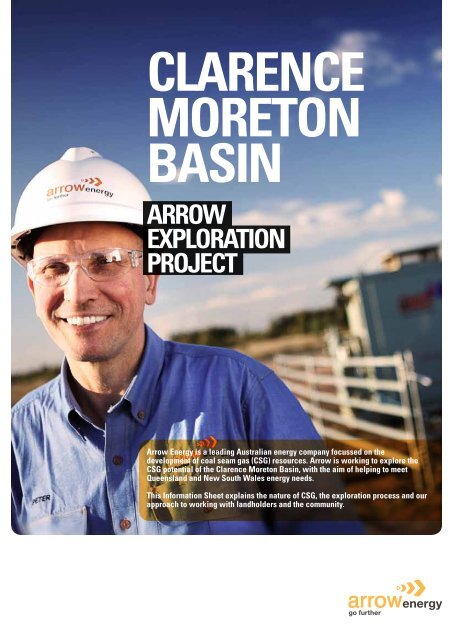
<strong>Arrow</strong> <strong>Energy</strong> is a leading Australian energy company focussed on the<br />
development of coal seam gas (CSG) resources. <strong>Arrow</strong> is working to explore the<br />
CSG potential of the Clarence Moreton Basin, with the aim of helping to meet<br />
Queensland and New South Wales energy needs.<br />
This Information Sheet explains the nature of CSG, the <strong>exploration</strong> process and our<br />
approach to working with landholders and the community.
CLARENCE MORETON<br />
BASIN EXPLORATION<br />
The Clarence Moreton Basin stretches from southeast<br />
Queensland to northeast New South Wales, and is joined,<br />
and geologically equivalent to, the Surat Basin. The main<br />
coal measure common across both the Surat and Clarence<br />
Moreton Basins are the Walloon Coal Measures.<br />
These coal measures are the source of gas that have<br />
underpinned major energy developments in The Surat Basin<br />
and the vast CSG resources of the Clarence Moreton Basin<br />
could help reduce NSW’s current reliance on imports of<br />
energy, either as electricity or gas, from Queensland and<br />
Victoria. In the local area, these resources could underpin<br />
the development of a strong and alternative industry,<br />
providing jobs and helping to expand and strengthen local<br />
communities.<br />
<strong>Arrow</strong> is currently undertaking <strong>exploration</strong> in the Clarence<br />
Moreton Basin to identify and assess the potential CSG<br />
resources within its tenure area. This work is at a very early<br />
stage and has yet to identify the extent and characteristics<br />
of CSG resources. The results of the different phases of<br />
<strong>exploration</strong> works will determine the viability of any future<br />
<strong>project</strong>.<br />
EXISTING<br />
OPERATIONS<br />
<strong>Arrow</strong> <strong>Energy</strong> has been operating since 2000 and was one of the<br />
founders of Australia’s CSG industry. Before that time, CSG was<br />
largely regarded as a safety hazard to coal mining, and otherwise<br />
not capable of supporting domestic gas supply requirements.<br />
History has disproven those early beliefs, and <strong>Arrow</strong> has been<br />
producing gas commercially since 2005. Production from<br />
<strong>Arrow</strong>’s gas fields currently provides more than 20 per cent<br />
of Queensland’s overall natural gas needs, and the capacity<br />
exists to supply far more. This gas is produced from five fields in<br />
Queensland: four fields in the Surat Basin near Dalby, and one<br />
field in the Bowen Basin, near Moranbah.<br />
<strong>Arrow</strong> is highly experienced in all aspects of CSG <strong>exploration</strong>,<br />
development and production having drilled more than 300 gas<br />
wells in the Surat Basin, and 150 wells in the Bowen Basin. Gas<br />
from these wells is gathered, compressed and piped to industrial<br />
customers, primarily electricity generators. <strong>Arrow</strong> also has direct<br />
interests in three gas-fired power stations. These activities<br />
are managed within a strong framework of safety, health and<br />
environmental controls.<br />
<strong>Arrow</strong>’s <strong>exploration</strong> and development activities are conducted<br />
over wide areas, extending as far north as Proserpine in the<br />
Whitsunday region, west to Charters Towers and south to<br />
the Newcastle region. This geographic spread has provided<br />
<strong>Arrow</strong> with a very good understanding of landholder and local<br />
community concerns.<br />
Prior to undertaking activities, <strong>Arrow</strong> will contact the landholder<br />
to explain how the activities are conducted in accordance<br />
with regulations and industry codes and guidelines and work<br />
with individual landholder concerns, timing of activities and<br />
operational practices.<br />
EXPLORATION<br />
ACTIVITIES<br />
All petroleum <strong>exploration</strong> and development activities require<br />
environmental assessment under the NSW Environmental<br />
Planning and Assessment Act 1979. Under the legislation,<br />
companies like <strong>Arrow</strong> have a set of rights and obligations with<br />
respect to the accessing of the resource and the land under<br />
which the resources are located.<br />
The <strong>exploration</strong> process that <strong>Arrow</strong> uses to explore for CSG is<br />
staged in a sequential process that seeks to progressively obtain<br />
better understanding of the nature of the resource. The basic<br />
steps are:<br />
1. Seismic surveys and stratigraphic drilling are used to<br />
define the extent and continuity of coal seams.<br />
Seismic<br />
Is a surface based activity that uses a vibration<br />
source to produce energy waves that travel underground.<br />
The energy is reflected off the different geological strata<br />
such as a coal seam, back to the surface where it is<br />
recorded by a geophone.<br />
Stratigraphic drilling<br />
Involves drilling a bore to several hundred metres<br />
in depth in order to locate and confirm potential<br />
coal seams. Stratigraphic drilling could be<br />
expected to take several weeks per bore.<br />
2. Exploration bore drilling is undertaken to determine<br />
whether the coal seam contains gas, and the potential of<br />
the coal seam as a gas reservoir. This is done by<br />
drilling bores to obtain core samples. Additional works may be<br />
conducted on the bore to determine the permeability of the<br />
coal – or how readily gas will flow from the coal. This activity<br />
could also be expected to take several weeks per bore.<br />
3. Appraisal drilling or ‘pilot testing’ is undertaken to<br />
confirm whether economic supplies of gas are present.<br />
A pilot test involves drilling five to six bores to test the<br />
production potential on a small scale. Since CSG is held in<br />
coal seams under the pressure of water (hydrostatic<br />
pressure), it is necessary to reduce the water pressure in<br />
order for the gas to flow. The drilling activity generally takes<br />
several weeks per bore, however once the pilot is in<br />
operation (producing water and gas), the production phase of<br />
the pilot test could last up to 12 months or more.<br />
Pilot bores that do not prove viable are shut down and properly<br />
abandoned, and drilling sites are rehabilitated to their original<br />
state. Where a pilot program is successful and shows viable<br />
amounts of gas, <strong>Arrow</strong> will seek field development approval.<br />
In steps 1 and 2, the drilling process requires the use of water,<br />
sourced locally, which is stored in small ground pits. These<br />
pits are lined with an impermeable liner which is removed and<br />
disposed of at a government-approved waste disposal site, at the<br />
end of drilling. In step 3, during the pilot test phase, the activities<br />
produce water from the bore which is stored in a purpose built<br />
small dam. If, for any reason, the <strong>project</strong> does not continue,<br />
this land area is remediated as required under government<br />
regulation.<br />
At each of these stages, a decision is made to either proceed<br />
based on favourable results, or abandon further works.
COAL<br />
SEAM<br />
GAS<br />
CSG is a naturally occurring gas which has been trapped in<br />
coal beds by water and ground pressure. The coal formed over<br />
millions of years as the environment changed from forests,<br />
rivers and lakes to swamps, then to rock and landform. Organic<br />
sediment was left and compressed to form the coal beds that<br />
now lie under the Clarence Moreton Basin.<br />
When extracted, CSG is just like conventional natural gas and<br />
can be used for the same purposes, such as home cooking. One<br />
of the most common uses of CSG is for electricity generation,<br />
with gas-fired power stations producing up to 50 per cent less<br />
emission than equivalent-sized conventional coal-fired power<br />
stations. CSG can also be used for other industrial purposes<br />
such as fertiliser production.<br />
Coal seams contain differing amounts of water. For example, the<br />
seams in <strong>Arrow</strong>’s CSG production operations in the Surat Basin<br />
of Queensland produce approximately 10 times the volume of<br />
water per unit of gas than operations in the Bowen Basin. Part<br />
of the <strong>exploration</strong> work in the Clarence Moreton Basin will be<br />
to understand the volume and characteristics of water stored in<br />
the coal seams. Water from coal seams can vary markedly in<br />
composition - from near fresh to very saline.<br />
The drilling of CSG bores by <strong>Arrow</strong> use proven construction<br />
procedures and processes, and qualified and experienced<br />
personnel. Drilling is conducted within strict regulatory and<br />
environmental management measures. The fundamental aim of<br />
this process is to ensure that the gas well is totally isolated and<br />
secure from overlying strata and aquifers, and that no water or<br />
gas can either enter or escape from the well.<br />
For further information on the construction of CSG bores refer to<br />
the Water and Salt Management Information Sheet.
FOR FURTHER INFORMATION ABOUT<br />
ARROW ENERGY<br />
Visit:<br />
http://www.<strong>arrow</strong>energy.com.au/page/Community_Information/<br />
FOR FURTHER INFORMATION ABOUT CSG OR<br />
RELEVANT LEGISLATION<br />
Visit the following websites<br />
NSW regulation of the petroleum industry<br />
Petroleum (Onshore) Act 1991<br />
http://www.austlii.edu.au/au/legis/nsw/consol_act/pa1991224<br />
Environmental Planning and Assessment Act (NSW) 1979<br />
http://www.austlii.edu.au/au/legis/nsw/consol_act/epaaa1979389<br />
Information about minerals and petroleum titles<br />
http://www.dpi.nsw.gov.au/minerals/titles<br />
Commonwealth regulation of the petroleum industry<br />
Environment Protection and Biodiversity Conservation Act 1999<br />
(EPBC Act)<br />
http://www.austlii.edu.au/au/legis/nsw/consol_act/epaaa1979389<br />
Commonwealth Government Environmental Assessment<br />
Department of Environment, Water, Heritage and the Arts<br />
www.environment.gov.au/epbc/assessments/index.html<br />
WORKING WITH<br />
LANDHOLDERS AND<br />
THE COMMUNITY<br />
<strong>Arrow</strong> <strong>Energy</strong> recognises and respects the interests and<br />
concerns of landholders and communities. <strong>Arrow</strong> is cognisant<br />
of the need to establish long term relationships with people,<br />
and to conduct our activities to minimise impact upon others.<br />
It is also understood that not only landholders directly affected<br />
by our activities must be considered, but also their neighbours,<br />
local authorities and relevant community groups.<br />
<strong>Arrow</strong> is flexible when planning <strong>exploration</strong> activities, and can<br />
normally adjust locations or timing of planned drilling or other<br />
activities to accommodate reasonable requests. Priority is given<br />
to making early contact with landholders to discuss and agree<br />
the nature and timing of proposed activities, and to set in place<br />
formal agreements to provide certainty and comfort to both<br />
parties.<br />
Prior to undertaking any activities on private property, including<br />
environmental investigations, <strong>Arrow</strong> communicates with<br />
landholders. When determining temporary and permanent<br />
locations for plant and equipment, all aspects of the property<br />
are considered in consultation with the landholder. Agricultural<br />
activities, stock considerations, seasonal conditions,<br />
topography, drainage lines, service corridors and vegetation and<br />
fauna communities are all taken into account.<br />
Our preference is to develop working relationships with<br />
landholders on whose properties we would like to operate, and<br />
work together with them to resolve concerns. We work with<br />
landholders to gain voluntary access agreements.


