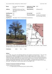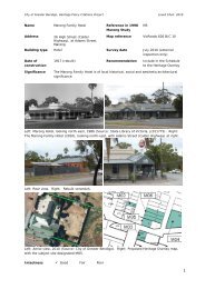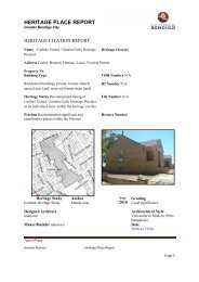
Vol 2 Heritage Policy Citation Review - City of Greater Bendigo
Vol 2 Heritage Policy Citation Review - City of Greater Bendigo
Vol 2 Heritage Policy Citation Review - City of Greater Bendigo

Create successful ePaper yourself
Turn your PDF publications into a flip-book with our unique Google optimized e-Paper software.
<strong>City</strong> <strong>of</strong> <strong>Greater</strong> <strong>Bendigo</strong>, <strong>Heritage</strong> <strong>Policy</strong> <strong>Citation</strong>s Project Lovell Chen, 2010<br />
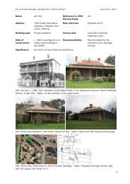
Name House (former St Francis<br />
Xavier Catholic Church)<br />
Reference in 1998<br />
Marong Study<br />
CF01<br />
Address 10 Mulvahil Road, Woodvale 1 Map reference VicRoads 44 D3<br />
Building type Private residence Survey date July 2010 (external<br />
inspection only, visibility<br />
restricted)<br />
Date <strong>of</strong><br />
construction<br />
1935 Recommendation Include in the Schedule to<br />
the <strong>Heritage</strong> Overlay<br />
Significance The former St Francis Xavier Catholic Church built in 1935, is <strong>of</strong> local historical<br />
significance.<br />
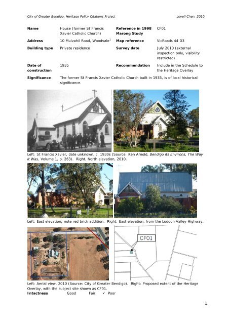
Left: St Francis Xavier, date unknown, c. 1930s (Source: Ken Arnold, <strong>Bendigo</strong> its Environs, The Way<br />
it Was, <strong>Vol</strong>ume 1, p. 263). Right, North elevation, 2010.<br />
Left: East elevation; note red brick addition. Right: East elevation, from the Loddon Valley Highway.<br />
Left: Aerial view, 2010 (Source: <strong>City</strong> <strong>of</strong> <strong>Greater</strong> <strong>Bendigo</strong>). Right: Proposed extent <strong>of</strong> the <strong>Heritage</strong><br />
Overlay, with the subject site shown as CF01.<br />
Intactness Good Fair Poor<br />
1
<strong>City</strong> <strong>of</strong> <strong>Greater</strong> <strong>Bendigo</strong>, <strong>Heritage</strong> <strong>Policy</strong> <strong>Citation</strong>s Project Lovell Chen, 2010<br />
History<br />
Campbell’s Forest was named after Donald and Roderick Campbell, the first squatters on the Bullock<br />
Creek, who had taken up the ‘Weddikar Run’ before 1845, after which it was taken on by Messrs<br />
Nicholson and Thomas Myers. This partnership was dissolved on 23 July 1849, when the run was<br />
transferred to William and Thomas Myers. The population <strong>of</strong> the Campbell’s Forest area was never<br />
large: as late as the mid-1880s, it numbered less than 50. This more than doubled, however, when<br />
the area was opened up for selection in 1910. 2<br />
On 18 July 1873, two acres <strong>of</strong> Crown allotment 1A, section 4, Parish <strong>of</strong> Nerring, south <strong>of</strong> Campbell’s<br />
Forest, was set aside for the construction <strong>of</strong> St Francis Xavier Catholic Church. Patrick Donnellan, a<br />
farmer from Nerring and Patrick Graham, a Campbell’s Forest publican, were the local representatives<br />
for the Church. The first confirmation was held at the church in 1925. In 1935 the original church<br />
was replaced with the present structure. 3<br />
St Francis Xavier had a large and active congregation until the late 1940s, with a Sunday mass <strong>of</strong> 55<br />
in 1949, reflecting the presence in the district <strong>of</strong> the descendants <strong>of</strong> early Irish Catholic pioneers.<br />
Each year parishioners entered a float in the St Patrick's Day procession in Eaglehawk. The church<br />
was widely known for its annual balls and concerts, held in the Campbell's Forest hall. The<br />
congregation declined gradually from the 1950s. Father John Leahy presided over the last mass on 1<br />
February 1971. 4<br />
The building was sold to Des Clark <strong>of</strong> <strong>Bendigo</strong> on 17 February 1978 and subsequently to Kevin and<br />
Judith Smith in 1981. 5 In 1985 Peter Bray undertook works to convert it into a residence. 6<br />
Victoria’s Framework <strong>of</strong> Historical Themes<br />
Victoria’s themes and sub-themes:<br />
8.1: Maintaining spiritual life<br />
Description & Integrity<br />
(The following description is limited due to the restricted visibility <strong>of</strong> the building from the main road<br />
frontage, including restricted views <strong>of</strong> the side elevations, and <strong>of</strong> the rear.)<br />
The former St Francis Xavier Catholic Church, built in 1935, is a vernacular Gothic-influenced timber<br />
church with ‘bungalow’ and Arts and Crafts touches. It is located on a large allotment to the east <strong>of</strong><br />
the Loddon Valley Highway. The original building is essentially T shaped in plan with a small gable<br />
ended porch to the front (north) and projecting transepts (or porches) at the south. Although adapted<br />
to residential use, the church retains its original nave and side and front porches.<br />
The aerial photograph included above indicates that additions have been added to both the east and<br />
west sides <strong>of</strong> the building, apparently enveloping (or partly enveloping) the original building<br />
elevations. The west addition(s) is not visible from the street, and views <strong>of</strong> the east addition are also<br />
limited, but some description is included below.<br />
The walls <strong>of</strong> the church are clad with bull nosed weatherboards and asbestos cement sheeting. The<br />
weatherboards are generally painted white, with the asbestos sheeting painted green. The timber<br />
framed windows are lancet-arched. It is possible that the original side walls associated with the east<br />
and west additions have been partially removed/penetrated to open up to the additions .<br />
A triangular window with six lights in a radial arrangement around a central glazed bullseye is located<br />
to the north gable end, over the front porch. The glazed bullseye features the lettering ‘HIS’ in<br />
leadlight work 7 ; the leadlight to the six surrounding lights have simple diamond patterns.<br />
The works to the east include a brick structure (wall) which begins at the front porch and continues<br />
along the east elevation. It may incorporate an enclosed outdoor space. The transept at the east end<br />
also appears to have been clad (or reconstructed) in brick. To the east side <strong>of</strong> the front porch an<br />
2
<strong>City</strong> <strong>of</strong> <strong>Greater</strong> <strong>Bendigo</strong>, <strong>Heritage</strong> <strong>Policy</strong> <strong>Citation</strong>s Project Lovell Chen, 2010<br />
awning has been added, with a plain fascia; this cuts across the lancet window so that the top light<br />
reads as a curved triangle above the awning, and as a simple double-hung sash below.<br />
The ridge-mounted crosses, evident in the historic image above, have been removed. The origins <strong>of</strong><br />
the church are remembered in a sign fixed to a timber board facing Mulvahil Road reading ‘St Francis<br />
Xavier Catholic Church’.<br />
Comparative Analysis<br />
The former St Francis Xavier Catholic Church is typical <strong>of</strong> many timber churches in small rural<br />
communities. These changed little in various respects between the 1870s and World War II, with<br />
most having a small or medium sized church facing the road directly in front and an open and informal<br />
landscape setting surrounding the building. Common elements include lancet windows, weatherboard<br />
walling, and timber ro<strong>of</strong>s clad in corrugated galvanised steel. The Wesleyan Church at Poowong, near<br />
Korumburra in central Gippsland is very similar in its original form but is much earlier (1878;<br />
transepts 1890). 8 The former St Francis Xavier Catholic Church is also one <strong>of</strong> the few surviving<br />
timber churches in the <strong>City</strong> <strong>of</strong> <strong>Greater</strong> <strong>Bendigo</strong>.<br />
The distinct bungalow and Arts and Crafts touches are <strong>of</strong> interest and include the weatherboard<br />
walling set <strong>of</strong>f with cement sheet and battens in the upper gabling, generating a half-timbered effect.<br />
Triangular windows are also employed as a motif in this church, either as fanlights to form lancets<br />
from otherwise double-hung sash windows in the porch and nave sides, or as complete triangles,<br />
either with a flat base, as over the porch, or equilateral (as in the front gable).<br />
Although chronologically quite late in use for this building (1935), not as successfully employed, and<br />
subsequently modified by adaptation works, the ‘bungalow’ and arts and crafts influences apparent<br />
here correspond with Lorne Presbyterian Church (1911) and Carnegie Methodist Church (1914), 9<br />
Mount Pleasant Uniting Church in Nunawading (1917), St George’s Anglican Flemington (1923), and<br />
Balwyn Church <strong>of</strong> Christ (1926). 10 The Campbell’s Forest church is also comparatively large, its<br />
volume being closer to suburban Protestant churches <strong>of</strong> the inter-war period. The Anglican Church in<br />
Marong (1871) has a similar curved triangle in its west gable.<br />
Assessment Against Criteria<br />
Amended <strong>Heritage</strong> Victoria Criteria<br />
Criterion A: Importance to the course, or pattern, <strong>of</strong> the <strong>City</strong> <strong>of</strong> <strong>Greater</strong> <strong>Bendigo</strong>’s cultural history.<br />
The former St Francis Xavier Catholic Church built in 1935, is <strong>of</strong> historical significance for its capacity<br />
to recall the religious life <strong>of</strong> the Catholic community in the area. The church had a large and active<br />
congregation until the late 1940s, a legacy <strong>of</strong> the presence in the district <strong>of</strong> the early Irish Catholic<br />
pioneers and their descendants. The site, south <strong>of</strong> Campbell’s Forest, was selected as the location <strong>of</strong><br />
the Catholic place <strong>of</strong> worship as early as 1873. The present church was built in 1935, replacing the<br />
original structure. St Francis Xavier’s is also one <strong>of</strong> the more substantial historic properties remaining<br />
in the settlement <strong>of</strong> Campbell’s Forest and provides evidence <strong>of</strong> the settlement’s early twentieth<br />
century heyday.<br />
Criterion B: Possession <strong>of</strong> uncommon, rare or endangered aspects <strong>of</strong> the <strong>City</strong> the <strong>of</strong> <strong>Greater</strong> <strong>Bendigo</strong>’s<br />
cultural history.<br />
The former St Francis Xavier Catholic Church is believed to be a rare surviving timber church building<br />
in the municipality.<br />
Criterion C: Potential to yield information that will contribute to an understanding <strong>of</strong> the <strong>City</strong> <strong>of</strong><br />
<strong>Greater</strong> <strong>Bendigo</strong>’s cultural history.<br />
N/A<br />
Criterion D: Importance in demonstrating the principal characteristics <strong>of</strong> a class <strong>of</strong> cultural places or<br />
objects.<br />
N/A<br />
3
<strong>City</strong> <strong>of</strong> <strong>Greater</strong> <strong>Bendigo</strong>, <strong>Heritage</strong> <strong>Policy</strong> <strong>Citation</strong>s Project Lovell Chen, 2010<br />
Criterion E: Importance in exhibiting particular aesthetic characteristics in the context <strong>of</strong> the<br />
municipality.<br />
The former church, in its original form, was a well executed timber building in the vernacular Gothic<br />
mode, which successfully incorporated ‘bungalow’ and Arts and Crafts touches. However, the<br />
modifications to the building, to adapt it to residential use, have impacted on its original form, and<br />
also on some <strong>of</strong> the original detailing. While it is recognised that the church is one <strong>of</strong> the few<br />
surviving timber churches in the <strong>City</strong> <strong>of</strong> <strong>Greater</strong> <strong>Bendigo</strong>, the degree <strong>of</strong> alteration has detracted from<br />
the aesthetic significance <strong>of</strong> the building.<br />
Criterion F: Importance in demonstrating a high degree <strong>of</strong> creative or technical achievement at a<br />
particular period.<br />
N/A<br />
Criterion G: Strong or special association with a particular community or cultural group for social,<br />
cultural or spiritual reasons. This includes the significance <strong>of</strong> the place to Indigenous peoples as part<br />
<strong>of</strong> their continuing and developing cultural traditions.<br />
N/A<br />
Criterion F: Special association with life or works <strong>of</strong> a person, or group <strong>of</strong> persons, <strong>of</strong> importance in<br />
the <strong>City</strong> <strong>of</strong> <strong>Greater</strong> <strong>Bendigo</strong>’s history.<br />
N/A<br />
Statement <strong>of</strong> Significance<br />
What is significant?<br />
The former St Francis Xavier Catholic Church, south <strong>of</strong> Campbell’s Forest, is a Gothic-influenced<br />
timber church that incorporates ‘bungalow’ and Arts and Crafts touches. Since the cessation <strong>of</strong><br />
services at the church in 1971, the building has been adapted to a private residence, a process that<br />
has resulted in extensive alterations. The church was built in 1935, replacing an earlier place <strong>of</strong><br />
worship on the same site. The previous church dated to 1873. St Francis Xavier’s is one <strong>of</strong> the more<br />
substantial historic properties remaining in the settlement <strong>of</strong> Campbell’s Forest and provides evidence<br />
<strong>of</strong> the settlement’s early twentieth century heyday. The property also demonstrates the religious life<br />
<strong>of</strong> the Catholic community in the area, which formed a large and active congregation from the 1870s<br />
until its gradual decline from the late 1940s.<br />
How is it significant?<br />
The former St Francis Xavier Catholic Church built in 1935, is <strong>of</strong> local historical significance.<br />
Why is it significant?<br />
The former St Francis Xavier Catholic Church is <strong>of</strong> local historical significance (Criterion A) for its<br />
capacity to recall the religious life <strong>of</strong> the Catholic community in the area. The church had a large and<br />
active congregation until the late 1940s, a legacy <strong>of</strong> the presence in the district <strong>of</strong> the early Irish<br />
Catholic pioneers and their descendants. The site, south <strong>of</strong> Campbell’s Forest, was selected as the<br />
location <strong>of</strong> the Catholic place <strong>of</strong> worship as early as 1873. The present church was built in 1935,<br />
replacing the original structure. St Francis Xavier’s is also one <strong>of</strong> the more substantial historic<br />
properties remaining in the settlement <strong>of</strong> Campbell’s Forest and provides evidence <strong>of</strong> the settlement’s<br />
early twentieth century heyday. The former church, in its original form, was a well executed timber<br />
building in the vernacular Gothic mode, which successfully incorporated ‘bungalow’ and Arts and<br />
Crafts touches. However, the modifications to the building, to adapt it to residential use, have<br />
impacted on its original form, and also on some <strong>of</strong> the original detailing. While it is recognised that<br />
the church is one <strong>of</strong> the few surviving timber churches in the <strong>City</strong> <strong>of</strong> <strong>Greater</strong> <strong>Bendigo</strong> (Criterion B), the<br />
degree <strong>of</strong> alteration has detracted from the aesthetic significance <strong>of</strong> the building.<br />
4
<strong>City</strong> <strong>of</strong> <strong>Greater</strong> <strong>Bendigo</strong>, <strong>Heritage</strong> <strong>Policy</strong> <strong>Citation</strong>s Project Lovell Chen, 2010<br />
Recommendations<br />
The property is recommended for inclusion in the Schedule to the <strong>Greater</strong> <strong>Bendigo</strong> <strong>Heritage</strong> Overlay.<br />
The extent <strong>of</strong> the Overlay is indicated in the above map, although the significant elements are<br />
confined to the original church building, an area <strong>of</strong> curtilage around the building (typically in the order<br />
<strong>of</strong> five to ten metres), and the front setback to the building from the road frontage. The various nonoriginal<br />
additions and alterations to the building are not significant.<br />
External Paint Colours No<br />
Internal Alterations Controls No<br />
Tree Controls No<br />
Outbuildings and fences exemptions No<br />
Victorian <strong>Heritage</strong> Register No<br />
Prohibited uses may be permitted No<br />
Incorporated plan No<br />
Aboriginal heritage place No<br />
Identified By<br />
Andrew Ward, 1998.<br />
References<br />
Ken Arnold, <strong>Bendigo</strong> its Environs, The Way it Was, <strong>Vol</strong>ume 1, Crown Castleton Publishers, 2003.<br />
Ray Wallace, Shades <strong>of</strong> the Past: A History <strong>of</strong> Campbells Forest and Yarraberb, Back To Committee,<br />
1993.<br />
Andrew Ward et al, <strong>City</strong> <strong>of</strong> <strong>Greater</strong> <strong>Bendigo</strong> <strong>Heritage</strong> Study (Marong) Study Area, Stage 2, 1998.<br />
Specific:<br />
1<br />
Address changed from Mulvahil Road, Campbell's Forest, <strong>Heritage</strong> <strong>Policy</strong> <strong>Citation</strong>s<br />
<strong>Review</strong>, 2011. November 2011.<br />
2<br />
See, Ken Arnold, <strong>Bendigo</strong> its Environs, The Way it Was, <strong>Vol</strong>ume 1, Crown Castleton Publishers,<br />
2003, p. 257, and Anon., Shire <strong>of</strong> Marong 1864-1964, unpaginated.<br />
3<br />
See, Ken Arnold, <strong>Bendigo</strong> its Environs, The Way it Was, <strong>Vol</strong>ume 1, Crown Castleton Publishers,<br />
2003, p. 265.<br />
4<br />
Ray Wallace, Shades <strong>of</strong> the Past: A History <strong>of</strong> Campbells Forest and Yarraberb, Back To<br />
Committee, 1993, pp.52-54.<br />
5<br />
Pers comm., Kevin Smith and Ray Wallace (historian), November, 1992<br />
6<br />
Pers comm, Peter Bray, interview with Andrew Ward and Ray Wallace, June, 1998.<br />
7<br />
‘HIS’ (Iesous Hominum Salvator) is a monogram used by the Roman Catholic Church, meaning<br />
‘Jesus, saviour <strong>of</strong> man’. Catholic Encyclopaedia online, www.newadvent.org<br />
8<br />
Miles Lewis (ed, contrib), Victorian Churches, National Trust, Melbourne, 1991, p. 131, item<br />
307.<br />
9<br />
Miles Lewis (ed, contrib), Victorian Churches, National Trust, Melbourne, 1991, pp. 65, item 70<br />
(Carnegie); 156, item 405 (Lorne).<br />
10<br />
The bungalow influence on Melbourne Churches is outlined by C Hamann in ‘Architecture’, in<br />
Andrew Brown-May and Shurlee Swain (eds.), The Encyclopedia <strong>of</strong> Melbourne, Cambridge,<br />
Melbourne, 2006, p. 31.<br />
5
<strong>City</strong> <strong>of</strong> <strong>Greater</strong> <strong>Bendigo</strong>, <strong>Heritage</strong> <strong>Policy</strong> <strong>Citation</strong>s Project Lovell Chen, 2010<br />
Name ‘Bob the Shepherd's Hill’<br />
Address CA 4A Loddon Valley<br />
Highway, north <strong>of</strong> the<br />
intersection with Derby<br />
Road, Woodvale 1<br />
Reference in 1998<br />
Marong Study<br />
CF2<br />
Map reference VicRoads 44 D3<br />
Building type N/A Survey date July 2010<br />
Date N/A Recommendation Not recommended for the<br />
Schedule to the <strong>Heritage</strong><br />
Overlay<br />
Significance ‘Bob the Shepherd's Hill’ is not <strong>of</strong> local heritage significance, and is not<br />
recommended for inclusion in the <strong>Heritage</strong> Overlay.<br />
Looking south from the crest <strong>of</strong> ‘Bob the Shepherd's Hill’.<br />
Looking north towards ‘Bob the Shepherd's Hill’.<br />
1
<strong>City</strong> <strong>of</strong> <strong>Greater</strong> <strong>Bendigo</strong>, <strong>Heritage</strong> <strong>Policy</strong> <strong>Citation</strong>s Project Lovell Chen, 2010<br />
Left: Aerial view, 2010, with the approximate area <strong>of</strong> ‘Bob the Shepherd's Hill’ indicated (<strong>City</strong> <strong>of</strong><br />
<strong>Greater</strong> <strong>Bendigo</strong>).<br />
Intactness Good Fair Poor<br />
History<br />
Campbell’s Forest was named after Donald and Roderick Campbell, the first squatters on the Bullock<br />
Creek, who had taken up the Crown land ‘Weddikar Run’ before 1845, after which it was taken on by<br />
Messrs Nicholson and Thomas Myers. This latter partnership dissolved on 23 July 1849, when it was<br />
transferred to William and Thomas Myers. 2 The site known as ‘Bob the Shepherd's Hill’ in Campbell’s<br />
Forest, is a low rise in the landscape located approximately eight kilometres north <strong>of</strong> Eaglehawk. It<br />
was reputedly used by shepherds working the ‘Weddikar Run’, particularly during prolonged wet<br />
weather. Sheep grazing on the elevated ground were less susceptible to footrot than those kept on<br />
the lower-lying flats. The use <strong>of</strong> shepherds on the big pastoral runs declined from the 1850s with the<br />
advent <strong>of</strong> the gold rushes; the original runs were also gradually broken up (subdivided) and sold or<br />
leased in smaller allotments from the 1860s, through a series <strong>of</strong> land acts in Victoria. The name <strong>of</strong><br />
the elevated site, as 'Bob the Shepherd's Hill' has survived in local memory. 3<br />
Victoria’s Framework <strong>of</strong> Historical Themes<br />
Victoria’s themes and sub-themes:<br />
2.3: Adapting to diverse environments<br />
4.3: Grazing and raising livestock<br />
Description & Integrity<br />
‘Bob the Shepherd's Hill’ forms a low wooded rise in undulating countryside approximately eight<br />
kilometres north <strong>of</strong> Eaglehawk. It is bisected by the Loddon Valley Highway. The area is partially<br />
located on road reserve and on private property to either side. To the west the land is largely devoid<br />
<strong>of</strong> trees and used as arable pasture; to the east it is lightly wooded. Expansive views are available<br />
from the hill to the south and east. No physical evidence <strong>of</strong> early shepherding practices has been<br />
identified. Local oral tradition suggests that the remains <strong>of</strong> a shepherd's hut may survive on the hill.<br />
However, this has not been confirmed and would require an archaeological survey and investigation to<br />
clarify.<br />
2
<strong>City</strong> <strong>of</strong> <strong>Greater</strong> <strong>Bendigo</strong>, <strong>Heritage</strong> <strong>Policy</strong> <strong>Citation</strong>s Project Lovell Chen, 2010<br />
Comparative Analysis<br />
‘Bob the Shepherd’s Hill’ is an example <strong>of</strong> an ‘associative landscape,’ described by <strong>Heritage</strong> Victoria as,<br />
‘<strong>of</strong>ten intangible … [these] can be largely natural, apparently unmodified landscapes with associated<br />
cultural values’. 4 There are no directly comparable examples <strong>of</strong> landscapes in the municipality, as far<br />
as the authors <strong>of</strong> this citation are aware, which retain an acknowledged historical association with<br />
shepherding. However, given the presence <strong>of</strong> a number <strong>of</strong> pastoral runs in the region in the pre-<br />
1850s period, it can be assumed that elevated landforms generally would have been similarly used by<br />
shepherds, and run managers, to manage sheep flocks in wet weather.<br />
Assessment Against Criteria<br />
Amended <strong>Heritage</strong> Victoria Criteria (based on <strong>Heritage</strong> Victoria Landscape Assessment Criteria,<br />
updated January 2009)<br />
Criterion A: Importance to the course, or pattern, <strong>of</strong> the <strong>City</strong> <strong>of</strong> <strong>Greater</strong> <strong>Bendigo</strong>’s cultural history.<br />
‘Bob the Shepherd's Hill’ is <strong>of</strong> historical interest as a landscape linked in name with the pre-gold rush<br />
era, when this area was associated with pastoral use and the old ‘Weddikar Run’. The low rise,<br />
approximately eight kilometres north <strong>of</strong> Eaglehawk at the south <strong>of</strong> Campbell’s Forest, was reputedly<br />
used by shepherds working the ‘Weddikar Run’ in wet weather. The name <strong>of</strong> the elevated site, as<br />
'Bob the Shepherd's Hill' has also, unusually, survived in local memory, although it is assumed that<br />
other local elevated landforms would have been similarly used by shepherds, and run managers, to<br />
manage sheep flocks in wet weather.<br />
Criterion B: Possession <strong>of</strong> uncommon, rare or endangered aspects <strong>of</strong> the <strong>City</strong> the <strong>of</strong> <strong>Greater</strong> <strong>Bendigo</strong>’s<br />
cultural history.<br />
The authors <strong>of</strong> this report are not aware <strong>of</strong> any directly comparable examples <strong>of</strong> landscapes in the<br />
municipality which retain an acknowledged historical association with shepherding. However, given<br />
the presence <strong>of</strong> a number <strong>of</strong> pastoral runs in this region prior to the 1850s, it can be assumed that<br />
elevated landforms would have been similarly used by shepherds and run managers to manage sheep<br />
flocks in wet weather.<br />
Criterion C: Potential to yield information that will contribute to an understanding <strong>of</strong> the <strong>City</strong> <strong>of</strong><br />
<strong>Greater</strong> <strong>Bendigo</strong>’s cultural history.<br />
N/A<br />
Criterion D: Importance in demonstrating the principal characteristics <strong>of</strong> a class <strong>of</strong> cultural places or<br />
objects.<br />
N/A<br />
Criterion E: Importance in exhibiting particular aesthetic characteristics in the context <strong>of</strong> the<br />
municipality.<br />
N/A<br />
Criterion F: Importance in demonstrating a high degree <strong>of</strong> creative or technical achievement at a<br />
particular period.<br />
N/A<br />
Criterion G: Strong or special association with a particular community or cultural group for social,<br />
cultural or spiritual reasons. This includes the significance <strong>of</strong> the place to Indigenous peoples as part<br />
<strong>of</strong> their continuing and developing cultural traditions.<br />
N/A<br />
3
<strong>City</strong> <strong>of</strong> <strong>Greater</strong> <strong>Bendigo</strong>, <strong>Heritage</strong> <strong>Policy</strong> <strong>Citation</strong>s Project Lovell Chen, 2010<br />
Criterion F: Special association with life or works <strong>of</strong> a person, or group <strong>of</strong> persons, <strong>of</strong> importance in<br />
the <strong>City</strong> <strong>of</strong> <strong>Greater</strong> <strong>Bendigo</strong>’s history.<br />
N/A<br />
Statement <strong>of</strong> Significance<br />
‘Bob the Shepherd's Hill’ is <strong>of</strong> historical interest as a landscape linked in name with the pre-gold rush<br />
era, when this area was associated with pastoral use and the old ‘Weddikar Run’. The low rise,<br />
approximately eight kilometres north <strong>of</strong> Eaglehawk at the south <strong>of</strong> Campbell’s Forest, was reputedly<br />
used by shepherds working the ‘Weddikar Run’ in wet weather. The name <strong>of</strong> the elevated site, as<br />
'Bob the Shepherd's Hill' has also, unusually, survived in local memory, although it is assumed that<br />
other local elevated landforms would have been similarly used by shepherds, and run managers, to<br />
manage sheep flocks in wet weather.<br />
Recommendations<br />
The place is not recommended for inclusion in the Schedule to the <strong>Heritage</strong> Overlay <strong>of</strong> the <strong>City</strong> <strong>of</strong><br />
<strong>Greater</strong> <strong>Bendigo</strong> Planning Scheme. While the landscape element has historical interest, largely due to<br />
the survival <strong>of</strong> the name in local memory, the hill itself has no known physical remains associated with<br />
the shepherding or pastoral run history. It is also considered to be highly likely that there are other<br />
local elevated landforms which were similarly used to manage sheep flocks in wet weather.<br />
Identified By<br />
Andrew Ward, 1998.<br />
References<br />
Ken Arnold, <strong>Bendigo</strong> its Environs, The Way it Was, <strong>Vol</strong>ume 1, Crown Castleton Publishers, 2003.<br />
Ray Wallace, Shades <strong>of</strong> the Past: A History <strong>of</strong> Campbells Forest and Yarraberb, Back To Committee,<br />
1993.<br />
Andrew Ward et al, <strong>City</strong> <strong>of</strong> <strong>Greater</strong> <strong>Bendigo</strong> <strong>Heritage</strong> Study (Marong) Study Area, Stage 2, 1998.<br />
Specific:<br />
1<br />
Address changed from Loddon Valley Highway (north <strong>of</strong> Derby Road intersection),<br />
Campbell's Forest, <strong>Heritage</strong> <strong>Policy</strong> <strong>Citation</strong>s <strong>Review</strong>, 2011. November 2011.<br />
2<br />
See, Ken Arnold, <strong>Bendigo</strong> its Environs, The Way it Was, <strong>Vol</strong>ume 1, Crown Castleton Publishers,<br />
2003, p. 257, and Anon., Shire <strong>of</strong> Marong 1864-1964, unpaginated.<br />
3<br />
The name, ‘Bob the Shepherd’s Hill,’ was recalled by a number <strong>of</strong> elderly residents <strong>of</strong> the area<br />
during the heritage study survey carried out during the 1990s. Pers comm, Ray Wallace<br />
(historian), and Adam Mornement (Lovell Chen), 9 August 2010. See also, Ray Wallace,<br />
Shades <strong>of</strong> the Past: Campbell's Forest and Yarraberb, Campbell's Forest and Yarraberb Back-to<br />
Committee, 1993, p. 8.<br />
4<br />
<strong>Heritage</strong> Victoria, Landscape Assessment Guidelines, July 2002, updated January 2009.<br />
4
<strong>City</strong> <strong>of</strong> <strong>Greater</strong> <strong>Bendigo</strong>, <strong>Heritage</strong> <strong>Policy</strong> <strong>Citation</strong>s Project Lovell Chen, 2010<br />
Name Sandstone dwelling Reference in 1998<br />
Marong Study<br />
Address 326 Maiden Gully Road,<br />
California Gully<br />
CG2<br />
Map reference VicRoads 607 M2<br />
Building type Private residence Survey date July 2010<br />
Date <strong>of</strong><br />
construction<br />
1920 (upgraded or rebuilt<br />
1941)<br />
Recommendation Not recommended<br />
for the Schedule to<br />
the <strong>Heritage</strong> Overlay<br />
Significance The dwelling at 326 Maiden Gully Road is not <strong>of</strong> local heritage significance,<br />
and is not recommended for inclusion in the <strong>Heritage</strong> Overlay.<br />
Left: North elevation <strong>of</strong> no. 326 Maiden Gully Road. Right: Verandah.<br />
Left: West wall. Right: Recent sandstone structure to the west.<br />
Left: Aerial view, 2010 (Source: <strong>City</strong> <strong>of</strong> <strong>Greater</strong> <strong>Bendigo</strong>).<br />
Intactness Good Fair Poor<br />
1
<strong>City</strong> <strong>of</strong> <strong>Greater</strong> <strong>Bendigo</strong>, <strong>Heritage</strong> <strong>Policy</strong> <strong>Citation</strong>s Project Lovell Chen, 2010<br />
History<br />
California Gully was one <strong>of</strong> many early gold fields that supported sizeable tent populations during the<br />
initial rushes to <strong>Bendigo</strong> in 1851-52. Significant and more permanent development subsequently took<br />
place in the area between the 1860s and 1880s. However, with the decline <strong>of</strong> gold mining in the early<br />
1900s, and the advent <strong>of</strong> World War I (1914-1918), the 1930s Depression, and World War II (1939-<br />
1945), very little housing was built in California Gully until a new burst <strong>of</strong> albeit limited development<br />
<strong>of</strong> the area during the post-war years. 1<br />
<strong>City</strong> <strong>of</strong> <strong>Greater</strong> <strong>Bendigo</strong> rate books indicate that a dwelling at 326 Maiden Gully Road was built by<br />
1920. In 1933, the property was owned by the Carlton and United Breweries. Edward J Yates took<br />
possession the following year, when the net asset value (NAV) was £3. The NAV increased to £13<br />
pounds in 1941, suggesting that the property was significantly upgraded or rebuilt at that time. 2<br />
Edward Yates was a miner, working during the fading years <strong>of</strong> <strong>Bendigo</strong>'s long period <strong>of</strong> quartz reef<br />
mining. The vernacular nature <strong>of</strong> the present dwelling, and the low cost <strong>of</strong> the locally available<br />
materials, suggest that the property was self-built. The rear <strong>of</strong> the property was damaged during the<br />
bush fires <strong>of</strong> 2009. 3<br />
The Yates family was well-known in the local area, and is also associated with the construction in the<br />
1930s <strong>of</strong> number 330 Maiden Gully Road.4<br />
Victoria’s Framework <strong>of</strong> Historical Themes<br />
Victoria’s themes and sub-themes:<br />
4.5: Gold mining<br />
6.8: Living on the fringes<br />
Description & Integrity<br />
The property at no. 326 Maiden Gully Road, which is believed to have taken on its present form in<br />
1941, is a single-storey gable ro<strong>of</strong> bungalow-style dwelling built <strong>of</strong> local sandstone. It is located on a<br />
sloping site, within a large allotment. The sandstone walls are coursed, with red brick dressings to the<br />
openings and corners. The gabled ro<strong>of</strong> is clad with corrugated steel sheet, painted green. The gable<br />
ends are clad in asbestos cement sheet, with strapping and a central fixed louvred vent, in the<br />
manner <strong>of</strong> a Californian bungalow. The street-facing elevation (north) is symmetrical with double<br />
hung windows flanking a central doorway. The timber door has two glass panels with a glazed<br />
highlight above. There is an elevated timber posted bull nosed verandah with central ladder frame<br />
frieze and fretted spandrels (framing the entrance). The floor <strong>of</strong> the verandah is rough concrete, and<br />
the brick base is in poor condition.<br />
The dwelling is in fair condition.<br />
There are a number <strong>of</strong> timber additions to the rear <strong>of</strong> the dwelling, incorporating a brick chimney.<br />
These were damaged during the 2009 bushfires. A large sandstone building, also with gable ends, <strong>of</strong><br />
more recent construction (c. 1990s) is located to the west <strong>of</strong> the house. This appears to be a garage<br />
or store. It has a shallow pitched ro<strong>of</strong> and a double-width timber door. Both structures are set back<br />
from Maiden Gully Road, behind an open garden. Vegetation, including a variety <strong>of</strong> mature and semimature<br />
trees are located around the property.<br />
Comparative Analysis<br />
The use <strong>of</strong> locally-available materials in the construction <strong>of</strong> self-built homes dates to the earliest years<br />
<strong>of</strong> settlement in the <strong>Bendigo</strong> goldfields. Surviving early examples include Tweedside, at 39 Crusoe<br />
Road, Kangaroo Flat (c. 1856), which was built <strong>of</strong> locally-made brick for a wealthy migrant, who also<br />
imported glass sheets for use in his new home. A more contemporary equivalent to the subject<br />
property, albeit built about ten years later and <strong>of</strong> mud brick and timber, is no. 330 Maiden Gully Road.<br />
This property is also believed to have been associated with, and built by, the Yates family. The<br />
bungalow style <strong>of</strong> the subject building is also <strong>of</strong> interest, being a comparatively late example <strong>of</strong> this<br />
style in the Victorian context.<br />
2
<strong>City</strong> <strong>of</strong> <strong>Greater</strong> <strong>Bendigo</strong>, <strong>Heritage</strong> <strong>Policy</strong> <strong>Citation</strong>s Project Lovell Chen, 2010<br />
Assessment Against Criteria<br />
Amended <strong>Heritage</strong> Victoria Criteria<br />
Criterion A: Importance to the course, or pattern, <strong>of</strong> the <strong>City</strong> <strong>of</strong> <strong>Greater</strong> <strong>Bendigo</strong>’s cultural history.<br />
The sandstone building at 326 Maiden Gully Road, which took on its present form in 1941, is <strong>of</strong> some<br />
historical interest as a late example <strong>of</strong> a vernacular dwelling built at low cost with local materials by<br />
miner Edward Yates, a member <strong>of</strong> the Yates family, well known locally. Its construction maintains a<br />
long tradition <strong>of</strong> ingenuity and self-sufficiency established by miners during the early gold rushes <strong>of</strong><br />
the 1850s. The building is also <strong>of</strong> interest as a property constructed at California Gully during the<br />
mid-twentieth century, a period <strong>of</strong> relatively limited construction activitiy coming comparatively late in<br />
the history <strong>of</strong> the area, and following the Depression and during World War II.<br />
Criterion B: Possession <strong>of</strong> uncommon, rare or endangered aspects <strong>of</strong> the <strong>City</strong> the <strong>of</strong> <strong>Greater</strong> <strong>Bendigo</strong>’s<br />
cultural history.<br />
N/A<br />
Criterion C: Potential to yield information that will contribute to an understanding <strong>of</strong> the <strong>City</strong> <strong>of</strong><br />
<strong>Greater</strong> <strong>Bendigo</strong>’s cultural history.<br />
N/A<br />
Criterion D: Importance in demonstrating the principal characteristics <strong>of</strong> a class <strong>of</strong> cultural places or<br />
objects.<br />
N/A<br />
Criterion E: Importance in exhibiting particular aesthetic characteristics in the context <strong>of</strong> the<br />
municipality.<br />
The sandstone building at 326 Maiden Gully Road is <strong>of</strong> some, albeit limited, aesthetic value as a<br />
modest property <strong>of</strong> vernacular construction that is substantially intact. Properties <strong>of</strong> similar<br />
construction, being self-built and using local materials, were relatively common in the <strong>Bendigo</strong><br />
goldfields from the late-1850s, but the subject property is a late example. The bungalow style <strong>of</strong> the<br />
subject building is also <strong>of</strong> interest, being a comparatively late example <strong>of</strong> this style in the Victorian<br />
context.<br />
Criterion F: Importance in demonstrating a high degree <strong>of</strong> creative or technical achievement at a<br />
particular period.<br />
N/A<br />
Criterion G: Strong or special association with a particular community or cultural group for social,<br />
cultural or spiritual reasons. This includes the significance <strong>of</strong> the place to Indigenous peoples as part<br />
<strong>of</strong> their continuing and developing cultural traditions.<br />
N/A<br />
Criterion F: Special association with life or works <strong>of</strong> a person, or group <strong>of</strong> persons, <strong>of</strong> importance in<br />
the <strong>City</strong> <strong>of</strong> <strong>Greater</strong> <strong>Bendigo</strong>’s history.<br />
The property was upgraded or rebuilt in 1941 by miner Edward Yates. The Yates family was well<br />
known in the California Gully area. This association is <strong>of</strong> local interest.<br />
3
<strong>City</strong> <strong>of</strong> <strong>Greater</strong> <strong>Bendigo</strong>, <strong>Heritage</strong> <strong>Policy</strong> <strong>Citation</strong>s Project Lovell Chen, 2010<br />
Statement <strong>of</strong> Significance<br />
The sandstone building at 326 Maiden Gully Road, upgraded or rebuilt in 1941, is <strong>of</strong> some historical<br />
interest as a late example <strong>of</strong> a vernacular dwelling built by miner Edward Yates, a Yates family, well<br />
known in the California Gully area. Its construction maintains a long local tradition <strong>of</strong> ingenuity and<br />
self-sufficiency established by miners during the early gold rushes <strong>of</strong> the 1850s. The building is also<br />
<strong>of</strong> interest as a property constructed at California Gully during the mid-twentieth century, a period <strong>of</strong><br />
relatively limited local construction activity. The building additionally has some, albeit limited,<br />
aesthetic value as a modest property <strong>of</strong> vernacular construction that is substantially intact. Similar<br />
properties were relatively common in the <strong>Bendigo</strong> goldfields from the late-1850s, but the subject<br />
building is a late example. The bungalow-style <strong>of</strong> the dwelling is also <strong>of</strong> interest but is a<br />
comparatively late example <strong>of</strong> this style in the Victorian context. The association <strong>of</strong> the dwelling with<br />
the Yates family is <strong>of</strong> local interest.<br />
Recommendations<br />
The property is not recommended for inclusion in the Schedule to the <strong>Heritage</strong> Overlay <strong>of</strong> the <strong>City</strong> <strong>of</strong><br />
<strong>Greater</strong> <strong>Bendigo</strong> Planning Scheme. While the building has some historical interest and aesthetic<br />
value, these attributes <strong>of</strong> the property are not considered to be <strong>of</strong> sufficient significance to warrant<br />
inclusion in the <strong>Heritage</strong> Overlay.<br />
External Paint Colours<br />
Internal Alterations Controls<br />
Tree Controls<br />
Outbuildings and fences exemptions<br />
Victorian <strong>Heritage</strong> Register<br />
Prohibited uses may be permitted<br />
Incorporated plan<br />
Aboriginal heritage place<br />
Identified By<br />
Andrew Ward, 1998.<br />
References<br />
Ken Arnold, <strong>Bendigo</strong> its Environs, The Way it Was, <strong>Vol</strong>ume 1, Crown Castleton Publishers, 2003.<br />
Andrew Ward et al, <strong>City</strong> <strong>of</strong> <strong>Greater</strong> <strong>Bendigo</strong> <strong>Heritage</strong> Study (Marong) Study Area, Stage 2, 1998.<br />
Specific:<br />
1 <strong>City</strong> <strong>of</strong> <strong>Greater</strong> <strong>Bendigo</strong> Community Pr<strong>of</strong>ile,<br />
http://pr<strong>of</strong>ile.id.com.au/Default.aspx?id=134&pg=101&gid=240&type=enum<br />
2 Borough <strong>of</strong> Eaglehawk Rate Books: 1933, 1934-41, cited in ‘Stone House’ citation, Andrew<br />
Ward et al, <strong>City</strong> <strong>of</strong> <strong>Greater</strong> <strong>Bendigo</strong> <strong>Heritage</strong> Study (Marong) Study Area, Stage 2, 1998.<br />
3 Pers comm, Neil Hunt (property owner) and Adam Mornement (Lovell Chen), 9 July 2010.<br />
4 Pers comm William Bice and Mrs Ray Bice (former owners <strong>of</strong> no. 330 Maiden Gully Road) and<br />
Ray Wallace (historian), 13 August 1998, cited in ‘Former Beale House’ citation, Andrew Ward<br />
et al, <strong>City</strong> <strong>of</strong> <strong>Greater</strong> <strong>Bendigo</strong> <strong>Heritage</strong> Study (Marong) Study Area, Stage 2, 1998.<br />
4
<strong>City</strong> <strong>of</strong> <strong>Greater</strong> <strong>Bendigo</strong>, <strong>Heritage</strong> <strong>Policy</strong> <strong>Citation</strong>s Project Lovell Chen, 2010<br />
Name Beale House Reference in 1998<br />
Marong Study<br />
Address 330 Maiden Gully Road,<br />
Maiden Gully 1<br />
CG3<br />
Map reference Vicroads 607 M2<br />
Building type Private residence Survey date July 2010<br />
Date <strong>of</strong><br />
construction<br />
1930s Recommendation Not recommended for<br />
the Schedule to the<br />
<strong>Heritage</strong> Overlay<br />
Significance The Beale House is not <strong>of</strong> local heritage significance, and is not recommended for<br />
inclusion in the <strong>Heritage</strong> Overlay.<br />
Left: West elevation, partially obscured by foliage. Right: East elevation, partially obscured.<br />
Left: Aerial view, 2010 (Source: <strong>City</strong> <strong>of</strong> <strong>Greater</strong> <strong>Bendigo</strong>).<br />
Intactness Good Fair Poor<br />
History<br />
California Gully was one <strong>of</strong> many early gold fields that supported sizeable tent populations during the<br />
initial rushes to <strong>Bendigo</strong> in 1851-52. Significant and more permanent development subsequently took<br />
place in the area between the 1860s and 1880s. However, with the decline <strong>of</strong> gold mining in the early<br />
1900s, and the advent <strong>of</strong> World War I (1914-1918), the 1930s Depression, and World War II (1939-<br />
1945), very little housing was built in California Gully until a new burst <strong>of</strong> limited development in the<br />
area during the post-war years. 2 The cottage at 330 Maiden Gully Road is unusual in this context as it<br />
was built for its owner, Mrs Beale, during the Depression <strong>of</strong> the 1930s. 3 It is built <strong>of</strong> low cost, locally<br />
available materials, including mud brick and timber, reflecting the straitened economic climate <strong>of</strong> the<br />
period. Mrs Beale was a member <strong>of</strong> the Yates family, well known in the local area, and also associated<br />
with the property at no. 326 Maiden Gully Road.<br />
1
<strong>City</strong> <strong>of</strong> <strong>Greater</strong> <strong>Bendigo</strong>, <strong>Heritage</strong> <strong>Policy</strong> <strong>Citation</strong>s Project Lovell Chen, 2010<br />
Victoria’s Framework <strong>of</strong> Historical Themes<br />
Victoria’s themes and sub-themes:<br />
6.8: Living on the fringes<br />
Description & Integrity<br />
No. 330 Maiden Gully Road, built in the 1930s, is a double-fronted dwelling built <strong>of</strong> mud brick and<br />
timber on a sloping triangular site. It has a transverse gable ro<strong>of</strong>, with gable ends, over the original<br />
(northern) component <strong>of</strong> the house. The walls to the north component are built <strong>of</strong> mud brick, with the<br />
gable ends clad in timber panels fixed horizontally. The walls and gable ends are painted. The ro<strong>of</strong> is<br />
clad with corrugated sheet steel, painted; there is a brick chimney to the east. The timber posted bull<br />
nosed verandah is not original. Extensive foliage to the front garden inhibits views <strong>of</strong> the property.<br />
However the front elevation appears to be arranged symmetrically, with a central door flanked by<br />
windows. Additions (date unknown) are incorporated into the rear <strong>of</strong> the northern component; a<br />
skillion-ro<strong>of</strong> is also attached to the rear <strong>of</strong> the original gable.<br />
The property appears to be in fair condition.<br />
There are several steel sheet-clad outbuildings/structures on the property, which are <strong>of</strong> recent origin.<br />
Comparative Analysis<br />
The use <strong>of</strong> locally-available materials in the construction <strong>of</strong> self-built homes dates to the earliest years<br />
<strong>of</strong> settlement in the <strong>Bendigo</strong> goldfields. Surviving early examples include Tweedside, at 39 Crusoe<br />
Road, Kangaroo Flat (c. 1856), which was built <strong>of</strong> locally-made brick for a wealthy migrant, who also<br />
imported glass sheets for use in his new home. A more contemporary equivalent to the subject<br />
property, albeit built about ten years later <strong>of</strong> sandstone and brick in the bungalow-style, is no. 326<br />
Maiden Gully Road. This property is also believed to have been associated with, and built by, the<br />
Yates family. The simple form and massing <strong>of</strong> the northern component <strong>of</strong> the subject building, with<br />
the transverse gable ro<strong>of</strong> and symmetrical frontage, additionally harks back to earlier dwellings built<br />
throughout the goldfields.<br />
Assessment Against Criteria<br />
Amended <strong>Heritage</strong> Victoria Criteria<br />
Criterion A: Importance to the course, or pattern, <strong>of</strong> the <strong>City</strong> <strong>of</strong> <strong>Greater</strong> <strong>Bendigo</strong>’s cultural history.<br />
The mud brick and timber building at 330 Maiden Gully Road, built in the 1930s, is <strong>of</strong> some historical<br />
interest as an example <strong>of</strong> a vernacular dwelling built at low cost with local materials. As such, it<br />
maintains a tradition <strong>of</strong> ingenuity and self-sufficiency established by miners during the early gold<br />
rushes <strong>of</strong> the 1850s. The building is also <strong>of</strong> interest as a property constructed at California Gully<br />
during the Depression, a period <strong>of</strong> limited constructed activity. It was constructed by Mrs Beale, a<br />
member <strong>of</strong> the well known local Yates family .<br />
Criterion B: Possession <strong>of</strong> uncommon, rare or endangered aspects <strong>of</strong> the <strong>City</strong> the <strong>of</strong> <strong>Greater</strong> <strong>Bendigo</strong>’s<br />
cultural history.<br />
Criterion C: Potential to yield information that will contribute to an understanding <strong>of</strong> the <strong>City</strong> <strong>of</strong><br />
<strong>Greater</strong> <strong>Bendigo</strong>’s cultural history.<br />
N/A<br />
Criterion D: Importance in demonstrating the principal characteristics <strong>of</strong> a class <strong>of</strong> cultural places or<br />
objects.<br />
N/A<br />
Criterion E: Importance in exhibiting particular aesthetic characteristics in the context <strong>of</strong> the<br />
municipality.<br />
2
<strong>City</strong> <strong>of</strong> <strong>Greater</strong> <strong>Bendigo</strong>, <strong>Heritage</strong> <strong>Policy</strong> <strong>Citation</strong>s Project Lovell Chen, 2010<br />
The building at 330 Maiden Gully Road is <strong>of</strong> limited aesthetic value as a modest property <strong>of</strong> vernacular<br />
construction which retains its original front (north) building component. Properties <strong>of</strong> this nature were<br />
relatively common in the <strong>Bendigo</strong> goldfields from the late-1850s, although the subject building is a<br />
relatively late example <strong>of</strong> its type. The simple form and massing <strong>of</strong> the northern component <strong>of</strong> the<br />
subject building, with the transverse gable ro<strong>of</strong> and symmetrical frontage, also harks back to earlier<br />
dwellings built throughout the goldfields.<br />
Criterion F: Importance in demonstrating a high degree <strong>of</strong> creative or technical achievement at a<br />
particular period.<br />
N/A<br />
Criterion G: Strong or special association with a particular community or cultural group for social,<br />
cultural or spiritual reasons. This includes the significance <strong>of</strong> the place to Indigenous peoples as part<br />
<strong>of</strong> their continuing and developing cultural traditions.<br />
N/A<br />
Criterion F: Special association with life or works <strong>of</strong> a person, or group <strong>of</strong> persons, <strong>of</strong> importance in<br />
the <strong>City</strong> <strong>of</strong> <strong>Greater</strong> <strong>Bendigo</strong>’s history.<br />
The property was built for Mrs Beale, a member <strong>of</strong> the Yates family, well known in the California Gully<br />
area. This association is <strong>of</strong> local interest.<br />
Statement <strong>of</strong> Significance<br />
The 1930s mud brick and timber building at 330 Maiden Gully Road, is <strong>of</strong> some historical interest as<br />
an example <strong>of</strong> a vernacular dwelling built <strong>of</strong> local materials, which maintains a tradition <strong>of</strong> ingenuity<br />
and self-sufficiency established by miners during the early gold rushes <strong>of</strong> the 1850s. The building is<br />
also <strong>of</strong> interest as a property constructed at California Gully during the Depression, a period <strong>of</strong> limited<br />
constructed activity, for a member <strong>of</strong> the well known local Yates family. In addition, the building has<br />
limited aesthetic value as a modest property <strong>of</strong> vernacular construction which retains its original front<br />
(north) building component. Properties <strong>of</strong> this nature were relatively common in the <strong>Bendigo</strong><br />
goldfields from the late-1850s, although the subject building is a relatively late example <strong>of</strong> its type.<br />
The simple form and massing <strong>of</strong> the northern component <strong>of</strong> the subject building, with the transverse<br />
gable ro<strong>of</strong> and symmetrical frontage, also harks back to earlier dwellings built throughout the<br />
goldfields. The association between the property and Yates family is <strong>of</strong> local interest.<br />
Recommendations<br />
The property is not recommended for inclusion in the Schedule to the <strong>Heritage</strong> Overlay <strong>of</strong> the <strong>City</strong> <strong>of</strong><br />
<strong>Greater</strong> <strong>Bendigo</strong> Planning Scheme. While the building has some historical interest and aesthetic<br />
value, these attributes <strong>of</strong> the property are not considered to be <strong>of</strong> sufficient significance to warrant<br />
inclusion in the <strong>Heritage</strong> Overlay.<br />
External Paint Colours<br />
Internal Alterations Controls<br />
Tree Controls<br />
Outbuildings and fences exemptions<br />
Victorian <strong>Heritage</strong> Register<br />
Prohibited uses may be permitted<br />
Incorporated plan<br />
Aboriginal heritage place<br />
3
<strong>City</strong> <strong>of</strong> <strong>Greater</strong> <strong>Bendigo</strong>, <strong>Heritage</strong> <strong>Policy</strong> <strong>Citation</strong>s Project Lovell Chen, 2010<br />
Identified By<br />
Andrew Ward, 1998.<br />
References<br />
Ken Arnold, <strong>Bendigo</strong> its Environs, The Way it Was, <strong>Vol</strong>ume 1, Crown Castleton Publishers, 2003.<br />
Andrew Ward et al, <strong>City</strong> <strong>of</strong> <strong>Greater</strong> <strong>Bendigo</strong> <strong>Heritage</strong> Study (Marong) Study Area, Stage 2, 1998.<br />
Specific:<br />
1<br />
Changed from ‘California Gully’, <strong>Heritage</strong> <strong>Policy</strong> <strong>Citation</strong>s <strong>Review</strong>, 2011. November<br />
2011.<br />
2<br />
<strong>City</strong> <strong>of</strong> <strong>Greater</strong> <strong>Bendigo</strong> Community Pr<strong>of</strong>ile,<br />
http://pr<strong>of</strong>ile.id.com.au/Default.aspx?id=134&pg=101&gid=240&type=enum<br />
3<br />
Pers comm William Bice and Mrs Ray Bice (former owners <strong>of</strong> no. 330 Maiden Gully Road) and<br />
Ray Wallace (historian), 13 August 1998, cited in ‘Former Beale House’ citation, Andrew Ward<br />
et al, <strong>City</strong> <strong>of</strong> <strong>Greater</strong> Geelong <strong>Heritage</strong> Study (Marong) Study Area, Stage 2, 1998.<br />
4
<strong>City</strong> <strong>of</strong> <strong>Greater</strong> <strong>Bendigo</strong>, <strong>Heritage</strong> <strong>Policy</strong> <strong>Citation</strong>s Project Lovell Chen, 2010<br />
Name Rosemundy House Reference in 1998<br />
Marong Study<br />
Address 15 Rosemundy Road, Epsom Map reference VicRoads 604 D6<br />
Building type Private residence Survey date June 2010 (external<br />
inspection only)<br />
Date <strong>of</strong><br />
construction<br />
Built in multiple phases from<br />
1858<br />
Recommendation Include in the Schedule<br />
to the <strong>Heritage</strong> Overlay<br />
Significance Rosemundy House is <strong>of</strong> local historical and aesthetic/architectural significance.<br />
Left: John Goyne’s factory (demolished), undated (Source: Nola Aicken, present owner <strong>of</strong> the<br />
property). Right: South elevation <strong>of</strong> Rosemundy House, with the scullery, c. 1858 at centre, the<br />
‘gold <strong>of</strong>fice’ at right and the west wing, c. 1890s, at left.<br />
Left: East elevation, the verandahed component at left dates to c. 1867, the facetted bay window to<br />
the 1890s and the north wing, at right, to 2007. Right: West elevation, 1890s.<br />
Left: Aerial view, 2010 (<strong>City</strong> <strong>of</strong> <strong>Greater</strong> <strong>Bendigo</strong>). Right: Proposed <strong>Heritage</strong> Overlay map. Note, the<br />
extent <strong>of</strong> the property boundary and the heritage overlay are indictive only.<br />
E1<br />
1
<strong>City</strong> <strong>of</strong> <strong>Greater</strong> <strong>Bendigo</strong>, <strong>Heritage</strong> <strong>Policy</strong> <strong>Citation</strong>s Project Lovell Chen, 2010<br />
Intactness Good Fair Poor<br />
History<br />
John Goyne (1826-1907) was a Cornishman, born at Rosemundy, St Agnes. He was working as a<br />
miner by at least the age <strong>of</strong> 15, and in 1847, he married Catherine Letcher <strong>of</strong> Truro. 1 In 1853, when<br />
Goyne departed for the Australian colonies, the couple had four children. It would be 14 years before<br />
the family was reunited, in Epsom, north <strong>of</strong> Sandhurst (<strong>Bendigo</strong>). 2 Goyne followed the diggings from<br />
Creswick to Ballarat and then to <strong>Bendigo</strong>. By 1858, he had raised sufficient funds to establish the<br />
business that later made his fortune. Goyne had noticed that the established process <strong>of</strong> passing goldbearing<br />
quartz through gauze wire gratings was inefficient, resulting in significant loss <strong>of</strong> gold. These<br />
gratings contained 36 small punctures per square inch. Goyne developed a system that could create<br />
49 punctures per square inch; the process was ultimately refined to achieve 290 punctures per square<br />
inch. Manufacture <strong>of</strong> these quartz stamper components, in the factory on his Epsom property, grew<br />
into a business that thrived from the 1860s until the 1890s, when quartz reef mining began to slow. 3<br />
During this period Goyne received orders for his components from all the gold-producing Australian<br />
colonies, as well as New Zealand, South Africa and Batavia (Indonesia). 4<br />
The weatherboard factory (see page 1) was located to the south-east <strong>of</strong> the present house; it was a<br />
substantial structure comprising flanking bays projecting from a central double-height volume, with a<br />
tall circular brick chimney at the rear. The factory has been demolished. Goyne’s original house (built<br />
c. 1858) was a small brick construction at the south <strong>of</strong> the present house, now known as the scullery.<br />
As the business prospered, Goyne sent for his wife and children (arriving in 1866 and 1867<br />
respectively), and the house expanded to the north, with a passage leading from the scullery,<br />
providing access to bedrooms and reception rooms. At this time, the principal presentation <strong>of</strong> the<br />
property was oriented to the east, facing the <strong>Bendigo</strong> Creek. At its height the property comprised<br />
eight hectares (20 acres), <strong>of</strong> which six acres were orchards. 5 As well as the main house, built<br />
structures at the estate included a laundry, stables (also demolished) and a ‘gold <strong>of</strong>fice’. The latter is<br />
still extant and is assumed to have had an administrative function associated with the factory<br />
operation, rather than a role involving the storage or holding <strong>of</strong> gold, or perhaps even a<br />
household/domestic role, although that would run contrary to its name. Public gold <strong>of</strong>fices or subtreasuries<br />
were established by the Government across the Victorian goldfields, for the safe storage <strong>of</strong><br />
gold in transit. The building on the subject property was unlikely to have served this purpose, unless<br />
gold processing (such as quartz crushing) or some form <strong>of</strong> gold handling occurred here.<br />
John Goyne was a prominent member <strong>of</strong> the local community. He was elected to the Huntly Shire<br />
Council in 1881, becoming shire president in 1883 and 1895. In total he served as a councillor for 15<br />
years. During the later years <strong>of</strong> the nineteenth century, and into the twentieth century, Goyne’s son<br />
Davey took an increasingly active role in running the factory. 6 Davey’s house survives at number 131<br />
Goynes Road.<br />
Victoria’s Framework <strong>of</strong> Historical Themes<br />
Victoria’s themes and sub-themes:<br />
4.5: Gold mining<br />
5.2: Developing a manufacturing capacity<br />
5.3: Marketing and retailing<br />
6.5: Living in country towns<br />
Description & Integrity<br />
Rosemundy House, built from 1858 for John Goyne, is located on Rosemundy Road, to the east <strong>of</strong><br />
Goyne’s Road. The large, asymmetrical allotment comprises a substantial and evolved single-storey<br />
Italianate red brick and stuccoed house to the west, a freestanding ‘gold <strong>of</strong>fice’ and outbuildings to the<br />
east. A depression between the house and outbuildings, which was the site <strong>of</strong> the former factory, is<br />
used as a barbeque/seating area.<br />
The earliest part <strong>of</strong> Rosemundy House, forming the south wing, is a small red brick construction,<br />
rectangular in plan with a gable ro<strong>of</strong> clad with corrugated galvanised sheet steel, crude barge boards<br />
2
<strong>City</strong> <strong>of</strong> <strong>Greater</strong> <strong>Bendigo</strong>, <strong>Heritage</strong> <strong>Policy</strong> <strong>Citation</strong>s Project Lovell Chen, 2010<br />
and a simple face brick chimney at its west end. There is distinctive post-supported convex verandah<br />
to the south elevation. Between 1858 and 1867 this was John Goyne’s principal residence. A<br />
relatively recent infill connects the 1858 component (known as the scullery) to the main component <strong>of</strong><br />
the residence to the north, built in 1867 with additions in the 1890s and 2007.<br />
The main component <strong>of</strong> the building has a hipped ro<strong>of</strong> in corrugated galvanised steel, with steel finials<br />
and cream bricks to the chimney corbels. Its principal presentation is to the east, facing <strong>Bendigo</strong><br />
Creek. This east elevation, L-shaped in plan, comprises a recessed timber-posted verandah, with<br />
elaborate cast iron lacework, and a projecting bay to the north. The projecting bay, which provided a<br />
formal reception space, is believed to date to the 1890s and has facetted windows with elaborate,<br />
classically-inspired moulding surrounds. Internally, the space survives with a high level <strong>of</strong> integrity.<br />
The original west elevation <strong>of</strong> the 1867 addition has been enclosed by a symmetrically-composed west<br />
wing, also believed to date from the 1890s, with hipped ro<strong>of</strong> and full-width verandah supported by<br />
metal poles with an elaborate cast iron lacework frieze. There is a central door with fanlight and<br />
sidelights, although the door itself is modern, and a flanking pair <strong>of</strong> double hung sash windows. The<br />
2007 addition to the north is a long narrow wing, with a facetted north window. The addition<br />
continues the red face brick, hipped ro<strong>of</strong> form and generally Italianate character <strong>of</strong> Rosemundy House.<br />
The ‘gold <strong>of</strong>fice’ to the east <strong>of</strong> the house is a single-storey construction built <strong>of</strong> red face brick.<br />
Although on a tight rectilinear footprint the building achieves a sense <strong>of</strong> verticality. The gable ro<strong>of</strong> is<br />
clad with corrugated galvanised sheet steel. There is an external chimney breast to the south, and an<br />
addition (WC?) to the north. The face brick chimney stack is surmounted by dog tooth brickwork and<br />
a two-course cornice. The north gable has decorated barge boards, a gable cross-bar, a square<br />
timber vent and timber finial. The timber work is generally in poor condition. The date <strong>of</strong> the building<br />
has not been established<br />
To the north, east and south there is a generous garden, with open fields to the east and the creek<br />
beyond. The footings <strong>of</strong> the former stables, a two storey timber building, are to the north <strong>of</strong> the<br />
house, and a cellar is to the west <strong>of</strong> the scullery (the 1858 part <strong>of</strong> the house). A gable ro<strong>of</strong>ed<br />
outbuilding with bush pole frame and timber slab walls is also located to the west <strong>of</strong> the allotment.<br />
The open setback and turning circle to the south is <strong>of</strong> recent origin; it is believed that the property<br />
was originally accessed from the north. Some machinery related to the factory, including a large<br />
boiler, survives at the site.<br />
Comparative Analysis<br />
In the co-location <strong>of</strong> a residence and factory at a site established from the 1850s, Rosemundy House<br />
compares with Symbester House at nearby Eaglehawk Flat. In both cases, the factory has been<br />
demolished. However, the survival <strong>of</strong> the ‘gold <strong>of</strong>fice’ at Rosemundy House is also an unusual<br />
element, in combination with the residence and former factory site. Architecturally, the evolved<br />
dwelling at Rosemundy House demonstrates John Goyne’s growing wealth and status. An evolved<br />
building <strong>of</strong> this nature is not uncommon, and in this instance the high degree <strong>of</strong> intactness <strong>of</strong> the<br />
different building components helps to distinguish the property. The earliest (1858) component is a<br />
humble red brick building with limited architectural pretension, typical <strong>of</strong> goldfields buildings <strong>of</strong> the<br />
1850s. The 1867 and 1890s additions are essentially Italianate in character but <strong>of</strong> far greater scale<br />
and substance.<br />
Assessment against Criteria<br />
Amended <strong>Heritage</strong> Victoria Criteria<br />
Criterion A: Importance to the course, or pattern, <strong>of</strong> the <strong>City</strong> <strong>of</strong> <strong>Greater</strong> <strong>Bendigo</strong>’s cultural history.<br />
Rosemundy House, an essentially Italianate residence at Epsom built in stages from 1858, is <strong>of</strong><br />
historical significance. It was built by the successful miner turned stamper component manufacturer,<br />
John Goyne (1826-1907). The site, adjacent to <strong>Bendigo</strong> Creek at Epsom, was originally developed<br />
with a timber factory and a small red brick dwelling to its east; the factory has been demolished, but<br />
the original 1858 dwelling survives (as the scullery). The expansion <strong>of</strong> Rosemundy House in 1867 and<br />
again in the 1890s reflects Goyne’s growing commercial success and social status. The 1867 addition<br />
also provided accommodation for Goyne’s family, with whom he was reunited after a long separation.<br />
3
<strong>City</strong> <strong>of</strong> <strong>Greater</strong> <strong>Bendigo</strong>, <strong>Heritage</strong> <strong>Policy</strong> <strong>Citation</strong>s Project Lovell Chen, 2010<br />
At its height, the estate extended for over eight hectares, and included a substantial orchard and twostorey<br />
stables, <strong>of</strong> which the footings survive. In the combination <strong>of</strong> private residence and factory at a<br />
single property, Rosemundy House demonstrates a particular way <strong>of</strong> life on the goldfields, where it<br />
was not uncommon for a residence and place <strong>of</strong> work to be co-located. The survival <strong>of</strong> the free<br />
standing ‘gold <strong>of</strong>fice’ is also an unusual element, which enhances the significance <strong>of</strong> the property. The<br />
association with John Goyne is additionally significant, as he was a prominent and respected member<br />
<strong>of</strong> the local community, a councillor for 15 years from 1881, and president <strong>of</strong> Huntly Shire in 1883 and<br />
1895; his local importance is also reflected in the naming <strong>of</strong> ‘Goyne’s Road’ directly to the east. His<br />
son, Davey, continued to manage the factory after John’s retirement. However, business slowed from<br />
the 1890s, with the decline <strong>of</strong> quartz reef mining.<br />
Criterion B: Possession <strong>of</strong> uncommon, rare or endangered aspects <strong>of</strong> the <strong>City</strong> <strong>of</strong> <strong>Greater</strong> <strong>Bendigo</strong>’s<br />
cultural history.<br />
N/A<br />
Criterion C: Potential to yield information that will contribute to an understanding <strong>of</strong> the <strong>City</strong> <strong>of</strong><br />
<strong>Greater</strong> <strong>Bendigo</strong>’s cultural history.<br />
N/A<br />
Criterion D: Importance in demonstrating the principal characteristics <strong>of</strong> a class <strong>of</strong> cultural places or<br />
objects.<br />
N/A<br />
Criterion E: Importance in exhibiting particular aesthetic characteristics in the context <strong>of</strong> the<br />
municipality.<br />
Rosemundy House, built from 1858 with additions in 1867, the 1890s and 2007, is <strong>of</strong><br />
aesthetic/architectural significance. It is a substantial evolved dwelling set within a generous garden<br />
setting. The earliest (1858) component is a humble red brick building with limited architectural<br />
pretension, typical <strong>of</strong> goldfields buildings <strong>of</strong> the 1850s. The 1867 and 1890s additions are essentially<br />
Italianate in character, and <strong>of</strong> greater scale and substance. All <strong>of</strong> these elements are substantially<br />
intact to their periods <strong>of</strong> construction and reflect John Goyne’s growing commercial success and social<br />
status. The interiors <strong>of</strong> the principal formal spaces survive with a high degree <strong>of</strong> integrity; the 2007<br />
addition is sympathetic in scale and style. The ‘gold <strong>of</strong>fice’, although modest, is also <strong>of</strong> significance<br />
and if it proved to be an original gold storage/handling facility it would be a rare surviving building<br />
type on a private property. Its simple detailing and vertical proportions are distinctive; its visual<br />
relationship with the main house and former factory site is additionally an aspect <strong>of</strong> its significance,<br />
emphasising its original role within the property. The property overall is further enhanced by the<br />
substantial garden setting, with open fields to the east.<br />
Criterion F: Importance in demonstrating a high degree <strong>of</strong> creative or technical achievement at a<br />
particular period.<br />
N/A<br />
Criterion G: Strong or special association with a particular community or cultural group for social,<br />
cultural or spiritual reasons. This includes the significance <strong>of</strong> the place to Indigenous peoples as part<br />
<strong>of</strong> their continuing and developing cultural traditions.<br />
N/A<br />
Criterion F: Special association with life or works <strong>of</strong> a person, or group <strong>of</strong> persons, <strong>of</strong> importance in<br />
the <strong>City</strong> <strong>of</strong> <strong>Greater</strong> <strong>Bendigo</strong>’s history.<br />
4
<strong>City</strong> <strong>of</strong> <strong>Greater</strong> <strong>Bendigo</strong>, <strong>Heritage</strong> <strong>Policy</strong> <strong>Citation</strong>s Project Lovell Chen, 2010<br />
Rosemundy House is significant for its association with John Goyne, a successful industrialist who was<br />
a prominent and respected member <strong>of</strong> the local community, being a councillor for 15 years from 1881,<br />
and president <strong>of</strong> Huntly Shire in 1883 and 1895.<br />
Statement <strong>of</strong> Significance<br />
What is significant?<br />
Rosemundy House is a substantial and evolved single-storey Italianate red brick and stuccoed house.<br />
It was built in multiple stages from 1858. As originally built, a weatherboard factory was located to<br />
the east <strong>of</strong> the house. The factory was used for the manufacture <strong>of</strong> the quartz stamper components<br />
that made Goyne’s fortune. A depression to the east <strong>of</strong> the house indicates the location <strong>of</strong> the factory.<br />
Goyne’s original house was a small brick construction at the south <strong>of</strong> the present house, now known<br />
as the scullery. As his business prospered, the house was expanded to the north, with a passage<br />
leading from the scullery providing access to bedrooms and reception rooms. At its height the<br />
property comprised eight hectares (20 acres). As well as the main house, built structures included a<br />
laundry, stables (also demolished) and a ‘gold <strong>of</strong>fice’. The latter is extant and is assumed to have had<br />
an administrative function associated with the factory operation, rather than a role involving the<br />
storage or holding <strong>of</strong> gold, or perhaps even a household/domestic role.<br />
How is it significant?<br />
Rosemundy House is <strong>of</strong> local historical and aesthetic/architectural significance.<br />
Why is it significant?<br />
Rosemundy House at Epsom, an essentially Italianate residence built in stages from 1858, is <strong>of</strong> local<br />
historical and aesthetic/architectural significance. Historically (Criterion A), Rosemundy House was<br />
established by the successful miner turned quartz stamper component manufacturer, John Goyne<br />
(1826-1907). The property was originally developed with a timber factory (since demolished) and a<br />
small red brick 1858 dwelling to its east, which survives as the scullery to the enlarged residence.<br />
The expansion <strong>of</strong> Rosemundy House in 1867 and again in the 1890s reflects Goyne’s growing<br />
commercial success and social status; the 1867 addition also provided for Goyne’s family with whom<br />
he was reunited after a long separation. At its height, the estate extended for over eight hectares,<br />
and included a substantial orchard and two-storey stables, <strong>of</strong> which the footings survive. Rosemundy<br />
House is also significant for the combination <strong>of</strong> private residence and factory/place <strong>of</strong> work at a single<br />
property. The survival <strong>of</strong> the free standing ‘gold <strong>of</strong>fice’ is also an unusual element, which enhances<br />
the significance <strong>of</strong> the property. The association with John Goyne is additionally important (Criterion<br />
F), as he was a prominent and respected member <strong>of</strong> the local community, a councillor for 15 years<br />
from 1881, and president <strong>of</strong> Huntly Shire in 1883 and 1895. His son, Davey, continued to manage the<br />
factory after John’s retirement, although business slowed from the 1890s with the decline <strong>of</strong> quartz<br />
reef mining.<br />
Rosemundy House is <strong>of</strong> local aesthetic/architectural significance (Criterion E). It is a substantial<br />
evolved nineteenth century dwelling set within a generous garden setting. The earliest (1858)<br />
component is a humble red brick building with limited architectural pretension, typical <strong>of</strong> goldfields<br />
buildings <strong>of</strong> the period. The 1867 and 1890s additions are essentially Italianate in character and <strong>of</strong><br />
greater scale and substance. All these elements are substantially intact to their periods <strong>of</strong><br />
construction. The ‘gold <strong>of</strong>fice’, although modest, is also significant. Its simple detailing and vertical<br />
proportions are distinctive; its visual relationship with the main house and former factory site is<br />
additionally an aspect <strong>of</strong> its significance, emphasising its original role within the property. The<br />
property overall is further enhanced by the substantial garden setting, with open fields to the east.<br />
Recommendations<br />
The property is recommended for inclusion in the Schedule to the <strong>Greater</strong> <strong>Bendigo</strong> <strong>Heritage</strong> Overlay.<br />
The recommended extent <strong>of</strong> the Overlay is indicated in the map above, with the significance<br />
concentrated in the evolved main residence, ‘gold <strong>of</strong>fice’ and sites <strong>of</strong> former buildings such as the<br />
factory and stables (see below for potential archaeological value), with a curtilage to the structures<br />
and the garden setting. The evolved nature <strong>of</strong> the residence is also important with the nineteenth<br />
5
<strong>City</strong> <strong>of</strong> <strong>Greater</strong> <strong>Bendigo</strong>, <strong>Heritage</strong> <strong>Policy</strong> <strong>Citation</strong>s Project Lovell Chen, 2010<br />
century additions being significant components <strong>of</strong> the dwelling. The original face brickwork <strong>of</strong> the<br />
historic buildings should remain unpainted. The current vehicle turning circle and driveway and the<br />
2007 additions, although sympathetic, are not original or early and hence not significant elements.<br />
No detailed investigation <strong>of</strong> the footings and remnants <strong>of</strong> the factory or stables building has been<br />
undertaken, and further survey would assist in clarifying if these elements are <strong>of</strong> archaeological value.<br />
The gable ro<strong>of</strong>ed outbuilding with bush pole frame and timber slab walls has also not been<br />
investigated in detail and may be a significant element. Clarification <strong>of</strong> the original construction and<br />
use <strong>of</strong> the ‘gold <strong>of</strong>fice’ would confirm if this building is in fact a rare building type on a private<br />
property.<br />
External Paint Colours No<br />
Internal Alterations Controls No<br />
Tree Controls No<br />
Outbuildings and fences exemptions Yes<br />
Victorian <strong>Heritage</strong> Register No<br />
Prohibited uses may be permitted No<br />
Incorporated plan No<br />
Aboriginal heritage place No<br />
Identified By<br />
Andrew Ward, 1998.<br />
References<br />
Andrew Ward et al, <strong>City</strong> <strong>of</strong> <strong>Greater</strong> <strong>Bendigo</strong> <strong>Heritage</strong> Study (Marong) Study Area, Stage 2, 1998.<br />
Specific:<br />
1<br />
Nola Aicken, ‘John Goyne 1826-1907),’ unpublished paper, citing details <strong>of</strong> the British census<br />
<strong>of</strong> 1841 and 1851<br />
2<br />
Nola Aicken, ‘John Goyne 1826-1907),’ unpublished paper.<br />
3<br />
Nola Aicken, ‘John Goyne 1826-1907),’ unpublished paper.<br />
4<br />
Nola Aicken, ‘John Goyne 1826-1907),’ unpublished paper, see also W.B. Kimberly (ed),<br />
<strong>Bendigo</strong> and vicinity: a comprehensive history <strong>of</strong> her past, and a resume <strong>of</strong> her resources ;<br />
together with the biographies <strong>of</strong> her representative pioneers, public, commercial and<br />
pr<strong>of</strong>essional men, F W Niven & Co, Melbourne, 1895.<br />
5<br />
Nola Aicken, ‘John Goyne 1826-1907),’ unpublished paper.<br />
6<br />
Pers comm, Nola Aicken (present owner), and Adam Mornement (Lovell Chen), 23 June 2010.<br />
6
<strong>City</strong> <strong>of</strong> <strong>Greater</strong> <strong>Bendigo</strong>, <strong>Heritage</strong> <strong>Policy</strong> <strong>Citation</strong>s Project Lovell Chen, 2010<br />
Name Former Weighbridge Hotel Reference in 1998<br />
Marong Study<br />
Address 12 Lockwood Road, Kangaroo<br />
Flat<br />
KF02<br />
Map reference VicRoads 613 M3<br />
Building type Shop Survey date June 2010 (external<br />
inspection only)<br />
Date <strong>of</strong><br />
construction<br />
1875 Recommendation Include in the Schedule<br />
to the <strong>Heritage</strong> Overlay<br />
Significance The former Weighbridge Hotel is <strong>of</strong> local historical and aesthetic/architectural<br />
significance.<br />
Left: South and east elevations, Lockwood Road and Dunlop Lane respectively, c. 1980s (Source:<br />
Ruth Hopkins, Moving Forward, Looking Back: the History <strong>of</strong> the Marong Shire, 1985, p. 59).<br />
Right: South and east elevations (2010).<br />
Left: Detail <strong>of</strong> south elevation. Right: Rear (north) elevation.<br />
Left: Aerial 2010 (Source: <strong>City</strong> <strong>of</strong> <strong>Greater</strong> <strong>Bendigo</strong>); the non-original western section <strong>of</strong> the building<br />
is evident. Right: Proposed <strong>Heritage</strong> Overlay map. The Weighbridge Hotel is shown as KF02.<br />
Intactness Good Fair Poor<br />
1
<strong>City</strong> <strong>of</strong> <strong>Greater</strong> <strong>Bendigo</strong>, <strong>Heritage</strong> <strong>Policy</strong> <strong>Citation</strong>s Project Lovell Chen, 2010<br />
History<br />
The first publican’s licenses in Kangaroo Flat were granted to William Gunn and James Jamieson on 9<br />
August 1854. 1 Gunn’s Glasgow Arms Hotel (established shortly afterwards and now demolished),<br />
located at the corner <strong>of</strong> Station and High streets, was a Kangaroo Flat landmark. The former<br />
Weighbridge Hotel (subject building), whose name relates to the former public weighbridge opposite,<br />
was built in 1875 by Henry Alger, the previous owner and publican <strong>of</strong> the Crown & Anchor Hotel at<br />
Lockwood. 2 The building was located in Kangaroo Flat’s historic commercial core. The Weighbridge<br />
Hotel was also one <strong>of</strong> nine hotels in Kangaroo Flat included in the Liquor Register <strong>of</strong> Licensee renewals<br />
granted at the Court <strong>of</strong> Petty Sessions in Sandhurst on 22 December 1884. The township <strong>of</strong> Kangaroo<br />
Flat was proclaimed in 1886. Robert Slessar was the licensee at that time. 3 In 1907-08 the licensee<br />
was G Brooks, 4 and in 1910 the Licenses Reduction Board presided over its closure, the owner being<br />
paid £200 in compensation and the occupant £45. 5 The property is presently used as a barber’s shop.<br />
Victoria’s Framework <strong>of</strong> Historical Themes<br />
Victoria’s themes and sub-themes:<br />
5.6: Entertaining and socialising<br />
5.8: Working<br />
Description & Integrity<br />
The former Weighbridge Hotel is a single-storey brick building located at the corner <strong>of</strong> Lockwood Road<br />
and Dunlop Lane in Kangaroo Flat. It is constructed to the south and east property boundaries (zero<br />
setbacks). The west portion <strong>of</strong> the building (shops) is <strong>of</strong> recent origin.<br />
The former Weighbridge Hotel itself has a chamfered corner entry bay, with door. There is another<br />
door to the south elevation, which is flanked by two windows. There are a further three windows to<br />
the Dunlop Lane elevation. All the window and door openings in the original hotel component to<br />
Lockwood Road and Dunlop Lane appear original or early, while later openings have been made to the<br />
rear (north) elevation. The window to the east <strong>of</strong> the corner entry door is a double hung sash, with<br />
two panes to each sash. The upper panes are framed by a moulded and arched timber plate,<br />
suggesting that it may be earlier than the other window openings, which are double hung timber<br />
framed sashes with cambered headers. The original hotel walls are built in a variant <strong>of</strong> English bond<br />
with one header course for every three stretcher courses. The bricks walls are overpainted.<br />
There is a stepped parapet to the south and north elevations, with a bracketed projecting course <strong>of</strong><br />
headers surmounted by stretcher bricks, topped by a further course <strong>of</strong> headers set back. The parapet<br />
continues to the recent addition to the west. Behind the parapet, and with generally limited visibility,<br />
is a galvanised steel-clad pitched ro<strong>of</strong> (to the original hotel component). There are three chimneys,<br />
including two mounted flush with the five step parapet rear wall. This suggests that this south<br />
elevation and the ro<strong>of</strong> it screens were alterations, possibly <strong>of</strong> the period c.1900-20s. The timberframed<br />
skillion-ro<strong>of</strong>ed verandah to the south (front) elevation facing Lockwood Road is <strong>of</strong> recent origin<br />
A skillion ro<strong>of</strong>ed rear addition to the original hotel, evident in the c. 1980s image (see page 1), has<br />
been demolished. The rear yard is paved in asphalt. The property appears generally to be in sound<br />
condition.<br />
Comparative Analysis<br />
In its combination <strong>of</strong> a brick-patterned and then recessed parapet with a corner entrance and<br />
cambered head double-hung sash windows, the former Weighbridge Hotel parallels other hotels in the<br />
area, including: the now demolished Windermere Hotel, also in Kangaroo Flat, which had a chimney<br />
attached to its parapet as with the rear parapet here; 6 Gunn’s Hotel at the High and Station street<br />
intersection (demolished); 7 the former Liverpool Arms Hotel at Kangaroo Flat (W6); and the former<br />
Royal Hotel at Woodvale (W1). 8 More generally, the low spreading proportions and chamfered corner<br />
typify historic goldfields hotels. These goldfields hotels lso differ from proportionally similar singlestorey<br />
hotels in, for instance, the Port Fairy or Port Albert districts in having parapet frontages. 9 The<br />
2
<strong>City</strong> <strong>of</strong> <strong>Greater</strong> <strong>Bendigo</strong>, <strong>Heritage</strong> <strong>Policy</strong> <strong>Citation</strong>s Project Lovell Chen, 2010<br />
distinctive parapet treatment with recessed upper courses and dog-tooth or detail brickwork is also<br />
common to hotels and shops in the Kangaroo Flat area and is something <strong>of</strong> a local signature.<br />
Assessment against Criteria<br />
Amended <strong>Heritage</strong> Victoria Criteria<br />
Criterion A: Importance to the course, or pattern, <strong>of</strong> the <strong>City</strong> <strong>of</strong> <strong>Greater</strong> <strong>Bendigo</strong>’s cultural history.<br />
The former Weighbridge Hotel (built 1875), at the corner <strong>of</strong> Lockwood Road and Dunlop Lane in<br />
Kangaroo Flat, in the town’s historic commercial core, is <strong>of</strong> historical significance. It is an example <strong>of</strong><br />
a hotel built during the early years <strong>of</strong> the development <strong>of</strong> Kangaroo Flat, prior to its proclamation as a<br />
township in 1886. The former hotel also survives as one <strong>of</strong> nine hotels in Kangaroo Flat included in<br />
the Liquor Register <strong>of</strong> Licensee renewals in December 1884. The name recalls the weighbridge which<br />
was historically located opposite the property, now demolished.<br />
Criterion B: Possession <strong>of</strong> uncommon, rare or endangered aspects <strong>of</strong> the <strong>City</strong> <strong>of</strong> <strong>Greater</strong> <strong>Bendigo</strong>’s<br />
cultural history.<br />
N/A<br />
Criterion C: Potential to yield information that will contribute to an understanding <strong>of</strong> the <strong>City</strong> <strong>of</strong><br />
<strong>Greater</strong> <strong>Bendigo</strong>’s cultural history.<br />
N/A<br />
Criterion D: Importance in demonstrating the principal characteristics <strong>of</strong> a class <strong>of</strong> cultural places or<br />
objects.<br />
The former Weighbridge Hotel retains some <strong>of</strong> the principal characteristics <strong>of</strong> historic single-storey<br />
hotels in the area. These include the low proportions, chamfered corner entry bay and cambered head<br />
double-hung sash windows.<br />
Criterion E: Importance in exhibiting particular aesthetic characteristics in the context <strong>of</strong> the<br />
municipality.<br />
The former Weighbridge Hotel is <strong>of</strong> aesthetic/architectural significance. It is a surviving hotel <strong>of</strong> the<br />
Victorian period which is similar in its low proportions and chamfered corner, and details including the<br />
brick-patterned and recessed parapet, and cambered head double-hung sash windows, to a number <strong>of</strong><br />
historic hotels in the former Rural <strong>City</strong> <strong>of</strong> Marong, and the goldfields region more generally. The<br />
distinctive parapet treatment with recessed upper courses and dog-tooth or detail brickwork is also<br />
common to hotels and shops in the Kangaroo Flat area and is something <strong>of</strong> a local signature.<br />
Criterion F: Importance in demonstrating a high degree <strong>of</strong> creative or technical achievement at a<br />
particular period.<br />
N/A<br />
Criterion G: Strong or special association with a particular community or cultural group for social,<br />
cultural or spiritual reasons. This includes the significance <strong>of</strong> the place to Indigenous peoples as part<br />
<strong>of</strong> their continuing and developing cultural traditions.<br />
N/A<br />
Criterion H: Special association with life or works <strong>of</strong> a person, or group <strong>of</strong> persons, <strong>of</strong> importance in<br />
the <strong>City</strong> <strong>of</strong> <strong>Greater</strong> <strong>Bendigo</strong>’s history.<br />
N/A<br />
3
<strong>City</strong> <strong>of</strong> <strong>Greater</strong> <strong>Bendigo</strong>, <strong>Heritage</strong> <strong>Policy</strong> <strong>Citation</strong>s Project Lovell Chen, 2010<br />
Statement <strong>of</strong> Significance<br />
What is significant?<br />
The former Weighbridge Hotel is a single-storey brick building located at the corner <strong>of</strong> Lockwood Road<br />
and Dunlop Lane in Kangaroo Flat. It is constructed to the south and east property boundaries. The<br />
west portion <strong>of</strong> the building (shops) is <strong>of</strong> recent origin. The hotel was constructed in 1875. Its name<br />
relates to the former weighbridge opposite. The building has a chamfered corner entry bay, with<br />
door. There is another door to the south elevation, which is flanked by two windows. There are a<br />
further three windows to the Dunlop Lane elevation. All the window and door openings in the original<br />
hotel component to Lockwood Road and Dunlop Lane appear original or early, while later openings<br />
have been made to the rear (north) elevation. The original hotel walls are built in a variant <strong>of</strong> English<br />
bond with one header course for every three stretcher courses.<br />
How is it significant?<br />
The former Weighbridge Hotel is <strong>of</strong> local historical and aesthetic/architectural significance.<br />
Why is it significant?<br />
The former Weighbridge Hotel (1875) is historically significant (Criterion A) as an example <strong>of</strong> a hotel<br />
built during the early years <strong>of</strong> the development <strong>of</strong> Kangaroo Flat, prior to its proclamation as a<br />
township in 1886. The former hotel also survives as one <strong>of</strong> nine hotels in Kangaroo Flat included in<br />
the Liquor Register <strong>of</strong> Licensee renewals in December 1884. The name recalls the weighbridge which<br />
was historically located opposite the property, now demolished. The former hotel is also <strong>of</strong><br />
aesthetic/architectural significance (Criterion E). It is a surviving hotel <strong>of</strong> the Victorian period which is<br />
similar in its low proportions and chamfered corner, and details including the brick-patterned and<br />
recessed parapet, and cambered head double-hung sash windows, to a number <strong>of</strong> historic hotels in<br />
the former Rural <strong>City</strong> <strong>of</strong> Marong and the goldfields region more generally. The distinctive parapet<br />
treatment with recessed upper courses and dog-tooth or detail brickwork is also common to hotels<br />
and shops in the Kangaroo Flat area and is something <strong>of</strong> a local signature (Criterion D).<br />
Recommendations<br />
The property is recommended for inclusion in the Schedule to the <strong>Heritage</strong> Overlay <strong>of</strong> the <strong>City</strong> <strong>of</strong><br />
<strong>Greater</strong> <strong>Bendigo</strong> Planning Scheme. The extent <strong>of</strong> the Overlay is indicated in the above map, with the<br />
focus <strong>of</strong> significance on the original hotel component. The western addition to the building (modern<br />
shops); the non-original verandah; and the rear yard are not elements <strong>of</strong> significance. In preference,<br />
the external paintwork should be removed, and the original face brick presentation <strong>of</strong> the building<br />
returned. The advice <strong>of</strong> a heritage practitioner should be sought prior to undertaking these works.<br />
Further investigation is required to determine the original verandah form (if any).<br />
External Paint Colours No<br />
Internal Alterations Controls No<br />
Tree Controls No<br />
Outbuildings and fences exemptions No<br />
Victorian <strong>Heritage</strong> Register No<br />
Prohibited uses may be permitted No<br />
Incorporated plan No<br />
Aboriginal heritage place No<br />
Identified By<br />
Andrew Ward, 1998.<br />
4
<strong>City</strong> <strong>of</strong> <strong>Greater</strong> <strong>Bendigo</strong>, <strong>Heritage</strong> <strong>Policy</strong> <strong>Citation</strong>s Project Lovell Chen, 2010<br />
References<br />
Ken Arnold, <strong>Bendigo</strong>; Its Environs; The Way It Was, Crown Castleton, <strong>Bendigo</strong>, 2003.<br />
David Horsfall (ed), Kangaroo Flat, A History, Gold, Goats and Peppercorns, Back to Committee, 1993.<br />
Andrew Ward et al, <strong>City</strong> <strong>of</strong> <strong>Greater</strong> <strong>Bendigo</strong> <strong>Heritage</strong> Study (Marong) Study Area, Stage 2, 1998.<br />
Specific:<br />
1<br />
David Horsfall (ed), Kangaroo Flat, A History Gold, Goats and Peppercorns, Back To<br />
Committee, 1993, p. 82.<br />
2<br />
Alexander Sutherland, Victoria and Its Metropolis: the colony and its people in 1888,<br />
Melbourne, 1888, cited by Gordon and Shirley Roberts in ‘The Search for the Crown & Anchor<br />
and the Mystery <strong>of</strong> Happy Jack,’ unpublished paper, provided courtesy <strong>of</strong> <strong>City</strong> <strong>of</strong> <strong>Greater</strong><br />
<strong>Bendigo</strong>.<br />
3<br />
David Horsfall (ed), Kangaroo Flat, A History Gold, Goats and Peppercorns, Back To<br />
Committee, 1993, pp. 82-3.<br />
4 Sands and McDougall, <strong>Bendigo</strong>, Suburban, and District Directory for 1907-08, cited in ‘Former<br />
Weighbridge Hotel’ citation, Andrew Ward et al, <strong>City</strong> <strong>of</strong> <strong>Greater</strong> <strong>Bendigo</strong> <strong>Heritage</strong> Study<br />
(Marong) Study Area, Stage 2, 1998.<br />
5<br />
David Horsfall (ed), Kangaroo Flat, A History Gold, Goats and Peppercorns, Back To<br />
Committee, 1993, pp. 82-84.<br />
6 Wesley Hammill and Dorothy Wild, Photographic History <strong>of</strong> Kangaroo Flat, private publication,<br />
Kangaroo Flat, 1994, volume 2, not paginated.<br />
7 David Horsfall (ed), Kangaroo Flat, A History, Gold, Goats and Peppercorns, Back to<br />
Committee, 1993, p. 53.<br />
8 Ken Arnold, <strong>Bendigo</strong>; Its Environs; The Way It Was, Crown Castleton, <strong>Bendigo</strong>, 2003, p. 74-5,<br />
see also pp. 256-7.<br />
9 Compare examples illustrated in The <strong>Heritage</strong> <strong>of</strong> Australia, Macmillan, Melbourne, 1981: these<br />
include the former Derwent Hotel in Port Albert (p.3/122) or the Merrijig Inn and Caledonian<br />
Hotel at Port Fairy (pp. 3/110-111).<br />
5
<strong>City</strong> <strong>of</strong> <strong>Greater</strong> <strong>Bendigo</strong>, <strong>Heritage</strong> <strong>Policy</strong> <strong>Citation</strong>s Project Lovell Chen, 2010<br />
Name Former Liverpool Store Reference in 1998<br />
Marong Study<br />
Address 10 Lockwood Road, Kangaroo<br />
Flat<br />
Building type Premises <strong>of</strong> the Y Service<br />
Club (YMCA)<br />
Date <strong>of</strong><br />
construction<br />
Believed to have been built in<br />
the 1860s<br />
KF03<br />
Map reference VicRoads 613 M3<br />
Survey date June 2010 (external<br />
inspection only)<br />
Recommendation Include in the Schedule<br />
to the <strong>Heritage</strong> Overlay<br />
Significance The former Liverpool Store is <strong>of</strong> local historical, aesthetic/architectural and social<br />
significance.<br />
Left: The former ‘Liverpool Store’ complex included a timber shop to High Street, now demolished.<br />
Note the unpainted east wall <strong>of</strong> the subject building at upper left <strong>of</strong> image (dated 1870s). (Source:<br />
Courtesy Peter Bimpson, <strong>City</strong> <strong>of</strong> <strong>Greater</strong> <strong>Bendigo</strong>). Right: South elevation (Lockwood Road) <strong>of</strong> the<br />
former Liverpool Store, c. 1990s (Source: National Library <strong>of</strong> Australia).<br />
Left: South and east elevations. Right: Rear elevation; note lantern ro<strong>of</strong>.<br />
.<br />
Left: East elevation, note angled brick course, evidence <strong>of</strong> a pre-existing structure in this location.<br />
Right: Aerial view, 2010 (Source: <strong>City</strong> <strong>of</strong> <strong>Greater</strong> <strong>Bendigo</strong>).<br />
1
<strong>City</strong> <strong>of</strong> <strong>Greater</strong> <strong>Bendigo</strong>, <strong>Heritage</strong> <strong>Policy</strong> <strong>Citation</strong>s Project Lovell Chen, 2010<br />
Proposed <strong>Heritage</strong> Overlay map, with the subject site shown as KF03.<br />
Intactness Good Fair Poor<br />
History<br />
The double-height brick former store located in Kangaroo Flat’s historic commercial core is believed to<br />
have been built during the 1860s, at which time the population <strong>of</strong> the township was approximately<br />
1,200. 1 The former store was built as the centrepiece <strong>of</strong> W Roger's ‘Liverpool Store’ complex, which<br />
included a post <strong>of</strong>fice and a single-storey timber shop, with gable ends and street verandah, acting as<br />
the retail outlet for the store. 2 The timber shop addressed High Street, with a low-scale rear wing<br />
which abutted the east elevation <strong>of</strong> the existing building (see ‘Curnow and Anderson’ picture, c.<br />
1870s, page 1). It is also possible that the former post <strong>of</strong>fice or a residence abutted the north end <strong>of</strong><br />
the east elevation <strong>of</strong> the subject building. The former store is the only surviving component <strong>of</strong> the<br />
complex.<br />
The premises passed from Roger to H Algier and then to Curnow and Anderson, grocers, ironmongers<br />
and produce dealers, in the 1870s. It was later occupied by Earl's bakery, and in 1907-08 by F<br />
Lapsley for his Corn Store. 3 In the mid 1930s Mr Jeffery, who was to become one <strong>of</strong> <strong>Bendigo</strong>'s most<br />
prominent bakers, purchased the property. It was subsequently used as the YMCA hall. The property<br />
is now the premises <strong>of</strong> the Y Service Club, which supports the YMCA and the community.<br />
Victoria’s Framework <strong>of</strong> Historical Themes<br />
Victoria’s themes and sub-themes:<br />
5.3: Marketing and retailing<br />
5.8: Working<br />
Description & Integrity<br />
The former Liverpool Store is a double-height brick building located at the south-east corner <strong>of</strong><br />
Lockwood Road and Dunlop Lane in Kangaroo Flat, with no setback to Lockwood Road. The property<br />
was not inspected internally; references to internal elements in the following are from the previous<br />
survey carried out in 1998. 4<br />
The former store has a square plan and is built on a sandstone base. The break fronted and trabeated<br />
front (south) elevation, addressing Lockwood Road, is divided into three bays with a cornice and<br />
parapet carried on pilasters. The parapet has a central pediment moulding supported on each side by<br />
half ogee cornices. The central entry has a flat head surmounted by a round arch filled in by a recent<br />
metal fanlight with slender radial framing. The entry doors are also recent, in four leaves with plateglass<br />
windows and a kick-bar one quarter the way up. The entry, which may have originally been a<br />
vehicle entry, is flanked in each bay by a single window, bricked up but possibly always having been<br />
blind. The bays are divided by pilasters which break up through the main cornice and rise across the<br />
parapet. These have deep indentations (recessed panels) that rise through the parapet. The side and<br />
2
<strong>City</strong> <strong>of</strong> <strong>Greater</strong> <strong>Bendigo</strong>, <strong>Heritage</strong> <strong>Policy</strong> <strong>Citation</strong>s Project Lovell Chen, 2010<br />
end walls are windowless. With the exception <strong>of</strong> the rear, all elevations are overpainted. The ro<strong>of</strong> is a<br />
four-sided hip, with steel cladding and a proportionally large, similarly hipped and clad central lantern<br />
extending over about half the ro<strong>of</strong> area.<br />
A bricked-up door opening at the south end <strong>of</strong> the east elevation may have provided a connection to<br />
the former timber shop that formed part <strong>of</strong> the original Liverpool Store complex. An embedded angled<br />
brick course is evident at the north end <strong>of</strong> the east elevation, indicating that a gable ro<strong>of</strong>ed structure<br />
pre-existed the former Liverpool Store in this location.<br />
Inside (as <strong>of</strong> 1998), the floor is subdivided into a central section with aisles divided by timber posts<br />
supporting a complicated system <strong>of</strong> ties and struts to carry the ro<strong>of</strong>.<br />
The side yard to the building’s immediate east is paved in concrete, and the Lockwood Road paving is<br />
a mixture <strong>of</strong> cement with inset brick paving at the Dunlop Lane corner.<br />
Comparative Analysis<br />
Stores <strong>of</strong> this type, with a parapet, central vehicle-sized entry and symmetrical flanking bays, are<br />
found throughout Victoria, including in Melbourne suburbs. The form was also used for market<br />
buildings as at Castlemaine (1861-2). 5 Later, with simpler ro<strong>of</strong> forms, the basic form was reworked in<br />
early motor garages such as Hawthorn Motors at Glenferrie (1912). The narrow pilaster indentations<br />
are rarer elements, although a related indented brick surfacing can be seen in hotel piers and<br />
parapets around the Geelong waterfront area. These stores also had formal similarities to institutional<br />
halls, including the Temperance Hall in View Street, <strong>Bendigo</strong>, with the frontage treatment by James<br />
Blair (c. 1895). 6 The street entry to <strong>Bendigo</strong>’s former Fuse Factory is also similar in principle. 7<br />
Assessment Against Criteria<br />
Amended <strong>Heritage</strong> Victoria Criteria<br />
Criterion A: Importance to the course, or pattern, <strong>of</strong> the <strong>City</strong> <strong>of</strong> <strong>Greater</strong> <strong>Bendigo</strong>’s cultural history.<br />
The former Liverpool Store (built c. 1860s) at the south-east corner <strong>of</strong> Lockwood Road and Dunlop<br />
Lane, Kangaroo Flat, and located in the town’s historic commercial core, is historically significant. The<br />
former commercial building dates to the earliest phase <strong>of</strong> settlement at Kangaroo Flat; it is also the<br />
only surviving element <strong>of</strong> the former ‘Liverpool Store’ complex, which is also believed to date to the<br />
1860s, and included a timber shop addressing High Street, and a post <strong>of</strong>fice.<br />
Criterion B: Possession <strong>of</strong> uncommon, rare or endangered aspects <strong>of</strong> the <strong>City</strong> the <strong>of</strong> <strong>Greater</strong> <strong>Bendigo</strong>’s<br />
cultural history.<br />
The former Liverpool Store, as a two-storey brick structure dating to the 1860s, is a rare surviving<br />
building <strong>of</strong> its type in the former Shire <strong>of</strong> Marong, and <strong>of</strong>fers evidence <strong>of</strong> an historic commercial<br />
operation.<br />
Criterion C: Potential to yield information that will contribute to an understanding <strong>of</strong> the <strong>City</strong> <strong>of</strong><br />
<strong>Greater</strong> <strong>Bendigo</strong>’s cultural history.<br />
N/A<br />
Criterion D: Importance in demonstrating the principal characteristics <strong>of</strong> a class <strong>of</strong> cultural places or<br />
objects.<br />
N/A<br />
Criterion E: Importance in exhibiting particular aesthetic characteristics in the context <strong>of</strong> the<br />
municipality.<br />
The former Liverpool Store is <strong>of</strong> aesthetic/architectural significance. Its double-height and robust<br />
presence to the street, as well as the trabeated and substantially intact south elevation, give the<br />
3
<strong>City</strong> <strong>of</strong> <strong>Greater</strong> <strong>Bendigo</strong>, <strong>Heritage</strong> <strong>Policy</strong> <strong>Citation</strong>s Project Lovell Chen, 2010<br />
property a high degree <strong>of</strong> prominence in its context. The brick building, which is among the most<br />
substantial (non religious) buildings in Kangaroo Flat, also emphasises the historic importance <strong>of</strong> the<br />
former commercial (Liverpool Store) operation. Elements <strong>of</strong> note include the ro<strong>of</strong> lantern, and in<br />
relation to the facade the pedimented parapet, evidence <strong>of</strong> the former vehicle entry, symmetrical<br />
flanking bays, and pilaster indentations.<br />
Criterion F: Importance in demonstrating a high degree <strong>of</strong> creative or technical achievement at a<br />
particular period.<br />
N/A<br />
Criterion G: Strong or special association with a particular community or cultural group for social,<br />
cultural or spiritual reasons. This includes the significance <strong>of</strong> the place to Indigenous peoples as part<br />
<strong>of</strong> their continuing and developing cultural traditions.<br />
The former Liverpool Store is <strong>of</strong> social significance in the local context, for its present use as premises<br />
<strong>of</strong> the Y Service Club, which supports the YMCA and the community, and for its historic use as retail<br />
premises. The social value <strong>of</strong> the property is enhanced by its large scale and prominence at the south<br />
end <strong>of</strong> Kangaroo Flat’s main retail strip.<br />
Criterion H: Special association with life or works <strong>of</strong> a person, or group <strong>of</strong> persons, <strong>of</strong> importance in<br />
the <strong>City</strong> <strong>of</strong> <strong>Greater</strong> <strong>Bendigo</strong>’s history.<br />
N/A<br />
Statement <strong>of</strong> Significance<br />
What is significant?<br />
The former Liverpool Store is a double-height brick building located at the south-east corner <strong>of</strong><br />
Lockwood Road and Dunlop Lane in Kangaroo Flat. It was built in the 1860s as the centrepiece <strong>of</strong> W<br />
Roger's ‘Liverpool Store’ complex, which included a post <strong>of</strong>fice and a single-storey timber shop, with<br />
gable ends and street verandah, acting as the retail outlet for the store. The extant brick building has<br />
a square plan and is built on a sandstone base. The break fronted and trabeated front (south)<br />
elevation, addressing Lockwood Road, is divided into three bays with a cornice and parapet carried on<br />
pilasters. A bricked-up door opening at the south end <strong>of</strong> the east elevation may have provided a<br />
connection to the former timber shop that formed part <strong>of</strong> the original Liverpool Store complex. An<br />
embedded angled brick course is evident at the north end <strong>of</strong> the east elevation, indicating that a gable<br />
ro<strong>of</strong>ed structure pre-existed the former Liverpool Store in this location.<br />
How is it significant?<br />
The former Liverpool Store is <strong>of</strong> local historical, aesthetic/architectural and social significance.<br />
Why is it significant?<br />
The former Liverpool Store (c. 1860s) is historically significant (Criterion A) as a former commercial<br />
building which dates to the earliest phase <strong>of</strong> settlement at Kangaroo Flat. It is also the only surviving<br />
element <strong>of</strong> the former ‘Liverpool Store’ complex, which is also believed to date to the 1860s, and<br />
included a timber shop addressing High Street, and a post <strong>of</strong>fice. The building is additionally a<br />
relatively rare surviving building <strong>of</strong> its type in the Marong area, <strong>of</strong>fering evidence <strong>of</strong> an historic<br />
commercial operation (Criterion B). The former Liverpool Store is <strong>of</strong> local social significance (Criterion<br />
G), for its present use as premises <strong>of</strong> the Y Service Club, which supports the YMCA and the<br />
community, and for its historic use as retail premises. The social value <strong>of</strong> the property is enhanced by<br />
its large scale and prominence at the south end <strong>of</strong> Kangaroo Flat’s main retail strip.<br />
The former ‘Liverpool Store’ is also <strong>of</strong> aesthetic/architectural significance (Criterion E). Its doubleheight<br />
and robust presence to the street, as well as the trabeated and substantially intact south<br />
elevation, give the property a high degree <strong>of</strong> prominence in its context. The brick building, which is<br />
4
<strong>City</strong> <strong>of</strong> <strong>Greater</strong> <strong>Bendigo</strong>, <strong>Heritage</strong> <strong>Policy</strong> <strong>Citation</strong>s Project Lovell Chen, 2010<br />
among the most substantial (non religious) buildings in Kangaroo Flat, also emphasises the historic<br />
importance <strong>of</strong> the former commercial (Liverpool Store) operation.<br />
Recommendations<br />
The property is recommended for inclusion in the Schedule to the <strong>Heritage</strong> Overlay <strong>of</strong> the <strong>City</strong> <strong>of</strong><br />
<strong>Greater</strong> <strong>Bendigo</strong> Planning Scheme. The extent <strong>of</strong> the Overlay is indicated in the above map, and<br />
extends to the title boundary. However, the focus <strong>of</strong> significance is on the 1860s brick building, and<br />
particularly its ro<strong>of</strong> lantern, the pedimented parapet, symmetrical flanking bays and pilaster<br />
indentations. In preference, the external paintwork should be removed, and the original face brick<br />
presentation <strong>of</strong> the building returned. The advice <strong>of</strong> a heritage practitioner should be sought prior to<br />
undertaking these latter works. Further research is also required in order to clarify the original form<br />
and treatment <strong>of</strong> the large central opening to the facade.<br />
External Paint Colours No<br />
Internal Alterations Controls No<br />
Tree Controls No<br />
Outbuildings and fences exemptions No<br />
Victorian <strong>Heritage</strong> Register No<br />
Prohibited uses may be permitted No<br />
Incorporated plan No<br />
Aboriginal heritage place No<br />
Identified By<br />
Andrew Ward, 1998.<br />
References<br />
Mike Butcher and Gill Flanders, <strong>Bendigo</strong> Historic Buildings, National Trust <strong>of</strong> Australia (Vic), 1987.<br />
David Horsfall (ed), Kangaroo Flat, A History, Gold, Goats and Peppercorns, Back To Committee,<br />
1993.<br />
Andrew Ward et al, <strong>City</strong> <strong>of</strong> <strong>Greater</strong> <strong>Bendigo</strong> <strong>Heritage</strong> Study (Marong) Study Area, Stage 2, 1998.<br />
Specific:<br />
1<br />
F F Bailliere, Victorian Gazetteer and Road Guide, 1865, Melbourne, p. 200.<br />
2<br />
David Horsfall (ed), Kangaroo Flat, A History, Gold, Goats and Peppercorns, Back To<br />
Committee, 1993, pp. 40-48.<br />
3<br />
Sands and McDougall, <strong>Bendigo</strong>, Suburban, and District Directory for 1907-08, cited in ‘YMCA’<br />
citation, Andrew Ward et al, <strong>City</strong> <strong>of</strong> <strong>Greater</strong> Geelong <strong>Heritage</strong> Study (Marong) Study<br />
Area, Stage 2, 1998.<br />
4<br />
‘YMCA’ citation, Andrew Ward et al, <strong>City</strong> <strong>of</strong> <strong>Greater</strong> Geelong <strong>Heritage</strong> Study (Marong) Study<br />
Area, Stage 2, 1998.<br />
5<br />
The <strong>Heritage</strong> <strong>of</strong> Australia, Macmillan, Melbourne, 1981, pp. 3, and 151-53, though<br />
Castlemaine Market had a more complex plan, a portico and flanking towers.<br />
6<br />
Mike Butcher and Gill Flanders, <strong>Bendigo</strong>: Tour Guide <strong>of</strong> Historic Buildings, National Trust <strong>of</strong><br />
Victoria, <strong>Bendigo</strong>, 1987, p. 15.<br />
7<br />
The <strong>Heritage</strong> <strong>of</strong> Australia, Macmillan, Melbourne, 1981, p. 3/148.<br />
5
<strong>City</strong> <strong>of</strong> <strong>Greater</strong> <strong>Bendigo</strong>, <strong>Heritage</strong> <strong>Policy</strong> <strong>Citation</strong>s Project Lovell Chen, 2010<br />
Name Uniting Church (former Wesleyan<br />
Church)<br />
Address 10 Camp Street, at the southwest<br />
corner <strong>of</strong> Church and Camp<br />
streets, Kangaroo Flat 1<br />
Reference in 1998<br />
Marong Study<br />
KF04<br />
Map reference VicRoads 613 M3<br />
Building type Church Survey date June 2010 (external<br />
inspection only)<br />
Date <strong>of</strong><br />
construction<br />
1871 Recommendation Include in the Schedule<br />
to the <strong>Heritage</strong> Overlay<br />
Significance The Uniting Church is <strong>of</strong> local historical, social and aesthetic/architectural<br />
significance.<br />
Left: North and west elevations, addressing High and Camp streets respectively. Right: Rear (east)<br />
<strong>of</strong> the Uniting Church complex.<br />
Left: East elevation. The addition was built in 1986 following a fire. Right: Interwar Sunday School.<br />
Left: Aerial view, 2010 (Source: <strong>City</strong> <strong>of</strong> <strong>Greater</strong> <strong>Bendigo</strong>). Right: Proposed <strong>Heritage</strong> Overlay map,<br />
with the Uniting Church shown as KF04.<br />
Intactness Good Fair Poor<br />
1
<strong>City</strong> <strong>of</strong> <strong>Greater</strong> <strong>Bendigo</strong>, <strong>Heritage</strong> <strong>Policy</strong> <strong>Citation</strong>s Project Lovell Chen, 2010<br />
History<br />
The Methodist sects were well represented in the former Marong Shire from the earliest years <strong>of</strong><br />
European settlement, arguably more so than any other denomination, reflecting the presence <strong>of</strong><br />
Cornish miners in the district. 2 The Wesleyans were the first sect to hold services in the former shire,<br />
from 1854, in a slab building at Kangaroo Flat. Also, in September <strong>of</strong> 1854, J D Mowbray opened a<br />
Wesleyan Day School at Kangaroo Flat, operating from a tent. He established a Sunday School shortly<br />
afterwards. 3 Mowbray’s tent was one <strong>of</strong> the first denominational schools in the former shire. 4 The<br />
Wesleyans at Kangaroo Flat relocated to the present site, on elevated ground to the south-west <strong>of</strong> the<br />
Camp and High street intersection, in 1856. A brick church was constructed there in 1858, designed<br />
by Reverend Joseph Dare. The foundation was laid by magistrate Lachlan McLachlan in August 1858. 5<br />
The foundation stone <strong>of</strong> the present church was laid on 7 March 1871 by Thompson Moore, MLA for<br />
Mandurang and successful local businessman. It was designed by the eminent firm <strong>of</strong> Melbourne<br />
architects Crouch and Wilson who undertook many church commissions. The builder was Gibbons <strong>of</strong><br />
Castlemaine and the cost £1,150. The church was opened on 4 July 1871, from which point the<br />
earlier brick church was used as the Sunday School. 6 The trustees <strong>of</strong> the new Wesleyan Church were<br />
Thompson Moore, J S Lithgo, David Weir, Sidney Courtier and J J Christian. The 1858 church was<br />
extended in 1936, and inn 1952 the original section <strong>of</strong> the 1858 church was demolished and replaced<br />
with a new Sunday School Hall and a vestry. These new additions were opened on 25 September<br />
1954. 7 In 1977, the Methodists, Presbyterians and Congregationalists combined to form the Uniting<br />
Church, and in May 1982 a fire damaged a weatherboard addition at the rear (east) <strong>of</strong> the 1871<br />
church. It was replaced with additional accommodation and a new brick wall in 1986. 8<br />
Victoria’s Framework <strong>of</strong> Historical Themes<br />
Victoria’s themes and sub-themes:<br />
8.1: Maintaining spiritual life<br />
8.2: Educating people<br />
Description & Integrity<br />
The Uniting Church (former Wesleyan) complex comprises a substantial gabled bichrome brick Gothic<br />
Revival church (1871) and brick Sunday School (1936). The buildings are located to the west end <strong>of</strong> a<br />
deep site, on elevated ground behind a small open landscaped park close to Kangaroo Flat’s historic<br />
centre. The main presentation is to the west (High Street), behind the deep setback.<br />
The gabled west façade <strong>of</strong> the 1871 church, facing High Street, is subdivided into three elements,<br />
having a central geometric arched west window and doors in each flanking bay, with three oculus<br />
windows outlined in cream brick, one over each door, the other above the main window. The main<br />
window has four lancets rising to support three quatrefoils with seven linking triangular lights. The<br />
side windows are all simple lancets with diamond-pattern lead pane joints. Their heads are expressed<br />
in cream brick. The plinth is <strong>of</strong> rough-cut sandstone and there is a decorated wrought iron cross at<br />
the gable apex, set in a chamfered block-finial. The steeply pitched ro<strong>of</strong> has slate tile cladding,<br />
capped with a notched ridge, and with three dormer vents on each side. The lower gable edges are<br />
finished with two kneelers delineated in cream brick. The facade also has a pair <strong>of</strong> diagonal two-stage<br />
buttresses in red brick with cream brick <strong>of</strong>f-sets, and this treatment is repeated on the six other<br />
buttresses to the side walls, these being set at right angles. The breakfront around the main window<br />
is topped by a gable with two more kneelers projecting to each side and finishing a run <strong>of</strong> cream brick<br />
up each breakfront corner, each laid in three course sets <strong>of</strong> alternating length to produce quoin<br />
imagery. The plan is a basic nave, and there is no chancel expressed externally.<br />
A larger addition has been made to the Church Street (east) side <strong>of</strong> the church, in the wake <strong>of</strong> the<br />
1982 fire. This includes a broad porch to the north side that continues around to Church Street. The<br />
outer component has a large flat ro<strong>of</strong> with timber fascia and metal decking, supported by blade piers<br />
in brick. It breaks open at the north-east corner to include an integral pergola with diagonal beams.<br />
On the Church Street side, this pier theme becomes a set <strong>of</strong> wing walls separating five (sashed)<br />
window bays. The porch entry is a floor-to-ceiling set <strong>of</strong> fixed glass panes with a main door.<br />
Immediately behind the flat ro<strong>of</strong>ed area is a lean-to pitched ro<strong>of</strong> forming a gable-hip with the church’s<br />
original east end gable. The lean-to east end ro<strong>of</strong> is clad in Marseilles pattern tiles and standard tile<br />
2
<strong>City</strong> <strong>of</strong> <strong>Greater</strong> <strong>Bendigo</strong>, <strong>Heritage</strong> <strong>Policy</strong> <strong>Citation</strong>s Project Lovell Chen, 2010<br />
ridge capping. A timber fascia set above a row <strong>of</strong> clerestory windows. The addition is not a<br />
sympathetic element and conceals the original gable end to which it is attached.<br />
The inter war Sunday School to the immediate south <strong>of</strong> the church is directly linked to the flat ro<strong>of</strong>ed<br />
component <strong>of</strong> the 1980s addition, with metal-deck ro<strong>of</strong>ing running through and linking with its north<br />
porch wing. This obscures the Sunday School’s east elevation, apart from the plain brick rear gable;<br />
the addition also internalises the south windows <strong>of</strong> the 1871 church.<br />
The Sunday School is <strong>of</strong> red brick with a rough cast gable end, decorated panels in clinker brick, a<br />
central gable vent and a broad gable eave, supported by four diagonal timber brackets. It has a<br />
cruciform pitched truss ro<strong>of</strong> clad in corrugated galvanised steel, with two transverse wings to each<br />
side <strong>of</strong> the main gable as it faces High Street. The corbelled side gables are plain brick panels, and<br />
the main (High Street) wall is dominated by a four-light timber-framed central fanlight window<br />
bisected with a brick pier. The fanlights have pent heads, carrying the Gothic influences further. This<br />
window is crowned by a Tudor-looking hood mould with label-stops, and flanked by a pair <strong>of</strong> twostage<br />
buttresses with cement-rendered <strong>of</strong>f-sets. The High Street wall has a thick, flush course line in<br />
rendered cement running across its front.<br />
A toilet block is located to the west (front) <strong>of</strong> the Sunday School, with a flat ro<strong>of</strong> clad in steel decking,<br />
red face brick walls and boxed eaves. A timber ramp has been added to the north-west corner <strong>of</strong> the<br />
Sunday School, and its framing supports a recent lean-to porch ro<strong>of</strong>. The toilet entries are screened<br />
by crimped steel panels attached to a light steel frame. The steel ridge-vents above the hall are<br />
recent. These elements are also not sympathetic to the Sunday School and obscure views <strong>of</strong> its main<br />
façade.<br />
The open space to the west <strong>of</strong> the deep site was landscaped as a small municipal park during the early<br />
1990s, by arrangement with the former Rural <strong>City</strong> <strong>of</strong> Marong. 9<br />
The original fabric <strong>of</strong> the church appears to be in generally sound condition but shows evidence <strong>of</strong><br />
structural movement. This is marked along the north side walls, where mortar courses have fallen out<br />
at various places. A conspicuous vertical crack has opened between the bricks alongside one <strong>of</strong> the<br />
side lancet windows and runs down to the base.<br />
Comparative Analysis<br />
The original 1871 church resembles a number <strong>of</strong> churches completed for dissenting congregations in<br />
Victoria, including on the goldfields. Crouch and Wilson, the architects, were leaders in this genre and<br />
had been designing compositionally and proportionally similar churches since the 1850s in Melbourne<br />
(as at Glen Iris) and around Victoria. The bichrome brick had also spread through Victoria after Reed<br />
and Barnes’ pioneering use <strong>of</strong> it in the Independent Church and St Jude’s churches in Melbourne<br />
(1866-7). Breakfronts coupled to major west windows can be seen in Charles Webb’s Anglican Church<br />
in New Street Brighton (1856-7), the breakfront being coupled to a bellcote. Camberwell Uniting,<br />
from 1889, is another with strong parallels. Charles Webb’s dissenting Churches, as with the John<br />
Knox (1863) and Welsh Churches in Melbourne, also have parallels in the broad west frontage,<br />
although this design avoids Webb’s signature <strong>of</strong> two turrets on the west front. 10<br />
The Church Street additions typify more recent porch and <strong>of</strong>fice extensions to older churches and are<br />
popular in both Uniting and Anglican Church circles.<br />
Assessment Against Criteria<br />
Amended <strong>Heritage</strong> Victoria Criteria<br />
Criterion A: Importance to the course, or pattern, <strong>of</strong> the <strong>City</strong> <strong>of</strong> <strong>Greater</strong> <strong>Bendigo</strong>’s cultural history.<br />
The 1871 Uniting Church (former Wesleyan Church) at the corner <strong>of</strong> Church and Camp streets,<br />
Kangaroo Flat is <strong>of</strong> historical significance. The site has been the centre <strong>of</strong> Methodism at Kangaroo Flat<br />
since 1858, and the present church has been the focus <strong>of</strong> Methodism since 1871, initially as the<br />
Wesleyan Church and since 1977 as the Uniting Church. The Methodist sects were well represented in<br />
the former Marong Shire from the earliest years <strong>of</strong> European settlement, reflecting the presence <strong>of</strong><br />
3
<strong>City</strong> <strong>of</strong> <strong>Greater</strong> <strong>Bendigo</strong>, <strong>Heritage</strong> <strong>Policy</strong> <strong>Citation</strong>s Project Lovell Chen, 2010<br />
Cornish miners in the district. The presence <strong>of</strong> the Methodists, and this substantial 1871 church, also<br />
provides evidence <strong>of</strong> the diversity <strong>of</strong> religious communities on the broader goldfields. The 1936<br />
Sunday School additionally is <strong>of</strong> significance, and provides evidence <strong>of</strong> the ongoing role and presence<br />
<strong>of</strong> the church in the local community into the first half <strong>of</strong> the twentieth century.<br />
Criterion B: Possession <strong>of</strong> uncommon, rare or endangered aspects <strong>of</strong> the <strong>City</strong> the <strong>of</strong> <strong>Greater</strong> <strong>Bendigo</strong>’s<br />
cultural history.<br />
N/A<br />
Criterion C: Potential to yield information that will contribute to an understanding <strong>of</strong> the <strong>City</strong> <strong>of</strong><br />
<strong>Greater</strong> <strong>Bendigo</strong>’s cultural history.<br />
N/A<br />
Criterion D: Importance in demonstrating the principal characteristics <strong>of</strong> a class <strong>of</strong> cultural places or<br />
objects.<br />
N/A<br />
Criterion E: Importance in exhibiting particular aesthetic characteristics in the context <strong>of</strong> the<br />
municipality.<br />
The 1871 Uniting Church (former Wesleyan Church) at the corner <strong>of</strong> Church and Camp streets,<br />
Kangaroo Flat is <strong>of</strong> aesthetic/architectural significance. The building, although unsympathetically<br />
modified and extended, remains a substantial and prominent gabled bichrome brick Gothic Revival<br />
church. It is an example <strong>of</strong> the work <strong>of</strong> Crouch and Wilson, noted Melbourne architectural practice,<br />
which demonstrates the tri-partite façade treatment which was a characteristic <strong>of</strong> the firm's churches.<br />
Elements <strong>of</strong> note include the central geometric arched west window with four lancets rising to support<br />
three quatrefoils with linking triangular lights; three main gable oculus windows outlined in cream<br />
brick; side windows with simple lancets and diamond-pattern leadlights; picturesque steeply pitched<br />
ro<strong>of</strong>; wall buttressing; and brick quoining. The church also has landmark qualities by virtue <strong>of</strong> its<br />
scale and presentation, as well as its location on a generous, informally landscaped and elevated site<br />
at the south <strong>of</strong> Kangaroo Flat’s historic core. The 1936 Sunday School is also <strong>of</strong> note. While<br />
appropriately subservient to the church in scale and footprint, the smaller building has elements <strong>of</strong><br />
interest including the distinctive cruciform pitched truss ro<strong>of</strong> with two transverse wings to each side <strong>of</strong><br />
the main gable; use <strong>of</strong> red brick with a rough cast gable end, and decorated panels in clinker brick; a<br />
central gable vent and a broad bracketed gable eave; and the Gothic influenced four-light timberframed<br />
central fanlight window, flanked by a pair <strong>of</strong> two-stage buttresses.<br />
Criterion F: Importance in demonstrating a high degree <strong>of</strong> creative or technical achievement at a<br />
particular period.<br />
N/A<br />
Criterion G: Strong or special association with a particular community or cultural group for social,<br />
cultural or spiritual reasons. This includes the significance <strong>of</strong> the place to Indigenous peoples as part<br />
<strong>of</strong> their continuing and developing cultural traditions.<br />
The Uniting Church at Kangaroo Flat is <strong>of</strong> social significance in the local context, as the focus <strong>of</strong> the<br />
Methodist community, initially the Wesleyan Church and later the Uniting Church, since 1871.<br />
Criterion H: Special association with life or works <strong>of</strong> a person, or group <strong>of</strong> persons, <strong>of</strong> importance in<br />
the <strong>City</strong> <strong>of</strong> <strong>Greater</strong> <strong>Bendigo</strong>’s history.<br />
N/A<br />
Statement <strong>of</strong> Significance<br />
What is significant?<br />
4
<strong>City</strong> <strong>of</strong> <strong>Greater</strong> <strong>Bendigo</strong>, <strong>Heritage</strong> <strong>Policy</strong> <strong>Citation</strong>s Project Lovell Chen, 2010<br />
The Uniting Church (former Wesleyan) complex at Kangaroo Flat comprises a substantial gabled<br />
bichrome brick Gothic Revival church (1871) and a brick Sunday School (1936). The buildings are<br />
located on elevated ground behind a small open landscaped park close to Kangaroo Flat’s historic<br />
centre. The 1871 church, designed by Melbourne architects Crouch and Wilson, superseded an earlier<br />
(1858) church within the same allotment. The 1858 church then became a Sunday School, prior to its<br />
demolition in 1936 and replacement with the present Sunday School. Despite the unsympathetic<br />
modifications and additions to the east, the 1871 church remains a substantial and prominent<br />
structure with a strong Gothic Revival character. The gabled west façade <strong>of</strong> the 1871 church, facing<br />
High Street, is subdivided into three elements, having a central geometric arched west window and<br />
doors in each flanking bay, with three oculus windows outlined in cream brick. The main window has<br />
four lancets rising to support three quatrefoils with seven linking triangular lights. The side windows<br />
are all simple lancets with diamond-pattern lead pane joints, and heads expressed in cream brick.<br />
The plinth is <strong>of</strong> rough-cut sandstone and there is a decorated wrought iron cross at the gable apex.<br />
The steeply pitched ro<strong>of</strong> has slate tile cladding. The lower gable edges are finished with two kneelers<br />
delineated in cream brick. The facade also has a pair <strong>of</strong> diagonal two-stage buttresses in red brick<br />
with cream brick <strong>of</strong>f-sets, a treatment repeated on the six other buttresses to the side walls. The plan<br />
is a basic nave, and there is no chancel expressed externally.<br />
How is it significant?<br />
The Uniting Church is <strong>of</strong> local historical, social and aesthetic/architectural significance.<br />
Why is it significant?<br />
The 1871 Uniting Church (former Wesleyan Church) is historically significant (Criterion A) as the<br />
centre <strong>of</strong> Methodism at Kangaroo Flat since 1858, with the present church the focus <strong>of</strong> Methodism<br />
since 1871, initially as the Wesleyan Church and since 1977 as the Uniting Church. The Methodist<br />
sects were well represented in the former Marong Shire from the earliest years <strong>of</strong> European<br />
settlement, reflecting the presence <strong>of</strong> Cornish miners in the district. The presence <strong>of</strong> the Methodists,<br />
and this substantial 1871 church, also provides evidence <strong>of</strong> the diversity <strong>of</strong> religious communities on<br />
the broader goldfields. The 1936 Sunday School additionally is <strong>of</strong> significance, and provides evidence<br />
<strong>of</strong> the ongoing role and presence <strong>of</strong> the church in the local community into the first half <strong>of</strong> the<br />
twentieth century. Socially (Criterion G), the Uniting Church is significant as the focus <strong>of</strong> the<br />
Methodist community, initially the Wesleyan Church and later the Uniting Church, since 1871.<br />
The Uniting Church is also <strong>of</strong> aesthetic/architectural significance (Criterion E). The building, although<br />
unsympathetically modified and extended, remains a substantial and prominent gabled bichrome brick<br />
Gothic Revival church. It is an example <strong>of</strong> the work <strong>of</strong> Crouch and Wilson, noted Melbourne<br />
architectural practice, which demonstrates the tri-partite façade treatment which was a characteristic<br />
<strong>of</strong> the firm's churches. Elements <strong>of</strong> note include the central geometric arched west window with four<br />
lancets rising to support three quatrefoils with linking triangular lights; three main gable oculus<br />
windows outlined in cream brick; side windows with simple lancets and diamond-pattern leadlights;<br />
picturesque steeply pitched ro<strong>of</strong>; wall buttressing; and brick quoining. The church also has landmark<br />
qualities by virtue <strong>of</strong> its scale and presentation, as well as its location on a generous, informally<br />
landscaped and elevated site at the south <strong>of</strong> Kangaroo Flat’s historic core. The 1936 Sunday School is<br />
also <strong>of</strong> note. While appropriately subservient to the church in scale and footprint, the smaller building<br />
has elements <strong>of</strong> interest including the distinctive cruciform pitched truss ro<strong>of</strong> with two transverse<br />
wings to each side <strong>of</strong> the main gable; use <strong>of</strong> red brick with a rough cast gable end, and decorated<br />
panels in clinker brick; a central gable vent and a broad bracketed gable eave; and the Gothic<br />
influenced four-light timber-framed central fanlight window, flanked by a pair <strong>of</strong> two-stage buttresses.<br />
Recommendations<br />
The property is recommended for inclusion in the Schedule to the <strong>Heritage</strong> Overlay <strong>of</strong> the <strong>City</strong> <strong>of</strong><br />
<strong>Greater</strong> <strong>Bendigo</strong> Planning Scheme. Although the extent <strong>of</strong> the Overlay is shown in the above map,<br />
reflecting the property boundary, the focus <strong>of</strong> significance is on the 1871 and 1936 buildings. The<br />
face brick walling should remain unpainted. The additions are not significant, and if removed in the<br />
future could provide the opportunity to reinstate the original church building form. It is recommended<br />
that the property be inspected for structural movement.<br />
5
<strong>City</strong> <strong>of</strong> <strong>Greater</strong> <strong>Bendigo</strong>, <strong>Heritage</strong> <strong>Policy</strong> <strong>Citation</strong>s Project Lovell Chen, 2010<br />
External Paint Colours No<br />
Internal Alterations Controls No<br />
Tree Controls No<br />
Outbuildings and fences exemptions No<br />
Victorian <strong>Heritage</strong> Register No<br />
Prohibited uses may be permitted No<br />
Incorporated plan No<br />
Aboriginal heritage place No<br />
Identified By<br />
Andrew Ward, 1998.<br />
References<br />
Mike Butcher and Gill Flanders, <strong>Bendigo</strong> Historic Buildings, National Trust <strong>of</strong> Australia (Vic), 1987.<br />
David Horsfall (ed), Kangaroo Flat, A History, Gold, Goats and Peppercorns, Back To Committee,<br />
1993.<br />
Andrew Ward et al, <strong>City</strong> <strong>of</strong> <strong>Greater</strong> <strong>Bendigo</strong> <strong>Heritage</strong> Study (Marong) Study Area, Stage 2, 1998.<br />
Specific:<br />
1<br />
Changed address from 161 High Street, <strong>Heritage</strong> <strong>Policy</strong> <strong>Citation</strong>s <strong>Review</strong>, 2011.<br />
November 2011.<br />
2<br />
Ruth Hopkins, Moving Forward, Looking Back: The History <strong>of</strong> Marong Shire, Shire <strong>of</strong> Marong,<br />
1985, p. 101. Methodist sects included the Wesleyans, Primitive Methodists, Bible Christians,<br />
Congregationalist Presbyterians and Independents.<br />
3<br />
David Horsfall, Kangaroo Flat, A History, Gold, Goats and Peppercorns, Back To Committee,<br />
1993, p. 106.<br />
4<br />
Ruth Hopkins, Moving Forward, Looking Back: The History <strong>of</strong> Marong Shire, Shire <strong>of</strong> Marong,<br />
1985, pp. 103.<br />
5<br />
David Horsfall (ed)Kangaroo Flat, A History, Gold, Goats and Peppercorns, Back To<br />
Committee, 1993, p. 106-07.<br />
6<br />
David Horsfall (ed)Kangaroo Flat, A History, Gold, Goats and Peppercorns, Back To<br />
Committee, 1993, p. 107.<br />
7<br />
David Horsfall (ed)Kangaroo Flat, A History, Gold, Goats and Peppercorns, Back To<br />
Committee, 1993, p. 107.<br />
8<br />
David Horsfall (ed)Kangaroo Flat, A History, Gold, Goats and Peppercorns, Back To<br />
Committee, 1993, p. 107.<br />
9<br />
David Horsfall (ed)Kangaroo Flat, A History, Gold, Goats and Peppercorns, Back To<br />
Committee, 1993, p. 107.<br />
10<br />
See The <strong>Heritage</strong> <strong>of</strong> Australia, Macmillan, Melbourne, 1981, pp. 3/12 item 4 (Brighton Anglican<br />
Church), 3/42-3 (St Jude’s), 3/52 (Independent Church), 3/60 (John Knox).<br />
6
<strong>City</strong> <strong>of</strong> <strong>Greater</strong> <strong>Bendigo</strong>, <strong>Heritage</strong> <strong>Policy</strong> <strong>Citation</strong>s Project Lovell Chen, 2010<br />
Name St Mary the Virgin Anglican<br />
Church (demolished)<br />
Address 193 High Street, accessed from<br />
Church Street, Kangaroo Flat<br />
Reference in 1998<br />
Marong Study<br />
KF5<br />
Map reference VicRoads 613 M4<br />
Building type Church (demolished) Survey date June 2010<br />
Date <strong>of</strong><br />
construction<br />
1862 (demolished 2009) Recommendation Recommended for<br />
inclusion in the Victorian<br />
<strong>Heritage</strong> Inventory<br />
Significance St Mary the Virgin Anglican Church (site <strong>of</strong>) is not <strong>of</strong> sufficient heritage<br />
significance to be included in the Schedule to the <strong>Heritage</strong> Overlay, but is<br />
recommended for inclusion in the Victorian <strong>Heritage</strong> Inventory.<br />
Left: East elevation <strong>of</strong> former St Mary the Virgin Anglican Church, undated. (Source: Photographic<br />
History <strong>of</strong> Kangaroo Flat, private publication, Kangaroo Flat, 1994, volume 1, not paginated.) Right:<br />
Aerial view <strong>of</strong> the Anglican reserve, February 2007. The church is circled (Source: Google Earth).<br />
Left: Aerial <strong>of</strong> the Anglican reserve, May 2010, following the fire <strong>of</strong> December 2008. (Source: <strong>City</strong> <strong>of</strong><br />
<strong>Greater</strong> <strong>Bendigo</strong>). Right: The Anglican reserve pictured from the west, with the site <strong>of</strong> the former<br />
church at left (void) and the present church (former parish hall) at right (2010).<br />
Intactness Good Fair Poor<br />
History<br />
The first Anglican services at Kangaroo Flat are believed to have been held in 1858, in the school room<br />
in Kangaroo Gully. The present two-acre Anglican reserve, south <strong>of</strong> Kangaroo Flat’s historic core, was<br />
granted in 1862. 1 The original reserve has not been subdivided, with the exception <strong>of</strong> two blocks in<br />
the south-west. A church was constructed on the site in 1862, designed by the prolific and notable<br />
church architect Nathaniel Billing. Its construction was supervised by the architect and land surveyor<br />
1
<strong>City</strong> <strong>of</strong> <strong>Greater</strong> <strong>Bendigo</strong>, <strong>Heritage</strong> <strong>Policy</strong> <strong>Citation</strong>s Project Lovell Chen, 2010<br />
William Smith. The foundation stone was laid by the first Bishop <strong>of</strong> Melbourne, Charles Perry on 30<br />
June 1862. Bishop Perry was also present at its opening on 30 October 1862.<br />
St Mary the Virgin was a small polychrome brick church in the early English Gothic Revival manner.<br />
The nave was divided into four buttressed bays with coupled lancet arched windows and a plain end<br />
wall. Modifications and extensions were carried out in 1952 (new sanctuary), 1967 (internal<br />
refurbishment) and 1987 (narthex). A parish hall – the present St Mary’s Anglican Church – was<br />
constructed in 1969-70 to the south <strong>of</strong> the church. It was dedicated by the Right Reverend R E<br />
Richards, Bishop <strong>of</strong> Richards on 8 February 1970. The weatherboard parish hall <strong>of</strong> 1890 was<br />
demolished in 1992.<br />
St Mary the Virgin was extensively damaged in a fire on 11 December 2008. The vestry, including<br />
some church records and memorabilia, was saved. However, the damage was sufficiently extensive to<br />
warrant the removal <strong>of</strong> the building in its entirety in July 2009. 2<br />
Victoria’s Framework <strong>of</strong> Historical Themes<br />
Victoria’s themes and sub-themes:<br />
8.1: Maintaining spiritual life<br />
Description & Integrity<br />
The St Mary the Virgin Anglican Church complex comprises the former parish hall (St Mary’s Anglican<br />
Church since December 2008), and subsoil remnants (footings, etc) <strong>of</strong> the original St Mary’s (1862,<br />
demolished 2009).<br />
The former Parish Hall, built in 1969-70, is a double-height face brick construction with a shallow<br />
gable ro<strong>of</strong>. The windowless front (east) elevation features two broad projecting brick piers flanking an<br />
open-sided single-storey entry vestibule whose gabled ro<strong>of</strong> is carried on a steel frame. A cross is<br />
fixed to the east elevation at the apex <strong>of</strong> the vestibule ro<strong>of</strong>. The entry is a pair <strong>of</strong> timber door leafs<br />
painted red. There are highlight windows to the north and south elevations. A concrete ramp is<br />
located at the rear (west) entrance, which mirrors the east elevation, in being windowless with a<br />
central door opening. The A demountable structure is located to the south.<br />
The site includes a number <strong>of</strong> trees and plantings <strong>of</strong> some age, presumed to have been planted by the<br />
Anglican Church which has occupied the site since 1862. As noted, with the exception <strong>of</strong> two blocks<br />
subdivided in the north-east corner, the two-acre site retains its original (1862) dimensions.<br />
Comparative Analysis<br />
N/A<br />
Assessment Against Criteria<br />
Amended <strong>Heritage</strong> Victoria Criteria<br />
N/A<br />
Statement <strong>of</strong> Significance<br />
N/A<br />
Recommendations<br />
The property is recommended for inclusion in the Victorian <strong>Heritage</strong> Inventory (VHI). The process to<br />
be followed for a site to be included in the VHI is typically undertaken by an archaeologist, and<br />
involves a site inspection and completion <strong>of</strong> a ‘<strong>Heritage</strong> Inventory Site Card’ to be filed with <strong>Heritage</strong><br />
Victoria. Details <strong>of</strong> the process are at, www.dpcd.vic.gov.au/heritage, ‘Archaeology and <strong>Heritage</strong><br />
Inventory’. Notwithstanding the <strong>Heritage</strong> Act 1995 provision that all sites older than 50 years are<br />
automatically protected, the inclusion <strong>of</strong> the St Mary the Virgin Anglican Church site in the VHI, in the<br />
2
<strong>City</strong> <strong>of</strong> <strong>Greater</strong> <strong>Bendigo</strong>, <strong>Heritage</strong> <strong>Policy</strong> <strong>Citation</strong>s Project Lovell Chen, 2010<br />
absence <strong>of</strong> <strong>Heritage</strong> Overlay controls, would provide an appropriate mechanism for the future<br />
management/protection <strong>of</strong> the sub-surface remnants.<br />
Identified By<br />
Andrew Ward, 1998.<br />
References<br />
Mike Butcher and Gill Flanders, <strong>Bendigo</strong> Historic Buildings, National Trust <strong>of</strong> Australia (Vic), 1987.<br />
David Horsfall (ed), Kangaroo Flat, A History, Gold, Goats and Peppercorns, Back To Committee,<br />
1993.<br />
Andrew Ward et al, <strong>City</strong> <strong>of</strong> <strong>Greater</strong> <strong>Bendigo</strong> <strong>Heritage</strong> Study (Marong Study Area), Stage 2, 1998.<br />
Specific:<br />
1<br />
David Horsfall, Kangaroo Flat, A History, Gold, Goats and Peppercorns, Back To Committee,<br />
1993, p. 107.<br />
2<br />
The <strong>Bendigo</strong> Advertiser, 12 December 2007 and 27 July 2009; ABC News online,<br />
www.abc.net.au/news/stories/2008/12/11/2443507.htm) 11 December 2008.<br />
3
<strong>City</strong> <strong>of</strong> <strong>Greater</strong> <strong>Bendigo</strong>, <strong>Heritage</strong> <strong>Policy</strong> <strong>Citation</strong>s Project Lovell Chen, 2010<br />
Name Former Liverpool Arms Hotel Reference in 1998<br />
Marong Study<br />
Address 182 High Street, Kangaroo<br />
Flat<br />
KF06<br />
Map reference VicRoads 613 M3<br />
Building type Retail premises Survey date June 2010 (external<br />
inspection only)<br />
Date <strong>of</strong><br />
construction<br />
Before 1884 Recommendation Include in the Schedule<br />
to the <strong>Heritage</strong> Overlay<br />
Significance The former Liverpool Arms Hotel is <strong>of</strong> local historical and aesthetic/architectural<br />
significance.<br />
Left: East elevation, addressing High Street. Right: South elevation, addressing View Street.<br />
Left: Detail <strong>of</strong> external wall at corner <strong>of</strong> High and View streets. Right: Aerial view.<br />
Left: Proposed <strong>Heritage</strong> Overlay map, with the subject site shown as KF06<br />
Intactness Good Fair Poor<br />
1
<strong>City</strong> <strong>of</strong> <strong>Greater</strong> <strong>Bendigo</strong>, <strong>Heritage</strong> <strong>Policy</strong> <strong>Citation</strong>s Project Lovell Chen, 2010<br />
History<br />
The first publican’s licenses in Kangaroo Flat were granted to William Gunn and James Jamieson on 9<br />
August 1854. 1 Gunn’s Glasgow Arms Hotel (established shortly afterwards and now demolished),<br />
located at the corner <strong>of</strong> Station and High streets, was a Kangaroo Flat landmark. The date <strong>of</strong><br />
construction <strong>of</strong> the subject building, the Liverpool Arms Hotel, is not known. It was one <strong>of</strong> nine hotels<br />
in Kangaroo Flat included in the Liquor Register <strong>of</strong> licensee renewals granted at the Court <strong>of</strong> Petty<br />
Sessions in Sandhurst on 22 December 1884. Eliza Cushion was the licensee at that time. 2 The<br />
Liverpool Arms was de-licensed on 15 September 1915. 3 In the 1990s it was in use as a restaurant;<br />
it is presently used as a shop.<br />
Victoria’s Framework <strong>of</strong> Historical Themes<br />
Victoria’s themes and sub-themes:<br />
5.6: Entertaining and socialising<br />
5.8: Working<br />
Description & Integrity<br />
The former Liverpool Arms Hotel on the High Street at Kangaroo Flat is a single storey construction <strong>of</strong><br />
bichromatic brick (overpainted) built to the boundaries <strong>of</strong> its corner site. Being located at a corner,<br />
the building has frontages to both streets (High and View streets), with the principal presentation to<br />
High Street. A non-original return verandah, over the street, is located to both frontages (elevations).<br />
The building has a parapet to High Street, with a recessed stuccoed panel for signage; the parapet<br />
returns to View Street for a bay and then lowers. The cornice treatment is straightforward, being a<br />
flat plate <strong>of</strong> bricks projecting slightly from the parapet face and fronted with a reverse ogee moulded<br />
string course. The windows in the two bays <strong>of</strong> the façade to each side <strong>of</strong> the south-east corner,<br />
appear to be original. The paired doors and windows to the west elevation along View Street are<br />
later, being part <strong>of</strong> an addition; the windows are <strong>of</strong> different proportions. There is an outbuilding<br />
visible from View Street, on the west side <strong>of</strong> the former hotel, which repeats the window treatment on<br />
the later component <strong>of</strong> the View Street elevation. The outbuilding is separated from the main building<br />
by a backyard vehicular entry. The four doors facing High and View streets are panelled with tall<br />
glazed panes in their upper panels. The timber-posted verandah, including the ro<strong>of</strong>ing, lacework<br />
frieze and posts are all later elements. The building has different ro<strong>of</strong> forms, including a hipped ro<strong>of</strong><br />
at the centre <strong>of</strong> the building with galvanised steel cladding painted a dull green. The ro<strong>of</strong> behind the<br />
parapet facing High Street has a mono-pitched metal deck ro<strong>of</strong>, as does the wing projecting west<br />
along View Street. There are unpainted bi-chrome brick chimney stacks. The north side <strong>of</strong> the<br />
building abuts a contemporary restaurant building. Alterations, other than those noted above –<br />
including the verandah, west additions/alterations and overpainting – also include internal works, to<br />
adapt the former hotel to a restaurant and shop. The building appears to be in generally sound<br />
condition.<br />
Comparative Analysis<br />
In its combination <strong>of</strong> a moulded and then recessed parapet top with low, spreading proportions and<br />
cambered headed double-hung sash windows, the former Liverpool Arms Hotel parallels other singlestorey<br />
historic hotels in the area. These include the now demolished Windermere Hotel and the<br />
former Weighbridge Hotel both in Kangaroo Flat (although these hotels had chamfered corner<br />
entrances, a form which was not adopted for the subject building); 4 the former Royal Hotel at<br />
Woodvale; and the former Happy Jack’s (Crown and Anchor) Hotel, Lockwood South. 5 William Gunn’s<br />
Glasgow Arms Hotel (c. 1854-60, and later demolished) 6 at the High and Station streets corner was<br />
similarly spreading in its proportions. The former Liverpool Arms Hotel’s combination <strong>of</strong> differing ro<strong>of</strong><br />
forms parallels both the former Glasgow Arms hotel and the earlier, single-storey version <strong>of</strong> the Rifle<br />
Brigade Hotel in View Street, central <strong>Bendigo</strong>. 7<br />
Other <strong>Bendigo</strong> hotels similar to the former Liverpool Arms include the Manchester Arms Hotel in Long<br />
Gully by H E Tolhurst (1866); and the Queen’s Arms Hotel in Russell Street, Quarry Hill by M<strong>of</strong>fat and<br />
2
<strong>City</strong> <strong>of</strong> <strong>Greater</strong> <strong>Bendigo</strong>, <strong>Heritage</strong> <strong>Policy</strong> <strong>Citation</strong>s Project Lovell Chen, 2010<br />
Brady, who were also active in Kangaroo Flat (1872). The latter is a corner design with return<br />
verandah. The Camp Hotel on the Neilborough-to-Eaglehawk Road in the Whipstick (1868) shows the<br />
characteristic window and door treatment seen in the Kangaroo Flat’s former hotels. 8 The breadth <strong>of</strong><br />
examples cited indicates the popularity and longevity <strong>of</strong> this hotel type in the <strong>Bendigo</strong> region.<br />
More generally, the low proportions and spreading street frontage typify Central Victorian hotels and<br />
shop buildings in the Loddon Valley and elsewhere, especially on flat sites. They differ from<br />
proportionally similar single-storey hotels in, for instance, Victoria’s Western District in having parapet<br />
frontages. The distinctive parapet treatment with recessed upper courses above either a moulded or<br />
projecting brick course is common in hotels and shops in the <strong>Bendigo</strong> area and the combination is<br />
something <strong>of</strong> a regional signature.<br />
Assessment Against Criteria<br />
Amended <strong>Heritage</strong> Victoria Criteria<br />
Criterion A: Importance to the course, or pattern, <strong>of</strong> the <strong>City</strong> <strong>of</strong> <strong>Greater</strong> <strong>Bendigo</strong>’s cultural history.<br />
The former Liverpool Arms Hotel (built before 1884), at the corner <strong>of</strong> High and View streets in<br />
Kangaroo Flat, is <strong>of</strong> historical significance as an example <strong>of</strong> a hotel built during the early years <strong>of</strong> the<br />
development <strong>of</strong> Kangaroo Flat, prior to its proclamation as a township. The former Liverpool Arms<br />
Hotel was one <strong>of</strong> nine hotels at Kangaroo Flat in 1884, and although de-licensed in 1915, remains as<br />
evidence <strong>of</strong> the proliferation <strong>of</strong> hotels in the goldfields settlements. Its prominent location on High<br />
Street also emphasises the role <strong>of</strong> hotels on main roads.<br />
Criterion B: Possession <strong>of</strong> uncommon, rare or endangered aspects <strong>of</strong> the <strong>City</strong> <strong>of</strong> <strong>Greater</strong> <strong>Bendigo</strong>’s<br />
cultural history.<br />
N/A<br />
Criterion C: Potential to yield information that will contribute to an understanding <strong>of</strong> the <strong>City</strong> <strong>of</strong><br />
<strong>Greater</strong> <strong>Bendigo</strong>’s cultural history.<br />
N/A<br />
Criterion D: Importance in demonstrating the principal characteristics <strong>of</strong> a class <strong>of</strong> cultural places or<br />
objects.<br />
The former Liverpool Arms Hotel retains some <strong>of</strong> the principal characteristics <strong>of</strong> historic single-storey<br />
hotels in the area. These include the moulded and recessed parapet with stuccoed panel for signage;<br />
the low, spreading proportions; cambered headed double-hung sash windows; and multiple doors in<br />
the two street frontages for providing entry to different areas (and internal functions) <strong>of</strong> the building.<br />
Criterion E: Importance in exhibiting particular aesthetic characteristics in the context <strong>of</strong> the<br />
municipality.<br />
The former Liverpool Arms Hotel, although an evolved building (with additions and modifications), is <strong>of</strong><br />
aesthetic/architectural significance. It retains the distinctive elements <strong>of</strong> other single-storey historic<br />
hotels in the area, including the moulded and recessed parapet with a stuccoed panel for signage; the<br />
low, spreading proportions; and cambered headed double-hung sash windows. The multiple doors in<br />
the two street frontages also reflect its historic hotel function, in originally providing entry to different<br />
areas <strong>of</strong> the building such as the public bar and the residence. Its location at the southern entry to<br />
Kangaroo Flat, on the township’s main street, additionally gives the property a degree <strong>of</strong> prominence<br />
in the local context.<br />
Criterion F: Importance in demonstrating a high degree <strong>of</strong> creative or technical achievement at a<br />
particular period.<br />
N/A<br />
3
<strong>City</strong> <strong>of</strong> <strong>Greater</strong> <strong>Bendigo</strong>, <strong>Heritage</strong> <strong>Policy</strong> <strong>Citation</strong>s Project Lovell Chen, 2010<br />
Criterion G: Strong or special association with a particular community or cultural group for social,<br />
cultural or spiritual reasons. This includes the significance <strong>of</strong> the place to Indigenous peoples as part<br />
<strong>of</strong> their continuing and developing cultural traditions.<br />
N/A<br />
Criterion H: Special association with life or works <strong>of</strong> a person, or group <strong>of</strong> persons, <strong>of</strong> importance in<br />
the <strong>City</strong> <strong>of</strong> <strong>Greater</strong> <strong>Bendigo</strong>’s history.<br />
N/A<br />
Statement <strong>of</strong> Significance<br />
What is significant?<br />
The former Liverpool Arms Hotel (built before 1884), located prominently at the corner <strong>of</strong> High and<br />
View streets in Kangaroo Flat, is a single storey bichromatic brick (overpainted) building constructed<br />
to the boundaries <strong>of</strong> its corner site. The building has frontages to both streets (High and View streets),<br />
with the principal presentation to High Street. The return verandah to these building frontages is not<br />
original. Significant elements include the moulded and recessed parapet with a stuccoed panel for<br />
signage; the low, spreading proportions; the cambered headed double-hung sash windows; and the<br />
multiple doors in the two street frontages. The location at the southern entry to Kangaroo Flat, on the<br />
township’s main street, is also important.<br />
How is it significant?<br />
The former Liverpool Arms Hotel at the corner <strong>of</strong> High and View streets, Kangaroo Flat, is <strong>of</strong> local<br />
historical and aesthetic/architectural significance.<br />
Why is it significant?<br />
The former Liverpool Arms Hotel (built before 1884), at the corner <strong>of</strong> High and View streets in<br />
Kangaroo Flat, is <strong>of</strong> local historical and aesthetic/architectural significance. It is historically significant<br />
(Criterion A) as an example <strong>of</strong> a hotel built during the early years <strong>of</strong> the development <strong>of</strong> Kangaroo<br />
Flat, prior to its proclamation as a township. The former Liverpool Arms Hotel was one <strong>of</strong> nine hotels<br />
at Kangaroo Flat in 1884, and although de-licensed in 1915, remains as evidence <strong>of</strong> the proliferation<br />
<strong>of</strong> hotels in the goldfields settlements. Its prominent location on High Street also emphasises the role<br />
<strong>of</strong> hotels on main roads. The former Liverpool Arms Hotel, although an evolved building (with<br />
additions and modifications) is also <strong>of</strong> aesthetic/architectural significance (Criterion E); and retains<br />
some <strong>of</strong> the principal characteristics <strong>of</strong> historic single-storey hotels in the area (Criterion D). The<br />
latter include the distinctive elements <strong>of</strong> single-storey historic hotels, such as the moulded and<br />
recessed parapet with a stuccoed panel for signage; the low, spreading proportions; and cambered<br />
headed double-hung sash windows. The multiple doors in the two street frontages also reflect its<br />
historic hotel function, in originally providing entry to different areas <strong>of</strong> the building (bar and<br />
residence). Its location at the southern entry to Kangaroo Flat, on the township’s main street,<br />
additionally gives the property a degree <strong>of</strong> prominence in the local context.<br />
Recommendations<br />
The property is recommended for inclusion in the Schedule to the <strong>Greater</strong> <strong>Bendigo</strong> <strong>Heritage</strong> Overlay.<br />
The extent <strong>of</strong> the Overlay is indicated in the above map, with the focus <strong>of</strong> significance on the evolved<br />
former hotel building. In preference, the external paintwork should be removed, to return the building<br />
to its original bichromatic brick presentation. The advice <strong>of</strong> a heritage practitioner should be sought<br />
prior to undertaking these works.<br />
External Paint Colours No<br />
Internal Alterations Controls No<br />
Tree Controls No<br />
4
<strong>City</strong> <strong>of</strong> <strong>Greater</strong> <strong>Bendigo</strong>, <strong>Heritage</strong> <strong>Policy</strong> <strong>Citation</strong>s Project Lovell Chen, 2010<br />
Outbuildings and fences exemptions No<br />
Victorian <strong>Heritage</strong> Register No<br />
Prohibited uses may be permitted No<br />
Incorporated plan No<br />
Aboriginal heritage place No<br />
Identified By<br />
Andrew Ward, 1998.<br />
References<br />
Mike Butcher and Gill Flanders, <strong>Bendigo</strong> Historic Buildings, National Trust <strong>of</strong> Australia (Vic), 1987.<br />
David Horsfall, Kangaroo Flat, A History, Gold, Goats and Peppercorns, Back To Committee, 1993.<br />
Andrew Ward et al, <strong>City</strong> <strong>of</strong> <strong>Greater</strong> <strong>Bendigo</strong> <strong>Heritage</strong> Study (Marong) Study Area, Stage 2, 1998.<br />
Specific:<br />
1<br />
David Horsfall, Kangaroo Flat, A History Gold, Goats and Peppercorns, Back To Committee,<br />
1993, p. 82.<br />
2<br />
David Horsfall, Kangaroo Flat, A History Gold, Goats and Peppercorns, Back To Committee,<br />
1993, pp. 82-3.<br />
3<br />
Andrew Ward et al, <strong>City</strong> <strong>of</strong> <strong>Greater</strong> <strong>Bendigo</strong> <strong>Heritage</strong> Study (Marong) Study Area, Stage 2,<br />
citation for the Fotmer Liverpool Arms Hotel (KF6), 1998, source uncited.<br />
4<br />
Wesley Hammill and Dorothy Wild, Photographic History <strong>of</strong> Kangaroo Flat, private publication,<br />
Kangaroo Flat, 1994, volume 2, not paginated, p. 77.<br />
5<br />
Ken Arnold, <strong>Bendigo</strong>, Its Environs: The Way It Was, Crown Castleton, <strong>Bendigo</strong>, 2003, p. 74-5.<br />
See also, Arnold, pp. 256-7.<br />
6<br />
David Horsfall, Kangaroo Flat, A History Gold, Goats and Peppercorns, Back To Committee,<br />
1993, pp. 82-3.<br />
7<br />
David Horsfall, Kangaroo Flat, A History Gold, Goats and Peppercorns, Back To Committee,<br />
1993, p. 53; Mike Butcher and Gill Flanders, <strong>Bendigo</strong> Historic Buildings, National Trust <strong>of</strong><br />
Australia (Victoria), <strong>Bendigo</strong>, 1982, p. 14.<br />
8<br />
Mike Butcher and Gill Flanders, <strong>Bendigo</strong> Historic Buildings, National Trust <strong>of</strong> Australia<br />
(Victoria), <strong>Bendigo</strong>, 1982, p. 106 (Manchester Arms), p. 130 (Camp Hotel) and p. 151<br />
(Queen’s Arms).<br />
5
<strong>City</strong> <strong>of</strong> <strong>Greater</strong> <strong>Bendigo</strong>, <strong>Heritage</strong> <strong>Policy</strong> <strong>Citation</strong>s Project Lovell Chen, 2010<br />
Name Priceline Pharmacy Reference in 1998<br />
Marong Study<br />
Address 116 High Street, Kangaroo<br />
Flat<br />
Building type Retail premises (former post<br />
<strong>of</strong>fice)<br />
Date <strong>of</strong><br />
construction<br />
KF7<br />
Map reference VicRoads 613 M3<br />
Survey date June 2010 (external<br />
inspection only)<br />
c.1880s Recommendation Not recommended for<br />
the Schedule to the<br />
<strong>Heritage</strong> Overlay<br />
Significance The Priceline Pharmacy is not <strong>of</strong> local heritage significance, and is not<br />
recommended for inclusion in the <strong>Heritage</strong> Overlay.<br />
Left: East elevation (High Street). Right: North elevation, showing rear additions.<br />
Left: Detail <strong>of</strong> original wall fabric to upper section <strong>of</strong> the east elevation. Right: Aerial view 2010<br />
(source: <strong>City</strong> <strong>of</strong> <strong>Greater</strong> <strong>Bendigo</strong>).<br />
Intactness Good Fair Poor<br />
Existing<br />
<strong>Heritage</strong> Status<br />
HV AHC NT<br />
History<br />
The pharmacy at 116 High Street is understood to have formed part <strong>of</strong> the Kangaroo Flat post <strong>of</strong>fice.<br />
The original date <strong>of</strong> construction has not been established but is assumed to have been c.1880s-<br />
1890s. The post <strong>of</strong>fice was located on the north side <strong>of</strong> the property, with a residence, which had a<br />
dedicated entrance, to the south. A timber rear addition comprised the kitchen and other amenities.<br />
The post <strong>of</strong>fice is recorded as having had an open fire and timber counter. A cast iron drinking<br />
fountain was located in front <strong>of</strong> the building. 1 In 1907-08 the postmistress was a Mrs M A Davidson;<br />
it was later run by a Mrs Robinson. Subsequent postal managers included Miss Hocking (1930s), Miss<br />
1
<strong>City</strong> <strong>of</strong> <strong>Greater</strong> <strong>Bendigo</strong>, <strong>Heritage</strong> <strong>Policy</strong> <strong>Citation</strong>s Project Lovell Chen, 2010<br />
Davidson, Fred Jackson (1940s) and J Clarke 2 who ran the post <strong>of</strong>fice until R Tyndall’s chemist shop<br />
was established there in 1950. The property remains in use as a pharmacy.<br />
Victoria’s Framework <strong>of</strong> Historical Themes<br />
Victoria’s themes and sub-themes:<br />
5.8: Working<br />
8.3: Providing health and welfare services<br />
Description & Integrity<br />
The single storey building is located on the west side <strong>of</strong> High Street, with an asphalt-paved car park<br />
fronting Dunlop Lane at the rear. The building comprises three components: the original front<br />
component (the long-standing High Street shop), a large gabled addition to its rear, and a more<br />
recent awning attached to the addition.<br />
The shop front on the east <strong>of</strong> the building (facade) has a parapet with a curved pediment with<br />
recessed tympanum, and dogs tooth cornice returning on the side elevations. The pitched ro<strong>of</strong> is clad<br />
with corrugated sheet metal. As built, the wall facing High Street is believed to have been exposed<br />
brick, which is now overpainted. The facade has large modern openings, including double doors and<br />
irregularly-spaced display windows, although the cambered brick headers <strong>of</strong> the original windows and<br />
door can still in part be discerned above these openings. Original sandstone quoins are also still<br />
evident. There is a bull-nosed verandah with faux ‘1880s’ lace around the timber posts and a neo-<br />
Federation frame-frieze. The addition abutting the original building component (to the rear) is fronted<br />
on its north side by a stepped back wall in umber brown brick, with a side door and topped by pitched<br />
ro<strong>of</strong>ing carried on gables fronted with cement sheet. Behind that is a more recent awning addition<br />
with large signage panel and entry ramp facing Dunlop Lane. The additions, which have not been<br />
dated, have steel deck or corrugated galvanised steel ro<strong>of</strong> cladding. The building appears to be in<br />
generally sound condition.<br />
Comparative Analysis<br />
The original building was similar to single-storey parapet-fronted shops all over Victoria, built from the<br />
later nineteenth century into the 1920s, with various frontage forms and <strong>of</strong> various materials. They<br />
were generally marked by symmetrical shopfronts, or had the door <strong>of</strong>fset simply to one side, and the<br />
parapets on these shops <strong>of</strong>ten had a recess or panel set out for signage. The quoin usage was<br />
familiar to that found elsewhere in the <strong>Bendigo</strong>-Castlemaine area, although usually on more imposing<br />
buildings such as the various post <strong>of</strong>fices or Castlemaine Market. The later verandah, with its<br />
inauthentic combination <strong>of</strong> Federation and 1880s elements, is an example <strong>of</strong> recent verandah<br />
additions, <strong>of</strong>ten found on historic shopfronts.<br />
Assessment Against Criteria<br />
Amended <strong>Heritage</strong> Victoria Criteria<br />
Criterion A: Importance to the course, or pattern, <strong>of</strong> the <strong>City</strong> <strong>of</strong> <strong>Greater</strong> <strong>Bendigo</strong>’s cultural history.<br />
The pharmacy building at 116 High Street, Kangaroo Flat, c. 1880s-90s, is <strong>of</strong> historical interest as a<br />
surviving historic commercial building in the township’s main street. It is believed to have formed<br />
part <strong>of</strong> the Kangaroo Flat post <strong>of</strong>fice and quarters and has been used as a pharmacy for at least 60<br />
years.<br />
Criterion B: Possession <strong>of</strong> uncommon, rare or endangered aspects <strong>of</strong> the <strong>City</strong> <strong>of</strong> <strong>Greater</strong> <strong>Bendigo</strong>’s<br />
cultural history.<br />
N/A<br />
Criterion C: Potential to yield information that will contribute to an understanding <strong>of</strong> the <strong>City</strong> <strong>of</strong><br />
<strong>Greater</strong> <strong>Bendigo</strong>’s cultural history.<br />
2
<strong>City</strong> <strong>of</strong> <strong>Greater</strong> <strong>Bendigo</strong>, <strong>Heritage</strong> <strong>Policy</strong> <strong>Citation</strong>s Project Lovell Chen, 2010<br />
N/A<br />
Criterion D: Importance in demonstrating the principal characteristics <strong>of</strong> a class <strong>of</strong> cultural places or<br />
objects.<br />
N/A<br />
Criterion E: Importance in exhibiting particular aesthetic characteristics in the context <strong>of</strong> the<br />
municipality.<br />
The pharmacy building at 116 High Street, Kangaroo Flat is <strong>of</strong> limited aesthetic/architectural value.<br />
The facade retains some intact original elements, including the parapet with a curved pediment with<br />
recessed tympanum and dog's tooth cornice but is otherwise an altered frontage. The shopfront<br />
openings are modern, and the verandah is not original.<br />
Criterion F: Importance in demonstrating a high degree <strong>of</strong> creative or technical achievement at a<br />
particular period.<br />
N/A<br />
Criterion G: Strong or special association with a particular community or cultural group for social,<br />
cultural or spiritual reasons. This includes the significance <strong>of</strong> the place to Indigenous peoples as part<br />
<strong>of</strong> their continuing and developing cultural traditions.<br />
N/A<br />
Criterion H: Special association with life or works <strong>of</strong> a person, or group <strong>of</strong> persons, <strong>of</strong> importance in<br />
the <strong>City</strong> <strong>of</strong> <strong>Greater</strong> <strong>Bendigo</strong>’s history.<br />
N/A<br />
Statement <strong>of</strong> Significance<br />
The Priceline Pharmacy at 116 High Street Kangaroo Flat, c 1890s-1900s, is <strong>of</strong> some historical interest<br />
and limited aesthetic/architectural value. Historically, the c. 1880s-90s building is a surviving historic<br />
commercial building in the township’s main street, which is believed to have formed part <strong>of</strong> the<br />
Kangaroo Flat post <strong>of</strong>fice and quarters, and was subsequently used as a pharmacy for at least 60<br />
years. Aesthetically, the facade retains some intact original elements, including the parapet with a<br />
curved pediment with recessed tympanum and dog's tooth cornice but is otherwise an altered<br />
frontage. The shopfront openings are modern, and the verandah is not original.<br />
Recommendations<br />
The property is not recommended for inclusion in the Schedule to the <strong>Greater</strong> <strong>Bendigo</strong> <strong>Heritage</strong><br />
Overlay. While the property has some historical and aesthetic interest, the building is altered, and the<br />
majority <strong>of</strong> the building (footprint) is not original. The historical interest and limited<br />
aesthetic/architectural value are not sufficient to warrant inclusion in the <strong>Heritage</strong> Overlay.<br />
External Paint Colours -<br />
Internal Alterations Controls -<br />
Tree Controls -<br />
Outbuildings and fences exemptions -<br />
Victorian <strong>Heritage</strong> Register -<br />
Prohibited uses may be permitted -<br />
Incorporated plan -<br />
3
<strong>City</strong> <strong>of</strong> <strong>Greater</strong> <strong>Bendigo</strong>, <strong>Heritage</strong> <strong>Policy</strong> <strong>Citation</strong>s Project Lovell Chen, 2010<br />
Aboriginal heritage place -<br />
Identified By<br />
Andrew Ward, 1998.<br />
References<br />
David Horsfall, Kangaroo Flat, A History, Gold, Goats and Peppercorns, Back To Committee, 1993.<br />
Andrew Ward et al, <strong>City</strong> <strong>of</strong> <strong>Greater</strong> <strong>Bendigo</strong> <strong>Heritage</strong> Study (Marong) Study Area, Stage 2, 1998.<br />
Specific:<br />
1<br />
David Horsfall (ed), Kangaroo Flat, A History, Gold, Goats and Peppercorns, Back To<br />
Committee, 1993, p. 3.<br />
2 Details <strong>of</strong> postal managers derive from the citation for ‘John Jones Pharmacy’ included in the<br />
<strong>City</strong> <strong>of</strong> <strong>Greater</strong> <strong>Bendigo</strong> <strong>Heritage</strong> Study (Marong) Study Area, Stage 2, 1998, by Andrew Ward<br />
et al. The source is presumed to have been personal communication between Ray Wallace,<br />
local historian, and Dorothy Wild, 16 September 1998.<br />
4
<strong>City</strong> <strong>of</strong> <strong>Greater</strong> <strong>Bendigo</strong>, <strong>Heritage</strong> <strong>Policy</strong> <strong>Citation</strong>s Project Lovell Chen, 2010<br />
Name Former ‘Victoria Store’ Reference in 1998<br />
Marong Study<br />
Address 143-147 High Street,<br />
Kangaroo Flat<br />
KF09<br />
Map reference VicRoads 613 M3<br />
Building type Retail/restaurant Survey date June 2010 (external<br />
inspection only)<br />
Date <strong>of</strong><br />
construction<br />
1870, with later additions Recommendation Include in the Schedule to<br />
the <strong>Heritage</strong> Overlay<br />
Significance The former ‘Victoria Store’ is <strong>of</strong> local historical and aesthetic/architectural<br />
significance.<br />
Left: Former ‘Victoria Store,’ pictured c. 1870, prior to additions (Source: <strong>City</strong> <strong>of</strong> <strong>Greater</strong> <strong>Bendigo</strong>).<br />
Right: Former ‘Victoria Store’ pictured in 1902. Note the expansion to the north and south (Source:<br />
<strong>City</strong> <strong>of</strong> <strong>Greater</strong> <strong>Bendigo</strong>).<br />
Left: West elevation <strong>of</strong> the former Victoria Store. Right: Detail <strong>of</strong> the west elevation.<br />
Left: Two storey structure at the rear <strong>of</strong> the property. Right: Aerial view <strong>of</strong> the property, 2010<br />
(Source: <strong>City</strong> <strong>of</strong> <strong>Greater</strong> <strong>Bendigo</strong>).<br />
1
<strong>City</strong> <strong>of</strong> <strong>Greater</strong> <strong>Bendigo</strong>, <strong>Heritage</strong> <strong>Policy</strong> <strong>Citation</strong>s Project Lovell Chen, 2010<br />
Proposed <strong>Heritage</strong> Overlay map. The subject site is shown as KF09.<br />
Intactness Good Fair Poor<br />
History<br />
A timber store was erected by James Stevenson at no. 145 High Street in 1861, being replaced by a<br />
brick structure in 1870. 1 Stevenson sold a range <strong>of</strong> goods, including ironmongery, clothing, millinery,<br />
boots and groceries. By 1872 the ‘Victoria Store’ was recorded in the Marong Shire Rate Books as a,<br />
‘brick hotel and store’. 2 Stevenson died in 1891, aged 56, after which his widow and their son,<br />
Richard, ran the shop. Richard (Dick) and his wife Mary subsequently took over the management <strong>of</strong><br />
the premises until their deaths on 14 April 1945 and 27 May 1944 respectively. In the 1980s, Dick<br />
Stevenson was still fondly remembered locally for his visits by bicycle to take orders and for his gifts<br />
<strong>of</strong> sweets in a paper ‘twist’. 3 His death ended the Stevenson family’s 84-year association with the<br />
‘Victoria Store’. There have been a number <strong>of</strong> subsequent owners.<br />
Since 1870 the original shop (145 High Street) has been expanded to the north and south. A twostorey<br />
gable ro<strong>of</strong>ed building (residence?) on a narrow footprint has also been constructed at the rear.<br />
The date <strong>of</strong> this building has not been established. This two-storey structure is evident in<br />
photography dating to 1902. The detached property at no 149 High Street (the barber’s shop, KF10)<br />
was originally associated with the Victoria Store, although built slightly later. 4 The former Victoria<br />
Store is presently used as a c<strong>of</strong>fee shop (no. 143), noodle restaurant (no. 145) and shop (no. 147).<br />
Victoria’s Framework <strong>of</strong> Historical Themes<br />
Victoria’s themes and sub-themes:<br />
5.3: Marketing and retailing<br />
5.8: Working<br />
Description & Integrity<br />
The Victoria Store comprises a single-storey brick building at nos 143-147 High Street, and a twostorey<br />
brick building at the rear. The High Street frontage <strong>of</strong> numbers 143-47 High Street has a<br />
simple stuccoed parapet and cornice with plain frieze, relieved by a single cyma recta string course<br />
moulding. The shopfronts were originally in exposed face brick; nos 145-147 were later clad to door<br />
height level with square ceramic tiling, relieved by a strip <strong>of</strong> repeated art deco patterning. Although<br />
now overpainted, these appear interwar in their embossed outlines; the door furniture also appears to<br />
be from the 1930s. The shop front <strong>of</strong> no. 143 is also modified, with a chromium-plated trim window,<br />
possibly dating to the 1950s or ‘60s. The arched wall vents below the shop windows also appear to<br />
date to the interwar period, as do the square wall vents lower down. The non-original High Street<br />
awning is cantilevered, with a more recent fascia and a set <strong>of</strong> thin posts designed to make the awning<br />
read as a lean-to verandah.<br />
To the rear <strong>of</strong> no. 145 High Street is a largely externally intact two-storey brick building, on a narrow<br />
rectilinear plan, with a timber skillion-ro<strong>of</strong>ed attachment (lean-to) and a single ridge gable ro<strong>of</strong> and<br />
2
<strong>City</strong> <strong>of</strong> <strong>Greater</strong> <strong>Bendigo</strong>, <strong>Heritage</strong> <strong>Policy</strong> <strong>Citation</strong>s Project Lovell Chen, 2010<br />
gable coping treatment characteristic <strong>of</strong> the area. The ro<strong>of</strong> is clad in corrugated galvanised steel; the<br />
two chimneys at the north end are in unpainted cream brick. The brick walling is overpainted. Its<br />
three east-facing windows are double-hung sashes, with cambered s<strong>of</strong>fits and stone or rendered sills.<br />
There is a single similar window under the south gable. The lean-to windows are probably later, with<br />
timber reveals. A steel and timber framed fence with crimped steel sheet panels separates the twostorey<br />
building from the rear yard. The two-storey component (and perhaps its timber and<br />
weatherboard lean-to) may originally have been separate from the shop fronts but is now attached to<br />
the back <strong>of</strong> the shops.<br />
The buildings appear to be in generally sound condition.<br />
Comparative Analysis<br />
The physical fabric <strong>of</strong> the former ‘Victoria Store’ property encompasses Kangaroo Flat development<br />
from the 1870s into the 1930s and beyond. The single storey property to High Street is believed to<br />
have originally encompassed a hotel and in this way invites comparison with the former Weighbridge<br />
Hotel (12 Lockwood Road, KF02) and Liverpool Arms (182 High Street, KF06). The frontage to High<br />
Street otherwise reads as a more typical historic commercial building, with its parapeted facade. The<br />
shopfronts also date from the interwar and post-WWII periods, which is more typical <strong>of</strong> historic retail<br />
strips in Melbourne, where interwar makeovers to shops were common. The two-storey gabled<br />
property at the rear is unusual in its combination (on the same property) with the former ‘Victoria<br />
Store’ building; it also suggests with its tight footprint and verticality the early Italianate proportions<br />
<strong>of</strong> the two-storey 1860s railway stations <strong>of</strong> that period, including Kangaroo Flat station itself (1863).<br />
Assessment Against Criteria<br />
Amended <strong>Heritage</strong> Victoria Criteria<br />
Criterion A: Importance to the course, or pattern, <strong>of</strong> the <strong>City</strong> <strong>of</strong> <strong>Greater</strong> <strong>Bendigo</strong>’s cultural history.<br />
The former ‘Victoria Store’ at 143-147 High Street, Kangaroo Flat (built from 1870) is <strong>of</strong> historical<br />
significance. The brick commercial building dates to the early period <strong>of</strong> settlement at Kangaroo Flat,<br />
supplanting an earlier 1861 store by the same owner, James Stevenson, and providing the local<br />
community with a range <strong>of</strong> goods, including ironmongery, clothing, millinery, boots and groceries. By<br />
1872 the ‘Victoria Store’ was also recorded as operating as a hotel. The Stevenson family maintained<br />
its association with the premises until the 1940s, and the property has provided multiple functions<br />
over time, including use as a shop, hotel and residence.<br />
Criterion B: Possession <strong>of</strong> uncommon, rare or endangered aspects <strong>of</strong> the <strong>City</strong> <strong>of</strong> <strong>Greater</strong> <strong>Bendigo</strong>’s<br />
cultural history.<br />
N/A<br />
Criterion C: Potential to yield information that will contribute to an understanding <strong>of</strong> the <strong>City</strong> <strong>of</strong><br />
<strong>Greater</strong> <strong>Bendigo</strong>’s cultural history.<br />
N/A<br />
Criterion D: Importance in demonstrating the principal characteristics <strong>of</strong> a class <strong>of</strong> cultural places or<br />
objects.<br />
N/A<br />
Criterion E: Importance in exhibiting particular aesthetic characteristics in the context <strong>of</strong> the<br />
municipality.<br />
The former ‘Victoria Store’ is <strong>of</strong> aesthetic/architectural significance. The physical fabric <strong>of</strong> the property<br />
encompasses Kangaroo Flat development from the 1870s and later. The 1870 building frontage to<br />
3
<strong>City</strong> <strong>of</strong> <strong>Greater</strong> <strong>Bendigo</strong>, <strong>Heritage</strong> <strong>Policy</strong> <strong>Citation</strong>s Project Lovell Chen, 2010<br />
High Street, although altered and extended, retains its parapet and cornice. The property is also<br />
distinguished through its association with the largely externally intact two-storey gabled building at<br />
the rear. This building, with its tight footprint and verticality, suggests the early Italianate<br />
proportioning <strong>of</strong> two-storey 1860s railway stations including Kangaroo Flat station itself (1863).<br />
Criterion F: Importance in demonstrating a high degree <strong>of</strong> creative or technical achievement at a<br />
particular period.<br />
N/A<br />
Criterion G: Strong or special association with a particular community or cultural group for social,<br />
cultural or spiritual reasons. This includes the significance <strong>of</strong> the place to Indigenous peoples as part<br />
<strong>of</strong> their continuing and developing cultural traditions.<br />
N/A<br />
Criterion H: Special association with life or works <strong>of</strong> a person, or group <strong>of</strong> persons, <strong>of</strong> importance in<br />
the <strong>City</strong> <strong>of</strong> <strong>Greater</strong> <strong>Bendigo</strong>’s history.<br />
N/A<br />
Statement <strong>of</strong> Significance<br />
What is significant?<br />
The former ‘Victoria Store’ at 143-147 High Street, Kangaroo Flat, comprises a single-storey brick<br />
building at nos 143-147 High Street, which dates from 1870; and a two-storey brick building to the<br />
rear, which pre-dates 1902. The frontage <strong>of</strong> the former store has a surviving nineteenth century<br />
parapet and cornice with plain frieze and string course moulding. To the rear <strong>of</strong> no. 145 High Street is<br />
the largely externally intact two-storey brick building, on a narrow rectilinear plan, with a single ridge<br />
gable ro<strong>of</strong> and gable ends. The shopfronts incorporate later elements <strong>of</strong> the interwar (1930s) and<br />
post-WWII (1950s and 1960s) periods. This fabric is <strong>of</strong> interest but is not as significant as the<br />
surviving nineteenth century fabric.<br />
How is it significant?<br />
The former ‘Victoria Store’ at 143-147 High Street, Kangaroo Flat is <strong>of</strong> local historical and<br />
aesthetic/architectural significance.<br />
Why is it significant?<br />
The historical significance (Criterion A) <strong>of</strong> the former ‘Victoria Store’ derives from the 1870 building’s<br />
association with the early period <strong>of</strong> settlement at Kangaroo Flat. It supplanted an earlier 1861 store<br />
by the same owner, James Stevenson, and provided the local community with a range <strong>of</strong> goods,<br />
including ironmongery, clothing, millinery, boots and groceries. By 1872 the ‘Victoria Store’ was also<br />
recorded as operating as a hotel. The Stevenson family maintained its association with the premises<br />
until the 1940s, and the property has provided multiple functions over time, including use as a shop,<br />
hotel and residence. Aesthetically and architecturally (Criterion E), the fabric <strong>of</strong> the property<br />
encompasses Kangaroo Flat development from the 1870s and later. The 1870 building frontage to<br />
High Street, although altered and extended, retains its parapet and cornice. The property is also<br />
distinguished through its association with the largely externally intact two-storey gabled building at<br />
the rear. This building, with its tight footprint and verticality, suggests the early Italianate<br />
proportioning <strong>of</strong> two-storeyed 1860s railway stations.<br />
Recommendations<br />
The property is recommended for inclusion in the Schedule to the <strong>Greater</strong> <strong>Bendigo</strong> <strong>Heritage</strong> Overlay.<br />
The extent <strong>of</strong> the Overlay is shown in the above map, and extends to the property boundary.<br />
4
<strong>City</strong> <strong>of</strong> <strong>Greater</strong> <strong>Bendigo</strong>, <strong>Heritage</strong> <strong>Policy</strong> <strong>Citation</strong>s Project Lovell Chen, 2010<br />
Significant elements <strong>of</strong> the complex are the surviving elements <strong>of</strong> the nineteenth century shopfront<br />
(including the parapet and cornice), and the two-storey structure at the rear.<br />
External Paint Colours No<br />
Internal Alterations Controls No<br />
Tree Controls No<br />
Outbuildings and fences exemptions No<br />
Victorian <strong>Heritage</strong> Register No<br />
Prohibited uses may be permitted No<br />
Incorporated plan No<br />
Aboriginal heritage place No<br />
Identified By<br />
Andrew Ward, 1998.<br />
References<br />
Mike Butcher and Gill Flanders, <strong>Bendigo</strong> Historic Buildings, National Trust <strong>of</strong> Australia, (Vic), 1987.<br />
David Horsfall, Kangaroo Flat, A History, Gold, Goats and Peppercorns, Back To Committee, 1993.<br />
Sands and McDougall, <strong>Bendigo</strong>, Suburban and District Directory for 1907-08.<br />
Andrew Ward et al, <strong>City</strong> <strong>of</strong> <strong>Greater</strong> <strong>Bendigo</strong> <strong>Heritage</strong> Study (Marong) Study Area, Stage 2, 1998.<br />
Specific:<br />
1 ‘Stevenson and His Store,‘ David Horsfall (ed), Kangaroo Flat, A History, Gold, Goats and<br />
Peppercorns, Back To Committee, 1993, p. 75.<br />
2 ‘Shops, former Victoria Store’ citation, Andrew Ward et al, <strong>City</strong> <strong>of</strong> <strong>Greater</strong> <strong>Bendigo</strong> <strong>Heritage</strong><br />
Study (Marong) Study Area, Stage 2, 1998.<br />
3 Mike Butcher and Gill Flanders, <strong>Bendigo</strong> Historic Buildings, National Trust <strong>of</strong> Australia, (Vic),<br />
1987, p. 139.<br />
4 David Horsfall (ed), Kangaroo Flat, A History, Gold, Goats and Peppercorns, Back To<br />
Committee, 1993, p. 3.<br />
5
<strong>City</strong> <strong>of</strong> <strong>Greater</strong> <strong>Bendigo</strong>, <strong>Heritage</strong> <strong>Policy</strong> <strong>Citation</strong>s Project Lovell Chen, 2010<br />
Name Bonhaven Reference in 1998<br />
Marong Study<br />
KF11<br />
Address 181 High Street, Kangaroo Flat Map reference VicRoads 613 M3<br />
Building type Residential Survey date June 2010 (external<br />
inspection only)<br />
Date <strong>of</strong><br />
construction<br />
1932-34 Recommendation Include in the Schedule<br />
to the <strong>Heritage</strong> Overlay<br />
Significance Bonhaven is <strong>of</strong> local historical and aesthetic/architectural significance.<br />
Left: Bonhaven pictured c. early 1990s (Source: Photographic History <strong>of</strong> Kangaroo Flat, 1994, v. 1).<br />
Right: Bonhaven looking south-west, 2010<br />
Left: Motor garage to the north <strong>of</strong> the house. Right: Rear view.<br />
Left: Aerial view, 2010 (Source: <strong>City</strong> <strong>of</strong> <strong>Greater</strong> <strong>Bendigo</strong>). Right: Proposed <strong>Heritage</strong> Overlay map,<br />
with Bonhaven shown as KF11.<br />
Intactness Good Fair Poor<br />
1
<strong>City</strong> <strong>of</strong> <strong>Greater</strong> <strong>Bendigo</strong>, <strong>Heritage</strong> <strong>Policy</strong> <strong>Citation</strong>s Project Lovell Chen, 2010<br />
History<br />
Bonhaven was built in 1932-34 by the butcher and small goods manufacturer William Sparks<br />
Petherick, who established the butcher’s shop at 138 High Street, Kangaroo Flat, which he ran for<br />
many years (see KF8). From the 1920s, Petherick was also a prominent and successful harness<br />
racing horse owner and trainer. He is believed to have paid for Bonhaven out <strong>of</strong> the winnings <strong>of</strong> the<br />
champion trotter Glideaway. 1 Bonhaven, built during the Great Depression, was reputedly widely<br />
admired, with visitors to the area being known to slow down to admire the property as they passed. 2<br />
The architect has not been identified.<br />
Victoria’s Framework <strong>of</strong> Historical Themes<br />
Victoria’s themes and sub-themes:<br />
6.5: Living in country towns<br />
Description & Integrity<br />
Bonhaven is a picturesque, single-storey, brick and stucco Mediterranean style interwar villa which<br />
reveals Arts and Crafts influences including Bungalow and Spanish Mission elements. It faces west<br />
and is located in a generous landscaped garden on a large corner allotment south <strong>of</strong> Kangaroo Flat’s<br />
main retail strip. The property has hipped and gabled ro<strong>of</strong> forms clad with terracotta tiles in the<br />
Marseilles pattern; there are four chimneys, each in red face brick with a clinker brick base and top.<br />
Projecting bricks form a neck and cornice for each chimney. The house has a projecting arcaded<br />
porch facing west, comprising one large central arch and two smaller flanking arches on columns. The<br />
tympanum is rendered in stucco, with a small trio <strong>of</strong> clinker brick insets as central decorations, and<br />
two moulded roundels to each side <strong>of</strong> the central arch. The porch gable is bracketed with a central<br />
jerkin-head and timber kneeler outlines at each end <strong>of</strong> its bargeboard. There is a concrete balustrade<br />
with waisted Italianate balusters on the terrazzo porch; the entry steps are bowed outward. Some<br />
ornamental glass work remains visible on the west side, being small paned in lead insets with<br />
neoclassical patterning. The south bay <strong>of</strong> the west frontage has a triple window with a bracketed<br />
concrete planter box at its sills. The north bay is a five-light curved bay with a bracketed ‘flat’ canopy<br />
and a brick apron. The west elevation has a three-course relieving band <strong>of</strong> clinker brick <strong>of</strong>fsetting the<br />
otherwise plain red face brick frontage, carried as a dado up to almost window-head height. A<br />
stuccoed frieze separates this from the boxed eaves, which are slat-boxed under the main ro<strong>of</strong> and<br />
solid-panelled under the front gable.<br />
The north and south elevations have similar red face brick and stuccoed frieze treatment, with boxframe<br />
windows. A nook porthole to the side <strong>of</strong> the north chimney is corbelled out on several brick<br />
courses. The east (rear) side is similarly clad in face brick, with a wide lean-to enclosed verandah,<br />
entered by two doors. The brick garage with its scroll parapet and gable (revealing a Dutch influence)<br />
two-leaf doors, and similarly tiled ro<strong>of</strong>, may even be original or at least early; the front path paving<br />
also appears to be <strong>of</strong> long standing. The fence is original, with red face brick piers, with their caps<br />
and lower parapets all clad in cement render and wrought iron panels in the sections between. There<br />
is also a wrought iron main gate, diagonally placed and a side gate with the integral metal outline<br />
name ‘BONHAVEN’ with the ‘N’s set round the wrong way.<br />
The property appears to be in sound condition. At the time <strong>of</strong> the inspection, the house was not<br />
occupied, and the main front windows were temporarily clad in protective crimped steel sheet. The<br />
beam to the original lych gate, with name and house number attached (see 1990s picture, page 1),<br />
has been removed. The side fence to View Street has been renewed in crimped galvanized steel on a<br />
steel framing with concrete footings.<br />
Comparative Analysis<br />
Bonhaven, <strong>of</strong> 1932-34, compares with a number <strong>of</strong> substantial houses built in regional Victoria during<br />
the later interwar period. These include noted development found in Sturt Street, Ballarat, south <strong>of</strong><br />
Lake Wendouree; on the Upper Esplanade in Geelong; and selectively also in <strong>Bendigo</strong>. Locally, the<br />
house compares with another large early 1930s example, the Jefferey House at the corner <strong>of</strong> High<br />
Street and Lockwood Road, 3 but this has been supplanted by a video shop and a set <strong>of</strong> <strong>of</strong>fices.<br />
Stylistically the subject house is an eclectic mix, displaying Arts and Crafts influences, including a<br />
2
<strong>City</strong> <strong>of</strong> <strong>Greater</strong> <strong>Bendigo</strong>, <strong>Heritage</strong> <strong>Policy</strong> <strong>Citation</strong>s Project Lovell Chen, 2010<br />
mixture <strong>of</strong> Bungalow and Spanish Mission elements. The Spanish Mission shows especially in the<br />
three porch arches, and the Arts and Crafts in the curved bay. The Bungalow components show in the<br />
ro<strong>of</strong> form, the jerkin-headed gable above the porch, and the low, spreading proportions.<br />
Combinations <strong>of</strong> Bungalow forms were still fairly common in Victoria after the Depression had reached<br />
its peak, and architects were producing Bungalow genre designs up to World War II. The survival <strong>of</strong><br />
the brick fence, including the intact wrought iron panels and gates and the curbed paving and<br />
driveway are <strong>of</strong> note and again are characteristic <strong>of</strong> this period.<br />
Assessment Against Criteria<br />
Amended <strong>Heritage</strong> Victoria Criteria<br />
Criterion A: Importance to the course, or pattern, <strong>of</strong> the <strong>City</strong> <strong>of</strong> <strong>Greater</strong> <strong>Bendigo</strong>’s cultural history.<br />
Bonhaven at 181 High Street, Kangaroo Flat (built 1932-34) is <strong>of</strong> historical significance as a<br />
substantial property built by local butcher and horse owner and trainer, William Sparks Petherick. The<br />
property, one <strong>of</strong> few substantial residential buildings to be built locally during the 1930s Depression, is<br />
believed to have been funded by the winnings <strong>of</strong> Petherick’s champion trotter Glideaway. The<br />
Mediterranean-style <strong>of</strong> the dwelling, again unusual in the local context, was also much admired after<br />
its construction.<br />
Criterion B: Possession <strong>of</strong> uncommon, rare or endangered aspects <strong>of</strong> the <strong>City</strong> <strong>of</strong> <strong>Greater</strong> <strong>Bendigo</strong>’s<br />
cultural history.<br />
N/A<br />
Criterion C: Potential to yield information that will contribute to an understanding <strong>of</strong> the <strong>City</strong> <strong>of</strong><br />
<strong>Greater</strong> <strong>Bendigo</strong>’s cultural history.<br />
N/A<br />
Criterion D: Importance in demonstrating the principal characteristics <strong>of</strong> a class <strong>of</strong> cultural places or<br />
objects.<br />
N/A<br />
Criterion E: Importance in exhibiting particular aesthetic characteristics in the context <strong>of</strong> the<br />
municipality.<br />
Bonhaven, a brick and stucco Mediterranean-style interwar villa <strong>of</strong> a relatively high level <strong>of</strong> external<br />
intactness, is <strong>of</strong> aesthetic/architectural significance. Stylistically the subject house is an eclectic mix,<br />
displaying Arts and Crafts influences including a mixture <strong>of</strong> Bungalow and Spanish Mission elements.<br />
The Spanish Mission is especially evident in the projecting arcaded porch with its three porch arches,<br />
stucco tympanum, clinker brick central decorations, and moulded roundels. The Arts and Crafts is<br />
seen in the curved bay. While the Bungalow components show in the ro<strong>of</strong> form, jerkin-headed gable<br />
above the porch and the low, spreading proportions. The survival <strong>of</strong> the brick fence, including the<br />
intact wrought iron panels and gates and the curbed paving, driveway and garage, is also <strong>of</strong> note.<br />
The setting <strong>of</strong> the property in a generous landscaped garden complements the architectural style and<br />
enhances the aesthetic significance.<br />
Criterion F: Importance in demonstrating a high degree <strong>of</strong> creative or technical achievement at a<br />
particular period.<br />
N/A<br />
Criterion G: Strong or special association with a particular community or cultural group for social,<br />
cultural or spiritual reasons. This includes the significance <strong>of</strong> the place to Indigenous peoples as part<br />
<strong>of</strong> their continuing and developing cultural traditions.<br />
N/A<br />
3
<strong>City</strong> <strong>of</strong> <strong>Greater</strong> <strong>Bendigo</strong>, <strong>Heritage</strong> <strong>Policy</strong> <strong>Citation</strong>s Project Lovell Chen, 2010<br />
Criterion H: Special association with life or works <strong>of</strong> a person, or group <strong>of</strong> persons, <strong>of</strong> importance in<br />
the <strong>City</strong> <strong>of</strong> <strong>Greater</strong> <strong>Bendigo</strong>’s history.<br />
N/A<br />
Statement <strong>of</strong> Significance<br />
What is significant?<br />
Bonhaven at 181 High Street, Kangaroo Flat was built in 1932-34 by local butcher and small goods<br />
manufacturer, William Sparks Petherick. It is a single-storey, brick and stucco Mediterranean style<br />
interwar villa which reveals Arts and Crafts influences including Bungalow and Spanish Mission<br />
elements. The dwelling has hipped and gabled ro<strong>of</strong> forms clad with terracotta tiles in the Marseilles<br />
pattern, with brick chimneys; and a projecting gabled and arcaded porch comprising one large central<br />
arch and two smaller flanking arches on columns with a concrete balustrade. The elevations have red<br />
face brick and stuccoed frieze treatment, and a variety <strong>of</strong> window forms including box-frame windows<br />
with concrete planter boxes to sills and a curved bay window. Other elements <strong>of</strong> significance include<br />
the brick fence with its intact wrought iron panels and gates; and the curbed paving, driveway and<br />
garage. The dwelling faces west and is set in a generous landscaped garden on a large corner<br />
allotment south <strong>of</strong> Kangaroo Flat’s main retail strip.<br />
How is it significant?<br />
Bonhaven at 181 High Street, Kangaroo Flat is <strong>of</strong> local historical and aesthetic/architectural<br />
significance.<br />
Why is it significant?<br />
Bonhaven at 181 High Street, Kangaroo Flat (built 1932-34) is <strong>of</strong> local historical and<br />
aesthetic/architectural significance. It is historically significant (Criterion A) as a substantial property<br />
built by local butcher and horse owner and trainer, William Sparks Petherick. The property, one <strong>of</strong> few<br />
buildings <strong>of</strong> note to be built locally during the 1930s Depression, is believed to have been funded by<br />
the winnings <strong>of</strong> Petherick’s champion trotter Glideaway. The Mediterranean-style <strong>of</strong> the dwelling was<br />
also much admired after its construction. Bonhaven, a brick and stucco Mediterranean-style interwar<br />
villa <strong>of</strong> a relatively high level <strong>of</strong> external intactness, is also <strong>of</strong> aesthetic/architectural significance<br />
(Criterion E). The property is an eclectic mix, displaying Arts and Crafts influences including a mixture<br />
<strong>of</strong> Bungalow and Spanish Mission elements. The Spanish Mission is especially evident in the<br />
projecting arcaded porch with its three porch arches, stucco tympanum, clinker brick central<br />
decorations, and moulded roundels. The Arts and Crafts is seen in the curved bay. While the<br />
Bungalow components show in the ro<strong>of</strong> form, jerkin-headed gable above the porch, and the low,<br />
spreading proportions. The survival <strong>of</strong> the brick fence, including the intact wrought iron panels and<br />
gates, and the curbed paving, driveway and garage, is also <strong>of</strong> note. The setting <strong>of</strong> the property in a<br />
generous landscaped garden complements the architectural style, and enhances the aesthetic<br />
significance.<br />
Recommendations<br />
The property is recommended for inclusion in the Schedule to the <strong>Greater</strong> <strong>Bendigo</strong> <strong>Heritage</strong> Overlay.<br />
The extent <strong>of</strong> the Overlay is indicated in the above map, with the focus <strong>of</strong> significance on the interwar<br />
dwelling, and the complementary original fence, curbed paving and driveway, garage and garden<br />
setting.<br />
External Paint Colours No<br />
Internal Alterations Controls No<br />
Tree Controls No<br />
Outbuildings and fences exemptions Yes<br />
4
<strong>City</strong> <strong>of</strong> <strong>Greater</strong> <strong>Bendigo</strong>, <strong>Heritage</strong> <strong>Policy</strong> <strong>Citation</strong>s Project Lovell Chen, 2010<br />
Victorian <strong>Heritage</strong> Register No<br />
Prohibited uses may be permitted No<br />
Incorporated plan No<br />
Aboriginal heritage place No<br />
Identified By<br />
Andrew Ward, 1998.<br />
References<br />
David Horsfall, Kangaroo Flat, A History, Gold, Goats and Peppercorns, Back To Committee, 1993.<br />
Andrew Ward et al, <strong>City</strong> <strong>of</strong> <strong>Greater</strong> <strong>Bendigo</strong> <strong>Heritage</strong> Study (Marong) Study Area, Stage 2, 1998.<br />
Specific:<br />
1<br />
The history derives from ‘The Old Butcher’s Shop,’ included in David Horsfall, Kangaroo Flat, A<br />
History, Gold, Goats and Peppercorns, Back To Committee, 1993, p. 101.<br />
2<br />
Wesley Hammill and Dorothy Wild, Photographic History <strong>of</strong> Kangaroo Flat, Photographic<br />
History Publications, <strong>Bendigo</strong>, 1994, v. 1, unpaginated.<br />
3<br />
Wesley Hammill and Dorothy Wild, Photographic History <strong>of</strong> Kangaroo Flat, Photographic<br />
History Publications, <strong>Bendigo</strong>, 1994, v. 1, unpaginated.<br />
5
<strong>City</strong> <strong>of</strong> <strong>Greater</strong> <strong>Bendigo</strong>, <strong>Heritage</strong> <strong>Policy</strong> <strong>Citation</strong>s Project Lovell Chen, 2010<br />
Name Millewa Hall Reference in 1998<br />
Marong Study<br />
Address 214 High Street (north-west<br />
corner <strong>of</strong> Wesley Street),<br />
Kangaroo Flat<br />
KF12<br />
Map reference VicRoads 613 L4<br />
Building type Private residence Survey date June 2010 (external<br />
inspection only)<br />
Date <strong>of</strong><br />
construction<br />
1872 Recommendation Include in the Schedule to<br />
the <strong>Heritage</strong> Overlay<br />
Significance Millewa Hall is <strong>of</strong> local historical and aesthetic/architectural significance.<br />
Left: Millewa Hall front (east) elevation, c. early 1990s (Source: Ruth Hopkins, Looking Back, Moving<br />
Forward, 1985, p. 38). Right: The east and south elevations <strong>of</strong> Millewa Hall.<br />
Left: South elevation. Right: The former coach house/stables.<br />
Left: Aerial view, 2010. Right: Proposed <strong>Heritage</strong> Overlay map, with the subject site shown as KF12.<br />
Intactness Good Fair Poor<br />
1
<strong>City</strong> <strong>of</strong> <strong>Greater</strong> <strong>Bendigo</strong>, <strong>Heritage</strong> <strong>Policy</strong> <strong>Citation</strong>s Project Lovell Chen, 2010<br />
History<br />
Millewa Hall 1 was built in 1872 for Irishman, James Moore, brother <strong>of</strong> the Member <strong>of</strong> the Legislative<br />
Assembly for Mandurang, Thompson Moore. 2 James himself was President <strong>of</strong> the <strong>Bendigo</strong> Liberal<br />
Association in the early1870s. 3 In partnership with his brother and John Capper, James Moore traded<br />
as Moore Bros and Co. The partners had a store in Kangaroo Flat, later expanding to the Beehive<br />
Building in Pall Mall, <strong>Bendigo</strong>, and subsequently also to the Lyceum Store Co. Ltd in Pall Mall. 4 Millewa<br />
Hall was built in 1872 and was designed by noted local architectural practice Vahland and<br />
Getzschmann. It was described by James Moore as ‘a bit <strong>of</strong> a place,’ being a 13-room dwelling set in<br />
a 2 ha (5-acre) site at the southern entrance to Kangaroo Flat. 5 The property originally extended to<br />
the <strong>Bendigo</strong> Creek, to the west. James Moore died in 1881, when he was struck by a train on his way<br />
to the station at Kangaroo Flat. 6 Millewa Hall is presently a private residence, having previously been<br />
adapted as a nursing home and accommodation for the aged. 7<br />
Victoria’s Framework <strong>of</strong> Historical Themes<br />
Victoria’s themes and sub-themes:<br />
6.5: Living in country towns<br />
Description & Integrity<br />
Millewa Hall is a substantial single-storey stuccoed Italianate villa on a rectilinear plan, in a large<br />
corner allotment, with generous setbacks to the main building frontage/address to High Street in<br />
Kangaroo Flat (east side) and Wesley Street (south side). The house has hipped ro<strong>of</strong> forms clad in<br />
slate tiles with galvanised steel ridge capping. Behind the main north-south transverse hip are two<br />
trailing hips with a central valley joint. There are four chimneys, set inside each trailing ridge, but<br />
each <strong>of</strong>fset from the other. Each chimney has its original cornice and stacks with recessed panels, set<br />
on square bases with plain surfacing and chamfered tops. The facade (east elevation to High Street)<br />
has a set <strong>of</strong> brackets under its front eave, and a symmetrical frontage, comprising a central door with<br />
sidelights and a three-paned fanlight, and two canted bays with double-hung sash windows. The<br />
verandah shown in the early 1990s image has been removed, and in its place is a terrace with a<br />
central porch with chamfered corners and smooth fascia framing the entrance, approached via a flight<br />
<strong>of</strong> curved steps with an undulating balustrade. These splay outwards into the garden and begin at the<br />
terrace floor, swelling to balustrade height by the first steps and continuing down into two piers<br />
surmounted by urns. The recent porch is supported on modern columns. The canted bay windows<br />
have a pilastrated treatment; the corners <strong>of</strong> the facade have a quoining treatment. The side windows<br />
have moulded surrounds with bracketed sills, each being a timber-framed double-hung sash.<br />
There are a number <strong>of</strong> rear additions to the west side <strong>of</strong> the original 1870s building, including a<br />
parapet-fronted monopitch ro<strong>of</strong>ed wing with rendered walling and a rounded porch and lattice gable<br />
added in turn to that, probably in the 1980s. There is another outbuilding and large tank to the<br />
immediate south-west <strong>of</strong> the house, again probably later, and several more outlying structures<br />
including two rectangular buildings. The former coach house/stables, abutting Wesley Street to the<br />
south, have been converted to residential accommodation. This building has parapeted gables at its<br />
east and west ends, a rendered concrete wall divided into two with piers, with a shallow battered base<br />
plate. The building also has a lean-to addition with a monopitch ro<strong>of</strong> in corrugated galvanised steel<br />
and overpainted face brick walling.<br />
The house has spacious grounds originally dominated by two large Moreton Bay figs either side <strong>of</strong> the<br />
pathway addressing High Street. One <strong>of</strong> the Moreton Bay figs survives. A gazebo with faceted conical<br />
ro<strong>of</strong> is located near the south-east corner <strong>of</strong> the garden.<br />
Comparative Analysis<br />
Millewa Hall is an 1870s symmetrically fronted Italianate villa. The large scale <strong>of</strong> the sashes in each <strong>of</strong><br />
the canted bays to the facade is unusual, even when compared with Melbourne or Geelong examples.<br />
Outside the <strong>Bendigo</strong> area, Victoria’s mid-nineteenth century canted bays tended to have their windows<br />
treated as openings in an otherwise continuous masonry bay wall. However, the Millewa Hall bay<br />
window treatment recurs at Hope Park (KF16) and Myrnong (KF17) in Kangaroo Flat, although the<br />
Myrnong bays are very lightly scaled and the window frames are not made to serve as pilasters, as<br />
2
<strong>City</strong> <strong>of</strong> <strong>Greater</strong> <strong>Bendigo</strong>, <strong>Heritage</strong> <strong>Policy</strong> <strong>Citation</strong>s Project Lovell Chen, 2010<br />
they do here and at Hope Park. In the context <strong>of</strong> the work <strong>of</strong> architects Vahland and Getzchmann,<br />
Millewa Hall compares with the Colbinabbin and Stanhope homesteads <strong>of</strong> 1867. The mature garden<br />
also compares with that at Park View in Marong (M7), especially in being dominated by voluminous<br />
Moreton Bay figs and in its linkage to the main garden area by a direct pathway axis running to the<br />
front door.<br />
Assessment Against Criteria<br />
Amended <strong>Heritage</strong> Victoria Criteria<br />
Criterion A: Importance to the course, or pattern, <strong>of</strong> the <strong>City</strong> <strong>of</strong> <strong>Greater</strong> <strong>Bendigo</strong>’s cultural history.<br />
Millewa Hall (built 1872) at 214 High Street, Kangaroo Flat, is historically significant as a substantial<br />
mid-Victorian property at Kangaroo Flat. It was commissioned by James Moore, a successful<br />
businessman, local politician and prominent member <strong>of</strong> the local community. The property was also<br />
designed by the leading <strong>Bendigo</strong> architectural practice Vahland and Getzchmann, and is a significant<br />
example <strong>of</strong> their residential work.<br />
Criterion B: Possession <strong>of</strong> uncommon, rare or endangered aspects <strong>of</strong> the <strong>City</strong> <strong>of</strong> <strong>Greater</strong> <strong>Bendigo</strong>’s<br />
cultural history.<br />
N/A<br />
Criterion C: Potential to yield information that will contribute to an understanding <strong>of</strong> the <strong>City</strong> <strong>of</strong><br />
<strong>Greater</strong> <strong>Bendigo</strong>’s cultural history.<br />
N/A<br />
Criterion D: Importance in demonstrating the principal characteristics <strong>of</strong> a class <strong>of</strong> cultural places or<br />
objects.<br />
N/A<br />
Criterion E: Importance in exhibiting particular aesthetic characteristics in the context <strong>of</strong> the<br />
municipality.<br />
Millewa Hall is <strong>of</strong> aesthetic/architectural significance as a large and prominent 1870s Italianate villa,<br />
which retains a comparatively high degree <strong>of</strong> external intactness, and is set in a generous landscaped<br />
garden at the southern entrance to Kangaroo Flat. The east elevation in particular is boldly<br />
expressed, with the canted bays and, albeit altered entrance arrangement with central porch and<br />
flight <strong>of</strong> curved steps with undulating balustrade. Elements <strong>of</strong> note include the symmetrical<br />
presentation, and the canted bays to the east facade with large scale window sashes to each <strong>of</strong> the<br />
bays. The presentation <strong>of</strong> the property is enhanced by its spacious landscaped garden, dominated by<br />
the mature Moreton Bay fig tree in the setback to High Street. The survival <strong>of</strong> the former coach<br />
house/stables, with the parapeted gable ends, is also <strong>of</strong> note. Millewa Hall is additionally an example<br />
<strong>of</strong> the work <strong>of</strong> prominent <strong>Bendigo</strong> architects Vahland and Getzchmann.<br />
Criterion F: Importance in demonstrating a high degree <strong>of</strong> creative or technical achievement at a<br />
particular period.<br />
N/A<br />
Criterion G: Strong or special association with a particular community or cultural group for social,<br />
cultural or spiritual reasons. This includes the significance <strong>of</strong> the place to Indigenous peoples as part<br />
<strong>of</strong> their continuing and developing cultural traditions.<br />
N/A<br />
Criterion H: Special association with life or works <strong>of</strong> a person, or group <strong>of</strong> persons, <strong>of</strong> importance in<br />
the <strong>City</strong> <strong>of</strong> <strong>Greater</strong> <strong>Bendigo</strong>’s history.<br />
3
<strong>City</strong> <strong>of</strong> <strong>Greater</strong> <strong>Bendigo</strong>, <strong>Heritage</strong> <strong>Policy</strong> <strong>Citation</strong>s Project Lovell Chen, 2010<br />
Millewa Hall is significant for its association with the leading <strong>Bendigo</strong> architectural practice Vahland<br />
and Getzchmann. It is an example <strong>of</strong> their residential work in an oeuvre which included many<br />
important public, civic and commercial buildings in the municipality. The property is also significant<br />
for its association with the original owner, James Moore, who was a successful businessman, local<br />
politician and prominent member <strong>of</strong> the local community.<br />
Statement <strong>of</strong> Significance<br />
What is significant?<br />
Millewa Hall at 214 High Street, Kangaroo Flat is a substantial single-storey, symmetrically fronted,<br />
stuccoed Italianate villa constructed in 1872. The building is set in a landscaped garden at the<br />
southern entrance to Kangaroo Flat, with generous setbacks to the main building frontage to High<br />
Street and also to Wesley Street. The significant components <strong>of</strong> the property include the 1870s<br />
building, the coach house/stables, and the landscaped garden including the mature Moreton Bay fig<br />
and the setbacks to High and Wesley streets.<br />
How is it significant?<br />
Millewa Hall (built 1872) at 214 High Street, Kangaroo Flat is <strong>of</strong> local historical and<br />
aesthetic/architectural significance.<br />
Why is it significant?<br />
Millewa Hall (built 1872) is historically significant (Criterion A) as a substantial mid-Victorian property<br />
at Kangaroo Flat. It is also significant for its association (Criterion H) with the original owner, James<br />
Moore, a successful businessman, local politician and prominent member <strong>of</strong> the local community; and<br />
for its association with the leading <strong>Bendigo</strong> architectural practice Vahland and Getzchmann, being a<br />
significant example <strong>of</strong> their residential work. The practice was responsible for many important public,<br />
civic and commercial buildings in the municipality. Millewa Hall is additionally <strong>of</strong><br />
aesthetic/architectural significance (Criterion E) as a large and prominent 1870s Italianate villa, which<br />
retains a comparatively high degree <strong>of</strong> external intactness, and is set in a generous landscaped garden<br />
at the southern entrance to Kangaroo Flat. The east elevation in particular is boldly expressed, with<br />
the canted bays and, albeit altered entrance arrangement with central porch and flight <strong>of</strong> curved steps<br />
with undulating balustrade. Elements <strong>of</strong> note include the symmetrical presentation, and the canted<br />
bays to the east facade with large scale window sashes to each <strong>of</strong> the bays. The presentation <strong>of</strong> the<br />
property is enhanced by its spacious landscaped garden, dominated by the significant mature Moreton<br />
Bay fig tree in the setback to High Street. The survival <strong>of</strong> the former coach house/stables, with the<br />
parapeted gable ends, is also <strong>of</strong> note.<br />
Recommendations<br />
The property is recommended for inclusion in the Schedule to the <strong>Greater</strong> <strong>Bendigo</strong> <strong>Heritage</strong> Overlay.<br />
The extent <strong>of</strong> the Overlay is illustrated in the above map, with the focus <strong>of</strong> significance on the 1870s<br />
building, the coach house/stables, and the landscaped garden including the mature Moreton Bay fig<br />
and the setbacks to High and Wesley streets.<br />
External Paint Colours No<br />
Internal Alterations Controls No<br />
Tree Controls Yes<br />
Outbuildings and fences exemptions Yes<br />
Victorian <strong>Heritage</strong> Register No<br />
Prohibited uses may be permitted No<br />
Incorporated plan No<br />
Aboriginal heritage place No<br />
4
<strong>City</strong> <strong>of</strong> <strong>Greater</strong> <strong>Bendigo</strong>, <strong>Heritage</strong> <strong>Policy</strong> <strong>Citation</strong>s Project Lovell Chen, 2010<br />
Identified By<br />
Andrew Ward, 1998.<br />
References<br />
Mike Butcher and Gill Flanders, <strong>Bendigo</strong> Historic Buildings, National Trust <strong>of</strong> Australia (Vic), 1987.<br />
David Horsfall, Kangaroo Flat, A History, Gold, Goats and Peppercorns, Back To Committee, 1993.<br />
Andrew Ward et al, <strong>City</strong> <strong>of</strong> <strong>Greater</strong> <strong>Bendigo</strong> <strong>Heritage</strong> Study (Marong) Study Area, Stage 2, 1998.<br />
Specific:<br />
1<br />
The property is also slso spelt Milawa Hall, see Mike Butcher and Gill Flanders, <strong>Bendigo</strong> Historic<br />
Buildings, National Trust <strong>of</strong> Australia (Vic), 1987, p. 138.<br />
2<br />
Kathleen Thomson and Ge<strong>of</strong>frey Serle, A Biographical Register <strong>of</strong> the Victorian Parliament<br />
1859-1900, www.parliament.vic.gov.au/re-member<br />
3<br />
Ruth Hopkins, Moving Forward, Looking Back: The History <strong>of</strong> The Marong Shire, Shire <strong>of</strong><br />
Marong, 1985, pp. 37-38.<br />
4<br />
Mike Butcher and Gill Flanders, <strong>Bendigo</strong> Historic Buildings, National Trust <strong>of</strong> Australia (Vic),<br />
1987, p. 138.<br />
5<br />
Mike Butcher and Gill Flanders, <strong>Bendigo</strong> Historic Buildings, National Trust <strong>of</strong> Australia (Vic),<br />
1987, p. 138.<br />
6<br />
Ruth Hopkins, Moving Forward, Looking Back: The History <strong>of</strong> The Marong Shire, Shire <strong>of</strong><br />
Marong, 1985, p. 37.<br />
7<br />
Mike Butcher and Gill Flanders, <strong>Bendigo</strong> Historic Buildings, National Trust <strong>of</strong> Australia (Vic),<br />
1987, p. 139.<br />
5
<strong>City</strong> <strong>of</strong> <strong>Greater</strong> <strong>Bendigo</strong>, <strong>Heritage</strong> <strong>Policy</strong> <strong>Citation</strong>s Project Lovell Chen, 2010<br />
Name Returned Soldiers League Hall<br />
(former Rechabites Hall)<br />
Address 15a Station Street, Kangaroo<br />
Flat<br />
Reference in 1998<br />
Marong Study<br />
KF14<br />
Map reference VicRoads 613 M3<br />
Building type Public hall Survey date June 2010<br />
Date <strong>of</strong><br />
construction<br />
1890 Recommendation Not recommended for<br />
the Schedule to the<br />
<strong>Heritage</strong> Overlay<br />
Significance The Returned Soldiers League Hall is not <strong>of</strong> local heritage significance, and is not<br />
recommended for inclusion in the <strong>Heritage</strong> Overlay.<br />
Left: South (front) elevation, viewed from the west, 1995 (Source: National Library <strong>of</strong> Australia).<br />
Right: South elevation, viewed from the east. 2010.<br />
Left: South and east elevations. Right: East elevation viewed from High Street.<br />
Left: Aerial view, 2010 (Source: <strong>City</strong> <strong>of</strong> <strong>Greater</strong> <strong>Bendigo</strong>).<br />
Intactness Good Fair Poor<br />
1
<strong>City</strong> <strong>of</strong> <strong>Greater</strong> <strong>Bendigo</strong>, <strong>Heritage</strong> <strong>Policy</strong> <strong>Citation</strong>s Project Lovell Chen, 2010<br />
Existing<br />
<strong>Heritage</strong> Status<br />
HV AHC NT<br />
History<br />
This hall was built in 1890 as the premises <strong>of</strong> the Independent Order <strong>of</strong> Rechabites (IOR). The IOR<br />
promoted abstinence from alcohol during the late-nineteenth century heyday <strong>of</strong> the temperance<br />
movement. By 1907-08, the building was referred as the Temperance Hall. 1 There have been many<br />
subsequent uses and occupants, including scouting groups, the YMCA and the Red Cross. The<br />
Returned Soldiers League (RSL) Hall acquired the building in 1953 and has met there since. 2 An<br />
infant welfare centre operated from the building in the period1953 to 1959. The RSL subsequently<br />
extended the building, with a kitchen, meeting room and billiard room 3 and made it available as a preschool<br />
centre from 1959-61. 4<br />
Victoria’s Framework <strong>of</strong> Historical Themes<br />
Victoria’s themes and sub-themes:<br />
8.2: Educating people<br />
8.3: Providing health and welfare services<br />
8.4: Forming community organisations<br />
9.5: Advancing knowledge<br />
Description & Integrity<br />
The Returned Soldiers League Hall at 15a Station Street, facing south along Dunlop Lane, is a small,<br />
bichromatic structure designed in the Classical Revival style. It has a moulded cornice in cream and<br />
red face brick and a cream brick lunette arch over the centrally located double front doors. This has<br />
an inset keystone with ‘Erected A.D. 1890’ incised in its face. On alignment with the top <strong>of</strong> the doors<br />
are two courses <strong>of</strong> cream brick bracketing a course <strong>of</strong> marginally darker red-brown brick headers. The<br />
metal awning over the front doors is modern (compare the photographs on p. 1). The pediment and<br />
its curving cornice appear to be a later if long-standing addition, being completed in a deep red face<br />
brick substantially different from the main brick frontage. The RSL signage is modern (post-1995).<br />
The side walls to the east and west have two high-mounted two-light windows with segmental s<strong>of</strong>fits.<br />
The east wall has a two-leafed side door and cement-rendered lintel. The west wall has an attached<br />
chimney, battered outward to a square chimney-breast; the stack has a corbelled brick top.<br />
The building has a large addition towards the rear (built 1959), with a hipped ro<strong>of</strong> clad in corrugated<br />
galvanised steel, smooth boxed eaves and unusual large diamond-patterned window framing. The<br />
addition has an awkward relationship with the earlier hall building and clearly breaks into the<br />
rectilinear footprint <strong>of</strong> the original structure. Cooling plant over the hall and the ball vent fixed to the<br />
top <strong>of</strong> the chimney are recent additions. The building appears to be in generally sound condition.<br />
Comparative Analysis<br />
This is one <strong>of</strong> many small, symmetrically fronted red brick halls found in regional Victoria and the<br />
goldfields in particular, with bichrome relief. It is also an unexceptional example. The Colonial<br />
Customs House at Wahgunyah (1886) generally compares in composition and proportions. 5 The<br />
cream-brick entry arch is <strong>of</strong> interest, sustaining an arch detail seen in central Victorian court house<br />
and postal buildings from the 1860s and enjoying a revival in Victorian railway architecture at this<br />
time (see South Melbourne and Serviceton railway stations, 1885-90).<br />
Assessment Against Criteria<br />
Amended <strong>Heritage</strong> Victoria Criteria<br />
Criterion A: Importance to the course, or pattern, <strong>of</strong> the <strong>City</strong> <strong>of</strong> <strong>Greater</strong> <strong>Bendigo</strong>’s cultural history.<br />
2
<strong>City</strong> <strong>of</strong> <strong>Greater</strong> <strong>Bendigo</strong>, <strong>Heritage</strong> <strong>Policy</strong> <strong>Citation</strong>s Project Lovell Chen, 2010<br />
The Returned Soldiers League Hall at 15 Station Street, Kangaroo Flat (built 1890) is <strong>of</strong> historical<br />
interest. The building was constructed as the premises <strong>of</strong> the Independent Order <strong>of</strong> Rechabites (IOR),<br />
and provides evidence <strong>of</strong> the IOR’s activities on the goldfields, including their promotion <strong>of</strong> abstinence<br />
from alcohol during the heyday <strong>of</strong> the temperance movement. The hall has also been the premises <strong>of</strong><br />
the RSL since 1953, and served as a public resource, being used as premises for the scouts, YMCA,<br />
Red Cross and as a pre-school centre.<br />
Criterion B: Possession <strong>of</strong> uncommon, rare or endangered aspects <strong>of</strong> the <strong>City</strong> <strong>of</strong> <strong>Greater</strong> <strong>Bendigo</strong>’s<br />
cultural history.<br />
N/A<br />
Criterion C: Potential to yield information that will contribute to an understanding <strong>of</strong> the <strong>City</strong> <strong>of</strong><br />
<strong>Greater</strong> <strong>Bendigo</strong>’s cultural history.<br />
N/A<br />
Criterion D: Importance in demonstrating the principal characteristics <strong>of</strong> a class <strong>of</strong> cultural places or<br />
objects.<br />
The RSL Hall at 15a Station Street shares some <strong>of</strong> the characteristics <strong>of</strong> many small halls found in<br />
regional Victoria, and the goldfields in particular, including its modest scale, symmetrical frontage, and<br />
(originally) simple plan. It is however an undistinguished and altered example <strong>of</strong> the type.<br />
Criterion E: Importance in exhibiting particular aesthetic characteristics in the context <strong>of</strong> the<br />
municipality.<br />
The RSL Hall at 15a Station Street is <strong>of</strong> limited aesthetic/architectural value. While it is an historic<br />
(1890s) building in the Classical Revival style, which utilises bichrome brick, it is an unexceptional<br />
example <strong>of</strong> the style. It is also a modest and altered building, with a modified frontage - the pediment<br />
with its curving cornice appears to be a later albeit long-standing addition. It also has a prominent,<br />
and ill-fitting, large 1959 addition towards the rear, which visibly breaks with the rectilinear plan <strong>of</strong><br />
the original building.<br />
Criterion F: Importance in demonstrating a high degree <strong>of</strong> creative or technical achievement at a<br />
particular period.<br />
N/A<br />
Criterion G: Strong or special association with a particular community or cultural group for social,<br />
cultural or spiritual reasons. This includes the significance <strong>of</strong> the place to Indigenous peoples as part<br />
<strong>of</strong> their continuing and developing cultural traditions.<br />
N/A<br />
Criterion H: Special association with life or works <strong>of</strong> a person, or group <strong>of</strong> persons, <strong>of</strong> importance in<br />
the <strong>City</strong> <strong>of</strong> <strong>Greater</strong> <strong>Bendigo</strong>’s history.<br />
N/A<br />
Statement <strong>of</strong> Significance<br />
The Returned Soldiers League Hall at 15 Station Street, Kangaroo Flat (built 1890) is <strong>of</strong> historical<br />
interest and limited aesthetic/architectural value. The building was constructed as the premises <strong>of</strong> the<br />
Independent Order <strong>of</strong> Rechabites (IOR) and provides evidence <strong>of</strong> the IOR’s activities on the goldfields,<br />
including their promotion <strong>of</strong> abstinence from alcohol during the heyday <strong>of</strong> the temperance movement.<br />
The hall has also been the premises <strong>of</strong> the RSL since 1953, and served as a public resource, being<br />
used as premises for the scouts, YMCA, Red Cross and as a pre-school centre. The RSL Hall is <strong>of</strong><br />
limited aesthetic/architectural value. While it is an historic (1890s) building in the Classical Revival<br />
style, which utilises bichrome brick, it is an unexceptional example <strong>of</strong> the style. It is also a modest<br />
3
<strong>City</strong> <strong>of</strong> <strong>Greater</strong> <strong>Bendigo</strong>, <strong>Heritage</strong> <strong>Policy</strong> <strong>Citation</strong>s Project Lovell Chen, 2010<br />
and altered building, with a modified frontage - the pediment with its curving cornice appears to be a<br />
later albeit long-standing addition. It additionally has a prominent, and ill-fitting, large 1959 addition<br />
towards the rear, which visibly breaks with the rectilinear plan <strong>of</strong> the original building. While the hall<br />
shares some characteristics with many small halls in regional Victoria, including its modest scale,<br />
symmetrical frontage, and (originally) simple plan, it is an undistinguished example <strong>of</strong> the type.<br />
Recommendations<br />
The property is not recommended for inclusion in the Schedule to the <strong>Greater</strong> <strong>Bendigo</strong> <strong>Heritage</strong><br />
Overlay. While the property has some historical and aesthetic interest, the building is a modest and<br />
altered hall and <strong>of</strong> no distinction in the context <strong>of</strong> late nineteenth century brick halls on the gold fields.<br />
External Paint Colours<br />
Internal Alterations Controls<br />
Tree Controls<br />
Outbuildings and fences exemptions<br />
Victorian <strong>Heritage</strong> Register<br />
Prohibited uses may be permitted<br />
Incorporated plan<br />
Aboriginal heritage place<br />
Identified By<br />
Andrew Ward, 1998.<br />
References<br />
David Horsfall, Kangaroo Flat, A History, Gold, Goats and Peppercorns, Back To Committee, 1993.<br />
Andrew Ward et al, <strong>City</strong> <strong>of</strong> <strong>Greater</strong> <strong>Bendigo</strong> <strong>Heritage</strong> Study (Marong) Study Area, Stage 2, 1998.<br />
Specific:<br />
1<br />
Sands and McDougall, <strong>Bendigo</strong>, Suburban, and District Directory for 1907-08, cited in ‘RSL,’<br />
citation, Andrew Ward et al, <strong>City</strong> <strong>of</strong> <strong>Greater</strong> <strong>Bendigo</strong> <strong>Heritage</strong> Study (Marong) Study Area,<br />
Stage 2, 1998.<br />
2<br />
David Horsfall (ed), Kangaroo Flat, A History, Gold, Goats and Peppercorns, Back To<br />
Committee, 1993, p. 162.<br />
3<br />
David Horsfall (ed), Kangaroo Flat, A History, Gold, Goats and Peppercorns, Back To<br />
Committee, 1993, p. 162.<br />
4<br />
David Horsfall (ed), Kangaroo Flat, A History, Gold, Goats and Peppercorns, Back To<br />
Committee, 1993, p. 124.<br />
5<br />
The <strong>Heritage</strong> <strong>of</strong> Australia, Macmillan, Melbourne, 1981, p. 3/181, item 12.<br />
4
<strong>City</strong> <strong>of</strong> <strong>Greater</strong> <strong>Bendigo</strong>, <strong>Heritage</strong> <strong>Policy</strong> <strong>Citation</strong>s Project Lovell Chen, 2010<br />
Name Hope Park<br />
Reference in 1998<br />
Marong Study<br />
KF16<br />
Address 12 Weir Court, Kangaroo Flat Map reference VicRoads 607 L12<br />
Building type Private residence Survey date June 2010<br />
Date <strong>of</strong><br />
construction<br />
1867 Recommendation Include in the Schedule<br />
to the <strong>Heritage</strong> Overlay<br />
Significance Hope Park is <strong>of</strong> local historical and aesthetic/architectural significance.<br />
Left: Hope Park, undated (Source: Photographic History <strong>of</strong> Kangaroo Flat, private publication,<br />
Kangaroo Flat, 1994, volume 1, not paginated.) Right: East elevation.<br />
Left: North and east elevations. Right: Hope Park (centre) viewed from Alder Road to the north.<br />
Left: Aerial view, 2010, with the historic property circled. Right: Proposed <strong>Heritage</strong> Overlay, with the<br />
subject property shown as KF16.<br />
Intactness Good Fair Poor<br />
1
<strong>City</strong> <strong>of</strong> <strong>Greater</strong> <strong>Bendigo</strong>, <strong>Heritage</strong> <strong>Policy</strong> <strong>Citation</strong>s Project Lovell Chen, 2010<br />
History<br />
Hope Park is located in the north-west <strong>of</strong> Kangaroo Flat, close to the Golden Square boundary. The<br />
picturesque stone property was built in 1867 by Scottish architect David Weir, who also designed the<br />
building. The stone was quarried on site. 1 Weir had two acres <strong>of</strong> vines planted on the grounds by<br />
1872. 2 In 1907 Jack Giudice purchased the property and established a dairy farm and trotting stud<br />
there, and Hope Park remained in the Giudice family for nearly 90 years. The Giudice family was also<br />
associated with <strong>Bendigo</strong>'s Plaza Picture Theatre. 3 In recent years the grounds (landholding) to the<br />
north, east and south <strong>of</strong> Hope Park have been subdivided and developed for residential purposes.<br />
Victoria’s Framework <strong>of</strong> Historical Themes<br />
Victoria’s themes and sub-themes:<br />
4.1: Living <strong>of</strong>f the land<br />
4.3: Grazing and raising livestock<br />
4.4: Farming<br />
6.8: Living on the fringes<br />
Description & Integrity<br />
Hope Park, set in a deep allotment oriented east-west, comprises an original L-shaped stone house<br />
setback from the road (Weir Court), with rear additions, outbuildings and mature trees. The house<br />
addresses the east.<br />
The L-shaped stone house has a steeply pitched ro<strong>of</strong> clad in Marseilles-pattern tiling and ridge<br />
capping, with prominent gables on its front (east) and side (north) elevations, each with a timber<br />
s<strong>of</strong>fit and exposed purlins. The ro<strong>of</strong> has two ridges at right angles, the transverse ridge running<br />
across the longitudinal ridge to form a large dormer gable on the south side. Chimneys are located<br />
over the windows at the extremities <strong>of</strong> the two ridges. The rear rooms are under a broad mono-pitch<br />
ro<strong>of</strong> that slopes back from the main gable group; this may have a membrane cladding, and it has new<br />
vents. The front wing has a timber-framed canted bay with half pyramidal tiled ro<strong>of</strong> over and an<br />
apron sill, in the east gable and a diagonally angled central entry porch. The north bay is also gabled,<br />
with elongated double hung timber sash windows with stone sills, under two unusual pent drip courses<br />
<strong>of</strong> inset stone slabs.<br />
The walls <strong>of</strong> the dwelling are reputedly 750mm thick, 4 in gallet stonework (where large stone blocks<br />
are infilled with chip and spall), with some quoin definition at the front wing corners. The gable<br />
bargeboards are simple planks, and the random coursed wing chimney, set directly above the canted<br />
bay, has rubble stone necking and a roughly bracketed cornice. The house has a square plan terrace<br />
filling in its basic L-shape, with an angled entry step. This terrace is built up with a stone wall laid in a<br />
random (irregular) pattern. The north gabled wing is coupled to another canted timber bay and a<br />
stone-walled rear wing. Modifications to the property include the ro<strong>of</strong> tile cladding, which replaced the<br />
original shingle, possibly in the early twentieth century. The shingle-fronted entry porch may be later,<br />
and its waisted, arrow-headed finial is unusual. There is a later screen door. The various out<br />
buildings are <strong>of</strong> weatherboard or <strong>of</strong> corrugated galvanised steel cladding, painted, and the shed and<br />
monopitch ro<strong>of</strong>s are all clad in corrugated galvanised steel, mostly painted. The grounds, although<br />
significantly reduced and developed, feature a number <strong>of</strong> plantings including two cypress pines and<br />
two tall palms located to the north-east and south-west sides <strong>of</strong> the dwelling respectively. The<br />
property is enclosed by a modern wire mesh fence.<br />
Comparative Analysis<br />
The term cottage orné, characterised by free treatment <strong>of</strong> medieval forms and loosely picturesque or<br />
rustic Gothic motifs, had currency from c.1795. 5 The genre appeared in Australia in the 1830s, as<br />
with Lindsay at Darling Point, New South Wales (1834), and Major Thomas Mitchell’s Carthona in the<br />
same suburb (1839-41). 6 Homesteads such as Banyule (1842-6) and Overnewton (1849-59) in<br />
Victoria; and Melbourne suburban houses such as Invergowrie (1846-1869) and The Hawthorns<br />
(1846-47), all consolidated the genre in Victoria. As the names suggest these picturesque houses<br />
were <strong>of</strong>ten to evoke Scottishness, a pattern maintained by Scottish architect David Weir at Hope Park.<br />
Generally the cottage orné was L-shaped in plan, with steep-pitched ro<strong>of</strong>s, conspicuous gabling and<br />
2
<strong>City</strong> <strong>of</strong> <strong>Greater</strong> <strong>Bendigo</strong>, <strong>Heritage</strong> <strong>Policy</strong> <strong>Citation</strong>s Project Lovell Chen, 2010<br />
bargeboards, stone or masonry drip-mouldings, prominent or imposing chimneys, and canted bay<br />
windows in the projecting wings, as here. These dwellings generally addressed their sites diagonally<br />
rather than frontally, and wall materials were usually left exposed rather than rendered, all as here.<br />
The lightly framed bay is another example <strong>of</strong> this detail locally: timber canted bays, or bays developed<br />
around expanded mullions, recurred in other Kangaroo Flat houses such as Millewa Hall (1872) and<br />
earlier as in Myrnong (1857-58).<br />
Assessment Against Criteria<br />
Amended <strong>Heritage</strong> Victoria Criteria<br />
Criterion A: Importance to the course, or pattern, <strong>of</strong> the <strong>City</strong> <strong>of</strong> <strong>Greater</strong> <strong>Bendigo</strong>’s cultural history.<br />
Hope Park (built 1867) at 12 Weir Court, Kangaroo Flat is <strong>of</strong> historical significance. The picturesque<br />
stone property, constructed <strong>of</strong> stone quarried on site, was designed and built by Scottish architect<br />
David Weir. Hope Park is also an early agricultural property in the north-west <strong>of</strong> Kangaroo Flat and<br />
significant as one <strong>of</strong> the few surviving properties dating to the early years <strong>of</strong> settlement in this area <strong>of</strong><br />
the expanding suburb. The property was associated with the local Guidice family for some 90 years.<br />
Criterion B: Possession <strong>of</strong> uncommon, rare or endangered aspects <strong>of</strong> the <strong>City</strong> the <strong>of</strong> <strong>Greater</strong> <strong>Bendigo</strong>’s<br />
cultural history.<br />
Hope Park, in the cottage orné-style, is an unusual dwelling in the Marong and broader municipal<br />
context. It retains many <strong>of</strong> the distinctive characteristics <strong>of</strong> the style including an L-shaped plan,<br />
steeply pitched ro<strong>of</strong>s, gabling and bargeboards, prominent chimneys, canted bay windows in<br />
projecting wings, and a diagonal presentation to the site.<br />
Criterion C: Potential to yield information that will contribute to an understanding <strong>of</strong> the <strong>City</strong> <strong>of</strong><br />
<strong>Greater</strong> <strong>Bendigo</strong>’s cultural history.<br />
N/A<br />
Criterion D: Importance in demonstrating the principal characteristics <strong>of</strong> a class <strong>of</strong> cultural places or<br />
objects.<br />
N/A<br />
Criterion E: Importance in exhibiting particular aesthetic characteristics in the context <strong>of</strong> the<br />
municipality.<br />
Hope Park is <strong>of</strong> aesthetic/architectural significance. The property demonstrates many <strong>of</strong> the key<br />
characteristics <strong>of</strong> the cottage orné-style, including an L-shaped plan, steeply pitched ro<strong>of</strong>s,<br />
conspicuous gabling and bargeboards, stone or masonry drip-mouldings, prominent chimneys, canted<br />
bay windows in the projecting wings, and addressing the site diagonally rather than frontally. The<br />
picturesque cottage orné-style, introduced in Australia from the 1830s, was generally associated with<br />
settlers <strong>of</strong> Scottish descent, as occurred here. The property is additionally prominent in its immediate<br />
context, with the high gabled wings making it one <strong>of</strong> the taller buildings in the surrounding modern<br />
suburban development, and visible in views from the roads to the north and west. The mature<br />
cypress pines and palm trees also have a high degree <strong>of</strong> visibility and enhance the presentation <strong>of</strong> the<br />
property.<br />
Criterion F: Importance in demonstrating a high degree <strong>of</strong> creative or technical achievement at a<br />
particular period.<br />
N/A<br />
Criterion G: Strong or special association with a particular community or cultural group for social,<br />
cultural or spiritual reasons. This includes the significance <strong>of</strong> the place to Indigenous peoples as part<br />
<strong>of</strong> their continuing and developing cultural traditions.<br />
3
<strong>City</strong> <strong>of</strong> <strong>Greater</strong> <strong>Bendigo</strong>, <strong>Heritage</strong> <strong>Policy</strong> <strong>Citation</strong>s Project Lovell Chen, 2010<br />
N/A<br />
Criterion H: Special association with life or works <strong>of</strong> a person, or group <strong>of</strong> persons, <strong>of</strong> importance in<br />
the <strong>City</strong> <strong>of</strong> <strong>Greater</strong> <strong>Bendigo</strong>’s history.<br />
N/A<br />
Statement <strong>of</strong> Significance<br />
What is significant?<br />
Hope Park (built 1867), at 12 Weir Court, Kangaroo Flat, was built in 1867 for Scottish architect David<br />
Weir. The dwelling is set in a deep allotment and comprises an original L-shaped stone house setback<br />
from the road (Weir Court). The house has a steeply pitched ro<strong>of</strong> clad in Marseilles-pattern tiling with<br />
ridge capping, prominent gables to its east and north elevations, a timber-framed canted bay window<br />
with a half pyramidal tiled ro<strong>of</strong> over in the east gable, and a diagonally angled central entry porch.<br />
The north gabled wing is coupled to another canted timber bay and a non-original stone-walled rear<br />
wing. The house also has a square plan terrace filling in its basic L-shape, with an angled entry step;<br />
the terrace is built up with a stone wall laid in a random pattern. The grounds, although significantly<br />
reduced and developed, feature a number <strong>of</strong> plantings including two cypress pines and two tall palms<br />
located to the north-east and south-west sides <strong>of</strong> the dwelling respectively.<br />
How is it significant?<br />
Hope Park (built 1867), at 12 Weir Court, Kangaroo Flat, is <strong>of</strong> local historical and<br />
aesthetic/architectural significance.<br />
Why is it significant?<br />
The picturesque dwelling Hope Park, constructed in 1867 <strong>of</strong> stone quarried on site and designed and<br />
built by Scottish architect David Weir, is historically important (Criterion A). It is an early agricultural<br />
property in the north-west <strong>of</strong> Kangaroo Flat, and significant as one <strong>of</strong> the few surviving properties<br />
dating to the early years <strong>of</strong> settlement in this area <strong>of</strong> the expanding suburb. The property was<br />
associated with the local Guidice family for some 90 years. Hope Park, in the cottage orné-style, is<br />
also <strong>of</strong> aesthetic/architectural significance (Criterion E) and an unusual style <strong>of</strong> dwelling in the Marong<br />
and broader municipal context (Criterion B). The picturesque cottage orné-style, introduced in<br />
Australia from the 1830s, was generally associated with settlers <strong>of</strong> Scottish descent, as occurred here.<br />
The property demonstrates many <strong>of</strong> the key characteristics <strong>of</strong> the cottage orné-style, including an Lshaped<br />
plan, steeply pitched ro<strong>of</strong>s, conspicuous gabling and bargeboards, stone or masonry dripmouldings,<br />
prominent chimneys, canted bay windows in the projecting wings, and addressing the site<br />
diagonally rather than frontally. The property is additionally prominent in its immediate context, with<br />
the high gabled wings making it one <strong>of</strong> the taller buildings in the surrounding modern suburban<br />
development, and visible in views from the roads to the north and west. The mature cypress pines<br />
and palm trees, on the north-east and south-west sides <strong>of</strong> the dwelling respectively, also have a high<br />
degree <strong>of</strong> visibility and enhance the presentation <strong>of</strong> the property.<br />
Recommendations<br />
The property is recommended for inclusion in the Schedule to the <strong>Greater</strong> <strong>Bendigo</strong> <strong>Heritage</strong> Overlay.<br />
The Overlay extent is indicated in the above map, although the focus <strong>of</strong> significance is on the original<br />
stone house, its setback from Weir Court, and the area/setting enclosed by the modern wire mesh<br />
fence (the fence is not significant) which includes cypress pines and two tall palms in the immediate<br />
curtilage to the building. The non-original rear wing is not a significant element.<br />
External Paint Colours No<br />
Internal Alterations Controls No<br />
Tree Controls Yes<br />
4
<strong>City</strong> <strong>of</strong> <strong>Greater</strong> <strong>Bendigo</strong>, <strong>Heritage</strong> <strong>Policy</strong> <strong>Citation</strong>s Project Lovell Chen, 2010<br />
Outbuildings and fences exemptions No<br />
Victorian <strong>Heritage</strong> Register No<br />
Prohibited uses may be permitted No<br />
Incorporated plan No<br />
Aboriginal heritage place No<br />
Identified By<br />
Andrew Ward, 1998.<br />
References<br />
Mike Butcher and Gill Flanders, <strong>Bendigo</strong> Historic Buildings, National Trust <strong>of</strong> Australia (Vic), 1987.<br />
David Horsfall (ed). Kangaroo Flat, A History: Gold, Goats and Peppercorns, ‘Back To’ Committee,<br />
<strong>Bendigo</strong>, 1993.<br />
Andrew Ward et al, <strong>City</strong> <strong>of</strong> <strong>Greater</strong> <strong>Bendigo</strong> <strong>Heritage</strong> Study (Marong) Study Area, Stage 2, 1998.<br />
Specific:<br />
1<br />
David Horsfall (ed), Kangaroo Flat, A History: Gold, Goats and Peppercorns, ‘Back To’<br />
Committee, <strong>Bendigo</strong>, 1993, p. 89.<br />
2<br />
Mike Butcher and Gill Flanders, <strong>Bendigo</strong> Historic Buildings, National Trust <strong>of</strong> Australia (Vic),<br />
1987, p. 141.<br />
3<br />
‘Hope Park,’ citation, Andrew Ward et al, <strong>City</strong> <strong>of</strong> <strong>Greater</strong> <strong>Bendigo</strong> <strong>Heritage</strong> Study (Marong)<br />
Study Area, Stage 2, 1998.<br />
4<br />
Noted by Mike Butcher and Gill Flanders, <strong>Bendigo</strong> Historic Buildings, National Trust <strong>of</strong> Australia<br />
(Vic), 1987, p. 141.<br />
5<br />
James Stevens Curl, Dictionary <strong>of</strong> Architecture and Landscape Architecture, Oxford, 2006, p.<br />
206.<br />
6<br />
See Joan Kerr and James Broadbent, Gothick Taste in the Colony <strong>of</strong> New South Wales, Ell,<br />
Sydney, 1980, esp. Chs. 5, 6; The <strong>Heritage</strong> <strong>of</strong> Australia, Macmillan, Melbourne, 1981, pp. 3/3,<br />
item 1 (Banyule); 3/35 item 9 (Overnewton). Philip Goad and others, Melbourne Architecture,<br />
Watermark, Sydney, 2009, pp. 19 item 10 (Banyule), 19 item 13 (The Hawthorns), 20 item 16<br />
(Invergowrie).<br />
5
<strong>City</strong> <strong>of</strong> <strong>Greater</strong> <strong>Bendigo</strong>, <strong>Heritage</strong> <strong>Policy</strong> <strong>Citation</strong>s Project Lovell Chen, 2010<br />
Name Myrnong Reference in 1998<br />
Marong Study<br />
Address 2 Myrnong Court,<br />
Kangaroo Flat<br />
KF17<br />
Map reference VicRoads 613 M4<br />
Building type Private residence Survey Date June 2010<br />
Date <strong>of</strong><br />
construction<br />
1857-58 Recommendation Include in the Schedule<br />
to the <strong>Heritage</strong> Overlay<br />
Significance Myrnong is <strong>of</strong> local historical and aesthetic/architectural significance.<br />
West elevation <strong>of</strong> Myrnong.<br />
Left: Aerial view, 2010 (Source: <strong>City</strong> <strong>of</strong> <strong>Greater</strong> <strong>Bendigo</strong>). Right: Proposed <strong>Heritage</strong> Overlay map.<br />
Myrnong is indicated as KF17.<br />
Intactness Good Fair Poor<br />
1
<strong>City</strong> <strong>of</strong> <strong>Greater</strong> <strong>Bendigo</strong>, <strong>Heritage</strong> <strong>Policy</strong> <strong>Citation</strong>s Project Lovell Chen, 2010<br />
History<br />
Myrnong was built by Englishman, John Cappy, in 1857-58. 1 Cappy was associated with deep lead<br />
mining and believed that a reef ran through his property. However, he refused to allow mining on his<br />
land. As a result Myrnong does not appear on mining maps. 2 In 1872, Myrnong was described in the<br />
<strong>Bendigo</strong> Advertiser as an, ‘English gentleman’s home,’ with privet hedges and a trellis covered in the<br />
grape vines. The property at that time covered an area <strong>of</strong> 2.6 ha (6.5 acres), and the house had 10<br />
or 12 rooms. The property was presumably used as a horse stud (?), as in 1872 it had 14 stables<br />
with space for 28 horses, living quarters for the stable hands, and a blacksmith’s area. 3 The coach<br />
house was demolished in about 1980. 4 The driveway to the house was originally from the north.<br />
However, the early configuration <strong>of</strong> the property has been completely obscured by subdivision.<br />
Myrnong is now located at the end <strong>of</strong> a cul-de-sac on a suburban allotment.<br />
Victoria’s Framework <strong>of</strong> Historical Themes<br />
Victoria’s themes and sub-themes:<br />
6.5: Living in country towns<br />
Description & Integrity<br />
Myrnong is a symmetrical single-storey, hipped and gabled, early Gothic-influenced house with its<br />
front elevation facing west. The original face brick external walls have been overpainted. The ro<strong>of</strong><br />
forms, which are clad in corrugated galvanised steel, comprise a transverse ridge over the linking<br />
central section <strong>of</strong> the building, and gables over the projecting flanking (north and south) wings. There<br />
is a cast concrete cornice to the parapets and a reconstructed timber posted verandah to the central<br />
building section. Two large brick chimneys are visible from the street (Myrnong Court), with<br />
proportionally broad bases and plain uncorniced stacks. The front door is <strong>of</strong>fset to the north end <strong>of</strong><br />
the verandah. The flanking wings have canted window bays with light timber frames and large-scaled<br />
sashes. The front yard has been reorganised since the 1990s and a paved driveway leads past the<br />
house on its south side, diagonally to its right. A swimming pool has been installed to the rear, and a<br />
large asphalted apron leading to a large outbuilding in on the south side <strong>of</strong> the house. This<br />
outbuilding is ro<strong>of</strong>ed in corrugated galvanised steel. The rear <strong>of</strong> the house has a verandah ro<strong>of</strong>ed in<br />
corrugated galvanised steel with three polycarbonate light sheeting, and a square, flat ro<strong>of</strong>ed wing,<br />
apparently recent, runs <strong>of</strong>f the south wing toward the swimming pool. Two skylights have been added<br />
to the south wing. There is a further shed on the property’s south-west side and a circular formal<br />
garden immediately south <strong>of</strong> the driveway. The property appears to be in generally sound condition.<br />
Comparative Analysis<br />
As a building dating to the 1850s, Myrnong’s only Kangaroo Flat equivalent is Tweedside at 39 Crusoe<br />
Road (c. 1856). Dwellings dating to the 1850s in the <strong>City</strong> <strong>of</strong> <strong>Greater</strong> <strong>Bendigo</strong> include Dudley House at<br />
60 View Street, <strong>Bendigo</strong> (1858); Specimen Cottage at 178-180 Hargreaves Street, <strong>Bendigo</strong> (1856);<br />
and Myrnong (1857-58). All are among the oldest surviving dwellings on the <strong>Bendigo</strong> goldfields. With<br />
regard to aesthetic presentation, Myrnong is an early local example in the picturesque genre, albeit<br />
with loosely Gothic details. The gable detailing includes an emphatic gable moulding with unusual<br />
turned-down gable-shoulders and a large a drip-moulding. Other common elements <strong>of</strong> the genre<br />
include exposed brickwork, albeit this has been overpainted at Myrnong; conspicuous chimneys; a<br />
steep pitch to ro<strong>of</strong>s, and canted bays. These are also typical <strong>of</strong> Colonial picturesque architecture and<br />
its usual domestic variant, the cottage orné 5 and had been well-tried in earlier and more<br />
thoroughgoing examples such as Lindsay and Carthona in the Sydney suburbs (1834-1844); and in<br />
Melbourne at The Hawthorns (1846-7), Invergowrie (1846-69), Banyule (1846) and Overnewton<br />
(1849). 6 In this company Myrnong is an interesting although rather tentative example, with limited<br />
Gothic details and moderately pitched ro<strong>of</strong>ing. The lightly framed window bay is also another example<br />
<strong>of</strong> this detail locally: timber canted bays, or bays developed around expanded mullions, recurred in<br />
other Kangaroo Flat houses including later examples such as Hope Park (1867) and Millewa Hall<br />
(1872).<br />
Assessment Against Criteria<br />
Amended <strong>Heritage</strong> Victoria Criteria<br />
2
<strong>City</strong> <strong>of</strong> <strong>Greater</strong> <strong>Bendigo</strong>, <strong>Heritage</strong> <strong>Policy</strong> <strong>Citation</strong>s Project Lovell Chen, 2010<br />
Criterion A: Importance to the course, or pattern, <strong>of</strong> the <strong>City</strong> <strong>of</strong> <strong>Greater</strong> <strong>Bendigo</strong>’s cultural history.<br />
Myrnong, at 2 Myrnong Court, Kangaroo Flat, is <strong>of</strong> historical significance. It was built in 1857-58 for<br />
Englishman John Cappy, who was associated with deep lead mining. By the 1870s, Mynong was a<br />
substantial ‘gentleman’s residence,’ with extensive stabling and horse facilities. At that time the<br />
property was also located in a generous landscaped setting, although the early configuration <strong>of</strong> the<br />
property, and the scale <strong>of</strong> the grounds, has been obscured and reduced through subdivision. Myrnong<br />
is also one <strong>of</strong> the oldest residential buildings in Kangaroo Flat and one <strong>of</strong> the few remaining 1850s<br />
dwellings on the <strong>Bendigo</strong> goldfield.<br />
Criterion B: Possession <strong>of</strong> uncommon, rare or endangered aspects <strong>of</strong> the <strong>City</strong> <strong>of</strong> <strong>Greater</strong> <strong>Bendigo</strong>’s<br />
cultural history.<br />
Myrnong, as a building dating to the 1850s, is one <strong>of</strong> the few dwellings <strong>of</strong> this period in Kangaroo Flat<br />
and in the <strong>City</strong> <strong>of</strong> <strong>Greater</strong> <strong>Bendigo</strong> generally, and a rare example <strong>of</strong> a property dating to the 1850s<br />
which was built on the fringes <strong>of</strong> <strong>Bendigo</strong>. It is also among the oldest surviving dwellings on the<br />
<strong>Bendigo</strong> goldfields.<br />
Criterion C: Potential to yield information that will contribute to an understanding <strong>of</strong> the <strong>City</strong> <strong>of</strong><br />
<strong>Greater</strong> <strong>Bendigo</strong>’s cultural history.<br />
N/A<br />
Criterion D: Importance in demonstrating the principal characteristics <strong>of</strong> a class <strong>of</strong> cultural places or<br />
objects.<br />
N/A<br />
Criterion E: Importance in exhibiting particular aesthetic characteristics in the context <strong>of</strong> the<br />
municipality.<br />
Myrnong is <strong>of</strong> aesthetic/architectural significance. The 1850s dwelling is an early local example in the<br />
picturesque Gothic genre, albeit simply detailed but with prominent gabling and canted window bays.<br />
Its symmetrical façade, with the tranverse ro<strong>of</strong>ed central section and flanking gabled wings, is<br />
evocative <strong>of</strong> the mid-Victorian period. Other elements <strong>of</strong> note include the large brick chimneys and<br />
the light timber frames and large-scaled sashes to the canted window bays. The dwelling is also<br />
substantially externally intact, albeit overpainted (i.e. not retaining its original face brick<br />
presentation).<br />
Criterion F: Importance in demonstrating a high degree <strong>of</strong> creative or technical achievement at a<br />
particular period.<br />
N/A<br />
Criterion G: Strong or special association with a particular community or cultural group for social,<br />
cultural or spiritual reasons. This includes the significance <strong>of</strong> the place to Indigenous peoples as part<br />
<strong>of</strong> their continuing and developing cultural traditions.<br />
N/A<br />
Criterion H: Special association with life or works <strong>of</strong> a person, or group <strong>of</strong> persons, <strong>of</strong> importance in<br />
the <strong>City</strong> <strong>of</strong> <strong>Greater</strong> <strong>Bendigo</strong>’s history.<br />
N/A<br />
Statement <strong>of</strong> Significance<br />
What is significant?<br />
3
<strong>City</strong> <strong>of</strong> <strong>Greater</strong> <strong>Bendigo</strong>, <strong>Heritage</strong> <strong>Policy</strong> <strong>Citation</strong>s Project Lovell Chen, 2010<br />
Myrnong, at 2 Myrnong Court, Kangaroo Flat, was built in 1857-58 for Englishman John Cappy, who<br />
was associated with deep lead mining. Myrnong, set in a generous allotment, is a symmetrical singlestorey,<br />
hipped and gabled, early Gothic-influenced house with its front elevation facing west. The<br />
original face brick external walls have been overpainted. The ro<strong>of</strong> forms, clad in corrugated<br />
galvanised steel, comprise a transverse ridge over the linking central section <strong>of</strong> the building, and<br />
gables over the projecting flanking wings. There is a cast concrete cornice to the parapets and a<br />
reconstructed timber posted verandah to the central building section. The flanking wings have canted<br />
window bays with light timber frames and large-scaled sashes.<br />
How is it significant?<br />
Myrnong, at 2 Myrnong Court, Kangaroo Flat, is <strong>of</strong> local historical and aesthetic/architectural<br />
significance.<br />
Why is it significant?<br />
Myrnong is historically significant (Criterion A) as a dwelling built in 1857-58 for Englishman John<br />
Cappy, who was associated with deep lead mining. By the 1870s, Mynong was a substantial<br />
‘gentleman’s residence,’ with extensive stabling and horse facilities. At that time the property was<br />
located in a generous landscaped setting, although the early configuration <strong>of</strong> the property, and the<br />
scale <strong>of</strong> the grounds, has been obscured and reduced through subdivision. Myrnong as a building<br />
dating to the 1850s, is also one <strong>of</strong> the few dwellings <strong>of</strong> this period in Kangaroo Flat and in the <strong>City</strong> <strong>of</strong><br />
<strong>Greater</strong> <strong>Bendigo</strong> generally, and a rare example <strong>of</strong> a property dating to the 1850s which was built on<br />
the fringes <strong>of</strong> <strong>Bendigo</strong>. It is also among the oldest surviving dwellings on the <strong>Bendigo</strong> goldfields<br />
(Criterion B). Myrnong is additionally <strong>of</strong> aesthetic/architectural significance (Criterion E), as an early<br />
local example in the picturesque Gothic genre, albeit simply detailed but with prominent gabling and<br />
canted window bays. Its symmetrical façade, with the tranverse ro<strong>of</strong>ed central section, and flanking<br />
gabled wings, is evocative <strong>of</strong> the mid-Victorian period. Other elements <strong>of</strong> note include the large brick<br />
chimneys and the light timber frames and large-scaled sashes to the canted window bays. The<br />
dwelling is also substantially externally intact, albeit overpainted.<br />
Recommendations<br />
The property is recommended for inclusion in the Schedule to the <strong>Greater</strong> <strong>Bendigo</strong> <strong>Heritage</strong> Overlay.<br />
The extent <strong>of</strong> the Overlay is indicated in the above map, with the focus <strong>of</strong> significance on the 1850s<br />
building and its presentation to Myrnong Court. In preference, the external paintwork should be<br />
removed and the original facebrick presentation <strong>of</strong> the building returned. The advice <strong>of</strong> a heritage<br />
practitioner should be sought prior to undertaking such works.<br />
External Paint Colours No<br />
Internal Alterations Controls No<br />
Tree Controls No<br />
Outbuildings and fences exemptions No<br />
Victorian <strong>Heritage</strong> Register No<br />
Prohibited uses may be permitted No<br />
Incorporated plan No<br />
Aboriginal heritage place No<br />
Identified By<br />
Andrew Ward, 1998.<br />
4
<strong>City</strong> <strong>of</strong> <strong>Greater</strong> <strong>Bendigo</strong>, <strong>Heritage</strong> <strong>Policy</strong> <strong>Citation</strong>s Project Lovell Chen, 2010<br />
References<br />
Mike Butcher and Gill Flanders, <strong>Bendigo</strong> Historic Buildings, National Trust <strong>of</strong> Australia (Victoria), 1987.<br />
David Horsfall (ed), Kangaroo Flat, A History, Gold, Goats and Peppercorns, Back to Committee, 1993.<br />
Andrew Ward et al, <strong>City</strong> <strong>of</strong> <strong>Greater</strong> <strong>Bendigo</strong> <strong>Heritage</strong> Study (Marong) Study Area, Stage 2, 1998.<br />
Specific:<br />
1<br />
The surname is also given as ‘Capper,’ by Mike Butcher and Gill Flanders, <strong>Bendigo</strong> Historic<br />
Buildings, National Trust <strong>of</strong> Australia (Victoria), 1987, p. 141.<br />
2<br />
Cited by David Horsfall (ed), Kangaroo Flat, A History, Gold, Goats and Peppercorns, Back to<br />
Committee, 1993, p. 87.<br />
3<br />
Cited by David Horsfall (ed), Kangaroo Flat, A History, Gold, Goats and Peppercorns, Back to<br />
Committee, 1993, p. 86, and Mike Butcher and Gill Flanders, <strong>Bendigo</strong> Historic Buildings,<br />
National Trust <strong>of</strong> Australia (Victoria), 1987, p. 141.<br />
4<br />
David Horsfall (ed), Kangaroo Flat, A History, Gold, Goats and Peppercorns, Back to<br />
Committee, 1993, p. 86<br />
5<br />
James Stevens Curl, Dictionary <strong>of</strong> Architecture and Landscape Architecture, Oxford, 2006, p.<br />
206. Jane Austen notes the cottage ornee as a usual form in her incomplete manuscript<br />
Sanditon (1817).<br />
6<br />
See Joan Kerr and James Broadbent, Gothick Taste in the Colony <strong>of</strong> New South Wales, Ell,<br />
Sydney, 1980, esp. Chs. 5, 6; The <strong>Heritage</strong> <strong>of</strong> Australia, Macmillan, Melbourne, 1981, pp. 3/3,<br />
item 1 (Banyule); 3/35 item 9 (Overnewton). Philip Goad and others, Melbourne Architecture,<br />
Watermark, Sydney, 2009, pp. 19 item 10 (Banyule), 19 item 13 (The Hawthorns), 20 item 16<br />
(Invergowrie).<br />
5
<strong>City</strong> <strong>of</strong> <strong>Greater</strong> <strong>Bendigo</strong>, <strong>Heritage</strong> <strong>Policy</strong> <strong>Citation</strong>s Project Lovell Chen, 2010<br />
Name Dunedin House (formerly Hillside) Reference in 1998<br />
Marong Study<br />
Address 25 Morrison Street, Kangaroo Flat<br />
(front entrance on Dudley Street)<br />
KF18<br />
Map reference VicRoads 612 K4<br />
Building type Private residence Survey date June 2010 (external<br />
inspection only)<br />
Date <strong>of</strong><br />
construction<br />
1873 Recommendation Include in the<br />
Schedule to the<br />
<strong>Heritage</strong> Overlay<br />
Significance Dunedin House is <strong>of</strong> local historical and aesthetic/architectural significance.<br />
Left: Front (north) elevation, c. early 1990s (Source: Photographic History <strong>of</strong> Kangaroo Flat, 1994, v.<br />
1). Right: North elevation and front garden, 2010.<br />
Left: West elevation, viewed from Morrison Street. Right: South elevation.<br />
Left: Aerial view 2010 (Source: <strong>City</strong> <strong>of</strong> <strong>Greater</strong> <strong>Bendigo</strong>). Right: Proposed <strong>Heritage</strong> Overlay map,<br />
with the subject property shown as KF18.<br />
Intactness Good Fair Poor<br />
1
<strong>City</strong> <strong>of</strong> <strong>Greater</strong> <strong>Bendigo</strong>, <strong>Heritage</strong> <strong>Policy</strong> <strong>Citation</strong>s Project Lovell Chen, 2010<br />
History<br />
Dunedin House (formerly known as Hillside) was built in 1873 for the barrister J A C Helm, who<br />
forewent a position at Cambridge University to travel to the colonies and became an expert on mining<br />
law. When established, the grounds <strong>of</strong> the property extended to Crusoe Road to the east. 1 The<br />
architects were M<strong>of</strong>fat and Brady. Joseph M Brady was, at this period, supervising the completion <strong>of</strong><br />
the nearby Crusoe waterworks and was therefore conveniently placed to oversee the construction <strong>of</strong><br />
Helm's home. He was in partnership with the mining engineer Robert M<strong>of</strong>fat during the 1870s and ran<br />
a successful practice at this time, designing the former ‘<strong>Bendigo</strong> Independent’ <strong>of</strong>fices in Williamson<br />
Street, central <strong>Bendigo</strong> and the former ‘Golden Eagle’ flour mill, also in Williamson Street. He<br />
undertook various residential and commercial commissions and is believed to have acted as the<br />
Sandhurst Diocesan architect for the Catholic Church, designing the former Bishop's Palace in McCrae<br />
Street as well as St Patrick’s Catholic Church in Marong.<br />
Helm moved to Melbourne in 1889, where he died four years later. Subsequent owners <strong>of</strong> Dunedin<br />
House included Dr H L Atkinson, who named the property Hillside, 2 and John and Alice McNair, who<br />
acquired the property in 1924, selling it to a Mr Hieneman in 1942. 3 The name Dunedin House was<br />
re-established in the late twentieth century, when the building was in use as hostel accommodation<br />
for students from the <strong>Bendigo</strong> Regional Institute <strong>of</strong> TAFE. 4 Works at the property since 2002 include<br />
alterations to the main house, the construction <strong>of</strong> a swimming pool and a new garage. 5<br />
Victoria’s Framework <strong>of</strong> Historical Themes<br />
Victoria’s themes and sub-themes:<br />
6.5: Living in country towns<br />
Description & Integrity<br />
Dunedin House is a substantial single-storey verandahed mid-Victorian Italianate villa sited on a large<br />
asymmetrical block on the east side <strong>of</strong> Morrison Street, between Dudley Street and Victoria Avenue,<br />
Kangaroo Flat. The main presentation <strong>of</strong> the property is to the north, to Dudley Street.<br />
The massing <strong>of</strong> the building is in two broad parts. The eastern component has a U-shaped hipped ro<strong>of</strong><br />
and verandah anchored below the main ro<strong>of</strong> eave on three sides, facing a new subdivision around<br />
Victoria Avenue. The western component is asymmetrical, with a main hipped ro<strong>of</strong> and valleys<br />
coupled to a porch hip and two projecting side hips. There is also a pyramidal-ro<strong>of</strong>ed component at<br />
the house centre. The dwelling is built <strong>of</strong> bichrome red and cream face brick with stuccoed dressings,<br />
with vermiculated quoins and panels to the chimneys. The chimneys also use vermiculation in their<br />
stack and collar panels, above plain pedestals. Windows to the verandah elevations are timberframed<br />
double hung sashes, with window sills overhung to receive sliding louvered shutters; while<br />
those to the western section have semi-circular cream window arches. The elevated entry is<br />
approached by a flight <strong>of</strong> granite steps with curved balustrades, entry piers and urns, all in moulded<br />
or rendered cement or stucco. The timber posted verandah has a timber frieze rail and cast iron lace<br />
frieze to the principal elevations and is terminated by the projecting wings.<br />
The property includes remnants <strong>of</strong> an early garden layout, including mature trees and plantings and a<br />
vehicle turning circle accessed from the north (Dudley Street) entrance. A modern garage, clad in<br />
corrugated galvanised steel, is at the property’s south-west corner. A modern timber picket fence<br />
fronts the Dudley Street boundary. The vehicle entrance comes through a set <strong>of</strong> wrought iron gates<br />
which may or may not be original or early. The bluestone piers to the gates are not original, with<br />
more recent materials in the piers indicating they are <strong>of</strong> more contemporary origin.<br />
Comparative Analysis<br />
As a large Italianate property <strong>of</strong> the nineteenth century, Dunedin House is generally characteristic <strong>of</strong><br />
its period, as reflected in the lacework cast iron verandah frieze and hipped ro<strong>of</strong>ing plan. However,<br />
the use <strong>of</strong> stucco is more sparing than was customary in the 1870s domestic Italianate genre. 6 Its<br />
exposed red brick and semi-circular cream window arches owe more to a similar combination in brick<br />
courthouses, railway stations and other government buildings appearing during the 1850s and early<br />
1860s in a broadly Italianate manner. 7 This carries over into Kangaroo Flat’s former Independent<br />
2
<strong>City</strong> <strong>of</strong> <strong>Greater</strong> <strong>Bendigo</strong>, <strong>Heritage</strong> <strong>Policy</strong> <strong>Citation</strong>s Project Lovell Chen, 2010<br />
Order <strong>of</strong> Rechabites Hall on Station Street (KF14) and is seen in a number <strong>of</strong> earlier buildings in the<br />
region, such as Kangaroo Flat Railway Station (1863). These influences may have derived from the<br />
architects, M<strong>of</strong>fat and Brady’s varied experience and commissions, including ecclesiastical, residential,<br />
commercial and even industrial buildings. Significantly, the vertically-panelled chimney stacks and<br />
conspicuous quoins on Dunedin House are both seen in the latter railway station, although the<br />
treatment here <strong>of</strong> these elements is more detailed, with projecting vermiculated panels in each case.<br />
Assessment Against Criteria<br />
Amended <strong>Heritage</strong> Victoria Criteria<br />
Criterion A: Importance to the course, or pattern, <strong>of</strong> the <strong>City</strong> <strong>of</strong> <strong>Greater</strong> <strong>Bendigo</strong>’s cultural history.<br />
Dunedin House (formerly known as Hillside), is historically significant as a substantial single-storey<br />
mid-Victorian Italianate villa built in 1873 at 25 Morrison Street, Kangaroo Flat. It was built for the<br />
barrister J A C Helm, an expert on mining law, and designed by architect Joseph M Brady, then in<br />
partnership with engineer Robert M<strong>of</strong>fat, and busy with several other local commissions. The current<br />
property is a remnant <strong>of</strong> a once more extensive landholding, whereby the grounds originally extended<br />
to Crusoe Road to the east.<br />
Criterion B: Possession <strong>of</strong> uncommon, rare or endangered aspects <strong>of</strong> the <strong>City</strong> the <strong>of</strong> <strong>Greater</strong> <strong>Bendigo</strong>’s<br />
cultural history.<br />
Dunedin House is a rare example <strong>of</strong> a substantial property dating to the 1870s, which was built on the<br />
fringes <strong>of</strong> <strong>Bendigo</strong>.<br />
Criterion C: Potential to yield information that will contribute to an understanding <strong>of</strong> the <strong>City</strong> <strong>of</strong><br />
<strong>Greater</strong> <strong>Bendigo</strong>’s cultural history.<br />
N/A<br />
Criterion D: Importance in demonstrating the principal characteristics <strong>of</strong> a class <strong>of</strong> cultural places or<br />
objects.<br />
N/A<br />
Criterion E: Importance in exhibiting particular aesthetic characteristics in the context <strong>of</strong> the<br />
municipality.<br />
Dunedin House, built in 1873, is <strong>of</strong> aesthetic/architectural significance as a substantially externally<br />
intact, large Italianate bichromatic brick villa. The massing <strong>of</strong> the building is <strong>of</strong> interest, with two<br />
distinct components including the asymmetrical west end with a main hipped ro<strong>of</strong> and valleys coupled<br />
to a porch hip and projecting side hips; this component also has finely detailed semi-circular cream<br />
window arches. The east component has a U-shaped hipped ro<strong>of</strong> and extensive verandah to three<br />
sides, with more finely detailed work, including the cast iron lacework frieze. Other elements <strong>of</strong> note<br />
include the stuccoed dressings, with vermiculated quoins and panels to the chimneys and the elevated<br />
entry on the north elevation which is approached by a flight <strong>of</strong> granite steps with curved balustrades,<br />
entry piers and urns, all in moulded or rendered cement or stucco. The substantial landscaped<br />
garden, which retains much <strong>of</strong> its early layout, enhances the aesthetic significance. The scale and<br />
grandeur <strong>of</strong> the property also reflects the eminence <strong>of</strong> the man who commissioned it, English barrister<br />
J A C Helm.<br />
Criterion F: Importance in demonstrating a high degree <strong>of</strong> creative or technical achievement at a<br />
particular period.<br />
N/A<br />
Criterion G: Strong or special association with a particular community or cultural group for social,<br />
cultural or spiritual reasons. This includes the significance <strong>of</strong> the place to Indigenous peoples as part<br />
<strong>of</strong> their continuing and developing cultural traditions.<br />
3
<strong>City</strong> <strong>of</strong> <strong>Greater</strong> <strong>Bendigo</strong>, <strong>Heritage</strong> <strong>Policy</strong> <strong>Citation</strong>s Project Lovell Chen, 2010<br />
N/A<br />
Criterion H: Special association with life or works <strong>of</strong> a person, or group <strong>of</strong> persons, <strong>of</strong> importance in<br />
the <strong>City</strong> <strong>of</strong> <strong>Greater</strong> <strong>Bendigo</strong>’s history.<br />
Dunedin House is significant for its association with its first owner, barrister J A C Helm, who<br />
commissioned the design and construction <strong>of</strong> the house. Helm forewent a position at Cambridge<br />
University to migrate to the colonies where he became an expert on mining law, and was for a time an<br />
important and influential member <strong>of</strong> the local community. The property is also associated with<br />
<strong>Bendigo</strong> architect Joseph M Brady who, in partnership with the mining engineer Robert M<strong>of</strong>fat, ran a<br />
successful practice in the <strong>Bendigo</strong> region. The architect was involved in a number <strong>of</strong> local<br />
developments including the Crusoe waterworks near Kangaroo Flat; the ‘<strong>Bendigo</strong> Independent’ <strong>of</strong>fices<br />
in <strong>Bendigo</strong>; and the former ‘Golden Eagle’ flour mill in <strong>Bendigo</strong>. Brady also reputedly held the position<br />
<strong>of</strong> Sandhurst Diocesan architect for the Catholic Church, where he was involved in designing the<br />
former Bishop's Palace in McCrae Street and St Patrick’s Church in Marong.<br />
Statement <strong>of</strong> Significance<br />
What is significant?<br />
Dunedin House (formerly known as Hillside), at 25 Morrison Street was built in 1873 and is a<br />
substantial single-storey verandahed mid-Victorian Italianate villa sited on a large asymmetrical block<br />
on the east side <strong>of</strong> Morrison Street, between Dudley Street and Victoria Avenue, Kangaroo Flat. The<br />
main presentation <strong>of</strong> the property is to the north, to Dudley Street. The massing <strong>of</strong> the building is in<br />
two broad parts, with the eastern component having a U-shaped hipped ro<strong>of</strong> and verandah to three<br />
sides. The western component is asymmetrical, with a main hipped ro<strong>of</strong> and projecting side hips.<br />
There is also a pyramidal-ro<strong>of</strong>ed component at the house centre. The dwelling is built <strong>of</strong> bichrome red<br />
and cream face brick with stuccoed dressings, with vermiculated quoins and panels to the chimneys.<br />
Windows to the verandah elevations are timber-framed double hung sashes, while those to the<br />
western section have semi-circular cream window arches. The elevated entry is approached by a<br />
flight <strong>of</strong> granite steps with curved balustrades, entry piers and urns, all in moulded or rendered<br />
cement or stucco. The timber posted verandah has a timber frieze rail and cast iron lace frieze to the<br />
principal elevations and is terminated by the projecting wings. The property also includes remnants <strong>of</strong><br />
an early garden layout, including mature trees and plantings and a vehicle turning circle accessed<br />
from the north (Dudley Street) entrance. The vehicle entrance comes through a set <strong>of</strong> wrought iron<br />
gates which may or may not be original or early (this has not been confirmed).<br />
How is it significant?<br />
Dunedin House is <strong>of</strong> local historical and aesthetic/architectural significance.<br />
Why is it significant?<br />
Dunedin House is historically significant (Criterion A) as a local example <strong>of</strong> a substantially externally<br />
intact, large mid-Victorian Italianate bichromatic brick villa. The current property is a remnant <strong>of</strong> a<br />
once more extensive landholding, whereby the grounds originally extended to Crusoe Road to the<br />
east. It is also significant for its association with the first owner, barrister J A C Helm, who<br />
commissioned the design and construction <strong>of</strong> the house. Helm forewent a position at Cambridge<br />
University to migrate to the colonies where he became an expert on mining law, and was for a time an<br />
important and influential member <strong>of</strong> the local community (Criterion H). Dunedin House is also<br />
associated with architect Joseph M Brady, who in partnership with engineer Robert M<strong>of</strong>fat, ran a<br />
successful practice in the <strong>Bendigo</strong> region and was involved in a number <strong>of</strong> local developments<br />
including the Crusoe waterworks near Kangaroo Flat; the ‘<strong>Bendigo</strong> Independent’ <strong>of</strong>fices in <strong>Bendigo</strong>;<br />
and the former ‘Golden Eagle’ flour mill in <strong>Bendigo</strong>. Brady also reputedly held the position <strong>of</strong> the<br />
Sandhurst Diocesan architect for the Catholic Church, where he was also involved in designing the<br />
former Bishop's Palace in McCrae Street and St Patrick’s Church in Marong.<br />
Dunedin House is <strong>of</strong> aesthetic/architectural significance (Criterion E). The massing <strong>of</strong> the building is <strong>of</strong><br />
interest, with two distinct components including the asymmetrical west end with a main hipped ro<strong>of</strong><br />
4
<strong>City</strong> <strong>of</strong> <strong>Greater</strong> <strong>Bendigo</strong>, <strong>Heritage</strong> <strong>Policy</strong> <strong>Citation</strong>s Project Lovell Chen, 2010<br />
and valleys coupled to a porch hip and projecting side hips. This component also has finely detailed<br />
semi-circular cream window arches. The east component has a U-shaped hipped ro<strong>of</strong> and extensive<br />
verandah to three sides, with more finely detailed work, including the cast iron lacework frieze. Other<br />
elements <strong>of</strong> note include the stuccoed dressings, with vermiculated quoins and panels to the chimneys<br />
and the elevated entry on the north elevation which is approached by a flight <strong>of</strong> granite steps with<br />
curved balustrades, entry piers and urns, all in moulded or rendered cement or stucco. The<br />
substantial landscaped garden, which retains much <strong>of</strong> its early layout, enhances the aesthetic<br />
significance. The scale and grandeur <strong>of</strong> the property also reflects the eminence <strong>of</strong> the man who<br />
commissioned it, English barrister J A C Helm. The property is additionally a rare example <strong>of</strong> a<br />
substantial property dating to the 1870s that was built on the fringes <strong>of</strong> <strong>Bendigo</strong> (Criterion B).<br />
Recommendations<br />
The property is recommended for inclusion in the Schedule to the <strong>Greater</strong> <strong>Bendigo</strong> <strong>Heritage</strong> Overlay.<br />
The extent <strong>of</strong> the Overlay is indicated in the above map, with the focus <strong>of</strong> significance on the<br />
substantial 1870s residence; its associated landscaped setting, including the vehicle turning circle;<br />
and the presentation <strong>of</strong> the property to Dudley Street. The bichrome brick walling and stucco should<br />
remain unpainted.<br />
External Paint Colours No<br />
Internal Alterations Controls No<br />
Tree Controls No<br />
Outbuildings and fences exemptions No<br />
Victorian <strong>Heritage</strong> Register No<br />
Prohibited uses may be permitted No<br />
Incorporated plan No<br />
Aboriginal heritage place No<br />
Identified By<br />
Andrew Ward, 1998.<br />
References<br />
Mike Butcher and Gill Flanders, <strong>Bendigo</strong> Historic Buildings, National Trust <strong>of</strong> Australia (Vic), 1987.<br />
David Horsfall (ed), Kangaroo Flat, A History, Gold, Goats and Peppercorns, Back To Committee,<br />
1993.<br />
Andrew Ward et al, <strong>City</strong> <strong>of</strong> <strong>Greater</strong> <strong>Bendigo</strong> <strong>Heritage</strong> Study (Marong) Study Area, Stage 2, 1998.<br />
Specific:<br />
1<br />
Mike Butcher and Gill Flanders, <strong>Bendigo</strong> Historic Buildings, National Trust <strong>of</strong> Australia (Vic),<br />
1987, p. 142.<br />
2<br />
Mike Butcher and Gill Flanders, <strong>Bendigo</strong> Historic Buildings, National Trust <strong>of</strong> Australia (Vic),<br />
1987, p. 143.<br />
3<br />
David Horsfall (ed), Kangaroo Flat, A History, Gold, Goats and Peppercorns, Back To<br />
Committee, 199, p. 85.<br />
4<br />
Mike Butcher and Gill Flanders, <strong>Bendigo</strong> Historic Buildings, National Trust <strong>of</strong> Australia (Vic),<br />
1987, p. 142.<br />
5<br />
<strong>City</strong> <strong>of</strong> <strong>Greater</strong> <strong>Bendigo</strong>, Building and Planning Applications.<br />
6<br />
See James Stevens Curl, Encyclopedia <strong>of</strong> Architecture and Landscape Architecture, Oxford,<br />
2006, has entries on both Italianate and Italian Villa Style, both relevant to Australian<br />
experience, on p. 389. See also Richard Apperly and others, A Pictorial Guide to Identifying<br />
5
<strong>City</strong> <strong>of</strong> <strong>Greater</strong> <strong>Bendigo</strong>, <strong>Heritage</strong> <strong>Policy</strong> <strong>Citation</strong>s Project Lovell Chen, 2010<br />
Australian Architecture, Angus and Robertson, 1994, ‘Victorian Italianate’ pp. 70-73.In<br />
Australia Italianate normally refers both to picturesque, asymmetrical detached house design<br />
and to urban and public emulations <strong>of</strong> the 15 th and 16 th century Italian palazzo.<br />
7 Michael Challinger illustrates several related red-brick Italianate buildings in the region,<br />
immediately predating Dunedin House. See Historic Court Houses <strong>of</strong> Victoria, Pallisade,<br />
Melbourne, 2001, esp. Eaglehawk (1879), p.79; Inglewood (1868), p.102; Maldon (1861), p.<br />
121, and Newstead (1865), p. 143.<br />
6
<strong>City</strong> <strong>of</strong> <strong>Greater</strong> <strong>Bendigo</strong>, <strong>Heritage</strong> <strong>Policy</strong> <strong>Citation</strong>s Project Lovell Chen, 2010<br />
Name Medical Centre (formerly<br />
known as Belmont)<br />
Address 68 High Street, at corner with<br />
Lansell Street, Kangaroo Flat<br />
Building type Medical centre (former private<br />
residence)<br />
Date <strong>of</strong><br />
construction<br />
Reference in 1998<br />
Marong Study<br />
KF19<br />
Map reference Vicroads 613 M2<br />
Survey date June 2010 (external<br />
inspection only)<br />
Built from the early 1870s Recommendation Include in the Schedule<br />
to the <strong>Heritage</strong> Overlay<br />
Significance The medical centre is <strong>of</strong> local historical and aesthetic/architectural significance.<br />
Left: East elevation, addressing High Street, c. Early 1990s (Source: Photographic History <strong>of</strong><br />
Kangaroo Flat, 1994, v. 1). Right: East and north elevations, 2010.<br />
Left: South wing. Right: Rear <strong>of</strong> the medical centre, with car park pictured right.<br />
Left: Aerial view, 2010 (Source: <strong>City</strong> <strong>of</strong> <strong>Greater</strong> <strong>Bendigo</strong>). Right: Proposed <strong>Heritage</strong> Overlay map.<br />
The subject site is shown as KF19.<br />
Intactness Good Fair Poor<br />
1
<strong>City</strong> <strong>of</strong> <strong>Greater</strong> <strong>Bendigo</strong>, <strong>Heritage</strong> <strong>Policy</strong> <strong>Citation</strong>s Project Lovell Chen, 2010<br />
History<br />
Thomas Luxton (1850-1911) commissioned the construction <strong>of</strong> Belmont, a red brick dwelling, in the<br />
early-1870s. The property was located next to the former Devonshire Arms Hotel, <strong>of</strong> which Thomas’<br />
father James Luxton had been licensee following the family’s arrival in the <strong>Bendigo</strong> district in the<br />
1850s. Thomas Luxton worked at Kangaroo Flat grocery store before finding success as a mining<br />
speculator and subsequently helping to form the <strong>Bendigo</strong> Stock Exchange. 1 He married Sarah<br />
Schooling <strong>of</strong> Kyneton in 1872. Their first son, Harold (later Sir Harold) was born at Belmont. 2 During<br />
the 1870s, Thomas Luxton was an eminent member <strong>of</strong> the Kangaroo Flat community. He was on the<br />
Marong Shire Council from 1874 to 1877 and also served as a guardian <strong>of</strong> St Mary’s Church <strong>of</strong> England<br />
(demolished 2009, KF05). 3 In the 1880s the family moved to Melbourne, where Thomas continued to<br />
prosper as a broker and investor and became Mayor <strong>of</strong> Prahran in 1894. In his later years Luxton<br />
became a prominent philanthropist. By the time <strong>of</strong> Luxton’s relocation to Melbourne, Belmont<br />
comprised nine rooms including a small ballroom. 4 In the mid-1950s, Belmont was acquired by Dr<br />
Peter Kirby, who established his medical practice there, which was maintained for the next 40 years. 5<br />
Dr Kirby added a brick surgery to the rear <strong>of</strong> the original building and made modifications to the<br />
verandah. 6 Belmont remains a large medical centre. The property has been refurbished in recent<br />
years, with additions and alterations carried out at the rear.<br />
Victoria’s Framework <strong>of</strong> Historical Themes<br />
Victoria’s themes and sub-themes:<br />
6.5: Living in country towns<br />
8.3: Providing health and welfare services<br />
Description & Integrity<br />
The medical centre (formerly Belmont) is a large single-storey asymmetrical mid-Victorian villa in the<br />
Italianate style, with complex hipped and gabled ro<strong>of</strong> forms, located on a prominent site at the corner<br />
<strong>of</strong> High and Lansell streets, Kangaroo Flat. The number <strong>of</strong> rooms in the earliest 1870s component <strong>of</strong><br />
the building is not known, but the earliest elements include the High Street (east) elevation and the<br />
rendered faceted window bay to the north. As noted in the ‘History’ above, the original building<br />
expanded to include nine rooms and a small ballroom by the 1880s. The property was also extended<br />
in the 1950s, and more recently, as part <strong>of</strong> its adaptation to a medical centre. Additions and<br />
alterations have generally been concentrated to the rear (west) and south. The east elevation,<br />
comprising a recessed verandah and projecting gabled bay to the south, is distinguished by stuccoed<br />
quoins, and the gable end treatment <strong>of</strong> the south bay which features an oculus. The front door,<br />
accessed from the verandah, includes the lettering ‘Belmont’ to the frosted highlight. The windows to<br />
the verandah recess are double-hung timber-framed sashes; the window to the south bay has a<br />
cambered s<strong>of</strong>fit and two narrow sidelights. A stuccoed chimney with terracotta pots is set back from<br />
the east elevation <strong>of</strong> the south wing. There is a narrower chimney, also stuccoed, above the north<br />
bay. It is possible that the east elevation – the L-shaped frontage to High Street – may be later than<br />
the north bay. The sashes in the latter faceted bay are <strong>of</strong> an earlier type than the three-light wing<br />
window facing High Street; there is also a marked difference in eave height; and the quoining to the<br />
wall edges in the east elevation do not appear in the rest <strong>of</strong> the building. There are two later<br />
additions to the south side, facing Lansell Street. The rear (west) elevation includes weatherboard<br />
and brick additions begun in Dr Kirby’s time. These have thick-framed double-hung sashes<br />
characteristic <strong>of</strong> the 1940s and 1950s.<br />
In recent years the property has been extensively refurbished. Works include generally<br />
unsympathetic treatment to the front verandah, with timber columns, quasi-Federation details around<br />
the post and lintel intersections, and a simple steel balustrade. A similar fabric has been added to<br />
form a second verandah at the junction <strong>of</strong> the north side and the faceted bay wing, where it shelters a<br />
mural added to the east elevation. In addition, the gable cross-bar and finial to the south wing<br />
addressing High Street is modern; the cross-bar inappropriately cuts across the gable oculus. The<br />
ro<strong>of</strong> has been reclad in corrugated galvanised steel. The rendered north bay and its lug-bordered<br />
windows facing north, parallel with High Street has been painted a light colour, increasing its<br />
differential with the rest <strong>of</strong> the house. The bagged brick front fence is another complete<br />
refurbishment. The property has a generous curtilage to all sides, with a large asphalted car park to<br />
the west, and lawns to the south, east and north. There are no plantings <strong>of</strong> obvious age.<br />
2
<strong>City</strong> <strong>of</strong> <strong>Greater</strong> <strong>Bendigo</strong>, <strong>Heritage</strong> <strong>Policy</strong> <strong>Citation</strong>s Project Lovell Chen, 2010<br />
Comparative Analysis<br />
The medical centre (formerly Belmont) presents generally as an Italianate property, with its original or<br />
early proportions and detailing related to Kangaroo Flat railway station (1863), completed about ten<br />
years earlier. 7 The steep ro<strong>of</strong> pitch gives the property a faintly Gothic character. The house was<br />
planned and/or evolved asymmetrically and inflects diagonally onto its site in characteristic Italianate<br />
manner. 8 Belmont is also more insistently asymmetrical in composition than its Kangaroo Flat<br />
counterparts, including Dunedin House (KF18).<br />
Assessment Against Criteria<br />
Amended <strong>Heritage</strong> Victoria Criteria<br />
Criterion A: Importance to the course, or pattern, <strong>of</strong> the <strong>City</strong> <strong>of</strong> <strong>Greater</strong> <strong>Bendigo</strong>’s cultural history.<br />
The medical centre (formerly Belmont) at the corner <strong>of</strong> High and Lansell streets, Kangaroo Flat, the<br />
original component <strong>of</strong> which dates to the early 1870s, is historically significant as a large and<br />
prominently-sited mid-Victorian villa. It was commissioned by Thomas Luxton, an eminent member <strong>of</strong><br />
the Kangaroo Flat community, who was a local politician and philanthropist, a successful mining<br />
speculator who helped form the <strong>Bendigo</strong> Stock Exchange, and later (in the 1890s) the Mayor <strong>of</strong><br />
Prahran. From the 1950s to the 1990s, the property was also the long-standing surgery <strong>of</strong> local<br />
general medicial practitioner, Dr Kirby. This later use <strong>of</strong> the property, as medical centre, continues.<br />
Criterion B: Possession <strong>of</strong> uncommon, rare or endangered aspects <strong>of</strong> the <strong>City</strong> the <strong>of</strong> <strong>Greater</strong> <strong>Bendigo</strong>’s<br />
cultural history.<br />
The medical centre is a rare example <strong>of</strong> a substantial property dating to the 1870s which was built on<br />
the fringes <strong>of</strong> <strong>Bendigo</strong>. It is also one <strong>of</strong> the oldest properties <strong>of</strong> this type in Kangaroo Flat.<br />
N/A<br />
Criterion C: Potential to yield information that will contribute to an understanding <strong>of</strong> the <strong>City</strong> <strong>of</strong><br />
<strong>Greater</strong> <strong>Bendigo</strong>’s cultural history.<br />
N/A<br />
Criterion D: Importance in demonstrating the principal characteristics <strong>of</strong> a class <strong>of</strong> cultural places or<br />
objects.<br />
N/A<br />
Criterion E: Importance in exhibiting particular aesthetic characteristics in the context <strong>of</strong> the<br />
municipality.<br />
The medical centre (formerly Belmont) originally constructed in the early 1870s, is <strong>of</strong><br />
aesthetic/architectural significance. It is a large asymmetrical mid-Victorian villa in the Italianate<br />
manner, with complex hipped and gabled ro<strong>of</strong> forms and prominent chimneys, located on a prominent<br />
site at the corner <strong>of</strong> High and Lansell streets. Although an evolved building, with some substantial<br />
additions, the original and early components remain evident and clear, particularly on the diagonallyoriented<br />
east and north sides <strong>of</strong> the building. This is also notwithstanding that these two most<br />
prominent early bays (building components) appear to have been constructed at different times.<br />
Criterion F: Importance in demonstrating a high degree <strong>of</strong> creative or technical achievement at a<br />
particular period.<br />
N/A<br />
3
<strong>City</strong> <strong>of</strong> <strong>Greater</strong> <strong>Bendigo</strong>, <strong>Heritage</strong> <strong>Policy</strong> <strong>Citation</strong>s Project Lovell Chen, 2010<br />
Criterion G: Strong or special association with a particular community or cultural group for social,<br />
cultural or spiritual reasons. This includes the significance <strong>of</strong> the place to Indigenous peoples as part<br />
<strong>of</strong> their continuing and developing cultural traditions.<br />
N/A<br />
Criterion H: Special association with life or works <strong>of</strong> a person, or group <strong>of</strong> persons, <strong>of</strong> importance in<br />
the <strong>City</strong> <strong>of</strong> <strong>Greater</strong> <strong>Bendigo</strong>’s history.<br />
The medical centre (formerly Belmont) is significant for its association with its first owner, Thomas<br />
Luxton, an eminent member <strong>of</strong> the Kangaroo Flat community, who was a local politician and<br />
philanthropist, a successful mining speculator who helped form the <strong>Bendigo</strong> Stock Exchange, and later<br />
(in the 1890s) the Mayor <strong>of</strong> Prahran.<br />
Statement <strong>of</strong> Significance<br />
What is significant?<br />
The medical centre (formerly Belmont) is located on a prominent site at the corner <strong>of</strong> High and Lansell<br />
streets, Kangaroo Flat. It is a large single-storey asymmetrical mid-Victorian villa in the Italianate<br />
style, with complex hipped and gabled ro<strong>of</strong> forms. The original component <strong>of</strong> the building dates to the<br />
early 1870s, and includes the High Street (east) elevation and the rendered faceted window bay to the<br />
north. The dwelling had expanded by the 1880s to include nine rooms and a small ballroom. The east<br />
elevation, comprising a recessed verandah and projecting gabled bay to the south, is distinguished by<br />
stuccoed quoins, and the gable end treatment <strong>of</strong> the south bay which features an oculus. The front<br />
door, accessed from the verandah, includes the lettering ‘Belmont’ to the frosted highlight. There are<br />
two later additions to the south side, facing Lansell Street. The rear (west) elevation includes<br />
weatherboard and brick additions <strong>of</strong> the 1950s. There are also more recent works associated with the<br />
property’s adaptation to a medical centre. Additions and alterations have generally been concentrated<br />
to the rear (west) and south.<br />
How is it significant?<br />
The medical centre (formerly Belmont) at the corner <strong>of</strong> High and Lansell streets, Kangaroo Flat, the<br />
original component <strong>of</strong> which dates to the early 1870s, is <strong>of</strong> local historical and aesthetic/architectural<br />
significance.<br />
Why is it significant?<br />
The medical centre (formerly Belmont) is <strong>of</strong> local historical significance (Criterion A) as a large and<br />
prominently-sited mid-Victorian villa. It is associated with the first owner Thomas Luxton, an eminent<br />
member <strong>of</strong> the Kangaroo Flat community, who was a local politician and philanthropist, a successful<br />
mining speculator who helped form the <strong>Bendigo</strong> Stock Exchange, and later (in the 1890s) the Mayor <strong>of</strong><br />
Prahran (Criterion H). From the 1950s to the 1990s, the property was also the long-standing surgery<br />
<strong>of</strong> local general medicial practitioner, Dr Kirby. This later use <strong>of</strong> the property, as medical centre,<br />
continues. The medical centre (formerly Belmont) is also <strong>of</strong> aesthetic/architectural significance, as a<br />
large asymmetrical mid-Victorian villa in the Italianate manner, with complex hipped and gabled ro<strong>of</strong><br />
forms and prominent chimneys, located on a prominent site at the corner <strong>of</strong> High and Lansell streets.<br />
Although an evolved building, with some substantial additions, the original and early components<br />
remain evident and clear, particularly on the diagonally-oriented east and north sides <strong>of</strong> the building.<br />
This is also notwithstanding that these two most prominent early bays (building components) appear<br />
to have been constructed at different times. The medical centre is additionally one <strong>of</strong> the oldest<br />
properties <strong>of</strong> this type in Kangaroo Flat, and a rare example <strong>of</strong> a substantial property dating to the<br />
1870s which was built on the fringes <strong>of</strong> <strong>Bendigo</strong> (Criterion B).<br />
Recommendations<br />
The property is recommended for inclusion in the Schedule to the <strong>Greater</strong> <strong>Bendigo</strong> <strong>Heritage</strong> Overlay.<br />
The Overlay extent is indicated in the above map, although the focus <strong>of</strong> significance is on the<br />
original/early building components and their diagonal presentations to the adjoining streetscapes. The<br />
4
<strong>City</strong> <strong>of</strong> <strong>Greater</strong> <strong>Bendigo</strong>, <strong>Heritage</strong> <strong>Policy</strong> <strong>Citation</strong>s Project Lovell Chen, 2010<br />
later additions and works, including those which supported the adaptation <strong>of</strong> the dwelling to a medical<br />
facility, are not elements <strong>of</strong> significance. The brick walling should remain unpainted. In preference,<br />
replace the unsympathetic treatment to the front verandah.<br />
External Paint Colours No<br />
Internal Alterations Controls No<br />
Tree Controls No<br />
Outbuildings and fences exemptions No<br />
Victorian <strong>Heritage</strong> Register No<br />
Prohibited uses may be permitted No<br />
Incorporated plan No<br />
Aboriginal heritage place No<br />
Identified By<br />
Andrew Ward, 1998.<br />
References<br />
Mike Butcher and Gill Flanders, <strong>Bendigo</strong> Historic Buildings, National Trust <strong>of</strong> Australia (Vic), 1987.<br />
David Horsfall (ed), Kangaroo Flat, A History, Gold, Goats and Peppercorns, Back To Committee,<br />
1993.<br />
Andrew Ward et al, <strong>City</strong> <strong>of</strong> <strong>Greater</strong> <strong>Bendigo</strong> <strong>Heritage</strong> Study (Marong) Study Area, Stage 2, 1998.<br />
Specific:<br />
1<br />
J Ann Hone, 'Luxton, Thomas (1850-1911)', Australian Dictionary <strong>of</strong> Biography, <strong>Vol</strong>ume<br />
5,Melbourne University Press, 1974, p. 113.<br />
2<br />
Mike Butcher and Gill Flanders, <strong>Bendigo</strong> Historic Buildings, National Trust <strong>of</strong> Australia (Vic),<br />
1987, p. 142.<br />
3<br />
J Ann Hone, 'Luxton, Thomas (1850-1911)', Australian Dictionary <strong>of</strong> Biography, <strong>Vol</strong>ume<br />
5,Melbourne University Press, 1974, p. 113.<br />
4<br />
Andrew Ward et al, ‘Belmont’ citation, included in <strong>City</strong> <strong>of</strong> <strong>Greater</strong> <strong>Bendigo</strong> <strong>Heritage</strong> Study<br />
(Marong) Study Area, Stage 2, 1998. The original source is not cited.<br />
5<br />
David Horsfall (ed), Kangaroo Flat, A History, Gold, Goats and Peppercorns, Back To<br />
Committee, 1993, p. 65.<br />
6<br />
Mike Butcher and Gill Flanders, <strong>Bendigo</strong> Historic Buildings, National Trust <strong>of</strong> Australia (Vic),<br />
1987, p. 142.<br />
7<br />
See Wesley Hamill and Dorothy Wild, Photographic History <strong>of</strong> Kangaroo Flat, Photographic<br />
History series, <strong>Bendigo</strong>, 1994, volume 1, unpaginated.<br />
8<br />
The diagonal inflection in later Victorian house designs is discussed by Miles Lewis in Richard<br />
Apperly and others, (eds., contrib.) The History and Design <strong>of</strong> the Australian House, Oxford,<br />
Melbourne, 1985, pp. 79-81. For Italianate more generally see James Stevens Curl,<br />
Encyclopedia <strong>of</strong> Architecture and Landscape Architecture, Oxford, 2006, for ‘Italianate’ and<br />
‘Italian Villa Style’, p. 389. In Australia, Italianate is understood to refer to both the style <strong>of</strong><br />
15th and 16th century Italian urban palaces, and also to more picturesque and usually<br />
asymmetrical detached houses.<br />
5
<strong>City</strong> <strong>of</strong> <strong>Greater</strong> <strong>Bendigo</strong>, <strong>Heritage</strong> <strong>Policy</strong> <strong>Citation</strong>s Project Lovell Chen, 2010<br />
Name Reference in 1998<br />
Marong Study<br />
KF20<br />
Address 24 Chapel Street Map reference VicRoads 613 M3<br />
Building type Private residence Survey date June 2010 (external<br />
inspection only)<br />
Date <strong>of</strong> construction 1872 Recommendation Not recommended for<br />
the Schedule to the<br />
<strong>Heritage</strong> Overlay<br />
Significance The property at 24 Chapel Street is not <strong>of</strong> local heritage significance, and<br />
is not recommended for inclusion in the <strong>Heritage</strong> Overlay.<br />
Left: Front elevation, facing north-east (Chapel Street). Right: Rear elevation (Hill Street).<br />
Aerial view, 2010 (Source: <strong>City</strong> <strong>of</strong> <strong>Greater</strong> <strong>Bendigo</strong>).<br />
Intactness Good Fair Poor<br />
1
<strong>City</strong> <strong>of</strong> <strong>Greater</strong> <strong>Bendigo</strong>, <strong>Heritage</strong> <strong>Policy</strong> <strong>Citation</strong>s Project Lovell Chen, 2010<br />
History<br />
The blacksmith, James White, had purchased lot 82, section D, Parish <strong>of</strong> Sandhurst, Shire <strong>of</strong> Marong<br />
by11 October, 1871. 1 He built this house in 1872, the net asset value being £50. For many years the<br />
property was owned by the Kangaroo Flat miner, George Shelton, known as ‘Sweet Orange George’<br />
because <strong>of</strong> a well known and loved sweet-fruited orange tree in his front garden. 2 The large cellar<br />
attached to the house at one time was used as the billiard room. It has been suggested that this<br />
house was the last coaching stop before Sandhurst, but it may also be that the nearby Viaduct Hotel,<br />
where there was also a cab rank, served this purpose. 3 In 1999 the house was owned by Robert<br />
Cameron, Member <strong>of</strong> the Legislative Assembly for <strong>Bendigo</strong> West. 4<br />
Victoria’s Framework <strong>of</strong> Historical Themes<br />
Victoria’s themes and sub-themes:<br />
6.5: Living in country towns<br />
Description & Integrity<br />
No. 24 Chapel Street is located on an asymmetrical allotment at the intersection <strong>of</strong> Hill and Chapel<br />
streets to the east <strong>of</strong> Kangaroo Flat, in close proximity to the rail line. The property comprises the<br />
original 1870s house, to the north, with a very substantial addition to the rear. The emphasis <strong>of</strong> the<br />
following description is on the historic property.<br />
The original house, addressing Chapel Street, is a symmetrical single-storey red brick villa with a<br />
hipped ro<strong>of</strong> clad in corrugated galvanised steel. The Chapel Street elevation, facing north-east, is<br />
distinguished by its pilastrated verandah columns, each fluted with Roman Doric necking. The<br />
verandah has a concave ro<strong>of</strong>, also clad in corrugated galvanised steel. The original windows are<br />
timber-framed, double-hung sashes with cambered s<strong>of</strong>fits. The entry is approached by slate steps<br />
and the brick reveal to the doorway is rebated to give it visual emphasis. There are plain cement<br />
render quoins and moulded bricks to the chimneys.<br />
Rear additions have been made to the original 1870s dwelling, which are substantially larger than the<br />
original house. Although these appear to have been sympathetically executed in terms <strong>of</strong> brick and<br />
ro<strong>of</strong>ing materials, the additions have effectively overwhelmed the original and more modest house,<br />
wrapping around its rear (west) and south sides. This is evident in the aerial image above; the<br />
additions are also visible from the rear property address to Hill Street.<br />
The garden includes a mature Moreton Bay Fig, presumed to be associated with early occupants. The<br />
property appears to be in sound condition.<br />
Comparative Analysis<br />
The direct Kangaroo Flat comparison is with 2 Olympic Parade Street (1872, KF22). Further afield, 24<br />
Chapel Street also compares with the former Michael Bourke farmstead at no. 550 McKenzie Road,<br />
Woodstock-on-Loddon (WL01). This latter property is believed to date to the 1870s. All three have<br />
symmetrical fronts with shallow eaves and concave verandah ro<strong>of</strong>s. Kangaroo Flat verandahs are<br />
invariably either bull-nosed or straight-sheeted, and the concave form is an early colonial one that<br />
really peaked in Victoria in the mid-1850s. The window details at 24 Chapel Street are basic and<br />
usual in the <strong>Bendigo</strong> region, being double-hung sashes with round-arched headers and single block<br />
stone sills. The quoins were frequent in regional Victoria, and in this case may owe something to the<br />
conspicuous quoins on Kangaroo Flat railway station (1863), along with other railway buildings <strong>of</strong> the<br />
early 1860s. The bricks are exposed throughout, whereas in many other <strong>Bendigo</strong> buildings this finish<br />
was stuccoed over as part <strong>of</strong> later works.<br />
Assessment Against Criteria<br />
Amended <strong>Heritage</strong> Victoria Criteria<br />
Criterion A: Importance to the course, or pattern, <strong>of</strong> the <strong>City</strong> <strong>of</strong> <strong>Greater</strong> <strong>Bendigo</strong>’s cultural history.<br />
2
<strong>City</strong> <strong>of</strong> <strong>Greater</strong> <strong>Bendigo</strong>, <strong>Heritage</strong> <strong>Policy</strong> <strong>Citation</strong>s Project Lovell Chen, 2010<br />
No. 24 Chapel Street, Kangaroo Flat (built 1872) has some historical interest for its association with<br />
the early years <strong>of</strong> the development <strong>of</strong> Kangaroo Flat. It was built for blacksmith James White, and<br />
subsequently occupied for many years by miner George Shelton, known as ‘Sweet Orange George’<br />
because <strong>of</strong> a well known orange tree in his front garden.<br />
Criterion B: Possession <strong>of</strong> uncommon, rare or endangered aspects <strong>of</strong> the <strong>City</strong> <strong>of</strong> <strong>Greater</strong> <strong>Bendigo</strong>’s<br />
cultural history.<br />
N/A<br />
Criterion C: Potential to yield information that will contribute to an understanding <strong>of</strong> the <strong>City</strong> <strong>of</strong><br />
<strong>Greater</strong> <strong>Bendigo</strong>’s cultural history.<br />
N/A<br />
Criterion D: Importance in demonstrating the principal characteristics <strong>of</strong> a class <strong>of</strong> cultural places or<br />
objects.<br />
N/A<br />
Criterion E: Importance in exhibiting particular aesthetic characteristics in the context <strong>of</strong> the<br />
municipality.<br />
The original (1872) component <strong>of</strong> no. 24 Chapel Street, Kangaroo Flat has some aesthetic value as a<br />
symmetrical 1870s single-storey red brick villa, with the Chapel Street elevation distinguished by its<br />
concave verandah with pilastrated columns, and slate entry steps. The mature Moreton Bay figs to<br />
the garden are also <strong>of</strong> interest. However, the very substantial rear addition has impacted on the<br />
property. While the original component remains readable, the addition has detracted from its<br />
presentation and encroached into the setting <strong>of</strong> the more modest 1870s dwelling.<br />
Criterion F: Importance in demonstrating a high degree <strong>of</strong> creative or technical achievement at a<br />
particular period.<br />
N/A<br />
Criterion G: Strong or special association with a particular community or cultural group for social,<br />
cultural or spiritual reasons. This includes the significance <strong>of</strong> the place to Indigenous peoples as part<br />
<strong>of</strong> their continuing and developing cultural traditions.<br />
N/A<br />
Criterion H: Special association with life or works <strong>of</strong> a person, or group <strong>of</strong> persons, <strong>of</strong> importance in<br />
the <strong>City</strong> <strong>of</strong> <strong>Greater</strong> <strong>Bendigo</strong>’s history.<br />
N/A<br />
Statement <strong>of</strong> Significance<br />
No. 24 Chapel Street, Kangaroo Flat (built 1872) is <strong>of</strong> some historical and aesthetical interest. The<br />
property derives some historical interest from its association with the early years <strong>of</strong> the development<br />
<strong>of</strong> Kangaroo Flat. It was built for blacksmith James White, and subsequently occupied for many years<br />
by miner George Shelton, known as ‘Sweet Orange George’ because <strong>of</strong> a well known orange tree in his<br />
front garden. The original (1872) component also has some aesthetic value as a symmetrical 1870s<br />
single-storey red brick villa, with the Chapel Street elevation distinguished by its concave verandah<br />
with pilastrated columns, and slate entry steps. The mature Moreton Bay figs to the garden are also<br />
<strong>of</strong> interest. However, the very substantial rear addition has impacted on the property. While the<br />
original component remains readable, the addition has detracted from its presentation and encroached<br />
into the setting <strong>of</strong> the more modest 1870s dwelling.<br />
3
<strong>City</strong> <strong>of</strong> <strong>Greater</strong> <strong>Bendigo</strong>, <strong>Heritage</strong> <strong>Policy</strong> <strong>Citation</strong>s Project Lovell Chen, 2010<br />
Recommendations<br />
The property is not recommended for inclusion in the Schedule to the <strong>Greater</strong> <strong>Bendigo</strong> <strong>Heritage</strong><br />
Overlay. While the property has some historical and aesthetical interest, specifically in the original<br />
1870s component, the extent <strong>of</strong> this original fabric is limited, with the modern addition/works<br />
effectively constituting the majority <strong>of</strong> built form/fabric on the site.<br />
External Paint Colours<br />
Internal Alterations Controls<br />
Tree Controls<br />
Outbuildings and fences exemptions<br />
Victorian <strong>Heritage</strong> Register<br />
Prohibited uses may be permitted<br />
Incorporated plan<br />
Aboriginal heritage place<br />
Identified By<br />
Andrew Ward, 1998.<br />
References<br />
Andrew Ward et al, <strong>City</strong> <strong>of</strong> <strong>Greater</strong> <strong>Bendigo</strong> <strong>Heritage</strong> Study (Marong) Study Area, Stage 2, 1998.<br />
Specific:<br />
1<br />
Shire <strong>of</strong> Marong rate book, 1872, cited in citation for no. 24 Chapel Street, Andrew Ward et al,<br />
<strong>City</strong> <strong>of</strong> <strong>Greater</strong> <strong>Bendigo</strong> <strong>Heritage</strong> Study (Marong) Study Area, Stage 2, 1998.<br />
2<br />
Pers comm, Lindsay Shelton, and Ray Wallace, 11 March, 1999, , cited in citation for no. 24<br />
Chapel Street, Andrew Ward et al, <strong>City</strong> <strong>of</strong> <strong>Greater</strong> <strong>Bendigo</strong> <strong>Heritage</strong> Study (Marong) Study<br />
Area, Stage 2, 1998.<br />
3<br />
Pers comm, Bill Pettit and Ray Wallace, 11 March, 1999, , cited in citation for no. 24 Chapel<br />
Street, Andrew Ward et al, <strong>City</strong> <strong>of</strong> <strong>Greater</strong> <strong>Bendigo</strong> <strong>Heritage</strong> Study (Marong) Study Area,<br />
Stage 2, 1998.<br />
4<br />
Pers comm., Robert Cameron, Ray Wallace, 2 March, 1999, , cited in citation for no. 24 Chapel<br />
Street, Andrew Ward et al, <strong>City</strong> <strong>of</strong> <strong>Greater</strong> <strong>Bendigo</strong> <strong>Heritage</strong> Study (Marong) Study Area,<br />
Stage 2, 1998.<br />
4
<strong>City</strong> <strong>of</strong> <strong>Greater</strong> <strong>Bendigo</strong>, <strong>Heritage</strong> <strong>Policy</strong> <strong>Citation</strong>s Project Lovell Chen, 2010<br />
Name Happy Jack’s Emporium Reference in 1998<br />
Marong Study<br />
Address 748 Calder Alternative<br />
Highway, Lockwood South<br />
LS1<br />
Map reference VicRoads 44 D7<br />
Building type Retail premises (former hotel) Survey date June 2010 (external<br />
inspection only)<br />
Date <strong>of</strong><br />
construction<br />
Before 1865 Recommendation Not recommended for<br />
the Schedule to the<br />
<strong>Heritage</strong> Overlay<br />
Significance Happy Jack’s Emporium is not <strong>of</strong> local heritage significance, and is not<br />
recommended for inclusion in the <strong>Heritage</strong> Overlay.<br />
Left: Happy Jack Hotel (also referred to as Happy Jack Store), c. 1900. Right: Happy Jack’s c. 1920<br />
(Source for both pictures: Ken Arnold, <strong>Bendigo</strong> its Environs, The Way it Was, <strong>Vol</strong>ume 1, Crown<br />
Castleton Publishers, 2003, pp. 86-87).<br />
Left: East elevation, facing the Calder Alternative Highway. Right: Verandah and front wall.<br />
Left: Rear and side <strong>of</strong> the store. Right: Aerial view, 2010 (Source: <strong>City</strong> <strong>of</strong> <strong>Greater</strong> <strong>Bendigo</strong>).<br />
1
<strong>City</strong> <strong>of</strong> <strong>Greater</strong> <strong>Bendigo</strong>, <strong>Heritage</strong> <strong>Policy</strong> <strong>Citation</strong>s Project Lovell Chen, 2010<br />
Intactness Good Fair Poor <br />
History<br />
Lockwood is located to approximately 15km from <strong>Bendigo</strong>. The settlement, known today at Lockwood<br />
and Lockwood South, was the seat <strong>of</strong> local government from the 1850s until usurped by Marong in<br />
1908. It is located in prime arable land, being located on the Bullock Creek, one <strong>of</strong> two principal<br />
watercourses in the Parish <strong>of</strong> Lockwood. The early development <strong>of</strong> the settlement was underpinned<br />
by agriculture, with Lockwood supplying produce to the <strong>Bendigo</strong> goldfields; market gardens and farms<br />
were established along the banks <strong>of</strong> Bullock Creek by 1857. 1 The first post <strong>of</strong>fice in Lockwood was<br />
opened in January 1855, and by the early 1860s, the Shire Hall and council <strong>of</strong>fices had been<br />
constructed. 2 Gold was discovered nearby in 1863 3 and by 1865 the population <strong>of</strong> the township was<br />
approximately 500. At that time there were two hotels, the Queen’s Head and the Happy Jack. 4<br />
The present building, now known as Happy’s Jack Emporium, is the second Happy Jack Hotel.<br />
Anecdotally, the first hotel was built in the 1850s by Jack (sometimes ‘John’) Kennedy, an overseer<br />
and shepherd for the Mount Alexander No 2 Run, on the site <strong>of</strong> his shepherd’s hut. His wife, Margaret,<br />
along with Mrs Patrick Farrell, is credited with finding the first payable gold at the <strong>Bendigo</strong> goldfield,<br />
near Golden Square in the spring <strong>of</strong> 1851. 5 Shortly afterwards a hotel bearing Jack’s name was built,<br />
near the site <strong>of</strong> the current building. The hotel was <strong>of</strong>fered for sale as early as 1859 and a photograph<br />
dated 1865 shows that the present structure had been built by that time. 6 It was strategically located<br />
on the road to Marong (now the Calder Alternative Highway), and close to two intersections, Crusoe<br />
Road providing access to Kangaroo Flat and <strong>Bendigo</strong> beyond, and the Maldon Road to the south. This<br />
was a major stock route, as well as a means <strong>of</strong> access for itinerant miners.<br />
The Happy Jack Hotel was operating as a hotel and store in the late-nineteenth century, and the post<br />
<strong>of</strong>fice was transferred to the building in around 1909. 7 The hotel was subsequently de-licensed in<br />
1916 but has continued to trade as a store. 8 Today, Happy Jack’s Emporium is among the more<br />
prominent and substantial buildings in Lockwood South, which has contracted significantly in size since<br />
its gold rush heyday.<br />
The current building is an evolved structure, with a considerable proportion <strong>of</strong> the building fabric and<br />
form <strong>of</strong> recent origin. It appears to have provided holiday accommodation, in addition to the store<br />
function.<br />
Victoria’s Framework <strong>of</strong> Historical Themes<br />
Victoria’s themes and sub-themes:<br />
5.6: Entertaining and socialising<br />
5.8: Working<br />
6.8: Living on the fringes<br />
Description & Integrity<br />
Happy Jack’s Emporium is a single-storey brick store located on the east side <strong>of</strong> the Calder Alternative<br />
Highway at Lockwood South, with limited setback to the road and close to the intersections with<br />
Crusoe Road and the Maldon Road. The building was not inspected internally; descriptions <strong>of</strong> internal<br />
elements in the following derive from the 1998 survey. 9<br />
The original component <strong>of</strong> the building, largely confined to the west component and elevation (building<br />
facing the Calder Alternative Highway) is believed to date to the 1860s, when it replaced the original<br />
Happy Jack Hotel. The building otherwise has a substantial non-original rear wing and additions,<br />
including free-standing elements. The west elevation is overpainted brick with irregularly-spaced door<br />
and window openings, all <strong>of</strong> which appear to be <strong>of</strong> long-standing. The two doors retain early fan lights<br />
and timber framing, although modern door leafs have been fitted. The window openings have<br />
cambered brick s<strong>of</strong>fits and projecting granite sills; the windows are double-hung sashes, with six<br />
panes to each sash, and delicate glazing bars. The skillion-ro<strong>of</strong>ed verandah is modern, having<br />
replaced an earlier interwar verandah. 10 A timber picket fence and gate enclose the verandah.<br />
2
<strong>City</strong> <strong>of</strong> <strong>Greater</strong> <strong>Bendigo</strong>, <strong>Heritage</strong> <strong>Policy</strong> <strong>Citation</strong>s Project Lovell Chen, 2010<br />
Signage reading ‘Happy Jack’s Emporium’ in sans-serif lettering, is painted to the frieze above the<br />
verandah line, and below the brick cornice, which has a ‘dog tooth’ treatment. There are no openings<br />
to the north and south end elevations, and the chimney has been removed since 1998. The<br />
transverse gable ro<strong>of</strong>, clad with corrugated galvanised sheet steel, has an asymmetrical pr<strong>of</strong>ile.<br />
Works include the comparatively recent development to the rear <strong>of</strong> the hotel, including a gable-ro<strong>of</strong>ed<br />
trailing wing to the south, a square plan structure to the north-east <strong>of</strong> the store and a covered way,<br />
which provides access from the side carpark.<br />
The interior has been reconfigured and refurbished on at least two occasions. There is no evidence <strong>of</strong><br />
stables associated with the property.<br />
Comparative Analysis<br />
The Happy Jack Hotel is an altered and compromised building, and as such comparisons with other<br />
similar historic hotels, including the former Camp Hotel and Store in the Whipstick, and the former<br />
Liverpool Arms on High Street at Kangaroo Flat, serve a limited purpose. The hotel could be<br />
compared in terms <strong>of</strong> its combination <strong>of</strong> low, spreading proportions, and irregularly spaced openings<br />
to the main building façade. However, this is a reasonably superficial comparison, given the works<br />
which have occurred. The timber picket enclosure to the verandah is also a domestic feature, out <strong>of</strong><br />
keeping with the hotel character.<br />
Assessment Against Criteria<br />
Amended <strong>Heritage</strong> Victoria Criteria<br />
Criterion A: Importance to the course, or pattern, <strong>of</strong> the <strong>City</strong> <strong>of</strong> <strong>Greater</strong> <strong>Bendigo</strong>’s cultural history.<br />
The former Happy Jack Hotel (built from the 1860s), on the Calder Alternative Highway at Lockwood<br />
South, is <strong>of</strong> historical interest for its association with the early years <strong>of</strong> settlement in the Lockwood<br />
South district, which was important as an agricultural community supplying produce to the <strong>Bendigo</strong><br />
goldfields. Through its name, the property retains an association with the pre-gold rush settlement <strong>of</strong><br />
the area – ‘Happy’ Jack Kennedy was a shepherd and overseer on the Mount Alexander No.2 Run.<br />
The former hotel also survives as a rather solitary reminder <strong>of</strong> Lockwood’s gold rush heyday, when it<br />
was the seat <strong>of</strong> local government and had a population <strong>of</strong> approximately 500. The location <strong>of</strong> the<br />
hotel on the main road to Marong, and in close proximity to two intersections providing access to<br />
Kangaroo Flat and <strong>Bendigo</strong> beyond, and the Maldon Road to the south, also recalls early transport and<br />
stock routes in the area.<br />
Criterion B: Possession <strong>of</strong> uncommon, rare or endangered aspects <strong>of</strong> the <strong>City</strong> <strong>of</strong> <strong>Greater</strong> <strong>Bendigo</strong>’s<br />
cultural history.<br />
N/A<br />
Criterion C: Potential to yield information that will contribute to an understanding <strong>of</strong> the <strong>City</strong> <strong>of</strong><br />
<strong>Greater</strong> <strong>Bendigo</strong>’s cultural history.<br />
N/A<br />
Criterion D: Importance in demonstrating the principal characteristics <strong>of</strong> a class <strong>of</strong> cultural places or<br />
objects.<br />
N/A<br />
Criterion E: Importance in exhibiting particular aesthetic characteristics in the context <strong>of</strong> the<br />
municipality.<br />
N/A<br />
Criterion F: Importance in demonstrating a high degree <strong>of</strong> creative or technical achievement at a<br />
particular period.<br />
3
<strong>City</strong> <strong>of</strong> <strong>Greater</strong> <strong>Bendigo</strong>, <strong>Heritage</strong> <strong>Policy</strong> <strong>Citation</strong>s Project Lovell Chen, 2010<br />
N/A<br />
Criterion G: Strong or special association with a particular community or cultural group for social,<br />
cultural or spiritual reasons. This includes the significance <strong>of</strong> the place to Indigenous peoples as part<br />
<strong>of</strong> their continuing and developing cultural traditions.<br />
N/A<br />
Criterion H: Special association with life or works <strong>of</strong> a person, or group <strong>of</strong> persons, <strong>of</strong> importance in<br />
the <strong>City</strong> <strong>of</strong> <strong>Greater</strong> <strong>Bendigo</strong>’s history.<br />
N/A<br />
Statement <strong>of</strong> Significance<br />
The former Happy Jack Hotel (built from the 1860s), on the Calder Alternative Highway at Lockwood<br />
South, is <strong>of</strong> historical interest for its association with the early years <strong>of</strong> settlement in the Lockwood<br />
South district, which was important as an agricultural community supplying produce to the <strong>Bendigo</strong><br />
goldfields. Through its name, the property retains an association with the pre-gold rush settlement <strong>of</strong><br />
the area – ‘Happy’ Jack Kennedy was a shepherd and overseer on the Mount Alexander No.2 Run.<br />
The former hotel also survives as a rather solitary reminder <strong>of</strong> Lockwood’s gold rush heyday, when it<br />
was the seat <strong>of</strong> local government and had a population <strong>of</strong> approximately 500. The location <strong>of</strong> the<br />
hotel on the main road to Marong, and in close proximity to two intersections providing access to<br />
Kangaroo Flat and <strong>Bendigo</strong> beyond, and the Maldon Road to the south, also recalls early transport and<br />
stock routes in the area.<br />
Recommendations<br />
The former Happy Jack Hotel is not recommended for inclusion in the Schedule to the <strong>Greater</strong> <strong>Bendigo</strong><br />
<strong>Heritage</strong> Overlay. While the property has historical interest, the built form <strong>of</strong> the site has been<br />
modified, and the historical character somewhat diminished. As such, it is considered that a site<br />
specific <strong>Heritage</strong> Overlay over the existing property is not warranted. However, to recognise the<br />
historical values <strong>of</strong> the property, including its role in the historical Lockwood settlement, and as a<br />
stopping place on the main road to Marong, an interpretive plaque and/or inclusion <strong>of</strong> the property in<br />
an interpretive local history pamphlet or trail would be desirable.<br />
External Paint Colours<br />
Internal Alterations Controls<br />
Tree Controls<br />
Outbuildings and fences exemptions<br />
Victorian <strong>Heritage</strong> Register<br />
Prohibited uses may be permitted<br />
Incorporated plan<br />
Aboriginal heritage place<br />
Identified By<br />
Andrew Ward, 1998.<br />
References<br />
Ken Arnold, <strong>Bendigo</strong> its Environs, The Way it Was, <strong>Vol</strong>ume 1, Crown Castleton Publishers, 2003.<br />
Andrew Ward et al, <strong>City</strong> <strong>of</strong> <strong>Greater</strong> <strong>Bendigo</strong> <strong>Heritage</strong> Study (Marong) Study Area, Stage 2, 1998.<br />
4
<strong>City</strong> <strong>of</strong> <strong>Greater</strong> <strong>Bendigo</strong>, <strong>Heritage</strong> <strong>Policy</strong> <strong>Citation</strong>s Project Lovell Chen, 2010<br />
Specific:<br />
1<br />
Ken Arnold, <strong>Bendigo</strong> its Environs, The Way it Was, <strong>Vol</strong>ume 1, Crown Castleton Publishers,<br />
2003, pp. 69-75.<br />
2<br />
David Horsfall (ed), Kangaroo Flat A History: Goats, Gold and Peppercorns, p. 23, Ken Arnold,<br />
<strong>Bendigo</strong> its Environs: The Way it Was, pp. 69-70.<br />
3<br />
Ken Arnold, <strong>Bendigo</strong> its Environs, The Way it Was, <strong>Vol</strong>ume 1, Crown Castleton Publishers,<br />
2003, p. 69.<br />
4<br />
F F Bailliere, in the Victorian Gazetteer and Road Guide, 1865, p. 226.<br />
5<br />
Ken Arnold, <strong>Bendigo</strong> its Environs, The Way it Was, <strong>Vol</strong>ume 1, Crown Castleton Publishers,<br />
2003, pp. 69-70.<br />
6<br />
‘Happy Jack General Store,’ Andrew Ward et al, <strong>City</strong> <strong>of</strong> <strong>Greater</strong> <strong>Bendigo</strong> <strong>Heritage</strong> Study<br />
(Marong) Study Area, Stage 2, 1998.<br />
7<br />
‘Happy Jack General Store,’ Andrew Ward et al, <strong>City</strong> <strong>of</strong> <strong>Greater</strong> <strong>Bendigo</strong> <strong>Heritage</strong> Study<br />
(Marong) Study Area, Stage 2, 1998.<br />
8<br />
Gordon and Shirley Roberts in ‘The Search for the Crown & Anchor and the Mystery <strong>of</strong> Happy<br />
Jack,’ unpublished paper, provided courtesy <strong>of</strong> <strong>City</strong> <strong>of</strong> <strong>Greater</strong> <strong>Bendigo</strong>.<br />
9<br />
‘Happy Jack General Store,’ Andrew Ward et al, <strong>City</strong> <strong>of</strong> <strong>Greater</strong> <strong>Bendigo</strong> <strong>Heritage</strong> Study<br />
(Marong) Study Area, Stage 2, 1998.<br />
10<br />
See illustration on ‘Happy Jack General Store,’ Andrew Ward et al, <strong>City</strong> <strong>of</strong> <strong>Greater</strong> <strong>Bendigo</strong><br />
<strong>Heritage</strong> Study (Marong) Study Area, Stage 2, 1998.<br />
5
<strong>City</strong> <strong>of</strong> <strong>Greater</strong> <strong>Bendigo</strong>, <strong>Heritage</strong> <strong>Policy</strong> <strong>Citation</strong>s Project Lovell Chen, 2010<br />
Name St Monica's Catholic Church Reference in 1998<br />
Marong Study<br />
Address 97 High Street, corner Station<br />
Street, Kangaroo Flat<br />
KF23<br />
Map reference VicRoads 613 M3<br />
Building Type Church Survey date June and July 2010<br />
Date <strong>of</strong><br />
construction<br />
1926 Recommendation Include in the Schedule to<br />
the <strong>Heritage</strong> Overlay<br />
Significance St Monica’s Catholic Church is <strong>of</strong> local historical, social and aesthetic/architectural<br />
significance.<br />
Left: Presentation <strong>of</strong> St Monica’s at the corner <strong>of</strong> High and Station streets. Right: Rear (east) view,<br />
with sanctuary at centre and sacristy to the right.<br />
Left: South elevation. Right: Entry to the sacristy (north elevation).<br />
Left: Aerial view, 2010 (Source: <strong>City</strong> <strong>of</strong> <strong>Greater</strong> <strong>Bendigo</strong>). Right: Proposed <strong>Heritage</strong> Overlay map,<br />
with St Monica’s shown as KF23.<br />
Intactness Good Fair Poor<br />
1
<strong>City</strong> <strong>of</strong> <strong>Greater</strong> <strong>Bendigo</strong>, <strong>Heritage</strong> <strong>Policy</strong> <strong>Citation</strong>s Project Lovell Chen, 2010<br />
History<br />
The first Mass in Kangaroo Flat was held in 1857, at Mr Hiemann's International Hotel, located on the<br />
site <strong>of</strong> the present St Monica’s Church (built 1926). Hiemann, a German Lutheran, is believed to have<br />
made the International Hotel available to the Catholic community following a proposal for the first<br />
Mass to be held in a slab hut at the north-east corner <strong>of</strong> High and Station streets, opposite the<br />
International. 1 In the early-1860s, the site <strong>of</strong> the slab hut was developed as school, church and hall,<br />
dedicated to St Monica. The (then) church building, designed by prominent <strong>Bendigo</strong> architects<br />
Vahland and Getzschmann, was built <strong>of</strong> locally-fired bricks, and blessed by the Bishop <strong>of</strong> Melbourne,<br />
the Most Reverend James Goold, on 24 July 1864. It served as a school during the week and a church<br />
at weekends, until the completion <strong>of</strong> the present church on a separate site in 1926. The 1864 building<br />
was demolished in 1992. 2 In the early 1920s, the site <strong>of</strong> the present St Monica’s Church was acquired<br />
by Bishop John McCarthy, the third Bishop <strong>of</strong> Sandhurst – by then the International Hotel was long<br />
since de-licensed. The foundation stone was laid by Bishop McCarthy on Sunday 16 May 1926, and<br />
the church was blessed by the Bishop on Sunday 7 November 1926. The total cost <strong>of</strong> the building and<br />
fittings was £4,000. The architect was George Austen; the contractor was Frank Brown. 3 Austen also<br />
designed <strong>Bendigo</strong>'s former Limerick Castle Hotel in Williamson Street, again in1926.<br />
Victoria’s Framework <strong>of</strong> Historical Themes<br />
Victoria’s themes and sub-themes:<br />
8.1: Maintaining spiritual life<br />
Description & Integrity<br />
St Monica’s Church is located on the south-east corner <strong>of</strong> High and Station streets, south <strong>of</strong> St<br />
Monica's Primary School (formerly the site <strong>of</strong> the slab hut and 1864 Vahland and Getzschmann church,<br />
see ‘History’, above). It is located in the approximate centre <strong>of</strong> a rectangular allotment, with an open<br />
landscaped area to the west, a row <strong>of</strong> specimen trees to the north and a car park to the east (rear).<br />
There is a public pathway to the south and a modern toilet block to the south-east corner <strong>of</strong> the site.<br />
The building addresses the west.<br />
St Monica’s is a richly decorated, gabled and buttressed, Gothic Revival red brick church with<br />
tuckpointing and white stuccoed contrasts. The ro<strong>of</strong> is steeply pitched and clad with original slate<br />
tiles. The gable ends have characteristic Gothic Revival copings with crosses at the apexes; the main<br />
west gable has a rose window with a dressed course and blind triangular panel above, and a sloping<br />
parapet, dressed apex, four kneelers and angled buttresses. The nave measures 16.7m by 8.2m, and<br />
is 9.1m high; the sanctuary is 5.2m by 5.2m, and the sacristy, on the east side <strong>of</strong> the sanctuary is<br />
4.3m by 3.7m. 4<br />
The large rose window to the west gable has a broad intrados and moulded extrados, acting as a dripmould,<br />
and ending in ballflowers halfway round. It has radial bar tracery, like a wheel window,<br />
converging on a quatrefoil. The nave windows are all lancets with trefoliated inner frames, each with<br />
conspicuous quoin surrounds and a thick, smooth intrados coupled to a moulded extrados ending in<br />
ballflowers at the impost. The side buttresses are two-stepped with cement-rendered <strong>of</strong>fsets; the<br />
west gable has conspicuous three-step angle buttresses with cement-rendered gablets capped with<br />
square-plan gablet pinnacles. The pinnacles and upper third step <strong>of</strong> these buttresses have recessed<br />
panels ending in trefoils. The front porch also has two buttresses with two steps, the upper being<br />
cement rendered with recessed oblong c<strong>of</strong>fer panels filled with foliate ornament. There is a faceted<br />
apsidal sanctuary with attached vestry. The chancel windows are sited high, being paired lancets with<br />
trefoliated frames and similar quoined architraves to those <strong>of</strong> the side nave windows. The vestry cuts<br />
across these chancel windows on the north-east side. It is dominated by a large gable with a crucifix<br />
finial, apex stone, kneelers, and two tall flanking corbels each capped by a gablet. The south-east<br />
wall <strong>of</strong> this vestry has a high mounted two-light window with timber frames and mullions, each pane<br />
with depressed three-centred arches cut in the window frames. These are surmounted by a flat head,<br />
above which was a depressed pointed arch. This flat head with surmounting pointed arch is matched<br />
by the side porch door and the vestry door. The nave’s south-west side has a two-leafed door set in<br />
the fourth bay. The external doors are planked and appear to be long standing.<br />
2
<strong>City</strong> <strong>of</strong> <strong>Greater</strong> <strong>Bendigo</strong>, <strong>Heritage</strong> <strong>Policy</strong> <strong>Citation</strong>s Project Lovell Chen, 2010<br />
The trees to the to the north boundary are a variety <strong>of</strong> species and appear to have been planted at the<br />
same time or soon after the construction <strong>of</strong> the church.<br />
Comparative Analysis<br />
St Monica’s is a characteristic interwar church <strong>of</strong> the 1920s. It inherits the vigorous and robustly<br />
scaled detail seen in a series <strong>of</strong> August Fritsch’s Roman Catholic churches around Melbourne from<br />
c.1906 onward, as in his St Joseph’s Church in Stanhope Street, Malvern (1908). This robustness<br />
continued in his much larger red brick Catholic churches such as St Mary’s, Bairnsdale (1913); and in<br />
churches by others, such as St Joseph’s Benalla by Kempson and Connolly (1907-8). 5 St Monica’s<br />
architects, Keogh and Austin, had also designed similar churches, as with the Church <strong>of</strong> the<br />
Immaculate conception at St Arnaud (1906-7). Clegg, Miller and Riley went in similar directions with<br />
St Michael’s and St John’s Horsham (1913), soon after E F Eberach had completed the John Knox<br />
Presbyterian Church at Swan Hill (c.1912). On a tall plinth, this latter building included similar<br />
buttress-pinnacles, rose windows and gabled porch with paired lancets. The quoins and cementdressed<br />
surfaces at the St Arnaud church are also <strong>of</strong> similar weight to those <strong>of</strong> St Monica’s. 6 The<br />
difference here is that George Austen used Gothic influences, where Fritsch and other Melbournebased<br />
Catholic Church architects preferred Romanesque. In texture and colour St Monica’s resembles<br />
other vivid red brick churches <strong>of</strong> the period in Victoria, such as the Methodist Church in Kerang<br />
(1928). The main window detailing, a simple trefoil inside a lancet, was related to the square-headed<br />
trefoil being used consistently by newer architects such as Alexander North and Louis Williams,<br />
especially in their Trinity College Chapel for the University <strong>of</strong> Melbourne (1909-15). The thick, flat<br />
extrados surfaces on St Monica’s are deliberately emphatic and heavy, and such emphasis was<br />
common in the middle and later 1920s, part <strong>of</strong> an effort to make churches more visible and sturdy in<br />
appearance. The multiple kneelers on the side gable were common throughout the red-brick period <strong>of</strong><br />
church design between c. 1890 and 1930, as were the pitched gable parapets and the cement<br />
dressing. The subject church is also emphatically processional; and proportionally long churches<br />
predominated in Victoria’s church architecture during this period, climaxing with Payne and Dale’s St<br />
Dominic’s at Camberwell, and Newman College Chapel (1938-42).<br />
Assessment Against Criteria<br />
Amended <strong>Heritage</strong> Victoria Criteria<br />
Criterion A: Importance to the course, or pattern, <strong>of</strong> the <strong>City</strong> <strong>of</strong> <strong>Greater</strong> <strong>Bendigo</strong>’s cultural history.<br />
St Monica’s Catholic Church, at the corner <strong>of</strong> High and Station streets, Kangaroo Flat (built 1926), is<br />
historically significant as the principal Catholic Church and centre <strong>of</strong> Catholic worship at Kangaroo Flat<br />
since 1926. The first Mass at Kangaroo Flat was held in 1857 on the site <strong>of</strong> the present church, then<br />
the International Hotel. The association between Catholicism and this part <strong>of</strong> High Street is reinforced<br />
by St Monica’s Primary School, located to the north-east <strong>of</strong> the Station and High streets intersection,<br />
on a site originally developed by the Catholic community from the 1860s.<br />
Criterion B: Possession <strong>of</strong> uncommon, rare or endangered aspects <strong>of</strong> the <strong>City</strong> <strong>of</strong> <strong>Greater</strong> <strong>Bendigo</strong>’s<br />
cultural history.<br />
N/A<br />
Criterion C: Potential to yield information that will contribute to an understanding <strong>of</strong> the <strong>City</strong> <strong>of</strong><br />
<strong>Greater</strong> <strong>Bendigo</strong>’s cultural history.<br />
N/A<br />
Criterion D: Importance in demonstrating the principal characteristics <strong>of</strong> a class <strong>of</strong> cultural places or<br />
objects.<br />
N/A<br />
Criterion E: Importance in exhibiting particular aesthetic characteristics in the context <strong>of</strong> the<br />
municipality.<br />
3
<strong>City</strong> <strong>of</strong> <strong>Greater</strong> <strong>Bendigo</strong>, <strong>Heritage</strong> <strong>Policy</strong> <strong>Citation</strong>s Project Lovell Chen, 2010<br />
St Monica’s Catholic Church is <strong>of</strong> aesthetic/architectural significance. The 1926 building is a<br />
substantially intact, richly decorated, gabled and buttressed, Gothic Revival brick church with<br />
tuckpointing and white stuccoed contrasts, and a steeply pitched slate clad ro<strong>of</strong>. It is a vigorous and<br />
robustly scaled church, with vivid red brick walling, and distinguished by Gothic Revival elements<br />
including copings with crosses at the gable apexes, and a large rose window with a dressed course<br />
and blind triangular panel above to the west gable end. Other elements <strong>of</strong> note include the lancet<br />
windows with trefoliated inner frames to the nave; two-stepped side buttresses with cement-rendered<br />
<strong>of</strong>fsets; the three-stepped angle buttresses with cement-rendered gablets capped with pinnacles to<br />
the west gable; the buttressed front porch; and the faceted apsidal sanctuary with attached vestry.<br />
The unusually thick and emphatic extrados surfaces on St Monica’s reflect an emphasis on making<br />
churches more visible and sturdy in appearance during the 1920s. The subject church is also<br />
emphatically processional and demonstrative <strong>of</strong> the proportionally long churches which predominated<br />
in Victoria’s church architecture during this period. St Monica’s, which has not been significantly<br />
modified since construction, also occupies a prominent location on High Street at the north end <strong>of</strong><br />
Kangaroo Flat’s retail strip.<br />
Criterion F: Importance in demonstrating a high degree <strong>of</strong> creative or technical achievement at a<br />
particular period.<br />
N/A<br />
Criterion G: Strong or special association with a particular community or cultural group for social,<br />
cultural or spiritual reasons. This includes the significance <strong>of</strong> the place to Indigenous peoples as part<br />
<strong>of</strong> their continuing and developing cultural traditions.<br />
St Monica’s Catholic Church is <strong>of</strong> social significance in the local context, as the centre <strong>of</strong> the local<br />
Kangaroo Flat Catholic community since 1926, including the focus <strong>of</strong> church services and worship.<br />
Criterion H: Special association with life or works <strong>of</strong> a person, or group <strong>of</strong> persons, <strong>of</strong> importance in<br />
the <strong>City</strong> <strong>of</strong> <strong>Greater</strong> <strong>Bendigo</strong>’s history.<br />
N/A<br />
Statement <strong>of</strong> Significance<br />
What is significant?<br />
St Monica’s Catholic Church, at the corner <strong>of</strong> High and Station streets, Kangaroo Flat, was built in<br />
1926, south <strong>of</strong> St Monica's Primary School. The church is a richly decorated, gabled and buttressed,<br />
Gothic Revival red brick church with tuckpointing and white stuccoed contrasts. The ro<strong>of</strong> is steeply<br />
pitched and clad with original slate tiles. The gable ends have characteristic Gothic Revival copings<br />
with crosses at the apexes; the main west gable has a large rose window with a dressed course and<br />
blind triangular panel above; and nave windows which are all lancets with trefoliated inner frames and<br />
conspicuous quoin surrounds. The side buttresses are two-stepped with cement-rendered <strong>of</strong>fsets; the<br />
west gable has three-step angle buttresses with cement-rendered gablets capped with pinnacles. The<br />
front porch also has two buttresses; there is a faceted apsidal sanctuary with attached vestry. The<br />
external doors are planked and appear to be long standing. The church addresses the west and is<br />
located in the approximate centre <strong>of</strong> a rectangular allotment, with an open landscaped area to the<br />
west, a row <strong>of</strong> specimen trees to the north and a car park to the east (rear). The trees to the to the<br />
north boundary are a variety <strong>of</strong> species and appear to have been planted at the same time or soon<br />
after the construction <strong>of</strong> the church.<br />
How is it significant?<br />
St Monica’s Catholic Church, at the corner <strong>of</strong> High and Station streets, Kangaroo Flat (built 1926), is <strong>of</strong><br />
local historical, social and aesthetic/architectural significance.<br />
Why is it significant?<br />
St Monica’s Catholic Church is historically significant (Criterion A) as the principal Catholic Church and<br />
centre <strong>of</strong> Catholic worship at Kangaroo Flat since 1926. The first Mass at Kangaroo Flat was held in<br />
4
<strong>City</strong> <strong>of</strong> <strong>Greater</strong> <strong>Bendigo</strong>, <strong>Heritage</strong> <strong>Policy</strong> <strong>Citation</strong>s Project Lovell Chen, 2010<br />
1857 on the site <strong>of</strong> the present church, then the International Hotel. The association between<br />
Catholicism and this part <strong>of</strong> High Street is reinforced by St Monica’s Primary School, located to the<br />
north-east <strong>of</strong> the Station and High streets intersection, on a site originally developed by the Catholic<br />
community from the 1860s. It is also <strong>of</strong> social significance (Criterion G) as the centre <strong>of</strong> the local<br />
Kangaroo Flat Catholic community since 1926, including being the focus <strong>of</strong> church services and<br />
worship. Aesthetically and architecturally (Criterion E) St Monica’s is a substantially intact, richly<br />
decorated, gabled and buttressed, Gothic Revival brick church with tuckpointing and white stuccoed<br />
contrasts, and a steeply pitched slate clad ro<strong>of</strong>. It is a vigorous and robustly scaled church, with vivid<br />
red brick walling, and distinguished by Gothic Revival elements including copings with crosses at the<br />
gable apexes, and a large rose window with a dressed course and blind triangular panel above to the<br />
west gable end. Other elements <strong>of</strong> note include the lancet windows with trefoliated inner frames to<br />
the nave; two-stepped side buttresses with cement-rendered <strong>of</strong>fsets; the three-stepped angle<br />
buttresses with cement-rendered gablets capped with pinnacles to the west gable; the buttressed<br />
front porch; and the faceted apsidal sanctuary with attached vestry. The unusually thick and<br />
emphatic extrados surfaces on St Monica’s reflect an emphasis on making churches more visible and<br />
sturdy in appearance during the 1920s. The subject church is also emphatically processional and<br />
demonstrative <strong>of</strong> the proportionally long churches which predominated in Victorian church architecture<br />
during this period. St Monica’s, which has not been significantly modified since construction,<br />
additionally occupies a prominent location on High Street at the north end <strong>of</strong> Kangaroo Flat’s retail<br />
strip.<br />
Recommendations<br />
St Monica’s is recommended for inclusion in the Schedule to the <strong>Greater</strong> <strong>Bendigo</strong> <strong>Heritage</strong> Overlay.<br />
The extent <strong>of</strong> the Overlay is indicated in the above map. The focus <strong>of</strong> significance is on the 1920s<br />
church building, and its presentation to the west and north. The walls should remain unpainted.<br />
External Paint Colours No<br />
Internal Alterations Controls No<br />
Tree Controls No<br />
Outbuildings and fences exemptions No<br />
Victorian <strong>Heritage</strong> Register No<br />
Prohibited uses may be permitted No<br />
Incorporated plan No<br />
Aboriginal heritage place No<br />
Identified By<br />
Andrew Ward, 1998.<br />
References<br />
J Hattam, The Church <strong>of</strong> St. Monica, Kangaroo Flat, unpublished paper, 1976.<br />
David Horsfall (ed), Kangaroo Flat, A History, Gold, Goats and Peppercorns, Back To Committee,<br />
1993.<br />
Andrew Ward et al, <strong>City</strong> <strong>of</strong> <strong>Greater</strong> <strong>Bendigo</strong> <strong>Heritage</strong> Study (Marong) Study Area, Stage 2, 1998.<br />
Specific:<br />
1<br />
David Horsfall (ed), Kangaroo Flat, A History, Gold, Goats and Peppercorns, Back To<br />
Committee, 1993, p. 108.<br />
2<br />
Wesley Hammill and Dorothy Wild, Photographic History <strong>of</strong> Kangaroo Flat, Photographic<br />
History series, <strong>Bendigo</strong>, 1994, <strong>Vol</strong>ume 2, unpaginated.<br />
5
<strong>City</strong> <strong>of</strong> <strong>Greater</strong> <strong>Bendigo</strong>, <strong>Heritage</strong> <strong>Policy</strong> <strong>Citation</strong>s Project Lovell Chen, 2010<br />
3<br />
David Horsfall (ed), Kangaroo Flat, A History, Gold, Goats and Peppercorns, Back To<br />
Committee, 1993, pp. 108-09.<br />
4<br />
Measurements cited in J Hattam, The Church <strong>of</strong> St. Monica, Kangaroo Flat, unpublished paper,<br />
1976.<br />
5<br />
Miles Lewis (ed., contrib.), Victorian Churches, National Trust, Melbourne, 1991, pp. 76 item<br />
109 (Malvern), 93 item 162 (Bairnsdale), 103 item 202 (Benalla).<br />
6<br />
Miles Lewis (ed., contrib.) Victorian Churches, National trust, Melbourne, 1991, p. 148 item<br />
377.<br />
6
<strong>City</strong> <strong>of</strong> <strong>Greater</strong> <strong>Bendigo</strong>, <strong>Heritage</strong> <strong>Policy</strong> <strong>Citation</strong>s Project Lovell Chen, 2010<br />
Name Tweedside<br />
Reference in 1998<br />
Marong Study<br />
KF24<br />
Address 39-41 Crusoe Road, Kangaroo Flat Map reference VicRoads 612 K6<br />
Building type Private residence Survey date June 2010<br />
Date <strong>of</strong><br />
construction<br />
1850s Recommendation Include in the<br />
Schedule to the<br />
<strong>Heritage</strong> Overlay<br />
Significance Tweedside is <strong>of</strong> local historical and aesthetic/architectural significance.<br />
Left: West elevation <strong>of</strong> Tweedside, c. early-1990s (Source: Photographic History <strong>of</strong> Kangaroo Flat,<br />
<strong>Bendigo</strong>, 1994, <strong>Vol</strong>ume 1, unpaginated). Right: Tweedside, note wing projecting from the south-east<br />
corner.<br />
Left: Detail <strong>of</strong> verandah. Right: Aerial view, 2010 (Source: <strong>City</strong> <strong>of</strong> <strong>Greater</strong> <strong>Bendigo</strong>).<br />
Proposed <strong>Heritage</strong> Overlay map, with the subject site shown asKF24.<br />
Intactness Good Fair Poor<br />
1
<strong>City</strong> <strong>of</strong> <strong>Greater</strong> <strong>Bendigo</strong>, <strong>Heritage</strong> <strong>Policy</strong> <strong>Citation</strong>s Project Lovell Chen, 2010<br />
History<br />
Tweedside, located on the flats <strong>of</strong> the <strong>Bendigo</strong> Creek, south <strong>of</strong> Kangaroo Flat, is believed to have been<br />
built in the mid-1850s, for successful drover and stock dealer Archibald Parkes McColough.<br />
McColough and his wife, Elizabeth, arrived in Victoria from Nova Scotia, Canada in 1852. McColough’s<br />
occupation as a drover may explain the then historically relative isolation <strong>of</strong> his house on Crusoe<br />
Road, at that time a stock route. 1 Family folklore records that Elizabeth McColough was determined<br />
that her children would not be born in a tent: Emma McColough was born on 20 October 1853,<br />
followed by Mary Ella on 21 September 1856, Evangeline on 20 April 1859 and then three subsequent<br />
children. It is assumed that the house was constructed in this mid-1850s period. The property is<br />
shown on the map <strong>of</strong> the area prepared by District Surveyor Richard Larritt, dated 3 March 1859. 2<br />
The McColoughs were well prepared, bringing with them construction materials including heavy plate<br />
glass. The bricks for the property are believed to have been made on site. 3<br />
By 1860, the McColough’s dwelling was described as having four rooms. It was <strong>of</strong>fered for sale at that<br />
time but was not purchased. Additions, undertaken possibly as early as the 1860s, brought the house<br />
to six rooms with stables, coach house, servants' quarters and kitchen. 4 Tweedside was purchased in<br />
a derelict state by the Londey family in 1929-30 and it is thought that the verandah was reconstructed<br />
around this time. Works were carried out at the property in the 1950s, including the construction <strong>of</strong> a<br />
new kitchen. 5<br />
Victoria’s Framework <strong>of</strong> Historical Themes<br />
Victoria’s themes and sub-themes:<br />
2.5: Migrating and making a home<br />
4.1: Living <strong>of</strong>f the land<br />
4.3: Grazing and raising livestock<br />
6.5: Living on the fringes<br />
Description & Integrity<br />
Tweedside is a single-storey c.1850s brick dwelling, with a wing projecting from the south-east. The<br />
property is set to the rear <strong>of</strong> its allotment, with a generous landscaped garden setting to Crusoe Road.<br />
The garden, which is bisected by an asphalt drive, includes a number <strong>of</strong> trees and plantings which<br />
partially obscure views <strong>of</strong> the property from the street.<br />
The original component <strong>of</strong> the property is a symmetrical brick structure with a hipped ro<strong>of</strong> clad in<br />
corrugated galvanised steel. The walls were originally in exposed brick, now overpainted. The Arts<br />
and Crafts-influenced timber posted verandah is later (c. 1930). There are four chimneys in<br />
overpainted brick, one <strong>of</strong> which is diagonally angled (the chimney on the south-west side <strong>of</strong> the ro<strong>of</strong>).<br />
The chimneys have large bases and cornices <strong>of</strong> corbelled brick courses. The windows are generally<br />
timber-framed double-hung sashes with cambered s<strong>of</strong>fits and simple block sills. The date <strong>of</strong> the south<br />
wing is not known, but it is possible that it includes fabric dating to the extension <strong>of</strong> the property in<br />
the 1860s (see ‘History’, above). The façade <strong>of</strong> this wing, where it faces Crusoe Road, has a variety <strong>of</strong><br />
openings, including a large multi-paned opening with French glass doors that appears to date from the<br />
1980s or 1990s.<br />
The property appears to be in generally sound condition.<br />
Comparative Analysis<br />
In terms <strong>of</strong> age, Tweedside (1850s) compares with Dudley House at 60 View Street, <strong>Bendigo</strong> (1858),<br />
Specimen Cottage at 178-180 Hargreaves Street, <strong>Bendigo</strong> (1856,) and Myrnong (1857-58), at<br />
Myrnong Court, Kangaroo Flat as among the oldest surviving dwellings on the <strong>Bendigo</strong> goldfields. It is<br />
also possible that Tweedside predates all <strong>of</strong> these, if constructed before the birth <strong>of</strong> the McColough’s<br />
first two children, being Emma (October 1853) and then Mary Ella (September 1856), as family<br />
tradition suggests. With regard to form and style, Tweedside’s Kangaroo Flat equivalents include<br />
Woodville at 2 Olympic Parade, although its hipped ro<strong>of</strong> is larger in area and more complex, and the<br />
original brickwork is still exposed. As with Woodville, Tweedside has a verandah frame <strong>of</strong> probably<br />
2
<strong>City</strong> <strong>of</strong> <strong>Greater</strong> <strong>Bendigo</strong>, <strong>Heritage</strong> <strong>Policy</strong> <strong>Citation</strong>s Project Lovell Chen, 2010<br />
later date and has rear alterations <strong>of</strong> similar date. Tweedside’s angled chimney is unusual in the area.<br />
Its prominent chimney bases are also more characteristic <strong>of</strong> <strong>Bendigo</strong>.<br />
Assessment Against Criteria<br />
Amended <strong>Heritage</strong> Victoria Criteria<br />
Criterion A: Importance to the course, or pattern, <strong>of</strong> the <strong>City</strong> <strong>of</strong> <strong>Greater</strong> <strong>Bendigo</strong>’s cultural history.<br />
Tweedside at no 39 Crusoe Road, Kangaroo Flat, is <strong>of</strong> historical significance as one <strong>of</strong> the oldest<br />
dwellings in the Kangaroo Flat area and more broadly on the <strong>Bendigo</strong> goldfield. It is believed to have<br />
been constructed in the 1850s, possibly c. 1856, by Archibald Parkes McColough, a drover and stock<br />
dealer who arrived in Victoria from Nova Scotia with his wife in 1852. The location <strong>of</strong> the property<br />
provides an insight into early patterns <strong>of</strong> settlement in the area, potentially related to McColough’s<br />
occupation as a drover and stock dealer. The early construction <strong>of</strong> the property, utilising bricks<br />
burned on site and materials brought to Victoria by the McColoughs, also provides evidence <strong>of</strong><br />
approaches to building substantial dwellings in the early gold rush period.<br />
Criterion B: Possession <strong>of</strong> uncommon, rare or endangered aspects <strong>of</strong> the <strong>City</strong> <strong>of</strong> <strong>Greater</strong> <strong>Bendigo</strong>’s<br />
cultural history.<br />
Tweedside is significant for being one <strong>of</strong> the oldest dwellings in the Kangaroo Flat area and more<br />
broadly on the <strong>Bendigo</strong> goldfield; it is additionally a rare example <strong>of</strong> a property dating to the 1850s,<br />
which was built on the fringes <strong>of</strong> <strong>Bendigo</strong>.<br />
Criterion C: Potential to yield information that will contribute to an understanding <strong>of</strong> the <strong>City</strong> <strong>of</strong><br />
<strong>Greater</strong> <strong>Bendigo</strong>’s cultural history.<br />
N/A<br />
Criterion D: Importance in demonstrating the principal characteristics <strong>of</strong> a class <strong>of</strong> cultural places or<br />
objects.<br />
N/A<br />
Criterion E: Importance in exhibiting particular aesthetic characteristics in the context <strong>of</strong> the<br />
municipality.<br />
Tweedside is <strong>of</strong> aesthetic/architectural significance as a largely externally intact, simple but wellproportioned<br />
early (1850s) brick villa in Kangaroo Flat. It would have been a substantial structure at<br />
the time <strong>of</strong> its construction, particularly given its then isolated location. In its ro<strong>of</strong> form, chimneys,<br />
external brick walls and generous setback from the street, the property retains much <strong>of</strong> its original<br />
presentation. The angled chimney is a particularly early element, providing an indication <strong>of</strong> the<br />
building’s early date <strong>of</strong> construction.<br />
Criterion F: Importance in demonstrating a high degree <strong>of</strong> creative or technical achievement at a<br />
particular period.<br />
N/A<br />
Criterion G: Strong or special association with a particular community or cultural group for social,<br />
cultural or spiritual reasons. This includes the significance <strong>of</strong> the place to Indigenous peoples as part<br />
<strong>of</strong> their continuing and developing cultural traditions.<br />
N/A<br />
Criterion H: Special association with life or works <strong>of</strong> a person, or group <strong>of</strong> persons, <strong>of</strong> importance in<br />
the <strong>City</strong> <strong>of</strong> <strong>Greater</strong> <strong>Bendigo</strong>’s history.<br />
N/A<br />
3
<strong>City</strong> <strong>of</strong> <strong>Greater</strong> <strong>Bendigo</strong>, <strong>Heritage</strong> <strong>Policy</strong> <strong>Citation</strong>s Project Lovell Chen, 2010<br />
Statement <strong>of</strong> Significance<br />
What is significant?<br />
Tweedside at no 39 Crusoe Road, Kangaroo Flat, is believed to have been constructed in the 1850s,<br />
possibly c. 1856, by Archibald Parkes McColough. It is a single-storey brick dwelling, with a wing<br />
projecting from the south-east. The original component is a symmetrical brick structure with a hipped<br />
ro<strong>of</strong>; the walls were originally in exposed brick, now overpainted. The Arts and Crafts-influenced<br />
timber posted verandah is later (c. 1930). There are four chimneys in overpainted brick, with large<br />
bases and corbelled brick cornices, one <strong>of</strong> which (on the south-west side <strong>of</strong> the ro<strong>of</strong>) is diagonally<br />
angled, an indication <strong>of</strong> its early date. The windows are generally timber-framed double-hung sashes.<br />
The date <strong>of</strong> the south wing is not known, but it may include fabric dating to the 1860s extension <strong>of</strong><br />
the property. The façade <strong>of</strong> this wing has a variety <strong>of</strong> openings, including a large opening with French<br />
glass doors that appears to date from the 1980s or 1990s. The property is set to the rear <strong>of</strong> its<br />
allotment, with a generous landscaped garden setting to Crusoe Road.<br />
How is it significant?<br />
Tweedside at no 39 Crusoe Road, Kangaroo Flat, is <strong>of</strong> local historical and aesthetic/architectural<br />
significance.<br />
Why is it significant?<br />
Tweedside is historically significant (Criterion A) as one <strong>of</strong> the oldest dwellings in the Kangaroo Flat<br />
area and more broadly on the <strong>Bendigo</strong> goldfield. Tweedside is also a rare example <strong>of</strong> a property<br />
dating to the 1850s, which was built on the fringes <strong>of</strong> <strong>Bendigo</strong> (Criterion B). It is believed to have<br />
been constructed in the 1850s, possibly c. 1856, by Archibald Parkes McColough, a drover and stock<br />
dealer who arrived in Victoria from Nova Scotia with his wife in 1852. The location <strong>of</strong> the property<br />
provides an insight into early patterns <strong>of</strong> settlement in the area, potentially related to McColough’s<br />
occupation as a drover and stock dealer. The early construction <strong>of</strong> the property, utilising bricks<br />
burned on site and materials brought to Victoria by the McColoughs, also provides evidence <strong>of</strong><br />
approaches to building substantial dwellings in the early gold rush period. Tweedside is also <strong>of</strong><br />
aesthetic/architectural significance (Criterion E) as a largely externally intact, simple but wellproportioned<br />
early (1850s) brick villa in Kangaroo Flat. It would have been a substantial structure at<br />
the time <strong>of</strong> its construction, particularly given its then isolated location. In its ro<strong>of</strong> form, chimneys,<br />
external brick walls and generous setback from the street, the property retains much <strong>of</strong> its original<br />
presentation. The angled chimney is a particularly early element, providing an indication <strong>of</strong> the<br />
building’s early date <strong>of</strong> construction.<br />
Recommendations<br />
The property is recommended for inclusion in the Schedule to the <strong>Greater</strong> <strong>Bendigo</strong> <strong>Heritage</strong> Overlay.<br />
The extent <strong>of</strong> the Overlay is indicated in the above map, while the focus <strong>of</strong> significance is on the<br />
1850s dwelling, together with its (believed to be early) south wing. In preference, the external<br />
paintwork should be removed and the original brick presentation <strong>of</strong> the building reinstated. The<br />
advice <strong>of</strong> a heritage practitioner should be sought prior to undertaking these works.<br />
External Paint Colours No<br />
Internal Alterations Controls No<br />
Tree Controls No<br />
Outbuildings and fences exemptions No<br />
Victorian <strong>Heritage</strong> Register No<br />
Prohibited uses may be permitted No<br />
Incorporated plan No<br />
4
<strong>City</strong> <strong>of</strong> <strong>Greater</strong> <strong>Bendigo</strong>, <strong>Heritage</strong> <strong>Policy</strong> <strong>Citation</strong>s Project Lovell Chen, 2010<br />
Aboriginal heritage place No<br />
Identified By<br />
Andrew Ward, 1998.<br />
References<br />
David Horsfall (ed), Kangaroo Flat, A History, Gold, Goats and Peppercorns, Back To Committee,<br />
1993.<br />
Andrew Ward et al, <strong>City</strong> <strong>of</strong> <strong>Greater</strong> <strong>Bendigo</strong> <strong>Heritage</strong> Study (Marong) Study Area, Stage 2, 1998.<br />
Specific:<br />
1<br />
David Horsfall (ed), Kangaroo Flat, A History, Gold, Goats and Peppercorns, Back To<br />
Committee, 1993, p. 87.<br />
2<br />
David Horsfall (ed), Kangaroo Flat, A History, Gold, Goats and Peppercorns, Back To<br />
Committee, 1993, pp. 87-88.<br />
3<br />
David Horsfall (ed), Kangaroo Flat, A History, Gold, Goats and Peppercorns, Back To<br />
Committee, 1993p. 88, citing, M Butcher and W Gregson, ‘So Now You See It,’ <strong>Bendigo</strong><br />
Advertiser, 1992, pp. 79-80.<br />
4<br />
M Butcher and W Gregson, ‘So Now You See It,’ <strong>Bendigo</strong> Advertiser, 1992, pp. 79-80.<br />
5<br />
Tweedside citation included in Andrew Ward et al, <strong>City</strong> <strong>of</strong> <strong>Greater</strong> <strong>Bendigo</strong> <strong>Heritage</strong> Study<br />
(Marong) Study Area, Stage 2, 1998, source not cited.<br />
5
<strong>City</strong> <strong>of</strong> <strong>Greater</strong> <strong>Bendigo</strong>, <strong>Heritage</strong> <strong>Policy</strong> <strong>Citation</strong>s Project Lovell Chen, 2010<br />
Name Former police station and<br />
quarters<br />
Address Corner <strong>of</strong> Camp and Church<br />
streets, Kangaroo Flat<br />
Reference in 1998<br />
Marong Study<br />
KF25<br />
Map reference VicRoads 613 M3<br />
Building type Police station (disused) Survey date June and August 2010<br />
Date <strong>of</strong><br />
construction<br />
1883 Recommendation Include in the Schedule<br />
to the <strong>Heritage</strong> Overlay<br />
Significance The former police station and quarters is <strong>of</strong> local historical, social and<br />
aesthetic/architectural significance.<br />
Left: East elevation <strong>of</strong> the police station and quarters, showing the three 1880s transverse gables,<br />
Left: Rear view <strong>of</strong> the police station and quarters, with the classroom addition at left (east). Right:<br />
West elevation <strong>of</strong> the freestanding 1963 addition at the south-west corner <strong>of</strong> the site.<br />
Left: Aerial view, 2010 (Source: <strong>City</strong> <strong>of</strong> <strong>Greater</strong> <strong>Bendigo</strong>). Right: Proposed <strong>Heritage</strong> Overlay map,<br />
with the subject site shown as KF25.<br />
Intactness Good Fair Poor<br />
1
<strong>City</strong> <strong>of</strong> <strong>Greater</strong> <strong>Bendigo</strong>, <strong>Heritage</strong> <strong>Policy</strong> <strong>Citation</strong>s Project Lovell Chen, 2010<br />
History<br />
The Kangaroo Flat district was first policed in the 1850s with a station opened at the gold mining<br />
settlement <strong>of</strong> Crusoe Gully (also known as Robinson Crusoe). From the mid-1850s, a Constable Black<br />
was a regular presence in Kangaroo Flat, 1 and by the end <strong>of</strong> the decade Sergeant Babington, who<br />
served for a long period as head <strong>of</strong> the Kangaroo Flat police station, is recorded as having been called<br />
to attend a number <strong>of</strong> incidents at the Italian camp in the nascent settlement. 2 However, the policing<br />
<strong>of</strong> the area was a matter <strong>of</strong> concern to residents. In 1863, local surgeon George O’Donnell wrote to<br />
the <strong>Bendigo</strong> Advertiser to complain that only two policeman were present to manage a population <strong>of</strong><br />
3,000-4,000 over an area spreading for six miles (10km). 3<br />
In 1883, the present four-room, double-fronted timber police station and quarters was built on the<br />
corner <strong>of</strong> Camp and Church streets, shortly before the proclamation <strong>of</strong> the township in 1886. The<br />
building was drawn by architect John R Brown and approved by Charles Barrett, an architect with the<br />
Victorian Public Works Department. Brown was noted for his ornamental designs utilising sunshades,<br />
multi-gabled facades with decorative woodwork, Gothic ro<strong>of</strong> vents and elaborate chimneys. The<br />
Kangaroo Flat design was one <strong>of</strong> nine double-fronted four-roomed police station and quarters<br />
complexes erected in Victoria during the first half <strong>of</strong> the 1880s. 4<br />
The station was closed in late 1922, with the <strong>of</strong>ficer-in-charge being transferred to nearby Golden<br />
Square. It was not until 1963, after several submissions from local representatives, that a local police<br />
presence was again established. At that time, a new police station was erected at the south-west<br />
corner <strong>of</strong> the site and the former police station and quarters reconfigured internally. 5 Kangaroo Flat<br />
Police Station closed again between 1971 and 1974, and operations finally ceased in 2006. The<br />
property is presently redundant. A recent fire caused some damage to the north wall <strong>of</strong> the rear<br />
gable, internally and externally. 6<br />
Victoria’s Framework <strong>of</strong> Historical Themes<br />
Victoria’s themes and sub-themes:<br />
7.3: Maintaining law and order<br />
Description & Integrity<br />
The disused 1883 police station and quarters at the corner <strong>of</strong> Camp and Church streets, Kangaroo<br />
Flat, occupies a large asymmetrical site, with street frontages to the south, east and west. The built<br />
elements are located on the south <strong>of</strong> the allotment and include the 1880s police station and quarters,<br />
a demountable classroom addition to the north-east and a small freestanding police station (1963) to<br />
the south-west. Open landscaped areas are located to the south <strong>of</strong> the site and at the south-east<br />
corner. There is a large concrete area to the north <strong>of</strong> the buildings, and there are a number <strong>of</strong><br />
freestanding lock-ups and demountables at the site, used for storage.<br />
The original 1880s weatherboard police station and quarters addresses Camp Street (south).<br />
Asymmetrically planned, it comprises a pair <strong>of</strong> transverse gables and is connected to a rear wing <strong>of</strong><br />
similar age and appearance. The building has a timber-framed ro<strong>of</strong> clad in corrugated galvanised<br />
steel and a timber-posted verandah. The front door is in a filled-in verandah bay. Some early timberframed<br />
windows survive, although some have been replaced. The Camp Street frontage comprises a<br />
projecting wing and recessed verandah. Each <strong>of</strong> the gables is fronted by long finials with square<br />
bases. The east end <strong>of</strong> the building is framed by a large brick chimney, repeated in the gabled block<br />
immediately behind and seen from Church Street. The chimneys are in overpainted brick with broad<br />
backs and brick cornices, tapering in to the stacks. The stacks are panelled on the two facing Church<br />
Street, and all five chimneys’ upper levels have tapered tops above angled header bricks, forming<br />
notched collars and capped by cylindrical flues or chimney-cans. The timber gable finials, accentuated<br />
bargeboards and chimney details are broadly expressive <strong>of</strong> the Gothic Revival. The stepped chimneys<br />
and serrated ornamentation are prominent elements.<br />
The demountable block facing Church Street is a standard timber school room <strong>of</strong> the post-war period,<br />
with horizontally proportioned top-hung windows and an apron <strong>of</strong> vertical planking. It has a ro<strong>of</strong> clad<br />
in corrugated galvanised steel, rather rusty. The 1960s police station, at the Smith and Camp Streets<br />
corner, is also timber with vertical planking and a low pitched ro<strong>of</strong>.<br />
2
<strong>City</strong> <strong>of</strong> <strong>Greater</strong> <strong>Bendigo</strong>, <strong>Heritage</strong> <strong>Policy</strong> <strong>Citation</strong>s Project Lovell Chen, 2010<br />
The 1880s police station and quarters appears to be in fair condition. Successive internal renovations<br />
and modifications, and the recent fire damage, have had some impact on the building.<br />
Comparative Analysis<br />
The disused police station and quarters at Kangaroo Flat was one <strong>of</strong> nine similar double-fronted fourroomed<br />
police station and quarters complexes erected in Victoria between 1880 and 1886, to standard<br />
Public Works Department designs (see also ‘History’ page 2). Analysis <strong>of</strong> other surviving examples<br />
has not been undertaken for this report. More generally, timber properties <strong>of</strong> this age are relatively<br />
rare in the local context, although examples include the former Gunn’s Hotel at Raywood (1873, R10)<br />
and the former Kamarooka Road School (Neilborough North) no. 1726 (1876, SU1).<br />
Assessment Against Criteria<br />
Amended <strong>Heritage</strong> Victoria Criteria<br />
Criterion A: Importance to the course, or pattern, <strong>of</strong> the <strong>City</strong> <strong>of</strong> <strong>Greater</strong> <strong>Bendigo</strong>’s cultural history.<br />
The disused 1883 police station and quarters at the corner <strong>of</strong> Camp and Church streets, Kangaroo Flat<br />
is <strong>of</strong> historical significance, as the focus <strong>of</strong> policing activity in Kangaroo Flat for a long period from<br />
1883, albeit intermittently, having been closed between 1922 and 1963, and again between 1971 and<br />
1974, before operations finally ceased in 2006. The disused facility recalls the early development <strong>of</strong><br />
the township and the formalisation <strong>of</strong> the settlement in the build-up to the proclamation <strong>of</strong> Kangaroo<br />
Flat in 1886. The former police station is also historically significant as a surviving example <strong>of</strong> a<br />
standard Public Works Department design <strong>of</strong> a timber police station with quarters dating to the 1880s.<br />
Criterion B: Possession <strong>of</strong> uncommon, rare or endangered aspects <strong>of</strong> the <strong>City</strong> <strong>of</strong> <strong>Greater</strong> <strong>Bendigo</strong>’s<br />
cultural history.<br />
N/A<br />
Criterion C: Potential to yield information that will contribute to an understanding <strong>of</strong> the <strong>City</strong> <strong>of</strong><br />
<strong>Greater</strong> <strong>Bendigo</strong>’s cultural history.<br />
N/A<br />
Criterion D: Importance in demonstrating the principal characteristics <strong>of</strong> a class <strong>of</strong> cultural places or<br />
objects.<br />
N/A<br />
Criterion E: Importance in exhibiting particular aesthetic characteristics in the context <strong>of</strong> the<br />
municipality.<br />
The weatherboard police station and quarters is <strong>of</strong> aesthetic/architectural significance. While it is a<br />
standard Public Works Department design for a timber police station with quarters <strong>of</strong> the period<br />
(1880s) and subsequently modified and extended, it remains a picturesque and highly detailed<br />
building which retains many <strong>of</strong> the original Gothic Revival architectural elements. These include the<br />
asymmetrical planning; the striking combination <strong>of</strong> the three transverse gables; gabled ends with long<br />
finials and accentuated bargeboards; and the stepped chimneys with tapered tops.<br />
Criterion F: Importance in demonstrating a high degree <strong>of</strong> creative or technical achievement at a<br />
particular period.<br />
N/A<br />
Criterion G: Strong or special association with a particular community or cultural group for social,<br />
cultural or spiritual reasons. This includes the significance <strong>of</strong> the place to Indigenous peoples as part<br />
<strong>of</strong> their continuing and developing cultural traditions.<br />
3
<strong>City</strong> <strong>of</strong> <strong>Greater</strong> <strong>Bendigo</strong>, <strong>Heritage</strong> <strong>Policy</strong> <strong>Citation</strong>s Project Lovell Chen, 2010<br />
The former police station is <strong>of</strong> some local significance as the focus <strong>of</strong> police work and activity in<br />
Kangaroo Flat, albeit intermittently, from the 1880s to 2006.N/A<br />
Criterion H: Special association with life or works <strong>of</strong> a person, or group <strong>of</strong> persons, <strong>of</strong> importance in<br />
the <strong>City</strong> <strong>of</strong> <strong>Greater</strong> <strong>Bendigo</strong>’s history.<br />
N/A<br />
Statement <strong>of</strong> Significance<br />
What is significant?<br />
The former police station and quarters at the corner <strong>of</strong> Camp and Church streets, Kangaroo Flat, dates<br />
from the 1880s and operated intermittently as a police station until 2006. The original 1883<br />
components are on the south <strong>of</strong> the allotment and comprise the weatherboard police station and<br />
quarters which is asymmetrically planned, has a pair <strong>of</strong> transverse gables with ro<strong>of</strong>s clad in corrugated<br />
galvanised steel, and a timber-posted verandah. This is connected to a rear wing <strong>of</strong> similar age and<br />
appearance. Each <strong>of</strong> the gables is fronted by long finials with square bases; large brick chimney are<br />
also attached to the gables, which are in overpainted brick with broad backs and brick cornices,<br />
tapering in to the stacks. The timber gable finials, accentuated bargeboards and chimney details are<br />
broadly expressive <strong>of</strong> the Gothic Revival. The stepped chimneys and serrated ornamentation are<br />
prominent elements. The demountable block facing Church Street is a standard timber school room <strong>of</strong><br />
the post-war period. The 1960s police station, at the Smith and Camp Streets corner, is also timber<br />
with vertical planking and a low pitched ro<strong>of</strong>. Open landscaped areas are located to the south <strong>of</strong> the<br />
site and at the south-east corner. There is a large concrete area to the north <strong>of</strong> the buildings, and<br />
there are a number <strong>of</strong> freestanding lock-ups and demountables at the site, used for storage.<br />
How is it significant?<br />
The former police station and quarters at Kangaroo Flat is <strong>of</strong> local historical, social and<br />
aesthetic/architectural significance.<br />
Why is it significant?<br />
The former police station and quarters at Kangaroo Flat is <strong>of</strong> local historical, social and<br />
aesthetic/architectural significance. The property is <strong>of</strong> historical significance (Criterion A) as the focus<br />
<strong>of</strong> policing activity in Kangaroo Flat for a long period from 1883, albeit intermittently, having been<br />
closed between 1922 and 1963, and again between 1971 and 1974, before operations finally ceased<br />
in 2006. The disused facility recalls the early development <strong>of</strong> the township and the formalisation <strong>of</strong><br />
the settlement in the build-up to the proclamation <strong>of</strong> Kangaroo Flat in 1886. The former police station<br />
and quarters is also historically significant as a surviving example <strong>of</strong> a standard Public Works<br />
Department design <strong>of</strong> a timber police station with quarters dating to the 1880s. The former police<br />
station is additionally <strong>of</strong> some local significance as the focus <strong>of</strong> police work and activity in Kangaroo<br />
Flat, over periods from the 1880s to 2006 (Criterion G). With regard to its aesthetic/architectural<br />
significance (Criterion E), and while it is a standard Public Works Department design for a timber<br />
police station with quarters <strong>of</strong> the period (1880s), and subsequently modified and extended, it<br />
remains a picturesque and highly detailed building which retains many <strong>of</strong> the original Gothic Revival<br />
architectural elements. These include the asymmetrical planning; striking combination <strong>of</strong> three<br />
transverse gables; gabled ends with long finials and accentuated bargeboards; and the stepped<br />
chimneys with tapered tops.<br />
Recommendations<br />
The property is recommended for inclusion in the Schedule to the <strong>Greater</strong> <strong>Bendigo</strong> <strong>Heritage</strong> Overlay.<br />
The extent <strong>of</strong> the Overlay is illustrated in the above map, reflecting the current property boundary.<br />
However, the focus <strong>of</strong> significance is on the 1880s building, and consideration could be given to<br />
reducing the Overlay extent to cover this building, a curtilage around it and the setbacks to Camp and<br />
Church streets. While the demountable classroom addition to the north-east and small freestanding<br />
police station (1963) to the south-west, provide evidence <strong>of</strong> the evolution <strong>of</strong> the property, these are<br />
not elements <strong>of</strong> heritage significance. The north <strong>of</strong> the site is also not <strong>of</strong> heritage value.<br />
4
<strong>City</strong> <strong>of</strong> <strong>Greater</strong> <strong>Bendigo</strong>, <strong>Heritage</strong> <strong>Policy</strong> <strong>Citation</strong>s Project Lovell Chen, 2010<br />
Further research would assist in clarifying the extent to which other examples survive <strong>of</strong> the original<br />
nine double-fronted four-roomed police station and quarters complexes erected in Victoria during the<br />
1880s.<br />
External Paint Colours No<br />
Internal Alterations Controls No<br />
Tree Controls No<br />
Outbuildings and fences exemptions No<br />
Victorian <strong>Heritage</strong> Register No<br />
Prohibited uses may be permitted No<br />
Incorporated plan No<br />
Aboriginal heritage place No<br />
Identified By<br />
Andrew Ward, 1998.<br />
References<br />
Arnold, <strong>Bendigo</strong>; Its Environs; The Way It Was, Crown Castleton, <strong>Bendigo</strong>, 2003.<br />
David Horsfall (ed), Kangaroo Flat, A History, Gold, Goats and Peppercorns, Back to Committee, 1993.<br />
Andrew Ward et al, <strong>City</strong> <strong>of</strong> <strong>Greater</strong> <strong>Bendigo</strong> <strong>Heritage</strong> Study (Marong) Study Area, Stage 2, 1998.<br />
Specific:<br />
1<br />
David Horsfall (ed), Kangaroo Flat, A History, Gold, Goats and Peppercorns, Back to<br />
Committee, 1993, p. 13.<br />
2<br />
David Horsfall (ed), Kangaroo Flat, A History, Gold, Goats and Peppercorns, Back to<br />
Committee, 1993, p. 14.<br />
3<br />
<strong>Bendigo</strong> Advertiser, cited in David Horsfall (ed), Kangaroo Flat, A History, Gold, Goats and<br />
Peppercorns, Back to Committee, 1993, p. 16.<br />
4<br />
Bruce Trethowan, The Public Works Department <strong>of</strong> Victoria 1851-1900: An Architectural<br />
History in Two <strong>Vol</strong>umes, The Public Works Department <strong>of</strong> Victoria 1851-1900, volume 2.<br />
5<br />
‘Gold Rush Days Recalled: New Station Opened at Kangaroo Flat,’ in Police Life, July 1963.<br />
6<br />
Pers comm., John Savage, <strong>Bendigo</strong> Police (Golden Square) and Adam Mornement, Lovell<br />
Chen, August 2010.<br />
5
<strong>City</strong> <strong>of</strong> <strong>Greater</strong> <strong>Bendigo</strong>, <strong>Heritage</strong> <strong>Policy</strong> <strong>Citation</strong>s Project Lovell Chen, 2010<br />
Name Former Reservoir View Hotel Reference in 1998<br />
Marong Study<br />
Address 229 Crusoe Road, Kangaroo<br />
Flat<br />
Building type Private residence (former<br />
hotel)<br />
Date <strong>of</strong><br />
construction<br />
KF26<br />
Map reference VicRoads 612 J7-G8<br />
Survey date June 2010 (external<br />
inspection only)<br />
By 1874 Recommendation Not recommended for<br />
inclusion in the Schedule<br />
to the <strong>Heritage</strong> Overlay<br />
Significance The former Reservoir Hotel is not <strong>of</strong> local heritage significance, and is not<br />
recommended for inclusion in the <strong>Heritage</strong> Overlay.<br />
Left: Reservoir View Hotel, c. 1890s (Source: Photographic History <strong>of</strong> Kangaroo Flat, 1994, v. 1).<br />
Right: Former Reservoir View Hotel, east elevation.<br />
Left: South elevation. Right: North elevation, with garden in foreground.<br />
Aerial view, 2010 (Source: <strong>City</strong> <strong>of</strong> <strong>Greater</strong> Geelong).<br />
1
<strong>City</strong> <strong>of</strong> <strong>Greater</strong> <strong>Bendigo</strong>, <strong>Heritage</strong> <strong>Policy</strong> <strong>Citation</strong>s Project Lovell Chen, 2010<br />
Intactness Good Fair Poor<br />
<strong>Heritage</strong> Status HV AHC NT<br />
History<br />
Crusoe Gully (also known as Robinson Crusoe) was one <strong>of</strong> a number <strong>of</strong> mining settlements established<br />
in the area to the east <strong>of</strong> the Calder Highway and west <strong>of</strong> Lockwood during the 1850s. Others in the<br />
vicinity were Big Hill and Break O’Day. 1 Crusoe Road was also one <strong>of</strong> the main roads through the<br />
area, connecting Lockwood and Kangaroo Flat. After the initial rushes, Crusoe Gully was sustained by<br />
the establishment <strong>of</strong> a reservoir. Andrew Logiannis (also recorded as Lagogiannis) purchased land at<br />
Crusoe (lot 23, section G, Parish <strong>of</strong> Sandhurst, Shire <strong>of</strong> Marong) on 29 April 1873. It was in this year<br />
that the Crusoe Reservoir was opened. Logiannis was working as a publican by 1874, 2 and some time<br />
later ran a store in one <strong>of</strong> the rooms <strong>of</strong> the Reservoir View Hotel. The hotel, which is also referred to<br />
as the Crusoe View, 3 was located near the Crusoe Inn (established in 1857) and in close proximity to<br />
the local cricket pitch. Boats for use on the reservoir could also be rented from the premises. Crusoe<br />
Gully had a population <strong>of</strong> c. 75 from the 1870s-1890s, from which point it increased to c. 130. Today<br />
the area previously known as Crusoe Gully is at the south <strong>of</strong> Kangaroo Flat. Boating on the reservoir<br />
was a popular pastime from c. 1880 until the hotel was de-licensed on 31 December 1908. Harry and<br />
George Miller subsequently lived there for many years. The property remains in use as a private<br />
residence.<br />
Victoria’s Framework <strong>of</strong> Historical Themes<br />
Victoria’s themes and sub-themes:<br />
5.6: Entertaining and socialising<br />
5.8: Working<br />
Description & Integrity<br />
The former Reservoir View Hotel is located to the west <strong>of</strong> the Crusoe Reservoir. The property, much<br />
modified from its original 1870s form, comprises a single-storey brick building with an open<br />
landscaped setting to the north.<br />
As pictured in the late nineteenth century (see page 1), the building had a two part verandah,<br />
parapeted on the two side bays to the south and with a concave ro<strong>of</strong> on the three bays to the north.<br />
The main ro<strong>of</strong> was pyramidal, accompanied by a single ridge transverse-pitch ro<strong>of</strong> to the left, behind<br />
the parapet verandah. The face-brick walls were exposed. There was a substantial outbuilding or<br />
addition to the rear. As pictured, Crusoe Reservoir appears quite close – c. 30-40m from the hotel –<br />
much closer than it is today.<br />
The earlier configuration <strong>of</strong> the hotel is difficult to read in the present building. The front doors were<br />
replaced in the Federation period or possibly later (c. 1905-1925) with basket-arched doors and have<br />
Federation or interwar door hardware. The door reveals, including the cambered fanlight lintels,<br />
appear older and match the flanking sash windows. The original double hung sash windows with their<br />
cambered s<strong>of</strong>fits and simple block sills remain. The chimneys also have an early twentieth century<br />
appearance, being simple stacks with no cornices or bases <strong>of</strong> the type usual in the area and capped<br />
with bricks set on end, rather in the manner <strong>of</strong> 1920s bungalow designs. The verandah fascia has<br />
exposed rafters and a Federation appearance, and the exposed rafters continue around the sides <strong>of</strong><br />
the original block. The verandah s<strong>of</strong>fit has been boxed with plasterboard sheeting and sealed with<br />
battens. A door on the south side has been sheeted over with corrugated galvanised steel. The<br />
transverse pitched ro<strong>of</strong> and its accompanying rooms have been removed, leaving only the pyramidal<br />
ro<strong>of</strong>. The floor <strong>of</strong> the former hotel’s south end is still evident in the cleared space to the side <strong>of</strong> the<br />
current building, with a low cutting to the south side. The building’s brick and timber has been<br />
overpainted. Two stained timber bays were added to the north and south elevations, possibly in the<br />
1970s; only the north bay survives. The outhouse to the north side is linked by a monopitch timber<br />
and corrugated galvanised steel ro<strong>of</strong> to the house, providing a sheltered area.<br />
2
<strong>City</strong> <strong>of</strong> <strong>Greater</strong> <strong>Bendigo</strong>, <strong>Heritage</strong> <strong>Policy</strong> <strong>Citation</strong>s Project Lovell Chen, 2010<br />
Comparative Analysis<br />
In its original form the Reservoir View Hotel compared with its contemporary counterparts in Kangaroo<br />
Flat, including the former Weighbridge Hotel (KF2) and the former Liverpool Arms Hotel (KF6), in<br />
having a fairly low pitched hipped ro<strong>of</strong> and a lean-to verandah with timber posts. The windows were<br />
also typical <strong>of</strong> commercial buildings in main street frontages in the Kangaroo Flat area, as were the<br />
exposed brick walls. All the later treatment <strong>of</strong> the building, however, is more domestic in nature. The<br />
Federation or early twentieth century renewal <strong>of</strong> the doors facing the reservoir effectively recast the<br />
building as a house and the side bays probably added in the 1970s reinforced this residential<br />
character.<br />
Assessment Against Criteria<br />
Amended <strong>Heritage</strong> Victoria Criteria<br />
Criterion A: Importance to the course, or pattern, <strong>of</strong> the <strong>City</strong> <strong>of</strong> <strong>Greater</strong> <strong>Bendigo</strong>’s cultural history.<br />
The former Reservoir View Hotel at 229 Crusoe Road, Kangaroo Flat, is <strong>of</strong> some historical interest as a<br />
former hotel which operated from the 1870s until 1908, in the isolated and small settlement known<br />
locally as Crusoe Gully. The area was initially a mining community, being sustained by its location on<br />
the main road between Lockwood and Kangaroo Flat and, from the early 1870s, by the construction <strong>of</strong><br />
the Crusoe Reservoir. The hotel property was also a store, a not uncommon combination on the<br />
goldfields. The property has been in use as a private residence since 1908 and has been subject to<br />
multiple alterations.<br />
Criterion B: Possession <strong>of</strong> uncommon, rare or endangered aspects <strong>of</strong> the <strong>City</strong> <strong>of</strong> <strong>Greater</strong> <strong>Bendigo</strong>’s<br />
cultural history.<br />
N/A<br />
Criterion C: Potential to yield information that will contribute to an understanding <strong>of</strong> the <strong>City</strong> <strong>of</strong><br />
<strong>Greater</strong> <strong>Bendigo</strong>’s cultural history.<br />
N/A<br />
Criterion D: Importance in demonstrating the principal characteristics <strong>of</strong> a class <strong>of</strong> cultural places or<br />
objects.<br />
N/A<br />
Criterion E: Importance in exhibiting particular aesthetic characteristics in the context <strong>of</strong> the<br />
municipality.<br />
As built, the former Reservoir View Hotel at 229 Crusoe Road was generally representative <strong>of</strong> mid-<br />
Victorian hotels, being <strong>of</strong> brick construction with a low-pitch hipped ro<strong>of</strong> and a lean-to verandah.<br />
Alterations to the property over time have significantly compromised its original form, and the current<br />
building is only <strong>of</strong> very limited interest aesthetically.<br />
Criterion F: Importance in demonstrating a high degree <strong>of</strong> creative or technical achievement at a<br />
particular period.<br />
N/A<br />
Criterion G: Strong or special association with a particular community or cultural group for social,<br />
cultural or spiritual reasons. This includes the significance <strong>of</strong> the place to Indigenous peoples as part<br />
<strong>of</strong> their continuing and developing cultural traditions.<br />
N/A<br />
3
<strong>City</strong> <strong>of</strong> <strong>Greater</strong> <strong>Bendigo</strong>, <strong>Heritage</strong> <strong>Policy</strong> <strong>Citation</strong>s Project Lovell Chen, 2010<br />
Criterion H: Special association with life or works <strong>of</strong> a person, or group <strong>of</strong> persons, <strong>of</strong> importance in<br />
the <strong>City</strong> <strong>of</strong> <strong>Greater</strong> <strong>Bendigo</strong>’s history.<br />
N/A<br />
Statement <strong>of</strong> Significance<br />
The former Reservoir View Hotel at 229 Crusoe Road, Kangaroo Flat, is <strong>of</strong> some historical interest. It<br />
is a former hotel which operated from the 1870s until 1908, in the isolated and small settlement<br />
known locally as Crusoe Gully. The area was initially a mining community, being sustained by its<br />
location on the main road between Lockwood and Kangaroo Flat and, from the early 1870s, by the<br />
construction <strong>of</strong> the Crusoe Reservoir. The hotel property was also a store, a not uncommon<br />
combination on the goldfields. The property has been in use as a private residence since 1908, and<br />
has been subject to multiple alterations. Aesthetically, the original building was generally<br />
representative <strong>of</strong> mid-Victorian hotels. However alterations to the property over time have<br />
significantly compromised its original form, and the current building is <strong>of</strong> very limited interest<br />
aesthetically.<br />
Recommendations<br />
The property is not recommended for inclusion in the Schedule to the <strong>Greater</strong> <strong>Bendigo</strong> <strong>Heritage</strong><br />
Overlay.<br />
Identified By<br />
Andrew Ward, 1998.<br />
References<br />
Arnold, <strong>Bendigo</strong>; Its Environs; The Way It Was, Crown Castleton, <strong>Bendigo</strong>, 2003.<br />
David Horsfall (ed), Kangaroo Flat, A History, Gold, Goats and Peppercorns, Back to Committee, 1993.<br />
Andrew Ward et al, <strong>City</strong> <strong>of</strong> <strong>Greater</strong> <strong>Bendigo</strong> <strong>Heritage</strong> Study (Marong) Study Area, Stage 2, 1998.<br />
Specific:<br />
1<br />
Ken Arnold, <strong>Bendigo</strong> its Environs, the Way it Was, <strong>Vol</strong>ume 1, Crown Castelton Publishers,<br />
2003, p. 55.<br />
2<br />
Shire <strong>of</strong> Marong rate books, 1874. See also, David Horsfall (ed), Kangaroo Flat, A History,<br />
Gold, Goats and Peppercorns, Back to Committee, 1993, pp.83-84.<br />
3<br />
Ken Arnold, <strong>Bendigo</strong> its Environs, the Way it Was, <strong>Vol</strong>ume 1, Crown Castelton Publishers,<br />
2003, p. 63.<br />
4
<strong>City</strong> <strong>of</strong> <strong>Greater</strong> <strong>Bendigo</strong>, <strong>Heritage</strong> <strong>Policy</strong> <strong>Citation</strong>s Project Lovell Chen, 2010<br />
Name Ark Hall Reference in 1998<br />
Marong Study<br />
Address 1419 Calder Alternative<br />
Highway, at Boyles Lane<br />
corner, Marong<br />
L01<br />
Map reference VicRoads 44 D7<br />
Building type Private residence Survey date June 2010 (external<br />
inspection only)<br />
Date <strong>of</strong><br />
construction<br />
c. 1865 (reconfigured as a<br />
single-storey building in<br />
the 1940s)<br />
Significance Ark Hall is <strong>of</strong> local historical significance.<br />
Recommendation Recommended for the<br />
Schedule to the <strong>Heritage</strong><br />
Overlay<br />
Left: Ark Hall, c. 1890, with members <strong>of</strong> the Wallis family in the foreground (Source: North Goldfields<br />
Library, image 104). Right: current building, minus upper level.<br />
.<br />
Left: South-east elevation, note timber dormer at rear. Right: View <strong>of</strong> Ark Hall looking directly east.<br />
Left: Aerial view, 2010 (Source: <strong>City</strong> <strong>of</strong> <strong>Greater</strong> <strong>Bendigo</strong>). Right: Proposed <strong>Heritage</strong> Overlay map,<br />
with the subject site shown as L1.<br />
1
<strong>City</strong> <strong>of</strong> <strong>Greater</strong> <strong>Bendigo</strong>, <strong>Heritage</strong> <strong>Policy</strong> <strong>Citation</strong>s Project Lovell Chen, 2010<br />
Intactness Good Fair Poor <br />
History<br />
Lockwood is located approximately 15km from <strong>Bendigo</strong>. The settlement was the seat <strong>of</strong> local<br />
government from the 1850s until usurped by Marong in 1908. It is located in prime arable land, being<br />
on the Bullock Creek, one <strong>of</strong> two principal watercourses in the Parish <strong>of</strong> Lockwood. Early development<br />
was underpinned by agriculture, with Lockwood supplying produce to the <strong>Bendigo</strong> goldfields. 1 The<br />
first post <strong>of</strong>fice in Lockwood was opened in January 1855, and by the early 1860s, the Shire Hall and<br />
council <strong>of</strong>fices had been constructed. 2 Gold was discovered nearby in 1863, 3 and by 1865 the<br />
population <strong>of</strong> the township was approximately 500.<br />
Ark Hall at Lockwood was built for John Charles Wallis (1831-1892), a market gardener and farmer<br />
who was born at Tamworth, England, migrating to Australia in 1853 with his wife Alice. They took up<br />
15ha (38 acres) <strong>of</strong> land on the Bullock Creek in the same year. Prior to this Wallis had worked briefly<br />
as a butcher in Kyneton. 4 The family’s first house was <strong>of</strong> wattle and daub construction. 5 Wallis<br />
eventually owned 400ha (1,000 acres) on which he ran cattle, sheep and game fowl, and established<br />
a vineyard. John and Alice Wallis had 14 children. 6<br />
In 1860 the family returned to England, where they stayed for 18 months. While there, Wallis bought<br />
materials that were later used in the construction <strong>of</strong> his new house. 7 Ark Hall was a symmetrically<br />
composed two-storey bi-chrome brick construction with a shallow first floor balcony, ground level<br />
verandah and hipped ro<strong>of</strong> (see picture c. 1890, page 1). Cream brick relieved the orange/red face<br />
brick at the corners, resembling quoins, and the surrounds <strong>of</strong> the round-headed front door. There<br />
were two chimneys, with cream bricks to the corbels, and windows were double-hung sashes, with a<br />
pair <strong>of</strong> panes to each sash. The internal staircase and fittings were <strong>of</strong> cedar and a large cellar was<br />
provided. A front room at ground floor level was fitted out as a shop, selling market and garden<br />
produce and home baked bread. 8 Ark Hall was rated at £70 in 1865. 9<br />
Wallis was a successful exhibitor at the district agricultural and horticultural shows, enjoying success<br />
with his game fowl. He was also a councillor <strong>of</strong> the Shire <strong>of</strong> Marong in 1871 and President <strong>of</strong> the<br />
Board <strong>of</strong> Advice to the Shire. 10<br />
In 1939, the upper level <strong>of</strong> Ark Hall was damaged in a violent storm, resulting in its removal in c.<br />
1945-47, when the building was reconfigured in its present form. 11<br />
Victoria’s Framework <strong>of</strong> Historical Themes<br />
Victoria’s themes and sub-themes:<br />
4.1: Living <strong>of</strong>f the land<br />
4.3: Grazing and raising livestock<br />
4.4: Farming<br />
5.3: Marketing and retailing<br />
5.8: Working<br />
Description & Integrity<br />
Ark Hall on the Calder Alternative Highway at Lockwood was originally built in the 1860s as a twostorey<br />
property, being reconfigured to its present form in the mid-1940s. The property occupies a<br />
large asymmetrical plot on the south side <strong>of</strong> the Highway. The house itself is oriented at a diagonal to<br />
true north; for ease, the front wall is described here as the north elevation. The focus <strong>of</strong> the following<br />
description is the historic single-storey property, although there are a number <strong>of</strong> outbuildings at the<br />
rear (south) <strong>of</strong> the allotment. Ark Hall was not inspected internally; descriptions <strong>of</strong> internal elements<br />
in the following derive from the 1998 survey. 12<br />
Ark Hall is a symmetrically composed dwelling built <strong>of</strong> red/orange face brick relieved by cream bricks<br />
at the corners, resembling quoins, and around the central round arched doorway. Double hung sash<br />
windows flank the central door, with two panes to each sash, divided by glazing bars. The postsupported<br />
skillion ro<strong>of</strong>ed verandah and shallow hipped ro<strong>of</strong> are clad with corrugated steel sheeting;<br />
2
<strong>City</strong> <strong>of</strong> <strong>Greater</strong> <strong>Bendigo</strong>, <strong>Heritage</strong> <strong>Policy</strong> <strong>Citation</strong>s Project Lovell Chen, 2010<br />
these are non-original elements, as are the rectangular brick chimneys to the east and west faces <strong>of</strong><br />
the ro<strong>of</strong>, all added/rebuilt during the works to adapt the house to a single storey form. Each chimney<br />
stack is topped by bands <strong>of</strong> projecting cream bricks. The verandah, which may date to the 1945-47<br />
works, is deeper than the original, and returns around the side elevations, again unlike the original; it<br />
is also enclosed with wire mesh. A band <strong>of</strong> timber at the top <strong>of</strong> the front elevation is the springing<br />
point <strong>of</strong> the original balcony. A gabled dormer clad with corrugated sheet metal fixed horizontally<br />
projects from the rear (south side) <strong>of</strong> the ro<strong>of</strong>. Openings to the side elevations have been modified.<br />
The substantial cellar built to store produce potentially survives, as does the original staircase to the<br />
cellar.<br />
Outbuildings include a small brick building with hipped ro<strong>of</strong>, <strong>of</strong> simple form and detailing, to the rear<br />
<strong>of</strong> the dwelling (possibly used as a studio or sleep out) and a skillion-ro<strong>of</strong>ed iron clad chicken shed. A<br />
free-standing (mudbrick?) dwelling is located to the west, on the property, and addressing the road;<br />
this was not investigated. A timber post-and-rail fence is located on the front property boundary.<br />
Comparative Analysis<br />
In its original 1860s form, Ark Hall was one <strong>of</strong> few two-storey residences in the outlying settlements <strong>of</strong><br />
the <strong>Bendigo</strong> goldfield, comparing with Rocky Vale Villa at maiden Gully, a two-storey Gothic Revival<br />
house built <strong>of</strong> sandstone and granite by stonemason William Beebe Snr, and completed in 1891. As a<br />
substantial dwelling <strong>of</strong> some architectural pretension it also compared with the 1880s Park View in<br />
Marong, located a short distance north on Bullock Creek. As with Park View, Ark Hall was broadly<br />
Italianate in character. However, these qualities <strong>of</strong> scale and architectural grandeur were significantly<br />
comprised by the loss <strong>of</strong> the first floor and the reconfiguration <strong>of</strong> the building in the mid-1940s.<br />
Assessment Against Criteria<br />
Amended <strong>Heritage</strong> Victoria Criteria<br />
Criterion A: Importance to the course, or pattern, <strong>of</strong> the <strong>City</strong> <strong>of</strong> <strong>Greater</strong> <strong>Bendigo</strong>’s cultural history.<br />
Ark Hall, built c.1865, on the Calder Alternative Highway at Lockwood, is <strong>of</strong> historical significance for<br />
providing evidence <strong>of</strong> settlement in the peak phase (1860s) <strong>of</strong> development <strong>of</strong> the Lockwood district,<br />
which in turn was an important agricultural community supplying produce to the <strong>Bendigo</strong> goldfields.<br />
The property was built for successful market gardener and farmer John Wallis, whose landholding<br />
eventually extended to 400ha, on which he ran cattle, sheep and fowl, and established a vineyard. Its<br />
original double-storey scale also reflected Wallis’ commercial success, and eminence in the local<br />
community; he was a councillor <strong>of</strong> the Shire <strong>of</strong> Marong in 1871 and President <strong>of</strong> the Board <strong>of</strong> Advice to<br />
the Shire. Ark Hall is also <strong>of</strong> interest for the 1940s reconfiguration <strong>of</strong> the building, after the upper<br />
level was damaged in a violent storm and removed, demonstrating a desire to retain and repair what<br />
would have been a severely damaged structure.<br />
Criterion B: Possession <strong>of</strong> uncommon, rare or endangered aspects <strong>of</strong> the <strong>City</strong> <strong>of</strong> <strong>Greater</strong> <strong>Bendigo</strong>’s<br />
cultural history.<br />
N/A<br />
Criterion C: Potential to yield information that will contribute to an understanding <strong>of</strong> the <strong>City</strong> <strong>of</strong><br />
<strong>Greater</strong> <strong>Bendigo</strong>’s cultural history.<br />
N/A<br />
Criterion D: Importance in demonstrating the principal characteristics <strong>of</strong> a class <strong>of</strong> cultural places or<br />
objects.<br />
N/A<br />
Criterion E: Importance in exhibiting particular aesthetic characteristics in the context <strong>of</strong> the<br />
municipality.<br />
3
<strong>City</strong> <strong>of</strong> <strong>Greater</strong> <strong>Bendigo</strong>, <strong>Heritage</strong> <strong>Policy</strong> <strong>Citation</strong>s Project Lovell Chen, 2010<br />
In its original form, Ark Hall was one <strong>of</strong> few two-storey buildings in the area and had a high degree <strong>of</strong><br />
architectural pretension, being a symmetrically composed dwelling <strong>of</strong> bi-chromatic brick. These<br />
qualities <strong>of</strong> scale and architectural grandeur were however significantly comprised by the<br />
reconfiguration <strong>of</strong> the property in the mid-1940s. While the building retains its symmetrical<br />
proportions, original detailing to the ground level façade, and the shallow hipped ro<strong>of</strong> form which<br />
broadly replicates that <strong>of</strong> the original two-storey dwelling, Ark Hall is nevertheless a significantly<br />
compromised dwelling. The deep wraparound verandah and rear dormer are also unsympathetic to<br />
the property’s original design.<br />
Criterion F: Importance in demonstrating a high degree <strong>of</strong> creative or technical achievement at a<br />
particular period.<br />
N/A<br />
Criterion G: Strong or special association with a particular community or cultural group for social,<br />
cultural or spiritual reasons. This includes the significance <strong>of</strong> the place to Indigenous peoples as part<br />
<strong>of</strong> their continuing and developing cultural traditions.<br />
N/A<br />
Criterion H: Special association with life or works <strong>of</strong> a person, or group <strong>of</strong> persons, <strong>of</strong> importance in<br />
the <strong>City</strong> <strong>of</strong> <strong>Greater</strong> <strong>Bendigo</strong>’s history.<br />
N/A<br />
Statement <strong>of</strong> Significance<br />
What is significant?<br />
Ark Hall was built c. 1865 as a two-storey property, and was reconfigured to its present form in the<br />
mid-1940s. It is a symmetrically composed dwelling built <strong>of</strong> red/orange face brick relieved by cream<br />
bricks at the corners, resembling quoins, and around the central round arched doorway. Double hung<br />
sash windows flank the central door, with two panes to each sash, divided by glazing bars. The postsupported<br />
skillion ro<strong>of</strong>ed verandah and shallow hipped ro<strong>of</strong> are clad with corrugated steel sheeting.<br />
These are non-original elements, as are the rectangular brick chimneys to the east and west faces <strong>of</strong><br />
the ro<strong>of</strong>, all added/rebuilt during the works to adapt the house to a single storey form. Each chimney<br />
stack is topped by bands <strong>of</strong> projecting cream bricks. The verandah, which may date to the 1945-47<br />
works, is deeper than the original, and returns around the side elevations, again unlike the original. A<br />
band <strong>of</strong> timber at the top <strong>of</strong> the front elevation is the springing point <strong>of</strong> the original balcony. A gabled<br />
dormer clad with corrugated sheet metal fixed horizontally projects from the rear (south side) <strong>of</strong> the<br />
ro<strong>of</strong>. Openings to the side elevations have been modified.<br />
How is it significant?<br />
Ark Hall is <strong>of</strong> local historical significance.<br />
Why is it significant?<br />
Ark Hall, built c.1865, on the Calder Alternative Highway at Lockwood, is <strong>of</strong> historical interest for<br />
providing evidence <strong>of</strong> settlement in the peak phase (1860s) <strong>of</strong> development <strong>of</strong> the Lockwood district,<br />
which was an important agricultural community supplying produce to the <strong>Bendigo</strong> goldfields. The<br />
property was built for successful market gardener and farmer John Wallis, whose landholding<br />
eventually extended to 400ha. Its original scale also reflected Wallis’ commercial success, and<br />
eminence in the local community, where he was a councillor <strong>of</strong> the Shire <strong>of</strong> Marong in 1871 and<br />
President <strong>of</strong> the Board <strong>of</strong> Advice to the Shire. Ark Hall is additionally <strong>of</strong> interest for the 1940s<br />
reconfiguration <strong>of</strong> the building, after the upper level was damaged in a violent storm and removed,<br />
demonstrating a desire to retain and repair what would have been a severely damaged structure.<br />
4
<strong>City</strong> <strong>of</strong> <strong>Greater</strong> <strong>Bendigo</strong>, <strong>Heritage</strong> <strong>Policy</strong> <strong>Citation</strong>s Project Lovell Chen, 2010<br />
Recommendations<br />
The property is recommended for inclusion in the Schedule to the <strong>Greater</strong> <strong>Bendigo</strong> <strong>Heritage</strong> Overlay.<br />
The significance <strong>of</strong> the property relates primarily to its historical value, and its capacity to recall the<br />
development <strong>of</strong> the Lockwood district as an agricultural community from the 1850s. The Overlay<br />
extent is indicated on the above map, although the focus <strong>of</strong> significance is on the brick dwelling and<br />
its setback from Alternative Calder Highway.<br />
External Paint Colours No<br />
Internal Alterations Controls No<br />
Tree Controls No<br />
Outbuildings and fences exemptions No<br />
Victorian <strong>Heritage</strong> Register No<br />
Prohibited uses may be permitted No<br />
Incorporated plan No<br />
Aboriginal heritage place No<br />
Identified By<br />
Andrew Ward, 1998.<br />
References<br />
Ken Arnold, <strong>Bendigo</strong> its Environs, The Way it Was, <strong>Vol</strong>ume 1, Crown Castleton Publishers, 2003.<br />
Ruth Hopkins, Moving Forward, Looking Back, Shire <strong>of</strong> Marong, 1985.<br />
Andrew Ward et al, <strong>City</strong> <strong>of</strong> <strong>Greater</strong> <strong>Bendigo</strong> <strong>Heritage</strong> Study (Marong) Study Area, Stage 2, 1998.<br />
Specific:<br />
1<br />
Ken Arnold, <strong>Bendigo</strong> its Environs, The Way it Was, <strong>Vol</strong>ume 1, Crown Castleton Publishers,<br />
2003, pp. 69-75.<br />
2<br />
David Horsfall (ed), Kangaroo Flat A History: Goats, Gold and Peppercorns, p. 23, Ken Arnold,<br />
<strong>Bendigo</strong> its Environs: The Way it Was, pp. 69-70.<br />
3<br />
Ken Arnold, <strong>Bendigo</strong> its Environs, The Way it Was, <strong>Vol</strong>ume 1, Crown Castleton Publishers,<br />
2003, p. 69.<br />
4<br />
Ken Arnold, <strong>Bendigo</strong> its Environs, The Way it Was, <strong>Vol</strong>ume 1, Crown Castleton Publishers,<br />
2003, p. 95.<br />
5<br />
Ruth Hopkins, Moving Forward, Looking Back, Shire <strong>of</strong> Marong, 1985, p. 70.<br />
6<br />
Ken Arnold, <strong>Bendigo</strong> its Environs, The Way it Was, <strong>Vol</strong>ume 1, Crown Castleton Publishers,<br />
2003, p. 95.<br />
7<br />
Ken Arnold, <strong>Bendigo</strong> its Environs, The Way it Was, <strong>Vol</strong>ume 1, Crown Castleton Publishers,<br />
2003, p. 96.<br />
8<br />
‘House’ citation for Ark Hall, Andrew Ward et al, <strong>City</strong> <strong>of</strong> <strong>Greater</strong> <strong>Bendigo</strong> <strong>Heritage</strong> Study<br />
(Marong) Study Area, Stage 2, 1998.<br />
9<br />
Shire <strong>of</strong> Marong rate book, 1865.<br />
10<br />
Ruth Hopkins, Moving Forward, Looking Back, Shire <strong>of</strong> Marong, 1985, p. 70.<br />
11<br />
Pers comm, Jean Thomas, and Ray Wallace, local historian, 11 March, 1999.<br />
12<br />
‘House,’ citation for Ark Hall, Andrew Ward et al, <strong>City</strong> <strong>of</strong> <strong>Greater</strong> <strong>Bendigo</strong> <strong>Heritage</strong> Study<br />
(Marong) Study Area, Stage 2, 1998.<br />
5
<strong>City</strong> <strong>of</strong> <strong>Greater</strong> <strong>Bendigo</strong>, <strong>Heritage</strong> <strong>Policy</strong> <strong>Citation</strong>s Project Lovell Chen, 2010<br />
Name Uniting Church (former<br />
Wesleyan Church)<br />
Address 813 Calder Alternative<br />
Highway, Lockwood South<br />
Reference in 1998<br />
Marong Study<br />
LS2<br />
Map reference VicRoads 44 D 7<br />
Building type Church Survey date June 2010 (external<br />
inspection only)<br />
Date <strong>of</strong><br />
construction<br />
1872 Recommendation Include in the Schedule<br />
to the <strong>Heritage</strong> Overlay<br />
Significance The former Wesleyan Church is <strong>of</strong> local historical and aesthetic/architectural<br />
significance.<br />
Left: East (front) elevation. Right: North elevation, with recent addition.<br />
Left: Aerial view, 2010, note conifers to the east boundary (Source: <strong>City</strong> <strong>of</strong> <strong>Greater</strong> <strong>Bendigo</strong>). Right:<br />
Proposed <strong>Heritage</strong> Overlay map, with the subject site indicated (LS2).<br />
Intactness Good Fair Poor<br />
Existing<br />
<strong>Heritage</strong> Status<br />
HV AHC NT<br />
History<br />
Methodist sects were well represented in the former Marong Shire from the earliest years <strong>of</strong> European<br />
settlement, arguably better than any other denomination, reflecting the strong presence <strong>of</strong> Cornish<br />
miners in the district. 1 The Wesleyans were the first sect to hold services in the former shire, from<br />
1854, in a slab building at Kangaroo Flat. In the same year, Methodist preacher Reverend T Raston<br />
was conducting services in a tent at Lockwood on a regular basis. 2 In March 1859, under the<br />
Denominational Board, the Wesleyan Independent Church began school classes in a brick and stone<br />
building, at Lockwood South, with James Richards as the head teacher. The school (no. 385) came<br />
under the control <strong>of</strong> the Education Department in 1873. 3 The present red brick Wesleyan building was<br />
1
<strong>City</strong> <strong>of</strong> <strong>Greater</strong> <strong>Bendigo</strong>, <strong>Heritage</strong> <strong>Policy</strong> <strong>Citation</strong>s Project Lovell Chen, 2010<br />
built in 1872; the building held the chapel and possibly also a classroom as a school was part <strong>of</strong> the<br />
development at the time. It is not known if the school was in fact a separate building. The subject<br />
building, now the Uniting Church, is part <strong>of</strong> the Golden Square circuit. The church has been altered<br />
internally, and a brick addition constructed to the north.<br />
Victoria’s Framework <strong>of</strong> Historical Themes<br />
Victoria’s themes and sub-themes:<br />
8.1: Maintaining spiritual life<br />
8.2: Educating people<br />
Description & Integrity<br />
The former Wesleyan Church (built 1872), now Uniting Church, at Lockwood South is a small<br />
polychrome brick church located on a broadly square allotment on the west side <strong>of</strong> the Calder<br />
Alternative Highway. Stylistically, it combines Classical-Renaissance and Gothic traditions. The site<br />
includes the brick church/school building, with a c. 1980s brick addition to the north; a steel tank on a<br />
stand; former railway guard’s van (relocated to the site); and steel shed at the rear (west) <strong>of</strong> the site.<br />
A row <strong>of</strong> mature conifers screen the front <strong>of</strong> the property from the Highway, partly concealing views <strong>of</strong><br />
the church. Other mature vegetation is dotted around the site. The property was not inspected<br />
internally. Descriptions <strong>of</strong> internal elements in the following derive from the 1998 survey. 4<br />
The church has a hipped ro<strong>of</strong> clad in corrugated iron, <strong>of</strong> a relatively shallow pitch, with gable ends. It<br />
is built <strong>of</strong> orange/red brick, with umber brick string courses and cement rendered string-course<br />
dressings. These connect flat-arched windows and doorways with square hood moulds in a Collegiate<br />
Tudor manner. The windows are rectangular with chamfered reveals and sloping sills bracketed by<br />
lugs; the window surrounds are thick and emphatic. A similar treatment surmounts the main door,<br />
although here the lintel is pushed right up under the hood mould.<br />
The external walls are divided by buttresses, which merge into the wall piers after receding from their<br />
bases. There is a cartouche reading ‘Wesleyan Church AD 1872’ at the top <strong>of</strong> in the east gable end<br />
(main entrance elevation). English bond is used throughout the original building; stretcher bond in<br />
the addition to the north. The brickwork to the nave eaves spans between the buttresses, and is<br />
recessed to simulate trabeation. The cornice and gable moulding comprise projecting brick <strong>of</strong><br />
three/five courses, supported on the sides by projecting brick headers that form a dog-tooth<br />
moulding. The addition to the north side sits uneasily with the historic fabric, with regard to the<br />
colour <strong>of</strong> the brickwork and application <strong>of</strong> stretcher bond, and the large window openings with<br />
anodised frames. Inside, the varnished timber ceiling is (reputedly) in situ, and there is a disused<br />
fireplace at the west end <strong>of</strong> the nave.<br />
A post and ‘hairpin’ wire fence is located to the east boundary, with a steel entrance gate to the north.<br />
The church occupies an informal open setting, typical <strong>of</strong> many historic churches in rural areas, albeit<br />
enhanced by the row <strong>of</strong> conifers which also help give the property a sense <strong>of</strong> seclusion.<br />
Comparative Analysis<br />
The exterior <strong>of</strong> the former Wesleyan Church at Lockwood South combines a number <strong>of</strong> influences<br />
including Classical-Renaissance and Gothic traditions, creating a discernible Tudor effect which is most<br />
discernibly expressed in the flat-arched windows and doorways with square hood moulds. The fusion<br />
<strong>of</strong> gable fascia with flanking piers, in a continuous link, recurs in mid-nineteenth-century buildings in<br />
Victoria and appears to be a means <strong>of</strong> expressing robustness. Similar examples/approaches include<br />
Crouch and Wilson’s Congregational Church and Hall in South Melbourne (1867-8, adapted to<br />
residential use,) coupling a masonry fascia to two flat-fronted piers 5 ; T J Crouch’s St Andrew’s<br />
Presbyterian Church, Lilydale (1882) 6 ; Kilmore Primitive Methodist Church (1859-60, now a Masonic<br />
hall) 7 ; and Evander McIver’s Brunswick Presbyterian Church (1884) coupling its corbelled masonry<br />
fascia to an integral breakfront. 8<br />
Assessment Against Criteria<br />
Amended <strong>Heritage</strong> Victoria Criteria<br />
2
<strong>City</strong> <strong>of</strong> <strong>Greater</strong> <strong>Bendigo</strong>, <strong>Heritage</strong> <strong>Policy</strong> <strong>Citation</strong>s Project Lovell Chen, 2010<br />
Criterion A: Importance to the course, or pattern, <strong>of</strong> the <strong>City</strong> <strong>of</strong> <strong>Greater</strong> <strong>Bendigo</strong>’s cultural history.<br />
The former Wesleyan Church (built 1872) on the Calder Alternative Highway at Lockwood South is <strong>of</strong><br />
historical significance for its capacity to recall the presence in the Lockwood area <strong>of</strong> Methodist sects<br />
since the earliest years <strong>of</strong> the gold rushes. These sects were well represented in the former Marong<br />
Shire, reflecting the presence <strong>of</strong> Cornish miners in the district. Regular Methodist services were held<br />
in Lockwood from 1854, with a Wesleyan presence in the settlement dating to at least 1859 with the<br />
establishment <strong>of</strong> the Wesleyan Independent Church School. The current building demonstrates the<br />
ongoing presence <strong>of</strong> the Wesleyans in the community in 1872, including through the provision <strong>of</strong> a<br />
chapel for services and a school/classroom facility. When viewed by passing traffic on the Highway,<br />
the church in its grounds also provides a reminder <strong>of</strong> the historic presence <strong>of</strong> religious denominations<br />
on the goldfields.<br />
Criterion B: Possession <strong>of</strong> uncommon, rare or endangered aspects <strong>of</strong> the <strong>City</strong> the <strong>of</strong> <strong>Greater</strong> <strong>Bendigo</strong>’s<br />
cultural history.<br />
The former Wesleyan Church is unusual in the <strong>Greater</strong> <strong>Bendigo</strong> context, for its combination <strong>of</strong> a<br />
number <strong>of</strong> stylistic influences including Classical-Renaissance and Gothic traditions. These have<br />
created a discernible Tudor effect, expressed in the flat-arched windows and doorways with square<br />
hood moulds.<br />
Criterion C: Potential to yield information that will contribute to an understanding <strong>of</strong> the <strong>City</strong> <strong>of</strong><br />
<strong>Greater</strong> <strong>Bendigo</strong>’s cultural history.<br />
N/A<br />
Criterion D: Importance in demonstrating the principal characteristics <strong>of</strong> a class <strong>of</strong> cultural places or<br />
objects.<br />
N/A<br />
Criterion E: Importance in exhibiting particular aesthetic characteristics in the context <strong>of</strong> the<br />
municipality.<br />
The former Wesleyan Church (built 1872) on the Calder Alternative Highway at Lockwood South is <strong>of</strong><br />
aesthetic/architectural significance as a substantially intact example <strong>of</strong> a small polychromatic brick<br />
church <strong>of</strong> the early 1870s. The combination <strong>of</strong> Classical-Renaissance and Gothic traditions creates a<br />
distinct Tudoresque effect, expressed in the flat-arched windows and doorways with square hood<br />
moulds. The fusion <strong>of</strong> the gable fascia with the flanking piers to the front (east) elevation is a device<br />
that recurs elsewhere in mid-nineteenth-century Victoria, and suggests a sense <strong>of</strong> strength and<br />
robustness. The simple and informal setting <strong>of</strong> the building, combined with the screening conifer row,<br />
also contribute to the aesthetic significance <strong>of</strong> the property.<br />
Criterion F: Importance in demonstrating a high degree <strong>of</strong> creative or technical achievement at a<br />
particular period.<br />
N/A<br />
Criterion G: Strong or special association with a particular community or cultural group for social,<br />
cultural or spiritual reasons. This includes the significance <strong>of</strong> the place to Indigenous peoples as part<br />
<strong>of</strong> their continuing and developing cultural traditions.<br />
The church is <strong>of</strong> some social significance in the local context, as the focus <strong>of</strong> the Uniting Church<br />
congregation, and for being part <strong>of</strong> the Golden Square circuit.<br />
Criterion H: Special association with life or works <strong>of</strong> a person, or group <strong>of</strong> persons, <strong>of</strong> importance in<br />
the <strong>City</strong> <strong>of</strong> <strong>Greater</strong> <strong>Bendigo</strong>’s history.<br />
3
<strong>City</strong> <strong>of</strong> <strong>Greater</strong> <strong>Bendigo</strong>, <strong>Heritage</strong> <strong>Policy</strong> <strong>Citation</strong>s Project Lovell Chen, 2010<br />
N/A<br />
Statement <strong>of</strong> Significance<br />
What is significant?<br />
The former Wesleyan Church (built 1872), now Uniting Church, at Lockwood South is a small<br />
polychrome brick church located on a broadly square allotment on the west side <strong>of</strong> the Calder<br />
Alternative Highway. Stylistically, it combines Classical-Renaissance and Gothic traditions. The<br />
church has a hipped ro<strong>of</strong> clad in corrugated iron, with gable ends, and external walls <strong>of</strong> orange/red<br />
brick, with umber brick string courses and cement rendered string-course dressings which connect the<br />
flat-arched windows and doorways with square hood moulds in a Collegiate Tudor manner. The<br />
windows are rectangular with thick and emphatic surrounds, a treatment which similarly surmounts<br />
the main door. The external walls are also divided by buttresses, which merge into the wall piers; and<br />
there is a cartouche reading ‘Wesleyan Church AD 1872’ at the top <strong>of</strong> in the east gable end which is<br />
the main entrance elevation. The church occupies an informal open setting, typical <strong>of</strong> many historic<br />
churches in rural areas, albeit enhanced by the row <strong>of</strong> conifers which also help give the property a<br />
sense <strong>of</strong> seclusion.<br />
How is it significant?<br />
The former Wesleyan Church (built 1872) on the Calder Alternative Highway at Lockwood South is <strong>of</strong><br />
local historical, social and aesthetic/architectural significance.<br />
Why is it significant?<br />
The former Wesleyan Church is <strong>of</strong> historical significance (Criterion A) for its capacity to recall the<br />
presence in the Lockwood area <strong>of</strong> Methodist sects, going back to the earliest years <strong>of</strong> the gold rushes.<br />
The sects were well represented in the former Marong Shire, reflecting the presence <strong>of</strong> Cornish miners<br />
in the district. Regular Methodist services were held in Lockwood from 1854, with a Wesleyan<br />
presence in the settlement dating to at least 1859 with the establishment <strong>of</strong> the Wesleyan<br />
Independent Church School. The current building <strong>of</strong> 1872 demonstrates the ongoing presence <strong>of</strong> the<br />
Wesleyans in the community in this period, through the provision <strong>of</strong> a chapel for services and a<br />
school/classroom facility. When viewed by passing traffic on the Highway, the church in its grounds<br />
also provides a reminder <strong>of</strong> the historic presence <strong>of</strong> religious denominations on the goldfields. The<br />
church is also <strong>of</strong> social significance in the local context, as the focus <strong>of</strong> the Uniting Church<br />
congregation, and for being part <strong>of</strong> the Golden Square circuit (Criterion G). Architecturally (Criterion<br />
E), the church is significant as a substantially intact example <strong>of</strong> a small polychromatic brick church <strong>of</strong><br />
the early 1870s. The combination <strong>of</strong> Classical-Renaissance and Gothic traditions creates a distinct<br />
Tudoresque effect, expressed in the flat-arched windows and doorways with square hood moulds.<br />
These influences are also unusual in the <strong>Greater</strong> <strong>Bendigo</strong> context (Criterion B). The fusion <strong>of</strong> the<br />
gable fascia with the flanking piers to the front (east) elevation is a device that recurs elsewhere in<br />
mid-nineteenth-century Victoria and suggests a sense <strong>of</strong> strength and robustness. The simple and<br />
informal setting <strong>of</strong> the building, combined with the screening conifer row, also contribute to the<br />
aesthetic significance <strong>of</strong> the property.<br />
Recommendations<br />
The property is recommended for inclusion in the Schedule to the <strong>Greater</strong> <strong>Bendigo</strong> <strong>Heritage</strong> Overlay.<br />
The recommended extent <strong>of</strong> the Overlay is indicated in the map above, with the significance<br />
concentrated in the 1872 church building, the setting around the building and the conifer row to the<br />
front <strong>of</strong> the property. Valued aspects <strong>of</strong> the presentation <strong>of</strong> the building include the exposed face<br />
brick work, which should remain unpainted. The unsympathetic c.1980s brick addition to the north <strong>of</strong><br />
the building, steel tank, former railway van and steel shed at the rear <strong>of</strong> the site are not significant<br />
elements. If the north addition is removed, it would be desirable to reinstate the original form and<br />
detailing <strong>of</strong> the building elevation. The undeveloped northern area <strong>of</strong> the site, at a generous distance<br />
from the heritage building, is also not part <strong>of</strong> the significant setting.<br />
4
<strong>City</strong> <strong>of</strong> <strong>Greater</strong> <strong>Bendigo</strong>, <strong>Heritage</strong> <strong>Policy</strong> <strong>Citation</strong>s Project Lovell Chen, 2010<br />
External Paint Colours No<br />
Internal Alterations Controls No<br />
Tree Controls Yes<br />
Outbuildings and fences exemptions No<br />
Victorian <strong>Heritage</strong> Register No<br />
Prohibited uses may be permitted No<br />
Incorporated plan No<br />
Aboriginal heritage place No<br />
Identified By<br />
Andrew Ward, 1998.<br />
References<br />
Ken Arnold, <strong>Bendigo</strong> its Environs, The Way it Was, <strong>Vol</strong>ume 1, Crown Castleton Publishers, 2003.<br />
David Horsfall (ed), Kangaroo Flat, A History, Gold, Goats and Peppercorns, Back To Committee,<br />
1993.<br />
Andrew Ward et al, <strong>City</strong> <strong>of</strong> <strong>Greater</strong> <strong>Bendigo</strong> <strong>Heritage</strong> Study (Marong) Study Area, Stage 2, 1998.<br />
Specific:<br />
1<br />
Ruth Hopkins, Moving Forward, Looking Back: The History <strong>of</strong> Marong Shire, Shire <strong>of</strong> Marong,<br />
1985, p. 101. Methodist sects included the Wesleyans, Primitive Methodists, Bible Christians,<br />
Congregationalist Presbyterians and Independents.<br />
2<br />
Rev Irving Benson, A Century <strong>of</strong> Methodism, Spectator Publishing Company, Melbourne, 1935,<br />
p.457, and Ken Arnold, <strong>Bendigo</strong> its Environs, The Way it Was, <strong>Vol</strong>ume 1, Crown Castleton<br />
Publishers, 2003, p. 83.<br />
3<br />
Ken Arnold, <strong>Bendigo</strong> its Environs, The Way it Was, <strong>Vol</strong>ume 1, Crown Castleton Publishers,<br />
2003, p. 75.<br />
4<br />
‘Uniting Church,’ Andrew Ward et al, <strong>City</strong> <strong>of</strong> <strong>Greater</strong> <strong>Bendigo</strong> <strong>Heritage</strong> Study (Marong) Study<br />
Area, Stage 2, 1998.<br />
5<br />
Miles Lewis, ed/contrib., Victorian Churches, National Trust, Melbourne, 1991, p. 86 item 144.<br />
6<br />
Miles Lewis, ed/contrib., Victorian Churches, National Trust, Melbourne, 1991, Lewis, p. 133,<br />
item 315.<br />
7<br />
Miles Lewis, ed/contrib., Victorian Churches, National Trust, Melbourne, 1991, Lewis, p. 129,<br />
item 297.<br />
8<br />
Miles Lewis, ed/contrib., Victorian Churches, National Trust, Melbourne, 1991, Lewis, p. 61,<br />
item 56.<br />
5
<strong>City</strong> <strong>of</strong> <strong>Greater</strong> <strong>Bendigo</strong>, <strong>Heritage</strong> <strong>Policy</strong> <strong>Citation</strong>s Project Lovell Chen, 2010<br />
Name Hume’s Hovell Reference in 1998<br />
Marong Study<br />
Address 630 Calder Alternative Highway,<br />
Lockwood South<br />
LS3<br />
Proposed map reference VicRoads 44 D7<br />
Building type Private residence Survey date June 2010 (external<br />
inspection only)<br />
Date <strong>of</strong><br />
construction<br />
After 1853 Recommendation Include in the<br />
Schedule to the<br />
<strong>Heritage</strong> Overlay<br />
Significance Hume’s Hovell is <strong>of</strong> local aesthetic/architectural significance and historical interest.<br />
Left: North elevation, as seen from the Calder Alternative Highway. Right: Front (west) elevation.<br />
Left: Brick chimney at chamfered corner, possibly a former entrance. Right: Aerial view, 2010<br />
(Source: <strong>City</strong> <strong>of</strong> <strong>Greater</strong> <strong>Bendigo</strong>).<br />
1
<strong>City</strong> <strong>of</strong> <strong>Greater</strong> <strong>Bendigo</strong>, <strong>Heritage</strong> <strong>Policy</strong> <strong>Citation</strong>s Project Lovell Chen, 2010<br />
Proposed <strong>Heritage</strong> Overlay map with the subject designated as LS3. 1<br />
Intactness Good Fair Poor<br />
History<br />
Lockwood is located approximately 15km from <strong>Bendigo</strong>. The settlement was the seat <strong>of</strong> local<br />
government from the 1850s until usurped by Marong in 1908. It is prime arable land, being located<br />
on the Bullock Creek, one <strong>of</strong> two principal watercourses in the Parish <strong>of</strong> Lockwood. Early development<br />
was underpinned by agriculture, with Lockwood supplying produce to the <strong>Bendigo</strong> goldfields. 2 The<br />
first post <strong>of</strong>fice in Lockwood was opened in January 1855; by the early 1860s the Shire Hall and<br />
council <strong>of</strong>fices had been constructed. 3 Gold was discovered nearby in 1863 4 and by 1865 the<br />
population <strong>of</strong> the township was approximately 500.<br />
This dwelling is located on Lot 1, Section 5 <strong>of</strong> the Parish <strong>of</strong> Lockwood. The allotment was alienated<br />
from Crown land (i.e. sold) on 11 August 1853. The date <strong>of</strong> construction <strong>of</strong> this building, and its<br />
original use, has not been confirmed, although the original component <strong>of</strong> the structure may date to<br />
this 1850s period. It may have been constructed as a hotel; other suggestions include use as a police<br />
troopers barracks. During the twentieth century it was used as a dairy, operated by the Frost family. 5<br />
It is now a private residence.<br />
Victoria’s Framework <strong>of</strong> Historical Themes<br />
Victoria’s themes and sub-themes:<br />
5.8: Working<br />
7.3: Maintaining law and order (to be confirmed)<br />
Description & Integrity<br />
This single-storey building constructed <strong>of</strong> roughly coursed granite addresses the Calder Alternative<br />
Highway at the corner <strong>of</strong> Belvoir Park Road, near the entrance to Lockwood South. The property is<br />
located on the higher north side <strong>of</strong> the Highway; the road facing elevation is described here as the<br />
south elevation. The focus <strong>of</strong> this description is on the historic single-storey property, although there<br />
are a number <strong>of</strong> outbuildings at the rear (north) <strong>of</strong> the allotment, possibly including a former stables<br />
building. 6 This is not visible from the road and was not inspected. The outbuildings which are visible<br />
from the Highway are not <strong>of</strong> heritage interest.<br />
The building shows evidence, through the different treatment <strong>of</strong> the granite walls, <strong>of</strong> being<br />
constructed/modified in stages. The main original or early components <strong>of</strong> the property comprise a<br />
pair <strong>of</strong> transverse hipped ro<strong>of</strong> bays to the front <strong>of</strong> the building, with additions to the rear, including a<br />
long gable ro<strong>of</strong>ed trailing wing on the west side. The ro<strong>of</strong> forms are clad with corrugated galvanised<br />
steel, which appears to be recent; a granite chimney is located on the west side <strong>of</strong> the ro<strong>of</strong> (front<br />
bay). There is a bull nosed timber posted verandah to the front wing (south elevation), enclosed by a<br />
recently installed picket fence. The verandah has been recently upgraded, possibly when the house<br />
2
<strong>City</strong> <strong>of</strong> <strong>Greater</strong> <strong>Bendigo</strong>, <strong>Heritage</strong> <strong>Policy</strong> <strong>Citation</strong>s Project Lovell Chen, 2010<br />
was re-ro<strong>of</strong>ed. 7 A short flight <strong>of</strong> granite steps leads up to the verandah. A sign reading ‘Hume’s<br />
Hovell’ is attached to the south <strong>of</strong> the centrally located front door. The windows to either side <strong>of</strong> the<br />
door are timber-framed, with side-lights. The south-west corner <strong>of</strong> the building is chamfered, with a<br />
chimney <strong>of</strong> red brick. The verandah ends at the chamfered corner. This corner form (prior to the<br />
introduction <strong>of</strong> the chimney) may indicate that the property was built as a hotel during the 1850s,<br />
with the entrance potentially located in the corner. Paint to the some areas <strong>of</strong> the stone and<br />
brickwork has been removed since 1998.<br />
The property appears to be in generally sound condition.<br />
Comparative Analysis<br />
Other local properties dating to the 1850s include Tweedside, at 39 Crusoe Road, Kangaroo Flat (c.<br />
1856), which was built <strong>of</strong> bricks made on site, as well as materials imported from overseas by its<br />
wealthy owner. Dudley House at 60 View Street, <strong>Bendigo</strong> dates from 1858; Specimen Cottage at 178-<br />
180 Hargreaves Street, <strong>Bendigo</strong>, dates from 1856; and Myrnong at Kangaroo Flat is from 1857-58. It<br />
is possible that the subject building (the original component) predates or is contemporary with these,<br />
although the lack <strong>of</strong> certainty about the history prevents this from being confirmed. Some details,<br />
such as the windows to the south elevation (Highway façade) are later than the 1850s. The granite<br />
construction material is also unusual, and was typically favoured by Scottish immigrants.<br />
Assessment Against Criteria<br />
Amended <strong>Heritage</strong> Victoria Criteria<br />
Criterion A: Importance to the course, or pattern, <strong>of</strong> the <strong>City</strong> <strong>of</strong> <strong>Greater</strong> <strong>Bendigo</strong>’s cultural history.<br />
The single-storey building <strong>of</strong> roughly coursed granite at 630 Calder Alternative Highway, Lockwood<br />
South is <strong>of</strong> historical interest. While the original date <strong>of</strong> construction and use <strong>of</strong> the building have not<br />
been confirmed, the form <strong>of</strong> the building including its chamfered corner indicate it is an early structure<br />
possibly dating from the 1850s. This was the period when the subject allotment was taken up; it is<br />
also the period when the Lockwood settlement was established. Without knowing more about the<br />
building, it is difficult to reach a conclusion about historical significance.<br />
Criterion B: Possession <strong>of</strong> uncommon, rare or endangered aspects <strong>of</strong> the <strong>City</strong> the <strong>of</strong> <strong>Greater</strong> <strong>Bendigo</strong>’s<br />
cultural history.<br />
N/A<br />
Criterion C: Potential to yield information that will contribute to an understanding <strong>of</strong> the <strong>City</strong> <strong>of</strong><br />
<strong>Greater</strong> <strong>Bendigo</strong>’s cultural history.<br />
N/A<br />
Criterion D: Importance in demonstrating the principal characteristics <strong>of</strong> a class <strong>of</strong> cultural places or<br />
objects.<br />
N/A<br />
Criterion E: Importance in exhibiting particular aesthetic characteristics in the context <strong>of</strong> the<br />
municipality.<br />
This single-storey structure <strong>of</strong> roughly coursed granite is <strong>of</strong> aesthetic/architectural significance. While<br />
the building is an evolved structure and not intact to a specific period, the form <strong>of</strong> the front part <strong>of</strong> the<br />
building, including the chamfered corner, indicate that it is an historic building, possibly a former<br />
goldfields hotel. The use <strong>of</strong> granite is also <strong>of</strong> interest; it demonstrates the use <strong>of</strong> a locally sourced<br />
material but one which is difficult to work with. Granite was also favoured as a construction material<br />
by Scottish immigrants, although the original owner/builder <strong>of</strong> this structure has not been identified.<br />
The location on elevated ground at the southern entrance to Lockwood South, also gives the building<br />
some prominence.<br />
3
<strong>City</strong> <strong>of</strong> <strong>Greater</strong> <strong>Bendigo</strong>, <strong>Heritage</strong> <strong>Policy</strong> <strong>Citation</strong>s Project Lovell Chen, 2010<br />
Criterion F: Importance in demonstrating a high degree <strong>of</strong> creative or technical achievement at a<br />
particular period.<br />
N/A<br />
Criterion G: Strong or special association with a particular community or cultural group for social,<br />
cultural or spiritual reasons. This includes the significance <strong>of</strong> the place to Indigenous peoples as part<br />
<strong>of</strong> their continuing and developing cultural traditions.<br />
N/A<br />
Criterion F: Special association with life or works <strong>of</strong> a person, or group <strong>of</strong> persons, <strong>of</strong> importance in<br />
the <strong>City</strong> <strong>of</strong> <strong>Greater</strong> <strong>Bendigo</strong>’s history.<br />
N/A<br />
Statement <strong>of</strong> Significance<br />
What is significant?<br />
The single-storey building <strong>of</strong> roughly coursed granite construction, at 630 Calder Alternative Highway,<br />
Lockwood South, is located on the higher north side <strong>of</strong> the Highway. The building shows evidence,<br />
through the different treatment <strong>of</strong> the granite walls, <strong>of</strong> being constructed/modified in stages. The<br />
main original or early components comprise a pair <strong>of</strong> transverse hipped ro<strong>of</strong> bays to the front <strong>of</strong> the<br />
building, with additions to the rear, including a long gable ro<strong>of</strong>ed trailing wing on the west side. The<br />
corrugated galvanised steel ro<strong>of</strong> cladding appears to be recent; a granite chimney is located on the<br />
west side <strong>of</strong> the ro<strong>of</strong> (front bay). The bull nosed timber posted verandah to the front wing (south<br />
elevation) was recently upgraded, is accessed by a short flight <strong>of</strong> granite steps, and enclosed by a<br />
recent picket fence. The front door is centrally located in the south elevation; the windows to either<br />
side are timber-framed, with side-lights. The south-west corner <strong>of</strong> the building is chamfered, with a<br />
chimney <strong>of</strong> red brick; the verandah ends at the chamfered corner.<br />
How is it significant?<br />
The single-storey building at 630 Calder Alternative Highway, Lockwood South, is <strong>of</strong> local<br />
aesthetic/architectural significance and historical interest.<br />
Why is it significant?<br />
The single-storey building <strong>of</strong> roughly coursed granite construction, at 630 Calder Alternative Highway,<br />
Lockwood South, is <strong>of</strong> local aesthetic/architectural significance and historical interest. Architecturally<br />
(Criterion E), while the building is an evolved structure and not intact to a specific period, the form <strong>of</strong><br />
the front part <strong>of</strong> the building, including the chamfered corner, indicates that it is an historic building<br />
possibly a former goldfields hotel. The use <strong>of</strong> granite is also <strong>of</strong> interest; it demonstrates the use <strong>of</strong> a<br />
locally sourced material, albeit one which is difficult to work with. Granite was also favoured as a<br />
construction material by Scottish immigrants, although the original owner/builder <strong>of</strong> this structure has<br />
not been identified. The location on elevated ground at the southern entrance to Lockwood South, also<br />
gives the building some prominence. Historically, the building provides evidence <strong>of</strong> the midnineteenth<br />
century development <strong>of</strong> the Lockwood area, although the original construction date and<br />
use <strong>of</strong> the property have not been confirmed.<br />
Recommendations<br />
The property is recommended for inclusion in the Schedule to the <strong>Greater</strong> <strong>Bendigo</strong> <strong>Heritage</strong> Overlay.<br />
The recommended extent <strong>of</strong> the Overlay is indicated in the map above, with the significance<br />
concentrated in the single-storey granite building and its presentation to the Highway, albeit some<br />
elements <strong>of</strong> this presentation are not original or early including the verandah and balustrade, and the<br />
ro<strong>of</strong> cladding. The outbuildings on the rear (north) <strong>of</strong> the allotment are generally not <strong>of</strong> heritage<br />
4
<strong>City</strong> <strong>of</strong> <strong>Greater</strong> <strong>Bendigo</strong>, <strong>Heritage</strong> <strong>Policy</strong> <strong>Citation</strong>s Project Lovell Chen, 2010<br />
interest, although an exception to this might be an historic stables building (if it is extant) which was<br />
not visible or identified during the current survey. Further research into the history <strong>of</strong> the property, as<br />
well as a more detailed physical inspection <strong>of</strong> the house and site, would help to clarify the date <strong>of</strong> the<br />
property. The existence <strong>of</strong> historic stables might also shed light on the use <strong>of</strong> the property as a hotel<br />
or police troopers barracks, as has been suggested.<br />
External Paint Colours No<br />
Internal Alterations Controls No<br />
Tree Controls No<br />
Outbuildings and fences exemptions No<br />
Victorian <strong>Heritage</strong> Register No<br />
Prohibited uses may be permitted No<br />
Incorporated plan No<br />
Aboriginal heritage place No<br />
Identified By<br />
Andrew Ward, 1998.<br />
References<br />
Ken Arnold, <strong>Bendigo</strong> its Environs, The Way it Was, <strong>Vol</strong>ume 1, Crown Castleton Publishers, 2003.<br />
Ruth Hopkins, Moving Forward, Looking Back, Shire <strong>of</strong> Marong, 1985.<br />
Andrew Ward et al, <strong>City</strong> <strong>of</strong> <strong>Greater</strong> <strong>Bendigo</strong> <strong>Heritage</strong> Study (Marong) Study Area, Stage 2, 1998.<br />
Specific:<br />
1<br />
Changed map from <strong>Heritage</strong> <strong>Policy</strong> <strong>Citation</strong>s <strong>Review</strong>, 2011. November 2011.<br />
2<br />
Ken Arnold, <strong>Bendigo</strong> its Environs, The Way it Was, <strong>Vol</strong>ume 1, Crown Castleton Publishers,<br />
2003, pp. 69-75.<br />
3<br />
David Horsfall (ed), Kangaroo Flat A History: Goats, Gold and Peppercorns, p. 23, Ken Arnold,<br />
<strong>Bendigo</strong> its Environs: The Way it Was, pp. 69-70.<br />
4<br />
Ken Arnold, <strong>Bendigo</strong> its Environs, The Way it Was, <strong>Vol</strong>ume 1, Crown Castleton Publishers,<br />
2003, p. 69.<br />
5<br />
Pers comm, Peter Costello, then property owner, and Ray Wallace, local historian, 2 March,<br />
1999. See, <strong>Citation</strong> for 630 Calder Alternative Highway, Andrew Ward et al, <strong>City</strong> <strong>of</strong> <strong>Greater</strong><br />
<strong>Bendigo</strong> <strong>Heritage</strong> Study (Marong) Study Area, Stage 2, 1998.<br />
6<br />
<strong>Citation</strong> for 630 Calder Alternative Highway, Andrew Ward et al, <strong>City</strong> <strong>of</strong> <strong>Greater</strong> <strong>Bendigo</strong><br />
<strong>Heritage</strong> Study (Marong) Study Area, Stage 2, 1998.<br />
7<br />
See picture <strong>of</strong> 630 Calder Alternative Highway, on the citation prepared by Andrew Ward et al,<br />
<strong>City</strong> <strong>of</strong> <strong>Greater</strong> <strong>Bendigo</strong> <strong>Heritage</strong> Study (Marong) Study Area, Stage 2, 1998.<br />
5
<strong>City</strong> <strong>of</strong> <strong>Greater</strong> <strong>Bendigo</strong>, <strong>Heritage</strong> <strong>Policy</strong> <strong>Citation</strong>s Project Lovell Chen, 2010<br />
Name St Patrick's Catholic Church,<br />
presbytery and stables<br />
Address 53 High Street (church); 31<br />
Cathcart Street (presbytery and<br />
stables), Marong. The church<br />
can also be accessed from<br />
Cathcart Street<br />
Building type Church; private residence with<br />
stables<br />
Date 1877 (church); 1905 (presbytery<br />
and stables)<br />
Reference in 1998<br />
Marong Study<br />
M1<br />
Map reference VicRoads 626 C 10<br />
Survey date July 2010 (external<br />
inspection only)<br />
Recommendation Include in the Schedule<br />
to the <strong>Heritage</strong> Overlay<br />
Significance St Patrick’s Catholic Church, presbytery and stables are <strong>of</strong> local historical and<br />
aesthetic/architectural significance. The church is also <strong>of</strong> local social significance.<br />
Left: East elevation <strong>of</strong> St Patrick’s, with presbytery visible at rear. Right: St Patrick’s, north and<br />
west elevations.<br />
Left: East elevation <strong>of</strong> the presbytery. Right: East elevation <strong>of</strong> the stables, with the verandah <strong>of</strong> the<br />
presbytery at right.<br />
1
<strong>City</strong> <strong>of</strong> <strong>Greater</strong> <strong>Bendigo</strong>, <strong>Heritage</strong> <strong>Policy</strong> <strong>Citation</strong>s Project Lovell Chen, 2010<br />
Top: Aerial view <strong>of</strong> St Patrick’s, 2010. (Source: <strong>City</strong> <strong>of</strong> <strong>Greater</strong> <strong>Bendigo</strong>). 1 Bottom: Proposed<br />
<strong>Heritage</strong> Overlay map, with the church, presbytery and stables designated as M01. Note: the extent<br />
<strong>of</strong> the overlay is indicative only.<br />
Intactness Good Fair Poor<br />
History<br />
The Marong area was squatted from the mid-1840s 2 and used as a gold washing site and<br />
commissioner’s camp from 1852, when the water gave out at <strong>Bendigo</strong>. 3 The town is located at the<br />
intersection <strong>of</strong> Bullock Creek and the Alternative Calder Highway, approximately 9 km west <strong>of</strong><br />
<strong>Bendigo</strong>. The Marong District Roads Board was formed in September 1861 at a meeting held in<br />
Kilgour’s Union Hotel at Lockwood. At that time, 36 dwellings were recorded at Marong, <strong>of</strong> which 20<br />
had more than two rooms, eight were <strong>of</strong> canvas, and seven <strong>of</strong> slabs or mud. The majority <strong>of</strong><br />
residents were farmers. 4 In 1865, Marong was described as a ‘small hamlet’ with a population <strong>of</strong><br />
‘about 50 persons’. 5 Marong County was renamed the Parish <strong>of</strong> Marong in 1861 and from this time,<br />
land was temporarily reserved from sale for National School purposes (1861), for a cemetery (1861),<br />
for Presbyterian and Wesleyan churches (1865), and for public recreation (1869). 6 The Marong<br />
District Roads Board became known as the Shire <strong>of</strong> Marong on 12 December 1864. 7 By 1865, the<br />
Shire <strong>of</strong> Marong had an estimated area <strong>of</strong> 148,000ha (365,000 acres) and an estimated population <strong>of</strong><br />
5,500; the number <strong>of</strong> dwellings being approximately 1,100. 8 Some development at Marong occurred<br />
between the 1860s and 1880s, following the early gold rushes. From the 1860s, there was also<br />
lobbying for Marong to take over from Lockwood as the seat <strong>of</strong> local government. This finally occurred<br />
in September 1908 with the opening <strong>of</strong> the new shire hall. Marong has never been a particularly large<br />
township. The most significant development has occurred in the post-war years. 9<br />
The date and location <strong>of</strong> the first Mass at Marong is disputed. Some suggest it was in 1860 at ‘Dukes<br />
Flat’; others claim that the drawing room <strong>of</strong> a Mr Lyons, a short distance north <strong>of</strong> township, was the<br />
location in 1861. 10 What is known is that, in 1875, Reverend Dean Backhaus purchased four blocks <strong>of</strong><br />
2
<strong>City</strong> <strong>of</strong> <strong>Greater</strong> <strong>Bendigo</strong>, <strong>Heritage</strong> <strong>Policy</strong> <strong>Citation</strong>s Project Lovell Chen, 2010<br />
land between the present Cathcart and High streets in Marong, at nearly £80 per acre, to provide a<br />
place <strong>of</strong> worship for the nearly 70 Catholic families then living in the district, suggesting also the<br />
presence <strong>of</strong> Irish settlers in the area. Construction <strong>of</strong> the present St Patrick’s commenced the<br />
following year. 11<br />
The foundation stone was laid on 22 November 1876 by Bishop Martin Crane on a ‘gloriously fine’<br />
spring afternoon in the presence <strong>of</strong> some 300 people.<br />
r<br />
he<br />
cCrae Street.<br />
12 The church was designed by <strong>Bendigo</strong><br />
architect Joseph M Brady and built by Wilson and Alcock. Brady also designed Dunedin House in<br />
Kangaroo Flat, which was constructed in 1873 for barrister J A C Helm; and was in this 1870s period<br />
supervising the completion <strong>of</strong> the Crusoe waterworks near Kangaroo Flat. In partnership with the<br />
mining engineer Robert M<strong>of</strong>fat, Brady ran a successful practice in the <strong>Bendigo</strong> region, responsible fo<br />
designing the former ‘<strong>Bendigo</strong> Independent’ <strong>of</strong>fices in Williamson Street, <strong>Bendigo</strong> and the former<br />
‘Golden Eagle’ flour mill, also in Williamson Street. Brady’s role in the design <strong>of</strong> St Patrick’s Church<br />
may also have come about through his reputed position as the Sandhurst Diocesan architect for t<br />
Catholic Church, designing the former Bishop's Palace in M<br />
Bishop Crane dedicated the church on Sunday 25 March 1877. A bottle inserted in the foundation<br />
stone contains copies <strong>of</strong> the newspapers <strong>of</strong> that day, ‘coins <strong>of</strong> the realm’ and a dedication written in<br />
Latin. St. Patrick's was one <strong>of</strong> a number <strong>of</strong> Catholic churches built in the Diocese <strong>of</strong> Sandhurst under<br />
the pastoral care <strong>of</strong> Bishop Crane, following his appointment in 1875. 13 The building, measuring<br />
12.2m (40ft) long and 7m (23ft) wide was built to accommodate 200 people. 14 The bricks were made<br />
at a kiln near Mopoke Hill, north <strong>of</strong> Marong by William and James Lawyer. The bricklayers were Mr<br />
Junck and his son who walked out from <strong>Bendigo</strong> each week and camped on the site. 15 The <strong>Bendigo</strong><br />
Advertiser <strong>of</strong> 26 March 1877 described the church as a ‘pretty country edifice’. The altar was carved<br />
and constructed by ‘Mr Bell <strong>of</strong> Sandhurst’, and the church included ‘massive candlesticks <strong>of</strong> solid silver<br />
on the altar’. 16<br />
Repairs were carried out to the church in 1939-40, including works to the stained timber ceiling and<br />
the installation <strong>of</strong> a new floor. A ‘working bee’ saw the church exterior painted in 1950. Further<br />
works to the church interior, including a new altar facing the congregation and the construction <strong>of</strong> new<br />
confessional box, were carried out in the late 1960s. A freestanding toilet block, located to the west<br />
<strong>of</strong> the church, was constructed in 1975. 17<br />
Following the First Diocesan Synod <strong>of</strong> 17 December 1901, the Marong Parish was formed, including<br />
Marong, Raywood and Nerring. Reverend Father J O’Carroll was appointed the first Parish Priest.<br />
Initially, he lived at ‘The Hut,’ a weatherboard house on the Alternative Calder Highway, between<br />
Bullock Creek and the railway crossing. In 1905 the present presbytery, including it is assumed the<br />
stables, was built on the west side <strong>of</strong> Cathcart Street, directly opposite the church. The foundation<br />
stone was laid and blessed by the Most Reverend T Reville, Bishop <strong>of</strong> Sandhurst on 15 October 1905.<br />
O'Carroll died in the Lewisham Hospital, Sydney on 18 July 1918 and is buried at Marong. 18 The<br />
presbytery and stables have been sold by the church and are in private ownership.<br />
Victoria’s Framework <strong>of</strong> Historical Themes<br />
Victoria’s themes and sub-themes:<br />
8.1: Maintaining spiritual life<br />
Description & Integrity<br />
St Patrick’s Catholic Church<br />
St Patrick’s Catholic Church (1877) is located on a deep, broad site running east-west between<br />
Cathcart Street and the High Street in the centre <strong>of</strong> Marong. It is a small Gothic Revival stuccoed<br />
church with a porch to the east and a sanctuary and vestry to the west. The gabled ro<strong>of</strong> is timberframed<br />
and clad in corrugated galvanised steel, with a cross at the top <strong>of</strong> each gable end, and another<br />
over the porch. Windows and doorways are lancet arched and there are oculus windows and motifs in<br />
the gable ends. The west wall <strong>of</strong> the nave has a blind Romanesque arch to the sanctuary. The nave<br />
has five bays, each expressed by two-step side buttresses, and five gablet ro<strong>of</strong> vents on each side.<br />
The nave corners each have angled buttresses intersecting just below the gable kneelers. A corbelled<br />
effect is gained from stubby cyma recta moulds jutting out between the upper buttress insets and the<br />
3
<strong>City</strong> <strong>of</strong> <strong>Greater</strong> <strong>Bendigo</strong>, <strong>Heritage</strong> <strong>Policy</strong> <strong>Citation</strong>s Project Lovell Chen, 2010<br />
kneeler elevations. The kneeler pr<strong>of</strong>iles are vermiculated. Apex blocks support the crucifix finials on<br />
the two larger gables. The gable parapets are each pitched with a rounded ridge, curving back toward<br />
the horizontal at their bases. The nave, porch and vestry windows are all original timber-framed<br />
double-hung sashes with two clear panes per facet, and all <strong>of</strong> similar size. The church appears to be<br />
in good condition. The substantial church grounds are not formally landscaped. There are a number<br />
<strong>of</strong> trees to the north, and a rough track (‘desire line’) running east-west across the site. The toilet<br />
block (1975) is located to the west <strong>of</strong> the site. Fencing is modern metal posts with cyclone wire.<br />
Presbytery<br />
The presbytery (1905), set back from Cathcart Street behind generous garden, is a Federation design<br />
with a symmetrical gable-hip ro<strong>of</strong> with boxed eaves, bracketed on each side by gabled wings, which<br />
also frame the verandah. Its ro<strong>of</strong> is timber framed and clad in corrugated galvanised steel. The<br />
chimneys have substantial bases, though these are treated as necks, comparatively close in to the<br />
stacks, rather than the massive block-bases seen at Kangaroo Flat and elsewhere. The upper stacks<br />
have simple stuccoed cornices. The verandah has a bull-nosed ro<strong>of</strong> clad in corrugated galvanised<br />
steel and a timber frame set on turned timber posts. The timber frieze rail supports a cast iron lace<br />
infill and there are cast iron lace fans flanking the intersection <strong>of</strong> each post with the frieze. The walls<br />
are white tuckpointed red brick with cement-rendered courses running around at window sill height.<br />
The verandah is terminated by a lattice screen, which appears to be a recent addition. There are<br />
symmetrical window bays and half timbering to the gable ends. A trailing wing projects from the<br />
south-east <strong>of</strong> the house, terminated by a chimney similar to those in the main house. This wing<br />
comprises a single-ridge pitched ro<strong>of</strong> clad in corrugated galvanised steel, a more recent flat-ro<strong>of</strong>ed<br />
portion with porthole windows inset at clerestory level, a lean-to verandah and a brick walled addition<br />
running at right angles across the rear <strong>of</strong> the main house. The majority <strong>of</strong> the windows sit at the<br />
rendered course line and are double-hung timber sashes with clear panes. The presbytery appears to<br />
be in sound condition. The garden includes mature palm trees and vestiges early garden layout.<br />
Stables<br />
The timber framed stables (presumed to date to 1905) at the rear <strong>of</strong> the site comprise a central three<br />
stall stables with l<strong>of</strong>t, a carriage room to the south and two roomed quarters, kitchen, laundry and<br />
shower alcove to the north. Inside, the mangers, stalls and brick pavement remain. The loading<br />
doorway to the l<strong>of</strong>t retains its surmounting beam and gables with decorative brackets. The walls are<br />
clad in weatherboard, and the ro<strong>of</strong> is clad in corrugated galvanised steel. The stables are in poor<br />
condition, with at least 25 weatherboard planks missing from the walls, exposing the timber frame<br />
exposed in these areas. A window is missing on the south-west side and two others appear in poor<br />
repair. The galvanised steel ro<strong>of</strong> has some rusted areas and the weatherboard walling has not been<br />
painted for a long period.<br />
Comparative Analysis<br />
St Patrick’s<br />
The 1870s masonry church has broad parallels throughout rural Victoria, including the goldfields,<br />
being a small yet robust church building in a simple open and informal setting. It is also substantially<br />
intact. Details <strong>of</strong> interest include the asymmetrically placed sanctuary and vestry <strong>of</strong> the church; the<br />
latter is an unusual feature through being set to one side <strong>of</strong> what appears to have been intended as an<br />
imposing, symmetrical chancel arch. The spur cyma recta moulds between the buttresses and the<br />
gable kneelers occur very rarely in Victoria, if at all. The moulds are in a similar position to those <strong>of</strong><br />
Christ Church, St Arnaud (1864, 1877), with side pr<strong>of</strong>iles <strong>of</strong> a continual moulding along the sides;<br />
Henderson and Smart’s small Church <strong>of</strong> St Andrew’s at Rye (1882) also has a half ogee spur below<br />
each kneeler. 19<br />
Presbytery<br />
Though fairly conservative by 1905, this is still an imposing Federation house design, with a<br />
handsome verandah that illustrates the persistence <strong>of</strong> the use <strong>of</strong> cast iron lace among some<br />
Federation domestic genres. It compares in this detailing with housing in the Tara Estate, Camberwell<br />
(c. 1905), especially in Broadway. The tuck-pointing, porthole, cement rendered courses and turned<br />
verandah posts were standard components <strong>of</strong> Federation domestic architecture in Victoria.<br />
4
<strong>City</strong> <strong>of</strong> <strong>Greater</strong> <strong>Bendigo</strong>, <strong>Heritage</strong> <strong>Policy</strong> <strong>Citation</strong>s Project Lovell Chen, 2010<br />
Stables<br />
The timber stables appear virtually unaltered in design from their original form <strong>of</strong> c. 1905, which is<br />
unusual in any context. The survival <strong>of</strong> stables in association with a church and presbytery, including<br />
a stables <strong>of</strong> this size is also a rare surviving combination, albeit no longer in the same ownership as<br />
the church.<br />
Assessment Against Criteria<br />
Amended <strong>Heritage</strong> Victoria Criteria<br />
Criterion A: Importance to the course, or pattern, <strong>of</strong> the <strong>City</strong> <strong>of</strong> <strong>Greater</strong> <strong>Bendigo</strong>’s cultural history.<br />
St Patrick’s Catholic Church, built in 1877, is <strong>of</strong> historical significance. The large site, between<br />
Cathcart and High streets, has been the centre <strong>of</strong> Catholicism at Marong since 1877. The Catholic<br />
faith was well represented in the Marong area by the 1870s and is presumed to reflect the presence <strong>of</strong><br />
Irish settlers in the district. The Catholic Church is also an expression <strong>of</strong> the development <strong>of</strong> Marong<br />
from the 1860s to the 1880s. The presbytery (built in 1905) is significant for its association with both<br />
the church and the formation <strong>of</strong> the Marong Parish following the First Diocesan Synod <strong>of</strong> December<br />
1901. It also provides evidence <strong>of</strong> the living conditions <strong>of</strong> the parish priest and, through its<br />
substantial size, fine detailing and execution, reflects on the apparent affluence <strong>of</strong> the parish in this<br />
period. Reverend Father J O’Carroll, the first parish priest to take up residence, was well liked and<br />
long serving; he is buried at Marong. The stables also contribute to the former ecclesiastical complex,<br />
and through their scale and the facilities provided (for a stable hand) again reflect on the relative<br />
affluence <strong>of</strong> the church. The stables (c. 1905) are additionally comparatively late and remarkably<br />
intact example <strong>of</strong> a timber stables complex. Collectively, the church, presbytery and stables<br />
demonstrate the evolution <strong>of</strong> Catholic parish facilities in Marong from the 1870s to the early twentieth<br />
century.<br />
Criterion B: Possession <strong>of</strong> uncommon, rare or endangered aspects <strong>of</strong> the <strong>City</strong> the <strong>of</strong> <strong>Greater</strong> <strong>Bendigo</strong>’s<br />
cultural history.<br />
The c.1905 timber stables are significant for being a rare example <strong>of</strong> a virtually unaltered stables<br />
building. The survival <strong>of</strong> the stables in association with a church and presbytery, including a stables <strong>of</strong><br />
this size, is additionally a rare surviving combination. The spur cyma recta moulds between the<br />
buttresses <strong>of</strong> the church, and the gable kneelers, also occur very rarely in Victoria, if at all.<br />
Criterion C: Potential to yield information that will contribute to an understanding <strong>of</strong> the <strong>City</strong> <strong>of</strong><br />
<strong>Greater</strong> <strong>Bendigo</strong>’s cultural history.<br />
N/A<br />
Criterion D: Importance in demonstrating the principal characteristics <strong>of</strong> a class <strong>of</strong> cultural places or<br />
objects.<br />
N/A<br />
Criterion E: Importance in exhibiting particular aesthetic characteristics in the context <strong>of</strong> the<br />
municipality.<br />
St Patrick’s Catholic Church is <strong>of</strong> aesthetic/architectural significance as an example <strong>of</strong> a small Gothic<br />
Revival stuccoed church <strong>of</strong> the 1870s. It is largely intact as designed, having never been extended or<br />
substantially modified. Details <strong>of</strong> interest include the asymmetrically placed sanctuary and vestry <strong>of</strong><br />
the church; the spur cyma recta moulds between the buttresses; and the gable kneelers which occur<br />
very rarely in Victoria, if at all. The church is prominent in its context by virtue <strong>of</strong> its location in a<br />
large and informal open landscape, with unimpeded views from Cathcart and High streets. The<br />
presbytery is also <strong>of</strong> aesthetic/architectural significance as an imposing Federation period dwelling<br />
with a handsome verandah, albeit relatively conservative in design. Modifications to the building have<br />
generally been concentrated to the rear, allowing the property to present as originally designed in its<br />
garden setback, which retains vestiges <strong>of</strong> its early layout. The stables building is additionally<br />
5
<strong>City</strong> <strong>of</strong> <strong>Greater</strong> <strong>Bendigo</strong>, <strong>Heritage</strong> <strong>Policy</strong> <strong>Citation</strong>s Project Lovell Chen, 2010<br />
significant as a remarkably intact example <strong>of</strong> a timber stables, and a rare surviving example <strong>of</strong> its<br />
type.<br />
Criterion F: Importance in demonstrating a high degree <strong>of</strong> creative or technical achievement at a<br />
particular period.<br />
N/A<br />
Criterion G: Strong or special association with a particular community or cultural group for social,<br />
cultural or spiritual reasons. This includes the significance <strong>of</strong> the place to Indigenous peoples as part<br />
<strong>of</strong> their continuing and developing cultural traditions.<br />
St Patrick’s Catholic Church is <strong>of</strong> social significance as the focus <strong>of</strong> Catholic worship and the parish<br />
community <strong>of</strong> Marong, since 1877. The Catholic faith was well represented in the Marong area in the<br />
nineteenth century, and the church is valued locally as an expression <strong>of</strong> the importance <strong>of</strong> the faith in<br />
the development <strong>of</strong> Marong and its ongoing presence in the community.<br />
Criterion H: Special association with life or works <strong>of</strong> a person, or group <strong>of</strong> persons, <strong>of</strong> importance in<br />
the <strong>City</strong> <strong>of</strong> <strong>Greater</strong> <strong>Bendigo</strong>’s history.<br />
St Patrick’s Catholic Church is associated with <strong>Bendigo</strong> architect Joseph M Brady who, in partnership<br />
with the mining engineer Robert M<strong>of</strong>fat, ran a successful practice in the <strong>Bendigo</strong> region. The architect<br />
was involved in a number <strong>of</strong> local developments including Dunedin House in Kangaroo Flat; the Crusoe<br />
waterworks near Kangaroo Flat; the ‘<strong>Bendigo</strong> Independent’ <strong>of</strong>fices in <strong>Bendigo</strong>; and the former ‘Golden<br />
Eagle’ flour mill in <strong>Bendigo</strong>. Brady’s involvement in St Patrick’s Church may have come about through<br />
his reputed position as the Sandhurst Diocesan architect for the Catholic Church, where he was also<br />
involved in designing the former Bishop's Palace in McCrae Street.<br />
Statement <strong>of</strong> Significance<br />
What is significant?<br />
St Patrick’s Catholic Church (1877) is located on a deep, broad site running east-west between<br />
Cathcart and High streets, Marong. It is a small Gothic Revival stuccoed church with a gabled ro<strong>of</strong>,<br />
porch to the east end and a sanctuary and vestry to the west end. There is a cross at the top <strong>of</strong> each<br />
gable end, and another over the porch; windows and doorways are lancet arched and the gable ends<br />
have oculus windows and motifs. The nave has five bays, expressed externally by two-step side<br />
buttresses, and gablet ro<strong>of</strong> vents. The nave corners each have angled buttresses intersecting just<br />
below the gable kneelers. A corbelled effect is gained from stubby cyma recta moulds jutting out<br />
between the upper buttress insets and the kneeler elevations. The nave, porch and vestry windows<br />
are all original timber-framed double-hung sashes <strong>of</strong> similar size. The substantial church grounds are<br />
not formally landscaped.<br />
The presbytery (1905), set back from Cathcart Street behind generous garden with mature palm trees<br />
and vestiges <strong>of</strong> an early garden layout, is a Federation design with a symmetrical gable-hip ro<strong>of</strong> clad<br />
in corrugated galvanised steel, with boxed eaves, bracketed on each side by gabled wings, which also<br />
frame the return verandah. The latter is bull-nosed and timber-posted with a timber frieze rail<br />
supporting a cast iron lace infill and cast iron lace fans. The walls are white tuckpointed red brick with<br />
cement-rendered courses at window sill height. There are symmetrical window bays and half<br />
timbering to the gable ends. A trailing wing projects from the south-east <strong>of</strong> the house, terminated by<br />
a chimney similar to those in the main house. The majority <strong>of</strong> the windows sit at the rendered course<br />
line and are double-hung timber sashes with clear panes.<br />
The timber framed stables (presumed to date to 1905) at the rear <strong>of</strong> the site comprise a central three<br />
stall stables with l<strong>of</strong>t, carriage room to the south and two roomed quarters, kitchen, laundry and<br />
shower alcove to the north. Inside, the mangers, stalls and brick pavement remain. The loading<br />
doorway to the l<strong>of</strong>t retains its surmounting beam and gables with decorative brackets. The walls are<br />
clad in weatherboard, and the ro<strong>of</strong> is clad in corrugated galvanised steel.<br />
How is it significant?<br />
6
<strong>City</strong> <strong>of</strong> <strong>Greater</strong> <strong>Bendigo</strong>, <strong>Heritage</strong> <strong>Policy</strong> <strong>Citation</strong>s Project Lovell Chen, 2010<br />
St Patrick’s Catholic Church (1877), presbytery and stables (1905) are <strong>of</strong> local historical and<br />
aesthetic/architectural significance. The church is also <strong>of</strong> local social significance.<br />
Why is it significant?<br />
St Patrick’s Catholic Church (1877) and the presbytery and stables (built 1905) are historically<br />
significant (Criterion A). The Catholic faith was well represented in the Marong area by the 1870s,<br />
and is presumed to reflect the presence <strong>of</strong> Irish settlers in the district. The Catholic Church is also an<br />
expression <strong>of</strong> the development <strong>of</strong> Marong from the 1860s to the 1880s. The presbytery (built in<br />
1905) is significant for its association with both the church and the formation <strong>of</strong> the Marong Parish<br />
following the First Diocesan Synod <strong>of</strong> December 1901. It provides evidence <strong>of</strong> the living conditions <strong>of</strong><br />
the parish priest and, through its substantial size, fine detailing and execution, reflects on the<br />
apparent affluence <strong>of</strong> the parish in this period. Reverend Father J O’Carroll, the first parish priest to<br />
take up residence, was well liked and long serving; he is buried at Marong. The stables also<br />
contribute to the former ecclesiastical complex, and through their scale and the facilities provided (for<br />
a stable hand) again reflect on the relative affluence <strong>of</strong> the church. Collectively, the church,<br />
presbytery and stables demonstrate the evolution <strong>of</strong> Catholic parish facilities in Marong from the<br />
1870s to the early twentieth century. St Patrick’s Catholic Church is also <strong>of</strong> social significance as the<br />
focus <strong>of</strong> Catholic worship and the parish community <strong>of</strong> Marong, since 1877, and is valued locally as an<br />
expression <strong>of</strong> the importance <strong>of</strong> the faith and its ongoing presence in the community (Criterion G).<br />
The church is additionally associated with <strong>Bendigo</strong> architect Joseph M Brady who, in partnership with<br />
the mining engineer Robert M<strong>of</strong>fat, ran a successful practice in the <strong>Bendigo</strong> region (Criterion H). The<br />
architect was involved in a number <strong>of</strong> local developments including Dunedin House in Kangaroo Flat;<br />
the Crusoe waterworks near Kangaroo Flat; the ‘<strong>Bendigo</strong> Independent’ <strong>of</strong>fices in <strong>Bendigo</strong>; and the<br />
former ‘Golden Eagle’ flour mill in <strong>Bendigo</strong>. Brady’s involvement in St Patrick’s Church may have<br />
come about through his reputed position as the Sandhurst Diocesan architect for the Catholic Church,<br />
where he was also involved in designing the former Bishop's Palace in McCrae Street.<br />
St Patrick’s Catholic Church is <strong>of</strong> local aesthetic/architectural significance as an example <strong>of</strong> a small<br />
Gothic Revival stuccoed church <strong>of</strong> the 1870s. It is largely intact as designed, having never been<br />
extended or substantially modified. Details <strong>of</strong> interest include the asymmetrically placed sanctuary<br />
and vestry <strong>of</strong> the church; the spur cyma recta moulds between the buttresses; and the gable<br />
kneelers. The church is prominent in its context by virtue <strong>of</strong> its location in a large and informal open<br />
landscape, with unimpeded views from Cathcart and High streets. The presbytery is also <strong>of</strong><br />
aesthetic/architectural significance as an imposing Federation period dwelling with a handsome<br />
verandah, albeit relatively conservative in design. Modifications to the building have generally been<br />
concentrated to the rear, allowing the property to present as originally designed in its garden setback,<br />
which retains vestiges <strong>of</strong> its early layout. The c.1905 timber stables are also significant as a rare<br />
example <strong>of</strong> a virtually unaltered stables building (Criterion B). The survival <strong>of</strong> the stables in<br />
association with a church and presbytery, including a stables <strong>of</strong> this size, is additionally a rare<br />
surviving combination. For the church building, the spur cyma recta moulds between the buttresses<br />
and the gable kneelers also occur very rarely in Victoria, if at all.<br />
Recommendations<br />
St Patrick’s Catholic Church, the presbytery and stables are recommended for inclusion in the<br />
Schedule to the <strong>Greater</strong> <strong>Bendigo</strong> <strong>Heritage</strong> Overlay, as per the map included above. The recommended<br />
Overlay includes the extent <strong>of</strong> the two titles, the church and the presbytery and stables.<br />
Consideration could be given to reducing the Overlay to the church in the southern area <strong>of</strong> the<br />
allotment, although a generous curtilage/setting should be retained around the heritage building, to<br />
maintain aspects <strong>of</strong> its current informal landscaping and presentation to the street. The toilet block is<br />
not significant and can be retained, modified or demolished as required.<br />
The face brick <strong>of</strong> the former presbytery should remain unpainted. The garden setting and deep<br />
setback is also a valued part <strong>of</strong> the presentation <strong>of</strong> the building to the street.<br />
7
<strong>City</strong> <strong>of</strong> <strong>Greater</strong> <strong>Bendigo</strong>, <strong>Heritage</strong> <strong>Policy</strong> <strong>Citation</strong>s Project Lovell Chen, 2010<br />
External Paint Colours No<br />
Internal Alterations Controls No<br />
Tree Controls No<br />
Outbuildings and fences exemptions Yes<br />
Victorian <strong>Heritage</strong> Register No<br />
Prohibited uses may be permitted No<br />
Incorporated plan No<br />
Aboriginal heritage place No<br />
Identified By<br />
Andrew Ward, 1998.<br />
References<br />
Ken Arnold, <strong>Bendigo</strong> its Environs, The Way it Was, <strong>Vol</strong>ume 1, Crown Castleton Publishers, 2003.<br />
Andrew Ward et al, <strong>City</strong> <strong>of</strong> <strong>Greater</strong> <strong>Bendigo</strong> <strong>Heritage</strong> Study (Marong) Study Area, Stage 2, 1998.<br />
Specific:<br />
1<br />
Aerial changed from <strong>Heritage</strong> <strong>Policy</strong> <strong>Citation</strong>s <strong>Review</strong>, 2011. November 2011.<br />
2<br />
Ken Arnold, <strong>Bendigo</strong> its Environs, The Way it Was, <strong>Vol</strong>ume 1, Crown Castleton Publishers,<br />
2003, p. 123.<br />
3<br />
Andrew Ward, <strong>City</strong> <strong>of</strong> <strong>Greater</strong> <strong>Bendigo</strong> (Marong District) <strong>Heritage</strong> Study (Stage One Report),<br />
unpaginated.<br />
4<br />
Ruth Hopkins, Moving Forward, Looking Back, The History <strong>of</strong> the Marong Shire, Shire <strong>of</strong><br />
Marong, 1985, p. 13.<br />
5<br />
F F Bailliere, in the Victorian Gazetteer and Road Guide, 1865, p. 238.<br />
6<br />
Victorian Government Gazette: 29 – 25/02/1861, 98 – 29/06/1861, 178 – 06/12/1861, 98 –<br />
04/08/1865, and 06/08/1869).<br />
7<br />
Ken Arnold, <strong>Bendigo</strong> its Environs, The Way it Was, <strong>Vol</strong>ume 1, Crown Castleton Publishers,<br />
2003, p. 126.<br />
8<br />
F F Bailliere, in the Victorian Gazetteer and Road Guide, 1865, p. 238.<br />
9<br />
Mike Butcher and Gill Flanders, <strong>Bendigo</strong> Historic Buildings, p. 167, and<br />
http://pr<strong>of</strong>ile.id.com.au/Default.aspx?id=134&pg=101&gid=230&type=enum<br />
10<br />
Anon, St Patrick's Marong, 1877-1977, Centenary Committee, 1977, p. 6.<br />
11<br />
Anon, St Patrick's Marong, 1877-1977, Centenary Committee, 1977, p. 6.<br />
12<br />
<strong>Bendigo</strong> Advertiser, 23 November 1876, reproduced in Anon, St Patrick's Marong, 1877-1977,<br />
Centenary Committee, 1977, p. 7<br />
13<br />
Anon, St Patrick's Marong, 1877-1977, Centenary Committee, 1977, foreword.<br />
14<br />
<strong>Bendigo</strong> Advertiser, 23 November 1876, reproduced in Anon, St Patrick's Marong, 1877-1977,<br />
Centenary Committee, 1977, p. 7<br />
15<br />
<strong>Bendigo</strong> Advertiser, 23 January 1877, reproduced in Anon, St Patrick's Marong, 1877-1977,<br />
Centenary Committee, 1977, p. 8<br />
16<br />
<strong>Bendigo</strong> Advertiser, 26 March 1877, reproduced in Anon, St Patrick's Marong, 1877 1977,<br />
Centenary Committee, 1977, p. 9<br />
17<br />
Anon, St Patrick's Marong, 1877-1977, Centenary Committee, 1977, pp. 27-28.<br />
18<br />
Anon, St Patrick's Marong, 1877-1977, Centenary Committee, 1977, pp. 16-17.<br />
19<br />
Miles Lewis (ed., contrib.), Victorian Churches, National Trust, Melbourne, 1991, pp. 120, item<br />
266 (Rye); 148, item 376 (St Arnaud).<br />
8
<strong>City</strong> <strong>of</strong> <strong>Greater</strong> <strong>Bendigo</strong>, <strong>Heritage</strong> <strong>Policy</strong> <strong>Citation</strong>s Project Lovell Chen, 2010<br />
Name (Fmr) Holy Trinity Anglican<br />
Church<br />
Reference in 1998<br />
Marong Study<br />
Address 35 High Street, Marong Map reference VicRoads 603 N9<br />
Building type Private residence (former<br />
church)<br />
Date <strong>of</strong><br />
construction<br />
M2<br />
Survey date July 2010 (external<br />
inspection only)<br />
1878 Recommendation Include in the Schedule<br />
to the <strong>Heritage</strong> Overlay<br />
Significance The former Holy Trinity Anglican Church is <strong>of</strong> local historical, social and<br />
aesthetic/architectural significance.<br />
Left: East elevation <strong>of</strong> the former Holy Trinity Anglican Church, Marong. Right: North and west<br />
elevations.<br />
Left: Aerial view, 2010 (Source: <strong>City</strong> <strong>of</strong> <strong>Greater</strong> <strong>Bendigo</strong>). Right: Proposed <strong>Heritage</strong> Overlay map<br />
with the subject site designated as M02. Note, the extent <strong>of</strong> the overlay is indicative only. 1<br />
Intactness Good Fair Poor<br />
History<br />
The Marong area was squatted from the mid-1840s 2 and used as a gold washing site and<br />
commissioner’s camp from 1852, when the water gave out at <strong>Bendigo</strong>. 3 The town is located at the<br />
intersection <strong>of</strong> Bullock Creek, the historic source <strong>of</strong> water, and the Alternative Calder Highway (which<br />
becomes ‘High Street’ at Marong), a main road through the district from the early years <strong>of</strong> settlement.<br />
The Marong District Roads Board was formed in September 1861 at a meeting held in Kilgour’s Union<br />
1
<strong>City</strong> <strong>of</strong> <strong>Greater</strong> <strong>Bendigo</strong>, <strong>Heritage</strong> <strong>Policy</strong> <strong>Citation</strong>s Project Lovell Chen, 2010<br />
Hotel at Lockwood. At that time, 36 dwellings were recorded at Marong, <strong>of</strong> which 20 had more than<br />
two rooms, eight were <strong>of</strong> canvas and seven <strong>of</strong> slabs or mud. The majority <strong>of</strong> residents were farmers. 4<br />
In 1865, Marong was described as a ‘small hamlet’ with a population <strong>of</strong> ‘about 50 persons’. 5 Marong<br />
County was renamed the Parish <strong>of</strong> Marong in 1861 and from this time, land was temporarily reserved<br />
from sale for National School purposes (1861), for a cemetery (1861), for Presbyterian and Wesleyan<br />
churches (1865), and for public recreation (1869). 6 The Marong District Roads Board became known<br />
as the Shire <strong>of</strong> Marong on 12 December 1864. 7 By 1865, the Shire <strong>of</strong> Marong had an estimated area<br />
<strong>of</strong> 148,000ha (365,000 acres) and an estimated population <strong>of</strong> 5,500, the number <strong>of</strong> dwellings being<br />
approximately 1,100. 8<br />
By 1873, monthly Anglican (Church <strong>of</strong> England) services were held in the Presbyterian (Uniting)<br />
Church at Marong by the Reverend Joseph Carlisle, vicar <strong>of</strong> Eaglehawk. On 5 November 1873, a<br />
public meeting was called for the purpose <strong>of</strong> establishing a Church <strong>of</strong> England place <strong>of</strong> worship. Less<br />
than a week later, a Henry J Palmer had donated the present site, on the west side <strong>of</strong> High Street.<br />
The building was to cost £430 and 12 shillings plus the price <strong>of</strong> the bricks. The designer was the well<br />
known <strong>Bendigo</strong> architect William C Vahland and the builder Thomas Smallwood. As with the Catholic<br />
Church in Marong, Holy Trinity was made <strong>of</strong> bricks manufactured by J W Lawyer at Mopoke Hill. On<br />
10 April 1878, the foundation stone was laid by the Right Reverend James Moorhouse, Bishop <strong>of</strong><br />
Melbourne. The length <strong>of</strong> the church was 11m (36ft) the width 7.6m (25ft), the chancel 3.3m (11ft)<br />
by 4m (13ft) and the porch 1.8m (6ft) feet by 2.4m (8ft). On 1 September 1878 Holy Trinity was<br />
opened for public worship, the service being conducted by Reverend Carlisle. The vestry was added in<br />
1897 by A Betts at a price <strong>of</strong> £46, the foundation stone being laid by the mayor <strong>of</strong> <strong>Bendigo</strong> Mr H M.<br />
Marks on 10 June 1897. 9 The church has been deconsecrated and adapted as private residence; the<br />
date <strong>of</strong> the deconsecration is not known.<br />
Victoria’s Framework <strong>of</strong> Historical Themes<br />
Victoria’s themes and sub-themes:<br />
8.1: Maintaining spiritual life<br />
Description & Integrity<br />
The former Holy Trinity Anglican Church (built 1878) at Marong is a small brick gabled Gothic Revival<br />
parish church set back from the west side <strong>of</strong> High Street in the centre <strong>of</strong> the township. In recent<br />
years the church has been adapted as a private residence. It has a three-bay nave with articulated<br />
sanctuary and vestry, the vestry being a later addition (1897). The west elevation has a porch with<br />
central entry door, small flanking buttresses and a sturdy cross finial. Above that is a curved<br />
triangular window with a cement-rendered hood mould. The ro<strong>of</strong> is timber framed and clad in<br />
corrugated galvanised steel. Another cross finial is located at the top <strong>of</strong> the west gable. Red bricks<br />
are relieved by black string courses visually anchoring the nave windows at their arch springs and<br />
window sills. Tuck-pointed bright red brickwork outlines the arches. The nave, sanctuary and vestry<br />
windows are all simple lancets, with the sanctuary windows arranged in a group <strong>of</strong> three. Thick gable<br />
pr<strong>of</strong>ile cement copings to the parapeted gable ends have cusped terminations. The buttresses are<br />
two-stepped with cement rendered <strong>of</strong>f sets and are diagonal at all major external corners. The gable<br />
has prominent gable-topped kneelers with triangular trefoils sitting on corbels and piers turned<br />
diagonally into the corner buttresses below them.<br />
There have been no major external additions since the vestry <strong>of</strong> 1897 and that continued the original<br />
style <strong>of</strong> the church, even reproducing the rather High Victorian cranked linkage between its gable<br />
kneelers and the diagonal buttresses. Modifications to adapt the property to a residence include the<br />
introduction <strong>of</strong> corrugated sheet steel fences to the north, west and south boundaries (which are<br />
unsympathetic); discreet flues to the north and south <strong>of</strong> the nave, an air-conditioning unit adjacent to<br />
the entrance, and the removal <strong>of</strong> the post-mounted bell, cast by J W Horwood's Albion foundry at<br />
Castlemaine.<br />
The former Holy Trinity Anglican Church appears to be in generally sound condition, with evidence <strong>of</strong><br />
some structural movement.<br />
2
<strong>City</strong> <strong>of</strong> <strong>Greater</strong> <strong>Bendigo</strong>, <strong>Heritage</strong> <strong>Policy</strong> <strong>Citation</strong>s Project Lovell Chen, 2010<br />
Comparative Analysis<br />
The late 1870s brick church has broad parallels throughout rural Victoria, including the goldfields,<br />
being a small yet robust church building. It is also substantially intact and typically located in a simple<br />
open and informal setting, albeit on a comparatively small allotment. The treatment <strong>of</strong> the former<br />
church is plain and basic, being a brick version <strong>of</strong> the simple porch and oblong nave churches found in<br />
many small rural communities. Churches with prominent triangular west windows, as occurs here,<br />
appear in the High Victorian genre, the most spectacular being Albert Purchas’ St George’s<br />
Presbyterian in Chapel Street, East St Kilda (1877-80), or Sydney Smith’s west front to Christ Church<br />
Anglican, St Kilda (1874-81). 10 The Marong church window is a pure triangle; the Purchas and Smith<br />
churches use rose windows inside triangular moulds. The cranked linkage between the diagonal<br />
buttresses and the gable kneelers is unusual in Victoria, although a distinctly High Victorian detail 11<br />
and was evidently thought a sufficient signature to be maintained in the vestry extension. The motif<br />
had appeared in distant Victorian locations: on Charles Maplestone’s St John’s Anglican, Diamond<br />
Creek (1867-70) and R S Tuffs’ St Paul’s Lutheran at Grovedale near <strong>Bendigo</strong> (1870). 12 The red brick<br />
with white painted cement dressing seen here was popular in central Victoria across denominations<br />
and is seen in numbers <strong>of</strong> later churches, such as the Presbyterian and Catholic churches in St Arnaud<br />
by Wharton and Vickers (1876) and Keogh and Austin (1906-7) respectively: 13 Austin’s similar St<br />
Monica’s Church at Kangaroo Flat (1926), E P Eberach’s John Knox Presbyterian at Swan Hill (1912),<br />
and Clegg, Miller and Riley’s former Catholic Church at Horsham (1913). 14 It also spread to<br />
Melbourne suburban churches, especially after August Fritsch’s St Joseph’s Catholic Church, Malvern<br />
(1<br />
908). 15<br />
Assessment Against Criteria<br />
Amended<br />
<strong>Heritage</strong> Victoria Criteria<br />
Criterion<br />
A: Importance to the course, or pattern, <strong>of</strong> the <strong>City</strong> <strong>of</strong> <strong>Greater</strong> <strong>Bendigo</strong>’s cultural history.<br />
The former Holy Trinity Anglican Church (built 1878) at Marong is <strong>of</strong> historical significance. From<br />
1878 until the 1990s, the site, on the west side <strong>of</strong> High Street, was the centre <strong>of</strong> Anglican worship at<br />
Marong. Its construction in the 1870s reflects the development <strong>of</strong> Marong during the late nineteenth<br />
century and the denominational diversity <strong>of</strong> the goldfields towns and settlements. The former Holy<br />
Trinity Anglican Church is also significant<br />
for its association with the prominent and prolific <strong>Bendigo</strong><br />
architect,<br />
William C Vahland.<br />
Criterion B: Possession<br />
<strong>of</strong> uncommon, rare or endangered aspects <strong>of</strong> the <strong>City</strong> the <strong>of</strong> <strong>Greater</strong> <strong>Bendigo</strong>’s<br />
cultural<br />
history.<br />
N/A<br />
Criterion C: Potential to yield information<br />
that will contribute to an understanding <strong>of</strong> the <strong>City</strong> <strong>of</strong><br />
<strong>Greater</strong><br />
<strong>Bendigo</strong>’s cultural history.<br />
N/A<br />
Criterion D: Importance in demonstrating the principal characteristics <strong>of</strong> a class <strong>of</strong> cultural places or<br />
objects.<br />
N/A<br />
Criterion E: Importance<br />
in exhibiting particular aesthetic characteristics in the context <strong>of</strong> the<br />
municipality.<br />
The former Holy Trinity Anglican Church is <strong>of</strong> aesthetic/architectural significance as an example <strong>of</strong><br />
a<br />
small Gothic Revival church <strong>of</strong> the 1870s, <strong>of</strong> red brick with white painted cement dressings, and<br />
displaying some High Victorian details. Although extended with a vestry in 1897, and adapted as a<br />
private residence, the church is largely intact externally. The former Holy Trinity church is also a<br />
restrained example <strong>of</strong> the work <strong>of</strong> renowned <strong>Bendigo</strong> architect, William Vahland. Details <strong>of</strong> note<br />
include the prominent triangular west window, the lancet arched windows and the cranked linkage<br />
3
<strong>City</strong> <strong>of</strong> <strong>Greater</strong> <strong>Bendigo</strong>, <strong>Heritage</strong> <strong>Policy</strong> <strong>Citation</strong>s Project Lovell Chen, 2010<br />
between the diagonal buttresses and the gable kneelers. The use <strong>of</strong> red brick with white painted<br />
cement contrasts was popular in central Victoria across denominations, and is seen in numbers <strong>of</strong> later<br />
churches. The former Holy Trinity Anglican Church is also a prominent element <strong>of</strong> the streetscape by<br />
virtue <strong>of</strong> its location on High Street, albeit on a narrow allotment; and through the picturesque steeply<br />
gabled<br />
ro<strong>of</strong> form.<br />
Criterion F: Importance<br />
in demonstrating a high degree <strong>of</strong> creative or technical achievement at a<br />
particular<br />
period.<br />
N/A<br />
Criterion G: Strong or special association with a particular community or cultural group for social,<br />
cultural or spiritual reasons. This includes the significance<br />
<strong>of</strong> the place to Indigenous peoples as part<br />
<strong>of</strong><br />
their continuing and developing cultural traditions.<br />
The church has some social significance as the local focus <strong>of</strong> Anglican worship at Marong, and the<br />
Anglican<br />
community, for over 100 years from 1878 until the 1990s.<br />
Criterion H: Special association with life<br />
or works <strong>of</strong> a person, or group <strong>of</strong> persons, <strong>of</strong> importance in<br />
the<br />
<strong>City</strong> <strong>of</strong> <strong>Greater</strong> <strong>Bendigo</strong>’s history.<br />
The former Holy Trinity Anglican Church is significant for its association with noted <strong>Bendigo</strong> architect<br />
William C Vahland, albeit the building is regarded as a restrained example <strong>of</strong> his work. Vahland was<br />
locally prolific, with his commissions including notable residential<br />
buildings, as well as many important<br />
public, civic and commercial buildings<br />
in the municipality.<br />
Statement <strong>of</strong> Significance<br />
What<br />
is significant?<br />
The former Holy Trinity Anglican Church at no 35 High Street, Marong, was constructed in 1878. The<br />
building, which in recent years has been adapted as a private residence, is a small brick gabled Gothic<br />
Revival church set back from the west side <strong>of</strong> High Street in the centre <strong>of</strong> the township. It has a<br />
three-bay nave with articulated sanctuary and vestry, the vestry being a later addition (1897). The<br />
west elevation has a porch with central entry door, small flanking buttresses, and a cross finial, and<br />
above on the gable end a curved triangular window with a cement-rendered hood mould and another<br />
cross finial at the top <strong>of</strong> the gable. The red brick walling is relieved by black string courses which<br />
anchor the nave windows at their arch springs and window sills. The nave, sanctuary and vestry<br />
windows are all simple lancets, with the sanctuary windows arranged in a group <strong>of</strong> three. The<br />
buttresses are two-stepped with cement rendered <strong>of</strong>f sets and are diagonal at all major external<br />
corners. There have been no major external additions since the vestry <strong>of</strong> 1897 which continued the<br />
original<br />
style <strong>of</strong> the church.<br />
How<br />
is it significant?<br />
The former Holy Trinity Anglican Church<br />
at no 35 High Street, Marong, is <strong>of</strong> local historical, social and<br />
aesthetic/architectural<br />
significance.<br />
Why<br />
is it significant?<br />
The former Holy Trinity Anglican Church is historically significant (Criterion A) through being the<br />
centre <strong>of</strong> Anglican worship at Marong from 1878 until the 1990s. Its construction in the 1870s reflects<br />
the development <strong>of</strong> Marong during the late nineteenth century and the denominational diversity <strong>of</strong> the<br />
goldfields towns and settlements. The church is also significant for its association with the prominent<br />
and prolific <strong>Bendigo</strong> architect, William C Vahland, whose commissions included notable residential<br />
buildings, as well as many important public, civic and commercial buildings in the municipality<br />
(Criterion H). The church additionally has some social significance as the local focus <strong>of</strong> Anglican<br />
worship at Marong,<br />
and the Anglican community, for over 100 years from 1878 until the 1990s<br />
(Criterion<br />
G).<br />
4
<strong>City</strong> <strong>of</strong> <strong>Greater</strong> <strong>Bendigo</strong>, <strong>Heritage</strong> <strong>Policy</strong> <strong>Citation</strong>s Project Lovell Chen, 2010<br />
Aesthetically and architecturally (Criterion E), the former church is an example <strong>of</strong> a small Gothic<br />
Revival church <strong>of</strong> the 1870s, <strong>of</strong> red brick with white painted cement dressings, and displaying some<br />
High Victorian details. Although extended with a vestry in 1897, and adapted as a private residence,<br />
the church is largely intact externally. The former Holy Trinity is also a restrained example <strong>of</strong> the<br />
work <strong>of</strong> Vahland. Details <strong>of</strong> note include the prominent triangular west window, the lancet arched<br />
windows and the cranked linkage between the diagonal buttresses and the gable kneelers. The use <strong>of</strong><br />
red brick with white painted cement contrasts was popular in central Victoria across denominations<br />
and is seen in numbers <strong>of</strong> later churches. The former<br />
Holy Trinity Anglican Church is also a prominent<br />
element<br />
<strong>of</strong> the streetscape by virtue <strong>of</strong> its location on High Street, albeit on a narrow allotment and<br />
through the picturesque steeply<br />
gabled ro<strong>of</strong> form.<br />
Recommendations<br />
The Holy Trinity Anglican Church is recommended for inclusion in the Schedule to the <strong>Greater</strong><br />
<strong>Bendigo</strong><br />
<strong>Heritage</strong><br />
Overlay. The recommended extent <strong>of</strong> the Overlay is identified in the above map, with the<br />
significance focused on the former church building and its simple setting to the street.<br />
The<br />
church has been sympathetically adapted to a private residence but still clearly presents as a mid<br />
Victorian church building. The face brick should remain unpainted.<br />
External Paint Colours No<br />
Internal Alterations Controls No<br />
Tree Controls No<br />
Outbuildings and fences exemptions No<br />
Victorian <strong>Heritage</strong> Register No<br />
Prohibited uses may be permitted No<br />
Incorporated plan No<br />
Aboriginal heritage place No<br />
Identified By<br />
Andrew<br />
Ward, 1998.<br />
Reference<br />
Ken Arnold, <strong>Bendigo</strong> its Environs, The Way it Was, <strong>Vol</strong>ume 1, Crown Castleton Publishers, 2003.<br />
Andrew Ward et al, <strong>City</strong> <strong>of</strong> <strong>Greater</strong> <strong>Bendigo</strong> <strong>Heritage</strong> Study (Marong) Study Area, Stage 2, 1998.<br />
Specific:<br />
1<br />
Changed map from<br />
<strong>Heritage</strong> <strong>Policy</strong> <strong>Citation</strong>s <strong>Review</strong>, 2011.<br />
2<br />
Ken Arnold, <strong>Bendigo</strong> its Environs, The Way it Was, <strong>Vol</strong>ume 1, Crown Castleton Publishers,<br />
2003, p. 123.<br />
3<br />
Andrew Ward, <strong>City</strong> <strong>of</strong> <strong>Greater</strong> <strong>Bendigo</strong> (Marong District) <strong>Heritage</strong> Study (Stage One Report),<br />
unpaginated.<br />
4<br />
Ruth Hopkins, Moving Forward, Looking Back, The History <strong>of</strong> the Marong<br />
Shire, Shire <strong>of</strong><br />
Marong, 1985, p. 13.<br />
5<br />
F F Bailliere, in the Victorian Gazetteer<br />
and Road Guide, 1865, p. 238.<br />
6<br />
Victorian Government Gazette: 29 – 25/02/1861, 98 – 29/06/1861, 178 – 06/12/1861, 98 –<br />
04/08/1865, and 06/08/1869).<br />
7<br />
Ken Arnold, <strong>Bendigo</strong> its Environs, The Way it Was, <strong>Vol</strong>ume 1, Crown Castleton<br />
Publishers,<br />
2003, p. 126.<br />
8<br />
F F Bailliere, in the Victorian Gazetteer and Road Guide, 1865,<br />
p. 238.<br />
5
<strong>City</strong> <strong>of</strong> <strong>Greater</strong> <strong>Bendigo</strong>, <strong>Heritage</strong> <strong>Policy</strong> <strong>Citation</strong>s Project Lovell Chen, 2010<br />
9<br />
Reverend P D Kissick, Brick Making for God: Built in Truth, Holy Trinity Centenary 1878-1978,<br />
Holy Trinity Centenary Committee 1978, pp. 6, 8, 9, 14-23.<br />
10<br />
See Miles Lewis (ed., contrib.), Victorian Churches, National Trust, Melbourne, 1991, pp. 83,<br />
item 133 (Christ Church), and 84 item 137 (St George’s).<br />
11<br />
Gothic revivalism <strong>of</strong> the High Victorian period (c. 1848-1880) was renowned for vigorous<br />
detail, evoking muscularity, bone structures and bodily stress. This is outlined by George<br />
Hersey in his High Victorian Gothic: a Study in Associationism, Johns Hopkins, Baltimore,<br />
1972. It was more inventive and less tied to reproducing specific medieval detail than early<br />
Victorian Gothic Revival (1835-1850) had been, and was a particular mark <strong>of</strong> William<br />
Butterfield, (massive and angular ‘Rhenish’ towers) John Horbury Hunt, Crouch and Wilson<br />
and Edward Gell among others in Australia (crutch buttresses, crow-steps, cranked brick<br />
faceting, dog-tooth brick mouldings); and George Edmund Street, Samuel Tuelon, E B Lamb<br />
and R C Carpenter (spectacular and massive yet spiky finials and turrets, bold bichrome and<br />
polychrome walling). High Victorian’s other main signature was an insistent use <strong>of</strong> colour in<br />
patterns, usually striping and coloured course lines, as here, or criss-cross patterning known<br />
as diaper-work. Climatic recognition was considered a must in High Victorian circles, as in the<br />
adoption <strong>of</strong> ‘speluncar’ or cave-like character for churches in hot climates, <strong>of</strong>ten through use<br />
<strong>of</strong><br />
plate tracery or narrow lancet windows. John Ruskin was its major critical arbiter, and its<br />
principal journal was the British Ecclesiologist. Its exponents were later known as ‘rogue<br />
architects’. It had a major influence in Victoria,<br />
both in the polychrome and bichromatic<br />
brickwork <strong>of</strong> the <strong>Bendigo</strong> and Ballarat regions, and the brick polychrome made popular by<br />
Joseph Reed in Melbourne after c. 1865.<br />
12<br />
Lewis, pp. 116, item 251 (Diamond Creek); 147, item 373 (Grovedale).<br />
13<br />
Lewis, p. 148, items 375<br />
(Presbyterian) and 377 (Roman Catholic)<br />
14<br />
Lewis, p.p. 127, item 291 (Horsham); 149, item 380 (Swan Hill).<br />
15 Lewis, p. 76, item 109.<br />
6
<strong>City</strong> <strong>of</strong> <strong>Greater</strong> <strong>Bendigo</strong>, <strong>Heritage</strong> <strong>Policy</strong> <strong>Citation</strong>s Project Lovell Chen, 2010<br />
Name Former Shire <strong>of</strong> Marong Hall Reference in 1998<br />
Marong Study<br />
Address 31 Adams Street (Calder Highway),<br />
at corner with High Street, Marong<br />
Building type Multi-purpose hall (former<br />
municipal hall)<br />
Date <strong>of</strong><br />
construction<br />
M3<br />
Map reference VicRoads 626 B/C 10<br />
Survey date July 2010 (external<br />
inspection only)<br />
1908 Recommendation Include in the<br />
Schedule to the<br />
<strong>Heritage</strong> Overlay<br />
Significance The former Marong Shire Hall is <strong>of</strong> local historical, social and aesthetic/architectural<br />
significance.<br />
Left: Shire <strong>of</strong> Marong Hall c. 1908 (Source: Mike Butcher and Gill Flanders, <strong>Bendigo</strong> Historic<br />
Buildings, National Trust <strong>of</strong> Australia. p. 167). North elevation, 2010, note soldier’s memorial.<br />
Left: West elevation, note mature palms. Right: The modified rear (south) elevation.<br />
Left: Aerial view, 2010 (Source: <strong>City</strong> <strong>of</strong> <strong>Greater</strong> <strong>Bendigo</strong>). Right: Proposed <strong>Heritage</strong> Overlay map,<br />
with the subject site shown as M03.<br />
Intactness Good Fair Poor<br />
1
<strong>City</strong> <strong>of</strong> <strong>Greater</strong> <strong>Bendigo</strong>, <strong>Heritage</strong> <strong>Policy</strong> <strong>Citation</strong>s Project Lovell Chen, 2010<br />
History<br />
The Marong area was squatted from the mid-1840s 1 and used as a gold washing site and<br />
commissioner’s camp from 1852, when the water gave out at <strong>Bendigo</strong>. 2 The town is located at the<br />
intersection <strong>of</strong> Bullock Creek, and the Alternative Calder Highway (‘High Street’ at Marong), a main<br />
road through the district from the early years <strong>of</strong> settlement. The Marong District Roads Board was<br />
formed in September 1861 at a meeting held in Kilgour’s Union Hotel at Lockwood. In 1861, 36<br />
dwellings were recorded at Marong, <strong>of</strong> which 20 had more than two rooms, eight were <strong>of</strong> canvas and<br />
seven <strong>of</strong> slabs or mud. The majority <strong>of</strong> residents were farmers. 3 In 1865, Marong was described as a<br />
‘small hamlet’ with a population <strong>of</strong> ‘about 50 persons’. 4 Marong County was renamed the Parish <strong>of</strong><br />
Marong in 1861 and from this time, land was temporarily reserved from sale for National School<br />
purposes (1861), for a cemetery (1861), for Presbyterian and Wesleyan churches (1865) and for<br />
public recreation (1869). 5 The Marong District Roads Board became known as the Shire <strong>of</strong> Marong on<br />
12 December 1864, 6 and by 1865 the Shire <strong>of</strong> Marong had an estimated area <strong>of</strong> 148,000ha (365,000<br />
acres), and an estimated population <strong>of</strong> 5,500, the number <strong>of</strong> dwellings being approximately 1,100. 7<br />
Some development at Marong occurred between the 1860s and 1880s, following the early gold<br />
rushes. From the 1860s, there was also lobbying for Marong to take over from Lockwood as the seat<br />
<strong>of</strong> local government. This finally occurred on 11 September 1908, with the <strong>of</strong>ficial opening <strong>of</strong> the<br />
Marong Shire Hall (the subject building). The early meetings <strong>of</strong> the Shire <strong>of</strong> Marong were held at<br />
Lockwood where municipal <strong>of</strong>fices were built at the crossroads opposite the old Queen's Head Hotel.<br />
That municipal building has long been demolished.<br />
The design <strong>of</strong> the Shire Hall was given to the <strong>of</strong>fice <strong>of</strong> the noted <strong>Bendigo</strong> architect, William C Vahland,<br />
who was by then in his 80s. At that time Vahland was in partnership with John Beebe 8 . Given<br />
Vahland’s age, it has been suggested that Beebe acted as the principal architect in the design <strong>of</strong> the<br />
Marong Shire Hall. 9 The firm was descended from <strong>Bendigo</strong>’s best known architectural practice, begun<br />
as the <strong>of</strong>fice <strong>of</strong> William Charles Vahland in 1857; Vahland with Robert Getzschmann, 1858-1875;<br />
William and Henry Vahland, 1892-1904; William and Henry Vahland with John Beebe, 1901-4; and<br />
then William Vahland and John Beebe to c. 1913.<br />
Victoria’s Framework <strong>of</strong> Historical Themes<br />
Victoria’s themes and sub-themes:<br />
7.1: Developing institutions <strong>of</strong> self-government and democracy<br />
7.2: Struggling for political rights<br />
Description & Integrity<br />
Marong’s former shire hall, at the south-east corner <strong>of</strong> Adams Street (Calder Highway) and High<br />
Street (Alternative Calder Highway), is a single-storey building with a taller hall/chamber at its centre<br />
and an entrance loggia. The building combines Classical and Baroque motifs. It is built <strong>of</strong> red tuckpointed<br />
brickwork, with relief afforded by a stuccoed cornice, loggia spandrels and pediment vents,<br />
painted a light/neural colour.<br />
The symmetrical front (north) elevation, facing Adams Street, is distinguished by a three-arched<br />
loggia with moulded imposts and flanking wings. A recessed pediment, over the loggia, features the<br />
shire coat <strong>of</strong> arms in a foliated surround to its tympanum. The pediment has four matching pierpilasters,<br />
two being wider at each corner, and concludes with a string course, lower plain cornice and<br />
a broad pediment. The loggia windows are arched double-hung sashes with c<strong>of</strong>fered apron-sills; the<br />
central door is windowed and two-leaved with a lunette fanlight. The paired windows on the flanking<br />
wings are double-hung sashes with cambered headers. The loggia spandrel is inscribed MARONG SHIRE<br />
HALL in sans-serif letters. The front cornice is <strong>of</strong> the characteristic plain-topped <strong>Bendigo</strong> type, with a<br />
moulding placed mid-way up its stuccoed surface. This forms a Doric-influenced capital for the<br />
pilastrated pier separating each wing from the central loggia.<br />
The hall ro<strong>of</strong> is hipped with slate tile cladding and ridge capping in galvanised steel and has small<br />
slatted dormer vents with half-oval pediment and keystones combined. The ro<strong>of</strong> fascias are courses<br />
<strong>of</strong> header bricks supported on a lower row <strong>of</strong> stretchers, tuck-pointed like the walling. The chimney<br />
cornices behind this are matching in their mould detailing. As in the front parapet the surface is<br />
stuccoed, marking it out from the exposed face brick walling below.<br />
2
<strong>City</strong> <strong>of</strong> <strong>Greater</strong> <strong>Bendigo</strong>, <strong>Heritage</strong> <strong>Policy</strong> <strong>Citation</strong>s Project Lovell Chen, 2010<br />
The rear wall <strong>of</strong> the main hall/chamber appears to have been intended as the link to an additional<br />
structure, as evidenced by the segmental arch in its central bay. It is capped by a brick dentilled<br />
cornice and flanking piers and blind arches with stuccoed corner pilasters running up to their impost<br />
lines. The rear also has a set <strong>of</strong> more recent additions. The segmental arched bay has been infilled<br />
with a rendered surface with three rectangular windows and a connecting wing to newer buildings.<br />
While this annexe continues the red face brick <strong>of</strong> the original building, it has a flat ro<strong>of</strong>, timber fascia<br />
and asymmetrically placed aluminium-framed windows, variously fixed or double-hung. This more<br />
recent fabric has an additional block to one side and a conspicuous air-conditioning duct running<br />
across its central area.<br />
The former Marong Shire Hall is set back from Adams Street behind a landscaped garden, bisected by<br />
a concrete pathway. The entrance is via a granite Marong and District Soldiers Memorial gateway,<br />
installed after World War I. There are three mature palm trees to the west lawn.<br />
The former Marong Shire Hall appears to be in sound condition.<br />
Comparative Analysis<br />
Marong’s is one <strong>of</strong> several small brick shire halls in the <strong>Bendigo</strong> region, the others including John<br />
O’Dwyer’s design for Huntly (1867), George Steane’s design for Strathfieldsaye (1869), 10 and H E<br />
Tolhurst’s for Raywood (1878). O’Dwyer and Steane were shire engineers, while Tolhurst was<br />
prominent in Eaglehawk. Marong’s shire hall was designed by W C Vahland and John Beebe,<br />
successor practice to the long-established <strong>Bendigo</strong> <strong>of</strong>fice <strong>of</strong> Vahland and Getzschmann. The red tuckpointed<br />
brickwork, window to wall proportions and the elegant hipped ro<strong>of</strong> link it to other, earlier<br />
public buildings in Central Victoria, especially to smaller post <strong>of</strong>fices and court houses <strong>of</strong> the late<br />
1850s and 1860s. These generally had arched windows, but the material usage and elegant<br />
proportions were similar. Court house examples include Creswick (1859), F E Kawerau’s at Maldon<br />
(1861), J J Clark’s at Newstead (1865), Talbot (1866), A T Snow’s at Inglewood (1868), John<br />
Williams’ at Eaglehawk (1869), Woodend (1871) and Huntly (1874). 11 At a larger scale, there are<br />
resemblances to William Wardell’s second <strong>Bendigo</strong> Post Office in View Street (1867). 12 Broadly, these<br />
were Italianate designs with symmetrical street entrances, with subtly prominent eave lines. Most<br />
were in an exposed red brick similar to the shire or borough halls at Raywood, Marong and<br />
Strathfieldsaye. The court house plans obviously differed, with high windows for the court wings and<br />
a flanking lower wing or pavilions for the ancillary rooms. The three shire halls in the <strong>Bendigo</strong> region<br />
opted for tripartite facades: either three façade bays, as at Raywood, or three-arched entries as at<br />
Huntly, Strathfieldsaye and Marong.<br />
The design and composition <strong>of</strong> Marong Shire Hall also reflects its comparatively late date. The main<br />
part was completed in 1908, by which time the broadly classical tradition among Australian architects<br />
was being infused with ‘English Renaissance’ or English Baroque revivalism, especially <strong>of</strong> the style <strong>of</strong><br />
Christopher Wren, Thomas Archer, John Vanbrugh and Nicholas Hawksmoor – in retrospect the<br />
Baroque revival is also called Edwardian Baroque, appropriate enough at the Marong Shire Hall as the<br />
building was commenced during Edward VII’s reign. 13 The echoes <strong>of</strong> this revived form, recently relaunched<br />
by Herbert Gribble (Brompton Oratory) and then John Brydon (Chelsea Vestry) in the period<br />
1878-87, are quite restrained in this example, being seen either in the little ro<strong>of</strong> vents or the hall<br />
pediment, which has a typically English Baroque relief comprising a roundel flanked by foliage. In<br />
other related designs this roundel housed a clock, as did Fawcett and Ashworth’s Flinders Street<br />
Station, Melbourne, commenced in 1901 and still under construction when this Shire hall was being<br />
built.<br />
Although the design <strong>of</strong> Marong Shire Hall was cautious overall, any incursion into contemporary<br />
Baroque revivalism was still rare in Victoria outside Melbourne and <strong>Bendigo</strong>. Besides many houses,<br />
Vahland, Getzschmann and their partners had designed the bulk <strong>of</strong> <strong>Bendigo</strong>’s Town Hall, the<br />
Mechanics’ Institute and School <strong>of</strong> Mines, a series <strong>of</strong> large hotels, public halls, and the Edinburgh<br />
Tannery.<br />
Assessment Against Criteria<br />
Amended <strong>Heritage</strong> Victoria Criteria<br />
3
<strong>City</strong> <strong>of</strong> <strong>Greater</strong> <strong>Bendigo</strong>, <strong>Heritage</strong> <strong>Policy</strong> <strong>Citation</strong>s Project Lovell Chen, 2010<br />
Criterion A: Importance to the course, or pattern, <strong>of</strong> the <strong>City</strong> <strong>of</strong> <strong>Greater</strong> <strong>Bendigo</strong>’s cultural history.<br />
The former Marong Shire Hall, located at the south-east corner <strong>of</strong> Adams Street (Calder Highway) and<br />
High Street (Alternative Calder Highway), is <strong>of</strong> historical significance. It was completed in 1908 after<br />
approximately 40 years <strong>of</strong> agitation on the part <strong>of</strong> the town elders for a municipal hall at Marong. It<br />
demonstrates the pre-eminence <strong>of</strong> Marong as a centre for local government in the Shire from 1908<br />
until the 1990s, supplanting Lockwood in this role. The involvement <strong>of</strong> noted <strong>Bendigo</strong> architects<br />
Vahland and Beebe in the design <strong>of</strong> the building is also significant.<br />
Criterion B: Possession <strong>of</strong> uncommon, rare or endangered aspects <strong>of</strong> the <strong>City</strong> the <strong>of</strong> <strong>Greater</strong> <strong>Bendigo</strong>’s<br />
cultural history.<br />
N/A<br />
Criterion C: Potential to yield information that will contribute to an understanding <strong>of</strong> the <strong>City</strong> <strong>of</strong><br />
<strong>Greater</strong> <strong>Bendigo</strong>’s cultural history.<br />
N/A<br />
Criterion D: Importance in demonstrating the principal characteristics <strong>of</strong> a class <strong>of</strong> cultural places or<br />
objects.<br />
N/A<br />
Criterion E: Importance in exhibiting particular aesthetic characteristics in the context <strong>of</strong> the<br />
municipality.<br />
The former Marong Shire Hall is <strong>of</strong> aesthetic/architectural significance. The building is largely<br />
externally intact to its main presentation and is a well resolved and prominently located shire hall<br />
which combines Classical and Baroque motifs. Designed by the noted <strong>Bendigo</strong> architects Vahland and<br />
Beebe, the former Shire Hall is relatively unusual as a building in this period which demonstrates<br />
Baroque Revival influence, outside the major centres <strong>of</strong> Melbourne and <strong>Bendigo</strong>. Elements <strong>of</strong> note<br />
include the finely executed red tuck-pointed brickwork, the pedimented central entrance loggia, and<br />
the contrasting use <strong>of</strong> stucco to cornices, loggia spandrels and pediment vents. The significance <strong>of</strong><br />
the building is enhanced by its prominent corner location and generous landscaped setting, which<br />
includes vestiges <strong>of</strong> an early garden layout, the granite soldier’s memorial to Adams Street and<br />
mature palm trees to High Street. The building is also <strong>of</strong> interest as a comparatively late example <strong>of</strong> a<br />
small brick shire hall in the <strong>Bendigo</strong> region, with others mainly built in the 1860s and 1870s.<br />
Criterion F: Importance in demonstrating a high degree <strong>of</strong> creative or technical achievement at a<br />
particular period.<br />
N/A<br />
Criterion G: Strong or special association with a particular community or cultural group for social,<br />
cultural or spiritual reasons. This includes the significance <strong>of</strong> the place to Indigenous peoples as part<br />
<strong>of</strong> their continuing and developing cultural traditions.<br />
The former Marong Shire Hall is <strong>of</strong> some social significance as the building which was at the centre <strong>of</strong><br />
local government in the former Shire from 1908 until the 1990s, and the seat <strong>of</strong> civic activity and local<br />
government for many decades.<br />
Criterion H: Special association with life or works <strong>of</strong> a person, or group <strong>of</strong> persons, <strong>of</strong> importance in<br />
the <strong>City</strong> <strong>of</strong> <strong>Greater</strong> <strong>Bendigo</strong>’s history.<br />
The building is significant for its association with noted <strong>Bendigo</strong> architects William Vahland and John<br />
Beebe. Vahland was locally prolific for many years, before teaming up with Beebe, having begun his<br />
4
<strong>City</strong> <strong>of</strong> <strong>Greater</strong> <strong>Bendigo</strong>, <strong>Heritage</strong> <strong>Policy</strong> <strong>Citation</strong>s Project Lovell Chen, 2010<br />
architectural practice as the <strong>of</strong>fice <strong>of</strong> William Charles Vahland in 1857, and forming partnerships with<br />
other architects through to Beebe in the very early twentieth century.<br />
Statement <strong>of</strong> Significance<br />
What is significant?<br />
The former Marong Shire Hall, located at the south-east corner <strong>of</strong> Adams Street (Calder Highway) and<br />
High Street (Alternative Calder Highway) was constructed in 1908. It is a single-storey building with a<br />
taller hall/chamber at its centre and an entrance loggia, and is built <strong>of</strong> red tuck-pointed brickwork,<br />
with relief afforded by a stuccoed cornice, loggia spandrels and pediment vents, painted a light/neural<br />
colour. The building combines Classical and Baroque motifs. The symmetrical front (north) elevation<br />
is distinguished by a three-arched loggia with moulded imposts and flanking wings. A recessed<br />
pediment, over the loggia, features the shire coat <strong>of</strong> arms in a foliated surround to its tympanum. The<br />
loggia windows are arched double-hung sashes with c<strong>of</strong>fered apron-sills; the central door is windowed<br />
and two-leaved with a lunette fanlight. The paired windows on the flanking wings are double-hung<br />
sashes with cambered headers. The loggia spandrel is inscribed MARONG SHIRE HALL. The hall ro<strong>of</strong> is<br />
hipped with slate tile cladding and has small slatted dormer vents. The rear wall <strong>of</strong> the main<br />
hall/chamber appears to have been intended as the link to an additional structure, as evidenced by<br />
the segmental arch in its central bay. The rear also has a set <strong>of</strong> more recent additions, with a<br />
connecting wing to the newer buildings. The former Marong Shire Hall is set back from Adams Street<br />
behind a landscaped garden, bisected by a concrete pathway. The entrance is via a granite Marong<br />
and District Soldiers Memorial gateway, installed after World War I. There are three mature palm<br />
trees to the west lawn.<br />
How is it significant?<br />
The former Marong Shire Hall is <strong>of</strong> local historical, social and aesthetic/architectural significance.<br />
Why is it significant?<br />
The former Marong Shire Hall is historically significant (Criterion A) for its capacity to demonstrate<br />
Marong’s central role in the administration <strong>of</strong> the former Shire <strong>of</strong> Marong from 1908 to the 1990s,<br />
after supplanting Lockwood in this role. When completed in 1908 it followed approximately 40 years<br />
<strong>of</strong> agitation on the part <strong>of</strong> the town elders for a municipal hall at Marong. The involvement <strong>of</strong> noted<br />
<strong>Bendigo</strong> architects William Vahland and John Beebe in the design <strong>of</strong> the building is significant<br />
(Criterion H). Vahland was locally prolific for many years, before teaming up with Beebe, having<br />
begun his architectural practice as the <strong>of</strong>fice <strong>of</strong> William Charles Vahland in 1857, and forming<br />
partnerships with other architects through to Beebe in the very early twentieth century. The former<br />
Marong Shire Hall is also <strong>of</strong> some social significance as the building which was at the centre <strong>of</strong> local<br />
government in the former Shire from 1908 until the 1990s, and the seat <strong>of</strong> civic activity and local<br />
government for many decades (Criterion H).<br />
The former Marong Shire Hall is <strong>of</strong> local aesthetic/architectural significance (Criterion E). The building<br />
is largely externally intact to its main presentation and is a well resolved and prominently located shire<br />
hall which combines Classical and Baroque motifs. It is also relatively unusual as a building in this<br />
period which demonstrates Baroque Revival influence, outside the major centres <strong>of</strong> Melbourne and<br />
<strong>Bendigo</strong>. Elements <strong>of</strong> note include the finely executed red tuck-pointed brickwork, the pedimented<br />
central entrance loggia, and the contrasting use <strong>of</strong> stucco to cornices, loggia spandrels and pediment<br />
vents. The significance <strong>of</strong> the building is enhanced by its prominent corner location and generous<br />
landscaped setting, which includes vestiges <strong>of</strong> an early garden layout, the granite soldier’s memorial<br />
to Adams Street and mature palm trees to High Street. The building is additionally <strong>of</strong> interest as a<br />
comparatively late example <strong>of</strong> a small brick shire hall in the <strong>Bendigo</strong> region, with others mainly built in<br />
the 1860s and 1870s.<br />
Recommendations<br />
The property is recommended for inclusion in the Schedule to the <strong>Greater</strong> <strong>Bendigo</strong> <strong>Heritage</strong> Overlay.<br />
The recommended extent <strong>of</strong> the Overlay is illustrated in the above map, with the focus <strong>of</strong> significance<br />
on the historic building and the landscaped areas to the north and west. The brickwork should not be<br />
5
<strong>City</strong> <strong>of</strong> <strong>Greater</strong> <strong>Bendigo</strong>, <strong>Heritage</strong> <strong>Policy</strong> <strong>Citation</strong>s Project Lovell Chen, 2010<br />
overpainted and the light coloured paint treatment to the stucco maintained. The setting <strong>of</strong> the<br />
building at a prominent corner site, including mature plantings (palm trees) and the soldier’s<br />
memorial, is also significant. The rear additions are not significant; the modified rear <strong>of</strong> the building<br />
also <strong>of</strong>fers some potential for new works.<br />
External Paint Colours No<br />
Internal Alterations Controls No<br />
Tree Controls Yes<br />
Outbuildings and fences exemptions No<br />
Victorian <strong>Heritage</strong> Register No<br />
Prohibited uses may be permitted No<br />
Incorporated plan No<br />
Aboriginal heritage place No<br />
Identified By<br />
Andrew Ward, 1998.<br />
References<br />
Mike Butcher and Gill Flanders, <strong>Bendigo</strong> Historic Buildings, National Trust <strong>of</strong> Australia (Victoria) 1987.<br />
David Horsfall (ed), Shire <strong>of</strong> Marong 1864-1964, Shire <strong>of</strong> Marong.<br />
Andrew Ward et al, <strong>City</strong> <strong>of</strong> <strong>Greater</strong> <strong>Bendigo</strong> <strong>Heritage</strong> Study (Marong) Study Area, Stage 2, 1998.<br />
Specific:<br />
1<br />
Ken Arnold, <strong>Bendigo</strong> its Environs, The Way it Was, <strong>Vol</strong>ume 1, Crown Castleton Publishers,<br />
2003, p. 123.<br />
2<br />
Andrew Ward, <strong>City</strong> <strong>of</strong> <strong>Greater</strong> <strong>Bendigo</strong> (Marong District) <strong>Heritage</strong> Study (Stage One Report),<br />
unpaginated.<br />
3<br />
Ruth Hopkins, Moving Forward, Looking Back, The History <strong>of</strong> the Marong Shire, Shire <strong>of</strong><br />
Marong, 1985, p. 13.<br />
4<br />
F F Bailliere, in the Victorian Gazetteer and Road Guide, 1865, p. 238.<br />
5<br />
Victorian Government Gazette: 29 – 25/02/1861, 98 – 29/06/1861, 178 – 06/12/1861, 98 –<br />
04/08/1865, and 06/08/1869).<br />
6<br />
Ken Arnold, <strong>Bendigo</strong> its Environs, The Way it Was, <strong>Vol</strong>ume 1, Crown Castleton Publishers,<br />
2003, p. 126.<br />
7<br />
F F Bailliere, in the Victorian Gazetteer and Road Guide, 1865, p. 238.<br />
8<br />
Brother <strong>of</strong> William Beebe junior, more widely known, and son <strong>of</strong> William Beebe senior (died<br />
1891). For the Vahland- Beebe partnership see Mike Butcher and Gill Flanders, <strong>Bendigo</strong><br />
Historic Buildings, National Trust, <strong>Bendigo</strong>, 1987, pp. 35, 157-8, 167 (Marong Shire Hall).<br />
9<br />
Mike Butcher and Gill Flanders, <strong>Bendigo</strong> Historic Buildings, National Trust <strong>of</strong> Australia<br />
(Victoria) 1987, p. 167.<br />
10<br />
Mike Butcher and Gill Flanders, <strong>Bendigo</strong> Historic Buildings, National Trust <strong>of</strong> Australia (Victoria)<br />
1987, p. 160-161 (Huntly), 163(Strathfieldsaye).<br />
11<br />
Michael Challinger, Historic Court Houses <strong>of</strong> Victoria, Pallisade, Melbourne, 2001, pp. 71<br />
(Creswick), 74 (Huntly), 79 (Eaglehawk), 102 (Inglewood), 121 (Maldon), 143 (Newstead),<br />
182 (Talbot), 198 (Woodend).<br />
12<br />
Mike Butcher and Gill Flanders, <strong>Bendigo</strong> Historic Buildings, National Trust <strong>of</strong> Australia (Victoria)<br />
1987, pp. 22-3. The third Post <strong>of</strong>fice was George Watson’s Pall Mall design, <strong>of</strong> 1883-7 (p. 37).<br />
13<br />
For the contemporary revival <strong>of</strong> English Baroque architecture, see Alastair Service ed.,<br />
contrib.), Edwardian Architecture and its Origins, Architectural Press, London, 1974, and his<br />
Edwardian Architecture, Thames and Hudson, London, 1977.<br />
6
<strong>City</strong> <strong>of</strong> <strong>Greater</strong> <strong>Bendigo</strong>, <strong>Heritage</strong> <strong>Policy</strong> <strong>Citation</strong>s Project Lovell Chen, 2010<br />
Name Marong School No. 400 Reference in 1998<br />
Marong Study<br />
Address 10 Adams Street (Calder<br />
Highway at Marong)<br />
M4<br />
Map reference VicRoads 626 C10<br />
Building type School Survey date July 2010 (external<br />
inspection only)<br />
Date <strong>of</strong><br />
construction<br />
c. 1874 (bichrome brick<br />
building.)<br />
Recommendation Include in the Schedule to<br />
the <strong>Heritage</strong> Overlay<br />
Significance The bichrome brick school building at Marong School no.400 is <strong>of</strong> local historical,<br />
social and aesthetic/architectural significance.<br />
Left: Front (north) elevation. Right: West and front elevations, with landscaped garden at right.<br />
Left: East elevation. Right: Later classroom additions, including the 1930s building.<br />
Left: Aerial view, 2010, with the brick school building highlighted (Source: <strong>City</strong> <strong>of</strong> <strong>Greater</strong> <strong>Bendigo</strong>).<br />
Right: Proposed <strong>Heritage</strong> Overlay map, with the subject site designated M4.<br />
Intactness Good Fair Poor<br />
1
<strong>City</strong> <strong>of</strong> <strong>Greater</strong> <strong>Bendigo</strong>, <strong>Heritage</strong> <strong>Policy</strong> <strong>Citation</strong>s Project Lovell Chen, 2010<br />
History<br />
The Marong area was squatted from the mid-1840s 1 and used as a gold washing site and<br />
commissioner’s camp from 1852, when the water gave out at <strong>Bendigo</strong>. 2 The town is located at the<br />
intersection <strong>of</strong> Bullock Creek and the Alternative Calder Highway, approximately 9km west <strong>of</strong> <strong>Bendigo</strong>.<br />
The Marong District Roads Board was formed in September 1861 at a meeting held in Kilgour’s Union<br />
Hotel at Lockwood. At that time, 36 dwellings were recorded at Marong, <strong>of</strong> which 20 had more than<br />
two rooms, eight were <strong>of</strong> canvas and seven <strong>of</strong> slabs or mud. The majority <strong>of</strong> residents were farmers. 3<br />
In 1865, Marong was described as a ‘small hamlet’ with a population <strong>of</strong> ‘about 50 persons’. 4 Marong<br />
County was renamed the Parish <strong>of</strong> Marong in 1861 and from this time, land was temporarily reserved<br />
from sale for National School purposes (1861), for a cemetery (1861), for Presbyterian and Wesleyan<br />
churches (1865), and for public recreation (1869). 5 The Marong District Roads Board became known<br />
as the Shire <strong>of</strong> Marong on 12 December 1864. 6 By 1865, the Shire <strong>of</strong> Marong had an estimated area<br />
<strong>of</strong> 148,000ha (365,000 acres), and an estimated population <strong>of</strong> 5,500. 7 Some development at Marong<br />
occurred between the 1860s and 1880s, following the early gold rushes. Marong has never been a<br />
particularly large township. The most significant development has occurred in the post-war years. 8<br />
A school was opened at Marong in August 1859, on a half-acre site on a bend in Bullock Creek on the<br />
Marong township reserve. It is assumed that this is the eastern section <strong>of</strong> the present site. Local<br />
residents raised money for the building. The brick building with a shingled ro<strong>of</strong> was constructed (since<br />
demolished), by James Wait in July 1859, and opened in the following month by E P Date. By 1863<br />
the average attendance was 46. In 1874 extensions were completed and a teacher's residence added<br />
on additional land. It is believed that the current bichrome brick building at the school dates to this<br />
phase <strong>of</strong> works. A new residence, and an additional room for the school was built in 1887. The town<br />
water supply was connected in 1889. Sanitary arrangements at the school were condemned in 1909<br />
as an outbreak <strong>of</strong> typhoid fever was attributed to their poor condition. Extensive repairs were carried<br />
out in 1912. In 1936 the original 1859 brick school building, which was in poor condition, was<br />
replaced with a new two room weatherboard building, the latter being occupied by the beginning <strong>of</strong><br />
1938. 9<br />
Victoria’s Framework <strong>of</strong> Historical Themes<br />
Victoria’s themes and sub-themes:<br />
8.2: Educating people<br />
9.5: Advancing knowledge<br />
Description & Integrity<br />
Brick building<br />
The red brick building at the south-east <strong>of</strong> the site is a small single-room school building with gable<br />
ends and a gabled porch, steeply pitched ro<strong>of</strong> form, prominent plain barge-boards with exposed<br />
purlins and timber finial. The brick has bichrome colouration in red and cream, with the creams used<br />
in a single all-round wall-strip two courses deep and again to delineate quoins at each corner. This<br />
quoin expression is in three-tiered tapering courses throughout. The gable has a second two-course<br />
stripe and two more pairs <strong>of</strong> cream-brick three-step ‘quoins’ each side <strong>of</strong> the gable vent. The westfacing<br />
window has a bi-chrome segmental arch with two more <strong>of</strong> these stepped ‘quoins’ flanking it,<br />
and the porch window is narrow with a cambered s<strong>of</strong>fit and a simple basalt block sill. There is another<br />
brick bay to the east, with a large double hung sash window with nine panes per sash. This wing has<br />
a weatherboard extension with a half-hip ro<strong>of</strong> projecting c. 1.5 metres, with two more double hung<br />
sashes facing the playground (east). The large window by the porch in the south elevation has been<br />
enlarged. This may have been changed later in the nineteenth century or as part <strong>of</strong> the<br />
improvements specified in 1912. Its frame, head and sill detailing appears more typical <strong>of</strong> this period.<br />
The building appears to be in sound condition.<br />
Additional buildings<br />
Behind the brick building is a hipped ro<strong>of</strong>ed weatherboard building with two classrooms with two<br />
triple-finned chimneys in red face brick and a round porch awning. This is the 1936-8 addition<br />
introduced under Percy Everett’s aegis at Government Architect. This building has a group <strong>of</strong> four<br />
double hung sash windows to the south elevation but placed asymmetrically, each with six panes per<br />
sash. To the north-west <strong>of</strong> the 1930s block are three timber-framed portables with top-hung windows<br />
2
<strong>City</strong> <strong>of</strong> <strong>Greater</strong> <strong>Bendigo</strong>, <strong>Heritage</strong> <strong>Policy</strong> <strong>Citation</strong>s Project Lovell Chen, 2010<br />
and low-pitched ro<strong>of</strong>ing clad in crimped metal. The wall and apron boarding is vertical apart from the<br />
centre unit’s end wall, which is horizontally laid weatherboard. The undercr<strong>of</strong>ts have between two and<br />
four courses <strong>of</strong> timber plank screens. These may have been added for the school’s centenary in 1959,<br />
or soon after. Another timber building sits north <strong>of</strong> the 1930s block, linked to it by a columned<br />
cloister with metal-deck ro<strong>of</strong>ing. There is a modern timber-framed shelter to the south <strong>of</strong> the school<br />
ground, close to the brick building.<br />
Comparative Analysis<br />
Compositionally the bichrome brick school building is close to two plan VIII Common schools, dating<br />
from the late-1860s – Evansford (1867) and Muckleford South (1873) – in placing an entry porch <strong>of</strong>fcentre<br />
under the gable and having a large window to one side <strong>of</strong> the porch. 10 For this reason it is<br />
estimated to date to the extension works carried out at the school property in 1874. In addition, the<br />
bichrome and proportioning is typical <strong>of</strong> 1860s court houses and other government buildings.<br />
Bichrome and polychrome schools, in architrave striation, emerged with Essendon Primary in 1862 ,<br />
predating Joseph Reed’s much better-known foray into polychrome church and house design in 1865-<br />
7. The bulk <strong>of</strong> 1850s elementary school designs were, however, either Gothic or classical-temple in<br />
composition and were either rendered or in plain stone or timber. They also avoided the brick<br />
asymmetrical cottage-Italianate form seen here.<br />
11<br />
Direct formal parallels are closer with contemporary court houses such as Creswick 1859, Maldon<br />
1861, Daylesford and Bright 1862, Learmonth and Jamieson 1864, Benalla 1865, Ararat 1867,<br />
Inglewood 1868; this genre persisted through into the 1880s. 12 The school also has an affinity in<br />
design and detail with some railway stations such as Kangaroo Flat (1862), though these are in either<br />
in monochrome brick or stone. Similarly, M Schneider, W H Ellerker, Wharton and Vickers and Henry<br />
Bastow’s polychrome government schools after 1873 are much later, and all their patterned brick<br />
designs primarily adopt a free Gothic approach rather than the segmental arched form seen here. 13<br />
Marong is also quite dissimilar in composition and detail from the next polychrome school essay,<br />
Henry Bastow’s Camp Hill School <strong>of</strong> 1878, which is another freely Gothic design. Post-1873 schools<br />
use two-course wall striping, as here, but the stepped or tapering cream brick quoining in threecourse<br />
groups as seen at Marong is absent from these other State School designs. Nor does Marong<br />
use either the bichrome Gothic or diaper brickwork seen in Victoria’s mainstream school designs <strong>of</strong><br />
this period. More generally, bichrome and polychrome persisted in school designs through to 1890,<br />
when supplanted by cement dressing.<br />
The 1936-8 addition is typically Percy Everett in that it is determinedly modern, with three-finned<br />
chimneys, the rounded and scored porch fascia and Everett’s cultivation <strong>of</strong> a strip-window form in the<br />
grouped sashes at its left front. The three timber portables behind the brick building are typical <strong>of</strong><br />
their type; another example is sited behind the former Kangaroo Flat Police Station the Camp and<br />
Church Streets corner.<br />
Assessment Against Criteria<br />
Amended <strong>Heritage</strong> Victoria Criteria<br />
Criterion A: Importance to the course, or pattern, <strong>of</strong> the <strong>City</strong> <strong>of</strong> <strong>Greater</strong> <strong>Bendigo</strong>’s cultural history.<br />
The bichrome brick school building (built c. 1870s) at the Marong School no.400 is historically<br />
significant as the earliest surviving component <strong>of</strong> Marong Primary School. The school was originally<br />
established in 1859, on the present site at a bend in the Bullock Creek in close proximity to the town<br />
reserve. It has been the principal focus <strong>of</strong> State funded education at Marong since its inception. The<br />
building was also constructed in a period, between the 1860s and ‘80s, when the township <strong>of</strong> Marong<br />
was experiencing significant growth and development.<br />
Criterion B: Possession <strong>of</strong> uncommon, rare or endangered aspects <strong>of</strong> the <strong>City</strong> the <strong>of</strong> <strong>Greater</strong> <strong>Bendigo</strong>’s<br />
cultural history.<br />
N/A<br />
3
<strong>City</strong> <strong>of</strong> <strong>Greater</strong> <strong>Bendigo</strong>, <strong>Heritage</strong> <strong>Policy</strong> <strong>Citation</strong>s Project Lovell Chen, 2010<br />
Criterion C: Potential to yield information that will contribute to an understanding <strong>of</strong> the <strong>City</strong> <strong>of</strong><br />
<strong>Greater</strong> <strong>Bendigo</strong>’s cultural history.<br />
N/A<br />
Criterion D: Importance in demonstrating the principal characteristics <strong>of</strong> a class <strong>of</strong> cultural places or<br />
objects.<br />
N/A<br />
Criterion E: Importance in exhibiting particular aesthetic characteristics in the context <strong>of</strong> the<br />
municipality.<br />
The brick school building (built c. 1870s) at the Marong School no.400 is <strong>of</strong> aesthetic/architectural<br />
significance. Although small in size, the bichrome brick building has picturesque qualities deriving<br />
from its steeply pitched ro<strong>of</strong> form, gable ends and gabled porch. Other elements <strong>of</strong> note include the<br />
asymmetrical cottage-Italianate form, the prominent plain barge-boards with exposed purlins and<br />
finials, and the stepped or tapering cream brick quoining.<br />
Criterion F: Importance in demonstrating a high degree <strong>of</strong> creative or technical achievement at a<br />
particular period.<br />
N/A<br />
Criterion G: Strong or special association with a particular community or cultural group for social,<br />
cultural or spiritual reasons. This includes the significance <strong>of</strong> the place to Indigenous peoples as part<br />
<strong>of</strong> their continuing and developing cultural traditions.<br />
The 1870s building at Marong School no.400 has social significance as a long-standing building within<br />
the school complex, which has served the local school community at Marong for 140 years.<br />
Criterion H: Special association with life or works <strong>of</strong> a person, or group <strong>of</strong> persons, <strong>of</strong> importance in<br />
the <strong>City</strong> <strong>of</strong> <strong>Greater</strong> <strong>Bendigo</strong>’s history.<br />
N/A<br />
Statement <strong>of</strong> Significance<br />
What is significant?<br />
The bichrome brick school building, built c. 1870s, located in the south-east <strong>of</strong> the site is a small<br />
single-room school building with gable ends and a gabled porch, steeply pitched ro<strong>of</strong> form, prominent<br />
plain barge-boards with exposed purlins and timber finial. The brick has bichrome colouration in red<br />
and cream, with the cream used in courses and to delineate quoins at corners and around some<br />
openings. There is a brick bay to the east, with a large double hung sash window with nine panes per<br />
sash. This wing has a weatherboard extension with a half-hip ro<strong>of</strong>. The large window by the porch in<br />
the south elevation has been enlarged, a change which may have occurred later in the nineteenth<br />
century or as part <strong>of</strong> the improvements <strong>of</strong> 1912.<br />
How is it significant?<br />
The bichrome brick school building (built c. 1870s) at the Marong School no.400 is <strong>of</strong> local historical,<br />
social and aesthetic/architectural significance.<br />
Why is it significant?<br />
The bichrome brick school building is historically significant (Criterion A) as the earliest surviving<br />
component <strong>of</strong> Marong Primary School. The school was originally established in 1859, on the present<br />
site at a bend in the Bullock Creek in close proximity to the town reserve. It has been the principal<br />
focus <strong>of</strong> State funded education at Marong since its inception. The building was also constructed in a<br />
4
<strong>City</strong> <strong>of</strong> <strong>Greater</strong> <strong>Bendigo</strong>, <strong>Heritage</strong> <strong>Policy</strong> <strong>Citation</strong>s Project Lovell Chen, 2010<br />
period, between the 1860s and ‘80s, when the township <strong>of</strong> Marong was experiencing significant<br />
growth and development. The 1870s building also has social significance as a long-standing building<br />
within the school complex, which has served the local school community at Marong for 140 years<br />
(Criterion G).<br />
It is also <strong>of</strong> aesthetic/architectural significance (Criterion E). Although small in size, the brick building<br />
has picturesque qualities deriving from its steeply pitched ro<strong>of</strong> form, gable ends and gabled porch.<br />
Other elements <strong>of</strong> note include the asymmetrical cottage-Italianate form, the prominent plain bargeboards<br />
with exposed purlins and finials, and the stepped or tapering cream brick quoining.<br />
Recommendations<br />
The property is recommended for inclusion in the Schedule to the <strong>Greater</strong> <strong>Bendigo</strong> <strong>Heritage</strong> Overlay.<br />
While the map above illustrates an extent <strong>of</strong> Overlay coverage (following the property boundaries), it<br />
is recommended that this be reduced to the historic building with a curtilage around it <strong>of</strong> five or so<br />
metres. The timber buildings and the remainder <strong>of</strong> the property generally, while sharing the historical<br />
significance <strong>of</strong> the site, do not contain elements which warrant heritage controls. The 1930s timber<br />
classroom, while <strong>of</strong> some interest including through its association with architect Percy Everett, is<br />
otherwise not a distinctive or distinguished building, and its inclusion in the Overlay is not<br />
recommended.<br />
External Paint Colours No<br />
Internal Alterations Controls No<br />
Tree Controls No<br />
Outbuildings and fences exemptions No<br />
Victorian <strong>Heritage</strong> Register No<br />
Prohibited uses may be permitted No<br />
Incorporated plan No<br />
Aboriginal heritage place No<br />
Identified By<br />
Andrew Ward, 1998.<br />
References<br />
Ken Arnold, <strong>Bendigo</strong> its Environs, The Way it Was, <strong>Vol</strong>ume 1, Crown Castleton Publishers, 2003.<br />
Andrew Ward et al, <strong>City</strong> <strong>of</strong> <strong>Greater</strong> <strong>Bendigo</strong> <strong>Heritage</strong> Study (Marong) Study Area, Stage 2, 1998.<br />
Specific:<br />
1<br />
Ken Arnold, <strong>Bendigo</strong> its Environs, The Way it Was, <strong>Vol</strong>ume 1, Crown Castleton Publishers,<br />
2003, p. 123.<br />
2<br />
Andrew Ward, <strong>City</strong> <strong>of</strong> <strong>Greater</strong> <strong>Bendigo</strong> (Marong District) <strong>Heritage</strong> Study (Stage One Report),<br />
unpaginated.<br />
3<br />
Ruth Hopkins, Moving Forward, Looking Back, The History <strong>of</strong> the Marong Shire, Shire <strong>of</strong><br />
Marong, 1985, p. 13.<br />
4<br />
F F Bailliere, in the Victorian Gazetteer and Road Guide, 1865, p. 238.<br />
5<br />
Victorian Government Gazette: 29 – 25/02/1861, 98 – 29/06/1861, 178 – 06/12/1861, 98 –<br />
04/08/1865, and 06/08/1869).<br />
6<br />
Ken Arnold, <strong>Bendigo</strong> its Environs, The Way it Was, <strong>Vol</strong>ume 1, Crown Castleton Publishers,<br />
2003, p. 126.<br />
7<br />
F F Bailliere, in the Victorian Gazetteer and Road Guide, 1865, p. 238.<br />
5
<strong>City</strong> <strong>of</strong> <strong>Greater</strong> <strong>Bendigo</strong>, <strong>Heritage</strong> <strong>Policy</strong> <strong>Citation</strong>s Project Lovell Chen, 2010<br />
8<br />
Mike Butcher and Gill Flanders, <strong>Bendigo</strong> Historic Buildings, p. 167, and<br />
http://pr<strong>of</strong>ile.id.com.au/Default.aspx?id=134&pg=101&gid=230&type=enum<br />
9<br />
Vision and Realisation, Victorian Government, Melbourne, 1973, v. 2, p. 442.<br />
10<br />
Lawrence Burchell, Victorian Schools: a Study in Colonial Government Architecture 1837-<br />
1900, University Press, Melbourne, 1980, pp. 70-71. Plan VIII is on p. 72.<br />
11<br />
Lawrence Burchell, Victorian Schools: a Study in Colonial Government Architecture 1837-<br />
1900, University Press, Melbourne, 1980, illustration, p. 65; discussion pp. 64, 66.<br />
12<br />
Illustrated and discussed by Michael Challinger, Historic Court Houses <strong>of</strong> Victoria, Palisade,<br />
Melbourne, 2001.<br />
13<br />
Lawrence Burchell, Victorian Schools: a Study in Colonial Government Architecture 1837-<br />
1900, University Press, Melbourne, 1980, Ch. 8.<br />
6
<strong>City</strong> <strong>of</strong> <strong>Greater</strong> <strong>Bendigo</strong>, <strong>Heritage</strong> <strong>Policy</strong> <strong>Citation</strong>s Project Lovell Chen, 2010<br />
Name Marong Family Hotel Reference in 1998<br />
Marong Study<br />
Address 26 High Street (Calder<br />
Highway), at Adams Street,<br />
Marong<br />
M5<br />
Map reference VicRoads 626 B/C 10<br />
Building type Hotel Survey date July 2010 (external<br />
inspection only)<br />
Date <strong>of</strong><br />
construction<br />
1917 (rebuilt) Recommendation Include in the Schedule<br />
to the <strong>Heritage</strong> Overlay<br />
Significance The Marong Family Hotel is <strong>of</strong> local historical, social and aesthetic/architectural<br />
significance.<br />
Left: Marong Hotel, looking north-east, 1986 (Source: State Library <strong>of</strong> Victoria, jc011775). Right:<br />
The Marong Family Hotel (2010), looking north-east, with Adams Street (Calder Highway) at right.<br />
Left: Rear view. Right: Rebuilt verandah.<br />
Left: Aerial view, 2010 (Source: <strong>City</strong> <strong>of</strong> <strong>Greater</strong> <strong>Bendigo</strong>). Right: Proposed <strong>Heritage</strong> Overlay map,<br />
with the subject site designated MO5.<br />
Intactness Good Fair Poor<br />
1
<strong>City</strong> <strong>of</strong> <strong>Greater</strong> <strong>Bendigo</strong>, <strong>Heritage</strong> <strong>Policy</strong> <strong>Citation</strong>s Project Lovell Chen, 2010<br />
History<br />
The Marong area was squatted from the mid-1840s<br />
sent<br />
1949.<br />
1 and used as a gold washing site and<br />
commissioner’s camp from 1852, when the water gave out at <strong>Bendigo</strong>. 2 By 1861 there were 36<br />
dwellings at Marong, <strong>of</strong> which 20 had more than two rooms, eight were <strong>of</strong> canvas and seven <strong>of</strong> slabs<br />
or mud. The majority <strong>of</strong> residents were farmers. 3 In 1865, Marong was described as a ‘small hamlet’<br />
with a population <strong>of</strong> ‘about 50 persons’. 4 By then a hotel, the Marong, was also operating in the<br />
nascent township. 5 By 1867, the premises were conducted by William Lanaby. 6 The hotel burnt<br />
down in 1917, and the present structure was rebuilt on the same site, opposite Marong Shire Hall<br />
(built 1908). A small component <strong>of</strong> the old hotel is understood to remain at the rear <strong>of</strong> the pre<br />
building. 7 Some early licencees <strong>of</strong> the rebuilt hotel were Alan Hollingworth, Edward Tresize and<br />
Arnold (‘Barney’) Treweek, who had the licence from 1938 to<br />
Victoria’s Framework <strong>of</strong> Historical Themes<br />
Victoria’s themes and sub-themes:<br />
5.6: Entertaining and socialising<br />
5.8: Working<br />
Description & Integrity<br />
The Marong Family Hotel is located at the north-east corner <strong>of</strong> Adams Street (Calder Highway) and<br />
High Street (Alternative Calder Highway) in the Marong town centre, opposite Marong Shire Hall. It is<br />
a large, single-storey Federation-era structure <strong>of</strong> brick and stucco, with a horizontal massing. The<br />
hotel addresses both Adams Street to the south and High Street to the west, with a corner splay. The<br />
moulded parapet is prominent and ornamented, comprising finials and semicircular pediments with<br />
rising sun ornamentation in cast cement giving emphasis to the corner and ends <strong>of</strong> each street<br />
elevation. As built, sash windows to the south and west elevations were located between bands <strong>of</strong><br />
render at dado height and surrounding the window tops. The windows to the west elevation and the<br />
westernmost window to the south elevation retain this form, with recessed moulded sills. Other<br />
window openings to the south elevation have been dropped almost to ground level and have plate<br />
glass windows, embossed with the ‘mfh’ logo. Original door openings to the south and west elevations<br />
also have render surrounds. The hipped ro<strong>of</strong> form <strong>of</strong> the main hotel is clad with corrugated sheet<br />
steel, and falls to a central valley, oriented east-west. There are three rendered brick chimneys.<br />
Since the 1990s the black tuckpointed red brick walls have been overpainted (pale/cream) to the<br />
south and west, and the timber post-supported verandah, including corner gable, re-ro<strong>of</strong>ed. The<br />
verandah has a ladder frame frieze. The rear (north) wall <strong>of</strong> the hotel is exposed brick. The opensided<br />
gabled shelter to the rear (beer) garden also appears to be recent. There is no evidence <strong>of</strong><br />
former stables (presumed to have been demolished). The internal public spaces have been altered<br />
and reconfigured.<br />
Although beyond the site boundary, the horse trough (donated bv Anni and George Bill) and palm<br />
trees to the south contribute to the hotel’s streetscape presence.<br />
The Marong Family Hotel appears to be in sound condition.<br />
Comparative Analysis<br />
The Marong Family Hotel, although built in 1917 on the site <strong>of</strong> its fire-damaged predecessor, is<br />
essentially Victorian in detail and form. With its moulded parapet, corner siting, and low, spreading<br />
proportions, it parallels a number <strong>of</strong> other single-storeyed former hotels in the former Rural <strong>City</strong> <strong>of</strong><br />
Marong. These include the former Weighbridge Hotel in Kangaroo Flat, the former Royal Hotel at<br />
Woodvale (also rebuilt in the early twentieth century following a fire), and the former Camp Hotel on<br />
the Neilborough-Eaglehawk Road in the Whipstick. Of these, the Marong Family Hotel is an exception<br />
in being operational. More generally, the low proportions and spreading street frontage typify Central<br />
Victorian hotels and shop buildings in the Loddon Valley and elsewhere, especially on flat sites. They<br />
2
<strong>City</strong> <strong>of</strong> <strong>Greater</strong> <strong>Bendigo</strong>, <strong>Heritage</strong> <strong>Policy</strong> <strong>Citation</strong>s Project Lovell Chen, 2010<br />
differ from proportionally similar single-storey hotels in for example, Victoria’s Western District in<br />
having parapet frontages.<br />
Assessment Against Criteria<br />
Amended <strong>Heritage</strong> Victoria Criteria<br />
Criterion A: Importance to the course, or pattern, <strong>of</strong> the <strong>City</strong> <strong>of</strong> <strong>Greater</strong> <strong>Bendigo</strong>’s cultural history.<br />
The Marong Family Hotel, built in 1917, is <strong>of</strong> historical significance. The first hotel on this prominent<br />
site, at the north-east corner <strong>of</strong> Adams Street and High Street in Marong town centre, was built in the<br />
1860s. The present hotel, built following a fire to its predecessor, has been an operating hotel and<br />
venue for community recreation and entertainment since 1917. It is believed that there are elements<br />
<strong>of</strong> the former hotel at the rear. The new hotel was built shortly after Marong replaced Lockwood North<br />
as the municipal centre <strong>of</strong> the former Shire <strong>of</strong> Marong and can be seen as reflecting the confidence <strong>of</strong><br />
the town at the time.<br />
Criterion B: Possession <strong>of</strong> uncommon, rare or endangered aspects <strong>of</strong> the <strong>City</strong> <strong>of</strong> <strong>Greater</strong> <strong>Bendigo</strong>’s<br />
cultural history.<br />
N/A<br />
Criterion C: Potential to yield information that will contribute to an understanding <strong>of</strong> the <strong>City</strong> <strong>of</strong><br />
<strong>Greater</strong> <strong>Bendigo</strong>’s cultural history.<br />
N/A<br />
Criterion D: Importance in demonstrating the principal characteristics <strong>of</strong> a class <strong>of</strong> cultural places or<br />
objects.<br />
N/A<br />
Criterion E: Importance in exhibiting particular aesthetic characteristics in the context <strong>of</strong> the<br />
municipality.<br />
The Marong Family Hotel, built in 1917, is <strong>of</strong> aesthetic/architectural significance. Although built in the<br />
Federation period, and substantially intact to that date, it is essentially Victorian in form and<br />
proportions. In its moulded parapet, and low, spreading proportions, it parallels a number <strong>of</strong> other<br />
single-storeyed former hotels in the former Rural <strong>City</strong> <strong>of</strong> Marong, including the former Weighbridge<br />
Hotel in Kangaroo Flat, the former Royal Hotel at Woodvale (also rebuilt in the early twentieth century<br />
following a fire), and the former Camp Hotel on the Neilborough-Eaglehawk Road in the Whipstick.<br />
The prominent and ornamented parapet, including finials and semicircular pediments with rising sun<br />
ornamentation in cast cement, which give emphasis to the corner and ends <strong>of</strong> each street elevation, is<br />
a distinguishing element <strong>of</strong> the Marong Family Hotel. Recent works, including dropped windows and<br />
overpainting, have not significantly diminished its capacity to demonstrate the original design intent.<br />
The hotel is also a prominent element <strong>of</strong> the streetscape, being located at the town’s principal<br />
intersection, and opposite the former Shire <strong>of</strong> Marong hall.<br />
Criterion F: Importance in demonstrating a high degree <strong>of</strong> creative or technical achievement at a<br />
particular period.<br />
N/A<br />
Criterion G: Strong or special association with a particular community or cultural group for social,<br />
cultural or spiritual reasons. This includes the significance <strong>of</strong> the place to Indigenous peoples as part<br />
<strong>of</strong> their continuing and developing cultural traditions.<br />
The Marong Family Hotel is <strong>of</strong> local social significance. It is a hotel which has operated continuously<br />
since 1917, on the site <strong>of</strong> an even earlier hotel, and as such has been a valued focus <strong>of</strong> local<br />
3
<strong>City</strong> <strong>of</strong> <strong>Greater</strong> <strong>Bendigo</strong>, <strong>Heritage</strong> <strong>Policy</strong> <strong>Citation</strong>s Project Lovell Chen, 2010<br />
community recreation and entertainment for many decades. Its prominent corner location, in the<br />
centre <strong>of</strong> town, enhances this aspect <strong>of</strong> significance.<br />
Criterion H: Special association with life or works <strong>of</strong> a person, or group <strong>of</strong> persons, <strong>of</strong> importance in<br />
the <strong>City</strong> <strong>of</strong> <strong>Greater</strong> <strong>Bendigo</strong>’s history.<br />
N/A<br />
Statement <strong>of</strong> Significance<br />
What is significant?<br />
The Marong Family Hotel was built in 1917 at the north-east corner <strong>of</strong> Adams and High streets in the<br />
Marong town centre. It replaced an earlier hotel on the site which was burnt down in 1917. The<br />
building is a large, single-storey Federation-era structure <strong>of</strong> brick and stucco, with a horizontal<br />
massing and low, spreading proportions. The hotel addresses both Adams Street to the south and<br />
High Street to the west, with a corner splay and prominent and ornamented moulded parapet. The<br />
sash windows to the west elevation and the westernmost window to the south elevation retain their<br />
original form, while other window openings to the south elevation have been dropped almost to<br />
ground level and have had plate glass added. Original door openings to the south and west elevations<br />
also have render surrounds. The hipped ro<strong>of</strong> form <strong>of</strong> the main hotel is clad with corrugated sheet<br />
steel, and falls to a central valley; there are three rendered brick chimneys. The timber postsupported<br />
verandah has a ladder frame frieze. The brick walls have been overpainted to the south<br />
and west, while the rear (north) wall <strong>of</strong> the hotel is exposed brick.<br />
How is it significant?<br />
The Marong Family Hotel is <strong>of</strong> local historical, social and aesthetic/architectural significance.<br />
Why is it significant?<br />
The Marong Family Hotel is historically significant (Criterion A) for occupying the site <strong>of</strong> the earlier<br />
1860s hotel on this prominent location, and for replacing this building, following a fire, in 1917. It has<br />
since that time operated as a hotel and venue for community recreation and entertainment. The<br />
current hotel was also built shortly after Marong replaced Lockwood North as the municipal centre <strong>of</strong><br />
the former Shire <strong>of</strong> Marong and can be seen as reflecting the confidence <strong>of</strong> the town at the time. The<br />
Marong Family Hotel is <strong>of</strong> local social significance (Criterion G), as a hotel which has operated<br />
continuously since 1917 and as such has been a valued focus <strong>of</strong> local community recreation and<br />
entertainment for many decades; this role is enhanced by its prominent corner location in the centre<br />
<strong>of</strong> town.<br />
The Marong Family Hotel is also <strong>of</strong> aesthetic/architectural significance (Criterion E). Although built in<br />
the Federation period, and substantially intact to that date, it is essentially Victorian in form and<br />
proportions. In its moulded parapet, and low, spreading proportions, it parallels a number <strong>of</strong> other<br />
single-storeyed former hotels in the former Rural <strong>City</strong> <strong>of</strong> Marong. The prominent and ornamented<br />
parapet, including finials and semicircular pediments with rising sun ornamentation in cast cement,<br />
which give emphasis to the corner and ends <strong>of</strong> each street elevation, is a distinguishing element <strong>of</strong> the<br />
Marong Family Hotel. The hotel is also a prominent element <strong>of</strong> the streetscape, being located at the<br />
town’s principal intersection, and opposite the former Shire <strong>of</strong> Marong hall.<br />
Recommendations<br />
The property is recommended for inclusion in the Schedule to the <strong>Greater</strong> <strong>Bendigo</strong> <strong>Heritage</strong> Overlay.<br />
The recommended extent <strong>of</strong> Overlay coverage is indicated in the above map. The focus <strong>of</strong> significance<br />
is on the main historic building component, and its corner presentation. The elements on the north<br />
side <strong>of</strong> the hotel, including the open-sided gabled shelter, are not significant. In preference, the<br />
external paint treatment should be removed, and the original facebrick presentation <strong>of</strong> the building<br />
reinstated.<br />
4
<strong>City</strong> <strong>of</strong> <strong>Greater</strong> <strong>Bendigo</strong>, <strong>Heritage</strong> <strong>Policy</strong> <strong>Citation</strong>s Project Lovell Chen, 2010<br />
External Paint Colours No<br />
Internal Alterations Controls No<br />
Tree Controls No<br />
Outbuildings and fences exemptions No<br />
Victorian <strong>Heritage</strong> Register No<br />
Prohibited uses may be permitted No<br />
Incorporated plan No<br />
Aboriginal heritage place No<br />
Identified By<br />
Andrew Ward, 1998.<br />
References<br />
Mike Butcher and Gill Flanders, <strong>Bendigo</strong> Historic Buildings, National Trust <strong>of</strong> Australia (Vic), 1987.<br />
Ruth Hopkins, Moving Forward Looking Back, Shire <strong>of</strong> Marong, 1985.<br />
David Horsfall, Kangaroo Flat, A History, Gold, Goats and Peppercorns, Back To Committee, 1993.<br />
Andrew Ward et al, <strong>City</strong> <strong>of</strong> <strong>Greater</strong> <strong>Bendigo</strong> <strong>Heritage</strong> Study (Marong) Study Area, Stage 2, 1998.<br />
Specific:<br />
1<br />
Ken Arnold, <strong>Bendigo</strong> its Environs, The Way it Was, <strong>Vol</strong>ume 1, Crown Castleton Publishers,<br />
2003, p. 123.<br />
2<br />
Andrew Ward, <strong>City</strong> <strong>of</strong> <strong>Greater</strong> <strong>Bendigo</strong> (Marong District) <strong>Heritage</strong> Study (Stage One Report),<br />
unpaginated.<br />
3<br />
Ruth Hopkins, Moving Forward, Looking Back, The History <strong>of</strong> the Marong Shire, Shire <strong>of</strong><br />
Marong, 1985, p. 13.<br />
4<br />
F F Bailliere, in the Victorian Gazetteer and Road Guide, 1865, p. 238.<br />
5<br />
F F Bailliere, in the Victorian Gazetteer and Road Guide, 1865, p. 238.<br />
6<br />
‘Marong hotel’ citation, Andrew Ward et al, <strong>City</strong> <strong>of</strong> <strong>Greater</strong> <strong>Bendigo</strong> <strong>Heritage</strong> Study (Marong)<br />
Study Area, Stage 2, 1998. Source uncited.<br />
7 ‘<br />
Marong hotel’ citation, Andrew Ward et al, <strong>City</strong> <strong>of</strong> <strong>Greater</strong> <strong>Bendigo</strong> <strong>Heritage</strong> Study (Marong)<br />
Study Area, Stage 2, 1998. Source uncited, possibly pers comm., Jean Thomas interview with<br />
Ray Wallace (historian), 11 March1999.<br />
5
<strong>City</strong> <strong>of</strong> <strong>Greater</strong> <strong>Bendigo</strong>, <strong>Heritage</strong> <strong>Policy</strong> <strong>Citation</strong>s Project Lovell Chen, 2010<br />
Name Uniting Church complex Reference in 1998<br />
Marong Study<br />
Address 32 High Street, Marong Map reference<br />
M6<br />
VicRoads 626 C 10<br />
Building type Church and Sunday school Survey date July 2010 (external<br />
inspection only)<br />
Date <strong>of</strong><br />
construction<br />
1914 (church) Recommendation Include in the Schedule<br />
to the <strong>Heritage</strong> Overlay<br />
Significance The Uniting Church (former Presbyterian) is <strong>of</strong> local historical, social and<br />
aesthetical/architectural significance.<br />
Left: West elevation, with timber addition at rear and bell tower to north <strong>of</strong> entry. Right: Looking<br />
south-east.<br />
Left: Aerial view, 2010 (Source: <strong>City</strong> <strong>of</strong> <strong>Greater</strong> <strong>Bendigo</strong>). Right: Proposed <strong>Heritage</strong> Overlay map,<br />
with the subject site designated M06. Note, the site boundaries and the extent <strong>of</strong> the overlay are<br />
indicative only. 1<br />
Intactness Good Fair Poor<br />
1
<strong>City</strong> <strong>of</strong> <strong>Greater</strong> <strong>Bendigo</strong>, <strong>Heritage</strong> <strong>Policy</strong> <strong>Citation</strong>s Project Lovell Chen, 2010<br />
History<br />
ral<br />
er 1886. 5<br />
Formerly the Marong Presbyterian Church, this building was erected in 1914 on a large site between<br />
High Street and Leslie Street in the centre <strong>of</strong> Marong. Presbyterian services had been held at Marong<br />
since at least 1862 when a weatherboard church was built, and land was temporarily reserved from<br />
sale for Presbyterian and Wesleyan churches in 1865. 2 By then, the Shire <strong>of</strong> Marong had an<br />
estimated area <strong>of</strong> 148,000ha (365,000 acres) and an estimated population <strong>of</strong> 5,500, 3 although the<br />
population <strong>of</strong> Marong itself was only ‘about 50 persons’. 4 The ministers Nish, Henderson and<br />
Abernathy were among the pioneers who had a part in the leadership <strong>of</strong> Presbyterian worship in the<br />
early days. Due partly to financial stresses, services were held irregularly, and it was to be seve<br />
years before weekly services were held. The Presbyterian allotment at Marong was a Crown Reserve,<br />
the church receiving a Certificate <strong>of</strong> Title on 22 Novemb<br />
At the annual meeting <strong>of</strong> the congregation on 13 November 1912, architect John Ride was appointed<br />
treasurer and a new building fund was instituted. Also in that year, George McKay was ordained and<br />
inducted as the first elder <strong>of</strong> the church. By 11 April 1914, Ride had drawn up plans for the new<br />
church. The foundation stone was laid by the moderator <strong>of</strong> the Presbyterian Church, Rev J Crookston,<br />
on 2 September 1914 at 2 pm, and the bricks laid by a Mr Crawford <strong>of</strong> Eaglehawk bricklayer, after day<br />
labour had erected the frame-work under the supervision <strong>of</strong> the Church Board. On 1 November, the<br />
Rev John Barnaby MA, BD, <strong>of</strong> Ormond College, assisted by the incumbent minister, the Rev A Irving<br />
Davidson, M.A, conducted two special services at 5 pm and 7:30 pm. A fortnight later the Rev A<br />
Davidson conducted the first communion service in the church. The new church was opened with a<br />
debt <strong>of</strong> £275 and the old building auctioned and sold for £17 to a J Chambers Snr. 6 The property is<br />
now under the control <strong>of</strong> the Uniting Church.<br />
The Sunday school building at the rear is the former Woodstock Presbyterian Church which was built<br />
in 1939. It was moved to its present site in 1972. The last service was held at Woodstock on Loddon<br />
on 16 May 1971. 7<br />
Victoria’s Framework <strong>of</strong> Historical Themes<br />
Victoria’s themes and sub-themes:<br />
8.1: Maintaining spiritual life<br />
8.2: Educating people<br />
Description & Integrity<br />
The Uniting Church at 32 High Street is a small gabled Federation era Gothic Revival building<br />
constructed <strong>of</strong> white tuck-pointed red brick, with cement dressings. The main church building,<br />
oriented east-west, is located in the south-west corner <strong>of</strong> a large allotment that stretches between<br />
Leslie and High streets in the centre <strong>of</strong> Marong. The timber Sunday school at the rear, originally built<br />
in 1939 and relocated to its present site in 1971, is oriented north-south. The two structures are<br />
joined by a brick linking element, with a ramp and 8 walkway to the south. A freestanding bell<br />
mounted on a pipe column frame is located to the north <strong>of</strong> the main church entrance.<br />
The gabled ro<strong>of</strong> is clad in corrugated galvanised steel and fitted with eight small gablet vents and six<br />
cylindrical steel vents nearer the ridge. The gable ends have small lancet vents, while the front gable<br />
also has four brick kneelers and pitched coping. There are two rendered courses: one at eave line and<br />
the other level with the window arch springers. The lancet windows are in two frames each: a<br />
rectangular casement and a pointed fan; the panes use squared lead lighting and the sills are simple<br />
blocks. The three nave bays are expressed by a pair <strong>of</strong> two-stepped buttresses on each side and<br />
diagonal buttresses at each corner. The buttress set-backs are all cement-rendered. The parapet<br />
copings, buttresses, and lancet windows demonstrate the influence <strong>of</strong> the Gothic Revival. The<br />
entrance porch is also gabled and has the foundation stone to its right side and a two-leafed door<br />
curving at the upper corners to fit the pointed entry arch. Above that is a roundel showing the<br />
burning bush from Exodus. The roundel, semicircular drip mould above that, the orb finials and the<br />
right-angled pediment all demonstrate free Classical affinities.<br />
2
<strong>City</strong> <strong>of</strong> <strong>Greater</strong> <strong>Bendigo</strong>, <strong>Heritage</strong> <strong>Policy</strong> <strong>Citation</strong>s Project Lovell Chen, 2010<br />
The timber hall at the rear has early windows but altered wall fabric, possibly modified at the time <strong>of</strong><br />
its relocation from Woodstock on Loddon in 1972. The bell was cast in 1862 by John C Wilson's<br />
foundry, Glasgow. The fence 9 and toilet block to the south <strong>of</strong> the site are relatively recent additions.<br />
The large allotment is generally open in character, with some scattered trees. Pedestrian ‘desire’ lines<br />
are evident across the site, running south-west to north-east, and east-west at the south <strong>of</strong> the site.<br />
Comparative Analysis<br />
The red brick with white painted cement dressing treatment seen here was popular in churches in<br />
Central Victoria across denominations and is found in numbers <strong>of</strong> churches over a long period. These<br />
include the Presbyterian and Catholic churches in St Arnaud by Wharton and Vickers (1876) and<br />
Keogh and Austin (1906-7) respectively, 10 Austin’s similar St Monica’s Church at Kangaroo Flat<br />
(1926), E P Eberach’s John Knox Presbyterian at Swan Hill (1912) and Clegg, Miller and Riley’s former<br />
Catholic Church at Horsham (1913). 11 It also spread in Melbourne suburban churches, especially after<br />
August Fritsch’s St Joseph’s Catholic Church Malvern (1908), or Haddon and Henderson’s St Andrew’s<br />
Presbyterian, Oakleigh (1928). 12 This treatment is also found on the earlier former Holy Trinity<br />
Anglican Church (1878) at Marong. More generally, the Uniting Church has parallels with many small<br />
rural churches in Victoria and the goldfields, with its robust gabled presence and expansive open and<br />
informal landscape setting.<br />
Assessment Against Criteria<br />
Criterion A: Importance to the course, or pattern, <strong>of</strong> the <strong>City</strong> <strong>of</strong> <strong>Greater</strong> <strong>Bendigo</strong>’s cultural history.<br />
The Uniting Church (former Presbyterian) at 32 High Street, Marong built in 1914, is <strong>of</strong> historical<br />
significance. Presbyterian services were held at Marong from at least 1862, when a timber church was<br />
constructed in the township. The bell (cast 1862) at the present church is assumed to be a surviving<br />
element <strong>of</strong> this early church complex. The present building, constructed on a large site between<br />
Leslie 13 and High streets, reflects the enduring nature <strong>of</strong> the Presbyterian 14 faith in the Marong area,<br />
and the ongoing religious diversity <strong>of</strong> the goldfields communities. It has been the centre <strong>of</strong><br />
Presbyterian worship at Marong since completion in 1914. The Sunday school addition at the rear, a<br />
timber former church built in 1939 and relocated from its site at Woodstock on Loddon in 1972, also<br />
emphasises the continuing strength <strong>of</strong> the Presbyterian church in the area into the twentieth century.<br />
The relocation <strong>of</strong> the Sunday school additionally reflects on the consolidation <strong>of</strong> Marong at a time<br />
when smaller outlying communities, such as Woodstock on Loddon, were in decline.<br />
Criterion B: Possession <strong>of</strong> uncommon, rare or endangered aspects <strong>of</strong> the <strong>City</strong> the <strong>of</strong> <strong>Greater</strong> <strong>Bendigo</strong>’s<br />
cultural history.<br />
N/A<br />
Criterion C: Potential to yield information that will contribute to an understanding <strong>of</strong> the <strong>City</strong> <strong>of</strong><br />
<strong>Greater</strong> <strong>Bendigo</strong>’s cultural history.<br />
N/A<br />
Criterion D: Importance in demonstrating the principal characteristics <strong>of</strong> a class <strong>of</strong> cultural places or<br />
objects.<br />
The Uniting Church at Marong demonstrates some <strong>of</strong> the principal characteristics <strong>of</strong> small rural<br />
churches in Central Victoria and the goldfields. These include the red brick walling with white painted<br />
cement dressings; the robust gabled presence; and the expansive open and informal landscape<br />
setting.<br />
Criterion E: Importance in exhibiting particular aesthetic characteristics in the context <strong>of</strong> the<br />
municipality.<br />
The Uniting Church (former Presbyterian) at 32 High Street is <strong>of</strong> aesthetic/architectural significance.<br />
The Federation era Gothic Revival building is largely externally intact and demonstrates characteristics<br />
3
<strong>City</strong> <strong>of</strong> <strong>Greater</strong> <strong>Bendigo</strong>, <strong>Heritage</strong> <strong>Policy</strong> <strong>Citation</strong>s Project Lovell Chen, 2010<br />
<strong>of</strong> church design seen in Central Victoria across denominations over a long period from the 1870s,<br />
including the use <strong>of</strong> white tuck-pointed red brick with cement dressings. Although a small building, it<br />
has a robust presence with its buttresses and forceful gables; the steeply pitched ro<strong>of</strong> also has<br />
picturesque qualities. The roundel to the west gable, showing the burning bush from Exodus, is <strong>of</strong><br />
note. The siting in an expansive open and informal landscape setting also has parallels with many<br />
small rural churches in Victoria and throughout the goldfields. The addition <strong>of</strong> the timber Sunday<br />
school building, and the associated works to the south (including the covered way and access ramp),<br />
have not significantly affected the presentation <strong>of</strong> the building from High Street. The church is also a<br />
prominent element <strong>of</strong> the High Street streetscape.<br />
Criterion F: Importance in demonstrating a high degree <strong>of</strong> creative or technical achievement at a<br />
particular period.<br />
N/A<br />
Criterion G: Strong or special association with a particular community or cultural group for social,<br />
cultural or spiritual reasons. This includes the significance <strong>of</strong> the place to Indigenous peoples as part<br />
<strong>of</strong> their continuing and developing cultural traditions.<br />
The Uniting Church (former Presbyterian) at 32 High Street is <strong>of</strong> social significance in the local<br />
context. It has been the focus <strong>of</strong> Presbyterian services and the Presbyterian community in Marong<br />
since 1914.<br />
Criterion H: Special association with life or works <strong>of</strong> a person, or group <strong>of</strong> persons, <strong>of</strong> importance in<br />
the <strong>City</strong> <strong>of</strong> <strong>Greater</strong> <strong>Bendigo</strong>’s history.<br />
N/A<br />
Statement <strong>of</strong> Significance<br />
What is significant?<br />
The Uniting Church (former Presbyterian) at 32 High Street, Marong, was built in 1914. The church is<br />
a small gabled Federation era Gothic Revival building constructed <strong>of</strong> white tuck-pointed red brick, with<br />
cement dressings and rendered courses. The timber Sunday school at the rear, originally built in<br />
1939, was relocated to its present site in 1971. The two structures are joined by a brick linking<br />
element; a freestanding bell, cast in 1862 by John C Wilson's foundry, Glasgow, is mounted on a pipe<br />
column frame located to the north <strong>of</strong> the main church entrance. The gabled ro<strong>of</strong> to the church is clad<br />
in corrugated steel and has gablet vents and steel vents near the ridge. The gable ends have small<br />
lancet vents, while the front gable also has brick kneelers and pitched coping; the lancet windows also<br />
use squared lead lighting. The three nave bays are expressed by a pair <strong>of</strong> two-stepped buttresses on<br />
each side and diagonal buttresses at each corner. The parapet copings, buttresses, and lancet<br />
windows demonstrate the influence <strong>of</strong> the Gothic Revival. The entrance porch is also gabled and has a<br />
two-leafed door curving at the upper corners to fit the pointed entry arch. Above is a roundel showing<br />
the burning bush from Exodus. The timber hall at the rear has early windows but altered wall fabric,<br />
possibly modified at the time <strong>of</strong> its relocation from Woodstock on Loddon in 1972. The large allotment<br />
is generally open in character, with some scattered trees.<br />
How is it significant?<br />
The Uniting Church is <strong>of</strong> local historical, social and aesthetical/architectural significance.<br />
Why is it significant?<br />
The Uniting Church is historically significant (Criterion A) for its association with Presbyterianism in<br />
Marong dating back to at least 1862, when a timber church was constructed in the township. The bell<br />
(cast 1862) at the present church is assumed to a surviving element <strong>of</strong> this early church complex.<br />
The present building, constructed on a large site between Leslie and High streets, reflects the<br />
enduring nature <strong>of</strong> the Presbyterian faith in the Marong area, and the ongoing religious diversity <strong>of</strong> the<br />
goldfields communities. It has been the centre <strong>of</strong> Presbyterian worship at Marong since completion in<br />
4
<strong>City</strong> <strong>of</strong> <strong>Greater</strong> <strong>Bendigo</strong>, <strong>Heritage</strong> <strong>Policy</strong> <strong>Citation</strong>s Project Lovell Chen, 2010<br />
1914. The Sunday school addition at the rear, a timber former church built in 1939 and relocated<br />
from Woodstock on Loddon in 1972 15 , also emphasises the continuing strength <strong>of</strong> the Presbyterian<br />
church in the area into the twentieth century. The relocation <strong>of</strong> the Sunday school additionally reflects<br />
the consolidation <strong>of</strong> Marong at a time when smaller outlying communities, such as Woodstock on<br />
Loddon, were in decline. The Uniting Church is also <strong>of</strong> local social significance (Criterion G) through<br />
being the focus <strong>of</strong> Presbyterian services, and the Presbyterian community, in Marong since 1914. In<br />
terms <strong>of</strong> the property’s aesthetic/architectural significance (Criterion E), the Federation era Gothic<br />
Revival building is largely externally intact and demonstrates characteristics <strong>of</strong> church design seen in<br />
Central Victoria across denominations over a long period from the 1870s, including the use <strong>of</strong> white<br />
tuck-pointed red brick with cement dressings (Criterion D). Although a small building, it has a robust<br />
presence with its buttresses and forceful gables; the steeply pitched ro<strong>of</strong> also has picturesque<br />
qualities. The roundel to the west gable, showing the burning bush from Exodus, is <strong>of</strong> note. The<br />
siting in an expansive open and informal landscape setting has parallels with many small rural<br />
churches in Victoria and throughout the goldfields. The church is also a prominent element <strong>of</strong> the<br />
High Street streetscape.<br />
Recommendations<br />
The property is recommended for inclusion in the Schedule to the <strong>Greater</strong> <strong>Bendigo</strong> <strong>Heritage</strong> Overlay.<br />
The recommended Overlay area is indicated in the above map. However, the focus <strong>of</strong> significance is<br />
on the 1914 church and its setback and simple informal setting to High Street. The face brick should<br />
remain unpainted.<br />
The timber hall at the rear is <strong>of</strong> interest, but as a relocated and altered structure, its removal could be<br />
contemplated. The 1862 bell should be retained on site. The fence and toilet block to the south <strong>of</strong><br />
the site are not significant. The undeveloped northern area <strong>of</strong> the site, at a generous distance from<br />
the heritage building, is also not part <strong>of</strong> the significant setting.<br />
External Paint Colours No<br />
Internal Alterations Controls No<br />
Tree Controls No<br />
Outbuildings and fences exemptions No<br />
Victorian <strong>Heritage</strong> Register No<br />
Prohibited uses may be permitted No<br />
Incorporated plan No<br />
Aboriginal heritage place No<br />
Identified By<br />
Andrew Ward, 1998.<br />
References<br />
Ken Arnold, <strong>Bendigo</strong> its Environs, The Way it Was, <strong>Vol</strong>ume 1, Crown Castleton Publishers, 2003.<br />
Andrew Ward et al, <strong>City</strong> <strong>of</strong> <strong>Greater</strong> <strong>Bendigo</strong> <strong>Heritage</strong> Study (Marong) Study Area, Stage 2, 1998.<br />
Specific:<br />
1<br />
Changed map from <strong>Heritage</strong> <strong>Policy</strong> <strong>Citation</strong>s <strong>Review</strong>, 2011. November 2011.<br />
2<br />
Victorian Government Gazette, 98 – 04/08/1865.<br />
3<br />
F F Bailliere, in the Victorian Gazetteer and Road Guide, 1865, p. 238.<br />
4<br />
F F Bailliere, in the Victorian Gazetteer and Road Guide, 1865, p. 238.<br />
5
<strong>City</strong> <strong>of</strong> <strong>Greater</strong> <strong>Bendigo</strong>, <strong>Heritage</strong> <strong>Policy</strong> <strong>Citation</strong>s Project Lovell Chen, 2010<br />
5<br />
Anon, Marong, Victoria, Presbyterian Church, 1964.<br />
6<br />
Anon, Marong, Victoria, Presbyterian Church, 1964.<br />
7<br />
Anon, Centenary Celebrations, Woodstock-on-Loddon Presbyterian Church, 1967.<br />
8<br />
Removed ‘enclosed’ as per owner. <strong>Heritage</strong> <strong>Policy</strong> <strong>Citation</strong>s <strong>Review</strong>, 2011. November<br />
2011.<br />
9<br />
Removed ‘cyclone-wire’, <strong>Heritage</strong> <strong>Policy</strong> <strong>Citation</strong>s <strong>Review</strong>, 2011. November 2011<br />
10<br />
Miles Lewis (ed., contrib.), Victorian Churches, National Trust, Melbourne, 1991, p. 148, items<br />
375 (Presbyterian) and 377 (Roman Catholic)<br />
11<br />
Lewis, p.p. 127, item 291 (Horsham); 149, item 380 (Swan Hill).<br />
12<br />
Lewis, p. 76, item 109 (Malvern); 78, item 114 (Oakleigh).<br />
13<br />
Changed from ‘Cathcart’, <strong>Heritage</strong> <strong>Policy</strong> <strong>Citation</strong>s <strong>Review</strong>, 2011. November 2011.<br />
14<br />
All ‘Presbyterian’ changed from ‘Methodist’ as per owner correction, <strong>Heritage</strong> <strong>Policy</strong><br />
<strong>Citation</strong>s <strong>Review</strong>, 2011. November 2011.<br />
15<br />
Changed from ‘1971’, <strong>Heritage</strong> <strong>Policy</strong> <strong>Citation</strong>s <strong>Review</strong>, 2011. November 2011.<br />
6
<strong>City</strong> <strong>of</strong> <strong>Greater</strong> <strong>Bendigo</strong>, <strong>Heritage</strong> <strong>Policy</strong> <strong>Citation</strong>s Project Lovell Chen, 2010<br />
Name Park View Reference in 1998<br />
Marong Study<br />
Address 1810 Calder Alternative<br />
Highway, Marong<br />
M7<br />
Map reference VicRoads 44 D6<br />
Building type Private residence Survey date July 2010<br />
Date <strong>of</strong><br />
construction<br />
Present house c. 1870-<br />
1885 1 ;outbuilding 1860s<br />
Recommendation Include in the Schedule to<br />
the <strong>Heritage</strong> Overlay<br />
Significance Park View is <strong>of</strong> local historic and aesthetic/architectural significance.<br />
Left: View looking south-west, c. 1880s, with Thomas Glover at centre (Source: North Goldfields,<br />
picture 000709). Right: West elevation, 2010.<br />
Left: South elevation. Right: Rear elevation, note plantings at right.<br />
Left: Landscaped garden setting. Right: Footings <strong>of</strong> outbuilding, possibly 1860s.<br />
1
<strong>City</strong> <strong>of</strong> <strong>Greater</strong> <strong>Bendigo</strong>, <strong>Heritage</strong> <strong>Policy</strong> <strong>Citation</strong>s Project Lovell Chen, 2010<br />
Left: Aerial view, 2010 (Source: <strong>City</strong> <strong>of</strong> <strong>Greater</strong> <strong>Bendigo</strong>). Right: Proposed <strong>Heritage</strong> Overlay map,<br />
with the subject site highlighted green (M07)<br />
Intactness Good Fair Poor<br />
History<br />
Thomas Glover was born in Antrim, Northern Ireland and arrived at Marong in 1854. He was a<br />
successful farmer with interests in numerous mining ventures in the <strong>Bendigo</strong> goldfields, including the<br />
Hustlers and Garden Gully mines. He was a member <strong>of</strong> the Marong District Roads Board in 1862,<br />
becoming chairman in the following year 2 and was a councillor <strong>of</strong> the Shire <strong>of</strong> Marong for many years,<br />
being elected president in 1873. 3 He married Margaret Ann Campbell (1832-?) <strong>of</strong> Loughbrick, Country<br />
Down. By the early-1860s, Glover had acquired a large estate on a prime site adjacent to the Bullock<br />
Creek on the main Lockwood-Marong road (the Alternative Calder Highway). His original house at the<br />
property was complete by 1864, and in 1867, he had 48ha (118 acres) under cultivation, 91ha (224<br />
acres) <strong>of</strong> pasture and 0.8ha (2 acres) under vines. The property at that time had a net asset value <strong>of</strong><br />
£150. 4 Glover commissioned the noted local architect William C Vahland, then in partnership with R<br />
Getzschmann, to design what was in effect a new house to the west <strong>of</strong> the existing property,<br />
overlooking the creek. It is believed that the property included a nine-hole golf course. The house at<br />
that time was noted as one <strong>of</strong> the finest in the district, reflecting the confidence <strong>of</strong> the gold rush era<br />
and Glover’s wealth and eminence. Thomas Glover died on 30 July 1885.<br />
Victoria’s Framework <strong>of</strong> Historical Themes<br />
Victoria’s themes and sub-themes:<br />
6.8: Living on the fringes<br />
9.1: Participating in sport and recreation<br />
Description & Integrity<br />
Park View is located on elevated ground overlooking Bullock Creek, to the east <strong>of</strong> the Alternative<br />
Calder Highway, approximately 1km south <strong>of</strong> Marong. It is approached along a gravelled drive, with a<br />
timber bridge over Bullock Creek. The property comprises a late Italianate villa in landscaped grounds<br />
with an outbuilding, possibly dating to the 1860s, at the rear.<br />
The main house appears to have begun as a gabled ro<strong>of</strong> building, shown at the right <strong>of</strong> the archival<br />
photograph dated c. 1880 (see page 1). This component has been removed. It had a five-bay<br />
verandah springing from just below the main eave line, a timber frieze and posts and a strait-sheeted<br />
and quite deep verandah ro<strong>of</strong>. This building component also had a single large chimney visible in the<br />
photograph, with a cornice formed from brick courses.<br />
The present house, broadly square in plan, is a later component acting as a frontispiece or<br />
improvement to the original, and its detailing and material usage and form are characteristic <strong>of</strong> the<br />
1870s to early 1890s. The house has a single-hipped ro<strong>of</strong> clad in corrugated galvanised steel, with a<br />
2
<strong>City</strong> <strong>of</strong> <strong>Greater</strong> <strong>Bendigo</strong>, <strong>Heritage</strong> <strong>Policy</strong> <strong>Citation</strong>s Project Lovell Chen, 2010<br />
gablet vent, a second gable on its rear elevation, and boxed eaves with consistently spaced cyma<br />
recta brackets. The eave has several small trefoliated panels inset. There are four chimneys, each<br />
stucco rendered, with articulated pedestal bases, stacks with incised panel outlines and cornices. The<br />
west eave is broken by a breakfront pedimented gable, with timber bargeboard-cornice, a timber<br />
architrave and a deeply recessed tympanum with a circular vent. The verandah is attached just below<br />
the eave bracket line and has a concave ro<strong>of</strong> clad in corrugated galvanised steel over a timber frame.<br />
The verandah frieze and its iron panels appear long-standing as materials but the verandah structure<br />
itself has been rebuilt. The house entrance under the verandah is fronted by an arched breakfront<br />
porch comprising a large central arch and six narrow stilted arches as flanking components. At each<br />
verandah corner the columns are paired and support another two <strong>of</strong> these stilted arches in the<br />
lacework frieze. The pedimented ro<strong>of</strong> gable is on axis with (and above) the front door. The flanking<br />
verandah frieze comprises panels <strong>of</strong> interlinked arch-pattern lacework with inverted finials and<br />
lacework quadrant brackets at the column junctions. The verandah columns appear original and are<br />
stamped Angus McLean, Patentee, Ironfounder, Post Office Place, Melbourne. The verandah floor<br />
tiling and cement bedding has been re-laid.<br />
The external walls are <strong>of</strong> exposed red-umber face-brick, the windows being original timber-framed<br />
double-hung sashes and, at the sides and rear these are on simple basalt block sills. The main<br />
corners are in rendered cement and shaped as quoins. The front elevation is symmetrical. The north<br />
elevation has two windows placed towards the east, the south elevation has a single window also<br />
towards the east and the rear, kitchen elevation has four evenly spaced openings, a door and three<br />
windows. The front windows are set in cement-rendered rectangular-plan bays with two narrow<br />
sidelights in each, and with cement-rendered apron sills. The front door is treated similarly, but the<br />
sidelights are set integrally in the door-case and the door-case is in turn set between two cementrendered<br />
piers. The whole building has a circling stone base, including the kitchen elevation and its<br />
chimney-breast flank. This is expressed as independent <strong>of</strong> the main hipped ro<strong>of</strong>, having a skillion ro<strong>of</strong><br />
set between parapet walls with cement-rendered coping. The kitchen chimney-breast is expressed<br />
externally as a slight breakfront in the brick walling, supporting a cement rendered chimney pedestal<br />
running partway down the wall. The archival photograph shows this lesser elevation as original,<br />
attached to a high-mounted timber-framed verandah to the rear; the latter has been replaced with a<br />
deeper skillion verandah linked to a pergola.<br />
The house appears to be in generally sound condition, with some evidence <strong>of</strong> structural movement.<br />
Recent restoration and refurbishment works have been carried out to a high standard, and are<br />
generally sympathetic to the original design.<br />
Outbuildings<br />
A stone outbuilding at the east <strong>of</strong> the site, recently refurbished and extended, may incorporate<br />
elements <strong>of</strong> one <strong>of</strong> the 1860s outbuildings. This structure, whose rear component has a floor dug c.<br />
1.5m below grade, has a random (irregular) rubble footing in what appears to be local sedimentary<br />
bluestone (not basalt), with a plate <strong>of</strong> headers giving way to stretcher bond in a six-course layer<br />
capped by another course <strong>of</strong> headers. The brick here is <strong>of</strong> the pink and tan-brown characteristic <strong>of</strong><br />
central Victoria in the 1860s, as is the brick floor below the stone footing.<br />
Garden<br />
The garden layout is on the same general lines seen in the 1880s photograph. The original stone<br />
kerbs have been removed, as has the side gravel drive, with its curving entry. The verandah garden<br />
on the entry side (west) has been straightened out in its perimeter pr<strong>of</strong>ile and the rounded garden on<br />
the further side has been left in similar shaping to that seen in the 1880s photograph. Several trees,<br />
including Moreton Bay fig trees, monkey puzzles (araucaria) and other conifers, are long-standing and<br />
appear part <strong>of</strong> the original garden design. Other borders were replanted with agapanthus, a favourite<br />
early twentieth century planting.<br />
Comparative Analysis<br />
Park View is assumed to date to the early-1880s and can be seen as a transitional design, between<br />
the last phase <strong>of</strong> Italianate’s dominance in the 1880s and the onset <strong>of</strong> Federation approaches around<br />
1887-90. It was designed by the prolific <strong>Bendigo</strong> practice <strong>of</strong> Vahland and Getzschmann’s. The<br />
formally complex treatment <strong>of</strong> the verandah frieze corresponds to the high levels <strong>of</strong> mannerism seen<br />
in Vahland and Getzschmann’s institutional designs <strong>of</strong> the later 1880s, as with their former<br />
3
<strong>City</strong> <strong>of</strong> <strong>Greater</strong> <strong>Bendigo</strong>, <strong>Heritage</strong> <strong>Policy</strong> <strong>Citation</strong>s Project Lovell Chen, 2010<br />
Commercial Bank <strong>of</strong> Sydney, Pall Mall <strong>Bendigo</strong> (1888), or the grouped columns and broken-base<br />
pediments on <strong>Bendigo</strong> Town Hall (reshaped by Vahland in 1883-5). 5 The lacework quadrants on the<br />
verandah, with inverted finials, are also seen in other houses in central Victoria, as with the verandah<br />
added to Adelaide Vale’s original homestead at Fosterville and the ground-floor verandah frieze at H R<br />
Caselli’s Glenfine homestead, Cape Clear (1873), an earlier breakfront verandah with paired columns.<br />
The detail appears in 7 Wheeler Street (1870) and as late as Terrigal (1913), both in Castlemaine, 6<br />
and locally at Vahland and Getzschmann’s Goldmines Hotel at Marong Road, Ironbark (1870). 7 The<br />
paired cast-iron columns and their lacework interstices seen here at Park View are given similar<br />
narrow stilted verandah frieze arches in Illira, 57 Forrest Street <strong>Bendigo</strong> (1887), and as flankers for<br />
the pediment-entry at Kyneton District Hospital, in a verandah added in 1910. 8 Similar arches appear<br />
with another pedimented verandah in Cranbourne, 2 High Street Wodonga (1890). The mature<br />
garden compares with that at Millewa Hall, 214 High Street, Kangaroo Flat (another Vahland and<br />
Getzschmann design) in having dominant and voluminous Moreton Bay figs and an axial connection to<br />
the house via the front door.<br />
Assessment Against Criteria<br />
Amended <strong>Heritage</strong> Victoria Criteria<br />
Criterion A: Importance to the course, or pattern, <strong>of</strong> the <strong>City</strong> <strong>of</strong> <strong>Greater</strong> <strong>Bendigo</strong>’s cultural history.<br />
Park View is <strong>of</strong> historical significance for its association with the development <strong>of</strong> Marong, particularly<br />
with later development in the area by a locally notable and prosperous family. It is also able to<br />
demonstrate an aspect <strong>of</strong> goldfields life, whereby a relatively small number <strong>of</strong> affluent families, who<br />
typically had made their fortunes in gold, lived in palatial villas in extensive landscaped gardens. The<br />
present property (believed to date to the late 1880s) superseded an earlier (1860s) structure at the<br />
site, reflecting the increasing wealth <strong>of</strong> its owner Thomas Glover, a mining speculator, successful<br />
farmer and local councillor/politician. Glover also had the resources to commission the design <strong>of</strong> his<br />
house from the prolific and fashionable <strong>Bendigo</strong> architects, Vahland and Getzschmann.<br />
Criterion B: Possession <strong>of</strong> uncommon, rare or endangered aspects <strong>of</strong> the <strong>City</strong> the <strong>of</strong> <strong>Greater</strong> <strong>Bendigo</strong>’s<br />
cultural history.<br />
N/A<br />
Criterion C: Potential to yield information that will contribute to an understanding <strong>of</strong> the <strong>City</strong> <strong>of</strong><br />
<strong>Greater</strong> <strong>Bendigo</strong>’s cultural history.<br />
N/A<br />
Criterion D: Importance in demonstrating the principal characteristics <strong>of</strong> a class <strong>of</strong> cultural places or<br />
objects.<br />
N/A<br />
Criterion E: Importance in exhibiting particular aesthetic characteristics in the context <strong>of</strong> the<br />
municipality.<br />
Park View, built c. 1870-1885, is <strong>of</strong> aesthetic/architectural significance as an example <strong>of</strong> the work <strong>of</strong><br />
the noted <strong>Bendigo</strong> architect William Vahland, then in partnership with R Getzschmann. It is a bold,<br />
confident design reflecting the opulence <strong>of</strong> the era and the wealth <strong>of</strong> owner. It can also be seen as a<br />
transitional design, between the last phase <strong>of</strong> Italianate’s dominance in the 1880s and the onset <strong>of</strong><br />
Federation around 1887-90. The house is largely intact as built and notable elements include the<br />
complex verandah frieze including the lacework quadrants; the grouped verandah columns; and the<br />
breakfront verandah form. Modifications have generally been <strong>of</strong> a sympathetic nature. The aesthetic<br />
significance <strong>of</strong> the property is also enhanced by the landscaped garden setting, including mature<br />
trees.<br />
Criterion F: Importance in demonstrating a high degree <strong>of</strong> creative or technical achievement at a<br />
particular period.<br />
4
<strong>City</strong> <strong>of</strong> <strong>Greater</strong> <strong>Bendigo</strong>, <strong>Heritage</strong> <strong>Policy</strong> <strong>Citation</strong>s Project Lovell Chen, 2010<br />
N/A<br />
Criterion G: Strong or special association with a particular community or cultural group for social,<br />
cultural or spiritual reasons. This includes the significance <strong>of</strong> the place to Indigenous peoples as part<br />
<strong>of</strong> their continuing and developing cultural traditions.<br />
N/A<br />
Criterion H: Special association with life or works <strong>of</strong> a person, or group <strong>of</strong> persons, <strong>of</strong> importance in<br />
the <strong>City</strong> <strong>of</strong> <strong>Greater</strong> <strong>Bendigo</strong>’s history.<br />
Park View is significant for its association with the leading <strong>Bendigo</strong> architectural practice Vahland and<br />
Getzchmann. It is an example <strong>of</strong> their residential work in an oeuvre which included many important<br />
public, civic and commercial buildings in the municipality. The property is also significant for its<br />
association with Thomas Glover, who had migrated from Ireland in 1854 and went on to become a<br />
local person <strong>of</strong> note, being a mining speculator, successful farmer and local councillor/politician.<br />
Statement <strong>of</strong> Significance<br />
What is significant?<br />
Park View, at 1810 Alternative Calder Highway, Marong, comprises an early 1880s symmetrical<br />
Italianate villa in landscaped grounds with an outbuilding, possibly dating to the 1860s, at the rear <strong>of</strong><br />
the main house. It is approached along a gravelled drive, with a timber bridge over Bullock Creek.<br />
The house is broadly square in plan, and has a single-hipped ro<strong>of</strong> clad in corrugated galvanised steel,<br />
with a gablet vent, a second gable on its rear elevation, four stucco rendered chimneys, and boxed<br />
eaves. The west eave is broken by a breakfront pedimented gable above the verandah and on axis<br />
with the entrance below. The verandah, which is attached just below the eave bracket line, wraps<br />
around three sides, has a concave ro<strong>of</strong> and an iron frieze. The house entrance under the verandah is<br />
fronted by an arched breakfront porch. External walls are <strong>of</strong> exposed red-umber face-brick, the<br />
windows being original timber-framed double-hung sashes. The front windows are set in cementrendered<br />
rectangular-plan bays with two narrow sidelights in each, and with cement-rendered apron<br />
sills. The front door is treated similarly, but with sidelights set integrally in the door-case. The main<br />
corners are in rendered cement and shaped as quoins. The whole building has a circling stone base.<br />
The stone outbuilding at the east <strong>of</strong> the site may incorporate elements <strong>of</strong> one <strong>of</strong> the 1860s<br />
outbuildings. This structure has brick with pink and tan-brown colouring characteristic <strong>of</strong> central<br />
Victoria in the 1860s; a rear component dug out to c. 1.5m below grade; and a random (irregular)<br />
rubble footing in what appears to be local sedimentary bluestone. The garden layout is on the same<br />
general lines seen in the early 1880s photograph. Several trees, including Moreton Bay fig trees,<br />
monkey puzzles (araucaria) and other conifers, are long-standing and appear part <strong>of</strong> the original<br />
garden design. Other borders were replanted with agapanthus, a favourite early twentieth century<br />
planting.<br />
How is it significant?<br />
Park View is <strong>of</strong> local historic and aesthetic/architectural significance.<br />
Why is it significant?<br />
Park View is historically significant (Criterion A) for its association with the development <strong>of</strong> Marong,<br />
particularly with later development in the area by a locally notable and prosperous family. It is able to<br />
demonstrate an aspect <strong>of</strong> goldfields life, whereby a relatively small number <strong>of</strong> affluent families, who<br />
typically had made their fortunes in gold, lived in palatial villas in extensive landscaped gardens. The<br />
present property (believed to date to the early 1880s) superseded an earlier (1860s) structure at the<br />
site, reflecting the increasing wealth <strong>of</strong> its owner Thomas Glover, who had the resources to<br />
commission the design <strong>of</strong> his house from the prolific and fashionable <strong>Bendigo</strong> architects, Vahland and<br />
Getzschmann. Park View is also significant for its association with the leading <strong>Bendigo</strong> architectural<br />
practice, and is an example <strong>of</strong> their residential work in an oeuvre which included many important<br />
5
<strong>City</strong> <strong>of</strong> <strong>Greater</strong> <strong>Bendigo</strong>, <strong>Heritage</strong> <strong>Policy</strong> <strong>Citation</strong>s Project Lovell Chen, 2010<br />
public, civic and commercial buildings in the municipality. The association with Glover is additionally<br />
significant; he migrated from Ireland in 1854 and went on to become a local person <strong>of</strong> note, being a<br />
mining speculator, successful farmer and local councillor/politician (Criterion H).<br />
Aesthetically and architecturally (Criterion E), Park View is significant as an example <strong>of</strong> the work <strong>of</strong> the<br />
noted <strong>Bendigo</strong> architects. It is a bold, confident design reflecting the opulence <strong>of</strong> the era and the<br />
wealth <strong>of</strong> owner. It can also be seen as a transitional design, between the last phase <strong>of</strong> Italianate’s<br />
dominance in the 1880s and the onset <strong>of</strong> Federation around 1887-90. The house is largely intact as<br />
built and notable elements include the complex verandah frieze including the lacework quadrants; the<br />
grouped verandah columns; and the breakfront verandah form. Modifications have generally been <strong>of</strong><br />
a sympathetic nature. The aesthetic significance <strong>of</strong> the property is also enhanced by the landscaped<br />
garden setting, including the Moreton Bay fig trees, monkey puzzles (araucaria) and other conifers.<br />
Recommendations<br />
Park View is recommended for inclusion in the Schedule to the <strong>Greater</strong> <strong>Bendigo</strong> <strong>Heritage</strong> Overlay, to<br />
the extent indicated in the above map. The focus <strong>of</strong> significance includes the house, stone outbuilding<br />
at the east <strong>of</strong> the site (which may incorporate elements <strong>of</strong> one <strong>of</strong> the 1860s outbuildings), and<br />
landscaped garden, including the Moreton Bay fig trees, Monkey Puzzle trees (araucaria) and other<br />
conifers. The exposed brickwork and basalt should remain unpainted.<br />
External Paint Colours No<br />
Internal Alterations Controls No<br />
Tree Controls Yes<br />
Outbuildings and fences exemptions Yes<br />
Victorian <strong>Heritage</strong> Register No<br />
Prohibited uses may be permitted No<br />
Incorporated plan No<br />
Aboriginal heritage place No<br />
Identified By<br />
Andrew Ward, 1998.<br />
References<br />
Ken Arnold, <strong>Bendigo</strong> its Environs, The Way it Was, <strong>Vol</strong>ume 1, Crown Castleton Publishers, 2003.<br />
Mike Butcher and Gill Flanders, <strong>Bendigo</strong> Historic Buildings, National Trust, <strong>Bendigo</strong>, 1987<br />
Andrew Ward et al, <strong>City</strong> <strong>of</strong> <strong>Greater</strong> <strong>Bendigo</strong> <strong>Heritage</strong> Study (Marong) Study Area, Stage 2, 1998.<br />
Specific:<br />
1<br />
Changed from 1885-1890, <strong>Heritage</strong> <strong>Policy</strong> <strong>Citation</strong>s <strong>Review</strong>, 2011. February 2012 as<br />
per owner. Has historic photo dating from before 1885.<br />
2<br />
Marong Roads Board rate books: 1862-63, cited in ‘Park View’ citation, Andrew Ward et al,<br />
<strong>City</strong> <strong>of</strong> <strong>Greater</strong> <strong>Bendigo</strong> <strong>Heritage</strong> Study (Marong) Study Area, Stage 2, 1998.<br />
3<br />
Ruth Hopkins, Moving Forward, Looking Back, The History <strong>of</strong> the Marong Shire, Shire <strong>of</strong><br />
Marong, 1985, p. 23; and Ken Arnold, <strong>Bendigo</strong> its Environs, The Way it Was, <strong>Vol</strong>ume 1, Crown<br />
Castleton Publishers, 2003, pp. 126-127<br />
4 `<br />
Marong Shire rate books: 1864 and 1878.<br />
5<br />
The <strong>Heritage</strong> <strong>of</strong> Australia, Macmillan, Melbourne, 1981, pp. 3/146-7 items 6, 10.<br />
6<br />
The <strong>Heritage</strong> <strong>of</strong> Australia, pp. 3/158 items 8a, 3 (Fosterville, Cape Clear), and 3/154 items 3<br />
and 6 (Castlemaine).<br />
6
<strong>City</strong> <strong>of</strong> <strong>Greater</strong> <strong>Bendigo</strong>, <strong>Heritage</strong> <strong>Policy</strong> <strong>Citation</strong>s Project Lovell Chen, 2010<br />
7<br />
Mike Butcher and Gill Flanders, <strong>Bendigo</strong> Historic Buildings, National Trust, <strong>Bendigo</strong>, 1987, p.<br />
108.<br />
8<br />
The <strong>Heritage</strong> <strong>of</strong> Australia, pp. 3/148 item 4 (<strong>Bendigo</strong>) 3/160 item 9 (Kyneton), and 3/183 item<br />
18 (Wodonga).<br />
7
<strong>City</strong> <strong>of</strong> <strong>Greater</strong> <strong>Bendigo</strong>, <strong>Heritage</strong> <strong>Policy</strong> <strong>Citation</strong>s Project Lovell Chen, 2010<br />
Name McKenzie's Tomato Seed<br />
Extraction Factory<br />
Address 284 O'Sullivans Road at<br />
McKenzie Road, Marong<br />
Reference in 1998<br />
Marong Study<br />
M8<br />
Map reference VicRoads 44 C6<br />
Building type Industrial complex Survey date July 2010 (external<br />
inspection only)<br />
Date <strong>of</strong><br />
construction<br />
During World War II Recommendation Include in the Schedule<br />
to the <strong>Heritage</strong> Overlay<br />
Significance The former McKenzie's Tomato Seed Extraction Factory is <strong>of</strong> local historical and<br />
technical significance.<br />
McKenzie's Tomato Seed Extraction Factory looking east.<br />
Left: East elevation <strong>of</strong> the former store (left) and the former seed extraction room (right). Right:<br />
Aerial view, 2010 (Source: <strong>City</strong> <strong>of</strong> <strong>Greater</strong> <strong>Bendigo</strong>).<br />
Proposed <strong>Heritage</strong> Overlay map, with the subject site highlighted green (M08). Note, the extent <strong>of</strong> the<br />
overlay is indicative only.<br />
Intactness Good Fair Poor<br />
1
<strong>City</strong> <strong>of</strong> <strong>Greater</strong> <strong>Bendigo</strong>, <strong>Heritage</strong> <strong>Policy</strong> <strong>Citation</strong>s Project Lovell Chen, 2010<br />
History<br />
Tomato growing was once an important industry within the <strong>Bendigo</strong> region. Marong, Wilson's Hill,<br />
Huntly and Epsom in particular were major centres <strong>of</strong> production. An <strong>of</strong>ten overlooked facet <strong>of</strong> this<br />
industry is that <strong>of</strong> seed supply; it appears that there were very few plants operating in the area.<br />
However, the subject site was one such complex. The plant was built by Duncan McKenzie during<br />
World War II, although its origins pre-date the war. During the 1930s, German horticulturalists had<br />
developed the highly prized Grosse Lisse variety <strong>of</strong> tomato. In World War II, McKenzie obtained some<br />
Grosse Lisse seeds and, realising their commercial potential, cultivated them in close proximity to his<br />
allotment at 284 McKenzie Road, south <strong>of</strong> Marong. With a supply <strong>of</strong> seeds assured, McKenzie erected<br />
the present factory and procured the machinery. Local engineer Jim Kearney designed and made the<br />
pulping and seed extraction plant. The building itself was erected by the Eaglehawk builder, Mitchell,<br />
who hired locals Bill Elvey and Charles Grey as his assistants. 1 The plant was driven by a McDonald<br />
diesel engine until 1953 when electricity reached the district and the plant was converted to electrical<br />
power. 2 Following the extraction <strong>of</strong> the seeds, the tomato pulp was cooked on the site using steam<br />
produced by a boiler formerly used in mining operations. The paste was then sold to tomato sauce<br />
manufacturers. The machinery was removed from the site in 1999 and relocated to a museum at<br />
Lockwood. The date on which the factory ceased production is not known.<br />
Victoria’s Framework <strong>of</strong> Historical Themes<br />
Victoria’s themes and sub-themes:<br />
5.1: Processing raw materials<br />
5.2: Developing a manufacturing capacity<br />
5.3: Marketing and retailing<br />
Description & Integrity<br />
The subject site is an abandoned tomato seed extraction factory <strong>of</strong> humble construction and utilitarian<br />
character and materials usage. It is located in open countryside at the corner <strong>of</strong> McKenzie and<br />
O'Sullivans roads, approximately four kilometres south <strong>of</strong> Marong. The complex is oriented north to<br />
south. At the south end is a single-storey gable ro<strong>of</strong>ed structure clad in corrugated sheet steel, fixed<br />
horizontally to the frame, with two circular vents to the ro<strong>of</strong>. This may have been a store. The one<br />
and two-storey component at the centre <strong>of</strong> the site is the former seed extraction room. This is a sawn<br />
timber framed construction clad in weatherboards, with corrugated sheet steel cladding to the upper<br />
sections <strong>of</strong> the north and south elevations. This building is lined internally with asbestos cement<br />
sheeting. Both structures are built on a concrete base with vents integrated into the low concrete<br />
footings. A pole-supported barn is located at the north <strong>of</strong> the contiguous linear factory. A gable<br />
ro<strong>of</strong>ed shed with a bush pole frame is at the north end <strong>of</strong> the complex. A further timber-framed shed<br />
is located to the north-east <strong>of</strong> the complex.<br />
The machinery at the complex was relocated to a museum at Lockwood in 1999. An under-fired<br />
boiler, manufactured by L B Coulsell and Brothers, North Melbourne, survives at the site, fixed in a<br />
brick base to the west <strong>of</strong> the factory building. This boiler supplied steam to the plant prior to<br />
electrification.<br />
The abandoned factory appears to be in relatively poor condition.<br />
Comparative Analysis<br />
McKenzie's Tomato Seed Extraction Factory is a utilitarian and low-cost response to specific functional<br />
manufacturing/processing requirements. As such, it compares broadly with local eucalyptus<br />
distilleries, including Flett’s at Woodvale (W7) and Hooper’s at Patchy Flat (PF1), which in turn<br />
demonstrate the ingenuity <strong>of</strong> ‘bush’ engineers. As with the eucalyptus distilleries, the tomato factory<br />
site retains some capacity to demonstrate its original function, at least in terms <strong>of</strong> the production<br />
process as reflected in the layout and arrangement <strong>of</strong> the built components.<br />
2
<strong>City</strong> <strong>of</strong> <strong>Greater</strong> <strong>Bendigo</strong>, <strong>Heritage</strong> <strong>Policy</strong> <strong>Citation</strong>s Project Lovell Chen, 2010<br />
Assessment Against Criteria<br />
Amended <strong>Heritage</strong> Victoria Criteria<br />
Criterion A: Importance to the course, or pattern, <strong>of</strong> the <strong>City</strong> <strong>of</strong> <strong>Greater</strong> <strong>Bendigo</strong>’s cultural history.<br />
The former McKenzie's Tomato Seed Extraction Factory, at the corner <strong>of</strong> McKenzie and O'Sullivans<br />
road south <strong>of</strong> the Marong, is <strong>of</strong> historical significance. The abandoned factory complex provides<br />
evidence <strong>of</strong> the once significant local tomato growing industry. It was built by Duncan McKenzie<br />
during World War II and is an example <strong>of</strong> a utilitarian industrial complex <strong>of</strong> humble proportions built <strong>of</strong><br />
low-cost materials. Its location is relatively isolated, being in close proximity to the fields where<br />
tomatoes were previously grown and some distance from the Alternative Calder Highway to the east.<br />
Tomato seeds from the Grosse Lisse variety <strong>of</strong> tomato were extracted in the factory, and the seeds<br />
sold to tomato growers in the <strong>Bendigo</strong> region and beyond. The tomato pulp residue was also<br />
processed on site for sale to tomato sauce manufacturers.<br />
Criterion B: Possession <strong>of</strong> uncommon, rare or endangered aspects <strong>of</strong> the <strong>City</strong> the <strong>of</strong> <strong>Greater</strong> <strong>Bendigo</strong>’s<br />
cultural history.<br />
N/A<br />
Criterion C: Potential to yield information that will contribute to an understanding <strong>of</strong> the <strong>City</strong> <strong>of</strong><br />
<strong>Greater</strong> <strong>Bendigo</strong>’s cultural history.<br />
The former McKenzie's Tomato Seed Extraction Factory is significant for its capacity to demonstrate<br />
aspects <strong>of</strong> its original function, at least in terms <strong>of</strong> the production process as reflected in the layout<br />
and arrangement <strong>of</strong> the built components. The machinery for the seed extraction process was built<br />
locally, and included recycled mining equipment; however, with the exception <strong>of</strong> the under-fired<br />
boiler, the machinery has been relocated <strong>of</strong>f-site for storage at a local museum.<br />
N/A<br />
Criterion D: Importance in demonstrating the principal characteristics <strong>of</strong> a class <strong>of</strong> cultural places or<br />
objects.<br />
N/A<br />
Criterion E: Importance in exhibiting particular aesthetic characteristics in the context <strong>of</strong> the<br />
municipality.<br />
N/A<br />
Criterion F: Importance in demonstrating a high degree <strong>of</strong> creative or technical achievement at a<br />
particular period.<br />
N/A<br />
Criterion G: Strong or special association with a particular community or cultural group for social,<br />
cultural or spiritual reasons. This includes the significance <strong>of</strong> the place to Indigenous peoples as part<br />
<strong>of</strong> their continuing and developing cultural traditions.<br />
N/A<br />
Criterion H: Special association with life or works <strong>of</strong> a person, or group <strong>of</strong> persons, <strong>of</strong> importance in<br />
the <strong>City</strong> <strong>of</strong> <strong>Greater</strong> <strong>Bendigo</strong>’s history.<br />
N/A<br />
3
<strong>City</strong> <strong>of</strong> <strong>Greater</strong> <strong>Bendigo</strong>, <strong>Heritage</strong> <strong>Policy</strong> <strong>Citation</strong>s Project Lovell Chen, 2010<br />
Statement <strong>of</strong> Significance<br />
What is significant?<br />
The former McKenzie's Tomato Seed Extraction Factory is located in open countryside at the corner <strong>of</strong><br />
McKenzie and O'Sullivans road south <strong>of</strong> the Marong. It is an abandoned tomato seed extraction<br />
factory <strong>of</strong> humble construction and utilitarian character and materials. The complex is oriented north<br />
to south; at the south end is a single-storey gable ro<strong>of</strong>ed structure clad in corrugated sheet steel,<br />
which may have been a store. The weatherboard one and two-storey component at the centre <strong>of</strong> the<br />
site is the former seed extraction room, and has corrugated sheet steel cladding to the upper sections<br />
<strong>of</strong> the north and south elevations. Both structures are built on a concrete base. A pole-supported<br />
barn is located at the north <strong>of</strong> the contiguous linear factory; a gable-ro<strong>of</strong>ed shed with a bush pole<br />
frame is at the north end <strong>of</strong> the complex; and a further timber-framed shed is located to the northeast<br />
<strong>of</strong> the complex. The machinery was relocated to a museum at Lockwood in 1999. An under-fired<br />
boiler, manufactured by L B Coulsell and Brothers, North Melbourne, survives at the site, fixed in a<br />
brick base to the west <strong>of</strong> the factory building.<br />
How is it significant?<br />
The former McKenzie's Tomato Seed Extraction Factory is <strong>of</strong> local historical and technical significance.<br />
Why is it significant?<br />
The former McKenzie's Tomato Seed Extraction Factory, an abandoned factory complex, is <strong>of</strong> historical<br />
significance (Criterion A), for providing evidence <strong>of</strong> the once significant local tomato growing industry.<br />
It was built by Duncan McKenzie during World War II and is an example <strong>of</strong> a utilitarian industrial<br />
complex <strong>of</strong> humble proportions built <strong>of</strong> low-cost materials. Its location is relatively isolated, being in<br />
close proximity to the fields where tomatoes were previously grown, and some distance from the<br />
Alternative Calder Highway to the east. Tomato seeds from the Grosse Lisse variety <strong>of</strong> tomato were<br />
extracted in the factory, and the seeds sold to tomato growers in the <strong>Bendigo</strong> region and beyond. The<br />
tomato pulp residue was also processed on site for sale to tomato sauce manufacturers. The former<br />
factory (Criterion C) is also significant for its capacity to demonstrate aspects <strong>of</strong> its original function,<br />
at least in terms <strong>of</strong> the production process as reflected in the layout and arrangement <strong>of</strong> the built<br />
components. The machinery for the seed extraction process was built locally, and included recycled<br />
mining equipment; however, with the exception <strong>of</strong> the under-fired boiler, the machinery has been<br />
relocated <strong>of</strong>f-site for storage at a local museum.<br />
Recommendations<br />
The former McKenzie's Tomato Seed Extraction Factory is recommended for inclusion in the Schedule<br />
to the <strong>Greater</strong> <strong>Bendigo</strong> <strong>Heritage</strong> Overlay. The recommended extent <strong>of</strong> the Overlay is identified in the<br />
above map. The focus <strong>of</strong> significance is on the historic factory building components. Given the<br />
unusual history <strong>of</strong> the site, a form <strong>of</strong> interpretive plaque at the property, or preparation <strong>of</strong> an<br />
historical pamphlet or interpretive signage is recommended, as a means <strong>of</strong> telling the story <strong>of</strong> the<br />
property.<br />
External Paint Colours No<br />
Internal Alterations Controls No<br />
Tree Controls No<br />
Outbuildings and fences exemptions No<br />
Victorian <strong>Heritage</strong> Register No<br />
Prohibited uses may be permitted No<br />
Incorporated plan No<br />
Aboriginal heritage place No<br />
4
<strong>City</strong> <strong>of</strong> <strong>Greater</strong> <strong>Bendigo</strong>, <strong>Heritage</strong> <strong>Policy</strong> <strong>Citation</strong>s Project Lovell Chen, 2010<br />
Identified By<br />
Andrew Ward, 1998.<br />
References<br />
Andrew Ward et al, <strong>City</strong> <strong>of</strong> <strong>Greater</strong> <strong>Bendigo</strong> <strong>Heritage</strong> Study (Marong) Study Area, Stage 2, 1998.<br />
Specific:<br />
1 The history derives from an interview given by Duncan McKenzie, the founder <strong>of</strong> the seed<br />
extraction factory, to historian Ray Wallace on 4 March 1999.<br />
2 Kim Ross, <strong>Bendigo</strong> Steam Preservation Society, interview with Ray Wallace, 4 March 1999.<br />
5
<strong>City</strong> <strong>of</strong> <strong>Greater</strong> <strong>Bendigo</strong>, <strong>Heritage</strong> <strong>Policy</strong> <strong>Citation</strong>s Project Lovell Chen, 2010<br />
Name Pratty’s Patch Reference in 1998<br />
Marong Study<br />
Address 35 Monsants Road, Maiden Gully Map reference VicRoads 606 C5<br />
Building type Restaurant Survey Date June 2010 (external<br />
inspection only)<br />
Date 1865 Recommendation Include in the Schedule<br />
to the <strong>Heritage</strong> Overlay<br />
Significance Pratty’s Patch is <strong>of</strong> local historical and aesthetic/architectural significance.<br />
Left: West elevation <strong>of</strong> Pratty’s Patch, c. 1985 showing original/early wings (Source: Ruth Hopkins,<br />
Moving Forward, Looking Back, Shire <strong>of</strong> Marong, 1985, p. 112). Right: West elevation, with gabled<br />
addition at south end (right).<br />
Left: The 1860s wing; note stepped chimney form. Right: Former residence, to south <strong>of</strong> 1865 wing.<br />
Left: Aerial view, 2010 (Source: <strong>City</strong> <strong>of</strong> <strong>Greater</strong> <strong>Bendigo</strong>). Right: Proposed <strong>Heritage</strong> Overlay map<br />
with the subject site highlighted green (MG1).<br />
Intactness Good Fair Poor<br />
MG1<br />
1
<strong>City</strong> <strong>of</strong> <strong>Greater</strong> <strong>Bendigo</strong>, <strong>Heritage</strong> <strong>Policy</strong> <strong>Citation</strong>s Project Lovell Chen, 2010<br />
History<br />
European occupation <strong>of</strong> the Maiden Gully area dates to the 1840s. Having previously been employed<br />
as the manager <strong>of</strong> the Mount Alexander Run No. 2, Thomas Myers, with John Nicholson, became<br />
squatters on the Widdekar Run in 1845. In 1849 Nicholson relinquished his interests to Thomas and<br />
William Myers, but William also soon abandoned his interests in the run when it was invaded by gold<br />
prospectors. The lease on the run was transferred to Donald and Roderick Campbell (after whom<br />
Campbell’s Forest was named) in 1853, to Hugh Glass six months later and to Messrs Brett and Ross<br />
in 1869. It was cancelled in 1872 and the land was then opened up for selection. Gold rushes in the<br />
area <strong>of</strong> Myers Creek occurred in the mid-1860s. 1 By 1907 Maiden Gully was a small residential<br />
community served by the Maiden Gully hotel and store. It included a small population <strong>of</strong> market<br />
gardeners, farmers and dairy farmers. 2 Maiden Gully was commonly known as Myers Flat until 1938. 3<br />
John Fellows (1808? – 1882?), his wife Mary Ann and their large family travelled from Antrim, Ireland<br />
to Melbourne in 1852, arriving in April 1853. 4 The family settled at Sandhurst (<strong>Bendigo</strong>), before<br />
moving to New Zealand Gully, Maiden Gully, in 1863. Fellows replaced the family’s original bark hut<br />
with the original section <strong>of</strong> the present stone structure in 1863. 5 The five-room stone cottage had a<br />
relatively high net asset value <strong>of</strong> £25. Fellows practised as a grocer, vet and dentist as well as having<br />
mining interests. 6 In the early 1870s he was subjected to court action, for reasons not established,<br />
and his stone cottage was sold by bill <strong>of</strong> sale. 7 In 1932, the house was acquired by a Spaniard, Peter<br />
‘Pratty’ Monsant, who lived there for the next 50 years, growing tomatoes on the surrounding<br />
acreage. Dances were held in the front room and cricket matches on the flat across the road. The<br />
Monsants were active participants in community life. 8 In the 1990s the building was extended by a<br />
new owner, A Burns, who redeveloped it as ‘Pratty’s Patch,’ a licensed restaurant, bar and bistro. 9<br />
Victoria’s Framework <strong>of</strong> Historical Themes<br />
Victoria’s themes and sub-themes:<br />
4.4: Farming<br />
5.8: Working<br />
6.8: Living on the fringes<br />
Description & Integrity<br />
Pratty’s Patch is located on the east side <strong>of</strong> Monsants Road at Maiden Gully. The main building<br />
complex on the west <strong>of</strong> the site comprises a number <strong>of</strong> transverse-gabled stone buildings, all ro<strong>of</strong>ed<br />
with corrugated galvanised sheet steel. To the east <strong>of</strong> these components are large additions, together<br />
with a collection <strong>of</strong> outbuildings further east again (rear <strong>of</strong> property). The complex was built in stages<br />
over a long period, from 1863 to c. 1980s; the date <strong>of</strong> construction <strong>of</strong> all the building components has<br />
not been established.<br />
The property was inspected from the road, and with the aid <strong>of</strong> recent aerial photography. The rear<br />
additions and outbuildings were not inspected, and the property was not inspected internally.<br />
The façade (west elevation to Monsants Road) comprises a central verandahed component, flanked by<br />
two projecting blocks. All are built <strong>of</strong> random (irregular) coursed rubble. The north block is believed<br />
to date to 1863. 10 It has one window to its west elevation and parapeted ends and a brick and<br />
stepped chimney stack to its north elevation. The balancing block to the south has been constructed<br />
since 1985, and replicates the stepped chimney form <strong>of</strong> the 1860s building component. The recessed<br />
central component with verandah, which is also believed to date from the 1860s or thereabouts, has a<br />
symmetrical frontage with central front door and two flanking windows which appear to be <strong>of</strong> longstanding;<br />
the door is four-panelled and the windows are six-paned. To the rear (east side) <strong>of</strong> the<br />
north 1863 component is a further gable-ro<strong>of</strong>ed stone structure, also <strong>of</strong> recent (post-1985) origin,<br />
which projects north <strong>of</strong> the original wing. In its essential form, including stepped brick chimney, and<br />
parapets, this addition follows the pattern established by the original 1863 wing. Another verandah<br />
wraps around the north end <strong>of</strong> the various wings. The property appears to be in generally sound<br />
condition.<br />
The property has a limited setback to Monsants Road and a treed setting to rear.<br />
2
<strong>City</strong> <strong>of</strong> <strong>Greater</strong> <strong>Bendigo</strong>, <strong>Heritage</strong> <strong>Policy</strong> <strong>Citation</strong>s Project Lovell Chen, 2010<br />
Comparative Analysis<br />
Long, single-storey transverse-gabled houses with connected verandahs were common for housing<br />
and hostelries in south-eastern Australia by the 1840s, as in the terraces in Albion Street, Surry Hills,<br />
Sydney (c. 1825), the so-called ‘Caroline Chisholm Terraces‘ in Morpeth, New South Wales (c. 1840),<br />
and Roseneath Cottage, 40 O’Connell Street, Parramatta (1837). In Victoria similar types include the<br />
London Tavern at Beechworth (1859) and the Lexington Homestead at Moyston (c. 1851). 11 Rocky<br />
Vale Villa (built from the early 1870s to 1891) at nearby Wick’s Road, is comparable in being a broadly<br />
contemporaneous building constructed <strong>of</strong> locally-quarried stone. The multi-stepped chimney breasts<br />
at Pratty’s Patch are distinctive in both the <strong>Bendigo</strong> area and more widely throughout Victoria, with<br />
the more usual treatment being to batter the chimney breast in two main steps and to cast the<br />
chimney breast symmetrically, perhaps to distinguish them from asymmetrical hut chimneys. 12<br />
Assessment Against Criteria<br />
Amended <strong>Heritage</strong> Victoria Criteria<br />
Criterion A: Importance to the course, or pattern, <strong>of</strong> the <strong>City</strong> <strong>of</strong> <strong>Greater</strong> <strong>Bendigo</strong>’s cultural history.<br />
Pratty’s Patch, <strong>of</strong> Monsants Road, Maiden Gully is <strong>of</strong> historical significance. The main building<br />
complex, constructed <strong>of</strong> random (irregular) coursed rubble between 1865 and the c. 1980s, is<br />
associated with the 1860s gold rushes phase <strong>of</strong> development at Myers Flat (Maiden Gully). The<br />
dwelling was originally built for Irish settler John Fellows and his family from 1865; Fellows was<br />
involved in a number <strong>of</strong> commercial pursuits including working as a grocer, vet and dentist. The<br />
property was later acquired by Peter ‘Pratty’ Monsant, a Spaniard who worked the surrounding<br />
acreage and played a prominent role in community life. Since the mid-1980s the property has been<br />
significantly extended and adapted as a restaurant.<br />
Criterion B: Possession <strong>of</strong> uncommon, rare or endangered aspects <strong>of</strong> the <strong>City</strong> <strong>of</strong> <strong>Greater</strong> <strong>Bendigo</strong>’s<br />
cultural history.<br />
N/A<br />
Criterion C: Potential to yield information that will contribute to an understanding <strong>of</strong> the <strong>City</strong> <strong>of</strong><br />
<strong>Greater</strong> <strong>Bendigo</strong>’s cultural history.<br />
N/A<br />
Criterion D: Importance in demonstrating the principal characteristics <strong>of</strong> a class <strong>of</strong> cultural places or<br />
objects.<br />
N/A<br />
Criterion E: Importance in exhibiting particular aesthetic characteristics in the context <strong>of</strong> the<br />
municipality.<br />
Pratty’s Patch <strong>of</strong> Monsants Road, Maiden Gully is <strong>of</strong> aesthetic/architectural significance. The 1860s<br />
components echo the form <strong>of</strong> long, single-storey transverse-gabled houses with connected verandahs,<br />
which were common in south-eastern Australia by the 1840s. The original components are also<br />
significant as an example <strong>of</strong> 1860s stone villas in the local area. While the property has evolved from<br />
humble origins to be a structure <strong>of</strong> some scale and presence, and the additions and alterations since<br />
1985 have broadly followed the template established by the 1860s component (with gabled ro<strong>of</strong>s,<br />
stepped chimneys and walls <strong>of</strong> random coursed rubble), these later (evolved) elements are not <strong>of</strong><br />
heritage significance. The original 1860s building components also remain as prominent historic<br />
structures in the Maiden Gully area.<br />
Criterion F: Importance in demonstrating a high degree <strong>of</strong> creative or technical achievement at a<br />
particular period.<br />
N/A<br />
3
<strong>City</strong> <strong>of</strong> <strong>Greater</strong> <strong>Bendigo</strong>, <strong>Heritage</strong> <strong>Policy</strong> <strong>Citation</strong>s Project Lovell Chen, 2010<br />
Criterion G: Strong or special association with a particular community or cultural group for social,<br />
cultural or spiritual reasons. This includes the significance <strong>of</strong> the place to Indigenous peoples as part<br />
<strong>of</strong> their continuing and developing cultural traditions.<br />
N/A<br />
Criterion H: Special association with life or works <strong>of</strong> a person, or group <strong>of</strong> persons, <strong>of</strong> importance in<br />
the <strong>City</strong> <strong>of</strong> <strong>Greater</strong> <strong>Bendigo</strong>’s history.<br />
N/A<br />
Statement <strong>of</strong> Significance<br />
What is significant?<br />
Pratty’s Patch, built from 1865 to c. 1980s, is located on Monsants Road, Maiden Gully. The<br />
original/early building components are on the west <strong>of</strong> the site and comprise a number <strong>of</strong> transversegabled<br />
stone buildings, all built <strong>of</strong> random (irregular) coursed rubble and ro<strong>of</strong>ed with corrugated<br />
galvanised sheet steel. To the east <strong>of</strong> these components are large additions, including the addition at<br />
the north end which dates from post-1985, together with a collection <strong>of</strong> outbuildings further east<br />
again (rear <strong>of</strong> property). The date <strong>of</strong> construction <strong>of</strong> all the building components has not been<br />
established. The west elevation to Monsants Road comprises a central verandahed residential<br />
component, which is believed to date from the 1860s or thereabouts, flanked by two projecting<br />
blocks. The north block is believed to date to 1863. 13 It has one window to its west elevation and<br />
parapeted ends and a brick and stepped chimney stack to its north elevation. The balancing block to<br />
the south has been constructed since 1985. The recessed central component, with verandah, has a<br />
symmetrical frontage with central front door and two flanking windows which appear to be <strong>of</strong> longstanding.<br />
The property has a limited setback to Monsants Road and a treed setting to rear.<br />
How is it significant?<br />
Pratty’s Patch is <strong>of</strong> local historical and aesthetic/architectural significance.<br />
Why is it significant?<br />
Pratty’s Patch, built from 1865 to c. 1980s, is <strong>of</strong> historical significance (Criterion A) for its association<br />
with the 1860s gold rushes phase <strong>of</strong> development at Myers Flat (Maiden Gully). The dwelling was<br />
originally built for Irish settler John Fellows and his family from 1865; Fellows was involved in a<br />
number <strong>of</strong> commercial pursuits including working as a grocer, vet and dentist. The property was later<br />
acquired by Peter ‘Pratty’ Monsant, a Spaniard who worked the surrounding acreage and played a<br />
prominent role in community life. Since the mid-1980s the property has been significantly extended<br />
and adapted as a restaurant. Architecturally (Criterion E), the 1860s components echo the form <strong>of</strong><br />
long, single-storey transverse-gabled houses with connected verandahs, which were common in<br />
south-eastern Australia by the 1840s. The original components are also significant as an example <strong>of</strong> a<br />
1860s stone villa in the local area. While the property has evolved from humble origins to be a<br />
structure <strong>of</strong> some scale and presence, and the additions and alterations since 1985 have broadly<br />
followed the template established by the 1865 component, these later (evolved) elements are not <strong>of</strong><br />
heritage significance. The original 1860s building components also remain as prominent historic<br />
structures in the Maiden Gully area.<br />
Recommendations<br />
The property is recommended for inclusion in the Schedule to the <strong>Greater</strong> <strong>Bendigo</strong> <strong>Heritage</strong> Overlay.<br />
The recommended extent <strong>of</strong> the overlay is indicated in the map above, with the focus <strong>of</strong> significance<br />
concentrated in the 1860s components <strong>of</strong> the building complex, and their presentation and<br />
appearance to Monsants Road. These include the 1865 wing to the north, the recessed and<br />
verandahed former residence, the exposed stonework and the generally consistent nature <strong>of</strong> the<br />
volumes and massing, with gabled ro<strong>of</strong>s and stepped chimney. The rear additions and outbuildings<br />
were not inspected, and no comment is provided here on the retention or treatment <strong>of</strong> these<br />
elements.<br />
4
<strong>City</strong> <strong>of</strong> <strong>Greater</strong> <strong>Bendigo</strong>, <strong>Heritage</strong> <strong>Policy</strong> <strong>Citation</strong>s Project Lovell Chen, 2010<br />
External Paint Colours No<br />
Internal Alterations Controls No<br />
Tree Controls No<br />
Outbuildings and fences exemptions No<br />
Victorian <strong>Heritage</strong> Register No<br />
Prohibited uses may be permitted No<br />
Incorporated plan No<br />
Aboriginal heritage place No<br />
Identified By<br />
Andrew Ward, 1998.<br />
References<br />
Ken Arnold, <strong>Bendigo</strong> its Environs, The Way it Was, <strong>Vol</strong>ume 1, Crown Castleton Publishers, 2003.<br />
Andrew Ward et al, <strong>City</strong> <strong>of</strong> <strong>Greater</strong> <strong>Bendigo</strong> <strong>Heritage</strong> Study (Marong) Study Area, Stage 2, 1998.<br />
Specific:<br />
1<br />
Ken Arnold, <strong>Bendigo</strong> its Environs: The Way it Was, pp. 202-203.<br />
2<br />
Andrew Ward, <strong>City</strong> <strong>of</strong> <strong>Greater</strong> <strong>Bendigo</strong> (Marong District) <strong>Heritage</strong> Study, unpaginated.<br />
3<br />
Ken Arnold, <strong>Bendigo</strong> its Environs: The Way it Was, pp. 202-203.<br />
4<br />
Ken Arnold, <strong>Bendigo</strong> its Environs: The Way it Was, pp. 242.<br />
5<br />
‘Pratty’s Patch’ citation, Andrew Ward et al, <strong>City</strong> <strong>of</strong> <strong>Greater</strong> <strong>Bendigo</strong> <strong>Heritage</strong> Study (Marong)<br />
Study Area, Stage 2, 1998, citing rate books 1864-65, and Ken Arnold, <strong>Bendigo</strong> its Environs:<br />
The Way it Was, pp. 242-243. See also Ruth Hopkins, Moving Forward, Looking Back, The<br />
History <strong>of</strong> the Marong Shire, Shire <strong>of</strong> Marong, 1985, p. 112.<br />
6<br />
‘Pratty’s Patch’ citation, Andrew Ward et al, <strong>City</strong> <strong>of</strong> <strong>Greater</strong> <strong>Bendigo</strong> <strong>Heritage</strong> Study (Marong)<br />
Study Area, Stage 2, 1998.<br />
7<br />
Ken Arnold, <strong>Bendigo</strong> its Environs: The Way it Was, p. 243.<br />
8<br />
Ken Arnold, <strong>Bendigo</strong> its Environs: The Way it Was, p. 243.<br />
9<br />
Ruth Hopkins, Moving Forward, Looking Back, The History <strong>of</strong> the Marong Shire, Shire <strong>of</strong><br />
Marong, 1985, p. 112.<br />
10<br />
Ruth Hopkins, Moving Forward, Looking Back, The History <strong>of</strong> the Marong Shire, Shire <strong>of</strong><br />
Marong, 1985, p. 112.<br />
11<br />
See William Hardy Wilson, Old Colonial Architecture in New South Wales and Tasmania,<br />
private publication, Sydney, 1924, Ure Smith, Sydney, 1975, plate 37 (Surry Hills). Also The<br />
<strong>Heritage</strong> <strong>of</strong> Australia, Macmillan, Melbourne, 1981, pp. 2/56 item 12 (Roseneath Cottage),<br />
3/138 item 8 (Moyston) and 3/174 item 1 (Beechworth).<br />
12<br />
Of the type shown in Miles Lewis’, Victorian Primitive, Greenhouse, Melbourne, 1979.<br />
13<br />
Ruth Hopkins, Moving Forward, Looking Back, The History <strong>of</strong> the Marong Shire, Shire <strong>of</strong><br />
Marong, 1985, p. 112.<br />
5
<strong>City</strong> <strong>of</strong> <strong>Greater</strong> <strong>Bendigo</strong>, <strong>Heritage</strong> <strong>Policy</strong> <strong>Citation</strong>s Project Lovell Chen, 2010<br />
Name Rocky Vale Villa Reference in 1998<br />
study<br />
Address 7 Wick’s Road, Maiden Gully Map reference VicRoads 606 H/J 7<br />
Building type Private residence Survey date December 2011<br />
Date <strong>of</strong><br />
construction<br />
MG2<br />
c. 1873-1891 (completion) Recommendation Include in the Schedule<br />
to the <strong>Heritage</strong><br />
Overlay 1<br />
Significance Rocky Vale is <strong>of</strong> local historical and aesthetic/architectural significance.<br />
Left: Front (south) elevation c. early 1980s (Source: Ruth Hopkins. Moving Forward, Looking Back,<br />
the History <strong>of</strong> the Marong Shire, Shire <strong>of</strong> Marong, 1995, p. 14). Right: Front elevation, December<br />
2011.<br />
Left: Aerial view, 2010 (Source: <strong>City</strong> <strong>of</strong> <strong>Greater</strong> <strong>Bendigo</strong>). Right: Proposed <strong>Heritage</strong> Overlay map,<br />
with the subject site highlighted green (MG2). Note The extent <strong>of</strong> the overlay is indicative only. 2<br />
Intactness Good Fair Poor<br />
Existing<br />
<strong>Heritage</strong> Status<br />
HV AHC NT<br />
History<br />
Rocky Vale Villa was designed and built by stonemason William Beebe Senior (c. 1827-1891), two <strong>of</strong><br />
whose sons, John and William, followed their father to become stonemasons, later practising as<br />
architects. John Beebe was later in partnership with noted <strong>Bendigo</strong> architect, William Vahland. Beebe<br />
Snr was born in the village <strong>of</strong> Cottesmore in the county <strong>of</strong> Rutland, England, arriving at Portland,<br />
Victoria towards the end <strong>of</strong> 1854. He and his wife were at Myers Flat, north-west <strong>of</strong> <strong>Bendigo</strong> by 1857,<br />
1
<strong>City</strong> <strong>of</strong> <strong>Greater</strong> <strong>Bendigo</strong>, <strong>Heritage</strong> <strong>Policy</strong> <strong>Citation</strong>s Project Lovell Chen, 2010<br />
having initially spent some time in Dunkeld, in the Western District. Beebe Snr established a dairy at<br />
Homevale, Myers Flat, acquiring two allotments at Maiden Gully in 1873 and 1875. By 1875, the<br />
Beebes were living at the family stone yard while Rocky Vale Villa was under construction. 3<br />
The house took almost 20 years to construct, and was finally completed in 1891, the same year that<br />
William Beebe Senior died. It was built <strong>of</strong> sandstone and granite quarried at the property, with<br />
Harcourt granite used for the lintels and quoins. The property previously included a two-acre orchard,<br />
irrigated by the dam, which survives. Beebe Snr was an outspoken character, given to expressing his<br />
firm opinions through the local press. 4 His stonework is found at cemeteries throughout the <strong>Bendigo</strong><br />
region. The Beebes were a prominent family for many years in the <strong>Bendigo</strong> area. As well as the work<br />
<strong>of</strong> William Beebe Snr’s architect sons, William Beebe Junior was a councillor and mayor <strong>of</strong> the <strong>City</strong> <strong>of</strong><br />
<strong>Bendigo</strong>.<br />
Victoria’s Framework <strong>of</strong> Historical Themes<br />
Victoria’s themes and sub-themes:<br />
4.6: Exploiting other mineral, forest and water resources<br />
5.8: Working<br />
Description & Integrity<br />
The following description is based on analysis <strong>of</strong> photography dating to the 1980s and 1990s, recent<br />
aerial photography, the description <strong>of</strong> the property prepared by Andrew Ward in 1998 5 , and<br />
information acquired in a site visit, December 2011.<br />
Rocky Vale Villa is a two-storey rustic Gothic Revival house built <strong>of</strong> sandstone and granite, located to<br />
the south <strong>of</strong> the Calder Highway at Maiden Gully, at the end <strong>of</strong> a private drive. It was designed and<br />
built by English stonemason William Beebe over a period <strong>of</strong> almost 20 years from the early 1870s.<br />
While the front elevation and side elevation remains largely intact, rear alterations include the addition<br />
<strong>of</strong> a one-storey, cream brick veneer structure used as a kitchen, bathrooms, and laundry most likely<br />
dating from the 1960s. Also, two small, one-storey buildings have been built in close proximity to the<br />
house. 6<br />
Rocky Vale Villa is a robust and well detailed residence on an ‘L’ shaped plan, with an engaged tower<br />
at the junction <strong>of</strong> the two gabled wings. The principal elevation faces north. The front door is to the<br />
east face <strong>of</strong> the tower; the latter has a more steeply pitched ro<strong>of</strong> than the two wings and its gable<br />
ends have copings, skew corbels over dressed stone quoins, fleur de lis finials in the Gothic manner<br />
and a small cartouche reading Rocky Vale Villa. The two wings, with comparatively shallow pitched<br />
ro<strong>of</strong>s, also have copings to the gable ends. The apex <strong>of</strong> the north wing is terminated with a finial; a<br />
chimney is located at the apex <strong>of</strong> the east wing. The ro<strong>of</strong> areas are clad with corrugated galvanised<br />
sheet steel, which is not original.<br />
The coursed stonework incorporates granite heads, sills and architraves to the windows and gable<br />
vents and there are granite quoins. The windows have stone block sills, lintels, mullions and<br />
architraves. At the ground floor, the windows are tall double-hung sashes. The first floor windows<br />
have three elements which appear to comprise a double-hung sash and fixed fanlight. The attic<br />
windows are either blind, as in the north wing, or in three elements, as in the tower.<br />
There is an intact domed well in the yard in good condition and two original dams, one lined with<br />
sandstone, on each side <strong>of</strong> the house towards the rear. 7<br />
The property has limited prominence in the local landscape due to its location at the end <strong>of</strong> a private<br />
drive.<br />
Comparative Analysis<br />
In the Australian colonies, two-storey houses in random (irregular) coursed stone, or random rubble<br />
stone, with smooth dressing generally occurred where owners had the money or persistence and<br />
typically utilised picturesque Gothic or Cottage Orné effects. A contemporary example in New South<br />
Wales is Abercrombie House, Bathurst (1870-8), which is also in granite with Dutch gabling. 8 The Lshaped<br />
massing at Rocky Vale Villa also relates to a picturesque composition with Gothic detailing<br />
2
<strong>City</strong> <strong>of</strong> <strong>Greater</strong> <strong>Bendigo</strong>, <strong>Heritage</strong> <strong>Policy</strong> <strong>Citation</strong>s Project Lovell Chen, 2010<br />
seen earlier in Sir Thomas Mitchell’s Carthona in Sydney, 1841-4, 9 in the Melbourne area with both<br />
the stucco-rendered Banyule at Heidelberg (1846), and the random rubble basalt <strong>of</strong> Invergowrie and<br />
the Hawthorns, Hawthorn (1846.). 10 A local although simpler counterpart is Hope Park at 12 Weir<br />
Court, Kangaroo Flat (1867). The most inventive in Victoria’s genre were Davidson and Henderson’s<br />
contemporary Narrapumelap at Wickliffe (1877), and Joseph Reed’s trio, Barragunda at Cape Schanck<br />
(1865), Heronswood at Dromana (1864), and the round-arched Kolor at Penshurst (1868). 11<br />
Narrapumelap and Kolor are in the Western District; Barragunda and Heronswood are on the<br />
Mornington Peninsula. All these designs are undeniably more adventurous and inventive than Rocky<br />
Vale Villa, which is more focussed on details and the basics <strong>of</strong> stone construction.<br />
Assessment Against Criteria<br />
Amended <strong>Heritage</strong> Victoria Criteria<br />
Criterion A: Importance to the course, or pattern, <strong>of</strong> the <strong>City</strong> <strong>of</strong> <strong>Greater</strong> <strong>Bendigo</strong>’s cultural history.<br />
Rocky Vale Villa (built 1870s-1891), at 7 Wick’s Road, Maiden Gully, is <strong>of</strong> historical significance. The<br />
two-storey residence built <strong>of</strong> locally quarried sandstone and granite is testament to the skill and<br />
perseverance <strong>of</strong> its builder, English stonemason William Beebe Snr, who commenced construction <strong>of</strong><br />
the house in the early-1870s, and completed it in 1891, the same year he died. Beebe’ stonework is<br />
found at cemeteries throughout the <strong>Bendigo</strong> area. Two <strong>of</strong> his sons, William and John, also followed<br />
their father, becoming stonemasons and later architects. John Beebe was later in partnership with<br />
noted <strong>Bendigo</strong> architect, William Vahland. William Beebe Jnr was also Mayor <strong>of</strong> the <strong>City</strong> <strong>of</strong> <strong>Bendigo</strong>.<br />
Criterion B: Possession <strong>of</strong> uncommon, rare or endangered aspects <strong>of</strong> the <strong>City</strong> the <strong>of</strong> <strong>Greater</strong> <strong>Bendigo</strong>’s<br />
cultural history.<br />
Rocky Vale Villa is a rare example in the municipality <strong>of</strong> a substantial two-storey stone house built in<br />
the picturesque Gothic Revival mode, a style commonly found in parts <strong>of</strong> New South Wales and<br />
Victoria from the 1840s until the 1870s.<br />
Criterion C: Potential to yield information that will contribute to an understanding <strong>of</strong> the <strong>City</strong> <strong>of</strong><br />
<strong>Greater</strong> <strong>Bendigo</strong>’s cultural history.<br />
N/A<br />
Criterion D: Importance in demonstrating the principal characteristics <strong>of</strong> a class <strong>of</strong> cultural places or<br />
objects.<br />
N/A<br />
Criterion E: Importance in exhibiting particular aesthetic characteristics in the context <strong>of</strong> the<br />
municipality.<br />
Rocky Vale Villa, at 7 Wick’s Road, Maiden Gully, is <strong>of</strong> aesthetic/architectural significance. It is a rare<br />
local example <strong>of</strong> a substantial two-storey stone house built in the picturesque Gothic Revival mode, a<br />
style commonly found in parts <strong>of</strong> New South Wales and Victoria from the 1840s until the 1870s, the<br />
decade that construction <strong>of</strong> Rocky Vale Villa began. The main north elevation is essentially intact as<br />
completed in 1891. Detailing <strong>of</strong> note includes the engaged tower at the junction <strong>of</strong> the two gabled<br />
wings, the pitched ro<strong>of</strong> forms, stone quoins, and fleur de lis finials, and the coursed stonework which<br />
incorporates granite heads, sills and architraves to the windows and gable vents. While there are<br />
more adventurous and inventive Gothic Revival dwellings <strong>of</strong> the nineteenth century (including outside<br />
the municipality), Rocky Vale Villa is particularly focussed on the detailing and the basics <strong>of</strong> stone<br />
construction. This is perhaps not surprising given William Beebe Snr’s pr<strong>of</strong>ession as a stonemason.<br />
Criterion F: Importance in demonstrating a high degree <strong>of</strong> creative or technical achievement at a<br />
particular period.<br />
N/A<br />
3
<strong>City</strong> <strong>of</strong> <strong>Greater</strong> <strong>Bendigo</strong>, <strong>Heritage</strong> <strong>Policy</strong> <strong>Citation</strong>s Project Lovell Chen, 2010<br />
Criterion G: Strong or special association with a particular community or cultural group for social,<br />
cultural or spiritual reasons. This includes the significance <strong>of</strong> the place to Indigenous peoples as part<br />
<strong>of</strong> their continuing and developing cultural traditions.<br />
N/A<br />
Criterion H: Special association with life or works <strong>of</strong> a person, or group <strong>of</strong> persons, <strong>of</strong> importance in<br />
the <strong>City</strong> <strong>of</strong> <strong>Greater</strong> <strong>Bendigo</strong>’s history.<br />
Rocky Vale Villa has some significance for its association with William Beebe Snr, the original owner<br />
and builder <strong>of</strong> the dwelling, whose stonework is found at cemeteries throughout the <strong>Bendigo</strong> area.<br />
Two <strong>of</strong> his sons, William and John, were also local stonemasons and architects, with John eventually<br />
forming a partnership with noted <strong>Bendigo</strong> architect, William Vahland; and William later becoming<br />
Mayor <strong>of</strong> the <strong>City</strong> <strong>of</strong> <strong>Bendigo</strong>.<br />
Statement <strong>of</strong> Significance<br />
What is significant?<br />
Rocky Vale Villa, built 1870s-1891, is at 7 Wick’s Road, Maiden Gully.<br />
Rocky Vale Villa is a rustic Gothic Revival two-storey house built <strong>of</strong> sandstone and granite, on a ‘L’<br />
shaped plan with an engaged tower at the junction <strong>of</strong> the two gabled wings. The principal elevation<br />
faces north. The front door is to the east face <strong>of</strong> the tower, which has a more steeply pitched ro<strong>of</strong><br />
than the two wings. The tower’s gable ends have copings, skew corbels over dressed stone quoins,<br />
fleur de lis finials in the Gothic manner and a small cartouche reading Rocky Vale Villa. The two<br />
wings, with comparatively shallow pitched ro<strong>of</strong>s, also have copings to the gable ends. The ro<strong>of</strong> areas<br />
are clad with corrugated galvanised sheet steel, which is not original. The coursed stonework<br />
incorporates granite heads, sills and architraves to the windows and gable vents, and granite quoins.<br />
The windows have stone block sills, lintels, mullions and architraves. There is a domed well in the<br />
yard. The property has limited prominence in the local landscape due to its location at the end <strong>of</strong> a<br />
private drive.<br />
The mid to late 20 th century, brick veneer additions in the rear <strong>of</strong> the building, both attached and<br />
freestanding, are non-significant and detract from the interpretation <strong>of</strong> the place.<br />
How is it significant?<br />
Rocky Vale Villa is <strong>of</strong> local historical and aesthetic/architectural significance.<br />
Why is it significant?<br />
Rocky Vale Villa is historically important in the local context (Criterion A). It is associated with English<br />
stonemason William Beebe Snr, who built the property <strong>of</strong> locally quarried sandstone and granite over<br />
a period <strong>of</strong> almost 20 years from the early-1870s. The residence is testament to the skill and<br />
perseverance <strong>of</strong> its builder, who died the year the house was completed (1891). Beebe’ stonework is<br />
found at cemeteries throughout the <strong>Bendigo</strong> area. The property is also associated with two <strong>of</strong> Beebe’s<br />
sons, William and John, who were also local stonemasons and architects, with John eventually forming<br />
a partnership with noted <strong>Bendigo</strong> architect, William Vahland; and William later becoming Mayor <strong>of</strong> the<br />
<strong>City</strong> <strong>of</strong> <strong>Bendigo</strong> (Criterion H). Rocky Vale Villa is a rare local example <strong>of</strong> a substantial two-storey<br />
stone house built in the picturesque Gothic Revival mode, a style commonly found in parts <strong>of</strong> New<br />
South Wales and Victoria from the 1840s until the 1870s (Criterion B). Architecturally (Criterion E),<br />
the main north elevation is essentially intact as completed in 1891. Detailing <strong>of</strong> note includes the<br />
engaged tower at the junction <strong>of</strong> the two gabled wings, the pitched ro<strong>of</strong> forms, stone quoins, and fleur<br />
de lis finials, and the coursed stonework which incorporates granite heads, sills and architraves to the<br />
windows and gable vents. While there are more adventurous and inventive nineteenth century Gothic<br />
Revival dwellings (including outside the municipality), Rocky Vale Villa is particularly focussed on the<br />
detailing and basics <strong>of</strong> stone construction. This is perhaps not surprising given William Beebe Snr’s<br />
pr<strong>of</strong>ession as a stonemason.<br />
4
<strong>City</strong> <strong>of</strong> <strong>Greater</strong> <strong>Bendigo</strong>, <strong>Heritage</strong> <strong>Policy</strong> <strong>Citation</strong>s Project Lovell Chen, 2010<br />
Recommendations<br />
The property is recommended for inclusion in the Schedule to the <strong>Greater</strong> <strong>Bendigo</strong> <strong>Heritage</strong> Overlay<br />
local historical and aesthetic/architectural significance. The recommended extent <strong>of</strong> the Overlay is<br />
indicated in the map above, with the focus <strong>of</strong> significance concentrated in the two-storey stone<br />
building. The mid to late 20 th century, brick veneer additions to the rear <strong>of</strong> the stone building, both<br />
attached and freestanding are not significant and detract from the overall interpretation <strong>of</strong> the place;<br />
it is recommended that they be removed. 12<br />
External Paint Colours No<br />
Internal Alterations Controls No<br />
Tree Controls No<br />
Outbuildings and fences exemptions No<br />
Victorian <strong>Heritage</strong> Register No<br />
Prohibited uses may be permitted No<br />
Incorporated plan No<br />
Aboriginal heritage place No<br />
Identified By<br />
Andrew Ward, 1998.<br />
References<br />
Ken Arnold, <strong>Bendigo</strong> its Environs, The Way it Was, <strong>Vol</strong>ume 1, Crown Castleton Publishers, 2003.<br />
Mike Butcher and Gill Flanders, <strong>Bendigo</strong> Historic Buildings, National Trust <strong>of</strong> Australia (Vic), 1987.<br />
David Horsfall (ed), Kangaroo Flat, A History, Gold, Goats and Peppercorns, Back To Committee,<br />
1993.<br />
Andrew Ward et al, <strong>City</strong> <strong>of</strong> <strong>Greater</strong> <strong>Bendigo</strong> <strong>Heritage</strong> Study (Marong) Study Area, Stage 2, 1998.<br />
Specific:<br />
1<br />
Changed from provisional – site visit completed December 2011.<br />
2<br />
Changed map from <strong>Heritage</strong> <strong>Policy</strong> <strong>Citation</strong>s <strong>Review</strong>, 2011. November 2011.<br />
3<br />
Ken Arnold, <strong>Bendigo</strong> its Environs, The Way it Was, <strong>Vol</strong>ume 1, Crown Castleton Publishers,<br />
2003, p. 233.<br />
4<br />
Mike Butcher and Gill Flanders, <strong>Bendigo</strong> Historic Buildings, National Trust <strong>of</strong> Australia (Vic),<br />
1987, pp. 168-169.<br />
5<br />
‘Rocky Vale Villa’ citation, Andrew Ward et al, <strong>City</strong> <strong>of</strong> <strong>Greater</strong> <strong>Bendigo</strong> <strong>Heritage</strong> Study (Marong)<br />
Study Area, Stage 2, 1998.<br />
6<br />
Site visit, Amanda Jean and Katie Nolan, 1 December 2011.<br />
7<br />
Site visit, Amanda Jean and Katie Nolan, 1 December 2011.<br />
8<br />
The <strong>Heritage</strong> <strong>of</strong> Australia, Macmillan, Melbourne, 1981, pp. 2/254-5, item 4.<br />
9<br />
Graham Jahn and others, Sydney Architecture, Watermark, Sydney, 1997, p. 31 item 142.<br />
10<br />
Philip Goad and others, Melbourne Architecture, Watermark, Sydney, 1999, 2007, pp. 18 item<br />
10 (Banyule), 19 item 13 (The Hawthorns), 20 item 16 (Invergowrie).<br />
11<br />
See The <strong>Heritage</strong> <strong>of</strong> Australia, p. 3/139 (Narrapumelap), and Philip Goad and others, Bates<br />
Smart: 150 Years <strong>of</strong> Australian Architecture, Thames and Hudson, Melbourne, 2004, pp. 36-7<br />
(Barragunda), 37 (Heronswood) and 58 (Kolor).<br />
12<br />
Site visit, Amanda Jean and Katie Nolan, 1 December 2011.<br />
5
<strong>City</strong> <strong>of</strong> <strong>Greater</strong> <strong>Bendigo</strong>, <strong>Heritage</strong> <strong>Policy</strong> <strong>Citation</strong>s Project Lovell Chen, 2010<br />
Name Maiden Gully Community<br />
Centre<br />
Address 5 Beckhams Road, Maiden<br />
Gully<br />
Reference in 1998<br />
Marong Study<br />
MG3<br />
Map reference VicRoads 606 D3<br />
Building type Former school room Survey date June 2010 (external<br />
inspection only)<br />
Date <strong>of</strong><br />
construction<br />
1938 Recommendation Not recommended for<br />
the Schedule to the<br />
<strong>Heritage</strong> Overlay<br />
Significance The Maiden Gully Community Centre is not <strong>of</strong> local heritage significance, and is<br />
not recommended for inclusion in the <strong>Heritage</strong> Overlay.<br />
Left: Myers Creek School, no. 1592. This prefabricated school room, designed by Percy Everett, was<br />
constructed in 1938 and has been demolished (Source: Ken Arnold, <strong>Bendigo</strong> its Environs, The Way it<br />
Was, <strong>Vol</strong>ume 1, 2003, p. 213). Right: The present schoolroom was constructed in 1967. Its original<br />
asbestos cement sheet wall lining has been replaced with timber boards.<br />
Left: North elevation <strong>of</strong> the buildings.. Right: Aerial view, 2010 (Source: <strong>City</strong> <strong>of</strong> <strong>Greater</strong> <strong>Bendigo</strong>).<br />
Intactness Good Fair Poor<br />
History<br />
Myers Creek School opened on this site at Beckhams Road, Maiden Gully on 1 July 1875. The first<br />
head teacher was Patrick Fitzpatrick. Average attendance was 22, the school being <strong>of</strong> timber<br />
construction with a capacity for 72 pupils. As enrolments fluctuated, it was closed from time to time.<br />
The original school building was relocated to Torrumbarry South in 1925. 1 Over a decade later, in<br />
response to lobbying by the Maiden Gully Progress League, new school facilities were commissioned. 2<br />
1
<strong>City</strong> <strong>of</strong> <strong>Greater</strong> <strong>Bendigo</strong>, <strong>Heritage</strong> <strong>Policy</strong> <strong>Citation</strong>s Project Lovell Chen, 2010<br />
On 21 October 1937, Messrs Midgeley and Thurwell were awarded the contract for the construction <strong>of</strong><br />
a prefabricated timber school building measuring 6.1m by 3.7m, with a porch measuring 1.2sqm. The<br />
building, described as a ‘portable timber panelled school’ on the working drawings, was designed by<br />
Percy Everett, the noted Chief Architect <strong>of</strong> the Victorian Public Works Department. 3 New designs for<br />
small portable schools were tested in the 1930s, some using new materials. Designs generally had<br />
low pitched gable ro<strong>of</strong>s with horizontal fenestration on a modular grid with a concrete chimney if<br />
required. Oxley Flats No. 2347 (1937) and the Maiden Gully School were examples. It is not recorded<br />
what became <strong>of</strong> the Maiden Gully prefabricated school; it may have been by razed by fire. 4 It was<br />
replaced by the smaller current prefabricated building with asbestos cement sheet wall linings, in<br />
1967. 5 This building, which survives in modified form, is attached by a corridor to a flat-ro<strong>of</strong>ed<br />
timber-clad prefab <strong>of</strong> unknown date. The former school complex is now the Maiden Gully Community<br />
Centre, with barbeque facilities to the north <strong>of</strong> the site. The present Maiden Gully Primary School<br />
opened on nearby Carolyn Way in 1988.<br />
Victoria’s Framework <strong>of</strong> Historical Themes<br />
Victoria’s themes and sub-themes:<br />
8.2: Educating people<br />
9.5: Advancing knowledge<br />
Description & Integrity<br />
Maiden Gully Community Centre, the former Myers Creek School complex, comprises a single roomed<br />
prefabricated former classroom (built 1967), with a larger flat-ro<strong>of</strong>ed classroom to the north. A<br />
corridor to the rear (south) <strong>of</strong> the larger classroom links the two buildings. There is a gable ro<strong>of</strong>ed<br />
metal garage/store to the east <strong>of</strong> the former school buildings. Since 1998, the 1967 classroom has<br />
been reclad in timber panels, replacing the earlier asbestos cement sheet wall linings. The shallow<br />
pitched gabled ro<strong>of</strong> survives. No buildings <strong>of</strong> heritage value remain at the site.<br />
Comparative Analysis<br />
The small timber-clad prefabricated classroom, previously sheeted in asbestos cement wall linings,<br />
compares with countless small, prefabricated buildings across Victoria, Australia and beyond dating<br />
from the 1960s. The present example has been modified since the 1998, presumably to remove the<br />
asbestos-containing materials from a public facility.<br />
Assessment Against Criteria<br />
Amended <strong>Heritage</strong> Victoria Criteria<br />
Criterion A: Importance to the course, or pattern, <strong>of</strong> the <strong>City</strong> <strong>of</strong> <strong>Greater</strong> <strong>Bendigo</strong>’s cultural history.<br />
The former school complex at Maiden Gully, now Maiden Gully Community Centre, is <strong>of</strong> some historical<br />
interest for its association with the Myers Creek School established on the site in 1875. In the 1930s,<br />
the school received a new prefabricated timber school building, designed by noted Victorian Public<br />
Works Department Chief Architect , Percy Everett, by way <strong>of</strong> ‘testing’ these new classroom facilities.<br />
This structure is no longer extant. The school operated intermittently until 1988, when it was replaced<br />
by the Maiden Gully Primary School, on nearby Carolyn Way. The present site includes a modified<br />
prefabricated building dating to 1967. No buildings <strong>of</strong> heritage value remain at the site.<br />
Criterion B: Possession <strong>of</strong> uncommon, rare or endangered aspects <strong>of</strong> the <strong>City</strong> the <strong>of</strong> <strong>Greater</strong> <strong>Bendigo</strong>’s<br />
cultural history.<br />
N/A<br />
Criterion C: Potential to yield information that will contribute to an understanding <strong>of</strong> the <strong>City</strong> <strong>of</strong><br />
<strong>Greater</strong> <strong>Bendigo</strong>’s cultural history.<br />
N/A<br />
2
<strong>City</strong> <strong>of</strong> <strong>Greater</strong> <strong>Bendigo</strong>, <strong>Heritage</strong> <strong>Policy</strong> <strong>Citation</strong>s Project Lovell Chen, 2010<br />
Criterion D: Importance in demonstrating the principal characteristics <strong>of</strong> a class <strong>of</strong> cultural places or<br />
objects.<br />
N/A<br />
Criterion E: Importance in exhibiting particular aesthetic characteristics in the context <strong>of</strong> the<br />
municipality.<br />
N/A<br />
Criterion F: Importance in demonstrating a high degree <strong>of</strong> creative or technical achievement at a<br />
particular period.<br />
N/A<br />
Criterion G: Strong or special association with a particular community or cultural group for social,<br />
cultural or spiritual reasons. This includes the significance <strong>of</strong> the place to Indigenous peoples as part<br />
<strong>of</strong> their continuing and developing cultural traditions.<br />
N/A<br />
Criterion H: Special association with life or works <strong>of</strong> a person, or group <strong>of</strong> persons, <strong>of</strong> importance in<br />
the <strong>City</strong> <strong>of</strong> <strong>Greater</strong> <strong>Bendigo</strong>’s history.<br />
N/A<br />
Statement <strong>of</strong> Significance<br />
The former school complex at Maiden Gully, now Maiden Gully Community Centre, is <strong>of</strong> some historical<br />
interest for its association with the Myers Creek School established on the site in 1875. In the 1930s,<br />
the school received a new prefabricated timber school building, designed by noted Victorian Public<br />
Works Department Chief Architect , Percy Everett, by way <strong>of</strong> ‘testing’ these new classroom facilities.<br />
This structure is no longer extant. The school operated intermittently until 1988, when it was replaced<br />
by the Maiden Gully Primary School, on nearby Carolyn Way. The present site includes a modified<br />
prefabricated building dating to 1967. No buildings <strong>of</strong> heritage value remain at the site.<br />
Recommendations<br />
The property is not recommended for inclusion in the Schedule to the <strong>Greater</strong> <strong>Bendigo</strong> <strong>Heritage</strong><br />
Overlay. While the site has some historical interest, this is not sufficient to warrant inclusion in the<br />
<strong>Heritage</strong> Overlay.<br />
External Paint Colours -<br />
Internal Alterations Controls -<br />
Tree Controls -<br />
Outbuildings and fences exemptions -<br />
Victorian <strong>Heritage</strong> Register -<br />
Prohibited uses may be permitted -<br />
Incorporated plan -<br />
Aboriginal heritage place -<br />
3
<strong>City</strong> <strong>of</strong> <strong>Greater</strong> <strong>Bendigo</strong>, <strong>Heritage</strong> <strong>Policy</strong> <strong>Citation</strong>s Project Lovell Chen, 2010<br />
Identified By<br />
Andrew Ward, 1998.<br />
References<br />
Ken Arnold, <strong>Bendigo</strong> its Environs, The Way it Was, <strong>Vol</strong>ume 1, Crown Castleton Publishers, 2003.<br />
Andrew Ward et al, <strong>City</strong> <strong>of</strong> <strong>Greater</strong> <strong>Bendigo</strong> <strong>Heritage</strong> Study (Marong) Study Area, Stage 2, 1998.<br />
Vision and Realisation, Education Department, v.2., 1973.<br />
Ross Jones, Back to Maiden Gully 50 Years1938-1988 Primary School 1592, 1988.<br />
Specific:<br />
1<br />
Vision and Realisation, Victorian Government, Melbourne, 1973, v. 2, p. 486.<br />
2<br />
Ken Arnold, <strong>Bendigo</strong> its Environs, The Way it Was, <strong>Vol</strong>ume 1, Crown Castleton Publishers,<br />
2003, pp. 211-13; and ‘Maiden Gully Community Centre,’ citation, Andrew Ward, Andrew<br />
Ward et al, <strong>City</strong> <strong>of</strong> <strong>Greater</strong> <strong>Bendigo</strong> <strong>Heritage</strong> Study (Marong) Study Area, Stage 2, 1998.<br />
3<br />
Ken Arnold, <strong>Bendigo</strong> its Environs, The Way it Was, <strong>Vol</strong>ume 1, Crown Castleton Publishers,<br />
2003, pp. 211-13; and ‘Maiden Gully Community Centre,’ citation, Andrew Ward, Andrew<br />
Ward et al, <strong>City</strong> <strong>of</strong> <strong>Greater</strong> <strong>Bendigo</strong> <strong>Heritage</strong> Study (Marong) Study Area, Stage 2, 1998.<br />
Ward describes the building at measuring 9.1m (30ft) x 3m (10ft).<br />
4<br />
Ken Arnold, <strong>Bendigo</strong> its Environs, The Way it Was, <strong>Vol</strong>ume 1, Crown Castleton Publishers,<br />
2003, p. 213.<br />
5<br />
Vision and Realisation, Victorian Government, Melbourne, 1973, v. 2, p. 486.<br />
4
<strong>City</strong> <strong>of</strong> <strong>Greater</strong> <strong>Bendigo</strong>, <strong>Heritage</strong> <strong>Policy</strong> <strong>Citation</strong>s Project Lovell Chen, 2010<br />
Name Ninnes Lone Grave and Reserve Reference in 1998<br />
Marong Study<br />
Address Allotment 36, Parish <strong>of</strong> Marong,<br />
Maiden Gully, access by Pioneer<br />
Drive and Kawana Drive<br />
MG4<br />
Map reference VicRoads 606 H5<br />
Building type Grave Survey date July 2010<br />
Date <strong>of</strong><br />
construction<br />
Grave (1852); stone wall (1853) Recommendation Include in the Schedule<br />
to the <strong>Heritage</strong> Overlay<br />
Significance Ninnes Lone Grave and Reserve is <strong>of</strong> at least local historical significance and is<br />
recommended for inclusion in the <strong>Heritage</strong> Overlay. It is also recommended for<br />
nomination to the Victorian <strong>Heritage</strong> Register.<br />
Left: Ninnes Lone Grave, looking south. Right: Ninnes Lone Grave, looking north.<br />
Left: Headstone to west internal wall face. Right: Interpretation board.<br />
Left: Aerial view, 2010 (Source: <strong>City</strong> <strong>of</strong> <strong>Greater</strong> <strong>Bendigo</strong>). Right: Proposed <strong>Heritage</strong> Overlay map,<br />
with the subject site designated as MG4.<br />
Intactness Good Fair Poor<br />
1
<strong>City</strong> <strong>of</strong> <strong>Greater</strong> <strong>Bendigo</strong>, <strong>Heritage</strong> <strong>Policy</strong> <strong>Citation</strong>s Project Lovell Chen, 2010<br />
History<br />
Thomas and Maria Ninnes and their children arrived in Australia at Point Henry, Geelong, on 8<br />
November 1848 aboard the Andromache from Cornwall, moving from there to South Australia. In<br />
February 1852, Thomas, Maria and their three daughters, Mary, Martha and Grace, left the copper<br />
mines in Burra, South Australia and headed for the <strong>Bendigo</strong> goldfields. They travelled overland by<br />
wagon and eventually arrived at Myers’ Creek (now Maiden Gully). The couple’s daughter, Jane<br />
Ninnes, was born en route in March 1852. At Myer's Creek, Maria and her two young daughters,<br />
Grace and Jane, became ill. Both Grace (aged two) and Jane (aged two months) died on 29 May<br />
1852. Maria died shortly afterwards in July 1852. Thomas buried Maria with the two children and<br />
built a cairn to mark the spot. He inscribed a nearby tree with their names and the date 7 July 1852.<br />
According to Thomas’ notebook <strong>of</strong> July 7 1852:<br />
We took sum boards from the Burra with us which turned to make c<strong>of</strong>fins. I made a<br />
nice c<strong>of</strong>fin for the two children. My wife requested me to make a c<strong>of</strong>in for her also. It<br />
was a severe trial to me but I managed to make it Bound it with white cloth It<br />
appeared very nice John Thomas and sons dug the graves Nicholas Trahair read the<br />
burial service. So ends the history <strong>of</strong> a good clean carefull affectionate wife Myself<br />
with Mary + Martha was left to mourn our loss.<br />
In November 1853, Thomas returned to the grave site and noted that he:<br />
built a stone wall round the graves <strong>of</strong> my wife + and two children and cut the names in<br />
a large tree at the head <strong>of</strong> there graves The wall is alright but the tree is cut down …<br />
Thomas Ninnes left Myer's Creek and returned to South Australia with his two surviving daughters in<br />
December 1853. Purchasing a farm at Clare in South Australia, he remarried and had several more<br />
children. Thomas died in 1894, requesting in his will that the grave be found, repaired and<br />
maintained. In 1905, Thomas and Maria’s surviving daughters, Mary and Martha, returned to Maiden<br />
Gully to arrange a more permanent stone wall and headstone, and during the 1920s and 1930s an<br />
unknown stone mason reset and mortared the sandstone. Over the years, local residents have<br />
maintained the site. Family members also reputedly hold an annual pilgrimage to the grave.<br />
Peter Rohs was the first owner <strong>of</strong> Allotment 36, from 1869-1910; the grave was located within this<br />
larger allotment. An immigrant from Denmark, he operated a bone and flock mill on the property.<br />
Subsequent owners include E W Hands, Mr & Mrs Wearnes, Desmond Checcucci (owner from 1954-<br />
1966), Joseph Brains (owner from 1966-?), and more recently developers Return Nominees Pty Ltd,<br />
Queensland. The <strong>City</strong> <strong>of</strong> <strong>Greater</strong> <strong>Bendigo</strong> are now the owners <strong>of</strong> the site on which the graves are<br />
located, which is a Council reserve. A cement capping to the wall, mortar repairs, and an engraved<br />
memorial stone, are the most recent (probably 1990s) additions to the grave. 1<br />
Victoria’s Framework <strong>of</strong> Historical Themes<br />
Victoria’s themes and sub-themes:<br />
4.5: Gold mining<br />
8.5: Preserving traditions and commemorating<br />
Description & Integrity<br />
The Ninnes Lone Grave and Reserve is located on a sloping allotment in Maiden Gully between Pioneer<br />
Drive to the south and Kawana Drive to the north. A pedestrian pathway provides access from both<br />
ends. The reserve is surrounded by modern housing development. The grave itself is surrounded by<br />
a stone wall, measuring approximately 3m x 2.5m and rising to 0.9m at its highest point. A number<br />
<strong>of</strong> different mortars are evident, reflecting upgrade works carried out over time. These include at<br />
least two different cement based mortars and a mud-based mortar. The remnants <strong>of</strong> cambered<br />
cement capping are evident to the tops <strong>of</strong> the walls. The base <strong>of</strong> the grave interior is natural earth. A<br />
headstone is fixed to the western interior (see page 1). The grave is in sound condition. It has been<br />
noted that some repairs have been unsympathetic (notably mortars) to the origins <strong>of</strong> the grave, and<br />
that the headstone requires regilding. 2 The grave reserve includes a number <strong>of</strong> naturally occurring<br />
native trees, including Grey Box (Eucalyptus microcarpa). Timber post and rail fencing lines the<br />
2
<strong>City</strong> <strong>of</strong> <strong>Greater</strong> <strong>Bendigo</strong>, <strong>Heritage</strong> <strong>Policy</strong> <strong>Citation</strong>s Project Lovell Chen, 2010<br />
reserve boundaries. An interpretation sign, installed in 2002, is located to the east <strong>of</strong> the grave, next<br />
to the path.<br />
Comparative Analysis<br />
Multiple examples <strong>of</strong> lone graves (also known as pioneer graves) exist across Victoria. They are<br />
generally associated with episodes in the early exploration and settlement <strong>of</strong> the State, such as the<br />
gold-induced settlement <strong>of</strong> Myers Flat (Maiden Gully) in the early 1850s. Many also pre-date the 1853<br />
introduction <strong>of</strong> the civil registration <strong>of</strong> deaths in Victoria. The 2009 Conservation Management Plan for<br />
the Ninnes Lone Grave and Reserve, notes that ‘the Ninnes Lone Grave is one <strong>of</strong> the very earliest<br />
known lone graves in Victoria … [and] pre-dates the first recorded death in the <strong>Bendigo</strong> region (1<br />
August 1852) … The comprehensive information assembled by … Mrs Edith Lunn, together with the<br />
intact original fabric <strong>of</strong> the grave, hard-won retention <strong>of</strong> a vestige <strong>of</strong> its once-rural setting, and the<br />
discovery <strong>of</strong> supporting documentary evidence through the memoirs <strong>of</strong> the grave’s creator Thomas<br />
Ninnes makes this site one <strong>of</strong> the finest examples in the State today.’ 3<br />
Assessment Against Criteria<br />
Amended <strong>Heritage</strong> Victoria Criteria<br />
Criterion A: Importance to the course, or pattern, <strong>of</strong> the <strong>City</strong> <strong>of</strong> <strong>Greater</strong> <strong>Bendigo</strong>’s cultural history.<br />
The Ninnes Lone Grave is historically significant as one <strong>of</strong> the finest and best preserved examples <strong>of</strong> a<br />
lone grave (also known as pioneer graves) in Victoria; for its association with the earliest gold-rush<br />
related settlement and activity at Myers’ Creek (now Maiden Gully); and for its capacity to<br />
demonstrate aspects <strong>of</strong> the <strong>of</strong>ten very harsh pioneering conditions experienced by the diggers,<br />
particularly those with families and young children. The Ninnes Lone Grave is also understood to be<br />
one <strong>of</strong> the very earliest known lone graves in Victoria, and pre-dates the first recorded European<br />
death in the <strong>Bendigo</strong> region. The Ninnes’ migration from South Australia additionally demonstrates<br />
the <strong>of</strong>ten transient nature <strong>of</strong> life for people seeking work and income in Colonial Australia, including<br />
the movement (in this case) <strong>of</strong> Cornish miners from the copper mines <strong>of</strong> Burra to the <strong>Bendigo</strong><br />
goldfields. While the grave and reserve are now surrounded by modern housing development, the<br />
retention <strong>of</strong> a small area <strong>of</strong> native vegetation helps preserve an aspect <strong>of</strong> the grave’s original context.<br />
Criterion B: Possession <strong>of</strong> uncommon, rare or endangered aspects <strong>of</strong> the <strong>City</strong> <strong>of</strong> <strong>Greater</strong> <strong>Bendigo</strong>’s<br />
cultural history.<br />
N/A<br />
Criterion C: Potential to yield information that will contribute to an understanding <strong>of</strong> the <strong>City</strong> <strong>of</strong><br />
<strong>Greater</strong> <strong>Bendigo</strong>’s cultural history.<br />
The Ninnes Lone Grave provides graphic evidence <strong>of</strong> the realities <strong>of</strong> life as experienced by families on<br />
the early goldfields and helps document the tragic experience <strong>of</strong> the Ninnes family, losing two children<br />
on a single day followed by the mother, Maria Ninnes only weeks later.<br />
Criterion D: Importance in demonstrating the principal characteristics <strong>of</strong> a class <strong>of</strong> cultural places or<br />
objects.<br />
N/A<br />
Criterion E: Importance in exhibiting particular aesthetic characteristics in the context <strong>of</strong> the<br />
municipality.<br />
N/A<br />
Criterion F: Importance in demonstrating a high degree <strong>of</strong> creative or technical achievement at a<br />
particular period.<br />
N/A<br />
3
<strong>City</strong> <strong>of</strong> <strong>Greater</strong> <strong>Bendigo</strong>, <strong>Heritage</strong> <strong>Policy</strong> <strong>Citation</strong>s Project Lovell Chen, 2010<br />
Criterion G: Strong or special association with a particular community or cultural group for social,<br />
cultural or spiritual reasons. This includes the significance <strong>of</strong> the place to Indigenous peoples as part<br />
<strong>of</strong> their continuing and developing cultural traditions.<br />
N/A<br />
Criterion H: Special association with life or works <strong>of</strong> a person, or group <strong>of</strong> persons, <strong>of</strong> importance in<br />
the <strong>City</strong> <strong>of</strong> <strong>Greater</strong> <strong>Bendigo</strong>’s history.<br />
N/A<br />
Statement <strong>of</strong> Significance<br />
What is significant?<br />
The Ninnes Lone Grave and Reserve is surrounded by modern housing development. The grave itself<br />
is enclosed by a stone wall, measuring approximately 3m x 2.5m and rising to 0.9m at its highest<br />
point. A number <strong>of</strong> different mortars are evident, reflecting upgrade works carried out over time.<br />
These include at least two different cement based mortars and a mud-based mortar. The remnants <strong>of</strong><br />
cambered cement capping are evident to the tops <strong>of</strong> the walls. The grave reserve includes a number<br />
<strong>of</strong> naturally occurring native trees, including Grey Box (Eucalyptus microcarpa). Timber post and rail<br />
fencing lines the reserve boundaries. An interpretation sign, installed in 2002, is located to the east <strong>of</strong><br />
the grave, next to the path.<br />
How is it significant?<br />
Ninnes Lone Grave and Reserve is <strong>of</strong> local historical significance. The site may also be <strong>of</strong> significance<br />
in the State-wide context.<br />
Why is it significant?<br />
The Ninnes Lone Grave is <strong>of</strong> at least local significance (Criterion A) as one <strong>of</strong> the finest and best<br />
preserved examples <strong>of</strong> a lone grave (also known as pioneer graves) in Victoria; for its association with<br />
the earliest gold-rush related settlement and activity at Myers’ Creek (now Maiden Gully); and for its<br />
capacity to demonstrate aspects <strong>of</strong> the <strong>of</strong>ten very harsh pioneering conditions experienced by the<br />
diggers, particularly those with families and young children. The Ninnes Lone Grave is also<br />
understood to be one <strong>of</strong> the very earliest known lone graves in Victoria, and pre-dates the first<br />
recorded European death in the <strong>Bendigo</strong> region. The Ninnes’ migration from South Australia<br />
additionally demonstrates the <strong>of</strong>ten transient nature <strong>of</strong> life for people seeking work and income in<br />
Colonial Australia, including the movement (in this case) <strong>of</strong> Cornish miners from the copper mines <strong>of</strong><br />
Burra to the <strong>Bendigo</strong> goldfields. While the grave and reserve are now surrounded by modern housing<br />
development, the retention <strong>of</strong> a small area <strong>of</strong> native vegetation helps preserve an aspect <strong>of</strong> the<br />
grave’s original context. The Ninnes Lone Grave is also significant (Criterion C) for providing graphic<br />
evidence <strong>of</strong> the realities <strong>of</strong> life as experienced by families on the early goldfields, and helps document<br />
the tragic experience <strong>of</strong> the Ninnes family, losing two children on a single day followed by the mother,<br />
Maria Ninnes only weeks later.<br />
Recommendations<br />
The Ninnes Lone Grave and Reserve is recommended for inclusion in the Schedule to the <strong>Greater</strong><br />
<strong>Bendigo</strong> <strong>Heritage</strong> Overlay, to the extent <strong>of</strong> the reserve accessible from Pioneer Drive and Kawana<br />
Drive, and as shown on the above map. The focus <strong>of</strong> significance is on the grave and the natural<br />
setting <strong>of</strong> the reserve, which should be retained. The site is owned and managed by the <strong>City</strong> <strong>of</strong><br />
<strong>Greater</strong> <strong>Bendigo</strong>, which commissioned a conservation management plan for the site in 2009 (Lee<br />
Andrews & Associates, see references). The CMP includes a suite <strong>of</strong> conservation and management<br />
policies, which are recommended to guide the future care and conservation <strong>of</strong> the site.<br />
Given the potential State-level significance, consideration could be given to nominating the property to<br />
the Victorian <strong>Heritage</strong> Register.<br />
4
<strong>City</strong> <strong>of</strong> <strong>Greater</strong> <strong>Bendigo</strong>, <strong>Heritage</strong> <strong>Policy</strong> <strong>Citation</strong>s Project Lovell Chen, 2010<br />
External Paint Colours No<br />
Internal Alterations Controls No<br />
Tree Controls No<br />
Outbuildings and fences exemptions No<br />
Victorian <strong>Heritage</strong> Register No<br />
Prohibited uses may be permitted No<br />
Incorporated plan No<br />
Aboriginal heritage place No<br />
Identified By<br />
Andrew Ward, 1998.<br />
References<br />
Lee Andrews & Associates, Ninnes Lone Grave and Reserve Conservation Management Plan, 2009.<br />
Ken Arnold, <strong>Bendigo</strong> its Environs, The Way it Was, <strong>Vol</strong>ume 1, Crown Castleton Publishers, 2003.<br />
Andrew Ward et al, <strong>City</strong> <strong>of</strong> <strong>Greater</strong> <strong>Bendigo</strong> <strong>Heritage</strong> Study (Marong) Study Area, Stage 2, 1998.<br />
Specific:<br />
1<br />
The history is derived from Lee Andrews & Associates, Ninnes Lone Grave and Reserve<br />
Conservation Management Plan, 2009; ‘Lone Grave,’ citation, Andrew Ward et al, <strong>City</strong> <strong>of</strong><br />
<strong>Greater</strong> <strong>Bendigo</strong> <strong>Heritage</strong> Study (Marong) Study Area, Stage 2, 1998. Reference is also made<br />
to, Annette O'Donahue, The Lone Grave, paper submitted in part fulfilment <strong>of</strong> Diploma <strong>of</strong><br />
Regional Studies, School <strong>of</strong> Education and Arts, Latrobe University, <strong>Bendigo</strong>, 1988.<br />
2<br />
Lee Andrews & Associates, Ninnes Lone Grave and Reserve Conservation Management Plan,<br />
2009, pp. 29-30, referring to a 2009 inspection by heritage archaeologist David Bannear.<br />
3<br />
Lee Andrews & Associates, Ninnes Lone Grave and Reserve Conservation Management Plan,<br />
2009, p. 55.<br />
5
<strong>City</strong> <strong>of</strong> <strong>Greater</strong> <strong>Bendigo</strong>, <strong>Heritage</strong> <strong>Policy</strong> <strong>Citation</strong>s Project Lovell Chen, 2010<br />
Name Byronsvale (formerly Turand) Reference in 1998<br />
Marong Study<br />
Address 51 Andrews Road, Maiden Gully Map reference VicRoads 606 D7<br />
Building type Bed and breakfast<br />
accommodation, including stables<br />
Date <strong>of</strong><br />
construction<br />
MG5<br />
Survey date July 2010 (external<br />
inspection only)<br />
Built from 1872 Recommendation Include in the<br />
Schedule to the<br />
<strong>Heritage</strong> Overlay<br />
Significance Byronsvale is <strong>of</strong> local historical and aesthetic/architectural significance.<br />
Left: Byronsvale (then Turand), c. 1950s, following renovations (Source: Private collection, Pat and<br />
David Andrew). Right: North elevation, note recent verandah.<br />
Left: Byronsvale looking west, note new entrance porch to 1872 wing (left), and additions to the west<br />
elevation. Right: Former stables, converted to accommodation.<br />
1
<strong>City</strong> <strong>of</strong> <strong>Greater</strong> <strong>Bendigo</strong>, <strong>Heritage</strong> <strong>Policy</strong> <strong>Citation</strong>s Project Lovell Chen, 2010<br />
Left: Aerial view, 2010, with the house at top and the stables at bottom right. Right: Proposed<br />
<strong>Heritage</strong> Overlay map, with the indicative location <strong>of</strong> the subject site highlighted green (MG5).<br />
Intactness Good Fair Poor<br />
History<br />
David Chaplin Sterry (1832-1904) was born in Suffolk, England, and arrived in <strong>Bendigo</strong> in 1853,<br />
where he prospected at the Epsom and Huntly diggings before focussing his attention on deep lead<br />
mining, which made him a very rich man. 1 Sterry worked on the Victoria Reef, at Ironbark, had<br />
interests in the Catherine Reef at Eaglehawk, formed the New Victoria Gold Mining Company, was a<br />
major shareholder in the Catherine Reef United and a local director in the <strong>Bendigo</strong> Goldfields<br />
Company. 2 In March 1867 Sterry took up land at Myers Creek, later known as Maiden Gully, acquiring<br />
additional land over the years. By 1868, he had 4ha (10 acres) under cultivation. He erected a hut<br />
there in 1868, and built the first stage <strong>of</strong> the present house in 1872. 3 As with the adjacent stables<br />
complex, the house was built <strong>of</strong> hand made bricks and local sandstone. The property had a net asset<br />
value <strong>of</strong> £60 in 1872. 4 Also in 1872, Sterry commissioned the construction <strong>of</strong> the Goldmines Hotel on<br />
the Marong Road, Ironbark, near the Victoria Reef.<br />
Sterry took a strong interest in local government, being elected president <strong>of</strong> the Marong Shire on four<br />
occasions, and holding his seat until 1903. He served concurrently on the Sandhurst <strong>City</strong> Council and<br />
was Mayor <strong>of</strong> the <strong>City</strong> in 1878-79. He was elected to the Legislative Council for the Northern Province<br />
in 1882, retiring in 1889 to take up a seat in the Assembly representing the newly formed electorate<br />
<strong>of</strong> South Sandhurst. He held his seat until 1904 when failing health caused his retirement from public<br />
life. He died shortly afterwards. 5<br />
Victoria’s Framework <strong>of</strong> Historical Themes<br />
Victoria’s themes and sub-themes:<br />
4.5: Gold mining<br />
6.8: Living on the fringes<br />
Description & Integrity<br />
Byronsvale (previously Turand) is located on Andrews Road at the south <strong>of</strong> Maiden Gully. Access is<br />
via a driveway from Andrews Road. The property includes the main north-facing house, two-storey<br />
sandstone stables, a former dairy and modern outbuildings, and vineyards which provide a fine<br />
northern aspect from the house.<br />
House<br />
The house was built in two principal stages, 1872 and c. 1880s. Additions and alterations were<br />
carried out in the early 2000s. The 1872 component at the south <strong>of</strong> the house is a narrow gable<br />
ro<strong>of</strong>ed bay composed <strong>of</strong> random (irregular) coursed rubble stone. The larger 1880s addition to the<br />
north is built <strong>of</strong> red brick on sandstone footings and plinth with a hipped ro<strong>of</strong> <strong>of</strong> painted, corrugated<br />
galvanised steel. Given the material homogeneity <strong>of</strong> the southern 1872 stone component with the<br />
2
<strong>City</strong> <strong>of</strong> <strong>Greater</strong> <strong>Bendigo</strong>, <strong>Heritage</strong> <strong>Policy</strong> <strong>Citation</strong>s Project Lovell Chen, 2010<br />
stables (see description below) it is assumed that the brick component was a ‘frontispiece’ or<br />
improvement to the original house. 6 The narrow link element between the 1872 and c. 1880s<br />
components was previously weatherboard. The present stone infill is recent. 7 The south elevation <strong>of</strong><br />
the 1872 wing is symmetrical, with a central facetted porch (built early 2000s) flanked by a double<br />
hung sash window to each side. The windows have red brick dressings. The gable ends are<br />
parapeted, with a simple brick chimney to the east. The north elevation <strong>of</strong> the c. 1880s brick wing,<br />
also symmetrical, is distinguished by a central gabled pediment. A frieze below the eaves line is <strong>of</strong><br />
ornamental brickwork, comprising a bracketed string course returning to the east and west elevations.<br />
On the north elevation the string course is surmounted by a course <strong>of</strong> brick angled outwards in a dogtooth<br />
pattern. Below the bracketed course line a new verandah (also built in the early 2000s) is<br />
anchored, its outer frame being in crisp-cut timber with an ‘X’-patterned timber balustrade. The<br />
verandah replaced a 1950s two column porch; it returns to both the east and west elevations. To the<br />
west, it continues to a pergola, accessed from a new door opening to the west elevation. Other than<br />
those noted above, recent works include an addition to the east elevation, with an outsized chamfered<br />
bay with over-scaled windows at the north end.<br />
Stables<br />
The former stables (now accommodation), to the south-east <strong>of</strong> the house, is a long-standing (c. 1872)<br />
two-storey gable-ro<strong>of</strong>ed sandstone building, with a timber ro<strong>of</strong> frame clad in painted corrugated<br />
galvanised steel. The gable ends have parapets with quoins formed from multiple brick courses at<br />
each corner. The cambered window heads and the architraves are also framed in brick. The stable<br />
windows are generally two-paned double-hung timber sashes. With the exception <strong>of</strong> the timber door<br />
to the former hay l<strong>of</strong>t all <strong>of</strong> these are recent replacements. The stone is in random (irregular) courses<br />
nearer the ground and gradually loses course definition higher up, much like the 1872 component <strong>of</strong><br />
the house. The building has been extended to the east and south. The skillion ro<strong>of</strong>ed south lean-to<br />
has stone side walls and a weatherboard south wall. The east lean-to has a Castlemaine-stone plinth,<br />
weatherboard walling and modern double-hung sash windows.<br />
A mud brick former dairy is located to the west <strong>of</strong> the stables. It has a new ro<strong>of</strong>, door, fascia, ro<strong>of</strong><br />
posts, render and over painting.<br />
Byronsvale is set in an extensive open landscape, with associated vineyards to the north and<br />
woodland to the south.<br />
Comparative Analysis<br />
The house and stables, in combination, are distinctive; the stables also rival the house in size. This is<br />
true <strong>of</strong> some large working farm compounds, such as Iandra (c. 1910) at Greenthorpe in Central New<br />
South Wales. 8 The use <strong>of</strong> projecting brick courses, dentils and angled brick parallels examples in<br />
Kangaroo Flat shopfronts and former hotels, and appears to be common <strong>Bendigo</strong> detailing. The<br />
stables are imposing in their mass, and in this regard compare with the two-storey bluestone<br />
barn/store at the farm complex at 550 McKenzie Road, south-east <strong>of</strong> Marong. In terms <strong>of</strong> the<br />
application <strong>of</strong> sandstone, Byronsvale compares with two Maiden Gully properties, Rocky Vale Villa<br />
(early 1870s to 1891) and Pratty’s Patch. Pratty’s Patch, located close by, shares several other details<br />
with Byronsvale, including the parapet gabling with stepped-section coping terminated by corner piers,<br />
the variation between coursed and completely random (irregular) rubble stone, and brick architraves<br />
in rubble stonework.<br />
Assessment Against Criteria<br />
Amended <strong>Heritage</strong> Victoria Criteria<br />
Criterion A: Importance to the course, or pattern, <strong>of</strong> the <strong>City</strong> <strong>of</strong> <strong>Greater</strong> <strong>Bendigo</strong>’s cultural history.<br />
Byronsvale (built from 1872) on Andrews Road to the south <strong>of</strong> Maiden Gully is <strong>of</strong> historical significance<br />
as an early surviving farm house complex in the district, recalling the area’s long history <strong>of</strong> agricultural<br />
production supplying the <strong>Bendigo</strong> market. The property, including its evolved form and substantial<br />
stables complex, helps demonstrate aspects <strong>of</strong> the lifestyle that could be attained with wealth founded<br />
on gold. Byronsvale is also significant for its association with the first owner, successful miner,<br />
entrepreneur, local politician and State parliamentarian <strong>of</strong> some standing, David Chaplin Sterry (1832-<br />
3
<strong>City</strong> <strong>of</strong> <strong>Greater</strong> <strong>Bendigo</strong>, <strong>Heritage</strong> <strong>Policy</strong> <strong>Citation</strong>s Project Lovell Chen, 2010<br />
1904). Sterry acquired land at Myers Creek (Maiden Gully) in 1867 and also commissioned the<br />
Goldmines Hotel at the Marong Road, Ironbark, near the Victoria Reef.<br />
Criterion B: Possession <strong>of</strong> uncommon, rare or endangered aspects <strong>of</strong> the <strong>City</strong> the <strong>of</strong> <strong>Greater</strong> <strong>Bendigo</strong>’s<br />
cultural history.<br />
N/A<br />
Criterion C: Potential to yield information that will contribute to an understanding <strong>of</strong> the <strong>City</strong> <strong>of</strong><br />
<strong>Greater</strong> <strong>Bendigo</strong>’s cultural history.<br />
N/A<br />
Criterion D: Importance in demonstrating the principal characteristics <strong>of</strong> a class <strong>of</strong> cultural places or<br />
objects.<br />
N/A<br />
Criterion E: Importance in exhibiting particular aesthetic characteristics in the context <strong>of</strong> the<br />
municipality.<br />
Byronsvale, built from 1872, is <strong>of</strong> aesthetic/architectural significance. The earliest components, being<br />
the south wing <strong>of</strong> the house and the stables, are elegant stone structures which form a distinctive<br />
combination; the stables also rival the house in size. The c. 1880s addition to the house transformed<br />
it into a villa <strong>of</strong> some substance and included some architectural flourishes such as the central gabled<br />
pediment and frieze <strong>of</strong> ornamental brickwork. The house and stables are substantially intact to their<br />
periods <strong>of</strong> construction, while the various additions do not significantly detract from an appreciation <strong>of</strong><br />
the original building forms. The relationship between the house and stables is also important and<br />
helps demonstrate the earliest layout and function <strong>of</strong> the property. The current, largely informal<br />
setting, with vineyards to the north and woodland to the south, additionally enhances the presentation<br />
<strong>of</strong> the property.<br />
Criterion F: Importance in demonstrating a high degree <strong>of</strong> creative or technical achievement at a<br />
particular period.<br />
N/A<br />
Criterion G: Strong or special association with a particular community or cultural group for social,<br />
cultural or spiritual reasons. This includes the significance <strong>of</strong> the place to Indigenous peoples as part<br />
<strong>of</strong> their continuing and developing cultural traditions.<br />
Byronsvale is significant for its association with David Chaplin Sterry, the first owner, who was a<br />
successful miner, entrepreneur, local politician and State parliamentarian <strong>of</strong> some standing.<br />
Statement <strong>of</strong> Significance<br />
What is significant?<br />
Byronsvale (previously Turand) is located on Andrews Road to the south <strong>of</strong> Maiden Gully, and is<br />
accessed via a driveway from Andrews Road. The property includes the main north-facing house,<br />
two-storey sandstone stables, a former dairy and modern outbuildings, and vineyards which provide a<br />
fine northern aspect from the house. The house was built in two principal stages, 1872 and c. 1880s,<br />
with additions and alterations in the early 2000s. The 1872 component at the south <strong>of</strong> the house is a<br />
narrow gable ro<strong>of</strong>ed bay composed <strong>of</strong> random (irregular) coursed rubble stone. The larger 1880s<br />
addition to the north is <strong>of</strong> red brick on sandstone footings and plinth with a hipped ro<strong>of</strong> <strong>of</strong> painted,<br />
corrugated galvanised steel. The south elevation <strong>of</strong> the 1872 wing is symmetrical, with a central<br />
facetted porch (built early 2000s) and parapeted gable ends with a simple brick chimney to the east.<br />
The north elevation <strong>of</strong> the 1880s brick wing, also symmetrical, has a central gabled pediment and a<br />
frieze below the eaves line <strong>of</strong> ornamental brickwork. Below this again is a new verandah (early<br />
2000s) which returns to the east and west elevations, and an ‘X’-patterned timber balustrade. The c.<br />
4
<strong>City</strong> <strong>of</strong> <strong>Greater</strong> <strong>Bendigo</strong>, <strong>Heritage</strong> <strong>Policy</strong> <strong>Citation</strong>s Project Lovell Chen, 2010<br />
1872 former stables (now accommodation) to the south-east <strong>of</strong> the house is a two-storey gablero<strong>of</strong>ed<br />
sandstone building; the gable ends have parapets with quoins formed from multiple brick<br />
courses. The stone is in random (irregular) courses nearer the ground and gradually loses course<br />
definition higher up, much like the 1872 component <strong>of</strong> the house. The building has been extended to<br />
the east and south. A mud brick former dairy is located to the west <strong>of</strong> the stables. It has a new ro<strong>of</strong>,<br />
door, fascia, ro<strong>of</strong> posts, render and over painting.<br />
Byronsvale is set in an extensive open landscape, with associated vineyards to the north and<br />
woodland to the south.<br />
How is it significant?<br />
Byronsvale on Andrews Road to the south <strong>of</strong> Maiden Gully is <strong>of</strong> local historical and<br />
aesthetic/architectural significance.<br />
Why is it significant?<br />
Byronsvale, the original and early components <strong>of</strong> which date to the 1870s and 1880s, is historically<br />
significant (Criterion A) as an early surviving farm house complex in the district, recalling the area’s<br />
long history <strong>of</strong> agricultural production supplying the <strong>Bendigo</strong> market. The property, including its<br />
evolved form and substantial stables complex, helps demonstrate aspects <strong>of</strong> the lifestyle that could be<br />
attained with wealth founded on gold. Byronsvale is also significant for its association with the first<br />
owner, successful miner, entrepreneur, local politician and State parliamentarian <strong>of</strong> some standing,<br />
David Chaplin Sterry (1832-1904) (Criterion G). Sterry acquired land at Myers Creek (Maiden Gully)<br />
in 1867 and also commissioned the Goldmines Hotel at the Marong Road, Ironbark, near the Victoria<br />
Reef. Architecturally (Criterion E), the earliest components, being the south wing <strong>of</strong> the house and<br />
the stables, are elegant stone structures which form a distinctive combination; the stables also rival<br />
the house in size. The c. 1880s addition to the house transformed it into a villa <strong>of</strong> some substance<br />
and included some architectural flourishes such as the central gabled pediment and frieze <strong>of</strong><br />
ornamental brickwork. The house and stables are substantially intact to their periods <strong>of</strong> construction,<br />
while the various additions do not significantly detract from an appreciation <strong>of</strong> the original building<br />
forms. The relationship between the house and stables is also important and helps demonstrate the<br />
earliest layout and function <strong>of</strong> the property. The current setting, with vineyards to the north and<br />
woodland to the south, additionally enhances the presentation <strong>of</strong> the property.<br />
Recommendations<br />
The property is recommended for inclusion in the Schedule to the <strong>Greater</strong> <strong>Bendigo</strong> <strong>Heritage</strong> Overlay,<br />
to the extent <strong>of</strong> the area indicated in the above map. The focus <strong>of</strong> significance is on the house, built<br />
in 1872/1880s; the stables (c. 1872); and the informal landscape setting to these historic structures.<br />
The additions <strong>of</strong> the 2000s and other modifications to the buildings are not significant elements. If<br />
the additions were to be removed, consideration could be given to reinstating the original form <strong>of</strong> the<br />
buildings. The original unpainted exteriors <strong>of</strong> the house and stables should remain unpainted.<br />
External Paint Colours No<br />
Internal Alterations Controls No<br />
Tree Controls No<br />
Outbuildings and fences exemptions Yes<br />
Victorian <strong>Heritage</strong> Register No<br />
Prohibited uses may be permitted No<br />
Incorporated plan No<br />
Aboriginal heritage place No<br />
5
<strong>City</strong> <strong>of</strong> <strong>Greater</strong> <strong>Bendigo</strong>, <strong>Heritage</strong> <strong>Policy</strong> <strong>Citation</strong>s Project Lovell Chen, 2010<br />
Identified By<br />
Andrew Ward, 1998.<br />
References<br />
Ken Arnold, <strong>Bendigo</strong> its Environs, The Way it Was, <strong>Vol</strong>ume 1, Crown Castleton Publishers, 2003.<br />
Mike Butcher and Gill Flanders, <strong>Bendigo</strong> Historic Buildings, National Trust <strong>of</strong> Australia (Victoria) 1987.<br />
Ruth Hopkins, Moving Forward, Looking Back, Shire <strong>of</strong> Marong, 1985.<br />
David Horsfall (ed), Shire <strong>of</strong> Marong 1864-1964, Shire <strong>of</strong> Marong.<br />
Andrew Ward et al, <strong>City</strong> <strong>of</strong> <strong>Greater</strong> <strong>Bendigo</strong> <strong>Heritage</strong> Study (Marong) Study Area, Stage 2, 1998.<br />
Specific:<br />
1<br />
Ken Arnold, <strong>Bendigo</strong> its Environs, The Way it Was, <strong>Vol</strong>ume 1, Crown Castleton Publishers,<br />
2003, pp. 170-71.<br />
2<br />
‘Turand’ citation, Andrew Ward et al, <strong>City</strong> <strong>of</strong> <strong>Greater</strong> <strong>Bendigo</strong> <strong>Heritage</strong> Study (Marong) Study<br />
Area, Stage 2, 1998, and Ken Arnold, <strong>Bendigo</strong> its Environs, The Way it Was, <strong>Vol</strong>ume 1, Crown<br />
Castleton Publishers, 2003, pp. 170-71.<br />
3<br />
Ken Arnold suggests that the first stage <strong>of</strong> the present house was built in 1862. He does not<br />
cite sources, see <strong>Bendigo</strong> its Environs, The Way it Was, <strong>Vol</strong>ume 1, Crown Castleton Publishers,<br />
2003, pp. 170-71.<br />
4<br />
Shire <strong>of</strong> Marong rate books 1867-1873.<br />
5<br />
K Thomson and G and Serle, A Biographical Register <strong>of</strong> the Victorian Parliament 1859-1900,<br />
ANUP, 1972, p.201. See also, ‘Turand’ citation, Andrew Ward et al, <strong>City</strong> <strong>of</strong> <strong>Greater</strong> <strong>Bendigo</strong><br />
<strong>Heritage</strong> Study (Marong) Study Area, Stage 2, 1998, and Ken Arnold, <strong>Bendigo</strong> its Environs,<br />
The Way it Was, <strong>Vol</strong>ume 1, Crown Castleton Publishers, 2003, pp. 170-71.<br />
6<br />
The ‘frontispiece’ was well established as an additive and visual amplification in a series <strong>of</strong><br />
Tasmanian homesteads (Woolmers, Panshanger, Clarendon, Killymoon, Mona Vale) and in<br />
Victoria as well (Mandevelle Hall, Toorak). See Conrad Hamann, ‘Australian Architecture:<br />
Themes in a Diverse Culture,’ in Neil Durbach and others, Abundant Australia, exhibition<br />
catalogue, XI International Architecture Exhibition, Biennale, Venice, 2008, pp. 16-17. More<br />
specific dating <strong>of</strong> the brick component as opposed to the stone is difficult: by the 1860s both<br />
materials were widely available locally in the forms seen here, and the detailing was also well<br />
established (cf. Kangaroo Flat).<br />
7<br />
Pers comm, Pat Andrews, property owners, and Adam Mornement, Lovell chen, July 2010.<br />
8<br />
The <strong>Heritage</strong> <strong>of</strong> Australia, Macmillan, Melbourne, 1981, p. 2/278, items 5, 6 and 9.<br />
6
<strong>City</strong> <strong>of</strong> <strong>Greater</strong> <strong>Bendigo</strong>, <strong>Heritage</strong> <strong>Policy</strong> <strong>Citation</strong>s Project Lovell Chen, 2010<br />
Name Former Shamrock Hotel and<br />
Store<br />
Address 63 Whewell Street, corner<br />
Miller Street, Neilborough<br />
Building type Private residence (former<br />
hotel)<br />
Date <strong>of</strong><br />
construction<br />
Reference in 1998<br />
Marong Study<br />
N01<br />
Map reference VicRoads 44 E3 (external<br />
inspection only)<br />
Survey date July 2010<br />
c. 1904 Recommendation Include the Schedule to<br />
the <strong>Heritage</strong> Overlay<br />
Significance The former Shamrock Hotel and Store is <strong>of</strong> local historical and<br />
aesthetic/architectural significance.<br />
Left: The original Shamrock Hotel, undated, viewed from the north-east (Source: Marie H Manning<br />
(ed), Back-To Raywood and District Souvenir Booklet, 1973, p. 16). Right: The Crapper family in<br />
front <strong>of</strong> the Shamrock before 1904, when the hotel was razed by fire (Source: Ken Arnold, <strong>Bendigo</strong><br />
its Environs, The Way it Was, <strong>Vol</strong>ume 1, Crown Castleton Publishers, 2003, p. 381).<br />
Left: View <strong>of</strong> the present Shamrock Hotel from the north-east. Note chimneys. Right: East and<br />
south elevations.<br />
1
<strong>City</strong> <strong>of</strong> <strong>Greater</strong> <strong>Bendigo</strong>, <strong>Heritage</strong> <strong>Policy</strong> <strong>Citation</strong>s Project Lovell Chen, 2010<br />
Left: North elevation. Right: Aerial view, 2010 (Source: <strong>City</strong> <strong>of</strong> <strong>Greater</strong> <strong>Bendigo</strong>).<br />
Proposed <strong>Heritage</strong> Overlay map (indicative only), with the subject site shown as N01. 1<br />
Intactness Good Fair Poor<br />
History<br />
Gold was discovered in the Whipstick, at Flagstaff hill, in the early 1850s. By the middle <strong>of</strong> the decade<br />
prospectors had moved north to Elysian Flat (Neilborough). In January 1858, Elysian Flat was home<br />
to a population <strong>of</strong> approximately 2,000, and there were 50-60 stores. 2 An area was set aside for the<br />
township <strong>of</strong> Neilborough in 1860, and Neilborough became part <strong>of</strong> the Borough <strong>of</strong> Raywood in 1865. A<br />
timber police building, lock-up and court house had been constructed by the early 1860s. By 1887,<br />
the population <strong>of</strong> the township was 407, remaining stable at around that figure until the 1930s. 3<br />
On 23 June 1862 the District Licensing Branch granted John Bennet a license to sell liquor at the<br />
Shamrock Hotel, a substantial timber building at the corner <strong>of</strong> Miller and Whewell streets. Subsequent<br />
licensees included Samuel Pendlebury, from 1865-1871, Thomas Wherritt by 1872, Alexander Munro,<br />
Thomas Crapper by 1876 and the Harris family. 4 Crapper took over again in 1883, the family<br />
remaining as licensees for over half a century. The original hotel had a corner splay, an unusually tall<br />
chimney to the east side, triangular ro<strong>of</strong> vents, and verandahs to the north and east. The building<br />
was razed in a fire in around 1904. The present brick structure, which replaced it on the same site,<br />
operated as a hotel and store. 5<br />
Thomas Crapper (born 1829, at Oxford, England) was transported to Australia as a convict for<br />
burglary, arriving at Hobson’s Bay in 1846. He married Alice at Sandhurst in 1859, subsequently<br />
settling in the Neilborough area. Crapper’s son Albert James succeeded him as licensee. Another son,<br />
Lawrence, was a blacksmith at Neilborough. The Crappers surrendered the license <strong>of</strong> the hotel in<br />
1942. 6 The Judd family were the last licensees and a Joseph Rayner adapted the hotel as a residence,<br />
a use that it retains today. 7 The date <strong>of</strong> conversion to residence is not known.<br />
2
<strong>City</strong> <strong>of</strong> <strong>Greater</strong> <strong>Bendigo</strong>, <strong>Heritage</strong> <strong>Policy</strong> <strong>Citation</strong>s Project Lovell Chen, 2010<br />
Victoria’s Framework <strong>of</strong> Historical Themes<br />
Victoria’s themes and sub-themes:<br />
4.5: Gold mining<br />
5.6: Entertaining and socialising<br />
5.8: Working<br />
Description & Integrity<br />
The former Shamrock Hotel and Store is a substantial single-storey Federation-era brick building (c.<br />
1904), located on a corner site in Neilborough. The building has a shallow open setback to both Miller<br />
and Whewell streets. The building appears in good condition and externally is predominantly intact as<br />
built. The property is now used as a private residence. It is interesting to note that the present<br />
building retains a number <strong>of</strong> characteristics <strong>of</strong> its 1860s timber predecessor, including an unusually tall<br />
brick chimney, a corner splay, verandahs to the north and east and triangular ro<strong>of</strong> vents (see page 1).<br />
The single-storeyed former hotel and store, broadly L-shaped in plan, is built <strong>of</strong> red brick with stucco<br />
trimmings. An additional brick wing, set back from Whewell Street, extends towards the south from<br />
the cavity <strong>of</strong> the ‘L’. It is possible that the rear wing was the original residential quarters. The hotel,<br />
which is built on a stone plinth, has a corner splay, and timber posted verandah to Miller and Whewell<br />
streets (north and east respectively). The verandah posts have Arts and Crafts influenced brackets;<br />
there is a band <strong>of</strong> light coloured stucco above the verandah line on the north and east elevations. The<br />
hipped ro<strong>of</strong> is clad with corrugated galvanised sheet steel, which appears to be recent. The ridges and<br />
stamped finials are galvanised steel. There are two triangular ro<strong>of</strong> vents to the north and east<br />
elevations. Small green-painted metal shamrocks are fixed at the apex <strong>of</strong> the vents, a reference to<br />
the building’s name. Three tall and elaborate chimneys are visible from the street, with a fourth, far<br />
less ornate to the rear wing. The detailing <strong>of</strong> the chimney to the rear wing suggests that it may be a<br />
remnant <strong>of</strong> the original 1860s Shamrock Hotel. The three chimneys visible in the street are <strong>of</strong> cement<br />
rendered brick with prominent bases and moulding <strong>of</strong> two rolled edges tapering to the stacks. The<br />
stacks, which comprise panels <strong>of</strong> face brick with cement rendered surrounds, are surmounted by<br />
pronounced moulded cornices and a concave summit topped with an additional cornice. The window<br />
openings are timber double-hung sashes with a single pane to each sash and sloping window sills.<br />
Aside from the door to the corner splay there is an opening to the east elevation, possibly the<br />
entrance to the former store. There is a timber bay window, with three facets, to the south elevation<br />
<strong>of</strong> the hotel. The date <strong>of</strong> this apparently domestic modification is not known. A metal picket fence is<br />
located to the south <strong>of</strong> the site, with a modern metal fence to the north, topped with lattice work strip,<br />
evoking the details and Edwardian era ‘blood and bandage’ colours <strong>of</strong> the hotel.<br />
Modern structures include a large water tank and modern steel-clad garage (in a ‘barn’ style) to the<br />
south <strong>of</strong> the site.<br />
Comparative Analysis<br />
The former Shamrock Hotel and Store is an essentially intact Federation-era building, which is<br />
distinguished by its unusually tall and particularly elaborate chimneys. The contrasting ‘blood and<br />
bandage’ colouration <strong>of</strong> the brick and stucco, and the skillion-ro<strong>of</strong>ed verandah are characteristics <strong>of</strong><br />
the era. Of hotels in the local area, the Shamrock compares with the Little Sebastian Hotel at<br />
Sebastian in terms <strong>of</strong> scale, brick construction and prominence in the streetscape. The replacement <strong>of</strong><br />
the earlier nineteenth century timber hotel is a common theme. Unusually, the rebuilt Shamrock<br />
Hotel retained the tall brick chimney, corner splay, verandahs to the north and east and triangular<br />
ro<strong>of</strong> vents <strong>of</strong> the original building. The building was constructed as a hotel and store, with a private<br />
residence at the rear. In this sense it compares with the former Camp Hotel and Store at Woodvale.<br />
This combination <strong>of</strong> functions may also explain its substantial scale, which now appears out <strong>of</strong><br />
proportion to the small township <strong>of</strong> Neilborough.<br />
Assessment Against Criteria<br />
Amended <strong>Heritage</strong> Victoria Criteria<br />
Criterion A: Importance to the course, or pattern, <strong>of</strong> the <strong>City</strong> <strong>of</strong> <strong>Greater</strong> <strong>Bendigo</strong>’s cultural history.<br />
3
<strong>City</strong> <strong>of</strong> <strong>Greater</strong> <strong>Bendigo</strong>, <strong>Heritage</strong> <strong>Policy</strong> <strong>Citation</strong>s Project Lovell Chen, 2010<br />
The former Shamrock Hotel and Store, built c. 1904, is <strong>of</strong> historical significance. There has been a<br />
hotel on this corner site since 1862, soon after the rush to Elysian Flat (Neilborough), which began in<br />
1857. In the late-1850s there was a population <strong>of</strong> around 2,000 at the township and 50-60 stores.<br />
The present structure was built c. 1904 following a fire to its predecessor. It was used as a hotel and<br />
store until World War II. The former Shamrock Hotel and Store is now one <strong>of</strong> the last surviving<br />
(former) commercial buildings in the township. It was associated with the local Crapper family, with<br />
convict antecedents, from the 1870s to the 1920s.<br />
Criterion B: Possession <strong>of</strong> uncommon, rare or endangered aspects <strong>of</strong> the <strong>City</strong> <strong>of</strong> <strong>Greater</strong> <strong>Bendigo</strong>’s<br />
cultural history.<br />
N/A<br />
Criterion C: Potential to yield information that will contribute to an understanding <strong>of</strong> the <strong>City</strong> <strong>of</strong><br />
<strong>Greater</strong> <strong>Bendigo</strong>’s cultural history.<br />
N/A<br />
Criterion D: Importance in demonstrating the principal characteristics <strong>of</strong> a class <strong>of</strong> cultural places or<br />
objects.<br />
N/A<br />
Criterion E: Importance in exhibiting particular aesthetic characteristics in the context <strong>of</strong> the<br />
municipality.<br />
The former Shamrock Hotel and Store is <strong>of</strong> aesthetic/architectural significance. It is a large and<br />
essentially intact Federation-era building located on a prominent corner site in the township <strong>of</strong><br />
Neilborough. The building is distinguished by its unusually tall and particularly elaborate chimneys.<br />
The contrasting ‘blood and bandage’ colouration <strong>of</strong> the brick and stucco, and the skillion-ro<strong>of</strong>ed<br />
verandah are characteristics <strong>of</strong> the era. The Shamrock, which replaced a fire-razed predecessor,<br />
unusually retained some characteristics <strong>of</strong> the original building, including prominent chimneys, a<br />
corner splay, verandahs to the north and east and triangular ro<strong>of</strong> vents. The Shamrock was rebuilt as<br />
a hotel, store and private residence, which may also explain its substantial scale, which now appears<br />
out <strong>of</strong> proportion to the small township. Alterations for the adaptation <strong>of</strong> the building to residential<br />
use have generally been sympathetic to the original form <strong>of</strong> the building, and have not comprised its<br />
capacity to demonstrate the original design intent.<br />
Criterion F: Importance in demonstrating a high degree <strong>of</strong> creative or technical achievement at a<br />
particular period.<br />
N/A<br />
Criterion G: Strong or special association with a particular community or cultural group for social,<br />
cultural or spiritual reasons. This includes the significance <strong>of</strong> the place to Indigenous peoples as part<br />
<strong>of</strong> their continuing and developing cultural traditions.<br />
N/A<br />
Criterion H: Special association with life or works <strong>of</strong> a person, or group <strong>of</strong> persons, <strong>of</strong> importance in<br />
the <strong>City</strong> <strong>of</strong> <strong>Greater</strong> <strong>Bendigo</strong>’s history.<br />
N/A<br />
Statement <strong>of</strong> Significance<br />
What is significant?<br />
The former Shamrock Hotel and Store, built c. 1904, is located at the corner <strong>of</strong> Whewell and Miller<br />
streets, Neilborough. It is a substantial single-storey Federation-era brick building with stucco<br />
4
<strong>City</strong> <strong>of</strong> <strong>Greater</strong> <strong>Bendigo</strong>, <strong>Heritage</strong> <strong>Policy</strong> <strong>Citation</strong>s Project Lovell Chen, 2010<br />
trimmings, on a broadly ‘L’-shaped in plan, and with a shallow setback to both Miller and Whewell<br />
streets. Another brick wing, which may have been the original residential quarters, extends towards<br />
the south from the cavity <strong>of</strong> the ‘L’. The hotel, which is built on a stone plinth, has a corner splay, and<br />
a timber posted verandah with Arts and Crafts influenced brackets, to the north and east elevations.<br />
A band <strong>of</strong> light coloured stucco runs above the verandah line. The hipped ro<strong>of</strong> is clad with corrugated<br />
galvanised sheet steel, and has pairs <strong>of</strong> triangular ro<strong>of</strong> vents with metal shamrocks fixed at the apex<br />
<strong>of</strong> the vents, to the north and east ro<strong>of</strong> planes. There are three tall and elaborate chimneys <strong>of</strong> cement<br />
rendered brick with prominent bases and mouldings visible from the street, with a fourth less ornate<br />
chimney to the rear wing. Window openings are timber double-hung sashes. In addition to the door<br />
to the corner splay there is an opening to the east elevation which was possibly the entrance to the<br />
former store. The present building retains a number <strong>of</strong> characteristics <strong>of</strong> its 1860s timber<br />
predecessor, including an unusually tall brick chimney, corner splay, verandahs to the north and east<br />
and triangular ro<strong>of</strong> vents.<br />
How is it significant?<br />
The former Shamrock Hotel and Store is <strong>of</strong> local historical and aesthetic/architectural significance.<br />
Why is it significant?<br />
The former Shamrock Hotel and Store is historically significant (Criterion A) for being associated with<br />
the site <strong>of</strong> a hotel on this corner since 1862, soon after the rush to Elysian Flat (Neilborough), which<br />
began in 1857. In the late-1850s there was a population <strong>of</strong> around 2,000 at the township and 50-60<br />
stores. The present structure was built c. 1904 following a fire to its predecessor. It was used as a<br />
hotel and store until World War II. The former Shamrock Hotel and Store is now one <strong>of</strong> the last<br />
surviving (former) commercial buildings in the township. It was also associated with the local Crapper<br />
family, with convict antecedents, from the 1870s to the 1920s. The former Shamrock Hotel and Store<br />
is also <strong>of</strong> aesthetic/architectural significance (Criterion E). It is a large and essentially intact<br />
Federation-era building located on a prominent corner site in the township. The building is<br />
distinguished by its unusually tall and particularly elaborate chimneys. The contrasting ‘blood and<br />
bandage’ colouration <strong>of</strong> the brick and stucco, and the skillion-ro<strong>of</strong>ed verandah are characteristics <strong>of</strong><br />
the era. The Shamrock, which replaced a fire-razed predecessor, unusually retained some<br />
characteristics <strong>of</strong> the original building, including prominent chimneys, a corner splay, verandahs to the<br />
north and east and triangular ro<strong>of</strong> vents. The Shamrock was rebuilt as a hotel, store and private<br />
residence, which may also explain its substantial scale, which now appears out <strong>of</strong> proportion to the<br />
small township.<br />
Recommendations<br />
The property is recommended for inclusion in the Schedule to the <strong>Greater</strong> <strong>Bendigo</strong> <strong>Heritage</strong> Overlay.<br />
The recommended extent <strong>of</strong> the Overlay is illustrated in the map above. The focus <strong>of</strong> significance is<br />
on the 1904 historic building and its corner presentation to the street. The brickwork should be<br />
maintained unpainted. The modern steel-clad garage to the south <strong>of</strong> the site is not significant.<br />
External Paint Colours No<br />
Internal Alterations Controls No<br />
Tree Controls No<br />
Outbuildings and fences exemptions No<br />
Victorian <strong>Heritage</strong> Register No<br />
Prohibited uses may be permitted No<br />
Incorporated plan No<br />
Aboriginal heritage place No<br />
5
<strong>City</strong> <strong>of</strong> <strong>Greater</strong> <strong>Bendigo</strong>, <strong>Heritage</strong> <strong>Policy</strong> <strong>Citation</strong>s Project Lovell Chen, 2010<br />
Identified By<br />
Andrew Ward, 1998.<br />
References<br />
Ken Arnold, <strong>Bendigo</strong> its Environs, The Way it Was, <strong>Vol</strong>ume 1, Crown Castleton Publishers, 2003.<br />
Ray Wallace, Sydney Flat Gold to Woodvale Green, Woodvale Progress Association, 1984.<br />
Andrew Ward et al, <strong>City</strong> <strong>of</strong> <strong>Greater</strong> <strong>Bendigo</strong> <strong>Heritage</strong> Study (Marong) Study Area, Stage 2, 1998.<br />
Specific:<br />
1<br />
Changed map from <strong>Heritage</strong> <strong>Policy</strong> <strong>Citation</strong>s <strong>Review</strong>, 2011. November 2011.<br />
2<br />
Ken Arnold, <strong>Bendigo</strong> its Environs, The Way it Was, <strong>Vol</strong>ume 1, Crown Castleton Publishers,<br />
2003, pp. 355-358.<br />
3<br />
Ken Arnold, <strong>Bendigo</strong> its Environs, The Way it Was, <strong>Vol</strong>ume 1, Crown Castleton Publishers,<br />
2003, pp. 358-60.<br />
4<br />
Licensee details from Shire <strong>of</strong> Marong rate books, 1872; Ken Arnold, <strong>Bendigo</strong> its Environs, The<br />
Way it Was, <strong>Vol</strong>ume 1, Crown Castleton Publishers, 2003, p. 360; and ‘Former Shamrock<br />
Hotel’ citation, Andrew Ward et al, <strong>City</strong> <strong>of</strong> <strong>Greater</strong> <strong>Bendigo</strong> <strong>Heritage</strong> Study (Marong) Study<br />
Area, Stage 2, 1998, source uncited.<br />
5<br />
Ken Arnold, <strong>Bendigo</strong> its Environs, The Way it Was, <strong>Vol</strong>ume 1, Crown Castleton Publishers,<br />
2003, p. 376.<br />
6<br />
Ken Arnold, <strong>Bendigo</strong> its Environs, The Way it Was, <strong>Vol</strong>ume 1, Crown Castleton Publishers,<br />
2003, pp. 380-81.<br />
7<br />
Pers comm., Len Rayner, son <strong>of</strong> Joseph Rayner, interview with Ray Wallace (historian), 17.<br />
August, 1998.<br />
6
<strong>City</strong> <strong>of</strong> <strong>Greater</strong> <strong>Bendigo</strong>, <strong>Heritage</strong> <strong>Policy</strong> <strong>Citation</strong>s Project Lovell Chen, 2010<br />
Name Black Rock Reference in<br />
1998 Marong<br />
Study<br />
Address Approximately 300m east <strong>of</strong> Black<br />
Rock Road, north <strong>of</strong> the intersection<br />
with Scotts Road, Whipstick State Park<br />
N2<br />
Map reference VicRoads 44 3F<br />
Building type N/A Survey date August 2010<br />
Date <strong>of</strong><br />
construction<br />
N/A Recommendation Not recommended<br />
for the <strong>Heritage</strong><br />
Overlay<br />
Significance Black Rock is not <strong>of</strong> local heritage significance, and is not recommended for<br />
inclusion in the <strong>Heritage</strong> Overlay.<br />
Looking north from the top <strong>of</strong> Black Rock (Source: Deon Marks, Parks Victoria).<br />
1
<strong>City</strong> <strong>of</strong> <strong>Greater</strong> <strong>Bendigo</strong>, <strong>Heritage</strong> <strong>Policy</strong> <strong>Citation</strong>s Project Lovell Chen, 2010<br />
Black Rock is located in a fenced compound.<br />
Left: Aerial view, 2010, with Black Rock indicated (Source: <strong>City</strong> <strong>of</strong> <strong>Greater</strong> <strong>Bendigo</strong>).<br />
Intactness Good Fair Poor<br />
History<br />
Black Rock, also known as Sentinel Point, is a linear formation <strong>of</strong> hard rock rising approximately four<br />
metres above ground level. It is located directly east <strong>of</strong> Neilborough (previously known as Elysian<br />
Flat), which was the subject <strong>of</strong> a gold rush in 1857. Alluvial mining in the area around the Black Rock<br />
began the following year, and the area was worked repeatedly over the years, until the 1980s. Local<br />
miner ‘Bluey’ Robbins dug at least four deep shafts, which are believed to have yielded rich returns. 1<br />
His workings reputedly survive approximately 20m west <strong>of</strong> Black Rock.<br />
From the early years <strong>of</strong> European settlement, Black Rock was a recognised landscape element for the<br />
local community, a popular destination for residents <strong>of</strong> Neilborough, and the scene <strong>of</strong> picnics and the<br />
like. 2 Its attractions included its location in isolated country, and setting in dense Mallee scrub. Until<br />
2
<strong>City</strong> <strong>of</strong> <strong>Greater</strong> <strong>Bendigo</strong>, <strong>Heritage</strong> <strong>Policy</strong> <strong>Citation</strong>s Project Lovell Chen, 2010<br />
relatively recently, its existence was known primarily to well-informed local residents, eucalyptus<br />
cutters and members <strong>of</strong> the <strong>Bendigo</strong> Field Naturalist's Club. 3 With improved transport, and<br />
heightened awareness <strong>of</strong> its existence, Black Rock has become better known.<br />
Victoria’s Framework <strong>of</strong> Historical Themes<br />
Victoria’s themes and sub-themes:<br />
1.6: Appreciating and protecting Victoria’s natural wonders<br />
Description & Integrity<br />
Black Rock is a linear formation <strong>of</strong> hard rock, oriented broadly north-south and rising approximately<br />
four metres above ground level. It is located in dense scrub east <strong>of</strong> Black Rock Road, north <strong>of</strong> the<br />
intersection with Scotts Road. Black Rock Road is approximately 300m to the west. There are paths<br />
(pedestrian desire lines) leading from the east and north, however, the rock formation is difficult to<br />
find, amid dense Mallee scrub. Black Rock itself is a deep grey colour with lichen growth in some<br />
areas. A tall steel post and wire fence has been erected around the rock in recent years, as protection<br />
against damage caused by walkers and trail bikes and to protect a rare fern which is understood<br />
grows on, or in close proximity to Black Rock. 4 The mine shafts dug by ‘Bluey’ Robbins in the 1980s<br />
are to the west <strong>of</strong> the area that has been fenced <strong>of</strong>f.<br />
Comparative Analysis<br />
Black Rock broadly compares with Stranger Rock, near Derrinal, which is a geological anomaly<br />
(‘erratic’), although it is much larger than Stranger Rock. Black Rock differs, however, to Stranger<br />
Rock in that it was historically a popular destination for residents <strong>of</strong> Neilborough.<br />
Assessment Against Criteria<br />
Amended <strong>Heritage</strong> Victoria Criteria (based on <strong>Heritage</strong> Victoria Landscape Assessment Criteria,<br />
updated January 2009)<br />
Criterion A: Importance to the course, or pattern, <strong>of</strong> the <strong>City</strong> <strong>of</strong> <strong>Greater</strong> <strong>Bendigo</strong>’s cultural history.<br />
Black Rock is <strong>of</strong> some historical interest, as a landscape element/natural feature which has been<br />
known and appreciated by local people from the early years <strong>of</strong> European settlement in the Neilborough<br />
area.<br />
Criterion B: Possession <strong>of</strong> uncommon, rare or endangered aspects <strong>of</strong> the <strong>City</strong> the <strong>of</strong> <strong>Greater</strong> <strong>Bendigo</strong>’s<br />
cultural history.<br />
N/A<br />
Criterion C: Potential to yield information that will contribute to an understanding <strong>of</strong> the <strong>City</strong> <strong>of</strong><br />
<strong>Greater</strong> <strong>Bendigo</strong>’s cultural history.<br />
N/A<br />
Criterion D: Importance in demonstrating the principal characteristics <strong>of</strong> a class <strong>of</strong> cultural places or<br />
objects.<br />
N/A<br />
Criterion E: Importance in exhibiting particular aesthetic characteristics in the context <strong>of</strong> the<br />
municipality.<br />
N/A<br />
Criterion F: Importance in demonstrating a high degree <strong>of</strong> creative or technical achievement at a<br />
particular period.<br />
3
<strong>City</strong> <strong>of</strong> <strong>Greater</strong> <strong>Bendigo</strong>, <strong>Heritage</strong> <strong>Policy</strong> <strong>Citation</strong>s Project Lovell Chen, 2010<br />
N/A<br />
Criterion G: Strong or special association with a particular community or cultural group for social,<br />
cultural or spiritual reasons. This includes the significance <strong>of</strong> the place to Indigenous peoples as part<br />
<strong>of</strong> their continuing and developing cultural traditions.<br />
N/A<br />
Criterion F: Special association with life or works <strong>of</strong> a person, or group <strong>of</strong> persons, <strong>of</strong> importance in<br />
the <strong>City</strong> <strong>of</strong> <strong>Greater</strong> <strong>Bendigo</strong>’s history.<br />
N/A<br />
Statement <strong>of</strong> Significance<br />
Black Rock is <strong>of</strong> some historical interest, as a landscape element/natural feature which has been<br />
known and appreciated by local people from the early years <strong>of</strong> European settlement in the Neilborough<br />
area.<br />
Recommendations<br />
Black Rock and its site are not recommended for inclusion in the Schedule to the <strong>Greater</strong> <strong>Bendigo</strong><br />
<strong>Heritage</strong> Overlay. While the geological formation has some historical interest, this is not sufficient to<br />
warrant inclusion in the <strong>Heritage</strong> Overlay. It is also assumed that there are other areas <strong>of</strong> natural<br />
interest and value which share similar histories but are not subject to <strong>Heritage</strong> Overlay controls. In<br />
addition, the current management by Parks Victoria, and the Crown land status <strong>of</strong> the site, already<br />
provide a level <strong>of</strong> protection and control which is appropriate to a site such as this.<br />
External Paint Colours -<br />
Internal Alterations Controls -<br />
Tree Controls -<br />
Outbuildings and fences exemptions -<br />
Victorian <strong>Heritage</strong> Register -<br />
Prohibited uses may be permitted -<br />
Incorporated plan -<br />
Aboriginal heritage place -<br />
Identified By<br />
Andrew Ward, 1998.<br />
References<br />
Ken Arnold, <strong>Bendigo</strong> its Environs, The Way it Was, <strong>Vol</strong>ume 1, Crown Castleton Publishers, 2003.<br />
Andrew Ward et al, <strong>City</strong> <strong>of</strong> <strong>Greater</strong> <strong>Bendigo</strong> <strong>Heritage</strong> Study (Marong) Study Area, Stage 2, 1998.<br />
William Perry, Tales <strong>of</strong> the Whipstick, 1975.<br />
Specific:<br />
1 Pers comm., Ray Wallace, local historian, and Adam Mornement, Lovell Chen 9 August 2010.<br />
4
<strong>City</strong> <strong>of</strong> <strong>Greater</strong> <strong>Bendigo</strong>, <strong>Heritage</strong> <strong>Policy</strong> <strong>Citation</strong>s Project Lovell Chen, 2010<br />
2<br />
Ken Arnold, <strong>Bendigo</strong> its Environs, The Way it Was, <strong>Vol</strong>ume 1, Crown Castleton Publishers,<br />
2003, p. 379.<br />
3<br />
Pers comm., Albert Calvert, and Ray Wallace, local historian, 1970; and pers comm; Hugh<br />
Harvey and Ray Wallace, 1987.<br />
4<br />
Pers comm., Prue Hawkeye, <strong>City</strong> <strong>of</strong> <strong>Greater</strong> <strong>Bendigo</strong>, and Adam Mornement, Lovell Chen, 2<br />
July 2010.<br />
5
<strong>City</strong> <strong>of</strong> <strong>Greater</strong> <strong>Bendigo</strong>, <strong>Heritage</strong> <strong>Policy</strong> <strong>Citation</strong>s Project Lovell Chen, 2010<br />
Name Hooper's eucalyptus distillery Reference in 1998<br />
Marong Study<br />
Address CA 44A Welshs Road, <strong>of</strong>f<br />
Blandfords Road, south <strong>of</strong><br />
Neilborough 1<br />
Proposed map<br />
reference<br />
PF1<br />
VicRoads 44 F3<br />
Building type Industrial site Survey date August 2010<br />
Established 1970s(closed 2009) Recommendation Include in the Schedule<br />
to the <strong>Heritage</strong> Overlay<br />
Significance<br />
Hooper’s eucalyptus distillery is <strong>of</strong> local historical and technological significance.<br />
From left, looking north: Metal stack; remnants <strong>of</strong> brick boiler housing; gantry for truck-mounted<br />
vat; and rail carriage (former eucalyptus cutter’s hut).<br />
Left: Brick housing for boiler, removed 2010. Right: In-ground brick vat.<br />
Left: Aerial view, 2010, note dam to east <strong>of</strong> boiler housing and stack, and ash dump to south<br />
(Source: <strong>City</strong> <strong>of</strong> <strong>Greater</strong> <strong>Bendigo</strong>). Right: Proposed HO map, with the subject site shown as PF1.<br />
1
<strong>City</strong> <strong>of</strong> <strong>Greater</strong> <strong>Bendigo</strong>, <strong>Heritage</strong> <strong>Policy</strong> <strong>Citation</strong>s Project Lovell Chen, 2010<br />
Intactness Good Fair Poor<br />
History<br />
Eucalyptus oil was one <strong>of</strong> the first primary products exported from Australia; Governor Philip sent a<br />
sample to Sir Joseph Banks in 1790. In 1852, Government botanist Ferdinand Von Mueller<br />
recommended that the distillation <strong>of</strong> eucalyptus oil may have commercial potential. 2 Two years later<br />
Joseph Bosisto (1824-1896), a chemist, parliamentarian and friend <strong>of</strong> Von Mueller, established the<br />
first eucalyptus distillery (‘still’) in Victoria. 3 Bosisto used the oil in a variety <strong>of</strong> medicinal concoctions,<br />
including cold remedies and inhalants. The product was also regarded as a source <strong>of</strong> fuel: in 1858,<br />
the town <strong>of</strong> Kyneton was illuminated by gas from eucalyptus oil. 4 Eucalyptus oil has also been used<br />
as an ingredient in perfumes, disinfectants, germicides and industrial lubricants. By the mid-1880s,<br />
the eucalyptus distilling industry was established throughout Victoria.<br />
The first eucalyptus oil producer in <strong>Bendigo</strong> was German chemist Richard Sandner. In 1876, working<br />
in partnership with his two sons, Sandner operated a plant and refinery in Bridge Street, <strong>Bendigo</strong>.<br />
Jack<br />
5<br />
The business thrived, and Sandner later opened a branch in Chicago, run by his son Carl. 6 Other<br />
early producers included Albert Hartland and Matthew Hodgson at Huntly North in 1890, 7 and<br />
Shadbolt, who operated a distillery at the base <strong>of</strong> the Flagstaff Hill, north <strong>of</strong> the Camp Hotel (W6) in<br />
the Whipstick from the 1890s. 8 The boom years <strong>of</strong> the local industry began in about 1900, and lasted<br />
until the 1940s. By the outbreak <strong>of</strong> World War I, the Whipstick and surrounding area was the premier<br />
eucalyptus oil-producing region in Victoria, with Whipstick species <strong>of</strong> eucalypt being particularly<br />
productive. During the Depression <strong>of</strong> the 1930s, there were an estimated 50 distilleries in operation,<br />
with the epicentre <strong>of</strong> the industry being the Whipstick. 9 The rise <strong>of</strong> eucalyptus distilling also coincided<br />
with the decline <strong>of</strong> mining. During the early years <strong>of</strong> the twentieth century, large tracts <strong>of</strong> land north<br />
<strong>of</strong> <strong>Bendigo</strong> were opened for selection, and the selectors (farmers) looked to ‘eucy’ as a source <strong>of</strong><br />
employment and supplementary income while their blocks were cleared and prepared for agriculture in<br />
compliance with the Land Acts. 10<br />
Eucalyptus distilleries are typically improvised utilitarian constructions built <strong>of</strong> readily available<br />
materials and making use <strong>of</strong> recycled machinery and equipment. No two are exactly alike. However,<br />
there are some fundamental commonalities, including vats, a crane to lift the vat lids, a boiler,<br />
chimney stack, metal pipe work and a condensing dam. In traditional (pre-mechanisation) eucalyptus<br />
oil distillation, leaves are stacked in in-ground brick-lined vats, typically around 3.6m (12ft) deep and<br />
2.1m (7ft) in diameter, 11 and steam from the boiler is released into the bottom <strong>of</strong> the vat. The oilheavy<br />
steam is channelled through a metal pipe at the top <strong>of</strong> the vats that runs through the adjacent<br />
condensing dam, where the steam evaporates leaving the oil to be collected in a receiving pot at the<br />
side <strong>of</strong> the dam. The extraction process takes approximately four hours for green growth and two<br />
hours for dry leaves. 12<br />
Eucalyptus distilling is physically demanding and lonely work and almost exclusively male. Cutters<br />
harvest leaves and transport them to the distillery where they are processed by the distillers. 13<br />
Historically, rates <strong>of</strong> pay for cutters depended on the amount <strong>of</strong> oil yielded by each vat. The industry<br />
was never unionised and even during the good times, pr<strong>of</strong>its were marginal. 14 In the Whipstick, as in<br />
other areas, the industry typically attracted itinerant or short-term workers. 15<br />
Hooper’s distillery, to the south <strong>of</strong> Neilborough, was established by the Hooper brothers, Percy and<br />
Ronald Hooper in the 1970s.<br />
calyptus oil.<br />
16 It operated with traditional in-ground brick vats at that time, at least<br />
one <strong>of</strong> which survives at the site. In the post-World War II period, Percy (‘Perce’) and Ron Hooper<br />
introduced a mechanised system <strong>of</strong> production, where eucalyptus leaves were distilled on the tray <strong>of</strong> a<br />
truck fitted with a metal vat, whose lid was lowered by means <strong>of</strong> an overhead pulley carried on a<br />
gantry. 17 Hooper’s was the last operational distillery in the Whipstick, closing in 2009 – the Hartland<br />
plant at Huntly operates primarily as a tourist destination. The boiler at the subject site was removed<br />
from its brick housing in 2010. 18 Today Spain, Portugal and Israel are among the leading<br />
international producers <strong>of</strong> eu<br />
2
<strong>City</strong> <strong>of</strong> <strong>Greater</strong> <strong>Bendigo</strong>, <strong>Heritage</strong> <strong>Policy</strong> <strong>Citation</strong>s Project Lovell Chen, 2010<br />
Victoria’s Framework <strong>of</strong> Historical Themes<br />
Victoria’s themes and sub-themes:<br />
4.6: Exploiting other mineral, forest and water resources<br />
5.1: Processing raw materials<br />
5.2: Developing a manufacturing capacity<br />
5.3: Marketing and retailing<br />
5.8: Working<br />
Description & Integrity<br />
Hooper’s eucalyptus distillery is located <strong>of</strong>f Blandford’s Road, south <strong>of</strong> Neilborough. The site extends<br />
over a large clearing in the Mallee scrub. The disused distillery, including a dam, metal gantry, metal<br />
stack and brick boiler housing, are located to the east <strong>of</strong> the road access (see aerial view, page 1).<br />
The Hoopers’ operations were dependent on leaf collected from public land and in 2001 the Final<br />
Report for the Box-Ironbark Forests and Woodland investigation recommended that all licenses on<br />
public land be cancelled by 2007.<br />
pes<br />
hen<br />
19 The Hoopers introduced modern machinery to the industry<br />
through the use <strong>of</strong> mobile steel steaming vat that were mounted onto a truck tray. These vats were<br />
driven to the cutting site, filled by mobile harvester and driven back to the still for steaming, where<br />
the lid <strong>of</strong> the vat was sealed and steam introduced from a boiler. The condensate was cooled in pi<br />
that passed through the adjacent dam and the oil collected in a receiver. 20 The spent leaves were t<br />
tipped from the truck. A large ash dump is to the south <strong>of</strong> the stack and boiler housing. To the west<br />
<strong>of</strong> the access road is a hut, used as accommodation for eucalyptus cutters, and agricultural<br />
outbuildings – the Hoopers also kept livestock. 21 The emphasis <strong>of</strong> the following description is on the<br />
remains <strong>of</strong> the eucalyptus distillery.<br />
The former boiler housing is covered by an open-sided metal-framed enclosure with corrugated<br />
galvanized metal ro<strong>of</strong>. In 2010, the boiler was removed from the site resulting in the partial<br />
demolition <strong>of</strong> its brick housing. The works exposed the concrete flue that connected it to the tall<br />
metal stack. The circular stack, which is presumed to be a relic <strong>of</strong> the gold mining industry, sits on a<br />
brick base, and is supported by three metal props. Adjacent to the former boiler is the metal-framed<br />
drive-through gantry, as part <strong>of</strong> the mechanisation <strong>of</strong> the plant. As noted above, eucalyptus leaves<br />
were distilled in a purpose-built metal vat carried on the tray <strong>of</strong> a truck. The lid <strong>of</strong> the container was<br />
lowered onto the vat by a pulley system carried on the gantry. The motor that powered the pulley is<br />
extant, as are timber and platforms to either side.<br />
Associated elements at the site include the condensing dam, a timber railway carriage and an inground<br />
brick-lined vat. The latter provides evidence <strong>of</strong> the pre-mechanisation origins <strong>of</strong> the plant. A<br />
large ash dump is to the south <strong>of</strong> the distilling plant, demonstrated by the absence <strong>of</strong> any natural<br />
growth, a result <strong>of</strong> the acidity <strong>of</strong> the burned eucalyptus leaves. There is no evidence at the site <strong>of</strong> the<br />
large truck-mounted vat.<br />
Comparative Analysis<br />
In the Whipstick, the eucalyptus distilling industry flourished from the 1890s, following the decline <strong>of</strong><br />
gold mining, to World War II. During the Depression <strong>of</strong> the 1930s, there were approximately 50<br />
eucalyptus distilleries in the area. By 1986, only four operational distilleries survived. Of these,<br />
Hooper’s was the last to close in 2009 – as noted at the history, the Hartland distillery at Huntly<br />
remains but operates primarily as a tourist attraction.<br />
Eucalyptus distilleries are characterised by the inventive application <strong>of</strong> available materials and<br />
equipment, typically in isolated bush settings. They necessarily include a boiler (for sites in the<br />
Whipstick, these are <strong>of</strong>ten gold mining-era equipment), stack, vats, a means <strong>of</strong> lifting vats lids and a<br />
dam, and <strong>of</strong>ten include some form <strong>of</strong> accommodation and evidence <strong>of</strong> post-World War II mechanised<br />
production processes. With the exception <strong>of</strong> the boiler, which has been removed, all <strong>of</strong> these<br />
elements are evident at Hooper’s eucalyptus distillery. The Hooper’s site has both elements <strong>of</strong><br />
tradition distillation techniques (as demonstrated by the in-ground brick vat) and post-World War II<br />
industrial processes (demonstrated by the gantry), it compares with the former Jones Brothers<br />
Eucalyptus Distillery at Inglewood, Loddon Shire, established c. 1900 (VHR H0276).<br />
3
<strong>City</strong> <strong>of</strong> <strong>Greater</strong> <strong>Bendigo</strong>, <strong>Heritage</strong> <strong>Policy</strong> <strong>Citation</strong>s Project Lovell Chen, 2010<br />
Assessment Against Criteria<br />
Amended <strong>Heritage</strong> Victoria Criteria<br />
Criterion A: Importance to the course, or pattern, <strong>of</strong> the <strong>City</strong> <strong>of</strong> <strong>Greater</strong> <strong>Bendigo</strong>’s cultural history.<br />
Hooper’s eucalyptus distillery, located <strong>of</strong>f Blandford’s Road, south <strong>of</strong> Neilborough, although established<br />
in the 1970s is <strong>of</strong> historical significance for its capacity to demonstration the continuity <strong>of</strong> an industry<br />
that played a significant role in the economy <strong>of</strong> the Whipstick, and broader areas <strong>of</strong> regional Victoria,<br />
from the 1890s to the late twentieth century. 22 The harvesting and distilling <strong>of</strong> eucalyptus was an<br />
important source <strong>of</strong> employment for workers following the decline <strong>of</strong> mining, and became particularly<br />
important during the Depression <strong>of</strong> the 1930s, when there were an estimated 50 distilleries in the<br />
Whipstick, the epicentre <strong>of</strong> the industry in Victoria, that produced eucalyptus oil containing very high<br />
cineole compounds. The Hooper’s plant was established in the post World War II adapted to a<br />
mechanised system <strong>of</strong> production in the 1970s. It was a long-running operation, being the last<br />
distillery in the Whipstick to close, in 2009. As with the earlier years <strong>of</strong> gold mining, small-scale<br />
operators with limited capital were able to exploit a naturally occurring resource in the area.<br />
Criterion B: Possession <strong>of</strong> uncommon, rare or endangered aspects <strong>of</strong> the <strong>City</strong> <strong>of</strong> <strong>Greater</strong> <strong>Bendigo</strong>’s<br />
cultural history.<br />
Hooper’s eucalyptus distillery is a rare surviving example <strong>of</strong> an industrial operation which was once<br />
relatively common in the Whipstick, and in regional areas across Victoria. In the 1930s, there were an<br />
estimated 50 ‘stills’ in the Whipstick area. By 1986, four operational distilleries survived, <strong>of</strong> which<br />
Hooper’s was the last to close in 2009 – the Hartland distillery at Huntly now operates primarily as a<br />
tourist attraction. Although machinery has been removed from the site, it retains the ability to<br />
demonstrate aspects <strong>of</strong> the production process.<br />
Criterion C: Potential to yield information that will contribute to an understanding <strong>of</strong> the <strong>City</strong> <strong>of</strong><br />
<strong>Greater</strong> <strong>Bendigo</strong>’s cultural history.<br />
N/A<br />
Criterion D: Importance in demonstrating the principal characteristics <strong>of</strong> a class <strong>of</strong> cultural places or<br />
objects.<br />
Hooper’s eucalyptus distillery is significant for its ability to demonstrate two approaches to industrial<br />
distillation through its retention <strong>of</strong> elements related to traditional and mechanised distillation.<br />
Criterion E: Importance in exhibiting particular aesthetic characteristics in the context <strong>of</strong> the<br />
municipality.<br />
N/A<br />
Criterion F: Importance in demonstrating a high degree <strong>of</strong> creative or technical achievement at a<br />
particular period.<br />
Hooper’s eucalyptus distillery is <strong>of</strong> technological significance for its capacity to demonstrate aspects <strong>of</strong><br />
eucalyptus distilling from the pre-World War I period through to the early twenty-first century. The<br />
site, with its remnant structures and machinery, and its evocative setting within the natural environs<br />
<strong>of</strong> the Whipstick, recalls the specific technologies developed for an industry based in isolated areas <strong>of</strong><br />
Victoria, and <strong>of</strong>ten run by small-scale operators with limited capital. The site retains evidence <strong>of</strong> two<br />
types <strong>of</strong> distillation, the traditional approach <strong>of</strong> in-ground brick-lined vats, and the later post-World<br />
War II truck-mounted vat distillation. These two approaches are represented by the brick-lined vat<br />
and the gantry that carried the lid <strong>of</strong> the truck-mounted vat. Other significant remnant elements at<br />
the site include the tall circular metal stack, presumed to be a relic <strong>of</strong> the gold mining industry, the<br />
dam, ash dump and remains <strong>of</strong> the brick boiler housing.<br />
4
<strong>City</strong> <strong>of</strong> <strong>Greater</strong> <strong>Bendigo</strong>, <strong>Heritage</strong> <strong>Policy</strong> <strong>Citation</strong>s Project Lovell Chen, 2010<br />
Criterion G: Strong or special association with a particular community or cultural group for social,<br />
cultural or spiritual reasons. This includes the significance <strong>of</strong> the place to Indigenous peoples as part<br />
<strong>of</strong> their continuing and developing cultural traditions.<br />
N/A<br />
Criterion H: Special association with life or works <strong>of</strong> a person, or group <strong>of</strong> persons, <strong>of</strong> importance in<br />
the <strong>City</strong> <strong>of</strong> <strong>Greater</strong> <strong>Bendigo</strong>’s history.<br />
N/A<br />
Statement <strong>of</strong> Significance<br />
What is significant?<br />
Hooper’s eucalyptus distillery, established in the 1970s south <strong>of</strong> Neilborough, extends over a large<br />
clearing in the Mallee scrub. The disused distillery, including a dam, metal gantry, metal stack and<br />
brick boiler housing, are located to the east <strong>of</strong> the road access. A large ash dump is to the south <strong>of</strong><br />
the stack and boiler housing. To the west <strong>of</strong> the access road is a hut, which was most likely used for<br />
accommodation for eucalyptus cutters, and agricultural outbuildings, for the Hoopers’ livestock.<br />
Extant site elements include the former boiler housing, which is covered by an open-sided metalframed<br />
enclosure with corrugated galvanized metal ro<strong>of</strong>, a tall metal circular stack (presumed to be a<br />
relic <strong>of</strong> the gold mining industry) and a metal-framed drive-through gantry, as part <strong>of</strong> the<br />
mechanisation <strong>of</strong> the plant. The motor that powered the pulley is extant, as are timber and platforms<br />
to either side. Associated elements at the site include the condensing dam, a timber railway good<br />
truck/carriage and an in-ground brick-lined vat. The latter provides evidence <strong>of</strong> the premechanisation<br />
origins <strong>of</strong> the plant. A large ash dump is to the south <strong>of</strong> the distilling plant,<br />
demonstrated by the absence <strong>of</strong> any natural growth, a result <strong>of</strong> the acidity <strong>of</strong> the burned eucalyptus<br />
leaves.<br />
How is it significant?<br />
Hooper’s eucalyptus distillery is <strong>of</strong> local historical and technological significance.<br />
Why is it significant?<br />
Hooper’s eucalyptus distillery is historically significant (Criterion A) for its capacity to recall an industry<br />
that played a significant role in the economy <strong>of</strong> the Whipstick, and broader areas <strong>of</strong> regional Victoria,<br />
from the 1890s to the late twentieth century. The harvesting and distilling <strong>of</strong> eucalyptus was an<br />
important source <strong>of</strong> employment for workers following the decline <strong>of</strong> mining and became particularly<br />
important during the Depression <strong>of</strong> the 1930s, when there were an estimated 50 distilleries in the<br />
Whipstick, the epicentre <strong>of</strong> the industry in Victoria. By 1986 there were an estimated four operational<br />
distilleries in the area. Today, Hooper’s eucalyptus distillery is a rare (Criterion B) surviving example<br />
<strong>of</strong> its type. The Hooper’s plant was established in the 1970s and adapted to a mechanised system <strong>of</strong><br />
production in c. the 1950s. It was a long-running operation, being the last distillery in the Whipstick<br />
to close, in 2009. Technologically (Criterion F), Hooper’s eucalyptus distillery is significant for its<br />
capacity to demonstrate aspects <strong>of</strong> eucalyptus distilling from the pre-World War I period through to<br />
the early twenty-first century. The site, with its remnant structures and machinery, and its evocative<br />
setting within the natural environs <strong>of</strong> the Whipstick, recalls the specific technologies developed for an<br />
industry based in isolated areas <strong>of</strong> Victoria, and <strong>of</strong>ten run by small-scale operators with limited capital<br />
(Criterion D). The site retains evidence <strong>of</strong> two types <strong>of</strong> distillation, the traditional approach <strong>of</strong> inground<br />
brick-lined vats, and the later post-World War II truck-mounted vat distillation. These two<br />
approaches are represented by the brick-lined vat and the gantry that carried the lid <strong>of</strong> the truckmounted<br />
vat. Other significant remnant elements at the site include the tall circular metal stack,<br />
presumed to be a relic <strong>of</strong> the gold mining industry, the dam, ash dump and remains <strong>of</strong> the brick boiler<br />
housing.<br />
5
<strong>City</strong> <strong>of</strong> <strong>Greater</strong> <strong>Bendigo</strong>, <strong>Heritage</strong> <strong>Policy</strong> <strong>Citation</strong>s Project Lovell Chen, 2010<br />
Recommendations<br />
The property is recommended for inclusion in the Schedule to the <strong>Greater</strong> <strong>Bendigo</strong> <strong>Heritage</strong> Overlay.<br />
The recommended extent <strong>of</strong> the Overlay is illustrated in the above map, with the focus <strong>of</strong> significance<br />
on the dam, brick metal stack, in-ground brick vat, overhead gantry, remnants <strong>of</strong> the brick boiler<br />
housing and the open area (ash dump) to the south. The setting <strong>of</strong> the site, including the enclosing<br />
Whipstick forest, is also significant.<br />
External Paint Colours No<br />
Internal Alterations Controls No<br />
Tree Controls No<br />
Outbuildings and fences exemptions No<br />
Victorian <strong>Heritage</strong> Register No<br />
Prohibited uses may be permitted No<br />
Incorporated plan No<br />
Aboriginal heritage place No<br />
Identified By<br />
Andrew Ward, 1998.<br />
References<br />
Ken Arnold, <strong>Bendigo</strong> its Environs, The Way it Was, <strong>Vol</strong>ume 1, Crown Castleton Publishers, 2003.<br />
Andrew Ward et al, <strong>City</strong> <strong>of</strong> <strong>Greater</strong> <strong>Bendigo</strong> <strong>Heritage</strong> Study (Marong) Study Area, Stage 2, 1998.<br />
Specific:<br />
1<br />
Changed address from 405900 Welsh’s Road in <strong>Heritage</strong> <strong>Policy</strong> <strong>Citation</strong>s <strong>Review</strong>,<br />
2011. November 2011<br />
2<br />
Ray Wallace, As Aussie As a Gum Leaf, A Brief History <strong>of</strong> the Eucalyptus Industry in <strong>Bendigo</strong>,<br />
Australian Farm Management Society, <strong>Bendigo</strong> Branch, p. 1.<br />
3<br />
Deirdre Morris, 'Mueller, Sir Ferdinand Jakob Heinrich von [Baron von Mueller] (1825 - 1896)',<br />
Australian Dictionary <strong>of</strong> Biography, <strong>Vol</strong>ume 5, Melbourne University Press, 1974, pp 306-308.<br />
4<br />
Ray Wallace, As Aussie As a Gum Leaf, A Brief History <strong>of</strong> the Eucalyptus Industry in <strong>Bendigo</strong>,<br />
Australian Farm Management Society, <strong>Bendigo</strong> Branch, p. 1<br />
5<br />
See, www.land.vic.gov.au/DSE/nrenfor.nsf/childdocs/489D890EF4F9EFA14A256AA40011BFEF-<br />
C744C5604A8870504A256AA40011D6A4-21B9A0AF6E36F3ACCA2574580017AEC4?open<br />
6<br />
Ray Wallace, As Aussie As a Gum Leaf, A Brief History <strong>of</strong> the Eucalyptus Industry in <strong>Bendigo</strong>,<br />
Australian Farm Management Society, <strong>Bendigo</strong> Branch, p. 1<br />
7<br />
Jan Neil, The Golden Age Retraced, Mullaya, Victoria, 1973, p. 58.<br />
8<br />
Ray Wallace, Sydney Flat to Woodvale Green, Woodvale Progress Association, 1984, p. 48.<br />
9<br />
Ray Wallace, As Aussie As a Gum Leaf, A Brief History <strong>of</strong> the Eucalyptus Industry in <strong>Bendigo</strong>,<br />
Australian Farm Management Society, <strong>Bendigo</strong> Branch, p. 2.<br />
10<br />
Ray Wallace, As Aussie As a Gum Leaf, A Brief History <strong>of</strong> the Eucalyptus Industry in <strong>Bendigo</strong>,<br />
Australian Farm Management Society, <strong>Bendigo</strong> Branch, p. 1.<br />
11<br />
Jan Neil, The Golden Age Retraced, Mullaya, Victoria, 1973, p. 58.<br />
12<br />
Ray Wallace, As Aussie As a Gum Leaf, A Brief History <strong>of</strong> the Eucalyptus Industry in <strong>Bendigo</strong>,<br />
Australian Farm Management Society, <strong>Bendigo</strong> Branch, p. 2; and Jan Neil, The Golden Age<br />
Retraced, Mullaya, Victoria, 1973, pp. 58-59.<br />
13<br />
Eucalyptus typically takes 20 years to mature, and can be harvested once a year. While<br />
maturing, eucalyptus can be harvested every 18-2 months. Ray Wallace, As Aussie As a Gum<br />
Leaf, A Brief History <strong>of</strong> the Eucalyptus Industry in <strong>Bendigo</strong>, Australian Farm Management<br />
Society, <strong>Bendigo</strong> Branch, p. 2.<br />
6
<strong>City</strong> <strong>of</strong> <strong>Greater</strong> <strong>Bendigo</strong>, <strong>Heritage</strong> <strong>Policy</strong> <strong>Citation</strong>s Project Lovell Chen, 2010<br />
14<br />
Ray Wallace notes that in the early 1920s the price for eucalyptus oil fluctuated from 1 shilling<br />
and twopence to 1 shilling and threepence per pound, and during the Depression down to 9<br />
pence per pound. By the Second World War, the price had risen to 8 shillings per pound.<br />
See, Flett’s Eucalyptus Distillery’ citation, Andrew Ward et al, <strong>City</strong> <strong>of</strong> <strong>Greater</strong> <strong>Bendigo</strong> <strong>Heritage</strong><br />
Study (Marong) Study Area, Stage 2, 1998.<br />
15<br />
Ray Wallace, As Aussie As a Gum Leaf, A Brief History <strong>of</strong> the Eucalyptus Industry in <strong>Bendigo</strong>,<br />
Australian Farm Management Society, <strong>Bendigo</strong> Branch, p. 2; also pers comm., Ray Wallace<br />
and Adam Mornement, Lovell Chen, 9 August 2010.<br />
16<br />
Tracey Pontell and Gayle Thompson, descendants <strong>of</strong> the Hoopers, email to K.Nolan, <strong>City</strong> <strong>of</strong><br />
<strong>Greater</strong> <strong>Bendigo</strong>, Tuesday, 13 September 2011<br />
17<br />
Pers comm., Perce Hooper, and Ray Wallace, local historian, 17 August 1998.<br />
18<br />
Pers comm., Ray Wallace and Adam Mornement, Lovell Chen, 9 August 2010.<br />
19<br />
Shiel, D., ‘Eucalyptus Oil Production around <strong>Bendigo</strong>’ in Butcher and Y. Collins (ed) <strong>Bendigo</strong> at<br />
Work, National Trust Australia, <strong>Bendigo</strong> and District Branch, 2005, pp219-228<br />
20<br />
Ibid. p.224<br />
21<br />
Pers comm., Ray Wallace and Adam Mornement, Lovell Chen, 9 August 2010.<br />
22<br />
Tracey Pontell and Gayle Thompson, descendants <strong>of</strong> the Hoopers, email to K.Nolan, <strong>City</strong> <strong>of</strong><br />
<strong>Greater</strong> <strong>Bendigo</strong>, Tuesday, 13 September 2011<br />
7
<strong>City</strong> <strong>of</strong> <strong>Greater</strong> <strong>Bendigo</strong>, <strong>Heritage</strong> <strong>Policy</strong> <strong>Citation</strong>s Project Lovell Chen, 2010<br />
Name St Mary's Anglican Church (former<br />
Congregational Church)<br />
Reference in 1998<br />
Marong Study<br />
Address 47-49 Sandhurst Street, Raywood Map reference VicRoads 44 E2<br />
Building type Church Survey date June 2010 (external<br />
inspection only)<br />
Date <strong>of</strong><br />
construction<br />
Unknown (possibly 1870s) Recommendation Include in the<br />
Schedule to the<br />
<strong>Heritage</strong> Overlay<br />
Significance St Mary’s Anglican Church is <strong>of</strong> local historical, social and aesthetic/architectural<br />
significance.<br />
Left: West and north elevations. Note bell tower to the north (right) <strong>of</strong> the church. Right: West and<br />
south elevations.<br />
Left: Addition at the rear <strong>of</strong> the church. Right: Aerial view, 2010 (Source: <strong>City</strong> <strong>of</strong> <strong>Greater</strong> <strong>Bendigo</strong>).<br />
Proposed <strong>Heritage</strong> Overlay map. The subject site is shown as R01 (at centre <strong>of</strong> plan).<br />
Intactness Good Fair Poor<br />
R1<br />
1
<strong>City</strong> <strong>of</strong> <strong>Greater</strong> <strong>Bendigo</strong>, <strong>Heritage</strong> <strong>Policy</strong> <strong>Citation</strong>s Project Lovell Chen, 2010<br />
History<br />
The first Anglican services in Raywood, following the discovery <strong>of</strong> gold at Thunder Plains in October<br />
1863, were conducted at the home <strong>of</strong> a Joseph Davies. 1 Reverend Horace F Tucker <strong>of</strong> the Campaspe<br />
Mission subsequently took Anglican services in the township, until he was succeeded by Reverend<br />
Elijah P Sutton in 1881. The present St Mary’s Church was originally built for the Congregational<br />
Church, possibly in the 1870s. The original architect has not been identified. Following the decline <strong>of</strong><br />
attendances at the Congregational Church during 1880, 2 the church was rented by the Salvation<br />
Army, before being sold to the Church <strong>of</strong> England for £120 some time after 1895. 3 St Mary’s was<br />
restored and redecorated prior to being reconsecrated at an Anglican church on 28 October 1962 by<br />
Bishop Richards. 4<br />
Victoria’s Framework <strong>of</strong> Historical Themes<br />
Victoria’s themes and sub-themes:<br />
8.1: Maintaining spiritual life<br />
Description & Integrity<br />
St Mary’s Anglican Church (former Congregational Church) at Raywood occupies a rectangular<br />
allotment on the west side <strong>of</strong> Sandhurst Road, close to the Inglewood Street and Sandhurst Road<br />
intersection in the centre <strong>of</strong> the township. The brick church, which is believed to date to the 1870s,<br />
has a shallow and open set back to Sandhurst Road. There is a small bell tower to the north <strong>of</strong> the<br />
church.<br />
St Mary’s is a small brick and stuccoed church in the Gothic Revival manner, with gable ends and a<br />
steeply pitched ro<strong>of</strong> form. There is a circular rose window to the front (east) gable surmounted by a<br />
large rendered relieving arch overlooking a buttressed porch. There are three buttressed bays to the<br />
nave with lancet arched windows. Each side lancet window has a rectangular surrounding panel <strong>of</strong><br />
darker coloured brick, and sills with stub jambs.<br />
The buttresses are two-step with double <strong>of</strong>f-sets on the upper step and single-depth <strong>of</strong>f-sets on the<br />
lower. At each corner they are angled. Their setbacks are expressed side-on as cement-rendered<br />
angled blocks, and the cement dressing continues upward at each corner to include a corbelled<br />
kneeler for the main gable. Each <strong>of</strong> these cement surfaces reads as cruciform in outline when seen<br />
from the street. The porch has a two-leaved entry door under a pointed arch. The main gable coping,<br />
as on the porch, is a set <strong>of</strong> flat plates. The ro<strong>of</strong>s to the main gable and porch are clad with corrugated<br />
galvanised sheet steel, painted red. There are three vents to each face <strong>of</strong> the main gable ro<strong>of</strong>.<br />
There is a non-original gabled brick rear addition and relatively recent leadlight work to the rose<br />
window and the nave windows to both sides. The nave is anchored by three ‘S’ irons. A diagonal<br />
crack under the north springing line <strong>of</strong> the arch to the east gable has been re-mortared.<br />
The building is sited in an informal open setting, with some post and wire boundary fencing.<br />
Comparative Analysis<br />
St Mary’s Raywood reads as a dissenting church, which is appropriate given its Congregational origins.<br />
Externally it parallels Crouch and Wilson’s essay for the Primitive Methodists at Chewton (1860), and<br />
their Wesleyan Church in Glen Iris (1862). 5 The Chewton church had a front porch enclosed by two<br />
curving, angled flying buttresses that ascribe a pointed arch in pr<strong>of</strong>ile. These buttresses have five <strong>of</strong>fsets<br />
each, expressed side-on as triangular blocks, just as the squared buttresses do at St Mary’s<br />
Raywood. The Glen Iris church was more sedate but with a rose window similar to Raywood’s and a<br />
similar entry porch flanked by diagonal buttresses. The deep buttresses on the Raywood church are<br />
paralleled in the diagonal corner buttresses at both Chewton and Glen Iris, and the gable kneelers at<br />
Chewton ascribe a partial crucifix in their intersection with the buttresses, as at St Mary’s. Besides<br />
these two examples, churches with front gables with a large relieving arch in these proportions are<br />
comparatively rare in Australia. The best known outside Victoria are John Horbury Hunt’s Anglican<br />
cathedrals at Armidale and Grafton, New South Wales (1871-8, 1880), where a brick sustaining arch<br />
circles a brick surface below with lancet and roundel windows, resembling a huge area <strong>of</strong> expanded<br />
2
<strong>City</strong> <strong>of</strong> <strong>Greater</strong> <strong>Bendigo</strong>, <strong>Heritage</strong> <strong>Policy</strong> <strong>Citation</strong>s Project Lovell Chen, 2010<br />
plate tracery. In Melbourne, North and Williams took Hunt’s expanded plate tracery idea further with<br />
their brick quasi-relieving arch and huge concrete tympanum in St Peter’s Eastern Hill Anglican Hall,<br />
East Melbourne (1913), again punctuated by grouped lancets.<br />
In several respects, St Mary’s Raywood parallels the Uniting Church (former Methodist Church, R2)<br />
nearby at 28 Sandhurst Street, built 1876. Comparable elements include the three-bay nave<br />
expressed by two-step buttresses, the squat entry porch with franking buttresses, and the flat plates<br />
used as main gable coping; otherwise the former Methodist Church’s detailing is generally simpler.<br />
Assessment Against Criteria<br />
Amended <strong>Heritage</strong> Victoria Criteria<br />
Criterion A: Importance to the course, or pattern, <strong>of</strong> the <strong>City</strong> <strong>of</strong> <strong>Greater</strong> <strong>Bendigo</strong>’s cultural history.<br />
St Mary’s Anglican Church, Raywood, is <strong>of</strong> historical significance. It is believed to have been<br />
constructed in the 1870s, and as such dates to the earliest phase <strong>of</strong> development at Raywood,<br />
following the discovery <strong>of</strong> gold nearby in October 1863. It was built for the Congregational Church,<br />
and later rented to the Salvation Army, following the decline <strong>of</strong> Congregational attendances.<br />
Dissenting faiths, such as the Congregationalists, were common on the goldfields, and the presence <strong>of</strong><br />
their churches helps emphasise the diversity <strong>of</strong> the various goldfields communities and populations.<br />
The property was sold to the Anglican Church after 1895; this take-over by one <strong>of</strong> the more<br />
mainstream churches was also a not uncommon outcome for the dissenting churches. The property is<br />
additionally significant for remaining in use, for over 140 years, as a church.<br />
Criterion B: Possession <strong>of</strong> uncommon, rare or endangered aspects <strong>of</strong> the <strong>City</strong> <strong>of</strong> <strong>Greater</strong> <strong>Bendigo</strong>’s<br />
cultural history.<br />
St Mary’s Anglican Church, Raywood, has a large relieving arch to its front (west) gable end which, in<br />
these proportions, is a comparatively rare architectural element.<br />
Criterion C: Potential to yield information that will contribute to an understanding <strong>of</strong> the <strong>City</strong> <strong>of</strong><br />
<strong>Greater</strong> <strong>Bendigo</strong>’s cultural history.<br />
N/A<br />
Criterion D: Importance in demonstrating the principal characteristics <strong>of</strong> a class <strong>of</strong> cultural places or<br />
objects.<br />
N/A<br />
Criterion E: Importance in exhibiting particular aesthetic characteristics in the context <strong>of</strong> the<br />
municipality.<br />
St Mary’s Anglican Church, Raywood, is <strong>of</strong> aesthetic/architectural significance as a small brick and<br />
stuccoed church in the Gothic Revival manner. The large relieving arch to its front (west) gable end is<br />
a distinguishing element, demonstrative <strong>of</strong> St Mary’s origins as a dissenting church. In several<br />
respects St Mary’s parallels the Uniting Church (R2) at 28 Sandhurst Street, built 1876. Comparable<br />
elements include the three-bay nave expressed by two-step buttresses, the squat entry porch with<br />
franking buttresses, and the flat plates used as main gable coping. Externally, St Mary’s is<br />
substantially intact as built. The modern addition at the rear has not significantly impacted on or<br />
affected the presentation <strong>of</strong> the building from Sandhurst Street. Churches with front gables with a<br />
large relieving arch in these proportions are also comparatively rare in Australia. In addition, the<br />
church is a prominent element on the main street <strong>of</strong> the township, by virtue <strong>of</strong> it height, limited<br />
setback, and picturesque steeply pitched ro<strong>of</strong> form.<br />
Criterion F: Importance in demonstrating a high degree <strong>of</strong> creative or technical achievement at a<br />
particular period.<br />
N/A<br />
3
<strong>City</strong> <strong>of</strong> <strong>Greater</strong> <strong>Bendigo</strong>, <strong>Heritage</strong> <strong>Policy</strong> <strong>Citation</strong>s Project Lovell Chen, 2010<br />
Criterion G: Strong or special association with a particular community or cultural group for social,<br />
cultural or spiritual reasons. This includes the significance <strong>of</strong> the place to Indigenous peoples as part<br />
<strong>of</strong> their continuing and developing cultural traditions.<br />
St Mary’s Church, Raywood is <strong>of</strong> social significance as the focus <strong>of</strong> the local Anglican community,<br />
including being the building in which church services are held, since c. 1895. The restoration and<br />
redecoration <strong>of</strong> the church in 1962, and its reconsecration, emphasise its ongoing importance to the<br />
local community.<br />
Criterion H: Special association with life or works <strong>of</strong> a person, or group <strong>of</strong> persons, <strong>of</strong> importance in<br />
the <strong>City</strong> <strong>of</strong> <strong>Greater</strong> <strong>Bendigo</strong>’s history.<br />
N/A<br />
Statement <strong>of</strong> Significance<br />
What is significant?<br />
St Mary’s Anglican Church, estimated to date to the 1870s, occupies a rectangular allotment on the<br />
west side <strong>of</strong> Sandhurst Road, Raywood. It is a small brick and stuccoed church in the Gothic Revival<br />
manner, with gable ends and a steeply pitched ro<strong>of</strong>. A circular rose window is in the front (east)<br />
gable, surmounted by a large rendered relieving arch overlooking a buttressed porch. There are three<br />
buttressed bays to the nave with lancet arched windows. The buttresses are two-step, with cement<br />
dressings, and angled at each corner. The porch has a two-leaved entry door under a pointed arch.<br />
The ro<strong>of</strong>s to the main gable and porch are clad with corrugated galvanised sheet steel, painted red.<br />
There are three vents to each face <strong>of</strong> the main gable ro<strong>of</strong>. The church has a shallow and open set<br />
back to Sandhurst Road, with a small bell tower to the north <strong>of</strong> the church.<br />
How is it significant?<br />
St Mary’s Anglican Church, Raywood, is <strong>of</strong> local historical, social and aesthetic/architectural<br />
significance.<br />
Why is it significant?<br />
St Mary’s Anglican Church, Raywood, is historically significant (Criterion A) for its association with the<br />
earliest phase <strong>of</strong> development at Raywood, following the discovery <strong>of</strong> gold nearby in October 1863. It<br />
was built for the Congregational Church and later rented to the Salvation Army, following the decline<br />
<strong>of</strong> Congregational attendances. Dissenting faiths, such as the Congregationalists, were common on<br />
the goldfields, and the presence <strong>of</strong> their churches helps emphasise the diversity <strong>of</strong> the various<br />
goldfields communities and populations. The take-over <strong>of</strong> the property by a more mainstream church,<br />
such as the Anglican Church after 1895, was also a not uncommon outcome for the dissenting<br />
churches. The property is additionally significant for remaining in use, for over 140 years, as a<br />
church. St Mary’s Church is also <strong>of</strong> social significance (Criterion G) as the focus <strong>of</strong> the local Anglican<br />
community since c. 1895, including being the building in which church services were held over this<br />
period. The restoration and redecoration <strong>of</strong> the church in 1962, and its reconsecration, emphasise its<br />
ongoing importance to the local community.<br />
In terms <strong>of</strong> the local aesthetic/architectural significance (Criterion E), St Mary’s is a substantially intact<br />
small brick and stuccoed church in the Gothic Revival manner. The large relieving arch to its front<br />
(west) gable end is a distinguishing element, demonstrative <strong>of</strong> its origins as a dissenting church.<br />
Other elements <strong>of</strong> note include the three-bay nave expressed by two-step buttresses, squat entry<br />
porch with franking buttresses, rose window to the front (east) gable, and the flat plates used as main<br />
gable coping. Churches with front gables with a large relieving arch in these proportions are also<br />
comparatively rare in Australia (Criterion B). In addition, the church is a prominent element on the<br />
main street <strong>of</strong> the township, by virtue <strong>of</strong> its height, limited setback, and picturesque steeply pitched<br />
ro<strong>of</strong> form.<br />
4
<strong>City</strong> <strong>of</strong> <strong>Greater</strong> <strong>Bendigo</strong>, <strong>Heritage</strong> <strong>Policy</strong> <strong>Citation</strong>s Project Lovell Chen, 2010<br />
Recommendations<br />
The property is recommended for inclusion in the Schedule to the <strong>Greater</strong> <strong>Bendigo</strong> <strong>Heritage</strong> Overlay,<br />
to the extent as shown in the Overlay map above. The focus <strong>of</strong> significance is on the original church<br />
building, in its informal setting, with a curtilage around the building. The face brick should remain<br />
unpainted. The rear addition is <strong>of</strong> no heritage significance, and can be adapted, removed or retained<br />
as required.<br />
External Paint Colours No<br />
Internal Alterations Controls No<br />
Tree Controls No<br />
Outbuildings and fences exemptions No<br />
Victorian <strong>Heritage</strong> Register No<br />
Prohibited uses may be permitted No<br />
Incorporated plan No<br />
Aboriginal heritage place No<br />
Identified By<br />
Andrew Ward, 1998.<br />
References<br />
Ken Arnold, <strong>Bendigo</strong> its Environs, The Way it Was, <strong>Vol</strong>ume 1, Crown Castleton Publishers, 2003.<br />
Marie H Manning (ed), Back-To Raywood and District Souvenir Booklet, 1973.<br />
Andrew Ward et al, <strong>City</strong> <strong>of</strong> <strong>Greater</strong> <strong>Bendigo</strong> <strong>Heritage</strong> Study (Marong) Study Area, Stage 2, 1998.<br />
Specific:<br />
1<br />
Ken Arnold, <strong>Bendigo</strong> its Environs, The Way it Was, <strong>Vol</strong>ume 1, Crown Castleton Publishers,<br />
2003, p. 327.<br />
2<br />
Ken Arnold, <strong>Bendigo</strong> its Environs, The Way it Was, <strong>Vol</strong>ume 1, Crown Castleton Publishers,<br />
2003, p. 327.<br />
3<br />
Ken Arnold, <strong>Bendigo</strong> its Environs, The Way it Was, <strong>Vol</strong>ume 1, Crown Castleton Publishers,<br />
2003, p. 327.<br />
4<br />
Ken Arnold, <strong>Bendigo</strong> its Environs, The Way it Was, <strong>Vol</strong>ume 1, Crown Castleton Publishers,<br />
2003, p. 327.<br />
5<br />
Miles Lewis (ed., contrib.), Victorian Churches, National Trust, Melbourne, 1991, p. 135, item<br />
324 (Chewton); p. 63, item 63 (Glen Iris).<br />
5
<strong>City</strong> <strong>of</strong> <strong>Greater</strong> <strong>Bendigo</strong>, <strong>Heritage</strong> <strong>Policy</strong> <strong>Citation</strong>s Project Lovell Chen, 2010<br />
Name Uniting Church (former<br />
Methodist Church)<br />
Address 28 Sandhurst Street (<strong>Bendigo</strong>-<br />
Pyramid Road), Raywood<br />
Reference in 1998<br />
Marong Study<br />
R2<br />
Map reference VicRoads 44 E 2<br />
Building type Church Survey date June 2010<br />
Date <strong>of</strong><br />
construction<br />
1876 Recommendation Include in the Schedule<br />
to the <strong>Heritage</strong> Overlay<br />
Significance The Uniting Church is <strong>of</strong> local historical, social and aesthetic/architectural<br />
significance.<br />
Left: Looking south-east. Right: South elevation, note addition to the rear (east).<br />
Left: Church entrance. Right: Aerial view, 2010 (Source: <strong>City</strong> <strong>of</strong> <strong>Greater</strong> <strong>Bendigo</strong>). Below: Proposed<br />
<strong>Heritage</strong> Overlay map, with the subject site highlighted.<br />
Proposed <strong>Heritage</strong> Overlay map with the subject site shown as RO2.<br />
1
<strong>City</strong> <strong>of</strong> <strong>Greater</strong> <strong>Bendigo</strong>, <strong>Heritage</strong> <strong>Policy</strong> <strong>Citation</strong>s Project Lovell Chen, 2010<br />
Intactness Good Fair Poor<br />
Existing<br />
<strong>Heritage</strong> Status<br />
HV AHC NT<br />
History<br />
A Dr Stilwell, a Wesleyan, is believed to have conducted the first Wesleyan service in the township <strong>of</strong><br />
Raywood, at Gunn’s Hotel in January 1864 (Dr Stilwell later converted to Methodism). 1 It would be<br />
another decade before the first Methodist minister, a Reverend A Grewer, was appointed to Raywood,<br />
in 1874. 2 The present brick church, formerly a Methodist Church but now a Uniting Church, sited to<br />
the north <strong>of</strong> the school reserve, was opened in 1876 at a cost <strong>of</strong> £700. 3 The church was refurbished<br />
internally in 2003 4 and has been extended at the rear with meeting rooms and toilets.<br />
Victoria’s Framework <strong>of</strong> Historical Themes<br />
Victoria’s themes and sub-themes:<br />
8.1: Maintaining spiritual life<br />
Description & Integrity<br />
The Uniting Church (former Methodist Church) at Raywood occupies a small site to the east <strong>of</strong><br />
Sandhurst Street (<strong>Bendigo</strong>-Pyramid road), north <strong>of</strong> the school reserve. The gabled brick church<br />
building has a porch to the front and a modern addition to the rear. The building is located in the<br />
centre <strong>of</strong> the lot, setback from Sandhurst Street. A row <strong>of</strong> mature trees marks the rear boundary.<br />
The Uniting Church is a small Gothic Revival bichrome brick church with a three-bay nave expressed<br />
with buttresses and lancet windows. Its steeply pitched ro<strong>of</strong> has a single ridge and is clad in painted<br />
corrugated galvanised steel. Its liturgical west front comprises a low or squat gabled porch with<br />
buttresses, again clad in painted corrugated galvanised steel, and a two-leaf porch door set in a<br />
pointed opening and flanked by alternating cream brick headers and stretchers, to generate a quoinlike<br />
effect. Above the porch, on the main front gable, is a recessed, blind lancet arch set in a gabled<br />
breakfront with surmounting oculus vent and a quatrefoil surround inside the vent. The gable above<br />
has a flat plate coping, as does the rear (liturgical east) gable. There are no windows to the front<br />
gable. Splayed gable kneelers, two on each main gable, are expressed as paired and corbelled blocks<br />
with a double cyma recta outer moulding linking each block. All buttresses are two-step with cement<br />
rendered <strong>of</strong>f-sets. The porch buttresses are squatter. The body <strong>of</strong> the church is constructed <strong>of</strong> rich<br />
brown brick, varied in colour gradation. The building appears to be in generally sound condition.<br />
The single-storey rear addition reads as a later element, being built <strong>of</strong> pale bricks and having a<br />
shallow pitched ro<strong>of</strong>. It is <strong>of</strong> similar width to the brick church building.<br />
Comparative Analysis<br />
Several aspects <strong>of</strong> this church are paralleled in St Mary’s Anglican Church on the opposite side <strong>of</strong><br />
Sandhurst Road (R1), including the three-bay nave, squat porch with flanking buttresses and the flat<br />
plate gable coping. The use <strong>of</strong> bichrome brick to generate quoin imagery can be seen much earlier: in<br />
Holy Trinity Anglican Church, Oakleigh (1858), through to Crouch and Wilson’s Congregational Church<br />
and Hall, South Melbourne (1867-8), and S H Lugg’s Bible Christian Church in Ballarat (1866-7). In<br />
the <strong>Bendigo</strong> area bichrome brick is evident at St Luke’s Anglican Church at White Hills (1863), a W C<br />
Vahland design. The device was still current in 1876, as seen in Charles Webb’s former John Knox<br />
Church in Brighton. 5 In buttressed Gothic churches, the blind west front <strong>of</strong> the subject building, apart<br />
from the porch, is unusual. It appears in a few other protestant churches in Victoria, such as the<br />
former St John’s Catholic Church, Sutherlands Creek (1858), Hamilton’s Lutheran Church (1861), St<br />
Andrew’s Presbyterian Church, Penshurst (1865), and St John’s Anglican Church, Diamond Creek<br />
(1867-70). 6<br />
2
<strong>City</strong> <strong>of</strong> <strong>Greater</strong> <strong>Bendigo</strong>, <strong>Heritage</strong> <strong>Policy</strong> <strong>Citation</strong>s Project Lovell Chen, 2010<br />
Assessment Against Criteria<br />
Amended <strong>Heritage</strong> Victoria Criteria<br />
Criterion A: Importance to the course, or pattern, <strong>of</strong> the <strong>City</strong> <strong>of</strong> <strong>Greater</strong> <strong>Bendigo</strong>’s cultural history.<br />
The Uniting Church (former Methodist Church) at Raywood, built 1876, is <strong>of</strong> historical significance.<br />
The first Methodist service at Raywood was held in January 1864 at Gunn’s Hotel, conducted by<br />
Wesleyan preacher Dr Stilwell. Twelve years later the present brick church was built, reflecting the<br />
strength <strong>of</strong> the Methodist congregation among the goldfields population. The presence <strong>of</strong> the<br />
Methodists also underscores the diversity <strong>of</strong> religious communities on the nineteenth century<br />
goldfields, which in turn has resulted in the rich collection <strong>of</strong> church buildings scattered throughout the<br />
<strong>Bendigo</strong> region. The brick building has been the centre <strong>of</strong> Methodist (now Uniting Church) worship at<br />
Raywood for over 130 years, and remains in use.<br />
Criterion B: Possession <strong>of</strong> uncommon, rare or endangered aspects <strong>of</strong> the <strong>City</strong> <strong>of</strong> <strong>Greater</strong> <strong>Bendigo</strong>’s<br />
cultural history.<br />
The Uniting Church has a blind west front gable (without windows), which is an unusual architectural<br />
treatment for a small Gothic church.<br />
Criterion C: Potential to yield information that will contribute to an understanding <strong>of</strong> the <strong>City</strong> <strong>of</strong><br />
<strong>Greater</strong> <strong>Bendigo</strong>’s cultural history.<br />
N/A<br />
Criterion D: Importance in demonstrating the principal characteristics <strong>of</strong> a class <strong>of</strong> cultural places or<br />
objects.<br />
N/A<br />
Criterion E: Importance in exhibiting particular aesthetic characteristics in the context <strong>of</strong> the<br />
municipality.<br />
The Uniting Church (former Methodist Church) at Raywood is <strong>of</strong> aesthetic/architectural significance as<br />
a substantially externally intact 1870s small gabled Gothic Revival church. Elements <strong>of</strong> note include<br />
the rich brown brick walling, with varied colour gradation, the squat and buttressed gabled entrance<br />
porch with two-leaf door in a pointed opening, flanked by brick quoining, and the gabled breakfront<br />
above the porch in the main gable with a recessed blind lancet arch, and surmounting oculus vent<br />
with quatrefoil. The use <strong>of</strong> bichrome brick to generate quoin imagery in Victorian churches dates to at<br />
least 1858; the blind west front <strong>of</strong> the building, apart from the porch, is also unusual. The modern<br />
addition at the rear has not significantly affected the presentation <strong>of</strong> the building from Sandhurst<br />
Street. The church is additionally a prominent element in the streetscape, with the steeply pitched<br />
ro<strong>of</strong> having picturesque qualities. The informal landscape setting is also typical <strong>of</strong> numerous churches<br />
on the goldfields.<br />
Criterion F: Importance in demonstrating a high degree <strong>of</strong> creative or technical achievement at a<br />
particular period.<br />
N/A<br />
Criterion G: Strong or special association with a particular community or cultural group for social,<br />
cultural or spiritual reasons. This includes the significance <strong>of</strong> the place to Indigenous peoples as part<br />
<strong>of</strong> their continuing and developing cultural traditions.<br />
The Uniting Church at Raywood is <strong>of</strong> local social significance as the focus <strong>of</strong> Methodist (and now<br />
Uniting Church) services since 1876, and as a prominent historic building in the local community<br />
context.<br />
3
<strong>City</strong> <strong>of</strong> <strong>Greater</strong> <strong>Bendigo</strong>, <strong>Heritage</strong> <strong>Policy</strong> <strong>Citation</strong>s Project Lovell Chen, 2010<br />
Criterion H: Special association with life or works <strong>of</strong> a person, or group <strong>of</strong> persons, <strong>of</strong> importance in<br />
the <strong>City</strong> <strong>of</strong> <strong>Greater</strong> <strong>Bendigo</strong>’s history.<br />
N/A<br />
Statement <strong>of</strong> Significance<br />
What is significant?<br />
The Uniting Church (former Methodist Church) was built in 1876, and occupies a small site to the east<br />
<strong>of</strong> Sandhurst Street (<strong>Bendigo</strong>-Pyramid road), Raywood. A row <strong>of</strong> mature trees marks the rear<br />
boundary. It is a small Gothic Revival bichrome brick church with a three-bay nave expressed with<br />
buttresses and lancet windows. The body <strong>of</strong> the church is constructed <strong>of</strong> rich brown brick, varied in<br />
colour gradation. Its steeply pitched ro<strong>of</strong> has a single ridge and is clad in painted corrugated<br />
galvanised steel. Its liturgical west front comprises a low or squat gabled porch with buttresses, and a<br />
two-leaf porch door flanked by alternating cream brick headers and stretchers which generate a<br />
quoin-like effect. Above the porch, on the main front gable, is a recessed, blind lancet arch; there are<br />
no windows to the front gable. All buttresses are two-step with cement rendered <strong>of</strong>f-sets; the porch<br />
buttresses are squatter.<br />
How is it significant?<br />
The Uniting Church (former Methodist Church) is <strong>of</strong> local historical, social and aesthetic/architectural<br />
significance.<br />
Why is it significant?<br />
The Uniting Church is historically significant (Criterion A) as the centre <strong>of</strong> Methodist (now Uniting<br />
Church) worship at Raywood for over 130 years and retains this use. The first Methodist service at<br />
Raywood was held in January 1864 at Gunn’s Hotel, conducted by Wesleyan preacher Dr Stilwell.<br />
Twelve years later the present brick church was built, reflecting the strength <strong>of</strong> the Methodist<br />
congregation among the goldfields population. The presence <strong>of</strong> the Methodists also underscores the<br />
diversity <strong>of</strong> religious communities on the nineteenth century goldfields, which in turn has resulted in<br />
the rich collection <strong>of</strong> church buildings scattered throughout the <strong>Bendigo</strong> region. The Uniting Church is<br />
also <strong>of</strong> local social significance (Criterion G), as the focus <strong>of</strong> Methodist (and now Uniting Church)<br />
services since 1876, and as a prominent historic building in the local community context.<br />
Aesthetically and architecturally (Criterion E), the Raywood Uniting Church is significant as a<br />
substantially externally intact 1870s small gabled Gothic Revival church. Elements <strong>of</strong> note include the<br />
rich brown brick walling, with varied colour gradation; the squat and buttressed gabled entrance porch<br />
with two-leaf door in a pointed opening, flanked by brick quoining; and the gabled breakfront above<br />
the porch in the main gable with a recessed blind lancet arch, and surmounting oculus vent with<br />
quatrefoil. The use <strong>of</strong> bichrome brick to generate quoin imagery in Victorian churches dates to at<br />
least 1858; the blind west front <strong>of</strong> the building, apart from the porch, is also unusual (Criterion B).<br />
The church is additionally a prominent element in the streetscape, with the steeply pitched ro<strong>of</strong> having<br />
picturesque qualities. The informal landscape setting is also typical <strong>of</strong> numerous churches on the<br />
goldfields.<br />
Recommendations<br />
The property is recommended for inclusion in the Schedule to the <strong>Greater</strong> <strong>Bendigo</strong> <strong>Heritage</strong> Overlay.<br />
The recommended extent <strong>of</strong> the Overlay is illustrated in the above map. The focus <strong>of</strong> significance is<br />
on the 1870s church building, and its simple setting and presentation, as seen from Sandhurst Street.<br />
The brick walling should remain unpainted. The rear addition is <strong>of</strong> no heritage significance and can be<br />
adapted, removed or retained as required.<br />
External Paint Colours No<br />
Internal Alterations Controls No<br />
Tree Controls No<br />
4
<strong>City</strong> <strong>of</strong> <strong>Greater</strong> <strong>Bendigo</strong>, <strong>Heritage</strong> <strong>Policy</strong> <strong>Citation</strong>s Project Lovell Chen, 2010<br />
Outbuildings and fences exemptions No<br />
Victorian <strong>Heritage</strong> Register No<br />
Prohibited uses may be permitted No<br />
Incorporated plan No<br />
Aboriginal heritage place No<br />
Identified By<br />
Andrew Ward, 1998.<br />
References<br />
Ken Arnold, <strong>Bendigo</strong> its Environs, The Way it Was, <strong>Vol</strong>ume 1, Crown Castleton Publishers, 2003.<br />
Marie H Manning (ed), Back-To Raywood and District Souvenir Booklet, 1973.<br />
Andrew Ward et al, <strong>City</strong> <strong>of</strong> <strong>Greater</strong> <strong>Bendigo</strong> <strong>Heritage</strong> Study (Marong) Study Area, Stage 2, 1998.<br />
Specific:<br />
1<br />
Ken Arnold, <strong>Bendigo</strong> its Environs, The Way it Was, <strong>Vol</strong>ume 1, Crown Castleton Publishers,<br />
2003, p. 326.<br />
2<br />
Ken Arnold, <strong>Bendigo</strong> its Environs, The Way it Was, <strong>Vol</strong>ume 1, Crown Castleton Publishers,<br />
2003, p. 326.<br />
3<br />
‘Uniting Church’ citation, Andrew Ward et al, <strong>City</strong> <strong>of</strong> <strong>Greater</strong> <strong>Bendigo</strong> <strong>Heritage</strong> Study (Marong)<br />
Study Area, Stage 2, 1998.<br />
4<br />
Ken Arnold, <strong>Bendigo</strong> its Environs, The Way it Was, <strong>Vol</strong>ume 1, Crown Castleton Publishers,<br />
2003, p. 326.<br />
5<br />
Miles Lewis (ed., contrib.), Victorian Churches, National Trust, Melbourne, 1991, pp. 78, item<br />
115 (Oakleigh); 86, item 144 (South Melbourne) 95, item 172 (Ballarat), 105, item 208<br />
(White Hills) and 60, item 52 (Brighton).<br />
6<br />
Lewis, pp. 99, item 186 (Sutherlands Creek) 116, item 251 (Diamond Creek), 124, item 282<br />
(Hamilton) 138, item 334 (Penshurst), and 103, item 203 (<strong>Bendigo</strong>).<br />
5
<strong>City</strong> <strong>of</strong> <strong>Greater</strong> <strong>Bendigo</strong>, <strong>Heritage</strong> <strong>Policy</strong> <strong>Citation</strong>s Project Lovell Chen, 2010<br />
Name Raywood Primary School, no.<br />
1844<br />
Reference in 1998<br />
Marong Study<br />
Address 18 Sandhurst Street 1 , Raywood Map reference VicRoads 44 E2<br />
Building type School Survey date August 2010<br />
Date 1877 Recommendation Include in the Schedule<br />
to the <strong>Heritage</strong> Overlay<br />
Significance The brick school building at Raywood Primary School is <strong>of</strong> local historical, social<br />
and aesthetic/architectural significance.<br />
Left: West 2 elevation, with the school room (1877) to the rear <strong>of</strong> the porch (1912). Right: North<br />
elevation, note modified windows to school room.<br />
Left: Rear (east) elevation. Right: Soldier’s memorial at the school entrance.<br />
R03<br />
1
<strong>City</strong> <strong>of</strong> <strong>Greater</strong> <strong>Bendigo</strong>, <strong>Heritage</strong> <strong>Policy</strong> <strong>Citation</strong>s Project Lovell Chen, 2010<br />
Left: Aerial view, 2010, with the brick school room indicated by the arrow (Source: <strong>City</strong> <strong>of</strong> <strong>Greater</strong><br />
<strong>Bendigo</strong>). Right: Proposed <strong>Heritage</strong> Overlay map (R03).<br />
Intactness Good Fair Poor<br />
History<br />
Raywood School no. 1844 replaced an earlier school, no. 761, which was established in 1864 by the<br />
Catholic Church authorities as a non-vested Common School under the Board <strong>of</strong> Education. 3 By c.<br />
1874, the school was overcrowded and dilapidated, and parents lobbied the Education Department for<br />
a new State school. 4 The present site, at the southern entrance to the township, was gazetted on 30<br />
April 1875, and tenders were called in June 1876 for the construction <strong>of</strong> the present brick building,<br />
measuring 15m (50ft) by 6m (20ft). The successful tenderer was Longstaff and Moriarty, for £552. 5<br />
The school opened on 27 February 1877 under head teacher John Poer. A ceiling was installed in<br />
1882-83, and the school was connected to the water mains in 1886. The school was remodelled in<br />
1912, with improvements to the lighting and ventilation, the removal <strong>of</strong> the original gallery and the<br />
construction <strong>of</strong> a hat and cloakroom (the present porch to the front). A five-room timber residence for<br />
the head teacher was also constructed in 1912. School attendances were steady at around 100,<br />
dropping during the interwar years as local mining activity diminished, and rising again after World<br />
War II, when surrounding holdings were subdivided for soldier settlers. 6 The school remains in use<br />
for its original intended function.<br />
Victoria’s Framework <strong>of</strong> Historical Themes<br />
Victoria’s themes and sub-themes:<br />
8.2: Educating people<br />
9.5: Advancing knowledge<br />
Description & Integrity<br />
Raywood Primary School, the earliest component <strong>of</strong> which dates to 1877, occupies a large triangular<br />
allotment to the east <strong>of</strong> the <strong>Bendigo</strong>-Pyramid Road at the southern entrance to Raywood. The school<br />
property comprises a number <strong>of</strong> buildings <strong>of</strong> which the central brick component is the oldest and<br />
tallest. This structure, which has a later ‘hat and cloakroom’ (porch) to the west side, is the focus <strong>of</strong><br />
the following description. The building is oriented at a diagonal to truth north. For ease, the front<br />
elevation facing the <strong>Bendigo</strong>-Pyramid Road is described as the west elevation below.<br />
The brick building comprises a single large room space, has a pitched ro<strong>of</strong> and gables at each end,<br />
and an asymmetrically placed (alter) porch at the west end. The walls are in local face brick set in<br />
English bond, varying between a rich tan and umber in colour. These are on a sandstone base set as<br />
random coursed rubble. There is a chimney on the south side, with cornice and neck shaped by<br />
setting brick courses out from the stack. The ro<strong>of</strong>, which was originally slate-clad, has been replaced<br />
with corrugated galvanised steel with timber fascias and bargeboards, two ridge vents and a triple<br />
skylight. The gables have boarded s<strong>of</strong>fits. The window and gable vent sills are in cut stone,<br />
overpainted at the west gable end and at the south-east end. An earlier rear door at the east end,<br />
2
<strong>City</strong> <strong>of</strong> <strong>Greater</strong> <strong>Bendigo</strong>, <strong>Heritage</strong> <strong>Policy</strong> <strong>Citation</strong>s Project Lovell Chen, 2010<br />
with a cambered s<strong>of</strong>fit, is now bricked in. The four windows on the north elevation <strong>of</strong> the school, each<br />
with cambered s<strong>of</strong>fits, have been bricked in above their sills and left with two-pane high-mounted<br />
windows, <strong>of</strong> which two have been filled in with air-conditioning units. The fanlit windows at the two<br />
ends are double hung sashes, four at the east end and to the west end. A rendered panel with<br />
lettering reading ‘Raywood P S No. 1844’ is located over the window to the west end. The entrance is<br />
through the later porch, which has red face brick walls set in stretcher-bond and a hipped ro<strong>of</strong> clad in<br />
painted corrugated galvanised steel with a single ridge vent and exposed rafters. The windows on the<br />
porch have overpainted lintels and sills, with a four-paned high-mounted window set between two<br />
piers facing the street. Its rendered central panel has a decorative font and a wave-pattern mural<br />
with the label ‘Raywood P S 1844’. The property appears to be in generally sound condition.<br />
A memorial gate, located at the entrance <strong>of</strong>f <strong>Bendigo</strong>-Pyramid Road 7 and on axis with a flagpole and<br />
the front <strong>of</strong> the 1870s school building, is constructed <strong>of</strong> granite and stone and commemorates former<br />
pupils <strong>of</strong> the school who were involved in wars; it is a twentieth century addition. The external shelter<br />
area and all the adjacent buildings are later, including <strong>of</strong> more recent origin. There is no evidence <strong>of</strong><br />
the 1912 timber teacher’s residence.<br />
Comparative Analysis<br />
The Raywood School dates from 1877, after the Common Schools were taken over by the Colonial<br />
Education Department, and architecturally it reflects the persistence <strong>of</strong> earlier plan forms. For<br />
instance, the plan resembles a type VIII layout for Common Schools, <strong>of</strong> which extant examples<br />
include Muckleford South (1870-3). 8 As with Muckleford South, Raywood School originally had a<br />
‘gallery’ <strong>of</strong> raised seating and integral desks along one side. Raywood also resembles Lawrence<br />
Burchell’s illustration <strong>of</strong> a standard early brick State school with attached quarters, where the<br />
chimneys, bargeboards, English bond brickwork, gable vent and original window heads and sills are all<br />
similar. 9 The later 1912 entry porch is similar in detailing and fenestration to schools from the Cohen<br />
period in the Public Works (c. 1900-1909), as at Canterbury.<br />
Assessment Against Criteria<br />
Amended <strong>Heritage</strong> Victoria Criteria<br />
Criterion A: Importance to the course, or pattern, <strong>of</strong> the <strong>City</strong> <strong>of</strong> <strong>Greater</strong> <strong>Bendigo</strong>’s cultural history.<br />
The brick school building at Raywood Primary School, in Sandhurst Street, Raywood, is historically<br />
significant. The school when built in 1877 replaced an earlier Common School, which was dilapidated<br />
and overcrowded, and despite fluctuating attendances throughout its history, Raywood Primary School<br />
has remained in operation for over 130 years. It has been the principal centre <strong>of</strong> State funded<br />
education at Raywood since 1877. The requirement for a new school at that time also demonstrates<br />
the growth <strong>of</strong> Raywood following the gold rushes <strong>of</strong> the 1860s, when settlements such as this<br />
continued to consolidate. The porch was an enhancement <strong>of</strong> 1912; the war memorial at the entrance<br />
was a later addition again, emphasising the importance <strong>of</strong> the school within the local community.<br />
Criterion B: Possession <strong>of</strong> uncommon, rare or endangered aspects <strong>of</strong> the <strong>City</strong> the <strong>of</strong> <strong>Greater</strong> <strong>Bendigo</strong>’s<br />
cultural history.<br />
N/A<br />
Criterion C: Potential to yield information that will contribute to an understanding <strong>of</strong> the <strong>City</strong> <strong>of</strong><br />
<strong>Greater</strong> <strong>Bendigo</strong>’s cultural history.<br />
N/A<br />
Criterion D: Importance in demonstrating the principal characteristics <strong>of</strong> a class <strong>of</strong> cultural places or<br />
objects.<br />
The 1877 brick school building at Raywood Primary School is <strong>of</strong> is a surviving example <strong>of</strong> a Common<br />
School building type, built to standard plans by the Colonial Education Department during the 1870s.<br />
3
<strong>City</strong> <strong>of</strong> <strong>Greater</strong> <strong>Bendigo</strong>, <strong>Heritage</strong> <strong>Policy</strong> <strong>Citation</strong>s Project Lovell Chen, 2010<br />
Extant features and elements that are characteristic <strong>of</strong> this building type include the rectilinear<br />
footprint, chimneys, bargeboards, English bond brickwork and gable vent.<br />
Criterion E: Importance in exhibiting particular aesthetic characteristics in the context <strong>of</strong> the<br />
municipality.<br />
The 1877 brick school building at Raywood Primary School is <strong>of</strong> aesthetic/architectural significance.<br />
The building is an example <strong>of</strong> a Common School building type, built to standard plans by the Colonial<br />
Education Department during the 1870s. Shared elements include the single-room space, rectilinear<br />
footprint, gabled form and the chimneys, bargeboards, English bond brickwork, gable vent and<br />
window heads and sills. The 1912 porch, while part-concealing and modifying the original building<br />
frontage, is significant as a long-standing addition which enhanced the facilities through introducing a<br />
hat and cloakroom space. Although modified, notably through the addition <strong>of</strong> the porch to the west,<br />
and through the bricking in <strong>of</strong> windows, the 1870s component still generally presents externally as<br />
built, and its simple gabled form and massing remain readable.<br />
Criterion F: Importance in demonstrating a high degree <strong>of</strong> creative or technical achievement at a<br />
particular period.<br />
N/A<br />
Criterion G: Strong or special association with a particular community or cultural group for social,<br />
cultural or spiritual reasons. This includes the significance <strong>of</strong> the place to Indigenous peoples as part<br />
<strong>of</strong> their continuing and developing cultural traditions.<br />
Raywood Primary School is <strong>of</strong> social significance in the local context, as the principal educational<br />
institution in Raywood for over 130 years. The associated war memorial at the entrance to the school,<br />
enhances this aspect <strong>of</strong> significance.<br />
Criterion H: Special association with life or works <strong>of</strong> a person, or group <strong>of</strong> persons, <strong>of</strong> importance in<br />
the <strong>City</strong> <strong>of</strong> <strong>Greater</strong> <strong>Bendigo</strong>’s history.<br />
N/A<br />
Statement <strong>of</strong> Significance<br />
What is significant?<br />
The brick building at Raywood Primary School, which dates to 1877, is the oldest and most prominent<br />
component <strong>of</strong> the Primary School, which was originally established in 1864. The brick building<br />
comprises a single large room space, has a pitched ro<strong>of</strong> and gables at each end, and an<br />
asymmetrically placed (later) porch at the west end. The walls are in local face brick set in English<br />
bond, varying between a rich tan and umber in colour. These are on a sandstone base set as random<br />
coursed rubble. There is a chimney on the south side, with cornice and neck shaped by setting brick<br />
courses out from the stack. The ro<strong>of</strong>, which was originally slate-clad, has been replaced with<br />
corrugated galvanised steel. The war memorial at the entrance was added during the twentieth<br />
century.<br />
How is it significant?<br />
The brick school building at Raywood Primary School, in Sandhurst Street, Raywood, is <strong>of</strong> local<br />
historical, social and aesthetic/architectural significance.<br />
Why is it significant?<br />
The brick school building at Raywood Primary School is historically significant (Criterion A) for being<br />
the principal centre <strong>of</strong> State funded education at Raywood since 1877. It replaced, when built, an<br />
earlier Common School which was dilapidated and overcrowded. The requirement for a new school at<br />
that time also demonstrates the the growth <strong>of</strong> Raywood following the gold rushes <strong>of</strong> the 1860s, when<br />
settlements such as this continued to consolidate. Despite fluctuating attendances throughout its<br />
4
<strong>City</strong> <strong>of</strong> <strong>Greater</strong> <strong>Bendigo</strong>, <strong>Heritage</strong> <strong>Policy</strong> <strong>Citation</strong>s Project Lovell Chen, 2010<br />
history, Raywood Primary School has remained in operation for over 130 years. The porch was an<br />
enhancement <strong>of</strong> 1912; the war memorial at the entrance was a later addition again, emphasising the<br />
importance <strong>of</strong> the school within the local community. Raywood Primary School is also <strong>of</strong> social<br />
significance (Criterion G), as the principal educational institution in Raywood for over 130 years. The<br />
associated war memorial at the entrance to the school, enhances this aspect <strong>of</strong> significance.<br />
Aesthetically and architecturally (Criterion E), the original brick building is a surviving example <strong>of</strong> a<br />
Common School building type, built to standard plans by the Colonial Education Department during<br />
the 1870s. Shared elements include the single-room space, rectilinear footprint, gabled form and the<br />
chimneys, bargeboards, English bond brickwork, gable vent and window heads and sills (Criterion D).<br />
The 1912 porch, while part-concealing and modifying the original building frontage, is significant as a<br />
long-standing addition which enhanced the facilities through introducing a hat and cloakroom space.<br />
Although modified, notably through the addition <strong>of</strong> the porch to the west, and through the bricking in<br />
<strong>of</strong> windows, the 1870s component still generally presents externally as built, and its simple gabled<br />
form and massing remain readable.<br />
Recommendations<br />
The property is recommended for inclusion in the Schedule to the <strong>Greater</strong> <strong>Bendigo</strong> <strong>Heritage</strong> Overlay.<br />
The extent <strong>of</strong> Overlay indicated in the above map covers the entirety <strong>of</strong> the school property; however<br />
the focus <strong>of</strong> significance is on the 1877 brick school building and attached porch, and its immediate<br />
curtilage and setting to Sandhurst Street. The <strong>Heritage</strong> Overlay area could be reduced to cover only<br />
these elements. The face brickwork should remain unpainted. Significant elements <strong>of</strong> the property<br />
also include the war memorial.<br />
External Paint Colours No<br />
Internal Alterations Controls No<br />
Tree Controls No<br />
Outbuildings and fences exemptions No<br />
Victorian <strong>Heritage</strong> Register No<br />
Prohibited uses may be permitted No<br />
Incorporated plan No<br />
Aboriginal heritage place No<br />
Identified By<br />
Andrew Ward, 1998.<br />
References<br />
Ken Arnold, <strong>Bendigo</strong> its Environs, The Way it Was, <strong>Vol</strong>ume 1, Crown Castleton Publishers, 2003.<br />
Marie H Manning (ed), Back-To Raywood and District Souvenir Booklet, 1973.<br />
Andrew Ward et al, <strong>City</strong> <strong>of</strong> <strong>Greater</strong> <strong>Bendigo</strong> <strong>Heritage</strong> Study (Marong) Study Area, Stage 2, 1998.<br />
Specific:<br />
1<br />
Removed ‘the <strong>Bendigo</strong>-Pyramid Road at Raywood’ from <strong>Heritage</strong> <strong>Policy</strong><br />
<strong>Citation</strong>s <strong>Review</strong>, 2011. November 2011.<br />
2<br />
All references to ‘east’ changed to ‘west’ and ‘west’ changed to ‘east’ from <strong>Heritage</strong><br />
<strong>Policy</strong> <strong>Citation</strong>s <strong>Review</strong>, 2011. November 2011.<br />
3<br />
Vision and Realisation, Victorian Government, Melbourne, 1973, v. 2, p. 450.<br />
4<br />
Raywood Primary School, 1877, Centenary Celebrations sheet, p. 2: History.<br />
5<br />
Raywood Primary School, 1877, Centenary Celebrations sheet, p. 2: History.<br />
6<br />
Vision and Realisation, Victorian Government, Melbourne, 1973, v. 2, p. 506.<br />
7<br />
Changed from ‘Sandhurst Street’ <strong>Heritage</strong> <strong>Policy</strong> <strong>Citation</strong>s <strong>Review</strong>, 2011. November<br />
2011.<br />
5
<strong>City</strong> <strong>of</strong> <strong>Greater</strong> <strong>Bendigo</strong>, <strong>Heritage</strong> <strong>Policy</strong> <strong>Citation</strong>s Project Lovell Chen, 2010<br />
8<br />
Lawrence Burchell, Victorian Schools: a Study in Colonial Government Architecture 1837-1900,<br />
University Press, Melbourne, 1980, p. 72.<br />
9<br />
Lawrence Burchell, Victorian Schools: a Study in Colonial Government Architecture 1837-1900,<br />
University Press, Melbourne, 1980, p. 115, Fig. 147. State is taken to mean built in the secular<br />
post-Common School period.<br />
6
<strong>City</strong> <strong>of</strong> <strong>Greater</strong> <strong>Bendigo</strong>, <strong>Heritage</strong> <strong>Policy</strong> <strong>Citation</strong>s Project Lovell Chen, 2010<br />
Name Former Morgans’s Store Reference in 1998<br />
Marong Study<br />
Address 54 Inglewood Street,<br />
Raywood<br />
Building type Private residence (former<br />
stores)<br />
Date <strong>of</strong><br />
construction<br />
R05<br />
Map reference VicRoads 44 E2<br />
Survey date June and August 2010<br />
1920s Recommendation Include in the Schedule<br />
to the <strong>Heritage</strong> Overlay<br />
Significance The former Morgan’s Store is <strong>of</strong> local historical, social and aesthetic/architectural<br />
significance.<br />
Left: North and west elevations <strong>of</strong> the former store (pair <strong>of</strong> shops). Right: North and east elevations.<br />
Left: Shopfronts, note two doors and signage (‘Confectionary’ and ‘S<strong>of</strong>t Drinks’) to upper windows.<br />
Right: Aerial view, 2010 (Source: <strong>City</strong> <strong>Greater</strong> <strong>Bendigo</strong>).<br />
Proposed <strong>Heritage</strong> Overlay map, with the subject site shown as R05. 1<br />
Intactness Good Fair Poor<br />
1
<strong>City</strong> <strong>of</strong> <strong>Greater</strong> <strong>Bendigo</strong>, <strong>Heritage</strong> <strong>Policy</strong> <strong>Citation</strong>s Project Lovell Chen, 2010<br />
History<br />
The pair <strong>of</strong> timber shops with rear quarters at 54 Inglewood Street, directly to the east <strong>of</strong> the former<br />
Town Hall (R12), was erected by Bill Morgan during the 1920s. 2 Morgan had previously owned the<br />
‘Higgie’s Fancy Goods’ store on the opposite side <strong>of</strong> Inglewood Street (R06). Subsequent owners <strong>of</strong><br />
the shops at 54 Inglewood Street were the Wodetski family, Frank and Mary Scarce and Stuart<br />
McGregor, for approximately 40 years from the 1960s. 3 In 2005, the property was acquired by the<br />
present owners and adapted to a private residence. 4<br />
Victoria’s Framework <strong>of</strong> Historical Themes<br />
Victoria’s themes and sub-themes:<br />
5.3: Marketing and retailing<br />
5.8: Working<br />
Description & Integrity<br />
The property at 54 Inglewood Street, Raywood comprises a 1920s single-storey parapeted timber<br />
building, with two former stores to the street frontage, beneath a verandah over the footpath, and<br />
premises to the rear. The property was inspected externally, but excluding outbuildings to the rear.<br />
References to the interior in the following are based on the previous survey carried out in 1998, 5 and<br />
correspondence from the present owners. 6<br />
The shop frontage is asymmetrically arranged and comprises two entrances. To the east is a recessed<br />
entry with a pair <strong>of</strong> door leafs flanked by display windows and surmounted by a fanlight, and to the<br />
west is a single door leaf flush with the display windows. The display windows have large square<br />
panes divided by timber glazing bars. Two upper lights display the lettering ‘Confectionery’ and ‘S<strong>of</strong>t<br />
Drinks’. These are recent and sympathetic replacements <strong>of</strong> original windows, with the works<br />
undertaken by the present owners. 7 There is pressed metal sheeting to the stall boards. The high<br />
stepped parapet also has a sheet metal lining. All ro<strong>of</strong> areas, including the pitched ro<strong>of</strong> <strong>of</strong> the main<br />
house and the skillion ro<strong>of</strong>s <strong>of</strong> the simply-detailed timber posted verandah and a small addition to the<br />
east, are clad with corrugated galvanised sheet steel. There is a brick chimney to the east. The side<br />
walls, and presumably the rear, are weatherboard. All external areas are painted a neutral pale<br />
colour, with the window frames in a light blue. In 1998 it was noted that the wall linings to the<br />
easternmost shop were intact, along with the counter and scales. The scales have been removed, and<br />
the counters are in storage. There is an open/garden area at the rear <strong>of</strong> the property, accessed from<br />
McKay Street.<br />
The property appears to be in generally sound condition.<br />
Comparative Analysis<br />
To the extent <strong>of</strong> the symmetrical stepped parapet and timber-posted verandah, the property at 54<br />
Inglewood Street, Raywood, is similar to many single-storey shops constructed all over Victoria, from<br />
the later nineteenth century through to the 1920s, albeit utilising a variety <strong>of</strong> frontage forms and<br />
materials. Many surviving examples are also <strong>of</strong> brick or masonry construction. The asymmetrically<br />
arranged shop front for this building, with two entrances, was presumably a response to the particular<br />
programmatic requirements <strong>of</strong> the original retail businesses. The presentation <strong>of</strong> the shops and<br />
building to the street, including the generous verandah over the public footpath, is also consistent<br />
with numerous historic shop buildings, and commercial streetscapes, in Victorian goldfields towns.<br />
Assessment Against Criteria<br />
Amended <strong>Heritage</strong> Victoria Criteria<br />
Criterion A: Importance to the course, or pattern, <strong>of</strong> the <strong>City</strong> <strong>of</strong> <strong>Greater</strong> <strong>Bendigo</strong>’s cultural history.<br />
The former Morgan’s Store, with dual shops and rear quarters at 54 Inglewood Street, Raywood, built<br />
in the 1920s, is <strong>of</strong> historical significance. The shops, which closed in c.2005, were among the lastsurviving<br />
retail premises in Raywood, and operated for over 80 years. The property’s location near<br />
2
<strong>City</strong> <strong>of</strong> <strong>Greater</strong> <strong>Bendigo</strong>, <strong>Heritage</strong> <strong>Policy</strong> <strong>Citation</strong>s Project Lovell Chen, 2010<br />
the intersection <strong>of</strong> Inglewood Street and the <strong>Bendigo</strong>-Pyramid Road, and adjacent to the Town Hall,<br />
also recalls the historic centre <strong>of</strong> the township.<br />
Criterion B: Possession <strong>of</strong> uncommon, rare or endangered aspects <strong>of</strong> the <strong>City</strong> <strong>of</strong> <strong>Greater</strong> <strong>Bendigo</strong>’s<br />
cultural history.<br />
N/A<br />
Criterion C: Potential to yield information that will contribute to an understanding <strong>of</strong> the <strong>City</strong> <strong>of</strong><br />
<strong>Greater</strong> <strong>Bendigo</strong>’s cultural history.<br />
N/A<br />
Criterion D: Importance in demonstrating the principal characteristics <strong>of</strong> a class <strong>of</strong> cultural places or<br />
objects.<br />
The former Morgan’s Store, at 54 Inglewood Street, Raywood, displays some <strong>of</strong> the principal<br />
characteristics <strong>of</strong> retail buildings constructed in Victoria during the early twentieth century. These<br />
include its prominent main street siting, the zero setback and generous verandah over the public<br />
footpath, which are typical <strong>of</strong> numerous historic shop buildings, and commercial streetscapes, in<br />
Victorian goldfields towns.<br />
Criterion E: Importance in exhibiting particular aesthetic characteristics in the context <strong>of</strong> the<br />
municipality.<br />
The former Morgan’s Store, at 54 Inglewood Street, Raywood, is <strong>of</strong> aesthetic/architectural significance<br />
as a substantially externally intact early twentieth century retail building in the township. The high<br />
stepped parapet and deep verandah are particularly expressive <strong>of</strong> the building’s retail origins. Other<br />
elements <strong>of</strong> note include the asymmetrically arranged shop frontage with dual entrances, one <strong>of</strong> which<br />
is recessed; the display windows with large square panes; and stall boards with pressed metal<br />
sheeting. The property is additionally prominently sited next to the former Town Hall (R12).<br />
Criterion F: Importance in demonstrating a high degree <strong>of</strong> creative or technical achievement at a<br />
particular period.<br />
N/A<br />
Criterion G: Strong or special association with a particular community or cultural group for social,<br />
cultural or spiritual reasons. This includes the significance <strong>of</strong> the place to Indigenous peoples as part<br />
<strong>of</strong> their continuing and developing cultural traditions.<br />
The former Morgan’s Store, at 54 Inglewood Street, Raywood, is <strong>of</strong> social significance as a store which<br />
was used for its original purpose from the 1920s to 2005. The social significance <strong>of</strong> the building is<br />
enhanced by its large scale and prominent siting in Raywood’s historic town centre.<br />
Criterion H: Special association with life or works <strong>of</strong> a person, or group <strong>of</strong> persons, <strong>of</strong> importance in<br />
the <strong>City</strong> <strong>of</strong> <strong>Greater</strong> <strong>Bendigo</strong>’s history.<br />
N/A<br />
Statement <strong>of</strong> Significance<br />
What is significant?<br />
The property at 54 Inglewood Street, Raywood comprises a 1920s single-storey parapeted timber<br />
building, with two former stores to the street frontage, beneath a timber-posted verandah over the<br />
footpath, and premises to the rear. The parapet has a high stepped form and the shop frontage is<br />
asymmetrical, with two entrances, and large display windows divided by timber glazing bars. The<br />
significant components include the 1920s building, the two stores and premises to the rear.<br />
3
<strong>City</strong> <strong>of</strong> <strong>Greater</strong> <strong>Bendigo</strong>, <strong>Heritage</strong> <strong>Policy</strong> <strong>Citation</strong>s Project Lovell Chen, 2010<br />
How is it significant?<br />
The 1920s former Morgan’s Store, with dual shops and rear quarters at 54 Inglewood Street,<br />
Raywood, is <strong>of</strong> local historical, social and aesthetic/architectural significance.<br />
Why is it significant?<br />
The former Morgan’s Store is historically significant (Criterion A) for being among the last-surviving<br />
retail premises in Raywood, which operated for over 80 years before closing in c.2005. The property’s<br />
location near the intersection <strong>of</strong> Inglewood Street and the <strong>Bendigo</strong>-Pyramid Road, and adjacent to the<br />
Town Hall, also recalls the historic centre <strong>of</strong> the township. The property is <strong>of</strong> social significance<br />
(Criterion G) as a store which was used for its original purpose from the 1920s to 2005. The social<br />
significance <strong>of</strong> the building is enhanced by its large scale and prominent siting in Raywood’s historic<br />
town centre. The former store is also <strong>of</strong> aesthetic/architectural significance (Criterion E) as a<br />
substantially externally intact early twentieth century retail building in the township. The prominent<br />
main street siting <strong>of</strong> the property, and the presentation <strong>of</strong> the shops and building to the street,<br />
including the zero setback and generous verandah over the public footpath, are typical <strong>of</strong> numerous<br />
historic shop buildings, and commercial streetscapes, in Victorian goldfields towns (Criterion D). The<br />
high stepped parapet and deep verandah are particularly expressive <strong>of</strong> the building’s retail origins.<br />
Other elements <strong>of</strong> note include the asymmetrically arranged shop frontage with dual entrances, one <strong>of</strong><br />
which is recessed, the display windows with large square panes; and stall boards with pressed metal<br />
sheeting.<br />
Recommendations<br />
The subject property is recommended for inclusion in the Schedule to the <strong>Greater</strong> <strong>Bendigo</strong> <strong>Heritage</strong><br />
Overlay. The extent <strong>of</strong> the Overlay is illustrated in the above map, although the focus <strong>of</strong> significance<br />
is on the 1920s building incorporating the two stores and premises to the rear. The outbuildings to<br />
the rear were not inspected.<br />
External Paint Colours No<br />
Internal Alterations Controls No<br />
Tree Controls No<br />
Outbuildings and fences exemptions No<br />
Victorian <strong>Heritage</strong> Register No<br />
Prohibited uses may be permitted No<br />
Incorporated plan No<br />
Aboriginal heritage place No<br />
Identified By<br />
Andrew Ward, 1998.<br />
References<br />
Ken Arnold, <strong>Bendigo</strong> its Environs, The Way it Was, <strong>Vol</strong>ume 1, Crown Castleton Publishers, 2003.<br />
Marie H Manning (ed), Back-To Raywood and District Souvenir Booklet, 1973.<br />
Andrew Ward et al, <strong>City</strong> <strong>of</strong> <strong>Greater</strong> <strong>Bendigo</strong> <strong>Heritage</strong> Study (Marong) Study Area, Stage 2, 1998.<br />
4
<strong>City</strong> <strong>of</strong> <strong>Greater</strong> <strong>Bendigo</strong>, <strong>Heritage</strong> <strong>Policy</strong> <strong>Citation</strong>s Project Lovell Chen, 2010<br />
1<br />
Changed map from <strong>Heritage</strong> <strong>Policy</strong> <strong>Citation</strong>s <strong>Review</strong>, 2011. November 2011.<br />
2<br />
Marie H Manning (ed), Back-To Raywood and District Souvenir Booklet, 1973, pp. 5-6; and<br />
‘McGregor’s Store’ citation, Andrew Ward et al, <strong>City</strong> <strong>of</strong> <strong>Greater</strong> <strong>Bendigo</strong> <strong>Heritage</strong> Study<br />
(Marong) Study Area, Stage 2, 1998.<br />
3<br />
‘McGregor’s Store’ citation, Andrew Ward et al, <strong>City</strong> <strong>of</strong> <strong>Greater</strong> <strong>Bendigo</strong> <strong>Heritage</strong> Study<br />
(Marong) Study Area, Stage 2, 1998.<br />
4<br />
Pers comm, Prue Hawkey, <strong>Bendigo</strong> <strong>City</strong> Council and present owners, 19 July 2010.<br />
5<br />
‘McGregor’s Store’ citation, Andrew Ward et al, <strong>City</strong> <strong>of</strong> <strong>Greater</strong> <strong>Bendigo</strong> <strong>Heritage</strong> Study<br />
(Marong) Study Area, Stage 2, 1998.<br />
6<br />
Pers comm, Prue Hawkey, <strong>Bendigo</strong> <strong>City</strong> Council and present owners, 19 July 2010.<br />
7<br />
Pers comm, Prue Hawkey, <strong>Bendigo</strong> <strong>City</strong> Council and present owners, 19 July 2010.<br />
5
<strong>City</strong> <strong>of</strong> <strong>Greater</strong> <strong>Bendigo</strong>, <strong>Heritage</strong> <strong>Policy</strong> <strong>Citation</strong>s Project Lovell Chen, 2010<br />
Name Former store and premises Reference in 1998<br />
Marong Study<br />
Address 57 Inglewood Street, Raywood Map reference Vicroads 44 E2<br />
Building type Private residence (former store) Survey date June 2010<br />
Date <strong>of</strong><br />
construction<br />
1890s Recommendation Not recommended for<br />
the Schedule to the<br />
<strong>Heritage</strong> Overlay<br />
Significance The former store and premises is not <strong>of</strong> local heritage significance, and is not<br />
recommended for inclusion in the <strong>Heritage</strong> Overlay.<br />
Left: Higgie’s Saddlery, c. 1880s, later destroyed by fire (Source: Marie H Manning (ed), Back-To<br />
Raywood and District Souvenir Booklet, 1973, p. 6). Right: south (front) and west elevations <strong>of</strong> the<br />
brick former store, built .c 1890s.<br />
Left: South and east elevations. Right: Aerial view, 2010 (Source: <strong>City</strong> <strong>of</strong> <strong>Greater</strong> <strong>Bendigo</strong>).<br />
Intactness Good Fair Poor<br />
History<br />
There were at least four saddlers operating in Raywood in the 1870s, 1 one <strong>of</strong> whom, David Higgie,<br />
had timber premises on Inglewood Street, almost directly opposite the Town Hall. Higgie’s small<br />
single storey shop front and premises had a gable ro<strong>of</strong> and a timber posted verandah that extended<br />
over the footpath, and was located adjacent to a large double-height gabled timber building, possibly<br />
a stable or store (see page 1). Higgie’s saddlery is first mentioned in the Shire <strong>of</strong> Marong rate books<br />
in 1878 with a net asset value <strong>of</strong> £10. 2 The timber structure was destroyed by fire in the 1880s or<br />
1890s. The present brick building was commissioned by David’s widow, Alicia, who lived there with<br />
her two daughters and second husband, Colin McKenzie – the date and cause <strong>of</strong> David Higgie’s death<br />
are not known. They were living in the building by 1896. 3 Alicia ran Higgie’s Fancy Goods Store from<br />
R06<br />
1
<strong>City</strong> <strong>of</strong> <strong>Greater</strong> <strong>Bendigo</strong>, <strong>Heritage</strong> <strong>Policy</strong> <strong>Citation</strong>s Project Lovell Chen, 2010<br />
the building. It later became McKenzie’s Drapery 4 and was subsequently sold to Bill Morgan, who also<br />
5<br />
built the shop opposite at 54 Inglewood Street (R5). The subject building is now a private residence.<br />
Victoria’s Framework <strong>of</strong> Historical Themes<br />
Victoria’s themes and sub-themes:<br />
5.3: Marketing and retailing<br />
5.8: Working<br />
Description & Integrity<br />
The former store at 57 Inglewood Street, almost directly opposite the Town Hall, is believed to date to<br />
the 1890s. It was built following a fire to a timber saddlery that previously occupied the site.<br />
The former store is a single storey gabled brick building; it has bi-chrome brick treatment to the<br />
corners (resembling quoins) <strong>of</strong> the facade (south elevation), with a pronounced serpentine parapet<br />
which returns to the east and west corners. There is a band <strong>of</strong> cream bricks to the bracketed cornice<br />
<strong>of</strong> the parapet and directly below, possibly indicating the springing point for the former verandah<br />
(demolished). A band <strong>of</strong> projecting cream bricks forms the upper course to the parapet. The face<br />
brick to the walls varies between a rich tan and umber in colour. The south elevation has also been<br />
extensively modified. As existing, is comprises two non-original large metal-framed sliding windows<br />
with concrete sills. The cambered headers <strong>of</strong> the two original windows (removed) are evident to<br />
either side <strong>of</strong> the former central door, which has also been removed and is indicated by a cambered<br />
brick header. The entrance is now to the west elevation, with a modern timber-posted verandah.<br />
Windows are generally modern replacements, although there is a double-hung sash with two panes to<br />
each sash to the west elevation, which appears to be <strong>of</strong> long standing. There a brick chimney at<br />
north-east <strong>of</strong> the building, with a damaged corbel. The pitched ro<strong>of</strong> <strong>of</strong> the main building is clad with<br />
corrugated galvanised sheet steel. There are skillion ro<strong>of</strong>ed timber additions to the north and west.<br />
The building appears to be in generally sound condition, with some evidence <strong>of</strong> structural movement.<br />
Comparative Analysis<br />
As originally built, the former store at 57 Inglewood Street, Raywood was similar to many singlestorey<br />
parapet-fronted shops all over Victoria, built from the later nineteenth century and into the<br />
1920s in various forms and materials. These buildings were generally marked by symmetrical<br />
shopfronts, verandahs and parapets with a recess or panel set out for signage. The modifications to<br />
the subject building, however, have impacted on its original form and presentation, and diminished<br />
the attributes which locate the building within this group.<br />
Assessment Against Criteria<br />
Amended <strong>Heritage</strong> Victoria Criteria<br />
Criterion A: Importance to the course, or pattern, <strong>of</strong> the <strong>City</strong> <strong>of</strong> <strong>Greater</strong> <strong>Bendigo</strong>’s cultural history.<br />
The former c.1890s store and premises at 57 Inglewood Street, Raywood is <strong>of</strong> some historical<br />
interest. It is associated with an earlier 1870s timber saddlery business, owned by David Higgie,<br />
which was destroyed by fire. Higgie’s widow ran a fancy goods store, and later a drapery operated<br />
out <strong>of</strong> the subject building before it was eventually adapted as a private residence, reflecting the<br />
changing economics <strong>of</strong> the town. The location <strong>of</strong> the property, opposite the Town Hall (1878, R12),<br />
and close to the main intersection <strong>of</strong> Inglewood Street and the <strong>Bendigo</strong>-Pyramid Road, is also <strong>of</strong><br />
interest as it recalls the historic centre <strong>of</strong> the town.<br />
Criterion B: Possession <strong>of</strong> uncommon, rare or endangered aspects <strong>of</strong> the <strong>City</strong> the <strong>of</strong> <strong>Greater</strong> <strong>Bendigo</strong>’s<br />
cultural history.<br />
N/A<br />
Criterion C: Potential to yield information that will contribute to an understanding <strong>of</strong> the <strong>City</strong> <strong>of</strong><br />
<strong>Greater</strong> <strong>Bendigo</strong>’s cultural history.<br />
2
<strong>City</strong> <strong>of</strong> <strong>Greater</strong> <strong>Bendigo</strong>, <strong>Heritage</strong> <strong>Policy</strong> <strong>Citation</strong>s Project Lovell Chen, 2010<br />
N/A<br />
Criterion D: Importance in demonstrating the principal characteristics <strong>of</strong> a class <strong>of</strong> cultural places or<br />
objects.<br />
N/A<br />
Criterion E: Importance in exhibiting particular aesthetic characteristics in the context <strong>of</strong> the<br />
municipality.<br />
The subject building retains some aesthetic/architectural interest, through the serpentine parapet, the<br />
bichrome brickwork and use <strong>of</strong> varied brick colours, and the overall gabled building form and massing<br />
which helps recall its commercial origins. However, the modifications to the building have impacted<br />
on its original presentation, and have diminished the architectural value <strong>of</strong> the structure.<br />
Criterion F: Importance in demonstrating a high degree <strong>of</strong> creative or technical achievement at a<br />
particular period.<br />
N/A<br />
Criterion G: Strong or special association with a particular community or cultural group for social,<br />
cultural or spiritual reasons. This includes the significance <strong>of</strong> the place to Indigenous peoples as part<br />
<strong>of</strong> their continuing and developing cultural traditions.<br />
N/A<br />
Criterion H: Special association with life or works <strong>of</strong> a person, or group <strong>of</strong> persons, <strong>of</strong> importance in<br />
the <strong>City</strong> <strong>of</strong> <strong>Greater</strong> <strong>Bendigo</strong>’s history.<br />
N/A<br />
Statement <strong>of</strong> Significance<br />
The former c.1890s store and premises at 57 Inglewood Street, Raywood is <strong>of</strong> some historical<br />
interest. It is associated with an earlier 1870s timber saddlery business, owned by David Higgie,<br />
which was destroyed by fire. Higgie’s widow ran a fancy goods store, and later a drapery operated<br />
out <strong>of</strong> the subject building before it was eventually adapted as a private residence, reflecting the<br />
changing economics <strong>of</strong> the town. The location <strong>of</strong> the property, opposite the Town Hall (1878, R12),<br />
and close to the main intersection <strong>of</strong> Inglewood Street and the <strong>Bendigo</strong>-Pyramid Road, is also <strong>of</strong><br />
interest as it recalls the historic centre <strong>of</strong> the town. In terms <strong>of</strong> the aesthetic/architectural values, the<br />
modifications to the building have impacted on its original presentation, and have diminished the<br />
architectural value <strong>of</strong> the structure.<br />
Recommendations<br />
The property is not recommended for inclusion in the Schedule to the <strong>Greater</strong> <strong>Bendigo</strong> <strong>Heritage</strong><br />
Overlay. The building, while having some historical interest, has been modified to the extent that it is<br />
considered to fall below the threshold <strong>of</strong> local significance.<br />
External Paint Colours -<br />
Internal Alterations Controls -<br />
Tree Controls -<br />
Outbuildings and fences exemptions -<br />
Victorian <strong>Heritage</strong> Register -<br />
Prohibited uses may be permitted -<br />
3
<strong>City</strong> <strong>of</strong> <strong>Greater</strong> <strong>Bendigo</strong>, <strong>Heritage</strong> <strong>Policy</strong> <strong>Citation</strong>s Project Lovell Chen, 2010<br />
Incorporated plan -<br />
Aboriginal heritage place -<br />
Identified By<br />
Andrew Ward, 1998.<br />
References<br />
Ken Arnold, <strong>Bendigo</strong> its Environs, The Way it Was, <strong>Vol</strong>ume 1, Crown Castleton Publishers, 2003.<br />
Marie H Manning (ed), Back-To Raywood and District Souvenir Booklet, 1973.<br />
Andrew Ward et al, <strong>City</strong> <strong>of</strong> <strong>Greater</strong> <strong>Bendigo</strong> <strong>Heritage</strong> Study (Marong) Study Area, Stage 2, 1998.<br />
Specific:<br />
1<br />
Ken Arnold, <strong>Bendigo</strong> its Environs, The Way it Was, <strong>Vol</strong>ume 1, Crown Castleton Publishers,<br />
2003, p. 329.<br />
2<br />
‘Higgie’s Saddlery, Higgie’s Fancy Goods,’ citation,Andrew Ward et al, <strong>City</strong> <strong>of</strong> <strong>Greater</strong> <strong>Bendigo</strong><br />
<strong>Heritage</strong> Study (Marong) Study Area, Stage 2, 1998.<br />
3<br />
‘Higgie’s Saddlery, Higgie’s Fancy Goods,’ citation,Andrew Ward et al, <strong>City</strong> <strong>of</strong> <strong>Greater</strong> <strong>Bendigo</strong><br />
<strong>Heritage</strong> Study (Marong) Study Area, Stage 2, 1998, source uncited.<br />
4<br />
Marie H Manning (ed), Back-To Raywood and District Souvenir Booklet, 1973, p. 6.<br />
5<br />
‘Higgie’s Saddlery, Higgie’s Fancy Goods,’ citation,Andrew Ward et al, <strong>City</strong> <strong>of</strong> <strong>Greater</strong> <strong>Bendigo</strong><br />
<strong>Heritage</strong> Study (Marong) Study Area, Stage 2, 1998, source uncited.<br />
4
<strong>City</strong> <strong>of</strong> <strong>Greater</strong> <strong>Bendigo</strong>, <strong>Heritage</strong> <strong>Policy</strong> <strong>Citation</strong>s Project Lovell Chen, 2010<br />
Name Post Office and Quarters Reference in 1998<br />
Marong Study<br />
Address 33-37 Inglewood Street, Raywood Map reference VicRoads 44 E2<br />
Building type Post <strong>of</strong>fice Survey date June 2010<br />
Date <strong>of</strong><br />
construction<br />
Significance<br />
1902 (quarters); 1912(post <strong>of</strong>fice) Recommendation Include in the<br />
Schedule to the<br />
<strong>Heritage</strong> Overlay<br />
Raywood Post Office and Quarters is <strong>of</strong> local historical and aesthetic/architectural<br />
significance.<br />
Left: Post <strong>of</strong>fice entrance, at east <strong>of</strong> property. Right: Verandah at west <strong>of</strong> property.<br />
Left: West elevation, as viewed from Inglewood Street. Right: Aerial view, 2010 (Source: <strong>City</strong> <strong>of</strong><br />
<strong>Greater</strong> <strong>Bendigo</strong>).<br />
Proposed <strong>Heritage</strong> Overlay map, with the subject site shown at R07.<br />
Intactness Good Fair Poor<br />
R07<br />
1
<strong>City</strong> <strong>of</strong> <strong>Greater</strong> <strong>Bendigo</strong>, <strong>Heritage</strong> <strong>Policy</strong> <strong>Citation</strong>s Project Lovell Chen, 2010<br />
History<br />
Within a few weeks <strong>of</strong> the October 1863 gold strike at Thunder Plains that led to the establishment <strong>of</strong><br />
Raywood, local storekeepers sent a petition for a post <strong>of</strong>fice to Melbourne. 1 A room at Gunn’s Hotel<br />
(R10) served as the town’s first post <strong>of</strong>fice, from 4 January 1864. 2 Prior to that, Raywood's mail was<br />
despatched from the Elysian Flat (Neilborough) post <strong>of</strong>fice by the Cobb and Co coaches that ran from<br />
Sandhurst (<strong>Bendigo</strong>) to Huntly, Elysian Flat, Raywood and Sebastian before returning to Sandhurst. 3<br />
Later, a separate building was erected as a post <strong>of</strong>fice approximately opposite the present post <strong>of</strong>fice<br />
on Inglewood Street. 4 In 1902, Isabelle McPhee commissioned the construction <strong>of</strong> the present<br />
property on the north side <strong>of</strong> Inglewood Street, adding the post <strong>of</strong>fice in 1912. 5 McPhee was<br />
postmaster from c. 1902 until at least 1930. 6 The building is not believed to have been built by the<br />
Commonwealth Government, as there is no mention <strong>of</strong> a post <strong>of</strong>fice at Raywood constructed during<br />
this period in the Department <strong>of</strong> Home Affairs reports covering post and telegraph <strong>of</strong>fices. 7 The<br />
building also does not conform to the Postmaster General Department's designs <strong>of</strong> the period. The<br />
post <strong>of</strong>fice remains in use.<br />
Victoria’s Framework <strong>of</strong> Historical Themes<br />
Victoria’s themes and sub-themes:<br />
3.7: Establishing and maintaining communications<br />
5.3: Marketing and retailing<br />
5.8: Working<br />
Description & Integrity<br />
The timber post <strong>of</strong>fice and quarters at 33 Inglewood Street, Raywood were built in 1912 and 1902<br />
respectively. The main component <strong>of</strong> the property was inspected externally; additions to the rear and<br />
outbuildings on the property were not inspected.<br />
Raywood Post Office is a single-storey timber structure built in the Queen Anne manner, with hipped<br />
and gabled ro<strong>of</strong> forms and a return verandah. The post <strong>of</strong>fice component comprises a gabled wing<br />
projecting forward <strong>of</strong> the main building line at the east side <strong>of</strong> the building. The south wall <strong>of</strong> this<br />
wing, which comprises a pair <strong>of</strong> double hung sash windows with a metal hood above, is given<br />
emphasis externally by its king post gable decoration and oculus vent. The entrance is in a facetted<br />
bay to the east, with a hipped ro<strong>of</strong>. An overpainted brick chimney is located to the north <strong>of</strong> the<br />
entrance porch, projecting from the east elevation. The pitched ro<strong>of</strong> <strong>of</strong> the post <strong>of</strong>fice wing is clad<br />
with corrugated galvanised sheet metal. The residence, to the west, has a timber posted bull nosed<br />
return verandah with cast iron lace enrichment to the south and west. Windows are generally double<br />
hung sashes. There is another projecting bay to the north-west. The hipped ro<strong>of</strong> <strong>of</strong> the residence is<br />
clad in corrugated galvanised sheet metal, there are picturesque bracketed eaves. The building is clad<br />
with weatherboards and painted a dark green. It appears to be in generally sound condition.<br />
Comparative Analysis<br />
In a general sense, the subject building compares to many single-storey timber buildings in Victoria in<br />
the Queen Anne style, and utilises typical elements <strong>of</strong> the style including the picturesque gables and<br />
return verandah with cast iron lacework. The 1902 building departs from the more common form and<br />
arrangement <strong>of</strong> these dwellings, however, in incorporating the post <strong>of</strong>fice component <strong>of</strong> 1912. While<br />
there are many timber post <strong>of</strong>fices in Australia, dating from the 1900-1915 period, these were<br />
purpose-built post <strong>of</strong>fice buildings many <strong>of</strong> which incorporated quarters in their original design and<br />
construction. The Raywood Post Office and quarters is therefore distinctive in this group. Together<br />
with the former McGregor’s Store at 54 Inglewood Street, Raywood Post Office and Quarters is also a<br />
timber commercial building <strong>of</strong> long standing in the township.<br />
Assessment Against Criteria<br />
Amended <strong>Heritage</strong> Victoria Criteria<br />
Criterion A: Importance to the course, or pattern, <strong>of</strong> the <strong>City</strong> <strong>of</strong> <strong>Greater</strong> <strong>Bendigo</strong>’s cultural history.<br />
2
<strong>City</strong> <strong>of</strong> <strong>Greater</strong> <strong>Bendigo</strong>, <strong>Heritage</strong> <strong>Policy</strong> <strong>Citation</strong>s Project Lovell Chen, 2010<br />
Raywood Post Office and Quarters, built in 1912 and 1902 respectively, is <strong>of</strong> historical significance.<br />
The original part <strong>of</strong> the building was constructed in 1902, for the postmaster Isabelle McPhee, before<br />
the post <strong>of</strong>fice component was added in 1912. The building has served as a post <strong>of</strong>fice since that time<br />
although postal services were established at Raywood as early as 1864. McPhee held the job <strong>of</strong><br />
postmaster from c. 1902 until at least 1930, which is also a matter <strong>of</strong> interest, shedding light on one<br />
<strong>of</strong> the public positions available for women in this period, when career opportunities were generally<br />
limited.<br />
Criterion B: Possession <strong>of</strong> uncommon, rare or endangered aspects <strong>of</strong> the <strong>City</strong> the <strong>of</strong> <strong>Greater</strong> <strong>Bendigo</strong>’s<br />
cultural history.<br />
N/A<br />
Criterion C: Potential to yield information that will contribute to an understanding <strong>of</strong> the <strong>City</strong> <strong>of</strong><br />
<strong>Greater</strong> <strong>Bendigo</strong>’s cultural history.<br />
N/A<br />
Criterion D: Importance in demonstrating the principal characteristics <strong>of</strong> a class <strong>of</strong> cultural places or<br />
objects.<br />
N/A<br />
Criterion E: Importance in exhibiting particular aesthetic characteristics in the context <strong>of</strong> the<br />
municipality.<br />
Raywood Post Office and Quarters is <strong>of</strong> aesthetic/architectural significance as a substantially externally<br />
intact timber 1902/1912 building in the Queen Anne style, which combined an earlier residence with a<br />
later post <strong>of</strong>fice. In this way the building departs from many purpose-built post <strong>of</strong>fice buildings <strong>of</strong> a<br />
similar period, which incorporated quarters in their original design and construction. The building also<br />
utilises elements typical <strong>of</strong> the style including the picturesque gables and return verandah with cast<br />
iron lacework. The post <strong>of</strong>fice component, to the east, is given prominence by its projecting gabled<br />
wing, king post gable decoration, oculus vent and the facetted entrance porch to the east. Together<br />
with the former McGregor’s Store at 54 Inglewood Street, Raywood Post Office and Quarters is<br />
additionally a timber commercial building <strong>of</strong> long standing in the township.<br />
Criterion F: Importance in demonstrating a high degree <strong>of</strong> creative or technical achievement at a<br />
particular period.<br />
N/A<br />
Criterion G: Strong or special association with a particular community or cultural group for social,<br />
cultural or spiritual reasons. This includes the significance <strong>of</strong> the place to Indigenous peoples as part<br />
<strong>of</strong> their continuing and developing cultural traditions.<br />
N/A<br />
Criterion H: Special association with life or works <strong>of</strong> a person, or group <strong>of</strong> persons, <strong>of</strong> importance in<br />
the <strong>City</strong> <strong>of</strong> <strong>Greater</strong> <strong>Bendigo</strong>’s history.<br />
N/A<br />
Statement <strong>of</strong> Significance<br />
What is significant?<br />
Raywood Post Office is a single-storey timber structure built in the Queen Anne manner, with hipped<br />
and gabled ro<strong>of</strong> forms and a return verandah. The post <strong>of</strong>fice component (built 1912) comprises a<br />
gabled wing projecting forward <strong>of</strong> the main building line at the east side <strong>of</strong> the building. The south<br />
wall <strong>of</strong> this wing, which comprises a pair <strong>of</strong> double hung sash windows with a metal hood above, is<br />
3
<strong>City</strong> <strong>of</strong> <strong>Greater</strong> <strong>Bendigo</strong>, <strong>Heritage</strong> <strong>Policy</strong> <strong>Citation</strong>s Project Lovell Chen, 2010<br />
given emphasis externally by its king post gable decoration and oculus vent. The entrance is in a<br />
facetted bay to the east, with a hipped ro<strong>of</strong>. The residence to the west (built 1902) has a timber<br />
posted bull nosed return verandah with cast iron lace enrichment to the south and west. The hipped<br />
ro<strong>of</strong> <strong>of</strong> the residence is clad in corrugated galvanised sheet metal, there are picturesque bracketed<br />
eaves. The building is clad with weatherboards and painted a dark green.<br />
How is it significant?<br />
Raywood Post Office and Quarters is <strong>of</strong> local historical and aesthetic/architectural significance.<br />
Why is it significant?<br />
Raywood Post Office and Quarters, built in 1912 and 1902 respectively, <strong>of</strong> 33 Inglewood Street,<br />
Raywood is <strong>of</strong> local historical and aesthetic/architectural significance. The property is historically<br />
significant (Criterion A), with the original part <strong>of</strong> the building constructed in 1902, for the postmaster<br />
Isabelle McPhee, before the post <strong>of</strong>fice component was added in 1912. The building has subsequently<br />
served as a post <strong>of</strong>fice for nearly 100 years, although postal services were established at Raywood as<br />
early as 1864. McPhee held the job <strong>of</strong> postmaster from c. 1902 until at least 1930, which is also a<br />
matter <strong>of</strong> interest shedding light on one <strong>of</strong> the public positions available for women in this period,<br />
when career opportunities were generally limited. Raywood Post Office and Quarters is also <strong>of</strong><br />
aesthetic/architectural significance (Criterion E) as a substantially externally intact timber 1902/1912<br />
building in the Queen Anne style, which combined an earlier residence with a later post <strong>of</strong>fice. In this<br />
way the building departs from many purpose-built post <strong>of</strong>fice buildings <strong>of</strong> a similar period, which<br />
incorporated quarters in their original design and construction. The building also utilises elements<br />
typical <strong>of</strong> the style including the picturesque gables and return verandah with cast iron lacework. The<br />
post <strong>of</strong>fice component, to the east, is given prominence by its projecting gabled wing, king post gable<br />
decoration, oculus vent and the facetted entrance porch to the east. Together with the former<br />
McGregor’s Store at 54 Inglewood Street, Raywood Post Office and Quarters is additionally a timber<br />
commercial building <strong>of</strong> long standing in the township.<br />
Recommendations<br />
The property is recommended for inclusion in the Schedule to the <strong>Greater</strong> <strong>Bendigo</strong> <strong>Heritage</strong> Overlay.<br />
The extent <strong>of</strong> the Overlay is illustrated in the above map, although the focus <strong>of</strong> significance is on the<br />
1902/1912 building components. The additions to the rear and outbuildings on the property were not<br />
inspected.<br />
External Paint Colours No<br />
Internal Alterations Controls No<br />
Tree Controls No<br />
Outbuildings and fences exemptions No<br />
Victorian <strong>Heritage</strong> Register No<br />
Prohibited uses may be permitted No<br />
Incorporated plan No<br />
Aboriginal heritage place No<br />
Identified By<br />
Andrew Ward, 1998.<br />
References<br />
Ken Arnold, <strong>Bendigo</strong> its Environs, The Way it Was, <strong>Vol</strong>ume 1, Crown Castleton Publishers, 2003.<br />
Marie H Manning (ed), Back-To Raywood and District Souvenir Booklet, 1973.<br />
4
<strong>City</strong> <strong>of</strong> <strong>Greater</strong> <strong>Bendigo</strong>, <strong>Heritage</strong> <strong>Policy</strong> <strong>Citation</strong>s Project Lovell Chen, 2010<br />
Andrew Ward et al, <strong>City</strong> <strong>of</strong> <strong>Greater</strong> <strong>Bendigo</strong> <strong>Heritage</strong> Study (Marong) Study Area, Stage 2, 1998.<br />
Specific:<br />
1<br />
Ken Arnold, <strong>Bendigo</strong> its Environs, The Way it Was, <strong>Vol</strong>ume 1, Crown Castleton Publishers,<br />
2003, p. 325.<br />
2<br />
Ken Arnold, <strong>Bendigo</strong> its Environs, The Way it Was, <strong>Vol</strong>ume 1, Crown Castleton Publishers,<br />
2003, p. 325.<br />
3<br />
Ken Arnold, <strong>Bendigo</strong> its Environs, The Way it Was, <strong>Vol</strong>ume 1, Crown Castleton Publishers,<br />
2003, p. 325.<br />
4<br />
‘Post Office and Quarters’ citation, Andrew Ward et al, <strong>City</strong> <strong>of</strong> <strong>Greater</strong> <strong>Bendigo</strong> <strong>Heritage</strong> Study<br />
(Marong) Study Area, Stage 2, 1998.<br />
5<br />
‘Post Office and Quarters’ citation, Andrew Ward et al, <strong>City</strong> <strong>of</strong> <strong>Greater</strong> <strong>Bendigo</strong> <strong>Heritage</strong> Study<br />
(Marong) Study Area, Stage 2, 1998.<br />
6<br />
Ken Arnold, <strong>Bendigo</strong> its Environs, The Way it Was, <strong>Vol</strong>ume 1, Crown Castleton Publishers,<br />
2003, p. 325.<br />
7<br />
‘Post Office and Quarters’ citation, Andrew Ward et al, <strong>City</strong> <strong>of</strong> <strong>Greater</strong> <strong>Bendigo</strong> <strong>Heritage</strong> Study<br />
(Marong) Study Area, Stage 2, 1998.<br />
5
<strong>City</strong> <strong>of</strong> <strong>Greater</strong> <strong>Bendigo</strong>, <strong>Heritage</strong> <strong>Policy</strong> <strong>Citation</strong>s Project Lovell Chen, 2010<br />
Name Former railway gatekeeper’s house<br />
(Departmental Residence no. 927)<br />
and water supply ruins<br />
Reference in 1998<br />
Marong Study<br />
Address 9 Inglewood Street, Raywood Map reference VicRoads 44 E2<br />
Building type Private residence (former railway<br />
gatehouse and water supply ruins)<br />
Date <strong>of</strong><br />
construction<br />
R08<br />
Survey date June 2010 (external<br />
inspection only)<br />
c. 1882 Recommendation Include in the<br />
Schedule to the<br />
<strong>Heritage</strong> Overlay<br />
Significance The former railway gatekeeper’s house is <strong>of</strong> local historical significance.<br />
Left: South elevation. Note infilled verandah to the west <strong>of</strong> the projecting gable. Right: west<br />
elevation, with the rail track in the foreground.<br />
Left: East elevation. Right: East elevation, with grain silo at rear.<br />
Left: Aerial view, 2010 (Source: <strong>City</strong> <strong>of</strong> <strong>Greater</strong> <strong>Bendigo</strong>). Right: Proposed <strong>Heritage</strong> Overlay map,<br />
with the subject site shown as R08. 1<br />
Intactness Good Fair Poor<br />
1
<strong>City</strong> <strong>of</strong> <strong>Greater</strong> <strong>Bendigo</strong>, <strong>Heritage</strong> <strong>Policy</strong> <strong>Citation</strong>s Project Lovell Chen, 2010<br />
History<br />
The line between Eaglehawk and Raywood was opened on 15 December 1882 and extended to<br />
Mitiamo on 21 June 1883. The following contracts were let for the construction <strong>of</strong> gatekeepers'<br />
cottages on the Eaglehawk-Kerang line: Johnson and Garrett, eight cottages, 3 February 1882; W E<br />
Brown, nine cottages, 11 August 1882; B Jensen, eight cottages, 17 November 1882 (Jensen was<br />
contracted on the same day to construct the station building at Raywood); and John Gibbs, one<br />
cottage, 17 August 1883; N Irwin, cottages and fencing, 21 December 1883.<br />
Raywood was a watering station for locomotives. The water supply installation at Raywood consisted<br />
<strong>of</strong> a 20,000-gallon tank, pipe track, engine house, boiler and pumping engine. It was similar to the<br />
Sebastian installation provided by L McPherson and Co on 1 December 1882.<br />
From 1 July 1896 to 30 June 1900, the Railway Department relocated 268 gatekeepers' cottages<br />
where they restricted the view <strong>of</strong> approaching trains, using them to provide accommodation for<br />
employees. During the post-war period, Departmental Residence no. 927 (the subject building) was<br />
used as a repairer's residence. 2 It is now a private residence,<br />
Raywood railway station has been demolished.<br />
Victoria’s Framework <strong>of</strong> Historical Themes<br />
Victoria’s themes and sub-themes:<br />
3.3: Linking Victorians by rail<br />
Description & Integrity<br />
The former railway gatekeeper’s residence at 9 Ingelwood Street, Raywood is located to the east <strong>of</strong><br />
the rail line, towards the west end <strong>of</strong> Inglewood Street. It was originally built in c. 1882, following the<br />
completion <strong>of</strong> the line from Eaglehawk to Raywood. The property was inspected externally. The<br />
remnants <strong>of</strong> the former water supply system were not inspected and are believed to be outside the<br />
subject property boundary. References to the water supply installation in the following description are<br />
derived from the previous survey carried out in 1998. 3<br />
The single-storey house is a standard departmental T-shaped timber residence <strong>of</strong> the late nineteenth<br />
century. As built there was a verandah to the west <strong>of</strong> the south elevation. This has been filled in (c.<br />
1960s), including the installation <strong>of</strong> a modern door and a highlight window. A gabled wing – possibly<br />
a later addition – projects to the north, and there is a skillion ro<strong>of</strong>ed infill to the north-west. The<br />
majority <strong>of</strong> visible windows to the house are not original, having been replaced by modern metalframed<br />
sliding windows. There are remnants <strong>of</strong> king post decorations to the projecting gable ends<br />
and triangular gable end vents. The ro<strong>of</strong> areas are clad with corrugated galvanised sheet steel,<br />
painted red. There are two painted brick chimneys, with different widths, dimensions and corbels, one<br />
to the north <strong>of</strong> the rear gable and one to the centre <strong>of</strong> the building, aligned with the original rear<br />
(north) building line.<br />
The property is set back from Inglewood Street behind an open landscaped setting, with a mature<br />
palm tree to the east. There is a timber post and metal mesh fence and cyclone wire gates to the<br />
driveway. A line <strong>of</strong> trees/plantings defines the rear (north) boundary. There are a number <strong>of</strong><br />
outbuildings (not inspected) and a water store (swimming pool?) to the rear <strong>of</strong> the property, and a<br />
carport to the west.<br />
The ruins <strong>of</strong> the water supply installation consist <strong>of</strong> a brick lined pit with timber copings (presumably<br />
decked over at one time) with iron pipe and valves situated near the grade crossing.<br />
Comparative Analysis<br />
As noted in the history (above), at least 27 contracts for the construction <strong>of</strong> gatekeeper’s cottages on<br />
the Eaglehawk-Kerang line, built to standard Departmental plans, were issued between December<br />
1882 and December 1883. The number <strong>of</strong> other surviving examples, either on this line or more<br />
broadly in Victoria, has not been established. However, notwithstanding this, the Raywood building is<br />
2
<strong>City</strong> <strong>of</strong> <strong>Greater</strong> <strong>Bendigo</strong>, <strong>Heritage</strong> <strong>Policy</strong> <strong>Citation</strong>s Project Lovell Chen, 2010<br />
a modified structure and not particularly distinguished or distinctive when compared with other later<br />
nineteenth century timber dwellings.<br />
Assessment Against Criteria<br />
Amended <strong>Heritage</strong> Victoria Criteria<br />
Criterion A: Importance to the course, or pattern, <strong>of</strong> the <strong>City</strong> <strong>of</strong> <strong>Greater</strong> <strong>Bendigo</strong>’s cultural history.<br />
The former railway gatekeeper’s residence (Departmental Residence no. 927) at 9 Ingelwood Street,<br />
Raywood is historically significant as a surviving example <strong>of</strong> one <strong>of</strong> a number (at least 27) <strong>of</strong> purposebuilt<br />
early 1880s railway residences associated with the Eaglehawk-Kerang line. It was also<br />
historically associated with the Raywood railway station and locomotive water supply installation, both<br />
<strong>of</strong> which have been demolished, albeit the ruins <strong>of</strong> the water supply reputedly remain outside the<br />
boundary <strong>of</strong> the subject property. While the building could be considered to provide some evidence <strong>of</strong><br />
the (now depleted) railway operations at Raywood, this evidence is generally limited to the subject<br />
property, in its altered state.<br />
Criterion B: Possession <strong>of</strong> uncommon, rare or endangered aspects <strong>of</strong> the <strong>City</strong> the <strong>of</strong> <strong>Greater</strong> <strong>Bendigo</strong>’s<br />
cultural history.<br />
N/A<br />
Criterion C: Potential to yield information that will contribute to an understanding <strong>of</strong> the <strong>City</strong> <strong>of</strong><br />
<strong>Greater</strong> <strong>Bendigo</strong>’s cultural history.<br />
N/A<br />
Criterion D: Importance in demonstrating the principal characteristics <strong>of</strong> a class <strong>of</strong> cultural places or<br />
objects.<br />
N/A<br />
Criterion E: Importance in exhibiting particular aesthetic characteristics in the context <strong>of</strong> the<br />
municipality.<br />
N/A<br />
Criterion F: Importance in demonstrating a high degree <strong>of</strong> creative or technical achievement at a<br />
particular period.<br />
N/A<br />
Criterion G: Strong or special association with a particular community or cultural group for social,<br />
cultural or spiritual reasons. This includes the significance <strong>of</strong> the place to Indigenous peoples as part<br />
<strong>of</strong> their continuing and developing cultural traditions.<br />
N/A<br />
Criterion H: Special association with life or works <strong>of</strong> a person, or group <strong>of</strong> persons, <strong>of</strong> importance in<br />
the <strong>City</strong> <strong>of</strong> <strong>Greater</strong> <strong>Bendigo</strong>’s history.<br />
N/A<br />
Statement <strong>of</strong> Significance<br />
What is significant?<br />
The single-storey house is a standard departmental T-shaped timber residence <strong>of</strong> the late nineteenth<br />
century. As built there was a verandah to the west <strong>of</strong> the south elevation. This has been filled in,<br />
3
<strong>City</strong> <strong>of</strong> <strong>Greater</strong> <strong>Bendigo</strong>, <strong>Heritage</strong> <strong>Policy</strong> <strong>Citation</strong>s Project Lovell Chen, 2010<br />
including the installation <strong>of</strong> a modern door and a highlight window. A gabled wing – possibly a later<br />
addition – projects to the north, and there is a skillion ro<strong>of</strong>ed infill to the north-west. The majority <strong>of</strong><br />
visible windows to the house are not original, having been replaced by modern metal-framed sliding<br />
windows. There are remnants <strong>of</strong> king post decorations to the projecting gable ends and triangular<br />
gable end vents.<br />
How is it significant?<br />
The former railway gatekeeper’s house is <strong>of</strong> local historical significance.<br />
Why is it significant?<br />
The former railway gatekeeper’s residence (Departmental Residence no. 927) at 9 Ingelwood Street,<br />
Raywood is historically significant (Criterion A) as a surviving example <strong>of</strong> a number (at least 27) <strong>of</strong><br />
purpose-built early 1880s railway residences associated with the Eaglehawk-Kerang line. It was also<br />
historically associated with the Raywood railway station and locomotive water supply installation, both<br />
<strong>of</strong> which have been demolished, albeit the ruins <strong>of</strong> the water supply reputedly remain outside the<br />
boundary <strong>of</strong> the subject property. The building provides some evidence <strong>of</strong> the (now depleted) railway<br />
operations at Raywood. In its original form, the former railway gatekeeper’s residence would have<br />
demonstrated the principal characteristics <strong>of</strong> a standard (i.e. mass produced) Railways Department Tshaped<br />
timber residence <strong>of</strong> the late nineteenth century. Although extensively modified, the building<br />
retains some original elements, including remnants <strong>of</strong> king post decorations to the projecting gable<br />
ends and triangular gable end vents.<br />
Recommendations<br />
The property is recommended for inclusion in the Schedule to the <strong>Greater</strong> <strong>Bendigo</strong> <strong>Heritage</strong> Overlay.<br />
In recognition <strong>of</strong> the property’s historical association with the demolished Raywood railway station and<br />
locomotive water supply installation, and through that with Raywood’s original role on the Eaglehawk-<br />
Kerang line, consideration could also be given to introducing a small interpretative element or making<br />
reference to the property and Raywood’s railway history, in an historical pamphlet or similar.<br />
It is also recommended that further investigation be undertaken into the (reputedly extant) water<br />
supply installation ruins, to establish the condition and extent <strong>of</strong> these elements. All ruins (including<br />
archaeological remains, footings, artefacts, etc) older than 50 years in Victoria are also covered by the<br />
statutory provisions <strong>of</strong> the Victorian <strong>Heritage</strong> Act 1995.<br />
External Paint Colours No<br />
Internal Alterations Controls No<br />
Tree Controls No<br />
Outbuildings and fences exemptions No<br />
Victorian <strong>Heritage</strong> Register No<br />
Prohibited uses may be permitted No<br />
Incorporated plan No<br />
Aboriginal heritage place No<br />
Identified By<br />
Andrew Ward, 1998.<br />
4
<strong>City</strong> <strong>of</strong> <strong>Greater</strong> <strong>Bendigo</strong>, <strong>Heritage</strong> <strong>Policy</strong> <strong>Citation</strong>s Project Lovell Chen, 2010<br />
References<br />
Ken Arnold, <strong>Bendigo</strong> its Environs, The Way it Was, <strong>Vol</strong>ume 1, Crown Castleton Publishers, 2003.<br />
Marie H Manning (ed), Back-To Raywood and District Souvenir Booklet, 1973.<br />
Andrew Ward et al, <strong>City</strong> <strong>of</strong> <strong>Greater</strong> <strong>Bendigo</strong> <strong>Heritage</strong> Study (Marong) Study Area, Stage 2, 1998.<br />
Specific:<br />
1<br />
Changed map from <strong>Heritage</strong> <strong>Policy</strong> <strong>Citation</strong>s <strong>Review</strong>, 2011. November 2011.<br />
2<br />
The history for the former railway gatehouse is derived from the citation for the ‘Former<br />
gatehouse and railway water supply ruins’ prepared by Andrew Ward et al, <strong>City</strong> <strong>of</strong> <strong>Greater</strong><br />
<strong>Bendigo</strong> <strong>Heritage</strong> Study (Marong) Study Area, Stage 2, 1998. Ward cites, Annual Reports <strong>of</strong><br />
the Board <strong>of</strong> Land and Works: Victorian Railways, as his primary source.<br />
3<br />
‘Former gatehouse and railway water supply ruins’ citation, Andrew Ward et al, <strong>City</strong> <strong>of</strong><br />
<strong>Greater</strong> <strong>Bendigo</strong> <strong>Heritage</strong> Study (Marong) Study Area, Stage 2, 1998.<br />
5
<strong>City</strong> <strong>of</strong> <strong>Greater</strong> <strong>Bendigo</strong>, <strong>Heritage</strong> <strong>Policy</strong> <strong>Citation</strong>s Project Lovell Chen, 2010<br />
Name Former McKay farmhouse Reference in 1998<br />
Marong Study<br />
Address 3536 Elmore-Raywood<br />
Road, at Oxleys Road<br />
intersection, Raywood<br />
R9<br />
Map reference VicRoads 44 E2<br />
Building type Private residence Survey date August 2010. Note: access to<br />
the site was not permitted.<br />
The survey was limited to<br />
views from Oxleys Road.<br />
Date <strong>of</strong><br />
construction<br />
Built by 1864; extended c.<br />
1916<br />
Recommendation Include in the Schedule to the<br />
<strong>Heritage</strong> Overlay.<br />
Significance The former McKay farmhouse is <strong>of</strong> local historical and aesthetic/architectural<br />
significance.<br />
West elevation, viewed from Oxleys Road. The c. 1864 brick dwelling is pictured left. The larger<br />
weatherboard structure was relocated from the nearby New Nil Desperandum Mine in c. 1916.<br />
Left: Aerial view, 2010, with the historic farmhouse highlighted (Source: <strong>City</strong> <strong>of</strong> <strong>Greater</strong> <strong>Bendigo</strong>).<br />
Right: Proposed <strong>Heritage</strong> Overlay map. The subject site is designated R09. The extent <strong>of</strong> the HO<br />
boundary is indicative only.<br />
Intactness Good Fair Poor<br />
1
<strong>City</strong> <strong>of</strong> <strong>Greater</strong> <strong>Bendigo</strong>, <strong>Heritage</strong> <strong>Policy</strong> <strong>Citation</strong>s Project Lovell Chen, 2010<br />
History<br />
Nathaniel McKay occupied the original brick dwelling at the McKay farmhouse by 1864, the year after<br />
the discovery <strong>of</strong> alluvial gold by Joseph Woodward on the edge <strong>of</strong> nearby Thunder Plains. 1 The<br />
humble property was almost certainly the birthplace <strong>of</strong> Hugh Victor McKay (1865-1926), inventor <strong>of</strong><br />
the Sunshine harvester and one <strong>of</strong> Australia’s most successful industrialists. 2<br />
Hugh McKay was the fifth <strong>of</strong> 12 children born to Nathaniel McKay and his wife Mary. Nathaniel McKay<br />
was an Irish settler who had been a stonemason and a miner before becoming a small farmer at<br />
Raywood. In the early 1870s the family moved to a selection at Drummartin, north-east <strong>of</strong> Raywood.<br />
Hugh grew up to become an efficient ploughman and was manager <strong>of</strong> the Drummartin farm by the<br />
age <strong>of</strong> 18. He used a reaper and binder and later a stripper on his father's holding where, with other<br />
members <strong>of</strong> his family, he designed and built a machine that would gather, thresh and clean the grain<br />
as it went through the crop. It was successfully trialled on the farm in February 1884. Hugh McKay<br />
subsequently built machines for sale in Ballarat and from 1906 in Braybrook (later Sunshine). McKay<br />
built up the largest agricultural implement factory in the southern hemisphere. He was noted for his<br />
stand on unionism and the wages board regulations established by Victorian Premier Allan McLean in<br />
1900. 3<br />
The later timber section <strong>of</strong> the farmhouse, facing the Elmore-Raywood Road, was relocated from the<br />
New Nil Desperandum mine on Lincoln Street, Raywood (<strong>Heritage</strong> Inventory number H7724-0208).<br />
The New Nil Desperandum was the town's last quartz reef mine, closing in 1916. 4 The property was<br />
originally a mine manager's house and may have been the home <strong>of</strong> Mr R Eddy, manager <strong>of</strong> the New<br />
Nil Desperandum.<br />
Victoria’s Framework <strong>of</strong> Historical Themes<br />
Victoria’s themes and sub-themes:<br />
4.1: Living <strong>of</strong>f the land<br />
4.3: Grazing and raising livestock<br />
4.5: Gold mining<br />
Description & Integrity<br />
The former McKay farmhouse occupies a large landholding at the corner <strong>of</strong> the Elmore-Raywood Road<br />
and Oxleys Road, approximately two kilometres east <strong>of</strong> Raywood. The property includes multiple farm<br />
outbuildings and two dwellings, being the original property (built by 1864 and extended c. 1916) and<br />
a smaller mid-twentieth century property. The original property, which is the subject <strong>of</strong> this<br />
assessment, is located at the north end <strong>of</strong> the driveway.<br />
The historic dwelling consists <strong>of</strong> two elements. The original c. 1864 component, facing Oxleys Road to<br />
the north is a small brick structure with rendered walls. It has a hipped ro<strong>of</strong> clad with corrugated<br />
galvanised sheet metal and two brick chimneys. There is a timber posted verandah to the west and<br />
north, enclosed by a sheet metal balustrade. There is a single door to the west elevation, a double<br />
hung window with glazing bars, and an addition extending from the north-east corner. The 1864<br />
building is effectively obscured from view by additions and the return verandah.<br />
The property was extended, presumably after 1916, by the addition <strong>of</strong> a weatherboard house from the<br />
New Nil Desperandum mine at Raywood. The latter building is also a single-storey structure, on a<br />
square plan, and is turned ‘side-on’ to the earlier building. It has a hipped ro<strong>of</strong>, with two lesser hips,<br />
clad with corrugated galvanised sheet steel, and two brick chimneys. A bull nosed post supported<br />
verandah with a ladder frame frieze is attached at the south end, facing the Elmore-Raywood Road.<br />
The west elevation has a double hung sash window with a pair <strong>of</strong> panes to each sash. The detail <strong>of</strong><br />
the elevation beneath the verandah is not available. This building is connected to the original<br />
property by a narrow skillion ro<strong>of</strong>ed timber linking element.<br />
A row <strong>of</strong> trees, possibly a wind break, is planted close to the south verandah <strong>of</strong> the timber addition.<br />
Trees are also planted to the east, obscuring views from the driveway.<br />
2
<strong>City</strong> <strong>of</strong> <strong>Greater</strong> <strong>Bendigo</strong>, <strong>Heritage</strong> <strong>Policy</strong> <strong>Citation</strong>s Project Lovell Chen, 2010<br />
Comparative Analysis<br />
In its simple materials and humble scale the original 1864 farmhouse compares with dwellings built all<br />
over Victoria during the early years <strong>of</strong> settlement. The former mine manager’s house, relocated to the<br />
McKay farm house presumably after 1916, is a weatherboard structure whose planning and form also<br />
appears typical <strong>of</strong> the late nineteenth century. While neither building is necessarily distinguished, the<br />
combination <strong>of</strong> the two, and their survival here in an (apparently) externally intact form is <strong>of</strong> some<br />
note.<br />
Assessment Against Criteria<br />
Amended <strong>Heritage</strong> Victoria Criteria<br />
Criterion A: Importance to the course, or pattern, <strong>of</strong> the <strong>City</strong> <strong>of</strong> <strong>Greater</strong> <strong>Bendigo</strong>’s cultural history.<br />
The former McKay farmhouse near Raywood, built from c. 1864, is historically significant as the birth<br />
place <strong>of</strong> Hugh Victor McKay (1865-1926), inventor <strong>of</strong> the Sunshine harvester and one <strong>of</strong> Australia’s<br />
most successful industrialists. The McKay family occupied the property prior to moving to a selection<br />
at Drummartin in the early 1870s. The original 1864 component <strong>of</strong> the property is also significant for<br />
its capacity to recall the earliest phase <strong>of</strong> settlement at Raywood following the gold strike at Thunder<br />
Plains in 1863. The property was extended in the early twentieth century through the addition <strong>of</strong> the<br />
former manager’s residence from the nearby New Nil Desperandum mine, which was Raywood’s last<br />
quartz reef mine, closing in 1916.<br />
Criterion B: Possession <strong>of</strong> uncommon, rare or endangered aspects <strong>of</strong> the <strong>City</strong> the <strong>of</strong> <strong>Greater</strong> <strong>Bendigo</strong>’s<br />
cultural history.<br />
N/A<br />
Criterion C: Potential to yield information that will contribute to an understanding <strong>of</strong> the <strong>City</strong> <strong>of</strong><br />
<strong>Greater</strong> <strong>Bendigo</strong>’s cultural history.<br />
N/A<br />
Criterion D: Importance in demonstrating the principal characteristics <strong>of</strong> a class <strong>of</strong> cultural places or<br />
objects.<br />
The original farmhouse, built c. 1864, is a structure <strong>of</strong> simple materials and humble scale with limited<br />
architectural pretension, typical <strong>of</strong> many rural dwellings built all over Victoria during the early years <strong>of</strong><br />
settlement in the 1850s-60s. The former mine manager’s house, relocated to the McKay farm house<br />
presumably after 1916, is a weatherboard structure whose planning and form are also typical <strong>of</strong> late<br />
nineteenth century design. While neither buildings are necessarily distinguished, the combination <strong>of</strong><br />
the two, and their survival here in an (apparently) externally intact form is <strong>of</strong> some note.<br />
Criterion E: Importance in exhibiting particular aesthetic characteristics in the context <strong>of</strong> the<br />
municipality.<br />
N/A<br />
Criterion F: Importance in demonstrating a high degree <strong>of</strong> creative or technical achievement at a<br />
particular period.<br />
N/A<br />
Criterion G: Strong or special association with a particular community or cultural group for social,<br />
cultural or spiritual reasons. This includes the significance <strong>of</strong> the place to Indigenous peoples as part<br />
<strong>of</strong> their continuing and developing cultural traditions.<br />
N/A<br />
3
<strong>City</strong> <strong>of</strong> <strong>Greater</strong> <strong>Bendigo</strong>, <strong>Heritage</strong> <strong>Policy</strong> <strong>Citation</strong>s Project Lovell Chen, 2010<br />
Criterion H: Special association with life or works <strong>of</strong> a person, or group <strong>of</strong> persons, <strong>of</strong> importance in<br />
the <strong>City</strong> <strong>of</strong> <strong>Greater</strong> <strong>Bendigo</strong>’s history.<br />
The former McKay farmhouse is significant as the birth place <strong>of</strong> Hugh Victor McKay (1865-1926),<br />
inventor <strong>of</strong> the Sunshine harvester and one <strong>of</strong> Australia’s most successful industrialists. The McKay<br />
family occupied the property prior to moving to a selection at Drummartin in the early 1870s.<br />
Statement <strong>of</strong> Significance<br />
What is significant?<br />
The former McKay farmhouse consists <strong>of</strong> two elements: the original c. 1864 component, facing Oxleys<br />
Road to the west, and a weatherboard addition to the south, which is believed to have been added<br />
after 1916. The original building is a small brick structure with rendered walls. It has a hipped ro<strong>of</strong><br />
clad with corrugated galvanised sheet metal and two brick chimneys to the north. There is a timber<br />
posted verandah to the west and north, enclosed by a sheet metal balustrade. The c. 1916 addition is<br />
also a single-storey structure, on a square plan. It has a hipped ro<strong>of</strong>, with two lesser hips, clad with<br />
corrugated galvanised sheet steel, and two brick chimneys. A bull nosed post supported verandah<br />
with a ladder frame frieze is attached at the south end. The 1864 dwelling was the birth place <strong>of</strong><br />
Hugh Victor McKay (1865-1926), inventor <strong>of</strong> the Sunshine harvester and one <strong>of</strong> Australia’s most<br />
successful industrialists.<br />
How is it significant?<br />
The former McKay farmhouse is <strong>of</strong> local historical and aesthetic/architectural significance.<br />
Why is it significant?<br />
The former McKay farmhouse (built c. 1864 and extended c. 1916) at the corner <strong>of</strong> the Elmore-<br />
Raywood Road and Oxleys Road is <strong>of</strong> local historical and aesthetic/architectural significance. It is<br />
historically significant (Criteria A and H) as the birthplace <strong>of</strong> Hugh Victor McKay (1865-1926), inventor<br />
<strong>of</strong> the Sunshine harvester and one <strong>of</strong> Australia’s most successful industrialists. The McKay family<br />
occupied the property prior to moving to a selection at Drummartin in the early 1870s. The original<br />
1864 component <strong>of</strong> the property is also significant for its capacity to recall the earliest phase <strong>of</strong><br />
settlement at Raywood following the gold strike at Thunder Plains in 1863. The property was<br />
extended in the early twentieth century through the addition <strong>of</strong> the former manager’s residence from<br />
the nearby New Nil Desperandum mine, which was Raywood’s last quartz reef mine, closing in 1916.<br />
The former McKay farmhouse near Raywood is also significant for its capacity to demonstrate<br />
(Criterion D) characteristics <strong>of</strong> relatively humble twentieth century dwellings. The original farmhouse,<br />
built c. 1864, is a structure <strong>of</strong> simple materials and small scale with limited architectural pretension,<br />
typical <strong>of</strong> many rural dwellings built all over Victoria during the early years <strong>of</strong> settlement in the 1850s-<br />
60s. The former mine manager’s house, relocated to the McKay farm house presumably after 1916, is<br />
a weatherboard structure whose planning and form are also typical <strong>of</strong> late nineteenth century design.<br />
While neither buildings is necessarily distinguished in its own right, the combination <strong>of</strong> the two, and<br />
their survival here in an (apparently) externally intact form is <strong>of</strong> some note.<br />
Recommendations<br />
The property is recommended for inclusion in the Schedule to the <strong>Greater</strong> <strong>Bendigo</strong> <strong>Heritage</strong> Overlay.<br />
The extent <strong>of</strong> the Overlay is indicated above, however, the focus <strong>of</strong> significance is on the (c. 1864)<br />
original dwelling and the weatherboard addition relocated here in c.1916. Given this focus, the extent<br />
<strong>of</strong> the <strong>Heritage</strong> Overlay could be reduced to cover these structures and the setback to Elmore-<br />
Raywood Road. Given the historical significance <strong>of</strong> the property, as the birthplace <strong>of</strong> Hugh Victor<br />
McKay, consideration could also be given to introducing a plaque to this effect in an appropriate<br />
location on the property boundary or entrance.<br />
External Paint Colours No<br />
Internal Alterations Controls No<br />
4
<strong>City</strong> <strong>of</strong> <strong>Greater</strong> <strong>Bendigo</strong>, <strong>Heritage</strong> <strong>Policy</strong> <strong>Citation</strong>s Project Lovell Chen, 2010<br />
Tree Controls No<br />
Outbuildings and fences exemptions No<br />
Victorian <strong>Heritage</strong> Register No<br />
Prohibited uses may be permitted No<br />
Incorporated plan No<br />
Aboriginal heritage place No<br />
Identified By<br />
Andrew Ward, 1998.<br />
References<br />
Ken Arnold, <strong>Bendigo</strong> its Environs, The Way it Was, <strong>Vol</strong>ume 1, Crown Castleton Publishers, 2003.<br />
Marie H Manning (ed), Back-To Raywood and District Souvenir Booklet, 1973.<br />
Andrew Ward et al, <strong>City</strong> <strong>of</strong> <strong>Greater</strong> <strong>Bendigo</strong> <strong>Heritage</strong> Study (Marong) Study Area, Stage 2, 1998.<br />
Specific:<br />
1<br />
Shire <strong>of</strong> Marong rate book, 1864, cited in citation for ‘McKay Farm House,’ Andrew Ward et al,<br />
<strong>City</strong> <strong>of</strong> <strong>Greater</strong> <strong>Bendigo</strong> <strong>Heritage</strong> Study (Marong) Study Area, Stage 2, 1998.<br />
2<br />
John Lack’s entry 'McKay, Hugh Victor (1865 - 1926)' in the Australian Dictionary <strong>of</strong><br />
Biography, <strong>Vol</strong>ume 10, Melbourne University Press, 1986, pp 291-294, notes that Hugh Victor<br />
McKay was born at Raywood on 21 August 1865.<br />
3 John Lack, 'McKay, Hugh Victor (1865 - 1926)', Australian Dictionary <strong>of</strong> Biography, <strong>Vol</strong>ume 10,<br />
Melbourne University Press, 1986, pp 291-294.<br />
4<br />
Pers comm., Mrs Oxley, long-time Raywood resident and then owner <strong>of</strong> the property, interview<br />
with Andrew Ward and Ray Wallace, 6 August, 1998, cited in citation for ‘McKay Farm House,’<br />
Andrew Ward et al, <strong>City</strong> <strong>of</strong> <strong>Greater</strong> <strong>Bendigo</strong> <strong>Heritage</strong> Study (Marong) Study Area, Stage 2,<br />
1998.<br />
5
<strong>City</strong> <strong>of</strong> <strong>Greater</strong> <strong>Bendigo</strong>, <strong>Heritage</strong> <strong>Policy</strong> <strong>Citation</strong>s Project Lovell Chen, 2010<br />
Name Raywood Hotel (former Gunn's<br />
Raywood Hotel)<br />
Address 48 Sandhurst Street, at the southeast<br />
corner <strong>of</strong> Inglewood Street<br />
(Elmore-Raywood Road) and<br />
Sandhurst Street (<strong>Bendigo</strong>-Pyramid<br />
Road) 1<br />
Reference in 1998<br />
Marong Study<br />
R10<br />
Map reference VicRoads 44 E2<br />
Building type Hotel Survey date June 2010 (external<br />
inspection only)<br />
Date <strong>of</strong><br />
construction<br />
Significance<br />
After 1870s Recommendation Include in the<br />
Schedule to the<br />
<strong>Heritage</strong> Overlay<br />
The former Gunn’s Hotel is <strong>of</strong> historical, social and aesthetic/architectural<br />
significance.<br />
Raywood Hotel looking south-east. The residential entrance is to the north elevation (left <strong>of</strong> picture),<br />
denoted by arch in the parapet.<br />
Left: Aerial view, 2010 (Source: <strong>City</strong> <strong>of</strong> <strong>Greater</strong> <strong>Bendigo</strong>). Right: Proposed heritage overlay with the<br />
subject site shown as R10. 2<br />
Intactness Good Fair Poor<br />
1
<strong>City</strong> <strong>of</strong> <strong>Greater</strong> <strong>Bendigo</strong>, <strong>Heritage</strong> <strong>Policy</strong> <strong>Citation</strong>s Project Lovell Chen, 2010<br />
History<br />
On 22 October 1863, Joseph Woodward found alluvial gold on the edge <strong>of</strong> Thunder Plains. He named<br />
the area Raywood after the town <strong>of</strong> his birth in England. The Borough <strong>of</strong> Raywood, including Elysian<br />
Flat (Neilborough), was proclaimed in 1865. A number <strong>of</strong> municipal and commercial buildings were<br />
constructed during the 1860s and 1870s, including the original Gunn’s Hotel and the first police<br />
station (both demolished). A Common School, and post <strong>of</strong>fice, located in Gunn’s Hotel, followed in<br />
1864. The Town Hall was completed in 1878. 3 Late nineteenth century development at Raywood was<br />
driven both by mining, and the town’s status and a centre for the surrounding agricultural district. It<br />
was not until 1915 it was amalgamated with the Shire <strong>of</strong> Marong. 4<br />
The original Gunn’s Hotel was built close to the site <strong>of</strong> the present Town Hall, a short distance to the<br />
east <strong>of</strong> the present hotel. 5 It was operated by William Gunn (1828-1885), who had previously<br />
established the first hotel in Kangaroo Flat, the Glasgow Arms, in 1854. Gunn had subsequently been<br />
elected to the Marong and District Roads Board, in 1861, giving up this post to move to the nascent<br />
gold field <strong>of</strong> Raywood. It is believed that his original hotel at Raywood was operational only nine days<br />
after Joseph Woodward’s gold strike. 6 In the early years, Gunn’s Hotel was the centre <strong>of</strong> the growing<br />
community, being used as premises for church services, Cobb and Co’s mail delivery and meetings <strong>of</strong><br />
the Borough Council. It was also used as the venue for the Raywood Royal Theatre, operated by Mrs<br />
Gunn.<br />
The present hotel, at the corner <strong>of</strong> Elmore-Raywood Road (Inglewood Street at Raywood) and<br />
<strong>Bendigo</strong>-Pyramid Road, was built in the 1870s, during William Gunn Junior’s tenure as landlord, 7 on<br />
the site <strong>of</strong> the Bank <strong>of</strong> New South Wales. 8 The original name <strong>of</strong> the property survived until 1947. 9 It<br />
is now known as the Raywood Hotel. Gunn’s Hotel outlived the c. 23 hotels and shanties established<br />
at Raywood in the 1860s-80s, 10 including the former White Horse Hotel, on the north-east corner <strong>of</strong><br />
the Elmore-Raywood Road and <strong>Bendigo</strong>-Pyramid Road intersection. The hotel was for sale at the time<br />
<strong>of</strong> the site inspection.<br />
William Gunn Snr was also a founding member <strong>of</strong> the Raywood Progress League, in 1864. In 1871 he<br />
resigned to stand for parliament. William Gunn Jnr was elected a councillor for the Borough <strong>of</strong><br />
Raywood and was elected mayor on five occasions. 11<br />
Victoria’s Framework <strong>of</strong> Historical Themes<br />
Victoria’s themes and sub-themes:<br />
5.6: Entertaining and socialising<br />
5.8: Working<br />
Description & Integrity<br />
The former Gunn’s Hotel at Raywood is located to the south-east <strong>of</strong> the Elmore-Raywood Road<br />
(Inglewood Street) and <strong>Bendigo</strong>-Pyramid Road intersection, in the centre <strong>of</strong> the town. It was built<br />
after 1874, replacing an earlier Gunn’s Hotel, located nearby to the east. The hotel was not inspected<br />
internally.<br />
The single-storey hotel is built <strong>of</strong> timber; has a contiguous timber-posted verandah to the north and<br />
west elevations, which extends over (and covers) the public footpath, a corner splay with doors, and a<br />
high asbestos cement lined parapet. The west elevation has another door to the bar, and the north<br />
elevation has a door to the residential entry. The leadlight work to the residential entrance has<br />
‘Gunn's’ in the fanlight. Windows are generally double-hung sashes, with two panes to each sash.<br />
There are timber shutters, painted green. The parapet, which is not original, comprises regular-sized<br />
panels with strapping, has a modern sign reading ’Raywood Hotel’ to the west elevation, and an arch<br />
that surmounts the residential entrance.<br />
The building is comprised <strong>of</strong> two principal components, an L-shaped wing with hipped ro<strong>of</strong> to the<br />
corner, and a longer wing, aligned north-south, to its east. It is possible that this longer wing was a<br />
later addition. All the ro<strong>of</strong> areas are clad with galvanised corrugated sheet steel. There is a garden<br />
area to the rear.<br />
2
<strong>City</strong> <strong>of</strong> <strong>Greater</strong> <strong>Bendigo</strong>, <strong>Heritage</strong> <strong>Policy</strong> <strong>Citation</strong>s Project Lovell Chen, 2010<br />
Comparative Analysis<br />
Timber hotels were once a common feature <strong>of</strong> the former Shire <strong>of</strong> Marong and the Central Victorian<br />
goldfields generally. Examples include the Shamrock Hotel and Store at Neilborough (N1), the Camp<br />
Hotel in the Whipstick, at Woodvale (W6), the Royal Hotel, Woodvale (W1) and the Marong Hotel<br />
(M5). Many <strong>of</strong> these timber hotel buildings were razed by fire and replaced with brick structures. Of<br />
these examples, the original Shamrock Hotel and Store (built 1860s) at nearby Neilborough parallels<br />
the present Raywood Hotel in addressing the corner site with its generally low, spreading proportions,<br />
and deep verandah over the footpath.<br />
Assessment Against Criteria<br />
Amended <strong>Heritage</strong> Victoria Criteria<br />
Criterion A: Importance to the course, or pattern, <strong>of</strong> the <strong>City</strong> <strong>of</strong> <strong>Greater</strong> <strong>Bendigo</strong>’s cultural history.<br />
The former Gunn’s Hotel at Raywood, built after 1874, is historically significant as a long-standing<br />
hotel in the town, associated with an even earlier Gunn’s Hotel located nearby to the east, which was<br />
reputedly opened (presumably in shanty form) within days <strong>of</strong> the first gold strike at Raywood in 1863.<br />
The present building, constructed during the tenure <strong>of</strong> William Gunn Jnr as landlord, was renamed the<br />
Raywood Hotel in 1947. It was the longest lasting <strong>of</strong> the c. 23 hotels and shanties in the township,<br />
and remains in use for its original purpose. William Gunn Snr was a pioneering settler and played a<br />
prominent role in civic affairs.<br />
Criterion B: Possession <strong>of</strong> uncommon, rare or endangered aspects <strong>of</strong> the <strong>City</strong> the <strong>of</strong> <strong>Greater</strong> <strong>Bendigo</strong>’s<br />
cultural history.<br />
Gunn’s at Raywood is a rare surviving example <strong>of</strong> a timber hotel, which were once a common feature<br />
<strong>of</strong> the former Shire <strong>of</strong> Marong and the Central Victorian goldfields generally. Examples include the<br />
Shamrock Hotel and Store at Neilborough (N1), the Camp Hotel in the Whipstick, at Woodvale (W6),<br />
the Royal Hotel, Woodvale (W1) and the Marong Hotel (M5). Many <strong>of</strong> these timber hotel buildings<br />
were razed by fire and replaced with brick structures.<br />
Criterion C: Potential to yield information that will contribute to an understanding <strong>of</strong> the <strong>City</strong> <strong>of</strong><br />
<strong>Greater</strong> <strong>Bendigo</strong>’s cultural history.<br />
N/A<br />
Criterion D: Importance in demonstrating the principal characteristics <strong>of</strong> a class <strong>of</strong> cultural places or<br />
objects.<br />
Gunn’s Hotel demonstrates some <strong>of</strong> the principal characteristics <strong>of</strong> historic single-storey hotels in the<br />
area. These include its low spreading proportions, chamfered corner with door and irregularly-spaced<br />
openings.<br />
Criterion E: Importance in exhibiting particular aesthetic characteristics in the context <strong>of</strong> the<br />
municipality.<br />
The former Gunn’s Hotel at Raywood is <strong>of</strong> aesthetic/architectural significance as a c.1870s hotel<br />
building on a prominent corner site in the centre <strong>of</strong> Raywood. Although modified, including through<br />
the addition <strong>of</strong> the current asbestos cement lined parapet, the Raywood Hotel nevertheless recalls<br />
nineteenth century hotel buildings on the goldfields, through addressing the corner site with its<br />
generally low, spreading proportions, and deep verandah over the footpath. Many <strong>of</strong> the historic<br />
timber hotels have been destroyed by fire or otherwise replaced, and the Raywood Hotel is therefore<br />
distinguished in its longevity, both as a building type and an hotel operation. The leadlight work to<br />
the residential entrance, with the lettering ‘Gunn's’ in the fanlight, recalls the hotel’s origins.<br />
Criterion F: Importance in demonstrating a high degree <strong>of</strong> creative or technical achievement at a<br />
particular period.<br />
N/A<br />
3
<strong>City</strong> <strong>of</strong> <strong>Greater</strong> <strong>Bendigo</strong>, <strong>Heritage</strong> <strong>Policy</strong> <strong>Citation</strong>s Project Lovell Chen, 2010<br />
Criterion G: Strong or special association with a particular community or cultural group for social,<br />
cultural or spiritual reasons. This includes the significance <strong>of</strong> the place to Indigenous peoples as part<br />
<strong>of</strong> their continuing and developing cultural traditions.<br />
Gunn’s Hotel at Raywood is <strong>of</strong> social significance in the local context as a hotel as a place <strong>of</strong> meeting<br />
and congregation since the 1870s. The building’s social significance is enhanced by its large scale and<br />
prominent siting at the major intersection in the town centre.<br />
Criterion H: Special association with life or works <strong>of</strong> a person, or group <strong>of</strong> persons, <strong>of</strong> importance in<br />
the <strong>City</strong> <strong>of</strong> <strong>Greater</strong> <strong>Bendigo</strong>’s history.<br />
N/A<br />
Statement <strong>of</strong> Significance<br />
What is significant?<br />
Gunn’s Hotel (built 1870s) is a single-storey, corner-sited structure built <strong>of</strong> timber. It has a<br />
contiguous timber-posted verandah to the north and west elevations, which extends over (and covers)<br />
the public footpath, a corner splay with doors, and a high asbestos cement lined parapet. The west<br />
elevation has another door to the bar, and the north elevation has a door to the residential entry. The<br />
leadlight work to the residential entrance has ‘Gunn's’ in the fanlight. Windows are generally doublehung<br />
sashes, with two panes to each sash. There are timber shutters, painted green. The parapet,<br />
which is not original, comprises regular-sized panels with strapping, has a modern sign reading<br />
’Raywood Hotel’ to the west elevation, and an arch that surmounts the residential entrance.<br />
How is it significant?<br />
The former Gunn’s Hotel is <strong>of</strong> historical, social and aesthetic/architectural significance.<br />
Why is it significant?<br />
The former c.1870s Gunn’s Hotel at the corner <strong>of</strong> Inglewood and Sandhurst streets, Raywood, is <strong>of</strong><br />
historical, aesthetic/architectural and social significance. It is historically significant (Criterion A) as a<br />
long-standing hotel in the town, associated with an even earlier Gunn’s Hotel located nearby to the<br />
east, which was reputedly opened (presumably in shanty form) within days <strong>of</strong> the first gold strike at<br />
Raywood in 1863. The original Gunn’s Hotel was also an early centre <strong>of</strong> community activities, being<br />
the destination for mail deliveries, a venue for church services and also serving as the Raywood Royal<br />
Theatre. The present building, constructed during the tenure <strong>of</strong> William Gunn Jnr as landlord, was<br />
renamed the Raywood Hotel in 1947. It was the longest lasting <strong>of</strong> the c. 23 hotels and shanties in the<br />
township, and remains in use for its original purpose. William Gunn Snr was a pioneering settler, and<br />
played a prominent role in civic affairs. Gunn’s Hotel is <strong>of</strong> social significance (Criterion G) in the local<br />
context as a hotel as a place <strong>of</strong> meeting and congregation since the 1870s. The building’s social<br />
significance is enhanced by its large scale and prominent siting at the major intersection in the town<br />
centre. The hotel at Raywood is also <strong>of</strong> aesthetic/architectural significance (Criterion E) as a c.1870s<br />
hotel building on a prominent corner site in the centre <strong>of</strong> Raywood. Although modified, including<br />
through the addition <strong>of</strong> the current asbestos cement lined parapet, the Raywood Hotel nevertheless<br />
recalls nineteenth century hotel buildings on the goldfields, through addressing the corner site with its<br />
generally low, spreading proportions, and deep verandah over the footpath (Criterion D). Many <strong>of</strong> the<br />
historic timber hotels have been destroyed by fire or otherwise replaced, and the Raywood Hotel is<br />
therefore distinguished in its longevity, both as a building type and through its hotel operation<br />
(Criterion B). The leadlight work to the residential entrance, with the lettering ‘Gunn's’ in the fanlight,<br />
recalls the hotel’s origins.<br />
Recommendations<br />
The property is recommended for inclusion in the Schedule to the <strong>Greater</strong> <strong>Bendigo</strong> <strong>Heritage</strong> Overlay.<br />
The extent <strong>of</strong> the Overlay is indicated in the above map. The focus <strong>of</strong> significance is on the 1870s<br />
hotel building, including its corner presentation. As the hotel was not inspected internally, nor was it<br />
examined in detail to the rear, there may be elements <strong>of</strong> the building’s two principal components (the<br />
4
<strong>City</strong> <strong>of</strong> <strong>Greater</strong> <strong>Bendigo</strong>, <strong>Heritage</strong> <strong>Policy</strong> <strong>Citation</strong>s Project Lovell Chen, 2010<br />
L-shaped wing with hipped ro<strong>of</strong> to the corner, and a longer wing aligned north-south to its east) which<br />
are <strong>of</strong> lesser significance. This would require confirmation.<br />
External Paint Colours No<br />
Internal Alterations Controls No<br />
Tree Controls No<br />
Outbuildings and fences exemptions No<br />
Victorian <strong>Heritage</strong> Register No<br />
Prohibited uses may be permitted No<br />
Incorporated plan No<br />
Aboriginal heritage place No<br />
Identified By<br />
Andrew Ward, 1998.<br />
References<br />
Ken Arnold, <strong>Bendigo</strong> its Environs, The Way it Was, <strong>Vol</strong>ume 1, Crown Castleton Publishers, 2003.<br />
Marie H Manning (ed), Back-To Raywood and District Souvenir Booklet, 1973.<br />
Andrew Ward et al, <strong>City</strong> <strong>of</strong> <strong>Greater</strong> <strong>Bendigo</strong> <strong>Heritage</strong> Study (Marong) Study Area, Stage 2, 1998.<br />
Specific:<br />
1<br />
Address changed from 48 Inglewood Street, <strong>Heritage</strong> <strong>Policy</strong> <strong>Citation</strong>s <strong>Review</strong>, 2011.<br />
November 2011.<br />
2<br />
Map changed from <strong>Heritage</strong> <strong>Policy</strong> <strong>Citation</strong>s <strong>Review</strong>, 2011. November 2011.<br />
3<br />
Victorian Government Gazette: 6 – 17/01/1865 and http://raywood.vic.au/history <strong>of</strong>-raywood<br />
4<br />
Victorian Government Gazette: 115 – 15/09/1915<br />
5<br />
Ken Arnold, <strong>Bendigo</strong> its Environs, The Way it Was, <strong>Vol</strong>ume 1, Crown Castleton Publishers,<br />
2003, p. 332.<br />
6<br />
Ken Arnold, <strong>Bendigo</strong> its Environs, The Way it Was, <strong>Vol</strong>ume 1, Crown Castleton Publishers,<br />
2003, p. 332.<br />
7<br />
Ken Arnold, <strong>Bendigo</strong> its Environs, The Way it Was, <strong>Vol</strong>ume 1, Crown Castleton Publishers,<br />
2003, p. 332 and p. 338.<br />
8<br />
‘Gunn’s Raywood Hotel’ citation, Andrew Ward et al, <strong>City</strong> <strong>of</strong> <strong>Greater</strong> <strong>Bendigo</strong> <strong>Heritage</strong> Study<br />
(Marong) Study Area, Stage 2, 1998.<br />
9<br />
Ken Arnold, <strong>Bendigo</strong> its Environs, The Way it Was, <strong>Vol</strong>ume 1, Crown Castleton Publishers,<br />
2003, p. 332.<br />
10<br />
Ken Arnold, <strong>Bendigo</strong> its Environs, The Way it Was, <strong>Vol</strong>ume 1, Crown Castleton Publishers,<br />
2003, p. 332.<br />
11<br />
Ken Arnold, <strong>Bendigo</strong> its Environs, The Way it Was, <strong>Vol</strong>ume 1, Crown Castleton Publishers,<br />
2003, p. 338.<br />
5
<strong>City</strong> <strong>of</strong> <strong>Greater</strong> <strong>Bendigo</strong>, <strong>Heritage</strong> <strong>Policy</strong> <strong>Citation</strong>s Project Lovell Chen, 2010<br />
Name Former White Horse Hotel Reference in 1998<br />
Marong Study<br />
Address 49 Inglewood Street, at the northeast<br />
corner <strong>of</strong> Inglewood Street<br />
(Elmore-Raywood Road) and the<br />
<strong>Bendigo</strong>-Pyramid Road (Sandhurst<br />
Street), Raywood<br />
R11<br />
Map reference VicRoads 44 E2<br />
Building type Private residence (former hotel) Survey date June 2010 (external<br />
inspection only)<br />
Date <strong>of</strong><br />
construction<br />
c. 1870s Recommendation Not recommended for<br />
the Schedule to the<br />
<strong>Heritage</strong> Overlay<br />
Significance The Former White Horse Hotel is not <strong>of</strong> local heritage significance, and is not<br />
recommended for inclusion in the <strong>Heritage</strong> Overlay.<br />
Left: West elevation <strong>of</strong> the former White Horse Hotel. Right: South elevation.<br />
Left: Aerial view, 2010 (Source: <strong>City</strong> <strong>of</strong> <strong>Greater</strong> <strong>Bendigo</strong>).<br />
Intactness Good Fair Poor<br />
History<br />
Raywood was established following the discovery <strong>of</strong> gold at Thunder Plains on 22 October 1863. The<br />
Borough <strong>of</strong> Raywood, including Elysian Flat (Neilborough), was proclaimed in 1865. A number <strong>of</strong><br />
municipal and community buildings were constructed during the 1860s and 1870s, including the<br />
original Gunn’s Hotel and the first police station (both demolished). A Common School, and post<br />
<strong>of</strong>fice, located in Gunn’s Hotel, followed in 1864. The Town Hall was completed in 1878. 1 Raywood<br />
developed as a centre for the surrounding agricultural district. It was not until 1915 that the mining<br />
centre was amalgamated with the Shire <strong>of</strong> Marong. 2<br />
1
<strong>City</strong> <strong>of</strong> <strong>Greater</strong> <strong>Bendigo</strong>, <strong>Heritage</strong> <strong>Policy</strong> <strong>Citation</strong>s Project Lovell Chen, 2010<br />
A Mr Malloy owned the Shamrock Hotel in 1863 before it passed to the publican, Thomas Draper who<br />
ran two hotels in Inglewood Street during the 1860s, known as the Shamrock and the White Horse. 3<br />
The former was closed in the 1870s, Draper retaining the White Horse Hotel which he renamed the<br />
White Horse and Shamrock in 1879. It is possible that the present building was constructed during<br />
the 1870s. The hotel, generally referred to as the former White Horse Hotel, was sold to the Eeles<br />
family during the late 1920s for £150, and the rooms were let out. 4 The property has been adapted<br />
as a private residence.<br />
There were an estimated 23 hotels and shanties established at Raywood in the 1860s-80s. 5 In 1865,<br />
Raywood's hotels provided approximately 30 per cent <strong>of</strong> the Borough's rate revenue. 6 The Raywood<br />
Hotel (former Gunn’s Hotel, see R10) on the south-east corner <strong>of</strong> the Inglewood Street and <strong>Bendigo</strong>-<br />
Pyramid Road intersection is the last operational hotel in the town.<br />
Victoria’s Framework <strong>of</strong> Historical Themes<br />
Victoria’s themes and sub-themes:<br />
5.6: Entertaining and socialising<br />
5.8: Working<br />
Description & Integrity<br />
The former White Horse Hotel at Raywood is located at the north-east <strong>of</strong> the Inglewood Street and<br />
<strong>Bendigo</strong>-Pyramid Road intersection, in the centre <strong>of</strong> the township. It was not inspected internally.<br />
The single-storey brick residence is L-shaped in plan, with the shorter wing to Inglewood Street. The<br />
ro<strong>of</strong> <strong>of</strong> this component is taller than the north wing. All the ro<strong>of</strong> areas are hipped, and clad with<br />
corrugated galvanised sheet steel, and there is a brick chimney to each wing. There is also a corner<br />
splay, with a door and a fanlight above the door which is <strong>of</strong> long standing. A single door is also<br />
located to each <strong>of</strong> the south and west elevations. The windows are double hung sashes with a single<br />
pane to each sash, cast sills and cambered headers. The windows to east end <strong>of</strong> the east wing differ<br />
in form and are two pairs <strong>of</strong> double-hung sashes, multi-paned to the upper sash. This component is<br />
also rendered. These works were carried out in the 1990s. 7 The balance <strong>of</strong> the west and south<br />
elevations are unpainted face brick. Irregularly spaced plain brick pilasters are evident to the west<br />
elevation and flanking the splay door. It is believed that there was previously a verandah. 8 However,<br />
no evidence <strong>of</strong> this survives, although the narrow setback to the south and west sides would have<br />
been consistent with the historical use <strong>of</strong> a deep verandah over the public footpath. There is some<br />
evidence <strong>of</strong> structural movement.<br />
The former hotel occupies a large allotment, with a large garden area to the north and east, and a<br />
freestanding car port to the east.<br />
Comparative Analysis<br />
In its essential massing and details, with a corner splay entrance, irregularly spaced openings, camber<br />
headed double-hung sash windows and generally low, spreading proportions the former White Horse<br />
Hotel at Raywood parallels brick hotels built during the later Victorian period across the <strong>Bendigo</strong><br />
goldfields. Examples include the former Royal Hotel at Woodvale (W1), the former Weighbridge Hotel<br />
at Kangaroo Flat (KF2) and the former Camp Hotel and Store on the Neilborough-to-Eaglehawk Road<br />
in the Whipstick (W6). The absence <strong>of</strong> a parapet to this building is also unusual. However, in the<br />
comparative context, the former White Horse Hotel at Raywood is less externally intact than the hotels<br />
referred to above; it is also a less detailed building, and architecturally unremarkable.<br />
Assessment Against Criteria<br />
Amended <strong>Heritage</strong> Victoria Criteria<br />
Criterion A: Importance to the course, or pattern, <strong>of</strong> the <strong>City</strong> <strong>of</strong> <strong>Greater</strong> <strong>Bendigo</strong>’s cultural history.<br />
The former White Horse Hotel at Raywood is <strong>of</strong> historical interest for its association with the heyday <strong>of</strong><br />
Raywood, in the period 1860s-1880 when there were c. 23 shanties and hotels in the town, and<br />
2
<strong>City</strong> <strong>of</strong> <strong>Greater</strong> <strong>Bendigo</strong>, <strong>Heritage</strong> <strong>Policy</strong> <strong>Citation</strong>s Project Lovell Chen, 2010<br />
following the discovery <strong>of</strong> gold at Thunder Plains in October 1863. The former hotel, also previously<br />
known as the Shamrock, and the White Horse and Shamrock, is estimated to date to the 1870s.<br />
However, the building has long ceased to operate as a hotel, unlike the Raywood Hotel (former Gunn’s<br />
Hotel, see R10) <strong>of</strong> a similar period, having been adapted to a private residence. The subject building<br />
has also been altered.<br />
Criterion B: Possession <strong>of</strong> uncommon, rare or endangered aspects <strong>of</strong> the <strong>City</strong> the <strong>of</strong> <strong>Greater</strong> <strong>Bendigo</strong>’s<br />
cultural history.<br />
N/A<br />
Criterion C: Potential to yield information that will contribute to an understanding <strong>of</strong> the <strong>City</strong> <strong>of</strong><br />
<strong>Greater</strong> <strong>Bendigo</strong>’s cultural history.<br />
N/A<br />
Criterion D: Importance in demonstrating the principal characteristics <strong>of</strong> a class <strong>of</strong> cultural places or<br />
objects.<br />
The former White Horse Hotel at Raywood is without some <strong>of</strong> the typical elements <strong>of</strong> comparable<br />
goldfields hotels, including a parapet and verandah. The building is additionally a less detailed<br />
building than comparable historic local hotels.<br />
Criterion E: Importance in exhibiting particular aesthetic characteristics in the context <strong>of</strong> the<br />
municipality.<br />
The former White Horse Hotel at Raywood is <strong>of</strong> limited aesthetic value. While it retains some legibility<br />
as an historic hotel building, through the corner splay, irregularly spaced openings and location at the<br />
principal intersection in the centre <strong>of</strong> the township, the building has been altered and is architecturally<br />
undistinguished.<br />
Criterion F: Importance in demonstrating a high degree <strong>of</strong> creative or technical achievement at a<br />
particular period.<br />
N/A<br />
Criterion G: Strong or special association with a particular community or cultural group for social,<br />
cultural or spiritual reasons. This includes the significance <strong>of</strong> the place to Indigenous peoples as part<br />
<strong>of</strong> their continuing and developing cultural traditions.<br />
N/A<br />
Criterion H: Special association with life or works <strong>of</strong> a person, or group <strong>of</strong> persons, <strong>of</strong> importance in<br />
the <strong>City</strong> <strong>of</strong> <strong>Greater</strong> <strong>Bendigo</strong>’s history.<br />
N/A<br />
Statement <strong>of</strong> Significance<br />
The former White Horse Hotel at Raywood is <strong>of</strong> historical interest, and limited aesthetic value. The<br />
former hotel is <strong>of</strong> historical interest for its association with the heyday <strong>of</strong> Raywood, in the period<br />
1860s-1880 when there were c. 23 shanties and hotels in the town, and following the discovery <strong>of</strong><br />
gold at Thunder Plains in October 1863. The former hotel, also previously known as the Shamrock,<br />
and the White Horse and Shamrock, is estimated to date to the 1870s. However, the building has<br />
long ceased to operate as a hotel, unlike the Raywood Hotel (former Gunn’s Hotel, see R10) <strong>of</strong> a<br />
similar period, having been adapted to a private residence. The subject building has also been<br />
altered.<br />
3
<strong>City</strong> <strong>of</strong> <strong>Greater</strong> <strong>Bendigo</strong>, <strong>Heritage</strong> <strong>Policy</strong> <strong>Citation</strong>s Project Lovell Chen, 2010<br />
The former White Horse Hotel is <strong>of</strong> limited aesthetic value. While it retains some legibility as an<br />
historic hotel building, through the corner splay, irregularly spaced openings and location at the<br />
principal intersection in the centre <strong>of</strong> the township, the building has been altered and is architecturally<br />
undistinguished. It is also without some <strong>of</strong> the typical elements <strong>of</strong> comparable goldfields hotels,<br />
including a parapet and verandah. The building is additionally a less detailed building than<br />
comparable historic local hotels.<br />
Recommendations<br />
The property is not recommended for inclusion in the Schedule to the <strong>Greater</strong> <strong>Bendigo</strong> <strong>Heritage</strong><br />
Overlay.<br />
External Paint Colours<br />
Internal Alterations Controls<br />
Tree Controls<br />
Outbuildings and fences exemptions<br />
Victorian <strong>Heritage</strong> Register<br />
Prohibited uses may be permitted<br />
Incorporated plan<br />
Aboriginal heritage place<br />
Identified By<br />
Andrew Ward, 1998.<br />
References<br />
Ken Arnold, <strong>Bendigo</strong> its Environs, The Way it Was, <strong>Vol</strong>ume 1, Crown Castleton Publishers, 2003.<br />
Marie H Manning (ed), Back-To Raywood and District Souvenir Booklet, 1973.<br />
Andrew Ward et al, <strong>City</strong> <strong>of</strong> <strong>Greater</strong> <strong>Bendigo</strong> <strong>Heritage</strong> Study (Marong) Study Area, Stage 2, 1998.<br />
Specific:<br />
1<br />
Victorian Government Gazette: 6 – 17/01/1865 and http://raywood.vic.au/history <strong>of</strong>-raywood<br />
2<br />
Victorian Government Gazette: 115 – 15/09/1915<br />
3<br />
‘Former White Horse Hotel’ citation, Andrew Ward et al, <strong>City</strong> <strong>of</strong> <strong>Greater</strong> <strong>Bendigo</strong> <strong>Heritage</strong><br />
Study (Marong) Study Area, Stage 2, 1998, citing Borough <strong>of</strong> Raywood rate books, 1864.<br />
4<br />
Ken Arnold, <strong>Bendigo</strong> its Environs, The Way it Was, <strong>Vol</strong>ume 1, Crown Castleton Publishers,<br />
2003, p. 332.<br />
5<br />
Ken Arnold, <strong>Bendigo</strong> its Environs, The Way it Was, <strong>Vol</strong>ume 1, Crown Castleton Publishers,<br />
2003, p. 332.<br />
6<br />
‘Former White Horse Hotel’ citation, Andrew Ward et al, <strong>City</strong> <strong>of</strong> <strong>Greater</strong> <strong>Bendigo</strong> <strong>Heritage</strong><br />
Study (Marong) Study Area, Stage 2, 1998, citing Borough <strong>of</strong> Raywood rate books.<br />
7<br />
‘Former White Horse Hotel’ citation, Andrew Ward et al, <strong>City</strong> <strong>of</strong> <strong>Greater</strong> <strong>Bendigo</strong> <strong>Heritage</strong><br />
Study (Marong) Study Area, Stage 2, 1998.<br />
8<br />
Pers comm., Dennis Mannering, proprietor <strong>of</strong> Raywood General Store, 47 Inglewood Street,<br />
Raywood and Adam Mornement, Lovell Chen, 24 June 2010.<br />
4
<strong>City</strong> <strong>of</strong> <strong>Greater</strong> <strong>Bendigo</strong>, <strong>Heritage</strong> <strong>Policy</strong> <strong>Citation</strong>s Project Lovell Chen, 2010<br />
Name Former Raywood Town Hall Reference in 1998<br />
Marong Study<br />
Address 50 Inglewood Street, Raywood Map reference VicRoads 44 E2<br />
Building type Public hall (former town hall) Survey date June 2010 (external<br />
inspection only)<br />
Date <strong>of</strong><br />
construction<br />
1878 Recommendation Include in the Schedule<br />
to the <strong>Heritage</strong> Overlay<br />
Significance The former Raywood Town Hall is <strong>of</strong> local historical, social and<br />
aesthetic/architectural significance.<br />
Left: Raywood Town Hall north elevation, c. late-19 th century (Source: Marie H Manning, Back-To<br />
Raywood and District Souvenir Booklet, 1973, p. 5). Right: North elevation, 2010.<br />
Left: East elevation. Right: View looking north-east; note west addition at right.<br />
Left: Aerial view, 2010 (Source: <strong>City</strong> <strong>of</strong> <strong>Greater</strong> <strong>Bendigo</strong>). Right: Proposed <strong>Heritage</strong> Overlay map.<br />
The subject site is shown as R12. 1<br />
R12<br />
1
<strong>City</strong> <strong>of</strong> <strong>Greater</strong> <strong>Bendigo</strong>, <strong>Heritage</strong> <strong>Policy</strong> <strong>Citation</strong>s Project Lovell Chen, 2010<br />
Intactness Good Fair Poor<br />
History<br />
Raywood was declared a Borough in 1865, following representations from the local progress<br />
association at a time when it was a part <strong>of</strong> the Marong District Roads Board area. The first Council<br />
elections were held on 21 March 1865, and the first councillors were Messrs Emmett, Pendlebury,<br />
Molloy, Ratcliffe, McKay, Tatchell, Gunn, Emery and Page. George Emmett was the founding mayor<br />
and George Hall the first secretary. 2 The first council meeting was held at Gunn's Hotel on 5 April<br />
1865. Thomas Draper, a publican (see former White Horse Hotel citation, R11), previously owned the<br />
land on which the present building was erected, and James Wilcox occupied a hut on the land. 3<br />
The subject building was constructed in 1878, and was designed by Henry Edmeades Tolhurst. The<br />
successful Eaglehawk architect also designed the Manchester Arms Hotel, Long Gully; and the Bank <strong>of</strong><br />
Victoria, the Camp Hotel and the Oriental Bank at Eaglehawk, and three <strong>of</strong> Eaglehawk’s Protestant<br />
Churches. 4 Tolhurst was Eaglehawk’s town clerk and Borough surveyor, and he engineered lake<br />
Neangar in Canterbury Park (VicRoads 603 N8). The Raywood Town Hall was built by J Herbert <strong>of</strong><br />
Eaglehawk for the sum <strong>of</strong> £351 5 shillings. The public debt incurred was considerable and the loan<br />
was still being paid <strong>of</strong>f in 1887. By this time alluvial mining had ceased and after a number <strong>of</strong> difficult<br />
years the Borough was united with the Marong Shire on 1 October 1915. 5 The building has since been<br />
used as a public hall and meeting place.<br />
Victoria’s Framework <strong>of</strong> Historical Themes<br />
Victoria’s themes and sub-themes:<br />
7.1: Developing institutions <strong>of</strong> self-government and democracy<br />
7.2: Struggling for political rights<br />
Description & Integrity<br />
The former Raywood Town Hall occupies a narrow allotment running between Inglewood Street (as<br />
the Elmore-Raywood Road is known at Raywood) and McKay Street to the rear. It was inspected<br />
externally.<br />
The former town hall is a small building, albeit with a high volume, <strong>of</strong> brick construction with a hipped<br />
ro<strong>of</strong> and symmetrical break-fronted (north) facade in tuck-pointed bichrome brick; a pediment<br />
surmounts the projecting central section, which has deeply recessed entrance doors. The hipped ro<strong>of</strong><br />
is clad in corrugated galvanised steel and has two broad-corniced chimneys with conspicuous bases<br />
and bichrome stacks. The eaves are boxed with a single line <strong>of</strong> vent perforations around the sides and<br />
front. There are three recessed signage panels with a stucco base to the north elevation, reading<br />
‘TOWN’ and ‘HALL’ over the front windows and ‘1878’ over the front door. The windows are double-hung<br />
sashes, the lower panes being frosted. The two door leafs and fanlight are replacements – the original<br />
fanlight had a central glazing bar. The windows and the front door have cambered headers. The<br />
contrasting cream bricks are arranged in a quoin effect by being set in an alternating extra header’s<br />
width every four courses.<br />
There is a later and lower-scale addition to the west, linked to the original building by a recessed<br />
glazed vestibule. It has red brick walling <strong>of</strong> a later and differing brick and a hipped ro<strong>of</strong>.<br />
The former town hall has a shallow set back from Inglewood Street and is set to the rear <strong>of</strong> a timber<br />
picket fence. This is a sympathetic replacement <strong>of</strong> the original picket fence. The red letter box on the<br />
pavement to the east <strong>of</strong> the entrance is <strong>of</strong> long standing.<br />
The property is braced east-west with S bars, but appears to be in generally sound condition.<br />
Comparative Analysis<br />
Raywood’s is one <strong>of</strong> several small brick shire halls in the <strong>Bendigo</strong> region, the others including W C<br />
Vahland and John Beebe’s hall at Marong (M3), John O’Dwyer’s design for Huntly (1867), George<br />
2
<strong>City</strong> <strong>of</strong> <strong>Greater</strong> <strong>Bendigo</strong>, <strong>Heritage</strong> <strong>Policy</strong> <strong>Citation</strong>s Project Lovell Chen, 2010<br />
Steane’s design for Strathfieldsaye (1869), 6 and a series further afield at Chewton (1861), Maldon<br />
(1859) and Newstead (1860). O’Dwyer and Steane were shire engineers. Henry Tolhurst, architect <strong>of</strong><br />
Raywood Town hall, was a prominent architect based in Eaglehawk, who had designed three churches,<br />
two banks, a hotel and numbers <strong>of</strong> houses there, and had been active in <strong>Bendigo</strong> since c. 1861. 7 The<br />
bichrome brickwork, window to wall proportions and the elegant hipped ro<strong>of</strong> link it to other public<br />
buildings in Central Victoria, especially to smaller post <strong>of</strong>fices and court houses, most <strong>of</strong> which were<br />
completed earlier. These generally had arched windows, but the material usage and elegant<br />
proportions were similar. Court house examples include Creswick (1859), F E Kawerau’s at Maldon<br />
(1861), J J Clark’s at Newstead (1865), Talbot (1866), A T Snow’s at Inglewood (1868), H Williams’ at<br />
Eaglehawk (1869), Woodend (1871) and Huntly (1874). 8 Broadly, these were Italianate designs<br />
readjusted to present symmetrically to their street entrances, with subtly prominent eave lines. Most<br />
were in an exposed red brick similar to the halls at Raywood, Marong and Strathfieldsaye. The court<br />
house plans obviously differed, with high windows for the court wings and a flanking lower wing or<br />
pavilions for the ancillary rooms. The three shire halls in the <strong>Bendigo</strong> region also opted for tripartite<br />
facades: either three façade bays, as at Raywood, or three-arched entries as at Huntly,<br />
Strathfieldsaye and Marong.<br />
Assessment Against Criteria<br />
Amended <strong>Heritage</strong> Victoria Criteria<br />
Criterion A: Importance to the course, or pattern, <strong>of</strong> the <strong>City</strong> <strong>of</strong> <strong>Greater</strong> <strong>Bendigo</strong>’s cultural history.<br />
The former Raywood Town Hall (1878), located on Inglewood Street, Raywood, is historically<br />
significant for its capacity to recall the confidence and aspirations <strong>of</strong> Raywood during its late<br />
nineteenth century heyday; the building also provides evidence <strong>of</strong> the role <strong>of</strong> the township as a centre<br />
<strong>of</strong> local administration. The first Council elections were held in 1865, 13 years before the completion<br />
<strong>of</strong> the Town Hall, at the nearby Gunn’s Hotel and Theatre (demolished). The high cost <strong>of</strong> the new<br />
building (£351 5 shillings) resulted in considerable public debt. The building was used for its intended<br />
purpose from 1878 until 1915, when the Borough <strong>of</strong> Raywood united with the Marong Shire. It is one<br />
<strong>of</strong> a number <strong>of</strong> surviving modestly-sized former shire and town halls which recall the spread <strong>of</strong> local<br />
government in the goldfields region and the civic independence <strong>of</strong> <strong>of</strong>ten small centres in the<br />
nineteenth and early twentieth centuries, prior to later municipal amalgamations. The association<br />
with Henry Edmeades Tolhurst, successful Eaglehawk architect, is also <strong>of</strong> note.<br />
Criterion B: Possession <strong>of</strong> uncommon, rare or endangered aspects <strong>of</strong> the <strong>City</strong> the <strong>of</strong> <strong>Greater</strong> <strong>Bendigo</strong>’s<br />
cultural history.<br />
N/A<br />
Criterion C: Potential to yield information that will contribute to an understanding <strong>of</strong> the <strong>City</strong> <strong>of</strong><br />
<strong>Greater</strong> <strong>Bendigo</strong>’s cultural history.<br />
N/A<br />
Criterion D: Importance in demonstrating the principal characteristics <strong>of</strong> a class <strong>of</strong> cultural places or<br />
objects.<br />
The former Raywood Town Hall demonstrates some <strong>of</strong> the principal characteristics <strong>of</strong> a number <strong>of</strong><br />
small brick shire halls in the <strong>Bendigo</strong> area, including examples at Marong and Strathfieldsaye. All <strong>of</strong><br />
these three buildings has a tripartite façade. The building’s bi-chrome brickwork, window to wall<br />
proportions and the elegant hipped ro<strong>of</strong> link it to other public buildings in Central Victoria, especially<br />
to smaller post <strong>of</strong>fices and court houses, most <strong>of</strong> which were completed earlier.<br />
Criterion E: Importance in exhibiting particular aesthetic characteristics in the context <strong>of</strong> the<br />
municipality.<br />
The former Raywood Town Hall (1878) is <strong>of</strong> aesthetic/architectural significance as an externally intact,<br />
elegantly designed and executed, and prominently located former town hall. It was designed by the<br />
noted Eaglehawk architect Henry Edmeades Tolhurst. Although a small building, its high volume,<br />
3
<strong>City</strong> <strong>of</strong> <strong>Greater</strong> <strong>Bendigo</strong>, <strong>Heritage</strong> <strong>Policy</strong> <strong>Citation</strong>s Project Lovell Chen, 2010<br />
symmetrical facade, prominent break-fronted entry bay with recessed doors, bichrome brick walling<br />
with contrasting brick quoining, central pediment and tall broad-corniced chimneys, all add vigour to<br />
the building’s presentation. The former town hall also reads as a civic or municipal building, which<br />
further distinguishes the structure in its streetscape. It is additionally significant as one <strong>of</strong> a number<br />
<strong>of</strong> surviving small brick shire and town halls in the <strong>Bendigo</strong> region, with others at Marong, Huntly<br />
(1867), and Strathfieldsaye (1869). The public presentation <strong>of</strong> the building to the north is<br />
substantially as designed in 1878. The modern wing to the west is recessive and defers to the earlier<br />
building in height and setback.<br />
Criterion F: Importance in demonstrating a high degree <strong>of</strong> creative or technical achievement at a<br />
particular period.<br />
N/A<br />
Criterion G: Strong or special association with a particular community or cultural group for social,<br />
cultural or spiritual reasons. This includes the significance <strong>of</strong> the place to Indigenous peoples as part<br />
<strong>of</strong> their continuing and developing cultural traditions.<br />
The former Raywood Town Hall is <strong>of</strong> local social significance as a venue for public meetings and<br />
congregations since 1915. The building’s prominent location, and its capacity to recall Raywood’s<br />
heyday during the late nineteenth and early twentieth century enhance this aspect <strong>of</strong> its significance.<br />
Criterion H: Special association with life or works <strong>of</strong> a person, or group <strong>of</strong> persons, <strong>of</strong> importance in<br />
the <strong>City</strong> <strong>of</strong> <strong>Greater</strong> <strong>Bendigo</strong>’s history.<br />
N/A<br />
Statement <strong>of</strong> Significance<br />
What is significant?<br />
The former Raywood Town Hall is a small building <strong>of</strong> brick construction located on a narrow allotment<br />
in the heart <strong>of</strong> the town. The building has a hipped ro<strong>of</strong> and symmetrical break-fronted (north) facade<br />
in tuck-pointed bi-chrome brick. A pediment surmounts the projecting central section, which has<br />
deeply recessed entrance doors. The hipped ro<strong>of</strong> is clad in corrugated galvanised steel and has two<br />
broad-corniced chimneys with conspicuous bases and bi-chrome stacks. The eaves are boxed with a<br />
single line <strong>of</strong> vent perforations around the sides and front. There are three recessed signage panels<br />
with a stucco base to the north elevation, reading ‘TOWN’ and ‘HALL’ over the front windows and ‘1878’<br />
over the front door. The windows are double-hung sashes, the lower panes being frosted.<br />
How is it significant?<br />
The former Raywood Town Hall is <strong>of</strong> local historical, social and aesthetic/architectural significance.<br />
Why is it significant?<br />
The former Raywood Town Hall (1878), located on Inglewood Street, Raywood, is <strong>of</strong> local historical<br />
and aesthetic/architectural significance. It is historically significant (Criterion A) for its capacity to<br />
recall the confidence and aspirations <strong>of</strong> Raywood during its late nineteenth century heyday; the<br />
building also provides evidence <strong>of</strong> the role <strong>of</strong> the township as a centre <strong>of</strong> local administration. The<br />
first Council elections were held in 1865, 13 years before the completion <strong>of</strong> the Town Hall, at the<br />
nearby Gunn’s Hotel and Theatre (demolished). The high cost <strong>of</strong> the new building (£351 5 shillings)<br />
resulted in considerable public debt. The building was used for its intended purpose from 1878 until<br />
1915, when the Borough <strong>of</strong> Raywood united with the Marong Shire. The former Raywood Town Hall is<br />
<strong>of</strong> local social significance (Criterion G) as a venue for public meetings and congregations since 1915.<br />
The building’s prominent location, and its capacity to recall Raywood’s heyday during the late<br />
nineteenth and early twentieth century enhance this aspect <strong>of</strong> its significance. The former Town Hall<br />
is one <strong>of</strong> a number <strong>of</strong> surviving modestly-sized former shire and town halls which recall the spread <strong>of</strong><br />
local government in the goldfields region, and the civic independence <strong>of</strong> <strong>of</strong>ten small centres in the<br />
nineteenth and early twentieth centuries, prior to later municipal amalgamations. The association<br />
with Henry Edmeades Tolhurst, successful Eaglehawk architect, is also <strong>of</strong> note. The former town hall<br />
4
<strong>City</strong> <strong>of</strong> <strong>Greater</strong> <strong>Bendigo</strong>, <strong>Heritage</strong> <strong>Policy</strong> <strong>Citation</strong>s Project Lovell Chen, 2010<br />
is also <strong>of</strong> aesthetic/architectural significance as an externally intact, elegantly designed and executed,<br />
and prominently located former town hall (Criterion E). Although a small building, its high volume,<br />
symmetrical facade, prominent break-fronted entry bay with recessed doors, bichrome brick walling<br />
with contrasting brick quoining, central pediment and tall broad-corniced chimneys, all add vigour to<br />
the building’s presentation. The former town hall also reads as a civic or municipal building, which<br />
further distinguishes the structure in its streetscape, and demonstrates some <strong>of</strong> the principal<br />
characteristics <strong>of</strong> a number <strong>of</strong> small brick shire halls in the <strong>Bendigo</strong> area, including examples at<br />
Marong and Strathfieldsaye (Criterion D). All <strong>of</strong> these three buildings have a tripartite façade. It is<br />
additionally significant as one <strong>of</strong> a number <strong>of</strong> surviving small brick shire and town halls in the <strong>Bendigo</strong><br />
region, with others at Marong, Huntly (1867), and Strathfieldsaye (1869).<br />
Recommendations<br />
The property is recommended for inclusion in the Schedule to the <strong>Greater</strong> <strong>Bendigo</strong> <strong>Heritage</strong> Overlay.<br />
The extent <strong>of</strong> the Overlay is indicated in the above map, with the focus <strong>of</strong> significance on the 1878<br />
building. The brickwork should remain unpainted. The modern wing to the west is <strong>of</strong> no heritage<br />
significance and can be maintained or demolished as required.<br />
External Paint Colours No<br />
Internal Alterations Controls No<br />
Tree Controls No<br />
Outbuildings and fences exemptions No<br />
Victorian <strong>Heritage</strong> Register No<br />
Prohibited uses may be permitted No<br />
Incorporated plan No<br />
Aboriginal heritage place No<br />
Identified By<br />
Andrew Ward, 1998.<br />
References<br />
Ken Arnold, <strong>Bendigo</strong> its Environs, The Way it Was, <strong>Vol</strong>ume 1, Crown Castleton Publishers, 2003.<br />
Marie H Manning (ed), Back-To Raywood and District Souvenir Booklet, 1973.<br />
Andrew Ward et al, <strong>City</strong> <strong>of</strong> <strong>Greater</strong> <strong>Bendigo</strong> <strong>Heritage</strong> Study (Marong) Study Area, Stage 2, 1998.<br />
Specific:<br />
1<br />
Map changed from <strong>Heritage</strong> <strong>Policy</strong> <strong>Citation</strong>s <strong>Review</strong>, 2011. November 2011.<br />
2<br />
Marie Manning, Back to Raywood and District, Back to Committee, 1973, p.5.<br />
3<br />
‘Raywood Town Hall’ citation, Andrew Ward et al, <strong>City</strong> <strong>of</strong> <strong>Greater</strong> <strong>Bendigo</strong> <strong>Heritage</strong> Study<br />
(Marong) Study Area, Stage 2, 1998.<br />
4<br />
Mike Butcher and Gill Flanders, <strong>Bendigo</strong> Historic Buildings, National Trust, <strong>Bendigo</strong>, 1987, pp.<br />
117-27 (Eaglehawk), 106 (Long Gully), 128 (Lake Neangar).<br />
5<br />
‘Raywood Town Hall’ citation, Andrew Ward et al, <strong>City</strong> <strong>of</strong> <strong>Greater</strong> <strong>Bendigo</strong> <strong>Heritage</strong><br />
Study (Marong) Study Area, Stage 2, 1998.<br />
6<br />
Butcher and Flanders, p. 160-161 (Huntly), 163 (Strathfieldsaye).<br />
7<br />
Butcher and Flanders, pp. 117-127.<br />
8<br />
Michael Challinger, Historic Court Houses <strong>of</strong> Victoria, Pallisade, Melbourne, 2001, pp. 71<br />
(Creswick), 74 (Huntly), 79 (Eaglehawk), 102 (Inglewood), 121 (Maldon), 143 (Newstead),<br />
182 (Talbot), 198 (Woodend).<br />
5
<strong>City</strong> <strong>of</strong> <strong>Greater</strong> <strong>Bendigo</strong>, <strong>Heritage</strong> <strong>Policy</strong> <strong>Citation</strong>s Project Lovell Chen, 2010<br />
Name Belvoir Park Reference in 1998<br />
Marong Study<br />
Address 151 Belvoir Park Road,<br />
Lockwood South 1<br />
RV2<br />
Map reference VicRoads 44 D7<br />
Building type Not established (outbuilding?) Survey date June 2010<br />
Date <strong>of</strong><br />
construction<br />
Early 1860s Recommendation Not recommended for<br />
the Schedule to the<br />
<strong>Heritage</strong> Overlay<br />
Significance Belvoir Park is not <strong>of</strong> local heritage significance, and is not recommended for<br />
inclusion in the <strong>Heritage</strong> Overlay.<br />
Left: View <strong>of</strong> north and east elevations from Belvoir Park Road. Right: View <strong>of</strong> south and west<br />
elevations from Calder Alternative Highway.<br />
Left: Aerial view, 2010 (Source: <strong>City</strong> <strong>of</strong> <strong>Greater</strong> <strong>Bendigo</strong>).<br />
Intactness Good Fair Poor<br />
History<br />
The first gold discovered on the <strong>Bendigo</strong> gold field was found in the northern reaches <strong>of</strong> the pastoral<br />
lease later known as Ravenswood Run. 2 The Ravenswood Estate, then known as the Mount Alexander<br />
Run No. 2, was occupied by Charles Sherratt in 1839. Following some confusion over squatters’<br />
licenses, Sherratt sold the property to Messrs. Heape and Grice in 1843. It was in the Spring <strong>of</strong> 1852,<br />
when the property was owned by Stewart Gibson and Frederick Fenton, that gold was discovered by<br />
the wives <strong>of</strong> two <strong>of</strong> the property’s employees. Following Gibson’s death, Fenton became the sole<br />
owner <strong>of</strong> the No. 2 run which he renamed Ravenswood Run in 1857. 3 A township was proclaimed in<br />
1
<strong>City</strong> <strong>of</strong> <strong>Greater</strong> <strong>Bendigo</strong>, <strong>Heritage</strong> <strong>Policy</strong> <strong>Citation</strong>s Project Lovell Chen, 2010<br />
the Parish <strong>of</strong> Ravenswood in 1885. The Parish <strong>of</strong> Ravenswood lies partially in the former Shire <strong>of</strong><br />
Marong. 4<br />
Details <strong>of</strong> the history <strong>of</strong> Belvoir Park are scant. It is thought that the property dates from the early<br />
1860s and included a building (residence?) constructed <strong>of</strong> local granite, potentially built by masons<br />
working on the railway line approximately 2km to the east. The masons were on strike at the time. 5<br />
If this is correct, it implies a construction date <strong>of</strong> 1860-61 for the granite building, when the strikes<br />
were at their worst. 6 The house and 40ha (100 acres) <strong>of</strong> land were purchased in 1862 by Edward<br />
Bissill (1808-1903), from Judge Skinner <strong>of</strong> <strong>Bendigo</strong>, 7 who named the property Belvoir Park after<br />
Belvoir Castle in his native Lincolnshire. Belvoir Park remained in the Bissill family until 1983. The<br />
property, perched on a promontory with expansive views to the south, east and west, was considered<br />
to be one <strong>of</strong> the most attractive in the district. The Marong Shire rate books <strong>of</strong> 1880 list Bissill as a<br />
gentleman owning pasturelands in the Parish <strong>of</strong> Lockwood with a net asset value <strong>of</strong> £155. 8<br />
An associated granite barn was demolished in the 1960s. 9<br />
Victoria’s Framework <strong>of</strong> Historical Themes<br />
Victoria’s themes and sub-themes:<br />
6.8: Living on the fringes<br />
Description & Integrity<br />
Access to Belvoir Park was not possible. The property is visible from Belvoir Park Road to the east and<br />
the Alternative Calder Highway to the west, and includes a contemporary dwelling on the north side<br />
and another free-standing building to the rear. Views from Belvoir Park Road and the Alternative<br />
Calder Highway were not conclusive with regard to confirming whether the property retains the 1860s<br />
granite building referred to above which is potentially the building to the rear <strong>of</strong> the more modern<br />
dwelling.<br />
As compared to the 1998 citation, it does not appear that the subject building is built <strong>of</strong> ‘large granite<br />
blocks’. Ward also notes that there is a cellar and side verandah with rear wing; the latter is also not<br />
visible. While the general scale <strong>of</strong> the building appears unaltered when compare to the 1998 image,<br />
and the red brick dressings remain evident, the current building also has large openings in the rear<br />
wall, which might be consistent with its current use as (or adaptation to) a vehicle store or garage (?).<br />
Comparative Analysis<br />
Given the fact that the historic 1860s building appears to be no longer extent on this property, no<br />
comparative analysis is included here.<br />
Assessment Against Criteria<br />
Amended <strong>Heritage</strong> Victoria Criteria<br />
Criterion A: Importance to the course, or pattern, <strong>of</strong> the <strong>City</strong> <strong>of</strong> <strong>Greater</strong> <strong>Bendigo</strong>’s cultural history.<br />
Belvoir Park the property, at 151 Belvoir Park Road, is <strong>of</strong> some historical interest for originally being<br />
developed in the c. early 1860s and as an early property <strong>of</strong> some scale located in the northern reaches<br />
<strong>of</strong> the former Mount Alexander Run No.2, a pastoral lease later known as the Ravenswood Run. The<br />
first gold in the <strong>Bendigo</strong> goldfields was struck nearly in Spring 1852, and Edward Bissill, a successful<br />
businessman and investor, acquired the property in 1862. However, the subject property currently<br />
no longer appears to retain buildings associated with its nineteenth century development.<br />
Criterion B: Possession <strong>of</strong> uncommon, rare or endangered aspects <strong>of</strong> the <strong>City</strong> <strong>of</strong> <strong>Greater</strong> <strong>Bendigo</strong>’s<br />
cultural history.<br />
N/A<br />
Criterion C: Potential to yield information that will contribute to an understanding <strong>of</strong> the <strong>City</strong> <strong>of</strong><br />
<strong>Greater</strong> <strong>Bendigo</strong>’s cultural history.<br />
N/A<br />
2
<strong>City</strong> <strong>of</strong> <strong>Greater</strong> <strong>Bendigo</strong>, <strong>Heritage</strong> <strong>Policy</strong> <strong>Citation</strong>s Project Lovell Chen, 2010<br />
Criterion D: Importance in demonstrating the principal characteristics <strong>of</strong> a class <strong>of</strong> cultural places or<br />
objects.<br />
N/A<br />
Criterion E: Importance in exhibiting particular aesthetic characteristics in the context <strong>of</strong> the<br />
municipality.<br />
N/A<br />
Criterion F: Importance in demonstrating a high degree <strong>of</strong> creative or technical achievement at a<br />
particular period.<br />
N/A<br />
Criterion G: Strong or special association with a particular community or cultural group for social,<br />
cultural or spiritual reasons. This includes the significance <strong>of</strong> the place to Indigenous peoples as part<br />
<strong>of</strong> their continuing and developing cultural traditions.<br />
N/A<br />
Criterion H: Special association with life or works <strong>of</strong> a person, or group <strong>of</strong> persons, <strong>of</strong> importance in<br />
the <strong>City</strong> <strong>of</strong> <strong>Greater</strong> <strong>Bendigo</strong>’s history.<br />
N/A<br />
Statement <strong>of</strong> Significance<br />
Belvoir Park the property, at 151 Belvoir Park Road, is <strong>of</strong> some historical interest for originally being<br />
developed in the c. early 1860s and as an early property <strong>of</strong> some scale located in the northern reaches<br />
<strong>of</strong> the former Mount Alexander Run No.2, a pastoral lease later known as the Ravenswood Run. The<br />
first gold in the <strong>Bendigo</strong> goldfields was struck nearly in Spring 1852, and Edward Bissill, a successful<br />
businessman and investor, acquired the property in 1862. However, the subject property currently no<br />
longer appears to retain buildings associated with its nineteenth century development.<br />
Recommendations<br />
The subject property is not recommended for inclusion in the Schedule to the <strong>Greater</strong> <strong>Bendigo</strong><br />
<strong>Heritage</strong> Overlay.<br />
External Paint Colours<br />
Internal Alterations Controls<br />
Tree Controls<br />
Outbuildings and fences exemptions<br />
Victorian <strong>Heritage</strong> Register<br />
Prohibited uses may be permitted<br />
Incorporated plan<br />
Aboriginal heritage place<br />
Identified By<br />
Andrew Ward, 1998.<br />
3
<strong>City</strong> <strong>of</strong> <strong>Greater</strong> <strong>Bendigo</strong>, <strong>Heritage</strong> <strong>Policy</strong> <strong>Citation</strong>s Project Lovell Chen, 2010<br />
References<br />
Ken Arnold, <strong>Bendigo</strong>; Its Environs; The Way It Was, Crown Castleton, <strong>Bendigo</strong>, 2003.<br />
Mike Butcher and Gill Flanders, <strong>Bendigo</strong> Historic Buildings, National Trust <strong>of</strong> Australia (Victoria), 1987.<br />
David Horsfall (ed), Kangaroo Flat, A History, Gold, Goats and Peppercorns, Back to Committee, 1993.<br />
Andrew Ward et al, <strong>City</strong> <strong>of</strong> <strong>Greater</strong> <strong>Bendigo</strong> <strong>Heritage</strong> Study (Marong) Study Area, Stage 2, 1998.<br />
Specific:<br />
1<br />
Changed suburb from Ravenswood, <strong>Heritage</strong> <strong>Policy</strong> <strong>Citation</strong>s <strong>Review</strong>, 2011. November 2011.<br />
2<br />
Mike Butcher and Gill Flanders, <strong>Bendigo</strong> Historic Buildings, National Trust <strong>of</strong> Australia<br />
(Victoria), 1987, p. 169.<br />
3<br />
Anon., Shire <strong>of</strong> Marong 1864-1964, unpaginated and Ken Arnold, <strong>Bendigo</strong> its Environs: The<br />
Way it Was, p. 31.<br />
4<br />
Victorian Government Gazette: 71 – 31/07/1885 and Ken Arnold, <strong>Bendigo</strong> its Environs: The<br />
Way it Was, p. 32.<br />
5<br />
Mike Butcher and Gill Flanders, <strong>Bendigo</strong> Historic Buildings, National Trust <strong>of</strong> Australia<br />
(Victoria), 1987, p. 170.<br />
6<br />
‘Belvoir Park,’ citation, Andrew Ward et al, <strong>City</strong> <strong>of</strong> <strong>Greater</strong> <strong>Bendigo</strong> <strong>Heritage</strong> Study (Marong)<br />
Study Area, Stage 2, 1998.<br />
7<br />
<strong>Bendigo</strong> Cemeteries Trust, ‘Kangaroo Flat Walking Tours,’ www.bencemtrust.com.au, accessed<br />
11 September 2010)<br />
8<br />
Cited at, <strong>Bendigo</strong> Cemeteries Trust, ‘Kangaroo Flat Walking Tours,’ www.bencemtrust.com.au,<br />
accessed 11 September 2010.<br />
9<br />
Mike Butcher and Gill Flanders, <strong>Bendigo</strong> Historic Buildings, National Trust <strong>of</strong> Australia<br />
(Victoria), 1987, p. 170.<br />
4
<strong>City</strong> <strong>of</strong> <strong>Greater</strong> <strong>Bendigo</strong>, <strong>Heritage</strong> <strong>Policy</strong> <strong>Citation</strong>s Project Lovell Chen, 2010<br />
Name Little Sebastian Hotel Reference in 1998<br />
Marong Study<br />
Address 102 Main Street, Sebastian Map reference VicRoads 44 3D<br />
Building type Hotel Survey date June and August 2010<br />
Date <strong>of</strong><br />
construction<br />
Significance<br />
1879-80 Recommendation Include in the Schedule<br />
to the <strong>Heritage</strong> Overlay<br />
The Little Sebastian Hotel is <strong>of</strong> local historical, social and aesthetic/architectural<br />
significance.<br />
Left: White Horse Hotel, c. 1860s, before the fire <strong>of</strong> the 1870s (Ken Arnold, <strong>Bendigo</strong> its Environs, The<br />
Way it Was, <strong>Vol</strong>ume 1, Crown Castleton Publishers, 2003, p. 295). Right: Little Sebastian Hotel<br />
south elevation.<br />
Left: Rear view <strong>of</strong> the Little Sebastian, as seen from Vogeles Road. Right: Aerial view, 2010<br />
(Source: <strong>City</strong> <strong>of</strong> <strong>Greater</strong> <strong>Bendigo</strong>).<br />
Proposed <strong>Heritage</strong> Overlay map, with the subject site shown as S01. Note HO662 is the Frederick<br />
the Great Mine and Cyanide Works.<br />
Intactness Good Fair Poor<br />
S1<br />
1
<strong>City</strong> <strong>of</strong> <strong>Greater</strong> <strong>Bendigo</strong>, <strong>Heritage</strong> <strong>Policy</strong> <strong>Citation</strong>s Project Lovell Chen, 2010<br />
History<br />
Sebastian Schmidt discovered gold in the area south <strong>of</strong> Raywood in 1863. The town that bears<br />
Schmidt’s name was established shortly afterwards. Its fortunes rose and fell with the Frederick the<br />
Great Mine, around which Sebastian was built. Gold extraction began in 1864, when landholder Hugh<br />
Glass granted Messrs Charlton and Co, comprising Robert Charlton, Francis Harritable, Hart and Price,<br />
the right to erect a 12-head crushing plant at the Frederick the Great Mine. 1 The mine finally closed<br />
some 70 years later, by which time it had yielded over 170,000 ounces <strong>of</strong> gold. 2 During the boom<br />
years <strong>of</strong> the late nineteenth century, the mine employed over 400 men. By 1879, the year<br />
construction <strong>of</strong> the Little Sebastian Hotel began, Main Street, to the north <strong>of</strong> the mine, boasted a<br />
Mechanic’s Institute, State school, timber church (Primitive Methodists) and portable police building. 3<br />
There were also numerous hotels and wine shanties, including the White Horse Hotel, established by<br />
1865 and run by Misses Vogele: the All Nations, Commercial, Criterion, Garbarinas, Nerring, Sebastian<br />
and Traveller’s Rest. 4 The present Little Sebastian Hotel was built in 1879-80, following a fire to the<br />
earlier Vogele’s White Horse Hotel.<br />
The Little Sebastian Hotel was built by Francis Harritable (1820-1916), a Spanish seaman who arrived<br />
in Melbourne in 1858, 5 on the site <strong>of</strong> the fire-razed White Horse. 6 Harritable followed the diggings,<br />
travelling to McIvor (Heathcote) 7 before arriving at Sebastian by 1864. He was a member <strong>of</strong> the<br />
‘Messrs Charlton and Co’ consortium (see above) and later became a director <strong>of</strong> the Frederick the<br />
Great Mine. In 1873, Harritable acquired 14ha (35 acres) south <strong>of</strong> the Frederick the Great Mine, on<br />
the present Rothackers Road. There he built a dwelling for his growing family and a complex <strong>of</strong><br />
outbuildings <strong>of</strong> log construction, some <strong>of</strong> which survive. He subsequently purchased the adjacent<br />
55ha (136 acre) block and land in nearby Campbell’s Forest.<br />
By the early 1890s, there were four pubs (hotel) operating in Sebastian. 8 Today, the Little Sebastian<br />
Hotel stands alone as a commercial building on Sebastian’s former main street, a relic <strong>of</strong> the town’s<br />
gold rush heyday. The Bryden family were prominent and long-standing licensees <strong>of</strong> the hotel during<br />
the twentieth century. 9 The property still operates as a hotel.<br />
Victoria’s Framework <strong>of</strong> Historical Themes<br />
Victoria’s themes and sub-themes:<br />
4.5: Gold mining<br />
5.6: Entertaining and socialising<br />
5.8: Working<br />
Description & Integrity<br />
The Little Sebastian Hotel, built 1879-80, is a symmetrical single-storey hotel <strong>of</strong> bi-chrome brick<br />
construction located on Sebastian’s main street, opposite the Frederick the Great Mine. The hotel<br />
occupies a large site, at the corner <strong>of</strong> Main Street and Vogele Road. There is a garden area to the<br />
east, as well as rear additions and outbuildings. The following description focuses on the main original<br />
building component to the south <strong>of</strong> the site; the east and north (rear) elevations are largely obscured<br />
in views from Main Street and Vogele Road.<br />
The subject building is a richly detailed nineteenth century hotel. The front (south) elevation is<br />
distinguished by a tall, central gable in the hipped ro<strong>of</strong>. The gable end has an oculus vent; a plaster<br />
panel in the form <strong>of</strong> a cartouche, reading ‘Little Sebastian Hotel’; a finial; and intricately fretted barge<br />
boards in the Carpenters' Gothic tradition. The barge boards to the balance <strong>of</strong> the ro<strong>of</strong> are<br />
comparatively plain. The hipped ro<strong>of</strong>, over the front component <strong>of</strong> one (large) room depth, is clad<br />
with corrugated sheet steel. There is a timber posted verandah with timber frieze rail and cast iron<br />
lacework. Cream brick relieves the red face brick at the corners, resembling quoins, and to the<br />
window and door surrounds. The openings – two sets <strong>of</strong> double doors and four windows – to the front<br />
elevation are irregularly spaced. All appear to be original and are double hung sashes, with a single<br />
pane to each sash, and projecting sills. Another double-hung window, also with a cream brick<br />
surround, is located to the north end <strong>of</strong> the west elevation. The north elevation also has a painted<br />
‘HOTEL’ sign. The paired timber doors are not original.<br />
2
<strong>City</strong> <strong>of</strong> <strong>Greater</strong> <strong>Bendigo</strong>, <strong>Heritage</strong> <strong>Policy</strong> <strong>Citation</strong>s Project Lovell Chen, 2010<br />
There are north-south running wings to the rear <strong>of</strong> the main original component, also <strong>of</strong> brick<br />
construction, with hipped ro<strong>of</strong>s and chimneys. These appear to be <strong>of</strong> long standing, although<br />
apparently modified with elements such as skillion additions, awnings and timber pergolas added.<br />
Another wing/addition attached on an east-west alignment to the rear <strong>of</strong> the latter wings, appears to<br />
be later again.<br />
The hotel is set back from the street behind a shallow brick paved area. There is a pre-cast concrete<br />
horse trough and pitched drain to the west <strong>of</strong> the entrance to the ‘Front Bar’. The hotel appears to be<br />
in generally sound condition.<br />
Comparative Analysis<br />
In its essential form as a symmetrical, single-storey hotel <strong>of</strong> brick construction with hipped ro<strong>of</strong> and<br />
front verandah, the Little Sebastian Hotel (1879-80) does not conform to the prevailing <strong>Bendigo</strong><br />
goldfields convention <strong>of</strong> hotels <strong>of</strong> low, spreading proportions, with parapeted frontages and no<br />
verandahs (see, for instance, the former Royal Hotel on the Loddon Valley Highway, and the former<br />
Weighbridge Hotel in Kangaroo Flat). Rather, the Little Sebastian’s pronounced central gable and the<br />
rich detailing to the gable barge boards and cast iron lacework gives it an air <strong>of</strong> Boom era ebullience.<br />
In its application <strong>of</strong> bichrome brick, the Little Sebastian Hotel also corresponds with a number <strong>of</strong><br />
contemporaneous buildings in the area, including the former Nerring School no. 1531 at Woodvale,<br />
designed by H R Bastow, senior architect with the Department <strong>of</strong> Public Works, and completed in<br />
1875; and the brick school building, c. 1870s, at the Marong School no. 400.<br />
Assessment Against Criteria<br />
Criterion A: Importance to the course, or pattern, <strong>of</strong> the <strong>City</strong> <strong>of</strong> <strong>Greater</strong> <strong>Bendigo</strong>’s cultural history.<br />
The Little Sebastian Hotel, built 1879-80, is <strong>of</strong> historical significance. It is a prominent commercial<br />
building located on Main Street, Sebastian, facing the long-running and highly productive Frederick<br />
the Great Mine. The hotel contributes to the surviving evidence <strong>of</strong> Sebastian’s gold producing heyday<br />
in the latter decades <strong>of</strong> the nineteenth century. In the 1890s the Little Sebastian was one <strong>of</strong> four<br />
hotels in the township; today it is the only survivor, and one <strong>of</strong> few still operating hotels in the area<br />
with gold rush-era origins. It is also the last remaining commercial building in the original centre <strong>of</strong><br />
Sebastian. The hotel additionally derives significance from its association with the earlier White Horse<br />
Hotel (c. 1860s, demolished 1870s), on which site it is located. The association with Francis<br />
Harritable is also <strong>of</strong> note; Harritable, a Spanish immigrant, constructed the hotel and was also a<br />
member <strong>of</strong> the consortium which established the Fredrick the Great mine in 1864. Harritable became<br />
a prominent member <strong>of</strong> the local community, and his sons farmed the family land on Rothackers Road<br />
well into the twentieth century.<br />
Criterion B: Possession <strong>of</strong> uncommon, rare or endangered aspects <strong>of</strong> the <strong>City</strong> <strong>of</strong> <strong>Greater</strong> <strong>Bendigo</strong>’s<br />
cultural history.<br />
N/A<br />
Criterion C: Potential to yield information that will contribute to an understanding <strong>of</strong> the <strong>City</strong> <strong>of</strong><br />
<strong>Greater</strong> <strong>Bendigo</strong>’s cultural history.<br />
N/A<br />
Criterion D: Importance in demonstrating the principal characteristics <strong>of</strong> a class <strong>of</strong> cultural places or<br />
objects.<br />
N/A<br />
Criterion E: Importance in exhibiting particular aesthetic characteristics in the context <strong>of</strong> the<br />
municipality.<br />
The Little Sebastian Hotel, built in 1879-80, is <strong>of</strong> aesthetic/architectural significance. The subject<br />
building, which is comparatively externally intact, has unusually rich detailing for a hotel on the<br />
3
<strong>City</strong> <strong>of</strong> <strong>Greater</strong> <strong>Bendigo</strong>, <strong>Heritage</strong> <strong>Policy</strong> <strong>Citation</strong>s Project Lovell Chen, 2010<br />
<strong>Bendigo</strong> goldfields. Details <strong>of</strong> note include the tall central gable to the hipped ro<strong>of</strong>, the oculus vent,<br />
intricately fretted barge boards in the Carpenters' Gothic tradition, and finial to the gable end, the<br />
timber posted verandah with timber frieze rail and cast iron lacework, and the contrasting cream brick<br />
quoining to the building’s corners and window and door surrounds. This somewhat exuberant design<br />
could be seen to reflect the confidence and prosperity <strong>of</strong> Sebastian at the height <strong>of</strong> the gold rush. The<br />
building is also unusual in that it does not conform to the prevailing <strong>Bendigo</strong> goldfields convention <strong>of</strong><br />
hotels <strong>of</strong> low, spreading proportions, with parapeted frontages and no verandahs. Modifications and<br />
additions have generally been located to rear, with minimal impacts on the road-facing principal<br />
elevation.<br />
Criterion F: Importance in demonstrating a high degree <strong>of</strong> creative or technical achievement at a<br />
particular period.<br />
N/A<br />
Criterion G: Strong or special association with a particular community or cultural group for social,<br />
cultural or spiritual reasons. This includes the significance <strong>of</strong> the place to Indigenous peoples as part<br />
<strong>of</strong> their continuing and developing cultural traditions.<br />
The Little Sebastian Hotel is <strong>of</strong> social significance in the local context as place <strong>of</strong> meeting and<br />
congregation for the Sebastian community since 1879. The building’s social significance is enhanced<br />
by its rich architectural detailing and location opposite the Frederick the Great Mine on the heart <strong>of</strong> the<br />
township.<br />
Criterion H: Special association with life or works <strong>of</strong> a person, or group <strong>of</strong> persons, <strong>of</strong> importance in<br />
the <strong>City</strong> <strong>of</strong> <strong>Greater</strong> <strong>Bendigo</strong>’s history.<br />
The association <strong>of</strong> the Little Sebastian Hotel and Francis Harritable, who oversaw its construction, is<br />
additionally <strong>of</strong> note. Harritable, a Spanish immigrant, constructed the hotel and was also a member <strong>of</strong><br />
the consortium which established the Fredrick the Great mine in 1864. Harritable became a<br />
prominent member <strong>of</strong> the local community, and his sons farmed the family land on Rothackers Road<br />
well into the twentieth century.<br />
Statement <strong>of</strong> Significance<br />
What is significant?<br />
The Little Sebastian Hotel, built 1879-80, is a symmetrical single-storey hotel <strong>of</strong> bi-chrome brick<br />
construction located on Sebastian’s main street, opposite the Frederick the Great Mine. The richly<br />
detailed south elevation is distinguished by a tall, central gable in the hipped ro<strong>of</strong>. The gable end has<br />
an oculus vent; a plaster panel in the form <strong>of</strong> a cartouche, reading ‘Little Sebastian Hotel’; a finial;<br />
and intricately fretted barge boards in the Carpenters' Gothic tradition.<br />
Why is it significant?<br />
The Little Sebastian Hotel, built 1879-80, is <strong>of</strong> local historical, social and aesthetic/architectural<br />
significance.<br />
How is it significant?<br />
The Little Sebastian Hotel is historically significant (Criterion A) as a prominent commercial building<br />
located on Main Street, Sebastian, facing the long-running and highly productive Frederick the Great<br />
Mine. The hotel contributes to the surviving evidence <strong>of</strong> Sebastian’s gold producing heyday in the<br />
latter decades <strong>of</strong> the nineteenth century. In the 1890s the Little Sebastian was one <strong>of</strong> four hotels in<br />
the township; today it is the only survivor, and one <strong>of</strong> few still operating hotels in the area with gold<br />
rush-era origins. It is also the last remaining commercial building in the original centre <strong>of</strong> Sebastian.<br />
The hotel additionally derives significance from its association with the earlier White Horse Hotel (c.<br />
1860s, demolished 1870s), on which site it is located. The Little Sebastian Hotel is <strong>of</strong> social<br />
significance (Criterion G) in the local context as place <strong>of</strong> meeting and congregation for the Sebastian<br />
community since 1879. The building’s social significance is enhanced by its rich architectural detailing<br />
and location opposite the Frederick the Great Mine on the heart <strong>of</strong> the township. The association<br />
4
<strong>City</strong> <strong>of</strong> <strong>Greater</strong> <strong>Bendigo</strong>, <strong>Heritage</strong> <strong>Policy</strong> <strong>Citation</strong>s Project Lovell Chen, 2010<br />
(Criterion H) with Francis Harritable is additionally <strong>of</strong> note. Harritable, a Spanish immigrant,<br />
constructed the hotel and was also a member <strong>of</strong> the consortium which established the Fredrick the<br />
Great mine in 1864. Harritable became a prominent member <strong>of</strong> the local community, and his sons<br />
farmed the family land on Rothackers Road well into the twentieth century.<br />
The Little Sebastian Hotel is also <strong>of</strong> aesthetic/architectural significance (Criterion E). The subject<br />
building, which has a high degree <strong>of</strong> intactness externally, has unusually rich detailing for a hotel on<br />
the <strong>Bendigo</strong> goldfields. Details <strong>of</strong> note include the tall central gable to the hipped ro<strong>of</strong>; the oculus<br />
vent, intricately fretted barge boards in the Carpenters' Gothic tradition, and finial to the gable end;<br />
the timber posted verandah with timber frieze rail and cast iron lacework; and the contrasting cream<br />
brick quoining to the building’s corners and window and door surrounds. This somewhat exuberant<br />
design could be seen to reflect the confidence and prosperity <strong>of</strong> Sebastian at the height <strong>of</strong> the gold<br />
rush. The building is also unusual in that it does not conform to the prevailing <strong>Bendigo</strong> goldfields<br />
convention <strong>of</strong> hotels <strong>of</strong> low, spreading proportions, with parapeted frontages and no verandahs.<br />
Recommendations<br />
The property is recommended for inclusion in the Schedule to the <strong>Greater</strong> <strong>Bendigo</strong> <strong>Heritage</strong> Overlay.<br />
The extent <strong>of</strong> the Overlay is indicated in the above map. The focus <strong>of</strong> significance is on the original<br />
hotel component, and the original or early wings, albeit the degree to which these could be considered<br />
contributory elements would require further investigation (to date the wings and assess their<br />
intactness). The bi-chrome brickwork should remain unpainted; the signage should also be retained.<br />
External Paint Colours No<br />
Internal Alterations Controls No<br />
Tree Controls No<br />
Outbuildings and fences exemptions No<br />
Victorian <strong>Heritage</strong> Register No<br />
Prohibited uses may be permitted No<br />
Incorporated plan No<br />
Aboriginal heritage place No<br />
Identified By<br />
Andrew Ward, 1998.<br />
References<br />
Ken Arnold, <strong>Bendigo</strong> its Environs, The Way it Was, <strong>Vol</strong>ume 1, Crown Castleton Publishers, 2003.<br />
Ray Wallace, Sydney Flat Gold to Woodvale Green, Woodvale Progress Association, 1984.<br />
Andrew Ward et al, <strong>City</strong> <strong>of</strong> <strong>Greater</strong> <strong>Bendigo</strong> <strong>Heritage</strong> Study (Marong) Study Area, Stage 2, 1998.<br />
Specific:<br />
1<br />
Ken Arnold, <strong>Bendigo</strong> its Environs, The Way it Was, Crown Castleton, <strong>Bendigo</strong>, 2003, p. 283.<br />
2<br />
Vision and Realisation, Victorian Government, Melbourne, 1973, v. 2, p. 478.<br />
3<br />
Ken Arnold, <strong>Bendigo</strong> its Environs, The Way it Was, <strong>Vol</strong>ume 1, Crown Castleton Publishers,<br />
2003, p. 281; and F F Bailliere, in the Victorian Gazetteer and Road Guide, 1879, p. 421.<br />
4<br />
Ken Arnold, <strong>Bendigo</strong> its Environs, The Way it Was, Crown Castleton, <strong>Bendigo</strong>, 2003, p. 295.<br />
5<br />
Ken Arnold, <strong>Bendigo</strong> its Environs, The Way it Was, Crown Castleton, <strong>Bendigo</strong>, 2003, p. 299.<br />
6<br />
Ray Wallace, Sydney Flat Gold to Woodvale Green, Woodvale Progress Association, 1984, p.<br />
22.<br />
7<br />
Ray Wallace, Sydney Flat Gold to Woodvale Green, Woodvale Progress Association, 1984, p.<br />
22.<br />
5
<strong>City</strong> <strong>of</strong> <strong>Greater</strong> <strong>Bendigo</strong>, <strong>Heritage</strong> <strong>Policy</strong> <strong>Citation</strong>s Project Lovell Chen, 2010<br />
8<br />
Ken Arnold, <strong>Bendigo</strong> its Environs, The Way it Was, Crown Castleton, <strong>Bendigo</strong>, 2003, p. 295.<br />
9<br />
John D Bryden, Sebastian Back to and School Centenary, Back To Committee, 1975.<br />
6
<strong>City</strong> <strong>of</strong> <strong>Greater</strong> <strong>Bendigo</strong>, <strong>Heritage</strong> <strong>Policy</strong> <strong>Citation</strong>s Project Lovell Chen, 2010<br />
Name Engi farmhouse and outbuildings Reference in 1998<br />
Marong Study<br />
Address 5 Sebastian Road, south-west <strong>of</strong><br />
the intersection with the <strong>Bendigo</strong><br />
Pyramid Road<br />
S3<br />
Map reference VicRoads 4 E3<br />
Building type House and farm buildings Survey date June 2010 (external<br />
inspection only)<br />
Date <strong>of</strong><br />
construction<br />
1896 Recommendation Not recommended for<br />
inclusion in the<br />
Schedule to the<br />
<strong>Heritage</strong> Overlay<br />
Significance The Engi farmhouse complex is not <strong>of</strong> local heritage significance, and is not<br />
recommended for inclusion in the <strong>Heritage</strong> Overlay.<br />
Front (east) elevation <strong>of</strong> the Engi farmhouse, with outbuilding to the south (left).<br />
Rear <strong>of</strong> the Engi farmhouse property, viewed from Sebastian Road to the north.<br />
Left: Aerial view, 2010 (Source: <strong>City</strong> <strong>of</strong> <strong>Greater</strong> <strong>Bendigo</strong>).<br />
Intactness Good Fair Poor<br />
1
<strong>City</strong> <strong>of</strong> <strong>Greater</strong> <strong>Bendigo</strong>, <strong>Heritage</strong> <strong>Policy</strong> <strong>Citation</strong>s Project Lovell Chen, 2010<br />
History<br />
The abandoned house and farm buildings at 5 Sebastian Road were built by the Engi family, Italian<br />
settlers who arrived in Sebastian in 1896. 1 The Engis farmed the land, producing dairy products and<br />
cultivating vines. 2 The house is built <strong>of</strong> mud brick, a construction technique <strong>of</strong>ten referred to as<br />
‘German’ in the <strong>Bendigo</strong> area (see ‘Comparative Analysis’ below). ‘German brick houses’ were <strong>of</strong>ten<br />
associated with settlers <strong>of</strong> limited means, including farmers, who used vernacular building traditions<br />
and locally available materials to construct buildings and provide shelter for their families and<br />
livestock. Subsequent owners <strong>of</strong> the property included the Pollocks and the Dows. Andy Dow sold the<br />
property in the mid-1960s. The railway, which is located to the east <strong>of</strong> the house, predates the<br />
house, being extended north to Raywood in 1882.<br />
Victoria’s Framework <strong>of</strong> Historical Themes<br />
Victoria’s themes and sub-themes:<br />
4.1: Living <strong>of</strong>f the land<br />
4.4: Farming<br />
6.8: Living on the fringes<br />
Description & Integrity<br />
The property at 5 Sebastian Road comprises a 1890s mud brick cottage with a double hipped ro<strong>of</strong>,<br />
with outbuildings to the south and west. The house faces the railway line to the east. Access to the<br />
triangular allotment is from Sebastian Road to the north. The house is a symmetrical, single-storey<br />
mud brick cottage with verandah carried on timber posts to the east. The verandah is recent (post<br />
1998). The mud brick is rendered with ashlar markings. There is a central door to the east elevation,<br />
flanked by windows. All are sheeted over with corrugated sheet steel. The hipped ro<strong>of</strong> is clad with<br />
corrugated steel. There are three brick chimneys. The former dairy, to the south <strong>of</strong> the house, is a<br />
stud framed structure with gable ro<strong>of</strong>, internal asbestos cement linings and a ventilated concrete floor.<br />
There are corrugated sheet metal clad additions at the rear <strong>of</strong> the farm house. Mature pepper trees<br />
are located to the south and east <strong>of</strong> the property. The farm house appears to be in generally sound<br />
condition.<br />
Comparative Analysis<br />
Despite widespread application from at least the 1820s, adobe (mud brick) construction is one <strong>of</strong><br />
Australia’s least clearly documented vernacular building materials. 3 In a discussion <strong>of</strong> Victorian<br />
examples, Pr<strong>of</strong>essor Miles Lewis, Pr<strong>of</strong>essor in the Faculty <strong>of</strong> Architecture, Building & Planning at the<br />
University <strong>of</strong> Melbourne identifies examples built in the 1860s at Eltham, in the Hamilton area, at<br />
Werribee, a ruin <strong>of</strong> c. 1870 at Badaginnie near Violet Town, and another deteriorated example on the<br />
Sandy Creek Road near Maldon. He also notes that, ‘mud brick buildings are fairly common in the<br />
<strong>Bendigo</strong> area <strong>of</strong> Victoria’. 4<br />
In the <strong>Bendigo</strong> area and in parts <strong>of</strong> South Australia and New South Wales, adobe constructions were<br />
<strong>of</strong>ten referred to as ‘German’ houses. German settlers in South Australia are known to have used<br />
adobe from the 1830s. 5 The term ‘German brick’ was also used in Cornish settlements in South<br />
Australia, to describe a brick <strong>of</strong> wet earth, limestone and straw in moulds <strong>of</strong> approximately 230mm x<br />
380mm. The connection between the Cornish miners <strong>of</strong> South Australia and the <strong>Bendigo</strong> goldfields is<br />
well documented, and may explain the introduction <strong>of</strong> mud brick building techniques to the area.<br />
Pr<strong>of</strong>essor Lewis notes that relatively few mud brick buildings were constructed in Australia following<br />
World War I, suggesting that the high tide <strong>of</strong> this vernacular building technique occurred around the<br />
1890s (as is consistent with the subject building).<br />
The Engi farmhouse is one <strong>of</strong> a number <strong>of</strong> mud brick structures in the north <strong>of</strong> the former Shire <strong>of</strong><br />
Marong. These include the Kelly farmhouse and outbuilding (c. 1902) on Caldow Road, Woodvale; the<br />
former dairy (c. 1880s) at the Monmore farm on Bayliss Road, Woodvale;<br />
2<br />
6 and two small mud brick<br />
structures (1890s and early 1900s) at the Flett farmstead, Woodvale. In terms <strong>of</strong> scale, form and<br />
age, the Engi farmhouse is most directly comparable with the Kelly farm house on Caldow Road,
<strong>City</strong> <strong>of</strong> <strong>Greater</strong> <strong>Bendigo</strong>, <strong>Heritage</strong> <strong>Policy</strong> <strong>Citation</strong>s Project Lovell Chen, 2010<br />
although the modifications to the building diminish its comparable value. Other examples survive at<br />
abandoned properties at the corner <strong>of</strong> Fitzpatrick’s Road and Three Chain Road south <strong>of</strong> Sebastian,<br />
and on the Neilborough East Road, between Neilborough and Summerfield (Neilborough North). The<br />
provenance and history <strong>of</strong> these latter two examples is not known, and it is possible that comparable<br />
examples <strong>of</strong> mud brick buildings survive elsewhere in the district. Further research and investigation<br />
would be required to establish this.<br />
Assessment Against Criteria<br />
Amended <strong>Heritage</strong> Victoria Criteria<br />
Criterion A: Importance to the course, or pattern, <strong>of</strong> the <strong>City</strong> <strong>of</strong> <strong>Greater</strong> <strong>Bendigo</strong>’s cultural history.<br />
The Engi farmhouse (1896) and outbuildings at 5 Sebastian Road, south <strong>of</strong> Sebastian, is <strong>of</strong> historical<br />
interest. The property provides evidence <strong>of</strong> local development in the later nineteenth century, where<br />
farmers <strong>of</strong> limited means built low cost dwellings using vernacular construction methods and locally<br />
available materials. Mud brick dwellings <strong>of</strong> this type were <strong>of</strong>ten referred to as ‘German’ houses in the<br />
<strong>Bendigo</strong> area, where they were common; the description may owe its origins to the German settlers <strong>of</strong><br />
South Australia who used adobe construction from the 1830s. It is also possible that mud brick<br />
building techniques were introduced to the Victorian goldfields via the diggers from California.<br />
Criterion B: Possession <strong>of</strong> uncommon, rare or endangered aspects <strong>of</strong> the <strong>City</strong> <strong>of</strong> <strong>Greater</strong> <strong>Bendigo</strong>’s<br />
cultural history.<br />
N/A<br />
Criterion C: Potential to yield information that will contribute to an understanding <strong>of</strong> the <strong>City</strong> <strong>of</strong><br />
<strong>Greater</strong> <strong>Bendigo</strong>’s cultural history.<br />
N/A<br />
Criterion D: Importance in demonstrating the principal characteristics <strong>of</strong> a class <strong>of</strong> cultural places or<br />
objects.<br />
N/A<br />
Criterion E: Importance in exhibiting particular aesthetic characteristics in the context <strong>of</strong> the<br />
municipality.<br />
The Engi farmhouse (1896) is <strong>of</strong> some aesthetic interest for its simple building form with a double<br />
hipped ro<strong>of</strong> and mud brick construction. Unlike other surviving examples <strong>of</strong> mud brick buildings in the<br />
vicinity, however, the Engi farmhouse is cement rendered, reducing its capacity to present as an<br />
adobe construction. There is also some aesthetic interest in its informal setting, adjacent to the<br />
railway.<br />
Criterion F: Importance in demonstrating a high degree <strong>of</strong> creative or technical achievement at a<br />
particular period.<br />
N/A<br />
Criterion G: Strong or special association with a particular community or cultural group for social,<br />
cultural or spiritual reasons. This includes the significance <strong>of</strong> the place to Indigenous peoples as part<br />
<strong>of</strong> their continuing and developing cultural traditions.<br />
N/A<br />
Criterion H: Special association with life or works <strong>of</strong> a person, or group <strong>of</strong> persons, <strong>of</strong> importance in<br />
the <strong>City</strong> <strong>of</strong> <strong>Greater</strong> <strong>Bendigo</strong>’s history.<br />
N/A<br />
3
<strong>City</strong> <strong>of</strong> <strong>Greater</strong> <strong>Bendigo</strong>, <strong>Heritage</strong> <strong>Policy</strong> <strong>Citation</strong>s Project Lovell Chen, 2010<br />
Statement <strong>of</strong> Significance<br />
The Engi farmhouse (1896) and outbuildings at 5 Sebastian Road, south <strong>of</strong> Sebastian, is <strong>of</strong> some<br />
historical and aesthetic interest but is not considered to reach local heritage significance. The<br />
property provides evidence <strong>of</strong> local development in the later nineteenth century, where farmers <strong>of</strong><br />
limited means built low cost dwellings using vernacular construction methods and locally available<br />
materials. Mud brick dwellings <strong>of</strong> this type were <strong>of</strong>ten referred to as ‘German’ houses in the <strong>Bendigo</strong><br />
area, where they were common; the description may owe its origins to the German settlers <strong>of</strong> South<br />
Australia who used adobe construction from the 1830s. It is also possible that mud brick building<br />
techniques were introduced to the Victorian goldfields via the diggers from California. Aesthetically,<br />
the farmhouse <strong>of</strong> interest for its simple building form with a double hipped ro<strong>of</strong> and mud brick<br />
construction. Unlike other surviving examples <strong>of</strong> mud brick buildings in the vicinity, however, the Engi<br />
farmhouse is rendered, reducing its capacity to present as an adobe construction. There is also some<br />
aesthetic interest in its informal setting, adjacent to the railway.<br />
Recommendations<br />
The property is not recommended for inclusion in the Schedule to the <strong>Greater</strong> <strong>Bendigo</strong> <strong>Heritage</strong><br />
Overlay. While there is some heritage interest in the property and building, as outlined above, this is<br />
not considered sufficient to justify an individual <strong>Heritage</strong> Overlay control.<br />
External Paint Colours<br />
Internal Alterations Controls<br />
Tree Controls<br />
Outbuildings and fences exemptions<br />
Victorian <strong>Heritage</strong> Register<br />
Prohibited uses may be permitted<br />
Incorporated plan<br />
Aboriginal heritage place<br />
Identified By<br />
Andrew Ward, 1998.<br />
References<br />
Ken Arnold, <strong>Bendigo</strong> its Environs, The Way it Was, <strong>Vol</strong>ume 1, Crown Castleton Publishers, 2003.<br />
Ray Wallace, Sydney Flat Gold to Woodvale Green, Woodvale Progress Association, 1984.<br />
Andrew Ward et al, <strong>City</strong> <strong>of</strong> <strong>Greater</strong> <strong>Bendigo</strong> <strong>Heritage</strong> Study (Marong) Study Area, Stage 2, 1998.<br />
Specific:<br />
1<br />
Shire <strong>of</strong> Marong rate book, 1896<br />
2<br />
Pers comm, Mrs Horace Engi, wife <strong>of</strong> descendant <strong>of</strong> the original owners, and Ray Wallace<br />
(historian), 1998.<br />
3<br />
Miles Lewis, ‘Adobe or Clay Lump,’ Australian Building: A Cultural Investigation, Sections<br />
3.02.2 & 3.02.15, viewed online at mileslewis.net, accessed 30 August 2010.<br />
4<br />
Miles Lewis, ‘Adobe or Clay Lump,’ Australian Building: A Cultural Investigation, Sections<br />
3.02.10, viewed online at mileslewis.net, accessed 30 August 2010.<br />
5<br />
Miles Lewis, ‘Adobe or Clay Lump,’ Australian Building: A Cultural Investigation, Sections<br />
3.02.12, viewed online at mileslewis.net, accessed 30 August 2010.<br />
4
<strong>City</strong> <strong>of</strong> <strong>Greater</strong> <strong>Bendigo</strong>, <strong>Heritage</strong> <strong>Policy</strong> <strong>Citation</strong>s Project Lovell Chen, 2010<br />
6 Access to the Monmore site, on Bayliss road, was not possible, however a substantial mud<br />
brick dairy, with walls c.60cm thick, was extant in 2003, see Ken Arnold, <strong>Bendigo</strong> its Environs,<br />
The Way it Was, <strong>Vol</strong>ume 1, Crown Castleton Publishers, 2003, p. 405.<br />
5
<strong>City</strong> <strong>of</strong> <strong>Greater</strong> <strong>Bendigo</strong>, <strong>Heritage</strong> <strong>Policy</strong> <strong>Citation</strong>s Project Lovell Chen, 2010<br />
Name Francis Harritable’s log buildings<br />
(ruins)<br />
Address 3a Rothackers Road (accessed<br />
from Fitzpatricks Road), near<br />
Sebastian<br />
Reference in 1998<br />
Marong Study<br />
S05<br />
Map reference VicRoads 44 D3<br />
Building type Former stores and dwelling Survey date June and August 2010<br />
Date <strong>of</strong><br />
construction<br />
c.1860s-70s (stores); c. 1890s<br />
(dwelling)<br />
Recommendation Include in the Schedule<br />
to the <strong>Heritage</strong> Overlay<br />
Significance The log structures (ruins) are <strong>of</strong> local historical and technological significance.<br />
July 1994 – Left: East end <strong>of</strong> eastern store. Right: View <strong>of</strong> the two stores from the north (Source:<br />
Andrew Ward, courtesy <strong>of</strong> <strong>City</strong> <strong>of</strong> <strong>Greater</strong> <strong>Bendigo</strong>).<br />
June 2010 – Left: View <strong>of</strong> site from Rothackers Road (west). Right: The eastern store, viewed from<br />
the south-west.<br />
June 2010 – Left: Raised floor and remnant mud and brick pugging to the eastern store. Right: View<br />
<strong>of</strong> site from north-west, with the former dwelling at left.<br />
1
<strong>City</strong> <strong>of</strong> <strong>Greater</strong> <strong>Bendigo</strong>, <strong>Heritage</strong> <strong>Policy</strong> <strong>Citation</strong>s Project Lovell Chen, 2010<br />
Left: Aerial view, 2010, with the stores and stables circled (Source: <strong>City</strong> <strong>of</strong> <strong>Greater</strong> <strong>Bendigo</strong>). Right:<br />
Proposed <strong>Heritage</strong> Overlay map, with the subject site shown as S05. Note, the extent <strong>of</strong> the overlay<br />
is indicative.<br />
Intactness Good Fair Poor<br />
History<br />
Francis (Frank) Harritable (1820-1916) was a Spanish seaman who arrived in Melbourne in 1858. 1<br />
Harritable followed the diggings, travelling to McIvor (Heathcote) 2 before arriving at Sebastian by<br />
1864. In September <strong>of</strong> that year, local landholder Hugh Glass granted Messrs Charlton and Co –<br />
comprising Robert Charlton, Francis Harritable, Hart and Price –consent to erect a 12-head crushing<br />
plant at the Frederick the Great Mine in Sebastian. 3 Harritable later became a director <strong>of</strong> the mine,<br />
which finally closed in the 1930s, by which time it had yielded over 170,000 ounces <strong>of</strong> gold. 4<br />
In 1865, Harritable married Alice Ann (1845-1919), at which time Sebastian was described as a ‘tiny<br />
hamlet … nearly deserted’. 5 The first <strong>of</strong> the Harritables’ many children, David, was born in 1867. 6 In<br />
1873, Harritable acquired 14ha (35 acres) south <strong>of</strong> the Frederick the Great Mine, on the present<br />
Rothackers Road, a short distance west <strong>of</strong> Myers Creek. He subsequently purchased the adjacent<br />
55ha (136 acre) block and land in nearby Campbell’s Forest. In 1879-80 he built the White Horse<br />
Hotel at Sebastian (now the Little Sebastian). Aside from the Frederick the Great Mine, at which<br />
mining had temporarily ceased, local industry at the time included a saw mill, located ‘two miles from<br />
the township’. 7<br />
The Harritable property on Rothackers Road, oriented north-south parallel with the road, comprised a<br />
house (demolished) and two stores built <strong>of</strong> logs. 8 A later log building, to the east <strong>of</strong> the stores, is<br />
believed to have been built as a dwelling for Robert Harritable (born 1878). 9 Following their father’s<br />
death, the Harritable sons continued to work the land. They were mixed farmers, growing grain,<br />
mainly wheat and some oats and raising sheep for meat and wool production. 10<br />
Victoria’s Framework <strong>of</strong> Historical Themes<br />
Victoria’s themes and sub-themes:<br />
2.4: Arriving in a new land<br />
2.5: Migrating and making a home<br />
4.1: Living <strong>of</strong>f the land<br />
4.3: Grazing and raising livestock<br />
4.5: Gold mining<br />
4.6: Exploiting other mineral, forest and water resources<br />
5.8: Working<br />
6.8: Living on the fringes<br />
Description & Integrity<br />
The surviving structures at the Harritable property are two log stores and a log dwelling. All are built<br />
<strong>of</strong> Cypress Pine and in a ruinous condition. The broader complex previously included a dwelling<br />
(demolished), dam (extant), an earth closet with facilities for adults and children (the location is<br />
indicated by a bramble thicket to the north <strong>of</strong> the timber stores) and brick pathways.<br />
2
<strong>City</strong> <strong>of</strong> <strong>Greater</strong> <strong>Bendigo</strong>, <strong>Heritage</strong> <strong>Policy</strong> <strong>Citation</strong>s Project Lovell Chen, 2010<br />
The stores are gable ro<strong>of</strong>ed log structures, built <strong>of</strong> un-split logs laid horizontally, with the corners<br />
formed by notches cut out <strong>of</strong> the ends. The eastern store retains part <strong>of</strong> its sawn timber ro<strong>of</strong> frame<br />
and some gable end weatherboards at its eastern end. Corrugated sheet metal, the former ro<strong>of</strong>ing<br />
material, is located around the base <strong>of</strong> the buildings. The gaps between the logs are pugged internally<br />
with mud and brick fragments – some pugging survives. The logs to the north sides <strong>of</strong> the stores,<br />
facing the former farmhouse, are sawn to give more <strong>of</strong> a refined finish. To the south side, the logs<br />
are rough (unsawn). The western store has a wide ground level opening to the north and an upper<br />
level opening to the east. There is evidence that the store originally had a raised timber floor. The<br />
eastern store has a raised timber floor with two doors, one to the lower level (north) and the other to<br />
the upper level (east). The floor is carried on stumps and joists, oriented north-south. A semi circular<br />
gutter bracket is located to the south wall. When the site was inspected in the 1990s, the two stores<br />
were connected by a sawn timber framed link section (no longer extant). The smaller structure to the<br />
east <strong>of</strong> the site, believed to have been built as a dwelling by Robert Harritable (see ‘History’) is<br />
approximately square in plan, and in an advanced state <strong>of</strong> decay. A low doorway is to the west wall.<br />
Aside from the timber stores and dwelling, evidence <strong>of</strong> early settlement at the site includes a riveted<br />
iron tank, the post <strong>of</strong> a former post and rail fence, brick paths and mature trees.<br />
Comparative Analysis<br />
In the early years <strong>of</strong> European settlement, log construction was the preferred method <strong>of</strong> building<br />
police lock-ups in Victoria. In situations where brick or stone were not readily available, it was a<br />
means <strong>of</strong> constructing secure buildings. Surviving Victorian log lock-ups include an example at nearby<br />
Eaglehawk. Miles Lewis, Pr<strong>of</strong>essor in the Faculty <strong>of</strong> Architecture, Building & Planning at the University<br />
<strong>of</strong> Melbourne, suggests that the use <strong>of</strong> log construction by the police was a factor in log buildings<br />
gaining some currency on the goldfields. 11 A number <strong>of</strong> log-built diggers’ huts are recorded at the<br />
<strong>Bendigo</strong> goldfields in 1852. A contemporary description records the structures as, ‘… built <strong>of</strong> solid<br />
trunks <strong>of</strong> trees laid horizontally … The logs are notched at the corners, and the interstices daubed with<br />
clay … The ro<strong>of</strong>s <strong>of</strong> these are almost flat, covered with sheets <strong>of</strong> bark, with logs on the bark to keep it<br />
down’. 12 With exception <strong>of</strong> the flat ro<strong>of</strong>, the subject buildings generally conform to this description.<br />
Other recorded log cabins in the area include an example built by William Sinclair at the junction <strong>of</strong><br />
Derwent and Long gullies in 1854 13 and another at Neilborough East, built by brothers Harry and John<br />
Mountjoy (undated). 14 Pr<strong>of</strong>essor Lewis notes that log construction became more common after 1870,<br />
following the land selection Acts which forced settlers into heavily forested land. The requirement to<br />
clear sites <strong>of</strong> trees and vegetation for habitation and cultivation was a factor in the increasing use <strong>of</strong><br />
timber as a construction material from this time. 15<br />
Extant examples <strong>of</strong> log constructions in the <strong>Bendigo</strong> region include a former food store at Viewbank in<br />
Summerfield and the Eaglehawk lock-up. The former food store at Viewbank is a comparatively crude<br />
construction, utilising logs <strong>of</strong> massive dimensions; it is also in a ruinous state. The lock-up is <strong>of</strong><br />
comparatively refined construction and survives in good condition.<br />
Assessment Against Criteria<br />
Amended <strong>Heritage</strong> Victoria Criteria<br />
Criterion A: Importance to the course, or pattern, <strong>of</strong> the <strong>City</strong> <strong>of</strong> <strong>Greater</strong> <strong>Bendigo</strong>’s cultural history.<br />
The log structures (ruins) at Francis Harritable’s property south <strong>of</strong> Sebastian are <strong>of</strong> historical<br />
significance. The two stores are presumed to have been constructed in the 1860s-70s by Spaniard<br />
Francis Harritable, an early settler in Sebastian who invested in the successful Frederick the Great<br />
Mine. Harritable acquired extensive land in the region, and also constructed the present Little<br />
Sebastian Hotel. The smaller log construction to the east <strong>of</strong> the site is believed to have been built as<br />
a dwelling by Harritable’s son, Robert, and possibly dates to the 1890s. The Harritables were<br />
associated with the site for at least two generations from the 1860s to the early twentieth century.<br />
The structures also help demonstrate an approach to building on isolated farms, making use <strong>of</strong><br />
available materials and vernacular construction.<br />
Criterion B: Possession <strong>of</strong> uncommon, rare or endangered aspects <strong>of</strong> the <strong>City</strong> <strong>of</strong> <strong>Greater</strong> <strong>Bendigo</strong>’s<br />
cultural history.<br />
3
<strong>City</strong> <strong>of</strong> <strong>Greater</strong> <strong>Bendigo</strong>, <strong>Heritage</strong> <strong>Policy</strong> <strong>Citation</strong>s Project Lovell Chen, 2010<br />
The log structures (ruins), albeit in a depleted state, are comparatively rare surviving log buildings in<br />
the <strong>Bendigo</strong> goldfields region. Log construction is believed to have been relatively common in the<br />
goldfields from the 1850s, although few are known to survive. Known examples include the<br />
Eaglehawk lock-up and the former food store at Viewbank, Summerfield.<br />
Criterion C: Potential to yield information that will contribute to an understanding <strong>of</strong> the <strong>City</strong> <strong>of</strong><br />
<strong>Greater</strong> <strong>Bendigo</strong>’s cultural history.<br />
N/A<br />
Criterion D: Importance in demonstrating the principal characteristics <strong>of</strong> a class <strong>of</strong> cultural places or<br />
objects.<br />
N/A<br />
Criterion E: Importance in exhibiting particular aesthetic characteristics in the context <strong>of</strong> the<br />
municipality.<br />
N/A<br />
Criterion F: Importance in demonstrating a high degree <strong>of</strong> creative or technical achievement at a<br />
particular period.<br />
The log structures (ruins) at Francis Harritable’s property south <strong>of</strong> Sebastian are <strong>of</strong> technological<br />
significance for demonstrating an approach to the use <strong>of</strong> a locally available resource (timber) in the<br />
construction <strong>of</strong> vernacular dwellings for storage and human habitation, in this case in the 1860s-70s<br />
(stores) and 1890s (dwelling). The surviving internal pugging, with mud and brick fragments,<br />
enhances the technological value <strong>of</strong> the structures.<br />
Criterion G: Strong or special association with a particular community or cultural group for social,<br />
cultural or spiritual reasons. This includes the significance <strong>of</strong> the place to Indigenous peoples as part<br />
<strong>of</strong> their continuing and developing cultural traditions.<br />
N/A<br />
Criterion H: Special association with life or works <strong>of</strong> a person, or group <strong>of</strong> persons, <strong>of</strong> importance in<br />
the <strong>City</strong> <strong>of</strong> <strong>Greater</strong> <strong>Bendigo</strong>’s history.<br />
The association <strong>of</strong> the log ruins with Francis Harritable is additionally <strong>of</strong> note. Harritable, a Spanish<br />
immigrant, was a prominent member <strong>of</strong> the local community. He oversaw the construction <strong>of</strong> the<br />
Little Sebastian Hotel (S01) and was also a member <strong>of</strong> the consortium which established the Fredrick<br />
the Great mine in 1864.<br />
Statement <strong>of</strong> Significance<br />
What is significant?<br />
The surviving structures at the Harritable property are two log stores and a log dwelling. All are built<br />
<strong>of</strong> Cypress Pine. The stores are gable ro<strong>of</strong>ed log structures, built <strong>of</strong> un-split logs laid horizontally, with<br />
the corners formed by notches cut out <strong>of</strong> the ends. The eastern store retains part <strong>of</strong> its sawn timber<br />
ro<strong>of</strong> frame and some gable end weatherboards at its eastern end. The gaps between the logs are<br />
pugged internally with mud and brick fragments – some pugging survives. The western store has a<br />
wide ground level opening to the north and an upper level opening to the east. There is evidence that<br />
the store originally had a raised timber floor. The eastern store has a raised timber floor with two<br />
doors, one to the lower level (north) and the other to the upper level (east). The smaller structure to<br />
the east <strong>of</strong> the site is believed to have been built as a dwelling. It is approximately square in plan,<br />
and in an advanced state <strong>of</strong> decay.<br />
How is it significant?<br />
4
<strong>City</strong> <strong>of</strong> <strong>Greater</strong> <strong>Bendigo</strong>, <strong>Heritage</strong> <strong>Policy</strong> <strong>Citation</strong>s Project Lovell Chen, 2010<br />
The log structures (ruins) at Francis Harritable’s property south <strong>of</strong> Sebastian are <strong>of</strong> local historical and<br />
technological significance.<br />
Why is it significant?<br />
The log structures (ruins) at Francis Harritable’s property south <strong>of</strong> Sebastian are <strong>of</strong> local historical and<br />
technological significance. The log structures are <strong>of</strong> historical significance (Criterion A), being<br />
constructed in the 1860s-70s by Spaniard Francis Harritable, an early settler in Sebastian who<br />
invested in the successful Frederick the Great Mine. Harritable acquired extensive land in the region,<br />
and also constructed the present Little Sebastian Hotel. The smaller log construction to the east <strong>of</strong><br />
the site is believed to have been built as a dwelling by Harritable’s son, Robert, and possibly dates to<br />
the 1890s. The Harritables were associated with the site for at least two generations from the 1860s<br />
to the early twentieth century. The association (Criterion H) <strong>of</strong> the log ruins with Francis Harritable is<br />
also <strong>of</strong> note. Harritable, a Spanish immigrant, was a prominent member <strong>of</strong> the local community. He<br />
oversaw the construction <strong>of</strong> the Little Sebastian Hotel (S01) and was also a member <strong>of</strong> the consortium<br />
which established the Fredrick the Great mine in 1864. The log structures (ruins), albeit in a depleted<br />
state, are comparatively rare (Criterion B) surviving log buildings in the <strong>Bendigo</strong> goldfields region.<br />
Log construction is believed to have been relatively common in the goldfields from the 1850s,<br />
although few are known to survive. Technologically (Criterion F), the log structures (ruins) at Francis<br />
Harritable’s property are significant for demonstrating an approach to the use <strong>of</strong> a locally available<br />
resource (timber) in the construction <strong>of</strong> vernacular dwellings for storage and human habitation, in this<br />
case in the 1860s-70s (stores) and 1890s (dwelling). The surviving internal pugging, with mud and<br />
brick fragments, enhances the technological value <strong>of</strong> the structures.<br />
Recommendations<br />
Francis Harritable’s log buildings are recommended for inclusion in the Schedule to the <strong>Greater</strong><br />
<strong>Bendigo</strong> <strong>Heritage</strong> Overlay. The Overlay area is illustrated above, with the focus <strong>of</strong> significance on the<br />
log ruins. A reduced extent <strong>of</strong> <strong>Heritage</strong> Overlay could be considered, which captures the significant<br />
elements only, a curtilage around them <strong>of</strong> in the order <strong>of</strong> 10 metres, and the setback to Rothackers<br />
Road.<br />
In preference, maintain the ruins in their existing condition, although ‘benign neglect’ may be a<br />
reasonable future outcome. In this situation, where the ruins will likely continue to deteriorate, it is<br />
recommended that the structures be photographically recorded. Ruinous structures, including those<br />
on sites with the potential to yield artefacts and other material remains relating to the historical use <strong>of</strong><br />
the property, can also be considered for inclusion in the Victorian <strong>Heritage</strong> Inventory (VHI). The<br />
process <strong>of</strong> recommending a site for the VHI is typically undertaken by an archaeologist, who inspects<br />
the site and completes a ‘<strong>Heritage</strong> Inventory Site Card’ to be filed with <strong>Heritage</strong> Victoria. Details <strong>of</strong><br />
the process are at, www.dpcd.vic.gov.au/heritage, ‘Archaeology and <strong>Heritage</strong> Inventory’.<br />
External Paint Colours No<br />
Internal Alterations Controls No<br />
Tree Controls No<br />
Outbuildings and fences exemptions No<br />
Victorian <strong>Heritage</strong> Register No<br />
Prohibited uses may be permitted No<br />
Incorporated plan No<br />
Aboriginal heritage place No<br />
Identified By<br />
Andrew Ward, 1998.<br />
5
<strong>City</strong> <strong>of</strong> <strong>Greater</strong> <strong>Bendigo</strong>, <strong>Heritage</strong> <strong>Policy</strong> <strong>Citation</strong>s Project Lovell Chen, 2010<br />
References<br />
Ken Arnold, <strong>Bendigo</strong> its Environs, The Way it Was, Crown Castleton, <strong>Bendigo</strong>, 2003.<br />
F F Bailliere, Victorian Gazetteer and Road Guides, 1865 and 1879.<br />
Ray Wallace, Sydney Flat Gold to Woodvale Green, Woodvale Progress Association, 1984.<br />
Andrew Ward et al, <strong>City</strong> <strong>of</strong> <strong>Greater</strong> <strong>Bendigo</strong> <strong>Heritage</strong> Study (Marong) Study Area, Stage 2, 1998.<br />
Specific:<br />
1<br />
Ken Arnold, <strong>Bendigo</strong> its Environs, The Way it Was, Crown Castleton, <strong>Bendigo</strong>, 2003, p. 299.<br />
2<br />
Ray Wallace, Sydney Flat Gold to Woodvale Green, Woodvale Progress Association, 1984, p.<br />
22.<br />
3<br />
Ken Arnold, <strong>Bendigo</strong> its Environs, The Way it Was, Crown Castleton, <strong>Bendigo</strong>, 2003, p. 283.<br />
4<br />
Vision and Realisation, Victorian Government, Melbourne, 1973, v. 2, p. 478.<br />
5<br />
F F Bailliere, in the Victorian Gazetteer and Road Guide, 1865 (p. 334).<br />
6<br />
Ken Arnold, <strong>Bendigo</strong> its Environs, The Way it Was, Crown Castleton, <strong>Bendigo</strong>, 2003, p. 299.<br />
7<br />
F F Bailliere, Victorian Gazetteer and Road Guide, 1879, p. 421.<br />
8<br />
It has been suggested that the western log building was a stable (Ray Wallace, Sydney Flat<br />
Gold to Woodvale Green, Woodvale Progress Association, 1984, p. 22). However, the<br />
evidence <strong>of</strong> a former raised floor would appear to suggest that it was a store.<br />
9<br />
Ray Wallace, Sydney Flat Gold to Woodvale Green, Woodvale Progress Association, 1984, p.<br />
22.<br />
10<br />
Ray Wallace, Sydney Flat Gold to Woodvale Green, Woodvale Progress Association, 1984, p.<br />
22.<br />
11<br />
Miles Lewis, ‘Lock-Ups,’ Section 2.02 <strong>of</strong> Australian Building: A Cultural Investigation, viewed<br />
online at mileslewis.net, accessed 16 July 2010.<br />
12<br />
William Howitt, Land, Labour and Gold, or Two Years in Victoria, Longman Brown, London,<br />
1858, p. 377, cited in Miles Lewis, ‘The Goldfields,’ Section 2.02 <strong>of</strong> Australian Building: A<br />
Cultural Investigation, viewed online at mileslewis.net, accessed 16 July 2010.<br />
13<br />
Ralph W Birrell and James A Lerk, <strong>Bendigo</strong>’s Gold Story, Golden Square 2001, p. 59.<br />
14<br />
Marie Manning, Back to Raywood and District, Raywood and District Back To Committee, 1973,<br />
p.12.<br />
15<br />
Miles Lewis, ‘Other Log Buildings,’ Section 2.02 <strong>of</strong> Australian Building: A Cultural Investigation,<br />
viewed online at mileslewis.net, accessed 16 July 2010.<br />
6
<strong>City</strong> <strong>of</strong> <strong>Greater</strong> <strong>Bendigo</strong>, <strong>Heritage</strong> <strong>Policy</strong> <strong>Citation</strong>s Project Lovell Chen, 2010<br />
Name Pierce’s eucalyptus distillery Reference in 1998<br />
Marong Study<br />
Address 257 Pierce’s Road, Sebastian Map reference VicRoads 44 E3<br />
Building type Industrial site Survey date July and August 2010<br />
Established 1911 (ceased operations early<br />
1990s 1 )<br />
S06<br />
Recommendation Include in the Schedule<br />
to the <strong>Heritage</strong> Overlay<br />
Significance The Pierce eucalyptus distillery is <strong>of</strong> local historical and technological significance.<br />
Left: Label for J W Pierce & Sons ‘Wallaby Brand’ (Source: Ken Arnold, <strong>Bendigo</strong> its Environs, The Way<br />
it Was, <strong>Vol</strong>ume 1, 2003, p. 95). Right: The Pierce eucalyptus distillery, viewed from Pierces Road.<br />
Left: Section <strong>of</strong> the timber retaining wall. Right: Brick vats adjacent to the stack.<br />
Left: Aerial view <strong>of</strong> 257 Pierces Road, 2010 (Source: <strong>City</strong> <strong>of</strong> <strong>Greater</strong> <strong>Bendigo</strong>). Right: Proposed<br />
<strong>Heritage</strong> Overlay map, with the subject property shown as S06. 2<br />
1
<strong>City</strong> <strong>of</strong> <strong>Greater</strong> <strong>Bendigo</strong>, <strong>Heritage</strong> <strong>Policy</strong> <strong>Citation</strong>s Project Lovell Chen, 2010<br />
Intactness Good Fair Poor<br />
History<br />
Eucalyptus oil was one <strong>of</strong> the first primary products exported from Australia; Governor Philip sent a<br />
sample to Sir Joseph Banks in 1790. In 1852, Government botanist Ferdinand Von Mueller<br />
recommended that the distillation <strong>of</strong> eucalyptus oil may have commercial potential. 3 Two years later<br />
Joseph Bosisto (1824-1896), a chemist, parliamentarian and friend <strong>of</strong> Von Mueller, established the<br />
first eucalyptus distillery (‘still’) in Victoria. 4 Bosisto used the oil in a variety <strong>of</strong> medicinal concoctions,<br />
including cold remedies and inhalants. The product was also regarded as a source <strong>of</strong> fuel: in 1858,<br />
the town <strong>of</strong> Kyneton was illuminated by gas from eucalyptus oil. 5 Eucalyptus oil has also been used<br />
as an ingredient in perfumes, disinfectants germicides and industrial lubricants. By the mid-1880s,<br />
the eucalyptus distilling industry was established throughout Victoria.<br />
The first eucalyptus oil producer in <strong>Bendigo</strong> was German chemist Richard Sandner. In 1876, working<br />
in partnership with his two sons, Sandner operated a plant and refinery in Bridge Street, <strong>Bendigo</strong>.<br />
Jack<br />
6<br />
The business thrived, and Sandner later opened a branch in Chicago, run by his son Carl. 7 Other<br />
early producers included Albert Hartland and Matthew Hodgson at Huntly North in 1890, 8 and<br />
Shadbolt, who operated a distillery at the base <strong>of</strong> the Flagstaff Hill, north <strong>of</strong> the Camp Hotel (W6) in<br />
the Whipstick from the 1890s. 9 The boom years <strong>of</strong> the local industry began in about 1900, and lasted<br />
until the 1940s. By the outbreak <strong>of</strong> World War I, the Whipstick and surrounding area was the premier<br />
eucalyptus oil-producing region in Victoria. During the Depression <strong>of</strong> the 1930s, there were an<br />
estimated 50 distilleries in operation, with the epicentre <strong>of</strong> the industry being the Whipstick. 10 The<br />
rise <strong>of</strong> eucalyptus distilling coincided with the decline <strong>of</strong> mining. During the early years <strong>of</strong> the<br />
twentieth century, large tracts <strong>of</strong> auriferous-class land in the area north <strong>of</strong> <strong>Bendigo</strong> were opened for<br />
selection, and workers looked to ‘eucy’ as a source <strong>of</strong> employment were while their blocks were<br />
cleared and prepared for agriculture in compliance with the Lands Act. 11<br />
Eucalyptus distilleries are typically improvised utilitarian constructions built <strong>of</strong> readily available<br />
materials and making use <strong>of</strong> recycled machinery and equipment. No two are exactly alike. However,<br />
there are some fundamental commonalities, including vats, a crane to lift the vat lids, a boiler,<br />
chimney stack, metal pipe work and a condensing dam. In traditional (pre-mechanisation) eucalyptus<br />
oil distillation, leaves are stacked in in-ground brick-lined vats, typically around 3.6m (12ft) deep and<br />
2.1m (7ft) in diameter, 12 and steam from the boiler is released into the bottom <strong>of</strong> the vat. The oilheavy<br />
steam is channelled through a metal pipe at the top <strong>of</strong> the vats that runs through the adjacent<br />
condensing dam, where the steam evaporates leaving the oil to be collected in a receiving pot at the<br />
side <strong>of</strong> the dam. The extraction process takes approximately four hours for green growth, and two<br />
hours for dry leaves. 13<br />
Eucalyptus distilling is physically demanding and lonely work, and almost exclusively male. Cutters<br />
harvest leaves, and transport them to the distillery, where they are processed by the distillers. 14<br />
Historically, rates <strong>of</strong> pay for cutters depended on the amount <strong>of</strong> oil yielded by each vat. The industry<br />
was never unionised and even during the good times, pr<strong>of</strong>its were marginal. 15 In the Whipstick, as in<br />
other areas, the industry typically attracted itinerant or short-term workers. 16<br />
The industry was partially mechanised in the post-World War II period, notably with the introduction<br />
<strong>of</strong> portable vats mounted on the back <strong>of</strong> trucks, which were larger than brick vats, and could be<br />
stacked at the point <strong>of</strong> collection. Today, the Australian eucalyptus industry barely survives. The last<br />
operational distillery in the Whipstick was Hooper’s, near Neilborough (PF1), which closed in 2009.<br />
The Hartland plant at Huntly survives primarily as a tourist destination. Today Spain, Portugal and<br />
Israel are among the leading international producers <strong>of</strong> eucalyptus oil.<br />
John Wiseman Pierce <strong>of</strong> Flora Hill, south <strong>of</strong> <strong>Bendigo</strong>, ran a butchers shop near the Bulls Head Hotel<br />
before moving to Sebastian in 1911. He established this distillery in that year, building his house and<br />
outbuildings a little further west on the other side <strong>of</strong> what became known as Pierce’s Road. It was at<br />
this distillery that Pierce produced his ‘Wallaby Brand’ (see page 1) eucalyptus oil. He died in 1942<br />
and his two sons, James and Thomas, took over. 17 Thomas closed the plant in the early 1990s and<br />
the machinery removed in a clearance sale 18 . The site was subsequently acquired by local couple, the<br />
Lands, who have established the site as a conservation area. 19<br />
2
<strong>City</strong> <strong>of</strong> <strong>Greater</strong> <strong>Bendigo</strong>, <strong>Heritage</strong> <strong>Policy</strong> <strong>Citation</strong>s Project Lovell Chen, 2010<br />
Victoria’s Framework <strong>of</strong> Historical Themes<br />
Victoria’s themes and sub-themes:<br />
4.6: Exploiting other mineral, forest and water resources<br />
5.1: Processing raw materials<br />
5.2: Developing a manufacturing capacity<br />
5.3: Marketing and retailing<br />
5.8: Working<br />
Description & Integrity<br />
Pierce’s eucalyptus distillery is located to the north <strong>of</strong> Pierce’s Road, approximately 2km from the<br />
<strong>Bendigo</strong>-Pyramid Road to the west. Operations at the distillery ceased in the early 1990s. At that<br />
time, the site included the following machinery and equipment:<br />
A Cornish boiler in brick housing, including pressure gauges – the boiler had been relocated<br />
from the Nell Gywnne mine;<br />
Brick stack;<br />
Two brick lined vats with concrete covers;<br />
A derrick crane with winch and engine;<br />
Pipework to condensing dam and glazed terra cotta collection point for eucalyptus oil to the<br />
west <strong>of</strong> the dam;<br />
Four pumps for raising water from the dam to boiler. The manufacturers' details were: Miller<br />
and Co. Machinery Pty. Ltd, South Melbourne and <strong>Bendigo</strong>; Blakes Patent No.4, Boston and<br />
New York; Geo. F. Blake Manufacturing Co, New York and Boston; and the Austral Otis<br />
Engineering Coy. Ltd., Melbourne;<br />
An ash dump; and<br />
Hut <strong>of</strong> corrugated galvanised sheeting. 20<br />
Much <strong>of</strong> the above was removed in a clearance sale prior to the present owners, the Lands, purchasing<br />
the block. Today, all that survives is the stack, the dam, the circular brick-lined vats, brick water<br />
race, and some pipework.<br />
The brick stack, square in plan and tapering in four stages, is unusually tall, and includes a fire hole to<br />
the north. The stack is adjacent to the two brick vats (the tops <strong>of</strong> which are visible on the ground),<br />
one <strong>of</strong> which is filled with debris; the other retains it concrete lid, inscribed with the date 15<br />
September 1971. A timber retaining wall is located beneath the vats and stack, and forms the north<br />
bank <strong>of</strong> the condensing dam. A brick water race and some pipework also survive. North <strong>of</strong> the dam,<br />
stacks and where the ash dump was located, whose extent is demonstrated by the absence <strong>of</strong> any<br />
natural growth, a result <strong>of</strong> the acidity <strong>of</strong> the burned eucalyptus leaves.<br />
Comparative Analysis<br />
In the Whipstick, the eucalyptus distilling industry flourished from the 1890s, following the decline <strong>of</strong><br />
gold mining, to World War II. During the Depression <strong>of</strong> the 1930s, there were approximately 50<br />
eucalyptus distilleries in the area. By 1986, only four operational distilleries survived. Of these, all<br />
are closed, although the Hartland distillery at Huntly operates as a tourist attraction. The trajectory <strong>of</strong><br />
the Pierce distillery was typical, in having been founded in 1911, and operated by two generations <strong>of</strong><br />
the family for a period <strong>of</strong> over 80 years.<br />
Eucalyptus distilleries are characterised by the inventive application <strong>of</strong> available materials and<br />
equipment, typically in isolated bush settings. They necessarily include a boiler (for sites in the<br />
Whipstick, these are <strong>of</strong>ten gold mining-era equipment), stack, vats, means <strong>of</strong> lifting vats lids and a<br />
dam, and <strong>of</strong>ten include some form <strong>of</strong> accommodation and evidence <strong>of</strong> a post-World War II mechanised<br />
production processes. Despite the removal <strong>of</strong> machinery and equipment, the former Pierce eucalyptus<br />
distillery retains the capacity to demonstrate its original function, including through the retention <strong>of</strong><br />
the tall chimney, brick-lined vats, brick water race and the dam. Of comparable sites in the local<br />
area, the Flett eucalyptus distillery at Leatherarse Gully, Woodvale (W7) has a higher degree <strong>of</strong><br />
intactness than the Pierce distillery; it includes its boiler, crane derrick, pipework, sleeping quarters<br />
and some associated equipment, such as a eucalyptus dray. The former Hooper distillery near<br />
3
<strong>City</strong> <strong>of</strong> <strong>Greater</strong> <strong>Bendigo</strong>, <strong>Heritage</strong> <strong>Policy</strong> <strong>Citation</strong>s Project Lovell Chen, 2010<br />
Neilborough (PF1) also retains its iron stack and evidence <strong>of</strong> two distillation processes, traditional and<br />
mechanised. However, as with the Pierce site, the boiler has been removed. The former Scott’s<br />
distillery, on Scott’s Road near Neilborough also generally compares with the Pierce site, and retains<br />
its stack and dam.<br />
Assessment Against Criteria<br />
Amended <strong>Heritage</strong> Victoria Criteria<br />
Criterion A: Importance to the course, or pattern, <strong>of</strong> the <strong>City</strong> <strong>of</strong> <strong>Greater</strong> <strong>Bendigo</strong>’s cultural history.<br />
Pierce’s eucalyptus distillery on Pierce’s Road, Sebastian, is <strong>of</strong> historical significance for its capacity to<br />
recall aspects <strong>of</strong> an industry that played a significant role in the economy <strong>of</strong> the Whipstick, and<br />
broader areas <strong>of</strong> regional Victoria, from the 1890s to the late twentieth century. John Wiseman Pierce<br />
established the distillery in 1911, and passed it to his two sons who operated the plant until the late-<br />
1990s. The harvesting and distilling <strong>of</strong> eucalyptus was an important source <strong>of</strong> employment for<br />
workers in the goldfields following the decline <strong>of</strong> mining and became particularly important during the<br />
Depression <strong>of</strong> the 1930s, when there were an estimated 50 distilleries in the Whipstick. The latter<br />
was the epicentre <strong>of</strong> eucalyptus distilling in Victoria, where the industry has only recently died out. As<br />
with the earlier years <strong>of</strong> gold mining, small-scale operators with limited capital were able to exploit a<br />
naturally occurring resource in the area.<br />
Criterion B: Possession <strong>of</strong> uncommon, rare or endangered aspects <strong>of</strong> the <strong>City</strong> <strong>of</strong> <strong>Greater</strong> <strong>Bendigo</strong>’s<br />
cultural history.<br />
Pierce’s eucalyptus distillery is a rare surviving example <strong>of</strong> an industrial operation which was once<br />
relatively common in the Whipstick, and in regional areas across Victoria. In the 1930s, there were an<br />
estimated 50 ‘stills’ in Whipstick area. By 1986, four operational distilleries survived. Although<br />
machinery has been removed from the site, it retains the ability to demonstrate aspects <strong>of</strong> the<br />
production process.<br />
Criterion C: Potential to yield information that will contribute to an understanding <strong>of</strong> the <strong>City</strong> <strong>of</strong><br />
<strong>Greater</strong> <strong>Bendigo</strong>’s cultural history.<br />
N/A<br />
Criterion D: Importance in demonstrating the principal characteristics <strong>of</strong> a class <strong>of</strong> cultural places or<br />
objects.<br />
Pierce’s eucalyptus distillery is significant for its ability to demonstrate the industrial operation <strong>of</strong> the<br />
site through its retention <strong>of</strong> some essential components <strong>of</strong> the distilling process, including its chimney<br />
stack, condensing dam and circular in-ground brick vats.<br />
Criterion E: Importance in exhibiting particular aesthetic characteristics in the context <strong>of</strong> the<br />
municipality.<br />
N/A<br />
Criterion F: Importance in demonstrating a high degree <strong>of</strong> creative or technical achievement at a<br />
particular period.<br />
The Pierce eucalyptus distillery, although depleted by the removal <strong>of</strong> machinery and equipment, is <strong>of</strong><br />
technological significance for its capacity to demonstrate aspects <strong>of</strong> a distilling operation that ran from<br />
1911 to the 1990s. Elements which remain on site include the tall brick chimney, brick-lined vats,<br />
brick water race and the dam, and some pipework. The site, with its remnant elements, remains<br />
within the environs <strong>of</strong> the Whipstick which in turn evokes the original natural and isolated setting <strong>of</strong><br />
the distilling operation.<br />
Criterion G: Strong or special association with a particular community or cultural group for social,<br />
cultural or spiritual reasons. This includes the significance <strong>of</strong> the place to Indigenous peoples as part<br />
<strong>of</strong> their continuing and developing cultural traditions.<br />
4
<strong>City</strong> <strong>of</strong> <strong>Greater</strong> <strong>Bendigo</strong>, <strong>Heritage</strong> <strong>Policy</strong> <strong>Citation</strong>s Project Lovell Chen, 2010<br />
N/A<br />
Criterion H: Special association with life or works <strong>of</strong> a person, or group <strong>of</strong> persons, <strong>of</strong> importance in<br />
the <strong>City</strong> <strong>of</strong> <strong>Greater</strong> <strong>Bendigo</strong>’s history.<br />
N/A<br />
Statement <strong>of</strong> Significance<br />
What is significant?<br />
Pierce’s eucalyptus distillery ceased operations in the 1990s. Extant elements include the square brick<br />
stack, dam, circular brick-lined vats, brick water race, and some pipework. The site is located to the<br />
north <strong>of</strong> Pierce’s Road, approximately 2km from the <strong>Bendigo</strong>-Pyramid Road to the west.<br />
How is it significant?<br />
The Pierce eucalyptus distillery is <strong>of</strong> local historical and technological significance.<br />
Why is it significant?<br />
The Pierce eucalyptus distillery, on Pierce’s Road east <strong>of</strong> Sebastian, is <strong>of</strong> local historical and<br />
technological significance. It is historically significant (Criterion A) for its capacity to recall aspects <strong>of</strong><br />
an industry that played a significant role in the economy <strong>of</strong> the Whipstick and broader areas <strong>of</strong><br />
regional Victoria, from the 1890s to the late twentieth century. John Wiseman Pierce established the<br />
distillery in 1911, and passed it to his two sons who operated the plant until the late-1990s. The<br />
harvesting and distilling <strong>of</strong> eucalyptus was an important source <strong>of</strong> employment for workers in the<br />
goldfields following the decline <strong>of</strong> mining and became particularly important during the Depression <strong>of</strong><br />
the 1930s, when there were an estimated 50 distilleries in the Whipstick. Today, only five survive,<br />
with varying levels <strong>of</strong> intactness (Criterion B). The Whipstick was the epicentre <strong>of</strong> eucalyptus distilling<br />
in Victoria, where the industry has only recently died out. As with the earlier years <strong>of</strong> gold mining,<br />
small-scale operators with limited capital were able to exploit a naturally occurring resource in the<br />
area. Technologically (Criterion F), the Pierce eucalyptus distillery, although depleted by the removal<br />
<strong>of</strong> machinery and equipment, is significant for its capacity to demonstrate aspects <strong>of</strong> a distilling<br />
operation that ran from 1911 to the 1990s. Elements which remain on site include the brick chimney<br />
stack, dam, circular brick-lined vats, and some pipework (Criterion D). The site, with its remnant<br />
elements, remains within the environs <strong>of</strong> the Whipstick which in turn evokes the original natural and<br />
isolated setting <strong>of</strong> the distilling operation.<br />
Recommendations<br />
The property is recommended for inclusion in the Schedule to the <strong>Greater</strong> <strong>Bendigo</strong> <strong>Heritage</strong> Overlay.<br />
The above map illustrates the proposed Overlay area, although the focus <strong>of</strong> significance is on the tall<br />
brick chimney, brick-lined vats, brick water race and the dam, and the pipework. The setting <strong>of</strong> the<br />
site, including the enclosing Whipstick forest, is also significant. A reduced extent <strong>of</strong> <strong>Heritage</strong> Overlay<br />
could be considered, which captures the significant elements only, and their immediate curtilage.<br />
External Paint Colours No<br />
Internal Alterations Controls No<br />
Tree Controls No<br />
Outbuildings and fences exemptions No<br />
Victorian <strong>Heritage</strong> Register No<br />
Prohibited uses may be permitted No<br />
Incorporated plan No<br />
Aboriginal heritage place No<br />
5
<strong>City</strong> <strong>of</strong> <strong>Greater</strong> <strong>Bendigo</strong>, <strong>Heritage</strong> <strong>Policy</strong> <strong>Citation</strong>s Project Lovell Chen, 2010<br />
Identified By<br />
Andrew Ward, 1998.<br />
References<br />
Ken Arnold, <strong>Bendigo</strong> its Environs, The Way it Was, <strong>Vol</strong>ume 1, Crown Castleton Publishers, 2003.<br />
Andrew Ward et al, <strong>City</strong> <strong>of</strong> <strong>Greater</strong> <strong>Bendigo</strong> <strong>Heritage</strong> Study (Marong) Study Area, Stage 2, 1998.<br />
Specific:<br />
1<br />
Changed from 2000s as per owner, communication 11 September 2011.<br />
2<br />
Changed map from <strong>Heritage</strong> <strong>Policy</strong> <strong>Citation</strong>s <strong>Review</strong>, 2011. November 2011.<br />
3<br />
Ray Wallace, As Aussie As a Gum Leaf, A Brief History <strong>of</strong> the Eucalyptus Industry in <strong>Bendigo</strong>,<br />
Australian Farm Management Society, <strong>Bendigo</strong> Branch, p. 1.<br />
4<br />
Deirdre Morris, 'Mueller, Sir Ferdinand Jakob Heinrich von [Baron von Mueller] (1825 - 1896)',<br />
Australian Dictionary <strong>of</strong> Biography, <strong>Vol</strong>ume 5, Melbourne University Press, 1974, pp 306-308.<br />
5<br />
Ray Wallace, As Aussie As a Gum Leaf, A Brief History <strong>of</strong> the Eucalyptus Industry in <strong>Bendigo</strong>,<br />
Australian Farm Management Society, <strong>Bendigo</strong> Branch, p. 1<br />
6<br />
See, www.land.vic.gov.au/DSE/nrenfor.nsf/childdocs/489D890EF4F9EFA14A256AA40011BFEF-<br />
C744C5604A8870504A256AA40011D6A4-21B9A0AF6E36F3ACCA2574580017AEC4?open<br />
7<br />
Ray Wallace, As Aussie As a Gum Leaf, A Brief History <strong>of</strong> the Eucalyptus Industry in <strong>Bendigo</strong>,<br />
Australian Farm Management Society, <strong>Bendigo</strong> Branch, p. 1<br />
8<br />
Jan Neil, The Golden Age Retraced, Mullaya, Victoria, 1973, p. 58.<br />
9<br />
Ray Wallace, Sydney Flat to Woodvale Green, Woodvale Progress Association, 1984, p. 48.<br />
10<br />
Ray Wallace, As Aussie As a Gum Leaf, A Brief History <strong>of</strong> the Eucalyptus Industry in <strong>Bendigo</strong>,<br />
Australian Farm Management Society, <strong>Bendigo</strong> Branch, p. 2.<br />
11<br />
Ray Wallace, As Aussie As a Gum Leaf, A Brief History <strong>of</strong> the Eucalyptus Industry in <strong>Bendigo</strong>,<br />
Australian Farm Management Society, <strong>Bendigo</strong> Branch, p. 1.<br />
12<br />
Jan Neil, The Golden Age Retraced, Mullaya, Victoria, 1973, p. 58.<br />
13<br />
Ray Wallace, As Aussie As a Gum Leaf, A Brief History <strong>of</strong> the Eucalyptus Industry in <strong>Bendigo</strong>,<br />
Australian Farm Management Society, <strong>Bendigo</strong> Branch, p. 2; and Jan Neil, The Golden Age<br />
Retraced, Mullaya, Victoria, 1973, pp. 58-59.<br />
14<br />
Eucalyptus typically takes 20 years to mature, and can be harvested once a year. While<br />
maturing, eucalyptus can be harvested every 18-2 months. Ray Wallace, As Aussie As a Gum<br />
Leaf, A Brief History <strong>of</strong> the Eucalyptus Industry in <strong>Bendigo</strong>, Australian Farm Management<br />
Society, <strong>Bendigo</strong> Branch, p. 2.<br />
15<br />
Ray Wallace notes that in the early 1920s the price for eucalyptus oil fluctuated from 1 shilling<br />
and twopence to 1 shilling and threepence per pound, and during the Depression down to 9<br />
pence per pound. By the Second World War, the price had risen to 8 shillings per pound.<br />
See, Flett’s Eucalyptus Distillery’ citation, Andrew Ward et al, <strong>City</strong> <strong>of</strong> <strong>Greater</strong> <strong>Bendigo</strong> <strong>Heritage</strong><br />
Study (Marong) Study Area, Stage 2, 1998.<br />
16<br />
Ray Wallace, As Aussie As a Gum Leaf, A Brief History <strong>of</strong> the Eucalyptus Industry in <strong>Bendigo</strong>,<br />
Australian Farm Management Society, <strong>Bendigo</strong> Branch, p. 2; also pers comm., Ray Wallace<br />
and Adam Mornement, Lovell Chen, 9 August 2010.<br />
17<br />
Pers comm., Thomas Pierce, and Ray Wallace, local historian, 11 August 1998.<br />
18<br />
Changed from removed by the Lands, based on personal communication from John<br />
Land, 11 September 2011.<br />
19<br />
‘Pierce’s Eucalyptus Distillery’ citation, Andrew Ward et al, <strong>City</strong> <strong>of</strong> <strong>Greater</strong> <strong>Bendigo</strong> <strong>Heritage</strong><br />
Study (Marong) Study Area, Stage 2, 1998.<br />
20<br />
‘Pierce’s Eucalyptus Distillery’ citation, Andrew Ward et al, <strong>City</strong> <strong>of</strong> <strong>Greater</strong> <strong>Bendigo</strong> <strong>Heritage</strong><br />
Study (Marong) Study Area, Stage 2, 1998.<br />
6
<strong>City</strong> <strong>of</strong> <strong>Greater</strong> <strong>Bendigo</strong>, <strong>Heritage</strong> <strong>Policy</strong> <strong>Citation</strong>s Project Lovell Chen, 2010<br />
Name ‘Stranger Rock’ (aka<br />
‘Dunns Rock’)<br />
Address Due west <strong>of</strong> the parking<br />
bay just north <strong>of</strong> where the<br />
bridge over the McIvor<br />
Creek enters Lake Eppalock<br />
at Derrinal<br />
Reference in<br />
1998 Marong<br />
Study<br />
N/A<br />
Map reference VicRoads 45 B7<br />
Building type N/A Survey date July 2010 (inspected by Pat<br />
McCarthy, <strong>of</strong> DSE)<br />
Date <strong>of</strong><br />
construction<br />
N/A Recommendation Not recommended for<br />
inclusion in the Schedule to<br />
the <strong>Heritage</strong> Overlay<br />
Significance Stranger Rock is not is not <strong>of</strong> local heritage significance and is not recommended<br />
for inclusion in the <strong>Heritage</strong> Overlay.<br />
Stranger Rock (Source: Pat McCarthy, Department <strong>of</strong> Sustainability and Environment, Heathcote).<br />
Intactness Good Fair Poor<br />
History<br />
Stranger Rock is a geological anomaly (or ‘erratic’), being a type <strong>of</strong> hard rock (granite) not typically<br />
found in this area <strong>of</strong> the Victoria. The local landscape is comprised <strong>of</strong> Ordovician sedimentary rock<br />
dropped from the toe <strong>of</strong> an ice sheet moving north and west from the Great Dividing Range. Stranger<br />
Rock is both much larger and harder than the majority <strong>of</strong> rocks in the area. Former names for the<br />
erratic include ‘Dunns Rock’. 1<br />
1
<strong>City</strong> <strong>of</strong> <strong>Greater</strong> <strong>Bendigo</strong>, <strong>Heritage</strong> <strong>Policy</strong> <strong>Citation</strong>s Project Lovell Chen, 2010<br />
Victoria’s Framework <strong>of</strong> Historical Themes<br />
Victoria’s themes and sub-themes:<br />
1.6: Appreciating and protecting Victoria’s natural wonders<br />
Description & Integrity<br />
Stranger Rock is located on private land near the north shore <strong>of</strong> Lake Derrinal, close to Moorabbee<br />
Road and the McIvor Highway, approximately 10 km west <strong>of</strong> Heathcote. It is a large (c. 100-ton)<br />
granite boulder with a pink hue. Its upper surface is marked with grooves and striations, legacies <strong>of</strong><br />
glacial activity. 2<br />
Comparative Analysis<br />
Stranger Rock is a geological anomaly (‘erratic’). In this regard it compares with Black Rock, near<br />
Neilborough (N2). However, Black Rock is much larger than Stranger Rock. It has not been<br />
established during research for this report whether Black Rock is a legacy <strong>of</strong> glacial activity. Black<br />
Rock also differs to Stranger Rock in that it was historically a popular destination for residents <strong>of</strong><br />
Neilborough.<br />
Assessment Against Criteria<br />
Amended <strong>Heritage</strong> Victoria Criteria (based on <strong>Heritage</strong> Victoria Landscape Assessment Criteria,<br />
updated January 2009)<br />
Criterion A: Importance to the course, or pattern, <strong>of</strong> the <strong>City</strong> <strong>of</strong> <strong>Greater</strong> <strong>Bendigo</strong>’s cultural history.<br />
Stranger Rock is <strong>of</strong> some historical interest, as an anomalous landscape element/natural feature which<br />
has been known by local people from the early years <strong>of</strong> European settlement in the Heathcote/Derrinal<br />
area.<br />
Criterion B: Possession <strong>of</strong> uncommon, rare or endangered aspects <strong>of</strong> the <strong>City</strong> the <strong>of</strong> <strong>Greater</strong> <strong>Bendigo</strong>’s<br />
cultural history.<br />
N/A<br />
Criterion C: Potential to yield information that will contribute to an understanding <strong>of</strong> the <strong>City</strong> <strong>of</strong><br />
<strong>Greater</strong> <strong>Bendigo</strong>’s cultural history.<br />
N/A<br />
Criterion D: Importance in demonstrating the principal characteristics <strong>of</strong> a class <strong>of</strong> cultural places or<br />
objects.<br />
N/A<br />
Criterion E: Importance in exhibiting particular aesthetic characteristics in the context <strong>of</strong> the<br />
municipality.<br />
N/A<br />
Criterion F: Importance in demonstrating a high degree <strong>of</strong> creative or technical achievement at a<br />
particular period.<br />
N/A<br />
Criterion G: Strong or special association with a particular community or cultural group for social,<br />
cultural or spiritual reasons. This includes the significance <strong>of</strong> the place to Indigenous peoples as part<br />
<strong>of</strong> their continuing and developing cultural traditions.<br />
2
<strong>City</strong> <strong>of</strong> <strong>Greater</strong> <strong>Bendigo</strong>, <strong>Heritage</strong> <strong>Policy</strong> <strong>Citation</strong>s Project Lovell Chen, 2010<br />
N/A<br />
Criterion F: Special association with life or works <strong>of</strong> a person, or group <strong>of</strong> persons, <strong>of</strong> importance in<br />
the <strong>City</strong> <strong>of</strong> <strong>Greater</strong> <strong>Bendigo</strong>’s history.<br />
N/A<br />
Statement <strong>of</strong> Significance<br />
Stranger Rock is <strong>of</strong> some historical interest, as an anomalous landscape element/natural feature which<br />
has been known by local people from the early years <strong>of</strong> European settlement in the Heathcote/Derrinal<br />
area.<br />
Recommendations<br />
Stranger Rock is not recommended for inclusion in the Schedule to the <strong>Greater</strong> <strong>Bendigo</strong> <strong>Heritage</strong><br />
Overlay. While the geological formation has some historical interest, due to it being recognised as a<br />
geological anomaly in the local Lake Derrinal landscape, this public recognition and interest is not<br />
sufficient to demonstrate historical significance, nor to warrant inclusion in the <strong>Heritage</strong> Overlay.<br />
External Paint Colours -<br />
Internal Alterations Controls -<br />
Tree Controls -<br />
Outbuildings and fences exemptions -<br />
Victorian <strong>Heritage</strong> Register -<br />
Prohibited uses may be permitted -<br />
Incorporated plan -<br />
Aboriginal heritage place -<br />
Identified By<br />
Not known.<br />
References<br />
N/A<br />
Specific:<br />
1<br />
The information for this brief history was compiled from information provided by the Tourist<br />
Information Office at Heathcote.<br />
2<br />
See photograph (page 1), and brochure provided by the Tourist Information Office at<br />
Heathcote.<br />
3
<strong>City</strong> <strong>of</strong> <strong>Greater</strong> <strong>Bendigo</strong>, <strong>Heritage</strong> <strong>Policy</strong> <strong>Citation</strong>s Project Lovell Chen, 2010<br />
Name Former Kamarooka Road School<br />
(Neilborough North) no. 1726<br />
Address CA 5A Elmore-Raywood Road,<br />
Neilborough 1<br />
Reference in1998<br />
Marong Study<br />
SU1<br />
Map reference VicRoads 44 F2<br />
Building type School (abandoned) Survey date June and August 2010<br />
(external inspection only)<br />
Date <strong>of</strong><br />
construction<br />
1876 Recommendation Include in the Schedule to<br />
the <strong>Heritage</strong> Overlay<br />
Significance The former Kamarooka Road School is <strong>of</strong> local historical and aesthetic/architectural<br />
significance.<br />
Left: Standard timber school room and porch with capacity for 40 pupils designed in 1872. The<br />
picture is not dated, and the school room is not named. (Source: Right: Lawrence Burchell, Victorian<br />
Schools: a Study in Colonial Government Architecture 1837-1900, University Press, 1980, p. 114).<br />
Right: North elevation <strong>of</strong> the Former Kamarooka Road School<br />
Left: North and west elevations, note sugar gums at rear. Right: Rear (south) elevation.<br />
1
<strong>City</strong> <strong>of</strong> <strong>Greater</strong> <strong>Bendigo</strong>, <strong>Heritage</strong> <strong>Policy</strong> <strong>Citation</strong>s Project Lovell Chen, 2010<br />
Left: West elevation, note partially detached entrance porch. Right: Aerial view, 2010 (Source: <strong>City</strong><br />
<strong>of</strong> <strong>Greater</strong> <strong>Bendigo</strong>).<br />
Proposed <strong>Heritage</strong> Overlay map, with the subject site shown as SU01. 2<br />
Intactness Good Fair Poor<br />
History<br />
The area <strong>of</strong> open, gently undulating farming country approximately eight kilometres east <strong>of</strong> Raywood<br />
was first settled in the 1860s, by William Waugh. 3 The only road through the area was the<br />
Kamarooka Road, now the Elmore-Raywood Road. Subsequent settlers, including the Frazier,<br />
Hocking, Brown and Farnald families, named the settlement Summerfield. 4 It was renamed<br />
Neilborough North in 1901, reverting to Summerfield in 1924, in response to an outcry from<br />
residents. 5<br />
In response to a report from District Inspector Craig, an application for a school to serve the children<br />
<strong>of</strong> local farmers was approved on 16 September 1874. The site for the Kamarooka Road School no.<br />
1726 6 was gazetted in February 1875, being excised from W J Newton's farm. Newton received £10<br />
in compensation. The timber school room measured 7.3 (24ft) by 4.9m (16ft) and had a capacity for<br />
40 pupils. There was an attached porch and two rooms as quarters for staff. The first Head Teacher,<br />
from 1876 to 1890, was Benjamin H Fernhold, who taught an average <strong>of</strong> 15 boys and 16 girls. After a<br />
period <strong>of</strong> diminishing attendances the school was closed on 12 May 1911 but re-opened on 6 May<br />
1915. It was finally closed on 23 March 1955. However, the school had been unstaffed for a number<br />
<strong>of</strong> years prior to that. 7 It is now privately owned and unoccupied.<br />
Prior to the construction <strong>of</strong> the Summerfield church (now demolished), in 1888, church services were<br />
also held at the Kamarooka Road School. 8<br />
Victoria’s Framework <strong>of</strong> Historical Themes<br />
Victoria’s themes and sub-themes:<br />
8.1: Maintaining spiritual life<br />
2
<strong>City</strong> <strong>of</strong> <strong>Greater</strong> <strong>Bendigo</strong>, <strong>Heritage</strong> <strong>Policy</strong> <strong>Citation</strong>s Project Lovell Chen, 2010<br />
8.2: Educating people<br />
Description & Integrity<br />
The former Kamarooka Road School (Neilborough North School) no. 1726 is located in open, gently<br />
undulating farmland approximately 8km east <strong>of</strong> Raywood. The single-storey gabled timber building is<br />
in the approximate centre <strong>of</strong> a large rectangular allotment on the south side <strong>of</strong> the Elmore-Raywood<br />
Road. The building is oriented north-west to south-east. As well as the timber school building, with<br />
attached porch and lean-to quarters, the site includes a concrete water tank. Sugar gums to the<br />
north-east, south-east and south-west boundaries <strong>of</strong> the reserve are vestiges <strong>of</strong> an early wind break.<br />
The property was not inspected internally. Descriptions <strong>of</strong> internal elements in the following derive<br />
from the 1998 survey. 9<br />
The school room, lean-to quarters and porch are clad in weatherboard fixed to a stud frame and raised<br />
on stumps. The school room and porch have gabled ro<strong>of</strong>s, the quarters is a skillion. All ro<strong>of</strong> areas are<br />
clad with corrugated galvanised sheet steel. However, the battens, exposed to the north end <strong>of</strong> the<br />
school room, suggest that the ro<strong>of</strong> was originally shingle. The stumps <strong>of</strong> timber finals, at both ends <strong>of</strong><br />
the school room ro<strong>of</strong>, are extant. A rectangular brick chimney with corbelled cornice is located to the<br />
south-west side <strong>of</strong> the schoolroom. The school is entered by a door to the north-east <strong>of</strong> the porch. A<br />
second door, presumably to the quarters, is located to the south <strong>of</strong> the rear elevation <strong>of</strong> the school<br />
room. The window openings to the school room and porch appear to be in their original locations, and<br />
are double sashes hung with glazing bars to the sashes. Only the lower section <strong>of</strong> the window to the<br />
north-west (front) elevation <strong>of</strong> the school, next to the porch, has not been sheeted over. The two<br />
windows to the south-west wall <strong>of</strong> the quarters are <strong>of</strong> a later date. There a rectangular timber louvre<br />
vents, cambered at the top, to the front and rear gable ends <strong>of</strong> the school room. Inside, there is a<br />
fireplace, beaded timber linings, a coved ceiling with tie rods and diagonal braces.<br />
The former school is in poor condition. The school room and quarters have subsided by several<br />
degrees, resulting in the base plate being twisted, and the porch has settled c. 3 or 4 degrees to the<br />
east, partially separating it from the north-west face <strong>of</strong> the school room, and pulling away seven<br />
courses <strong>of</strong> weatherboard. Two more courses <strong>of</strong> weatherboard have fallen <strong>of</strong>f the north-west wall <strong>of</strong><br />
the quarters, and there is some weatherboard damage above and below the gable vent on the northwest<br />
elevation. Ro<strong>of</strong> sheeting at the north end <strong>of</strong> the south-west face <strong>of</strong> the school room is missing.<br />
Guttering is in place on each side <strong>of</strong> the classroom and quarters and is connected to a PVC downpipe<br />
on the north-east face <strong>of</strong> the school room. The chimney appears to be almost perpendicular, and the<br />
base plate and footings appear intact, with stumps sitting level on the entry side and fitted with intact<br />
steel ant caps. The weatherboard has not been painted for some decades. There are some signs <strong>of</strong><br />
recent maintenance, including protective blue sheeting that has been fed into the open wall cavity<br />
between the porch and the main entry-side wall, below the opened ro<strong>of</strong> area<br />
The school building has a high degree <strong>of</strong> intactness in terms <strong>of</strong> its original design. However, this is<br />
tempered by extensive water damage, the twisting subsidence <strong>of</strong> the building frame and removal <strong>of</strong><br />
areas <strong>of</strong> the weatherboard cladding to reveal the inner frame and walling.<br />
Comparative Analysis<br />
The former Kamarooka Road School (Neilborough North School) no. 1726 is a reversed version <strong>of</strong> the<br />
standard 40 pupil school and basic quarters, drawn up by the Colonial Architects in 1872. 10 Around<br />
75 <strong>of</strong> these schools were built in 1875 alone, at the first <strong>of</strong> two peaks <strong>of</strong> construction, the other being<br />
in 1879. 11 It otherwise differs from the original drawing in having a marginally broader chimney,<br />
broader and possibly later planked entrance door (in contrast to the original design’s muntin and panel<br />
door) and a broader porch elevation. In all other design respects it appears to be identical. The<br />
corbelled brick chimney cornice, the gable vents, finial placements, window placements, six-pane sash<br />
frames, gable and wall proportions and ro<strong>of</strong> pitch are all consistent with the 1872 prototype. In<br />
design the school is also related to a parallel series <strong>of</strong> 60-pupil schools built in both weatherboard and<br />
brick between 1873 and 1890. A brick example <strong>of</strong> this can be seen in the Raywood School, although<br />
that design has been altered since construction. It is also possible that the subject building is rare in<br />
the State context, as comparatively few timber school buildings <strong>of</strong> this early period survive (although<br />
this would require confirmation).<br />
3
<strong>City</strong> <strong>of</strong> <strong>Greater</strong> <strong>Bendigo</strong>, <strong>Heritage</strong> <strong>Policy</strong> <strong>Citation</strong>s Project Lovell Chen, 2010<br />
Assessment Against Criteria<br />
Amended <strong>Heritage</strong> Victoria Criteria<br />
Criterion A: Importance to the course, or pattern, <strong>of</strong> the <strong>City</strong> <strong>of</strong> <strong>Greater</strong> <strong>Bendigo</strong>’s cultural history.<br />
The former Kamarooka Road School (Neilborough North School) no. 1726, built in 1876, is <strong>of</strong> historical<br />
significance. It is the last surviving (former) public building in the settlement <strong>of</strong> Summerfield, a small<br />
isolated farming community once sufficiently large to warrant a school with a capacity for 40 pupils.<br />
Summerfield was first settled in the 1860s, and the school finally closed in 1955. Prior to the<br />
construction <strong>of</strong> the Summerfield church in 1888 (now demolished), church services were also held at<br />
the Kamarooka Road School.<br />
Criterion B: Possession <strong>of</strong> uncommon, rare or endangered aspects <strong>of</strong> the <strong>City</strong> <strong>of</strong> <strong>Greater</strong> <strong>Bendigo</strong>’s<br />
cultural history.<br />
The former Kamarooka Road School no. 1726 is believed to be a rare surviving example <strong>of</strong> a standard<br />
timber school and basic quarters, with capacity for 40 pupils, dating to the 1870s. The model was<br />
drawn up by the Colonial Architects in 1872, and in 1875 alone at least 75 were built across Victoria.<br />
No other examples <strong>of</strong> its type are known to survive in the <strong>Bendigo</strong> area. However, further research is<br />
required to confirm this.<br />
Criterion C: Potential to yield information that will contribute to an understanding <strong>of</strong> the <strong>City</strong> <strong>of</strong><br />
<strong>Greater</strong> <strong>Bendigo</strong>’s cultural history.<br />
N/A<br />
Criterion D: Importance in demonstrating the principal characteristics <strong>of</strong> a class <strong>of</strong> cultural places or<br />
objects.<br />
N/A<br />
Criterion E: Importance in exhibiting particular aesthetic characteristics in the context <strong>of</strong> the<br />
municipality.<br />
The former Kamarooka Road School no. 1726 is <strong>of</strong> aesthetic/architectural significance. It is a small<br />
and simply detailed building, and a surviving example <strong>of</strong> a once common standard school building<br />
design <strong>of</strong> the 1870s. Although in poor condition, and with some structural problems, the school room,<br />
lean-to quarters and porch retain a comparatively high degree <strong>of</strong> intactness (i.e. have been only<br />
minimally modified) to the original design. The building has some picturesque qualities, due to the<br />
gabled form and steep ro<strong>of</strong> pitch; and a high degree <strong>of</strong> visibility from Elmore-Raywood Road where it<br />
is seen in an open and informal landscape setting complemented by Sugar gums to the east, south<br />
and west boundaries <strong>of</strong> the reserve, vestiges <strong>of</strong> an early wind break.<br />
Criterion F: Importance in demonstrating a high degree <strong>of</strong> creative or technical achievement at a<br />
particular period.<br />
N/A<br />
Criterion G: Strong or special association with a particular community or cultural group for social,<br />
cultural or spiritual reasons. This includes the significance <strong>of</strong> the place to Indigenous peoples as part<br />
<strong>of</strong> their continuing and developing cultural traditions.<br />
N/A<br />
Criterion H: Special association with life or works <strong>of</strong> a person, or group <strong>of</strong> persons, <strong>of</strong> importance in<br />
the <strong>City</strong> <strong>of</strong> <strong>Greater</strong> <strong>Bendigo</strong>’s history.<br />
N/A<br />
4
<strong>City</strong> <strong>of</strong> <strong>Greater</strong> <strong>Bendigo</strong>, <strong>Heritage</strong> <strong>Policy</strong> <strong>Citation</strong>s Project Lovell Chen, 2010<br />
Statement <strong>of</strong> Significance<br />
What is significant?<br />
The former Kamarooka Road School (Neilborough North School) no. 1726 is a small and simply<br />
detailed timber building, and a surviving example <strong>of</strong> a once common standard school building design<br />
drawn up by the Colonial Architects in 1872. It is a remnant <strong>of</strong> the settlement <strong>of</strong> Summerfield, an<br />
agricultural community established in the 1860s located in open, gently undulating farmland<br />
approximately 8km east <strong>of</strong> Raywood. As well as the single-storey gabled timber building with<br />
attached porch and lean-to quarters, the site includes vestiges <strong>of</strong> a wind break to the north-east,<br />
south-east and south-west boundaries <strong>of</strong> the reserve. Extant elements include the corbelled brick<br />
chimney, gable vents, finials, six-pane sash windows and steeply pitched ro<strong>of</strong>.<br />
How is it significant?<br />
The former Kamarooka Road School is <strong>of</strong> local historical and aesthetic/architectural significance.<br />
Why is it significant?<br />
The former Kamarooka Road School is historically significant (Criterion A) as the last surviving<br />
(former) public building in the settlement <strong>of</strong> Summerfield, a small isolated farming community once<br />
sufficiently large to warrant a school with a capacity for 40 pupils. Summerfield was first settled in<br />
the 1860s, and the school finally closed in 1955. Prior to the construction <strong>of</strong> the Summerfield church,<br />
in 1888, (now demolished), church services were also held at the Kamarooka Road School. The<br />
former school is also significant (Criterion B) for being a rare surviving example <strong>of</strong> a standard timber<br />
school and basic quarters, with capacity for 40 pupils, dating to the 1870s. The model was drawn up<br />
by the Colonial Architects in 1872, and in 1875 alone at least 75 were built across Victoria. No other<br />
examples <strong>of</strong> its type are known to survive in the <strong>Bendigo</strong> area, although further research is required<br />
to confirm this. The former Kamarooka Road School no. 1726 is also <strong>of</strong> aesthetic/architectural<br />
significance (Criterion E). It is a small and simply detailed building, and a surviving example <strong>of</strong> a once<br />
common standard school building design <strong>of</strong> the 1870s. Although in poor condition, and with some<br />
structural problems, the school room, lean-to quarters and porch retain a comparatively high degree<br />
<strong>of</strong> intactness (i.e. have been only minimally modified) to the original design. The building has some<br />
picturesque qualities, due to the gabled form and steep ro<strong>of</strong> pitch; and a high degree <strong>of</strong> visibility from<br />
Elmore-Raywood Road where it is seen in an open and informal landscape setting complemented by<br />
sugar gums to the east, south and west boundaries <strong>of</strong> the reserve, vestiges <strong>of</strong> an early wind break.<br />
Recommendations<br />
The property is recommended for inclusion in the Schedule to the <strong>Greater</strong> <strong>Bendigo</strong> <strong>Heritage</strong> Overlay.<br />
It is recommended that the <strong>Heritage</strong> Overlay curtilage includes the historic building, which is the focus<br />
<strong>of</strong> significance, the setback to Elmore-Raywood Road and sugar gums in the immediate vicinity <strong>of</strong> the<br />
building. It is recognised that the poor condition <strong>of</strong> the building will likely lead to further deterioration<br />
and accordingly reuse or occupation <strong>of</strong> the building is highly desirable, including a sympathetic<br />
adaptive reuse.<br />
External Paint Colours No<br />
Internal Alterations Controls No<br />
Tree Controls Yes<br />
Outbuildings and fences exemptions No<br />
Victorian <strong>Heritage</strong> Register No<br />
Prohibited uses may be permitted No<br />
Incorporated plan No<br />
Aboriginal heritage place No<br />
5
<strong>City</strong> <strong>of</strong> <strong>Greater</strong> <strong>Bendigo</strong>, <strong>Heritage</strong> <strong>Policy</strong> <strong>Citation</strong>s Project Lovell Chen, 2010<br />
Identified By<br />
Andrew Ward, 1998.<br />
References<br />
Ken Arnold, <strong>Bendigo</strong> its Environs, The Way it Was, <strong>Vol</strong>ume 1, Crown Castleton Publishers, 2003.<br />
Andrew Ward et al, <strong>City</strong> <strong>of</strong> <strong>Greater</strong> <strong>Bendigo</strong> <strong>Heritage</strong> Study (Marong) Study Area, Stage 2, 1998.<br />
Specific:<br />
1<br />
Changed address from 3085 Elmore-Raywood Road, Summerfield, <strong>Heritage</strong> <strong>Policy</strong><br />
<strong>Citation</strong>s <strong>Review</strong>, 2011. November 2011.<br />
2<br />
Changed map from <strong>Heritage</strong> <strong>Policy</strong> <strong>Citation</strong>s <strong>Review</strong>, 2011. November 2011.<br />
3<br />
Ken Arnold, <strong>Bendigo</strong> its Environs, The Way it Was, <strong>Vol</strong>ume 1, Crown Castleton Publishers,<br />
2003, p. 345.<br />
4<br />
Marie Manning, Back to Raywood and District, Raywood and District Back To Committee, 1973,<br />
p.12.<br />
5<br />
Ken Arnold, <strong>Bendigo</strong> its Environs, The Way it Was, <strong>Vol</strong>ume 1, Crown Castleton Publishers,<br />
2003, p. 345.<br />
6<br />
In 1901, when Summerfield was renamed Neilborough North, the Kamarooka Road School was<br />
renamed Neilborough north School. Ken Arnold, <strong>Bendigo</strong> its Environs, The Way it Was,<br />
<strong>Vol</strong>ume 1, Crown Castleton Publishers, 2003, p. 346.<br />
7<br />
Vision and Realisation, Victorian Government, Melbourne, 1973, v. 2, pp. 495-96.<br />
8<br />
Marie Manning, Back to Raywood and District, Raywood and District Back To Committee, 1973,<br />
p.12.<br />
9<br />
‘House’ [sic], Andrew Ward et al, <strong>City</strong> <strong>of</strong> <strong>Greater</strong> <strong>Bendigo</strong> <strong>Heritage</strong> Study (Marong) Study Area,<br />
Stage 2, 1998.<br />
10<br />
Lawrence Burchell, Victorian Schools: a Study in Colonial Government Architecture 1837-1900,<br />
University Press, Victorian Department <strong>of</strong> Education, Melbourne, 1980, p. 112 Fig. 143 (plan)<br />
144 (discussion) 145 (images <strong>of</strong> completed examples).<br />
11<br />
See the graph for construction <strong>of</strong> ‘Forties’ in Burchell, p. 114 Fig. 144. Their production ceased<br />
around 1889.<br />
6
<strong>City</strong> <strong>of</strong> <strong>Greater</strong> <strong>Bendigo</strong>, <strong>Heritage</strong> <strong>Policy</strong> <strong>Citation</strong>s Project Lovell Chen, 2010<br />
Name Viewbank (ruin) Reference in 1998<br />
Marong Study<br />
Address 2856 Elmore-Raywood Road ,<br />
north-east <strong>of</strong> intersection with<br />
Ludemans Road, Raywood 1<br />
Building type Timber ruin, presumed to be a<br />
food store<br />
Date <strong>of</strong><br />
construction<br />
SU2<br />
Map reference VicRoads 44 F2<br />
Survey date August 2010<br />
After 1882 Recommendation Include in the Schedule<br />
to the <strong>Heritage</strong> Overlay<br />
Significance The log ruin is <strong>of</strong> local historical and technological significance.<br />
Left: South side <strong>of</strong> the former store, with the fireplace <strong>of</strong> the former house at right. Right: The entry<br />
to the former larder (east face).<br />
Left: Embanked earth at the rear <strong>of</strong> former food store. Right: Detail <strong>of</strong> south face.<br />
Left: Aerial view, 20010, with the approximate site <strong>of</strong> the timber ruin indicated (Source: <strong>City</strong> <strong>of</strong><br />
<strong>Greater</strong> <strong>Bendigo</strong>). Right: Proposed <strong>Heritage</strong> Overlay map, with the subject site shown as SU02.<br />
Note, the extent <strong>of</strong> the property boundary is indictive only.<br />
Intactness Good Fair Poor<br />
1
<strong>City</strong> <strong>of</strong> <strong>Greater</strong> <strong>Bendigo</strong>, <strong>Heritage</strong> <strong>Policy</strong> <strong>Citation</strong>s Project Lovell Chen, 2010<br />
History<br />
The area <strong>of</strong> open, gently undulating farming country approximately eight kilometres east <strong>of</strong> Raywood<br />
was first settled in the 1860s, by William Waugh. 2 The only road through the area was the<br />
Kamarooka Road, now the Elmore-Raywood Road. Subsequent settlers, including the Frazier,<br />
Hocking, Brown and Farnald families, named the settlement Summerfield. 3 It was renamed<br />
Neilborough North in 1901, reverting to Summerfield in 1924, in response to an outcry from<br />
residents. 4 The timber school at Summerfield was constructed in 1876, and a church (demolished)<br />
was constructed in 1888. 5<br />
Thomas Hocking (1836-1896) was born in Cornwall and arrived in Victoria in 1852, initially mining at<br />
White Hills. 6 He was an early selector at Summerfield, taking up 130ha (320 acres) in 1882. 7 He<br />
subsequently built this log building, a presumed food store, on his selection and named the property<br />
Viewbank. He also built a house on the landholding. It remained in the Hocking family until its<br />
purchase from Miss Florence Hocking by Peter Ludeman in the 1990s. 8 Hocking and his wife Margaret<br />
also selected land at Tandarra, where they built another house <strong>of</strong> bark and mud. 9<br />
Victoria’s Framework <strong>of</strong> Historical Themes<br />
Victoria’s themes and sub-themes:<br />
4.1: Living <strong>of</strong>f the land<br />
5.8: Working<br />
6.8: Living on the fringes<br />
Description & Integrity<br />
The collapsed log structure at Viewbank, a property on the north side <strong>of</strong> the Elmore-Raywood Road at<br />
Summerfield, is <strong>of</strong> massive construction, and comprises double thickness logs walls with the cavities<br />
filled with earth. There is a rammed earth embankment at the rear (west). The logs have chocked<br />
corners fixed with iron pins. The corner posts have U shaped terminations accommodating cross<br />
beams. There is evidence <strong>of</strong> notches cut for a cross beam to carry the ro<strong>of</strong> in the centre <strong>of</strong> both sides.<br />
The remnant ro<strong>of</strong> structure comprises beams oriented east-west. It is possible that the ro<strong>of</strong> was<br />
pugged with earth as a sealant. No evidence survives <strong>of</strong> the original entry.<br />
The location <strong>of</strong> the former farmhouse (demolished) is indicated by the brick fireplace approximately<br />
three metres from the entrance to the larder. Former farm outbuildings survive in poor condition. An<br />
avenue <strong>of</strong> gums leads to the former farmhouse from the Elmore-Raywood road at the south.<br />
Comparative Analysis<br />
In the early years <strong>of</strong> European settlement, log construction was the preferred method <strong>of</strong> building<br />
police lock-ups in Victoria. In situations where brick or stone were unavailable, it was a means <strong>of</strong><br />
constructing secure buildings. Surviving Victorian log lock-ups include an example at Eaglehawk,<br />
approximately 25km south <strong>of</strong> Summerfield. Miles Lewis, Pr<strong>of</strong>essor in the Faculty <strong>of</strong> Architecture,<br />
Building & Planning at the University <strong>of</strong> Melbourne, suggests that the use <strong>of</strong> log construction by the<br />
police was a factor in log buildings gaining some currency on the goldfields. 10 A number <strong>of</strong> log-built<br />
diggers’ huts are recorded at the <strong>Bendigo</strong> goldfields in 1852. A contemporary description records the<br />
structures as, ‘… built <strong>of</strong> solid trunks <strong>of</strong> trees laid horizontally … The logs are notched at the corners,<br />
and the interstices daubed with clay … The ro<strong>of</strong>s <strong>of</strong> these are almost flat, covered with sheets <strong>of</strong> bark,<br />
with logs on the bark to keep it down’. 11 Other recorded log cabins in the area include an example<br />
built by William Sinclair at the junction <strong>of</strong> Derwent and Long gullies in 1854 12 and another at<br />
Neilborough East, built by brothers Harry and John Mountjoy (undated). 13 Pr<strong>of</strong>essor Lewis notes that<br />
log construction became more common after 1870, following the Land Acts (Selection Acts) which<br />
forced settlers into heavily forested land. The requirement <strong>of</strong> the selection leases to clear sites for<br />
habitation and cultivation was a factor in the increasing use <strong>of</strong> timber as a construction material from<br />
this time. 14<br />
Extant examples <strong>of</strong> log constructions in the <strong>Bendigo</strong> region include Francis Harritable’s log buildings at<br />
Sebastian and the Eaglehawk lock-up. Harritable’s stores (also in a ruinous condition) were originally<br />
gable ro<strong>of</strong>ed buildings with logs laid horizontally, the corners formed by notches cut out <strong>of</strong> the ends<br />
and gaps between the logs pugged with mud and broken bricks. The lock-up is <strong>of</strong> comparatively<br />
2
<strong>City</strong> <strong>of</strong> <strong>Greater</strong> <strong>Bendigo</strong>, <strong>Heritage</strong> <strong>Policy</strong> <strong>Citation</strong>s Project Lovell Chen, 2010<br />
refined construction and survives in good condition. The former food store at Viewbank is a<br />
comparatively crude construction, <strong>of</strong> massive proportions.<br />
Assessment Against Criteria<br />
Amended <strong>Heritage</strong> Victoria Criteria<br />
Criterion A: Importance to the course, or pattern, <strong>of</strong> the <strong>City</strong> <strong>of</strong> <strong>Greater</strong> <strong>Bendigo</strong>’s cultural history.<br />
The log ruin at Viewbank (built after 1882), on the Elmore-Raywood Road at Summerfield, is<br />
historically significant. It provides evidence <strong>of</strong> a farmstead at Summerfield, a small farming<br />
community east <strong>of</strong> Raywood, which was settled from the 1860s. The property was occupied by<br />
Thomas Hocking and his family from 1882, and the Hocking family retained ownership <strong>of</strong> the site until<br />
the 1990s. The ruin demonstrates an innovative approach to the building <strong>of</strong> a food store on an<br />
isolated farm, making use <strong>of</strong> available materials and vernacular construction. Thomas Hocking,<br />
although apparently a settler <strong>of</strong> limited means, was inventive and resourceful in his approach to this<br />
building. This is demonstrated through the use <strong>of</strong> the massive timbers and other construction<br />
techniques which remain evident, such as the double thickness log walls with earth-filled cavities, and<br />
the use <strong>of</strong> the rammed earth embankment to the rear. Hocking also built another house <strong>of</strong> bark and<br />
mud at Tandarra.<br />
Criterion B: Possession <strong>of</strong> uncommon, rare or endangered aspects <strong>of</strong> the <strong>City</strong> <strong>of</strong> <strong>Greater</strong> <strong>Bendigo</strong>’s<br />
cultural history.<br />
The log ruin at Viewbank is significant as a rare surviving example, albeit in a depleted state, <strong>of</strong> a log<br />
structure in the <strong>Bendigo</strong> goldfields region. Log construction was recorded in the region from the early<br />
1850s. Aside from the timber lock-up at Eaglehawk, only one other complex <strong>of</strong> log structures in<br />
known to survive (Harritables at Sebastian). The subject ruin is also rare for the use <strong>of</strong> such massive<br />
timbers in its construction and as a surviving (and assumed to be) purpose-built food store originally<br />
associated with a 1880s selection.<br />
Criterion C: Potential to yield information that will contribute to an understanding <strong>of</strong> the <strong>City</strong> <strong>of</strong><br />
<strong>Greater</strong> <strong>Bendigo</strong>’s cultural history.<br />
N/A<br />
Criterion D: Importance in demonstrating the principal characteristics <strong>of</strong> a class <strong>of</strong> cultural places or<br />
objects.<br />
N/A<br />
Criterion E: Importance in exhibiting particular aesthetic characteristics in the context <strong>of</strong> the<br />
municipality.<br />
N/A<br />
Criterion F: Importance in demonstrating a high degree <strong>of</strong> creative or technical achievement at a<br />
particular period.<br />
The Viewbank ruin, presumed to have been a food store, is <strong>of</strong> technical significance in demonstrating<br />
an approach to the use <strong>of</strong> locally available materials (timber and earth) in the construction <strong>of</strong> a<br />
domestic farm building in the 1880s; and for the use <strong>of</strong> particularly large timbers in the construction,<br />
as well as earth-filled cavities and the utilisation <strong>of</strong> the rammed earth embankment. These aspects <strong>of</strong><br />
the design would also have provided insulating benefits.<br />
Criterion G: Strong or special association with a particular community or cultural group for social,<br />
cultural or spiritual reasons. This includes the significance <strong>of</strong> the place to Indigenous peoples as part<br />
<strong>of</strong> their continuing and developing cultural traditions.<br />
N/A<br />
3
<strong>City</strong> <strong>of</strong> <strong>Greater</strong> <strong>Bendigo</strong>, <strong>Heritage</strong> <strong>Policy</strong> <strong>Citation</strong>s Project Lovell Chen, 2010<br />
Criterion F: Special association with life or works <strong>of</strong> a person, or group <strong>of</strong> persons, <strong>of</strong> importance in<br />
the <strong>City</strong> <strong>of</strong> <strong>Greater</strong> <strong>Bendigo</strong>’s history.<br />
N/A<br />
Statement <strong>of</strong> Significance<br />
What is significant?<br />
The collapsed log structure at Viewbank is <strong>of</strong> massive construction, and comprises double thickness<br />
logs walls with the cavities filled with earth. There is a rammed earth embankment at the rear (west).<br />
The logs have chocked corners fixed with iron pins. The corner posts have U shaped terminations<br />
accommodating cross beams. There is evidence <strong>of</strong> notches cut for a cross beam to carry the ro<strong>of</strong> in<br />
the centre <strong>of</strong> both sides. The remnant ro<strong>of</strong> structure comprises beams oriented east-west. It is<br />
possible that the ro<strong>of</strong> was pugged with earth as a sealant. No evidence survives <strong>of</strong> the original entry.<br />
How is it significant?<br />
The log ruin is <strong>of</strong> local historical and technological significance.<br />
Why is it significant?<br />
The log ruin at Viewbank (built after 1882), on the Elmore-Raywood Road at Summerfield, is <strong>of</strong> local<br />
historical and technological significance. It is historically significant (Criterion A) for providing<br />
evidence <strong>of</strong> a farmstead at Summerfield, a small farming community east <strong>of</strong> Raywood, which was<br />
settled from the 1860s. The property was occupied by Thomas Hocking and his family from 1882, and<br />
the Hocking family retained ownership <strong>of</strong> the site until the 1990s. The ruin demonstrates an<br />
innovative approach to building a food store on an isolated farm, making use <strong>of</strong> available materials<br />
and vernacular construction. Thomas Hocking, although apparently a settler <strong>of</strong> limited means, was<br />
inventive and resourceful in his approach to this building. This is demonstrated through the use <strong>of</strong> the<br />
massive timbers and other construction techniques which remain evident, such as the double<br />
thickness log walls with earth-filled cavities, and the use <strong>of</strong> the rammed earth embankment to the<br />
rear. Hocking also built another house <strong>of</strong> bark and mud at Tandarra. The log ruin at Viewbank is also<br />
significant as a rare surviving example (Criterion B), albeit in a depleted state, <strong>of</strong> a log structure in the<br />
<strong>Bendigo</strong> goldfields region, where log construction was recorded from the early 1850s. The subject<br />
ruin is additionally rare for the use <strong>of</strong> the massive timbers in its construction and as a surviving (and<br />
assumed to be) purpose-built food store originally associated with a 1880s selection. Technologically<br />
(Criterion F), the Viewbank ruin is significant for demonstrating an approach to the use <strong>of</strong> locally<br />
available materials (timber and earth) in the construction <strong>of</strong> a domestic farm building in the 1880s and<br />
for the use <strong>of</strong> particularly large timbers in the construction, as well as earth-filled cavities and the<br />
utilisation <strong>of</strong> the rammed earth embankment. These aspects <strong>of</strong> the design would also have provided<br />
insulating benefits.<br />
Recommendations<br />
The log ruin at Viewbank is recommended for inclusion in the Schedule to the <strong>Greater</strong> <strong>Bendigo</strong><br />
<strong>Heritage</strong> Overlay. While the map above illustrates an extent <strong>of</strong> Overlay coverage (following indicative<br />
allotment boundaries) it is recommended that this be reduced to the historic ruin with a curtilage<br />
around it <strong>of</strong> in the order <strong>of</strong> 10 metres. The focus <strong>of</strong> significance is on the ruined log structure. In<br />
preference, maintain the log ruin in its existing condition, although ‘benign neglect’ may be a<br />
reasonable future outcome. In this situation, where the ruin will likely continue to deteriorate, it is<br />
recommended that the structure be photographically recorded. Ruinous structures, including those on<br />
sites with the potential to yield artefacts and other material remains relating to the historical use <strong>of</strong><br />
the property, can also be considered for inclusion in the Victorian <strong>Heritage</strong> Inventory (VHI). The<br />
process <strong>of</strong> recommending a site for the VHI is typically undertaken by an archaeologist, who inspects<br />
the site and completes a ‘<strong>Heritage</strong> Inventory Site Card’ to be filed with <strong>Heritage</strong> Victoria. Details <strong>of</strong><br />
the process are at, www.dpcd.vic.gov.au/heritage, ‘Archaeology and <strong>Heritage</strong> Inventory’.<br />
External Paint Colours No<br />
4
<strong>City</strong> <strong>of</strong> <strong>Greater</strong> <strong>Bendigo</strong>, <strong>Heritage</strong> <strong>Policy</strong> <strong>Citation</strong>s Project Lovell Chen, 2010<br />
Internal Alterations Controls No<br />
Tree Controls No<br />
Outbuildings and fences exemptions No<br />
Victorian <strong>Heritage</strong> Register No<br />
Prohibited uses may be permitted No<br />
Incorporated plan No<br />
Aboriginal heritage place No<br />
Identified By<br />
Andrew Ward, 1998.<br />
References<br />
Ken Arnold, <strong>Bendigo</strong> its Environs, The Way it Was, <strong>Vol</strong>ume 1, Crown Castleton Publishers, 2003.<br />
Andrew Ward et al, <strong>City</strong> <strong>of</strong> <strong>Greater</strong> <strong>Bendigo</strong> <strong>Heritage</strong> Study (Marong) Study Area, Stage 2, 1998.<br />
Specific:<br />
1<br />
Changed suburb from Summerfield, from <strong>Heritage</strong> <strong>Policy</strong> <strong>Citation</strong>s <strong>Review</strong>, 2011.<br />
November 2011.<br />
2<br />
Ken Arnold, <strong>Bendigo</strong> its Environs, The Way it Was, <strong>Vol</strong>ume 1, Crown Castleton Publishers,<br />
2003, p. 345.<br />
3<br />
Marie Manning, Back to Raywood and District, Raywood and District Back To Committee, 1973,<br />
p.12.<br />
4<br />
Ken Arnold, <strong>Bendigo</strong> its Environs, The Way it Was, <strong>Vol</strong>ume 1, Crown Castleton Publishers,<br />
2003, p. 345.<br />
5<br />
Marie Manning, Back to Raywood and District, Raywood and District Back To Committee, 1973,<br />
p.12.<br />
6<br />
Ken Arnold, <strong>Bendigo</strong> its Environs, The Way it Was, <strong>Vol</strong>ume 1, Crown Castleton Publishers,<br />
2003, p. 352.<br />
7<br />
Shire <strong>of</strong> Marong rate book, 1882.<br />
8<br />
Pers comm., Peter Ludeman, interview with Ray Wallace, 14 August, 1998.<br />
9<br />
Ken Arnold, <strong>Bendigo</strong> its Environs, The Way it Was, <strong>Vol</strong>ume 1, Crown Castleton Publishers,<br />
2003, p. 352.<br />
10<br />
Miles Lewis, ‘Lock-Ups,’ Section 2.02 <strong>of</strong> Australian Building: A Cultural Investigation, viewed<br />
online at mileslewis.net, accessed 16 July 2010.<br />
11<br />
William Howitt, Land, Labour and Gold, or Two Years in Victoria, Longman Brown, London,<br />
1858, p. 377, cited in Miles Lewis, ‘The Goldfields,’ Section 2.02 <strong>of</strong> Australian Building: A<br />
Cultural Investigation, viewed online at mileslewis.net, accessed 16 July 2010.<br />
12<br />
Ralph W Birrell and James A Lerk, <strong>Bendigo</strong>’s Gold Story, Golden Square 2001, p. 59.<br />
13<br />
Marie Manning, Back to Raywood and District, Raywood and District Back To Committee, 1973,<br />
p.12.<br />
14<br />
Miles Lewis, ‘Other Log Buildings,’ Section 2.02 <strong>of</strong> Australian Building: A Cultural Investigation,<br />
viewed online at mileslewis.net, accessed 16 July 2010.<br />
5
<strong>City</strong> <strong>of</strong> <strong>Greater</strong> <strong>Bendigo</strong>, <strong>Heritage</strong> <strong>Policy</strong> <strong>Citation</strong>s Project Lovell Chen, 2010<br />
Name Former Royal Hotel Reference in 1998<br />
Marong Study<br />
Address Loddon Valley Highway, north<br />
<strong>of</strong> the Three Chain Road and<br />
Riley's Road intersection,<br />
Woodvale<br />
Building type Private residence (former<br />
hotel)<br />
Date <strong>of</strong><br />
construction<br />
W01<br />
Map reference VicRoads 44 E4<br />
Survey date June 2010 (external<br />
inspection only)<br />
c. 1912 Recommendation Include in the Schedule<br />
to the <strong>Heritage</strong> Overlay<br />
Significance The former Royal Hotel is <strong>of</strong> local historical and aesthetic/architectural<br />
significance.<br />
Left: South and west elevations, viewed from the Loddon Valley Highway. Right: Rear (east) <strong>of</strong> the<br />
former Royal Hotel.<br />
Left: Aerial view, 2010; the former Royal Hotel is circled (Source: <strong>City</strong> <strong>of</strong> <strong>Greater</strong> <strong>Bendigo</strong>). Right:<br />
Proposed <strong>Heritage</strong> Overlay map, with the subject site shown as W01.<br />
Intactness Good Fair Poor<br />
History<br />
Hotels and shanties were a feature <strong>of</strong> the <strong>Bendigo</strong> goldfields from the earliest days <strong>of</strong> the rushes.<br />
Over time, at least 12 hotels operated at Woodvale (originally regarded as part <strong>of</strong> Myers Creek, later<br />
Myers Flat, and known as Sydney Flat from 1852 1 ), a dispersed area located approximately 6km north<br />
<strong>of</strong> Eaglehawk. 2 The date <strong>of</strong> construction <strong>of</strong> the original Royal Hotel, overlooking the Loddon Valley<br />
Highway north <strong>of</strong> the intersection with Rileys Road and Three Chain Road, at the western edge <strong>of</strong><br />
Woodvale, is not known. The present structure was constructed in c. 1912, following a fire to its<br />
1
<strong>City</strong> <strong>of</strong> <strong>Greater</strong> <strong>Bendigo</strong>, <strong>Heritage</strong> <strong>Policy</strong> <strong>Citation</strong>s Project Lovell Chen, 2010<br />
predecessor. The Stewand brewing family owned the Royal in 1926, but it was delicensed prior to the<br />
1930s. Some <strong>of</strong> the licensees included the Shadbolts family and ‘Widder’ Malone, both well known<br />
locally. 3<br />
As was typical <strong>of</strong> the era, the rebuilt hotel <strong>of</strong>fered stabling, as evidenced in the lettering to one <strong>of</strong> the<br />
cement panels below the parapet. This demonstrates the continuing importance, well into the<br />
twentieth century, <strong>of</strong> horses as a means <strong>of</strong> transport for travelling in country areas. This in turn led to<br />
a demand for hotels and stabling at frequent intervals on the road system. The former Royal Hotel is<br />
approximately 1km from the former Old House at Home Hotel and is one <strong>of</strong> several hotels that<br />
formerly existed on the Loddon Valley Highway, including the Swan Hill Road Hotel, the Campbell’s<br />
Forest and the Royal Mail, all within a 15km stretch. In its present form, long since adapted as a<br />
private residence, the former Royal Hotel is relatively isolated in the landscape. However, passing<br />
trade notwithstanding, this part <strong>of</strong> Woodvale previously had sufficient population to support two<br />
incarnations <strong>of</strong> the Royal Hotel.<br />
Victoria’s Framework <strong>of</strong> Historical Themes<br />
Victoria’s themes and sub-themes:<br />
5.6: Entertaining and socialising<br />
5.8: Working<br />
Description & Integrity<br />
The former Royal Hotel is a single storey red brick hotel with a splayed corner, essentially rectangular<br />
in plan, overlooking the Loddon Valley Highway north <strong>of</strong> the intersection with Rileys Road and Three<br />
Chain Road. It is located in generally flat open countryside at the western edge <strong>of</strong> Woodvale. The<br />
former stables have been removed (date unknown), and the hotel has been adapted as a private<br />
residence, including modifications and additions at the rear.<br />
The building, oriented at a diagonal to true north, addresses both the Loddon Valley Highway and<br />
Three Chain Road, an unsealed track to the south. These elevations have narrow setbacks from the<br />
property edge. The splayed corner, which faces directly south, retains its original paired timber door<br />
leaves. There are two window openings to each <strong>of</strong> the principal elevations, at irregular intervals.<br />
These are double hung sashes, with two panes per sash. The original window and door openings have<br />
cambered brick s<strong>of</strong>fits. Works have been carried out to the easternmost window on the Three Chain<br />
Road elevation, including a new lintel. However, the timber window frame appears original. There are<br />
also two door openings to the elevation facing the Loddon Valley Highway, an opening with a<br />
cambered s<strong>of</strong>fit, timber door and highlight, and a later round headed opening to its south. At the top<br />
<strong>of</strong> the two walls are recessed cement cement panels, with the words ‘Royal’ and ‘Stabling’ legible. The<br />
parapet has a simple stepped cornice and frieze with brackets formed by brick ends. There is no<br />
physical evidence that there was originally a verandah to the principal elevations. There are two short<br />
brick chimneys, unrendered. A red brick addition has been constructed at the rear <strong>of</strong> the hotel, with a<br />
skillion-ro<strong>of</strong>ed enclosure, possibly used as a car park. The former Royal Hotel appears to be in<br />
generally sound condition.<br />
Comparative Analysis<br />
Although built in 1912, the former Royal Hotel takes its presentational and stylistic cues from the<br />
earlier established <strong>Bendigo</strong> hotel typology <strong>of</strong> the nineteenth century, including brick constructions <strong>of</strong><br />
low, spreading proportions with splayed corners, simple recessed parapets and no verandahs. In this<br />
regard, the former Royal Hotel parallels a number <strong>of</strong> other single-storeyed former hotels in the former<br />
Rural <strong>City</strong> <strong>of</strong> Marong, including the former Weighbridge Hotel in Kangaroo Flat and the former Camp<br />
Hotel on the Neilborough-Eaglehawk Road in the Whipstick. The recessed cement panels at the top <strong>of</strong><br />
the walls <strong>of</strong> the former Royal Hotel are, however, an unusual feature.<br />
Assessment Against Criteria<br />
Amended <strong>Heritage</strong> Victoria Criteria<br />
Criterion A: Importance to the course, or pattern, <strong>of</strong> the <strong>City</strong> <strong>of</strong> <strong>Greater</strong> <strong>Bendigo</strong>’s cultural history.<br />
2
<strong>City</strong> <strong>of</strong> <strong>Greater</strong> <strong>Bendigo</strong>, <strong>Heritage</strong> <strong>Policy</strong> <strong>Citation</strong>s Project Lovell Chen, 2010<br />
The former Royal Hotel (built c. 1912), on the Loddon Valley Highway, Woodvale, north <strong>of</strong> the<br />
intersection with Rileys Road and Three Chain Road, is historically significant. The hotel replaced a<br />
fire damaged predecessor, and as such continued an earlier hotel operation on this site in a general<br />
locale (Woodvale) where at least 12 hotels have been documented over time. The <strong>of</strong>fering <strong>of</strong> stabling<br />
in 1912 (albeit the stables have been removed) also provides evidence <strong>of</strong> the enduring importance in<br />
country areas <strong>of</strong> horses as a means <strong>of</strong> transport; this in turn led to a demand for hotels and stabling<br />
at frequent intervals on the road network. The isolated former Royal Hotel is approximately 1km from<br />
the former Old House at Home Hotel, and is one <strong>of</strong> several hotels that formerly existed on the Loddon<br />
Valley Highway within a 15km stretch.<br />
Criterion B: Possession <strong>of</strong> uncommon, rare or endangered aspects <strong>of</strong> the <strong>City</strong> <strong>of</strong> <strong>Greater</strong> <strong>Bendigo</strong>’s<br />
cultural history.<br />
N/A<br />
Criterion C: Potential to yield information that will contribute to an understanding <strong>of</strong> the <strong>City</strong> <strong>of</strong><br />
<strong>Greater</strong> <strong>Bendigo</strong>’s cultural history.<br />
N/A<br />
Criterion D: Importance in demonstrating the principal characteristics <strong>of</strong> a class <strong>of</strong> cultural places or<br />
objects.<br />
The former Royal Hotel retains some <strong>of</strong> the principal characteristics <strong>of</strong> historic single-storey hotels in<br />
the area. These include its low spreading proportions, splayed corner, simple recessed parapets and<br />
the absence <strong>of</strong> a verandah.<br />
Criterion E: Importance in exhibiting particular aesthetic characteristics in the context <strong>of</strong> the<br />
municipality.<br />
The former Royal Hotel is <strong>of</strong> aesthetic/architectural significance as a largely externally intact hotel <strong>of</strong><br />
the early twentieth century, albeit one which is essentially Victorian in character, taking its stylistic<br />
and presentational cues from the established <strong>Bendigo</strong> hotel typology <strong>of</strong> the nineteenth century. These<br />
include brick constructions <strong>of</strong> low, spreading proportions with splayed corners, simple recessed<br />
parapets and no verandahs. In this regard, the former Royal Hotel also parallels a number <strong>of</strong> other<br />
historic surviving single-storeyed hotels in the former Rural <strong>City</strong> <strong>of</strong> Marong, and retains the capacity to<br />
demonstrate its original function. The recessed cement panels at the top <strong>of</strong> the walls are an unusual<br />
feature. The location on the Loddon Valley Highway, at the intersection with Three Chain Road and<br />
Rileys Road, also provides a high degree <strong>of</strong> prominence to the historic building in the flat and<br />
generally open surrounding landscape.<br />
Criterion F: Importance in demonstrating a high degree <strong>of</strong> creative or technical achievement at a<br />
particular period.<br />
N/A<br />
Criterion G: Strong or special association with a particular community or cultural group for social,<br />
cultural or spiritual reasons. This includes the significance <strong>of</strong> the place to Indigenous peoples as part<br />
<strong>of</strong> their continuing and developing cultural traditions.<br />
N/A<br />
Criterion H: Special association with life or works <strong>of</strong> a person, or group <strong>of</strong> persons, <strong>of</strong> importance in<br />
the <strong>City</strong> <strong>of</strong> <strong>Greater</strong> <strong>Bendigo</strong>’s history.<br />
N/A<br />
3
<strong>City</strong> <strong>of</strong> <strong>Greater</strong> <strong>Bendigo</strong>, <strong>Heritage</strong> <strong>Policy</strong> <strong>Citation</strong>s Project Lovell Chen, 2010<br />
Statement <strong>of</strong> Significance<br />
What is significant?<br />
The former Royal Hotel is a single storey red brick hotel with a splayed corner. It is located on the<br />
Loddon Valley Highway, and also addresses Three Chain Road to the south. These elevations have<br />
narrow setbacks from the property edge. The splayed corner, which faces directly south, retains its<br />
original paired timber door leaves. There are two window openings to each <strong>of</strong> the principal elevations,<br />
at irregular intervals. These are double hung sashes, with two panes per sash. The original window<br />
and door openings have cambered brick s<strong>of</strong>fits. Works have been carried out to the easternmost<br />
window on the Three Chain Road elevation, including a new lintel. However, the timber window frame<br />
appears original. There are also two door openings to the elevation facing the Loddon Valley Highway,<br />
an opening with a cambered s<strong>of</strong>fit, timber door and highlight, and a later round headed opening to its<br />
south. At the top <strong>of</strong> the two walls are recessed cement cement panels, with the words ‘Royal’ and<br />
‘Stabling’ legible. The parapet has a simple stepped cornice and frieze with brackets formed by brick<br />
ends. There are two short brick chimneys, unrendered.<br />
How is it significant?<br />
The former Royal Hotel is <strong>of</strong> local historical and aesthetic/architectural significance.<br />
Why is it significant?<br />
The former Royal Hotel at Woodvale, on the Loddon Valley Highway north <strong>of</strong> the Riley’s Road<br />
intersection, is <strong>of</strong> local historical and aesthetic/architectural significance. Historically (Criterion A), the<br />
hotel replaced a fire damaged predecessor and as such continued an earlier hotel operation on this<br />
site in a general locale (Woodvale) where at least 12 hotels have been documented over time. The<br />
<strong>of</strong>fering <strong>of</strong> stabling in 1912 (removed) also provides evidence <strong>of</strong> the enduring importance in country<br />
areas <strong>of</strong> horses as a means <strong>of</strong> transport; this in turn led to a demand for hotels and stabling at<br />
frequent intervals on the road network. The isolated former Royal Hotel is approximately 1km from<br />
the former Old House at Home Hotel and is one <strong>of</strong> several hotels that formerly existed on the Loddon<br />
Valley Highway within a 15km stretch. In terms <strong>of</strong> the aesthetic/architectural significance (Criterion<br />
E), the former Royal Hotel is a largely externally intact hotel <strong>of</strong> the early twentieth century, albeit one<br />
which is essentially Victorian in character, taking its stylistic and presentational cues from the<br />
established <strong>Bendigo</strong> hotel typology <strong>of</strong> the nineteenth century (Criterion D). These include brick<br />
constructions <strong>of</strong> low, spreading proportions with splayed corners, simple recessed parapets and no<br />
verandahs. In this regard, the former Royal Hotel also parallels a number <strong>of</strong> other historic surviving<br />
single-storeyed hotels in the former Rural <strong>City</strong> <strong>of</strong> Marong, and retains the capacity to demonstrate its<br />
original function. The recessed cement panels at the top <strong>of</strong> the walls are an unusual feature. The<br />
location on the Loddon Valley Highway, at the intersection with Three Chain Road and Rileys Road,<br />
also provides a high degree <strong>of</strong> prominence to the historic building in the flat and generally open<br />
surrounding landscape.<br />
Recommendations<br />
The property is recommended for inclusion in the Schedule to the <strong>Greater</strong> <strong>Bendigo</strong> <strong>Heritage</strong> Overlay.<br />
The extent <strong>of</strong> the Overlay is indicated in the above map, with the significance focused on the 1912<br />
building and its corner presentation to the adjacent roads.<br />
External Paint Colours No<br />
Internal Alterations Controls No<br />
Tree Controls No<br />
Outbuildings and fences exemptions No<br />
Victorian <strong>Heritage</strong> Register No<br />
Prohibited uses may be permitted No<br />
Incorporated plan No<br />
4
<strong>City</strong> <strong>of</strong> <strong>Greater</strong> <strong>Bendigo</strong>, <strong>Heritage</strong> <strong>Policy</strong> <strong>Citation</strong>s Project Lovell Chen, 2010<br />
Aboriginal heritage place No<br />
Identified By<br />
Andrew Ward, 1998.<br />
References<br />
Ken Arnold, <strong>Bendigo</strong> its Environs, The Way it Was, <strong>Vol</strong>ume 1, Crown Castleton Publishers, 2003.<br />
Ray Wallace, Shades <strong>of</strong> the Past: A History <strong>of</strong> Campbell’s Forest and Yarraberb, Back To Committee,<br />
1993.<br />
Ray Wallace, Sydney Flat Gold to Woodvale Green, Woodvale Progress Association, 1984.<br />
Andrew Ward et al, <strong>City</strong> <strong>of</strong> <strong>Greater</strong> <strong>Bendigo</strong> <strong>Heritage</strong> Study (Marong) Study Area, Stage 2, 1998.<br />
Specific:<br />
1<br />
See ‘History’ at www.woodvale.vic.au<br />
2<br />
Ray Wallace, Sydney Flat to Woodvale Green, Woodvale Progress Association, 1984, pp. 50-<br />
51.<br />
3<br />
Ray Wallace, Sydney Flat to Woodvale Green, Woodvale Progress Association, 1984, pp. 50<br />
51.<br />
5
<strong>City</strong> <strong>of</strong> <strong>Greater</strong> <strong>Bendigo</strong>, <strong>Heritage</strong> <strong>Policy</strong> <strong>Citation</strong>s Project Lovell Chen, 2010<br />
Name Monmore Vineyard and Butter<br />
Factory<br />
Reference in 1998<br />
Marong Study<br />
Address Bayliss Road, Woodvale Map reference VicRoads 44 E3<br />
Building type Remnants <strong>of</strong> the former wine<br />
making facilities and dairy<br />
Date <strong>of</strong><br />
construction<br />
Significance<br />
The former vineyard and<br />
dairy were established by the<br />
1870s<br />
W02<br />
Survey date November 2011<br />
Recommendation Include in the Schedule to<br />
the <strong>Heritage</strong> Overlay 1<br />
The Monmore Vineyard and Butter Factory property is <strong>of</strong> local historical and<br />
technological significance.<br />
Left: The former farmhouse. Right: Mud brick structure, possibly the ‘cooling chamber’ <strong>of</strong> the former<br />
dairy. (Source: Both pictures are dated 22 July 1994 and supplied by the <strong>City</strong> <strong>of</strong> <strong>Greater</strong> <strong>Bendigo</strong>.)<br />
Left: Ruined former farm building, pictured 22 July 1994. Right: Aerial view <strong>of</strong> the site, 2010<br />
(Source: <strong>City</strong> <strong>of</strong> <strong>Greater</strong> <strong>Bendigo</strong>).<br />
Proposed <strong>Heritage</strong> Overlay map, with the subject site shown as W02. Note: the location <strong>of</strong> the HO<br />
has not been confirmed and is indicative only.<br />
1
<strong>City</strong> <strong>of</strong> <strong>Greater</strong> <strong>Bendigo</strong>, <strong>Heritage</strong> <strong>Policy</strong> <strong>Citation</strong>s Project Lovell Chen, 2010<br />
Intactness Good Fair Poor (Intactness not known)<br />
History<br />
The Bayliss family is believed to have arrived at Sydney Flat (Woodvale) 2 during the 1860s, having<br />
emigrated from Staffordshire, England in 1856 and arriving at Melbourne in 1857. 3 Sydney Flat was<br />
initially established as a gold mining settlement, with the majority <strong>of</strong> alluvial miners moving on by the<br />
1860s-70s. From that point, the district became one <strong>of</strong> mixed farming, dairying, vineyards and<br />
orchards. 4 In 1871, Edward Bayliss (1847-1900), established a farm on 8.9ha (22 acres) <strong>of</strong> land at<br />
Allotment 18 Section 3 at Sydney Flat, close to Sebastian. 5 Over the next 20 years, Bayliss expanded<br />
his landholding and established significant dairy and viticulture operations. This expansion coincided<br />
with the extension <strong>of</strong> the railway to Sydney Flat in 1882. To secure access to a reliable water supply,<br />
Bayliss reputedly acquired a tract <strong>of</strong> land 1.8m (6ft) wide and two miles long, to build a water race to<br />
connect with the main Whipstick water race. 6 It is not known if this survives. By 1892 Bayliss owned<br />
162ha (400 acres). During the 1870s and 1880s, dairying was Bayliss’ principal activity, with the<br />
mechanised dairy being based on British models. As well as producing his own ‘Monmore’ brand <strong>of</strong><br />
butter, Bayliss also processed milk from other local producers. A substantial mud-brick ‘cooling<br />
chamber’ (which is the focus <strong>of</strong> this citation) with 600mm thick walls provided a regular temperature<br />
for the storage <strong>of</strong> butter. 7 Bayliss did expand into wine-making, with 4.5ha (11 acres) <strong>of</strong> his<br />
landholding being under vines by 1887. 8 The property also became known as the Monmore vineyard,<br />
producing 1,600 gallons <strong>of</strong> wine annually. He obtained first prize at the <strong>Bendigo</strong> Grand National show<br />
in 1892 as well as internationally. 9 In November 1893, Bayliss acquired the Railway Station Hotel at<br />
Woodvale. 10<br />
Victoria’s Framework <strong>of</strong> Historical Themes<br />
Victoria’s themes and sub-themes:<br />
4.3: Grazing and raising livestock<br />
4.4: Farming<br />
5.2: Developing a manufacturing capacity<br />
5.8: Working<br />
6.8: Living on the fringes<br />
Description & Integrity<br />
The focus <strong>of</strong> this citation is on the early mud brick building (believed to be the former ‘cooling<br />
chamber’ and perhaps the earliest house on the site). The condition in November 2011 indicates that<br />
the building is in a poor structural state, subject to water damage. There are large structural cracks<br />
throughout. Sections <strong>of</strong> the rear external wall which contained an external window has collapsed and<br />
some internal walls have also collapsed. The upper timber l<strong>of</strong>t area is in a poor condition and in need<br />
<strong>of</strong> stabilisation. 11<br />
The former Monmore vineyard and dairy is a complex <strong>of</strong> ruinous buildings and machinery including the<br />
former farmhouse and associated kitchen, now demolished, two dairies <strong>of</strong> varying dates, a wine cellar,<br />
filled in, and blacksmith's shed. Many <strong>of</strong> the moveable items, machinery and outbuildings are no<br />
longer on site. A photographic record <strong>of</strong> all items was completed by Robyn Ballinger in 2005 as a<br />
condition <strong>of</strong> the demolition permit for the timber house. 12 The timber-framed house was demolished in<br />
2005. It had a gable ro<strong>of</strong> with fretted barges and a projecting wing, presenting with an asymmetrical<br />
aspect to the roadway. The three rooms and a vestibule connecting with the collapsed mud brick<br />
kitchen wing have all been demolished. The earliest dairy is <strong>of</strong> mud brick construction with 60cm [2ft]<br />
thick ventilated walls, double doors, fireplace and chimney [Note: This may be the ‘cooling chamber’<br />
referred to in the ‘History’ and is still extant. 13 The dairy had a hipped ro<strong>of</strong> and evidence <strong>of</strong> white<br />
wash to the upper sections <strong>of</strong> the walls. The later brick dairy, alongside is presumed to have been<br />
built during the interwar period and is <strong>of</strong> red brick. The winery is ruinous and consists <strong>of</strong> a cellar ,<br />
now filled in, which was surmounted by a former Railway Department gatekeeper's cottage (‘no.7’),<br />
now demolished. This was a small timber lined building with coved ceilings and has the number 7 in<br />
faded paint on the gable end. The smithy's is a bush pole shed with vertical slabs, riveted iron forge,<br />
metal implements and anvil base and is extant. There are large extant machinery sheds nearby in<br />
bush pole and part mud brick and timber construction. Machinery that was recorded on site in 1993<br />
2
<strong>City</strong> <strong>of</strong> <strong>Greater</strong> <strong>Bendigo</strong>, <strong>Heritage</strong> <strong>Policy</strong> <strong>Citation</strong>s Project Lovell Chen, 2010<br />
within the vicinity <strong>of</strong> the buildings included a steam driven butter churn and there was at least one line<br />
<strong>of</strong> cable and posts with remnants <strong>of</strong> the grape vines. These have now largely been removed from site<br />
14<br />
Comparative Analysis<br />
As a complex <strong>of</strong> farm and agricultural buildings related to the production <strong>of</strong> foodstuffs, the former<br />
Monmore Vineyard and Butter Factory at Woodvale is comparable with the property at 550 McKenzie<br />
Road, Woodstock-on-Loddon (WL01), developed by Michael Bourke from the 1850s. However, the<br />
Monmore<br />
property is both later (1870s) and composed primarily <strong>of</strong> timber and mud brick buildings.<br />
The former dairy building (possibly the ‘cooling chamber’), which is believed to survive at the site, is<br />
an early surviving example <strong>of</strong> a mud brick building in this area. Despite widespread application from<br />
at least the 1820s, adobe (mud brick) construction is one <strong>of</strong> Australia’s least clearly documented<br />
vernacular building materials.<br />
are<br />
elly<br />
d it is possible that comparable examples <strong>of</strong> mud brick buildings survive elsewhere in the<br />
15 Pr<strong>of</strong>essor Miles Lewis, Pr<strong>of</strong>essor in the Faculty <strong>of</strong> Architecture,<br />
Building & Planning at the University <strong>of</strong> Melbourne, suggests that, ‘… we cannot be sure that any mud<br />
brick was used in Australia before the gold rushes, and we therefore do not know whether it reached<br />
us only through the influence <strong>of</strong> California’. 16 Pr<strong>of</strong>essor Lewis also notes that, ‘mud brick buildings<br />
fairly common in the <strong>Bendigo</strong> area <strong>of</strong> Victoria’. 17 Aside from the two examples at the former K<br />
property on Caldow Road (W08), local examples <strong>of</strong> mud brick constructions include two small<br />
buildings (1890s and early 1900s) at the nearby Flett farmstead, <strong>of</strong>f Daly Road (W03), which<br />
demonstrate two different construction techniques, and the former Engi farmhouse at Sebastian<br />
(1896). Other examples survive at abandoned properties at the corner <strong>of</strong> Fitzpatrick’s Road and<br />
Three Chain Road south <strong>of</strong> Sebastian, and on the Neilborough East Road, between Neilborough and<br />
Summerfield (Neilborough North). The provenance and history <strong>of</strong> these two latter examples is not<br />
known, an<br />
district.<br />
Assessment Against Criteria<br />
Amended<br />
<strong>Heritage</strong> Victoria Criteria (the following is in note form only)<br />
Criterion<br />
A: Importance to the course, or pattern, <strong>of</strong> the <strong>City</strong> <strong>of</strong> <strong>Greater</strong> <strong>Bendigo</strong>’s cultural history.<br />
The Monmore Vineyard and Butter Factory is historically significant for its capacity to recall aspects<br />
<strong>of</strong><br />
the history <strong>of</strong> agriculture in Woodvale, including mixed farming, dairying and vineyards. Edward<br />
Bayliss, who had arrived from England in 1856, and established the farm in the 1870s, built up the<br />
property into a successful dairying and viticulture operation in the latter nineteenth century, producing<br />
his own brand <strong>of</strong> ‘Monmore’ butter. The reputed construction <strong>of</strong> a two mile-long water race by<br />
Bayliss, to connect up with the Whipstick water race, also emphasises the difficulties experienced by<br />
early<br />
settlers in securing access to water, and their resourcefulness in obtaining it.<br />
Criterion B: Possession<br />
<strong>of</strong> uncommon, rare or endangered aspects <strong>of</strong> the <strong>City</strong> <strong>of</strong> <strong>Greater</strong> <strong>Bendigo</strong>’s<br />
cultural<br />
history.<br />
N/A<br />
Criterion C: Potential to yield information<br />
that will contribute to an understanding <strong>of</strong> the <strong>City</strong> <strong>of</strong><br />
<strong>Greater</strong><br />
<strong>Bendigo</strong>’s cultural history.<br />
N/A<br />
Criterion D: Importance in demonstrating the principal characteristics <strong>of</strong> a class <strong>of</strong> cultural places or<br />
objects.<br />
N/A<br />
Criterion E: Importance<br />
in exhibiting particular aesthetic characteristics in the context <strong>of</strong> the<br />
municipality.<br />
N/A<br />
3
<strong>City</strong> <strong>of</strong> <strong>Greater</strong> <strong>Bendigo</strong>, <strong>Heritage</strong> <strong>Policy</strong> <strong>Citation</strong>s Project Lovell Chen, 2010<br />
Criterion F: Importance in demonstrating a high degree <strong>of</strong> creative or technical achievement at a<br />
particular period.<br />
The early mud brick dairy building (possibly the ‘cooling chamber’) at the Monmore Vineyard and<br />
Butter Factory is technologically significant as an early surviving example <strong>of</strong> a mud brick structure in<br />
the <strong>Bendigo</strong> region, representing a type <strong>of</strong> vernacular construction which was once more common in<br />
this area. The cooling chamber was built with particularly thick walls (c. 60cm), to provide an<br />
insulated and cool temperature environment for the storage <strong>of</strong> dairy products, including butter.<br />
Criterion G: Strong or special association with a particular community or cultural group for social,<br />
cultural or spiritual reasons. This includes the significance <strong>of</strong> the place to Indigenous peoples as part<br />
<strong>of</strong> their continuing and developing cultural traditions.<br />
N/A<br />
Criterion H: Special association with life or works <strong>of</strong> a person, or group <strong>of</strong> persons, <strong>of</strong> importance in<br />
the <strong>City</strong> <strong>of</strong> <strong>Greater</strong> <strong>Bendigo</strong>’s history.<br />
N/A<br />
Statement <strong>of</strong> Significance<br />
What is significant?<br />
The early mud brick building (believed to be the former dairy ‘cooling chamber’) is extant and consists<br />
<strong>of</strong> a cooling chamber <strong>of</strong> mud brick construction with 60cm [2ft] thick ventilated walls, double doors,<br />
fireplace and chimney and l<strong>of</strong>t space. The dairy is believed to have a hipped ro<strong>of</strong> and evidence <strong>of</strong><br />
white wash to the upper sections <strong>of</strong> the walls. The later dairy alongside is presumed to have been<br />
built during the interwar period and is <strong>of</strong> brick.<br />
How is it significant?<br />
The Monmore Vineyard and Butter Factory property is <strong>of</strong> local historical and technological significance.<br />
Why is it significant?<br />
The Monmore Vineyard and Butter Factory property is historically significant (Criterion A) for its<br />
capacity to recall aspects <strong>of</strong> the history <strong>of</strong> agriculture in Woodvale, including mixed farming, dairying<br />
and vineyards. Edward Bayliss, who had arrived from England in 1856, and established the farm in<br />
the 1870s, built up the property into a successful dairying and viticulture operation in the latter<br />
nineteenth century, producing his own brand <strong>of</strong> ‘Monmore’ butter. The reputed construction <strong>of</strong> a two<br />
mile-long water race by Bayliss, to connect up with the Whipstick water race, also emphasises the<br />
difficulties experienced by early settlers in securing access to water and their resourcefulness in<br />
obtaining it. Technologically (Criterion F), the early mud brick dairy building (possibly the ‘cooling<br />
chamber’) is <strong>of</strong> significance as an early surviving example <strong>of</strong> a mud brick structure in the <strong>Bendigo</strong><br />
region, representing a type <strong>of</strong> vernacular construction which was once more common in the area. The<br />
cooling chamber was built with particularly thick walls (c. 60cm), to provide an insulated and cool<br />
temperature environment for the storage <strong>of</strong> dairy products, including butter.<br />
Recommendations<br />
The property was inspected in November 2011 and the inclusion <strong>of</strong> the mud brick former diary and<br />
adjacent smaller red brick dairy as a place <strong>of</strong> local historical and technological significance is<br />
confirmed. On the basis <strong>of</strong> this confirmation the property should be recommended for inclusion in the<br />
Schedule to the <strong>Greater</strong> <strong>Bendigo</strong> <strong>Heritage</strong> Overlay. The extent <strong>of</strong> the Overlay is indicated in the above<br />
map, although the focus <strong>of</strong> significance is on the early mud brick building and brick dairy described<br />
above as the ‘cooling chamber’, which is believed to be adjacent to Bayliss Road (as per the aerial<br />
image above). Consideration could be given to reducing the extent <strong>of</strong> the Overlay to cover this<br />
structure only, including a curtilage around the building and land in the setback to the road.<br />
4
<strong>City</strong> <strong>of</strong> <strong>Greater</strong> <strong>Bendigo</strong>, <strong>Heritage</strong> <strong>Policy</strong> <strong>Citation</strong>s Project Lovell Chen, 2010<br />
External Paint Colours No<br />
Internal Alterations Controls No<br />
Tree Controls No<br />
Outbuildings and fences exemptions No<br />
Victorian <strong>Heritage</strong> Register No<br />
Prohibited uses may be permitted No<br />
Incorporated plan No<br />
Aboriginal heritage place No<br />
Identified By<br />
Andrew Ward, 1998.<br />
References<br />
Ken Arnold, <strong>Bendigo</strong> its Environs, The Way it Was, <strong>Vol</strong>ume 1, Crown Castleton Publishers, 2003.<br />
Ray Wallace, Sydney Flat Gold to Woodvale Green, Woodvale Progress Association, 1984.<br />
Andrew Ward et al, <strong>City</strong> <strong>of</strong> <strong>Greater</strong> <strong>Bendigo</strong> <strong>Heritage</strong> Study (Marong) Study Area, Stage 2, 1998.<br />
Specific:<br />
1<br />
Place was provisionally recommended in <strong>Heritage</strong> <strong>Policy</strong> <strong>Citation</strong>s <strong>Review</strong>, 2011 due<br />
to inability to conduct a site visit. That was remedied in November 2011 by <strong>City</strong> <strong>of</strong><br />
<strong>Greater</strong> <strong>Bendigo</strong> <strong>Heritage</strong> Advisor, Amanda Jean and is recommended for inclusion.<br />
2<br />
From 1845, the area was regarded as part <strong>of</strong> Myers Creek, later Myers Flat, and became<br />
known as Sydney Flat from 1852, with the present name, Woodvale, being adopted in the<br />
1920s. See, ‘History,’ www.woodvale,vic.au, accessed 16 November 2010.<br />
3<br />
Ken Arnold, <strong>Bendigo</strong> its Environs, The Way it Was, <strong>Vol</strong>ume 1, Crown Castleton Publishers,<br />
2003, p. 404.<br />
4<br />
See ‘History,’ at www.woodvale.vic.au, accessed 16 November 2010.<br />
5<br />
Ken Arnold, <strong>Bendigo</strong> its Environs, The Way it Was, <strong>Vol</strong>ume 1, Crown Castleton Publishers,<br />
2003, p. 404.<br />
6<br />
Ray Wallace, Sydney Flat Gold to Woodvale Green, Woodvale Progress Association, 1984, p.<br />
24.<br />
7<br />
Ray Wallace, Sydney Flat Gold to Woodvale Green, Woodvale Progress Association, 1984, p.<br />
24. The thickness <strong>of</strong> the wall was measured on site in November 2011 and the original<br />
dimension <strong>of</strong> 600mm was confirmed by Mandy Jean, heritage architect.<br />
8<br />
Ray Wallace, Sydney Flat Gold to Woodvale Green, Woodvale Progress Association, 1984, p.<br />
24.<br />
9<br />
Ray Wallace, Sydney Flat Gold to Woodvale Green, Woodvale Progress Association, 1984, p.<br />
25.<br />
10<br />
Ken Arnold, <strong>Bendigo</strong> its Environs, The Way it Was, <strong>Vol</strong>ume 1, Crown Castleton Publishers,<br />
2003, p. 404. Pers com and local knowledge is that Bayliss also entered his wine into<br />
international exhibitions, Mandy Jean with M. Surplice, Nov 2011.<br />
11<br />
Mandy Jean, heritage architect, carried out a site inspection <strong>of</strong> the mud building with<br />
M. Surplice in November 2011.<br />
12<br />
Photographic record <strong>of</strong> the whole site was carried out by Robyn Ballinger in 2005, a<br />
copy <strong>of</strong> the document was submitted to the <strong>City</strong> <strong>of</strong> <strong>Greater</strong> <strong>Bendigo</strong> as part <strong>of</strong> the<br />
Building Permit for demolition.<br />
13<br />
The site inspection in November 2011 carried out by Mandy Jean with M. Surplice<br />
confirmed the dimension <strong>of</strong> mud brick wall <strong>of</strong> the former dairy as being 600mm<br />
thick. It was also confirmed on site that the former timber house and wine cellar was<br />
filled in and the timber structure above it had been demolished in accordance with<br />
5
<strong>City</strong> <strong>of</strong> <strong>Greater</strong> <strong>Bendigo</strong>, <strong>Heritage</strong> <strong>Policy</strong> <strong>Citation</strong>s Project Lovell Chen, 2010<br />
the building permit issued by the <strong>City</strong> <strong>of</strong> <strong>Greater</strong> <strong>Bendigo</strong> Council. Other moveable<br />
items had been removed from site while the original harvesters and other<br />
miscellaneous agricultural machinery remain as well as the remnant water race and<br />
original fig trees that marked the location <strong>of</strong> each vine row in the vineyard.<br />
14<br />
Ibid.<br />
15<br />
Miles Lewis, ‘Adobe or Clay Lump,’ Australian Building: A Cultural Investigation, Sections<br />
3.02.2 & 3.02.15, viewed online at mileslewis.net, accessed 30 August 2010.<br />
16<br />
Miles Lewis, ‘Adobe or Clay Lump,’ Australian Building: A Cultural Investigation, Sections<br />
3.02.9, viewed online at mileslewis.net, accessed 30 August 2010.<br />
17<br />
Miles Lewis, ‘Adobe or Clay Lump,’ Australian Building: A Cultural Investigation, Sections<br />
3.02.10, viewed online at mileslewis.net, accessed 30 August 2010.<br />
6
<strong>City</strong> <strong>of</strong> <strong>Greater</strong> <strong>Bendigo</strong>, <strong>Heritage</strong> <strong>Policy</strong> <strong>Citation</strong>s Project Lovell Chen, 2010<br />
Name Woodvale Hall (former school, no.<br />
1531)<br />
Address Daly's Road, near <strong>Bendigo</strong>-<br />
Pyramid Road intersection,<br />
Woodvale<br />
Reference in 1998<br />
Marong Study<br />
W04<br />
Map reference VicRoads 44 4E<br />
Building type Public hall (former school) Survey date June 2010<br />
Date <strong>of</strong><br />
construction<br />
1875 Recommendation Include in the Schedule<br />
to the <strong>Heritage</strong> Overlay<br />
Significance Woodvale Hall (former school) is <strong>of</strong> local historic, social and aesthetic/architectural<br />
significance.<br />
Left: Woodvale School, pictured c. 1895 (Source: Ray Wallace, Sydney Flat Gold to Woodvale Green,<br />
Woodvale Progress Association, 1984, p. 38). Right: West and north elevations.<br />
Left: Rear (south) and east elevations, note skillion addition at left <strong>of</strong> picture. Right: War memorial<br />
to the north <strong>of</strong> the public hall grounds.<br />
Left: Aerial view, 2010 (Source: <strong>City</strong> <strong>of</strong> <strong>Greater</strong> <strong>Bendigo</strong>). Right: Proposed <strong>Heritage</strong> Overlay map,<br />
with the subject site shown as W04.<br />
Intactness Good Fair Poor<br />
1
<strong>City</strong> <strong>of</strong> <strong>Greater</strong> <strong>Bendigo</strong>, <strong>Heritage</strong> <strong>Policy</strong> <strong>Citation</strong>s Project Lovell Chen, 2010<br />
History<br />
As with many gold rush settlements, early community life at Sydney Flat (Woodvale 1 ) was frenzied,<br />
haphazard and notable for transient and predominantly male populations. Despite this, by1858 there<br />
were three schools at Woodvale, in the area between Nuggetty and Poverty Gullies and on Sydney Flat<br />
near the Old House at Home Hotel. There was another school at nearby Myer’s Flat to the west,<br />
reflecting the size <strong>of</strong> the local population by that time. 2<br />
By 1873, a James Wood was lobbying the Board <strong>of</strong> Education for a school at Woodvale. The following<br />
year tenders were called for the present school building, located on Daly’s Road, a short distance<br />
north <strong>of</strong> Woodvale’s historic centre and close to the Old House at Home Hotel. The contract was won<br />
by <strong>Bendigo</strong> builder, F Button, for the sum <strong>of</strong> £632, 5/10. 3 The original specifications and plans were<br />
for a much larger school. The completed school (the subject building) with a capacity for 100 pupils,<br />
had a shingle ro<strong>of</strong>, deal floorboards and was built <strong>of</strong> bricks carted from Eaglehawk. It opened on 1<br />
June 1875 with George Whitfield as head teacher. Shortly afterwards, Whitfield erected a residence in<br />
the grounds (demolished). 4 By 1877, the average attendance was 77. At that time the school was<br />
known as the Nerring School no. 1531, 5 the name changing to Sydney Flat School in 1902 and<br />
Woodvale School in 1936. 6<br />
Water storage and the provision <strong>of</strong> clean water were notable problems in the early years; a 370-gallon<br />
tank proved inadequate, and the shingles tainting the supply <strong>of</strong> storm water. 7 The issue was resolved<br />
with the provision <strong>of</strong> an underground tank. The shingle ro<strong>of</strong> was replaced by corrugated sheet metal<br />
after 1890. Renovations (unspecified) were carried out in 1912, at a cost <strong>of</strong> £137. Further works in<br />
1914 saw the removal <strong>of</strong> the internal gallery and original desk platforms. 8 The school community and<br />
local residents planted cypress trees as a memorial to seven former students who fell in World War I.<br />
Tablets were fixed to each <strong>of</strong> the trees in 1926. Electricity was installed in 1955, and the school finally<br />
closed on 15 January 1962. 9 In recent years the former school has been restored. The building, now<br />
used as a public hall for meetings and functions, is maintained by a local community association.<br />
Victoria’s Framework <strong>of</strong> Historical Themes<br />
Victoria’s themes and sub-themes:<br />
8.2: Educating people<br />
9.5: Advancing knowledge<br />
Description & Integrity<br />
The former Woodvale School is a standard gabled bichrome brick school room <strong>of</strong> the late Victorian<br />
period, with an entrance porch to the south and a skillion-ro<strong>of</strong>ed lean-to addition to the east. The<br />
building is located in the approximate centre <strong>of</strong> a large, gently sloping and partly treed allotment on<br />
the south side <strong>of</strong> Daly’s Road, close to the <strong>Bendigo</strong>-Pyramid Road intersection.<br />
The school has a sandstone plinth laid in random (irregular) coursed rubble, bluestone sills and<br />
bichrome window heads with cambered s<strong>of</strong>fits. The red brick walls on the front (south) elevation are<br />
laid in English bond with a two-course strip in cream brick running round the building and its porch.<br />
The gable vents are bullseyes, with bichrome surrounds to the south face. The ro<strong>of</strong>s <strong>of</strong> the original<br />
components (main school room and porch) are simple gables, clad in corrugated galvanised steel; the<br />
main ro<strong>of</strong> has three gablet vents to the west. The brick chimney is original. The bargeboards have<br />
long finials, with the main upper finial supported on a cross-beam and the porch finial serving as a<br />
flagpole. Timber finials are not original. The porch bargeboard is supported on two projecting purlins.<br />
Toothed brickwork at the north end anticipates an extension never built – as noted in the history<br />
(above), the original plans and specifications were for a much larger building. The windows to the<br />
north elevation have four sashes in two bays, probably added in the Federation period. Inside, the<br />
coved and painted timber ceiling linings and decorative ceiling vents are intact, as are the roll <strong>of</strong><br />
honour, blackboard and fireplace. The lean-to addition may date to the 1960s, although its windows<br />
appear earlier indicating they may have been relocated during the construction works.<br />
There is a white-painted timber toilet to the east <strong>of</strong> the allotment, twinned with no internal division.<br />
To the south <strong>of</strong> the entrance are the memorials to the seven former pupils, with a row <strong>of</strong> recently<br />
replanted cypress trees behind. The allotment is enclosed to the south by a low wire and post fence.<br />
2
<strong>City</strong> <strong>of</strong> <strong>Greater</strong> <strong>Bendigo</strong>, <strong>Heritage</strong> <strong>Policy</strong> <strong>Citation</strong>s Project Lovell Chen, 2010<br />
The cast iron entrance gates, painted green, were installed in 2004. These were a donation by Neil M<br />
and Dagmar V Daly, members <strong>of</strong> the fourth generation <strong>of</strong> Dalys in the Woodvale community and<br />
dedicated to the memory <strong>of</strong> Roy and Janet Daly (nee Bayliss).<br />
The former school appears to be in sound condition.<br />
Comparative Analysis<br />
The bichrome structural detailing and the gablet vents evident at the former Woodvale school building<br />
are hallmarks <strong>of</strong> a number <strong>of</strong> schools <strong>of</strong> the late-Victorian period designed by H R Bastow, senior<br />
architect with the Department <strong>of</strong> Public Works. The chimney cornicing in exposed corbelled brick, its<br />
single relieving course line in cream brick, the window heads, entry gable gablet vents and crossbraced<br />
finial are identical with those on Bastow’s Helen Street School at Northcote, also 1874. 10<br />
These details are also largely identical with those on Bastow’s Mount Pleasant School at Ballarat, also<br />
1874, except that the window-heads there are surrounded by dog-toothed drip moulds. 11<br />
Assessment Against Criteria<br />
Amended <strong>Heritage</strong> Victoria Criteria<br />
Criterion A: Importance to the course, or pattern, <strong>of</strong> the <strong>City</strong> <strong>of</strong> <strong>Greater</strong> <strong>Bendigo</strong>’s cultural history.<br />
The former Woodvale School (no. 1531), completed in 1875, on Daly’s Road at Woodvale is <strong>of</strong> local<br />
historical significance. It provides evidence <strong>of</strong> the consolidation <strong>of</strong> Sydney Flat (Woodvale) as a<br />
community in the 1870s, following the frenzy <strong>of</strong> the early gold rushes <strong>of</strong> the 1850s. Its use for nearly<br />
a century, from 1875 to 1962, demonstrates the size and longevity <strong>of</strong> the local community into the<br />
second half <strong>of</strong> the twentieth century. The former school remains in use as a public hall, maintained by<br />
a local community association.<br />
Criterion B: Possession <strong>of</strong> uncommon, rare or endangered aspects <strong>of</strong> the <strong>City</strong> the <strong>of</strong> <strong>Greater</strong> <strong>Bendigo</strong>’s<br />
cultural history.<br />
N/A<br />
Criterion C: Potential to yield information that will contribute to an understanding <strong>of</strong> the <strong>City</strong> <strong>of</strong><br />
<strong>Greater</strong> <strong>Bendigo</strong>’s cultural history.<br />
N/A<br />
Criterion D: Importance in demonstrating the principal characteristics <strong>of</strong> a class <strong>of</strong> cultural places or<br />
objects.<br />
The former Woodvale School demonstrates a number <strong>of</strong> characteristics <strong>of</strong> schools <strong>of</strong> the late-Victorian<br />
period designed by H R Bastow <strong>of</strong> the Department <strong>of</strong> Public Works. These include the bichrome<br />
structural detailing, gablet vents, chimney cornicing in exposed corbelled brick, the single relieving<br />
course line in cream brick, the window heads, entry gable gablet vents and cross-braced finial.<br />
Criterion E: Importance in exhibiting particular aesthetic characteristics in the context <strong>of</strong> the<br />
municipality.<br />
The former Woodvale School (no. 1531) is <strong>of</strong> local aesthetic/architectural significance. It is a largely<br />
externally intact example <strong>of</strong> a late-Victorian bichrome brick gabled school building, which is similar in<br />
form and details to a number <strong>of</strong> contemporaneous (1870s) schools in Victoria designed by H R<br />
Bastow, senior architect with the Department <strong>of</strong> Public Works. Excepting the rear lean-to addition,<br />
and the windows to the north elevation which were probably added in the Federation period, the<br />
school presents externally predominantly as built. Elements <strong>of</strong> note include the bichrome window<br />
heads, chimney cornicing, gablet vents and cross-braced finial. The steeply pitched ro<strong>of</strong> also has<br />
picturesque qualities, giving the building considerable prominence in its informal treed landscape<br />
setting; the row <strong>of</strong> memorials is also significant.<br />
3
<strong>City</strong> <strong>of</strong> <strong>Greater</strong> <strong>Bendigo</strong>, <strong>Heritage</strong> <strong>Policy</strong> <strong>Citation</strong>s Project Lovell Chen, 2010<br />
Criterion F: Importance in demonstrating a high degree <strong>of</strong> creative or technical achievement at a<br />
particular period.<br />
N/A<br />
Criterion G: Strong or special association with a particular community or cultural group for social,<br />
cultural or spiritual reasons. This includes the significance <strong>of</strong> the place to Indigenous peoples as part<br />
<strong>of</strong> their continuing and developing cultural traditions.<br />
The former Woodvale School is <strong>of</strong> social significance, as a focus <strong>of</strong> the local community for nearly a<br />
century. Former students who perished in World War I are commemorated by the memorials and<br />
replanted trees in the grounds, while the recently planted cypress trees maintain this approach,<br />
emphasizing the local importance <strong>of</strong> the property and echoing those originally planted by the school<br />
community after the war. The former school is also valued for remaining in use as a public hall,<br />
maintained by a local community association.<br />
Criterion H: Special association with life or works <strong>of</strong> a person, or group <strong>of</strong> persons, <strong>of</strong> importance in<br />
the <strong>City</strong> <strong>of</strong> <strong>Greater</strong> <strong>Bendigo</strong>’s history.<br />
N/A<br />
Statement <strong>of</strong> Significance<br />
What is significant?<br />
The former Woodvale School is a standard gabled bi-chrome brick school room <strong>of</strong> the late Victorian<br />
period, with an entrance porch to the south and a skillion-ro<strong>of</strong>ed lean-to addition to the east. The<br />
building is located in the approximate centre <strong>of</strong> a large, gently sloping and partly treed allotment on<br />
the south side <strong>of</strong> Daly’s Road, close to the <strong>Bendigo</strong>-Pyramid Road intersection. The school has a<br />
sandstone plinth laid in random (irregular) coursed rubble, bluestone sills and bi-chrome window<br />
heads with cambered s<strong>of</strong>fits. The red brick walls on the front (south) elevation are laid in English<br />
bond with a two-course strip in cream brick running round the building and its porch. The gable vents<br />
are bullseyes, with bichrome surrounds to the south face. The ro<strong>of</strong>s <strong>of</strong> the original components (main<br />
school room and porch) are simple gables, clad in corrugated galvanised steel; the main ro<strong>of</strong> has<br />
three gablet vents to the west. The brick chimney is original. The bargeboards have long finials, with<br />
the main upper finial supported on a cross-beam and the porch finial serving as a flagpole. The<br />
timber finials are not original. The porch bargeboard is supported on two projecting purlins. The<br />
windows to the north elevation have four sashes in two bays, probably added in the Federation period.<br />
Inside, the coved and painted timber ceiling linings and decorative ceiling vents are intact, as are the<br />
roll <strong>of</strong> honour, blackboard and fireplace. The lean-to addition may date to the 1960s, although its<br />
windows appear earlier indicating they may have been relocated during the construction works.<br />
How is it significant?<br />
The former Woodvale School is <strong>of</strong> local historic, social and aesthetic/architectural significance.<br />
Why is it significant?<br />
The former Woodvale School no. 1531, in Daly's Road, Woodvale, and completed in 1875, is <strong>of</strong> local<br />
historic significance (Criterion A), for providing evidence <strong>of</strong> the consolidation <strong>of</strong> Sydney Flat<br />
(Woodvale) as a community in the 1870s, following the frenzy <strong>of</strong> the early gold rushes <strong>of</strong> the 1850s.<br />
Its use for nearly a century, from 1875 to 1962, demonstrates the size and longevity <strong>of</strong> the local<br />
community into the second half <strong>of</strong> the twentieth century. The former school also remains in use as a<br />
public hall, maintained by a local community association. The property is <strong>of</strong> social significance<br />
(Criterion G), as a focus <strong>of</strong> the local community for nearly a century. Former students who perished in<br />
World War I are commemorated by the memorials and replanted trees in the grounds, while the<br />
recently planted cypress trees maintain this approach, emphasizing the local importance <strong>of</strong> the<br />
property and echoing those originally planted by the school community after the war. The former<br />
school is also valued for remaining in use as a public hall. The property is also <strong>of</strong> local<br />
aesthetic/architectural significance (Criterion E), as a largely externally intact example <strong>of</strong> a late-<br />
4
<strong>City</strong> <strong>of</strong> <strong>Greater</strong> <strong>Bendigo</strong>, <strong>Heritage</strong> <strong>Policy</strong> <strong>Citation</strong>s Project Lovell Chen, 2010<br />
Victorian bichrome brick gabled school building, which is similar in form and details to a number <strong>of</strong><br />
contemporaneous (1870s) schools in Victoria designed by H R Bastow, senior architect with the<br />
Department <strong>of</strong> Public Works. Excepting the rear lean-to addition, and the windows to the north<br />
elevation which were probably added in the Federation period, the school presents externally<br />
predominantly as built. Elements <strong>of</strong> note include the bichrome window heads, chimney cornicing,<br />
gablet vents and cross-braced finial. The steeply pitched ro<strong>of</strong> also has picturesque qualities, giving<br />
the building considerable prominence in its informal treed landscape setting; the row <strong>of</strong> memorials is<br />
also significant.<br />
Recommendations<br />
The subject property is recommended for inclusion in the Schedule to the <strong>Greater</strong> <strong>Bendigo</strong> <strong>Heritage</strong><br />
Overlay. The extent <strong>of</strong> the Overlay is indicated in the above map. The focus <strong>of</strong> significance is on the<br />
1870s school building; the skillion addition is not significant. The brick walling should remain<br />
unpainted. The setting to the school is also significant, including the informal treed landscape, and<br />
the memorials. The 2004 cast iron entrance gates are not historical elements, but may have<br />
contemporary value to the community.<br />
External Paint Colours No<br />
Internal Alterations Controls No<br />
Tree Controls No<br />
Outbuildings and fences exemptions No<br />
Victorian <strong>Heritage</strong> Register No<br />
Prohibited uses may be permitted No<br />
Incorporated plan No<br />
Aboriginal heritage place No<br />
Identified By<br />
Andrew Ward, 1998.<br />
References<br />
Ken Arnold, <strong>Bendigo</strong> its Environs, The Way it Was, <strong>Vol</strong>ume 1, Crown Castleton Publishers, 2003.<br />
Ray Wallace, Sydney Flat Gold to Woodvale Green, Woodvale Progress Association, 1984.<br />
Andrew Ward et al, <strong>City</strong> <strong>of</strong> <strong>Greater</strong> <strong>Bendigo</strong> <strong>Heritage</strong> Study (Marong) Study Area, Stage 2, 1998.<br />
Specific:<br />
1<br />
From 1845, the area was regarded as part <strong>of</strong> Myers Creek, later Myers Flat, and became<br />
known as Sydney Flat from 1852, with the present name, Woodvale, being adopted in the<br />
1920s. See, ‘History,’ www.woodvale,vic.au<br />
2<br />
Ray Wallace, Sydney Flat Gold to Woodvale Green, Woodvale Progress Association, 1984, p.<br />
33.<br />
3<br />
Ray Wallace, Sydney Flat Gold to Woodvale Green, Woodvale Progress Association, 1984, p.<br />
33.<br />
4<br />
Vision and Realisation, Victorian Government, Melbourne, 1973, v. 2, p. 482.<br />
5<br />
Nerring derives from the Aboriginal name for the area.<br />
6<br />
Ray Wallace, Sydney Flat Gold to Woodvale Green, Woodvale Progress Association, 1984, pp.<br />
34-36.<br />
7<br />
Ray Wallace, Sydney Flat Gold to Woodvale Green, Woodvale Progress Association, 1984, p.<br />
34.<br />
8<br />
Ray Wallace, Sydney Flat Gold to Woodvale Green, Woodvale Progress Association, 1984, pp.<br />
34-46, and Vision and Realisation, Victorian Government, Melbourne, 1973, v. 2, p. 482.<br />
5
<strong>City</strong> <strong>of</strong> <strong>Greater</strong> <strong>Bendigo</strong>, <strong>Heritage</strong> <strong>Policy</strong> <strong>Citation</strong>s Project Lovell Chen, 2010<br />
9 Vision and Realisation, Victorian Government, Melbourne, 1973, v. 2, p. 482.<br />
10 Lawrence Burchell, Victorian Schools: A Study in Colonial Government Architecture 1837 1900,<br />
University Press-Victorian Education Department, Melbourne, 1980, p. 107.<br />
11 Burchell, p. 109, Fig. 142.<br />
6
<strong>City</strong> <strong>of</strong> <strong>Greater</strong> <strong>Bendigo</strong>, <strong>Heritage</strong> <strong>Policy</strong> <strong>Citation</strong>s Project Lovell Chen, 2010<br />
Name Former Old House at Home Hotel Reference in 1998<br />
Marong Study<br />
Address 610 <strong>Bendigo</strong>-Pyramid Road,<br />
opposite Quinn's Road,<br />
Woodvale 1<br />
W05<br />
Map reference VicRoads 44 E4<br />
Building type Private residence (former hotel) Survey date June 2010 (external<br />
inspection only)<br />
Date <strong>of</strong><br />
construction<br />
A hotel on the site <strong>of</strong> the former<br />
Old House at Home Hotel was in<br />
existence during the 1860s<br />
Recommendation Include in the Schedule<br />
to the <strong>Heritage</strong> Overlay<br />
Significance The former Old House at Home Hotel is <strong>of</strong> local historical and<br />
aesthetic/architectural significance.<br />
Left: The former Old House at Home Hotel, c. 1870s (Source: Ray Wallace, Sydney Flat Gold to<br />
Woodvale Green, Woodvale Progress Association, 1984, p. 55). Right: The former hotel pictured in<br />
August 2008 (Source: Flickr, www.flickr.com, photography by Ken Whelan, dated 18 August 2008).<br />
Left: West elevation, note tall corrugated sheet metal boundary fence. Right: North elevation,<br />
viewed from Camp Road.<br />
Left: Aerial view, 2010 (Source: <strong>City</strong> <strong>of</strong> <strong>Greater</strong> <strong>Bendigo</strong>). Right: Proposed heritage overlay map,<br />
with the subject site shown as W05.<br />
Intactness Good Fair Poor<br />
1
<strong>City</strong> <strong>of</strong> <strong>Greater</strong> <strong>Bendigo</strong>, <strong>Heritage</strong> <strong>Policy</strong> <strong>Citation</strong>s Project Lovell Chen, 2010<br />
History<br />
Hotels and shanties were a feature <strong>of</strong> the <strong>Bendigo</strong> goldfields from the earliest days <strong>of</strong> the gold rushes.<br />
Over time, at least 12 hotels operated at Sydney Flat (Woodvale), 2 a dispersed settlement<br />
approximately 6km north <strong>of</strong> Eaglehawk. 3 Historically, this was Woodvale’s ‘town centre’. Other<br />
buildings in the vicinity included the former Red Lion Hotel to the south and a butcher’s shop directly<br />
opposite. The date <strong>of</strong> construction <strong>of</strong> the subject Old House at Home Hotel, which overlooks the<br />
Pyramid-<strong>Bendigo</strong> Road, opposite Quinn's Road, is not known. It has been suggested that there was a<br />
hotel in this location during the 1860s, at the time <strong>of</strong> the rush to the Red Flag diggings on the flat at<br />
the rear, 4 and Stephen Ingham, the first publican, was operating from this site in 1868. Ingham left<br />
in the 1870s to run the butcher’s shop opposite. Another record identifies a James Elliott as the<br />
owner <strong>of</strong> the hotel on 27 May 1869. 5 William Bruce, an entrepreneur and businessman with a ginger<br />
beer factory next to his property at Eaglehawk Flat, took over the license from Ingham, appointing, a<br />
Mr Crawford as publican from 1875. 6 There was a timber stable at the rear <strong>of</strong> the hotel in the 1870s.<br />
‘Ma’ Burke ran the hotel during the interwar period and was responsible for its high pr<strong>of</strong>ile in the<br />
community at that time. Following Burke’s death in 1961, the pub was taken over by Jack Harris, who<br />
was the last publican at the Old House at Home. The hotel being delicensed in March 1970, Jack<br />
Harris subsequently adapted the hotel to a private residence. The Old House at Home Hotel was the<br />
last <strong>of</strong> the Woodvale pubs to operate for its original purpose, the majority <strong>of</strong> others having been<br />
delicensed by 1930. 7<br />
Victoria’s Framework <strong>of</strong> Historical Themes<br />
Victoria’s themes and sub-themes:<br />
5.6: Entertaining and socialising<br />
5.8: Working<br />
Description & Integrity<br />
The former the Old House at Home Hotel is a single-storey brick hotel that is believed to have 1860s<br />
origins, albeit some later modifications to the building frontage/facade. The hotel is located to the<br />
south-west <strong>of</strong> a large landholding in generally flat open countryside on the east side <strong>of</strong> the Pyramid-<br />
<strong>Bendigo</strong> Road, opposite Quinn's Road at Woodvale. Since 2008, a tall corrugated sheet metal fence<br />
has been erected around the property, obscuring views from publically accessible vantage points.<br />
Only the parapet, pediment, verandah ro<strong>of</strong>, chimney and some sections <strong>of</strong> the external walls are<br />
visible. A second structure, possibly the stables, is screened from view.<br />
The brickwork <strong>of</strong> the former hotel building is stuccoed to the west (front), north and south elevations,<br />
with a recessed panel for signage in the parapet and a prominent surmounting pediment with<br />
acroteria. The north (side) wall has a stepped pr<strong>of</strong>ile; the south (side) wall does not. The west<br />
elevation has a central door and flanking windows. The (non-original) southern window opening<br />
comprises three double-hung sashes; the northern window is a single double-hung sash with a<br />
projecting sill. Despite the modification to the southern window, the parapet, pediment and central<br />
door give the building a sense <strong>of</strong> symmetry. The verandah was previously supported on square<br />
concrete columns and pedestals (possibly timber), dating to the inter-war period. The present<br />
verandah, the top <strong>of</strong> whose square timber posts are visible above the tall fence, has been installed<br />
since 2008.<br />
The hotel was adapted as a private residence in 1970 and appears to have been extended at the rear.<br />
Evidence indicates that the brick and stone stables referred to in the 1998 citation are extant.<br />
However, the corrugated iron fence obscures views.<br />
Comparative Analysis<br />
In a number <strong>of</strong> respects, the former Old House at Home Hotel is anomalous as compared to surviving<br />
nineteenth century hotels in the former Rural <strong>City</strong> <strong>of</strong> Marong. It is not located on a corner; it is<br />
compact and symmetrical rather than having the low, spreading proportions <strong>of</strong> so many hotels in the<br />
area, including the nearby former Royal Hotel on the Loddon Valley Highway (W01) and the former<br />
Camp Hotel and Store (W06) in the Whipstick; and it has a deep recessed frieze, with surmounting<br />
2
<strong>City</strong> <strong>of</strong> <strong>Greater</strong> <strong>Bendigo</strong>, <strong>Heritage</strong> <strong>Policy</strong> <strong>Citation</strong>s Project Lovell Chen, 2010<br />
pediment, that was designed to carry signage. For these reasons, the former Old House at Home<br />
Hotel is more comparable to single-storey parapet-fronted retail and commercial buildings in goldfields<br />
towns and elsewhere in Victoria, built from the 1860s into the early twentieth century. As with the<br />
pharmacy at 116 High Street, Kangaroo Flat (KF07), and the ’Victoria Store’ at 143-45 High Street<br />
(KF09), also at Kangaroo Flat (prior to additions), these were typically distinguished by symmetrical<br />
frontages, and parapets which <strong>of</strong>ten had a recess or panel to carry signage.<br />
Assessment Against Criteria<br />
Amended <strong>Heritage</strong> Victoria Criteria<br />
Criterion A: Importance to the course, or pattern, <strong>of</strong> the <strong>City</strong> <strong>of</strong> <strong>Greater</strong> <strong>Bendigo</strong>’s cultural history.<br />
The former Old House at Home Hotel (built from the 1860s), on the <strong>Bendigo</strong>-Pyramid Road opposite<br />
Quinn’s Road at Woodvale, is <strong>of</strong> local historical significance. It is associated with the gold rushes that<br />
underpinned European settlement <strong>of</strong> the area from the 1850s, being established to service miners at<br />
the nearby Red Flag diggings. The former hotel is approximately 1km from the former Royal Hotel,<br />
and is one <strong>of</strong> several hotels that once existed on the <strong>Bendigo</strong>-Pyramid Road. The location <strong>of</strong> the hotel<br />
also provides evidence <strong>of</strong> the historic centre <strong>of</strong> Woodvale; other buildings in the vicinity included the<br />
former Red Lion Hotel to the south and a butcher’s shop directly opposite (both demolished). The<br />
former Old House at Home Hotel was the last operational hotel in Woodvale, being delicensed in 1970.<br />
The majority <strong>of</strong> hotels in the area had been delicensed by 1930.<br />
Criterion B: Possession <strong>of</strong> uncommon, rare or endangered aspects <strong>of</strong> the <strong>City</strong> <strong>of</strong> <strong>Greater</strong> <strong>Bendigo</strong>’s<br />
cultural history.<br />
N/A<br />
Criterion C: Potential to yield information that will contribute to an understanding <strong>of</strong> the <strong>City</strong> <strong>of</strong><br />
<strong>Greater</strong> <strong>Bendigo</strong>’s cultural history.<br />
N/A<br />
Criterion D: Importance in demonstrating the principal characteristics <strong>of</strong> a class <strong>of</strong> cultural places or<br />
objects.<br />
N/A<br />
Criterion E: Importance in exhibiting particular aesthetic characteristics in the context <strong>of</strong> the<br />
municipality.<br />
The former the Old House at Home Hotel (built from the 1860s), is <strong>of</strong> aesthetic/architectural<br />
significance. It is a compact and symmetrical brick building with a pronounced parapet and prominent<br />
triangular pediment; the deep recessed frieze and pediment were designed to carry signage. In these<br />
respects it is not typical <strong>of</strong> historic hotels, but relates more to single-storey parapet-fronted retail and<br />
commercial buildings in goldfields towns and elsewhere in Victoria, built from the 1860s into the early<br />
twentieth century. Modifications, including the replacement verandah, have not significantly<br />
compromised the capacity <strong>of</strong> the building to demonstrate the original design intent. The former hotel<br />
is also prominently located on the <strong>Bendigo</strong>-Pyramid Road, opposite the intersection with Quinn’s Road.<br />
Criterion F: Importance in demonstrating a high degree <strong>of</strong> creative or technical achievement at a<br />
particular period.<br />
N/A<br />
Criterion G: Strong or special association with a particular community or cultural group for social,<br />
cultural or spiritual reasons. This includes the significance <strong>of</strong> the place to Indigenous peoples as part<br />
<strong>of</strong> their continuing and developing cultural traditions.<br />
N/A<br />
3
<strong>City</strong> <strong>of</strong> <strong>Greater</strong> <strong>Bendigo</strong>, <strong>Heritage</strong> <strong>Policy</strong> <strong>Citation</strong>s Project Lovell Chen, 2010<br />
Criterion H: Special association with life or works <strong>of</strong> a person, or group <strong>of</strong> persons, <strong>of</strong> importance in<br />
the <strong>City</strong> <strong>of</strong> <strong>Greater</strong> <strong>Bendigo</strong>’s history.<br />
N/A<br />
Statement <strong>of</strong> Significance<br />
What is significant?<br />
The former the Old House at Home Hotel is a single-storey brick hotel that is believed to have 1860s<br />
origins. The brickwork is stuccoed to the west (front), north and south elevations, with a recessed<br />
panel for signage in the parapet and a prominent surmounting pediment with acroteria. The north<br />
(side) wall has a stepped pr<strong>of</strong>ile; the south (side) wall does not. The west elevation has a central door<br />
and flanking windows. The (non-original) southern window opening comprises three double-hung<br />
sashes; the northern window is a single double-hung sash with a projecting sill. Despite the<br />
modification to the southern window, the parapet, pediment and central door give the building a sense<br />
<strong>of</strong> symmetry. The verandah was previously supported on square concrete columns and pedestals<br />
(possibly timber), dating to the inter-war period. The present verandah, the top <strong>of</strong> whose square<br />
timber posts are visible above the tall fence, has been installed since 2008.<br />
How is it significant?<br />
The former Old House at Home Hotel is <strong>of</strong> local historical and aesthetic/architectural significance.<br />
Why is it significant?<br />
The former Old House at Home Hotel (built from the 1860s), on the <strong>Bendigo</strong>-Pyramid Road opposite<br />
Quinn’s Road at Woodvale, is <strong>of</strong> local historical and aesthetic/architectural significance. It is<br />
historically significant (Criterion A) through its association with the gold rushes that underpinned<br />
European settlement <strong>of</strong> the area from the 1850s, being established to service miners at the nearby<br />
Red Flag diggings. The former hotel is approximately 1km from the former Royal Hotel and is one <strong>of</strong><br />
several hotels that once existed on the <strong>Bendigo</strong>-Pyramid Road. The location <strong>of</strong> the hotel also provides<br />
evidence <strong>of</strong> the historic centre <strong>of</strong> Woodvale; other buildings in the vicinity included the former Red<br />
Lion Hotel to the south and a butcher’s shop directly opposite (both demolished). The former Old<br />
House at Home Hotel was the last operational hotel in Woodvale, being delicensed in 1970. The<br />
majority <strong>of</strong> hotels in the area had been delicensed by 1930. Aesthetically and architecturally<br />
(Criterion E), the former hotel is significant as a compact and symmetrical brick building with a<br />
pronounced parapet and prominent triangular pediment, with a deep recessed frieze and pediment<br />
designed to carry signage. In these respects it is not typical <strong>of</strong> historic hotels, but relates more to<br />
single-storey parapet-fronted retail and commercial buildings in goldfields towns and elsewhere in<br />
Victoria, built from the 1860s into the early twentieth century. Modifications, including the<br />
replacement verandah, have not significantly compromised the capacity <strong>of</strong> the building to demonstrate<br />
the original design intent. The former hotel is also prominently located on the <strong>Bendigo</strong>-Pyramid Road,<br />
opposite the intersection with Quinn’s Road.<br />
Recommendations<br />
The property is recommended for inclusion in the Schedule to the <strong>Greater</strong> <strong>Bendigo</strong> <strong>Heritage</strong> Overlay.<br />
The extent <strong>of</strong> the Overlay is illustrated in the above map, with the focus <strong>of</strong> significance on the original<br />
1860s hotel component. The stables <strong>of</strong> the former hotel may survive; if so they also form part <strong>of</strong> the<br />
significance <strong>of</strong> the property. Extensions to the rear, if confirmed to date from the 1970s, are not <strong>of</strong><br />
significance. Desirably, the tall corrugated steel fence would be replaced with a lower fence, to<br />
enhance the presentation <strong>of</strong> the property to the <strong>Bendigo</strong>-Pyramid Road.<br />
External Paint Colours No<br />
Internal Alterations Controls No<br />
4
<strong>City</strong> <strong>of</strong> <strong>Greater</strong> <strong>Bendigo</strong>, <strong>Heritage</strong> <strong>Policy</strong> <strong>Citation</strong>s Project Lovell Chen, 2010<br />
Tree Controls No<br />
Outbuildings and fences exemptions No<br />
Victorian <strong>Heritage</strong> Register No<br />
Prohibited uses may be permitted No<br />
Incorporated plan No<br />
Aboriginal heritage place No<br />
Identified By<br />
Andrew Ward, 1998.<br />
References<br />
Ken Arnold, <strong>Bendigo</strong> its Environs, The Way it Was, <strong>Vol</strong>ume 1, Crown Castleton Publishers, 2003.<br />
Ray Wallace, Shades <strong>of</strong> the Past: A History <strong>of</strong> Campbell’s Forest and Yarraberb, Back To Committee,<br />
1993.<br />
Ray Wallace, Sydney Flat Gold to Woodvale Green, Woodvale Progress Association, 1984.<br />
Andrew Ward et al, <strong>City</strong> <strong>of</strong> <strong>Greater</strong> <strong>Bendigo</strong> <strong>Heritage</strong> Study (Marong) Study Area, Stage 2, 1998.<br />
Specific:<br />
1<br />
Changed address from Pyramid-<strong>Bendigo</strong> Road, <strong>Heritage</strong> <strong>Policy</strong> <strong>Citation</strong>s <strong>Review</strong>, 2011.<br />
November 2011.<br />
2<br />
From 1845, the area was regarded as part <strong>of</strong> Myers Creek, later Myers Flat, and became<br />
known as Sydney Flat from 1852, with the present name, Woodvale, being adopted in the<br />
1920s. See, ‘History,’ www.woodvale,vic.au<br />
3<br />
Ray Wallace, Sydney Flat to Woodvale Green, Woodvale Progress Association, 1984, pp. 50-<br />
51.<br />
4<br />
‘Old House at Home Hotel’ citation, Andrew Ward et al, <strong>City</strong> <strong>of</strong> <strong>Greater</strong> <strong>Bendigo</strong> <strong>Heritage</strong> Study<br />
(Marong) Study Area, Stage 2, 1998, source uncited.<br />
5<br />
Ken Arnold, <strong>Bendigo</strong> its Environs, The Way it Was, <strong>Vol</strong>ume 1, Crown Castleton Publishers,<br />
2003, p. 399.<br />
6<br />
Ken Arnold, <strong>Bendigo</strong> its Environs, The Way it Was, <strong>Vol</strong>ume 1, Crown Castleton Publishers,<br />
2003, p. 399.<br />
7<br />
Ray Wallace, Sydney Flat to Woodvale Green, Woodvale Progress Association, 1984, pp. 50<br />
51.<br />
5
<strong>City</strong> <strong>of</strong> <strong>Greater</strong> <strong>Bendigo</strong>, <strong>Heritage</strong> <strong>Policy</strong> <strong>Citation</strong>s Project Lovell Chen, 2010<br />
Name Former Camp Hotel and Store Reference in 1998<br />
Marong Study<br />
Address 889 Eaglehawk-Neilborough<br />
Road, at intersection with Camp<br />
Road, Woodvale 1<br />
W06<br />
Map reference VicRoads 44 E/F4<br />
Building type Private residence Survey date June 2010 (external<br />
inspection only)<br />
Date <strong>of</strong><br />
construction<br />
1868 Recommendation Include in the Schedule<br />
to the <strong>Heritage</strong> Overlay<br />
Significance The former Camp Hotel is <strong>of</strong> local historical and aesthetic/architectural<br />
significance and is recommended for inclusion in the <strong>Heritage</strong> Overlay. It is also<br />
recommended for nomination to the Victorian <strong>Heritage</strong> Register.<br />
Left: Former Camp Hotel and Store c. 1880s. The lady in black at centre may be Mrs Dolman<br />
(Source: North Goldfields Library, image no. 000287). Right: The former hotel and store, undated<br />
(Source: William Perry, Tales <strong>of</strong> the Whipstick, Eaglehawk, 1978).<br />
Left and right: East elevation <strong>of</strong> the former Camp Hotel and Store.<br />
Left: South elevation (view from Camp Road), note addition to the west. Right: Barns and<br />
outbuildings to the north <strong>of</strong> the hotel.<br />
1
<strong>City</strong> <strong>of</strong> <strong>Greater</strong> <strong>Bendigo</strong>, <strong>Heritage</strong> <strong>Policy</strong> <strong>Citation</strong>s Project Lovell Chen, 2010<br />
Left: Aerial view, 2010 (Source: <strong>City</strong> <strong>of</strong> <strong>Greater</strong> <strong>Bendigo</strong>). Right: Proposed <strong>Heritage</strong> Overlay map,<br />
with the subject site shown as W06.<br />
Intactness Good Fair Poor<br />
History<br />
Hotels and shanties were a feature <strong>of</strong> the <strong>Bendigo</strong> goldfields from the earliest days <strong>of</strong> the gold rushes.<br />
Over time, at least 12 hotels 2 operated at Sydney Flat (Woodvale), 3 a far-flung settlement<br />
approximately 6km north <strong>of</strong> Eaglehawk. A hotel was established in this location, south <strong>of</strong> Flagstaff<br />
Hill, in 1857. Mary Deeming, an elderly Englishwoman with mining interests, was granted a license by<br />
the District Licensing Branch on 20 May. 4 The hotel was a slab hut and became the social centre for<br />
an estimated local population <strong>of</strong> 1,000 people. 5 On 7 February 1861, Deeming and five miners<br />
drinking at the hotel were reputedly attacked by a group <strong>of</strong> armed men, with Deeming robbed <strong>of</strong> her<br />
gold. The incident incited criticism <strong>of</strong> the local police and inspired local residents to hold a fundraising<br />
concert for Deeming. It also marked the end <strong>of</strong> Deeming’s time in the Whipstick. 6 In 1862, she sold<br />
the Camp Hotel to John Dolman, an Englishman then recently convicted <strong>of</strong> ‘sly grogging’, a crime for<br />
which he was fined the substantial sum <strong>of</strong> £50. 7 Dolman commissioned Irish architect Robert<br />
Alexander Love (1814-c.1876) to design the present Camp Hotel in the mid-1860s.<br />
Love, a Donegal-born architect and engineer, arrived in Australia, via America, in 1858. He designed<br />
a large number <strong>of</strong> buildings for a variety <strong>of</strong> private, commercial and ecclesiastical clients, the majority<br />
in and around <strong>Bendigo</strong> and Stawell. His <strong>Bendigo</strong> works include St Paul's Anglican Church, the View<br />
Street Temperance Hall lodge room, the Anne Caudle Centre building, St Jude's Church, the<br />
Benevolent Asylum and the Anchor Brewery. In Marong he designed State School No. 744 at North<br />
Lockwood; the Bible Christian Church, California Gully; and the Chapel <strong>of</strong> Ease, also at North<br />
Lockwood. 8 Love was one <strong>of</strong> the first architects known to have used cavity wall construction in<br />
Australia, 9 and has been credited with introducing the technique to the <strong>Bendigo</strong> and Stawell areas by<br />
at least 1868, the year the Camp Hotel was built. 10 The hotel was built <strong>of</strong> bricks manufactured at a<br />
nearby kiln and designed to be both hotel and store.<br />
Dolman died in 1878, and his widow carried on the business for a number <strong>of</strong> years, with the licence<br />
passing to a Mr Evans between 1895 and 1904. 11 The hotel was delicensed on 31 December 1910,<br />
and the former hotel and store is now a private residence. It is one <strong>of</strong> few surviving nineteenth<br />
century brick structures in the heart <strong>of</strong> the Whipstick and the only surviving former hotel on the<br />
Neilborough-to-Eaglehawk Road, and is a well known local landmark. 12<br />
The complex also included a vertical slab barn and stables (now altered), and a metal lined shed with<br />
Morewood and Rogers tiles, all <strong>of</strong> unknown date but possibly associated with the original 1857 hotel.<br />
The stables provide evidence <strong>of</strong> the importance <strong>of</strong> horses as a means <strong>of</strong> transport, which in turn led to<br />
a demand for hotels and stabling at frequent intervals on the road system.<br />
2
<strong>City</strong> <strong>of</strong> <strong>Greater</strong> <strong>Bendigo</strong>, <strong>Heritage</strong> <strong>Policy</strong> <strong>Citation</strong>s Project Lovell Chen, 2010<br />
Victoria’s Framework <strong>of</strong> Historical Themes<br />
Victoria’s themes and sub-themes:<br />
4.5: Gold mining<br />
5.3: Marketing and retailing<br />
5.6: Entertaining and socialising<br />
5.8: Working<br />
6.8: Living on the fringes<br />
Description & Integrity<br />
The former Camp Hotel and Store, built 1868, is a single-storey construction in exposed red brick,<br />
with a twin hipped ro<strong>of</strong> form, located in an isolated woodland setting at the intersection <strong>of</strong> two<br />
unsealed roads, the Neilborough-Eaglehawk Road and Camp Road. Although sited at a corner, the<br />
building’s principal presentation is to the east (the Neilborough-Eaglehawk Road), with the Camp Road<br />
elevation being comparatively plain. There are a number <strong>of</strong> barns and outbuildings to the north <strong>of</strong> the<br />
hotel and a red brick toilet to the west (rear). The former hotel and store appears in excellent<br />
condition. Externally, it is also predominantly intact as built.<br />
The building has a double hipped ro<strong>of</strong> clad with corrugated galvanised steel sheeting. There are four<br />
chimneys in exposed brick, including one with a double-width stack. The chimney cornices are in<br />
corbelled brick set on headers that act as cornice brackets. The walls have a sandstone base and<br />
there are granite thresholds and cement window sills. The east elevation comprises regular intervals<br />
<strong>of</strong> five courses <strong>of</strong> stretchers for each header course, decreasing to two courses between headers under<br />
the front eave. The side walls have a row <strong>of</strong> headers between every four courses <strong>of</strong> stretchers, except<br />
near the eave line where the interval increases to one header row in every five stretcher courses.<br />
The east elevation has seven irregularly-spaced openings, three doors and four windows, all with<br />
cambered brick s<strong>of</strong>fits. Two <strong>of</strong> the doors are standard width with fanlights; the third has a fanlight<br />
and coupled sidelights. The number <strong>of</strong> doors reflects the original uses <strong>of</strong> the building, incorporating<br />
the hotel, store and also presumably a residence.<br />
The lantern adjacent to the second doorway <strong>of</strong> the façade matches the one which is evident in the<br />
1880s image. It is not known if this is original or a reproduction, but if the former, it is a rare<br />
nineteenth century hotel signifier. The windows are double-hung sashes with two panes per sash.<br />
There is no verandah and there are no indications <strong>of</strong> anchorage points for a verandah frame, where it<br />
was customary to have the verandah ro<strong>of</strong> springing from just below the eave line. There is also no<br />
verandah shown in the 1880s image. There is, however, a sealed surface area <strong>of</strong> ground in front <strong>of</strong><br />
the façade, to about verandah depth.<br />
A recent timber-framed gabled structure has been added at the rear (west), clad in corrugated<br />
galvanised steel. The outhouse at the west <strong>of</strong> the allotment has an asbestos-cement ro<strong>of</strong> and is also a<br />
later addition. To the north the former vertical slab barn and stables (now altered with corrugated<br />
external cladding) 13 , and a metal lined shed with Morewood and Rogers ro<strong>of</strong> tiles. It is possible that<br />
these tiles were recycled from the original slab hut Camp Hotel (built 1857). An internal inspection in<br />
1998 noted that there is a cellar below the building, and the original configuration <strong>of</strong> rooms survives,<br />
including the store, bar and dining room. 14<br />
Comparative Analysis<br />
The 1868 former Camp Hotel and Store corresponds with a number <strong>of</strong> historic hotels in the <strong>Bendigo</strong><br />
goldfields region, with regard to its height-to-width proportions, single-storey form, rectilinear plan,<br />
sequence <strong>of</strong> multiple doors interspersed with sash windows, brick corbelled chimney cornices and<br />
simple block sills. The most direct comparisons are with the former Weighbridge Hotel at 12<br />
Lockwood Road, Kangaroo Flat; and the former Liverpool Arms at 182 High Street, also at Kangaroo<br />
Flat, both <strong>of</strong> which were built before 1884; and the nearby former Royal hotel (built c. 1912), on the<br />
Loddon Valley Highway. The only other hotel known to have been designed by Robert Love in the<br />
<strong>Bendigo</strong> area is the former Foundry Arms at Golden Square, which is comparatively ornate with an<br />
elaborate castellated parapet and verandah with cast iron lacework. In this comparable context, the<br />
former Camp Hotel and Store at Woodvale is remarkably externally intact.<br />
3
<strong>City</strong> <strong>of</strong> <strong>Greater</strong> <strong>Bendigo</strong>, <strong>Heritage</strong> <strong>Policy</strong> <strong>Citation</strong>s Project Lovell Chen, 2010<br />
Assessment Against Criteria<br />
Amended <strong>Heritage</strong> Victoria Criteria<br />
Criterion A: Importance to the course, or pattern, <strong>of</strong> the <strong>City</strong> <strong>of</strong> <strong>Greater</strong> <strong>Bendigo</strong>’s cultural history.<br />
The former Camp Hotel and Store, built 1868, at the intersection <strong>of</strong> the Neilborough-Eaglehawk Road<br />
and Camp Road, Woodvale, is <strong>of</strong> historical significance. The hotel and store, which retains a high level<br />
<strong>of</strong> intactness, was built to serve the substantial mining population present at Sydney Flat from the<br />
early gold rushes. The existing brick structure replaced an earlier (1857) slab hut construction. The<br />
survival <strong>of</strong> this building in its isolated setting at the intersection <strong>of</strong> two unsealed roads in the heart <strong>of</strong><br />
the Whipstick forest is also evocative <strong>of</strong> the goldfields conditions. It is additionally one <strong>of</strong> very few<br />
surviving nineteenth century brick buildings in the Whipstick, the only surviving former hotel on the<br />
Neilborough-to-Eaglehawk Road, and a well known local landmark. The survival <strong>of</strong> outbuildings, one<br />
<strong>of</strong> which may be a stable, provides evidence <strong>of</strong> the importance <strong>of</strong> horses as a means <strong>of</strong> transport,<br />
which in turn led to a demand for hotels and stabling at frequent intervals on the road system. It is<br />
also possible that the outbuildings and the Morewood and Rogers tiles to the metal lined shed date to<br />
the earlier 1850s Camp Hotel, built under the ownership <strong>of</strong> the original proprietor, Mary Deeming.<br />
Criterion B: Possession <strong>of</strong> uncommon, rare or endangered aspects <strong>of</strong> the <strong>City</strong> <strong>of</strong> <strong>Greater</strong> <strong>Bendigo</strong>’s<br />
cultural history.<br />
N/A<br />
Criterion C: Potential to yield information that will contribute to an understanding <strong>of</strong> the <strong>City</strong> <strong>of</strong><br />
<strong>Greater</strong> <strong>Bendigo</strong>’s cultural history.<br />
N/A<br />
Criterion D: Importance in demonstrating the principal characteristics <strong>of</strong> a class <strong>of</strong> cultural places or<br />
objects.<br />
The former Camp Hotel and Store retains some <strong>of</strong> the principal characteristics <strong>of</strong> historic single-storey<br />
hotels in the area. These include its height-to-width proportions, single-storey form, rectilinear plan,<br />
sequence <strong>of</strong> multiple doors interspersed with sash windows, brick corbelled chimney cornices and<br />
simple block sills.<br />
Criterion E: Importance in exhibiting particular aesthetic characteristics in the context <strong>of</strong> the<br />
municipality.<br />
The former Camp Hotel and Store is <strong>of</strong> aesthetic/architectural significance as a highly intact and<br />
substantial 1860s brick hotel, which retains its original 1860s presentation to the Neilborough-<br />
Eaglehawk Road, and its setting within the Whipstick. The single-storey red brick construction<br />
demonstrates key characteristics <strong>of</strong> gold rush era hotels in the <strong>Bendigo</strong> region, including the heightto-width<br />
proportions, single-storey form, rectilinear plan, sequence <strong>of</strong> multiple doors interspersed with<br />
sash windows, brick corbelled chimney cornices and simple block sills. The number <strong>of</strong> doors reflects<br />
the original uses <strong>of</strong> the building, incorporating the hotel, store and also presumably residence. The<br />
hotel’s picturesque setting in isolated country at the intersection <strong>of</strong> two unsealed roads enhances its<br />
aesthetic qualities.<br />
Criterion F: Importance in demonstrating a high degree <strong>of</strong> creative or technical achievement at a<br />
particular period.<br />
N/A<br />
Criterion G: Strong or special association with a particular community or cultural group for social,<br />
cultural or spiritual reasons. This includes the significance <strong>of</strong> the place to Indigenous peoples as part<br />
<strong>of</strong> their continuing and developing cultural traditions.<br />
4
<strong>City</strong> <strong>of</strong> <strong>Greater</strong> <strong>Bendigo</strong>, <strong>Heritage</strong> <strong>Policy</strong> <strong>Citation</strong>s Project Lovell Chen, 2010<br />
N/A<br />
Criterion H: Special association with life or works <strong>of</strong> a person, or group <strong>of</strong> persons, <strong>of</strong> importance in<br />
the <strong>City</strong> <strong>of</strong> <strong>Greater</strong> <strong>Bendigo</strong>’s history.<br />
The former Camp Hotel and Store is additionally <strong>of</strong> significance for having been designed by Irish<br />
architect Robert Alexander Love (1814-c.1876). Love was a prolific designer in the <strong>Bendigo</strong> and<br />
Stawell regions during the 1860s, and was responsible for a number <strong>of</strong> churches, halls, the <strong>Bendigo</strong><br />
Benevolent Asylum and the Anchor Brewery. He was also one <strong>of</strong> the first architects to use cavity wall<br />
construction in Australia but not necessarily in relation to the subject building.<br />
Statement <strong>of</strong> Significance<br />
What is significant?<br />
The former Camp Hotel and Store, built 1868 is located in an isolated woodland setting at the<br />
intersection <strong>of</strong> the unsealed Neilborough-Eaglehawk Road and Camp Road, Woodvale. It is a singlestorey<br />
building constructed in exposed red brick, with a twin hipped ro<strong>of</strong> form and four brick<br />
chimneys. The walls have a sandstone base, with granite thresholds and cement window sills. The<br />
east elevation has seven irregularly-spaced openings, three doors and four windows, all with<br />
cambered brick s<strong>of</strong>fits. Two <strong>of</strong> the doors are standard width with fanlights; the third has a fanlight<br />
and coupled sidelights. The number <strong>of</strong> doors reflects the original uses <strong>of</strong> the building, incorporating<br />
the hotel, store and also presumably a residence. The windows are double-hung sashes with two<br />
panes per sash. There are a number <strong>of</strong> barns and outbuildings to the north <strong>of</strong> the hotel and a red<br />
brick toilet to the west (rear). The former hotel and store appears in excellent condition. Externally,<br />
it is also predominantly intact as built.<br />
How is it significant?<br />
The former Camp Hotel and Store is <strong>of</strong> historical and aesthetic/architectural significance. Its<br />
association with a prominent local designer is also significant. 15 The property is <strong>of</strong> at least local<br />
significance and may be <strong>of</strong> significance in the State-wide context.<br />
Why is it significant?<br />
It is historically significant (Criterion A) as a hotel and store built to serve the substantial mining<br />
population present at Sydney Flat from the early gold rushes. The existing brick structure replaced an<br />
earlier (1857) slab hut construction. The survival <strong>of</strong> this building, which has a high level <strong>of</strong> intactness,<br />
in its isolated setting at the intersection <strong>of</strong> two unsealed roads in the heart <strong>of</strong> the Whipstick forest is<br />
evocative <strong>of</strong> the goldfields conditions. It is also one <strong>of</strong> very few surviving nineteenth century brick<br />
buildings in the Whipstick, the only surviving former hotel on the Neilborough-to-Eaglehawk Road, and<br />
a well known local landmark. The survival <strong>of</strong> outbuildings, one <strong>of</strong> which may be a stable, provides<br />
evidence <strong>of</strong> the importance <strong>of</strong> horses as a means <strong>of</strong> transport, which in turn led to a demand for<br />
hotels and stabling at frequent intervals on the road system. It is also possible that the outbuildings<br />
and the Morewood and Rogers tiles to the metal lined shed date to the earlier 1850s Camp Hotel, built<br />
under the ownership <strong>of</strong> the original proprietor, Mary Deeming.<br />
The former Camp Hotel and Store is also <strong>of</strong> aesthetic/architectural significance (Criterion E) as a<br />
highly intact and substantial 1860s brick hotel, which retains its original 1860s presentation to the<br />
Neilborough-Eaglehawk Road, and its setting within the Whipstick. The single-storey red brick<br />
construction demonstrates key characteristics (Criterion D) <strong>of</strong> gold rush era hotels in the <strong>Bendigo</strong><br />
region, including the height-to-width proportions, single-storey form, rectilinear plan, sequence <strong>of</strong><br />
multiple doors interspersed with sash windows, brick corbelled chimney cornices and simple block sills.<br />
The number <strong>of</strong> doors reflects the original uses <strong>of</strong> the building, incorporating the hotel, store and also<br />
presumably residence. The hotel’s picturesque setting in isolated country enhances its aesthetic<br />
qualities. The association (Criterion H) with Irish architect Robert A Love is also significant. Love was<br />
a prolific designer in the <strong>Bendigo</strong> and Stawell regions during the 1860s, and was responsible for a<br />
number <strong>of</strong> churches, halls, the <strong>Bendigo</strong> Benevolent Asylum and the Anchor Brewery. He was also one<br />
<strong>of</strong> the first architects to use cavity wall construction in Australia, but not necessarily in relation to the<br />
subject building. Modifications and additions to the Camp Hotel have generally been located to rear,<br />
5
<strong>City</strong> <strong>of</strong> <strong>Greater</strong> <strong>Bendigo</strong>, <strong>Heritage</strong> <strong>Policy</strong> <strong>Citation</strong>s Project Lovell Chen, 2010<br />
with minimal impacts on the principal façade and its historic presentation. The lantern to the east<br />
elevation, which may be original, is a signifier <strong>of</strong> nineteenth century hotel buildings.<br />
Recommendations<br />
The property is recommended for inclusion in the Schedule to the <strong>Greater</strong> <strong>Bendigo</strong> <strong>Heritage</strong> Overlay.<br />
The extent <strong>of</strong> the Overlay is indicated in the above map, with the focus <strong>of</strong> significance on the original<br />
1860s building, its setting and presentation to the Eaglehawk-Neilborough Road, the historic<br />
outbuildings/stables to the north, being the vertical slab barn and stables, and metal lined shed with<br />
Morewood and Rogers ro<strong>of</strong> tiles.<br />
It is possible that the former Camp Hotel and Store is also <strong>of</strong> technological significance as an early<br />
example in Australia <strong>of</strong> cavity wall construction. The architect Robert A Love is credited with<br />
introducing the technique to the <strong>Bendigo</strong> area by 1868, the year that the Camp Hotel was built.<br />
Further research and more detailed investigation <strong>of</strong> the building would be required to confirm this.<br />
Given the potential State-level significance, consideration could be given to nominating the property to<br />
the Victorian <strong>Heritage</strong> Register.<br />
External Paint Colours No<br />
Internal Alterations Controls No<br />
Tree Controls No<br />
Outbuildings and fences exemptions Yes<br />
Victorian <strong>Heritage</strong> Register No<br />
Prohibited uses may be permitted No<br />
Incorporated plan No<br />
Aboriginal heritage place No<br />
Identified By<br />
Andrew Ward, 1998.<br />
References<br />
Ken Arnold, <strong>Bendigo</strong> its Environs, The Way it Was, <strong>Vol</strong>ume 1, Crown Castleton Publishers, 2003.<br />
Ray Wallace, Sydney Flat Gold to Woodvale Green, Woodvale Progress Association, 1984.<br />
Andrew Ward et al, <strong>City</strong> <strong>of</strong> <strong>Greater</strong> <strong>Bendigo</strong> <strong>Heritage</strong> Study (Marong) Study Area, Stage 2, 1998.<br />
Specific:<br />
1<br />
Changed address from Neilborough-Eaglehawk Road, <strong>Heritage</strong> <strong>Policy</strong> <strong>Citation</strong>s<br />
<strong>Review</strong>, 2011. November 2011.<br />
2<br />
Ray Wallace, Sydney Flat to Woodvale Green, Woodvale Progress Association, 1984, pp. 50-<br />
51.<br />
3<br />
From 1845, the area was regarded as part <strong>of</strong> Myers Creek, later Myers Flat, and became<br />
known as Sydney Flat from 1852, with the present name, Woodvale, being adopted in the<br />
1920s. See, ‘History,’ www.woodvale,vic.au<br />
4<br />
Ray Wallace, Sydney Flat to Woodvale Green, Woodvale Progress Association, 1984, p. 53;<br />
see also Ken Arnold, <strong>Bendigo</strong> its Environs, The Way it Was, <strong>Vol</strong>ume 1, Crown Castleton<br />
Publishers, 2003, p. 400.<br />
5<br />
Mike Butcher and Gill Flanders, <strong>Bendigo</strong> Historic Buildings, National Trust, <strong>Bendigo</strong>, 1987, p.<br />
130.<br />
6
<strong>City</strong> <strong>of</strong> <strong>Greater</strong> <strong>Bendigo</strong>, <strong>Heritage</strong> <strong>Policy</strong> <strong>Citation</strong>s Project Lovell Chen, 2010<br />
6<br />
Ray Wallace, Sydney Flat to Woodvale Green, Woodvale Progress Association, 1984, pp. 53-<br />
54.<br />
7<br />
Ray Wallace, Sydney Flat to Woodvale Green, Woodvale Progress Association, 1984, p. 54.<br />
8<br />
A list <strong>of</strong> projects attributed to Love is at, http://trove.nla.gov.au/work/32925867<br />
9<br />
Cavity wall construction was developed in Britain from the 1820s, gaining widespread use from<br />
the 1850s. The technique provided insulation and additional rigidity to buildings.<br />
10<br />
Miles Lewis, ‘R A Love and the <strong>Bendigo</strong> connection,’ Section 6.03 <strong>of</strong> Australian Building: A<br />
Cultural Investigation, viewed online at mileslewis.net, accessed 27 August 2010.<br />
11<br />
Ken Arnold, <strong>Bendigo</strong> its Environs, The Way it Was, <strong>Vol</strong>ume 1, Crown Castleton Publishers,<br />
2003, p. 400.<br />
12<br />
The majority <strong>of</strong> local histories refer to the Camp Hotel. See for instance, Ken Arnold, <strong>Bendigo</strong><br />
its Environs, The Way it Was, <strong>Vol</strong>ume 1, Crown Castleton Publishers, 2003, p. 400, which<br />
describes the Camp hotel as the ‘best known’ in Woodvale.<br />
13<br />
Changed noted by owner, David Vaughan. Damage during storms in January 2011<br />
led to a need to stabalise the structure. Many posts were beyond repair. Steel posts<br />
were used to replace timber ones and recycling the materials that could be used,<br />
timber slabs replaced with corrugated iron. From email correspondence 20<br />
September 2011.<br />
14<br />
‘House Dunedin’ citation (Camp Hotel), Andrew Ward et al, <strong>City</strong> <strong>of</strong> <strong>Greater</strong> <strong>Bendigo</strong> <strong>Heritage</strong><br />
Study (Marong) Study Area, Stage 2, 1998.<br />
15<br />
Changed from <strong>Heritage</strong> <strong>Policy</strong> <strong>Citation</strong>s <strong>Review</strong>, 2011. November 2011.<br />
7
<strong>City</strong> <strong>of</strong> <strong>Greater</strong> <strong>Bendigo</strong>, <strong>Heritage</strong> <strong>Policy</strong> <strong>Citation</strong>s Project Lovell Chen, 2010<br />
Name Kelly Cottage 1 Reference in 1998<br />
Marong Study<br />
Address 117 Caldow Road, Woodvale Map reference VicRoads 44 E4<br />
W08<br />
Building type Private residence Survey date June 2010<br />
Date <strong>of</strong><br />
construction<br />
c. 1892 2 Recommendation Include in the Schedule<br />
to the <strong>Heritage</strong> Overlay<br />
Significance The former Kelly Cottage is <strong>of</strong> local historical, aesthetic/architectural and<br />
technological significance.<br />
Left: Kelly cottage, front (west) elevation, with gable ro<strong>of</strong>ed outbuilding at right (south).<br />
Left: West and south elevation <strong>of</strong> the cottage, note ruins <strong>of</strong> former kitchen at rear. Right: The<br />
outbuilding as viewed from Caldow Road. Note poor condition <strong>of</strong> the ro<strong>of</strong> and render.<br />
Left: Aerial view, 2010 (Source: <strong>City</strong> <strong>of</strong> <strong>Greater</strong> <strong>Bendigo</strong>). Right: Proposed <strong>Heritage</strong> Overlay map,<br />
with the subject site shown as W08. 3<br />
1
<strong>City</strong> <strong>of</strong> <strong>Greater</strong> <strong>Bendigo</strong>, <strong>Heritage</strong> <strong>Policy</strong> <strong>Citation</strong>s Project Lovell Chen, 2010<br />
Intactness Good Fair Poor<br />
History 4<br />
Kelly Family, 1904. Left to right: Susan<br />
(Tot), George, Sarah (Mother), Kathleen<br />
(Kit), Daniel (Jr.), Joe, Daniel (Father),<br />
Grace, Eliza. Photo supplied by Betty<br />
Dean, granddaughter <strong>of</strong> Daniel and<br />
Sarah Kelly.<br />
Daniel Kelly first appears in the Shire <strong>of</strong> Marong rate books in 1902 5 , but the cottage was built some<br />
time before 1892 when his daughter was born there. 6 Daniel Kelly, from Tipperary, Ireland, was a<br />
miner who worked in local mines and the house was originally built on a miners right, which was later<br />
converted to freehold title in 1989 7 . Daniel’s wife, Sarah (nee Gibbs), who was from Tasmania, was a<br />
midwife who travelled around the area on a horse and buggy delivering local babies. Together they<br />
raised 7 children in the house, and like their father, all the males worked in the local gold mines.<br />
Daniel died in 1904 from ‘miners complaint’ 8 and his widow, Sarah, carried on until 1940. In 1947,<br />
Cecil and Beatrice Ellwood purchased the property. 9<br />
The cottage was described in the 1911 rate book as a ‘German brick dwelling’ with a net asset value <strong>of</strong><br />
£8 10 and was the second house at this location. The first house was constructed across the road from<br />
the existing cottage and is believe to have been burnt down by Daniel’s father as part <strong>of</strong> a long<br />
standing family feud. 11 The Kelly’s were Catholics and Sarah was from a Protestant family. The term<br />
‘German’ is reference to the mud brick construction technique (see ‘Comparative Analysis’ below). The<br />
buildings’ also demonstrate the use <strong>of</strong> vernacular building techniques and traditions for rural families<br />
<strong>of</strong> limited means, into the twentieth century.<br />
Kelly Cottage consists <strong>of</strong> two rooms made <strong>of</strong> mudbrick, with a corrugated iron hipped ro<strong>of</strong>, timber<br />
floor, and no verandah. A basic rear extension was built some time after construction and included a<br />
kitchen, bathroom, additional bedroom, rear verandah and brick Dutch oven furnace, which seems to<br />
have been used only very early on as the Kelly grandchildren have no memory <strong>of</strong> it being used. This<br />
extension was separated from the front two rooms by a north/south passage and had a dirt floor and<br />
no ceiling. The extension has been demolished by pervious owners, with the only remnants being a<br />
kitchen fireplace, and the Dutch oven. The existing outbuilding is believed to be a much later addition,<br />
largely built from materials salvaged from the demolition <strong>of</strong> the rear extension. A front verandah was<br />
constructed at one point after the Kelly sold the property and has also been demolished. 12<br />
Notably, the land around the house was not used for any agricultural or farming activity after the<br />
1890s, apart from small scale domestic activity.<br />
Victoria’s Framework <strong>of</strong> Historical Themes<br />
Victoria’s themes and sub-themes:<br />
6.8: Living on the fringes<br />
Description & Integrity<br />
The Kelly cottage14 property on Caldow Road comprises two mud brick buildings, the main cottage<br />
addressing but setback from Caldow Road and a smaller outbuilding at the rear. The Kelly property is<br />
a landholding to the east <strong>of</strong> Woodvale’s historic town centre. The two buildings are located in the<br />
south-west corner <strong>of</strong> the landholding.<br />
The main house is a symmetrical, single-storey mud brick cottage with a hipped ro<strong>of</strong>. The front<br />
2
<strong>City</strong> <strong>of</strong> <strong>Greater</strong> <strong>Bendigo</strong>, <strong>Heritage</strong> <strong>Policy</strong> <strong>Citation</strong>s Project Lovell Chen, 2010<br />
(west) elevation has a central door, <strong>of</strong>f-centre, flanked by timber-framed windows. There is also a<br />
small window to the centre <strong>of</strong> the south elevation. The hipped ro<strong>of</strong> is clad in corrugated steel,<br />
painted. The guttering and downpipes appear to be recent. An external chimney breast, rendered, is<br />
to the north wall. The base, which is presumed to be mud brick, is topped with red brick. A<br />
verandah, partially collapsed in 1998, has been removed. 13 ‘S’ braces at the corners and through the<br />
centre <strong>of</strong> the building provide additional support.<br />
There are the remains <strong>of</strong> a brick hearth/fire place at the rear, presumed to be the former kitchen. The<br />
smaller gable–ended outbuilding, at the rear <strong>of</strong> the site, is also built <strong>of</strong> mud brick and is believed to be<br />
a later addition, built largely out <strong>of</strong> materials salvaged from demolition <strong>of</strong> the kitchen extension. 14 The<br />
walls are rendered, decaying in some areas to expose the bricks and re-reused bricks appear to have<br />
been pointed with cement mortar, now deteriorating. 15 The outbuilding has a shallow gable ro<strong>of</strong>, clad<br />
in corrugated sheet metal in poor condition. There is a brick chimney. The entrance is positioned<br />
asymmetrically to the north wall. There is a louvre window on the south elevation. 16 The building was<br />
poorly constructed, with undersized structural timber in the ro<strong>of</strong> and lintel above the<br />
window, and ungalvanised or poorly galvanised ro<strong>of</strong> sheeting with has corroded badly. 17<br />
The mud bricks walls <strong>of</strong> the main house appear to be in generally sound condition. There is some<br />
evidence <strong>of</strong> damp at the north <strong>of</strong> the cottage. The ro<strong>of</strong> fabric, walls and render to the outbuilding<br />
are in a decayed condition.<br />
Comparative Analysis<br />
Despite widespread application from at least the 1820s, adobe (mud brick) construction is one <strong>of</strong><br />
Australia’s least clearly documented vernacular building materials. 18 The oldest surviving example in<br />
Australia may be a schoolhouse <strong>of</strong> sun-dried bricks with stone quoins at Wilberforce in New South<br />
Wales, which is estimated to have been built in 1819-20. 19 Other early examples dating to the 1820s<br />
and 30s have not been corroborated as mud brick buildings and for this reason Pr<strong>of</strong>essor Miles Lewis,<br />
Pr<strong>of</strong>essor in the Faculty <strong>of</strong> Architecture, Building & Planning at the University <strong>of</strong> Melbourne, suggests<br />
that, ‘… we cannot be sure that any mud brick was used in Australia before the gold rushes, and we<br />
therefore do not know whether it reached us only through the influence <strong>of</strong> California’. 20 In a<br />
discussion <strong>of</strong> Victorian examples, Lewis identifies examples built in the 1860s in Eltham, near<br />
Hamilton, and at Werribee, a ruin c. 1870 at Badaginnie near Violet Town and another deteriorated<br />
example on the Sandy Creek Road near Maldon. He also notes that, ‘mud brick buildings are fairly<br />
common in the <strong>Bendigo</strong> area <strong>of</strong> Victoria’. 21 In the <strong>Bendigo</strong> area and parts <strong>of</strong> South Australia and New<br />
South Wales, adobe constructions were <strong>of</strong>ten referred to as ‘German’ houses. German settlers in<br />
South Australia are known to have used adobes from the 1830s. 22 The term ‘German brick’ was also<br />
used in Cornish settlements in South Australia, to describe a brick <strong>of</strong> wet earth, limestone and straw in<br />
moulds <strong>of</strong> approximately 230mm x 380mm. The connection between the Cornish miners <strong>of</strong> South<br />
Australia and the <strong>Bendigo</strong> goldfields is well documented and may explain the introduction <strong>of</strong> mud brick<br />
building techniques to the area.<br />
Pr<strong>of</strong>essor Lewis notes that relatively few mud brick buildings were constructed in Australia following<br />
World War I, suggesting that the high tide <strong>of</strong> this vernacular building technique occurred around the<br />
1890s. In the 1911 census, 6,333 sun-dried brick buildings were identified in Australia, accounting for<br />
0.69% <strong>of</strong> the total building stock, an apparently small figure but greater than the number built <strong>of</strong><br />
bark, wattle and daub or other vernacular building techniques. 23<br />
Aside from the two examples at the former Kelly property on Caldow Road, local examples <strong>of</strong> mud<br />
brick constructions include two small buildings (1890s and early 1900s) at the nearby Flett farmstead,<br />
<strong>of</strong>f Daly Road, which demonstrate two different construction techniques. There is also a substantial<br />
former dairy (c. 1880s) at the former Monmore dairy site, at Bayliss road, 24 and the former Engi<br />
farmhouse at Sebastian (1896). Other examples survive at abandoned properties at the corner <strong>of</strong><br />
Fitzpatrick’s Road and Three Chain Road south <strong>of</strong> Sebastian and on the Neilborough East Road,<br />
between Neilborough and Summerfield (Neilborough North). The provenance and history <strong>of</strong> these<br />
latter two examples is not known, and it is possible that comparable examples <strong>of</strong> mud brick buildings<br />
survive elsewhere in the district. Further research and investigation would be required to establish<br />
this.<br />
3
<strong>City</strong> <strong>of</strong> <strong>Greater</strong> <strong>Bendigo</strong>, <strong>Heritage</strong> <strong>Policy</strong> <strong>Citation</strong>s Project Lovell Chen, 2010<br />
With regard to extant examples <strong>of</strong> mud brick buildings in the Woodvale vicinity, the former Kelly<br />
cottage is comparable in scale, form and date <strong>of</strong> construction to the Engi farmhouse, near Sebastian.<br />
The former Bayliss dairy is also comparable in terms <strong>of</strong> scale, although this is earlier (c. 1880s). The<br />
Kelly cottage compares to the Flett farmstead in terms <strong>of</strong> there being two mud brick buildings at a<br />
single site.<br />
Assessment Against Criteria<br />
Amended <strong>Heritage</strong> Victoria Criteria<br />
Criterion A: Importance to the course, or pattern, <strong>of</strong> the <strong>City</strong> <strong>of</strong> <strong>Greater</strong> <strong>Bendigo</strong>’s cultural history.<br />
The former Kelly cottage, at 117 Caldow Road, Woodvale, is <strong>of</strong> historical significance. Daniel Kelly<br />
built the cottage prior to 1892. The property provides evidence <strong>of</strong> local development in the earliest<br />
years <strong>of</strong> the twentieth century, where miners and other settlers 25 <strong>of</strong> limited means continued to build<br />
low cost dwellings using vernacular construction methods and locally available materials. Mud brick<br />
dwellings <strong>of</strong> this type were <strong>of</strong>ten referred to as ‘German’ houses in the <strong>Bendigo</strong> area, where they were<br />
common; the description may owe its origins to the German settlers <strong>of</strong> South Australia who used<br />
adobe construction from the 1830s. It is also possible that mud brick building techniques were<br />
introduced to the Victorian goldfields via the diggers from California.<br />
Criterion B: Possession <strong>of</strong> uncommon, rare or endangered aspects <strong>of</strong> the <strong>City</strong> <strong>of</strong> <strong>Greater</strong> <strong>Bendigo</strong>’s<br />
cultural history.<br />
N/A<br />
Criterion C: Potential to yield information that will contribute to an understanding <strong>of</strong> the <strong>City</strong> <strong>of</strong><br />
<strong>Greater</strong> <strong>Bendigo</strong>’s cultural history.<br />
N/A<br />
Criterion D: Importance in demonstrating the principal characteristics <strong>of</strong> a class <strong>of</strong> cultural places or<br />
objects.<br />
N/A<br />
Criterion E: Importance in exhibiting particular aesthetic characteristics in the context <strong>of</strong> the<br />
municipality.<br />
The 1892 mud brick buildings at the former Kelly cottage, including the main cottage and, to a lesser<br />
extent 26 , the smaller outbuilding to the rear, are <strong>of</strong> aesthetic/architectural significance. The two<br />
buildings, with their simple building forms including the symmetrical main house, are substantially<br />
externally intact, save for the removal <strong>of</strong> the rear kitchen extension 27 . The buildings also still present<br />
as mud brick (adobe) structures. There is additionally some aesthetic value in the informal treed<br />
setting, including the adjacent remains <strong>of</strong> a brick hearth/fire place at the rear, presumed to be the<br />
former kitchen.<br />
N/A<br />
Criterion F: Importance in demonstrating a high degree <strong>of</strong> creative or technical achievement at a<br />
particular period.<br />
The two mud brick buildings at the former Kelly cottage are <strong>of</strong> technological significance. They are<br />
substantially unaltered examples <strong>of</strong> vernacular mud brick buildings <strong>of</strong> the early twentieth century,<br />
providing evidence <strong>of</strong> the ongoing use <strong>of</strong> this construction technique decades after it was first used for<br />
buildings in the <strong>Bendigo</strong> goldfields region.<br />
Criterion G: Strong or special association with a particular community or cultural group for social,<br />
cultural or spiritual reasons. This includes the significance <strong>of</strong> the place to Indigenous peoples as part<br />
<strong>of</strong> their continuing and developing cultural traditions.<br />
4
<strong>City</strong> <strong>of</strong> <strong>Greater</strong> <strong>Bendigo</strong>, <strong>Heritage</strong> <strong>Policy</strong> <strong>Citation</strong>s Project Lovell Chen, 2010<br />
N/A<br />
Criterion H: Special association with life or works <strong>of</strong> a person, or group <strong>of</strong> persons, <strong>of</strong> importance in<br />
the <strong>City</strong> <strong>of</strong> <strong>Greater</strong> <strong>Bendigo</strong>’s history.<br />
N/A<br />
Statement <strong>of</strong> Significance<br />
What is significant?<br />
The Kelly cottage property on Caldow Road comprises two mud brick buildings, the main cottage<br />
addressing but setback from Caldow Road and a smaller outbuilding at the rear. The Kelly property is<br />
a landholding to the east <strong>of</strong> Woodvale’s historic town centre. The two buildings are located in the<br />
south-west corner <strong>of</strong> the landholding.<br />
The main house is a symmetrical, single-storey mud brick cottage with a hipped ro<strong>of</strong>. The front<br />
(west) elevation has a central door, <strong>of</strong>f-centre, flanked by timber-framed windows. There is also a<br />
small window to the centre <strong>of</strong> the south elevation. The hipped ro<strong>of</strong> is clad in corrugated steel,<br />
painted. The guttering and downpipes appear to be recent. An external chimney breast, rendered, is<br />
to the north wall. The base, which is presumed to be mud brick, is topped with red brick. A<br />
verandah, partially collapsed in 1998, has been removed. ‘S’ braces at the corners and through the<br />
centre <strong>of</strong> the building provide additional support.<br />
There are the remains <strong>of</strong> a brick hearth/fire place at the rear, presumed to be the former kitchen. The<br />
smaller gable–ended outbuilding, at the rear <strong>of</strong> the site, is also built <strong>of</strong> mud brick and is believed to be<br />
a later addition, built largely out <strong>of</strong> materials salvaged from demolition <strong>of</strong> the kitchen extension. The<br />
walls are rendered, decaying in some areas to expose the bricks and re-reused bricks appear to have<br />
been pointed with cement mortar, now deteriorating. The outbuilding has a shallow gable ro<strong>of</strong>, clad in<br />
corrugated sheet metal in poor condition. There is a brick chimney. The entrance is positioned<br />
asymmetrically to the north wall. There is a louvre window on the south elevation. The building was<br />
poorly constructed, with undersized structural timber in the ro<strong>of</strong> and lintel above the<br />
window, and ungalvanised or poorly galvanised ro<strong>of</strong> sheeting with has corroded badly.<br />
How is it significant?<br />
The former Kelly cottage is <strong>of</strong> local historical, aesthetic/architectural and technological significance.<br />
Why is it significant?<br />
The mud brick Kelly cottage, believed to have been built by miner 28 Daniel Kelly in c.1892, and, to a<br />
lesser extent, the later mud brick outbuilding are historically significant (Criterion A). The former Kelly<br />
cottage, at 117 Caldow Road, Woodvale, is <strong>of</strong> historical significance. Daniel Kelly is believed to have<br />
built the first part <strong>of</strong> this property in 1892. The property provides evidence <strong>of</strong> local development in the<br />
late nineteenth and early twentieth century, where miners and other settlers <strong>of</strong> limited means<br />
continued to build low cost dwellings using vernacular construction methods and locally available<br />
materials. Mud brick dwellings <strong>of</strong> this type were <strong>of</strong>ten referred to as ‘German’ houses in the <strong>Bendigo</strong><br />
area, where they were common; the description may owe its origins to the German settlers <strong>of</strong> South<br />
Australia who used adobe construction from the 1830s. It is also possible that mud brick building<br />
techniques were introduced to the Victorian goldfields via the diggers from California. The mud brick<br />
buildings, including the c 1892 main cottage and later, smaller outbuilding to the rear, are also <strong>of</strong><br />
aesthetic/architectural significance (Criterion E). The two buildings, with their simple building forms<br />
including the symmetrical main house, are substantially externally intact, save for the removal <strong>of</strong> the<br />
rear kitchen extension 29 . The buildings also still present as mud brick (adobe) structures. There is<br />
additionally some aesthetic value in the informal treed setting, including the adjacent remains <strong>of</strong> a<br />
brick hearth/fire place at the rear, presumed to be the former kitchen. Technologically (Criterion F),<br />
the mud brick buildings are substantially unaltered examples <strong>of</strong> vernacular mud brick buildings <strong>of</strong> the<br />
early twentieth century, providing evidence <strong>of</strong> the ongoing use <strong>of</strong> this construction technique decades<br />
after it was first used for buildings in the <strong>Bendigo</strong> goldfields region.<br />
5
<strong>City</strong> <strong>of</strong> <strong>Greater</strong> <strong>Bendigo</strong>, <strong>Heritage</strong> <strong>Policy</strong> <strong>Citation</strong>s Project Lovell Chen, 2010<br />
Recommendations<br />
The property is recommended for inclusion in the Schedule to the <strong>Greater</strong> <strong>Bendigo</strong> <strong>Heritage</strong> Overlay.<br />
The area <strong>of</strong> the Overlay is illustrated in the above map, although the focus <strong>of</strong> significance is on the<br />
two -roomed mud brick cottage, and the mud brick outbuilding to a lesser extent, their treed setting<br />
including the adjacent remains <strong>of</strong> a brick hearth/fire place and the setback to Caldow Road, and the<br />
visual relationship between the two elements.<br />
The mud brick should remain unpainted. Works are required to the ro<strong>of</strong> and render to the outbuilding<br />
to protect it from the elements.<br />
External Paint Colours No<br />
Internal Alterations Controls No<br />
Tree Controls No<br />
Outbuildings and fences exemptions No<br />
Victorian <strong>Heritage</strong> Register No<br />
Prohibited uses may be permitted No<br />
Incorporated plan No<br />
Aboriginal heritage place No<br />
Identified By<br />
Andrew Ward, 1998.<br />
References<br />
Ken Arnold, <strong>Bendigo</strong> its Environs, The Way it Was, <strong>Vol</strong>ume 1, Crown Castleton Publishers, 2003.<br />
Ray Wallace, Sydney Flat Gold to Woodvale Green, Woodvale Progress Association, 1984.<br />
Andrew Ward et al, <strong>City</strong> <strong>of</strong> <strong>Greater</strong> <strong>Bendigo</strong> <strong>Heritage</strong> Study (Marong) Study Area, Stage 2, 1998.<br />
Specific:<br />
1<br />
All ‘Farm House’ changed to ‘Cottage’, <strong>Heritage</strong> <strong>Policy</strong> <strong>Citation</strong>s <strong>Review</strong>, 2011.<br />
November 2011.<br />
2<br />
Changed from ‘1902’. Source: Brendan Bartlett, owner, from conversation with<br />
grandchild <strong>of</strong> original owner, Betty Dean, <strong>Heritage</strong> <strong>Policy</strong> <strong>Citation</strong>s <strong>Review</strong>, 2011.<br />
November 2011.<br />
3<br />
Changed map from <strong>Heritage</strong> <strong>Policy</strong> <strong>Citation</strong>s <strong>Review</strong>, 2011. November 2011.<br />
4<br />
Much <strong>of</strong> this section has been changed from the original <strong>Heritage</strong> <strong>Policy</strong> <strong>Citation</strong>s <strong>Review</strong>,<br />
2011, based on research and communication conducted by owner,<br />
Brendan Bartlett. See following footnotes for references. November 2011.<br />
5<br />
Shire <strong>of</strong> Marong rate books, 1901, 1902, cited in ‘Kelly farm house’ citation, Andrew Ward et<br />
al, <strong>City</strong> <strong>of</strong> <strong>Greater</strong> <strong>Bendigo</strong> <strong>Heritage</strong> Study (Marong) Study Area, Stage 2, 1998.<br />
6<br />
Much <strong>of</strong> this paragraph was taken from personal communication between Brendan<br />
Bartlett, Betty Dean, and Stan Vains (grandchildren <strong>of</strong> Daniel Kelly) 12 December<br />
2010, 27 March 2011.<br />
7<br />
Title records for <strong>Vol</strong>ume 9867 folio 609 (freehold title) and <strong>Vol</strong>ume 1211 Folio 936<br />
(previous Crown Land Lease-Miners Right).<br />
8<br />
As per death certificate, research by Brendan Bartlett, owner.<br />
9<br />
Personal communication with Wilson Ellwood, child <strong>of</strong> Cecil and Beatrice, per<br />
Brendan Bartlett, owner 13 September 2011.<br />
Shire <strong>of</strong> Marong rate books, 1911, cited in ‘Kelly farm house’ citation, Andrew Ward et al, <strong>City</strong><br />
<strong>of</strong> <strong>Greater</strong> <strong>Bendigo</strong> <strong>Heritage</strong> Study (Marong) Study Area, Stage 2, 1998.<br />
11<br />
Personal communication between Brendan Bartlett, Betty Dean, and Stan Vains<br />
6
<strong>City</strong> <strong>of</strong> <strong>Greater</strong> <strong>Bendigo</strong>, <strong>Heritage</strong> <strong>Policy</strong> <strong>Citation</strong>s Project Lovell Chen, 2010<br />
(grandchildren <strong>of</strong> Daniel Kelly) 12 December 2010, 27 March 2011.<br />
12<br />
Much <strong>of</strong> this paragraph was taken from personal communication between Brendan<br />
Bartlett, Betty Dean, and Stan Vains (grandchildren <strong>of</strong> Daniel Kelly) 12 December<br />
2010, 27 March 2011.<br />
‘Kelly farm house’ citation, Andrew Ward et al, <strong>City</strong> <strong>of</strong> <strong>Greater</strong> <strong>Bendigo</strong> <strong>Heritage</strong> Study<br />
(Marong) Study Area, Stage 2, 1998.<br />
14<br />
Personal communication between Brendan Bartlett, Betty Dean, and Stan Vains<br />
(grandchildren <strong>of</strong> Daniel Kelly) 12 December 2010, 27 March 2011.<br />
15<br />
Brendan Bartlett, owner. November 2011.<br />
16<br />
Changed from ‘There are no windows’, <strong>Heritage</strong> <strong>Policy</strong> <strong>Citation</strong>s <strong>Review</strong>,2011.<br />
Source: Brendan Bartlett, owner. November 2011.<br />
17<br />
Brendan Bartlett, owner. November 2011.<br />
18<br />
Miles Lewis, ‘Adobe or Clay Lump,’ Australian Building: A Cultural Investigation, Sections<br />
3.02.2 & 3.02.15, viewed online at mileslewis.net, accessed 30 August 2010.<br />
19<br />
Miles Lewis, ‘Adobe or Clay Lump,’ Australian Building: A Cultural Investigation, Sections<br />
3.02.9, viewed online at mileslewis.net, accessed 30 August 2010.<br />
20<br />
Miles Lewis, ‘Adobe or Clay Lump,’ Australian Building: A Cultural Investigation, Sections<br />
3.02.9, viewed online at mileslewis.net, accessed 30 August 2010.<br />
21<br />
Miles Lewis, ‘Adobe or Clay Lump,’ Australian Building: A Cultural Investigation, Sections<br />
3.02.10, viewed online at mileslewis.net, accessed 30 August 2010.<br />
22<br />
Miles Lewis, ‘Adobe or Clay Lump,’ Australian Building: A Cultural Investigation, Sections<br />
3.02.12, viewed online at mileslewis.net, accessed 30 August 2010.<br />
23<br />
Miles Lewis, ‘Adobe or Clay Lump,’ Australian Building: A Cultural Investigation, Sections<br />
3.02.15, viewed online at mileslewis.net, accessed 30 August 2010.<br />
24<br />
Access to the Monmore site, on Bayliss Road, was not possible, however the dairy. However,<br />
a substantial structure mud brick dairy, with walls c.60cm thick, is believed to be extant.<br />
25<br />
Changed from ‘farmers’, <strong>Heritage</strong> <strong>Policy</strong> <strong>Citation</strong>s <strong>Review</strong>, 2011.November 2011.<br />
26<br />
Included in citation given new information provided by Brendan Bartlett, November<br />
2011.<br />
27<br />
Changed from ‘verandah’, <strong>Heritage</strong> <strong>Policy</strong> <strong>Citation</strong>s <strong>Review</strong>, 2011.November 2011.<br />
28<br />
Changed from ‘farmer’, <strong>Heritage</strong> <strong>Policy</strong> <strong>Citation</strong>s <strong>Review</strong>, 2011.November 2011.<br />
29<br />
Changed from ‘verandah’, <strong>Heritage</strong> <strong>Policy</strong> <strong>Citation</strong>s <strong>Review</strong>, 2011.November 2011.<br />
7
<strong>City</strong> <strong>of</strong> <strong>Greater</strong> <strong>Bendigo</strong>, <strong>Heritage</strong> <strong>Policy</strong> <strong>Citation</strong>s Project Lovell Chen, 2010<br />
Name Roy Roger's Tree (Eucalyptus<br />
tricarpa)<br />
Address Eaglehawk-Neilborough Road,<br />
near Notley’s picnic ground, the<br />
Whipstick<br />
Reference in 1998<br />
Marong Study<br />
WH1<br />
Map reference VicRoads 44 E3<br />
Building type N/A Survey date June 2010<br />
Date <strong>of</strong><br />
construction<br />
N/A Recommendation Include in the Schedule<br />
to the <strong>Heritage</strong> Overlay<br />
Significance ‘Roy Roger’s Tree’ is <strong>of</strong> local historical significance.<br />
Left: Roy Roger’s Tree, viewed from the north (Source: Deon Marks, Parks Victoria). Right: Proposed<br />
<strong>Heritage</strong> Overlay map with the tree indicated (WH1).<br />
Intactness Good Fair Poor<br />
History<br />
In the 1950s, many parts <strong>of</strong> the <strong>Bendigo</strong> Whipstick were logged as 'firewood blocks'. 1 One such area<br />
was just west <strong>of</strong> Notley's eucalyptus distillery, which is today a popular picnic reserve. As the<br />
designated area was being logged, the then local Forest Officer <strong>of</strong> the former Forests Commission <strong>of</strong><br />
Victoria, Roy Rogers, determined that a good remnant specimen tree <strong>of</strong> the Red Ironbark (Eucalyptus<br />
tricarpa) forest should be preserved and saved from logging. 2 That tree stands on the side the<br />
Neilborough-Eaglehawk Road today, and is a prominent landscape feature as viewed from the north<br />
and south. The specimen is known locally known as 'Roy Roger's Tree'.<br />
Victoria’s Framework <strong>of</strong> Historical Themes<br />
Victoria’s themes and sub-themes:<br />
1.6: Appreciating and protecting Victoria’s natural wonders<br />
1
<strong>City</strong> <strong>of</strong> <strong>Greater</strong> <strong>Bendigo</strong>, <strong>Heritage</strong> <strong>Policy</strong> <strong>Citation</strong>s Project Lovell Chen, 2010<br />
Description & Integrity<br />
‘Roy Roger's Tree’ is the largest mature specimen <strong>of</strong> Red Ironbark (Eucalyptus tricarpa) located on the<br />
Neilborough-Eaglehawk Road and reputedly one <strong>of</strong> the oldest surviving specimens in the Whipstick. It<br />
is a remnant <strong>of</strong> the indigenous Ironbark forest vegetation <strong>of</strong> the Whipstick and goldfields areas, which<br />
was historically heavily forested and is clearly distinguished from the surrounding Mallee scrubland,<br />
and some secondary Ironbark growth, by its height <strong>of</strong> approximately 21m and even canopy spread <strong>of</strong><br />
approximately 15m. Its diameter at breast-height measurement is approximately 1m. ‘Roy Roger's<br />
Tree’ appears to be in good condition, with no obvious signs <strong>of</strong> distress. The tree is located within the<br />
Whipstick State Park, which forms part <strong>of</strong> the <strong>Greater</strong> <strong>Bendigo</strong> National Park.<br />
Comparative Analysis<br />
N/A<br />
Assessment Against Criteria<br />
Amended <strong>Heritage</strong> Victoria Criteria (based on <strong>Heritage</strong> Victoria Landscape Assessment Criteria,<br />
updated January 2009)<br />
Criterion A: Importance to the course, or pattern, <strong>of</strong> the <strong>City</strong> <strong>of</strong> <strong>Greater</strong> <strong>Bendigo</strong>’s cultural history.<br />
‘Roy Roger’s Tree’ on the Neilborough-Eaglehawk Road in the Whipstick is <strong>of</strong> historical significance as<br />
a substantial and mature specimen <strong>of</strong> Red Ironbark (Eucalyptus tricarpa), and a remnant <strong>of</strong> the<br />
indigenous Ironbark forest vegetation <strong>of</strong> the Whipstick and goldfields areas. It is significant for being<br />
deliberately selected and retained by Forests Officer, Roy Rogers during the 1950s, as a memento <strong>of</strong><br />
the indigenous forest flora a time when many parts <strong>of</strong> the <strong>Bendigo</strong> Whipstick were being heavily<br />
logged. Today, conspicuous by its height, ‘Roy Roger’s Tree’ is a well known local landmark.<br />
Criterion B: Possession <strong>of</strong> uncommon, rare or endangered aspects <strong>of</strong> the <strong>City</strong> the <strong>of</strong> <strong>Greater</strong> <strong>Bendigo</strong>’s<br />
cultural history.<br />
N/A<br />
Criterion C: Potential to yield information that will contribute to an understanding <strong>of</strong> the <strong>City</strong> <strong>of</strong><br />
<strong>Greater</strong> <strong>Bendigo</strong>’s cultural history.<br />
N/A<br />
Criterion D: Importance in demonstrating the principal characteristics <strong>of</strong> a class <strong>of</strong> cultural places or<br />
objects.<br />
N/A<br />
Criterion E: Importance in exhibiting particular aesthetic characteristics in the context <strong>of</strong> the<br />
municipality.<br />
N/A<br />
Criterion F: Importance in demonstrating a high degree <strong>of</strong> creative or technical achievement at a<br />
particular period.<br />
N/A<br />
Criterion G: Strong or special association with a particular community or cultural group for social,<br />
cultural or spiritual reasons. This includes the significance <strong>of</strong> the place to Indigenous peoples as part<br />
<strong>of</strong> their continuing and developing cultural traditions.<br />
N/A<br />
2
<strong>City</strong> <strong>of</strong> <strong>Greater</strong> <strong>Bendigo</strong>, <strong>Heritage</strong> <strong>Policy</strong> <strong>Citation</strong>s Project Lovell Chen, 2010<br />
Criterion F: Special association with life or works <strong>of</strong> a person, or group <strong>of</strong> persons, <strong>of</strong> importance in<br />
the <strong>City</strong> <strong>of</strong> <strong>Greater</strong> <strong>Bendigo</strong>’s history.<br />
N/A<br />
Statement <strong>of</strong> Significance<br />
What is significant?<br />
‘Roy Roger’s Tree’ is a mature specimen <strong>of</strong> Red Ironbark (Eucalyptus tricarpa), and a conspicuous<br />
remnant <strong>of</strong> the indigenous forest vegetation <strong>of</strong> the Whipstick and goldfields areas. It is located within<br />
the Whipstick State Park, which forms part <strong>of</strong> the <strong>Greater</strong> <strong>Bendigo</strong> National Park.<br />
How is it significant?<br />
‘Roy Roger’s Tree’ is <strong>of</strong> local historical significance.<br />
Why is it significant?<br />
‘Roy Roger’s Tree’ on the Neilborough-Eaglehawk Road in the Whipstick is <strong>of</strong> local historical<br />
significance (Criterion A) as a substantial and mature specimen <strong>of</strong> Red Ironbark (Eucalyptus tricarpa)<br />
and remnant <strong>of</strong> the indigenous Ironbark forest vegetation <strong>of</strong> the Whipstick and goldfields areas. It is<br />
significant for being deliberately selected and retained by Forests Officer, Roy Rogers during the<br />
1950s, as a memento <strong>of</strong> the indigenous forest flora a time when many parts <strong>of</strong> the <strong>Bendigo</strong> Whipstick<br />
were being heavily logged. Today, conspicuous by its height, ‘Roy Roger’s Tree’ is a well known local<br />
landmark.<br />
Recommendations<br />
‘Roy Roger’s Tree’ is recommended for inclusion in the Schedule to the <strong>Greater</strong> <strong>Bendigo</strong> <strong>Heritage</strong><br />
Overlay.<br />
External Paint Colours No<br />
Internal Alterations Controls No<br />
Tree Controls Yes<br />
Outbuildings and fences exemptions No<br />
Victorian <strong>Heritage</strong> Register No<br />
Prohibited uses may be permitted No<br />
Incorporated plan No<br />
Aboriginal heritage place No<br />
Identified By<br />
Andrew Ward<br />
References<br />
Andrew Ward et al, <strong>City</strong> <strong>of</strong> <strong>Greater</strong> <strong>Bendigo</strong> <strong>Heritage</strong> Study (Marong) Study Area, Stage 2, 1998.<br />
Leon Costermans, Trees <strong>of</strong> Victoria and Adjoining Areas, Costermans Publishing, Frankston, 1994, p.<br />
115.<br />
Specific:<br />
1 Pers comm, William Perry, author, and Ray Wallace, local historian, 1986, cited in ‘Ropy<br />
Roger’s Tree’ citation, Andrew Ward et al, <strong>City</strong> <strong>of</strong> <strong>Greater</strong> <strong>Bendigo</strong> <strong>Heritage</strong> Study (Marong)<br />
Study Area, Stage 2, 1998.<br />
3
<strong>City</strong> <strong>of</strong> <strong>Greater</strong> <strong>Bendigo</strong>, <strong>Heritage</strong> <strong>Policy</strong> <strong>Citation</strong>s Project Lovell Chen, 2010<br />
2 Pers comm, Roy Rogers, and Ray Wallace, local historian, 1970, , cited in ‘Ropy Roger’s Tree’<br />
citation, Andrew Ward et al, <strong>City</strong> <strong>of</strong> <strong>Greater</strong> <strong>Bendigo</strong> <strong>Heritage</strong> Study (Marong) Study Area,<br />
Stage 2, 1998.<br />
4
<strong>City</strong> <strong>of</strong> <strong>Greater</strong> <strong>Bendigo</strong>, <strong>Heritage</strong> <strong>Policy</strong> <strong>Citation</strong>s Project Lovell Chen, 2010<br />
Name Farm complex Reference in 1998<br />
Marong Study<br />
WL01<br />
Address 550 McKenzie Road, Shelbourne 1 Map reference VicRoads 44 C6<br />
Building type Private residence/farm Survey date July 2010 (external<br />
inspection only)<br />
Date <strong>of</strong><br />
construction<br />
Barn/store, after 1857; villa, c.<br />
1870s<br />
Recommendation Include in the Schedule<br />
to the <strong>Heritage</strong> Overlay<br />
Significance The farm complex is <strong>of</strong> local historical and aesthetic/architectural significance.<br />
Left: Front (south) elevation <strong>of</strong> the red brick villa. Right: Rear elevation.<br />
Left: Barn/store to the north <strong>of</strong> the house. Right: Mature trees to the front garden.<br />
Left: Aerial view, 2010 (Source: <strong>City</strong> <strong>of</strong> <strong>Greater</strong> <strong>Bendigo</strong>). Right: Proposed <strong>Heritage</strong> Overlay map,<br />
with the subject site shown as WL01.<br />
Intactness Good Fair Poor<br />
1
<strong>City</strong> <strong>of</strong> <strong>Greater</strong> <strong>Bendigo</strong>, <strong>Heritage</strong> <strong>Policy</strong> <strong>Citation</strong>s Project Lovell Chen, 2010<br />
History<br />
Woodstock on Loddon, south-east <strong>of</strong> Marong, was a horse changing point on the <strong>Bendigo</strong>-Tarnagulla<br />
mail run. Land was subdivided here from the late 1860s, with a school being established by 1865. 2<br />
The district was primarily agricultural and pastoral. 3 Michael Bourke <strong>of</strong> County Galway was an early<br />
farmer and businessman in the area, arriving in 1857. He was involved in the hotel industry, butter<br />
and cheese manufacture, bacon curing, viticulture and dairying, regularly advertising produce from his<br />
cheese factory in the <strong>Bendigo</strong> Advertiser during the 1880s, prior to its sale to Cocks and Co. 4 Bourke<br />
lived on a 1.2ha (3 acre) allotment <strong>of</strong> his larger 650ha (1,600 acre) property. A red brick villa and<br />
bluestone barn/store are surviving elements <strong>of</strong> what is believed to have been a much larger farm<br />
complex. It is assumed that the barn/store was used for the preparation and storage <strong>of</strong> his produce.<br />
Michael Bourke was elected to Council for the Shire <strong>of</strong> Marong in 1877, serving as president in 1884. 5<br />
Victoria’s Framework <strong>of</strong> Historical Themes<br />
Victoria’s themes and sub-themes:<br />
4.3: Grazing and raising livestock<br />
4.4: Farming<br />
5.3: Marketing and retailing<br />
5.8: Working<br />
6.8: Living on the fringes<br />
Description & Integrity<br />
The mid Victorian farm complex at 550 McKenzie Road, Marong includes a single-storey red brick villa,<br />
a two-storey bluestone store/barn and mature trees in a landscaped garden to the south. The<br />
property is located approximately 5km south-east <strong>of</strong> Marong, near the border <strong>of</strong> Loddon Shire. The<br />
site slopes from the north towards McKenzie Road at the south. The buildings were not inspected<br />
internally; references to internal elements in the following derive from the 1998 survey. 6<br />
House and landscape<br />
The brick dwelling is square in plan and built on bluestone base walls. The south elevation (principal<br />
façade) is symmetrical, with a central door flanked by a window to each side. The windows are<br />
double-hung sashes, with a single pane to each sash, and projecting sandstone sills. There is a<br />
timber-post verandah, with concave ro<strong>of</strong>, timber frieze rail and grapevine lacework. The verandah is<br />
accessed by a flight <strong>of</strong> three steps. The steeply pitched hipped ro<strong>of</strong> <strong>of</strong> the main house is almost<br />
pyramidal; there are brick chimneys with corbels to the east and west sides <strong>of</strong> the ro<strong>of</strong> ridgeline. The<br />
house has not been dated through documentary evidence, but in composition and details is estimated<br />
to date to the 1870s (see also ‘Comparative Analysis’). As such, it is assumed to be a replacement <strong>of</strong><br />
an earlier residence on the property. There are two brick skillion-ro<strong>of</strong>ed secondary wings directly to<br />
the rear <strong>of</strong> the main house, each with a tall brick chimney; these are early if not original elements<br />
which are flanked to the east and west by later brick additions with skillion ro<strong>of</strong>s. A verandah <strong>of</strong><br />
recent origin extends across the rear <strong>of</strong> the property and wraps around to the east and west<br />
elevations <strong>of</strong> the main house. All the ro<strong>of</strong> areas <strong>of</strong> the property are clad with corrugated galvanised<br />
sheet steel (green), which appears recent and in good condition. There is a cellar and a well (covered<br />
over) at the rear. The front driveway is landscaped with mature Monkey Puzzle trees and Moreton<br />
Bay figs, which are <strong>of</strong> long-standing and assumed to have been planted by Michael Bourke.<br />
Barn/store<br />
To the rear <strong>of</strong> the house is a substantial gable-ro<strong>of</strong>ed two-storey bluestone barn with tooled joints to<br />
the front (south) only, and double sliding timber doors, diagonally lined. The barn is undated, but<br />
may be a remnant <strong>of</strong> Bourke’s early occupation <strong>of</strong> the site from the late-1850s. The east and west<br />
walls are battered, for stability. The l<strong>of</strong>t is accessed by an external timber staircase and entered by a<br />
timber door surmounted by a long timber lintel. There is an oculi surrounded by rubbed white bricks<br />
in the centre <strong>of</strong> the south facing gable. Ventilation at the lower levels is by narrow slits. The ro<strong>of</strong> is<br />
clad with corrugated galvanised sheet steel. Inside, the main beams are adzed (i.e they show<br />
evidence <strong>of</strong> having been cut with a steel cutting blade, or adze) attached at right angles to a wooden<br />
handle, used for dressing timberand span approximately six metres. There is a well at the rear and<br />
associated timber-framed outbuildings. The barn appears to be in generally sound condition, albeit<br />
with some evidence <strong>of</strong> structural movement.<br />
2
<strong>City</strong> <strong>of</strong> <strong>Greater</strong> <strong>Bendigo</strong>, <strong>Heritage</strong> <strong>Policy</strong> <strong>Citation</strong>s Project Lovell Chen, 2010<br />
Other elements<br />
Attached to both the east and west elevations <strong>of</strong> the barn are later corrugated galvanised steel clad<br />
additions, with skillion ro<strong>of</strong>s and large timber barn-style doors. To either side <strong>of</strong> these again, flanking<br />
the barn but projecting further forward (as ‘wings’), are two gable-ended steel clad sheds, on<br />
rectilinear footprints. These components, with the barn at the centre, form a complementary group <strong>of</strong><br />
working/storage buildings. Neither the additions to the barn, or the flanking sheds, have been<br />
investigated in detail but may be <strong>of</strong> long standing.<br />
An additional ruin, referred to in the 1998 survey, was not found during the site visit. This brick<br />
structure, measuring approximately 15m x 4m on plan was set into a nearby hill and partially<br />
submerged.<br />
Comparative Analysis<br />
As a farm complex with a farmhouse and associated outbuildings related to food production, the<br />
property at 550 McKenzie Road compares with the former Monmore Vineyard and Butter Factory at<br />
Woodvale (not inspected for this survey). The Monmore complex is later than the Bourke property,<br />
dating to the 1880s. Seen in isolation the house compares with Woodville at 2 Olympic Parade,<br />
Kangaroo Flat (KF22, built 1872) and 24 Chapel Street, Kangaroo Flat (KF20, built 1872), being a<br />
symmetrical, unpretentious, red brick property with a steeply pitched hipped ro<strong>of</strong> and concave<br />
verandah – Woodville’s vernandah has been modified. The barn or store is unusual in the district,<br />
with regard to its battered walls, presumed to be for stability, and in having two storeys, there being<br />
relatively few two-storey buildings <strong>of</strong> any description in the area.<br />
Assessment Against Criteria<br />
Amended <strong>Heritage</strong> Victoria Criteria<br />
Criterion A: Importance to the course, or pattern, <strong>of</strong> the <strong>City</strong> <strong>of</strong> <strong>Greater</strong> <strong>Bendigo</strong>’s cultural history.<br />
The mid Victorian farm complex at 550 McKenzie Road, Marong is <strong>of</strong> historical significance for its<br />
associations with early settlement at Woodstock on Loddon and for its capacity to demonstrate<br />
aspects <strong>of</strong> the agricultural and pastoral practices <strong>of</strong> Michael Bourke, a local politician and major dairy,<br />
meats and wine producer in the <strong>Bendigo</strong> hinterland from the late-1850s. The significance is enhanced<br />
by the survival <strong>of</strong> the unusual bluestone barn/store, believed to date to the late-1850s. The<br />
combination <strong>of</strong> house, barn and mature trees, all dating from the Bourke period <strong>of</strong> ownership and<br />
operation, is additionally <strong>of</strong> note.<br />
Criterion B: Possession <strong>of</strong> uncommon, rare or endangered aspects <strong>of</strong> the <strong>City</strong> the <strong>of</strong> <strong>Greater</strong> <strong>Bendigo</strong>’s<br />
cultural history.<br />
The barn or store at the farm complex is unusual in the district, with regard to its battered walls,<br />
presumed to be for stability, and in having two storeys, there being relatively few two-storey buildings<br />
<strong>of</strong> any description in the area.<br />
Criterion C: Potential to yield information that will contribute to an understanding <strong>of</strong> the <strong>City</strong> <strong>of</strong><br />
<strong>Greater</strong> <strong>Bendigo</strong>’s cultural history.<br />
N/A<br />
Criterion D: Importance in demonstrating the principal characteristics <strong>of</strong> a class <strong>of</strong> cultural places or<br />
objects.<br />
N/A<br />
Criterion E: Importance in exhibiting particular aesthetic characteristics in the context <strong>of</strong> the<br />
municipality.<br />
The farm complex at 550 McKenzie Road is <strong>of</strong> aesthetic/architectural significance. The red brick house<br />
is a largely intact example <strong>of</strong> a simply detailed mid Victorian villa, with a steeply pitched hipped ro<strong>of</strong>,<br />
3
<strong>City</strong> <strong>of</strong> <strong>Greater</strong> <strong>Bendigo</strong>, <strong>Heritage</strong> <strong>Policy</strong> <strong>Citation</strong>s Project Lovell Chen, 2010<br />
symmetrical façade, timber-post verandah with concave ro<strong>of</strong>, and grape motifs to the cast iron<br />
verandah lacework which refer to the viticultural activities <strong>of</strong> the historic property. The c. 1850s<br />
gabled bluestone barn is a comparatively rare example <strong>of</strong> this type <strong>of</strong> structure in the area with its<br />
battered walls and two storey massing. The building is enhanced by its stone construction, double<br />
sliding timber doors, oculi in the centre <strong>of</strong> the south facing gable, and l<strong>of</strong>t with external access. The<br />
mature trees in the landscaped garden setting, including Monkey Puzzle trees and Moreton Bay figs,<br />
further enhance the aesthetic significance.<br />
Criterion F: Importance in demonstrating a high degree <strong>of</strong> creative or technical achievement at a<br />
particular period.<br />
N/A<br />
Criterion G: Strong or special association with a particular community or cultural group for social,<br />
cultural or spiritual reasons. This includes the significance <strong>of</strong> the place to Indigenous peoples as part<br />
<strong>of</strong> their continuing and developing cultural traditions.<br />
N/A<br />
Criterion H: Special association with life or works <strong>of</strong> a person, or group <strong>of</strong> persons, <strong>of</strong> importance in<br />
the <strong>City</strong> <strong>of</strong> <strong>Greater</strong> <strong>Bendigo</strong>’s history.<br />
N/A<br />
Statement <strong>of</strong> Significance<br />
What is significant?<br />
The mid-Victorian farm complex at 550 McKenzie Road, Marong includes a single-storey red brick villa,<br />
a two-storey bluestone store/barn and mature trees in a landscaped garden to the south. The brick<br />
dwelling (c. 1870s) is square in plan and built on bluestone base walls. The south elevation (principal<br />
façade) is symmetrical, with a central door flanked by a window to each side. The windows are<br />
double-hung sashes, and there is a timber-post verandah, with concave ro<strong>of</strong>, timber frieze rail and<br />
grapevine lacework. To the rear <strong>of</strong> the house is a substantial gable-ro<strong>of</strong>ed two-storey bluestone barn<br />
(c. 1850s) whose east and west walls are battered. The l<strong>of</strong>t is accessed by an external timber<br />
staircase and entered by a timber door surmounted by a long timber lintel. Additional elements at the<br />
site include single-storey skillion-ro<strong>of</strong>ed additions to the east and west <strong>of</strong> the barn, and two gableended<br />
steel clad sheds, which form a complementary group <strong>of</strong> working/storage buildings. The mature<br />
trees in the landscaped garden at the south <strong>of</strong> the property include Monkey Puzzle trees and Moreton<br />
Bay figs.<br />
How is it significant?<br />
The farm complex is <strong>of</strong> local historical and aesthetic/architectural significance.<br />
Why is it significant?<br />
The farm complex at 550 McKenzie Road, approximately 5km south-east <strong>of</strong> Marong, is <strong>of</strong> local<br />
historical and aesthetic/architectural significance. The property is <strong>of</strong> historical significance (Criterion<br />
A) for its associations with early settlement at Woodstock on Loddon, and for its capacity to<br />
demonstrate aspects <strong>of</strong> the agricultural and pastoral practices <strong>of</strong> Michael Bourke, a local politician and<br />
major dairy, meats and wine producer in the <strong>Bendigo</strong> hinterland from the late-1850s. The significance<br />
is enhanced by the survival <strong>of</strong> the unusual bluestone barn/store, believed to date to the late-1850s.<br />
The combination <strong>of</strong> house, barn and mature trees, all dating from the Bourke period <strong>of</strong> ownership and<br />
operation, is additionally <strong>of</strong> note. The property is also <strong>of</strong> aesthetic/architectural significance (Criterion<br />
E). The red brick house is a largely intact example <strong>of</strong> a simply detailed mid Victorian villa, with a<br />
steeply pitched hipped ro<strong>of</strong>, symmetrical façade, timber-post verandah with concave ro<strong>of</strong>, and grape<br />
motifs to the cast iron verandah lacework which refer to the viticultural activities <strong>of</strong> the historic<br />
property. The 1850s gabled bluestone barn is a comparatively rare example <strong>of</strong> this type <strong>of</strong> structure<br />
in the area with its battered walls and two storey massing (Criterion B). The building is enhanced by<br />
4
<strong>City</strong> <strong>of</strong> <strong>Greater</strong> <strong>Bendigo</strong>, <strong>Heritage</strong> <strong>Policy</strong> <strong>Citation</strong>s Project Lovell Chen, 2010<br />
its stone construction, double sliding timber doors, oculi in the centre <strong>of</strong> the south facing gable, and<br />
l<strong>of</strong>t with external access. The mature trees in the landscaped garden setting, including Monkey Puzzle<br />
trees and Moreton Bay figs, further enhance the aesthetic significance.<br />
Recommendations<br />
The property is recommended for inclusion in the Schedule to the <strong>Greater</strong> <strong>Bendigo</strong> <strong>Heritage</strong> Overlay.<br />
The Overlay area is indicated in the above map, although the focus <strong>of</strong> significance is on the red brick<br />
villa and bluestone barn, and the landscaped area to the south, including the Monkey Puzzle trees and<br />
Moreton Bay figs. The red brick and stone materials to the buildings should remain unpainted. The<br />
brick secondary wings to the dwelling, with the tall chimneys, are contributory elements <strong>of</strong> the house.<br />
The skillion-ro<strong>of</strong>ed additions to the east and west elevations <strong>of</strong> the barn, and the flanking sheds, are<br />
also potentially contributory elements, pending further investigation and confirmation.<br />
External Paint Colours No<br />
Internal Alterations Controls No<br />
Tree Controls Yes<br />
Outbuildings and fences exemptions Yes<br />
Victorian <strong>Heritage</strong> Register No<br />
Prohibited uses may be permitted No<br />
Incorporated plan No<br />
Aboriginal heritage place No<br />
Identified By<br />
Andrew Ward, 1998.<br />
References<br />
Mike Butcher and Gill Flanders, <strong>Bendigo</strong> Historic Buildings, National Trust <strong>of</strong> Australia (Victoria) 1987.<br />
Ruth Hopkins, Moving Forward, Looking Back, The History <strong>of</strong> the Marong Shire, Shire <strong>of</strong> Marong, 1985.<br />
David Horsfall (ed), Shire <strong>of</strong> Marong 1864-1964, Shire <strong>of</strong> Marong.<br />
Andrew Ward et al, <strong>City</strong> <strong>of</strong> <strong>Greater</strong> <strong>Bendigo</strong> <strong>Heritage</strong> Study (Marong) Study Area, Stage 2, 1998.<br />
Specific:<br />
1<br />
Changed suburb from Marong, <strong>Heritage</strong> <strong>Policy</strong> <strong>Citation</strong>s <strong>Review</strong>, 2011. November<br />
2011.<br />
2<br />
Andrew Ward, <strong>City</strong> <strong>of</strong> <strong>Greater</strong> <strong>Bendigo</strong> (Marong District) <strong>Heritage</strong> Study, Stage 1 Report,<br />
1994, unpaginated.<br />
3<br />
F F Bailliere, Victorian Gazetteer and Road Guide, 1879, p. 515<br />
4<br />
Ruth Hopkins, Moving Forward, Looking Back, The History <strong>of</strong> the Marong Shire, Shire <strong>of</strong><br />
Marong, 1985, p. 75.<br />
5<br />
‘Farm complex,’ citation for 550 McKenzie Road, Andrew Ward et al, <strong>City</strong> <strong>of</strong> <strong>Greater</strong> <strong>Bendigo</strong><br />
<strong>Heritage</strong> Study (Marong) Study Area, Stage 2, 1998.<br />
6<br />
‘Farm complex,’ citation for 550 McKenzie Road, Andrew Ward et al, <strong>City</strong> <strong>of</strong> <strong>Greater</strong> <strong>Bendigo</strong><br />
<strong>Heritage</strong> Study (Marong) Study Area, Stage 2, 1998.<br />
5