Applicatopn dossier for nomination as a European Geopark ...
Applicatopn dossier for nomination as a European Geopark ...
Applicatopn dossier for nomination as a European Geopark ...

Create successful ePaper yourself
Turn your PDF publications into a flip-book with our unique Google optimized e-Paper software.
«Bogdinsko – B<strong>as</strong>kunchaksky» <strong>Geopark</strong><br />
»<br />
A Cultural Sustainable Tourist, Quality Rural District<br />
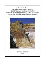
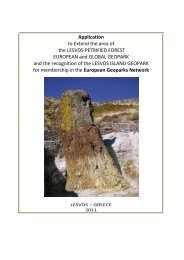
<strong>Applicatopn</strong> <strong>dossier</strong> <strong>for</strong> <strong>nomination</strong> <strong>as</strong> a<br />
<strong>European</strong> <strong>Geopark</strong><br />
Enclosure 3
INDEX<br />
A. DEFINITION OF THE REGION BEING PROPOSED FOR NOMINATION AS A EUROPEAN GEOPARK<br />
A.1. NAME OF THE REGION PRPOSED FOR NOMINATIONS AS A EUROPEAN GEOPARK………………………3<br />
A.2. LOCATION……………………………………………………………………………………………………………...3<br />
A.3. SURFACE AREA, GEOGRAPHICAL AND HUMAN STATISTICS<br />
A.4. DETAILED DESCRIPTION OF THE ORGANISATION IN CHANGE OF THE REGION BEING PROPOSED FOR<br />
NOMINATION AS A EUROPEAN GEOPARK …………………………………………………………………………….4<br />
A.5. ENCLOSURES …………………………………………………………………………………………………………..4<br />
B. SCIENTIFIC DESCRIPTION OF THE REGION BEING PROPOSED FOR NOMINATION AS A EUROPEAN<br />
GEOPARK<br />
B.1. DEFINITION OF THE GEOGRAPHIC REGION IN WHICH THE NOMINATED AREA IS LOCATED ………………….……5<br />
B.2. GENERAL GEOLOGICAL DESCRIPTION ………………………………………………………………………………….…….5<br />
B.2.1. PLAN DENUDATSIONNAJA………………………………………………………………………………………..5<br />
B.2.2. KARSTIC PROCESSES IN LAKE BASKUNCHAK VICINITIES …………………………………………………5<br />
B.2.3. BOLSHOE BOGDO MOUNTAIN……………………………………………………………………………………6<br />
B.2.4. FORMS OF ROKS EOLATION ON ROCKY SEDIMENTATIONS IN NEAR VICINITIES OF BOLCHOYE<br />
BOGDO AND “SINGIN ROCKS” ………………………………………………………………………….6<br />
B.2.6. THE HOLE SHARBULACK………………………………………………………………………………………….6<br />
B.2.7. KARSTIC FORMS OF RELIEF………………………………………………………………………………………6<br />
B.2.8. CAVES OF CORROSION – EROSION TYPE CAVE SHARBULACK…………………………………………….7<br />
B.3. THE GEOLOGICAL PERIODS ………………………………………………………………………………………..10<br />
B.4. GEOMORPHOLOGICAL FEATURES ………………………………………………………………………………..11<br />
C. ARGUMENTS FOR NOMINATING THE TERRITORY AS A EUROPEAN GEOPARK<br />
C.1. COMPREHENSIVE ANALYSIS OF THE TERRITORY'S POTENTIAL FOR THE DEVELOPMENT OF GEOTOURISM…...13<br />
C.2. OVERVIEW OF THE EXISTING GEOINSTITUTION AND GEO-ACTIVITIES IN THE REGION OF THE GEOPARK…….13<br />
C.3. POLICIES FOR THE PROTECTION, ENHANCEMENT AND ECONOMIC DEVELOPMENT OF THE GEOLOGICAL<br />
HERITAGE PRESENT IN THE TERRITORY. ……………………………………………………………………………………….…..13<br />
C.4. THE TERRITORY'S INTEREST IN JOINING THE EUROPEAN GEOPARK NETWORK ……………………………………13<br />
D. GENERAL INFORMATION ON THE TERRITORY<br />
D.1. ECONOMICAL ACTIVITIES, DESCRIPTION OF THE PRIMARY STRUCTURES RESPONSIBLE FOR THE<br />
SUSTAINABLE DEVELOPMENT OF THE TERRITORY………………………………………………………………………………14<br />
D.2. THE PROVISIONS FOR THE PROTECTION OF THE TERRITORY……………………………………………………………14<br />
D.3. PROTECTION STATUS OF THE TERRITORY…………………………………………………….……………………………..14<br />
D.4. EXISTING FACILITIES……………………………………………………………………………….…………………………….14<br />
D.5. FUTURE FACILITIES PLANNED………………………………………………………………………………………………….15<br />
2
A. DEFINITION OF THE REGION BEING PROPOSED FOR NOMINATION AS A UROPEAN<br />
GEOPARK<br />
A.1. NAME OF THE REGION PRPOSED FOR<br />
NOMINATIONS AS A EUROPEAN GEOPARK:<br />
The name that is proposed <strong>for</strong> the site applying to take<br />
part in the EUROPEAN NETWORK of GEOPARK is<br />
“BOGDINSKO-BASKUNCHAKSKY GEOPARK”. The<br />
area lies within the borderline of the present Bogdisko-<br />
B<strong>as</strong>kunchaksky reserve.<br />
A.2. LOCATION<br />
The geopark settles down in the south of Russia in the<br />
western part of Near-C<strong>as</strong>pian lowland on a left bank of<br />
the river of Volga within Ahtubinsky administrative area<br />
of the Astrakhan area.<br />
The geopark territory settles down in 50 kilometres<br />
from an administrative centre of the given territory -<br />
Ахтубинска. In immediate proximity from the given<br />
territory on distance about 12 km settlements the<br />
Verhny , Nigniy Bottom and Srednij B<strong>as</strong>kunchak settle<br />
down.<br />
<strong>Geopark</strong> area it is possible to reach railway and motor<br />
transport. By train it is desirable which settles down in<br />
15 kilometres from geopark will stop at station Verhny<br />
B<strong>as</strong>kunchak, further journey is carried out by motor<br />
transport. For Journey on the car the network of the<br />
highways connecting an connect the Astrakhan and<br />
Volgograd are<strong>as</strong> too can be used <strong>for</strong> journey to<br />
geopark.<br />
The nearest international airports settle down in the<br />
cities of Astrakhans and Volgograd, located within 300<br />
kilometres from geopark territory. This distance can be<br />
overcome by the bus, a train, or the car on it will leave<br />
about 4 hours.<br />
A.3. SURFACE AREA, GEOGRAPHICAL AND<br />
HUMAN STATISTICS<br />
The area is in limits of Bogdinsko-B<strong>as</strong>kunchak<br />
reserve. Its area makes 18478 hectares. The reserve<br />
consists of two sites: Vicinities of salty lake<br />
B<strong>as</strong>kunchak and mountain Big Богдо (16483<br />
hectares) and a site «the Green garden» (2004<br />
hectares). In all territory of geopark the economic<br />
activities are not carried out, the given area is<br />
especially protected territory.<br />
<strong>Geopark</strong> holistic way<br />
Our geopark policy is aimed to create a connection<br />
between man, environment, culture, society and<br />
geology in close agreement with the general<br />
philosophy of the <strong>European</strong> <strong>Geopark</strong>s Network.<br />
The geological diversity found within the geopark<br />
offers great possibilities to demonstrate how geology is<br />
able to influence the bio-diversity, animal breeding,<br />
agriculture, communication and the very important<br />
<strong>as</strong>pects of life and cultural evolution like the human<br />
presence ever since pre-history and proto-history, and<br />
the great epopee during which the exploitation of<br />
gypsum and saltw<strong>as</strong> carried out.<br />
3<br />
Population<br />
The resident population of the District involved is equal<br />
to 73152 in habitants (Istat, 2007). The average<br />
population density is 9.3 inhabitants / sq.km.<br />
In the l<strong>as</strong>t ten years the resident population of the<br />
area, likewise <strong>for</strong> the total province population, h<strong>as</strong><br />
been subject to a decre<strong>as</strong>ing flux. Such trend however<br />
results <strong>as</strong> a contr<strong>as</strong>t, compared to the regional value<br />
which is substantially stable.<br />
B. Bogdo<br />
Tourism<br />
Despite presence of a considerable cultural heritage.<br />
The tourist stream which concerns all area comes to<br />
an end in the digital <strong>for</strong>m bad.<br />
Tourism in territory of Bogdinsko-B<strong>as</strong>kunchak reserve<br />
h<strong>as</strong> the big history and is developing branch. Here in<br />
territory of Bogdinsko-B<strong>as</strong>kunchak reserve there are<br />
the unique objects, capable to draw attention of<br />
tourists. Those are nature sanctuaries: mountain Big<br />
Bogdo, natural oundary a green garden, salty lake<br />
B<strong>as</strong>kunchak and karstic caves in its vicinities.<br />
No other geopark comparable to this in the<br />
<strong>European</strong> <strong>Geopark</strong> Network.<br />
Here there is unique in area денудационная a plain<br />
complicated by various <strong>for</strong>ms of a relief: funnels,<br />
caves, beams which were <strong>for</strong>med throughout many
thousand years. It became possible <strong>as</strong> a result of<br />
many transgressions of the C<strong>as</strong>pian sea which<br />
promoted <strong>for</strong>mation of the salty lake B<strong>as</strong>kunchak<br />
largest in Europe. In territory of geopark it is a lot of<br />
places where ancient adjournment leave on a day<br />
surface, <strong>for</strong>ming unique geological landscapes.<br />
A.4 ORGANIZATION IN CHARGE OF THE<br />
EUROPEAN GEOPARK ZONE<br />
Bogdinsko-B<strong>as</strong>kunchakskiy <strong>Geopark</strong> – A Quality<br />
Rural, Cultural,<br />
Sustainable Tourist District<br />
To resort to an <strong>as</strong>sociative District locally, represents<br />
an attempt to put into a network all those factors<br />
around a good idea <strong>as</strong> a precise, locally integrated,<br />
sustainable development strategy and, at the same<br />
time, the District is the strategic instrument to relaunch<br />
those identity values that can be found within a<br />
territory, <strong>as</strong> an evolved product of the interaction<br />
between natural and cultural factors.<br />
Thus it finds synthesis and development in the geotourism<br />
and <strong>Geopark</strong> idea, <strong>for</strong> the revaluation and thus<br />
the safeguard of the local rural heritage.<br />
The District strategy can have a triple valence:<br />
1.<strong>as</strong> an instrument to program the sustainable<br />
development of the Bogdinsko-B<strong>as</strong>kunchakskiy area,<br />
2.<strong>as</strong> an operational support to reposition that part of<br />
the territory to a ready tourism,<br />
3.<strong>as</strong> a hauling element <strong>for</strong> the area with a<br />
highpotential, but that is not able to take off.<br />
With the creation of the District, it is intended to<br />
revalue and promote in a new way the territory of the<br />
Bogdinsko-B<strong>as</strong>kunchakskiy <strong>Geopark</strong> and its<br />
resources, proposing a geo-tourism development with<br />
a series of “routes” that, at the same time, put in<br />
evidence the natural geologic wine, g<strong>as</strong>tronomy,<br />
tourist and cultural values while creating a coordinated<br />
and quality tourist-reception offer, even in<br />
relation to complementary services.<br />
А.5 ENCLOSURES<br />
1. Evaluation Dossier<br />
2. Letter of Commitmant<br />
3. Application Dossier<br />
4. Bibliograpfhy<br />
5. Selection of booklets<br />
6. Current perimeter map<br />
4
B. SCIENTIFIC DESCRIPTION OF THE REGION BEING PROPOSED FOR NOMINATION AS A EUROPEAN<br />
GEOPARK<br />
of pl<strong>as</strong>ters кунгурского a circle, hundred is caused by<br />
display hydrochloric тектогенеза. It h<strong>as</strong> defined wide<br />
development here alkali processes and, <strong>as</strong><br />
consequence, specific <strong>for</strong>ms of a relief. In the<br />
tectonic relation the territory represents the<br />
B<strong>as</strong>kunchak hydrochloric file testing a modern<br />
raising, and мульду, filled with lake B<strong>as</strong>kunchak. In<br />
the l<strong>as</strong>t of 15-20 thousand years the site tested a<br />
raising with a speed to 0,04-0,06 millimetres a year. It<br />
testifies to high tectonic activity in plat<strong>for</strong>m conditions.<br />
Structural features, history of geological development<br />
and climate have defined a geomorphological<br />
structure of territory. The site денудационной plains<br />
with an absolute mark of 149,6 metres Here settles<br />
down. The plain Denudatsionnaja corresponds to a<br />
hydrochloric file and smoothly p<strong>as</strong>ses in<br />
accumulative which surrounds lake B<strong>as</strong>kunchak.<br />
B.1. DEFINITION OF THE GEOGRAPHIC REGION IN<br />
WHICH THE NOMINATED AREA IS LOCATED<br />
The lake B<strong>as</strong>kunchak and mountain Bolhoe Bogdo are<br />
located in the western part of Near-C<strong>as</strong>pian lowland on<br />
the left co<strong>as</strong>t of the river Volga. The main element of<br />
hydrography in the given area is the salty lake<br />
B<strong>as</strong>kunchak, it in Near-C<strong>as</strong>pian lowland which area<br />
makes of the largest lakes about 12 square kilometres.<br />
It is a large hollow not having a drain, being in the<br />
central part in which flow down superficial waters from<br />
surrounding heights. At lake co<strong>as</strong>t is more than 70<br />
ravines. At e<strong>as</strong>t co<strong>as</strong>t «Gorkaj Rechka» - the largest<br />
source is located. The absolute mark of a surface of<br />
lake B<strong>as</strong>kunchak makes-21,3 metre. The western co<strong>as</strong>t<br />
more abrupt also h<strong>as</strong> developed овражную a part. In<br />
area there are small fresh lakes. They represent falls in<br />
a relief. As a whole vicinities represent hilly plain.<br />
On the character the climate of the given area concerns<br />
a climate of northern desert. In a cold se<strong>as</strong>on<br />
continental polar air which arrives with e<strong>as</strong>t or юго e<strong>as</strong>t<br />
winds here dominates. In the winter these winds cause<br />
cold, and in the spring - droughty hot weather. This air<br />
h<strong>as</strong> small humidity and low temperatures. In a cold<br />
se<strong>as</strong>on intrusion of Arctic dry and cold air which cause<br />
the sharp cold snaps accompanied by a strong wind<br />
from northwest, northern and to northe<strong>as</strong>t directions is<br />
periodically observed.<br />
In summer and autumn months the field of the raised<br />
pressure quite often broken by p<strong>as</strong>sage of cyclones,<br />
moving on average widths is established. At this time<br />
year, <strong>as</strong> well <strong>as</strong> in the winter, prevailing influence<br />
remains behind continental polar air which happens dry<br />
enough and прогретым, arriving here with northern,<br />
northe<strong>as</strong>t and e<strong>as</strong>t winds.<br />
Considerable deposits are observed seldom and<br />
b<strong>as</strong>ically are connected with an exit of southern<br />
cyclones.<br />
Air temperature h<strong>as</strong> sharply expressed annual course.<br />
The coldest months in this territory are February and<br />
January. Average monthly temperatures of air almost<br />
identical also make 8,6 and 8,5 degrees of Celsius of a<br />
frost.<br />
The average annual temperature of air is equal 8,2<br />
degrees of Celsius. Высокте summer temperatures of<br />
air are combined with sharp changes of temperatures<br />
of day and night, and <strong>as</strong> in low temperatures of winter<br />
During большей parts of year prevail northe<strong>as</strong>t and<br />
e<strong>as</strong>t winds, reaching a maximum in a cold se<strong>as</strong>on. In<br />
November, December, January winds e<strong>as</strong>t, from<br />
February till May - northe<strong>as</strong>t prevail.<br />
Within a year deposits drop out non-uni<strong>for</strong>mly. The<br />
greatest quantity of deposits drops out in December -<br />
26,5 mm, the le<strong>as</strong>t - in February - 18,3 mm.<br />
B.2. GENERAL GEOLOGICAL DESCRIPTION<br />
In the modern geological plan the area represents the<br />
arch of the large B<strong>as</strong>kunchak hydrochloric file<br />
surrounded межкуполными with hollows. Feature of a<br />
geological structure is presence near to a day surface<br />
5<br />
Bolshoe Bogdo mountain<br />
B. 2.1. Plain Denudatsionnaja.<br />
The plain Denudatsionnaja occupies a considerable<br />
part of territory round lake. Its absolute marks go<br />
down from periphery in a direction to lake from 19,7<br />
metres to 0 metres. During the period<br />
раннехвалынской transgressions all territory h<strong>as</strong><br />
been covered by the sea. Only the mountain Bolhoe<br />
Bogdo with an absolute mark of 49-50 metres<br />
towered in the <strong>for</strong>m of island.<br />
B. 2. 2. Karstic processes in lake B<strong>as</strong>kunchak<br />
vicinities<br />
Karstic <strong>for</strong>ms of a relief around lake B<strong>as</strong>kunchak are<br />
caused by an exit on a day surface осадочных<br />
breeds old paleozoic the age, presented ander perm
pl<strong>as</strong>ters kungurian a circle. Pl<strong>as</strong>ters are lifted on a day<br />
surface owing to hydrochloric tectonics and make the<br />
top part Hydrochloric dome a file in which modern<br />
karstic processes intensively proceed.<br />
B 2.3. Bolshoe Bogdo mountain<br />
The height above the sea level is 149,6m. It is the<br />
highest point of Pric<strong>as</strong>pian lowland.<br />
Flank processes are observed on the most raised<br />
sections, especially in the area of Bolshoye Bogdo.<br />
Under the action of temporarily arising trickles,<br />
gravitational <strong>for</strong>ces, wind the drift of superficial rocks<br />
and <strong>for</strong>mation of delluvial aprons with the capacity up to<br />
10-15m occurs.<br />
Thus, on hollows of a drain and gullies the drift of rocks<br />
with denudation plains onto accumulative ones and<br />
directly into the lake B<strong>as</strong>kunchack occurs. As a result of<br />
Khvalynian sediments more ancient rocks frequently<br />
submitted by gypsums drift onto the surface of the<br />
mountain.<br />
The lake B<strong>as</strong>kunchack<br />
B 2.4. Forms of rocks eolation on rocky<br />
sedimentations in near vicinities of Bolshoye<br />
Bogdo and « Singing rocks»<br />
In conditions of arid climate physical eolation and eolian<br />
processes are actively shown that results the <strong>for</strong>mation<br />
of outliers of destruction, cellular <strong>for</strong>ms. In separate<br />
places dense rocks collapse even up to sandy<br />
sediments. Wind makes deflation, corrosion, it sorts<br />
sand, carries out finer particles far beyond their initial<br />
distribution.<br />
B 2.5. The lake B<strong>as</strong>kunchack<br />
B<strong>as</strong>kunchack is the salty lake having the area about<br />
115 km ². It is situated in the area of Ahtubinsk<br />
(Astrakhan region), geographical coordinates: 48°10’<br />
northern latitude, 46°53’ e<strong>as</strong>tern longitude/48,166667°<br />
northern latitude, 46,883333° e<strong>as</strong>tern longitude,<br />
approximately in 270km to the north from the C<strong>as</strong>pian<br />
sea, and in 53 km to the e<strong>as</strong>t from Volga.<br />
Shore line in the lake is 21m below the sea level. Water<br />
in the lake is replenished with a help of the small river<br />
Gorkaya, area of a reservoir of which is 11000 km ²,<br />
and with a help of 25 springs. Salinity of the lake is<br />
about 300 gram per litre. Capacity of salt superficial<br />
deposits in the lake is 10-18 m. As a result of salt<br />
6<br />
extraction craters with the depth up to 8 meters were<br />
<strong>for</strong>med. The depth of salt bedding is 6 km. In spring<br />
and in autumn the level of brine in the lake is<br />
maximal - up to 1 meter. In brine bacteria which bear<br />
salt live only.<br />
Since VIII century salt w<strong>as</strong> extracted from the lake<br />
and sent along a Silky way.<br />
For the first time the lake B<strong>as</strong>kunchack is officially<br />
mentioned in 1627 in « The Book of Big Drawing »,<br />
the first geographical description of Russia <strong>as</strong> a<br />
place, « where people extract salt pure <strong>as</strong> ice ».<br />
Today extremely pure salt of lake (99.8 % NaCl)<br />
<strong>for</strong>ms up to 80 % from the general extraction of salt in<br />
Russia. Depending on need, from 1,5 up to 5 million<br />
tons of salt in a year are extracted here. For export of<br />
salt the B<strong>as</strong>kunchack railway w<strong>as</strong> constructed.<br />
At the lake co<strong>as</strong>t there are deposits of medical caolin.<br />
B 2.6. The hole Sharbulack<br />
The section is situated on the southern co<strong>as</strong>t of the<br />
lake B<strong>as</strong>kunchack, to the e<strong>as</strong>t of mountain Bolshoye<br />
Bogdo. It is characterized by the presence of various<br />
<strong>for</strong>ms of the karstic phenomena: caves, craters,<br />
gaps, gullies, cracks, etc.<br />
B 2.7. Karstic <strong>for</strong>ms of relief<br />
The karst in the area of B<strong>as</strong>kunchack is caused by an<br />
output of sedimentary rocks позднепалеозойского<br />
age, submitted by bottom Permian gypsums of the<br />
Kungurianstage, onto the earth surface. Gypsums<br />
are lifted on a day time surface owing to hydrochloric<br />
tectonics; they represent the top part of the salt<br />
cupola m<strong>as</strong>sive in which present karstic processes<br />
intensively proceed.
Karstic gypsums border a bowl of the lake<br />
B<strong>as</strong>kunchack non-uni<strong>for</strong>mly. I.V.Golovachyov offered<br />
the following allocation of karstic fields. Northern field<br />
surrounds a bowl of B<strong>as</strong>kunchack from the west, the<br />
north and the northe<strong>as</strong>t. It is conditionally shared into<br />
three parts: western – from the gully Belaya (Ak -<br />
Dzhar) to the south and west in borders of Kungurian<br />
gypsums extension; northern (or central) field extends<br />
from the gully Belaya to the e<strong>as</strong>t up to the lake Kar<strong>as</strong>un<br />
and to the north up to the lake Turgaj; the e<strong>as</strong>t field<br />
extends to the northe<strong>as</strong>t co<strong>as</strong>t of the lake B<strong>as</strong>kunchack<br />
between the river Gorkaya and the lake Kar<strong>as</strong>un. The<br />
e<strong>as</strong>t field is bordered from the northern field by the river<br />
Gorkaya and also l<strong>as</strong>ts to the e<strong>as</strong>t in borders of<br />
Kungurian gypsums extension. It consists of two<br />
detached closely spaced sections: Vac - Tausk and<br />
T<strong>as</strong>bulack. The southern field is located on the<br />
southern co<strong>as</strong>t of B<strong>as</strong>kunchack, to the e<strong>as</strong>t of Bolshoye<br />
Bogdo. Except <strong>for</strong> these three karstic fields the karstic<br />
removed and detached Cub- Тausk section is allocated.<br />
In the territory of the lake B<strong>as</strong>kunchack vicinities there<br />
are following <strong>for</strong>ms of a karstic relief:<br />
1. The negative superficial <strong>for</strong>ms of the given area<br />
karstic relief are: corries, craters, hollows, gullies.<br />
2. Gypsum hills with the height of up to 4,0 - 6,0m.,<br />
extended from the northe<strong>as</strong>t to the southwest on the<br />
northern and the northe<strong>as</strong>t co<strong>as</strong>t of the lake<br />
B<strong>as</strong>kunchack.<br />
3. Grottoes, niches, shelters (Transitive <strong>for</strong>ms from<br />
superficial karstic <strong>for</strong>ms to underground ones). On the<br />
researched area, within the limits of the northern<br />
gypsum field there are three grottoes: "Lisiy",<br />
"Koljuchiy" and "Sharovskoy".<br />
4. To underground karstic relief in the given area the<br />
following <strong>for</strong>ms can be concerned: karst cracks, karstic<br />
wells and caves.<br />
7<br />
Karst cracks are the most typical <strong>for</strong> the natural<br />
boundary Sharbulack on the southern gypsum field,<br />
and also <strong>for</strong> the central part of the northern gypsum<br />
field. Tectonic cracks (<strong>for</strong>med owing to salt domn<br />
tectonics) are poorly treated by karstic processes.<br />
Mainly they are strongly attached to the raised<br />
sections raised and gypsum hills. The width of<br />
cracks, <strong>as</strong> a rule, is not great (up to 0,4 - 0,6m.).<br />
They have the depth up to 4,0 - 6,0m., and even<br />
more. So, the disconnected crack «Grelka", h<strong>as</strong> the<br />
depth up to 12,5m. Bottoms of cracks are usually<br />
filled by detrital gypsums and friable alluvial sandy<br />
material.<br />
Karst wells. To karstic wells, the vertical cavities<br />
connected to the zone of vertical descending<br />
circulation of karstic waters concern. Depth of wells is<br />
up to 20,0m. Wells of the given area have a<br />
corrosion-erosive origin. They can be fragments of<br />
buried cavities, or the expanded channels of well -<br />
imaginative swallow holes. Wells are available in the<br />
central part of the northern gypsum field. Depth of<br />
them, <strong>as</strong> a rule, is not great - about 4,0 - 6,0m, width<br />
is about 1,0 - 2,0m, cross section is roundish. On<br />
subsurfaces channel corries can be met.<br />
B 2.8. Caves of corrosion – erosion type<br />
Cave Sharbulack.<br />
The entrance is situated in the natural hole<br />
Sharbulack, in the edge of karst-erosive hollow; it<br />
opens with a small descending window. The cave<br />
represents a twisting horizontal tailrace channel<br />
underrated in the distant part. The height of the<br />
entrance reaches 1,5m. The extension of the cave is<br />
about 40m. The maximal depth of the cave bedding<br />
from the steppe level is about 30m. In 2007 owing to<br />
entrance failure the cave became inaccessible <strong>for</strong><br />
visiting.<br />
Cave Grobick. The entrance is situated in the natural<br />
hole Sharbulack in gypsum exposure. The cave<br />
represents a vertical crack with a horizontal bottom.<br />
Between vertical walls in 4,5m above the floor there<br />
is a large wedged gypsum block which teared off the<br />
arch and looks like a coffin. The maximum height of<br />
the entrance is 7,5m. Be<strong>for</strong>e the creation of the state<br />
reserve the cave had been actively visited by tourists.<br />
Cave Cherep. The entrance of the cave is situated in<br />
the natural hole Sharbulack, in a slope of karstic<br />
crater; it is submitted with a small entrance grotto<br />
with a height of 2,5m and width of 3m. In the depth of<br />
the grotto the block with the inscription and the image<br />
of a skull with bones is located. In the beginning of<br />
the l<strong>as</strong>t century the cave w<strong>as</strong> named « Forty doors ».
The cave is situated in gypsum and represents the<br />
large landslide underground hall complicated with large<br />
blocks. Be<strong>for</strong>e the creation of the state reserve it had<br />
been actively visited by tourists.<br />
Cave Natechnaya. This cave is situated in the same<br />
crater <strong>as</strong> Cherep but on the opposite slope. It<br />
represents a large vertical crack (max. height up is to<br />
5m, width is up to 2,5m), with one small entrance -<br />
manhole, decorated with a white gypsum bark of<br />
secondary crystallization. Be<strong>for</strong>e the creation of the<br />
state reserve it had been actively visited by tourists. It<br />
h<strong>as</strong> been known since 1969.<br />
Cave November, 8. It is situated in the natural hale<br />
Sharbulack. It w<strong>as</strong> found in 1985. The entrance to the<br />
cave is located in a slope of karstic crater. The cave<br />
represents a descending crack in gypsum rock.<br />
General extent is about 30m. The depth from the<br />
steppe level is 13,3m.<br />
Cave March, 8. The entrance is the horizontal channel<br />
of roundish section leaving under the b<strong>as</strong>is of a gypsum<br />
exposure in the western slope of karstic crater. Further<br />
the cave runs along cracks deep into the m<strong>as</strong>sive <strong>as</strong> a<br />
narrow horizontal way. It is narrow, difficultly p<strong>as</strong>sable<br />
and short. It is seldom visited. It w<strong>as</strong> found in 1968.<br />
Cave Familnaja. It is located in the natural hole<br />
Sharbulack. It represents a large vertical crack (max.<br />
height up is to 5m, width is up to 2,5m), with one small<br />
entrance - manhole, decorated with a white gypsum<br />
bark of secondary crystallization. The height of the<br />
manhole is about 8m. The extent is about 20m. The<br />
width is 0,6-0,8m. It is very seldom visited. The<br />
entrance is obstructed. The cave is found in 1968.<br />
Cave Vodjanaja - 1. It is located in the natural hole<br />
Sharbulack in the b<strong>as</strong>is of a slope karstic crater. The<br />
extent of the cave is about 10-12m, the width is 1-1,5m<br />
and the height is 2,5m. The cave obliquely runs to the<br />
bottom and tooks to the small lake with the area of<br />
about 4m and the depth up to 2,5m. It w<strong>as</strong> found in<br />
60th years.<br />
Cave Vodjanaja - 2. It is located in the natural hole<br />
Sharbulack. The entrance represents a narrow<br />
extended window following to a cavity. The extent of a<br />
cave is about 38m. In the cave there are two small<br />
lakes with the area of 10m and 6,7m, the depth is up to<br />
1,5m and up to 3,5m accordingly. It w<strong>as</strong> found in 1989.<br />
Cave Dlinny razlomchick. It is situated in the natural<br />
hole Sharbulack. The entrance is located on the slope<br />
8<br />
of a karstic crater. The cave represents a vertical<br />
crack with the inclined sandy floor and blindly coming<br />
to the end in the distant part. The extent is about<br />
16m. The height is up to 3,5m, width is 0,5-0,6m. The<br />
cave w<strong>as</strong> found in 1989.<br />
Cave Gluboky razlomchik. It is situated in the<br />
natural hole Sharbulack. The entrance is located in a<br />
karstic well. The cave represents a vertical<br />
descending crack in gypsums, the depth is up to 10m<br />
and its width is about 0,5m. The cave w<strong>as</strong> found in<br />
2002.<br />
Cave Аstrahanka. It is situated in the southwest part<br />
of the natural hole Sharbulack. The entrance is<br />
located on the slope of a karstic hollow, in the b<strong>as</strong>is<br />
of a gypsum exposure. The extent is about 20m. The<br />
average height of the manhole is about 2-2,5m. It<br />
w<strong>as</strong> found in 2000.<br />
Cave Obmanka. It is situated in the southwest part of<br />
the natural hole Sharbulack. The entrance is located<br />
on the slope of a karstic hole, in the b<strong>as</strong>is of gypsum<br />
exposure. The maximal depth of the cave bedding<br />
from the steppe level is 21,3m. The extent is about<br />
16m. The average height of the manhole is about 1-<br />
1,3m. The width of it is about 2-2,5m. The size of the<br />
cave entrance is 2,7 X 2,1m. It blindly comes to a low<br />
manhole. It w<strong>as</strong> found in 2000.<br />
Cave Sharovskaya - 1. It is situated on the western<br />
co<strong>as</strong>t of B<strong>as</strong>kunchack. The entrance is located in a<br />
gypsum exposure (e<strong>as</strong>t exposition) and represents a<br />
narrow vertical crack running to the cavity. The b<strong>as</strong>ic<br />
part of this cave is submitted by the underground hall<br />
of a landslide origin. The hall h<strong>as</strong> sizes of 8-5,5m.<br />
Height of a hall is up to 4,5m. The floor of a cave is<br />
filled up with blocks and pieces of gypsum. It is<br />
located in immediate proximity from a day time<br />
surface. It w<strong>as</strong> found in 1995.<br />
Cave Sharovskaya - 2. It is situated on the western<br />
co<strong>as</strong>t of B<strong>as</strong>kunchack. The entrance is located in a<br />
gypsum exposure of karstic crater southern slope.<br />
The cave is submitted by bursi<strong>for</strong>m poorly<br />
descending cavity, in distant bottom part of which<br />
there is a small lake with the area of about 15m2,<br />
with the depth of 1,5m. The extent of the cave is<br />
about 11m. The depth from the surface level is 10m.<br />
It w<strong>as</strong> found in 1995.<br />
Cave Sharovskaya - 3. It is situated on the western<br />
co<strong>as</strong>t of B<strong>as</strong>kunchack. The entrance is located in a<br />
gypsum exposure and represents a narrow horizontal
crack through which it is possible to get in a cavity. The<br />
cave is low (0,7-0,8m) and wide (up to 4m), with the<br />
plane sandy bottom, almost without detrital gypsum<br />
material. The extent of the cave is about 12m. The<br />
depth from the surface is about 7m. It w<strong>as</strong> found in<br />
1995.<br />
Cave B<strong>as</strong>kunchakskaya. It is the largest cave in<br />
Northern PriC<strong>as</strong>pian. It is situated in the small flat<br />
bottom valley Pezherskaya. It h<strong>as</strong> been known <strong>for</strong><br />
about 100 years. The c<strong>as</strong>e h<strong>as</strong> three entrances. It is<br />
laid in the Perm gypsums of Kungurian stage. It is<br />
developed on a vertical crack of submeridional<br />
direction. Its extent is about 1480m. The depth from the<br />
surface level is 32m. Its volume is about 9400 cube. M.<br />
In a cave there is a underground lake the area about 10<br />
cubic meters. The cave w<strong>as</strong> investigated by the<br />
Saratov cave explorers in details in the beginning of<br />
80th years.<br />
Cave Devjat dyr. The cave is situated in the balka<br />
Pezchernaja. It is laid in karstic rest and located in a<br />
large karst-erosive hollow. It w<strong>as</strong> a part of the cave<br />
B<strong>as</strong>kunchakskaja earlier. The total extent of the cave is<br />
about 70m. As a whole the arch of the cave closely<br />
comes to the surface. The amplitude of the cave is<br />
0,6m. The cave h<strong>as</strong> many entrances of various sizes. It<br />
is e<strong>as</strong>ily accessible, that is why it is actively visited. The<br />
cave h<strong>as</strong> been known <strong>for</strong> a long time. For the first time<br />
it w<strong>as</strong> described by the Saratov cave explorers in the<br />
beginning of 80th years.<br />
Cave Оrgannaya. It is located in the middle part of the<br />
balka Belaya. The entrance is located in the b<strong>as</strong>is of a<br />
gypsum slope (e<strong>as</strong>t exposition) of northern from the<br />
top. The general extent of the cave is 22m at the<br />
relative depth is about 1m. The height of the arch is up<br />
to 2,5m. The depth of bedding from the steppe level is<br />
about 10m. It w<strong>as</strong> found and <strong>for</strong> the first time described<br />
in the beginning of 80th years.<br />
Cave Surprise. It is located to the north of the Belaja<br />
balka. The entrance is dated to a karstic hollow and<br />
opens with a steeply inclined 16-meter manhole. It runs<br />
to the hall with the area of about 16m2 and height up to<br />
3m. From the hall a very dirty channel, which length is<br />
about 28m, runs. Earlier in the middle of a channel<br />
there w<strong>as</strong> a small lake with the area of 6m2 and depth<br />
up to 1,5m. Since 2001 it h<strong>as</strong> not present. The general<br />
depth of a cave is up to 20m. It w<strong>as</strong> found and <strong>for</strong> the<br />
first time described in the beginning of 80th years.<br />
Cave Nevidimka. This cave is situated on the north of<br />
the Belaja balka. The entrance is in the southwest part<br />
of the abrupt southern slope of karstic crater. The cave<br />
begins with the small chamber from which the manhole<br />
dives down and deduces into a vertical crack. The<br />
depth of this cave is about 10m. The entrance is usually<br />
buried with adjournment of steppe vegetation ("roll -<br />
field") and also hardly acceptable. It w<strong>as</strong> found in 1989.<br />
Cave Metro. This cave is situated in upper reachers of<br />
Belaja balka. The entrance is located in the b<strong>as</strong>is of the<br />
large karst-erosive hollow southern slope. The cave<br />
represents tailrace tunnel with the extent of about<br />
100m. The cave w<strong>as</strong> found in 1989. At the moment of<br />
detection the height of the manhole w<strong>as</strong> 1,5m. For the<br />
next years it w<strong>as</strong> buried with sandy - loam adjournment<br />
9<br />
owing to a sliding of a hollow slope. Again it w<strong>as</strong><br />
opened in 2001. The height of the manhole now is<br />
about 1m.<br />
Cave Chabanskaya. The entrance is located in a<br />
blind karstic ravine. The general extent of this cave is<br />
82m. It w<strong>as</strong> found and surveyed by cave explorers in<br />
1988. Now it is inaccessible owing to entrance failure.<br />
It w<strong>as</strong> situated in immediate proximity from a day<br />
time surface.<br />
Cave Crystalnaya. It is located on the northern co<strong>as</strong>t<br />
of B<strong>as</strong>kunchack. It is the second largest cave on the<br />
given area. The cave begins with 15m - long well,<br />
running to the hall Holodny in the height up to 3m and<br />
sizes of 4 х 2,5m. Then the low manhole deduces to<br />
the hall Teply. The sizes of this hall are 16,5 х 9m at<br />
average height of about 2,5-3m. Further the cave<br />
comes to the end with 30m – long manhole. The<br />
depth of the cave from the steppe level is 30m. The<br />
cave is plentifully decorated with a white bark of<br />
secondary gypsum crystallization. At present here<br />
there is a small cave lake with the area of up to 2 m2.<br />
The cave is interesting due to various <strong>for</strong>ms of<br />
crystallization of cave minerals. It w<strong>as</strong> found in 1986.<br />
Cave Albina. It is situated on the northern co<strong>as</strong>t of<br />
B<strong>as</strong>kunchack. The entrance is located in 2,5m above<br />
a bottom of karstic crater, in its e<strong>as</strong>t slope. The depth<br />
of the cave from the steppe level is about 7m. Its<br />
extent is about 12m. The average height is 1m, width<br />
is 3-3,5m. The cave w<strong>as</strong> found in 1995.<br />
Cave Mihajlovskaja. It is situated on the north co<strong>as</strong>t<br />
of Lake B<strong>as</strong>kunchack. The entrance is located 4m<br />
below the steppe level and 2,5m above the bottom of<br />
the karstic crater. The cave depth is about 25m from<br />
the steppe level. The extent is about 35m. It is<br />
interesting due to the presence of 6m - depth well<br />
with the diameter of 2 m. It is complex and dangerous<br />
<strong>for</strong> p<strong>as</strong>sage, there<strong>for</strong>e the entrance is immured. It<br />
w<strong>as</strong> found in 1998.<br />
Cave Bolshoy Tupic ("Blind"). It is situated on the<br />
northern co<strong>as</strong>t of Lake B<strong>as</strong>kunchack. The cave h<strong>as</strong><br />
the large arch entrance located on the b<strong>as</strong>is of a<br />
karstic crater slope. The cave is submitted by the<br />
fragment of the large channel, blindly coming to the<br />
end with the imp<strong>as</strong>se. The extent is about 13m. The<br />
cave w<strong>as</strong> found in 1986.<br />
Cave Pervomajskaja. It is situated on northe<strong>as</strong>t<br />
co<strong>as</strong>t of B<strong>as</strong>kunchack and south - west of Lake<br />
Kar<strong>as</strong>un. The entrance is located in a blind karstic
avine, in the b<strong>as</strong>is of a gypsum exposure. The cave is<br />
submitted with tailrace channel. The general extent of<br />
the cave is about 65m; its depth from the surface is<br />
about 14m. It w<strong>as</strong> found in 2001.<br />
Cave Grelka. It is situated in the central part of the<br />
northern gypsum field. The cave represents vertical,<br />
opening on the surface, crack with the depth up to 12m<br />
and width of 0,4-0,5m. At the bottom of the crack snow<br />
is kept till the summer. Among similar and accessible to<br />
p<strong>as</strong>sage cracks this cave is the deepest. It w<strong>as</strong> found in<br />
1988.<br />
Cave Krestik. The entrance is located in a gypsum<br />
exposure at the bottom of a large karst-erosive hollow.<br />
The cave begins at the bottom of superficial well. It is<br />
<strong>for</strong>med by crossing of two vertical cracks. The<br />
max.height of the arch is up to 6m. It w<strong>as</strong> found in<br />
1990.<br />
Cave Karman. The cave is located in the natural<br />
hollow Vak-Tau in the b<strong>as</strong>is of a karstic crater slope.<br />
The cave represents a low, wide, blindly coming to the<br />
end cave – manhole with the extent up to10m. It w<strong>as</strong><br />
found in autumn, 1990.<br />
Cave Deniskina. The entrance to the cave is located in<br />
the b<strong>as</strong>is of a karstic crater slope. The cave begins with<br />
a small manhole deducing to the underground chamber<br />
with the diameter of about 3m and height up to 1,4m.<br />
From it is possible to get into the cross linearly<br />
extended manhole with a height up to 2m and length of<br />
about 16m. It w<strong>as</strong> found in 1995.<br />
Cave Skladskaja. The entrance is located in the<br />
central part of the karstic hollow <strong>for</strong>med due to merge<br />
of two craters. The cavity is submitted with low<br />
chamber near the entrance with a diameter of about 2-<br />
2,5m and height of 0,8-1,0m. Further there leaves a<br />
manhole with a diameter of 0,4-0,5m which through 6m<br />
comes to the end with a small chamber with a height of<br />
1,3m and width of 1m. It w<strong>as</strong> found in autumn of 1990.<br />
B 3. The geological periods<br />
The following complexes of rocks participate in the<br />
geological structure of territory.<br />
Paleozoic erathem<br />
The Perm system<br />
The bottom division<br />
Kungurian stage. Outlets of Kungurian adjournments on<br />
a day time surface are known in a vicinity of<br />
B<strong>as</strong>kunchack along balks Sinia, Pezchernaja and in the<br />
natural hollow Spher - Bulak.<br />
In a cut three packs are precisely allocated: the bottom<br />
is sulfate - terrigenous, the average is halogen and the<br />
top is sulfate – terrigenous too. Lithologically this pack<br />
is submitted by anhydrites, argillites, sections with<br />
individual prolayers of salt and aleurolites. The capacity<br />
of this pack is 80-150m.<br />
The halogen pack is combined mainly by stone salt,<br />
sulfur, light grey, middling-and large crystal, with<br />
inclusions of anhydrite, separate large units of which<br />
have the extended <strong>for</strong>m and trans<strong>for</strong>mations of<br />
intensively expressed processes of stone salt in post<br />
sedimentational period.<br />
In halogen thickness there are prolayers and lenses of<br />
anhydrites, argillites, less often aleurolites. Argillites are<br />
dark grey, aleurolite with a big maintenance of carbided<br />
10<br />
organic chemistry. Sandstones and aleurolites are<br />
dark grey, fine-grained.<br />
Top sulfate - terrigenous pack is deposited on salt<br />
and is combined by anhydrites with subordinated<br />
layers of clays, limestone, aleurolites, stone salt. Its<br />
capacity is 40 - 80m. On this pack the crucial<br />
importance w<strong>as</strong> rendered by secondary processes,<br />
first of all by erosion.<br />
Mesozoic erathem<br />
Tri<strong>as</strong>sic system<br />
The bottom division<br />
vetluzchskaya series. On the mountain Bolshoje<br />
Bogdo vetluzchskoye adjournment consists of<br />
conglomerate-sandy and sandy-argillaceous<br />
thicknesses (from below upwards). The bottom<br />
thickness with the capacity of about 90m consists of<br />
oligomict sandstones, mainly quartz,<br />
разнозернистых sandstones, more often finegrained,<br />
red - brown, green-grey. Sandstones p<strong>as</strong>s in<br />
gravelites and finely cut conglomerates. Pebbles of<br />
conglomerates consist of quartz, red and grey - color<br />
sandstones, aleurolites, clays and limestone. On a<br />
rough surface of sandstones thickness of clays with<br />
subordinates of low-power (up to 1m) prolayers of<br />
aleurolites and sandstones is deposited.<br />
Geological cut of B.Bogdo<br />
B<strong>as</strong>kunchack series. In the section of mountain<br />
Bolshoje Bogdo the conglomerate is established. In<br />
the cut of баскунчакской series characterized by<br />
terrigenous - carbonate structure, from below three<br />
packs are allocated upwards: clay, clayey-carbonate<br />
and sandy-argillaceous. The bottom part is submitted<br />
with clays with the subordinated prolayers of<br />
sandstones, aleurolites, less often limestones. Clays<br />
are brown - red, dark brown with bluish-gray spots,<br />
aleurite, and carbonate, not clear layered, and<br />
combined with fine clay.<br />
Overlying clayey-carbonate pack is combined by<br />
alternation of clays, carbonates with rare prolayers of<br />
aleurolites and sandstones. Clays are grey, greenishand<br />
brownish-grey up to dark grey, weakly<br />
carbonate, aleurite.<br />
A sandy-argillaceous pack crowns the cut of<br />
B<strong>as</strong>kunch<strong>as</strong>k series .<br />
Cretaceous system<br />
Outputs of cretaceous adjournment on a day time<br />
surface are known in the area of the lake<br />
B<strong>as</strong>kunchack, in hollows Belaja, Sinaja, Pezchernaya<br />
and natural boundaries ShChigrety.<br />
The top division<br />
Cretaceous outcrops are known in the northwest part<br />
of the lake B<strong>as</strong>kunchack area (in hollows Belaja,<br />
Sinaja, Pezchernaya). They are deposited with<br />
w<strong>as</strong>hout on spreading early Cretaceous<br />
adjournments and are characterized mainly by<br />
carbonate structure. The capacity of late Cretaceous<br />
adjournment reaches 624m.<br />
Cenomanian stage. Cenomanian <strong>for</strong>mations, being<br />
deposited transgressivly on the spreading<br />
adjournment, have a wide circulation. Lithologically
they are expressed by clay - siltstone thickness, on the<br />
separate are<strong>as</strong> with prolayers of marl.<br />
Turonian and conjac stages. Adjournments of these<br />
stages have universal development. They are<br />
deposited with w<strong>as</strong>hout on spreading cenomanian<br />
<strong>for</strong>mations and lithologically they are expressed by<br />
white, strong pelitomorphic and organogenic -<br />
pyrocl<strong>as</strong>tic limestones.<br />
Santonian stage. Santonian adjournments have a wide<br />
circulation. The bottom sublevel is combined by<br />
limestones of light grey colour, sometimes with a<br />
greenish shade, fractured. In the west of the examined<br />
area prolayers of marls and clays are traced. In the<br />
b<strong>as</strong>is of the cut the conglomerate submitted by a<br />
pebble of phosphorites, consolidated with caebonate<br />
cement is deposited.<br />
Early santonian sublevel is submitted by silica clays of<br />
grey and dark grey colours, layered, with interlensing of<br />
siltstone. In the roof of the cut following limestones are<br />
deposited: dark grey, carbonate, with prolayers of<br />
aleurolites.<br />
Campania stage. Campanian <strong>for</strong>mations have universal<br />
distribution and deposited with w<strong>as</strong>hout on spreading<br />
adjournment. The bottom sublevel is expressed by<br />
limestones of grey, greenish-grey, clay, pelitomorphic,<br />
with prolayers one-colour marls.<br />
Early Campanian sublevel is submitted by clays of dark<br />
grey colour, calcareous, aleurite, with prolayers of<br />
marls and limestones.<br />
Cainozoic erathem<br />
Quaternary system<br />
Quaternary adjournments are submitted by alternation<br />
of layers of sand and clays with prevalence in the cut of<br />
the l<strong>as</strong>t ones and subdivided into Khvalynian and<br />
modern adjournments.<br />
The list of rocks<br />
1. Anhydrite<br />
2. Argillite<br />
3. Table salt<br />
4. Aleurolite<br />
5. Clay<br />
6. Limestone<br />
7. Sandstone quartz<br />
8. Marl<br />
9. Gypsum<br />
B. 4 Geomorphological features<br />
The area of Bogdo and B<strong>as</strong>kunchack occupies the<br />
special position in geological structure. It is located in<br />
the northe<strong>as</strong>t part of the Northwest PriC<strong>as</strong>pian in<br />
vicinities of the lake B<strong>as</strong>kunchack and mountain<br />
Bolshoye Bogdo. The special feature of a geological<br />
structure is the presence near to a day time surface of<br />
gypsums of Kungurian stage that is caused by the<br />
display of hydrochloric tectogenesis. It h<strong>as</strong> defined here<br />
the wide development of leaching processes and, <strong>as</strong> a<br />
result, specific <strong>for</strong>ms of relief (craters, hollows, caves<br />
and others). Authors paid special attention to studying<br />
of these relief <strong>for</strong>ms.<br />
In the tectonic relation the territory represents<br />
Баскунчакский hydrochloric m<strong>as</strong>sive experiencing a<br />
11<br />
modern rising, and mould, filled with the lake<br />
B<strong>as</strong>kunchack. In one of exposures of Ubo hill<br />
(vicinities of the settlement Nizchny B<strong>as</strong>kunchack a<br />
layer of early Khvalynian clay with de<strong>for</strong>mation up to<br />
1-1,5m ) is traced. For the l<strong>as</strong>t 15-20 thousand years<br />
the section h<strong>as</strong> been uplifted with a speed of up to<br />
0,04-0,06mm per year that testifies the high tectonic<br />
activity in plat<strong>for</strong>m conditions.<br />
Structural features, history of geological development<br />
and climate have defined geomorphological structure<br />
of researched area. There is a unique presence in<br />
the Northwest PriC<strong>as</strong>pian of denudation plains with<br />
the absolute mark of 149,6m. The denudation plain<br />
refers to a hydrochloric m<strong>as</strong>sive and smoothly<br />
p<strong>as</strong>ses to accumulative plain, which outlines the lake<br />
B<strong>as</strong>kunchack. The mould is occupied with the lake<br />
and earlier it w<strong>as</strong> considered <strong>as</strong> compensatory one.<br />
But during the l<strong>as</strong>t decade in connection with the<br />
active extraction of salt, the mould bowing is not<br />
compensated by salt accumulating. There<strong>for</strong>e a<br />
surface of salt in the center of lake caves in about a<br />
minus of 21,2 m. in 90th of XX century up to a minus<br />
of 22 m in 2004.<br />
The peneplain occupies a significant part of territory<br />
the around the lake. Absolute marks of it go down<br />
from periphery in the direction of lake from 149,6m.<br />
Prevailing modern relief <strong>for</strong>ming processes are<br />
fluvial, karstic and processes of physical aeration.<br />
As a result of linear erosion hollows of a drain are<br />
<strong>for</strong>med. In total more than 70 hollows run into the<br />
lake.<br />
Other remarkable <strong>for</strong>m of a relief is gullies with the<br />
extent from several up to ten and more meters.<br />
Especially quickly they develop in ruts of roads after<br />
showers.<br />
On flat slopes of low raisings sections of a plane<br />
drain with the area from several square meters up to<br />
several tens square meters are <strong>for</strong>med. On hollows<br />
of a drain and gullies drift of rocks from the peneplain<br />
to accumulative one and directly to the lake<br />
B<strong>as</strong>kunchack occur. As a result Khvalynian<br />
adjournments are drifted and more ancient rocks<br />
frequently submitted by gypsums come onto the<br />
surface.<br />
Special interest is represented by karstic <strong>for</strong>ms of a<br />
relief. The karst area of B<strong>as</strong>kunchack, according to<br />
A.G.Chikisheva and N.A.Gvozdetskogo's<br />
cl<strong>as</strong>sification concerns to PriB<strong>as</strong>kunchack karstic<br />
district of Western - PriC<strong>as</strong>pian karstic province of<br />
PriC<strong>as</strong>pian karstic area of the E<strong>as</strong>t Europe karstic<br />
country.<br />
The karst area of the lake B<strong>as</strong>kunchack is caused by<br />
the exit onto a day time surface of sedimentary rocks<br />
of late Paleozoic age, submitted by late Perm<br />
gypsums of Kungurian stage. Gypsums are lifted<br />
onto a day time surface owing to hydrochloric<br />
tectonics and make the top part of the salt dome<br />
m<strong>as</strong>sive in which modern karstic processes<br />
intensively progress and which is the most accessible<br />
to researches. Karstic gypsums border the bowl of<br />
B<strong>as</strong>kunchack non-uni<strong>for</strong>mly.<br />
Karstic gypsums are strongly dim from a surface and<br />
are blocked by a thin cover of adjournment.
Overlapping rocks are submitted, <strong>as</strong> a rule, by sandy<br />
loams and loams of Khvalynian age. N.A.Gvozdetsky<br />
(1981) refers the karst of this area to the covered type.<br />
At the same time there are also local sections of the<br />
open karst. They b<strong>as</strong>ically are characteristic of large<br />
karstic-erosive hollows of a superficial drain (Belaja,<br />
Pezcherskaja, Sharovskaja) and natural hollow<br />
Sharbulak.<br />
For the area of lake B<strong>as</strong>kunchack G.V.Korotkevich<br />
gives the size of karst <strong>for</strong>ming activity - 3,25mm / year.<br />
The karstic relief of the area of lake vicinities develops<br />
from superficial and underground karstic <strong>for</strong>ms.<br />
To superficial <strong>for</strong>ms of karstic relief on the given area it<br />
is possible to include craters and hollows.<br />
The largest <strong>for</strong>ms of the karstic superficial relief in the<br />
given area are karst-erosive hollows of a superficial<br />
drain. They are developed b<strong>as</strong>ically on the western part<br />
of the northern gypsum field.<br />
To underground <strong>for</strong>ms of a karstic relief in the given<br />
area can be referred karstic wells and caves. To karstic<br />
wells vertical cavities connected to a zone of vertical<br />
descending circulation of karstic waters concern.<br />
The largest karstic cave of PriC<strong>as</strong>pian lowland is<br />
"B<strong>as</strong>kunchakskaya". According to the Saratov section<br />
of speleology the cave h<strong>as</strong> the extent of 1480,0m, the<br />
maximal depth is about 32,0m, its volume is about<br />
9400,0m3. It is situated on the northwest co<strong>as</strong>t of<br />
B<strong>as</strong>kunchack in top reaches of the superficial drain<br />
Pezcernaja.<br />
Cave "B<strong>as</strong>kunchakskaja" h<strong>as</strong> some inputs and<br />
concerns to the type of horizontal through (through<br />
p<strong>as</strong>sage) caves; it h<strong>as</strong> been known <strong>for</strong> more than<br />
hundred years. It is actively visited nowadays.<br />
Golovachev I.V. describes three tens caves in<br />
gypsums with the extent of more than 10,0km., but only<br />
7 of these caves are examined and there are published<br />
data about them.<br />
The accumulative plain adjoins to the lake<br />
B<strong>as</strong>kunchack. According the geomorphological<br />
expressiveness it is subdivided into two subtypes:<br />
gently-wavy which is deposited on the hypsometric<br />
level 0 - minus 10m and flat located on absolute marks<br />
from minus 10m up to minus 21,2m (isohypse, outlining<br />
the lake).<br />
The flat sinuosity of the plain of higher hypsometric<br />
level is caused by non-uni<strong>for</strong>m accumulation of<br />
deposits, drifted from peneplains and the differentiated<br />
display of hydrochloric tectogenesis.<br />
From the surface the plain is combined by early<br />
Khvalynian adjournments which are blocked from<br />
above by dealluvial ones, with the impurity of chippings,<br />
brought from the mountain and adjoining to peneplains.<br />
The flat plain is a part of the lake bottom and is<br />
combined from a surface by oozy deposits of a lake<br />
origin with the impurity of small salt crystals.<br />
The width of accumulative plain varies from 3km in the<br />
settlement Nizchny B<strong>as</strong>kunchack is up to 0,5km in the<br />
southwest part. The relief is complicated with hollows of<br />
a drain which through peneplains cross the<br />
accumulative plain.<br />
Lake B<strong>as</strong>kunchack is a unique <strong>for</strong>m of a relief - mould,<br />
filled with halogen type of deposits. Prior to the<br />
beginning of industrial development of salt the whole<br />
12<br />
surface of lake represented a dense salt layer.<br />
Geophysical investigation h<strong>as</strong> shown that salt is<br />
deposited up to the depth of 600m, but deep from the<br />
surface it alternates with sand, clay. In the plan the<br />
lake h<strong>as</strong> the wrong <strong>for</strong>m with the general orientation<br />
in a northwest direction. The extent of the lake on the<br />
big axis is 18 km, the general area is 106 км2. The<br />
significant part of the lake area (60 %) <strong>as</strong> a result of<br />
salt extraction is occupied by broken zones. These<br />
zones represent sections from which salt is taken up<br />
to the depth of 8m. Broken zones are filled with brine<br />
with a mineralization of 300 g/l. Natural process of<br />
salt accumulation is broken.
C. ARGUMENTS FOR NOMINATING THE TERRITORY AS A EUROPEAN GEOPARK<br />
C.1. COMPREHENSIVE ANALYSIS OF THE TERRITORY'S<br />
POTENTIAL FOR THE DEVELOPMENT OF GEOTOURISM<br />
Due to the considerable presence of sites with<br />
geological, naturalistic and archaeological interest, the<br />
Bogdinsko-B<strong>as</strong>kunchaksky reserve h<strong>as</strong> notable<br />
potential <strong>for</strong> the development of Geotourism. The<br />
onservation and evaluation of the lithological and<br />
morphological characteristics takes on an important<br />
scientific value.<br />
These elements condition the geological evolution of<br />
the area. The area is well known in the tourist market<br />
because of the tourist resort Salty lake B<strong>as</strong>kunchak and<br />
not le<strong>as</strong>t the majestic mountain Bolhoe Bogdo.<br />
Optimum to use possibilities <strong>for</strong> tourism, the reserve cooperates<br />
with the scientific organisations which develop<br />
techniques <strong>for</strong> improvement of tourist activity. As <strong>for</strong><br />
attraction of different tourist groups the reserve will<br />
organise a museum of natural history which exposition<br />
will be very interesting to visitors of reserve and will<br />
interest people of visitors <strong>for</strong> survey of sights.<br />
For financing of individual programs on protection of<br />
surrounding wildlife and geological objects the reserve<br />
co-operates with the various international organisations<br />
which are engaged in nature protection, such <strong>as</strong> WWF<br />
(the world fund of the wild nature).<br />
C.2. OVERVIEW OF THE EXISTING GEOINSTITUTION AND<br />
GEO-ACTIVITIES IN THE REGION OF THE GEOPARK<br />
The Bogdinsko-B<strong>as</strong>kunchaksky reserve throughout<br />
many years actively co-operates with the leading<br />
scientific organisations. These organisations carry out<br />
thematic scientific researches of geology, ecology of<br />
flora and reserve fauna. These researches are spent<br />
more than 10 years.<br />
Such scientific organisations co-operate with reserve<br />
<strong>as</strong>: the Astrakhan state university (research of flora,<br />
karstic caves), the Astrakhan state technical university<br />
(geological researches), the Russian university of<br />
friendship of the people (fauna research).<br />
Regularly carry out researches employees of zoological<br />
institute of the Russian Academy of Sciences and<br />
biological institute of the Russian Academy of<br />
Sciences.<br />
The researches in the field of tourist activity in geopark<br />
territory are spent by Institute of ecology of the Volga<br />
pool of the Russian Academy of Sciences.<br />
The scientific organisations publish works which<br />
expand an outlook of scientific and practical knowledge<br />
of flora, to fauna and geopark geology.<br />
C.3. POLICIES FOR THE PROTECTION, ENHANCEMENT<br />
AND ECONOMIC DEVELOPMENT OF THE GEOLOGICAL<br />
HERITAGE PRESENT IN THE TERRITORY.<br />
The reserve establishment h<strong>as</strong> carried out numerous<br />
scientific researches rather.<br />
13<br />
The geological heritage of area also co-operated with<br />
the scientific organisations to make this heritage<br />
popular.<br />
To advance development Geotourism, Park in<br />
cooperation with municipalities and with the Agencies<br />
responsible <strong>for</strong> development of tourism, intends to<br />
involve tourist operators in initiatives which are<br />
promoting of geological and geomorphological<br />
extreme итуаций.<br />
The Park establishment develops long-term plans<br />
aimed at protection экосистемы reserve and its<br />
development. In con<strong>for</strong>mity with principles of a<br />
sustainable development the establishment spends<br />
scientifically-practical conferences to which agenda<br />
questions of preservation of the environment and<br />
development of tourist and recreational activity enter.<br />
Also the reserve with its unique natural and<br />
geological complexes lets out a lot of printing and<br />
souvenir production with the logos and symbolics.<br />
C.4. THE TERRITORY'S INTEREST IN JOINING THE<br />
EUROPEAN GEOPARK NETWORK<br />
The Bogdinsko-B<strong>as</strong>kunchaksky reserve <strong>as</strong>pires to<br />
become a <strong>European</strong> <strong>Geopark</strong> because, besides<br />
having a unique geological heritage, h<strong>as</strong> <strong>for</strong> years<br />
carried out a policy of sustainable development. It<br />
includes a number of geological sites of particular<br />
importance in terms of scientific quality, rarity,<br />
aestheticism and of educational value. The territory is<br />
not only important <strong>for</strong> its geology, it possesses an<br />
enormous rchaeological, ecological, historical and<br />
cultural heritage. The Park Institution intends to make<br />
use of the management results developed by the<br />
<strong>European</strong> Network of <strong>Geopark</strong>s, utilising the label<br />
and a common image of quality that emph<strong>as</strong>izes the<br />
valorisation of the geological heritage and the<br />
sustainable development. The Bogdinsko-<br />
B<strong>as</strong>kunchaksky reserve intends to collaborate with<br />
the <strong>European</strong> Network of <strong>Geopark</strong>s and with the local<br />
entrepreneurs to promote and support the creation<br />
and commercialization of new products connected<br />
with the geological heritage.<br />
The sites of the Bogdinsko-B<strong>as</strong>kunchaksky reserve<br />
will have their own website and will be safeguarded.<br />
The Institution of the Bogdinsko-B<strong>as</strong>kunchaksky<br />
reserve h<strong>as</strong> an active role <strong>for</strong> the economic<br />
development and the valorisation of the territory and<br />
its heritage and is working <strong>for</strong> the development <strong>for</strong><br />
geotourism. It h<strong>as</strong> a positive influence on the quality<br />
of life of its inhabitants. This means that the residents<br />
are actively involved with the cultural<br />
revival of the territory. The Institution also promotes<br />
education on the environment, the <strong>for</strong>mation and the<br />
development of Scientific Research in its various<br />
disciplines in the Science of the Earth, improving<br />
natural environment and encouraging Sustainable<br />
Development Policies.
D. GENERAL INFORMATION ON THE TERRITORY<br />
D.1. ECONOMICAL ACTIVITIES, DESCRIPTION OF THE<br />
PRIMARY STRUCTURES RESPONSIBLE FOR THE<br />
SUSTAINABLE DEVELOPMENT OF THE TERRITORY<br />
In the territory of the region the production of local<br />
manufacturers are used: food stuffs in restaurant<br />
business, products of local m<strong>as</strong>ters in shops,<br />
organized markets realizing local agricultural<br />
production. In the region there are trade marks, <strong>for</strong><br />
example, «Astrakhan water-melon».<br />
In the territory of the region products and souvenirs<br />
from local materials (<strong>for</strong> example, salt in decorative<br />
packing) are accessible<br />
Promotion of local m<strong>as</strong>ters’ products is actively<br />
supported by the reserve; local production is<br />
advertised and exposed in the most favorable light.<br />
The reserve concludes contracts on manufacturing of<br />
souvenir production with national skilled craftsmen.<br />
The symbolics of the reserve is used by local<br />
commodity producers in labels of production sold both<br />
in the territory of region, and out of its limits.<br />
The reserve works under contracts with businessmen<br />
on granting transport services, manufacturing of the<br />
equipment of excursion routes, design services and<br />
manufacturing of printed, souvenir production.<br />
The reserve works in contact with industrial<br />
enterprises of the region, carrying out projects on a<br />
contractual b<strong>as</strong>is. There are joint projects financed by<br />
enterprises on manufacturing the advertising -<br />
publishing production, directed on popularization of<br />
geological appeal of the region (the edition of sets of<br />
cards, pocket and wall calendars, illustrated collections<br />
etc).<br />
D.2. THE PROVISIONS FOR THE PROTECTION OF THE<br />
TERRITORY<br />
Stay on the reserve territory of extraneous people who<br />
are not its workers or officials of the body in the<br />
authority of which there is the reserve, can be admitted<br />
only at the presence of this body or the reserve<br />
administration.<br />
The responsibility <strong>for</strong> infringement of the established<br />
mode or other rules of protection and use of the<br />
environmental natural environment and natural<br />
resources in the territory of reserve, its security zone<br />
and other specially protected territories under the<br />
authority of the reserve, comes according to the<br />
current legislation of the Russian Federation.<br />
D.3. PROTECTION STATUS OF THE TERRITORY<br />
1. On the whole territory of the reserve any activity<br />
contradicting to problems of reserve and a mode of<br />
special protection of its territory is <strong>for</strong>bidden, including:<br />
The actions changing a hydrological mode of grounds;<br />
Prospecting works and development of minerals,<br />
infringement of a soil cover, outcrops of minerals,<br />
exposures and rocks;<br />
Cutting of wood, except cuttings which are carried out<br />
in established order, preparation of galipot, wood<br />
juices, herbs and technical raw material, and also<br />
14<br />
other kinds of wood use, except <strong>for</strong> c<strong>as</strong>es stipulated<br />
by the present Statute;<br />
Mowing, cattle p<strong>as</strong>turage, accommodation of<br />
beehives and apiaries, gathering and preparation of<br />
wild-growing fruits, mushrooms, nuts, seeds, flowers<br />
and other kinds of using flora except <strong>for</strong> c<strong>as</strong>es<br />
stipulated by the present Statute;<br />
Construction and accommodation of industrial and<br />
agricultural enterprises, and their separate objects,<br />
construction of buildings and constructions, roads<br />
and overp<strong>as</strong>ses, transmission lines and other<br />
communications, except <strong>for</strong> necessary <strong>for</strong><br />
maintenance of reserve activity; thus concerning the<br />
objects stipulated by the general plan, sanctions of<br />
construction according to the legislation of the Russian<br />
Federation on local self-management and Town-planning<br />
code of the Russian Federation;<br />
Trade, sports and amateur hunting and fishering,<br />
other kinds of using fauna, except <strong>for</strong> c<strong>as</strong>es<br />
stipulated by the present Statute;<br />
Introduction of alive organisms with an aim of their<br />
acclimatization;<br />
Application of mineral fertilizers and chemicals of<br />
plants protection;<br />
Pollution of territory by household and industrial<br />
w<strong>as</strong>te products and dust;<br />
Transit run of pets;<br />
The presence, p<strong>as</strong>s and travel of extraneous people<br />
and motor transport outside of roads and general<br />
purpose waterways;<br />
Gathering of zoological, botanical, mineralogical and<br />
other collections, except <strong>for</strong> stipulated by subjects<br />
and plans of scientific researches in the reserve;<br />
Flight of helicopters and planes lower than 2000<br />
meters above the reserve without the coordination<br />
with its administration or Russia nature inspectorate,<br />
and also overcoming of a sound barrier above the<br />
territory of the reserve;<br />
Other activity breaking natural development of natural<br />
processes, menacing to the condition of natural<br />
complexes and objects, and also not connected with<br />
the per<strong>for</strong>mance of problems <strong>as</strong>signed to the reserve.<br />
2. In the territory of the reserve the realization of<br />
actions and the activity, directed at:<br />
Preservation in natural conditions of natural<br />
complexes, restoration, and also prevention of<br />
changes of natural complexes and their components<br />
in a result of anthropogenous influence;<br />
Maintenance of conditions providing sanitary and fireprevention<br />
safety of people, animals, natural<br />
complexes and objects;<br />
Prevention of dangerous natural phenomena (snow<br />
avalanches, rock falls, mud flows and others),<br />
menacing to life and settlements of people;<br />
Carrying out of scientific researches and ecological<br />
monitoring;<br />
Conducting of ecological and educational work;<br />
Realization of control functions.
3. In the reserve sections on which any intervention of<br />
people in natural processes is excluded. The sizes of<br />
these sections are defined proceeding from the<br />
necessity of preservation of the whole natural complex<br />
in natural conditions.<br />
D.4. EXISTING FACILITIES<br />
In the reserve the network of foot routes which include<br />
the b<strong>as</strong>ic sights representing the interest <strong>for</strong> visitors of<br />
different interests is developed. Routes are regularly<br />
marked; the equipment of routes is checked on<br />
durability and is under repair. For visitors booklets with<br />
route maps are created. The reserve cooperates with<br />
the sanatorium “B<strong>as</strong>sol” where the full board <strong>for</strong> having<br />
a rest is stipulated.<br />
In the reserve territory excursions <strong>for</strong> groups by the<br />
number up to 30 people during the se<strong>as</strong>on from April<br />
to October are carried out. Excursions <strong>for</strong> groups with<br />
special interests are developed in the field of geology<br />
and geomorphology, <strong>for</strong> an audience with wide<br />
interests. The reserve works with visitors - invalids of<br />
4-3 groups. To visit the reserve is possible without the<br />
<strong>for</strong>ward ordering, registration is made after the arrival.<br />
Alongside with it the in<strong>for</strong>mation about the reserve is a<br />
part of the exposition in a local museum of history in<br />
Akhtubinsk and the museum of B<strong>as</strong>kunchack mining.<br />
In educational establishments of city in<strong>for</strong>mation<br />
stands reserve are made out.<br />
D.5. FUTURE FACILITIES PLANNED<br />
In the organisation the general plan <strong>for</strong> development of<br />
reserve in which the b<strong>as</strong>ic actions necessary <strong>for</strong><br />
per<strong>for</strong>mance in the future are designated is developed.<br />
For attraction of tourists and improvement of tourist<br />
activity on reserve territories it is planned:<br />
1 Organization of a geological route on territory of the<br />
reserve aimed at acquaintance with geological sights;<br />
2 Organization of excursion in karstic caves <strong>for</strong> survey<br />
of underground <strong>for</strong>ms of a relief, образовавщихся in<br />
pl<strong>as</strong>ter cavities;<br />
3 Organization of the big sightseeing tour on reserve<br />
with survey of geological, ecological and animal<br />
objects;<br />
4. The educational project on environment concerning<br />
geology and reserve geomorphology of "the aeration<br />
Form»;<br />
5. The publication of an in<strong>for</strong>mative material<br />
concerning a geological and geomorphological<br />
heritage Future Bogdinsko - B<strong>as</strong>kunchaksky <strong>Geopark</strong>;<br />
6. Realisation of traffic signs which describe<br />
geological, geomorphological features geosites;<br />
7. The publication of the guide on Bogdinsko -<br />
B<strong>as</strong>kunchaksky <strong>Geopark</strong>;<br />
8. The organisation and realisation of a museum of<br />
geology of mountain Bolchoe Bogdo.<br />
15