lesvos geopark
lesvos geopark
lesvos geopark

You also want an ePaper? Increase the reach of your titles
YUMPU automatically turns print PDFs into web optimized ePapers that Google loves.
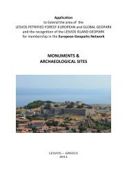
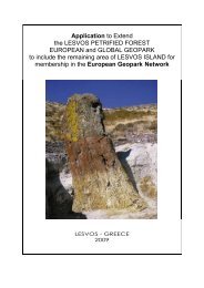
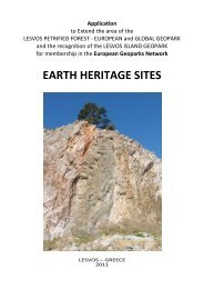
Application<br />
to Extend the area of<br />
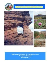
the LESVOS PETRIFIED FOREST<br />
EUROPEAN and GLOBAL GEOPARK<br />
and the recognition of the LESVOS ISLAND GEOPARK<br />
for membership in the European Geoparks Network<br />
LESVOS – GREECE<br />
2011
Extended Lesvos island Geopark Application<br />
Contents<br />
A. Identification of the Area............................................................ ................................ 3<br />
1. Name of the proposed Geopark ......................................................................................... 3<br />
2. Surface area, physical and human geography characteristics of the proposed Geopark .. 3<br />
3. Organization in charge and management structure (description, function and<br />
organigram) of the proposed Lesvos Geopark ………………………………………………………………….. 10<br />
4. Application contact person (name, position, tel./fax, e -mail) ……………………………………….. 13<br />
B – Geological Heritage ………………………………………………………………………………………………… 14<br />
1. Location of the proposed Lesvos Geopark (please include a geographical map and the<br />
geographic coordinates longitude and latitude coordinates) ……………………………………………. 14<br />
2. General geological description of the proposed Lesvos Geopark ………………………………….. 14<br />
3. Listing and description of the geological sites within the proposed Lesvos Geopark …….. 22<br />
4 Details on the interest of these sites in terms of their international, national, regional<br />
or local value (for example scientific, educational, aesthetic) …………………………………………… 24<br />
C. Geoconservation ………………………………………………………………………………………………………. 26<br />
1. Current or potential pressure on the proposed Lesvos Geopark …………………………………… 26<br />
2. Current status in terms of protection of geological sites within the proposed Lesvos<br />
Geopark ……………………………………………………………………………………………………………………………. 28<br />
3. Data on the management and maintenance of these sites …………………………………………… 30<br />
4. Listing and description of non-geological sites and how they are integrated into the<br />
proposed Geopark ……………………………………………………………………………………………………………. 33<br />
D. Economic Activity & Business Plan (including detailed financial information) …………… 36<br />
1. Economic activity in the proposed Lesvos Geopark ………………………………………………………. 36<br />
2. Existing and planned facilities for the proposed Lesvos Geopark (e.g. geo-education,<br />
geo-tourism, tourism infrastructure etc) ………………………………………………………………………….. 37<br />
3. Analysis of geotourism potential of the proposed Lesvos Geopark ………………………………. 44<br />
4. Overview and policies for the sustainable development of:<br />
- geo-tourism and economy<br />
- geo-education<br />
- geo-heritage ……………………………………………………………………………………………………………….. 44<br />
5. Policies for, and examples of, community empowerment (involvement and<br />
consultation) in the proposed Lesvos Geopark …………………………………………………………………. 48<br />
6. Policies for, and examples of, public and stakeholder awareness in the proposed<br />
Lesvos Geopark ………………………………………………………………………………………………………………… 49<br />
E. Interest and arguments for joining the EGN/GGN ……………………………………………………… 50<br />
2
A. Identification of the Area<br />
1. Name of the proposed Geopark<br />
The applicant area’s name is “Lesvos Geopark” and the present application is for the extension<br />
of the Lesvos Petrified Forest European and Global Geopark. Lesvos island is the third largest<br />
Greek island, and the seventh largest in the Mediterranean .<br />
Lesvos Island is well known for the Petrified Forest, its geodiversity and biodiversity, its<br />
protected areas that cover the largest part of the island presenting a variety of birds and<br />
wildflowers, the ancient olive groves and rare pine forests, the hot springs, its antiquities, the<br />
medieval castles, traditional villages and culture. Lesvos has an excellent network of trails,<br />
unique specimens of industrial architecture, monasteries and churches .<br />
The island is the birthplace of famous people of art and literature like the phi losopher<br />
Theophrastus, the singer and guitar-player Arion, the famous poet Sappho and Alkaeo, the<br />
musician and founder of the guitar Terpandros, the philosopher Pittako, the painter George<br />
Jakobidis and the Nobel Prize winner poet Odysseas Elitis.<br />
2. Surface area, physical and human geography characteristics of the proposed Geopark<br />
The island of Lesvos is located in the NE Aegean Sea. It is situated close to the coast of Asia<br />
Minor with an area of 1.636 km 2 and 370 km of coastline and a population of 90.463<br />
inhabitants.<br />
The sea enters deeply into the southern portion of the island and forms two enchanting<br />
bays with narrow entrances, namely the Kalloni and Gera gulfs. Small coves and fishing<br />
harbors ornament its shores and the headlands that are formed along the coast are most<br />
picturesque. Olive and pine trees cover mountains and plains on the central and eastern part<br />
of the island while a wide variety of aromatic and medical herbs are also present. 11 million<br />
olive trees produce more than 20.000 tons of oli ves per year.<br />
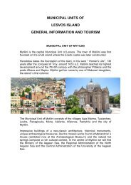
Mytilini is the capital town of the island and the administrative center of Lesvos Municipality<br />
and the Region of North Aegean, the seat of the General Secretary of the Aegean & Naval<br />
Policy and of the University of the Aegean. It is the commercial and cultural center of the island<br />
and has a population of 37,881 inhabitants (2001 census). Mytilini is largely built on the ancient<br />
town. It spreads amphitheatrically around the harbour with extension to the north and west<br />
highs. On the north of Mytilini the Venetian castle crowns a magnificent pine wood which<br />
reaches down to the shore. It is one of the largest mediaeval castles in the Eastern<br />
Mediterranean. Places of special interest are the Ancient Theatre with marvellous acoustics,<br />
the Archaeological Museum, the Byzantine Museum, Theophilos Museum, Teriade Museum<br />
of modern art and some of the monumental churches, having both impressive architectural<br />
features and ecclesiastical articles.<br />
On the Northern edge of the island stands the Mythimna Municipal Unit (2,375 inhabitants)<br />
which is the centre of the tourist development. Its capital is the picturesque town of<br />
Mythimna (Molyvos) which has been declared a settlement subject to preservation. Its castle<br />
crowns it from Byzantine times and makes it even more charming.<br />
Other Municipal Units of the Island are Kalloni with 8,073 inhabitants, Polichnitos with 5,163<br />
inhabitants, Plomari with 6,385 inhabitants, Agiasos with 2,581 inhabitants, Agia Paraskevi with<br />
2,454 inhabitants, Petra with 3,721 inhabitants, Mantamados with 3,024 inhabitants,<br />
Loutropoli Thermis 3,481 inhabitants, Evergetoulas with 3,242 inhabitants, Gera with 6,945<br />
3
inhabitants. On the extreme Western edge of the island lies the Eressos-Antissa Municipal Unit<br />
with 5,111 inhabitants (2001 census). The villages of this area are of incomparable wild beauty,<br />
where appear large accumulations of fossilised tree trunks comprising the well known<br />
«Petrified Forest of Lesvos».<br />
The Natural History Museum of Lesvos' Petrified Forest is located in Sigri village since 1994, in<br />
order to undertake scientific research on the natural monument, as well as the preservation<br />
and promotion of the Petrified Forest.<br />
The local economy is based on the agricultural production with an emphasis on olive oil<br />
production (of exceptionally high quality), cattle-raising (mainly dairy products) and fishing.<br />
Distillery is developed and its main product is the world famous ouzo. Many of the island’s<br />
inhabitants are professionally engaged in agricultural tourism.<br />
The climate is mild Mediterranean, the mean annual temperature is 18 °C (64°F), and the mean<br />
annual rainfall is 750 mm (29 in). Its exceptional sunshine makes it one of the sunniest islands<br />
in the Aegean. Snow is extremely rare as are temperatures below freezing.<br />
The Petrified Forest protected area<br />
On the western part of Lesvos Island, remains of fossil<br />
plants appear within volcanic rocks. The fossils<br />
comprise the well-known «Lesvos Petrified Forest»,<br />
which covers an area of 15,000 ha. Within this area,<br />
several unique palaeo-botanical sites showing high<br />
concentrations of fossilised tree-trunks have been<br />
discovered.<br />
The region of the Petrified Forest is characterized by<br />
impressive volcanic geotopes, result of the intense<br />
volcanic activity of the past. This region could be<br />
characterized as a window on the geohistoric<br />
development of the Aegean over the past 20 million<br />
years.<br />
Scientists researching and studying the Petrified<br />
Forest speak enthusiastically of the rarity and great<br />
scientific value of the monument and repeatedly<br />
emphasize the uniqueness of the site. There are<br />
many reasons for this. The Petrified Forest<br />
constitutes an entire forest ecosystem that was<br />
fossilised on site because of intense volcanic activity.<br />
Lesvos Petrified Forest<br />
The large number of fossilised trunks that have<br />
remained standing upright, with their root system<br />
fully developed, confirms that the trees were fossilised in their original position, thus this is an<br />
autochthonous fossilised forest.<br />
The fossilised trees and the parts of the plants have been preserved in excellent c onditions up<br />
to the present. The age of the forest and the great variety of fossilised plant species that have<br />
been found contribute to its great scientific value, whereas the composition of the fossilised<br />
4
flora is a particularly important guide to the climatic conditions, the environment and the<br />
geological conditions at that period.<br />
The systematic paleobotanical study of the petrified tree trunks and fossilised leaves enables<br />
the determination of the genus and species of the plants that made up the forest of Lesvos 20<br />
million years ago.<br />
At the area of Gavathas, in northwestern Lesvos, findings of the oldest known land mammal in<br />
Greece, Prodeinotherium bavaricum (first appearance of the family in Europe) have been<br />
recovered.<br />
At the Petrified Forest, we can gather information regarding the plant species which<br />
constituted the island’s flora, the climatic and geological conditions that prevailed in the<br />
Aegean area 20 millions years ago. In other words, the Petrified Forest constitutes a unique<br />
‘’testimonial’’ of the geological history of the Aegean basin over the past 20 million years.<br />
Map of Lesvos isl. with the Lesvos Petrified Forest Geopark (yellow) and protected areas<br />
The Paleofauna of Vatera<br />
The Natural History Collection of Vrisa houses the fossils that were collected in Vrisa and some<br />
characteristic rocks, animals and plants of Lesvos. The Collection was founded in September of<br />
1999 and it is housed in the building of the old school of Vrisa.<br />
Some of the samples of Collection are exposed, in order to give a general impression of the<br />
natural history of the region. The core of this exposition is the fossils of animals, which lived<br />
in Lesvos 2 million years ago.<br />
5
NATURA 2000 protected areas<br />
In the eastern part of Lesvos a rather moist climate prevails, in comparison with the rest of the<br />
island. The slopes of Mt. Olympus and the Amalis peninsula dominate the morphology, while in<br />
between them is the tectonic basin of the Gulf of Gera with impressive steep cliffs on its<br />
eastern side. Plants at lower elevations are typical of Mediterranean maquis plants,<br />
characteristically consisting of evergreen bushes (2-2.5 meters in height) with tough leathery<br />
leaves adapted to the Mediterranean climatic conditions. The se plants include olives, wild pear<br />
etc. At higher elevations on the slopes of Mt. Olympus, the flora changes to plants which have<br />
adapted to the more damp and cold climatic conditions. Myrtle, laurel, maple etc. grow here,<br />
as well as cultivated tree crops rarely found on Greek islands such as the chestnut groves of<br />
Agiassos and cherry, apple and pear orchards.<br />
A large part of the eastern side of the island is covered by olive groves which blanket the hills<br />
and slopes, supported by impressive dry stonewall terraces. From a distance the border<br />
between the silver grey leaves of the olives and the dark green maquis plants and pines is quite<br />
noticeable. This ecosystem sustains a wealth of birds, reptiles, insects and mammals.<br />
The Gulf of Yera with the Dipi Marsh and Mt. Olympus make up one of the three regions of the<br />
island which are part of a network of natural conservation called “NATURA 2000”.<br />
In the central part of the island, and especially around the Gulf of Kalloni, the climate becomes<br />
drier and there are plains with wheat, hay and vegetable fields. This region contains the largest<br />
gulf of the island, the Gulf of Kalloni. To the east and north of the Gulf of Kalloni, there are large<br />
mature pine forests which coincide with the borders of the ophiolitic remnants of the oceanic<br />
crust of Tethys. In the coastal area around the gulf there are 17 natural and artificial wetlands<br />
such as the salt flats which consist of a very important system that hosts significant numbers of<br />
water birds, both migratory and non-migratory, of international interest. The area is inundated<br />
every spring by birdwatchers from all over the world. The Gulf of Kalloni is one of three regions<br />
of the island which are part of a network of natural conservation called “NATURA 2000”.<br />
In the western part of the island, where the Petrified Forest is located, the climatic conditions<br />
change and become drier, the rocks are volcanic and the mountain slopes of Mt. Ordymnos<br />
dominate the morphology of the area. The flora in this part of the island is typical of<br />
Mediterranean frigana plants. The dominant plants are small round and thorny bushes<br />
between the craggy rocks. Thorny burnet, euphorbia sp., prickly broom, and greater knapweed<br />
constitute a continuous and thick layer of plants, which together with the rocks is virtually<br />
impassable for a hiker. For the frigana micro-environment, spring and early summer brings the<br />
blooming of a wide variety of plants such as orchids, the thirty different types of which impress<br />
the observer with eccentric shades of color. In amongst these plants there are also many fruit<br />
and insect-eating, as well as predatory, birds, rabbits, mice, turtles, impressive lizards, snakes<br />
and many more organisms which are well-hidden in between the plants and rocks. Later in the<br />
summer, a wide variety of prickly herbaceous plants and well-known thistles bloom.<br />
The oak forests are also impressive in this region. Their acorns, once used for trade, supported<br />
the economic life of the island at one point. This area is also criss-crossed by seasonal streams<br />
with flowering plants growing on their banks. In spring, blooming oleanders and rhododendrons<br />
and light up the region with their pink and yellow blossoms. This area is one of three areas of<br />
the island which are part of a network of natural conservation called “NATURA 2000”.<br />
6
Biodiversity<br />
The island of Lesvos is a richly endowed land. Its natural beauties, its climate and its fertile soil<br />
have given birth to people with a profound sense of beauty and harmony, from the depths of<br />
antiquity right up to the present. It is not by chance that even during mythological times Lesvos<br />
was known for its flourishing arts.<br />
Lesvos island can be divided into four main physiographical provinces: a. The south -eastern part<br />
where the Olympus mountain range, reaching a maximum height of 967 m, dominates. b. The<br />
Kalloni Gulf grabben. c. The central mountainous region, including the chain of the main<br />
volcanic centres; this region starts west of Kalloni Gulf and extends to the northern shores of<br />
the island, hosting also the highest peak of the island, Lepetymnos (968 m). d. The hilly western<br />
part which is composed of pyroclastic rocks, and is characterised by irregular peaks that reach<br />
heights of 600 m.<br />
The East coast of Lesvos Isl. is separated from the West coast of Asia Minor by the Mytilini<br />
strait. Olive and pine trees cover mountains and plains on the central and eastern part of the<br />
island while a wide variety of aromatic and medical herbs are also present. Forests of pine and<br />
some oak occupy 20%, and the remainder is scrub, grassland and urban.<br />
Flora<br />
The main feature of the forest flora of Lesvos is the close association of various vegetation<br />
types with the island’s geological structure.<br />
The geological makeup of Lesvos divides the<br />
island to the following regions with their<br />
corresponding vegetation: a) Lime region<br />
(eastern Lesvos, Chamali, Pigi, Ippeios,<br />
Karini), where olive trees represent the<br />
dominant species (Olea europaea, b) Schist<br />
region (southeastern Lesvos, Agiassos, Gera,<br />
Plomari) with oak (Quercus sp.) and<br />
chestnut trees (Castanea sativa), c)<br />
Ophiolithic region (central Lesvos, west of<br />
Olympos) with Mediterranean pines (Pinus<br />
brutia) and d) Volcanic region (central,<br />
northern and western Lesvos) with oak<br />
(Quercus pubescens, Quercus aegilops),<br />
Olive trees common at eastern Lesvos<br />
yellow azalea (Rododendron luteum), black pines (Pinus nigra) and Sarcopoterium spinosum<br />
and Centaurea spinosa shrubs.<br />
The Herbaceous vegetation of the island is also impressive. Two anemone species (Anemone<br />
coronaria & A. pavonina) and daisy species (Anthemis chia & A. arvensis), red (Papaver rhoeas)<br />
and orange poppies (P. Levigatum), as well as asphodels (Asphodelus microcarpus), the typical<br />
plants of the Elysian Fields of ancient Greeks, bloom over extensive areas and create a<br />
multicolor display. The Lesbian Alyssum (Alyssum lesbiacum) seems to be the only endemic<br />
species on the island, while Phododendron luteum (yellow azalea) and Haplophyllum<br />
megalanthum (orchid species) are plants of the Orient, which, in the Greek territory, glow only<br />
on Lesvos. Other species, such as Royal fern (Osmunda regalis), False hemp (Datisca<br />
cannabina), Komper’s orchid (Comperia comperiana), small carnation (Dianthus anatolicus),<br />
7
chickweed (Elatine aslinastrum), Corydalis integra, a type of buttercup (Raunculus isthmicus)<br />
and a type of campion (Silene urvillei), are very rare in other parts of Greece.<br />
It is worth mentioning Colchicum Automnale, a bulbous plant that flowers with the first autumn<br />
breeze, on the island. Its flower is perfect; it has both male reproductive organs, six stamens<br />
and female ones, three carpels. All parts of the plant are poisonous’ they contain an active<br />
poison called colchicines. According to mythology, Medea daughter of the king of Colchis,<br />
kelled her own children with its poison, and so gave it its name.<br />
Finally, dozens of rare and quite elusive orchid species are a fascinating part of Lesbian flora,<br />
while there is a vast variety of toadstools and mushrooms, mainly in the district of Achladeri.<br />
Fauna<br />
The island’s fauna is just as rich as its flora combining animal species of both the Orient and the<br />
West. Among the carnivores encountered in the olive groves are the fox (Vulpes vulpres), the<br />
ferret (Martes foina) and the weasel (Mustela nivalis). The most important m ammal of Lesvos<br />
is the squirrel (Sciurus anomalus) or galia as the natives call it, which lives in the Asia Minor<br />
shores and nowhere else in Europe but on Lesvos. Other species present on the island include<br />
the otter, the hedgehod (erinaceus concolor) and the hare (Lepus capensis). On Lesvos, we also<br />
encounter the amphibian Greek March frog, the European tree frog, the Eastern spadefoot and<br />
the green toad. Many reptiles also live on the island, the Greek tortoise (Testudo graeca)<br />
Balkan terrapin (Mauremys revulata) , European pond terrapin (Emys orbicularis), Agama stelio,<br />
Balkan green lizard (Lacerta trilineata), Balkan wall lizard (Podarcis taureca) armoured glass<br />
snake (Phiosaurus apodus), Mediterranean house gecko (Hemidactylus turcicus), Caspian<br />
Whipsnake (Coluber jugularis), Balkan whip snake (Coluber gemonensis), Dahl’s Whipesnake<br />
(Coluber najadum), coastal viper (Viperea xanthina), dice snake (Natrix tesselata), European<br />
ratsnake (Elaphe situla), four-lined snake (Elaphe quatuorlineata), caat snake (Telescopus<br />
fallax), sand boa (Eryx jaculus), worm snake (Typhlops Vermicularis), Montpellier Snake<br />
(Malpolon monspessulanus).<br />
An ideal place for bird watching, Lesvos is the island with the richest avifauna in the Aegean.<br />
Due to the wide variety of habitats and its location half way in the migration routes of Eastern<br />
Mediterranean, more than 300 species of birds pass, winter or nest on the island. Important<br />
regions for bird watching are Olympos, Kalloni, the Bay of Gera, Prinovouni, Akrasia, around<br />
Vatera, Lepetymnos, Agiassos, Sigri, Eressos, Petra, Skala in Polychnitos, Agra, Potamia et. al.<br />
Sitta Krueperi is one of the rarest species, which has chosen to live only in the pinewoods of the<br />
regions of Olympos, Achladeri and Akrasio in the whole of Europe. Cinereous Bunting (Emberiza<br />
cineracea) can be traced in Eressos, Olympos and Agra. Other rare species nesting on the island<br />
are Ruppell’s Warbler, the olive-tree Warbler, the Olivaceous Warbler, the Pied Wheatear, the<br />
Rufous Bush Robin, the Masked Shrike, the Sombre Tit, the Rock Nuthatch, the Cretzschmar’s<br />
Bunting, the Long-legged Buzzard, the Accipiter, the Alectoris chukar. The Ruddy Shelduck<br />
(Tadorna ferruginea) is rare in Greece and nests in the area of Achladeri. Also on the island we<br />
find a few pairs of Black Storks (Ciconia nigra). In Lesvos there are also White Storks (Ciconia<br />
ciconia). Rare aquatic birds nest in the Bay of Kalloni, such as the Black-winged Stilt, the pied<br />
avocet, the Stone Curlew, the Little Bittern, the king fisher, the Collared Pratincole, the Marsh<br />
harrier, the Common Tern, the Little Tern, etc. As for more ordinary birds, Lesvos hosts<br />
blackbirds, thrushes and starlings in the olive groves, as well as robins, Chaffinches, skylarks,<br />
wrens, woodpeckers, Blackcaps and, in the summer, Wheatears. More rarely one might<br />
8
encounter the Sardinian Warbler (Sylvia melonocerhala) exclusively in the olive groves, the<br />
Sylvia olivetorum and in recent years the wren. The Hoopoe nest in olive trees cavities, while in<br />
dry branches we come across the small Dunnock (Prunellamodularis). During the winter the<br />
wood cock and two species of thrush, the Fieldfare and the Redwing, visit the island, whereas<br />
the Eurasian Eagle Owl is giving way to the Long-eared Owl.<br />
An impressive group of insects with a diverse variety of species that inhabit Lesvos are the<br />
dragonflies (order Odanata). The research is still in progress but 45 different species have<br />
already been spotted on the island. These dragonflies seem to be members of the prehistoric<br />
family of giant dragonflies, the first insects to become avian.<br />
Finally, it is worth mentioning that more than 530 species of bees live on Lesvos. The list is<br />
constantly growing as research progresses. This impressive variety of bees is, of course, related<br />
to the huge range of plant and habitat variety of the island.<br />
Wetlands<br />
These are ideal locations for watching and photographing birds and they attract more and more<br />
enthusiasts from around the world. In the wetland<br />
of Kalloni Bay the sea has no waves or spoondrift.<br />
Sea water is trapped in salt pans. This environment<br />
swarming with life is chosen by birds, and bird<br />
watchers can not but follow in spring and autumn<br />
months, the coexistence of man and beast has<br />
reached the point where flamingos with their long<br />
legs and impressive pink plumage are not bothered<br />
by human presence. The wetland has been<br />
included in Natura 2000 network, and includes,<br />
besides the bay marine habitat, a large number of<br />
terrestrial wetlands: the saltpans of Kalloni and<br />
Polichnitos, the stream beds of Tsiknias, Vouvari,<br />
Mylopotamos, Ennia Kamares, Potamia, the lagoon of Messa, etc.<br />
Wetland of Kalloni<br />
In the eastern part of the island, at the junction of Mytilini -Kalloni and Mytilini-Gera roads, the<br />
river Evergetoulas and the marsh of Dipio create another impressive wetland called Dipio -Larso.<br />
Wild geese and ducks, herons and other birds searching for food en d up in the mouths of the<br />
rivers Almyropotamos and Vourkos in the wetland of Vatera. The clay soil and the shallow<br />
waters of the area foster the development of various plant and animal species close to the<br />
shore.<br />
Thermal springs<br />
Geological changes endowed Lesvos with numerous hot springs, which influenced life on the<br />
island. The first settlements in prehistoric times were created near such “miraculous” waters,<br />
which provide today’s traveler with a unique therapeutic experience.<br />
The Hot Springs of Thermi are not only therapeutic, but they boast a brilliant history. They are<br />
worth a visit, even if you are not interested in a therapeutic bath, just so that you can explore<br />
the region’s past. The area flourished during the Hellenistic period, and the Romans used the<br />
baths in their daily lives. Places like ancient temples, parts of which were used in later<br />
constructions, domed buildings, created under the Ottoman rule by pashas who adored Lesvos,<br />
Sarlitza Palace Hotel, designed by French architects and the place Venizelos stayed at, all<br />
9
whisper secrets of History! Modern spa facilities housed in a renovated building with individual<br />
baths; are located right next to Sarlitza Palace. The water temperature is 49.9 o C, and the<br />
spring is characterized as a ferrous hot spring.<br />
The Gulf of Gera Hot Springs are just a few kilometers form Mytilene. In the past, carts and<br />
boats used to wait at the calm waters’ jetty and bring over people from the capital for their hot<br />
baths. The temperature of the water is 39.7 o C and the spring is characterized as rich in sodium<br />
chloride. The common bath with its view of the sea, as well as the stone and marble faucets<br />
are also impressive.<br />
Eftalou hot springs are situated on the northern coast of Lesvos, very close to Mythimna. The se<br />
springs, well up through andesitic tuffs and conglomerates. The temperature of the water is<br />
46.5 o C and, the radiation lever 14.7 MACHE; this<br />
makes Eftalou hot springs the most radioactive<br />
springs on Lesvos. The building where the baths are<br />
situated was built in the 17 th century and with its<br />
curved dome and small sky light windows provides a<br />
magical experience. The four baths in the<br />
renovated building situated next to this one<br />
constitute a more modern version of a health spa.<br />
Polichnitos hot springs are some of the warmest hot<br />
springs in Europe, with temperatures ranging<br />
between 62 o C and 86 o C. They are located 1km<br />
southeast form the town of Polichnitos and offer<br />
Polichnitos hot springs, one of the warmest<br />
hot springs in Europe<br />
two swimming pools and modern facilities. The<br />
waters are good for the treatment of rheumatism<br />
and arthropathies.<br />
Lisvori hot springs, hidden inside olive groves, spout<br />
up through volcanic conglomerates and volcanic<br />
tuffs. The water temperature is 69 o C and its<br />
chemical components are similar to those of<br />
Policnitos hot springs. There are two swimming pools, one of which has been in use since the<br />
Ottoman times.<br />
3. Organization in charge and management structure (description, function and organigram)<br />
of the proposed Lesvos Geopark<br />
The organizations being in charge of the application and the management of Lesvos Geopark<br />
are the Municipality of Lesvos, the University of Aegean and the Natural History Museum of the<br />
Lesvos Petrified Forest which is also in charge for the “Lesvos Petrified Forest – European and<br />
Global Geopark”, founding member of the EGN and member of GGN since 2004. The<br />
cooperation of these organizations is based on the Agreement for the establishment of the<br />
Lesvos Geopark, which was signed on 18.10.2011 with main aim the extension of the limits of<br />
the existing Lesvos Petrified Forest – European and Global Geopark to include the entire<br />
surface of Lesvos island.<br />
10
The Municipality of Lesvos is responsible for the local development. The University of the<br />
Aegean is providing scientific advice on any issue dealing with the geodiversity and biodiversity<br />
management and sustainable economic development in the area of the Lesvos Geopark. The<br />
Natural History Museum of the Lesvos Petrified Forest is responsible for the management of<br />
the Lesvos Geopark.<br />
The Geopark’s applicant parties have extensive experience of cooperating in environmental and<br />
tourism projects. The Natural History Museum of the Lesvos Petrified Forest European and<br />
Global Geopark founding member of the European Geoparks Network and member of the<br />
Global Geoparks Network of UNESCO.<br />
LESVOS GEOPARK<br />
ORGANIZATIONAL MODEL<br />
ESTABLISHMENT AGREEMENT<br />
Municipality of Lesvos<br />
University of Aegean<br />
Natural History Museum of the LPF<br />
Scientific<br />
Committee<br />
Nomination by the<br />
institutions<br />
Coordination<br />
Committee<br />
Lesvos Geopark M.A.<br />
Management and Action<br />
Plan<br />
Steering<br />
Committee<br />
Nomination by the<br />
institutions<br />
Organizational Model of the Lesvos Geopark<br />
Coordination Committee<br />
The Lesvos Geopark’s Coordination Committee consists of representatives nominated by the<br />
different organisations, which contribute to the activities of the Lesvos Geopark :<br />
Lesvos Municipality<br />
Region of North Aegean<br />
Decentralised Administration of the Aegean / Forest Authority of Lesvos<br />
University of the Aegean<br />
University of Athens – Dept. of Geology and Geoenvironment<br />
Natural History Museum of the Lesvos Petrified Forest<br />
Ephorate of Antiquities of Lesvos<br />
Museums and Cultural Organizations<br />
11
ETAL SA (LEADER Local Action Group)<br />
Chamber of Lesvos<br />
Geotechnical Chamber of Aegean<br />
Steering Committee<br />
The Lesvos Geopark’s Steering Committee comprises of the Mayor of Lesvos and one<br />
representative of the Municipality of Mytilini, one representative of the University of Aegean<br />
and a representative of the Natural History Museum of the Lesvos Petrified Forest. In addition,<br />
experts from different fields could attend meetings of the Steering Group when necessary .<br />
Scientific Committee<br />
The Geopark Scientific Committee consists of scientists nominated by the different<br />
organisations, which participate in the Lesvos Geopark Coordination Committee. The Geopark<br />
Scientific Committee meets twice per year and is responsible to provide advise on any issue<br />
dealing with the Lesvos <strong>geopark</strong> outlined in the Organisational chart.<br />
Funding<br />
The Geopark’s operational funds are based on the contribution of the participating<br />
organisations which are responsible to secure the appropriate budget for its activities.<br />
Personnel<br />
The Lesvos Geopark’s personnel consists of individuals employed by the Municipality of Lesvos,<br />
the Natural History Museum of the Lesvos Petrified Forest and the University of the Aegean<br />
and the contribution of all participating organizations in the Lesvos <strong>geopark</strong> Coordination<br />
Committee.<br />
Natural History Museum of the Lesvos Petrified Forest<br />
The Museum is a legal non-profit entity that belongs to the Greek state and is overseen by the<br />
Minister of Culture (N. 2260/1994). The aim of the Museum is the study, research, promotion,<br />
exhibition, maintenance, protection and any suitable usage of the Petrified Forest of Lesvos, as<br />
stated by paragraph 2 of article 2 of N.2260/94.<br />
More specific aims of the Museum, as determined by the Administrative Council, are:<br />
o the research and promotion of elements that are part of the geohistoric development of<br />
the region in which Petrified Forest was developed, as well as the comparative study<br />
of modern and fossilized ecosystems, in order to increase awareness of the value and<br />
importance of the Petrified Forest<br />
o the presentation, promotion and projection of the fossilized finds through exhibitions<br />
o the management, protection and promotion of the Petrified Forest<br />
o the protection of geodiversity and biodiversity, biotopes and geotopes, landscapes and<br />
more generally the natural environment<br />
o environmental education.<br />
o the cultural and economic growth of the region<br />
The legislative framework that determines the operation of Museum includes:<br />
o LAW 2260/94, (OFFICIAL JOURNAL OF THE HELLENIC REPUBLIC 204/A/5-12-1994)<br />
[ARTICLE 2]: Foundation of the Natural History Museum of the Lesvos Petrified Forest<br />
o P.D. 183/95, (OFFICIAL JOURNAL OF THE HELLENIC REPUBLIC 96/A/30-5-1995):<br />
Operation regulations of the Natural History Museum of the Lesvos Petrified Forest<br />
12
The Museum is managed by a seven member Administrative Council and the Director.<br />
The Museum employs staff and collaborators for a variety of different functions.<br />
Structure of the Museum Organisation:<br />
Department of Research, Study and Validation<br />
Department of Exhibitions, Publications, and Educational Programs<br />
Department of Administration, Support and Finances<br />
Technical Service<br />
The scientific actions of the Museum include:<br />
1. Research<br />
The Museum is active in the following research areas: Palaeobotanical – Paleontology,<br />
Geological structure and geodynamic development of the Aegean, Natural environment –<br />
Modern ecosystems, Geotopes, geodiversity and Geoconservation, Promotion of natural and<br />
cultural heritage, Methodologies in the preservation of fossils and biological samples<br />
2. Mapping<br />
An important research activity of the Museum involves the mapping of fossil -bearing locations,<br />
on which is based the impressive picture of the vegetation zones, palaeomorphology and plant<br />
variety of the Petrified Forest.<br />
3. Excavations<br />
Systematic excavations in the Petrified Forest began in 1997 and continue today. The<br />
excavations have brought to light important discoveries, which already have been presented i n<br />
the scientific community and have been published in established international and Greek<br />
scientific magazines. The objective of excavation research, is the collection of new elements<br />
that concern the composition of fossilized ecosystem.<br />
4. Conservation<br />
Particular care is applied in the conservation and aesthetic restoration of fossils. The fully<br />
equipped and functional Conservation laboratory is housed in the Museum. Systematic<br />
interventions for the conservation of plant fossils are carried out in the op en-air spaces of the<br />
Petrified Forest with the application of special pioneering techniques. The occurrence and<br />
conservation of new and existing discoveries enrich the exhibitions of the Museum.<br />
4. Application contact person (name, position, tel./fax, e-mail)<br />
Dimitris Vounatsos, Mayor of Lesvos<br />
El. Venizelou 11-17, 81100 Mytilene, Greece<br />
Dr. Nickolas Zouros<br />
Assoc Prof University of Aegean<br />
Director of the Natural History Museum of the Lesvos Petrified Forest<br />
8th November 17, 81100 Mytilini, Greece<br />
Phone: +030 22510 47033, Fax: +030 22510 47033, E-mail: <strong>lesvos</strong>pf@otenet.gr<br />
This application is uploaded at the internet address:<br />
http://www.petrifieforest.gr/Lesvos_Geopark_Application.pdf<br />
13
B. Geological Heritage<br />
1. Location of the proposed Lesvos Geopark<br />
The island of Lesvos is located in the NE Aegean Sea. During Cenozoic, Lesvos took its present<br />
impressive shape which the Nobel prize poet Elytis likened to the leaf of a plane tree. On the<br />
extreme Western edge of the island on an area of incomparable wild beauty, appear large<br />
accumulations of fossilised tree trunks comprising the well known «Petrified Forest of Lesvos»,<br />
The glossiness and the chromatic variety of the petrified pieces is fascinating. On Megalonisi,<br />
the island which protects the bay of Sigri, lie some marvellous trunks of petrified trees.<br />
The protected area of the Petrified Forest (15.000 ha) declared as Protected Natural<br />
Monument, is a founder member of the European Geoparks Network (2000) and is included in<br />
the Global Geoparks Network in 2004.<br />
The new application includes the already recognized Lesvos Petrified Forest Geopark and the<br />
remaining 148.000 ha of the total surface of the island.<br />
2. General geological description of the proposed Lesvos Geopark<br />
Lesvos island belongs to the Pelagonian geotectonic zone of Greece which represents fragment<br />
of the Cimmerian Continent (Mountrakis 1983; 1992).<br />
The geology of Lesvos has been described by Hecht (1971; 1974; 1975), Pe-Piper (1978),<br />
Katsikatsos et al. (1982, 1986). Hecht (1971;1974) presented the geological map of the island<br />
(1: 50.000 scale). Chemical analyses of the volcanic rocks have been carried out by Georgalas<br />
(1949), Borsi et. al. (1972), Pe-Piper (1978; 1980; 1984) and Pe-Piper and Piper (1980; 1989;<br />
1997).<br />
Geological Map of Lesvos Island<br />
14
According to the published data the geological structure of Les vos Island comprises the<br />
following rock-units.<br />
An autochthonous unit of Permo-Triassic age, including schists, quartzites,<br />
metasandstones, phyllites with intercalation of marbles and crystalli ne carbonates.<br />
These rocks are widely extended on the Southeast part of the island, while in the<br />
Northwest part they have a rather small extension.<br />
<br />
The allochthonous units that represent remnants of an ophiolitic sequence, comprising<br />
basic and ultrabasic rocks and associated deep-sea fine-grained sediments, as well as<br />
metamorphic rocks, amphibolites and amphibole schists, metabasites and<br />
metasediments, parts of the sole, overthrusted the metamorphic basement. These<br />
alpine and pre-alpine rocks were later covered by Tertiary volcanic rocks and Neogene<br />
marine and lacustrine deposits, as well as Quaternary deposits. The Neogene volcanic<br />
rocks, dominate the Central and Western part of the island.<br />
The Metamorphic basement<br />
The autochthonous unit, according to Katsikatsos et al. (1982,1986), is a series of formations<br />
ranging from Neopaleozoic to Upper Triassic age. It has no strati-graphic unconformities and it<br />
consists entirely of metaclastic rocks, crystalline limestones and dolomites. It is characterised by<br />
a very low grade metamorphism.<br />
These rocks dominate on the Southeast part of the island, where the visible thickness, in places,<br />
is more than 1.000 m. In the Northwest part of the Island they have relatively small extension<br />
(areas of Sigri, Gavathas, Eressos) and they are exposed under the postalpine volcanic rocks and<br />
lacustrine deposits.<br />
The metamorphic rocks consist of schists (mainly micaceous, sericitic and chlo-ritic) alternating<br />
with metasandstones (mainly arkoses), and quartzites as well as lenses and intercalations of<br />
crystalline limestones and dolomites.<br />
Generally the extension and the thickness of<br />
the carbonate rocks are always limited, except<br />
in the upper parts of certain areas, where the<br />
carbonates dominate.<br />
In these rocks and in several localities and<br />
different stratigraphic horizons, a rich fauna of<br />
Carboniferous-Permian age was found (Hecht<br />
1972; 1974; 1975, Katsikatsos et al. 1982)<br />
consisting of foraminifers, algae,<br />
lamellinbranches, gastropods, echinoderms,<br />
crinoids and corals.<br />
Mountain Olympos - Metamorphic rocks The Triassic formations represent the upwards<br />
normal transition of the Neopaleozoic<br />
formations and they are found only in the Southeast part of Lesvos. They consist mainly of<br />
schists and metasandstones. Within these formations very thick intercalations of crystalline<br />
carbonates usually occur, where fossils of Megalodon have been found by Katsikatsos (Migiros<br />
1994). They are characterised by the presence of breccia and big carbonate blocks, mainly<br />
within their upper horizons.<br />
15
The Ophiolitic sequence<br />
Basic and ultrabasic rocks, associated deep-sea sediments, as well as basic metamorphic rocks,<br />
overthrust the metamorphic basement. All these rocks have an allochthonous origin, they are<br />
remnants of an ophiolitic sequence and represent fragments of the Neo -Tethyan oceanic<br />
lithosphere, which were emplaced on the Pelagonian margin during Mesozoic (Mountrakis et<br />
al. 1992).<br />
According to Katsikatsos et al. (1982; 1986), the allochthonous rocks are divided into two<br />
tectonic nappes. The lower nappe, comprising Triassic volcano-sedimentary formations and the<br />
upper one, comprising ophiolitic rocks.<br />
The lower nappe, occupies a large area in the Southeast part of the island and its thickness<br />
exceeds, in places, 1.000 m. It consists of various types of metabasites, which usually domina te<br />
in the upper parts, and metasediments. At the base of the lower tectonic nappe, crystalline<br />
limestones and dolomites appear forming lenses and intercalations with schists of various<br />
mineralogical composition (chlorite, mica, sericite, e.t.c.) and conglomerates. Characteristic<br />
fossils of Lower-Middle Triassic age have been found in the carbonate rocks (Katsikatsos et al.<br />
1982).<br />
The volcano-sedimentary rocks suffered initially a low grade metamorphism in the pumpellyite -<br />
actinolite-chlorite zone (Katsikatsos et al. 1982). But in some places the presence of<br />
glaucophane, provides a high-pressure metamorphism.<br />
The upper ophiolitic nappe occupies a large area in the Southeast part of Lesvos. Geophysical<br />
data indicate that in the central part of the island (Kallo ni gulf) the ophiolites are continuous at<br />
depth below the Neogene volcanic rocks. The ophiolitic rocks overthrust, in their larger part,<br />
the volcano-sedimentary formations and can be divided into two parts, which are in tectonic<br />
relation, an upper part which mainly consists of ultramafic rocks (peridotite, pyroxenperidotite,<br />
and olivinite) and a lower part consisting of metamorphic basic ophiolitic rocks.<br />
Ultramafic rocks, of various degrees of serpentinization, are intersected by veins of pyroxenites<br />
and gabbros. Their thickness exceeds in places 1.000 m. Metamorphic basic ophiolitic rocks,<br />
mainly amphibolites and amphibolitic schists, are always tectonically intercalated with the<br />
ophiolitic rocks and the underlying volcanosedimentary formations. Their thickness reaches, in<br />
places 300 m.<br />
Both these rock - groups which belong to the ophiolitic tectonic nappe have suf fered at least<br />
one very low grade metamorphism in the pumpellyite-actinolite-chlo-rite zone, similar to the<br />
one that suffered the volcano-sedimentary nappe (Katsikatsos et.al. 1986; Katagas & Panagos,<br />
1979).<br />
The Postalpine volcanics<br />
Neogene volcanic rocks dominate the Central and Western part of the island. Lesvos is part of a<br />
belt of late Oligocene to middle Miocene calc-alcaline to shoshonitic volcanism of the Northern<br />
and Central Aegean Sea and Western Anatolia.<br />
In the central part of the island there is a series of stratovolcanoes, of basalt, andesite, dacite<br />
and rhyolite, termed the main volcanic chain, which extends in a SW-NE direction and includes<br />
a probable caldera complex near Vatoussa (Pe-Piper 1978; 1980).<br />
The Oligocene-Miocene volcanic rocks of Lesvos are shoshonitic, with only minor interbedded<br />
calc-alkaline andesites. There was minor earlier (21.5 M.a.) and later (16.5 M.a.) calc-alkaline<br />
volcanism. Several volcanic formations can be distinguished:<br />
16
The Eressos Formation is the oldest igneous formation, composed by porphyritic<br />
andesites interbedded with agglomerate and volcaniclastic rocks, dated at 21.5 M.a., by<br />
Pe-Piper & Piper (1993). These lavas are 3 to 4 M.a., older than the main volcanic<br />
sequence of Lesvos.<br />
The Skoutaros Formation is a normally magnetised sequence of andesite and basalt<br />
flow approximately synchronous with Sigri pyroclastics and Polychnitos ingnimbrite. In<br />
the upper part of the formation pyroxene andesite lavas interbedded with hornblende -<br />
biotite dacite lavas and felsic pyroclastic rocks of Sigri pyroclastic Formation.<br />
The Sigri pyroclastics, thickest in the west of the island, are connected with the<br />
development of the Petrified forest and are overlain by several sheets of the Polichnitos<br />
ignimbrite. The Kapi rhyolite domes are of approximately the same age, of about 17.0<br />
M.a.<br />
The Polychnitos ignimbrites occur in correlable units 5-30 m thick. Each unit has an<br />
upward decrease in size of lithic tephra, often poor welding at the base. Commonly an<br />
abundance of glass lenticules or obsidian are present near the base, and good columnar<br />
jointing exists at the top of the unit. They are believed to be cooling units. The<br />
ignimbrites thin out against both metamorphic basement highs, and the main volcanic<br />
chain (where they interbed with volcani-clastic conglomerate).<br />
The Skalochorion Formation lay inbetween<br />
the lower Skoutaros Formation<br />
and the upper Sykaminea lavas,<br />
composed by reversely magnetised<br />
intermediate lavas and contain feldspar<br />
megacrysts, commonly associated with<br />
mafic xenoliths.<br />
The Sykaminea Formation dominates in<br />
central Lesvos and comprise a reversely<br />
magnetised stratovolcanic sequence of<br />
andesites, dacites and rare rhyolitic<br />
pyroclastics, dated at 17.3 M.a. (Pe-Piper<br />
1980).<br />
Panagia Gorgona - Volcanic rocks<br />
The Mytilene Formation, was defined by<br />
Pe-Piper (1978; 1980) as local basalt<br />
flows that Prager (1966) claimed to overlay Pontian marls. New radiometric data<br />
indicate that the Mytilene formation is part of the main sequence of the volcanic<br />
activity in Lesvos, dated at 16.8 M.a. (Pe-Piper & Piper 1993), (Borsi, et al. 1972.).<br />
Mesotopos dykes, dated by Pe-Piper (1978) at 16.2 M.a., are widespread in western<br />
Lesvos. Volcanic equivalents are rare or absent.<br />
The impressive in volume and time duration (21.5-16.2 M.a.) volcanic activity in the area left a<br />
large number of active surface thermal manifestations and include hydrothermal alterations.<br />
The numerous hot springs, various geothermal fields, etc., should be connected mainly to the<br />
recent active tectonic activity.<br />
17
The Neogene marine and lacustrine deposits<br />
A long period of erosion, with deposition of Pliocene marine and lacustrine deposits, preceded<br />
the local basaltic andesitic activity of Eastern Lesvos. The Pliocene deposits consist of white<br />
marly limestones, partly concretionary and oolithic, intercalated with sandstones,<br />
conglomerates, whitish marls and clays containing several shell beds. The total thickness of<br />
these sediments is more than 60 meters. Neogene sediments are overline by Pleistocene and<br />
Holocene talus and continental deposits, composed by cemented and unconsolidated<br />
conglomerates, gravels, grey and red clays and sands.<br />
The Petrified Forest of Lesvos<br />
Western Lesvos, exposes large accumulations of fossilised tree trunks comprising the Petrified<br />
Forest of Lesvos. Isolated plant-fossils have been found in many other places of the island,<br />
including the area of Mythimna and Polichnitos (Velitzelos and Zouros 1997).<br />
The formation of the Petrified Forest is directly related to the intense volcanic activity in Lesvos<br />
island during late Oligocene - middle Miocene. In particular, it is related to the volcanic ash and<br />
pyroclastic materials erupting during the various episodes-phases. These materials covered<br />
entirely the vegetation of the area with a great quantity of fine, mainly volcanic, material.<br />
The rapid covering of tree trunks, branches, and leaves lead to isolation from atmospheric<br />
conditions. Along with the volcanic activity, hot reach in SiO 2 solutions penetrated and<br />
impregnated the volcanic materials that covered completely the tree trunks. Thus the major<br />
fossilisation process started with a molecule by molecule exchange of the organic plant by<br />
inorganic materials. In the case of the Petrified Forest of Lesvos, the Lesvos was perfect due to<br />
favourable conditions. Therefore morphological characteristics of the tree trunks such as the<br />
annual rings, barkers, as well as the internal structure of the wood, are all preserved in<br />
excellent condition. From the orientation of the trees we can presume also the direction of<br />
movement of the pyroclastic flow units (from E to W).<br />
The study of the fossil tree trunks, leaves and seeds gives useful data about the Palaeoflora, the<br />
climate and the relative age of the Petrified Forest in Lower Miocene. In addition to the large<br />
number of fossilised leaves, the genus or the species of the trees, can also be determined from<br />
the micro-analysis of the internal structure of the fossil wood. The erect tru nks, the roots and<br />
branches of many trees, give evidence that the fossilisation took place in situ.<br />
Despite the fact that the systematic study of the Petrified Forest has not yet been completed,<br />
the classification of the fossils allows certain conclusions to be drawn. All of the genera and<br />
species determined belong to higher plant groups: Angiospermae and Gymnospermae.<br />
Complete development of the flora was achieved in the presence of Angiosperms, the most<br />
evolved plants.<br />
From phytogeographical point of view the above mentioned plants can be distinguished into<br />
two main groups. The first group contains subtropical plants like Laurus (laurel), Cinnamomum<br />
(cinnamon), whose related species are actually developed in the forests of South -Eastern Asia.<br />
The second group includes plants which prefer mild temperatures like Alnus (alder), Carpinus<br />
(hornbill), Populus (poplar), Querqus (oak), Pinus (pine), Taxodioxylon gypsaceum (sequoia),<br />
etc. Related vegetation flourishes today in the warm continental zones of South -Eastern Asia<br />
and North America (Velitzelos 1988; 1993, Velitzelos & Gregor 1990, Suss & Velitzelos 1994).<br />
18
A comparison of the stratigraphic expanse of the plant fossils with other Euro pean flora and<br />
with the Palaeoflora of Greece leads to the conclusion that the Palaeoflora of Lesvos developed<br />
during Lower Miocene, under subtropical or warm temperate seasonal climatic conditions.<br />
The high proportion of upright petrified tree trunks, with well preserved roots in the fossilised<br />
soil, allows us to infer that the petrified forest of Lesvos island represents a complete<br />
autochthonous (fossilised in situ) ecosystem.<br />
The Fossilised Forest was developed during the time period from the end of the Late Oligocene<br />
to Lower - Middle Miocene (ca. 20-15 million years before present), in contrast to most well<br />
known fossilised forests on Earth, which developed in earlier geological periods. According to<br />
recent data, the composition of the fossil flora is characterised by a high proportion of<br />
angiosperms (flowering plants) and gym-nosperms (conifers), and a low proportion of<br />
Pteridophytes (ferns). The silicified tree trunks and their organs - especially the wood - are very<br />
well preserved. Furthermore, fossilised leaves, cones and seeds provide the raw data for<br />
important scientific studies. Taxonomic study of the flora shows that they do not grow today in<br />
the Mediterranean, but only in tropical to subtropical regions such as Asia and Central America.<br />
(Velitzelos 1988; 1993).<br />
All of the above mentioned criteria certify that the Petrified Forest of Lesvos represent an<br />
important stage of the earth's evolutionary processes. It is considered a unique natural<br />
geological monument offering rare scientific data as no other analogous monument from this<br />
time period and stage of plant development exists.<br />
The Greek State recognised the exceptional palaeontological and geological value of this unique<br />
natural monument. In order to protect the Petrified Forest and ensure its proper management,<br />
five terrestrial and marine areas with fossil accumulations, as well as all the isolated fossils were<br />
declared as Protected Natural Monument with a special Presidential Decree (443 /1985).<br />
The need for further research and protection of the fossils led to the establish ment of the<br />
Natural History Museum of Lesvos' Petrified Forest in 1994. Its scope is to undertake scientific<br />
research on the Petrified Forest as well as to preserve and to promote this monument. In<br />
addition the Museum will organise special environmental education programs in order to<br />
cultivate a widespread sense of respect to the Earth's Heritage and the Natural monuments,<br />
among young students.<br />
Further research in the Petrified Forest will provide new data concerning the volcanology,<br />
stratigraphy, palaeoecology, palaeontology, palaeoclimatology and palaeogeography of the<br />
Southeast Mediterranean, at the Cross-roads of Europe and Asia.<br />
The Paleofauna of Vatera<br />
The Natural History Collection of Vrisa houses the<br />
fossils that were collected in Vrisa and some<br />
characteristic rocks, animals and plants of Lesvos.<br />
The Collection was founded in September of 1999.<br />
It is part of the Museum of Paleontology and<br />
Geology of the University of Athens and it is housed<br />
in the building of the old school of Vrisa.<br />
Some of the samples of the Collection are exposed,<br />
in order to give a general impression of the natural<br />
history of the region. The core of this exposition are<br />
Paleofauna of Vatera<br />
19
the fossils of animals, which lived in Lesvos 2 million years ago.<br />
At that time, the fauna of Vatera was pretty different from the fauna of today. On the open<br />
plains, the ungulate herbivores (gazelles, antelopes and wild oxen, horses)<br />
and mammoths were grazing, being stalked by sabre-toothed cats.<br />
In the woods, deer, rhinoceroses, mastodonts, raccoon dogs and wild cats lived. This forest was<br />
not very dense. Giant macaques were found at the forest edge. Either in the open or in the<br />
forest, tortoises walked around, a small one and a giant one, as big as a car. Along the<br />
river, badgers and possibly otters made a living. High in the sky, eagles were circling. They are<br />
extinct since long, and their story is told only by their fossils.<br />
At the same time, two million years ago, the same animal species were found also in the rest<br />
of Europe and in Asia as well. The fauna of Vatera is part of that large ecosystem, ranging from<br />
Spain and France in the West to China in the Far East. The geological period of this fauna is the<br />
end of the Late Pliocene (MN 17). It is the time of the gradual transition from the warmer<br />
Pliocene period to the colder Pleistocene period. The Pleistocene speci es are very similar to the<br />
species of today, but those of the Pliocene are rather different. The climate of Lesvos two<br />
million years ago was warm and relatively dry. The landscape of Vatera was mainly an opencanopy<br />
woodland, as indicated by the presence of antelopes, gazelles, giraffes, rhinos and<br />
horses. But there may have been also a more closed woodland, where the deer and wild ox<br />
roamed. Typical forest dwellers (pigs, tiny ruminants) are missing; these habitats were not<br />
available around Vatera. The climate, the landscape and the fauna of Vatera two million years<br />
ago was similar to the subtropical open woodlands and savannas of Africa and India of today.<br />
(www.vrissa.geol.uoa.gr)<br />
Neotectonics<br />
From the geological, neotectonic, seismotectonic and geophysical point of view North Aegean<br />
and its surroundings have attracted the attention in the last decade.<br />
The northern section of the Gulf of Gera is dominated<br />
by the steep slope of the Larsos fault<br />
20
The 300-km long North Aegean Trough (NAT), with a maximum depth around 1900 m, is well<br />
defined by the 400-m isobath. It extends from the narrow Saros Trough to the east, as a<br />
continuation of the North Anatolian Fault through the Mar mara Sea, as far as the Sporades<br />
basin in the west. The trough is controlled by en echelon faults, which show normal character<br />
as it is derived from the seismic profiles (Biju-Duval, et al. 1972; Lalechos & Savoyar 1979; Brooks<br />
& Ferentinos 1980; Lyberis 1985; Roussos & Lyssimachou 1988) and there is also evidence for<br />
important dextral strike-slip movement. Lesvos island laying in the North - East Aegean area<br />
has a key role in understanding the geodynamics of the area.<br />
Map of active Faults of Lesvos Island<br />
Major geological faults can be observed at many places in Lesvos. These have caused cracks in<br />
the rock such as those in the area of the Gulf of Gera and created the valley along which the<br />
River Evergetoula flows. They are also responsible for the existence of warm springs in the area.<br />
The faults are also responsible for the impressively steep incline near to Larsos, into which the<br />
channel for the Roman aqueduct of Lesvos has been carved. In the region of the Gulf of Kalloni<br />
there is a large fault zone which was the cause of a powerful earthquake in 230 BC. This quake<br />
is linked to the destruction of the ancient city of Pyra, the ruins and ancient port of which are<br />
now beneath the sea in the Gulf of Kalloni. The same fault zone also appears to be linked to the<br />
most powerful earthquake to have taken place in Lesvos’s more recent history. The quake took<br />
place in 1867 with its epicentre in the Agia Paraskevi region. It registered 6.8 on the Richter<br />
scale and caused massive damage. Many geological faults can be seen along the whole length<br />
of the road as far as Sigri.<br />
21
3. Listing and description of geological sites within the proposed Lesvos Geopark<br />
GEOSITE<br />
Petrified Forest Parks<br />
1. Petrified Forest Park (Main Park)<br />
2. Sigri Petrified Forest Park<br />
3. Plaka Petrified Forest Park<br />
4. Chamandroula Petrified Forest Park<br />
5. Skamiouda Petrified Forest Park<br />
6. Nisiopi Petrified Forest Park<br />
Fossil sites (plant fossil sites)<br />
7. Antissa<br />
8. Gavathas<br />
9. Mesotopos<br />
10. Eresos<br />
11. Vatousa<br />
12. Rougada<br />
13. Lapsarna<br />
14. Agra<br />
15. Sarakina<br />
Fossil sites (plant fossil sites)<br />
16. Mythimna<br />
Fossil sites (mammal fossil sites)<br />
17. Vatera vertebrate fossil sites<br />
Fossil sites (mammal fossil sites)<br />
18. Gavathas Dinotherium fossil site<br />
19. Lapsarna micromammal site<br />
Volcanic sites<br />
20. Vatousa Caldera<br />
21. Agra Caldera<br />
22. Anemotia Volcano<br />
23. Lepetymnos Volcano<br />
24. Mesotopos Volcano<br />
25. Petra Volcanic Neck<br />
26. Pithariou Dome<br />
27. Ipsilou Dome - Columnar Lavas<br />
28. Eresos Dome<br />
29. Mythimna Dome – Castle Columnar Lavas<br />
30. Eresos Laccolith<br />
31. Pelopi Columnar Lavas<br />
32. Alifada Dyke<br />
33. Filia Dyke<br />
34. Eresos Dyke<br />
35. Avlaki Dyke (Petra)<br />
ASSESSMENT<br />
International significance<br />
Scientific Value (S)<br />
Educational Value (E)<br />
Aesthetic Value (A)<br />
Tourism attraction(TA)<br />
International significance (I)<br />
Scientific Value (S)<br />
Educational Value (E)<br />
Aesthetic Value (A)<br />
Tourism potential (T)<br />
National significance<br />
Scientific Value (S)<br />
Educational Value (E)<br />
National Significance<br />
Scientific Value (S)<br />
Educational Value (E)<br />
Aesthetic Value (A)<br />
Tourism potential (T)<br />
International significance (I)<br />
Scientific Value (S)<br />
Educational Value (E)<br />
International significance (I)<br />
Scientific Value (S)<br />
Educational Value (E)<br />
National significance<br />
Scientific Value (S)<br />
Educational Value (E)<br />
Aesthetic Value (A)<br />
Tourism potential (T)<br />
22
36. Volcanic Structure of Panagia Gorgona<br />
(Skala Sikamineas)<br />
37. Achladeri Ignimbrite<br />
38. Skamiouda Ignimbrite<br />
39. Parakila Volcanic Rocks Alteration<br />
Structures<br />
40. Vatoussa Spheroidal Erosional landforms<br />
41. Pterounda Volcanic Conglomerate<br />
42. Voulgaris Volcanic Conglomerate<br />
43. Panagia Islet Columnar Lavas (Tokmakia)<br />
44. Mparmpalias Islet Ignimbrite<br />
Thermal Springs<br />
45. Polichnitos<br />
46. Lisvori<br />
47. Argenos<br />
48. Eftalou<br />
49. Thermi<br />
50. Gera – Therma<br />
Thermal Springs<br />
51. Panagia Krifti<br />
Ancient Quarries – Mines<br />
52. Moria Ancient Quarry<br />
53. Mine galleries of Northern Lesvos<br />
54. Polichnitos Magnesite Mines<br />
55. Ancient quarries of Skala Loutron<br />
56. Lignite Mine galleries (Lapsarna)<br />
57. S. Lesvos Ancient Mines (Tarti, Τsaf)<br />
58. Eressos Ancient quarry<br />
Caves & Karstic structures<br />
59. Alifada Cave<br />
60. Agios Vartholomaios Taxiarhis Cave<br />
61. Mihos Cave<br />
Caves & Karstic structures<br />
62. Antissa Cave<br />
63. Panagia Krifti (Plomari)<br />
64. Asomatos Cave<br />
Waterfall - Gorge<br />
65. Pessa Waterfall<br />
66. Mankatsa Waterfall Mantamados<br />
67. Eresos Waterfall<br />
68. Voulgaris Gorge (Vatousa)<br />
69. Tsiknia Gorge<br />
Erosional Structures<br />
70. Candles Volcanic Erosional Structures<br />
71. “Dragon’s Jump” Volcanic Erosional<br />
Structure (Napi)<br />
72. Lapsarna Erosional Structures – Orfikia<br />
73. Fikiotrypa<br />
74. Sigri Tafoni<br />
Regional significance<br />
Scientific Value (S)<br />
Educational Value (E)<br />
Regional significance<br />
Scientific Value (S)<br />
Educational Value (E)<br />
Tourism Attraction (TA)<br />
Regional significance<br />
Scientific Value (S)<br />
Educational Value (E)<br />
Tourism potential (T)<br />
Regional significance<br />
Scientific Value (S)<br />
Educational Value (E)<br />
Tourism potential (T)<br />
Regional significance<br />
Scientific Value (S)<br />
Educational Value (E)<br />
Tourism potential (T)<br />
Regional significance<br />
Scientific Value (S)<br />
Educational Value (E)<br />
Tourism potential (T)<br />
Local significance<br />
Educational Value (E)<br />
Tourism potential (T)<br />
Regional significance<br />
Scientific Value (S)<br />
Educational Value (E)<br />
23
River delta<br />
75. Evergetoula Delta<br />
76. Kalloni Wetlands – Tsiknias Delta<br />
Springs<br />
77. Agiasos Water Springs<br />
Tectonic Structures<br />
78. Larsos Fault – Gera Gulf Fault<br />
79. Agia Paraskevi Fault<br />
80. Amali Faults<br />
81. Olympos Tectonic Window<br />
82. Nisiopi Graben<br />
83. Lambou Miloi Nappe<br />
84. Ancient Pyrra Fault<br />
85. Taxiarhis Tectonic Structures<br />
86. Antissa Fault<br />
Interesting Geological – Geomorphological<br />
Structures<br />
87. Ophiolite – Ampeliko<br />
88. Ophiolite - Amali<br />
89. Gera Schists<br />
90. Plomari beach-rock formation<br />
91. Megali Limni<br />
ANNEX I<br />
Local significance<br />
Educational Value (E)<br />
Tourism potential (T)<br />
Local significance<br />
Educational Value (E)<br />
Tourism potential (T)<br />
Regional significance<br />
Scientific Value (S)<br />
Educational Value (E)<br />
Local significance<br />
Scientific Value (S)<br />
Educational Value (E)<br />
4. Details on the interest of these sites in terms of their international, national, regional or<br />
local value (for example scientific, educational, aesthetic).<br />
Eighty two Geosites have scientific importance.<br />
Nineteen geosites have significant paleontological value; the most notable are the Petrified<br />
Forest Park at Bali Alonia, the Plaka Park, Sigri Park and the Nissiopi Park declared as Natural<br />
Monuments.<br />
Thirty one of them are Geosites with valuable geomorphologic features. Specially, they are<br />
remarkable the domes of Pitharion (Eresos-Mesotopos road), the dome of Ipsilou and the Geras<br />
fault scarp as well as the Lepetymnos – Mirivili peak and the Olympos peak due to their<br />
geological views.<br />
Twenty two sites have also cultural interest, due to their significance for cultural and religious<br />
reasons. Fifty seven geosites can be used for education and geotourism.<br />
The Petrified Forest Fossil sites have been declared natural monuments since 1985.<br />
The Lesvos Volcanic Centres<br />
In Lesvos, eruptions resulted in immense volcanic structures all through the central and<br />
western part of the island. There are impressive volcanic chambers, large dykes, volcanic necks<br />
and numerous exit points of volcanic material. Major craters are located in central Lesvos in the<br />
regions of Vatoussa, Agra and Lepetymnos. Today, the traditional village of Vatoussa and the<br />
villages of Pterounta and Chidira are located in an impressive volcanic crater. It is a huge crater<br />
with diameter of 6 kilometres which was the result of intense volcanic activity in the area 21.5<br />
to 16.5 million years ago. The Petrified Forest of Lesvos and a variety of geosites in Lesvos<br />
24
island are the results of volcanic activity in the<br />
northern Aegean region 20 million years ago.<br />
Miocene volcanic activity has created impressive<br />
geomorphic forms and a large number of<br />
natural resources such as extensive geothermal<br />
fields and thermal springs, ores and minerals.<br />
The traces of volcanic activity represent a<br />
unique natural treasure for Greece, one which<br />
we should capitalise on for developmental,<br />
educational and scientific purposes.<br />
Pelopi Columnar Lavas<br />
The Lesvos Faults<br />
Major geological faults can be observed at many places in Lesvos. These have caused cracks in<br />
the rocks such as those in the area of the Gulf of Gera and created the valley along which the<br />
River Evergetoulas flows. They are also responsible for the existence of warm springs in the<br />
area. The faults are also responsible for the impressively steep incline near to Larsos, into which<br />
the channel for the Roman aqueduct of Lesvos has been carved. In the region of the Gulf of<br />
Kalloni there is a large fault zone which was the cause of a powerful earthquake in 230 BC. The<br />
same fault zone also appears to be linked to the most powerful earthquake to have taken place<br />
in Lesvos more recent history. The quake took place in 1867 with its epicentre in the Agia<br />
Paraskevi region. It registered 6.8 on the Richter scale and caused massive damage. Many<br />
geological faults can be seen along the whole island.<br />
Agia Paraskevi fault<br />
25
C. Geoconservation<br />
1. Current or potential pressure on the proposed Lesvos Geopark<br />
GEOSITE<br />
Petrified Forest Parks<br />
1. Petrified Forest Park (Main Park)<br />
2. Sigri Petrified Forest Park<br />
3. Plaka Petrified Forest Park<br />
4. Chamandroula Petrified Forest Park<br />
5. Skamiouda Petrified Forest Park<br />
6. Nisiopi Petrified Forest Park<br />
Fossil sites (plant fossil sites)<br />
7. Antissa<br />
8. Gavathas<br />
9. Mesotopos<br />
10. Eresos<br />
11. Vatousa<br />
12. Rougada<br />
13. Lapsarna<br />
14. Agra<br />
15. Sarakina<br />
Fossil sites (plant fossil sites)<br />
16. Mythimna<br />
Fossil sites (mammal fossil sites)<br />
17. Vatera vertebrate fossil sites<br />
Fossil sites (mammal fossil sites)<br />
18. Gavathas Dinotherium fossil site<br />
Volcanic sites<br />
19. Vatousa Caldera<br />
20. Agra Caldera<br />
21. Anemotia Volcano<br />
22. Lepetymnos Volcano<br />
23. Mesotopos Volcano<br />
24. Petra Volcanic Neck<br />
25. Pithariou Dome<br />
26. Ipsilou Dome - Columnar Lavas<br />
27. Eresos Dome<br />
28. Mythimna Dome – Castle Columnar Lavas<br />
29. Eresos Laccolith<br />
30. Pelopi Columnar Lavas<br />
31. Alifada Dyke<br />
32. Filia Dyke<br />
33. Eresos Dyke<br />
34. Avlaki Dyke (Petra)<br />
35. Volcanic Structure of Panagia Gorgona (Skala<br />
Sikamineas)<br />
36. Achladeri Ignimbrite<br />
37. Skamiouda Ignimbrite<br />
38. Parakila Volcanic Rocks Alteration Structures<br />
CHARGE CAPACITY (C.C.) AND<br />
ACCESSIBILITY (Acc.)<br />
C.C. : Medium<br />
Acc. : Very good accessibility, by road, entrance fee<br />
(Government or Museum property)<br />
C.C. : Medium<br />
Acc. : Limited accessibility, works in progress<br />
C.C. : Medium<br />
Acc. : Limited accessibility – private property<br />
C.C. : Medium<br />
Acc. : Good accessibility by trail – private property<br />
C.C. : Medium<br />
C.C.: Medium<br />
Acc. : Good accessibility by road – private property<br />
C.C.: High.<br />
No environmental impact.<br />
Open sites.<br />
Acc. : Very good accessibility, by road,<br />
26
39. Vatoussa Spheroidal Erosional landforms<br />
40. Pterounda Volcanic Conglomerate<br />
41. Voulgaris Volcanic Conglomerate<br />
42. Panagia Islet Columnar Lavas (Tokmakia)<br />
43. Mparmpalias Islet Ignimbrite<br />
Thermal Springs<br />
44. Polichnitos<br />
45. Lisvori<br />
46. Argenos<br />
47. Eftalou<br />
48. Thermi<br />
49. Gera – Therma<br />
Thermal Springs<br />
50. Panagia Krifti<br />
Ancient Quarries – Mines<br />
51. Moria Ancient Quarry<br />
52. Mine galleries of Northern Lesvos<br />
53. Polichnitos Magnesite Mines<br />
54. Ancient quarries of Skala Loutron<br />
55. Lignite Mine galleries (Lapsarna)<br />
56. S. Lesvos Ancient Mines (Tarti, Τsaf)<br />
57. Eressos Ancient quarry<br />
Caves & Karstic structures<br />
58. Alifada Cave<br />
59. Agios Vartholomaios Taxiarhis Cave<br />
60. Mihos Cave<br />
Caves & Karstic structures<br />
61. Antissa Cave<br />
62. Panagia Krifti (Plomari)<br />
63. Asomatos Cave<br />
Waterfall - Gorge<br />
64. Pessa Waterfall<br />
65. Mankatsa Waterfall Mantamados<br />
66. Eresos Waterfall<br />
67. Voulgaris Gorge (Vatousa)<br />
68. Tsiknia Gorge<br />
Erosional Structures<br />
69. Candles Volcanic Erosional Structures<br />
70. “Dragon’s Jump” Volcanic Erosional Structure<br />
(Napi)<br />
71. Lapsarna Erosional Structures – Orfikia<br />
72. Fikiotrypa<br />
73. Sigri Tafoni<br />
River delta<br />
74. Evergetoula Delta<br />
75. Kalloni Wetlands – Tsiknias Delta<br />
Springs<br />
76. Agiasos Water Springs<br />
Tectonic Structures<br />
77. Larsos Fault – Gera Gulf Fault<br />
78. Agia Paraskevi Fault<br />
79. Amali Faults<br />
C.C. : High<br />
Acc. : Accessibility by boat<br />
C.C. : High<br />
Acc. : Very good accessibility, by road,<br />
C.C. : Medium<br />
Acc. : Accessibility by boat or trail<br />
C.C. : High<br />
Acc. : Good accessibility, by road or trail<br />
C.C. : Limited<br />
Acc. : By permission only<br />
C.C. : High<br />
Acc. : Accessibility by trail or boat<br />
C.C. : High<br />
Acc. : Good accessibility, by trail<br />
C.C. : High<br />
Acc. : Good accessibility, by road<br />
C.C. : High<br />
Acc. : Good accessibility, by road<br />
C.C. : High<br />
Acc. : Good accessibility, by road<br />
C.C. : High<br />
Acc. : Good accessibility, by road<br />
27
80. Olympos Tectonic Window<br />
81. Nisiopi Graben<br />
82. Lambou Miloi Nappe<br />
83. Ancient Pyrra Fault<br />
84. Taxiarhis Tectonic Structures<br />
85. Antissa Fault<br />
Interesting Geological – Geomorphological Structures<br />
86. Ophiolite – Ampeliko<br />
87. Ophiolite - Amali<br />
88. Gera Schists<br />
89. Plomari beach-rock formation<br />
90. Megali Limni<br />
ANNEX II<br />
C.C. : High<br />
Acc. : Good accessibility, by road<br />
2. Current status in terms of protection of geological sites within the proposed Lesvos<br />
Geopark<br />
Petrified Forest protection status<br />
The Law 3937/2011 on the Preservation of Biodiversity, which renewed the law 1650 / 1986 on<br />
the Environmental Protection, includes explicit innovations regarding the geological heritage<br />
and geodiversity protection, the interpretation of the physical, geological and biological<br />
characteristics and the categories of the protected areas.<br />
Recognizing the great environmental, geological and palaeontological value of the Petrified<br />
Forest of Lesvos, the Greek State has initiated a series of actions for its protection. The first<br />
Ministerial decision of the Minister of Culture was published on 31 January 1958 characterizing<br />
the Petrified Forest of Lesvos as a specially protected region.<br />
The expropriation of two regions of 500 acres each (at Bali Alonia and Hamandroula),<br />
containing a large number of fossilized trunks, occurred in 1965 with the decision of the<br />
Minister of Agriculture.<br />
In 1985, on the proposal of the Ministry of Agriculture, the "Petrified Forest" is declared a<br />
Protected Natural Monument (PD 443/85). With this decree, one marine and four land<br />
sections are protected. These sections cover a large area of 150.000 acres in the regions of<br />
Sigri, Antissa and Eressos, the marine section around the islet of Nisiopi or Megal onisi and four<br />
land regions as well as individual appearances of fossilized trunks. Under this law, excavation,<br />
embankment, sampling of ground and geological sublayers and other actions that could cause<br />
the deterioration and alteration of the geological sh ape of the landscape, as well as the cutting,<br />
collection, destruction or transport of fossils, is strictly prohibited.<br />
In 1996 the Forest Police Provision regulates areas of the Petrified Forest declared Protected<br />
Natural Monuments.<br />
NATURA 2000 protected areas<br />
By Law 2742/99 and 3044/02, the institutional framework for the protection of natural regions<br />
of European Importance through the "Natura 2000 Network" is created, following the E.U.<br />
directive (92/43/EC).<br />
In these regions, the maintenance of natural ecosites as well as wild fauna and flora is<br />
promoted. The area is more specifically divided into regions containing types of ecosites<br />
28
identified in E.U directives, which should be maintained or, potentially, re -established to a<br />
satisfactory level of maintenance, ecosites of priority, as well as types of flora and fauna. The<br />
Petrified Forest is included among the regions that constitute the National List of the Natura<br />
2000 Network, as “Western Peninsula Lesvos - Petrified Forest” (code GR 4110003).<br />
In the central part of the island, the area around the Gulf of Kalloni, belongs to the Natura 2000<br />
network. To the east and north of the Gulf of Kalloni, there are large mature pine forests which<br />
coincide with the borders of the ophiolitic remnants of the oce anic crust of Tethys. In the<br />
coastal area around the gulf there are 17 natural and artificial wetlands such as the salt flats<br />
which consist of a very important system that hosts significant numbers of water birds, both<br />
migratory and non-migratory, of international interest.<br />
The Gulf of Yera with the Dipi Marsh and Mt. Olympus at the eastern part of Lesvos island make<br />
up another protected area of the NATURA 2000 network.<br />
An area of 34.000 Hectares in the region<br />
has been characterized as an Area of<br />
Special Protection for Birds (Special<br />
Protected Area) according to the No. 4<br />
Directive on Birds (79/409/EC). The<br />
proposed region has the code "GR134:<br />
South-western Peninsula-Petrified Forest<br />
of Lesvos "and it follows along the western<br />
seashores of the island and its north to<br />
south border follows the imaginary line<br />
that links the settlements of Lapsarna,<br />
Ligeri, the Perivoli Monastery, Vatoussa,<br />
Revma, the heights of Mitero Mountain<br />
and Parakila.<br />
Area of Special Protection for Birds<br />
Six locations in the region have been characterized as wildlife refuges by the Forestry<br />
Department of the Ministry of Rural Development and Food.<br />
Region<br />
Extent (ha)<br />
Skamniouda, Antissa 600<br />
Petrified Forest, Sigri 800<br />
Deep valley - Kelemia, Antissa 400<br />
Nisiopi or Megalonisi of Sigri 80<br />
Mesoros - Agra 600<br />
Maliontas - Tavari Hrousos, Mesotopo 900<br />
In 1997, the Official Newspaper of the European Communities (l240/19 -9-1997) published the<br />
Convention on the protection of the Mediterranean from pollution, namely the Convention of<br />
Barcelona, with which the coastal area of the Petrified Forest is protected.<br />
29
3. Data on the management and maintenance of these sites<br />
GEOSITE<br />
Petrified Forest Parks<br />
1. Petrified Forest Park (Main Park)<br />
2. Sigri Petrified Forest Park<br />
3. Plaka Petrified Forest Park<br />
4. Chamandroula Petrified Forest Park<br />
5. Skamiouda Petrified Forest Park<br />
6. Nisiopi Petrified Forest Park<br />
Fossil sites (plant fossil sites)<br />
7. Antissa<br />
8. Gavathas<br />
9. Mesotopos<br />
10. Eresos<br />
11. Vatousa<br />
12. Rougada<br />
13. Lapsarna<br />
14. Agra<br />
15. Sarakina<br />
Fossil sites (plant fossil sites)<br />
16. Mythimna<br />
Fossil sites (mammal fossil sites)<br />
17. Vatera vertebrate fossil sites<br />
Fossil sites (mammal fossil sites)<br />
18. Gavathas Dinotherium fossil site<br />
Volcanic sites<br />
19. Vatousa Caldera<br />
20. Agra Caldera<br />
21. Anemotia Volcano<br />
22. Lepetymnos Volcano<br />
23. Mesotopos Volcano<br />
24. Petra Volcanic Neck<br />
25. Pithariou Dome<br />
26. Ipsilou Dome - Columnar Lavas<br />
27. Eresos Dome<br />
28. Mythimna Dome – Castle Columnar Lavas<br />
29. Eresos Laccolith<br />
30. Pelopi Columnar Lavas<br />
31. Alifada Dyke<br />
32. Filia Dyke<br />
33. Eresos Dyke<br />
34. Avlaki Dyke (Petra)<br />
35. Volcanic Structure of Panagia Gorgona<br />
(Skala Sikamineas)<br />
36. Achladeri Ignimbrite<br />
37. Skamiouda Ignimbrite<br />
38. Parakila Volcanic Rocks Alteration<br />
Structures<br />
39. Vatoussa Spheroidal Erosional landforms<br />
MANAGEMENT<br />
Improvement of the viewpoint, signposting and<br />
interpretation.<br />
Educational and tourist use.<br />
Improvement of the viewpoint, signposting and<br />
interpretation.<br />
Educational and tourist use.<br />
Building recreational areas and signposting.<br />
Educational and tourist use.<br />
Building recreational areas and signposting.<br />
Educational and tourist use.<br />
Educational and tourist use.<br />
Educational and tourist use.<br />
Building viewpoint.<br />
Signposting on the access to the paths. Interpretation panels.<br />
Educational and tourist use.<br />
30
40. Pterounda Volcanic Conglomerate<br />
41. Voulgaris Volcanic Conglomerate<br />
42. Panagia Islet Columnar Lavas (Tokmakia)<br />
43. Mparmpalias Islet Ignimbrite<br />
Thermal Springs<br />
44. Polichnitos<br />
45. Lisvori<br />
46. Argenos<br />
47. Eftalou<br />
48. Thermi<br />
49. Gera – Therma<br />
Thermal Springs<br />
50. Panagia Krifti<br />
Ancient Quarries – Mines<br />
51. Moria Ancient Quarry<br />
52. Mine galleries of Northern Lesvos<br />
53. Polichnitos Magnesite Mines<br />
54. Ancient quarries of Skala Loutron<br />
55. Lignite Mine galleries (Lapsarna)<br />
56. S. Lesvos Ancient Mines (Tarti, Τsaf)<br />
57. Eressos Ancient quarry<br />
Caves & Karstic structures<br />
58. Alifada Cave<br />
59. Agios Vartholomaios Taxiarhis Cave<br />
60. Mihos Cave<br />
Caves & Karstic structures<br />
61. Antissa Cave<br />
62. Panagia Krifti (Plomari)<br />
63. Asomatos Cave<br />
Waterfall - Gorge<br />
64. Pessa Waterfall<br />
65. Mankatsa Waterfall Mantamados<br />
66. Eresos Waterfall<br />
67. Voulgaris Gorge (Vatousa)<br />
68. Tsiknia Gorge<br />
Erosional Structures<br />
69. Candles Volcanic Erosional Structures<br />
70. “Dragon’s Jump” Volcanic Erosional<br />
Structure (Napi)<br />
71. Lapsarna Erosional Structures – Orfikia<br />
72. Fikiotrypa<br />
73. Sigri Tafoni<br />
River delta<br />
74. Evergetoula Delta<br />
75. Kalloni Wetlands – Tsiknias Delta<br />
Springs<br />
76. Agiasos Water Springs<br />
Tectonic Structures<br />
77. Larsos Fault – Gera Gulf Fault<br />
Improvement of the viewpoint, signposting and<br />
interpretation.<br />
Educational and tourist use.<br />
Building recreational areas and signposting.<br />
Educational and tourist use.<br />
Possibility for climbing.<br />
Building recreational areas and signposting.<br />
Educational and tourist use.<br />
Restricted area<br />
Building recreational areas and signposting.<br />
Educational and tourist use.<br />
Building recreational areas and signposting.<br />
Educational and tourist use.<br />
Building recreational areas and signposting.<br />
Educational and tourist use.<br />
Building recreational areas and signposting.<br />
Educational and tourist use.<br />
Building recreational areas and signposting.<br />
Educational and tourist use.<br />
Building recreational areas and signposting.<br />
Educational and tourist use.<br />
31
78. Agia Paraskevi Fault<br />
79. Amali Faults<br />
80. Olympos Tectonic Window<br />
81. Nisiopi Graben<br />
82. Lambou Miloi Nappe<br />
83. Ancient Pyrra Fault<br />
84. Taxiarhis Tectonic Structures<br />
85. Antissa Fault<br />
Interesting Geological – Geomorphological<br />
Structures<br />
86. Ophiolite – Ampeliko<br />
87. Ophiolite - Amali<br />
88. Gera Schists<br />
89. Plomari beach-rock formation<br />
90. Megali Limni<br />
Building recreational areas and signposting.<br />
Educational and tourist use.<br />
The extended proposed Lesvos Petrified Forest Geopark includes the whole island.<br />
Taking into account the results achieved by the Lesvos Petrified Forest Geopark so far, the<br />
Municipality of Lesvos, the University of the Aegean and the Natural History Museum of the<br />
Lesvos Petrified Forest agreed that the extension of the Lesvos Petrified forest Geopark is<br />
necessary in order to cover the whole island.<br />
The Natural History Museum of the Lesvos Petrified Forest is a non-profit organisation that<br />
defines the management structure of the Lesvos Petrified Forest Geopark.<br />
Its seven-member board encompasses representatives of the central government (Ministries of<br />
Culture and Forestry), the local authorities of Eressos-Antissa - Sigri, Universities (Universities of<br />
Athens and the Aegean) and the local community. Its scientific, technical and administrative<br />
staff includes 8 permanent and 25 temporary employees.<br />
Systematic scientific research and excavations have been carried out over the last decade by<br />
the Natural History Museum in order to gain a better understanding of the geological evolution<br />
of the island and the origin of the Petrified Forest.<br />
The main components of the operation of the extended Lesvos Geopark, remain those which<br />
characterized the operation of the Lesvos Petrified Forest Geopark and include scientific<br />
research, creation of the geosite inventory, protection, interpretation and promotion of<br />
geosites, conservation of fossils, creation of visiting parks and establishment of a network of<br />
walking trails linking sites of interest with ecotourism infrastructures, development of<br />
environmental education programmes on geosites, organisation of scientific and cultural events<br />
and promotion of monumental geosites.<br />
The Lesvos Geopark’s management plan is under elaboration from the organizations which<br />
agreed to establish the Lesvos Geopark. The main tool for the operation of the Lesvos <strong>geopark</strong><br />
remains the existing management plan of the Lesvos Petrified Forest Geopark.<br />
The Lesvos Geopark’s management plan, linking geoconservation and promotion of geosites,<br />
natural and cultural heritage with the development of geotourism, includes nine components:<br />
_ Geosite identification and assessment<br />
_ Enhancing the natural and cultural heritage<br />
_ Geosite protection and geoconservation<br />
_ Geopark infrastructure and land management<br />
32
_ Geotouristic and promotional activities<br />
_ Educational activities and tools<br />
_ Supporting local business – sustaining local communities<br />
_ Implementation, monitoring and review<br />
It is noteworthy that the Lesvos Petrified Forest Geopark has realized up to today several<br />
actions also outside the actual <strong>geopark</strong>’s borders in order to promote geotourism and<br />
alternative tourism in general, such as designing and realizing walking trails on the eastern and<br />
central part of the island, promoting geotourism in the entrance gates of the island (harbor,<br />
airport), producing information material for the whole island.<br />
This led to close collaboration with the Municipal Units (ex – Municipalities) and the Region (ex-<br />
Prefecture of Lesvos) as well as with important scientific, educational and development<br />
partners such as the University of the Aegean, the Ephorate of antiquities, the Environmental<br />
education center of Evergetoulas, the Local Development Company of Lesvos Island, women’s<br />
agrotouristic cooperatives outside the actual <strong>geopark</strong>, local producers etc.<br />
4. Listing and description of non-geological sites and how they are integrated into the<br />
proposed Lesvos Geopark<br />
MONUMENTS & ARCHAEOLOGICAL SITES OF LESVOS OPEN TO THE PUBLIC<br />
SITES and MONUMENTS of PREHISTORIC, CLASSICAL and ROMAN PERIOD<br />
Prehistoric settlement of Thermi<br />
Messon Basilica (Agia Paraskevi)<br />
Theatre of Mytillini<br />
Roman aqueduct at Moria<br />
Klopedi (Agia Paraskevi)<br />
Ancient Pyrra (Achladeri)<br />
Roman aqueduct at Moria<br />
SITES and MONUMENTS OF THE BYZANTINE PERIOD<br />
Castle of Mytillini<br />
Castle of Mythimna<br />
Fortress of Sigri<br />
Acropolis (Vigla) of Eressos<br />
Vareltzidaina Mansion (Petra)<br />
Basilica of Chalinados (Agia Paraskevi)<br />
Basilica of Agios Andreas (Skala Eressos)<br />
Katholikon of the Taxiarches monastery (Kato<br />
Tritos)<br />
Basilica of Ypsilometopo<br />
Castle of Mytillini<br />
33
Churches & Monasteries<br />
Monastery of the Koimisi tis Theotokou at<br />
Damandri (Polichnitos)<br />
Monastery of Pammegiston Taxiarchon<br />
(Mantamados)<br />
Monastery of Perivoli (Antissa)<br />
Monastery of Taxiarches Leimonos (Dafia)<br />
Monastery of Ypsilou (Sigri)<br />
Church of Agios Stefanos (Mantamados)<br />
Church of the Metamorfosi Sotira Christou at<br />
Papiana (Kalloni)<br />
Church of the Koimisi tis Theotokou at<br />
Agiassos<br />
Church of the Koimisi Theotokou at Petra<br />
Church of Agios Athanasios (Mytillini)<br />
Church of Agios Ioannis (Kerami)<br />
Church of Panagia Troulloti (Ano Pyrgoi<br />
Thermi)<br />
Church of Agios Therapon (Mytillini)<br />
MONUMENTS OF THE OTHOMAN PERIOD<br />
Valide Djami (Mytillini)<br />
Yeni Djami (Mytillini)<br />
Tsarsi Hamam (Mytillini)<br />
MONUMENTS OF THE MODERN ERA<br />
City Hall of Mytilene<br />
Lesvos Prefecture Building<br />
Mytilini’s Boarding School for Girls<br />
Residence of Bournazon (Mytilini)<br />
First Gymnasium of Mytilini<br />
School at Agia Paraskevi<br />
Windmill of Perama, Gera<br />
Windmill of Thermi<br />
Mesagros Bakery<br />
Multi-Cultural Centre at Polichnitos<br />
Multi-Cultural Centre at Mantamados<br />
Basilica of Chalinados (Agia Paraskevi)<br />
Church of Agios Therapon (Mytillini)<br />
Church of the Koimisi Theotokou (Petra)<br />
Volcanic neck<br />
34
MUSEUMS & COLLECTIONS<br />
THEMATIC MUSEUMS & COLLECTIONS<br />
Natural History Museum of the Lesvos<br />
Petrified Forest (Sigri)<br />
Vrisa Natural History Collection<br />
Environmental Information Centre of Kalloni<br />
Museum of Industrial Olive Oil Production in<br />
Lesvos (Agia Paraskevi)<br />
Vrana Olive – Press Museum (Papados)<br />
Barbayannis Ouzo Museum (Plomari)<br />
Soap Factory Museum of Plomari - Multi-<br />
Cultural Centre<br />
Cultural Center of Vatousa<br />
Rema Environmental Center<br />
ARCHAEOLOGICAL MUSEUMS & COLLECTIONS<br />
Old Archaeological Museum of Mytilini<br />
New Archaeological Museum of Mytilini<br />
Archaeological Collection of Eressos<br />
Archaeological - Folklore Collection of Napi<br />
Museum of the Castle of Mytilini<br />
Ecclesiastical and Byzantine Museum of<br />
Mytilini<br />
Ecclesiastical Museum of the Monastery of<br />
Taxiarches Leimonos (Dafia)<br />
Ecclesiastical Museum of the Monastery of<br />
Ypsilou (Sigri)<br />
Vrisa Natural History Collection<br />
Digital Art Museum of George Jakobides<br />
ART MUSEUMS<br />
Digital Art Museum of George Jakobides<br />
(Chidira)<br />
Theofilos Museum (Varia)<br />
Tériade Museum (Varia)<br />
Municipal Art Gallery of Mytilini<br />
ANNEX III<br />
Tériade Museum<br />
35
D. Economic Activity & Business Plan (including detailed financial information)<br />
1. Economic activity in the proposed Lesvos Geopark<br />
The economy of Lesvos is based on its own productive resources. The primary and tertiary<br />
sectors are the main economic activities and the gross product per capita is approximately<br />
69,1% of the Greek relevant indicator.<br />
The primary sector includes agriculture and more specifically the production of olive oil,<br />
livestock, farming including the production of grain, vegetables, fruit and fishery (various fish<br />
and shellfish). With eleven million olive trees Lesvos is considered as one of the main territories<br />
in olive oil production. Noteworthy is also the sheep and goat farming, where mainly the<br />
people of the central and western part of the island are occupied as there are large areas of<br />
pasture.<br />
The economy of the island also revolves around the processing of agricultural products, mainly<br />
oil, cheese, cured, ouzo, wines, etc., as well as the tourist product, for which great efforts are<br />
being made for its development. Lately emphasis is given on production of organic olive oil and<br />
wine from organically grown fields. Lesvos is also the home of ouzo because of the extensive<br />
involvement of residents in the distillery industry and several famous brands of ouzo come<br />
from the island. Thus on the island of Lesvos have been developed a series of businesses<br />
especially in the food and drink branch, quite dynamic at a national level.<br />
Lesvos produces 1% of the national GDP and 2.1% of the total national agricultural production.<br />
In 2001 agriculture accounted for 15% of the GDP of the island. It is the sixth largest producer<br />
of olive oil in Greece, producing 6% of the total production.<br />
Characteristic of the local economy is the fact that today, the Municipality of Lesvos can show a<br />
dynamic development on several sectors of the economy. The modernization of transport and<br />
densification of ferry and air services, combined with the reduced VAT rate and the incentives<br />
of the laws for development make the municipality of Lesvos an area for investment<br />
opportunities.<br />
Equally important is the tourism sector. The increasing number of tourists in recent decades<br />
has significantly affected the island's economy especially in the area of the Petrified Forest in<br />
western Lesvos and significant recreational areas such as Kalloni, Eressos, Mythimna, Petra,<br />
Vatera, Plomari. Tourism, which made its debut in the early '80s, is limited either to small family<br />
businesses or to small hotels resulting in the prevention of the destruction of flora and fauna<br />
and the preservation of the architectural character of the island. Currently are developed<br />
alternative forms of tourism such as bird watching, ecotourism and Geotourism, diving tourism,<br />
thermal tourism, gastronomy tourism, religious tourism etc.<br />
Lesvos is now characterized as one of the most renowned gourmet destinations revival of<br />
traditional local recipes from the Agrotouristic Women Cooperatives, a form of productive<br />
agricultural cooperatives with major contribution to local development. Women's cooperatives<br />
are characterized by substantial potential on the one hand and by serious drawbacks on the<br />
other. The economic performance of the cooperatives is satisfactory, while the use of local<br />
resources and 'know how' contribute to the development of the island.<br />
36
2. Existing and planned facilities for the proposed Lesvos Geopark (e.g. geo-education, geotourism,<br />
tourism infrastructure etc)<br />
Museums and Info centers<br />
Natural History Museum of the Lesvos Petrified Forest (Sigri)<br />
Vrisa Natural History Collection<br />
Environmental Information Centre of Kalloni<br />
Rema Environmental Center<br />
Geopark Information Center in Mytilene<br />
Hiking<br />
Lesvos can be justifiably considered a hiker’s paradise. Its abundant natural beauty spots,<br />
scattered cultural monuments, spectacular views over the Aegean Sea and the shores of Asia<br />
Minor, but mainly a network of signposted trails make Lesvos an ideal destination for hikers.<br />
Information boards, observation towers and kiosks for hikers to rest, complement the<br />
signposting of the trails and enrich the island’s routes.<br />
There are routes of ecological interest to follow, or routes through th e agricultural landscapes<br />
and the geological sites as well as cultural routes through traditional customs. There are treks<br />
of different difficulty levels which can satisfy even the most experienced hikers. (The material<br />
on the trails of Lesvos was drawn from the publication co-funded by the Lesvos Local Program<br />
LEADER+ ETAL S.A.)<br />
The name of the municipality is stated next to the name of the trail .<br />
Profitis Ilias – Ano Kampos (MU of Mantamados). The trail starts from the church of Prophitis<br />
Elias at the top of Lepetymnos, on the plateau of Ano Kampos, at an altitude of 756m. it s an<br />
easy trail through oak trees. The first 1600m are downhill, but then there is a steady slightly<br />
uphill route. The radient between the lowest and the highest point of the tra il is about 230m,<br />
and hikers can choose where they would like to start from.<br />
Pelopi – Ano Kampos (MU of Mantamados). The trail is about 2.65Km long; it starts at the<br />
hamlet of Pelopi and ends at the plateau of Ano Kampos, at an altitude of 756m. it’s an<br />
uphilltrail along the bed of the Ligona stream, ending after 1.7Km at Monoplatonos location. It<br />
then goes up a steep slope with low vegetation to the plateau of Ano Kampos. The gradient<br />
between the lowest and the highest point of the trail is about 369m., and it is advisable to<br />
follow the downhill route.<br />
Lepetymnos – Sykaminia (MU of Mithimna). From the main road, a short distance from the<br />
hamlet of Lepetymnos, starts a 3.15Km trail ending at the hamlet of Sykaminia. It is a very easy,<br />
paved trail with dense vegetation, descending for the first 1600m and then following a smooth<br />
uphill course. The gradient between the lowest and the highest point of the trail is about 137m<br />
and hikers can choose where they would like to start from.<br />
Krita – Sykaminia (MU of Mithimna). Krita spring, at an altitude of 505m, constitutes the<br />
starting poin of this trail, which, after a course of 2.5Km, ends at the hamlet of Sykaminia. The<br />
trail starts following a downhill course on a rural road along the bed of a stream, and af ter<br />
700m it goes uphill through low vegetation and olive groves. The trail is very steep before the<br />
hamlet of Sykaminia. The gradient between the lowest and the highest point of the trail is<br />
about 213m., and due to the view and terrain toughness it is ad visable to follow the downhill<br />
route.<br />
37
Petri – valley and springs of Ligona (MU of Petra). The trail is approximately 2.4Km long, and<br />
starts at the hamlet of Petri, at an altitude of 214m, where the view over Petra and Molyvos is<br />
quite impressive, especially in the afternoon. For the first 1,600m., the trail follows a smooth<br />
slightly uphill course to the north through low vegetation, until it finally reaches an altitude of<br />
250m. This location affords an excellent view over Ligona valley, scattered with water mill<br />
ruins; the mills were active when the river was filled with of water. Then the trail goes downhill<br />
along the cobblestone road used in the past by the millers, and comes to the bed of the river at<br />
162m above sea level. From this point on, hiking is uphill through dense plane trees to the<br />
springs of the River Ligona, at an altitude of 264m. The gradient between the lowest and the<br />
highest point of the trail is only 100m., and there is only one direction, the one from Petri to<br />
the springs of Ligona River.<br />
Sigri – Eressos (MU of Eressos-Antissa). The trail starts at the geological park, next to the<br />
Natural History Museum of Sigri village’ it follows a 14,2km dirt road and, after passing through<br />
Plaka Geological Park, ends at the hamlet of Eressos. It is a bare trail which, nevertheless,<br />
offers hikers variety, since uphill and downhill segments alternate affording spectacular views,<br />
especially at the highest point at 198m, 10,6km from Sigri. The gradient between the lowest<br />
and the highest point of the trail is about 170m, and hikers can follow the trail in either<br />
direction.<br />
Tsichliontas – Petrified Forest Park (MU of Eressos-Antissa). The Petrified Forest Park is<br />
connected to the Valley of the Tsichliontas River through a 2,75Km footpath. The gradi ent<br />
between the lowest and the highest point of the trail is about 220m. It is advisable to start from<br />
the Valley of the Tsichliontas River towards the Petrified Forest Park, following a steady uphill<br />
course.<br />
Potamia – Parakoila (MUof Kalloni). From the turn off point to Vatoussa and Pterounta, 3Km<br />
from the hamlet of Anemotia, starts the trail which follows a dirt road and ends after 12,6km at<br />
the hamlet of Parakoila. At first the course goes uphill through interesting geological<br />
formations, and crosses the only black pinewood forest on the island. After 4,45km, it reaches<br />
its highest point at 619m., where hikers can enjoy the view over Potamia valley and the Bay of<br />
Kalloni. The trail goes on downhill through dense pine vegetation and, after deviating for<br />
4,25km from the dirt road, it reaches a small park with a resting area. The church of<br />
“Zoodochos Pigi” is also found there. From this point on, the trail follows the dirt road once<br />
again, through olive groves, and reaches the hamlet of Parakoila after 3,9Km. The gradient<br />
between the lowest and the highest point of the trail is about 593m.<br />
Thermes Piges (hotsprings)-Damandrios Monastrery – Thermes Piges (MU of Polychnitos). The<br />
trail is about 8Km long and begins at Thermes Piges, just outside the hamlet of Polichnitos. It<br />
follows a circular course and comes back to its starting point. If you follow the reverse course,<br />
the trail starts at a cobblestone path, slightly uphill. After 3,6km, it reaches its highest point at<br />
260m, at the location of St. George’s church. Going downhill to the north through olive trees,<br />
hikers reach Damandrios Monastery, built in the 12 th century with excellent wall paintings.<br />
From then on, following the public road, hikers continue downhill through olive groves and<br />
fields, to end up again at Thermes Piges, where they started from, for a relaxing thermal bath<br />
after the hike. The gradient between the lowest and the highest point of the trail that can be<br />
followed in either direction any time of the year.<br />
38
Kato Chorio – Kournela (MU of Plomari). The trail starts at the hamlet of Kato Chorio and ends<br />
at the hamlet of Kournela after 5,6Km. It is a trail of varying difficulty through vegetation: it<br />
goes uphill for 3,3km, reaching its highest point at 545m, at the church of St . Irini; then the<br />
course continues steadily downhill through oak trees to reach the hamlet of Kournela. The<br />
gradient between the lowest and the highest point of the trail is about 385m.<br />
Kato Chorio – Plomari (MU of Plomari). The trail is 1.5km long and connects the hamlet of Kato<br />
Chorio to Plomari. It is versatile with uphill and downhill segments, passing through rich<br />
vegetation. It is ideal for hikers seeking a nice walk in the countryside any time of the year. The<br />
gradient between the lowest and the highest point of the trail is only 100m, and hikers can<br />
choose where they would like to start from.<br />
Plakados – Paliokastro (MU of Gera). The trail begins from the hamlet of Plakados and, after a<br />
3km course through olive groves, ands at Paliokastro hilltop, at an altitude of 400m. The first<br />
section of the trail (1.7km) to Skarlatos fountain is level, but the remaining rocky section to the<br />
Paliokastro hilltop is very steep. The course affords an impressive view over the bay of Gera,<br />
especially along the second section, but hikers need to be really fit. The gradient between the<br />
lowest and the highest point of the trail is 365m.<br />
Paliokastro – Palaiokipos (MU of Gera). This trail is about 2.8km long; it starts at Paliokastro<br />
hilltop at 400m above sea level and ends at the hamlet of Paliokipos. This trail basically<br />
continues from where the previous one ends. This one follows smoother slopes, passing<br />
through olive groves, but it is still demanding and hikers need to be fit, especially for the uphill<br />
part of the course. The gradient between the lowest and the highest point of the trail is 325m.<br />
It is advisable to begin at the hamlet of Plakados in the direction of Paliokastro hilltop and end<br />
at the hamlet of Paliokipos.<br />
Olympos peak – Agiassos (MU of Agiassos). The trail starts at the rocky peak of Olympos with a<br />
magnificent view over chestnut woods. The course is 4.2km long and, after passing the<br />
fountain of Kadis, it ends at the traditional hamlet of Agiassos. It is a steep trail through dense<br />
vegetation of olive, oak, chestnut, walnut and pine trees, which is rare for the Greek islands. It<br />
requires top physical fitness, especially for the uphill part. The gradient between the lowest<br />
and the highest point of the trail is 550m.<br />
Agiassos – Asomatos (MU of Agiassos). This trail is 3.25km long and connects the hamlet of<br />
Agiassos to the one of Asomatos. The first section (1.5km) is rather level compared to the<br />
remaining section, near the hamlet of Asomatos, which is steep. The course runs through dense<br />
vegetation of oak, pine and olive trees, and requires top physical fitness, especially for the<br />
steeper part. The gradient between the lowest and the highest point of the trail is 217m., but<br />
the streams and the cobblestone sections make the experience a ver y pleasant one.<br />
Asomatos – Agioi Anargyroi (MU of Evargetoula). From the hamlet of Asomatos, follow a<br />
1.3km cobblestone footpath to the spectacular location of Agioi Anargyroi. This trail goes<br />
trough dense vegetation of plane, poplar and cypress trees next to streams of running water.<br />
The first 750m follow a steep downhill course, which then becomes level. The gradient<br />
between the lowest and the highest point of the trail is 179m. It is advisable to start from<br />
Asomatos and follow the route to Agioi Anargyroi.<br />
Agios Ioannis Theologos – Kato Tritos (MU of Evergetoula). The trail is about 1.3km long; it<br />
starts at the hill of Agios Ioannis Theologos, at an altitude of 218m, affording an excellent view<br />
over the bay of Gera, and it reaches the hamlet of Kato Tritos. It follows a downhill course<br />
39
along the bed of a stream, passing through dense vegetation of plane and olive trees. After<br />
520m, the footpath joins the dirt road near Foussa cave. The gradient between the lowest and<br />
the highest point of the trail is 145m.<br />
Agia Marina – Provasma (MU of Mytilini). The trail is about 1.8km long; it starts after the field<br />
of Agia Marina and ends at Provasma location, in the mountain massif of Amali. The first part is<br />
not very attractive, but soon gets interesting and crosses over a wooden bridge. For the next<br />
15 minutes, hikers follow a rather steady course through pine trees, before arriving at a resting<br />
area. From the point on, and for about 10 minutes, the trail goes uphill’ it is not very steep, and<br />
reaches a little bridge at an altitude of 226m. Then the trail becomes steep, narrow, and<br />
demanding; only fit hikers should attempt it. Going uphill is rather hard for about 40 minutes,<br />
but ends at a location affording a spectacular view, at an altitude of 37 3m. Hikers will be<br />
compensated by the resting cabin. The gradient between the lowest and the highest point of<br />
the trail is 215m.<br />
Komi – Tayros Plateau (MU of Thermi). The trail begins at the hamlet of Komi and, after a hike<br />
of 5.25km., it ends at the remote plateau of Tavros, at an altitude of 320m. the trail goes uphill<br />
through a pinewood, but also passes through arid and rocky areas, and provides the hiker with<br />
points affording exceptional views. At a distance of 3.2km for the plateau of Komi, the h iker<br />
arrives to the junction that leads to Agios Charalambos. The maximum gradient of the trail is<br />
210m.<br />
Pigi – Paliohori (MU of Thermi). The trail is about 2km long; it starts from the hamlet of Pigi<br />
and ends at Paliohori. It is a paved trail of exceptional natural beauty with lush vegetation and<br />
altitude variations, at times passing through a dry river bed. Maximum gradient is just 80m. It<br />
is ideal for hikers seeking a nice walk in the countryside and one can choose where they would<br />
like to start from.<br />
Trail to lero Klopedis (MU of Agia Paraskevi). The dependency of the Holy Monastery of<br />
Taxiarches is one of two starting points of the 2.75km trail which meets the trail from Agia<br />
Paraskevi on the way to Kremasti (suspended) bridge. The trail passes through the<br />
archeological site of Klopedi, situated next to Taxiarchis Church, with its aeolic pillar capitals,<br />
and continues towards Prini bridge. The trail follows a rural road and it is easy for any hiker,<br />
since maximum gradient is just 66m.<br />
ANNEX IV<br />
Bird watching<br />
An ideal place for bird watching, Lesvos is the island with the richest avifauna in the Aegean.<br />
Due to the wide variety of habitats and its location half way in the migration routes of Eastern<br />
Mediterranean, more than 300 species of birds pa ss, winter or nest on the island.<br />
Important regions for bird watching are Olympos, Kalloni, the Bay of Gera, Prinovouni, Akrasia,<br />
around Vatera, Lepetymnos, Agiassos, Sigri, Eressos, Petra, Skala in Polychnitos, Agra, Potamia<br />
et. al.<br />
Krueper’s Nuthatch (Sitta Krueperi) is one of the rarest species, which has chosen to live only in<br />
the pinewoods of the region of Olympos, Achladeri and Akrasio in the whole of Europe.<br />
Cinereous Bunting (Emberiza cineracea) can be traced in Eressos, Olympos and Agra. Other<br />
rare species nesting on the island are Ruppell’s Warbler, the olive-tree Warbler, the Olivaceous<br />
Warbler, the Pied Wheatear, the Rufous Bush Robin, the Masked Shrike, the Sombre Tit, the<br />
40
Rock Nuthatch, the Cretzschmar’s Bunting, the Long-legged Buzzard, the Accipiter, the Alectoris<br />
chukar. The Ruddy Shelduck (Tadorna ferruginea) is rare in Greece and nests in the area of<br />
Achladeri. Also on the island we find a few pairs of Black Storks (Ciconia nigra).<br />
In Lesvos there are also White Storks (Ciconia ciconia). Rare aquatic birds nest in the Bay of<br />
Kalloni, such as the Black-winged Stilt, the pied avocet, the Stone Curlew, the Little Bittern, the<br />
king fisher, the Collared Pratincole, the Marsh harrier, the Common Tern, the Little Tern, etc.<br />
Mountain biking<br />
Apart from being a paradise for hikers, Lesvos is also suitable for mountain biking. Among the<br />
best known routes is the one that follows the Sedountas river in Plomari. By pedalling toward<br />
rocky Agiassos, bikers enjoy nature through a beautiful, yet quite d ifficult course.<br />
Horse riding<br />
In the south part of the island, departing from the hamlet of Milies next to village of Plagia, one<br />
can enjoy nature on horseback. Using the old trails islanders once used, visitors have the<br />
option of one or two hour rides riding native horse breeds. Dense olive groves, water springs<br />
and ruins of old stone houses are features of a unique way of getting to know the inland of<br />
Plomari.<br />
Diving<br />
Apart from all available activities on the main land, Lesvos is also suitable for sea activities. The<br />
diving center, open throughout the year and based at two different locations, provides the<br />
opportunity to discover the beauty of the seabed. In the east part of Lesvos, at Charamida, one<br />
of the bases of the diving center, the small islands of Agios Vassilios and Mesinia are an ideal<br />
site for diving, as well as the location of Tartios, with its crystal-clear waters; the shipwreck in<br />
the location of Vatera is an open invitation for exploration. In the northeast of the island, at<br />
Tokmakia, the second base of the center, in Petra, a group of islands and reefs rich in<br />
biodiversity and morphology of the seabed, are an ideal site for experience divers alike. An<br />
equally appropriate environment can be found at the islets across Petra.<br />
Geo-education - Programs for Students and Universities<br />
Educational activities in Lesvos Geopark support the development of educational geo -tourism.<br />
Environmental education programmes organized for elementary and high school students at<br />
the Petrified Forest cover a broad range of activities such as geosite recognition, fossil<br />
excavation and conservation, nature observation, bird-watching etc. School visits are organized<br />
during spring and autumn, outside the main tourist period, thus contributing to the local<br />
economy.<br />
Educational activities for local schools help raise the awareness of the local inhabitants as to<br />
the importance of our natural monuments and the conservation of the Earth’s heritage.<br />
Extended educational programmes, with schools coming from other parts of Greece and<br />
abroad, introduce young students to the “secrets” of scientific research and geoconservation<br />
through a variety of activities.<br />
A variety of educational tools have been created for the needs of the environmental education<br />
programmes (museum-kits, an educational CD-Rom, booklets, student booklets) for all levels of<br />
education. The two museum kits focus on plant fossils and volcanic rocks.<br />
The Lesvos Geopark also supports university field camps dedicated to various scientific<br />
disciplines (geomorphology, geology, paleontology, geography, vulcanology, environmental<br />
41
science, museology, conservation etc.). Several universities from various European countries<br />
and the USA have organized visits and educational activities using the Geopark infrastructures.<br />
ANNEX V<br />
A school class visiting the Petrified Forest Park. More than 3.000 school children participate every year in<br />
educational programs organized by the Lesvos Petrified Forest Geopark<br />
Professional Training<br />
The Vocational Training Center of the Natural History Museum of the Lesvos Petrified Forest<br />
(VTC - NHMLPF) founded in December 2000 is accommodated in the Museum ’s building in Sigri,<br />
Lesvos.<br />
The VTC was founded for the promotion of Geoconservation, Geotourism, Protected areas<br />
management and Local development and reducing the unemployment of young people in<br />
Lesvos. The centre helps trainees acquire the necessary skills for participation in the activities<br />
for the promotion and valorisation of the Petrified Forest and, more generally, for the<br />
involvement in the actions for the protection of natural regions implemented by local<br />
institutions.<br />
Volunteerism<br />
The Geopark in collaboration with the Friends of the Petrified Forest Association organises<br />
voluntary work programs with the participation of volunteers from Greece and many other<br />
European Countries (through Life Long Learning Programms) in the following sectors:<br />
1. Documentation of Collections (expertise: Geology - Paleontology)<br />
2. Mapping and Field scientific research<br />
3. Environmental education programs<br />
4. Protection and guarding of fossil bearing locations<br />
5. Communication and promotion<br />
42
Agro-tourism Festival<br />
The Geopark has organised the Agro-tourism Festival with particular success over the last few<br />
years on its grounds. The festival serves to promote local products, the natural wealth and the<br />
cultural traditions of Lesvos to visitors.<br />
The first festival was organised in 2000 and it has since become a tradition in the region as it is<br />
repeated every year championing local products and services.<br />
The main objective of the Agro-tourism Festival is for islanders as well as tourists to experience<br />
the pure products of the Lesvian soil. The festival also aims to promote products of Agro -<br />
touristic Cooperatives, products of biological agriculture, standard rural products as well as<br />
traditional products of the island. Simultaneously local traditions are displayed as local groups<br />
provide entertainment throughout the festival.<br />
The Agro-tourism Festival has provided the spark for the promotion and the dev elopment of<br />
the growth of agro-tourism, a sector in which Lesvos was found to be avant-garde with the<br />
foundation of the first Agro-touristic Women’s Cooperative in the `80s.<br />
In the frames of the Agro-tourism Festival, each year a special small fair day is organized in the<br />
Museum in which each cooperative or producer presents their products, handmade crafts, local<br />
traditional items and treats for visitors.<br />
At the same time each year an impressive series of supporting and parallel events is organised.<br />
Evenings of live music, dancing shows and theatrical works take place in the outdoor<br />
amphitheatre of the Museum. In the temporary exhibition area, local painters, sculptors,<br />
jewelers, and potters etc display their works of art.<br />
Festivals and celebrations<br />
Just like everywhere else in Greece, festivals have always played a prevalent role in the social,<br />
cultural and economic life of Lesvos. Some of them are more local, while others last longer,<br />
attract bigger crowds and go far beyond a strictly local character. Until 1922, these festivals<br />
mainly attracted crowds of visitors from the Christian communities of Asia Minor, such as those<br />
of Smyrna and Aivalik. Typical examples are the Festival of the Virgin in Agiassos, and that of<br />
Taxiarchis in Mantamados. Thousands of pilgrims flock on foot on the Eve of the celebration’<br />
the atmosphere is well worth experiencing.<br />
After the 1950s, a second series of customs emerged in the history of Lesvos; these are<br />
associated with the “horse culture” and gradually gained more and more attention. Riders<br />
decorate their horses in particularly good taste, while they compete with each other in showing<br />
off tricks and dancing. At many festivals they hold horse races with participants form every part<br />
of the island.<br />
Grand festivals, beyond the local level, are focal points of interest in the social and economic<br />
life of the island today. These include the Festival of the Virgin Mary in Agiassos on August 15,<br />
the Festival of Taxiarchis on the third Sunday after Easter Sunday at Mantama do, the Festival of<br />
Agios Haralambos or “Bull” feast at Agia Paraskevi. At these two festivals there is a ritualistic<br />
slaughtering of a bull, when the kisketsi is offered; this is a festive dish made with meat, ground<br />
chick peas and wheat, as well as the festival of Agios Ignatios at the Monastery of Leimonos in<br />
the district of Kalloni.<br />
Besides old traditional festivals that echo the history of the island, there are numerous other<br />
well-established events, many of which are associated with select island products. These is<br />
Ouzo Festival and Lesvos Summer held in Mytilene, Sardine Festival at the Quay of Kalloni,<br />
43
Cherry Festival and Chestnut Festival in Agiassos, the Vatioussian August in Vatoussa,<br />
Veniameineia Festival in Plomari and a plethora of culinary festivals introduce the products of<br />
Lesvos and become an excuse for traditional flavors to come back to life and for outstanding<br />
celebrations to take place.<br />
Finally a special note should be made to the carnivalesque custom of Koudounatoi at<br />
Mesotopos. The three Sundays of Carnival, the Koudounatoi, men wearing bucolic bells and<br />
placing pumpkins on their heads, decorated with rooster of turkey feathers go around the<br />
village and are treated in houses and coffee houses.<br />
ANNEX VI<br />
Publications<br />
There are a lot of publications, leaflets and tourism field guides for geo -tourism activities in the<br />
petrified forest parks.<br />
There are also field guides for bird watching and trekking.<br />
ANNEX VII<br />
3. Analysis of geotourism potential of the proposed Lesvos Geopark<br />
The proposed Lesvos Geopark has a long tradition on geotourism due to the activities of the<br />
existing Lesvos Petrified Forest Geopark. Although the official borders of the existing <strong>geopark</strong><br />
are restricted in the Western Peninsula of Lesvos, the activities always aimed to the<br />
development of geotourism in the entire island. Thus the planning and implementation of<br />
activities such as design and realization of trekking trails with emphasis on geotourism, study<br />
and promotion of geosites, realization of temporary exhibitio ns with geotouristical interest and<br />
realization of events included the whole island. As the island has great geodiversity, the<br />
creation of the Lesvos <strong>geopark</strong> will further these activities.<br />
Moreover on the island exist many enterprises whose activities are closely connected with<br />
geotourism such as horse riding, agrotouristic activities connected with the olive oil production,<br />
fishing, scuba diving etc. The network of museums, hotels and tour operators created enables<br />
the close collaboration of the stakeholders in promoting geotourism. The existing facilities and<br />
infrastructure allows the promoting of geotourism in connection with other forms of tourism.<br />
Lesvos proposed <strong>geopark</strong> is well known for its exceptional thermal springs that are exploited in<br />
a very soft, almost primitive way allowing visitors to actually recognize and understand the<br />
origin of the hot water and its connection with the volcanic activity. The castles built mainly on<br />
impressive geological structures, archaeological sites influenced by active tectonics and<br />
submerged underwater, still visible evidence of destructive earthquakes, very well known,<br />
especially among birdwatchers, wetlands affected and created due to active faults, a roman<br />
adequate exploiting the active fault system for the transp ortation of water are only some<br />
examples showing the enormous geotourism potential the proposed Lesvos Geopark.<br />
4. Overview and policies for the sustainable development of:<br />
Lesvos Geopark Management Plan<br />
The Geopark’s management plan is the main tool for the operation of the Lesvos Geopark. The<br />
management plan, linking geoconservation and promotion of geosites, natural and cultural<br />
heritage with the development of geotourism, includes nine components:<br />
44
• Geosite identification and assessment<br />
• Enhancing the natural and cultural heritage<br />
• Geosite protection and geoconservation<br />
• Geopark infrastructure and land management<br />
• Geotouristic and promotional activities<br />
• Educational activities and tools<br />
• Supporting local business<br />
• Implementation, monitoring and review<br />
• International cooperation and EU funding<br />
During the last seven years the Lesvos Geopark has been following the provisions of its<br />
management plan and has implemented a range of activities aimed at the further improvement<br />
of its infrastructure, services, activities and promotion. The results of the implementation of the<br />
management plan have been a significant increase in the number of visitors, the enrichment of<br />
its offer and services to visitors, and improvement of its operations.<br />
The main activities implemented during this period are presented below.<br />
Geosite identification and assessment<br />
A research study and field survey on Lesvos, carried out by the Natural History Museum of the<br />
Lesvos Petrified Forest and the Department of Geography of the University of the Aegean, has<br />
resulted in a better understanding of the geological evolution of the island and the origin of the<br />
petrified forest. A number of geosites was identified, mapped and assessed (Zouros 2005,<br />
2007). A new geosite map of the Lesvos was published. Apart from the fossil sites, geosites<br />
within the volcanic terrains of Lesvos Petrified Forest Geopark include the volcanic geosites,<br />
active and evolving geomorphological landforms, including tectonically active fault scarps,<br />
geothermal fields, karst and caves, and coastal and fluvial landforms. All geosites are included<br />
in the Lesvos geosite database and are accessible from the visitors through internet.<br />
Enhancing the natural and cultural heritage<br />
A second component of the Geopark’s management plan is the id entification of the different<br />
natural and cultural resources of the Lesvos Geopark, including flora and fauna (especially<br />
birds), wetlands, archaeological monuments like the Acropolis of Eressos and Ancient Antissa,<br />
Early Christian basilicas, Byzantine monasteries, Venetian castles, picturesque villages and rural<br />
architecture, drystone constructions and impressive landscapes. All these elements of interest<br />
were linked in Geopark presentation and benefit from a unified system for protection and<br />
promotion.<br />
Several biological or cultural aspects of the Petrified Forest protected area were identified and<br />
studied in collaboration with the University of the Aegean, research institutes and other<br />
scientists (i.e. birds, plants, wetlands, coastal and marine ecosystems, drystone constructions<br />
and agricultural landscape). The results of this research have been used for management,<br />
educational and promotional purposes. Special field guides were also published (i.e. Bird<br />
watching in the Lesvos Petrified Forest - 2006, About rocks, plants, animals – the natural<br />
characteristics of western Lesvos - 2004).<br />
45
Geosite protection and geoconservation<br />
The Geopark applies certain management measures for the protection and conservation of the<br />
inventory of geosites present in the territory. These measures comprise: 1) regular<br />
maintenance (fencing, cleaning) and custodial services to protect geosites from abuse and<br />
vandalism; 2) geosite monitoring with necessary measures and protective installations against<br />
weathering and erosion; 3) treatment of vulnerable geosites with annual conservation and<br />
protective measures (preparation, sealing).<br />
A conservation team was formed and an equipped laboratory for fossil conservation was<br />
organized. These conservators treat dozens of petrified trees thr ough the use of innovative<br />
techniques and treatment methods in their efforts to face several challenges such as weather<br />
conditions (unstable temperatures and relative humidity can deteriorate the fossils exposed to<br />
the open air), as well as unaware visitors.<br />
The most fragile fossils are covered by shelters that protect them from the rain. Stone walls<br />
also protect the fossils from the water runoff while the fossil sites themselves are angled for<br />
proper drainage. In some cases, stone walls have been constructed to stabilise the ground and<br />
prevent natural erosion. These walls along with wooden fences also serve to protect the fossils<br />
from unaware visitors.<br />
Geosite interpretation panels provide information to Geopark visitors on the importance of the<br />
geological and geomorphological processes on the evolution of the region. Thus local people<br />
can also learn that certain “rocks” represent remnants of outstanding phenomena and<br />
processes that demonstrate the geological history of their own terrain. In this way particu lar<br />
rock formations gain a new identity for the people and at the same time become objects to be<br />
respected and protected.<br />
Geopark infrastructure<br />
The Geopark has developed a range of tourist infrastructures to serve its visitors. The Natural<br />
History Museum of the Lesvos Petrified Forest in Sigri village is at the core of these<br />
infrastructures. This state-of-the-art museum has become a key factor in attracting visitors to<br />
this part of the island.<br />
Museum exhibitions present the evolution of plant life on ea rth, the flora of the Petrified<br />
Forest with fossil remains of over 40 different species found and identified in the broader area<br />
of western Lesvos, as well as the volcanic activity related to the formation of the Petrified<br />
Forest and the evolution of the Aegean area.<br />
Within the Petrified Forest’s protected area, the main fossil sites are fenced and safeguarded,<br />
and five visiting parks have been established, attracting thousands of visitors each year. These<br />
include the Petrified Forest Park, the Sigri Park, the Plaka Park, the Nisiopi Park and the<br />
Skamiouda Park. Several other areas will become visiting parks during the next years, as the<br />
Museum has already begun the necessary procedures.<br />
Another main infrastructure is the “Lava Paths” that lead visitors down the ancient paths of the<br />
pyroclastic flows from the main volcanoes to the Petrified Forest. Equipped with information<br />
panels that explain the various geosites, these footpaths link the existing visiting parks,<br />
wetlands, sites of natural beauty and ecological value, as well as cultural monuments (the Sigri<br />
castle, the Ypsilou monastery, the Eressos acropolis), picturesque villages and other sites of<br />
interest throughout the Geopark. Along the main roads crossing the Lesvos Geopark area,<br />
46
informative panels and road signs direct visitors towards the Petrified Forest and demarcate<br />
the borders of the protected area. Walking trails start from different points along the main<br />
road.<br />
The Geopark has also established two information centres to inform visitors about the<br />
geotouristic and educational activities in Lesvos. The first centre in Mytilene, the capital of the<br />
island, includes a small exhibition centre. The second information centre operates in the village<br />
of Eressos during the summer.<br />
There is also an information point in the Odysseas Elytis Airport of Mytilene.<br />
Geotouristic and promotional activities<br />
A broad range of activities accomplish the task of attracting and informing visitors.<br />
Lectures and multimedia presentations at the Museum are used to familiarise visitors with the<br />
geological processes related to the creation of the Petrified Forest, the diversity of fossil plants,<br />
and the geological evolution and natural heritage of the Aegean.<br />
Guided tours in the Petrified Forest parks, thematic guided walks, gu ided trekking and various<br />
recreation activities in the vicinity of geosites help raise public awareness about the values of<br />
geosites.<br />
Guided tours at the Petrified Forest Park<br />
Furthermore, a series of scientific and cultural events is organized and hos ted every year in the<br />
Petrified Forest to attract the attention of the broader public to this unique natural monument.<br />
The range of events includes scientific lectures, slide projections, documentary films, natural<br />
science oriented temporary exhibitions, book presentations, painting – sculpture - photo and<br />
video-art exhibitions, music and dance events, theatrical plays and happenings. Through these<br />
events the Geopark draws large audiences of people who may have low or no interest in<br />
natural heritage, thus creating new opportunities for sensitisation.<br />
47
The Geopark also organizes several thematic events to celebrate special events or international<br />
days (i.e. Museums International Day, Day of Monuments, Day of the Earth, Day of the<br />
Environment, European Heritage days, European Geoparks Week, Earth Fest - summer festival).<br />
Temporary exhibitions on the Lesvos Petrified Forest circulating through the larger cities and<br />
museums in Greece and abroad contribute significantly to the promotional work of the Lesvos<br />
Petrified Forest Geopark.<br />
International and national scientific conferences and meetings are also hosted in the Museum’s<br />
conference centre. Such events bring scientists from all over the world to the Geopark, helping<br />
to raise the Petrified Forest’s profile in the academic community and to promote the use of its<br />
existing infrastructure for the hosting of other academic and educational activities (i.e. research<br />
groups, educational visits, student field work). As a result, several universities have started to<br />
organize student visits and field work in the Geopark.<br />
The promotion of the Geopark occurs through print and television media. New excavation<br />
findings have attracted the attention of local and national media to this exceptional natural<br />
monument. A number of articles in national newspapers and magazines as well as radio and TV<br />
programmes have referred to the Petrified Forest, the new excavation findings and the<br />
importance of the monument. Research results have been presented in numerous scientific<br />
meetings in Greece and abroad, and several multimedia presentations on the Lesvos Petrified<br />
Forest have been organized in Athens, Thessaloniki, Crete and in the main towns of Lesvos.<br />
The Geopark has also produced a series of informative scientific and popular publications for<br />
visitors such as coffee-table books, field guides, magazines, conference proceedings, brochures,<br />
leaflets, posters etc.<br />
Implementation, monitoring and review<br />
To protect vulnerable geosites, the Lesvos Geopark has developed a geosite monitoring system<br />
which includes custodial services to prevent abuse and vandalism, and intermittent monitoring<br />
which provides all the necessary measures and protective installations against weathering and<br />
erosion.<br />
The monitoring system is based on the creation of a sophisticated geosite database which<br />
contains a complete descriptive record of the geosite and all conservation measures applied.<br />
The basic elements of this database are geosite location, identification, classification,<br />
description, age, land ownership, cleaning and conservation measures.<br />
Monitoring and review of Geopark operation and services takes place regularly and takes into<br />
account <strong>geopark</strong> management with a focus on geotouristic, educational and promotional<br />
activities as well as improvements to infrastructure and services.<br />
5. Policies for, and examples of, community empowerment (involvement and consultation) in<br />
the proposed Lesvos Geopark<br />
An important component of the Lesvos Geopark management plan is the support of the local<br />
economy. The Geopark has created links with local tourist enterprises, restaurants and small<br />
hotels in order to provide the necessary infrastructure to meet the needs of the increasing<br />
number of park visitors. The majority of visits to the Geopark occur during the summer period<br />
(July – September), but the aim is to extend the visiting period to the spring and autumn<br />
seasons.<br />
48
In the village of Sigri, the number of “Bed and Breakfast” accommodations has doubled over<br />
the last few years in order to meet the increasing demand. More important ly, visitors have<br />
increased the duration of their visit to the Geopark area. As a result the majority of the new<br />
enterprises established in western Lesvos are connected with the activities of the Lesvos<br />
Geopark.<br />
6. Policies for, and examples of, public and stakeholder awareness in the proposed Lesvos<br />
Geopark<br />
The Geopark supports the making of local handicrafts such as the production of fossil casts and<br />
souvenirs by local enterprises. These items are on sale in the Museum shop along with a variety<br />
of other locally made products. Lesvos has a long tradition in pottery and wood carving and the<br />
Geopark promotes these products to its visitors.<br />
The Lesvos Geopark collaborates closely with women’s agrotouristic cooperatives and local<br />
organic food producers to offer its visitors the opportunity to taste and buy local food products<br />
(pasta, organic olive oil, wine, ouzo, liquors, traditional sweets and marmalades etc). The<br />
catering for all Geopark events (conferences, meetings etc.) is supplied by the women’s<br />
cooperatives using the local traditional recipes. Their products are also sold in the Museum<br />
snack-bar.<br />
Every summer the Geopark organizes an Agrotouristic festival (attended by 28.000 visitors in<br />
2007), which promotes quality local products, food and drinks prep ared by the women’s<br />
cooperatives. The Agrotouristic festival includes a variety of presentations, events and<br />
happenings as well as an exhibition fair of local products.The event brings local producers and<br />
potential customers together. In this way Geopark visitors experience not only the rich natural<br />
heritage of the area and sites of high ecological and aesthetic value, but also the culture,<br />
tradition, and local production of the region. The Women’s agrotouristic cooperative found that<br />
this festival provided them with an excellent opportunity to promote their products and their<br />
success lead to the creation of similar cooperatives in other villages<br />
The Lesvos Geopark contributes significantly to territorial development by directly and<br />
indirectly creating new jobs. Since 1995 people have been finding employment within its<br />
activities, such as the 25 seasonal positions (8 months per year) and 8 permanent positions.<br />
This has to be added to the 5 existing positions in the Petrified Forest Park. But what is even<br />
more important for the employment in the area is the number of other employment<br />
opportunities which have been created in tourist enterprises, small hotels, guest houses,<br />
restaurants and other activities connected with the increase of tourist flow in the Geopa rk area.<br />
Several other local artisans, such as makers of handicrafts and ceramic fossil casts, carpenters,<br />
and blacksmiths, are permanent collaborators with the Geopark.<br />
49
E. Interest and arguments for joining the EGN/GGN<br />
The proposed Lesvos Geopark addresses the strong need for effective management of<br />
important geosites and sustainable development through the development of geotourism<br />
which enhances the value of the Earth heritage, its landscapes and geological formations, key<br />
witnesses to the history of life.<br />
The proposed Lesvos Geopark integrates the range of resources found in its broader region,<br />
including the existing geological tourist attractions, the various interpreted geosites, unique<br />
landscapes, wetlands, sites of natural beauty and ecological value, as well as cultural<br />
monuments, picturesque villages, traditional gastronomy and local products.<br />
A broad range of activities combine the main components for the operation of the Lesvos<br />
Geopark, including scientific research, the creation of the geosite inventory and map, the<br />
protection, interpretation and promotion of geosites, the conservation of fossils, the creation<br />
of visiting parks, the establishment of a network of walking trails linking geosites to ecotourism<br />
infrastructures, the development of environmental education programmes on geosites, the<br />
organisation of scientific and cultural events, and the promotion of monumental geosites.<br />
The results of the already recognized Lesvos Petrified Forest Geopark prove the potential of the<br />
proposed Lesvos Geopark to become a powerful tool for sustainable rural development<br />
through geotourism in Lesvos island.<br />
The positive results of Lesvos Geopark operation on geotourism development have been<br />
already recognized. Lesvos Geopark won the SKAL International Ecotourism Award 2008 in the<br />
category “general countryside”. SKAL International is the largest organization of travel and<br />
tourism professionals in the world.<br />
In 2009 Lesvos Island was declared as European Destination of Excellence EDEN by the<br />
European Commission Greek Ministry of Tourism Development due to the operation and<br />
activities of the Lesvos Petrified Forest <strong>geopark</strong>.<br />
After 10 years of the Lesvos Petrified Forest Geopark in EGN / GGN we believe that the holistic<br />
approach of all local resources on Lesvos island and Lesvos recognition as EGN/GGN member<br />
will provide the essential motivation for promoting sustainable local development for the<br />
benefit of the local society.<br />
Birtwatching at the proposed Lesvos Geopark<br />
50