Evaluation Document A
Evaluation Document A
Evaluation Document A

Create successful ePaper yourself
Turn your PDF publications into a flip-book with our unique Google optimized e-Paper software.
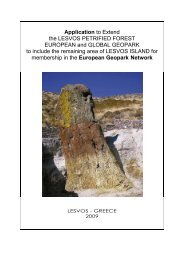
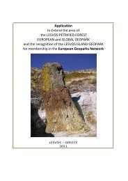
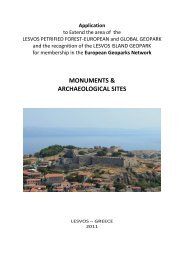
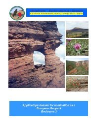
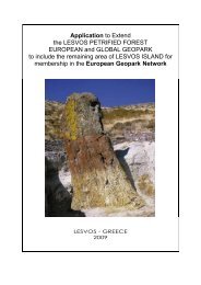
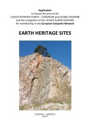
Application to Extend<br />
the LESVOS PETRIFIED FOREST<br />
EUROPEAN and GLOBAL GEOPARK<br />
to include the remaining area of LESVOS ISLAND<br />
for membership in the European Geopark<br />
Network<br />
LESVOS - GREECE<br />
2011
Global Geoparks Network<br />
Applicant’s <strong>Evaluation</strong> <strong>Document</strong><br />
<strong>Document</strong> A<br />
Applicants Identity<br />
1. Name and Country of Applicant territory.<br />
LESVOS Island GEOPARK - GREECE<br />
2. Name of the Applicant’s Management Body<br />
Natural History Museum of the Lesvos Petrified Forest<br />
Region:<br />
Country:<br />
North Aegean<br />
Greece<br />
Telephone: .+30 2251047033<br />
Fax: .+30 2251047033<br />
Email:<br />
3. Address of Applicant Management Body<br />
Mytilene, 8th Novemebr 17, Lesvos Island 81103, Greece<br />
4. Size of Territory and Geographical Coordinates<br />
lesvospf@otenet.gr<br />
Size in km 2<br />
Coordinates<br />
5. Contact Person<br />
Management Body Director<br />
Geoscientist<br />
Specialist on Regional Development<br />
1636<br />
39°12´13˝N 25°52´28˝Ε<br />
Nickolas Zouros<br />
Ilias Valiakos<br />
Ioannis Spilanis<br />
Statement of acceptance of European Geoparks Network Charter Requirements:<br />
The Management Body of the Applicant Territory ready the GGN / EGN charter and accepts all of its<br />
provisions.<br />
Name Position Date<br />
Dimitris Vounatsos Mayor of Lesvos 28/11/2011<br />
Signature<br />
Name Position Date<br />
Nickolas Zouros Director 28/11/2011<br />
Signature
Application Overview<br />
Category Weighting<br />
Selfassessment<br />
Evaluators<br />
(%) Estimate<br />
I<br />
Geology and<br />
Landscape<br />
1.1 Territory 5 48,5 0<br />
1.2 Geoconservation 20 200 0<br />
1.3<br />
Natural and<br />
Cultural Heritage<br />
10 100 0<br />
II.<br />
Management<br />
Structure<br />
25 240 0<br />
Interpretation and<br />
III Environmental<br />
15 150 0<br />
Education<br />
IV Geotourism 15 136,5 0<br />
Sustainable<br />
V Regional Economic 10 97 0<br />
Development<br />
Total 100 972 0<br />
EVALUATORS VERIFICATION<br />
Name Position Date<br />
Signature<br />
Name Position Date<br />
Signature
I. Geology and Landscape<br />
1.1 Territory<br />
1. TERRITORY<br />
1.1 Geosite list<br />
List of “Geosites” located within territory identified for use (Please<br />
provide a geosite list)<br />
Petrified<br />
Forest Park Petrified Forest Parks: Petrified Forest Park (Main<br />
Park), Sigri Petrified Forest Park, Plaka Petrified Forest Park,<br />
Chamandroula Petrified Forest Park, Skamiouda Petrified Forest<br />
Park, Nisiopi Petrified Forest Park<br />
Fossil sites (plant fossil sites) :Antissa, Gavathas, Mesotopos,<br />
Eresos, Vatousa, Rougada, Lapsarna, Agra, Sarakina, Mythimna<br />
Fossil sites (mammal fossil sites): Vatera vertebrate fossil sites,<br />
Gavathas Dinotherium fossil site, Lapsarna micromammal site<br />
Volcanic sites:Vatousa Caldera, Agra Caldera, Anemotia Volcano,<br />
Lepetymnos Volcano, Mesotopos Volcano, Petra Volcanic Neck,<br />
Pithariou Dome, Ypsilou Dome - Columnar Lavas, Eresos Dome,<br />
Mythimna Dome – Castle Columnar Lavas, Eresos Laccolith,<br />
Pelopi Columnar Lavas, Alifada Dyke, Filia Dyke, Eresos Dyke,<br />
Avlaki Dyke (Petra), Volcanic Structure of Panagia Gorgona (Skala<br />
Sikamineas), Achladeri Ignimbrite, Skamiouda Ignimbrite, Parakila<br />
Volcanic Rocks Alteration Structures, Vatoussa Spheroidal<br />
Erosional landforms, Pterounda Volcanic Conglomerate, Voulgaris<br />
Volcanic Conglomerate, Panaghia Islet Columnar Lavas<br />
(Tokmakia), Mparmpalias Islet Ignimbrite<br />
Thermal Springs: Polichnitos, Lisvori, Argenos, Eftalou, Thermi,<br />
Gera – Therma, Panagia Krifti<br />
Ancient Quarries – Mines: Moria Ancient Quarry, Mine galleries of<br />
Northern Lesvos, Polichnitos Magnesite Mines, Ancient quarries of<br />
Skala Loutron, Lignite Mine galleries (Lapsarna), S. Lesvos<br />
Ancient Mines (Tarti, Τsaf), Eressos Ancient quarry<br />
Caves & Karstic structures: Alifada Cave, Agios Vartholomaios<br />
Taxiarhis Cave, Mihos Cave,Antissa Cave, Panagia Krifti<br />
(Plomari), Asomatos Cave,<br />
Waterfalls – Gorge: Pessa Waterfall, Mankatsa Waterfall<br />
Mantamados, Eresos Waterfall, Voulgaris Gorge (Vatousa),<br />
Tsiknia Gorge<br />
Marks<br />
available<br />
Self<br />
Assessment<br />
Evaluators'<br />
Estimate<br />
Erosional Structures: Candles Volcanic Erosional Structures,<br />
“Dragon’s Jump” Volcanic Erosional Structure (Napi), Lapsarna<br />
Erosional Structures – Orfikia, Fikiotrypa, Sigri Tafoni<br />
River delta:Evergetoula Delta, Kalloni Wetlands – Tsiknias Delta<br />
Springs: Agiasos Water Springs<br />
Tectonic Structures: Larsos Fault – Gera Gulf Fault, Agia<br />
Paraskevi Fault, Amali Faults, Olympos Tectonic Window, Nisiopi<br />
Graben, Lambou Miloi Nappe, Ancient Pyrra Fault, Taxiarhis<br />
Tectonic Structures, Antissa Fault<br />
Interesting Geological – Geomorphological Structures: Ophiolite –<br />
Ampeliko, Ophiolite – Amali, Gera Schists, Plomari beach-rock<br />
formation, Megali Limni<br />
20 “Geosites”<br />
or more<br />
100<br />
40 “Geosites”<br />
or more<br />
Maximum<br />
Total<br />
200 200<br />
200 200 0<br />
2 Geodiversity<br />
How many geological periods are represented in your area? (10<br />
points each, maximum 100 points). (Please provide a list)<br />
2.1 Carboniferous, Permian, Triassic, Jurassic, Palaeogene, Neogen,<br />
100 70<br />
Quaternary
How many clearly defined rock types are represented in your area?<br />
(10 points each, maximum 100 points). (Please provide a list)<br />
2.2<br />
Schists, Marbles, Peridotites, Basalt, Ignimbrites, Perlite, Dacite,<br />
100 100<br />
Phylites, Pyroclastic formations, Limestones, Marles, Claystone<br />
How many distinct geological or geomorphological features are<br />
present within your area? (Please provide a list) (10 points each,<br />
maximum 100 points). Petrified forest, Gavathas mammal fossil<br />
site, Vatera vertebrate fossil sites, Gavathas Dinotherium fossil<br />
site, Lapsarna micromammal site, Vatousa Volcanic Center –<br />
Caldera, Vatousa spheroid erosional structures, Honeycomb<br />
weathering - Tafoni structures, Eressos laccoliths, Ypsiloy dome –<br />
Mesotopos Dome - Eresos Dome, Filia Dyke - Messotopos Dykes -<br />
Eressos Dykes, Ipsilou columnar lavas - Pelopi columnar lavas,<br />
2.3<br />
Petra volcanic neck, Polichnitos hot springs, Lisvori hot springs,<br />
100 100<br />
Eftalou hot springs – Argenos hot springs, Gera – Therma,<br />
Panagia Krifti, Antissa cave, Agios Vartholomaios Taxiarhis Cave,<br />
Mihos Cave,Antissa Cave, Panagia Krifti (Plomari), Asomatos<br />
Cave, Faneromeni Sigri folds, Molyvos PBG mines, Larsos Fault –<br />
Gera Gulf Fault, Agia Paraskevi Fault, Amali Faults, Olympos<br />
Tectonic Window, Nisiopi Graben, Lambou Miloi Nappe, Ancient<br />
Pyrra Fault, Taxiarhis Tectonic Structures, Antissa active fault,<br />
Voulgaris gorge, Lapsarna active coasts, Agiasos Water Springs<br />
3 Public Interpretation of the Geopark’s sites of interest<br />
Maximum<br />
Total<br />
300 270 0<br />
Number of sites with public Interpretation (trails, interpretation<br />
panels or leaflets) (Please provide a list) Petridied Forest Park (70<br />
sites), Plaka Park (48 sites), Sigri Park (22 sites), Nisiopi fossil site,<br />
Skamiouda Park (8 sites), Lepetumnos caldera, Vatousa caldera,<br />
Agra caldera, Vatousa spheroid erosional structures, Sigri<br />
3.1 Honeycomb weathering - Tafoni structures, Mesotopos domes,<br />
Ipsilou dome, Eresos Dome, Ipsilou columnar lava, Petra volcanic<br />
neck, Filia Dyke, Messotopos Dykes, Eressos Dykes, Eresos<br />
dome, Pelopi columnar lavas, Petra volcanic neck, Chamandroula<br />
fossil site, Argenos thermal spring, Eftalou thermal spring, Antissa<br />
cave<br />
5-10 40<br />
10-20 80<br />
20 or more 120 120
Geosites of Scientific Importance (Please provide a<br />
list). Petrified Forest Park (70 sites), Plaka Park (48<br />
sites), Sigri Park (22 sites), Nisiopi fossil site,<br />
Skamiouda Park (8 sites),Fossil sites (plant fossil<br />
sites) :Antissa, Gavathas, Mesotopos, Eresos,<br />
Vatousa, Rougada, Lapsarna, Agra, Sarakina,<br />
Mythimna, Fossil sites (mammal fossil sites): Vatera<br />
vertebrate fossil sites, Gavathas Dinotherium fossil<br />
site, Lapsarna micromammal siteVolcanic<br />
sites:Vatousa Caldera, Agra Caldera, Anemotia<br />
Volcano, Lepetymnos Volcano, Mesotopos Volcano,<br />
Petra Volcanic Neck, Pithariou Dome, Ypsilou Dome<br />
- Columnar Lavas, Eresos Dome, Mythimna Dome –<br />
Castle Columnar Lavas, Eresos Laccolith, Pelopi<br />
Columnar Lavas, Alifada Dyke, Filia Dyke, Eresos<br />
Dyke, Avlaki Dyke (Petra), Volcanic Structure of<br />
Panagia Gorgona (Skala Sikamineas), Achladeri<br />
Ignimbrite, Skamiouda Ignimbrite, Parakila Volcanic<br />
Rocks Alteration Structures, Vatoussa Spheroidal<br />
Erosional landforms, Pterounda Volcanic<br />
Conglomerate, Voulgaris Volcanic Conglomerate,<br />
Panaghia Islet Columnar Lavas (Tokmakia),<br />
Mparmpalias Islet Ignimbrite<br />
Thermal Springs: Polichnitos, Lisvori, Argenos,<br />
3.2 Eftalou, Thermi, Gera – Therma, Panagia Krifti > 25 % 40 40<br />
Ancient Quarries – Mines: Moria Ancient Quarry,<br />
Mine galleries of Northern Lesvos, Polichnitos<br />
Magnesite Mines, Ancient quarries of Skala Loutron,<br />
Lignite Mine galleries (Lapsarna), S. Lesvos Ancient<br />
Mines (Tarti, Τsaf), Eressos Ancient quarry<br />
Caves & Karstic structures: Alifada Cave, Agios<br />
Vartholomaios Taxiarhis Cave, Mihos Cave,Antissa<br />
Cave, Panagia Krifti (Plomari), Asomatos Cave,<br />
Waterfalls – Gorge: Pessa Waterfall, Mankatsa<br />
Waterfall Mantamados, Eresos Waterfall, Voulgaris<br />
Gorge (Vatousa), Tsiknia Gorge<br />
Erosional Structures: Candles Volcanic Erosional<br />
Structures, “Dragon’s Jump” Volcanic Erosional<br />
Structure (Napi), Lapsarna Erosional Structures –<br />
Orfikia, Fikiotrypa, Sigri Tafoni<br />
Tectonic Structures: Larsos Fault – Gera Gulf Fault,<br />
Agia Paraskevi Fault, Amali Faults, Olympos<br />
Tectonic Window, Nisiopi Graben, Lambou Miloi<br />
Nappe, Ancient Pyrra Fault, Taxiarhis Tectonic<br />
Structures, Antissa Fault<br />
Interesting Geological – Geomorphological<br />
Structures: Ophiolite – Ampeliko, Ophiolite – Amali,<br />
Gera Schists, Plomari beach-rock formation, Megali<br />
Limni
Geosites used for Education (Please provide a list).<br />
Petrified Forest Park (70 sites), Plaka Park (48<br />
sites), Sigri Park (22 sites),Fossil sites (plant fossil<br />
sites) :Antissa, Gavathas, Mesotopos, Eresos,<br />
Vatousa, Rougada, Lapsarna, Agra, Sarakina,<br />
Mythimna<br />
Fossil sites (mammal fossil sites): Vatera vertebrate<br />
fossil sites, Gavathas Dinotherium fossil site,<br />
Lapsarna micromammal site<br />
Volcanic sites:Vatousa Caldera, Agra Caldera,<br />
Anemotia Volcano, Lepetymnos Volcano,<br />
Mesotopos Volcano, Petra Volcanic Neck, Pithariou<br />
Dome, Ypsilou Dome - Columnar Lavas, Eresos<br />
Dome, Mythimna Dome – Castle Columnar Lavas,<br />
Eresos Laccolith, Pelopi Columnar Lavas, Alifada<br />
Dyke, Filia Dyke, Eresos Dyke, Avlaki Dyke (Petra),<br />
Volcanic Structure of Panagia Gorgona (Skala<br />
Sikamineas), Achladeri Ignimbrite, Skamiouda<br />
Ignimbrite, Parakila Volcanic Rocks Alteration<br />
Structures, Vatoussa Spheroidal Erosional<br />
landforms, Pterounda Volcanic Conglomerate,<br />
Voulgaris Volcanic Conglomerate, Panaghia Islet<br />
Columnar Lavas (Tokmakia), Mparmpalias Islet<br />
Ignimbrite<br />
Thermal Springs: Polichnitos, Lisvori, Argenos,<br />
Eftalou, Thermi, Gera – Therma, Panagia Krifti<br />
Ancient Quarries – Mines: Moria Ancient Quarry,<br />
3.3<br />
Mine galleries of Northern Lesvos, Polichnitos<br />
> 25 % 40 40<br />
Magnesite Mines, Ancient quarries of Skala Loutron,<br />
Lignite Mine galleries (Lapsarna), S. Lesvos Ancient<br />
Mines (Tarti, Τsaf), Eressos Ancient quarry<br />
Caves & Karstic structures: Alifada Cave, Agios<br />
Vartholomaios Taxiarhis Cave, Mihos Cave,Antissa<br />
Cave, Panagia Krifti (Plomari), Asomatos Cave,<br />
Waterfalls – Gorge: Pessa Waterfall, Mankatsa<br />
Waterfall Mantamados, Eresos Waterfall, Voulgaris<br />
Gorge (Vatousa), Tsiknia Gorge<br />
Erosional Structures: Candles Volcanic Erosional<br />
Structures, “Dragon’s Jump” Volcanic Erosional<br />
Structure (Napi), Lapsarna Erosional Structures –<br />
Orfikia, Fikiotrypa, Sigri Tafoni<br />
River delta:Evergetoula Delta, Kalloni Wetlands –<br />
Tsiknias Delta<br />
Springs: Agiasos Water Springs<br />
Tectonic Structures: Larsos Fault – Gera Gulf Fault,<br />
Agia Paraskevi Fault, Amali Faults, Olympos<br />
Tectonic Window, Nisiopi Graben, Lambou Miloi<br />
Nappe, Ancient Pyrra Fault, Taxiarhis Tectonic<br />
Structures, Antissa Fault<br />
Interesting Geological – Geomorphological<br />
Structures: Ophiolite – Ampeliko, Ophiolite – Amali,<br />
Gera Schists, Plomari beach-rock formation, Megali<br />
Limni
Geosites used for Geotourism (Please provide a<br />
list). Petrified Forest Park (70 sites), Plaka Park (48<br />
sites), Sigri Park (22 sites), Lepetumnos caldera,<br />
Vatousa caldera, Agra caldera, Vatousa spheroid<br />
erosional structures, Sigri Honeycomb weathering -<br />
Tafoni structures, Eressos laccoliths, Mesotopos<br />
domes, Ipsilou dome, Eresos Dome, Ipsilou<br />
columnar lava, Petra volcanic neck, Filia Dyke,<br />
3.4<br />
Messotopos Dykes, Eressos Dykes, Anemotia<br />
> 25 % 40 40<br />
columnar lavas, Eresos dome, Pelopi columnar<br />
lavas, Petra volcanic neck, Chamandroula fossil<br />
site, Thermal Springs of Polichnitos, Lisvori,<br />
Argenos, Eftalou, Thermi, Gera – Therma, Panagia<br />
Krifti ,Alifada Cave, Agios Vartholomaios Taxiarhis<br />
Cave, Mihos Cave,Antissa Cave, Panagia Krifti<br />
(Plomari), Asomatos Cave<br />
Non-Geological Sites used by the Geopark<br />
(intergraded in Geoparks activities) (Please provide<br />
a list). Psaropotamos wetlands – Eressos,<br />
Tsichliodas wetland, Eressos Akropolis, Sigri castle,<br />
Ypsilou monastery, Perivolis monastery, Limonos<br />
monastery, Pithariou Monastery, Church of Petra,<br />
Vatousa village, Molyvos village, Skamia vilage,<br />
Kalochtistos Apothica, Early Christian Vasilica of<br />
3.5<br />
Agios Andreas, Mythimna fortress, Klopedi<br />
40 40<br />
sanctuary, Messa sanctuary, Pira ancient<br />
submerged city, Ancient Antissa, Vareltzidenas<br />
maison, Ligonas Watermils, Stone bridge of<br />
Kremasti, Drystone constructions. ANNEX I Maps:<br />
I-8 (Map of cultural sites in Lesvos Petrified Forest<br />
Geopark)<br />
ANNEX II Cultural sites and monuments<br />
Maximum<br />
Total<br />
Relationship to existing Geoparks (select one from the<br />
4<br />
following options)<br />
200 200 0<br />
There is no comparison with any other existing Geopark within<br />
GGN<br />
4.1 PUBLICATION (The Petrified Forest of Lesvos, Guide to the<br />
300 300<br />
Lesvos Petrified Forest Park, Guide to the Plaka and Sigri Petrified<br />
Forest Parks, Α subtropical forest 20 million years ago)<br />
4.2 There is another Geopark within GGN with comparable geology. 200<br />
There is another Geopark within GGN with comparable geology or<br />
4.3 100<br />
infrastructure in the same country.<br />
There is another Geopark within GGN with comparable geology or<br />
4.4 infrastructure in the same country’s geographical Region<br />
50<br />
(Clarification in time and distance)<br />
Maximum<br />
Total<br />
300 300 0<br />
Territory<br />
Subtotal<br />
Maximum<br />
points<br />
Self<br />
Assessment<br />
Evaluators'<br />
Estimate<br />
1000 970 0
II. Geology and Landscape<br />
1.2 GEOLOGICAL CONSERVATION<br />
Marks<br />
available<br />
Self<br />
Assessment<br />
Evaluators'<br />
Estimate<br />
Inventory and significance of Geosites can be found in your area (SELF<br />
1<br />
AWARDED total cannot exceed 300).<br />
At least one geosite of international significance - geology and<br />
1.1 geomorphology. (100 for each). (Give a list and justification)<br />
160 160<br />
Petrified forest<br />
At least five geosites of national significance (Give a list and justification)<br />
Petrified forest<br />
1.2 park at Bali Alonia, Nisiopi fossil site, Vatousa volcano, Lepetymnos volcano,<br />
100 100<br />
Agia Paraskevi Major Fault zone, Geras Gulf fault zone, Gavathas mammal<br />
fossil site, Vatera fossil site<br />
At least 20 geosites of educational interest and used by schools and<br />
universities. (Give a list and justification)<br />
Petrified Forest Park (70<br />
sites), Plaka Park (48 sites), Sigri Park (22 sites), Lepetumnos caldera,<br />
Vatousa caldera, Agra caldera, Vatousa spheroid erosional structures, Sigri<br />
1.3 Honeycomb weathering - Tafoni structures, Eressos laccoliths, Mesotopos<br />
100 100<br />
domes, Ipsilou dome, Eresos Dome, Ipsilou columnar lava, Petra volcanic<br />
neck, Filia Dyke, Messotopos Dykes, Eressos Dykes, Anemotia columnar<br />
lavas, Eresos dome, Pelopi columnar lavas, Petra volcanic neck,<br />
Chamandroula fossil site, Argenos thermal spring, Polychnitos thermal spring,<br />
Geras fault zone, Agia Paraskevi fault zone, Ancient Pyrra fault.<br />
Do you have a geosites database for the Geopark? (Give a list and<br />
1.4 justification)<br />
50 50<br />
www.lesvosmuseum.gr:8080/stf<br />
Do you have a geosites map for the Geopark? (Give a list and justification)<br />
Maps :<br />
I-1 (Map of the protected area of the Lesvos Petrified Forest Geopark)<br />
I-2 (Map of the Petrified Forest Park)<br />
I-3 (Map of the Sigri Park)<br />
I-4 (Map of the Plaka Park)<br />
1.5 I-5 (Map of the Lesvos Petrified Forest Parks)<br />
50 50<br />
I-6 (Map of Geosite of Lesvos Island)<br />
I-7 (Map of the NATURA 2000 area of “West Peninsula - Petrified Forest” and<br />
the Petrified Forest protected area)<br />
I-8 (Map of cultural sites in Lesvos<br />
Petrified Forest Geopark)<br />
I-9 Lesvos island Geosite map<br />
I-10 Lesvos protected areas map<br />
Maximum Total 300 300 0
Strategy and legislation to protect against damage of geological sites<br />
2<br />
and features (one answer only)<br />
The entire territory has legal protection because of it’s geological values.<br />
2.1 300 0<br />
Part of the area is protected by law for its geological interest. (please refer to<br />
which part and why)<br />
Declaration of the Lesvos Petrified Forest as protected natural monument<br />
(PD 443/1985): The Greek state recognized the exceptional paleontological<br />
and geomorphological value of the Lesvos Petrified Forest and issued a<br />
special Presidential Decree (443/1985) in order to protect the Petrified Forest<br />
and ensure its proper management. By this act, four terrestrial and one<br />
marine area are characterized natural monuments within the broader area of<br />
2.2<br />
15.000 ha in which all fosils are protected.<br />
150 150<br />
The Petrified Forest is among the five areas of Lesvos island included in the<br />
National List of the Natura 2000 Network, as SCI - Western peninsula Lesvos<br />
- petrified forest (code GR 4110003), SCI - Kalloni gulf wetlands, SCI - Dipi<br />
wetlands and Olympus mountain, SPA - Southwest peninsula and the<br />
petrified forest, SPA - North Lesvos.<br />
The islet Megalonisi or Nisiopi is protected as Site of Particular Natural<br />
Beauty (official journal of the Hellenic Republic 1176/B/2000)<br />
Several other sites of geological and geomorphological interest are protected<br />
as cultural monuments (caves, Petra volcanic neck, etc).<br />
Prohibition of destroying and removing parts of the geological heritage.<br />
2.3 Declaration of the Lesvos Petrified Forest as<br />
150 150<br />
protected natural monument (PD 443/1985)<br />
3 How are the geosites protected against misuse and damage?<br />
Maximum Total 300 300 0<br />
General announcement of regulations against misuse and damage for the<br />
entire Geopark area.<br />
3.1 Information panels at geosites, infocenters, parks and the Museum dealing<br />
with protection in the Petrified forest area . Announcement of regulations by<br />
guards at the Petrified forest parks.<br />
100<br />
50<br />
Announcement of regulations against misuse and damage at individual sites<br />
of the Geopark<br />
3.2<br />
Information panels and posters at parks and the Museum dealing with<br />
protection, announcement of regulations by guards<br />
Use of observation posts, guarding and patrolling by wardens<br />
3.3<br />
Observatories at the parks, fencing of park and sites,<br />
construction of protection walls<br />
Provision for enforcement of regulations (no digging and collection) in<br />
website, flyers, etc.<br />
3.4<br />
Information panels and posters dealing with no digging and collection,<br />
announcement of regulations by guards, website<br />
Offering collecting of geological specimens under supervision at selected<br />
40<br />
3.5<br />
0<br />
sites (clarification)<br />
Maximum Total 200 200 0<br />
50<br />
60<br />
40<br />
50<br />
60<br />
40
What measures are carried out to protect geosites and infrastructure<br />
4<br />
against damage and natural degradation?<br />
Regular maintenance and cleaning. (Please give details. How often are they<br />
checked?)<br />
4.1<br />
Museum has a cleaning program for fossils and geosites - Maintenance<br />
and cleaning every year<br />
Conservation measures (Please give details)<br />
Conservation team controls annually all fossil sites<br />
4.2<br />
and conserves, 30 Conservation reports during last three years, 300 items<br />
conserved, 20 new fossil sites conserved<br />
Protective measures (preparation, sealing to avoid natural degradation)<br />
(Please give details)<br />
4.3<br />
Protective shelters, walls preventing erosion constructed in fossil sites,<br />
fenses<br />
Maximum Total 200 200 0<br />
60<br />
70<br />
70<br />
60<br />
70<br />
70<br />
Geoconservation<br />
Subtotal<br />
Maximum<br />
points<br />
Self<br />
Assessment<br />
Evaluators'<br />
Estimate<br />
1000 1000 0
IΙI. Geology and Landscape<br />
1.3 Natural and Cultural Heritage<br />
Marks available<br />
Self<br />
Assessment<br />
Evaluators'<br />
Estimate<br />
1 Natural Rank (SELF AWARDED total cannot exceed 300).<br />
World Heritage Site (Natural or Mixed) (Please give a list and<br />
1.1 300 0<br />
justification)<br />
Other International Designation in part of the Geopark territory<br />
(MAB = 200, Ramsar wetland = 200, Other = 100) (Please give a<br />
1.2 list and justification)<br />
200 200<br />
Natura 2000 (Map: I-10), Barcelona convention - Marine<br />
and coastal area of Sigri<br />
National designation in part of the Geopark territory (Please give<br />
a list and justification)<br />
1.3<br />
Natural monument (Presidential Degree<br />
200 200<br />
443/1985)<br />
Regional designation in part of the Geopark territory (Please give<br />
1.4 100 0<br />
a list and justification)<br />
Local designation in part of the Geopark territory (Please give a<br />
1.5 50 0<br />
list and justification)<br />
2 Cultural Rank (SELF AWARDED total cannot exceed 300).<br />
Maximum Total 300 300 0<br />
World Heritage Site in part of the Geopark territory (Cultural or<br />
2.1 300 0<br />
Mixed) (Please give a list and justification)<br />
Other International Designation in part of the Geopark territory<br />
(Please give a list and justification)<br />
2.2<br />
Europa Nostra for the Lesvos Industrial heritage<br />
200 200<br />
conservation<br />
National designation in part of the Geopark territory (Please give<br />
a list and justification) Many archeological sites are declared<br />
2.3 monuments of National interest from the Ministry of culture (see<br />
200 200<br />
Annex Cultural Monuments)<br />
Regional designation in part of the Geopark territory (Please give<br />
2.4 a list and justification)<br />
100 0<br />
Local designation in part of the Geopark territory (Please give a<br />
2.5<br />
list and justification)<br />
50 0<br />
Maximum Total 300 300 0<br />
3 Promotion and maintenance of Natural and Cultural Heritage<br />
Interpretation (Please give details)<br />
Information panels<br />
Leaflets<br />
Booklets<br />
3.1<br />
Books<br />
100 100<br />
Organization of periodical exhibitions, conferences, seminars,<br />
cultural events, voluntary programs<br />
Educational programs<br />
Education programmes (Please give details) The natural and<br />
cultural value of the Lesvos geosites is promoted by several<br />
educational programmes (see list). Examples are Geras fault<br />
3.2<br />
zone, Petra volcanic neck, Ipsilou dome, Skala Eressos domeancient<br />
100 100<br />
akropolis, Lepetymnos dome, Olympos peak, Caves<br />
etc
Communication (Please give details)<br />
Internet Site, newspaper, TV<br />
3.3<br />
and radio announcements, printing of invitations – programs –<br />
100 100<br />
posters – informational material, editions<br />
Promotion of the links between Geological Heritage sites and the<br />
existing Natural and cultural sites within the Geopark (Prove with<br />
examples) (Please give details)<br />
3.4 Multimedia presentations at the<br />
100 100<br />
Musuum info kiosks, Internet Site, newspaper, TV and radio<br />
programmes, printing of invitations – programs – posters –<br />
informational material, educational material and tools<br />
Maximum Total 400 400 0<br />
Natural and<br />
Cultural Heritage<br />
Subtotal<br />
Maximum<br />
points<br />
Self<br />
Assessment<br />
Evaluators'<br />
Estimate<br />
1000 1000 0<br />
Total Points<br />
Awarded For<br />
Section I: Geology<br />
and Landscape<br />
Maximum<br />
points<br />
Self<br />
Assessment<br />
Evaluators'<br />
Estimate<br />
3000 2970 0
IΙ. MANAGEMENT STRUCTURE<br />
Marks<br />
available<br />
Self<br />
Assessment<br />
Evaluators'<br />
Estimate<br />
1 How is the Applicants management structure organised?<br />
Does the Geopark have a clear and well defined boundary?<br />
1.1 (Please give details)<br />
50 50<br />
The Geopark is Lesvos Island as a whole<br />
Does the Geopark have well defined and effective management<br />
structure able to take and implement decisions to enhance<br />
protection of Geological Heritage and promote sustainable regional<br />
development for the Geopark area? (Please give details)<br />
The organizations<br />
being in charge of the application and the management of Lesvos<br />
Geopark are the Municipality of Lesvos, the University of Aegean<br />
and the Natural History Museum of the Lesvos Petrified Forest. The<br />
cooperation of these organizations is based on the Agreement for<br />
the establishment of the Lesvos Geopark, which was signed on<br />
18.10.2011 with main aim the extension of the limits of the existing<br />
Lesvos Petrified Forest – European and Global Geopark to include<br />
1.2<br />
the entire surface of Lesvos island. The Municipality of Lesvos is<br />
50 50<br />
responsible for the local development. The University of the<br />
Aegean is providing scientific advice on any issue dealing with the<br />
geodiversity and biodiversity management and sustainable<br />
economic development in the area of the Lesvos Geopark. The<br />
Natural History Museum of the Lesvos Petrified Forest is<br />
responsible for the management of the Lesvos Geopark. The<br />
operation of the Geopark is based on the contribution and duties of<br />
each partner as decided by the Geopark Coordination Committee.<br />
The Lesvos Geopark Coordination Committee will include<br />
representatives from all institutions dealing with the management of<br />
Lesvos natural and cultural heritage.<br />
Is the Geopark staff employed directly or indirectly by Geopark<br />
partners? (Please elaborate) The geopark staff is employed directly<br />
by the organizations being in charge of the application and the<br />
management of Lesvos Geopark. The Lesvos Geopark<br />
1.3<br />
Coordination Committee will also secure the contribution to<br />
50 50<br />
Geopark activities by staff employed directly from the institutions<br />
dealing with the management of Lesvos natural and cultural<br />
heritage.<br />
An independently administered budget (Please give details)<br />
The organizations being in charge<br />
of the application and the management of Lesvos Geopark have<br />
secure individual budgets. The Geopark’s operational funds are<br />
1.4<br />
based on the contribution of the participating organisations which<br />
50 50<br />
are responsible to secure the appropriate budget for its activities.<br />
The budget of the natural history Museum of the Lesvos Petrified<br />
Forest is supporting entirely the Geoaprk activities.<br />
2 Does a management or Master Plan exist?<br />
Maximum Total 200 200 0<br />
Management or Master Plan exists (not older than 10 years) (You<br />
should refer to the main components in accompanying<br />
documentation)<br />
2.1 The Lesvos Petrified Forest Management Plan exists since 2001.<br />
The extended Lesvos Geopark management plan is under<br />
preparation based on the smae components as the existing<br />
Management Plan<br />
3 Master Plan Components - What components does it include?<br />
Earth Heritage (Geosite and Landscape).<br />
3.1<br />
40<br />
10<br />
20<br />
10
Other Natural and Cultural Heritage<br />
3.2<br />
Links between Natural and Cultural Heritage<br />
3.3<br />
Tourism development (infrastructure and activities)<br />
3.4<br />
3.5 Education activities<br />
3.6 Local development<br />
Regional products<br />
3.7<br />
(agrotourism)<br />
3.8 Community links<br />
3.9 Funding<br />
3.10 Marketing strategy<br />
Strength and Weakness Analysis of Management and<br />
3.11<br />
administration<br />
3.12 An audit of the geological and other resources<br />
3.13 Do you have targets for the following goals? (Identify specific goals)<br />
10<br />
10<br />
10<br />
10<br />
10<br />
10<br />
10<br />
10<br />
20<br />
20<br />
20<br />
10<br />
10<br />
10<br />
10<br />
10<br />
10<br />
10<br />
10<br />
20<br />
20<br />
20<br />
Geology 5 5<br />
Landscape<br />
protection<br />
5 5<br />
5 5<br />
5 5<br />
3.14 Analysis of local/regional development potentials 10 10<br />
4 Does your Application have a Marketing Strategy<br />
Tourism<br />
“geotourism”<br />
Agriculture and<br />
forestry<br />
Strategy exists (not older than 10 years) (You should refer to the<br />
main components in accompanying documentation)<br />
Geopark should protect its geological heritage and create<br />
5 sustainable geotourism. What has been done to fulfil this<br />
duty?<br />
Maximum Total 180 180 0<br />
The Lesvos Petrified Forest Management Plan exists since 2001.<br />
50 30<br />
The extended Lesvos Geopark management plan is under<br />
preparation based on the smae components as the existing<br />
Management Plan<br />
Maximum Total 50 30 0<br />
Definition of areas which will be the focus of tourism development<br />
Parks of the Petrified Forest,<br />
5.1<br />
Natural History Museum of the Lesvos Petrified Forest,<br />
Volcanic structures<br />
Hot springsTectonic structures<br />
Definition of areas where no tourism is allowed, (with focus on<br />
protection and research)<br />
5.2<br />
Submarine area of the Lesvos Petrified Forest<br />
Caves<br />
25<br />
20<br />
25<br />
20
Measures taken to regulate and reduce traffic (restricted access,<br />
central parking lots, traffic guiding system, signposting etc.)<br />
Areas of restricted access<br />
5.3<br />
Central parking lots at the entrance gates of the Parks and the<br />
Museum<br />
Signposts<br />
Lesvos network of of trekking paths<br />
Environmental friendly hiking path system<br />
Lesvos network of trecking paths -<br />
5.4<br />
Paths with no or very limited constructions (always using local<br />
building material and in respect with local architecture)<br />
15<br />
10<br />
15<br />
10<br />
Clearly defined cycle or other trails such as bridleways or river<br />
trails.<br />
5.5<br />
The lava trails in the Petrified Forest area, Lesvos network<br />
10<br />
of trails scattered around the Geopark<br />
10<br />
Maximum Total 80 80 0<br />
Are there any initiatives or working groups who discuss<br />
6<br />
promotion of natural and cultural heritage<br />
Regular "Working Group" meetings on specific topics<br />
6.1 Regular Meetings of the Scientific Committee and the Steering<br />
Committee<br />
20<br />
20<br />
Individual cooperation and contracts between Applicant, tourist<br />
organisations and other interest groups The Tourist Board of<br />
Lesvos Municipality is the official body of Tourism policy of the<br />
island, chaired by the Mayor of Lesvos with the participation of all<br />
tourist agencies and tourism related associations in Lesvos.<br />
Other bodies collaborating with the Geopark are: the Chamber of<br />
6.2 Lesvos, the Geotechnical Chamber of Lesvos,<br />
Agrotourism Women Cooperatives,<br />
The Center of Environmental Education,<br />
The Friends of the Lesvos Petrified Forest,<br />
Center of Professional Training of the Natural History Museum of<br />
the Lesvos Petrified Forest<br />
10<br />
10<br />
Other regular activities, not described by the answers above.<br />
6.3<br />
Participation at the meetings<br />
10<br />
of local groups (eg Aiolis)<br />
10<br />
Maximum Total 20 20 0<br />
Has your geopark area received any awards or other formal<br />
recognition for its activities in the fields of geodiversity,<br />
7<br />
conservation or sustainable geo-tourism during the last five<br />
years? (SELF AWARDED total cannot exceed 100)<br />
7.1<br />
International awards (name and date of award)<br />
Skål International Ecotourism<br />
Award 2008<br />
European Destination of Excellence (EDEN) 2009<br />
100<br />
7.2 National awards (name and date of award) 50<br />
7.3 Other (e.g. from industry) (name and date of award) 20<br />
Maximum Total 100 100 0<br />
Are competent geological and scientific experts available to<br />
8 promote further research work on a scientific basis? (SELF<br />
AWARDED total cannot exceed 150)<br />
100
At least one person with a degree in geosciences or other related<br />
discipline in the permanent staff (employed directly) (Add 10 points<br />
for each geoscientist).<br />
Nickolas Zouros, Geologist<br />
8.1<br />
Ilias Valiakos, Geologist<br />
Konstantina Mpentana, Geologist<br />
Katerina Vasileiadou,<br />
Palaeontologist<br />
At least five people with a degree in geosciences or other related<br />
discipline on the staff of the Applicant (employed by partner)<br />
Nickolas Zouros, Geologist<br />
8.2<br />
Ilias Valiakos, Geologist<br />
Konstantina Mpentana, Geologist<br />
Katerina Vasileiadou,<br />
Palaeontologist<br />
Erdal Gumus, Geographer<br />
Do additional experts exist in the permanent staff (e.g. biologists)<br />
8.3<br />
Anna Neratzou, Conservator<br />
Antonis Georgiou, Conservator<br />
Regular and formal joint activity with at least one scientific<br />
institution (University, National Geological Survey)<br />
University of Athens-Department of Geology<br />
Aristotle University of Thessaloniki-Department of Geology<br />
University of the Aegean-Department of Geography<br />
8.4<br />
University of the Aegean-Department of Environmental Studies<br />
University of the Aegean-<br />
Department of Marine Studies<br />
IGME - Institute of Geologic and Mineral Exploration of Greece<br />
Geotechnical Chamber of Greece<br />
Natural History Museum of Crete<br />
8.5 Regular consulting is maintained by:<br />
Persons with scientific background in<br />
geosciences<br />
Persons with experience in geosciences<br />
40<br />
20<br />
10<br />
20<br />
15<br />
10<br />
40<br />
20<br />
10<br />
20<br />
15<br />
10<br />
Amateurs available from local community<br />
8.6 How many different scientific disciplines are in the expert network<br />
< 5 5<br />
> 5<br />
1. Geologist 2.<br />
Palaentologist 3. Enviromentalist, 4.<br />
Geographer, 5. Forester, 6. Biologist, 7.<br />
Economist, 8. Conservator<br />
Does a marketing expert exist? If not who does the work?<br />
8.7<br />
Director of the Natural History<br />
Museum of the Lesvos Petrified Forest<br />
Does a press office exist? If not who does the work?<br />
8.8<br />
Office of Public Relations,<br />
Exhibitions, Publications, and Educational Programs<br />
5<br />
15<br />
5<br />
5<br />
5<br />
15<br />
5<br />
5<br />
8.9 Are staff members available to run field trips/guided walks? 5 5<br />
Maximum Total 150 150 0<br />
9 Does your Applicant area have the following Infrastructure<br />
Museum within the area of Application managed by yourself or a<br />
9.1<br />
100<br />
partner in your organization<br />
100<br />
9.2 Information Centre within the area of Application 80 80<br />
‘Info-kiosks' or other 'local information points' within the area carry<br />
9.3<br />
40<br />
information about the Applicant and its aims and work<br />
40
9.4 Information panels within the area 40 40<br />
Geological Trails within the area of Applicant, which the Applicant<br />
9.5<br />
40<br />
has developed or been involved in developing<br />
40<br />
Maximum Total 180 180 0<br />
Total Points<br />
Awarded For<br />
Section II:<br />
Management<br />
Structure<br />
Maximum<br />
points<br />
Self<br />
Assessment<br />
Evaluators'<br />
Estimate<br />
1000 960 0
III. Information and Environmental<br />
Education<br />
Marks<br />
available<br />
Self<br />
Assessment<br />
Evaluators'<br />
Estimate<br />
Research, information and education scientific activity<br />
1<br />
in Earth sciences within the territory<br />
At least one scientific/academic institution working in the<br />
Applicant’s area.<br />
University of the Aegean<br />
1.1<br />
University of Athens<br />
Aristotle University of Thessaloniki<br />
University of Bonn<br />
At least one student final report (mapping etc.) in the<br />
1.2<br />
Applicant’s area per year<br />
At least one of PhD thesis on Applicant’s area within the<br />
1.3<br />
past three years<br />
At least five scientific or tourism focused academic papers<br />
from the work within the Applicant’s area during last 5 years<br />
1.4<br />
PUBLICATIONS<br />
Do you operate programs of environmental education in<br />
2<br />
your Applicant area?<br />
50<br />
40<br />
50<br />
40<br />
Maximum Total 180 180 0<br />
50<br />
40<br />
50<br />
40<br />
Does your permanent staff include specialists in<br />
environmental education, who undertake such work as their<br />
2.1<br />
main role within your team. K. Mpentana is responcible for<br />
the educational programmes<br />
Do you operate at least one formal education programme<br />
(please outline the nature of the programme(s)<br />
2.2<br />
See Annex Educational programs and tools<br />
Do you contribute towards at least one formal education<br />
2.3 programme developed by other organisations. (museums<br />
etc.)<br />
Personal and individual program offered to children visiting<br />
2.4 the Applicant’s area<br />
Do you operate a special program for primary/elementary<br />
2.5 school classes?<br />
Do you operate a special program for secondary/high<br />
2.6 school classes?<br />
Do you operate a special program for university students?<br />
2.7<br />
Are there any university camps/education centres in the<br />
Applicant’s area<br />
50<br />
30<br />
20<br />
20<br />
20<br />
20<br />
20<br />
50<br />
30<br />
20<br />
20<br />
20<br />
20<br />
20<br />
2.8 The University of the Aegean<br />
20<br />
Several Vocational Training Centres including the<br />
Vocational Training Centre of the Natural History Museum<br />
of the Lesvos Petrified Forest<br />
20<br />
Maximum Total 200 200 0<br />
What kind of educational materials exist? (The SELF<br />
3<br />
AWARDED total cannot exceed 120)<br />
Have you developed new educational material for school<br />
3.1<br />
20<br />
classes?<br />
20<br />
3.2 Films, video, slideshow etc. 20 20
3.3 Interactive elements/ internet 20 20<br />
Different special exhibitions changing on a regular basis<br />
Temporary<br />
3.4<br />
20<br />
exhibitions<br />
20<br />
Special education equipment (puzzles, special<br />
3.5<br />
20<br />
constructions, etc)<br />
20<br />
3.6<br />
Do you produce other material for children below 8 years?<br />
Games with cards<br />
PC Games<br />
Games at the exhibition rooms<br />
What kind of published information is available in your<br />
4<br />
Applicant area?<br />
Protection of geological heritage<br />
PUBLICATION (The<br />
4.1 Petrified Forest of Lesvos, Guide to the Lesvos Petrified<br />
Forest Park, Guide to the Sigri and Plaka Parks)<br />
Promotional material<br />
Geology of the area<br />
PUBLICATION (The<br />
4.2 Petrified Forest of Lesvos, Guide to the Lesvos Petrified<br />
Forest Park, Guide to the Sigri and Plaka Parks)<br />
Promotional material<br />
Publication linking geology, nature and culture of the area<br />
PUBLICATION<br />
4.3 (The Petrified Forest of Lesvos, Guide to the Lesvos<br />
Petrified Forest Park, Guide to the Sigri and Plaka Parks)<br />
Promotional materials<br />
Environmentally friendly behaviour in the area<br />
4.4<br />
Interactive element:<br />
“Biodiversity in the Aegean”<br />
20<br />
Maximum Total 120 120 0<br />
Other aspects of natural history which can be found within<br />
4.5 the area<br />
15<br />
Booklet: Observing The birds of the Lesvos Petrified Forest<br />
15<br />
Historical elements<br />
4.6 15 15<br />
Geology provision for school groups. For example,<br />
5 organized visits etc.<br />
(The SELF AWARDED<br />
total cannot exceed 100)<br />
Guided tours by Applicant’s staff (explain and justify)<br />
5.1<br />
Educational<br />
programs and tools<br />
Guided tours through a member organisation (explain and<br />
justify)<br />
5.2<br />
Educational programs and tools<br />
Standard programs, regularly offered for all park visitors<br />
5.3 (explain and justify)<br />
Educational programs and tools<br />
Limited group size (max. 30 persons per guide) (explain<br />
5.4<br />
and justify)<br />
20<br />
15<br />
20<br />
15<br />
Maximum Total 100 100 0<br />
30<br />
15<br />
10<br />
10<br />
20<br />
20<br />
15<br />
20<br />
15<br />
30<br />
15<br />
10<br />
10
Are alternatives available if tour impossible due to bad<br />
5.5 weather conditions? (explain and justify)<br />
Educational programs and tools<br />
5.6 Do programs exist for different ages? (explain and justify)<br />
20 20<br />
Do special, scientific programs exist? (explain and justify)<br />
5.7<br />
Educational<br />
programs and tools<br />
Is teacher training offered in matters relating to the<br />
5.8 Applicant? (explain and justify)<br />
20<br />
Educational programs and tools<br />
20<br />
Maximum Total 100 100 0<br />
6 Education – Guides<br />
Do you have at least one qualified expert in Geopark<br />
permanent staff providing guided visit that your organization<br />
6.1 has a role in developing? (explain and justify)<br />
Educational programs and<br />
tools<br />
Do you have at least one qualified expert in partner<br />
organization providing guided visit that your organization<br />
6.2 has a role in developing? (explain and justify)<br />
Educational programs and<br />
tools<br />
Personal guides in Geopark permanent staff(explain and<br />
6.3 justify)<br />
Educational programs and tools<br />
Personal guides by partner organisation(explain and justify)<br />
6.4<br />
Educational programs and tools<br />
Freelance guides whose training and / or program is<br />
supported by your organization (explain and justify)<br />
6.5<br />
Educational programs and tools<br />
Training courses for guides (explain and justify)<br />
6.6<br />
Educational<br />
20<br />
programs and tools<br />
20<br />
Maximum Total 100 100 0<br />
What kind of information do you provide to educational<br />
7<br />
groups, which encourage them to visit your area?<br />
7.1 Letters to schools and universities 20 20<br />
7.2 Brochure 20 20<br />
7.3 Press announcements (Newspapers, Radio, TV) 20 20<br />
7.4 Newspaper or newsletter 20 20<br />
Maximum Total 80 80 0<br />
Do you use the internet for school programmes? What<br />
8<br />
kind of service do you provide?<br />
Own website with general information about environmental<br />
education within the area<br />
8.1<br />
www.lesvosmuseum.gr<br />
50<br />
www.petrifiedforest.gr<br />
50<br />
Those responsible for the education programme may be<br />
8.2<br />
reached by E-Mail<br />
30<br />
30<br />
8.3 Regular electronic newsletter 20 20<br />
8.4 Up to date calendar of activities 20 20<br />
Maximum Total 120 120 0<br />
10<br />
20<br />
20<br />
15<br />
20<br />
15<br />
20<br />
10<br />
20<br />
20<br />
15<br />
20<br />
15<br />
20
Total Points<br />
Awarded For<br />
Section III:<br />
Education<br />
Maximum<br />
points<br />
Self<br />
Assessment<br />
Evaluators'<br />
Estimate<br />
1000 1000 0
IV. Geotourism<br />
What kind of promotional material of the area takes<br />
1<br />
place?<br />
1.1 Printed material (e.g. leaflets, magazines) 25 25<br />
1.2 Popular literature for public (e.g. books, guide books) 15 15<br />
1.3 CD or video material 15 15<br />
1.4 Other promotional material or merchandise 15 15<br />
Maximum Total 70 70 0<br />
In how many languages is the marketing material<br />
2<br />
produced? (The SELF AWARDED total cannot exceed 80)<br />
2.1 English 10 10<br />
2.2 French 10 10<br />
2.3 Spanish 10 10<br />
2.4 Russian 10<br />
2.5 Chinese 10<br />
2.6 Arabic 10<br />
Add 10 points for each other language. (explain and justify)<br />
German, Turkish,<br />
2.7 70<br />
Greek, Portuguese, Italian, Dutch, Czech, Norwegian<br />
Promotional materials<br />
2.8 Multi-languages in one publication 10 10<br />
Maximum Total 80 80 0<br />
Do information centres or exhibitions concerning the area<br />
3 exist in the Applicant’s area? (SELF AWARDED total<br />
cannot exceed 100)<br />
At least one information centre centre, managed directly by<br />
the Geopark or one of the partner members of your<br />
organization<br />
3.1<br />
Information Center of the Museum<br />
Mytiline's Information Center<br />
Vatousa's Information Center<br />
Rema's Information Center<br />
Existing 'info points' or similar facilities throughout the area<br />
managed by directly by the Geopark or one of the partner<br />
members of your organization<br />
3.2<br />
Info point of the Park of the Petrified<br />
Forest<br />
Info point of the Plaka Park<br />
Information centre “meeting and starting” point for excursions<br />
Info center meeting<br />
3.3<br />
of the Museum<br />
Info center meeting of the Petrified Forest Park<br />
Is the Information centre accessible for wheelchair users and<br />
3.4<br />
does it cater for individuals with other disabilities?<br />
Personal and individual information offered to visitors about<br />
3.5<br />
possible activities in the area.<br />
Centre open to the public at least 6 days a week, all year<br />
3.6<br />
20<br />
round weather permitting<br />
20<br />
Maximum Total 100 100 0<br />
How is information and interpretation about the area<br />
4<br />
presented in info centres, information points etc?<br />
Static display material<br />
4.1 10 10<br />
4.2 Films, video, slideshow etc. 10 10<br />
Interactive displays<br />
4.3 10 10<br />
Different special exhibitions changing on a regular basis<br />
4.4<br />
Organization of<br />
40<br />
periodical exhibitions<br />
40<br />
Maximum Total 70 70 0<br />
Public Access and facilities(SELF AWARDED total cannot<br />
5<br />
exceed 100)<br />
Is it possible to reach the geopark area by public transport<br />
The Geopark is reachable<br />
5.1<br />
by ferry and plane. There is a well structured public transport<br />
system inside the Geopark<br />
Marks<br />
available<br />
30<br />
20<br />
10<br />
10<br />
10<br />
50<br />
Self<br />
Assessment<br />
30<br />
20<br />
10<br />
10<br />
10<br />
50<br />
Evaluators'<br />
Estimate
Do you provide your own tourist transport<br />
5.2<br />
20<br />
Boat for Nisiopi<br />
20<br />
5.3 Is public transport integrated with walking, cycling trails 20 20<br />
Do you have car park facilities connected to the trails which<br />
5.4<br />
you have developed<br />
20<br />
20<br />
5.5 Are there toilets available in the parking areas 20 20<br />
Maximum Total 100 100 0<br />
Are visitors informed about public transport in the area<br />
6<br />
and encouraged to use it before they come?<br />
Promotional material about the area (leaflets, brochures,<br />
6.1<br />
internet) contains information about public transport<br />
Websites of the Applicant and/or local tourism organizations<br />
6.2 are linked to web-based timetables and transport information<br />
held by others.<br />
Special offers for tourists using public transport, bicycle or<br />
6.3<br />
other forms of sustainable transport<br />
10<br />
Maximum Total 50 20 0<br />
What kind of guided tours have been developed by your<br />
7<br />
management body or your partners?<br />
7.1 Groups with special interests in geology and geomorphology 10 10<br />
7.2 Tours take place regularly during the season 10 10<br />
7.3 Tours for a broad audience 20 20<br />
7.4 Do you offer tours for disabled visitors 10 10<br />
Alternatives available if tour impossible due to bad weather<br />
7.5<br />
conditions<br />
10<br />
10<br />
Flexible registration system (day to day basis) for participants<br />
7.6<br />
or no registration necessary<br />
10<br />
10<br />
Maximum Total 70 70 0<br />
8 What else do you use to inform visitors about your area<br />
Easy to read interpretation panels in entrance areas or at<br />
8.1<br />
Tourist locations<br />
There is at least one promoted trail dealing with geological<br />
8.2 subjects, developed by your team, alongside any developed<br />
20<br />
by partners.<br />
20<br />
Maximum Total 40 40 0<br />
How are information or activities of different<br />
9<br />
organisations co-ordinated<br />
9.1 Joint information or promotional material 20 20<br />
Maximum Total 20 20 0<br />
Do you use the internet and what kind of service do you<br />
10<br />
provide?<br />
10.1 Own website with general information about the area<br />
Links to other websites of tourist board, communities, local<br />
10.2 government, which provide a broad range of information on<br />
the Applicants area.<br />
10.3 Geopark management may be reached by email 10 10<br />
20<br />
20<br />
20<br />
50<br />
10<br />
20<br />
20<br />
50<br />
10
10.4 Regular electronic newsletter 10 10<br />
10.5 Facility to order publications on-line 10<br />
10.6 Up to date calendar of activities 10 10<br />
10.7 Guidance for visitors on potential excursions 10 10<br />
Maximum Total 110 100 0<br />
What kind of infrastructure is available for activities such<br />
11 as horse riding, canoeing and cycling ? (SELF AWARDED<br />
total cannot exceed 100)<br />
Network of footpaths which include the main touristic and<br />
11.1<br />
scientific points of interest<br />
11.2 Uniform/standard signposting of paths 10 10<br />
Regular checks of infrastructure and immediate repair<br />
11.3<br />
guaranteed<br />
11.4 Special maps and information sheets for hikers, cyclists, etc. 10 10<br />
At least one path concerning a special subject (mining,<br />
11.5 archaeology, architecture not previously counted in your<br />
score under another heading<br />
Guided cycling, walking, etc. tours, provided or actively<br />
11.6<br />
supported by a member organization<br />
Such tours include several days all inclusive offer (hotel, half<br />
11.7 or full board) for hiking and cycling tours provided or actively<br />
supported by a member organization<br />
Such tours include several days all inclusive package with<br />
11.8 luggage transport provided or actively supported by a member<br />
organization<br />
10<br />
There is a network of hiking/biking friendly hotels/pensions,<br />
11.9 defined by a catalogue of criteria who work in partnership with<br />
your organisation.<br />
20<br />
Maximum Total 100 70 0<br />
How do you communicate the goals of Geotourism,<br />
12<br />
especially with those responsible for tourism.<br />
Direct personal meetings or through their involvement in your<br />
12.1<br />
10<br />
organization.<br />
10<br />
12.2 A regular award scheme to promote good practice. 20 20<br />
The selection and nomination of official<br />
12.3<br />
partners/mentors/sponsors<br />
10<br />
10<br />
10<br />
10<br />
10<br />
20<br />
Maximum Total 50 30 0<br />
Do you have the following sustainable (e.g. non car<br />
13<br />
based) trails?<br />
13.1 Geo-trails 20 20<br />
13.2 Cultural trails 10 10<br />
13.3 Forest trails 10 10<br />
13.4 Other trails 10 10<br />
13.5 Other out-door activities not mentioned elsewhere. 10 10<br />
Maximum Total 60 60 0<br />
14 Visitor evaluation<br />
14.1 Do you count visitors? 20 20<br />
By entrance tickets / trail counters<br />
Χ<br />
By field trip participants?<br />
By estimation?<br />
X<br />
By visitor survey?<br />
14.2 Do you evaluate where your visitors come from? 20 20<br />
By booking addresses?<br />
By market analysis?<br />
By university study?<br />
Χ<br />
14.3 Do you use visitor evaluation for your forward planning? 20 20<br />
Do you have analysis of the socio-economic profile of your<br />
14.4 visitors (families, school classes, pension groups, tourist<br />
10<br />
10<br />
groups, etc)?<br />
14.5 Questionnaire on visitors’ satisfaction levels? 10 10<br />
Maximum Total 80 80 0<br />
10<br />
10<br />
10<br />
10<br />
10
Total Points<br />
Awarded For<br />
Section IV:<br />
Geotourism<br />
Maximum<br />
points<br />
Self<br />
Assessment<br />
Evaluators'<br />
Estimate<br />
1000 910 0
V. Sustainable Regional Economy<br />
What efforts are undertaken to promote regional food and<br />
1<br />
craft products, integrating the catering trade?<br />
Initiatives promoting food from regional and/or ecological<br />
production, which your organisation develops or actively<br />
supports.<br />
1.1<br />
Agrotourism Festivals, Days of<br />
Agrotourism<br />
Material of Agrotourism Festivals<br />
Meals from regional and/or ecological production are available in<br />
1.2<br />
restaurants<br />
The Applicant organizes markets, where mainly regional<br />
agricultural products are sold<br />
1.3<br />
Agrotourism Festivals, Days of Agrotourism<br />
50<br />
Material of Agrotourism Festivals<br />
50<br />
1.4 A label for regional food products or local gastronomy exists 30 30<br />
1.5 Direct marketing of regional agricultural products is promoted 40 40<br />
Which efforts are undertaken to create an d promote<br />
2 regional geotourism products? (The SELF-AWARDED total<br />
cannot exceed 200)<br />
50<br />
30<br />
Maximum Total 200 200 0<br />
2.1 Initiatives promoting geological replicas production exist 50 50<br />
2.2 Casts and souvenirs from local production are available 100 100<br />
The organization or its active partners has a retail outlet or<br />
2.3<br />
outlets where mainly regional products are sold.<br />
50<br />
50<br />
Maximum Total 200 200 0<br />
3 How are regional crafts promoted?<br />
3.1 The marketing of local craft products is actively supported 50 50<br />
3.2 Local craft products are showcased 100 100<br />
Maximum Total 150 150 0<br />
What efforts are undertaken to promote links between the<br />
4 Applicant and local businesses? (SELF AWARDED total<br />
cannot exceed 100)<br />
A label for regional services/products has been developed the<br />
4.1<br />
Applicant or in partnership with others<br />
50<br />
Direct marketing of regional products is undertaken by your<br />
4.2<br />
organization<br />
50<br />
50<br />
Tourism offers include tours of collaboration with local<br />
4.3<br />
businesses<br />
20<br />
20<br />
Maximum Total 100 70 0<br />
What kind of contracts are regularly offered to businesses in<br />
5<br />
your area?<br />
5.1 Services (repair, management) 50 50<br />
5.2 Design, Print 50 50<br />
Other equipment and services to support geotourism and<br />
5.3<br />
80<br />
interpretation, e.g. transport, display cabinets etc. (give details)<br />
80<br />
Maximum Total 150 150 0<br />
6 Networking (SELF AWARDED total cannot exceed 200)<br />
A network of co-operating enterprises exists, fostered by the<br />
6.1<br />
Applicant.<br />
6.2 There is a formal contract between the Applicant and its partners<br />
Marks<br />
available<br />
There are joint projects, financed, between the Applicant, private<br />
6.3<br />
50<br />
businesses and local authorities.<br />
50<br />
Maximum Total 200 200 0<br />
100<br />
100<br />
Self<br />
Assessment<br />
50<br />
30<br />
100<br />
100<br />
Evaluators'<br />
Estimate
Total Points<br />
Awarded For<br />
Section V:<br />
Sustainable<br />
Regional Economy<br />
Maximum<br />
points<br />
Self<br />
Assessment<br />
Evaluators'<br />
Estimate<br />
1000 970 0