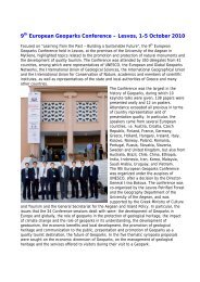
Application
Application
Application

Create successful ePaper yourself
Turn your PDF publications into a flip-book with our unique Google optimized e-Paper software.
<strong>Application</strong><br />
to Extend the area of the<br />
LESVOS PETRIFIED FOREST ‐ EUROPEAN and GLOBAL GEOPARK<br />
and the recognition of the LESVOS ISLAND GEOPARK<br />
for membership in the European Geoparks Network<br />
EARTH HERITAGE SITES<br />
LESVOS – GREECE<br />
2011
List of the geological and geomorphological sites<br />
within the proposed Lesvos Geopark<br />
Petrified Forest Parks<br />
1. Petrified Forest Park (Main Park)<br />
2. Sigri Petrified Forest Park<br />
3. Plaka Petrified Forest Park<br />
4. Chamandroula Petrified Forest Park<br />
5. Skamiouda Petrified Forest Park<br />
6. Nisiopi Petrified Forest Park<br />
Fossil sites (plant fossil sites)<br />
7. Antissa<br />
8. Gavathas<br />
9. Mesotopos<br />
10. Eresos<br />
11. Vatousa<br />
12. Rougada<br />
13. Lapsarna<br />
14. Agra<br />
15. Sarakina<br />
16. Mythimna<br />
Fossil sites (mammal fossil sites)<br />
17. Vatera vertebrate fossil sites<br />
18. Gavathas Dinotherium fossil site<br />
19. Lapsarna micromammal site<br />
Volcanic sites<br />
20. Vatousa Caldera<br />
21. Agra Caldera<br />
22. Anemotia Volcano<br />
23. Lepetymnos Volcano<br />
24. Mesotopos Volcano<br />
25. Petra Volcanic Neck<br />
26. Pithariou Dome<br />
27. Ipsilou Dome ‐ Columnar Lavas<br />
28. Eresos Dome<br />
29. Mythimna Dome – Castle Columnar Lavas<br />
30. Eresos Laccolith<br />
31. Pelopi Columnar Lavas<br />
32. Alifada Dyke<br />
33. Filia Dyke<br />
34. Eresos Dyke<br />
35. Avlaki Dyke (Petra)<br />
36. Volcanic Structure of Panagia Gorgona (Skala Sikamineas)<br />
37. Achladeri Ignimbrite<br />
38. Skamiouda Ignimbrite<br />
39. Parakila Volcanic Rocks Alteration Structures<br />
40. Vatoussa Spheroidal Erosional landforms<br />
41. Pterounda Volcanic Conglomerate<br />
42. Voulgaris Volcanic Conglomerate<br />
43. Panagia Islet Columnar Lavas (Tokmakia)<br />
44. Mparmpalias Islet Ignimbrite<br />
Thermal Springs<br />
45. Polichnitos<br />
46. Lisvori<br />
47. Argenos<br />
48. Eftalou<br />
49. Thermi<br />
2
50. Gera – Therma<br />
51. Panagia Krifti<br />
Ancient Quarries – Mines<br />
52. Moria Ancient Quarry<br />
53. Mine galleries of Northern Lesvos<br />
54. Polichnitos Magnesite Mines<br />
55. Ancient quarries of Skala Loutron<br />
56. Lignite Mine galleries (Lapsarna)<br />
57. S. Lesvos Ancient Mines (Tarti, Τsaf)<br />
58. Eressos Ancient quarry<br />
Caves & Karstic structures<br />
59. Alifada Cave<br />
60. Agios Vartholomaios Taxiarhis Cave<br />
61. Mihos Cave<br />
Caves & Karstic structures<br />
62. Antissa Cave<br />
63. Panagia Krifti (Plomari)<br />
64. Asomatos Cave<br />
Waterfalls<br />
65. Pessa Waterfall<br />
66. Mankatsa Waterfall Mantamados<br />
67. Eresos Waterfall<br />
Gorges<br />
68. Voulgaris Gorge (Vatousa)<br />
69. Tsiknias Gorge<br />
Erosional Structures<br />
70. Candles Volcanic Erosional Structures<br />
71. “Dragon’s Jump” Volcanic Erosional Structure (Napi)<br />
72. Lapsarna Erosional Structures – Orfikia<br />
73. Fikiotrypa<br />
74. Sigri Tafoni<br />
River delta<br />
75. Evergetoula Delta<br />
76. Kalloni Wetlands – Tsiknias Delta<br />
Springs<br />
77. Agiasos Water Springs<br />
Tectonic Structures<br />
78. Larsos Fault – Gera Gulf Fault<br />
79. Agia Paraskevi Fault<br />
80. Amali Faults<br />
81. Olympos Tectonic Window<br />
82. Nisiopi Graben<br />
83. Lambou Miloi Nappe<br />
84. Ancient Pyrra Fault<br />
85. Taxiarhis Tectonic Structures<br />
86. Antissa Fault<br />
Geological – Geomorphological Sites<br />
87. Ophiolite nape – Ampeliko<br />
88. Ophiolite ‐ Amali<br />
89. Gera Schists<br />
90. Plomari beach‐rock formation<br />
91. Megali Limni<br />
3
The Petrified Forest Parks<br />
Description of the characteristic geosites<br />
in the proposed Lesvos Geopark<br />
The Petrified Forest Park (Bali Alonia area)<br />
The region in which the Park was established in 1987 has been referred to as “Kiria Apolithomeni’’ (Main<br />
Fossil site) since the 18th century. This site is the first visiting park of the Petrified Forest, covering an area<br />
of 286 hectares. Integrated interventions for the protection and preservation of the fossils have been<br />
conducted over the years.<br />
Ancestral form of Sequoia – The largest standing tree trunk so far in Europe<br />
Visitors to the park can tour an entire mountainside along specially constructed trails. During the tour<br />
visitors can view the unique displays of Protopinaceae, ancestors of the modern‐day pine tree, grouped in<br />
small clusters. Most of the fossilized trunks belong to the Taxodiaceae, a forerunner of the present‐day<br />
Sequoia which grows on the west coast of the United States. The largest lying coniferous trunk (longer than<br />
20 meters) and the large standing Sequoia trunks belong to this family.<br />
In the Petrified Forest Park, the systematic excavation and research carried out by the Natural History<br />
Museum have brought to light many plant fossils, among which is the largest known standing petrified tree<br />
trunk, not only on Lesvos but certainly in all of Europe. This trunk measures 7.02 m in height with an 8.58 m<br />
circumference. It consists of the lower part of the tree and has remained in excellent condition. The trunk<br />
belongs to the species Taxodioxylon albertense, an ancestor of the modern day Sequoia.<br />
Furthermore, standing fossilized coniferous trunks which belong to the Protopinaceae family have been<br />
excavated and these are characterized by the excellent preservation of the internal and external structure<br />
of the wood. They belong to a new species, Pinoxylon paradoxum and are widespread throughout the<br />
Petrified Forest. The excavations have also uncovered many pieces of fossilized plants (seeds, leaves,<br />
branches, roots) which are displayed in the museum.<br />
4
Ancestral form of cypress The longest petrified tree trunk – 22,5 m<br />
Pinoxylon paradoxum‐ Ancestral form of pine in its growing position and a lying cypress trunk<br />
The park offers three circular theme trails designed to facilitate and familiarize visitors with the petrified<br />
remains. All three trails share an initial first stretch called trail one, entitled “Discovering the Petrified<br />
5
Forest’’, and along it visitors make their first encounter with examples of representative fossils. At the end<br />
of the trail, visitors can choose between 3 trails which lead to the major petrified trunks in the park<br />
Along trail two, visitors encounter major excavation sites with truly impressive fossil remains which reveal<br />
interesting information regarding the stratification of volcanic rock covering the forest that existed in the<br />
area 20 million years ago. Trail two is entitled “The History of the Petrified Coniferous Forest’’ and is<br />
essentially the history of the creation of the petrified forest.<br />
A cluster of confer tree trunks at the Bali Alonia Park<br />
Trail three constitutes the longest walk through the park. It includes the tallest standing trunks, the<br />
majority of which belong to the Taxodioxylon family. The Sequoia, the tallest tree on earth, pertains to this<br />
same family. These trees were part of a mixed coniferous forest which existed in the region about 20<br />
million years ago. Trail three leads us through the area where this forest once grew.<br />
Trail four is of particular scientific interest as it runs through the location of the petrified remains of<br />
Protopinaceae, predecessor of today’s pine tree.<br />
From the composition of the paleoflora scientists can conclude that in the extended area of the Aegean 20<br />
million years ago there were mixed conifer forests and that the broadleaves and palms predominated at<br />
lower elevations. This knowledge also helps in determining the palaeomorphology which once existed in<br />
the region of the Petrified Forest.<br />
6
Sigri Petrified Forest Park<br />
Impressive root systems and standing petrified trunks in excellent condition reveal the history of the<br />
Petrified Forest to visitors at the Sigri Park. Created by the Natural History Museum of the Lesvos Petrified<br />
Forest, the 30‐hectare Sigri Park is located immediately adjacent to the Museum building.<br />
The park is an excellent example of a “geoconcervation site” because of its rarity and the great scientific<br />
worth of its plant fossils.<br />
An exceptional cluster of conifer tree root systems<br />
While walking along the pathways which have been carved out of the hillside, visitors can admire the most<br />
valuable finds within the park which are the petrified tree root systems. Root systems of numerous trees<br />
have been uncovered well‐preserved and in a full stage of development. These roots serve as proof that the<br />
trees were petrified in situ. Impressive standing coniferous and angiosperm trunks (Pinoxylon paradoxum,<br />
Pinoxylon sp., Pinus sp.) emerging from the layers of volcanic ash and displaying their varied coloration can<br />
also be viewed. Sections of a number of fallen petrified trunks have been transferred to the park facilities.<br />
Fossils in the Sigri Park are found in two visible layers of volcanic rock. The upper layer (or horizon),<br />
approximately 20 meters thick, is a pyroclastic flow with large stones, mainly irregularly shaped lava<br />
fragments. Nine fossilized trunks were uncovered in this horizon during the excavations, with<br />
circumferences varying form 1.20 m to 3.20m. These fossilized trunks are characterized by intense brown‐<br />
red colours on the inside and white–green colours on the outer surfaces, and the interior wood structure is<br />
also clearly visible. Secondary layers of silica minerals are frequently found on the outer surface of the<br />
trunks or in small cracks which originated from the dissolution of the initial petrified material.<br />
The lower horizon consists of fine‐grained volcanic material, mainly volcanic ash. Five petrified coniferous<br />
gymnosperm trunks were found in their initial location within this horizon. The systematic excavation fully<br />
revealed the root systems of these trunks, proving beyond doubt the indigenous nature of the Petrified<br />
Forest. These fossilized trunks are mainly characterized by brown and red colours. The fine‐grained volcanic<br />
material contributed to the preservation of fragile parts of the plants like small branches, leaves from<br />
angiosperm trees, specifically various types from the Lauraceae family such as the leaves of the cinnamon<br />
(Cinnamomum polymorphum), seeds, and parts of root systems. In this horizon, a grassy layer full of<br />
branches, needles, and pine cones (Pinus sp.) was also discovered.<br />
7
A conifer tree embedded in pyroclastic layers in Sigri park<br />
Protection shelters in Sigri park<br />
8
Plaka Petrified Forest Park<br />
An important protected fossil bearing area is located in Plaka approximately 800 meters south of the village<br />
of Sigri. The park covers an area of 7 hectares, and consists of two sections, a marine and a coastal section.<br />
In both sections, interesting petrified remains will intrigue the visitor. Numerous standing trunks with intact<br />
root systems and lower trunk parts have been found on the site.<br />
In the Plaka Park, pines and a large variety of fruit bearing plants (angiosperms), which do not appear with<br />
such diversity in any other inland site, compose the vegetation of Lesvos 20 million years ago. More<br />
specifically, fossilized plants that correspond to modern pine (Pinoxylon and Pinus), laurel and cinnamon<br />
plants (Daphnogene polymorpha, Cinnamonum polymorphum, Laurinoxylon), cottonwood (Populoxylon),<br />
plane tree (Platanoxylon) and Palmae (Palmoxylon) were found. It is a different forest vegetation zone<br />
compared to the Petrified forest at the Main Petrified Forest Park site in which there is almost exclusively<br />
coniferous trees (sequoias and protopinaceae).<br />
Today, 46 excavation sites are accessible to visitors. Most of the fossilized trunks are still standing in their<br />
original location. Among the finds is the giant petrified trunk (No 1) with a circumference of 13.7 meters<br />
which, according to the international literature, is the largest standing fossilized trunk in the world. This<br />
tree belongs to the laurel family. An impressive root system at the lower end of the trunk proves that the<br />
trunk is in its original place of growth prior to fossilization. In the marine area the visitor can also find an<br />
impressive lying trunk with a length of 14 meters.<br />
Fossilized tree trunk with length of 14 m. submersed in the sea<br />
9
A huge standing petrified trunk of a cinnamon tree with 14,5 m circumference. According to the international<br />
bibliography, this fossil is the broadest standing petrified trunk in the world<br />
Protection shelters in Plaka park<br />
10
Chamandroula Petrified Forest Park<br />
The Chamandroula Park is another fenced area of the Petrified Forest with a large concentration of<br />
fossilized tree trunks.<br />
The park has petrified remains, tens of standing and lying fossilized conifer and angiosperm trunks with<br />
impressive colouring and preservation of their morphological characteristics of the wood.<br />
Standing and laying petrified trunks at Chamandroula Park<br />
11
Skamiouda Petrified Forest Park<br />
The Skamiouda Park is located outside of the protected region of the Petrified Forest, near Antissa, proving<br />
that the Petrified Forest is much larger than the Petrified Forest protected area.<br />
Excavation work has uncovered standing and lying fossilized trunks in an excellent state of preservation,<br />
and of special scientific value.<br />
The most impressive find is a gigantic lying petrified conifer trunk, length 15 m and circumference ca. 2m<br />
with excellently preserved morphological identifiers. This new find belongs to the conifers, an example of<br />
the species Taxodioxylon gypsaceum which is an ancestral form of the sequoia tree.<br />
A long lying petrified conifer tree trunk with length 15 m at Skamiouda Park<br />
12
Nisiopi Petrified Forest Park<br />
At Nisiopi or Megalonisi islet which encircles the bay of Sigri to the west, have been discovered hundreds of<br />
petrified logs with vibrant colours, either laying or standing, throughout the islet. On the west side of the<br />
island the actions of the waves have revealed giant conifers (ancestors of today’s Sequoias) and<br />
angiosperms. In the sea, visitors can identify tens of petrified logs just below the surface with their brilliant<br />
colours. The density of petrified logs on this island makes it a unique geoptope.<br />
The intense fault activity in the area during recent geologic history is revealed by the tens of faults in the<br />
surface and steep cliffs of the island, witness to its recent separation from the rest of Lesvos.<br />
View of the Nisiopi Park The information point at Nisiopi Park<br />
Petrified tree trunks of conifer trees at Nisiopi coast<br />
13
Petrified Forest Fossil sites<br />
In the area of Antissa were identified by the research of the Natural History Museum significant<br />
concentrations of plant fossils. In particular along the northern coast of the island were identified key<br />
positions of fossilized palms. These clusters of logs make up a petrified palm forest.<br />
Petrified trees in Akrohiras area<br />
In Gavathas have also been found gigantic standing fossilized trees of angiosperms showing excellent<br />
preservation of the internal and external structure of the wood. Visible are the growth rings.<br />
In Orphikia, east of the settlement of Lapsarna appear important plant fossils. Fossilized tree trunks and<br />
leaf fossil horizons have been identified in the region deriving from conifers and angiosperm trees. Plenty<br />
of petrified logs were recorded by the research of the Natural history Museum of the Lesvos Petrified<br />
Forest in Sarakina. These conifers and angiosperms were identified in pyroclastic rocks.<br />
In Mesotopos a rare flora of fossilized logs was identified. It is a rare subtropical flora consisting of<br />
angiosperms ‐ broadleaf trees characteristic of the subtropical zone. The wide dispersion of fossilized tree<br />
trunks on farms and pastures of the regions of Mesotopos ‐ Tavares ‐ Chrousos is evidence that this is a<br />
new interesting part of the Petrified Forest of Lesvos. In the area Chrousos Mesotopos was also revealed<br />
the presence of in situ petrified trunks of large dimensions with excellent preservation of the bark and the<br />
internal structure of the wood.<br />
In Eressos rare fossils of coniferous trees were identified. Important findings in the area are the fossilized<br />
twigs and leaves of the tree Cunnighamia miocenica. It is a coniferous tree of the subtropical zone, which<br />
was first discovered in Lesvos and is one of the best appearances of its kind in Europe. The Cunnighamia<br />
along with the sequoia and Protopinaceae participated in the composition of the forest of conifers in<br />
western Lesvos 20,000,000 years ago. The discovery gives great prestige to the fossil flora of the Petrified<br />
Forest of Lesvos. In the area of Vatoussa were identified important findings of fossils in layers of volcanic<br />
ash. These are important findings which were first discovered near the volcano. Another new fossiliferous<br />
site was found in the area of Agra.<br />
In the area of Rougkada Plomari have been identified rare fossils of coniferous trees. These coniferous<br />
trees, ancestral forms of Sequoia were identified in pyroclastic rocks similar to those of the region Sigri. The<br />
significance of the findings is that they show that the expansion of the Petrified Forest of Lesvos is not<br />
confined to the protected area Sigri‐Eressos‐Antissa.<br />
14
Cuninghamia miocenica and Laurel leaf family in pyroclastic rocks from Eresos<br />
In the area of Mythimna (Molyvos) have been identified rare fossils of coniferous trees. The most<br />
important occurrence is the gigantic trunk that belongs to an ancestral form of Sekoia located in a steep<br />
ravine north of Petra‐Molivos road.<br />
The significance of the findings is that they prove once again the vast spread of the Petrified Forest far<br />
beyond the boundaries of the protected area.<br />
Detail of the internal structure of a petrified tree trunk.<br />
15
Fossil sites (mammal fossil sites)<br />
Vatera vertebrate fossil sites<br />
In the area of Vatera was recently discovered in sweet water deposits an interesting vertebrate fauna aged<br />
2 million years, which has been identified by Prof. M. Dermitzakis (University of Athens). Among the<br />
findings are included the mandible, the tusks and other parts of the skeleton of the gigantic proboscides<br />
Anancus arvenensis, horse bones of various sizes including a tall horse with welded legs, bones and jaws of<br />
the carnivorous Nyctereutes megamastoides, as well as a bone of an oversized turtle. Of particular interest<br />
are the monkey bones belonging to the genus Paradolichopithecus. The list also includes fossils of giraffes,<br />
rhinos, deers, gazelles, antelopes, etc. These findings indicate a savannah paleoenvironment.<br />
Paradolichopithecus arvernesis<br />
Fossils specimens of Anancus arvernensis<br />
16
Gavathas Dinotherium fossil site<br />
In Gavathas‐Antissa, were identified the fossilized bones of animals that lived in the area of the Petrified<br />
Forest in the Lower Miocene, 18 million years ago. More specifically an intact mandible with all teeth and<br />
bones of an animal belonging to Prodeinotherium bavaricum. The animal is similar to today’s elephant, but<br />
it differed in that it had downward curving tusks located in the lower jawbone. The fossil is one of the<br />
oldest fossils of a vertebrate animal in Greece, and proves its migration form Africa (place of origin) to<br />
Europe during the Budigalian Age (Early Miocene). This animal was an inhabitant of the subtropical forest<br />
which once covered western Lesvos and I fed on the leaves and tender branches of plants in the forest.<br />
The bones and teeth of the Prodeinotherium bavaricum<br />
17
Lapsarna micromammal site<br />
Significant findings emerged from the research work of the Natural History Museum of the Lesvos Petrified<br />
Forest in Lapsarna where a rich fauna of micromammals was found. The fauna as well as the stratigraphic<br />
position of the sediment layer that contains it, suggests that probably this is a very old fauna, perhaps the<br />
oldest mammalian fauna that has been found in Greece, as it is certainly older than 18 million years and its<br />
age could be even 19 to 20 million years. The fauna includes lake snails of the family Planorbidae and<br />
Lymnaeidae that lived in the big lake that covered the area, small lake fish of the family of Cyprinidae<br />
(carps), many representatives of which live today in freshwater, tiny alligator of the genus Diplocynodon,<br />
small mammals belong to different families. Best represented are the rodents.<br />
A B<br />
The Lapsarna micromammal paleofauna<br />
C D<br />
A. Tooth of alligator ‐ B. Molar of insect eating mammal ‐ C. Tooth of rodent ‐ D. Tooth of dormouse<br />
18
Volcanic sites<br />
As a result of intense volcanic activity around 21.5 to 16.5 million years ago stunning geological formations<br />
were created on Lesvos island. In Lesvos, eruptions resulted in immense volcanic structures all through the<br />
central and western part of the island. There are impressive volcanic chambers, large dykes, volcanic necks<br />
and numerous exit points of volcanic material. Major craters are located in central Lesvos in the regions of<br />
Vatousa, Agra, Anemotia, Lepetymnos and Mesotopos.<br />
The Mythimna columnar lava formations<br />
Τhe Miocene lavas of Panagia Gorgona in Skala Sykamias.<br />
19
Pyroclastic flow near Mesotopos<br />
Layers of pyroclastic flow and mud flow in West Lesvos<br />
20
Vatousa volcano<br />
It is a huge crater with diameter of 6 kilometres which was the result of intense volcanic activity in the area<br />
18.5 to 16.5 million years ago. The initial volcano formation lost its shape after extensive downslope<br />
transport that resulted in the collapse of the volcano’s west side. During the period that followed, tectonic<br />
activity and corrosion changed its original shape. Today, the crater can be traced after close observation of<br />
the hills surrounding the Vatousa basin. These hills are actually what are left from the great volcanic<br />
structure. The area of Vatousa has dense, rich vegetation due to the fertile volcanic soil. The centre of the<br />
volcanic structure, from which lava erupted, can be easily spotted as the rocks in this area are softer due to<br />
corrosion from the hot air that emerged.<br />
The caldera of the volcano of Vatousa<br />
Lepetymnos volcano<br />
The volcano of Lepetymnos, in the Northern part of Lesvos is the island’s biggest stratovolcano. During its<br />
activity, about 18 million years ago, a big caldera was formed after violent volcanic eruptions. A calm period<br />
followed, during which big volcanic domes grew, resulting the slow upwards movement and solidification<br />
of magma. These domes formed the big mountain peaks of Prophitis Ilias and Myrivili. On the outskirts of<br />
the Lepetymnos domes there is impressive columnar lava formations created due to the rapid cooling of<br />
magma.<br />
The Lepetymnos impressive columnular lava formations created due to the rapid cooling of magma<br />
21
Agra volcano<br />
The village of Agra is built on the interior of a well retained crater that bares the same name. It borders the<br />
Vatousa crater which is older. Natural corrosion has not caused high degradation so that the crater shape is<br />
well retained.<br />
The crater of Agra volcano, the youngest volcano of Lesvos<br />
Eresos lava dome<br />
The lava dome in Eresos is a characteristic structure in the shape of a dome which was created by the<br />
Miocene volcanic activity on the island.<br />
The Eresos Lava dome and lacolite<br />
22
Pytharion lava dome<br />
A series of lava domes appear in the area of Eresos and seem to be younger structures of the Miocene<br />
volcanic activity.<br />
The Pytharion lava dome is one of the characteristic volcanic structures at the western Lesvos. It can been<br />
seen on the road Eressos ‐ Mesotopos created by the Miocene volcanic activity.<br />
The Pytharion Lava dome<br />
Ordymnos volcanic dome (Moni Ypsiloy)<br />
The Ordymnos volcanic dome dominates in western Lesvos. On top of the dome is built the monastery<br />
of St. John the Divine. The dome showing beautiful structures of magma intrusion in older pyroclastic<br />
volcanic materials. On the northern part there are impressive andesitic columnar lavas.<br />
23
The Ordymnos volcanic dome<br />
Columnar lava in Ordymnos volcanic dome<br />
24
Filia Volcanic dyke<br />
Lesvos has many volcanic dykes running through the volcanic rock. They began to be formed around 18<br />
million years ago when liquid magma entered cracks in the rock. The temperature of the magma was very<br />
high but when it came to the surface of the earth or up to the seabed it cooled and solidified into very hard<br />
rock.<br />
The volcanic dyke of Filia<br />
Volcanic dyke of Alyfanta<br />
Stunning images of volcanic material intrusion, from the latest volcanic activity, through the thick<br />
crystallized limestone appear in the Alyfanta area.<br />
Basaltic dyke intruded in Palaeozoic crystalline limestones near Alifanta, Mytilini<br />
25
Avlaki Volcanic dyke<br />
At the area of Petra village appears the impressive Avlaki volcanic dyke which protrude from the<br />
softer pyroclastic rocks.<br />
Volcanic dyke of Avlaki near Petra village<br />
Petra Volcanic neck<br />
Lesvos also has many features known as volcanic necks. These are tube‐like conduits which link a magma<br />
chamber in the interior of a volcano with the surface of the earth. It is through these that the magma is<br />
channelled. The volcanic rock on which the famous Church of the Panagia Glykofilousa in Petra stands is<br />
also classed as a volcanic neck. The volcanic neck in Petra was originally a lateral conduit which connected<br />
the magma chamber with the stratovolcano at Lepetymnos, the biggest volcanic centre on Lesvos. The<br />
rocks surrounding the volcanic neck have now eroded away, while the most resilient of the materials which<br />
filled it, which are andesitic, have remained.<br />
Panagia Glykofilousa in Petra, built on a volcanic neck<br />
26
Columnular lavas of Pelopi<br />
Impressive columnar lavas can be seen close to Pelopi along the southern flank of Lepetymnos mt.<br />
Columnular lavas created when magma cooled rapidly close to the surface of the Earth. As the magma<br />
approached the surface it cooled abruptly, resulting in the development of multiple parallel networks of<br />
cracks. Along the length of these cracks, andesitic rocks became separated and formed stunning natural<br />
pentagonal and hexagonal columns.<br />
Columnar lava flow of Pelopi along the southern side of Lepetymnos volcano<br />
Columnar lavas of Panagia Islet (Tokmakia)<br />
Spectacular forms of columnar lavas, formed by the rapid cooling of lava, appear at the islet of Panagia<br />
located east of the coast of Mantamados. It is another intrusion of magma associated with the volcanic<br />
center of Lepetymnos.<br />
Columnar lava of Panagia islet<br />
27
Thermal Springs<br />
Not far beneath the surface of Lesvos there are still large<br />
concentrations of hot magma. These act as vast heaters, warming<br />
water which penetrates the crust to a considerable depth. When it<br />
approaches the magma chamber, the meteoric water is heated and<br />
comes up through the surface of the Earth via thermal springs. The<br />
most important thermal springs on Lesvos are at Polichnitos, Lisvori,<br />
Thermi, Therma at Geras gulf, Eftalou and Argenos.<br />
At one of the springs at Polychnitos the temperature of the water<br />
reaches 87.6 degrees centigrade, making it the hottest natural spring in<br />
Europe. The minerals dissolved in the water crystallise as the water<br />
temperature drops when it reaches the surface. This leads to the<br />
occurrence of oxides, the cause of the intense colouration of the rocks<br />
around the springs. The hot water which circulates throughout the rock<br />
below the surface of the earth can reach a temperature of up to 400<br />
centigrade.<br />
Geothermic fields of high enthalpy have been located around<br />
Lepetymnos in the region of Stypsi and also in the Argenos region. The<br />
high temperature makes it possible for the water to dissolve minerals<br />
which are solid on the surface. When this water cools it cannot retain<br />
View of the area of the thermal<br />
springs of Therma<br />
the minerals in solution and so they are redeposited in channels. This is how mineral seams were laid down<br />
in the Molyvos area. In the past there were silver and lead mines in the region and mineshafts can still be<br />
seen today.<br />
Natural hot spring of Polichnitos. The water temperature at the thermal springs of Polichnitos exceeds<br />
87.6 degrees centigrade<br />
28
Ancient Quarries – Mines<br />
In Lesvos functioned in the antiquity important quarries and mines, the material of which was used for the<br />
structure of important monuments and artifacts.<br />
In the 4th century BC in the area of Moria was active an ancient quarry of white marble from which the<br />
ancient theater and the church of Pergamum were built. Within the crystalline limestones are remarkably<br />
preserved fossils of invertebrates (Megalodon). Important quarries operated during the antiquity in the SE<br />
coast of the island in the areas of Tarti, Tsaf, Mageiras and St. Isidoros. They were extracting Paleozoic<br />
metamorphic rocks such as schists and crystalline limestones.<br />
Mine of zinc copper in North Mine of zinc copper in North Lesvos Quartz veins, which host<br />
gold and silver mineralization in North Lesvos<br />
In the volcanic rocks of Northern Lesvos and especially in the areas of Megala Therma Argennos and south<br />
of Eftalou Mithymna has been developed a system of quartz veins, which host gold and silver<br />
mineralization. In these areas took place during the Byzantine period limited mining activity (mainly lead<br />
and zinc and copper), associated with the mineralization of gold and silver. In the region there are now<br />
eight galleries ant two wells, which follow the direction of the quartz veins. Although the galleries are not<br />
prop the are open due to the compact nature of the rock.<br />
Magnesite mineralization occurs in the area of Polichnitos within ultramafic rocks of the ophiolitic cover,<br />
which develops in the form of veins. In the past in this region magnesite was exploited, as justified by the<br />
abandoned tunnels and piles. The veins occupy magnesite zones of ultramafic rocks and derived from the<br />
decomposition of serpentinite during metamorphic phenomena.<br />
Mine galleries at the area of Polichnitos Magnesite mine in Polychmitos<br />
29
Caves & Karstic structures<br />
Lesvos has numerous natural obscure caves most of them located on the eastern part of the island. One of<br />
most important caves in Lesvos is the Agios Vartholomeos Cave at the suburb of Mytilini, Kayiani. It has<br />
amazing stalactites and prehistoric pots were found inside. Its length is 60m.<br />
The Alyphanta cave is the cave with the biggest length in Lesvos (about 120m). At its internal were found<br />
antiquities of the Roman and Byzantine era. It hasn't got stalactites' decoration but it has considerable<br />
forks.<br />
The Cave of Ayios Ioannis is at the area of Mychou (Geras Bay). It is 95m long and has two corridors with<br />
marble walls. Inside tombs of the 5th century were found. There aren’t any stalactites but we can admire<br />
wonderful formations on the vault.<br />
The Spilios cave in Antissa the biggest cave in Western Lesvos. 5.000 years old antiquities were found<br />
inside. It was supposed to be the Orpheas’ (a very famous musician of the antiquity who was killed and<br />
dropped to the sea with his lyre and was washed out near this cave, where he then was buried) oracle.<br />
The Antissa Cave Spilios, where It was supposed to be the Orpheas’ oracle<br />
30
Waterfalls<br />
Several waterfalls exist along small rivers in different parts of the island. Well‐known are the waterfalls of<br />
Mankatsa near Mandamados in volcanic rocks and Pessa, near Polychnitos in ophiolitic rocks.<br />
The waterfalls of Pessa, near Polychnitos<br />
31
The waterfalls of Mankasa formed in the volcanic rocks of the region of Mantamados with a hight of<br />
approximately 20 meters. The name Mankasa means furious flesh. It originated from the legend of<br />
a shepherdess living in the area and pushed down the cliff of the waterfall the young shepherds.<br />
The waterfalls of Mankatsa near Mandamados<br />
Methalia waterfalls near Eresos<br />
32
Erosional Structures<br />
Voulgaris Gorge<br />
The Voulgaris gorge is an impressive gorge which is cutting the volcanic formations of the Vatoussa volcano.<br />
It was created along the stream of Voulgaris River and it follows a series of active faults affecting a volcanic<br />
conglomerate which is the result of collapse of the north volcano flank.<br />
The Voulgaris gorge cuts the northern part of the Vatoussa volcano<br />
The “candles” geoform<br />
Characteristic erosion forms are the forms called "Candles", created by erosion of volcanic rocks in the<br />
area of the Monastery Limonos.<br />
The characteristic forms of erosion "Candles"<br />
33
Another erosional structure called "Dragon's Jump" in Napi in the area of the Municipal Unit of Aghia<br />
Paraskevi.<br />
The volcanic site “The Drajon’s Jump” in Napi<br />
Tafoni<br />
Cavernous weathering forms have a wide distribution in the warm and partly arid coastal regions<br />
.Impressive tafoni nodular erosion structures were formed at the area of Plaka Sigri. Tafone distribution is<br />
highly variable in Lesvos Petrified Forest Geopark coastal area. They develop on the ground rocks, at the<br />
lateral surfaces of bedrocks or overhanging over the cliffs<br />
Honeycomb weathering in pyroclastic rocks in Sigri<br />
34
Honeycomb-weathering features, closely spaced pits of centimeter to decimeter size surrounded by raised<br />
lips or walls, have a wide distribution on exposed surfaces on the volcanic formations in West Lesvos coast.<br />
Honeycombs are the dominant cavernous weathering features in Sigri. They exist usually on the andesitic<br />
outcrops but also on the pyroclastic sequence.<br />
Tafone distribution is highly variable. They develop on the lava boulders, at the lateral surfaces of the costal<br />
cliffs or overhanging over the cliffs.<br />
Impressive tafoni structures at the area of Plaka, south of Sigri .<br />
Tafoni structure on an andesitic boulder in Sigri area<br />
35
River delta<br />
One of the biggest river systems of the island is that of Tsiknia, which crosses the central part of the<br />
island and empties into the Gulf of Kalloni. The hydrographic network of the torrent Tsiknias has<br />
contributed greatly to the current terrain of central Lesvos combined with the intense endogenic<br />
phenomena of volcanism and tectonics. Being an important element of the central cluster of wetlands in<br />
the north side of the Gulf of Kalloni, Tsiknias river supports many freshwater<br />
organizations and attracts wading birds.<br />
Evergetoulas river is another big river system of the island. It flows into the wetland area of Ntipi at the<br />
Gera gulf. The name of the river, the springs of which are on the slopes of Mount Olympus, means<br />
benefactor and is indicative for its importance to the region.<br />
Springs<br />
The Evergetoulas river flows into the wetland area of Ntipi at the Gera gulf<br />
Most basins formed within the limits of the "Megali Limni" pine forest transfer depending on the year,<br />
moderate to large quantities of water flowing downstream, forming small‐medium streams with<br />
particular seasonal water flow. The largest of these streams is the stream of "Aghia Sotiras" and the stream<br />
of "Tsingou" that have flow throughout the year. Of particular ecological value is the stream of<br />
“Karkavouras” stemming from the high points of Olympus, passing the site of St. Dimitrios and fueling<br />
Evergetoulas River. Sources "Chtenelli" are inside the stream of Karkavouras at an altitude of 350 meters<br />
above sea level.<br />
in the forest of the area of Agiasos, can be found rich water resources. Most important are those<br />
of "Tsingos" the water of which has curative properties. The springs are close to the “Megali Limni” and<br />
their creation is due to tectonics.<br />
The Roman aqueduct of Mytilini started from “Megali Limni” and the sources of Tsingos, located at the<br />
foot of Mount Olympus in Agiasos. From there began the concentration of water that was transferred with<br />
pipes to the main adequate and finally to the town of Mytilini.<br />
36
Active Faults<br />
Lesvos island is affected by significant active faults located both onshore and offshore. Northern of Lesvos<br />
lays the Edremit fault, which shows high seismic potential and it’s one of the most hazardous seismic<br />
sources for the broader area. It defines the south coastline of Biga Peninsula (Turkey), right opposite of the<br />
northern shore of Lesvos, while its synthetic and antithetic faults are possible seismic sources of lower<br />
potential.<br />
Major geological faults can be observed at many places in Lesvos.<br />
The faults in the Gulf of Gera comprise a zone that has particular importance because of the short distance<br />
from the town of Mytilene. The Larsos fault scarp is the most impressive fault scarp on Lesvos island<br />
located at the northern part of the Gulf of Gera. On this fault scarp the channel for the Roman aqueduct of<br />
Lesvos has been carved. The NNE‐SSW Geras fault is responsible for the existence of warm springs in the<br />
area.<br />
The steep slope of the Larsos fault in Geras Gulf<br />
In the region of the Gulf of Kalloni there is a large fault zone. This fault zone is associated with powerful<br />
earthquakes. In 230 BC a quake is linked with the destruction of the ancient city of Pyra, the ruins and<br />
ancient port of which are now beneath the sea in the Gulf of Kalloni.<br />
The same fault zone also appears to be linked to the most powerful earthquake to have taken place in<br />
Lesvos’s more recent history. The quake took place in 1867 with its epicentre in the Agia Paraskevi region.<br />
It registered 6.8 on the Richter scale and caused massive damage.<br />
The right‐lateral Aghia Paraskevi fault (Fytikas et al., 1999) was the one activated when the 1867<br />
earthquake (6.8) occurred. It cuts off the central part of the island from N to S, while its visible length<br />
onshore has earthquake potential 6.7. This means that it continues to the sea, to the Kalloni gulf possibly,<br />
as it arises from the microseismic epicenters distribution<br />
37
Near the village of Agia Paraskevi, one of the most impressive faults of Lesvos is visible, with<br />
notable striations caused by the successive seismic events affecting the fault plane<br />
38
An active fault near Vatera affecting Pleistocene sediments<br />
The Antissa fault scarp.<br />
39
Olympos Mountain Tectonic Window<br />
A significant structure on Lesvos island is the tectonic window of Mountain Olympos at the area of Agiasos.<br />
The large outcrops of the marbles inside the “volcanosedimentary nappe”, are parts of the continental<br />
margin, together with the autochthonous unit of the basement, and they are in tectonic contact with the<br />
metasediments of the metamorphic sole<br />
The tectonic window of Mountain Olympos – Agiasos<br />
Schematic geological cross section in the area of Olympos Mt., showing the tectonic emplacement of the ophiolitic<br />
nappe and the metamorphic sole nappe onto the Triassic carbonate rocks of the autochthonous unit<br />
(Mountrakis et al 2001).<br />
40