Baldwin Park Civic Center Plaza - ULI Los Angeles - Urban Land ...
Baldwin Park Civic Center Plaza - ULI Los Angeles - Urban Land ...
Baldwin Park Civic Center Plaza - ULI Los Angeles - Urban Land ...

Create successful ePaper yourself
Turn your PDF publications into a flip-book with our unique Google optimized e-Paper software.
Recommendations<br />
Vision<br />
Revitalize <strong>Baldwin</strong> <strong>Park</strong>’s <strong>Civic</strong> <strong>Center</strong> District by creating a main<br />
street environment through enhanced pedestrian linkages between the<br />
community’s primary assets and activity nodes<br />
Vision Strategies<br />
To realize the vision, the panel suggests:<br />
I. Leveraging existing assets and improving linkages<br />
II. Site improvements and development opportunities<br />
III. Future housing<br />
Vision Strategy I: Leveraging Existing Assets & Improving Linkages<br />
Leveraging Existing Assets: The <strong>Baldwin</strong> <strong>Park</strong> Transit <strong>Center</strong> is surrounded by a variety<br />
of community assets that can be leveraged to promote pedestrian traffic and downtown<br />
development. These include the <strong>Civic</strong> <strong>Center</strong> and Arts and Recreation <strong>Center</strong> sites<br />
directly to the north, as well as the underutilized retail space adjacent to the centers<br />
on the south side of Ramona Boulevard, both east and west of Pacific Avenue. Slightly<br />
further away, to the northwest lies the Morgan <strong>Park</strong> and Community <strong>Center</strong>, an active<br />
community destination, visited by about 1,000 community members per day. Storefront<br />
retail wraps the park and community center around the northwest corner of Ramona<br />
and Maine Ave. The <strong>Park</strong> <strong>Plaza</strong> retail center sits at the northeast corner of Ramona<br />
and Maine. The center is conventionally designed and automobile oriented, with an<br />
abundance of surface parking as its main visual feature. Residential neighborhoods are<br />
located south of the Metrolink alignment, and north of the park and community center.<br />
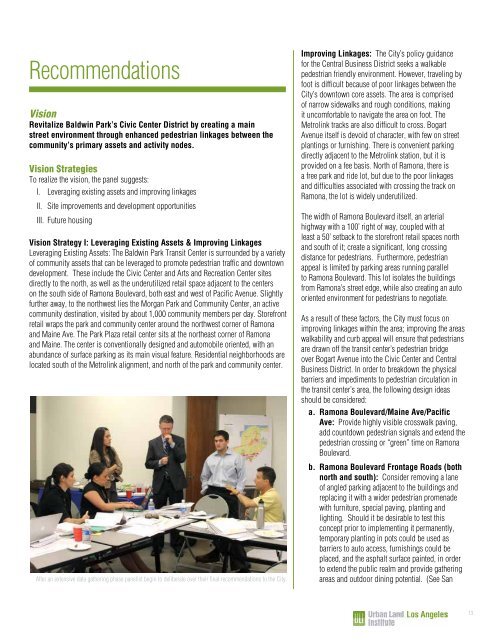
After an extensive data gathering phase panelist begin to deliberate over their final recommendations to the City.<br />
Improving Linkages: The City’s policy guidance<br />
for the Central Business District seeks a walkable<br />
pedestrian friendly environment. However, traveling by<br />
foot is difficult because of poor linkages between the<br />
City’s downtown core assets. The area is comprised<br />
of narrow sidewalks and rough conditions, making<br />
it uncomfortable to navigate the area on foot. The<br />
Metrolink tracks are also difficult to cross. Bogart<br />
Avenue itself is devoid of character, with few on street<br />
plantings or furnishing. There is convenient parking<br />
directly adjacent to the Metrolink station, but it is<br />
provided on a fee basis. North of Ramona, there is<br />
a free park and ride lot, but due to the poor linkages<br />
and difficulties associated with crossing the track on<br />
Ramona, the lot is widely underutilized.<br />
The width of Ramona Boulevard itself, an arterial<br />
highway with a 100’ right of way, coupled with at<br />
least a 50’ setback to the storefront retail spaces north<br />
and south of it; create a significant, long crossing<br />
distance for pedestrians. Furthermore, pedestrian<br />
appeal is limited by parking areas running parallel<br />
to Ramona Boulevard. This lot isolates the buildings<br />
from Ramona’s street edge, while also creating an auto<br />
oriented environment for pedestrians to negotiate.<br />
As a result of these factors, the City must focus on<br />
improving linkages within the area; improving the areas<br />
walkability and curb appeal will ensure that pedestrians<br />
are drawn off the transit center’s pedestrian bridge<br />
over Bogart Avenue into the <strong>Civic</strong> <strong>Center</strong> and Central<br />
Business District. In order to breakdown the physical<br />
barriers and impediments to pedestrian circulation in<br />
the transit center’s area, the following design ideas<br />
should be considered:<br />
a Ramona Boulevard/Maine Ave/Pacific<br />
Ave: Provide highly visible crosswalk paving,<br />
add countdown pedestrian signals and extend the<br />
pedestrian crossing or “green” time on Ramona<br />
Boulevard.<br />
b Ramona Boulevard Frontage Roads (both<br />
north and south): Consider removing a lane<br />
of angled parking adjacent to the buildings and<br />
replacing it with a wider pedestrian promenade<br />
with furniture, special paving, planting and<br />
lighting. Should it be desirable to test this<br />
concept prior to implementing it permanently,<br />
temporary planting in pots could be used as<br />
barriers to auto access, furnishings could be<br />
placed, and the asphalt surface painted, in order<br />
to extend the public realm and provide gathering<br />
areas and outdoor dining potential. (See San<br />
13