Weekly Edition 52 of 2012
Weekly Edition 52 of 2012
Weekly Edition 52 of 2012
You also want an ePaper? Increase the reach of your titles
YUMPU automatically turns print PDFs into web optimized ePapers that Google loves.
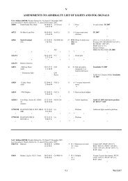
Vol H <strong>Edition</strong> <strong>2012</strong>/13 continued.<br />
H0059<br />
CA, IW, 2595<br />
H0059·1<br />
CA, IW, 2596<br />
- Beacon Point<br />
(Inukshuktuyuk). Ldg Lts<br />
219°49′. Front<br />
- Beacon Point<br />
(Inukshuktuyuk). Ldg Lts<br />
219°49′. Rear. 0·553M from<br />
front<br />
58 33·07 N<br />
68 11·54 W<br />
58 32·70 N<br />
68 12·30 W<br />
STRAIT OF BELLE ISLE. PINWARE BAY<br />
H0111·5 Remove from list; deleted<br />
H0244<br />
CA, N, 151·08<br />
H0719<br />
CA, N, 253<br />
V<br />
F W 17 15 Orange ( on square<br />
tower with black<br />
stripe<br />
* *<br />
F W 44 15 Orange D on square<br />
tower with black<br />
stripe<br />
8<br />
* *<br />
Vis on rangeline only.<br />
Seasonal<br />
Vis on rangeline only.<br />
Seasonal<br />
ROSE BLANCHE HARBOUR<br />
- Cain's Island 47 36·14 N<br />
58 42·09 W<br />
Fl R 6s 2 3 Mast fl 0·5<br />
- - . . Horn 30s . . . . . . bl 3<br />
* * *<br />
CANADA BAY<br />
- Bad Rock 50 47·12 N<br />
56 09·67 W<br />
Fl G 4s 5 6 White U, green<br />
bands, on square<br />
framework tower<br />
4<br />
*<br />
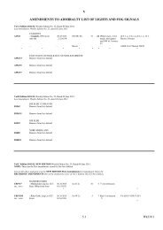
Vol J <strong>Edition</strong> <strong>2012</strong>/13. NEW EDITION <strong>Weekly</strong> <strong>Edition</strong> No. <strong>52</strong>, Dated 27 December <strong>2012</strong>.<br />
NOTE: These are the first amendments issued for the New <strong>Edition</strong>.<br />
Cut out the above and paste it in the NEW EDITION First Amendments box immediately below the<br />
RECORD OF AMENDMENTS title on the inside front cover <strong>of</strong> Vol J <strong>Edition</strong> <strong>2012</strong>/13 New <strong>Edition</strong>.<br />
J0214<br />
US, I, 95<br />
5.10<br />
Seasonal<br />
GULF OF MAINE. WOOD ISLAND<br />
- Wood Island. E end 43 27·41 N Al WG 10s 22 W13 White conical tower<br />
70 19·74 W<br />
G13 connected to dwelling<br />
22<br />
- - - Emergency light . . Fl G 10s<br />
- - - . . Horn(2) 30s . . . . . . bl 2, si 2, bl 2, si 24.<br />
Activated by keying microphone 5<br />
times on VHF channel 83A<br />
* * * *<br />
LONG ISLAND. LONG ISLAND SOUND<br />
J0820 Remove from list; deleted<br />
J0820·1<br />
US, I, 26160<br />
J1411·7<br />
US, II, 10450<br />
J2348·1<br />
US, II, 8995<br />
- Port Jefferson. Dir Lt 40 56·79 N Dir F W 13 . . Red U, white stripe, Vis 0·5° each side <strong>of</strong> bearing<br />
162·75°<br />
73 04·25 W<br />
on pile<br />
* * *<br />
CHESAPEAKE BAY ENTRANCE<br />
- Lynnhaven Inlet. Linkhorn 36 <strong>52</strong>·30 N<br />
Bay. Channel. No 23 76 00·53 W<br />
*<br />
Q G 5 3 Green & on pile<br />
CHESAPEAKE BAY. NORTHERN PART. ELK RIVER<br />
- North Ldg Lts 042·5°. Rear. 39 31·11 N F W 43 . . White framework Vis 5·5° each side <strong>of</strong> rangeline.<br />
1·617M from front<br />
75 54·53 W<br />
tower<br />
Shown 24 hours<br />
- - - - . . By day 42 . . . . Vis on rangeline only<br />
* * *<br />
Wk<strong>52</strong>/12


