Scottish Road Network Landslides Study - University of Glasgow
Scottish Road Network Landslides Study - University of Glasgow
Scottish Road Network Landslides Study - University of Glasgow

Create successful ePaper yourself
Turn your PDF publications into a flip-book with our unique Google optimized e-Paper software.
32<br />
INFORMATION SOURCES<br />
Second, information on past landslide locations that have affected the road network, their type<br />
<strong>of</strong> movement, their date <strong>of</strong> occurrence and, if relevant, reactivation dates may help to identify<br />
sites <strong>of</strong> current landslide activity and the factors that control their occurrence under present<br />
climatic conditions. Such data are contained within geological maps, landslide databases,<br />
ground investigation reports, PhD theses, and papers in technical/scientific journals.<br />
3.3.1 Geological/Geotechnical Information<br />
The British Geological Survey (BGS) holds a large amount <strong>of</strong> geological, engineering<br />
geological and geotechnical data. These data are increasingly being held in digital form and<br />
are being accessed, viewed, analysed and presented using sophisticated computer systems<br />
(relational databases and Geographical Information Systems, or GIS) that enable them to be<br />
combined in different ways. Thus BGS <strong>of</strong>fers not only large relevant data holdings but also<br />
the ability to manipulate the data to user needs incorporating new types <strong>of</strong> data into the<br />
system as the need arises.<br />
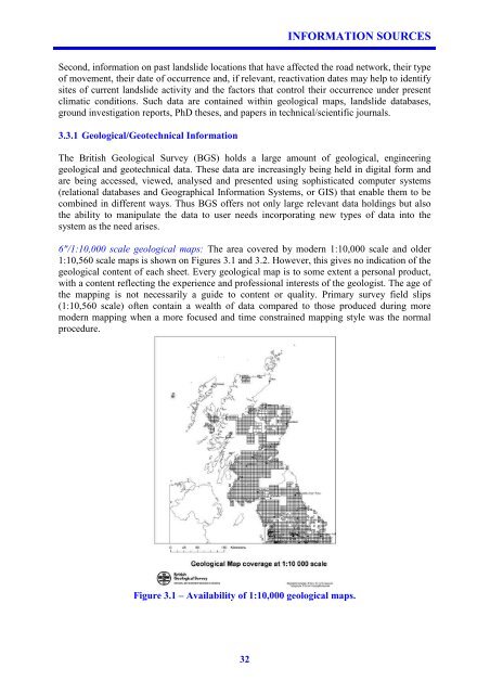
6"/1:10,000 scale geological maps: The area covered by modern 1:10,000 scale and older<br />
1:10,560 scale maps is shown on Figures 3.1 and 3.2. However, this gives no indication <strong>of</strong> the<br />
geological content <strong>of</strong> each sheet. Every geological map is to some extent a personal product,<br />
with a content reflecting the experience and pr<strong>of</strong>essional interests <strong>of</strong> the geologist. The age <strong>of</strong><br />
the mapping is not necessarily a guide to content or quality. Primary survey field slips<br />
(1:10,560 scale) <strong>of</strong>ten contain a wealth <strong>of</strong> data compared to those produced during more<br />
modern mapping when a more focused and time constrained mapping style was the normal<br />
procedure.<br />
Figure 3.1 – Availability <strong>of</strong> 1:10,000 geological maps.