Scottish Road Network Landslides Study - University of Glasgow
Scottish Road Network Landslides Study - University of Glasgow
Scottish Road Network Landslides Study - University of Glasgow

Create successful ePaper yourself
Turn your PDF publications into a flip-book with our unique Google optimized e-Paper software.
40<br />
INFORMATION SOURCES<br />
Storm Track Data: The MO have done some work on storm tracks across the UK and the<br />
number <strong>of</strong> storms passing through each year it has not yet appeared in print and it has<br />
probably not been done for Scotland alone. However, a contact at the MO has informally<br />
advised that it should be possible to generate such information from the available data.<br />
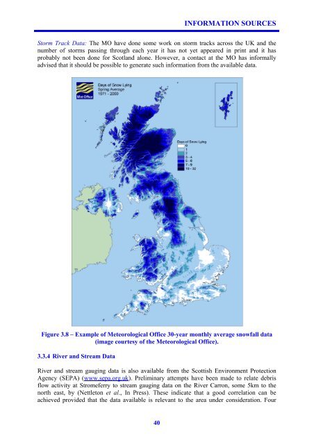
Figure 3.8 – Example <strong>of</strong> Meteorological Office 30-year monthly average snowfall data<br />
(image courtesy <strong>of</strong> the Meteorological Office).<br />
3.3.4 River and Stream Data<br />
River and stream gauging data is also available from the <strong>Scottish</strong> Environment Protection<br />
Agency (SEPA) (www.sepa.org.uk). Preliminary attempts have been made to relate debris<br />
flow activity at Stromeferry to stream gauging data on the River Carron, some 5km to the<br />
north east, by (Nettleton et al., In Press). These indicate that a good correlation can be<br />
achieved provided that the data available is relevant to the area under consideration. Four