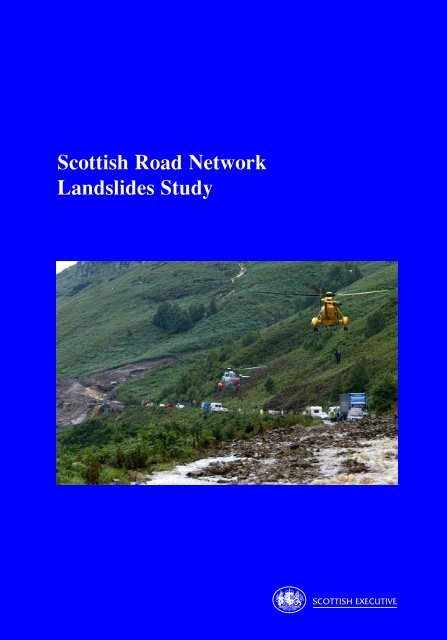
Scottish Road Network Landslides Study - University of Glasgow
Scottish Road Network Landslides Study - University of Glasgow
Scottish Road Network Landslides Study - University of Glasgow

Create successful ePaper yourself
Turn your PDF publications into a flip-book with our unique Google optimized e-Paper software.
<strong>Scottish</strong> <strong>Road</strong> <strong>Network</strong><br />
<strong>Landslides</strong> <strong>Study</strong><br />
SCOTTISH EXECUTIVE
SCOTTISH ROAD NETWORK<br />
LANDSLIDES STUDY<br />
Editors<br />
M G Winter (TRL Limited), F Macgregor and L Shackman (<strong>Scottish</strong> Executive)<br />
The <strong>Scottish</strong> Executive<br />
2005<br />
Cover Photograph (© Perthshire Picture Agency, PPA: www.ppapix.co.uk):<br />
The A85 in Glen Ogle blocked by two debris flows on 18 August 2004. RAF and Royal Navy<br />
helicopters are pictured airlifting some <strong>of</strong> the 57 occupants from the 20 trapped vehicles to<br />
safety.
Electronic copies <strong>of</strong> this report may be obtained from the <strong>Scottish</strong><br />
Executive web site (www.scotland.gov.uk).<br />
The views expressed in this report are those <strong>of</strong> the Editors and<br />
Authors and do not necessarily represent those <strong>of</strong> the Department or<br />
<strong>Scottish</strong> Ministers.<br />
The <strong>Scottish</strong> Executive and Astron would like to point out that some <strong>of</strong> the images in<br />
this document are <strong>of</strong> a poorer quality than would normally appear in their documents.<br />
This is because some photographs were taken on digital cameras, mobile phone<br />
cameras and/or in difficult conditions. In addition, some <strong>of</strong> the graphs and images<br />
used have been necessarily downloaded from websites at low resolutions<br />
which are <strong>of</strong> a poor reproductive quality when printed.<br />
© Crown Copyright 2005. Except as otherwise stated.<br />
Limited extracts from the text may be reproduced provided the source is<br />
acknowledged. For more extensive reproduction, please write to the<br />
Chief <strong>Road</strong> Engineer, <strong>Scottish</strong> Executive, Victoria Quay, Edinburgh,<br />
EH6 6QQ.
TABLE OF CONTENTS<br />
FOREWORD 1<br />
WORKING GROUP MEMBERS AND REPORT CONTRIBUTORS 2<br />
EXECUTIVE OVERVIEW 4<br />
1 INTRODUCTION TO LANDSLIDE HAZARDS 9<br />
2 BACKGROUND TO SCOTTISH LANDSLIDES AND DEBRIS FLOWS 12<br />
2.1 <strong>Landslides</strong> 12<br />
2.2 Recent Debris Flows 16<br />
2.3 Climatic Issues 19<br />
2.4 Current Inspection and Maintenance Arrangements 22<br />
2.5 Potential Third Party Issues 23<br />
3 DEBRIS FLOW INFORMATION SOURCES 25<br />
3.1 Key Findings from the Literature 25<br />
3.2 The Project Workshop 29<br />
3.3 Potential Third Party Issues 31<br />
4 DEBRIS FLOW TYPES AND MECHANISMS 45<br />
4.1 Flows 45<br />
4.2 Debris Flows 46<br />
4.3 Principles <strong>of</strong> Rapid Landslide Development 46<br />
5 KEY CONTRIBUTORY FACTORS TO DEBRIS FLOWS 68<br />
5.1 Hazard Factors Affecting Debris Flow Occurrence 68<br />
5.2 Hazard Factors Affecting Debris Flow Run-Out 75<br />
5.3 Factors Affecting Exposure to Debris Flow Hazards 77<br />
5.4 Summary <strong>of</strong> Key Contributory Factors 80<br />
6 PROPOSED METHODOLOGY FOR DEBRIS FLOW ASSESSMENT 81<br />
6.1 Hazard Assessment 81<br />
6.2 Hazard Ranking 83<br />
6.3 Detailed Assessment Factors 84<br />
7 HIGH HAZARD AREAS AND EARLY OPPORTUNITIES IN SCOTLAND 90<br />
7.1 Areas <strong>of</strong> High Perceived Hazard 90<br />
7.2 Early Opportunities 93<br />
8 DEBRIS FLOW MANAGEMENT AND MITIGATION OPTIONS 95<br />
8.1 Managing the Asset 95<br />
8.2 Approaches to Landslide Management 95<br />
8.3 Asset Management for Trunk <strong>Road</strong> Slopes 98<br />
8.4 Mitigation Techniques 101<br />
9 SUMMARY AND RECOMMENDATIONS FOR DEBRIS FLOWS IN SCOTLAND 109<br />
9.1 Summary 109<br />
9.2 Recommendations 110<br />
REFERENCES 114<br />
APPENDIX – PROJECT WORKSHOP AGENDA 119
MINISTERIAL FOREWORD<br />
The landslide events <strong>of</strong> August 2004 had a substantial impact on Scotland’s road network.<br />
Although the effects were principally experienced by local and commercial road users, the<br />
tourist industry, which reaches its peak in the summer months, was also significantly<br />
disrupted.<br />
The <strong>Scottish</strong> Executive, together with other governments, is committed to protecting the<br />
environment, aiming to tackle global warming. However, climate change is already<br />
happening. In response to the events last summer two studies were instigated. One concerns<br />
the effects <strong>of</strong> climate change on Scotland’s road network, which is being published<br />
separately. This study though focuses on how we develop our procedures for assessing,<br />
ranking and managing the hazards associated with landslides. This report presents the results<br />
<strong>of</strong> the first stage <strong>of</strong> the landslides study. It highlights debris flows, a particular type <strong>of</strong><br />
landslide, as representing a hazard to the road network and its users. The report details means<br />
by which areas susceptible to such hazards may be identified and the methods by which we<br />
might deal with them.<br />
I am pleased that we have been able to facilitate contributions to this report from a wide range<br />
<strong>of</strong> experts, who have worked together in such a collaborative fashion. The report that has<br />
emerged from their efforts is a forward-looking document that sets out the future for landslide<br />
management in Scotland. The work will now continue into the second stage <strong>of</strong> the study with<br />
the development <strong>of</strong> a standardised system for assessing hazards and managing the<br />
consequences. These efforts will make Scotland’s roads safer and help to maintain<br />
Scotland’s reputation as both an area <strong>of</strong> vibrant economic growth and a premier tourist<br />
destination.<br />
I am pleased to <strong>of</strong>fer my support to the work presented in this report and to the continued<br />
progress towards assessing and managing the hazards which landslides present.<br />
Nicol Stephen MSP<br />
Minister for<br />
Transport<br />
1
WORKING GROUP MEMBERS AND REPORT CONTRIBUTORS<br />
Dr David Brown: David is a Graduate Engineering Geologist at W A Fairhurst & Partners. He<br />
recently completed his PhD degree which included an extensive study <strong>of</strong> debris flow phenomena<br />
and has applied his knowledge <strong>of</strong> this subject to the literature review under the guidance <strong>of</strong> Paul<br />
McMillan. In the context <strong>of</strong> this work David represents Amey, the Operating Company for the<br />
south-east and south-west regions <strong>of</strong> the <strong>Scottish</strong> trunk road network.<br />
Alan Forster: Alan Forster is a Chartered Geologist and Principal Engineering Geologist at the<br />
British Geological Survey and manages the Geological Hazards sub-programme. Alan has over<br />
30 years experience in a wide range <strong>of</strong> subject areas in engineering geology, including a particular<br />
emphasis on slope instability in the past 10 years. Alan is former Secretary to the Engineering<br />
Group <strong>of</strong> the Geological Society and former Scientific Editor <strong>of</strong> the Quarterly Journal <strong>of</strong><br />
Engineering Geology and Hydrogeology.<br />
Andrew Heald: Andrew is a Chartered Geologist and Chartered Engineer and a Technical<br />
Director at Jacobs Babtie in <strong>Glasgow</strong>. He has over 20 years experience in a broad range <strong>of</strong><br />
geotechnical issues and a particular interest in landslides. After graduating, he was thrown in at<br />
the deep end <strong>of</strong> Dinorwic’s lower lake, to work on slope stability issues. He has studied<br />
landslides in Nepal, Bhutan and Peru and has recently learned to keep his telephone switched on<br />
when rainstorms hit the Highlands. In the context <strong>of</strong> this work Andrew represents BEAR, the<br />
Operating Company for the north-east and north-west regions <strong>of</strong> the <strong>Scottish</strong> trunk road network.<br />
Dr Steve Hencher: Steve is a Chartered Geologist and a Chartered Engineer and is Director and<br />
Head <strong>of</strong> Geotechnics at Halcrow in Hong Kong. He has more than 20 years experience in the<br />
investigation <strong>of</strong> landslides to a forensic level and in recent years has led several risk assessment<br />
studies <strong>of</strong> landslide hazards to roads and structures both at research and practical levels. He is a<br />
member <strong>of</strong> the ISSMGE/ISRM/IAEG Joint Technical Committee on <strong>Landslides</strong>.<br />
Forbes Macgregor: Forbes is a Chartered Civil Engineer and is construction standards manager<br />
within the Contracts and Policy Branch <strong>of</strong> the <strong>Scottish</strong> Executive Transport Group, Trunk <strong>Road</strong>s<br />
Design and Construction Division. He has over 30 years experience in all forms <strong>of</strong> road project<br />
design and construction, having worked extensively in both on-site supervision and <strong>of</strong>fice-based<br />
project management roles. Specifically in the geotechnics area, he contributes to a number <strong>of</strong> key<br />
UK technical working groups and manages the Independent Geotechnical Checking commission<br />
operated for the <strong>Scottish</strong> trunk road network.<br />
Stewart Martin: Stewart is a Chartered Civil Engineer and is Head <strong>of</strong> Geotechnics at Halcrow in<br />
Scotland. He has over 30 years experience in geotechnical engineering and has worked on a wide<br />
range <strong>of</strong> projects both overseas and in the United Kingdom. He carried out numerous slope<br />
stability investigations with British Waterways for cuttings, embankments and earthfill dams. He<br />
has been responsible for carrying out the geotechnical certification <strong>of</strong> all trunk road schemes in<br />
Scotland since 1994 and has developed a considerable appreciation <strong>of</strong> the trunk road geotechnical<br />
and geological environment over that period.<br />
Paul McMillan: Paul is a Chartered Geologist and is the Divisional Director responsible for W A<br />
Fairhurst & Partners Geotechnical and Environmental services in Scotland. Paul has wide<br />
experience in engineering geology, geotechnical engineering and geoenvironmental engineering,<br />
with particular expertise in relation to rock engineering. In the context <strong>of</strong> this work Paul<br />
represents Amey, the Operating Company for the south-east and south-west regions <strong>of</strong> the<br />
<strong>Scottish</strong> trunk road network.<br />
2
3<br />
WORKING GROUP<br />
Dr Roger Moore: Roger is a Chartered Geologist and is Head <strong>of</strong> Engineering Geomorphology at<br />
Halcrow in Birmingham. In 17 years he has accumulated experience in the applied earth sciences<br />
for engineering, planning, development and environmental projects. Projects include slopes and<br />
landslides, rivers and coastal studies and <strong>of</strong>fshore geohazard assessments. Specific applications<br />
include geohazard and quantitative risk analysis (QRA); landslide and flood disaster response<br />
planning and mitigation; transport/pipeline route alignment studies; and option studies for slope<br />
stabilisation and protection schemes.<br />
Ian Nettleton: Ian is both a Chartered Engineer and a Chartered Geologist and is an Associate at<br />
EDGE Consultants. He has accumulated experience in engineering geology and geotechnical<br />
engineering over more than 14 years. His experience includes investigation, design and<br />
assessment <strong>of</strong> slopes; forensic investigations <strong>of</strong> slope failures; development and implementation<br />
<strong>of</strong> hazard/risk assessment systems; earthworks asset management for infrastructure in the UK;<br />
development <strong>of</strong> risk reduction and risk management strategies, including remedial works design.<br />
Julie Parsons: Julie is a Chartered Geologist and a Principal Engineer with Jacobs Babtie in<br />
<strong>Glasgow</strong> with 11 years consultancy experience. She became very familiar with the characteristics<br />
<strong>of</strong>, and damage resulting from, debris flows and associated remedial measures during a two and a<br />
half year period in Hong Kong. Since 2000, she has provided advice and recommendations on<br />
landslides and washouts to BEAR. In the context <strong>of</strong> this work Julie represents BEAR, the<br />
Operating Company for the north-east and north-west regions <strong>of</strong> the <strong>Scottish</strong> trunk road network.<br />
Lawrence Shackman: Lawrence is a Chartered Civil Engineer and is currently an Area Manager<br />
in the <strong>Network</strong> Management Division <strong>of</strong> the <strong>Scottish</strong> Executive. He has 19 years experience <strong>of</strong><br />
design, construction and maintenance <strong>of</strong> trunk roads both with the Executive and as a consultant.<br />
He has practical experience <strong>of</strong> earthworks construction, specification and operations.<br />
Andy Sloan: Andy Sloan is a Chartered Engineer and a Director <strong>of</strong> Donaldson Associates Ltd<br />
who has responsibility for geotechnical engineering work undertaken by the firm. He has<br />
extensive experience in the application <strong>of</strong> soil and rock mechanics to engineering design. His<br />
particular interests lie in tunnelling and slope engineering. He has practical experience in the<br />
development and application <strong>of</strong> risk management systems for infrastructure slopes.<br />
Matt Willis: Matt is a Chartered Geologist and a Principal Engineering Geologist at Arup’s<br />
London <strong>of</strong>fice. During the last 15 years he has acquired experience in a range <strong>of</strong> activities<br />
including site investigation in the UK and overseas. Recently Matt’s work has focussed on<br />
infrastructure earthworks, especially slope stability and remote sensing, and he was Project<br />
Manager for the Highways Agency remote assessment project.<br />
Dr Mike Winter: Mike is both a Chartered Civil Engineer and a Chartered Geologist. He is the<br />
Regional Manager responsible for TRL’s infrastructure operations in Scotland. During the last 20<br />
years he has acquired broad experience in research and specialist consultancy in a wide range <strong>of</strong><br />
geotechnical and geoenvironmental engineering, and engineering geology fields. He has<br />
conducted investigations <strong>of</strong> many landslides, including debris flows, in Scotland and maintains an<br />
abiding interest in landslides, their forensic investigation, management and mitigation.
EXECUTIVE OVERVIEW<br />
INTRODUCTION<br />
‘The surface <strong>of</strong> the land is made by Nature to decay….<br />
Our fertile plains are formed from the ruins <strong>of</strong> the mountains’.<br />
James Hutton, 1785<br />
In August 2004 a series <strong>of</strong> landslides in the form <strong>of</strong> debris flows occurred in Scotland. Some<br />
<strong>of</strong> these affected the A83, A9 and A85, which form part <strong>of</strong> the trunk road network. These<br />
incidents were well reported in the media.<br />
While debris flows occur with some frequency in Scotland, they only rarely affect the trunk<br />
road network or for that matter the main local road network. However, when they do impact<br />
on the road network the degree <strong>of</strong> damage, in terms <strong>of</strong> the infrastructure and the loss <strong>of</strong> utility<br />
to road users, can have a major detrimental effect on both economic and social aspects <strong>of</strong> the<br />
use <strong>of</strong> the asset. Additionally, there is a high potential for such events to cause serious injury<br />
and even loss <strong>of</strong> life although, fortuitously, such consequences have been limited to date.<br />
The events <strong>of</strong> August 2004 followed a sustained period <strong>of</strong> heavy rainfall and, in addition,<br />
intense localised storms contributed to the triggering <strong>of</strong> at least some <strong>of</strong> the resulting debris<br />
flows. Rainfall <strong>of</strong> up to 300% <strong>of</strong> the monthly average fell in certain parts <strong>of</strong> Scotland during<br />
August 2004.<br />
Within the recent past, debris flow activity in Scotland has occurred largely in the periods<br />
July to August and November to January, but there is no certainty that such a pattern will be<br />
continued in the future. However, eastern parts <strong>of</strong> Scotland do receive their highest levels <strong>of</strong><br />
rainfall in August. Additionally, climate change models indicate that rainfall levels will<br />
increase in the winter but decrease during the summer months but that intense storm events<br />
will increase in number. These factors, therefore, may change both the frequency and the<br />
annual pattern <strong>of</strong> debris flow events.<br />
The impacts <strong>of</strong> such events are particularly serious during the summer months due to the<br />
major contribution that tourism makes to Scotland’s economy. Nevertheless, the impacts <strong>of</strong><br />
debris flow events during the winter months should not be underestimated.<br />
OBJECTIVES<br />
Following the events <strong>of</strong> August 2004, the need to act was recognised by the <strong>Scottish</strong><br />
Executive and this study was commissioned to take stock <strong>of</strong> the present situation on the trunk<br />
road network and to determine a sustainable approach to the management <strong>of</strong> such occurrences<br />
in the future.<br />
This study, termed <strong>Study</strong> 1, comprises two parts and it is Part 1 that is reported here. Part 1<br />
deals with the following activities:<br />
Considering the options for undertaking a detailed review <strong>of</strong> side slopes adjacent to the<br />
trunk road network and recommending a course <strong>of</strong> action.<br />
4
5<br />
EXECUTIVE OVERVIEW<br />
Outlining possible mitigation measures and management strategies that might be adopted.<br />
Undertaking an initial review to identify obvious areas that have the greatest potential for<br />
similar events in the future.<br />
STRUCTURE<br />
A Project Workshop was held in order to capture the knowledge vested with individual<br />
experts. The Project Workshop comprised presentations given by acknowledged experts<br />
followed by focussed discussion sessions designed to open out the knowledge base and<br />
determine the way forward with the project. Following the Project Workshop the Editors<br />
assigned tasks to individuals in terms <strong>of</strong> the preparation <strong>of</strong> this report as exemplified by the<br />
authorship <strong>of</strong> individual sections. The main results from the Project Workshop are<br />
incorporated in the various sections.<br />
After a brief introduction in Section 1, Section 2 gives the background to the <strong>Study</strong> as a<br />
whole. It describes the different types <strong>of</strong> landslide, focussing on debris flows as recently<br />
experienced, and illustrates the recent history <strong>of</strong> debris flows in Scotland with examples right<br />
up until the present. It also deals with climatic issues and those issues which relate to third<br />
party ownership <strong>of</strong> land from which landslides may originate<br />
Section 3 examines sources <strong>of</strong> relevant information, including previous literature, the Project<br />
Workshop and available data sets from sources such as <strong>Scottish</strong> Executive and the British<br />
Geological Survey.<br />
Section 4 deals with the classification and type <strong>of</strong> debris and other types <strong>of</strong> flows. It explains<br />
how rapid landslides develop from their causes and the underlying soil failure mechanisms,<br />
through the mechanics <strong>of</strong> their downslope propagation and, finally, to their run-out at the base<br />
<strong>of</strong> the slope.<br />
Section 5 examines the relevance <strong>of</strong> the key factors in debris flow initiation and propagation<br />
that have been identified from past events, including the events <strong>of</strong> August 2004. These are<br />
considered in terms <strong>of</strong> factors affecting the likelihood <strong>of</strong> debris flow occurrence, including<br />
the effects <strong>of</strong> run-out, and factors affecting the exposure <strong>of</strong> road users to debris flows<br />
Section 6 describes the proposed assessment methodology in terms <strong>of</strong> hazard assessment and<br />
approach for <strong>Study</strong> 1, Part 2 and also details the hazard assessment and exposure factors that<br />
will form the core <strong>of</strong> the methodology for the detailed assessment.<br />
Section 7 identifies areas <strong>of</strong> high hazard that are considered to have the greatest potential for<br />
similar debris flow events in the future and sets out opportunities for early actions.<br />
Section 8 describes management and mitigation options. In terms <strong>of</strong> management the<br />
sequential approach <strong>of</strong> Detection, Notification and Action (DNA) promulgated by the Editors<br />
at the Project Workshop is used. This approach is set out in terms <strong>of</strong> a response to both<br />
precursor conditions, such as intense rainfall, and also to the management <strong>of</strong> future debris<br />
flow events.<br />
Section 9 presents a brief summary <strong>of</strong> this report and makes recommendations for the way<br />
forward.
RECOMMENDATIONS<br />
Early Opportunities<br />
6<br />
EXECUTIVE OVERVIEW<br />
A number <strong>of</strong> areas <strong>of</strong> perceived high hazard were identified at the Project Workshop. The<br />
lengths <strong>of</strong> the road and the slope lengths they involve are substantial. Accordingly, it is<br />
considered unrealistic to undertake suitably prioritised further evaluations at this stage. The<br />
proposal is for the outputs <strong>of</strong> the GIS-based assessment to be used to corroborate the<br />
identification <strong>of</strong> the localities identified at the Project Workshop and, in addition, as a<br />
validation tool for the site specific assessment methodology.<br />
In the meantime it is important that maintenance and construction projects currently in design<br />
take the opportunity to limit any hazards or exposure by incorporating, where suitable,<br />
measures such as higher capacity or better forms <strong>of</strong> drainage, or debris traps. Peer group<br />
consultation in the form <strong>of</strong> the involvement <strong>of</strong> the Overseeing Organisation and its<br />
Independent Geotechnical Checker, the corresponding specialists within the Operating<br />
Companies, design organisations or other appropriate organisations is an essential part <strong>of</strong> this<br />
process.<br />
In the realm <strong>of</strong> minimising the potential impacts <strong>of</strong> debris flows on the network, some<br />
retargeting <strong>of</strong> maintenance actions could be productive. The checking <strong>of</strong> gullies, ditches and<br />
catchpits, with a wider view than that <strong>of</strong> merely keeping the roadway itself clear <strong>of</strong> water,<br />
could be undertaken as part <strong>of</strong> regular inspections. Where ineffectiveness <strong>of</strong> the drainage<br />
system, or underperformance under updated drainage criteria, is suspected, this should be<br />
considered in conjunction with the inspection regime for the roadside side slopes and<br />
remedial action addressed via an appropriate structured asset management plan. Additionally,<br />
critical review <strong>of</strong> the alignment <strong>of</strong> culverts and other conduits close to the road ought to be<br />
carried out as part <strong>of</strong> inspection and reporting procedures.<br />
Certain monitoring measures are already under consideration – for example, the installation<br />
<strong>of</strong> a rain gauge in the A83 Rest and be Thankful area, where debris flows are generally small<br />
but relatively frequent, potentially yielding more comparable data in a short time frame. The<br />
use <strong>of</strong> any such data gained, in conjunction with longer-duration data available from the<br />
Meteorological Office, needs to be managed appropriately to serve a worthwhile and<br />
consistent function. At a later stage, informed selection <strong>of</strong> locations for discrete placement <strong>of</strong><br />
additional rain-gauging facilities could be productive, and should be considered in the light <strong>of</strong><br />
experience <strong>of</strong> managing the information from current sources.<br />
An important action which could be introduced on an early basis is bringing NADICS into the<br />
management loop with regard to route advice when weather conditions conspire to create<br />
situations where sections <strong>of</strong> the network might be considered ‘at-risk’.<br />
<strong>Study</strong> 1, Part 2<br />
The initial stage <strong>of</strong> <strong>Study</strong> 1, Part 2 will be to develop the methodology for the assessment <strong>of</strong><br />
hazard and exposure to provide a hazard ranking, together with the selection <strong>of</strong> an appropriate<br />
management approach. The second stage will be to test the methodology before applying it<br />
more widely to the trunk road network.
7<br />
EXECUTIVE OVERVIEW<br />
The initial stage <strong>of</strong> this work is itself divided into four elements and can be summarised as<br />
follows:<br />
Development <strong>of</strong> a debris flow hazard and exposure assessment system to provide a hazard<br />
ranking <strong>of</strong> ‘at-risk’ areas <strong>of</strong> the road network.<br />
Undertaking a computer-based GIS assessment as a first stage in the hazard assessment<br />
process.<br />
Undertaking site specific hazard and exposure assessments <strong>of</strong> areas identified by the GIS<br />
as being <strong>of</strong> higher hazard.<br />
The identification and development <strong>of</strong> appropriate management processes for each<br />
category <strong>of</strong> hazard ranking.<br />
The GIS-based assessment will be used as a first stage in the hazard assessment process.<br />
This will enable site specific assessments to be targeted in order to obtain better value from<br />
such relatively resource-intensive activities. It will also allow the elimination <strong>of</strong> large areas <strong>of</strong><br />
the network having minimal hazard.<br />
It is also particularly important to note that the site-specific assessment will not be a ‘driveby’<br />
survey; it will require a highly specialised detailed site examination which will need to be<br />
carried out using an overall consistent approach. Prior to undertaking any site surveys it is<br />
important that the system is established for consistently describing and identifying hazards<br />
and the associated exposure. Some <strong>of</strong> the factors that will need to be incorporated in such a<br />
system, such as slope angle and the broad nature <strong>of</strong> the geology, will be incorporated into the<br />
GIS assessment. Other, more detailed, factors such as the effects <strong>of</strong> forestation will need to be<br />
incorporated into the site-based survey. Once a hazard assessment has been completed it may<br />
be combined with an assessment <strong>of</strong> the exposure <strong>of</strong> the road user to that hazard to give a<br />
hazard ranking. This will allow, in-turn, an appropriate management option to be selected<br />
from the range <strong>of</strong> options to be developed.<br />
There are a number <strong>of</strong> potential options which could be applied to the management <strong>of</strong> debris<br />
flows. These are addressed in the following paragraphs.<br />
The ‘Do-Nothing’ approach is intended to be applied to sites <strong>of</strong> low hazard ranking for which<br />
substantial expenditure is inappropriate. For such sites, whilst it is not possible to eliminate<br />
the chance <strong>of</strong> a landslide event affecting such areas it is seen as unlikely, largely<br />
unforeseeable and/or the exposure is less serious than at other locations where resources may<br />
be better expended.<br />
The ‘Do-Minimum’ option, with the potential to mitigate the impacts <strong>of</strong> debris flows to some<br />
extent involves simply ensuring that forward plans are in place to ensure that diversion routes<br />
are available and may be exploited in an expedient and well organised manner. Diversion<br />
route maps and contingency plans are currently held for many areas <strong>of</strong> the trunk road network.<br />
Whilst it is not possible to eliminate the chance <strong>of</strong> a debris flow event affecting such areas<br />
any occurrence is seen as unlikely and largely unforeseeable and any residual exposure<br />
cannot readily be quantified and is unlikely to justify the commitment <strong>of</strong> additional resources<br />
which may be better expended at other locations.
8<br />
EXECUTIVE OVERVIEW<br />
‘Do-Something 1’ is the first management option where site specific action is contemplated.<br />
Such action is essentially exposure reduction by managing the access to and/or actions <strong>of</strong> the<br />
road-using public on the network at times either when events occur or precursor rainfall has<br />
indicated a high likelihood <strong>of</strong> landslides occurring.<br />
In the case <strong>of</strong> short-term to medium-term reaction to such occurrences, then the DNA<br />
approach can be implemented by pre-planned actions such as issuing an advisory warning or<br />
closing the road. There may be a case for reacting to extremely heavy rainfall events in a<br />
similar fashion, especially with warnings. A caveat to this is the need to consider carefully at<br />
what levels the triggers should be set, in so far as the relationship between rainfall and<br />
landslides in Scotland is by no means fully understood.<br />
Considering the longer-term approach, precursor triggering conditions (i.e. rainfall) may<br />
enable many <strong>of</strong> the actions described above to be taken prior to the occurrence <strong>of</strong> major<br />
events. Either an extensively enhanced network <strong>of</strong> rain gauges installed across Scotland or<br />
access to data derived from radar and <strong>of</strong> sufficient resolution would be required. Such work<br />
might initially be concentrated on known storm tracks, if these are available from the<br />
Meteorological Office, and vulnerable slopes. Clearly, if this approach is taken then close<br />
consultation with both the Geotechnical Engineering Office in Hong Kong, which has<br />
extensive experience <strong>of</strong> operating such a system albeit in different climatological and<br />
geological conditions, and the UK Meteorological Office would be highly desirable.<br />
It is fully expected that it will take some considerable time and effort to ensure that sufficient<br />
data has been obtained and analysed so as to be able to introduce a warning system. Even<br />
then it must be expected that atypical events, which are not the subject <strong>of</strong> warnings, may<br />
occur. Also a number <strong>of</strong> false alarms may inevitably be expected. A programme <strong>of</strong> public and<br />
media education and awareness-raising is also likely to be desirable to minimise any potential<br />
adverse reaction to such scenarios.<br />
‘Do-Something 2’ involves more major works in order to achieve hazard reduction (as<br />
opposed to exposure reduction in the ‘Do-Something 1’ case). The approaches involved entail<br />
physical measures such as the protection <strong>of</strong> the road, reduction <strong>of</strong> the opportunity for a debris<br />
flow to occur or realignment <strong>of</strong> the road away from the area <strong>of</strong> high hazard. Such options<br />
need to be considered in the context <strong>of</strong> the policy governing the <strong>Scottish</strong> Executive’s overall<br />
trunk road maintenance and construction programme. In general, these are likely to be <strong>of</strong> high<br />
cost necessitating their restriction to the very few areas <strong>of</strong> highest hazard ranking.<br />
Clearly Monitoring and Feedback is fundamental to the success <strong>of</strong> the system and key to<br />
deriving best value from the arrangements proposed. The system developed is an active one<br />
and lessons learned from future landslide events, whether they occur in areas <strong>of</strong> high or very<br />
high hazard ranking or not, will produce valuable data which needs to be taken into account<br />
in adjusting the parameters that form the cornerstone <strong>of</strong> the assessment methodology.<br />
There exists a need to ensure that actions identified by the existing Rock Slope Hazard Index<br />
system (as developed in the early 1990s) are carried out on a priority budget basis. These will<br />
include both maintenance works and re-inspection activities. While the rock slope system and<br />
the proposed landslide system have very different structures, great efforts have been made to<br />
ensure that the critical exposure evaluation and the output categories are capable <strong>of</strong> being<br />
mutually compatible.
1 INTRODUCTION TO LANDSLIDE HAZARDS<br />
by M G Winter, F Macgregor and L Shackman<br />
In August 2004 Scotland experienced rainfall substantially in excess <strong>of</strong> the norm. Some areas<br />
<strong>of</strong> Scotland received in excess <strong>of</strong> 300% <strong>of</strong> the 30-year average August rainfall. In the Perth<br />
and Kinross area figures <strong>of</strong> the order <strong>of</strong> between 250% and 300% were typical. While the<br />
percentage rainfall during August reduced to the west, parts <strong>of</strong> Stirling and Argyll & Bute<br />
still received between 200% and 250% <strong>of</strong> the monthly average 1 .<br />
The rainfall was both intense and long lasting and a large number <strong>of</strong> landslides, in the form <strong>of</strong><br />
debris flows (see Section 2), were experienced in the hills <strong>of</strong> Scotland. A small number <strong>of</strong><br />
these intersected with the trunk road network, notably the A83 between Glen Kinglas and to<br />
the north <strong>of</strong> Cairndow (9 August), the A9 to the north <strong>of</strong> Dunkeld (11 August), and the A85 at<br />
Glen Ogle (18 August).<br />
While there were no major injuries to those affected, some 57 people were taken to safety by<br />
helicopter after being trapped between the two debris flows on the A85 in Glen Ogle (see<br />
cover picture). The A85, carrying up to 5,600 vehicles per day, was closed for four days. The<br />
A83, which carries around 5,000 vehicles per day (all vehicles two-way, 24 hour AADT 2 ),<br />
was closed for two days and the A9, carrying 13,500 vehicles per day, was closed for two<br />
days prior to reopening, initially with single lane working under convoy. The disruption<br />
experienced by local and tourist traffic, as well as to goods vehicles, was substantial.<br />
The need to act has been recognised by the <strong>Scottish</strong> Executive and this initial study (<strong>Study</strong> 1,<br />
Part 1) has been commissioned alongside a second study (<strong>Study</strong> 2). <strong>Study</strong> 2 is designed to<br />
identify the potential impacts and consequent necessary actions in the light <strong>of</strong> anticipated<br />
climate change and is not considered further in this report, although it is important to note that<br />
action has been taken to ensure that the two studies are complementary.<br />
As indicated above, this study, termed <strong>Study</strong> 1, comprises two parts and it is Part 1 that is<br />
reported here. Part 1 deals with the following activities:<br />
Considering the options for undertaking a detailed review <strong>of</strong> side slopes adjacent to the<br />
trunk road network and recommending a course <strong>of</strong> action.<br />
Outlining possible mitigation measures and management strategies that might be adopted.<br />
Undertaking an initial review to identify obvious areas that have the greatest potential for<br />
similar events in the future.<br />
This work will lead to <strong>Study</strong> 1, Part 2 which will include the development <strong>of</strong> a system to<br />
allow a detailed review <strong>of</strong> the network to be undertaken to identify the locations <strong>of</strong> greatest<br />
hazard and for those hazards to be ranked and appropriate mitigation and/or management<br />
measures to be selected.<br />
1 Source: http://www.met<strong>of</strong>fice.com/climate/uk/2004/august/maps.html.<br />
2 Note that the traffic flow figures are highly variable on a seasonal basis. The figures quoted are the maximum<br />
figures available from 2003 and 2004 records and are generally in either July or August. The minimum figures<br />
were 3,000 for the A83, 7,200 for the A9 and 2,300 for the A85 in either January or February.<br />
9
10<br />
INTRODUCTION<br />
The overall purpose <strong>of</strong> these studies is thus to ensure that the <strong>Scottish</strong> Executive has a system<br />
in place for assessing the hazards posed by debris flows. In addition, the system will be<br />
capable <strong>of</strong> ranking the hazards in terms <strong>of</strong> their potential relative effects on road users. This<br />
will allow the future effects <strong>of</strong> debris flow events to be managed and mitigated as appropriate<br />
and as budgets permit. This will ensure that the exposure <strong>of</strong> road users to the consequences <strong>of</strong><br />
future debris flows is minimised whilst acknowledging that it is not possible to prevent the<br />
occurrence <strong>of</strong> such events.<br />
A consistent, repeatable and reproducible system is required. This is especially important as a<br />
variety <strong>of</strong> consultants will be involved in the data gathering, analysis and interpretation<br />
process. Inevitably each will have a different, but nonetheless valid, approach when operating<br />
independently. Such a situation would make any comparison between individual consultant’s<br />
results and recommendations impossible for the purpose <strong>of</strong>, for example, allocating funds on<br />
a priority basis across the network. It is apparent at the outset that a unified system acceptable<br />
to all <strong>of</strong> the major players in the industry is required.<br />
It was thus recognised at an early stage <strong>of</strong> the development <strong>of</strong> the work that the input <strong>of</strong> a<br />
wide range <strong>of</strong> experts and stakeholders would be required in order for the studies to be<br />
completed successfully. In particular, the agreement and input <strong>of</strong> those most likely to be<br />
responsible for using the system was required.<br />
A Project Workshop was held in order to capture the knowledge vested with individual<br />
experts (see Appendix). The Project Workshop was facilitated by Pr<strong>of</strong>essor Malcolm Horner<br />
<strong>of</strong> the <strong>University</strong> <strong>of</strong> Dundee and comprised presentations given by acknowledged experts<br />
followed by focussed discussion sessions designed to open out the knowledge base and<br />
determine the way forward with the project. Following the Project Workshop the Editors<br />
assigned tasks to individuals in terms <strong>of</strong> the preparation <strong>of</strong> this report as exemplified by the<br />
authorship <strong>of</strong> individual sections. The main results from the Project Workshop are<br />
incorporated in the various sections.<br />
Section 2 gives the background to the <strong>Study</strong> as a whole. It describes the different types <strong>of</strong><br />
landslide, focussing on debris flows as recently experienced, and illustrates the recent history<br />
<strong>of</strong> debris flows in Scotland with examples right up until the present. It also deals with climatic<br />
issues and those issues which relate to third party ownership <strong>of</strong> land from which landslides<br />
may originate<br />
Section 3 examines sources <strong>of</strong> relevant information, including previous literature, the Project<br />
Workshop and available data sets from sources such as the <strong>Scottish</strong> Executive and the British<br />
Geological Survey.<br />
Section 4 deals with the classification and type <strong>of</strong> debris and other types <strong>of</strong> flows. It explains<br />
how rapid landslides develop from their causes and the underlying soil failure mechanisms,<br />
through the mechanics <strong>of</strong> their downslope propagation and, finally, to their run-out at the base<br />
<strong>of</strong> the slope.<br />
Section 5 examines the relevance <strong>of</strong> the key factors in debris flow initiation and propagation<br />
that have been identified from past events, including the events <strong>of</strong> August 2004. These are<br />
considered in terms <strong>of</strong> factors affecting the likelihood <strong>of</strong> debris flow occurrence, including<br />
the effects <strong>of</strong> run-out, and factors affecting the exposure <strong>of</strong> road users to debris flows
11<br />
INTRODUCTION<br />
Section 6 describes the proposed assessment methodology in terms <strong>of</strong> hazard assessment and<br />
approach for <strong>Study</strong> 1, Part 2 and also details the hazard assessment and exposure factors that<br />
will form the core <strong>of</strong> the methodology for the detailed assessment.<br />
Section 7 identifies areas <strong>of</strong> high hazard that are considered to have the greatest potential for<br />
similar debris flow events in the future and sets out opportunities for early actions.<br />
Section 8 describes management and mitigation options. In terms <strong>of</strong> management the<br />
sequential approach <strong>of</strong> Detection, Notification and Action (DNA) promulgated by the Editors<br />
at the Project Workshop is used. This approach is set out in terms <strong>of</strong> a response to both<br />
precursor conditions, such as intense rainfall, and also to the management <strong>of</strong> future debris<br />
flow events.<br />
Section 9 presents a brief summary <strong>of</strong> this report and makes recommendations for the way<br />
forward.<br />
In this report reference is made to both debris flows and landslides. Debris flow is recognised<br />
within the specialist community as a sub-set <strong>of</strong> the term landslide and is used in the<br />
description <strong>of</strong> the mechanisms and characteristics <strong>of</strong> such events. The term landslide is used<br />
as a common parlance term to describe the broader types <strong>of</strong> event that are liable to be<br />
encountered.<br />
The work reported herein has been conducted by a Working Group whose membership was<br />
selected in order to enable the individuals most suited to the various tasks to bring their<br />
knowledge, expertise and experience to bear on the relevant issues. The work has been<br />
funded through a variety <strong>of</strong> existing contracts with the close and active involvement and<br />
support <strong>of</strong> <strong>Scottish</strong> Executive engineers as key members <strong>of</strong> the Working Group. The<br />
involvement <strong>of</strong> TRL is in providing the facilitating project manager to lead the experts drawn<br />
from Scotland’s geotechnical community as well as making specific and substantial technical<br />
contributions. TRL’s input has been funded through existing commission arrangements. TRL<br />
has also been responsible for sub-contracting expertise from the British Geological Survey,<br />
Donaldson Associates, EDGE Consultants and Arup. The involvement <strong>of</strong> Halcrow has been<br />
funded through Trunk <strong>Road</strong> Division’s Geotechnical Certification Commission. The<br />
involvement <strong>of</strong> BEAR (represented by Jacobs Babtie) and Amey (represented by W A<br />
Fairhurst & Partners) was funded through existing arrangements for trunk road maintenance.<br />
The foregoing refers to the organisations involved in the project. However, the Working<br />
Group, including the editors <strong>of</strong> this report, comprised individuals each <strong>of</strong> whom was selected<br />
on the basis <strong>of</strong> their knowledge, expertise and experience and, indeed, their suitability to<br />
bring those characteristics to bear on the issues at hand. Appointments to the Working Group<br />
were for individuals, on the basis <strong>of</strong> their knowledge and experience, rather than potentially<br />
for the organisations who employ them. Individual members <strong>of</strong> the Working Group did,<br />
however, employ the services <strong>of</strong> colleagues as appropriate.
2 BACKGROUND TO SCOTTISH LANDSLIDES AND DEBRIS<br />
FLOWS<br />
by M G Winter, L Shackman, F Macgregor and I M Nettleton<br />
2.1 LANDSLIDES<br />
Recent extreme rainfall in Scotland has led to events that have been described in the media<br />
using the generic term ‘landslide’. These events have intersected with the A83 (between Glen<br />
Kinglas and to the north <strong>of</strong> Cairndow), A9 (to the north <strong>of</strong> Dunkeld) and A85 (Glen Ogle)<br />
trunk roads.<br />
While the recent happenings have been <strong>of</strong> both high magnitude (in terms <strong>of</strong> the amount <strong>of</strong><br />
material moved) and severe (in terms <strong>of</strong> their impact on the trunk road network and the<br />
exposure <strong>of</strong> its users) it is important to understand that they are by no means unique. Similar<br />
events have been observed in recent years by Nettleton et al. (In Press) at Invermoriston,<br />
intersecting the A887, and at Stromeferry, intersecting the A890 local road. Other events have<br />
been observed at A83 Rest and be Thankful, A9 Slochd, A95 Craigellachie and A84 Strathyre,<br />
for example.<br />
Many systems have been proposed for the classification <strong>of</strong> landslides, however, the most<br />
commonly adopted systems are those <strong>of</strong> Varnes (1978) and Hutchinson (1988).<br />
The International Geotechnical Societies’ UNESCO Working Party on World Landslide<br />
Inventory (WP/WLI) was formed for the International decade for Natural Disaster Reduction<br />
(1990 to 2000). The WP/WLI (1990) report “A Suggested Method for Reporting a Landslide”<br />
uses Varnes’ (1978) classification and reports that it is the most widely used. The World<br />
<strong>Road</strong> Association (PIARC) report “<strong>Landslides</strong>: Techniques for Evaluating Hazard” (Escario<br />
et al., 1997) also presents a classification based on Varnes’.<br />
Figure 2.1 presents the five kinematically distinct types <strong>of</strong> landslide identified by Varnes<br />
(1978), as follows (after Escario et al., 1997):<br />
a) Falls: A fall starts with the detachment <strong>of</strong> soil or rock from a steep slope along a surface<br />
on which little or no shear displacement takes place. The material then descends largely by<br />
falling, bouncing or rolling.<br />
b) Topples: A topple is the forward rotation, out <strong>of</strong> the slope, <strong>of</strong> a mass <strong>of</strong> soil and rock about<br />
a point or axis below the centre <strong>of</strong> gravity <strong>of</strong> the displaced mass.<br />
c) Slides: A slide is the downslope movement <strong>of</strong> a soil or rock mass occurring dominantly on<br />
the surface <strong>of</strong> rupture or relatively thin zones <strong>of</strong> intense shear strain.<br />
d) Flows: A flow is a spatially continuous movement in which shear surfaces are short lived,<br />
closely spaced and usually not preserved after the event. The distribution <strong>of</strong> velocities in<br />
the displacing mass resembles that in a viscous fluid.<br />
e) Spreads: A spread is an extension <strong>of</strong> a cohesive soil or rock mass combined with a general<br />
subsidence <strong>of</strong> the fractured mass <strong>of</strong> cohesive material into s<strong>of</strong>ter underlying material. The<br />
rupture surface is not a surface <strong>of</strong> intense shear. Spreads may result from liquefaction or<br />
flow (and extrusion) <strong>of</strong> the s<strong>of</strong>ter material.<br />
12
13<br />
BACKGROUND<br />
However, Varnes (1978) also presented a sixth mode <strong>of</strong> movement, Complex Failures.<br />
These are failures in which one <strong>of</strong> the five types <strong>of</strong> movement is followed by another type (or<br />
even types). For such cases the name <strong>of</strong> the initial type <strong>of</strong> movement should be followed by<br />
an “en dash” and then the next type <strong>of</strong> movement: e.g. rock fall-debris flow (WP/WLI, 1990).<br />
The EPOCH (1993) project (The Temporal Occurrence and Forecasting <strong>of</strong> <strong>Landslides</strong> in the<br />
European Community) produced a European classification based on Varnes (1978). For the<br />
purpose <strong>of</strong> this work Varnes’ (1978) classification has been adopted with amendments from<br />
Cruden and Varnes (1996). This approach is consistent with the UNESCO Working Party on<br />
World Landslide Inventory (WP/WLI, 1990; 1991; 1993).<br />
(a)<br />
(c)<br />
(e)<br />
Figure 2.1 – Types <strong>of</strong> landslide: (a) falls, (b) topples, (c) slides, (d) flows, and (e) spreads<br />
(after Escario et al., 1997).<br />
The recently observed landslide events have been typical <strong>of</strong> flow-type landslides. The<br />
influence <strong>of</strong> substantial flows <strong>of</strong> water, the stripping <strong>of</strong> superficial deposits, and the speed<br />
with which debris has both flowed and been deposited have all been apparent. In many cases<br />
the initial trigger appears to have been the displacement <strong>of</strong> relatively small amounts <strong>of</strong><br />
material, <strong>of</strong>ten into a stream channel. This has added a substantial debris charge to already<br />
high and potentially damaging water flows. The combination <strong>of</strong> water with high sediment<br />
loadings then has substantial erosive power. In other cases highly saturated materials have<br />
slumped rapidly downslope in a manner not dissimilar to that illustrated in Figure 2.1(d).<br />
Such events are typically described as ‘debris flows’ and are distinguished from most other<br />
types <strong>of</strong> landslides involving shear by the dynamic as opposed to broadly static nature <strong>of</strong> the<br />
(b)<br />
(d)
14<br />
BACKGROUND<br />
failure mechanisms 3 . This is an important distinction and not simply an academic nicety.<br />
Failure to make such a distinction could very easily lead to inappropriate data being collected<br />
and inappropriate approaches being proposed.<br />
Flows are largely dynamic in their trigger mechanisms and are generally characterised by<br />
rapid erosion and movement with high proportions <strong>of</strong> either water or air acting as a lubricant<br />
for the solid material that generally comprises the bulk <strong>of</strong> their mass. In their classification <strong>of</strong><br />
such flows, Pierson and Costa (1987) have illustrated the types <strong>of</strong> sediment-water flows using<br />
a two-dimensional matrix <strong>of</strong> mean velocity and sediment concentration. This has been<br />
adapted and simplified and is illustrated in Figure 2.2. Only pure water (0%) and dry<br />
sediment (100%) are marked on the sediment concentration axis as exact values depend on<br />
the particle size distribution and the physical-chemical composition. In addition, easily<br />
visualised mean velocities <strong>of</strong> mixed units are used, serving to emphasise the conceptual<br />
nature <strong>of</strong> this figure.<br />
Stürzstrom, debris avalanches and grain flows are generally air lubricated slides and are<br />
beyond the scope <strong>of</strong> the work <strong>of</strong> this report, except in as much as this work relates to the<br />
existing Rock Slope Hazard System (see Section 6.3). The large area under the curve at the<br />
bottom left hand <strong>of</strong> the figure has no mechanism to suspend sediment and can thus be<br />
neglected, as this essentially relates to flooding rather than landslides. Similarly normal and<br />
hyperconcentrated streamflow are typical <strong>of</strong> flooding, bearing a closer relationship to the<br />
August 2004 events in Boscastle in south-west England, and are not considered further herein.<br />
The remaining categories <strong>of</strong> debris flow and earth flow, as defined by Pierson and Costa, are<br />
the flow types with which we are concerned here and for simplicity are for now referred to<br />
simply as debris flows. These flow types, together with peat flows, are discussed further in<br />
Section 4. The sediment-water flows are defined as plastic with movement occurring over a<br />
wide range <strong>of</strong> potential velocities. These features are broadly characteristic <strong>of</strong> the debris flow<br />
types experienced in Scotland in recent years.<br />
Debris flows occur, in the main, because <strong>of</strong> the character <strong>of</strong> natural slopes, the deposits <strong>of</strong><br />
which they are comprised, and the amount and duration <strong>of</strong> rainfall (and consequent<br />
infiltration) to which they are subject. The fact that they impact on a road network is,<br />
irrespective <strong>of</strong> the consequences, coincidental in the phenomenological sense. Debris flows<br />
affecting the trunk road network are not caused by its construction and/or management,<br />
except in unusual circumstances. However, some aspects <strong>of</strong> the built environment, including<br />
a road network, may contribute to the outcomes <strong>of</strong> such events.<br />
It is important to note that debris flows are neither a recent phenomenon nor an uncommon<br />
occurrence. The first church in the Falkland Islands, for example, was wrecked in 1886 when<br />
a “river <strong>of</strong> liquid peat … roared down from the hills” (Winchester, 1985). Closer to home, a<br />
cloud burst in 1744 resulted in the flow and associated erosion <strong>of</strong> the gulley below the<br />
summit <strong>of</strong> Arthur’s Seat known today as the Gutted Haddie (McAdam, 1993). Innes (1983a)<br />
made a survey <strong>of</strong> Scotland based upon aerial maps and marked those 10km by 10km grid<br />
3 Note that in debris flows lubricated by air, rock is usually the dominant solid material. Such debris flows are<br />
thus <strong>of</strong>ten referred to as rockslides or rockfalls (after Erismann and Abele, 2001). Air lubricated rock falls are<br />
considered by the existing Rock Slope Hazard System (McMillan and Matheson, 1997) and are considered<br />
further in Section 6.3.
15<br />
BACKGROUND<br />
squares that showed some sign <strong>of</strong> debris flow activity (Figure 2.3), clearly indicating that<br />
such activity is far from unusual.<br />
360km/hr<br />
Fast-inertial<br />
forces<br />
dominant<br />
36km/hr<br />
3.6km/hr<br />
0.36km/hr<br />
0.6m/min<br />
MEAN 3.6m/hr<br />
VELOCITY<br />
(logarithmic<br />
scale)<br />
0.36m/hr<br />
0.9m/day<br />
31m/yr<br />
3.1m/yr<br />
Slow viscous<br />
forces<br />
dominant<br />
0.31m/yr<br />
FLUID TYPE<br />
INTERSTITIAL FLUID<br />
FLOW CATEGORY<br />
FLOW BEHAVIOUR<br />
Normal<br />
streamflow<br />
Onset <strong>of</strong> yield<br />
strength<br />
Hyperconcentrated<br />
streamflow<br />
No mechanism to<br />
suspend sediment<br />
Rapid increase in<br />
yield strength<br />
Velocities never measured or estimated<br />
Inertial slurry<br />
flow<br />
End <strong>of</strong> liquefaction<br />
behaviour<br />
Fluidized granular<br />
flow (Sturzstrom)<br />
(Debris flow) Inertial granular<br />
flow<br />
Viscous Slurry<br />
Flow<br />
(Debris flow)<br />
(Debris avalanche<br />
and Grain flow)<br />
Viscous<br />
granular flow<br />
(Earth flow)<br />
Solifluction Mass creep<br />
Newtonian Non-Newtonian<br />
Water<br />
Water & Fines Water, Air & Fines<br />
Streamflow Slurry Flow Granular Flow<br />
Liquid Flow Plastic<br />
0% - Pure Water Dry Sediment - 100%<br />
SEDIMENT CONCENTRATION<br />
Figure 2.2 – Simplified rheological classification <strong>of</strong> sediment-water flows (after Pierson<br />
and Costa, 1987). Flow types are given in green text.
16<br />
BACKGROUND<br />
It is clear that the August 2004 events in Scotland had the potential to cause injury and even<br />
death. However, such potential was not on the same scale as the reality that is experienced<br />
elsewhere in the world on a regular basis. For example, in September 2004, torrential rain<br />
triggered massive floods and landslides in SW China, killing in excess <strong>of</strong> 170 people and<br />
injuring many dozens more 4 .<br />
Figure 2.3 – The extent <strong>of</strong> recorded debris flow activity in Scotland (from Jones and Lee,<br />
1994; after Innes, 1983a). Note that the figure does not record any activity in the area<br />
around the Rest and be Thankful, for example. It seems unlikely that there was no such<br />
activity prior to 1983 when the figure was first published and the data set should thus<br />
not be seen as exhaustive.<br />
2.2 RECENT DEBRIS FLOWS<br />
In recent years debris flow events appear to have had an increasing effect on the <strong>Scottish</strong><br />
trunk and local road network, together with the <strong>Scottish</strong> rail network. At face value this<br />
suggests that such events have become more common. Such a conclusion would however be<br />
somewhat speculative as comprehensive, detailed records are not generally available for<br />
4 Sources: The Independent, 8 September 2004 and BBC World, 9 September 2004.
17<br />
BACKGROUND<br />
events that do not impact upon man’s activities. What does appear clear from simple<br />
observation is that many debris flows are initiated on the <strong>Scottish</strong> hills. However, only a<br />
relatively small number turn into major events that impact upon road networks or other forms<br />
<strong>of</strong> infrastructure. This implies that in order to manage the impacts <strong>of</strong> debris flows it is<br />
necessary to understand the preparatory factors (that make a slope vulnerable to debris flows),<br />
the trigger factors (that lead to initiation <strong>of</strong> flows) and any propagation and/or magnification<br />
factors. This theme is developed further in Section 4.<br />
A number <strong>of</strong> debris flows have historically occurred in the month <strong>of</strong> August. One example is<br />
an event that intersected the A887 at Invermoriston in 1997 (Figure 2.4). This event was<br />
studied in detail and found to have been triggered at a point almost 300m vertically and<br />
around 2,000m horizontally from the road, close to the source <strong>of</strong> the stream which<br />
subsequently contained most <strong>of</strong> the event. A number <strong>of</strong> contributory factors were established<br />
(Nettleton et al., In Press), including the following:<br />
The lack <strong>of</strong> water storage volume within the catchment, both above and below ground.<br />
The ploughing <strong>of</strong> agricultural land increases and accelerates run<strong>of</strong>f into streams.<br />
The presence <strong>of</strong> downslope bedding planes.<br />
Low permeability bedrock.<br />
The presence <strong>of</strong> forestry bridges which temporarily arrested the flow allowing material to<br />
accumulate and subsequently remobilise with greater erosive power.<br />
The presence <strong>of</strong> a buried cliff providing a large amount <strong>of</strong> debris at a point close to the<br />
road.<br />
A steep slope close to the road.<br />
Figure 2.4 – Debris flow at Invermoriston (A887) in August 1997. (Courtesy <strong>of</strong><br />
Northpix.)
18<br />
BACKGROUND<br />
Many <strong>of</strong> the features <strong>of</strong> the slope at Invermoriston, such as its convex shape (i.e. steepening<br />
downslope) are characteristic <strong>of</strong> glacial valleys which are in turn typical <strong>of</strong> much <strong>of</strong> the<br />
landscape <strong>of</strong> Scotland. The event was preceded by rainfall <strong>of</strong> both long duration and high<br />
intensity. As a result <strong>of</strong> the debris flow the road was closed, damage was sustained to vehicles<br />
and a local hotel only narrowly escaped substantial physical damage.<br />
Debris flow events have also been observed at other times <strong>of</strong> the year. They have affected<br />
both the A890 and the railway at Stromeferry in January 1999, October 2000 and October<br />
2001 (Figure 2.5). The January 1999 and October 2000 events were characterised by the<br />
mobilisation <strong>of</strong> material from a pre-existent landslide which slipped into a gully thus<br />
providing the source material for the debris flow event. The October 2001 event was<br />
propagated from a gully that had been infilled with silt, gravel and cobble fractions. In each<br />
case disruption to the road and railway was experienced.<br />
Figure 2.5 – Debris flow at A890 Stromeferry in October 2001. (Courtesy <strong>of</strong> and ©<br />
copyright Alex Ingram.)<br />
The effects <strong>of</strong> forestry have frequently been identified as, at least, partial causes or<br />
propagators <strong>of</strong> debris flows in areas such as the Pacific NW <strong>of</strong> the USA (Brunengo, 2002).<br />
Logging or deforestation can have a dramatic effect on the drainage patterns <strong>of</strong> a slope,<br />
reducing root moisture uptake, slope reinforcement due to the root systems, and the physical<br />
restraints on downslope water flow for example. Such effects were especially noted as factors<br />
in the triggering <strong>of</strong> a translational landslide (not a debris flow) at Loch Shira adjacent to the<br />
A83 trunk road near Inverary in December 1994.<br />
Returning to the more recent debris flows <strong>of</strong> August 2004, these occurred at three main<br />
locations as discussed in the following paragraphs.<br />
The A83 was blocked at two locations in Glen Kinglas and at a point approximately 1km<br />
north <strong>of</strong> Cairndow and the road here was closed for two days. Numerous smaller debris flows<br />
were also observed on the hill slopes either side <strong>of</strong> the glen.
19<br />
BACKGROUND<br />
The A9 was blocked by three main debris flows, two <strong>of</strong> which corresponded with areas <strong>of</strong><br />
instability adjacent to the old A9 which runs parallel to, and upslope from, the present trunk<br />
road. In such circumstances both forest roads and minor roads can act to retard and<br />
concentrate the downslope flow <strong>of</strong> water and thus aid its penetration into the slope below.<br />
Such a mechanism has been a factor in a number <strong>of</strong> previous events such as the washout that<br />
blocked the A83 Rest and be Thankful in the vicinity <strong>of</strong> <strong>Road</strong>man’s Cottage, in 1999.<br />
However, in the A9 Slochd failure <strong>of</strong> July 2002 it was the presence <strong>of</strong> the trunk road that<br />
contributed to the failure <strong>of</strong> the old road (used as a cycle path) and consequently to its own<br />
failure by undercutting. The presence <strong>of</strong> forest tracks was also identified as a factor in the<br />
debris flow at Invermoriston.<br />
In the A85 incident the road was blocked by two landslides. The southerly slip occurred first<br />
and as advice was being <strong>of</strong>fered to motorists by Operating Company staff a second landslide<br />
occurred to the north <strong>of</strong> the first. The two landslides effectively trapped 20 vehicles, and 57<br />
occupants were airlifted to safety by RAF and Royal Navy helicopters (see cover photograph).<br />
In its latter phases the northerly debris flow surmounted a spur <strong>of</strong> rock and an unoccupied<br />
Operating Company vehicle that had been parked in the lee <strong>of</strong> the spur was swept over the<br />
edge <strong>of</strong> the road and some distance downslope before it came to rest against a tree.<br />
Since August 2004 further landslides have affected the <strong>Scottish</strong> road network on the A82 near<br />
Letterfinlay alongside Loch Lochy (January 2005). In addition rock falls have affected the<br />
A832 near Kinlochewe (December 2004) and the A82 1.5 miles north <strong>of</strong> the Corran Ferry<br />
junction (January 2005).<br />
2.3 CLIMATIC ISSUES<br />
The climate <strong>of</strong> Scotland in terms <strong>of</strong> its rainfall may be very broadly divided into east and west<br />
(see Figures 2.6 and 2.7). Data presented by the Meteorological Office (Anon, 1989) indicates<br />
that in the east rainfall generally peaks in August while in the west the maximum rainfall<br />
levels are reached during the wider period September to January (Figure 2.6). Although<br />
rainfall levels in the west are relatively low in August they increase from a low point in May.<br />
Both scenarios indicate that the soil may be undergoing a transition from a dry to a wetter<br />
state at or around August, indicating an increased potential for debris flow and other forms <strong>of</strong><br />
landslide activity. The central area, as represented by Pitlochry in Figure 2.6, has a mix<br />
between the rainfall characteristics <strong>of</strong> the ‘east’ and the ‘west’. The rainfall peak is both lower<br />
and shorter (December and January) than in the west, but there are also small sub-peaks in<br />
August and October. A broadly similar pattern is found for Perth.<br />
Monthly average rainfall<br />
for 1951 to 1980 (mm)<br />
140<br />
120<br />
100<br />
80<br />
60<br />
40<br />
20<br />
0<br />
Edinburgh (Royal Botanic Gardens),<br />
26m AMSL, Average Annual<br />
Rainfall 626mm.<br />
Pitlochry, 144m AMSL,<br />
Average Annual Rainfall<br />
824mm.<br />
Tiree, 9m AMSL,<br />
Average Annual<br />
Rainfall 1106mm.<br />
J F M A M J J A S O N D J F M A M J J A S O N D J F M A M J J A S O N D<br />
Figure 2.6 – Annual average rainfall data for points in Scotland.
20<br />
BACKGROUND<br />
The soil water conditions necessary for debris flows may be generated by long periods <strong>of</strong><br />
rainfall or by shorter intense storms. It is however widely accepted that <strong>Scottish</strong> debris flow<br />
events are usually preceded by both extended periods <strong>of</strong> heavy rainfall (otherwise known as<br />
antecedent rainfall) and intense storms.<br />
Figure 2.7 – Example <strong>of</strong> Meteorological Office 30-year monthly average rainfall data for<br />
October (image courtesy <strong>of</strong> the Meteorological Office).<br />
Climate change models for Scotland in the 2080s 5 indicate that in the summer precipitation<br />
will decrease but increase in the winter. However the models are generally considered to be<br />
incapable <strong>of</strong> predicting localised summer storms. These storms are believed to be at least<br />
partially responsible for triggering the events <strong>of</strong> August 2004, and climate data may not give<br />
a full picture <strong>of</strong> the relationship between precipitation and landslides. Furthermore, it is<br />
5 Source: http://www.ukcip.org.uk and Personal Communication from D J Price (2005).
21<br />
BACKGROUND<br />
important to note that climate models generally predict averages and that the error limits can<br />
be substantial. Predicted changes in the number <strong>of</strong> ‘intense’ wet days generally indicate a net<br />
increase <strong>of</strong> less than one day per annum by the 2080s, with slightly fewer intense wet days in<br />
the summer and more in the winter. However, by the 2080s extreme storm event rainfall<br />
depths are predicted to increase by between 10% and 30%, with intense winter rainfall<br />
increasing slightly more than this and that in spring/autumn by slightly less. Summer extreme<br />
rainfall depths are predicted to increase by between 0% and 10%.<br />
Peak fluvial flows are anticipated to increase progressively during the 21 st century. Eastern<br />
Scotland is expected to experience larger increases than north-west Scotland for example. The<br />
occurrence <strong>of</strong> snow and the associated contribution <strong>of</strong> snowmelt to both fluvial flow and<br />
groundwater are, on the other hand, predicted to decrease. Reductions in snowfall are<br />
predicted to be greater for the eastern and southern parts <strong>of</strong> Scotland and least for the central<br />
upland areas.<br />
Changes in the factors discussed above coupled with increased potential evapotranspiration,<br />
particularly in the summer, and a longer growing season, leading to increased root uptake, are<br />
expected to have substantial effects on soil moisture. The models predict a 10% to 30%<br />
decrease in soil moisture for summer/autumn and an increase <strong>of</strong> 3% to 5% in the winter. The<br />
winter figures reflect the fact that soils can only contain so much water and most <strong>Scottish</strong><br />
soils are already close to saturation in the winter.<br />
Reduced soil moisture during the summer and autumn months may mean that the short term<br />
stability <strong>of</strong> some slopes formed from granular materials is enhanced by suction pressures.<br />
Soils under high levels <strong>of</strong> suction are vulnerable to rapid inundation, and a consequent<br />
reduction in the stabilising suction pressures, under precisely the conditions that tend to be<br />
created by such as short duration, localised summer storms. In addition, non-granular soils<br />
may form low permeability crusts during extended dry periods as a result <strong>of</strong> desiccation.<br />
Providing that these do not experience excessive cracking due to shrinkage, then they may<br />
increase run<strong>of</strong>f to areas <strong>of</strong> vulnerable granular deposits. Such actions could lead to the rapid<br />
development <strong>of</strong> instabilities in soil deposits, potentially creating conditions for the formation<br />
<strong>of</strong> debris flows. The complicating factors are the potential inability <strong>of</strong> current climate models<br />
to resolve storm events and the precise nature <strong>of</strong> the localised failure mechanisms that will<br />
lead to the initiation <strong>of</strong> an individual debris flow. It is highly unlikely that the measurement <strong>of</strong><br />
soil suction could provide a practical and reliable means <strong>of</strong> debris flow forecast.<br />
The UKCIP (UK Climate Impacts Programme) report considers three periods: the 2020s, the<br />
2050s and the 2080s. In general terms small changes are noted in the predictions for the<br />
2020s. These changes increase slightly for the 2050s and slightly further still for the<br />
predictions for the 2080s, reflecting the temporal trends in temperature and precipitation.<br />
Whilst climate models generally predict averages and the associated error limits can be<br />
substantial, it is also important to note that inter-annual variability is predicted to increase for<br />
many climate factors. This means that average changes, as discussed above, may mask more<br />
important variability effects.
2.4 CURRENT INSPECTION AND MAINTENANCE ARRANGEMENTS<br />
22<br />
BACKGROUND<br />
The current term contracts for the management and maintenance <strong>of</strong> the <strong>Scottish</strong> trunk road<br />
network require that embankments and cuttings are inspected (Section 2.7 <strong>of</strong> Schedule 7 Part<br />
1 to the Contract: Embankments and Cuttings). Guidance on inspections and on failure modes<br />
and their identification together with procedures for remedial works are given in HA48/93<br />
Maintenance <strong>of</strong> <strong>Road</strong> Earthworks and Drainage (DMRB 4.1.3). HA48/93 has recently been<br />
superseded by HD41/03 Maintenance <strong>of</strong> Highway Geotechnical Assets (DMRB 4.1.3), which<br />
has replaced HA48/93 for use on the trunk road network in England. HD41/03 is heavily<br />
slanted towards the Highways Agency’s organisational procedures and system <strong>of</strong><br />
geotechnical checking, but the principles are suitable to be applied where appropriate to the<br />
trunk road network in Scotland. Having been the conforming standard at the time <strong>of</strong> letting<br />
the current term maintenance contract, HA48/93 remains active for use on the trunk road<br />
network in Scotland.<br />
The Operating Companies are required to carry out detailed inspections <strong>of</strong> all embankments<br />
and cuttings to check for any indication <strong>of</strong> instability. Evidence <strong>of</strong> instability is reported using<br />
Form A and remedial works proposed on Form B <strong>of</strong> Appendix A <strong>of</strong> HA48/93.<br />
Although the actual requirement is for the Operating Companies to inspect embankments and<br />
cuttings, Form A includes for the reporting <strong>of</strong> instability in both those two categories and<br />
additionally in natural slopes. Notwithstanding this, the HA48/93 itself is focussed upon<br />
cuttings and embankments with only a brief note (paragraph 3.3) on the potential for the<br />
reactivation <strong>of</strong> slab slides (a variant upon that illustrated in Figure 2.1(c)) by the excavation<br />
<strong>of</strong> a cut slope or by loading with an embankment.<br />
Inspections are required to be carried out (Section 1.6 <strong>of</strong> the Schedule 7 Part 1 to the Contract:<br />
Detailed Inspection Requirements) at intervals <strong>of</strong> one year and no later than 14 days after the<br />
anniversary <strong>of</strong> the previous inspection. Further, in the North West Unit area, for example,<br />
additional earthwork monitoring requirements are specified. These are as follows:<br />
A83 Rest and be thankful (west <strong>of</strong> Arrochar): three monthly inspection and levelling<br />
survey <strong>of</strong> the road surface.<br />
A83 Loch Shira (east <strong>of</strong> Inverary): six monthly inspections.<br />
A83 Artilligan Sea Wall (south <strong>of</strong> Ardrishaig): two weekly inspections <strong>of</strong> sea wall and<br />
rock protection.<br />
A84 Doctor’s Corner (Loch Lubnaig): visual inspection <strong>of</strong> previous slip area.<br />
The possible need for additional inspection requirements in the light <strong>of</strong> a recent report on rock<br />
slope stability along the A83 is also highlighted.<br />
As part <strong>of</strong> their routine maintenance operations the Operating Companies are required to<br />
remove debris from behind netting, repair and replace netting, remove debris in rock traps<br />
and from behind rock fences. Other maintenance activities are to be the subject <strong>of</strong> an Order<br />
following the submission <strong>of</strong> Forms A and B in HA48/93.<br />
For the <strong>Scottish</strong> trunk road network schemes, the geotechnical process is subject to<br />
Geotechnical Certification as operated by the <strong>Scottish</strong> Executive and its Independent<br />
Geotechnical Checker. A high degree <strong>of</strong> comfort is therefore assured that all aspects <strong>of</strong>
23<br />
BACKGROUND<br />
earthworks stability have been properly addressed in design and construction. At the end <strong>of</strong><br />
the maintenance period responsibility for inspection passes to the <strong>Scottish</strong> Executive and the<br />
relevant Operating Company.<br />
2.5 POTENTIAL THIRD PARTY ISSUES<br />
The landslides which occurred during August 2004, see Section 2, all occurred either directly<br />
or indirectly as a result <strong>of</strong> rainfall and consequential debris flows on land outwith the trunk<br />
road boundary. Many <strong>of</strong> the other landslides which have occurred in Scotland have also been<br />
instigated on land outwith the road boundary. This raises questions as to how such land can<br />
be accessed and controlled in order that future events can either be prevented, minimised or<br />
managed. In addition, the responsibilities <strong>of</strong> the third parties who own or control such land<br />
need to be clarified in relation to such occurrences.<br />
With regard to trunk roads a number <strong>of</strong> powers are available to the <strong>Scottish</strong> Ministers as roads<br />
authority to assist in such matters under the <strong>Road</strong>s (Scotland) Act 1984 (House <strong>of</strong> Commons,<br />
1984). Such powers are also available for use by local roads authorities for roads under their<br />
control.<br />
The various sections <strong>of</strong> the Act which are <strong>of</strong> relevance are as follows:<br />
Section 30 - this section provides for works to be carried out by the roads authority in<br />
order to protect the road against hazards <strong>of</strong> nature, including landslide.<br />
Section 104(1)(a) authorises the roads authority to acquire land, either on a compulsory or<br />
voluntary basis, for the protection <strong>of</strong> a public road.<br />
Section 109 provides, by reference to Schedule 5, distance limits for acquiring land<br />
compulsorily, but in terms <strong>of</strong> Section 109(3) those distance limits do not apply for<br />
purposes connected with the protection <strong>of</strong> a public road.<br />
The roads authority therefore has the power to acquire land to construct a barrier or carry out<br />
other works to protect a road from landslide even although that barrier or work might be<br />
remote from the road itself.<br />
Section 31 makes provision for drainage <strong>of</strong> a public road including preventing surface<br />
water from falling on to the road.<br />
Section 32 authorises the roads authority to make contributions towards drainage works or<br />
flood prevention operations which may be desirable for the protection <strong>of</strong> a public road.<br />
Section 93 imposes an obligation on the roads authority to take steps to obviate any danger<br />
on land beside or near to a road.<br />
Section 95 deals with the deposit <strong>of</strong> mud or other materials from vehicles on to roads.<br />
Section 99 requires the owner and occupier <strong>of</strong> any land to prevent any flow <strong>of</strong> water or<br />
other matters from that land on to the road.<br />
Section 102 deals with the ploughing <strong>of</strong> unenclosed land adjoining a public road<br />
It is worth considering what the potential liability <strong>of</strong> third parties such as owners and<br />
occupiers <strong>of</strong> land adjoining a road is in relation to landslides and what might be the impact on<br />
land values and the economy in general.
24<br />
BACKGROUND<br />
It is clear that the primary responsibility for the protection <strong>of</strong> a road lies with the roads<br />
authority. However, liability may attach to third parties in certain circumstances, possibly,<br />
for example, where an adjoining landowner has been negligent and damage to the road as a<br />
result <strong>of</strong> that negligence is foreseeable. It would be necessary to carefully consider the<br />
individual circumstances <strong>of</strong> any incident resulting in damage to a road to ascertain whether<br />
any liability does attach to a third party. Where we are dealing with landslides caused solely<br />
by torrential rain, it may be very difficult to show liability for damage resulting to a road<br />
attaches to any third party.<br />
Certain duties and liabilities relating to the protection <strong>of</strong> roads are currently imposed on third<br />
parties. The <strong>Scottish</strong> Ministers could as a matter <strong>of</strong> policy impose further duties and liabilities.<br />
However, such an imposition may have the effect <strong>of</strong> diluting the primary responsibility for<br />
the protection <strong>of</strong> a road which currently lies with the roads authority and transferring it to<br />
owners and occupiers <strong>of</strong> land adjoining roads. Such a policy may impact on land values and<br />
the economy more generally, and this aspect would have to be taken into consideration when<br />
formulating the policy.
3 DEBRIS FLOW INFORMATION SOURCES<br />
by D J Brown, P McMillan, A Forster and M G Winter<br />
There is a wide range <strong>of</strong> information and data available that is relevant to landslide activity in<br />
general and to debris flows in particular in Scotland. In this section key findings from the<br />
literature are presented along with those from the Project Workshop. The available geological,<br />
climatological, topographical and other relevant data is also examined.<br />
3.1 KEY FINDINGS FROM THE LITERATURE<br />
3.1.1 General<br />
To allow the level <strong>of</strong> understanding <strong>of</strong> debris flows to be determined and applied to the<br />
situation in Scotland, literature was identified from international and more local sources to<br />
provide a broad view <strong>of</strong> the subject. Numerous workers have studied debris flows and a total<br />
<strong>of</strong> more than 100 papers, articles, publications, reports and books were identified and<br />
subjected to an initial appraisal, before selecting the most relevant information for full review.<br />
The ability <strong>of</strong> debris flows to transport and erode large amounts <strong>of</strong> surface material at high<br />
velocities represents a potential hazard to structures, communications, farmland and people in<br />
downslope locations. Therefore, the following sections outline key characteristics <strong>of</strong> debris<br />
flows (identified in the literature), particularly with reference to <strong>Scottish</strong> occurrences.<br />
In the longer term two other sources <strong>of</strong> information may be worthy <strong>of</strong> study in order to obtain<br />
information on slope stability on the metamorphic rocks <strong>of</strong> the Highlands and on mass<br />
movements <strong>of</strong> slopes in Galloway, respectively (Watters, 1972; Kirkby, 1963).<br />
3.1.2 Debris Flow Mechanics - Initiation, Transport and Deposition<br />
Debris flows may occur when hillslope sediment cover (e.g. soil, loose rock and landslipped<br />
materials) becomes rapidly saturated with water and flows into a channel, or when excess<br />
water on slopes causes extensive hillside erosion and channel scour (Innes, 1983b). Intense<br />
rainfall, rapid snowmelt, lake/dam collapse, or high levels <strong>of</strong> ground water flowing through<br />
fractured bedrock provide the water required to trigger movement (Innes, 1983b; Pierson and<br />
Costa, 1987; Smith and Lowe, 1991). Three major types <strong>of</strong> debris flow can be identified:<br />
‘valley confined’, ‘open hillside’ and ‘slide initiated’. However, valley confined and open<br />
hillside flows are geometric descriptions <strong>of</strong> distinct flow types, slide initiated flows may be<br />
viewed as describing a mechanism which is potentially equally applicable to either <strong>of</strong> the<br />
other two types. An additional category <strong>of</strong> ‘peat flows/spreads’ can also be included in certain<br />
environments.<br />
Flow typically requires relatively steep slopes and high topographic variance. The minimum<br />
slope angle for hillslope activity is approximately 30°, although it has been reported as low as<br />
20°. In Scotland, hillslope flows occur on slopes up to 46°, the upper limit governed by the<br />
angle at which debris accumulates (Innes, 1983b), with the majority between 32° and 42°.<br />
Valley confined flows may occur on angles as high as 75° to 80° as debris emerges from the<br />
side walls <strong>of</strong> gullies, but slumps onto saturated materials in the gully floor can result in flow<br />
initiation on angles as low as 15° to 20° (Innes, 1983b).<br />
25
26<br />
INFORMATION SOURCES<br />
Takahashi (1978) was able to quantify the upper and lower threshold angles in valleyconfined<br />
debris flows based on thickness <strong>of</strong> debris, depth <strong>of</strong> surface water flow, degree <strong>of</strong><br />
packing <strong>of</strong> the sediment, density <strong>of</strong> the sediment, density <strong>of</strong> the fluid, angle <strong>of</strong> internal<br />
friction <strong>of</strong> debris, cohesive strength and gravity.<br />
The role <strong>of</strong> water is critical to debris flow as pore water pressures facilitate the motion <strong>of</strong> the<br />
granular material and water may initiate colloidal interactions between clay particles (Pierson<br />
and Costa, 1987): however, at what point does flow occur? Debris flows contain<br />
approximately 50% to 75% sediment by volume (Pierson, 1985) and such mixtures are 104 to<br />
105 times more viscous than water (Johnson and Rodine, 1984). These mixtures possess finite<br />
yield (or shear) strength and this must be overcome by applied stress before deformation (i.e.<br />
flow) is possible (Pierson, 1995). This stress is applied by the addition <strong>of</strong> water to the<br />
sediment mass and when the yield strength is overcome, the mass flows as a single viscous,<br />
plastic material.<br />
Coarse material, including large boulders, is typically pushed to the head, flanks and upper<br />
surfaces <strong>of</strong> debris flows (Takahashi, 1981; Innes, 1983b; Coussot and Meunier, 1996) and<br />
thus inverse grading is observed. The means by which this inverse grading develops, and<br />
hence the nature <strong>of</strong> the flow, are not well understood. Therefore, much has been written in<br />
relation to flow mechanics <strong>of</strong> debris flows, with two main schools <strong>of</strong> thought. The two<br />
schools <strong>of</strong> thought are broadly as follows:<br />
Takahashi (1978; 1980; 1981) uses the principles <strong>of</strong> dispersive (or dilatant) forces<br />
(Bagnold, 1954) to explain debris flow mechanics. Dispersive forces transfer momentum<br />
from grain to grain and larger particles drift towards the zone with least shear (the upper<br />
part <strong>of</strong> a flow), hence inverse grading is produced.<br />
Johnson (1970) proposed that granular solids (boulders, gravel, etc.) are supported within<br />
the flow mainly by the strength <strong>of</strong> a fluid matrix comprising clay minerals and water<br />
(Bingham and Green plastic-fluid model <strong>of</strong> 1919) and that grain-to-grain interactions are<br />
trivial.<br />
Neither mechanism has been proven satisfactorily, however Coussot and Meunier (1996),<br />
after Middleton and Hampton (1976), suggest a compromise, whereby cohesive or muddy<br />
debris flows are supported by the strength <strong>of</strong> the clay-fluid matrix, whereas cohesionless, or<br />
granular, debris flows are supported by grain-to-grain transport and dispersive pressure.<br />
Debris flows are initiated when the applied shear stress exceeds the yield strength <strong>of</strong> the<br />
material involved, thus movement ceases when the shear stress falls below this limit.<br />
Deposition occurs en masse as a large plug <strong>of</strong> material and the flow essentially ‘freezes’<br />
(Johnson, 1970; Smith, 1986). The deposits are a chaotic mixture <strong>of</strong> clasts, which are matrixsupported<br />
and commonly show a preferred alignment <strong>of</strong> their long axes parallel to the<br />
direction <strong>of</strong> flow. Flows are derived from heterogeneous debris and can mix with surface<br />
materials and flows from other sources, producing mixed populations <strong>of</strong> rounded and angular<br />
clasts <strong>of</strong> various size, with the exception <strong>of</strong> the coarsest clasts that dominate the frontal part <strong>of</strong><br />
the flow.<br />
Flow transformations are defined as changes in flow behaviour between laminar and turbulent<br />
states (Fisher, 1983). Surface transformations from the addition <strong>of</strong> fluid (dilution) or sediment<br />
(bulking) are common in debris flows. <strong>Landslides</strong> or rockfalls may be diluted to form debris<br />
flows, by the addition <strong>of</strong> water from snowmelt or heavy rainfall (Smith and Lowe, 1991),
27<br />
INFORMATION SOURCES<br />
whereas stream or overland flows can bulk up with loose sediment and transform to debris<br />
flows (Pierson and Scott, 1985).<br />
3.1.3 Factors Influencing Occurrence<br />
The most important factor in debris flow occurrence is water. Heavy rainfall and/or snowmelt<br />
trigger the majority <strong>of</strong> flows, as the water mobilises the loose sediment. Furthermore,<br />
infiltration <strong>of</strong> this water into the soil is an important contributory factor. Caine (1980) and<br />
Innes (1983b) attempted to empirically quantify the amount <strong>of</strong> rainfall required to initiate<br />
debris flow events. Caine (1980) suggested a threshold for debris flow initiation, based upon<br />
data from North America, could be expressed in terms <strong>of</strong> a limiting curve, below which<br />
debris flow activity is unlikely to occur:<br />
0.<br />
39<br />
I = 14.<br />
8D<br />
where I is the rainfall intensity (in mm/hour) and D is the duration <strong>of</strong> rainfall (in hours).<br />
Innes (1983b) developed a similar curve illustrating the rainfall amount-duration relationship<br />
that has been reported as triggering a debris flow:<br />
0.<br />
5041<br />
T = 4. 9355D<br />
where T is the total rainfall in the period (in mm) and D is the rainfall duration (in hours).<br />
Debris flows in Scotland indicate that anything between 10mm to 75mm <strong>of</strong> rainfall per hour<br />
may be required to initiate these flows, significantly in excess <strong>of</strong> that predicted by the<br />
equation developed by Caine (1980). Current annual rainfall in Britain ranges from 1,000mm<br />
to 5,000mm (Meteorological Office) and, therefore, these figures represent significant<br />
amounts <strong>of</strong> rain falling in a short time. An early warning system in California suggests that<br />
for a rainfall <strong>of</strong> approximately 15mm per hour, the threshold time for the onset <strong>of</strong> mud/debris<br />
flows varies from 8 to 14 hours depending on slope angles and available material (Bryant,<br />
1991).<br />
Empirical evidence indicates that many <strong>Scottish</strong> debris flows are triggered by short intense<br />
rainfall events preceded by periods <strong>of</strong> heavy antecedent rainfall. In this context the two<br />
equations presented above will not provide a complete solution to the identification <strong>of</strong> likely<br />
periods <strong>of</strong> debris flow activity.<br />
Soil type is an important factor in debris flow activity. Ballantyne (1981; 1986) and Innes<br />
(1982; 1983b) observed that debris flows are more abundant on slopes mantled by soils with a<br />
relatively coarse-grained matrix, including the ablation tills 6 common on the side slopes <strong>of</strong><br />
many <strong>of</strong> Scotland’s glaciated valleys, than on slopes with soils dominated by a fine-grained<br />
cohesive matrix. That granular materials are more susceptible to flow probably reflects the<br />
high infiltration rates associated with such soils. High infiltration permits a rapid rise in the<br />
water table during periods <strong>of</strong> intense rainfall, leading to an increase in pore water pressures<br />
and consequent failure and flow (Ballantyne, 1986). Clearly glaci<strong>of</strong>luvial 7 materials similar to<br />
those affected by the A9 flows north <strong>of</strong> Dunkeld in August 2004 are also vulnerable. Clayey<br />
6 Ablation tills are those materials formed as a result <strong>of</strong> ice wasting, primarily melting, that are <strong>of</strong>ten unsorted<br />
but can show some signs <strong>of</strong> stratification with larger particles having settled to the base <strong>of</strong> the deposit. Many<br />
moraine deposits are formed by ablation processes.<br />
7 Glaci<strong>of</strong>luvial are not strictly tills, but are formed by deposition from streams flowing from ice mass margins.<br />
Depending upon stream flow and the distance to the point <strong>of</strong> deposition the level <strong>of</strong> sorting can vary from poorly<br />
sorted to well sorted. Streams and their deposits <strong>of</strong>ten interact with ablation processes especially if supraglacial<br />
deposits contain sand and silt forming a mass movement or debris flow.
28<br />
INFORMATION SOURCES<br />
soils, such as the lodgement 8 tills common in Scotland, are less susceptible to debris flow as<br />
bonds between particles provide cohesion and impede flow (Ballantyne, 1986). This can also<br />
be explained in terms <strong>of</strong> lithology. Where rocks yield sand-rich soils on weathering, such as<br />
the Torridonian sandstone <strong>of</strong> the NW Highlands and the granites <strong>of</strong> the Cairngorms, debris<br />
flow activity is more common (Strachan, 1976; Ballantyne, 1981). Tivy (1962) and<br />
Ballantyne (1984) suggest that areas underlain by schist, shale or greywacke, such as the<br />
Southern Uplands, yield clay- and silt-rich soils and are subject to debris flows only rarely.<br />
However, on-the-ground experience indicates that there is a comprehensive history <strong>of</strong><br />
instability, including in the form <strong>of</strong> debris flows, in many areas underlain by schist. Good<br />
examples <strong>of</strong> such instability are the A83 in the vicinity <strong>of</strong> the Rest and be Thankful, A83<br />
Loch Shira, A890 Stromeferry and the A87 at Invermoriston.<br />
However, clay content is an important constituent in the mobilisation <strong>of</strong> flows. Although<br />
debris flows are rarely initiated in these soils, a cohesive debris flow has the potential for<br />
longer run-out distances. Clay impedes soil water movement and hence increases the<br />
possibility <strong>of</strong> soil saturation (Innes, 1983b). This fluid matrix is highly mobile and capable <strong>of</strong><br />
travelling long distances, and Innes (1983b) found that debris flows in deep tills “may be two<br />
or three orders <strong>of</strong> magnitude larger” than in areas <strong>of</strong> thin cover. However, in the grain-tograin<br />
interactions <strong>of</strong> cohesionless (or granular) debris flows (Bagnold, 1954; Takahashi, 1978;<br />
1980; 1981) energy is dissipated more rapidly and therefore, run-out is shorter.<br />
Channel/slope geometry is an important control on the nature <strong>of</strong> debris flows. While confined<br />
flows will <strong>of</strong>ten travel further, relatively unconfined flows (floodplains/large U-shaped<br />
valleys) will frequently spread out to a greater degree forming a large lobate geometry. Where<br />
flow run-out is confined to tight valleys it will usually terminate close to the source, but the<br />
flow itself may incise deep channels (up to 5m) (Yarnold, 1993; Berti et al., 1999).<br />
Plant roots play a critical role in stabilising colluvium 9 against failure on hillsides.<br />
Furthermore, vegetation cover provides interception <strong>of</strong> rainfall and encourages<br />
evapotranspiration, thus reducing both direct and indirect infiltration into the soil which can<br />
de-stabilise colluvium. Removal <strong>of</strong> vegetation by deforestation and heather burning increases<br />
the possibility <strong>of</strong> debris flow (Bovis, 1993; Benda and Dunne, 1997) by increasing water<br />
ingress into the soil. The effects <strong>of</strong> deforestation are known to endure for up to 10 years, with<br />
an associated elevated likelihood <strong>of</strong> instability during that time.<br />
3.1.4 Hazard Identification, Assessment and Management<br />
The body <strong>of</strong> literature on hazard identification, risk assessment and management <strong>of</strong> debris<br />
flows grows as our understanding <strong>of</strong> the phenomenon increases. Knowledge <strong>of</strong> debris flows<br />
may not allow us to prevent debris flows. However, with sensible hazard identification,<br />
assessment and management some degree <strong>of</strong> control is possible. The following paragraphs<br />
identify some approaches to the identification, assessment and management <strong>of</strong> debris flows.<br />
These issues are discussed further in later sections <strong>of</strong> this report.<br />
8<br />
Lodgement tills are formed by a ‘plastering-on’ process at the base <strong>of</strong> an ice bed. They are normally compact<br />
and rich in fine particles usually exhibit preferred orientation <strong>of</strong> the larger particles which may indicate the<br />
direction <strong>of</strong> ice movement. Shear planes, joints and fissures are frequently found in lodgement tills.<br />
9<br />
Colluvium is material that has been transported down slope by the action <strong>of</strong> water and/or gravity and includes<br />
hillwash, scree (talus) and other materials.
29<br />
INFORMATION SOURCES<br />
Detailed hazard identification measures have been adopted which allow hazard mapping and<br />
zoning to be carried out. Hungr et al. (1987) selected various parameters (such as slope angle<br />
and channel geometry) to identify the potential impact <strong>of</strong> a debris flow in an upland area.<br />
Using an assumed mean deposit thickness and empirical run-out formulae (Takahashi, 1981)<br />
they calculated the extent <strong>of</strong> the debris flow and delineated three hazard zones (direct impact,<br />
indirect impact and flood zone). A year later, a debris flow occurred in the study area and its<br />
outline closely followed that <strong>of</strong> the predicted flow. Wilford et al. (2004) used ‘watershed<br />
morphometrics’ to recognise debris flow hazards. This method considers key attributes <strong>of</strong><br />
debris flow generation including watershed area, length and shape, drainage density, relief,<br />
forest cover and extent <strong>of</strong> terrain greater than 30°. These data were statistically analysed to<br />
identify boundaries, used to determine whether debris flow would occur.<br />
Larsen and Parks (1997) evaluated the correlation between roads and landslide distribution in<br />
Puerto Rico, as a measure <strong>of</strong> landslide risk. Where a landslide hazard had been identified as<br />
impacting a stretch <strong>of</strong> road, information on road type and traffic volume were used to provide<br />
an assessment <strong>of</strong> the risk posed by the landslides. Similar methods can be adopted for debris<br />
flows (Wieczorek et al., 2004).<br />
In North America and Japan, warning systems are in place to manage debris flow activity.<br />
Advanced warning systems use rainfall data to predict debris flow occurrence (e.g. Caine,<br />
1980; Innes, 1983b) and provide an alert approximately 12 hours before the anticipated event.<br />
However, these systems are <strong>of</strong>ten unreliable and rainfall or its intensity may not be the sole<br />
cause <strong>of</strong> debris flow. In British Columbia, current contingency plans include monitoring by<br />
highway patrols. Certain river crossings and areas identified in debris flow hazard mapping<br />
are under full-time surveillance during periods <strong>of</strong> extreme weather. Patrols observe water<br />
discharge and flow discolouration and if significant changes are observed roads and/or<br />
bridges can be closed. Post-event warning systems include slide-warning fences. These<br />
consist <strong>of</strong> lengths <strong>of</strong> wire connected to control stations which, if impacted by debris<br />
flows/landslides, send a signal back to the control station. Appropriate stretches <strong>of</strong> road or<br />
railway can then be closed and emergency services dispatched (Hungr et al., 1987).<br />
Hungr et al. (1987) suggest defensive measures against debris flows in source, transportation<br />
and deposition areas. In source areas these include reforestation and ‘controlled harvest’<br />
schemes to reduce debris production resulting from deforestation or natural loss <strong>of</strong> vegetation.<br />
<strong>Road</strong> construction and management involves the avoidance and elimination <strong>of</strong> unstable cuts<br />
and fills, which could provide debris sources or initiation points. Channel beds and side<br />
slopes should be cleared <strong>of</strong> debris, and channels lined or controlled with check dams. In<br />
transportation zones flows may be trained by chutes, tunnels and deflecting walls or the<br />
channel can be diverted. In the deposition zone, measures such as stilling basins or retention<br />
walls can be utilised.<br />
3.2 THE PROJECT WORKSHOP<br />
A Project Workshop was convened by the <strong>Scottish</strong> Executive as an integral part <strong>of</strong> this<br />
project and details are given in the Appendix. The information presented at the Project<br />
Workshop and the results from the discussion sessions form the framework <strong>of</strong> this report.<br />
Subsequently, work packages for the preparation <strong>of</strong> this report were allocated to targeted<br />
individuals.
3.2.1 Hazard Factors<br />
30<br />
INFORMATION SOURCES<br />
Hazard factors are those conditions from the past (e.g. geology), present (e.g. slope angle) and<br />
future (e.g. forecast rainfall) which determine either individually or in combination with other<br />
factors the potential for a debris flow event to occur, and thus the existence <strong>of</strong> that type <strong>of</strong><br />
hazard.<br />
Many hazard factors were identified at the Project Workshop and these are divided into a<br />
number <strong>of</strong> categories. These are developed further in Sections 5 and 6.3, but for the moment<br />
are listed with no attempt to relate factors to each other, to eliminate repetition, omission or,<br />
indeed, to ensure that each factor resides in the correct category.<br />
1. Geological:<br />
a) Superficial and underlying<br />
conditions.<br />
b) Structural control (e.g. bedding<br />
and dip).<br />
c) Drift location and thickness.<br />
d) Grading.<br />
e) Rockhead pr<strong>of</strong>ile.<br />
f) Weathering.<br />
g) Permeability.<br />
h) Cohesion.<br />
i) Grain size.<br />
j) Pore pressure.<br />
k) Soil properties.<br />
l) Scale.<br />
m) Glacial history.<br />
n) Soil properties.<br />
o) Moisture content.<br />
2. Geomorphic:<br />
a) Slope angle.<br />
b) Slope aspect.<br />
c) Slope height.<br />
d) Instability features.<br />
e) Paleo-landforms.<br />
f) Stream issues.<br />
g) Hydrological.<br />
h) Breaks in slope.<br />
i) Proximity <strong>of</strong> toe to<br />
carriageway.<br />
j) Rock outcrops.<br />
k) Natural barriers.<br />
3. Geotechnical:<br />
a) Pore water pressure.<br />
b) Saturation point.<br />
c) Ground water table.<br />
d) Sheer strength parameters.<br />
e) Relative density.<br />
f) Void ratio.<br />
g) Rock weathering<br />
characteristics.<br />
h) Erodibility.<br />
i) Maximum particle size.<br />
4. Hydrological:<br />
a) Channel width and depth.<br />
b) Roughness.<br />
c) Sinuosity.<br />
d) Catchment area.<br />
e) Run<strong>of</strong>f coefficients.<br />
f) Culvert alignment, shape and<br />
capacity.<br />
g) Channel location.<br />
h) Side slope stability.<br />
i) Displacement <strong>of</strong> culvert<br />
relative to stream.<br />
j) Catchment infiltration.<br />
k) Catchment drainage.<br />
5. Vegetation:<br />
a) Afforestation.<br />
b) Peat.<br />
c) Scarring.<br />
d) Ground coverage.<br />
e) Type.<br />
f) Deforestation.<br />
6. Land Use:<br />
a) Agriculture.<br />
b) Forestry.<br />
c) Communities.<br />
d) Infrastructure.<br />
e) Utilities.<br />
f) Sensitive developments.<br />
g) Forestry roads.
7. Meteorological:<br />
a) Antecedent rainfall.<br />
b) Rainfall intensity.<br />
c) Preceding climatic conditions.<br />
d) Prevailing weather conditions.<br />
e) Snowmelt.<br />
3.2.2 Hazard Exposure Factors<br />
31<br />
INFORMATION SOURCES<br />
8. Topographic:<br />
a) Slope angle, aspect and height.<br />
b) <strong>Road</strong> position relative to valley<br />
side.<br />
c) Stream angle.<br />
Hazard exposure factors are those conditions, usually from the present, which determine,<br />
either individually or in combination with other factors, the potential for a debris flow hazard<br />
to interact with the trunk road network and road users.<br />
A number <strong>of</strong> categories <strong>of</strong> hazard exposure factor were determined at the Project Workshop.<br />
In common with the hazard factors these are developed further in Section 6.3, but for the<br />
moment are listed as previously with no attempt to relate factors to each other or to eliminate<br />
repetition or omission.<br />
a) <strong>Road</strong> usage – traffic flows.<br />
b) <strong>Road</strong> usage – traffic type.<br />
c) Strategic importance.<br />
d) <strong>Road</strong> geometry.<br />
e) Sightlines.<br />
f) Client expectations.<br />
g) Environmental implications.<br />
h) <strong>Road</strong> class.<br />
i) <strong>Road</strong> gradient.<br />
j) Serviceability.<br />
3.3 SOURCES OF DATA<br />
k) Traffic management.<br />
l) Availability <strong>of</strong> alternative routes.<br />
m) Services/utilities.<br />
n) Structures.<br />
o) Proximity to hazards.<br />
p) Pathway.<br />
q) Emergency service access.<br />
r) Communications.<br />
s) Remoteness.<br />
The identification <strong>of</strong> areas <strong>of</strong> potential slope instability in the form <strong>of</strong> debris flows will<br />
require two main data types.<br />
First, information on the factors that cause slope instability is required. Such data include the<br />
following:<br />
Geometric data (e.g. slope angle) which are best obtained from data sets such as digital<br />
terrain models as these can be interrogated to determine which slopes lie within a range <strong>of</strong><br />
slope angles for example.<br />
Information on slope materials is also required from sources such as geological maps and<br />
geotechnical databases. In addition, data on land-use may also be required.<br />
Data to define the water condition <strong>of</strong> the slope may include rainfall data, storm track data,<br />
wind (drying by evaporation), plant cover (drying by transpiration), hydrology (surface<br />
water maps), hydrogeology (subsurface water maps), ground permeability maps and<br />
artificial drainage plans.
32<br />
INFORMATION SOURCES<br />
Second, information on past landslide locations that have affected the road network, their type<br />
<strong>of</strong> movement, their date <strong>of</strong> occurrence and, if relevant, reactivation dates may help to identify<br />
sites <strong>of</strong> current landslide activity and the factors that control their occurrence under present<br />
climatic conditions. Such data are contained within geological maps, landslide databases,<br />
ground investigation reports, PhD theses, and papers in technical/scientific journals.<br />
3.3.1 Geological/Geotechnical Information<br />
The British Geological Survey (BGS) holds a large amount <strong>of</strong> geological, engineering<br />
geological and geotechnical data. These data are increasingly being held in digital form and<br />
are being accessed, viewed, analysed and presented using sophisticated computer systems<br />
(relational databases and Geographical Information Systems, or GIS) that enable them to be<br />
combined in different ways. Thus BGS <strong>of</strong>fers not only large relevant data holdings but also<br />
the ability to manipulate the data to user needs incorporating new types <strong>of</strong> data into the<br />
system as the need arises.<br />
6"/1:10,000 scale geological maps: The area covered by modern 1:10,000 scale and older<br />
1:10,560 scale maps is shown on Figures 3.1 and 3.2. However, this gives no indication <strong>of</strong> the<br />
geological content <strong>of</strong> each sheet. Every geological map is to some extent a personal product,<br />
with a content reflecting the experience and pr<strong>of</strong>essional interests <strong>of</strong> the geologist. The age <strong>of</strong><br />
the mapping is not necessarily a guide to content or quality. Primary survey field slips<br />
(1:10,560 scale) <strong>of</strong>ten contain a wealth <strong>of</strong> data compared to those produced during more<br />
modern mapping when a more focused and time constrained mapping style was the normal<br />
procedure.<br />
Figure 3.1 – Availability <strong>of</strong> 1:10,000 geological maps.
33<br />
INFORMATION SOURCES<br />
1:50,000 scale geological maps: The 1:50,000 scale maps <strong>of</strong>fer complete coverage <strong>of</strong><br />
Scotland. However, the quality and content <strong>of</strong> the mapping is variable depending on the age<br />
<strong>of</strong> the map and the mapping requirements for the sheet. In many cases the primary ‘one-inch’<br />
maps have been revised to modern standards but some are still to be revised and the available<br />
maps are rescaled versions (to 1:50,000) <strong>of</strong> the earlier maps at the one-inch scale. In some<br />
cases the revised sheets in the Highlands have reused the primary survey superficial geology<br />
line-work. The extent <strong>of</strong> modern revision mapping (newly completed and ongoing) and the<br />
areas in need <strong>of</strong> revision are shown in Figure 3.3. Detailed mapping <strong>of</strong> Quaternary deposits<br />
(also called superficial deposits or drift) is largely a recent and ongoing commitment, and<br />
approved map-work is so far limited to areas around Aberdeen, Caithness, the Cairngorms<br />
and the Solway Firth (Figure 3.4).<br />
Figure 3.2 – Availability <strong>of</strong> 1:10,560 (six inch) geological maps.<br />
The National Landslide Hazard Assessment: The BGS national assessment <strong>of</strong> the potential<br />
for landslide hazard is based on geology, slope angle, and inferred material properties such as<br />
strength, plasticity, grain size, and discontinuity spacing. It is based on the UK 1:50,000 scale<br />
digital geological map and the assessment indicates how near conditions at a place might be<br />
expected to be to the onset <strong>of</strong> slope instability. As such it is an ideal land management tool<br />
with regard to maintaining slopes in a stable condition. If the component causative factors <strong>of</strong><br />
the assessment are carefully examined appropriate stabilising actions, such as drainage or the<br />
reduction <strong>of</strong> slope angle may be identified.<br />
It is a generalised assessment <strong>of</strong> the potential for a variety <strong>of</strong> types <strong>of</strong> landslide movement. As<br />
such its accuracy in the identification <strong>of</strong> the likelihood for any one type <strong>of</strong> movement is<br />
limited. However, the methodology is such that it is possible to recalculate the assessment<br />
using values that model more precisely the conditions for a single type <strong>of</strong> movement or reflect<br />
a particular geological environment. Refinement <strong>of</strong> the methodology has been achieved
34<br />
INFORMATION SOURCES<br />
successfully in, for example, North London for failures in London Clay by talking into<br />
account its geotechnical properties and also in Builth Wells, Wales by including factors for<br />
the weathering behaviour <strong>of</strong> the local rock types. Field visits to sites <strong>of</strong> high landslide<br />
potential in the North London exercise have confirmed the presence <strong>of</strong> past and currently<br />
active landslides.<br />
Figure 3.3 – Age <strong>of</strong> available 1:50,000 geological maps.<br />
Figure 3.4 – Age <strong>of</strong> available 1:50,000 Quaternary (superficial deposits or drift)<br />
geological maps.<br />
The National Landslide Database: The national landslide database is believed to be the most<br />
advanced <strong>of</strong> any landslide database in Britain and comparable to the best internationally. It<br />
stores up to 70 different types <strong>of</strong> spatial, temporal, physical and environmental data as well as
35<br />
INFORMATION SOURCES<br />
socio-economic impacts. The reference for the original source <strong>of</strong> the information such as<br />
BGS maps, journal references, PhD theses (and so on) is easily retrievable through the user<br />
interface. This enables more detail to be obtained by reference to the source material.<br />
Information is stored in 30 fully relational data tables, complemented by a series <strong>of</strong> history<br />
and trigger tables that provide a secure audit trail for data entry and update. Four interfaces<br />
are available according to needs and there is a choice <strong>of</strong> hardcopy, computer or graphical<br />
information system front end. It currently contains nearly 10,000 entries for Great Britain<br />
over 1,200 <strong>of</strong> which relate to Scotland. The dataset has been compiled from a wide range <strong>of</strong><br />
sources apart from BGS maps and it contains landslides that do not appear on the BGS maps.<br />
Similarly there are landslides on the more recently revised geological maps that have yet to be<br />
entered into the database. Revision <strong>of</strong> the database to include recent events or recently<br />
mapped landslides is an ongoing task but is constrained by available resources and other<br />
commitments.<br />
The National Geotechnical Database: The national geotechnical database is used primarily to<br />
hold and analyse geotechnical data collected for the geological formation studies <strong>of</strong> the<br />
‘Engineering behaviour <strong>of</strong> British rocks and soils project’ and the British geological hazards<br />
project. Thus, while it may not contain many data relevant to the study <strong>of</strong> debris flows and the<br />
<strong>Scottish</strong> trunk road network, it does <strong>of</strong>fer an advanced, highly developed and proven<br />
geotechnical database that could be used with immediate effect to contain and analyse those<br />
data contained within the ground investigation reports relevant to the assessment <strong>of</strong> the<br />
potential for debris flow hazards.<br />
Borehole records and site investigation records: The BGS borehole records collection for<br />
Scotland comprises borehole logs from site investigations, well bores, mineral bores, research<br />
bores which are held as paper copies and digital scans. They are available to BGS staff<br />
through a graphical data interface (GDI) that enables borehole locations to be viewed in<br />
conjunction with a wide range <strong>of</strong> other data layers. The digital scan may be retrieved through<br />
the GDI (Figure 3.5). The areal distribution is irregular but mainly concentrated in urban<br />
areas and along linear routes.<br />
The BGS site investigation report collection for Scotland contains mainly factual reports that<br />
describe the location, purpose and test data relating to the borehole database but may also<br />
contain interpretative reports and reports from other investigations such as penetrometer data<br />
and geophysical survey data. The geographical location <strong>of</strong> the investigation, as outline boxes,<br />
may be viewed using the BGS graphical data interface (GDI) (Figure 3.6). The reports are<br />
held as a micr<strong>of</strong>iche archive and have also been scanned (from the micr<strong>of</strong>iche archive) but<br />
they have not yet been made available (readily) to BGS staff this is due to the difficulties <strong>of</strong><br />
indexing them to a borehole level. It is intended to make an index to SI report level available<br />
in November 2004 within BGS.<br />
Other data: The BGS data holding also contains numerous reports, sheet descriptions, sheet<br />
memoirs, geologist notebooks and photographs that date from the formation <strong>of</strong> the survey to<br />
the present which contain information relevant to hazard assessment but are too diverse to be<br />
listed or described in detail in this report. These data are most likely to be useful at the local<br />
or site specific level <strong>of</strong> hazard assessment.
36<br />
INFORMATION SOURCES<br />
Figure 3.5 – Illustration <strong>of</strong> the BGS borehole record holdings for Scotland.
37<br />
INFORMATION SOURCES<br />
Figure 3.6 – Illustration <strong>of</strong> the BGS site investigation record holdings for Scotland.<br />
3.3.2 <strong>Scottish</strong> Executive Data<br />
Generally <strong>Scottish</strong> Executive (SE) data is linked to Arcview/Arcinfo, except as specified<br />
below. It should be noted that SE data holdings are not targeted towards the problem in hand<br />
nor do they include information <strong>of</strong> a specifically geological or geotechnical nature. They do<br />
however include topographical data which forms an important and integral part <strong>of</strong> any<br />
assessment and other data that may be integral to the process.
38<br />
INFORMATION SOURCES<br />
The Browser: This gives a forward, bi-directional video view <strong>of</strong> the entire trunk road network<br />
as viewed from the front seat passenger eye-view <strong>of</strong> a saloon car (the view is actually slightly<br />
downwards and to the left). This is useful for locating points <strong>of</strong> the network and getting a<br />
general feel for the landscape. Some detail can be picked out in the near-field and general<br />
shapes, for example whether a given area is or is not mountainous, from the far-field.<br />
Topographical Data: Topographical data is available at 1:50,000 from Ordnance Survey (OS)<br />
and at 1:10,000 to 1:1,250 from Landline. These are about to be replaced by Mastermap<br />
which will cover 1:50,000 downwards and better link with the GIS (Geographical<br />
Information System). Mastermap has been in production for a while now. It is understood that<br />
it is intended to run in parallel with Landline until Landline is phased out.<br />
The <strong>Scottish</strong> Executive has also recently completed the purchase <strong>of</strong> full coverage NEXTMap<br />
coverage for Scotland, including the full digital terrain model. However, the use <strong>of</strong> the data is<br />
restricted to flood prevention studies, but it is expected that the use <strong>of</strong> the data could be<br />
expanded for a reasonable sum.<br />
OS have a DTM (Digital Terrain Model) product called Landform PROFILE but it is not<br />
clear whether this forms part <strong>of</strong> the SE contract package and therefore whether it is/could be<br />
made available 10 .<br />
SERIS (<strong>Scottish</strong> Executive <strong>Road</strong> Information Service): This essentially comprises high-speed<br />
survey (HRM) data from SE’s Pavement Management System (PMS), developed from the<br />
proprietary WDM PMS. The data includes bendiness, gradient, bend radius, bend start/finish<br />
points, bend length, crossfall (and so on) all <strong>of</strong> which might be useful in assessing the<br />
exposure <strong>of</strong> vehicles to debris flow hazard. The SERIS system is not linked to Arcview/<br />
Arcinfo. Data can, however, be extracted and exported as shape files.<br />
Traffic Flow Data: Traffic flow data is a fundamental requirement for determining the<br />
exposure <strong>of</strong> vehicles to debris flow hazard. The likely requirement is for 24-hour, 2-way<br />
AADT (Annual Average Daily Traffic). This is available for the entire network, although the<br />
level <strong>of</strong> confidence in this data can be variable. Traffic data at various levels is available from<br />
the SRTDb (<strong>Scottish</strong> <strong>Road</strong> Traffic Database) team at SE.<br />
3.3.3 Climate Information<br />
The Meteorological Office (MO) has large quantities <strong>of</strong> weather (short term) and climate<br />
(long term) data over the UK and the ability to process such data with its powerful supercomputing<br />
facility. Thus it is experienced at producing products to meet a wide variety <strong>of</strong><br />
customer needs. BGS and the MO are already in discussions regarding the use <strong>of</strong> MO climate<br />
data in the assessment <strong>of</strong> geohazards and it has been apparent that such an application<br />
requires both sides to work together closely to unite their complementary skills and datasets<br />
in the most effective and appropriate outcome. It is unlikely that an ‘<strong>of</strong>f the shelf’ data set for<br />
rainfall or climate could be applied successfully to the problem and a MO participation in the<br />
10 A DTM differs from the basic topographical model in that it comprises three-dimensional data that can be<br />
manipulated and interrogated to determine, for example, slope angles or those areas <strong>of</strong> slope that lie within a<br />
range. The topographic data is essentially a digital map the underlying data <strong>of</strong> which cannot usually be accessed,<br />
let alone manipulated or interrogated.
39<br />
INFORMATION SOURCES<br />
team using a customised dataset <strong>of</strong>fers the best prospect <strong>of</strong> a successful assessment <strong>of</strong> the<br />
potential for debris flow hazard.<br />
Rainfall Data: The UK observing network is made up <strong>of</strong> various categories <strong>of</strong> station,<br />
including synoptic stations that provide comprehensive hourly data; climatological stations<br />
providing daily (0900-0900GMT) means, extremes and totals; and rainfall stations providing<br />
daily (occasionally hourly or sub-hourly) rainfalls. Synoptic sites 11 provide data in 'real time',<br />
as do some climate stations, but the majority <strong>of</strong> climate and rainfall sites send in data at the<br />
month-end. There are also land stations <strong>of</strong> various types, including climatological stations<br />
(SAMOS, auxiliary, SAWS/SIESAWS/MAWS are sub-sets <strong>of</strong> the synoptic type whereas<br />
CDLs and Health Resorts are mainly climatological). Rainfall stations are far more numerous<br />
and are shown on Figure 3.7. For rainfall there are also 5/15 minute areal data on 1km, 2km<br />
or 5km grids from the weather-radar network. In Scotland the radar sites are Hill <strong>of</strong> Dudwick<br />
(near Aberdeen), Stornoway and Corse Hill (near <strong>Glasgow</strong>). The data collected from these<br />
stations can be expressed over longer terms, commonly 30-year averages, and shown as<br />
yearly or monthly averages (Figure 2.7) 12 .<br />
Figure 3.7 – Illustration <strong>of</strong> the Meteorological Office rainfall sites (image courtesy <strong>of</strong> the<br />
Meteorological Office).<br />
Snow: Snowfall data is available nationally with 30-year average snowfall expressed on a<br />
monthly, seasonally or annual basis available on the MO web site (Figure 3.8). More detailed<br />
site-specific data would be available as required.<br />
11 Synoptic sites are those sites which are used to build up regional and/or national pictures. They have been<br />
selected as delivering data typical <strong>of</strong> an area, and to which a long term commitment has thus been made.<br />
12 Further information from: http://www.met<strong>of</strong>fice.gov.uk/climate/uk/networks/index.html.
40<br />
INFORMATION SOURCES<br />
Storm Track Data: The MO have done some work on storm tracks across the UK and the<br />
number <strong>of</strong> storms passing through each year it has not yet appeared in print and it has<br />
probably not been done for Scotland alone. However, a contact at the MO has informally<br />
advised that it should be possible to generate such information from the available data.<br />
Figure 3.8 – Example <strong>of</strong> Meteorological Office 30-year monthly average snowfall data<br />
(image courtesy <strong>of</strong> the Meteorological Office).<br />
3.3.4 River and Stream Data<br />
River and stream gauging data is also available from the <strong>Scottish</strong> Environment Protection<br />
Agency (SEPA) (www.sepa.org.uk). Preliminary attempts have been made to relate debris<br />
flow activity at Stromeferry to stream gauging data on the River Carron, some 5km to the<br />
north east, by (Nettleton et al., In Press). These indicate that a good correlation can be<br />
achieved provided that the data available is relevant to the area under consideration. Four
41<br />
INFORMATION SOURCES<br />
events would have been forecast rather than the three experienced over a three year period.<br />
This work also shows a similar correlation with rainfall, albeit from a station at Plockton<br />
around 10km to the west.<br />
The Flood Estimation Handbook (Anon, 1999) contains river and stream catchment data (e.g.<br />
return period, capacity and flow) that could be useful in relation to determining slopes prone<br />
to debris flows.<br />
3.3.5 Land Use Data<br />
The majority <strong>of</strong> relevant land use data appears to be available from the Centre for Ecology<br />
and Hydrology. The Land Cover Map <strong>of</strong> Great Britain (1990) is a digital dataset, providing<br />
classification <strong>of</strong> land cover types into 25 classes, at a 25m (or greater) resolution.<br />
The map provides:<br />
The first complete map <strong>of</strong> the land cover <strong>of</strong> Great Britain since the 1960s.<br />
The first comprehensive map <strong>of</strong> the land cover <strong>of</strong> Great Britain created from satellite<br />
information.<br />
The first digital map <strong>of</strong> national land cover.<br />
Accuracy to the field scale, checked against ground survey.<br />
The Land Cover Map comprises 25 classes as listed in Table 3.1 those classes that are<br />
particularly relevant to the assessment <strong>of</strong> debris flows in upland areas are highlighted 13 .<br />
Data Availability: Data are available in two ways - within the Countryside Information<br />
System (1km resolution only), and as stand-alone datasets, at 25m and 1km resolutions.<br />
Stand-alone datasets are provided, to the customer’s requirements, for any area <strong>of</strong> the country.<br />
Areas <strong>of</strong> data are cut out as a box by using Ordnance Survey grid references. Data is available<br />
at 25m resolution or 1km resolution in either a percentage or dominant value dataset. Other<br />
intermediate resolutions can be created as well.<br />
Charges and licensing: Data charges are in three bands, according to end use, in accordance<br />
with NERC's Data Policy. These bands are commercial (highest rate), non-commercial, and<br />
research use (lowest). UK academics may be entitled to further reductions, subject to NERC<br />
arrangements. Data is supplied under licence. A wide variety <strong>of</strong> licences can be provided,<br />
from single user research licence to a corporate multi-user, multi-site licence.<br />
Application to potential debris flow hazard assessment: This data set will have potential use<br />
in inferring the groundwater conditions because the nature <strong>of</strong> the vegetation will be<br />
influenced by the available moisture (e.g. ‘bog’ implies permanent saturation). There are also<br />
implications for the reinforcement <strong>of</strong> slopes by plant roots and for the removal <strong>of</strong> moisture by<br />
plant cover, which will depend on the species present, and the maturity <strong>of</strong> the cover.<br />
Conversely, recently felled tree cover may both reduce the strengthening effect and increase<br />
the presence <strong>of</strong> water due to reduced root uptake in addition to the potential for rotted tree<br />
roots to aid infiltration during high rainfall events.<br />
13 Further information from: http://www.ceh.ac.uk/data/lcm/LCMclassInfo.shtm.
42<br />
INFORMATION SOURCES<br />
Limitations: It is acknowledged that some misclassification <strong>of</strong> the land use will have been<br />
made at the time <strong>of</strong> survey but this is thought to be relatively minor in nature. Also, the<br />
dataset was based on 1990 information and it is possible that the land use has changed since<br />
that time<br />
Table 3.1 – The correspondence between the 25 'target' cover-types and the 17 'key'<br />
cover types <strong>of</strong> the Land Cover Map <strong>of</strong> Great Britain. Those classes denoted thus are<br />
considered to be <strong>of</strong> particular relevance to this study.<br />
Land Cover Category (17 Class System) Target Classes (17 Class System)<br />
Aa 1b Sea/Estuary 1c Sea/Estuary<br />
B 2 Inland Water 2 Inland Water<br />
C 3 Beach/Mudflat/Cliffs 3 Beach and Coastal Bare<br />
D 4 Saltmarsh 4 Saltmarsh<br />
E 5 Rough Pasture/Dune Grass/ 5 Grass Heath<br />
Grass Moor 9 Moorland Grass<br />
F 6 Pasture/Meadow/Amenity Grass 6 Mown/Grazed Turf<br />
7 Meadow/Verge/Semi-natural<br />
G 7 Marsh/Rough Grass 19 Ruderal Weed<br />
23 Felled Forest<br />
8 Rough/Marsh Grass<br />
H 8 Grass Shrub Heath 25 Open Shrub Heath<br />
10 Open Shrub Moor<br />
I 9 Shrub Heath 13 Dense Shrub Heath<br />
11 Dense Shrub Moor<br />
J 10 Bracken 12 Bracken<br />
K 11 Deciduous/Mixed Wood 14 Shrub/Orchard<br />
15 Deciduous Woodland<br />
L 12 Coniferous/Evergreen Woodland 16 Coniferous Woodland<br />
M 13 Bog (Herbaceous) 24 Lowland Bog<br />
17 Upland Bog<br />
N 14 Tilled (Arable Crops) 18 Tilled Land<br />
O 15 Suburban/Rural Development 20 Suburban/Rural Development<br />
P 16 Urban Development 21 Continuous Urban<br />
Q 17 Inland Bare Ground 22 Inland Bare Ground<br />
0 Unclassified<br />
3.3.6 Digital Elevation Models<br />
Digital elevation models (DEMs) are models <strong>of</strong> the Earth’s surface that can be used within a<br />
GIS environment to identify and quantify many aspects <strong>of</strong> topography such as slope angle<br />
and slope height, which can be incorporated into an assessment <strong>of</strong> potential slope instability.<br />
There are several sources <strong>of</strong> DEMs in the UK, as follows:<br />
CEH Enhanced OS Landform PANORAMA Dataset 10m contours.<br />
OS Landform Pr<strong>of</strong>ile Contours 5m contours.<br />
NEXTMap Britain Digital Surface Model.
NEXTMap Britain Digital Terrain Model.<br />
43<br />
INFORMATION SOURCES<br />
The Ordnance Survey’s Landform Pr<strong>of</strong>ile Contours and Intermap Technologies Inc’s<br />
NEXTMap are the main sources <strong>of</strong> DEMs for national and regional scale studies. Lidar data<br />
are more accurate but expensive to fly and have only been acquired for a relatively small<br />
number <strong>of</strong> areas, largely for flood prediction studies.<br />
Currently the NEXTMap Britain dataset is the most accurate national digital elevation dataset<br />
<strong>of</strong> Great Britain. It is a homogenous dataset that was captured with one sensor over two years.<br />
The other current national elevation datasets available for GB <strong>of</strong>fer a much coarser resolution<br />
and lower vertical accuracy and were captured with multiple techniques over the course <strong>of</strong><br />
forty years, thus affecting the level <strong>of</strong> detail, currency and consistency <strong>of</strong> the data. Therefore,<br />
the NEXTMap Britain dataset can provide a previously unattainable level <strong>of</strong> detail about the<br />
surface <strong>of</strong> the earth in Great Britain. Although both OS and Intermap are due to launch<br />
updated, more accurate versions <strong>of</strong> their DEMs in the near future it is likely that NEXTMap<br />
will continue to contain the more accurate data.<br />
NEXTMap Britain is a modern and accurate digital elevation and image data set covering<br />
England, Wales and Scotland. It utilises Intermap’s STAR-3i® IFSAR (Interferometric<br />
Synthetic Aperture Radar) which can quickly collect large areas <strong>of</strong> high resolution image data<br />
irrespective <strong>of</strong> the conditions. The product includes both elevation data and orthorectified<br />
radar imagery (ORRI). The Digital Elevation Models (DEM) comprise two further data<br />
formats, Digital Surface Model (DSM) and Digital Terrain Model (DTM), whereas ORRI<br />
provides an enhanced image with a ground resolution <strong>of</strong> up to 1.25 metres (Table 3.2).<br />
Table 3.2 – Data contained within Intermap NEXTMap.<br />
Product Description Resolution Accuracy<br />
DSM Digital Surface Model. Includes vegetation and cultural<br />
features as well as terrain surface.<br />
5m post spacing 1.0m vertical<br />
DTM Digital Terrain Model. Has been filtered to remove 5m post spacing<br />
smaller cultural features and areas <strong>of</strong> vegetation.<br />
Hydrologically enhanced.<br />
1.0m vertical<br />
ORRI Orthorectified Radar Image. Greyscale radar image. 1.25m pixels 2.0m horizontal<br />
DEM comparisons: Staff in the BGS Remote Sensing laboratory compared the results <strong>of</strong> the<br />
available datasets for a section <strong>of</strong> the Trent Valley to determine their suitability for a range <strong>of</strong><br />
geological projects. Their findings were as follows:<br />
CEH enhanced OS landform panorama: The Centre for Ecology and Hydrology DTM is<br />
based on Ordnance Survey (OS) Landform PANARAMA dataset with 50m cell spacing.<br />
The CEH have enhanced the base OS product by enhancing the hydrological features. Full<br />
coverage <strong>of</strong> Great Britain is available to BGS’s Science Budget projects but commercial<br />
projects have to enter complex negotiations with OS over derived data licensing. It is<br />
understood that OS have stopped supporting the base product and intend to withdraw it.<br />
OS Landform Pr<strong>of</strong>ile contours: Ordnance Survey (OS) Landform PROFILE contours, UK<br />
coverage. Useful for studying large areas but lacks detail in low-relief areas. Supplied as<br />
DXF format contours and spot heights and gridded in-house. The effective cell spacing is<br />
10m.
44<br />
INFORMATION SOURCES<br />
NEXTMap BRITAIN SK64 DSM: NEXTMap Britain Digital Surface Model (DSM),<br />
good detail, some subtle topographic features visible. Sample supplied by NEXTMap<br />
Britain,<br />
NEXTMap Britain SK64 DTM – 5M cell: NEXTMap Britain Digital Terrain Model<br />
(DTM), subtle topographic features are less distinct compared to the NEXTMap DSM.<br />
The vegetation and buildings have been removed, resulting in a ‘bare-earth’ representation<br />
<strong>of</strong> the surface.<br />
3.3.7 Summary<br />
The foregoing represents a fair summary <strong>of</strong> the available data. Inevitably there are some<br />
deficiencies in the data compared to the ideal. These are as follows:<br />
Slope materials: The information on the superficial geological deposits adjacent to the<br />
trunk road network is not <strong>of</strong> uniform age or detail and in some area it is likely to be less<br />
detailed than would be needed to assess the potential for slope instability. Localised<br />
mapping, especially regarding three-dimensional superficial material characterisation, may<br />
be needed to assess accurately the problem for areas identified as likely to be unstable<br />
based on initial assessment using available data.<br />
Climate: The rainfall and associated climate data are essential to assess debris flow<br />
hazards. Although the raw data exists it is likely that it will require Meteorological Office<br />
involvement to enable them to be understood, processed and applied in the most<br />
appropriate manner.<br />
Water: The available river and stream flow/catchment information has been relatively little<br />
used in the context <strong>of</strong> landslides and, more specifically, debris flows. This data shows<br />
considerable potential, in tandem with rainfall data, to assist in identifying precursor debris<br />
flow conditions.<br />
Slope: NEXTMap appears to be well-suited to the geometric requirements <strong>of</strong> slope<br />
instability assessment. However, access to the data needs to be organized. BGS is<br />
experienced in its use and has cover as far north as the Highland Boundary Fault but is<br />
currently in the process <strong>of</strong> obtaining the remaining cover through the NERC. Use in<br />
commercial contracts by BGS appears to be possible. The <strong>Scottish</strong> Executive has complete<br />
NEXTMap cover for Scotland, but its use is restricted to flood prevention studies.
4 DEBRIS FLOW TYPES AND MECHANISMS<br />
by I M Nettleton, S Martin, S Hencher and R Moore<br />
4.1 FLOWS<br />
4.1.1 Classification <strong>of</strong> Flows<br />
The flow type (see Section 2.1) <strong>of</strong> landslide movement is classified according to whether the<br />
materials involved are rock or engineering soils (Varnes, 1978).<br />
In the context <strong>of</strong> the recent flow type landslides on the road network in Scotland it is the<br />
engineering soil flows that are pertinent. The descriptions <strong>of</strong> these materials and the<br />
corresponding classifications are shown in Table 4.1.<br />
Table 4.1 – Engineering soils and associated flow types (after Varnes, 1978; Cruden and<br />
Varnes, 1996; Hutchinson, 1988).<br />
Engineering<br />
Soil Types<br />
Material Description Category<br />
Debris A mixture <strong>of</strong> fine materials (clay, silt, sand) and coarse materials<br />
(gravel, cobbles, boulders). Often coarse material predominates.<br />
Debris Flow<br />
Earth Material comprises a high proportion <strong>of</strong> fine materials (clay, silt,<br />
sand)<br />
Earth Flow<br />
Peat Peat Peat Flow (Bog Burst)<br />
Figure 4.1 shows the predominantly fine materials deposited by an Earth Flow at one <strong>of</strong> the<br />
events on the A9 Trunk <strong>Road</strong> north <strong>of</strong> Dunkeld (August 2004). Coarser material was in<br />
evidence at the other two main locations.<br />
Figure 4.1 – Hillslope flow which has formed its own channel by erosion (A9 north <strong>of</strong><br />
Dunkeld, August 2004). (Courtesy <strong>of</strong> Alan MacKenzie, BEAR.)<br />
45
46<br />
TYPES AND MECHANISMS<br />
Figure 4.2 shows the predominantly coarse debris deposited by Debris Flows on the A887<br />
Trunk <strong>Road</strong> at Invermoriston (August 1997). This is by far the most common type <strong>of</strong> flow<br />
encountered on the road network in Scotland.<br />
Figure 4.2 – Debris flow material on the A887 Trunk <strong>Road</strong> at Invermoriston, August<br />
1997. The debris consists predominantly <strong>of</strong> coarse material (gravel, cobbles and<br />
boulders), with some finer material (clay, silt and sand) and tree trunk debris.<br />
(Photograph courtesy <strong>of</strong> Northpix.)<br />
Pierson and Costa (1987) classified flow type landslides on the basis <strong>of</strong> the flow velocity and<br />
sediment concentration and their rheological classification <strong>of</strong> sediment water flows is shown<br />
in Figure 2.2. This rheological approach to classification may be particularly appropriate for<br />
the development <strong>of</strong> remedial measures such as channels, overshoots, culverts and so forth.<br />
Based on Pierson and Costas’ (1987) classification it is considered that most recent <strong>Scottish</strong><br />
flow landslides would fall within the Debris Flow category - which description is adopted as<br />
an all-encompassing term for this work. Peat flows are discussed further in Section 4.3.4.<br />
4.2 DEBRIS FLOWS<br />
4.2.1 Debris Flow Materials<br />
Debris flows usually comprise a mixture <strong>of</strong> fine (clay, silt and sand) and coarse (gravel,<br />
cobbles and boulders) materials with a variable quantity <strong>of</strong> water. The resulting mixtures<br />
<strong>of</strong>ten behave like viscous “slurries” as they flow down slope. They are <strong>of</strong>ten <strong>of</strong> high density,<br />
60% to 80% by weight solids (Varnes, 1978; Hutchinson, 1988), and may be described as<br />
being analogous to “wet concrete” (Hutchinson, 1988).<br />
Debris flows are potentially very destructive as they cause significant erosion <strong>of</strong> the<br />
substrates over which they flow, thereby increasing their sediment charge and further<br />
increasing their erosive capabilities. The density and rapid movement <strong>of</strong> debris flow materials<br />
yield a mass with significant energy (Table 4.2). This has the ability to pick-up and transport<br />
even large and/or well secured objects, thereby giving rise to the potential for significant
47<br />
TYPES AND MECHANISMS<br />
damage. Examples <strong>of</strong> such “accidental detritus” (Johnson and Rodine, 1984) picked-up by<br />
debris flows include tree trunks, branches, large boulders, parts <strong>of</strong> structures and vehicles (see<br />
Figures 4.1 and 4.2).<br />
Table 4.2 – Landslide rates <strong>of</strong> movement (WP/WLI, 1995).<br />
Movement Rate Velocity Class<br />
Extremely rapid 7<br />
Very rapid 6<br />
Rapid 5<br />
Moderate 4<br />
Slow 3<br />
Very slow 2<br />
Extremely slow 1<br />
Velocity<br />
Limits<br />
5m/sec<br />
3m/min<br />
1.8m/hour<br />
13m/month<br />
1.6m/year<br />
16mm/year<br />
Rate<br />
(mm/sec)<br />
5 x 10 3<br />
Debris Flow<br />
Range<br />
The debris flows experienced in Scotland occur on hillsides with relatively thin (typically<br />
48<br />
TYPES AND MECHANISMS<br />
Figure 4.3 – Hillslope debris flow on the North side <strong>of</strong> Maol Chean Dearg, 2004. Note<br />
the failure surface lies on top <strong>of</strong> a band <strong>of</strong> superficial deposits which contain a higher<br />
proportion <strong>of</strong> more silty/clayey material, that possesses an apparent “cohesion”.<br />
4.2.2 Debris Flow Forms<br />
Two forms <strong>of</strong> Debris Flows are distinguishable, based on the topographic and geological<br />
characteristics <strong>of</strong> their locations.<br />
Hillslope (Open-Slope) Debris Flows<br />
These form their own path down valley slopes as tracks or sheets (Cruden and Varnes, 1996),<br />
before depositing material on lower areas with lower slope gradients or where flow rates are<br />
reduced: e.g. obstructions, changes in topography (Figures 4.4, see also Section 4.3.2 and<br />
Figure 4.15). The deposition area may contain channels and levees.<br />
Channelised Debris Flows<br />
These follow existing channel type features: e.g. valleys, gullies, depressions, hollows and so<br />
on (Figures 4.4, 4.5 and 4.6). The flows are <strong>of</strong>ten <strong>of</strong> high density, 80% solids by weight<br />
(Cruden and Varnes, 1996), and have a consistency equivalent to that <strong>of</strong> wet concrete<br />
(Hutchinson, 1988). Hence, they can transport boulders that are some metres in diameter, for<br />
example a 9 tonne boulder was reported at the debris flow on the A85 at Glen Ogle (see<br />
Section 5).
49<br />
TYPES AND MECHANISMS<br />
Figure 4.4 – Hillslope (a) and channelised (b) debris flow.<br />
Figure 4.5 – Hillslope/channelised debris flow on the A890 Stromeferry Bypass, October<br />
2001. The figure in orange is at the base <strong>of</strong> the source area. Note the drainage pipe, to<br />
the side <strong>of</strong> the gully, installed to take water from an interceptor trench above the debris<br />
flow scarp and convex slope break at the pine tree.
50<br />
TYPES AND MECHANISMS<br />
Figure 4.6 – Stilling basins filled with coarse debris flow material the base <strong>of</strong><br />
Frenchman’s Burn on the A890 Stromeferry Bypass. The basins have a combined<br />
capacity <strong>of</strong> 100m 3 . The upper basin dam was formed using “armour” stone blocks from<br />
the stream while the lower basin dam was formed using gabion baskets.<br />
Coarser material may form natural levees or accumulate as debris dams (Figure 4.7) at<br />
obstacles (e.g. trees and large boulders and so on.) or changes in channel gradient, thus<br />
leaving finer material in suspension to continue down the channel. Suspended material in<br />
channel flows will typically be deposited in lower gradient sections <strong>of</strong> channels, where<br />
channels widen and upon emergence from the channel.<br />
In practice many debris flows may start as the hillslope form, but during the course <strong>of</strong> flowing<br />
down slope they may enter channel type features, form their own channel flow tracks in<br />
superficial deposits or may cut through superficial deposits and then be channelled down preexisting<br />
channel features in rockhead: e.g. an infilled stream or gully (Figure 4.8).
51<br />
TYPES AND MECHANISMS<br />
Figure 4.7 – Boulder and Tree Trunk Debris Dam containing an estimated 50m 3 to 75m 3<br />
<strong>of</strong> debris, which was subsequently broken up to prevent catastrophic failure and<br />
resulting erosional effects. Frenchman’s Burn on the A890 Stromeferry Bypass.<br />
Figure 4.8 – Location <strong>of</strong> debris flow scour where channel cut down through superficial<br />
deposits over a buried cliff. In excess <strong>of</strong> 100m 3 <strong>of</strong> material was picked up at this one<br />
location. Note the large boulders and tree trunks in the foreground. Debris Flow on the<br />
A887 road at Invermoriston, August 1997.
4.3 PRINCIPLES OF RAPID LANDSLIDE DEVELOPMENT<br />
52<br />
TYPES AND MECHANISMS<br />
In understanding the mechanisms <strong>of</strong> debris flows it is helpful first to consider the mechanisms<br />
<strong>of</strong> landslides more generally, not least as these frequently form all or part <strong>of</strong> the trigger event.<br />
Fundamentally, all landslides are the result <strong>of</strong> gravitational forces causing the ground to fail.<br />
Once the failure starts, the debris will travel downhill, sometimes in a highly mobile state due<br />
to mixing with water. There is potential for failure in any sloping ground but, all things being<br />
equal, the steeper the ground the more prone it is to land sliding.<br />
The susceptibility <strong>of</strong> a particular hillside to failure is expressed as a “Factor <strong>of</strong> Safety” as<br />
illustrated in Figure 4.9. For any potential failure surface, there is a balance between the<br />
weight <strong>of</strong> the potential landslide (driving force or shear force) and the inherent strength <strong>of</strong><br />
the soil or rock within the hillside (shear resistance). Provided the available shear resistance<br />
is greater than the shear force then the Factor <strong>of</strong> Safety will be greater than 1.0 and the slope<br />
will remain stable. If the Factor <strong>of</strong> Safety reduces to less than 1.0 through some change in<br />
conditions, the model predicts failure.<br />
SHEAR<br />
FORCE<br />
SHEAR<br />
RESISTANCE<br />
ALONG POTENTIAL<br />
FAILURE SURFACE<br />
SHEAR RESISTANCE<br />
= FACTOR OF SAFETY<br />
SHEAR FORCE<br />
Figure 4.9 – Landslide development.<br />
The shear force is mostly a component <strong>of</strong> the weight <strong>of</strong> the rock/soil making up the potential<br />
landslide. If water gets into the slope however this may have several impacts on the shear<br />
force. Water pressure can actively encourage movement <strong>of</strong> the landslide downhill. Saturation<br />
can increase the weight <strong>of</strong> the sliding mass. Other destabilising factors can be vibrations from<br />
nearby traffic, blasting and earthquakes. Damaging earthquakes are rare in Scotland.<br />
Clearly the highest shear forces will be in steeper ground but generally that ground will also<br />
be inherently strong (otherwise it would not stand so steeply) and therefore may have a<br />
similar Factor <strong>of</strong> Safety as shallower ground. That said, if a failure occurs in steep ground,<br />
then the effects may be particularly severe because the debris may gain momentum quickly<br />
and travel a long way.
53<br />
TYPES AND MECHANISMS<br />
The shear resistance is provided by the natural strength <strong>of</strong> the soil or rock. This can be very<br />
prone to the effect <strong>of</strong> water. The resistance along the potential sliding plane depends, among<br />
other factors, upon the weight <strong>of</strong> the potential sliding mass.<br />
4.3.1 Causes <strong>of</strong> Debris Flow<br />
Hillside debris flows typically start as a sliding detachment <strong>of</strong> material (upland debris slide,<br />
peat slide, rock slide etc.), usually initiated during heavy rainfall, which subsequently breaks<br />
down into a disaggregated mass in which shear surfaces are short-lived and usually not<br />
preserved. The failure mass usually combines with surface water flow, which typically results<br />
in high mobility and run-out.<br />
Channelised debris flows may develop as a result <strong>of</strong> the mobilisation and entrainment <strong>of</strong><br />
sediments by extreme flows confined within stream valleys, which may include the collapse<br />
<strong>of</strong> natural landslide dams that may have partly or completely blocked channels and stream<br />
valleys for some period prior to the event. For this reason, it is particularly important to<br />
investigate entire catchments in respect <strong>of</strong> channelised debris flow hazard and risk assessment.<br />
From the above, it may be concluded there are two principal causes <strong>of</strong> debris flows:<br />
The initiation <strong>of</strong> a source upland landslide that develops into a hillside debris flow.<br />
The mobilisation and entrainment <strong>of</strong> sediments by extreme flows within stream valleys.<br />
With regard to the causes <strong>of</strong> landslides these are well documented by others (e.g. Jones and<br />
Lee, 1994; Moore et al., 1995). Ultimately, landslides occur when the force <strong>of</strong> gravity<br />
exceeds the strength <strong>of</strong> soils and rocks forming slopes. In such circumstances, slope failure<br />
occurs to restore the balance between the destabilising forces (stresses) and the resisting<br />
forces (shear strength) along the surface <strong>of</strong> rupture or shear surface. Therefore, a landslide<br />
may be regarded as a dynamic process that changes a slope from an unstable to a more stable<br />
state.<br />
The causes <strong>of</strong> landslides are generally separated into two types:<br />
Preparatory factors which work to make the slope increasingly susceptible to failure<br />
without actually initiating it, and<br />
Triggering factors which initiate movement.<br />
As for all landslides, debris flows are caused by a combination <strong>of</strong> preparatory and triggering<br />
factors. The interrelationship <strong>of</strong> these factors controls the likelihood and timing <strong>of</strong> events at<br />
different sites (Figure 4.10).<br />
When considering the actual causes <strong>of</strong> upland landslides this relative simplicity gives way to<br />
complexity, as there is a great diversity <strong>of</strong> causal factors. In broad terms, however, they may<br />
be divided into internal causes that lead to a reduction in shear strength and external causes<br />
which lead to an increase in shear stress (Table 4.4). In summary, the main causes <strong>of</strong> upland<br />
landslides in Scotland are likely to include:<br />
Reduction <strong>of</strong> soil and rock strength over time due to weathering and slope ripening,
54<br />
TYPES AND MECHANISMS<br />
Historical land use changes, including deforestation, road construction, disturbance <strong>of</strong><br />
natural drainage, etc,<br />
Increased rainfall and storm intensity due to climate change, and<br />
High transient pore water pressures arising from intense rainstorms.<br />
Shear strength, Shear stress<br />
Short term increase in shear<br />
stress (e.g. intense rainfall event)<br />
Long term pre-conditioning <strong>of</strong><br />
upland slopes reducing material<br />
strength<br />
Figure 4.10 – Long term development <strong>of</strong> upland slopes and their susceptibility to rapid<br />
landslides.<br />
Table 4.4 – Causes <strong>of</strong> landslides.<br />
Internal Causes External Causes<br />
Materials:<br />
Soils subject to strength loss on contact with water<br />
or as a result <strong>of</strong> stress relief (strain s<strong>of</strong>tening).<br />
Fine-grained soils which are subject to strength<br />
loss or gain due to weathering.<br />
Soils with discontinuities characterised by low<br />
shear strength such as bedding planes, faults,<br />
joints etc.<br />
Weathering:<br />
Physical and chemical weathering <strong>of</strong> soils causing<br />
loss <strong>of</strong> strength (apparent cohesion and friction).<br />
Slope ripening and soil development.<br />
Pore water pressure:<br />
High pore water pressures causing a reduction in<br />
effective shear strength. Such effects are most<br />
severe during wet periods or intense rainstorms.<br />
Long term increase <strong>of</strong> shear<br />
stress (e.g. prolonged rainfall)<br />
Time<br />
Removal <strong>of</strong> slope support:<br />
Undercutting by water (waves and stream<br />
incision).<br />
Washing out <strong>of</strong> soil (groundwater).<br />
Man-made cuts and excavations.<br />
Increased loading:<br />
Natural accumulations <strong>of</strong> water, snow, talus.<br />
Man-made pressures (e.g. fill, tips, buildings).<br />
Transient Effects:<br />
Earthquakes and tremors.<br />
Shocks and vibrations.<br />
Short term change in slope<br />
conditions<br />
Change in slope conditions<br />
Change stresses acting on<br />
the slope<br />
Point where failure will occur<br />
(i.e. shear strength = shear<br />
stress)
Preparatory Factors<br />
55<br />
TYPES AND MECHANISMS<br />
Certain conditions are needed for the initiation <strong>of</strong> upland landslides including some or all <strong>of</strong><br />
the following:<br />
Steep hillsides promoting gravity induced slope failure,<br />
Weak jointed rocks exposed in rock slopes and cliffs,<br />
Weak soils, colluvium or peat overlying weathered rock,<br />
Low vegetation exposing soils to weathering processes,<br />
Poor drainage, surface water flow and soil piping, and<br />
Extreme climatic conditions.<br />
In upland environments, winter weather conditions involve freezing and thawing processes<br />
which act to weaken the soil and rock structure. Dry summer conditions may cause<br />
desiccation <strong>of</strong> soils (particularly peat), opening large cracks and providing routes for the<br />
ingress <strong>of</strong> surface water. These weathering processes result in weakened soil structures and<br />
loss <strong>of</strong> material strength.<br />
The products <strong>of</strong> weathering <strong>of</strong>ten form a mantle <strong>of</strong> weak soils overlying harder rocks which<br />
provide an interface or potential shear surface along which slope failure may propagate.<br />
Where rocks are exposed at surface, deep penetration <strong>of</strong> weathering along rock joints and<br />
discontinuities can significantly weaken the integrity <strong>of</strong> the rock mass and provide<br />
detachment surfaces for rock falls and slides. Jacking by tree root forces may open existing<br />
fractures allowing deeper penetration <strong>of</strong> water and frost penetration.<br />
The long term weathering <strong>of</strong> soils and rocks make upland slopes increasingly susceptible to<br />
failure. Such processes are <strong>of</strong>ten described as the ‘preconditioning’ or ‘ripening’ <strong>of</strong> slopes.<br />
They are <strong>of</strong>ten overlooked as a major cause <strong>of</strong> landslides given the long timescales over<br />
which they operate but they are a fundamental control in the location and timing <strong>of</strong> upland<br />
landslide events.<br />
Historical land use changes and construction activities are also important factors in the preconditioning<br />
<strong>of</strong> slopes for upland landslides. The effects <strong>of</strong> deforestation are well documented<br />
Sidle et al. (1985) and construction activities involving cut and fill and drainage works can<br />
lead to slope failures sometime after the works are completed.<br />
Such processes <strong>of</strong> deterioration are illustrated schematically in Figure 4.11 (upper right hand).<br />
The gradual deterioration is represented by a curve in which the Factor <strong>of</strong> Safety reduces over<br />
a period <strong>of</strong> time which may comprise tens or hundreds <strong>of</strong> years. The vertical lines represent<br />
the temporary reduction in Factor <strong>of</strong> Safety caused by relatively short-term, transient events.<br />
In the course <strong>of</strong> time, the slope will deteriorate to the point where it is vulnerable to a<br />
transient event – causing a reduction in the Factor <strong>of</strong> Safety to a value below 1.0. Whether<br />
that event results in catastrophic failure or relatively minor movement and distress depends on<br />
the slope, circumstances and severity <strong>of</strong> event (including how long it lasts).<br />
In general it can be assumed that for any given hillside there will be a whole range <strong>of</strong> locally<br />
susceptible areas with different current Factors <strong>of</strong> Safety (as per Figure 4.11, lower diagram).<br />
One might consider the hillside to comprise an inventory <strong>of</strong> different slopes <strong>of</strong> different
56<br />
TYPES AND MECHANISMS<br />
susceptibilities. The susceptibility at each location will be a function <strong>of</strong> the strength (or<br />
weakness) <strong>of</strong> the soil at that location but also many other factors such as local slope angle<br />
(and therefore shear stress), catchment leading to that location (which will influence water<br />
pressures and erosion potential), local topography leading to concentrations <strong>of</strong> surface flow,<br />
erosion and undermining and vegetation cover (deep rooted trees will help hold the soil<br />
together).<br />
Natural Slope<br />
Nick Nick Nick Nick point B<br />
C<br />
D New terrain<br />
Coastal Coastal Coastal Coastal<br />
steepening steepening steepening steepening<br />
Old terrain<br />
A<br />
Stress Stress Stress Stress relief<br />
fractures<br />
A<br />
Location<br />
original slope<br />
B is in metastable condition. Minor movement<br />
triggered by relatively small events<br />
– vertical joints open up<br />
– deterioration above eventual<br />
detachment surface<br />
– sediment infill<br />
– piping<br />
C failed new terrain – relatively stable<br />
D unstable due to coastal steepening<br />
Thus the original terrain setting may be<br />
important for the consideration <strong>of</strong> large<br />
cuttings<br />
F <strong>of</strong> S<br />
1.0 1.0 1.0 1.0<br />
F <strong>of</strong> S<br />
1.0<br />
Shape <strong>of</strong> F <strong>of</strong> S vs.Time<br />
curve (Ripening)<br />
less less less less<br />
Slope<br />
now<br />
or accelerating<br />
deterioration<br />
Figure 4.11 – Mechanisms <strong>of</strong> long term hillslope deterioration.<br />
Deterioration curve may<br />
be <strong>of</strong> different shapes<br />
more more more more<br />
susceptible<br />
A minor rainstorm (say a one in 1 year storm) will probably not result in any discrete<br />
landslides although it will contribute to the general deterioration <strong>of</strong> the hillside which might<br />
be measurable given sophisticated instruments.<br />
A more severe event (say a one in 10 year storm) may cause a few failures in sections <strong>of</strong><br />
hillside where the ripened factor <strong>of</strong> safety is approaching 1.0 (say 1.0 to 1.1).<br />
A much more severe event (say a one in 100 year storm) may cause all slopes to fail within a<br />
much wider range (say 1.0 to 1.3). Not only will the intensity <strong>of</strong> such a storm initiate discrete<br />
failures but the length <strong>of</strong> time that heavy rain continues during such a storm will make the<br />
debris more mobile so that it can flow a long way and impact on more structures than would<br />
otherwise be the case – the event may be disastrous.<br />
A<br />
B<br />
dry dry dry dry<br />
Log Log Log Log Time<br />
C<br />
external events cause variations in<br />
F <strong>of</strong> S over short periods<br />
(earthquakes, storms)<br />
Log Time<br />
General Concept<br />
(deterioration with time and<br />
change in landscape)<br />
Natural slope<br />
D<br />
B<br />
C<br />
“ripe”<br />
most stable<br />
If, for example, a slope is cut at B above, the<br />
upper part may already be in a precarious state
57<br />
TYPES AND MECHANISMS<br />
<strong>Road</strong> cuts may be particularly susceptible to triggering events as illustrated in Figure 4.12.<br />
Fundamentally, if the cutting had not been made, the natural slope would have gradually<br />
deteriorated in geological time (100s or 1,000s <strong>of</strong> years probably). However the process <strong>of</strong><br />
cutting the slope leads to a rapid reduction in the Factor <strong>of</strong> Safety because <strong>of</strong> increased shear<br />
stress (over-steepening) and probable changes in the groundwater conditions. Such<br />
deleterious effects can be mitigated against by the construction <strong>of</strong> engineering works such as<br />
retaining walls or in some other way strengthening the soil /rock.<br />
F <strong>of</strong> S<br />
1.0<br />
Cut Slope<br />
may<br />
fail on<br />
cutting<br />
1 2<br />
3 tends to 0<br />
No inherent<br />
weakness<br />
1<br />
2<br />
original slope<br />
Log time<br />
Figure 4.12 – Mechanism model for cutting a new slope.<br />
Original Water<br />
Table<br />
stress redistribution ( 3 tends to zero)<br />
ground water change (inducing higher<br />
seepage pressures and possible piping)<br />
– zone <strong>of</strong> accelerating deterioration<br />
– movement measurable<br />
– geological indicators:<br />
• rupture zone<br />
• opening <strong>of</strong> joints<br />
• deposition <strong>of</strong> weathering<br />
products<br />
• piping (exploiting deterioration)<br />
• geophysics<br />
Examples <strong>of</strong> preparatory factors observed in recent <strong>Scottish</strong> debris flows are shown in Table<br />
4.5.
58<br />
TYPES AND MECHANISMS<br />
Table 4.5 – Examples <strong>of</strong> debris flow preparatory factors observed in Scotland.<br />
Preparatory<br />
Factor<br />
Explanation<br />
Catchment Catchments with sparse superficial / peat deposits and or significant exposed bedrock are<br />
likely to result in large and “peaky” surface run-<strong>of</strong>f flows following high intensity<br />
rainfall, Figure 4.14.<br />
The aspect <strong>of</strong> the catchment, with respect to tracking <strong>of</strong> prevailing weather systems, may<br />
tend to trap and hold rain clouds.<br />
Steep Slopes More prone to failure and landslides in the superficial deposits.<br />
Increase the flow rate and, hence, erosive power <strong>of</strong> water flows.<br />
Drainage Capture and convergence <strong>of</strong> surface water flows by purpose built drains (e.g. forestry,<br />
farming, roads etc.) and “accidental” drains (e.g. footpaths, animal tracks, walls, fences<br />
etc.), Figure 4.14. This may lead to concentration <strong>of</strong> water flows with associated potential<br />
for scour, piping and pore water pressure rises.<br />
Superficial<br />
Deposits<br />
Loose unconsolidated deposits containing silt, sand, gravel, cobbles and boulders are<br />
particularly susceptible to debris flows e.g. Morainic deposits, weathered in situ bedrock,<br />
colluvium, fluvial deposits.<br />
Variations in thickness or permeability <strong>of</strong> superficial deposits may lead to restrictions <strong>of</strong><br />
groundwater flow and associated pore water pressure increases.<br />
Rockmass Rockhead hollows or channels may have been infilled with superficial deposits and<br />
provide a source <strong>of</strong> debris, Figures 4.5 and 4.14.<br />
Rockhead hollows or channels may funnel and collect ground water flow, Figure 4.14.<br />
Down slope inclined rockhead or discontinuity surfaces act as “permeability barriers” and<br />
tend to shed water down slope through the superficial deposits, Figure 4.5.<br />
Topography Concave slope pr<strong>of</strong>iles may lead to groundwater convergence towards the base <strong>of</strong> the<br />
concave slope (Wieczorek, 1987).<br />
Convex slopes may give rise to zones <strong>of</strong> tension at the crest <strong>of</strong> the convex slope. Zones<br />
<strong>of</strong> tension may lead to increased infiltration <strong>of</strong> surface water run <strong>of</strong>f with a corresponding<br />
potential for an increase in pore water pressures, Figure 4.14.<br />
<strong>Landslides</strong> <strong>Landslides</strong> into stream channels may create “debris dams” which provide a susceptible<br />
debris source.<br />
Agriculture/<br />
Forestry/<br />
Construction<br />
Triggering Factors<br />
Changes in vegetation: e.g. felling <strong>of</strong> forests, forest/vegetation fires, down-slope<br />
ploughing etc. may increase surface water run-<strong>of</strong>f flow rates and transfer “peaky” nature<br />
<strong>of</strong> intense rainfall events to surface water run-<strong>of</strong>f and groundwater flow.<br />
Disturbance/damage <strong>of</strong> organic soil horizons and vegetation root mat may render<br />
superficial deposits more susceptible to scour and water infiltration.<br />
Excavation <strong>of</strong> slopes (e.g. access tracks, road / rail construction etc.) may steepen slopes<br />
and lead to the creation <strong>of</strong> abrupt changes in slope angle. These locations may be prone<br />
to scour erosion and to the topographic effects described above, Figure 4.1.<br />
Triggering events result in the initiation and mobilisation <strong>of</strong> upland landslides (Table 4.4). In<br />
upland environments, the most significant triggering factor is likely to be the development <strong>of</strong><br />
transient high pore water pressures along pre-existing or potential rupture surfaces. High pore<br />
water pressures are typically generated as a result <strong>of</strong> extreme antecedent (long-duration)<br />
rainfall conditions and intense rainstorms, both <strong>of</strong> which can result in high groundwater levels<br />
and perched groundwater conditions. If the soil becomes fully saturated surface water flow<br />
may occur which can result in erosion and triggering <strong>of</strong> hillside debris flows. Examples <strong>of</strong>
59<br />
TYPES AND MECHANISMS<br />
such features are common in upland Scotland. It is noted that extreme rainstorms <strong>of</strong> different<br />
intensities, frequency and storm-paths can result in a very different pattern <strong>of</strong> landslide<br />
initiation and debris flow response.<br />
The permeability <strong>of</strong> soils and the speed by which surface water can be transmitted to potential<br />
rupture surfaces is a key factor in the initiation <strong>of</strong> upland landslides. The interface between<br />
permeable soils and relatively impermeable substrate can lead to the development <strong>of</strong> cleft<br />
water pressures along soil and rock discontinuities and artesian pore water pressures along<br />
potential rupture surfaces. Certain geological situations are particularly prone to the effects <strong>of</strong><br />
water infiltration, for example where permeable soil overlies less permeable bedrock. In such<br />
circumstances rapid increases in pore water pressures can trigger slope failure and<br />
mobilisation <strong>of</strong> landslides.<br />
Debris Flow Propagating Factors<br />
Many debris flows are <strong>of</strong> a size that would not lead to any significant events, and examples <strong>of</strong><br />
such can be seen on many hillsides in Scotland. However, whilst flowing down slope or<br />
channel some these debris flows may encounter particular features that can exacerbate them.<br />
This may lead to even quite modest debris flows escalating into large ones with potentially<br />
significant destructive effects, which are out <strong>of</strong> proportion to the initial event.<br />
Based upon <strong>Scottish</strong> experience, it is usually combinations <strong>of</strong> these propagating factors that<br />
lead to the large debris flows that have a significant impact upon the road network. These<br />
propagating factors are not well documented in the literature and are therefore some examples<br />
are presented in Table 4.6 and Figure 4.13.<br />
Figure 4.13 – Relict rockhead cliff surviving from, in this case, glacial times (a) and<br />
convex slope break (b).
4.3.2 Mechanisms <strong>of</strong> Debris Flow<br />
Source Area<br />
60<br />
TYPES AND MECHANISMS<br />
Slides in Soils and Peat: Steep upland slopes which are mantled by a cover <strong>of</strong> unconsolidated<br />
soils or peat are particularly susceptible to debris slides and hillside debris flows. Debris<br />
slides and peat slides involve shear failure <strong>of</strong> the unconsolidated material or peat at the<br />
interface with the underlying weathered rock, which typically varies between 1m and 5m<br />
below ground surface. Rapid increases in pore water pressure along the interface result in<br />
significant reductions in effective shear strength, leading to rupture or shear failure along the<br />
soil-rock interface.<br />
Table 4.6 – Debris flow propagating factors.<br />
Propagating Explanation<br />
Factor<br />
Debris Dams Formed when vegetation, landslide debris or previous flows create “dams” behind which<br />
further debris can build up, Figure 4.7. Eventually these dams become unstable, due to<br />
their size or the state <strong>of</strong> the vegetation, and will fail catastrophically during debris flows.<br />
This additional sediment charge increases the debris flow mass, erosive power and may<br />
create flow pulses.<br />
Tree trunks and branches entrained in debris flows form debris “dams” which are likely to<br />
trap large quantities <strong>of</strong> debris then fail catastrophically releasing highly erosive debris<br />
flow pulse.<br />
Convex<br />
Slopes<br />
May form zone <strong>of</strong> tension within superficial deposits may increase water infiltration,<br />
Figures 4.13 and 4.14, leading to increased pore pressures, a decrease in shear strength<br />
and the potential for further landsliding.<br />
At the change in slope a “waterfall” like feature may form leading to scour and the supply<br />
<strong>of</strong> more debris to the flow, further increasing its mass and erosive power, Figures 4.1 and<br />
4.8.<br />
Rockmass Rockhead inclined down slope tends to shed superficial deposits relatively easily and<br />
does not tend to hold retain debris flow material, Figure 4.5.<br />
Discontinuities within bedrock may be exploited by debris flow, providing more rock<br />
debris and concentrating the erosive force.<br />
Discontinuities dipping into the slope may form steps on rockhead where debris can<br />
become trapped and lead to the formation <strong>of</strong> debris “dams”.<br />
Relict rockhead cliffs and infilled gullies may provide a significant source <strong>of</strong> debris for<br />
the flow and may lead to the formation <strong>of</strong> a “waterfall” like feature with associated scour,<br />
Figures 4.5, 4.8 and 4.14.<br />
Drainage Drainage culverts may become blocked forming debris “dams”, see above.<br />
Inadequate drainage designs may lead to erosion and scour: e.g. inadequate wing walls,<br />
erosion down stream <strong>of</strong> culverts and bridges due to venturi effect.<br />
Tracks and drainage may concentrate surface water run-<strong>of</strong>f.<br />
Propagation <strong>of</strong> shear failure may occur in an upslope or downslope direction depending on<br />
the point <strong>of</strong> maximum strain. Where the slope is undercut or where the interface daylights on<br />
the slope, it is likely that shear failure will propagate upslope due to unloading. Where the<br />
slope is in tension, usually marked by curvi-linear tension cracks defining the potential<br />
headscarp, shear failure will propagate downslope due to loading. Bulging <strong>of</strong> the landslide toe<br />
is a characteristic <strong>of</strong> the latter mechanism which marks the location where the shear surface
61<br />
TYPES AND MECHANISMS<br />
ruptures to the ground surface. In both cases, when 50% or more <strong>of</strong> the shear surface has<br />
developed, rapid failure is likely to develop given a favourable pore water pressure regime.<br />
Figure 4.14 – Location <strong>of</strong> the October 2001 Debris Flow on the A890 Stromeferry<br />
Bypass. The main preparatory factors are highlighted.<br />
Falls and Slides in Rocks: Upland mountain slopes or rock exposures where slope angles are<br />
close to, or parallel, to the dip <strong>of</strong> the rock are particularly susceptible to rock falls or rock<br />
slides. They are <strong>of</strong>ten characterised by pronounced headscarps and flanks which are relatively<br />
free <strong>of</strong> debris, and a pronounced scree slope or debris fan at the base <strong>of</strong> the slope.<br />
Detachment surfaces usually correspond to faults, joints and other structural discontinuities<br />
where rock strengths are considerably less than those <strong>of</strong> the parent rock due to the effects <strong>of</strong><br />
long term weathering and transient pore water pressures. Rapid increases in pore water<br />
pressures along rock discontinuities are a major cause <strong>of</strong> rock falls and rock slides. Icewedging<br />
along joints may also be important.<br />
Debris Flow<br />
Once the fall or slide is in motion and depending on the coherency <strong>of</strong> the displaced mass, the<br />
failure breaks up on impact and as the slide avalanches downslope. The failure may develop<br />
into a debris flow when the debris comes into contact with surface water and stream flow,<br />
dramatically decreasing the viscosity <strong>of</strong> the debris-water mix 14 . As a general rule, where the<br />
constituent particles <strong>of</strong> the slide debris cease to be in contact and become supported by fluids,<br />
a change in mechanism from debris slide to debris flow takes place. This process is illustrated<br />
in the slope failure that occurred along the A83 in Scotland (Figure 4.15). This transition may<br />
14<br />
<strong>Landslides</strong> may trap air resulting in ‘fluidisation’ and long run-out as an alternative medium to water, but this<br />
mechanism is not considered further here.
62<br />
TYPES AND MECHANISMS<br />
be very rapid once the slide debris makes contact with surface water or stream flow (Figure<br />
4.16).<br />
Figure 4.15 – Upland debris slide and flow development along at Cairndow on the A83<br />
in 2004.<br />
Debris flows consist <strong>of</strong> a mixture <strong>of</strong> fine and coarse material, with a variable quantity <strong>of</strong><br />
water, which forms a muddy slurry that flows downslope, <strong>of</strong>ten in gravity induced surges.<br />
Debris flows generally mobilise as a result <strong>of</strong> soil saturation, surface water flow, and high<br />
pore water pressures developed within unconsolidated surface soils. Debris moves as a<br />
combination <strong>of</strong> viscous flow and mass movement under gravity.<br />
4.3.3 Propagation and Run-out Factors Affecting Debris Flow<br />
Rapid upland landslides and debris flows can develop into large run-out flows. Whether or<br />
not upland landslides develop into hillside debris flows and channelised debris flows depends<br />
to a large extent on a number <strong>of</strong> conditions or ‘run-out’ factors, these being:<br />
The supply and mixing <strong>of</strong> surface water with the landslide mass in motion.<br />
The erosive capacity <strong>of</strong> flooded upland streams (channelised debris flows).<br />
An available source <strong>of</strong> sediment for entrainment in channelised debris flows.<br />
Slope steepness and length <strong>of</strong> slope for gravity induced slides and falls.<br />
The connectivity between hillslopes and upland stream channels.
4<br />
6<br />
10 -6 10 m/s<br />
-6 10 m/s<br />
-6 m/s<br />
Local failure due to<br />
surface saturation<br />
10-8 10 m/s -8 10 m/s -8 m/s<br />
1<br />
Drainage <strong>of</strong>f roads<br />
Overflow causes<br />
washout failure<br />
Surface erosion<br />
destabilises<br />
boulder<br />
10 -6 10 m/s<br />
-6 10 m/s<br />
-6 m/s<br />
Dam (e.g.<br />
weathered dyke)<br />
63<br />
TYPES AND MECHANISMS<br />
t0 t0 t0<br />
2 3<br />
t1 t1 t1<br />
Rising pressure<br />
t2 k = 10 -4 m/s<br />
t1<br />
k = 10 -7 t2 k = 10<br />
t0 m/s<br />
-4 m/s<br />
t1<br />
k = 10 -7 t2 k = 10<br />
t0 m/s<br />
-4 m/s<br />
t1<br />
k = 10 -7 t0 m/s<br />
to to to = time wetting band reaches aquiclude<br />
/ aquitard<br />
k <strong>of</strong> country rock >> k <strong>of</strong> aquitard<br />
Oversteep slope<br />
with loss <strong>of</strong><br />
suction<br />
Rising ground<br />
water<br />
recharge<br />
Figure 4.16 – Mechanism models for open hillside failure caused by water.<br />
Water plays a major role not only in the initiation <strong>of</strong> failure but also in the way that the debris<br />
then flows or slides and the distance that it travels. Figure 4.17 illustrates many <strong>of</strong> the<br />
important factors culminating in the exposure <strong>of</strong> society to safety and economic consequence<br />
(item 7 on Figure 4.17).<br />
The connectivity between upland landslides and stream channels is a very significant factor in<br />
the propagation and run-out potential <strong>of</strong> debris flows. For relatively high frequency, shallow,<br />
open hillside landslides, debris typically remains on the hillslopes or is deposited on the lower<br />
valley slopes rather than being directly mobilised as channelised debris flow. However, for<br />
low frequency high magnitude events, debris stored upon hillslopes and within valley floors<br />
provides a source <strong>of</strong> generally unconsolidated sediment that can be entrained and mobilised<br />
by channelised debris flows. It follows that the accumulation <strong>of</strong> unconsolidated debris from<br />
numerous hillside landslides over time can provide a large volume <strong>of</strong> sediment capable <strong>of</strong><br />
being mobilised in a single episodic channelised debris flow event.<br />
5<br />
7<br />
Blocked<br />
culverts culverts culverts<br />
Piezometric<br />
pressure in<br />
confined channel<br />
to to to<br />
t3 t3 t3<br />
t2 t2 t2<br />
t1 t1 t1<br />
t0 t0 t0<br />
t3 t3 t3<br />
t3 t3 t3 progressive<br />
t2 t2 t2<br />
Wetting band<br />
positions <strong>of</strong> wetting band<br />
k = 10 -7 k = 10 m/s<br />
-7 k = 10 m/s<br />
-7 m/s<br />
Recharge zone<br />
upslope<br />
k = 10 -6 k = 10 m/s<br />
-6 k = 10 m/s<br />
-6 m/s<br />
k = 10 -3 k = 10 m/s<br />
-3 k = 10 m/s<br />
-3 m/s<br />
High<br />
permeability<br />
channel
5. Basin<br />
Hydrology<br />
• upstream flow<br />
characteristics<br />
1. Rainfall<br />
• intensity<br />
• duration<br />
• return period<br />
3. Susceptibility to Landslide / Erosion<br />
• terrain morphology<br />
• vegetation<br />
• geology<br />
7. Consequence<br />
• economic<br />
• life (death / injury)<br />
Figure 4.17 – Debris flow characteristics.<br />
64<br />
TYPES AND MECHANISMS<br />
2. Sub-catchment Hydrology<br />
•area<br />
• run-<strong>of</strong>f characteristics<br />
4. Nature <strong>of</strong> Debris<br />
•mobility<br />
• potential for damming<br />
and subsequent breach<br />
6. Travel Path<br />
• geometry<br />
• potential for<br />
entrainment<br />
Where open hillside landslides or debris flows deposit directly into stream channels at peak<br />
stage, mobilised sediments will be entrained and transported as a viscous flow (Figure 4.18).<br />
Where landslides deposit into stream channels at other times, landslide dams may form<br />
causing temporary lakes. As the volume <strong>of</strong> the lake increases, the erosive stresses imposed on<br />
the unconsolidated material forming the dam eventually exceed its holding capacity, leading<br />
to the collapse and break up <strong>of</strong> the dam. The collapse <strong>of</strong> landslide dams can be sudden,<br />
releasing surges <strong>of</strong> water and debris downstream, in the form <strong>of</strong> debris flows, with destructive<br />
effects.<br />
Debris flows have high erosive energy and are capable <strong>of</strong> entraining material as they<br />
propagate downslope or downstream (Figure 4.19). The entrainment <strong>of</strong> slope and valley<br />
deposits <strong>of</strong>ten contributes a significant proportion <strong>of</strong> the volume <strong>of</strong> debris flows. This is<br />
especially significant in channelised debris flows where colluvial and alluvial deposits occur<br />
as ribbon-like stores along stream channel banks and beds (<strong>of</strong>ten as angular and sub-rounded<br />
boulders within a sandy matrix) or broader accumulations in valley floors (valley floor stores).<br />
Moore et al. (2002) indicate that, in steep upland catchments, debris flow run-out volumes<br />
can be as much as eight times greater than the total volume <strong>of</strong> the source landslides. Five<br />
main stages <strong>of</strong> debris flow propagation were recognised within the catchment: initiation and
65<br />
TYPES AND MECHANISMS<br />
detachment <strong>of</strong> material from hillslopes; transport and delivery <strong>of</strong> this material into the<br />
channel system; storage <strong>of</strong> material within the channel system (and also, in the short-term, on<br />
hillslopes before delivery to the channels); entrainment and run-out from the catchment; and<br />
deposition on the debris fan. The linkages between these stages are critical.<br />
Figure 4.18 – Entrainment processes increasing the size and nature <strong>of</strong> run-out<br />
characteristics, Channerwick, Shetland Islands.<br />
Figure 4.19 – Connectivity <strong>of</strong> Hillslopes and upland streams and their implications on<br />
the run-out characteristics <strong>of</strong> debris flows, Channerwick, Shetland Islands.<br />
4.3.4 Channerwick Peat Slide and Debris Flow Example<br />
An example is provided <strong>of</strong> the dramatic peat slide failures triggered by an intense rainstorm in<br />
September 2003 at Channerwick, Shetland Islands. The rainstorm was part <strong>of</strong> a slow moving<br />
front which pushed south-eastwards across Scotland overnight and anecdotal evidence<br />
indicates an average intensity <strong>of</strong> 33mm/hr. The intensity <strong>of</strong> the storm resulted in widespread<br />
flooding <strong>of</strong> the hillsides (Figure 4.20) and burns and the initiation <strong>of</strong> rapid peat slides. The<br />
latter developed into hillside debris flows with long run-outs, causing widespread damage to
66<br />
TYPES AND MECHANISMS<br />
roads and other infrastructure. <strong>Landslides</strong> occurred on slopes with angles between<br />
approximately 7 and 25 o .<br />
Figure 4.20 – Upland intense rainfall characteristics at Hoswick Burn Shetland Islands<br />
south mainland, 2003.<br />
A key factor was the timing <strong>of</strong> the storm which followed a dry summer when groundwater<br />
levels would have been low reducing the load <strong>of</strong> the peat blanket. Cracks within the peat will<br />
also have formed providing conduits <strong>of</strong> surface water flow to the peat-weathered rock<br />
interface. During the intense rainstorm, surface water filled the tension cracks and soil pipe<br />
networks that connect the upper slope flushes and bogs to the lower slope peat blanket. The<br />
relative impermeability <strong>of</strong> the weathered rock interface beneath the basal amorphous peat will<br />
have caused a sudden increase in pore water pressure reducing the effective shear strength <strong>of</strong><br />
the overburden. Given the relatively low normal load <strong>of</strong> the peat overburden it is likely that<br />
the pore water pressures could have resulted in ‘lifting’ (buoyancy effect) <strong>of</strong> the peat blanket<br />
above the interface. Elsewhere, ‘bogbursts’ are widely reported where artesian groundwater<br />
conditions develop within the soil pipe network and where rupture surfaces break out at the<br />
ground surface.<br />
Once movement is initiated, the partially saturated peat is ‘rafted’ downslope, initially upon<br />
the shear surface and subsequently down steep sodden grassed slopes. The rafted blocks <strong>of</strong><br />
peat move rapidly as a debris slide with the peat blocks breaking down into smaller units as<br />
the slide progresses (Figure 4.21).
67<br />
TYPES AND MECHANISMS<br />
Figure 4.21 – Changes in peat transport mechanisms, Channerwick, Shetland Islands.
5 KEY CONTRIBUTORY FACTORS TO DEBRIS FLOWS<br />
by A Heald and J Parsons<br />
5.1 HAZARD FACTORS AFFECTING DEBRIS FLOW OCCURRENCE<br />
A wide range <strong>of</strong> factors may have a part to play in the triggering <strong>of</strong> particular debris flows in<br />
the <strong>Scottish</strong> context, and indeed worldwide. Some <strong>of</strong> these may be considered fundamental<br />
and must be in place, for example steep slopes (except in particular geological circumstances<br />
such as the presence <strong>of</strong> peat). Others may be considered contributory, for example animal<br />
tracks, but may nevertheless tip the balance <strong>of</strong> stability. In making a rapid and practical<br />
estimate <strong>of</strong> the relative hazard <strong>of</strong> debris flows on a national scale, it is necessary to weigh the<br />
relevant factors and, as a first pass, include only the highly influential factors in a simple<br />
model. Detailed studies at particular sites may then, as a second or later stage, include<br />
verification that more subtle factors are, or are not, in place. It may be that these stages lend<br />
themselves to a GIS-based first pass approach, followed by more detailed examination <strong>of</strong><br />
aerial or satellite photographs and by ground truthing.<br />
A number <strong>of</strong> landslide studies worldwide have used, as a primary indicator, the presence <strong>of</strong><br />
pre-existing landslides, determined either from historical records or from geomorphological<br />
features. This has been used to determine both landslide hazard and other variables, such as<br />
magnitude and run-out distances. It is not clear that this approach is appropriate to this case,<br />
as some debris flows take place where there may be no precedent, or in the case <strong>of</strong><br />
channelised flows, evidence may have been lost by the more regular processes <strong>of</strong> erosion.<br />
Furthermore, in assessing the wider subject <strong>of</strong> risk, experience shows that it is <strong>of</strong>ten the<br />
unprecedented event that causes the greatest damage.<br />
Various studies in Hong Kong (Evans and King, 1998) and in Nepal (Hearn and Petley, pers.<br />
comm., 2002) indicate that slope angle and geological unit alone provide good correlation<br />
with landslide occurrence and these factors formed the basis <strong>of</strong> simple predictive models.<br />
These studies considered a wider range <strong>of</strong> landslide types than simply debris flows and it may<br />
be that the underlying bedrock geology has a more or less direct influence in relation to the<br />
current study. The following sections discuss each <strong>of</strong> the factors that may be considered to<br />
influence the occurrence <strong>of</strong> debris flows in particular and in a <strong>Scottish</strong> context.<br />
5.1.1 Topographical Factors<br />
Slope Angle<br />
There seems little doubt that slope angle is a fundamentally important factor influencing the<br />
occurrence <strong>of</strong> debris flows. It should be borne in mind that the slope angle required to trigger<br />
a flow may not be the same as the slope angle required to maintain the mobility <strong>of</strong> the flow in<br />
its run-out zone. However, there is some overlap since there may be an angle above which<br />
scour will add further material to the flow in its run-out zone.<br />
It appears to be accepted that debris flows may be triggered at angles above about 30º and the<br />
recent flow affecting the A83 at Cairndow (Figure 5.1) appears to be an example <strong>of</strong> this.<br />
Similarly, the section <strong>of</strong> A83 leading up to the Rest and be thankful, some 7km south east <strong>of</strong><br />
Cairndow, has a history <strong>of</strong> being blocked as a result <strong>of</strong> instabilities in the slopes above. It is<br />
interesting to note that the slope angles along this section are also generally 30° to 40°.<br />
68
69<br />
CONTRIBUTORY FACTORS<br />
There is however some evidence <strong>of</strong> flows originating at angles as low as 26º, for example, the<br />
A9 Dunkeld flows and possibly also the A85 Glen Ogle flows. It appears that fine granular<br />
superficial materials are likely to flow at lower angles than coarser lithologies or cohesive<br />
soils. Much lower angles are recorded in the special case <strong>of</strong> peat flows. It may be that the A9<br />
Dunkeld flows rely partially on scour for their origin and may therefore be triggered at a<br />
lower angle but it may also be a function <strong>of</strong> material type since the A9 Dunkeld (Figure 4.1),<br />
and chiefly the A85 Glen Ogle, flows consisted <strong>of</strong> finer material than is generally reported<br />
appear in the literature.<br />
Figure 5.1 – Main characteristics <strong>of</strong> debris flow at A83 Cairndow<br />
Further afield, the 1998 Pachagrande debris flow that destroyed the Macchupicchu power<br />
station in Peru appears to have originated at a gradient <strong>of</strong> about 1v:2h (26.5º) whilst studies in<br />
Hong Kong (Franks, 1999) concluded that ‘… most landslide sources originate in areas with<br />
slope angles greater than 30°’.<br />
It may be possible to impose an upper limit on susceptible slope angle on the basis that strata<br />
likely to flow do not stand at angles greater than a certain value. There does not seem to be<br />
very much information on this in relation to <strong>Scottish</strong> conditions but it is considered likely that<br />
a maximum angle would not be greater than 45º to 50º. An angle <strong>of</strong> 46° is suggested Section<br />
3.1.2, corresponding to the upper limit at which debris accumulates.<br />
It would be recommended that any first pass hazard assessment should include slopes <strong>of</strong> 26º<br />
to 50º and that this factor is considered to be <strong>of</strong> primary importance. Where the geological<br />
formation is peat, then a lower minimum slope angle should be adopted.<br />
Slope Height<br />
It is not clear that any correlation exists between slope height and susceptibility to debris flow.<br />
Of the August 2004 events, the vertical height <strong>of</strong> the main A83 Cairndow and A85 Glen Ogle<br />
flows was similar at around 400m to 500m from source to limit <strong>of</strong> run-out, but the A9<br />
Dunkeld flows were smaller by an order <strong>of</strong> magnitude. It may be relevant that the
70<br />
CONTRIBUTORY FACTORS<br />
Pachagrande flow, discussed above, and the Huascaràn stürzstroms <strong>of</strong> 1962 and 1970 were<br />
almost an order <strong>of</strong> magnitude greater. Given that the materials involved behave substantially<br />
as granular soils and may be modelled by a c=0 (purely frictional) analysis, then slope<br />
stability theory supports the view that the probability <strong>of</strong> failure is independent <strong>of</strong> slope height.<br />
This aside, it is interesting to note that the source <strong>of</strong> the majority <strong>of</strong> A83 Cairndow flows did<br />
appear to start at a similar height on the hillside, as did many <strong>of</strong> the flows at or around the<br />
A85 Glen Ogle, however it is considered that this may be a function <strong>of</strong> some other factor (e.g.<br />
drift thickness, bedrock, spring line or change in slope angle) rather than a function <strong>of</strong> height.<br />
It is not considered that slope height should be considered in the hazard model. It may be that,<br />
all other factors being equal, a flow descending from 400m would be more damaging than<br />
one descending from 40m and this could be considered in assessing hazard exposure.<br />
Slope Aspect<br />
Slope aspect relative to the key elements <strong>of</strong> bedrock structure is <strong>of</strong>ten considered an<br />
important factor in landslide prediction. This seems most likely to be a potential preparatory<br />
factor in the initiation <strong>of</strong> debris flows when the slope aspect and the direction <strong>of</strong> dip <strong>of</strong> a<br />
relatively smooth rockhead pr<strong>of</strong>ile coincide. Similarly it may be that a stepped rockhead<br />
pr<strong>of</strong>ile, or one with inward facing scarps relative to the slope aspect, are less likely to be<br />
involved in the initiation <strong>of</strong> debris flows. Any correlation between slope aspect and type or<br />
thickness <strong>of</strong> drift cover is likely to be too complex and the effect too subtle for incorporation<br />
in the first stage model. Effects consequent upon steep northern slopes compared to gentler<br />
southern slopes, for example, will be picked up by other means.<br />
It is striking that the major flows in each <strong>of</strong> the August 2004 events all occurred on west<br />
facing slopes and this can be extended to include the Stromeferry event. It may be that the<br />
prevailing south-westerly weather patterns drive a greater degree <strong>of</strong> rain into the slope<br />
causing a greater degree <strong>of</strong> saturation. Other contemporaneous flows at Cairndow faced<br />
south and a minority <strong>of</strong> the smaller 18 August flows in the Glen Ogle/Strathyre district faced<br />
north, south and east. An east-facing flow affected the B898 on the opposite side <strong>of</strong> the<br />
valley to the A9 Dunkeld flows.<br />
There is limited evidence that slope aspect alone is a reliable predictor <strong>of</strong> debris flows and it s<br />
use in the model would require careful consideration. This factor, in combination with others,<br />
is explored further in Section 6.<br />
Other Topographical Influences<br />
The presence <strong>of</strong> active stream channels and gullies tends to focus surface water run<strong>of</strong>f and<br />
hence make channelised flow more likely. Terraces, ditches (natural or otherwise), and breaks<br />
in slope may have a positive or negative influence on the formation <strong>of</strong> debris flows depending<br />
upon their form or location. Rock outcrops or other natural or artificial barriers in the source,<br />
transportation or deposition zones may retard the formation or impact <strong>of</strong> a flow.<br />
These are issues that may prove important at the stage <strong>of</strong> detailed site appraisal and should be<br />
included in the model at that stage.
5.1.2 Geological, Geotechnical and Hydrogeological Factors<br />
Geological Formation<br />
71<br />
CONTRIBUTORY FACTORS<br />
Since the flows largely mobilise unconsolidated deposits, the influence <strong>of</strong> bedrock geology<br />
may at first be considered to be limited. Indeed, Vandine (1985) discounted underlying<br />
bedrock as a predisposing factor for landslides in British Columbia. It may be surprising then,<br />
that the three areas affected in August 2004, and the earlier Rest and be thankful instabilities,<br />
were all in areas underlain by Dalradian schists; a rock type <strong>of</strong>ten associated with a relatively<br />
low debris flow activity (Section 3.1.3). Similarly, the Invermoriston flow is in an area <strong>of</strong><br />
Moinian schist and the Stromeferry flow is underlain by older metamorphic rocks. Thus,<br />
while any direct correlation between susceptibility to flow and bedrock type may not be<br />
entirely clear at this stage, the tendency for schists and similar metamorphic rocks to weather<br />
to produce fine soils consisting <strong>of</strong> platey minerals, may be significant. Further, the low<br />
permeability <strong>of</strong> these rock types is likely to limit dissipation <strong>of</strong> pore water pressures by under<br />
drainage. At least in one case, that <strong>of</strong> the A9 Dunkeld flows, the false bedded silty fine sand<br />
that flowed does not appear to be locally derived and thus may be attributed to coincidence.<br />
The apparent correlation between debris flows and schist should be considered in the light <strong>of</strong><br />
the preponderance <strong>of</strong> this and similar lithologies in the high relief areas <strong>of</strong> Scotland. Further<br />
afield, Franks (1999) found that ‘… volcanic rocks were generally more susceptible to<br />
landslides than feldsparphyric rocks’ in Hong Kong, but thought that ‘… this may have been<br />
because the topographic relief is greater where the bedrock is volcanic’.<br />
The presence <strong>of</strong> a mantle <strong>of</strong> superficial deposits is <strong>of</strong> fundamental importance to the<br />
susceptibility to debris flows. It has been suggested that a critical thickness <strong>of</strong> around 1m to<br />
2m may be most favourable to triggering a flow and this would appear to be supported by the<br />
source areas <strong>of</strong> the debris flows at the A83 Cairndow, Rest and be thankful, A85 Glen Ogle<br />
and from Hong Kong studies (Franks, 1999). The debris flow materials were predominantly<br />
finely granular deposits, <strong>of</strong> glacial origin with the exception <strong>of</strong> the A9 event, which was<br />
fluvial or fluvio-glacial. Given that glaciation affected all <strong>of</strong> Scotland and that the majority <strong>of</strong>,<br />
if not all, steep sided slopes are expected to have a partial cover <strong>of</strong> glacial deposits, it is<br />
unlikely that it will be possible to include this variable as a factor in the model.<br />
In summary, while the solid geological formation is not in itself considered significant, the<br />
lithology <strong>of</strong> the underlying bedrock is likely to be a secondary influence. The presence and<br />
characteristics <strong>of</strong> a mantle <strong>of</strong> superficial materials is <strong>of</strong> primary importance but, given that<br />
such a mantle may be thin, this information is not readily available in a GIS model and may<br />
be difficult to discern with certainty by any form <strong>of</strong> remote imagery. It may be more practical<br />
to assume at first pass that everywhere below the maximum slope angle has the requisite<br />
mantle <strong>of</strong> superficial material and to filter out those cases where this does not apply by<br />
walkover at the second stage.<br />
Landslide History<br />
As discussed above, the pre-existence <strong>of</strong> landslides is <strong>of</strong>ten considered to be a good predictor<br />
<strong>of</strong> future instability. Although landslide history is an important factor in predicting future<br />
instability, it is not clear that it is as useful in predicting fast moving debris flows as it is in<br />
forecasting more slow moving progressive movements. However, evidence <strong>of</strong> past debris<br />
flows on a slope is a good indicator that the conditions exist for future flows and this may be<br />
considered an important factor at the stage <strong>of</strong> a second, more detailed, pass. Further, where a
72<br />
CONTRIBUTORY FACTORS<br />
debris flow has occurred in the immediate past and, for example, the vegetation has been<br />
removed to expose the vulnerable soils beneath, there is no doubt that the area is more<br />
susceptible to remobilisation if the trigger conditions (e.g. rainfall) should recur.<br />
Geotechnical Factors<br />
Soil properties including cohesion, grain size, shear strength, moisture content, void ratio,<br />
relative density and permeability are relevant to the occurrence <strong>of</strong> debris flows. These are<br />
likely to be known only as a result <strong>of</strong> a detailed ground investigation and should be picked up<br />
during a second stage detailed site appraisal.<br />
Earthquakes<br />
Although flows worldwide have been triggered by seismic activity (e.g. Huascaràn 1962 and<br />
1970), the occurrence and strength <strong>of</strong> earthquakes in Scotland is so low that their effect need<br />
not be considered here.<br />
Hydrogeological Factors<br />
Studies in Canada (Vandine, 1985) and California (Reneau and Dietrich, 1987) indicate that<br />
surface drainage is an important factor in controlling debris flow susceptibility, demonstrated<br />
by the fact that most <strong>of</strong> the landslides studied occurred within or adjacent to significant<br />
drainage lines or hollows. This pattern would appear to hold true for the A83 Cairndow, A83<br />
Rest and be Thankful and the main A85 Glen Ogle (Figure 5.2) events.<br />
Figure 5.2 – Source area <strong>of</strong> A85 Glen Ogle debris flow event.<br />
The location <strong>of</strong> the ground water table is important in the prediction <strong>of</strong> any slope instability<br />
but is difficult to estimate except as a result <strong>of</strong> detailed ground investigation. However, the<br />
presence <strong>of</strong> spring lines is an important indicator. It may be possible to identify these<br />
remotely from aerial or satellite photographs and published geological information.
73<br />
CONTRIBUTORY FACTORS<br />
Other hydrogeological and hydrological features that are relevant to the probability <strong>of</strong><br />
occurrence <strong>of</strong> debris flows include run<strong>of</strong>f coefficients and the size and shape <strong>of</strong> catchments.<br />
Some <strong>of</strong> the factors may be obtained remotely and from pre-existing data sets, but others<br />
would only be obtainable from detailed site specific studies.<br />
5.1.3 Meteorological Conditions<br />
Rainfall<br />
There can be little doubt that rainfall is one <strong>of</strong> the single most important factors in triggering<br />
debris flows in <strong>Scottish</strong> conditions. It is commonly accepted that the most frequent climatic<br />
trigger for landslides worldwide is a heavy rainfall event following a period <strong>of</strong> high<br />
antecedent rainfall. Of the August 2004 events, it appears that the A83 Cairndow and A85<br />
Glen Ogle flows occurred after short intense summer storms, albeit against a background <strong>of</strong> a<br />
wet summer, whereas the A9 Dunkeld flows followed more prolonged heavy rain.<br />
The Meikle Tombane rain gauge approximately 7km from the A9 Dunkeld flows measured<br />
77.5mm <strong>of</strong> rain on 9 August 2004, two days before the event. This quantity <strong>of</strong> rain on a<br />
single day has a return period <strong>of</strong> approximately 50 years. During the three days 9 to 11<br />
August, 171.3mm <strong>of</strong> rain was measured at Meikle Tombane and such a quantity <strong>of</strong> rain over<br />
three days has a return period <strong>of</strong> just over 400 years.<br />
The Lochearnhead rain gauge close to the A85 Glen Ogle event measured 80.8mm <strong>of</strong> rain on<br />
18 August and this has a return period <strong>of</strong> 10 to 15 years. It is interesting to note that the<br />
rainfall record indicates that 89mm <strong>of</strong> rain fell here on 10 August 2004 and this has a return<br />
period <strong>of</strong> about 20 years. This rain gauge records rainfall only on a daily basis but anecdotal<br />
information suggests that the rain was confined to a relatively short period for the day <strong>of</strong> 18<br />
August. If the rainfall measured on 18 August fell in only six hours then the return period<br />
would be about 120 years, if in 4 hours then the return period would be 250 to 300 years.<br />
It is also notable that the burns in Glen Ample and the Keltie Water (draining Ben Vorlich<br />
and Stuc A'Chroin to the south east <strong>of</strong> the debris flows that affected the trunk roads)<br />
experienced much worse flood flow conditions than the Glen Ogle burn. Three bridges in<br />
Glen Ample and five on the Keltie Water were washed away. In terms <strong>of</strong> return periods for<br />
these two catchments it is estimated, based on observations in the glens, that the floods were<br />
greater than 100 year events. In the Ogle Burn the flood debris indicates a much smaller<br />
event, probably with less than a 10 year return period.<br />
Information has been obtained from rain gauges about 20km away from the Cairndow event.<br />
Their return periods do not suggest an extraordinary event but their distance away from the<br />
site <strong>of</strong> interest may mean that they did not properly sample the event rainfall where the flows<br />
occurred.<br />
Thus, it seems that rainfall events <strong>of</strong> both long and short durations should be included in the<br />
model. However, there are currently insufficient rainfall data to determine how much rain<br />
has to fall over what time frame, before the likelihood <strong>of</strong> debris flows becomes a concern.<br />
Further, it is expected that these ‘trigger levels’ will vary from area to area as soil<br />
composition and other topographical factors come into play.
74<br />
CONTRIBUTORY FACTORS<br />
A major practical difficulty in incorporating rainfall into any model predicting debris flows is<br />
predicting which geographical areas <strong>of</strong> Scotland may be subject to exceptionally heavy rain<br />
over the lifespan <strong>of</strong> the model. It may well be considered that all areas <strong>of</strong> the highlands and<br />
islands, and possibly the whole <strong>of</strong> Scotland, could be equally subject to this factor. In that<br />
case rainfall distribution is no longer a variable in any predictive model, although, <strong>of</strong> course,<br />
rainfall level remains a critically important variable. However with more information from<br />
future instabilities, it may be possible to set rainfall ‘trigger’ levels as a short term<br />
management tool.<br />
Other Meteorological Factors<br />
Of the other meteorological influences, snow melt is clearly a source <strong>of</strong> surface run<strong>of</strong>f and <strong>of</strong><br />
saturation <strong>of</strong> near surface sediments, thus increasing the likelihood <strong>of</strong> instability. Conversely,<br />
frozen ground would be expected to be an inhibitor <strong>of</strong> debris flows. Wind, in addition to the<br />
possible effect discussed above under ‘slope aspect’ in relation to driving rain into the slope,<br />
may also have the secondary effect <strong>of</strong> uprooting trees with a consequent detrimental effect on<br />
stability. These other meteorological influences are considered either too subtle or too<br />
unpredictable to form a useful basis for a debris flow model.<br />
It should be noted that these comments relate to the long term prediction <strong>of</strong> the influence <strong>of</strong><br />
meteorological conditions on a particular slope over a period <strong>of</strong> many years. The prediction<br />
that a particular slope has an increased susceptibility due to a storm that is currently occurring<br />
or imminently forecast, is quite a different matter.<br />
5.1.4 Factors Related to Vegetation and Land Use<br />
Vegetation Factors<br />
Different types and densities <strong>of</strong> vegetation may be more or less retardant to debris flows<br />
depending upon how they affect soil infiltration rates and upon how their root systems serve<br />
to hold the soil in place. <strong>Landslides</strong> in Hong Kong during 1992/1993, occurred in terrain<br />
with low scrub and grass rather than the dense tropical vegetation typical <strong>of</strong> the region.<br />
Forestry in particular appears to reduce the probability <strong>of</strong> debris flows and may be considered<br />
<strong>of</strong> primary importance. In British Columbia, policy has concentrated on controlling timber<br />
harvesting and encouraging reforestation in the ‘source zone’. Forests may be picked up by<br />
GIS and should be incorporated into the susceptibility model at an early stage. Other types <strong>of</strong><br />
vegetation may be considered to be less influential and also less readily identified remotely<br />
and should be incorporated at a later stage.<br />
Land Use Factors<br />
Many land use factors may influence the likelihood <strong>of</strong> debris flows. These include<br />
agricultural uses, the presence <strong>of</strong> buildings or other man made features such as hard-standing,<br />
infrastructure or drainage. The influence <strong>of</strong> the old road in concentrating water flows was<br />
demonstrated at the A9 Dunkeld failure (Figure 5.3) and forest tracks could be expected to<br />
have a similar influence, as in the case <strong>of</strong> the washout that blocked the A83 Rest and be<br />
thankful in the vicinity <strong>of</strong> <strong>Road</strong>man’s Cottage, in 1999. Conversely, in the A9 Slochd failure<br />
<strong>of</strong> July 2002, the presence <strong>of</strong> the trunk road contributed in a similar way to the failure <strong>of</strong> the<br />
old road (used as a cycle path) and to its own failure by undercutting. In that case, a drainage<br />
channel was another man-made feature that served to concentrate run<strong>of</strong>f and hence contribute
75<br />
CONTRIBUTORY FACTORS<br />
to the failure. In the case <strong>of</strong> the Stromeferry flow, it was an old field boundary/deer track that<br />
created a pathway for preferential water flows.<br />
Generally, these features are <strong>of</strong> local significance and would be difficult to incorporate into a<br />
national model. They should, however, be incorporated at the site specific assessment stage.<br />
Figure 5.3 – Influence <strong>of</strong> old road on debris flow at A9 Dunkeld.<br />
5.2 HAZARD FACTORS AFFECTING DEBRIS FLOW RUN-OUT<br />
5.2.1 Slope Angle, Height and Magnitude<br />
(Volume <strong>of</strong> Material Delivered to Deposition Zone)<br />
It is generally accepted that debris-supported flows (i.e. those in which there is particle-toparticle<br />
contact) including most or all <strong>of</strong> those that have affected <strong>Scottish</strong> trunk roads in<br />
recent years, will flow at slope angles at or above 11º. The 1998 Pachagrande debris flow,<br />
referred to above, is an example <strong>of</strong> a debris flow that conforms to this limiting slope angle.<br />
Hungr et al. (1987) defines a confined channel as one with a width to depth ratio <strong>of</strong> less than<br />
five and reported (Hungr et al., 1984) that deposition will occur on slopes <strong>of</strong> 10° to 14° for<br />
non-channelised flows and 8° to 12° for channelised flows. This agrees well with studies in<br />
Hong Kong (Franks, 1999). Water-supported debris flows (i.e. where the particles are not<br />
generally in contact) <strong>of</strong>ten flow at angles at or above 2º. Observations <strong>of</strong> <strong>Scottish</strong> debris<br />
flows indicate that they are arrested at angles steeper than 2º.<br />
As discussed in Section 5.1.1 above in relation to probability, there seem to be no limiting<br />
factors related to the height (or length) <strong>of</strong> run-out.<br />
Along the Cairndow section <strong>of</strong> the A83, it was observed that, <strong>of</strong> debris flows originating at a<br />
similar height, ‘smaller’ flows did not tend to reach the A83. Whilst there may have been<br />
subtle differences in the factors affecting the run out channel characteristics (i.e. angle <strong>of</strong><br />
slope), it may suggest that there is a certain volume <strong>of</strong> material required to gain sufficient
76<br />
CONTRIBUTORY FACTORS<br />
momentum to reach the road. However, a more detailed investigation would be required to<br />
confirm this.<br />
5.2.2 Channel Characteristics<br />
In channelised flows, the cross-sectional shape <strong>of</strong> the stream channel, its width and depth in<br />
particular, may be expected to affect the length and volume <strong>of</strong> the run-out. Similarly, the<br />
longitudinal shape <strong>of</strong> the channel may lead to zones <strong>of</strong> deposition and zones <strong>of</strong> erosion along<br />
its length and these may vary with the intensity <strong>of</strong> different stages <strong>of</strong> the flood. Further, the<br />
smoothness <strong>of</strong> the channel may promote a longer run-out and this may in turn be a function <strong>of</strong><br />
topography, geology (drift thickness, bedrock type and structure), obstructions or<br />
constrictions (natural or artificial), and history <strong>of</strong> debris flows.<br />
The sinuosity <strong>of</strong> the channel may absorb the energy <strong>of</strong> the flood and thus retard it. However,<br />
it may also result in increased erosion on the outer sides <strong>of</strong> bends and in this way debris may<br />
be added to the flow. Bends in the channel may affect the direction <strong>of</strong> run-out and thus the<br />
effects <strong>of</strong> the event. The classical example <strong>of</strong> this relates to the 1970 Huascaràn stürzstrom in<br />
which the town <strong>of</strong> Yungay was thought to be protected by a 150m high hill that deflected the<br />
channel to the south. However, one branch <strong>of</strong> the flow failed to turn the bend, surmounted<br />
the hill and resulted in a reported 18,000 deaths in Yungay. The recent Glen Ogle flow,<br />
though on a much smaller scale and fortunately without casualties, followed a very similar<br />
pattern. The early part <strong>of</strong> the flow followed a sharp left-hand bend (Figure 5.4) in the stream<br />
channel, thus damaging a culvert and a section <strong>of</strong> the road. A later pulse did not turn the bend<br />
but had sufficient momentum to continue straight ahead over a rock outcrop, sweeping away<br />
a vehicle that might have been thought to be protected by the outcrop. In this way, the width<br />
<strong>of</strong> the run-out was increased and a greater length <strong>of</strong> the road was affected. Conversely, in the<br />
case <strong>of</strong> the A83 at Cairndow a ridge at the toe <strong>of</strong> a drainage channel successfully prevented<br />
one debris flow from reaching the road.<br />
Accordingly, the hydrological factors affecting run-out can be seen to be complex and are<br />
thus best reviewed on a site specific basis.<br />
5.2.3 Vegetation and Land Use Factors<br />
The surface conditions in the run-out zone may permit or impede the run-out <strong>of</strong> the flow.<br />
Afforestation may be particularly important in retarding flows as seen at Cairndow, but other<br />
conditions, such as hard surfacing or pasture land may be much more permissive to flows.<br />
Uprooted trees can contribute to the power <strong>of</strong> the debris flow. This was seen at the A9<br />
Dunkeld, where trees formed part <strong>of</strong> the debris that reached the road and trapped vehicles and<br />
at Glen Ogle, where trees were swept into the culverts and formed part <strong>of</strong> the blockage.<br />
Uprooted trees have caused significant damage in larger scale events in the Himalaya, for<br />
example in the Hinku valley <strong>of</strong> Nepal and at Punakha in Bhutan where a temporary dam <strong>of</strong><br />
trees deflected the flow with a resultant loss <strong>of</strong> life.<br />
On a <strong>Scottish</strong> scale afforestation is, in most cases, likely to retard run-out and this may be<br />
considered an important factor in assessing the effects <strong>of</strong> a debris flow.
77<br />
CONTRIBUTORY FACTORS<br />
5.3 FACTORS AFFFECTING EXPOSURE TO DEBRIS FLOW HAZARDS<br />
The key factor in relation to the exposure that results from a debris flow is whether or not the<br />
flow reaches a vulnerable element. As this study is focused on trunk roads and trunk road<br />
users, this key factor becomes simplified to whether or not the flow is, or is not, expected to<br />
reach a trunk road or associated infrastructure. Clearly, if there is no possibility that the flow<br />
will reach a trunk road (or associated infrastructure) then both the hazard and the hazard<br />
ranking (see Section 6) become, for the purposes <strong>of</strong> this study, zero.<br />
In cases where a trunk road is present within the modelled run-out zone <strong>of</strong> a flow, it would be<br />
possible to prioritise actions based on the scale <strong>of</strong> the exposure as discussed below.<br />
Figure 5.4 – View <strong>of</strong> the larger <strong>of</strong> the A85 Glen Ogle debris flows, showing the sharp<br />
bend in the channel just above road level.<br />
5.3.1 Factors Related to <strong>Road</strong> Usage<br />
Clearly, the potential exposure in relation to death or injury to members <strong>of</strong> the public are<br />
greater where traffic flows are greater. Debris flows tend to be fast-moving compared to<br />
most other forms <strong>of</strong> landside and frequently wash down very large boulders, as seen in the<br />
Cairndow (Figure 5.5) and Glen Ogle events. Any washing down <strong>of</strong> large boulders, or indeed<br />
other large items <strong>of</strong> debris, has the potential to cause serious injury or fatality.<br />
As trunk roads comprise, by definition, the country’s first level strategic road network, factors<br />
to be taken into account by this study will include traffic flows, sightlines and the availability
78<br />
CONTRIBUTORY FACTORS<br />
and length <strong>of</strong> diversion routes. Traffic flow relates to the likelihood <strong>of</strong> a debris flow event<br />
affecting road users, whilst sightlines will determine the potential for the road user to take<br />
avoiding action. The availability and length <strong>of</strong> a diversion route may be seen as an analogue<br />
for the economic impact <strong>of</strong> such an event. This may be complicated by the possibility <strong>of</strong><br />
alternative routes becoming blocked by other contemporaneous debris flows resulting from<br />
the same weather conditions or other factors. In the cases <strong>of</strong> both the recent Dunkeld and<br />
Glen Ogle events, minor roads in each area were also blocked by separate but related events.<br />
Figure 5.5 – Debris fan containing boulders (estimated up to 9 tonnes) at A83 Cairndow.<br />
In summary, it may be considered that traffic flows and are a key factor that may be utilised<br />
for prioritisation in a national plan. The other factors discussed here are more subtle and may<br />
be considered on a site specific basis.<br />
5.3.2 Factors Related to Emergency Response<br />
The seriousness <strong>of</strong> an event may be exacerbated or minimised by the ease <strong>of</strong> emergency<br />
response. For example, at the A9 Dunkeld event the police were able to attend the scene<br />
within a few minutes and to assist motorists from their vehicles. This may not be the case in<br />
a more remote location. At the A85 Glen Ogle event, BEAR personnel were rapidly on the<br />
scene and provided assistance but, with 20 vehicles and 57 motorists isolated between two<br />
debris flows, the decision was wisely taken to effect evacuation by RAF and Royal Navy<br />
helicopters. The events <strong>of</strong> August 2004 suggest that when debris flows occur, multiple events<br />
should be regarded as highly likely and thus there is a reasonable chance <strong>of</strong> the public<br />
becoming trapped or the main emergency becoming inaccessible to emergency vehicles.<br />
Clearly, the use <strong>of</strong> helicopters can reduce the effect <strong>of</strong> both remoteness and <strong>of</strong> multiple debris<br />
flows.<br />
Police and military personnel and trunk road maintenance staff are trained in emergency<br />
procedures and during recent events provided an excellent service. However, assessing the<br />
likelihood and location <strong>of</strong> any further debris flows is not part <strong>of</strong> their capability. Depending
79<br />
CONTRIBUTORY FACTORS<br />
upon the location <strong>of</strong> the emergency, there is always likely to be an interval <strong>of</strong> several hours<br />
before a geotechnical specialist with experience <strong>of</strong> landslides can attend the scene to assess<br />
the current and near-future hazards.<br />
In such events, the alarm is <strong>of</strong>ten raised rapidly by motorists using mobile telephones. There<br />
are however areas in Scotland where there is no mobile telephone coverage. These may be<br />
areas that are susceptible to debris flow activity and the seriousness <strong>of</strong> any event occurring in<br />
such locations could therefore be exacerbated by this factor.<br />
It may be considered appropriate to include these factors relating to access and the ability to<br />
rapidly raise the alarm in the determination <strong>of</strong> hazard ranking <strong>of</strong> particular routes. However,<br />
such areas are likely to be remote, have lower traffic flows and therefore affect fewer people.<br />
Such actions in the hazard ranking may therefore undermine the need to target resources<br />
where there is the greatest need, typically identified by the greatest traffic levels.<br />
5.3.3 Factors Related to the Local Value <strong>of</strong> the Asset.<br />
Factors considered here reflect the value <strong>of</strong> individual assets on the network and the likely<br />
cost <strong>of</strong> repair, for example damage to structures is likely to be more expensive to repair than<br />
damage to the carriageway surface or to an earthwork.<br />
It is also important to consider the environmental implications <strong>of</strong> a debris flow. Whilst the<br />
primary concerns <strong>of</strong> the work here are in ensuring that the exposure <strong>of</strong> the road using public<br />
to potentially dangerous and adverse economic debris flow events is minimised, clearly some<br />
account <strong>of</strong> the environmental impact <strong>of</strong> debris flow is required.<br />
Factors relating to environmental issues and designated areas would need to be assessed on a<br />
site specific basis.<br />
5.3.4 Publicity and Political Factors<br />
There is a potential for adverse publicity to be associated with any event that causes a trunk<br />
road to be closed although this may be diminished if, as in recent events, casualties have been<br />
avoided and the response is timely and efficient. The difficult question would be whether<br />
roads should be closed on the basis <strong>of</strong> a forecast event in any particular location and how the<br />
non-realisation <strong>of</strong> such an event would be perceived by the public and the media.<br />
It is considered that the assessment <strong>of</strong> this factor is beyond the remit <strong>of</strong> this study.<br />
5.3.5 Secondary Effects<br />
Debris flows may not only have a direct effect on a trunk road but there may also be ‘knockon’<br />
effects. For example, the debris may dam a river causing impounding <strong>of</strong> water and<br />
inundation upstream. This was the mechanism for destruction <strong>of</strong> the Macchupicchu power<br />
station following the 1998 Pachagrande debris flow. Subsequent bursting <strong>of</strong> such a<br />
temporary dam may cause further destruction downstream. Either <strong>of</strong> these situations could be<br />
damaging to a trunk road or to trunk road users. The potential for secondary effects would<br />
need to be assessed on a site specific basis.
5.4 SUMMARY OF KEY CONTRIBUTORY FACTORS<br />
80<br />
CONTRIBUTORY FACTORS<br />
A wide range <strong>of</strong> factors may contribute to the likelihood <strong>of</strong>, and exposure to the effects <strong>of</strong>, a<br />
debris flow in a particular location. Some <strong>of</strong> these are widely applicable and others are subtle<br />
but may make a critical difference at a particular location. Furthermore, some are readily<br />
assessed using GIS and/or remote sensing whereas others are only discernible to the expert<br />
after close inspection. It is likely that it will be necessary to base a first stage hazard<br />
assessment and hazard ranking upon the more widely applicable and readily obtainable<br />
factors and then to carry out secondary and subsequent filters using more site specific and<br />
difficult to assess factors.<br />
Rainfall or other source <strong>of</strong> water is a critical factor but it has been assumed that all parts <strong>of</strong><br />
the trunk road network may be subject to excessive rainfall and so this has been excluded as a<br />
differentiating factor.<br />
For a risk or hazard to exist at all, the conditions must allow a debris flow to occur and must<br />
allow the run-out <strong>of</strong> such a flow to reach a trunk road, a trunk road user or other infrastructure<br />
or feature that can impact upon that road or road user. As a first pass, there are three critical<br />
factors that could be obtained rapidly and remotely from a GIS to assess whether these<br />
conditions are in place:<br />
A source area where the slope angle is greater than 26º and less than 50º.<br />
A run-out zone where the slope angle is greater than 8º.<br />
A trunk road is present within either <strong>of</strong> the above zones.<br />
It should be noted that peat can flow at much lower angles than these and it would be<br />
appropriate also to perform an alternative first pass in which a search is carried out for all<br />
trunk roads passing through areas <strong>of</strong> peat.<br />
Perhaps the next most important factors are those that would allow prioritisation <strong>of</strong> particular<br />
routes or parts <strong>of</strong> routes, particularly traffic flows, the strategic importance <strong>of</strong> the route and<br />
the length and viability <strong>of</strong> diversions.<br />
There are a number <strong>of</strong> influential factors that should be considered at the second stage and<br />
possibly the most important <strong>of</strong> these is afforestation. Other significant topographical features<br />
may be considered at this stage along with the lithology <strong>of</strong> solid and drift geological deposits<br />
and the landslide history. Perhaps the next most critical factors relating to the seriousness <strong>of</strong><br />
the event may be the factors affecting the emergency response and possibly the publicity and<br />
political factors.<br />
Other factors such as vegetation and land use, animal and anthropogenic factors, slope aspect,<br />
detailed topography, geotechnical, hydrological and hydrogeological factors, local structures,<br />
environmental implications and secondary effects would need to be considered on a site<br />
specific basis but it may be necessary to bear in mind the possibility <strong>of</strong> ‘knock-on’ effects at<br />
all stages following the first pass.
6 PROPOSED METHODOLOGY FOR DEBRIS FLOW<br />
ASSESSMENT<br />
by M G Winter, F Macgregor and L Shackman<br />
6.1 HAZARD ASSESSMENT<br />
The purpose <strong>of</strong> the proposed hazard assessment is to determine stretches <strong>of</strong> the trunk road<br />
network most likely to be affected by debris flow activity. This will involve the sequential<br />
discarding <strong>of</strong> unlikely areas, at least in the early stages.<br />
Two initial sifts are likely to be undertaken. The first will differentiate between peat and nonpeat<br />
drift deposits. The second will be based on slope angle. A relatively high slope angle<br />
(around 26 o to 50 o ) will be applied to debris flow formation in non-peat deposits with a slope<br />
angle <strong>of</strong> around 8 o applied to the run-out zone (between, for example, the area in which debris<br />
flows might form and a trunk road). Soils that are known to exhibit cohesion may have a<br />
hazard reduction factor applied as they may be less susceptible to debris flow activity. A<br />
relatively low slope angle (possibly as low as 5 o ) will be applied to areas that are covered by<br />
peat. This approach means that most effort in assessing hazard is expended in those areas <strong>of</strong><br />
greatest actual hazard rather than an initial ‘blanket’ approach which expends considerable<br />
effort in all areas.<br />
The National Landslide Hazard Assessment (NLHA), based upon NEXTMap and other data,<br />
for landslide hazard zonation (see Section 3.3) can be rapidly adapted to suit the purposes <strong>of</strong> a<br />
bespoke initial assessment. In addition to the factors described above, some account <strong>of</strong><br />
engineering soil type is also incorporated. The NLHA data set incorporates information from<br />
both published and unpublished drift and bedrock geology maps, the unpublished information<br />
not being otherwise readily available to any other form <strong>of</strong> assessment. Proxy data in respect<br />
<strong>of</strong> friction angle ( ’) have been developed from drift and bedrock geology descriptions and<br />
are held within the data set.<br />
It is understood that the Meteorological Office have data on regular storm tracks for intense<br />
rainstorms across England and Wales. While it is not entirely clear whether such information<br />
is currently available for Scotland, it would be a very useful means <strong>of</strong> refining the initial<br />
evaluation <strong>of</strong> hazard if available. A proxy for antecedent rainfall data could also be delivered<br />
by means <strong>of</strong> the 30-year average rainfall figures for Scotland. However, some care is required<br />
as such data may not reflect the current rainfall patterns and also ignore the issue <strong>of</strong> low water<br />
content-high suction slopes that can be vulnerable to intense rainfall events (see also Section<br />
2.3).<br />
It is also perfectly feasible to attach a higher assignment <strong>of</strong> hazard for conditions relating to<br />
stream channel and catchment areas, thus emphasising the perceived hazard <strong>of</strong> debris flow<br />
development associated with stream beds.<br />
81
82<br />
PROPOSED METHODOLOGY<br />
A key issue is the swathe width to be examined and clearly this must correspond to the<br />
catchment adjacent to the road and the location <strong>of</strong> the watershed may well be the most<br />
appropriate measure to define the relevant swathe. However, the effort required to undertake<br />
the assessment is, to a large extent, independent <strong>of</strong> the geographical area included. This opens<br />
up the possibility <strong>of</strong> undertaking the assessment for the entire land mass <strong>of</strong> Scotland, rather<br />
than simply for land adjacent to trunk roads, thus providing valuable data for Local Authority<br />
roads. This approach also has the advantage that work is not necessary to identify the limits <strong>of</strong><br />
all <strong>of</strong> the catchments adjacent to the trunk road network, albeit that these are available<br />
electronically from the Flood Estimation Handbook (Anon, 1999) which includes details such<br />
as return period, capacity, flow and other data.<br />
In addition to the basic hazard assessment other key outputs have the potential to be sourced<br />
from the GIS, as follows:<br />
Inventory: An inventory <strong>of</strong> areas <strong>of</strong> high hazard in Scotland and, more specifically, areas<br />
that have a potential to affect the trunk road network may be developed. This could be<br />
refined to determine the lengths <strong>of</strong> the trunk road network subject to hazard from debris<br />
flow activity. Inventories could also be developed for local authority roads as a pan-<br />
Scotland approach is proposed.<br />
Some care will be needed to ensure that the inventory is not too restrictive as criticism may<br />
well be levelled at the system if debris flows subsequently occur outside the areas<br />
identified. Notwithstanding that, not all areas identified in the inventory will be selected<br />
for further investigation and/or management measures or mitigation. There remains a<br />
possibility that such areas will be subject to debris flow activity in the future, albeit that<br />
the possibility will be substantially less than those areas that are selected for further action.<br />
Mapping: The mapping <strong>of</strong> potential debris flow areas is a potentially valuable tool to<br />
portray the hazard assessment results. Not only could the initial, GIS-based hazard<br />
assessment be illustrated in this way, but results <strong>of</strong> the subsequent site-specific, more<br />
detailed hazard assessments could also be incorporated. In addition, both the exposure<br />
levels and the hazard ranking (see Section 6.2) could be illustrated in map form. The<br />
foregoing is, <strong>of</strong> course, subject to the data being available in a suitable format.<br />
Once areas <strong>of</strong> high potential hazard are identified then more substantive, site specific efforts<br />
may be expended in using a system developed on the basis <strong>of</strong> the assessment factors<br />
described in Section 6.3. As a first step it is proposed that a ‘ground-truthing’ exercise be<br />
undertaken by making a desktop comparison <strong>of</strong> the results from the initial GIS-based<br />
assessment with those areas <strong>of</strong> high hazard assessed during the Project Workshop and<br />
detailed in Section 7.<br />
In terms <strong>of</strong> the site specific work it is crucial that a range <strong>of</strong> sites representing as fully as<br />
possible the full range <strong>of</strong> conditions likely to be encountered relative to debris flows in<br />
Scotland is evaluated. Further, while the evaluation <strong>of</strong> each site should be undertaken by one<br />
member <strong>of</strong> the Working Group an independent check should be undertaken by another<br />
member <strong>of</strong> the Working Group. In each case the results must be compared, evaluated and<br />
audited by the Project Team.<br />
It is important to emphasise that any form <strong>of</strong> hazard assessment will determine the most likely<br />
areas to suffer debris flow activity. It remains possible that areas identified as having lower<br />
likelihood may experience such events if circumstances come together to provide the<br />
necessary triggers. As has been pointed out on many occasions the precise nature <strong>of</strong> the
83<br />
PROPOSED METHODOLOGY<br />
ground is uncertain and residual hazards must be expected. However, the judicious use <strong>of</strong> a<br />
system such as that proposed should ensure that apparently anomalous events are rare and<br />
that the hazards are managed to the best effect within budgetary constraints.<br />
6.2 HAZARD RANKING<br />
The assessment <strong>of</strong> hazard in isolation simply details the areas most likely to be affected – the<br />
likelihood <strong>of</strong> occurrence; it does not consider the consequences <strong>of</strong> such events. In order to<br />
enable the appropriate prioritisation <strong>of</strong> management budgets for potential debris flow activity<br />
on the trunk road network the exposure due to the interaction <strong>of</strong> debris flows on the network<br />
must also be evaluated.<br />
Traditionally the product <strong>of</strong> the hazard and exposure (or consequence) is defined as the risk.<br />
However, there are a number <strong>of</strong> ways in which exposure might be considered. In an ideal<br />
world the exposure resulting from debris flow activity would be determined in all its contexts.<br />
Such contexts include the exposure to life and limb, social/employment factors (including the<br />
effect upon tourism), environmental factors and economic factors. To include all such factors<br />
would be a major undertaking and is almost certainly beyond current capabilities in terms <strong>of</strong><br />
fully understanding the interaction between the factors and ensuring that there is no doublecounting<br />
(or even treble-counting) <strong>of</strong> the exposure factors. A thorough view <strong>of</strong> risk<br />
assessment in the context <strong>of</strong> landslides is presented by Lee and Jones (2004).<br />
Accordingly the product <strong>of</strong> hazard and exposure is referred to in the limited, but direct, sense<br />
in which it is evaluated as a hazard ranking. The hazard ranking may be seen as a<br />
qualitative/semi-quantitative risk assessment as opposed to the fully quantitative conventional<br />
risk assessment approach.<br />
The complexity <strong>of</strong> the interactions <strong>of</strong> exposure factors means that many are underpinned by a<br />
few relatively simple measures such as traffic flow, road geometry (especially sightlines), and<br />
the length and, indeed, the existence <strong>of</strong> a diversion route. These factors are capable <strong>of</strong><br />
capturing a simplified assessment <strong>of</strong> exposure and thus being imposed on the basic<br />
assessments <strong>of</strong> hazard to provide the hazard ranking described above. The process does not,<br />
however, represent a full risk assessment and nor is such a process either necessary, or<br />
desirable, in this case.<br />
Clearly, debris flow activity on the busy A9 to the north <strong>of</strong> Perth (traffic flow around 13,500<br />
vehicles per day – all vehicles two-way, 24 hour AADT 15 ) would have a far greater effect due<br />
to the higher traffic flows (and higher number <strong>of</strong> people dependent upon such traffic<br />
movements) than on the much more lightly trafficked A835 between Ullapool and Braemore<br />
Junction (traffic flow around 2,900 vehicles per day), for example. If two such lengths <strong>of</strong> road<br />
are found to have the same level <strong>of</strong> debris flow hazard (i.e. the same likelihood <strong>of</strong> a debris<br />
flow interacting with the road) then some means <strong>of</strong> distinguishing between the two and<br />
adopting a prioritisation approach to management and mitigation is required.<br />
Using the simplified exposure evaluation technique described above, it is thus almost certain<br />
that <strong>of</strong> the two examples cited the A9 would be assigned a higher priority than the A835. This<br />
15 Note that the traffic flow figures are highly variable on a seasonal basis. The figures quoted are the maximum<br />
figures available from 2003 and 2004 records and are generally in either July or August. The minimum figures<br />
were 7,200 for the A9 and 400 for the A835 in either January or February.
84<br />
PROPOSED METHODOLOGY<br />
is entirely appropriate as the interests affected (businesses, commuters, tourists, etc) by such<br />
events would be much greater than on the A835. In addition, the traffic flows on the A9 are<br />
much higher and the chances <strong>of</strong> personal injury are therefore proportionately higher, albeit<br />
that this aspect is <strong>of</strong>fset to some extent by the presence <strong>of</strong> generally better sightlines and<br />
geometry on the A9.<br />
Accordingly it may be seen that once the level <strong>of</strong> hazard has been determined then a further<br />
assessment <strong>of</strong> the exposure must be applied to a given situation to yield what we describe<br />
henceforth as a hazard ranking. The purpose <strong>of</strong> this hazard ranking is primarily to distinguish<br />
between areas with similar hazard levels to allow budgetary decisions to be made on an<br />
informed basis. Secondly, as indicated above, it is clear that areas with lower hazard levels<br />
may yield higher hazard rankings than areas with higher hazard levels which may yield lower<br />
hazard rankings. The foregoing, purely hypothetical, comparison <strong>of</strong> the A9 with the A835<br />
may well be a typical example <strong>of</strong> such a situation. The effects <strong>of</strong> an event on the A9 being so<br />
much greater than one on the A835 that the actual level <strong>of</strong> hazard alone does not determine<br />
the need for action or otherwise.<br />
6.3 DETAILED ASSESSMENT FACTORS<br />
The factors generated at the Project Workshop were very detailed and comprehensive (see<br />
Section 3.2). However, it is clear that many factors have the same, or similar, root. For<br />
example it could be argued that depositional regime is the root factor for others such as<br />
density, relative density, air voids, void ratio, permeability and even saturation.<br />
In this context it is clear that some effort is required in simplifying the factors determined<br />
from the Project Workshop. Indeed, this section does not address how they will be defined,<br />
but merely identifies the most important combined factors. Combining the factors and the<br />
method for doing so is a matter to be addressed at an early stage <strong>of</strong> <strong>Study</strong> 1, Part 2.<br />
The factors given below are considered to be a strong reflection <strong>of</strong> those that must be<br />
incorporated into a hazard assessment and ranking system. Clearly some are likely to be used<br />
at a very early stage (e.g. a GIS-based assessment) while others will be incorporated into a<br />
site-specific assessment methodology. However it is also recognised that some refinement <strong>of</strong><br />
these factors will be undertaken as the construction <strong>of</strong> a working hazard assessment and<br />
ranking system is constructed.<br />
6.3.1 Hazard Factors<br />
In Section 5 key contributory factors to debris flow hazard are discussed in the context <strong>of</strong><br />
those that affect likelihood <strong>of</strong> occurrence and those that affect the consequences <strong>of</strong> the event.<br />
The first stage assessment, as described in Section 6.1, considers two categories <strong>of</strong> debris<br />
flow hazard assessment.<br />
The first will effectively seek areas <strong>of</strong> peat on slope angles <strong>of</strong> 5 o or greater. While the<br />
presence <strong>of</strong> streams in the peat will be evaluated these will almost inevitably be present<br />
and further work on a site specific basis will be required.<br />
The second will deal with all other types <strong>of</strong> surface deposit. The slope angle, engineering<br />
soil type and presence or otherwise <strong>of</strong> a stream will all be taken account <strong>of</strong>. Note that the
85<br />
PROPOSED METHODOLOGY<br />
presence <strong>of</strong> a trunk road above, not just below, a hazard zone may present a threat to that<br />
road.<br />
Other factors will be incorporated as the availability <strong>of</strong> data permits.<br />
Once the first stage assessments have been undertaken then more detailed examinations <strong>of</strong><br />
areas <strong>of</strong> high hazard will be required. It is likely that all areas <strong>of</strong> high hazard in peat will<br />
require site specific assessments. The key issues for further desk-based assessment <strong>of</strong> areas <strong>of</strong><br />
high hazard in non-peat deposits are as follows:<br />
The presence <strong>of</strong> a trunk road within the area <strong>of</strong> high hazard or the presence <strong>of</strong> a suitable<br />
run-out zone (slope angle 8 o or greater) between the area <strong>of</strong> high hazard and the trunk road.<br />
The presence <strong>of</strong> other topographical features that may enhance the likelihood <strong>of</strong> debris<br />
flow occurrence. These include terraces, ditches (natural or otherwise) or breaks in the<br />
slope which may have either a positive or negative impact on debris flow formation and<br />
transportation and rock outcrops and other natural or artificial barriers that may retard the<br />
formation or passage <strong>of</strong> a debris flow.<br />
The existence <strong>of</strong> a history <strong>of</strong> landslide activity at the location. Such information is<br />
available from the National Landslide Database and BGS digital maps as well as from<br />
experience and observation.<br />
Factors relating to bedrock will require some further investigation. Much <strong>of</strong> the available<br />
research on <strong>Scottish</strong> debris flows has indicated a limited history <strong>of</strong> debris flows in areas <strong>of</strong><br />
schist bedrock materials for example. However, much on-the-ground experience<br />
contradicts this, especially in localities where the direction <strong>of</strong> bedrock dip has been found<br />
to approximately coincide with the slope aspect.<br />
Catchment data such as run<strong>of</strong>f coefficients and the catchment size and shape (Anon, 1999).<br />
The presence <strong>of</strong> spring lines.<br />
Deforestation and afforestation as factors potentially increasing and decreasing the<br />
likelihood <strong>of</strong> debris flow activity at a given location. In the case <strong>of</strong> deforestation the<br />
direction <strong>of</strong> old planting furrows should be taken into account as these may direct water<br />
into the area <strong>of</strong> high hazard. Afforestation is a particularly important factor to consider in<br />
the context <strong>of</strong> arresting or retarding debris flow runout.<br />
The presence <strong>of</strong> features such as public or forest roads between the area <strong>of</strong> high hazard and<br />
the trunk road. These may slow the progress <strong>of</strong> water and thus increase the deleterious<br />
effects <strong>of</strong> water ingress immediately below the feature and/or the presence <strong>of</strong> culverts<br />
passing under such roads may delay the downslope passage <strong>of</strong> debris and thus increase the<br />
debris load <strong>of</strong> future events.<br />
Storm track data will be incorporated if available, and 30-year average rainfall data will be<br />
used as a proxy for antecedent rainfall if the advice <strong>of</strong> the Meteorological Office concurs with<br />
its use in this context.<br />
Slope height, slope aspect, earthquakes and the underlying geological formation are all<br />
considered to be factors that have limited influence on the potential for debris flow<br />
development. However, where slope angle and the dip/direction <strong>of</strong> bedrock are known to be<br />
coincident then this might be a factor that adds to the perceived level <strong>of</strong> hazard. In addition<br />
the presence <strong>of</strong> a layer <strong>of</strong> drift and/or weathered bedrock deposits is considered vital for the
86<br />
PROPOSED METHODOLOGY<br />
development <strong>of</strong> debris flows: this must be neither so thin as to provide inadequate material to<br />
develop a debris flow nor so thick as to damp the dynamic flow.<br />
Detailed geotechnical factors, other than as described above and including the location <strong>of</strong> the<br />
water table, are unlikely to be available at other than a detailed site appraisal stage in which<br />
specific mitigation measures are being evaluated.<br />
6.3.2 Exposure Factors<br />
There are three main factors that would ideally be incorporated into the assessment <strong>of</strong><br />
exposure for the system. These are as follows:<br />
Traffic flows which not only give an estimate <strong>of</strong> the likely number <strong>of</strong> vehicles that will be<br />
delayed due to an event, but also give an, admittedly indirect, evaluation <strong>of</strong> factors such as<br />
the potential for personal injury and indeed the potential damage to the local economy.<br />
Factors related to road geometry, such as sightlines and carriageway width, determine the<br />
forward visibility available to drivers at a given location. This, in turn, describes the<br />
potential visibility <strong>of</strong> a hazard and therefore the potential for the driver to see it in time to<br />
stop or take other appropriate avoiding action. Clearly sightlines will become less relevant<br />
at night when the distance that a driver can see will be determined by the efficacy <strong>of</strong> the<br />
vehicle lighting.<br />
Diversion length improves the estimate <strong>of</strong> the potential damage for the local economy,<br />
albeit still in an indirect sense. This will be improved if the suitability <strong>of</strong> the diversion for<br />
the disrupted traffic levels, see item (a) above, and for HGVs can be assessed. Clearly if<br />
there is no diversion then the hazard ranking will need to reflect this fact.<br />
6.3.3 Compatibility with Existing Systems<br />
Having discussed these factors it is also clear that the other landslide hazard assessment and<br />
ranking system in use on Scotland’s trunk road network needs to be taken into account. The<br />
Rock Slope Hazard Index system (ROSHI), developed by McMillan and Matheson (1997) for<br />
the <strong>Scottish</strong> Executive’s use on trunk roads, considers only rock slopes. However, it gives a<br />
hazard ranking for the purposes <strong>of</strong> budgetary prioritisation <strong>of</strong> management and mitigation<br />
measures. Clearly having the two systems running in parallel and on an entirely different<br />
basis would severely restrict the ability <strong>of</strong> the Executive to make rational decisions on<br />
expenditure and to compare rock fall hazards with debris flow hazards. As such it is<br />
important that the end results from the two systems can be compared.<br />
It should, however, be recognised that the approach to the ROSHI is specific to rock slope<br />
instability and it is not the most desirable approach for the development <strong>of</strong> a system for debris<br />
flows. For example, the assessment <strong>of</strong> debris flow lends itself to a GIS-based initial<br />
assessment. This means that areas that satisfy specific, multiple criteria are identified. In<br />
contrast the ROSHI takes a sequential approach to building up a hazard ranking number (see<br />
below). As such it is proposed that the present debris flow system adopts the same number <strong>of</strong><br />
hazard ranking categories and that efforts are made to ensure that these are as comparable as<br />
possible with the ROSHI. Not least among these efforts should be that the assessment <strong>of</strong><br />
exposure used in the ROSHI categories is adopted for the debris flow system, with changes<br />
only as required to reflect the different nature <strong>of</strong> the hazard.
87<br />
PROPOSED METHODOLOGY<br />
The exposure factors used in the ROSHI are as follows:<br />
a) Sightline.<br />
b) <strong>Road</strong> type (single track, single carriageway, wide single carriageway, dual carriageway,<br />
two-lane motorway, three-lane motorway) – carriageway width and NESA/COBA speedflow<br />
relationships.<br />
c) Traffic flow (24-hour, 2-way, AADT).<br />
d) The existence <strong>of</strong> services and/or other structures above the road.<br />
e) The existence <strong>of</strong> a downwards slope, river or loch immediately to the opposite side <strong>of</strong> the<br />
road from a potential failure.<br />
Factors (a) to (c) are closely related to those described in Section 6.3.2.<br />
Essentially, the possible range <strong>of</strong> values <strong>of</strong> each factor is split into sub-ranges and the<br />
intermediate range assigned a parameter value <strong>of</strong> unity. Factor values in higher and lower<br />
ranges are assigned higher and lower parameter values, respectively.<br />
Sightline parameters (item (a) above) are based upon stopping distances from the Highway<br />
Code. Thus for single track and single carriageway roads a parameter value <strong>of</strong> unity is set to<br />
the sightline range <strong>of</strong> 40m to 60m, indicating that vehicles travelling within the speed limit<br />
are as likely to hit a block on the road as not 16 . For sightlines less than 40m a greater<br />
proportion <strong>of</strong> vehicles are likely to hit the block and the parameter is increased accordingly.<br />
Similarly for sightlines above 60m a greater proportion <strong>of</strong> vehicles will stop before hitting the<br />
block and the parameter value decreases. The equivalent sightline range for dual carriageways<br />
and motorways, corresponding to a parameter value <strong>of</strong> unity, is 60m to 100m.<br />
Carriageway width (item (b) above) gives an indication <strong>of</strong> the potential space available for<br />
avoidance manoeuvres in the event <strong>of</strong> a rockfall both at the time and if the rockfall has come<br />
to rest on the road. The ROSHI parameter values range from 0.7 to 1.2 with unity set for the<br />
6m to 8m width range. However, as a debris flow event is likely to cover the full road width<br />
in a very short period <strong>of</strong> time the opportunity for avoidance manoeuvres is severely limited<br />
and carriageway width is thus less pertinent to debris flows. A typical debris flow is likely to<br />
close the road for a longer period <strong>of</strong> time than a typical rockfall and, as previously observed,<br />
diversion issues come to the fore in place <strong>of</strong> avoidance.<br />
Traffic flow (item (c) above) is used along with other data in the ROSHI to derive traffic<br />
parameter values. Speed flow relations ships combined with AADT 2-way flows are used to<br />
obtain an indication <strong>of</strong> speed from, which parameter values for each <strong>of</strong> the six different road<br />
types in item (c) above are derived. Although it is also claimed that design speed is<br />
incorporated into the assessment <strong>of</strong> traffic parameter values, it is not clear from McMillan<br />
(1995) how this achieved.<br />
16 This approach appears to allow for shorter stopping distances than those given in the Highway Code (source:<br />
www.highwaycode.gov.uk) for the speed limit <strong>of</strong> such roads. It is assumed that this approach has been adopted<br />
to allow for a range <strong>of</strong> actual vehicle speeds. For example, taking speeds <strong>of</strong> 40mph to 60mph gives stopping<br />
distances <strong>of</strong> 36m to 73m. Allowing for some rounding the range <strong>of</strong> 40m to 60m seems reasonable for cars in dry<br />
conditions with good visibility; given that at most hazard sites speeds close to the speed limit are highly unlikely.<br />
However, for debris flows which are likely to be encountered in wet conditions with poor visibility some<br />
adjustment may be necessary for conditions and possibly also for vehicles with longer stopping distances.
88<br />
PROPOSED METHODOLOGY<br />
Factors (d) and (e) have relatively little influence on the overall outcome and are used to<br />
make small percentage adjustments to the overall hazard ranking score.<br />
Factor (d) does however raise the question <strong>of</strong> whether the <strong>Scottish</strong> Executive should expend<br />
additional effort in including statutory undertakers’ services in the hazard ranking assessment.<br />
This could potentially divert the assessment from its primary aims <strong>of</strong> protecting life and limb<br />
<strong>of</strong> road users and the economic activity to which Scotland’s road network is so vital. As the<br />
presence <strong>of</strong> statutory undertakers’ services is not immediately apparent and they will<br />
potentially be protected by any mitigation works undertaken it is suggested that such services<br />
not be included in the evaluation <strong>of</strong> exposure.<br />
The way in which ROSHI combines factors related to exposure and hazard is complex. Data<br />
and their effects are amalgamated by data type. Thus factors such as sightlines and<br />
carriageway widths are combined into the assessment along with slope angle, slope height<br />
and other factors relating to slope geometry in a section entitled, not surprisingly, geometry.<br />
This approach makes it very difficult to assess exactly how each factor contributes to the<br />
assessment <strong>of</strong> exposure. Notwithstanding this it is clear from an assessment <strong>of</strong> McMillan<br />
(1995) that while this approach may be unusual it does not introduce errors, only<br />
difficulties in comparing the outputs with other systems. In the proposed debris flow<br />
system it is recommended that the assessment <strong>of</strong> hazard remain separate from that <strong>of</strong> exposure<br />
in order to ensure that the development <strong>of</strong> each is clear.<br />
The proposed evaluation <strong>of</strong> exposure for debris flows thus becomes<br />
i) Sightline.<br />
ii) Carriageway width (small percentage change to the hazard ranking).<br />
iii) Traffic flow (24-hour, 2-way, AADT) and road type/speed-flow relationship as an<br />
indicator <strong>of</strong> relative traffic speed.<br />
iv) Diversion existence, length and suitability.<br />
v) The existence <strong>of</strong> vulnerable structures in the path <strong>of</strong> any potential debris flow (small<br />
percentage change to the hazard ranking).<br />
vi) The existence <strong>of</strong> a downwards slope, river or loch immediately to the opposite side <strong>of</strong> the<br />
road from a potential failure (small percentage change to the hazard ranking).<br />
The associated categories <strong>of</strong> hazard ranking and their scoring in the ROSHI are follows:<br />
No [immediate] action required (score 0 to 1).<br />
Review in five years (score >1 to 10).<br />
Detailed inspection (within two years) (score >10 to 100).<br />
Urgent detailed inspection (score >100).<br />
It is recognised that the above descriptive categories are not entirely suited to debris flows.<br />
However the important issue will be to ensure that the two systems are as comparable as<br />
possible while recognising that the hazard evaluated and therefore the approach to their<br />
evaluation are different. Thus measurement <strong>of</strong> exposure must be as similar as possible for the<br />
two systems, as described above, and there must be the same number <strong>of</strong>, broadly comparable,<br />
hazard ranking categories.
89<br />
PROPOSED METHODOLOGY<br />
Once a hazard ranking is established for a range <strong>of</strong> sites then priorities can be set within the<br />
context <strong>of</strong> planned maintenance and capital works. Areas and sites viewed as the most<br />
vulnerable can then be subjected to well-targeted and justified management and mitigation<br />
actions as discussed in Section 8.
7 HIGH HAZARD AREAS AND EARLY OPPORTUNITIES IN<br />
SCOTLAND<br />
by M G Winter, F Macgregor and L Shackman<br />
With the bringing together <strong>of</strong> such a range <strong>of</strong> geotechnical specialists, the majority <strong>of</strong> whom<br />
have a detailed knowledge <strong>of</strong> the <strong>Scottish</strong> trunk road network, the Project Workshop<br />
presented an excellent opportunity to identify what might be termed ‘at-risk’ sites on the<br />
network, where early investigation <strong>of</strong> potential debris flow occurrence would be likely to be<br />
productive.<br />
The early identification <strong>of</strong> high hazard sites, on a subjective basis by acknowledged<br />
specialists, would serve the joint functions <strong>of</strong> assisting prioritisation <strong>of</strong> areas for action under<br />
Part 2 <strong>of</strong> the study, whilst providing, in parallel, a shortlist <strong>of</strong> sites appropriate for validating<br />
the debris flow hazard model in its development phase.<br />
A listing <strong>of</strong> the areas considered to present a sufficiently high hazard to warrant concern was<br />
set out. Subsequent to the Project Workshop, Digital Ordnance Survey mapping at the<br />
1:50,000 scale was used to inspect the areas identified in both plan form and also using a<br />
digital elevation model built into the s<strong>of</strong>tware. The identified areas have been described in<br />
terms <strong>of</strong> their layout relative to adjacent steep slopes, watercourses, lochs and other features.<br />
Approximate distances between significant locations along the road have also been given.<br />
The sites identified (in the order in which they were suggested at the Workshop, and not in<br />
any order <strong>of</strong> perceived hazard or hazard ranking) are set out in the following section.<br />
7.1 AREAS OF HIGH PERCEIVED HAZARD<br />
A83 Ardgarten to Loch Shira (29km)<br />
This includes the stretch <strong>of</strong> road between the Rest and be Thankful and Cairndow and is<br />
characterised by the steep slopes above and below it, to the north-east and south-west<br />
respectively.<br />
From Ardgarten (NN 27500 03150) the road ascends to the Rest and be Thankful (NN 22960<br />
07450), a distance <strong>of</strong> around 7km, first in the base <strong>of</strong> the valley and then, as it gains elevation,<br />
on sidelong ground high above and to the north-east <strong>of</strong> the valley floor. The road then passes<br />
above Loch Restil and along the valley floor, before running on sidelong ground along the<br />
north side <strong>of</strong> Glen Kinglas. With the steep slopes <strong>of</strong> the Binnein an Fhidhleir rising above,<br />
this is where debris flows occurred in August 2004. The road then follows Glen Kinglas<br />
down to its mouth on to Loch Fyne (NN 18420 11300). This latter section <strong>of</strong> the route is<br />
some 9km long.<br />
By this point the road is within 10m <strong>of</strong> sea level and close to the Loch Fyne shore, with steep<br />
slopes still rising above. At NN 19400 12500 the road turns sharply onto the low-lying<br />
ground around the head <strong>of</strong> Loch Fyne for a distance <strong>of</strong> less than 1km. The shore line is then<br />
rejoined (NN 18700 12600) and the route continues, generally no more than 20m above sea<br />
level, on sidelong ground with steep slopes above, until Loch Shira - an area <strong>of</strong> known<br />
landslide potential. This lochside stretch <strong>of</strong> the road covers approximately 13km.<br />
90
A84 South <strong>of</strong> Strathyre (8km)<br />
HIGH HAZARD AREAS AND EARLY OPPORTUNITIES<br />
Heading south from Strathyre, the A84 follows the valley floor to the head <strong>of</strong> Loch Lubnaig.<br />
The road then follows a course just a few metres away from the eastern margin <strong>of</strong> the loch<br />
(NN 56350 15300) for 7km with the steep slopes <strong>of</strong> Beinn Each and associated hills above.<br />
At the end <strong>of</strong> the loch (NN 58600 10700) the slopes slacken near St Bride’s Chapel before<br />
steepening again through the Pass <strong>of</strong> Leny (NN 58790 09160 to NN 60200 08650) for a<br />
further 1km. This is where the river runs through the Falls <strong>of</strong> Leny, immediately below the<br />
road.<br />
A85 Glen Ogle (6km)<br />
Running north-west, the A85 leaves Lochearnhead (NN 58870 23820) and follows Glen Ogle<br />
for a distance <strong>of</strong> just under 6km. (NN 55830 28400) Along this length the road runs on<br />
sidelong ground alongside the river. Running first to the west <strong>of</strong> the river and then to the<br />
north-east, the road runs up to 40 m above the river in some places. The August 2004 debris<br />
flows occurred in this section some 3km out <strong>of</strong> Lochearnhead.<br />
Some debris flow activity has been observed to the north <strong>of</strong> Strathyre (18 August 2004)<br />
between the two preceding sections. It may be prudent to include this section in any early<br />
evaluations.<br />
A87 Glenshiel (18km, plus a possible further 17km)<br />
The A87 in Glenshiel is characterised by the steep mountain slopes on either side <strong>of</strong> the route.<br />
Running south from Kintail Lodge (NG 94450 20230) the road runs initially along the<br />
northerly shore <strong>of</strong> Loch Duich, turning into the mouth <strong>of</strong> Glenshiel (NG 93300 19100) after<br />
1.5km. From this point the road crosses Shiel Bridge and then runs first along the south-west<br />
side <strong>of</strong> the small Loch Shiel and then the River Shiel, in Glen Shiel itself, as far as the<br />
Glenshiel battle site (NG 99150 13170). This section <strong>of</strong> around 7.5km runs mainly on the<br />
valley floor, but occasionally ascends to around 30m above the river. At the battle site the<br />
road once more crosses the river and then follows the north side <strong>of</strong> the glen as it turns to run<br />
eastwards. Through this approximately 8.5km stretch the road is mainly within a few metres<br />
<strong>of</strong> the valley floor as far as the pass that separates Glenshiel from Loch Cluanie (NH 03890<br />
11700).<br />
There may well be a case for adding the further 8.5km stretch <strong>of</strong> the A87 alongside Loch<br />
Cluanie (NH 09200 12060 to NH 16320 10700) to the list <strong>of</strong> high hazard areas. This length <strong>of</strong><br />
road is backed by steep slopes to the north and runs close to and just above the loch<br />
throughout much <strong>of</strong> this stretch. A similar case could also be made for the 8.5km stretch <strong>of</strong><br />
the A87 that runs alongside Loch Duich from just south <strong>of</strong> Eilean Donan (NG 88500 25550)<br />
to south east <strong>of</strong> Inverinate (NG 94400 21150) near Morvich. Although, relatively little drift<br />
material is present in parts <strong>of</strong> this area close to the road, debris flows have been known in this<br />
area with source material from high level slopes. It is however recognised that additional<br />
assessments may be required using ROSHI (see Section 6.3.3).<br />
A82 Fort Augustus to Lochend (29km, plus a possible further 9km)<br />
As the A82 runs north out <strong>of</strong> Fort Augustus (NH 38250 10200) it follows a route close to the<br />
westerly side <strong>of</strong> Loch Ness, rarely rising more than 20 m above the loch until it turns inland<br />
91
HIGH HAZARD AREAS AND EARLY OPPORTUNITIES<br />
towards the bridge over the river at Invermoriston (NH 41950 16500). This section is around<br />
8.5km long. From Invermoriston, (NH 42050 16800) the road returns close to the lochside<br />
and runs parallel to it for some distance, again rarely rising more that 20m above the level <strong>of</strong><br />
the loch itself. At Achnahannet (NH 51100 25750) the road then begins to follow a route<br />
further from and higher above the loch before turning inland at Urquhart Castle for<br />
Drumnadrochit (NH 52880 28450) some 17km from Invermoriston. After Drumnadrochit<br />
(NH 52650 30000), the road then rejoins the lochside, remaining close to it as far as Lochend<br />
(NH 59650 37950). This section is some 13.5km long.<br />
The section from Drumnadrochit to Lochend has been the subject <strong>of</strong> recent inspections by the<br />
Operating Company. These are believed to have revealed only limited drift deposits close to<br />
the road and this section may be more suitable for assessment using ROSHI (see Section<br />
6.3.3). However, it is not clear how far up the slopes <strong>of</strong> the adjacent hillsides the inspections<br />
reached and therefore how relevamnt they are to debris flow hazard. Similar inspections are<br />
planned for the section south <strong>of</strong> the Drumnadrochit in 2005.<br />
While there are noticeable variations in the steepness, extent and ground cover <strong>of</strong> the hills<br />
bounding this section, these generally rise sharply above the road right along the lengths<br />
detailed. For this reason, there is insufficient information on the basis <strong>of</strong> a simple map-based<br />
survey to rule out any <strong>of</strong> the sections from being <strong>of</strong> high hazard. Indeed there is a strong<br />
argument for including the 9km length <strong>of</strong> road alongside Loch Lochy which runs down from<br />
Laggan Locks (NN 28750 96150) to Letterfinlay (NN 24750 90800). Debris flows were<br />
experience in this area in early 2005 (see Section 2.2).<br />
A835 Ullapool to Braemore Junction (16km)<br />
To the south <strong>of</strong> Ullapool (NH 15100 92050) the A835 follows a line that is frequently close to<br />
and just above the shore <strong>of</strong> Loch Broom and then latterly the River Broom all the way up the<br />
Corrieshalloch Gorge to Braemore Junction (NH 20920 77720), a distance <strong>of</strong> some 16km.<br />
Steep slopes are in evidence above this entire length <strong>of</strong> road.<br />
A9 Dunkeld to Drumochter (22km)<br />
From a point just north <strong>of</strong> Dunkeld, where the road crosses the River Tay (NO 00450 43900),<br />
the A9 runs for approximately 3km (NO 00200 47150) with the river close by below and the<br />
old A9 on the steep slopes above. To the north, the slopes above the road slacken and the<br />
hazard level diminishes. It is not until just to north <strong>of</strong> Pitlochry that the slopes steepen again<br />
as the road enters the Pass <strong>of</strong> Killicrankie (NO 91620 60750). After 2km the end <strong>of</strong> the pass is<br />
reached (NN 91920 62350) and the slopes slacken to lessen the hazard levels once more. In<br />
this area the slopes beneath the A9 are also steep and lead down to the old A9, the railway<br />
and the River Tay. The slopes above the road steepen once more at Shierglas (NN 88480<br />
64320) and do not slacken for around 3.5km, beyond Blair Atholl, until Balnansteuartach is<br />
reached. At the Pass <strong>of</strong> Drumochter the slopes above the road steepen once more at The Wade<br />
Stone (NN 69142 71730) only slackening in steepness 13km later in the locality <strong>of</strong> North<br />
Drumochter Lodge (NN 63000 79700).<br />
A95 Craigellachie (1km)<br />
The hills in this area are significantly less steep and less high than in other areas identified in<br />
this listing. However, there may be a relatively high hazard level locally where the A95<br />
92
HIGH HAZARD AREAS AND EARLY OPPORTUNITIES<br />
between Maggieknockater and Craigellachie passes over a hill (NJ 30150 44750) and then<br />
sweeps downwards on sidelong ground through Birchbank downwards to the Spey at<br />
Craigellachie itself (NJ 29380 45150).<br />
A86 Spean Bridge (5.5km)<br />
Debris flows are known to have occurred in the area <strong>of</strong> the National Trust for Scotland site at<br />
Achaneich/Inverroy (NN 24600 81600) around 1999/2000. This area is characterised by<br />
relatively shallow slopes (for the area), but a high density <strong>of</strong> streams which could carry debris<br />
flow. Above the spring line the slopes steepen significantly. In addition the 3km length <strong>of</strong><br />
road to the east <strong>of</strong> Spean Bridge exhibits particularly steep slopes (between a point just to the<br />
east <strong>of</strong> Roybridge, NN 27970 80900, and a second point to the east <strong>of</strong> Achluachrach, NN<br />
31000 81200). It is suggested that the entire section between NN 23100 82000 to the east <strong>of</strong><br />
Spean Bridge and NN 31000 81200 to the east <strong>of</strong> Achluachrach be considered, with the<br />
exception <strong>of</strong> the short stretch on the flood plain at Roybridge.<br />
A87 (Skye) Gleann Torra-mhichaig to South <strong>of</strong> Raasay ferry (1.5km)<br />
This section commences about 1.5km north <strong>of</strong> the Sligachan Hotel (NG 49650 30550),<br />
running generally southwards. After passing the junction with the A863, the A87 then runs<br />
north-east, skirting the base <strong>of</strong> the very steep slopes <strong>of</strong> Glamaig round past Sconser, and then<br />
heads southwards into Gleann Torra-mhichaig terminating where the road crosses the river<br />
Abhainn Torra-mhichaig (NG 53750 30700). For the initial part <strong>of</strong> the section in question the<br />
road runs just above the shore line, thereafter entering the glen, where it runs above the river.<br />
7.2 EARLY OPPORTUNITIES<br />
After availability <strong>of</strong> the GIS assessment data (see Section 6.1) during <strong>Study</strong> 1, Part 2, a<br />
comparison will be made with the sections <strong>of</strong> road identified above. Such an exercise will<br />
enable a selection <strong>of</strong> different types <strong>of</strong> potential failure to be used in the evaluation and<br />
validation <strong>of</strong> the system for hazard ranking which is to be developed as a key objective <strong>of</strong><br />
Part 2.<br />
In addition to identifying the sites as listed above, the Project Workshop also gave an ideal<br />
opportunity to consider actions which could be carried out in the short term, either to<br />
minimise the build-up <strong>of</strong> potential factors which might give rise to unstable slope situations<br />
on the network, or to improve systems to collect and use meaningful data which might assist<br />
in the assessment or prediction <strong>of</strong> slope failure events in the future.<br />
In the realm <strong>of</strong> minimising potential contributory factors, some retargeting <strong>of</strong> maintenance<br />
actions could be productive. Checking <strong>of</strong> gullies, ditches and catchpits, with a wider view to<br />
that <strong>of</strong> merely keeping the roadway itself clear <strong>of</strong> water, could be undertaken as part <strong>of</strong><br />
regular inspections. Where ineffectiveness <strong>of</strong> the system, or underperformance under updated<br />
drainage criteria, is suspected, this should be considered in conjunction with the inspection<br />
regime for the roadside side slopes and remedial action addressed via an appropriate<br />
structured asset management plan. The principles <strong>of</strong> such a management approach are set out<br />
in HD 41/03 (DMRB 4.1.3). Additionally, critical review <strong>of</strong> the alignment <strong>of</strong> culverts and<br />
other conduits close to the road ought to be carried out as part <strong>of</strong> inspection and reporting<br />
procedures.<br />
93
HIGH HAZARD AREAS AND EARLY OPPORTUNITIES<br />
Certain monitoring measures are already under consideration – for example, the installation<br />
<strong>of</strong> a rain gauge close to the A85 – but the use <strong>of</strong> any such data gained, in conjunction with<br />
longer-duration data available from the Meteorological Office, needs to be managed<br />
appropriately to serve a worthwhile and consistent function. At a later stage, informed<br />
selection <strong>of</strong> locations for discrete placement <strong>of</strong> additional rain-gauging facilities could be<br />
productive, and should be considered in the light <strong>of</strong> experience <strong>of</strong> managing the information<br />
from current sources.<br />
An important action which could be introduced on an early basis is bringing NADICS,<br />
including both the current and proposed future network <strong>of</strong> variable message signs, into the<br />
management loop with regard to route advice when weather conditions conspire to create<br />
situations where sections <strong>of</strong> the network might be considered ‘at-risk’.<br />
94
8 DEBRIS FLOW MANAGEMENT AND MITIGATION OPTIONS<br />
by A Sloan, L Shackman, F Macgregor and M G Winter<br />
8.1 MANAGING THE ASSET<br />
The trunk road network comprises a long linear asset, much <strong>of</strong> which passes through hilly<br />
terrain, with varying potential for the development <strong>of</strong> debris flows and other disruptive events.<br />
The roads themselves carry different traffic flows and therefore the resulting consequences or<br />
losses from such events are variable.<br />
This section explores the various management and mitigation practices that have been<br />
adopted in both the UK and overseas. It then goes on to recommend some <strong>of</strong> these as<br />
potential techniques for use on the <strong>Scottish</strong> trunk road network. It is suggested that a threestep<br />
management tool in <strong>Study</strong> 1, Part 2 be adopted, as follows:<br />
Detection: The identification <strong>of</strong> the occurrence <strong>of</strong> an event or the precursor conditions that<br />
could lead to an event.<br />
Notification: The dissemination <strong>of</strong> information relating to the hazard(s).<br />
Action: The proactive process by which intervention reduces the exposure <strong>of</strong> the road user<br />
to the hazard.<br />
This Detection-Notification-Action (or DNA) process has been developed as a tangible<br />
approach to reducing the hazards to which the public are exposed when using the trunk road<br />
network. It is feasible to introduce this on parts <strong>of</strong> the network, particularly at locations where<br />
the hazards posed by debris flows are recognised as being real and present. It is considered<br />
that the DNA process should be an intrinsic element <strong>of</strong> a fully developed Asset Management<br />
System.<br />
8.2 APPROACHES TO LANDSLIDE MANAGEMENT<br />
In developing management processes for problems in Scotland it would be prudent to learn<br />
lessons from countries where landslide management has been practised for some time and<br />
where losses arising from landslides are significant. It is to be noted that in an international<br />
context the scale, frequency and consequential losses from landslides in Scotland have<br />
fortunately been relatively minor to date. The following sections briefly examine procedures<br />
developed for use in the United States <strong>of</strong> America (USA) and Hong Kong although it is worth<br />
noting that substantial work has been carried out in Australia (AGS, 2000) and elsewhere in<br />
the world.<br />
8.2.1 United States <strong>of</strong> America<br />
<strong>Landslides</strong> in the USA, for example, collectively constitute a serious hazard and result in<br />
significant losses. The US Geological Survey (USGS) estimates an average <strong>of</strong> 25 to 50 deaths<br />
annually are attributable to landslides as well as financial costs <strong>of</strong> between $1 billion and $3<br />
billion per annum and untold environmental and societal disruption. To this USGS has<br />
developed a management system (Spiker and Gori, 2003) based upon the following elements:<br />
Research.<br />
95
MANAGEMENT AND MITIGATION OPTIONS<br />
Hazard mapping, the benefits <strong>of</strong> which are particularly emphasised by Anon (2004).<br />
Real time monitoring.<br />
Loss assessment.<br />
Information collection, interpretation, dissemination and archiving.<br />
Guidelines and training.<br />
Public awareness and education.<br />
Implementation <strong>of</strong> loss reduction measures.<br />
Emergency preparedness, response and recovery.<br />
Amongst other conclusions drawn from an assessment <strong>of</strong> the USGS proposals (Anon, 2004) it<br />
was also concluded that:<br />
The dissemination <strong>of</strong> collected information on landslide hazards was <strong>of</strong> critical importance<br />
in the implementation <strong>of</strong> an effective risk reduction programme.<br />
Finally it was concluded that the wish to implement a loss reduction programme would<br />
cost money and that a budget should be set for both the development and the<br />
implementation <strong>of</strong> such a process.<br />
8.2.2 Hong Kong SAR<br />
The benefits <strong>of</strong> introducing a slope management system in the developed world are perhaps<br />
most dramatically observed from the experience <strong>of</strong> Hong Kong. In 1972 and 1976 landslides<br />
occurred that killed 100 and 18 people respectively. In response to this the precursor <strong>of</strong> the<br />
Geotechnical Engineering Office (GEO) was established with the basic mandate to improve<br />
public safety.<br />
The GEO has developed slope management systems that are rigorously adhered to throughout<br />
Hong Kong. These involve defining maintenance requirements, examinations, risk analyses,<br />
real-time warning systems in relation to intense rainfall, increased community awareness<br />
through education programmes, and direct engineering works. This process has reduced<br />
dramatically the risk to public safety despite the rapid growth <strong>of</strong> Hong Kong (Chan, 2000).<br />
Early stages <strong>of</strong> the Hong Kong programme concentrated on hazard definition through the<br />
developments <strong>of</strong> asset inventories, mapping and geological/geotechnical assessments. It was<br />
realised that such a technical based approach was insufficient alone to reduce the risk posed<br />
by landslides. Consequently developmental work was carried out into inspection and<br />
maintenance regimes, risk analysis, warning systems in relation to heavy rainfall, education<br />
<strong>of</strong> the community and increasing public awareness to the presence <strong>of</strong> slope hazards. This<br />
included the setting <strong>of</strong> regulatory instruments to control the construction <strong>of</strong> new slopes and<br />
the remediation <strong>of</strong> existing slopes 17 .<br />
The foregoing is simply a small sample <strong>of</strong> the wide range <strong>of</strong> systems implemented around the<br />
world for slope management. The examples do however serve as useful reference systems,<br />
albeit covering geographical areas more prone to landslides than Scotland.<br />
17 The processes involved in the day-to-day management <strong>of</strong> slopes in Hong Kong can be studied through the<br />
following web link; http://hkss.ced.gov.hk/hkss/eng/whatsnew/index.htm.<br />
96
8.2.3 United Kingdom<br />
MANAGEMENT AND MITIGATION OPTIONS<br />
In the UK other managers <strong>of</strong> long linear infrastructure are <strong>Network</strong> Rail and the Highways<br />
Agency in England. Both these organisations have asset management systems specifically<br />
dealing with slopes. However, the Highways Agency in particular only really deals with<br />
slopes in the near-field relative to their road infrastructure. It does not, in general, have to<br />
contend with slopes that extend some hundreds <strong>of</strong> metres vertically and many more metres<br />
horizontally from their infrastructure as does the trunk road authority in Scotland.<br />
Of particular relevance for comparison purposes is the system employed on Scotland’s<br />
railways. This is <strong>of</strong> relevance because the railway in Scotland is faced with similar problems<br />
to those experienced by the country’s trunk road system. The railways in Scotland run in the<br />
same topography and quite <strong>of</strong>ten along the same glens as the trunk road system. The rail<br />
network in Scotland has suffered from some significant landslides in the past. Partly as a<br />
consequence <strong>of</strong> these failures <strong>Network</strong> Rail has a system whereby all <strong>of</strong> the earthworks<br />
(embankments and cuttings) on the network are examined on a regular basis as a risk<br />
management procedure. The process is summarised in Figure 8.1.<br />
It is important to note that the primary response <strong>of</strong> <strong>Network</strong> Rail to a perceived heightening<br />
<strong>of</strong> risk is <strong>of</strong>ten to close the railway and use buses to transport their customers by public road.<br />
This is clearly not an option for the trunk road authority.<br />
Inventory <strong>of</strong> Al Slopes<br />
Examination and Assessment<br />
<strong>of</strong> Potential for Failure at<br />
Each Slope<br />
Categorisation <strong>of</strong> Slopes as<br />
Poor<br />
Marginal<br />
Serviceable<br />
Re-Examination <strong>of</strong> All<br />
Slopes on a Cyclical Basis<br />
Engineered Remedial Works<br />
Monitoring<br />
Poor Slopes: Every Year<br />
Marginal: Every 5 years<br />
Seviceable: Every 10 years<br />
Figure 8.1 – Summary <strong>of</strong> the <strong>Network</strong> Rail slope management procedures.<br />
The elements <strong>of</strong> the process within the red outline on the above diagram are those that are<br />
specified in <strong>Network</strong> Rail’s published standards. The management system revolves around<br />
the visual examination <strong>of</strong> slopes on a cyclic basis after an initial assessment. Those posing the<br />
greatest hazard are examined every year whilst those that are more benign are examined<br />
every 10 years. Those slopes <strong>of</strong> marginal hazard rating are scheduled for re-examination<br />
97<br />
Reduce Risk to Acceptable<br />
Levels<br />
Prioritisation <strong>of</strong> Poor Slopes<br />
in Order <strong>of</strong> Perceived Risk<br />
and Develop Business Case<br />
Is the Risk to the Safe<br />
Operation <strong>of</strong> the Railway at<br />
Each Slope Acceptable?
MANAGEMENT AND MITIGATION OPTIONS<br />
every five years. The processes by which the slopes have to be examined are specified in<br />
<strong>Network</strong> Rail company standards along with the level <strong>of</strong> competence required <strong>of</strong> the<br />
examiner. Physical monitoring or engineering works are carried out on slopes where the risk<br />
is considered to be such that visual inspection alone cannot be relied upon to manage the risk.<br />
It is clear that management systems developed in relation to the potential for landslides<br />
recognise that it is not possible to prevent such events from occurring at every location. The<br />
aim is to manage the situation by understanding the hazards and potential losses arising from<br />
landslides and reducing losses to acceptable levels.<br />
Key factors which define a system to be developed for dealing with debris flow hazards can<br />
be summarised as follows:<br />
The relatively small scale <strong>of</strong> the problem in Scotland.<br />
The emphasis on the trunk road network.<br />
Particular topographical and climatic conditions in Scotland.<br />
The particular emphasis on debris flows on Scotland’s mountains.<br />
Reporting Landslide Events on the UK Rail <strong>Network</strong><br />
The initial report <strong>of</strong> an incident on the railway, including a landslide, can come from a train<br />
driver, a member <strong>of</strong> the public or a railway worker. The nature <strong>of</strong> the incident and its location<br />
is reported to <strong>Network</strong> Rail ‘Control’, a 24 hour a day control centre for all aspects <strong>of</strong> the<br />
entire network. All rail workers are briefed as to the telephone number for ‘Control’ and it is<br />
displayed prominently on rail structures such as bridges.<br />
Upon receipt <strong>of</strong> a notification <strong>of</strong> a landslide, ‘Control’ will notify the on-call engineer from<br />
the engineering department with responsibility for earthworks. This engineer makes a<br />
decision as to the best course <strong>of</strong> action. This, more <strong>of</strong>ten than not is to call <strong>Network</strong> Rail’s<br />
Earthworks Examination engineers. This is a firm <strong>of</strong> independent consultants appointed to<br />
undertake the cyclic examinations <strong>of</strong> the network. This firm also provides 24 hour cover for<br />
call-outs to landslide events. The purpose <strong>of</strong> the call-out is primarily to undertake an<br />
examination and record the nature <strong>of</strong> the landslide.<br />
Engineers on site assess the magnitude <strong>of</strong> the problem. Management decisions are made<br />
based upon the evidence collected from the site. The line may be already closed, or open but<br />
in a dangerous condition. In either case emphasis is placed on re-opening the line for full<br />
speed train operation in as expedient manner as possible, whether engineering works are<br />
required prior to re-opening or not.<br />
8.3 ASSET MANAGEMENT FOR TRUNK ROAD SLOPES<br />
8.3.1 The Concept <strong>of</strong> Loss<br />
Asset Management requires knowledge <strong>of</strong> the degree <strong>of</strong> risk associated with the nature <strong>of</strong> the<br />
hazard, the likelihood <strong>of</strong> debris flows developing and knowledge <strong>of</strong> the consequences if the<br />
debris flow occurred. A set <strong>of</strong> criteria developed to understand and recognise hazards,<br />
although it is also recognised that it is highly unlikely that a stage <strong>of</strong> predicting debris flows<br />
or any other landslides with any degree <strong>of</strong> certainty will be reached.<br />
98
MANAGEMENT AND MITIGATION OPTIONS<br />
Defining the consequences <strong>of</strong> such an event to allow a meaningful and complete assessment<br />
<strong>of</strong> risk is extremely complex. The identification and quantification <strong>of</strong> loss associated with<br />
landslides is as important an element <strong>of</strong> risk assessment as hazard identification. Take, for<br />
example, the debris flows that occurred at the same time and very close to those that closed<br />
the A83 in August 2004 but did not reach the road. While the hazard was essentially the same,<br />
within discernible limits, the losses were significantly different. This fact has been recognised<br />
in Section 6 and the term hazard ranking used as shorthand for an assessment that is<br />
qualitative or semi-quantitative.<br />
Accepting that it will not be possible to reduce the risk to zero in each and every case<br />
introduces that realisation that there must be a level <strong>of</strong> loss that is acceptable and that to<br />
define this one must identify a boundary between acceptable loss and unacceptable loss.<br />
This concept is useful in determining risk as it gets away from the need to accurately define<br />
loss, instead the losses can be rated as either acceptable or unacceptable. For example it may<br />
transpire that on certain routes it is unacceptable to have a road closure at all or for no more<br />
than a short period <strong>of</strong> time. In other locations the level <strong>of</strong> acceptable loss may be drawn at<br />
personal injury (i.e. road closure is acceptable for a period <strong>of</strong> days but injury to the road user<br />
is unacceptable).<br />
Care should be taken not to set the aspirations <strong>of</strong> loss reduction to a level that cannot be<br />
justified in financial terms due to either the magnitude <strong>of</strong> the problem and/or inherent<br />
technical complexity. Stage 2 <strong>of</strong> this study will need to broadly define acceptable and<br />
unacceptable losses in the context <strong>of</strong> the exposure assessment discussed in Section 6.3.<br />
8.3.2 Asset Management Strategies<br />
The options available for the development <strong>of</strong> an asset management strategy fall into two<br />
groups defined herein as follows:<br />
Category 1: Reactive Approach.<br />
Category 2: Proactive Approach.<br />
The Category 1 approach accepts that debris flows will occur and seeks to formalise the<br />
response to such events. This would involve little or no change to the current arrangements<br />
whereby the Operating Company is mobilised in the event <strong>of</strong> a landslide occurring on the<br />
trunk road network. Technical and practical assessments are made at the scene and actions<br />
such as diversion and road re-opening decided upon and implemented appropriately. With the<br />
absence <strong>of</strong> a debris flow hazard assessment model, this type <strong>of</strong> approach is one which<br />
requires to be adopted where such types <strong>of</strong> event can potentially occur.<br />
A reactive approach may be appropriate where small non-life threatening slips are expected.<br />
In the terminology defined above this equates to situations where the level <strong>of</strong> consequential<br />
losses are small. The magnitude <strong>of</strong> the debris flows experienced in the summer <strong>of</strong> 2004 were<br />
such that the reactive approach is considered to be inappropriate in that the consequential<br />
losses could so easily have been significantly greater.<br />
To this end it is considered that the better approach is that <strong>of</strong> the proactive Category 2 type.<br />
This can be summarised as the development and implementation <strong>of</strong> a step-by-step approach<br />
to managing the risk posed by debris flows. This would involve identifying risk and reducing<br />
99
MANAGEMENT AND MITIGATION OPTIONS<br />
this where the levels were determined as being unacceptably high, the aim being to minimise<br />
losses due to debris flows.<br />
The Category 2 approach necessarily comprises several stages to be worked through in the<br />
development and implementation <strong>of</strong> management procedures to minimise potential losses.<br />
The complexity <strong>of</strong> each stage and the magnitude <strong>of</strong> the effort required will be dependent on<br />
the magnitude <strong>of</strong> the problem as a whole and the aspirations <strong>of</strong> the <strong>Scottish</strong> Executive.<br />
The steps that require to be addressed are summarised as follows:<br />
Develop an inventory <strong>of</strong> slopes likely to pose a hazard to the road network.<br />
Carry out hazard assessment <strong>of</strong> each slope.<br />
Debris flow mapping.<br />
Assess the acceptable loss at each site.<br />
Assess the hazard posed at each site.<br />
Assess whether this hazard is acceptable or not.<br />
In cases where hazard is unacceptable decide on hazard reduction measures.<br />
In cases where hazard is acceptable decide how to measure change in hazard.<br />
Education and knowledge dissemination.<br />
The options available to deliver each stage are discussed in more detail below. The purpose <strong>of</strong><br />
the discussion is not to present technical detail rather to discuss the options from a<br />
management perspective and to reinforce the manner in which these elements <strong>of</strong> a system as<br />
largely described in previous sections fits into an asset management strategy.<br />
The development <strong>of</strong> an inventory <strong>of</strong> slopes does not lend itself well to natural slopes, not least<br />
due to the likely very high number <strong>of</strong> low risk slopes that would be categorised. More<br />
appropriate is to ensure that areas likely to pose a hazard to the road network zones are<br />
delineated. The determination <strong>of</strong> such areas is described in Section 6 along with the approach<br />
to hazard assessment and the development <strong>of</strong> maps <strong>of</strong> debris flow hazards. The results <strong>of</strong><br />
these will need to be taken forward into a loss, hazard ranking and loss acceptability<br />
assessment.<br />
8.3.3 Assessment <strong>of</strong> Loss, Risk and its Acceptability<br />
Without an assessment <strong>of</strong> loss it will not be possible to assess risk in a fully quantitative<br />
manner. However, as discussed in Section 6 it may be that the potential for loss can be<br />
summarised on a route by route or part route basis and a semi-quantitative/qualitative<br />
assessment may not only be acceptable but potentially desirable. In managing the asset, as<br />
discussed below, it will be necessary to compare the risk at individual slopes to determine<br />
which ones should be considered in more detail for risk mitigation measures. If losses along<br />
sections <strong>of</strong> road are deemed to be the same, then the comparison <strong>of</strong> risk distils to a<br />
comparison <strong>of</strong> geotechnical hazard.<br />
The concepts <strong>of</strong> acceptable loss and unacceptable loss are discussed in forgoing text. An<br />
action for the next stage <strong>of</strong> the study is to ascertain on a route by route basis the degree <strong>of</strong><br />
100
MANAGEMENT AND MITIGATION OPTIONS<br />
acceptable loss and thereafter acceptable risk. As a minimum this will be set at a level less<br />
than personal injury to the road user. It is to be noted that the commissioning <strong>of</strong> this study<br />
indicates that the degree <strong>of</strong> loss suffered in the summer <strong>of</strong> 2004 was unacceptable. In these<br />
events no one was injured but several road users had fortunate escapes and it may be<br />
considered that it is the realisation <strong>of</strong> what could have happened that is unacceptable.<br />
The key test <strong>of</strong> the risk assessment process as an element <strong>of</strong> the overall management <strong>of</strong> the<br />
network is to assess whether the risk determined is acceptable or unacceptable. This single<br />
element is probably the most critical aspect <strong>of</strong> the asset management process. Up until this<br />
point the process has been steered by determining risk. In comparing slopes and deciding<br />
whether or not to recommend risk reduction measures a degree <strong>of</strong> objectivity and experience<br />
is required. It requires consideration <strong>of</strong> not only the level <strong>of</strong> risk but other factors as well, not<br />
least amongst these being financial constraints.<br />
In the case where the risk is considered to be acceptable the option exists to do no further<br />
work. However there is always the possibility <strong>of</strong> unknown factors in the condition <strong>of</strong> a slope<br />
that could introduce an unsuspected hazard. In addition there is always the inherent, and in<br />
the case <strong>of</strong> debris flow assessment the very real, possibility <strong>of</strong> uncertainty in assessing the<br />
true extent <strong>of</strong> the hazard and, indeed, the risk. Consequently it is likely that some form <strong>of</strong><br />
repeat examination will be required after the initial categorisation <strong>of</strong> hazard and risk. The next<br />
stage <strong>of</strong> the study will address the need for repeat examination and reassessment <strong>of</strong> slopes.<br />
Further to this it may be the case that risk reduction measures cannot be put in place at all the<br />
slopes identified as posing significant risk. In this eventuality it may be that repeat<br />
examination is required in lieu <strong>of</strong> risk reduction measures.<br />
8.3.4 Risk Reduction Measures<br />
In the case <strong>of</strong> slopes that are categorised as being <strong>of</strong> sufficiently high risk that the situation<br />
cannot be managed by repeat examinations it will be necessary to take action to reduce the<br />
risk or, in this case, hazard ranking. Risk, being the product <strong>of</strong> hazard and consequence, can<br />
be managed by tackling either or both <strong>of</strong> these two elements. Examples <strong>of</strong> these are discussed<br />
in detail in Section 8.4, albeit in terms <strong>of</strong> the hazard, exposure and hazard ranking approach<br />
described in Section 6.<br />
8.4 MITIGATION TECHNIQUES<br />
The foregoing details the processes <strong>of</strong> managing slopes to understand the potential for debris<br />
flows. The process culminates in a decision on whether the hazard ranking, in the context <strong>of</strong><br />
the safe operation <strong>of</strong> the road network at any location, is acceptable or not. At those locations<br />
where the hazard ranking is unacceptable it will be necessary to undertake some form <strong>of</strong><br />
mitigative action to either reduce the hazard or to reduce the exposure <strong>of</strong> the road user.<br />
To reduce the hazard to the road user either the magnitude <strong>of</strong> the hazard and/or the potential<br />
exposure or losses that are likely to arise as a result <strong>of</strong> debris flow must be reduced. To reduce<br />
the exposure <strong>of</strong> road users, the debris flow event is taken as a given and either the number <strong>of</strong><br />
people exposed to the hazard must be reduced, for example by closure <strong>of</strong> the road, or they<br />
must be warned to exercise caution at appropriate times and places.<br />
101
8.4.1 Exposure Reduction<br />
MANAGEMENT AND MITIGATION OPTIONS<br />
The reduction <strong>of</strong> exposure lends itself to the use <strong>of</strong> a simple and memorable three-part<br />
management tool, as follows:<br />
Detection: The identification <strong>of</strong> either the occurrence <strong>of</strong> an event, by instrumentation (e.g.<br />
tilt meters or acoustic sensors) or observation (e.g. Closed-Circuit Television, CCTV,<br />
monitoring or visual patrols during high likelihood periods), or by the measurement and/or<br />
forecast <strong>of</strong> precursor conditions (e.g. rainfall).<br />
Notification: The dissemination <strong>of</strong> information relating to the hazard(s) and exposure(s),<br />
by for example Variable Message Signs (VMS) including NADICS signs, media<br />
announcements (radio, TV, traffic guidance systems and the web) and “landslide patrols”<br />
in marked vehicles.<br />
Action: The proactive process by which intervention reduces the exposure <strong>of</strong> the road user<br />
to the hazard, by for example road closure, convoying <strong>of</strong> traffic 18 or traffic diversion.<br />
This DNA approach can be operated for either precursor conditions that potentially lead to<br />
landslide events in high hazard ranking areas, namely rainfall, or to actual landslide events<br />
that have taken place.<br />
Precursor (Preparatory or Trigger) Conditions<br />
Detection: Debris flows are initiated, in the main, by heavy rainfall in combination with other<br />
conditions. Forecast and real time rainfall data for an area with adverse topographic or other<br />
conditions is extremely useful information. If high rainfall is forecast or recorded in such<br />
areas then the potential for debris flows will be higher. In certain parts <strong>of</strong> the world weather<br />
forecasting and thereafter rainfall monitoring in real time are two <strong>of</strong> the controlling factors in<br />
landslide management. For example the very successful system run in Hong Kong and that<br />
trialled in California both pass information on the heightened likelihood <strong>of</strong> landslide<br />
development to the public as a result <strong>of</strong> rainfall monitoring. This is achieved in a not<br />
dissimilar fashion as that in which information on extreme weather events is passed to the<br />
public in the UK.<br />
In the case <strong>of</strong> Hong Kong 19 a comprehensive network <strong>of</strong> automatic rain gauges covers much<br />
<strong>of</strong> the region to record and send data to a central control point for analysis in real time. This is<br />
combined with short-term forecast data to enable managers to monitor the rainfall situation as<br />
it develops and make informed decisions in an expedient fashion.<br />
If such predictive capability was installed in Scotland then it would be possible to develop<br />
systems to reduce the exposure <strong>of</strong> the road user to the effects <strong>of</strong> debris flows. However, it<br />
must be understood that in Hong Kong more than 20 years <strong>of</strong> experience have been acquired.<br />
This means that a sound knowledge <strong>of</strong> the relationship between rainfall and landslides is in<br />
place relating to the local climate and geology. It is clear that some considerable time would<br />
be required to build a similar knowledge base for Scotland, possibly a minimum <strong>of</strong> five years.<br />
A significant investment in instrumentation, data analysis and maintenance would however be<br />
required.<br />
18<br />
Note that while this moves traffic past a potential hazard rapidly if a convoy is hit the losses would be greater<br />
than might otherwise be the case.<br />
19<br />
Source: http://hkss.ced.gov.hk/hkss/eng/index.htm.<br />
102
MANAGEMENT AND MITIGATION OPTIONS<br />
Notification: In Hong Kong if the conditions for a ‘Landslip Warning’ are met then the public<br />
are alerted to reduce their exposure to possible danger from landslides. The issue <strong>of</strong> a<br />
Landslip Warning also triggers an emergency system within various Government<br />
Departments that mobilizes staff and resources to deal with landslide incidents. A Landslip<br />
Warning is issued when it is predicted that numerous (more than about ten) landslides will<br />
occur. Nonetheless it is accepted that isolated landslides may occur from time to time when a<br />
Landslip Warning is not in force and that Landslip Warnings will occasionally be issued and<br />
not be followed by landslides. Landslip Warnings are issued by means <strong>of</strong> website notices,<br />
media announcements and notices prominently displayed in public buildings and areas.<br />
In Scotland it is clearly important that a variety <strong>of</strong> public announcements are used when there<br />
is a heightened likelihood <strong>of</strong> landslide development in an area. This might involve a variety<br />
<strong>of</strong> systems including websites (e.g. NADICS), variable message sign systems and media<br />
(radio and TV) announcements notifying drivers that their potential exposure to the hazards<br />
posed by landslides is real and present. Announcements could also be linked into traffic<br />
guidance systems such as TrafficMaster TM .<br />
Action: If such a system were devised and implemented for Scotland and warnings were<br />
received that heavy rain was falling in an area or was approaching an area recognised as<br />
being <strong>of</strong> high hazard ranking then a number <strong>of</strong> options are available for action. First the road<br />
length (or lengths) deemed to be threatened could be closed. This might be effected by<br />
installing barriers such as the snow barriers present on some <strong>of</strong> Scotland’s roads. The decision<br />
to reopen the road would need to be taken after the intense rainfall had passed and an<br />
inspection <strong>of</strong> the route had taken place. The dis-benefit to this approach is that given the<br />
relatively rare occurrence <strong>of</strong> debris flows, at least those that interact with the trunk road<br />
network, and the high levels <strong>of</strong> rainfall that Scotland receives, a number <strong>of</strong> false alarms could<br />
be expected. The public at large could, potentially, become disillusioned at what could be<br />
seen as a very conservative approach.<br />
Alternatively trained operatives could be deployed on high hazard ranking sections <strong>of</strong> road<br />
during periods <strong>of</strong> predicted or actual high rainfall. These operatives could escort people<br />
through the high hazard ranking sections <strong>of</strong> road.<br />
An alternative approach could be to simply inform the public <strong>of</strong> the heightened informed <strong>of</strong><br />
the heightened likelihood <strong>of</strong> landslide development in an area, as described above, and to take<br />
no further action until an event occurred.<br />
Event Occurrence<br />
Detection: The movement <strong>of</strong> slope material can be monitored and the resulting information<br />
used in a similar way to rainfall data. The data is measured in real time and used as a<br />
management tool. Monitoring instruments can be located such as to record movement from<br />
potential debris flow or positioned such that notification is received if debris reaches or gets<br />
close to a road.<br />
In relation to the former, the seeding area for debris flows can be very large and high on the<br />
hillside. This introduces difficulty in pinpointing the optimum location for the installation <strong>of</strong><br />
the monitoring system and doubt as to whether the debris will reach the road. Installing<br />
instrumentation to indicate whether debris has reached a road has precedence: there is a<br />
103
MANAGEMENT AND MITIGATION OPTIONS<br />
location on the <strong>Scottish</strong> rail network at Glen Douglas where an instrumented fence has been<br />
installed. The purpose <strong>of</strong> this is to recognise when a fall <strong>of</strong> ground impinges the line.<br />
Similarly the railway through the Pass <strong>of</strong> Brander above the A85 at Loch Awe has a system<br />
whereby any rolling rocks or debris flows trigger signals on the railway that shut the line and<br />
stop trains.<br />
It is likely that any instrumentation would be electronic with remote reading <strong>of</strong> data sent back<br />
to a central control point.<br />
Whether such a system is sufficient in isolation is questionable but it is considered that in<br />
conjunction with rainfall monitoring and possibly the deployment <strong>of</strong> operatives the likelihood<br />
<strong>of</strong> road users being affected by debris flow events could be reduced significantly.<br />
A range <strong>of</strong> possible instrumentation types is presented briefly, as follows:<br />
Borehole or Shallow Inclinometers: Instrumentation installed in the ground that monitors<br />
ground movement. Of use when movement is know to be occurring and is to be monitored<br />
over a period <strong>of</strong> time.<br />
Tilt Meters: Instrumentation installed on a structure to determine rotation <strong>of</strong> the structure.<br />
The rotation is measured by electronic tilt switches. To be installed in road or hill side<br />
barriers to indicate movement <strong>of</strong> the ground or impact <strong>of</strong> a debris flow.<br />
‘Trip Wire’: Instrumentation to be installed along the strike <strong>of</strong> the slope that records<br />
whether debris has moved on the hillside. In this case a cable is physically moved by<br />
debris either as material strikes it or the fixed ends or fixed points <strong>of</strong> the cable move<br />
relative to one another. Movement can be detected by a change in electrical resistance in<br />
the cable.<br />
‘Ball <strong>of</strong> String’: Generally used to detect movement broadly along the dip <strong>of</strong> a slope. A<br />
fixed point is placed to stable ground and a freely rotating drum <strong>of</strong> wire is attached. The<br />
free end <strong>of</strong> the wire is attached to a point on potentially unstable ground. Movement is<br />
detected by the rotation <strong>of</strong> the drum as the movement causes additional wire to be paid out.<br />
Telemetry: Movement <strong>of</strong> the slope at discrete locations is recorded remotely by measuring<br />
distances form a set point.<br />
Acoustic Meters: Instrumentation that detects small amounts <strong>of</strong> noise/vibration caused by<br />
small movements preceding larger landslide events.<br />
Remote Sensing: Remote assessment <strong>of</strong> slope instability using techniques ranging from<br />
CCTV monitoring to satellite imagery. Monitoring might initially be by human/visual<br />
means while automatic movement detection systems are developed.<br />
An alternative approach is to use operatives to detect debris flow events by introducing<br />
landslide patrols during periods <strong>of</strong> high rainfall. As previously noted it is essential that such<br />
operatives are trained in what to look for and that patrols should operate in pairs for safety<br />
reasons.<br />
Notification: In the first instance, a landslide event having occurred, notification must be to<br />
the Operating Company and the infrastructure owner. The decision must then be made rapidly<br />
to close the road or to keep it open. The nature <strong>of</strong> debris flows is such that in most cases the<br />
104
MANAGEMENT AND MITIGATION OPTIONS<br />
road will be blocked and therefore closed to all intents and purposes. Secondly the public<br />
must be warned by media announcements.<br />
Action: In terms <strong>of</strong> positive actions that may be taken after a debris flow event the range <strong>of</strong><br />
actions is similar to that available for Precursor Conditions and described above. However, it<br />
is important to note that closing the road in the area immediately adjacent to the event is not<br />
an adequate response. Debris flow propensity is generally believed to affect long lengths <strong>of</strong><br />
hillside and an evaluation <strong>of</strong> the vulnerable area must be performed in order to ensure that<br />
and appropriate length <strong>of</strong> road is closed.<br />
In all cases re-opening <strong>of</strong> the road must only occur after a thorough inspection <strong>of</strong> the road and<br />
the adjacent slopes has been undertaken to ensure that the likelihood <strong>of</strong> further debris flow<br />
events is at an acceptable level. Current practice is to undertake ground-based inspections<br />
only when the adverse weather has abated and only to reopen the road once such inspections<br />
indicate that the residual hazard and exposure are at an acceptable level.<br />
8.4.2 Hazard Reduction<br />
The challenge with hazard reduction is in identifying locations that are <strong>of</strong> sufficiently high<br />
hazard and exposure to warrant spending significant sums <strong>of</strong> money on engineering works.<br />
The lengths <strong>of</strong> road that have already been identified in Section 7 are significant. The costs<br />
associated with installing remedial works over the entirety <strong>of</strong> such lengths are almost<br />
certainly both unaffordable and unjustifiable. Moreover the environmental impact <strong>of</strong> such<br />
engineering work should not be underestimated, having a lasting visual impact at the least and<br />
potentially more serious impacts. It is considered that such works should be limited to<br />
locations where their worth can be proven.<br />
Notwithstanding the foregoing, simple measures can be taken such as ensuring that that<br />
channels and gullies are kept open can be effective in terms <strong>of</strong> hazard reduction. This requires<br />
that the maintenance regime is fully effective both in routine terms and also in response to<br />
periods <strong>of</strong> high rainfall, flood and slope movement.<br />
Typically, the reduction in hazard will entail physical engineering works to change the nature<br />
<strong>of</strong> a slope or road to reduce the potential for either initiation and/or the potential for a debris<br />
flow to reach the road once initiated. As described in earlier sections <strong>of</strong> this report such slides<br />
tend to be dynamic and are quite <strong>of</strong>ten initiated some distance above the road. When the<br />
slides reach the road they are relatively fast moving high energy flows. The energy <strong>of</strong> these<br />
systems has a significant impact in the nature <strong>of</strong> the engineering works that can be used to<br />
reduce the hazard to the road and its user. Hence, there are three broad approaches to<br />
selection <strong>of</strong> hazard mitigation works:<br />
Accept that debris flows will occur and protect the road.<br />
Carry out engineering works to reduce to opportunity for a debris flow to occur.<br />
Realign the road.<br />
In relation to the first option there are not many examples <strong>of</strong> such engineering works in<br />
Scotland or the rest <strong>of</strong> the UK, but in upland areas <strong>of</strong> mainland Europe such engineering is<br />
relatively common place. The energy <strong>of</strong> the debris flow is such that a rigid barrier constructed<br />
to protect the road would have to be designed for very high loads. The problem with a rigid<br />
105
MANAGEMENT AND MITIGATION OPTIONS<br />
barrier is that the debris flow has significant momentum and to bring the slide to a sudden<br />
stop, as is the case with a rigid barrier, requires the dissipation <strong>of</strong> a lot <strong>of</strong> energy,<br />
instantaneously imparting very high loads.<br />
<strong>Road</strong> Protection<br />
Debris Flow Shelters: Stone shelters or ‘avalanche shelters’ are engineered structures that<br />
form canopies over a section <strong>of</strong> road prone to rock fall or debris flows. These structures are<br />
usually formed from reinforced concrete. There is an example <strong>of</strong> such a structure on the A890<br />
north-east <strong>of</strong> Stromeferry in the north-west highlands. This structure straddles both the road<br />
and railway at that location (Figure 8.2).<br />
Figure 8.2 – Stone shelter on A890 northeast <strong>of</strong> Stromeferry.<br />
In these structures energy is dissipated by placing a depth <strong>of</strong> granular material on the ro<strong>of</strong> on<br />
which the debris flow lands.<br />
Debris Flow Overshoots: In situations where the energy is anticipated to be very high,<br />
modifications can be made to the above to allow the debris flows to pass over the top <strong>of</strong> the<br />
structure. This is done by shaping the top <strong>of</strong> ro<strong>of</strong> <strong>of</strong> the shelter such that the falling material<br />
passes over the structure without dissipating much energy. This shaping or pr<strong>of</strong>iling involves<br />
constructing a ski-jump type reinforced concrete structure. Material falling simply slides over<br />
the ro<strong>of</strong> and continues down the hillside.<br />
Barrier Fences: Fences can be constructed to act as effective barriers to halt debris flows.<br />
Such fences are designed to be flexible so that the energy <strong>of</strong> the debris flow is dissipated over<br />
a short period <strong>of</strong> time thus reducing the forces that the structure has to cater for. These<br />
systems have been shown to work well. Figure 8.3 shows such a fence installed on the<br />
Inverness to Kyle <strong>of</strong> Lochalsh railway in Scotland. Such fences do require maintenance after<br />
the impact <strong>of</strong> a debris flow. A related approach has been taken to the arrest <strong>of</strong> rockfalls using<br />
highly flexible fences with fixed end-posts only (e.g. Winter et al., In Preparation).<br />
106
MANAGEMENT AND MITIGATION OPTIONS<br />
Flexible fixed position fence structures are common place in upland areas <strong>of</strong> mainland Europe<br />
and while the UK does not have engineering design standards for such structures experience<br />
is available and formalised procedures do exist, particularly in Switzerland.<br />
Improving Channel Flow: In certain circumstances it may be possible to improve channel<br />
flow down to the road and beneath the road by for example widening culverts. Such works<br />
would improve the potential for debris flows to avoid the road.<br />
Debris Flow Prevention<br />
In relation to the second option, preventing the slide happening in the first place, applicable<br />
engineering solutions will vary depending very much upon individual circumstances. Debris<br />
flows can have a relatively large source area and in the case <strong>of</strong> recent examples in Scotland,<br />
be located very high up on the hillside above the road. In most circumstances the potential for<br />
carrying out conventional remedial works to restrain the material before it starts to move is<br />
considered to be very limited. There may be particular conditions where a combination <strong>of</strong><br />
techniques such as gravity retaining structures, anchoring or soil nailing may be applicable.<br />
However, in general terms the cases where these are applicable and economic are likely to be<br />
limited.<br />
The link between debris flows and intense rainfall has been established previously in this<br />
document. As a result water management can reduce the potential for debris flow initiation.<br />
In the circumstances <strong>of</strong> the large debris flows that occurred in the summer <strong>of</strong> 2004 it is<br />
considered that on hill drainage improvement would have had little impact due to the scale <strong>of</strong><br />
the events. In other locations positive action to improve drainage may well have a beneficial<br />
effect. This would include improving channel flow and forming drainage around the crest <strong>of</strong><br />
certain slopes to take water away in a controlled manner.<br />
Figure 8.3 – Flexible catch fence.<br />
107
<strong>Road</strong> Realignment<br />
MANAGEMENT AND MITIGATION OPTIONS<br />
<strong>Road</strong> realignment can be used as part <strong>of</strong> the <strong>Scottish</strong> Executive’s structural management<br />
activities in order to improve the road in terms <strong>of</strong> both alignment and junction layout, in<br />
particular to reduce accidents and also to ensure compliance with current design standards. In<br />
cases where the hazard ranking from debris flows is high and other factors indicate that some<br />
degree <strong>of</strong> reconstruction is required, road realignment may be a viable option. Similar<br />
expedients have historically been used on the <strong>Scottish</strong> rail network, for instance at<br />
Stromeferry, Penmanshiel and Dolphinston, where hazards have been sufficiently significant<br />
to justify the high cost <strong>of</strong> such realignments.<br />
8.4.3 Partnership, Education and Knowledge Dissemination<br />
It is recognised (USGS and GEO: Malone, 1998) that widespread public awareness <strong>of</strong><br />
landslide hazards enables individuals to make informed decisions as to where to live what<br />
property to buy where to locate businesses and so on. For local decision makers such<br />
knowledge allows for better town planning and the locating <strong>of</strong> critical facilities. In this study<br />
the decisions that people would have to make are limited to road usage. However, it is<br />
considered that a more inclusive approach will result in a wider understanding <strong>of</strong> losses, for<br />
example road closures. In parallel, the dissemination <strong>of</strong> such knowledge widens the base <strong>of</strong><br />
decision making responsibility and as such public acceptance <strong>of</strong> loss is likely to increase.<br />
To this end it is suggested that the next stage <strong>of</strong> the study addresses, the most appropriate<br />
ways to increase public awareness, evaluate the effectiveness <strong>of</strong> different types <strong>of</strong> message<br />
and messaging systems, and the most appropriate methods to disseminate information.<br />
It should be recognised that different users will look for differing levels <strong>of</strong> information. This<br />
could range from roadside warnings in its simplest form to more detailed data presentations,<br />
possibly web site based where information detailing the management procedures is posted.<br />
It is not only the public that should be engaged in debris flow education, but road maintainers<br />
and local authorities as well. In a similar way any alterations road layouts or new road<br />
developments should have the assessment <strong>of</strong> the potential impact on debris flow and land<br />
slips in general as an integral requirement <strong>of</strong> the Approval in Principle process.<br />
108
9 SUMMARY AND RECOMMENDATIONS FOR DEBRIS FLOWS IN<br />
SCOTLAND<br />
by M G Winter, F Macgregor and L Shackman<br />
9.1 SUMMARY<br />
In August 2004 a series <strong>of</strong> landslides in the form <strong>of</strong> debris flows occurred in Scotland. Some<br />
<strong>of</strong> these affected the A83, A9 and A85, which form part <strong>of</strong> the trunk road network. These<br />
incidents were well reported in the media.<br />
While debris flows occur with some frequency in Scotland, they only rarely affect the trunk<br />
road network or for that matter the main local road network. However, when they do impact<br />
on the road network the degree <strong>of</strong> damage they do, in terms <strong>of</strong> the infrastructure and the loss<br />
<strong>of</strong> utility to road users, can have a major detrimental effect on both economic and social<br />
aspects <strong>of</strong> the use <strong>of</strong> the asset. Additionally, there is a high potential for such events to cause<br />
serious injury and even loss <strong>of</strong> life although, fortuitously, such consequences have been<br />
limited to date.<br />
The events <strong>of</strong> August 2004 followed a sustained period <strong>of</strong> heavy rainfall and, in addition,<br />
intense localised storms contributed to the triggering <strong>of</strong> at least some <strong>of</strong> the resulting debris<br />
flows. Rainfall <strong>of</strong> up to 300% <strong>of</strong> the monthly average fell in certain parts <strong>of</strong> Scotland during<br />
August 2004.<br />
Within the recent past, debris flow activity in Scotland has occurred largely in the periods<br />
July to August and November to January, but there is no certainty that such a pattern will be<br />
continued in the future. However, eastern parts <strong>of</strong> Scotland do receive their highest levels <strong>of</strong><br />
rainfall in August. Additionally, climate change models indicate that rainfall levels will<br />
increase in the winter but decrease during the summer months but that intense storm events<br />
will increase in number. These factors, therefore, may change both the frequency and the<br />
annual pattern <strong>of</strong> debris flow events.<br />
The impacts <strong>of</strong> such events, when they do happen, are particularly serious during the summer<br />
months due to the major contribution that tourism makes to Scotland’s economy.<br />
Nevertheless, the impacts <strong>of</strong> debris flow events during the winter months should not be<br />
underestimated.<br />
Following the events <strong>of</strong> August 2004, this study was commissioned to take stock <strong>of</strong> the<br />
present situation on the trunk road network and to determine a sustainable approach to the<br />
management to such occurrences in the future. The process chosen involves the assessment<br />
and ranking <strong>of</strong> hazards with a system <strong>of</strong> management and mitigation also being proposed.<br />
This system is based upon the principles <strong>of</strong> Detection, Notification and Action (DNA) applied<br />
both to the response to landslide events and to precursor rainfall conditions.<br />
109
9.2 RECOMMENDATIONS<br />
9.2.1 Early Opportunities<br />
SUMMARY AND RECOMMENDATIONS<br />
A number <strong>of</strong> areas <strong>of</strong> perceived high hazard were identified at the Project Workshop. The<br />
lengths <strong>of</strong> the road and the slope lengths they involve are substantial. Accordingly, it is<br />
considered unrealistic to undertake suitably prioritised further evaluations at this stage. The<br />
proposal is for the outputs <strong>of</strong> the GIS-based assessment to be used to corroborate the<br />
identification <strong>of</strong> the localities identified at the Project Workshop and, in addition, as a<br />
validation tool for the site specific assessment methodology.<br />
In the meantime it is important that maintenance and construction projects currently in design<br />
take the opportunity to limit any hazards or exposure by incorporating, where suitable,<br />
measures such as higher capacity or better forms <strong>of</strong> drainage, or debris traps. Peer group<br />
consultation in the form <strong>of</strong> the involvement <strong>of</strong> the Overseeing Organisation and its<br />
Independent Geotechnical Checker, the corresponding specialists within the Operating<br />
Companies, design organisations or other appropriate organisations is an essential part <strong>of</strong> this<br />
process.<br />
In the realm <strong>of</strong> minimising the potential impacts <strong>of</strong> debris flows on the network, some<br />
retargeting <strong>of</strong> maintenance actions could be productive. The checking <strong>of</strong> gullies, ditches and<br />
catchpits, with a wider view than that <strong>of</strong> merely keeping the roadway itself clear <strong>of</strong> water,<br />
could be undertaken as part <strong>of</strong> regular inspections. Where ineffectiveness <strong>of</strong> the drainage<br />
system, or underperformance under updated drainage criteria, is suspected, this should be<br />
considered in conjunction with the inspection regime for the roadside side slopes and<br />
remedial action addressed via an appropriate structured asset management plan. Additionally,<br />
critical review <strong>of</strong> the alignment <strong>of</strong> culverts and other conduits close to the road ought to be<br />
carried out as part <strong>of</strong> inspection and reporting procedures.<br />
Certain monitoring measures are already under consideration – for example, the installation<br />
<strong>of</strong> a rain gauge in the A83 Rest and be Thankful area, where debris flows are generally small<br />
but relatively frequent, potentially yielding more comparable data in a short time frame. The<br />
use <strong>of</strong> any such data gained, in conjunction with longer-duration data available from the<br />
Meteorological Office, needs to be managed appropriately to serve a worthwhile and<br />
consistent function. At a later stage, informed selection <strong>of</strong> locations for discrete placement <strong>of</strong><br />
additional rain-gauging facilities could be productive, and should be considered in the light <strong>of</strong><br />
experience <strong>of</strong> managing the information from current sources.<br />
An important action which could be introduced on an early basis is bringing NADICS into the<br />
management loop with regard to route advice when weather conditions conspire to create<br />
situations where sections <strong>of</strong> the network might be considered ‘at-risk’.<br />
9.2.1 <strong>Study</strong> 1, Part 2<br />
The initial stage <strong>of</strong> <strong>Study</strong> 1, Part 2 will be to develop the methodology for the assessment <strong>of</strong><br />
hazard and exposure to provide a hazard ranking, together with the selection <strong>of</strong> an appropriate<br />
management approach. The second stage will be to test the methodology before applying it<br />
more widely to the trunk road network.<br />
Figure 9.1 presents a flowchart <strong>of</strong> the work to be undertaken.<br />
110
SUMMARY AND RECOMMENDATIONS<br />
The initial stage <strong>of</strong> this work is itself divided into four elements and can be summarised as<br />
follows:<br />
Development <strong>of</strong> a debris flow hazard and exposure assessment system to provide a hazard<br />
ranking <strong>of</strong> ‘at-risk’ areas <strong>of</strong> the road network.<br />
Undertaking a computer-based GIS assessment as a first stage in the hazard assessment<br />
process.<br />
Undertaking site specific hazard and exposure assessments <strong>of</strong> areas identified by the GIS<br />
as being <strong>of</strong> higher hazard.<br />
The identification and development <strong>of</strong> appropriate management processes for each<br />
category <strong>of</strong> hazard ranking.<br />
Comparison with<br />
Sites <strong>of</strong> Known<br />
High Hazard<br />
(see Section 7)<br />
Methodology<br />
Validation via<br />
Sites <strong>of</strong> Known<br />
High Hazard<br />
(see Section 7)<br />
Do-Nothing<br />
No Action<br />
Reactive to Events<br />
<strong>Study</strong> 1, Part 2<br />
GIS Hazard<br />
Evaluation<br />
(see Section 6)<br />
Development and Implementation <strong>of</strong><br />
Site Specific Hazard Ranking<br />
Evaluation Methodology<br />
(see Section 6)<br />
Identification <strong>of</strong> Very<br />
High, High, Medium and<br />
Low Hazard Ranking Sites<br />
Do-Minimum<br />
Assess Diversions<br />
and Implement Plans<br />
Monitoring and<br />
Feedback<br />
Figure 9.1 – Management and mitigation options within <strong>Study</strong> 1, Part 2.<br />
The GIS-based assessment will be used as a first stage in the hazard assessment process.<br />
This will enable site specific assessments to be targeted in order to obtain better value from<br />
such relatively resource-intensive activities. It will also allow the elimination <strong>of</strong> large areas <strong>of</strong><br />
the network having minimal hazard.<br />
111<br />
Do-Something 1<br />
Exposure Reduction<br />
(see Section 8)<br />
Elimination <strong>of</strong> Sites<br />
with Extremely Low<br />
Hazard<br />
LOW<br />
MEDIUM<br />
HIGH<br />
VERY HIGH<br />
Do-Something 2<br />
Hazard Reduction<br />
(see Section 8)
SUMMARY AND RECOMMENDATIONS<br />
It is also particularly important to note that the site-specific assessment will not be a ‘driveby’<br />
survey; it will require a highly specialised detailed site examination which will need to be<br />
carried out using an overall consistent approach. Prior to undertaking any site surveys it is<br />
important that the system is established for consistently describing and identifying hazards<br />
and the associated exposure. Some <strong>of</strong> the factors that will need to be incorporated in such a<br />
system, such as slope angle and the broad nature <strong>of</strong> the geology, will be incorporated into the<br />
GIS assessment. Other, more detailed, factors such as the effects <strong>of</strong> forestation will need to be<br />
incorporated into the site-based survey. Once a hazard assessment has been completed it may<br />
be combined with an assessment <strong>of</strong> the exposure <strong>of</strong> the road user to that hazard to give a<br />
hazard ranking. This will allow, in-turn, an appropriate management option to be selected<br />
from the range <strong>of</strong> options to be developed.<br />
There are a number <strong>of</strong> potential options which could be applied to the management <strong>of</strong> debris<br />
flows. These are addressed in the following paragraphs.<br />
The ‘Do-Nothing’ approach is intended to be applied to sites <strong>of</strong> low hazard ranking for which<br />
substantial expenditure is inappropriate. For such sites, whilst it is not possible to eliminate<br />
the chance <strong>of</strong> a landslide event affecting such areas it is seen as unlikely, largely<br />
unforeseeable and/or the exposure is less serious than at other locations where resources may<br />
be better expended.<br />
The ‘Do-Minimum’ option, with the potential to mitigate the impacts <strong>of</strong> debris flows to some<br />
extent involves simply ensuring that forward plans are in place to ensure that diversion routes<br />
are available and may be exploited in an expedient and well organised manner. Diversion<br />
route maps and contingency plans are currently held for many areas <strong>of</strong> the trunk road network.<br />
Whilst it is not possible to eliminate the chance <strong>of</strong> a debris flow event affecting such areas<br />
any occurrence is seen as unlikely and largely unforeseeable and any residual exposure<br />
cannot readily be quantified and is unlikely to justify the commitment <strong>of</strong> additional resources<br />
which may be better expended at other locations.<br />
‘Do-Something 1’ is the first management option where site specific action is contemplated.<br />
Such action is essentially exposure reduction by managing the access to and/or actions <strong>of</strong> the<br />
road-using public on the network at times either when events occur or precursor rainfall has<br />
indicated a high likelihood <strong>of</strong> landslides occurring.<br />
In the case <strong>of</strong> short-term to medium-term reaction to such occurrences, then the Detection-<br />
Notification-Action (DNA) approach can be implemented by pre-planned actions such as<br />
issuing an advisory warning or closing the road. There may be a case for reacting to<br />
extremely heavy rainfall events in a similar fashion, especially with warnings. A caveat to<br />
this is the need to consider carefully at what levels the triggers should be set, in so far as the<br />
relationship between rainfall and landslides in Scotland is by no means fully understood.<br />
Considering the longer-term approach, precursor triggering conditions (i.e. rainfall) may<br />
enable many <strong>of</strong> the actions described above to be taken prior to the occurrence <strong>of</strong> major<br />
events. Either an extensively enhanced network <strong>of</strong> rain gauges installed across Scotland or<br />
access to data derived from radar and <strong>of</strong> sufficient resolution would be required. Such work<br />
initially be concentrated on known storm tracks, if these are available from the<br />
Meteorological Office, and vulnerable slopes. Clearly, if this approach is taken then a close<br />
consultation with both the Geotechnical Engineering Office in Hong Kong, which has<br />
112
SUMMARY AND RECOMMENDATIONS<br />
extensive experience <strong>of</strong> operating such a system albeit in different climatological and<br />
geological conditions, and the UK Meteorological Office would be highly desirable.<br />
It is fully expected that it will take some considerable time and effort to ensure that sufficient<br />
data has been obtained and analysed so as to be able to introduce a warning system. Even<br />
then it must be expected that atypical events, which are not the subject <strong>of</strong> warnings, may<br />
occur. Also a number <strong>of</strong> false alarms may inevitably be expected. A programme <strong>of</strong> public and<br />
media education and awareness-raising is also likely to be desirable to minimise any potential<br />
adverse reaction to such scenarios.<br />
‘Do-Something 2’ involves more major works in order to achieve hazard reduction (as<br />
opposed to exposure reduction in the ‘Do-Something 1’ case). The approaches involved entail<br />
physical measures such as the protection <strong>of</strong> the road, reduction <strong>of</strong> the opportunity for a debris<br />
flow to occur or realignment <strong>of</strong> the road away from the area <strong>of</strong> high hazard. Such options<br />
need to be considered in the context <strong>of</strong> the policy governing the <strong>Scottish</strong> Executive’s overall<br />
trunk road maintenance and construction programme. In general, these are likely to be <strong>of</strong> high<br />
cost necessitating their restriction to the very few areas <strong>of</strong> highest hazard ranking.<br />
Clearly, and as illustrated in Figure 9.1, Monitoring and Feedback is fundamental to the<br />
success <strong>of</strong> the system and key to deriving best value from the arrangements proposed. The<br />
system developed is an active one and lessons learned from future landslide events, whether<br />
they occur in areas <strong>of</strong> high or very high hazard ranking or not, will produce valuable data<br />
which needs to be taken into account in adjusting the parameters that form the cornerstone <strong>of</strong><br />
the assessment methodology.<br />
There exists a need to ensure that actions identified by the existing Rock Slope Hazard Index<br />
system (as developed in the early 1990s) are carried out on a priority budget basis. These will<br />
include both maintenance works and re-inspection activities. While the rock slope system and<br />
the proposed landslide system have very different structures, great efforts have been made to<br />
ensure that the critical exposure evaluation and the output categories are capable <strong>of</strong> being<br />
mutually compatible.<br />
113
REFERENCES<br />
Anon. 1989. The climate <strong>of</strong> Scotland – some facts and figures. London: The Stationery Office.<br />
Anon. 1999. Flood Estimation Handbook. Wallingford: Institute <strong>of</strong> Hydrology.<br />
www.nwl.ac.uk/ih.<br />
Anon. 2004. Partnerships for Reducing Landslide Risk, Assessment <strong>of</strong> the National Landslide<br />
Hazards Mitigation Strategy. Washington D.C.: National Research Council.<br />
Australian Geomechanics Society. 2000. Landslide risk management concepts and guidelines.<br />
Australian Geomechanics, 35(1), 51-92.<br />
Bagnold, R. A. 1954. Experiments on a gravity-free dispersion <strong>of</strong> large solid spheres in a<br />
Newtonian fluid under shear. Proceedings, Royal Society <strong>of</strong> London, Series A, 225, 49-63.<br />
Ballantyne, C. K. 1981. Periglacial landforms and environments on mountains in the<br />
Northern Highlands <strong>of</strong> Scotland. Unpublished PhD Thesis. Edinburgh: <strong>University</strong> <strong>of</strong><br />
Edinburgh.<br />
Ballantyne, C. K. 1984. The Late Devensian periglaciation <strong>of</strong> upland Scotland. Quaternary<br />
Science Reviews, 3, 311-343.<br />
Ballantyne, C. K. 1986. <strong>Landslides</strong> and slope failures in Scotland: A review. <strong>Scottish</strong><br />
Geographical Magazine, 102(3), 134-150.<br />
Benda, L. & Dunne, T. 1997. Stochastic forcing <strong>of</strong> sediment supply to channel networks from<br />
landsliding and debris flow. Water Resources Research, 33(12), 2849-2863.<br />
Berti, M., Genevois, R., Simoni, A. & Rosella Tecca, P. 1999. Field observations <strong>of</strong> a debris<br />
flow event in the Dolomites. Geomorphology, 29, 265-274.<br />
Bingham, E. C. & Green, H. 1919. Paint, a plastic material and not a viscous liquid; the<br />
measurement <strong>of</strong> its mobility and yield value. Proceedings, American Society for Testing<br />
Materials, 19, 640-664.<br />
Bovis, M. J. 1993. Hillslope geomorphology and geotechnique. Progress in Physical<br />
Geography, 17(2), 173-189.<br />
Brunengo, M. J. 2002. Who knows/who cares/why bother about debris flows? Washington<br />
State’s experience translating information into policy. Proceedings, Geological Society <strong>of</strong><br />
America, Cordilleran Section, 98 th Annual Meeting.<br />
Bryant, E. 1991. Natural hazards. Cambridge: Cambridge <strong>University</strong> Press.<br />
Caine, N. 1980. The rainfall intensity-duration control <strong>of</strong> shallow landslides and debris flows.<br />
Geografiska Annalerum, 62A, 23-27.<br />
114
115<br />
REFERENCES<br />
Chan, R. K. S. 2000. Hong Kong slope management system. Proceedings <strong>of</strong> the Symposium<br />
on Slope Hazards and Their Prevention, The Jockey Club Research and Information Centre<br />
for Landslip Prevention and Land Development. Hong Kong: The <strong>University</strong> <strong>of</strong> Hong Kong.<br />
Coussot, P. & Meunier, M. 1996. Recognition, classification and mechanical description <strong>of</strong><br />
debris flows. Earth Science Reviews, 40, 209-227.<br />
Cruden, D. M. & Varnes, D. J. 1996. Landslide types and processes. In: Special report 247:<br />
<strong>Landslides</strong>: Investigation and Mitigation (Eds: Turner, A. K. & Schuster, R. L.), 36-<br />
75.Transportation and <strong>Road</strong> Research Board, Washington, D. C.: National Academy <strong>of</strong><br />
Science.<br />
Design Manual for <strong>Road</strong>s and Bridges. London: The Stationery Office.<br />
DMRB 4.1.3, HA48/93 Maintenance <strong>of</strong> <strong>Road</strong> Earthworks and Drainage, May 2001.<br />
DMRB 4.1.3, HA41/03 Maintenance <strong>of</strong> Highway Geotechnical Assets, November 2004.<br />
EPOCH. 1993. The temporal occurrence and forecasting <strong>of</strong> landslides in the European<br />
community (Ed: Flageollet, J. C.). Contract No. 90 0025, 3 Volumes.<br />
Erismann, T. H. & Abele, G. 2001. Dynamics <strong>of</strong> rockslides and rockfalls. Berlin: Springer.<br />
Escario, M. V., George, L.-A., Cheney, R. A. & Yamamura, K. 1997. <strong>Landslides</strong>: techniques<br />
for evaluating hazard. Report <strong>of</strong> PIARC Technical Committee on Earthworks, Drainage,<br />
Subgrade (C12), 12.04B. Paris: PIARC, World <strong>Road</strong> Association.<br />
Evans, N. C. & King, J. P. 1998. The natural terrain landslide study: debris avalanche<br />
susceptibility. GEO Technical Note TN 1/98. Hong Kong: Geotechnical Engineering Office.<br />
Fisher, R. V. 1983. Flow transformations in sediment gravity flows. Geology, 11, 273-274.<br />
Franks, C. A. M. 1999. Characteristics <strong>of</strong> some rainfall induced landslides on natural slopes,<br />
Hong Kong. Quarterly Journal <strong>of</strong> Engineering Geology, 32, 247-259.<br />
Hearn, G. J. & Petley, D. N. 2002. Unpublished proceedings <strong>of</strong> Mountain Hazards Research<br />
and Risk Minimisation Seminar. Nepal: Kathmandu.<br />
House <strong>of</strong> Commons. 1984. <strong>Road</strong>s (Scotland) Act 1984. (Commencement No.3) Order 1990:<br />
Statutory Instruments 1990 262 (C.72)(SI.217). London: The Stationary Office.<br />
Hungr, O., Morgan, G. C. & Kellerhals, R. 1984. Quantitative analysis <strong>of</strong> debris torrent<br />
hazards for design <strong>of</strong> remedial measures. Canadian Geotechnical Journal, 21, 663-676.<br />
Hungr, O., Morgan, G. C., Van Dine, D. F. & Lister, D. R. 1987. Debris flow defences in<br />
British Columbia. In: Debris Flow/Avalanches: Process, Recognition and Mitigation (Eds:<br />
Costa, J. E. & Wieczorek, G. F.). Reviews in Engineering Geology Volume VII, 201-222.<br />
Boulder, CO: Geological Society <strong>of</strong> America.<br />
Hutchinson, J. N. 1988. General Report: Morphological and geotechnical parameters <strong>of</strong><br />
landslides in relation to geology and hydrogeology. Proceedings, Fifth International<br />
Symposium on <strong>Landslides</strong> (Ed: Bonnard, C.), 1, 3-35. Rotterdam: Balkema,
116<br />
REFERENCES<br />
Innes, J. L. 1982. Debris flow activity in the <strong>Scottish</strong> Highlands. Unpublished PhD Thesis.<br />
Cambridge: <strong>University</strong> <strong>of</strong> Cambridge.<br />
Innes, J. L. 1983a. Lichenometric dating <strong>of</strong> debris flow deposits in the <strong>Scottish</strong> Highlands.<br />
Earth Surface Processes and Landforms, 8, 579-588.<br />
Innes, J. L. 1983b. Debris flows. Progress in Physical Geography, 7, 469-501.<br />
Johnson, A. M. 1970. Physical processes in geology. San Francisco, CA: Freeman-Cooper.<br />
Johnson, A. M. & Rodine, J. R. 1984. Debris Flow. In: Slope Instability (Eds: Brunsden, D. &<br />
Prior, D. B.). John Wiley & Sons Ltd., Chichester, UK. 257-361.<br />
Jones, D. K. C. & Lee, E. M. 1994. Landsliding in Great Britain. London: HMSO.<br />
Kirkby, M. J. 1963. A study <strong>of</strong> rates <strong>of</strong> erosion and mass movements <strong>of</strong> slopes, with special<br />
reference to Galloway. Unpublished PhD Thesis. Cambridge: Trinity College.<br />
Larsen, M. C. & Parks, J. E. 1997. How wide is a road? The association <strong>of</strong> roads and masswasting<br />
disturbance in a forested montane environment. Earth Surface Processes and<br />
Landforms, 22, 835-848.<br />
Lee, E. M. & Jones, D. K. C. 2004. Landslide risk assessment. Thomas Telford, London.<br />
Malone, A. W. 1998. Risk management and slope safety in Hong Kong. Proceedings,<br />
Seminar on Slope Engineering in Hong Kong, 3-17. Rotterdam: Balkema.<br />
McAdam, D. 1993. Edinburgh – a landscape fashioned by geology. Edinburgh: <strong>Scottish</strong><br />
Natural Heritage and British Geological Survey.<br />
McMillan, A. A. & Powell, J. H. 1999. BGS Rock Classification Scheme, Volume 4:<br />
Classification <strong>of</strong> artificial (man-made) ground and natural deposits - applications to<br />
geological maps and datasets in the UK. British Geological Survey Research Report No. RR<br />
99-04. p 65.<br />
McMillan, P. 1995. Rock slope risk assessment. Project Report PR/SC/22/95. Edinburgh:<br />
TRL Limited. (Unpublished report available only on direct personal application to TRL<br />
Limited, Edinburgh.)<br />
McMillan, P. & Matheson, G. D. 1997. A two stage new system for road rock slope risk<br />
assessment. International Journal <strong>of</strong> Rock Mechanics & Mineral Science, 34:3-4, Paper No.<br />
196.<br />
Middleton, G. V. & Hampton, M. A. 1976. Subaqueous sediment transport and deposition by<br />
sediment gravity flows. In: Marine sediment transport and environmental management (Eds:<br />
Stanley, D. J. & Swift, D. J. P.). London: J Wiley & Sons.<br />
Moore, R., Lee, E. M. & Clark, A. R. 1995. The undercliff <strong>of</strong> the Isle <strong>of</strong> Wight: a review <strong>of</strong><br />
ground behaviour. Newport, Isle <strong>of</strong> Wight: Cross Publishing.
117<br />
REFERENCES<br />
Moore, R., Lee, E. M. & Palmer, J. S. 2002. A sediment budget approach for estimating<br />
debris flow hazard and risk: Lantau, Hong Kong. Instability, Planning and Management:<br />
seeking sustainable solutions to ground movement problems (Eds: McInnes, R. G. &<br />
Jakeways, J.). London: Thomas Telford Publishing.<br />
Nettleton, I. M., Tonks, D. M., Low, B., MacNaughton, S. & Winter, M. G. In Press. Debris<br />
flows from the perspective <strong>of</strong> the <strong>Scottish</strong> Highlands. Proceedings, 11 th International<br />
Conference on <strong>Landslides</strong>, Norway, 1-10 September 2005.<br />
Pierson, T. C. 1985. Initiation and flow behaviour <strong>of</strong> the 1980 Pine Creek and Muddy River<br />
lahars, Mount St. Helens, Washington. Geological Society <strong>of</strong> America Bulletin, 96, 1056-<br />
1069.<br />
Pierson, T. C. 1995. Flow characteristics <strong>of</strong> large eruption-triggered debris flows at snow-clad<br />
volcanoes: constraints for debris flow models. Journal <strong>of</strong> Volcanology and Geothermal<br />
Research, 66, 283-294.<br />
Pierson, T. C. & Costa, J. E. 1987. A rheological classification <strong>of</strong> subaerial sediment-water<br />
flows. In: Debris Flow/Avalanches: Process, Recognition and Mitigation (Eds: Costa, J. E. &<br />
Wieczorek, G. F.). Reviews in Engineering Geology Volume VII, 1-12. Boulder, CO:<br />
Geological Society <strong>of</strong> America.<br />
Pierson, T. C. & Scott, K. M. 1985. Downstream dilution <strong>of</strong> a lahar: transition from debris<br />
flow to hyperconcentrated streamflow. Water Resources Research, 21, 1511-1524.<br />
Reneau, S. L. & Deitrich, W. E. 1987. The importance <strong>of</strong> hollows in debris flow studies;<br />
examples from Marin County, California. In: Debris Flow/Avalanches: Process, Recognition<br />
and Mitigation (Eds: Costa, J. E. & Wieczorek, G. F.). Reviews in Engineering Geology<br />
Volume VII, 165-180. Boulder, CO: Geological Society <strong>of</strong> America.<br />
Sidle, R. C., Pearce, A. J. & O'Loughlin, C. L. 1985. Hillslope stability and land use. Water<br />
Resources Monograph. 140pp. Washington, D.C.: American Geophysical Union.<br />
Smith, G. A. 1986. Coarse-grained non-marine volcaniclastic sediment: Terminology and<br />
depositional process. Geological Society <strong>of</strong> America Bulletin, 97, 1-10.<br />
Smith, G. A. & Lowe, D. R. 1991. Lahars: Volcano-hydrologic events and deposition in the<br />
debris flow - hyperconcentrated flow continuum. Sedimentation in volcanic settings (Eds:<br />
Fisher, R. V. & Smith, G. A.). SEPM Special Publication, 45, 99-106.<br />
Spiker, E. C. & Gori, P. L. 2003. National Landslide Hazards Mitigation Strategy – A<br />
Framework for Loss Reduction. USGS Circular 1244.<br />
Strachan, G. J. 1976. Debris flows in Wester Ross. Unpublished MA (Hons) Dissertation,<br />
Aberdeen: <strong>University</strong> <strong>of</strong> Aberdeen.<br />
Takahashi, T. 1978. Mechanical characteristics <strong>of</strong> debris flow. Journal <strong>of</strong> the Hydraulics<br />
Division, American Society <strong>of</strong> Civil Engineers, 104, 1153-1169.
118<br />
REFERENCES<br />
Takahashi, T. 1980. Debris Flow on prismatic open channel. Journal <strong>of</strong> the Hydraulics<br />
Division, American Society <strong>of</strong> Civil Engineers, 106, 381-396.<br />
Takahashi, T. 1981. Debris Flow in Dyke. In: Annual review <strong>of</strong> fluid mechanics (Eds: Van,<br />
M., Wehausen, J.V. & Lumley, J. L.), 13, 57 – 77.<br />
Tivy, J. 1962. An investigation <strong>of</strong> certain slope deposits in the Lowther Hills, Southern<br />
Uplands <strong>of</strong> Scotland. Transactions <strong>of</strong> the Institute <strong>of</strong> British Geographers, 30, 59-73.<br />
Vandine, D. F. 1985. Debris flows and debris torrents in the Southern Canadian Cordillera.<br />
Canadian Geotechnical Journal, 22, 44-68.<br />
Varnes, D. J. 1978. Slope movement types and processes. In: Special Report 176: <strong>Landslides</strong>:<br />
Analysis and Control (Eds: Schuster, R. L. & Krizek, R. J.). Transportation and <strong>Road</strong><br />
Research Board, National Academy <strong>of</strong> Science, Washington D. C., 11-33.<br />
Watters, R. J. 1972. Slope stability in the metamorphic rocks <strong>of</strong> the <strong>Scottish</strong> Highlands.<br />
Unpublished PhD Thesis. London: Imperial College <strong>of</strong> Science and Technology.<br />
Wieczorek, G. F., Mossa, G. S. & Morgan, B. A. 2004. Regional debris-flow distribution and<br />
preliminary risk assessment from severe storm events in the Appalachian Blue Ridge<br />
Province, USA. <strong>Landslides</strong>, 1, 53-59.<br />
Wilford, D. J., Sakals, M. E., Innes, J. L., Sidle, R. C. & Bergerud, W. A. 2004. Recognition<br />
<strong>of</strong> debris flow, debris flood and flood hazard through watershed morphometrics. <strong>Landslides</strong>, 1,<br />
61-66.<br />
Winchester, S. 1985. Outposts: Journeys to the Surviving Relics <strong>of</strong> the British Empire.<br />
London: Penguin.<br />
Winter, M. G., Nettleton, I. M. & McMillan, P. In Preparation. A full-scale destructive trial <strong>of</strong><br />
a rockfall catch fence. Paper for submission to the Quarterly Journal <strong>of</strong> Engineering Geology<br />
and Hydrogeology.<br />
WP/WLI. 1990. A suggested method for reporting a landslide. Bulletin <strong>of</strong> the International<br />
Association <strong>of</strong> Engineering Geology, No. 41, 5-12.<br />
WP/WLI. 1991. A suggested method for a landslide summary. Bulletin <strong>of</strong> the International<br />
Association <strong>of</strong> Engineering Geology, No. 43, 101-110.<br />
WP/WLI. 1993. A suggested method for describing the activity <strong>of</strong> a landslide. Bulletin <strong>of</strong> the<br />
International Association <strong>of</strong> Engineering Geology, No. 47, 53-57.<br />
WP/WLI. 1995. A suggested method for describing the rate <strong>of</strong> movement <strong>of</strong> a landslide.<br />
Bulletin <strong>of</strong> the International Association <strong>of</strong> Engineering Geology, No. 52, 75-78.<br />
Yarnold, J. C. 1993. Rock-avalanche characteristics in dry climates and the effect <strong>of</strong> flow into<br />
lakes: Insights from mid-Tertiary sedimentary breccias near Artillery Peak, Arizona.<br />
Geological Society <strong>of</strong> America Bulletin, 105, 345-360.
APPENDIX – PROJECT WORKSHOP AGENDA<br />
Debris Flow Risk Assessment and Mitigation on the <strong>Scottish</strong> Trunk <strong>Road</strong> <strong>Network</strong><br />
A Project Workshop held by the <strong>Scottish</strong> Executive<br />
Tuesday 28 September 2004 at Pentland Suite, Corus Edinburgh North Hotel<br />
Facilitator: Pr<strong>of</strong>essor Malcolm Horner, Dundee <strong>University</strong>.<br />
0900 C<strong>of</strong>fee<br />
0930 Welcome, Pr<strong>of</strong>essor Malcolm Horner, Dundee <strong>University</strong>.<br />
Introduction, Forbes Macgregor, <strong>Scottish</strong> Executive and Dr Mike Winter, TRL<br />
Limited.<br />
0945 Debris Flows on the A9, A85 and A83, Andy Heald/Julie Parsons, BEAR.<br />
1000 The Potential for Debris Flows on the SE/SW <strong>Network</strong>, Paul McMillan, Amey.<br />
1015 Shetland Peat Flow Case <strong>Study</strong>, Stewart Martin, Halcrow.<br />
1030 C<strong>of</strong>fee and Informal Discussions<br />
1100 Debris Flows at Stromeferry Bypass, Ian Nettleton, EDGE Consultants.<br />
1115 Debris Flow Indicators, Dr Mike Winter, TRL Limited.<br />
1130 Risk and Hazard Assessment Techniques, Alan Forster, BGS.<br />
1145 Remote Rapid Assessment Techniques, Matthew Willis, Arup.<br />
1200 Asset Management, Andy Sloan, Donaldson Associates.<br />
1215 Discussion Session 1: Data Needs for Risk Assessment and Mitigation.<br />
1300 Lunch and Informal Discussions<br />
1400 Discussion Session 2: Risk Assessment Techniques.<br />
1500 Discussion Session 3: Mitigation and Risk Management Strategies.<br />
1530 Tea and Informal Discussions<br />
1600 Discussion Session 3 (Cont’d): Mitigation and Risk Management Strategies.<br />
1630 Discussion Session 4: Obvious Areas <strong>of</strong> Greatest Potential Risk on the Trunk <strong>Road</strong><br />
<strong>Network</strong>.<br />
1700 Close<br />
Other Attendees:<br />
Lawrence Shackman, NMD, <strong>Scottish</strong> Executive;<br />
Polly Griffiths (Reporter), TRL.<br />
119
© Crown copyright 2005<br />
ISBN: 0-7559-4649-9<br />
This information is available on the <strong>Scottish</strong> Executive website<br />
www.scotland.gov.uk<br />
Astron B41378 06/05