ASTER User's Guide - Aster - NASA
ASTER User's Guide - Aster - NASA
ASTER User's Guide - Aster - NASA
Create successful ePaper yourself
Turn your PDF publications into a flip-book with our unique Google optimized e-Paper software.
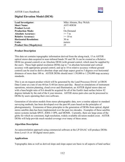
<strong>ASTER</strong> Users Handbook<br />
Digital Elevation Model (DEM)<br />
Lead Investigator: Mike Abrams, Roy Welch<br />
Short Name: AST14DEM<br />
Product Level: 3<br />
Production Mode: On-Demand<br />
Absolute Accuracy: >= 7 m<br />
Relative Accuracy: >= 10 m<br />
Horizontal Resolution: 30 m<br />
Units: meters<br />
Product Size (Megabytes): 25<br />
Product Description<br />
This data set contains topographic information derived from the along-track, 15 m <strong>ASTER</strong><br />
optical stereo data acquired in near-infrared bands 3N and 3B. It can be created as a Relative<br />
DEM (no ground control) or an Absolute DEM (with ground control, which must be supplied by<br />
the user). These high spatial resolution DEMs (up to 7 m absolute horizontal and vertical<br />
accuracy with appropriate ground control, and up to 10 m relative accuracy without ground<br />
control) can be used to derive absolute slope and slope aspect good to 5 degrees over horizontal<br />
distances of more than 100 m. <strong>ASTER</strong> DEMs should meet 1:50,000 to 1:250,000 map accuracy<br />
standards.<br />
This is an on-request product which will be generated by the Land Processes DAAC at EROS<br />
Data Center at a rate of one 60 km X 60 km stereo pair/day. Based on simulations of instrument<br />
operations, mission planning, cloud cover and illumination, an <strong>ASTER</strong> digital stereo data set<br />
with a base/height ratio of 0.6 should be acquired for all of the Earth's land surface below 82<br />
degrees latitude by the end of the 6 year mission. <strong>ASTER</strong> stereo pairs also can be processed to<br />
DEMs by users operating their own software.<br />
Generation of elevation models from stereo photographic data, now a routine adjunct to standard<br />
surveying methods, has been developed over the past 60 years based on the principles of<br />
photogrammetry. Extensions of these principles to the generation of DEMs from optical, digital<br />
stereo satellite data has been implemented over the past two decades. Examples of these satellite<br />
stereo systems include SPOT, JERS-1 OPS, and MOMS. Currently, there are large areas of the<br />
globe for which no consistent, high-resolution, widely available elevation models exist. <strong>ASTER</strong><br />
DEMs will help provide much needed coverage over many of these areas.<br />
Algorithm Description<br />
An autocorrelation approach using commercial software at the LP-DAAC will produce DEMs<br />
from Level-1A or 1B digital stereo pairs.<br />
Applications<br />
Topographic data as well as derived slope and slope aspect are basic to all aspects of land surface<br />
112


