ASTER User's Guide - Aster - NASA
ASTER User's Guide - Aster - NASA
ASTER User's Guide - Aster - NASA

You also want an ePaper? Increase the reach of your titles
YUMPU automatically turns print PDFs into web optimized ePapers that Google loves.
<strong>ASTER</strong> Users Handbook<br />
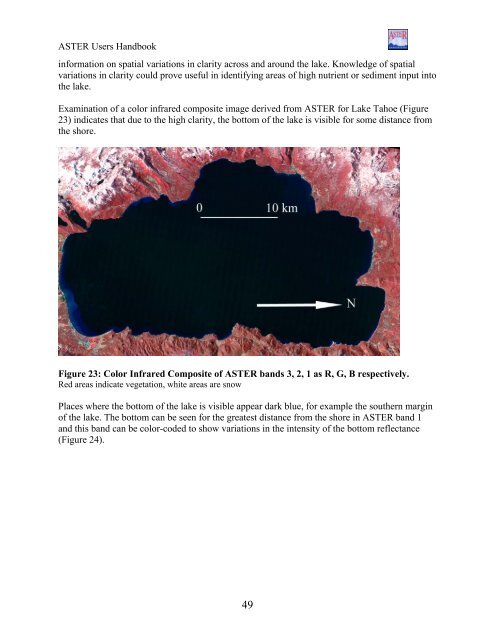
information on spatial variations in clarity across and around the lake. Knowledge of spatial<br />
variations in clarity could prove useful in identifying areas of high nutrient or sediment input into<br />
the lake.<br />
Examination of a color infrared composite image derived from <strong>ASTER</strong> for Lake Tahoe (Figure<br />
23) indicates that due to the high clarity, the bottom of the lake is visible for some distance from<br />
the shore.<br />
Figure 23: Color Infrared Composite of <strong>ASTER</strong> bands 3, 2, 1 as R, G, B respectively.<br />
Red areas indicate vegetation, white areas are snow<br />
Places where the bottom of the lake is visible appear dark blue, for example the southern margin<br />
of the lake. The bottom can be seen for the greatest distance from the shore in <strong>ASTER</strong> band 1<br />
and this band can be color-coded to show variations in the intensity of the bottom reflectance<br />
(Figure 24).<br />
49