

Download - Coordinates
Download - Coordinates
Download - Coordinates

Create successful ePaper yourself
Turn your PDF publications into a flip-book with our unique Google optimized e-Paper software.
GPSMAP 478 – two versatile and<br />
portable GPS navigators that come<br />
pre-loaded with a comprehensive set<br />
of maps and charts. The 2 navigators<br />
are waterproof to IEC 60529, IPX-7<br />
standards (submersible to one meter<br />
for up to 30 minutes) and have a highresolution<br />
256-color sunlight readable<br />
TFT display. www.garmin.com<br />
StreetPro Singapore<br />
version 3 by MapInfo<br />
MapInfo Corporation announced the<br />
release of StreetPro for Singapore. It<br />
is a digital database comprising an<br />
extensive array of layers including<br />
a high quality street network, and a<br />
variety of contextual layers to enhance<br />
analysis and map presentation;<br />
integrated postcode boundaries and<br />
6 digit postcode points supporting<br />
location intelligence, landmark<br />
and feature categories providing<br />
comprehensive local content and<br />
detailed coverage of the entire<br />
country. www.mapinfo.com<br />
Next Generation Geospatial<br />
and Civil Engineering Solution<br />
Autodesk, Inc. launches the Autodesk<br />
Civil 3D 2007, Autodesk Map 3D<br />
2007, and Autodesk Raster Design<br />
2007 software products. These new<br />
solutions enable the integration of<br />
computer-aided design (CAD) and<br />
geospatial information system (GIS)<br />
data allowing customers to create,<br />
manage and share valuable spatial<br />
information for better decision-making<br />
and improved operational efficiency<br />
helping municipalities, engineering<br />
and construction, public works,<br />
transportation and utility customers be<br />
more productive and provide better.<br />
Earlier, it also introduced the new<br />
version of MapGuide Open Source,<br />
its next generation web mapping<br />
software originally called MapServer<br />
Enterprise, hosted by the Open<br />
Source Geospatial Foundation<br />
(http://mapguide.osgeo.org).<br />
It is a free software which enables users<br />
to quickly develop and distribute spatial<br />
and design data over the web, as well<br />
as reduces their total cost of ownership<br />
for a web mapping solution. The<br />
company plans to offer a commercial<br />
version called Autodesk MapGuide<br />
Enterprise 2007 later this year.<br />
Standard Galileo-ready<br />
Receiver & Antenna<br />
NovAtel Inc. announces the release of<br />
its first production standard Galileoready<br />
receiver and antenna. Its<br />
L1L5E5a receiver offers superior<br />
16 channel tracking of GPS L1/<br />
L5, Galileo L1/E5a and SBAS<br />
signals in a Euro form-factor card,<br />
packaged in a EuroPak enclosure.<br />
The complementary 704X passive<br />
antenna offers access to multiple<br />
GNSS including GPS, Galileo<br />
and GLONASS frequencies.<br />
Innerspace Introduces Portable<br />
Hydrographic Survey System<br />
The Innerspace Technology Model<br />
620 Portable Hydrographic Survey<br />
System (PHSS) is designed to collect<br />
X-Y-Z data from a small boat. It is<br />
both easy to set up and easy to use<br />
and operation is self taught, no factory<br />
training is necessary. It consists of<br />
survey depth sounder, DGPS and<br />
Windows XP based hydrographic<br />
(X-Y-Z) data collection software.<br />
www. innerspacetechnology.com<br />
Thales GPSDifferential<br />
Module<br />
Thales has introduced GPSDifferential<br />
Module, a software extension for<br />
Mobile Mapper CE that seamlessly<br />
adds the power of post processing to<br />
virtually any mobile GIS/mapping<br />
software application. With this, submeter<br />
and up to sub-foot mapping is<br />
easy to achieve, even where real-time<br />
corrections are not available, or when<br />
used in difficult signal environments<br />
www.thalesgroup.com/navigation<br />
Bentley Connects MicroStation<br />
to Google Earth Service<br />
Bentley Systems announces that<br />
it has connected MicroStation to<br />
the Google Earth service. As a<br />
result, for the first time, users can<br />
view and navigate 2D/3D models of<br />
infrastructure projects in the context<br />
of the Google Earth environment.<br />
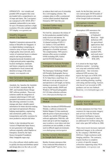
Hemisphere introduces<br />
GPS for agriculture<br />
Hemisphere GPS announces the<br />
introduction<br />
of Outback®<br />
BaseLine – highdefinition<br />
GPS<br />
for agricultural<br />
applications that<br />
is much more<br />
accurate than<br />
standard GPS,<br />
and much more<br />
affordable than<br />
RTK GPS.<br />
It is aimed at the large highdefinition<br />
market – including<br />
row crop and controlled traffic<br />
applications – that welcomes<br />
enhanced GPS accuracy but<br />
rejects the high cost of RTK GPS.<br />
It’s ideal for many agricultural<br />
tasks including planting, seeding,<br />
cultivating and harvesting. Farmers<br />
who haven’t yet invested in GPS<br />
guidance can use one Outback<br />
BaseLine. www.hemispheregps.com<br />
Business<br />
GeoEye receives additional<br />
awards from NGA<br />
GeoEye announces its Clear View<br />
contracts for map-accurate imagery<br />
and services with the National<br />
Geospatial-Intelligence Agency<br />
(NGA) have increased in value by<br />
an additional $13 million taking the<br />
total value upto $49 million in 2006.<br />
These most recent increases represent<br />
additional imagery to be collected<br />
by the company’s IKONOS and<br />
OrbView-3 high-resolution earthimaging<br />
satellites. The contracts<br />
require GeoEye to complete<br />
a variety of specific imagery<br />
collections supporting many NGA<br />
requirements. www.geoeye.com<br />
April 2006 15


