

Download - Coordinates
Download - Coordinates
Download - Coordinates

You also want an ePaper? Increase the reach of your titles
YUMPU automatically turns print PDFs into web optimized ePapers that Google loves.
HISTORY<br />
Remembering Everest<br />
Beginning with this issue, JR Smith traces the life and work of Sir George Everest<br />
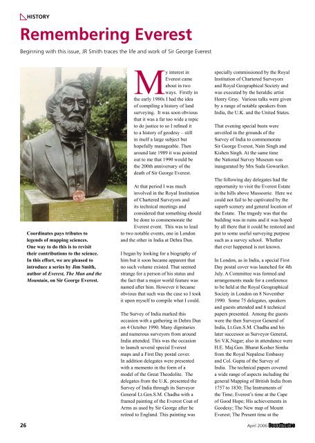
<strong>Coordinates</strong> pays tributes to<br />
legends of mapping sciences.<br />
One way to do this is to revisit<br />
their contributions to the science.<br />
In this effort, we are pleased to<br />
introduce a series by Jim Smith,<br />
author of Everest, The Man and the<br />
Mountain, on Sir George Everest.<br />
My interest in<br />
Everest came<br />
about in two<br />
ways. Firstly in<br />
the early 1980s I had the idea<br />
of compiling a history of land<br />
surveying. It was soon obvious<br />
that it was a far too wide a topic<br />
to do justice to so I refined it<br />
to a history of geodesy – still<br />
in itself a large subject but<br />
hopefully manageable. Then<br />
around late 1989 it was pointed<br />
out to me that 1990 would be<br />
the 200th anniversary of the<br />
death of Sir George Everest.<br />
At that period I was much<br />
involved in the Royal Institution<br />
of Chartered Surveyors and<br />
its technical meetings and<br />
considered that something should<br />
be done to commemorate the<br />
Everest event. This was to lead<br />
to two notable events, one in London<br />
and the other in India at Dehra Dun.<br />
I began by looking for a biography of<br />
him but it soon became apparent that<br />
no such volume existed. That seemed<br />
strange for a person of his status and<br />
the fact that a major world feature was<br />
named after him. However it became<br />
obvious that such was the case so I took<br />
it upon myself to compile what I could.<br />
The Survey of India marked this<br />
occasion with a gathering in Dehra Dun<br />
on 4 October 1990. Many dignitaries<br />
and numerous surveyors from around<br />
India attended. This was the occasion<br />
to launch several special Everest<br />
maps and a First Day postal cover.<br />
In addition delegates were presented<br />
with a memento in the form of a<br />
model of the Great Theodolite. The<br />
delegates from the U.K. presented the<br />
Survey of India through its Surveyor<br />
General Lt.Gen.S.M. Chadha with a<br />
framed painting of the Everest Coat of<br />
Arms as used by Sir George after he<br />
retired to England. This painting was<br />
specially commissioned by the Royal<br />
Institution of Chartered Surveyors<br />
and Royal Geographical Society and<br />
was executed by the heraldic artist<br />
Henry Gray. Various talks were given<br />
by a range of notable speakers from<br />
India, the U.K. and the United States.<br />
That evening special busts were<br />
unveiled in the grounds of the<br />
Survey of India to commemorate<br />
Sir George Everest, Nain Singh and<br />
Kishen Singh. At the same time<br />
the National Survey Museum was<br />
inaugurated by Mrs Suda Gowariker.<br />
The following day delegates had the<br />
opportunity to visit the Everest Estate<br />
in the hills above Mussoorie. Here we<br />
could not fail to be captivated by the<br />
superb scenery and general location of<br />
the Estate. The tragedy was that the<br />
building was in ruins and it was hoped<br />
by all there that it could be restored and<br />
put to some useful surveying purpose<br />
such as a survey school. Whether<br />
that ever happened is not known.<br />
In London, as in India, a special First<br />
Day postal cover was launched for 4th<br />
July. A Committee was formed and<br />
arrangements made for a conference<br />
to be held at the Royal Geographical<br />
Society in London on 8 November<br />
1990. Some 75 delegates, speakers<br />
and guests attended and 8 technical<br />
papers presented. Among the guests<br />
were the then Surveyor General of<br />
India, Lt.Gen.S.M. Chadha and his<br />
later successor as Surveyor General,<br />
Sri V.K.Nagar; also in attendance were<br />
H.E. Maj.Gen. Bharat Kesher Simha<br />
from the Royal Nepalese Embassy<br />
and Col. Gupta of the Survey of<br />
India. The technical papers covered<br />
a wide range of aspects including the<br />
general Mapping of British India from<br />
1757 to 1830; The Instruments of<br />
the Time; Everest’s time at the Cape<br />
of Good Hope; His achievements in<br />
Geodesy; The New map of Mount<br />
Everest; The Present time at the<br />
26 April 2006


