

Download - Coordinates
Download - Coordinates
Download - Coordinates

Create successful ePaper yourself
Turn your PDF publications into a flip-book with our unique Google optimized e-Paper software.
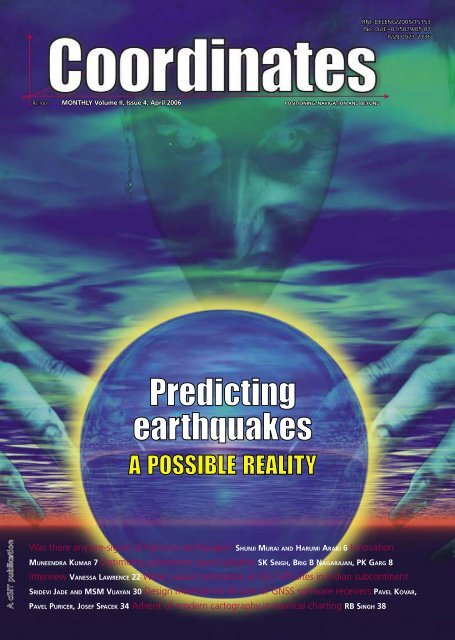
Rs.100 MONTHLY Volume II, Issue 4, April 2006 POSITIONING, NAVIGATION AND BEYOND<br />
Was there any pre-signal of Pakistan earthquake? SHUNJI MURAI AND HARUMI ARAKI 6 Innovation<br />
MUNEENDRA KUMAR 7 Optimizing gravimetric geoid solution SK SINGH, BRIG B NAGARAJAN, PK GARG 8<br />
RNI: DELENG/2005/15153<br />
No: DL(E)-01/5079/05-07<br />
ISSN 0973-2136<br />
Interview VANESSA LAWRENCE 22 Water vapour estimation at few GPS sites in Indian subcontinent<br />
SRIDEVI JADE AND MSM VIJAYAN 30 Design methods for RF part of GNSS software receivers PAVEL KOVAR,<br />
PAVEL PURICER, JOSEF SPACEK 34 Advent of modern cartography in nautical charting RB SINGH 38
CONTENTS – VOLUME 2, ISSUE 4, APR 2006<br />
Articles<br />
Was there any pre-signal of Pakistan earthquake? SHUNJI MURAI AND HARUMI ARAKI 6 Optimizing<br />
gravimetric geoid solution SK SINGH, BRIG B NAGARAJAN, PK GARG 8 Water vapour estimation at few<br />
GPS sites in Indian subcontinent SRIDEVI JADE AND MSM VIJAYAN 30 Design methods for RF part of<br />
GNSS software receivers PAVEL KOVAR, PAVEL PURICER, JOSEF SPACEK 34 Advent of modern cartography in<br />
nautical charting RB SINGH 38<br />
Columns<br />
My coordinates EDITORIAL 4 Innovation MUNEENDRA KUMAR 7 News INDUSTRY 14 LBS 16 GPS 18<br />
GIS 19 REMOTE SENSING 20 GALILEO UPDATE 28 Her coordinates VANESSA LAWRENCE 22 History JIM<br />
SMITH 26 Book review ESSENTIALS OF GPS 28 Mark your calendar APRIL TO NOVEMBER 42<br />
cGIT 28A Pocket D, SFS Mayur Vihar Phase III, Delhi 110 096, India. Phones +91 11 22632607, 98107 24567,<br />
98102 33422 Email [information] talktous@mycoordinates.org [editorial] bal@mycoordinates.org [advertising]<br />
sam@mycoordinates.org [subscriptions] iwant@mycoordinates.org Web www.mycoordinates.org<br />
This issue has been made possible by the support and good wishes of the following individuals and companies Brig B<br />
Nagarajan, Harumi Araki, IV Muralikrishna, Jim Smith, Josef Spacek, MSM Vijayan, Muneendra Kumar, NK Agrawal, Pavel<br />
Kovar, Pavel Puricer, PK Garg, RB Singh, Shunji Murai, SK Singh, Sridevi Jade, Vanessa Lawrence and Autodesk, Contex,<br />
HP, Leica, Navcom, Nikon, Spectra Precision, Thales, Topcon, Trimble; and many others.<br />
<strong>Coordinates</strong> is an initiative of cGIT that aims to broaden the scope of positioning, navigation and related technologies. cGIT does not neccesarily subscribe to the views expressed by<br />
the authors in this magazine and may not be held liable for any losses caused directly or indirectly due to the information provided herein. © cGIT, 2005. Reprinting with permission is<br />
encouraged; contact the editor for details. Annual subscription (12 issues) [India] Rs.1,200 [Overseas] US$80<br />
Printed and published by Sanjay Malaviya on behalf of Centre for Geoinformation Technologies (cGIT) at A221 Mangal Apartments, Vasundhara Enclave, Delhi 110096, India.<br />
Editor Bal Krishna | Owner Centre for Geoinformation Technologies | Designer TSA Effects, www.tsa.in | Printer Sonu Printer, A110 DDA Sheds, Okhla, New Delhi, India.<br />
This issue of <strong>Coordinates</strong> is of 44 pages, including cover.<br />
April 2006 3
MYCOORDINATES<br />
A capital chaos<br />
Delhi faces confusion and chaos.<br />
With a pressure to host Commonwealth games in 2010.<br />
Unauthorized construction, encroachments, illegal uses of residential properties, etc.<br />
Court orders against ‘unauthorized’ and ‘illegal’.<br />
And that provokes many to make efforts to counter it.<br />
Debate starts on rules and applicability, practice and practicalities, law and legalities.<br />
Livelihood is pit against planning.<br />
And planning becomes a casualty to politics. Politics of elections and votes.<br />
Or, might be a case of callousness in planning itself.<br />
There are rules and regulations.<br />
And, its violations too.<br />
That too in connivance with authorities.<br />
We are in a mess.<br />
Basically, a consequence of corruption in concerned public offices and public life.<br />
And, corruption is not an issue in this country.<br />
That’s a way of life.<br />
Isn’t it?<br />
Bal Krishna, Editor<br />
bal@mycoordinates.org<br />
Our advisors Muneendra Kumar PhD, Chief Geodesist (Retired), US National Geospatial Intelligence Agency, USA,<br />
Naser El-Sheimy PEng, CRC Professor, Department of Geomatics Engineering, The University of Calgary Canada, George<br />
Cho Associate Professor in GIS and the Law, University of Canberra, Australia, Prof Madhav N Kulkarni Department of<br />
Civil Engineering, Indian Institute of Technology Bombay, India Dr Abbas Rajabifard Deputy Director, Centre for SDI and<br />
Land Administration, University of Melbourne, Australia, Luiz Paulo Souto Fortes PhD Associate Director of Geosciences,<br />
Brazilian Institute of Geography and Statistics - IBGE, Brazil<br />
4 April 2006
April 2006 5
DISASTER MANAGEMENT<br />
Was there any pre-signal of<br />
Pakistan earthquake?<br />
The authors have already reported the case of the Sumatra offshore earthquake in this magazine<br />
in July 2005. In this issue the results of Pakistan earthquake has been reported<br />
SHUNJI MURAI AND HARUMI ARAKI<br />
The authors have continued a<br />
research on the prediction of<br />
earthquake using GPS data in<br />
Japan, one of the disaster prone<br />
countries since 2000. The authors<br />
have discovered pre-signals of those<br />
past big earthquakes with more than<br />
M6, such as Miyagi Offshore and<br />
Hokubu Earthquakes (2003.5.26; M7.1<br />
and 7.26; M6.4), Tokachi Offshore<br />
Earthquake (2003.9.26; M8.0), Niigata<br />
Chu-etsu Earthquake (2004.10.23;<br />
M 6.8) and Fukuoka West Offshore<br />
Earthquake (2005.3.20; M7.0) with<br />
use of “Electronic Control Points”<br />
or GPS stations constructed by the<br />
Geographic Survey Institute (GSI) as<br />
well as Sumatra Offshore Earthquake<br />
(2004.12.26; M9.0) and Pakistan<br />
Earthquake (2005.10.8; M7.7).<br />
The authors have already reported<br />
the case of the Sumatra Offshore<br />
Earthquake in this magazine in July<br />
2005. This time we would like to report<br />
the results of Pakistan Earthquake.<br />
Though the number of GPS stations<br />
of International GPS Service (IGS)<br />
near the origin of the earthquake was<br />
very few, the distance change ratio<br />
between Uzbekistan and Bahrain and<br />
the area change ratio of the triangle<br />
of Uzbekistan, Tehran and Lhasa<br />
showed pre-signals two or three days<br />
before the earthquake occurred.<br />
Distribution of IGS<br />
GPS stations<br />
Figure 1 shows the location of the origin<br />
of Pakistan Earthquake. Figure 2 shows<br />
an example of large scale landslide<br />
occurred due to Pakistan Earthquake,<br />
which was taken by ASTER satellite.<br />
GPS stations near the origin were very<br />
few as shown in Figure 3. In this figure,<br />
the nearest GPS station is Uzbekistan<br />
(kit3) located in Eurasian Plate. Tehran<br />
(tehr) and Lhasa (lhas) are also located in<br />
the same plate. Bahrain (bhar) is located<br />
in Arabian Plate and Hyderabad (hyde)<br />
is in Indian Plate. The origin is located<br />
near the border of those three plates.<br />
Checking pre-signals<br />
before the earthquake<br />
The authors checked GPS data<br />
in the geocentric coordinate<br />
system from 10 days before to<br />
the day of the earthquake.<br />
The following two indicators<br />
were checked.<br />
1) Daily distance change ratio in<br />
ppm; all combinations of distance<br />
between the five GPS stations in X,<br />
Y and Z axis. As shown in Figure<br />
4, the daily distance change ratio<br />
in Y axis between Uzbekistan and<br />
6 April 2006
Bahrain showed remarkable presignal<br />
on the 6th October 2005,<br />
two days before the earthquake.<br />
2) Daily triangle area change ratio in<br />
ppm; all combinations of triangle<br />
consisting of three GPS stations<br />
out of the five GPS stations were<br />
checked. As shown in Figure 5,<br />
the triangle of Uzbekistan, Lhasa<br />
and Tehran showed the maximum<br />
change ratio in XY projection<br />
plane on the 5th October 2005.<br />
Conclusion<br />
It is obvious that there were pre-signals<br />
of Pakistan Earthquake in the indicator<br />
of daily distance change ratio as well<br />
as daily triangle area change ratio in<br />
GPS data as described in this report.<br />
The authors are honored to inform the<br />
readers that the Japanese Patent Bureau<br />
has approved our patent on “Prediction<br />
of Earthquake and Volcanic Eruption”<br />
(Patent No. 3763130) using GPS data<br />
as of the 27th January 2006. We will<br />
expect some businesses on the prediction<br />
of earthquake in Japan. Though we can<br />
discover pre-signals, we cannot foretell<br />
exactly when earthquake will occur. From<br />
our experience, two days at earliest to<br />
three months at slowest were critical<br />
days with red signal before earthquake.<br />
ocn.ne.jp<br />
Shunji Murai<br />
Professor Emeritus,<br />
University of Tokyo;<br />
sh1939murai@nifty.<br />
com<br />
Harumi Araki<br />
Director,<br />
Environmental<br />
Geology Laboratory;<br />
arakey@mbf.<br />
Innovation<br />
GLOBAL Reckoning of<br />
Latitude and Longitude<br />
( E)<br />
Presently, the GPS is globally<br />
accepted as the best and most<br />
accurate positioning system<br />
and survey technique. Let us<br />
start reckoning the latitude and<br />
longitude in a global way.<br />
In the new global reckoning way<br />
a. Latitude (φ) is 0° at the South<br />
Pole, 90° at the Equator, and<br />
180° at the North Pole.<br />
b. Longitude (λ) is eastward<br />
from 0° to 360°East.<br />
This global reckoning eliminates<br />
the need for “ N or S”, “E or<br />
W”, and/or “Negative/Minus<br />
(-) or Positive/Plus (+) in all our<br />
applications all over the world.<br />
Example: <strong>Coordinates</strong> “065°/<br />
240°” and “145° / 240°”<br />
identify two positions in two<br />
hemispheres with no ambiguity<br />
and in a new unique way.<br />
If we adopt this “simple” system,<br />
both for civil and military, it will<br />
be a truly global approach to use<br />
with the GPS surveying technique.<br />
April 2006<br />
Muneendra<br />
Kumar Ph.D. is<br />
Chief Geodesist<br />
(Retired), U S<br />
National Geospatial-<br />
Intelligence Agency<br />
munismk@yahoo.com<br />
7
GEODESY<br />
Optimizing gravimetric<br />
geoid solution<br />
Various modification approaches are examined in this study which<br />
might be implemented in generalised Stokes scheme<br />
SK SINGH, BRIG (DR) B NAGARAJAN, PKGARG<br />
Transformation of GPS<br />
derived ellipsoidal height to<br />
orthometric height is one of the<br />
most important applications<br />
of gravimetric geoid. Its applicability<br />
remains questionable if the above<br />
transformation cannot be done to a<br />
reasonable order of accuracy. Use<br />
of GPS observations at levelling<br />
benchmarks and subsequently<br />
determined geoidal seperation using<br />
the geometrical relationship between<br />
geoid and ellipsoid (see fig. 1 ) serve<br />
as standard for accuracy assessment<br />
of gravimetric geoid. Stokes’s (1849)<br />
solution of geodetic boundry – value<br />
problem requires a global integration<br />
of gravity anomalies to compute the<br />
separation (N) between the geoid<br />
and geocentric reference ellipsoid.<br />
In any gravimetric geoid computation<br />
at regional or local level the gravity<br />
data only to the extent of region of<br />
interest is inevitably used. The Stokes<br />
integral formula which is generally<br />
used to provide the gravimetric geoid<br />
solution, requires a global integration<br />
of surface gravity anomaly data<br />
over the entire Earth. However, this<br />
requirement is practically difficult to<br />
meet due to the reasons of security and<br />
political sensitivity, the integrations<br />
is performed over a limited spherical<br />
cap, which is bounded by the spherical<br />
distance Ψ 0 , where 0
scheme for geoid computation<br />
(Vanic̃ek and Sjöberg, 1991).<br />
According to the scheme the long<br />
wave length contribution of a GGM<br />
viz. EGM96 (N M ) are corrected to a<br />
certain extent by a global integration<br />
of residual gravity anomalies to<br />
get the geoid height (N 1 ) at the<br />
computation point by the expression<br />
N 1 = N M + R⁄4πγ α=0 ∫ 2π<br />
Ψ=0 ∫π S(ψ)<br />
Δg M sin ψ dψdα ----(1)<br />
Where, γ = normal gravity at the<br />
surface of reference ellipsoid<br />
S(Ψ) = Stokes kernel<br />
Δg M = residual gravity anomalies after<br />
removing the contribution of GGM to a<br />
degree M from the local terrestrial data<br />
Ψ = spherical distance from<br />
the computation point<br />
α = azimuth of line joining<br />
the computation point and<br />
a surface element<br />
The spherical Stokes Kernel in its<br />
closed from is represented in the<br />
form of trigonometrical function<br />
(Heiskanen and Moritz, 1967)<br />
For 0 ≤ ψ ≤ π<br />
The low frequency geoid<br />
undulation (N M ) are computed from<br />
spherical harmonic coefficients<br />
of global geopotential model:<br />
Where c=R/2γ, ∆g n the estimated<br />
gravity anomaly from nth degree<br />
spherical harmonic coefficients<br />
and M is the maximum degree<br />
of geopotential model. ∆g M is<br />
evaluated by the expression:<br />
where ∆g is the observed gravity<br />
anomaly at computation point.<br />
As already explained it is impractical<br />
to evaluate the integral of equation<br />
over the entire earth due to the<br />
various constraints associated with<br />
data availability it is preferred to<br />
perform the evaluation in a domain<br />
of predefined spherical cap of radius<br />
ψ 0 (0 < ψ 0 < π) about each geoid<br />
computation point. This convenience<br />
from computational point of view result<br />
in leakage of low frequency gravity<br />
errors into the geoid solution a direct<br />
consequence of the approximation<br />
of the generalized Stokes integral<br />
(Vanicek and Featherstone, 1998).<br />
The orthogonality property of surface<br />
spherical harmonics breaks down<br />
under the approximation made in<br />
generalized Stokes scheme (eqn 1)<br />
and non-zero truncation coefficients<br />
of significant magnitude may<br />
appear in the region (2 ≤ n ≤ M).<br />
To circumvent effect of leakage<br />
of errors in geoid model solution<br />
the ideas of using an appropriate<br />
modification of the original Stokes<br />
kernel along with optimum value of<br />
spherical cap radius (Ψ 0 ) has gained<br />
significance in geodetic literature.<br />
Optimisation process of<br />
gravimetric geoid solution<br />
The Stokes kernel to a great extent<br />
forms a weighted integral function for<br />
gravity data in geoid model solution<br />
given by numerical solution of Stokes<br />
integral. This strong dependence of<br />
the geoid computation and associated<br />
errors on the kernel is the basis for<br />
any kernel modifications, the objective<br />
being to reduce the error. Since the<br />
basic purpose of determination of<br />
geoid is to transform the GPS derived<br />
ellipsoidal heights (h) to orthometric<br />
heights ( H ) using the relationship;<br />
h=N+H, the most appropriate form<br />
of kernal modification and optimum<br />
size of the cap radius is determined<br />
empirically on trial and error basis.<br />
Choice of kernel modifications<br />
The approaches of kernel<br />
modifications are broadly classified<br />
into two categories, deterministic<br />
and stochastic, The stochastic<br />
approach essentially requires the error<br />
characteristics of local gravity data<br />
and global geopotential model which<br />
is not known to a satisfactory level<br />
in most of the cases and hence are of<br />
limited practical applications. The<br />
deterministic approaches presented<br />
by Wong and Gore (1969), Heck<br />
and Grüninger (1987) and Vanic̃ek<br />
Kleusberg (1987) are more frequently<br />
used in geoid computation and hence<br />
considered to be potential alternatives.<br />
All these approaches are related to<br />
each other in general as by making<br />
certain changes one’s expression<br />
degenarates to the other the origin<br />
being the simple approach presented by<br />
Wong and Gore (1969) which involves<br />
removing the low – degree terms from<br />
the original kernel, according to:<br />
S WG (Ψ) = S(Ψ) - Σ P<br />
k=2 2k+1/k-1 P k (Ψ)<br />
---------(3)]<br />
For (0 < Ψ ≤ Ψ 0 ) and P
Accuracy of computed geoid<br />
undulations depend largely on the<br />
extent of the terrestrial gravity anomaly<br />
data used around the computation point.<br />
Nagarajan (1994) has shown that due<br />
to propagation of error with increase<br />
in the cap radius beyond certain value<br />
,does not improve rather degrades the<br />
geoid undulation results.The choices of<br />
size of the cap radius and approach of<br />
kernel modifications are strictly region<br />
dependent and till today no approach<br />
is claimed to be an ideal one which<br />
can straightway be used irrespective<br />
of the size and location of the area of<br />
interest. Therefore it is rather difficult<br />
to make the choice of most suitable<br />
kernel modification approach or size<br />
of the cap radius unless the geoid<br />
results are compared with the GPS<br />
– levelling observations results thus<br />
making it an essential component of<br />
gravimetric geoid computation process.<br />
Case study<br />
GPS-levelling and gravimetric geoid<br />
In order to illustrate the procedure<br />
to achieve an optimized solution for<br />
gravimetric geoid the free air gravity<br />
anomaly data from Bangalore and<br />
adjoining region in a block of 2° X 1°<br />
was taken for computation. The RCR<br />
technique implemented in generalized<br />
Stokes scheme was adopted and<br />
contribution of EGM96 (Lemoine.<br />
et.al.) global geopotential model to<br />
degree and order of 360 was removed<br />
from the observed gravity data. A<br />
local DEM was also developed based<br />
upon the available height data in the<br />
region and terrain effect was removed<br />
from the reduced gravity anomaly<br />
data. The complete procedure is not<br />
explained here as the study is focussed<br />
on selection of most appropriate<br />
size of cap radius and approach of<br />
kernel modification to derive the<br />
gravimetric geoid solutions which is<br />
best fitted in least square sense to the<br />
geometric geoid derived from GPS<br />
observations at levelling bench marks.<br />
GPS observations at about 84 leveling<br />
bench marks were carried out by<br />
Geodetic & Research Branch, Survey<br />
of India, as a part of project undertaken<br />
to provide Ground Control Points<br />
(GCPs) to develop a comprehensive<br />
development Plan for Bangalore City<br />
(See Nagarajan and Singh, 2005 ).<br />
Out of these 84 points 68 points were<br />
selected for performing a realistic<br />
assessment of geoid model and<br />
subsequently optimized the integral<br />
parameters of Stokes Formula.<br />
In order to avoid the complexity in<br />
comparison of different geoid solutions<br />
correspond to different modification<br />
approaches with geometrically derived<br />
geoid heights from GPS-leveling<br />
observations, we have chosen the most<br />
widely used Wong and Gore (1969)<br />
approach and geoid solutions were<br />
obtained by varying size of cap radius<br />
( Ψ 0 ) and degree of modification P.<br />
For each typical combination of cap<br />
radius and degree of modification<br />
the fitting of gravimetric geoid<br />
heights to observed GPS – Leveling<br />
height differences at discrete points<br />
has been analysed and statistics of<br />
differences were computed. Fig. 2 to<br />
Fig. 5 represents the fit of gravimetric<br />
geoid heights to geometric geoid<br />
heights for different combinations.<br />
Analysis of results<br />
A visual inspection of above figures<br />
give an idea about the extent of<br />
deviation of gravimetric geoid heights<br />
from GPS – levelling geoid heights. It<br />
could be well ascertained that optimum<br />
size of cap radius should be larger than<br />
1° and degrees of modification should<br />
be around 60 – 70 for this particular<br />
region in order to achieve an optimum<br />
solution for gravimetric geoid. It is<br />
further argued that due to varying error<br />
characteristics of gravity data sources,<br />
different results can be expected in<br />
different regions. It has also been seen<br />
from the Fig. 6 that any value below 1°<br />
of cap radius result in comparatively<br />
worse fit due to numerical instability<br />
in the solution.<br />
However, as size of cap radius<br />
approach close to 1.5 degree the<br />
solutions attain the stability as evident<br />
from the Fig. 6 wherein it is clearly<br />
shown that increase in size of cap<br />
radius beyond 1.5 does not improve<br />
the root mean square (RMS) error<br />
of differences between gravimetric<br />
(computed) and observed geoid<br />
heights. Thus the most appropriate<br />
size of cap radius is 1.5° for the given<br />
data and now only task remains to<br />
determine the optimum value for<br />
degree of kernel modification P. This<br />
is again done by plotting the RMS error<br />
against each corresponding degree of<br />
modification for fixed cap radius of size<br />
1.5° (see fig. 7). Featherstone (2003)<br />
demonstrated that due to removal<br />
of the low – frequency Legendre<br />
polynomials the spheroidal (Wong<br />
and Gore) Kernel oscillates between<br />
positive and negative values and the<br />
oscillation increases with increase in<br />
degree of modification. The increased<br />
oscillation of the kernel induced<br />
numerical instability in solutions of<br />
Stokes Integral. However, it is not<br />
always necessary that the lowest of the<br />
Fig.2 Comparison of observed (GPS-leveling diff.) and computed (gravimetric)<br />
geoid heights for Ψ 0 = 1 0 for different degrees of modification (P)<br />
10 April 2006
Fig.3 Comparison of observed (GPS-leveling diff.) and computed (gravimetric)<br />
geoid heights for Ψ 0 = 1.25 0 for different degrees of modification (P)<br />
Fig.4 Comparison of observed (GPS-leveling diff.) and computed (gravimetric)<br />
geoid heights for Ψ 0 = 1.5 0 for different degrees of modification (P)<br />
Fig.5 Comparison of observed (GPS-leveling diff.) and computed (gravimetric)<br />
geoid heights for Ψ 0 = 2 0 for different degrees of modification (P)<br />
low degree range gives better solutions.<br />
Considering these facts we testified the<br />
results starting with P=40 and allowed<br />
to vary in the step of 10 to evaluate the<br />
change in performance. The RMS error<br />
was taken as the standard parameter in<br />
order to select the optimum degree of<br />
modification. Fig. 7 clearly indicates<br />
that RMS error of the Least square fit<br />
is lowest for the solution derived using<br />
P=70 as degree of kernel modification.<br />
The above illustrations gives an<br />
overview of the procedure to be<br />
adopted while deriving the optimum<br />
solution for gravimetric geoid. The<br />
GPS–leveling observations are<br />
of great help in this process and<br />
without it the quality assessment<br />
of gravimetric geoid solution can<br />
not be made with authenticity.<br />
Conclusion<br />
Rather than presenting simply the<br />
requirements of GPS – levelling data<br />
only for comparison purpose this<br />
study has focussed its importance<br />
in deriving an optimized solution of<br />
gravimetric geoid. Wonge and Gore<br />
modification approach was examined<br />
and its performance was evaluated by<br />
changing size of cap radius and degree<br />
of modifications which is an arguably<br />
more informative exercise rather than<br />
making the geoid determination as<br />
routine computation. The problems<br />
that may be encountered when<br />
practically applying the modified<br />
kernels have been described. The<br />
case study has practically proved the<br />
optimisation procedure to be followed<br />
and importance of GPS–leveling data<br />
in this process. However, because of<br />
the pecularities of local gravity data<br />
error characteristics the modifications<br />
approach and its parameter might<br />
vary from region to region in practical<br />
gravimetric geoid computation<br />
References<br />
1. Evans, J.D., Featherstone, W.E.<br />
2000. Improved convergence rates<br />
for truncation error in gravimetric<br />
geoid determination, Journal of<br />
Geodesy 74 (2), 239 – 248.<br />
2. Featherstone. W.E., 2003, Software<br />
for computing five existing types<br />
of deterministically modified<br />
integration kernel for gravimetric<br />
geoid determination. Computers<br />
and Geosciences, 29, 183-193.<br />
3. Heck. B., Grüninger, W.,1987.<br />
Modification of Stoke’s integral<br />
formula by combining two<br />
classical approaches. Proceedings<br />
of the XIX General Assembly<br />
of the International Union<br />
of Geodesy and Geophysics,<br />
Vol. 2. Vancouver, Canada.<br />
4. Heiskanen, W.H., Moritz, H., 1967.<br />
Physical Geodesy. W.H. Freeman &<br />
Co.., San Francisco, CA, 364 pp.<br />
5. Lemoine, F.G., Kenyon S.C.,<br />
April 2006 11
Fig.6 Performance evaluation of different cap radii (Ψ ) 0<br />
for different degrees of modification (P)<br />
Fig.7 RMS Error variations for selected cap radius of size<br />
(Ψ 0 = 1.50) with degrees of modification (P)<br />
Factor, J.K., Trimmer, R.G., Pavlis,<br />
N.K., Chinn, D.S., Cox, C.M.,<br />
Klosko, S.M., Luthcke, S.B.,<br />
Torrences, M.H., Wang, Y.M.,<br />
Williamson, R.G., Pavlis, E.C.,<br />
Rapp, R.H., Olson, T.R., 1998,<br />
The development of the joint<br />
NASA GSFC and the National<br />
Imagery and Mapping Agency<br />
(NIMA) geopotential model<br />
EGM 96, NASA/TP –1998-<br />
206861. National Aeronautics<br />
and Space Administration<br />
Maryland, USA, 575pp.<br />
6. Molodensky, M.S., Eremeev,<br />
V.F., Yurkina, M.I.,1962.<br />
Methodes for study of the<br />
external gravitational field and<br />
figure of the Earth. The Israeli<br />
Programme for the translation<br />
of Scientific Publications,<br />
Jerusalem, Israel, 248 pp.<br />
7. Nagarajan,B.,1994.Definition and<br />
realization of a global vertical<br />
Datum,Report N0.427,Deptt. Of<br />
Geodetic Science ,The Ohio State<br />
University,Columbus,Ohio.<br />
8. Nagarajan, B., Singh, S.K.,,<br />
2005. On the Derivation of<br />
Orthometric Heights from<br />
COORDINATES IS AVAILABLE FOR FREE DOWNLOAD<br />
www.mycoordinates.org<br />
GPS-Levelling Observations.<br />
GIS Development, 9(4).<br />
9. Stokes, G.G., 1849. On the variation<br />
of gravity on the surface of the<br />
Earth. Transaction of Cambridge<br />
Philosophical Society 8, 672-695.<br />
10. Vanic̃ek P., Sjöberg, L.E., 1981.<br />
Reformulation of Stoke’s theory<br />
of higher than second-degree<br />
reference field and modification<br />
of integration Kernels. Journal<br />
of Geophysical Research – Solid<br />
Earth 96 (B4), 6529 – 6539.<br />
11. Vanic̃ek P., Featherstone, W.E.,<br />
1998. Performance of three types<br />
of Stoke’s Kernel in the combined<br />
solution for the geoid, Journal<br />
of Geodesy 72 (12), 684-697.<br />
12. Vanic̃ek P., Kleusberg, A.,<br />
1987. The Canadian geoid-<br />
Stokesian approach manuscript<br />
a geodaetica 12 (2), 86-98.<br />
13. Wong L., Gore, R., 1969.<br />
Accuracy of geoid heights<br />
from modified Stokes Kernel,<br />
Geophysical Journal of the Royal<br />
Astronomical Society 18, 81-91.<br />
12 April 2006<br />
SK Singh Geodetic<br />
& Research Branch,<br />
Survey of India,<br />
Dehradun, India<br />
gandrb@vsnl.net.in<br />
Brig (Dr) B<br />
Nagarajan Geodetic<br />
& Research Branch,<br />
Survey of India,<br />
Dehradun, India<br />
gandrb@vsnl.net.in<br />
PKGarg Department<br />
of Civil Engineering,<br />
Indian Institute of<br />
Technology, Roorkee,<br />
India gargpfce@iitr.<br />
ernet.in
April 2006 13
NEWSBRIEFS — INDUSTRY<br />
Products<br />
New Tiny Surface Mount<br />
GPS Receiver<br />
Trimble has introduced its new<br />
Copernicus GPS receiver – a<br />
thumbnail-sized, surface-mount,<br />
low power module ideal for adding<br />
GPS capabilities to Bluetooth<br />
appliances, sport accessories,<br />
personal navigators or cameras,<br />
computer and communication<br />
peripherals as well as vehicle tracking,<br />
navigation, and security products.<br />
It enables system integrators to<br />
easily add GPS capability to a<br />
mobile device with minimal impact<br />
on its size or battery life at a very<br />
economical price. www.trimble.com<br />
GNSS technology for<br />
surveying applications<br />
The Leica Geosystems launches Leica<br />
GX1230 GG and Leica ATX1230 GG<br />
sensors for surveying applications as<br />
well as the GRX1200 GG Pro sensor<br />
for reference station networks. The<br />
new ultra precise GNSS measurement<br />
engine now supports both GPS L2C<br />
signals and GLONASS satellites. Users<br />
of these solutions will benefit by having<br />
up to 100 % more satellites available<br />
than GPS alone. These systems<br />
are designed to track future GNSS<br />
signals, such as GPS L5 and Galileo.<br />
It also announces availability of<br />
Leica CloudWorx 1.0 for PDMS,<br />
that enable professionals to use rich,<br />
as-built point cloud data directly<br />
in their native desktop design and<br />
visualization platform. PDMS is part<br />
of AVEVA’s VANTAGE Plant Design<br />
family. www.leicageosystems.com<br />
Topcon opens G3 door<br />
to the future<br />
Topcon Positioning Systems (TPS)<br />
introduces the Paradigm G3 chip, a<br />
new technology that sets the standard<br />
for the future of satellite positioning.<br />
The new Topcon G3 technology takes it<br />
a step further by adding the soon-to-beavailable<br />
GALILEO . The G3 chip with<br />
its patented Universal Signal Tracking<br />
capabilities has 72 universal channels<br />
that can receive signals from up to 36<br />
satellites simultaneously. G3 can track<br />
all signals from all available satellite<br />
positioning systems. It is designed to<br />
dynamically adjust to satellites with<br />
best signal strength. The streamlined<br />
chip profile is 75 percent smaller than<br />
current chips, enabling small, lighter<br />
receiver design. Users of Topcon<br />
Positioning Systems GPS+ technology<br />
and equipment can access three<br />
additional navigational satellites in the<br />
GLONASS system also. When faced<br />
with environmental challenges such<br />
as narrow streets with tall buildings,<br />
dense forests and mountainous terrain,<br />
Topcon’s G3 system can provide<br />
better satellite coverage than before.<br />
GfK MACON re-digitalizes<br />
topographical maps of India<br />
The India Edition, which contains the<br />
world’s only six-digit postcode map<br />
of that country, is being supplemented<br />
to include a lot of topographical<br />
information, including more than 3,000<br />
new city points. It comprises detailed<br />
postal and administrative units as well<br />
as a large selection of topographical<br />
map layers, such as roads, railway<br />
lines, cities, rivers and elevations.<br />
The digital maps are supplied as<br />
vector data records in the standard<br />
GIS formats. www.gfk-macon.com<br />
PCI Geomatics develops SAR<br />
Polarimetry Workstation<br />
PCI Geomatics announces the<br />
development and release of the SAR<br />
Polarimetry Workstation (SPW) as<br />
part of the Canadian Space Agency<br />
(CSA) Earth Observation Application<br />
Development Program (EOADP). The<br />
SPW is available as an add-on module<br />
to Geomatica 10. It can directly read<br />
data products from the AIRSAR,<br />
ENVISAR ASAR, CV-580, and SIR-C<br />
systems. It is also able to read synthetic<br />
RADARSAT-2 data products and will<br />
be able to read the real data products<br />
once they become available. PCI<br />
Geomatics also released Geomatica<br />
10 for Linux and Solaris users.<br />
The latest version emphasizes<br />
automation, productivity, and support<br />
for more than 100 geospatial data<br />
formats. www.pcigeomatics.com<br />
Enhanced VueStar (TM)<br />
Aerial Survey System<br />
NavCom Technology, Inc., announces<br />
the introduction of the newly enhanced<br />
VueStar(TM) aerial survey solution<br />
combining its new StarPac(TM)<br />
utility software that facilitates better<br />
integration into pre-existing workflows.<br />
VueStar’s complete global navigation<br />
system utilizes the global satellitebased<br />
StarFire(TM) Network to<br />
provide precise positioning worldwide<br />
without the need for RTK base stations<br />
or GPS post processing. This new<br />
system introduces three significant<br />
enhancements: Improved GPS signal<br />
processing, StarPac Mission software,<br />
and the optional Event Latch Interface.<br />
The 12-channel, dual-frequency GPS<br />
receiver computes real-time positions<br />
at up to 25 times a second, re-acquires<br />
GPS signals faster, and includes<br />
improved troposphere modeling which<br />
better compensates for changes in<br />
altitude. www.NavComTech.com<br />
Garmin introduces portable<br />
GPS navigators<br />
Garmin International, Inchas<br />
announced the GPSMAP378 and<br />
14 April 2006
GPSMAP 478 – two versatile and<br />
portable GPS navigators that come<br />
pre-loaded with a comprehensive set<br />
of maps and charts. The 2 navigators<br />
are waterproof to IEC 60529, IPX-7<br />
standards (submersible to one meter<br />
for up to 30 minutes) and have a highresolution<br />
256-color sunlight readable<br />
TFT display. www.garmin.com<br />
StreetPro Singapore<br />
version 3 by MapInfo<br />
MapInfo Corporation announced the<br />
release of StreetPro for Singapore. It<br />
is a digital database comprising an<br />
extensive array of layers including<br />
a high quality street network, and a<br />
variety of contextual layers to enhance<br />
analysis and map presentation;<br />
integrated postcode boundaries and<br />
6 digit postcode points supporting<br />
location intelligence, landmark<br />
and feature categories providing<br />
comprehensive local content and<br />
detailed coverage of the entire<br />
country. www.mapinfo.com<br />
Next Generation Geospatial<br />
and Civil Engineering Solution<br />
Autodesk, Inc. launches the Autodesk<br />
Civil 3D 2007, Autodesk Map 3D<br />
2007, and Autodesk Raster Design<br />
2007 software products. These new<br />
solutions enable the integration of<br />
computer-aided design (CAD) and<br />
geospatial information system (GIS)<br />
data allowing customers to create,<br />
manage and share valuable spatial<br />
information for better decision-making<br />
and improved operational efficiency<br />
helping municipalities, engineering<br />
and construction, public works,<br />
transportation and utility customers be<br />
more productive and provide better.<br />
Earlier, it also introduced the new<br />
version of MapGuide Open Source,<br />
its next generation web mapping<br />
software originally called MapServer<br />
Enterprise, hosted by the Open<br />
Source Geospatial Foundation<br />
(http://mapguide.osgeo.org).<br />
It is a free software which enables users<br />
to quickly develop and distribute spatial<br />
and design data over the web, as well<br />
as reduces their total cost of ownership<br />
for a web mapping solution. The<br />
company plans to offer a commercial<br />
version called Autodesk MapGuide<br />
Enterprise 2007 later this year.<br />
Standard Galileo-ready<br />
Receiver & Antenna<br />
NovAtel Inc. announces the release of<br />
its first production standard Galileoready<br />
receiver and antenna. Its<br />
L1L5E5a receiver offers superior<br />
16 channel tracking of GPS L1/<br />
L5, Galileo L1/E5a and SBAS<br />
signals in a Euro form-factor card,<br />
packaged in a EuroPak enclosure.<br />
The complementary 704X passive<br />
antenna offers access to multiple<br />
GNSS including GPS, Galileo<br />
and GLONASS frequencies.<br />
Innerspace Introduces Portable<br />
Hydrographic Survey System<br />
The Innerspace Technology Model<br />
620 Portable Hydrographic Survey<br />
System (PHSS) is designed to collect<br />
X-Y-Z data from a small boat. It is<br />
both easy to set up and easy to use<br />
and operation is self taught, no factory<br />
training is necessary. It consists of<br />
survey depth sounder, DGPS and<br />
Windows XP based hydrographic<br />
(X-Y-Z) data collection software.<br />
www. innerspacetechnology.com<br />
Thales GPSDifferential<br />
Module<br />
Thales has introduced GPSDifferential<br />
Module, a software extension for<br />
Mobile Mapper CE that seamlessly<br />
adds the power of post processing to<br />
virtually any mobile GIS/mapping<br />
software application. With this, submeter<br />
and up to sub-foot mapping is<br />
easy to achieve, even where real-time<br />
corrections are not available, or when<br />
used in difficult signal environments<br />
www.thalesgroup.com/navigation<br />
Bentley Connects MicroStation<br />
to Google Earth Service<br />
Bentley Systems announces that<br />
it has connected MicroStation to<br />
the Google Earth service. As a<br />
result, for the first time, users can<br />
view and navigate 2D/3D models of<br />
infrastructure projects in the context<br />
of the Google Earth environment.<br />
Hemisphere introduces<br />
GPS for agriculture<br />
Hemisphere GPS announces the<br />
introduction<br />
of Outback®<br />
BaseLine – highdefinition<br />
GPS<br />
for agricultural<br />
applications that<br />
is much more<br />
accurate than<br />
standard GPS,<br />
and much more<br />
affordable than<br />
RTK GPS.<br />
It is aimed at the large highdefinition<br />
market – including<br />
row crop and controlled traffic<br />
applications – that welcomes<br />
enhanced GPS accuracy but<br />
rejects the high cost of RTK GPS.<br />
It’s ideal for many agricultural<br />
tasks including planting, seeding,<br />
cultivating and harvesting. Farmers<br />
who haven’t yet invested in GPS<br />
guidance can use one Outback<br />
BaseLine. www.hemispheregps.com<br />
Business<br />
GeoEye receives additional<br />
awards from NGA<br />
GeoEye announces its Clear View<br />
contracts for map-accurate imagery<br />
and services with the National<br />
Geospatial-Intelligence Agency<br />
(NGA) have increased in value by<br />
an additional $13 million taking the<br />
total value upto $49 million in 2006.<br />
These most recent increases represent<br />
additional imagery to be collected<br />
by the company’s IKONOS and<br />
OrbView-3 high-resolution earthimaging<br />
satellites. The contracts<br />
require GeoEye to complete<br />
a variety of specific imagery<br />
collections supporting many NGA<br />
requirements. www.geoeye.com<br />
April 2006 15
Infotech Enterprises gets<br />
multi million dollar contract<br />
The Los Angeles Region Imagery<br />
Acquisition Consortium (LAR-<br />
IAC) -a consortium of 26 state and<br />
local government agencies within<br />
the county of Los Angeles (LA)<br />
USA has selected VARGIS LLC - a<br />
fully owned subsidiary of Infotech<br />
Enterprises Limited in U.S, to<br />
provide digital aerial imagery data<br />
with GIS, web mapping system<br />
with computer aided design and<br />
engineering design applications. It<br />
will be providing digital imagery<br />
data and related photogrammetric<br />
services for the entire LA country<br />
area. www.infotechsw.com<br />
Bangladesh National Mapping<br />
from East View Cartographic<br />
East View Cartographic (EVC)<br />
announces an agreement to become<br />
an official reseller of topographic<br />
and thematic maps from the<br />
Survey of Bangladesh. These<br />
nationally produced maps offer<br />
large-scale coverage available for<br />
Bangladesh and are ideal for uses<br />
such as project planning, natural<br />
resources development, trade and<br />
investment, humanitarian/disaster<br />
response, academic research, and<br />
even travel and tourism. The<br />
Survey of Bangladesh has also<br />
produced a number of specialized<br />
series including 1:10,000 coastal<br />
mapping, a Dhaka city plan at<br />
1:5000 scale, and a variety of<br />
political-administrative and<br />
thematic maps. www.eastview.com<br />
Intermap partners with<br />
Tele Atlas for navigation<br />
Intermap has recently partnered<br />
with Teleatlas to develop vehicle<br />
navigation applications. The new<br />
collaboration combines Tele Atlas’<br />
2D road data with Intermap’s 3D<br />
NEXTMap data. The companies will<br />
first work to produce an operational<br />
scale pilot incorporating Intermap’s<br />
3D elevation map of California,<br />
the most accurate map of the state<br />
ever produced, and Tele Atlas road<br />
vectors. The resulting application<br />
will allow visualization systems to<br />
operate at higher levels of detail and<br />
accuracy than any other statewide<br />
dataset www.tribuneindia.com<br />
POSTrack for remote<br />
sensing solution<br />
Applanix introduces POSTrack,<br />
the first fully integrated, real-time<br />
direct georeferencing and flight<br />
management system designed<br />
to support aerial remote sensing<br />
solution. POSTrack streamlines<br />
mission planning and dramatically<br />
reduces in-flight operation workload<br />
stress www.applanix.com<br />
Geokosmos announced its<br />
acquisition of UltraCAM-D<br />
Geokosmos has announced its<br />
acquisition of the UltraCAM-D<br />
digital aerial topographic camera, a<br />
Vexcel Imaging (Austria) product.<br />
The Ultra-CAM-D is a full-scale<br />
digital aerial camera with the<br />
high-resolution rate (86,25 mega<br />
pixel), which will be used within<br />
the territory of the former Soviet<br />
Union states. It plans a joint<br />
use of the camera and aircraftinstalled<br />
ALTM LIDARs, which<br />
will allow to create detailed<br />
texturing 3-D DTM and DSM<br />
Boeing Awarded $240<br />
Million JDAM Contract<br />
Boeing received a $240 million<br />
contract from the U.S. Air Force to<br />
produce 10,000 Joint Direct Attack<br />
Munition (JDAM) tail kits for<br />
existing 500-, 1,000- and 2,000pound<br />
bombs purchased by<br />
the U.S. Air Force and Navy.<br />
Known as the world’s most<br />
accurate bomb, JDAM<br />
is a Global Positioning<br />
System-aided, nearprecision<br />
weapon<br />
that has been used<br />
extensively in<br />
global operations<br />
by the U.S. Air<br />
Force and Navy.<br />
http://webwire.com<br />
NEWSBRIEFS — LBS<br />
Chunghwa Telecom and SiRF<br />
to offer A-GPS services<br />
Chunghwa Telecom in Taiwan<br />
announced the formation of an alliance<br />
with SiRF International to establish<br />
an A-GPS platform for operation of<br />
mobile location services in the Taiwan<br />
market. CHT has finished R&D and<br />
testing of the A-GPS platform that<br />
integrates GPS technology with CHT’s<br />
mobile communication infrastructure,<br />
It initially offered A-GPS services to<br />
Taiwan SECOM, one of the largest<br />
provider of security services in Taiwan,<br />
at the end of last year and plans to<br />
offer personal A-GPS value-added<br />
services to mobile communication<br />
users later this year. www.digitimes.com<br />
World’s Smallest Real-<br />
Time GPS Tracker<br />
The WorldTracker SMS unit measures<br />
just 2.56 by 1.7 by 1.1 inches (45 by<br />
66 by 25 millimeters) and weighs<br />
a mere 3.1 ounces (87 grams). The<br />
device is completely self-contained<br />
and features built-in GPS and GSM<br />
antennas, as well as a rechargeable<br />
lithium ion battery. It features a<br />
WAAS-enabled GPS receiver. The<br />
Federal Aviation Administration (FAA)<br />
and the Department of Transportation<br />
(DOT) developed the WAAS program<br />
for use in precision flight approaches.<br />
Japan’s KDDI offers 3-D<br />
navigation on cellphones<br />
Japanese mobile operator KDDI<br />
unveiled plans to let users find their<br />
way to shops and restaurants<br />
by looking at 3-D<br />
satellite images on<br />
their cellphones. The<br />
service is an updated<br />
version of its already<br />
popular “EZ Navi-<br />
Walk” programming<br />
which uses the GPS and<br />
offers vocal guidance.<br />
The new version offers<br />
3-D images that show<br />
surrounding buildings and<br />
side streets or directions<br />
once one is inside a building.<br />
http://mybroadband.co.za<br />
16 April 2006
April 2006 17
NEWSBRIEFS — GPS<br />
GLONASS for civilian use in<br />
2006<br />
The restrictions on precise satellite<br />
definition of on-land coordinates will<br />
be lifted by yearend, a senior military<br />
official said. Lieutenant-General<br />
Valery Filatov said the location of<br />
geographical objects at accuracy of<br />
up to 30 meters would be available<br />
for civilian use from the Russian<br />
GLONASS satellite system and the<br />
US GPS. www.spacedaily.com<br />
Oregon testing new GPSbased<br />
road tax system<br />
US state Oregon is investigating<br />
a new method of assessing taxes<br />
used to bankroll state highways.<br />
Instead of collecting money via<br />
gasoline taxes, Oregon is testing a<br />
GPS-based system, which levels<br />
taxes based upon miles driven.<br />
By switching to such a system, the<br />
state would not lose revenue with<br />
every resident that purchases a more<br />
fuel-efficient vehicle. The ‘black<br />
box’ system keeps tabs on how many<br />
miles are racked up both in and out of<br />
Oregon’s borders, as well as during<br />
rush hour, and levies taxes on the<br />
totals accrued. As things stand, Oregon<br />
derives some 80-percent of its highway<br />
funding from its 24-cent-per-gallon<br />
tax, thus the move towards more fuelefficient<br />
vehicles stands to negatively<br />
impact the state’s coffers by millions<br />
of dollars. http://sports.autoblog.com<br />
US 3.3 billion GPS products<br />
from China - Taiwan<br />
Mainland China and Taiwan are<br />
expected to manufacture a combined<br />
US$3.3 billion worth of GPS<br />
products in 2006—an increase of 20<br />
percent. 80 percent of production<br />
is expected to be exported. China<br />
Sourcing Report provides production;<br />
technology, price and component<br />
supply forecasts for the GPS industry in<br />
both the countries. It features detailed<br />
profiles of 32 leading manufacturers<br />
compiled through factory visits,<br />
plus specifications for 112 popular<br />
export products. www.pr.com<br />
China steps towards securing<br />
the country’s cultural safety<br />
Archeologists in China are launching a<br />
new round of investigations to determine<br />
the number of sites of historical interest<br />
and to protect them better. They will be<br />
using technologies such as GPS, aerial<br />
photography, remote sensing, digital<br />
cameras and computers to survey sites<br />
of historical interest across the country.<br />
The investigation is an important step<br />
towards securing the country’s cultural<br />
safety. www.shanghaidaily.com<br />
Tracking buses in<br />
Indore, India<br />
Indore City Transport Service (ICTSL)<br />
will soon introduce the GPS for an<br />
online bus tracking system (OBTS)<br />
to offer better facilities to commuters<br />
in this Indian city. ICTSL held a prebid<br />
conference for the project. It is<br />
planning a control room for OBTS, and<br />
every bus would have a GPS-based<br />
tracking device installed with online<br />
data transfer facility. Initially it will<br />
flash the estimated time of arrival at 50<br />
bus stops. www.business-standard.com<br />
GPS collars for Kashmiri<br />
red deer<br />
The Jammu and Kashmir Wildlife<br />
Department, India, has opted for GPS to<br />
monitor the endangered red deer or the<br />
Kashmir stag. In collaboration with the<br />
Dehradun based Wildlife institute, the<br />
department has procured 8 GPS collars<br />
from Germany. www.indianexpress.com<br />
Indian schools to be<br />
mapped with GPS<br />
As many as 56,000 schools in Tamil<br />
Nadu, India will be mapped with the<br />
help of GPS to facilitate future decisions<br />
on upgrading the schools or giving<br />
funds. The data will contain details on<br />
the number of schools, students in each<br />
school, number of teachers and the<br />
student-teacher ratio in each hamlet. The<br />
project has been launched by the state’s<br />
Madurai Kamaraj University and the<br />
Bharatidasan University in collaboration<br />
with the government programme<br />
‘Sarva Shiksha Abhiyan’ (SSA),<br />
education for all. www.newkerala.com<br />
Vehicle tracking device<br />
in Ludhiana, India<br />
Micro Technologies in India launches a<br />
special software package in Ludhiana for<br />
truck and bus-fleet owners, called Micro<br />
VBB Marshal. The software identifies<br />
the location of vehicles and ensures the<br />
safety of passengers. Ludhiana has one of<br />
the largest fleet-owning communities in<br />
the country. As of now, the company has<br />
stocked the product with leading petrol<br />
pumps and prominent dealers in the<br />
city. This mobile phone and GIS-based<br />
vehicle location and tracking application<br />
security product with messaging system<br />
is available at an array of dealers in<br />
the city. www.business-standard.com<br />
18 April 2006
NEWSBRIEFS — GIS<br />
Border inspection<br />
mapping operation<br />
China and Nepal will jointly launch a<br />
border inspection mapping operation.<br />
Both countries will apply GPS to<br />
survey the border marks. The major<br />
mapping work will be done by Chinese<br />
workers and then workers from Nepal<br />
will check the mapping data and<br />
results. The Surveying and Mapping<br />
Bureau of Shaanxi, from northwest<br />
China, has been appointed to take the<br />
task and will form the main body of the<br />
China team. The first batch of mapping<br />
workers are scheduled to arrive in<br />
the China-Nepal border area next<br />
month and all the outdoor surveying<br />
is planned to finish by the end of<br />
September. It is expected that the final<br />
mapping outcome will be unveiled by<br />
the end of 2007. www.vnagency.com.vn<br />
New land-use map for<br />
Kathmandu valley<br />
Town Development Committee (TDC)<br />
of Nepal, under the Ministry of Works<br />
and Physical Planning, is set to come<br />
up with a new land use map of the<br />
Kathmandu Valley soon aiming at<br />
finding out the changed land use pattern<br />
over the two decades. The existing land<br />
use map was prepared 22 years ago.<br />
Preparation of the detailed land use<br />
map would finish within the current<br />
fiscal year. www.gorkhapatra.org.np<br />
Indonesia enters into agreement<br />
for spatial data interoperability<br />
Indonesia’s National Coordinating<br />
Agency for Surveys and Mapping<br />
(BAKOSURTANAL), and<br />
Credent Technology Asia signed<br />
a Memorandum of Understanding<br />
(MOU) to foster the application of<br />
interoperability standards and support<br />
the implementing of National Spatial<br />
Data Infrastructure policy in Indonesia.<br />
This MOU also includes an Intergraph’s<br />
Open Interoperability Grant through<br />
Intergraph’s Open Interoperability<br />
Grant Program, with a commercial<br />
value of more than US$12.4 million<br />
http://www.credent-asia.com/<br />
Pakistan gets satellite<br />
data equipment<br />
China has provided meteorological<br />
satellite data reception equipment<br />
to Pakistan to help reduce natural<br />
disaster and gather data for a variety<br />
of purposes. This technology would<br />
provide real time data collected by<br />
China’s Fengyun meteorological<br />
satellite series. www.hindu.com<br />
Singapore completes first phase<br />
of Tsunami Warning System<br />
Singapore announced the completion<br />
of the first phase of its Tsunami Early<br />
Warning System while celebrating<br />
this year’s World Meteorological Day.<br />
Phase one of the system provides<br />
Singapore with the capability to<br />
exchange real-time earthquake data<br />
with seismic networks operated by<br />
countries in the region. Developed<br />
by the Meteorological Services<br />
Division of the NEA, the system<br />
worth 3 million Singapore dollars<br />
is expected to be completed by the<br />
end of 2007. www.hinduonnet.com<br />
nowCOAST Web Mapping<br />
Portal goes live<br />
NOAA has launched an updated<br />
version of the nowCOAST web portal.<br />
It is a web mapping portal providing<br />
coastal communities with real-time<br />
observations and NOAA forecasts.<br />
It allows users to view real-time<br />
surface observations ‘on-the-map’<br />
along with the latest GOES satellite<br />
cloud imagery and NOAA National<br />
Weather Service weather radar<br />
images. www.noaanews.noaa.gov<br />
Satellite imageries enhance<br />
map of Kolkata<br />
Kolkata Municipal Corporation (KMC),<br />
India would shortly develop a map<br />
enhanced by satellite imageries of the<br />
entire city of Kolkata. It will provide<br />
the entire satellite mapping of the city.<br />
Kolkata will be one of the first Indian<br />
cities to have its own unique satellite<br />
map. The map, developed through<br />
picture taken either through satellite<br />
or from the air, has been developed by<br />
Riddhi Communications and Netguru<br />
India has been assigned the task of<br />
maintaining the site. A GIS model has<br />
been utilised in preparing the satellite<br />
map of the city. http://dnaindia.com<br />
Geomorphology study<br />
for Indian district<br />
Tiruchy district in India has<br />
been selected for a national geomorphological<br />
study. The five districts<br />
are: Tiruchy (granitic terrain), Jalore<br />
(desert), Himachal Pradesh (Himalayan<br />
terrain), Mahanadhi delta (coastal<br />
terrain) and Madhya Pradesh (Deccan<br />
trap). The imageries would be utilised<br />
for the development of the economy.<br />
The study will be conducted by the<br />
National Resources Repository in<br />
association with the Geological Survey<br />
of India. www.newindpress.com<br />
GRASS GIS 6.0.2 released<br />
under General Public License<br />
The Geographic Resources Analysis<br />
Support System, commonly referred<br />
to as GRASS GIS, is a GIS used for<br />
data management, image processing,<br />
graphics production, spatial modeling,<br />
and visualization of raster, vector<br />
and sites data. It is open source Free<br />
Software released under the GNU<br />
General Public License (GPL). The<br />
new features of GRASS 6 cover a<br />
new topological 2D/3D vector engine<br />
and support for vector network<br />
analysis. Attributes are managed in<br />
an SQL-based DBMS. A new display<br />
manager has been implemented.<br />
The NVIZ visualization tool was<br />
enhanced to display 3D vector data<br />
and voxel volumes. Messages are<br />
partially translated (i18N) with<br />
support for FreeType fonts, including<br />
multibyte Asian characters. GRASS is<br />
integrated with GDAL/OGR libraries<br />
to support an extensive range of<br />
raster and vector formats, including<br />
OGC-conformal Simple Features.<br />
April 2006 19
NEWSBRIEFS — REMOTE SENSING<br />
Forest cover in Philippines<br />
on the rise<br />
The Department of Environment and<br />
Natural Resources (DENR) revealed<br />
recently that satellite imagery and<br />
remote sensors indicate that the<br />
forest cover in Central Luzon has<br />
increased to 7.2 million hectares<br />
from 6.5 million hectares in 1988.<br />
www.manilastandardtoday.com<br />
NOAA sponsors Remote<br />
Sensing Market Survey<br />
The U.S. National Oceanic and<br />
Atmospheric Administration (NOAA)<br />
Satellite and Information Service<br />
has awarded the ‘NOAA Remote<br />
Sensing Survey and Analysis of the<br />
Asia Aerial and Spaceborne Remote<br />
Sensing Market’ to Global Marketing<br />
Insights, Inc. This is a follow-up to<br />
the global survey conducted in 2005.<br />
The new project will study aerial<br />
and space-borne remote sensing<br />
trends and activities in more than 20<br />
Asian countries. Global Marketing<br />
Insights shall cover eight sectors<br />
: aerial film, aerial digital, aerial<br />
sensors, satellites, commercial end<br />
users, value added hardware and<br />
software, academic and government.<br />
Space accords signed<br />
during Russia PM visit<br />
India and Russia signed two<br />
agreements on jointly launching and<br />
developing satellites for the spacebased<br />
global navigation system during<br />
Russian Prime Minister Mikhail<br />
Fradkov’s New Delhi visit . These<br />
agreements would put into the practical<br />
plane Indo-Russian accord on India’s<br />
participation in operationalising<br />
and commercialising the ex-Soviet<br />
GLONASS, signed during Russian<br />
President Vladimir Putin’s India visit<br />
in December 2004. http://sify.com<br />
India, Myanmar sign Remote<br />
Sensing agreement<br />
An agreement for mutual cooperation<br />
in the field of remote sensing between<br />
India and Myanmar was signed as per<br />
which India will provide Myanmar<br />
access to data from Indian remote<br />
sensing satellites at subsidized rates.<br />
India announced a grant of USD 1.3<br />
million for upgrading Remote Sensing<br />
Ground Receiving Station in Yangon<br />
and another grant of USD 3 million<br />
for assistance with delineation of<br />
Myanmar’s continental shelf in addition<br />
to technical assistance for the project.<br />
Google Mars explores<br />
the Red Planet<br />
Google Mars allows users to view<br />
the surface of the Red Planet either<br />
by a colour coded altitude map,<br />
black and white photographs, or<br />
an infrared map.. Another service,<br />
Google Moon, lets users to view the<br />
sites of moon landings. The maps<br />
used on Google Mars were made from<br />
images captured by NASA probes<br />
Mars Odyssey and Mars Global<br />
Surveyor, both currently orbiting<br />
the planet. http://news.bbc.co.uk<br />
China to launch 18 land<br />
observation satellites<br />
The China Center for Resources<br />
Satellite Data & Application<br />
(CRESDA) announced that China will<br />
launch 18 land observation satellites<br />
in the next ten years. The Sino-Brazil<br />
earth resource satellite 02B will be<br />
launched in 2007 and its data will be<br />
released for free. The 18 satellites made<br />
up of land resource and environmental<br />
series, together with the marine<br />
and meteorological ones, will help<br />
China build up an earth observation<br />
system for long- term stable operation<br />
http://english.people.com.cn/<br />
Flood-mapping service<br />
in eastern France<br />
A satellite-based rapid mapping<br />
service developed in eastern France<br />
is now ready and on call 24x7. This<br />
service has been designed to manage<br />
floods. Apart from being applied<br />
to risk assessment and prevention<br />
efforts, the ESA-backed Flood<br />
Plain Monitoring Service aims to<br />
deliver map products to end users<br />
within six hours during times of<br />
crisis. www.innovations-report.de<br />
Satellite based natural<br />
resource census in Orissa<br />
A satellite-based natural resources<br />
census is to be launched by Orissa<br />
Remote Sensing Application Centre<br />
(ORSAC) in the Indian state of Orissa<br />
soon. This remote-sensing and GISbased<br />
census would be carried out<br />
over a period of two years in all the<br />
314 blocks of Orissa. The ORSAC has<br />
signed an MoU with the Department<br />
of Space for the purpose. ORSAC<br />
has also tied up with Indian Space<br />
Research Organisation to secure twophase<br />
satellite imagery from IRS<br />
I-D and ResourceSat. Apart from<br />
land use, it would also carry out a<br />
forest survey. The census, which<br />
would take at least two years, will<br />
also conduct a two-phase survey<br />
of the crop during rabi and kharif<br />
seasons. www.newindpress.com<br />
First Images from Goodrich<br />
Optical System<br />
The Japan Aerospace Exploration<br />
Agency (JAXA) has released the<br />
first images from the Panchromatic<br />
Remote-sensing Instrument for Stereo<br />
Mapping (PRISM) payload on their<br />
Advanced Land Observing Satellite<br />
(ALOS). The imagery was released<br />
less than one month after the ALOS<br />
launch, much quicker than is typical<br />
for sophisticated imaging systems. The<br />
images clearly show objects as small as<br />
cars and the stereo imaging, a unique<br />
capability for an Earth observation<br />
satellite, allows generation of threedimensional<br />
“fly-by” movies www.<br />
jaxa.jp/press/2006/02/20060215<br />
New iceberg spotted<br />
near Antarctica<br />
The National Ice Center, US, using<br />
satellite imagery from the Defense<br />
Meteorological Satellite Program,<br />
spotted an iceberg now named D-16.<br />
The iceberg is about 8 miles wide and<br />
15 miles long. The city-sized iceberg<br />
broke free of the Fimbul Ice Shelf,<br />
a large glacial ice sheet along the<br />
northwestern section of Queen Maud<br />
Land, in the eastern Weddell Sea near<br />
Antarctica. www.livescience.com
HER COORDINATES<br />
“The wireless market<br />
can transform the way<br />
people do business”<br />
says Dr Vanessa Lawrence, Director General and Chief Executive while<br />
discussing the latest trends and activities at Ordnance Survey<br />
What’s the latest in<br />
Ordnance Survey?<br />
We are taking several important steps<br />
towards an enhanced data capture,<br />
management and supply process<br />
focused on the needs of our customers<br />
and partners. Pressing ahead with plans<br />
for an integrated IT architecture and<br />
data model will enable seamless data<br />
collection, storage and management<br />
to address the growing demand for<br />
location information. The new system<br />
will manage a greater volume of<br />
data while enabling more efficient<br />
collection, boosting the potential<br />
for new products while ensuring<br />
currency and consistency between all<br />
existing datasets. We are completing<br />
a comprehensive six-year programme<br />
of positional accuracy improvement<br />
(PAI) affecting around 155,000 square<br />
kilometres of Great Britain. The<br />
programme was prompted by advances<br />
in surveying technology that made it<br />
difficult to align higher-accuracy work<br />
to rural mapping previously surveyed at<br />
1:2 500 scale. PAI, which has involved<br />
extensive customer contact, is a vital<br />
underlying element in ensuring our<br />
product portfolio remains interoperable.<br />
The last year has seen a large increase<br />
in the numbers of customers and<br />
partners moving from dependency<br />
on older large-scale products to OS<br />
MasterMap, our latest generation of<br />
data surveyed at 1:1250. In so doing,<br />
customer and partners gain the scope<br />
to use structured, intelligent and<br />
well maintained geographic data as a<br />
fully integrated business database.<br />
Enhancements soon to be incorporated<br />
into our most highly detailed address<br />
data – OS MasterMap Address Layer<br />
- will add 1.3 million buildings to the<br />
spatial dataset. Address Layer 2 will<br />
include a geographic alternative such<br />
as the locality or district name and<br />
alias details, such as the name of the<br />
property as well as its number and<br />
street. Previously “non-addressable”<br />
properties - those without letterboxes<br />
such as utilities plant, community halls,<br />
churches and public conveniences<br />
- will prove vital references for<br />
emergency response, civil contingency<br />
planning, risk assessment, asset<br />
insurance, planning, customer services<br />
and asset maintenance. Each building<br />
will be classified as “residential” or<br />
“commercial”, and a cross-reference<br />
table will link our data with that<br />
of other key address providers.<br />
“Freedom of Information”<br />
what do you mean by this?<br />
The Freedom of Information Act<br />
(FOIA) 2000 came into law in Great<br />
Britain in January 2005. It gives the<br />
right to any person making a request of<br />
a public authority (including Ordnance<br />
Survey) to be told whether it has the<br />
information they are interested in<br />
and to have that information given<br />
to them. The aim is to ensure there is<br />
openness and public accountability<br />
in government activity, balanced<br />
with the need to protect legitimate<br />
confidential information. Since the Act<br />
came into operation, Ordnance Survey<br />
has responded to almost 200 requests<br />
from individuals and organisations.<br />
Government analysis has consistently<br />
found our response rate to meet or<br />
approach 100% within the standard<br />
statutory deadline of 20 days.<br />
However, I want to make it clear<br />
that prior to the FOIA, we already<br />
had an established customer contact<br />
centre handling in excess of 2,500<br />
enquiries per month, demonstrating<br />
our commitment to operating<br />
within the spirit of the legislation<br />
even before it came into force.<br />
22 April 2006
Tell us about the National<br />
GPS Network<br />
The National GPS Network is an<br />
infrastructure of active and passive<br />
Global Positioning System (GPS)<br />
reference stations enabling surveyors<br />
to determine precise coordinates in<br />
GPS and British National Grid spatial<br />
reference systems. Over recent years,<br />
considerable progress has been made<br />
in enabling the use of GPS technology<br />
within the National Grid by defining<br />
published coordinate transformations,<br />
most recently OSTN02.<br />
In December 2005 we launched<br />
OS Net, a publicly available GPS<br />
correction network, enabling up to<br />
centimetre-accuracy data collection<br />
and a range of positioning services<br />
both in real time and for postprocess<br />
applications. This 90strong<br />
base station network is the<br />
country’s most comprehensive highaccuracy<br />
positioning framework<br />
and has already delivered significant<br />
efficiency improvements for<br />
our 285 field surveyors.<br />
The network has been trialled by major<br />
utility companies, and partners can<br />
add their technical and commercial<br />
expertise to develop positioning<br />
applications tailored to their customers’<br />
requirements. This means utilities,<br />
construction companies and other<br />
users of high-level positioning<br />
services no longer have to set out<br />
their own base station network to use<br />
centimetre- or decimetre-level GPS.<br />
Potential benefits include cost savings<br />
in hardware, set-up and maintenance<br />
for industries including construction,<br />
land survey and agriculture.<br />
It is said that with the<br />
services offered by the<br />
website, you can achieve<br />
high absolute positioning<br />
accuracy throughout Great<br />
Britain. Please elaborate.<br />
The GPS website (www.gps.gov.<br />
uk) provides a coordinate converter<br />
to transform horizontal and vertical<br />
coordinates to ETRS89 (GPS)<br />
coordinates and vice-versa. The precise<br />
transformations can be downloaded<br />
free of charge and incorporated into<br />
third-party software packages. The<br />
website also gives access to a database<br />
of passive stations with precisely<br />
measured GPS coordinates and there is<br />
a facility to download data from active<br />
GPS stations for post-processing user<br />
data to improve the level of precision.<br />
The GPS correction network has<br />
boosted the amount of free raw<br />
data available on the website by<br />
90% for GPS users including civil<br />
engineers and surveyors, asset<br />
managers, engineers and academics.<br />
Data from individual OS Net stations<br />
is fed to the website directly from<br />
one central server held at our head<br />
office rather than from each one<br />
individually. This has speeded and<br />
streamlined the delivery of realtime<br />
data to customers, safeguarding<br />
accuracy through direct data flow.<br />
How active is private<br />
sector in the activities<br />
of Ordnance Survey?<br />
As Great Britain’s national mapping<br />
agency, Ordnance Survey operates<br />
as a public sector trading fund which<br />
means we are financed through data<br />
licensing rather than direct funding<br />
from the tax-payer. The aim is to<br />
provide a sharper focus on achieving<br />
value for money and providing key<br />
services and supplies more effectively.<br />
Last year we returned a trading revenue<br />
of £100.4 million. We receive more<br />
than half of our trading revenue from<br />
the private sector and work alongside<br />
partners and customers to develop and<br />
deliver our products and services.<br />
Our geographic information underpins<br />
an array of tasks such as performance<br />
analysis, asset management, consumer<br />
profiling, routing and supply chain<br />
management. The accessibility and<br />
flexibility of our digital data presents<br />
new and exciting possibilities for<br />
customers and partners and can help<br />
inform policy and planning, deliver<br />
improved services, join up disparate<br />
datasets and boost process efficiencies.<br />
Awareness and use of location<br />
information is growing rapidly<br />
across the private sector, with GI<br />
underpinning a growing number of<br />
services and processes across many<br />
markets. We collaborate with a wide<br />
range of partners and developers who<br />
evolve products and services based<br />
on our GI. System suppliers develop<br />
data-enabling tools, software and<br />
services to enable the management<br />
and integration of our data.<br />
Given the terrorist attack<br />
last year in London, do you<br />
think that there is a need to<br />
restrict spatial data access<br />
to genuine users only?<br />
You have to understand that Ordnance<br />
Survey information underpins £100<br />
billion of economic activity in Great<br />
Britain every year. That is about 8%<br />
of GDP. It is used in a vast range of<br />
applications from educational provision<br />
to emergency services. To restrict this<br />
information would have a great impact<br />
on our economy. The issue is to make<br />
sure that all our data is licensed to end<br />
users. We will continue to highlight the<br />
benefits of GI as location data moves<br />
further into the mainstream. As this<br />
information is being handled by an<br />
increasing number of people with less<br />
specialist GIS knowledge, systems<br />
will become easier to use. Like any<br />
other data business, we are well aware<br />
of the balance to be struck between<br />
providing data for the legitimate user of<br />
information and protecting society from<br />
perceived threats. Our view is that the<br />
potential for misuse is overwhelmingly<br />
outweighed by the tremendous benefits<br />
that our data brings to society.<br />
Our Mapping for Emergencies<br />
scheme supplies paper map products<br />
and GI to national organisations<br />
and emergency services to support<br />
their response to major civil crises.<br />
In the immediate aftermath of the<br />
London bombings, we worked<br />
alongside other government agencies<br />
to produce a range of wall maps,<br />
flyers and handouts incorporating<br />
April 2006 23
London Transport data. In the weeks<br />
that followed, we supplied a number<br />
of organisations with full national<br />
coverage of requested data products<br />
to inform their contingency planning.<br />
Galileo will be able to<br />
break the existing US<br />
monopoly. Comment.<br />
Ordnance Survey strongly supports<br />
the evolving Galileo satellite<br />
navigation system. Galileo is still<br />
some years away but it has the<br />
potential to deliver major advances<br />
to the location industry and beyond.<br />
The ideal scenario will be if the<br />
European and US systems can be<br />
made as interoperable as possible.<br />
Combining the two will benefit<br />
mobile internet services, positioning<br />
and navigation systems, road<br />
charging schemes and many other<br />
applications, physically providing<br />
greater signal availability, redundancy,<br />
acquisition speed and accuracy<br />
over and above GPS on its own.<br />
While assurances have been made<br />
regarding GPS availability, there<br />
are no guarantees. Galileo has been<br />
developed by the European Union<br />
to specifically benefit the European<br />
citizen. It will have guaranteed levels<br />
of service and the legally binding<br />
operational assurances that are needed<br />
for public safety as well as commercial<br />
services. Galileo will therefore provide<br />
a stable satellite navigation system,<br />
delivering the consumer confidence<br />
necessary to stimulate investment<br />
in the development of end user<br />
applications. Increased redundancy<br />
and integrity will create the potential<br />
to derive a wider breadth of services.<br />
Galileo will facilitate efficiencies in<br />
our field data capture process, while<br />
all professional users of satellite<br />
navigation will enjoy greater signal<br />
availability, acquisition speed<br />
and accuracy to enable or support<br />
initiatives including improving<br />
personal safety, reducing traffic<br />
congestion and the location and<br />
relocation of utility assets.<br />
How do you see the<br />
emerging market of LBS?<br />
The wireless market can transform the<br />
way people do business, with mobile<br />
and fixed broadband connections<br />
enabling customers to transfer and<br />
receive a mass of information. GI<br />
can greatly boost this market, adding<br />
valuable context to information<br />
disseminated via high-bandwidth<br />
wireless connections helping companies<br />
to make services relevant and personal<br />
to a customer’s physical location.<br />
Beyond information delivery,<br />
geographic data can greatly assist<br />
in the planning and implementation<br />
of wireless infrastructure, aiding<br />
the rollout of masts by assessing<br />
their physical locations. Projects can<br />
be managed remotely, saving time<br />
and costs by identifying potential<br />
issues at the planning stage.<br />
The LBS market is estimated to reach<br />
200 million EUR by 2007 and wireless<br />
carriers around the world are locationenabling<br />
their networks to facilitate<br />
worldwide demand for LBS services<br />
such as social networking, gaming,<br />
personal navigation and directions.<br />
GIS provides the tools to deliver and<br />
Vanessa Lawrence is Director General and Chief Executive of Ordnance Survey,<br />
Britain’s national mapping agency. A world renowned geographer, she is responsible<br />
for creating and maintaining the master map of the entire country, from which<br />
Ordnance Survey produces its intelligent geographic information, digital map data<br />
and paper maps. As the head of Ordnance Survey, Vanessa is adviser to the UK<br />
Government on mapping, surveying and geographic information. On her appointment<br />
to head Ordnance Survey in 2000, she was described by the Government Minister<br />
responsible for the mapping agency as “a world-class professional known in both<br />
the private and public sectors for her vision, dynamism and wealth of knowledge.”<br />
Since then, she has helped reshape and restructure Ordnance Survey to make<br />
it much more customer focused and led a comprehensive strategy to transform<br />
it into an e-business technologically, commercially and culturally. The strategy<br />
has won distinguished praise from Ministers, and as a result Vanessa has been<br />
personally appointed one of the government’s official e-champions. In addition,<br />
she was made a non-executive director of the Board of the Office of the Deputy<br />
Prime Minister (ODPM). Another key highlight of the past five years has been<br />
the complete restructuring of the topographic database that underpins mapping<br />
in Great Britain; this involved a large IT project delivered on time and to budget.<br />
The launch of OS MasterMap, the new definitive map database backed by an<br />
online service, means information from both the public and private sector can<br />
be successfully ‘joined-up’ offering potential benefits to the whole nation.<br />
Following a degree in Geography at the University of Sheffield, Vanessa gained<br />
an MSc in remote sensing, image processing and the application of geographic<br />
information systems at the University of Dundee. In 1996 she joined Autodesk; firstly<br />
as Regional Business Development Manager and then Global Manager - Strategic<br />
Marketing and Communications for the GIS Solutions Division. She has been awarded<br />
an Honorary Doctorate at Oxford Brookes University and an Honorary Degree of<br />
Doctor of Laws at the University of Dundee. In addition, she has been awarded<br />
Honorary Degrees of Doctor of Science from the University of Sheffield, Kingston<br />
University, the University of Glasgow and The Nottingham Trent University. She is a<br />
Visiting Professor at Kingston University and the University of Southampton. She was<br />
appointed a member of the Council of the University of Southampton in 2002. She is<br />
a companion of the Chartered Management Institute, a Fellow of the Royal Institute of<br />
Chartered Surveyors, and a member of the Council of the Royal Geographical Society.<br />
24 April 2006
administer base map data such as manmade<br />
structures (streets, buildings)<br />
and terrain (mountains, rivers). It is<br />
also used to manage points-of-interest<br />
data such as the location of petrol<br />
stations, restaurants and nightclubs.<br />
The rollout of 3G mobile phone<br />
systems has been somewhat slower<br />
than anticipated due to the cost and<br />
complexity of the new access network<br />
the technology requires. This has<br />
reciprocally affected the growth<br />
of location-based technologies.<br />
However, Galileo will offer a good<br />
platform for them, especially if more<br />
handheld devices are fitted with GPS.<br />
What are your future plans<br />
in Ordnance Survey?<br />
A central part of our future vision is a<br />
new corporate headquarters suitable<br />
for a forward-looking information<br />
and technology organisation. In<br />
December 2005 we announced plans<br />
to move from our current building<br />
in Southampton to a development<br />
site on the edge of the city. This is<br />
a sound investment which means<br />
we can continue to offer efficient,<br />
attractive working conditions in the<br />
area for staff. Such is the scale and<br />
complexity of the project that we<br />
are not likely to move until 2008.<br />
Our products and services will<br />
continue to be driven and shaped by<br />
customer demand and it is a priority to<br />
continue to respond to their evolving<br />
needs. As a government trading<br />
fund, our activities are financed<br />
through data licensing rather than<br />
direct funding from the taxpayer.<br />
This gives us the scope to deliver<br />
products and services that reflect<br />
market demand while completing<br />
essential activities vital to the national<br />
interest but which cannot be justified<br />
on purely commercial grounds.<br />
The Digital National Framework<br />
(DNF) is becoming the de facto<br />
enabling standard facilitating the<br />
sharing and integration of GI from<br />
multiple sources. The collection<br />
and use of mapping data to DNF<br />
standards will facilitate the linking<br />
up of disparate datasets belonging to<br />
a range of organisations. Promoting<br />
the potential of cooperation across<br />
the GI community will facilitate, I<br />
believe, greater use of geographic<br />
data for decision-making within<br />
both the public and private sectors.<br />
Medium-term research into future<br />
applications to evolve data capture<br />
techniques, boost data interoperability<br />
and add spatial intelligence<br />
to navigation, gaming, asset<br />
management and tourist information<br />
products has a considerable<br />
focus at Ordnance Survey.<br />
A number of pioneering ideas<br />
are under development within<br />
our Research and Innovation<br />
department and with external<br />
commercial and academic partners.<br />
April 2006 25
HISTORY<br />
Remembering Everest<br />
Beginning with this issue, JR Smith traces the life and work of Sir George Everest<br />
<strong>Coordinates</strong> pays tributes to<br />
legends of mapping sciences.<br />
One way to do this is to revisit<br />
their contributions to the science.<br />
In this effort, we are pleased to<br />
introduce a series by Jim Smith,<br />
author of Everest, The Man and the<br />
Mountain, on Sir George Everest.<br />
My interest in<br />
Everest came<br />
about in two<br />
ways. Firstly in<br />
the early 1980s I had the idea<br />
of compiling a history of land<br />
surveying. It was soon obvious<br />
that it was a far too wide a topic<br />
to do justice to so I refined it<br />
to a history of geodesy – still<br />
in itself a large subject but<br />
hopefully manageable. Then<br />
around late 1989 it was pointed<br />
out to me that 1990 would be<br />
the 200th anniversary of the<br />
death of Sir George Everest.<br />
At that period I was much<br />
involved in the Royal Institution<br />
of Chartered Surveyors and<br />
its technical meetings and<br />
considered that something should<br />
be done to commemorate the<br />
Everest event. This was to lead<br />
to two notable events, one in London<br />
and the other in India at Dehra Dun.<br />
I began by looking for a biography of<br />
him but it soon became apparent that<br />
no such volume existed. That seemed<br />
strange for a person of his status and<br />
the fact that a major world feature was<br />
named after him. However it became<br />
obvious that such was the case so I took<br />
it upon myself to compile what I could.<br />
The Survey of India marked this<br />
occasion with a gathering in Dehra Dun<br />
on 4 October 1990. Many dignitaries<br />
and numerous surveyors from around<br />
India attended. This was the occasion<br />
to launch several special Everest<br />
maps and a First Day postal cover.<br />
In addition delegates were presented<br />
with a memento in the form of a<br />
model of the Great Theodolite. The<br />
delegates from the U.K. presented the<br />
Survey of India through its Surveyor<br />
General Lt.Gen.S.M. Chadha with a<br />
framed painting of the Everest Coat of<br />
Arms as used by Sir George after he<br />
retired to England. This painting was<br />
specially commissioned by the Royal<br />
Institution of Chartered Surveyors<br />
and Royal Geographical Society and<br />
was executed by the heraldic artist<br />
Henry Gray. Various talks were given<br />
by a range of notable speakers from<br />
India, the U.K. and the United States.<br />
That evening special busts were<br />
unveiled in the grounds of the<br />
Survey of India to commemorate<br />
Sir George Everest, Nain Singh and<br />
Kishen Singh. At the same time<br />
the National Survey Museum was<br />
inaugurated by Mrs Suda Gowariker.<br />
The following day delegates had the<br />
opportunity to visit the Everest Estate<br />
in the hills above Mussoorie. Here we<br />
could not fail to be captivated by the<br />
superb scenery and general location of<br />
the Estate. The tragedy was that the<br />
building was in ruins and it was hoped<br />
by all there that it could be restored and<br />
put to some useful surveying purpose<br />
such as a survey school. Whether<br />
that ever happened is not known.<br />
In London, as in India, a special First<br />
Day postal cover was launched for 4th<br />
July. A Committee was formed and<br />
arrangements made for a conference<br />
to be held at the Royal Geographical<br />
Society in London on 8 November<br />
1990. Some 75 delegates, speakers<br />
and guests attended and 8 technical<br />
papers presented. Among the guests<br />
were the then Surveyor General of<br />
India, Lt.Gen.S.M. Chadha and his<br />
later successor as Surveyor General,<br />
Sri V.K.Nagar; also in attendance were<br />
H.E. Maj.Gen. Bharat Kesher Simha<br />
from the Royal Nepalese Embassy<br />
and Col. Gupta of the Survey of<br />
India. The technical papers covered<br />
a wide range of aspects including the<br />
general Mapping of British India from<br />
1757 to 1830; The Instruments of<br />
the Time; Everest’s time at the Cape<br />
of Good Hope; His achievements in<br />
Geodesy; The New map of Mount<br />
Everest; The Present time at the<br />
26 April 2006
Survey of India and a Short Biography<br />
of the Man. During the events a<br />
presentation was made by General<br />
Chadha to The Royal Institution of<br />
Chartered Surveyors of a painting of<br />
Everest’s Estate near Mussoorie.<br />
It became obvious as I compiled my<br />
contribution to that conference of the<br />
short biography of him that sources<br />
of information about his personal life<br />
were almost non-existent. Hence the<br />
reason why no-one had previously<br />
tried to compile any story of his life.<br />
The reason for this became clear upon<br />
perusing some of the published writings<br />
of his niece Mary Everest Boole. In<br />
one of her articles she said “ .. That<br />
circumstances into which I cannot now<br />
enter, led to the destruction of nearly<br />
all written memorials of his life….”<br />
No other references have so far brought<br />
to light what those circumstances were<br />
although there have been various unsubstantiated<br />
suggestions. Unlike most<br />
other important scientists and notable<br />
persons of his time he appears not<br />
to have deposited any of his papers<br />
in a national archive for posterity<br />
so subsequent researchers had but<br />
scattered crumbs to draw upon. This<br />
should not be confused with his<br />
professional life which as far as the<br />
Survey of India is concerned is well<br />
documented and archived in Delhi as<br />
will be seen as this series progresses.<br />
and London I set to and gathered as<br />
much as I could about him. It is this<br />
that will be related in a series of short<br />
articles over the coming months.<br />
If any readers can add to the<br />
information given in any of these<br />
instalments or wish to comment on<br />
it in any way then I would be very<br />
pleased to hear from them. Much of<br />
the content will also be found in :-<br />
Smith, J.R. 1999. Everest. The Man<br />
and the Mountain. Whittles, Scotland.<br />
YES! I want my<br />
I would like to subscribe for (tick one)<br />
1 year 2 years 3 years<br />
12 issues 24 issues 36 issues<br />
Rs.1200/US$80 Rs.2100/US$145 Rs.2700/US$180<br />
First name<br />
................................................................................................<br />
Last name<br />
.................................................................................................<br />
Designation<br />
.................................................................................................<br />
Organization<br />
.................................................................................................<br />
Address ....................................................................................<br />
.................................................................................................<br />
City ....................................... Pincode .......................................<br />
State .....................................Country .......................................<br />
Phone .......................................................................................<br />
Fax ............................................................................................<br />
Email ........................................................................................<br />
I enclose cheque no ..........................................<br />
drawn on .........................................................<br />
dated ...........................towards subscription<br />
charges for <strong>Coordinates</strong> magazine<br />
in favour of cGIT.<br />
Sign ............................ Date .............................<br />
Mail this form with payment to:<br />
JR Smith<br />
<strong>Coordinates</strong> – cGIT<br />
28A Pocket D, SFS<br />
jim@smith1780. Mayur Vihar Phase III<br />
freeserve.co.uk<br />
Delhi 110 096, India<br />
Sparked by the knowledge that this<br />
great person had not been written about<br />
If you’d like an invoice before sending<br />
in any detail and coupled with the<br />
your payment, you may either send us<br />
interest shown at the events in India<br />
this completed subscription form and<br />
we’ll bill you, or send us a request for an<br />
April 2006 invoice at iwant@mycoordinates.org 27
BOOK REVIEW<br />
Essentials<br />
of GPS<br />
2nd Edition<br />
NK Agrawal<br />
Price: Rs. 260/,<br />
Pages: 145<br />
Reviewed by Dr I V Murali Krishna<br />
Professor and Head, Jawaharlal Nehru,<br />
Technological University, Hyderabad<br />
The 2nd edition of the book contains<br />
questions included after each chapter,<br />
which makes it more useful for<br />
students and teachers of colleges and<br />
universities, where GPS is being taught.<br />
It qualifies now to be introduced as<br />
textbook. Some new articles on GPS by<br />
the author, which have been published<br />
in various journals, have been included<br />
in the book. The book contains<br />
fundamental and essential information<br />
required for students, teachers and<br />
practicing, surveyors, scientists and all<br />
those who are using GPS in anyway.<br />
It has chapters on Geodesy, Indian<br />
Geodetic Datum, WGS 84, DGPS,<br />
GPS Observable, Errors, Applications<br />
and Definitions. It also contains useful<br />
and interesting articles on various<br />
aspects of GPS by the author.<br />
The book covers entire syllabus of<br />
the subject GPS of courses M. Tech.<br />
(SIT) and M. Tech. (RS and GIS)<br />
of JNTU Hyderabad. The book will<br />
be extremely useful to the students<br />
and teachers of Geodesy, GPS,<br />
Geology, Geography, Geo-Physics,<br />
Science, Engineering, Geophysics,<br />
Oceanography, space sciences etc.,<br />
and all those who are interested in<br />
GPS. This is the first Indian book<br />
on GPS and priced moderately. Shri<br />
Agrawal deserves congratulations<br />
for bringing out 2nd edition. I<br />
recommend it as a valuable book for<br />
students, teachers and professionals.<br />
The author, Mr. NK Agrawal<br />
can be contacted at<br />
nande@rediffmail.com<br />
Galileo update<br />
Galileo – the European Programme for Global<br />
Navigation Services for civil purposes is an initiative<br />
led by European Union. We provide regular updates<br />
to our readers on the Galileo programme.<br />
Europe and Russia to restart talks<br />
on Galileo and Glonass operations<br />
Negotiations on interoperability<br />
between the European Galileo and<br />
Russian Glonass satellite navigation<br />
systems are expected to restart<br />
soon, after a yearlong hiatus. The<br />
hope of talks follows an agreement<br />
on dialogue structures between the<br />
European Commission and Russia’s<br />
Federal Space Agency (FSA).<br />
A trilateral steering board has been<br />
created for discussions between the<br />
EC, European Space Agency and<br />
the FSA. ESA already has working<br />
groups covering areas of co-operation<br />
under its framework agreement<br />
with the FSA, including satellite<br />
communications, global navigation<br />
and technology. These will include EC<br />
representatives and will report to the<br />
new steering board. A new working<br />
group on Earth observation will also<br />
be created. www.flightglobal.com<br />
Emergency service based on<br />
Galileo precursor EGNOS<br />
Alcatel Alenia Space has announced<br />
that it will demonstrate the first<br />
emergency service based on EGNOS,<br />
a precursor of Galileo, in Lisbon,<br />
Portugal. The integrated end-to-end<br />
Location-Based Solution (LBS),<br />
designed under the coordination<br />
of Alcatel Alenia Space, enables<br />
the Civil Security forces and Fire<br />
Brigades to locate emergency calls<br />
from mobile phones and efficiently<br />
guide the intervention team.<br />
Using EGNOS-enhanced accurate<br />
positioning integrated with the<br />
telecom network and the emergency<br />
control centre application, the service<br />
improves the speed and efficiency of<br />
the rescue, increases the team safety<br />
and optimizes the resources needed<br />
for overall incident management.<br />
This emergency management<br />
solution has been developed in the<br />
scope of the European Research<br />
and Development project SCORE<br />
(Service of Coordinated Operational<br />
Emergency & Rescue using EGNOS).<br />
As prime contractor of SCORE,<br />
Alcatel Alenia Space is leading a<br />
consortium of 8 European companies<br />
dedicated to establish solutions for<br />
emergency call positioning (E112)<br />
and rescue force guidance during<br />
accidents or natural disasters.<br />
Launched in February 2004, SCORE<br />
is managed by the GJU (Galileo Joint<br />
Undertaking) and publicly funded<br />
under the 6th Framework Program<br />
of the European Commission, with<br />
partners coming from Austria, the<br />
Czech Republic, France, Italy,<br />
the Netherlands, Portugal and<br />
Spain. www.spacedaily.com<br />
Launch of second Galileo<br />
test satellite postponed<br />
The second experimental satellite,<br />
Giove-B, for the European satellite<br />
navigation system Galileo will<br />
probably be postponed several<br />
months. Instead of being launched in<br />
April, the satellite called Giove-B will<br />
probably take off between September<br />
and November, a spokesperson<br />
from the European Space Agency<br />
ESA told. www.heise.de<br />
28 April 2006
April 2006 29
GNSS<br />
Water vapour estimation at few<br />
GPS sites in Indian subcontinent<br />
Precipitable Water Vapor (PWV) in the atmosphere can be estimated from GPS data by<br />
determining the travel time delay of GPS radio signals through the troposphere<br />
SRIDEVI JADE AND MSM VIJAYAN<br />
Atmospheric water vapour<br />
estimation from the GPS<br />
data, surface total pressure<br />
and the mean tropospheric<br />
temperature is the most cost effective<br />
method which gives all weather<br />
good spatio-temporal coverage.<br />
Precipitable Water Vapor (PWV)<br />
in the atmosphere can be estimated<br />
from GPS data by determining<br />
the travel time delay of GPS radio<br />
signals through the troposphere.<br />
Water vapour is already identified as<br />
an important scientific input needed<br />
at various sites for atmospheric and<br />
space related studies: improving<br />
short term cloud and precipitation<br />
forecasts, sharpening images of<br />
mesospheric and stratospheric<br />
phenomena, to name a few. Its<br />
systematic estimation at and around<br />
GPS sites would, in turn, considerably<br />
enhance the vertical precision of<br />
site coordinates, thereby making it<br />
a valuable tool in monitoring and<br />
modelling of the vertical deformation<br />
of environmentally stressed sites.<br />
Radio signals transmitted by GPS<br />
satellites are refracted by the earth’s<br />
atmosphere and the ionosphere, thereby<br />
resulting in their delayed arrival at<br />
a receiving station, relative to their<br />
vacuum path. The delay caused by<br />
the ionosphere depends on the total<br />
electron content along the path and the<br />
signal frequency. Signals monitored at<br />
two frequencies using dual frequency<br />
GPS receivers, therefore, provide a<br />
tractable means of estimating the time<br />
delay contributed by the ionosphere,<br />
and this quantity can be subsequently<br />
used to estimate the distribution of<br />
TEC (Total Electronic Content) in the<br />
regional ionosphere. The troposphere,<br />
on the other hand, is non-dispersive.<br />
Figure 1: Comparison of ZTD computed for IISC GPS site and<br />
the ZTD values hosted on the SOPAC website<br />
The path delay caused by it is not<br />
dependent on frequency but on the<br />
constituents of the atmosphere that<br />
are a mixture of dry gases and water<br />
vapour. The signal delays introduced<br />
by these components, when vertically<br />
scaled, represent the Zenith Total<br />
Delay (ZTD). The Signal delay (Bevis<br />
et al., 1992) is measured by a GPS<br />
receiver from all satellites in view,<br />
when mapped to the vertical using the<br />
cosec function (elevation angle of the<br />
satellite) and added, yield the zenith<br />
total delay (ZTD). Saastamoinen (1972)<br />
showed that the ZTD can be expressed<br />
as the sum of Zenith Hydrostatic Delay<br />
(ZHD) and Zenith Wet Delay (ZWD).<br />
At sea level, ZTD has a magnitude of<br />
~230 cm, of which, the hydrostatic and<br />
wet components contribute about ~90%<br />
and ~10% respectively, corresponding<br />
approximately to the ratio of the total<br />
mass of dry air to water vapor in the<br />
atmosphere (Cucurull et al., 2002).<br />
PWV from GPS data<br />
ZTD at a GPS site is estimated from<br />
analysis of the GPS data generated at<br />
the site along with those at a network<br />
of widely spaced IGS (International<br />
GPS service) monitoring sites. After<br />
accounting for all the errors due to<br />
ionospheric refraction, orbital accuracy,<br />
antenna phase center modeling,<br />
signal mutli-path and scattering by<br />
the neighbourhood environment of<br />
the receiver, the residual quantity is<br />
modelled as being the contribution of<br />
the neutral atmosphere. The ZHD is<br />
modelled from the surface pressure<br />
data at the site, applying a mapping<br />
function. ZWD is then obtained by<br />
30 April 2006
Figure 2: PWV estimated from the GPS data for Bangalore (IISC), Shillong<br />
(CSOS), and KodaiKanal (KODI) and Hanle (HNLE) GPS sites<br />
subtracting ZHD from ZTD. The Zenith<br />
wet delay thus obtained, is related<br />
to the PWV directly above the GPS<br />
antenna through a factor proportional<br />
to the mean temperature of the<br />
atmosphere (Sridevi Jade et al., 2005).<br />
C-MMACS scientists, in collaboration<br />
with scientists of the various academic<br />
host Institutions have established 14<br />
permanent GPS stations in different<br />
parts of the country: Bangalore,<br />
Kodaikanal, Bhopal, Almora (UP), Leh<br />
and Hanle in Ladakh, and eight others<br />
Figure 3: PWV estimates for Bangalore site from 2001 to 2003<br />
in northeastern India. These stations<br />
form part of the national network<br />
of GPS stations sponsored by the<br />
Department of Science and Technology<br />
for earthquake hazard assessment<br />
studies. All these stations are slated<br />
to be equipped with meteorological<br />
packages within the next one year so<br />
that water vapour estimations at these<br />
sites can be routinely made for research<br />
and development of potentially<br />
operational frameworks for real-time<br />
assimilation in meteorological data<br />
for numerical weather prediction.<br />
At present, contemporaneous<br />
meteorological data for such<br />
estimations are available only at four<br />
sites: Bangalore (13.02° N, 77.57º E),<br />
Kodaikanal (10.23° N, 77.47º E), Hanle<br />
(32.78° N, 78.97º E), and Shillong<br />
(25.57° N, 91.86º E). Accordingly,<br />
available daily mean data at these sites<br />
for the years 2001, 2002 and 2003,<br />
have been used to study the variability<br />
of water vapour across a wide region<br />
from the temperate Bangalore ( MSL<br />
ht 929.32m) to the high altitude desert<br />
site at Hanle (MSL ht 4324.41m) .<br />
Data analysis<br />
Zenith Total atmospheric delay at the<br />
above sites was obtained from the<br />
analysis of GPS data using GAMIT/<br />
GLOBK 10.05 data processing software<br />
along with the IGS (International<br />
GPS Service) sites. These have been<br />
compared (Figure 1) with the Zenith<br />
total delay at the IGS sites hosted on<br />
the SOPAC/CSRC archive (http://<br />
garner.ucsd.edu/pub/troposphere/) and<br />
the difference between the expected<br />
and observed values fall within the<br />
band of ± 0.03m. The Zenith Total<br />
atmospheric delay obtained from<br />
these analyses for the four GPS sites<br />
were used to derive the Zenith wet<br />
delay and Precipitable Water vapour<br />
(PW) in mm and IWV in kg/m2 using<br />
the surface temperature and pressure<br />
values to constrain the atmospheric<br />
model. The ratio of derived values<br />
of PW/ZWD is found to be 0.165 at<br />
Bangalore, 0.163 at Shillong, 0.140 at<br />
Hanle and 0.157 for Kodaikanal which<br />
compare well with the value of 0.15<br />
± 20% given by Bevis et al. (1994).<br />
GPS derived IWV values presented<br />
here, are the first such determination<br />
over the Indian subcontinent. GPS<br />
derived integrated water vapour<br />
estimation at four GPS sites<br />
geographically spread across the Indian<br />
subcontinent (Figures 2 to 4) show the<br />
variability of water vapour across the<br />
sites with Bangalore having the highest<br />
value, Hanle the lowest, Shillong<br />
and Kodaikanal having intermediate<br />
values, each corresponding well with<br />
its geographical location. The Inter-<br />
April 2006 31
Figure 4: PWV and Relative Humidity for Bangalore site for 3 years<br />
annual variability of IWV (Figure 3 and<br />
4) over the 3 years roughly corresponds<br />
to the Indian monsoon intensity with<br />
2002 being the lean one. Water vapour<br />
variations (Figure 4) over the year for<br />
all the 3 years roughly correspond to the<br />
Indian monsoon period with December<br />
to March being the dry season and June<br />
to October the peak monsoon period,<br />
and the intervening months marking<br />
a transitional period. IWV estimated<br />
from GPS data (Figure 4) is virtually inphase<br />
with the ground humidity values.<br />
Future<br />
Whilst these results are still far from<br />
providing the vertical profile of water<br />
vapour in the atmosphere, that needs<br />
further developments and modelling<br />
to make water vapour tomography<br />
possible, currently available approaches<br />
as demonstrated above can yield<br />
accurate and reliable estimates of<br />
vertically integrated IWV above a<br />
GPS antenna site using, all weather,<br />
inexpensive GPS receivers capable of<br />
being deployed widely. 4-dimensional<br />
assimilation of IWV estimates when<br />
available from widely spread GPS<br />
stations, into a meso-scale model,<br />
have the potential of greatly offsetting<br />
the uncertainties of meteorological<br />
forecasts by creating continually<br />
updated initial state models. This,<br />
however, necessitates real time or<br />
near real-time availability of IWV<br />
estimates which, in turn, require<br />
installation of meteorological sensors<br />
at all the GPS sites to measure the<br />
surface pressure and temperature to<br />
desirable accuracy. With consistent<br />
data analysis in terms of methods and<br />
models, ground-based GPS will, as the<br />
length of the time series grows, become<br />
an independent data source in climate<br />
monitoring. Meanwhile, simulation<br />
experiments designed to assess the<br />
quality improvement of forecasts<br />
when GPS derived IWV data are<br />
incorporated, may generate insightful<br />
ideas as to how best may one fruitfully<br />
exploit the potential possibilities.<br />
Acknowledgements<br />
We acknowledge the scientific<br />
support from Drs S K Srivastav, S K<br />
Subramanian and SC Sahu of IMD.<br />
We would also like to acknowledge<br />
COORDINATES IS NOW ONLINE. VISIT US AT<br />
WWW.MYCOORDINATES.ORG<br />
the help rendered by Dr Tushar<br />
Prabhu, BC Bhatt and Dr SS Gupta<br />
of Indian Institute of Astrophysics.<br />
References<br />
Bevis, M., Businger, S., Herring,<br />
T.A., Rocken, C., Anthes, R.A.,<br />
Ware, R.H., 1992. GPS Meteorology:<br />
remote sensing of atmospheric water<br />
vapor using the global positioning<br />
system. Journal of Geophysical<br />
Research, 97(D14), 15787-15801.<br />
Bevis M., Businger, S., Chiswell,<br />
S., 1994. GPS meteorology:<br />
mapping zenith wet delays on<br />
to precipitable water. Journal of<br />
Applied Meteorology, 33, 379-386.<br />
Cucurull, L., Sedo, P., Behrend,<br />
D., Cardellah, E., and Rius,<br />
A., 2002. Integrating NWP<br />
products into the analysis of GPS<br />
observables. Physics and Chemistry<br />
of the Earth, 27, 377-383.<br />
Saastamoinen, J., 1972. Atmospheric<br />
correction for the troposphere<br />
and stratosphere in radio ranging<br />
of satellites. In: Henriksen,<br />
S.W., et al. (Ed.), Geophysical<br />
Monograph Series, vol.15, American<br />
Geophysical Union, pp.245-251.<br />
Sridevi, J., Vijayan, M.S.M., Gaur,<br />
V.K., Prabhu, T.P., Sahu, S.C.,<br />
2005. Estimates of Precipitable<br />
Water Vapour from GPS data<br />
over the Indian subcontinent.<br />
Journal of Atmospheric and Solar-<br />
Terrestrial Physics, 67, 623-635.<br />
Sridevi Jade and<br />
MSM Vijayan<br />
Center for<br />
Mathematical<br />
Modelling and<br />
Computer Simulation, Bangalore,<br />
India sridevi@cmmacs.ernet.in<br />
32 April 2006
April 2006 33
GNSS<br />
Design methods for RF part<br />
of GNSS software receivers<br />
The paper focuses on the construction of RF front end for experimental and software GNSS receivers<br />
PAVEL KOVÁR, PAVEL PURICER, JOSEF ŠPACEK<br />
Many researchers and R&D<br />
laboratories in the world<br />
deal with the design of<br />
the software-based or<br />
experimental GNSS receivers using<br />
digital signal processing for work and<br />
experiments with received navigational<br />
signals. These concepts have one in<br />
common: the necessity of use of some<br />
analogue RF part before conversion of<br />
the signal to the digital domain. The<br />
problem of the RF front end design of<br />
the experimental or special purpose<br />
navigation receivers has to be solved.<br />
It is not an easy task as can be seen<br />
from many papers and conference<br />
contributions. The aim of this paper is<br />
analysis of the possibility of such GNSS<br />
RF front end design. We will discuss<br />
the following three main approaches:<br />
• Possibility of the use of the lot<br />
manufacture receiver RF front end,<br />
• Application of RF front<br />
end GPS/GNSS ASICs,<br />
• RF front end design from<br />
universal RF integrated<br />
circuits and components.<br />
Technical requirements and<br />
characteristics of the experimental<br />
receiver RF front end come<br />
from the research aims. In this<br />
design phase the designer has<br />
to define the parameters like<br />
• Number of RF channels,<br />
• Processing frequencies,<br />
• Bandwidth of each channel,<br />
• Channel selectivity,<br />
• Local oscillator frequency stability,<br />
• Output signal specification,<br />
• Dynamic range<br />
Experimental versus lot<br />
manufacture receivers<br />
The requirements on RF front end of<br />
the experimental GNSS receiver are<br />
rather different than requirements<br />
on RF front end of the commonly<br />
manufactured GNSS receivers. The<br />
lot manufacture receiver processes<br />
navigation frequencies in which<br />
the navigation service is routinely<br />
provided. Most simple receivers<br />
process only GPS L1 frequency.<br />
Some present high performance<br />
receivers process also GLONASS<br />
L1 and GPS L2 signals. On the<br />
other hand the experimental GNSS<br />
receivers should process all known<br />
navigation signals in extreme case.<br />
The bandwidth of the common<br />
production receiver depends on<br />
its type. Low cost low power<br />
consumption GPS receivers use low<br />
sampling frequencies and bandwidth<br />
of about 2 MHz. These receivers<br />
usually have not implemented any<br />
multipath mitigation algorithms. The<br />
bandwidth of the high performance lot<br />
manufacture GPS receivers is much<br />
wider, i.e. 8 – 16 MHz. The bandwidth<br />
of the experimental receivers depends<br />
on the receiver mission. Typically, the<br />
bandwidth of such receiver should be<br />
adjustable in wide range to support<br />
broad spectrum of experiments.<br />
The frequency plan of the lot<br />
manufacture receivers is optimized<br />
from many aspects. The all required<br />
frequencies used for frequency<br />
conversion, signal sampling, and<br />
processing should be derived from<br />
one low cost high stability frequency<br />
standard. The power consumption<br />
of this frequency source should<br />
be kept low. Therefore most RF<br />
ASICs use only one synthesizer,<br />
which directly generates signals<br />
of the first local oscillator. The<br />
remaining frequencies are derived<br />
from this signal by dividers. This<br />
approach leads for utilization of<br />
the non standard intermediated<br />
frequencies. It is not problem for<br />
mass market products, where the<br />
special IF filters and frequency<br />
standard of required frequency are<br />
developed and produced for particular<br />
chip sets. The filters are usually<br />
manufactured by lot manufacture<br />
low cost SAW technology.<br />
In the case of experimental GNSS<br />
receivers, the development and<br />
production of the specialized<br />
components in the same manner<br />
as in the case of lot manufacture<br />
is very expensive. Therefore the<br />
standard RF components and<br />
integrated circuits should be used.<br />
The power consumption of the<br />
experimental receiver, cost and count<br />
of the components are not critical<br />
measures. It is appropriate to use<br />
common frequency standard and<br />
standard intermediated frequency.<br />
Nevertheless, the design of the<br />
synthesizers for experimental<br />
receivers is more complicated.<br />
Lot manufacture<br />
receiver front end<br />
The easiest and cheapest way how<br />
to develop RF front end for GPS/<br />
GNSS signal experimentation is an<br />
utilization of the RF front end of the<br />
lot manufacture GPS receiver. The<br />
most modern GPS receivers consist<br />
of at least two chips or blocks, RF<br />
ASIC and IF DSP ASIC. The signal<br />
on the RF ASIC output can be easily<br />
split and utilized for the experiments.<br />
For example in fig. 1 is shown<br />
archaic GPS receiver Magellan<br />
Meridian XL artificially equipped<br />
34 April 2006
Fig. 1 Magellan Meridian LX receiver front end utilization for experiments<br />
with connector, which carries out<br />
RF front end output after the limiter,<br />
ground, and sample clock signal. In<br />
such receiver adjustment the receiver<br />
signal have not to be overload and<br />
special care must be taken not to<br />
inject noise and interference inside.<br />
The most GPS/GNSS receivers<br />
and OEM modules can be adjusted<br />
by similar way. Most popular<br />
is utilization of the GPS OEM<br />
module with the Zarlink/Plessey<br />
chipsets [Kelley (2002)].<br />
Some drawback of this method<br />
lies in the fact that the bandwidth,<br />
intermediated frequency, ADC<br />
resolution, and other parameter of<br />
the front end cannot be optimized for<br />
specific experiments. The experimental<br />
receiver clocks are usually derived<br />
from the clock standard of the adjusted<br />
receiver, which is not sufficient<br />
for some kind of experiments.<br />
On the other hand only a little<br />
experience with RF circuit design is<br />
needed and special RF measurement<br />
equipment is not required.<br />
GPS/GNSS front end ASIC<br />
The next possibility how to design<br />
RF front end of the experimental<br />
GPS/GNSS receiver is utilization of<br />
the RF ASIC of the existing GPS/<br />
GNSS chipsets. These chipsets are<br />
produced by many semiconductors<br />
manufactures and widely used in<br />
GPS receivers and OEM modules.<br />
The chips usually require only small<br />
number of external components and<br />
low cost RF and IF filters, which are<br />
designed especially for these chipsets.<br />
The drawbacks of such RF front end<br />
design are mainly caused by high<br />
optimization of these chips. The<br />
designer in general cannot modify<br />
frequency plan of such front end,<br />
resolution of the ADC, sampling<br />
frequency etc. The bandwidth<br />
of the front end can be rather<br />
hardly adjusted only in confident<br />
range depending on availability<br />
of the IF filters on proprietary<br />
frequencies. The RF front end<br />
characteristics are thus mainly<br />
defined by the chip manufacturer.<br />
The designer of discussed front end<br />
should be familiar with RF design.<br />
The design itself is however eased<br />
thanks to availability of the reference<br />
design and application notes usually<br />
provided by the chip manufacturer.<br />
The RF front end design approach<br />
is complicated by availability and<br />
applicability of particular RF ASICs<br />
and some critical passive components<br />
like filters and frequency standard<br />
oscillators. The popular RF ASIC<br />
for experimentation with GPS is for<br />
example GP2015 produced by Zarling.<br />
RF front end design based<br />
on discrete components<br />
The above mentioned RF front<br />
end design approaches have many<br />
limitations. Only the mass market<br />
receiver’s features are supported and<br />
the RF ASIC and receivers for new<br />
GPS and Galileo frequencies are<br />
not available. Special requirements<br />
on receiver bandwidth, frequency<br />
stability, resolution of the analog<br />
to digital converter etc. cannot be<br />
met, or can be met with extreme<br />
difficulty. In this case the special RF<br />
front end with “discrete” universal<br />
integrated circuits and discrete RF<br />
components has to be designed.<br />
The first step of the design of the<br />
discrete RF front end is a definition<br />
of the frequency and level plan of the<br />
receiver. In this step the following<br />
features must be taken in to account:<br />
1. Output signal analog to digital<br />
conversion method. Two basic<br />
methods are available:<br />
• Direct analog to digital<br />
conversion of the IF signal. In<br />
this method the care must be<br />
taken to use proper selection of<br />
the sampling frequency to avoid<br />
the degradation of the signal to<br />
noise ratio on the output of the<br />
high resolution A/D converter<br />
by jitter of the sampling signal.<br />
• Analog conversion to the<br />
base band (I&Q) and then<br />
analog to digital conversion.<br />
In this method the quadrature<br />
demodulator amplitude<br />
unbalance can cause a problem<br />
during high resolution analog<br />
to digital conversion.<br />
2. Availability of the IF filters. The<br />
broad offer of IF filters with<br />
various bandwidths are available<br />
only on several frequencies for<br />
example 70 MHz and 140 MHz.<br />
The selectivity of the receiver can<br />
be also formed by the digital filter<br />
implemented to the receiver ASIC,<br />
FPGA, DSP or to the software.<br />
In this case the high resolution<br />
of A/D converter is needed.<br />
3. Availability and performance of the<br />
RF filters. The high performance RF<br />
filters of various bandwidths, insert<br />
April 2006 35
Fig. 2 Experimental GNSS receiver RF channel<br />
loss, and selectivity are basically<br />
available for GPS L1 frequency.<br />
Some manufactures offer a few<br />
filters for GPS L2 frequency too.<br />
The RF filters for other GNSS<br />
signals like GPS L5, GLONASS<br />
and Galileo E5, E5a, E5b, E6 are<br />
basically not available at present.<br />
The development and manufacture<br />
of custom-made RF filters are<br />
generally out of feasibility of the<br />
researcher. The solution of this<br />
problem is an implementation of<br />
helical filters, which are suitable<br />
for prototyping. Helical filters are<br />
customer tunable and available<br />
in sufficient range from various<br />
Fig. 3 Experimental GNSS receiver RF front end housed in 19” rack<br />
manufacturers. However, the<br />
parameters of these filters are<br />
worse than the SAW filters. These<br />
parameters can be compensated by<br />
proper design of the frequency plan,<br />
use of relatively high intermediated<br />
frequency and implementation<br />
of the active components with<br />
higher dynamic range.<br />
This third approach is the most suitable<br />
for the design of the special purposes or<br />
experimental receivers. The following<br />
discrete RF front ends that have been<br />
designed at the Czech Technical<br />
University [Kacmarik (2005)] for the<br />
purposes of use in experimental GNSS<br />
software receivers can describe the<br />
design genesis and concrete solutions.<br />
RF front end kit<br />
The RF front end for the first version<br />
of experimental GNSS receiver uses<br />
modular architecture. Up to two RF<br />
front end channels are housed in 19“<br />
box (Fig. 3), equipped with power<br />
supply and high stability 10 MHz<br />
frequency standard. Each channel (Fig.<br />
2) consists of four replaceable blocks:<br />
• RF selective amplifier,<br />
• Synthesizer & Mixer,<br />
• IF selective amplifier,<br />
• VGA amplifier.<br />
The RF front end is a single conversion<br />
receiver with intermediated frequency<br />
70 MHz. The RF selective amplifier<br />
consists of low noise RF amplifier,<br />
helical filter, and antenna supply bridge.<br />
Synthesizer & Mixer block converting<br />
RF signal to the IF frequency uses<br />
external 10 MHz frequency standard.<br />
The IF selective amplifier consists<br />
of cascade of monolithic amplifiers<br />
and helical filters. The last block of<br />
the cascade is variable gain amplifier<br />
(VGA). The gain of this block can be<br />
controlled either by the AGC loop or<br />
via the external signal. Gain control<br />
range is approximately 50 dB.<br />
Compact design<br />
A natural process of design<br />
optimization led to the more compact<br />
RF front end (Fig. 4) for the second<br />
generation of experimental GNSS<br />
receiver. The intermediated frequency<br />
of this front end was increased to<br />
140 MHz to improve suppression of<br />
the mirror reception. The helical IF<br />
filter was replaced by the SAW filter<br />
with much better form factor. The<br />
bandwidth of the filter is 16 MHz. The<br />
bandwidth of the signal can be further<br />
reduced by digital filter in receiver<br />
DSP if needed. The complete RF chain<br />
with microcontroller for synthesizer<br />
control was integrated into one box<br />
(50×70 mm) [Spacek (2005)].<br />
36 April 2006
Fig. 4 Compact RF front end for second<br />
generation of experimental GNSS receiver<br />
The final step was development of<br />
the RF front end version for compact<br />
version of the receiver for GPS L1 and<br />
L2 frequency in euro card (100 x 160<br />
mm) format. The designed compact<br />
RF front end has been again revised<br />
and 3V technology was used for all<br />
parts. The helical RF filters were<br />
replaced by the SAW filters. The hybrid<br />
synthesizers were replaced by the<br />
integrated ADF4360 by Analog Devices<br />
controlled by the external inductors.<br />
The more compactness of the design<br />
and use of unified 3V technology were<br />
paid by limited tuning possibility of the<br />
synthesizer and lesser flexibility of the<br />
Fig. 5 Block diagram of the 3V GPS L1/L2 RF front end<br />
design due to necessity<br />
of matching RF and IF<br />
amplifiers to 50 W. In<br />
the case of the use for<br />
the different navigation<br />
frequency the RF front<br />
end must be completely<br />
redesigned. The block<br />
diagram of such RF<br />
front end is in Fig. 5.<br />
Summary<br />
The concrete selection<br />
of the design method for<br />
RF front end depends<br />
on many factors<br />
like research aims,<br />
available technology<br />
and experiences. The<br />
simplest way how to<br />
design RF front end for<br />
experimentation with<br />
the GPS/GNSS signals<br />
is utilization of the RF<br />
front end of lot product<br />
receiver. This approach<br />
does not require many experiences with<br />
RF design. The features of the RF front<br />
end are done by manufacture and can<br />
be hardly fit to researcher requirements.<br />
More flexible approach is a design of<br />
the custom made RF front end. The<br />
design using GPS/GNSS RF ASIC is<br />
easier, but less flexible than the design<br />
based on universal RF components<br />
and integrated circuits. The most<br />
flexible solution is RF front end<br />
assembly from replaceable blocks. This<br />
approach enables easily modified RF<br />
front end characteristic in accordance<br />
with the application requirements.<br />
The modular design with validated<br />
parameters can be then optimized to<br />
the compact non-modifiable version.<br />
References<br />
• Parkinson KJ, Dempster AG,<br />
Muford P, Rizos C (2005). FPGA<br />
based GPS receiver design<br />
considerations. On the CD-ROM<br />
of the proceedings of International<br />
Symposium on GPS/GNSS 2005,<br />
The Hong Kong Polytechnic<br />
University, Hong Kong<br />
• Spacek J, Puricer P (2005).<br />
Experimental GNSS Software<br />
Receiver Front-end. On the CD-<br />
ROM of the proceedings of the 9th<br />
International Student Conference<br />
on Electrical Engineering, Prague.<br />
• Kacmarik P, Kovar P, Seidl L,<br />
Vejrazka F (2005). System for<br />
GPS Signal Analysis in Various<br />
Environments. In Radioelektronika<br />
2003 - Conference Proceedings,<br />
13th International Czech-Slovak<br />
Scientific Conference, Brno<br />
• Kelley C, Barnes J, Cheng J (2002).<br />
OpenSource GPS, Open Source<br />
Software for Learning about GPS.<br />
On the CD-ROM of the proceedings<br />
of the 15th International Technical<br />
Meeting of the Satellite Division<br />
of The Institute of Navigation<br />
ION GPS 2002, Portland<br />
Pavel Kovác Czech Technical<br />
University in Prague,<br />
Faculty of Electrical<br />
Engineering,<br />
Department of<br />
Radio Engineering<br />
kovar@fel.cvut.cz<br />
Pavel Puricer Czech Technical<br />
University in Prague, Faculty<br />
of Electrical Engineering,<br />
Department of Radio Engineering<br />
puricep@fel.cvut.cz<br />
Josef Špacek Czech Technical<br />
University in Prague, Faculty<br />
of Electrical Engineering,<br />
Department of Radio Engineering<br />
spacekm@fel.cvut.cz<br />
April 2006 37
CARTOGRAPHY<br />
Advent of modern cartography<br />
in nautical charting<br />
The paper highlights the role of modern cartography as emerging tool for integration of<br />
multimedia data at various scales during compilation of nautical charts and its production<br />
RB SINGH<br />
A<br />
nautical chart is a medium<br />
of information and tool for<br />
safe maritime navigation. It is<br />
the chief nautical instrument<br />
for ocean route planning and safe<br />
navigation. With the time not only the<br />
user’s requirements have increased, but<br />
also the advancement in the expertise<br />
in the field of nautical cartography has<br />
resulted in better product in the most<br />
useful way. With the advent of modern<br />
cartography, chart contents are stored<br />
in digital form as database offering<br />
flexibility of producing nautical charts<br />
at any chosen scale and projection<br />
without going through the process of<br />
redrawing. Computer aided cartography<br />
since the nautical cartographers<br />
realized computer as their tool,<br />
has matured to an interdisciplinary<br />
field of research by now.<br />
Cartography is undergoing a period of<br />
rapid change as a result of the process<br />
and product of information revolution.<br />
GIS, GPS, Geosciences, Oceanographic<br />
studies and thematic mapping through<br />
remote sensing has taken their berth<br />
in place of traditional mapping.<br />
The 1980’s saw an accelerating<br />
pace of technological change as<br />
the computer found its way into all<br />
aspects of cartographic production.<br />
Modern cartography is capable of<br />
generating data in static and dynamic<br />
modes for different environment<br />
also. As automated cartographic<br />
technique, it is highly useful to capture,<br />
store, retrieve and presentation of<br />
hydrographic and topographic data<br />
into both raster and vector mode<br />
for compilation of nautical charts at<br />
different scale using various software.<br />
The specific characteristic of modern<br />
cartography is to integrate various<br />
thematic data with aid of GIS, and<br />
remote sensing into required format<br />
for decision makers and planners<br />
during production of nautical charts.<br />
Cartographic revolution<br />
Cartography evolved through three<br />
stages, the pre historic stage (from<br />
evolution of man to 4th century<br />
BC), the medieval stage (4th to 5th<br />
century) and the modern stage. In<br />
the primitive stage, cartography<br />
meant lines and sketches on the rock,<br />
leaves, and animal skins with the<br />
help of fibers of coconut tree and<br />
seashells. The first map were made<br />
by people of Marshal Island (pacific)<br />
and were used a “ Portland charts”<br />
Greeks were pioneer in modern<br />
cartography, Anaximander (611 BC<br />
– 547 BC) draw first map of Greece<br />
with geographical information.<br />
Periplus Maric Erythroci is the<br />
manual of Erythracean Sea prepared<br />
by an unknown Roman merchant<br />
is a significant contribution of<br />
cartography. During the middle age,<br />
Arabian and British geographer<br />
contributed a lot of work in the field of<br />
cartography and Portolon maps were<br />
prepared with the help of compass.<br />
The modern stage of cartography<br />
starts from 1500 AD with the works<br />
of Nicholous, Crab, Martin, Pedru,<br />
Renial etc. The modern technique in<br />
cartography includes models, aerial<br />
photographs, Photogrammetry Remote<br />
sensing data and GIS, which make the<br />
subject methodical and rational. It has<br />
also reduced the time involved in the<br />
production of a map and nautical charts.<br />
Development in<br />
nautical charting<br />
Indian nautical cartographer has a<br />
good knowledge of astronomy and<br />
it is probable that they had prepared<br />
route and navigational chart though<br />
no ancient maps exist in India.<br />
The Indian Naval Hydrographic<br />
Department (INHD) is one of the<br />
oldest hydrographic departments<br />
in the world deriving its origins<br />
from the earliest voyages of the<br />
Europeans into the Indian water.<br />
The earliest compilation of nautical<br />
charts of the Indian Ocean and Indian<br />
coasts was date back to 1703. The<br />
Naval Hydrographic Department<br />
was established in 1954 and<br />
assumed the national responsibility<br />
for hydrographic surveys of<br />
Indian water and production of<br />
the navigational charts. The early<br />
chart was published in 1959 using<br />
the cartographic standardization<br />
contained in chart branch order.<br />
The earlier charts (pre-1966) were<br />
totally hand drawn. The introduction<br />
of photo type- setting machine for<br />
lettering (1967) and scribe for line<br />
work (1969), made dynamic change<br />
in appearance of the nautical chart.<br />
The chart provides a complete<br />
coverage of the area to cater for<br />
mariners need. Since the navigational<br />
chart is used by International<br />
shipping, it is essential that the<br />
symbol and abbreviation used on<br />
chart are in standard format so that<br />
these can be understood the world<br />
over. The face of Indian charts is<br />
totally modernized after switching<br />
over to new fonts and styles on<br />
acquisition of new model of photo<br />
38 April 2006
type setting machine (1973). The<br />
line work which was hand drawn was<br />
gradually replaced by scribing which<br />
resulted in mass scale modernization<br />
of Indian nautical charts Today,<br />
the nautical chart must respond to<br />
the fast changing requirement of<br />
navigators and other specialist users.<br />
Modern cartography<br />
Following the impact of computer<br />
technology on cartography, the<br />
working group of International<br />
Cartographic Association defines<br />
modern cartography as “ A holistic<br />
representation and intellectual<br />
abstraction of geographical reality,<br />
intended to be communicated for a<br />
purpose or purposes, transferring<br />
relevant geographical data into an<br />
end product which is visual, digital<br />
or tactile’’. Now a day’s computer<br />
has influenced every aspect of<br />
manual and analytical cartography in<br />
both static and dynamic environment.<br />
Ease in updating of existing chart<br />
and map is the key advantage of<br />
modern cartography. Updating of<br />
topographic and hydrographic details<br />
for nautical chart interacting by using<br />
high resolution satellite images and<br />
digital ortho photos, supplemented<br />
by field data collected using GPS<br />
and processed through coordinate<br />
geometry is now well established.<br />
Cartographer is now beginning to<br />
exploit the tools and methods of the<br />
new interactive media, multimedia<br />
and animation to show spatial<br />
distribution over time and space<br />
for various charting purposes.<br />
Computers have influenced every<br />
aspect of manual and analytical<br />
cartography. The first aspect is<br />
cost effectiveness. After initial<br />
investment in digitization and<br />
creation of database for base map/<br />
chart, the updating and multipurpose<br />
chart production by adding value<br />
added layer to the base map is both<br />
time and cost effective. Various<br />
thematic maps and charts can be<br />
produced using digital cartography.<br />
Element of modern<br />
cartography<br />
Hardware<br />
The most important development<br />
for modern cartography was<br />
incorporation of microprocessors<br />
directly into the display device.<br />
Over time, more and more<br />
functions and capabilities<br />
have moved from the main<br />
computer and have been<br />
directly incorporated into the<br />
graphic terminal. The next<br />
logical development was the<br />
disconnection of graphic terminal<br />
from mainframe as standalone<br />
system, called workstation. Some<br />
of the known workstation are<br />
SUN, SPACE, DEC, ALPHA,<br />
HP, IBM, INTRGRAPH and Silicon<br />
graphic. The additional components<br />
are monitor, digitizer and scanner and<br />
output devices like pen plotter, raster<br />
plotter and image setter equipment.<br />
Software<br />
Modern cartography now overlaps with<br />
GIS more than over before. This is a result<br />
of building more and more cartographic<br />
capabilities into GIS and even into<br />
remote sensing system. Some of the well<br />
known software package which are used<br />
in cartographic work, are listed below.<br />
Remote sensing<br />
EASI/PACE, Image Analyst, ERDAS<br />
imagine, Er Mapper, TNTMips<br />
Geographic Information System<br />
Geomedia Professional, SPAN,<br />
ARC/INFO, MGE, MapInfo,<br />
ILWIS, IDRIS, CARIS GIS<br />
Computer aided drafting system<br />
Auto Cad, Micro station, Arc Cad<br />
Mapping System<br />
ACE (from PCI Geomatic) Map<br />
composer (from ERDAS) Map<br />
publisher (from INTERGRAPH)<br />
Arc plot (from ESRI)<br />
Relation between cartography,<br />
remote sensing and GIS<br />
Cartography, Remote sensing<br />
and Geographic Information<br />
System together with Geodesy,<br />
Photogrammetry and Surveying<br />
are grouped under the mapping<br />
science. From review of definition<br />
of cartography, RS and GIS, it can<br />
be demonstrated that there is a<br />
considerable overlap. Depending<br />
on the definition selected either<br />
cartography or GIS can be interpreted<br />
as totally subsuming the activities that<br />
might be claimed by others. There<br />
are various models, which outline<br />
possible conceptual relationship<br />
among this field, out of which<br />
three models are discussed here.<br />
(i) linear model This model implies<br />
the sequence of activities as data<br />
acquisition (RS), followed by<br />
data management (GIS) and data<br />
presentation (Cartography)<br />
(ii) cartography dominant model<br />
This model places cartography in<br />
an unrivalled position. The case<br />
for this model is made when data<br />
is collected and manipulated for<br />
display as a map, the usual outcome<br />
of acquisition and manipulation<br />
of geo - reference data.<br />
(iii) GIS dominant model Similar<br />
to cartographic dominant<br />
model, where in RS and GIS<br />
are visualized as subset of<br />
April 2006 39
cartography, in GIS dominant<br />
model, GIS is placed at the helm<br />
of affairs and RS and cartography<br />
are treated as part of GIS.<br />
Modern cartography<br />
as integrating tool<br />
Today with arrival of satellite data,<br />
microprocessors and computer aided<br />
system i.e. GIS, We have modern<br />
cartography with various software<br />
(ARC/INFO, ERDAS, INTERGRAF,<br />
CARIS) which have been proved to<br />
integrate multimedia data layers into<br />
a required format and scale for better<br />
and faster charting practice. The recent<br />
development in modern cartography<br />
has proved their capabilities to produce<br />
nautical charts in analogue form and<br />
electronic navigational chart in the form<br />
of electronic navigational chart database<br />
(ENCDB) for requirement of safety and<br />
automated navigation. Preparation of<br />
chart involves the integration of various<br />
topographic and hydrographic source<br />
materials into a balanced and harmonic<br />
composition on a specified scale.<br />
National Hydrographic Office,<br />
Dehradun, India, under ministry of<br />
defense (Navy), is the pioneer office<br />
to produce nautical charts for marine<br />
safety navigation. To achieve the faster<br />
production of chart, NHO has been<br />
provided with modern cartographic<br />
division to integrate different types<br />
of ocean and topographic data into a<br />
required scale and projection with the<br />
help of INTERGRAPH workstation.<br />
Preparation of fresh compilation<br />
for nautical chart using original<br />
hydrographic and topographic data<br />
involves the digitization of various<br />
analogue data which is available in the<br />
form of survey fair sheet, toposheet,<br />
satellite imageries, tidal data, current<br />
data, sailing direction etc. on different<br />
scale and projection. The scope and<br />
purpose of modern cartographic<br />
section at NHO are as follow.<br />
(i) To create a fair drawing material<br />
(film positive and negative)<br />
from chart compilation.<br />
(ii) For auto compilation of various<br />
source data to create database for<br />
paper chart and ENC generation.<br />
(iii) To prepare electronic chart<br />
from existing chart database.<br />
The work procedure for production<br />
of nautical chart, involves inputting<br />
of data (hard copy and digital),<br />
preprocessing, compilation/auto<br />
compilation of various charts, ENC<br />
generation and chart preparation.<br />
The whole workflow is classified<br />
into five main activities as follow.<br />
(a) Data input: (Type and Source)<br />
(b) Data processing: Auto<br />
compilation, digitization and<br />
creation of master file.<br />
(c) Data output: Fair drawing<br />
and ENC generation.<br />
(d) Quality control: It is an issue, which<br />
can be controlled by verification<br />
and inspection at each step from<br />
data capture to presentation.<br />
(e) Records and reference.<br />
Application in support<br />
of nautical charting<br />
Nautical chart is a specialized map,<br />
which is a legal tool for marine<br />
navigational safety and research. It<br />
is specifically designed to meet the<br />
requirement of marine navigation<br />
showing depth of water, nature of<br />
bottom, elevation and configuration of<br />
coast, danger and aids to navigation.<br />
Modern cartographic tools are being<br />
increasingly used world over for ocean<br />
and land management application.<br />
Digital Photogrammetry and image<br />
processing of remote sensing data<br />
jointly meet the mapping requirement<br />
of coastal and hydrographic<br />
management application. In addition<br />
to this technology, tools for integrating<br />
various thematic data and generation<br />
of hydrographic database for paper<br />
and ENC chart production are now<br />
available with modern cartography.<br />
Based on experience of other<br />
International hydrographic offices,<br />
National Hydrographic Office,<br />
Dehradun also expects to utilize<br />
modern cartographic tools for nautical<br />
charting in the following ways.<br />
(a) Modern cartographic tools<br />
are useful for the generation<br />
of paper chart database and<br />
electronic navigational chart<br />
database (ENCDB) to produce<br />
paper chart and ENC.<br />
(b) To meet the greater demand of<br />
chart for safety of navigation, it<br />
provides the faster production<br />
of nautical charts.<br />
(c) It is highly utilized in generation<br />
of grids, graticules, ticks, labels,<br />
projection scales and map legend<br />
during auto compilation of charts.<br />
(d) It can be effectively depict<br />
low tide line, high tide line,<br />
nature of coastline, danger line<br />
and isolated shoal patch on<br />
chart for safety navigation.<br />
(e) Modern cartography plays<br />
a vital role to collect and<br />
represent accurately the valuable<br />
topographical information including<br />
conspicuous objects along coast,<br />
which are aids to navigation.<br />
(f) It is widely applicable to<br />
integrate multi thematic data<br />
and RS data into digital format<br />
for terrain measurement and<br />
management to study coastal<br />
resource development. The modern<br />
cartography in conjunction with<br />
GIS, RS, Photogrammetry, GPS<br />
and modeling tools is enable to<br />
shoreline mapping, coastal highway<br />
and gas pipeline mapping, coastal<br />
habitats and low water features<br />
representation in support of coastal<br />
zone management chart production.<br />
(g) It is capable to analyze and<br />
integrate spatial data in requisite<br />
projection and all scale ranging<br />
from 1: 1000 to 1: million as<br />
required to produce large scale<br />
to small scale nautical chart.<br />
Further improvement in modern<br />
cartography with aid of information<br />
technology will provide valuable<br />
information to represent marine<br />
features such as pinnacle rock,<br />
wreck, navigational buoys, beacon<br />
etc. that are important in nautical<br />
charting for safety navigation.<br />
Conclusion<br />
Modern cartographic techniques are<br />
being increasingly used world over<br />
40 April 2006
April 2006 41
for ocean and land management<br />
application. It involves the integration<br />
of data from various sources i.e.<br />
satellite imageries, aerial photography,<br />
GPS data and so forth. Multimedia<br />
cartography is a very new domain<br />
and has yet been explored fully for<br />
interactive visualization. It has also<br />
good potentiality for application in<br />
nautical chart production. Modern<br />
cartography includes utilities for<br />
generation of map features, finishing,<br />
printing, and publishing of cartographic<br />
quality map/chart as is the requirement<br />
of a host of national survey agencies.<br />
The modern cartography in addition<br />
with information technology and GIS<br />
provides the various integrating tools,<br />
which enable to create topographic<br />
and hydrographic database for nautical<br />
chart production. It also provides<br />
the faster production of charts to<br />
meet the national requirement for<br />
safety of navigation. At National<br />
Hydrographic Office, automatic<br />
cartographic technique is capable<br />
for creating database and producing<br />
nautical chart as both i.e. paper charts<br />
and Electronic navigational charts.<br />
Thus generation of static, dynamic<br />
and interactive cartographic output<br />
has become essential for planning and<br />
development purpose using digital and<br />
multimedia cartographic methods.<br />
Reference:<br />
1. Peter F. Fisher and Richard<br />
E. Lindenberg (1989). “On<br />
distinction among cartography,<br />
remote sensing and GIS.”<br />
2. Robert G. Gromly (1992)<br />
Digital Cartography<br />
3. Keith C. Clarke (1995): “Analytical<br />
and computer cartography.<br />
4. Erdas Imagine software manual<br />
5. Barbara P. Butterfield “Scale<br />
dependence and self similarity<br />
o\in cartographic lines.”<br />
Dr RB Singh Principal<br />
Civil Hydrographic<br />
Officer, National<br />
Hydrographic Office,<br />
Dehradun, India<br />
MARK YOUR CALENDAR<br />
April 2006<br />
Geo-Siberia 2006<br />
26-28 April in Novosibirsk, Russia<br />
http://www.sibfair.ru/en/exhibition.php?id=533<br />
May 2006<br />
European Navigation Conference<br />
and Exhibition<br />
7-10 May Manchester Convention Centre<br />
United Kingdom<br />
conference@rin.org.uk<br />
The North American Defense<br />
Geospatial Intelligence Conference<br />
8-10 May, USA<br />
dgi@wbresearch.com<br />
4th Taipei International<br />
Conference on Digital Earth<br />
25- 26 May, Taiwan, Taipei<br />
derc@mail.pccu.edu.tw<br />
http://deconf.pccu.edu.tw/<br />
June 2006<br />
Geoinformatics for Rural Development<br />
5 - 8 June, Hyderabad, India<br />
ivm@ieee.org<br />
Navigation Europe 2006<br />
June 19-20, 2006,London, UK<br />
Precksha@telematicsupdate.com<br />
International Conference in GIS and Health<br />
27-29 June, Hong Kong<br />
chankw1@hkuoc.hk<br />
http;//geog.hku.hk/HealthGIS2006<br />
July 2006<br />
ISPRS Commission I Symposium: “Paris<br />
2006: From Sensors to Imagery”<br />
03 - 06 July, Paris, France<br />
isprs2006@colloquium.fr<br />
www.colloquium.fr/sfpt2006<br />
3rd Annual Meeting (AOGS 2006)<br />
10-14 July, Singapore<br />
http://asiaoceania-conference.org/<br />
COAST - GIS 06<br />
13-17 July Wollongong and<br />
Sydney, Australia<br />
www.uow.edu.au/science/eesc/<br />
conferences/coastgis06<br />
IGNSS 2006 Symposium on GPS/GNSS<br />
17-21 July ,Gold Coast, Australia<br />
http://www.ignss.org/conf2006/index.php<br />
August 2006<br />
International Workshop on<br />
3D Geoinformation<br />
7-8 August, Kuala Lumpur Malaysia<br />
alias@fksg.utm.my<br />
www.fksg.utm.my/3dgeoinfo2006<br />
26th ESRI User Conference and<br />
4th Survey and GIS Summit<br />
07- 11 August, San Diego, CA, USA<br />
uc@esri.com<br />
www.esri.com<br />
Digital Earth 2006<br />
27-30 Aug<br />
www.digitalearth06.org.nz<br />
james@eventdynamics.co.nz<br />
September 2006<br />
WALIS Forum<br />
14 - 15 September Perth<br />
Convention Centre, Australia<br />
davidls@walis.wa.gov.au<br />
www.walis.wa.gov.au<br />
17th UNRCC for Asia and the Pacific/<br />
12th Meeting of the PCGIAP<br />
18-22 September, Bangkok<br />
http://www.gsi.go.jp/PCGIAP/<br />
ION GNSS 2006<br />
26 - 29 September, Fort Worth TX, USA<br />
www.ion.org/meetings#gnss<br />
October 2006<br />
Intergeo 2006<br />
10 -12October, Munich, Germany<br />
ofreier@hinte-messe.de<br />
http://www.intergeo.de<br />
XXIII International FIG Congress Back<br />
15-20, Germany, Munich<br />
http://www.fig2006.de/index2.html<br />
Office@fig2006.de<br />
The 12th IAIN World Congress 2006<br />
18-20 October, Jeju, Korea<br />
http:// 203.230.240.83/<br />
Geoinformatics 2006<br />
20-21 October, Wuhan, China<br />
lilyshi@Imars.whu.edu.cn<br />
The 12th IAIN World Congress 2006<br />
18-20 November, Korea<br />
jkinpr@mail.hhu.ac.kr<br />
November 2006<br />
GSDI-9 - Geospatial Information:<br />
tool for reducing poverty<br />
03-11 November, Santiago de Chile, Chile<br />
gsdi9@igm.cl<br />
http://www.igm.cl/gsdi9<br />
Trimble Dimensions<br />
05 - 08 November, Las Vegas NV<br />
http://www.trimble.com<br />
AFITA-2006<br />
9-11 November, 2006<br />
The Indian Institute of Science, Bangalore<br />
http://www.afita2006.org<br />
42 April 2006
4 March 2006


