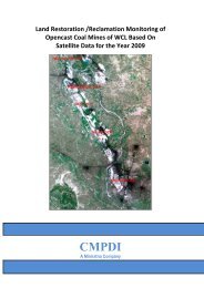
pench-kanhan coalfields - Western Coalfields Ltd. India.
pench-kanhan coalfields - Western Coalfields Ltd. India.
pench-kanhan coalfields - Western Coalfields Ltd. India.

You also want an ePaper? Increase the reach of your titles
YUMPU automatically turns print PDFs into web optimized ePapers that Google loves.
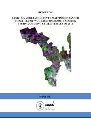
Following maps are prepared on 1:50,000 scale:<br />
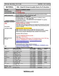
Job No. 561410027 (WCL) 21<br />
CMPDI<br />
3. Plate No. 1: Drawing No. HQ/REM/ 001: FCC (IRS – P6 LISS-III data of<br />
Pench-Kanhan-Tawa Valley coalfield of the year 2011) with Coalfield<br />
boundary and other infrastructural details.<br />
4. Plate No. 2: Drawing No. HQ/REM/ 002 - Land use/Cover Map of Pench-<br />
Kanhan-Tawa Valley Coalfield based on IRS-P6 LISS-III data..<br />
3.3 Land use/cover Analysis<br />
Satellite data of the year 2011 was processed using ERDAS IMAGINE 9.0<br />
image processing s/w in order to interpret the various land use/cover classes<br />
present in the study area of Pench-Kanhan-Tawa Valley Coalfield covering<br />
907.90 sq. kms. Blockwise area of each land use/cover class for Pench-<br />
Kanhan-Tawa Valley coalfield was calculated using Arc-Info GIS & ERDAS<br />
IMAGINE 9.0 s/w and tabulated in Table 3.2. Distribution of various land use<br />
classes are shown in the Pie Charts (Fig. 2.6). Pench-Kanhan-Tawa Valley<br />
coalfield contains 91 coal blocks (identified till) whose land use/cover<br />
classes are tabulated in Table 3.3. Blockwise land use/vegetation cover<br />
database are generated on GIS platform for further temporal analysis.<br />
3.3.1 Settlement/ Built-up land<br />
All the man-made constructions covering the land surface are included<br />
under this category. Built-up land has been divided in to rural, urban and<br />
industrial classes based on availability of infrastructure facilities. Total area<br />
of settlements in Pench-Kanhan-Tawa valley CF covers 23.24 km 2 (2.56%)<br />
out of which urban settlement covers 15.25 km 2 , rural settlement covers<br />
5.53 km 2 and industrial settlement covers 2.46 km 2 area (Refer Table 3.2).