

Cranbourne West Precinct Structure Plan - Growth Areas Authority
Cranbourne West Precinct Structure Plan - Growth Areas Authority
Cranbourne West Precinct Structure Plan - Growth Areas Authority

You also want an ePaper? Increase the reach of your titles
YUMPU automatically turns print PDFs into web optimized ePapers that Google loves.
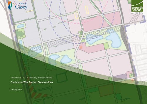
Amendment C102 to the Casey <strong>Plan</strong>ning scheme<br />
<strong>Cranbourne</strong> <strong>West</strong> <strong>Precinct</strong> <strong>Structure</strong> <strong>Plan</strong><br />
January 2010
SM | 20100105 | 11:43
CONTENTS<br />
1.0 INTRODUCTION 3<br />
1.1 ROLE OF THE CRANBOURNE WEST PRECINCT STRUCTURE PLAN<br />
3<br />
1.2 HOW TO USE THIS PSP 3<br />
1.3 MONITORING AND REVIEW 3<br />
1.4 AREA TO WHICH THE PSP APPLIES 3<br />
2.0 STRATEGIC CONTEXT 5<br />
2.1 METROPOLITAN AND REGIONAL CONTEXT 5<br />
2.1.1 Employment land 5<br />
2.1.2 Residential land 5<br />
2.2 LOCAL CONTEXT 6<br />
2.2.1 Site features 7<br />
3.0 VISION - PRECINCT STRUCTURE PLAN 8<br />
3.1 VISION 8<br />
3.2 NEW COMMUNITY AND EMPLOYMENT STRUCTURE 11<br />
3.2.1 Broad land use configuration 11<br />
3.2.2 Integrated living and working community 11<br />
3.2.3 Green web 11<br />
3.2.4 Image and character 11<br />
3.2.5 Housing 11<br />
3.2.6 Community facilities 12<br />
3.2.7 Open space 12<br />
3.2.8 Transport and movement 12<br />
3.2.9 Employment and activity centres 12<br />
3.3 LAND BUDGET AND DEMOGRAPHIC PROJECTIONS 13<br />
3.3.1 Land budget 13<br />
3.3.2 Demographic projections 13<br />
3.3.3 Net developable area and passive public open space 13<br />
4.0 ELEMENTS 18<br />
4.1 IMAGE AND CHARACTER 19<br />
4.1.1 Image and character objectives 19<br />
4.1.2 Implementation 19<br />
4.1.3 <strong>Plan</strong>ning and design guidelines 19<br />
4.2 HOUSING 20<br />
4.2.1 Housing objectives 20<br />
4.2.2 Implementation 20<br />
4.2.3 <strong>Plan</strong>ning and design guidelines 21<br />
4.3 EMPLOYMENT AND ACTIVITY CENTRES 22<br />
4.3.1 Employment Area and Activity Centre objectives 22<br />
4.3.2 Implementation 22<br />
4.3.3 <strong>Plan</strong>ning and design guidelines for Employment areas 23<br />
4.3.4 <strong>Plan</strong>ning and design guidelines for Activity Centres 25<br />
4.4 COMMUNITY FACILITIES 29<br />
4.4.1 Community infrastructure objectives 29<br />
4.4.2 Implementation 29<br />
4.4.3 <strong>Plan</strong>ning and design guidelines 29<br />
4.5 OPEN SPACE AND NATURAL SYSTEMS 30<br />
4.5.1 Objectives 30<br />
4.5.2 Implementation 30<br />
4.5.3 <strong>Plan</strong>ning and design guidelines 30<br />
4.6 TRANSPORT AND MOVEMENT 34<br />
4.6.1 Transport and Movement objectives 34<br />
4.6.2 Implementation 35<br />
4.6.3 <strong>Plan</strong>ning and Design Guidelines 35<br />
4.7 . UTILITIES AND ENERGY 40<br />
4.7.1 Utilities and Energy Objectives 40<br />
4.7.2 Implementation 40<br />
4.7.3 <strong>Plan</strong>ning and design guidelines 40<br />
5.0 INFRASTRUCTURE AND STAGING 42<br />
5.1 DEVELOPMENT STAGING 42<br />
5.1.1 Development staging objectives 42<br />
5.1.2 Implementation 42<br />
5.1.3 <strong>Plan</strong>ning and design guidelines 42<br />
5.2 PRECINCT INFRASTRUCTURE PLAN 42<br />
6.0 OTHER INFORMATION 46<br />
6.1 SUPPORTING INFORMATION 46<br />
6.2 GLOSSARY 46<br />
cranbourne west precinct structure plan<br />
1
2<br />
Section 1 - Introduction<br />
plan 1<br />
precinct structure plan area<br />
cranbourne west precinct structure plan
1.0 INTRODUCTION<br />
1.1 ROLE OF THE CRANBOURNE WEST PRECINCT<br />
STRUCTURE PLAN<br />
The <strong>Cranbourne</strong> <strong>West</strong> <strong>Precinct</strong> <strong>Structure</strong> <strong>Plan</strong> (PSP) has been prepared<br />
by the City of Casey with the assistance of David Lock Associates and<br />
Pocock Design Environment in conjunction with the <strong>Growth</strong> <strong>Areas</strong><br />
<strong>Authority</strong> (GAA), government agencies, service authorities and major<br />
stakeholders.<br />
A precinct structure plan is a mechanism used by the Victorian<br />
Government and the City of Casey to plan for major new urban<br />
development together with the infrastructure and services required by<br />
the future community.<br />
The role of the PSP is:<br />
• To provide the framework, conditions and requirements for<br />
the consideration of planning permits that provide for urban<br />
development under the provisions of the Casey <strong>Plan</strong>ning Scheme,<br />
including the provisions of the Urban <strong>Growth</strong> Zone.<br />
• To plan for the creation of an urban structure that implements the<br />
‘Neighbourhood Principles’ as stated in Melbourne 2030.<br />
• To ensure that planning occurs so that the future community<br />
within the <strong>Cranbourne</strong> <strong>West</strong> <strong>Precinct</strong> <strong>Structure</strong> <strong>Plan</strong> area (the<br />
‘<strong>Precinct</strong>’) can be provided with early access to infrastructure and<br />
services, such as community facilities and services, transport,<br />
employment, activity centres, open space and recreation facilities.<br />
• To provide developers, investors and local communities with<br />
certainty regarding the nature of future development within the<br />
<strong>Precinct</strong>.<br />
This PSP is informed by the:<br />
• State <strong>Plan</strong>ning Policy Framework and the Victorian Government’s<br />
<strong>Precinct</strong> <strong>Structure</strong> <strong>Plan</strong>ning Guidelines; and,<br />
• Local <strong>Plan</strong>ning Policy Framework of the Casey <strong>Plan</strong>ning Scheme as<br />
well as other City of Casey local policies and strategies including<br />
the Casey 21 Strategy.<br />
• The PSP sets objectives, and provides for their implementation in<br />
relation to:<br />
• land use (such as residential of varying densities, industrial, retail<br />
and non-retail, open space, heritage, education facilities and<br />
community infrastructure);<br />
• transport (such as primary arterial and local arterial road networks,<br />
collector roads and public transport);<br />
• activity centres and employment areas; and<br />
• open space both unencumbered (passive and active) and<br />
encumbered (waterways and biodiversity and environmental<br />
sensitive areas).<br />
1.2 HOW TO USE THIS PSP<br />
The Urban <strong>Growth</strong> Zone requires the responsible authority to consider<br />
the PSP when assessing planning permit applications for the use and<br />
development, including subdivision, of land within the <strong>Precinct</strong>. A<br />
permit must only be granted for proposals which are generally in<br />
accordance with the PSP and an urban design framework prepared<br />
under Schedule 1 to the Urban <strong>Growth</strong> Zone (UGZ).<br />
1.3 MONITORING AND REVIEW<br />
The GAA and the City of Casey will jointly monitor the implementation<br />
of this PSP. The effectiveness of the PSP will be evaluated regularly,<br />
at least every five years and it is expected that it will be revised and<br />
updated from time to time as required.<br />
1.4 AREA TO WHICH THE PSP APPLIES<br />
The <strong>Precinct</strong> comprises approximately 783 hectares of land and is<br />
generally bounded by:<br />
• Thompsons Road to the north.<br />
• <strong>West</strong>ern Port Highway to the west.<br />
• Ballarto Road Reserve and the Ranfurlie Golf Club in the south.<br />
• Evans Road and <strong>Cranbourne</strong>-Frankston Road in the east.<br />
The <strong>Precinct</strong> also includes the wedge of land west of the Merinda Park<br />
Station at Lyndhurst.<br />
The PSP applies to the land shown in <strong>Plan</strong> 1.<br />
cranbourne west precinct structure plan<br />
Section 1 - Introduction<br />
3
4<br />
Section 2 - Context<br />
NEPEAN HWY<br />
NEPEAN HWY<br />
KINGSTON<br />
PORT<br />
PHILLIP<br />
BAY<br />
MOOROODUC HWY<br />
GOVERNOR RD<br />
NEPEAN HWY<br />
MORNINGTON<br />
PENINSULA<br />
MOOROODUC HWY<br />
COOLART RD<br />
KEYSBOROUGH<br />
MORNINGTON PENINSULA FWY<br />
FRANKSTON<br />
COOLART RD<br />
HUTTON RD<br />
Eastern<br />
Treatment<br />
<strong>Plan</strong>t<br />
FRANKSTON<br />
NORTH<br />
PROPOSED MORNINGTON PENINSULA FWY<br />
MORNINGTON-TYABB RD<br />
DANDENONG-FRANKSTON RD<br />
Karingal<br />
Hub<br />
FRANKSTON-FLINDERS RD<br />
EASTLINK (UN DER CONSTRUCTION)<br />
WARRIGAL<br />
DANDENONG<br />
GREENS RD<br />
GREATER<br />
DANDENONG<br />
LOWER DANDENONG RD<br />
NEPEAN HWY<br />
NEPEAN HWY<br />
LYNDHURST<br />
WESTERN PORT HWY<br />
KINGSTON<br />
PORT<br />
PHILLIP<br />
BAY<br />
MOOROODUC HWY<br />
C<br />
PRINCES HWY<br />
WESTERN PORT HWY<br />
CRANBOURNE-FRANKSTON RD<br />
GOVERNOR RD<br />
MORNINGTON<br />
Key Open Space<br />
PENINSULA<br />
HAMPTON<br />
PARKKEYSBOROUGH<br />
NARRE<br />
DANDENONG<br />
WARREN<br />
SOUTH<br />
COOLART RD<br />
FRANKSTON<br />
NORTH<br />
FRANKSTON<br />
COOLART RD<br />
CHELTENHAM RD<br />
HUTTON RD<br />
CRANBOURNE<br />
Eastern EAST<br />
Treatment<br />
<strong>Plan</strong>t<br />
Karingal<br />
Hub<br />
CES HWY<br />
KINGSTON RD HEATHERTON RD<br />
HALLAM<br />
NEPEAN HWY<br />
HALLAM RD<br />
SOUTH GIPPSLAND HWY<br />
LYNBROOK<br />
CRANBOURNE<br />
CRANBOURNE<br />
SOUTH<br />
SPRINGVALE RD<br />
MOOROODUC HWY<br />
MORNINGTON PENINSULA FWY<br />
PROPOSED MORNINGTON PENINSULA FWY<br />
MORNINGTON-TYABB RD<br />
CASEY<br />
NARRE<br />
WARREN<br />
Casey<br />
Central<br />
EASTLINK (UN DER CONSTRUCTION)<br />
DANDENONG-FRANKSTON RD<br />
BAXTER-TOORADIN RD BAXTER-TOORADIN RD<br />
EVANS ROAD<br />
THOMPSONS RD<br />
FRANKSTON-FLINDERS RD<br />
NORTH<br />
FWY<br />
PRINCES HWY<br />
PRINCES FWY<br />
GREENS RD<br />
GREATER<br />
DANDENONG<br />
LYNDHURST<br />
WESTERN PORT HWY<br />
PRINCES HWY<br />
WESTERN PORT HWY<br />
CRANBOURNE-FRANKSTON RD<br />
ENDEAVOUR<br />
HILLS<br />
LYNBROOK<br />
HALLAM<br />
HALLAM RD<br />
SOUTH GIPPSLAND HWY<br />
CRANBOURNE<br />
SOUTH<br />
HAMPTON<br />
PARK<br />
CRANBOURNE<br />
CRANBOURNE<br />
EAST<br />
CASEY<br />
NARRE<br />
WARREN<br />
NARRE<br />
WARREN<br />
SOUTH<br />
Casey<br />
Central<br />
THOMPSONS RD<br />
BAXTER-TOORADIN RD BAXTER-TOORADIN RD<br />
EVANS ROAD<br />
CARDINIA<br />
NARRE<br />
WARREN<br />
NORTH<br />
PRINCES HWY<br />
PRINCES FWY<br />
SOUTH GIPPSLAND HWY<br />
WESTERN<br />
PORT<br />
BERWICK<br />
BALLARTO RD BALLARTO RD<br />
SOUTH GIPPSLAND HWY<br />
WESTERN<br />
PORT<br />
BERWICK<br />
BALLARTO RD BALLARTO RD<br />
NARRE WARREN-CRANBOURNE RD<br />
BERWICK-CRANBOURNE RD<br />
Site<br />
Railway Line<br />
Possible Future Rail Line<br />
Arterial Roads<br />
Main Roads<br />
Municipal Boundaries<br />
Principal Activity Centres<br />
BERWICK-CRANBOURNE RD<br />
North<br />
Other Significant Activity Centres<br />
Major Industrial Area<br />
Principal Public Transport Network<br />
<strong>Cranbourne</strong> East B <strong>Growth</strong> Area<br />
Urban <strong>Growth</strong> Area<br />
Rural Area<br />
0 1 2 3 4 5km<br />
NARRE WARREN-CRANBOURNE RD<br />
BERWICK-CRANBOURNE RD<br />
CWUG/PSP2/001<br />
SEPTEMBER 2007<br />
BERWICK-CRANBOURNE RD<br />
CARDINIA<br />
0 1 2 3 4 5km<br />
Other Significant Activity Centres plan 2<br />
Major Industrial Area<br />
Principal Public Transport Network<br />
metropolitan <strong>Cranbourne</strong> & East B regional <strong>Growth</strong> Area context<br />
Site<br />
Railway Line<br />
Possible Future Rail Line<br />
Arterial Roads<br />
Main Roads<br />
Municipal Boundaries<br />
Key Open Space<br />
Principal Activity Centres<br />
cranbourne west precinct structure plan<br />
Urban <strong>Growth</strong> Area<br />
Rural Area<br />
North<br />
CWUG/PSP2/001<br />
SEPTEMBER 2007
2.0 STRATEGIC CONTEXT<br />
2.1 METROPOLITAN AND REGIONAL CONTEXT<br />
The <strong>Precinct</strong> benefits from its proximity and access to major high<br />
capacity transport links in Melbourne’s south-east including:<br />
• Eastlink.<br />
• Thompsons Road.<br />
• <strong>West</strong>ern Port Highway<br />
• The Dandenong-Port of Hastings corridor.<br />
• South Gippsland Highway.<br />
• Princes Freeway.<br />
• <strong>Cranbourne</strong> Railway Line.<br />
The <strong>Precinct</strong> is situated 2km west of the <strong>Cranbourne</strong> Principal Activity<br />
Centre. In 2006, the wider <strong>Cranbourne</strong> area had a population of<br />
approximately 38,000 residents. Continuing new greenfield residential<br />
development on multiple growth fronts surrounding <strong>Cranbourne</strong> will<br />
see it grow to an estimated population of 110,000 by 2030 or sooner<br />
depending on rates of development. The present sub-regional retail<br />
role of <strong>Cranbourne</strong> Principal Activity Centre will therefore become<br />
more significant, and this will see growing demand for intensification<br />
and diversification of land uses around the centre.<br />
Development of the <strong>Precinct</strong>’s employment areas will be influenced<br />
by its relationship to the Dandenong South industrial area. This<br />
area, commencing 1.5km north of the <strong>Precinct</strong>, continues to<br />
consolidate its role as a major suburban business hub attracting larger<br />
processing, packaging and distribution industries, and manufacturing<br />
businesses, which benefit from access to upgraded regional transport<br />
infrastructure.<br />
The <strong>Precinct</strong> has access to an extensive network of major open space<br />
and recreational assets within the wider <strong>Cranbourne</strong> area. The <strong>Precinct</strong><br />
is within 1.5km of the regionally significant <strong>Cranbourne</strong> Royal Botanic<br />
Gardens and the <strong>Cranbourne</strong> horse racing and training complex. Casey<br />
Fields, a regional sporting hub, is 4km east of the <strong>Precinct</strong>. A network<br />
of golf courses adjoining and surrounding the <strong>Precinct</strong> provides high<br />
value landscape qualities, recreational opportunities and wildlife<br />
habitats.<br />
2.1.1 EMPLOYMENT LAND<br />
The Casey Municipal Strategic Statement and C21 Strategy identify the<br />
need for the City of Casey to strengthen and diversify its employment<br />
base to achieve improved local job self-containment and prioritise the<br />
need to deliver a large new <strong>Cranbourne</strong> Industry Park in <strong>Cranbourne</strong><br />
<strong>West</strong>.<br />
The <strong>Growth</strong> Area Framework <strong>Plan</strong> (GAFP) shows the macro-structure<br />
of the <strong>Precinct</strong> is driven by the need to provide approximately 400ha<br />
of employment land in <strong>Cranbourne</strong> <strong>West</strong> to facilitate economic<br />
development and job creation in Melbourne’s south-eastern region.<br />
The Department of Industry, Innovation and Regional Development<br />
(DIIRD) is the key State Government sponsor of the <strong>Precinct</strong>’s regional<br />
employment role. DIIRD requires provision of some land suitable for<br />
large lot industrial subdivision (i.e. 5-10ha).<br />
2.1.2 RESIDENTIAL LAND<br />
In addition to employment land, the <strong>Precinct</strong> is identified for residential<br />
land supply. This will constitute an extension to <strong>Cranbourne</strong> <strong>West</strong> with<br />
strong connections to the existing residential community. The <strong>Precinct</strong><br />
will provide residential land which delivers housing types and lifestyle<br />
opportunities sought by a broad cross-section of professionals, skilled<br />
tradespeople and manual workers.<br />
cranbourne west precinct structure plan<br />
Section 2 - Context<br />
5
6<br />
2.2 LOCAL CONTEXT<br />
The <strong>Precinct</strong> abuts an existing residential suburb known as <strong>Cranbourne</strong> Victorian Canine <strong>West</strong> on its eastern<br />
Association Inc.<br />
side. The land to the north of the <strong>Precinct</strong> is currently being developed for residential<br />
purposes which will form an extension of the suburb of Lyndhurst. To the west and south<br />
are non-urban uses. The Casey C21 Strategy earmarks the land to the south for large lot<br />
suburban development, however this land is not within the Urban <strong>Growth</strong> Boundary<br />
(UGB). In this regard, it is noted that the C21 Strategy was prepared prior to the release of<br />
Melbourne 2030.<br />
Notable development, facilities and services in proximity to the <strong>Precinct</strong> include:<br />
SKYE<br />
• <strong>Cranbourne</strong> Principal Activity Centre which is a central location for various medical and<br />
community facilities.<br />
Victorian<br />
Paintball Games<br />
• Neighbourhood activity centres at Duff Street and Camms Road.<br />
Skye Golf Course<br />
and Driving Range<br />
• Government secondary schools at Lyndhurst and <strong>Cranbourne</strong> and a Catholic College<br />
on the <strong>Cranbourne</strong> Frankston Road.<br />
• Government primary school and a catholic primary school at <strong>Cranbourne</strong> <strong>West</strong>.<br />
• Railway stations at Merinda Park in Lyndhurst and <strong>Cranbourne</strong>.<br />
• Local bus routes serving the existing community of <strong>Cranbourne</strong> <strong>West</strong>.<br />
• <strong>Cranbourne</strong> Major Electricity Transmission Station.<br />
• Local parks within the existing suburb of <strong>Cranbourne</strong> <strong>West</strong> including several sections<br />
LANGWARRIN<br />
of linear park underneath the transmission lines.<br />
The parameters of the PSP are established by opportunities and constraints derived from<br />
the planning policy framework, existing site conditions and its context. Full analysis of this<br />
information is provided in a reference document, the <strong>Cranbourne</strong> <strong>West</strong> Urban <strong>Growth</strong> <strong>Plan</strong><br />
Key Issues Paper April 2007.<br />
Section 2 - Context<br />
CENTRE RD<br />
Sandhurst<br />
Club<br />
TAYLORS RD<br />
WEDGE RD<br />
HALL RD<br />
MORNINGTON<br />
PENINSULA<br />
Ranfurlie<br />
Golf Club<br />
BALLARTO RD PROPOSED BALLARTO RD<br />
CRANBOURNE-FRANKSTON RD<br />
WESTERN PORT HWY<br />
WESTERN PORT HWY<br />
Morning Mist<br />
Recreation Reserve<br />
THOMPSONS RD<br />
PEARCEDALE RD<br />
Melbourne Water<br />
Retarding Basin<br />
EVANS ROAD<br />
CRANBOURNE<br />
WEST<br />
Amstel<br />
Golf Club<br />
Golf Course<br />
(Under Construction)<br />
NORTH RD<br />
MerindaPark<br />
Station<br />
CENTRAL PKW<br />
S.S.<br />
Sandhurst<br />
Club<br />
Skye Golf Course<br />
and Driving Range<br />
CENTRE RD<br />
<strong>Cranbourne</strong><br />
Terminal<br />
Station<br />
TAYLORS RD<br />
BROWNS RD<br />
SMITHS RD<br />
P.S.<br />
P.S.<br />
LANGWARRIN<br />
S.S.<br />
Propose Lyndhurst<br />
Electricity Terminal Station<br />
P.S.<br />
SKYE<br />
Victorian<br />
Paintball Games<br />
MORNINGTON<br />
PENINSULA<br />
S.S.<br />
Victorian Canine<br />
CRANBOURNE<br />
Association Inc.<br />
<strong>Cranbourne</strong> Principal<br />
Activity Centre<br />
P.S.<br />
P.S.<br />
HALL RD<br />
WESTERN PORT HWY<br />
HWY<br />
GLASSCOCKS RD<br />
<strong>Cranbourne</strong><br />
Station<br />
WEDGE RD<br />
Royal Botanic<br />
Gardens <strong>Cranbourne</strong><br />
WESTERN PORT HWY<br />
Morning Mist<br />
Recreation Reserve<br />
CRANBOURNE<br />
Lynbrook Station<br />
NORTH<br />
Ranfurlie<br />
Golf Club<br />
BALLARTO RD PROPOSED BALLARTO RD<br />
CRANBOURNE<br />
SOUTH<br />
CRANBOURNE-FRANKSTON RD<br />
Site<br />
Arterial Roads<br />
Main Roads<br />
Secondary Roads<br />
Collector Roads<br />
Railway Line<br />
Level Crossing<br />
Urban <strong>Growth</strong> Area<br />
Rural Area<br />
Great Southern<br />
Home Centre<br />
P.S.<br />
<strong>Cranbourne</strong><br />
Training Complex<br />
P.S.<br />
CAMMS RD<br />
SLADEN ST<br />
JUNCTION<br />
VILLAGE<br />
CRAIG RD<br />
LYNDHURST<br />
THOMPSONS RD<br />
NARRE WARREN-CRANBOURNE RD<br />
PEARCEDALE RD<br />
S.S.<br />
Residential<br />
Existing Retail<br />
Proposed Retail<br />
Existing Amenities<br />
Public Open Space<br />
Proposed<br />
Shopping Centre<br />
S.S.<br />
TAFE The Complex<br />
Melbourne Water<br />
Retarding Basin<br />
MerindaPark<br />
Station<br />
Proposed<br />
<strong>Cranbourne</strong> East<br />
Station<br />
CRANBOURNE<br />
WEST<br />
EVANS ROAD<br />
S.S.<br />
Amstel<br />
Golf Club<br />
DEVON Golf Course<br />
MEADOWS (Under Construction)<br />
NORTH RD<br />
CRANBOURNE<br />
EAST<br />
CENTRAL PKW<br />
SOUTH GIPPSLAND HWY<br />
CROSS RD<br />
THOMPSONS RD<br />
<strong>Cranbourne</strong><br />
Terminal<br />
Station<br />
BROWNS RD<br />
SMITHS RD<br />
Casey<br />
Fields<br />
<strong>Cranbourne</strong><br />
Golf Club<br />
P.S.<br />
P.S.<br />
PROPOSED GLASSCOCKS RD<br />
SOUTH GIPPSLAND HWY<br />
S.S.<br />
PROPOSED LINSELL BVD EXTENSION<br />
P.S.<br />
CLYDE<br />
NORTH<br />
BERWICK-CRANBOURNE RD<br />
Existing Infrastructure<br />
Proposed Infrastructure<br />
Transmission Line<br />
Drainage Line<br />
Municipal Boundary<br />
Urban <strong>Growth</strong> Boundary<br />
North<br />
<strong>Cranbourne</strong><br />
Station<br />
CRANBOURNE<br />
SOUTH<br />
FISHERIES RD CLYDE - FIVE WAYS RD<br />
Great Southern<br />
Home Centre<br />
P.S.<br />
CRANBOURNE<br />
<strong>Cranbourne</strong><br />
Training Complex<br />
Royal Botanic<br />
Gardens <strong>Cranbourne</strong><br />
Site<br />
Arterial Roads<br />
Main Roads<br />
Secondary Roads<br />
Collector Roads<br />
Railway Line<br />
Level Crossing<br />
Urban <strong>Growth</strong> Area<br />
Rural Area<br />
<strong>Cranbourne</strong><br />
Golf Club<br />
P.S.<br />
CAMMS RD<br />
P.S.<br />
S.S.<br />
<strong>Cranbourne</strong> Principal<br />
Activity Centre<br />
P.S.<br />
P.S.<br />
SLADEN ST<br />
CLYDE<br />
MANKS RD<br />
0 100 200 500 1000m<br />
JUNCTION<br />
VILLAGE<br />
CRAIG RD<br />
CRANBOURNE<br />
NORTH<br />
NARRE WARREN-CRANBOURNE RD<br />
Proposed<br />
Shopping Centre<br />
S.S.<br />
Residential<br />
Existing Retail<br />
Proposed Retail<br />
Existing Amenities<br />
Public Open Space<br />
S.S.<br />
TAFE The Complex<br />
Casey Central<br />
Major Activity Centre<br />
DEVON<br />
MEADOWS<br />
P.S.<br />
PROPOSED GLASSCOCKS RD<br />
THOMPSONS RD<br />
CRANBOURNE<br />
EAST<br />
Proposed<br />
<strong>Cranbourne</strong> East<br />
Station<br />
SOUTH GIPPSLAND HWY<br />
CROSS RD<br />
PROPOSED LINSELL BVD EXTENSION<br />
Casey<br />
Fields<br />
CLYDE<br />
NORTH<br />
BERWICK-CRANBOURNE RD<br />
Existing Infrastructure<br />
Proposed Infrastructure<br />
Transmission Line<br />
Drainage Line<br />
Municipal Boundary<br />
Urban <strong>Growth</strong> Boundary<br />
North<br />
FISHERIES RD CLYDE - FIVE WAYS RD<br />
CLYDE<br />
MANKS RD<br />
0 100 200 500 1000m<br />
plan 3<br />
local context & site features<br />
cranbourne west precinct structure plan
2.2.1 SITE FEATURES<br />
Detailed site investigations were undertaken in the first phase of preparing the PSP and this<br />
information was brought together in the Key Issues Paper.<br />
The <strong>Precinct</strong> is currently used for rural purposes and associated activities and represents a<br />
non-urban edge to the existing <strong>Cranbourne</strong> community which extends to the immediate<br />
east of the site. Scattered stands and lines of trees punctuate the generally open and<br />
grassed character of the <strong>Precinct</strong>.<br />
Topographically, the <strong>Precinct</strong> is gently undulating in the south west falling towards a flatter<br />
area in the north. A series of local high points in the southeast offer fine long views to the<br />
Dandenong Ranges and occasional views towards the Melbourne CBD skyline.<br />
There are a number of highly modified drainage lines generally traversing the <strong>Precinct</strong><br />
from southeast to northwest, along which are a series of dams. A large Melbourne Water<br />
retarding basin occupies a site on Evans Road.<br />
The lack of significant natural features gives the area a ‘constructed’ agricultural feel within<br />
which natural values have been subdued.<br />
In terms of subdivision and ownership pattern, there are a large number of relatively small<br />
lots in the north (with the exception of land adjacent to Merinda Park Station) which are<br />
generally owner occupied. A small number of local roads dissect this portion of the site.<br />
In the balance land to the south of Breens Road, there are a small number of relatively large<br />
lots which have generally been taken up by developer interests.<br />
The land is generally used for farming with the exception of:<br />
• Merinda Park Station in the northeast of the growth area with a large park and ride car<br />
park and high voltage transmission lines traversing the site.<br />
• Poultry related businesses close to Thompsons Road which require buffers to be<br />
applied to new sensitive uses in proximity.<br />
• Two service stations alongside <strong>West</strong>ern Port Highway.<br />
• Rural residential dwellings.<br />
The <strong>Precinct</strong> contains five recorded historic archaeological sites which have been given ‘D’<br />
classifications by Heritage Victoria and one heritage site listed in the City of Casey Heritage<br />
Overlay HO163 at 2/660 Hall Road, known as Hayton Park. Site prediction models suggest<br />
that the <strong>Precinct</strong> has a low potential to contain any significant sites or features however the<br />
potential remains for further low significance historic sites, relating to the early agricultural<br />
period of the district, to be located.<br />
Indigenous heritage studies revealed a very high potential for buried indigenous<br />
archaeological sites within the <strong>Precinct</strong> and that the area contains one of the last remaining<br />
undeveloped remnant sand dune landform between Dandenong and Cardinia with<br />
significant loss of sites on the same landform in the surrounding region over the past ten<br />
years as a result of urban development.<br />
The <strong>Precinct</strong> is in an area of shallow water tables with the depth to watertable less than<br />
1.5 metres in the southern half of the <strong>Precinct</strong> and therefore may have constraints on<br />
development due to salinity risks.<br />
plan 4<br />
site features<br />
cranbourne west precinct structure plan<br />
Section 2 - Context<br />
7
8<br />
3.0 VISION - PRECINCT STRUCTURE PLAN<br />
3.1 VISION<br />
Development in the <strong>Cranbourne</strong> <strong>West</strong> precinct will set new benchmarks in best practice urban<br />
development. It will ‘complete’ the existing community of <strong>Cranbourne</strong> <strong>West</strong> to form a well serviced,<br />
socially equitable neighbourhood with a comprehensive range of social infrastructure. It will enrich the<br />
employment opportunities available within the City of Casey by offering opportunities for a wide range<br />
of business types.<br />
Development of large residential and employment areas side by side within the precinct presents a<br />
design challenge. The vision therefore is to produce an integrated living and working environment<br />
that fosters a diverse and dynamic blend of lifestyle and commerce opportunities, unprecedented in an<br />
outer suburban location.<br />
Natural and cultural features will, where possible, be protected, enhanced and integrated within the<br />
development to form an intrinsic part of its character. Housing options will range from detached<br />
houses on family-sized blocks to apartments close to shops, services, and public transport, and include<br />
accommodation for the retired, aged and mobility-impaired. The scale of the development will enable<br />
the provision of a comprehensive range of community facilities and services, including ‘daily needs’<br />
within a comfortable walking distance of all dwellings.<br />
Good road access to the development will be maintained. However, a comprehensive network of public<br />
transport, walking and cycling routes will be established to foster more sustainable modes of travel.<br />
Buildings and services will meet high environmental standards, and leading edge telecommunications<br />
infrastructure will be provided to attract high-technology businesses and assist people in working from<br />
home.<br />
<strong>Cranbourne</strong> <strong>West</strong> will become known as a leading example of best practice in sustainable urban<br />
development. This will set it apart from other developments and lift the identity of <strong>Cranbourne</strong>,<br />
attracting residents, businesses and visitors who place a premium on ecologically, socially and<br />
economically responsible lifestyles.<br />
Section 3 - Vision<br />
plan 5<br />
future urban structure<br />
cranbourne west precinct structure plan
Figure 1: Enlargement of <strong>Plan</strong> 5 - Thompsons Road to Wedge Road Figure 2: Enlargement of <strong>Plan</strong> 5 - Wedge Road to Hall Road<br />
cranbourne west precinct structure plan<br />
Section 3 - Vision<br />
9
Figure 3: Enlargement of <strong>Plan</strong> 5 -Hall Road to Ballarto Road<br />
10 Section 3 - Vision<br />
cranbourne west precinct structure plan
3.2 NEW COMMUNITY AND EMPLOYMENT STRUCTURE<br />
3.2.1 BROAD LAND USE CONFIGURATION<br />
The <strong>Precinct</strong> consists of two principal land uses: residential and<br />
employment. The structure of the <strong>Precinct</strong> is determined by<br />
the need to achieve a dwelling yield sufficient to sustain core<br />
community infrastructure (i.e. schools, kindergartens, local social and<br />
health services, local shops and parks) and meet Melbourne 2030<br />
expectations, whilst providing maximum employment land.<br />
Employment land uses are generally located in the north and west of<br />
the <strong>Precinct</strong>, whilst residential land uses are located in the east and<br />
south of the <strong>Precinct</strong>. Employment land uses generating higher job<br />
densities, such as offices, are located in the north-east of the <strong>Precinct</strong><br />
toward Merinda Park Station, while lower job density land uses, such as<br />
distribution centres, are generally located in the southwest. A range of<br />
residential densities will be sought to respond to activity centres and<br />
the interface to the UGB.<br />
There are a number of reasons for this configuration of uses:<br />
• It locates residential development and other sensitive land uses<br />
away from existing poultry operations and the electricity terminal<br />
station in the north of the <strong>Precinct</strong>.<br />
• It maximises the length of new residential frontage along the<br />
Evans Road interface to the existing <strong>Cranbourne</strong> <strong>West</strong> community,<br />
and thereby facilitates integration of new residential development<br />
with the existing <strong>Cranbourne</strong> <strong>West</strong> community and shared use of<br />
supporting land uses such as activity centres, community facilities<br />
and schools.<br />
• It preserves land with higher landscape values in the south of<br />
the <strong>Precinct</strong> for ‘prestige’ residential development to encourage<br />
executives and senior managers to live locally.<br />
• It encourages transit-oriented development by locating the<br />
highest trip-generating land uses (i.e. offices, mixed use) near to<br />
public transport services at Merinda Park Station.<br />
• It locates employment land uses which generate a high proportion<br />
of heavy vehicle trips close to access points to <strong>West</strong>ern Port<br />
Highway.<br />
• It optimises the exposure for businesses to the <strong>West</strong>ern Port<br />
Highway, and minimises new residential frontages to its high<br />
traffic volumes.<br />
• It facilitates creation of a high quality business park and mixed use<br />
environment by encircling the Melbourne Water retarding basin<br />
on Evans Road with consistent land uses.<br />
• It manages interfaces between new residential development<br />
and employment land uses by locating complementary mixed<br />
use activities and public open spaces along the <strong>Precinct</strong>’s central<br />
internal spine.<br />
The future structure for urban development within the <strong>Precinct</strong> is<br />
shown in <strong>Plan</strong> 5.<br />
3.2.2 INTEGRATED LIVING AND WORKING COMMUNITY<br />
Residential and employment areas will develop a distinct sense of<br />
character and image across the <strong>Precinct</strong>. However, a 2.4km interface<br />
between residential and employment land uses along the <strong>Precinct</strong>’s<br />
central internal spine presents an opportunity to knit the <strong>Precinct</strong><br />
together into an integrated living and working community.<br />
The north south ‘employment interface’ punctuated by a series of eastwest<br />
pedestrian and road connections will enable direct access into<br />
employment areas by the workforce residing in the new residential<br />
development and the existing <strong>Cranbourne</strong> <strong>West</strong> community.<br />
In addition to strong connections across the <strong>Precinct</strong>, the central spine<br />
will have detailed design controls to manage built form integration,<br />
planned around a series of public open spaces along a boulevard style<br />
road, evolving into an adaptable mixed use corridor which provides<br />
transitional built form between residential neighbourhoods and larger<br />
scale industrial buildings. In this mixed use employment interface,<br />
Council envisages that the <strong>Precinct</strong> could accommodate a finer-grain<br />
style of commercial and industrial buildings catering for emerging<br />
professional and business support activities that will not adversely<br />
affect residential amenity.<br />
3.2.3 GREEN WEB<br />
The <strong>Precinct</strong>’s ‘constructed’ agricultural landscape means little<br />
indigenous vegetation remains and its landscape characteristics are<br />
defined by mature windrows and gently undulating land dissected and<br />
shaped by drainage corridors. These landscape features form green<br />
infrastructure that provide a framework of natural assets that will shape<br />
land uses and connections within the <strong>Precinct</strong> and into the surrounding<br />
urban fabric and open space network. This green web will contribute<br />
to the <strong>Precinct</strong> creating a ‘city living, country feel’ for residents and<br />
workers through access to high quality, well located green spaces<br />
and will echo an important reminder of the pre-contact landscape as<br />
aspired by the local Aboriginal communities.<br />
Components of the green web are:<br />
• Drainage corridors and retarding basins.<br />
• Local and linear parks framed by existing and remnant windrows<br />
and copses.<br />
• An Aboriginal park.<br />
• Active public open space.<br />
• Green road verges.<br />
• Local high points and ridgelines.<br />
• View lines.<br />
3.2.4 IMAGE AND CHARACTER<br />
The existing and previous agricultural use has removed most of<br />
the remnant indigenous vegetation from the <strong>Precinct</strong> leaving only<br />
scattered mature trees in pastures and roadsides and small, fragmented<br />
roadside patches of trees and shrubs, grasses and herbs.<br />
In developing the PSP, landscape cues have been taken from the<br />
topography, views and vistas, remnant vegetation, rural dams and<br />
drainage lines.<br />
Casey C21 and the Casey Image Strategy encourage a treed image<br />
for Casey and in particular <strong>Cranbourne</strong> <strong>West</strong>. They endorse extensive<br />
boulevard planting along the main road network. This includes<br />
boulevard planting across drainage lines to encourage views to the<br />
wide green spaces with informal indigenous plantings along water<br />
courses.<br />
The sandy soil conditions, particularly in the area south of Hall Road,<br />
will pose challenges to establishment of vegetation over time. This<br />
places additional significance on the retention of indigenous and nonindigenous<br />
vegetation within the development of the <strong>Precinct</strong> to help<br />
establish an image and character for the new communities from day<br />
one. They provide a sense of place and character for the residential<br />
area, allowing additional planting over time to grow, replace and then<br />
form the dominate character.<br />
Open space, community infrastructure and roads has been cognisant<br />
of these features and in many cases to incorporated them within public<br />
land, so that Council can build on the image and character of the new<br />
community over time.<br />
A tree reserve is required along the eastern side of <strong>West</strong>ern Port<br />
Highway to ensure the implementation of the Casey Arterial Roads<br />
Tree Strategy (CARTS). The purpose of this reservation is to facilitate<br />
a double row of tree planting along the Highway which assists with<br />
creating a legible and unified landscape character in Casey. This<br />
reserve has been implemented to the north of Thompsons Road in<br />
Lyndhurst and carrying it along the length of <strong>West</strong>ern Port Highway is<br />
highly desirable. Similarly, the implementation of CARTS on the other<br />
arterial roads will ensure a consistent landscape theme with existing<br />
residential areas.<br />
3.2.5 HOUSING<br />
The establishment of an integrated and sustainable residential suburb<br />
by developing walkable neighbourhoods is a key element of the PSP.<br />
The configuration of residential development within the <strong>Precinct</strong><br />
creates two walkable neighbourhoods – one north of Hall Road which<br />
includes part of the existing development east of Evans Road, and<br />
another south of Hall Road.<br />
cranbourne west precinct structure plan<br />
Section 3 - Vision<br />
11
3.2.6 COMMUNITY FACILITIES<br />
The community and recreation facilities for <strong>Cranbourne</strong> <strong>West</strong> will be<br />
provided in community hubs within activity centres enabling shared<br />
use of space between community and other activities. A range of state<br />
agencies and the City of Casey have identified facilities required to<br />
serve the existing and future community of <strong>Cranbourne</strong> <strong>West</strong>.<br />
The allocation of land for such facilities and commitment by agencies<br />
and developers will ensure that facilities including local parks,<br />
playgrounds and community meeting places will be provided in each<br />
neighbourhood as residents move in, while other facilities including<br />
schools, children’s services, health facilities and formal recreation<br />
facilities will be provided when the population threshold to support<br />
their provision has been reached.<br />
The early provision of community and recreation facilities in each<br />
neighbourhood will contribute to a sense of community identity and<br />
provide an opportunity for participation and proactive community<br />
development.<br />
As the new community will have a relatively youthful age profile, the<br />
focus of facilities and amenity will be on young families. The facilities<br />
will be flexible to meet the community’s changing needs as the<br />
population matures.<br />
An indoor community meeting space for early service delivery and<br />
community engagement and development services will be required<br />
in the northern and southern residential areas at the commencement<br />
of development. It is proposed that this space be provided by the<br />
relevant developer as part of the display village component of their<br />
development. The use of these spaces will be relocated into the<br />
integrated community centre in the NAC when developed.<br />
12 Section 3 - Vision<br />
3.2.7 OPEN SPACE<br />
In addition to providing well located open space areas for the<br />
future communities, the PSP has been influenced by the traditional<br />
pathways of the Boon wurrung people and other sites of local heritage<br />
significance and the natural environment, including the location of<br />
remnant indigenous vegetation and potential habitat for the Dwarf<br />
Galaxias and Growling Grass Frog.<br />
The open space infrastructure within the <strong>Precinct</strong> falls into five<br />
categories:<br />
• Drainage Corridors and Retarding Basins.<br />
• Passive Open Space.<br />
• Active Spaces.<br />
• Hub Spaces.<br />
• Edge Spaces.<br />
Each category of open space is designed to serve a particular purpose.<br />
3.2.8 TRANSPORT AND MOVEMENT<br />
The provision of an efficient and safe road, cycle and pedestrian<br />
network will be important to the successful development of the<br />
<strong>Precinct</strong>. Not only will good networks facilitate movements within<br />
the <strong>Precinct</strong> but these networks will ensure that the <strong>Precinct</strong> will<br />
successfully integrate with the existing residential area of <strong>Cranbourne</strong><br />
<strong>West</strong>.<br />
The road network will need to be designed to ensure that vehicle and<br />
truck movements associated with the industrial and employment areas<br />
can be accommodated and will not conflict with residential traffic and<br />
amenity.<br />
The management and coordinated delivery of the road network will<br />
be achieved through identifying an appropriate road hierarchy and<br />
implementing the <strong>Cranbourne</strong> <strong>West</strong> Development Contributions <strong>Plan</strong>.<br />
To achieve the public transport requirements, a hierarchy of public<br />
transport has been identified to serve <strong>Cranbourne</strong> <strong>West</strong> comprising of<br />
strategic regional services linking to key activity centres and a network<br />
of local services throughout the <strong>Precinct</strong> connecting the residential<br />
areas to the local destinations.<br />
<strong>Plan</strong>s 13, 14, and 15 show the proposed road, public transport, walking<br />
and cycling network to support development in the <strong>Precinct</strong>.<br />
3.2.9 EMPLOYMENT AND ACTIVITY CENTRES<br />
A core component of the PSP is to provide the framework for the<br />
establishment of land uses to increase employment opportunities<br />
and to deliver an orderly hierarchy of activity centres to service the<br />
expected residential and commercial development.<br />
The PSP includes a number of new activity centres to serve the new<br />
residential and business communities of <strong>Cranbourne</strong> <strong>West</strong>. Most<br />
of these centres will be mixed use centres that integrate retail,<br />
commercial, community and potentially residential uses to create<br />
vibrant, safe and efficient focal points for the community.<br />
The future retail hierarchy of the <strong>Precinct</strong> taking into account the<br />
forecast resident and working population within <strong>Cranbourne</strong> <strong>West</strong> will<br />
be supported by the following Activity Centres:<br />
• 1 x Large Neighbourhood Activity Centre to meet the daily and<br />
weekly needs of the catchment population.<br />
• 3 x Small Neighbourhood Activity Centres to meet the daily<br />
convenience needs (or daily ‘top up’ needs) of the catchment<br />
population and workers.<br />
• 1 x Business Activity Centre to meet the needs of on-site workers<br />
and facilitate long-term development of a transit oriented<br />
development.<br />
The location of the proposed activity centres is shown in <strong>Plan</strong> 10.<br />
The size of each centre has been determined to ensure an appropriate<br />
hierarchy of activity centres is provided within the <strong>Precinct</strong> and the<br />
municipality and that each centre will not unreasonable conflict and<br />
compete with other centres in the network.<br />
In additional to supporting the development of four new activity<br />
centres, the PSP seeks the establishment of significant employment<br />
areas through designating land for industry, office and mixed used<br />
development.<br />
The <strong>Precinct</strong> is forecast to accommodate between a minimum of 10,626<br />
and up to 16,762 new jobs.<br />
The PSP identifies specific locations for different types of employment<br />
generating uses as shown on <strong>Plan</strong> 9. These areas are:<br />
• Industrial.<br />
• Business Park.<br />
• Mixed Use.<br />
• Employment interface.<br />
• Business Activity Centre<br />
cranbourne west precinct structure plan
3.3 LAND BUDGET AND DEMOGRAPHIC PROJECTIONS<br />
3.3.1 LAND BUDGET<br />
The PSP covers an area of approximately 791.3ha which comprises a range of different<br />
land use components. As identified in the land budget at Table 1 the total Net Residential<br />
Developable Area (NDA) is 254ha and the total Net Employment Developable Area is<br />
349.7ha which includes 8.5ha west of Merinda Park Station.<br />
In addition to Residential NDA the new community includes 23.7ha for schools,<br />
community facilities and neighbourhood activity centres. A further 33.0ha is provided as<br />
unencumbered public open space (including passive and active) and 19.2ha is encumbered<br />
land available for recreation including retarding basins and floodways.<br />
3.3.2 DEMOGRAPHIC PROJECTIONS<br />
It is estimated that the residential area within the <strong>Precinct</strong> will provide approximately 4,477<br />
new households with a population of approximately 12,560 residents. Increased population<br />
densities will be achieved through provision of higher housing densities around activity<br />
nodes. The estimated population is sufficient to satisfy minimum catchment thresholds<br />
required for a comprehensive range of community infrastructure and services.<br />
The estimated household, population and lot yield is shown in Table 2.<br />
The expected residential density and population will build upon the existing residential<br />
population of <strong>Cranbourne</strong> <strong>West</strong>, east of Evans Road.<br />
As demonstrated in Table 3, the likely population distribution shows a high percentage of<br />
population in two key age cohorts. These include infants and children younger than nine<br />
years of age and adults between 25 and 39 years of age. Provision of services and facilities<br />
for these user groups is particularly important in the early years of development within the<br />
<strong>Precinct</strong>.<br />
3.3.3 NET DEVELOPABLE AREA AND PASSIVE PUBLIC OPEN SPACE<br />
<strong>Plan</strong> 6 shows the 63 individual properties within the <strong>Precinct</strong>. The NDA and passive public<br />
open space (POS) required to be provided on each property is shown in Table 4.<br />
plan 6<br />
property plan<br />
cranbourne west precinct structure plan<br />
Section 3 - Vision<br />
13
Table 1: The likely population distribution in the precinct<br />
Age group Proportion* Estimated number of people<br />
0 to 4 18% 2262<br />
5 to 9 14% 1759<br />
10 to 14 4% 503<br />
15 to 19 5% 628<br />
20 to 24 3% 377<br />
25 to 29 14% 1759<br />
30 to 39 25% 3142<br />
40 to 49 9% 1131<br />
50 to 59 4% 503<br />
60 to 69 2% 251<br />
70+ 2% 251<br />
Total 100% 12,566<br />
Table 2: Land Budget<br />
DESCRIPTION<br />
14 Section 3 - Vision<br />
Hectares<br />
South Residential North Residential Residential Totals Employment Total <strong>Precinct</strong><br />
% of Total<br />
<strong>Precinct</strong><br />
% of NDA Hectares % of Total<br />
<strong>Precinct</strong><br />
% of NDA Hectares % of Total<br />
<strong>Precinct</strong><br />
% of NDA Hectares % of Total<br />
<strong>Precinct</strong><br />
% of NDA Hectares % of Total<br />
<strong>Precinct</strong><br />
TOTAL PRECINCT AREA (ha) 211.26 100.0% 133.50 100.0% 344.76 100.0% 446.51 100.0% 791.27 100.0%<br />
Transport<br />
6 Lane Arterial Roads 6.87 3.25% 4.16% 1.98 1.48% 2.22% 8.85 2.6% 3.5% 12.05 2.7% 3.4% 20.90 2.64% 3.46%<br />
4 Lane Arterial Roads 0.00 0.00% 0.00% 0.00 0.00% 0.00% 0.00 0.0% 0.0% 0.00 0.0% 0.0% 0.00 0.00% 0.00%<br />
Freeway Interchange 4.73 2.24% 2.87% 0.00 0.00% 0.00% 4.73 1.4% 1.9% 10.71 2.4% 3.1% 15.44 1.95% 2.56%<br />
Tree Reserves / Buffers 1.18 0.56% 0.72% 0.00 0.00% 0.00% 1.18 0.34% 0.46% 1.38 0.31% 0.39% 2.56 0.32% 0.42%<br />
Railway Corridors / Easements 0.00 0.00% 0.00% 0.00 0.00% 0.00% 0.00 0.0% 0.0% 0.49 0.1% 0.1% 0.49 0.06% 0.08%<br />
Sub-total 12.78 6.05% 7.74% 1.98 1.48% 2.22% 14.76 2.6% 5.8% 24.63 2.8% 7.0% 39.39 4.98% 6.52%<br />
Community Facilities<br />
Community Services Facilities 0.10 0.05% 0.06% 0.65 0.49% 0.73% 0.75 0.22% 0.30% 0.00 0.00% 0.00% 0.75 0.09% 0.12%<br />
Neighbourhood Activity Centre (NAC) 0.00 0.00% 0.00% 7.45 5.58% 8.37% 7.45 2.16% 2.93% 0.00 0.00% 0.00% 7.45 0.94% 1.23%<br />
Subtotal 0.10 0.05% 0.06% 8.10 6.07% 9.10% 8.20 2.38% 3.23% 0.00 0.00% 0.00% 8.20 1.04% 1.36%<br />
Government Education<br />
Government Schools 3.58 1.69% 2.17% 11.90 8.91% 13.37% 15.48 4.49% 6.09% 0.00 0.00% 0.00% 15.48 1.96% 2.56%<br />
Subtotal 3.58 1.69% 2.17% 11.90 8.91% 13.37% 15.48 4.49% 6.09% 0.00 0.00% 0.00% 15.48 1.96% 2.56%<br />
OPEN SPACE<br />
Encumbered Land Available for Recreation<br />
Power easements 0.00 0.00% 0.00% 0.00 0.00% 0.00% 0.00 0.00% 0.00% 24.78 5.55% 7.09% 24.78 3.13% 4.10%<br />
Waterway / Drainage Line / Wetland / retarding 10.31 4.88% 6.25% 8.86 6.64% 9.95% 19.17 5.56% 7.55% 39.63 8.88% 11.33% 58.80 7.43% 9.74%<br />
Heritage 0.00 0.00% 0.00% 0.00 0.00% 0.00% 0.00 0.00% 0.00% 0.00 0.00% 0.00% 0.00 0.00% 0.00%<br />
Conservation 0.00 0.00% 0.00% 0.00 0.00% 0.00% 0.00 0.00% 0.00% 0.00 0.00% 0.00% 0.00 0.00% 0.00%<br />
Subtotal 10.31 4.88% 6.25% 8.86 6.64% 9.95% 19.17 5.56% 7.55% 64.41 14.43% 18.42% 83.58 10.56% 13.84%<br />
Unencumbered Land Available for Recreation<br />
Active Open Space 9.90 4.7% 6.00% 8.23 6.2% 9.2% 18.13 5.3% 7.1% 0.00 0.0% 0.00% 18.13 2.29% 3.00%<br />
Passive Open Space 9.58 4.5% 5.81% 5.42 4.1% 6.1% 15.00 4.4% 5.9% 7.75 1.7% 2.22% 22.75 2.88% 3.77%<br />
Subtotal 19.48 9.2% 11.81% 13.65 10.2% 15.3% 33.13 9.6% 13.04% 7.75 1.7% 2.22% 40.88 5.17% 6.77%<br />
TOTALS OPEN SPACE 29.79 14.1% 18.05% 22.51 16.9% 25.29% 52.30 15.2% 20.59% 72.16 16.2% 20.63% 124.46 15.7% 20.61%<br />
NET DEVELOPABLE AREA (NDA) ha 165.01 78.11% 89.01 66.67% 254.02 73.68% 349.72 78.32% 603.74 76.30%<br />
% of NDA<br />
cranbourne west precinct structure plan
Table 3: Estimated household, population and lot yield<br />
DESCRIPTION Ha Dwell / ha Dwellings Avg HH Size Est Population<br />
% Local &<br />
connector Rds<br />
Local + Conn<br />
Rds Area<br />
Housing Ha<br />
(less roads)<br />
Avg Lot size % of Lots<br />
<strong>Cranbourne</strong> <strong>West</strong> South<br />
Residential - Conventional Density Residential 141.19 15.00 2118 3.1 6565.2 30.0% 42.4 98.8 467 76.9%<br />
Residential - Medium Density 15.98 25.00 399 2.5 998.6 30.0% 4.8 11.2 280 14.5%<br />
Residential - Medium Density - Retirement 0.00 25.00 0 1.4 0.0 30.0% 0.0 0.0 0 0.0%<br />
Residential - High Density 7.85 30.00 235 1.9 447.2 30.0% 2.4 5.5 233 8.6%<br />
Totals 165.01 16.7 2753 8011.0 49.5 115.5 419.6 100%<br />
<strong>Cranbourne</strong> <strong>West</strong> North<br />
Residential - Conventional Density Residential 57.67 15.00 865 3.1 2681.7 30.0% 17.3 40.4 467 50.1%<br />
Residential - Medium Density 15.87 25.00 397 2.5 991.9 30.0% 4.8 11.1 280 23.0%<br />
Residential - Medium Density - Retirement 0.00 25.00 0 1.4 0.0 30.0% 0.0 0.0 0 0.0%<br />
Residential - High Density 15.47 30.00 464 1.9 881.7 30.0% 4.6 10.8 233 26.9%<br />
Totals 89.01 19.4 1726 4555.3 26.7 62.3 361.0 100%<br />
<strong>Cranbourne</strong> <strong>West</strong> Totals<br />
Residential - Conventional Density Residential 198.86 15.00 2983 3.1 9246.9 30.0% 59.7 139.2 467 66.6%<br />
Residential - Medium Density 31.85 25.00 796 2.5 1990.5 30.0% 9.6 22.3 280 17.8%<br />
Residential - Medium Density - Retirement 0.00 25.00 0 1.4 0.0 30.0% 0.0 0.0 0 0.0%<br />
Residential - High Density 23.31 30.00 699 1.9 1328.9 30.0% 7.0 16.3 233 15.6%<br />
TOTALS 254.02 17.6 4478 12566 76.2 177.8 397.0 100%<br />
-<br />
cranbourne west precinct structure plan<br />
Section 3 - Vision<br />
15
Table 4: Property Specific Land Use Budget<br />
Property<br />
Number<br />
Property Address<br />
16 Section 3 - Vision<br />
Total Area<br />
(Hectares)<br />
Arterial road<br />
widening<br />
Freeway<br />
Interchange<br />
Thompson<br />
Rd widening<br />
Tree Reserve<br />
Floodway<br />
Retarding<br />
Basin<br />
Electricity<br />
easement<br />
Railway<br />
station<br />
School<br />
District Park<br />
Large NAC<br />
1 1/910 Thompsons Rd, <strong>Cranbourne</strong> <strong>West</strong> 2.00 0.14 0.15 1.71 0.29 1.71 1.71 0.00 0.0%<br />
2 920 Thompsons Rd, <strong>Cranbourne</strong> <strong>West</strong> 2.04 0.12 1.92 0.12 1.92 1.92 0.00 0.0%<br />
3 1/930 Thompsons Rd, <strong>Cranbourne</strong> <strong>West</strong> 3.33 0.30 3.03 0.30 3.03 3.03 0.00 0.0%<br />
4 490 <strong>West</strong>ern Port Hwy, <strong>Cranbourne</strong> <strong>West</strong> 2.48 0.09 0.09 2.30 0.18 2.30 2.30 0.00 0.0%<br />
5 500 <strong>West</strong>ern Port Hwy, <strong>Cranbourne</strong> <strong>West</strong> 3.77 0.10 0.09 3.58 0.19 3.58 3.58 0.00 0.0%<br />
6 510 <strong>West</strong>ern Port Hwy, <strong>Cranbourne</strong> <strong>West</strong> 3.78 0.10 0.03 1.20 2.45 1.33 2.45 2.45 0.00 0.0%<br />
7 520 <strong>West</strong>ern Port Hwy, <strong>Cranbourne</strong> <strong>West</strong> 3.64 0.09 0.18 2.16 1.21 0.27 3.37 2.16 1.21 56.0%<br />
8 530 <strong>West</strong>ern Port Hwy, <strong>Cranbourne</strong> <strong>West</strong> 3.56 0.09 0.39 2.45 0.63 0.48 3.08 2.45 0.63 25.7%<br />
9 540T <strong>West</strong>ern Port Hwy, <strong>Cranbourne</strong> <strong>West</strong> 3.54 0.09 0.75 2.70 0.84 2.70 2.70 0.00 0.0%<br />
10 940 Thompsons Rd, <strong>Cranbourne</strong> <strong>West</strong> 21.80 0.73 17.96 3.11 0.73 21.07 21.07 0.00 0.0%<br />
11 30 Gwen Rd, <strong>Cranbourne</strong> <strong>West</strong> 12.11 11.15 0.96 0.00 12.11 12.11 0.00 0.0%<br />
12 970 Thompsons Rd, <strong>Cranbourne</strong> <strong>West</strong> 2.02 0.10 1.92 0.10 1.92 1.92 0.00 0.0%<br />
13 980 Thompsons Rd, <strong>Cranbourne</strong> <strong>West</strong> 2.04 0.10 1.94 0.10 1.94 1.94 0.00 0.0%<br />
14 990 Thompsons Rd, <strong>Cranbourne</strong> <strong>West</strong> 2.05 0.09 1.96 0.09 1.96 1.96 0.00 0.0%<br />
15 1000 Thompsons Rd, <strong>Cranbourne</strong> <strong>West</strong> 2.03 0.11 1.80 0.12 0.11 1.92 1.92 0.00 0.0%<br />
16 15 Gwen Rd, <strong>Cranbourne</strong> <strong>West</strong> 2.03 1.99 0.04 0.00 2.03 2.03 0.00 0.0%<br />
17 5 Gwen Rd, <strong>Cranbourne</strong> <strong>West</strong> 2.02 1.87 0.15 0.00 2.02 2.02 0.00 0.0%<br />
18 20 Gwen Rd, <strong>Cranbourne</strong> <strong>West</strong> 2.01 1.97 0.04 0.00 2.01 2.01 0.00 0.0%<br />
19 10 Gwen Rd, <strong>Cranbourne</strong> <strong>West</strong> 2.03 1.88 0.15 0.00 2.03 2.03 0.00 0.0%<br />
20 75 Missens Rd, <strong>Cranbourne</strong> <strong>West</strong> 2.22 1.53 0.20 0.49 0.00 2.22 2.02 0.20 9.9%<br />
21 1010 Thompsons Rd, <strong>Cranbourne</strong> <strong>West</strong> 1.99 0.08 0.10 1.41 0.27 0.13 0.18 1.81 1.54 0.27 17.5%<br />
22 1020 Thompsons Rd, <strong>Cranbourne</strong> <strong>West</strong> 2.16 0.07 0.70 1.25 0.14 0.77 1.39 1.25 0.14 11.2%<br />
23 1030 Thompsons Rd, <strong>Cranbourne</strong> <strong>West</strong> 3.23 0.14 0.47 2.05 0.57 0.61 2.62 2.05 0.57 27.8%<br />
24 1040 Thompsons Rd, <strong>Cranbourne</strong> <strong>West</strong> 3.44 0.09 3.35 0.09 3.35 3.35 0.00 0.0%<br />
25 30 Missens Rd, <strong>Cranbourne</strong> <strong>West</strong> 2.02 0.22 1.75 0.05 0.22 1.80 1.80 0.00 0.0%<br />
26 1060 Thompsons Rd, <strong>Cranbourne</strong> <strong>West</strong> 2.37 0.01 0.21 2.15 0.22 2.15 2.15 0.00 0.0%<br />
27 321 Evans Rd, <strong>Cranbourne</strong> <strong>West</strong> 1.20 1.20 0.00 1.20 1.20 0.00 0.0%<br />
28 315 Evans Rd, <strong>Cranbourne</strong> <strong>West</strong> 1.20 1.20 0.00 1.20 1.20 0.00 0.0%<br />
29 305 Evans Rd, <strong>Cranbourne</strong> <strong>West</strong> 2.40 2.40 0.00 2.40 2.40 0.00 0.0%<br />
30 295 Evans Rd, <strong>Cranbourne</strong> <strong>West</strong> 2.39 2.39 0.00 2.39 2.39 0.00 0.0%<br />
31 5 Volk Rd, <strong>Cranbourne</strong> <strong>West</strong> 2.00 1.85 0.15 0.00 2.00 2.00 0.00 0.0%<br />
32 15 Volk Rd, <strong>Cranbourne</strong> <strong>West</strong> 2.04 2.00 0.04 0.00 2.04 2.04 0.00 0.0%<br />
33 1/25-27 Volk Rd, <strong>Cranbourne</strong> <strong>West</strong> 2.08 0.54 1.47 0.07 0.54 1.54 1.54 0.00 0.0%<br />
34 35 Volk Rd, <strong>Cranbourne</strong> <strong>West</strong> 2.30 0.29 1.98 0.03 0.29 2.01 2.01 0.00 0.0%<br />
35 285 Evans Rd, <strong>Cranbourne</strong> <strong>West</strong> 2.03 2.03 0.00 2.03 2.03 0.00 0.0%<br />
36 275 Evans Rd, <strong>Cranbourne</strong> <strong>West</strong> 2.03 1.20 0.35 0.48 0.00 2.03 2.03 0.00 0.0%<br />
37 10 Volk Rd, <strong>Cranbourne</strong> <strong>West</strong> 2.02 1.66 0.36 0.00 2.02 2.02 0.00 0.0%<br />
38 20 Volk Rd, <strong>Cranbourne</strong> <strong>West</strong> 2.03 1.77 0.26 0.00 2.03 2.03 0.00 0.0%<br />
39 30 Volk Rd, <strong>Cranbourne</strong> <strong>West</strong> 2.03 1.77 0.26 0.00 2.03 2.03 0.00 0.0%<br />
40 40 Volk Rd, <strong>Cranbourne</strong> <strong>West</strong> 2.90 0.55 1.98 0.37 0.55 2.35 2.35 0.00 0.0%<br />
41 265 Evans Rd, <strong>Cranbourne</strong> <strong>West</strong> 2.02 0.01 0.01 2.00 0.02 2.00 2.00 0.00 0.0%<br />
42 255 Evans Rd, <strong>Cranbourne</strong> <strong>West</strong> 2.03 0.09 0.20 1.26 0.48 0.29 1.74 1.74 0.00 0.0%<br />
43 340 Evans Rd, Lyndhurst 15.97 2.02 0.49 4.98 7.15 1.33 7.49 8.48 8.48 0.00 0.0%<br />
44 280 Evans Rd, <strong>Cranbourne</strong> <strong>West</strong> 24.45 1.51 0.21 5.10 15.41 0.71 1.51 6.82 17.63 16.92 0.71 4.2%<br />
45 590 <strong>West</strong>ern Port Hwy, <strong>Cranbourne</strong> <strong>West</strong> 39.91 0.35 0.72 0.18 0.56 14.54 6.71 13.99 2.86 23.06 16.85 16.85 0.00 0.0%<br />
46 620 <strong>West</strong>ern Port Hwy <strong>Cranbourne</strong> <strong>West</strong> 39.89 0.33 3.12 0.20 1.11 29.92 5.21 4.76 35.13 35.13 0.00 0.0%<br />
47 690 <strong>West</strong>ern Port Hwy, <strong>Cranbourne</strong> <strong>West</strong> 56.08 0.60 4.90 2.49 42.02 1.82 4.25 5.50 50.58 48.76 1.82 3.7%<br />
48 635 Hall Rd, <strong>Cranbourne</strong> <strong>West</strong> 67.67 0.80 3.94 0.64 2.46 52.96 0.60 6.27 5.38 62.29 61.69 0.60 1.0%<br />
49 195 Evans Rd, <strong>Cranbourne</strong> <strong>West</strong> 48.85 0.47 2.34 0.03 1.30 31.92 1.60 4.78 1.64 4.77 4.14 44.71 43.07 1.64 3.8%<br />
50 175 Evans Rd, <strong>Cranbourne</strong> <strong>West</strong> 0.48 0.10 0.28 0.10 0.10 0.38 0.10 0.28 280.0%<br />
51 165 Evans Rd, <strong>Cranbourne</strong> <strong>West</strong> 0.49 0.11 0.10 0.18 0.10 0.21 0.38 0.28 0.00 0.0%<br />
52 135 Evans Rd, <strong>Cranbourne</strong> <strong>West</strong> 66.43 0.95 5.56 3.50 3.40 4.67 43.35 5.00 10.01 59.92 53.02 3.40 6.4%<br />
53 665 Hall Rd, <strong>Cranbourne</strong> <strong>West</strong> 66.63 0.92 3.29 8.40 8.23 7.45 0.55 2.08 13.10 8.59 5.49 8.53 28.84 62.42 35.71 2.08 5.8%<br />
54 570 Hall Rd, <strong>Cranbourne</strong> <strong>West</strong> 39.59 1.55 4.00 1.05 0.09 4.41 1.14 2.29 21.61 3.45 11.10 28.49 27.35 1.14 4.2%<br />
Small NAC<br />
Business<br />
Park<br />
Employment<br />
Interface<br />
Industrial<br />
Mixed Use<br />
Business<br />
Activity Centre<br />
Passive POS<br />
Higher density<br />
residential<br />
Medium<br />
density<br />
residential<br />
Standards<br />
density<br />
residential<br />
Collector<br />
roads<br />
Total<br />
infrastructure<br />
& facilities (ha)<br />
Gross<br />
Developable<br />
Area (ha)<br />
Net<br />
Developable<br />
Area (ha)<br />
Passive POS<br />
(ha)<br />
cranbourne west precinct structure plan<br />
Passive POS<br />
(%)
Table 4: Property Specific Land Use Budget (continued)<br />
Property<br />
Number<br />
Property Address<br />
Total Area<br />
(Hectares)<br />
Arterial road<br />
widening<br />
Freeway<br />
Interchange<br />
Thompson<br />
Rd widening<br />
Tree Reserve<br />
Floodway<br />
Retarding<br />
Basin<br />
Electricity<br />
easement<br />
Railway<br />
station<br />
School<br />
District Park<br />
Large NAC<br />
55 1/630 Hall Rd, <strong>Cranbourne</strong> <strong>West</strong> 54.17 0.87 1.34 3.58 9.90 0.10 2.12 7.45 21.97 6.84 15.79 51.96 36.26 2.12 5.8%<br />
56 2/660 Hall Rd, <strong>Cranbourne</strong> <strong>West</strong> 18.29 0.80 0.96 1.34 1.02 12.31 1.86 0.80 17.49 16.53 0.96 5.8%<br />
57 1/660 Hall Rd, <strong>Cranbourne</strong> <strong>West</strong> 14.99 0.76 1.54 0.70 5.52 6.21 0.26 2.30 12.69 11.99 0.70 5.8%<br />
58 865 <strong>Cranbourne</strong>/Frankston Rd, <strong>Cranbourne</strong> <strong>West</strong> 49.67 0.56 2.68 3.21 37.61 5.61 0.56 49.11 46.43 2.68 5.8%<br />
59 950 <strong>West</strong>ern Port Hwy, <strong>Cranbourne</strong> <strong>West</strong> 31.51 0.30 0.73 0.13 1.16 1.21 1.53 23.74 2.71 3.53 27.98 26.45 1.53 5.8%<br />
60 195W Evans Rd, <strong>Cranbourne</strong> <strong>West</strong> 17.24 1.48 10.55 5.19 0.02 17.22 0.02 0.02 n/a n/a<br />
61 201W Evans Rd, <strong>Cranbourne</strong> <strong>West</strong> 0.23 0.15 0.03 0.05 0.15 0.08 0.08 n/a n/a<br />
62 Merinda Park railway station, <strong>Cranbourne</strong> North 2.27 0.19 0.09 1.50 0.49 2.27 0.00 0.00 n/a n/a<br />
63 685 Hall Road 0.27 0.01 0.26 0.01 0.26 0.00 0.26 100.0%<br />
Section of Thompsons Road and Evans Road within<br />
precinct<br />
2.38 2.38 2.38 0.00 0.00 n/a n/a<br />
Gwen, Missens, Volk Roads road reserves 2.14 2.14 0.00 2.14 2.14 n/a n/a<br />
Hall Road within employment area 0.86 0.86 0.86 0.00 0.00 n/a n/a<br />
Hall Road within residential area 2.59 2.59 2.59 0.00 0.00 0.00 0.00<br />
TOTAL 791.46 20.90 12.51 2.93 2.56 19.53 39.27 24.78 0.49 15.48 18.13 7.45 0.75 90.04 6.55 194.16 15.57 7.15 22.94 19.96 27.41 172.29 70.61 164.78 668.49 603.74 22.94 3.8%<br />
Small NAC<br />
Business<br />
Park<br />
Employment<br />
Interface<br />
Industrial<br />
Mixed Use<br />
Business<br />
Activity Centre<br />
Passive POS<br />
Higher density<br />
residential<br />
Medium<br />
density<br />
residential<br />
Standards<br />
density<br />
residential<br />
Collector<br />
roads<br />
Total<br />
infrastructure<br />
& facilities (ha)<br />
Gross<br />
Developable<br />
Area (ha)<br />
Net<br />
Developable<br />
Area (ha)<br />
Passive POS<br />
(ha)<br />
cranbourne west precinct structure plan<br />
Section 3 - Vision<br />
Passive POS<br />
(%)<br />
17
4.0 ELEMENTS<br />
This chapter sets out the objectives, how the objectives will be implemented and<br />
planning and design guidelines for the following Elements:<br />
• Image and Character.<br />
• Housing.<br />
• Employment and Activity Centres.<br />
• Community Facilities.<br />
• Transport and Movement.<br />
• Open space and Natural Systems.<br />
• Transport and Movement.<br />
• Utilities and Energy.<br />
Objectives: an objective describes the desired outcome to be achieved in the completed<br />
development.<br />
Implementation: describes how the objectives must be achieved. This includes plans which<br />
are the spatial expression of the objectives.<br />
<strong>Plan</strong>ning and Design Guidelines: planning and design guidelines including figures and<br />
tables that:<br />
• must be met; or<br />
• should be met.<br />
If an alternative to a planning and design guideline that ‘should’ be met, meets the relevant<br />
objective(s) for the Element, the alternative may be considered.<br />
18 Section 4 - Elements<br />
plan 7<br />
image & character<br />
cranbourne west precinct structure plan
4.1 IMAGE AND CHARACTER<br />
4.1.1 IMAGE AND CHARACTER OBJECTIVES<br />
• To celebrate the unique natural and cultural character of the<br />
growth area through extending <strong>Cranbourne</strong>’s treed image into<br />
<strong>Cranbourne</strong> <strong>West</strong> and establishing links between the suburban<br />
area and surrounding rural areas.<br />
• To retain identified vegetation within the <strong>Precinct</strong> for visual<br />
interest and identity.<br />
• To preserve significant view lines and vistas.<br />
• To provide an attractive treed landscape that extends<br />
<strong>Cranbourne</strong>’s treed image into the <strong>Precinct</strong>.<br />
• To ensure boulevard tree planting occurs along the collector and<br />
arterial roads.<br />
4.1.2 IMPLEMENTATION<br />
The image and character objectives are met by implementation of all<br />
the following:<br />
» Preservation of image and character features identified in <strong>Plan</strong> 7.<br />
» Public open space identified in <strong>Plan</strong> 12 and Table 4 and 9.<br />
» Road network identified in <strong>Plan</strong> 7 and <strong>Plan</strong> 13.<br />
» Provision of landscaping reflecting the Casey Arterial Roads Tree Strategy,<br />
Casey Collector Roads Tree Strategy – Trunk, Major & Minor, Casey Local<br />
Roads Tree Strategy and the Casey Landscape Policy.<br />
4.1.3 PLANNING AND DESIGN GUIDELINES<br />
The following planning and design guidelines must be met:<br />
• Landscape gateways must be addressed with intensive localised<br />
planting and urban design themes at locations shown in <strong>Plan</strong> 7.<br />
• A tree reserve must be implemented along <strong>West</strong>ern Port Highway<br />
in residential and industrial subdivisions generally in accordance<br />
Cross-sections 1 to 4.<br />
The following planning and design guidelines should be met:<br />
• Development should acknowledge that much of the vegetation<br />
to be retained is “transitional” and its retention is relevant for the<br />
immediate image, character and place making of the <strong>Precinct</strong> even<br />
though it may have a limited lifespan or ecological value.<br />
• Where a local road has been placed to ensure preservation of<br />
existing vegetation, the road cross section should be widened to<br />
facilitate preservation within the road reservation.<br />
• Development should ensure placement of roadways to achieve<br />
identified views, vistas and respond to contouring.<br />
• Public art should be encouraged at key locations including<br />
landscape and employment gateways and meeting / gathering<br />
places.<br />
• Gateway opportunities identified within the <strong>Precinct</strong> and at key<br />
entries into the <strong>Precinct</strong> as shown in <strong>Plan</strong> 15 should be carefully<br />
designed to ensure high quality and co-ordinated development<br />
at significant intersections, termination points and high amenity<br />
locations.<br />
cranbourne west precinct structure plan<br />
Section 4 - Elements<br />
19
4.2 HOUSING<br />
4.2.1 HOUSING OBJECTIVES<br />
Housing design<br />
• To create a diversity of residential lot sizes and housing forms to respond to anticipated<br />
demographic change and to provide housing options for a range of household sizes<br />
and income groups.<br />
• To create two ‘walkable neighbourhoods’ - one north of Hall Road which includes part<br />
of the existing <strong>Cranbourne</strong> <strong>West</strong> community east of Evans Road, and a second south of<br />
Hall Road.<br />
• To locate key land uses which act as a magnet for medium and higher density housing<br />
on arterial and collector roads, to maximise the opportunity for residents to use public<br />
transport.<br />
• To respond to the shallow groundwater table in the south-west corner of the southern<br />
residential neighbourhood.<br />
• To encourage subdivision design which provides tree planting zones within public and<br />
private space to create a treed image and high quality streetscape.<br />
Interfaces<br />
• To ensure medium density residential development opposite the employment<br />
interface is well designed, compact, affordable and contributes to the creation of a<br />
human-scale pedestrian streetscape along the central spine road.<br />
• To ensure that subdivision layout and residential lot design provides a positive<br />
interface to arterial roads and <strong>West</strong>ern Port Highway.<br />
• To minimise conflict between the needs of residents and industry / commerce within<br />
the precinct.<br />
Affordable housing<br />
• To create more opportunities for those in the ‘intermediate market’ to find home<br />
ownership options to reduce mortgage stress and achieve an appropriate social mix.<br />
• To create a permanent affordable stock of rental housing for very low income earners<br />
and those saving to move into home ownership.<br />
4.2.2 IMPLEMENTATION<br />
These objectives are met by implementation of all the following:<br />
» Housing diversity as set out in <strong>Plan</strong> 8.<br />
» Distribution of densities as set out in Table 3.<br />
20 Section 4 - Elements<br />
plan 8<br />
housing diversity<br />
cranbourne west precinct structure plan
4.2.3 PLANNING AND DESIGN GUIDELINES<br />
The following planning and design guidelines must be met:<br />
Residential interface to <strong>West</strong>ern Port Highway/Future Freeway<br />
• A tree reserve must be provided within residential subdivisions<br />
along the interface to the <strong>West</strong>ern Port Highway/Future Freeway<br />
between Hall Road and Ballarto Road that provides a continuous<br />
shared path and a double row of trees generally in accordance<br />
with Cross-section 1, unless a drainage scheme prepared for the<br />
land provides for drainage land which can accommodate the<br />
interface treatment provided in Cross-section 1 in which case the<br />
width of the tree reserve can be reduced or removed.<br />
• Where a tree reserve is required to be provided, a local street must<br />
be provided generally in accordance with Cross-section 1 adjacent<br />
to the tree reserve and be addressed by adjacent residential<br />
development.<br />
Tree planting zones<br />
• A residential lot with an area greater than 300 square metres must<br />
make provision for the planting of a canopy tree of an appropriate<br />
species within the front setback or rear yard to the satisfaction of<br />
the responsible authority.<br />
The following planning and design guidelines should be met:<br />
Residential design<br />
• A mix of housing types should be delivered across the residential<br />
neighbourhoods ranging from standard single dwellings to<br />
medium and higher density housing generally in accordance with<br />
<strong>Plan</strong> 8.<br />
• Multi-unit development in a horizontal and vertical form should<br />
be provided to attract a diverse mix of people and enable people<br />
to ‘age in place’ near to community facilities, services, public<br />
transport routes and higher amenity areas.<br />
• Lot sizes and building envelopes should be varied and provide<br />
for the activation of public spaces around key activity nodes and<br />
public open spaces.<br />
Housing diversity and density<br />
• An average of at least 30 dwellings per hectare should be provided<br />
generally on land designated in <strong>Plan</strong> 8 as higher density residential<br />
with heights of up to 3-4 storeys.<br />
• An average of at least 25 dwellings per hectare should be provided<br />
generally on land designated in <strong>Plan</strong> 8 as ‘medium density<br />
residential’.<br />
• An average of at least 15 dwellings per hectare should be provided<br />
generally on land in <strong>Plan</strong> 8 designated as ‘standard density<br />
residential’.<br />
Development proposals should achieve or exceed the minimum<br />
housing yields shown on <strong>Plan</strong> 8 and as described above. However,<br />
flexibility is provided for the final configuration and location of different<br />
forms of housing to vary from the spatial location depicted in <strong>Plan</strong> 8<br />
provided the overall housing yields are achieved across the site or all<br />
sites within contiguous ownership or control of the applicant.<br />
Other aspects<br />
• Shallow groundwater in the south-west corner of the southern<br />
residential neighbourhood should be carefully managed through<br />
appropriate detailed design of development.<br />
• Non-residential uses (in particular more substantial facilities) such<br />
as child care centres or medical centres should be located within<br />
or adjacent to designated activity centres.<br />
Subdivision and housing design guidelines<br />
The following planning and design guidelines must be met:<br />
<strong>Plan</strong>ning applications for residential subdivision must be accompanied<br />
by ‘Subdivision and Housing Design Guidelines’ prepared to the<br />
satisfaction of the responsible authority.<br />
The ‘Subdivision and Housing Design Guidelines’ must address the<br />
following to the satisfaction of the responsible authority:<br />
For multi-dwelling developments or for developments with lots less than<br />
300 square metres in size:<br />
• A detailed urban design response must be prepared and<br />
implemented to the satisfaction of the responsible authority. The<br />
design response must manage and deliver positive streetscapes<br />
which provide for the activation and passive surveillance of the<br />
public realm.<br />
For lots greater than 300 square metres in size and that are not proposed<br />
for multi-dwelling development (i.e. lots for which a planning permit will<br />
not be required for a dwelling or multi-dwellings):<br />
• Housing design guidelines which respond to, and as appropriate<br />
implement, the following PSP benchmark guidelines:<br />
• A garage/carport opening not exceeding more than 40% of the<br />
lot width.<br />
• The garage/carport set back a minimum of 0.84 metre behind<br />
the front wall of the dwelling and a minimum of 5.5 metres<br />
from the street.<br />
• Fencing not to be constructed forward of the front wall of the<br />
dwelling or 9 metres from the principal frontage, whichever is<br />
lesser. A lot that fronts an arterial road may have a maximum<br />
1.2 metre high fence.<br />
• On a corner residential lot, solid fencing (defined as fencing<br />
less than 30 percent translucent) greater than 1.2 metres high<br />
which exceeds 40 percent of the secondary street frontage<br />
should not be constructed.<br />
• The mechanism for implementation of the design guidelines is<br />
to be to the satisfaction fo the responsible authority. Where a<br />
building envelope arrangement is required by the responsible<br />
authority, a restriction is to be imposed on the lots by the plan of<br />
subdivision which sunsets after 25 years. The restriction should<br />
include a requirement that, except with the written consent of<br />
the responsible authority, no dwelling is constructed outside<br />
any specified building envelope which achieves the standards<br />
specified in the approved housing design guidelines.<br />
Permit applicants are encouraged to prepare innovative housing<br />
design guidelines which will provide for attractive and positive<br />
streetscapes.<br />
Medium density residential opposite employment interface land<br />
• Buildings should address the central spine road and Central<br />
Parkway extension and provide the primary pedestrian access into<br />
dwellings from these roads.<br />
• Vehicular access to dwellings should be restricted on the central<br />
spine road and Central Parkway extension and should be provided<br />
from the rear or via shared vehicular accessways from the central<br />
spine road and Central Parkway extension serving multiple<br />
properties or integrated housing developments.<br />
• Shared vehicular accessways from the central spine road and<br />
Central Parkway extension should be spaced approximately 100<br />
metres apart and have a maximum width of 6 metres for trafficable<br />
lanes.<br />
• Design of buildings should enable surveillance of the central spine<br />
road and Central Parkway extension.<br />
• Fencing between the building and street should not exceed 1.2<br />
metres in height.<br />
cranbourne west precinct structure plan<br />
Section 4 - Elements<br />
21
4.3 EMPLOYMENT AND ACTIVITY CENTRES<br />
4.3.1 EMPLOYMENT AREA AND ACTIVITY CENTRE OBJECTIVES<br />
The employment area objectives are:<br />
Jobs<br />
• To provide diverse employment opportunities for <strong>Cranbourne</strong>,<br />
Casey and the wider sub region.<br />
• To deliver in the longer term a ‘smart and skilled’ employment area<br />
that complements, rather than replicates, industrial development<br />
in the Southern Industrial Node.<br />
• To provide a mix of lots sizes and environments for employment<br />
land that can accommodate variations in industry needs over the<br />
medium and longer term.<br />
• To develop a high amenity, high access, treed, green and<br />
landscaped employment area.<br />
• To facilitate growth in employment densities over time as<br />
industries mature.<br />
• To redress the serious job deficits across most industry sectors and<br />
all broad skill categories in the City of Casey and <strong>Cranbourne</strong>.<br />
• To ensure that the factors that influence the uses, success in<br />
servicing the region and overall success of the development are<br />
enhanced through site design.<br />
• To provide diversity and flexibility in employment sectors within<br />
the <strong>Precinct</strong> and Casey more broadly.<br />
• To cater for local level services and industry which will serve the<br />
<strong>Precinct</strong> and Casey more broadly.<br />
Employment Interface<br />
• To ensure that non-residential development does not have<br />
adverse impacts on the amenity of adjoining areas, in particular<br />
residential areas.<br />
• To encourage a range of uses which are sensitive to the adjoining<br />
residential area including office/warehouse combinations for<br />
service industries, offices, some limited retailing, lunch facilities,<br />
printing, accounting, legal services, packaging, marketing,<br />
information technology, labour hire, equipment hire, recreation<br />
facilities and fitness and leisure facilities.<br />
• To encourage a quality design outcome along the central spine<br />
road to minimise visual bulk and reduce the number of driveway<br />
crossovers and heavy traffic.<br />
The Activity Centre objectives are:<br />
General<br />
• To provide mixed use activity centres that integrate retail,<br />
commercial, community and residential uses to create vibrant, safe<br />
and efficient focal points for the community.<br />
• To develop ‘street – based’ centres that can integrate a range of<br />
uses, adapt to change and form new community focal points.<br />
22 Section 4 - Elements<br />
Large NAC on north-west corner of Evans and Hall Road<br />
• To provide a new town centre that includes sports fields,<br />
community facilities, youth spaces, arts and sculpture, learning<br />
centres, churches, aged care, trails, trees and water features and a<br />
town square.<br />
• To develop a centre that:<br />
• serves the new <strong>Cranbourne</strong> <strong>West</strong> resident population, a portion<br />
of the existing resident population to the east of Evans Road, as<br />
well as passing traffic; and<br />
• is anchored by a full line supermarket and supported by a<br />
range of other small outlets including both food and non-food<br />
retail outlets and a selection of retail and business services.<br />
• To provide integrated community and residential uses around<br />
the town centre at sufficient density to support a range of<br />
community and retail services.<br />
• To provide access and integration opportunities for the residential<br />
community to the east of Evans Road and the <strong>Precinct</strong>.<br />
• To provide for a relationship with and surveillance of the northsouth<br />
open space and waterway spine.<br />
• To provide for a community hub that integrates a range of<br />
community facilities, including an Integrated Community Centre<br />
comprising a Business Accelerator, with the retail centre.<br />
• To provide a town square comprising a central area of public urban<br />
open space with provision for community events such as markets,<br />
fairs and permanent and temporary public art displays.<br />
• To provide for ‘shop top’ housing within the centre and higher<br />
density housing areas around centre with flexible building design<br />
able to be used as dwellings or small offices.<br />
Small NAC on the corner of Evans Road and an extension to Central<br />
Parkway and Small NAC within the southern residential precinct<br />
• To service the day to day requirements of people working and<br />
living in the <strong>Precinct</strong>.<br />
• To perform a supportive role to the Large NAC at the corner of Hall<br />
and Evans Road.<br />
• To provide a focal point for the community in these areas.<br />
Small NAC within Mixed Use on the central trunk boulevard<br />
collector road<br />
• To create an area that provides facilities to achieve the principles of<br />
live, work and play.<br />
• To achieve an area of integrated office, commercial and residential<br />
development.<br />
• To encourage a mix of uses including cafes, business related<br />
services and retailing which may include a small format<br />
supermarket.<br />
• To support the needs of the local working population.<br />
Business Activity Centre (at the scale of Small NAC) adjacent to<br />
Merinda Park Station<br />
• To encourage offices to locate in the centre in the longer term.<br />
• To encourage uses that in the short to medium term will provide<br />
for the interim use of the land including food and drink premises,<br />
large footprint retail premises such as nurseries, landscape<br />
gardening supplies, trade supplies or restricted retail.<br />
• To support interim uses that will not prejudice the longer term<br />
objectives of the centre.<br />
• To ensure that the initial development provides an effective urban<br />
structure capable of intensification over time.<br />
• To ensure that any subdivision of the area retains large lots<br />
capable of re-development over time.<br />
• To provide convenience level retail and services to support the<br />
worker population within the precinct and the convenience needs<br />
of rail commuters.<br />
• To maintain longer term opportunities for a more intensive mixed<br />
use transit orientated development at the site.<br />
• To develop the centre in the long term with a broad mix of uses<br />
primarily including commercial offices adjacent to the Merinda<br />
Park Station, supported by some convenience level retail and<br />
business support services.<br />
• To encourage in the long term a wide range of uses to support<br />
the broader employment area including entertainment facilities,<br />
a tavern, restaurants, a function centre, conference facilities and<br />
specialised residential development such as serviced apartments.<br />
• To encourage private community support services such as child<br />
care and medical services.<br />
• To facilitate the development of a business incubator to support<br />
the establishment of and strengthen existing businesses.<br />
• To ensure that the level of retail facilities commences small and<br />
only increases up to 2000-3000 m2 of Shop leasable floor area as<br />
the commercial office floor space increases and a transit orientated<br />
development emerges.<br />
4.3.2 IMPLEMENTATION<br />
The employment area objectives are met by implementation of all the<br />
following:<br />
» Provision of different types of employment activities in the locations<br />
shown on <strong>Plan</strong> 9.<br />
The activity centre objectives are met by implementation of all the<br />
following:<br />
» Activity centre hierarchy, network and locations shown in <strong>Plan</strong> 10.<br />
» Indicative Leasable Floor Area for Shop and Supermarket in Table 5.<br />
» Concept plan for Large Neighbourhood Activity Centre shown in Figure 4.<br />
cranbourne west precinct structure plan
4.3.3 PLANNING AND DESIGN GUIDELINES FOR EMPLOYMENT AREAS<br />
General<br />
The following planning and design guidelines must be met:<br />
Development must present an active frontage to the <strong>West</strong>ern Port Highway, arterial roads,<br />
connector roads, retarding basins, linear parks and vegetated waterways.<br />
Development must actively address and provide passive surveillance to all adjoining public<br />
streets and public open spaces, including retarding basins, vegetated waterways and linear parks.<br />
The following planning and design guidelines should be met:<br />
• Job intensive uses including office development should be concentrated in areas closer to<br />
Merinda Park Railway Station.<br />
• Employment areas should use a ‘clean and green’ approach to design which will attract<br />
higher end (technology and white collar) industries.<br />
• Development should seek to achieve integrated development to provide for employment,<br />
residential, retail, entertainment, leisure, cultural and educational activity in the one<br />
precinct, adding to the quality of life of people coming into the area and providing a suite<br />
of opportunities to fulfil the majority of the daily requirements (for shopping, learning,<br />
exercise, leisure etc).<br />
• The highest standards in environmentally sustainable design should be achieved to ensure<br />
protection of values the community holds and to foster a positive place to work.<br />
• Development of tourist and conferencing facilities to service regional and national<br />
businesses should be encouraged, ideally near the high amenity business park and in<br />
proximity to Merinda Park Station.<br />
• A distinctive entry feature or element (as a point/landmark or an edge) should be<br />
constructed to create a unique sense of place and to distinguish the employment area from<br />
other surrounding areas within the <strong>Precinct</strong> such as the residential areas.<br />
Subdivision design<br />
The following planning and design guidelines must be met:<br />
• Larger scale development proposals must provide a range of lot sizes. Further, these sites<br />
should identify larger strategic sites with flexibility to be redeveloped to more intensive<br />
uses over time.<br />
• Parks and open space corridors must be bounded by public streets and fronted by<br />
buildings. Back fences onto parks and roads should be avoided unless a specific design<br />
response providing for passive surveillance is achieved.<br />
• All streets (excluding laneways) must incorporate footpaths on both sides.<br />
• Streetscape and other public realm treatments must be of a high quality, robust, easy<br />
to maintain and repair, and conform to a consistent theme, to the satisfaction of the<br />
responsible authority.<br />
• Subdivision design and development must provide a coordinated suite of streetscape<br />
elements, including semi-advanced canopy trees and street lighting.<br />
• Streets, public spaces and car parks must be well lit with pedestrian-friendly lighting.<br />
plan 9<br />
employment areas<br />
cranbourne west precinct structure plan<br />
Section 4 - Elements<br />
23
Site design<br />
The following planning and design guidelines should be met:<br />
• An open street character should be promoted with security<br />
fencing recessed behind the alignment of the building façade to<br />
protect storage areas and limit access to the site. A translucent<br />
type of fencing is promoted with the use of tubular steel frames, or<br />
of similar material. Chain link fencing is to be avoided.<br />
• Any front fencing should be of high quality and integrated with<br />
the design of the building, or screened by landscaping.<br />
• Large off-street car parks and servicing areas should be screened<br />
from the public realm.<br />
• Servicing areas and most on-site car parking should be located<br />
behind or to the side of buildings.<br />
Building design<br />
The following planning and design guidelines should be met:<br />
• The design of each building should contribute to a cohesive and<br />
legible character for each employment area as a whole.<br />
• Building elements in landmark locations should be emphasised,<br />
through distinctive height, roof form and/or detailed design.<br />
• All street facades should be articulated with features such as doors,<br />
windows, sunshades, a varying skyline, recesses and projections,<br />
and changes of material and colour.<br />
• Buildings with long continuous facades should be broken into<br />
smaller vertical sections using variations in wall articulation,<br />
window sizes, blank wall areas, materials, colours and textures.<br />
Patterns of light and shadow should be used to reduce the<br />
apparent scale of buildings.<br />
• Entrances should have a direct address to the street to ensure<br />
passive surveillance and form an active association with the street<br />
where possible. Entries should be designed to provide a strong<br />
and unique identity from the street.<br />
• Buildings on corner sites should be given emphasis and are<br />
encouraged to have feature elements, visually pleasing and<br />
interesting facades to both sides that abut the street.<br />
• Building services should be visually and acoustically screened<br />
from the public realm, and any equipment screens or housings are<br />
integrated with the overall building design.<br />
• Building materials should be high quality and durable.<br />
• Fencing and walls for security purposes should have positive<br />
impacts on the streetscape and other public domain areas.<br />
Landscaping<br />
The following planning and design guidelines should be met:<br />
• Common landscaping themes should be developed for each<br />
employment area in terms of streetscapes, fencing and front<br />
setback landscaping.<br />
• Front setbacks should be attractively landscaped in a consistent<br />
24 Section 4 - Elements<br />
theme.<br />
• Off-street car parks should be pedestrian-friendly and have<br />
convenient and safe pedestrian links to their associated uses<br />
including the incorporation of well-lit footpaths within car parks.<br />
• Off-street car parks should be well landscaped with shade trees.<br />
Resource conservation<br />
The following planning and design guidelines should be met:<br />
• Development should incorporate a number of energy efficiency<br />
measures and initiatives reflecting current best practice that are<br />
the most appropriate and cost effective for the specific design,<br />
with a view to the built form being more energy efficient in the<br />
long term.<br />
• Design solutions such as double glazing, vegetation as insulation,<br />
building integrated PV or other energy efficiency solutions<br />
that are most appropriate for the relevant built form, should be<br />
incorporated.<br />
• Development should incorporate water reuse and conservation<br />
measures.<br />
• Initiatives such as rainwater tanks for toilet flushing should be<br />
incorporated.<br />
• Development should facilitate waste recycling and provide<br />
adequate storage space for recycling bins.<br />
Development along arterial road interfaces<br />
The following planning and design guidelines should be met:<br />
• High quality interface treatment through site and building<br />
design, landscaping and access arrangements should be provided<br />
by development on industrial land along the south side of<br />
Thompsons Road and the north side of Hall Road.<br />
• A loop road (or another similar treatment) should be provided to<br />
enable development to front the arterial road.<br />
• Industrial development should incorporate an office component<br />
at the edge of the site abutting the arterial road.<br />
• Development should address the arterial road frontage with an<br />
attractive façade.<br />
• The arterial road frontage should be visually defined by building(s)<br />
and landscaping, rather than fencing, car parking, open storage<br />
and/or service areas.<br />
• Front setbacks should be generously landscaped, including at least<br />
semi-advanced trees.<br />
• Arterial road facades should be articulated with features such<br />
as doors, windows, sunshades, a varying skyline, recesses and<br />
projections, and changes of material and colour.<br />
Industrial<br />
Land use specific planning and design guidelines<br />
The following planning and design guideline must be met:<br />
• A tree reserve must be provided along the interface to the <strong>West</strong>ern<br />
Port Highway/Future Freeway between Thompsons Road and Hall<br />
Road that provides a continuous shared path and a double row<br />
of trees generally in accordance with Cross-sections 2 to 4, unless<br />
a drainage scheme prepared for the land provides for drainage<br />
land accommodating the interface treatment provided in Crosssections<br />
2 to 4 in which case the width of the tree reserve can be<br />
reduced or removed.<br />
The following planning and design guidelines should be met:<br />
• Manufacturing should be directed towards land nearer to the<br />
<strong>West</strong>ern Port Highway and Thompsons Road interchange.<br />
• Smaller footprint local level service industry which requires<br />
separation distance from residential areas should be directed to<br />
industrial land nearer to Thompsons Road.<br />
• Building heights and off site impacts should be minimised through<br />
careful design to create attractive and landscaped industrial<br />
streetscapes.<br />
• Subdivision and site design should respond to green breaks<br />
provided by passive public open space and stormwater retarding<br />
areas abutting the <strong>West</strong>ern Port Highway as opportunities for<br />
relief in the continuous built form along the <strong>Precinct</strong>’s western<br />
boundary.<br />
• Lots with frontage or sideage to the industrial spine road should<br />
provide a rain garden within a 5 metre wide landscape setback<br />
adjacent to the road reserve for collection and cleansing of<br />
stormwater run-off from hard surface areas.<br />
Business Park<br />
The following planning and design guideline must be met:<br />
• A sensitive design response must be delivered on the northern<br />
side of Breens Road within Property No. 44 to protect the<br />
residential amenity of properties to the south.<br />
The following planning and design guidelines should be met:<br />
• Large footprint office buildings and office/warehouse/<br />
manufacturing combinations should be directed to this area with a<br />
focus on white collar type employment.<br />
• This area of the <strong>Precinct</strong> should be developed as a ‘skilled’ precinct<br />
to attract highly technical and diverse businesses.<br />
• Development should generally be high density but medium rise<br />
with landscaped setbacks and shared car parking including some<br />
under cover parking.<br />
• Development should provide direct access to the business park<br />
from Evans Road and the extension of Missens Road.<br />
• Development should provide for convenience shops and services<br />
in a location that is central to the wider employment precinct and<br />
cranbourne west precinct structure plan
adjacent to or abutting high amenity public open space.<br />
• The office component of development should be located at the<br />
front of the site.<br />
Mixed Use<br />
The following planning and design guideline should be met:<br />
• Development should generally be high density but medium rise<br />
building form with an average site cover of at least 50%, minimum<br />
setbacks to streets, active street frontages, shared car parking and<br />
where relevant underground/under building parking.<br />
Fine Grain development within the Residential/Employment<br />
Interface<br />
The following planning and design guidelines must be met:<br />
• Buildings must address the central spine road and Central Parkway<br />
extension.<br />
• On-site car parking must not be located within front building<br />
setbacks (between the building and the street).<br />
• Vehicle access to on-site car parking must be provided from the<br />
side, from side and rear streets and lanes or via shared vehicular<br />
accessways from the central spine road and Central Parkway<br />
extension serving multiple properties or larger integrated<br />
developments.<br />
The following planning and design guidelines should be met:<br />
• Development and subdivision design should facilitate fine grain<br />
development which can accommodate a diverse range of flexible<br />
commercial, mixed use and office premises.<br />
• Noise emissions should be compatible with adjacent residential<br />
areas.<br />
• Hours of operation should be carefully managed to limit<br />
disturbance to adjacent residential areas from uses which generate<br />
truck movements before 7.00am and after 9.00pm within 100<br />
metres of a residential zone.<br />
• Advertising signage should be appropriate for a residential<br />
interface in terms of scale, proliferation and illumination.<br />
• Buildings should have a zero setback from central spine road and<br />
Central Parkway extension.<br />
• Buildings should provide direct pedestrian access from central<br />
spine road and Central Parkway extension to buildings at ground<br />
level.<br />
• Servicing areas and on-site car parking should not be located in<br />
front building setbacks.<br />
• Shared vehicular accessways from the central spine road and<br />
Central Parkway extension should be spaced approximately 100<br />
metres apart and have a maximum width of 6.5m for trafficable<br />
lanes.<br />
• Design of buildings should enable surveillance of the central spine<br />
road and Central Parkway extension.<br />
Business Activity Centre<br />
The following planning and design guidelines must be met:<br />
• Design of the centre must provide a safe, legible and activated<br />
pedestrian network between the Merinda Park Station and the<br />
northern section of the <strong>Precinct</strong>.<br />
• Subdivision of the centre must be carefully managed to maintain<br />
strategically located large lots to preserve the capacity for redevelopment<br />
into high employment density land uses over time.<br />
The following planning and design guidelines should be met:<br />
• Except for interim uses, building design should be high densitymedium<br />
rise with an average site cover of at least 50% where<br />
possible and street based with zero setbacks from the street. They<br />
include active street frontages and shared parking.<br />
• Development should provide direct access to the Merinda Park<br />
Station from areas south of Thompsons Road and west of Evans<br />
Road through creation of an internal street linking Evans Road and<br />
Thompsons Road via the Station.<br />
• Signalised intersections with pedestrian phases should be<br />
provided where the primary internal street meets the arterial<br />
roads.<br />
• Development should provide an inviting pedestrian link from the<br />
intersection of Thompsons Road and Evans Road to the Station.<br />
• Convenience retail uses should be provided near the Station and<br />
as part of a key mixed use street forming the heart of the longer<br />
term transit orientated development of the site.<br />
• Clear-glazed windows should be provided on all facades facing<br />
streets and public spaces.<br />
• Development should provide an attractive edge to Thompsons<br />
Road and Evans Road.<br />
• Emphasis should be given to building elements in landmark<br />
locations, through distinctive height, roof form and/or detailed<br />
design.<br />
• Development should provide for bus stops and taxis near the front<br />
of the Station and located in consultation with the Director of<br />
Public Transport.<br />
• Development should not prejudice the future expansion of the<br />
existing park and ride facilities should future demand increase.<br />
4.3.4 PLANNING AND DESIGN GUIDELINES FOR ACTIVITY CENTRES<br />
An Urban Design Framework (UDF) for an activity centre must:<br />
• Define the precise boundary of the Business 1 Zone, Mixed Use<br />
Zone and any other surrounding zones.<br />
• set out the form and function of the activity centre including the<br />
proposed use and development of each part of the activity centre<br />
in the short and longer term having regard to its intended role as<br />
explained by the PSP or any relevant local policy.<br />
• show:<br />
• A street based centre.<br />
• A highly permeable street block structure.<br />
• Minimum heights to be achieved by development in the main<br />
street core.<br />
• A substantial multi-purpose urban space with a taller enclosed<br />
building perimeter.<br />
• A mixture of uses both vertically and horizontally to facilitate a<br />
wide range of uses.<br />
• A compact urban core which maximises developable area / plot<br />
ratio, mix and intensity of activity and housing within walkable<br />
distance of the main street.<br />
• Community and business services in the main street which<br />
integrates a community centre space and business incubator as<br />
appropriate.<br />
• Multi-purpose, mixed-use buildings in the main street.<br />
• Individual tenancies through subdivision to facilitate evolution<br />
and change in the centre over time.<br />
• explain how the design responds to feedback received from<br />
consultation with infrastructure agencies or landowners within the<br />
centre.<br />
• explain how the activity centre incorporates safe design or similar<br />
guidelines referred to in the scheme.<br />
• show how the activity centre will relate to existing and proposed<br />
development in the area.<br />
• include building design guidelines to emphasise the interface with<br />
streets and other public spaces.<br />
• include a Transport Impact Assessment Report to the satisfaction<br />
of the relevant roads authority (be it VicRoads or Council).<br />
• set out the proposed design of streets including street design and<br />
widths, pedestrian access and areas, car parking, paving materials<br />
and street furniture.<br />
• show arrangements for access to the activity centre from adjoining<br />
arterial roads.<br />
• show the location of community facilities and public spaces.<br />
• include an overall landscape concept for the activity centre.<br />
• have regard to environmental sustainability principles including<br />
integrated water management and energy conservation.<br />
• show all proposed car parking areas and explain the sufficiency of<br />
the quantity of car parking spaces proposed.<br />
cranbourne west precinct structure plan<br />
Section 4 - Elements<br />
25
• set out how public transport will be integrated with the activity<br />
centre.<br />
• include design guidelines for advertising signs.<br />
• consider the provision of service areas for deliveries and waste<br />
disposal and how measures can be incorporated to minimise the<br />
impact on the amenity of the activity centre and adjoining areas;<br />
and<br />
• incorporate housing as a core component of the activity centre.<br />
General requirements – Large NAC<br />
Detailed design for the Large NAC at the corner of Evans and Hall<br />
Road should provide:<br />
• A layout that addresses the concept in Figure 4.<br />
• An indicative leasable floor areas in accordance with Table 5.<br />
• A high level of permeability between the retail component and<br />
the surrounding residential areas, community infrastructure<br />
and public transport through legible street networks and centre<br />
design.<br />
• A community hub that incorporates a range of community<br />
facilities and uses and is integrated with the retail / commercial<br />
activity.<br />
• Town square space to be connected to the linear park within the<br />
floodway which passes through the centre including:<br />
• pedestrian and cycle links to all components of the centre;<br />
• a pedestrian only space with hard and soft landscaping,<br />
seating, shading, lighting and signage for safety and to facilitate<br />
a high level of activity; and,<br />
• provision of a children’s playground.<br />
• The Secondary School located adjacent to the proposed district<br />
sports facility on the central trunk boulevard collector road and<br />
Local Public Transport Network. This Secondary School will<br />
incorporate an indoor space suitable for a Basketball Stadium<br />
for joint community and school use. Consultation should<br />
occur between Department of Education and Early Childhood<br />
Development and Council during planning, design, construction,<br />
management and maintenance of the secondary school and<br />
district open sports facility.<br />
• An Integrated Community Centre that includes a Maternal<br />
and Child Health Centre and is of flexible design suitable to<br />
provide for a double kindergarten, youth information services,<br />
a Neighbourhood Learning Centre and outreach services to the<br />
community hubs in the smaller residential activity centres (as<br />
required). The Integrated Community Centre also comprises a<br />
Business Accelerator (100m2). This community building should be<br />
co-located with a proposed children’s playground and the outdoor<br />
fitness station.<br />
• A site for a private or community run child care centre adjoining<br />
the Integrated Community Centre and co-located with the<br />
waterway linear park.<br />
26 Section 4 - Elements<br />
• A health precinct that responds to the existing and future needs<br />
identified by Southern Health at the time of detailed activity<br />
centre design. This facility should be co-located with consulting<br />
room premises within the activity centre.<br />
• Links to the district sports facility and playing fields located next to<br />
the Secondary College and the waterway linear park.<br />
• An outdoor fitness station (outdoor gym) and skate park located<br />
within the Community Hub and co-located with the Integrated<br />
Community Centre.<br />
• The area surrounding the activity centre should be developed for<br />
flexible buildings able to be used as dwellings or small offices. This<br />
provides a mechanism for the centre to expand and contract with<br />
the market without leaving vacant space.<br />
• Access to the activity centre from the arterial road network to the<br />
satisfaction of VicRoads and the responsible authority.<br />
General requirements – Small NACs<br />
Detailed design for the Small NACs on the corner of Evans Road<br />
and an extension to Central Parkway and in the southern residential<br />
precinct should provide:<br />
• Convenient access to the existing community.<br />
• Leasable floor areas in accordance with Table 5.<br />
• The retail component integrated with the other facilities contained<br />
within this small activity centre.<br />
• A village green which forms a pedestrian only community focal<br />
point for this neighbourhood.<br />
• Integration with the primary school and community meeting<br />
space containing the outreach Maternal and Child Health services.<br />
The final location for the Small NAC (corner of Evans Road and Central<br />
Parkway extension) may be on either the north side or the south side<br />
of the trunk collector road. The final location will be determined by the<br />
responsible authority throught the approvals process for the Urban<br />
Design Framework for the centre and/or permits for subdivision in the<br />
locality.<br />
Detailed design for the Small NAC on the central trunk boulevard<br />
collector road within Mixed Use should provide:<br />
• A selection of small convenience/service outlets, with leasable<br />
floor areas in accordance with Table 5.<br />
General requirements – Business Activity Centre<br />
Detailed design for the Business Activity Centre adjacent to Merinda<br />
Park Station should provide:<br />
• Retailing to be delivered as part of a broad based, mixed use<br />
centre – and not as a separate pioneer use in its own right.<br />
• Leasable floor areas in accordance with Table 5.<br />
• Activation of the public realm in front of the Station, making it a<br />
safer place for passengers during the day and at night.<br />
Table 5: Activity centre indicative leasable floor areas<br />
Activity centre<br />
Large NAC<br />
(corner Hall and Evans Roads)<br />
Small NAC<br />
(corner of Evans Road and Central<br />
Parkway extension)<br />
Small NAC<br />
(southern residential precinct)<br />
Small NAC<br />
(on central trunk boulevard<br />
collector road in Mixed Use)<br />
Business Activity Centre – Small NAC<br />
(adjacent to Merinda Park railway<br />
station)<br />
Indicative<br />
Leasable Floor<br />
Area for Shop<br />
(m 2 )<br />
Indicative<br />
Leasable<br />
Floor Area for<br />
Supermarket (m 2 )<br />
Number of<br />
supermarkets<br />
8,000 4,500 2<br />
3,000 2,000 1<br />
3,000 2,000 1<br />
3,000 2,000 1<br />
500* 0* 0*<br />
* The Business Activity Centre can grow to the scale of a Small NAC comprising Leasable<br />
Floor Area for Shop of 2,000-3,000m2 and a single supermarket to 2,000m2 with strategic<br />
justification as on-site employment within the centre grows and a transit-oriented<br />
development emerges.<br />
cranbourne west precinct structure plan
Figure 4: Concept plan for Large Neighbourhood Activity Centre<br />
plan 10<br />
activity centres<br />
cranbourne west precinct structure plan<br />
Section 4 - Elements<br />
27
28 Section 4 - Elements<br />
plan 11<br />
community facilities<br />
cranbourne west precinct structure plan
4.4 COMMUNITY FACILITIES<br />
Three community hubs are proposed: a northern, central and<br />
southern hub. The components of each of the hubs are as follows:<br />
Northern Community Hub<br />
• Primary school.<br />
• Community meeting space.<br />
• Village green.<br />
• Central Community Hub<br />
• Town square.<br />
• Secondary school.<br />
• Integrated Community Centre comprising Business Accelerator,<br />
Double Kindergarten, Maternal and Child Health, playground,<br />
large community rooms, NGO consulting room and space for<br />
community development worker.<br />
• Child care centre.<br />
• Health precinct providing day surgery and other procedures,<br />
general practice and community health services as provided by<br />
the Department of Human Services.<br />
• District open space providing for a two-oval football/cricket facility<br />
and two-court netball facility, co located with a joint use pavilion.<br />
• Basketball stadium (within the Secondary School campus).<br />
• Outdoor fitness station.<br />
• Skate Park and Basketball Court.<br />
• A Nursing Home facility with a site area of 1.5 ha.<br />
• A site for a CFA fire station (~2,000m2).<br />
• Southern Community Hub<br />
• Primary school.<br />
• Community meeting space.<br />
• Village green.<br />
• District open space providing for:<br />
• A two-oval cricket facility and three-field soccer facility, colocated<br />
with a joint use pavilion.<br />
• A two-green lawn bowls facility and six-court tennis facility, colocated<br />
with a joint use pavilion.<br />
4.4.1 COMMUNITY INFRASTRUCTURE OBJECTIVES<br />
• To foster a strong sense of community.<br />
• To ensure the timely provision of community infrastructure based<br />
upon population thresholds.<br />
• To secure the early provision of an indoor community meeting<br />
space in the northern and southern residential neighbourhoods.<br />
4.4.2 IMPLEMENTATION<br />
The community infrastructure objectives are met by the<br />
implementation of the network and hierarchy of community hubs as a<br />
focus of community services and facilities as shown in <strong>Plan</strong> 11.<br />
4.4.3 PLANNING AND DESIGN GUIDELINES<br />
The following planning and design guidelines must be met:<br />
• Preparation of a permit application for each site must set aside<br />
land as required for community infrastructure.<br />
The following planning and design guidelines should be met:<br />
• Community infrastructure should be integrated with council<br />
facilities and open spaces. Opportunities should be provided<br />
to co-locate the community centre with a proposed children’s<br />
playground, outdoor fitness station and kindergarten.<br />
• A site within the northern and southern residential<br />
neighbourhoods should be considered for early service delivery<br />
and community engagement and development services on an<br />
interim basis. This may occupy a retail tenancy within the activity<br />
centres or a display home / office within the first residential estate<br />
developed.<br />
cranbourne west precinct structure plan<br />
Section 4 - Elements<br />
29
4.5 OPEN SPACE AND NATURAL SYSTEMS<br />
4.5.1 OBJECTIVES<br />
Open Space objectives<br />
• To provide and develop a range of open space types to meet the<br />
active and passive needs of residents, visitors and workers.<br />
• To provide open space to protect and enhance environmental<br />
values and features.<br />
• To create an attractive urban environment with a strong sense of<br />
place through the provision and landscaping of open space.<br />
• To establish an equitable distribution of open spaces across the<br />
<strong>Precinct</strong> that are accessible to the community.<br />
• To encourage and promote the early development of open space<br />
through subdivisional works, development contributions and<br />
Council’s Capital Works Programs.<br />
• To deliver high quality public open space in a land efficient<br />
manner.<br />
• To locate local parks and passive open space in accordance with<br />
<strong>Plan</strong> 12.<br />
• To provide drainage corridors and retarding basins for adequate<br />
stormwater storage capacity to manage adverse effects from<br />
runoff.<br />
• To improve the ecological function and hydrological function of<br />
drainage corridors.<br />
• To ensure that drainage corridors or retarding basins can also<br />
contribute to the supply of usable open space.<br />
• To locate linear green spaces that connect with key origins<br />
and destinations, such as schools, shops or areas of higher<br />
density housing; to allow most people within the community to<br />
experience them on their day to day business.<br />
• To provide a strong central green spine to the northern residential<br />
community with key community, recreational, environmental and<br />
educational infrastructure reinforcing its role.<br />
• To ensure that the contribution of passive open space across<br />
landowners is equalised within the residential area.<br />
• To encompass elevated topography to preserve views and vistas,<br />
provide for visual relief or preserve landforms significant to the<br />
Aboriginal community.<br />
• To develop two formal recreation reserves (regional parks) to<br />
serve the southern and northern residential areas with a pair<br />
of ovals and associated facilities and with the southern facility<br />
incorporating tennis courts and bowling greens.<br />
• To develop ‘hub spaces’ distributed throughout the local and<br />
district parks that will become focal points for the local community<br />
and offer an accessible forum for social engagement which will<br />
include bbq/picnic areas, performance spaces, play areas, formal<br />
gardens, tennis courts, bowls green, volleyball and/or basketball<br />
courts, in various combinations in various places.<br />
30 Section 4 - Elements<br />
• To develop ‘edge spaces’ that will provide both an edge and a<br />
buffer to minimise conflicts between land uses and providing<br />
definition to different components of the plan.<br />
Biodiversity objectives<br />
• To preserve areas of environmental value.<br />
• To enhance the environmental values of the <strong>Precinct</strong>.<br />
Aboriginal cultural heritage objectives<br />
• To ensure that places of Aboriginal cultural heritage significance<br />
are incorporated into the <strong>Precinct</strong> design from the outset.<br />
• To provide space within the <strong>Precinct</strong> dedicated to Aboriginal<br />
cultural heritage interpretation.<br />
• To respond appropriately to any further aboriginal cultural<br />
heritage sites identified during development of the <strong>Precinct</strong>.<br />
• To ensure that the open space corridors running through the<br />
<strong>Precinct</strong> are evocative of the past Boon wurrung pathways and<br />
express some of the principles behind the use of, and relationship<br />
with the land by Aboriginal people.<br />
• To ensure that the open space links different landforms,<br />
provide associations with water resources, link one significant<br />
archaeological site and provide a near-continuous pathway across<br />
the <strong>Precinct</strong>.<br />
• To ensure that landscape treatment and the retention of different<br />
landform elements add and enhance the interpretation of<br />
Aboriginal cultural heritage.<br />
• To create a park for Aboriginal cultural heritage interpretation in<br />
the southern residential area that contains a significant landform<br />
for the Boon wurrung community.<br />
Post contact heritage objectives<br />
• To conserve and enhance the recognised heritage place ‘Hayton<br />
Park’.<br />
• To respond appropriately to any further historic sites uncovered<br />
during development.<br />
• To recognise the post contact heritage of <strong>Cranbourne</strong> <strong>West</strong><br />
through retention of planted vegetation.<br />
• To incorporate existing planted vegetation that originates from<br />
the former agricultural use of the <strong>Precinct</strong>.<br />
4.5.2 IMPLEMENTATION<br />
The open space objectives are met by implementation of all the<br />
following:<br />
» Provision of open space in the locations shown on <strong>Plan</strong> 12.<br />
» Provision of open space in accordance with the requirements in Table 4.<br />
» Provision of open space in a manner that addresses the identified values<br />
at Table 6.<br />
» Provisions of Clause 52.01 of the Casey <strong>Plan</strong>ning Scheme.<br />
» Open space concepts generally in accordance with <strong>Plan</strong> 12.1 and 12.2.<br />
The biodiversity objectives are met by implementation of all the<br />
following:<br />
» Open space identified in <strong>Plan</strong> 12.<br />
» Waterway management identified in <strong>Plan</strong> 16.<br />
» Native vegetation provisions at Clause 52.17 of the Casey <strong>Plan</strong>ning<br />
Scheme and Victoria’s Native Vegetation Management – A Framework for<br />
Action (Department of Natural Resources and Environment 2002).<br />
The heritage objectives are met by implementation of all the following:<br />
» The Aboriginal Park in the location shown on <strong>Plan</strong>s 7 and 12.<br />
» Aboriginal cultural heritage interpretation and activities within open<br />
space areas.<br />
» Retention of planted vegetation within public parks in accordance with<br />
<strong>Plan</strong> 12: Open space.<br />
4.5.3 PLANNING AND DESIGN GUIDELINES<br />
Open Space<br />
The following planning and design guidelines must be met:<br />
• A public open space contribution is not required for land set aside<br />
for government schools. If land set aside for government schools<br />
is not required in the long term then this land must make a public<br />
open space contribution in accordance with the provisions of the<br />
planning scheme.<br />
• Where the size and location of a parcel of land being subdivided<br />
is unable to provide open space within the framework set out in<br />
the PSP a cash contribution in lieu of the provision of land for open<br />
space must be provided.<br />
• If during detailed design of a subdivision land identified in the PSP<br />
for passive public open space is shown in a different configuration<br />
or location, the land identified in the PSP for passive public open<br />
space may be used in accordance with the adjoining applied zone.<br />
• Detailed landscape plans must be prepared for all local open space<br />
as part of the subdivision and development of the land and form<br />
part of a wider landscape master plan for the area.<br />
• All land shown as public open space must be landscaped in<br />
accordance with an approved landscape plan to the satisfaction<br />
of the responsible authority. The landscaping must include, as<br />
appropriate:<br />
• Drinking water fountains along shared path routes at key<br />
junctions and major destinations.<br />
• Shared use paths.<br />
• Public art or other structures/features at key junctions.<br />
• Provision of a dual pipe recycled water system.<br />
• All open space reserves including drainage corridors must be<br />
fronted by a road or street to ensure development addresses open<br />
space.<br />
• Tree planting on arterial roads must be provided in accordance<br />
with the Casey Arterial Roads Tree Strategy. Tree planting on all<br />
other roads should be provided in accordance with a relevant<br />
landscape plan.<br />
cranbourne west precinct structure plan
The following planning and design guidelines should be met:<br />
• Local open space reserves should contain a range of facilities including picnic tables,<br />
rotundas, barbeques, barbeque shelters, basketball half courts, playgrounds, tennis hit up<br />
walls, BMX tracks, golf hit up cages, informal cricket pitches and multi-sport fun goalposts<br />
which should be planned and delivered in consultation with Council’s Recreation <strong>Plan</strong>ning<br />
Team.<br />
• Open space should be vegetated with appropriate indigenous species.<br />
• Open space areas should generally be provided in the locations shown on <strong>Plan</strong> 12, however<br />
variations might be appropriate where they are supported by detailed site planning such as<br />
the preparation of a Design Response <strong>Plan</strong>.<br />
Heritage<br />
The following planning and design guidelines must be met:<br />
• An Aboriginal cultural heritage interpretation area must be provided within the Aboriginal<br />
Park to represent a landform significant to the Boon wurrung community.<br />
• The Boon wurrung people must be involved in preparation of detailed design and landscape<br />
plans for the Aboriginal Park and linear park networks.<br />
• Hayton Park building and vegetation must be retained within public open space in<br />
accordance with planning scheme requirements for Heritage Overlay No. 163.<br />
• Prior to transferring the Hayton Park building to Council, an appropriate engineering<br />
assessment of the building’s condition must be undertaken to establish the works required<br />
to restore the building to a state appropriate for a community use such as a neighbourhood<br />
house or learning centre.<br />
• The association of the McNab family with land at 665 Hall Road, <strong>Cranbourne</strong> <strong>West</strong> must be<br />
recognised in public art within the Large Neighbourhood Activity Centre.<br />
The following planning and design guidelines should be met:<br />
• Opportunities to provide Aboriginal cultural heritage interpretation within open space<br />
corridors should be considered.<br />
Biodiversity<br />
The following planning and design guidelines should be met:<br />
• Development should avoid woody native vegetation removal along roadsides and of<br />
scattered remnant indigenous trees.<br />
• Development should avoid works that will impact upon both the in-stream and surrounding<br />
habitat values of the Evans Road wetland.<br />
• Development should retain the potential aquatic habitat, remnant indigenous vegetation<br />
and isolated trees in linear reserves or easements as fauna habitat.<br />
• Remnant indigenous vegetation occurring in small linear roadside patches should be<br />
retained and enhanced as they provide a natural landscape amenity.<br />
• Scattered trees (predominantly River Red Gum; some Coastal Manna Gum, Swamp Gum,<br />
Blackwood, Black Wattle, Cherry Ballart and Swamp Paperback) should be retained wherever<br />
possible, and incorporated into ‘pocket parks’ and linear open space as identified in <strong>Plan</strong>s 5<br />
and 14.<br />
• <strong>Plan</strong>ting of locally indigenous species should be undertaken to supplement natural<br />
recruitment throughout the <strong>Precinct</strong>.<br />
• A Native Vegetation <strong>Plan</strong> should be prepared for major land parcels in conjunction with<br />
Department of Sustainability and Environment for protection of vegetation identified in <strong>Plan</strong><br />
5.<br />
plan 12<br />
open space<br />
cranbourne west precinct structure plan<br />
Section 4 - Elements<br />
31
Table 6: Open Space values matrix<br />
Park<br />
Number<br />
Park Size Primary Classification<br />
32 Section 4 - Elements<br />
Amenity and view<br />
into<br />
Associated with<br />
stormwater<br />
Ecological value<br />
Educational value<br />
Existing tree<br />
Expansive views out<br />
Gateway<br />
Historical value<br />
Landscape buffer<br />
Important circulation<br />
link to the greater<br />
landscape<br />
Productive soils<br />
Comments<br />
R01 0.36 Tree reserve Strip buffer from the highway that protects existing trees.<br />
R02 0.98<br />
R03 0.71<br />
R04 1.84<br />
R05 0.76<br />
R06 0.69<br />
Employment pocket<br />
park<br />
Employment pocket<br />
park<br />
Ecologically focused<br />
park<br />
Local neighbourhood<br />
park<br />
Local neighbourhood<br />
park<br />
R07 0.38 Tree reserve Landscape buffer.<br />
R08 0.33<br />
R09 0.34<br />
R10 1.00<br />
R11 0.76<br />
Employment pocket<br />
park<br />
Employment pocket<br />
park<br />
Local neighbourhood<br />
park<br />
Local neighbourhood<br />
park<br />
R12 0.61 Urban park<br />
R13 1.21<br />
R14 0.64<br />
R15 1.00<br />
Employment pocket<br />
park<br />
Local neighbourhood<br />
park<br />
Local neighbourhood<br />
park<br />
R16 0.64 Tree reserve<br />
R17 0.6<br />
Employment pocket<br />
park<br />
Good existing trees and pond developed in conjunction with ecological and pedestrian focused floodway reserve connecting from RB07.<br />
Seat and tables for workers and space for urban recreation such as a half court, and fitness stations. Due to its location beside the busy road<br />
and its important pedestrian function it is important to have activity here even out of normal work hours.<br />
Good existing trees and a expansive view out, opportunity to develop workers' passive recreation and lunch space. Good opportunity for the<br />
green space to give relief to the built form.<br />
Excellent group of trees and important ecological node due to its relationship to stormwater corridor and RB01. Important break in the urban<br />
edge, good for passive recreation walks based around the landscape and existing trees with space for sports fields to the south.<br />
R05 creates highly visible access to the existing RB07 stormwater basin. The RB07 stormwater basin is an excellent opportunity for integrated ecologicaleducational<br />
and passive recreation design but for this to work and feel safe it requires clear and well defined access hence open spaces R05. R05 has a gateway<br />
function for the development as well as delivering good access and views into RB07. R05 is also located at a high point with expansive views out cross the<br />
landscape. R05 links RB07 to the central collector road. Great location for public toilets, drinking water and young children's playground.<br />
R06 lines up with a main road giving a open space termination point to the proposed road and a focus for the business park to take "visual/<br />
caretaker ownership" of RB07 making it a safer place for the public to use. Good location for a playground and picnic area with tables and BBQ<br />
because this area is readily accessible by the existing community to the east of <strong>Cranbourne</strong> west.<br />
Green space for the business park to focus on and a relief to the built form. Good space for worker lunch time activities, seats and tables and<br />
maybe a half court or some fitness activities. Creates a gateway for pedestrain that are moving between the residential area to the business<br />
park<br />
Excellent existing trees creating a good pocket park for school children, local business and a good gateway for the development.<br />
This reserve's proximity to an ecological corridor and school make it an excellent opportunity to develop an ecological reserve that could act<br />
as an outdoor classroom and cycle/pedestrian gateway for the school.<br />
Mid-block local park with space for active recreation such as fields, goals, pitches, playground, cycle tracks, BBQ and tables.<br />
Important break in the urban fabric and creates safe walking connection from residential and business. Great location for skatepark and half<br />
courts with seats and tables. Good location for "teenpark" due to its high visibility in and out of working hours due to the main spine road and<br />
traffic.<br />
Excellent existing trees with a positive relationship to the stormwater basin creating an important ecological recreation node. Idea for multisports<br />
fields, courts, active community recreation and toilets.<br />
R14 integrates with the stormwater corridor creating the opportunity for "floodable recreation" in which the basin area is designed for passive<br />
recreation and informal ball sports or built forms such as a half court that are capable of flooding once in a while during high flows not<br />
medium to low flows. The reserve is an important mid-block open space and one of the open space nodes along the stormwater corridor.<br />
Mid-block local park with space for active recreation such as fields, goals, pitches, playground, cycle tracks, BBQ and tables.<br />
Some good existing trees, strip developed as a buffer from the highway, could also be developed as a stormwater floodway with a cycleway<br />
on the inside edge buffered from the highway.<br />
Good existing trees<br />
cranbourne west precinct structure plan
Table 6: Open Space values matrix (continued)<br />
Park<br />
Number<br />
R18 1.00<br />
R19 0.94<br />
Park Size Primary Classification<br />
Local neighbourhood<br />
park<br />
Local neighbourhood<br />
park<br />
R20 0.4 Urban park<br />
Amenity and view<br />
into<br />
Associated with<br />
stormwater<br />
Ecological value<br />
Educational value<br />
Existing tree<br />
Expansive views out<br />
Gateway<br />
Historical value<br />
Landscape buffer<br />
Important circulation<br />
link to the greater<br />
landscape<br />
Productive soils<br />
Comments<br />
Good amenity for looking into due to its proximity to medium density housing. Also good for playground, cycle tracks, BBQ and tables. The<br />
reserve is an important mid-block open space.<br />
Mid-block local park with space for active recreation such as fields, goals, pitches, playground, cycle tracks, BBQ and tables.<br />
R20 is a urban town centre park which focus on high quality surfaces and tree canopy. They provide eating and resting spaces and help<br />
connect the activity centre to the stormwater pedestrian spine. Creates good views into the open space network and would use flood basin<br />
land and sculpture to make the most out of the stormwater component.<br />
R21 0.12 Tree reserve Buffer landscape with an off-road pedestrian safe access route to RB05, R23 and RP02.<br />
R22 0.62<br />
R23 0.34<br />
R24 0.7<br />
R25 1.06<br />
R26 2.06<br />
R27 0.5<br />
Parks preserving<br />
heritage values<br />
Local neighbourhood<br />
park<br />
Local neighbourhood<br />
park<br />
Local neighbourhood<br />
park<br />
Parks preserving<br />
heritage values<br />
Local neighbourhood<br />
park<br />
R28 0.93 Tree reserve<br />
R29 1.14<br />
R30 1.06<br />
R31 0.12<br />
R32 0.98<br />
R33 0.55<br />
Local neighbourhood<br />
park<br />
Local neighbourhood<br />
park<br />
Ecologically focused<br />
park<br />
Local neighbourhood<br />
park<br />
Local neighbourhood<br />
park<br />
R34 0.13 Tree reserve<br />
Historical farm house with historical landscape could become the community information / resource centre or a compatible community<br />
focused services such as food surrounded by passive recreation uses.<br />
Mid-block local park with space for active recreation such as fields, goals, pitches, playground, cycle tracks, BBQ and tables.<br />
R24 integrates with the stormwater corridor creating the opportunity for "floodable recreation" in which the basin area is designed for passive<br />
recreation and informal ball sports or built forms such as a half court that are capable of flooding once in a while during high flows not<br />
medium to low flows. The reserve is an important mid-block open space and one of the open space nodes along the stormwater corridor.<br />
Mid-block local park with space for active recreation such as fields, goals, pitches, playground, cycle tracks, BBQ and tables.<br />
Historical site with interesting topography and long views, good linking space to other open spaces. Likely to have a local stormwater<br />
function which could help develop vegetation on the sandy soil. Good for passive recreation and fitness trails with maybe some educational<br />
component.<br />
Some existing trees, good space for active recreation such as fields, goals, pitches, playground, cycle tracks, BBQ and tables.<br />
Some good existing trees, strip developed as a buffer from the highway, could also be developed as a stormwater floodway with a cycleway<br />
on the inside edge buffered from the highway creating a safe access route from RB05-R33 to RB06-R36. It could also be used as stormwater<br />
floodway between basins<br />
Mid-block local park with space for active recreation such as fields, goals, pitches, playground, cycle tracks, BBQ and tables.<br />
Mid-block local park with space for active recreation such as fields, goals, pitches, playground, cycle tracks, BBQ and tables.<br />
Retention of trees forming a gateway with protential ecological value.<br />
Significant existing tree great for family recreational use such as multiple playgrounds, half courts, multi sport goal posts and public toilet.<br />
Mid-block local park with space for active recreation such as fields, goals, pitches, playground, cycle tracks, BBQ and tables.<br />
Some good existing trees, strip developed as a buffer from the highway, could also be developed as a stormwater floodway with a cycleway<br />
on the inside edge buffered from the highway.<br />
cranbourne west precinct structure plan<br />
Section 4 - Elements<br />
33
4.6 TRANSPORT AND MOVEMENT<br />
4.6.1 TRANSPORT AND MOVEMENT OBJECTIVES<br />
Transport (overall)<br />
• To ensure the transport network provides for the safe and efficient operation of the<br />
existing and future arterial road network both in the short and long term.<br />
• To promote travel by more sustainable modes.<br />
• To provide future residents, employees and visitors the opportunity to walk, cycle and use<br />
public transport.<br />
• To reduce the reliance on the private motor vehicle.<br />
Road network<br />
• To provide an efficient, legible and safe road network that provides good internal<br />
movement within and between neighbourhoods and good access to external<br />
destinations.<br />
• To maximise east west connectivity between the existing <strong>Cranbourne</strong> <strong>West</strong> and future<br />
<strong>Cranbourne</strong> <strong>West</strong> community with safe and frequent pedestrian and cycle connections<br />
across Evans Road to facilitate movement.<br />
• To minimise the through movement of heavy vehicle traffic within the residential areas.<br />
• To limit direct access to arterial roads to protect their function and safety.<br />
• To minimise the opportunity for vehicles to travel at excessive speeds.<br />
• Public transport network<br />
• To ensure that streets are constructed to accommodate bus movements in accordance<br />
with the Department of Transport’s Guidelines and to the satisfaction of the Director of<br />
Public Transport.<br />
• To facilitate, where possible, the early provision of public transport services.<br />
• To provide coverage to both residential and employment areas and connections to the<br />
existing <strong>Cranbourne</strong> community.<br />
• To provide connections to areas of activity including education establishments and<br />
community services.<br />
• Promote walking, cycling and public transport for access to the Merinda Park Station and<br />
connections to the PPTN.<br />
Walking and cycling network<br />
• To provide a safe and high amenity walking and cycling network through the considered<br />
placement of open space, active frontages and minimising the number of pedestrian /<br />
vehicle conflict points.<br />
34 Section 4 - Elements<br />
plan 13<br />
road network<br />
cranbourne west precinct structure plan
4.6.2 IMPLEMENTATION<br />
The transport objectives are met by implementation of all the<br />
following:<br />
» Road network in <strong>Plan</strong> 13, including the:<br />
» Road type and cross sections provided in Table 7.<br />
» Intersections layouts provided in Table 8.<br />
» Road cross-section construction consistent with the Department of<br />
Transport’s Guidelines for Land Use and Development and the Casey<br />
Standard Drawings and Casey Arterial Roads Tree Strategy.<br />
» Public transport network in <strong>Plan</strong> 14.<br />
» Walking and cycling network in <strong>Plan</strong> 15.<br />
» Provision of transport infrastructure and services indicated in the<br />
transport plans and as set out in the <strong>Precinct</strong> Investment <strong>Plan</strong> in Chapter<br />
5.<br />
Implementation of the transport objectives will be assisted through:<br />
• Liaison with the Department of Transport and VicRoads to ensure<br />
successful delivery and implementation of road infrastructure and<br />
public transport.<br />
• Liaison with Department of Transport to upgrade Merinda Park<br />
Station.<br />
4.6.3 PLANNING AND DESIGN GUIDELINES<br />
Road network<br />
The following planning and design guidelines must be met:<br />
• Investigation areas for future grade separated freeway<br />
interchanges within the precinct must be set aside to the<br />
satisfaction of VicRoads unless otherwise advised by VicRoads.<br />
• Investigation areas for future widening of Thompsons Road must<br />
be set aside to the satisfaction of VicRoads unless otherwise<br />
advised by VicRoads. These may require a 10 metre wide strip of<br />
land:<br />
• on the south of the existing road reserve from east of <strong>West</strong>ern<br />
Port Highway to a point mid-way between Evans Road and the<br />
railway line; and<br />
• on the north beyond the existing public acquisition overlay<br />
from Evans Road to the railway line.<br />
• Road cross sections for collector roads must comply with<br />
requirements set out in Table 6 (Road type and cross sections)<br />
which references the cross section widths described in Clause<br />
56.06-8 Table C1 of the Scheme and Casey Standard Drawings and<br />
the Department of Transport’s Guidelines.<br />
• All roads must make provision for emergency vehicle and waste<br />
collection vehicle access.<br />
• An interim intersection (roundabout) on <strong>West</strong>ern Port Highway/<br />
Future Freeway into the <strong>Precinct</strong> on an alignment adjacent to<br />
Wedge Road must be provided.<br />
The following planning and design guidelines should be met:<br />
• Roads presenting motorists with an opportunity to travel at<br />
excessive speeds should be designed with slow points which can<br />
include intersection treatments, deflection points, speed humps or<br />
other treatments.<br />
• Roads abutting open space areas including tree reserves, retarding<br />
basins and floodways may be entitled to a reduced road reserve<br />
width to an area equivalent to one nature strip width less 1m from<br />
back of curb, provided services or reserve design is not negatively<br />
impacted upon by this reduction.<br />
• A southern access point into the <strong>Precinct</strong> at Ballarto Road should<br />
be provided via an eastern leg on the existing roundabout at<br />
<strong>West</strong>ern Port Highway/Future Freeway.<br />
• Road design should preserve the potential for future connectivity<br />
with land to the south of Ballarto Road in the event that residential<br />
development is permitted south of Ballarto Road.<br />
• East–west connections across Evans Road should be developed to<br />
link the new residential population with the existing <strong>Cranbourne</strong><br />
<strong>West</strong> community. A signalised pedestrian crossing should be<br />
located adjacent to Montrose Way.<br />
• Roads providing a connection between a residential and<br />
employment area should contain traffic calming and specific<br />
design measures to prevent the through movement of heavy<br />
vehicles into residential areas.<br />
• VicRoads Access Management Principles – Arterial Roads (Existing<br />
and Proposed Access Management) should be met. Specifically:<br />
• Access to <strong>West</strong>ern Port Highway/Future Freeway is only<br />
permitted via Thompsons Road, Wedge Road, Hall Road<br />
and Ballarto Road as shown in <strong>Plan</strong> 5 and 7 (other than any<br />
temporary access agreed to by VicRoads at its absolute<br />
discretion).<br />
• Access to Thompsons Road and Hall Road is only permitted via<br />
the signalised intersections as shown in <strong>Plan</strong> 5 and 7.<br />
• Access to Evans Road and <strong>Cranbourne</strong>-Frankston Road<br />
is permitted via the signalised intersections as shown in<br />
<strong>Plan</strong>s 5 and 13. Where access is permitted via unsignalised<br />
intersections as shown on the PSP, such intersections must be<br />
in accordance with the following access principles, all to the<br />
satisfaction of the VicRoads and Council:<br />
» The road connections should carry no more than 1000–2000<br />
vehicles per day and should have a low level of internal<br />
connectivity.<br />
» The road connections should be provided by way of median<br />
openings in accordance with VicRoads Standard Drawing<br />
No. 463743.<br />
» The land the connections service should continue to have<br />
internal road connectivity via the signalized intersections.<br />
» The road connections should be located to allow the<br />
provision of left turn and right turn deceleration lanes, and<br />
desirably be located mid-distance between the signalized<br />
intersections.<br />
» The road connections should meet safe sight distance<br />
requirements, with turns permitted to be based on a safety<br />
assessment, including an analysis of predicted turn volumes.<br />
» The location and design of the road connections has regard<br />
to any access on the opposite side of the road.<br />
• Access on a local road must be restricted in the vicinity of<br />
an intersection with an arterial road. The length of access<br />
restriction must provide for the safe and efficient operation<br />
of the arterial road and the local road to the satisfaction of<br />
VicRoads and Council.<br />
• Any additional access to Thompsons Road, Hall Road, Evans<br />
Road and <strong>Cranbourne</strong>-Frankston Road should be considered on<br />
a case by case basis where a need can be demonstrated and if<br />
permitted will be provided in accordance with VicRoads Access<br />
Management Policies for an AMP2 Limited Access (Urban)<br />
arterial road.<br />
• Active frontages for development addressing <strong>West</strong>ern Port<br />
Highway and arterial roads should be achieved through the use of<br />
internal loop roads.<br />
Intersection construction<br />
The following planning and design guidelines must be met:<br />
• Intersections must be designed and constructed in accordance<br />
with <strong>Plan</strong> 13 and Table 8.<br />
• Where a road or street intersects with an existing or proposed<br />
arterial road the design of the intersection or proposed<br />
intersection must set aside the widening of the road reserve<br />
required to provide right of way flaring for the ultimate design of<br />
the intersection to the satisfaction of VicRoads and Council.<br />
• Land within Property Nos. 50 and 51 known as 165 and 175 Evans<br />
Road, <strong>Cranbourne</strong> <strong>West</strong> must be acquired to enable delivery of<br />
Intersection E5 at Central Parkway and Evans Road.<br />
• Intersection E4 providing a road connection to Evans Road from<br />
Property No. 49 must be constructed to pipe or cross via a culvert<br />
an existing open channel to the Evans Road retarding basin.<br />
The following planning and design guidelines should be met:<br />
• Unless signalised, intersections of local roads should be a<br />
roundabout or a T-intersection.<br />
• T-intersections should be staggered to avoid overlap of right<br />
turning movements.<br />
• Intersections E2a and E2b should be at least 200 metres apart to<br />
provide flexibility to allow any right turn lanes.<br />
• Intersection E8 providing a road connection to Evans Road from<br />
the Large Neighbourhood Activity Centre on Property No. 53<br />
should be located not less than 250 metres north of Hall Road.<br />
• Intersection E9 providing a road connection to <strong>Cranbourne</strong>-<br />
Frankston Road between Hall Road and Brookland Greens<br />
Boulevard from Property No. 58 should only be permitted subject<br />
to the submission of a Road Safety Audit to the satisfaction of<br />
VicRoads.<br />
cranbourne west precinct structure plan<br />
Section 4 - Elements<br />
35
Table 7: Road type and cross sections<br />
Road / street type Road reservation Ultimate function and cross section<br />
<strong>West</strong>ern Port Highway / Future<br />
Freeway<br />
Arterial Road – 6 lanes<br />
36 Section 4 - Elements<br />
60-61m reservation width south of Thompsons Road including 8.84m PAO on east side.<br />
Thompsons Road 40m reservation including 20m widening to north plus investigation area for additional future road widening. • Six lane divided road, no parking.<br />
Hall Road 40m reservation including 20m widening to south.<br />
Evans Road<br />
(north of Central Parkway)<br />
<strong>Cranbourne</strong>-Frankston Road No widening required.<br />
Arterial Road – 4 lanes<br />
Evans Road (south of Central<br />
Parkway)<br />
Connector Street Level 1 & 2*<br />
in accordance with Clause<br />
56.06-8 Table C1 of the Scheme<br />
and Casey Standard Drawing.<br />
Local Access Street Level 2*<br />
in accordance with Clause 56 and<br />
Casey Standard Drawing.<br />
Industrial Road*<br />
in accordance with Clause 56 and<br />
Casey Standard Drawing.<br />
40m reservation including variable widening to east between railway line and Breens Road and to west<br />
between Breens Road and Central Parkway.<br />
34m reservation including variable widening to west between Central Parkway and Hall Road. 3,000<br />
Connector Street Level 1 – 25m reservation (excluding shared path)<br />
Connector Street Level 1A – 27m reservation (including shared path)<br />
Connector Street Level 2 – 27m reservation (excluding shared path)<br />
Connector Street Level 2A – 28m reservation (including shared path<br />
Local Access Street Level 2 – 23m reservation (excluding shared path)<br />
Local Access Street Level 2A – 25m reservation (including shared path)<br />
Industrial Connector – 25m reservation<br />
Future freeway widened from 4 to 6 lanes with grade separated interchanges under investigation as follows:<br />
• Full interchange at Thompsons Road (located wholly outside PSP area).<br />
• Half interchange (northern orientation only) at Wedge Road.<br />
• Full interchange at Hall Road.<br />
• Overpass / underpass at Ballarto Road.<br />
• No direct property access except at specified intersections.<br />
• No direct property access except at specified intersections.<br />
• Grade separated (overpass / underpass) of the railway line.<br />
• PPTN bus route on specified routes.<br />
• Shared path on both sides.<br />
• Only permit low landscaping/planting in median that ensures visibility and is not a traffic hazard.<br />
• Four lane divided road, no parking.<br />
• No direct property access except at specified intersections.<br />
• Proposed PPTN route via Central/Parkway/Camms Road.<br />
• Shared path on both sides.<br />
• Two trafficable lanes (minimum 3.5m width each lane).<br />
• Two parallel parking lanes.<br />
• Two on-road bike lanes.<br />
• Shared path as specified.<br />
• Direct property access.<br />
• Proposed local bus route as specified.<br />
• Two trafficable lanes (minimum 3m width each lane).<br />
• Two parallel parking lanes as specified.<br />
• Two on-road bike lanes as specified.<br />
• Shared path as specified.<br />
• Direct property access.<br />
• Two lanes (minimum 3.25m width each lane).<br />
• Two parallel parking lanes.<br />
• Two on-road bike lanes.<br />
• Direct property access.<br />
cranbourne west precinct structure plan
Cross-Section 1: Residential Interface to <strong>West</strong>ern Port Freeway with Tree Reserve Cross-Section 2: Industrial Interface to <strong>West</strong>ern Port Freeway with Tree Reserve<br />
Cross-Section 3: Industrial Interface to <strong>West</strong>ern Port Freeway with Tree Reserve adjacent<br />
Retarding Basin or Floodway<br />
Cross-Section 4: Industrial Interface to <strong>West</strong>ern Port Freeway with Tree Reserve and Building siding/backing<br />
cranbourne west precinct structure plan<br />
Section 4 - Elements<br />
37
Table 8: Intersection layout<br />
Intersection Management<br />
Ultimate layout<br />
(VicRoads Standard Drwg No.)<br />
T1<br />
Thompson Road-Industrial spine road-Lyndhurst<br />
Blvd<br />
Signalised 547839<br />
T2 Thompson Road-Central spine road-Marriott Blvd Signalised 547839<br />
T3 Thompson Road-Merinda Park industrial road Signalised 547839<br />
E1<br />
Evans Road- Boland Drive (formerly Melada Parade)<br />
-Merinda Park industrial road<br />
Signalised 547839<br />
E2a Evans Road-industrial road Unsignalised 463743<br />
E2b Evans Road-Volk Road Unsignalised 463743<br />
E3 Evans Road-Breens Road (extension) Signalised 547839<br />
E4 Evans Road-industrial road Unsignalised 463743<br />
E5 Evans Road-Central Parkway (extension) Signalised 547839<br />
E6 Evans Road-connector street Unsignalised 463743<br />
E7 Evans Road-Duff Street (extension) Signalised 547839<br />
E8<br />
Evans Road-Large Neighbourhood Activity Centre<br />
connector/access street<br />
Signalised<br />
463744 if T-intersection or 547839 if<br />
cross intersection.<br />
E9 <strong>Cranbourne</strong>-Frankston Road-connector street Unsignalised 463743<br />
E10 <strong>Cranbourne</strong>-Frankston Road-Brooklands Green Blvd Signalised 547839<br />
H1 Hall Road-Industrial spine road-connector street Signalised 547839<br />
H2 Hall Road-Central spine road-connector street Signalised 547839<br />
H3<br />
Hall Road-Large Neighbourhood Activity Centre<br />
connector/access street-connector street<br />
Signalised 547839<br />
Consistent with indicative intersection<br />
layout shown in Figure 2.1 of the expert<br />
WP1a<br />
<strong>West</strong>ern Port Highway/Future Freeway-Wedge Road<br />
– Interim<br />
At-grade<br />
roundabout<br />
witness statement provided to the<br />
planning panel by Christian Griffith of<br />
GTA Consultants dated 2 March 2009<br />
with final design and alignment subject<br />
to VicRoads approval.<br />
WP1b<br />
<strong>West</strong>ern Port Highway/Future Freeway-Wedge Road<br />
– Ultimate<br />
Grade separated<br />
interchange<br />
No standard drawing. Freeway<br />
design to resolve.<br />
WP2a<br />
<strong>West</strong>ern Port Highway/Future Freeway-Ballarto<br />
Road – Interim<br />
At-grade<br />
roundabout<br />
136820 with final design and<br />
alignment subject to VicRoads<br />
approval<br />
WP2b<br />
<strong>West</strong>ern Port Highway/Future Freeway-Ballarto<br />
Road – Ultimate<br />
Grade separated<br />
under/overpass<br />
No standard drawing. Freeway<br />
design to resolve.<br />
38 Section 4 - Elements<br />
plan 14<br />
public transport<br />
cranbourne west precinct structure plan
Public transport<br />
The following planning and design guideline must be met:<br />
• Bus stop facilities must be provided in accordance with DOI ‘Public transport Guidelines<br />
for Land Use Development’.<br />
The following planning and design guidelines should be met:<br />
• Early provision of local public transport services should be sought during the<br />
development of the <strong>Precinct</strong> in conjunction with Department of Transport.<br />
• 95% of all households should be within 400 metres of a public transport service.<br />
Walking and cycling network<br />
The following planning and design guideline must be met:<br />
• Continuous shared paths must be provided along open space drainage links, along<br />
specified connector streets and along the arterial road network, including the <strong>West</strong>ern<br />
Port Highway within a tree reserve and along the western side of Evans Road when<br />
constructed to an urban standard, in accordance with <strong>Plan</strong> 15 and Casey Standard<br />
Drawings prior to the issue of a Statement of Compliance for the relevant stage of<br />
subdivision.<br />
The following planning and design guidelines should be met:<br />
• Walking and cycling networks should be implemented early in the construction process<br />
to ensure that these facilities are available to all new residents, workers and visitors.<br />
• Shared paths should be provided in areas expecting high foot traffic such as near schools,<br />
community centres, activity centres and public transport nodes.<br />
• Cycle parking facilities should be provided at key destinations such as schools, community<br />
centres, activity centres and public transport nodes.<br />
• Pedestrian and cycle crossings should be provided at all key street intersections and along<br />
key desire lines, particularly along the interface between the residential and employment<br />
areas.<br />
• High quality linkages should be provided that include crossing facilities at main streets to<br />
the following trip attractors and generators:<br />
• Residential areas of <strong>Cranbourne</strong><br />
• <strong>Cranbourne</strong> town centre<br />
• Schools<br />
• PPTN along Evans Road and along <strong>Cranbourne</strong>-Frankston Road.<br />
plan 15<br />
walking & cycling<br />
cranbourne west precinct structure plan<br />
Section 4 - Elements<br />
39
4.7 UTILITIES AND ENERGY<br />
4.7.1 UTILITIES AND ENERGY OBJECTIVES<br />
• To provide for more environmentally-responsible infrastructure<br />
provision and resource management.<br />
• To provide physical services at the time of development.<br />
• To implement sustainable technologies, land management and<br />
building methods to reduce resource consumption.<br />
• To ensure access to leading edge telecommunications technology.<br />
• To ensure that reticulated gas is provided for both the residential<br />
and employment areas at the time of development.<br />
• To provide stormwater quality treatment for both residential<br />
and employment areas to best practice or 45% nitrogen,<br />
45% phosphorus and 80% suspended solids reduction across<br />
Melbourne Water and Council managed assets.<br />
• To provide equitable and sustainable asset management<br />
outcomes for both Council and Melbourne Water as drainage<br />
authorities.<br />
• To provide retarding required for the control of peak flow for 100<br />
year ARI events and 1.5 year ARI events prior to discharging to a<br />
waterway downstream of the PSP area (i.e. upstream of <strong>West</strong>ern<br />
Port Highway).<br />
• To provide land use efficiencies through the co-location of<br />
stormwater retarding and stormwater quality treatment within the<br />
<strong>Precinct</strong>.<br />
• To implement best practice in water sensitive urban design such<br />
that potable water use is minimised, water reuse is maximised<br />
and aquatic ecosystem health is protected and enhanced through<br />
improved stormwater quality and flow management.<br />
• To ensure that stormwater drainage and storage areas contribute<br />
to the urban structure and amenity of the residential suburb and<br />
employment areas.<br />
4.7.2 IMPLEMENTATION<br />
The utilities and energy objectives will be achieved by implementation<br />
of all the following:<br />
• Management of urban stormwater in residential subdivisions in<br />
accordance with Clause 56.<br />
• Preparation and application of an integrated stormwater<br />
management plan for the employment areas equivalent to Clause<br />
56 requirements including best practice targets for stormwater<br />
management.<br />
• Stormwater drainage and retarding basins being provided in<br />
accordance with <strong>Plan</strong> 16.<br />
40 Section 4 - Elements<br />
4.7.3 PLANNING AND DESIGN GUIDELINES<br />
Resource conservation<br />
The following planning and design guideline must be met:<br />
• Reticulated recycled water must be provided within residential<br />
development areas.<br />
The following planning and design guidelines should be met:<br />
• Reticulated recycled water should be provided within employment<br />
precincts.<br />
• Solar energy (e.g. solar hot water) should be harvested in new<br />
buildings and public lighting.<br />
• New development should incorporate leading edge sustainable<br />
energy supply strategies and alternative energy sources such as<br />
combined heat and power and energy from waste.<br />
Telecommunications<br />
The following planning and design guideline must be met:<br />
New subdivision must incorporate a conduit suitable for the provision<br />
of optical fibre services to service all dwellings, commercial buildings<br />
and lots.<br />
The following planning and design guideline should be met:<br />
• State of the art technology and communications should be<br />
planned and provided, incorporating of a variety of high speed<br />
technologies including WiFi, high speed broad band and mobile<br />
connection and coverage etc.<br />
Electricity infrastructure<br />
The following planning and design guidelines must be met:<br />
• All existing above ground electricity powerlines at or below 22 KV<br />
on the land must be removed and placed underground before the<br />
issue of any Statement of Compliance or the final Statement of<br />
Compliance if the land is developed in stages.<br />
• The design of electricity and other related infrastructure must<br />
provide for alternative electricity transmission through the<br />
new development so as to render any existing above ground<br />
assets along arterial roads on the same side of the road as the<br />
development redundant and subject to the relevant utility<br />
authority consenting those assets must be removed as part of the<br />
development works for the relevant stage of the subdivision at no<br />
cost to the relevant utility authority or Council.<br />
Gas supply<br />
The following planning and design guideline must be met:<br />
• Demand for pre-installation of reticulated gas to the employment<br />
area must be scoped prior to development.<br />
Drainage<br />
The following planning and design guidelines must be met:<br />
• Retarding basins and floodway reserves must be provided<br />
generally in the location shown on the PSP. The shape of the<br />
retarding basins may change during detailed design.<br />
• Retarding required for the control of peak flow for 100 year<br />
ARI events and 1.5 year ARI events must be constructed within<br />
the main waterway reserve prior to discharging to a waterway<br />
downstream of the PSP area.<br />
• Development of end-of-pipe retardation for 1.5 year ARI events<br />
located outside the main floodway must not be permitted.<br />
• Proposed retarding basins for the control of peak flow for 100 year<br />
ARI events must be developed to accommodate volumes required<br />
by Melbourne Water.<br />
• The main floodway which traverses the precinct from <strong>Cranbourne</strong>-<br />
Frankston Road to <strong>West</strong>ern Port Highway/Freeway must be<br />
designed and constructed with a minimum width of 55 metres<br />
unless Melbourne Water permits otherwise.<br />
• The floodway which traverses the residential precinct south of Hall<br />
Road must be designed and constructed with a minimum width of<br />
35 metres unless Melbourne Water permits otherwise.<br />
• The floodway which runs along an existing drainage channel from<br />
the existing retarding basin on Evans Road to Thompsons Road<br />
must be designed and constructed with a minimum width of 35<br />
metres unless Melbourne Water permits otherwise.<br />
• The floodway on Property No. 59 which generally runs from<br />
Ballarto Road along the <strong>West</strong>ern Port Highway/Future Freeway<br />
must be designed and constructed with a minimum width of 40<br />
metres unless Melbourne Water permits otherwise.<br />
• Within residential and employment areas subdivisions, roads and<br />
public open space must be designed using Water Sensitive Urban<br />
Design Principles to achieve half of the best practice requirement<br />
before stormwater flows into the Melbourne Water drainage<br />
system.<br />
The following planning and design guidelines should be met:<br />
• If during detailed design of retarding basins land identified for a<br />
retarding basin is not required for a retarding basin purpose and it<br />
has not been purchased or reserved by Melbourne Water as part of<br />
the drainage scheme the land should be used for a purpose which<br />
is in accordance with the adjoining applied zone.<br />
• The design of retarding basin RB01 should endeavour to<br />
incorporate part of the public open space within Park R04 so<br />
that the 1:100 flood level (ARI) will be the same as for retarding<br />
basin RB02 provided the remnant vegetation within the park can<br />
generally be preserved.<br />
• Floodway reserves accommodating overland flow paths may be<br />
subject to minor realignment following engineering analysis of the<br />
catchment during preparation of a drainage scheme by Melbourne<br />
Water.<br />
cranbourne west precinct structure plan
• Wetlands should be constructed within the Melbourne Water Development Service<br />
Scheme retarding basins to provide stormwater quality treatment.<br />
• Each residential dwelling should install a stormwater tank to be plumbed into the toilet<br />
system in order to save potable water, improve the waterway flow regime in main<br />
waterways by reducing stormwater in the drainage system and best approximate natural<br />
flow regime conditions.<br />
• Preparation of site masterplans for land including parks and district playing fields should<br />
demonstrate how connection to recycled water for irrigation of Council reserves is<br />
provided from third pipe infrastructure or stormwater retarding basins.<br />
• Design of the landscaping of drainage areas to should respond to amenity and<br />
microclimate influences.<br />
• Sites with frontages and sideages abutting the industrial spine road should provide rain<br />
gardens within front landscape setbacks for on-site stormwater cleansing.<br />
• The design of drainage reserves and drainage infrastructure should consider the potential<br />
to provide passive open space opportunities that will augment the supply and respond to<br />
the location of unencumbered passive open space areas.<br />
plan 16<br />
water management plan<br />
cranbourne west precinct structure plan<br />
Section 4 - Elements<br />
41
5.0 INFRASTRUCTURE AND STAGING<br />
5.1 DEVELOPMENT STAGING<br />
5.1.1 DEVELOPMENT STAGING OBJECTIVES<br />
• Ensure that staging of development facilitates the timely provision<br />
of infrastructure.<br />
• Establish a basis for a co-ordinated approach to the provision<br />
of necessary infrastructure including transport, open space,<br />
community services and facilities.<br />
5.1.2 IMPLEMENTATION<br />
The development staging objectives are met by implementation of the:<br />
• <strong>Cranbourne</strong> <strong>West</strong> Development Contributions <strong>Plan</strong>.<br />
• Establishment of infrastructure arrangements with developers as<br />
part of development approvals.<br />
5.1.3 PLANNING AND DESIGN GUIDELINES<br />
• Staging of individual developments must:<br />
• Not create circumstances by which its future residents might<br />
be unreasonably isolated from employment, social and<br />
community needs.<br />
• Ensure sealed road access from a sealed arterial road network.<br />
• Ensure road connections to adjoining development are<br />
completed and in a logical and timely sequence and not held<br />
up to achieve advantage over abutting landowners.<br />
• Only allow for temporary road access in exceptional<br />
circumstances and:<br />
» If the associated traffic volumes will not exceed that of local<br />
street levels.<br />
» Where the road and access points are constructed to a<br />
permanent standard in accordance with Casey Standard<br />
Drawings.<br />
» Not overload the traffic carrying capacity of any collector<br />
road or access street within or adjoining the PSP area.<br />
5.2 PRECINCT INFRASTRUCTURE PLAN<br />
The <strong>Precinct</strong> Infrastructure <strong>Plan</strong> is shown in Table 9 and provides an<br />
indication of the infrastructure projects that will need to be provided,<br />
funded and coordinated to facilitate the vision of the PSP. The<br />
table should also be read in conjunction with the <strong>Cranbourne</strong> <strong>West</strong><br />
Development Contributions <strong>Plan</strong>.<br />
42 Section 5 - <strong>Precinct</strong> Infrastructure <strong>Plan</strong><br />
cranbourne west precinct structure plan
Table 9: Infrastructure and services required within the precinct to support the development of the precinct<br />
Project Category Project Title Project Description Justification Lead Agency<br />
A - PUBLIC TRANSPORT<br />
Timing:<br />
S=2009-13<br />
M=2014-18<br />
L=2019+<br />
Section 5 - <strong>Precinct</strong> Infrastructure <strong>Plan</strong><br />
Indicative Costs<br />
($2009)<br />
A1 Merinda Park Station Merinda Park Station upgrade Upgrade of existing station including bus interchange To attract new population to use public transport VicTrack, DoT M Undetermined<br />
A2<br />
A3<br />
B - ROADS<br />
Local Public Transport<br />
Network<br />
Regional Public Transport<br />
Network<br />
Local Public Transport Network One proposed local routes through precinct To provide options for alternative mode of transport for local trips DoT, City of Casey S Undetermined<br />
Regional Public Transport Network<br />
Upgrade of PPTN on Evans Road and Central Parkway/<br />
Camms Road<br />
To provide a regional service that responds to the travel patterns and distribution of<br />
the new community<br />
To provide alternative mode of transport for regional trips<br />
DoT L Undetermined<br />
B1 Roads Industrial Connector Streets Industrial component of growth area To serve primary access and circulation requirements Developer to construct, City of Casey to maintain S Undetermined<br />
B2 Roads Residential Connector Streets Residential component of growth area<br />
To serve access and circulation requirements To create direct connections to key activity<br />
nodes<br />
Developer to construct, City of Casey to maintain S Undetermined<br />
B3 Roads Local Streets Throughout whole growth area To serve access and circulation requirements Developer to construct, City of Casey to maintain S Undetermined<br />
B4a<br />
B4b<br />
B4c<br />
Intersections with arterial<br />
and future arterial roads<br />
Intersections with arterial<br />
and future arterial roads<br />
Intersections with arterial<br />
and collector roads<br />
Signalised Intersection - Intersection of<br />
Thompsons Road and Evans Road<br />
Signalised Intersection - Intersection of<br />
<strong>Cranbourne</strong>-Frankston Road, Hall Road<br />
and Evans Road<br />
14 signalised intersections of collector<br />
roads with surrounding arterial road<br />
network<br />
Signals and turn lanes (for six lane treatment on<br />
Thompsons Rd) plus a through carriageway<br />
Signals and turn lanes(for six or four lane treatment on<br />
Hall Road and Evans Road<br />
To serve access and circulation requirements VicRoads S $4,656,328<br />
To serve access and circulation requirements VicRoads<br />
L*<br />
*In the medium term an<br />
upgrade to the current<br />
intersection will be required<br />
to service new development<br />
ahead of construction of the<br />
ultimate intersection.<br />
$5,342,875*<br />
*Actual figure may<br />
vary when design<br />
finalised.<br />
Generally cross intersections To serve access and circulation requirements Developers S Undetermined<br />
B5 Arterial road widening Thompsons Rd Widening to 6 lanes divided To serve primary access and circulation requirements Vic Roads S Undetermined<br />
B6a Arterial road widening Hall Rd widening Widening to 6 lanes divided To serve primary access and circulation requirements VicRoads[1] L<br />
B6b Arterial road urbanisation Hall Rd urbanisation Construction of Hall Road to an urban standard.<br />
Upgrade to an urban standard suitable for development in <strong>Cranbourne</strong> <strong>West</strong> in the short<br />
term<br />
$2,425,000*<br />
*Indicative cost.<br />
City of Casey S $2,110,338<br />
B7a Arterial road widening Evans Rd widening Widening to 6 lanes (in part) & 4 lanes (in part) divided To serve primary access and circulation requirements VicRoads L<br />
B7b Arterial road urbanisation Evans Rd urbanisation Construction of Evans Road to an urban standard.<br />
Upgrade to an urban standard suitable for development in <strong>Cranbourne</strong> <strong>West</strong> in the short<br />
term<br />
$6,625,000*<br />
*Indicative cost.<br />
City of Casey S $3,134,876<br />
B9 <strong>West</strong>ernport Highway <strong>West</strong>ernport Highway upgrade Upgrade to freeway and new interchanges To improve regional access Vic Roads S - L Undetermined<br />
B10 Industrial road<br />
Missen Road land and construction in<br />
industrial area<br />
B11 Shared path <strong>West</strong>ernport Highway shared pathway<br />
Widening to Industrial road To serve primary access and circulation requirements Developer to construct, City of Casey to maintain S $3,913,500<br />
North-south pathway along western side of <strong>West</strong>ernport<br />
Highway, along growth area boundary<br />
To provide walking and cycling access for people living and working in the growth area Developer to construct, City of Casey to maintain S Undetermined<br />
B12 Shared path Evans Road shared pathway Eastern side of Evans Road To provide walking and cycling access for people living and working in the growth area City of Casey S Undetermined<br />
B13 Shared path Evans Road shared pathway <strong>West</strong>ern side of Evans Road To provide walking and cycling access for people living and working in the growth area Developer to construct, City of Casey to maintain S Undetermined<br />
B14 Shared path Hall Road shared pathway North and south sides of Hall Road To provide walking and cycling access for people living and working in the growth area Developer to construct, City of Casey to maintain S Undetermined<br />
B15 Shared path Thompsons Road shared pathway Southern side of Thompsons Road To provide walking and cycling access for people living and working in the growth area Developer to construct, City of Casey to maintain S Undetermined<br />
B17 Shared path NAC shared pathway<br />
C - UTILITY SERVICES<br />
Shared path along access road into NAC from Hall Road<br />
and Evans Road<br />
To provide walking and cycling access for people living and working in the growth area Developer to construct, City of Casey to maintain S Undetermined<br />
C1 Water Water Provision of reticulated water to site To meet essential servicing requirements of new development Relevant Service <strong>Authority</strong> S Undetermined<br />
C2 Sewerage Sewerage Provision of reticulated sewerage to site To meet essential servicing requirements of new development Relevant Service <strong>Authority</strong> S Undetermined<br />
C3 Gas Gas Provision of reticulated gas to residential area To meet essential servicing requirements of new development Relevant Service <strong>Authority</strong> S Undetermined<br />
C4 Gas Gas Provision of reticulated gas to industrial area To attract investment Relevant Service <strong>Authority</strong> S Undetermined<br />
C5 Telecommunications Telecommunications Provision of high band width reticulated services to site To meet essential servicing requirements of new development and support business Relevant Service <strong>Authority</strong> S Undetermined<br />
cranbourne west precinct structure plan<br />
43
Project Category Project Title Project Description Justification Lead Agency<br />
44 Section 5 - <strong>Precinct</strong> Infrastructure <strong>Plan</strong><br />
Timing:<br />
S=2009-13<br />
M=2014-18<br />
L=2019+<br />
Indicative Costs<br />
($2009)<br />
C6 Electricity Electricity Provision of reticulated electricity to site To meet essential servicing requirements of new development Relevant Service <strong>Authority</strong> S Undetermined<br />
C7 Recycled Water Service Recycled Water Service Provision of third pipe to residential area To meet state government mandate regarding third pipe Relevant Service <strong>Authority</strong> S Undetermined<br />
C8 Recycle Water Service Recycle Water Service Provision of third pipe to industrial area To attract investment Relevant Service <strong>Authority</strong> S Undetermined<br />
C9<br />
<strong>Cranbourne</strong> <strong>West</strong><br />
Pumping Station<br />
D - DRAINAGE<br />
<strong>Cranbourne</strong> <strong>West</strong> Pumping Station Upgrade to existing infrastructure To address to existing capacity constraints Relevant Service <strong>Authority</strong> S Undetermined<br />
D1 Retarding Basins Industrial Area Retarding basins To retard peak stormwater flows Developer to construct, Melbourne Water to maintain S Undetermined<br />
D2 Retarding Basins Residential Area Retarding basins To retard peak stormwater flows Developer to construct, Melbourne Water to maintain S Undetermined<br />
D3 Waterways<br />
E - SCHOOLS<br />
E1 Secondary College Secondary College<br />
Vegetated waterways in residential and<br />
industrial area<br />
East side of Central Spine road adjacent to district playing<br />
fields & NAC<br />
• To provide flora and fauna habitat and links<br />
• To provide for sustainable stormwater drainage and cleansing<br />
Developer to construct, Melbourne Water / City of<br />
Casey to maintain<br />
Existing and new residential catchment meets threshold for new Secondary School DET M<br />
E2 Primary School Primary School <strong>West</strong> of Evans Road, in the northern residential area Existing and new residential catchment meets threshold for (2) new Primary School/s DET S<br />
E3 Primary School Primary School South of playing fields in the southern residential area Existing and new residential catchment meets threshold for (2) new Primary School/s DET M<br />
F - COMMUNITY FACILITIES<br />
F1 Double Kindergarten Double Kindergarten Large Neighbourhood Activity Centre To provide kindergarten services for the new resident population City of Casey M<br />
S Undetermined<br />
F2 Child Care Centre Child Care Centre Small NAC (southern residential area) To provide localised services for the new resident and worker populations City of Casey, Private Providers M $3,000,000<br />
$28,000,000 (2008$<br />
cost)<br />
$11,500,000 (2008$<br />
cost)<br />
$11,500,000 (2008$<br />
cost)<br />
$2,500,000 (this<br />
cost is included<br />
in cost provided<br />
for F6 Community<br />
Centre)<br />
F3 Health <strong>Precinct</strong> Health <strong>Precinct</strong> Large Neighbourhood Activity Centre To respond to the existing and future needs identified by Southern Health DHS L Undetermined<br />
F4<br />
F5<br />
F6<br />
Community Meeting<br />
Space<br />
Community Meeting<br />
Space<br />
Community Centre /<br />
Family Resource Centre<br />
Within the northern precinct<br />
Within the southern precinct<br />
Community Centre / Family Resource<br />
Centre<br />
F8 Aged Housing Groups Aged Housing Groups<br />
F9<br />
F10<br />
F11<br />
Access for Transport<br />
Disadvantaged<br />
Community<br />
Development Worker<br />
Infrastructure<br />
Coordination Staff<br />
Community Bus Community Bus<br />
Community Development Worker<br />
Interim community meeting space in early stages of<br />
development on adjacent land<br />
Interim community meeting space in early stages of<br />
development on adjacent land<br />
Large Neighbourhood Activity Centre<br />
Group of 20 dwellings adjacent the NAC in small groups<br />
of Adaptable Housing compliant with AS 4299-1995 and<br />
close to local public transport route<br />
Based initially in the City offices and commencing 3<br />
months prior to the completion of new residential<br />
development and for a period of 3 years<br />
Infrastructure Coordination Staff Based in the Council offices<br />
To provide early service delivery and community engagement and development services<br />
until the integrated community centre is established in the large neighbourhood activity<br />
centre.<br />
To provide early service delivery and community engagement and development services<br />
until the integrated community centre is established in the large neighbourhood activity<br />
centre.<br />
To provide a maternal and child health centre in a flexible building for the new resident<br />
population<br />
To provide low care residential aged care with operation costs funded through CAP<br />
package and constructed by private sector provider<br />
To provide a funded on demand community transport program for disadvantaged to<br />
access the NAC, Rail stations and major bus stops<br />
Developer / City of Casey to construct, City of Casey to<br />
maintain<br />
Developer / City of Casey to construct, City of Casey to<br />
maintain<br />
Developer / City of Casey to construct, City of Casey to<br />
maintain<br />
S Undetermined<br />
S Undetermined<br />
S-M $4,000,735<br />
Private Developer M Undetermined<br />
City of Casey to run with funding S $149,341<br />
To provide community development activities and programs for new residents City of Casey with possible funding S Undetermined<br />
To coordinate the implementation of integrated Community and Recreation Facilities and<br />
service the Human Services Implementation Group<br />
City of Casey S Undetermined<br />
F12 Emergency services Fire brigade New fire brigade and land (approx. 2,000m2) To service expanding urban development CFA M Undetermined<br />
G - ACTIVE OPEN SPACE<br />
G1 Playing fields 1 Northern residential precinct.<br />
G2 Playing fields 2 Southern residential precinct<br />
Establishment and infrastructure for Active Playing Fields<br />
1 (Football/Cricket/Netball)<br />
Establishment and infrastructure for Active Playing Fields<br />
2 (Soccer/Cricket)<br />
To provide a training and playing space for formal sports such as cricket and football with<br />
club facilities and a pavilion<br />
To provide a training and playing space for formal sports such as cricket and football with<br />
club facilities and a pavilion<br />
Developer / City of Casey to construct, City of Casey to<br />
maintain<br />
Developer / City of Casey to construct, City of Casey to<br />
maintain<br />
G3 Basketball Stadium Basketball Stadium Secondary College Shared facility for community and school use City of Casey to maintain M<br />
S-M<br />
S-M<br />
$2,672,967 (plus<br />
$12M for land)<br />
$2,082,136 (plus<br />
$10M for land)<br />
Undetermined<br />
(unclear if $28M<br />
cost for E1 includes<br />
this project)<br />
cranbourne west precinct structure plan
Project Category Project Title Project Description Justification Lead Agency<br />
G4 Tennis Courts Tennis Courts Southern residential precinct<br />
G5 Lawn Bowls Lawn Bowls Southern residential precinct<br />
G6<br />
Club rooms / Sport<br />
Pavilions<br />
H - PASSIVE OPEN SPACE<br />
H1<br />
Shared pedestrian/ bike<br />
paths<br />
H2 Aboriginal Park<br />
H3<br />
I - BUFFERS<br />
Local / Neighbourhood<br />
Parks<br />
To provide variety in the provision of formal sports opportunities To create an integrated<br />
sports node<br />
To provide variety in the provision of formal sports opportunities To create an integrated<br />
sports node<br />
At the playing fields Club rooms / Sport Pavilions To provide support to the formal sport activities occurring at the playing fields<br />
Through all linear parks, vegetated<br />
waterways, retarding basins<br />
In the south eastern portion of the<br />
residential area.<br />
I1 Tree Reserve Along <strong>West</strong>ernport Highway<br />
J - OTHER<br />
• To support recreational activity<br />
• To promote walking and cycling<br />
• To activate the open space network<br />
• To provide interpretation of the past use of land by indigenous communities<br />
• To respond to the Casey policy<br />
Developer / City of Casey to construct, City of Casey to<br />
maintain<br />
Developer / City of Casey to construct, City of Casey to<br />
maintain<br />
Developer / City of Casey to construct, City of Casey to<br />
maintain<br />
Timing:<br />
S=2009-13<br />
M=2014-18<br />
L=2019+<br />
Section 5 - <strong>Precinct</strong> Infrastructure <strong>Plan</strong><br />
M<br />
M<br />
Indicative Costs<br />
($2009)<br />
$1,068,213 (plus<br />
$1.19M for land)<br />
$636,428 (plus<br />
$1.19M for land)<br />
S $4,199,824<br />
Developer to construct, City of Casey to maintain S Undetermined<br />
City of Casey S Undetermined<br />
Throughout the growth area To provide passive open space for new residents and workers in the growth area. Developer to construct, City of Casey to maintain S Undetermined<br />
Tree reserve along WP Hwy to be planted with double<br />
row river red gums<br />
To manage interface between highway urban area Developer to construct, City of Casey to maintain S-M Undetermined<br />
J1 Town Square 1 Large Neighbourhood Activity Centre To provide community focus and informal meeting space for residents and visitors Developer to construct, City of Casey to maintain S-M Undetermined<br />
J2 Village Green 1<br />
J3 Village Green 2<br />
Northern Small Neighbourhood Activity<br />
Centre<br />
Southern Small Neighbourhood<br />
Activity Centre<br />
To provide a community focal point for new neighbourhood Developer to construct, City of Casey to maintain S Undetermined<br />
To provide a community focal point for new neighbourhood Developer to construct, City of Casey to maintain S Undetermined<br />
cranbourne west precinct structure plan<br />
45
6.0 OTHER INFORMATION<br />
6.1 SUPPORTING INFORMATION<br />
The following documents may assist in understanding the background to the<br />
vision, objectives, guidelines and other requirements of this PSP:<br />
• C21 A vision for the future, City of Casey, 2002.<br />
• Casey – Cardinia <strong>Growth</strong> Area Framework <strong>Plan</strong>, Department of<br />
Sustainability and Environment, 2006.<br />
• <strong>Cranbourne</strong> <strong>West</strong> Urban <strong>Growth</strong> <strong>Plan</strong> – Key Issues Paper, David<br />
Lock Associates, April 2007.<br />
• Activity Centres Strategy, City of Casey, October 2006.<br />
6.2 GLOSSARY<br />
Central Spine Road means the north-south Connector Street (Level 1 or 2)<br />
which in <strong>Plan</strong> 13 runs from Intersection ‘T2’ on Thompsons Road through<br />
Intersection ‘H2’ on Hall Road to a T-intersection with the southern most eastwest<br />
connector street in the southern residential area.<br />
Industrial Spine Road means the north-south Industrial Road which in <strong>Plan</strong><br />
13 runs from Intersection ‘T1’ on Thompsons Road to Intersection ‘H1’ on Hall<br />
Road.<br />
46 Section 6 - Other Information<br />
cranbourne west precinct structure plan


