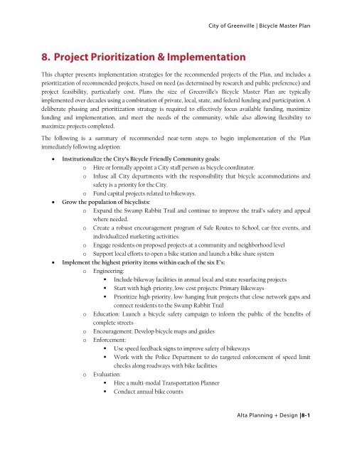
8. Project Prioritization & Implementation - Greenville
8. Project Prioritization & Implementation - Greenville
8. Project Prioritization & Implementation - Greenville

Create successful ePaper yourself
Turn your PDF publications into a flip-book with our unique Google optimized e-Paper software.
City of <strong>Greenville</strong> | Bicycle Master Plan<br />
<strong>8.</strong> <strong>Project</strong> <strong>Prioritization</strong> & <strong>Implementation</strong><br />
This chapter presents implementation strategies for the recommended projects of the Plan, and includes a<br />
prioritization of recommended projects, based on need (as determined by research and public preference) and<br />
project feasibility, particularly cost. Plans the size of <strong>Greenville</strong>’s Bicycle Master Plan are typically<br />
implemented over decades using a combination of private, local, state, and federal funding and participation. A<br />
deliberate phasing and prioritization strategy is required to effectively focus available funding, maximize<br />
funding and implementation, and meet the needs of the community, while also allowing flexibility to<br />
maximize projects completed.<br />
The following is a summary of recommended near-term steps to begin implementation of the Plan<br />
immediately following adoption:<br />
• Institutionalize the City’s Bicycle Friendly Community goals:<br />
o Hire or formally appoint a City staff person as bicycle coordinator.<br />
o Infuse all City departments with the responsibility that bicycle accommodations and<br />
safety is a priority for the City.<br />
o Fund capital projects related to bikeways.<br />
• Grow the population of bicyclists:<br />
o Expand the Swamp Rabbit Trail and continue to improve the trail’s safety and appeal<br />
where needed.<br />
o Create a robust encouragement program of Safe Routes to School, car-free events, and<br />
individualized marketing activities.<br />
o Engage residents on proposed projects at a community and neighborhood level<br />
o Support local efforts to open a bike station and launch a bike share system<br />
• Implement the highest priority items within each of the six E’s:<br />
o Engineering:<br />
Include bikeway facilities in annual local and state resurfacing projects<br />
Start with high-priority, low-cost projects: Primary Bikeways<br />
Prioritize high-priority, low-hanging fruit projects that close network gaps and<br />
connect residents to the Swamp Rabbit Trail<br />
o Education: Launch a bicycle safety campaign to inform the public of the benefits of<br />
complete streets<br />
o Encouragement: Develop bicycle maps and guides<br />
o Enforcement:<br />
Use speed feedback signs to improve safety of bikeways<br />
Work with the Police Department to do targeted enforcement of speed limit<br />
checks along roadways with bike facilities<br />
o Evaluation:<br />
Hire a multi-modal Transportation Planner<br />
Conduct annual bike counts<br />
Alta Planning + Design |8-1
Chapter 8| <strong>Prioritization</strong> and <strong>Implementation</strong> Plan<br />
o<br />
Work with the Police Department to develop annual bicycle collision statistics<br />
reports<br />
Equity: Equitably distribute bicycling investments across the City<br />
Public outreach is a key component to the development of this Plan (see Section 4.4). As the City moves<br />
forward with implementation of proposed projects, community engagement should continue at the<br />
neighborhood level. Some bikeway projects traverse or directly impact a neighborhood. As the opportunity to<br />
implement a project arises, the City should provide information about the project to residents directly affected<br />
and provide an opportunity for dialogue about the project.<br />
8-2 | Alta Planning + Design
City of <strong>Greenville</strong> | Bicycle Master Plan<br />
<strong>8.</strong>1. Infrastructure Improvement <strong>Prioritization</strong><br />
The infrastructure recommendations of this Plan include over 137 miles of new on-street bikeways (including<br />
bike lanes, enhanced bike routes and shared lane markings) to increase <strong>Greenville</strong>’s bicycle network<br />
connectivity and to create a comprehensive, safe, and logical network. Pavement markings and signage will<br />
support the bikeway network by providing network identification and wayfinding for cyclists. The following<br />
basic elements were considered in the development of the phasing and prioritization of the construction<br />
improvements and programs.<br />
• Need: Based on prior plans, data collection, field observation, and considerable public comment and<br />
input from the <strong>Project</strong> Advisory Committee and <strong>Project</strong> Team.<br />
• Feasibility: Considers the size and corresponding cost of the improvements and the best opportunity<br />
for implementation. Infrastructure projects that do not require acquiring right-of-way, such as<br />
restriping, are easiest to implement. Easier projects were prioritized higher than projects requiring<br />
expensive or potentially controversial right-of-way acquisition.<br />
To gauge the relative importance of recommended improvement projects, the <strong>Project</strong> Team developed several<br />
evaluation criteria to identify and prioritize each proposed project. The criteria highlight the features of a<br />
bikeway network most important to <strong>Greenville</strong> residents and rank projects against each other as an indication<br />
of their relative importance. Through this approach, the best possible future bicycle network is determined.<br />
Alta Planning + Design |8-3
Chapter 8| <strong>Prioritization</strong> and <strong>Implementation</strong> Plan<br />
Table <strong>8.</strong>1-1 shows the evaluation criteria used to prioritize potential projects, as well as the possible scores (0<br />
– 2), the weighted multiplier, and the total potential values. Scores are assigned to each proposed project<br />
based on its alignment with one of the three descriptions shown for each criterion (far right column).<br />
Construction projects were categorized into first-, second-, and third-tier priority projects within each of four<br />
categories of recommended bicycle facilities. While all of the projects are important to the development of<br />
<strong>Greenville</strong>’s bicycle network, focusing on the most viable and publicly supported projects can build<br />
momentum and set the groundwork for future investments. The categories reflect the prioritization strategy,<br />
with previously-determined, publicly supported, easy-to-implement and less-expensive projects designated as<br />
first-tier. Any of these projects can proceed when funding and political conditions warrant. It must be<br />
recognized that these construction projects, while deemed the most important, may not get implemented<br />
within the time periods noted due to fiscal constraints.<br />
8-4 | Alta Planning + Design
City of <strong>Greenville</strong> | Bicycle Master Plan<br />
Criteria Score Multiplier Total Description<br />
On a Primary<br />
Bikeway<br />
Safety Corridor<br />
Ease of<br />
<strong>Implementation</strong><br />
Network Gaps<br />
Destinations<br />
Cycle Zone<br />
Analysis (CZA)<br />
Scoring 1<br />
Proximity to<br />
Schools<br />
Transit Access<br />
Special<br />
Emphasis<br />
Neighborhoods<br />
Table <strong>8.</strong>1-1. Weighted evaluation criteria determine the prioritization of proposed bikeway projects.<br />
2 3.0 6 Is on a designated primary bikeway<br />
1 3.0 3 Connects directly to a designated primary bikeway<br />
0 3.0 0 Does not directly or indirectly connect to a designated primary bikeway<br />
2 3.0 6 Proposes a bicycle facility on a corridor with more than 1 reported bike<br />
crash (2005-2010)<br />
1 3.0 3 Proposes a bicycle facility on a corridor with at least 1 reported bike crash<br />
(2005-2010)<br />
0 3.0 0 Corridor does not have a reported bicycle crash (2005-2010)<br />
3 3.0 9 Bikeway project can be constructed/installed with little to no changes to<br />
the existing roadway<br />
2 3.0 6 Bikeway project is along City-owned right of way.<br />
1 3.0 3 Bikeway project can be constructed/installed with minor alterations to<br />
the existing roadway<br />
0 3.0 0 Bikeway project requires major alterations to the existing roadway or<br />
existing land development<br />
2 2.0 4 Facility fills a network gap between two existing bikeways<br />
1 2.0 2 Facility fills a network gap between an existing bikeway and a proposed<br />
bikeway<br />
0 2.0 0 Does not directly or indirectly fill a network gap<br />
2 2.0 4 Connects to a park, or major employment or commercial destination or<br />
hospital, or Swamp Rabbit Trail<br />
1 2.0 2 Connects to a community center, library, service agency, government<br />
facility, or minor commercial area<br />
0 2.0 0 Does not directly or indirectly connect to a significant destination<br />
2 1.0 2 Bikeway located in zone with highest third of CZA difference (existing vs.<br />
proposed)<br />
1 1.0 1 Bikeway located in zone with middle third of CZA difference (existing vs.<br />
proposed)<br />
0 1.0 0 Bikeway located in zone with lowest third of CZA difference (existing vs.<br />
proposed)<br />
2 1.0 2 Direct access to a <strong>Greenville</strong> school (public, private, and post-secondary)<br />
1 1.0 1 Secondary access to a <strong>Greenville</strong> school (within 1/2 mile)<br />
0 1.0 0 Does not directly or indirectly access a <strong>Greenville</strong> school.<br />
2 1.0 2 Bikeway connects to 6 or more transit stops<br />
1 1.0 1 Bikeway connects to 1-5 transit stops<br />
0 1.0 0 Bikeway does not directly connect to transit stops<br />
2 1.0 2 Bikeway is within special emphasis neighborhood<br />
1 1.0 1 Bikeway connects to a special emphasis neighborhood<br />
0 1.0 0 Bikeway is not within and does not connect to a special emphasis<br />
neighborhood<br />
1 See Chapter 3 of this Plan.<br />
Alta Planning + Design |8-5
Chapter 8| <strong>Prioritization</strong> and <strong>Implementation</strong> Plan<br />
<strong>8.</strong>1.1. Priority <strong>Project</strong>s<br />
Based on the evaluation criteria and prioritization matrix described above, this section identifies the high<br />
priority projects within each of the four categories of facility type recommended in the Plan. The categories<br />
are: bicycle lanes, bicycle routes, multi-use paths, and shared roadways. First- and second-tier projects are<br />
described in a table and bulleted list, respectively. All remaining proposed projects not listed below are within<br />
the third-tier. Based on extensive research, analysis, and public input in the preparation of this plan, the entire<br />
list of projects proposed within this Plan have evidenced merit. Third-tier projects play an important role in<br />
completing the vision of the bikeway network, but should be considered long-term projects based on their<br />
limited ranking within the prioritization matrix.<br />
The City and SCDOT will be the implementing agencies for bike lanes and shared-lane markings. Most of the<br />
streets recommended for these facilities are on streets that are part of the SCDOT maintenance system (see<br />
Map 1 the following page), so the City will coordinate with SCDOT on the design and implementation of<br />
these facilities. In most cases, implementation of bike lanes on SCDOT roadways will be completed through<br />
scheduled resurfacing projects. SCDOT will incur most of the street resurfacing costs. The added incremental<br />
costs for bike lane symbols and signage will be borne by the City of <strong>Greenville</strong>.<br />
8-6 | Alta Planning + Design
City of <strong>Greenville</strong> | Bicycle Master Plan<br />
Alta Planning + Design |8-7<br />
Map 8-1 SCDOT Maintained Streets in <strong>Greenville</strong>, SC
Chapter 8| <strong>Prioritization</strong> and <strong>Implementation</strong> Plan<br />
<strong>8.</strong>1.2. Bicycle Lanes<br />
The bicycle lane projects that received the highest scores are shown in the tables below. Table <strong>8.</strong>1-2 shows the<br />
highest ranking projects that occur on major arterials in <strong>Greenville</strong>. Table <strong>8.</strong>1-3 shows both the first-tier and<br />
second-tier priority projects that occur on local or collector streets. Remaining bicycle lane projects are<br />
included in Chapter 7: Proposed Improvements.<br />
Table <strong>8.</strong>1-2. Highest priority proposed bicycle lane projects on major arterials.<br />
Rank Corridor 2 Length (miles) From To Total Score<br />
1 Laurens Rd 5.67 Park Ave City Limit 36<br />
2 Pleasantburg Dr 5.52 Cleveland St City Limit 34<br />
3 Rutherford Rd 2.39 Poinsett Hwy Pleasantburg<br />
Dr<br />
32<br />
4 Augusta St 0.77 University St Otis St 31<br />
5 Rutherford St 0.60 Buncombe St Shaw St 30<br />
6 Pete Hollis Blvd - Buncombe<br />
Rd Rte<br />
0.80 College St City Limit 29<br />
7 Wade Hampton Blvd - Church<br />
St Rte<br />
2.37 Academy St Pleasantburg<br />
Dr<br />
8 Pleasantburg Dr 1.32 Cleveland St Mauldin Rd 21<br />
9 Pelham Rd - Roper Mountain<br />
Rd Rte<br />
3.29 North St Keys Dr/Roper<br />
Mountain Rd<br />
10 Mauldin Rd 1.22 Crystal Ave Parkins Mill Rd 16<br />
28<br />
16<br />
Table <strong>8.</strong>1-3. Highest priority proposed bicycle lane projects.<br />
Rank Corridor Length<br />
(miles)<br />
From To Total<br />
Score<br />
First Tier Priority <strong>Project</strong>s<br />
1 Pendleton St 0.43 Vardy St Academy 29<br />
St<br />
2 Dunbar St 0.75 Augusta City Limit 27<br />
St<br />
3 University Ridge 0.28 Howe St Church St 25<br />
4 Verdae Blvd - E Parkins Mills Rd Rte 2.46 Woodruff Isbell Ln 24<br />
Rd<br />
5 Guess St 0.58 Nelson St Mills Ave 24<br />
2 Note that the abbreviation “Rte” signifies a series of roadways that connect to create a continuous bikeway.<br />
8-8 | Alta Planning + Design
City of <strong>Greenville</strong> | Bicycle Master Plan<br />
6 Woods Crossing<br />
Rd - Lowndes<br />
Hill Rd -<br />
Washington St<br />
Rte<br />
7 Legrand Blvd -<br />
John McCarroll<br />
Way Rte<br />
2.13 Congaree<br />
Rd<br />
0.38 Don Dr McAlister<br />
Rd<br />
8 Lowndes Hill Rd 1.22 North St Keith Dr 22<br />
9 Chick Springs Rd 0.32 Twin Lake Rd Rutherford 22<br />
Rd<br />
10 Antrim Dr 0.57 Liberty Lane Laurens Rd 22<br />
11 McDaniel Ave 0.21 Augusta St Camille 21<br />
Ave<br />
12 Cleveland St 0.54 McIver St Parkins Mill 21<br />
Rd<br />
13 Townes St 0.26 Mountainview Randall St 21<br />
Ave<br />
Second Tier Priority <strong>Project</strong>s<br />
14 Halton Rd 2.32 Haywood Rd Pelham Rd 20<br />
15 Prosperity Ave 0.53 Old Augusta City Limit 20<br />
Rd<br />
16 Richland Way 0.23 Washington St Laurens Rd 20<br />
17 Main St 0.32 Park Dr Park Ave 20<br />
18 Salters Rd - Old 1.43 Woodruff Rd Bi-Lo Blvd 19<br />
Sulphur Springs<br />
Rd - Forrester Dr<br />
Rte<br />
19 White Oak Dr 0.62 Wade<br />
Hampton Blvd<br />
North St 19<br />
20 Faris Rd 0.46 Pleasantburg<br />
Dr<br />
21 Batesview Dr 0.60 Wade<br />
Hampton Blvd<br />
22 Independence<br />
Blvd<br />
Laurens<br />
Rd<br />
22<br />
E of the 19<br />
Swamp<br />
Rabbit Trail<br />
North St 18<br />
2.84 Patewood Dr Roper<br />
Mountain<br />
Rd<br />
23 Carolina Point 0.30 Woodruff Rd Fibers Dr 18<br />
Pkwy<br />
24 McBee Ave 0.16 Academy St Broad St 18<br />
25 Mall Connector 0.76 Woods<br />
Salters Rd 17<br />
Rd<br />
Crossing Rd<br />
26 Reid St - Twin 0.50 Chick Springs Holmes Dr 17<br />
Lake Rd<br />
Rd<br />
27 Faris Rd 0.64 Club Forest Grove Rd 17<br />
Lane<br />
28 Dunbar St 0.23 Augusta St City Limit 17<br />
29 Industrial Dr 0.62 Fore Ave Airport Rd 17<br />
18<br />
23<br />
Alta Planning + Design |8-9
Chapter 8| <strong>Prioritization</strong> and <strong>Implementation</strong> Plan<br />
30 Ridge Rd 1.14 Parkins Mill Rd City Limit 16<br />
31 Grove Rd 1.28 Augusta St City Limit 16<br />
32 Main St 0.97 Rutherford Rd Park Dr 16<br />
33 Mills Ave 0.45 Lynn St Augusta St 16<br />
8-10 | Alta Planning + Design
City of <strong>Greenville</strong> | Bicycle Master Plan<br />
Alta Planning + Design |8-11<br />
Map 8-2 Bike Lane <strong>Prioritization</strong>
Chapter 8| <strong>Prioritization</strong> and <strong>Implementation</strong> Plan<br />
<strong>8.</strong>1.3. Shared Roadways/Shared Lane Markings<br />
The shared lane marking projects that received the highest scores are shown in Table <strong>8.</strong>1-4. Remaining shared<br />
lane marking projects are included in Chapter 7: Proposed Improvements.<br />
Table <strong>8.</strong>1-4. Highest priority shared lane marking projects.<br />
Rank Corridor Length (miles) From To Total Score<br />
First Tier Priority <strong>Project</strong>s<br />
1 Hudson St 1.35 Hampton Ave Dunbar St 36<br />
2 Broad St - Butler Ave Lane 0.81 Main St Buncombe St 35<br />
3 Haynie St - Pearl Ave Rte 0.54 Augusta St Cleveland St 28<br />
4 Woodlark St 1.02 Hillside Dr Keith Dr 26<br />
5 Nelson St 0.10 Guess St Anderson St 26<br />
6 Wardlaw St - Westfield St Rte 0.56 Main St Broad St 26<br />
7 Main St 0.41 Anderson St River St 26<br />
8 Hampton Ave 0.67 Academy St Mulberry St 25<br />
9 McDaniel Ave 0.16 Ridgeland Dr Broad St 25<br />
10 Lois Ave - Woodside Rd Lane 0.25 Pendleton St City Limit 25<br />
11 Harris St 0.12 Augusta St Howe St 24<br />
12 Stone Ave - Mulberry St Rte 0.91 Rutherford Rd Swamp Rabbit<br />
Trail<br />
24<br />
13 North St 0.53 White Oak Dr City Limit 23<br />
14 Jones Ave 0.74 University Ridge August St 23<br />
15 Potomac Ave 0.42 Long Hill St Augusta Rd 23<br />
16 Mayberry St 0.57 Willard St Hudson St 21<br />
Second Tier Priority <strong>Project</strong>s<br />
17 Cleveland Park Dr - Lakehurst 1.07 Washington St Cleveland St 20<br />
St Rte<br />
18 Cleveland St 0.54 Southland Ave Jones Ave 19<br />
24 Cleveland St 0.24 Pleasantburg Dr Parkins Mill Rd 18<br />
19 Haywood Rd 2.60 Laurens Rd City Limit 17<br />
20 McDaniel Ave 0.52 Camille Ave Cleveland St 17<br />
21 McBee Ave - Washington St 0.11 McDaniel Ave Cleveland Park 17<br />
Lane<br />
Dr<br />
22 Lynn St 0.28 Mills Ave Grove Rd 17<br />
23 McBee Ave 0.67 Washington St Academy St 16<br />
8-12 | Alta Planning + Design
City of <strong>Greenville</strong> | Bicycle Master Plan<br />
<strong>8.</strong>1.4. Bicycle Routes<br />
The bicycle route projects that received the highest scores are shown in Table <strong>8.</strong>1-5. Remaining bicycle route<br />
projects are included in Chapter 7: Proposed Improvements. Though it is beyond the scope of this Plan to<br />
determine a preferred facility treatment along each section of bike route, this Plan strongly recommends that<br />
<strong>Greenville</strong> pursue innovative bike route treatments (such as those identified by the National Association of City<br />
Transportation Officials Urban Bikeway Design Guide and detailed in the Design Guidelines of this Plan). Traffic<br />
calming, traffic diversion, trails along roadways, cycletracks and/or sidepaths, wayfinding signs, and bicycle<br />
route directional markers are examples of treatments that can enhance bicycle route design where the existing<br />
roadway environment is not ideal.<br />
Table <strong>8.</strong>1-5. Highest prioirty proposed bicycle route projects.<br />
Rank Corridor Length<br />
(miles)<br />
From To Total<br />
Score<br />
First Tier Priority <strong>Project</strong>s<br />
1 Cleveirvine Ave - Haviland<br />
Ave - Nicholtown Rd -<br />
Alameda St - Rebecca St<br />
Rte<br />
2 Mulberry St - Willard St -<br />
Cain St Rte<br />
0.81 Beechwood<br />
Ave<br />
1.05 Swamp<br />
Rabbit Trail<br />
Clark St 34<br />
2nd St 32<br />
3 Alameda St - Hilton St Rte 0.57 Clark St Faris Rd 32<br />
4 Burns St - Elms St Rte 0.66 Dunbar St Grove Rd 30<br />
5 Howe St - Furman College<br />
Way Rte<br />
0.53 University<br />
Ridge<br />
End of Furman College Way 28<br />
6 Market St 0.49 Vardy St Hudson St 27<br />
7 Webster Rd - Clark St -<br />
Greenacre Rd Rte<br />
8 Hillside Dr - Prescott St -<br />
Harrington Ave Rte<br />
0.76 McAlister<br />
Rd<br />
1.08 Lowndes<br />
Hill Rd<br />
Baxter St 26<br />
Wade Hampton Blvd 24<br />
9 Webster Rd - Clark St -<br />
Greenacre Rd Rte<br />
0.52 Skyland Dr Clark St 24<br />
10 Otis St 0.40 Guess St Augusta St 24<br />
11<br />
Crystal Ave<br />
0.17 Old<br />
Augusta Rd<br />
Augusta Rd 24<br />
12 Old Augusta Rd 0.09 Augusta St Prosperity Ave 23<br />
13 Ackley Rd - Fernwood<br />
Lane - Woodland Way Rte<br />
Second Tier Priority <strong>Project</strong>s<br />
0.30 Beechwood<br />
Ave<br />
Cleveirvine Ave 23<br />
14 Crescent Ave 1.19 Church Ave Cleveland St 19<br />
15 Rice St - Long Hill St Rte 0.81 Meyers Dr Prosperity Ave 19<br />
Alta Planning + Design |8-13
Chapter 8| <strong>Prioritization</strong> and <strong>Implementation</strong> Plan<br />
16 Pleasant Ridge Ave -<br />
Penrose Ave - Chapman<br />
Rd Rte<br />
0.82 Old<br />
Augusta Rd<br />
End of Chapman Rd 19<br />
17 Bradshaw St 0.09 Augusta St Howe St 19<br />
18 Byrd Blvd - Gatlin Park Rte 1.48 Augusta Ct Augusta St 19<br />
19<br />
Ellford St<br />
0.39 Academy<br />
St<br />
Church St 18<br />
20 Field St 0.13 Augusta St Market St 18<br />
21<br />
Winterberry Ct<br />
0.49 Cleveland<br />
St<br />
Pleasantburg Dr 18<br />
22 Blythe Dr 0.32 Augusta St Long Hill St 18<br />
23 Augusta St 0.12 Augusta Pl Tallulah Dr 18<br />
24 Ebaugh Ave 0.14 Traxier St Richard Way 17<br />
25<br />
Henderson Rd<br />
1.18 Cleveland<br />
St<br />
Laurens Rd 17<br />
26 Gallivan St 0.39 Main St Mohawk Dr 16<br />
27<br />
Willow Springs Dr<br />
0.27 Parkins<br />
Mills Dr<br />
Existing Greenway 16<br />
28 Westminster Dr 0.31 Faris Rd Augusta Pl 16<br />
29<br />
30<br />
Church St<br />
Afton Ave - McIver St Rte<br />
0.32 Academy<br />
St<br />
0.42 Crescent<br />
Ave<br />
Beattie Place 16<br />
Cleveland St 16<br />
8-14 | Alta Planning + Design
City of <strong>Greenville</strong> | Bicycle Master Plan<br />
Alta Planning + Design |8-15<br />
Map 8-3 Bike Route <strong>Prioritization</strong>
Chapter 8| <strong>Prioritization</strong> and <strong>Implementation</strong> Plan<br />
<strong>8.</strong>1.5. Multi-use Paths<br />
The multi-use path projects that received the highest scores are shown in Table <strong>8.</strong>1-6. Remaining multi-use<br />
path projects are included in Chapter 7: Proposed Improvements.<br />
Table <strong>8.</strong>1-6. Highest prioirty proposed multi-use paths.<br />
Rank Corridor Length (miles) From To Total Score<br />
1 BRT Trail 4.38 Traxler St Millenium Blvd 22<br />
2 Beattie Pl 0.68 Heritage Green Pl North St 18<br />
3 Richland Way 0.24 Washington St Laurens Rd 11<br />
4 Chick Springs Greenway 0.54 Twin Lake Rd Poinsettia Pl 10<br />
8-16 | Alta Planning + Design
City of <strong>Greenville</strong> | Bicycle Master Plan<br />
<strong>8.</strong>1.6. Additional Infrastructure Recommendations<br />
This Plan also provides recommendations for additional linear and non-linear infrastructure improvements<br />
that are essential to developing a complete and user-friendly bikeway network. These recommendations<br />
include:<br />
• Bicycle Detection at Traffic Signals<br />
• Wayfinding Signage<br />
• Bicycle Parking<br />
• Bike Route Connection Gaps<br />
• Major Roadway Corridor Plans<br />
<strong>8.</strong>1.6.1 Bicycle Detection at Traffic Signals<br />
Proposed locations for including bicycle detection at actuated traffic signals are included in the map of<br />
network recommendations. Per guidance in Chapter 7 and the Design Guidelines, this Plan recommends that<br />
the City install bicycle detection at all actuated intersections along existing and proposed bikeways.<br />
Additionally, the City should consider installing bicycle detection at all actuated intersections. As a first<br />
priority, bicycle detection hardware should be installed at the signalized intersections listed in Table <strong>8.</strong>1-7.<br />
The City should install the bicycle detection hardware on the secondary street (listed in the column labeled<br />
“corridor”) as it intersects a primary street (listed in the column labeled “cross street”). Additional bicycle<br />
detection should be implemented over time in conjunction with signal upgrade projects and in coordination<br />
with SCDOT.<br />
Table <strong>8.</strong>1-7. Priority intersections for installation of bicycle detection hardware.<br />
Corridor<br />
Townes Avenue<br />
Butler Road<br />
Batesview Drive<br />
Guess Street<br />
Antrim street<br />
Calhoun Street<br />
Calhoun Street<br />
McDaniel Avenue<br />
Phillips Street<br />
Augusta Street<br />
Legrand Boulevard<br />
Lowndes Hill Drive<br />
Transit Drive<br />
Parkins Mill Road<br />
Cross Street<br />
Stone Avenue<br />
Buncombe Road<br />
Wade Hampton Boulevard<br />
Mills Avenue<br />
Pleasantburg Drive<br />
Dunbar Street<br />
Pendleton Street<br />
Augusta Street<br />
Augusta Street<br />
Augusta Place<br />
Pleasantburg Drive<br />
Pleasantburg Drive<br />
Pleasantburg Drive<br />
Laurens Road<br />
Alta Planning + Design |8-17
Chapter 8| <strong>Prioritization</strong> and <strong>Implementation</strong> Plan<br />
<strong>8.</strong>1.6.2 Wayfinding Signage<br />
Wayfinding signage will enhance the practicality and user-friendliness of <strong>Greenville</strong>’s bikeway network.<br />
Decision point and confirmation signs will boost bicyclists’ confidence in using bikeway facilities, attract new<br />
users, and inform bicyclists of key connectors and access points. This Plan recommends that development of<br />
the wayfinding signage program begin within twelve months of adoption of the Plan.<br />
The primary bike route network of this Plan provides important cross-town connections and bypass routes<br />
for major arterials. The primary bike routes identified on the proposed network map are first-tier priority<br />
routes for installation of wayfinding signage.<br />
<strong>8.</strong>1.6.3 Bicycle Parking<br />
Bicycle parking should be expanded as the bikeway network is expanded. Requests by the general public<br />
provide an appropriate gauge of bicycle parking needs and unmet demand. This Plan recommends that the<br />
City of <strong>Greenville</strong> prioritize bicycle parking locations requested through Google’s dynamic online mapping<br />
service and documented here: tinyurl.com/<strong>Greenville</strong>BikeRacks.<br />
The results of the public outreach process conducted for this Plan reinforce the list of bicycle parking<br />
locations requested online. Priority locations for short-term and long-term bicycle parking identified in the<br />
public outreach process are shown in Table <strong>8.</strong>1-<strong>8.</strong><br />
Rank<br />
8-18 | Alta Planning + Design<br />
Short-term Bicycle Parking Locations<br />
1 Throughout Main Street’s Entertainment, Restaurant and Retail District<br />
2 Falls Park<br />
3 River Place, Flour Field and other West End destinations<br />
4 Cleveland Park (including the Zoo and the dog park)<br />
5 Government buildings (including libraries, post offices, County offices and schools)<br />
6 University Center<br />
7 <strong>Greenville</strong> Transit Authority Transfer Center<br />
8 Bi-Lo Center Entertainment Venue<br />
Rank<br />
Long-term Bicycle Parking Locations<br />
1 Downtown Parking Garages<br />
2 <strong>Greenville</strong> Transit Authority Transfer Center<br />
3 <strong>Greenville</strong> Technical College Campus<br />
4 Campuses of <strong>Greenville</strong> Hospital System and St. Francis Hospital System<br />
5 ICAR Campus<br />
<strong>8.</strong>1.6.4 Bike Route Connection Gaps<br />
Table <strong>8.</strong>1-<strong>8.</strong> Priority locations for bicycle parking.<br />
The Plan identifies gaps in the connectivity of the bike route network due to dead end streets, development<br />
patterns, natural barriers, or other features. As the bike route network is developed, the City of <strong>Greenville</strong><br />
should prioritize and fund the development of connector trails or roadway segments in order to complete the<br />
network. Key gaps in the bike route system are listed in Table <strong>8.</strong>1-9.
City of <strong>Greenville</strong> | Bicycle Master Plan<br />
Table <strong>8.</strong>1-9. Key connectivity gaps in the bike route network.<br />
Corridor<br />
Fernwood Lane<br />
Blair Street<br />
Villa Road<br />
Mt Vista Avenue - Augusta Court Rte<br />
Waccamaw Avenue<br />
Fore Avenue -- Evelyn Avenue Rte<br />
Connector Street<br />
Ackley Road<br />
Asteria Street<br />
West Orchard Park Drive<br />
Meyers Drive<br />
Meyers Drive<br />
Glenda Lane<br />
<strong>8.</strong>1.6.5 Major Corridor Studies<br />
In Chapter 7, this plan recommends a comprehensive approach to corridor design and planning for the City’s<br />
major roadway corridors. Such planning and design would include access management approaches to limit the<br />
number and spacing of driveways and turning locations; land use policies to facilitate more bicycle- and<br />
pedestrian-friendly development patterns; connectivity improvements to provide additional parallel route<br />
options; travelway designs that are more appropriate to an urban context; and speed reduction measures for<br />
motor vehicle travel.<br />
This plan recommends that the City continue to coordinate with SCDOT and GPATS to prioritize, fund, and<br />
implement improvements for on these corridors to make them safer and more accessible to all modes of travel,<br />
including bicycles. At least one major corridor study and implementation project should be the focus of City<br />
and partner agency efforts every two years. Additional planning and implementation opportunities may occur<br />
more frequently as resurfacing or other local, state, and/or private investment initiatives occur on these<br />
corridors. The corridors recommended for further planning and design and/or implementation include:<br />
• Augusta Street (High priority bikeway corridor per public input and analysis, including collision<br />
data analysis)<br />
• Woodruff Road (Corridor study complete; needs detailed plans for bikeway improvements)<br />
• Wade Hampton Boulevard (Draft corridor streetscape concepts completed)<br />
• Pelham Road (SCDOT resurfacing project upcoming for portion of the corridor)<br />
• Roper Mountain Road (SCDOT resurfacing project upcoming for portion of the corridor)<br />
• Pleasantburg Drive (Corridor study complete; needs detailed plans for bikeway improvements)<br />
• Church Street/Mills Avenue Corridor (portions of Church St funded for redesign)<br />
• Laurens Road/US 276 (High priority bikeway corridor per public input and analysis)<br />
• Poinsett Highway<br />
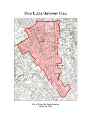
• Buncombe Road/Pete Hollis Boulevard<br />
Alta Planning + Design |8-19
Chapter 8| <strong>Prioritization</strong> and <strong>Implementation</strong> Plan<br />
<strong>8.</strong>2. Infrastructure Improvement Cost Opinions<br />
This section presents planning-level cost opinions for the comprehensive network of on-street bikeways and<br />
multi-use paths recommended in the <strong>Greenville</strong> Bicycle Master Plan. Cost estimates for bikeway facilities are<br />
based on cost opinions provided by the City of <strong>Greenville</strong>. The cost of bikeway facilities significantly varies by<br />
facility type, as shown in Table <strong>8.</strong>2-1. For example, the addition of shared lane marking (sharrows) to an<br />
existing roadway requires few changes to the existing roadway, but provides no exclusive space for bicycle<br />
use. By contrast, a separated multi-use path provides a far greater level of separation from the roadway, but at<br />
a greater fiscal burden. The following is a summary of the fully burdened costs of different bikeway facility<br />
types and their associated costs. All costs are total installed costs that include: planning and engineering,<br />
environmental, and contingency.<br />
Facility Cost Materials<br />
Multi-use path (per mile) $ 800,000.00<br />
Bike lanes: restriping (per mile) -<br />
8-20 | Alta Planning + Design<br />
Construction,<br />
<strong>Implementation</strong><br />
Type<br />
signing n/a 30%<br />
retrofit on street $ 15,000.00 Striping and signing Stripe 20%<br />
Bike lane restriping w/ resurfacing<br />
project (per mile) $ 8,000.00 Striping and signing Stripe 20%<br />
Bike lane: widening on street with<br />
curb & gutter (per mile; minimum) $ 250,000.00 Roadway widening Widen 40%<br />
Bike lane: add pavement; no curb<br />
(per mile with resurfacing) $ 28,000.00<br />
Asphalt, striping,<br />
signing Widen 20%<br />
Bike route (per mile) $ 2,000.00 Signing n/a 15%<br />
Bike route marking (per mile) $ 2,600.00 Pavement stamp n/a 15%<br />
Shared lane marking (per mile) $ 6,500.00 Signing, markings n/a 15%<br />
Inverted ‘U’ bicycle rack (ea) $ 200.00 Rack n/a 15%<br />
‘‘Share the Road’’ signs (ea) $ 100.00 Signs, posts n/a 15%<br />
Bike route marking (ea) $ 50.00 Stencils (52 per mile) n/a 15%<br />
Shared lane marking (ea) $ 200.00 Stencils (20 per mile) n/a 15%<br />
Wayfinding/destination sign (ea) $ 150.00 Signs, posts n/a 15%<br />
Loop detectors (two) $1,500.00<br />
Colored bike lane ( square foot<br />
Detector, stencil,<br />
labor<br />
thermoplastic) $4.50 n/a<br />
Traffic circle (ea) $40,000.00<br />
Diverter (ea)<br />
Table <strong>8.</strong>2-1. Planning-Level Cost Estimates for Bicycle Facilities<br />
$15,600.00 -<br />
$40,000.00<br />
Concrete curb,<br />
n/a<br />
Additional<br />
Costs*<br />
$300 for<br />
calibration<br />
only<br />
landscaping n/a 15%<br />
Concrete curb,<br />
landscaping n/a 15%
City of <strong>Greenville</strong> | Bicycle Master Plan<br />
Facility Cost Materials<br />
<strong>Implementation</strong><br />
Type<br />
Bike box (ea) $5,000.00 Thermoplastic, signs n/a 15%<br />
Advanced stop line (ea) $225.00 n/a 15%<br />
Bicycle/pedestrian bridge (linear<br />
foot) $150.00 n/a 15%<br />
Grinding and eradicating (linear<br />
foot) $0.50 n/a 10%<br />
* Planning and engineering, environmental, and contingency<br />
Additional<br />
Costs*<br />
The total implementation cost of the <strong>Greenville</strong> Bikeways Master Plan is estimated at approximately $10.4<br />
million, as shown in Table <strong>8.</strong>2-2. Planning-level cost estimates for each recommended facility are included in<br />
the Appendix.<br />
Table <strong>8.</strong>2-2. Planning-Level Cost Summary<br />
Facility Type Length (miles) Planning-Level Cost<br />
Proposed Bike Lane 62.34 $4,007,000<br />
Proposed Sharrow 24.48 $173,000<br />
Proposed Bicycle Route 51.17 $134,000<br />
On-street Facilities Subtotal 137.99 $4,314,000<br />
Proposed Multi-Use Path 7.61 $6,083,000<br />
Combined Total 145.55 $10,397,000<br />
Alta Planning + Design |8-21
Chapter 8| <strong>Prioritization</strong> and <strong>Implementation</strong> Plan<br />
<strong>8.</strong>3. Bicycle Facility Maintenance<br />
This section discusses potential strategies the City of <strong>Greenville</strong> can employ to facilitate maintenance of onstreet<br />
bikeways.<br />
<strong>8.</strong>3.1. On-Street Bikeway Maintenance<br />
While implementing bikeway facilities is important, keeping them in good condition is equally important.<br />
When a bicycle lane becomes filled with debris, bicyclists are forced into the motor vehicle lane. Poor bikeway<br />
maintenance can contribute to accidents and deter potential bicyclists unwilling to risk flat tires and skidding<br />
on roadways. Periodic checks should be made of the on-street bikeway network with work being confined to<br />
spot fixes and damage response. Street sweeping of on-street facilities will need to be coordinated with the<br />
City and SCDOT roadway maintenance program to ensure that roadways are cleared curb to curb.<br />
Maintenance activities can also be driven by specific maintenance requests from the public. On-street<br />
bikeways should be kept clear of snow and ice (if any) during winter months.<br />
On-street bikeways should be maintained as part of standard City and SCDOT roadway maintenance<br />
programs. Extra emphasis should be put on keeping bikeways and roadway shoulders clear of debris and<br />
keeping vegetation overgrowth from blocking visibility or creeping into the roadway. Section 32-8 of the<br />
City’s Municipal Code prohibits the placement of yard debris of other solid waste in a location that impedes<br />
vehicular or pedestrian traffic and should be enforced for the benefit of all road users.<br />
Table <strong>8.</strong>3-1. Summary of Maintenance Recommendations<br />
Maintenance Activity<br />
Inspections<br />
Pavement sweeping/blowing<br />
Pothole repair<br />
Culvert and drainage grate inspection<br />
Tree/shrub trimming<br />
Pavement markings replacement<br />
Signage repair/replacement<br />
Major damage response (washouts, fallen trees,<br />
flooding)<br />
Frequency<br />
Seasonal -- at beginning of Spring and end of Summer<br />
Weekly/monthly, as needed; clean up in the Spring; weekly in Fall<br />
1 week -- 1 month after report<br />
Before Winter and after major storms<br />
Every 5 months -- 1 year<br />
Paint: 1 year; thermoplastic: 10-15 years<br />
As needed (worn signs every 10 years); check signs annually; move as<br />
needed<br />
As soon as possible<br />
8-22 | Alta Planning + Design
City of <strong>Greenville</strong> | Bicycle Master Plan<br />
<strong>8.</strong>4. Bikeway Maintenance Policy Recommendations<br />
The City, in coordination with the SCDOT maintenance program, should establish the following bikeway<br />
maintenance protocols by 2013:<br />
• Establish routine maintenance schedules and standards for citywide bikeways.<br />
Action Items:<br />
o Conduct regular visual inspections of all bikeways and develop database to track<br />
observations.<br />
o Implement maintenance schedule and standards.<br />
• Maintain in good condition striping, surface conditions, lighting and landscaping on and adjacent to<br />
bikeways.<br />
Action Items:<br />
o Monitor and maintain adequate lighting along City bikeways. Action Item:<br />
o Review lighting conditions and repair lighting system as necessary.<br />
• Address bicyclist safety during construction and maintenance activities.<br />
Action Items:<br />
o Develop and implement standard procedures to ensure safe passage of bicyclists through<br />
construction zones, and update appropriate manuals.<br />
o Issue public announcements regarding any street or bicycle path closures or detour.<br />
o Minimize street or bicycle path closures and delays along officially designated bikeways.<br />
• Establish routine maintenance program that encourages citizens to report maintenance issues that<br />
impact bicyclist safety.<br />
Action Items:<br />
o Work with neighborhood organizations, the future Bicycle Advisory Committee, and<br />
other groups to promote and expand the City's hazard reporting mechanisms.<br />
o Create hazard reporting banner on homepage of the bicycle program website that links<br />
to Service Request Forms for the Department of Public Works.<br />
o Report to the BAC on the number of submitted Service Request Forms.<br />
Alta Planning + Design |8-23
Chapter 8| <strong>Prioritization</strong> and <strong>Implementation</strong> Plan<br />
<strong>8.</strong>5. Non-infrastructure Improvement <strong>Prioritization</strong><br />
The programs recommended in this Plan are a relatively inexpensive method for improving and raising public<br />
awareness and adding to the safety and enjoyment of bicycling in <strong>Greenville</strong>. Because of their minimal expense<br />
and importance to supporting the bicycle travel and thereby increase usage, all of the recommended programs<br />
and policies are designated for short- or medium-term implementation, shown below as first- and second-tier<br />
priorities. A comprehensive and diversified approach to programs and policies is essential to growing the<br />
bicycling community and culture in <strong>Greenville</strong>. Thus, both first-tier and second-tier lists include an<br />
appropriate combination of mutually reinforcing strategies that reach diverse audiences.<br />
<strong>8.</strong>5.1. First-tier Programs, Policies, and Evaluation<br />
First-tier non-infrastructure recommendations are programs and policies that have the highest impact for the<br />
lowest cost. Short-term priority projects are listed below, distinguished by those programs that offer<br />
immediate opportunities through continuation and expansion of existing programs and those that will be<br />
strategies new to <strong>Greenville</strong>.<br />
Continued and expanded efforts:<br />
• National Bike Month Activities<br />
• Bicycle Patrol<br />
• Green Ribbon Committee<br />
• Adult Bicycling Skills Classes<br />
New efforts:<br />
• Bicycle Resource Website<br />
• Coordinated Safe Routes to School Program<br />
• Launch Parties for New Bikeways<br />
• Car Free Street Events<br />
• Family Day/Family Biking Classes<br />
• Speed Feedback Signs<br />
• Targeted Enforcement<br />
• Annual Count and Survey Program<br />
• Permanent Bicycle Advisory Committee<br />
• Large Event Bicycle Parking Policy<br />
• Bicycle Staff Position<br />
This Plan recommends implementing first-tier programs, policies, and evaluation within 12 months of<br />
adoption of the Bicycle Master Plan.<br />
8-24 | Alta Planning + Design
City of <strong>Greenville</strong> | Bicycle Master Plan<br />
<strong>8.</strong>5.2. Second-tier Programs, Policies and Evaluation<br />
Second-tier non-infrastructure recommendations are programs and policies that may take time to plan and<br />
implement, due to cost, political will or other factors, or particularly benefit from building upon first-tier<br />
successes. Medium-term priority projects include:<br />
• Bicycle Safety Campaign<br />
• Employer Based Encouragement Programs<br />
• Bicycle Friendly Business Program<br />
• Personal Travel Encouragement Program<br />
• Bicycle Sharing<br />
• Senior Bicycle Education Classes<br />
• Youth Bicycle Safety Education Classes<br />
• Diversion Classes for Motorists and Bicyclists<br />
• Increase Bicycle Friendly Community Status<br />
• Funding Policy for Bicycle Program<br />
• Long-Term Bicycle Parking Policy<br />
This Plan recommends implementing second-tier programs, policies, and evaluation one to three years after<br />
the adoption of the Bicycle Master Plan.<br />
Alta Planning + Design |8-25
Chapter 8| <strong>Prioritization</strong> and <strong>Implementation</strong> Plan<br />
<strong>8.</strong>6. Non-infrastructure Improvement <strong>Implementation</strong><br />
The non-infrastructure recommendations of this Plan are designed for implementation within three years of<br />
adoption of the Plan. While the vast majority of infrastructure and policy recommendations fall within the<br />
exclusive jurisdiction of the City of <strong>Greenville</strong> and its governing authority, many program recommendations<br />
can, and should, fall under the banner of outside agencies, private sector partners, and nonprofit<br />
organizations. In <strong>Greenville</strong>, nonprofit organizations that may want a role in implementing community<br />
programs include: YMCA, LiveWell <strong>Greenville</strong>, and Upstate Forever. A collaborative approach to<br />
implementing and sustaining bicycling programs contributes to the broader vision of fostering a strong<br />
bicycle advocacy community and bicycle culture (2.2.3 Encouragement). Additionally, the minimal expense<br />
associated with most programs offers the unique opportunity for multiple, varied sectors of the community to<br />
contribute to the larger bicycle friendly community campaign.<br />
For each of non-infrastructure recommendation of the Plan, Table <strong>8.</strong>6-1 outlines the timeline for<br />
implementation and the frequency of the program’s occurrence. The entity most appropriate for initiating and<br />
overseeing the program or policy is noted as the “Lead Agency” and other groups who should play a central<br />
role in guiding and/or implementing the recommendation are shown as “<strong>Project</strong> Partners.” Referencing<br />
Chapter 2 of this Plan (2.Recommended Vision, Goals, and Objectives) the second column of Table <strong>8.</strong>6-1<br />
clarifies the nexus between the non-infrastructure strategies prioritized in this Plan and the goals and<br />
objectives previously established.<br />
8-26 | Alta Planning + Design
Table <strong>8.</strong>6-1. Non-infrastructure recommendations are designed for implementation within three years of adoption of the Bicycle Master Plan<br />
City of <strong>Greenville</strong> | Bicycle Master Plan<br />
Strategy Vision & Goals Nexus Commencement Occurrence Lead Agency <strong>Project</strong> Partners<br />
Bicycle Patrol<br />
Enforcement Goal 1: Increase safety through promoting Immediate Ongoing City Police Department City Administration<br />
greater awareness of bike-car issues and conflicts.<br />
(Objective 1.1)<br />
Green Ribbon<br />
Evaluation and Planning Goal 2: Pursue cost-effective Immediate Ongoing City Parks & Recreation Department City Administration<br />
Committee<br />
multi-modal integration/improvements. (Objective<br />
2.1)<br />
Launch Parties for New Encouragement Goal 3: Make bicycle travel an integral To occur on opening Annual Bikeville City Parks & Recreation Department; City Department of Public<br />
Bikeways<br />
part of daily life, particularly for trips under 3 miles. date of next developed<br />
Information and Events<br />
(Objective 3.2)<br />
bikeway segment<br />
Adult Bicycling Skills<br />
Classes<br />
Education Goal 3: Increase the number of area League<br />
Cycling Instructors (LCIs) and frequently offer Smart<br />
September 2011 Biannual Bikeville Local LCIs; Local bike shops<br />
Permanent Bicycle<br />
Advisory Committee<br />
Coordinated Safe<br />
Routes to School<br />
Program<br />
Speed Feedback Signs<br />
Car Free Street Events<br />
Bicycle Resource<br />
Website<br />
National Bike Month<br />
Activities<br />
Large Event Bicycle<br />
Parking Policy<br />
Employer Based<br />
Encouragement<br />
Programs<br />
Family Day/Family<br />
Biking Classes<br />
Annual Count and<br />
Survey Program<br />
Targeted Enforcement<br />
Cycling courses.<br />
Evaluation and Planning Goal 2: Pursue cost-effective<br />
multi-modal integration/improvements. (Objective 2.1<br />
and 2.2)<br />
Encouragement Goal 10: Encourage Safe Routes to<br />
School<br />
November 2011 Ongoing City Administration;<br />
City Council<br />
January 2012 Ongoing <strong>Greenville</strong> County Schools, PTAs and<br />
other parent groups<br />
City Parks & Recreation Department<br />
City Department of Public Works; Bikeville; Local nonprofit; GPATS;<br />
SC DOT Safe Routes to School Resource Center<br />
Education Goal 1: Establish safety training and accident<br />
reduction for entire community. (Objective 1.1)<br />
January 2012 Ongoing City Public Works Department Department of Public Information and Events<br />
Encouragement Goal 7: Continue to promote and grow April 2012 Biannual City Parks & Recreation Department Bikeville; Local nonprofit; City Department of Public Information and<br />
non-competitive cycling events. (Objective 7.1)<br />
Events; <strong>Greenville</strong> Spinners; SORBA; City Police Department<br />
Encouragement Goal 2: Residents have good knowledge May 2012 Ongoing City Parks & Recreation Department City Department of Public Information and Events; Bikeville;<br />
of network of bike-friendly roads. (Objective 2.1);<br />
<strong>Greenville</strong> Spinners; SORBA<br />
Encouragement Goal 3: Make bicycle travel an integral<br />
part of daily life; particularly for trips under 3 miles<br />
(Objective 3.2)<br />
Encouragement Goal 6: Expand Bike Month Programs. May 2012 Annual Bikeville Local nonprofit; <strong>Greenville</strong> Spinners; SORBA; local bike shops; City<br />
Department of Public Information and Events<br />
Encouragement Goal 8: Encourage the use of bicycles<br />
through the provision of convenient and secure<br />
bicycle parking and support facilities. (Objective <strong>8.</strong>3)<br />
Encouragement Goal 5: Increase ridership and bike mode<br />
share. (Objective 5.1); Encouragement Goal 6: Expand<br />
Bike Month Programs. (Objective 6.4)<br />
Education Goal 1: Establish safety training and accident<br />
reduction for entire community. (Objective 1.1)<br />
Evaluation and Planning Goal 2: Prioritize and increase<br />
bicycle funding to support facility upgrades,<br />
enforcement and education programs. (Objective 2.5);<br />
Equity Goal 2: Provide appropriate bicycle facilities in<br />
and near <strong>Greenville</strong>’s Special Emphasis<br />
Neighborhoods. (Objective 2.2)<br />
Enforcement Goal 1: Increase safety through promoting<br />
greater awareness of bike-car issues and conflicts.<br />
(Objective 1.3);<br />
July 2012 Ongoing City Administration; City Council City Department of Public Information and Events; City Police<br />
Department; Bikeville; local advocate groups for implementation<br />
August 2012 Ongoing Bikeville Chamber of Commerce; Local nonprofits<br />
September 2012 Annual Local Nonprofit Local LCIs; Bikeville; local bike shops<br />
September 2012 Annual City Parks & Recreation Department; City<br />
Department of Public Works<br />
Bikeville; GPATS<br />
October 2012 Every 2 to 4 years City Police Department Department of Public Information and Events<br />
Alta Planning + Design |8-27
Chapter 8| <strong>Prioritization</strong> and <strong>Implementation</strong> Plan<br />
Bicycle Staff Position<br />
Bicycle Sharing<br />
Bicycle Safety<br />
Campaign<br />
Senior Bicycle<br />
Education Classes<br />
Funding Policy<br />
Increase Bicycle<br />
Friendly Community<br />
Status<br />
Youth Bicycle Safety<br />
Education Classes<br />
Bicycle Friendly<br />
Business Program<br />
Diversion Classes for<br />
Motorists and Bicyclists<br />
Long-Term Bicycle<br />
Parking Policy<br />
Personal Travel<br />
Encouragement<br />
Program<br />
Evaluation and Planning Goal 2: Prioritize and increase<br />
bicycle funding to support facility upgrades,<br />
enforcement and education programs. (Objective 2.2)<br />
Encouragement Goal 9: Develop a downtown bike<br />
share/bike rental program; Engineering Goal 4: Expand<br />
bicyclists’ access and mobility through the integration<br />
of bicycling into the transit system.<br />
Education Goal 1: Establish safety training and accident<br />
reduction for entire community. (Objective 1.1);<br />
Education Goal 1: Establish safety training and accident<br />
reduction for entire community. (Objective 1.1)<br />
Engineering Goal 5: Fully fund the implementation of<br />
the Bicycle Master Plan and Bike Program; Evaluation<br />
and Planning Goal 2: Prioritize and increase bicycle<br />
funding to support facility upgrades, enforcement and<br />
education programs. (Objective 2.1)<br />
Evaluation and Planning Goal 1: Pursue Silver Level<br />
designation from the League of American Bicyclists in<br />
the fall of 2013.<br />
Education Goal 2: Implement a bike safety education<br />
curriculum for elementary, middle, and high schools.<br />
(Objective 2.1)<br />
Encouragement Goal 3: Make bicycle travel an integral<br />
part of daily life, particularly for trips under 3 miles.<br />
(Objective 3.4)<br />
Enforcement Goal 2: Engender mutual respect between<br />
different transport user groups. (Objective 2.1 and<br />
2.2)<br />
Encouragement Goal 8: Encourage the use of bicycles<br />
through the provision of convenient and secure<br />
bicycle parking and support facilities; Engineering Goal<br />
2: Create and expand a complete and integrated<br />
network of bicycle facilities that is safe for all ages<br />
and abilities. (Objective 2.8)<br />
Encouragement Goal 3: Make bicycle travel an integral<br />
part of daily life, particularly for trips under 3 miles.<br />
(Objective 3.4)<br />
January 2013 Ongoing City Administration City Parks & Recreation Department; City Planning & Development<br />
Division; City Public Works; GPATS<br />
March 2013 Ongoing <strong>Greenville</strong> Transit Authority City Administration; City Economic Development; City Public Works<br />
April 2013 Every 2 to 4 years Bikeville Local hospitals; City Police Department; SafeKids Upstate<br />
May 2013 Annual City Department of Parks and Recreation;<br />
Bikeville<br />
Local LCIs; Local hospitals<br />
June 2013 Ongoing City Administration; City Council City Parks & Recreation Department; City Planning & Development<br />
Division; City Public Works; GPATS<br />
July 2013 Every 2 to 4 Years City Administration; City Parks &<br />
Recreation Department<br />
All related City departments and partner groups<br />
August 2013 Annual <strong>Greenville</strong> County Schools Local LCIs; SafeKids Upstate; City Police Department<br />
November 2013 Ongoing Chamber of Commerce; Bikeville Bicycle shops; Local nonprofit; City Economic Development<br />
Department; League of American Bicyclists<br />
February 2014 Ongoing <strong>Greenville</strong> County Solicitor’s Office Local LCIs<br />
April 2014 Ongoing City Administration; City Council City Planning & Development Division<br />
September 2014<br />
Expanded to new<br />
target areas after one<br />
year of operation<br />
City Department of Parks and Recreation;<br />
<strong>Greenville</strong> Transit Authority<br />
Bikeville; Local Nonprofit; GPATS<br />
8-28 | Alta Planning + Design