

2013 RECREATION, PARK, and OPEN SPACE ... - Titusville City Hall
2013 RECREATION, PARK, and OPEN SPACE ... - Titusville City Hall
2013 RECREATION, PARK, and OPEN SPACE ... - Titusville City Hall

Create successful ePaper yourself
Turn your PDF publications into a flip-book with our unique Google optimized e-Paper software.
REGIONAL <strong>RECREATION</strong> OPPORTUNITIES<br />
Municipal boundary lines do not limit the destinations to which residents will travel to use recreation facilities. It is<br />
important to consider the regional recreation opportunities beyond borders of the <strong>Titusville</strong> School District when<br />
taking an inventory of recreation facilities used by residents. The following describes some of these facilities. These<br />
facilities are also displayed on a map at the end of this section.<br />
These regional facilities are classified as: Large Urban Parks, Natural Resource Areas, <strong>and</strong> Greenways in the park<br />
classifications described earlier in this chapter; <strong>and</strong> as Park Trails in the trail classifications.<br />
Within about twenty to twenty-five miles of the <strong>City</strong> of <strong>Titusville</strong> lie many of these types of facilities. These include:<br />
three county parks in each of Crawford, Venango <strong>and</strong> Venango Counties; three Pennsylvania State Parks; two State<br />
Forests; one county forest; <strong>and</strong> the Allegheny National Recreation area. Regional shared-use trails include the Erie-to-<br />
Pittsburgh Trail, S<strong>and</strong>y Creek/Clarion Highl<strong>and</strong>s Trail, Lake Wilhelm Trail, <strong>and</strong> the Ernst Trail. The nationally recognized<br />
North Country Trail passes through the region as well, <strong>and</strong> the Allegheny National Forests includes a series of trails for<br />
multiple types of use.<br />
Regional Trails<br />
A regional trail system presents recreational <strong>and</strong> alternative transportation opportunities for nearly any desired trail<br />
use. Regional trails are available for a multitude of uses including hiking, biking, mountain biking, horseback riding,<br />
ATVing, <strong>and</strong> more.<br />
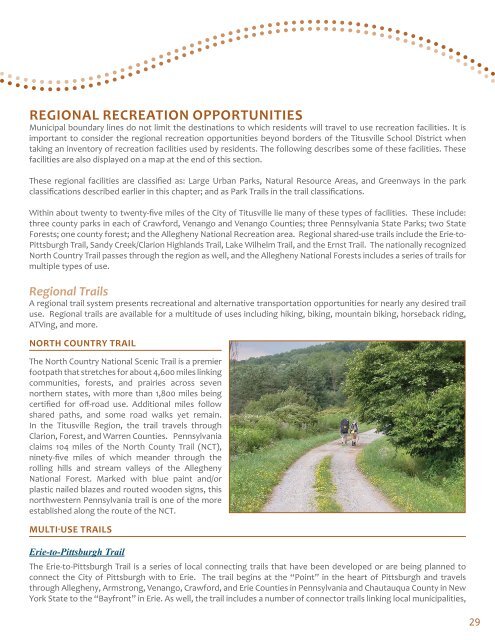
NORTH COUNTRY TRAIL<br />
The North Country National Scenic Trail is a premier<br />
footpath that stretches for about 4,600 miles linking<br />
communities, forests, <strong>and</strong> prairies across seven<br />
northern states, with more than 1,800 miles being<br />
certified for off-road use. Additional miles follow<br />
shared paths, <strong>and</strong> some road walks yet remain.<br />
In the <strong>Titusville</strong> Region, the trail travels through<br />
Clarion, Forest, <strong>and</strong> Warren Counties. Pennsylvania<br />
claims 104 miles of the North County Trail (NCT),<br />
ninety-five miles of which me<strong>and</strong>er through the<br />
rolling hills <strong>and</strong> stream valleys of the Allegheny<br />
National Forest. Marked with blue paint <strong>and</strong>/or<br />
plastic nailed blazes <strong>and</strong> routed wooden signs, this<br />
northwestern Pennsylvania trail is one of the more<br />
established along the route of the NCT.<br />
MULTI‐USE TRAILS<br />
Erie-to-Pittsburgh Trail<br />
The Erie-to-Pittsburgh Trail is a series of local connecting trails that have been developed or are being planned to<br />
connect the <strong>City</strong> of Pittsburgh with to Erie. The trail begins at the “Point” in the heart of Pittsburgh <strong>and</strong> travels<br />
through Allegheny, Armstrong, Venango, Crawford, <strong>and</strong> Erie Counties in Pennsylvania <strong>and</strong> Chautauqua County in New<br />
York State to the “Bayfront” in Erie. As well, the trail includes a number of connector trails linking local municipalities,<br />
29