Proceedings of the fifth mountain lion workshop: 27
Proceedings of the fifth mountain lion workshop: 27
Proceedings of the fifth mountain lion workshop: 27

Create successful ePaper yourself
Turn your PDF publications into a flip-book with our unique Google optimized e-Paper software.
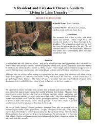
PROCEEDINGS OF THE FIFTH MOUNTAIN LION WORKSHOP 77<br />
<strong>mountain</strong> <strong>lion</strong>s, <strong>the</strong> flora and fauna <strong>of</strong> <strong>mountain</strong> <strong>lion</strong> habitat,<br />
and conservation issues in <strong>the</strong> Fort Huachuca-Canelo Hills<br />
region.<br />
A standard method has been developed and is applied<br />
to all <strong>the</strong> track counts on Fort Huachuca and Canelo Hills.<br />
The routes are covered early in <strong>the</strong> morning, soon after<br />
sunrise, in order to avoid <strong>the</strong> midday heat and to take<br />
advantage <strong>of</strong> <strong>the</strong> low-angle morning sunlight. Direct, bright<br />
overhead lighting renders <strong>the</strong> already-faint tracks almost<br />
invisible. Routes are not prepared (e.g., dragged) prior to <strong>the</strong><br />
survey. In <strong>the</strong> absence <strong>of</strong> rain, a fine dust layer typically<br />
forms on <strong>the</strong> routes, providing an ideal tracking surface.<br />
Based on <strong>the</strong> results <strong>of</strong> repeating <strong>the</strong> route surveys during <strong>the</strong><br />
Fort Huachuca track count, we have found that tracks typically<br />
persist as long as a week in dry wea<strong>the</strong>r and, ideally, <strong>the</strong> track<br />
counts are conducted after several days <strong>of</strong> no rain. Tracks and<br />
sign <strong>of</strong> <strong>lion</strong>s, bobcats, coatimundi, and bears are recorded.<br />
High-quality tracks are recorded on a glass plate and<br />
transferred to paper. Ideally, one front and one rear track are<br />
traced. A set <strong>of</strong> standard track measurements are made and<br />
recorded for each track. When possible, stride measurements<br />
are also made. As discussed below, continued quality control<br />
problems with <strong>the</strong> tracings have lead to <strong>the</strong> additional<br />
procedure <strong>of</strong> photographing <strong>the</strong> tracks. Recently, <strong>the</strong><br />
positional location <strong>of</strong> <strong>the</strong> tracks are recorded with a hand-held<br />
Trimble GPS unit and transferred to a topographic map for<br />
spatial analysis. In <strong>the</strong> case <strong>of</strong> <strong>lion</strong>s, an attempt has been<br />
made to classify tracks according to sex and age but, with <strong>the</strong><br />
exception <strong>of</strong> tracks made by mature males or <strong>of</strong> tracks that are<br />
obviously too small to have been made by an adult <strong>lion</strong>, this<br />
information is very uncertain.<br />
FORT HUACHUCA<br />
The Fort Huachuca Track Counts began in 1989 as an<br />
extension <strong>of</strong> a larger reconnaissance <strong>of</strong> <strong>lion</strong> sign conducted by<br />
<strong>the</strong> Arizona Game and Fish Department (AGFD). A team <strong>of</strong><br />
AGFD employees including Harley Shaw, Norm Woolsey,<br />
Jim Wegge, and Ron Day, surveyed <strong>lion</strong> sign density in a<br />
variety <strong>of</strong> habitats across <strong>the</strong> state (Shaw et al. 1988). Since<br />
1989, <strong>the</strong> track count has been conducted yearly on <strong>the</strong> Fort<br />
Huachuca Military Reserve (FHMR) in sou<strong>the</strong>astern Arizona.<br />
The count started as a cooperative effort between <strong>the</strong> FHMR<br />
wildlife management personnel and <strong>the</strong> Research Branch <strong>of</strong><br />
<strong>the</strong> AGFD. After <strong>the</strong> initial two years, <strong>the</strong> counts were<br />
conducted by volunteers cooperating with personnel at<br />
FHMR. At present, a number <strong>of</strong> groups are involved with <strong>the</strong><br />
track count, including: General Wildlife Services, Chino<br />
Valley, Arizona; The Phoenix Zoo, Phoenix Arizona; Keeping<br />
Track, Inc., Vermont; and The Sky Island Alliance, Tucson,<br />
Arizona.<br />
The study area covered by <strong>the</strong> Fort Huachuca track<br />
count is shown in Figure 1. Five routes (labeled A-E)<br />
covering 15.3 miles <strong>of</strong> route are located in <strong>the</strong> elevation range<br />
between 5000 and 6500 feet along <strong>the</strong> nor<strong>the</strong>ast face <strong>of</strong> <strong>the</strong><br />
Huachuca Mountains, within FHMR. All <strong>of</strong> <strong>the</strong> routes lie<br />
within <strong>the</strong> encinal vegetation zone described by Wallmo<br />
(1955), which includes <strong>the</strong> oak woodland, woodland<br />
chaparral, chaparral with conifer, and pine-oak woodland<br />
habitats. These habitats likely support high deer densities, and<br />
probably constitute most <strong>of</strong> <strong>the</strong> hunting area for <strong>lion</strong>s. From<br />
<strong>the</strong>se habitats, <strong>lion</strong>s can easily move upward to cliffs and<br />
brushy ledges to bed sites. It is likely that <strong>lion</strong>s spend more<br />
time in <strong>the</strong>se areas than in <strong>the</strong> lower elevations on <strong>the</strong> FHMR.<br />
Because <strong>the</strong> Fort Huachuca track count has been an evolving,<br />
informal reconnaissance ra<strong>the</strong>r than a formal survey, <strong>the</strong><br />
number and length <strong>of</strong> routes used in <strong>the</strong> effort has changed<br />
over <strong>the</strong> years (Table 1). The five routes shown in Figure 1<br />
were established as <strong>the</strong> principal surveying routes in 1994.<br />
The five routes were not selected on <strong>the</strong> basis <strong>of</strong> any<br />
established process (e.g., randomization). Ra<strong>the</strong>r, <strong>the</strong>y were<br />
selected for characteristics that facilitate track counts,<br />
including relatively good substrate for seeing tracks,<br />
avoidance <strong>of</strong> excessively steep terrain and, based upon earlier<br />
counts, a history <strong>of</strong> track presence. The routes are surveyed<br />
by separate teams starting at opposite ends <strong>of</strong> <strong>the</strong> route, thus<br />
requiring each team to cover less than 2 miles in one direction<br />
during each survey.<br />
It should be noted that <strong>the</strong> <strong>lion</strong> habitat encompassed<br />
by FHMR probably does not constitute a full home range for<br />
even one <strong>lion</strong>. The tracks and o<strong>the</strong>r sign documented during<br />
<strong>the</strong> track count are not sign <strong>of</strong> animals living full-time within<br />
<strong>the</strong> FHMR boundaries, but ra<strong>the</strong>r animals that use <strong>the</strong> FHMR<br />
for a portion <strong>of</strong> <strong>the</strong>ir range but also spend some percentage <strong>of</strong><br />
<strong>the</strong>ir time on surrounding areas. While it is difficult to make<br />
an exact measure <strong>of</strong> <strong>the</strong> available <strong>lion</strong> habitat <strong>of</strong> <strong>the</strong> FHMR,<br />
approximately 35 mi 2 <strong>of</strong> chaparral, woodland, and forest<br />
habitat exist above <strong>the</strong> 5000-foot level, which likely<br />
constitutes <strong>the</strong> bulk <strong>of</strong> <strong>the</strong> <strong>lion</strong> habitat. Thus we estimate that<br />
an average <strong>of</strong> 2 to 4 adult <strong>lion</strong>s are located on <strong>the</strong> FHMR on<br />
any given day, based upon densities <strong>of</strong> <strong>lion</strong>s found in o<strong>the</strong>r<br />
studies, and assuming that <strong>lion</strong>s socially regulate <strong>the</strong>ir<br />
numbers as suggested by Hornocker (1970). These would not<br />
necessarily be <strong>the</strong> same <strong>lion</strong>s at any given time, but would<br />
instead result from perhaps 6-8 adult <strong>lion</strong>s ranging into home<br />
areas that use both peripheral areas and portions <strong>of</strong> <strong>the</strong> FHMR.<br />
A much greater area <strong>of</strong> <strong>lion</strong> habitat exists outside <strong>the</strong> FHMR<br />
boundaries on <strong>the</strong> Huachuca Mountains than occurs within<br />
<strong>the</strong>se boundaries.<br />
The track count information collected since 1989 is<br />
summarized in Table 1. Between 1989 and 1993, routes were<br />
run only once during <strong>the</strong> survey period. Beginning in 1994,<br />
routes were covered twice with an interval between 3 and 5<br />
days. Track densities varied considerably over <strong>the</strong> 6 years <strong>of</strong>