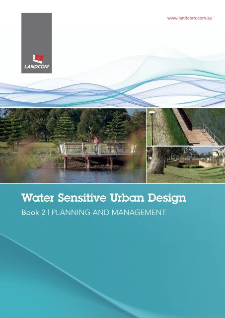
Book 2 | Planning and Management - WSUD
Book 2 | Planning and Management - WSUD
Book 2 | Planning and Management - WSUD

Create successful ePaper yourself
Turn your PDF publications into a flip-book with our unique Google optimized e-Paper software.
www.l<strong>and</strong>com.com.au<br />
Water Sensitive Urban Design<br />
<strong>Book</strong> 2 | planning <strong>and</strong> management
This document has been prepared solely for the benefit of L<strong>and</strong>com <strong>and</strong> is issued in confidence for<br />
the purposes only for which it is supplied. Unauthorised use of this document in any form whatsoever<br />
is prohibited. No liability is accepted by EDAW Australia Pty Ltd or any employee, contractor, or<br />
sub-consultant of this company with respect to its use by any other person<br />
This disclaimer shall apply notwithst<strong>and</strong>ing that the document may be made available to other persons for<br />
an application for permission or approval to fulfil a legal obligation.
Water Sensitive Urban Design<br />
<strong>Book</strong> 2 | planning <strong>and</strong> management<br />
Table of Contents<br />
1 | Introduction 4<br />
2 | Attainment of the Water Conservation Targets 5<br />
2.1 Dem<strong>and</strong> <strong>Management</strong> 7<br />
2.2 Alternative Water Sources 8<br />
2.2.1 Rainwater 9<br />
2.2.2 Stormwater 9<br />
2.2.3 Greywater 9<br />
2.2.4 Blackwater 10<br />
2.3 Maintenance 11<br />
2.4 Costs 12<br />
2.5 Key Issues 13<br />
3 | Attainment of the Stormwater Quality Targets 14<br />
3.1 Bioretention Systems 14<br />
3.1.1 Street trees 14<br />
3.1.2 Raingardens 15<br />
3.1.3 Bioretention swales 15<br />
3.1.4 Sizing bioretention systems 16<br />
3.2 Vegetated Swales <strong>and</strong> Buffer Strips 18<br />
3.2.1 Sizing swale systems 19<br />
3.3 Wetl<strong>and</strong>s 21<br />
3.3.1 Macrophyte zone 21<br />
3.3.2 Sizing wetl<strong>and</strong> systems 22<br />
3.4 Key Issues 24<br />
4 | Attainment of the Flow <strong>Management</strong> Targets 25<br />
4.1 Adequacy of Proposed NSW SEI Objectives 25<br />
4.2 Basis for Flow <strong>Management</strong> Targets 26<br />
5 | Integration of <strong>WSUD</strong> into L<strong>and</strong>com Development Projects 29<br />
5.1 Public Open Space (POS) Layout 30<br />
5.2 Road Layouts <strong>and</strong> Streetscaping 31<br />
5.3 Application of <strong>WSUD</strong> Elements 34<br />
Bioswale<br />
<strong>Book</strong> 2 | planning <strong>and</strong> management 3
Water Sensitive Urban Design<br />
1 | Introduction<br />
Proposed bioswale in median strip | Green Square Town Centre<br />
L<strong>and</strong>com has<br />
implemented a<br />
range of innovative<br />
<strong>WSUD</strong> initiatives<br />
which have<br />
achieved targets<br />
beyond the original<br />
<strong>WSUD</strong> strategy.<br />
Since 2003 L<strong>and</strong>com has focussed on<br />
making sustainability initiatives a key<br />
element of all of its developments, as<br />
reflected in its annual Triple Bottom Line<br />
reporting. L<strong>and</strong>com prepared a Water<br />
Sensitive Urban Design (<strong>WSUD</strong>) Policy in<br />
2003 <strong>and</strong> published its <strong>WSUD</strong> Strategy<br />
in 2004. Since that time L<strong>and</strong>com has<br />
progressed steadily towards attaining the<br />
best practice objectives of urban water<br />
management in all its projects. L<strong>and</strong>com<br />
has implemented a range of innovative<br />
<strong>WSUD</strong> initiatives which have achieved<br />
targets beyond the original <strong>WSUD</strong><br />
strategy.<br />
This document forms part of a 4-book set<br />
that updates <strong>and</strong> revises the L<strong>and</strong>com<br />
Water Sensitive Urban Design Strategy<br />
of 2004. Recent advances in Integrated<br />
Water Cycle <strong>Management</strong> <strong>and</strong> <strong>WSUD</strong>,<br />
such as the release of Australian Runoff<br />
Quality 1 , the BASIX scheme, MUSIC (v3)<br />
<strong>and</strong> wider implementation have seen the<br />
stormwater industry evolve over the last<br />
three years. During this period the NSW<br />
Government has also revised its statewide<br />
water management objectives for new<br />
developments.<br />
L<strong>and</strong>com’s Water Sensitive Urban Design<br />
Strategy (2009) is contained in the<br />
following 4 books;<br />
<strong>Book</strong> 1 | Policy<br />
- contains L<strong>and</strong>com’s <strong>WSUD</strong><br />
Policy <strong>and</strong> Urban Water<br />
<strong>Management</strong> Objectives<br />
<strong>Book</strong> 2 | <strong>Planning</strong> anD<br />
<strong>Management</strong><br />
- consists of descriptions <strong>and</strong><br />
discussions on urban water<br />
best planning <strong>and</strong> management<br />
practices applicable to L<strong>and</strong>com<br />
projects<br />
<strong>Book</strong> 3 | Case Studies<br />
- includes discussions on how<br />
<strong>WSUD</strong> could be integrated into<br />
L<strong>and</strong>com Development Projects<br />
<strong>Book</strong> 4 | Maintenance<br />
- contains operation <strong>and</strong><br />
maintenance guidelines of key<br />
<strong>WSUD</strong> elements<br />
This document, <strong>Book</strong> 2, describes <strong>and</strong><br />
discusses urban water best planning <strong>and</strong><br />
management practices applicable to<br />
L<strong>and</strong>com projects.<br />
1<br />
Engineers Australia (2006), Australian Runoff<br />
Quality: A Guide to Water Sensitive Urban Design,<br />
Wong, T H F (ed), ISBN 0 85825 852 8, Engineers<br />
Australia, Canberra, Australia, 2006.<br />
4 <strong>Book</strong> 2 | planning <strong>and</strong> management
Water Sensitive Urban Design<br />
2 | Attainment of the Water Conservation Targets<br />
Wetl<strong>and</strong> treatment system | Park Central<br />
L<strong>and</strong>com’s stretch<br />
target recommends<br />
a 60+ % reduction<br />
in potable water<br />
consumption.<br />
L<strong>and</strong>com’s water conservation target<br />
is consistent with the BASIX scheme<br />
which requires that new homes in Sydney<br />
achieve a 40% reduction in potable<br />
water consumption. L<strong>and</strong>com’s stretch<br />
target recommends a 60+ % reduction in<br />
potable water consumption. Options to<br />
minimise water consumption considered<br />
for a development include:<br />
••<br />
Dem<strong>and</strong> management – water efficient<br />
fittings, appliances (dishwashers <strong>and</strong><br />
washing machines) <strong>and</strong> water efficient<br />
garden design.<br />
••<br />
Alternative Water Sources – greywater<br />
/ roofwater / stormwater / reclaimed<br />
water<br />
Existing residential water use in Sydney is<br />
summarised in Table 1 (Base Case). These<br />
figures are based on the average water<br />
dem<strong>and</strong> across all types of residential<br />
development, including detached,<br />
attached <strong>and</strong> high-rise dwellings. The<br />
total potable water dem<strong>and</strong> is, on<br />
average, 256.6 Litres per person per day.<br />
As can be seen in Table 1, most of this<br />
is used in the shower, toilet, washing<br />
machine <strong>and</strong> garden. The numbers given<br />
are not meant to be prescriptive but are<br />
intended to illustrate how water use can<br />
be calculated <strong>and</strong> how BASIX targets can<br />
be met.<br />
Examples of a detached <strong>and</strong> a highdensity<br />
dwelling in attaining the BASIX<br />
target are also outlined in Table 1. These<br />
examples both use the average Sydney<br />
household water consumption as the<br />
baseline. Detached dwellings can meet<br />
the BASIX target using water efficient<br />
fittings in the kitchen, bathroom <strong>and</strong><br />
shower, as well as adopting alternative<br />
water sources for toilet flushing, garden<br />
watering <strong>and</strong> car washing.<br />
Multi-storey dwellings can meet the<br />
BASIX target using water efficient fittings<br />
in the kitchen, bathroom <strong>and</strong> shower, as<br />
well as adopting 4 star clothes washing<br />
machines <strong>and</strong> dishwashers, which are<br />
allowed under the BASIX scheme for<br />
multi-unit residential dwellings.<br />
<strong>Book</strong> 2 | planning <strong>and</strong> management 5
Water Sensitive Urban Design<br />
Detention pond integrated into parkl<strong>and</strong> | Garden Gates<br />
Table 1 | Residential water savings through water efficient fittings <strong>and</strong> rainwater harvest <strong>and</strong>/or water recycling 1<br />
Usage (L/P/d)<br />
Average for all<br />
Sydney homes<br />
pre-BASIX<br />
Dem<strong>and</strong> <strong>Management</strong><br />
features<br />
Estimated per capita dem<strong>and</strong>*<br />
Detached dwellings<br />
Estimated<br />
per capita dem<strong>and</strong>*<br />
INTERNAL<br />
High-density/multi-storey<br />
Dem<strong>and</strong> <strong>Management</strong><br />
feature<br />
Estimated<br />
per capita dem<strong>and</strong>*<br />
Kitchen sink 12 Flow regulator (5*) 6.5 Flow regulator (5*) 6.5<br />
Bathroom basin 5.9 Flow regulator (5*) 3.2 Flow regulator (5*) 3.2<br />
Laundry 5.9 5.9 5.9<br />
Bathroom 8.7 8.7 8.7<br />
Shower 56.9 3 star rated 44.6 3 star rated 44.6<br />
Toilet 35.2<br />
Rainwater/<br />
recycled water<br />
3.5 3 star rated 24.8<br />
Clothes Washing<br />
Machine<br />
49.1 49.1 4 star rated 19.1<br />
Dishwasher 3.9 4 star rated 3.9 4 star rated 3.9<br />
SUB-TOTAL<br />
INTERNAL<br />
177.6 125.4 112.8<br />
EXTERNAL<br />
Garden 47.9<br />
Rainwater/<br />
recycled water<br />
4.8 1.9<br />
Swimming Pool 9.3 9.3<br />
Leaks 12.1 12.1 20<br />
Car Wash 6<br />
Rainwater/<br />
recycled water<br />
0.6 1.3<br />
Cooling Tower 0.5 0 16<br />
Fire Test 3.2 -<br />
SUB-TOTAL<br />
EXTERNAL<br />
79 26.8 39.2<br />
TOTAL 256.6 152.2 152.0<br />
* Predicted dem<strong>and</strong>s were estimated from a range of sources, including the Water Efficiency Labelling Scheme (Australian Government)<br />
1<br />
Determined from the BASIX Scheme, NSW Department of <strong>Planning</strong>.<br />
6 <strong>Book</strong> 2 | planning <strong>and</strong> management
Water Sensitive Urban Design<br />
Bioretention system on road verge<br />
Most detached<br />
dwellings require<br />
efficient fittings as<br />
well as a rainwater<br />
tank to meet the<br />
BASIX Targets.<br />
2.1 Dem<strong>and</strong> <strong>Management</strong><br />
Dem<strong>and</strong> management measures are<br />
relatively easy to implement, even in<br />
existing dwellings. Examples include:<br />
••<br />
Water efficient fittings, including<br />
toilets, shower heads <strong>and</strong> tap fittings;<br />
••<br />
Water efficient appliances, including<br />
dishwashers <strong>and</strong> washing machines<br />
(only allowed to contribute to the BASIX<br />
score for multi-storey developments);<br />
••<br />
Use of pool covers to reduce<br />
evaporation losses from swimming<br />
pools; <strong>and</strong><br />
••<br />
L<strong>and</strong>scaped areas comprised of<br />
low-water-use <strong>and</strong>/or indigenous<br />
plants.<br />
As shown in Table 1, most detached<br />
dwellings require efficient fittings as well<br />
as a rainwater tank (or other alternative<br />
supply) to meet the BASIX Targets.<br />
Normally it is possible to achieve a BASIX<br />
score of 40% for high-rise buildings<br />
using a combination of water-efficient<br />
fittings <strong>and</strong> appliances, without the use<br />
of alternative water sources.<br />
Alternative water sources would increase<br />
water savings <strong>and</strong> may enable high-rise<br />
dwellings to meet the stretch target of<br />
60% reduction in potable water dem<strong>and</strong>.<br />
<strong>Book</strong> 2 | planning <strong>and</strong> management 7
Water Sensitive Urban Design<br />
Wetl<strong>and</strong> | Prince Henry<br />
2.2 Alternative Water Sources<br />
In most urban developments there are<br />
three major water sources:<br />
1) Potable mains water<br />
2) Local runoff:<br />
––<br />
Rainwater (roof runoff)<br />
––<br />
Stormwater (surface runoff from<br />
roads, paths <strong>and</strong> pervious surfaces<br />
such as lawns)<br />
3) Wastewater:<br />
––<br />
Greywater (shower, bathroom<br />
<strong>and</strong> laundry sinks, <strong>and</strong> washing<br />
machine wastewater)<br />
––<br />
Blackwater (kitchen <strong>and</strong> toilet<br />
wastewater)<br />
Rainwater, stormwater, greywater <strong>and</strong><br />
blackwater can be alternatives to potable<br />
water.<br />
Potable water conservation targets<br />
(in NSW) are calculated using the BASIX<br />
tool. The water reuse options given<br />
in the tool are potable mains water,<br />
rainwater, stormwater, greywater (treated<br />
<strong>and</strong> diverted), <strong>and</strong> reticulated (applicable<br />
only where a reticulated water supply is<br />
available). The allowed application of<br />
alternative water streams is summarised in<br />
Table 2. If greywater (treated or diverted)<br />
or stormwater is selected, a warning box<br />
in BASIX appears: Greywater systems to<br />
toilets, laundry taps, <strong>and</strong>/or garden taps<br />
requires that the greywater is treated to<br />
a suitable quality as determined by NSW<br />
Health.<br />
Table 2 | Allowable water reuse applications (BASIX)<br />
Source<br />
Garden<br />
<strong>and</strong> Lawn<br />
Reuse Option<br />
All toilet Laundry All hot<br />
Drinking <strong>and</strong><br />
other<br />
Townswater ✓ ✓ ✓ ✓ ✓<br />
Rainwater ✓ ✓ ✓ ✓ ✓<br />
Stormwater ✓ ✓ ✓<br />
Greywater (treated) ✓ ✓ ✓<br />
Greywater (diverted)<br />
✓<br />
Reticulated ✓ ✓ ✓<br />
Mix of RW, GW & SW<br />
✓<br />
8 <strong>Book</strong> 2 | planning <strong>and</strong> management
Water Sensitive Urban Design<br />
Rainwater tank<br />
2.2.1 Rainwater<br />
Rainwater is available wherever there is<br />
a roof surface from which runoff can be<br />
collected. Minimal treatment is required<br />
before rainwater can be used. Under the<br />
BASIX legislation, the NSW government<br />
recommends that rainwater be used<br />
for garden watering, cold water laundry<br />
<strong>and</strong> toilet flushing <strong>and</strong> also accepts that<br />
it may be used for hot water. However<br />
sometimes there may be insufficient<br />
rainwater available to meet the high<br />
combined dem<strong>and</strong>s of toilet flushing,<br />
washing machine <strong>and</strong> garden watering,<br />
<strong>and</strong> usually potable mains water top-up is<br />
provided to rainwater tanks.<br />
2.2.2 Stormwater<br />
Stormwater is runoff from the ground<br />
surface <strong>and</strong> is traditionally conveyed<br />
directly to receiving waters. Stormwater<br />
treatment <strong>and</strong> reuse can both save potable<br />
water <strong>and</strong> assist in meeting water quality<br />
<strong>and</strong> flow management objectives in a<br />
development. Stormwater contains higher<br />
contaminant loads than rainwater, even<br />
after it is treated to meet the stormwater<br />
quality targets outlined in <strong>Book</strong> 1,<br />
Section 2.2. Therefore some additional<br />
treatment, such as disinfection, is typically<br />
required prior to reuse. Stormwater reuse<br />
is particularly effective on a precinct<br />
scale, for example stormwater could be<br />
collected for irrigation of public open<br />
space in a L<strong>and</strong>com development.<br />
2.2.3 Greywater<br />
Greywater reuse can save significant<br />
quantities of potable water. Its effective<br />
use requires separation of greywater<br />
from other wastewater streams <strong>and</strong><br />
additional infrastructure (underground<br />
tanks, pumps, on-site disposal system).<br />
While separation <strong>and</strong> reuse of greywater<br />
can have significant benefits, including<br />
the reduction of wastewater volumes<br />
<strong>and</strong> reduced potable water dem<strong>and</strong>,<br />
the infrastructure requirements for a<br />
fourth pipe to separate the greywater<br />
for treatment, <strong>and</strong> the treatment<br />
requirements being similar to wastewater<br />
mean that greywater reuse may only have<br />
limited application.<br />
Greywater treatment <strong>and</strong> reuse systems<br />
can range from a simple greywater<br />
diversion system, which directs greywater<br />
to a subsurface irrigation system, to a<br />
complex treatment system including<br />
collection, treatment, storage <strong>and</strong><br />
possibly disinfection.<br />
<strong>Book</strong> 2 | planning <strong>and</strong> management 9
Water Sensitive Urban Design<br />
Wetl<strong>and</strong> | Helensburgh<br />
2.2.4 Blackwater<br />
Blackwater treatment <strong>and</strong> reuse options<br />
include reclaimed water reuse <strong>and</strong> sewer<br />
mining. In many parts of Western Sydney,<br />
Sydney Water is making reclaimed<br />
water available to new developments.<br />
Wastewater from existing wastewater<br />
treatment plants is treated to a higher<br />
st<strong>and</strong>ard, then it can be delivered to new<br />
developments in a dual pipe system.<br />
Reclaimed wastewater can only be used<br />
for toilet flushing, garden irrigation,<br />
<strong>and</strong> other outdoor uses. As these uses<br />
represent a significant proportion of total<br />
household water dem<strong>and</strong>, it is usually<br />
possible to meet the BASIX target using<br />
reclaimed wastewater along with water<br />
efficient fittings. Wastewater reuse for<br />
garden irrigation <strong>and</strong> toilet flushing could<br />
be combined with a rainwater tank for<br />
laundry <strong>and</strong> hot water use for a solution<br />
that saves additional water <strong>and</strong> meets the<br />
stretch target of 60% reduction in potable<br />
water dem<strong>and</strong>.<br />
A wide range of wastewater treatment<br />
systems <strong>and</strong> devices are available, ranging<br />
from relatively simple biological systems<br />
(constructed ponds <strong>and</strong> wetl<strong>and</strong>s) to<br />
highly technological mechanical devices<br />
(membrane filtration <strong>and</strong> reverse osmosis).<br />
The appropriate treatment system for a<br />
given application depends on:<br />
••<br />
The wastewater stream to be treated<br />
– light greywater (including shower,<br />
bath <strong>and</strong> bathroom basin wastewater),<br />
greywater (including laundry tub<br />
<strong>and</strong> washing machine wastewater) or<br />
blackwater (including kitchen <strong>and</strong> toilet<br />
wastewater).<br />
••<br />
The water quality required at the end of<br />
the treatment process.<br />
••<br />
The wastewater flows – total quantity,<br />
variability in quality <strong>and</strong> quantity.<br />
The report Wastewater Reuse in the Urban<br />
Environment: Selection of Technologies,<br />
prepared by Ecological Engineering<br />
for L<strong>and</strong>com in 2006, includes detailed<br />
information on selecting the right<br />
treatment technologies for wastewater<br />
treatment.<br />
10 <strong>Book</strong> 2 | planning <strong>and</strong> management
Water Sensitive Urban Design<br />
Rainwater<br />
harvesting systems<br />
are relatively low<br />
maintenance <strong>and</strong><br />
simple, regular<br />
preventative<br />
maintenance can<br />
help avoid the<br />
need for corrective<br />
action.<br />
2.3 Maintenance<br />
Dem<strong>and</strong> management options require<br />
minimal maintenance, <strong>and</strong> may even<br />
prove to require less maintenance than<br />
traditional options. For example:<br />
••<br />
Water efficient toilets, shower heads<br />
<strong>and</strong> tap fittings have maintenance<br />
requirements no different to traditional<br />
less efficient fittings.<br />
••<br />
Water efficient appliances including<br />
dishwashers <strong>and</strong> clothes washing<br />
machines have similar maintenance<br />
requirements to traditional models.<br />
••<br />
Pool covers may reduce pool<br />
maintenance efforts by keeping leaf<br />
litter out of swimming pools.<br />
••<br />
Water-efficient l<strong>and</strong>scaping can also<br />
be low-maintenance l<strong>and</strong>scaping, as<br />
residents will not need to spend so<br />
much time watering the garden <strong>and</strong><br />
tending to plants which are ill-suited to<br />
the Australian climate.<br />
Rainwater harvesting systems are<br />
relatively low maintenance <strong>and</strong> simple,<br />
regular preventative maintenance can<br />
help avoid the need for corrective action.<br />
Recommended maintenance includes:<br />
••<br />
6-monthly inspections of roof areas <strong>and</strong><br />
gutters to ensure they are relatively free<br />
of leaves <strong>and</strong> debris. Vegetation <strong>and</strong><br />
trees that overhangs the roof may need<br />
to be pruned.<br />
••<br />
First flush devices should be checked<br />
once every 3-6 months <strong>and</strong> cleaned out<br />
as required.<br />
••<br />
Screens at inlet <strong>and</strong> overflow points<br />
should be inspected each 6 months to<br />
check for fouling.<br />
••<br />
Each 2-3 years, tanks should be checked<br />
for accumulation of sludge. Sludge may<br />
become a problem if it is deep enough<br />
to start becoming resuspended or<br />
when it affects storage capacity. When<br />
necessary, sludge can be removed by<br />
siphon, by suspending the sludge <strong>and</strong><br />
washing it through, or by completely<br />
emptying the tank.<br />
Stormwater treatment <strong>and</strong> reuse systems<br />
can take a range of different forms, with<br />
different maintenance requirements.<br />
Maintenance for vegetated stormwater<br />
treatment systems is described in <strong>Book</strong> 4.<br />
Stormwater treatment measures for reuse<br />
may also include other types of treatment<br />
systems including Gross Pollutant Traps<br />
(GPT), s<strong>and</strong> filters <strong>and</strong> disinfection systems,<br />
which have more intensive maintenance<br />
requirements, e.g. GPTs require frequent<br />
cleanouts <strong>and</strong> the surface of s<strong>and</strong> filters<br />
needs to be scraped around once each<br />
3 months. UV disinfection systems need<br />
to be checked regularly <strong>and</strong> the UV<br />
lamps need to be replaced occasionally.<br />
Stormwater storage systems should be<br />
checked for accumulation of sludge,<br />
similar to rainwater tanks.<br />
Greywater systems range from simple to<br />
complex treatment <strong>and</strong> reuse systems.<br />
Simple greywater diversion systems still<br />
require regular maintenance, including<br />
(based on the NSW Guideline for Sewered<br />
Residential Premises (Single Households)<br />
Greywater Reuse, Draft for Comment 28<br />
August 2006):<br />
••<br />
Regular cleaning of filters (each week).<br />
••<br />
Replacing filters (each 6-12 months).<br />
••<br />
Periodic de-sludging of the surge tank<br />
(each 6 months).<br />
More complex greywater treatment<br />
systems have more onerous maintenance<br />
requirements, which are set out by<br />
manufacturers of greywater treatment<br />
systems.<br />
Wastewater treatment generally takes<br />
place at a centralised facility, where<br />
treatment, monitoring <strong>and</strong> maintenance<br />
requirements are similar to any wastewater<br />
<strong>and</strong> water treatment plants.<br />
<strong>Book</strong> 2 | planning <strong>and</strong> management 11
Water Sensitive Urban Design<br />
2.4 Costs<br />
Water-efficient<br />
l<strong>and</strong>scaping can<br />
be installed at no<br />
additional cost to<br />
non-water-efficient<br />
l<strong>and</strong>scaping.<br />
Costs for meeting water conservation<br />
targets should be balanced against<br />
improved receiving water quality <strong>and</strong> less<br />
dependence on potable water systems.<br />
For example, residents may value the<br />
ability to water their garden with rainwater<br />
or reclaimed water, while potable water<br />
restrictions are in place.<br />
Dem<strong>and</strong> management measures can be<br />
considered cost-neutral, as water efficient<br />
fittings <strong>and</strong> appliances can be used in<br />
place of non-water-efficient equivalents<br />
at similar prices. Similarly, water-efficient<br />
l<strong>and</strong>scaping can be installed at no<br />
additional cost to non-water-efficient<br />
l<strong>and</strong>scaping. Some dem<strong>and</strong> management<br />
measures can even save significant<br />
amounts of money, for example efficient<br />
shower heads reduce hot water use, which<br />
in turn reduces hot water heating costs.<br />
Alternative water sources include some<br />
additional costs. Rainwater tanks are<br />
readily available <strong>and</strong> there is information<br />
on costs available from suppliers. A<br />
good indicative cost to use for a typical<br />
household rainwater tank is around $2-<br />
3,000, including supply <strong>and</strong> installation<br />
of a simple above-ground tank (slimline<br />
tanks or other special designs are likely to<br />
be more expensive). Maintenance costs<br />
are around $90/year (MUSIC User Manual,<br />
2005). These costs assume that the<br />
rainwater tank is plumbed into the house<br />
<strong>and</strong> includes a pump.<br />
Stormwater reuse costs are difficult to<br />
summarise in general terms. There are<br />
significant economies of scale, depending<br />
on the magnitude of the reuse system. Key<br />
cost components include the treatment<br />
<strong>and</strong> storage systems. It is best to look at<br />
stormwater reuse costs on a site-specific<br />
basis.<br />
Greywater diversion <strong>and</strong> treatment<br />
systems range in cost depending on the<br />
size <strong>and</strong> type of the treatment system. In<br />
the L<strong>and</strong>com report Wastewater Reuse<br />
in the Urban Environment: Selection<br />
of Technologies (2006), two single<br />
household greywater treatment systems<br />
were included in the analysis <strong>and</strong> they<br />
cost around $5,000-6,500 for supply<br />
<strong>and</strong> installation <strong>and</strong>
Water Sensitive Urban Design<br />
Ponds at the end of the wetl<strong>and</strong> treatment system | Park Central<br />
Golf course stormwater storage | Prince Henry<br />
2.5 Key Issues<br />
Key issues for the implementation of water conservation initiatives are;<br />
••<br />
Minimise dem<strong>and</strong> with the use of water efficient fittings <strong>and</strong> appliances.<br />
••<br />
Consider the different sources of water available (e.g. potable, rainwater, recycled<br />
water) <strong>and</strong> match water sources with end uses that have compatible quality<br />
requirements.<br />
••<br />
Check the availability of recycled water in the region. The use of centralised recycled<br />
water systems (dual pipe reticulation) makes it possible to meet BASIX targets without<br />
the use of rainwater tanks or to exceed BASIX targets with rainwater tanks.<br />
••<br />
Where rainwater tanks are to be provided, tanks should be sized with respect to the<br />
available roof area <strong>and</strong> the anticipated dem<strong>and</strong>s.<br />
••<br />
Regional stormwater harvesting could be incorporated into developments using tanks<br />
or ponds as storage systems, e.g. for irrigation of public open space.<br />
••<br />
Greywater recycling is typically more difficult to implement than other options, as it<br />
requires separation of greywater from the wastewater stream, but this may warrant<br />
investigation where other options are limited.<br />
••<br />
A combination of different alternative water sources could make it possible to achieve<br />
reductions in potable water dem<strong>and</strong> much greater than 40%. 60% reduction is<br />
considered a realistic stretch target that could be achieved using recycled water for<br />
toilet flushing <strong>and</strong> outdoor use, plus a rainwater tank for hot water.<br />
<strong>Book</strong> 2 | planning <strong>and</strong> management 13
Water Sensitive Urban Design<br />
3 | Attainment of the Stormwater Quality Targets<br />
Figure 1 - Examples of bioretention systems in planter boxes, in parks <strong>and</strong> in the streetscape<br />
Stormwater quality<br />
targets can be met<br />
through stormwater<br />
treatment<br />
systems, such<br />
as bioretention<br />
systems, swales <strong>and</strong><br />
wetl<strong>and</strong>s.<br />
L<strong>and</strong>com’s stormwater pollution<br />
reduction targets require a 45% reduction<br />
in the mean annual load of total nitrogen,<br />
65% reduction in the mean annual load of<br />
total phosphorus <strong>and</strong> an 85% reduction in<br />
the mean annual load of total suspended<br />
solids. The stretch targets are for<br />
stormwater pollution load reductions are<br />
of 65%, 85% <strong>and</strong> 90% respectively.<br />
Stormwater quality targets can be met<br />
through stormwater treatment systems,<br />
such as bioretention systems, swales <strong>and</strong><br />
wetl<strong>and</strong>s, which can be incorporated into<br />
public open space, streetscapes or on<br />
lots. Further information on these devices<br />
is contained within the NSW Government<br />
document Managing Urban Stormwater:<br />
Treatment Techniques.<br />
3.1 Bioretention Systems<br />
Bioretention systems filter stormwater<br />
runoff through a vegetated soil media<br />
layer. The treated stormwater is<br />
collected at the base of the system via<br />
perforated pipes, from where it flows to<br />
downstream waterways or storages for<br />
reuse. Temporary ponding above the<br />
vegetated soil media provides additional<br />
treatment. Bioretention systems are not<br />
intended to be infiltration systems where<br />
treated stormwater would discharge into<br />
groundwater.<br />
Typically flood flows bypass the system<br />
thereby preventing high flow velocities<br />
that can dislodge collected pollutants or<br />
scour vegetation. Bioretention systems<br />
can be installed at various scales, for<br />
example, in planter boxes, in parks or<br />
in streetscapes integrated with traffic<br />
calming measures. (Figure 1).<br />
3.1.1 Street trees<br />
Recovery<br />
Pipeline<br />
Porous<br />
Pavement<br />
Filtration<br />
Media<br />
Street tree bioretention systems are small<br />
bioretention systems that take the place<br />
of traditional street trees. These systems<br />
can be integrated into high-density urban<br />
environments <strong>and</strong> can take on a variety of<br />
forms (Figure 2). A typical arrangement of<br />
a street tree bioretention system is shown<br />
above. The filtration media should be at<br />
least 0.8 m deep to allow for root growth<br />
of the tree, therefore substantial depth is<br />
required between the inlet <strong>and</strong> outlet.<br />
14 <strong>Book</strong> 2 | planning <strong>and</strong> management
Water Sensitive Urban Design<br />
Figure 2 - Example of street tree bioretention systems<br />
Figure 3a - Example of bioretention raingarden<br />
Raingardens can be<br />
incorporated in a<br />
range of locations,<br />
as they can be any<br />
shape <strong>and</strong> size.<br />
3.1.2 Raingardens<br />
Example raingarden concept design<br />
Temporary<br />
ponding<br />
Growing<br />
Media<br />
(filter)<br />
1:6<br />
Perforated under drain<br />
Geofabric<br />
Overflow<br />
Pit<br />
Vegetation<br />
Raingardens can be incorporated in a<br />
range of locations, as they can be any<br />
shape <strong>and</strong> size. Typical locations include<br />
pocket parks, traffic calming measures<br />
<strong>and</strong> between parking bays. Examples<br />
<strong>and</strong> a typical raingarden arrangement is<br />
shown in Figures 3a & 3b.<br />
g<br />
Pipe<br />
0.15m<br />
0.8m minimum if tree<br />
planted<br />
0.2m (drainage layer)<br />
3.1.3 Bioretention swales<br />
Swale bioretention systems provide both<br />
stormwater treatment <strong>and</strong> conveyance<br />
functions. A bioretention system is<br />
installed in the base of a swale, whereby the<br />
swale provides stormwater pretreatment<br />
to remove coarse to medium sediments.<br />
The bioretention system can be installed<br />
in part of a swale, or along the full length<br />
of a swale, depending on treatment<br />
requirements. Runoff can be directed into<br />
conveyance bioretention systems either<br />
through direct surface runoff (eg. with<br />
flush kerbs) or from an outlet of a pipe<br />
system. An example of these systems is<br />
shown in Figure 4.<br />
0.2-.5 m<br />
1-3 m<br />
0.3-0.7 m<br />
Filter media (s<strong>and</strong>y loam)<br />
Perforated collection pipe<br />
Possible impervious liner<br />
0.1 m<br />
0.15-0.2 m<br />
Transition layer (coarse s<strong>and</strong>)<br />
Drainage layer (coarse s<strong>and</strong>/ gravel)<br />
0.6-2.0 m<br />
Figure 4 - Example of bioretention swales<br />
<strong>Book</strong> 2 | planning <strong>and</strong> management 15
Water Sensitive Urban Design<br />
Figure 3b - Example of bioretention raingarden<br />
3.1.4 Sizing bioretention systems<br />
Figure 5 presents sizing curves for<br />
bioretention systems in Eastern <strong>and</strong><br />
Western Sydney, showing typical<br />
performance for different catchment<br />
impervious fractions including 40, 60, 80<br />
<strong>and</strong> 100%. Different curves are provided<br />
for Eastern <strong>and</strong> Western Sydney to<br />
accommodate the influence of different<br />
rainfall patterns <strong>and</strong> volume on treatment<br />
performance. The sizing curves are<br />
presented in terms of the bioretention<br />
filter area as a percentage of the total<br />
catchment area.<br />
The curves assume that the bioretention<br />
system included 0.2m extended<br />
detention, 0.5m filter depth, <strong>and</strong> a<br />
s<strong>and</strong>y loam filter material, with<br />
a median particle size of 0.5mm<br />
<strong>and</strong> hydraulic conductivity of<br />
100mm/hr. It can be seen in Figure 5<br />
that in Western Sydney a bioretention<br />
system to treat a 40% impervious<br />
catchment can be sized at approximately<br />
1% of the catchment, whereas this<br />
increases to 1.5% in Eastern Sydney.<br />
For catchments with higher impervious<br />
fractions, a larger treatment area is<br />
required; at 100% impervious fraction,<br />
1.5% of the catchment is required in<br />
western Sydney <strong>and</strong> 2.1% in eastern<br />
Sydney.<br />
Other than the area, key aspects of<br />
bioretention system design that have a<br />
strong influence on pollutant removal<br />
performance include the extended<br />
detention depth, filter media depth<br />
<strong>and</strong> type of filter material. Bioretention<br />
performance improves with increasing<br />
depths of extended detention <strong>and</strong> the<br />
filter media, however deeper systems may<br />
not be feasible on all sites.<br />
16 <strong>Book</strong> 2 | planning <strong>and</strong> management
Water Sensitive Urban Design<br />
(a) Western Sydney<br />
100%<br />
90%<br />
Total suspended<br />
solids<br />
Pollutant load reduction (%)<br />
80%<br />
70%<br />
60%<br />
50%<br />
40%<br />
30%<br />
20%<br />
10%<br />
40%<br />
impervious<br />
100%<br />
impervious<br />
Total phosphorus<br />
removal (target = 65%)<br />
Total nitrogen<br />
removal (target = 45%)<br />
Impervious fraction:<br />
40%<br />
60%<br />
80%<br />
100%<br />
0%<br />
0.0% 0.5% 1.0% 1.5% 2.0% 2.5% 3.0%<br />
Bioretention area as a percentage of catchment area<br />
(b) Eastern Sydney<br />
100%<br />
90%<br />
Total suspended<br />
solids<br />
Pollutant load reduction (%)<br />
80%<br />
70%<br />
60%<br />
50%<br />
40%<br />
30%<br />
20%<br />
10%<br />
40%<br />
impervious<br />
Total phosphorus<br />
removal (target = 65%)<br />
Total nitrogen<br />
removal (target = 45%)<br />
100%<br />
impervious<br />
Impervious fraction:<br />
40%<br />
60%<br />
80%<br />
100%<br />
0%<br />
0.0% 0.5% 1.0% 1.5% 2.0% 2.5% 3.0%<br />
Bioretention area as a percentage of catchment area<br />
Figure 5 - Bioretention sizing curves<br />
<strong>Book</strong> 2 | planning <strong>and</strong> management 17
Water Sensitive Urban Design<br />
Figure 6 - Swale cross-section<br />
3.2 Vegetated Swales <strong>and</strong><br />
Buffer Strips<br />
Vegetated Swales<br />
<strong>and</strong> Buffer Strips<br />
can be integrated<br />
with l<strong>and</strong>scape<br />
features in public<br />
open space, or<br />
incorporated into<br />
streetscapes.<br />
Vegetated swales can be used instead of<br />
pipes to convey stormwater <strong>and</strong> provide a<br />
‘buffer’ between the impervious areas of a<br />
catchment <strong>and</strong> the receiving water. They<br />
can be integrated with l<strong>and</strong>scape features<br />
in public open space, or incorporated<br />
into streetscapes. The interaction with<br />
vegetation facilitates an even distribution<br />
<strong>and</strong> slowing of flow, thus encouraging<br />
pollutant settlement <strong>and</strong> retention in the<br />
vegetation. A typical swale cross-section<br />
is shown in Figure 6.<br />
The longitudinal slope of a swale is an<br />
important consideration. They generally<br />
operate best with slopes from 1% to<br />
4%. Slopes milder than this can tend to<br />
become waterlogged <strong>and</strong> have stagnant<br />
ponding, although the use of underdrains<br />
can alleviate this problem.<br />
Figure 7 demonstrates the different forms<br />
that vegetated swales can take.<br />
18 <strong>Book</strong> 2 | planning <strong>and</strong> management
Water Sensitive Urban Design<br />
Figure 7 - Examples of different types of swales<br />
3.2.1 Sizing swale systems<br />
Swales can be constructed in a variety of<br />
sizes <strong>and</strong> configurations. For simplicity<br />
<strong>and</strong> ease of use, a set of sizing curves have<br />
been produced for one type of swale with<br />
typical cross-sectional dimensions <strong>and</strong><br />
other parameters:<br />
••<br />
Longitudinal slope = 3%.<br />
••<br />
Base width = 2 m (top width dependent<br />
on depth of flow).<br />
••<br />
Side slopes = 1 in 6.<br />
••<br />
Vegetation height = 0.25 m.<br />
The sizing curves are presented in terms<br />
of the length of this st<strong>and</strong>ard swale per<br />
hectare of contributing catchment.<br />
Four sets of results are presented, for<br />
catchment impervious fractions of 40, 60,<br />
80 <strong>and</strong> 100%. Sizing curves for a st<strong>and</strong>ard<br />
swale are shown in Figure 8.<br />
Other than their length, key aspects of<br />
swale design that influence their pollutant<br />
removal performance are the slope <strong>and</strong><br />
vegetation height. The swale crosssectional<br />
area is also important <strong>and</strong> needs<br />
to be large enough to convey the design<br />
flow.<br />
It can be noted that swales by themselves<br />
are not capable of meeting the stormwater<br />
pollution reduction targets <strong>and</strong> therefore<br />
need to be accompanied by another<br />
treatment system such as a bioretention<br />
system or a wetl<strong>and</strong>.<br />
<strong>Book</strong> 2 | planning <strong>and</strong> management 19
Water Sensitive Urban Design<br />
(a) Western Sydney<br />
100%<br />
90%<br />
Total suspended<br />
solids<br />
80%<br />
Pollutant load reduction (%)<br />
70%<br />
60%<br />
50%<br />
40%<br />
30%<br />
Total phosphorus<br />
removal (target = 65%)<br />
Total nitrogen<br />
removal (target = 45%)<br />
20%<br />
10%<br />
0%<br />
0 20 40 60 80 100 120<br />
Swale length (m) per hectare catchment area<br />
Impervious fraction:<br />
40%<br />
60%<br />
80%<br />
100%<br />
(b) Eastern Sydney<br />
100%<br />
90%<br />
Total suspended<br />
solids<br />
80%<br />
Pollutant load reduction (%)<br />
70%<br />
60%<br />
50%<br />
40%<br />
30%<br />
Total phosphorus<br />
removal (target = 65%)<br />
Total nitrogen<br />
removal (target = 45%)<br />
20%<br />
Impervious fraction:<br />
40%<br />
60%<br />
10%<br />
80%<br />
100%<br />
0%<br />
0 20 40 60 80 100 120<br />
Swale length (m) per hectare catchment area<br />
Figure 8 - Swale sizing curves<br />
20 <strong>Book</strong> 2 | planning <strong>and</strong> management
Water Sensitive Urban Design<br />
While wetl<strong>and</strong>s can<br />
play an important<br />
role in stormwater<br />
treatment, they can<br />
also have significant<br />
community<br />
benefits.<br />
3.3 Wetl<strong>and</strong>s<br />
Constructed wetl<strong>and</strong> systems remove<br />
pollutants through sedimentation<br />
<strong>and</strong> absorption of nutrients <strong>and</strong> other<br />
associated contaminants. They generally<br />
consist of an inlet zone (a sediment basin to<br />
remove coarse sediments), a macrophyte<br />
zone (a shallow heavily vegetated area<br />
to remove fine particulates <strong>and</strong> take up<br />
soluble pollutants) <strong>and</strong> a high flow bypass<br />
channel (to protect the macrophyte zone).<br />
While wetl<strong>and</strong>s can play an important<br />
role in stormwater treatment, they can<br />
also have significant community benefits.<br />
They provide habitat for wildlife <strong>and</strong> a<br />
focus for recreation, such as walking paths<br />
<strong>and</strong> resting areas. They can also improve<br />
the aesthetics of new developments <strong>and</strong><br />
can be a central l<strong>and</strong>scape feature.<br />
Wetl<strong>and</strong>s can be constructed on many<br />
scales, from small scales, house block<br />
scale to large regional systems. In highly<br />
urban areas they can have a hard edge<br />
form <strong>and</strong> be part of a streetscape or<br />
building forecourts. In regional settings<br />
they can be over 10 hectares in size <strong>and</strong><br />
provide significant habitat for wildlife.<br />
3.3.1 Macrophyte zone<br />
An important operating characteristic<br />
of macrophyte zones is well distributed<br />
flows that pass through various b<strong>and</strong>s of<br />
vegetation. Strong vegetation growth is<br />
required to perform the filtration process<br />
as well as withst<strong>and</strong> flows through the<br />
system. Different b<strong>and</strong>s of a wetl<strong>and</strong> are<br />
shown in Figure 9.<br />
Different zones in a macrophyte system<br />
perform different functions. Ephemeral<br />
areas are often used as organic matter<br />
traps. These areas wet <strong>and</strong> dry regularly<br />
<strong>and</strong> thus enhance the breakdown process<br />
of organic vegetation. Marsh areas<br />
promote epiphyte (biofilms) growth <strong>and</strong><br />
filtration of runoff. Epiphytes use the<br />
plants as substrate <strong>and</strong> can effectively<br />
promote adhesion of fine colloidal<br />
particulates to wetl<strong>and</strong> vegetation <strong>and</strong><br />
uptake of nutrients. Generally, there<br />
are areas of open water surrounding the<br />
outlet of wetl<strong>and</strong>s. These can increase UV<br />
disinfection <strong>and</strong> provide habitat for fish<br />
<strong>and</strong> other aquatic species.<br />
Optimal detention times in the wetl<strong>and</strong><br />
(typically designed for 72 hours) ensure<br />
desired performance. The macrophyte<br />
zone outlet must be sized accordingly.<br />
Multiple level orifice riser outlets are<br />
considered to give the most uniform<br />
detention times for wetl<strong>and</strong>s.<br />
Figure 9 - Indicative long section for a wetl<strong>and</strong>.<br />
<strong>Book</strong> 2 | planning <strong>and</strong> management 21
Water Sensitive Urban Design<br />
Figure 10 - Examples of wetl<strong>and</strong>s in highly urban areas<br />
3.3.2 Sizing wetl<strong>and</strong> systems<br />
Sizing curves for wetl<strong>and</strong>s in Eastern <strong>and</strong><br />
Western Sydney are presented in Figure<br />
11, showing typical performance for<br />
different catchment impervious fractions<br />
from 40 to 100%. The sizing curves present<br />
the wetl<strong>and</strong>’s macrophyte zone area as a<br />
percentage of the catchment area. The<br />
total area set aside for the wetl<strong>and</strong> would<br />
also need to include the sedimentation<br />
basin <strong>and</strong> high flow bypass; therefore the<br />
total area for the wetl<strong>and</strong> would need to<br />
be greater.<br />
The sizing curves are based on a wetl<strong>and</strong><br />
with the following characteristics: there<br />
is a suitably sized GPT upstream of<br />
the wetl<strong>and</strong> to provide efficient coarse<br />
sediment removal, or a treatment system<br />
able to perform the equivalent removal of<br />
gross pollutants <strong>and</strong> coarse sediments,<br />
such as a suitably sized swale.<br />
A wetl<strong>and</strong> always requires a sediment basin<br />
at its inlet. The sediment basin should be<br />
sized appropriately, even if space for the<br />
wetl<strong>and</strong> is limited. The st<strong>and</strong>ard sediment<br />
basin used in producing the curves a<br />
st<strong>and</strong>ard size of 10% of the macrophyte<br />
zone of upstream catchment <strong>and</strong> a typical<br />
pool depth of 2m. The wetl<strong>and</strong> has an<br />
average depth of 0.5 m <strong>and</strong> an extended<br />
detention depth of 0.5 m. The extended<br />
detention allows more stormwater to be<br />
captured <strong>and</strong> treated, thus increasing<br />
the pollutant load removed. The wetl<strong>and</strong><br />
has been sized for 72 hours detention.<br />
Evaporation losses are 125% of potential<br />
evapo-transpiration.<br />
It is generally preferred that the ratio<br />
of length to width in a wetl<strong>and</strong> is<br />
approximately > 1:4 <strong>and</strong> < 1:10. Wetl<strong>and</strong><br />
cells with irregular shapes should have<br />
berms to regulate the flow. Other than the<br />
macrophyte zone area, key parameters<br />
of wetl<strong>and</strong> design that have an impact<br />
on performance include the size of the<br />
sedimentation basin, the extended<br />
detention depth <strong>and</strong> the detention time.<br />
The pollutant removal rates in the sizing<br />
curves in Figure 11 are for the whole<br />
treatment train, including the GPT,<br />
sedimentation basin <strong>and</strong> wetl<strong>and</strong>. The<br />
sizing curves show that the macrophyte<br />
zone size should be 1.6-4.0% of the<br />
catchment area in Western Sydney <strong>and</strong><br />
3.0-5.0% of the catchment area in Eastern<br />
Sydney, depending on the impervious<br />
fraction.<br />
22 <strong>Book</strong> 2 | planning <strong>and</strong> management
Water Sensitive Urban Design<br />
100%<br />
90%<br />
Total suspended<br />
solids<br />
Pollutant load reduction (%)<br />
80%<br />
70%<br />
60%<br />
50%<br />
40%<br />
30%<br />
20%<br />
10%<br />
40% impervious<br />
Total phosphorus<br />
removal (target = 65%)<br />
Total nitrogen<br />
removal (target = 45%)<br />
100% impervious<br />
Impervious fraction<br />
40%<br />
60%<br />
80%<br />
100%<br />
0%<br />
0% 1% 2% 3% 4% 5% 6%<br />
Macrophyte zone area as a percentage of catchment area<br />
(b) Eastern Sydney<br />
100%<br />
90%<br />
Total suspended<br />
solids<br />
Pollutant load reduction (%)<br />
80%<br />
70%<br />
60%<br />
50%<br />
40%<br />
30%<br />
Total phosphorus<br />
removal (target = 65%)<br />
Total nitrogen<br />
removal (target = 45%)<br />
20%<br />
10%<br />
40% impervious<br />
0%<br />
0% 1% 2% 3% 4% 5% 6%<br />
Macrophyte zone area as a percentage of catchment area<br />
100% impervious<br />
Impervious fraction<br />
40%<br />
60%<br />
80%<br />
100%<br />
Figure 11 - Wetl<strong>and</strong> sizing curves<br />
<strong>Book</strong> 2 | planning <strong>and</strong> management 23
Water Sensitive Urban Design<br />
Riparian <strong>and</strong> channel restoration | The Ponds<br />
3.4 Key Issues<br />
Key issues for the implementation of stormwater quality initiatives are;<br />
••<br />
Use stormwater treatment elements in the urban l<strong>and</strong>scape to maximise the visual<br />
<strong>and</strong> recreational amenity of developments.<br />
••<br />
Size <strong>WSUD</strong> elements relative to the contributing catchment area <strong>and</strong> impervious<br />
fraction, as demonstrated in the sizing curves presented in this section.<br />
••<br />
Generally, <strong>WSUD</strong> is most effective on slopes of 1-4%.<br />
••<br />
Where slopes exceed 4%, either discrete treatment systems such as bioretention<br />
street planters or additional flow control features (such as check dams in swales <strong>and</strong><br />
bioretention swales) can be used.<br />
••<br />
Use <strong>WSUD</strong> elements such as wetl<strong>and</strong>s <strong>and</strong> bioretention raingardens in open space<br />
areas where practical.<br />
••<br />
Use <strong>WSUD</strong> elements such as bioretention swales in streets on the high-side verge<br />
reserve if there is one, or in the centre median of dual travel-way streets. <strong>WSUD</strong><br />
elements such as bioretention raingardens can also be incorporated between parking<br />
bays or in traffic-calming features.<br />
••<br />
It is generally preferred that the ratio of length to width in a wetl<strong>and</strong> is approximately<br />
> 1:4 <strong>and</strong> < 1:10. Wetl<strong>and</strong> cells with irregular shapes should have berms to regulate<br />
the flow.<br />
24 <strong>Book</strong> 2 | planning <strong>and</strong> management
Water Sensitive Urban Design<br />
4 | Attainment of the Flow <strong>Management</strong> Targets<br />
Integrating treated water into the l<strong>and</strong>scape<br />
A commonly adopted best management<br />
practice (BMP) guidelines for waterway<br />
stability include the stipulation that<br />
peak flows from the 1.5-year average<br />
recurrence interval (ARI) storm event postdevelopment<br />
must be attenuated to predevelopment<br />
levels (ARQ, 2006).<br />
The NSW Department of Environment<br />
<strong>and</strong> Climate Change (DECC) have recently<br />
recommended the SEI for designated<br />
‘growth centres’ in western (greater)<br />
Sydney as a measure of the impact<br />
development can have on geomorphic<br />
stability of the downstream waterway.<br />
The Stream Erosion Index has been<br />
defined by DECC as the ratio of the post<br />
development duration of stormwater<br />
flows greater than the “stream-forming<br />
flow” to the duration of flows greater<br />
than the “stream-forming flow” for the<br />
catchment under pre-development,<br />
natural conditions. The flow management<br />
targets for new developments require a<br />
Stream Erosion Index = 3.5 – 5.0.<br />
The flow management target is applicable<br />
to Greenfield sites in Western Sydney<br />
or at other sites where there is a natural<br />
stream categorised by Department of<br />
Water & Energy (DWE), downstream<br />
of a development. At other sites, flow<br />
management objectives should be<br />
considered on a case-by-case basis.<br />
4.1 Adequacy of Proposed<br />
NSW SEI Objectives<br />
Theoretical basis for determining stream<br />
erosion potential suggests that stream<br />
erosion is not determined just by the<br />
duration of exceedence of the channel<br />
forming flow but also the magnitude of<br />
this exceedence. The erosion potential<br />
is often expressed as a power function<br />
(of 1.5) of the magnitude of exceedence<br />
of the critical shear stress condition in the<br />
waterway.<br />
SEI modelling undertaken by Brookes <strong>and</strong><br />
Wong (2009) indicated that a typically<br />
developed catchment with percentage<br />
imperviousness of up to 95% could achieve<br />
the prescribed SEI objective of 3 to 5 in<br />
the absence of stormwater detention<br />
measures. The result is inconsistent<br />
with field observations that indicate that<br />
unattenuated flows from a developed<br />
catchment are a significant cause of creek<br />
instability. The adequacy of the SEI target<br />
was further tested on three case sites<br />
which were currently experiencing stream<br />
erosion. The SEI values in two cases were<br />
calculated as being within the prescribed<br />
range of 3 to 5, suggesting that no<br />
stormwater management initiatives for<br />
waterway geomorphic protection would<br />
have been required. The third case had<br />
an SEI greater than 5.<br />
<strong>Book</strong> 2 | planning <strong>and</strong> management 25
Water Sensitive Urban Design<br />
4.2 Basis for Flow<br />
<strong>Management</strong> Targets<br />
The results identify that the recommended<br />
acceptable SEI values of 3 to 5 for the<br />
growth centres in Western Sydney may not<br />
be adequate in protecting geomorphic<br />
stability of stream in the region. It is<br />
recommended that the acceptable range<br />
of SEI prescribed to mitigate the impacts<br />
of l<strong>and</strong> developments be reviewed. It<br />
is envisage that further field based<br />
investigations may be required to ensure<br />
the provide a stronger linkage between<br />
the selection of channel forming flow <strong>and</strong><br />
catchment geology, <strong>and</strong> in further refining<br />
the acceptable range in SEI that reflects<br />
best practice approach to <strong>WSUD</strong>.<br />
In the interim, it is recommended that best<br />
practice SEI be set at 2 <strong>and</strong> a stretch target<br />
SEI of 1, while maintaining its current flow<br />
management objective of attenuating the<br />
peak 1.5 year ARI peak discharge to the<br />
pre-development magnitude.<br />
Urban development increases the<br />
frequency <strong>and</strong> magnitude of runoff into<br />
local watercourses. The reasons for this<br />
are outlined in Table 3, which explains<br />
the key differences between stormwater<br />
flow regimes for natural <strong>and</strong> developed<br />
catchments.<br />
Table 3 | Differences in the stormwater flow regime for natural <strong>and</strong> developed catchments<br />
Catchment conditions Natural conditions Traditional developed conditions<br />
Impervious areas <strong>and</strong><br />
hydraulic connectivity<br />
Rainfall losses (rainfall<br />
that does not lead to<br />
runoff)<br />
Catchment response<br />
time<br />
Runoff volume<br />
Peak flows<br />
Few impervious areas, none connected<br />
directly to receiving waters<br />
In small storm events, or in the initial<br />
part of large storm events, significant<br />
quantities of rainfall are stored in<br />
depressions, vegetation, <strong>and</strong> leaf litter.<br />
During a storm event, rainfall infiltrates<br />
into the upper soil horizons. Rainfall<br />
losses are therefore high.<br />
Relatively slow due to high rainfall<br />
losses <strong>and</strong> indirect connection to<br />
receiving waters<br />
Relatively small due to high rainfall<br />
losses<br />
Relatively low due to slow catchment<br />
response<br />
Extensive impervious areas, directly<br />
connected to receiving waters via the<br />
stormwater pit <strong>and</strong> pipe network<br />
Impervious areas store almost no<br />
rainfall. Pervious areas in the urban<br />
environment also store less rainfall<br />
than natural pervious areas. There are<br />
limited opportunities for infiltration<br />
during storm events. Rainfall losses<br />
are therefore low.<br />
Relatively fast due to low rainfall losses<br />
<strong>and</strong> direct connection to receiving<br />
waters<br />
Relatively large due to low rainfall<br />
losses<br />
Relatively high due to fast catchment<br />
response<br />
26 <strong>Book</strong> 2 | planning <strong>and</strong> management
Water Sensitive Urban Design<br />
Example of a grassed swale<br />
One of the important implications of the<br />
various flow regime changes outlined in<br />
Table 3 is that urban development leads<br />
to a situation where a rainfall event is more<br />
likely to lead to runoff. Small, frequent<br />
rainfall events in a natural catchment are<br />
mostly accounted for in rainfall losses <strong>and</strong><br />
runoff is infrequent. The same rainfall<br />
events in a developed catchment lead to<br />
significant runoff in receiving waters.<br />
Typical storm hydrographs for a catchment<br />
before <strong>and</strong> after development are shown<br />
in Figure 12. Also shown in Figure 12 is<br />
a typical hydrograph for a developed<br />
catchment with traditional flood retarding<br />
measures (for example, on-site detention<br />
or regional flood retarding). Detention<br />
is able to reduce the peak flows below<br />
pre-development levels, but the volume<br />
of runoff <strong>and</strong> the flow duration remains<br />
much larger than in the natural case.<br />
2. Developed, without<br />
flood retarding<br />
Flow rate<br />
3. Developed, with<br />
flood retarding<br />
1. Natural<br />
Time<br />
Figure 12 - Typical storm flow hydrographs before <strong>and</strong> after development<br />
<strong>Book</strong> 2 | planning <strong>and</strong> management 27
flood retarding<br />
Flow rate<br />
Water Sensitive Urban Design<br />
3. Developed, with<br />
flood retarding<br />
1. Natural<br />
Stream-forming<br />
flow is a flow<br />
rate at which<br />
flow velocities<br />
cause sediment<br />
movement.<br />
The increase in the frequency <strong>and</strong><br />
magnitude of runoff post-development<br />
<strong>and</strong> the increased duration of runoff as<br />
a result of flood retarding tends to lead<br />
to increased erosion in waterways, due<br />
to flow in creeks reaching the “streamforming<br />
flow”, at which velocities are<br />
erosive, more often. Stream-forming flow<br />
is a flow rate at which flow velocities cause<br />
sediment movement.<br />
The flow management targets outlined in<br />
<strong>Book</strong> 1, Table 1 refer to the duration for<br />
which flows are above Time the stream-forming<br />
flow. This is illustrated in Figure 13. The<br />
Stream Erosion Index also referred to in<br />
<strong>Book</strong> 1, Table 1 is the ratio of the postdevelopment<br />
duration to the natural<br />
duration shown in Figure 13. The Stream<br />
Erosion Index should be 3.5–5.0 to meet<br />
the target or as low as 1.0 to meet the<br />
stretch target.<br />
Streamforming<br />
flow<br />
Natural duration<br />
Flow rate<br />
Post-development duration<br />
Time<br />
Figure 13 - Duration of flows above the stream-forming flow in natural <strong>and</strong> developed conditions<br />
Reducing the duration of stream-forming<br />
flows to meet the Stream Erosion Index<br />
target of 3.5 - 5.0 requires consideration<br />
of site-specific issues. Some potential<br />
options for meeting the target include:<br />
••<br />
Infiltration measures can be an<br />
effective way to mimic rainfall losses<br />
in natural systems; however infiltration<br />
measures are not suitable at sites with<br />
salinity, shallow groundwater or shallow<br />
bedrock. Much of Western Sydney is<br />
affected by salinity <strong>and</strong> infiltration is<br />
unsuitable.<br />
••<br />
Storage <strong>and</strong> reuse can also mimic<br />
rainfall losses, for example the use of<br />
rainwater tanks or stormwater storage<br />
<strong>and</strong> reuse systems.<br />
An appropriate solution for a site should<br />
be determined by modelling. Rainfallrunoff<br />
modelling allows determination of<br />
the duration of flows above the streamforming<br />
flow, <strong>and</strong> can be used to model<br />
different scenarios including mitigation<br />
options.<br />
It is a difficult exercise to define the<br />
stream forming flow for different creeks,<br />
as it is important to consider the nature of<br />
the bed sediment <strong>and</strong> how susceptible it<br />
is to erosion.<br />
28 <strong>Book</strong> 2 | planning <strong>and</strong> management
Water Sensitive Urban Design<br />
5 | Integration of <strong>WSUD</strong> into L<strong>and</strong>com Development Projects<br />
GUTTER<br />
FIRST FLUSH DEVICE<br />
OVERFLOW TO<br />
INFILTRATION TRENCH<br />
GARDEN AREA OR<br />
STREET DRAINAGE SYSTEM<br />
LOT BOUNDARY<br />
TANK<br />
RAINWATER SUPPLY<br />
TO HOUSE<br />
ROAD CARRIAGEWAY<br />
BIO RETENTION BASIN<br />
PUMP<br />
PRE-TREATMENT<br />
(ALTERNATIVE LOCATION)<br />
SEWER IN PROPERTY<br />
COMBINED<br />
ELEC/TEL/GAS<br />
WATER<br />
STORMWATER<br />
PRE-TREATMENT<br />
STORMWATER<br />
OUTLET PIPE<br />
MAX WATER LEVEL (Below outlet pipe)<br />
SUBSOIL DRAINAGE<br />
Figure 14 - Configuration of <strong>WSUD</strong> elements from the household allotment through roads <strong>and</strong> regional bioretention basin.<br />
Importantly it is<br />
recommended that<br />
the development<br />
of a <strong>WSUD</strong> strategy<br />
be undertaken at<br />
the same time as<br />
the masterplan.<br />
Every L<strong>and</strong>com development is required<br />
to have a <strong>WSUD</strong> strategy to address the<br />
management of the three urban water<br />
streams through the development. While<br />
the complexity of these strategies may<br />
vary depending on the scope of the<br />
project it is always recommended that<br />
this work be undertaken by a specialist<br />
consultant.<br />
Importantly it is recommended that<br />
the development of this strategy be<br />
undertaken at the same time as the<br />
masterplan / structure plan to ensure that<br />
all <strong>WSUD</strong> opportunities can be taken <strong>and</strong><br />
that the strategy is fully integrated into the<br />
masterplan. While <strong>WSUD</strong> elements may<br />
have a l<strong>and</strong>take of 1-3% of the site area,<br />
implementing them into the urban design<br />
can optimise outcomes, due to:<br />
••<br />
<strong>WSUD</strong> elements being integrated into<br />
streetscapes<br />
••<br />
<strong>WSUD</strong> in Public Open Space (POS)<br />
••<br />
<strong>WSUD</strong> elements acting as an interface<br />
between the development <strong>and</strong> the<br />
riparian zone<br />
••<br />
<strong>WSUD</strong> at the lot level <strong>and</strong> delivered<br />
through housing design guides.<br />
By integrating <strong>WSUD</strong> through a<br />
development it is possible to make<br />
sure that the elements do not require<br />
larger areas at downstream locations in<br />
developments. The integration of <strong>WSUD</strong><br />
into L<strong>and</strong>com developments is an iterative<br />
process involving the masterplanner <strong>and</strong><br />
the project team. Ideally, this integration<br />
will be facilitated through close<br />
communication with the masterplanner<br />
<strong>and</strong> through a series of workshops on the<br />
selection of <strong>WSUD</strong> options that meets the<br />
design objectives.<br />
An example of the application of <strong>WSUD</strong><br />
elements through a development is shown<br />
in Figure 14. Details of the integration of<br />
<strong>WSUD</strong> into POS <strong>and</strong> roadways are detailed<br />
in the following sections.<br />
<strong>Book</strong> 2 | planning <strong>and</strong> management 29
Water Sensitive Urban Design<br />
Figure 15 - Examples of matching public open space with stormwater features (Victoria Park, Dockl<strong>and</strong>s in Melbourne<br />
<strong>and</strong> Ascot Waters in Perth. Ascot Waters images source: www.wsud.org)<br />
5.1 Public Open Space<br />
(POS) Layout<br />
POS areas can<br />
potentially<br />
incorporate<br />
stormwater<br />
conveyance <strong>and</strong><br />
treatment systems<br />
as l<strong>and</strong>scape<br />
features within<br />
a multiple use<br />
corridor.<br />
Integration of public open space (POS)<br />
with conservation corridors, stormwater<br />
management systems <strong>and</strong> recreational<br />
facilities is a fundamental objective<br />
of <strong>WSUD</strong>. POS areas can potentially<br />
incorporate stormwater conveyance <strong>and</strong><br />
treatment systems as l<strong>and</strong>scape features<br />
within a multiple use corridor. This can<br />
provide a recreation focus (such as a<br />
linear park with bike path or an urban<br />
forest) as well as enhancing community<br />
underst<strong>and</strong>ing <strong>and</strong> regard of stormwater<br />
as a valuable resource. The key principles<br />
to be considered in locating POS areas:<br />
••<br />
Align POS along natural drainage lines<br />
••<br />
Protect/enhance areas containing<br />
natural water features (such as creeks<br />
<strong>and</strong> wetl<strong>and</strong>s) <strong>and</strong> other environmental<br />
values by locating them within POS<br />
••<br />
Utilise POS to provide links between<br />
public <strong>and</strong> private areas <strong>and</strong> community<br />
activity nodes<br />
For water sensitive l<strong>and</strong>scape design the<br />
following natural l<strong>and</strong>scape values should<br />
be considered:<br />
••<br />
Retention of natural features –<br />
watercourses, l<strong>and</strong>forms <strong>and</strong> other<br />
water features should be retained or<br />
restored<br />
••<br />
Use of indigenous species – existing<br />
native vegetation needs to be retained<br />
or restored. Vegetated links should<br />
be provided with native vegetation on<br />
adjoining l<strong>and</strong><br />
••<br />
Planting – should be limited to locally<br />
indigenous species (or specifically<br />
appropriate other species) <strong>and</strong> exclude<br />
groups that can cause weed problems<br />
••<br />
Fauna habitat – provision should be<br />
made for fauna habitat measures such<br />
as wetl<strong>and</strong>s, ponds, shrubs <strong>and</strong> nest<br />
boxes, <strong>and</strong><br />
••<br />
Hydrologic maintenance of natural<br />
regime on native vegetation –<br />
stormwater runoff should be diverted<br />
away from native vegetation to maintain<br />
suitable soil moisture <strong>and</strong> nutrient<br />
conditions <strong>and</strong> avoid the spread of<br />
weeds.<br />
30 <strong>Book</strong> 2 | planning <strong>and</strong> management
Water Sensitive Urban Design<br />
Figure 16 - <strong>WSUD</strong> elements can form part of the streetscape<br />
5.2 Road Layouts <strong>and</strong><br />
Streetscaping<br />
Street layouts on<br />
L<strong>and</strong>com projects<br />
are guided by the<br />
L<strong>and</strong>com Street<br />
Design Guidelines.<br />
Roads account for a significant percentage<br />
of the overall impervious area created<br />
within a typical urban development <strong>and</strong><br />
therefore can significantly change the way<br />
water is transported through an area. These<br />
areas also generate a number of water<br />
borne stormwater contaminants that can<br />
adversely impact on receiving waterway<br />
health (e.g. metals <strong>and</strong> hydrocarbons).<br />
Consequently, it is important to mitigate<br />
the impact of stormwater runoff generated<br />
from road surfaces. By carefully planning<br />
road alignments <strong>and</strong> streetscapes, <strong>WSUD</strong><br />
drainage elements such as bioretention<br />
systems <strong>and</strong> vegetated swales can be used<br />
to collect, attenuate, convey <strong>and</strong> treat<br />
the runoff before discharge to receiving<br />
waterways.<br />
Street layouts on L<strong>and</strong>com projects are<br />
guided by the L<strong>and</strong>com Street Design<br />
Guidelines. Key principles in selecting<br />
road alignments <strong>and</strong> streetscapes<br />
for <strong>WSUD</strong> depend on the natural<br />
topography <strong>and</strong> overall masterplan for the<br />
development, as outlined in the design<br />
principles <strong>and</strong> common issues included in<br />
the Street Design Guidelines:<br />
••<br />
Generally, <strong>WSUD</strong> elements in the<br />
streetscape are most effective on<br />
slopes of 1-4%, i.e. where road grades<br />
are 1-4%.<br />
••<br />
Where slopes exceed 4%, either discrete<br />
treatment systems such as bioretention<br />
street tree planters or additional flow<br />
control features (such as check dams<br />
with swales <strong>and</strong> linear bioretention<br />
systems (Figure 16) can be used.<br />
••<br />
Use <strong>WSUD</strong> elements such as<br />
bioretention swales on the high-side<br />
verge reserve if there is one.<br />
••<br />
Where the street runs perpendicular<br />
to the contours, use either verge for<br />
bioretention systems.<br />
••<br />
Where practical, incorporate <strong>WSUD</strong><br />
elements in the centre medial of dual<br />
travel-way streets.<br />
••<br />
Ensure street or driveway crossovers of<br />
bioretention swales are either at grade<br />
or incorporate a culvert crossing. If<br />
this is not possible, use discrete <strong>WSUD</strong><br />
elements separated by driveway<br />
crossovers.<br />
<strong>Book</strong> 2 | planning <strong>and</strong> management 31
Water Sensitive Urban Design<br />
Figure 17 - Bollards or kerbs with regular breaks allow distributed flow to the <strong>WSUD</strong> element while protecting these systems from traffic<br />
••<br />
Street-scale <strong>WSUD</strong> elements should be<br />
part of an overall <strong>WSUD</strong> strategy for a<br />
development (Figure 16).<br />
••<br />
It is not necessary to provide <strong>WSUD</strong><br />
elements on all streets, however<br />
streetscape <strong>WSUD</strong> elements may form<br />
an important part of a <strong>WSUD</strong> strategy<br />
for a development.<br />
••<br />
Parking areas can be located adjacent<br />
to <strong>WSUD</strong> elements, but should be<br />
designed to prevent vehicles damaging<br />
these systems. Bollards or kerbs with<br />
regular breaks are required to allow<br />
distributed flow to the <strong>WSUD</strong> element<br />
(Figure 17).<br />
••<br />
Parking areas may be interspersed<br />
between <strong>WSUD</strong> elements, such as<br />
parking bays between raingardens.<br />
An example of a road cross-section is<br />
shown in Figure 18.<br />
Different types of streets will lead to<br />
different opportunities for <strong>WSUD</strong>. Model<br />
street types described in L<strong>and</strong>com’s Street<br />
Design Guidelines are listed in Table 4<br />
along with potential <strong>WSUD</strong> opportunities.<br />
CARRIAGEWAY<br />
BIO RETENTION<br />
SLOTTED KERB<br />
3% 4%<br />
DIRECT<br />
STORMWATER<br />
FLOW<br />
Figure 18 - Road design with stormwater feeding into a bioretention system for treatment.<br />
32 <strong>Book</strong> 2 | planning <strong>and</strong> management
Water Sensitive Urban Design<br />
Table 4 | <strong>WSUD</strong> opportunities in different streetscapes<br />
Model Street Type<br />
<strong>WSUD</strong> Examples<br />
Street Tree Bioretention Systems<br />
Swales/Bioretention Swales In A Central Median<br />
Major Road<br />
Raingardens<br />
Swales/Bioretention Swales<br />
Collector Street<br />
Swales/Bioretention Swales<br />
Swale<br />
Local Streets<br />
Bioretention System<br />
Swales/Bioretention Systems<br />
Minor Local Street<br />
Raingardens<br />
Porous Paving Infiltration<br />
Lanes <strong>and</strong> access<br />
ways/mews<br />
Carparks<br />
Carparks<br />
5.3 Application of <strong>WSUD</strong> Elements<br />
As outlined in the above sections there are a range of <strong>WSUD</strong> planning practices <strong>and</strong> elements that<br />
can be applied to meet water quality objectives. The applicability of these elements at different scales<br />
is outlined in Table 5.<br />
Table 5 The application of <strong>WSUD</strong> elements at varying scales.<br />
<strong>Book</strong> 2 | planning <strong>and</strong> management 33
Water Sensitive Urban Design<br />
Detention Basin | Koala Bay<br />
Water steps | Victoria Park<br />
The development<br />
of the <strong>WSUD</strong><br />
strategy will identify<br />
which elements are<br />
appropriate on any<br />
given site.<br />
5.3 Application of <strong>WSUD</strong><br />
Elements<br />
As outlined there are a range of <strong>WSUD</strong><br />
planning practices <strong>and</strong> elements that<br />
can be applied to meet water quality<br />
objectives. The applicability of these<br />
elements at different scales is outlined in<br />
Table 5.<br />
The development of the <strong>WSUD</strong> strategy will<br />
identify which elements are appropriate<br />
on any given site. Every location or site<br />
will require individual design measures.<br />
Examples of the application of <strong>WSUD</strong><br />
are shown in four case studies in <strong>Book</strong> 3<br />
| Case Studies.<br />
Table 5 | The application of <strong>WSUD</strong> elements at varying scales.<br />
Allotment Subdivision Regional elements<br />
Allotment density<br />
<strong>and</strong> layout<br />
Street layout<br />
<strong>and</strong> streetscape<br />
Public open space<br />
Multiple use corridors<br />
AAA appliances Water use education Water use education<br />
On-site infiltration<br />
Buffer strips<br />
Precinct infiltration<br />
Buffer strips<br />
Vegetated swales Vegetated swales Rehabilitated waterways<br />
Bioretention systems Bioretention systems Bioretention systems<br />
Rain gardens/ local wetl<strong>and</strong>s Urban forest Urban forest<br />
On-site detention Retarding basins Retarding basins<br />
Rainwater tanks for reuse<br />
Wetl<strong>and</strong>s <strong>and</strong> ponds for<br />
storage <strong>and</strong> reuse<br />
Wetl<strong>and</strong>s <strong>and</strong> ponds for<br />
storage <strong>and</strong> reuse<br />
Grey water reuse Grey water reuse Reclaimed water reuse<br />
34 <strong>Book</strong> 2 | planning <strong>and</strong> management
Level 2, 330 Church Street<br />
Parramatta NSW 2150<br />
PO Box 237 Parramatta NSW 2124<br />
DX 28448 Parramatta<br />
Telephone 61 2 9841 8600<br />
Facsimile 61 2 9841 8688<br />
Printed May 2009 on recycled paper.