

ESTIMATING THE RADIUS OF MAXIMUM WINDS VIA SATELLITE ...
ESTIMATING THE RADIUS OF MAXIMUM WINDS VIA SATELLITE ...
ESTIMATING THE RADIUS OF MAXIMUM WINDS VIA SATELLITE ...
SHOW LESS

Create successful ePaper yourself
Turn your PDF publications into a flip-book with our unique Google optimized e-Paper software.
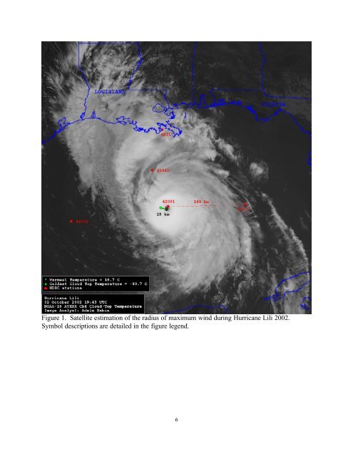
Figure 1. Satellite estimation of the radius of maximum wind during Hurricane Lili 2002.<br />
Symbol descriptions are detailed in the figure legend.<br />
6


