Why GOES-R? - Office of the Federal Coordinator for Meteorology ...
Why GOES-R? - Office of the Federal Coordinator for Meteorology ...
Why GOES-R? - Office of the Federal Coordinator for Meteorology ...

Create successful ePaper yourself
Turn your PDF publications into a flip-book with our unique Google optimized e-Paper software.
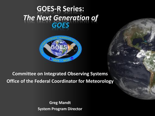
<strong>GOES</strong>-R Series:<br />
The Next Generation <strong>of</strong><br />
<strong>GOES</strong><br />
Committee on Integrated Observing Systems<br />
<strong>Office</strong> <strong>of</strong> <strong>the</strong> <strong>Federal</strong> <strong>Coordinator</strong> <strong>for</strong> <strong>Meteorology</strong><br />
Greg Mandt<br />
System Program Director
Outline<br />
• Overview<br />
• Spacecraft & Instrument Capabilities<br />
• Ground Segment Status<br />
• Algorithm Status<br />
• User Readiness<br />
2
<strong>Why</strong> <strong>GOES</strong>-R?<br />
• Continuation <strong>of</strong> <strong>the</strong> U.S. capability required to observe, protect and manage <strong>the</strong> earth’s resources to<br />
promote environmental stewardship.<br />
• Enhance ability to predict and track storms; plan routes <strong>for</strong> airlines and ship traffic, identify demands <strong>for</strong><br />
natural resources such as gas and water, and assess space wea<strong>the</strong>r impacts on sensitive electronics such<br />
as satellites and terrestrial communications.<br />
<strong>GOES</strong>-R Instruments<br />
Improve hurricane track & intensity <strong>for</strong>ecast<br />
Improve thunderstorm & tornado warning lead time<br />
Improve aviation flight route planning<br />
Improve solar flare warnings <strong>for</strong> communications and<br />
navigation<br />
Improve power blackout <strong>for</strong>ecasts due to solar flares<br />
Improve energetic particle <strong>for</strong>ecasts<br />
Advanced Baseline Imager (ABI) and<br />
Geostationary Lightning Mapper (GLM)<br />
Extreme Ultra Violet Sensor /<br />
X-Ray Sensor Irradiace Sensor (EXIS)<br />
Solar Ultra Violet Imager (SUVI)<br />
Space Environmental In-Situ Suite<br />
(SEISS)<br />
3
<strong>GOES</strong> Program History<br />
<strong>GOES</strong> 4-7<br />
• Vertical pr<strong>of</strong>iling<br />
<strong>GOES</strong> 13,14,15<br />
• Simultaneous, independent<br />
imaging, sounding<br />
1975 1980 1994 2006 2015<br />
<strong>GOES</strong> 1-3<br />
• NOAA’s First <strong>GOES</strong><br />
• Spin-stabilized<br />
<strong>GOES</strong> 8-12<br />
• 3-axis stabilized<br />
• Simultaneous imaging,<br />
sounding 100% <strong>of</strong> time<br />
<strong>GOES</strong>-R series<br />
• Improved spectral, spatial<br />
and temporal resolution in<br />
imaging<br />
• Lightning mapping<br />
• Improved space wea<strong>the</strong>r<br />
monitoring<br />
4
Continuity <strong>of</strong> <strong>GOES</strong> Operational Satellite Program<br />
Calendar Year<br />
As <strong>of</strong> September 1, 2010<br />
07 08<br />
09<br />
10<br />
11<br />
12<br />
13<br />
14<br />
15<br />
16<br />
17<br />
18<br />
19<br />
20<br />
21<br />
22<br />
23<br />
24<br />
25<br />
26<br />
27 28 29 30 31 32 33 34 35 36<br />
<strong>GOES</strong>-11<br />
<strong>GOES</strong> West<br />
<strong>GOES</strong>-12*<br />
Transitioning to South American Operations<br />
<strong>GOES</strong>-13<br />
<strong>GOES</strong> East<br />
<strong>GOES</strong>-14<br />
On-orbit spare<br />
<strong>GOES</strong>-15<br />
In post launch checkout<br />
<strong>GOES</strong>-R<br />
<strong>GOES</strong>-S<br />
<strong>GOES</strong>-T<br />
<strong>GOES</strong>-U<br />
Satellite is operational<br />
beyond design life<br />
* Backup and South American Coverage<br />
beginning June 2010<br />
On-orbit <strong>GOES</strong> storage<br />
Operational<br />
Future Options<br />
5
<strong>GOES</strong>-R Program<br />
Management Structure<br />
Program Scientist (NOAA)<br />
Lead: Steven Goodman<br />
<strong>GOES</strong>-R Program <strong>Office</strong><br />
System Program Director (SPD): Greg Mandt (NOAA)<br />
Deputy SPD: Rick Pickering (NASA)<br />
Assistant SPD: Mike Corbett (NOAA)<br />
Program Control<br />
Lead: Stephen Shaeffer (NOAA)<br />
Program Systems Engineering<br />
Lead: Barbara Pfarr (NASA)<br />
Deputy: Craig Keeler (NOAA)<br />
Program Mission Assurance<br />
Lead: Roman Kilgore (NASA)<br />
Contracts<br />
Lead: Kelly Mabe (NOAA)<br />
NESDIS STAR<br />
(Algorithm Development)<br />
Flight Project<br />
Project Manager: Michael Donnelly (NASA)<br />
Deputy (Spacecraft): Tim Walsh (NOAA)<br />
Deputy (Instruments): Kathy McIntyre (NASA)<br />
Ground Segment Project<br />
Project Manager: Vanessa Griffin (NOAA)<br />
Deputy: Robin Pfister (NASA)<br />
Assistant: Vacant (NOAA)<br />
6
2007 2008 2009 2010 2011 2012 2013 2014 2015<br />
Program<br />
/System<br />
Spacecraft<br />
System Design<br />
Review complete<br />
Spacecraft SDR<br />
Complete<br />
<br />
Working towards System PDR<br />
Working towards PDR in<br />
January 2011<br />
Launch<br />
Readiness<br />
Oct. 2015<br />
Flight<br />
Segment<br />
Ground<br />
Segment<br />
Instruments<br />
<br />
5 Instrument contracts<br />
underway<br />
EXIS & SUVI<br />
passed CDR<br />
Core contract awarded<br />
to Harris Corp.<br />
Core SRR complete<br />
80% delivery <strong>of</strong> baseline<br />
product algorithms<br />
<br />
RBU lease awarded<br />
Development<br />
<br />
<br />
<br />
ABI PTM in <strong>the</strong>rmal<br />
vacuum (TVAC) testing<br />
GLM CDR in December<br />
Antenna and GAS<br />
contracts awarded<br />
Working towards PDR in<br />
Spring 2011<br />
Integration and Testing<br />
7
<strong>GOES</strong>-West<br />
137° West <strong>GOES</strong>-R System Configuration<br />
<strong>GOES</strong>-East<br />
75° West<br />
O<strong>the</strong>r Users<br />
Remote<br />
Backup Facility<br />
Fairmont, WV<br />
NOAA<br />
Satellite Operations Facility<br />
Suitland, MD<br />
Command and Data Acquisition Station<br />
Wallops, VA<br />
8<br />
8
9<br />
<strong>GOES</strong>-R Spacecraft<br />
Specifications<br />
Size: ~5.5 meters (from launch vehicle interface<br />
to top <strong>of</strong> ABI)<br />
Mass: Satellite (spacecraft and payloads) dry<br />
mass 4000W at end-<strong>of</strong>-life (includes<br />
accounting <strong>for</strong> limited array degradation)<br />
Current Status<br />
• Lockheed-Martin Space Systems Co (LMSSC) <strong>of</strong><br />
Newtown, PA is primary contractor<br />
• Spacecraft System Definition Review (SDR)<br />
completed March 9-10, 2010.<br />
• Spacecraft baseline established in April 2010.<br />
• Working towards Preliminary Design Review<br />
(PDR) in January 2011.<br />
Solar UV Imager<br />
(SUVI)<br />
Space Environment<br />
In-situ Suite (SEISS)<br />
Geostationary Lightning<br />
Mapper (GLM)<br />
Extreme UV/X-ray<br />
Irradiance Sensor (EXIS)<br />
Magnetometer<br />
Advanced<br />
Baseline Imager<br />
(ABI)<br />
Unique Payload Services:<br />
• High Rate In<strong>for</strong>mation Transmission/Emergency Managers Wea<strong>the</strong>r<br />
In<strong>for</strong>mation Network (HRIT/EMWIN)<br />
• Data Collection System (DCS)<br />
• Search and Rescue Satellite Aided Tracking (SARSAT) Repeater<br />
• <strong>GOES</strong>-R Re-Broadcast (GRB)
10<br />
Advanced Baseline Imager (ABI)<br />
Specifications<br />
• 16 channel imager<br />
• Improves upon current capabilities in spectral in<strong>for</strong>mation (3X),<br />
spatial coverage (4X), and temporal resolution (5X)<br />
• Continues current products and will enable new products <strong>for</strong> severe<br />
wea<strong>the</strong>r <strong>for</strong>ecasting, fire and smoke monitoring, volcanic ash<br />
advisories, and more<br />
Current Status<br />
• ITT Corporation (Ft. Wayne, IN) is primary contractor<br />
• PTM instrument team successfully completed Bench Testing, Vibe<br />
Testing and EMI Testing early<br />
• The ABI PTM is now undergoing <strong>the</strong>rmal vacuum (TVAC) testing<br />
‣ Plan to complete testing ~ December<br />
• ABI Flight Model activity centered on suppliers and module level<br />
Delta CDRs<br />
ABI Proto-Type Model (PTM)
ABI: Improved Resolution<br />
Corresponding Simulated <strong>GOES</strong> Imager Spectral Bands:<br />
Simulated “ABI” Spectral Bands:<br />
11
ABI Scan Mode 3 Product<br />
Demonstration<br />
Courtesy <strong>of</strong> J. Li, CIMSS<br />
Total precipitable water (TPW) and Lifted Index (LI) are demonstrated in a Mode 3 timeline<br />
12
<strong>GOES</strong>-R Fog Probability<br />
Product Improvements<br />
• Improved algorithm technology - <strong>the</strong> <strong>GOES</strong>-R algorithm provides quantitative in<strong>for</strong>mation on fog<br />
probability, while heritage <strong>GOES</strong> fog detection products are more qualitative in nature<br />
• Improved sensor technology - <strong>the</strong> ABI has greatly improved spectral in<strong>for</strong>mation, spatial resolution,<br />
and temporal resolution<br />
Heritage <strong>GOES</strong><br />
Fog Detection<br />
<strong>GOES</strong>-R Algorithm<br />
Applied to <strong>GOES</strong><br />
<strong>GOES</strong>-R Algorithm<br />
Applied to <strong>GOES</strong>-R<br />
Courtesy: Mike Pavolonis/NESDIS STAR<br />
13
<strong>GOES</strong>-R Atmospheric Motion Vectors<br />
Product Example: Hurricane Katrina<br />
Low-mid level vectors - cyan<br />
IR AMVs derived from current <strong>GOES</strong>-12<br />
4km resolution; 15-minute time step<br />
Upper-level vectors - yellow<br />
IR AMVs derived from WRF model images<br />
using simulated future <strong>GOES</strong>-R radiances<br />
2 km resolution; 5-minute time step<br />
Courtesy C. Velden: UWisc-CIMSS/NOAA-STAR<br />
14
Volcanic Ash Product Suite<br />
(Extent, Height, Mass Loading, Size)<br />
- Eyjafjallajökull Volcanic Ash Cloud -<br />
The <strong>GOES</strong>-R ash cloud heights closely match <strong>the</strong><br />
CALIPSO cloud top boundary. The traditional<br />
methodology underestimates <strong>the</strong> cloud height.<br />
Ash cloud cross-section<br />
White: <strong>GOES</strong>-R Heights<br />
Magenta: IR Window Heights<br />
May 6, 2010 (14:00 UTC)<br />
The ash cloud top height is critically important <strong>for</strong> determining if ash is at jetliner cruising altitudes<br />
(nowcasting component). In addition, <strong>the</strong> ash cloud height is a very important parameter <strong>for</strong> initializing<br />
dispersion models (<strong>for</strong>ecasting component).<br />
Courtesy: Mike Pavolonis/NESDIS STAR<br />
15
Geostationary Lightning Mapper (GLM)<br />
Specifications<br />
• Detects total lightning: in cloud, cloud to cloud,<br />
and cloud to ground<br />
Sensor Unit<br />
Mechanical<br />
Support Structure<br />
Metering tube<br />
Optical Assembly<br />
– Aids in <strong>for</strong>ecasting severe storms and<br />
tornado activity, and convective wea<strong>the</strong>r<br />
impacts on aviation safety and efficiency.<br />
– Currently no ocean coverage, and limited<br />
land coverage in dead zones<br />
Current Status<br />
• Lockheed Martin Applied Technology Corp (Palo Alto, CA)<br />
is primary contractor<br />
• Critical Design Review scheduled <strong>for</strong> December 2010<br />
• Engineering Design Unit (EDU) continuing to go thru<br />
fabrication<br />
16
<strong>GOES</strong>-R+S<br />
GLM Combined FOV<br />
GLM Characteristics<br />
• Staring CCD imager<br />
(1372x1300 pixels)<br />
• Near uni<strong>for</strong>m spatial<br />
resolution<br />
- 8 km nadir<br />
- 12 km edge fov<br />
• Single band 777.4 nm<br />
• Simple commanding<br />
• Adaptive thresholding<br />
• 2 ms frame rate<br />
• 7.7 Mbps downlink rate<br />
• < 20 sec product latency<br />
LIS/OTD Combined Lightning 1997-2005<br />
17
Lightning Trends<br />
Depict Storm Intensification<br />
Total lightning (Upper) from <strong>the</strong> North Alabama LMA coincident with NEXRAD radar-derived storm<br />
relative velocity (Lower) at 1236 (Left) and 1246 (Right) UTC on 6 May 2003. The lightning surge <strong>of</strong><br />
over 200% occurs 14 minutes prior to a confirmed tornado touchdown.<br />
Image courtesy <strong>of</strong> Ge<strong>of</strong>frey Stano and SPoRT.<br />
18
Space Wea<strong>the</strong>r Instruments<br />
…Space Environment Impacts Earth!<br />
– Instruments provide early warning<br />
– Communications satellites / power grids<br />
– Voice and data blackouts over poles<br />
• Communications blackouts<br />
• Aviation routing<br />
– Astronaut safety<br />
• Solar storms can expose astronauts to equivalent<br />
<strong>of</strong> 8 chest X-rays<br />
19
Space Wea<strong>the</strong>r Instruments<br />
Current Status:<br />
• Extreme UV/X-ray Irradiance Sensor (EXIS)<br />
‣ Completed CDR in November 2009<br />
‣ Procurement & fabrication <strong>of</strong> flight parts is underway<br />
SUVI Structural Assembly<br />
• Space Environment In-Situ Suite (SEISS)<br />
‣ Completed CDR in June 2010<br />
‣ Program focus has been on transitioning to flight model<br />
manufacturing<br />
• Solar UV Imager (SUVI)<br />
‣ Completed CDR in December 2009<br />
‣ EDU integration ongoing & flight fabrication underway<br />
EHIS<br />
SGPS<br />
DPU<br />
MPS-Lo<br />
MPS-Hi<br />
SEISS Brassboard Units<br />
EXIS Instrument<br />
20
21<br />
<strong>GOES</strong>-R Ground System<br />
System Architecture<br />
Remote Back-Up Facility<br />
NOAA Satellite<br />
Operation Facility<br />
GAS<br />
Wallops Command and<br />
Data Acquisition Station<br />
AWIPS<br />
(NWS)<br />
CLASS<br />
(OSD)<br />
Product<br />
Users<br />
Dk. Blue – Primary<br />
Lt. Blue – Back-up
Ground Segment Status<br />
• Integrated Baseline Review (IBR): Government<br />
review <strong>of</strong> Harris concluded proper integration<br />
<strong>of</strong> planned cost and schedule into <strong>the</strong> contract<br />
baseline (November 2009)<br />
• Core GS System Definition Review (SDR): Joint<br />
Harris/Government SDR passed with “Green”<br />
rating in April 2010<br />
• Core GS Preliminary Design Review (PDR)<br />
scheduled <strong>for</strong> February 28 – March 4, 2011<br />
• Established stakeholder Steering Group<br />
• Draft <strong>GOES</strong>-R Metadata plan released<br />
NOAA Satellite Operation Facility (NSOF)<br />
Suitland, Maryland<br />
22
Ground Segment Status (con’t)<br />
Remote Backup Unit (Fairmont, WV)<br />
• Lease signed in Dec 2009<br />
• Site preparations are underway<br />
Antenna System<br />
Contract awarded to Harris Co.<br />
in July 2010<br />
Wallops, VA<br />
ESPDS/<strong>GOES</strong>-R Access System (GAS)<br />
• Evolution <strong>of</strong> legacy ESPC systems including data ingest, product processing & distribution <strong>for</strong><br />
future JPSS & <strong>GOES</strong>-R era<br />
• Contract awarded to Solers, Inc. in August 2010<br />
23
Algorithm Working Group<br />
Algorithm<br />
Development<br />
Calibration, Validation,<br />
and Verification<br />
Algorithm Sustainment<br />
and Product Tailoring<br />
AWG Achievements:<br />
• 80% Algorithm Packages <strong>for</strong> Baseline<br />
Products completed Sept 2009<br />
Looking <strong>for</strong>ward to:<br />
• 100% Algorithm Packages <strong>for</strong><br />
Baseline Products due Nov. 2010<br />
• 80% Algorithm Packages <strong>for</strong> Option<br />
Products due November 2010<br />
24
<strong>GOES</strong>-R Products<br />
25
Algorithm Testing and Validation<br />
“Ground Truth” Datasets…<br />
Aeronet Stations<br />
Aerosol Optical Depth<br />
CALIPSO, CLOUDSAT<br />
Clouds, Icing<br />
Bouys, Ships<br />
SST<br />
SURFRAD, ARM<br />
LST, Radiation<br />
Radiosondes<br />
Winds, Temperature,<br />
Moisture, Stability<br />
NWP Analyses<br />
Winds, Temperature,<br />
Moisture<br />
Rain Guages<br />
Precipitation<br />
Sfc Snow Reports,<br />
NESDIS IMS<br />
Snow<br />
Ground-based Ozone<br />
Ozone<br />
Pilot Reports<br />
Icing,Turbulence<br />
National Lightning<br />
Detection Network (NLDN)<br />
Lightning<br />
26
Algorithm Maturity & Validation<br />
Proxy & Ground Truth Datasets<br />
•Algorithms mature; get<br />
better algorithms<br />
Seasonal conditions<br />
represented<br />
Wide variety <strong>of</strong><br />
atmospheric and<br />
surface conditions<br />
are represented<br />
Level 2 Product<br />
Generation<br />
Validate with<br />
Ground Truth<br />
MORE IS<br />
BETTER!!<br />
•Better estimates <strong>of</strong><br />
product per<strong>for</strong>mance<br />
• Increased confidence<br />
that on-orbit product<br />
per<strong>for</strong>mance will meet<br />
specs<br />
• Increased confidence<br />
that user needs are met<br />
27
User Readiness<br />
Training and Education<br />
• Online training modules<br />
• http://meted.ucar.edu/goes_r/envmon/<br />
• http://cimss.ssec.wisc.edu/satmet/<br />
Proving Ground<br />
• Working with cooperative institutes, wea<strong>the</strong>r<br />
<strong>for</strong>ecast <strong>of</strong>fices, NCEP National Centers, and<br />
NOAA Testbeds (75+ partners)<br />
• Intended outcomes are Day-1 readiness and<br />
maximum utilization <strong>for</strong> both <strong>the</strong> developers<br />
and users <strong>of</strong> <strong>GOES</strong>-R products, and an<br />
effective transition to operations<br />
28
<strong>GOES</strong>-R Proving Ground<br />
Aerosols/Dust<br />
<strong>GOES</strong>-R Proving Ground bridges <strong>the</strong> gap<br />
between research and operations:<br />
– Utilizing current systems (satellite, terrestrial,<br />
or model/syn<strong>the</strong>tic) to emulate future <strong>GOES</strong>-R<br />
capabilities<br />
– Infusing <strong>GOES</strong>-R products and techniques into<br />
NWS operations with emphasis on AWIPS and<br />
transitioning to AWIPS-II.<br />
– Putting prototype <strong>GOES</strong>-R products in hands <strong>of</strong><br />
<strong>for</strong>ecasters<br />
– Keeping lines <strong>of</strong> communication open between<br />
developers and <strong>for</strong>ecasters<br />
– Allowing end user to have say in final product,<br />
how it is displayed and integrated into<br />
operations<br />
Derived Winds<br />
Lightning<br />
Radiances<br />
Volcanic Ash<br />
29
Thank you!<br />
Any ???