Embankment Dam Failure Analysis (FEMA 541) - Association of ...
Embankment Dam Failure Analysis (FEMA 541) - Association of ...
Embankment Dam Failure Analysis (FEMA 541) - Association of ...

You also want an ePaper? Increase the reach of your titles
YUMPU automatically turns print PDFs into web optimized ePapers that Google loves.
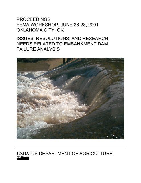
PROCEEDINGS<br />
<strong>FEMA</strong> WORKSHOP, JUNE 26-28, 2001<br />
OKLAHOMA CITY, OK<br />
ISSUES, RESOLUTIONS, AND RESEARCH<br />
NEEDS RELATED TO EMBANKMENT DAM<br />
FAILURE ANALYSIS<br />
US DEPARTMENT OF AGRICULTURE
Acknowledgements<br />
The project proposal and scope <strong>of</strong> work were developed and submitted by Dr.<br />
Greg Hanson and Darrel Temple <strong>of</strong> the ARS as a joint effort with Bill Irwin <strong>of</strong> the<br />
NRCS. The steering committee which helped organize the Workshop on Issues,<br />
Resolutions, and Research Needs Related to <strong>Embankment</strong> <strong>Dam</strong> <strong>Failure</strong> <strong>Analysis</strong><br />
included the following members:<br />
Dr. Greg Hanson, USDA-ARS<br />
Bill Irwin, USDA-NRCS<br />
Darrel Temple, USDA-ARS<br />
Wayne Graham, USBR<br />
Charles Pearre, USACE<br />
Ed Fiegle, GA Dept. <strong>of</strong> Natural Resources<br />
Terry Hampton, Gannett Fleming<br />
Brandee Hancock, and Ruth Treat <strong>of</strong> the ARS-PSWCRL served as the<br />
administrative staff in organizing the meeting, corresponding with participants,<br />
and making local arrangements. Kevin Cook and Brandee Hancock assisted in<br />
organizing the proceedings. Nate Snorteland <strong>of</strong> the U.S. Bureau <strong>of</strong> Reclamation<br />
served as the facilitator and therefore led all group discussions. Nate Snorteland<br />
contributed heavily to the “<strong>Dam</strong> <strong>Failure</strong> <strong>Analysis</strong> and Research Development<br />
Topics,” section <strong>of</strong> the proceedings.<br />
PROJECT SPONSOR<br />
Federal Emergency Management Agency<br />
National <strong>Dam</strong> Safety Program<br />
Research Subcommittee, David Achterberg, (USBR), Chair<br />
500 C Street SW<br />
Washington, DC 20047<br />
PROJECT COORDINATOR<br />
USDA-ARS-PSWCRL<br />
1301 N. Western<br />
Stillwater, OK 74075
TABLE OF CONTENTS<br />
Page #<br />
OVERVIEW………………………………………………………………………. 1-1<br />
OUTLINE OF THE WORKSHOP AGENDA…………………………………. 2-1<br />
SUMMARY OF WORKSHOP PRESENTATIONS…………………………... 3-1<br />
DAM FAILURE ANALYSIS AND RESEARCH DEVELOPMENT TOPICS. 4-1<br />
APPENDICES<br />
A AGENDA<br />
B PRESENTATIONS<br />
C PARTICIPANTS
1<br />
OVERVIEW<br />
________________________________________________________________________<br />
This workshop is part <strong>of</strong> a series <strong>of</strong> workshops being sponsored by the Federal<br />
Emergency Management Agency (<strong>FEMA</strong>) and administered by the ARS/NRCS <strong>of</strong> the<br />
USDA. The workshop was a 3-day workshop on “Issues, Resolutions, and Research<br />
Needs Related to <strong>Embankment</strong> <strong>Dam</strong> <strong>Failure</strong> <strong>Analysis</strong>,” held in Oklahoma City, OK,<br />
June 26-28 th , 2001. The product <strong>of</strong> this workshop is the written report documenting the<br />
results <strong>of</strong> the workshop. The report will be included in <strong>FEMA</strong>’s National <strong>Dam</strong> Safety<br />
Program Act Report Series.<br />
The workshop consisted <strong>of</strong> convening and facilitating a group <strong>of</strong> experts with respect to<br />
dam safety associated with embankment dam failure analysis. The objectives <strong>of</strong> this<br />
work were:<br />
1. To document, in the form <strong>of</strong> a final report, a state <strong>of</strong> practice concerning<br />
embankment dam failure analysis;<br />
2. To identify short-term (immediate) and long-term research needs <strong>of</strong> the<br />
federal and non-federal dam safety community; and<br />
3. To recommend a course <strong>of</strong> action to address these needs.<br />
By research needs we understood the interest <strong>of</strong> the National <strong>Dam</strong> Safety Program to<br />
encompass both short-term (i.e. immediate) and long-term research including areas <strong>of</strong><br />
development and technology transfer. These may include such areas as the following:<br />
a vision for the future <strong>of</strong> computer modeling <strong>of</strong> embankment breaching processes and<br />
flood routing, basic research <strong>of</strong> embankment overtopping and breach processes, and<br />
tools to conduct forensic studies. There were 14 areas <strong>of</strong> research identified and<br />
prioritized by workshop participants. The workshop was a successful undertaking that<br />
produced open communication among a wide range <strong>of</strong> experts in the field and identified<br />
research and development opportunities that could significantly improve the state-<strong>of</strong>the-practice<br />
in the field.<br />
1-1
2<br />
OUTLINE OF THE WORKSHOP AGENDA<br />
________________________________________________________________<br />
A group <strong>of</strong> 35 individuals were assembled for a three-day workshop on Issues,<br />
Resolutions, and Research Needs Related to <strong>Dam</strong> <strong>Failure</strong> Analyses. The group<br />
consisted <strong>of</strong> invited experts, facilitators, and the <strong>FEMA</strong> Project Officer for the workshop.<br />
The workshop participants were selected to provide broad representation <strong>of</strong> individuals<br />
in the topic area. Participants included 15 representatives <strong>of</strong> 7 different U.S. federal<br />
agencies, 5 representatives from 5 different state dam safety agencies, 9<br />
representatives <strong>of</strong> 8 different consulting companies, 3 university pr<strong>of</strong>essors, and 1<br />
representative from a hydropower organization. The group included individuals from 15<br />
different U.S. states and 4 other countries (Canada, United Kingdom, Norway, and<br />
Finland).<br />
The first day and a half was devoted to exchange <strong>of</strong> information through presentations<br />
by the participants and discussions <strong>of</strong> embankment dam failures.<br />
Presentations included:<br />
1. Classification and case histories, including the human and economic<br />
consequences, <strong>of</strong> dam failure.<br />
2. Overview <strong>of</strong> presently used tools for assessing risk, time to failure, dam<br />
failure processes, outflow hydrograph, and flood routing.<br />
3. State assessment criteria, experience, and case examples.<br />
A tour <strong>of</strong> the ARS Hydraulic Unit research facilities at Lake Carl Blackwell, OK was<br />
conducted in the afternoon <strong>of</strong> the second day. The tour included research projects<br />
covering:<br />
1. Apparatus and procedure for measuring erodibility <strong>of</strong> cohesive materials in<br />
concentrated flow environments (i.e. earthen spillways, streambeds,<br />
streambanks, and embankments).<br />
2. Riffle-pool rock chutes model for a specific application <strong>of</strong> stream stabilization<br />
on Sugar Creek, OK.<br />
3. Performance studies <strong>of</strong> vegetated and bare earth on steep channels.<br />
4. <strong>Embankment</strong> breach discharge model study.<br />
5. Large-scale embankment breach failure study.<br />
2-1
The first half <strong>of</strong> the third day was devoted to presentations and discussions on research<br />
and new technology related to risk assessment, embankment dam failure, and flood<br />
routing. The afternoon <strong>of</strong> the third day was devoted to discussions prioritizing research<br />
needs.<br />
2-2
3<br />
SUMMARY OF WORKSHOP PRESENTATIONS<br />
________________________________________________________________<br />
The broad scope <strong>of</strong> the workshop presentations demonstrates the wide range <strong>of</strong><br />
perspectives represented and the importance <strong>of</strong> the subject to the various entities<br />
involved. The material presented covered the spectrum from addressing concerns with<br />
developing solutions for specific immediate problems to identification <strong>of</strong> knowledge<br />
deficiencies that impede development <strong>of</strong> generalized tools, and from concerns related to<br />
the breach process itself to those related to the impacts <strong>of</strong> the resulting floodwave<br />
downstream. However, the presenters did an excellent job <strong>of</strong> focusing on the goals <strong>of</strong><br />
the workshop and, together, these presentations present a relatively clear picture <strong>of</strong> the<br />
present state <strong>of</strong> the science in this area. This section provides a very brief overview <strong>of</strong><br />
the material presented in the workshop, those presentations that included papers are<br />
referred by number to appendix B <strong>of</strong> this report.<br />
1.1 <strong>Dam</strong> <strong>Failure</strong>s<br />
3.1.1 Classification and Case Histories <strong>of</strong> <strong>Dam</strong> <strong>Failure</strong>s – Martin McCann,<br />
National Performance <strong>of</strong> <strong>Dam</strong>s Program<br />
This presentation focused on an overview <strong>of</strong> the National Performance <strong>of</strong> <strong>Dam</strong>s<br />
Program (NPDP). The NPDP acts as a public library <strong>of</strong> dam performance. The NPDP<br />
has several priorities: facilitating reporting <strong>of</strong> dam performance, providing access to<br />
basic information, data compilation and presentation, and research. Dr McCann gave<br />
an incident summary for the last 10 years related to total number <strong>of</strong> incidents, type <strong>of</strong><br />
dam, type <strong>of</strong> incident, hazard classification, and height <strong>of</strong> dam. Dr. McCann also<br />
discussed the challenges in data collection and archiving <strong>of</strong> dam incidents/failures. The<br />
information is a resource to support dam engineering, dam safety, and public policy.<br />
3.1.2 Human and Economic Consequences <strong>of</strong> <strong>Dam</strong> <strong>Failure</strong>- Wayne Graham,<br />
USBR (B-1)<br />
Mr. Graham’s presentation focused on 13 dam failures in the U.S. Included was every<br />
U.S. dam failure that caused more than 50 fatalities. The presentation included a<br />
discussion <strong>of</strong> dam characteristics, cause <strong>of</strong> dam failure, dam failure warning (if any),<br />
evacuation, and human and economic losses. Loss <strong>of</strong> life from dam failure can vary<br />
widely. In 1889, the 72-foot high earthfill South Fork <strong>Dam</strong> near Johnstown, PA. failed,<br />
killing about 2,200 people. This can be contrasted to the period, 1985 to 1994, when<br />
hundreds <strong>of</strong> smaller dams failed in the U.S. and less than 2% <strong>of</strong> these failures caused<br />
fatalities. Many <strong>of</strong> the dam failure images in Mr. Graham’s presentation are proprietary<br />
and not in the public domain. As such, dam failure images used in the presentation are<br />
not included in these proceedings.<br />
3-1
1.2 Present Practice for Predicting <strong>Dam</strong> <strong>Failure</strong>s<br />
1.2.1 Will a <strong>Dam</strong> <strong>Failure</strong> Occur?- Risk Assessment USBR Perspective. –<br />
Bruce Muller, USBR (B-2)<br />
Mr. Muller presented that the Bureau <strong>of</strong> Reclamation is developing a program to: 1)<br />
quantify the risk <strong>of</strong> storing water, 2) monitor aspects <strong>of</strong> performance that indicate<br />
potential for some form <strong>of</strong> failure mode to develop, and 3) take action to reduce the<br />
likelihood <strong>of</strong> dam failure. The USBR risk management responsibility comes out <strong>of</strong> the<br />
<strong>Dam</strong> Safety Act <strong>of</strong> 1978 which authorizes the Department <strong>of</strong> Interior to construct,<br />
restore, operate, maintain, new or modified features <strong>of</strong> their dams for safety purposes.<br />
1.2.2 Will a <strong>Dam</strong> <strong>Failure</strong> Occur?- Risk Assessment USACE Perspective. –<br />
David Moser, USACE (B-3)<br />
Mr. Moser discussed why the U.S. Army Corps <strong>of</strong> Engineers is interested in risk<br />
assessment and what their objectives are. The Corps <strong>of</strong> Engineers has approximately<br />
570 dams, 64% <strong>of</strong> their dams are over 30 years old and 28% are over 50 years old.<br />
Approximately 10% <strong>of</strong> these dams are categorized as hydrologically or seismically<br />
deficient based on present Corps Criteria. The cost to fix these deficiencies is several<br />
billions <strong>of</strong> dollars. The Corps traditional approach to handling risk assessment has been<br />
meeting standards and criteria (i.e. design based on Probable Maximum Flood).<br />
Because <strong>of</strong> the current interest around the world, the Corps Major Rehabilitation<br />
Program, and a need for consistency with other agencies the Corps has a renewed<br />
interest in risk analysis for dam safety. Their objective is to develop methodologies,<br />
frameworks, and s<strong>of</strong>tware tools necessary for the USACE to proactively manage the<br />
overall level <strong>of</strong> human and economic risk from their inventory <strong>of</strong> dams.<br />
1.2.3 Methods Based on Case Study Database. – Tony Wahl, USBR (B-4)<br />
Mr. Wahl focused his discussion on embankment dam breach parameter predictions<br />
based on case studies and the uncertainty <strong>of</strong> these parameters. This discussion was<br />
based on an evaluation <strong>of</strong> a database <strong>of</strong> 108 dam failures. The breach parameters<br />
evaluated were breach width, failure time, and peak outflow. The uncertainty <strong>of</strong> breach<br />
parameter predictions is very large. Four equations were evaluated for breach width,<br />
five equations were evaluated for failure time, and 13 equations were evaluated for<br />
peak outflow. There is room for improvement in determining these breach parameters<br />
and the uncertainty.<br />
1.2.4 Directions for <strong>Dam</strong>-Breach Modeling/Flood Routing – Danny Fread<br />
(Retired National Weather Service). (B-5)<br />
Dr. Fread concentrated his discussion on models he has been involved with at the<br />
National Weather Service as well as other types <strong>of</strong> models that are used in dam-breach<br />
prediction and flood routing. The dam-breach modeling involves the development <strong>of</strong><br />
the breach as well as the peak outflow that would be used in flood routing downstream.<br />
3-2
He also discussed research needs to improve these models such as; 1) prototype<br />
embankment experiments; 2) Manning’s n and debris effects; and 3) risk or probabilistic<br />
approaches to dam failures.<br />
1.2.5 RESCDAM-Project – Mikko Huokuna, Finnish Environment Institute (B-<br />
6)<br />
Mr. Huokuna’s presentation focused on Finland’s dams and reservoirs and the<br />
RESCDAM project. Finland’s dams and reservoirs have been constructed mainly for<br />
flood control, hydroelectric power production, water supply, recreation, and fish culture,<br />
as well as storing waste detrimental to health or the environment. At present, there are<br />
55 large dams in Finland and based on Finnish dam safety legislation 36 dams require<br />
a rescue action plan. The RESCDAM project is meant to improve the dam safety<br />
sector. The activities <strong>of</strong> the RESCDAM project embrace risk analysis, dam-break flood<br />
analysis, and rescue action improvement. Recommendations for further research<br />
based on the dam break hazard analysis <strong>of</strong> the RESCDAM project include<br />
determination <strong>of</strong> breach formation, determination <strong>of</strong> roughness coefficients for the<br />
discharge channel, and the effect <strong>of</strong> debris and urban areas on floodwave propagation.<br />
1.2.6 Hazard Classification – Alton Davis, Engineering Consultants Inc. (B-7)<br />
Mr. Davis presented and discussed “<strong>FEMA</strong> Guidelines for <strong>Dam</strong> Safety: Hazard Potential<br />
Classification System for <strong>Dam</strong>s.” The <strong>FEMA</strong> guidelines specified three hazard potential<br />
classifications: 1) low hazard potential, 2) significant hazard potential, and 3) high<br />
hazard potential. The definitions <strong>of</strong> each hazard potential and selection criteria were<br />
provided in the presentation. Factors such as loss <strong>of</strong> human life, economic losses,<br />
lifeline disruption, and environmental damage affect classification.<br />
1.3 Current Practice<br />
3.3.1-5 State assessment Criteria, Experience and Case Examples –<br />
John Ritchey, <strong>Dam</strong> Safety Section State <strong>of</strong> New Jersey (B-8)<br />
Ed Fiegle, <strong>Dam</strong> Safety Section State <strong>of</strong> Georgia<br />
(B-9)<br />
Matt Lindon, <strong>Dam</strong> Safety Section State <strong>of</strong> Utah<br />
(B-10)<br />
David Gutierrez, <strong>Dam</strong> Safety Section State <strong>of</strong> California<br />
Cecil Bearden, <strong>Dam</strong> Safety Section State <strong>of</strong> Oklahoma.<br />
These presentations focused on state assessment criteria, experience and case<br />
examples in relationship to dam failure analysis. This not only included their states but<br />
also information related to states in their region. Current assessment criteria practiced<br />
at the state level for dam failure analyses is variable. Several states conduct in house<br />
assessments, some states require the dam owner to hire a licensed pr<strong>of</strong>essional, and<br />
some allow the dam owner to conduct the assessments. The analyses are preformed<br />
for the purpose <strong>of</strong> determining hazard classifications, spillway design floods, flood<br />
zoning, and for establishing inundation areas for use in Emergency Action Plans. The<br />
methods accepted for dam failure analyses vary from state to state. Typical models that<br />
3-3
are used for conducting dam failure analysis and downstream flood routing are HEC-1,<br />
HEC-RAS, DAMBRK, FLDWAV, NWS Simplified DAMBRK, NRCS’s TR-61, WSP2<br />
Hydraulics, and the TR-66 Simplified <strong>Dam</strong> Breach Routing Procedure. There were<br />
several research needs mentioned in these presentations including; 1) establishment <strong>of</strong><br />
a forensic team, 2) refinement <strong>of</strong> breach parameters, 3) training on present technology,<br />
4) aids for determining Manning’s n values, and 5) refining and understanding actual<br />
failure processes.<br />
3.3.6-9 Federal Assessment Criteria, Experience, and Case Examples-<br />
Wayne Graham, USBR<br />
(B-12)<br />
Bill Irwin, NRCS<br />
(B-13)<br />
James Evans and Michael Davis, FERC<br />
(B-14)<br />
These presentations focused on the federal assessment criteria, experience, and case<br />
examples. The USBR, NRCS, and FERC each have a portfolio <strong>of</strong> dams that they have<br />
ownership <strong>of</strong>, partnership in, or regulatory responsibility over. These agencies conduct<br />
embankment dam failure analysis and inundation mapping to assign hazard<br />
classification, develop evacuation plans, assess risk, and evaluate rehabilitation needs.<br />
The criteria are agency specific with a recognized need for inter-agency coordination.<br />
There are several recognized uncertainties that require more investigation including; 1)<br />
failure analysis for different types <strong>of</strong> failure (i.e. overtopping, piping, and seismic), 2)<br />
breach characteristics, 3) Manning’s roughness characteristics, 4) allowable<br />
overtopping, 5) consequences <strong>of</strong> failure, and 5) quantifying risk.<br />
3.3.10-13 Owners and Consultants Assessment Criteria, Experience, and Case<br />
Examples-<br />
Derek Sakamoto, BC Hydro<br />
(B-15)<br />
Ellen Faulkner, Mead & Hunt Inc.<br />
(B-16)<br />
Catalino Cecilio, Catalino B. Cecilio Consultants<br />
(B-17)<br />
John Rutledge, Freeze and Nichols.<br />
Mr. Sakamoto, representing BC Hydro, presented an overview <strong>of</strong> the Inundation<br />
Consequences Program for assessing the consequences resulting from a potential dam<br />
breach. The key focus <strong>of</strong> this program is to provide an improved tool for safety<br />
management planning. This program will provide decision makers with realistic<br />
characterizations <strong>of</strong> the various situations. It will provide investigators with the ability to<br />
determine effects <strong>of</strong> parameters such as dam breach scenarios and temporal variations<br />
related to flood wave propagation. This will also provide a powerful communication tool.<br />
Engineering consultants throughout the United States perform dam safety assessments,<br />
which must be responsive to the needs <strong>of</strong> dam owners and to the requirements <strong>of</strong> state<br />
and federal regulatory agencies. The purpose <strong>of</strong> these studies is hazard classification,<br />
emergency action plan, or design flood assessment. Each dam failure study involves<br />
identification <strong>of</strong> a critical, plausible mode <strong>of</strong> failure and the selection <strong>of</strong> specific<br />
parameters, which define the severity <strong>of</strong> failure. These parameters include ultimate<br />
dimensions <strong>of</strong> the breach, time required to attain dimensions, and the depth <strong>of</strong><br />
overtopping required to initiate failure. The choice <strong>of</strong> these parameters is influenced by<br />
3-4
what is reasonable to the engineer and also acceptable to the regulatory agency. The<br />
models used for dam safety assessment are based on what the regulatory agencies<br />
consider acceptable.<br />
3.4 Research and New Technology<br />
3.4.1 Risk Assessment Research- David Bowles, Utah State University<br />
Dr. Bowles discussed the ASDSO/<strong>FEMA</strong> Specialty Workshop on Risk Assessment for<br />
<strong>Dam</strong>s and some requirements for failure modes analyses for use in Risk Assessment.<br />
The workshop scope was to assess state <strong>of</strong> practice <strong>of</strong> risk assessment, technology<br />
transfer/training, and risk assessment needs. The outcomes <strong>of</strong> the workshop followed<br />
four major application areas in current risk assessment practice: failure modes<br />
identification, index prioritization, portfolio risk assessment, and detailed quantitative risk<br />
assessment.<br />
Dr. Bowles also discussed requirements for failure mode analysis for use in risk<br />
assessment which included: understanding how the dam will perform under various<br />
stresses, improving capability <strong>of</strong> predicting failure, incorporation <strong>of</strong> uncertainties, and<br />
application over a range <strong>of</strong> site specific cases.<br />
3.4.2 Research at CSU Related to Design Flood Impacts on Evaluating <strong>Dam</strong><br />
<strong>Failure</strong> Mechanisms - Steve Abt, Colorado State University (B-18)<br />
Dr. Abt’s presentation focused on current dam safety research efforts being conducted<br />
at Colorado State University. The research at CSU has focused on dam embankment<br />
protection including: hydraulic design <strong>of</strong> stepped spillways (i.e. roller compacted<br />
concrete), hydraulic analysis <strong>of</strong> articulated concrete blocks, and design criteria for<br />
rounded rock riprap.<br />
3.4.3 Limited Overtopping, <strong>Embankment</strong> Breach, and Discharge - Darrel<br />
Temple and Greg Hanson, USDA-ARS (B-19)<br />
Mr. Temple and Dr. Hanson discussed research being conducted by the ARS Plant<br />
Science and Water Conservation Laboratory on overtopping <strong>of</strong> vegetated<br />
embankments. This research includes limited overtopping <strong>of</strong> grassed embankments,<br />
breach processes, and breach discharge. Long duration flow tests were conducted on<br />
steep vegetated and non-vegetated slopes. The embankment overtopping breach tests<br />
have been conducted on soil materials ranging from non-plastic sandy material to a<br />
plastic clay material. The vegetal cover and soil materials have a major impact on the<br />
timing <strong>of</strong> breach processes.<br />
3-5
3.4.4 <strong>Dam</strong> Break Routing - Michael Gee, USACE (B-20)<br />
Dr. Gee gave an overview <strong>of</strong> HEC models for dam break flood routing. The USACE<br />
Hydrologic Engineering Center provides a program <strong>of</strong> research, training, and technical<br />
assistance for hydrologic engineering and planning analysis. The future additions to the<br />
suite <strong>of</strong> HEC models includes dam and levee breaching (i.e. overtopping, and piping).<br />
The HEC-RAS 3.1 release will be available fall <strong>of</strong> 2001. Dr. Gee presented some<br />
examples <strong>of</strong> floodwave routing through a river system and the graphic output from HEC-<br />
RAS computations.<br />
3.4.5 Overview <strong>of</strong> CADAM and Research - Mark Morris, HR Wallingford. (B-21)<br />
Mr. Morris provided an overview <strong>of</strong> the CADAM Concerted Action Project and the<br />
IMPACT research project. Both <strong>of</strong> these projects have been funded by the European<br />
Commission. The CADAM project ran between Feb 98 and Jan 2000 with the aim <strong>of</strong><br />
reviewing dambreak modeling codes and practice, from basics to application. The<br />
topics covered included analysis and modeling <strong>of</strong> flood wave propagation, breaching <strong>of</strong><br />
embankments, and dambreak sediment effects. The program <strong>of</strong> study was such that<br />
the performance <strong>of</strong> modeling codes were evaluated against progressively more complex<br />
conditions.<br />
The IMPACT project focuses research in a number <strong>of</strong> key areas that were identified<br />
during the CADAM project as contributing to uncertainty in dambreak and extreme flood<br />
predictions. Research areas include embankment breach, flood propagation, and<br />
sediment movement.<br />
3.4.6 <strong>Embankment</strong> Breach Research - Kjetil Arne Vaskinn, Statkraaft Groner.<br />
(B-22)<br />
Mr. Vaskinn discussed embankment breach research in Norway. The issue <strong>of</strong> dam<br />
safety has become more and more important in Norway during the last years and much<br />
money has been spent to increase the safety level <strong>of</strong> dams. <strong>Dam</strong> break analysis is<br />
performed in Norway to assess the consequences <strong>of</strong> dambreak and is a motivating<br />
factor for the dam safety work. Norway has started a new research project focusing on<br />
improving the knowledge in this field. The objectives <strong>of</strong> this project are to improve the<br />
knowledge <strong>of</strong> rock fill dams exposed to leakage and to gain knowledge on the<br />
development <strong>of</strong> a breach. There is overlap between the Norway project and that <strong>of</strong><br />
IMPACT (discussed by Mr. Morris) so they will be coordinating their research efforts.<br />
3-6
4<br />
DAM FAILURE ANALYSIS RESEARCH AND DEVELOPMENT<br />
TOPICS<br />
________________________________________________________________<br />
Process<br />
Potential research and development ideas were compiled in a brainstorming session<br />
with the workshop participants divided into several small groups. The ideas from all the<br />
groups were then listed on flip charts and posted on the wall. As a group, the<br />
participants grouped and merged the ideas where possible. After all the topics were<br />
listed, the participants were asked to cast votes using three different criteria: Probability<br />
<strong>of</strong> Success, Value, and Cost. The aggregate score for each topic is based on the<br />
arithmetic sum <strong>of</strong> votes that topic received in each <strong>of</strong> the three voting categories.<br />
Each participant was given three sets <strong>of</strong> 10 colored stickers with which to vote. Each<br />
participant was allowed to cast more than one vote per listed topic as long as the<br />
participant’s total number <strong>of</strong> votes in each category did not exceed 10. The entire list <strong>of</strong><br />
research and development topics and the results <strong>of</strong> the voting are shown below in Table<br />
1.<br />
TABLE 1 – RESEARCH AND DEVELOPMENT TOPICS AND VOTE TOTALS<br />
TOPIC<br />
NUMBER<br />
1<br />
RESEARCH / DEVELOPMENT TOPIC(S)<br />
Update, Revise, and Disseminate the historic data set /<br />
database <strong>of</strong> dam failures. The data set should include<br />
failure information, flood information, and embankment<br />
properties.<br />
Probability <strong>of</strong><br />
Success<br />
NUMBER OF VOTES<br />
Value Cost 1<br />
16 16 6<br />
2<br />
Develop forensic guidelines and standards for dam<br />
safety experts to use when reporting dam failures or<br />
dam incidents. Create a forensic team that would be<br />
able to collect and disseminate valuable forensic data.<br />
16 24 14<br />
3<br />
Produce an expert-level video <strong>of</strong> Danny Fread along<br />
the lines <strong>of</strong> the previous ICODS videos from Jim<br />
Mitchell, Don Deere, etc.<br />
13 7 9<br />
4<br />
Identify critical parameters for different types <strong>of</strong> failure<br />
modes.<br />
5 3 6<br />
4-1
TOPIC<br />
NUMBER<br />
5<br />
RESEARCH / DEVELOPMENT TOPIC(S)<br />
Perform basic physical research to model different dam<br />
parameters such as soil properties, scaling effects, etc.<br />
with the intent to verify the ability to model actual dam<br />
failure characteristics and extend dam failure<br />
knowledge using scale models.<br />
Probability <strong>of</strong><br />
Success<br />
NUMBER OF VOTES<br />
Value Cost 1<br />
15 21 4<br />
6<br />
Update the regression equations used to develop the<br />
input data used in dam breach and flood routing<br />
models.<br />
2 7 11<br />
7<br />
Develop better computer-based predictive models.<br />
This would preferably build upon existing technology<br />
rather than developing new s<strong>of</strong>tware.<br />
14 13 7<br />
8<br />
Develop a process that would be able to integrate dam<br />
breach and flood routing information into an early<br />
warning system.<br />
0 0 0<br />
9<br />
Make available hands-on end-user training for breach<br />
and flood routing modeling that is available to<br />
government agencies and regulators, public entities<br />
(such as dam owners), and private consultants.<br />
11 6 13<br />
10<br />
Validate and test existing dam breach and flood routing<br />
models using available dam failure information.<br />
0 1 1<br />
11<br />
Develop a method to combine deterministic and<br />
probabilistic dam failure analyses including the<br />
probability <strong>of</strong> occurrence and probable breach location.<br />
5 2 3<br />
12<br />
Using physical research data, develop guidance for the<br />
selection <strong>of</strong> breach parameters used during breach<br />
modeling.<br />
16 20 16<br />
13<br />
Send U.S. representatives to cooperate with EU dam<br />
failure analysis activities.<br />
10 7 13<br />
14 Lobby the NSF to fund basic dam failure research. 0 2 2<br />
1 A higher number in the cost category indicates a lower cost.<br />
4-2
The break down <strong>of</strong> the individual topics by probability <strong>of</strong> success is shown if Figure 1.<br />
and Table 2.<br />
TOPICS<br />
Research/Development Topics<br />
1<br />
2<br />
3<br />
4<br />
5<br />
6<br />
7<br />
8<br />
9<br />
10<br />
11<br />
12<br />
13<br />
14<br />
1 - Assimilate historic<br />
data set<br />
2 - Forensic standards<br />
3 - Produce Danny<br />
Fread video<br />
4 - Critical failure<br />
mode parameters<br />
5 - Basic research<br />
6 - Update regression<br />
equations<br />
7 - Develop improved<br />
computer models<br />
8 - Integrate models with<br />
early warning systems<br />
9 - Develop hands-on<br />
end-user training<br />
10-Validate existing<br />
models<br />
11-Combine deterministic/<br />
probabilistic analysis<br />
12-Breach parameter<br />
guidance<br />
13-U.S. reps @<br />
European activities<br />
14-Lobby NSF<br />
0 2 4 6 8 10 12 14 16 18 20 22 24 26 28 30<br />
Number <strong>of</strong> participant votes<br />
Figure 1. Probability <strong>of</strong> success<br />
TABLE 2 – RESEARCH TOPICS RANKED BY PROBABILITY OF SUCCESS<br />
TOPIC<br />
NUMBER<br />
RESEARCH / DEVELOPMENT TOPIC(S)<br />
NUMBER OF VOTES<br />
1<br />
Update, Revise, and Disseminate the historic data set / database.<br />
The data set should include failure information, flood information, and<br />
embankment properties.<br />
16<br />
2<br />
Develop forensic guidelines and standards for dam safety experts to<br />
use when reporting dam failures or dam incidents. Create a forensic<br />
team that would be able to collect and disseminate valuable forensic<br />
data.<br />
16<br />
12<br />
Using physical research data, develop guidance for the selection <strong>of</strong><br />
breach parameters used during breach modeling.<br />
16<br />
4-3
TOPIC<br />
NUMBER<br />
RESEARCH / DEVELOPMENT TOPIC(S)<br />
NUMBER OF VOTES<br />
5<br />
Perform basic physical research to model different dam parameters<br />
such as soil properties, scaling effects, etc. with the intent to verify<br />
the ability to model actual dam failure characteristics and extend dam<br />
failure knowledge using scale models.<br />
15<br />
7<br />
Develop better computer-based predictive models. Preferably build<br />
upon existing technology rather than developing new s<strong>of</strong>tware.<br />
14<br />
3<br />
Produce an expert-level video <strong>of</strong> Danny Fread along the lines <strong>of</strong> the<br />
previous ICODS videos from Jim Mitchell, Don Deere, etc.<br />
13<br />
9<br />
Make available hands-on end-user training for breach and flood<br />
routing modeling that is available to government agencies and<br />
regulators, public entities (such as dam owners), and private<br />
consultants.<br />
11<br />
13<br />
Send U.S. representatives to cooperate with EU dam failure analysis<br />
activities.<br />
10<br />
4 Identify critical parameters for different types <strong>of</strong> failure modes 5<br />
11<br />
Develop a method to combine deterministic and probabilistic dam<br />
failure analyses including the probability <strong>of</strong> occurrence and probable<br />
breach location.<br />
5<br />
6<br />
Update the regression equations used to develop the input data used<br />
in dam breach and flood routing models.<br />
2<br />
8<br />
Develop a process that would be able to integrate dam breach and<br />
flood routing information into an early warning system.<br />
0<br />
10<br />
Validate and test existing dam breach and flood routing models using<br />
available dam failure information.<br />
0<br />
14 Lobby the NSF to fund basic dam failure research. 0<br />
4-4
The break down <strong>of</strong> the individual topics by value <strong>of</strong> the item is shown if Figure 2. and<br />
Table 3.<br />
TOPIC<br />
Research/Development Topics<br />
1<br />
2<br />
3<br />
4<br />
5<br />
6<br />
7<br />
8<br />
9<br />
10<br />
11<br />
12<br />
13<br />
14<br />
1 - Assimilate historic<br />
data set<br />
2 - Forensic standards<br />
3 - Produce Danny<br />
Fread video<br />
4 - Critical failure<br />
mode parameters<br />
5 - Basic research<br />
6 - Update regression<br />
equations<br />
7 - Develop improved<br />
computer models<br />
8 - Integrate models with<br />
early warning systems<br />
9 - Develop hands-on<br />
end-user training<br />
10 - Validate existing<br />
models<br />
11 - Combine deterministic/<br />
probabilistic analysis<br />
12 - Breach parameter<br />
guidance<br />
13 - U.S. reps @<br />
European activities<br />
14 - Lobby NSF<br />
0 2 4 6 8 10 12 14 16 18 20 22 24 26 28 30<br />
Number <strong>of</strong> participant votes<br />
Figure 2. Value <strong>of</strong> research topic<br />
TABLE 3 – RESEARCH TOPICS RANKED BY VALUE<br />
TOPIC<br />
NUMBER<br />
RESEARCH / DEVELOPMENT TOPIC(S)<br />
NUMBER OF VOTES<br />
2<br />
5<br />
Develop forensic guidelines and standards for dam safety experts to<br />
use when reporting dam failures or dam incidents. Create a forensic<br />
team that would be able to collect and disseminate valuable forensic<br />
data.<br />
Perform basic physical research to model different dam parameters<br />
such as soil properties, scaling effects, etc. with the intent to verify<br />
the ability to model actual dam failure characteristics and extend dam<br />
failure knowledge using scale models.<br />
24<br />
21<br />
4-5
TOPIC<br />
NUMBER<br />
RESEARCH / DEVELOPMENT TOPIC(S)<br />
NUMBER OF VOTES<br />
12<br />
Using physical research data, develop guidance for the selection <strong>of</strong><br />
breach parameters used during breach modeling.<br />
20<br />
1<br />
Update, Revise, and Disseminate the historic data set / database.<br />
The data set should include failure information, flood information, and<br />
embankment properties.<br />
16<br />
7<br />
Develop better computer-based predictive models. Preferably build<br />
upon existing technology rather than developing new s<strong>of</strong>tware.<br />
13<br />
3<br />
Produce an expert-level video <strong>of</strong> Danny Fread along the lines <strong>of</strong> the<br />
previous ICODS videos from Jim Mitchell, Don Deere, etc.<br />
7<br />
6<br />
Update the regression equations used to develop the input data used<br />
in dam breach and flood routing models.<br />
7<br />
13<br />
Send U.S. representatives to cooperate with EU dam failure analysis<br />
activities.<br />
7<br />
9<br />
Make available hands-on end-user training for breach and flood<br />
routing modeling that is available to government agencies and<br />
regulators, public entities (such as dam owners), and private<br />
consultants.<br />
6<br />
4 Identify critical parameters for different types <strong>of</strong> failure modes 3<br />
11<br />
Develop a method to combine deterministic and probabilistic dam<br />
failure analyses including the probability <strong>of</strong> occurrence and probable<br />
breach location.<br />
2<br />
14 Lobby the NSF to fund basic dam failure research. 2<br />
10<br />
Validate and test existing dam breach and flood routing models using<br />
available dam failure information.<br />
1<br />
4-6
TOPIC<br />
NUMBER<br />
RESEARCH / DEVELOPMENT TOPIC(S)<br />
NUMBER OF VOTES<br />
8<br />
Develop a process that would be able to integrate dam breach and<br />
flood routing information into an early warning system.<br />
0<br />
TOPICS<br />
Research/Development Topics<br />
1<br />
2<br />
3<br />
4<br />
5<br />
6<br />
7<br />
8<br />
9<br />
10<br />
11<br />
12<br />
13<br />
14<br />
Cost<br />
1 - Assimilate historic<br />
data set<br />
2 - Forensic standards<br />
3 - Produce Danny<br />
Fread video<br />
4 - Critical failure<br />
mode parameters<br />
5 - Basic research<br />
6 - Update regression<br />
equations<br />
7 - Develop improved<br />
computer models<br />
8 - Integrate models with<br />
early warning systems<br />
9 - Develop hands-on<br />
end-user training<br />
10-Validate existing<br />
models<br />
11-Combine deterministic/<br />
probabilistic analysis<br />
12-Breach parameter<br />
guidance<br />
13-U.S. reps @<br />
European activities<br />
14-Lobby NSF<br />
0 2 4 6 8 10 12 14 16 18 20 22 24 26 28 30<br />
Number <strong>of</strong> participant votes<br />
Figure 3. Cost <strong>of</strong> research topic (the more votes the lower the cost).<br />
TABLE 4 – RESEARCH TOPICS RANKED BY COST<br />
TOPIC<br />
NUMBER<br />
RESEARCH / DEVELOPMENT TOPIC(S)<br />
NUMBER OF VOTES<br />
4-7
TOPIC<br />
NUMBER<br />
RESEARCH / DEVELOPMENT TOPIC(S)<br />
NUMBER OF VOTES<br />
12<br />
Using physical research data, develop guidance for the selection <strong>of</strong><br />
breach parameters used during breach modeling.<br />
16<br />
2<br />
9<br />
Develop forensic guidelines and standards for dam safety experts to<br />
use when reporting dam failures or dam incidents. Create a forensic<br />
team that would be able to collect and disseminate valuable forensic<br />
data.<br />
Make available hands-on end-user training for breach and flood<br />
routing modeling that is available to government agencies and<br />
regulators, public entities (such as dam owners), and private<br />
consultants.<br />
14<br />
13<br />
13<br />
Send U.S. representatives to cooperate with EU dam failure analysis<br />
activities.<br />
13<br />
6<br />
Update the regression equations used to develop the input data used<br />
in dam breach and flood routing models.<br />
11<br />
3<br />
Produce an expert-level video <strong>of</strong> Danny Fread along the lines <strong>of</strong> the<br />
previous ICODS videos from Jim Mitchell, Don Deere, etc.<br />
9<br />
7<br />
Develop better computer-based predictive models. Preferably build<br />
upon existing technology rather than developing new s<strong>of</strong>tware.<br />
7<br />
1<br />
Update, Revise, and Disseminate the historic data set / database.<br />
The data set should include failure information, flood information, and<br />
embankment properties.<br />
6<br />
4 Identify critical parameters for different types <strong>of</strong> failure modes 6<br />
5<br />
Perform basic physical research to model different dam parameters<br />
such as soil properties, scaling effects, etc. with the intent to verify<br />
the ability to model actual dam failure characteristics and extend dam<br />
failure knowledge using scale models.<br />
4<br />
11<br />
Develop a method to combine deterministic and probabilistic dam<br />
failure analyses including the probability <strong>of</strong> occurrence and probable<br />
breach location.<br />
3<br />
4-8
TOPIC<br />
NUMBER<br />
RESEARCH / DEVELOPMENT TOPIC(S)<br />
NUMBER OF VOTES<br />
14 Lobby the NSF to fund basic dam failure research. 2<br />
10<br />
Validate and test existing dam breach and flood routing models using<br />
available dam failure information.<br />
1<br />
8<br />
Develop a process that would be able to integrate dam breach and<br />
flood routing information into an early warning system.<br />
0<br />
Prioritization <strong>of</strong> Research Topics<br />
After the votes were tabulated, each research topic was ranked according to the<br />
aggregate total <strong>of</strong> votes cast. The rank <strong>of</strong> each topic in Table 5 and Figure 4 is a<br />
reflection <strong>of</strong> the combination <strong>of</strong> value, cost, and probability <strong>of</strong> success, based on equal<br />
weighting, as determined by the participants. Based on all the input by the participants,<br />
it is the author’s opinion that the following topics were the leading research and<br />
development ideas identified in the workshop.<br />
1. Develop forensic guidelines and standards for dam safety representatives and<br />
experts to use when reporting dam failures or dam incidents. Create a forensic<br />
team that would be able to collect and disseminate valuable forensic data. (Topic<br />
#2)<br />
2. Using physical research data, develop guidance for the selection <strong>of</strong> breach<br />
parameters used during breach modeling. (Topic #12)<br />
3. Perform basic physical research to model different dam parameters such as soil<br />
properties, scaling effects, etc. with the intent to verify the ability to model actual<br />
dam failure characteristics and extend dam failure knowledge using scale<br />
models. (Topic #5)<br />
4. Update, revise, and disseminate information in the historic data set / database.<br />
The data set should include failure information, flood information, and<br />
embankment properties. (Topic #1)<br />
5. Develop better computer-based predictive models. Preferably these models<br />
would build upon existing technology rather than developing new s<strong>of</strong>tware.<br />
(Topic #7)<br />
4-9
6. Make available hands-on end-user training for breach and flood routing modeling<br />
which would be available to government agencies and regulators, public entities<br />
(such as dam owners), and private consultants. (Topic #9)<br />
7. Record an expert-level video <strong>of</strong> Danny Fread along the lines <strong>of</strong> the previous<br />
ICODS videos from Jim Mitchell, Don Deere, etc. (Topic #3)<br />
8. Send U.S. representatives to cooperate with EU dam failure analysis activities.<br />
(Topic #13)<br />
The participants ranked the previous eight topics the highest overall when the three<br />
different criteria were averaged. The listing <strong>of</strong> the top 8 here is purely an arbitrary cut<strong>of</strong>f<br />
by the author.<br />
Overall, there were fewer votes cast for cost than for the other two ranking criteria. This<br />
is probably due to the fact that cost is more difficult to estimate than the value or<br />
probability <strong>of</strong> success. Because <strong>of</strong> this, the topics above may be in a slightly different<br />
order if cost is not considered as a ranking criterion.<br />
It is interesting to note that only fourteen topics were identified during the workshop.<br />
Previous workshops on different subjects identified a substantial number <strong>of</strong> topics, and<br />
then their ranking method narrowed their priority list down to a manageable number.<br />
This is not necessarily an indication that there is less to accomplish in the area <strong>of</strong> dam<br />
failure analysis, it is more an indication that this particular workshop attempted to<br />
combine many tasks into one research topic. It is the author’s opinion that many <strong>of</strong> the<br />
identified priority items can be broken down into several distinct sub-topics, and doing<br />
so may make it easier to cooperatively address the research needs listed here.<br />
In-order to identify short-term research versus long-term research items the votes cast<br />
for cost were plotted against value for each <strong>of</strong> the 14 research topics and the plot was<br />
broken into 4 quadrants (Figure 5). The upper left quadrant corresponded to those<br />
items that the participants deemed were <strong>of</strong> high value and low cost to accomplish. They<br />
were therefore labeled low hanging fruit and could be looked upon as short-term<br />
research items. Items 2 and 12 fell into this quadrant, which were the top two in the<br />
overall score. The upper right were items that based on relative comparison were high<br />
value but also high cost. This quadrant was labeled ‘strategic plan’ indicating that the<br />
items falling in this quadrant would be long-term research items. Items 1, 5, and 7 fell<br />
into this quadrant. These items were also ranked 3 – 5 in the overall scoring. The<br />
lower left quadrant was labeled ‘do later’ and based on relative comparisons contained<br />
research items that were low cost and low value. Items 3, 6, 9 and 13 fell into this<br />
quadrant, 3, 9 and 13 were also ranked 6 – 8 in the overall ranking. The lower right<br />
quadrant was labeled ‘consider’ and based on relative comparisons contained research<br />
items that were low cost and low value. Research items 4, 8, 10, 11, and 14 fell into<br />
this quadrant. This comparison may be found useful in determining the most effective<br />
use <strong>of</strong> limited resources.<br />
4-10
TOPICS<br />
Research/Development Topics<br />
2<br />
12<br />
5<br />
1<br />
7<br />
9<br />
13<br />
3<br />
6<br />
4<br />
11<br />
14<br />
10<br />
8<br />
1 - Assimilate historic<br />
data set<br />
2 - Forensic standards<br />
3 - Produce Danny<br />
Fread video<br />
4 - Critical failure<br />
mode parameters<br />
5 - Basic research<br />
6 - Update regression<br />
equations<br />
7 - Develop improved<br />
computer models<br />
8 - Integrate models with<br />
early warning systems<br />
9 - Develop hands-on<br />
end-user training<br />
10 - Validate existing<br />
models<br />
11 - Combine deterministic/<br />
probabilistic analysis<br />
12 - Breach parameter<br />
guidance<br />
13 - U.S. reps @<br />
European activities<br />
14 - Lobby NSF<br />
0 10 20 30 40 50 60 70 80<br />
Aggregate Score<br />
Figure 4. Research topic ranked by aggregate score<br />
<strong>of</strong> probability <strong>of</strong> success, value, and cost.<br />
TABLE 5 – RESEARCH TOPICS RANKED BY AGGREGATE SCORE<br />
TOPIC<br />
NUMBER<br />
RESEARCH / DEVELOPMENT TOPIC(S)<br />
AGGREGATE<br />
SCORE<br />
RANK<br />
2<br />
Develop forensic guidelines and standards for dam safety experts to use when<br />
reporting dam failures or dam incidents. Create a forensic team that would be<br />
able to collect and disseminate valuable forensic data.<br />
54 1<br />
12<br />
Using physical research data, develop guidance for the selection <strong>of</strong> breach<br />
parameters used during breach modeling.<br />
52 2<br />
5<br />
Perform basic physical research to model different dam parameters such as soil<br />
properties, scaling effects, etc. with the intent to verify the ability to model actual<br />
dam failure characteristics and extend dam failure knowledge using scale<br />
models.<br />
40 3<br />
4-11
TOPIC<br />
NUMBER<br />
RESEARCH / DEVELOPMENT TOPIC(S)<br />
AGGREGATE<br />
SCORE<br />
RANK<br />
1<br />
Update, Revise, and Disseminate the historic data set / database. The data set<br />
should include failure information, flood information, and embankment<br />
properties.<br />
38 4<br />
7<br />
Develop better computer-based predictive models. Preferably build upon<br />
existing technology rather than developing new s<strong>of</strong>tware.<br />
34 5<br />
9<br />
Make available hands-on end-user training for breach and flood routing<br />
modeling that is available to government agencies and regulators, public<br />
entities (such as dam owners), and private consultants.<br />
30 6<br />
13 Send U.S. representatives to cooperate with EU dam failure analysis activities. 30 7<br />
3<br />
Record an expert-level video <strong>of</strong> Danny Frease along the lines <strong>of</strong> the ICODS<br />
videos from Jim Mitchell, Don Deer, etc.<br />
29 8<br />
6<br />
Update the regression equations used to develop the input data used in dam<br />
breach and flood routing models.<br />
20 9<br />
4 Identify critical parameters for different types <strong>of</strong> failure modes 14 10<br />
11<br />
Develop a method to combine deterministic and probabilistic dam failure<br />
analyses including the probability <strong>of</strong> occurrence and probable breach location.<br />
10 11<br />
14 Lobby the NSF to fund basic dam failure research. 4 12<br />
10<br />
Validate and test existing dam breach and flood routing models using available<br />
dam failure information.<br />
2 13<br />
8<br />
Develop a process that would be able to integrate dam breach and flood routing<br />
information into an early warning system.<br />
0 14<br />
4-12
TOPICS<br />
increasing<br />
VALUE<br />
2<br />
20 12<br />
15<br />
10<br />
5<br />
0<br />
16<br />
COST<br />
13<br />
9<br />
Low Hanging<br />
Fruit<br />
12<br />
6<br />
Do Later<br />
3<br />
8<br />
7<br />
increasing<br />
1<br />
4<br />
Strategic Plan<br />
5<br />
Consider<br />
11 14<br />
10<br />
8<br />
4<br />
0<br />
1<br />
2<br />
3<br />
4<br />
5<br />
6<br />
7<br />
8<br />
9<br />
10<br />
11<br />
12<br />
13<br />
14<br />
Assimilate Historic<br />
Data Set<br />
Forensic Standards<br />
Produce Danny<br />
Fread Video<br />
Critical <strong>Failure</strong><br />
Mode Parameters<br />
Basic Research<br />
Update regression<br />
equations<br />
Develop Improved<br />
Computer models<br />
Integrate models with<br />
early warning systems<br />
Develop hands-on<br />
end-user training<br />
Validate existing<br />
models<br />
Combine deterministic/<br />
probabilistic analysis<br />
Breach Parameter<br />
guidance<br />
U.S. reps @<br />
European activities<br />
Lobby NSF<br />
Figure 5. Decision quadrant.<br />
4-13
APPENDICES
A<br />
AGENDA<br />
________________________________________________________________________<br />
AGENDA FOR WORKSHOP ON ISSUES, RESOLUTIONS, AND RESEARCH<br />
NEEDS RELATED TO DAM FAILURE ANALYSES<br />
TUESDAY, June 26<br />
Morning<br />
Introduction to Workshop<br />
Presenter<br />
Introductions (Darrel Temple) 0730<br />
Purpose (where workshop fits into scheme <strong>of</strong> workshops.) (Gene Zeizel) 0745<br />
<strong>Dam</strong> <strong>Failure</strong>s<br />
Classification & Case Histories <strong>of</strong> <strong>Dam</strong> <strong>Failure</strong>s (Martin McCann) 0800<br />
Human and Economic Consequences <strong>of</strong> <strong>Dam</strong> <strong>Failure</strong> (Wayne Graham) 0830<br />
Present Practice for Predicting <strong>Dam</strong> <strong>Failure</strong>s<br />
Overview <strong>of</strong> Presently Used tools<br />
a. Will a <strong>Dam</strong> <strong>Failure</strong> Occur?<br />
i. Risk Assessment – USBR Perspective (Bruce Muller) 0850<br />
ii. Risk Assessment – USACE Perspective (David Moser) 0910<br />
b. Time to <strong>Failure</strong>, <strong>Dam</strong> <strong>Failure</strong> Processes, Prediction <strong>of</strong> <strong>Dam</strong> <strong>Failure</strong> Discharge; Peak<br />
Discharge and Outflow Hydrograph.<br />
i. Methods Based on Case Study Database. (Tony Wahl) 0930<br />
Break 1000<br />
ii. Some Existing Capabilities and Future (Danny Fread) 1015<br />
Directions for <strong>Dam</strong>-Breach Modeling/<br />
Flood Routing<br />
c. Ultimate Use <strong>of</strong> Peak Discharge and Outflow Hydrograph.<br />
i. RESCDAM-project (Mikko Huokuna) 1045<br />
ii. Hazard Classification (Al Davis, ICODS) 1115<br />
Lunch Break 1145<br />
Afternoon<br />
Current Practice<br />
State Assessment Criteria, Experience, and Case Example<br />
New Jersey (John Ritchey) 1300<br />
Georgia (Ed Fiegle) 1320<br />
Utah (Matt Lindon) 1340<br />
California (David Gutierrez) 1400<br />
Oklahoma (Cecil Bearden) 1420<br />
Break 1440<br />
Federal Assessment Criteria, Experience, and Case Example<br />
Bureau <strong>of</strong> Reclamation (Wayne Graham) 1500<br />
NRCS (Bill Irwin) 1520<br />
FERC (James Evans and Michael Davis) 1540
WEDNESDAY, June 27<br />
Morning<br />
Current Practice (cont.)<br />
Private Experience and Case Example<br />
Owners<br />
BC Hydro (Derek Sakamoto) 0740<br />
Consultants<br />
Mead &Hunt Inc. (Ellen Faulkner) 0810<br />
Catalino B. Cecilio Consult. (Catlino Cecilio) 0830<br />
Freeze & Nichols (John Rutledge) 0850<br />
Break 0910-0930<br />
Group Discussions (Nate Snorteland) 0930<br />
Lunch Break 1200<br />
Afternoon<br />
Tour <strong>of</strong> ARS Hydraulic Laboratory 1300-1500<br />
THURSDAY, June 28<br />
Morning<br />
Research And New Technology<br />
Risk Assessment Research (David Bowles) 0800<br />
Overtopping and Breach Research<br />
Research at CSU Related to Design Flood Impacts<br />
on Evaluating <strong>Dam</strong> <strong>Failure</strong> Mechanisms (Steve Abt) 0830<br />
Limited Overtopping, <strong>Embankment</strong> Breach<br />
and Discharge (Temple and Hanson) 0900<br />
Break 1000<br />
<strong>Dam</strong> Break Routing (Michael Gee) 1020<br />
Overview <strong>of</strong> CADAM and Research (Mark Morris) 1050<br />
<strong>Embankment</strong> Breach Research (Kjetil Arne Vaskinn) 1120<br />
Lunch Break 1150<br />
Afternoon<br />
Group Discussions (Nate Snorteland) 1330-1600
B<br />
PRESENTATIONS<br />
________________________________________________________________________<br />
B-1
<strong>Dam</strong> Volume Economic<br />
<strong>Dam</strong> Date and Time <strong>of</strong> <strong>Failure</strong> Height (ft) Released (ac-ft) Deaths <strong>Dam</strong>age<br />
St. Francis <strong>Dam</strong>, CA March 12-13, 1928 at midnight 188 38,000 420 $14 m<br />
Castlewood <strong>Dam</strong>, CO August 2-3, 1933 at midnight 70 5,000 2 $2 m<br />
Baldwin Hills <strong>Dam</strong>, CA December 14, 1963 at 3:38 p.m. 66 700 5 $11 m<br />
Buffalo Creek, WV February 26, 1972 at 8 a.m. 46 404 125 $50 m<br />
(Coal Waste <strong>Dam</strong>)<br />
Black Hills Flood, SD June 9, 1972 at about 11 p.m. 20 700 ??? $160 m<br />
(Canyon Lake <strong>Dam</strong>) (All flooding)<br />
Teton <strong>Dam</strong>, ID June 5, 1976 at 11:57 a.m. 305 250,000 11 $400 m<br />
Kelly Barnes <strong>Dam</strong>, GA November 6, 1977 at 1:20 a.m. 40 630 39 $3 m<br />
Lawn Lake <strong>Dam</strong>, CO July 15, 1982 at 5:30 a.m. 26 674 3 $31 m<br />
Timber Lake <strong>Dam</strong>, VA June 22, 1995 at 11 p.m. 33 1,449 2 $0 m<br />
Human and Economic Consequences <strong>of</strong> <strong>Dam</strong> <strong>Failure</strong><br />
by<br />
Wayne Graham, June 26, 2001<br />
Williamsburg <strong>Dam</strong>, MA May 16, 1874 at 7:20 a.m. 43 307 138<br />
(Mill River <strong>Dam</strong>)<br />
South Fork <strong>Dam</strong>, PA May 31, 1889 at 3:10 p.m. 72 11,500 2,209<br />
(Johnstown <strong>Dam</strong>)<br />
Walnut Grove <strong>Dam</strong>, AZ February 22, 1890 at 2 a.m. 110 60,000 about 85<br />
Austin <strong>Dam</strong>, PA September 30, 1911 at2 p.m. 50 850 78
<strong>Dam</strong> name: Williamsburg <strong>Dam</strong> (Mill River <strong>Dam</strong>)<br />
Location: on east branch Mill River, 3 miles north <strong>of</strong> Williamsburg, MA<br />
<strong>Dam</strong> Characteristics:<br />
<strong>Dam</strong> type: earthfill with masonry core wall<br />
<strong>Dam</strong> height: 43 feet - at time <strong>of</strong> failure, water 4 feet below crest<br />
<strong>Dam</strong> crest length: 600 feet<br />
Reservoir volume: 307 acre-feet<br />
Spillway: 33 feet wide<br />
History <strong>of</strong> <strong>Dam</strong>:<br />
Purpose: Increase water supply to mill operators<br />
<strong>Dam</strong> completed: 1865, just months after civil war.<br />
<strong>Dam</strong> failed: Saturday May 16, 1874 (9 years old) (20 minutes after initial slide, entire dam<br />
failed)<br />
<strong>Failure</strong> cause: Seepage carried away fill, embankment sliding, then collapse <strong>of</strong> masonry core<br />
wall (internal erosion)<br />
Details on Detection <strong>of</strong> <strong>Failure</strong>/Deciding to warn: After observing large slide, gatekeeper<br />
(Cheney) rode 3 miles on horseback to Williamsburg. Another person living near dam ran 2<br />
miles in 15 minutes after seeing the top <strong>of</strong> the dam break away.<br />
Details on dissemination <strong>of</strong> warnings and technologies used: The gatekeeper (who had not<br />
seen the large reservoir outflow) got to Williamsburg at about the time the dam broke. He<br />
conferred with reservoir <strong>of</strong>ficials and changed his horse. Some overheard the conversation and a<br />
milkman (Graves) traveled by horse and warned mills downstream. Many people received either<br />
no warning or only a few minutes <strong>of</strong> warning.<br />
Details on response to the warning:<br />
Description <strong>of</strong> flooding resulting from dam failure: 20 to 40 foot high floodwave crumpled<br />
brass, silk, and button mills, crushed boarding houses, farmhouses and barns.<br />
The losses included: 138 dead, 750 people homeless<br />
Location mileage flood arrived dead<br />
<strong>Dam</strong> 0 7:20?<br />
Williamsburg 3 7:40 57 flood 300 feet wide<br />
Skinnerville 4 4<br />
Haydenville<br />
Leeds<br />
5<br />
7<br />
7:45<br />
8:05<br />
27<br />
50<br />
Florence 10 8:35 0<br />
All 138 fatalities occurred in the first 7 miles downstream from the dam.<br />
Prepared by Wayne Graham
<strong>Dam</strong> name: South Fork (Johnstown)<br />
Location: On South Fork Little Conemaugh River<br />
<strong>Dam</strong> Characteristics:<br />
<strong>Dam</strong> type: earthfill<br />
<strong>Dam</strong> height: 72 feet<br />
<strong>Dam</strong> crest length: feet<br />
Reservoir volume: 11,500 acre-feet<br />
Spillway:<br />
History <strong>of</strong> <strong>Dam</strong>:<br />
Purpose: Originally for supplying water to canal system; at time <strong>of</strong> failure was owned by South<br />
Fork Hunting and Fishing Club <strong>of</strong> Pittsburgh.<br />
<strong>Dam</strong> completed: 1853<br />
<strong>Dam</strong> failed: May 31, 1889 about 3:10 pm (about 36 years old)<br />
<strong>Failure</strong> cause: overtopping during an approximate 25-year storm (Drainage area <strong>of</strong> about 48 sq.<br />
mi.)<br />
Details on Detection <strong>of</strong> <strong>Failure</strong>/Deciding to warn:<br />
People were at dam trying to prevent dam failure. Between 11:30 and noon the resident engineer,<br />
on horseback, reached the town <strong>of</strong> South Fork (2 miles from dam) with a warning. Word was<br />
telegraphed to Johnstown that dam was in danger.<br />
Details on dissemination <strong>of</strong> warnings and technologies used:<br />
Warnings were not widely disseminated.<br />
Details on response to the warning:<br />
• Little attention paid to warnings due to false alarms in prior years.<br />
• At time <strong>of</strong> failure, Johnstown was inundated by up to 10 feet <strong>of</strong> floodwater.<br />
Description <strong>of</strong> flooding resulting from dam failure: Floodwater reached Johnstown, mile 14,<br />
about 1 hour after failure. Large number <strong>of</strong> buildings destroyed.<br />
The losses included: about 2,209 fatalities; 20,000 people at risk.<br />
All, or nearly all, <strong>of</strong> the fatalities occurred in the first 14 miles downstream from South Fork<br />
<strong>Dam</strong>.<br />
Prepared by Wayne Graham
<strong>Dam</strong> name: Walnut Grove <strong>Dam</strong><br />
Location: On the Hassayampa River, about 40 miles south <strong>of</strong> Prescott, AZ<br />
<strong>Dam</strong> Characteristics:<br />
<strong>Dam</strong> type: Rockfill<br />
<strong>Dam</strong> height: 110 feet<br />
<strong>Dam</strong> crest length: 400 feet<br />
Reservoir volume: 60,000 acre-feet?<br />
Spillway: 6 feet by 26 feet<br />
History <strong>of</strong> <strong>Dam</strong>:<br />
Purpose: Irrigation and gold placer mining. <strong>Dam</strong> completed: October 1887<br />
<strong>Dam</strong> failed: 2 a.m. February 22, 1890 (2 years old)<br />
<strong>Failure</strong> cause: Overtopped (inadequate spillway cap and poor construction workmanship). The<br />
dam withstood 3 feet <strong>of</strong> overtopping for 6 hours before failing.<br />
Details on Detection <strong>of</strong> <strong>Failure</strong>/Deciding to warn:<br />
11 hours before dam failure an employee was directed by the superintendent <strong>of</strong> the water storage<br />
company to ride by horseback and warn people at a construction camp for a lower dam about 15<br />
miles downstream from Walnut Grove <strong>Dam</strong>.<br />
Details on dissemination <strong>of</strong> warnings and technologies used:<br />
The rider on horseback never reached the lower camp.<br />
Details on response to the warning:<br />
The majority <strong>of</strong> the 150 or more inhabitants <strong>of</strong> the (Fools Gulch) camp were calmly sleeping in<br />
their tents. When the roar <strong>of</strong> the approaching water became audible, it was almost too late for<br />
escape up the hillsides, yet many reached safety by scrambling up the hillside through cactus and<br />
rocks.<br />
Description <strong>of</strong> flooding resulting from dam failure:<br />
Floodwaters reached depths <strong>of</strong> 50 to 90 feet in the canyon downstream from the dam.<br />
The losses included:<br />
70 to 100 fatalities<br />
Prepared by Wayne Graham
<strong>Dam</strong> name: Austin <strong>Dam</strong><br />
Location: On Freeman Run, about 1.5 miles upstream from Austin, Pennsylvania. The dam is<br />
located in western PA., about 130 miles northeast <strong>of</strong> Pittsburgh.<br />
<strong>Dam</strong> Characteristics:<br />
<strong>Dam</strong> type: Concrete gravity<br />
<strong>Dam</strong> height: Between 43 and 50 feet<br />
<strong>Dam</strong> crest length: 544 feet<br />
Reservoir volume: Between 550 and 850 acre-feet<br />
Spillway: 50 feet long and 2.5 feet deep<br />
History <strong>of</strong> <strong>Dam</strong>:<br />
<strong>Dam</strong> completed: November 1909<br />
Partial failure: January 1910; part <strong>of</strong> dam moved 18 inches at base and<br />
34 inches at the top.<br />
<strong>Dam</strong> failed: 2pm or 2:20 pm, September 30, 1911 (2 years old)<br />
<strong>Failure</strong> cause: Weakness <strong>of</strong> the foundation, or <strong>of</strong> the bond between the<br />
foundation and concrete.<br />
Details on Detection <strong>of</strong> <strong>Failure</strong>/Deciding to warn:<br />
Harry Davis, boarding in a house on the mountain slope near the dam phoned the Austin<br />
operators at whose warning the paper mill whistle sounded - about 2 pm. The phone operators<br />
warned others but many ignored the warnings.<br />
Details on dissemination <strong>of</strong> warnings and technologies used:<br />
The mill whistle had blown twice earlier in the day as false signals had been received from<br />
telephone company employees who had been repairing telephone lines. The two false alarms<br />
were the cause <strong>of</strong> many people losing their lives as many people assumed the whistle (sounded to<br />
warn <strong>of</strong> dam failure) was another false alarm. Warnings were issued to people in Costello, about<br />
5 miles downstream from the dam. (A person riding a bicycle traveled from the south side <strong>of</strong><br />
Austin to Costello to spread the warning).<br />
Details on response to the warning:<br />
Description <strong>of</strong> flooding resulting from dam failure:<br />
The water traveled from the dam to the town <strong>of</strong> Austin, a distance <strong>of</strong> 1.5 miles, in either 11<br />
minutes or in up to 20 to 30 minutes. This results in a travel time <strong>of</strong> between 3 and 8 miles per<br />
hour.<br />
The losses included:<br />
At least 78 fatalities, all in the first 2 miles downstream from the dam, i.e. in the Austin area.<br />
(About 3 or 4 percent <strong>of</strong> Austin’s 2300 population)<br />
Prepared by Wayne Graham
<strong>Dam</strong> name: Saint Francis <strong>Dam</strong><br />
Location: north <strong>of</strong> Los Angeles, CA<br />
<strong>Dam</strong> Characteristics:<br />
<strong>Dam</strong> type: Concrete Gravity<br />
<strong>Dam</strong> height: 188 feet<br />
<strong>Dam</strong> crest length: ?? feet<br />
Reservoir volume: 38,000 acre-feet<br />
Spillway:<br />
History <strong>of</strong> <strong>Dam</strong>:<br />
Purpose: LA Water Supply<br />
<strong>Dam</strong> completed:<br />
<strong>Dam</strong> failed: About midnight March 12, 1928 (2 years old)<br />
<strong>Failure</strong> cause: Foundation failure at abutment<br />
Details on Detection <strong>of</strong> <strong>Failure</strong>/Deciding to warn:<br />
No detection before failure. Ventura County Sheriffs <strong>of</strong>fice informed at 1:20 am.<br />
Details on dissemination <strong>of</strong> warnings and technologies used:<br />
Once people learned <strong>of</strong> failure, telephone operators called local police, highway patrol and phone<br />
company customers. Warning spread by word <strong>of</strong> mouth, phone, siren and law enforcement in<br />
motor vehicles.<br />
Details on response to the warning:<br />
Description <strong>of</strong> flooding resulting from dam failure:<br />
Flooding was severe through a 54 miles reach from dam to ocean. The leading edge <strong>of</strong> the<br />
flooding moved at 18 mph near dam and 6 mph nearer the ocean.<br />
The losses included: 420 fatalities. About 3,000 people were at risk. <strong>Dam</strong>age total <strong>of</strong> about<br />
$13.5 million includes death claims.<br />
Photos from USGS library and Ventura County Museum <strong>of</strong> History and Art.<br />
Photos:<br />
Site mileage flood arrived dead<br />
big pile (power plant) 1.5 5 minutes > 11 out <strong>of</strong> 50<br />
Cal Edison const. camp 17 lhr 20mm 89 <strong>of</strong> 150<br />
Santa Paula 38.5 3 hours yes<br />
Prepared by Wayne Graham
<strong>Dam</strong> name: Castlewood <strong>Dam</strong><br />
Location: near Franktown, Colorado (about 35 miles upstream from Denver.<br />
<strong>Dam</strong> Characteristics:<br />
<strong>Dam</strong> type: rockfill<br />
<strong>Dam</strong> height: 70 feet<br />
<strong>Dam</strong> crest length: 600 feet<br />
Reservoir volume: 3430 acre-feet at spillway crest; 5000 acre-feet at elevation <strong>of</strong> failure.<br />
Spillway: Central overflow, 100 feet long, 4 feet deep.<br />
History <strong>of</strong> <strong>Dam</strong>:<br />
Purpose: irrigation<br />
<strong>Dam</strong> completed: 1890<br />
<strong>Dam</strong> failed: about midnight August 3, 1933<br />
<strong>Failure</strong> cause: overtopping<br />
Details on Detection <strong>of</strong> <strong>Failure</strong>/Deciding to warn:<br />
The dam begins failing due to overtopping about• midnight. Caretaker lives nearby but phone not<br />
working. Drives 12 miles to use phone. At 2:30 a.m. caretaker uses phone to initiate warning<br />
process.<br />
Details on dissemination <strong>of</strong> warnings and technologies used:<br />
Residents in upstream areas probably received no <strong>of</strong>ficial warning. Flooding occurred in Denver<br />
between about 5:30 a.m. and 8:00 a.m. Warnings by police and firemen preceded the arrival <strong>of</strong><br />
floodwaters.<br />
Details on response to the warning:<br />
Many people evacuated. A newspaper reported, “A stampede <strong>of</strong> 5,000, man clad in nightclothes,<br />
fled from the lowlands.” People also drove to the banks <strong>of</strong> Cherry Creek to view the flood.<br />
Description <strong>of</strong> flooding resulting from dam failure:<br />
In the Denver area, flooding caused significant damage. The flood depth and velocity, however,<br />
were not great enough to destroy (move or collapse) buildings.<br />
The losses included:<br />
2 fatalities occurred. A woman was thrown into Cherry Creek while viewing the flood on<br />
horseback and a man stepped into a deep hole while wading toward high ground. $1.7 million in.<br />
damage.<br />
Prepared by Wayne Graham
<strong>Dam</strong> name: Baldwin Hills <strong>Dam</strong><br />
Location: Los Angeles, California. The dam was located about midway between downtown<br />
L.A., and LAX (L.A. International Airport).<br />
<strong>Dam</strong> Characteristics:<br />
<strong>Dam</strong> type: earthfill<br />
<strong>Dam</strong> height: 65.5 feet. Water depth <strong>of</strong> 59 feet when break occurred.<br />
<strong>Dam</strong> crest length: not determined<br />
Reservoir volume: about 700 acre-feet at time <strong>of</strong> failure.<br />
Spillway: <strong>of</strong> f stream storage at top <strong>of</strong> hill. No spillway?<br />
History <strong>of</strong> <strong>Dam</strong>:<br />
Purpose: water supply<br />
<strong>Dam</strong> completed: 1950<br />
<strong>Dam</strong> failed: Saturday, December 14, 1963 at 3:38 p.m.<br />
<strong>Failure</strong> cause: displacement in the foundation<br />
Details on Detection <strong>of</strong> <strong>Failure</strong>/Deciding to warn:<br />
11:15 a.m.: crack discovered in dam<br />
12:20 p.m.: reservoir draining begins<br />
1:30 p.m.: LA Dept <strong>of</strong> Water and Power notifies police<br />
1:45 p.m.: decision made to evacuate<br />
2:20 p.m.: evacuation begins<br />
3:38 p.m.: dam fails<br />
Details or dissemination <strong>of</strong> warnings and technologies used:<br />
Warnings disseminated by police in patrol cars, motorcycle and helicopter. This event was<br />
covered by radio and television.<br />
Details on response to the warning:<br />
Many people evacuated but “some people were not taking the warnings seriously.<br />
Description <strong>of</strong> flooding resulting from dam failure:<br />
Flooding extended about 2 miles from dam. Affected area was about 1 square mile which<br />
contained about 16,500 people. The fatalities occurred about I mile downstream from the dam.<br />
The losses included:<br />
5 fatalities; they all resided in condo complex that was flooded but not destroyed. 41 homes<br />
destroyed; 986 houses and 100 apt. buildings damaged, 3000 automobiles damaged. <strong>Dam</strong>age<br />
reported to be $11.3 million.<br />
Prepared by Wayne Graham
<strong>Dam</strong> name: Buffalo Creek Coal Waste <strong>Dam</strong><br />
Location: near Saunders, West Virginia<br />
<strong>Dam</strong> Characteristics:<br />
<strong>Dam</strong> type: coal waste<br />
<strong>Dam</strong> height: 46 feet<br />
<strong>Dam</strong> crest length: feet<br />
Reservoir volume: 404 acre-feet<br />
Spillway: small pipe<br />
History <strong>of</strong> <strong>Dam</strong>:<br />
Purpose: improve water quality, dispose <strong>of</strong> coal waste<br />
<strong>Dam</strong> completed: continually changing<br />
<strong>Dam</strong> failed: February 26, 1972 about 8 a.m. (0 years old)<br />
<strong>Failure</strong> cause: Slumping <strong>of</strong> dam face during 2-year rain.<br />
Details on Detection <strong>of</strong> <strong>Failure</strong>/Deciding to warn: Owner reps were on site monitoring<br />
conditions prior to dam failure. “At least two dam owner <strong>of</strong>ficials urged the Logan County<br />
Sheriff’s force to refrain from a massive alert and exodus.”<br />
Details on dissemination <strong>of</strong> warnings and technologies used:<br />
Company <strong>of</strong>ficials issued no warnings. The senior dam safety <strong>of</strong>ficial on the site dismissed two<br />
deputy sheriffs (at about 6:30 a.m.) who had been called to the scene to aid evacuation.<br />
Details on response to the warning: Resident’s reaction to the meager warnings that were<br />
issued were dampened due to at least 4 previous false alarms.<br />
Description <strong>of</strong> flooding resulting from dam failure:<br />
Wave traveled downstream through the 15-mile long valley at 5mph. Over 1,000 homes either<br />
destroyed or damaged.<br />
The losses included: 125 deaths; 4,000 people homeless<br />
All <strong>of</strong> the fatalities occurred in the first 15 miles downstream from the dam.<br />
<strong>Dam</strong>age total <strong>of</strong> $50 million.<br />
Prepared by Wayne Graham
<strong>Dam</strong> name: Black Hills Flash Flood (Canyon Lake <strong>Dam</strong>)<br />
Location: Rapid City, South Dakota<br />
<strong>Dam</strong> Characteristics:<br />
<strong>Dam</strong> type: earthfill<br />
<strong>Dam</strong> height: 20+? feet<br />
<strong>Dam</strong> crest length: 500 feet<br />
Reservoir volume: about 700 acre-feet <strong>of</strong> water released<br />
Spillway: Capacity <strong>of</strong> 3,200 cfs<br />
History <strong>of</strong> <strong>Dam</strong>:<br />
Purpose: Recreational lake in city park<br />
<strong>Dam</strong> completed: 1933<br />
<strong>Dam</strong> failed: June 9, 1972 Reports varied between 10:45 and 11:30 (39-years old when failed)<br />
<strong>Failure</strong> cause: Overtopping<br />
Details on Detection <strong>of</strong> <strong>Failure</strong>/Deciding to warn:<br />
There were no dam failure warnings and virtually no flood warnings in Rapid City. The 10pm<br />
TV news wrap-up indicated that the magnitude and seriousness <strong>of</strong> the flood was not realized at<br />
that time. At 10:30 pm, in simultaneous TV and radio broadcast, people in low-lying areas were<br />
urged to evacuate.<br />
Details on dissemination <strong>of</strong> warnings and technologies used:<br />
The initial warnings did not carry a sense <strong>of</strong> urgency because <strong>of</strong> the complete lack <strong>of</strong> knowledge<br />
concerning the incredible amount <strong>of</strong> rain that was falling.<br />
Details on response to the warning:<br />
Description <strong>of</strong> flooding resulting from darn failure:<br />
Water started flowing over Canyon Lake <strong>Dam</strong> at 10 am or earlier. The dam failed at 10:45 pm<br />
(or as late as 11:30 pm)<br />
Peak inflow was about 43,000 cfs<br />
Peak outflow was about 50,000 cfs<br />
Flood in Rapid City covered an area up to 0.5 miles wide.<br />
The losses included:<br />
236 fatalities with 17,000 at risk. Of the fatalities: 35 occurred in first 3 miles above dam; 165<br />
below dam; 36 elsewhere Incremental fatalities resulting from dam failure: ???<br />
3,000 injured. Flooding, including that from dam failure, destroyed or caused major damage to<br />
over 4,000 permanent residences and mobile homes. <strong>Dam</strong>age total (failure plus non failure):<br />
$160 million.<br />
Prepared by Wayne Graham
<strong>Dam</strong> name: Teton <strong>Dam</strong><br />
Location: near Wilford, Idaho<br />
<strong>Dam</strong> Characteristics:<br />
<strong>Dam</strong> type: earthf ill<br />
<strong>Dam</strong> height: 305 feet (275 depth at failure)<br />
<strong>Dam</strong> crest length: feet<br />
Reservoir volume: 250,000 acre-feet released<br />
Spillway: water never reached spillway<br />
History <strong>of</strong> <strong>Dam</strong>:<br />
Purpose: irrigation<br />
<strong>Dam</strong> completed: under final construction/first filling<br />
<strong>Dam</strong> failed: Saturday June 5, 1976 at 11:57 a.m.; first filling<br />
<strong>Failure</strong> cause: Piping <strong>of</strong> dam core in foundation key trench.<br />
Details on Detection <strong>of</strong> <strong>Failure</strong>/Deciding to warn:<br />
12:30 am and 7am: dam unattended.<br />
7am to 8am: Survey crew discovers turbid leakage<br />
9:30 am: PCE considers alerting residents but decides emergency situation is not imminent and<br />
is concerned about causing panic.<br />
10 am: larger leak, flowing turbid water<br />
10:30 to 10:45: PCE notifies sheriff’s <strong>of</strong>fices and advises them to alert citizens.<br />
Details on dissemination <strong>of</strong> warnings and technologies used:<br />
police, radio, television, telephone, neighbor word <strong>of</strong> mouth. (Included live commercial radio<br />
broadcasts from reporters in aircraft and at Teton <strong>Dam</strong>)<br />
Details on response to the warning:<br />
Why were there 800 injured?<br />
Description <strong>of</strong> flooding resulting from dam failure:<br />
Over 3,700 houses destroyed or damaged. 150 to 200 sq. mi. flooded<br />
The losses included:<br />
11 fatalities (6 from drowning, 3 heart failure, 1 accidental gun shot and 1 suicide) with about<br />
25,000 people at risk. 800 injuries. <strong>Dam</strong>age total <strong>of</strong> $400 million from USGS Open File Report<br />
77-765.<br />
Photos:<br />
Sugar City 12 mi. 1pm 15 ft depth (0 dead)<br />
Rexburg 15 mi. 1:40pm 6 to 8 ft. (2 deaths)<br />
Prepared by Wayne Graham
<strong>Dam</strong> name: Kelly Barnes <strong>Dam</strong><br />
Location: on Toccoa Creek, near Toccoa Falls, Georgia.<br />
<strong>Dam</strong> Characteristics:<br />
<strong>Dam</strong> type: earthfill<br />
<strong>Dam</strong> height: about 40 feet<br />
<strong>Dam</strong> crest length: 400 feet<br />
Reservoir volume: 630 acre-feet at time <strong>of</strong> failure<br />
Spillway:<br />
History <strong>of</strong> <strong>Dam</strong>:<br />
Purpose: Originally for hydropower. Hydropower abandoned in 1957 and then used for<br />
recreation.<br />
<strong>Dam</strong> completed: 1899. Enlarged/modified in 1937 and after 1945. <strong>Dam</strong> failed: Sunday,<br />
November 6, 1977 at 1:20 a.m.<br />
<strong>Failure</strong> cause: Saturation due to heavy rain caused downstream slope failure.<br />
Details on Detection <strong>of</strong> <strong>Failure</strong>/Deciding to warn:<br />
Two volunteer firemen examined the dam around 10:30 p.m. and radiod that dam was solid and<br />
that there was no need for concern or alarm.<br />
Details on dissemination <strong>of</strong> warnings and technologies used:<br />
With concern over rising water, not dam failure, 1 or 2 families were warned by volunteer<br />
firemen just minutes before dam failure.<br />
Details on response to the warning:<br />
Most people were not warned. It would have been horrible conditions for evacuation - dark,<br />
rainy and cold.<br />
Description <strong>of</strong> flooding resulting from dam failure:<br />
Flood reached depths <strong>of</strong> 8 to 10 feet in populated floodplain.<br />
The losses included:<br />
39 fatalities, all within 2 miles <strong>of</strong> the dam. 9 houses, 18 house trailers, 2 college buildings<br />
demolished. 4 houses and 5 college buildings damaged. <strong>Dam</strong>age total <strong>of</strong> $2.8 million.<br />
Prepared by Wayne Graham
<strong>Dam</strong> name: Lawn Lake <strong>Dam</strong><br />
Location: In Rocky Mountain National Park, Colorado<br />
<strong>Dam</strong> Characteristics:<br />
<strong>Dam</strong> type: Earthfill<br />
<strong>Dam</strong> height: 26 feet<br />
<strong>Dam</strong> crest length: about 500 feet<br />
Reservoir volume: 674 acre-feet released<br />
History <strong>of</strong> <strong>Dam</strong>:<br />
Purpose: irrigation<br />
<strong>Dam</strong> completed: 1903<br />
<strong>Dam</strong> failed: Thursday, July 15, 1982 at about 5:30 a.m.<br />
<strong>Failure</strong> cause: Piping<br />
Details on Detection <strong>of</strong> <strong>Failure</strong>/Deciding to warn:<br />
The dam failure was observed by anyone able to take action until the leading edge <strong>of</strong> the flood<br />
had traveled about 4.5 miles downstream from Lawn ‘Lake <strong>Dam</strong>. A trash collector heard loud<br />
noises and observed mud and debris on road. He used an emergency telephone which the<br />
National Park Service had at various locations within the park. The NPS and local government<br />
<strong>of</strong>ficials then began to warn and evacuate people located near the watercourse.<br />
Details on dissemination <strong>of</strong> warnings and technologies used:<br />
NPS Rangers and local police and sheriff used automobiles and went through area to warn. Local<br />
radio station was also broadcasting information on the flood and its movement.<br />
Details on response to the warning:<br />
Most people were taking the warnings seriously as the “Big Thompson” flood <strong>of</strong> 1976 which<br />
occurred nearby and killed about 140 was still in their memory. Three people died; 1 received no<br />
warning and the other 2 a weak warning not mentioning dam failure.<br />
Description <strong>of</strong> flooding resulting from dam failure:<br />
Flood covered an area about 13 miles long with first 7 miles in Rocky Mtn. N.P. Flood plain was<br />
generally narrow. Some buildings destroyed. Main street <strong>of</strong> Estes Park flooded.<br />
The losses included:<br />
3 fatalities. <strong>Dam</strong>ages totaled $31 million.<br />
Prepared by Wayne Graham
<strong>Dam</strong> name: Timber Lake <strong>Dam</strong><br />
Location: near Lynchburg, Virginia<br />
<strong>Dam</strong> Characteristics:<br />
<strong>Dam</strong> type: earthfill<br />
<strong>Dam</strong> height: 33 feet<br />
<strong>Dam</strong> crest length: about 500 feet<br />
Reservoir volume: 1449 acre-feet<br />
Spillway: ungated<br />
History <strong>of</strong> <strong>Dam</strong>:<br />
Purpose: Real estate development<br />
<strong>Dam</strong> completed: 1926<br />
<strong>Dam</strong> failed: About 11 p.m., Thursday, June 22, 1995<br />
<strong>Failure</strong> cause: Overtopping<br />
Details on Detection <strong>of</strong> <strong>Failure</strong>/Deciding to warn:<br />
Heavy rains in the 4.36 square mile drainage basin above dam prompted the maintenance<br />
director for the homeowners association to reach dam. Due to flooded roads he did not get to the<br />
dam before it failed.<br />
Details on dissemination <strong>of</strong> warnings and technologies used:<br />
There were no dam failure warnings issued for area downstream from the dam.<br />
Details on response to the warning:<br />
No dam failure warnings were issued. However, local volunteer firefighters were at a 4 lane<br />
divided highway about 1 mile downstream from Timber Lake <strong>Dam</strong> to search 3 cars that had<br />
stalled prior to the dam failure. The sudden surge <strong>of</strong> about 4 feet (at this location) caused by the<br />
dam failure caused the death <strong>of</strong> one firefighter.<br />
Description <strong>of</strong> flooding resulting from dam failure:<br />
Aside from flooded roads, very little damage occurred.<br />
The losses included: 2 fatalities. The firefighter died in the search and rescue that started before<br />
dam failure and a woman died as she was driving on a road that crossed the dam failure<br />
floodplain. Aside from dam reconstruction, little economic damage.<br />
Prepared by Wayne Graham
B-2
Will a <strong>Dam</strong> <strong>Failure</strong> Occur?<br />
Assessing <strong>Failure</strong> in a<br />
Risk-based Context<br />
Bruce C. Muller, Jr.<br />
U.S. Bureau <strong>of</strong> Reclamation<br />
<strong>Dam</strong> Safety Office<br />
Could we predict it today?<br />
Teton <strong>Dam</strong> - June 5, 1976<br />
1
If we can’t predict dam<br />
failures, what can we do?<br />
• Recognize the risks associated with storing<br />
water<br />
• Monitor those aspects <strong>of</strong> performance that<br />
would be indicative <strong>of</strong> a developing failure<br />
• Take action to reduce risk where warranted<br />
Reclamation’s Risk<br />
Management Responsibility<br />
Reclamation Safety <strong>of</strong> <strong>Dam</strong>s Act <strong>of</strong> 1978:<br />
To authorize the Secretary <strong>of</strong> the Interior<br />
to construct, restore, operate, and maintain<br />
new or modified features and existing<br />
Federal Reclamation dams for safety <strong>of</strong><br />
dams purposes.<br />
2
Reclamation’s Risk<br />
Management Responsibility<br />
Reclamation Safety <strong>of</strong> <strong>Dam</strong>s Act <strong>of</strong> 1978 Sec. 2.<br />
“In order to preserve the structural safety<br />
<strong>of</strong> Bureau <strong>of</strong> Reclamation dams and<br />
related facilities the Secretary <strong>of</strong> the<br />
Interior is authorized to perform such<br />
modifications as he determines to be<br />
reasonably required.”<br />
Reclamation’s View <strong>of</strong> Risk<br />
• Risk = p[load] x p[adverse response] x consequence<br />
• Loads:<br />
• Adverse Response:<br />
• Consequence:<br />
static, hydrologic, seismic,<br />
operations<br />
loss <strong>of</strong> storage, uncontrolled<br />
release, failure<br />
life loss, economic damage,<br />
environmental damage<br />
3
Risk Management Tools<br />
• Facility reviews<br />
• Performance monitoring<br />
• Issue evaluation<br />
– Technical analysis<br />
– Risk analysis<br />
• Risk reduction actions<br />
• Public Protection Guidelines<br />
Public Protection Guidelines<br />
Expected Annual Life Loss<br />
Justification to reduce risk<br />
short term risk<br />
.01<br />
Justification to reduce long<br />
term risk<br />
.001<br />
Justification for reducing<br />
risk decreases<br />
Life Loss<br />
4
Roles <strong>of</strong> <strong>Dam</strong> <strong>Failure</strong> Analyses<br />
• Identifying the extent <strong>of</strong> an adverse<br />
response to a loading condition<br />
• Defining the outflow hydrograph<br />
• Estimating the consequences <strong>of</strong> the outflow<br />
hydrograph<br />
Important Issues<br />
• Validation <strong>of</strong> technical models<br />
• Addressing uncertainty<br />
• Scalability<br />
• Cost effectiveness<br />
• Balancing unknowns<br />
5
Challenges<br />
• Focus research needs on areas that help<br />
decision makers reach decisions<br />
• Strive for balance in development <strong>of</strong> tools<br />
(breach formation, routing, consequence<br />
assessment)<br />
• Ensure that tools can be cost effectively<br />
applied to a wide variety <strong>of</strong> structures<br />
6
B-3
2/6/02<br />
'DP 6DIHW\ 'HFLVLRQV &XUUHQW 86$&(<br />
3UDFWLFH<br />
Dr. David Moser<br />
IWR<br />
US Army Corps<br />
<strong>of</strong> Engineers<br />
1<br />
%DFNJURXQG<br />
✦ &RUSV KDV DSSUR[LPDWHO\ GDPV<br />
‡ RYHU \HDUV ROG<br />
‡ RYHU \HDUV ROG<br />
‡ FDWHJRUL]HG DV K\GURORJLFDOO\ RU<br />
VHLVPLFDOO\ GHILFLHQW EDVHG RQ FXUUHQW<br />
FULWHULD<br />
✦ &RVW WR IL[ WKHVH GHILFLHQFLHV UDQJHV<br />
EHWZHHQ DQG ELOOLRQ<br />
US Army Corps<br />
<strong>of</strong> Engineers<br />
2<br />
1
2/6/02<br />
%DFNJURXQG<br />
✦ 7UDGLWLRQDO &RUSV DSSURDFK WR ULVN DQG<br />
UHOLDELOLW\ LVVXHV<br />
‡ 6WDQGDUGV<br />
‡ &ULWHULD<br />
US Army Corps<br />
<strong>of</strong> Engineers<br />
2<br />
6WDQGDUGV<br />
✦ 0HHW VWDQGDUG ➨ VWUXFWXUH LV VDIH<br />
DJDLQVW GHVLJQ<br />
HYHQW<br />
✦ 0DNH GHVLJQ HYHQW /$5*(<br />
✦ 6LPSOLILHV 'HVLJQ 3UREOHP<br />
US Army Corps<br />
<strong>of</strong> Engineers<br />
3<br />
2
2/6/02<br />
'HVLJQ (YHQWV<br />
)ORRG<br />
✦ 3UH 3UREDEOH<br />
0D[LPXP )ORRG<br />
30)<br />
✦ 6LQFH %DVH<br />
6DIHW\ &RQGLWLRQ<br />
%6&<br />
6HLVPLF<br />
✦ 0D[LPXP &UHGLEOH<br />
(DUWKTXDNH 0&(<br />
✦ 2SHUDWLQJ %DVLV<br />
(DUWKTXDNH 2%(<br />
US Army Corps<br />
<strong>of</strong> Engineers<br />
3<br />
%DVH 6DIHW\ &RQGLWLRQ<br />
✦ 'HVLJQ HYHQW DW RU DERYH ZKLFK GDP<br />
IDLOXUH GRHV QRW LQFUHDVH GRZQVWUHDP<br />
KD]DUG<br />
US Army Corps<br />
<strong>of</strong> Engineers<br />
4<br />
3
2/6/02<br />
(VWDEOLVKLQJ WKH %DVH 6DIHW\ &RQGLWLRQ<br />
Population Impacted<br />
Economic <strong>Dam</strong>ages<br />
W ith <strong>Dam</strong> <strong>Failure</strong><br />
Without <strong>Dam</strong> <strong>Failure</strong><br />
Threshold Flood<br />
BSC<br />
50 60 70 80 90 100<br />
Percent <strong>of</strong> the PMF<br />
US Army Corps<br />
<strong>of</strong> Engineers<br />
4<br />
:K\ &KDQJH IURP 30)"<br />
✦ 0RYLQJ 7DUJHW RI 30)<br />
✦ 8QHDVH ZLWK ³&RQVHUYDWLYH´ $VVXPSWLRQV<br />
‡ ³5HGXQGDQW 5HGXQGDQFLHV´<br />
✦ &RVW RI 0RGLI\LQJ 'DPV IRU 5HYLVHG 30)<br />
US Army Corps<br />
<strong>of</strong> Engineers<br />
5<br />
4
2/6/02<br />
:K\ 1RW &KDQJH IURP 0&("<br />
✦ 0&( PRUH OLNHO\ WKDQ 30)<br />
✦ 30) ZLWKRXW IDLOXUH DOUHDG\ FDWDVWURSKLF<br />
✦ )DLOXUH IURP VHLVPLF HYHQW DSW WR EH<br />
³VXQQ\ GD\´<br />
‡ /LWWOH ZDUQLQJ<br />
US Army Corps<br />
<strong>of</strong> Engineers<br />
5<br />
:K\ 1RW 5LVN $QDO\VLV IRU<br />
'DP 6DIHW\"<br />
✦ 'LIILFXOW\ LQ TXDQWLI\LQJ OLNHOLKRRG RI<br />
IDLOXUH<br />
✦ )RFXV RQ TXDQWLI\LQJ FRQVHTXHQFHV<br />
‡ (QJLQHHULQJHFRQRPLF HFRQRPLF V\VWHP<br />
✦ &ULWHULD FRQVLVWHQW ZLWK WUDGLWLRQDO<br />
HQJLQHHULQJ HWKLFV<br />
‡ 3URYLGH VDIHW\ VR WKDW GDP GRHV QRW LPSRVH<br />
DGGHG ULVN FRPSDUHG WR QDWXUDO VWDWH<br />
US Army Corps<br />
<strong>of</strong> Engineers<br />
6<br />
5
2/6/02<br />
&XUUHQW 'DP 6DIHW\ 5 '<br />
✦ 5HDVRQV IRU &RUSV UHQHZHG LQWHUHVW LQ<br />
ULVN DQDO\VLV<br />
‡ ([SDQGHG XVH RI ULVN DQDO\VLV DURXQG ZRUOG<br />
‡ &RUSV 0DMRU 5HKDELOLWDWLRQ 3URJUDP<br />
‡ &RUSV SROLF\ QRW FRQVLVWHQW ZLWK 86%5<br />
US Army Corps<br />
<strong>of</strong> Engineers<br />
6<br />
0DMRU 5HKDELOLWDWLRQ 3URJUDP<br />
✦ ,QLWLDWHG LQ <br />
✦ 5HTXLUHG ULVN DQDO\VLV DQG DGRSWHG<br />
HFRQRPLF LQYHVWPHQW GHFLVLRQ<br />
‡ (YDOXDWLRQ UHTXLUHPHQWV IRU VWDWLF ULVN HJ<br />
VHHSDJH GLIIHUHQW WKDQ K\GURORJLF DQG<br />
VHLVPLF<br />
US Army Corps<br />
<strong>of</strong> Engineers<br />
7<br />
6
2/6/02<br />
5LVN $QDO\VLV IRU 'DP 6DIHW\<br />
✦ 5 ' 3URJUDP ,QLWLDWHG LQ <br />
✦ 2EMHFWLYH<br />
'HYHORS PHWKRGRORJLHV IUDPHZRUNV DQG<br />
VRIWZDUH WRROV QHFHVVDU\ IRU WKH 86$&( WR<br />
SURDFWLYHO\ PDQDJH WKH RYHUDOO OHYHO RI<br />
KXPDQ DQG HFRQRPLF ULVN IURP RXU LQYHQWRU\<br />
RI GDPV<br />
US Army Corps<br />
<strong>of</strong> Engineers<br />
7<br />
5LVN $QDO\VLV<br />
Risk<br />
Assessment<br />
Risk<br />
Management<br />
Risk<br />
Communication<br />
US Army Corps<br />
<strong>of</strong> Engineers<br />
8<br />
7
2/6/02<br />
FRAMEWORK FOR RISK ASSESSMENT<br />
IDENTIFICATION<br />
INITIATING<br />
EVENT<br />
• STATIC LOADING<br />
• FLOOD<br />
•EARTHQUAKE<br />
•U/S DAM FAILURE<br />
•LANDSLIDE<br />
SYSTEM RESPONSE OUTCOME EXPOSURE CONSEQUENCES<br />
• OVERTOPPING<br />
• SLOPE FAILIURE<br />
• CRACKING<br />
• PIPIING<br />
• STRUCT/FND FAILURE<br />
• BREACH<br />
• PARTIAL BREACH<br />
•NO BREACH<br />
• TIME OF DAY<br />
• SEASON<br />
• WARNING TIME<br />
• LOSS OF LIFE<br />
• ECONOMIC<br />
• ENVIRONMENTAL<br />
• SOCIAL<br />
ESTIMATION<br />
LOADING<br />
PROB (E)<br />
RESPONSE<br />
PROB (R|E)<br />
OUTCOME<br />
PROB<br />
(O|R,E)<br />
EXPOSURE<br />
PROB (L|O,R,E)<br />
EXPECTED<br />
LOSSES<br />
MEASURES<br />
U/S WATERSHED<br />
CHANGES<br />
U/S DAM<br />
IMPROVEMENTS<br />
STRUCTURAL<br />
MODIFICATIONS<br />
SAFETY<br />
INSPECTIONS<br />
INSTRUMENTATION<br />
STRUCTURAL<br />
MODIFICATIONS<br />
WARNING<br />
SYSTEMS<br />
FLOOD PROOFING<br />
EMERGENCY<br />
PREPAREDNESS<br />
RELOCATIONS<br />
LAND USE<br />
ZONING<br />
OPERATING<br />
RESTRICTIONS<br />
FORMULATE<br />
MEASURES<br />
Compare residual risk<br />
to risk guidelines<br />
US Army Corps<br />
<strong>of</strong> Engineers<br />
8<br />
5LVN $QDO\VLV 5 ' )RFXV<br />
✦ $QDO\VLV IRU VLWHVSHFLILF VSHFLILF HYDOXDWLRQ<br />
✦ $QDO\VLV IRU GDP LQYHQWRU\ SULRULWL]DWLRQ<br />
✦ 7HFKQLFDO ULVN DVVHVVPHQW WRROV<br />
✦ 5LVN PDQDJHPHQW GHFLVLRQ JXLGHOLQHV<br />
GHYHORSPHQW<br />
✦ 0HWKRGV WR ILHOG HYDOXDWLRQ ZLWKLQ 86$&(<br />
RUJDQL]DWLRQDO VWUXFWXUH<br />
US Army Corps<br />
<strong>of</strong> Engineers<br />
9<br />
8
2/6/02<br />
5LVN $QDO\VLV 5 ' )RFXV<br />
✦ $QDO\VLV IRU VLWHVSHFLILF HYDOXDWLRQ<br />
‡ 7HFKQLFDO SURFHGXUHV WR TXDQWLI\ OLNHOLKRRGV<br />
DQG FRQVHTXHQFHV<br />
‡ 'HYHORSPHQW GHFLVLRQ JXLGHOLQHV<br />
‡ )LHOG GHPRQVWUDWLRQV<br />
ƒ 7HVW SURFHGXUHV DQG H[SRVH ILHOG WR DSSURDFK<br />
US Army Corps<br />
<strong>of</strong> Engineers<br />
9<br />
1.0E-03<br />
([DPSOH )DLOXUH 5LVN 'LVSOD\<br />
9.0E-04<br />
8.0E-04<br />
Annualized Risk <strong>of</strong> <strong>Failure</strong><br />
7.0E-04<br />
6.0E-04<br />
5.0E-04<br />
4.0E-04<br />
3.0E-04<br />
2.0E-04<br />
1.0E-04<br />
0.0E+00<br />
US Army Corps<br />
<strong>of</strong> Engineers<br />
Flood Seismic Static Total<br />
Initiating Event<br />
10<br />
9
2/6/02<br />
1.6E-02<br />
([DPSOH /2/ 5LVN 'LVSOD\<br />
1.4E-02<br />
1.2E-02<br />
Statistical LOL<br />
1.0E-02<br />
8.0E-03<br />
6.0E-03<br />
4.0E-03<br />
2.0E-03<br />
0.0E+00<br />
US Army Corps<br />
<strong>of</strong> Engineers<br />
Flood Seismic Static Total<br />
Initiating Event<br />
10<br />
5LVN $QDO\VLV 5 ' )RFXV<br />
✦ $QDO\VLV IRU GDP LQYHQWRU\ SULRULWL]DWLRQ<br />
‡ 0HWKRGRORJ\ IRU 'LVWULFW 'LYLVLRQ DQG<br />
1DWLRQZLGH 3RUWIROLR ,QYHQWRU\ 5LVN<br />
$QDO\VHV<br />
‡ /HYHO RI GHWDLO DQG GDWD UHTXLUHPHQWV<br />
FRQVLVWHQW ZLWK PRVWO\ DYDLODEOH<br />
‡ ,QWHJUDWH XSGDWH LQWR SHULRGLF LQVSHFWLRQV<br />
‡ 6XSSRUW DGGLWLRQDO LQYHVWLJDWLRQV<br />
US Army Corps<br />
<strong>of</strong> Engineers<br />
11<br />
10
2/6/02<br />
5LVN $QDO\VLV 5 ' )RFXV<br />
✦ 7HFKQLFDO ULVN DVVHVVPHQW WRROV<br />
‡ 3UREDELOLVWLF PRGHOV IRU<br />
ƒ 5DWH DQG H[WHQW RI HURVLRQ LQ VRLO DQG URFN OLQHG VSLOOZD\V<br />
ƒ 4XDQWLI\LQJ K\GURORJLF ORDGLQJ XQFHUWDLQW\<br />
ƒ (VWLPDWLQJ H[WUHPH IORRGV<br />
ƒ 4XDQWLI\LQJ VHHSDJH SLSLQJ LQ HPEDQNPHQW GDPV OHYHHV<br />
DQG VRLO IRXQGDWLRQV<br />
ƒ 4XDQWLI\LQJ IDLOXUH RI JDWHV DQG RSHUDWLQJ HTXLSPHQW<br />
ƒ 4XDQWLI\LQJ IDLOXUH PHFKDQLVPV RI FRQFUHWH GDPV<br />
ƒ (VWLPDWLQJ XQFHUWDLQWLHV IRU EUHDFKLQJ SDUDPHWHUV RI<br />
HPEDQNPHQW GDPV<br />
ƒ 4XDQWLI\LQJ XSOLIW XQFHUWDLQWLHV LQ URFN IRXQGDWLRQV<br />
US Army Corps<br />
<strong>of</strong> Engineers<br />
11<br />
5LVN $QDO\VLV 5 '<br />
✦ /HVVRQV OHDUQHG VR IDU<br />
‡ 7KH IXWXUH XVH RI ULVN DQDO\VLV IRU GDP VDIHW\<br />
HYDOXDWLRQV VHHPV WR EH DFFHSWHG<br />
‡ 7KH VWXG\ FRVWV LQ WKH VDPH EDOOSDUN DV PRVW<br />
PDMRU UHKDELOLWDWLRQ VWXGLHV<br />
‡ 7KH DQDO\VLV LQ WKH GHPRQVWUDWLRQ FRXOG KDYH<br />
EHHQ LPSURYHG ZLWK PRUH WLPH DQG PRQH\<br />
US Army Corps<br />
<strong>of</strong> Engineers<br />
12<br />
11
2/6/02<br />
5LVN $QDO\VLV 5 '<br />
✦ 0HWKRGRORJLFDO 3UREOHPV<br />
‡ 4XDQWLI\LQJ SRSXODWLRQ DW ULVN<br />
‡ 6XEMHFWLYH SUREDELOLW\ DVVHVVPHQW XVHG LQ<br />
HVWLPDWLQJ V\VWHP UHVSRQVH SUREDELOLWLHV<br />
‡ 1HHG WR XVH PRUH UHILQHG PRGHOV IRU<br />
TXDQWLI\LQJ HDUWKTXDNH DQG VWDWLF ULVNV DQG<br />
V\VWHP UHVSRQVHV<br />
‡ 4XDQWLI\LQJ DQG XVLQJ GLVWULEXWLRQV IRU<br />
XQFHUWDLQWLHV<br />
US Army Corps<br />
<strong>of</strong> Engineers<br />
12<br />
5LVN $QDO\VLV 5 '<br />
✦ 0DMRU 5 ' 1HHGV<br />
‡ ,PSURYLQJ PHWKRGV IRU SUHGLFWLQJ WKH ORVV RI<br />
OLIH<br />
‡ 6SHFLDO SXUSRVH VRIWZDUH WRROV<br />
‡ ,PSURYLQJ WKH HVWLPDWHV LQ ORDGLQJV<br />
IUHTXHQFLHV DQG XQFHUWDLQWLHV RI ODUJH IORRGV<br />
‡ 4XDQWLI\LQJ HDUWKTXDNH V\VWHP UHVSRQVH<br />
XQFHUWDLQWLHV<br />
‡ 4XDQWLI\LQJ VWDWLF IDLOXUH SUREDELOLWLHV<br />
US Army Corps<br />
<strong>of</strong> Engineers<br />
13<br />
12
B-4
The Uncertainty <strong>of</strong> <strong>Embankment</strong> <strong>Dam</strong> Breach Parameter Predictions<br />
Based on <strong>Dam</strong> <strong>Failure</strong> Case Studies<br />
by Tony L. Wahl 1<br />
Introduction<br />
Risk assessment studies considering the failure <strong>of</strong> embankment dams <strong>of</strong>ten make use <strong>of</strong> breach<br />
parameter prediction methods that have been developed from analysis <strong>of</strong> historic dam failures.<br />
Similarly, predictions <strong>of</strong> peak breach outflow can also be made using relations developed from<br />
case study data. This paper presents an analysis <strong>of</strong> the uncertainty <strong>of</strong> many <strong>of</strong> these breach<br />
parameter and peak flow prediction methods, making use <strong>of</strong> a previously compiled database<br />
(Wahl 1998) <strong>of</strong> 108 dam failures. Subsets <strong>of</strong> this database were used to develop many <strong>of</strong> the<br />
relations examined.<br />
The paper begins with a brief discussion <strong>of</strong> breach parameters and prediction methods. The<br />
uncertainty analysis <strong>of</strong> the various methods is next presented, and finally, a case study is <strong>of</strong>fered<br />
to illustrate the application <strong>of</strong> several breach parameter prediction methods and the uncertainty<br />
analysis to a risk assessment recently performed by the Bureau <strong>of</strong> Reclamation for Jamestown<br />
<strong>Dam</strong>, on the James River in east-central North Dakota.<br />
Breach Parameters<br />
<strong>Dam</strong> break flood routing models (e.g., DAMBRK, FLDWAV) simulate the outflow from a<br />
reservoir and through the downstream valley resulting from a developing breach in a dam. These<br />
models focus their computational effort on the routing <strong>of</strong> the breach outflow hydrograph. The<br />
development <strong>of</strong> the breach is not simulated in any physical sense, but rather is idealized as a<br />
parametric process, defined by the shape <strong>of</strong> the breach, its final size, and the time required for its<br />
development (<strong>of</strong>ten called the failure time). Breaches in embankment dams are usually assumed<br />
to be trapezoidal, so the shape and size <strong>of</strong> the breach are defined by a base width and side slope<br />
angle, or more simply by an average breach width.<br />
The failure time is a critical parameter affecting the outflow hydrograph and the consequences <strong>of</strong><br />
dam failure, especially when populations at risk are located close to a dam so that available<br />
warning and evacuation time dramatically affects predictions <strong>of</strong> loss <strong>of</strong> life. For the purpose <strong>of</strong><br />
routing a dam-break flood wave, breach development begins when a breach has reached the<br />
point at which the volume <strong>of</strong> the reservoir is compromised and failure becomes imminent.<br />
During the breach development phase, outflow from the dam increases rapidly. The breach<br />
development time ends when the breach reaches its final size; in some cases this may also<br />
correspond to the time <strong>of</strong> peak outflow through the breach, but for relatively small reservoirs the<br />
peak outflow may occur before the breach is fully developed. This breach development time as<br />
described above is the parameter predicted by most failure time prediction equations.<br />
1 Hydraulic Engineer, U.S. Bureau <strong>of</strong> Reclamation, Water Resources Research Laboratory, Denver, CO. e-mail:<br />
twahl@do.usbr.gov phone: 303-445-2155.<br />
1
The breach development time does not include the potentially long preceding period described as<br />
the breach initiation phase (Wahl 1998), which can also be important when considering available<br />
warning and evacuation time. This is the first phase <strong>of</strong> an overtopping failure, during which flow<br />
overtops a dam and may erode the downstream face, but does not create a breach through the<br />
dam that compromises the reservoir volume; if the overtopping flow were quickly stopped<br />
during the breach initiation phase, the reservoir would not fail. In an overtopping failure, the<br />
length <strong>of</strong> the breach initiation phase is important, because breach initiation can potentially be<br />
observed and may thus trigger warning and evacuation. Unfortunately, there are few tools<br />
available for predicting the length <strong>of</strong> the breach initiation phase.<br />
During a seepage-erosion (piping) failure the delineation between breach initiation and breach<br />
development phases is less apparent. In some cases, seepage-erosion failures can take a great<br />
deal <strong>of</strong> time to develop. In contrast to the overtopping case, the loading that causes a seepageerosion<br />
failure cannot normally be removed quickly, and the process does not take place in full<br />
view, except that the outflow from a developing pipe can be observed and measured. One useful<br />
way to view seepage-erosion failures is to consider three possible conditions:<br />
(1) normal seepage outflow, with clear water and low flow rates;<br />
(2) initiation <strong>of</strong> a seepage-erosion failure with cloudy seepage water that indicates a developing<br />
pipe, but flow rates are still low and not rapidly increasing. Corrective actions might still be<br />
possible that would heal the developing pipe and prevent failure.<br />
(3) active development phase <strong>of</strong> a seepage-erosion failure in which erosion is dramatic and flow<br />
rates are rapidly increasing. <strong>Failure</strong> can no longer be prevented.<br />
Only the length <strong>of</strong> the last phase is important when determining the breach hydrograph from a<br />
dam, but both the breach initiation and breach development phases may be important when<br />
considering warning and evacuation time. Again, as with the overtopping failure, there are few<br />
tools available for estimating the length <strong>of</strong> the breach initiation phase.<br />
Predicting Breach Parameters<br />
To carry out a dam break routing simulation, breach parameters must be estimated and provided<br />
as inputs to the dam-break and flood-routing simulation model. Several methods are available<br />
for estimating breach parameters; a summary <strong>of</strong> the available methods was provided by Wahl<br />
(1998). The simplest methods (Johnson and Illes 1976; Singh and Snorrason 1984; Reclamation<br />
1988) predict the average breach width as a linear function <strong>of</strong> either the height <strong>of</strong> the dam or the<br />
depth <strong>of</strong> water stored behind the dam at the time <strong>of</strong> failure. Slightly more sophisticated methods<br />
predict more specific breach parameters, such as breach base width, side slope angles, and failure<br />
time, as functions <strong>of</strong> one or more dam and reservoir parameters, such as storage volume, depth <strong>of</strong><br />
water at failure, depth <strong>of</strong> breach, etc. All <strong>of</strong> these methods are based on regression analyses <strong>of</strong><br />
data collected from actual dam failures. The database <strong>of</strong> dam failures used to develop these<br />
relations is relatively lacking in data from failures <strong>of</strong> large dams, with about 75 percent <strong>of</strong> the<br />
cases having a height less than 15 meters, or 50 ft (Wahl 1998).<br />
Physically-based simulation models are available to aid in the prediction <strong>of</strong> breach parameters.<br />
Although none are widely used, the most notable is the National Weather Service BREACH<br />
2
model (Fread 1988). These models simulate the hydraulic and erosion processes associated with<br />
flow over an overtopping dam or through a developing piping channel. Through such a<br />
simulation, an estimate <strong>of</strong> the breach parameters may be developed for use in a dam-break flood<br />
routing model, or the outflow hydrograph at the dam can be predicted directly. The primary<br />
weakness <strong>of</strong> the NWS-BREACH model and other similar models is the fact that they do not<br />
adequately model the headcut-type erosion processes that dominate the breaching <strong>of</strong> cohesivesoil<br />
embankments (e.g., Hahn et al. 2000). Recent work by the Agricultural Research Service<br />
(e.g., Temple and Moore 1994) on headcut erosion in earth spillways has shown that headcut<br />
erosion is best modeled with methods based on energy dissipation.<br />
Predicting Peak Outflow<br />
In addition to prediction <strong>of</strong> breach parameters, many investigators have proposed simplified<br />
methods for predicting peak outflow from a breached dam. These methods are valuable for<br />
reconnaissance-level work and for checking the reasonability <strong>of</strong> dam-break outflow hydrographs<br />
developed from estimated breach parameters. This paper considers the relations by:<br />
• Kirkpatrick (1977)<br />
• SCS (1981)<br />
• Hagen (1982)<br />
• Reclamation (1982)<br />
• Singh and Snorrason (1984)<br />
• MacDonald and Langridge-Monopolis (1984)<br />
• Costa (1985)<br />
• Evans (1986)<br />
• Froehlich (1995a)<br />
• Walder and O’Connor (1997)<br />
All <strong>of</strong> these methods except Walder and O’Connor are straightforward regression relations that<br />
predict peak outflow as a function <strong>of</strong> various dam and/or reservoir parameters, with the relations<br />
developed from analyses <strong>of</strong> case study data from real dam failures. In contrast, Walder and<br />
O’Connor’s method is based upon an analysis <strong>of</strong> numerical simulations <strong>of</strong> idealized cases<br />
spanning a range <strong>of</strong> dam and reservoir configurations and erosion scenarios. An important<br />
parameter in their method is an assumed vertical erosion rate <strong>of</strong> the breach; for reconnaissancelevel<br />
estimating purposes they suggest that a range <strong>of</strong> reasonable values is 10 to 100 m/hr, based<br />
on analysis <strong>of</strong> case study data. The method makes a distinction between so-called largereservoir/fast-erosion<br />
and small-reservoir/slow-erosion cases. In large-reservoir cases the peak<br />
outflow occurs when the breach reaches its maximum depth, before there has been any<br />
significant drawdown <strong>of</strong> the reservoir. The peak outflow in this case in insensitive to the erosion<br />
rate. In the small-reservoir case there is significant drawdown <strong>of</strong> the reservoir as the breach<br />
develops, and thus the peak outflow occurs before the breach erodes to its maximum depth. Peak<br />
outflows for small-reservoir cases are dependent on the vertical erosion rate and can be<br />
dramatically smaller than for large-reservoir cases. The determination <strong>of</strong> whether a specific<br />
situation is a large-reservoir or small-reservoir case is based on a dimensionless parameter<br />
incorporating the embankment erosion rate, reservoir size, and change in reservoir level during<br />
the failure. Thus, so-called large-reservoir/fast-erosion cases can occur even with what might be<br />
3
considered “small” reservoirs and vice versa. This refinement is not present in any <strong>of</strong> the other<br />
peak flow prediction methods.<br />
Developing Uncertainty Estimates<br />
In a typical risk assessment study, a variety <strong>of</strong> loading and failure scenarios are analyzed. This<br />
allows the study to incorporate variability in antecedent conditions and the probabilities<br />
associated with different loading conditions and failure scenarios. The uncertainty <strong>of</strong> key<br />
parameters (e.g., material properties) is sometimes considered by creating scenarios in which<br />
analyses are carried out with different parameter values and a probability <strong>of</strong> occurrence assigned<br />
to each value <strong>of</strong> the parameter. Although the uncertainty <strong>of</strong> breach parameter predictions is <strong>of</strong>ten<br />
very large, there have previously been no quantitative assessments <strong>of</strong> this uncertainty, and thus<br />
breach parameter uncertainty has not been incorporated into most risk assessment studies. In<br />
some studies, variations in thresholds <strong>of</strong> failure (e.g., overtopping depth to initiate breach) have<br />
been incorporated, usually through a voting process in which study team members and technical<br />
experts use engineering judgment to assign probabilities to different failure thresholds.<br />
It is worthwhile to consider breach parameter prediction uncertainty in the risk assessment<br />
process because the uncertainty <strong>of</strong> breach parameter predictions is likely to be significantly<br />
greater than all other factors, and could thus dramatically influence the outcome. For example<br />
Wahl (1998) used many <strong>of</strong> the available relations to predict breach parameters for 108<br />
documented case studies and plot the predictions against the observed values. Prediction errors<br />
<strong>of</strong> ±75% were not uncommon for breach width, and prediction errors for failure time <strong>of</strong>ten<br />
exceeded 1 order <strong>of</strong> magnitude. Most relations used to predict failure time are conservatively<br />
designed to underpredict the reported time more <strong>of</strong>ten than they overpredict, but overprediction<br />
errors <strong>of</strong> more than one-half order <strong>of</strong> magnitude did occur several times.<br />
The first question that must be addressed in an uncertainty analysis <strong>of</strong> breach parameter<br />
predictions is how to express the results. The case study datasets used to develop most breach<br />
parameter prediction equations include data from a wide range <strong>of</strong> dam sizes, and thus,<br />
regressions in log-log space have been commonly used. Figure 1 shows the observed and<br />
predicted breach widths as computed by Wahl (1998) in both arithmetically-scaled and log-log<br />
plots. In the arithmetic plots, it would be difficult to draw in upper and lower bound lines to<br />
define an uncertainty band. In the log-log plots data are scattered approximately evenly above<br />
and below the lines <strong>of</strong> perfect prediction, suggesting that uncertainties would best be expressed<br />
as a number <strong>of</strong> log cycles on either side <strong>of</strong> the predicted value. This is the approach taken in the<br />
analysis that follows.<br />
The other notable feature <strong>of</strong> the plots in Figure 1 is the presence <strong>of</strong> a few significant outliers.<br />
The source <strong>of</strong> these outliers is believed to be the variable quality <strong>of</strong> the case study observations,<br />
the potential for misapplication <strong>of</strong> some <strong>of</strong> the prediction equations due to lack <strong>of</strong> detailed<br />
knowledge <strong>of</strong> each case study, and inherent variability in the data due to the variety <strong>of</strong> factors<br />
that influence dam breach mechanics. Thus, before determining uncertainties, an outlierexclusion<br />
algorithm was applied (Rousseeuw 1998). The algorithm has the advantage that it is,<br />
itself, insensitive to the effects <strong>of</strong> outliers.<br />
4
Predicted Breach Width (meters)<br />
300<br />
250<br />
200<br />
150<br />
100<br />
50<br />
Von Thun & Gillette (1990)<br />
Line <strong>of</strong> Agreement<br />
0<br />
0 50 100 150 200 250 300<br />
Observed Breach Width (meters)<br />
300<br />
250<br />
200<br />
150<br />
100<br />
50<br />
Froehlich (1995)<br />
0<br />
0 50 100 150 200 250 300<br />
Observed Breach Width (meters)<br />
300<br />
250<br />
200<br />
150<br />
100<br />
50<br />
Reclamation (1988)<br />
0<br />
0 50 100 150 200 250 300<br />
Observed Breach Width (meters)<br />
Predicted Breach Width (meters)<br />
1000<br />
100<br />
10<br />
Von Thun & Gillette (1990)<br />
1000<br />
Line <strong>of</strong> Agreement<br />
1<br />
1 10 100 1000<br />
Observed Breach Width (meters)<br />
100<br />
10<br />
Froehlich (1995)<br />
1<br />
1 10 100 1000<br />
Observed Breach Width (meters)<br />
1000<br />
100<br />
10<br />
Reclamation (1988)<br />
1<br />
1 10 100 1000<br />
Observed Breach Width (meters)<br />
Figure 1. — Predicted and observed breach widths (Wahl 1998),<br />
plotted arithmetically (top) and on log-log scales (bottom).<br />
The uncertainty analysis was performed using the database presented in Wahl (1998), with data<br />
on 108 case studies <strong>of</strong> actual embankment dam failures, collected from numerous sources in the<br />
literature. The majority <strong>of</strong> the available breach parameter and peak flow prediction equations<br />
were applied to this database <strong>of</strong> dam failures, and the predicted values were compared to the<br />
observed values. Computation <strong>of</strong> breach parameters or peak flows was straightforward in most<br />
cases. A notable exception was the peak flow prediction method <strong>of</strong> Walder and O’Connor<br />
(1997), which requires that the reservoir be classified as a large- or small-reservoir case. In<br />
addition, in the case <strong>of</strong> the small-reservoir situation, an average vertical erosion rate <strong>of</strong> the<br />
breach must be estimated. The Walder and O’Connor method was applied only to those dams<br />
that could be clearly identified as large-reservoir (in which case peak outflow is insensitive to the<br />
vertical erosion rate) or small-reservoir with an associated estimate <strong>of</strong> the vertical erosion rate<br />
obtained from observed breach heights and failure times. Two other facts should be noted:<br />
• No prediction equation could be applied to all 108 dam failure cases, due to lack <strong>of</strong> required<br />
input data for the specific equation or the lack <strong>of</strong> an observed value <strong>of</strong> the parameter <strong>of</strong><br />
interest. Most <strong>of</strong> the breach width equations could be tested against about 70 to 80 cases, the<br />
failure time equations were tested against 30 to 40 cases, and the peak flow prediction<br />
equations were generally tested against about 30 to 40 cases.<br />
5
• The testing made use <strong>of</strong> the same data used to originally develop the equations, but each<br />
equation was also tested against additional cases. This should provide a fair indication <strong>of</strong> the<br />
ability <strong>of</strong> each equation to predict breach parameters for future dam failures.<br />
A step-by-step description <strong>of</strong> the uncertainty analysis method follows:<br />
(1) Plot predicted vs. observed values on log-log scales.<br />
(2) Compute individual prediction errors in terms <strong>of</strong> the number <strong>of</strong> log cycles separating the<br />
predicted and observed value, e i<br />
= log( xˆ)<br />
− log( x)<br />
= log( xˆ<br />
/ x)<br />
, where e i is the prediction<br />
error, xˆ is the predicted value and x is the observed value.<br />
(3) Apply the outlier-exclusion algorithm to the series <strong>of</strong> prediction errors computed in step (2).<br />
The algorithm is described by Rousseeuw (1998).<br />
(a) Determine T, the median <strong>of</strong> the e i values. T is the estimator <strong>of</strong> location.<br />
(b) Compute the absolute values <strong>of</strong> the deviations from the median, and determine the<br />
median <strong>of</strong> these absolute deviations (MAD).<br />
(c) Compute an estimator <strong>of</strong> scale, S=1.483*(MAD). The 1.483 factor makes S comparable<br />
to the standard deviation, which is the usual scale parameter <strong>of</strong> a normal distribution.<br />
(d) Use S and T to compute a Z-score for each observation, Z i =(e i -T)/S, where the e i 's are the<br />
observed prediction errors, expressed as a number <strong>of</strong> log cycles.<br />
(e) Reject any observations for which |Z i |>2.5<br />
This method rejects at the 98.7% probability level if the samples are from a perfect normal<br />
distribution.<br />
(4) Compute the mean, e , and the standard deviation, S e , <strong>of</strong> the remaining prediction errors. If<br />
the mean value is negative, it indicates that the prediction equation underestimated the observed<br />
values, and if positive the equation overestimated the observed values. Significant over or<br />
underestimation should be expected, since many <strong>of</strong> the breach parameter prediction equations are<br />
intended to be conservative or provide envelope estimates, e.g., maximum reasonable breach<br />
width, fastest possible failure time, etc.<br />
(5) Using the values <strong>of</strong> e and S e , one can express a confidence band around the predicted value<br />
−e<br />
−2Se<br />
−e+<br />
2Se<br />
<strong>of</strong> a parameter as {ˆ x ⋅ 10 , xˆ<br />
⋅10<br />
}, where xˆ is the predicted value. The use <strong>of</strong> ±2S e gives<br />
approximately a 95 percent confidence band.<br />
Table 1 summarizes the results. The first column identifies the particular method being<br />
analyzed, the next two columns show the number <strong>of</strong> case studies used to test the method, and the<br />
next two columns give the prediction error and the width <strong>of</strong> the uncertainty band. The rightmost<br />
column shows the range <strong>of</strong> the prediction interval around a hypothetical predicted value <strong>of</strong> 1.0.<br />
The values in this column can be used as multipliers to obtain the prediction interval for a<br />
specific case.<br />
6
Table 1. – Uncertainty estimates <strong>of</strong> breach parameter and peak flow prediction equations. All equations use<br />
metric units (meters, m 3 , m 3 /s). <strong>Failure</strong> times are computed in hours.<br />
Equation<br />
BREACH WIDTH EQUATIONS<br />
USBR (1988)<br />
B = 3(<br />
h w<br />
)<br />
MacDonald and Langridge-Monopolis (1984)<br />
0.769<br />
Ver<br />
= 0.0261(<br />
Vw<br />
⋅ hw<br />
)<br />
earthfill<br />
0.852<br />
Ver<br />
= 0.00348(<br />
Vw<br />
⋅ hw<br />
)<br />
non-earthfill (e.g., rockfill)<br />
Von Thun and Gillette (1990)<br />
B = 2 . 5h w<br />
+ C b<br />
where C b is a function <strong>of</strong> reservoir size<br />
Froehlich (1995b)<br />
0.32 0.19<br />
B = 0.1803KoVw<br />
hb<br />
where K o = 1.4 for overtopping, 1.0 for<br />
piping<br />
FAILURE TIME EQUATIONS<br />
MacDonald and Langridge-Monopolis (1984)<br />
0.364<br />
t f = 0.0179(<br />
Ver<br />
)<br />
Von Thun and Gillette (1990)<br />
t<br />
f<br />
= 0.015(<br />
hw<br />
)<br />
highly erodible<br />
t<br />
f<br />
= 0 .020( hw<br />
) + 0.25 erosion resistant<br />
Von Thun and Gillette (1990)<br />
t<br />
f<br />
= B /( 4hw<br />
)<br />
highly erodible<br />
t<br />
f<br />
= B /( 4hw<br />
+ 61) erosion resistant<br />
Froehlich (1995b)<br />
0.53 −0.9<br />
t f = 0.00254( Vw<br />
) hb<br />
USBR (1988)<br />
t f = 0.011(<br />
B )<br />
PEAK FLOW EQUATIONS<br />
Kirkpatrick (1977)<br />
Q p = .268( hw<br />
SCS (1981)<br />
1 +<br />
Q p = 16.6(<br />
hw<br />
)<br />
1.85<br />
Hagen (1982)<br />
0.5<br />
Q p = 0.54(<br />
S ⋅ hd<br />
)<br />
Reclamation (1982)<br />
1.85<br />
p 19.1(<br />
hw<br />
)<br />
2.5<br />
0.3)<br />
Q = envelope equation<br />
Number <strong>of</strong> Case Studies<br />
Before<br />
outlier<br />
exclusion<br />
After<br />
outlier<br />
exclusion<br />
Mean<br />
Prediction<br />
Error, e<br />
(log cycles)<br />
Width <strong>of</strong><br />
Uncertainty<br />
Band, ±2S e<br />
(log cycles)<br />
Prediction interval<br />
around a hypothetical<br />
predicted value <strong>of</strong> 1.0<br />
80 70 -0.09 ±0.43 0.45 — 3.3<br />
60 58 -0.01 ±0.82 0.15 — 6.8<br />
78 70 +0.09 ±0.35 0.37 — 1.8<br />
77 75 +0.01 ±0.39 0.40 — 2.4<br />
37 35 -0.21 ±0.83 0.24 — 11.<br />
36 34 -0.64 ±0.95 0.49 — 40.<br />
36 35 -0.38 ±0.84 0.35 — 17.<br />
34 33 -0.22 ±0.64 0.38 — 7.3<br />
40 39 -0.40 ±1.02 0.24 — 27.<br />
38 34 -0.14 ±0.69 0.28 — 6.8<br />
38 32 +0.13 ±0.50 0.23 — 2.4<br />
31 30 +0.43 ±0.75 0.07 — 2.1<br />
38 32 +0.19 ±0.50 0.20 — 2.1<br />
7
Equation<br />
PEAK FLOW EQUATIONS (continued)<br />
Singh and Snorrason (1984)<br />
1.89<br />
Q p = 13.4(<br />
hd<br />
)<br />
Q p = 1.776(<br />
S)<br />
0.47<br />
MacDonald and Langridge-Monopolis (1984)<br />
0.412<br />
Q p = 1.154(<br />
Vw<br />
⋅ hw<br />
)<br />
Q<br />
Number <strong>of</strong> Case Studies<br />
Before<br />
outlier<br />
exclusion<br />
38<br />
35<br />
After<br />
outlier<br />
exclusion<br />
28<br />
34<br />
Mean<br />
Prediction<br />
Error, e<br />
(log cycles)<br />
+0.19<br />
+0.17<br />
Width <strong>of</strong><br />
Uncertainty<br />
Band, ±2S e<br />
(log cycles)<br />
±0.46<br />
±0.90<br />
Prediction interval<br />
around a hypothetical<br />
predicted value <strong>of</strong> 1.0<br />
0.23 — 1.9<br />
0.08 — 5.4<br />
37 36 +0.13 ±0.70 0.15 — 3.7<br />
0.411<br />
p = 3.85(<br />
Vw<br />
⋅ hw<br />
) envelope equation 37 36 +0.64 ±0.70 0.05 — 1.1<br />
Costa (1985)<br />
0.57<br />
Q p = 1.122(<br />
S)<br />
envelope equation<br />
Q<br />
Q<br />
35 35 +0.69 ±1.02 0.02 — 2.1<br />
0.42<br />
p = 0.981(<br />
S ⋅ hd<br />
)<br />
31 30 +0.05 ±0.72 0.17 — 4.7<br />
0.44<br />
p = 2.634(<br />
S ⋅ hd<br />
) envelope equation 31 30 +0.64 ±0.72 0.04 — 1.22<br />
Evans (1986)<br />
0.53<br />
Q p = 0.72(<br />
Vw<br />
)<br />
39 39 +0.29 ±0.93 0.06 — 4.4<br />
Froehlich (1995a)<br />
0.295<br />
Q p = 0.607( Vw<br />
h<br />
1.24<br />
w<br />
)<br />
32 31 -0.04 ±0.32 0.53 — 2.3<br />
Walder and O’Connor (1997)<br />
Q p estimated using method based on relative 22 21 +0.13 ±0.68 0.16 — 3.6<br />
erodibility <strong>of</strong> dam and size <strong>of</strong> reservoir<br />
Notes: Where multiple equations are shown for application to different types <strong>of</strong> dams (e.g., highly erodible vs.<br />
erosion resistant), a single prediction uncertainty was analyzed, with the system <strong>of</strong> equations viewed as a single<br />
algorithm. The only exception is the pair <strong>of</strong> peak flow prediction equations <strong>of</strong>fered by Singh and Snorrason (1984),<br />
which are alternative and independent methods for predicting peak outflow.<br />
Definitions <strong>of</strong> Symbols for Equations Shown in Column 1.<br />
B = average breach width, meters<br />
C<br />
b = <strong>of</strong>fset factor in the Von Thun and Gillette breach width equation, varies from 6.1 m to 54.9 m as a function<br />
<strong>of</strong> reservoir storage<br />
h<br />
b = height <strong>of</strong> breach, m<br />
h<br />
d = height <strong>of</strong> dam, m<br />
h<br />
w = depth <strong>of</strong> water above breach invert at time <strong>of</strong> failure, meters<br />
K = overtopping multiplier for Froehlich breach width equation, 1.4 for overtopping, 1.0 for piping<br />
o<br />
Q = peak breach outflow, m 3 /s<br />
p<br />
S = reservoir storage, m 3<br />
t = failure time, hours<br />
f<br />
V<br />
er = volume <strong>of</strong> embankment material eroded, m 3<br />
V = volume <strong>of</strong> water stored above breach invert at time <strong>of</strong> failure, m 3<br />
w<br />
8
Summary <strong>of</strong> Uncertainty <strong>Analysis</strong> Results<br />
The four methods for predicting breach width all had absolute mean prediction errors less than<br />
one-tenth <strong>of</strong> an order <strong>of</strong> magnitude, indicating that on average their predictions are on-target.<br />
The uncertainty bands were similar (±0.3 to ±0.4 log cycles) for all <strong>of</strong> the equations except the<br />
MacDonald and Langridge-Monopolis equation, which had an uncertainty <strong>of</strong> ±0.82 log cycles.<br />
The five methods for predicting failure time all underpredict the failure time on average, by<br />
amounts ranging from about one-fifth to two-thirds <strong>of</strong> an order <strong>of</strong> magnitude. This is consistent<br />
with the previous observation that these equations are designed to conservatively predict fast<br />
breaches, which will cause large peak outflows. The uncertainty bands on all <strong>of</strong> the failure time<br />
equations are very large, ranging from about ±0.6 to ±1 order <strong>of</strong> magnitude, with the Froehlich<br />
(1995b) equation having the smallest uncertainty.<br />
Most <strong>of</strong> the peak flow prediction equations tend to overpredict observed peak flows, with most<br />
<strong>of</strong> the “envelope” equations overpredicting by about two-thirds to three-quarters <strong>of</strong> an order <strong>of</strong><br />
magnitude. The uncertainty bands on the peak flow prediction equations are about ±0.5 to ±1<br />
order <strong>of</strong> magnitude, except the Froehlich (1995a) relation which has an uncertainty <strong>of</strong> ±0.32<br />
orders <strong>of</strong> magnitude. In fact, the Froehlich equation has both the best prediction error and<br />
uncertainty <strong>of</strong> all the peak flow prediction equations.<br />
Application to Jamestown <strong>Dam</strong><br />
To illustrate the application <strong>of</strong> the uncertainty analysis results, a case study is presented. In<br />
January 2001 the Bureau <strong>of</strong> Reclamation conducted a risk assessment study for Jamestown <strong>Dam</strong><br />
(Figure 2), a feature <strong>of</strong> the Pick-Sloan Missouri Basin Program, located on the James River<br />
immediately upstream from Jamestown, North Dakota. For this risk assessment, two potential<br />
static failure modes were considered:<br />
• Seepage erosion and piping <strong>of</strong> foundation materials<br />
• Seepage erosion and piping <strong>of</strong> embankment materials<br />
No distinction between these two failure modes was made in the breach parameter analysis, since<br />
most methods used to predict breach parameters lack the refinement needed to consider the<br />
differences in breach morphology for these two failure modes.<br />
Figure 2. — Jamestown <strong>Dam</strong> and reservoir.<br />
9
The potential for failure and the downstream consequences from failure increase significantly at<br />
higher reservoir levels, although the likelihood <strong>of</strong> occurrence <strong>of</strong> high reservoir levels is low. The<br />
reservoir rarely exceeds its top-<strong>of</strong>-joint-use elevation, and has never exceeded elevation<br />
1445.9 ft. Four potential reservoir water surface elevations at failure were considered in the<br />
study:<br />
• Top <strong>of</strong> joint use, elev. 1432.67 ft, reservoir capacity <strong>of</strong> about 37,000 ac-ft<br />
• Elev. 1440.0 ft, reservoir capacity <strong>of</strong> about 85,000 ac-ft<br />
• Top <strong>of</strong> flood space, elev. 1454 ft, reservoir capacity <strong>of</strong> about 221,000 ac-ft<br />
• Maximum design water surface, elev. 1464.3 ft, storage <strong>of</strong> about 380,000 ac-ft<br />
Breach parameters were predicted using most <strong>of</strong> the methods discussed earlier in this paper, and<br />
also by modeling with the National Weather Service BREACH model (NWS-BREACH).<br />
<strong>Dam</strong> Description<br />
Jamestown <strong>Dam</strong> is located on the James River about 1.5 miles upstream from the city <strong>of</strong><br />
Jamestown, North Dakota. It was constructed by the Bureau <strong>of</strong> Reclamation from 1952 to 1954.<br />
The facilities are operated by Reclamation to provide flood control, municipal water supply, fish<br />
and wildlife benefits and recreation.<br />
The dam is a zoned-earthfill structure with a structural height <strong>of</strong> 111 ft and a height <strong>of</strong> 81 ft<br />
above the original streambed. The crest length is 1,418 ft at elevation 1471 ft and the crest width<br />
is 30 ft. The design includes a central compacted zone 1 impervious material, and upstream and<br />
downstream zone 2 <strong>of</strong> sand and gravel, shown in Figure 3. The upstream slope is protected with<br />
riprap and bedding above elevation 1430 ft. A toe drain consisting <strong>of</strong> sewer pipe laid with open<br />
joints is located in the downstream zone 2 along most <strong>of</strong> the embankment.<br />
Figure 3. — Cross-section through Jamestown <strong>Dam</strong>.<br />
The abutments are composed <strong>of</strong> Pierre Shale capped with glacial till. The main portion <strong>of</strong> the<br />
dam is founded on a thick section <strong>of</strong> alluvial deposits. The spillway and outlet works are<br />
founded on Pierre Shale. Beneath the dam a cut<strong>of</strong>f trench was excavated to the shale on both<br />
abutments, however, between the abutments, foundation excavation extended to a maximum<br />
depth <strong>of</strong> 25 ft, and did not provide a positive cut<strong>of</strong>f <strong>of</strong> the thick alluvium. The alluvium beneath<br />
the dam is more than 120 ft thick in the channel area.<br />
There is a toe drain within the downstream embankment near the foundation level, and a fairly<br />
wide embankment section to help control seepage beneath the dam, since a positive cut<strong>of</strong>f was<br />
not constructed. The original design recognized that additional work might be required to<br />
10
control seepage and uplift pressures, depending on performance <strong>of</strong> the dam during first filling.<br />
In general, performance <strong>of</strong> the dam has been adequate, but, reservoir water surface elevations<br />
have never exceeded 1445.9 ft, well below the spillway crest. Based on observations <strong>of</strong><br />
increasing pressures in the foundation during high reservoir elevations and significant boil<br />
activity downstream from the dam, eight relief wells were installed along the downstream toe in<br />
1995 and 1996. To increase the seepage protection, a filter blanket was constructed in low areas<br />
downstream from the dam in 1998.<br />
Results — Breach Parameter Estimates<br />
Breach parameter predictions were computed for the four reservoir conditions listed previously:<br />
top <strong>of</strong> joint use; elev. 1440.0; top <strong>of</strong> flood space; and maximum design water surface elevation.<br />
Predictions were made for average breach width, volume <strong>of</strong> eroded material, and failure time.<br />
Side slope angles were not predicted because equations for predicting breach side slope angles<br />
are rare in the literature; Froehlich (1987) <strong>of</strong>fered an equation, but in his later paper (1995b) he<br />
suggested simply assuming side slopes <strong>of</strong> 0.9:1 (horizontal:vertical) for piping failures. Von<br />
Thun and Gillette (1990) suggested using side slopes <strong>of</strong> 1:1, except for cases <strong>of</strong> dams with very<br />
thick zones <strong>of</strong> cohesive materials where side slopes <strong>of</strong> 0.5:1 or 0.33:1 might be more appropriate.<br />
After computing breach parameters using the several available equations, the results were<br />
reviewed and engineering judgment applied to develop a single predicted value and an<br />
uncertainty band to be provided to the risk assessment study team. These recommended values<br />
are shown at the bottom <strong>of</strong> each column in the tables that follow.<br />
Breach Width<br />
Predictions <strong>of</strong> average breach width are summarized in Table 2. The table also lists the<br />
predictions <strong>of</strong> the volume <strong>of</strong> eroded embankment material made using the MacDonald and<br />
Langridge-Monopolis equation, and the corresponding estimate <strong>of</strong> average breach width.<br />
Table 2. — Predictions <strong>of</strong> average breach width for Jamestown <strong>Dam</strong>.<br />
BREACH WIDTHS<br />
B, feet<br />
Prediction<br />
Top <strong>of</strong> joint use<br />
(elev. 1432.67 ft)<br />
95% Prediction<br />
Interval<br />
Prediction<br />
Elev. 1440.0 ft<br />
95% Prediction<br />
Interval<br />
11<br />
Prediction<br />
Top <strong>of</strong> flood space<br />
(elev. 1454.0 ft)<br />
95% Prediction<br />
Interval<br />
Maximum design water surface<br />
(elev. 1464.3 ft)<br />
Prediction<br />
95% Prediction<br />
Interval<br />
Reclamation, 1988 128 58 — 422 150 68 — 495 192 86 — 634 223 100 — 736<br />
Von Thun and Gillette,<br />
1990<br />
287 106 — 516 305 113 — 549 340 126 — 612 366 135 — 659<br />
Froehlich, 1995b 307 123 — 737 401 160 — 962 544 218 — 1307 648 259 — 1554^<br />
MacDonald and<br />
Langridge-Monopolis,<br />
1984<br />
191,000 29,000 — 1,296,000 408,000 61,000 — 2,775,000 1,029,000 154,000 — 6,995,000 1,751,000 263,000 — 11,904,000<br />
(Volume <strong>of</strong> erosion, yd 3 )<br />
(Equivalent breach width, ft) 281 42 — 1,908^ 601 90 — 4,090^ 1,515^ 227 — 10,300^ 2,578^ 387 — 17,528^<br />
Recommended values 290 110 — 600 400 150 — 1000 540 200 — 1300 650 250 — 1418<br />
* Recommend breach side slopes for all scenarios are 0.9 horizontal to 1.0 vertical.<br />
^ Exceeds actual embankment length.<br />
The uncertainty analysis described earlier showed that the Reclamation equation tends to<br />
underestimate the observed breach width, so it is not surprising that it yielded the smallest<br />
values. The Von Thun and Gillette equation and the Froehlich equation produced comparable<br />
results for the top-<strong>of</strong>-joint-use scenario, in which reservoir storage is relatively small. For the<br />
two scenarios with greater reservoir storage, the Froehlich equation predicts significantly larger
each widths. This is not surprising, since the Froehlich equation relates breach width to an<br />
exponential function <strong>of</strong> both the reservoir storage and reservoir depth. The Von Thun and<br />
Gillette equation accounts for reservoir storage only through the C b <strong>of</strong>fset parameter, but C b is a<br />
constant for all reservoirs larger than 10,000 ac-ft, as was the case for all four <strong>of</strong> these scenarios.<br />
Using the MacDonald and Langridge-Monopolis equation, the estimate <strong>of</strong> eroded embankment<br />
volume and associated breach width for the top-<strong>of</strong>-joint-use scenario is also comparable to the<br />
other equations. However, for the two large-volume scenarios, the predictions are much larger<br />
than any <strong>of</strong> the other equations, and in fact are unreasonable because they exceed the dimensions<br />
<strong>of</strong> the dam (1,418 ft long; volume <strong>of</strong> 763,000 yd 3 ).<br />
The prediction intervals developed through the uncertainty analysis are sobering, as the ranges<br />
vary from small notches through the dam to complete washout <strong>of</strong> the embankment. Even for the<br />
top-<strong>of</strong>-joint-use case, the upper bound for the Froehlich and Von Thun/Gillette equations is<br />
equivalent to about half the length <strong>of</strong> the embankment.<br />
<strong>Failure</strong> Time<br />
<strong>Failure</strong> time predictions are summarized in Table 3. All <strong>of</strong> the equations indicate increasing<br />
failure times as the reservoir storage increases, except the second Von Thun and Gillette relation,<br />
which predicts a slight decrease in failure time for the large-storage scenarios. For both Von<br />
Thun and Gillette relations, the dam was assumed to be in the erosion resistant category.<br />
Table 3. — <strong>Failure</strong> time predictions for Jamestown <strong>Dam</strong>.<br />
FAILURE TIMES<br />
t f , hours<br />
Top <strong>of</strong> joint use<br />
(elev. 1432.67 ft)<br />
Elev. 1440.0 ft<br />
Top <strong>of</strong> flood space<br />
(elev. 1454.0 ft)<br />
Maximum design water surface<br />
(elev. 1464.3 ft)<br />
Prediction<br />
95% Prediction<br />
Interval<br />
Prediction<br />
95% Prediction<br />
Interval<br />
Prediction<br />
95% Prediction<br />
Interval<br />
Prediction<br />
95% Prediction<br />
Interval<br />
MacDonald and<br />
Langridge-Monopolis,<br />
1984<br />
Von Thun and Gillette,<br />
1990<br />
t f = f(h w)<br />
…erosion resistant<br />
Von Thun and Gillette,<br />
1990<br />
t f = f(B, h w)<br />
…erosion resistant<br />
1.36 0.33 — 14.9 1.79 0.43 — 19.7 2.45* 0.59 — 26.9 2.45* 0.59 — 26.9<br />
0.51 0.25 — 20.4 0.55 0.27 — 22.2 0.64 0.31 — 25.6 0.70 0.34 — 28.1<br />
1.68 0.59 — 28.6 1.53 0.53 — 25.9 1.33 0.47 — 22.6 1.23 0.43 — 20.9<br />
Froehlich, 1995b 1.63 0.62 — 11.9 2.53 0.96 — 18.4 4.19 1.59 — 30.6 5.59 2.12 — 40.8<br />
Reclamation, 1988 0.43 0.10 — 11.6 0.50 0.12 — 13.6 0.64 0.15 — 17.4 0.75 0.18 — 20.2<br />
Recommended values 1.5 0.25 — 12 1.75 0.25 — 14 3.0 0.3 — 17 4.0 0.33 — 20<br />
* The MacDonald and Langridge-Monopolis equation is based on the prediction <strong>of</strong> eroded volume, shown previously in Table 2.<br />
Because the predicted volumes exceeded the total embankment volume in the two large-storage scenarios, the total embankment<br />
volume was used in the failure time equation. Thus, the results are identical to the top-<strong>of</strong>-joint-use case.<br />
The predicted failure times exhibit wide variation, and the recommended values shown at the<br />
bottom <strong>of</strong> the table are based on much judgment. The uncertainty analysis showed that all <strong>of</strong> the<br />
failure time equations tend to conservatively underestimate actual failure times, especially the<br />
Von Thun and Gillette and Reclamation equations. Thus, the recommended values are generally<br />
a compromise between the results obtained from the MacDonald and Langridge-Monopolis and<br />
Froehlich relations. Despite this fact, some very fast failures are documented in the literature,<br />
and this possibility is reflected in the prediction intervals determined from the uncertainty<br />
analysis.<br />
12
Results — Peak Outflow Estimates<br />
Peak outflow estimates are shown in Table 4, sorted in order <strong>of</strong> increasing peak outflow for the<br />
top-<strong>of</strong>-joint-use scenario. The lowest peak flow predictions come from those equations that are<br />
based solely on dam height or depth <strong>of</strong> water in the reservoir. The highest peak flows are<br />
predicted by those equations that incorporate a significant dependence on reservoir storage.<br />
Some <strong>of</strong> the predicted peak flows and the upper bounds <strong>of</strong> the prediction limits would be the<br />
largest dam-break outflows ever recorded, exceeding the 2.3 million ft 3 /s peak outflow from the<br />
Teton <strong>Dam</strong> failure. (Storage in Teton <strong>Dam</strong> was 289,000 ac-ft at failure). The length <strong>of</strong><br />
Jamestown Reservoir (about 30 miles) may help to attenuate some <strong>of</strong> the large peak outflows<br />
predicted by the storage-sensitive equations, since there will be an appreciable routing effect in<br />
the reservoir itself that is probably not accounted for in the peak flow prediction equations.<br />
Table 4. — Predictions <strong>of</strong> peak breach outflow for Jamestown <strong>Dam</strong>.<br />
PEAK OUTFLOWS<br />
Q p , ft 3 /s<br />
Prediction<br />
Top <strong>of</strong> joint use<br />
(elev. 1432.67 ft)<br />
95% Prediction<br />
Interval<br />
Prediction<br />
Elev. 1440.0 ft<br />
95% Prediction<br />
Interval<br />
Prediction<br />
Top <strong>of</strong> flood space<br />
(elev. 1454.0 ft)<br />
95% Prediction<br />
Interval<br />
Maximum design water surface<br />
(elev. 1464.3 ft)<br />
Prediction<br />
95% Prediction<br />
Interval<br />
Kirkpatrick, 1977 28,900 8,100 — 196,600 42,600 11,900 — 289,900 78,200 21,900 — 531,700 112,900 31,600 — 768,000<br />
SCS, 1981 67,500 15,500 — 162,000 90,500 20,800 — 217,200 142,900 32,900 — 342,900 188,300 43,300 — 451,900<br />
Reclamation, 1982, envelope 77,700 15,500 — 163,100 104,100 20,800 — 218,600 164,400 32,900 — 345,200 216,600 43,300 — 455,000<br />
Froehlich, 1995a 93,800 49,700 — 215,700 145,900 77,300 — 335,600 262,700 139,200 — 604,200 370,900 196,600 — 853,100<br />
MacDonald and<br />
Langridge-Monopolis, 1984<br />
Singh/Snorrason, 1984<br />
Q p = f(h d)<br />
167,800 25,200 — 620,900 252,400 37,900 — 933,700 414,100 62,100 — 1,532,000 550,600 82,600 — 2,037,000<br />
202,700 46,600 — 385,200 202,700 46,600 — 385,200 202,700 46,600 — 385,200 202,700 46,600 — 385,200<br />
Walder and O’Connor, 1997 211,700 33,900 — 755,600 279,300 44,700 — 997,200 430,200 68,800 — 1,536,000 558,600 89,400 — 1,994,000<br />
Costa, 1985<br />
Q p = f(S*h d)<br />
Singh/Snorrason, 1984<br />
Q p = f(S)<br />
219,500 37,300 — 1,032,000 311,200 52,900 — 1,463,000 464,900 79,000 — 2,185,000 583,800 99,200 — 2,744,000<br />
249,600 20,000 — 1,348,000 369,000 29,500 — 1,993,000 578,200 46,300 — 3,122,000 746,000 59,700 — 4,028,000<br />
Evans, 1986 291,600 17,500 — 1,283,000 453,100 27,200 — 1,994,000 751,800 45,100 — 3,308,000 1,002,000 60,100 — 4,409,000<br />
MacDonald and<br />
Langridge-Monopolis, 1984<br />
(envelope equation)<br />
548,700 27,400 — 603,500 824,300 41,200 — 906,700 1,351,000 67,600 — 1,486,000 1,795,000 89,800 — 1,975,000<br />
Hagen, 1982 640,100 44,800 — 1,344,000 970,000 67,900 — 2,038,000 1,564,000 109,500 — 3,285,000 2,051,000 143,600 — 4,308,000<br />
Costa, 1985<br />
Q p = f(S*h d) (envelope)<br />
Costa, 1985<br />
Q p = f(S)<br />
894,100 35,800 — 1,091,000 1,289,000 51,600 — 1,573,000 1,963,000 78,500 — 2,395,000 2,492,000 99,700 — 3,040,000<br />
920,000 18,400 — 1,932,000 1,478,000 29,600 — 3,104,000 2,548,000 51,000 — 5,351,000 3,470,000 69,400 — 7,288,000<br />
The equation <strong>of</strong>fered by Froehlich (1995a) clearly had the best prediction performance in the<br />
uncertainty analysis, and is thus highlighted in the table. This equation had the smallest mean<br />
prediction error and narrowest prediction interval by a significant margin.<br />
The results for the Walder and O’Connor method are also highlighted. As discussed earlier, this<br />
is the only method that considers the differences between the so-called large-reservoir/fasterosion<br />
and small-reservoir/slow-erosion cases. Jamestown <strong>Dam</strong> proves to be a largereservoir/fast-erosion<br />
case when analyzed by this method (regardless <strong>of</strong> the assumed vertical<br />
erosion rate <strong>of</strong> the breach—within reasonable limits), so the peak outflow will occur when the<br />
breach reaches its maximum size, before significant drawdown <strong>of</strong> the reservoir has occurred.<br />
Despite the refinement <strong>of</strong> considering large- vs. small-reservoir behavior, the Walder and<br />
O’Connor method was found to have uncertainty similar to most <strong>of</strong> the other peak flow<br />
prediction methods (about ±0.75 log cycles). However, amongst the 22 case studies that the<br />
method could be applied to, only four proved to be large-reservoir/fast-erosion cases. Of these,<br />
13
the method overpredicted the peak outflow in three cases, and dramatically underpredicted in one<br />
case (Goose Creek <strong>Dam</strong>, South Carolina, failed 1916 by overtopping). Closer examination<br />
showed some contradictions in the data reported in the literature for this case. On balance, it<br />
appears that the Walder and O’Connor method may provide reasonable estimates <strong>of</strong> the upper<br />
limit on peak outflow for large-reservoir/fast-erosion cases.<br />
For the Jamestown <strong>Dam</strong> case, results from the Froehlich method can be considered the best<br />
estimate <strong>of</strong> peak breach outflow, and the results from the Walder and O’Connor method provide<br />
an upper bound estimate.<br />
NWS-BREACH Simulations<br />
Several simulations runs were made using the National Weather Service BREACH model (Fread<br />
1988). The model requires input data related to reservoir bathymetry, dam geometry, the<br />
tailwater channel, embankment materials, and initial conditions for the simulated piping failure.<br />
Detailed information on embankment material properties was not available at the time that the<br />
simulations were run, so material properties were assumed to be similar to those <strong>of</strong> Teton <strong>Dam</strong>.<br />
A Teton <strong>Dam</strong> input data file is distributed with the model.<br />
The results <strong>of</strong> the simulations are very sensitive to the elevation at which the piping failure is<br />
assumed to develop. In all cases analyzed, the maximum outflow occurred just prior to the crest<br />
<strong>of</strong> the dam collapsing into the pipe; after the collapse <strong>of</strong> the crest, a large volume <strong>of</strong> material<br />
partially blocks the pipe and the outflow becomes weir-controlled until the material can be<br />
removed. Thus, the largest peak outflows and largest breach sizes are obtained if the failure is<br />
initiated at the base <strong>of</strong> the dam, assumed to be elev. 1390.0 ft. This produces the maximum<br />
amount <strong>of</strong> head on the developing pipe, and allows it to grow to the largest possible size before<br />
the collapse occurs. Table 5 shows summary results <strong>of</strong> the simulations. For each <strong>of</strong> the four<br />
initial reservoir elevations a simulation was run with the pipe initiating at elev. 1390.0 ft, and a<br />
second simulation was run with the pipe initiating about midway up the height <strong>of</strong> the dam.<br />
Table 5. — Results <strong>of</strong> NWS-BREACH simulations <strong>of</strong> seepage-erosion failures <strong>of</strong> Jamestown <strong>Dam</strong>.<br />
Top <strong>of</strong> joint use<br />
Top <strong>of</strong> flood space<br />
Maximum design water<br />
Initial elev. <strong>of</strong> piping failure, ft Æ<br />
(elev. 1432.67 ft)<br />
Elev. 1440.0 ft<br />
(elev. 1454.0 ft)<br />
surface (elev. 1464.3 ft)<br />
1390.0 1411.0 1390.0 1415.0 1390.0 1420.0 1390.0 1430.0<br />
Peak outflow, ft 3 /s 80,400 16,400 131,800 24,050 242,100 52,400 284,200 54,100<br />
t p, Time-to-peak outflow, hrs<br />
(from first significant<br />
increased flow through the<br />
3.9 2.1 4.0 1.8 4.0 1.4 3.6 1.1<br />
breach)<br />
Breach width at t p, ft 51.6 21.4 63.2 24.8 81.0 33.7 81.0 34.2<br />
There is obviously wide variation in the results depending on the assumed initial conditions for<br />
the elevation <strong>of</strong> the seepage failure. The peak outflows and breach widths tend toward the low<br />
end <strong>of</strong> the range <strong>of</strong> predictions made using the regression equations based on case study data.<br />
The predicted failure times are within the range <strong>of</strong> the previous predictions, and significantly<br />
longer than the very short (0.5 to 0.75 hr) failure times predicted by the Reclamation (1988)<br />
equation and the first Von Thun and Gillette equation.<br />
Refinement <strong>of</strong> the material properties and other input data provided to the NWS-BREACH<br />
model might significantly change these results.<br />
14
Conclusions<br />
This paper has presented a quantitative analysis <strong>of</strong> the uncertainty <strong>of</strong> various regression-based<br />
methods for predicting embankment dam breach parameters and peak breach outflows. The<br />
uncertainties <strong>of</strong> predictions <strong>of</strong> breach width, failure time, and peak outflow are large for all<br />
methods, and thus it may be worthwhile to incorporate uncertainty analysis results into future<br />
risk assessment studies when predicting breach parameters using these methods. Predictions <strong>of</strong><br />
breach width generally have an uncertainty <strong>of</strong> about ±1/3 order <strong>of</strong> magnitude, predictions <strong>of</strong><br />
failure time have uncertainties approaching ±1 order <strong>of</strong> magnitude, and predictions <strong>of</strong> peak flow<br />
have uncertainties <strong>of</strong> about ±0.5 to ±1 order <strong>of</strong> magnitude, except the Froehlich peak flow<br />
equation, which has an uncertainty <strong>of</strong> about ±1/3 order <strong>of</strong> magnitude.<br />
The uncertainty analysis made use <strong>of</strong> a database <strong>of</strong> information on the failure <strong>of</strong> 108 dams<br />
compiled from numerous sources in the literature (Wahl 1998). For those wishing to make use<br />
<strong>of</strong> this database, it is available in electronic form (Lotus 1-2-3, Micros<strong>of</strong>t Excel, and Micros<strong>of</strong>t<br />
Access) on the Internet at http://www.usbr.gov/wrrl/twahl/damfailuredatabase.zip.<br />
The case study presented for Jamestown <strong>Dam</strong> showed that significant engineering judgment<br />
must be exercised in the interpretation <strong>of</strong> predictions obtained from the regression-based<br />
methods. The results from use <strong>of</strong> the physically-based NWS-BREACH model were reassuring<br />
because they fell within the range <strong>of</strong> values obtained from the regression-based methods, but at<br />
the same time they also helped to show that even physically-based methods can be highly<br />
sensitive to the analysts assumptions regarding breach morphology and the location <strong>of</strong> initial<br />
breach development. The NWS-BREACH simulations revealed the possibility for limiting<br />
failure mechanics that were not considered in the regression-based methods.<br />
References<br />
Costa, John E., 1985, Floods from <strong>Dam</strong> <strong>Failure</strong>s, U.S. Geological Survey Open-File Report 85-560, Denver,<br />
Colorado, 54 p.<br />
Dewey, Robert L., and David R. Gillette, 1993, “Prediction <strong>of</strong> <strong>Embankment</strong> <strong>Dam</strong> Breaching for Hazard<br />
Assessment,” Proceedings, ASCE Specialty Conference on Geotechnical Practice in <strong>Dam</strong> Rehabilitation,<br />
Raleigh, North Carolina, April 25-28, 1993.<br />
Evans, Steven G., 1986, “The Maximum Discharge <strong>of</strong> Outburst Floods Caused by the Breaching <strong>of</strong> Man-Made and<br />
Natural <strong>Dam</strong>s,” Canadian Geotechnical Journal, vol. 23, August 1986.<br />
Fread, D.L., 1984, DAMBRK: The NWS <strong>Dam</strong>-Break Flood Forecasting Model, National Weather Service, Office <strong>of</strong><br />
Hydrology, Silver Spring, Maryland.<br />
Fread, D.L., 1988 (revised 1991), BREACH: An Erosion Model for Earthen <strong>Dam</strong> <strong>Failure</strong>s, National Weather<br />
Service, National Oceanic and Atmospheric Administration, Silver Spring, Maryland.<br />
Fread, D.L., 1993, “NWS FLDWAV Model: The Replacement <strong>of</strong> DAMBRK for <strong>Dam</strong>-Break Flood Prediction,”<br />
<strong>Dam</strong> Safety ’93, Proceedings <strong>of</strong> the 10th Annual ASDSO Conference, Kansas City, Missouri, September<br />
26-29, 1993, p. 177-184.<br />
Froehlich, David C., 1987, “<strong>Embankment</strong>-<strong>Dam</strong> Breach Parameters,” Hydraulic Engineering, Proceedings <strong>of</strong> the<br />
1987 ASCE National Conference on Hydraulic Engineering, Williamsburg, Virginia, August 3-7, 1987, p.<br />
570-575.<br />
Froehlich, David C., 1995a, “Peak Outflow from Breached <strong>Embankment</strong> <strong>Dam</strong>,” Journal <strong>of</strong> Water Resources<br />
Planning and Management, vol. 121, no. 1, p. 90-97.<br />
15
Froehlich, David C., 1995b, “<strong>Embankment</strong> <strong>Dam</strong> Breach Parameters Revisited,” Water Resources Engineering,<br />
Proceedings <strong>of</strong> the 1995 ASCE Conference on Water Resources Engineering, San Antonio, Texas, August<br />
14-18, 1995, p. 887-891.<br />
Hagen, Vernon K., 1982, “Re-evaluation <strong>of</strong> Design Floods and <strong>Dam</strong> Safety,” Proceedings, 14th Congress <strong>of</strong><br />
International Commission on Large <strong>Dam</strong>s, Rio de Janeiro.<br />
Hahn, W., G.J. Hanson, and K.R. Cook, 2000, “Breach Morphology Observations <strong>of</strong> <strong>Embankment</strong> Overtopping<br />
Tests,” 2000 Joint Conference on Water Resources Engineering and Water Resources Planning and<br />
Management, ASCE, Minneapolis, MN.<br />
Johnson, F.A., and P. Illes, 1976, “A Classification <strong>of</strong> <strong>Dam</strong> <strong>Failure</strong>s,” International Water Power and <strong>Dam</strong><br />
Construction, December 1976, p. 43-45.<br />
Kirkpatrick, Gerald W., 1977, “Evaluation Guidelines for Spillway Adequacy,” The Evaluation <strong>of</strong> <strong>Dam</strong> Safety,<br />
Engineering Foundation Conference, Pacific Grove, California, ASCE, p. 395-414.<br />
MacDonald, Thomas C., and Jennifer Langridge-Monopolis, 1984, “Breaching Characteristics <strong>of</strong> <strong>Dam</strong> <strong>Failure</strong>s,”<br />
Journal <strong>of</strong> Hydraulic Engineering, vol. 110, no. 5, p. 567-586.<br />
Rousseeuw, Peter J. (1998). “Robust Estimation and Identifying Outliers” in Handbook <strong>of</strong> Statistical Methods for<br />
Engineers and Scientists, 2 nd ed., Harrison M. Wadsworth, Jr., editor. McGraw-Hill, New York, NY, pp.<br />
17.1-17.15.<br />
Singh, Krishan P., and Arni Snorrason, 1984, “Sensitivity <strong>of</strong> Outflow Peaks and Flood Stages to the Selection <strong>of</strong><br />
<strong>Dam</strong> Breach Parameters and Simulation Models,” Journal <strong>of</strong> Hydrology, vol. 68, p. 295-310.<br />
Soil Conservation Service, 1981, Simplified <strong>Dam</strong>-Breach Routing Procedure, Technical Release No. 66 (Rev. 1),<br />
December 1981, 39 p.<br />
Temple, Darrel M., and John S. Moore, 1994, “Headcut Advance Prediction for Earth Spillways,” presented at the<br />
1994 ASAE International Winter Meeting, Paper No. 94-2540, Atlanta, Georgia, December 13-16, 1994,<br />
19 p.<br />
U.S. Bureau <strong>of</strong> Reclamation, 1982, Guidelines for Defining Inundated Areas Downstream from Bureau <strong>of</strong><br />
Reclamation <strong>Dam</strong>s, Reclamation Planning Instruction No. 82-11, June 15, 1982.<br />
U.S. Bureau <strong>of</strong> Reclamation, 1988, Downstream Hazard Classification Guidelines, ACER Technical Memorandum<br />
No. 11, Assistant Commissioner-Engineering and Research, Denver, Colorado, December 1988, 57 p.<br />
Von Thun, J. Lawrence, and David R. Gillette, 1990, Guidance on Breach Parameters, unpublished internal<br />
document, U.S. Bureau <strong>of</strong> Reclamation, Denver, Colorado, March 13, 1990, 17 p.<br />
Wahl, Tony L., 1998, Prediction <strong>of</strong> <strong>Embankment</strong> <strong>Dam</strong> Breach Parameters - A Literature Review and Needs<br />
Assessment, U.S. Bureau <strong>of</strong> Reclamation <strong>Dam</strong> Safety Report DSO-98-004, July 1998,<br />
http://www.usbr.gov/wrrl/twahl/distilled.dso-98-004.pdf<br />
Walder, Joseph S., and Jim E. O’Connor, 1997, “Methods for Predicting Peak Discharge <strong>of</strong> Floods Caused by<br />
<strong>Failure</strong> <strong>of</strong> Natural and Constructed Earth <strong>Dam</strong>s,” Water Resources Research, vol. 33, no. 10, October 1997,<br />
12 p.<br />
16
B-5
SOME EXISTING CAPABILITIES AND FUTURE DIRECTIONS FOR<br />
DAM-BREACH MODELING/FLOOD ROUTING<br />
D.L. Fread 1<br />
Abstract: <strong>Dam</strong>-breach modeling and the routing <strong>of</strong> the unsteady<br />
breach outflow through the downstream river/valley are important<br />
tasks for many Federal, state, local agencies, consultants etc.,<br />
which are charged with or assist those so charged with dam<br />
design, operation, regulation, and/or public safety. A brief<br />
historical summary is provided which covers some <strong>of</strong> the relevant<br />
procedures for prediction <strong>of</strong> dam-breach outflows and their extent<br />
<strong>of</strong> flooding in the downstream river/valley.<br />
<strong>Dam</strong>-breach modeling can be conveniently categorized as<br />
parametric-based or physically-based. The former utilizes key<br />
parameters: average breach width (b av ) and breach formation time<br />
(t f ) to represent the breach formation in earthen dams, and thus<br />
compute the breach outflow hydrograph using a numerical time-step<br />
solution procedure or a single analytical equation. Statistics<br />
on observed values for b av and t f have been presented. Also,<br />
various regression equations have been developed to compute peakbreach<br />
discharge using only the reservoir volume (V r ) and the dam<br />
height (H d ) or some combination there<strong>of</strong>. Physically-based breach<br />
models use principles <strong>of</strong> hydraulics, sediment erosion, and soil<br />
stability to construct time-stepping numerical solutions <strong>of</strong> the<br />
breach formation process and the breach outflow hydrograph.<br />
Flood routing is essential for assessing the extent <strong>of</strong> downstream<br />
flooding due to dam-breach outflows because <strong>of</strong> the extreme amount<br />
<strong>of</strong> peak attenuation the unsteady breach outflow experiences<br />
during its propagation through the river/valley. <strong>Dam</strong>-breach<br />
flood routing models have utilized (1) numerical time-step<br />
solutions <strong>of</strong> the complete one-dimensional Saint-Venant equations<br />
<strong>of</strong> unsteady flow; (2) breach peak-flow routing attenuation curves<br />
coupled with the Manning equation to compute peak-flow depths;<br />
and (3) a simplified Muskingum-Cunge flow routing and Manning<br />
equation depth computation. The latter two routing procedures<br />
incur additional error compared to the Saint-Venant routing.<br />
Finally, future research/development directions for dam-breach<br />
prediction are presented.<br />
1. Introduction<br />
A breach is the opening formed in a dam as it fails. The actual<br />
____________________<br />
857-0744<br />
1 Fread Hydraulic Modeling Services, 622 Stone Road, Westminster, MD 21158, Ph 410-
each failure mechanics are not well understood for either<br />
earthen or concrete dams. Prior to about 1970, most attempts to<br />
predict downstream flooding due to dam failures, assumed that the<br />
dam failed completely and instantaneously. The assumptions <strong>of</strong><br />
instantaneous and complete breaches were used for reasons <strong>of</strong><br />
convenience when applying certain mathematical techniques for<br />
analyzing dam—break flood waves. These assumptions are somewhat<br />
appropriate for concrete arch dams with reservoir storage volumes<br />
greater than about one—half million acre—ft, but they are not<br />
appropriate for either earthen dams or concrete gravity dams.<br />
<strong>Dam</strong>-break modeling and the associated routing <strong>of</strong> the outflow<br />
hydrograph (flood wave) through the downstream river/valley is<br />
<strong>of</strong> continuing concern to many Federal, state, local, and<br />
international agencies, the private sector, and academia.<br />
Such predictive capabilities are <strong>of</strong> concern to these entities<br />
since they are charged with or assist those charged with<br />
responsibilities for dam design, operation, regulation, and/or<br />
public safety. This paper presents a perspective on the present<br />
capabilities to accomplish dam-breach modeling and the associated<br />
flood routing.<br />
<strong>Dam</strong>—breach models may be conveniently categorized as parametric<br />
models or physically—based models. A summary <strong>of</strong> a relevant<br />
portion <strong>of</strong> the history <strong>of</strong> dam-breach modeling and dam-breach<br />
flood routing capabilities is presented in Table 1. A brief<br />
description <strong>of</strong> both numerical and analytical dam—breach<br />
parametric models, dam-breach physically-based models, and dambreach<br />
flood routing models are presented herein.<br />
Finally, future research/development directions in dam-breach<br />
prediction capabilities are presented. These are judged to <strong>of</strong>fer<br />
the most efficient and effective means <strong>of</strong> improving practical<br />
dam-breach modeling and dam-breach flood routing capabilities.<br />
2. Numerical Parametric Breach Models<br />
Earthen dams which exceedingly outnumber all other types <strong>of</strong> dams<br />
do not tend to completely fail, nor do they fail instantaneously.<br />
The fully formed breach in earthen dams tends to have an average<br />
width (b av ) in the range (O.5
Table 1. History <strong>of</strong> <strong>Dam</strong>-Breach Modeling<br />
and the resulting crevasse has progressed back across the width<br />
<strong>of</strong> the dam crest to reach the upstream face. This portion <strong>of</strong> the<br />
failure process could be thought <strong>of</strong> as the “initiation time”<br />
which is quite distinct from the breach “formation time” or time<br />
<strong>of</strong> failure (t f ). Time <strong>of</strong> failure (t f ) for overtopping initiated<br />
failures may be in the range <strong>of</strong> a few minutes to usually less<br />
than an hour, depending on the height <strong>of</strong> the dam, the type <strong>of</strong><br />
materials, and the magnitude and duration <strong>of</strong> the overtopping flow<br />
<strong>of</strong> the escaping water.<br />
Poorly constructed coal-waste dumps (dams) which impound water<br />
tend to fail within a few minutes, and have average breach widths<br />
in the upper range <strong>of</strong> the earthen dams mentioned above. Also,<br />
average breach widths are considerably larger for reservoirs with<br />
very large storages which sustain a fairly constant reservoir<br />
elevation during the breach formation time; such a slowly<br />
changing reservoir elevation enables the breach to erode to the<br />
bottom <strong>of</strong> the dam and then erode horizontally creating a wider<br />
breach before the peak discharge is attained.<br />
Piping failures occur when initial breach formation takes place at<br />
some point below the top <strong>of</strong> the dam due to erosion <strong>of</strong> an<br />
internal channel through the dam by the escaping water. Breach<br />
formation times are usually considerably longer for piping than<br />
overtopping failures since the upstream face is slowly being<br />
eroded in the early phase <strong>of</strong> the piping development. As the<br />
erosion proceeds, a larger and larger opening is formed; this is<br />
eventually hastened by caving-in <strong>of</strong> the top portion <strong>of</strong> the dam.
Fread (1971,1977,l988,l993) used a parametric approach to describe<br />
and mathematically model the dynamic breach—forming process. The<br />
mathematical model combined the reservoir level—pool routing<br />
equation with a critical—flow, weir equation in which the weir or<br />
breach was time dependent whose shape and size were controlled by<br />
specified parameters. The numerical time—stepping solution <strong>of</strong><br />
these equations produced a discharge hydrograph <strong>of</strong> breach outflow<br />
including the maximum (peak) discharge. The parametric<br />
description <strong>of</strong> the dynamic breach is shown in Figure 1.<br />
The breach is assumed to form over a finite interval <strong>of</strong> time (t f )<br />
and has a final (terminal) breach size <strong>of</strong> b determined by the<br />
breach side—slope parameter (z) and the average breach width<br />
parameter b av . Such a parametric representation <strong>of</strong> the breach is<br />
Figure 1. Front View <strong>of</strong> <strong>Dam</strong> Showing Formation <strong>of</strong> Breach.<br />
utilized for reasons <strong>of</strong> simplicity, generality, wide<br />
applicability, and the uncertainty in the actual failure<br />
mechanism. This approach to the breach description follows that<br />
first used by Fread and Harbaugh (1973) and later in the NWS<br />
DAMBRK Model (Fread;1977, 1988). The shape parameter (z)<br />
identifies the side slope <strong>of</strong> the breach, i.e., 1 vertical: z<br />
horizontal. The range <strong>of</strong> z values is from 0 to somewhat larger<br />
than unity. The value <strong>of</strong> z depends on the angle <strong>of</strong> repose <strong>of</strong> the<br />
compacted, wetted materials through which the breach develops.<br />
Rectangular, triangular, or trapezoidal shapes may be specified<br />
by using various combinations <strong>of</strong> values for z and the terminal<br />
breach bottom width (b), e.g., z=0 and b>0 produces a rectangle<br />
and z>0 and b=0 yields a triangular-shaped breach. The terminal<br />
width b is related to the average width <strong>of</strong> the breach (b av ) by the<br />
following:<br />
b= b av -zH d (1)<br />
in which H d is the height <strong>of</strong> the dam. The bottom elevation <strong>of</strong> the<br />
breach (h b ) is simulated as a function <strong>of</strong> time (t f ) according to
the following:<br />
h b =h d- (h d - h bm )(t b /t f ) ρ 0
3. Analytical Parametric Breach Models<br />
A single analytical equation was also developed to predict the<br />
peak outflow from a breached dam. Fread (1981,l984) developed<br />
such an equation which was a critical component <strong>of</strong> the NWS SMPDBK<br />
(Simplified <strong>Dam</strong>-Break) model. This equation accounted for the<br />
hydraulic processes <strong>of</strong> dam-breach outflows, i.e, the simultaneous<br />
lowering <strong>of</strong> the reservoir elevation as the breach forms by the<br />
escaping reservoir outflow while using the basic breach<br />
parameters (b av ,t f ), i.e.<br />
Q p =3.1b av [C/(t f + C/H d 0.5 )] 3 (6)<br />
in which Q p is the peak breach outflow in cfs, b av is the average<br />
breach width in feet, t f is the breach formation time in hours,<br />
H d is the height <strong>of</strong> the dam in feet, and C=23.4 S a /b av in which S a<br />
is the reservoir surface area (acres) somewhat above the<br />
elevation <strong>of</strong> the top <strong>of</strong> the dam. Recently, a similar but<br />
considerably more complicated approach was reported by Walder and<br />
O’Connor(1997).<br />
Another analytical (single equation) approach for earthen dam—<br />
breaches relies on a statistical regression approach that relates<br />
the observed (estimated) peak dam—breach discharge to some<br />
measure <strong>of</strong> the impounded reservoir water volume: depth, volume,<br />
or some combination there<strong>of</strong>, e.g., Hagen,l982; Evans,l986; Costa,<br />
1988; Froehlich,l995. An example <strong>of</strong> this type <strong>of</strong> equation<br />
follows:<br />
Q p =aV r b H d<br />
c<br />
(7)<br />
in which V r is the reservoir volume, H d is the height <strong>of</strong> the dam,<br />
and a, b, c are regression coefficients, e.g., Froehlich(1995)<br />
quantifies these as a=40.1, b=O.295, c=1.24 in which the units for<br />
Q p , V r , and H d are cfs, acre-ft and ft, respectively. This<br />
approach is expedient but generally only provides an order <strong>of</strong><br />
magnitude prediction <strong>of</strong> dam-breach peak discharge. It does not<br />
reflect the true hydraulics, but instead mixes the failureerosion<br />
process and the hydraulic processes, while ignoring the<br />
important components <strong>of</strong> time—dependent erosion, weir flow, and<br />
reservoir routing.<br />
4. Physically-Based Breach Erosion Models<br />
Another means <strong>of</strong> determining the breach properties is the use <strong>of</strong><br />
physically-based breach erosion models. Crist<strong>of</strong>ano(l965) modeled<br />
the partial, time-dependent breach formation in earthen dams;<br />
however, this procedure required critical assumptions and<br />
specification <strong>of</strong> unknown critical parameter values. Also, Harris<br />
and Wagner(1967) used a sediment transport relation to determine<br />
the time for breach formation, but this procedure required<br />
specification <strong>of</strong> breach size and shape in addition to two
critical parameters for the sediment transport computation; then,<br />
Ponce and Tsivoglou(1981) presented a rather computationally<br />
complex breach erosion model which coupled the Meyer—Peter and<br />
Muller sediment transport equation to the one—dimensional<br />
differential equations <strong>of</strong> unsteady flow (Saint-Venant equations)<br />
and the sediment conservation equation. They compared the<br />
model’s predictions with observations <strong>of</strong> a breached landslide—<br />
formed dam on the Mantaro River in Peru. The results were<br />
substantially affected by the judicious selection <strong>of</strong> the breach<br />
channel hydraulic friction factor (Manning n), an empirical<br />
breach width—flow parameter, and an empirical coefficient in the<br />
sediment transport equation.<br />
Another physically-based breach erosion model (BREACH) for<br />
earthen dams was developed (Fread;1984,1987) which utilizes<br />
principles <strong>of</strong> soil mechanics, hydraulics, and sediment transport.<br />
This model substantially differed from the previously mentioned<br />
models. It predicted the breach characteristics (size, shape, time<br />
<strong>of</strong> formation) and the discharge hydrograph emanating from a<br />
breached earthen dam which was man—made or naturally formed by a<br />
landslide; the typical scale and geometrical variances are<br />
illustrated in Figure 2. The model was developed by coupling the<br />
Figure 2. Comparative View <strong>of</strong> Natural Landslide <strong>Dam</strong>s and Man-Made <strong>Dam</strong>s.<br />
conservation <strong>of</strong> mass <strong>of</strong> the reservoir inflow, spillway outflow,<br />
and breach outflow with the sediment transport capacity (computed<br />
along an erosion-formed breach channel. The bottom slope <strong>of</strong> the<br />
breach channel was assumed to be the downstream face <strong>of</strong> the dam<br />
as shown in Figure 3. The growth <strong>of</strong> the breach channel,<br />
conceptually modeled as shown in Figure 4, was dependent on the<br />
dam’s material properties (D 50 size, unit weight(γ), internal<br />
friction angle (φ), and cohesive strength (C h )).<br />
The model considered the possible existence <strong>of</strong> the following<br />
complexities: (1) core material properties which differ from<br />
those <strong>of</strong> the outer portions <strong>of</strong> the dam; (2) formation <strong>of</strong> an<br />
eroded ditch along the downstream face <strong>of</strong> the dam prior to the<br />
actual breach formation by the overtopping water; (3) the<br />
downstream face <strong>of</strong> the dam could have a grass cover or be<br />
composed <strong>of</strong> a material such as rip—rap or cobble stones <strong>of</strong> larger<br />
grain size than the major portion <strong>of</strong> the dam; (4) enlargement <strong>of</strong><br />
the breach through the mechanism <strong>of</strong> one or more sudden structural
Figure 3. Side View <strong>of</strong> <strong>Dam</strong> Showing Conceptualized Overtopping <strong>Failure</strong> Sequence.<br />
collapses <strong>of</strong> the breaching portion <strong>of</strong> the dam due to the<br />
hydrostatic pressure force exceeding the resisting shear and<br />
cohesive forces; (5) enlargement <strong>of</strong> the breach width by collapse<br />
<strong>of</strong> the breach sides according to slope stability theory as shown<br />
in Figure 4; and (6) the capability for initiation <strong>of</strong> the breach<br />
Figure 4. Front View <strong>of</strong> <strong>Dam</strong> with Breach Formation Sequence.<br />
via piping with subsequent progression to a free—surface breach<br />
flow. The outflow hydrograph was obtained through a<br />
computationally efficient time-stepping iterative solution. This
each erosion model was not subject to numerical stability/<br />
convergence difficulties experienced by the more complex model <strong>of</strong><br />
Ponce and Tsivoglou (1981). The model’s predictions were<br />
favorably compared with observations <strong>of</strong> a piping failure <strong>of</strong> the<br />
large man-made Teton <strong>Dam</strong> in Idaho, the piping failure <strong>of</strong> the<br />
small man—made Lawn Lake <strong>Dam</strong> in Colorado, and an overtopping<br />
activated breach <strong>of</strong> a large landslide—formed dam in Peru. Model<br />
sensitivity to numerical parameters was minimal. A variation <strong>of</strong><br />
+ 30 percent in the internal friction angle and a ± 100 percent<br />
variation in the cohesion parameter resulted in less than ± 20<br />
percent variation in the simulated breach properties and peak<br />
breach outflow. However, it was somewhat sensitive to the extent<br />
<strong>of</strong> grass cover when simulating man—made dams in which over<br />
topping flows could or could not initiate the failure <strong>of</strong> the dam.<br />
A brief description <strong>of</strong> three breach simulations follows:<br />
(1) Teton <strong>Dam</strong>. The BREACH model was applied to the piping<br />
initiated failure (Fread;1984,1987) <strong>of</strong> the earthfill Teton <strong>Dam</strong><br />
which breached in June 1976, releasing an estimated peak<br />
discharge (Q p ) <strong>of</strong> 2.2 million cfs having a range <strong>of</strong> 1.6 to 2.6<br />
million cfs. The material properties <strong>of</strong> the breach were as<br />
follows: H d =262.5 ft, D 50 =0.lmm, φ=20 deg, C h =3O lb/ft 2 , and γ=100<br />
lb/ft 3 . The downstream face <strong>of</strong> the dam had a slope <strong>of</strong> 1: 4 and<br />
upstream face slope was 1:2. An initial piping failure <strong>of</strong> 0.01<br />
ft located at 160 ft above the bottom <strong>of</strong> the dam commenced the<br />
simulation. The simulated breach hydrograph is shown in<br />
Figure 5. The computed final breach top width (W) <strong>of</strong> 645 ft<br />
compared well with the observed value <strong>of</strong> 650 ft. The computed<br />
side slope <strong>of</strong> the breach was 1:1.06 compared to 1:1.0. The<br />
computed time (T p ) to peak flow was 2.2 hr compared to 1.95-2.12<br />
hr.<br />
(2) Lawn Lake <strong>Dam</strong>. This dam was a 26 ft high earthen dam with<br />
approximately 800 acre-ft <strong>of</strong> storage, which failed July 15, 1982,<br />
by piping along a bottom drain pipe (Jarrett and Costa,1984).<br />
The BREACH model was applied (Fread,1987) with the piping breach<br />
assumed to commence within 2 ft <strong>of</strong> the bottom <strong>of</strong> the dam. The<br />
material properties <strong>of</strong> the breach were assumed as follows:<br />
H d =26 ft, D 50 =0.25mm, φ=25 deg, C h =l00 lb/ ft 2 , and γ=100 lb/ft 3 .<br />
The downstream face <strong>of</strong> the dam had a slope <strong>of</strong> 1:3 and the<br />
upstream face 1:1.5. The computed outflow was 17,925 cfs, while<br />
the estimated actual outflow was 18,000 cfs. The model produced<br />
a trapezoidal-shaped breach with top and bottom dimensions <strong>of</strong> 132<br />
and 68 ft, respectively. The actual breach dimensions were 97<br />
and 55 ft, respectively. The mean observed breach width was<br />
about 32 percent smaller than the mean breach width produced by<br />
the model.
Figure 5. Teton <strong>Dam</strong>: Predicted and Observed Breach Outflow<br />
Hydrograph and Breach Properties<br />
(3) Mantaro Landslide <strong>Dam</strong>. A massive landslide occurred in the<br />
valley <strong>of</strong> the Mantaro River in the mountainous area <strong>of</strong> central<br />
Peru on April 25, 1974. The slide, with a volume <strong>of</strong><br />
approximately 5.6 x 10 10 ft, dammed the Mantaro River and formed a<br />
lake which reached a depth <strong>of</strong> about 560 ft before overtopping<br />
during the period June 6-8, 1974 (Lee and Duncan,1975). The<br />
overtopping flow very gradually eroded a small channel along the<br />
approximately 1 mile long downstream face <strong>of</strong> the slide during the<br />
first two days <strong>of</strong> overtopping. Then a dramatic increase in the<br />
breach channel occurred during the next 6—10 hours resulting in a<br />
final trapezoidal-shaped breach channel approximately 350 ft<br />
deep, a top width <strong>of</strong> some 800 ft, and side slopes <strong>of</strong> about 1:1.<br />
The peak flow was estimated at 353,000 cfs as reported by Lee and<br />
Duncan (1975), although Ponce and Tsivoglou(l98l) later reported<br />
an estimated value <strong>of</strong> 484,000 cfs. The breach did not erode down<br />
to the original river bed; this caused a rather large lake about<br />
200 ft deep to remain after the breaching had subsided some 24<br />
hours after the peak had occurred. The landslide material was<br />
mostly a mixture <strong>of</strong> silty sand with some clay resulting in a D 50<br />
size <strong>of</strong> about 11mm with some material ranging in size up to 3 ft<br />
boulders. The BREACH model was applied (Fread;1984,l987) to the<br />
Mantaro landslide-formed dam using the following parameters:
upstream face slope 1:17, downstream face slope 1:8, Hd=560 ft,<br />
D 50 =llmm, C h =30 lb/ft 2 , φ=38 deg, γ=100 lb/ft 3 . The initial breach<br />
depth was assumed to be 0.35 ft. The computed breach outflow is<br />
shown in Figure 6 along with the estimated actual values. The<br />
timing <strong>of</strong> the peak outflow and its magnitude are very similar as<br />
are the dimensions <strong>of</strong> the gorge eroded through the dam shown by<br />
the values <strong>of</strong> D, W, and α in Figure 6. Of particular interest,<br />
the BREACH model produced a depth <strong>of</strong> breach <strong>of</strong> 352 ft which<br />
compared to the observed depth <strong>of</strong> 350 ft.<br />
Figure 6.<br />
Mantaro Landslide <strong>Dam</strong>: Predicted and Observed Breach Hydrograph and Breach<br />
Properties.<br />
Other physically-based breach erosion models include the<br />
following: (1) the BEED model (Singh and Quiroga,1988) which is<br />
similar to the BREACH model except it considers the effect <strong>of</strong><br />
saturated soil in the collapse <strong>of</strong> the breach sides and it routes<br />
the breach outflow hydrograph through the downstream valley using<br />
a simple diffusion routing technique (Muskingum-Cunge) which<br />
neglects backwater effects and can produce significant errors in<br />
routing a dam-breach hydrograph when the channel/valley slope is<br />
less than 0.003 ft/ft; (2) a numerical model (Macchione and<br />
Sirangelo,1988) based on the coupling <strong>of</strong> the one-dimensional<br />
unsteady flow (Saint-Venant) equations with the continuity<br />
equation for sediment transport and the Meyer-Peter and Muller<br />
sediment transport equation; and (3) a numerical model (Bechteler<br />
and Broich,1993) based on the coupling <strong>of</strong> the two-dimensional
unsteady flow equations with the sediment continuity equation and<br />
the Meyer—Peter and Muller equation.<br />
4. Flood Routing<br />
Flood waves produced by the breaching (failure) <strong>of</strong> a dam are<br />
known as dam—breach flood waves. They are much larger in peak<br />
magnitude, considerably more sharp—peaked, and generally <strong>of</strong><br />
much shorter duration with flow acceleration components <strong>of</strong> a far<br />
greater significance than flood waves produced by precipitation<br />
run<strong>of</strong>f. The prediction <strong>of</strong> the time <strong>of</strong> occurrence and extent <strong>of</strong><br />
flooding in the downstream valley is known as flood routing.<br />
The dam-breach wave is modified (attenuated, lagged, and<br />
distorted) as it flows (is routed) through the downstream valley<br />
due to the effects <strong>of</strong> valley storage, frictional resistance to<br />
flow, flood flow acceleration components, flow losses, and<br />
downstream channel constrictions and/or flow control structures.<br />
Modifications to the dam-break flood wave are manifested as<br />
attenuation (reduction) <strong>of</strong> the flood peak magnitude, spreadingout<br />
or dispersion <strong>of</strong> the temporal varying flood—wave volume, and<br />
changes in the celerity (propagation speed) or travel time <strong>of</strong> the<br />
flood wave. If the downstream valley contains significant<br />
storage volume such as a wide floodplain, the flood wave can be<br />
extensively attenuated (see Figure 7) and its propagation speed<br />
greatly reduced. Even when the downstream valley approaches that<br />
<strong>of</strong> a relatively narrow uniform rectangular—shaped section, there<br />
is appreciable attenuation <strong>of</strong> the flood peak and reduction in the<br />
wave celerity as the wave progresses through the valley.<br />
Figure 7. <strong>Dam</strong>-Break Flood Wave Attenuation Along the Routing Reach.
5.1 Flood Routing with Saint-Venant Equations<br />
<strong>Dam</strong>—breach flood waves have been routed using simulation models<br />
based on numerical solutions <strong>of</strong> the one—dimensional Saint-Venant<br />
equations <strong>of</strong> unsteady flow, e.g., DAMBRK (Fread,1977,l978) and<br />
FLDWAV (Fread, 1993). The Saint-Venant equations used in these<br />
models consists <strong>of</strong> the mass conservation equation, i.e.,<br />
δQ/δx+s c δ(A+A o )/ δt - q=0 (8)<br />
and the momentum conservation equation, i.e.,<br />
s m δQ/δt + β(δQ 2 /A)/ δx+gA(δh/δx+S f +S e )-qν x =0 (9)<br />
where h is the water—surface elevation, A is the active cross—<br />
sectional area <strong>of</strong> flow, A o is the inactive (<strong>of</strong>f-channel storage)<br />
cross—sectional area, s c and s m are depth-weighted sinuosity<br />
coefficients which correct for the departure <strong>of</strong> a sinuous in—bank<br />
channel from the x-axis <strong>of</strong> the valley floodplain, x is the<br />
longitudinal mean flow—path distance measured along the center <strong>of</strong><br />
the river/valley watercourse (river channel and floodplain), t is<br />
time, q is the lateral inflow or outflow per lineal distance<br />
along the river/valley (inflow is positive and outflow is<br />
negative), β is the momentum coefficient for nonuniform velocity<br />
distribution within the cross section, g is the gravity<br />
acceleration constant, S f is the boundary friction slope, S e is the<br />
expansion—contraction (large eddy loss) slope, and ν x is the<br />
velocity component <strong>of</strong> the lateral flow along the x—axis.<br />
5.2 Peak Flow Routing Attenuation Curves<br />
Another flood routing technique SMPDBK (Fread and Wetmore,1984;<br />
Fread, et al.,1991) has been used when the river/valley<br />
downstream from a breached dam is uncomplicated by unsteady<br />
backwater effects, levee overtopping, or large tributaries.<br />
SMPDBK determines the peak flow, depth, and time <strong>of</strong> occurrence at<br />
selected locations downstream <strong>of</strong> a breached dam. SMPDBK first<br />
computes the peak outflow at the dam, based on the reservoir size<br />
and the temporal and geometrical description <strong>of</strong> the breach. The<br />
SMPDBK uses an analytical time-dependent broad-crested weir<br />
equation, Eq.(6), to determine the maximum breach outflow (Q p ) in<br />
cfs and the user is required to supply the values <strong>of</strong> four<br />
variables for this equation. These variables are: (1) the<br />
surface area (A s , acres) <strong>of</strong> the reservoir; (2) the depth (H d , ft)<br />
to which the breach erodes; (3) the time (t f , hrs) required for<br />
breach formation; and (4) the width (b av , ft) <strong>of</strong> the breach, and<br />
(5) the spillway flow and overtopping crest flow (Q o ) which is<br />
estimated to occur simultaneously with the breach peak outflow.<br />
The computed flood wave and channel properties are used in<br />
conjunction with special dimensionless routing curves (see<br />
Figure 8) to determine how the peak flow will be diminished as it<br />
moves downstream.
Figure 8. Routing Curves for SMPDBK Model for Froude No. = 0.25.<br />
The dimensionless routing curves were developed from numerous<br />
executions <strong>of</strong> the NWS DAMBRK model and they are grouped into<br />
families based on the Froude number associated with the flood<br />
wave peak, and have as their X—abcissa the ratio <strong>of</strong> downstream<br />
distance (from the dam to a selected cross—section where Q p and<br />
other properties <strong>of</strong> the flood wave are desired) to a distance<br />
parameter (X c ). The Y-ordinate <strong>of</strong> the curves used in predicting<br />
peak downstream flows is the ratio <strong>of</strong> the peak flow (Q p ) at the<br />
selected cross section to the computed peak flow at the dam,<br />
QBMAX. The distinguishing characteristic <strong>of</strong> each member <strong>of</strong> a<br />
family is the ratio (V o ) <strong>of</strong> the volume in the reservoir to the<br />
average flow volume in the downstream channel from the dam to the<br />
selected section. To specify the distance in dimensionless form,<br />
the distance parameter (X c ) in feet is computed as follows:<br />
X c =6V r /[(1+4(0.5) m-1 A d ] (10)<br />
in which V r is the reservoir volume (acre—ft), m is a crosssectional<br />
shape factor for the routing reach, and A d , is the<br />
average cross—section area in the routing reach at a depth <strong>of</strong> H d .<br />
The volume parameter (V o ) is V o =V r /( c X c ) in which c represents<br />
the average cross-sectional area in the routing reach at the<br />
average maximum depth produced by the routed flow. The Froude<br />
Number (F c ) is F c =V c /(gD c ) where V c and D c , are the average<br />
velocity and hydraulic depth, respectively, within the routing<br />
reach. Further details on the computation <strong>of</strong> the dimensionless<br />
parameters can be found elsewhere (Wetmore and Fread,1984;<br />
Fread,et al.,1991).<br />
The SMPDBK model then computes the depth produced by the peak<br />
flow using the Manning equation based on the channel geometry,<br />
slope, and roughness at the selected downstream locations. The<br />
model also computes the time required for the peak to reach each
forecast location and, if a flood depth is entered for the point,<br />
the time at which that depth is reached, as well as when the<br />
flood wave recedes below that depth, thus providing a time frame<br />
for evacuation and possible fortification on which a preparedness<br />
plan may be based. The SMPDBK model neglects backwater effects<br />
created by any downstream dams or bridge embankments, the<br />
presence <strong>of</strong> which may substantially reduce the model’s accuracy.<br />
However, its speed and ease <strong>of</strong> use, together with its small<br />
computational requirements, make it an attractive tool for use in<br />
cases where limited time and resources preclude the use <strong>of</strong> the<br />
DAMBRK or FLDWAV models. In such instances, planners, designers,<br />
emergency managers, and consulting engineers responsible for<br />
predicting the potential effects <strong>of</strong> a dam failure may employ the<br />
model where backwater effects are not significant.<br />
The SMPDBK model was compared with the DAMBRK model in several<br />
theoretical applications (Fread, et al.,1991) and several<br />
hypothetical dam failures (Westphal and Thompson,l987) where the<br />
effects <strong>of</strong> backwater, downstream dams/bridges, levee overtopping,<br />
or significant downstream tributaries were negligible. The<br />
average differences between the two models were less than<br />
10 percent for predicted flows, travel times, and depths.<br />
5.3 Numerical Routing with Muskingum-Cunge Equation<br />
Another simple routing model (Muskingum-Cunge with variable<br />
coefficients) may be used for routing dam-breach floods through<br />
downstream river/valleys with moderate to steep bottom slopes<br />
(S o >0.003 ft/ft). The spatially distributed Muskingum-Cunge<br />
routing equation applicable to each ∆x i subreach for each ∆t j<br />
time step is as follows:<br />
Q i+1 j+1 =C 1 Q i j+1 +C 2 Q i j +C 3 Q i+1 j +C 4 (11)<br />
The coefficients C 0 , C 1 , and C 2 are positive values whose sum must<br />
equal unity; they are defined as<br />
C 0 = 2 K(1—X) + ∆t j (12)<br />
C 1 = (∆t j -2KX)/C 0 (13)<br />
C 2 = (∆t j +2KX)/C 0 (14)<br />
C 3 = [2K(1—X) — ∆t]/C 0 (15)<br />
C 4 = q i ∆x i ∆t j /C 0 (16)<br />
in which K is a storage constant having dimensions <strong>of</strong> time, X is<br />
a weighting factor expressing the relative importance <strong>of</strong> inflow<br />
and outflow on the storage in the ∆x i subreach <strong>of</strong> the river, and<br />
q i the lateral inflow (+) or outflow (-) along the ∆x i subreach.
K and X are computed as follows:<br />
K = ∆x i /c (17)<br />
X = O.5[1—D/(k’S∆x i )] (18)<br />
in which c is the kinematic wave celerity c=k’Q/A, Q is<br />
discharge, S is the energy slope approximated by evaluating S f for<br />
the initial flow condition, D is the hydraulic depth<br />
A/B where A is the cross-sectional area and B is the wetted<br />
top width associated with Q, and k’ is the kinematic wave ratio,<br />
i.e., k’=5/3-2/3 A(dB/dh)/B 2 . The bar indicates the variable is<br />
averaged over the ∆x i reach and over the ∆t j time step. The<br />
coefficients (C 0 ,C 1 ,C 2 ,C 3 ,C 4 ) are functions <strong>of</strong> ∆x i and ∆t j (the<br />
independent parameters), and D, c, and k’ (the dependent<br />
variables) are also functions <strong>of</strong> water—surface elevations (h).<br />
These water—surface elevations may be obtained from a steady,<br />
uniform flow formula such as the Manning equation, i.e.,<br />
Q= µ/nAR 2/3 S 1/2 (19)<br />
in which n is the Manning roughness coefficient, A is the crosssectional<br />
area, R is the hydraulic radius given by A/P in which P<br />
is the wetted perimeter <strong>of</strong> the cross section, S is the energy<br />
slope as defined previously, and µ is a units conversion factor<br />
(1.49 for U.S. and 1.0 for SI).<br />
5.4 Testing <strong>of</strong> DAMBRK and SMPDBK<br />
The DAMBRK and SMPDBK models have been tested on several<br />
historical floods due to breached dams to determine their ability<br />
to reconstitute observed downstream peak stages, discharges, and<br />
travel times. Among the floods that have been used in the<br />
testing are: 1976 Teton <strong>Dam</strong> Flood, 1972 Buffalo Creek (coal-waste<br />
dam) Flood, 1889 Johnstown <strong>Dam</strong> Flood, 1977 Toccoa (Kelly Barnes)<br />
<strong>Dam</strong> Flood, the 1997 Laurel Run <strong>Dam</strong> Flood and others. Some <strong>of</strong> the<br />
results from the Teton and Buffalo Creek dam-breach tests follow.<br />
The Teton <strong>Dam</strong>, a 300 ft high earthen dam with 230,000 acre-ft <strong>of</strong><br />
stored water and maximum 262.5 ft water depth, failed on June 5,<br />
1976, killing 11 people making 25,000 homeless and inflicting<br />
about $400 million in damages to the downstream Teton-Snake River<br />
Valley. The following observations were reported (Ray, et<br />
al.,1976): the approximate development <strong>of</strong> the breach,<br />
description <strong>of</strong> the reservoir storage, downstream cross—sections<br />
and estimates <strong>of</strong> Manning’s n approximately every five miles,<br />
estimated peak discharge measurements <strong>of</strong> four sites, flood—peak<br />
travel times, and flood-peak elevations. The critical breach<br />
parameters were t f =1.43 hours, b=80 ft, and z=1.04. The computed<br />
peak flow pr<strong>of</strong>ile along the downstream valley is shown in<br />
Figure 9. Variations between computed and observed values are
about 5 percent for DAMBRK and 12 percent for SMPDBK. The<br />
Buffalo Creek “coal waste” dam, a 44 ft high tailings dam with<br />
400 acre-ft <strong>of</strong> storage failed on February 1972, resulting in<br />
Figure 9. Pr<strong>of</strong>ile <strong>of</strong> peak discharge downstream <strong>of</strong> Teton.<br />
118 lives lost and over $50 million in property damage. Flood<br />
observations (Davies, et al., 1975) along with the computed<br />
flood—peak pr<strong>of</strong>ile extending about 16 miles downstream are shown<br />
in Figure 10. Critical breach parameters were t f =0.08 hours,<br />
b=l70 ft, and z=2.6. Comparison <strong>of</strong> computed and observed flows<br />
indicate an average difference <strong>of</strong> about 11 percent for both<br />
DAMBRK and SMPDBK.<br />
The Muskingum-Cunge flood routing model was compared with the<br />
DAMBRK (Saint-Venant) model for all types <strong>of</strong> flood waves (Fread<br />
and Hsu,1993). For dam—breach waves, the routing error<br />
associated with the more simple but less accurate Muskingum-Cunge<br />
model was found to exceed 10 percent when the channel bottom<br />
slope S o
Figure 10. Pr<strong>of</strong>ile <strong>of</strong> peak discharge downstream <strong>of</strong> Buffalo Creek<br />
5 Future Research/Development Directions<br />
Some possible effective future research/development directions<br />
that could improve prediction <strong>of</strong> dam-breach floods are the<br />
following: (1) use prototype physical experiments to develop<br />
breach models for embankment dams which simulate both breach<br />
“initiation time” and breach “formation time”; first, for clay<br />
embankment dams after Temple and Moore (1997), then for silt/loam<br />
embankments, sand/gravel embankments, and embankments with clay<br />
or concrete seepage-prevention cores; (2) determine the Manning<br />
n flow resistance values for dam-breach floods using both<br />
historical data from such floods and using theoretical approaches<br />
such as the component analysis used by Walton and Christianson<br />
(1980) similar to the Colebrook equation (Streeter,1966). Also,<br />
determine procedures to account for flood debris blockage effects<br />
on Manning n values and the dam effect on bridge openings (the<br />
latter could be simulated as an internal boundary equation<br />
consisting <strong>of</strong> a discharge-depth rating function which would<br />
represent increasing discharge with increasing flow depth,<br />
followed by decreasing discharge as debris blockage accumulates<br />
with increasing depth, followed by a time-dependent breach <strong>of</strong> the<br />
debris blocked bridge); (3) develop methodologies, e.g., Monte-<br />
Carlo simulation (Froehlich,1998), to produce the inherent<br />
probabilistic features <strong>of</strong> dam-breach flood predictions due to the<br />
uncertainty associated with reservoir inflows, breach formation,<br />
and downstream Manning n/debris effects.
6. References:<br />
Bechteler,W. and Broich,K. (1993). “Computational <strong>Analysis</strong> <strong>of</strong><br />
the <strong>Dam</strong>—Erosion Problem,”Advances in Hvdro—Science and<br />
Engineering,Vol.1,edited by S. Wang,Ctr. for Computational<br />
Hydroscience and Engineering, Univ. Mississippi,pp.723-728.<br />
Christ<strong>of</strong>ano,E.A.(1965). “Method <strong>of</strong> Computing Rate for <strong>Failure</strong> <strong>of</strong><br />
Earth Fill <strong>Dam</strong>s,” Bureau <strong>of</strong> Reclamation,Denver,CO,April.<br />
Costa,J.E. (1988) “Floods from <strong>Dam</strong> <strong>Failure</strong>s”, Flood Geomorphology,<br />
edited by V.R.Baker,R.C.Kochel, and P.C.Patton,pp.439—463,<br />
John Wiley,New York.<br />
Davies,W.E., Bailey,J.E., and Kelly, D.B. (1972). “West Virginia<br />
Buffalo Creek Flood: A Study <strong>of</strong> the Hydrology and Engineering<br />
Geology”, Geological Survey Circular 667,U.S.Geological<br />
Survey, 32pp.<br />
Evans,S.G.(1986). “The Maximum Discharge <strong>of</strong> Outburst Floods<br />
Caused by the Breaching <strong>of</strong> Man-made and Natural <strong>Dam</strong>s”, Can.<br />
Geotech.J.,23,pp.385-387.<br />
Fread,D.L. (1993).“NWS FLDWAV Model: The Replacement <strong>of</strong> DAMBRK<br />
for <strong>Dam</strong>-Break Flood Prediction”,Proceedings <strong>of</strong> the 10 th Annual<br />
Conference <strong>of</strong> the <strong>Association</strong> <strong>of</strong> State <strong>Dam</strong> Safety Officials,<br />
Inc., Kansas City,MO,pp. 177-184.<br />
Fread,D.L. (1988).“The NWS DAMBRK Model: Theoretical<br />
Background/User Documentation”, HRL-256, Hydrologic Research<br />
Laboratory,National Weather Service, Silver Spring,MD, 315 pp.<br />
Fread,D.L.(1987). “BREACH:An Erosion Model for Earthen <strong>Dam</strong><br />
<strong>Failure</strong>s”, HRL-193, Hydrologic Research Laboratory, National<br />
Weather Service,Silver Spring,MD, 34pp.<br />
Fread,D.L.(1984). “A Breach Erosion Model for Earthen <strong>Dam</strong>s”,<br />
Proc. <strong>of</strong> Specialty Conference on Delineation <strong>of</strong><br />
Landslides,Flash Flood, and Debris Flow Hazards in Utah, Utah<br />
State Univ. ,Logan,UT,June 15,3Opp.<br />
Fread,D.L. (1981). “Some Limitations <strong>of</strong> Contemporary <strong>Dam</strong>-Break<br />
Flood Routing Models,”Preprint 81-525: Annual Meetinci <strong>of</strong><br />
American Society <strong>of</strong> Civil Engineers,Oct. 17,St.Louis, MO,l5pp.<br />
Fread,D.L.(1977). “The Development and Testing <strong>of</strong> a <strong>Dam</strong>-Break<br />
Flood Forecasting Model”, Proc. <strong>of</strong> <strong>Dam</strong>-Break Flood Modeling<br />
Workshop, U.S. Water Resources Council, Washington, PC, pp.164-<br />
197.<br />
Fread,D.L. (1971). “Transient Hydraulic Simulation: Breached<br />
Earth <strong>Dam</strong>s”, Doctoral Dissertation, University <strong>of</strong> Missouri-<br />
Rolla, Rolla, Missouri, 66pp.
Fread,D.L., and Hsu,K.S. (l993) “Applicability <strong>of</strong> Two Simplified<br />
Flood Routing Methods: Level-Pool and Muskingum-Cunge”, Proc.<br />
<strong>of</strong> ASCE National Hydraulic Engineering Conference, San<br />
Francisco,CA,pp.1564-1568.<br />
Fread,D.L.,Lewis,J.M., and Wiele,S.M.(1991).“The NWS Simplified<br />
<strong>Dam</strong>-Break Flood Forecasting Model”, HRL-256, Hydrologic<br />
Research Laboratory, National Weather Service, Silver Spring,<br />
MD, 47pp.<br />
Fread,D.L. and Harbaugh,T.E. (1973) “Transient Hydraulic<br />
Simulation <strong>of</strong> Breached Earth <strong>Dam</strong>s”, J. Hydraul Div. ,ASCE, Vol.<br />
99, No.HY1,January l973,pp.139—154.<br />
Froehlich,D.C. (1998). “Personal Communication”, March 11, 1998.<br />
Froehlich, D.C. (1995). “Peak Outflow from Breached <strong>Embankment</strong><br />
<strong>Dam</strong>s”, J. <strong>of</strong> Water Resources Planning and Management, ASCE,<br />
vol.1-2l, No. l,pp.90—97<br />
Froehlich, D.C. (1987). “<strong>Embankment</strong>—<strong>Dam</strong> Breach Parameters”,<br />
Proc. <strong>of</strong> the 1987 National Conf. on Hydraulic Engr., ASCE, New<br />
York, August,pp. 570-575.<br />
Hagen,V.K.(1982).”Re-evaluation <strong>of</strong> Design Floods and <strong>Dam</strong> Safety”,<br />
Paper Presented at 14th ICOLD Congress, Rio de Janeiro<br />
Harris,G.W. and Wagner,D.A. (1967). Outflow from Breached <strong>Dam</strong>s,<br />
Univ <strong>of</strong> Utah.<br />
Johnson,F.A. and Illes,P. (1976). “A Classification <strong>of</strong> <strong>Dam</strong><br />
<strong>Failure</strong>s”, Water Power and <strong>Dam</strong> Construction, Dec., pp.43-45.<br />
Lee,K.L. and Duncan,J.M. (1975). “Landslide <strong>of</strong> April 25, 1974 on<br />
the Mantaro River, Peru”, Nat’l Acad. <strong>of</strong> Sciences, Washington,<br />
D.C.<br />
Macchiorie,F.and Sirangelo,B. (1988). “Study <strong>of</strong> Earth <strong>Dam</strong><br />
Erosion Due to Overtopping”, Hvdrology <strong>of</strong> Disasters, Proc. <strong>of</strong><br />
Tech. Conf.in Geneva, November 1988, Starosolszky,O. and Melder<br />
O.M. (Editors), James and James, London, pp.212-219.<br />
MacDonald,T.C. and Langridge-Monopolis,J. (1984). “Breaching<br />
Characteristics <strong>of</strong> <strong>Dam</strong> <strong>Failure</strong>s”, J.Hydraul.Div., ASCE, Vol.<br />
l10,No.HY5,pp. 567—586.<br />
Ponce,V.M., and Tsivoglou A.J.(1981).“Modeling <strong>of</strong> Gradual <strong>Dam</strong><br />
Breaches”, J. Hvdraul DiV.,ASCE,Vol.107,No.HY6,pp.829-838.<br />
Ray,H.A.,Kjelstrom,L.C.,Crosthwaite,E.G., and Low,W.H. (1976).<br />
“The Flood in Southeastern Idaho from the Teton <strong>Dam</strong> <strong>Failure</strong> <strong>of</strong><br />
June 5, l976”. Unpublished Open File Report, U.S. Geological<br />
Survey, Boise, ID.
Singh,V.P.,Scarlatos,P.D.,Collins,J.G. and Jourdan,M.R. (1988).<br />
“Breach Erosion <strong>of</strong> Earthf ill <strong>Dam</strong>s (BEED) Model”, Natural<br />
Hazards, Vol.1, pp.161-180.<br />
Singh,V.P. and Quiroga,C.A. (1988).“Dimensionless Analytical<br />
Solutions for <strong>Dam</strong> Breach Erosion”, J. Hvdraul.Res., Vol.26,<br />
No.2, pp.179—197.<br />
Singh,K.P. and Snorrason,A. (1982).“Sensitivity <strong>of</strong> Outflow<br />
Peaks and Flood Stages to the Selection <strong>of</strong> <strong>Dam</strong> Breach<br />
Parameters and Simulation Models”, University <strong>of</strong> Illinois State<br />
Water Survey Division, Surface Water Section, Champaign, IL,<br />
June,17 9pp.<br />
Streeter,V.L. (1966). Fluid Mechanics, pp.253-256, McGraw-Hill,<br />
New York.<br />
Temple,D.M., and Moore,J.S. (1997). “Headcut Advance Prediction<br />
for Earth Spillways.” Trans. <strong>of</strong> Am. Soc. Agric. Engr.,Vol.40,<br />
No.3, pp.557—562.<br />
Walder,J.S., and O’Connor,J.E. (1997). “Methods for Predicting<br />
Peak Discharge <strong>of</strong> Floods Caused by <strong>Failure</strong> <strong>of</strong> Natural and<br />
Constructed Earthen <strong>Dam</strong>s”, Water Resources Research, Vol.33,<br />
No. 10,pp. 2337—2348.<br />
Walton,R. and Christenson,B.A. (1980). “Friction Factors in Storm-<br />
Surges Over Inland Areas”, Waterways,Ports,Coastal and Ocean<br />
Division,ASCE,106(WW2),pp.261—271,198o.<br />
Wetmore,J.N. and Fread,D.L.(1984). “The NWS Simplified <strong>Dam</strong><br />
Break Flood Forecasting Model for Desk-Top and Hand-Held<br />
Microcomputers”, Printed and Distributed by the Federal<br />
Emergency Management Agency (<strong>FEMA</strong>), 122 pp.<br />
Westphal,J.A. and Thompson,D.B. (1987). “NWS <strong>Dam</strong>break or NWS<br />
Simplified <strong>Dam</strong> Breach, Proceedings, Computational Hvdrology<br />
‘87, Lighthouse Publications, First International Conference<br />
(Hromadka and McCuen, Eds), Anaheim, California.
B-6
Issues, Resolutions, and Research Needs Related to <strong>Embankment</strong> <strong>Dam</strong> <strong>Failure</strong> <strong>Analysis</strong><br />
USDA/<strong>FEMA</strong> Workshop<br />
Oklahoma City, June 26-28,2001<br />
An Introduction to RESCDAM project<br />
Mikko Huokuna ed.<br />
Finnis Environment Institute<br />
1. INTRODUCTION<br />
Finland’s dams and reservoirs have been constructed mainly for flood control, hydroelectric power<br />
production, water supply and fish culture, as well as for storing waste detrimental to health or the<br />
environment. Some <strong>of</strong> the reservoirs play also a recreational role. At present, there are 55 large<br />
dams in Finland. According to the Finnish dam safety legislation, 36 dams require a rescue action<br />
plan. The development <strong>of</strong> rescue actions based on the risk analysis and the dam-break flood hazard<br />
analysis was found necessary by the Finnish Ministry <strong>of</strong> the Interior, the Ministry <strong>of</strong> the Agriculture<br />
and Forestry, and the organizations subordinate to these ministries. The launching <strong>of</strong> the<br />
RESCDAM project is meant to improve the dam safety sector. The project is financially supported<br />
by the European Union, the Finnish Ministry <strong>of</strong> the Agriculture and Forestry, the Finnish Ministry<br />
<strong>of</strong> the Interior and the West Finland Regional Environment Centure.<br />
The RESCDAM project is co-ordinated by the Finnish Environment Institute. The project is being<br />
carried out in co-operation with: ENEL SpA Ricerca Polo Idraulico e Strutturale (Milan), EDF<br />
Electricite de France (Paris), the Helsinki University <strong>of</strong> Technology, the Emergency Services<br />
College (Kuopio), the Seinäjoki Rescue Centre (Seinäjoki), and the West Finland Regional<br />
Environment Centre (Vaasa, Seinäjoki). The sub-contractors <strong>of</strong> the project are the PR Water<br />
Consulting Ltd. (Helsinki) and Pr<strong>of</strong>essor Emeritus Eero Slunga (Espoo).<br />
The activities <strong>of</strong> the RESCDAM project embrace the risk analysis, the dam-break flood analysis and<br />
the rescue actions improvement.<br />
The risk analysis consists <strong>of</strong>:<br />
-Assessment <strong>of</strong> the risk <strong>of</strong> events or processes that could lead to a dam-break.<br />
-Assessment <strong>of</strong> the risks posed by a dam-break flood causing hazards to the<br />
population, property and the environment downstream from the dam.<br />
-Depth-velocity dam-break flood danger level curves.<br />
-Sociological analysis on the reaction <strong>of</strong> the population during dam-break flooding<br />
and the related rescue actions and evacuation.<br />
The dam-break flood hazard analysis consists <strong>of</strong>:<br />
1
-Application <strong>of</strong> the numerical model for the simulation <strong>of</strong> dam breach formation to<br />
the example dam case.<br />
-Application <strong>of</strong> the numerical flow models (1- and 2-d models) for dam-break flood<br />
simulation to the pilot project dam case.<br />
-Study <strong>of</strong> the effect <strong>of</strong> different approaches to model urban areas on flood<br />
propagation.<br />
The development <strong>of</strong> the rescue actions includes:<br />
-Basic international investigation on how dam-break rescue actions are organised in<br />
different countries. The evaluation <strong>of</strong> the requirement for equipment, tools, training<br />
and exercises.<br />
-Recommendations to update the existing Finnish dam-break flood rescue guidelines.<br />
-Evaluation <strong>of</strong> the opportunities for special training and exercises taking into account<br />
the need for continuous updating activities. Acquirement <strong>of</strong> the special rescue<br />
equipment required and making arrangements for practical training and rescue<br />
exercises at the example dam.<br />
-Drawing up rescue action plans for the example dam.<br />
The results <strong>of</strong> the RESCDAM project formed a basis for an international seminar and workshop.<br />
The seminar and workshop took place in Seinäjoki in October 1-5, 2000. The purpose was to create<br />
a forum for the presentation <strong>of</strong> and discussion on practical experience in dam safety and emergency<br />
action planning. The papers presented during theseminar will be included in the RESCDAM final<br />
report.<br />
The RESCDAM project started in June, 1999 and will finish in 2001. The project’s final report will<br />
be available in the form <strong>of</strong> a CD and on the net.<br />
2. THE KYRKÖSJÄRVI RESERVOIR PILOT PROJECT<br />
The Kyrkösjärvi Reservoir, located in the Seinäjoki City, North West Finland, is an <strong>of</strong>f-river<br />
channel reservoir using the water from the river Seinäjoki, a major tributary <strong>of</strong> the river Kyrönjoki<br />
(see Figure 3.2.1. ). This reservoir and its embankment dam were chosen as the area <strong>of</strong> the pilot<br />
project in the RESCDAM project. There are several reasons for this choice. The reservoir is in multi<br />
purpose use (flood control, hydropower production, water supply, cooling water for a thermal<br />
power plant and recreational use) and it is therefore very important for the local population. The<br />
area has also been recently surveyed and high accuracy digital maps and a digital terrain model are<br />
available. The reservoir is located in the City area, with urban areas at risk. The local rescue centre<br />
has in addition to the Kyrkösjärvi reservoir to deal also with other reservoirs and dams in its area<br />
and is therefore highly motivated to develop its organisation's skills.<br />
2
Figure 1. Map <strong>of</strong> the Kyrönjoki River basin<br />
The dam was designed in 1977 and taken into use on February 6, 1981. The reservoir is used as<br />
flood storage for the River Seinäjoki, which flows trough the city area. There is a hydropower plant<br />
in the northern part <strong>of</strong> the lake and a thermal power plant which uses the water from the lake as<br />
cooling water, at the eastern bank <strong>of</strong> the reservoir. The volume <strong>of</strong> the reservoir is 15.8 10 6 m 3 at the<br />
flood HW-level 81.25 m and 22.3 10 6 m 3 at the emergency HW-level 82.25 m (HW + safety<br />
margin).<br />
Seinäjoki river is a tributary <strong>of</strong> the Kyrönjoki river (drainage area 4.900 km 2 ).The drainage area <strong>of</strong><br />
the Seinäjoki river upstream <strong>of</strong> the Kyrkösjärvi reservoir is 813 km 2 . Water from Seinäjoki river<br />
flows to the reservoir trough a canal which begins at Renko Weir (Figure 2.). The discharge through<br />
the canal between the Renko Weir and the reservoir are at low Reservoir levels or high river levels<br />
3
45 m 3 /s and at low water level differences, at least 25 m 3 /s. The discharge from the reservoir<br />
through the turbines <strong>of</strong> the hydropower plant can be 21 m 3 /s and through a discharge valve 2 m 3 /s.<br />
Kyrkösjärvi dam is a homogeneous embankment dam (Figure 2.). The length <strong>of</strong> the dam is 12.5 km,<br />
from which one third is lower than three meters. The maximum height <strong>of</strong> the dam is about seven<br />
meters. The core material <strong>of</strong> the dam is glacial till.<br />
Figure 2. Kyrkösjärvi <strong>Embankment</strong> <strong>Dam</strong><br />
3. RISK ASSESSMENT<br />
3.1 Public response towards dam safety issues<br />
The sociological research on the public response towards dam safety issues was one part <strong>of</strong> the<br />
RESCDAM . It played an important role in this project by concentrating on the attitude <strong>of</strong> the<br />
public towards a risk <strong>of</strong> the Kyrkösjärvi dam-break and on the possible reactions <strong>of</strong> the people in<br />
the case <strong>of</strong> a flood caused by it. By learning the population needs in the field <strong>of</strong> security matters, the<br />
research served as one <strong>of</strong> the tools for creating the emergency action plan in the case <strong>of</strong> a<br />
Kyrkösjärvi dam-break and a better preparedness for such an accident.<br />
4
The first step <strong>of</strong> the research included preparation <strong>of</strong> a questionnaire devoted to the problems <strong>of</strong><br />
dam-breaks in general and in the case <strong>of</strong> Seinäjoki, as well as to the alarm system. The purpose <strong>of</strong><br />
the questionnaire was to introduce the dam-break issues to the public and to learn their perception<br />
<strong>of</strong> such a risk in Seinäjoki.<br />
At the preparation stage, it was important to construct the questions in such a way as to find out the<br />
level <strong>of</strong> public awareness on the dam-break risk problem but not to induce panic. In order to avoid<br />
unnecessary fears and stress among the public, it was decided that the questionnaire was to be<br />
accompanied by a short letter <strong>of</strong> explanation signed by the chief <strong>of</strong> the local fire brigade. It was<br />
stressed there that this questionnaire is part <strong>of</strong> a wider research and that Kyrkösjärvi is only an<br />
example dam in this study.<br />
The questionnaire was divided into three parts concentrating on personal data, dam-safety issues<br />
and comments. One thousand copies were distributed to the households in the 2-hour dam-break<br />
flood prone area. The copy <strong>of</strong> the questionnaire was sent by post along with the explanation letter in<br />
the end <strong>of</strong> October, 1999. A free-<strong>of</strong>-charge return envelope addressed to the Finnish Environment<br />
Institute in Helsinki was also included. Until the end <strong>of</strong> December, 1999, two hundred eighty five<br />
responses were received. The results <strong>of</strong> the questionnaire analysis are available in the paper entitled<br />
“Public Response Towards <strong>Dam</strong> Safety Issues – Kyrkösjärvi <strong>Dam</strong> Pilot Project”.<br />
Several comments to this questionnaire revealed that dam-break safety issues were a new and<br />
unexpected subject to the respondents. A few persons stated that a fact that a dam could break had<br />
never crossed their minds. Nonetheless, the general risk perception among the public proved to be<br />
low.<br />
The respondents emphasised the need for decent information on the dam safety issues. However,<br />
making a decision on the content and the amount <strong>of</strong> the information disseminated to the public<br />
creates a problem for the authorities responsible for the public information campaign. On the basis<br />
<strong>of</strong> the sociological research and the results <strong>of</strong> the international workshop on the RESCDAM project,<br />
a few conclusions were made in the subject <strong>of</strong> the public information campaign. Information<br />
presented to the public should be simple and comprehensive. It should stress the safety <strong>of</strong> a dam and<br />
simultaneously remind that the EAP has been created to make the dam even more safe. The problem<br />
<strong>of</strong> information overburden and its prolonged impact to the public should be tackled while designing<br />
the information campaign. Since people receive an enormous amount <strong>of</strong> different information daily,<br />
it is important to “pack” the information in such a way as to attract their attention. Moreover, the<br />
impact <strong>of</strong> the information received will gradually diminish with time and some people will move<br />
away or into the community. One possible solution to this problem is to create the web pages<br />
devoted to the dam-break issues and let people know regularly where to seek for the up-dated<br />
information.<br />
On the basis <strong>of</strong> the analysis <strong>of</strong> the answers and the respondents’ comments, a few recommendations<br />
for the EAP creation were made. It was recommended that a compact guide for the population on<br />
how to act in the event <strong>of</strong> a dam-break should be created. Such a guide should be in a form <strong>of</strong> a<br />
leaflet distributed to each household in the flood prone area. The other way <strong>of</strong> disseminating this<br />
information would be to include it in the local phone-book.<br />
5
Other recommendation deals with the creation <strong>of</strong> an effective alarm system. In the case <strong>of</strong> a dambreak<br />
fast and effective warning <strong>of</strong> the population plays a crucial role for their safety. As the results<br />
<strong>of</strong> the questionnaire analysis reveal the traditional warning system by sirens might not be the best<br />
solution. There are a few reasons for such a statement. First, its relative ineffectiveness in the night<br />
time or when the TV or the radio is on. People fear that they might not hear the alarm sound. A<br />
second reason derives from the instruction how to act when one hears an alarm signal. Namely,<br />
people are supposed to go home where they should receive instructions by radio. The weakness <strong>of</strong><br />
such an arrangement in the event <strong>of</strong> a dam-break is a relatively long time before the inhabitants find<br />
out what the actual reason <strong>of</strong> the alarm is. Moreover, there exists also a considerable danger that a<br />
flood might stop the energy supply which would negatively influence the effectiveness <strong>of</strong><br />
information dissemination.<br />
At least parts <strong>of</strong> the EAP should be presented to the local inhabitants during the public information<br />
meeting. They should be given a possibility to comment and discuss the plan. Their suggestions<br />
should be taken into consideration in the process <strong>of</strong> further development <strong>of</strong> the EAP.<br />
3.2 The use <strong>of</strong> physical models<br />
One part <strong>of</strong> the RESCDAM was a research carried out at the Laboratory <strong>of</strong> Water Resources at the<br />
Helsinki University <strong>of</strong> Technology. There is a separate report available on that study.<br />
There were three goals in this part <strong>of</strong> the project: 1) human stability and manoeuvrability in flowing<br />
water, 2) permanence <strong>of</strong> buildings in flowing water and 3) roughness coefficients <strong>of</strong> forest and<br />
houses. Human stability and roughness coefficients <strong>of</strong> forest and houses were studied using physical<br />
laboratory tests. Experiments on the human stability were conducted testing full scale test persons in<br />
the 130 m long model basin equipped with towing carriage in the Helsinki University <strong>of</strong><br />
Technology Ship Laboratory. The roughness coefficient was studied in the 50 m long fixed bed<br />
flume at the Laboratory <strong>of</strong> Water Resources using scale model forests and houses. The permanence<br />
<strong>of</strong> buildings in flowing water was based on literature.<br />
3.3 Concept and Bases <strong>of</strong> Risk <strong>Analysis</strong> for <strong>Dam</strong>s -<br />
There is a separate report named “Concept and Bases <strong>of</strong> Risk <strong>Analysis</strong> for <strong>Dam</strong>s -With an Example<br />
Application on Kyrkösjärvi <strong>Dam</strong>” by pr<strong>of</strong>. Eero Slunga. In the conclusions <strong>of</strong> the report he writes:<br />
Probabilistic risk analysis is a more rational basis for dam safety evaluation, and provides a deeper<br />
insight into the risks involved than the traditional standards-based approach. A full risk analysis<br />
provides a more comprehensive view <strong>of</strong> dam safety, in that it considers all loading conditions over<br />
the full range <strong>of</strong> loads. The analysis procedure itself should not be viewed as a replacement to<br />
traditional engineering judgement and expertise. Quite the contrary, this process depends heavily on<br />
the knowledge base <strong>of</strong> experts. Attaining an exact value <strong>of</strong> probability for dam failure is not a<br />
realistic expectation. The utility <strong>of</strong> this approach is to assess dam safety on relative basis. After<br />
having assessed the probability <strong>of</strong> failure for an existing dam, one can investigate -In relative sense<br />
- the effects that various improvement or remedial measures will have.<br />
6
The concept <strong>of</strong> probabilistic risk analysis may be used for different purposes and at different levels,<br />
for example:<br />
- at the dam design stage, to achieve a balanced design and to place the main design<br />
effort, where the uncertainties and the consequences seem the greatest;<br />
- as a basis for decision-making when selecting among different remedial actions and<br />
upgrading for old dams within time and financial restraints;<br />
- to relate dam engineering risk levels to acceptable risk levels established by society for<br />
other activities.<br />
The scepticism to use the probabilistic risk analysis may result from too much emphasis on the third<br />
and most complex item above, while the benefits from applications such as the first two may be<br />
overlooked. The application example <strong>of</strong> the risk analysis <strong>of</strong> Kyrkösjärvi dam may be included in the<br />
second one <strong>of</strong> the above–mentioned items.<br />
There is concern among practitioners that risk analyses are too subjective, in that there are no clearcut<br />
procedures for calculating some failure probabilities, and thus there is too much reliance on<br />
expert judgement. In fact there are still many areas, where further guidance is required.<br />
Recommendations for some <strong>of</strong> the areas that need to be addressed in more detail are listed below:<br />
- Additional refinement <strong>of</strong> quantitative analyses.<br />
- Development <strong>of</strong> internal erosion analysis methods to be used in a risk analysis format.<br />
- Retrospective probability <strong>of</strong> failure under static loading.<br />
- Whether societal risk criteria should be applied on a total expected annual risk to life<br />
basis or on a specific event basis.<br />
- The concept <strong>of</strong> average individual risk over the population risk.<br />
- Prediction <strong>of</strong> loss <strong>of</strong> life.<br />
- Whether upgrading <strong>of</strong> dams should have criteria applied which were as stringent as for<br />
new dams.<br />
- Inconsistent international terminology.<br />
4. DAM BREAK HAZARD ANALYSES<br />
4.1 Introduction<br />
<strong>Dam</strong> break hazard analyses (DBHA)provides information about consequences <strong>of</strong> a possible dam<br />
break for risk estimation and rescue planning. Numerical models are used in DBHA to determine<br />
the flow through a dam breach and to simulate flood propagation in the downstream valley.<br />
Kyrkösjärvi reservoir and its embankment dam, located in the Seinäjoki City, North West Finland,<br />
were chosen as the area <strong>of</strong> the pilot project in the RESCDAM project. A numerical model for the<br />
simulation <strong>of</strong> dam breach formation was used to the determination <strong>of</strong> dam breach discharges.<br />
Propagation <strong>of</strong> flood in different breach scenarios were calculated with 1-d flow model and two 2-d<br />
models. Also the effect <strong>of</strong> different approaches to model urban areas on flood propagation were<br />
studied in the project.<br />
7
The 2-d flood calculations and the study on the effect <strong>of</strong> urban areas on flood propagation were<br />
made by the partners, EDF Electricite de France (Paris) and ENEL SpA Ricerca Polo Idraulico e<br />
Strutturale (Milan). According to the preliminary sensitivity analyses the most dangerous breach<br />
location ( location A) and the HQ 1/100 flood condition and mean flow condition (MQ) were chosen<br />
for DBHA calculations made by the partners EDF and ENEL. The analyses for two other breach<br />
locations (location B and C) were decided to be done with 1d-flow model. It was also decided that<br />
1d-model is used to produce a downstream boundary condition for 2d-models. Later it was observed<br />
that the original modelling area is too small and simulations were extended to the northern area <strong>of</strong><br />
the Seinäjoki city (area behind the railway). The simulations were first made with 1d-model by FEI<br />
and FEI provided a rating curve for the flow over the railway for the partners. Because in the<br />
simulations the flow is divided to several streams and the modelling <strong>of</strong> that area is extremely<br />
difficult it was decided to calculate the most important cases with 2d-model to the whole area. That<br />
work was done by FEI by using Telemac-2d model.<br />
Geometry input data for the DBHA was attained from a accurate digital terrain model which was<br />
available for the project. The results <strong>of</strong> DBHA were provided as flood maps, tables, water level<br />
hydrographs and animations for rescue planning. GIS system was used to produce the flood maps<br />
and the information about buildings and people living under flood risk.<br />
4.2 Hydrological analysis<br />
The Hydrological <strong>Analysis</strong> in RESCDAM project are based on a HBV-hydrological model.The<br />
Kyrönjoki watershed model is a semi-distributed model with 22 sub-basins. Each sub-basin has<br />
separate precipitation, temperature and potential evaporation as input. The Kyrönjoki model has a<br />
flood-area-model which simulates water exchange between river and flood plains. Flood-areamodel<br />
is simulated with shorter time steps than the main model. At every reach <strong>of</strong> river with<br />
embankments and weir the model calculates water level in river and discharge through the weir over<br />
the embankment into the flood plain. This part <strong>of</strong> the model is important during flood. This simple<br />
hydraulic model is verified against the results from a complete hydraulic model to keep up the<br />
accuracy <strong>of</strong> the simulation.<br />
The Kyrönjoki watershed model is a conceptual model used for operational forecasting in the<br />
Finnish Environment Institute (Vehviläinen 1994). The watershed model is based on a conceptual<br />
distributed run<strong>of</strong>f model, water balance model for lake, river routing model (Muskingum and<br />
cascade reservoirs) and flood area models. The input variables for the model are daily precipitation,<br />
temperature and potential evaporation (Class A pan).<br />
As input for Kyrkösjärvi dam-break simulation three flood situations have been simulated. Floods<br />
with return period <strong>of</strong> 20, 100 and 10 000 year have been created or determined with the operational<br />
hydrological catchment model. The method used to determine 10 000 year flood is based on<br />
precipitation with return period <strong>of</strong> 10 000 year.<br />
More detailed information on the Hydrological analysis <strong>of</strong> Kyrkösjärvi reservoir and is given in a<br />
separate report in RESCDAM project.<br />
8
4.3 Determination <strong>of</strong> the Breach Hydrographs<br />
Determination <strong>of</strong> flow through a dam breach has lot <strong>of</strong> uncertainties. In the RESCDAM project a<br />
numerical model for erosion <strong>of</strong> a embankment dam (Huokuna 1999) was used for the determination<br />
<strong>of</strong> the discharge hydrograph. Hydrographs were also calculated by using a method in which the<br />
breach opening is increasing linearly when the duration <strong>of</strong> the breach formation and the width <strong>of</strong> the<br />
final breach opening are given. That method to calculate breach formation is available in DYX.10<br />
flow model and it is also available in many other models, like DAMBRK model.<br />
In the studies the breach is assumed to happen at three locations at two different hydrological<br />
conditions. The assumed dam breach locations are presented in the Figure 3. The hydrological<br />
conditions are the HQ 1/100 flood and the mean flow.<br />
Figure 3. The locations <strong>of</strong> the assumed dam breach sites.<br />
The location A in the Figure 3. is the most dangerous location for a possible dam break at<br />
Kyrkösjärvi dam. The dam is highest at this location (km 5.7 at Figure 2 ) and because <strong>of</strong> the<br />
topography <strong>of</strong> the valley downstream <strong>of</strong> the dam, the Seinäjoki downtown area could be badly<br />
flooded if the dam breaks at location A.<br />
9
The breach hydrographs for the location A and HQ 1/100 -flood case are presented in the Figure 4. The<br />
hydrograph calculated by the erosion model was used in the calculations made by ENEL and EDF.<br />
Figure 4. Breach hydrographs for the location A in the HQ 1/100 –case<br />
4.4 1-D Flow Modelling<br />
The 1-d modelling for the dam break hazard analysis <strong>of</strong> the Kyrkösjärvi reservoir has been done by<br />
using DYX.10-flow model. The model is based on four point implicit difference scheme developed<br />
by Danny L. Fread for DAMBRK model. During 1980’s Fread’s algorithm was developed further<br />
in Finland for river networks.<br />
The 1-d flow model for the Kyrkösjärvi DBHA covers the area from Renko dam (upstream <strong>of</strong><br />
Kyrkösjärvi Reservoir) to Kylänpää (about 30 km downstream <strong>of</strong> the reservoir). The cross-sections<br />
used in the model were taken either from a terrain model or they were measured cross-sections.<br />
There were 735 cross-sections 22 reaches and 35 junctions in the Kyrkösjärvi 1-d DBHA model<br />
(breach location A). Some <strong>of</strong> the reaches were fictive channels (flood plains, connecting channels<br />
etc.)<br />
The following cases where studied with the 1-d model:<br />
-Breach location A Base flow MQ<br />
-Breach location A Base flow HQ 1/100<br />
-Breach location C Base flow MQ<br />
-Breach location C Base flow HQ 1/100<br />
10
A constant roughness coefficient (Manning n=0.060) was used in all simulation cases. 1-d model<br />
was also used to run sensitivity analyses <strong>of</strong> the effect <strong>of</strong> the size <strong>of</strong> the breach hydrograph on the<br />
water level downstream <strong>of</strong> the dam. A more detailed description <strong>of</strong> the 1-d flow modelling in the<br />
RESCDAM-project is given in a separate report.<br />
4.5 2-D Flow Modelling; Electricite de France<br />
Electricite de France (EDF) used Telemac-2D model, a 2-dimensional finite element model, in the<br />
simulation. There were 81161 elements and 41086 points used in the Kyrkösjärvi model. The finite<br />
element mesh is shown in Figure 5. The mesh size ranges from 8 m to 20 m approximately. The<br />
river beds, the bridges, the roads, and the railways been highly refined to model accurately the<br />
propagation. The boundary conditions are solid boundaries everywhere except at the breach, at the<br />
entrance <strong>of</strong> river Seinäjoki, and at the output zone. In regular areas such as roads, reservoir dykes,<br />
and river beds, regular griding has been used. For other features such as railways, embankments,<br />
constraint lines have been imposed. All these features are quite visible on the mesh. A separate<br />
report is by EDF is available RESCDAM project.<br />
Figure 5. The Telemac-2D finite element mesh used in the Kyrkösjärvi simulations by EDF.<br />
4.6 2-D Flow Modelling; ENEL SpA Ricerca Polo Idraulico e Strutturale<br />
ENEL used FLOOD-2D model, a 2-dimensional finite volume model, in the simulation.<br />
FLOOD2D has been developed by Enel.Hydro Ricerca Polo Idraulico e Strutturale. The model is<br />
based on the integration <strong>of</strong> the Saint Venant equations for two-dimensional flow and it neglects the<br />
convective terms in the momentum conservation equations. The model requires as basic input only<br />
the natural ground topography and the estimated Manning's friction factors.<br />
The two dimensional model was applied to the area below the dam including the City area <strong>of</strong><br />
Seinäjoki. Two sets <strong>of</strong> topography were used:<br />
11
1) Rectangular mesh # 10m without buildings and<br />
2) Rectangular mesh # 10m with buildings.<br />
The model has a total number <strong>of</strong> 446.961 grid points. Depending on the base flow condition<br />
approximately 55.000 - 70.000 cells <strong>of</strong> the model became wetted during the computations. There is<br />
a separate report about calculations in RESCDAM project by ENEL.<br />
4.7 Urban Areas And Floating Debris<br />
During RESCDAM project the partners EDF and ENEL developed the methods to calculate flood<br />
wave propagation on urban area. ENEL used the geometry approach to calculate flood propagation<br />
on urban area. Houses were taken into account in the model geometry. EDF used the porosity<br />
approach to model flood propagation on urban area.<br />
There is a separate paper by EDF presenting the results <strong>of</strong> porosity approach on calculation results<br />
(Modelling urban areas in dam-break flood-wave numerical simulations). That paper was presented<br />
in the RESCDAM Seminar.<br />
ENEL applied the geometry method for the whole calculation area. In the FLOOD2D-model he<br />
geometry was presented by a grid consisting <strong>of</strong> rectangles <strong>of</strong> 10 m times 10 m. ENEL made the<br />
calculations for MQ and HQ 1/100 -cases (breach location A) by using two geometry data sets. One<br />
with buildings and another without buildings. Comparison <strong>of</strong> those results are given in the final<br />
report <strong>of</strong> RESCDAM. Generally the calculated water levels were higher in the cases in which<br />
buildings were taken in to account (maximum difference about 0.5 m). Also the propagation <strong>of</strong> a<br />
flood wave was generally a bit slower when the buildings were taken in to account. However the<br />
effect on propagation speed was not very large. The effect <strong>of</strong> buildings on damage hazard<br />
parameter (flow velocity x depth) was not very large in the case <strong>of</strong> Seinäjoki DBHA and can not be<br />
seen to be very important for the planning <strong>of</strong> emergency actions.<br />
The effect <strong>of</strong> urban areas and floating debris in dam-break modelling is presented also in a paper by<br />
Peter Reiter (Considerations on urban areas and floating debris in dam-break flood modelling), who<br />
presented the paper in the RESCDAM seminar.<br />
4.8 Analyses Of The Results<br />
The following flow calculations were decided to be done by the partners EDF and ENEL:<br />
RUN 1 Base flow in Seinäjoki River 150 m3/s + breach hydrograph for max reservoir level,<br />
roughness varies between Stricler 15 (Manning's n=0.06666) and 40 (Manning's<br />
n=0.025).<br />
RUN 2 Base flow and breach hydrograph as in RUN 1, roughness is constant for the entire<br />
modelling area with Strickler 15 (Manning's n=0.06666).<br />
RUN 3 MQ base flow + breach hydrograph, constant Manning n varying in the entire<br />
modelling area according to landforms and vegetation and according to the experience<br />
<strong>of</strong> EDF and ENEL.<br />
RUN 4 HQ1/100 base flow + breach hydrograph, other conditions as in RUN 3.<br />
RUN 5 Conditions <strong>of</strong> RUN 3 modified according to the partners choice <strong>of</strong> modelling buildings<br />
(EDF: porosity, ENEL: geometry)<br />
12
RUN 6<br />
Conditions <strong>of</strong> RUN 4 modified according to the partners choice <strong>of</strong> modelling buildings<br />
(EDF: porosity, ENEL: geometry)<br />
The breach location was assumed to be the location A for all these calculations. The computer runs<br />
RUN 5 and RUN 6 were done for the whole area only by ENEL, while EDF used a smaller<br />
example area.<br />
In the RESCDAM project the meaning <strong>of</strong> using the different models to simulate the same case was<br />
not to compare the computational algorithms. The meaning was to get an idea how much the results<br />
may differ depending on the models and the modellers using their own approaches. The comparison<br />
<strong>of</strong> different models and solution algorithms have been done recently in the CADAM-project.<br />
The partners get the land use data in the 10 m x 10 m grid which was derived from the terrain model<br />
data. The computation area was divided to 6 land use areas and the modellers used their own<br />
judgement for choosing the friction factors for different areas.<br />
In an separate report the results <strong>of</strong> calculations made by ENEL and EDF are compared together with<br />
the results <strong>of</strong> 1-d simulations. The water level comparison is done on different locations<br />
downstream <strong>of</strong> the dam. The progression <strong>of</strong> the dam break flood is also compared on maps.<br />
According to the comparison the results calculated by EDF and ENEL seems to be relatively close<br />
to each other. There is more difference between the results <strong>of</strong> the 2-dimensional models and the<br />
results <strong>of</strong> the 1-dimensional model. The 1-dimensional simulations were made only for constant<br />
Manning’s n (n=0.06) and this is explanation for some differences. However, in the case <strong>of</strong> very<br />
complicated topography, like in the Seinäjoki case, the use <strong>of</strong> 2-dimensional model seem to be more<br />
reasonable. The use <strong>of</strong> 1-dimensional model needs a lot <strong>of</strong> experience because the cross-sections<br />
have to be put on right locations. The use <strong>of</strong> 2-dimensional models are more straightforward.<br />
4.9 DBHA Results For Rescue Actions<br />
The first DBHA results for emergency action planning where based on 1-d model results and results<br />
by EDF and ENEL and only the breach location A was considered. Later the calculations for the<br />
locations A, B and C was made by FEI using 2-dimensional Telemac-2d model. The original final<br />
element mesh greated by EDF was extended to the area north from the railway station when the<br />
terrain model data for that area was available. ..Those results were the final results used for<br />
emergency action planning <strong>of</strong> the Kyrkösjärvi Reservoir. There is a separate report available in<br />
RESCDAM on 2-d calculations made by the Finnish Environment Institute.<br />
The results <strong>of</strong> DBHA for rescue actions consists <strong>of</strong> inundation maps, water depth maps, hazard<br />
parameter maps as well as water level and velocity hydrographs and tables. In the RESCDAM<br />
project the results were transferred to GIS-system and different results could be analysed together<br />
with the database information <strong>of</strong> buildings and inhabitants. That information was used to get<br />
damage and LOL-estimations.<br />
13
5. DEVELOPMENT OF RESCUE ACTIONS<br />
Developing <strong>of</strong> rescue services concerning waterbody dams can be compared to the corresponding<br />
planning obligation <strong>of</strong> nuclear power plants. These types <strong>of</strong> accidents are very unlikely, but if an<br />
accident does occur consequences can be very serious.<br />
The main area in the preparation <strong>of</strong> an emergency action plan <strong>of</strong> a dam must be in organising the<br />
warning, alerting and evacuation activities. Consequences <strong>of</strong> a dam failure as well as conditions<br />
following the accident are so difficult for rescuing, that evacuation before the arrival <strong>of</strong> flood must<br />
be the main approach. In addition to the warning and evacuation <strong>of</strong> population also the automatical<br />
dam monitoring and notification <strong>of</strong> a dam break must furthermore be developed. In the seminar <strong>of</strong><br />
RESCDAM project it was very unambiguously stated, that the risk <strong>of</strong> loosing human lives is<br />
influenced strongly by the time <strong>of</strong> the notification <strong>of</strong> a dam failure. If the failure is not noticed early<br />
enough, the benefit gained from public warning sirens is lost and people do not have enough time to<br />
escape from the flood area.<br />
<strong>Failure</strong> risk <strong>of</strong> a dam should be taken into account also in laws controlling building construction.<br />
Assembly rooms, hospitals, maintenance institution and corrective institutions should not be built in<br />
the danger area <strong>of</strong> the dam, because the evacuation <strong>of</strong> such buildings is very problematic in accident<br />
situation. Buildings in the danger area should be built so that dam failure will not endanger people<br />
living in the buildings.<br />
When preparing for a dam failure, it is especially important to consider human behaviour in crises<br />
situations. Studies <strong>of</strong> this topic show that people do not always believe in the reality <strong>of</strong> warnings.<br />
Home is “the sanctuary” for people and leaving home is difficult. In the planning and<br />
implementation <strong>of</strong> rescue operations the compliance <strong>of</strong> population with the warning and evacuation<br />
instructions must always be ensured with vehicles with loudspeaker system rotating in the danger<br />
area and rescue units going from house to house.<br />
Compliance with warnings and instructions given by authorities can be facilitated with<br />
advance bulletin that is distributed to people in the danger area in advance. In Finland this kind <strong>of</strong><br />
advance informing has primarily been recommended, but not requested. However advance<br />
informing has significant meaning in the success <strong>of</strong> rescue operations and thus it should be<br />
determined.<br />
The hazard risk assessment <strong>of</strong> the dam with inundation maps about the flood situation after the<br />
failure prepared along with the assessment are almost merely the basis for the emergency action<br />
plan prepared by rescue services. The needs <strong>of</strong> rescue services must be noticed when presenting the<br />
flood information and inundation maps. The availability <strong>of</strong> maps in digital and paper form should<br />
be further developed. Digital maps were developed during RESCDAM project. These maps can be<br />
applied to all dams and results and reactions were very positive.<br />
5.1 Emergency Action Plan For The Kyrkösjärvi <strong>Dam</strong><br />
Emergency action plan <strong>of</strong> Kyrkösjärvi reservoir is based on a dam-break flood analysis (Chapter 4).<br />
The dam failure may in the worst case cause a flood that covers over 10 km 2 <strong>of</strong> population centre<br />
and over 1300 buildings there. The flood will wet app. 420 00 square metres <strong>of</strong> built floor area in<br />
14
uildings with 0-2 floors. As a whole there is nearly 800 000 square metres <strong>of</strong> built floor area in the<br />
flood area, about half <strong>of</strong> which will stay below the water level. <strong>Dam</strong> failure will affect directly or<br />
indirectly lives <strong>of</strong> many thousands <strong>of</strong> people. Flood will significantly damage the distribution <strong>of</strong><br />
electricity and energy, water system, road network, sewage and entrepreneurship and servicing in<br />
the city <strong>of</strong> Seinäjoki. Situation is then catastrophic in Seinäjoki and the resources <strong>of</strong> the city <strong>of</strong><br />
Seinäjoki are not adequate considering the situation. Danger <strong>of</strong> losing human lives depends mainly<br />
on, how fast the failure is noticed.<br />
The emergency action plan <strong>of</strong> the Kyrkösjärvi dam is mainly prepared according to the existing<br />
Finnish <strong>Dam</strong> Safety Code <strong>of</strong> Practice. However among other things the planning <strong>of</strong> warning <strong>of</strong><br />
population is emphasised so that evacuation is really materialised. Respectively more attention is<br />
paid among other things to instructions <strong>of</strong> emergency response centre, medical rescue services and<br />
informing as well as to the organising <strong>of</strong> the maintenance <strong>of</strong> evacuated population. One <strong>of</strong> the<br />
purposes <strong>of</strong> the preparation <strong>of</strong> the plan was also to facilitate the maintenance and updating <strong>of</strong> the<br />
plan.<br />
Sufficient guarantee to the success <strong>of</strong> rescue operation must be taken into account when preparing<br />
the emergency action plan. The basis for the planning should be the worst possible accident<br />
situation. In the emergency action plan <strong>of</strong> Kyrkösjärvi the dam failure will occur during natural<br />
flood in the waterbody. <strong>Dam</strong> will fail without warning in the worst possible place. Also possible<br />
other failure situation was considered.<br />
Preparation <strong>of</strong> emergency action plan is almost entirely based on the flood information from the<br />
hazard risk assessment <strong>of</strong> the dam. Flood information must be prepared in such a form that rescue<br />
services is able to interpret and process it to it’s own use. During the project inundation maps<br />
produced with MicroStation- and TeleMac-s<strong>of</strong>tware from 3D-terrain model were transferred to<br />
MapInfo- s<strong>of</strong>tware used by rescue authorities. Actual plans and maps <strong>of</strong> rescue services were then<br />
prepared with MapInfo-s<strong>of</strong>tware.<br />
Levels according to geographic co-ordinates were prepared from digital inundation maps. These<br />
levels can be used together with different kind <strong>of</strong> map material and plans prepared by rescue<br />
authorities. There is an example <strong>of</strong> the use <strong>of</strong> inundation maps in Graph 5.<br />
Evacuation <strong>of</strong> population<br />
Medical rescue services<br />
Responsibility areas <strong>of</strong> rescue units<br />
Coverage area <strong>of</strong> public warning sirens<br />
Flood information<br />
Population database<br />
Building data base<br />
Road network<br />
Basic map<br />
Inundation maps according to<br />
- water depth<br />
- flowing speed <strong>of</strong> flood<br />
- damage parameter<br />
Figure 6 .Usage principles <strong>of</strong> material needed in rescue operations<br />
15
Emergency action plans prepared earlier in Finland are mainly prepared on paper maps. MapInfos<strong>of</strong>tware<br />
(or some other s<strong>of</strong>tware processing geographical information = GIS) enables the<br />
processing <strong>of</strong> information. Several different kinds <strong>of</strong> database combined to co-ordinates can be<br />
used to help planning. This kind <strong>of</strong> database is for example population, road network and building<br />
register as well as different maps. These considerable improve the quality <strong>of</strong> planning and facilitate<br />
the preparing and updating <strong>of</strong> plans.<br />
Earlier digital map material was not available in planning <strong>of</strong> rescue services. The results <strong>of</strong><br />
RESCDAM project are very significant in this area.<br />
5.2 Recommendations to update the Finnish <strong>Dam</strong> Safety Code <strong>of</strong> Practice<br />
Acts, decrees and instructions concerning dam safety and emergency action plans <strong>of</strong> the dams today<br />
are quite sufficient and they form a good basis for the maintenance <strong>of</strong> dam safety.<br />
Recommendations for the development <strong>of</strong> the Finnish <strong>Dam</strong> Safety Code <strong>of</strong> Practice presented in<br />
Appendix XX do not change the present planning practice very much. The recommended changes<br />
have a great influence on the practical implementation <strong>of</strong> dam safety.<br />
Recommended changes to the safety monitoring <strong>of</strong> the dam would influence among other things the<br />
periodicity <strong>of</strong> monitoring. At the moment the risk factor to people, property and environment do not<br />
have much influence the content <strong>of</strong> monitoring program. This means that the periodicity <strong>of</strong> every P-<br />
dam is almost the same according to the code. In the future the operational conditions <strong>of</strong> rescue<br />
services could influence the monitoring program <strong>of</strong> the dam. Recommendations include some<br />
changes to the content <strong>of</strong> periodic inspections and repairing <strong>of</strong> monitored deficiencies.<br />
The most significant change influencing the dam safety concerns the informing. At the moment<br />
informing about the dam failure risk and about the prepared emergency action plan is directed to<br />
population in the danger area. The word “should” gives the dam owner and authorities a lot <strong>of</strong><br />
possibilities and has normally lead to a situation that there is no informing at all. During<br />
RESCDAM project it was observed that advance informing has a great meaning when warning the<br />
population. In the recommendation it is presented that population in the danger area must be<br />
informed about the emergency action plan and about the risk <strong>of</strong> a dam failure.<br />
The renovation <strong>of</strong> the rescue services act and decree as well as the regulations and instructions<br />
passed based on the act and decree influence the most on the dam safety code. These parts <strong>of</strong> the<br />
recommendation are mainly about updating the code.<br />
16
6. CONLUSIONS<br />
In the RESCDAM project the main focus was put on the development <strong>of</strong> rescue actions based on<br />
the risk assessment and dam-break hazard analysis. The experience and achievements<br />
(developments) <strong>of</strong> the International Commission on Large <strong>Dam</strong>s was taken into account in the<br />
project. The developments in this field from the USA, Canada, Australia, Norway and Sweden were<br />
also considered while referring to the state <strong>of</strong> art in risk analysis and using the best available<br />
practice in calculating the risk <strong>of</strong> the project example dam – the Kyrkösjärvi dam.<br />
For the Kyrkösjärvi dam, the detailed study was performed to calculate its risk as good as<br />
reasonably practical. The calculations were divided into two parts. One dealt with the probability <strong>of</strong><br />
a failure and the other one with the consequences <strong>of</strong> such a failure. The detailed study <strong>of</strong> the risk<br />
identification takes into account all the characteristics <strong>of</strong> a dam and its foundation as well as the<br />
history <strong>of</strong> the dam’s behaviour during its use. The detailed study is recommended to trace all the<br />
possible hazards which can lead to any kind <strong>of</strong> a dam failure. The failure in this study was defined<br />
in terms <strong>of</strong> a complete breach followed by a significant release <strong>of</strong> water from the reservoir. The<br />
detailed risk analysis including the effects <strong>of</strong> a dam failure provides a tool for the decision-makers<br />
while selecting among different remedial actions and upgrading for all dams within time and<br />
financial restraints. It provided also information and basis for the emergency action plan <strong>of</strong> the dam<br />
in question.<br />
On the basis <strong>of</strong> the project findings the following recommendations for the particular areas <strong>of</strong><br />
development were made:<br />
-Additional refinement <strong>of</strong> quantitative analyses.<br />
-Development <strong>of</strong> internal erosion analysis methods to be used in a risk analysis<br />
format.<br />
-Retrospective probability <strong>of</strong> failure under static loading.<br />
-Whether societal risk criteria should be applied on a total expected annual risk to<br />
life basis or on a specific event basis.<br />
-The concept <strong>of</strong> average individual risk over the population risk.<br />
-Prediction <strong>of</strong> loss <strong>of</strong> life.<br />
-Whether upgrading <strong>of</strong> dams should have criteria applied which were as stringent as<br />
for new dams.<br />
-Inconsistent international terminology.<br />
<strong>Dam</strong> break hazard analyses (DBHA)provides information about consequences <strong>of</strong> a possible dam<br />
break for risk estimation and rescue planning. Numerical models are used in DBHA to determine<br />
the flow through a dam breach and to simulate flood propagation in the downstream valley. In the<br />
RESCDAM-project several modelling approaches have been used in the flow modelling. The<br />
results shows that with careful modelling and accurate data the results <strong>of</strong> different modelling<br />
approaches may be relatively close each other. However, there is a lot <strong>of</strong> uncertainties in the<br />
modelling and specially in the one dimensional modelling where the modeller can effect<br />
dramatically on the results by selecting the locations <strong>of</strong> cross-sections carelessly.<br />
17
The determination <strong>of</strong> flow hydrographs through the dam breach opening is crucial for the results <strong>of</strong><br />
DBHA. In the RESCDAM project a numerical erosion model for the breach <strong>of</strong> a embankment dam<br />
has been used to define the flow hydrographs. There is a lot <strong>of</strong> uncertainties in the determination <strong>of</strong><br />
breach hydrograph and sensitivity analyses have to be committed to ensure the results. The debris<br />
flow, clogging <strong>of</strong> bridges and other structures and erosion <strong>of</strong> flooded areas are also causing<br />
uncertainties in the flood simulation and that uncertainty has to be taken into account.<br />
In the RESCDAM project special methods have been tested to model the flow in urban areas. The<br />
results <strong>of</strong> EDF, which used porosity approach, and ENEL, which used geometry approach, are<br />
promising and they gives good basis for further development.<br />
The results <strong>of</strong> DBHA for rescue actions consists <strong>of</strong> inundation maps, water depth maps, hazard<br />
parameter maps as well as water level and velocity hydrographs and tables. It is important that the<br />
results <strong>of</strong> DBHA are presented in the way that they can be used efficiently in the dam break risk<br />
estimation and rescue planning. The use <strong>of</strong> GIS is essential in that purpose.<br />
Some recommendations for further research topics based on the DBHA <strong>of</strong> the RESCDAM project:<br />
-determination <strong>of</strong> breach formation<br />
-determination <strong>of</strong> roughness coefficients<br />
-the effect <strong>of</strong> debris flow and urban areas in DBHA<br />
After the RESCDAM project is completed, it is planned to organise an emergency exercise <strong>of</strong> the<br />
Kyrkösjärvi emergency action plan. In connection to this happening the public will receive more<br />
information about actions during the possible dam break flood.<br />
After the exercise the improved version <strong>of</strong> the emergency plan should be presented to the public and<br />
an information bulletin including instructions how to behave in the case <strong>of</strong> a flood caused by a dam<br />
failure should be distributed to the population in the flood prone area.<br />
If all the above mentioned actions are completed, it will be possible to perform a new sociological<br />
research to study with the help <strong>of</strong> a new questionnaire the impact <strong>of</strong> the information given to the<br />
public on the potential behaviour patterns in the case <strong>of</strong> a flood caused by a dam failure. After this<br />
study it can be studied/checked what impact these changes have/might have on the estimated loss<br />
<strong>of</strong> life in the case <strong>of</strong> a Kyrkösjärvi dam failure.<br />
Referenses:<br />
The text in this paper is based on RESCDAM final report which will be available in July 2001.<br />
The report,and the references used in the text, will be available thru internet and in the form <strong>of</strong> a<br />
CD.<br />
18
B-7
<strong>FEMA</strong>/USDA WORKSHOP OKLAHOMA CITY JUNE 26, 2001<br />
GUIDELINES FOR ASSIGNING HAZARD POTENTIAL<br />
CLASSIFICATIONS TO DAMS<br />
by<br />
Alton P. Davis, Jr., P.E. - Independent Consultant<br />
presented at the<br />
<strong>FEMA</strong>/USDA WORKSHOP ON ISSUES,<br />
RESOLUTIONS, AND RESEARCH NEEDS RELATED<br />
TO DAM FAILURE<br />
“<strong>FEMA</strong> GUIDELINES FOR DAM SAFETY:<br />
HAZARD POTENTIAL CLASSIFICATION SYSTEM<br />
FOR DAMS”<br />
<strong>FEMA</strong> Mitigation Directorate: <strong>FEMA</strong> No. 333<br />
October 1998<br />
1
HAZARD POTENTIAL CLASSIFICATIONS<br />
• Low Hazard Potential<br />
• Significant Hazard Potential<br />
• High Hazard Potential<br />
LOW HAZARD POTENTIAL<br />
“<strong>Dam</strong>s assigned the Low Hazard Potential classification<br />
are those where failure or mis-operation results in no<br />
probable loss <strong>of</strong> human life and low economic losses,<br />
low environmental damage, and no significant<br />
disruption <strong>of</strong> lifeline facilities. Losses are principally<br />
limited to the owner’s property.”<br />
2
SIGNIFICANT HAZARD POTENTIAL<br />
“<strong>Dam</strong>s assigned the Significant Hazard Potential<br />
classification are those dams where failure or misoperation<br />
results in no probable loss <strong>of</strong> human life but<br />
can cause economic loss, environmental damage,<br />
disruption <strong>of</strong> lifeline facilities, or can impact other<br />
concerns.”<br />
HIGH HAZARD POTENTIAL<br />
“<strong>Dam</strong>s assigned the High Hazard Potential<br />
classification are those where failure or mis-operation<br />
will probably cause loss <strong>of</strong> one or more human lives.”<br />
3
HIGH HAZARD POTENTIAL<br />
• Loss <strong>of</strong> One or More Human Lives<br />
• Probable<br />
•Likely to Occur<br />
•Reasonable / Realistic Scenario<br />
• Temporary Occupancy<br />
• High Use Areas<br />
CONSEQUENCE BASED SYSTEM<br />
• Adverse Impacts<br />
• Incremental Impacts<br />
• Immediate Impacts<br />
• Current Conditions<br />
• No Allowance for Evacuation<br />
4
SELECTING HAZARD POTENTIAL CLASSIFICATION<br />
• Presumptive (Phase 1)<br />
• Incremental Hazard Assessment (Phase 2)<br />
• Risk Based Assessment (Phase 3 - Refinement)<br />
PRESUMPTIVE<br />
• Obvious<br />
• Readily Available Information<br />
•Maps<br />
• Site Reconnaissance<br />
5
INCREMENTAL HAZARD ASSESSMENT<br />
• Detailed <strong>Dam</strong> Break Studies<br />
• <strong>FEMA</strong> Publication No. 94<br />
“Federal Guidelines For <strong>Dam</strong> Safety: Selecting &<br />
Accommodating Inflow Design Floods for <strong>Dam</strong>s.” October 1998<br />
• Defining Incremental Impacts<br />
RISK BASED ASSESSMENT<br />
• Refinement<br />
• Limited to Loss <strong>of</strong> Human Life Issues<br />
• Tools, Procedures, Knowledge, Experience<br />
• No Set Procedure Currently Accepted<br />
• Proposed Approach in Draft Guideline<br />
6
GUIDELINE GOALS<br />
• Repeatable Classification<br />
• Better Understanding by Public<br />
• Standard Terminology<br />
• Periodic Review <strong>of</strong> Classification<br />
• Record <strong>of</strong> Decision<br />
FACTORS AFFECTING CLASSIFICATION<br />
• Loss <strong>of</strong> Human Life<br />
• Economic Losses<br />
• Lifeline Disruption<br />
• Environmental <strong>Dam</strong>age<br />
7
LIFE LOSS CONSIDERATIONS<br />
• Designated Day Use / Recreation Areas<br />
• Non-Permanent Structures<br />
• Overnight Recreation Facilities<br />
• Roads / Highways<br />
• Permanent Structures<br />
• Occasional Downstream Recreationist<br />
• Immediate Life Loss<br />
• No Evacuation<br />
Designated Day Use and Recreation Areas<br />
• Golf Courses<br />
• Boating, Rafting, and Kayaking River Sections<br />
• Swimming, Wading, and Beach Areas<br />
• Special Regulation Fisheries: Gold Medal, Wild<br />
Trout, Catch and Release<br />
• Parks and Picnic Areas<br />
• Sporting Events<br />
• Scenic Attractions<br />
8
Permanent Structures<br />
• Single family homes on fixed (masonry) foundations<br />
• Mobile homes on temporary foundations or single family homes on<br />
stilts<br />
• Public buildings such as prisons, hospitals, and schools<br />
• Motels<br />
• Houses <strong>of</strong> worship<br />
• Condo and apartment complexes<br />
• Commercial and industrial facilities<br />
• Emergency response facilities such as fire, police and public<br />
works<br />
Mis-Operation<br />
• Mis-operation <strong>of</strong> a dam or its appurtenant works is the<br />
sudden accidental and/or non-scheduled operation <strong>of</strong> a water<br />
retaining element <strong>of</strong> a dam that releases stored water to the<br />
downstream channel in an uncontrolled manner. Misoperation<br />
also includes the deliberate release <strong>of</strong> floodwater<br />
because <strong>of</strong> an emergency situation, but without the issuance<br />
<strong>of</strong> a timely evacuation warning to the downstream interests<br />
(Ref. 12 Nigeria, Ref. 13 Dominican Republic). Misoperation<br />
also includes the inability to operate a gate in an<br />
emergency, a condition that could lead to overtopping <strong>of</strong> the<br />
dam and potential breach. Mis-operation does not include<br />
structural failure <strong>of</strong> the dam.<br />
9
Upstream <strong>Dam</strong>age Potential<br />
• It is unlikely that loss <strong>of</strong> human life will occur in the<br />
reservoir area due to dam failure. A possible exception<br />
would be during a sunny day breach event when boaters or<br />
swimmers could be drawn into the breach. These<br />
possibilities are covered under the concept <strong>of</strong> the<br />
occasional hiker or fisherman as outlined in <strong>FEMA</strong><br />
Publication No. 333, and are not considered to represent<br />
probable loss <strong>of</strong> human life for purposes <strong>of</strong> assigning<br />
hazard potential classifications. If overnight sleeping on<br />
boats at mariners is allowed, the potential for loss <strong>of</strong> life<br />
should be evaluated in accordance with Appendix E.<br />
Lifeline Disruption<br />
• ASCE defines lifelines as transportation systems [highways, airports,<br />
rail lines, waterways, ports and harbor facilities] and utility systems<br />
[electric power plants, gas and liquid fuel pipelines,<br />
telecommunication systems, water supply and waste water treatment<br />
facilities].<br />
• For the purpose <strong>of</strong> this guideline, lifeline facilities are categorized in<br />
two groups: “Easy to Restore” and “Difficult to Restore”. Easy to<br />
restore lifeline facilities are those that generally can be returned to<br />
service in seven days or less or for which there are alternative<br />
resources or routes available. Difficult to restore lifeline facilities are<br />
those that will take more then seven days to recover operation or for<br />
which there are no alternative resources available.<br />
10
Lifeline Disruption<br />
Easy to Restore in Seven Days or Less<br />
• Transportation Infrastructure<br />
• Emergency Shelters<br />
• Fuel Supplies<br />
• Radio and Telephone Centers<br />
• Municipal Services Facilities<br />
• Fiber Optic/Phone Trunk Lines<br />
• Water and Gas Pipelines<br />
• Emergency Response Services<br />
• Evacuation Routes<br />
Lifeline Disruption<br />
Difficult to Restore in Seven Days or Less<br />
• Potable Water Treatment Facilities<br />
• Wastewater Treatment Facilities<br />
• Power Generation Facilities<br />
• Navigation Facilities<br />
• Communication Facilities<br />
• Fire and Police<br />
• Medical Facilities<br />
• Railroads<br />
• Levies/Flood Control <strong>Dam</strong>s<br />
• Power Transmission Lines<br />
11
ECONOMIC LOSSES<br />
• Direct Physical Property <strong>Dam</strong>age<br />
• Cleanup Costs<br />
• Repair Costs<br />
• Replacement Costs<br />
• Exclude Owner Economic Losses<br />
• Include Loss <strong>of</strong> Business Income<br />
• Commercial<br />
• Recreation<br />
• Replacement Water Supply<br />
• Dollar Breakpoint ($1,000,000 Incremental 2001 $)<br />
Economics Losses<br />
• Residential structures<br />
• Industrial buildings<br />
• Commercial and Public buildings<br />
• Railroads<br />
• Main highways<br />
• Bridges on main highways and on Township and County roads<br />
• Disruption <strong>of</strong> utilities (electric, sewer, municipal and agricultural water supply)<br />
• Economic loss due to lost recreation or damage to recreational facilities upstream<br />
and downstream <strong>of</strong> the dam<br />
• Loss <strong>of</strong> commercial navigation<br />
• Agricultural land and buildings<br />
• Costs <strong>of</strong> alternative transportation or routings<br />
12
ENVIRONMENTAL DAMAGE<br />
• Habitat and Wetlands<br />
• Toxic and Radiological Waste<br />
•Mine Waste<br />
•Animal Waste<br />
Other Concerns<br />
• National security issues (dams upstream <strong>of</strong> military<br />
facilities)<br />
• Non-jurisdictional dams (No federal or state oversight)<br />
• Native American sites<br />
• Archeological and historic sites<br />
• Facilities not easily evacuated (Assisted living<br />
establishments, prisons, hospitals)<br />
13
RISK BASED ASSESSMENT<br />
• The purpose <strong>of</strong> this procedure is to<br />
differentiate between High Hazard Potential<br />
and not High Hazard potential. Using the<br />
procedures outlined in this Appendix, if the<br />
calculated probable loss <strong>of</strong> human life<br />
exceeds 0.33, the dam should be classified<br />
as High Hazard Potential.<br />
RISK BASED ASSESSMENT<br />
• For estimating incremental life loss only<br />
• Presumptive and incremental hazard methods inadequate<br />
• When 2-feet incremental flooding criteria inadequate<br />
• Use when human occupancy is seasonal<br />
• Based on empirical life loss data<br />
• Use to differentiate between High Hazard Potential and<br />
Not High Hazard Potential<br />
14
RISK BASED ASSESSMENT<br />
1. Assume failure scenario<br />
2. Define incrementally impacted areas<br />
3. Select time sequence (season, day <strong>of</strong> week, time <strong>of</strong> day, etc.)<br />
4. Estimate number <strong>of</strong> people at risk for time sequence<br />
5. Select empirical fatality rates<br />
6. Compute probability <strong>of</strong> zero fatalities<br />
7. Determine (time sequence factor)*(zero fatality probability)<br />
8. Add values for all time sequences in 7 above<br />
9. Compute 1.0 minus total time sequence values<br />
10. If result in Step 9 is >0.33, then classify as High Hazard Potential<br />
RISK BASSED ASSESSMENT<br />
• Reference:<br />
“A Procedure for Estimating Loss <strong>of</strong> Life<br />
Caused by <strong>Dam</strong> <strong>Failure</strong>”<br />
Department <strong>of</strong> the Interior, Bureau <strong>of</strong> Reclamation,<br />
DSO-99-06 September 1999<br />
by Wayne J. Graham, P.E.<br />
15
GUIDELINE PROCESS<br />
• Final Draft to ICODS February 6, 2001<br />
• Review and Comment by ICODS<br />
• Peer Review by ASDSO, USCOLD, and ASCE<br />
• <strong>FEMA</strong> Issue as Guideline<br />
TASK COMMITTEE<br />
Alton P. Davis, Jr. * Chair (Independent Consultant)<br />
Kelvin Ke-Kang Wu* (MSHA)<br />
Wayne J. Graham* (Bureau <strong>of</strong> Reclamation)<br />
Jerrold W. Gotzmer* (FERC)<br />
Richard W. DeBold (State <strong>of</strong> New Hampshire)<br />
William Irwin (NRCS)<br />
David S. Bowles (Utah State University)<br />
Alan E. Pearson (State <strong>of</strong> Colorado)<br />
William Allerton (FERC)<br />
Martin W. McCann (Jack Benjamin & Assoc.)<br />
Terry L. Hampton (Mead & Hunt)<br />
Charles Karpowics (NPS)<br />
James D. Simons (State <strong>of</strong> North Carolina)<br />
* Developed final draft<br />
16
B-8
<strong>Embankment</strong> <strong>Dam</strong> <strong>Failure</strong> <strong>Analysis</strong><br />
State Assessment Criteria, Issues and Experience<br />
Northeastern United States<br />
By:<br />
John C. Ritchey, P.E.<br />
State <strong>of</strong> New Jersey<br />
Department <strong>of</strong> Environmental Protection<br />
<strong>Dam</strong> Safety Section<br />
The Northeast Region <strong>of</strong> the <strong>Association</strong> <strong>of</strong> State <strong>Dam</strong> Safety Officials includes the states<br />
<strong>of</strong> Connecticut, Delaware, Maine, Maryland, Massachusetts, New Hampshire, New<br />
Jersey, New York, Pennsylvania, Rhode Island, and Vermont.<br />
<strong>Dam</strong>s within the region vary in size with a few large dams and many small dams.<br />
Regardless <strong>of</strong> size, many <strong>of</strong> the dams in the region are in close proximity to developed<br />
areas. It is not uncommon to find 15-foot dams that are rated as high hazard structures.<br />
Some states within this region find themselves regulating detention basins due to the<br />
provisions <strong>of</strong> their state dam safety laws. With developers trying to maximize pr<strong>of</strong>it, we<br />
<strong>of</strong>ten find 15 to 20 foot high embankment dams in the middle <strong>of</strong> residential<br />
developments.<br />
Additionally, many <strong>of</strong> the embankment dams were constructed over 100 years ago using<br />
combinations <strong>of</strong> cyclopean concrete, masonry, concrete core walls and earth. This<br />
sometimes presents unique conditions for modeling dam failures.<br />
State Assessment Criteria (Current Practices)<br />
For the purpose <strong>of</strong> preparing this paper, a survey <strong>of</strong> states within the Northeast Region<br />
was conducted to determine current practices in performing dam failure analysis.<br />
Although response to the survey was low, those that responded are representative <strong>of</strong> the<br />
procedures which are used in the Northeast Region.<br />
Generally within the Northeastern States, it is a requirement that the dam owner obtain<br />
the services <strong>of</strong> a licensed pr<strong>of</strong>essional engineer to undertake a dam failure analysis.<br />
Analyses are performed for the purpose <strong>of</strong> determining hazard classifications, spillway<br />
design floods and for establishing inundation areas for use in Emergency Action Plans.<br />
Occasionally, state engineers will perform their own dam failure analysis. New Jersey for<br />
example will perform dam failure analysis on dams owned by the State Divisions <strong>of</strong><br />
Parks and Forestry and Fish and Wildlife when undertaking preliminary engineering or<br />
establishing inundation areas for Emergency Action Plans.
It is common that dam failure analysis be performed for all proposed dam structures in<br />
order to establish a hazard classification for the proposed dam. Additionally, dam failure<br />
analysis is required for all high and significant hazard dams in order to establish the<br />
inundation maps for the required Emergency Action Plan. <strong>Dam</strong> failure analysis may be<br />
required to be performed on low hazard dams on a case by case basis. Generally, when<br />
an inspection report identifies that development has occurred downstream <strong>of</strong> a dam that<br />
may increase the hazard classification, a state dam safety <strong>of</strong>fice may require that a dam<br />
failure analysis be performed to identify the inundation areas and therefore assign an<br />
appropriate hazard classification. Changes within a watershed downstream or upstream<br />
<strong>of</strong> a high or significant hazard dam may warrant revisiting the dam failure analysis in<br />
order to refine inundation limits. Generally, this would be identified to be necessary as<br />
part <strong>of</strong> a formal inspection being undertaken on the dam.<br />
The most common method <strong>of</strong> undertaking a dam failure analysis is to utilize the US<br />
Army Corp <strong>of</strong> Engineers Flood Hydrograph Package (HEC-1) to establish dam breach<br />
discharges. For the purpose <strong>of</strong> establishing downstream flooding limits, output data from<br />
the HEC-1 is utilized to develop a back water analysis using the US Army Corps <strong>of</strong><br />
Engineers River <strong>Analysis</strong> System (HEC-RAS) to establish water surface elevations. It is<br />
estimated that approximately 90% <strong>of</strong> all dam failure analysis being completed in the<br />
region is done with this method.<br />
Many <strong>of</strong> the states accept the National Weather Service's <strong>Dam</strong> Break Flood Forecasting<br />
Model (DAMBRK). However, due to the sensitivity <strong>of</strong> the DAMBRK model and the<br />
manipulation <strong>of</strong> the input necessary to get the program to run (particularly on small<br />
dams), some states reportedly try to avoid using this model except on large dams. Some<br />
states reported using the Flood Wave Model (FLDWAV). No state reported any<br />
difficulties with the FLDWAV model, however, it was the general consensus that limited<br />
information and training has been made available for the FLDWAV model. Other<br />
models that were reported to be accepted by the states were the NWS Simplified<br />
DAMBRK Model, the NRCS's TR-61, WSP2 Hydraulics, and the TR-66, Simplified<br />
<strong>Dam</strong> Breach Routing Procedure.<br />
Pennsylvania reported that they have compared the NWS DAMBRK model and the<br />
HEC-1 model on specific projects in the past. The results showed that the two models<br />
give similar outflows, but they have noticed that the NWS model attenuates the<br />
downstream flood results quicker than that <strong>of</strong> the HEC-1 model.<br />
For breach parameters, it is recommended that the engineers performing the analysis<br />
utilize a range <strong>of</strong> breach parameters such as those recommended by the Federal Energy<br />
Regulatory Commission (FERC). In order to achieve results that are conservative, it is<br />
recommended that the upper level <strong>of</strong> the average breach width and that the lower end <strong>of</strong><br />
the range <strong>of</strong> breach times be used so that the resultant breach wave is a worse case<br />
scenario. The breach should be assumed to be at the location where the dam height is the<br />
greatest and the breach should occur at the peak <strong>of</strong> the design storm event. Engineers are<br />
encouraged to perform sensitivity analysis on their breach parameters to determine the<br />
reasonableness <strong>of</strong> their assumptions.<br />
2
Maryland also recommends that the equations developed by Froelich in 1987 (revised<br />
1995) for determining average breach width and time <strong>of</strong> failure be used and the results<br />
compared with the results <strong>of</strong> the breach analysis using the recommended range <strong>of</strong> breach<br />
widths and times.<br />
Froelich Equations:<br />
B = 9.5Ko(VsH) 0.25 T f = 0.59(Vs 0.47 )/(H 0.91 )<br />
where:<br />
B = average breach width (ft)<br />
T f = time <strong>of</strong> failure (hrs)<br />
Ko = 0.7 for piping and 1.0 for overtopping failure<br />
Vs = storage volume (ac-ft)<br />
H = height (ft) <strong>of</strong> water over breach bottom<br />
Issues with <strong>Dam</strong> <strong>Failure</strong> <strong>Analysis</strong><br />
Core walls and concrete or masonry faces<br />
In the 1920's and 1930's, many dams were built with a concrete or masonry core walls or<br />
with concrete or masonry downstream or upstream faces. These walls within earthen<br />
dams have been an issue <strong>of</strong> discussion when it comes to determine breach parameters to<br />
be used in a dam breach analysis.<br />
When a dam with a core wall overtops, the downstream<br />
face <strong>of</strong> the dam will erode away. However, the top <strong>of</strong><br />
the dam will only be able to erode down to the elevation<br />
<strong>of</strong> the top <strong>of</strong> the core wall. This will leave the core wall<br />
to provide the structural stability in the dam. The<br />
remaining embankment material behind the core wall<br />
may be saturated and would likely "flow" if the core<br />
wall were to fail. Generally core walls were designed as<br />
an impervious barrier to reduce seepage and were not<br />
designed to provide structural stability. Since the<br />
downstream fill material has eroded away and the fill<br />
Possible<br />
Saturated Zone<br />
material behind the structurally questionable core wall is saturated, it could be<br />
recommended that breach parameters similar to those <strong>of</strong> a concrete gravity dam be used<br />
with a very fast to nearly instantaneous time <strong>of</strong> failure. The width should be established<br />
based upon the procedures used to construct the core wall (monolithic vs. continuous<br />
pour). It could be recommended that the downstream face <strong>of</strong> the dam had eroded away<br />
on the rising limb <strong>of</strong> the hydrograph and that the near instantaneous failure <strong>of</strong> the<br />
concrete core wall would occur at the peak <strong>of</strong> the design storm.<br />
3
A similar situation exists in dams that were constructed with a masonry face on either the<br />
upstream or downstream side <strong>of</strong> the dam or used as a core wall in the dam. In cases<br />
where the masonry wall is on the downstream face, one could expect if the top layer <strong>of</strong><br />
masonry were to fail and erosion <strong>of</strong> the earth portion <strong>of</strong> the dam commence, the masonry<br />
would unravel as the earth eroded and typical earth dam breach parameters could be used.<br />
A masonry wall used in the dam as a core wall and on the upstream face <strong>of</strong> a dam could<br />
be expected to act similar to the core wall<br />
situation presented above. In the case with the<br />
wall on the upstream face, it would be more likely<br />
to be a near instantaneous since there would be no<br />
remaining earth fill material upstream or<br />
downstream <strong>of</strong> the wall. It couldn't be expected to<br />
fail typical <strong>of</strong> a designed masonry dam since the<br />
wall was not designed to stand alone as a masonry<br />
dam would have been.<br />
Overtopping <strong>of</strong> the Washington Forge Pond<br />
<strong>Dam</strong> in August 2000. <strong>Dam</strong> has masonry<br />
downstream face.<br />
Core wall example: West Branch Reservoir <strong>Dam</strong>, Bridgewater, New Jersey<br />
The West Branch Reservoir <strong>Dam</strong> is a 39 foot high, 330 foot long, high hazard dam<br />
constructed in 1929. The dam is an earthen dam with a concrete core wall. The core wall<br />
is 18 inches wide at the top with a 1H:20V batter on both sides resulting in a base width<br />
<strong>of</strong> approximately 5.5 feet resting on bedrock (not keyed). The core wall in this case was<br />
constructed as a continuous pour over 6 days.<br />
Construction <strong>of</strong> core wall at West Branch Reservoir <strong>Dam</strong><br />
4
On August 27, 1971, the West Branch Reservoir <strong>Dam</strong> was overtopped as a result <strong>of</strong><br />
Hurricane Doria. As a result <strong>of</strong> the overtopping, the downstream fill material was<br />
washed away exposing the concrete core<br />
wall. Fortunately the dam did not fail<br />
however, a quick failure <strong>of</strong> this dam could<br />
have been catastrophic. The exposed area <strong>of</strong><br />
the core wall was 22 feet deep and 48 feet<br />
wide.<br />
Many have credited the core wall with<br />
saving the dam from failure. And they may<br />
have rightfully done so. Without the core,<br />
the earth fill most likely would have<br />
continued to erode to the lakeside <strong>of</strong> the dam<br />
resulting in a breach <strong>of</strong> the embankment.<br />
However, one has to question that if the core wall had not been able to withstand the<br />
water pressure, would the failure been more catastrophic than a failure <strong>of</strong> an earth dam<br />
without a core wall? This is an important point to consider in developing the inundation<br />
maps for a dam with a core wall.<br />
The consultant for the Army Corps <strong>of</strong> Engineers performed a dam failure analysis <strong>of</strong> this<br />
dam as part <strong>of</strong> the Phase 1 inspection report. The consultant use a trapezoidal shaped<br />
breach with 45-degree side slopes, 190 feet wide at the base (original reservoir floor<br />
elevation). Six hours was chosen as the time for the breach to form to its maximum size.<br />
The start <strong>of</strong> breaching was modeled to begin when the dam first overtops.<br />
Masonry Wall Example: Edison Pond <strong>Dam</strong>, Sparta, New Jersey<br />
The Edison Pond <strong>Dam</strong> is a small dam in northern New Jersey. The dam is an earthen<br />
dam approximately 15 feet in height and a portion <strong>of</strong> the dam possesses a masonry wall<br />
along the upstream face <strong>of</strong> the dam. There is no history on the construction <strong>of</strong> this dam.<br />
The dam was in a serious state <strong>of</strong> disrepair. In August 2000, a storm dropped between 14<br />
and 18 inches <strong>of</strong> rain on the Edison Pond <strong>Dam</strong> watershed resulting in the failure <strong>of</strong> the<br />
dam. It is uncertain whether the dam failed as a result <strong>of</strong> piping or overtopping or a<br />
combination <strong>of</strong> both. The earth material downstream <strong>of</strong> the masonry wall was eroded in a<br />
very narrow breach (3 to 4 foot channel through the embankment) and the masonry wall<br />
was undermined leading one to believe that piping may have attributed to the failure.<br />
There was no clear indication that overtopping occurred, however, documentation<br />
indicates that the normal flow was known to flow over the crest <strong>of</strong> the dam at this<br />
location at times when the principal spillway was clogged by beavers. The wall,<br />
however, did not fail allowing for a slow release <strong>of</strong> the lake storage. The downstream<br />
dam survived minimal overtopping during the storm, however, a total failure <strong>of</strong> the<br />
5
Edison Pond <strong>Dam</strong> may have resulted in a larger overtopping <strong>of</strong> the downstream dam and<br />
hence possible failure.<br />
View <strong>of</strong> breach across<br />
crest with masonry wall<br />
on upstream face<br />
View <strong>of</strong> breach<br />
immediately below<br />
masonry wall<br />
View <strong>of</strong> breach through<br />
earthen embankment<br />
Views <strong>of</strong> Edison Pond <strong>Dam</strong> <strong>Failure</strong><br />
The masonry wall along the upstream face <strong>of</strong> the Edison Pond <strong>Dam</strong> was approximately 3<br />
feet wide. This, in combination with the narrow breach width downstream and a low<br />
hydraulic head on the wall probably prevented the total failure <strong>of</strong> the wall. But, had this<br />
dam overtopped for an extended period <strong>of</strong> time, a more significant portion <strong>of</strong> the earthen<br />
dam may have been eroded making a wider area <strong>of</strong> exposed masonry wall. This wall<br />
may not have been able to withstand the water pressures and may have experienced a<br />
total structural failure. With no earth pressures on the downstream side <strong>of</strong> the wall, a<br />
near instantaneous failure could have been expected, resulting in a large release <strong>of</strong> stored<br />
water.<br />
Additional Issues and Research Needs<br />
Additional issues and research needs that were identified by State engineers in the<br />
Northeast Region as part <strong>of</strong> the survey are:<br />
• Refinement <strong>of</strong> breach parameters for dams with core walls or vertical concrete or<br />
masonry walls on the upstream face.<br />
• Research into and refinement if necessary <strong>of</strong> breach parameters for small dams.<br />
• NWS DAMBRK model has problems with large lateral inflows being added<br />
downstream <strong>of</strong> a dam<br />
• State engineers unaware <strong>of</strong> the latest on the new FLDWAV model. Little or no<br />
training available.<br />
• How do models handle debris flow in the flood wave? Currently engineers concerned<br />
with this issue are using high 'n' values in the overbank areas.<br />
6
• Forensic Team. The Research Subcommittee <strong>of</strong> ICODS recommended to <strong>FEMA</strong> the<br />
development <strong>of</strong> a Forensic Team. The intent is that this team would be dispatched to<br />
the location <strong>of</strong> dam failures to gather data with respect to the breach and the impacts<br />
<strong>of</strong> the failure. State dam safety staffs are spread thin, and when failures occur,<br />
particularly in a wide spread area similar to the many failures that occurred along the<br />
east coast as a result <strong>of</strong> Hurricane Floyd, state engineers have little or no time to<br />
gather pertinent information with respect to the breach parameters and resultant<br />
damages. The data gathered by the Forensic Team would be useful for future<br />
research on dam safety analysis.<br />
7
B-9
Issues, Resolutions, and Research Needs Related to <strong>Dam</strong> <strong>Failure</strong> <strong>Analysis</strong> Workshop<br />
Oklahoma City, Oklahoma<br />
June 26 -28, 2001<br />
<strong>Embankment</strong> <strong>Dam</strong> <strong>Failure</strong> <strong>Analysis</strong><br />
by<br />
Francis E. Fiegle II, P. E.<br />
Georgia Safe <strong>Dam</strong>s Program<br />
The Kelly-Barnes <strong>Dam</strong> failed on November 6, 1977 near Toccoa, Georgia and killed 39<br />
people that fateful Saturday night. That incident led to the passage <strong>of</strong> the Georgia Safe <strong>Dam</strong>s Act<br />
and the formation <strong>of</strong> the Georgia Safe <strong>Dam</strong>s Program. Since that date, there have been over 300<br />
dam failures recorded in Georgia. Some <strong>of</strong> these have been catastrophic and two <strong>of</strong> these have<br />
resulted in loss <strong>of</strong> life. The Kelly Barnes <strong>Dam</strong> failed in 1977 and unnamed farm pond dam failed<br />
between Plains, Georgia and Americus which resulted in three deaths on July 5, 1994.<br />
Kelly Barnes <strong>Dam</strong> <strong>Failure</strong><br />
Toccoa Georgia<br />
A few <strong>of</strong> these dam failures have had good investigative follow-up where the size <strong>of</strong> the<br />
breach, initial conditions, and the resulting flood wave depths were measured. For instance, the<br />
Kelly Barnes <strong>Dam</strong> failure was thoroughly detailed by a Federal Investigative Board. The<br />
following breach parameters were detailed in the report for the Kelly Barnes <strong>Dam</strong> which was 38<br />
feet tall:<br />
• Breach side slopes - right 0.5 H to 1.0V<br />
- left 1.0 H to 1.0 V<br />
• Base width <strong>of</strong> breach - 40 ft<br />
• Sudden failure<br />
• Estimated peak flow - 24,000 cfs<br />
-1-
However, most <strong>of</strong> the dams that fail in Georgia have not had these detailed<br />
measurements. Every year in Georgia there are usually three or four dam failures <strong>of</strong> unregulated<br />
dams that are reported to our <strong>of</strong>fice. The majority <strong>of</strong> the dam failures have occurred during major<br />
rainfall events such as Tropical Storm Alberto in 1994, the 100-year flood in middle Georgia in<br />
1998, and Tropical Storm Allison in 2001.<br />
Lake Collins <strong>Dam</strong><br />
Sumter County<br />
Tropical Storm Alberto<br />
July 1994<br />
Clayton County Waste Water Pond <strong>Dam</strong><br />
1982<br />
-2-
Pritchard's Lake <strong>Dam</strong><br />
Morgan County<br />
March 2001<br />
Unknown <strong>Dam</strong><br />
Putnam County<br />
Tropical Storm Allison<br />
June 2001<br />
Over the years, our <strong>of</strong>fice has noted that most <strong>of</strong> the dam breaches have had the following<br />
general parameters:<br />
- Side slopes 1.0 H to 1.0 V<br />
- Base width <strong>of</strong> breach equal to height <strong>of</strong> the dam<br />
-3-
The side slopes are sometimes steeper in more clayey soils and flatter in sandy soils. The<br />
breach width maybe wider if there is a large impoundment (>than 25 acres).<br />
The breach parameters recommended in the Georgia Safe <strong>Dam</strong>s Program's Engineering<br />
Guidelines mirror the Breach Parameters recommended by FERC and have been modified by our<br />
field observations <strong>of</strong> numerous dam failures.<br />
Table I - Breach Parameters<br />
Type <strong>of</strong> <strong>Dam</strong><br />
Breach Width<br />
BR (Feet)<br />
Breach Side Slope<br />
Z<br />
Time to<br />
<strong>Failure</strong><br />
Hours<br />
Arch<br />
W<br />
Vertical or<br />
Slope <strong>of</strong> Valley<br />
Walls<br />
0.1<br />
Masonry;<br />
Gravity<br />
Monolith Width<br />
Vertical<br />
0.1 to 0.3<br />
Rockfill<br />
HD<br />
Timber Crib<br />
HD<br />
Vertical<br />
0.1 to 0.3<br />
Slag; Refuse<br />
80% <strong>of</strong> W<br />
1.0 – 2.0<br />
0.1 to 0.3<br />
Earthen –<br />
non-engineered<br />
HD<br />
1.0<br />
0.1<br />
Earthenengineered<br />
HD<br />
1.0<br />
0.5<br />
-4-
Table 2 – Breach Parameters<br />
Definitions<br />
• HD - Height <strong>of</strong> <strong>Dam</strong><br />
• Z - Horizontal Component <strong>of</strong> Side<br />
• - Slope <strong>of</strong> Breach<br />
• BR - Base Width <strong>of</strong> Breach<br />
• TFH - Time to Fully Form the Breach<br />
• W - Crest Length<br />
Typical Sketch <strong>of</strong> Breach <strong>of</strong> Earth <strong>Embankment</strong><br />
Our <strong>of</strong>fice uses the Boss <strong>Dam</strong>break s<strong>of</strong>tware, which is based on the NWS <strong>Dam</strong>break,<br />
developed by Dr. Danny Fread, P. E. Our <strong>of</strong>fice assumes that wedge erosion occurs (see<br />
following sketch). Furthermore, the time to failure is conservative for hazard classification <strong>of</strong><br />
dams. We use a 6-minute time failure for earth fill dams that are not engineered fills or that we<br />
have no construction/design information for and 30 minutes for failure <strong>of</strong> engineered dams.<br />
-5-
In Georgia, we use dambreak modeling for the following purposes:<br />
• Hazard classification<br />
• Flood inundation mapping<br />
• Emergency action planning<br />
• Incremental spillway capacity design<br />
In closing, over the years our <strong>of</strong>fice has used or has seen dambreak modeling and<br />
routings use the following methods:<br />
• NRCS TR66 (1978 to 1982)<br />
• NWS <strong>Dam</strong>break<br />
• HECI <strong>Dam</strong>break in conjunction with HECII or HECRAS stream routing<br />
• Boss <strong>Dam</strong>break (currently used by our <strong>of</strong>fice)<br />
In preparation for this workshop, I surveyed the states east <strong>of</strong> the Mississippi River. I<br />
received responses from Virginia, North Carolina, West Virginia, South Carolina, Kentucky,<br />
Tennessee, Florida, Ohio, Georgia, and Indiana. The following questions were asked and the<br />
responses are detailed.<br />
1. Who does the dambreak routings?<br />
• Owner <strong>of</strong> dam - SC, NC, VA, KY, WV, for new dams - FL, TN<br />
• State - SC, OH, GA, NC; TN for existing dams<br />
2. Breach Parameters:<br />
• Breach width varies from height to twice the height <strong>of</strong> the dam<br />
• Side slopes varies from 0.5 H to 1.0 H to 1V<br />
• Time to failure varies from 6 minutes to 60 minutes<br />
3. What type <strong>of</strong> dams are routed?<br />
• High hazard - SC, WV, VA, KY, TN, OH, NC, GA<br />
• Significant Hazard - SC, WV, VA<br />
• Low hazard - none<br />
• In Florida and Indiana - various hazards are routed<br />
4. Definition <strong>of</strong> High Hazard <strong>Dam</strong>s:<br />
• Floods a building that is occupied<br />
• One foot above finished floor<br />
• Well-traveled roadways 6 inches deep<br />
• Use BurRec Guidelines<br />
• Loss <strong>of</strong> life likely to probably<br />
• Any dam over 60 feet in height or stores more than 5000 acre-feet (Ohio)<br />
• Application <strong>of</strong> damage index<br />
5. Type <strong>of</strong> analyses used<br />
• NWS <strong>Dam</strong>break (variation <strong>of</strong>) - TN, SC, KY, OH, WV, NC, GA<br />
• HEC1 <strong>Dam</strong>break/HECII and HECRAS - TN, SC, OH, WV, NC, VA<br />
• Visual Observation - NC<br />
-6-
6. Reinventory <strong>of</strong> <strong>Dam</strong>s Timeframe:<br />
• Annually - high hazard only -SC<br />
• Two Years - high hazard only - NC<br />
• Three Years - significant hazard - NC, SC<br />
low hazard - SC<br />
• Five Years - all hazards - OH, GA<br />
low hazard - NC<br />
• Six Years - all hazards - VA<br />
• Kentucky only reinventories if hazard is noticed<br />
• West Virginia reinventories during routine inspections<br />
• Florida is locally determined (Water Management Districts)<br />
• Tennessee when doing a safety inspections<br />
As a result <strong>of</strong> this survey, there were several issues identified that need attention. It is<br />
clear that states need to take the following actions:<br />
• Regularly reinventory dams <strong>of</strong> all hazard classifications<br />
• Have consistent hazard classification guidelines<br />
• Adopt Quality Assurance/Quality Control Procedures<br />
• Improve technical expertise<br />
The states have requested the following guidance from this workshop based on the<br />
assembled expertise:<br />
• Time to failure guidelines<br />
• Is there time for emergency response to make a difference?<br />
• When to use which model or sets <strong>of</strong> models (field conditions, etc)?<br />
• What is the level <strong>of</strong> accuracy for each model?<br />
• Advantages/disadvantages for each model(s)<br />
As a result <strong>of</strong> the survey, the following immediate dam safety needs were identified by<br />
the states:<br />
• Combine HECI and HECII or HECHMS and HECRAS into integrated model(s)<br />
• Finish Floodwave Model<br />
• Provide in depth, hands on training in the use <strong>of</strong> all models<br />
Finally, the states identified the following Research Needs:<br />
• Input parameters for breach development for earth and rockfill dams<br />
• Depth <strong>of</strong> overtopping that causes failure<br />
• How does the crest protection influence overtopping failure development?<br />
• How does the embankment protection influence overtopping failure development?<br />
• Forensic investigation <strong>of</strong> breach failures including the condition <strong>of</strong> the dam<br />
• Influence <strong>of</strong> the size <strong>of</strong> the drainage basin on a "storm in progress" failure<br />
-7-
In closing, I wonder if we in the dam safety community are meeting the public's<br />
expectations in regulating dams, or better yet, are we classifying dams for regulation to meet our<br />
perception <strong>of</strong> the public's expectation or some variation there <strong>of</strong>? If we are using our paradigms<br />
without adequate explanation to the public and feedback from the "at risk" population, then likely<br />
we are imposing additional risk to the "at risk" populations that is not justified.<br />
-8-
B-10
ADJUSTING REALITY<br />
TO FIT THE MODEL<br />
MATTHEW LINDON, P.E.<br />
➤DEPT OF NATURAL RESOURCES<br />
➤STATE ENGINEERS OFFICE<br />
➤DAM SAFETY HYDROLOGIST<br />
CREDENTIALS<br />
AMATEUR ACADEMIC MODELER<br />
➤Prep School - Math, Science, Computers,<br />
Statistics<br />
➤Engineering - Calculus, Physics, Thermo, Fluids<br />
➤Grad Courses - Modeling, Meteorology, Hydrology<br />
➤Computers - Punch Cards, Batch Files, XT, AT,<br />
PC, Math Chip, 286, 386, 486, Pentium I, II….
MODELING<br />
EXPERIENCE<br />
DAM SAFETY HYDROLOGY<br />
20 YEARS<br />
➤ACOE - HEC I, II, HMS, RAS<br />
➤NWS - DAMBRK, BREACH, SMPDBK, DWOPER<br />
➤DHM, FLO2D, TR20, PIPE NETWORK<br />
➤STORM, SPIPE, FLDRTE, BACKWAT<br />
➤SIDECHAN, SPILLWAY, STABLE, QUAKE….<br />
Awakening<br />
From the Hypothetical to the Real World<br />
➤HEC I, HEC II courses and experience<br />
➤NWS - DAMBRK/BREACH Course - Exercise<br />
➤Quail Creek dam failure - Calibration opportunity<br />
➤Necessity is the mother <strong>of</strong> invention<br />
➤Measure, survey, interview, history <strong>of</strong> event
CALIBRATION<br />
CORRELATION TO REALITY<br />
➤ NO correlation <strong>of</strong> BREACH model with reality<br />
- Piping channel start sensitivity<br />
- Can’t model actual breach shape and timing<br />
➤ NO correlation <strong>of</strong> DAMBRK model with reality<br />
- Manning Roughness Coefficients unreal - 0.1-0.25<br />
- sensitive to breach size and timing<br />
- Can’t model trapezoidal migration<br />
- Can’t converge with Manning increase with depth<br />
➤ Sensitive to Black Box Variables - Mannings<br />
- Friction, bulking, debris, turbulence, eddys<br />
➤ Limited by time steps and reach lengths - converge?<br />
➤ Supercritical to subcritical hydraulic jumps<br />
Doubt and Disillusionment<br />
Pity the man who doubts what he’s sure <strong>of</strong><br />
➤ HEC I<br />
- Sensitive to Time Step, Reach Length, Basins<br />
- Black box for infiltration, lag, run<strong>of</strong>f, melt….<br />
- Hydrological routing - No Attenuation<br />
- Designed for flat farms not wild mountains<br />
➤ HEC II<br />
- Manning Black Box,<br />
- 1 dimension limits, boundary conditions<br />
- Designed for labs and canals - not rivers<br />
➤ Old equations on new high speed computers<br />
➤ Developed by mathematicians, statisticians and<br />
Computer Geeks
Basis <strong>of</strong> Uncertainty<br />
Close counts in horseshoes, hand grenades & hydrology<br />
➤Sensitivity analysis <strong>of</strong> input variables<br />
➤Probabilistic approach<br />
➤Monte Carlo combinations <strong>of</strong> all<br />
variables<br />
- Most probable answer<br />
- Not best answer<br />
- Not worst case<br />
➤Fuzziness <strong>of</strong> results<br />
Apparent Veracity<br />
Computers lie and liars use computers.<br />
➤Easy inout, user interface, GUI, ACAD, GIS<br />
➤Garbage in garbage out<br />
➤Slick output, graphics, color<br />
➤Windows, WYSIWYG, 3D, Iso views<br />
➤Computer Credibility - must be FACT<br />
➤Models using old theories and methods<br />
➤Lagging physically based, spatial and temporal<br />
➤Computers effect modeling like writing styles
New age modelers<br />
Post-modern hydrology - form before function.<br />
➤Ease <strong>of</strong> operation encourages the unqualified or<br />
unscrupulous to take advantage<br />
➤Not familiar with theory and methods<br />
➤Have not done calculations in head or by hand<br />
➤Don’t understand complex non linear nature <strong>of</strong><br />
these multidimensional problems.<br />
➤Know exactly what the models does or don’t use it<br />
Problem Solutions<br />
Good math and science don’t always make good models<br />
➤ Better Models<br />
- Eliminate Balck Boxes<br />
- 2D, 3D - less assumptions<br />
- incorporate new theory and methods<br />
- Use spatial and temporal improvements<br />
➤ Qualified modelers<br />
- Better modelers for better models<br />
- educate, train, help screens, documentation<br />
- Use models for intended purpose, scope and scale<br />
➤ Calibrate, Correlate, Calculate<br />
- Sensitivity analysis on input variables<br />
- Interpolate rather than extrapolate<br />
➤ Express degree <strong>of</strong> uncertainty <strong>of</strong> output<br />
- Probabilities, confidence, fuzziness, chaos
Get out <strong>of</strong> the box.<br />
To think outside the box you must get outside.<br />
➤ Natural phenomena are fantastically complex systems<br />
- Understand little<br />
- Describe less<br />
- Model and reproduce even less<br />
➤ Math and Science just our best guess<br />
- They are tools like slide rules, computers, hammers.<br />
- “Ology” is the study <strong>of</strong>, not the perfect understanding.<br />
- Use a large grain <strong>of</strong> salt<br />
➤ Observe present and past<br />
- Paleohydrology<br />
- Walk up and downstream<br />
- What does nature want to do<br />
➤ Connect the model with reality
B-11
A Simple Procedure for Estimating<br />
Loss <strong>of</strong> Life from <strong>Dam</strong> <strong>Failure</strong><br />
<strong>FEMA</strong>/USDA Workshop<br />
Issues, Resolutions, and Research<br />
Needs Related to <strong>Embankment</strong> <strong>Dam</strong> <strong>Failure</strong> <strong>Analysis</strong><br />
26-28 June 2001<br />
Wayne J. Graham, P.E.<br />
INTRODUCTION<br />
Evaluating the consequences resulting from a dam failure is<br />
an important and integral part <strong>of</strong> any dam safety study or<br />
risk analysis. The failure <strong>of</strong> some dams would cause only<br />
minimal impacts to the dam owner and others, while large<br />
dams immediately upstream from large cities are capable <strong>of</strong><br />
causing catastrophic losses. <strong>Dam</strong> failure can cause loss <strong>of</strong><br />
life, property damage, cultural and historic losses,<br />
environmental losses as well as social impacts. This paper<br />
focuses on the loss <strong>of</strong> life resulting from dam failure.<br />
Included is a procedure for estimating the loss <strong>of</strong> life that<br />
would result from dam failure. No currently available<br />
procedure is capable <strong>of</strong> predicting the exact number <strong>of</strong><br />
fatalities that would result from dam failure.<br />
PROCEDURE FOR ESTIMATING LOSS OF LIFE<br />
The steps for estimating loss <strong>of</strong> life resulting from dam<br />
failure are as follows:<br />
Step 1: Determine dam failure scenarios to evaluate.<br />
Step 2: Determine time categories for which loss <strong>of</strong> life<br />
estimates are needed.<br />
Step 3: Determine area flooded for each dam failure<br />
scenario.<br />
Step 4: Estimate the number <strong>of</strong> people at risk for each<br />
failure scenario and time category.<br />
Step 5: Determine when dam failure warnings would be<br />
initiated.<br />
Step 6: Select appropriate fatality rate.<br />
Step 7: Evaluate uncertainty.<br />
The details <strong>of</strong> each step are as follows:
Step 1: Determine <strong>Dam</strong> <strong>Failure</strong> Scenarios to Evaluate<br />
A determination needs to be made regarding the failure<br />
scenarios to evaluate. For example, loss <strong>of</strong> life estimates<br />
may be needed for two scenarios - failure <strong>of</strong> the dam with a<br />
full reservoir during normal weather conditions and failure<br />
<strong>of</strong> the dam during a large flood that overtops the dam.<br />
Step 2: Determine Time Categories For Which Loss <strong>of</strong> Life<br />
Estimates Are Needed<br />
The number <strong>of</strong> people at risk downstream from some dams is<br />
influenced by seasonality or day <strong>of</strong> week factors. For<br />
instance, some tourist areas may be unused for much <strong>of</strong> the<br />
year. The number <strong>of</strong> time categories (season, day <strong>of</strong> week,<br />
etc.) selected for evaluation should accommodate the varying<br />
usage and occupancy <strong>of</strong> the floodplain. Since time <strong>of</strong> day<br />
can influence both when a warning is initiated as well as<br />
the number <strong>of</strong> people at risk, each study should include a<br />
day category and a night category for each dam failure<br />
scenario evaluated.<br />
Step 3: Determine Area Flooded for Each <strong>Dam</strong> <strong>Failure</strong> Scenario<br />
In order to estimate the number <strong>of</strong> people at risk, a map or<br />
some other description <strong>of</strong> the flooded area must be available<br />
for each dam failure scenario. In some cases, existing dambreak<br />
studies and maps may provide information for the<br />
scenarios being evaluated. Sometimes new studies and maps<br />
will need to be developed.<br />
Step 4: Estimate the Number <strong>of</strong> People at Risk for Each<br />
<strong>Failure</strong> Scenario and Time Category<br />
For each failure scenario and time category, determine the<br />
number <strong>of</strong> people at risk. Population at risk (PAR) is<br />
defined as the number <strong>of</strong> people occupying the dam failure<br />
floodplain prior to the issuance <strong>of</strong> any warning. A general<br />
guideline is to: "Take a snapshot and count the people."<br />
The number <strong>of</strong> people at risk varies during a 24-hour period.<br />
The number <strong>of</strong> people at risk will likely vary depending upon<br />
the time <strong>of</strong> year, day <strong>of</strong> week and time <strong>of</strong> day during which<br />
the failure occurs. Utilize census data, field trips,<br />
aerial photographs, telephone interviews, topographic maps<br />
and any other sources that would provide a realistic<br />
estimate <strong>of</strong> floodplain occupancy and usage.
Step 5: Determine When <strong>Dam</strong> <strong>Failure</strong> Warnings Would be<br />
Initiated<br />
Determining when dam failure warnings would be initiated is<br />
probably the most important part <strong>of</strong> estimating the loss <strong>of</strong><br />
life that would result from dam failure. Table 1, "Guidance<br />
for Estimating When <strong>Dam</strong> <strong>Failure</strong> Warnings Would be<br />
Initiated," was prepared using data from U.S. dam failures<br />
occurring since 1960 as well as other events such as Vajont<br />
<strong>Dam</strong> in Italy, Malpasset <strong>Dam</strong> in France and Saint Francis <strong>Dam</strong><br />
in California. An evaluation <strong>of</strong> these dam failure data<br />
indicated that timely dam failure warnings were more likely<br />
when the dam failure occurred during daylight, in the<br />
presence <strong>of</strong> a dam tender or others and where the drainage<br />
area above the dam was large or the reservoir flood storage<br />
space. Timely dam failure warnings were less likely when<br />
failure occurred at night or outside the presence <strong>of</strong> a dam<br />
tender or casual observers. <strong>Dam</strong> failure warnings were also<br />
less likely where the drainage area was small or the<br />
reservoir had little or no flood storage space, i.e, when<br />
the reservoir was able to quickly fill and overtop the dam.<br />
Although empirical data are limited, it appears that timely<br />
warning is less likely for the failure <strong>of</strong> a concrete dam.<br />
Although dam failure warnings are frequently initiated<br />
before dam failure for earthfill dams, this is not the case<br />
for the failure <strong>of</strong> concrete dams.<br />
Table 1 provides a means for deriving an initial estimate <strong>of</strong><br />
when a dam failure warning would be initiated for the<br />
failure <strong>of</strong> an earthfill dam. The availability <strong>of</strong> emergency<br />
action plans, upstream or dam-site instrumentation, or the<br />
requirement for on-site monitoring during threatening events<br />
influences when a dam failure warning would be initiated.<br />
Assumptions regarding when a warning is initiated should<br />
take these factors into account.
Table 1<br />
Guidance for Estimating When <strong>Dam</strong> <strong>Failure</strong> Warnings Would be Initiated (Earthfill <strong>Dam</strong>)<br />
Notes: "Many Observers at <strong>Dam</strong>" means that a dam tender lives on high ground and within site <strong>of</strong> the dam or the dam is visible from the homes <strong>of</strong> many people or<br />
the dam crest serves as a heavily used roadway. These dams are typically in urban areas. "No Observers at <strong>Dam</strong>" means that there is no dam tender at the dam,<br />
the dam is out <strong>of</strong> site <strong>of</strong> nearly all homes and there is no roadway on the dam crest. These dams are usually in remote areas. The abbreviation "fw" stands<br />
for floodwater.<br />
<strong>Dam</strong> Type Cause <strong>of</strong> <strong>Failure</strong> Special<br />
Considerations<br />
Time <strong>of</strong><br />
<strong>Failure</strong><br />
When Would <strong>Dam</strong> <strong>Failure</strong> Warning be Initiated?<br />
Many Observers at <strong>Dam</strong><br />
No Observers at <strong>Dam</strong><br />
Earthfill Overtopping<br />
Drainage area at<br />
dam less than<br />
100 mi 2 (260 km 2 )<br />
Day<br />
0.25 hrs. before dam<br />
failure<br />
0.25 hrs. after fw<br />
reaches populated area<br />
Drainage area at<br />
dam less than<br />
100 mi 2 (260 km 2 )<br />
Night<br />
0.25 hrs. after dam<br />
failure<br />
1.0 hrs. after fw<br />
reaches populated area<br />
Drainage area at<br />
dam more than<br />
100 mi 2 (260 km 2 )<br />
Day<br />
2 hrs. before dam<br />
failure<br />
1 hr. before dam<br />
failure<br />
Drainage area at<br />
dam more than<br />
100 mi 2 (260 km 2 )<br />
Night<br />
1 to 2 hr. before dam<br />
failure<br />
0 to 1 hr. before dam<br />
failure<br />
Piping (full<br />
reservoir,<br />
normal weather)<br />
Day<br />
1 hr. before dam<br />
failure<br />
0.25 hrs. after fw<br />
reaches populated area<br />
Night<br />
0.5 hr. after dam<br />
failure<br />
1.0 hr. after fw<br />
reaches populated area<br />
Seismic<br />
Immediate<br />
<strong>Failure</strong><br />
Day<br />
0.25 hr. after dam<br />
failure<br />
0.25 hr. after fw<br />
reaches populated area<br />
Night<br />
0.50 hr. after dam<br />
failure<br />
1.0 hrs. after fw<br />
reaches populated area<br />
Delayed <strong>Failure</strong> Day 2 hrs. before dam<br />
failure<br />
0.5 hrs. before fw<br />
reaches populated area<br />
Night<br />
2 hrs. before dam<br />
failure<br />
0.5 hrs. before fw<br />
reaches populated area
Step 6: Select Appropriate Fatality Rate<br />
Fatality rates used for estimating life loss should be<br />
obtained from Table 2. The table was developed using data<br />
obtained from approximately 40 floods, many <strong>of</strong> which were<br />
caused by dam failure. The 40 floods include nearly all<br />
U.S. dam failures causing 50 or more fatalities as well as<br />
other flood events that were selected in an attempt to cover<br />
a full range <strong>of</strong> flood severity and warning combinations.<br />
Events occurring outside <strong>of</strong> the U.S. were included in the<br />
data set. The following paragraphs describe the terms and<br />
categories that form the basis for this methodology.<br />
Flood Severity along with warning time determines, to a<br />
large extent, the fatality rate that would likely occur.<br />
The flood severity categories are as follows:<br />
1) Low severity occurs when no buildings are washed <strong>of</strong>f<br />
their foundations. Use the low severity category if most<br />
structures would be exposed to depths <strong>of</strong> less than 10 ft<br />
(3.3 m) or if DV, defined below, is less than 50 ft 2 /s (4.6<br />
m 2 /s).<br />
2) Medium severity occurs when homes are destroyed but trees<br />
or mangled homes remain for people to seek refuge in or on.<br />
Use medium flood severity if most structures would be<br />
exposed to depths <strong>of</strong> more than 10 ft (3.3 m) or if DV is<br />
more than 50 ft 2 /s (4.6 m 2 /s).<br />
3) High severity occurs when the flood sweeps the area clean<br />
and nothing remains. High flood severity should be used<br />
only for locations flooded by the near instantaneous failure<br />
<strong>of</strong> a concrete dam, or an earthfill dam that turns into<br />
"jello" and washes out in seconds rather than minutes or<br />
hours. In addition, the flooding caused by the dam failure<br />
should sweep the area clean and little or no evidence <strong>of</strong> the<br />
prior human habitation remains after the floodwater recedes.<br />
Although rare, this type <strong>of</strong> flooding occurred below St.<br />
Francis <strong>Dam</strong> in California and Vajont <strong>Dam</strong> in Italy. The<br />
flood severity will usually change to medium and then low as<br />
the floodwater travels farther downstream.
The parameter DV may be used to separate areas anticipated<br />
to receive low severity flooding from areas anticipated to<br />
receive medium severity flooding. DV is computed as follows:<br />
Q df -Q 2.33<br />
DV = ------------<br />
W df<br />
where:<br />
Q df is the peak discharge at a particular site caused by dam<br />
failure.<br />
Q 2.33 is the mean annual discharge at the same site. This<br />
discharge can be easily estimated and it is an indicator <strong>of</strong><br />
the safe channel capacity.<br />
W df is the maximum width <strong>of</strong> flooding caused by dam failure<br />
at the same site.<br />
Warning Time influences the fatality rate. The warning time<br />
categories are as follows:<br />
1) No warning means that no warning is issued by the media<br />
or <strong>of</strong>ficial sources in the particular area prior to the<br />
flood water arrival; only the possible sight or sound <strong>of</strong> the<br />
approaching flooding serves as a warning.<br />
2) Some warning means <strong>of</strong>ficials or the media begin warning<br />
in the particular area 15 to 60 minutes before flood water<br />
arrival. Some people will learn <strong>of</strong> the flooding indirectly<br />
when contacted by friends, neighbors or relatives.<br />
3) Adequate warning means <strong>of</strong>ficials or the media begin<br />
warning in the particular area more than 60 minutes before<br />
the flood water arrives. Some people will learn <strong>of</strong> the<br />
flooding indirectly when contacted by friends, neighbors or<br />
relatives.<br />
The warning time for a particular area downstream from a dam<br />
should be based on when a dam failure warning is initiated<br />
and the flood travel time. For instance, assume a dam with<br />
a campground immediately downstream and a town where<br />
flooding begins 4 hours after the initiation <strong>of</strong> dam failure.<br />
If a dam failure warning is initiated 1 hour after dam<br />
failure, the warning time at the campground is zero and the<br />
warning time at the town is 3 hours.<br />
The fatality rate in areas with medium severity flooding<br />
should drop below that recommended in Table 2 as the warning<br />
time increases well beyond one hour. Repeated dam failure
warnings, confirmed by visual images on television showing<br />
massive destruction in upstream areas, should provide<br />
convincing evidence to people that a truly dangerous<br />
situation exists and <strong>of</strong> their need to evacuate. This should<br />
result in higher evacuation rates in downstream areas and in<br />
a lowering <strong>of</strong> the fatality rate.<br />
Flood Severity Understanding also has an impact on the<br />
fatality rate. A warning is comprised <strong>of</strong> two elements: 1)<br />
alerting people to danger and 2) requesting that people at<br />
risk take some action. Sometimes those issuing a flood<br />
warning or dam failure warning may not issue a clear and<br />
forceful message because either 1) they do not understand<br />
the severity <strong>of</strong> the impending flooding or 2) they do not<br />
believe that dam failure is really going to occur and hence<br />
do not want to unnecessarily inconvenience people. People<br />
exposed to dam failure flooding are less likely to take<br />
protective action if they receive a poorly worded or timidly<br />
issued warning. Warnings are likely to become more accurate<br />
after a dam has failed as those issuing a warning learn <strong>of</strong><br />
the actual failure and the magnitude <strong>of</strong> the resultant<br />
flooding. Precise warnings are therefore more probable in<br />
downstream areas. This factor will be used only when there<br />
is some or adequate warning time.<br />
The flood severity understanding categories are as follows:<br />
1) Vague Understanding <strong>of</strong> Flood Severity means that the<br />
warning issuers have not yet seen an actual dam failure or<br />
do not comprehend the true magnitude <strong>of</strong> the flooding.<br />
2) Precise Understanding <strong>of</strong> Flood Severity means that the<br />
warning issuers have an excellent understanding <strong>of</strong> the<br />
flooding due to observations <strong>of</strong> the flooding made by<br />
themselves or others.
Table 2<br />
Recommended Fatality Rates for Estimating Loss <strong>of</strong> Life Resulting from <strong>Dam</strong> <strong>Failure</strong><br />
no warning not applicable 0.75 0.30 to 1.00<br />
no warning not applicable 0.15 0.03 to 0.35<br />
no warning not applicable 0.01 0.0 to 0.02<br />
Flood Severity<br />
Warning Time<br />
(minutes)<br />
Flood Severity<br />
Understanding<br />
Fatality Rate<br />
(Fraction <strong>of</strong> people at risk expected to<br />
die)<br />
Suggested<br />
Suggested Range<br />
HIGH<br />
15 to 60<br />
more than 60<br />
vague<br />
precise<br />
vague<br />
precise<br />
Use the values shown above and apply to<br />
the number <strong>of</strong> people who remain in the dam<br />
failure floodplain after warnings are<br />
issued. No guidance is provided on how<br />
many people will remain in the floodplain.<br />
MEDIUM<br />
15 to 60<br />
more than 60<br />
vague 0.04 0.01 to 0.08<br />
precise 0.02 0.005 to 0.04<br />
vague 0.03 0.005 to 0.06<br />
precise 0.01 0.002 to 0.02<br />
LOW<br />
15 to 60<br />
more than 60<br />
vague 0.007 0.0 to 0.015<br />
precise 0.002 0.0 to 0.004<br />
vague 0.0003 0.0 to 0.0006<br />
precise 0.0002 0.0 to 0.0004
Step 7: Evaluate Uncertainty<br />
Various types <strong>of</strong> uncertainty can influence loss <strong>of</strong> life<br />
estimates. Quantifying uncertainty is difficult and may<br />
require significant time to achieve.<br />
Step 1 <strong>of</strong> this procedure suggests that separate loss <strong>of</strong> life<br />
estimates be developed for each dam failure scenario.<br />
Various causes <strong>of</strong> dam failure will result in differences in<br />
downstream flooding and therefore result in differences in<br />
the number <strong>of</strong> people at risk as well as flood severity.<br />
Step 2 suggests that the dam failure be assumed to occur at<br />
various times <strong>of</strong> the day or week. It is recognized that the<br />
time <strong>of</strong> failure impacts both when a dam failure warning<br />
would be initiated as well as the number <strong>of</strong> people who would<br />
be at risk.<br />
<strong>Dam</strong> failure modeling serves as the basis for step 3. <strong>Dam</strong><br />
failure modeling requires the estimation <strong>of</strong>: 1) the time for<br />
the breach to form, 2) breach shape and width and 3)<br />
downstream hydraulic parameters. Variations in these<br />
parameters will result in changes in the flood depth, flood<br />
width and flood wave travel time. This will lead to<br />
uncertainty in the: 1) population at risk, 2) warning time<br />
and 3) flood severity.<br />
Estimating the number <strong>of</strong> people at risk, step 4, may be<br />
difficult, especially for areas that receive temporary<br />
usage. A range <strong>of</strong> reasonable estimates could be used.<br />
Step 5 focuses on when a dam failure warning would be<br />
initiated. This warning initiation time could be varied to<br />
determine sensitivity to this assumption.<br />
The last type <strong>of</strong> uncertainty is associated with the<br />
inability to precisely determine the fatality rate, step 6.<br />
There was uncertainty associated with categorizing some <strong>of</strong><br />
the flood events that were used in developing Table 2.<br />
Similarly, some <strong>of</strong> the factors that contribute to life loss<br />
are not captured in the categories shown in Table 2. This<br />
type <strong>of</strong> uncertainty can introduce significant, but unknown,<br />
errors into the loss <strong>of</strong> life estimates. Some possible ways<br />
<strong>of</strong> handling this uncertainty would be to 1) use the range <strong>of</strong><br />
fatality rates shown in Table 2, 2) when the flooding at a<br />
particular area falls between two categories (it is unclear<br />
if the flood severity would be medium or low, for example)<br />
the loss <strong>of</strong> life estimates can be developed using the<br />
fatality rate and range <strong>of</strong> rates from all categories touched<br />
by the event and 3) historical events can be evaluated to<br />
see if there are any that closely match the situation at the<br />
site under study.
B-12
Workshop on Issues, Resolutions, and Research Needs<br />
Related to <strong>Dam</strong> <strong>Failure</strong> <strong>Analysis</strong><br />
Current Practice<br />
Natural Resources Conservation Service<br />
by Bill Irwin ¹<br />
Introduction<br />
The Natural Resources Conservation Service (NRCS) formerly Soil Conservation Service<br />
(SCS) is the engineer-<strong>of</strong>-record on over 26,000 <strong>of</strong> the roughly 77,000 dams currently<br />
identified in the National Inventory <strong>of</strong> <strong>Dam</strong>s (NID). NRCS has also engineered over<br />
3,000,000 dams and ponds that are smaller than the minimum size dam included in the<br />
National Inventory. Typical dams in the NRCS portfolio are relatively small embankment<br />
dams built over 30 years ago. Data on NRCS dams in the NID is shown in Figure 1.<br />
NID size dams 26000 26000 26000<br />
25ft+ high 15000 50AF+ storage 23000 30yrs+ old 15000<br />
45ft+ high 2000 500AF+ storage 7000 40yrs+ old 5000<br />
65ft+ high 400 5000AF+ storage 600 50yrs+ old 1000<br />
100ft+ high 40 15000AF+ storage 100 60yrs+ old 400<br />
Figure 1 – NRCS <strong>Dam</strong> Portfolio<br />
Current Criteria<br />
The NRCS has developed a significant set <strong>of</strong> design criteria over the years to accomplish this<br />
work. The SCS established three levels <strong>of</strong> hazard classification over as far back as anyone<br />
can remember and defined the high hazard classification almost fifty years ago as structures<br />
“…where failure may result in loss <strong>of</strong> life, damage to homes, industrial and commercial<br />
buildings, important public facilities, railroads and highways.” ² This classification and<br />
subsequent design criteria approach inherently requires evaluation <strong>of</strong> dam failure parameters.<br />
The NRCS has provided increasing degrees <strong>of</strong> criteria and guidance on selection <strong>of</strong> such<br />
parameters as techniques for analyzing the consequences <strong>of</strong> dam failures have advanced.<br />
Current NRCS failure analysis guidance was initially published the late 1970’s as Technical<br />
Release Number 66 (TR-66), “Simplified <strong>Dam</strong> Breach Routing Procedure”. This procedure<br />
is a combined hydrologic-hydraulic method. The hydraulic portion is a simplified version <strong>of</strong><br />
a simultaneous storage and kinematic routing method which accepts a breach hydrograph at<br />
the upstream end <strong>of</strong> the reach and routes the flood wave downstream, continuously in time<br />
and space. The hydrologic portion develops the breach hydrograph based on estimated<br />
downstream flow characteristics, total volume <strong>of</strong> flow from dam pool, and expected<br />
maximum breach discharge (Qmax). The Qmax parameter was estimated from a curve fit <strong>of</strong><br />
the peak discharges from historic dam failures available at the time.<br />
¹National Design Engineer, USDA/NRCS, Washington, DC<br />
email: bill.irwin@usda.gov phone: (202)720-5858<br />
²SCS Engineering Memo No. 3, July 16, 1956<br />
1
The procedure was intended to provide a practical “hand-worked” method appropriate for<br />
typical NRCS dam work. One published report ³ compared the TR-66 procedure with three<br />
other methods available at the time including the National Weather Service (NWS) and<br />
Hydraulic Engineering Center (HEC) models. For a 36ft high embankment dam subjected to<br />
a PMP event, the four methods produced comparable breach pr<strong>of</strong>ile depths, while the TR-66<br />
method computed the lowest peak flow at the dam. Computed peak discharges were<br />
71,355cfs by TR-66, 76,000cfs by Keulegan, 85,950cfs by NWS, and 87,000cfs by HEC-1.<br />
Current NRCS breach peak discharge criteria was initially published in the late 1980”s in<br />
Technical Release Number 60 (TR-60), “Earth <strong>Dam</strong>s and Reservoirs”. The criteria specifies<br />
the peak breach discharge (Qmax) to be used to delineate the potential dam failure inundation<br />
area below the dam and subsequently to determine the dam hazard classification. The<br />
criteria does not specify downstream breach routing or other hydraulic methodologies to be<br />
used. Regardless <strong>of</strong> the stream routing techniques to be used, the minimum peak discharge is<br />
as follows:<br />
1. For depth <strong>of</strong> water at dam (H w ) at time <strong>of</strong> failure 103 feet,<br />
Qmax = 65 H w 1.85<br />
2. For depth <strong>of</strong> water at dam (H w ) at time <strong>of</strong> failure < 103 feet,<br />
Qmax = 1000 B r 1.35<br />
but not less than 3.2 H w 2.5 nor more than 65 H w 1.85 , where,<br />
B r = V s H w / A and,<br />
B r = breach factor, acres<br />
V s = reservoir storage at failure, acre-feet<br />
A = cross-sectional area <strong>of</strong> the embankment, square feet<br />
3. When actual dam crest length(L) is less than theoretical breach width (T) such that,<br />
L < T = (65 H 0.35 ) / 0.416 use,<br />
Qmax = 0.416 L H 1.5 in lieu <strong>of</strong> 65 H w 1.85 in category 1 or 2 above, where,<br />
H = height <strong>of</strong> dam at centerline, from bottom <strong>of</strong> breach to top <strong>of</strong> dam, feet<br />
This suite <strong>of</strong> expressions for Qmax was derived from a data set <strong>of</strong> 39 dam failures available<br />
in the pr<strong>of</strong>ession or collected from NRCS sources at the time. Figure 2 taken from the<br />
original work shows the relationship between the peak breach discharge from the 39 sites and<br />
the peak break discharge predicted by the Qmax criteria.<br />
³ Safety <strong>of</strong> Existing <strong>Dam</strong>s, National Research Council, National Academy Press, 1983.<br />
2
Figure 2 – Comparison <strong>of</strong> Predicted vs. Reported Qmax for 39 site data set<br />
<strong>Failure</strong> Experiences<br />
NRCS has experience a relatively small number <strong>of</strong> dam failures considering the magnitude <strong>of</strong><br />
its portfolio. However, information from some dramatic NRCS dam failures provides insight<br />
into NRCS experienced failure modes.<br />
Figure 3 – Obion Creek #36 – looking upstream into reservoir<br />
Obion Creek #36 is a typical NRCS flood control dam from the 1960’s. It was built in 1963<br />
and failed a year later during the first reservoir filling storm. An Engineering Investigation<br />
concluded that dispersive soils were a major factor in the failure. Note that the dam was<br />
constructed with anti-seep collars along the principal spillway pipe as was typical at the time.<br />
3
Although this failure occurred several years ago, it is still representative <strong>of</strong> similar dams that<br />
were built around the same or earlier time periods before needed treatments <strong>of</strong> dispersive<br />
soils or needed filter diaphragms around pipe penetrations were recognized. NRCS has had<br />
several similar piping type failures and does have many similarly designed flood control<br />
dams that have not yet experienced a significant first filling.<br />
Figure 4 – Coon Creek #41 – note remaining embankment in upper right<br />
Coon Creek #41 is also a typical NRCS flood control dam from the 1960’s. It was built in<br />
1962 and failed in 1978 during the first significant reservoir filling. An Engineering<br />
Investigation concluded that stress relief fractured rock in the steep abutment was the major<br />
factor in the failure. This site was constructed with minimal foundation investigation and<br />
foundation treatments as was typical at the time. Although this site failure occurred several<br />
years ago, it is still representative <strong>of</strong> similar dams that were built in similar geologic settings<br />
around the same or earlier time periods before such foundation hazards were widely<br />
recognized or routinely investigated. NRCS has similar flood control dams which have not<br />
yet experienced a significant first filling. Most recently, Bad Axe #24, a similar site in a<br />
similar setting built in 1963, failed in a similar fashion last year.<br />
Figure 4 – Ascalmore #11 – looking upstream, note pipe outlet on left<br />
4
Figure 5 – Ascalmore #11 – looking upstream<br />
Ascalmore #11 was built in 1959 and failed last year after trash blocked the pipe spillway<br />
and a storm quickly filled the flood reservoir. An Engineering Investigation concluded that<br />
dispersive soils and animal burrow damage in the upper portions <strong>of</strong> the embankment were<br />
major factors in the failure. The rough appearance <strong>of</strong> the embankment surface is due to<br />
removal <strong>of</strong> extensive woody vegetation after the breach occurred and before the picture was<br />
taken. It is interesting to note that the embankment breached in two separate locations and<br />
the energy <strong>of</strong> the stored water was not sufficient to erode either breach to the base <strong>of</strong> the<br />
dam.<br />
Practical Criteria Needs<br />
The principal NRCS need related to embankment failure analysis continues to be<br />
determination <strong>of</strong> the breach inundation area below the dam for purposes <strong>of</strong> determining<br />
population at risk, hazard classification, and emergency action planning.<br />
The “hand-worked” hydraulic portion <strong>of</strong> the old TR-66 method is adequate for only very<br />
basic hazard class screening on typical rural NRCS dams and ponds. Current s<strong>of</strong>tware for<br />
breach flow pr<strong>of</strong>ile analysis supported with modern computer capabilities is the pr<strong>of</strong>essional<br />
norm for developing breach inundation maps and eventually emergency action plans. New<br />
hydraulic routing s<strong>of</strong>tware currently being developed in the pr<strong>of</strong>ession will further advance<br />
this aspect <strong>of</strong> dam failure consequence analysis.<br />
The hydrograph portion <strong>of</strong> the old TR-66 method and subsequently the Qmax equations<br />
approach <strong>of</strong> the current TR-60 criteria are still important. This approach can still provide<br />
adequate dam failure analysis criteria for typical NRCS dams since the embankments are<br />
small, the area at risk is close to the dam, and agency experience has been a wide variety <strong>of</strong><br />
failure modes. The NRCS workload involving dams requires that a large number <strong>of</strong> existing<br />
and potential dams be evaluated without significant topographic or soil site data. Such<br />
workload without much physical data does not justify a complex analysis. The current<br />
5
Qmax equation needs to be updated considering newer dam failure data available in the<br />
pr<strong>of</strong>ession.<br />
Another NRCS need related more to embankment non-failure analysis is allowable<br />
overtopping. Agency experience has repeatedly shown that well vegetated dams built with<br />
well compacted cohesive materials can sustain substantial overtopping flow with minimal<br />
damage. As NRCS begins a rehabilitation program to rehabilitate aging watershed dams, a<br />
major issue is increasing the height or spillway capacity <strong>of</strong> the existing dams to<br />
accommodate larger required design storms. Research that can increase the confidence level<br />
<strong>of</strong> the dam safety pr<strong>of</strong>ession to accept limited overtopping flow in upgrading these dams<br />
could eliminate the need for expensive structural upgrades on many existing agency dams.<br />
A last NRCS need related to dam failure analysis is a better tool for risk assessment. Recent<br />
new authority for NRCS to provide rehabilitation assistance came with the requirement to<br />
give priority consideration to those existing dams that are the greatest threat to public health<br />
and safety. NRCS has adopted a risk index system based on the common approach that total<br />
risk is the product <strong>of</strong> the probability <strong>of</strong> loading, the probability <strong>of</strong> adverse response to that<br />
loading, and the probability <strong>of</strong> consequence due to adverse response. <strong>Dam</strong> failure research<br />
could provide better tools to define the probability <strong>of</strong> adverse response.<br />
6
B-13
<strong>Dam</strong> <strong>Failure</strong> Analyses<br />
Workshop<br />
Oklahoma City, OK<br />
June 26-28, 2001<br />
Important Areas to Consider in the Investigation<br />
and Evaluation <strong>of</strong> Proposed and Existing <strong>Dam</strong>s<br />
• The <strong>Embankment</strong> Must be Safe Against Excessive Overtopping<br />
by Wave Action Especially During Pre-Inflow Design Flood<br />
• The Slopes Must be Stable During all Conditions <strong>of</strong> Reservoir<br />
Operations, Including Rapid Drawdown, if Applicable<br />
• Seepage Flow Through the <strong>Embankment</strong>, Foundation, and<br />
Abutments Must be Controlled so That no Internal Erosion<br />
(Piping) Takes Place and There is no Sloughing in Areas<br />
Where Seepage Emerges<br />
•1
Important Areas to Consider in the Investigation<br />
and Evaluation <strong>of</strong> Proposed and Existing <strong>Dam</strong>s<br />
(Continued)<br />
• The <strong>Embankment</strong> Must Not Overstress the Foundation<br />
• <strong>Embankment</strong> Slopes Must be Acceptably Protected Against<br />
Erosion by Wave Action from Gullying and Scour From<br />
Surface Run<strong>of</strong>f<br />
• The <strong>Embankment</strong>, Foundation, Abutments and Reservoir<br />
Rim Must be Stable and Must Not Develop Unacceptable<br />
Deformations Under Earthquake Conditions<br />
Design Factors <strong>of</strong> Safety for <strong>Embankment</strong> <strong>Dam</strong>s<br />
• End <strong>of</strong> Construction----------------------------------------------------------FS > 1.3<br />
• Sudden Draw Down From Maximum Pool------------------------------FS > 1.1<br />
• Sudden Draw Down From Spillway Crest or Top <strong>of</strong> Gates----------FS > 1.2<br />
• Steady Seepage with Maximum Storage Pool---------------------------FS > 1.5<br />
• Steady Seepage With Surcharge Pool-------------------------------------FS > 1.4<br />
• Seismic Loading Condition Factor <strong>of</strong> Safety----------------------------FS > 1.0<br />
• For Zones with Seismic Coefficients <strong>of</strong> 0.1 or Less – Pseudostatic<br />
<strong>Analysis</strong> is Acceptable if Liquefaction Does not Trigger.<br />
• Deformation <strong>Analysis</strong> are Required if pga 0.15g<br />
For Newmark Procedures, Deformation Should be 2.0 feet.<br />
•2
Stability Analyses Programs to Determine the Factors<br />
<strong>of</strong> Safety for the Various Loading Conditions<br />
• Computer Programs Such as UTEXAS3 are Used to Determine<br />
the Factors <strong>of</strong> Safety for the Various Loading Conditions<br />
Previously Discussed<br />
• COE Hand Calculation Method From EM 110-2-1902 are Used<br />
to Confirm a Computer Program Critical <strong>Failure</strong> Surface for<br />
Important Projects<br />
Lake Blackshear <strong>Dam</strong><br />
• Reasons to Prevent Overtopping <strong>of</strong> an <strong>Embankment</strong> Even<br />
When Covered With a Good Growth <strong>of</strong> Grass<br />
•3
•4
Milner <strong>Dam</strong><br />
• Control <strong>of</strong> Seepage Flow Through the <strong>Embankment</strong>, Foundation,<br />
And Abutments to Prevent Internal Erosion (Piping)<br />
• The Slopes Must be Stable During all Conditions <strong>of</strong><br />
Reservoir Operations<br />
• Do Not Permit Unacceptable Deformations Under<br />
Earthquake Conditions<br />
•5
•6
•7
•8
Santee Cooper East <strong>Dam</strong><br />
• The <strong>Embankment</strong>, Foundation, Abutments, and Reservoir<br />
Rim Must be Stable and Must Not Develop Unacceptable<br />
Deformations Due to Earthquake Loadings<br />
• Use <strong>of</strong> Hand Calculations to Confirm Computer Calculations<br />
•9
•10
Dayton <strong>Dam</strong> Canal<br />
<strong>Embankment</strong> <strong>Failure</strong> &<br />
Repair<br />
Michael S. Davis - Lead Engineer<br />
Chicago Regional Office<br />
Federal Energy Regulatory Commission<br />
2/12/02<br />
FERC-CRO June 2001 1<br />
Plan View<br />
2/12/02<br />
FERC-CRO June 2001 2<br />
Dayton <strong>Dam</strong> Canal <strong>Embankment</strong> <strong>Failure</strong> 1
Pertinent Data<br />
• Licensed: 1923<br />
• Built: 1925<br />
• Hazard Potential: Low<br />
• Flood <strong>of</strong> Record: 47,100 cfs (11/10/55)<br />
• Canal Dike Height: 28 feet<br />
• Canal Dike Length: 725 feet<br />
• A substation, owned by a separate entity, is located adjacent to the<br />
powerhouse.<br />
2/12/02<br />
FERC-CRO June 2001 3<br />
Overflow Spillway<br />
2/12/02<br />
FERC-CRO June 2001 4<br />
Dayton <strong>Dam</strong> Canal <strong>Embankment</strong> <strong>Failure</strong> 2
Canal <strong>Embankment</strong> – before<br />
failure<br />
2/12/02<br />
FERC-CRO June 2001 5<br />
Intake<br />
2/12/02<br />
FERC-CRO June 2001 6<br />
Dayton <strong>Dam</strong> Canal <strong>Embankment</strong> <strong>Failure</strong> 3
Canal <strong>Embankment</strong> – before<br />
failure<br />
2/12/02<br />
FERC-CRO June 2001 7<br />
Events Leading Up to the Breach<br />
• On July 17, 1996, 16.91 inches <strong>of</strong> rain over an 18-hour period<br />
was recorded at the Aurora precipitation gage, which is<br />
located about 40 miles upstream <strong>of</strong> the dam. As a result, the<br />
reservoir rose throughout the following day.<br />
• At 4 p.m., on July 18 th , the water level was at about 2 feet<br />
below the crest <strong>of</strong> the headgate structure, and rising about 1<br />
foot per hour. The tailwater was also still rising and was<br />
beginning to encroach on the substation.<br />
• At that time, the substation owner ordered the plant be taken<br />
<strong>of</strong>f line so that the power could be cut to the substation.<br />
• As a result, the level in the canal rose about 3 feet at the<br />
powerhouse, and began to overtop the canal embankment<br />
around both sides <strong>of</strong> the powerhouse.<br />
2/12/02<br />
FERC-CRO June 2001 8<br />
Dayton <strong>Dam</strong> Canal <strong>Embankment</strong> <strong>Failure</strong> 4
The Breach<br />
• With the reservoir still rising and the flow now overtopping the<br />
canal embankment, the canal embankment breached at about<br />
7 p.m. The breach was initially measured to be about 50 feet<br />
wide when it reached the foundation. Several secondary<br />
breaches formed on the embankment as well.<br />
• The resulting breach lowered the canal level and caused a<br />
differential pressure on the raised headgates. As a result, the<br />
chains holding the gates failed and all four gates slammed into<br />
the closed position and were severely damaged.<br />
• The flood peaked at about 55,000 cfs later that night (setting a<br />
new flood <strong>of</strong> record) with the reservoir at about elevation<br />
507.8 feet, which is 8.9 feet over the crest <strong>of</strong> the spillway, and<br />
about 3 inches over the crest <strong>of</strong> the headgate structure. The<br />
tailrace reached a peak elevation <strong>of</strong> 488.9 feet at the<br />
powerhouse.<br />
2/12/02<br />
FERC-CRO June 2001 9<br />
Cross-section <strong>of</strong> intake<br />
2/12/02<br />
FERC-CRO June 2001 10<br />
Dayton <strong>Dam</strong> Canal <strong>Embankment</strong> <strong>Failure</strong> 5
Graph<br />
2/12/02<br />
FERC-CRO June 2001 11<br />
July 20, 1996 Inspection<br />
• The next four photographs show the condition <strong>of</strong><br />
the project structures two days after the breach.<br />
• The inspection was unannounced and was done on<br />
a Saturday. Access to the site was limited to the<br />
left bank opposite the side <strong>of</strong> the canal.<br />
• The tailrace had receded about 15 feet since the<br />
breach.<br />
2/12/02<br />
FERC-CRO June 2001 12<br />
Dayton <strong>Dam</strong> Canal <strong>Embankment</strong> <strong>Failure</strong> 6
Breach – 7/20/96<br />
2/12/02<br />
FERC-CRO June 2001 13<br />
Canal <strong>Embankment</strong> 7/20/96<br />
2/12/02<br />
FERC-CRO June 2001 14<br />
Dayton <strong>Dam</strong> Canal <strong>Embankment</strong> <strong>Failure</strong> 7
Downstream Side at<br />
Secondary Breach 7/20/96<br />
2/12/02<br />
FERC-CRO June 2001 15<br />
Downstream Right Side <strong>of</strong> PH<br />
7/20/96<br />
2/12/02<br />
FERC-CRO June 2001 16<br />
Dayton <strong>Dam</strong> Canal <strong>Embankment</strong> <strong>Failure</strong> 8
July 22, 1996 Inspection<br />
• The next nine photographs show the condition <strong>of</strong><br />
the project structures four days after the breach.<br />
• The tailrace had receded about another 6 to 8 feet<br />
since the July 20 inspection.<br />
2/12/02<br />
FERC-CRO June 2001 17<br />
Headgate Structure 7/22/96<br />
2/12/02<br />
FERC-CRO June 2001 18<br />
Dayton <strong>Dam</strong> Canal <strong>Embankment</strong> <strong>Failure</strong> 9
Upstream side 7/22/96<br />
2/12/02<br />
FERC-CRO June 2001 19<br />
Upstream Side <strong>of</strong> Canal<br />
7/22/96<br />
2/12/02<br />
FERC-CRO June 2001 20<br />
Dayton <strong>Dam</strong> Canal <strong>Embankment</strong> <strong>Failure</strong> 10
Secondary Breach Location<br />
7/22/96<br />
2/12/02<br />
FERC-CRO June 2001 21<br />
Erosion at House 7/22/96<br />
2/12/02<br />
FERC-CRO June 2001 22<br />
Dayton <strong>Dam</strong> Canal <strong>Embankment</strong> <strong>Failure</strong> 11
Erosion at House 7/22/96<br />
2/12/02<br />
FERC-CRO June 2001 23<br />
Breach – 7/22/96<br />
2/12/02<br />
FERC-CRO June 2001 24<br />
Dayton <strong>Dam</strong> Canal <strong>Embankment</strong> <strong>Failure</strong> 12
Horses on dunes 7/22/96<br />
2/12/02<br />
FERC-CRO June 2001 25<br />
September 30, 1996 Inspection<br />
• On July 25, 1996, the licensee began to place large<br />
trap rock upstream <strong>of</strong> the headgate structure to cut<br />
<strong>of</strong>f the flow.<br />
• The c<strong>of</strong>ferdam was completed on July 30, 1996.<br />
• The next four photographs show the condition <strong>of</strong><br />
the substantially dewatered canal.<br />
2/12/02<br />
FERC-CRO June 2001 26<br />
Dayton <strong>Dam</strong> Canal <strong>Embankment</strong> <strong>Failure</strong> 13
Headgate Structure 9/30/96<br />
2/12/02<br />
FERC-CRO June 2001 27<br />
Upstream side 9/30/96<br />
2/12/02<br />
FERC-CRO June 2001 28<br />
Dayton <strong>Dam</strong> Canal <strong>Embankment</strong> <strong>Failure</strong> 14
Breach 9/30/96<br />
2/12/02<br />
FERC-CRO June 2001 29<br />
Breach 9/30/96<br />
2/12/02<br />
FERC-CRO June 2001 30<br />
Dayton <strong>Dam</strong> Canal <strong>Embankment</strong> <strong>Failure</strong> 15
Investigation and Evaluation<br />
• Primary breach was located from Station 6+40 to Station<br />
7+25, which is 85 feet at the crest.<br />
• Secondary breaches were located at Stations 1+50, 3+00,<br />
and 4+00.<br />
• Nine borings were taken <strong>of</strong> the existing embankment and<br />
foundation. The material was found to be heterogeneous,<br />
varying from clays, to silt and silty sand, to poorly graded<br />
sand. Blow counts ranged from 6 to 18.<br />
• A loose-to-medium-dense silty sand layer about 2 feet thick<br />
was encountered on the bedrock from the centerline <strong>of</strong> the<br />
embankment to its toe.<br />
• The foundation rock is a fine-grained, hard-jointed sandstone<br />
with numerous horizontal joints and fractures.<br />
2/12/02<br />
FERC-CRO June 2001 31<br />
Survey Exhibit<br />
2/12/02<br />
FERC-CRO June 2001 32<br />
Dayton <strong>Dam</strong> Canal <strong>Embankment</strong> <strong>Failure</strong> 16
Reconstruction <strong>of</strong> the Canal <strong>Embankment</strong><br />
• Construction began on July 31, 1997.<br />
• The canal embankment was completed in late<br />
November 1997.<br />
• Repairs to the headgate structure were completed<br />
in April 1998.<br />
• Generation resumed on May 11, 1998.<br />
• Cost <strong>of</strong> repairs was about $1,600,000.<br />
2/12/02<br />
FERC-CRO June 2001 33<br />
Exhibit<br />
2/12/02<br />
FERC-CRO June 2001 34<br />
Dayton <strong>Dam</strong> Canal <strong>Embankment</strong> <strong>Failure</strong> 17
Exhibit<br />
2/12/02<br />
FERC-CRO June 2001 35<br />
August 27, 1997 Inspection<br />
• The following two photographs show the progress<br />
<strong>of</strong> the reconstruction work.<br />
• At the time <strong>of</strong> this inspection, the contractor was<br />
reconstructing the canal invert.<br />
2/12/02<br />
FERC-CRO June 2001 36<br />
Dayton <strong>Dam</strong> Canal <strong>Embankment</strong> <strong>Failure</strong> 18
Filling in Canal Bottom 8/27/97<br />
2/12/02<br />
FERC-CRO June 2001 37<br />
Filling in Breach 8/27/97<br />
2/12/02<br />
FERC-CRO June 2001 38<br />
Dayton <strong>Dam</strong> Canal <strong>Embankment</strong> <strong>Failure</strong> 19
September 30, 1997 Inspection<br />
• The next four photographs show the canal<br />
embankment substantially completed.<br />
2/12/02<br />
FERC-CRO June 2001 39<br />
Canal <strong>Embankment</strong><br />
2/12/02<br />
FERC-CRO June 2001 40<br />
Dayton <strong>Dam</strong> Canal <strong>Embankment</strong> <strong>Failure</strong> 20
Impervious Core in breach<br />
9/30/97<br />
2/12/02<br />
FERC-CRO June 2001 41<br />
Cut-outs in canal <strong>Embankment</strong><br />
9/30/97<br />
2/12/02<br />
FERC-CRO June 2001 42<br />
Dayton <strong>Dam</strong> Canal <strong>Embankment</strong> <strong>Failure</strong> 21
Canal <strong>Embankment</strong> 9/30/97<br />
2/12/02<br />
FERC-CRO June 2001 43<br />
Final Inspection – January 15, 1998.<br />
• <strong>Embankment</strong> work was completed.<br />
• New gates were being installed in the headgate<br />
structure.<br />
2/12/02<br />
FERC-CRO June 2001 44<br />
Dayton <strong>Dam</strong> Canal <strong>Embankment</strong> <strong>Failure</strong> 22
Canal <strong>Embankment</strong> 1/15/98<br />
2/12/02<br />
FERC-CRO June 2001 45<br />
Dayton <strong>Dam</strong> Canal <strong>Embankment</strong> <strong>Failure</strong> 23
B-14
Presentation for <strong>FEMA</strong> / USDA Workshop – 27 June 2001:<br />
Workshop on Issues, Resolutions, and Research Needs Related to <strong>Dam</strong> <strong>Failure</strong> <strong>Analysis</strong><br />
BC HYDRO INUNDATION CONSEQUENCES PROGRAM<br />
Derek Sakamoto, P.Eng.<br />
BC Hydro<br />
Introduction<br />
BC Hydro is currently working on a program to define a methodology for assessing the consequences<br />
resulting from a potential dam breach. This Inundation Consequence (IC) Program was initiated in<br />
February 2000, with the goal <strong>of</strong> defining guidelines for performing the consequence investigation, which is<br />
to be followed by the completion <strong>of</strong> consequences investigations on all BC Hydro’s dam facilities.<br />
Included in this overview <strong>of</strong> the IC Program is a brief discussion <strong>of</strong> BC Hydro and its assets, a summary <strong>of</strong><br />
the legislation and guidelines defining the requirements <strong>of</strong> the program, followed by a discussion<br />
highlighting the key components <strong>of</strong> the IC Program.<br />
Primary Rationale & Objectives<br />
The key focus <strong>of</strong> this program is to provide an improved investigative tool for safety management planning.<br />
In the case <strong>of</strong> dam-breach emergency planning, this program will provide decision-makers with realistic<br />
characterizations <strong>of</strong> the various situations to which they may have to respond. Investigation into the effect<br />
<strong>of</strong> parameters such as dam breach scenarios and temporal variation related to the flood wave propagation<br />
can be performed. Additionally, severe “non-dam-breach” scenarios, such as the passing <strong>of</strong> extreme<br />
floods, can be investigated.<br />
A valuable product from these investigations will also be in providing powerful communication tools.<br />
This will benefit decision-makers by ensuring they are well informed <strong>of</strong> the magnitude <strong>of</strong> potential impacts<br />
related to dam breaches, thus enabling emergency precautions that are proportionate to the consequences<br />
and uncertainties. Additionally, meeting regulatory approvals and due diligence are key factors.<br />
BC Hydro<br />
British Columbia (BC) is the western most <strong>of</strong> Canada’s provinces, located on the Pacific Ocean along the<br />
West Coast. BC Hydro itself is a crown corporation, meaning it is a corporation that is owned by the<br />
province. The corporation, however, is run like a business without subsidies from the government; and like<br />
other commercial businesses its dividends are provided to its owner which, in this case, is the Province <strong>of</strong><br />
BC.<br />
BC Hydro owns 61 dams located within 6 operating areas:<br />
• Columbia River Basin – encompassing the upper region <strong>of</strong> the Columbia River and draining into<br />
Washington State, this area produces approximately 50% <strong>of</strong> BCH power.<br />
• Peace River Basin – the second largest power generating area, the Peace River joins with the<br />
Athabasca River in Alberta.<br />
• Coastal Region – Several smaller dam facilities located along the BC coast.<br />
• Lower Mainland (Vancouver Region) – housing facilities located near the City <strong>of</strong> Vancouver.<br />
• Fraser River Basin – 4 dam facilities draining into the Fraser River.<br />
• Vancouver Island – a number <strong>of</strong> dam facilities located on Vancouver Island (southwestern corner <strong>of</strong><br />
BC), taking advantage <strong>of</strong> the high precipitation <strong>of</strong> the Pacific West Coast.<br />
BC Hydro’s assets range from the extremely large Mica <strong>Dam</strong> to the smaller Salmon River Diversion <strong>Dam</strong>.<br />
Mica <strong>Dam</strong>, a 243 metre high earth-fill dam, is located at the headwaters <strong>of</strong> the Columbia River; the Salmon<br />
River <strong>Dam</strong> is a 5.5 metre earth-fill diversion dam located on the Campbell River system on Vancouver<br />
Island.
BC <strong>Dam</strong> Regulations and Guidelines<br />
Legislation for dam safety has been recently updated. Managed on a provincial level, the Province <strong>of</strong> BC<br />
passed its <strong>Dam</strong> Safety Regulations in late 1999. The need for defined safety regulations arose from such<br />
recent incidents as the failure <strong>of</strong> a private dam in May 1995. Although the breach <strong>of</strong> this small (6 metre<br />
high) dam did not result in any loss <strong>of</strong> life, over $500,000 in damage to property and infrastructure along<br />
with massive sediment loading into a local river resulted. The Province <strong>of</strong> BC has established regulations<br />
which define hazard classifications (Very High, High, Low & Very Low) for dams based on their<br />
consequence. Based on these hazard classifications, frequency <strong>of</strong> inspection to ensure the safe operations<br />
<strong>of</strong> the dam facilities are outlined as follows:<br />
Item<br />
Very High<br />
Consequence<br />
High Consequence Low Consequence Very Low<br />
Consequence<br />
Site Surveillance [a] WEEKLY WEEKLY MONTHLY QUARTERLY<br />
Formal Inspection [b] SEMI-ANNUALLY SEMI-ANNUALLY or ANNUALLY<br />
ANNUALLY<br />
ANNUALLY<br />
Instrumentation AS PER OMS * AS PER OMS * AS PER OMS * N/A<br />
MANUAL<br />
MANUAL<br />
MANUAL<br />
Test Operation <strong>of</strong> Outlet ANNUALLY ANNUALLY ANNUALLY ANNUALLY<br />
Facilities, Spillway<br />
gates and other<br />
Mechanical<br />
Components<br />
Emergency<br />
Preparedness Plan<br />
N/A<br />
Operation, Maintenance<br />
& Surveillance Plan<br />
<strong>Dam</strong> Safety Review [c]<br />
UPDATE<br />
COMMUNICATIONS<br />
DIRECTORY SEMI-<br />
ANNUALLY<br />
REVIEW EVERY<br />
7 - 10 YEARS<br />
EVERY 7-10 YEARS<br />
[d]<br />
UPDATE<br />
COMMUNICATIONS<br />
DIRECTORY SEMI-<br />
ANNUALLY<br />
REVIEW EVERY<br />
10 YEARS<br />
EVERY 10 YEARS<br />
[d]<br />
Further information regarding the BC regulations can be found at the web site:<br />
http://www.elp.gov.bc.ca/wat/dams/reg_final.html<br />
UPDATE<br />
COMMUNICATIONS<br />
DIRECTORY<br />
ANNUALLY<br />
REVIEW EVERY<br />
10 YEARS<br />
[d]<br />
In addition to the BC regulations a consortium <strong>of</strong> dam owners in Canada called the Canadian <strong>Dam</strong><br />
<strong>Association</strong> (CDA) has established guidelines defining key design parameters for dam construction. As<br />
with the inspection requirements <strong>of</strong> the provincial regulations, the level <strong>of</strong> the design requirements are<br />
based on the consequence classification:<br />
Consequence<br />
Category<br />
Earthquake Criteria<br />
Maximum Design Earthquake (MDE)<br />
Inflow Design<br />
Flood (IDF)<br />
Criteria<br />
Very High<br />
Maximum Credible<br />
Earthquake (MCE)<br />
1/10,000 Probable Maximum<br />
Flood (PMF)<br />
High 50% to 100% MCE 1/1000 to 1/10,000 1/1000 to PMF<br />
Low - 1/100 to 1/1000 1/100 to 1/1000<br />
Further information regarding the Canadian <strong>Dam</strong> <strong>Association</strong> can be found at web site:<br />
http://www.cda.ca<br />
Inundation Consequence Program<br />
Building upon the legislative, design and safety requirements, the IC program is focused on defining the<br />
consequences associated with potential dam breaches. In doing this assessment, four key tasks have been<br />
defined:<br />
• Hydraulic modeling<br />
REVIEW EVERY<br />
10 YEARS<br />
[d]
• Life Safety Model<br />
• Environmental / Cultural Impact Assessment<br />
• Economic / Social Impact Assessment<br />
Hydraulic Modeling<br />
Previous breach assessment work done by BC Hydro was done during the 1980’s. This analysis provided<br />
inundation mapping for assumed dam breach scenarios, which were completed using the NWS DAMBRK<br />
model. In looking to update what was “state <strong>of</strong> the art” <strong>of</strong> its time, BC Hydro has opted to update these<br />
breach studies using the 2-dimensional hydraulic model TELEMAC-2D. The decision to use the 2-<br />
dimensional model is driven by two aspects. The 2-D model <strong>of</strong>fers the ability to simulate complex flow<br />
patterns, which will be valuable tool in simulating the spread <strong>of</strong> flood waves over wide areas, or circulation<br />
and backwater <strong>of</strong> flows. Additionally, the 2-D output is an integral part <strong>of</strong> the Life Safety Model discussed<br />
later.<br />
There is, however, a need to identify the data requirements in selecting the correct computer model. In<br />
cases <strong>of</strong> “low consequence” dams, it may not be necessary to go to the expense and level <strong>of</strong> effort required<br />
<strong>of</strong> the 2-D model when a 1-D model can provide the same, or sufficient results. Two levels <strong>of</strong> assessment<br />
in the IC Program may be performed, with 1-D or coarse 2-D models being used on “low consequence”<br />
dams, and the more detailed 2-D models being used on the “high consequence” facilities.<br />
Life Safety Model<br />
BC Hydro is developing the Life Safety Model (LSM), a 2-D computer model which will be used to<br />
estimate Population at Risk (PAR) and Loss <strong>of</strong> Life (LOL) in the event <strong>of</strong> a dam breach. The power <strong>of</strong> the<br />
LSM is in the ability to simulate the movement <strong>of</strong> people over real space as they becoming aware <strong>of</strong> the<br />
dam breach, and models how people will escape from a flood. Using national census data, the PAR can be<br />
distributed over areas being assessed. Various scenarios are prepared distributing the PAR based on time<br />
<strong>of</strong> day, day <strong>of</strong> week, or season.<br />
This dynamic model will use the flood wave hydrograph produced by TELEMAC-2D as input, simulating<br />
the movement <strong>of</strong> the PAR in real time as the flood-wave propagates. The LSM model then simulates how<br />
the people react to the flood-wave, and their means <strong>of</strong> escape. A key aspect <strong>of</strong> this modeling is in<br />
providing a valuable tool in defining evacuation routes, potential “bottle-necks” in the evacuation plans,<br />
and highlighting problems associated with high risk areas such as hospitals or schools.<br />
Environmental / Cultural Impact Assessment<br />
The dam breach could result in a number <strong>of</strong> environmental and cultural impacts in areas both upstream and<br />
downstream <strong>of</strong> the dam. Three Consequence Types were identified (Physical, Biological, and Human<br />
Interaction) with 18 resulting Consequence Categories:<br />
Physical<br />
terrain stability, river channel changes, soil loss / deposition, mobilization <strong>of</strong> debris, & water quality<br />
Biological<br />
vegetation, fish, fish incubating, wildlife, productivity <strong>of</strong> reservoir, & productivity <strong>of</strong> receiving systems<br />
Human Interaction<br />
forest, agricultural resources, mineral resources, biological resources, settlement, recreation, & heritage<br />
Evaluation <strong>of</strong> these individual consequence categories is based on the net impact the potential dam breach<br />
could have on them. For each category, a series <strong>of</strong> “linkage diagrams” have been established. Each link<br />
defines the resulting effect that the breach can have on the specific category in varying degrees <strong>of</strong> severity.<br />
The more severe the impact, the higher up the linkage diagram.<br />
Economic / Social Impact Assessment<br />
The initial and key challenge in the economic assessment model was in the identification <strong>of</strong> all structures<br />
(residential, institutional, businesses, industries etc.) at risk. Geographic Information Systems (GIS) is<br />
being utilized to link the various available databases, the location <strong>of</strong> areas at risk, and the magnitude <strong>of</strong> the<br />
impending hazard. Databases that were used to identify areas at risk include:
• hydraulic model inundation polygon provided in UTM coordinates (TELEMAC-2D output);<br />
• BC Hydro customer database (providing building location with UTM coordinates & address);<br />
• BC Assessment Authority database (providing property values, property improvement value,<br />
construction material, structure use, age, number <strong>of</strong> floors, etc.)<br />
GIS also provides a valuable assessment tool in yielding a powerful graphical representation <strong>of</strong> properties<br />
at risk. It also yields an easily queried database to assess economic impact based on various scenarios.<br />
Future work will entail linking the economic losses with respect to social impact on communities in the<br />
inundation zone.<br />
IC Program Future<br />
A pilot program is currently under way to establish guidelines for completing the Inundation Consequence<br />
assessments. A draft <strong>of</strong> these guidelines is planned for completion during the summer <strong>of</strong> 2001 and<br />
finalized in 2002. Ultimately, inundation consequence assessments will be completed for all the BC Hydro<br />
sites.<br />
Presenter:<br />
Contact at:<br />
Derek Sakamoto is an engineer with BC Hydro’s Power Supply Engineering (PSE)<br />
group, and works in the Civil Engineering / Water Resources team. Having been with<br />
PSE for just over one year, Derek brings to his team over five years in consulting with a<br />
focus in design, construction and assessment work in hydraulic/hydrologic related<br />
projects.<br />
(604) 528-7812 (phone); (604) 528-1946 (fax); derek.sakamoto@bchydro.com (email)<br />
BC Hydro - 6911 Southpoint Drive (E13), Burnaby, BC, CANADA, V3N 4X8 (mail)
B-15
Analyzing Flooding Caused by <strong>Embankment</strong> <strong>Dam</strong> Breaches:<br />
A Consultant’s Perspective<br />
By Ellen B. Faulkner, P.E.<br />
Mead & Hunt, Inc.<br />
Madison/Eau Claire, Wisconsin<br />
Introduction<br />
As engineering consultant to owners <strong>of</strong> dams throughout the United States, Mead & Hunt<br />
performs dam safety assessments which must be responsive both to the needs <strong>of</strong> the dam owner<br />
and to the requirements <strong>of</strong> state and federal regulatory agencies. Frequently, these dam safety<br />
studies include the simulation <strong>of</strong> a hypothetical dam failure for the purpose <strong>of</strong> hazard<br />
classification, emergency action planning, or design flood assessment. Each dam failure study<br />
begins with the identification <strong>of</strong> a critical, but plausible, mode <strong>of</strong> failure and the selection <strong>of</strong><br />
specific parameters which define the severity <strong>of</strong> the failure. These parameters include the ultimate<br />
dimensions <strong>of</strong> the breach, the time required to attain these dimensions, and (in the case <strong>of</strong><br />
overtopping failures <strong>of</strong> embankment dams) the depth <strong>of</strong> overtopping required to initiate a failure.<br />
None <strong>of</strong> these quantities is easily identified. In many cases, the obvious solution is to<br />
choose the “path <strong>of</strong> least resistance” - that is, the parameters which will most easily meet with<br />
regulatory acceptance. However, choosing excessively conservative breach parameters may<br />
impose significant costs on the dam owner in the form <strong>of</strong> new design work and remedial actions,<br />
additional safety studies, or unnecessarily complex or inefficient emergency action plans.<br />
Clearly, the design, construction, and material composition <strong>of</strong> an earthen embankment<br />
significantly affect how a breach will form. As consultants we are aware that analytical<br />
approaches exist, based on theory, experiment, and experience with real dam failures, for relating<br />
breach size and speed <strong>of</strong> formation to the characteristics <strong>of</strong> the embankment. However, these<br />
approaches are not yet well-established enough to use in the regulatory settings in which we<br />
work. One Mead & Hunt study from northern Wisconsin, now almost ten years old but still fairly<br />
representative <strong>of</strong> the difficulties that may be encountered in this type <strong>of</strong> study, illustrates how<br />
different approaches to simulating an embankment breach can lead to substantially different<br />
conclusions with respect to design and safety requirements.<br />
Mead & Hunt, June 23, 2001<br />
1
Case Study Setting<br />
The Chalk Hill hydroelectric project is located on the Menominee River on the border between<br />
northeast Wisconsin and Michigan’s Upper Peninsula. Three miles downstream is the White<br />
Rapids project, owned by the same utility. Both dams contain concrete spillway sections and long<br />
earth embankments, but Chalk Hill’s embankment is significantly higher (37 feet) than that at<br />
White Rapids (25 feet). The river valley below both dams is lightly developed, with a mix <strong>of</strong><br />
year-round and seasonal residences located near the river and potentially in the dam failure<br />
inundation area.<br />
The studies described below were performed in 1992. They were the most recent <strong>of</strong> a<br />
series <strong>of</strong> dam break studies for the dams, which began in 1983 with a HEC-1 storage routing<br />
model which indicated that the hazard related to overtopping embankment failure <strong>of</strong> either dam<br />
was minimal. In 1987, failures <strong>of</strong> the embankments were re-analyzed using the NWS-DAMBRK<br />
dynamic routing model. In both the 1983 and 1987 studies, the assumed breach dimensions were<br />
consistent with then-current guidelines, which called for a breach bottom width equal to the<br />
height <strong>of</strong> the dam.<br />
In 1988, the Federal Energy Regulatory Commission (FERC) issued new guidelines<br />
regarding breach assumptions used for emergency action plans, inflow design flood studies, and<br />
hazard classifications. In the case <strong>of</strong> breaches in earth embankments, the assumed average breach<br />
width was to be as much as five times the dam height. Reviewing the 1987 reports under these<br />
guidelines, FERC requested a re-analysis for Chalk Hill and White Rapids using a wider breach.<br />
These analyses were conducted in early 1992. For White Rapids, where the height <strong>of</strong> the<br />
embankment was just 25 feet and downstream development relatively high on the valley walls, the<br />
re-analysis still indicated no incremental hazard due to overtopping flows; that is, the existing<br />
spillway capacity was adequate. For Chalk Hill, however, the use <strong>of</strong> a breach width in the high<br />
end <strong>of</strong> the stipulated range led to an IDF determination about twice the existing spillway capacity.<br />
Part <strong>of</strong> the problem at Chalk Hill was an assumed domino failure <strong>of</strong> White Rapids <strong>Dam</strong>.<br />
Although White Rapids did not pose a downstream hazard by itself, an overtopping failure <strong>of</strong><br />
White Rapids in conjunction with the peak <strong>of</strong> the dam failure wave from Chalk Hill would affect<br />
residences which were not in the inundation area <strong>of</strong> White Rapids alone. However, the assumed<br />
failure <strong>of</strong> White Rapids, consistent with FERC’s approach, occurred at the peak overtopping<br />
stage after the Chalk Hill failure. This scenario would require that the White Rapids embankment<br />
survive about three feet <strong>of</strong> overtopping before finally failing. If White Rapids could be assumed<br />
to fail at some lesser depth <strong>of</strong> overtopping, the downstream consequences would be less.<br />
Mead & Hunt, June 23, 2001<br />
2
In most inflow design flood studies, the addition or removal <strong>of</strong> a few structures to the dam<br />
break inundation zone is <strong>of</strong> little consequence, as long as at least one inhabited structure is<br />
affected by the flood. In this case, however, each structure determined to be affected was<br />
important because one <strong>of</strong> the owner’s alternatives was to purchase affected properties.<br />
Physical Model <strong>Analysis</strong> (NWS-BREACH)<br />
The inflow design flood determination for Chalk Hill <strong>Dam</strong> involved a number <strong>of</strong> separate breach<br />
assumptions: the breach formation time and dimensions at Chalk Hill; the formation time and<br />
dimensions at White Rapids; and the depth <strong>of</strong> overtopping which would certainly cause failure at<br />
White Rapids. (Another issue, related to the evaluation <strong>of</strong> alternatives for upgrading the spillway<br />
capacity, was whether initially confining Chalk Hill overtopping flows to a low section <strong>of</strong> the<br />
embankment would successfully promote a non-critical failure in that section.)<br />
We questioned whether the extreme breach parameters used in the first 1992 study were<br />
appropriate, considering two characteristics <strong>of</strong> the dam. First, the embankments were engineered<br />
and well-constructed -- unlike many dams whose actual historical failures formed the database<br />
that was apparently the foundation for the guidelines. Second, both reservoirs were small and<br />
drawdown would happen quickly. In an attempt to determine whether breach dimensions in the<br />
middle or lower end <strong>of</strong> the FERC’s suggested range would be consistent with the site-specific<br />
characteristics <strong>of</strong> the dams, we used the NWS-BREACH program to assess the breach formation<br />
characteristics at both Chalk Hill and White Rapids dams.<br />
BREACH is a physically based erosion model for embankment dams, and generates a time<br />
sequence <strong>of</strong> breach dimensions and an outflow hydrograph given an inflow hydrograph, the dam<br />
and reservoir capacity, and geometry and material properties for the embankment. The data<br />
requirements for BREACH include dike material data such as cohesion, angle <strong>of</strong> internal friction,<br />
void ratio, unit weight, plasticity, and gradation. The availability <strong>of</strong> almost all <strong>of</strong> these data<br />
through recent boring studies was another factor which made the physical model approach<br />
practicable for the Chalk Hill study.<br />
Using the NWS-BREACH model was a new approach in our experience, and one not<br />
approved by the FERC. To anticipate reviewers’ concerns about the accuracy and<br />
conservativeness <strong>of</strong> the model, we adopted an approach in which we simulated the breach using<br />
the most critical lab test values from both borings at each site. We tested one input variable at a<br />
time, choosing the single test value from the two borings which gave the most severe breach.<br />
When two tests values were not available, we chose the worst-case value <strong>of</strong> the input variable,<br />
Mead & Hunt, June 23, 2001<br />
3
ased on ranges given in the BRAECH program documentation.<br />
The resulting breach description was significantly different from any <strong>of</strong> those postulated,<br />
based on written guidelines, in previous studies. Table 1, below, summarizes the differences<br />
between the analyses.<br />
Table 1<br />
Comparison <strong>of</strong> Chalk Hill <strong>Embankment</strong> Breach Characteristics Using FERC Guidelines<br />
and NWS-BREACH Program<br />
Breach<br />
Depth <strong>of</strong><br />
Breach<br />
Time for<br />
Ultimate<br />
Breach Side<br />
Assumptions<br />
Overtopping<br />
Formation<br />
Breach to<br />
Breach<br />
Slope (H:V)<br />
Required to<br />
Time<br />
Erode to<br />
Bottom<br />
Initiate<br />
Bottom <strong>of</strong><br />
Width<br />
Breach (ft)<br />
<strong>Dam</strong><br />
Pre-1988<br />
Studies<br />
Studies<br />
Based on<br />
1988<br />
Guidelines<br />
0.5 1 hour 1 hour 37 feet (1 x<br />
dam height)<br />
0.5 0.3 hour 0.3 hour 111 feet (3 x<br />
dam height)<br />
1:1<br />
1:1<br />
NWS-<br />
BREACH<br />
0.6 > 2 hours 0.1 hour 25 + feet 1:1<br />
There were two major differences between the BREACH results and earlier assumptions. First,<br />
the BREACH program gave a much smaller breach after 2 hours (the time step limit in the<br />
program) than we had previously assumed for a one-half-hour formation time. Second, the<br />
simulated breach eroded very quickly to the bottom <strong>of</strong> the dam, at which time the peak reservoir<br />
outflow occurred, then continued to slowly widen as the reservoir level dropped. At two hours,<br />
the average breach width was about 1.7 times the height <strong>of</strong> the dam -- within the range given in<br />
the FERC Guidelines, but near the lower end. The breach was still widening when the program<br />
halted due to time step limits, but the peak outflow had long since passed.<br />
We also performed a sensitivity analysis to the individual material properties input to the<br />
program. Varying each one by plus or minus 25 percent, we found that the maximum changes in<br />
Mead & Hunt, June 23, 2001<br />
4
peak breach outflow were + 10 percent and -28 percent. The most sensitive parameters were<br />
cohesive strength and friction angle. We did not vary any <strong>of</strong> the parameters in combination with<br />
others, so did not determine how the various properties interacted in affecting the breach.<br />
A separate NWS-BREACH analysis was conducted for the White Rapids project. There,<br />
the simulated breach was larger relative to the dam height. The average breach width at White<br />
Rapids was more than twice the dam height. The White Rapids embankment materials had a<br />
lower unit weight than those at Chalk Hill, were more poorly graded, and were assumed to have<br />
zero cohesion (due to a lack <strong>of</strong> test data).<br />
Inflow Design Flood Determination<br />
NWS-BREACH develops an outflow hydrograph but does not route it downstream. Therefore,<br />
we used the breach parameters predicted by the NWS-BREACH model as input to the NWS-<br />
DAMBRK model. The resulting Inflow Design Flood was 85,000 cfs -- still more than the<br />
calculated spillway capacity, but much less than the IDF indicated by the previous study.<br />
The NWS-BREACH study never met with regulatory approval, apparently due to the very<br />
limited track record <strong>of</strong> the BREACH model and the startlingly less severe breach it predicted than<br />
had been assumed in previous studies. Returning to the more severe guidelines-based breach used<br />
in the previous study, however, we still had an unanswered question. This was the determination<br />
<strong>of</strong> risk below White Rapids <strong>Dam</strong>, which was presumed to fail as a result <strong>of</strong> the Chalk Hill breach<br />
wave. However, for some <strong>of</strong> the IDF cases considered, White Rapids would be overtopped by<br />
several feet before the Chalk Hill failure occurred. The BREACH model -- even if it had been<br />
accepted -- was <strong>of</strong> little help in this question, because it predicted a rapid failure at just 0.5 foot <strong>of</strong><br />
overtopping. Although that may have been the most likely event, none <strong>of</strong> the parties involved<br />
were comfortable with it as a “worst-case” scenario. Finally, it was agreed, on the basis <strong>of</strong><br />
pr<strong>of</strong>essional judgement alone, that the White Rapids embankment need not be assumed to<br />
withstand more than two feet <strong>of</strong> overtopping.<br />
Eventually, the owner <strong>of</strong> the projects addressed the IDF in two ways. One --<br />
demonstrating that the best ideas are the simplest -- was to retest the radial opening <strong>of</strong> the<br />
spillway gates. The gates proved to open considerably farther than shown in the design drawings,<br />
resulting in a spillway capacity about 20 percent higher than had previously been computed.<br />
Secondly, the owner purchased outright or in easements the remaining affected properties, which<br />
were relatively few in number.<br />
Mead & Hunt, June 23, 2001<br />
5
B-16
B-17
Current <strong>Dam</strong> Safety<br />
Research Efforts<br />
1
Hydraulic Design <strong>of</strong><br />
Stepped Spillways<br />
James Ruff<br />
and<br />
Jason Ward<br />
Project Background<br />
• Continuation <strong>of</strong> <strong>Dam</strong> Safety Research<br />
– Cooperative agreement between CSU & USBR<br />
– spillway overtopping flows<br />
– near prototype scale test facility<br />
• Stepped Spillway Phase<br />
– Start <strong>of</strong> construction July 1999<br />
– Two summers <strong>of</strong> testing<br />
– Data analysis and report 2000-2001<br />
2
Overtopping Facility<br />
• Near-prototype scale<br />
• 2H:1V Slope<br />
• 100 ft concrete chute<br />
• 50ft height<br />
• 10ft wide<br />
– reduced to 4 ft<br />
• 5 ft deep<br />
– 7 ft extended height<br />
• Horsetooth water supply<br />
– approx. 120 cfs max<br />
Objective<br />
Collect data on the characteristics <strong>of</strong> stepped spillway<br />
flow and develop a hydraulic design procedure.<br />
Experimental Program<br />
• Air concentration data<br />
• Velocity data<br />
• Visual Observations<br />
• Range <strong>of</strong> discharges & locations<br />
• Two step heights<br />
3
Stepped Spillway Tests<br />
• Horizontal Steps<br />
• Constructed <strong>of</strong> lumber and<br />
plywood<br />
Smooth Spillway Tests<br />
• Steps removed<br />
• Comparison data<br />
Test Series<br />
• First Series<br />
– 25 two-foot steps<br />
– 4 ft tread length<br />
– 2 ft riser height<br />
• Second Series<br />
– 50 two-foot steps<br />
– 2 ft tread length<br />
– 1 ft riser height<br />
• Third Series<br />
– Steps removed<br />
– Comparison data<br />
4
Flow Classification<br />
Nappe Flow<br />
Skimming Flow<br />
Flow Direction<br />
Observations<br />
h = 2.0 ft<br />
Transition<br />
Q = 40 cfs<br />
Window # 4<br />
Nappe<br />
Q = 20 cfs<br />
Window # 4<br />
Skimming<br />
Q = 60 cfs<br />
Window # 3<br />
5
Observations, cont’d<br />
h = 1.0 ft<br />
Nappe<br />
Q = 7.1 cfs<br />
Window # 2<br />
Skimming<br />
Q = 21 cfs<br />
Window # 4<br />
h = 1.0 ft<br />
Q = 60 cfs<br />
6
Friction Factor<br />
10.00<br />
Darcy Friction Factor f versus k/dw<br />
1.00<br />
f<br />
0.10<br />
8gd<br />
S<br />
f =<br />
U<br />
0.01<br />
0.01 0.10 1.00 10.00<br />
k/dw<br />
Present Study, h = 1ft<br />
Present Study, h = 2 ft<br />
Present Study, smooth (k = 0.01 ft) Gaston (1995)<br />
Chamani et. al. (1999) Chamani et. al. equation (2-23)<br />
Tozzi equation (2-16) equation (6-16)<br />
w f<br />
2<br />
avg<br />
1 w<br />
⎛ d ⎞<br />
= 2.15 + 0.85log⎜<br />
⎟<br />
f<br />
⎝ k ⎠<br />
k = roughness height<br />
dw = clear water depth<br />
Energy Dissipation, cont’d<br />
∆E/Eo<br />
Enery Dissipation versus Nh/yc<br />
1.00<br />
0.90<br />
0.80<br />
0.70<br />
0.60<br />
0.50<br />
0.40<br />
0.30<br />
0.20<br />
0.10<br />
0.00<br />
0.0 20.0 40.0 60.0 80.0 100.0<br />
h = 1 ft<br />
h = 2 ft<br />
smooth<br />
eqn. (6-21)<br />
f = 0.30<br />
eqn. (6-21)<br />
f = 0.25<br />
eqn. (6-21)<br />
f = 0.079<br />
Nh/yc<br />
Energy Dissipation<br />
∆E<br />
Eo<br />
− E1<br />
=<br />
E E<br />
o<br />
o<br />
1<br />
3<br />
⎛ f ⎞<br />
⎜ ⎟<br />
∆E<br />
8sin<br />
1−<br />
⎝ θ ⎠<br />
E<br />
o<br />
2<br />
−<br />
3<br />
1 ⎛ f ⎞<br />
cosθ<br />
+ ⎜ ⎟<br />
2 ⎝ 8sinθ<br />
⎠<br />
Nh 3<br />
+<br />
y 2<br />
c<br />
N = number <strong>of</strong> steps<br />
h = step height<br />
yc = critical depth<br />
7
Hydraulic Design Procedure<br />
• Assume given information<br />
– Total discharge, Q<br />
– spillway width, b<br />
– spillway height, H<br />
– spillway slope, θ = 26.6º<br />
– select step height, h (1.0 ft or 2.0 ft)<br />
• Design Charts:<br />
– friction factor f = f (H, q) versus Nh/y c<br />
– bulking coefficient ε = f (H,q) versus Nh/y c<br />
• Water surface pr<strong>of</strong>ile computation with f<br />
– d w , U avg<br />
• Compute energy dissipation<br />
Hydraulic <strong>Analysis</strong><br />
<strong>of</strong><br />
Articulated Concrete Blocks<br />
Christopher Thornton,Steven Abt,<br />
Chad Lipscomb and Michael Robeson<br />
8
Recent Developments in the Research and Development<br />
<strong>of</strong> Articulating Concrete Blocks for <strong>Embankment</strong><br />
Overtopping Protection<br />
9
Purpose<br />
• To evaluate the performance <strong>of</strong> commercially<br />
available embankment protection systems under<br />
various hydraulic conditions<br />
• To develop design criteria for ACB systems<br />
• To determine the effect <strong>of</strong> a drainage medium under<br />
ACB systems<br />
11
ACB Mats<br />
Placement<br />
12
Placement<br />
Un-Vegetated<br />
13
Vegetated<br />
Vegetated<br />
14
Block Overtopping Tests<br />
Flume Setup<br />
1<br />
2<br />
3<br />
Overtopping Testing<br />
15
Overtopping Testing<br />
Threshold Levels<br />
16
Threshold Levels<br />
Force Balance<br />
Flow<br />
F R<br />
F i<br />
F G2<br />
F L<br />
F G1<br />
F D<br />
Destabilizing Forces<br />
F i = Impact force (projecting block)<br />
F L = Lift Force<br />
F D = Drag Force<br />
F G1 = Gravity force parallel to slope<br />
Stabilizing Forces<br />
F R = Interblock resistance<br />
F G2 = Gravity force normal to slope<br />
17
30<br />
Design Curves<br />
28<br />
26<br />
24<br />
Articulated Concrete Blocks<br />
Weight A<br />
Weight B<br />
22<br />
Shear Stress (lb/ft^2)<br />
20<br />
18<br />
16<br />
14<br />
12<br />
10<br />
8<br />
6<br />
4<br />
2<br />
0<br />
0 2 4 6 8 10 12 14 16 18 20 22 24 26<br />
Velocity (ft/sec)<br />
Results<br />
• Drainage layer has pronounced effect on<br />
system performance<br />
• At high flows, velocity appears to be<br />
dominant force<br />
• Performance values consistent between<br />
overtopping and channelized test protocols<br />
18
Design Criteria<br />
for<br />
Rounded Rock Riprap<br />
Steven Abt<br />
and<br />
Humberto Gallegos<br />
Purpose<br />
• Develop design criteria for rounded/angular<br />
rock riprap in overtopping flow<br />
• Expand the database <strong>of</strong> rounded rock riprap to<br />
include higher embankment slopes<br />
• Increase the understanding <strong>of</strong> the behavior <strong>of</strong><br />
rounded rock riprap in overtopping flow<br />
19
Flow<br />
Flume Setup<br />
Top <strong>of</strong> flume wall<br />
Rock baffle<br />
Wave suppressor<br />
Riprap<br />
Filter layer<br />
Soil embankment<br />
Video platform<br />
Pump<br />
# 2<br />
Lab floor<br />
From pump # 1<br />
Main sump<br />
Flume Setup<br />
20
Testing Matrix<br />
Cumulative<br />
Database<br />
21
10<br />
<strong>Analysis</strong><br />
D 50<br />
C u<br />
-0.25 [1.0805%R+0.4428]<br />
-1<br />
1<br />
y = 0.8505x<br />
R 2 = 0.9737<br />
Rounded<br />
Angular<br />
0.1<br />
0.1 1 10<br />
5.23S 0.43 q f<br />
0.56<br />
Results<br />
D 50<br />
= 6.58S 0.43 q f<br />
0.56<br />
C u<br />
0.25<br />
(1.0805%R=0.4428)<br />
•<strong>Embankment</strong> Slopes: 10 to 45 %<br />
•Median Rock Sizes:<br />
D 50 = 2.4 to 15.3 cm<br />
•Rounded Rock: 55 to 95 %<br />
•Riprap Layer Thickness: 1.5 to 3 D 50<br />
•Coefficient <strong>of</strong> Uniformity: 1.2 to 4.0<br />
22
B-18
Limited Overtopping, <strong>Embankment</strong> Breach and Discharge<br />
Issues, Resolutions & Research Needs Related to <strong>Dam</strong> <strong>Failure</strong> <strong>Analysis</strong>:<br />
Oklahoma Workshop, June 26-28, 2001<br />
D.M.TEMPLE and G.J.HANSON, USDA-ARS-PSWCRL, 1301 N. Western, Stillwater, OK.<br />
74075, Phone (405) 624-4135, E-mail dtemple@pswcrl.ars.usda.gov, and<br />
ghanson@pswcrl.ars.usda.gov.<br />
ABSTRACT<br />
Over 10,000 flood control reservoirs constructed with the assistance <strong>of</strong> the USDA<br />
provide almost $1 billion in benefits each year. Sixty-two percent <strong>of</strong> these 10,000<br />
structures will reach age 50 by 2020. As these structures age additional trapped<br />
sediment may reduce the flood control capacity <strong>of</strong> the reservoir, population increases<br />
and changes in land in the upstream watershed may result in increased run<strong>of</strong>f,<br />
population encroachment on the downstream channels may result in structures that<br />
were designed to protect agricultural land now being depended upon to protect lives<br />
and homes, and many state dam safety regulatory requirements have also been<br />
increased since the original construction as a result <strong>of</strong> federal legislation and/or state<br />
laws. Because <strong>of</strong> this, public safety requires that this aging infrastructure be reevaluated<br />
and, in some cases, rehabilitated. A key aspect <strong>of</strong> this re-evaluation is<br />
prediction <strong>of</strong> the performance <strong>of</strong> existing hydraulic structures and channels during<br />
extreme flood events that may exceed original design conditions. This includes<br />
prediction <strong>of</strong> allowable overtopping, rate <strong>of</strong> embankment breach and failure, and<br />
resulting discharge.
INTRODUCTION<br />
The drought <strong>of</strong> the 1930’s, followed by flooding in the 1940’s, made the U.S. agriculture<br />
community keenly aware <strong>of</strong> the need to keep the water and soil in place. Following<br />
World War II, numerous management practices to control erosion and reduce flooding<br />
were implemented with the assistance <strong>of</strong> the USDA. Included were the upland flood<br />
control structures constructed under PL-534, PL-566, Pilot, and RC&D watershed<br />
programs. Approximately $14 billion was invested in more than 10,000 structures that<br />
presently provide on the order <strong>of</strong> $1 billion in benefits annually. These flood control<br />
structures have become an integral part or the nation’s transportation and<br />
communications infrastructure through their protection <strong>of</strong> roadways, pipelines, etc.<br />
As these structures continue to age, additional trapped sediment may reduce the flood<br />
control capacity <strong>of</strong> many <strong>of</strong> these reservoirs. Population increases and changes in land<br />
use have modified the hydrologic properties <strong>of</strong> the watersheds upstream <strong>of</strong> some <strong>of</strong><br />
these structures, resulting in increased run<strong>of</strong>f <strong>of</strong> water and/or sediment from a given<br />
storm. Increasing population and encroachment on the downstream channels have<br />
resulted in structures that were designed to protect agricultural land now being<br />
depended upon to protect lives and homes. Many state dam safety regulatory<br />
requirements have also been increased since the original construction as a result <strong>of</strong><br />
federal legislation and/or state laws. Essentially all <strong>of</strong> the state dam safety laws were<br />
written or significantly revised after dam safety concerns were raised in the 1970’s<br />
following the failure <strong>of</strong> Teton and Tacoa Falls <strong>Dam</strong>s. Over 70% <strong>of</strong> USDA-assisted<br />
projects were in place by that time. Conflicts between the design <strong>of</strong> the older dams and<br />
the new dam safety rules are inevitable. Public safety requires that the aging<br />
infrastructure that includes these dams be re-evaluated and, in some cases, the dams<br />
rehabilitated and/or modified if they are to continue to serve public needs.<br />
The Hydraulic Engineering Research Unit <strong>of</strong> the ARS Plant Science and Water<br />
Conservation Research Laboratory is conducting research to address the problems<br />
associated with rehabilitation <strong>of</strong> the watershed flood control structures and channels,<br />
and identified as research objectives. Key identified knowledge deficiencies related to<br />
rehabilitation <strong>of</strong> watershed flood control structures and channels may be expressed in<br />
the form <strong>of</strong> research objectives as: 1) determination <strong>of</strong> the extent <strong>of</strong> overtopping that<br />
may be sustained by a vegetated earth embankment, such as a dam, without resulting<br />
in embankment breach, and 2) quantification <strong>of</strong> the processes associated with breach<br />
such that timing, rate, and geometry <strong>of</strong> breach may be predicted, and 3) quantification<br />
<strong>of</strong> the discharge hydrograph and peak discharge as a result <strong>of</strong> an embankment breach.<br />
The results <strong>of</strong> this research will be incorporated into evaluation tools and s<strong>of</strong>tware,<br />
design criteria, and management practices that will allow the continued service and<br />
increased benefit <strong>of</strong> the nation’s agricultural watershed flood control infrastructure.<br />
EARTH EMBANKMENT EROSION RESEARCH<br />
Although the detailed data on embankment overtopping have been very limited,<br />
substantial data have been gathered from vegetated spillways, which have experienced<br />
flood flows. Analyses <strong>of</strong> these data, combined with laboratory tests and analyses, have<br />
led to the development <strong>of</strong> a procedure for evaluation <strong>of</strong> earth spillway performance<br />
(NRCS, 1997). The model used in this procedure divides the erosion process into three<br />
phases. These phases are: 1) the failure <strong>of</strong> the vegetal cover, if any, and the
development <strong>of</strong> concentrated flow, 2) erosion in the area <strong>of</strong> concentrated flow leading to<br />
the formation <strong>of</strong> a vertical or near vertical headcut, and 3) the upstream advance <strong>of</strong> the<br />
headcut leading to breach which may also be accompanied by further widening and<br />
deepening. The three phases describing progressive spillway erosion have also been<br />
observed for erosion <strong>of</strong> overtopped earth embankments when the embankment material<br />
exhibits even a small amount <strong>of</strong> cohesion (Hanson et al 2001). Therefore, even though<br />
caution is appropriate in attempting to extend this model directly to prediction <strong>of</strong><br />
embankment breach, the breakdown <strong>of</strong> the process into these same three phases<br />
would be appropriate. Because <strong>of</strong> the short distance through the crest or an<br />
embankment dam, the concept <strong>of</strong> allowable overtopping is practically limited to the first<br />
two phases.<br />
Tests have been conducted to evaluate the effectiveness <strong>of</strong> un-reinforced vegetation for<br />
overtopping protection and the applicability, on steep slopes, <strong>of</strong> the analysis tools <strong>of</strong> the<br />
first two phases <strong>of</strong> the three phase spillway model (Temple and Hanson, 1998; Hanson<br />
and Temple, 2001). It was found that the vegetation could provide substantial<br />
protection and that the relations used for phase 1 and phase 2 erosion <strong>of</strong> spillways<br />
could be effectively applied to the steeper embankment slopes. Differences observed<br />
were associated primarily with the reduced flow depth on the steeper slopes. This<br />
reduction in flow depth reduced the interaction <strong>of</strong> the vegetal elements with the turbulent<br />
flow field as a result <strong>of</strong> the turbulent scales being less than the length <strong>of</strong> the individual<br />
elements. However the effect <strong>of</strong> this on the flow resistance or protective action <strong>of</strong> the<br />
grass appeared to be minor. It was also observed that the decrease in flow depth<br />
emphasized the effects <strong>of</strong> discontinuities in the cover or surface. The importance <strong>of</strong> this<br />
effect on predicting breach or time to breach is shown by the curves <strong>of</strong> Figure 1<br />
(reproduced from Temple and Hanson, 2001).<br />
The equations used in the development <strong>of</strong> the curves <strong>of</strong> Figure 1are those documented<br />
in NRCS (1997) for the limits <strong>of</strong> phase 1, vegetal, failure. All curves are based on<br />
computations for a 3:1 embankment slope. Curve a represents a very high quality<br />
bermudagrass cover over a soil having a plasticity index <strong>of</strong> 15. Curve b is for that same<br />
condition except that the cover or surface exhibits minor discontinuities. A minor<br />
discontinuity is one that is large enough for the turbulent flow to directly impact the<br />
erodible material, but small enough that the flow does not concentrate within the<br />
discontinuity. This would normally imply a maximum dimension <strong>of</strong> the discontinuity<br />
parallel to flow on the order <strong>of</strong> flow depth and/or stem length. Curve d is for the same<br />
condition except that the discontinuity is large enough to allow the flow to fully<br />
concentrate, thereby negating any protective effect <strong>of</strong> the vegetal cover. Curve c is<br />
added to illustrate the relative importance <strong>of</strong> the material erodibility. Conditions for<br />
curve c are the same as for curve b except that the plasticity index <strong>of</strong> the material is<br />
reduced to zero to represent a highly erodible condition. The effect is substantially less<br />
than that indicated by adding discontinuities to the cover or surface. In all cases the<br />
curves represent failure on the slope and do not address the effects <strong>of</strong> the impacts <strong>of</strong><br />
high velocity flow on toe or berm areas. Figure 1 illustrates that un-reinforced<br />
vegetation may be effective in providing overtopping protection, but attention must be<br />
given to maintenance.
Figure 1. Potential allowable embankment overtopping based on the point <strong>of</strong> vegetal<br />
cover failure for: (a) a good cover <strong>of</strong> bermudagrass and a material plasticity index <strong>of</strong> 15;<br />
(b) a grass cover with minor surface discontinuities and a material plasticity index <strong>of</strong> 15;<br />
(c) a grass cover with minor surface discontinuities and a material plasticity index <strong>of</strong> 0;<br />
and (d) a grass cover with major discontinuities and a material plasticity index <strong>of</strong> 15.<br />
For homogeneous earth embankments, phase 2, concentrated flow erosion, will usually<br />
represent only a very brief portion <strong>of</strong> the hydrograph. The combination high stresses<br />
and low flow depth on the steep embankment slope means that once the flow becomes<br />
concentrated in the developing discontinuity, erosion to the point <strong>of</strong> development <strong>of</strong> a<br />
vertical or near vertical headcut is normally quite rapid. This phase received some<br />
attention in the research conducted on steep slopes (Hanson and Temple 2001) and<br />
embankment overtopping (Hanson et al 2001). These tests verified that phase 2 is<br />
typically very brief and that the relations used in the spillway model are adequate. An<br />
important point that was brought out in Hanson and Temple 2001 is that erodibility <strong>of</strong><br />
any given soil may vary several orders <strong>of</strong> magnitude depending on compaction density,<br />
and moisture content (Figure 2); indicating that proper measurement <strong>of</strong> erodibility is<br />
essential in predicting embankment performance. Erodibility is typically defined by two<br />
soil parameters, critical stress τ c and the detachment coefficient k d . The erosion is<br />
assumed not to begin until the effective hydraulic stress τ e exceeds τ c . Once the critical<br />
stress is exceeded the rate <strong>of</strong> erosion, dε/dt is assumed to occur at a linear rate<br />
described by the excess stress equation:<br />
dε<br />
dt<br />
=<br />
k d<br />
( τ − τ )<br />
e<br />
c<br />
[1]
0.1<br />
k d<br />
(m 3 /N-h)<br />
0.01<br />
0.001<br />
τ c<br />
(Pa)<br />
0.0001<br />
2<br />
1<br />
Ave τ c<br />
=0.55 Pa<br />
Laboratory Compacted<br />
Samples <strong>of</strong> Soil A<br />
<strong>Embankment</strong><br />
Jet Samples<br />
Estimated Value<br />
Based on post<br />
test samples<br />
0<br />
40 50 60 70 80 90 100<br />
Saturation %<br />
1.4 1.5 1.6 1.7 1.8 1.9<br />
Dry unit wt (Mg/m 3 )<br />
Figure 2. Relationship <strong>of</strong> a) k d and saturation, b) k d and dry unit weight, c) τ c and<br />
saturation, and d) τ c and dry unit weight for laboratory jet tests, and embankment jet<br />
tests.<br />
Phase 3, headcut deepening and advance, is a critical part <strong>of</strong> the breaching process.<br />
The purpose <strong>of</strong> the spillway model is the determination <strong>of</strong> the potential for breach to<br />
occur. Although this is an important consideration for overtopped embankments, the<br />
time <strong>of</strong> breach and the outflow from the breach are also important considerations. This<br />
means that a two-dimensional model (width <strong>of</strong> eroded area not considered) is not<br />
adequate, and erosion following the initial breach needs to be considered. This will<br />
require the addition <strong>of</strong> a model component to track headcut width during breach<br />
development and the quantification <strong>of</strong> at least two additional phases. These additional<br />
phases are the downward erosion <strong>of</strong> the crest <strong>of</strong> the vertical following submergence <strong>of</strong><br />
the headcut and the widening <strong>of</strong> the headcut following complete local removal <strong>of</strong> the<br />
embankment in the vicinity <strong>of</strong> the breach. Research presently underway includes<br />
breaching <strong>of</strong> embankments such as that shown in Figure 3, and will assist in quantifying
the action that occurs during these additional phases. Laboratory tests confirm that<br />
material properties may have a major impact on the rate <strong>of</strong> headcut advance, and<br />
therefore time to breach and breach rate. The headcut erodibility index based relations<br />
used in the spillway erosion model are semi-empirical and were developed to cover a<br />
broad range <strong>of</strong> geologic conditions. They were also developed without consideration <strong>of</strong><br />
such things as pore water changes with position <strong>of</strong> the headcut. Therefore, as<br />
discussed by Hanson et al 2001, it should be possible to either refine the relations for<br />
application to embankment conditions or to replace this approach with an alternate.<br />
Work is continuing in this area. The focus to date has been on homogeneous<br />
embankments, but plans are being made to expand the testing program to include other<br />
types.<br />
t = 0 min<br />
t = 6 min<br />
t = 12 min<br />
t = 27 min<br />
t = 39 min<br />
t = 51 min<br />
Figure 3. Time series <strong>of</strong> an embankment breach test <strong>of</strong> a homogeneous non-plastic<br />
sandy soil conducted at the ARS Hydraulic Laboratory, Stillwater, OK.
SUMMARY<br />
Research efforts at the ARS Plant Science and Water Conservation Research<br />
Laboratory have resulted in an increased understanding <strong>of</strong> the erosion processes<br />
applicable to an overtopped earth embankment. Advances in predicting performance <strong>of</strong><br />
vegetated earth spillways form a point <strong>of</strong> beginning for quantifying the breach process<br />
for embankments in a fashion that includes prediction <strong>of</strong> the extent <strong>of</strong> overtopping that<br />
may occur without breach, and the time <strong>of</strong> breach when breach does occur. However,<br />
the present spillway model is not considered adequate for this application.<br />
Additional research is being conducted to allow existing erosion models to be refined<br />
and extended. With respect to the earth spillway erosion model discussed, this<br />
involves refinement <strong>of</strong> existing headcut erosion components and development <strong>of</strong><br />
additional components to address the latter stages <strong>of</strong> breach development, breach<br />
widening and breach discharge prediction. Research presently underway will contribute<br />
to development <strong>of</strong> these components.<br />
Research on the ability <strong>of</strong> un-reinforced vegetation to protect embankment faces has<br />
shown that grass can substantially increase the time to breach. However, taking<br />
advantage <strong>of</strong> this capability will require that attention be given to maintenance <strong>of</strong> the<br />
cover and to protecting areas <strong>of</strong> concentrated attack such as the slope toe.<br />
Although the research described in this paper focuses on the performance <strong>of</strong> smaller<br />
dams <strong>of</strong> the type constructed with the assistance <strong>of</strong> the United States Department <strong>of</strong><br />
Agriculture, the results may also be used to better understand the response <strong>of</strong> larger<br />
earth dams and will compliment results <strong>of</strong> research on breach <strong>of</strong> large dams such as<br />
that being carried out under the CADAM project (European Commission, 1998a, 1998b,<br />
1999a, 1999b, 2000). This report discusses the approach being used in USDA<br />
research, some <strong>of</strong> the key underlying physical processes that must be considered, and<br />
the progress being made.
REFERENCES<br />
European Commission (1998a) CADAM Concerted Action on <strong>Dam</strong> Break Modeling,<br />
Proceedings from the Wallingford Meeting, March 2-3, 1998.<br />
European Commission (1999b) CADAM Concerted Action on <strong>Dam</strong> Break Modeling,<br />
Proceedings from the Munich Meeting, Oct. 8-9, 1998.<br />
European Commission (1999a) CADAM Concerted Action on <strong>Dam</strong> Break Modeling,<br />
Proceedings from the Milan Meeting, May 6-7, 1999.<br />
European Commission (1999b) CADAM Concerted Action on <strong>Dam</strong> Break Modeling,<br />
Proceedings from the Zaragoza Meeting, Nov. 18-19, 1999.<br />
European Commission (1999b) CADAM Concerted Action on <strong>Dam</strong> Break Modeling,<br />
Project Report, H. R. Wallingford. Sept. 2000. CD-ROM.<br />
Hanson, G. J., Cook, K. R., and Hahn, W. (2001) Evaluating Headcut Migration Rates <strong>of</strong><br />
Earthen <strong>Embankment</strong> Breach Tests. ASAE paper no. 01-012080.<br />
Hanson, G. J. and Temple, D. M. (2001) Performance <strong>of</strong> Bare Earth and Vegetated<br />
Steep Channels Under Long Duration Flows. ASAE paper no. 01-012157.<br />
Natural Resources Conservation Service. (1997) Earth spillway erosion model. Chapter<br />
51, Part 628, National Engineering Handbook.<br />
Temple, D.M. and Hanson, G.J. (1998) “Overtopping <strong>of</strong> Grassed <strong>Embankment</strong>s.”<br />
Proceedings <strong>of</strong> the Annual Conference <strong>of</strong> State <strong>Dam</strong> Safety Officials, Las Vegas, NV,<br />
October 11-16, 1998. CD-ROM<br />
Temple, D.M. and Hanson, G.J. (2001) “Water Over the <strong>Dam</strong>.” Prepared for<br />
Proceedings <strong>of</strong> the 7 th National Watershed Conference, National Watershed Coalition,<br />
Richmond, VA, May 21-23, 2001.
B-19
HEC Models for<br />
<strong>Dam</strong> Break Flood Routing<br />
by<br />
Michael Gee, Ph.D., P.E.<br />
Corps <strong>of</strong> Engineers Hydrologic Engineering Center<br />
609 2nd Street, Davis, CA 95616<br />
(530) 756-1104<br />
Michael.gee@usace.army.mil<br />
www.hec.usace.army.mil<br />
June 2001<br />
Hydrologic Engineering Center
Hydrologic Engineering Center Mission<br />
Technical<br />
Assistance<br />
Training<br />
and<br />
S<strong>of</strong>tware<br />
Support<br />
Research<br />
and<br />
Development<br />
Center <strong>of</strong> expertise in hydrologic engineering and planning analysis<br />
executing a balanced program <strong>of</strong> research, training and<br />
technical assistance. Located in Davis, California.<br />
Hydrologic Engineering Center<br />
HEC Products<br />
‣Hydrologic engineering s<strong>of</strong>tware; Corps,<br />
Public, International<br />
‣Technical Methods and Guidance<br />
‣Technical Assistance<br />
‣Prototype studies, Research and Applications<br />
‣Training Courses, Workshops and Seminars
Some HEC History<br />
• 80’s - Simplified techniques, test routing methods<br />
• 90’s<br />
- NexGen HEC-RAS development for 1-D steady flow<br />
- UNET (Mississippi Basin Modeling System for<br />
forecasting)<br />
- R & U (Alamo <strong>Dam</strong>, used combination <strong>of</strong> DAMBRK &<br />
HEC-RAS<br />
• 2000’s<br />
- HEC-RAS (unsteady flow)<br />
- CWMS (Corp Water Management System)<br />
References<br />
Hydrologic Engineering Center<br />
In the early ‘80’s HEC looked at using the TVA explicit model for unsteady<br />
flow applications. At that time, a geometric pre-processing program (GEDA)<br />
was developed to compute data tables <strong>of</strong> geometric properties for USTFLO<br />
from HEC-2 format cross-sections. This capability was later expanded to<br />
prepare DAMBRK and DWOPER geometric data from HEC-2 cross sections.<br />
Research was conducted regarding selection <strong>of</strong> appropriate flood routing<br />
procedures (HEC, 1980a) and generalized solutions to dam break flood routing<br />
(HEC, 1980b).<br />
UNET (HEC, 2001) has been routinely utilized throughout the Corps for 1-D<br />
unsteady flow modeling for at least the last fifteen years. Many features have<br />
been developed by Dr. Barkau for local needs (HEC, 1998). Of particular<br />
interest and continuing research are issues related to calibration - both<br />
hydrology related (what is the real flow hydrograph) and hydraulics related<br />
(what is the appropriate roughness function for the observed stage hydrograph<br />
and input flow hydrograph). Major developments to UNET (levee breach<br />
connections to <strong>of</strong>f-channel storage areas, etc.) were prompted by large floods in<br />
the Mississippi-Missouri system in ‘93.<br />
Current HEC work involves incorporation <strong>of</strong> the UNET unsteady flow equation<br />
solver into HEC-RAS. This allows the more complete geometric description <strong>of</strong><br />
the river used by RAS to be used as well as RAS’ graphical displays and data<br />
editing capabilities. RAS unsteady flow modeling will support the Corps Water<br />
Management System (HEC, 2000b).
Schematic <strong>of</strong> the Alamo <strong>Dam</strong> study area. A DAMBRK model had been<br />
developed <strong>of</strong> this system by the Seattle Dist. Of the Corps (for the L.A. Dist.).<br />
This model was used to evaluate additional failure scenarios. The DAMBRK<br />
cross sections were converted into RAS sections so that overbank depths and<br />
velocities could be computed. RAS was run as a steady flow model using peak<br />
flows at each section computed by DAMBRK (RAC, 1999).
Steps to Develop RAS Data<br />
• Start a New Project<br />
• Enter Geometric data<br />
• Enter Flow and Boundary data<br />
• Establish a Plan and Run<br />
• Evaluate model results<br />
• Adjust model, as necessary<br />
Hydrologic Engineering Center<br />
HEC-RAS Geometric Data<br />
• River<br />
• Reach<br />
• Junctions<br />
• River Stations<br />
• Cross section<br />
data entry
Cross-section Data Editor<br />
• Option: Add Section<br />
• River-Reach-Station<br />
• Input section data<br />
• Station/Elevation Data<br />
• Reach lengths<br />
• Manning’s n<br />
• Bank Stations<br />
• Contract/Expand Coef.<br />
Hydrologic Engineering Center<br />
Cross-section Plot
Pr<strong>of</strong>ile Plot<br />
XYZ Perspective Plot
Use <strong>of</strong> GIS/DEM data<br />
RAS cross section data can be developed from a digital terrain model using<br />
HEC-GeoRAS, which is an extension to ArcView (HEC, 2000a). This figure<br />
illustrates how the stream centerline and cross section strike lines are chosen by<br />
the user. This example is Las Vegas Wash.
Results <strong>of</strong> HEC-RAS computations can be viewed using the GIS/DEM data<br />
representation that was used to construct input data. The results that can be<br />
displayed (mapped) include traditional inundated areas for flows modeled as<br />
well as depth and velocity distributions. Ongoing work to extend HEC-RAS for<br />
sediment transport analysis will utilize this information to compute and display<br />
transverse distributions <strong>of</strong> bed shear stress and stream power (based upon the<br />
local grain size). This example is the Salt River near Phoenix, AZ.
RAS Unsteady Flow<br />
• Overview<br />
• New Geometric Features for RAS 3.0<br />
• Geometric pre-processor<br />
• Boundary and initial conditions<br />
• Unsteady flow simulation manager<br />
• Post-processor<br />
• Additional graphics/tables to view results<br />
Hydrologic Engineering Center<br />
Overview<br />
• Common geometry and hydraulic<br />
computations for steady & unsteady flow<br />
• Using the UNET equation solver (Dr.<br />
Robert Barkau)<br />
• Can handle simple dendritic streams to<br />
complex networks<br />
• Able to handle a wide variety <strong>of</strong> hydraulic<br />
structures<br />
• Extremely fast matrix solver
New Geometric Features for<br />
HEC-RAS<br />
• Existing Geometric<br />
Features all work for<br />
unsteady flow (XS,<br />
bridges, Culverts, inline<br />
weirs/spillways)<br />
• Lateral Weirs/Spillways<br />
• Storage Areas<br />
• Hydraulic Connections<br />
(weirs, gated spillways,<br />
and culverts)<br />
Hydrologic Engineering Center<br />
All <strong>of</strong> the existing hydraulic analysis features in the previous steady flow<br />
versions <strong>of</strong> HEC-RAS work within the new unsteady flow computation. The<br />
following new features were added to work with unsteady flow, but they also<br />
work in the steady flow simulation:<br />
• Lateral weirs/gated spillways.<br />
• Storage areas: used to model areas <strong>of</strong> ponded water.<br />
• Hydraulic connections: use to exchange water between storage areas, storage<br />
areas and a river reach, and between different river reaches.
Pre-processing Geometry<br />
• For unsteady flow, geometry is preprocessed<br />
into tables and rating curves<br />
- Cross sections are processed into tables<br />
<strong>of</strong> area, conveyance, and storage<br />
- Bridges and culverts are processed into a<br />
family <strong>of</strong> rating curves for each structure<br />
- Weirs and gated structures are calculated<br />
on the fly during unsteady flow calculations<br />
- Pre-processor results can be viewed in<br />
graphs and tables<br />
Hydrologic Engineering Center<br />
The pre-processor is used to process the geometric data into a series <strong>of</strong> hydraulic<br />
properties tables and rating curves. This is done in order to speed up the<br />
unsteady flow calculations. Instead <strong>of</strong> calculating hydraulic variables for each<br />
cross-section during each iteration, the program interpolates the hydraulic<br />
variables from the tables. The pre-processor must be executed at least once,<br />
but then only needs to be re-executed if something in the geometric data has<br />
changed.
Cross Section Properties Plot<br />
Cross sections are processed into tables <strong>of</strong> elevation versus hydraulic properties<br />
<strong>of</strong> areas, conveyances, and storage. Each table contains a minimum <strong>of</strong> 21 points<br />
(a zero point at the invert and 20 computed values). The user is required to set<br />
an interval to be used for spacing the points in the cross section tables. The<br />
interval can be the same for all cross sections or it can vary from cross section to<br />
cross section. This interval is very important, in that it will define the limits <strong>of</strong><br />
the table that is built for each cross section. On one hand, the interval must be<br />
large enough to encompass the full range <strong>of</strong> stages that may be incurred during<br />
the unsteady flow simulations. On the other hand, if the interval is too large, the<br />
tables will not have enough detail to accurately depict changes in area,<br />
conveyance, and storage with respect to elevation.
Bridge Hydraulic Properties Plot<br />
Hydraulic structures, such as bridges and culverts, are converted into families <strong>of</strong><br />
rating curves that describe the structure as a function <strong>of</strong> tailwater, flow and<br />
headwater. The user can set several parameters that can be used in defining the<br />
curves.
Boundary and Initial Conditions<br />
• Boundary conditions must be established<br />
at all ends <strong>of</strong> the river system:<br />
- Flow hydrograph<br />
- Stage hydrograph<br />
- Flow and stage hydrograph<br />
- Rating curve<br />
- Normal depth<br />
The user is required to enter boundary conditions at all <strong>of</strong> the external<br />
boundaries <strong>of</strong> the system, as well as any desired internal locations, and set the<br />
initial flow and storage area conditions in the system at the beginning <strong>of</strong> the<br />
simulation period.<br />
Boundary and Initial Conditions<br />
• Interior boundary conditions can also be<br />
defined within the river system:<br />
- Lateral inflow to a node<br />
- Uniform lateral inflow across a reach<br />
- Ground water inflow<br />
- Time series <strong>of</strong> gate openings<br />
- Elevation controlled gate<br />
- Observed internal stage and/or flow hydrograph
Unsteady Flow Simulation<br />
Manager<br />
1. Define a Plan<br />
2. Select which<br />
programs to run<br />
3. Enter a starting and<br />
ending date and time<br />
4. Set the computation<br />
settings<br />
5. Press the Compute<br />
button<br />
Once all <strong>of</strong> the geometry and unsteady flow data have been entered, the user can<br />
begin performing the unsteady flow calculations. To run the simulation, go to<br />
the HEC-RAS main window and select Unsteady Flow <strong>Analysis</strong> from the Run<br />
menu.<br />
The unsteady flow computations within HEC-RAS are performed by a modified<br />
version <strong>of</strong> UNET (HEC, 2001). The unsteady flow simulation is actually a three<br />
step process. First a program called RDSS (Read DSS data) runs. This s<strong>of</strong>tware<br />
reads data from a HEC-DSS file and converts it into the user specified<br />
computation interval. Next, the UNET program runs. This s<strong>of</strong>tware reads the<br />
hydraulic properties tables computed by the preprocessor, as well as the<br />
boundary conditions and flow data from the interface and the RDSS program.<br />
The program then performs the unsteady flow calculations. The final step is a<br />
program called TABLE. This s<strong>of</strong>tware takes the results from the UNET<br />
unsteady flow run and writes them to a HEC-DSS file.
Post-processing Results<br />
• Used to compute detailed hydraulic<br />
information for a set <strong>of</strong> user-specified<br />
times and an overall maximum water<br />
surface pr<strong>of</strong>ile.<br />
• Computed stages and flows are passed<br />
to the steady flow program for the<br />
computation <strong>of</strong> detailed hydraulic results<br />
The Post Processor is used to compute detailed hydraulic information for a set<br />
<strong>of</strong> user specified time lines during the unsteady flow simulation period. In<br />
general, the UNET program only computes stage and flow hydrographs at user<br />
specified locations. If the Post Processor is not run, then the user will only<br />
be able to view the stage and flow hydrographs and no other output from<br />
HEC-RAS. By running the Post Processor, the user will have all <strong>of</strong> the<br />
available plots and tables for unsteady flow that HEC-RAS normally produces<br />
for steady flow.<br />
When the Post-Processor runs, the program reads from HEC-DSS the maximum<br />
water surface pr<strong>of</strong>ile (stages and flows) and the instantaneous pr<strong>of</strong>iles. These<br />
computed stages and flow are sent to the HEC-RAS steady flow computation<br />
program SNET. Because the stages are already computed, the SNET program<br />
does not need to calculate a stage, but it does calculate all <strong>of</strong> the hydraulic<br />
variables that are normally computed. This consists <strong>of</strong> over two hundred<br />
hydraulic variables that are computed at each cross section for each flow and<br />
stage.
Viewing Unsteady Flow Results<br />
• All <strong>of</strong> the output that was available for<br />
steady flow computations is available for<br />
unsteady flow (cross sections, pr<strong>of</strong>ile, and<br />
perspective plots and tables).<br />
• Stage and flow hydrographs<br />
• Time series tables<br />
• Animation <strong>of</strong> cross section, pr<strong>of</strong>ile and<br />
perspective graphs<br />
Stage and Flow Hydrographs<br />
The stage and flow hydrograph plotter allows the user to plot flow hydrographs,<br />
stage hydrographs, or both simultaneously. Additionally, if the user has<br />
observed hydrograph data, that can also be plotted at the same time. The plot<br />
can be printed or sent to the windows clipboard for use in other s<strong>of</strong>tware.
Animation <strong>of</strong> Pr<strong>of</strong>ile Plot<br />
Hydrologic Engineering Center<br />
The HEC-RAS s<strong>of</strong>tware has the ability to animate the cross section pr<strong>of</strong>ile.<br />
When the user selects Animation, the plot steps thought the computed results in<br />
a timed sequence. The user can control the speed <strong>of</strong> the animation, as well as<br />
step through individual time steps.<br />
Application <strong>of</strong> HEC-RAS<br />
to a <strong>Dam</strong> Break Situation<br />
Hydrologic Engineering Center<br />
HEC-RAS (or UNET) can be used to simulate the unsteady routing <strong>of</strong> flood<br />
hydrographs resulting from breaching <strong>of</strong> dams or levees. The user has many<br />
methods available within the programs to generate the hydrographs. In this<br />
example, a gate operation is used to mimic the failure <strong>of</strong> a dam embankment.<br />
UNET has the ability to compute flows through levee and embankment<br />
breaches.
Gate Section
Gate Operation<br />
Computed Hydrographs
Future Work<br />
• <strong>Dam</strong> & Levee Breaching<br />
- Overtopping<br />
• Initiation via<br />
- Water surface elevation<br />
- Clock (simulation) time<br />
• Growth rate<br />
- Linear<br />
- Exponential<br />
• Use weir equations with submergence<br />
Hydrologic Engineering Center<br />
Weir Type Breach
Future Work (cont.)<br />
• <strong>Dam</strong> & Levee Breaching<br />
- Piping<br />
• Initiation via<br />
- Water surface elevation<br />
- Clock (simulation) time<br />
• Progression<br />
- Box until top collapses (when top elev. > W.S.)<br />
• Orifice flow transitioning to weir flow<br />
Hydrologic Engineering Center<br />
Piping Type Breach
Product Availability<br />
• Internal testing (Teton, MBMS etc.) this<br />
summer<br />
• General release <strong>of</strong> HEC-RAS 3.1 - Fall<br />
<strong>of</strong> 2001<br />
• Same breaching algorithms to be used<br />
in HEC-HMS<br />
Hydrologic Engineering Center<br />
REFERENCES<br />
HEC, 1977, “Guidelines for Calculating and Routing a <strong>Dam</strong>-Break Flood,” Research<br />
Document No. 5, U.S. Army Corps <strong>of</strong> Engineers, Davis, CA, January 1977.<br />
HEC, 1980a, “Comparative <strong>Analysis</strong> <strong>of</strong> Flood Routing Methods,” Research Document<br />
No. 24, U.S. Army Corps <strong>of</strong> Engineers, Davis, CA, September 1980.<br />
HEC, 1980b, “Dimensionless Graphs <strong>of</strong> Floods from Ruptured <strong>Dam</strong>s,” Research Note<br />
No. 8, U.S. Army Corps <strong>of</strong> Engineers, Davis, CA, April 1980.<br />
HEC, 1995, HEC-DSS User’s Guide and Utility Program Manuals, U.S. Army Corps <strong>of</strong><br />
Engineers, Davis, CA.<br />
HEC, 1998, “Mississippi Basin Modeling System Development and Application,” Project<br />
Report No. 36, U.S. Army Corps <strong>of</strong> Engineers, Davis, CA, April 1998.<br />
HEC, 2000a, “HEC-GeoRAS - An extension <strong>of</strong> support for HEC-RAS using ArcView,”<br />
User’s Manual, CPD-76, U.S. Army Corps <strong>of</strong> Engineers, Davis, CA, April 2000.<br />
HEC, 2000b, “Corps Water Management System (CWMS),” Technical Paper No. 158,<br />
U.S. Army Corps <strong>of</strong> Engineers, Hydrologic Engineering Center, June 2000.<br />
HEC, 2001, UNET One-Dimensional Unsteady Flow Through a Full Netwok <strong>of</strong> Open<br />
Channels, User’s manual, CPD-66, U.S. Army Corps <strong>of</strong> Engineers, Davis, CA,<br />
April 2001.<br />
HEC, 2001, HEC-RAS River <strong>Analysis</strong> System, Version 3.0 User’s Manual, CPD-68, U.S.<br />
Army Corps <strong>of</strong> Engineers, Davis, CA, January 2001.<br />
RAC, 1999, Alamo <strong>Dam</strong> Demonstration Risk Assessment: Summary Report DRAFT,<br />
RAC Engineers and Economists and Los Angeles District, U.S. Army Corps <strong>of</strong><br />
Engineers, Davis, CA, January 1977.<br />
USACE, 1993, River Hydraulics, Engineer Manual 1110-2-1416, Headquarters, U.S.<br />
Army Corps <strong>of</strong> Engineers, Washington, DC, October 1993.
B-20
MORRIS 1<br />
CADAM & IMPACT:<br />
European Research Projects Investigating <strong>Dam</strong>break<br />
Modelling and Extreme Flood Processes<br />
Issues, Resolutions & Research Needs Related to <strong>Dam</strong> <strong>Failure</strong><br />
<strong>Analysis</strong>: Oklahoma Workshop, June 26-28, 2001<br />
M W MORRIS, HR Wallingford, UK<br />
m.morris@hrwallingford.co.uk<br />
SYNOPSIS<br />
This paper provides an overview <strong>of</strong> the CADAM Concerted Action project,<br />
which was completed in January 2000, and an introduction to the IMPACT<br />
research project which will commence November / December 2001. Both<br />
projects have been funded by the European Commission, with the IMPACT<br />
project addressing key research issues identified during the CADAM<br />
concerted action project.<br />
The Concerted Action project on <strong>Dam</strong>break Modelling (CADAM) involved<br />
participants from 10 different countries across Europe and ran between Feb<br />
98 and. Jan 2000. The aim <strong>of</strong> the project was to review dambreak modelling<br />
codes and practice from first principles through to application, to try and<br />
identify modelling best practice, effectiveness <strong>of</strong> codes and research needs.<br />
Topics covered included the analysis and modelling <strong>of</strong> flood wave<br />
propagation, breaching <strong>of</strong> embankments and dambreak sediment effects.<br />
The programme <strong>of</strong> study was such that the performance <strong>of</strong> modelling codes<br />
were compared against progressively more complex conditions from simple<br />
flume tests through physical models <strong>of</strong> real valleys and finally to a real dambreak<br />
test case (the Malpasset failure). The study conclusions are presented<br />
in a final project report, published by both the EC and the IAHR. This paper<br />
provides a brief summary <strong>of</strong> the key issues identified.<br />
The IMPACT project (Investigation <strong>of</strong> Extreme Flood Processes &<br />
Uncertainty) focuses research in a number <strong>of</strong> key areas that were identified<br />
during the CADAM project as contributing greatly to uncertainty in<br />
dambreak and extreme flood predictions. Research areas include<br />
embankment breach (formation and location), flood propagation<br />
(infrastructure interaction and urban flooding) and sediment movement<br />
(near and far zones with respect to embankment failure). The uncertainty<br />
associated with current predictive models and following project research<br />
will be demonstrated through application to case study material.<br />
Implications <strong>of</strong> prediction uncertainty for end users with applications such<br />
as asset management and emergency planning will also be investigated.
MORRIS 2<br />
CADAM – AN INTRODUCTION<br />
The first legislation in Europe for dam-break risk analysis was presented in<br />
France in 1968, following the 1959 Malpasset dam-break that was<br />
responsible for more than 400 injuries. Since then, and especially more<br />
recently, many European countries have established legal requirements.<br />
However the techniques applied when undertaking the specified work can<br />
vary greatly. The perception <strong>of</strong> risks related to natural or industrial disasters<br />
has also evolved, leading to public demand for higher standards <strong>of</strong> safety<br />
and risk assessment studies. Considering the relatively high mean<br />
population density within Europe, a dam-break incident could result in<br />
considerable injury and damage; efficient emergency planning is therefore<br />
essential to avoid or minimise potential impacts.<br />
<strong>Dam</strong>-break analyses therefore play an essential role when considering<br />
reservoir safety, both for developing emergency plans for existing structures<br />
and in focussing planning issues for new ones. The rapid and continuing<br />
development <strong>of</strong> computing power and techniques during the last 15 years<br />
has allowed significant advances in the numerical modelling techniques that<br />
may be applied to dam-break analysis.<br />
CADAM was funded by the European Commission as a Concerted Action<br />
Programme that ran for a period <strong>of</strong> two years from February 1998. Under<br />
these terms, funding was provided only to pay for travel and subsistence<br />
costs for meetings, and for project co-ordination. All work undertaken<br />
during the study was therefore achieved through the integration <strong>of</strong> existing<br />
university and national research projects. HR Wallingford co-ordinated the<br />
project, with additional financial support from the DETR.<br />
The project continued work started by the IAHR Working Group<br />
(established by Alain Petitjean following the IAHR Congress in 1995) and<br />
had the following aims:<br />
• The exchange <strong>of</strong> dam-break modelling information between<br />
participants, with a special emphasis on the links between Universities,<br />
Research Organisations and Industry.<br />
• To promote the comparison <strong>of</strong> numerical dam-break models and<br />
modelling procedures with analytical, experimental and field data.<br />
• To promote the comparison and validation <strong>of</strong> s<strong>of</strong>tware packages<br />
developed or used by the participants.<br />
• To define and promote co-operative research.<br />
These aims were pursued through a number <strong>of</strong> objectives:<br />
• To establish needs <strong>of</strong> industry, considering a means <strong>of</strong> identifying dam<br />
owners, operators, inspectors etc. throughout Europe.<br />
• To link research with industry needs - encourage participation;<br />
distribute newsletters to dam owners and other interested parties.
MORRIS 3<br />
• To create a database <strong>of</strong> test cases (analytical, experimental, real life)<br />
available for reference.<br />
• To establish the state-<strong>of</strong>-the-art guidelines and current best practices for<br />
dam-break modelling within the technical scope <strong>of</strong> the Concerted<br />
Action. This leads towards establishing recommended European<br />
standard methods, procedures and practices for dam-break assessments.<br />
• To determine future RTD requirements.<br />
CONCERTED ACTION PROGRAMME<br />
The project involved participants from over 10 different countries across<br />
Europe. All member states were encouraged to participate, with attendance<br />
at the programme workshops open to all and to expert meetings by<br />
invitation. Also, links with other experts around the world were welcomed<br />
to ensure that state-<strong>of</strong>-the-art techniques and practices were considered. The<br />
programme <strong>of</strong> meetings planned for the presentation, discussion and<br />
dissemination <strong>of</strong> results and information were as follows:<br />
Meeting 1 Wallingford, UK. 2/3 rd March 98(Expert Meeting)<br />
A review <strong>of</strong> test cases and modelling work undertaken by the group up to<br />
the start <strong>of</strong> CADAM, followed by a review <strong>of</strong> test cases considered during<br />
the previous 6 months. Typical test cases included flood wave propagation<br />
around bends, over obstructions and spreading on a flat surface (physical<br />
modelling undertaken in laboratory flumes).<br />
Meeting 2 Munich, Germany 8/9 th October 98(Open Workshop)<br />
Presentations and discussion on the current state <strong>of</strong> the art in breach<br />
formation modelling and sediment transport during dam-break events.<br />
Meeting 3 Milan, Italy May6/7 th 99(Expert Meeting)<br />
Comparison and analysis <strong>of</strong> numerical model performance against a<br />
physical model <strong>of</strong> a real valley (Toce River, Italy) plus an update on breach<br />
modelling research.<br />
Meeting 4 Zaragoza, Spain Nov 18/19 th 99 (Symposium)<br />
Comparison and analysis <strong>of</strong> numerical model performance against a real<br />
failure test case (Malpasset failure) plus a presentation <strong>of</strong> the results and<br />
conclusions drawn from the work <strong>of</strong> the Concerted Action over the two-year<br />
study period.<br />
MODELLING COMPARISONS<br />
The programme <strong>of</strong> tests progressed from simple conditions to test the basic<br />
numerical stability <strong>of</strong> modelling codes, through to a real dambreak test case<br />
– the Malpasset failure. The aim <strong>of</strong> the programme was to progressively<br />
increase the complexity <strong>of</strong> the modelling, and in doing so to try and identify
MORRIS 4<br />
which models performed best under which conditions. Both breach models<br />
and flood routing models were considered during the project.<br />
Flood Routing <strong>Analysis</strong><br />
Numerical Models The models applied in CADAM ranged from<br />
commercially available s<strong>of</strong>tware to codes developed ‘in-house’ by the<br />
various participants. Participants ranged from ‘End User’ organisations such<br />
as ENEL (Italy), EDF (France) and Vattenfall (Sweden) to consultancy<br />
companies and universities undertaking research in this field. Many <strong>of</strong> the<br />
European participants codes were 2D codes based on depth averaged Saint<br />
Venant shallow water equations, but applying different numerical schemes<br />
utilising different orders <strong>of</strong> accuracy and source term implementations.<br />
Codes more familiar to the UK market included DAMBRK and ISIS (1D<br />
model - implicit finite difference Preissmann Scheme).<br />
Analytical Tests Initial test cases were relatively simple, with analytical<br />
solutions against which the numerical modelling results could be compared.<br />
These tests included:<br />
• Flume with vertical sides, varying bed level and width. No flow –<br />
water at rest.<br />
• Flume with (submerged) rectangular shaped bump. Steady flow<br />
conditions.<br />
• <strong>Dam</strong>-break flow along horizontal, rectangular flume with a dry bed.<br />
No friction used.<br />
• <strong>Dam</strong>-break flow along horizontal, rectangular flume with a wet bed.<br />
No friction used.<br />
• <strong>Dam</strong>-break flow along horizontal, rectangular flume with a dry bed.<br />
Friction used.<br />
These tests were designed to create and expose numerical 'difficulties'<br />
including shock waves, dry fronts, source terms, numerical diffusion and<br />
sonic points. Results were presented and discussed at the 2 nd IAHR Working<br />
Group meeting held in Lisbon, Nov. 96 (EDF, 1997).<br />
Flume Tests Following the analytical tests, a series <strong>of</strong> more complex tests<br />
were devised for which physical models provided data (Fig 1). The aim was<br />
to check the ability <strong>of</strong> the numerical codes to handle firstly, specific 2D<br />
features, and then important source terms. These tests were:<br />
• <strong>Dam</strong>-break wave along a rectangular flume with 90° bend to the left.<br />
• <strong>Dam</strong>-break wave along a rectangular flume with a symmetrical<br />
channel constriction.<br />
• <strong>Dam</strong>-break wave along a rectangular flume expanding onto a wider<br />
channel (asymmetrical).<br />
• <strong>Dam</strong>-break wave along a rectangular flume with 45° bend to the left.
MORRIS 5<br />
• <strong>Dam</strong>-break wave along a rectangular flume with a triangular (weir<br />
type) obstruction to flow.<br />
The first three test cases were presented and discussed at the 3 rd IAHR<br />
working Group meeting in Brussels (UCL, June 97) and the remaining two<br />
at the 1 st CADAM meeting in Wallingford (CADAM, March 98).<br />
downstream<br />
downstream<br />
U<br />
a<br />
Oblique bore<br />
upstream<br />
Photos courtesy <strong>of</strong> Sandra Soares, Université Catholique de Louvain, Belgium<br />
Fig. 1 Shock waves generated from ‘dambreak’ flow around a 45° bend.<br />
‘Real Valley’ Physical Model A model <strong>of</strong> the Toce River in Italy was used<br />
for the analysis <strong>of</strong> model performance against ‘real valley’ conditions (Fig<br />
2). The advantage <strong>of</strong> comparing the numerical models against a physical<br />
model, at this stage in the project, was that the model data would not include<br />
any effects from sediment or debris that might mask features <strong>of</strong> numerical<br />
model performance.<br />
Fig. 2 Digital plan model showing the Toce River model<br />
The model was provided by ENEL and, at a scale <strong>of</strong> 1:100, represented a<br />
5km stretch <strong>of</strong> the Toce River, downstream <strong>of</strong> a large reservoir. An<br />
automated valve controlled flow in the model such that a flood hydrograph
MORRIS 6<br />
simulating partial or total dam failure could be simulated. Features within<br />
the downstream valley included a storage reservoir, barrage, bridges and<br />
villages (Fig 3).<br />
Photos courtesy <strong>of</strong> Pr<strong>of</strong> JM Hiver, Université Libre de Bruxelles, Belgium<br />
Fig. 3 Bridge structure on the Toce model and a dambreak flow simulation<br />
Real <strong>Failure</strong> Test Case – The Malpasset <strong>Failure</strong> The Malpasset <strong>Dam</strong> failure<br />
was selected as the real case study for the project since:<br />
• The data was readily available through EDF (France)<br />
• It <strong>of</strong>fered a different data set to the commonly used Teton failure<br />
• In addition to field observations for peak flood levels there were also<br />
timings for the failure <strong>of</strong> three power supply centres<br />
” Data from a physical model study undertaken by EDF in 1964 (Scale<br />
1:400) was also available<br />
Modelling focused on the first 15km <strong>of</strong> valley downstream <strong>of</strong> the dam for<br />
which there was field data to compare against model predictions. This<br />
stretch <strong>of</strong> valley included features such as steep sided valleys, side valleys /<br />
tributaries and bridge / road crossings.<br />
Breach <strong>Analysis</strong><br />
One <strong>of</strong> the four CADAM meetings was devoted to breach formation and<br />
sediment and debris effects. A comparison <strong>of</strong> the performance <strong>of</strong> breach<br />
models was undertaken using two test cases. The first test case was based<br />
on physical modelling work performed at the Federal Armed Forces<br />
University in Munich. The simulation tested was for a homogeneous<br />
embankment represented by a physical model approximately 30cm high.<br />
The second test case was based on data from the Finnish Environment<br />
Institute, derived from past collaborative research work undertaken with the<br />
Chinese. This work analysed the failure <strong>of</strong> an embankment dam some 5.6m<br />
high (Loukola et al, 1993).
MORRIS 7<br />
SELECTED RESEARCH FINDINGS<br />
The following sections highlight some selected issues identified during the<br />
CADAM project:<br />
Flood Routing<br />
It was not possible to uniquely define a single best model or single best<br />
approach for dambreak modelling within the scope <strong>of</strong> the study since the<br />
various models and approaches performed differently under varying test<br />
conditions. Equally, a more in-depth analysis <strong>of</strong> the significant quantities <strong>of</strong><br />
test data collected is now required to understand some <strong>of</strong> the performance<br />
features identified. It was possible, however, to identify some recurring<br />
features and issues that should be considered when defining best practice for<br />
dambreak modelling. These include (in no particular order):<br />
Wave Arrival time The speed <strong>of</strong> propagation <strong>of</strong> the flood wave is an<br />
important component <strong>of</strong> dambreak modelling since it allows emergency<br />
planners to identify when inundation <strong>of</strong> a particular area may be expected.<br />
It was found that 1D and 2D models failed to reproduce this accurately and<br />
that 1D models consistently under predicted the time (i.e. flood wave<br />
propagated too quickly) and 2D models consistently over predicted this time<br />
(i.e. flood wave propagated too slowly).<br />
Figure 4 shows wave travel times for one set <strong>of</strong> test data. The 1D models<br />
(left) show a scatter <strong>of</strong> results, probably due to the range <strong>of</strong> numerical<br />
methods applied. Results shown spread across the observed data. Later<br />
tests showed a tendency to under predict the wave speed. Many <strong>of</strong> the 2D<br />
models used similar numerical methods perhaps resulting in the tight<br />
clustering <strong>of</strong> data, however the results here (and repeated later) show a<br />
consistent over prediction <strong>of</strong> wave speed (right).<br />
t [s]<br />
80<br />
60<br />
40<br />
2<br />
3<br />
5<br />
4<br />
1<br />
t [s]<br />
80<br />
60<br />
40<br />
5<br />
3<br />
1<br />
2<br />
4<br />
6<br />
20<br />
20<br />
0<br />
0 10 20 30 40 50<br />
x [m]<br />
0<br />
0 10 20 30 40 50<br />
x [m]<br />
Fig. 4<br />
Summary <strong>of</strong> flood wave travel times for 1D models (left) and<br />
2D models (right)<br />
Flood wave speed is poorly modelled – 1D models over predict wave speed,<br />
2D models under predict wave speed.
MORRIS 8<br />
Use <strong>of</strong> 1D or 2D Models It was found that the 1D models performed well<br />
in comparison with the 2D models for many <strong>of</strong> the test cases considered. It<br />
is clear, however, that there are instances where a 2D model predicts<br />
conditions more effectively than a 1D model. In these situations a 2D model<br />
should be used or the 1D model should be constructed to allow for 2D<br />
effects. These situations are where flow is predominantly 2 dimensional<br />
and include flow spreading across large flat areas (coastal plains, valley<br />
confluences etc), dead storage areas within valleys and highly meandering<br />
valleys. Simulation <strong>of</strong> these features using a 1D model will require<br />
experienced identification <strong>of</strong> flow features, reduction <strong>of</strong> flow cross section<br />
and addition <strong>of</strong> headloss along the channel.<br />
A promising development that may <strong>of</strong>fer a significant increase in model<br />
accuracy from a 1D model but without the heavy data processing<br />
requirements <strong>of</strong> a 2D model, is the use <strong>of</strong> a ‘patched’ model. This is where<br />
areas <strong>of</strong> 2D flow may be modelled using a 2D approach ‘patched’ within a<br />
1D model (Fig 5). This technique requires further development and<br />
validation, but seems to <strong>of</strong>fer significant potential.<br />
In relation to the additional effort required for 2D modelling, 1D models<br />
perform well but cannot be relied upon to simulate truly 2D flow conditions.<br />
An experienced modeller is required to apply a 1D model correctly to<br />
simulate some 2D flow conditions.<br />
Reach 1<br />
a<br />
A<br />
b<br />
B<br />
Reach 2<br />
a<br />
A<br />
b<br />
B<br />
C<br />
c<br />
C<br />
c<br />
Reach 3<br />
Fig. 5 2D patches within a 1D model to improve model accuracy whilst<br />
limiting processing requirements<br />
Modeller Assumptions It was clear just from the test cases undertaken (and<br />
also supported by an independent study undertaken by the USBR (Graham,<br />
1998)) that the assumptions made by modellers in setting up their models,<br />
can significantly affect the results produced. Graham (1998) deliberately<br />
gave identical topographic and structure data to two dambreak modellers<br />
and asked them to undertake independent dambreak studies for the same
MORRIS 9<br />
site. The results varied significantly, and particularly in terms <strong>of</strong> flood wave<br />
arrival times. Variations in breach formation, valley roughness and<br />
simulation <strong>of</strong> structures contributed to the differences.<br />
Modelling assumptions can significantly affect the model results. Different<br />
modellers may produce different results for an identical study. Care should<br />
be taken to ensure only experienced modellers are used and that all aspects<br />
and assumptions made are considered.<br />
Debris and Sediment Effects It is unusual to find debris and sediment effects<br />
considered in detail for dambreak studies but it is clear from case studies<br />
and ongoing research that the movement <strong>of</strong> sediment and debris under<br />
dambreak conditions can be extreme and will significantly affect<br />
topography, which in turn affects potential flood levels. Case studies in the<br />
US have shown bed level variations in the order <strong>of</strong> 5 to 10m.<br />
Debris and sediment effects can have a significant impact on flood water<br />
levels and should be considered during a dambreak study. These effects<br />
<strong>of</strong>fer a significant source <strong>of</strong> error in flood prediction.<br />
Mesh Convergence The definition <strong>of</strong> a model grid in 2D models, or the<br />
spacing <strong>of</strong> cross sections in 1D models, can significantly affect the predicted<br />
results. Models should be checked as a matter <strong>of</strong> routine to ensure that the<br />
grid spacing is appropriate for the conditions modelled and that further<br />
refinement does not significantly change the modelling results.<br />
Mesh or section spacing should be routinely checked when modelling<br />
Breach Modelling<br />
Existing models are very limited in their ability to reliably predict discharge<br />
and the time <strong>of</strong> formation <strong>of</strong> breaches. Figure 6 below shows a typical<br />
scatter <strong>of</strong> modelling results found for the CADAM test cases. Models<br />
comprised a range <strong>of</strong> university and commercial codes, including the NWS<br />
BREACH code.<br />
It is also clear that there is little guidance available on failure mechanisms <strong>of</strong><br />
structures, which adds to the uncertainty <strong>of</strong> conditions assumed by<br />
modellers.
MORRIS 10<br />
Fig. 6 Typical scatter <strong>of</strong> model results trying to predict breach formation<br />
There are no existing breach models that can reliably predict breach<br />
formation through embankments. Discharge prediction may be within an<br />
order <strong>of</strong> magnitude, whilst the time <strong>of</strong> breach formation is even worse.<br />
Prediction <strong>of</strong> breach formation time due to a piping failure is not yet<br />
possible.<br />
The NWS BREACH model is only calibrated against a very limited data set.<br />
The author (Danny Fread) confirmed that it is based on approximately 5<br />
data sets.<br />
Existing breach models should be used with caution and as an indicative<br />
tool only. A range <strong>of</strong> parameters and conditions should be modelled to<br />
assess model performance and results generated.<br />
There is a clear need to develop more reliable predictive tools that are based<br />
on a combination <strong>of</strong> soil mechanics and hydraulic theory.<br />
End User Needs<br />
Throughout CADAM, the project focused on the practical needs <strong>of</strong> end<br />
users. Attempts were made to quantify a number <strong>of</strong> issues, both by end<br />
users and academic researchers alike. The initial response to the question <strong>of</strong><br />
what accuracy models could <strong>of</strong>fer and what was required from end users<br />
was limited. Without agreement on such issues it is impossible to determine<br />
whether existing modelling tools are sufficient or not! This perhaps reflects<br />
the current uncertainty <strong>of</strong> end users with regards to legislation and<br />
appropriate safety measures and <strong>of</strong> modeller’s appreciation <strong>of</strong> processes and<br />
data accuracy. It was suggested that the level <strong>of</strong> modelling accuracy should
MORRIS 11<br />
be appropriate for the site in question (i.e. more detailed for urban areas).<br />
Water level prediction should be appropriate to the mapping required, and<br />
the mapping should be at a scale sufficient for emergency planning use (i.e.<br />
to identify flood levels in relation to individual properties). This suggests an<br />
inundation mapping scale <strong>of</strong> approximately 1:5000 for developed areas.<br />
Inundation maps should be undertaken at a scale appropriate for use in<br />
emergency planning. For urban areas it is suggested that this should be at a<br />
scale <strong>of</strong> 1:5000 or greater. Modelling accuracy should be consistent with the<br />
detail <strong>of</strong> mapping required (i.e. for the end user <strong>of</strong> the data)<br />
Some Additional Points on DAMBRK_UK and BREACH<br />
During the project, work undertaken by HR Wallingford identified a number<br />
<strong>of</strong> potential problems with the DAMBRK_UK and BREACH s<strong>of</strong>tware<br />
packages.<br />
Under certain conditions, it was found that the DAMBRK_UK package<br />
created artificial flow volume during the running <strong>of</strong> a simulation. For the<br />
limited conditions investigated this volume error was found to be as high as<br />
+13% (Mohamed (1998)). This error tended to be on the positive side,<br />
meaning that the flood levels predicted would be pessimistic. It may be<br />
assumed that similar errors exist in the original DAMBRK code. It was<br />
noted that model performance varied between DAMBRK, FLDWAV<br />
(released to replace DAMBRK) and BOSS DAMBRK. A detailed<br />
investigation into the magnitude and implications <strong>of</strong> these errors has not yet<br />
been undertaken.<br />
Similarly, problems were also found with the BREACH s<strong>of</strong>tware package.<br />
Under some conditions, predicted flood hydrographs were found to vary<br />
significantly with only minor modifications to input parameters. This<br />
erratic behaviour was discovered when considering the differences between<br />
piping and overtopping failure, by tending the piping location towards the<br />
crest <strong>of</strong> the dam. Erratic performance was also confirmed by a number <strong>of</strong><br />
other CADAM members.<br />
Figure 7 shows a plot <strong>of</strong> flood hydrographs generated by BREACH for an<br />
overtopping failure and a piping failure located just 3cm below the crest.<br />
Logic dictates that these hydrographs should be very similar however the<br />
results show a significant difference in both the volume <strong>of</strong> the hydrograph<br />
as well as the timing.
MORRIS 12<br />
Piping Vs Overtopping<br />
4500<br />
4000<br />
3500<br />
Outflow (m3/s)<br />
3000<br />
2500<br />
2000<br />
1500<br />
1000<br />
500<br />
0<br />
0 1 2 3 4 5 6 7 8 9<br />
time<br />
Piping<br />
Overtopping<br />
Fig. 7 Different outflow hydrographs produced by breach for an<br />
overtopping failure and a piping failure located 3cm below the crest.<br />
CADAM CONCLUSIONS<br />
The CADAM project has reviewed dambreak modelling codes and practice<br />
and identified a range <strong>of</strong> issues relating to model performance and accuracy.<br />
A number <strong>of</strong> these issues have been outlined above. When considering all<br />
aspects contributing to a dambreak study it was found that breach formation<br />
prediction, debris and sediment effects and modeller assumptions contribute<br />
greatly to potential prediction errors.<br />
Full details <strong>of</strong> all findings and conclusions may be found in the project<br />
report which has been published by both the EC and the IAHR, and which<br />
may also be found on the project website at:<br />
www.hrwallingford.co.uk/projects/CADAM<br />
BEYOND CADAM<br />
Following completion <strong>of</strong> the CADAM project, it was a logical extension <strong>of</strong><br />
the work to review the recommendations and develop a programme <strong>of</strong><br />
research work aimed at addressing the key issues. Working within the<br />
European Commission 5 th Framework Research Programme, a major<br />
research proposal was developed by a new consortium <strong>of</strong> organisations,<br />
some <strong>of</strong> whom had worked on the CADAM project and others whom joined<br />
the team to provide additional and more varied expertise. This proposal was<br />
named SECURE (Safety Evaluation <strong>of</strong> Man Made Water Control Structures<br />
in Europe)
MORRIS 13<br />
Funding <strong>of</strong> European research is undertaken on a competitive basis with a<br />
finite volume <strong>of</strong> money with which to fund projects. The original proposal<br />
initially failed to receive funding and required considerable reworking twice<br />
before funding was (informally) agreed. During this process the extent <strong>of</strong><br />
the proposed research was significantly reduced. However, the final<br />
proposal, named IMPACT (Investigation <strong>of</strong> Extreme Flood Processes &<br />
Uncertainty), is now subject to contract negotiation with the European<br />
Commission and research work should commence towards the end <strong>of</strong> 2001.<br />
The following sections are drawn from the European Commission<br />
discussion documents and provide an overview <strong>of</strong> the proposed work.<br />
Whilst the work programme is not yet final, it is unlikely to change<br />
significantly from the work described here.<br />
THE IMPACT PROJECT - OVERALL AIM<br />
The problem to be solved in the IMPACT project is to provide means <strong>of</strong><br />
assessing and reducing the risks from the catastrophic failure <strong>of</strong> dam and<br />
flood defence structures.<br />
THE EUROPEAN NEED FOR IMPACT<br />
In the EU, the asset value <strong>of</strong> dam and flood defence structures amounts to<br />
many billions <strong>of</strong> EURO. These structures include, for example, dams,<br />
weirs, sluices, flood embankments, dikes, tailings dams etc. Several<br />
incidents and accidents have occurred which have caused loss <strong>of</strong> human life,<br />
environmental and economic damages. For example, in May 1999 a dam<br />
failed in Southern Germany causing four deaths and over 1 Billion EURO<br />
<strong>of</strong> damage. In Spain in 1982, Tous dam failed when still under construction<br />
with the result <strong>of</strong> 8 casualties, 100,000 evacuated people and economic<br />
losses worth 1500 MEuro. In 1997, also in Spain, a dam failed on the<br />
Guadiamar river, not far from Sevilla, causing immense ecological damage<br />
from polluted sediments released into the river valley during the failure. The<br />
dam failure at Malpasset (French riviera) in 1959 caused more than 400<br />
casualties.<br />
The risk posed by a structure in any area is a combination <strong>of</strong> the hazard<br />
created by the structure (e.g. flooding) and the vulnerability <strong>of</strong> the potential<br />
impact area to that hazard (e.g. loss <strong>of</strong> life, economic loss, environmental<br />
damage). To manage and minimise this risk effectively it is necessary to be<br />
able to identify the hazards and vulnerability in a consistent and reliable<br />
manner. Good knowledge <strong>of</strong> the potential behaviour <strong>of</strong> the structure is<br />
important for its proper operation and maintenance in emergency situations<br />
such as high floods. In addition, prior knowledge <strong>of</strong> the potential<br />
consequences <strong>of</strong> failure <strong>of</strong> a dam or flood defence structure is essential for
MORRIS 14<br />
effective contingency planning to ensure public safety in such an<br />
emergency.<br />
In many areas related to structure failure our current understanding and<br />
ability to predict conditions is limited, so making the management <strong>of</strong> risk<br />
difficult. This project aims to advance the risk management process by<br />
improving knowledge <strong>of</strong>, and predictive tools for, the underlying processes<br />
that occur during and after failure. By both improving knowledge <strong>of</strong> the<br />
underlying processes and quantifying probability / uncertainty associated<br />
with these processes, the effect <strong>of</strong> these processes within the risk<br />
management system may be demonstrated and subsequently built into<br />
consideration the risk management process to improve reliability and safety.<br />
Many <strong>of</strong> the ‘underlying processes’ proposed for research were highlighted<br />
during the recent CADAM European Project as areas requiring further<br />
research.<br />
A common problem integral to the failure process is that <strong>of</strong> sediment and<br />
debris movement. The sudden release <strong>of</strong> water from a control structure<br />
brings with it intensive scour in the flow downstream. Close to the<br />
structure, the flow is extremely destructive; it can scour aggressively<br />
material from the riverbed and floor <strong>of</strong> the valley, changing completely the<br />
shape <strong>of</strong> the valley, or even diverting the river from its natural course. The<br />
flow will uproot vegetation and trees, demolish buildings and bridges and<br />
wash away animals, cars, caravans etc. The floating debris can be<br />
transported for substantial distances whilst the heavier material is deposited<br />
or trapped once the flow velocity attenuates. At a different level, it is the<br />
erosion <strong>of</strong> material from an embankment or dam that occurs during<br />
breaching and hence dictates the rate at which flood water may be released,<br />
and the location at which this may occur.<br />
The IMPACT project is <strong>of</strong> relevance to broad communities <strong>of</strong> user<br />
organisations, some <strong>of</strong> which are Partners in the IMPACT project team.<br />
The IMPACT project is organised in several complementary and<br />
interdependent themes to deliver the objectives <strong>of</strong> the research.<br />
IMPACT: SCIENTIFIC AND TECHNICAL OBJECTIVES<br />
The objectives <strong>of</strong> the IMPACT project are represented schematically in<br />
Figure 8 below. Specific objectives are therefore to:<br />
1. Advance scientific knowledge and understanding, and develop<br />
predictive modelling tools in three key areas associated with the<br />
assessment <strong>of</strong> the risks posed by dam and flood defence structures:<br />
a. the movement <strong>of</strong> sediment (and hence potential pollutants) generated<br />
by a failure
MORRIS 15<br />
Breach<br />
Formation<br />
Flood<br />
Propagation<br />
Sediment<br />
Movement<br />
Risk Assessment<br />
Combined inputs with associated<br />
uncertainty demonstrated through<br />
case study application<br />
Implications for End User<br />
Applications<br />
Project Co-ordination<br />
Fig. 8 Structure <strong>of</strong> the IMPACT work programme<br />
b. the mechanisms for the breaching <strong>of</strong> embankments (dams or flood<br />
control dykes) and factors determining breach location<br />
c. the simulation <strong>of</strong> catastrophic inundation <strong>of</strong> valleys and urban areas<br />
following the failure <strong>of</strong> a structure<br />
2. Advance the understanding <strong>of</strong> risk and uncertainty associated with the<br />
above factors and combine these factors through a single system to<br />
demonstrate the risk / uncertainty associated with application <strong>of</strong> the end<br />
data (i.e. asset management, emergency planning etc.)<br />
These objectives will be undertaken with careful reference to past and<br />
ongoing research projects related to these topics, including the CADAM and<br />
RESCDAM projects.<br />
An important subsidiary objective <strong>of</strong> the IMPACT Partners is to ensure enduser<br />
relevance, acceptance and implementation <strong>of</strong> the outputs <strong>of</strong> the<br />
research. To this end, the IMPACT project Partners will develop the<br />
methodologies using demonstration sites and applications wherever<br />
appropriate. The project will include:<br />
• breaching <strong>of</strong> large scale test embankments (6m high embankments) to<br />
investigate breach formation mechanisms and the relationship between<br />
prototype and laboratory simulation<br />
• field assessment <strong>of</strong> sediment movement following large scale<br />
embankment failure<br />
• simulation <strong>of</strong> catastrophic flooding through the streets <strong>of</strong> a European<br />
city<br />
• a combined assessment <strong>of</strong> extreme flood conditions and prediction<br />
uncertainty for a real or virtual site comprising dam / flood defence and<br />
urban area.
MORRIS 16<br />
IMPACT: BENEFITS OF THE RESEARCH PROJECT<br />
The successful completion <strong>of</strong> the IMPACT project is expected to lead to:<br />
• improved scientific knowledge and understanding <strong>of</strong> extreme and<br />
aggressive flood flows following the catastrophic failure <strong>of</strong> a water<br />
control structure<br />
• Specific scientific knowledge and understanding relating to breach<br />
formation through dams and flood defence structures, movement <strong>of</strong><br />
sediment under extreme flood conditions and the simulation <strong>of</strong> flooding<br />
in urban areas<br />
• improved understanding <strong>of</strong> the risk associated with the potential failure<br />
<strong>of</strong> dams and flood defence structures ultimately leading to reduced risks<br />
<strong>of</strong> failure and hence a reduction in long-term costs<br />
• improved understanding <strong>of</strong> the uncertainty associated with the<br />
prediction <strong>of</strong> extreme flood conditions and processes<br />
• improved public safety through emergency planning and community<br />
disaster preparedness in the event <strong>of</strong> a failure<br />
• enhanced prospects for EU-based consultancies in the International<br />
Water and Hydropower markets<br />
IMPACT: OVERVIEW OF WORK PROGRAMME<br />
As shown in Figure 8, the IMPACT project has been structured according to<br />
5 Theme Areas. These Theme Areas are:<br />
Theme 1<br />
Theme 2<br />
Theme 3<br />
Theme 4<br />
Theme 5<br />
Project Integration, Co-ordination and Delivery<br />
Breach Formation<br />
Flood Propagation<br />
Sediment Movement<br />
Combined Risk Assessment & Uncertainty<br />
The objectives and proposed work for each <strong>of</strong> these Theme Areas is<br />
presented in more detail below:<br />
Theme 1 Project Integration, Co-ordination and Delivery<br />
The IMPACT project involves 9 organisations drawn from 8 European<br />
countries and thus will require careful attention to the management <strong>of</strong> the<br />
research to ensure that it delivers it outputs. The project integration, coordination<br />
and delivery is a core management function <strong>of</strong> the project Coordinator.<br />
The project integration will be achieved through facilitation <strong>of</strong><br />
communication between each <strong>of</strong> the project themes and the researchers<br />
engaged in the work packages. There will be a regular meeting <strong>of</strong> the<br />
Theme leaders approximately every four to six months. Where possible,<br />
these meetings will be scheduled with other project meetings to minimise<br />
the travel costs. Full team meetings will be held at project workshops, <strong>of</strong><br />
which four are scheduled during the 36-month period. These workshops will<br />
provide opportunities for representatives <strong>of</strong> all the research teams to discuss
MORRIS 17<br />
their findings and future approaches. The Co-ordinator (M Morris: HR<br />
Wallingford) will use the project workshops to review progress and define<br />
the detailed work programme for the coming months.<br />
The Co-ordinator will establish a project Internet site with public and<br />
private areas. The public area will give information on the definitive project<br />
outputs, whilst the private site with an FTP area will be the main vehicle for<br />
electronic communication <strong>of</strong> data, s<strong>of</strong>tware and results between the<br />
IMPACT project team members. An Internet based email database will be<br />
established to allow any interested parties to register their email address for<br />
receipt <strong>of</strong> project newsletters, meeting details etc. The Co-ordinator will<br />
take final responsibility for the documentation and reporting <strong>of</strong> the project.<br />
Project team members will be encouraged to publish the results <strong>of</strong> the<br />
research in refereed scientific journals and conferences as appropriate.<br />
Public outputs from the project will be recorded and made available through<br />
the public area <strong>of</strong> the project Internet site.<br />
Theme 2 Breach Formation<br />
The problem to be solved in this theme is the lack <strong>of</strong> quantitative<br />
understanding <strong>of</strong> the modes and mechanisms involved in the failure <strong>of</strong> dams<br />
and flood defence structures. Without such understanding, the rate <strong>of</strong><br />
outflow from a failed structure cannot be assessed and hence the risks posed<br />
by the structure cannot be assessed with confidence. The approach to the<br />
research proposed in the IMPACT project is a combination <strong>of</strong> experimental<br />
and theoretical investigations, leading to a new modelling procedure for the<br />
failure <strong>of</strong> embankments. Three components <strong>of</strong> failure modes will be<br />
investigated, internal erosion, overtopping and slope stability during the<br />
breach enlargement. The methods will be validated as far as possible<br />
against data from the physical experiments as well as actual failures. The<br />
large-scale experimental facilities available to the IMPACT partners will<br />
allow the factors that govern the initiation and growth <strong>of</strong> breaches to be<br />
studied under controlled conditions. However, the issue <strong>of</strong> scaling from the<br />
laboratory to the prototype scale must be addressed. A novel part <strong>of</strong> the<br />
experimental programme is the rare opportunity to include field tests at<br />
large scale. A test site has been identified in Norway located between<br />
existing dams where a 6m high embankment may be constructed and then<br />
tested to failure using controlled flow released from the upper dam. Five<br />
failure tests are planned. The location and test programme means that no<br />
damage to infrastructure will occur, also with minimal environmental effect.<br />
Individual work packages within this Theme Area include:<br />
• Breach formation processes – controlled failure <strong>of</strong> 6m high<br />
embankments to identify key processes<br />
• Breach formation processes – laboratory physical modelling <strong>of</strong><br />
embankment failure to identify key processes
MORRIS 18<br />
• Model development and comparison - development and comparison <strong>of</strong><br />
breach model performance through use <strong>of</strong> a common modelling<br />
framework<br />
• Breach location – development <strong>of</strong> a methodology / prototype tool for a<br />
risk based approach to identifying breach location<br />
Theme 3 Flood Propagation<br />
The problem to be solved in this theme is to produce reliable modelling<br />
methods for the propagation <strong>of</strong> catastrophic floods generated by the failure<br />
<strong>of</strong> a water-control structure (<strong>of</strong>ten called the dam-break problem). The<br />
intensity <strong>of</strong> the flood will depend upon the initial difference in depth<br />
between the impounded level behind the control structure and the land level<br />
on the other side. Hence the research in this theme will concentrate upon<br />
the dam-break flood problem but the techniques will also be applicable to<br />
the failure <strong>of</strong> flood embankments. The overall objectives for this theme are:<br />
• To identify dam-break flow behaviour in complex valleys, around<br />
infrastructure and in urban areas, and the destructive potential <strong>of</strong> these<br />
catastrophic flood waves.<br />
• To compare different modelling techniques & identify best approach,<br />
including assessment <strong>of</strong> accuracy (in relation to practical use <strong>of</strong><br />
s<strong>of</strong>tware).<br />
• To adapt existing and develop new modelling techniques for the specific<br />
features <strong>of</strong> floods induced by failure <strong>of</strong> man made structures.<br />
• To develop guidelines for an appropriate strategy as regards modelling<br />
techniques, for a reliable and accurate prediction <strong>of</strong> flooded areas.<br />
The approach to be adopted is to:<br />
• compare different mathematical modelling techniques<br />
• identify the best approaches, including assessment <strong>of</strong> implementation <strong>of</strong><br />
the methods in industrial s<strong>of</strong>tware packages<br />
• check the accuracy and appropriateness <strong>of</strong> the recommended methods by<br />
validation <strong>of</strong> the models against the results from physical<br />
experimentation.<br />
• validate the different modelling techniques adopted, both existing and<br />
newly developed against field data obtained from actual catastrophic<br />
flood events.<br />
The research has been organised into two work-packages each subdivided<br />
into several distinct tasks; for each task there is a Technical Co-ordinator<br />
and a team <strong>of</strong> Partners involved in the activities. The two work-packages<br />
are:<br />
• Urban flood propagation<br />
• Flood propagation in natural topographies
MORRIS 19<br />
Theme 4 Sediment Movement<br />
The problem to be solved in this theme is to improve the predictions <strong>of</strong> the<br />
motion <strong>of</strong> sediments in association with catastrophic floods. The nature <strong>of</strong><br />
the problem is different form that in normal flood flows in that the quantity<br />
and size <strong>of</strong> sediment will be much greater in the catastrophic flood flow.<br />
This is an important issue for an accurate prediction <strong>of</strong> the downstream<br />
consequences:<br />
• the river bottom elevation can vary by tens <strong>of</strong> meters<br />
• or the river can be diverted from its natural bed (as for the Saguenay<br />
river tributary – the Lake Ha!Ha! damn failure, Canada, in 1997),<br />
with the associated impact on the flooded areas. The approach adopted in<br />
the IMPACT project is to combine physical experiments designed to<br />
improve our physical understanding <strong>of</strong> these cases with the development<br />
and testing <strong>of</strong> mathematical modelling methods for simulation <strong>of</strong> these<br />
flows. The IMPACT Partners will use the extensive experimental facilities<br />
available to them in undertaking the experimental programme. An output <strong>of</strong><br />
the research will be a set <strong>of</strong> well-documented experimental investigations <strong>of</strong><br />
flows with transported sediment, which could serve the international<br />
research community as benchmarks for future theoretical developments<br />
outside the scope <strong>of</strong> the current IMPACT project.<br />
The research is divided into two work-packages that address:<br />
• near field sediment flow in dam-break conditions<br />
• geomorphological changes in a valley induced by dam-break flows (far<br />
field)<br />
Theme 5 Combined Risk Assessment and Uncertainty<br />
Themes 2-4 outline proposed research into processes that are currently<br />
poorly understood or poorly simulated by predictive models. An important<br />
aspect <strong>of</strong> any process that contributes towards an overall risk assessment<br />
(i.e. prediction <strong>of</strong> flood risk) is an understanding <strong>of</strong> any uncertainty that may<br />
be associated with prediction <strong>of</strong> that particular process. For example, a flood<br />
level may be predicted to reach 20m and an emergency plan developed to<br />
cope with this. However, if the uncertainty associated with this prediction is<br />
±2m, then different measures may be taken to manage this event. The<br />
problem to be solved in this theme, is to quantify the uncertainty associated<br />
with each process contributing to the risk assessment and to demonstrate the<br />
significance <strong>of</strong> this for the end application. This may be in the form <strong>of</strong><br />
uncertainty associated with flood level prediction, flood location, flood<br />
timing or flood volume – depending upon the particular application <strong>of</strong> data.<br />
Uncertainty will be quantified by working closely with the fundamental<br />
research being undertaken in Themes 2-4 and demonstrated through a<br />
number <strong>of</strong> case study applications. The procedure for combining the
MORRIS 20<br />
uncertainty associated with different data will depend upon the process<br />
itself. This may require multiple model simulations or combination through<br />
spreadsheet and / or GIS systems as appropriate.<br />
Having identified process uncertainty and the effect that particular processes<br />
may have on the end application, it will also be possible to identify the<br />
importance (with respect to the accuracy <strong>of</strong> a risk assessment) that each<br />
process has and hence the effort that should be applied within the risk<br />
management process to achieve best value for money.<br />
IMPACT CONCLUSIONS<br />
Subject to final contract negotiations with the European Commission, the<br />
IMPACT project should commence towards the end <strong>of</strong> 2001 and run for a<br />
period <strong>of</strong> 3 years. The research findings from this project should enhance<br />
understanding <strong>of</strong> extreme flood processes and simulation including breach<br />
formation, flood routing and sediment movement. It is intended that<br />
research undertaken for the IMPACT project shall remain focussed upon the<br />
needs <strong>of</strong> end users, and active participation by representatives from industry<br />
worldwide shall be sought. Technical knowledge relating to the specific<br />
extreme event processes will be presented but also analysed in the context<br />
<strong>of</strong> end user applications with the aim <strong>of</strong> demonstrating not only what is<br />
known, but also the uncertainty related to that knowledge and how this<br />
might influence direct applications.<br />
For more information on this project, and to sign up to the project email list,<br />
visit the project website (from November 2001) at:<br />
www.hrwallingford.co.uk/projects/IMPACT<br />
or contact the project Co-ordinator directly on:<br />
m.morris@hrwallingford.co.uk<br />
ACKNOWLEDGEMENTS<br />
The members <strong>of</strong> CADAM are grateful for the financial support <strong>of</strong>fered by<br />
the European Community to structure this concerted action programme.<br />
Without funding for research time or facilities, however, the project relies<br />
on contributions made by the group members, which is greatly appreciated.<br />
The teams who undertook modelling comprise:<br />
Université Catholique de Louvain (Belgium), CEMAGREF (France),<br />
EDF/LNH (France), Université de Bordeaux (France), INSA Rouen<br />
(France), Federal Armed Forces University Munich (Germany), ENEL
MORRIS 21<br />
(Italy), Politechnika Gdanska (Poland), Universidade Tecnica de Lisboa<br />
(Portugal), Universidad de Zaragoza (Spain), Universidad Santiago de<br />
Compostela (Spain), Vattenfall Utveckling AB (Sweden), University <strong>of</strong><br />
Leeds (UK), HR Wallingford (UK).<br />
Special thanks should also go to the following organisations that have<br />
undertaken, or made available data from, physical modelling work:<br />
Université Catholique de Louvain (Belgium), Université Libre de Bruxelles<br />
(Belgium), LNEC (Portugal), ENEL (Italy), Federal Armed Forces<br />
University Munich (Germany), The Finnish Environment Institute.<br />
REFERENCES<br />
EDF (1997). Proceedings <strong>of</strong> the 2 nd AIRH Workshop on <strong>Dam</strong>-break Wave<br />
Simulation, Lisbon, Nov. 1996. Report LNH HE-43/97/016/B.<br />
Université Catholique de Louvain (1998). Proceedings <strong>of</strong> the 3 nd<br />
Workshop on <strong>Dam</strong>-break Wave Simulation, Brussels, June 1997.<br />
AIRH<br />
CADAM (1998). Proceedings <strong>of</strong> the 1 st CADAM workshop, Wallingford,<br />
March 1998.<br />
CADAM (1998). Proceedings <strong>of</strong> the 2 nd<br />
October 1998.<br />
CADAM workshop, Munich,<br />
CADAM (1999). Proceedings <strong>of</strong> the 3 rd CADAM workshop, Milan, May<br />
1999.<br />
CADAM (1999). Proceedings <strong>of</strong> the 4 th<br />
November 1999.<br />
CADAM workshop, Zaragoza,<br />
HR WALLINGFORD (2001). IMPACT: Investigation <strong>of</strong> Extreme Flood<br />
Processes & Uncertainty. European Commission proposal document, Part<br />
B, submitted under the Energy, Environment and Sustainable Development<br />
Programme (Research and Technical Development Activities <strong>of</strong> a Generic<br />
Nature), February 2001.<br />
LOUKOLA E, PAN S (1993). Investigation report on dam safety research<br />
in China. Finnish co-operative research work on dambreak hydrodynamics,<br />
National Board <strong>of</strong> Waters and the Environment Series A 167, 92p.<br />
MOHAMED (1998) Informatic tools for the hazard assessment <strong>of</strong> dam<br />
failure. MSc thesis for Mohamed Ahmed Ali Mohamed, IHE Delft, May<br />
1998.
B-21
Issues, Resolutions, And Research Needs Related To <strong>Dam</strong> <strong>Failure</strong> <strong>Analysis</strong><br />
USDA/<strong>FEMA</strong> Workshop<br />
Oklahoma City June 26 - 28, 2001<br />
<strong>Embankment</strong> Breach Research in Norway<br />
Senior Advisor Kjetil Arne Vaskinn, dr.ing.<br />
Statkraft Grøner AS 1<br />
1. INTRODUCTION<br />
The modern dam building in Norway started around the turn <strong>of</strong> the century, when we started to<br />
exploit our hydropower resources. Hydropower is today one <strong>of</strong> Norway’s major natural<br />
resources. The development <strong>of</strong> the resource has resulted in construction <strong>of</strong> many reservoirs. 2500<br />
dams are controlled by the Norwegian Water Resources and Energy Directorate (NVE). NVE is<br />
the dam-safety authority in Norway. The dams controlled by NVE are higher than 4 m or have a<br />
reservoir capacity exceed 0,5 Mill.(m 3 ).<br />
In the beginning most <strong>of</strong> the dams was masonry or concrete dams. After 1950, large embankment<br />
dams began to dominate the scene.<br />
A water reservoir behind a dam represents an enormous energy potential, which might cause<br />
catastrophic damage in case <strong>of</strong> a dam failure. The dams therefore pose a risk to the downstream<br />
area. To manage and minimize this risk effectively it is necessary to be able to identify the<br />
hazards and vulnerability in a consistent and reliable manner. Good knowledge <strong>of</strong> the behavior <strong>of</strong><br />
the structure is important for the maintenance and proper operation. In addition, prior knowledge<br />
<strong>of</strong> the potential consequences <strong>of</strong> failure <strong>of</strong> a dam or flood defense structure is essential for<br />
effective contingency planning to ensure public safety.<br />
The issue <strong>of</strong> dam safety has become more and more important in Norway during the last years<br />
and much money has been spent to increase the safety level. The dam owner is responsible for<br />
the safety <strong>of</strong> his dams. He has to follow the requirement and guidelines from NVE:<br />
} 1 Statkraft Grøner is one <strong>of</strong> the major consulting firms in Norway with 300 employee in<br />
1998 and an annual turnover 42 mill. US dollar. The company has a high expertise in the<br />
field <strong>of</strong> research and development, working closely with academic research groups and the<br />
hydropower industry. The company is fully owned by Statkraft SF, the largest Hydropower<br />
Company in Norway. Statkraft SF Operates 55 power plants and has ownership in 36 more.<br />
The average annual production for Statkraft in Norway is 36 TWh (30% <strong>of</strong> Norway’s total).<br />
Statkraft SF owns 113 water reservoirs with a capacity <strong>of</strong> 33,7 billion m3 (40% <strong>of</strong><br />
Norway’s total storage capacity)
1. Contingency planning for abnormal situations<br />
2. Safety revisions<br />
3. Load recording<br />
4. <strong>Dam</strong>age and accident reporting<br />
5. Risk analysis<br />
6. Discussions <strong>of</strong> the failure probability and studies on impact <strong>of</strong> failure<br />
To make sure that the dam-safety work is done in a proper way, NVE has made several<br />
guidelines. These include “Guidelines for simulation <strong>of</strong> dam-break”(Backe et al 1999). All the<br />
dam-break simulations in Norway are made according to these guidelines.<br />
The system for revisions <strong>of</strong> dams, developed by NVE, has been operation for several years. The<br />
experience so far is good. From time to time the result from a safety revision implies that the<br />
dam-owners have to put in a lot <strong>of</strong> money to fulfill the requirements. In most cases this is done<br />
without any discussions. Sometimes, however, there is a discussion between the owner <strong>of</strong> a dam<br />
and NVE based on different understanding <strong>of</strong> the guidelines and a lack <strong>of</strong> common understanding<br />
<strong>of</strong> the basic mechanism in how the strength and stability <strong>of</strong> the dam can be improved. The focus<br />
for discussion is now the new guidelines for dam-safety, not yet put into operation.<br />
The most frequent theme for discussion is whether or not a dam satisfies the requirement to:<br />
• Stability when exposed to normal loads.<br />
• Stability with extreme loads e.g. major leakage and resistance against erosion in case <strong>of</strong><br />
overtopping.<br />
Stability <strong>of</strong> rock filled dams is determined mostly as a function <strong>of</strong> the shear strength <strong>of</strong> the rock<br />
filling. Stability in case <strong>of</strong> extreme loads is also dependent <strong>of</strong> the shear strength, but in these<br />
cases there is a big uncertainty in the loads.<br />
The regulations require that the dams can resist a certain leakage through the core. An ongoing<br />
project (Cost efficient rehabilitation <strong>of</strong> dams) also put the focus on the breaching mechanism in<br />
the case <strong>of</strong> a major leakage.<br />
<strong>Dam</strong> break analysis is performed to assess the consequences <strong>of</strong> dambreak and is a motivating<br />
factor for the dam safety work. The routines used today to in Norway give a too simplified<br />
description <strong>of</strong> the development in the breach in our rock-filled dams. The materials and the way<br />
the dam is constructed are not taken into consideration. Due to this most <strong>of</strong> the work done on the<br />
dam to improve the security will have no visible influence on the development <strong>of</strong> the dambreak<br />
and on the downstream consequences <strong>of</strong> the break, when performing the dambreak simulation.<br />
This is not logical and gives not incentives to the dam safety work. The result <strong>of</strong> this can also be a<br />
wrong classification <strong>of</strong> a dam.<br />
Based on these experiences Norway has started a new project with the main objective <strong>of</strong><br />
improving the knowledge in this field.<br />
Parallel to the planning <strong>of</strong> a Norwegian project there, European research institutions have been<br />
working for establishing a common within the filed <strong>of</strong> dam-safety. The project is called IMPACT
and is presented in detail by Mark Morris. The problem to be solved in the IMPACT project is to<br />
provide means <strong>of</strong> assessing and reducing the risks from the catastrophic failure <strong>of</strong> dam and flood<br />
defense structures (quote from the application to EU for funding <strong>of</strong> IMPACT).<br />
2. MAJOR OBJECTIVES<br />
The scope <strong>of</strong> the project is to improve the knowledge <strong>of</strong>, and to develop predictive tools for the<br />
underlying processes that occur during and failure. By doing so the proper decisions can be taken<br />
for improving the dam safety taking into account the technology and economy.<br />
The objectives <strong>of</strong> the project are:<br />
• To improve the knowledge on the behavior <strong>of</strong> rock filled dams exposed to leakage.<br />
• To get knowledge on the developent <strong>of</strong> a breach.<br />
This knowledge will be used to:<br />
• Develop simulation tools that will be used in the planning <strong>of</strong> dam safety work.<br />
• Develop new criteria for design <strong>of</strong> dams<br />
• Develop criteria for stability and failure mechanics <strong>of</strong> dams.<br />
3. PROJECT PLAN.<br />
The Norwegian project consists <strong>of</strong> 4 sub-projects:<br />
1. Shear strengths and permeability <strong>of</strong> rock-fillings<br />
2. Stability <strong>of</strong> the supporting fill and dam-toe in rockfill dams exposed to heavy leakage<br />
3. Breach formation in embankment-dams (rock-filled dams)<br />
4. Breach formation in concrete dams<br />
A rockfill dam is defined as an embankment dam comprising more than 50% by volume <strong>of</strong> fill<br />
obtained from rock quarry or rock excavation. (Konov, 2001)<br />
The IMPACT-project project consist <strong>of</strong> 4 themes:<br />
1 Breach Formation<br />
2 Flood Propagation<br />
3 Sediment Movement<br />
4 Combined Risk Assessment and Uncertainty<br />
Sub-project 3 in the Norwegian project and theme 2 in IMPACT has the same objectives. Some<br />
<strong>of</strong> the problems that will be solved in sub-project 1 and 2, will give information that is relevant<br />
for IMPACT. Through coordination <strong>of</strong> these to major projects we hope to improve the knowledge<br />
about embankment dams<br />
Mark Morris has presented the details <strong>of</strong> IMPACT. In the following chapters a short description<br />
<strong>of</strong> the Norwegian project will be given.
3.1 Shear strengths and permeability <strong>of</strong> rock-fillings<br />
Through the process <strong>of</strong> reevaluation <strong>of</strong> rock-filled dams the question <strong>of</strong> the shear-strength has<br />
been asked. Very few dams have a documentation <strong>of</strong> the shear-strength <strong>of</strong> the rock-fillings based<br />
on test <strong>of</strong> the rock materials. In most cases the planning is based on experience from similar damconstructions<br />
and geological conditions.<br />
The main question to answer in the project will be what the correct or best parameters to describe<br />
the materials are. Physical test and experience will be used. Some tests have been done at some <strong>of</strong><br />
the largest rockfill-dams in Norway. This knowledge will be used to correlate the shear-strength<br />
from single tests <strong>of</strong> the rock material to roughness, shape <strong>of</strong> the grains, pressure strength.<br />
Permeability or hydraulic conductivity is important for the leakage through the supporting fill and<br />
for the erosion during a dam failure. Existing knowledge and data on this topic will be collected<br />
through a literature review. Test <strong>of</strong> the permeability in the large-scale test dam will be performed.<br />
3.2 Stability <strong>of</strong> the supporting fill and dam-toe in rock-filled dams exposed to heavy leakage<br />
Sub-project no 2 will focus on developing <strong>of</strong> tools or routines for assesment <strong>of</strong> the stability <strong>of</strong> a<br />
dam exposed to leakage through or over the core.<br />
The objectives <strong>of</strong> the tests are:<br />
1. To find the connection between the drainage capacity through a rock-filled dam, the<br />
size <strong>of</strong> the stones, layout <strong>of</strong> the filling/dam-toe etc. This information will be used<br />
setup <strong>of</strong> new guidelines for assessment <strong>of</strong> old dams and for layout and dimensioning<br />
<strong>of</strong> new dams in general and specifically the dam-toe.<br />
2. To increase the knowledge <strong>of</strong> the permeability <strong>of</strong> rock-fillings in general.<br />
3. To find and verify the connection between different scaling. (1:10, 1:5 and prototype)<br />
A computer simulation program will be developed to analyze the flow through a rock filling.<br />
Criteria that tells when a rock-filled dam will collapse either due to erosion <strong>of</strong> the individual<br />
stones or a major break along shear flater through the supporting fill, will be developed.<br />
The simulating program will be tested on physical models in large scale<br />
3.3 Breach formation in rock-filled dams<br />
The objective <strong>of</strong> this sub-project is to improve the understanding <strong>of</strong> the breach formation process<br />
that occurs in and through embankments, with a special focus on rockfill dams.<br />
Breach formation covers factors that will lead to an uncontrolled release <strong>of</strong> water from the<br />
structure. The most common modes <strong>of</strong> failure for an embankment are from water overtopping the<br />
crest or internal erosion also called piping. The ability to predict the location and rate <strong>of</strong><br />
development <strong>of</strong> a breach through a flood embankment or dam is limited.
The most commonly applied approach is the deterministic BREACH model developed in the late<br />
1970’s at the US National Weather Service (USNWS). Several parametric relationships based<br />
upon analysis <strong>of</strong> actual failures <strong>of</strong> dams are also in use. In Norway the relationship developed by<br />
Froelich (Backe D et al.1999) is used.<br />
Most <strong>of</strong> the tests and analysis have been <strong>of</strong> homogeneous structures <strong>of</strong> non-cohesive material.<br />
The failure <strong>of</strong> multi-element structures incorporating an impervious core remains poorly<br />
understood.<br />
Experimental tests will be undertaken to support the theoretical development <strong>of</strong> models <strong>of</strong> the<br />
failure modes and rates <strong>of</strong> failure. These tests will be made as part <strong>of</strong> the IMPACT project.<br />
Investigation will be made <strong>of</strong> the factors contributing to breach location and analysis <strong>of</strong> the likely<br />
probability <strong>of</strong> failure resulting from these factors.<br />
The tests will be completed through “large scale” tests. Based on the results from these tests a<br />
simulation program will be developed for simulation <strong>of</strong> the breach formation in these kinds <strong>of</strong><br />
dams.<br />
3.4 Breach formation in concrete dams<br />
This subproject will focus on the breach formation in concrete dams. Finite element methods will<br />
be used. The project will take advantage <strong>of</strong> the experience <strong>of</strong> concrete technology for simulation<br />
<strong>of</strong> failure <strong>of</strong> concrete dams.<br />
There exist several very advanced simulation programs that can be used e.g. ABAQUS. This<br />
program was developed to help engineers to design the <strong>of</strong>f-shore platforms that are used for oildrilling<br />
in the North See.<br />
4. PHYSICAL/SCALE MODELING<br />
There will be several test <strong>of</strong> physical modes in the in the laboratory and in the field (large-scale<br />
test). This test are necessary in order to find the answers in sub-project 1, 2 and 3 and also for the<br />
questions asked in theme 2 <strong>of</strong> IMPACT.<br />
4.1 Tests in the laboratory.<br />
There will be laboratory test both in Norway and in UK (Wallingford). The tests in UK will be<br />
undertaken to examine the different aspects <strong>of</strong> breach formation. This part <strong>of</strong> the laboratory<br />
modeling will use embankments approximately 0.75m in height and the experiments will<br />
investigate:<br />
• overtopping failures for water flowing over the crest <strong>of</strong> an embankment<br />
• piping failures where fine material is progressively eroded through the body <strong>of</strong> the<br />
embankment
Initial tests will cover homogeneous non-cohesive material – an idealized embankment. Tests<br />
will then progressively tend towards real embankment designs through the analysis <strong>of</strong> cohesive<br />
material and composite structures. Tests will measure flow-rate, the hydraulic heads, and<br />
evolution <strong>of</strong> the crest erosion and piping to establish the erosion rates <strong>of</strong> the material.<br />
The main issues <strong>of</strong> the Norwegian laboratory tests are to find out any possible problem with the<br />
field tests. Several tests <strong>of</strong> the dam-toe will be made. Focus will be on the following:<br />
1. Scaling effects<br />
2. Size <strong>of</strong> the materials (stones)<br />
3. Grain size distribution <strong>of</strong> material<br />
4. The shape (layout) <strong>of</strong> the dam-toe<br />
5. The importance <strong>of</strong> the downstream-water level.<br />
In the laboratory we will use to test-flumes: one in the scale 1:5, the second one in scale 1:10.<br />
According to the plans there will be 13 different tests <strong>of</strong> the dam-toe. These are shown in table 1.<br />
Table 1. Tests in the laboratory<br />
Test no 1 2 3 4 5 6 7 8 9 10 11 12 13<br />
Scale<br />
1:10 * * * * * * *<br />
1:5 * * * *? *? *?<br />
Size <strong>of</strong> the stones D50 [mm] 500 500 100 300 100<br />
0<br />
200<br />
0<br />
100 100<br />
0<br />
500 500 500 500 500<br />
Sizing E E E E E E E E V E V E E<br />
Shape<br />
Slope 1,5 1,5 1,5 1,5 1,5 1,5 1,5 1,5 1,5 3,0 3,0 1,5 3,0<br />
Water level L L L L L L L L L L L H H<br />
Reproducibilityt<br />
Scale *1 *1 *2 *3 *2 *3<br />
Size <strong>of</strong> the stones *1 *2 *1 *1 *1 *1 *2 *2<br />
Sizing *1 *1 *2 *2<br />
Slope *1 *2 *1 *2<br />
H/L waterlevel *1 *2 *1 *2<br />
E: Uniform, V: well graded, L: low water level downstream, H: high water level downstream<br />
*: referring to which tests can be compared. E.g.: If we want to study the scaling effects, results from test 1 and 2,<br />
2 and 7, and 5 and 8 should be compared.<br />
Key figures for the flumes are shown in table 2.<br />
Scale 1:10 Scale 1:5<br />
Width (meter) 2,20 4,0<br />
Length (meter) 10,0 10,0<br />
Depth (meter) 0,75 1,43<br />
Maximum discharge (l/s) 320 600<br />
We will also make some test with the focus <strong>of</strong> planning <strong>of</strong> the field test.<br />
All <strong>of</strong> the tests in table 1 are used to evaluate the stability <strong>of</strong> the stones in the outflow area.
Test no 1,2,3,5,7, and 8 will be used to assess if there are some scaling effects. Tests #1 to #8 are<br />
designed to help in evaluating the effect <strong>of</strong> the different sizes <strong>of</strong> the stones in the outflow area.<br />
The results here will also be used to compare with data from earlier tests and projects:<br />
• “Safety analysis <strong>of</strong> rock-filed dams”, <strong>Dam</strong> safety project 1992.<br />
• “ Safe remedies for leaking embankment dams”, ICOLD, Rio de Janeiro, 1982.<br />
• “Flow through and stability problems in rockfill dams exposed to exceptional loads”, Vienna<br />
1991.<br />
• “ The risk for internal erosion in rock-filled dams and the calculation <strong>of</strong> turbulent coefficient<br />
<strong>of</strong> permeability”, Norwegian research Council, 1991.<br />
• “Extreme situations”, Short course in dam safety, 1992.<br />
The test #2, 9, 10 and #11 are identical except from the differences in the grain size distribution<br />
<strong>of</strong> the building material. Two <strong>of</strong> them are well graded. The other two have a uniform grain size<br />
distribution. These tests will be used to assess the difference in stability with the same<br />
characteristic size <strong>of</strong> the stones, but different grain size distribution.<br />
Table 3 mixing <strong>of</strong> material<br />
Table 3.Size <strong>of</strong> material in prototype<br />
Test<br />
Size <strong>of</strong> stones (mm)<br />
mixing<br />
no. d max d 60 d 50 d 10 E/V C u<br />
1 750 600 500 240 E 2,5<br />
2 750 600 500 240 E 2,5<br />
3 150 120 100 48 E 2,5<br />
4 400 360 300 144 E 2,5<br />
5 1500 1200 1000 480 E 2,5<br />
6 1800 1600 1500 640 E 2,5<br />
7 150 120 100 48 E 2,5<br />
8 1500 1200 1000 480 E 2,5<br />
9 750 600 500 120 V 5<br />
10 750 600 500 240 E 2,5<br />
11 750 600 500 120 V 5<br />
12 750 600 500 240 E 2,5<br />
13 750 600 500 240 E 2,5<br />
Tests #2 , #9, # 10 and #11is identical except for the slope <strong>of</strong> the downstream side: two <strong>of</strong> them<br />
have the slope <strong>of</strong> 1:3, the two other have a slope equal to 1:1,5. Results from these tests will be<br />
used to assess the stability <strong>of</strong> the toe, due to different slopes.<br />
Test #2 and #12 are identical, the same is #10 and #13 except for difference in the water-level<br />
downstream <strong>of</strong> the dam. These tests will be used to compare the effect on the stability due to<br />
different level down stream <strong>of</strong> the dam.
The following data will be recorded in the tests:<br />
• The pressure line in the filling<br />
• Water-level upstream and downstream <strong>of</strong> the dam<br />
• The discharge through the dam (measurd downstream <strong>of</strong> the dam)<br />
• The water-level at the downstream edge <strong>of</strong> the dam_toe<br />
• The grain size distribution curve.<br />
• The porosity in a test volume<br />
• Picture from the test<br />
• Video recording <strong>of</strong> the test.<br />
4.2 The field tests<br />
The field test will be made downstream <strong>of</strong> one <strong>of</strong> the largest reservoir in Norway (The lake<br />
Røssvatnet). Statkraft SF is the owner <strong>of</strong> this reservoir and is an active partner in the project. The<br />
test site is in northern Norway, close to the Arctic Circle. Figure 1<br />
Tromsø<br />
Arctic circle<br />
Large scale test-site<br />
Trondheim<br />
Lysaker/Oslo<br />
The dam on this reservoir has just been revised. As a result <strong>of</strong> the safety revision Statkraft SF has<br />
made safety improvements on the dam. An overview <strong>of</strong> the area downstream <strong>of</strong> the dam is shown<br />
in figure 2. Figure 3 shows cross-section <strong>of</strong> the test-site and also a longitudinal section along the<br />
river. So far the focus in the project has been on the laboratory tests. The results from these test<br />
will give information and knowledge that will be used for the detailed planning<br />
We are going to run two different kind <strong>of</strong> tests:<br />
• tests <strong>of</strong> the stability <strong>of</strong> the dam-toe
• breach tests<br />
A local contracting firm will be responsible for the building <strong>of</strong> the dam according to our<br />
specifications.<br />
The release <strong>of</strong> water from the upstream-reservoir has to be done in close cooperation with the<br />
dam-owner, Statkraft SF.<br />
The gates at Røssvassdammen have a total capacity up to 500m 3 /s. The gates are new and the<br />
operation <strong>of</strong> them is easy and flexible. The high capacity through the gates gives us the<br />
opportunity to simulate breaching in a large reservoir (slow reduction in the water level in the<br />
reservoir as a function <strong>of</strong> time) and a small reservoir.<br />
Prior to the tests we will establish a measurement station for discharge. The capacity <strong>of</strong> the gate<br />
as a function <strong>of</strong> the opening is known. By releasing a known discharge through the gates and<br />
record the corresponding water level a stage-discharge relationship will be established.<br />
Exact measurement <strong>of</strong> the discharge through or over the dam is important.<br />
There might be a minor price to pay for the release <strong>of</strong> water, because it normally would have<br />
been use for hydropower production. Negotiation with Statkraft SF is going on now.<br />
The following data will be recorded in the tests:<br />
• The pressure line in the filling<br />
• Water-level upstream and downstream <strong>of</strong> the dam<br />
• The discharge through the dam (measurd downstream <strong>of</strong> the dam)<br />
• The water-level at the downstream edge <strong>of</strong> the dam_toe<br />
• Picture from the test<br />
• Video recording <strong>of</strong> the test.<br />
• The development <strong>of</strong> the breach
Longitudinal section<br />
Cross section<br />
Figure 2 Overview <strong>of</strong> the test-area.<br />
Cross-section<br />
Longitudinal<br />
Figure 3. Cross-section and longitudinal section
5. BUDGET AND TIME SCHEDULE<br />
The whole Norwegian project will run for 3 years with the startup the spring 2001 and with a<br />
total budget <strong>of</strong> 7 mill Norwegian Kroner. This close to 900 000 Euros.<br />
6. PARTNERS<br />
The Statkraft Grøner AS is the leader <strong>of</strong> the Norwegian project and also partner in IMPACT. The<br />
other Norwegian companies involved are:<br />
• Norconsult AS<br />
• NGI (Norwegian Geotechnical Institute)<br />
• SINTEF Energy Research<br />
• NTNU (Norwegian University for Science and Technology)<br />
There is established advisory group or steering committee for the project in Norway. This group<br />
is made up <strong>of</strong> the major dam owners in Norway, NVE and the Norwegian Electricity <strong>Association</strong><br />
EBL.<br />
7. REFERENCES<br />
BACKE D, (1999), Guidelines for <strong>Dam</strong>-break simulations. NVE 1-1999. (In Norwegian)<br />
KONOV T, (2001), Taking Stocks <strong>of</strong> Norway’s dams . In International Water Power & <strong>Dam</strong><br />
Construction. Mai 2001.<br />
SVENDSEN V N and GRØTTÅ L. (1995), New Requirements for dam safety in Norway.<br />
Hydropower & <strong>Dam</strong>s. May 1995.
C<br />
PARTICIPANTS<br />
________________________________________________________________________<br />
Steven Abt<br />
Department <strong>of</strong> Civil Engineering<br />
Colorado State University<br />
Fort Collins, CO 80523-1372<br />
Phone (970) 491-8203<br />
Fax (970) 491-8462<br />
Sabt@engr.ColoState.edu<br />
Cecil Bearden<br />
Planning and Management Division<br />
Oklahoma Water Resources Board<br />
3800 N. Classen<br />
Oklahoma City, OK 73118<br />
Phone (405) 530-8800<br />
Fax (405) 530-8900<br />
crbearden@owrb.state.ok.us<br />
David Bowles<br />
Utah State University<br />
Utah Water Research Laboratory<br />
College <strong>of</strong> Engineering<br />
8200 Old Main Hill<br />
Logan, UT 84322-8200<br />
Phone (435) 797-4010<br />
Fax (435) 797-2663<br />
David.Bowles@usu.edu<br />
Larry Caldwell<br />
USDA-NRCS<br />
USDA Agricultural Center Bldg.<br />
100 USDA, Suite 206<br />
Stillwater, OK 74074-2655<br />
Phone (405) 742-1257<br />
Fax (405) 742-1126<br />
larry.caldwell@ok.usda.gov
Catalino Cecilio<br />
Catalino B. Cecilio Consulting<br />
2009 Carignan Way<br />
San Jose, CA 95135-1248<br />
Phone (408) 528-9909<br />
Fax (408) 528-9910<br />
cat@cecilio-consulting.com<br />
Alton Davis<br />
Engineering Consultants Inc.<br />
12 Old Mill Rd.<br />
P.O. Box 223<br />
West Ossipee, NH 03890<br />
Phone (603) 539-8010<br />
Fax (603) 539-4697<br />
apdavis@locanet.com<br />
Michael Davis<br />
FERC-Division <strong>of</strong> <strong>Dam</strong> Safety and<br />
Inspections<br />
Chicago Regional Office<br />
230 S. Dearborn St., Suite 3130<br />
Chicago, IL 60604<br />
Phone (312) 353-3787<br />
Fax (312) 353-0109<br />
michael.davis@ferc.fed.us<br />
James Evans<br />
FERC-Division <strong>of</strong> <strong>Dam</strong> Safety and<br />
Inspections<br />
888 1 st Street NE, Rm. 62-73<br />
Washington, DC 20426<br />
Phone (202) 219-2740<br />
Fax (202) 219-2731<br />
james.evans@ferc.fed.us
Ellen Faulkner<br />
Mead & Hunt, Inc.<br />
4527 Kensington Court<br />
Eau Claire, WI 54701<br />
Phone (715) 831-9745<br />
faulkner@meadhunt.com<br />
Ed Fiegle<br />
GA Dept. <strong>of</strong> Natural Resources<br />
Safe <strong>Dam</strong>s Program<br />
4244 International Pkwy. Ste. 110<br />
Atlanta, GA 30354<br />
Phone (404) 362-2678<br />
Fax (404) 362-2591<br />
ed_fiegle@mail.dnr.state.ga.us<br />
Danny Fread<br />
622 Stone Road<br />
Westminster, MD 21158<br />
Phone (410) 857-0744<br />
dlfread@starpower.net<br />
Mike Gee<br />
US Army Corps <strong>of</strong> Engineers<br />
Hydrologic Engineering Center<br />
609 Second Street<br />
Davis, CA 95616-4587<br />
Phone (530) 756-1104<br />
Fax (530) 756-8250<br />
Michael.Gee@hec01.usace.army.mil<br />
Wayne Graham<br />
Sediment and River Hyd. Group<br />
Denver Federal Center (D-8540)<br />
Building 67, Room 470<br />
P.O. Box 25007<br />
Denver, CO 80225<br />
Phone (303) 445-2553<br />
Fax (303) 445-6351<br />
wgraham@do.usbr.gov
David Gutierrez<br />
California Dept. <strong>of</strong> Water<br />
P.O. Box 942836<br />
Sacramento, CA 94236-0001<br />
Phone (916) 445-3092<br />
Fax (916) 227-4759<br />
daveg@water.ca.gov<br />
Terry Hampton<br />
Gannett Fleming<br />
Manager, <strong>Dam</strong>s and Water Resources Engineering<br />
8025 Excelsior Drive<br />
Madison, WI 53717-1900<br />
Phone (608) 836-1500<br />
Fax: (608) 831-3337<br />
thampton@gfnet.com<br />
Greg Hanson<br />
USDA-ARS<br />
1301 N. Western St.<br />
Stillwater, OK 74075<br />
Phone (405) 624-4135 x. 224<br />
Fax (405) 624-4136<br />
ghanson@pswcrl.ars.usda.gov<br />
Mikko Houkuna<br />
Finnish Environment Institute<br />
P.O. Box 140<br />
FIN-00251 Helsinki, Finland<br />
Phone 011 +358 9 160 3371<br />
Fax 011 +358 9 160 2417<br />
Mikko.houkuna@vyh.fi<br />
Bill Irwin<br />
USDA, NRCS<br />
PO Box 2890<br />
Washington, DC 20013<br />
Phone (202) 720-5858<br />
Fax (202) 720-0428<br />
bill.irwin@usda.gov
Matt Lindon<br />
<strong>Dam</strong> Safety<br />
State Division <strong>of</strong> Water Rights<br />
PO Box 146300<br />
Salt Lake City, UT 84114-6300<br />
Phone (801) 538-7372<br />
Fax (801) 538-7476<br />
mlindon@state.ut.us<br />
Martin McCann, Jr.<br />
Stanford University<br />
Dept. <strong>of</strong> Civil and Env. Engineering<br />
Building 540, Room 124<br />
Stanford, CA 94305-4020<br />
Phone (650) 723-1502<br />
Fax (650) 723-8398<br />
mccann@ce.stanford.edu<br />
Mark Morris<br />
HR Wallingford<br />
Howberry Park<br />
Wallingford<br />
Oxon OX10 8BA, United Kingdom<br />
Phone +44 (0) 1491 822283<br />
Fax +44 (0) 1491 825539<br />
mwm@hrwallingford.co.uk<br />
David Moser<br />
Decision Methodologies Division<br />
Institute for Water Resources<br />
7701 Telegraph Road<br />
Alexandria, VA 22315<br />
Phone (703) 428-8066<br />
Fax (703) 428-8435<br />
David.A.Moser@wrc01.usace.army.mil<br />
Bruce Muller<br />
Bureau <strong>of</strong> Reclamation<br />
U. S. Department <strong>of</strong> Interior D-6600<br />
P.O. Box 25007<br />
Denver, CO 80225<br />
Phone (303) 445-3238<br />
bmuller@do.usbr.gov
John Ritchey<br />
Dept. <strong>of</strong> Environmental Protection<br />
<strong>Dam</strong> Safety Section<br />
P.O. Box 419<br />
Trenton, NJ 08625<br />
Phone (609) 984-0859<br />
Fax (609) 984-1908<br />
jritchey@dep.state.nj.us<br />
John Rutledge<br />
Freese & Nichols, Inc.<br />
4055 International Plaza, Suite 200<br />
Fort Worth, TX 76109<br />
Phone (817) 735-7284<br />
Fax (817) 735-7491<br />
jlr@freese.com<br />
Derek Sakamoto<br />
Power Supply, MEP, Stave Falls<br />
Project<br />
6911 Southpoint Dr (E04)<br />
Burnaby, British Columbia<br />
Canada V3N 4X8<br />
Phone (604) 528-7812<br />
Fax (604) 528-1946<br />
Derek.Sakamoto@BCHydro.bc.ca<br />
Nathan Snorteland<br />
Bureau <strong>of</strong> Reclamation<br />
U. S. Department <strong>of</strong> Interior D-8311<br />
P.O. Box 25007<br />
Denver, CO 80225<br />
Phone (303) 445-2395<br />
nsnorteland@do.usbr.gov
Darrel Temple<br />
USDA-ARS<br />
1301 N. Western St.<br />
Stillwater, OK 74075<br />
Phone (405) 624-4141 x. 231<br />
Fax (405) 624-4142<br />
dtemple@pswcrl.ars.usda.gov<br />
Kjetil Arne Vaskinn<br />
Statkraft Groner AS<br />
Olav Tryggvasonsgate<br />
P.O. Box 331<br />
NO-7402 Trondheim, Norway<br />
Phone 011 47 83058575<br />
Fax 011 47 73990202<br />
kav@trh.statkraftgroner.no<br />
Charles Wagner<br />
TVA- River Operations<br />
Sr. Manager, <strong>Dam</strong> Safety<br />
1101 Market Street LP 3K-C<br />
Chattanooga, TN 37402-2801<br />
Phone (423) 751-6970<br />
Fax (423) 751-6376<br />
cdwagner@tva.gov<br />
Tony Wahl<br />
Water Resources Research Lab<br />
Bureau <strong>of</strong> Reclamation<br />
U. S. Department <strong>of</strong> Interior D-8560<br />
P.O. Box 25007<br />
Denver, CO 80225-0007<br />
Phone (303) 445-2155<br />
Fax (303) 445-6324<br />
twahl@do.usbr.gov<br />
Eugene Zeizel<br />
<strong>FEMA</strong><br />
500 C. Street S. W.<br />
Washington, DC 20472<br />
Phone (202) 646-2802<br />
Fax (202) 646-3990<br />
gene.zeizel@fema.gov