Waterfront Master Plan Preliminary Directions and ... - City of Oshawa
Waterfront Master Plan Preliminary Directions and ... - City of Oshawa
Waterfront Master Plan Preliminary Directions and ... - City of Oshawa

You also want an ePaper? Increase the reach of your titles
YUMPU automatically turns print PDFs into web optimized ePapers that Google loves.
<strong>City</strong> <strong>of</strong> <strong>Oshawa</strong> <strong>Waterfront</strong> <strong>Master</strong> <strong>Plan</strong><br />
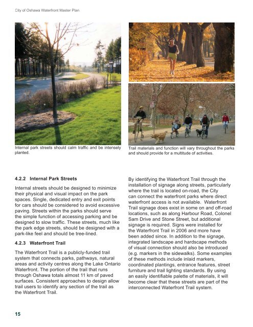
Internal park streets should calm traffi c <strong>and</strong> be intensely<br />
planted.<br />
Trail materials <strong>and</strong> function will vary throughout the parks<br />
<strong>and</strong> should provide for a multitude <strong>of</strong> activities.<br />
4.2.2 Internal Park Streets<br />
Internal streets should be designed to minimize<br />
their physical <strong>and</strong> visual impact on the park<br />
spaces. Single, dedicated entry <strong>and</strong> exit points<br />
for cars should be considered to avoid excessive<br />
paving. Streets within the parks should serve<br />
the simple function <strong>of</strong> accessing parking <strong>and</strong> be<br />
designed to slow traffi c. These streets, much like<br />
the park edge streets, should be designed with a<br />
park-like feel <strong>and</strong> should be tree-lined.<br />
4.2.3 <strong>Waterfront</strong> Trail<br />
The <strong>Waterfront</strong> Trail is a publicly-funded trail<br />
system that connects parks, pathways, natural<br />
areas <strong>and</strong> activity centres along the Lake Ontario<br />
<strong>Waterfront</strong>. The portion <strong>of</strong> the trail that runs<br />
through <strong>Oshawa</strong> totals almost 11 km <strong>of</strong> paved<br />
surfaces. Consistent approaches to design allow<br />
trail users to identify any section <strong>of</strong> the trail as<br />
the <strong>Waterfront</strong> Trail.<br />
By identifying the <strong>Waterfront</strong> Trail through the<br />
installation <strong>of</strong> signage along streets, particularly<br />
where the trail is located on-road, the <strong>City</strong><br />
can connect the waterfront parks where direct<br />
waterfront access is not available. <strong>Waterfront</strong><br />
Trail signage does exist in some on <strong>and</strong> <strong>of</strong>f-road<br />
locations, such as along Harbour Road, Colonel<br />
Sam Drive <strong>and</strong> Stone Street, but additional<br />
signage is required. Signs were installed for<br />
the <strong>Waterfront</strong> Trail in 2006 <strong>and</strong> more have<br />
been added since. In addition to the signage,<br />
integrated l<strong>and</strong>scape <strong>and</strong> hardscape methods<br />
<strong>of</strong> visual connection should also be introduced<br />
(e.g. markers in the sidewalks). Some examples<br />
<strong>of</strong> these methods include inlaid markers,<br />
coordinated plantings, entrance features, street<br />
furniture <strong>and</strong> trail lighting st<strong>and</strong>ards. By using<br />
an easily identifi able palette <strong>of</strong> materials, it will<br />
become clear that these streets are part <strong>of</strong> the<br />
interconnected <strong>Waterfront</strong> Trail system.<br />
15