Waterfront Master Plan Preliminary Directions and ... - City of Oshawa
Waterfront Master Plan Preliminary Directions and ... - City of Oshawa
Waterfront Master Plan Preliminary Directions and ... - City of Oshawa

You also want an ePaper? Increase the reach of your titles
YUMPU automatically turns print PDFs into web optimized ePapers that Google loves.
<strong>City</strong> <strong>of</strong> <strong>Oshawa</strong> <strong>Waterfront</strong> <strong>Master</strong> <strong>Plan</strong><br />
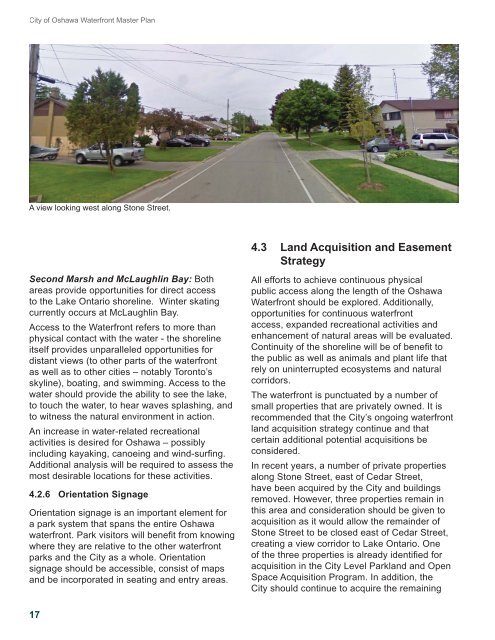
A view looking west along Stone Street.<br />
4.3 L<strong>and</strong> Acquisition <strong>and</strong> Easement<br />
Strategy<br />
Second Marsh <strong>and</strong> McLaughlin Bay: Both<br />
areas provide opportunities for direct access<br />
to the Lake Ontario shoreline. Winter skating<br />
currently occurs at McLaughlin Bay.<br />
Access to the <strong>Waterfront</strong> refers to more than<br />
physical contact with the water - the shoreline<br />
itself provides unparalleled opportunities for<br />
distant views (to other parts <strong>of</strong> the waterfront<br />
as well as to other cities – notably Toronto’s<br />
skyline), boating, <strong>and</strong> swimming. Access to the<br />
water should provide the ability to see the lake,<br />
to touch the water, to hear waves splashing, <strong>and</strong><br />
to witness the natural environment in action.<br />
An increase in water-related recreational<br />
activities is desired for <strong>Oshawa</strong> – possibly<br />
including kayaking, canoeing <strong>and</strong> wind-surfi ng.<br />
Additional analysis will be required to assess the<br />
most desirable locations for these activities.<br />
4.2.6 Orientation Signage<br />
Orientation signage is an important element for<br />
a park system that spans the entire <strong>Oshawa</strong><br />
waterfront. Park visitors will benefi t from knowing<br />
where they are relative to the other waterfront<br />
parks <strong>and</strong> the <strong>City</strong> as a whole. Orientation<br />
signage should be accessible, consist <strong>of</strong> maps<br />
<strong>and</strong> be incorporated in seating <strong>and</strong> entry areas.<br />
All efforts to achieve continuous physical<br />
public access along the length <strong>of</strong> the <strong>Oshawa</strong><br />
<strong>Waterfront</strong> should be explored. Additionally,<br />
opportunities for continuous waterfront<br />
access, exp<strong>and</strong>ed recreational activities <strong>and</strong><br />
enhancement <strong>of</strong> natural areas will be evaluated.<br />
Continuity <strong>of</strong> the shoreline will be <strong>of</strong> benefi t to<br />
the public as well as animals <strong>and</strong> plant life that<br />
rely on uninterrupted ecosystems <strong>and</strong> natural<br />
corridors.<br />
The waterfront is punctuated by a number <strong>of</strong><br />
small properties that are privately owned. It is<br />
recommended that the <strong>City</strong>’s ongoing waterfront<br />
l<strong>and</strong> acquisition strategy continue <strong>and</strong> that<br />
certain additional potential acquisitions be<br />
considered.<br />
In recent years, a number <strong>of</strong> private properties<br />
along Stone Street, east <strong>of</strong> Cedar Street,<br />
have been acquired by the <strong>City</strong> <strong>and</strong> buildings<br />
removed. However, three properties remain in<br />
this area <strong>and</strong> consideration should be given to<br />
acquisition as it would allow the remainder <strong>of</strong><br />
Stone Street to be closed east <strong>of</strong> Cedar Street,<br />
creating a view corridor to Lake Ontario. One<br />
<strong>of</strong> the three properties is already identifi ed for<br />
acquisition in the <strong>City</strong> Level Parkl<strong>and</strong> <strong>and</strong> Open<br />
Space Acquisition Program. In addition, the<br />
<strong>City</strong> should continue to acquire the remaining<br />
17