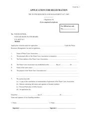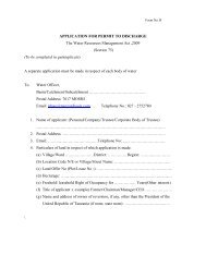
PANGANI BASIN WATER BOARD
PANGANI BASIN WATER BOARD
PANGANI BASIN WATER BOARD

Create successful ePaper yourself
Turn your PDF publications into a flip-book with our unique Google optimized e-Paper software.
throughout the year - rainfall<br />
patterns on Mt. Kilimanjaro, which<br />
lies immediately to the north of the<br />
spring, appear to have no bearing<br />
on its output (Røhr et al., 2002). In<br />
Kenya, the Lumi River drains the<br />
southern slopes of Mt. Kilimanjaro,<br />
and is the main source of water to<br />
Lake Jipe. Almost all of the river’s<br />
discharge into the lake is derived<br />
from springs (Musyoki, 2003).<br />
About 5% of all the water used in the<br />
PRB is derived from groundwater<br />
sources. Boreholes yielding more<br />
than 100 cubic metres per hour have<br />
been drilled in the Kahe Plains while<br />
boreholes yielding between 10 to 50<br />
m3/h have been sunk in the Sanya<br />
plains and Karoo Rocks of Tanga.<br />
Groundwater recharge is mainly from<br />
rainfall and rivers (Makule, n.d.).<br />
As the Pangani leaves the Nyumba<br />
ya Mungu Reservoir, the following<br />
demands are placed upon it<br />
(Mujwahuzi, 2001):<br />
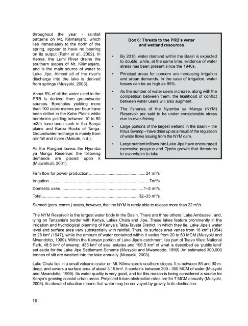
Box 6: Threats to the PRB’s water<br />
and wetland resources<br />
• By 2015, water demand within the Basin is expected<br />
to double, while, at the same time, evidence of water<br />
stress has been present since the 1940s.<br />
• Principal areas for concern are increasing irrigation<br />
and urban demands. In the case of irrigation, water<br />
losses can be as high as 85%.<br />
• As the number of water users increase, along with the<br />
competition between them, the likelihood of conflict<br />
between water users will also augment.<br />
• The fisheries of the Nyumba ya Mungu (NYM)<br />
Reservoir are said to be under considerable stress<br />
due to over-fishing.<br />
• Large portions of the largest wetland in the Basin – the<br />
Kirua Swamp – have dried up as a result of the regulation<br />
of water flows issuing from the NYM dam.<br />
• Large nutrient inflows into Lake Jipe have encouraged<br />
excessive papyrus and Typha growth that threatens<br />
to overwhelm to lake.<br />
Firm flow for power production..................................................24 m 3 /s<br />
Irrigation.......................................................................................7m 3 /s<br />
Domestic uses........................................................................1–2 m 3 /s<br />
Total....................................................................................32–33 m 3 /s<br />
Sarmett (pers. comm.) states, however, that the NYM is rarely able to release more than 22 m 3 /s.<br />
The NYM Reservoir is the largest water body in the Basin. There are three others: Lake Ambussel, and,<br />
lying on Tanzania’s border with Kenya, Lakes Chala and Jipe. These lakes feature prominently in the<br />
irrigation and hydrological planning of Kenya’s Taita-Taveta District, in which they lie. Lake Jipe’s water<br />
level and surface area vary substantially with rainfall. Thus, its surface area varies from 18 km 2 (1954)<br />
to 28 km 2 (1947), while the amount of water contained within it varies from 20 to 60 MCM (Musyoki and<br />
Mwandotto, 1999). Within the Kenyan portion of Lake Jipe’s catchment lies part of Tsavo West National<br />
Park, 48.5 km 2 of swamp, 435 km 2 of sisal estates and 196.5 km 2 of what is described as ‘public land’<br />
set aside for the Lake Jipe Settlement Scheme (Musyoki and Mwandotto, 1999). An estimated 300,000<br />
tonnes of silt are washed into the lake annually (Musyoki, 2003).<br />
Lake Chala lies in a small volcanic crater on Mt. Kilimanjaro’s southern slopes. It is between 85 and 90 m.<br />
deep, and covers a surface area of about 3.15 km 2 . It contains between 300 - 350 MCM of water (Musyoki<br />
and Mwandotto, 1999). Its water quality is very good, and for this reason is being considered a source for<br />
Kenya’s growing coastal urban areas. Projected future abstraction rates are for 7 MCM annually (Musyoki,<br />
2003). Its elevated situation means that water may be conveyed by gravity to its destination.<br />
16