PANGANI BASIN WATER BOARD
PANGANI BASIN WATER BOARD
PANGANI BASIN WATER BOARD

Create successful ePaper yourself
Turn your PDF publications into a flip-book with our unique Google optimized e-Paper software.
H<br />
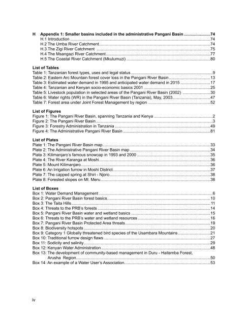
Appendix 1: Smaller basins included in the administrative Pangani Basin........................74<br />
H.1 Introduction...........................................................................................................................74<br />
H.2 The Umba River Catchment.................................................................................................74<br />
H.3 The Zigi River Catchment ....................................................................................................75<br />
H.4 The Msangazi River Catchment...........................................................................................77<br />
H.5 The Coastal River Catchment (Mkulumuzi)..........................................................................80<br />
List of Tables<br />
Table 1: Tanzanian forest types, uses and legal status........................................................................9<br />
Table 2: Eastern Arc Mountain forest cover loss in the Pangani River Basin....................................13<br />
Table 3: Estimated water demand in 1995 and anticipated water demand in 2015...........................17<br />
Table 4: Tanzanian and Kenyan socio-economic basics 2001...........................................................25<br />
Table 5: Livestock population in selected areas of the Pangani River Basin (2002) .........................30<br />
Table 6: Water rights (WR) in the Pangani River Basin (Tanzania), May, 2003.................................47<br />
Table 7: Forest area under Joint Forest Management by region ......................................................52<br />
List of Figures<br />
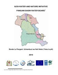
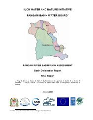
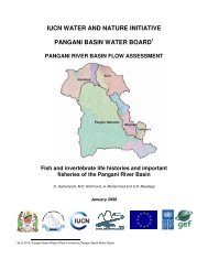
Figure 1: The Pangani River Basin, spanning Tanzania and Kenya....................................................2<br />
Figure 2: The Pangani River Basin......................................................................................................3<br />
Figure 3: Forestry Administration in Tanzania....................................................................................49<br />
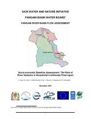
Figure 4: The Administrative Pangani River Basin.............................................................................81<br />
List of Plates<br />
Plate 1: The Pangani River Basin map..............................................................................................33<br />
Plate 2: The Administrative Pangani River Basin map.......................................................................34<br />
Plate 3: Kilimanjaro’s famous snowcap in 1993 and 2000.................................................................35<br />
Plate 4: The River Karanga at Moshi.................................................................................................36<br />
Plate 5: Mount Kilimanjaro.................................................................................................................36<br />
Plate 6: An Irrigation furrow in Moshi District.....................................................................................37<br />
Plate 7: The capped spring at Shiri - Njoro........................................................................................38<br />
Plate 8: Forested slopes on Mt. Meru................................................................................................38<br />
List of Boxes<br />
Box 1: Water Demand Management....................................................................................................6<br />
Box 2: Pangani River Basin forest basics..........................................................................................10<br />
Box 3: The Taita Hills.........................................................................................................................11<br />
Box 4: Threats to the PRB’s forests...................................................................................................14<br />
Box 5: Pangani River Basin water and wetland basics......................................................................15<br />
Box 6: Threats to the PRB’s water and wetland resources................................................................16<br />
Box 7: Pangani River Basin Protected Area threats..........................................................................19<br />
Box 8: Biodiversity hotspots...............................................................................................................20<br />
Box 9: Category 1 Globally threatened bird species of the Usambara Mountains.............................21<br />
Box 10: Traditional furrow design flaws.............................................................................................27<br />
Box 11: Sodicity and salinity...............................................................................................................29<br />
Box 12: Kenyan Water Administration................................................................................................48<br />
Box 13: The development of community-based management in Duru - Haitemba Forest,<br />
Arusha Region.....................................................................................................................50<br />
Box 14: An example of a Water User’s Association...........................................................................53<br />
iv