

D'Aguilar Range parks guide - Department of National Parks ...
D'Aguilar Range parks guide - Department of National Parks ...
D'Aguilar Range parks guide - Department of National Parks ...

You also want an ePaper? Increase the reach of your titles
YUMPU automatically turns print PDFs into web optimized ePapers that Google loves.
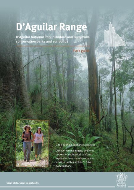
D’Aguilar <strong>Range</strong><br />
D’Aguilar <strong>National</strong> Park, Samford and Bunyaville<br />
conservation <strong>parks</strong> and surrounds<br />
Park <strong>guide</strong><br />
… the bush on Brisbane’s doorstep<br />
Discover remote gorges, sheltered<br />
pockets <strong>of</strong> subtropical rainforest,<br />
expansive forests and spectacular<br />
views; all within an hour’s drive<br />
from Brisbane.<br />
Great state. Great opportunity.
Courtesy <strong>of</strong> Jason Flesser<br />
Locality map<br />
Exploring the range<br />
The D’Aguilar <strong>Range</strong> can be explored in two hours or over several days.<br />
Experience the park on foot, by horse or bicycle, or by car or motorbike.<br />
To get the most <strong>of</strong> a visit, this <strong>guide</strong> is divided into sections to help visitors<br />
tailor their experience. More detailed information is available in the park,<br />
from Walkabout Creek Visitor Centre or at .<br />
Some activities in Queensland <strong>parks</strong> and forests require a permit, such as<br />
commercial, group or scientific activities. For licence and permit enquiries,<br />
email or phone 1300 130 372.<br />
To Nanango<br />
D’AGUILAR<br />
N<br />
Esk<br />
Kilcoy<br />
Lake<br />
Somerset<br />
Neurum<br />
Archer<br />
campground<br />
Rasmussen<br />
Road<br />
22<br />
Road<br />
Delaney Creek<br />
20 Broadwater<br />
D’Aguilar<br />
Road<br />
Woodford<br />
Mount<br />
HIGHWAY<br />
To<br />
Nambour<br />
BRUCE<br />
Legend<br />
D’Aguilar <strong>National</strong> Park<br />
Conservation park<br />
Other reserve<br />
Major road<br />
Minor road<br />
Forest drive<br />
Information centre<br />
Parking<br />
Toilets<br />
Wheelchair access<br />
Barbecue (wood)<br />
Barbecue (gas)<br />
Drinking water provided<br />
Sheltered picnic tables<br />
Shelter shed<br />
Picnic tables<br />
Lookout (with platform)<br />
Lookout (without platform)<br />
Walking track<br />
4x4 camping<br />
Bus parking<br />
Cafe<br />
Dogs allowed (on leash)<br />
Treat water before drinking<br />
No water provided<br />
Domestic animals prohibited<br />
No camping<br />
To Esk<br />
Kilcoy<br />
Road<br />
Somerset<br />
Wivenhoe<br />
To Esk<br />
Somerset<br />
Lake<br />
Wivenhoe<br />
Falls lookout<br />
and Bulls Falls<br />
Somerset<br />
lookout<br />
Road<br />
BRISBANE VALLEY HIGHWAY<br />
White and<br />
Red Cedar<br />
Fernvale<br />
To Toowoomba<br />
Scale<br />
0 5 10 15 20 km<br />
17<br />
Mount Mee<br />
12<br />
Rocky Hole<br />
19 Neurum Creek<br />
21 campground<br />
18<br />
The Gantry<br />
16<br />
Sellin<br />
Road<br />
Northbrook<br />
Laceys<br />
11<br />
Wivenhoe<br />
outlook<br />
South<br />
D’Aguilar<br />
Parkway<br />
Maiala<br />
10<br />
Mount Glorious<br />
Westridge<br />
outlook 9<br />
Manorina<br />
8<br />
Mount<br />
Nebo<br />
Lake<br />
Manchester<br />
13<br />
WARREGO<br />
Mee<br />
Road<br />
Mount Mee<br />
Mount<br />
Mount<br />
Lake<br />
Manchester<br />
Lake Manchester<br />
Kholo<br />
Mount Brisbane Road<br />
Creek<br />
Road<br />
HIGHWAY<br />
Mee<br />
Road<br />
Crosby<br />
Road<br />
Road<br />
Boombana 7 6<br />
Mount<br />
Mount<br />
Glorious<br />
Dayboro<br />
Jollys<br />
Lookout<br />
Mount<br />
Samson<br />
Nebo<br />
Winn<br />
Road<br />
McAfees lookout<br />
Bunyaville<br />
Samford Conservation<br />
Samford<br />
Conservation Park<br />
Park<br />
15<br />
14<br />
Road<br />
Camp<br />
Mountain<br />
5<br />
lookout<br />
Road<br />
Gold<br />
Creek<br />
Reservoir<br />
Road<br />
Clear<br />
Mountain<br />
Conservation Park<br />
4<br />
Caboolture<br />
Road<br />
Lake<br />
Samsonvale<br />
Road<br />
Samford<br />
HIGHWAY<br />
Old Northern<br />
Bellbird<br />
Grove<br />
3<br />
Walkabout Creek<br />
2<br />
Enoggera<br />
Reservoir<br />
Moggill<br />
Conservation Park<br />
Moggill<br />
Road<br />
Gap Creek<br />
Road<br />
Dayboro<br />
Samsonvale<br />
Road<br />
Mt Coot-tha<br />
1<br />
WESTERN<br />
Road<br />
Waterworks<br />
FREEWAY<br />
Petrie<br />
Gympie Road<br />
Road<br />
Road<br />
To Brisbane<br />
To<br />
Brisbane<br />
To Brisbane<br />
2
Touring and<br />
places to visit<br />
Embark on an adventure on one <strong>of</strong> several<br />
scenic tourist drives along the range and visit<br />
spectacular lookouts, parkland picnic areas<br />
and stunning natural features.<br />
South D’Aguilar<br />
To explore the southern end <strong>of</strong> the D’Aguilar <strong>Range</strong>,<br />
follow Mount Nebo Road (tourist route number 8)<br />
from The Gap. The road winds along the range to the<br />
mountain townships <strong>of</strong> Mount Nebo and Mount Glorious.<br />
Alternatively, the park can be reached via Samford along<br />
Mount Glorious Road (tourist route number 9). For those<br />
looking to circumnavigate the park, the Northbrook<br />
Parkway provides a circuit back through Brisbane<br />
Valley and Ipswich, or alternatively return via Samford.<br />
Westridge outlook<br />
Public transport access<br />
For information on bus services,<br />
contact TRANSLink on 13 12 30<br />
or visit .<br />
1 Mt Coot-tha<br />
Catch public transport or drive to the<br />
summit <strong>of</strong> Mt Coot-tha for expansive views<br />
over Brisbane city. Alternatively, embark<br />
on a short walk from any <strong>of</strong> the picnic areas<br />
at the foothills <strong>of</strong> the mountain or explore<br />
the Mt Coot-tha botanic gardens and<br />
planetarium. For further information<br />
or to obtain brochures or maps, please<br />
visit the Brisbane City Council website<br />
or phone<br />
(07) 3403 8888.<br />
2 Walkabout Creek<br />
Walkabout Creek is located at 60 Mount<br />
Nebo Road, The Gap—12 km from Brisbane’s<br />
CBD, and is easily accessible by public<br />
transport from the city. The complex includes<br />
a visitor and wildlife centre, function rooms<br />
and cafe.<br />
The Walkabout Creek Visitor<br />
Centre and South East Queensland<br />
Wildlife Centre are open from 9.00<br />
am to 4.15 pm every day, excluding<br />
some public holidays.<br />
The function rooms at Walkabout<br />
Creek provide a unique and<br />
secluded setting for conferences,<br />
functions and wedding ceremonies,<br />
and adjoin the Green Tree Frog Café.<br />
To find out more about the wedding<br />
centre and cafe, visit<br />
.<br />
Vehicle access<br />
3 Bellbird Grove<br />
10-minute drive from Walkabout Creek 2<br />
Stop and enjoy a picnic or barbecue at this<br />
open, grassy day-use area and take a short<br />
walk along one <strong>of</strong> the walking tracks.<br />
4 McAfees lookout<br />
15-minute drive from Walkabout Creek 2<br />
This lookout was named after the first<br />
settlers in this area an d <strong>of</strong>fers breathtaking<br />
views <strong>of</strong> Moreton Bay.<br />
5 Camp Mountain lookout<br />
15-minute drive from Walkabout Creek 2<br />
On a clear day see amazing views <strong>of</strong> Moreton<br />
Bay and the Glass House Mountains from<br />
the lower lookout. Walk along the ridgeline<br />
to another lookout <strong>of</strong>fering surprisingly<br />
close views <strong>of</strong> bustling Brisbane city.<br />
6 Jollys Lookout<br />
20-minute drive from Walkabout Creek 2<br />
Named after William Jolly, Brisbane’s first<br />
Lord Mayor (from 1925 to 1931), this<br />
lookout <strong>of</strong>fers expansive views <strong>of</strong> Moreton<br />
Island, Brisbane Valley and the Glass House<br />
Mountains.<br />
7 Boombana<br />
20-minute drive from Walkabout Creek 2<br />
Boombana, meaning ‘trees in bloom’,<br />
fits this area perfectly. During summer the<br />
lacebark tree Brachychiton discolor loses<br />
its leaves and keeps its large, pink, showy<br />
flowers to create a burst <strong>of</strong> colour through<br />
the greenery. Enjoy a barbecue lunch or<br />
take a walk through the forest.<br />
Start at Walkabout Creek 2 in The Gap<br />
and come face-to-face with the amazing<br />
diversity <strong>of</strong> native wildlife that lives in<br />
Queensland's national <strong>parks</strong> at the South<br />
East Queensland Wildlife Centre. With<br />
Enoggera Reservoir as the backdrop, and<br />
surrounded by tall eucalypt trees, the<br />
Green Tree Frog Café is a wonderful place<br />
to relax, grab a c<strong>of</strong>fee and a bite to eat.<br />
Enjoy a stroll along one <strong>of</strong> the two short<br />
walking tracks that start from the visitor<br />
centre (Corymbia circuit and Araucaria<br />
track), or journey up the mountain by<br />
car and visit a number <strong>of</strong> beautiful<br />
destinations within the park, including<br />
Bellbird Grove 3 , McAfees lookout 4<br />
and Boombana rainforest 7 .<br />
3
8 Manorina<br />
30-minute drive from Walkabout Creek 2<br />
11 Wivenhoe outlook<br />
50-minute drive from Walkabout Creek 2<br />
14 Samford Conservation Park<br />
15-minute drive from Walkabout Creek 2<br />
Two walking tracks leave from here, <strong>of</strong>fering<br />
walkers lush wet eucalypt forest and views<br />
<strong>of</strong> Samford Valley.<br />
9 Westridge outlook<br />
35-minute drive from Walkabout Creek 2<br />
From the lookout perched on a high rocky<br />
outcrop, enjoy views over Lake Wivenhoe<br />
with the Great Dividing <strong>Range</strong> in the distance.<br />
10 Maiala<br />
45-minute drive from Walkabout Creek 2<br />
This special area was the first piece <strong>of</strong><br />
national park declared on the D’Aguilar<br />
<strong>Range</strong>. Originally cleared for a timber mill,<br />
some machinery and a remnant hoop pine<br />
plantation remain as evidence <strong>of</strong> Maiala’s<br />
loud and laborious past.<br />
This outlook provides a picnic area with<br />
scenic views <strong>of</strong> Lake Wivenhoe.<br />
12 White and Red Cedar<br />
1-hour drive from Walkabout Creek 2<br />
via Northbrook Parkway<br />
With open grassy areas and a picturesque<br />
stream running behind the day-use area,<br />
this is a great place to stop and enjoy<br />
the scenery.<br />
13 Lake Manchester<br />
1-hour, 20-minute drive from<br />
Walkabout Creek 2<br />
Enjoy a picnic and take a short stroll<br />
to the lake’s grassy shores.<br />
Visit Ironbark Gully or Lomandra day-use<br />
areas <strong>of</strong>f Samford Road and enjoy a natural<br />
woodland setting for picnics and barbecues.<br />
15 Bunyaville Conservation Park<br />
20-minute drive from Walkabout Creek 2<br />
Discover a peaceful bush retreat with<br />
walking, mountain bike and horse riding<br />
trails close to Brisbane’s CBD.<br />
Courtesy <strong>of</strong> Bruce Cowell, Queensland Museum<br />
Connect with<br />
Nature<br />
A wide range <strong>of</strong> ranger-<strong>guide</strong>d activities<br />
are <strong>of</strong>fered in various <strong>parks</strong> throughout<br />
Brisbane, the Gold Coast and hinterland,<br />
and Western Scenic Rim. Connect with<br />
Nature <strong>of</strong>fers school holiday activities<br />
for adults, children and families as well<br />
as curriculum-based school educational<br />
activities for primary and secondary<br />
years. For more information on Connect<br />
with Nature, visit <br />
or phone 13 QGOV (13 74 68).<br />
For information about school activities<br />
in Bunyaville Conservation Park, please<br />
visit the Bunyaville Environmental<br />
Education Centre website<br />
or<br />
phone (07) 3353 4356. For information<br />
on the various environmental, cultural<br />
and recreational programs and activities<br />
<strong>of</strong>fered by Brisbane City Council visit<br />
or phone<br />
(07) 3403 8888.<br />
4<br />
The lush subtropical rainforest <strong>of</strong> Mount Glorious.
Drive safely<br />
• Please obey all park closure notices. Mount<br />
Mee is closed after heavy rain—before visiting,<br />
please check for park alerts on the DERM website<br />
at .<br />
• Please obey speed limits—the maximum speed<br />
limit on forest drives is 50 km/hr. Normal road<br />
rules apply. All forest drives allow two-way traffic.<br />
• Watch out for the unexpected. Drive slowly to<br />
allow time to react to changed road conditions<br />
and other park users.<br />
• Forest drives are unsealed with some sharp<br />
curves, narrow sections, loose surfaces and<br />
steep grades requiring careful driving.<br />
• Ensure your vehicle is mechanically sound.<br />
Rocky Hole.<br />
Mount Mee<br />
The 90-minute drive to Mount Mee from<br />
Brisbane meanders through the townships<br />
<strong>of</strong> Samford and Dayboro. Follow Mount Mee<br />
Road (tourist route number 29) and turn<br />
into Sellin Road, which leads to the park<br />
entrance.<br />
The northern section <strong>of</strong> the park is also<br />
accessible from Dayboro and Woodford.<br />
Please note that the majority <strong>of</strong> these roads<br />
are unsealed and only The Gantry day-use<br />
area is accessible via sealed road. These<br />
roads are <strong>of</strong>ten difficult to navigate in wet<br />
conditions and may be closed to vehicle<br />
access after heavy rain.<br />
Vehicles are permitted on all forest drives<br />
and unsealed roads in the Mount Mee<br />
section unless otherwise signed. Some<br />
roads and trails are designated nonmotorised<br />
areas in the interest <strong>of</strong> visitor<br />
safety. Four-wheel-drive vehicles are<br />
advised for all unsealed roads in<br />
Mount Mee. Vehicle permits are not<br />
required, except for group or commercial<br />
activities. All vehicles must be registered<br />
and driven by licensed drivers.<br />
16 The Gantry<br />
1-hour, 20-minute drive from Walkabout<br />
Creek 2<br />
Travel on a sealed road for 150 m from<br />
the park entrance on Mount Mee Road to<br />
The Gantry, the closest Mount Mee day-use<br />
area to Brisbane. The Gantry shelter is a<br />
legacy <strong>of</strong> the sawmill that operated here<br />
until 1981.<br />
17 Somerset lookout<br />
30-minute drive from The Gantry 16<br />
Enjoy spectacular views over the Great<br />
Dividing <strong>Range</strong>, Somerset Dam and Lake<br />
Wivenhoe’s headwaters. The lookout can<br />
be accessed on foot by walking along<br />
the Somerset trail, or by four-wheel-drive<br />
vehicles along the Western escarpment<br />
forest drive.<br />
18 Falls lookout and Bulls Falls<br />
5-minute drive from The Gantry 16<br />
Falls lookout can be reached by a formed,<br />
unsealed gravel road. A 400 m walk to a<br />
viewing platform overlooks the northern<br />
side <strong>of</strong> D’Aguilar <strong>Range</strong> and the picturesque<br />
Neurum Valley. Walk a further 80 m to Bulls<br />
Falls, <strong>of</strong>fering beautiful views <strong>of</strong> sheltered<br />
rainforest pools and rocky crags.<br />
19 Rocky Hole<br />
25-minute drive from The Gantry 16<br />
Surrounded by open eucalypt forest, this site<br />
features a rock pool and is popular during<br />
summer. Access is along an unsealed,<br />
formed gravel road.<br />
For your safety, do not jump or dive<br />
into the waterhole.<br />
20 Broadwater<br />
40-minute drive from The Gantry 16<br />
Enjoy a picnic or barbecue lunch at this<br />
small day-use area near a large waterhole.<br />
For your safety, do not jump or dive<br />
into the waterhole.<br />
Escape the crowds and visit this exciting destination for camping and motorised recreational<br />
adventures. For a two-hour scenic drive, journey along the Western escarpment forest drive<br />
(see trail map on page 6) through scribbly gum forest and take in spectacular views to the<br />
west over Somerset Dam and Lake Wivenhoe.<br />
Start a half-day adventure on the Mount Mee forest drive (see trail map on page 6) at The<br />
Gantry 16 and wander along the tranquil Mill rainforest walk. Continue on to Rocky Hole 19<br />
and relax by the cool water; this is a popular destination during the hot summer months.<br />
From here, drive to Broadwater 20 , a great picnic spot overlooking a large waterhole.<br />
Return via The Gantry or continue north through the small township <strong>of</strong> Woodford.<br />
Alternatively, drive along and explore the <strong>Range</strong> Road forest drive (see trail map on page 6).<br />
Start at The Gantry 16 and travel south-east along Peggs Road onto the <strong>Range</strong> Road forest<br />
drive. This drive explores open eucalypt forest and rainforest along the highest point <strong>of</strong> the<br />
range, <strong>of</strong>fering views to either side. Exit the park via Laceys Creek Road and finish<br />
the tour by visiting the small township <strong>of</strong> Dayboro.<br />
5
Lovedays Road<br />
Top Road<br />
Mount Mee<br />
Rasmussen Road<br />
22<br />
!<br />
20<br />
Archer<br />
campground<br />
Broadwater<br />
South D’Aguilar<br />
Lovedays Road<br />
L Traverse<br />
12 Red Cedar<br />
Centipede<br />
19<br />
!<br />
Rocky<br />
Hole<br />
Road<br />
12 White Cedar<br />
Mount Mee forest drive<br />
Neurum Creek Road<br />
21<br />
Neurum Creek<br />
campground<br />
Settlement Road<br />
Western escarpment forest drive<br />
17<br />
!<br />
Somerset<br />
lookout<br />
Falls<br />
lookout<br />
and<br />
Bulls Falls<br />
18<br />
!<br />
16<br />
!<br />
!<br />
Mill rainforest walk<br />
The Gantry<br />
Sellin Road<br />
To Mount Mee<br />
and <strong>D'Aguilar</strong><br />
Wivenhoe–Somerset Road<br />
Peggs Road<br />
The Hanger<br />
Mt Mee Road<br />
A Break<br />
Chambers Road<br />
Diana's Bath<br />
car park<br />
Diana's Bath Road<br />
Byron Creek Road<br />
Centre Road<br />
drive<br />
Mt Brisbane Road<br />
Jacky Creek Road<br />
Jacky<br />
Creek<br />
<strong>Range</strong> Road forest<br />
Butchershop Creek Road<br />
May Creek Road<br />
Scale<br />
0<br />
2 4 km<br />
Scale<br />
0<br />
2 4 km<br />
<strong>Range</strong> Road forest drive<br />
Wirth Road<br />
Laceys Creek Road<br />
Map adjoins top <strong>of</strong><br />
South <strong>D'Aguilar</strong> map<br />
Note: Many trails lead to private<br />
property. Get permission from<br />
landholders before accessing<br />
private property. Many gates are<br />
locked and cannot be opened.<br />
It is the responsibility <strong>of</strong> riders<br />
and walkers to determine<br />
appropriate access<br />
requirements.<br />
6
Map adjoins bottom <strong>of</strong><br />
Mount Mee map<br />
To Dayboro<br />
Dayboro Road<br />
11 Wivenhoe<br />
outlook<br />
Northbrook Parkway<br />
Northbrook Mtn<br />
bush camp<br />
Road<br />
Lepidozamia<br />
Mount Glorious Road<br />
Middle Kobble<br />
firebreak<br />
Tenison Woods Mountain<br />
North Kobble<br />
bush camp<br />
Middle Kobble<br />
bush camp<br />
South Kobble<br />
bush camp<br />
Winn Road<br />
Mount Samson Road<br />
Lake Samsonvale<br />
Clear Mountain Road<br />
Clear Mountain<br />
Conservation Park<br />
Samsonvale Road<br />
To Petrie<br />
Lawton Road<br />
England<br />
Creek<br />
Road<br />
England Creek<br />
bush camp<br />
Joyners Ridge Road<br />
Westridge<br />
outlook<br />
Westridge Break<br />
Dundas<br />
Cabbage Tree Road<br />
9<br />
Road<br />
10 Maiala<br />
Dundas<br />
bush camp<br />
Taylors Break<br />
Mount Glorious<br />
8 Manorina<br />
Mount<br />
Nebo<br />
Goat Track<br />
7 Boombana<br />
Light Line Road<br />
bush camp<br />
6 Jollys Lookout<br />
South Boundary Road<br />
Mount Nebo Road<br />
Mount Glorious Road<br />
Camp Mountain 5<br />
Samford<br />
Mailmans Track<br />
Samford<br />
Conservation Park<br />
Lomandra and<br />
14 Ironbark Gully<br />
3 Bellbird Grove<br />
Bunya Road<br />
Eatons Crossing Road<br />
Samford Road<br />
15<br />
Bunyaville<br />
Conservation Park<br />
Jinker Track<br />
Collins Road<br />
Light Line Road<br />
Scrub Road<br />
bush camp<br />
South Boundary Road<br />
4 McAfees<br />
lookout<br />
Centre Road<br />
2 Walkabout Creek<br />
Waterworks Road<br />
To Brisbane<br />
South Boundary Road<br />
Upper Brookfield Road<br />
13 Lake Manchester<br />
Lake Manchester Road<br />
Gold Creek Road<br />
Gap Creek Road<br />
1 Mt Coot-tha Forest*<br />
* For further information about<br />
Mt Coot-tha Forest or to<br />
obtain brochures or maps <strong>of</strong><br />
the area, please visit the<br />
Brisbane City Council website<br />
<br />
or phone 3403 8888.<br />
Western Freeway<br />
Legend<br />
D’Aguilar <strong>National</strong> Park<br />
Conservation Park<br />
Other reserve<br />
Minor road<br />
Management access only<br />
Creek<br />
Forest trail<br />
Horses and<br />
pedestrians<br />
Horses, cyclists and<br />
pedestrians<br />
Cyclists and<br />
pedestrians only<br />
Walking track<br />
Forest drive<br />
Easy<br />
Moderate<br />
Difficult<br />
Parking<br />
Camping<br />
7
Walking tracks<br />
The D’Aguilar <strong>Range</strong> <strong>of</strong>fers a wide variety<br />
<strong>of</strong> walking tracks suitable for beginner<br />
and experienced walkers. Walking tracks are<br />
classified according to Australian Standards<br />
and are only suitable for pedestrian use.<br />
Please note that while each track is classified<br />
according to its most difficult section, other<br />
sections may be easier.<br />
Walkers can also access a number <strong>of</strong> forest<br />
trails throughout the range. These trails may<br />
be shared by horse and mountain bike riders,<br />
four-wheel-drivers and/or motorcyclists—please<br />
see the trail map section <strong>of</strong> this <strong>guide</strong> (pages 6<br />
and 7) for more details.<br />
Mt Coot-tha Forest has a diverse range <strong>of</strong> tracks<br />
and trails, picnic facilities and seasonal creeks<br />
and waterfalls to explore. For information on<br />
walking tracks in Mt Coot-tha Forest, please<br />
refer to the track map on the Brisbane City<br />
Council website .<br />
Key to walking tracks<br />
Class 2 track Australian Standards<br />
• Easy level, well-graded track, suitable for all fitness levels.<br />
Class 3 track Australian Standards<br />
• Gently sloping, well-defined track with slight inclines or few steps.<br />
• Caution needed on loose gravel surfaces and exposed natural lookouts.<br />
• Reasonable level <strong>of</strong> fitness and ankle-supporting footwear required.<br />
Class 4 track Australian Standards<br />
• Distinct track, usually with steep exposed inclines or many steps.<br />
• Caution needed on loose gravel surfaces and exposed natural outlooks.<br />
• Moderate level <strong>of</strong> fitness and ankle-supporting footwear required.<br />
Mount Mee<br />
Track name and<br />
classification<br />
Distance/<br />
Time<br />
Short walks (less than 1 hour)<br />
Lophostemon walk<br />
750 m circuit,<br />
allow 20<br />
minutes<br />
Access point<br />
21<br />
Neurum Creek<br />
campground<br />
Drive from<br />
The Gantry<br />
(90 minutes<br />
from Brisbane)<br />
Description<br />
15 minutes This circuit begins at the northern end <strong>of</strong> Neurum<br />
Creek campground.<br />
Piccabeen walk<br />
1 km circuit,<br />
allow 20–30<br />
minutes<br />
16<br />
The Gantry<br />
Not<br />
applicable<br />
This short walk is along a boardwalk and track<br />
through a lush piccabeen palm grove.<br />
Falls lookout track<br />
1 km return,<br />
allow 20–30<br />
minutes<br />
18<br />
Falls lookout<br />
and Bulls Falls<br />
5 minutes Falls lookout can be reached by a gravel road<br />
<strong>of</strong>f Neurum Creek Road and has a short walk<br />
down to a viewing platform overlooking the<br />
northern side <strong>of</strong> D’Aguilar <strong>Range</strong> and<br />
picturesque Neurum Valley.<br />
Mill rainforest walk<br />
1.4 km circuit,<br />
allow 40–50<br />
minutes<br />
Off Neurum Creek<br />
Road between<br />
The Gantry 16<br />
and Neurum Creek<br />
campground 21<br />
10 minutes This subtropical rainforest track provides<br />
great opportunities for birdwatching so bring<br />
binoculars. The track entrance is accessed by<br />
a short unsealed, formed gravel road.<br />
Longer walks (2–4 hours)<br />
Somerset trail<br />
13 km circuit,<br />
allow 4 hours<br />
16<br />
The Gantry<br />
Not<br />
applicable<br />
This track passes through scribbly gum forests,<br />
rainforest and dry open forest. Take in views<br />
to the west overlooking Somerset Dam and<br />
Lake Wivenhoe.<br />
South D’Aguilar<br />
Short walks (less than 2 hours)<br />
Tree discovery<br />
circuit<br />
650 m circuit,<br />
allow 15<br />
minutes<br />
15<br />
Bunyaville<br />
Conservation<br />
Park<br />
20 minutes This walking track starts and finishes at the<br />
northern end <strong>of</strong> the day-use area.<br />
8<br />
Atrax circuit<br />
750 m return,<br />
allow 15–20<br />
minutes<br />
8<br />
Manorina 30 minutes Walk through tall forest featuring cabbage<br />
tree palms.
South D’Aguilar<br />
Track name and<br />
classification<br />
Distance/<br />
Time<br />
Access point<br />
Drive from<br />
Walkabout<br />
Creek<br />
Description<br />
Short walks (less than 2 hours) continued<br />
Crebra circuit<br />
900 m circuit,<br />
allow 20–30<br />
minutes<br />
14<br />
Samford<br />
Conservation<br />
Park<br />
15 minutes This circuit meanders through a forest <strong>of</strong> deeply<br />
furrowed and dark-coloured ironbark trees.<br />
Pitta circuit<br />
1 km circuit,<br />
allow 20–30<br />
minutes<br />
7<br />
Boombana 25 minutes This track explores open eucalypt forest and then<br />
subtropical rainforest. Mount Nebo village can be<br />
accessed from this circuit via a 600 m track from<br />
the boardwalk.<br />
Western Window<br />
track<br />
1.2 km return,<br />
allow 35–45<br />
minutes<br />
10<br />
Maiala 40 minutes This track runs along the escarpment to the Western<br />
Window—an expansive undulating view to the west.<br />
Corymbia circuit<br />
1.5 km return,<br />
allow 45<br />
minutes<br />
2<br />
Walkabout<br />
Creek<br />
Not<br />
applicable<br />
This track winds down through a wet eucalypt forest<br />
gully and climbs back to the visitor centre. The track<br />
is quite steep in places.<br />
Egernia circuit<br />
1.5 km circuit,<br />
allow 45<br />
minutes<br />
6<br />
Jollys Lookout 20 minutes This track loops through wet eucalypt forest and<br />
a gully <strong>of</strong> subtropical rainforest.<br />
Bunyaville track<br />
1.6 km return,<br />
allow 30–40<br />
minutes<br />
15<br />
Bunyaville<br />
Conservation<br />
Park<br />
20 minutes This track leaves from the northern end <strong>of</strong> the dayuse<br />
area and goes through open eucalypt forest<br />
back to the southern end <strong>of</strong> the day-use area.<br />
Turrbal circuit<br />
1.7 km circuit,<br />
allow 40–50<br />
minutes<br />
3<br />
Bellbird Grove 10 minutes This circuit winds through open eucalypt forest,<br />
down into a wet eucalypt gully and back to the<br />
day-use area.<br />
Golden Boulder<br />
track<br />
1.8 km circuit,<br />
allow 40–50<br />
minutes<br />
3<br />
Bellbird Grove 10 minutes A short track takes walkers along exposed ridges<br />
and past historic gold mines. It is quite steep in<br />
places, so please supervise children at all times.<br />
Rainforest circuit<br />
2 km circuit,<br />
allow 1 hour<br />
10<br />
Maiala 40 minutes This walking track winds through stunning<br />
subtropical rainforest. Cypress Grove and a section<br />
<strong>of</strong> the Greenes Falls (see longer walks) walking<br />
tracks adjoin this track.<br />
Cypress Grove<br />
track<br />
2.5 km return,<br />
allow 1 hour<br />
20 minutes<br />
10<br />
Maiala 40 minutes This is a short walk branching <strong>of</strong>f the<br />
Rainforest circuit.<br />
Longer walks (2–4 hours)<br />
Greenes Falls track<br />
4.3 km return,<br />
allow 2 hours<br />
10<br />
Maiala 40 minutes The Greenes Falls track passes over rainforest pools<br />
and ends at a lookout adjacent to Greenes Falls.<br />
Be prepared for an uphill walk on the return trip.<br />
Araucaria track<br />
5 km return,<br />
allow 2 hours<br />
2<br />
Walkabout<br />
Creek<br />
Not<br />
applicable<br />
This walking track winds past giant hoop pines<br />
along the shores <strong>of</strong> Enoggera Reservoir.<br />
Morelia walking<br />
track<br />
6 km return,<br />
allow 2–2.5<br />
hours<br />
8<br />
Manorina 30 minutes Walk from the Manorina car park through wet<br />
eucalypt forest to Mount Nebo lookout and enjoy<br />
spectacular views over Samford Valley and Moreton<br />
Bay. The track is quite steep in places.<br />
Westside track<br />
6.4 km return,<br />
allow 2–3<br />
hours<br />
10<br />
Maiala 40 minutes This track branches <strong>of</strong>f the Western Window track<br />
(see short walks). Access is from the top <strong>of</strong> the<br />
Maiala day-use area. Walk 600 m to the Western<br />
Window, before walking down to a level track<br />
perched on the side <strong>of</strong> a steep slope that finishes<br />
at Lawton Road.<br />
Thylogale walking<br />
track<br />
8 km return,<br />
allow 2–3<br />
hours<br />
6<br />
Jollys Lookout 15 minutes This walking track connects Jollys Lookout<br />
to Boombana. Walk through pockets <strong>of</strong> dry<br />
rainforest—a vegetation type known for its<br />
diversity and abundance <strong>of</strong> twisting vines.<br />
9
Mountain bike trails<br />
and horse riding trails<br />
Enjoy riding in a bushland environment on one <strong>of</strong><br />
the many multiple-use trails in the D’Aguilar <strong>Range</strong>.<br />
Mountain bike riding<br />
Cycling is permitted on all forest trails<br />
within the southern end <strong>of</strong> D’Aguilar <strong>Range</strong><br />
unless otherwise signed (see trail map on<br />
pages 6 and 7). Bicycles are not permitted<br />
on designated walking tracks, or on roads<br />
in Mount Mee as this area is set aside for<br />
motorised vehicle-based recreation.<br />
Ride safely<br />
• When using tracks, cyclists<br />
must alert others when<br />
approaching them.<br />
• Always wear a helmet.<br />
• Plan ahead, ride within your ability<br />
and according to track conditions.<br />
• Avoid skidding and sliding around<br />
turns—collision and injury may result.<br />
• Avoid riding in large groups.<br />
• Avoid riding on s<strong>of</strong>t,<br />
wet and muddy tracks.<br />
• Cyclists riding downhill must<br />
give way to cyclists riding uphill.<br />
The give-way code<br />
• Cyclists should give way<br />
to horses and walkers.<br />
• Walkers should give<br />
way to horses.<br />
For a challenging ride, follow South<br />
Boundary Road to Mount Nebo Road,<br />
and onto the cool rainforest township<br />
<strong>of</strong> Mount Nebo to enjoy a cold drink<br />
at one <strong>of</strong> the local cafes.<br />
Bunyaville Conservation Park 15 and<br />
Mt Coot-tha Forest 1 both <strong>of</strong>fer a variety<br />
<strong>of</strong> designated mountain bike trails that<br />
are interconnected by multiple-use trails.<br />
For more information on mountain bike<br />
trails in these areas visit<br />
, or contact<br />
Brisbane City Council on (07) 3403 8888<br />
or .<br />
Horse riding<br />
Horse riding is permitted on specified<br />
forest trails in the D’Aguilar <strong>Range</strong><br />
(see trail maps on previous pages).<br />
To help reduce your impact on these<br />
natural areas, please:<br />
• do not allow horses to remain<br />
in the park overnight<br />
• ride only on formed roads and trails<br />
designated for riding. Do not take<br />
shortcuts or form new tracks as<br />
this damages the environment<br />
and causes erosion<br />
• do not allow horses to enter<br />
or remain in or near natural<br />
watercourses. Only allow horses<br />
to cross natural watercourses at<br />
designated crossing points on<br />
the trail for the protection<br />
<strong>of</strong> watercourses in the area<br />
• minimise damage to vegetation.<br />
Do not allow horses to graze on<br />
any vegetation while in the area<br />
• tether horses at hitching posts<br />
or resting areas only for short<br />
periods to minimise soil erosion<br />
and compaction<br />
• avoid spreading weeds—ensure<br />
horses’ coats, hooves and<br />
equipment are free <strong>of</strong> seeds<br />
before park visits.<br />
For more information about horse<br />
riding in Queensland’s protected<br />
areas, visit .<br />
Enjoy a half or day-long ride in the<br />
foothills around Enoggera Reservoir<br />
and the southern section <strong>of</strong> the<br />
D’Aguilar <strong>Range</strong>. A series <strong>of</strong> trails<br />
lead into the adjacent valleys <strong>of</strong><br />
Brookfield and Gold Creek, or ride<br />
along the crest <strong>of</strong> South Boundary<br />
Road to Mount Nebo Road,<br />
and onto the township <strong>of</strong><br />
MountNebo.<br />
Courtesy <strong>of</strong> Tourism Queensland<br />
10<br />
11
Overnight stays<br />
and camping<br />
Courtesy <strong>of</strong> Jason Flesser<br />
With the variety <strong>of</strong> trails and tourist sites,<br />
why not unwind in the D’Aguilar <strong>Range</strong><br />
over a couple <strong>of</strong> days.<br />
Bed and breakfast, resort and commercial<br />
camping accommodation are available<br />
in and around the townships <strong>of</strong> Mount<br />
Mee, Mount Nebo and Mount Glorious.<br />
For more information about tourist<br />
accommodation in the D’Aguilar <strong>Range</strong>,<br />
visit the Tourism Queensland website<br />
.<br />
How to obtain a camping permit<br />
A camping permit must be obtained prior to arrival; fees are payable and<br />
a camping tag with your booking number must be displayed at your camp<br />
site. People who camp without a permit can be fined. To extend your stay<br />
you must amend your permit. Obtaining a camping permit well in advance<br />
is recommended for public or school holiday periods.<br />
Obtain a camping permit:<br />
• online at <br />
• by phoning 13 QGOV (13 74 68) with credit card details.<br />
Camping experiences<br />
D’Aguilar <strong>National</strong> Park has two formal campgrounds and eight remote bush camp sites.<br />
Formal campgrounds<br />
Located at Mount Mee, Neurum Creek and<br />
Archer campgrounds are not suitable for<br />
caravans, campervans or camper trailers.<br />
Open fires are allowed in the fireplaces<br />
and fire rings provided. Bring your own<br />
firewood—untreated, milled timber<br />
<strong>of</strong>f-cuts are recommended.<br />
21 Neurum Creek campground 16<br />
15-minute drive from The Gantry 16<br />
Neurum Creek campground provides<br />
opportunities for camping close to<br />
Neurum Creek in an enclosed<br />
forest setting.<br />
16<br />
22 Archer campground<br />
40-minute drive from The Gantry 16<br />
Enjoy the open, grassy, family friendly,<br />
natural bush setting near Neurum Creek.<br />
Facilities are provided for campers only.<br />
Remote bush camping<br />
Visitors can test their bush camping skills in the<br />
secluded back country <strong>of</strong> South D’Aguilar. There<br />
are eight walk-in-only bush camping sites, with<br />
minimal facilities—Dundas Road, South Kobble,<br />
Middle Kobble, North Kobble, Northbrook<br />
Mountain, Scrub Road, England Creek and<br />
Light Line Road bush camps. A network <strong>of</strong> trails<br />
provides access between these camping sites<br />
and also link to the townships <strong>of</strong> Mount Nebo<br />
and Mount Glorious.<br />
Walkers need to be physically fit, have<br />
bushwalking and navigation experience,<br />
and have an emergency plan in place with<br />
a responsible friend or family member.<br />
Always carry a topographic map, compass,<br />
first-aid kit, water and food. Mobile phone<br />
reception within the park is unreliable.<br />
Bush camps within D’Aguilar <strong>National</strong> Park<br />
may be closed during periods <strong>of</strong> high fire<br />
danger or for regenerative purposes.<br />
Please check ‘Park alerts’ at<br />
for the latest<br />
information on access, closures<br />
and conditions.<br />
Courtesy <strong>of</strong> Bruce Cowell, Queensland Museum<br />
11
Emergency contacts<br />
Ambulance emergency phone 000<br />
non-emergency phone 13 12 33<br />
when low or no mobile service: try phoning 112<br />
for text-only emergency messages 106<br />
(This is for people with speech or hearing<br />
impairments. No one will speak to you on this service.)<br />
Caring for<br />
the range<br />
By following these <strong>guide</strong>lines, visitors<br />
will help protect the natural environment<br />
for the future enjoyment <strong>of</strong> others and<br />
ensure the survival <strong>of</strong> native plants<br />
and animals living here.<br />
• Everything within national <strong>parks</strong><br />
and forests is protected. Do not take<br />
or interfere with plants and animals.<br />
• Stay on the designated tracks.<br />
Shortcutting causes erosion,<br />
damages vegetation and can<br />
potentially result in injury.<br />
• Leave pets at home. Domestic<br />
animals are not permitted in the<br />
national park.<br />
For your safety<br />
By following a few simple steps, visits can<br />
be safe and enjoyable.<br />
• Never walk alone. Tell friends or family<br />
where you are going and when you<br />
expect to return. If you change your<br />
plans, inform them.<br />
• Plan to complete walks well before dark.<br />
• Obey all safety and warning signs.<br />
• Wear appropriate bushwalking shoes.<br />
• Avoid walking during wet weather.<br />
Tracks can be slippery, especially<br />
after rain. Stay away from cliff edges.<br />
• Supervise children at all times.<br />
• Carry adequate drinking water—drinking<br />
water is not provided on park.<br />
• Remove all rubbish. No bins are<br />
provided in the park. To dispose<br />
<strong>of</strong> cigarette butts, carry a small<br />
container.<br />
• Let native animals find their own<br />
food. Human food can make native<br />
animals susceptible to disease<br />
and can cause overpopulation<br />
and aggressive behaviour.<br />
• Do not collect firewood. Fallen trees<br />
provide homes for insects and<br />
small animals.<br />
• Show consideration for other park<br />
users and wildlife by keeping noise<br />
to a minimum.<br />
• Carry a first-aid kit and know how<br />
to use it.<br />
• Carry a mobile phone, but remember<br />
that reception may be poor in places.<br />
• Use sun protection—wear sunscreen,<br />
a hat and long-sleeved shirt even on<br />
cloudy days. Start longer walks at<br />
cooler times <strong>of</strong> the day to avoid<br />
heat exhaustion in summer.<br />
• Never dive or jump into water as it<br />
may be shallow or have submerged<br />
hazards.<br />
• Do not leave valuables unattended.<br />
When visiting these <strong>parks</strong>, reduce<br />
risk <strong>of</strong> theft—ensure vehicles are<br />
locked and all valuables removed.<br />
Bushfire safety<br />
In conditions <strong>of</strong> high fire danger,<br />
walking tracks and other areas<br />
may be closed.<br />
For your safety, follow instructions<br />
on signs. If you see a bushfire or<br />
any illegal activity, please phone<br />
emergency services as soon<br />
as possible.<br />
Further information<br />
Visit <br />
• Go to ‘Park alerts’ for the latest<br />
information on access, closures<br />
and conditions.<br />
Email .<br />
Phone 13 QGOV (13 74 68).<br />
To access Lake Wivenhoe, please phone<br />
SEQ Water on (07) 5427 8100; to access<br />
Somerset Dam phone (07) 5426 0188.<br />
Photographs: unless credited otherwise,<br />
photographs are the property <strong>of</strong> NPRSR.<br />
Front cover: background photo courtesy<br />
<strong>of</strong> Bruce Cowell, Queensland Museum<br />
Information provided in this brochure is accurate<br />
at the time <strong>of</strong> printing and is a <strong>guide</strong> only.<br />
Conditions change and activities may be prohibited<br />
in some places. June 2012<br />
© State <strong>of</strong> Queensland.<br />
<strong>Department</strong> <strong>of</strong> <strong>National</strong> <strong>Parks</strong>, Recreation,<br />
Sport and Racing.<br />
BP1600 June 2012.<br />
Printed on eco-friendly paper to save<br />
energy and resources.<br />
12


