Appendix 8.1 Flood Risk Assessment - Peel
Appendix 8.1 Flood Risk Assessment - Peel
Appendix 8.1 Flood Risk Assessment - Peel

Create successful ePaper yourself
Turn your PDF publications into a flip-book with our unique Google optimized e-Paper software.
<strong>Peel</strong> Environmental Ltd<br />
<strong>Flood</strong> <strong>Risk</strong> <strong>Assessment</strong> – South Clyde Energy Centre, Glasgow<br />
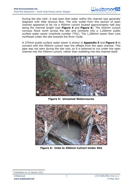
During the site visit 6 , it was seen that water within the channel was generally<br />
stagnant with little obvious flow. The only outlet from this section of open<br />
channel appeared to be via a 450mm culvert located approximately half way<br />
along the channel length (see Figure 4 and Figure 6). The 450mm culvert<br />
conveys flows north across the site and connects into a 1,200mm public<br />
surface water sewer (manhole number 7701). The 1,200mm sewer then runs<br />
northeast under the site towards the River Clyde.<br />
A 375mm public surface water sewer is shown in <strong>Appendix</strong> E and Figure 4 to<br />
connect with the 450mm culvert near the offtake from the open channel. This<br />
pipe was not seen during the site visit, so it is believed to run under the open<br />
channel into the 450mm culvert, rather than outfalling into the channel itself.<br />
Figure 5: Unnamed Watercourse<br />
Figure 6: Inlet to 450mm Culvert Under Site<br />
6 Undertaken on 14 January 2011<br />
©Weetwood<br />
www.weetwood.net<br />
7 1727 SCEC/FRA_Final v2.1<br />
14 May 2012