Tropical Storm Nicole - Planning Institute of Jamaica
Tropical Storm Nicole - Planning Institute of Jamaica
Tropical Storm Nicole - Planning Institute of Jamaica

Create successful ePaper yourself
Turn your PDF publications into a flip-book with our unique Google optimized e-Paper software.
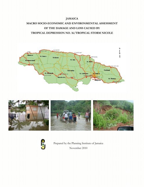
JAMAICA<br />
MACRO SOCIO-ECONOMIC AND ENVIRONMENTAL ASSESSMENT<br />
OF THE DAMAGE AND LOSS CAUSED BY<br />
TROPICAL DEPRESSION NO. 16/TROPICAL STORM NICOLE<br />
Prepared by the <strong>Planning</strong> <strong>Institute</strong> <strong>of</strong> <strong>Jamaica</strong><br />
November 2010
PREFACE<br />
This report is prepared to document the impact <strong>of</strong> <strong>Tropical</strong> Depression 16/<strong>Tropical</strong> <strong>Storm</strong><br />
<strong>Nicole</strong> on the affected population; estimate costs <strong>of</strong> damage and losses and identify<br />
geographically affected areas.<br />
The assessment was prepared by the <strong>Planning</strong> <strong>Institute</strong> <strong>of</strong> <strong>Jamaica</strong> in close collaboration<br />
with the Office <strong>of</strong> Disaster Preparedness and Emergency Management (ODPEM) and other<br />
member agencies <strong>of</strong> the Disaster Impact Assessment Core Team 1 . Data and information on<br />
the damage and losses were provided by various ministries and agencies <strong>of</strong> the Government<br />
<strong>of</strong> <strong>Jamaica</strong> as well as several non-government institutions and private sector entities. These<br />
include, among others:<br />
- Meteorological Services, <strong>Jamaica</strong><br />
- Ministry <strong>of</strong> Labour and Social Security<br />
- Ministry <strong>of</strong> Health<br />
- Ministry <strong>of</strong> Education<br />
- National Works Agency<br />
- Ministry <strong>of</strong> Water and Housing<br />
- Ministry <strong>of</strong> National Security<br />
- Ministry <strong>of</strong> Agriculture and Fisheries<br />
- Rural Agricultural Development Authority<br />
- National Water Commission<br />
- <strong>Jamaica</strong> Public Service Company<br />
- Forestry Department<br />
- Water Resources Authority<br />
- National Environment and <strong>Planning</strong> Agency<br />
- Mines and Geology Division<br />
-<br />
The assessment was made following the Economic Commission for Latin America and the<br />
Caribbean (ECLAC) Damage and Loss Assessment (DaLA) methodology for estimating the<br />
socio-economic and environmental effects <strong>of</strong> disasters. The ECLAC methodology is based<br />
on a stock-flow analysis <strong>of</strong> the difference before and after an event. Through a sectoral<br />
approach, it provides guidelines for the aggregation <strong>of</strong> value (damage and losses), to be used<br />
in the evaluation following an event. It is a basic accounting approach based on the national<br />
account framework and impact multipliers in the economy. The information supplied in the<br />
report is preliminary and subject to revision. The cut-<strong>of</strong>f point for data used in the report<br />
was October 7, 2010.<br />
- 1 The Disaster Impact Assessment Core Team consists <strong>of</strong> representatives from the PIOJ, Office <strong>of</strong> Disaster<br />
Preparedness and Emergency Management, Meteorological Service, <strong>Jamaica</strong>, Ministry <strong>of</strong> Labour and Social<br />
Security, Ministry <strong>of</strong> Health, Ministry <strong>of</strong> Education, National Works Agency, Ministry <strong>of</strong> Agriculture and<br />
Fisheries, National Water Commission, <strong>Jamaica</strong> Public Service Company and the National Environment and<br />
<strong>Planning</strong> Agency<br />
i
TABLE OF CONTENTS<br />
I. INTRODUCTION .................................................................................................. 1<br />
A. Description <strong>of</strong> Events ............................................................................................................ 1<br />
Rainfall Analysis .......................................................................................................................... 6<br />
B. Emergency Actions and Expenditure ................................................................................. 9<br />
C. Affected Population ............................................................................................................. 11<br />
Severely Affected Communities .............................................................................................. 12<br />
D. Impact on Livelihoods and Women and Children .......................................................... 19<br />
E. Casualties ............................................................................................................................... 20<br />
II. SOCIAL SECTORS ............................................................................................... 22<br />
A. Housing .................................................................................................................................. 22<br />
B. Education ............................................................................................................................... 24<br />
C. Public Buildings .................................................................................................................... 27<br />
D. Health ..................................................................................................................................... 28<br />
Primary, Secondary, and Tertiary Care ................................................................................. 29<br />
Critical Facilities ........................................................................................................................ 30<br />
Environmental Health .............................................................................................................. 30<br />
Health Priority Areas ................................................................................................................ 30<br />
Children’s Homes ..................................................................................................................... 31<br />
III. PRODUCTIVE SECTORS .................................................................................... 32<br />
A. Agriculture ............................................................................................................................. 32<br />
Domestic Crop and Livestock ................................................................................................ 33<br />
Greenhouse Farming ................................................................................................................ 36<br />
Farm Roads ................................................................................................................................ 37<br />
B. Tourism Sector ..................................................................................................................... 39<br />
General Overview ..................................................................................................................... 39<br />
Damage ....................................................................................................................................... 41<br />
Loss ............................................................................................................................................. 42<br />
IV. INFRASTRUCTURE ............................................................................................. 43<br />
A. Electricity & Water Supplies ............................................................................................... 43<br />
ii
a) Electricity Sub-industry ........................................................................................................ 44<br />
b) Water Supply and Sanitation ............................................................................................... 45<br />
B. Transport ............................................................................................................................... 47<br />
a) Road transport ...................................................................................................................... 48<br />
b) Airports .................................................................................................................................. 51<br />
c) Ports ........................................................................................................................................ 51<br />
C. Telecommunications ............................................................................................................ 51<br />
V. ENVIRONMENT ............................................................................................... 52<br />
VI. MACROECONOMIC IMPACT OF TROPICAL STORM NICOLE ................ 61<br />
A. Summary Of The Damage And Losses ............................................................................ 61<br />
B. Economic Performance In The Year Of The Event, Before The Event, January-<br />
June 2010 And July-September 2010 .......................................................................................... 66<br />
C. Projected Performance After The Event, October – December 2010 ........................ 72<br />
VII. CONCLUSION AND RECOMMENDATIONS................................................75<br />
iii
LIST OF FIGURES<br />
Figure 1: Radar Composite - Rainfall on September 27 and Affected Communities ................ 3<br />
Figure 2: Radar Composite - Rainfall on September 28 and Affected Communities ................ 4<br />
Figure 3: Island Rainfall: <strong>Tropical</strong> <strong>Storm</strong> <strong>Nicole</strong> ............................................................................. 6<br />
Figure 4: Percentage Mean Island Rainfall: <strong>Tropical</strong> <strong>Storm</strong> <strong>Nicole</strong> ............................................. 7<br />
Figure 5: Rainfall Accumulation September 24 – October 1, 2010 .............................................. 9<br />
Figure 6: Status <strong>of</strong> Shelters Sept 29 – October 5, 2010 ................................................................ 10<br />
Figure 7: Levels <strong>of</strong> Damage to Houses Critically Affected by <strong>Tropical</strong> <strong>Storm</strong> <strong>Nicole</strong> -<br />
Westmoreland ............................................................................................................................ 16<br />
Figure 8: Areas Critically Affected by <strong>Tropical</strong> <strong>Storm</strong> <strong>Nicole</strong> – Westmoreland ..................... 17<br />
Figure 9: Communities Affected by TS <strong>Nicole</strong> and Geographic Distribution <strong>of</strong> Poverty ..... 19<br />
Figure 10: Damage to Educational Institutions ............................................................................. 25<br />
Figure 11: Institutions Affected by Region .................................................................................... 26<br />
Figure 12: Summary <strong>of</strong> Damage to the Health Sector.................................................................. 29<br />
Figure 13: Total Damage to Agricultural Sector by Parish .......................................................... 33<br />
Figure 14: Preliminary Costs <strong>of</strong> Damage to Crops by Type <strong>of</strong> Crop ......................................... 34<br />
Figure 15: Cost <strong>of</strong> Damage to Livestock Due to <strong>Tropical</strong> <strong>Storm</strong> <strong>Nicole</strong> .................................. 36<br />
Figure 16: Status <strong>of</strong> Roads after <strong>Tropical</strong> <strong>Storm</strong> <strong>Nicole</strong> – September 30, 2010 ....................... 50<br />
Figure 17: Gully channel filled with silt and shrub in Clarendon ............................................... 54<br />
Figure 18: Large mats <strong>of</strong> seagrass uprooted in Negril .................................................................. 56<br />
Figure 19: Eroded section <strong>of</strong> a section <strong>of</strong> Long Bay Beach in Negril ........................................ 57<br />
Figure 20: Turbid waters <strong>of</strong> the Hope River .................................................................................. 58<br />
Figure 21: Unemployment Rate by Quarters, 2006-2010 ............................................................ 65<br />
iv
LIST OF TABLES<br />
Table 1: Wind Analysis ........................................................................................................................ 5<br />
Table 2: Rainfall Volume (mm) in selected stations, September 26-30........................................ 8<br />
Table 3: Estimated Affected Population Due To Heavy Rainfall and Flooding from <strong>Tropical</strong><br />
<strong>Storm</strong> <strong>Nicole</strong> (As reported to the ODPEM’s NEOC) ....................................................... 11<br />
Table 4: Hazards Experienced and Affected Communities......................................................... 12<br />
Table 5: Communities Worst Affected by <strong>Tropical</strong> <strong>Storm</strong> <strong>Nicole</strong> ............................................. 13<br />
Table 6: Number <strong>of</strong> Communities Affected by Parish (as reported to the NEOC)................ 14<br />
Table 7: Summary <strong>of</strong> Deaths Related to <strong>Tropical</strong> <strong>Storm</strong> <strong>Nicole</strong> ................................................ 20<br />
Table 8: Summary <strong>of</strong> Damage and Loss to the Social Sector ...................................................... 22<br />
Table 9: Summary <strong>of</strong> Damage to the Housing Sector as at October 20, 2010 ......................... 23<br />
Table 10: Damage and Losses to Education by Region ............................................................... 24<br />
Table 11: Damage to Educational Institutions by Type <strong>of</strong> Institution ...................................... 25<br />
Table 12: Summary <strong>of</strong> Damage and Loss to the Health Sector .................................................. 28<br />
Table 13: Preliminary Estimates <strong>of</strong> Damage from <strong>Tropical</strong> <strong>Storm</strong> <strong>Nicole</strong> by Parish .............. 32<br />
Table 14: Preliminary Estimates <strong>of</strong> Damage to Crops by Parish (<strong>Tropical</strong> <strong>Storm</strong> <strong>Nicole</strong>) .... 34<br />
Table 15: Preliminary Costs <strong>of</strong> Damage to Crops by Type <strong>of</strong> Crop .......................................... 35<br />
Table 16: Preliminary Estimates <strong>of</strong> Flood Damage –Livestock (<strong>Tropical</strong> <strong>Storm</strong> <strong>Nicole</strong>) ...... 35<br />
Table 17: Preliminary Estimates <strong>of</strong> Damage to Greenhouses ..................................................... 37<br />
Table 18: Preliminary Estimates <strong>of</strong> Damage to Farm Roads ...................................................... 37<br />
Table 19: Tourism Performance Indicators 2005-2009................................................................ 40<br />
Table 20: Cruise Ship Passenger Arrivals 2007-2010 .................................................................... 40<br />
Table 21: Summary <strong>of</strong> Damages and Losses in the Tourism Sector .......................................... 42<br />
Table 22: Infrastructure – Damage and Loss................................................................................. 43<br />
Table 23: Preliminary Cost To Re-Open and Restore Roads Affected As A Result <strong>of</strong><br />
<strong>Tropical</strong> <strong>Storm</strong> <strong>Nicole</strong> .............................................................................................................. 49<br />
Table 24: Solid Waste Expenditure Associated with <strong>Tropical</strong> <strong>Storm</strong> <strong>Nicole</strong> by Region ......... 59<br />
Table 25: Total Cost <strong>of</strong> Damage & Loss From <strong>Tropical</strong> <strong>Storm</strong> <strong>Nicole</strong> .................................... 64<br />
Table 26: Year over Year Change <strong>of</strong> Value Added by Industry at Constant (2003) Prices .... 68<br />
v
Executive Summary<br />
Description <strong>of</strong> the Event<br />
The event produced bands <strong>of</strong> showers and thunderstorms over most <strong>of</strong> the island but more<br />
so to the east, southern and western sections <strong>of</strong> the island. The event resulted in<br />
approximately 139.54 inches (3,544.4 mm) <strong>of</strong> rainfall over a 6-day period (September 26-<br />
October 1, 2010). Similar rainfall events were experienced in 1979 and in 1986. ODPEM has<br />
determined that in light <strong>of</strong> the volume and intensity <strong>of</strong> rainfall and the level <strong>of</strong> damage<br />
wrought, the event is to be classified as an extreme event. ODPEM has also indicated that it<br />
is now becoming increasingly evident that the return period for what may be deemed a 100-<br />
year event is being experienced within periods <strong>of</strong> 15-20 year cycles. The situation may have<br />
been exacerbated by an extended period <strong>of</strong> rainfall impacting the island in the days leading<br />
up to the event.<br />
Summary Cost<br />
The preliminary estimate <strong>of</strong> the damage and losses incurred by the <strong>Jamaica</strong>n economy due to<br />
<strong>Tropical</strong> <strong>Storm</strong> <strong>Nicole</strong> and associated rains was $20.58 billion (US $239.6 million 2 ),<br />
disaggregated as $19.51 billion in damage and $1.01 billion in losses 3 . With regard to total<br />
damage, publicly owned properties accounted for $19.32 billion or 93.9 per cent, while<br />
privately owned properties accounted for the remaining $1.25 million. The cost <strong>of</strong> the<br />
impact was equivalent to 1.9 per cent <strong>of</strong> current (2009) GDP, somewhat similar to the 2.1<br />
per cent <strong>of</strong> GDP occasioned by the impact <strong>of</strong> <strong>Tropical</strong> <strong>Storm</strong> Gustav in 2008, which cost<br />
approximately US$214 million. Damage and losses in the infrastructure sector represented<br />
the greatest portion <strong>of</strong> impact accounting for over 88.1 per cent <strong>of</strong> the estimated total (See<br />
Table 1, Figure 1).<br />
The impact <strong>of</strong> the rains necessitated a downward revision in the projected GDP growth rate,<br />
given the reported damage sustained mainly by agriculture and infrastructure (electricity,<br />
water, roads). Thus, GDP is expected to expand by 0.7 per cent instead <strong>of</strong> the 0.9 per cent<br />
projected prior to the event ( a detraction <strong>of</strong> 0.2 percentage points).<br />
2 Exchange rate: J $85.89 = US $1 (Bank <strong>of</strong> <strong>Jamaica</strong> Exchange Rate for September)<br />
3 The estimates delineated for losses may be underestimated as at the time <strong>of</strong> writing the relevant data were not<br />
fully tabulated.<br />
vi
Table 1: Preliminary Costs <strong>of</strong> Damage and Losses caused by <strong>Tropical</strong> <strong>Storm</strong> <strong>Nicole</strong><br />
vii
Infrastructure<br />
As in the case with <strong>Tropical</strong> <strong>Storm</strong> Gustav, the greatest impact <strong>of</strong> <strong>Tropical</strong> Depression No.<br />
16/<strong>Tropical</strong> <strong>Storm</strong> <strong>Nicole</strong> was to the country’s physical infrastructure. Based on<br />
preliminary assessments, damage was estimated at $18.09 billion. The associated losses,<br />
though not yet fully determined are estimated to be in the region <strong>of</strong> $28.4 million<br />
Damage to main roads and bridges was estimated at $14.0 billion <strong>of</strong> which $1.42 billion<br />
represented the preliminary cost to reopen blocked roads. A total <strong>of</strong> 543 main roads were<br />
impacted with St. Thomas accounting for $1.54 billion or 11.0 per cent <strong>of</strong> the total cost <strong>of</strong><br />
the damage. Another $1.90 billion was allocated to river training (Table 23). Cleaning and<br />
reconstruction <strong>of</strong> retaining walls <strong>of</strong> the Sandy Gully bridge accounted for 32.7 per cent<br />
(J$4.6 billion) <strong>of</strong> the total cost <strong>of</strong> damage to the road infrastructure.<br />
Preliminary estimates <strong>of</strong> damage to the NWC system ranged between $240.0 million -$270.0<br />
million. Assessment <strong>of</strong> damage to rural and remote infrastructure as well as commercial<br />
losses, increased operating costs (including the trucking <strong>of</strong> water) and other costs associated<br />
with the tropical storm has not yet been ascertained. More than 40.0 per cent <strong>of</strong> NWC’s<br />
460 water supply systems were damaged and/or forced out <strong>of</strong> operation and a further 30.0<br />
per cent were otherwise impacted. This resulted in water supply service to most customers<br />
being impacted in one way or another. However, within 10 days, more than 95.0 per cent <strong>of</strong><br />
the Commission’s productive capacity and more than 85.0 per cent <strong>of</strong> its systems were<br />
restored.<br />
Preliminary estimates indicate that the electricity sub-industry sustained damage <strong>of</strong> some<br />
$92.4 million. Associated losses were reported as being minimal as it was mainly the smaller<br />
users that were out <strong>of</strong> electricity. The impact to large consumers, for example hotels, was<br />
limited.<br />
viii
The impact on the JPSCo’s distribution system resulted in power outages to approximately<br />
48.0 per cent <strong>of</strong> customers (over 288 000) islandwide. While restoration efforts were<br />
hampered by blocked roads, landslides, flooding, badly damaged roadways and ongoing<br />
rainfall in some areas, electricity was restored to 99.0 per cent <strong>of</strong> the total customer base<br />
within almost a week <strong>of</strong> the storm.<br />
Transportation<br />
Physical damage to the JUTC’s four depot was minimal, estimated at $200 000, accounted<br />
for fully by damage at the Greater Portmore lay-by. The company, however, sustained loss<br />
in revenue during the initial one-week period <strong>of</strong> the event, which amounted to $25.0 million.<br />
Except for a few cancellations and flight delays, activities at the international airports<br />
functioned smoothly. The associated losses, if any, are yet to be determined. The Port<br />
Authority <strong>of</strong> <strong>Jamaica</strong> (PAJ) reported that there were no damages to its property, plant and<br />
equipment.<br />
Agriculture<br />
Preliminary figures from the Ministry <strong>of</strong> Agriculture indicated that total damage and loss to<br />
the agriculture sector was estimated at $576.5 million. Crop damage accounted for $531.6<br />
million while damage to livestock was put at $32.4 million and greenhouses at $12.5 million.<br />
Damage to the infrastructure (farm roads) was estimated at $574.6 million. Some $22.0<br />
million was also allocated as relief assistance to small farmers and greenhouse growers.<br />
Some 40.0 per cent <strong>of</strong> banana production was affected, 26 greenhouses were damaged, and<br />
crops mainly affected included vegetables, condiments and banana/plantains 4 . Losses were<br />
highest in the parish <strong>of</strong> St. Elizabeth ($89.7 million) followed by Clarendon ($86.2 million)<br />
and St. Mary ($81.2 million).<br />
Tourism<br />
An initial damage assessment indicates that the preliminary cost <strong>of</strong> damage is put at $76.18<br />
billion and losses at $88.32 billion. Damage within the tourism sector was greatest in Negril<br />
and the South Coast Resort Areas, Montego Bay, and Port Antonio. There were also reports<br />
<strong>of</strong> various attractions island-wide being affected. The most frequently reported type <strong>of</strong><br />
damage related to buildings, boats and other vessels; extensive beach erosion; and extensive<br />
vegetative and landscape damage due to floods and heavy winds.<br />
4 http://www.moa.gov.jm/news/ministry_helps_groups_affected_by_tsnicole.php<br />
ix
Education<br />
Total damage to educational institutions is estimated at $157 million, while losses amounted<br />
to $940 million, for a total <strong>of</strong> $1.10 billion. This represents 6.11 per cent <strong>of</strong> the damage to<br />
the social sector. Some 147 schools were damaged by the event with the main damage being<br />
leakage and flooding. During the event attendance at schools was largely disrupted between<br />
September 28 and October 1, with all schools being declared closed on September 29.<br />
Health<br />
The Ministry <strong>of</strong> Health reported that 16 persons lost their lives as a result <strong>of</strong> the event, 14 <strong>of</strong><br />
whom have been confirmed dead. Among those who perished were six children between 0<br />
(newborn) and 14 years <strong>of</strong> age. Nine persons died by drowning and 10 by crush injury. In<br />
addition, 42 persons (31 males and 11 females) with injuries related to the weather event<br />
were treated at hospitals since September 28, 2010. Nine <strong>of</strong> the injured were admitted to<br />
hospital. The health sector sustained damage and losses to the tune <strong>of</strong> $270.0 million. Four<br />
Health Centres were closed as a result <strong>of</strong> the weather conditions. Two hundred and seventynine<br />
<strong>of</strong> the 302 Health Centres were opened on Friday, October 1, 2010. Of these, 231<br />
<strong>of</strong>fered full services and 48 partial services. All 24 public hospitals and the University<br />
Hospital <strong>of</strong> the West Indies remained operational with one hospital – the Spanish Town<br />
Hospital <strong>of</strong>fering emergency services only. Services at the National Public Health<br />
Laboratory and the National Blood Transfusion service were closed temporarily due to<br />
floods and leaks.<br />
Affected Population<br />
Approximately 18.7 per cent <strong>of</strong> the total population or 507,831 persons from 130<br />
communities were directly and indirectly affected by the natural disaster. Most <strong>of</strong> the<br />
affected communities were impacted by flooding. The impact <strong>of</strong> <strong>Tropical</strong> <strong>Storm</strong> <strong>Nicole</strong> and<br />
associated rains was felt throughout <strong>Jamaica</strong> but tremendous damage was sustained in the<br />
parishes along the southeast through to southwest corridor and southern sections <strong>of</strong><br />
northern parishes. The parishes most affected included Hanover, Clarendon, KSA,<br />
Westmoreland, St. Catherine and St. Elizabeth which together accounted for 78.5 per cent <strong>of</strong><br />
communities affected. During the event there were up to 277 persons confirmed as being in<br />
shelters in St. Catherine, 228 in KSA and 49 in Westmoreland.<br />
Data on the directly affected population was generally not provided by gender. However, in<br />
terms <strong>of</strong> death and injuries, males fared worse than females. Males accounted for 75% <strong>of</strong><br />
mortality and 74% <strong>of</strong> the injured. It is known that males account for the majority <strong>of</strong> farmers<br />
and would account for the majority <strong>of</strong> the approximately 17,000 domestic crop farmers and<br />
1700 livestock farmers whose property crops and livestock were damaged.<br />
In the education sector, boys and girls at the early childhood, primary and secondary levels<br />
can be assumed to have been equally impacted as enrollment rates were relatively equal at<br />
these levels, with slightly higher number <strong>of</strong> boys at the secondary level.<br />
x
Comparison <strong>of</strong> the most affected communities with the poverty map indicates that the<br />
communities were generally not located in the poorest areas. There was, however, evidence<br />
that some communities such as Sandy Gully, are pockets <strong>of</strong> poverty within wealthier<br />
communities.<br />
A total <strong>of</strong> 2169 houses were assessed after the passage <strong>of</strong> <strong>Tropical</strong> <strong>Storm</strong> <strong>Nicole</strong>. Of these,<br />
474 (21.8 per cent) were severely damaged while 54 (2.5 per cent) were totally destroyed.<br />
Damage amounted to an estimated $274.3 million <strong>of</strong> which $75.6 million was the<br />
replacement cost for those totally destroyed units. Westmoreland had the highest number <strong>of</strong><br />
homes that were totally destroyed, and accounted for a third <strong>of</strong> the estimated replacement<br />
cost. In terms <strong>of</strong> overall damage, the five most affected parishes in rank order are<br />
Westmoreland with 648 houses and 28.4 per cent <strong>of</strong> the reported cost <strong>of</strong> damage, KSA with<br />
261 (15.8 per cent), St. Catherine - 209 (14.1 per cent), St. Mary – 27 (9.8 per cent) and St.<br />
Elizabeth with 310 (7.9 per cent) as presented in Table 11. Most <strong>of</strong> the damage to housing<br />
units was caused by flooding.<br />
Environment<br />
The entire island was enveloped by the intense showers <strong>of</strong> <strong>Tropical</strong> <strong>Storm</strong> <strong>Nicole</strong>. The<br />
continuous rains resulted in flooding, landslides and over flowing <strong>of</strong> rivers/gullies across the<br />
island resulting in the loss <strong>of</strong> lives and property and severe damage to the country’s<br />
infrastructure. Data from the Water Resources Authority (WRA) indicated that some rivers<br />
experienced the highest flows on record. The torrential rainfall also resulted in pollution <strong>of</strong><br />
the environment from run<strong>of</strong>f and spills from industrial facilities and sewage treatment<br />
plants, coastal erosion, sedimentation <strong>of</strong> coastal water bodies and accumulation <strong>of</strong> solid<br />
waste. There was also damage to vegetation in some areas, evidenced by uprooted trees.<br />
Emergency Operations<br />
Relief operations during and after the event included the airlifting <strong>of</strong> 300 relief packages to<br />
six marooned communities in the parishes <strong>of</strong> St. Thomas, St. Catherine & KSA by the JDF.<br />
The Ministry <strong>of</strong> Health responded to 16 emergency requests and eight helicopter Casualty<br />
Evacuation (CASEVAC) flights were completed, with transportation <strong>of</strong> nine patients to<br />
hospital. The Red Cross also provided relief supplies to 1,456 people in 7 communities.<br />
The total cost for emergency activities was estimated at approximately $48.9 million. This<br />
included $8.3 million and $10.0 million to cover emergency/humanitarian relief supplies <strong>of</strong><br />
the ODPEM and the Red Cross respectively. Another $0.65 million was spent on helicopter<br />
fuel for 18.5 hrs <strong>of</strong> helicopter flights, and fuel for four trips to carry paddle boats to Pedro<br />
River and Chigwell.<br />
xi
I. INTRODUCTION<br />
The Meteorological Phenomenon<br />
A. Description <strong>of</strong> Events<br />
The formation <strong>of</strong> <strong>Tropical</strong> <strong>Storm</strong> <strong>Nicole</strong> which affected the island from September 28 –<br />
October 1, 2010 was the culmination <strong>of</strong> a series <strong>of</strong> sequential weather events between<br />
September 22 and September 27. These weather events included:<br />
significant moisture and broad cyclonic flow associated with <strong>Tropical</strong> Depression<br />
Matthew which continued to impact much <strong>of</strong> the western Caribbean producing<br />
strong showers and thunderstorms west <strong>of</strong> 78°W;<br />
deep layer moisture across most <strong>of</strong> the Caribbean west <strong>of</strong> 67°W. This was<br />
associated with monsoonal moisture from northern South America and the large<br />
scale cyclonic surface wind field from the remnant low center <strong>of</strong> <strong>Tropical</strong> <strong>Storm</strong><br />
Matthew;<br />
<br />
<br />
an upper-level ridge axis that extended eastward to 14°N, 61°W over the remainder<br />
<strong>of</strong> the Caribbean basin. This upper-level pattern provided a diffluent environment<br />
al<strong>of</strong>t and in turn supported the widespread showers and scattered thunderstorms<br />
noted on satellite imagery mostly located west <strong>of</strong> 64°W; and<br />
a concentrated area <strong>of</strong> convective activity associated with a broad 1004 millibar lowpressure<br />
centre over northern Belize near 18°N, 88°W. Scattered moderate to strong<br />
convection was mostly located within 180 nautical miles <strong>of</strong> the centre and over<br />
interior portions <strong>of</strong> the Yucatan Peninsula. Global model guidance agreed on further<br />
organization <strong>of</strong> this broad area <strong>of</strong> low<br />
pressure over the western Caribbean.<br />
Based on radar reports <strong>of</strong> continuing showers and<br />
thunderstorms over <strong>Jamaica</strong> on September 26 and<br />
into September 27, with the low-pressure area<br />
drifting northward in the vicinity <strong>of</strong> the island, a<br />
Flash Flood Warning was issued at 1:00 p.m.<br />
Forecast Track for T.D. #16 at formation<br />
1
Conditions were, at that time, favourable for gradual development into another tropical<br />
cyclone and rainfall was expected to continue over the island for another two days.<br />
Throughout the night, radar reports indicated that periods <strong>of</strong> heavy showers and<br />
thunderstorms affected all western, central and southeastern parishes. These were forecast<br />
to continue during the day and for the next 2-3 days as <strong>Tropical</strong> Depression #16 (TD#16)<br />
formed west <strong>of</strong> the island. Marine interests were advised to look out for above-normal wave<br />
heights, strong, gusty winds, showers and thunderstorms.<br />
On September 28, <strong>Tropical</strong> Depression #16 was the main feature across the north-western<br />
Caribbean generating numerous showers and scattered thunderstorms over much <strong>of</strong> the<br />
basin north <strong>of</strong> 12°N between 65°W and 89°W. This widespread area <strong>of</strong> convection was<br />
supported al<strong>of</strong>t by an anticyclonic circulation centred near 18°N, 75°W that extended an<br />
upper-level ridge axis southeast to north-eastern Venezuela near 10°N, 62°W. As TD#16<br />
steered north-northeastward, 10-15 knot east-southeast trade winds were expected to resume<br />
over the basin east <strong>of</strong> 72°W with surface troughing forecast to drift over the western<br />
Caribbean between 80°W and 85°W through early Saturday.<br />
T.S. <strong>Nicole</strong> Dissipated<br />
With the depression moving towards the<br />
north on September 28, rainfall continued<br />
across the country and was forecast to<br />
peak in intensity within the next 24 hours<br />
although continuing through to October 1.<br />
Strong winds and heavy rains associated<br />
with the depression were expected to<br />
occur “a couple hundred miles to the east<br />
and southeast <strong>of</strong> the centre” as it moved<br />
across Cuba. By 5:00 a.m. the next day, September 29, the centre <strong>of</strong> the tropical cyclone<br />
emerged over the Straits <strong>of</strong> Florida, becoming <strong>Tropical</strong> <strong>Storm</strong> <strong>Nicole</strong> by 2:00 p.m. and<br />
dissipating by 5:00 p.m. The broad band <strong>of</strong> showers and thunderstorms left behind,<br />
continued to produce gusty winds and heavy rainfall across <strong>Jamaica</strong>, forecast to continue for<br />
another two days. The Flash Flood Warning was continued.<br />
2
On September 30, most parishes continued to experience scattered light to moderate and<br />
sometimes heavy showers and thunderstorms. These, however, showed gradual reduction<br />
on October 1-3; hence the Flash Flood Warning was lifted at 5:00 p.m. on October 3. The<br />
broad area <strong>of</strong> low-pressure had begun to drift northward and away from <strong>Jamaica</strong>.<br />
Radar Imagery:<br />
<strong>Jamaica</strong>’s Doppler Weather Surveillance Radar was in active operation for most <strong>of</strong> the severe<br />
weather event, although removed from service from 9:00 p.m. on September 28 to 11:00<br />
a.m. on September 30, and again at 9:00 p.m. on September 30 to the end <strong>of</strong> the period due<br />
to power supply issues. Figure 1 and Figure 2 display radar images showing the levels <strong>of</strong><br />
rainfall impacting the island at the peak <strong>of</strong> the event on September 27 and 28. Detailed radar<br />
images for the extent <strong>of</strong> the event can be found in Appendix A<br />
Figure 1: Radar Composite - Rainfall on September 27 and Affected Communities<br />
Source: Meteorological Service, <strong>Jamaica</strong>, ODPEM<br />
3
The communities affected by flooding and landslides as displayed in Figures 1 and 2 are<br />
consistent with the areas which received heavy rainfall on the days indicated. This covered<br />
mainly the western parishes <strong>of</strong> the island as well as Kingston and St. Andrew and parts <strong>of</strong> St.<br />
Thomas.<br />
Figure 2: Radar Composite - Rainfall on September 28 and Affected Communities<br />
Source: Meteorological Service, ODPEM<br />
There were three reported incidents <strong>of</strong> microburst in Savanna-la-Mar, Westmoreland,<br />
Mandeville and St. Elizabeth. Microburst is a kind <strong>of</strong> severe weather condition, which<br />
develops as a column <strong>of</strong> dropping air. Microburst appears like a tornado and usually has<br />
wind speeds <strong>of</strong> 120.7km (75 miles) per hour.<br />
4
Table 1: Wind Analysis<br />
Parish Station Day_26<br />
(knots)<br />
Highest Daily Wind<br />
(knots)<br />
Time <strong>of</strong> Strongest<br />
Gust (LST)<br />
St. Thomas Belvedere 2.2 18.3 0630<br />
Nutts River 1.7 11.3 0430<br />
Portland Happy Grove 4.4 21.7 0700<br />
Fair Prospect 4.1 18.3 0600<br />
C.A.S.E 3.7 17.4 1430<br />
Kingston Norman Manley 8.3 23.3 0558<br />
International Airport<br />
Parish Station Day_27<br />
(knots)<br />
Highest Daily Wind<br />
(knots)<br />
Time <strong>of</strong> Strongest<br />
Gust (LST)<br />
St. Thomas Belvedere 2.2 23.5 1145<br />
Nutts River 1.4 18.3 1200<br />
Portland Happy Grove 4.0 20 2400<br />
Fair Prospect 3.0 17.4 1100<br />
C.A.S.E 2.6 16.5 1300<br />
Kingston Norman Manley 5.4 15.2 0318<br />
International Airport<br />
Parish Station Day_28<br />
(knots)<br />
Highest Daily Wind<br />
(knots)<br />
Time <strong>of</strong> Strongest<br />
Gust (LST)<br />
St. Thomas Belvedere 3.0 20.9 0930<br />
Nutts River 1.9 23.5 2300<br />
Portland Happy Grove 4.9 24.3 1130<br />
Fair Prospect 3.4 20.9 1030<br />
C.A.S.E 1.2 6.1 0730<br />
Kingston Norman Manley 7.6 25.9 2316<br />
International Airport<br />
Parish Station Day_29<br />
(knots)<br />
Highest Daily Wind<br />
(knots)<br />
Time <strong>of</strong> Strongest<br />
Gust (LST)<br />
St. Thomas Belvedere 8.8 36.5 0700<br />
Nutts River 4.6 31.3 0530<br />
Portland Happy Grove 7.9 32.2 1000<br />
Fair Prospect 5.9 29.6 1430<br />
C.A.S.E 3.8 20.9 1700<br />
Kingston Norman Manley 14.1 36.5 1002<br />
International Airport<br />
Parish Station Day_30<br />
(knots)<br />
Highest Daily Wind<br />
(knots)<br />
Time <strong>of</strong> Strongest<br />
Gust (LST)<br />
St. Thomas Belvedere 1.2 13.9 1215<br />
Nutts River 0.4 8.7 1630<br />
Portland Happy Grove 4.8 19.1 1630<br />
Fair Prospect 2.3 19.1 1000<br />
C.A.S.E 2.5 13.9 0700<br />
Kingston Norman Manley 3.5 10.3 1659<br />
International Airport<br />
5
Rainfall Analysis<br />
The monthly average rainfall for the island for September was 272 per cent above the<br />
normal (30-year mean from 1971-2000). As a whole, rainfall for the island exceeded the 30-<br />
year mean figure for the month. The parish rainfall analysis figures indicate that every parish<br />
recorded above normal rainfall for the month 5 (Figure 3). St. Ann recorded the highest<br />
percentage <strong>of</strong> mean with 453 per cent or 468mm. See Appendix B for a breakdown <strong>of</strong><br />
rainfall by parish. The excessive rainfall prior to and during the event contributed to the high<br />
incidence <strong>of</strong> flooding.<br />
Figure 3: Island Rainfall: <strong>Tropical</strong> <strong>Storm</strong> <strong>Nicole</strong><br />
The Mount Peto station in Hanover recorded the highest rainfall volume <strong>of</strong> 307.8 mm in a<br />
single day and a total volume <strong>of</strong> 608.7 mm <strong>of</strong> rainfall over the 5-day period. Figure 3 gives<br />
the percentage <strong>of</strong> the 30-year mean by station. The following stations recorded 250 per cent<br />
or higher <strong>of</strong> the 30-year mean over the four day period:<br />
5 Preliminary Monthly Rainfall Summary for September 2010, Meteorological Service, <strong>Jamaica</strong><br />
6
• Clarendon - Grimmith recorded 342 per cent, Monymusk 317 per cent.<br />
• KSA - Mavis Bank 253 per cent, Newcastle 265 per cent, Palisadoes 296 per cent,<br />
Seaview 261 per cent and Waterloo 260 per cent .<br />
• Manchester – Manchester Pastures 302 per cent, Marshall Pen- Sutton 281 per<br />
cent,<br />
Spur Tree 268 per cent.<br />
• St. Catherine – Bois Content 250 per cent.<br />
• St. Mary – Boscobel 257 per cent, Hampstead 254 per cent.<br />
• Westmoreland – Barham 263 per cent, Masemure 260 per cent and Shrewsbury 272<br />
per cent.<br />
Figure 4: Percentage Mean Island Rainfall: <strong>Tropical</strong> <strong>Storm</strong> <strong>Nicole</strong><br />
Table 2 shows rainfall amounts collected at select rainfall stations across the island covering<br />
the period September 26 – 30, 2010.<br />
7
Table 2: Rainfall Volume (mm) in selected stations, September 26-30<br />
Parish Station Sep-26 Sep-27 Sep-28 Sep-29 Sep-30 Total<br />
St. Thomas Belvedere 22.4 21.2 69.6 76.6 25.6 215.4<br />
Nutts River 43.6 23.2 66.4 134.2 36.2 303.6<br />
Portland Happy Grove 14.6 2.8 66 126.6 16.4 226.4<br />
Fair Prospect 8.6 0.6 45.2 192.8 18 265.2<br />
C.A.S.E 3.4 6.8 0.2 7.8 31.6 49.8<br />
St. Catherine Worthy Park 14.5 30 132 125 6.5 308<br />
Swansea 14 36 233 175 7.5 465.5<br />
Charm Hole 17 22 160 180 8 387<br />
Tulloch Estates 18.8 13.6 218.2 141.5 8.9 401<br />
Kingston Palisadoes 30.4 26.2 211.5 150.6 3.5 422.2<br />
Clarendon * Beckford Kraal 30.5 90 248 241.5 16 626<br />
Mason River 9.4 40.8 227 180 13.9 471.1<br />
St. James * Sangster Int'l 2.4 14.3 146.6 114.8 9.8 287.9<br />
Airport<br />
Green Pond 19.8 13.6 155.6 105.6 14 308.6<br />
St. Elizabeth Appleton 15.6 20.9 177.7 141.3 115.7 471.2<br />
* Holland 10.9 41.4 238.8 175.3 31.4 497.8<br />
Hanover Cacoon Castle 0 43.8 164.3 156.5 18.3 382.9<br />
Shettlewood 6.5 52 114.4 199.6 1.4 373.9<br />
Sandy Bay (Tryall) 0 89.1 168.2 53 42.2 352.5<br />
Mount Peto 10.3 73 307.8 189.3 28.3 608.7<br />
Manchester J. J. Gagnon 9.5 21.8 19.8 141.4 97.1 289.6<br />
Craighead 40 65 110 158 107 480<br />
Marshall Pen 37.1 51.2 276.9 271.2 25.6 662<br />
Westmoreland Negril Point L/H 12.7 102.9 165.1 97.8 100.1 478.6<br />
NOTE: Stations marked with an asterisk ( * ) are those where the one-day maximum exceeds that station’s 30-year mean (1971-<br />
2000) rainfall for September.<br />
8
The National Aeronautics and Space Administration (NASA) reported that the highest<br />
rainfall totals associated with the system was over <strong>Jamaica</strong> where upwards <strong>of</strong> 550 mm (~22<br />
inches) <strong>of</strong> rain fell as a result <strong>of</strong> <strong>Tropical</strong> <strong>Storm</strong> <strong>Nicole</strong>'s interaction with the island's terrain 6<br />
(Figure 5).<br />
Figure 5: Rainfall Accumulation September 24 – October 1, 2010<br />
Source: NASA,<br />
B. Emergency Actions and Expenditure<br />
At the start <strong>of</strong> the event, all emergency centres were activated. This included the National<br />
Emergency Operations Centre, all Parish Emergency Operations Centre and the Tourism<br />
Emergency Operations Centre. On September 29, an aerial reconnaissance was conducted<br />
by the Prime Minister and other key disaster management personnel. The <strong>Jamaica</strong> Defense<br />
Force (JDF) airlifted 300 relief packages to six marooned communities in the parishes <strong>of</strong> St.<br />
Thomas, St. Catherine and Kingston and St. Andrew (KSA) as well as the medical<br />
evacuation <strong>of</strong> a pregnant mother. Four boats were sent to Chigwell and one to Pedro River.<br />
No evacuations were conducted, however, as residents refused to leave their communities.<br />
Other critical actions included the evacuation <strong>of</strong> students from Sandy Park Basic School, and<br />
four persons in Westmoreland, Riverside Drive, Havendale, New Haven and Sterling Castle<br />
in St. Andrew by the <strong>Jamaica</strong> Fire Brigade. The Ministry <strong>of</strong> Health (MOH) responded to 16<br />
6 http://www.nasa.gov/mission_pages/hurricanes/archives/2010/h2010_<strong>Nicole</strong>.html<br />
9
emergency requests and eight helicopter Casualty Evacuation (CASEVAC) flights were<br />
completed, with transportation <strong>of</strong> nine patients to hospital. The Red Cross provided relief<br />
supplies and food packages to 1,456 people in seven communities.<br />
A total <strong>of</strong> 27 shelters were opened across the island housing 532 persons. At the peak <strong>of</strong> the<br />
event, some 457 persons had sought refuge in 11 shelters in seven parishes. As at October<br />
5, 2010, a total <strong>of</strong> 114 persons remained in 6 shelters in Kingston, St. James and St.<br />
Catherine (See Figure 6).<br />
Figure 6: Status <strong>of</strong> Shelters Sept 29 – October 5, 2010<br />
500<br />
450<br />
400<br />
350<br />
300<br />
250<br />
200<br />
150<br />
100<br />
50<br />
Figure 1.0: Shelter Status Sept. 29. 2010 - Oct 05, 2010<br />
0<br />
29/09/2010<br />
29/09/2010<br />
29/09/2010<br />
30/09/2010<br />
30/09/2010<br />
1/10/2010<br />
1/10/2010<br />
05/10/2010<br />
No. <strong>of</strong> Shelters Opened<br />
No. <strong>of</strong> Persons in Shelter<br />
The total cost for emergency activities following <strong>Tropical</strong> <strong>Storm</strong> <strong>Nicole</strong> was estimated at<br />
approximately $48.9 million. This included $ 8.3 million and $10 million to cover<br />
emergency/humanitarian relief supplies <strong>of</strong> the ODPEM and the Red Cross respectively.<br />
Another $0.65 million was spent on helicopter fuel for 18.5 hrs <strong>of</strong> helicopter flights, and fuel<br />
for four trips to carry paddle boats to Pedro River and Chigwell. The <strong>Jamaica</strong> Red Cross also<br />
stated that some <strong>of</strong> the funds will be used to support the Ministry <strong>of</strong> Health’s Dengue<br />
Emergency Programme and to purchase the chemical, Malathion used to destroy Aedes<br />
aegypti mosquitoes breeding sites that may be prevalent in some areas.<br />
10
In the aftermath <strong>of</strong> the event, the Government allocated $30 million to be shared by the 14<br />
local authorities to undertake much needed drain cleaning and vector control activities<br />
islandwide. Each Council would receive $1 to $3 million towards drain cleaning; some<br />
received $200,000 while others received $500,000 for vector control 7 .<br />
C. Affected Population<br />
The estimated population during the period <strong>of</strong> the flood rains was 2.7 million. As at<br />
October 5, 2010 approximately 18.7 per cent <strong>of</strong> the total population or some 507,831<br />
persons from 130 communities were directly and indirectly affected by the natural disaster.<br />
Most <strong>of</strong> the affected communities were impacted by flooding (See Table 3 and Table 4).<br />
Table 3: Estimated Affected Population Due To Heavy Rainfall and Flooding from<br />
<strong>Tropical</strong> <strong>Storm</strong> <strong>Nicole</strong> (As reported to the ODPEM’s NEOC)<br />
End <strong>of</strong> Year % End <strong>of</strong> % End <strong>of</strong> Year % End <strong>of</strong> % Projected Population Estimated Population<br />
Population<br />
Year<br />
Population<br />
Year<br />
At the time <strong>of</strong> TS Affected during<br />
2006<br />
Population<br />
2008<br />
Population<br />
<strong>Nicole</strong> <strong>Tropical</strong> <strong>Storm</strong> <strong>Nicole</strong><br />
2007<br />
2009<br />
(September 28-<br />
October 1, 2010)<br />
<strong>Jamaica</strong> 2,669,500 100.0 2,682,100 100.0 2,692,400 100.0 2,698,800 100.0 2,708,813 507,831<br />
Kingston and 660,600 24.7 663,600 24.7 666,200 24.7 667,800 24.7 670,278 94,609<br />
St. Andrew<br />
St. Thomas 93,400 3.5 93,900 3.5 94,300 3.5 94,500 3.5 94,851 9,853<br />
Portland 81,500 3.1 81,900 3.1 82,300 3.1 82,400 3.1 82,706 390<br />
St. Mary 113,400 4.3 113,900 4.2 114,300 4.2 114,600 4.2 115,025 9,556<br />
St. Ann 172,000 6.4 172,800 6.4 173,400 6.4 173,800 6.4 174,445 14,892<br />
Trelawny 75,000 2.8 75,300 2.8 75,600 2.8 75,800 2.8 76,081 6,078<br />
St. James 182,800 6.8 183,700 6.9 184,400 6.9 184,900 6.9 185,586 36,489<br />
Hanover 69,300 2.6 69,600 2.6 69,900 2.6 70,100 2.6 70,360 32,057<br />
Westmoreland 143,800 5.4 144,400 5.4 145,000 5.4 145,300 5.4 145,839 36,858<br />
St. Elizabeth 149,800 5.6 150,600 5.6 151,100 5.6 151,500 5.6 152,062 33,879<br />
Manchester 189,300 7.1 190,200 7.1 190,900 7.1 191,400 7.1 192,110 7,770<br />
Clarendon 244,400 9.2 245,600 9.2 246,500 9.2 247,100 9.2 248,017 46,630<br />
St. Catherine 494,200 18.5 496,600 18.5 498,500 18.5 499,600 18.5 501,454 178,769<br />
Source: Economic and Social Survey <strong>Jamaica</strong> 2009<br />
Note: Population Projection by the Social Policy, <strong>Planning</strong> and Research Division, PIOJ.<br />
Estimated population affected during <strong>Tropical</strong> <strong>Storm</strong> <strong>Nicole</strong> data based on assessment from the Office <strong>of</strong> Disaster Preparedness and Emergency<br />
Management (ODPEM) and Ministry <strong>of</strong> Labour and Social Security (MLSS) and using community data from 2001 Poverty Map.<br />
7 http://rjrnewsonline.com/news/local/30m-islandwide-drain-cleaning-vector-control<br />
11
Table 4: Hazards Experienced and Affected Communities<br />
Hazard<br />
No. <strong>of</strong> Communities<br />
Flooding 103<br />
Freak <strong>Storm</strong> 2<br />
Landslide 19<br />
<strong>Storm</strong> Surge 1<br />
Wind damage 3<br />
Multiple (Flooding & Landslide) 2<br />
Total 130<br />
Affected persons lost homes and property due to flooding and landslides as well as a freak<br />
storms. Some residents lost livelihoods or had their livelihood interrupted. Many <strong>of</strong> these<br />
persons were in the agricultural sector and were banana, vegetable and livestock farmers.<br />
Severely Affected Communities<br />
Source: ODPEM NEOC<br />
The impact <strong>of</strong> <strong>Tropical</strong> <strong>Storm</strong> <strong>Nicole</strong> and associated rains was felt throughout <strong>Jamaica</strong> but<br />
tremendous damage was sustained in the parishes along the southeast through to southwest<br />
corridor and southern sections <strong>of</strong> northern parishes. The level <strong>of</strong> flooding or damage<br />
sustained in the impacted areas appears to have been directly related to the geomorphology,<br />
location and the nature <strong>of</strong> development undertaken in these areas. The areas affected were<br />
either located on alluvial fans, at the base <strong>of</strong> mountains (where the denuded hillsides lead to<br />
debris flows) or in karst terrain. The communities listed in Table 5 were the worst affected.<br />
12
Major landslide on the Maggotty main road, St. Elizabeth<br />
Inundated house in Wilton, St. Elizabeth in which a<br />
senior citizen was trapped for four days<br />
Table 5: Communities Worst Affected by <strong>Tropical</strong> <strong>Storm</strong> <strong>Nicole</strong><br />
St. Andrew - Hope Westmoreland St. Elizabeth St. Ann Hanover<br />
River Valley<br />
Kintyre Savanna-la-mar New River Pedro River Chigwell<br />
Hope Tavern Llandilo Luana<br />
August Town Little London Black River<br />
Albany<br />
Bamboo Avenue<br />
Big Bridge Treasure Beach<br />
McNeil Lands Burnt Savannah<br />
Source: Declaration <strong>of</strong> Disaster Areas -Information Note Prepared for the Office <strong>of</strong> the Prime Minister<br />
The parishes most affected include Hanover, Clarendon, KSA, Westmoreland, St. Catherine<br />
and St. Elizabeth which together accounted for 78.5 per cent <strong>of</strong> communities affected (Table<br />
6, Figure 7 and 8).<br />
During the event there were up to 277 persons confirmed as being in shelters in St.<br />
Catherine, 228 in KSA and 49 in Westmoreland 8 . Despite the high number <strong>of</strong> reported<br />
8 Shelter population is migratory so numbers may fluctuate from day to day<br />
13
communities affected in Hanover, Clarendon and St. Elizabeth, no shelters were activated in<br />
these parishes. The shelters in these parishes were on standby to receive residents who<br />
instead opted to stay with relatives and/or friends.<br />
Table 6: Number <strong>of</strong> Communities Affected by Parish (as reported to the NEOC)<br />
Parish<br />
Number <strong>of</strong><br />
Communities Affected<br />
Hanover 20<br />
Clarendon 19<br />
KSA 19<br />
Westmoreland 17<br />
St. Catherine 14<br />
St. Elizabeth 13<br />
St. James 10<br />
Manchester 5<br />
St. Thomas 5<br />
St. Ann 4<br />
St. Mary 2<br />
Trelawny 2<br />
TOTAL 130<br />
Source: ODPEM<br />
On October 1, 2010, the ODPEM recommended that the communities <strong>of</strong> New River,<br />
Kintyre, Tavern, Big Bridge, Little London and McNiel’s Land, Hope Tavern, August Town,<br />
River View, Bedward Gardens, Gold Smith Villa be declared as disaster areas and that<br />
measures be instituted to facilitate immediate actions to address the priorities <strong>of</strong> vector<br />
control, water and sanitation, re-housing or relocation <strong>of</strong> affected communities, livelihood<br />
reinstatement infrastructure replacement or flood control measures.<br />
14
The entrance to the Apple Valley Park and Farm (left) and the shops along the Maggotty River (right) were inundated when<br />
the river overflowed its banks.<br />
15
Figure 7: Levels <strong>of</strong> Damage to Houses Critically Affected by <strong>Tropical</strong> <strong>Storm</strong> <strong>Nicole</strong> - Westmoreland<br />
16
Figure 8: Areas Critically Affected by <strong>Tropical</strong> <strong>Storm</strong> <strong>Nicole</strong> – Westmoreland<br />
17
Poverty<br />
Generally, there is a direct relationship between the extent <strong>of</strong> disaster impact and the poverty<br />
status <strong>of</strong> residents, with the poor being more likely to be severely impacted than their<br />
wealthier counterparts. The prevalence <strong>of</strong> poverty for <strong>Jamaica</strong> in 2007 was 9.9 per cent<br />
(JSLC 2007). The majority <strong>of</strong> persons (71.3 per cent) classified as poor were located in the<br />
Rural Areas which account for 48 per cent <strong>of</strong> the total population. The areas most affected<br />
by the event were located in rural areas and this could suggest that those most severely<br />
affected were the poor. To examine this assumption, the areas most affected were overlaid<br />
on the most recent Poverty Maps. (See Figure 9 which displays the geographic distribution<br />
<strong>of</strong> poverty using the latest poverty maps). The analysis suggests that with the exception <strong>of</strong> a<br />
few communities, the areas most impacted by the storm were not among the poorest.<br />
However, the vulnerability <strong>of</strong> these communities may be due to their location in areas<br />
susceptible to landslides and flooding, and in some cases, they represent pockets <strong>of</strong> poverty<br />
in areas indicated as having low percentages <strong>of</strong> persons below the poverty line.<br />
18
Figure 9: Communities Affected by TS <strong>Nicole</strong> and Geographic Distribution <strong>of</strong><br />
Poverty<br />
Source: PIOJ, ODPEM<br />
D. Impact on Livelihoods and Women and Children<br />
The main impact <strong>of</strong> the tropical storm on livelihoods was on small farmers, persons in<br />
farming communities, greenhouse farmers and persons involved in related economic<br />
activities. Some 16,895 food crop farmers and 1,681 livestock farmers were negatively<br />
impacted.<br />
19
E. Casualties<br />
Sixteen persons reportedly lost their lives as a result <strong>of</strong> the event, 14 <strong>of</strong> whom have been<br />
confirmed dead. Among those who perished were six children between 0 (newborn) and 14<br />
years <strong>of</strong> age (Table 7). Nine persons died by drowning and 10 by crush injury.<br />
Table 7: Summary <strong>of</strong> Deaths Related to <strong>Tropical</strong> <strong>Storm</strong> <strong>Nicole</strong><br />
Parish Age Gender Status<br />
KSA 14 M Confirmed<br />
KSA 42 M Confirmed<br />
KSA 34 F Confirmed<br />
KSA 4 M Confirmed<br />
KSA 6 F Confirmed<br />
KSA 61 M Confirmed<br />
KSA 49 M Confirmed<br />
KSA 55 M Confirmed<br />
KSA 29 M Confirmed<br />
KSA ~ 60 M Confirmed<br />
KSA 11 F Missing<br />
St. Catherine 5 F Confirmed<br />
St. Catherine 81 M Missing<br />
Clarendon Newborn M Confirmed 9<br />
St. Elizabeth 68 M Confirmed<br />
Westmoreland 68 M Confirmed<br />
Source: Ministry <strong>of</strong> Health<br />
Among those who died, were six persons in Sandy Park, St. Andrew, whose two-bedroom<br />
house collapsed into the Sandy Gully, and three men who were crushed to death when a<br />
retaining wall collapsed on the shed in which they were sleeping in Norbrook Heights. A<br />
five-year old girl also lost her life when a tree fell on the house where she was sleeping in<br />
Christian Pen, St. Catherine. In addition, 42 persons (31 males and 11 females) with injuries<br />
9 The death <strong>of</strong> the newborn was indirectly related to the disaster.<br />
20
elated to the weather event were treated at hospitals since September 28, 2010. Nine <strong>of</strong> the<br />
injured were admitted to hospital. Three persons sustained injuries when their vehicle<br />
overturned on the Toll Road near Hill Run, St Catherine while five persons were injured<br />
during the microburst episode in Savanna-la-Mar, Westmoreland. As at October 3, 2010,<br />
two persons were still reported missing – an 11 year old from Sandy Park, Kingston and St.<br />
Andrew and an 81 year old from Riversdale, St. Catherine. Males suffered the brunt <strong>of</strong><br />
injury and death accounting for 75 per cent <strong>of</strong> the deceased and 74 per cent <strong>of</strong> the injured.<br />
21
II. SOCIAL SECTORS<br />
The heavy rains which accompanied <strong>Tropical</strong> Depression # 16 and <strong>Tropical</strong> <strong>Storm</strong> <strong>Nicole</strong><br />
had adverse effects on the lives <strong>of</strong> the <strong>Jamaica</strong>n population. Damage and losses to the social<br />
sectors amounted to $1.64 billion or 8.0 per cent <strong>of</strong> the total cost <strong>of</strong> the impact <strong>of</strong> the event<br />
(Table 8).<br />
Table 8: Summary <strong>of</strong> Damage and Loss to the Social Sector<br />
Sector Damage ($ million) Loss ($ million) TOTAL<br />
Housing 274.3 - 274.3<br />
Education 157 940 1480<br />
Health 270.4 - 270.36<br />
TOTAL 701.7 940 1641.7<br />
The following outlines the cost <strong>of</strong> damage across various social sectors.<br />
A. Housing<br />
As at October 20, a total <strong>of</strong> 2169 houses were assessed after the passage <strong>of</strong> <strong>Tropical</strong> <strong>Storm</strong><br />
<strong>Nicole</strong>. Of these, 474 (21.8 per cent) were severely damaged while 54 (2.5 per cent) were<br />
totally destroyed. Damage amounted to an estimated $274.3 million <strong>of</strong> which $75.6 million<br />
was the replacement cost for those totally destroyed units. Westmoreland had the highest<br />
number <strong>of</strong> homes that were totally destroyed, and account for a third <strong>of</strong> the estimated<br />
replacement cost. In terms <strong>of</strong> overall damage, the five most affected parishes in rank order<br />
are Westmoreland with 648 houses and 28.4 per cent <strong>of</strong> the reported cost <strong>of</strong> damage, KSA<br />
with 261 (15.8 per cent), St. Catherine - 209 (14.1 per cent), St. Mary – 27 (9.8 per cent) and<br />
St. Elizabeth with 310 (7.9 per cent) as presented in Table 9. Most <strong>of</strong> the damage to<br />
housing units was caused by flooding.<br />
22
At the time <strong>of</strong> the event, the predominant dwelling type in <strong>Jamaica</strong> was Separate House,<br />
Detached -80.6 per cent (<strong>Jamaica</strong> Survey <strong>of</strong> Living Conditions, 2007). This was the most<br />
common dwelling type in all areas, accounting for 92.2 and 83.4 per cent respectively, in<br />
Rural Areas and Other Towns compared with 63.4 per cent in the KMA. The housing<br />
structures are relatively strong with 66.6 per cent <strong>of</strong> dwellings having outer walls built with<br />
Block and Steel. The other main building materials were Wood (22.8 per cent) and Concrete<br />
Nog (8.6 per cent). In the Rural Areas, some 59.8 per cent <strong>of</strong> <strong>Jamaica</strong>n households own<br />
their homes with the Rural Areas accounting for the largest proportion <strong>of</strong> households living<br />
in owner occupied dwelling (67.9 per cent), while Other Towns and the KMA accounted for<br />
63.6 and 46.7 per cent respectively.<br />
Table 9: Summary <strong>of</strong> Damage to the Housing Sector as at October 20, 2010 10<br />
Parish<br />
Totally<br />
destroyed<br />
Cost $<br />
(million)<br />
Severely<br />
Damaged<br />
Cost $<br />
(million)<br />
Minor<br />
damage<br />
Cost $<br />
(million)<br />
Total<br />
Impacted<br />
Total<br />
Cost<br />
KSA 9 12.6 81 28.4 68 2.4 261 43.4<br />
St. Catherine 6 8.4 75 26.3 115 4.0 209 38.8<br />
Clarendon 3 4.2 26 9.1 30 1.1 144 14.4<br />
Manchester 0 12 4.2 18 0.6 30 4.8<br />
St. Elizabeth 3 4.2 41 14.4 85 3.0 310 21.6<br />
Westmoreland 18 25.2 121 42.5 291 10.2 648 77.9<br />
Hanover 2 2.8 9 3.2 48 1.7 75 7.6<br />
St. James 0 43 15.1 93 3.3 238 18.3<br />
Trelawny 1 1.4 9 3.2 7 0.2 17 4.8<br />
St. Mary 6 8.4 38 13.3 151 5.3 195 27.0<br />
Portland 5 7 1 0.4 0.0 6 7.4<br />
St. Thomas 1 1.4 18 6.3 17 0.6 36 8.3<br />
TOTAL 54 75.6 474 166.4 923 32.3 2169 274.3<br />
Source: MLSS and derived from Master Builders construction rates<br />
10 Based on the varying quality <strong>of</strong> housing, calculations were based on the following assumptions:<br />
1. A 12x18 feet starter house (concrete) is $6 500 per square foot totaling $1,404,000<br />
2. Repairing minor damage = 2.5% <strong>of</strong> the cost <strong>of</strong> the building<br />
Repairing major damage (an entire ro<strong>of</strong>) = 25% <strong>of</strong> the cost <strong>of</strong> the building<br />
Approximate cost <strong>of</strong> constructing home (per sq.ft) based on information received from Master Builders<br />
Association<br />
23
B. Education<br />
Total damage to educational institutions is estimated at $157 million, while losses amounted<br />
to $940 million, for a total <strong>of</strong> $1.10 billion. This represents 6.11 per cent <strong>of</strong> the damage to<br />
the social sector (Table 10). Some 147 schools were damaged by the event with the main<br />
damage being leakage and flooding (Figure 10). Several schools also suffered loss <strong>of</strong> access<br />
to electricity and inaccessibility due to impassable roads. A total <strong>of</strong> 144 institutions required<br />
repair.<br />
Table 10: Damage and Losses to Education by Region<br />
Region<br />
Total ($ million)<br />
Damage<br />
($ million) Loss ($ million)<br />
1 112 15 97<br />
2 169 13 156<br />
3 106 18 88<br />
4 327 31 296<br />
5 159 25 134<br />
6 224 55 169<br />
TOTAL 1097 157 940<br />
Source: Ministry <strong>of</strong> Education<br />
24
Figure 10: Damage to Educational Institutions<br />
Source: Ministry <strong>of</strong> Education<br />
Primary schools were most affected by the event accounting for 44.2 per cent <strong>of</strong> the total<br />
number <strong>of</strong> schools impacted (Table 11). A total <strong>of</strong> 35 high schools and 32 All Age schools<br />
were also impacted by the event. The most affected region was Region 6 which covers the<br />
parishes <strong>of</strong> Clarendon and St. Catherine with 55 institutions damaged (Figure 11).<br />
Table 11: Damage to Educational Institutions by Type <strong>of</strong> Institution<br />
Parish Infant Primary Primary and<br />
Junior High<br />
All Age<br />
High/Technical<br />
High<br />
Special<br />
Education/Other<br />
St Andrew 9 1 2 1 13<br />
St. Thomas 2 1 3<br />
Portland 2 2<br />
St. Mary 3 1 4 8<br />
St. Ann 1 6 8 1 16<br />
Trelawny 2 2<br />
St. James 4 2 2 1 9<br />
Hanover 1 1 2<br />
Westmoreland 5 4 3 12<br />
Manchester 11 3 1 15<br />
St. Elizabeth 8 2 10<br />
Clarendon 1 7 1 7 9 25<br />
St. Catherine 10 2 3 14 1 30<br />
TOTAL 2 65 10 32 35 3 147<br />
Source: Ministry <strong>of</strong> Education<br />
*Includes Youth Development Institutions<br />
Total<br />
25
Figure 11: Institutions Affected by Region<br />
Source: Ministry <strong>of</strong> Education<br />
During the event attendance at schools was largely disrupted, with all schools being declared<br />
closed on September 29. With the <strong>of</strong>ficial closing <strong>of</strong> schools and educational institutions<br />
approximately 880 000 students and over 25 000 teachers experienced loss <strong>of</strong> a day’s<br />
education contact time. These estimates were based on enrollment <strong>of</strong> the school age<br />
population (3 to 24 years) during the 2008/09 academic year 11 . As at October 5, the Ministry<br />
<strong>of</strong> Education reported that while affected schools had to undertake extensive cleaning<br />
activities, most schools had resumed normal schedules. The school year was extended by<br />
one day to compensate for the lost classroom time as a result <strong>of</strong> the event.<br />
11 ESSJ 2009<br />
26
C. Public Buildings<br />
a) Correctional Facilities<br />
Damage to correctional facilities was minimal with the main complaint from most<br />
locations being the leakage <strong>of</strong> ro<strong>of</strong>s. The perimeter fence <strong>of</strong> the Horizon Park<br />
facility in Spanish Town, St. Catherine was damaged by water from a gully which<br />
overflowed its banks. Sections <strong>of</strong> the compound were also flooded.<br />
b) Heritage Sites<br />
None <strong>of</strong> the sites under the proprietorship <strong>of</strong> the <strong>Jamaica</strong> National Heritage Trust<br />
(JNHT) sustained any damage. However, the historic Savanna-la-Mar Baptist Church<br />
in Westmoreland, built in 1829, was completely destroyed by a micorburst, which hit<br />
the town on September 29.<br />
d) Post Offices<br />
There was no infrastructural damage<br />
to Post Offices across the island but<br />
some post <strong>of</strong>fices experienced leaking<br />
as a result <strong>of</strong> previous damage. The<br />
Magotty Post Office was flooded as it<br />
is in close proximity to the Maggotty<br />
River which overflowed its banks.<br />
Additionally, Green Hill was cut <strong>of</strong>f<br />
from vehicular traffic, as the road<br />
leading there was eroded.<br />
Flooded Maggotty Post Office<br />
27
D. Health<br />
Damage and loss sustained by the health sector was estimated at $270.36 million. This<br />
represented damage and losses which accounted for 44.0 per cent ($118.9 million) and 56.0<br />
per cent ($151.4 million) <strong>of</strong> the total costs, respectively. Direct damage was as a result <strong>of</strong><br />
partial or total destruction <strong>of</strong> infrastructure, loss <strong>of</strong> equipment and furniture and latrine<br />
replacement. Hospitals/facilities in all Regions with the exception <strong>of</strong> the Western Regional<br />
Health Authority, in addition to MOH critical facilities, recorded damage. Damage to Heath<br />
Centres was however, confined to the South East Regional Health Authority (SERHA) and<br />
North East Regional Health Authority (NERHA). Damage to equipment was reported only<br />
within SERHA. Losses were in the form <strong>of</strong> disruptions in the distribution <strong>of</strong> vaccines which<br />
was estimated at $235 026. A total <strong>of</strong> 200 conventional pit latrines were replaced in five<br />
parishes (Table 12, Figure 12).<br />
Flooded areas increased the need for vector control activities which amounted to $42.9<br />
million. Some $8.7 million was spent on a programme to monitor the quality <strong>of</strong> water<br />
(coliform and bacteria kits) in affected areas<br />
Table 12: Summary <strong>of</strong> Damage and Loss to the Health Sector<br />
Total Damage Loss<br />
Partial or total destruction <strong>of</strong> infrastructure 103,688,531.00 103,688,531.00 0.00<br />
Loss <strong>of</strong> equipment and furniture 3,220,000.00 3,220,000.00 0.00<br />
Loss <strong>of</strong> vaccines 235,026.38 0.00 235,026.38<br />
Vector Control 52,900,000.00 52,900,000.00<br />
Water Quality Monitoring 8,730,000.00 0.00 8,730,000.00<br />
Environmental Health Sanitation 2,900,000.00 0.00 2,900,000.00<br />
Latrine Replacement 12,000,000.00 12,000,000.00 0.00<br />
Health Education Programme 13,794,000.00 0.00 13,794,000.00<br />
Epidemiological/Shelter Surveillance 4,795,000.00 0.00 4,795,000.00<br />
Supplementation <strong>of</strong> folic acid 0.00 0.00 0.00<br />
Vehicles 65,000,000.00 0.00 65,000,000.00<br />
MOH National Emergency Operations Centre 3,100,000.00 0.00 3,100,000.00<br />
Total 270,362,557.38 118,908,531.00 151,454,026.38<br />
Source: Emergency, Disaster Management and Special Services Branch, MOH September 9, 2008<br />
28
Figure 12: Summary <strong>of</strong> Damage to the Health Sector<br />
Summary <strong>of</strong> Damage to the Health Sector<br />
Partial or total destruction <strong>of</strong><br />
infrastructure<br />
Loss <strong>of</strong> equipment and furniture<br />
24%<br />
1%<br />
Loss <strong>of</strong> v accines<br />
Vector Control<br />
Water Quality Monitoring<br />
39%<br />
Env ironmental Health Sanitation<br />
0%<br />
2%<br />
5%<br />
4%<br />
1%<br />
3%<br />
1% 0%<br />
Latrine Replacement<br />
Health Education Programme<br />
Epidemiological/Shelter<br />
Surv eillance<br />
Supplementation <strong>of</strong> folic acid<br />
20%<br />
Vehicles<br />
MOH National Emergency<br />
Operations Centre<br />
Primary, Secondary, and Tertiary Care<br />
Where the status <strong>of</strong> primary care is concerned, four Health Centres were closed as a<br />
result <strong>of</strong> the weather conditions – Clarksonville and Walkerswood in St. Ann (ro<strong>of</strong><br />
damage with severe leaking) and Kingsville and Copse in Hanover (water damage). An<br />
additional nine Health Centres were closed prior to the event. Two hundred and<br />
seventy-nine <strong>of</strong> the 302 Health Centres were open on Friday, October 1, 2010. Of these,<br />
231 <strong>of</strong>fered full services and 48 partial services. No reports were received from ten.<br />
For Secondary and Tertiary Care, all 24 public hospitals and the University Hospital <strong>of</strong><br />
the West Indies remained operational with one hospital – the Spanish Town hospital<br />
<strong>of</strong>fering emergency services only.<br />
29
Critical Facilities<br />
The National Public Health Laboratory was re-opened on October 2, 2010 and provided<br />
all services, following closure on September 29, 2010 due to severe leaking. The<br />
National Blood Transfusion Services -The Blood Bank returned to normal operations on<br />
October 2, 2010, with donations resuming following closure due to severe leaking. The<br />
alternative facility at the National Chest Hospital was used for blood collection from<br />
September 29 – 30, 2010. All other blood collection facilities remained open and blood<br />
supply was adequate islandwide.<br />
Environmental Health<br />
The risk <strong>of</strong> disease outbreaks increased as Public Health was compromised in the<br />
priority environmental health areas – water quality, food safety, vector control and<br />
environmental sanitation. Breeding sites for vectors were created with pooling <strong>of</strong> water,<br />
uncollected garbage and debris, and exposed dead animals. There was also a lack <strong>of</strong><br />
potable water and electricity in the worst affected communities. Of note, is that the<br />
monitoring <strong>of</strong> the environmental health situation was critical to prevent disease<br />
outbreaks, such as for gastroenteritis, malaria and leptospirosis and to control the<br />
outbreak <strong>of</strong> dengue fever which was occurring before this weather event.<br />
Health Priority Areas<br />
During and after the event the Ministry <strong>of</strong> Health identified four (4) priority areas <strong>of</strong><br />
focus:<br />
1. Water Quality Monitoring - the MOH conducted monitoring <strong>of</strong> water supplies,<br />
treatment plants and at distribution points. They also collaborated with the<br />
National Water Commission, Parish Councils and private suppliers to ensure that<br />
their supplies were returned to normal.<br />
2. Food Safety - Continual inspections and food condemnation and seizures were<br />
conducted with 64 food establishments being inspected islandwide. A total <strong>of</strong><br />
75kg <strong>of</strong> meat were seized and condemned in Portland.<br />
30
3. Vector Control - Comprehensive programmes for mosquitoes, flies and rodents<br />
were being implemented in all parishes, focusing on the worst affected areas.<br />
Source reduction, larvicidal work (oiling and placement <strong>of</strong> larvicidal agents and<br />
fish in pools <strong>of</strong> water) and fogging were the priorities.<br />
4. Environmental Sanitation - The priority was for the replacement/repair <strong>of</strong><br />
latrines and the monitoring <strong>of</strong> waste water plants. Assessments were also done<br />
to determine the number that would need to be replaced and repaired.<br />
Collaboration with the Solid Waste Management Authorities continued to ensure<br />
that attention was given to the accumulation <strong>of</strong> solid waste islandwide to prevent<br />
the breeding <strong>of</strong> vectors.<br />
Children’s Homes<br />
All the children at the 61 Children’s Homes and Places <strong>of</strong> Safety remained safe and dry 12 .<br />
There were no injuries or illnesses and food supplies were adequate. Drinking water was<br />
supplied to six facilities -Sophies Place, Gordon Town, St. Andrew; Homestead Place <strong>of</strong><br />
Safety in Stony Hill, St Andrew; Garland Hall, St. James; New Hope Children’s Home,<br />
Manchester; Our Lady <strong>of</strong> Hope, St. Elizabeth; and Strathmore Place <strong>of</strong> Safety, St.<br />
Catherine.<br />
12 At October 1 st City <strong>of</strong> Refuge Children’s Home in Content Gap, St. Andrew was not contacted<br />
31
III.<br />
PRODUCTIVE SECTORS<br />
A. Agriculture<br />
Preliminary figures from the Ministry <strong>of</strong> Agriculture and Fisheries indicated that total damage<br />
and loss to the agriculture sector following a week long intense rainfall from <strong>Tropical</strong> <strong>Storm</strong><br />
<strong>Nicole</strong> was estimated at $576.5 million for damage to crops and livestock. Crop damage<br />
accounted for $531.6 million while damage to livestock was put at $32.4 million and greenhouses<br />
at $12.5 million (Table 13, Figure 13). Damage to the infrastructure 13 (farm roads) was estimated<br />
at $574.6 million. Some $22 million was also allocated to relief assistance for small farmers and<br />
greenhouse growers.<br />
Some 40 per cent <strong>of</strong> banana production was affected, 26 greenhouses were damaged, and crops<br />
mainly affected included vegetables, condiments and banana/plantains 14 . Losses were highest in<br />
the parish <strong>of</strong> St. Elizabeth ($89.7 million) followed by Clarendon ($86.2 million) and St. Mary<br />
($81.2 million).<br />
Table 13: Preliminary Estimates <strong>of</strong> Damage from <strong>Tropical</strong> <strong>Storm</strong> <strong>Nicole</strong> by Parish<br />
Parish<br />
Livestock<br />
J$ million<br />
Crops<br />
J$ million<br />
Greenhouse<br />
J$ million<br />
Manchester 1.895 12.865 5 19.76<br />
Clarendon 2.35 83.8 0 86.15<br />
Portland 0.35 46 0.1 46.45<br />
St. Elizabeth 1.3 87.52 0.879 89.699<br />
St. Andrew 3.1 41.22 0 44.32<br />
St. James 1.6 36.321 0.3 38.221<br />
St. Mary 1.64 75 4.6 81.24<br />
Trelawny 0.73 10.2 0.02 10.95<br />
St. Ann 0.35 35.7 1.22 37.27<br />
St. Thomas 1.1 44 0 45.1<br />
Hanover 0.8 9.866 0.18 10.846<br />
St. Catherine 15.75 14.86 0.2 30.81<br />
Westmoreland 1.45 34.28 0 35.73<br />
Total 32.415 531.632 12.499 576.546<br />
Total Damage<br />
J$ million<br />
13 . Damage to farm roads was calculated as apart <strong>of</strong> infrastructure damage<br />
14 http://www.moa.gov.jm/news/ministry_helps_groups_affected_by_tsnicole.php<br />
32
Figure 13: Total Damage to Agricultural Sector by Parish<br />
Source: RADA<br />
Domestic Crop and Livestock<br />
Approximately 3 740 hectares <strong>of</strong> crops were damaged, and approximately 1.8 per cent <strong>of</strong> the<br />
202 727 hectares <strong>of</strong> Active Farmlands 15 . Some 1 448 hectares (38.7 per cent) was in the<br />
parish <strong>of</strong> St. Elizabeth, the Bread Basket parish, which produces the bulk <strong>of</strong> fruits and<br />
vegetables. It is important to note that during 2009, St. Elizabeth accounted for 32.4 per cent<br />
<strong>of</strong> the total hectares <strong>of</strong> Domestic Crops reaped (9 724.9 hectares). Approximately 16 895<br />
domestic crop farmers were affected. Table 14 provides an estimate <strong>of</strong> the area damaged in<br />
hectares by parish, major crop categories and value. Farmers in St. Elizabeth, Clarendon and<br />
St. Mary were most impacted with damage to crops accounting for 16.46, 15.76, and 14.11<br />
15 Agriculture Census, 2007<br />
33
per cent <strong>of</strong> the total damage respectively. Damage to vegetables and banana crops<br />
accounted for almost 50 per cent <strong>of</strong> the total hectarage <strong>of</strong> crops affected, and 55 per cent <strong>of</strong><br />
the total cost <strong>of</strong> damage to crops (Figure 14).<br />
Table 14: Preliminary Estimates <strong>of</strong> Damage to Crops by Parish (<strong>Tropical</strong> <strong>Storm</strong><br />
<strong>Nicole</strong>)<br />
Source: RADA<br />
Figure 14: Preliminary Costs <strong>of</strong> Damage to Crops by Type <strong>of</strong> Crop<br />
2%<br />
7% 0%3% Legumes<br />
13%<br />
19%<br />
38%<br />
Vegetables<br />
Condiments<br />
Fruits<br />
Cereals<br />
Bananas<br />
Plantains<br />
Ground provisions (Tubers)<br />
Tree crops<br />
Others<br />
1%<br />
7%<br />
10%<br />
Source: RADA<br />
34
Table 15: Preliminary Costs <strong>of</strong> Damage to Crops by Type <strong>of</strong> Crop<br />
Crop<br />
Legumes 12.05<br />
Vegetables 197.37<br />
Condiments 54.30<br />
Fruits 38.90<br />
Cereals 7.65<br />
Bananas 97.72<br />
Plantains 69.18<br />
Ground provisions (Tubers) 37.54<br />
Tree crops 0.43<br />
Others 16.50<br />
TOTAL 531.63<br />
Source: RADA<br />
Cost ($million)<br />
Damage to livestock was estimated at $32.4 million. The most significant loss was recorded for<br />
the parish <strong>of</strong> St. Catherine ($15.79 million) followed by St. Andrew ($3.1million). Some 165<br />
000 birds were lost overall. St. Catherine was the worst hit, accounting for 100 000.<br />
Table 16: Preliminary Estimates <strong>of</strong> Flood Damage –Livestock (<strong>Tropical</strong> <strong>Storm</strong><br />
<strong>Nicole</strong>)<br />
L I V E S T O C K<br />
FISH PONDS<br />
PARISH CHICKEN BEE COL. CATTLE RABBITS PIGS (ha) GOATS FARMERS VALUE ($)<br />
St. Catherine 100,000 10 4 10 150 3.5 140 140 15,750,000<br />
St.Andrew 3,500 20 5 20 500 0 120 340 3,100,000<br />
Portland 500 5 18 10 25 75 350,000<br />
St. Ann 3000 5 0 0 30 0 0 0 350,000<br />
St. Mary 2000 73 4 18 32 25 75 1,640,000<br />
St. Thomas 3000 10 0 0 40 0 60 260 1,100,000<br />
Clarendon 20,000 5 0 0 80 0 0 170 2,350,000<br />
St. Elizabeth 10,000 30 3 0 50 0 8 13 1,300,000<br />
Manchester 5,000 20 5 0 250 0 150 233 1,895,000<br />
Trelawny 4,000 5 0 0 50 0 30 130 730,000<br />
Hanover 3000 15 8 10 5 0 10 45 800,000<br />
St. James 8000 20 6 20 25 155 1,600,000<br />
Westmoreland 3000 20 0 0 30 0 45 45 1,450,000<br />
TOTAL 165,000 233 40 76 1,247 4 638 1,681 32,415,000<br />
Source: RADA<br />
35
In monetary terms, St. Catherine livestock farmers were the worst affected, accounting for<br />
close to 50 per cent <strong>of</strong> the total value <strong>of</strong> livestock lost and the highest average loss $112 500<br />
per farmer. Numerically, 1 681 livestock farmers were affected, mostly from the parishes <strong>of</strong><br />
St. Andrew (340), St. Thomas (260) and Manchester (233). The parishes least affected by the<br />
prolonged rains were Portland and St. Ann (Table 16, Figure 15).<br />
Figure 15: Cost <strong>of</strong> Damage to Livestock Due to <strong>Tropical</strong> <strong>Storm</strong> <strong>Nicole</strong><br />
Source: RADA<br />
Greenhouse Farming<br />
A total <strong>of</strong> 26 greenhouses primarily made <strong>of</strong> metal, sustained damage during the event.<br />
Greenhouses in the parish <strong>of</strong> Manchester were most impacted with seven greenhouses damaged<br />
at a total cost <strong>of</strong> $5 million. St Mary also reported damage to eight wooden structures and crops<br />
at a cost <strong>of</strong> $4.6 million. Total estimated damage to structure was $8.3 million while damage to<br />
crop amounted to $3.96 million (Table 17). The damage to greenhouses represented less than<br />
10.0 per cent <strong>of</strong> the value <strong>of</strong> the industry. A significant number <strong>of</strong> growers were either at the<br />
end <strong>of</strong> the crop or the beginning <strong>of</strong> the crop, and this contributed to the lower level <strong>of</strong> crop<br />
damage.<br />
36
Table 17: Preliminary Estimates <strong>of</strong> Damage to Greenhouses<br />
PARISH Unit Type <strong>of</strong> Estimated Value Estimated Value Total<br />
Structure Damage to Structure ($) Damage to Crops ($) Damage ($)<br />
Portland 1 metal 100,000.00 0 100,000.00<br />
St. Ann 3 wood 1,020,000.00 200,000.00 1,220,000.00<br />
St. Mary 8 wood 3,600,000.00 1,000,000.00 4,600,000.00<br />
St. Elizabeth 3 metal 670,000.00 209,000.00 879,000.00<br />
Manchester 7 wood, metal 2,500,000.00 2,500,000.00 5,000,000.00<br />
Trelawny 1 metal 10,000.00 10,000.00 20,000.00<br />
Hanover 1 metal 100,000.00 40,000.00 180,000.00<br />
St. James 2 metal 300,000.00 0 300,000.00<br />
TOTAL<br />
26 8,300,000.00 3,959,000.00 12,299,000.00<br />
ESTIMATED LOSS<br />
Source: RADA<br />
Farm Roads<br />
A total <strong>of</strong> 739.6 km <strong>of</strong> farm roads were damaged by the heavy rains. St. Andrew and<br />
Portland experienced the greatest impact as 141 and 11.8 kms <strong>of</strong> roads were damaged at a<br />
cost <strong>of</strong> $100.8 million and $91.8 million, respectively (Table 18). One hundred kilometers<br />
(100km) <strong>of</strong> farm road was also damaged in the parish <strong>of</strong> St. Catherine.<br />
Table 18: Preliminary Estimates <strong>of</strong> Damage to Farm Roads<br />
PARISH Damage (km) # <strong>of</strong> Roads Cost <strong>of</strong> Damage ($million)<br />
St. Catherine 100 25 37.000<br />
St. Andrew 141 31 100.80<br />
Portland 111.8 31 91.80<br />
St. Ann 62.4 17 62.35<br />
St. Mary 30 12 25.00<br />
St. Thomas 62 38 36.30<br />
Clarendon 27 20 27.00<br />
St. Elizabeth 40 15 38.00<br />
Manchester 61.4 18 57.50<br />
Trelawny 33 17 28.80<br />
Hanover 28 11 28.00<br />
St. James 23.5 9 23.50<br />
Westmoreland 19.5 5 18.50<br />
TOTAL 739.6 249 574.55<br />
Source: RADA<br />
37
It should be noted that, while Portland was among the least affected parishes, some areas in<br />
the parish received high volumes and intense rainfall on September 29. This, along with the<br />
terrain, would have contributed significantly to the level <strong>of</strong> damage reported to roads.<br />
In response to the level <strong>of</strong> damage in the sector, the Ministry <strong>of</strong> Agriculture and Fisheries<br />
identified several measures intended to fast-track the recovery process. These include the<br />
following:<br />
<br />
A grant <strong>of</strong> $4 million dollars to be provided to the Greenhouse Growers Association<br />
to help with the purchasing <strong>of</strong> plastic for ro<strong>of</strong>ing that was damaged.<br />
<br />
Collaboration between the Ministry <strong>of</strong> Agriculture and Fisheries and the Food and<br />
Agriculture Organization (FAO) to allocate some $12 million towards engaging a<br />
number <strong>of</strong> nursery operators to plant seedlings, which will be grown in a protected<br />
environment. It is estimated that some 50,000 vegetable and condiments seedlings<br />
will be distributed and fertilizer will be sold at concessionary rate to farmers to start<br />
replanting.<br />
<br />
An additional subsidy being provided to the Rural Agricultural Development<br />
Authority (RADA) tractor programme to allow farmers to get production back up<br />
and running in the quickest possible times 16 .<br />
<br />
Small chicken farmers who provide some 40 percent <strong>of</strong> the market with chicken<br />
being given support with chicks and feed in the sum <strong>of</strong> $3 million to $4 million.<br />
<br />
The Veterinary Division dispatching animal technicians to provide prophylactic<br />
medication and vitamins to avert foot rot disease to small ruminants, which include<br />
goats and sheep. The cost <strong>of</strong> the medication is estimated at $2 million.<br />
16 http://www.jis.gov.jm/MinAgriFish/html/20101007T100000-<br />
0500_25567_JIS_MINISTRY_TO_PROVIDE_FINANCIAL_AND_TECHNICAL_SUPPORT_FOR_FAR<br />
MERS.asp<br />
38
B. Tourism Sector<br />
General Overview<br />
Over the last three years, <strong>Jamaica</strong>’s tourism industry operated in a very challenging<br />
environment owing to the impact <strong>of</strong> the global economic recession. Since 2007, total visitor<br />
arrivals have been trending downwards, influenced by consecutive yearly declines in cruise<br />
passenger arrivals (Table 20). Stopover arrivals on the other hand has continued its upward<br />
growth trend, and in 2009, grew by 3.6 percent compared with 2008 (Table 19).<br />
Historically, the USA represents the largest source market from which stopover visitors to<br />
the island originate. For 2009, 64.1 percent <strong>of</strong> the stopover visitors to the island originated<br />
from the USA; 15.9 per cent from Canada; and 15.1 percent from Europe. The winter<br />
tourist season, one <strong>of</strong> the most active periods in the <strong>Jamaica</strong>n tourist industry, runs from<br />
December 15 through to April 15. The resort areas and attractions in the island are mainly<br />
concentrated along the costal regions <strong>of</strong> the island, particularly in the areas <strong>of</strong> Montego Bay,<br />
Ocho Rios, Negril.<br />
Fortunately, <strong>Tropical</strong> <strong>Storm</strong> <strong>Nicole</strong> occurred during the <strong>of</strong>f-season and as such damage to<br />
the sector was not as bad as it could have been. Similarly, loss <strong>of</strong> income was somewhat<br />
mitigated because, the country had approximately 50.0 per cent less tourists than would have<br />
been the case in the high season (Table 20) A review <strong>of</strong> data from the Ministry <strong>of</strong> Tourism,<br />
indicates that September 29 – October 2 (the period the following the tropical storm), there<br />
was an overall increase in total passenger arrivals <strong>of</strong> 118 compared with the similar period<br />
for 2009. There were also 12 more flights recorded over the four day period in 2010.<br />
Therefore it may be concluded that the <strong>Tropical</strong> <strong>Storm</strong> <strong>Nicole</strong> had no significant impact on<br />
visitor arrivals to <strong>Jamaica</strong>.<br />
39
Table 19: Tourism Performance Indicators 2005-2009<br />
% Change<br />
INDICATORS 2005 2006 2007 2008 2009 2008 2009<br />
2007 2008<br />
Foreign Nationals 1 386 996 1 578 207 1 573 267 1 623 675 1 683 846 3.2 3.7<br />
Non-resident <strong>Jamaica</strong>ns 91 667 100 698 127 518 143 596 147 251 12.6 2.5<br />
Total Stopovers 1 478 663 1 678 905 1 700 785 1 767 271 1 831 097 3.9 3.6<br />
Cruise Passengers 1 135 843 1 336 994 1 179 504 1 092 263 r 922 349 -7.4 -15.5<br />
TOTAL<br />
VISITOR 2 614 506 3 015 358 2 880 289 2 859 534 r 2 753 446 -0.7 -3.7<br />
ARRIVALS<br />
Average Length <strong>of</strong> Stay (Nights) 9.8 9.8 9.6 9.3 9.2 -3.1 -1.1<br />
Total Foreign Exchange 1 545.1 1 870.6 1 910.0 1 975.5 1 939.7 3.4 -1.8<br />
Earnings US$M<br />
Stopover Foreign Exchange 1 448.9 1 753.0 1 795.9 1 871.5 1 859.1 4.2 -0.7<br />
EarningsUS$M<br />
Cruise Foreign Exchange 96.1 117.6 114.1 104.0 80.6 -8.9 -22.5<br />
Earnings US$M<br />
p provisional<br />
r revised<br />
Source: Compiled from data<br />
supplied by the <strong>Jamaica</strong> Tourist<br />
Board<br />
Table 20: Cruise Ship Passenger Arrivals 2007-2010<br />
Cruise Passengers<br />
2007 2008 2009 2010<br />
January 143,728 144,671 107,827 87,136<br />
February 123,130 133,403 90,477 78,805<br />
March 144,764 139,347 112,416 111,356<br />
JAN-MAR 411,622 417,421 310,720 277297.0<br />
GDP<br />
April 113,524 110,838 103,484 80,116<br />
May 93,151 59,860 68,181 60,304<br />
June 71,545 57,962 68,539 66,517<br />
APR-JUN 278,220 228,660 240,204 206937.0<br />
GDP<br />
July 76,231 69 343 56,112<br />
August 71,689 54 656 51,449<br />
September 60,682 48,821 45,101<br />
JUL-SEPT 208,602 172,820 152,662<br />
GDP<br />
October 63,438 73,165 57,478<br />
November 99,353 76,223 68,971<br />
December 118,269 120,612 92,314<br />
OCT-DEC 281,060 270000 218763<br />
Source: ESSJ 2009<br />
1,179,504 1,088,901 922,349<br />
40
Damage<br />
Preliminary cost <strong>of</strong> damage is put at $76.18 million (Table 21). Damage within the tourism<br />
sector was greatest in Negril and the South Coast Resort Areas, Montego Bay, and Port<br />
Antonio. There were also reports <strong>of</strong> various attractions island-wide being affected. The<br />
most frequently reported impacts included:<br />
damage to buildings (ro<strong>of</strong>s, windows, awnings, and furnishings);<br />
damage to boats and other vessels;<br />
littering <strong>of</strong> properties and public areas with sea weed;<br />
extensive beach erosion;<br />
flooding;<br />
car parks completely covered by flood waters; and<br />
extensive vegetative and landscape damage due to floods and heavy winds.<br />
In Negril, there was extensive physical damage to properties and beaches. It was estimated<br />
that approximately 80-90 per cent <strong>of</strong> properties experienced severe structural damage (ro<strong>of</strong>s,<br />
windows, awnings, furnishings, etc.). Several structures received internal damage due leaking<br />
ro<strong>of</strong>s while in other cases, damage was done to swimming pools and pumps. Fallen trees,<br />
silt build up and debris were a feature on all properties. There was damage to beaches and it<br />
was reported that there was significant loss <strong>of</strong> sand from some beaches including those at<br />
Shield Negril, Negril Tree House and Charleta.<br />
The South Coast Resort Area experienced physical damage ranging from moderate to<br />
extensive with extensive physical damage to properties due to flooding. Treasure Beach and<br />
surrounding areas, such as Little Ochie were among the most badly affected. Major<br />
infrastructure damage was reported for hotels and attractions. Various areas suffered loss<br />
due to rapid flood waters and landslides. In St. Elizabeth, in particular, most properties<br />
experienced severe structural damage with the ro<strong>of</strong> <strong>of</strong> at least one property being lost.<br />
Approximately four properties were forced to cease operations.<br />
41
The Montego Bay Resort Area experienced moderate impact affected with few damage to<br />
properties and other infrastructure. Some properties experienced structural damage while<br />
others reported leaking ro<strong>of</strong>s and flooding. Among the problems reported were:<br />
<br />
<br />
<br />
heavy silt build up on some properties;<br />
flood damage to landscapes; and<br />
fallen trees and debris on most properties.<br />
Loss<br />
Preliminary cost <strong>of</strong> losses is put at $88.32 million (Table 21). Losses caused by <strong>Tropical</strong><br />
<strong>Storm</strong> <strong>Nicole</strong> to <strong>Jamaica</strong>’s tourism sector includes:<br />
lower hotel occupancy;<br />
lower tourism revenues, including food and beverages, local transport and<br />
recreation;<br />
cost incurred by some hotels to find alternative energy supply due to lack <strong>of</strong><br />
electricity after the weather events;<br />
loss <strong>of</strong> business due to the blocking <strong>of</strong> some road by floods, landslides, fallen trees<br />
and other debris; and<br />
cost incurred to <strong>of</strong>f-set loss <strong>of</strong> communication services, electricity and water .<br />
Table 21: Summary <strong>of</strong> Damages and Losses in the Tourism Sector<br />
Summary J$<br />
Damage 76 182 270.00<br />
Loss <strong>of</strong> Hotel & Attractions Income 88 324 440.00<br />
Total Damage & Losses 164 506 710.00<br />
Source: PIOJ estimates based on <strong>of</strong>ficial GOJ data<br />
42
IV.<br />
INFRASTRUCTURE<br />
The country’s infrastructure sustained major damage on account <strong>of</strong> <strong>Tropical</strong> <strong>Storm</strong> <strong>Nicole</strong>.<br />
Damage was estimated at $18 117.5 million , this included $574.6 million for damage to<br />
farm roads (see Chapter on the Productive Sector). The associated losses was estimated to<br />
be in the region <strong>of</strong> $28.4 million 17 . Details <strong>of</strong> the damage to the electricity, water supply,<br />
telecommunications systems and the transport industries are outlined in Table 4.1.<br />
Table 22: Infrastructure – Damage and Loss<br />
Damage ($ million) Loss ($ million) Total ($ million)<br />
Electricity 92.4 n/a 92.4<br />
Water 270.0 n/a 270.0<br />
Transport * 17 013.9 27.9 17 041.8<br />
Airports n/a n/a n/a<br />
Ports 1.3 .5 1.8<br />
Telecommunication 136.9 n/a 136.9<br />
TOTAL 17,514.5 28.40 17,542.9<br />
n/a – not available<br />
* Figures include damage to NWA Roads & Bridges, Parish Council Roads and damage and<br />
losses incurred by the JUTC.<br />
A. Electricity & Water Supplies<br />
Prior to the event, the Electricity & Water industry recorded a 1.8 per cent decline in GDP<br />
during the January- June 2010 period compared with the corresponding period <strong>of</strong> 2009.<br />
This was due mainly to declines <strong>of</strong> 9.8 per cent and 8.7 per cent in water production in the<br />
January-March and April-June quarters, respectively. Electricity generation increased by 2.1<br />
per cent and 3.5 per cent in the respective quarters. The fall-<strong>of</strong>f in water production in the<br />
17 While the JUTC continue to incur losses on some <strong>of</strong> its routes, a generous cut <strong>of</strong>f period <strong>of</strong> seven days<br />
was used to estimate losses.<br />
43
period must be viewed against: a) record levels <strong>of</strong> production in the April-June 2009; as well<br />
as b) the severe drought conditions experienced which prevailed since the latter part <strong>of</strong> 2009<br />
into the first quarter <strong>of</strong> 2010. The declines in April-June 2010 outweighed the positive<br />
performance associated with the rehabilitation works being undertaken under the KMA<br />
Water Supply Project as well as other plant upgrades. With regard to the July-December<br />
2010 period, given the high water production levels in the July-September quarter, higher<br />
production levels are not anticipated. The effects associated with the passage <strong>of</strong> <strong>Tropical</strong><br />
<strong>Storm</strong> <strong>Nicole</strong> are expected to exacerbate the situation, and thereby impact the performance<br />
in the water sub-industry negatively, resulting in further reduction in production in the July-<br />
September quarter. This coupled with the effects <strong>of</strong> the storm on electricity sub-industry is<br />
expected to further erode the projected 2.0 per cent decline in GDP for the industry for the<br />
July-December 2010 period.<br />
a) Electricity Sub-industry<br />
The <strong>Jamaica</strong> Public Service is the sole transmitter and distributor <strong>of</strong> electricity in <strong>Jamaica</strong>. It<br />
serves a customer base <strong>of</strong> approximately 600 000 customers; has a peak demand <strong>of</strong> 642<br />
megawatts; and a generating capacity that exceeds 620 megawatts. This energy demand is<br />
supplied from 4 main power stations and 8 hydro-electric plants. The JPS also purchase a<br />
total <strong>of</strong> 217 megawatts <strong>of</strong> power from 3 independent power providers<br />
Preliminary estimates indicate that the electricity sub-industry sustained damage <strong>of</strong> some<br />
$92.4 million. While there may have been some associated losses, the company indicated<br />
that this would have been minimal as it was mainly the smaller users that were out <strong>of</strong><br />
electricity. The impact to large consumers, for example hotels, was limited and hence the<br />
associated losses would be minimal.<br />
<strong>Tropical</strong> <strong>Storm</strong> <strong>Nicole</strong> resulted in minimal damage to JPSCo’s transmission lines,<br />
transformer stations and household installations while minor damage were done to its<br />
distribution networks and communication systems. The damage was caused by the heavy<br />
rains, strong winds and lightning, which resulted in broken power lines, dislocated poles and<br />
damaged electrical infrastructure. The associated impact on the company’s distribution<br />
system resulted in power outages to approximately 48.0 per cent <strong>of</strong> customers (over 288 000)<br />
44
islandwide. The number <strong>of</strong> customers on the grid was increased to 99.0 per cent <strong>of</strong> the total<br />
within almost a week <strong>of</strong> the storm. However, restoration efforts were hampered by blocked<br />
roads, landslides, flooding, badly damaged roadways and ongoing rainfall in some areas.<br />
Therefore, while power was restored to most customers, after almost a week (as at October<br />
5, 2010) some households (approximately 500) were still without electricity on the 6 th<br />
October.<br />
b) Water Supply and Sanitation<br />
The National Water Commission (NWC) operates 460 water supply systems and 68 waste<br />
water systems islandwide. The Commission’s water supply infrastructure consists mainly <strong>of</strong>:<br />
wells; water treatment plants and intake works; booster/relift stations; springs and<br />
harnessing structures; tanks and reservoirs; and a large network <strong>of</strong> transmission/<br />
distribution pipeline. In addition, the NWC operates approximately 100 sewage treatment<br />
plants, including oxidation ditch, activated sludge, waste stabilization pond and primary<br />
treatment plants.<br />
The system is highly vulnerable to the effects <strong>of</strong> hurricane, storms, floods and related<br />
extreme weather phenomena. This is due to a number <strong>of</strong> factors, including the location <strong>of</strong><br />
intakes in riverbeds; some wells and pumping stations located in low lying plains; most<br />
systems being heavily dependent on the National Power Grid for operations; much<br />
transmission and distribution pipelines being exposed to landslides, pipeline dislocation and<br />
breakages; and the exposure <strong>of</strong> water sources to very muddy inflows (high turbidity) after<br />
heavy rainfall. These problems are exacerbated by the fact that most water systems are at<br />
least partly situated in very remote areas that are difficult to access due to the hilly<br />
topography on which they are located, even under normal conditions.<br />
Preliminary estimates <strong>of</strong> damage to the NWC system ranged between $240.0 million -$270.0<br />
million. Assessment <strong>of</strong> damage to rural and remote infrastructure as well as commercial<br />
losses, increased operating costs (including trucking <strong>of</strong> water) and other costs associated with<br />
the tropical storm has not yet been ascertained.<br />
45
The persistent flood rains in the aftermath <strong>of</strong> the system resulted in more than 40.0 per cent<br />
<strong>of</strong> the NWC’s water supply systems being damage or forced out <strong>of</strong> operation, while another<br />
30.0 per cent were otherwise impacted. Approximately, 45.0 per cent <strong>of</strong> the disruptions<br />
were caused by electrical problems, with the main parishes affected being St. Elizabeth, St.<br />
James, Clarendon and St Catherine. Approximately 20.0 per cent <strong>of</strong> the damage involved<br />
broken mains. High levels <strong>of</strong> turbidity featured in approximately 10 per cent <strong>of</strong> the<br />
disruptions. This problem was particularly evident in the parishes <strong>of</strong> St. Thomas, Clarendon,<br />
St. Catherine, and St, James. Other causes <strong>of</strong> disruption included:<br />
• flooding at some facilities;<br />
• blocked and damage intake structures; and<br />
• electrical and /or mechanical factors.<br />
Some <strong>of</strong> the major systems that were impacted include: Constant Spring; Hope Filter Plant;<br />
Long Mountain; and Seaview in St. Andrew; Tulloch Springs/Rio Cobre, St. Catherine;<br />
Greater Mandeville; Porus, Manchester; Great River; Queen <strong>of</strong> Spain; Pitfour, St James; and<br />
Hounslow, St. Elizabeth.<br />
Undermined and Dislocated Constant Spring Raw Water Pipeline<br />
46
The NWC was able to restore most <strong>of</strong> its supply system by Sunday, October 3, 2010, despite<br />
several unresolved issues. In the restoration effort, special attention was placed on facilities<br />
serving hospitals, clinics, schools and other critical public institutions as well as large<br />
population centres. Approximately 85.0 per cent <strong>of</strong> systems were back in operation fulfilling<br />
90.0 per cent <strong>of</strong> the company’s capacity, due mainly to the restoration <strong>of</strong> most <strong>of</strong> the<br />
systems servicing large townships. However, a number <strong>of</strong> smaller systems are still being<br />
restored, while others are still out because <strong>of</strong> unresolved challenges. In addition, the NWC<br />
reported that in many areas the restored service may be delivered at low pressure, with<br />
intermittent disruptions and other challenges as the systems become charged and settle<br />
down. It was estimated that 99.0 per cent <strong>of</strong> the system was back in operation by Monday<br />
October 4, 2010.<br />
Several <strong>of</strong> the NWC’s sewerage systems, including the Negril Sewerage plant and the<br />
Harbour View Sewerage Project have been impacted due mainly to:<br />
• flooding;<br />
• power supply and generator failure;<br />
• storm water intrusion;<br />
• illegal and inappropriate garbage disposal into NWC system; and<br />
• some damage on collection network.<br />
In addition, assessments are being done on some water and sewerage improvement works<br />
currently underway or recently completed, as they have suffered: a) damage to works in<br />
progress – including the <strong>Jamaica</strong> Water Supply Improvement Project (JWSIP) and sewerage<br />
improvement works along Barbican Road and Paddington Terrace in the Corporate Area; b)<br />
delays due to several lost days; c) setbacks as some activities already done needs to be redone<br />
- in the case <strong>of</strong> the Harbour View Sewerage Project ; and d) setbacks that will potentially<br />
result in expanded scope <strong>of</strong> work and variation <strong>of</strong> contracts.<br />
B. Transport<br />
The Transport industry sector sustained damage <strong>of</strong> approximately $17.01 billion. This<br />
include damage to NWA road and bridges ($13.99 billion) and Parish Council roads ($3.00<br />
billion). The remaining $0.4 million relates to damage to the <strong>Jamaica</strong> Urban Transit<br />
47
Company (JUTC) infrastructure. A further $27.9 million in losses was incurred by the<br />
JUTC. Of the estimated $14 billion damage to roads and bridges, $1.42 billion represents<br />
the preliminary cost to reopen blocked roads. Cleaning and reconstruction <strong>of</strong> retaining walls<br />
<strong>of</strong> the Sandy Gully bridge accounted for 32.7 per cent (J$4.6 billion) <strong>of</strong> the total cost <strong>of</strong><br />
damage to the road infrastructure. A total <strong>of</strong> 543 main roads were impacted with St.<br />
Thomas accounting for $1,542.2 million or 11 per cent <strong>of</strong> the total cost <strong>of</strong> the damage.<br />
Another $1.9 billion was allocated to river training (Table 23).<br />
a) Road transport<br />
The road infrastructure fared the worst from the impact <strong>of</strong> the tropical storm. The heavy<br />
rains resulted in flooding, landslides, breakaway and scouring <strong>of</strong> primary road routes. The<br />
devastation was across all parishes with Westmoreland, St. Elizabeth and Hanover faring the<br />
worst. Approximately 543 main roads across all parishes, river training works, drainage<br />
structures and gullies were affected by the flood rains (see Table 23, Figure 16). Significant<br />
damage was done to the Sandy Gully and river systems as well as the fording at the Dry<br />
River Bridge in Harbour View, St. Andrew. In addition, the Mandela Highway was reduced<br />
to single lane as the west-bound lane was inundated, the Bog Walk Gorge was also flooded<br />
and the Junction Road, St Mary was closed mainly due to landslides. Emergency responses<br />
aimed at clearing roads as well as other access-related activities were activated islandwide.<br />
JUTC – Physical damage to the JUTC’s four depot was minimal, estimated at $200 000,<br />
accounted for fully by damage at the Greater Portmore lay-by. However, the company<br />
sustained loss in revenue. The estimated loss in revenue during the initial one-week period<br />
<strong>of</strong> the event amounted to $25.0 million. This is calculated based on the average daily<br />
revenue for each depot minus the actual revenue made during the one week period. All<br />
routes were affected, but the routes most affected were Greater Portmore.<br />
Operation losses were due to road conditions which limited the amount <strong>of</strong> cycle trips. Some<br />
routes, for example, the number 53 – Half-Way-Tree to Above Rocks – were inoperable,<br />
while the 54 – the Half-Way-Tree to Border- was about 30.0 per cent operable up to<br />
October….<br />
48
Table 23: Preliminary Cost To Re-Open and Restore Roads Affected As A Result <strong>of</strong> <strong>Tropical</strong> <strong>Storm</strong> <strong>Nicole</strong><br />
49
Figure 16: Status <strong>of</strong> Roads after <strong>Tropical</strong> <strong>Storm</strong> <strong>Nicole</strong> – September 30, 2010<br />
<strong>Tropical</strong> <strong>Storm</strong> <strong>Nicole</strong> Status Report: Thursday, September 30, 2010<br />
50
As a result trips were shortened and buses ran half empty, resulting in estimated losses <strong>of</strong><br />
$120 000 per day and these losses will continue until the roads are repaired. The number 21,<br />
22 and 23 bus routes, which terminate in Spanish Town were also affected due mainly to the<br />
flooding <strong>of</strong> the Spanish Town lay-by. This lay-by was not operating at full capacity, resulting<br />
in estimated losses <strong>of</strong> $100 000 per day. Combined, losses to the other routes amount to<br />
approximately $150 000 - $200 000 per day.<br />
b) Airports<br />
Except for a few cancellations and flight delays, activities at the international airports<br />
functioned smoothly. The associated losses, if any are yet to be determined.<br />
c) Ports<br />
The Port Authority <strong>of</strong> <strong>Jamaica</strong> (PAJ) reported that there was no damage to its property,<br />
plant and equipment. However, the system caused an accumulation <strong>of</strong> debris in the<br />
Kingston Harbour from land-based sources. While this did not create any major delays in<br />
vessel movements tugs suffered some damage to their propellers, which will have to be<br />
repaired, a cost not covered by insurance. The cost for this repair is approximately US$15<br />
000, while the cost to remove the garbage is $500 000. There were no other damage or<br />
effect on other ports or PAJ’s property.<br />
C. Telecommunications<br />
The Telecommunications sub-industry sustained minor physical plant damage on account <strong>of</strong><br />
TS <strong>Nicole</strong>. At the time <strong>of</strong> writing, operational losses were not yet ascertained.<br />
One provider’s telephone network was affected resulting in an estimated damage <strong>of</strong> $136.9<br />
million. This represented less than one per cent <strong>of</strong> asset. This was due to downed<br />
poles/wires, equipment damage and power outages. Plants which relied solely on JPSCo for<br />
power were impacted. Approximately 40.0 per cent <strong>of</strong> mobile coverage was impacted, with<br />
35.0 per cent being restored within 24 hours. The parish <strong>of</strong> Portland was inaccessible for<br />
some days.<br />
51
V. ENVIRONMENT<br />
A. General<br />
a) Overview<br />
Given the high reliance <strong>of</strong> <strong>Jamaica</strong>’s economy on their natural resources, environmental<br />
impacts caused by extreme weather events may have disastrous effects on social and<br />
economic well-being. The impact <strong>of</strong> these events is <strong>of</strong>ten exacerbated by anthropogenic<br />
factors which increase the vulnerability <strong>of</strong> life and property. Environmental impacts caused<br />
by extreme weather events may include damage to critical coastal ecosystems such as coral<br />
reefs, wetlands (mangroves) and seagrass beds which act as coastal buffers and are habitat,<br />
feeding and nursery areas for fish and other marine organisms. In addition, beaches and<br />
coastal infrastructure are also eroded and damaged due to storm surges and flood waters.<br />
Equally vulnerable to extreme storm events are forests and other terrestrial vegetation.<br />
b) Pre-Existing Environmental Conditions<br />
Pre-existing environmental conditions can influence the potential impact <strong>of</strong> natural hazards<br />
such as hurricanes on the environment. Such conditions before the passage <strong>of</strong> <strong>Tropical</strong><br />
<strong>Storm</strong> <strong>Nicole</strong> included the following:<br />
- Extended period <strong>of</strong> drought from 2009 to April 2010 which resulted in reduced<br />
vegetation cover and soil instability. The dry conditions led to a number <strong>of</strong> forest (bush)<br />
fires in mainly parishes such as St. Thomas, Kingston & St. Andrew, St. Catherine,<br />
Clarendon, Manchester and St. Elizabeth.<br />
- The existence <strong>of</strong> formal and informal settlements in coastal and upland areas which are<br />
highly vulnerable to erosion, flooding and storm surge. This problem is <strong>of</strong>ten made<br />
worse by poor housing design in some <strong>of</strong> these areas;<br />
- Many coastal and inland ecosystems were already being degraded due to marine and<br />
land-based pollution, habitat degradation, over-fishing and the effects <strong>of</strong> previous storm<br />
52
events (Hurricane Ivan, 2004; Hurricane Dean 2007; <strong>Tropical</strong> Strom Gustav 2008). The<br />
denudation <strong>of</strong> hillsides and removal <strong>of</strong> vegetative cover can accelerate erosion due to<br />
rapid run<strong>of</strong>fs which may lead to increased sedimentation and turbidity in coastal areas<br />
which threatens marine resources.<br />
- Saturated ground conditions resulting from prolonged rainfall late August to early<br />
September prior to the storm.<br />
- Accumulation <strong>of</strong> solid waste in water channels due to indiscriminate disposal increased<br />
the potential for flooding in some areas.<br />
B. Impact <strong>of</strong> <strong>Storm</strong><br />
The entire island was enveloped by the intense showers <strong>of</strong> <strong>Tropical</strong> <strong>Storm</strong> <strong>Nicole</strong>. The<br />
continuous rains resulted in flooding, landslides and over flowing <strong>of</strong> rivers/gullies across the<br />
island resulting in the loss <strong>of</strong> lives and property and severe damage to the country’s<br />
infrastructure. In fact, preliminary data from the Water Resources Authority (WRA)<br />
indicated that some rivers experienced the highest flows on record. The torrential rainfall<br />
also resulted in pollution <strong>of</strong> the environment from run<strong>of</strong>f and spills from industrial facilities<br />
and sewage treatment plants, coastal erosion, sedimentation <strong>of</strong> coastal water bodies and<br />
accumulation <strong>of</strong> solid waste. There was also damage to vegetation in some areas, evidenced<br />
by uprooted trees.<br />
The analysis <strong>of</strong> environmental impacts is limited by inadequate data on the characteristics<br />
and conditions <strong>of</strong> the environment prior to the passage <strong>of</strong> the storm. Therefore, the<br />
assessment <strong>of</strong> environmental damage and losses were, therefore, mainly qualitative. An<br />
environmental survey was carried out by a number <strong>of</strong> agencies which included the National<br />
Environment and <strong>Planning</strong> Agency (NEPA), the National Solid Waste Management<br />
Authority (NSWMA), the Forestry Department and the WRA.<br />
a) Ecosystem and Habitat Damage<br />
Coastal and Marine Ecosystems: Increased turbidity and sedimentation was evident in<br />
run-<strong>of</strong>f from rivers and gullies. Coastal ecosystems such as coral reefs and seagrass beds are<br />
sensitive to sedimentation as impaired coastal and marine water quality could in turn<br />
53
negatively impact these ecosystems and marine life. Loss <strong>of</strong> coastal ecosystems such as coral<br />
reefs has a negative impact on marine fish catch since these ecosystems provide food and<br />
habitat for fish.<br />
Several <strong>of</strong> the 68 sewerage systems that are operated by the NWC were affected by the<br />
floods associated with the storm. In addition some 200 conventional pit latrines were<br />
washed out island-wide. Nutrient pollution in run<strong>of</strong>fs from sewage treatment plants, toilets<br />
and farms can affect coral reefs leading to excessive growth <strong>of</strong> algae which stifles reef<br />
growth.<br />
Many gullies overflowed their banks because <strong>of</strong> the build-up <strong>of</strong> silt and vegetation (Figure<br />
17).<br />
Figure 17: Gully channel filled with silt and shrub in Clarendon<br />
Source: National Environment and <strong>Planning</strong> Agency<br />
Large mats <strong>of</strong> seagrass beds were uprooted by the storm (<br />
54
Figure 18). Seagrass beds along with mangroves not only act as coastal buffers but they<br />
provide coastal stability and habitat and nursery for many fish species and other marine<br />
organisms. The loss <strong>of</strong> seagrass may to lead to a reduction in fish catch in the ensuing<br />
months within this area and may also lead to further beach erosion. It will also add to the<br />
clean up cost <strong>of</strong> beaches.<br />
55
Figure 18: Large mats <strong>of</strong> seagrass uprooted in Negril<br />
Source: Negril Area Environmental Protection Trust<br />
Terrestrial Ecosystems:<br />
Although there was some amount <strong>of</strong> damage to terrestrial and coastal vegetation, this does<br />
not seem to be as significant when compared to other storms that affected the island within<br />
the last five years.<br />
b) Coastal Erosion, Flooding and Sedimentation<br />
Several sections <strong>of</strong> the island suffered coastal erosion, notably, the Negril area (Figure 19).<br />
The western sections <strong>of</strong> the island, it would appear, experienced the greatest erosion as result<br />
<strong>of</strong> the storm.<br />
56
Figure 19: Eroded section <strong>of</strong> Long Bay Beach in Negril<br />
Source: Negril Area Environmental Protection Trust<br />
Arrow shows<br />
approximate extent<br />
<strong>of</strong> beach prior to<br />
several erosion<br />
events. Part <strong>of</strong> the<br />
building that used to<br />
be on beach is now<br />
in the sea.<br />
Although estimates <strong>of</strong> sediment deposits were not available for this report, significant,<br />
sediment deposits were reported at several locations. In fact, many coastal and inland roads<br />
as well as beaches were inundated by sediments and other debris which add to clean up<br />
costs. The uprooting and deposition <strong>of</strong> seagrass, as illustrated in Figure 18, may also lead to<br />
loss <strong>of</strong> beach sand as a common practice <strong>of</strong> citizens and hoteliers is to have the seagrass<br />
removed by bulldozer. Sand is therefore removed from the beach with the clean up <strong>of</strong> the<br />
seagrass and debris.<br />
57
Figure 20: Turbid waters <strong>of</strong> the Hope River<br />
Turbid waters <strong>of</strong><br />
this river means<br />
high sediment<br />
deposits in<br />
coastal waters<br />
The intense and prolonged rainfall caused extensive flooding in many areas (Figure 21).<br />
Figure 21: Main Road Flooded in New Market<br />
Notice<br />
denuded area<br />
on hillside<br />
which can<br />
contribute to<br />
flooding and<br />
sedimentation.<br />
Source: Water Resources Authority<br />
58
Waste<br />
Significant volumes <strong>of</strong> waste were deposited in terrestrial as well as coastal aquatic systems,<br />
especially solid waste. The deposit <strong>of</strong> high volumes <strong>of</strong> solid waste is a recurring problem<br />
during storm events due to inadequate waste management in the country. Improper disposal<br />
<strong>of</strong> solid waste does not only cause the blockage <strong>of</strong> drains which results in flooding, but can<br />
threaten the lives <strong>of</strong> marine organisms and reduce the aesthetic appeal <strong>of</strong> beaches. It is also<br />
possible that a lot <strong>of</strong> hazardous waste may be deposited in water bodies during flood events<br />
which end up in the marine environment. Given the lack <strong>of</strong> treatment and disposal facilities<br />
for hazardous waste, both solid and liquid forms <strong>of</strong> this type <strong>of</strong> waste could also harm the<br />
marine environment.<br />
The clean up expenditure after <strong>Tropical</strong> <strong>Storm</strong> <strong>Nicole</strong> amounted to $2.4 million. The<br />
Metropolitan Parks and Markets Administrative Region which cover the parishes <strong>of</strong><br />
Kingston and St. Andrew accounted for 83.2 per cent <strong>of</strong> the clean up cost (Table 24).<br />
Table 24: Solid Waste Expenditure Associated with <strong>Tropical</strong> <strong>Storm</strong> <strong>Nicole</strong> by Region<br />
REGION<br />
EXPENDITURE<br />
Metropolitan Parks & Markets (MPM) $1,965,480.00<br />
North Eastern Parks and Markets(NEPM) Waste Management Ltd. $ 236,512.00<br />
Southern Parks and Markets (SPM) Waste Management Ltd. $- 18<br />
Western Parks and Markets (WPM) Waste Management Ltd. $ 160,000.00<br />
Total Expenditure $2,361,992.00<br />
Source: National Solid Waste Management Authority<br />
c) Indirect Loss<br />
The reduction or loss <strong>of</strong> the protective effect <strong>of</strong> coastal ecosystems such as coral reefs, and<br />
seagrass can lead to significant erosion <strong>of</strong> coastline threatening coastal infrastructure and<br />
livelihoods. The loss <strong>of</strong> these ecosystems will also affect marine fish production and disrupt<br />
the livelihoods <strong>of</strong> fishers and other individuals and businesses that directly or indirectly<br />
18 An estimate <strong>of</strong> the clean up expenditure for North Eastern parks and markets was not available at the time<br />
<strong>of</strong> writing <strong>of</strong> this report<br />
59
enefit from fishing since these areas act as habitat and nursery areas for fish and other<br />
marine organisms. Although fish abundance may increase shortly after a storm event, this is<br />
short-lived because the coastal and marine ecosystems have been damaged which may<br />
eventually lead to migration or death <strong>of</strong> fish.<br />
Other sectors such as tourism could be impacted from changes in beach morphology, beach<br />
erosion and loss <strong>of</strong> beach due to loss <strong>of</strong> coral reefs. The high turbidity <strong>of</strong> coastal waters and<br />
debris on beaches affect tourism by reducing aesthetic appeal. Run<strong>of</strong>f bearing diverse<br />
pollutants including sewage not only affects coastal ecosystems but also threatens the health<br />
<strong>of</strong> people living near the coast.<br />
Forestry<br />
The value <strong>of</strong> total damage and losses to forestry was estimated at $5.65 million. This<br />
resulted mainly from the scouring <strong>of</strong> road surfaces, landslides, damage to timber stands and<br />
retaining structures; and loss <strong>of</strong> seedlings due to flooding <strong>of</strong> nurseries.<br />
60
VI. MACROECONOMIC IMPACT OF TROPICAL STORM NICOLE<br />
C. SUMMARY OF THE DAMAGE AND LOSSES<br />
The total cost <strong>of</strong> damage and losses associated with <strong>Tropical</strong> <strong>Storm</strong> <strong>Nicole</strong> was estimated at<br />
$20.58 billion (US $239.6 million 19 ), disaggregated as $19.51 billion in damage and $1.07<br />
billion in losses 20 . With regard to total damage, publicly owned properties accounted for<br />
$19.32 billion or 93.9 per cent, while privately owned properties accounted for the remaining<br />
$1.26 billion.<br />
The approximately $20.6 billion in total cost represents 1.9 per cent <strong>of</strong> 2009 current GDP.<br />
This was, however, dwarfed by the 8.0 per cent <strong>of</strong> GDP that Hurricane Ivan racked up in<br />
2004, but similar to 2.0 per cent <strong>of</strong> GDP as a result <strong>of</strong> <strong>Tropical</strong> <strong>Storm</strong> Gustav in 2008.<br />
Consequently, the shock to the economy associated with <strong>Tropical</strong> <strong>Storm</strong> <strong>Nicole</strong> caused a<br />
detraction <strong>of</strong> 0.1 percentage point from GDP estimates, resulting in a new projected annual<br />
GDP change <strong>of</strong> -0.6 per cent.<br />
As evidenced by the sums provided in Table 25 the country’s infrastructure was severely<br />
affected, with damage amounting to $18 089.0 million and losses <strong>of</strong> $28.4 million, translating<br />
in a total cost <strong>of</strong> $18,117.4 million. This represented 88 per cent <strong>of</strong> the total cost. Costs<br />
associated with the impact on the productive sector ($763.0 million), social sector ($1 641.6<br />
million), the Environment ($7.6 million) and expenditure on emergency operations ($48.9<br />
million) accounted for the remaining 11.9 per cent (see Table 25). Damage to the<br />
transport/roads and bridges was the most significant. The roads under the responsibility <strong>of</strong><br />
the National Works Agency were the worst affected, followed by Parish Council and farm<br />
roads. While the devastation was islandwide, the parishes in the western section <strong>of</strong> the island<br />
were the hardest hit.<br />
19 Exchange rate: J $85.89 = US $1 (Bank <strong>of</strong> <strong>Jamaica</strong> Exchange Rate for September)<br />
20 The estimates delineated for losses may be underestimated as at the time <strong>of</strong> writing the relevant data were<br />
not fully tabulated.<br />
61
Damage to the Electricity and Telecommunications sub industries amounted to $92.4<br />
million and $136.9 million, respectively. The damage to the electricity industry, due mainly<br />
to broken poles and dislocated lines, impacted the electricity distribution system resulting in<br />
power outages. However, losses that should emanate from these outages were not<br />
established, but are expected to be minimal due to the relatively quick restoration <strong>of</strong> power,<br />
especially to large users.<br />
An approximate cost <strong>of</strong> $270.0 million was recorded for damage to Water Supply and<br />
Sanitation. This figure mainly reflected damage to the water and sanitation infrastructure in<br />
urban areas as assessment <strong>of</strong> damage to rural and remote infrastructure and associated losses<br />
were still outstanding.<br />
With regard to the Productive sector, Domestic Agricultural Crops, Livestock and<br />
Greenhouse/Protective cultivation sustained the most damage, amounting to $576.5 million.<br />
A further $22.0 million in loss was incurred and was related to relief assistance to the<br />
agriculture sector. The Tourism industry recorded damage <strong>of</strong> $88.3 million and losses <strong>of</strong><br />
76.2 million.<br />
Emergency Operations to include Parish Council drainage cleaning, vector control activities<br />
and ODPEM Relief supplies and Red Cross activities incurred a cost <strong>of</strong> $48.9 million.<br />
Projected Economic Performance in 2010 prior to TS <strong>Nicole</strong><br />
General Trends<br />
Economic activity declined by 3.0 per cent in 2009. Despite this, a turnaround was<br />
projected for 2010 and the economy was expected to grow by 0.3 per cent. However, the<br />
fallout associated with the West Kingston events 21 in May, was estimated to detract 0.4<br />
percentage point from growth resulting in a revised GDP out-turn <strong>of</strong> -0.1 per cent.<br />
Subsequently, new data revealed a worsening <strong>of</strong> this position, thus the GDP figure was<br />
further revised downwards to -0.5 per cent, reflecting: 1) higher than anticipated<br />
21 A cost <strong>of</strong> approximately $22.5 billion, representing 2.1 per cent <strong>of</strong> 2009 current GDP, was incurred.<br />
62
unemployment levels; and 2) reduced capacity utilization in some industries.<br />
were the fiscal deficit and inflation targets.<br />
Also revised<br />
Economic Policy<br />
Despite the challenges, Government remains committed to its stated economic policy <strong>of</strong><br />
channeling the economy towards a path <strong>of</strong> growth and development. Hence the anticipated<br />
growth rate and targets outlined hinge heavily on the gains to be made from the economic<br />
policy being pursued by government. Medium-Term Monetary and Fiscal policy were<br />
developed within the context <strong>of</strong> the International Monetary Fund (IMF) Standby<br />
Agreement.<br />
a) Fiscal Policy<br />
The fiscal policy to be pursued should result in a projected decline <strong>of</strong> the fiscal deficit to 6.5<br />
per cent <strong>of</strong> GDP, down from the 10.9 per cent <strong>of</strong> GDP recorded in FY 2009/2010. This is<br />
slated to be achieved through the fiscal consolidation measures linked to the IMF<br />
programme and will involve broad based programmes <strong>of</strong> adjustment, aimed at tempering the<br />
level <strong>of</strong> debt and associated debt servicing costs, streamlining expenditure and reforming the<br />
public sector as well as divestment <strong>of</strong> non-core public bodies and loss making public<br />
enterprises.<br />
b) Monetary Policy and Exchange Rate<br />
Within the context <strong>of</strong> current economic trends, monetary policy as pursued by the central<br />
bank, is guided by the medium-term objective <strong>of</strong> single digit inflation coupled with a stable<br />
exchange rate. During 2010, this policy objective was to be facilitated by, among other<br />
things, the:<br />
1. relative stability <strong>of</strong> international commodity prices, in particular crude oil and grains;<br />
and<br />
2. receipt <strong>of</strong> loans from multilateral institutions following the signing <strong>of</strong> the Stand-By<br />
Agreement with the IMF.<br />
Also included in the Government <strong>of</strong> <strong>Jamaica</strong>’s economic programme is the pursuit <strong>of</strong> a<br />
lower interest rate structure, with the expressed aim <strong>of</strong> providing affordable financing to<br />
both the public and private sectors.<br />
63
Table 25: Total Cost <strong>of</strong> Damage & Loss from <strong>Tropical</strong> <strong>Storm</strong> <strong>Nicole</strong><br />
64
January<br />
April<br />
July<br />
October<br />
January<br />
April<br />
July<br />
October<br />
January<br />
April<br />
July<br />
October<br />
January<br />
April<br />
July<br />
October<br />
January<br />
April<br />
Per Cent<br />
Evolution <strong>of</strong> main variables<br />
a) Economic Activity<br />
The improvement in economic activity in 2010 was predicated on a) modest improvement in<br />
domestic and global demand, consequent on the gradual recovery from the global economic<br />
recession in major markets; b) growth in the Tourism sector, which is set to rebound, albeit at a lag,<br />
given the improvement in incomes in some source markets; c) growth in the agricultural sector due<br />
to the strengthening in global demand; and d) growth in the Mining & Quarrying industry associated<br />
with the reopening <strong>of</strong> one alumina plant and expansion in crude bauxite production.<br />
Figure 22: Unemployment Rate by Quarters, 2006-2010<br />
14<br />
13<br />
12<br />
11<br />
10<br />
9<br />
8<br />
7<br />
6<br />
2006 2007 2008 2009 2010<br />
b) Prices, Wages and Employment<br />
Inflation was projected to fall within a range <strong>of</strong> 7.0 per cent to 8.0 per cent for financial year (F/Y)<br />
2010/2011. This reduced rate was predicated on:<br />
• stability in international commodity prices;<br />
• subdued aggregate local demand amidst a reduction in purchasing power; and<br />
• relative stability in the foreign exchange market.<br />
Wages were expected to be contained due to: 1) wage freeze in the public sector; and 2) increase in<br />
the level <strong>of</strong> unemployment. The level <strong>of</strong> employment has been declining consistently since October<br />
65
2008. As at Apri,l 2010 the net decline in the level <strong>of</strong> employment was 86 600 persons. This trend is<br />
expected to continue given the relative weak domestic demand.<br />
c) The External Sector<br />
Global demand is expected to increase in 2010 as confidence rebounds in both the financial market<br />
and the real economy. This projected improvement in global economic conditions should augur<br />
well for the <strong>Jamaica</strong>n economy, especially given that its main trading partner, the USA should record<br />
increased output. In addition, <strong>Jamaica</strong>’s current account balance is also projected to be impacted by<br />
expansions in alumina and crude bauxite imports and increased stopover arrivals.<br />
D. ECONOMIC PERFORMANCE IN THE YEAR OF THE EVENT, BEFORE THE<br />
EVENT, JANUARY-JUNE 2010 AND JULY-SEPTEMBER 2010 22<br />
JANUARY-JUNE 2010<br />
1. Fiscal Performance<br />
Central Government operations produced a fiscal deficit <strong>of</strong> $7 064.5 million for April – June 2010.<br />
The fiscal out-turn was better than anticipated and reflected revenue enhancement measures and<br />
expenditure curtailment, which were consistent with the fiscal consolidation requirements <strong>of</strong> the<br />
Stand-By Agreement (SBA). The deficit was the net effect <strong>of</strong> higher than budgeted inflows <strong>of</strong><br />
Revenue & Grants at $78.91 billion and lower than projected expenditure <strong>of</strong> $85.97 billion.<br />
Increased revenues were due in part to: (i) a greater level <strong>of</strong> tax compliance as the tax administration<br />
intensified tax collection efforts; and (ii) the effect <strong>of</strong> two tax packages introduced in September and<br />
December <strong>of</strong> 2009. The lower expenditure represented declines in both Recurrent and Capital<br />
expenditure.<br />
2. Monetary and Exchange Policy<br />
During January-June 2010, macroeconomic performance was impacted by improvements in both<br />
the domestic and international environments. There was an increase in the pace <strong>of</strong> global economic<br />
recovery, which led to an increase in the demand for <strong>Jamaica</strong>n goods and services. Within the<br />
22 Figures for January-June represent actual GDP data from STATIN, while July-September are projections by the PIOJ.<br />
66
domestic market, business and consumer confidence was boosted by the successful signing <strong>of</strong> a 27-<br />
month Stand-By Agreement between <strong>Jamaica</strong> and the International Monetary Fund. These<br />
developments facilitated:<br />
the central bank’s removal from its list <strong>of</strong> Open Market Operation (OMO) Instruments, all tenors<br />
above 30-days as at January 16, 2010; and<br />
a reduction in interest rates. The market determined 182-day Treasury Bill yield fell to 9.26 per cent,<br />
7.54 percentage points lower that at the start <strong>of</strong> the year. Through three moves, the BOJ reduced<br />
the rate applicable to its 30-day OMO Instrument, by a combined total <strong>of</strong> 150 basis points to 9.0 per<br />
cent.<br />
3. Economic Activity<br />
For the first half <strong>of</strong> 2010, real GDP declined by 1.5 per cent relatively to the corresponding period<br />
<strong>of</strong> 2009, compared with the 3.6 per cent contraction recorded in January-June 2009. Economic<br />
performance during 2010 was mainly influenced by the protracted effects <strong>of</strong> the global economic<br />
crisis on the domestic economy. Aggregate demand remained weak as the unemployment levels<br />
rose and purchasing power <strong>of</strong> individuals declined. In addition, the economy was also adversely<br />
impacted by the effects <strong>of</strong>: (a) drought conditions which prevailed during the second half <strong>of</strong> 2009<br />
and the first quarter <strong>of</strong> 2010; (b) security operations in Kingston and St. Catherine and the<br />
associated ramifications during the second quarter <strong>of</strong> 2010; as well as (c) the JDX programme on<br />
financial institutions.<br />
The decline in the economy was reflected in both the Goods Producing and Services Industries<br />
which fell by 3.2 per cent and 1.3 per cent, respectively. All Goods Producing Industries declined<br />
with the exception <strong>of</strong> Agriculture, Forestry & Fishing which grew by 1.9 per cent. Within the<br />
Services Industry, the Finance & Insurance Services, Wholesale & Retail Trade Repairs and<br />
Installation <strong>of</strong> Machinery and Electricity & Water industries recorded the largest declines <strong>of</strong> 4.5 per<br />
cent, 2.1 per cent and 1.8 per cent, respectively. The Hotel and Restaurants industry, the industry<br />
which captures most <strong>of</strong> tourism’s direct contribution to Gross Domestic Product (GDP), grew by<br />
2.9 per cent.<br />
Real value added in the Agriculture industry grew by an estimated 1.9 per cent. Performance in the<br />
first two quarters was affected by drought conditions which began in the latter half <strong>of</strong> 2009.<br />
67
However, the occurrence <strong>of</strong> the tropical storm at the end <strong>of</strong> the third quarter and into the fourth<br />
quarter did not have any significant impact on the July- September quarter. The real impact is<br />
expected to be felt in the October- December 2010 ( Table 26).<br />
Table 26: Year over Year Change <strong>of</strong> Value Added by Industry at Constant (2003) Prices<br />
Jan- Jul- Oct- Jan-<br />
Jun Sept Dec Dec<br />
2010 2010 2010 2010<br />
GOODS PRODUCING INDUSTRY -3.2 1.8 1.5 -0.8<br />
Agriculture, Forestry & Fishing 1.9 2.0 -5.0 0.2<br />
Mining & Quarrying -24.5 31.1 29.5 -1.1<br />
Manufacture -2.1 -1.4 -0.5 -1.6<br />
<strong>of</strong> which: Food, Beverages & Tobacco -2.5 -0.5 -0.5 -1.6<br />
Other Manufacturing -1.6 -2.5 -0.5 -1.5<br />
Construction -2.1 -1.0 2.0 -0.8<br />
SERVICES INDUSTRY -1.3 -0.8 0.2 -0.8<br />
Electricity & Water Supply -1.8 -4.3 -1.0 -2.3<br />
Transport, Storage & Communication -1.0 1.2 2.1 0.3<br />
Wholesale & Retail Trade; Repair and Installation <strong>of</strong> Machinery -2.1 -2.0 0.0 -1.6<br />
Finance & Insurance Services -4.5 -4.0 -3.0 -4.0<br />
Real Estate, Renting & Business Activities -0.6 0.4 0.4 -0.1<br />
Producers <strong>of</strong> Government Services -0.2 0.2 0.2 0.0<br />
Hotels and Restaurants 2.9 2.0 3.5 2.8<br />
Other Services -0.5 0.3 0.5 0.0<br />
Less Financial Intermediation Services Indirectly Measured (FISIM) -5.8 -5.0 -4.0 -5.1<br />
TOTAL GDP AT BASIC PRICES -1.5 0.0 0.7 -0.6<br />
The Manufacture industry continued to be negatively impacted by low domestic and international<br />
demand for <strong>Jamaica</strong>n Manufactured products. This was exacerbated by the security operations and<br />
68
State <strong>of</strong> Emergency in sections <strong>of</strong> Kingston and St. Catherine during the months <strong>of</strong> May and June<br />
2010. Consequently, the industry declined by 2.1 per cent in January-June 2010, reflecting the<br />
combined effect <strong>of</strong> a 2.5 per cent decline in Food, Beverages & Tobacco sub industry and 1.6 per<br />
cent in the Other Manufacture.<br />
Real value added for the Mining & Quarrying industry declined by 24.5 per cent in January-June<br />
2010 relative to the similar period <strong>of</strong> 2009, resulting from a downturn in alumina production as<br />
crude bauxite production grew.<br />
For January–June 2010, real value added for the Construction industry fell by an estimated 2.1 per<br />
cent. This performance occurred against the background <strong>of</strong> the lingering effects <strong>of</strong> the negative<br />
impact <strong>of</strong> the global economic crisis on the domestic economy. The downturn recorded for the<br />
industry was attributed mainly to the decline in activities in Building Construction due to a reduction<br />
in the number <strong>of</strong> projects. Activities in the industry were further stymied given the completion <strong>of</strong><br />
major construction work on the North Coast Highway Project at the end <strong>of</strong> 2009 and work<br />
stoppage on Highway 2000 due to geological issues.<br />
Within the Services industry, declines in the Electricity and Water sub industry in January-June<br />
stemmed from declines in both electricity generation and water production. Real value added for<br />
Transport, Storage & Communication declined by an estimated 1.0 per cent. This performance was<br />
influenced mainly by contraction in the Transport & Storage segment due largely to a decline in air<br />
transport activities, which was enough to outweigh the estimated expansion in telecommunications<br />
activities.<br />
Despite signs <strong>of</strong> recovery in the global distributive trade, following the negative impact <strong>of</strong> the<br />
contraction in global demand arising from the economic crises, the local trade continued to contract<br />
as reflected by the 2.1 per cent decline in real value added in the January-June 2010 relative to<br />
January-June 2009. Local distributive activities during the January-June 2010 period were<br />
constrained by the downturn in the domestic economy resulting from the lagged effects <strong>of</strong> the<br />
global economic crises.<br />
69
Real value added for the Finance & Insurance Services industry declined by 4.5 per cent in the<br />
period January–June 2010, influenced mainly by: a) lower stock <strong>of</strong> Loans & Advances compared<br />
with the similar period <strong>of</strong> 2009; and b) the negative impact on net interest income <strong>of</strong> the JDX which<br />
was introduced in February 2010.<br />
The growth <strong>of</strong> 2.9 per cent in Hotels & Restaurants/Tourism industry was influenced mainly by the<br />
increase in stopover arrivals during the first three months <strong>of</strong> the year, as the May 2010 Western<br />
Kingston civil unrest had an adverse impact on the tourist industry. The increased expenditure for<br />
damage control to the island should augur well for the industry in terms <strong>of</strong> setting it on a renewed<br />
growth path amidst the negative publicity.<br />
4. The External sector<br />
BOP January – May 2010<br />
For the January - May 2010 period, there was a current account deficit <strong>of</strong> US$193.7 million, an<br />
improvement <strong>of</strong> US$102.3 million compared with the corresponding period <strong>of</strong> 2009. The<br />
contraction in the deficit during the first five months <strong>of</strong> 2010 stemmed from improvements in all<br />
sub-accounts with the exception <strong>of</strong> the goods sub-account.<br />
During the January-May 2010 period, the deficit on the Goods sub-account was US$1.24 billion, a<br />
deterioration <strong>of</strong> US$60.3 million compared with January – May 2009. This increase in the deficit<br />
was attributable to a US$21.3 million decrease in exports and a US$39.0 million growth in imports.<br />
Lower export earnings were influenced mainly by a decline in the value <strong>of</strong> alumina and sugar<br />
exports. The rise in the value <strong>of</strong> imports was associated with a 32.9 per cent expansion in the<br />
mineral fuel imports.<br />
The surplus on the Services sub-account increased to US$441.1 million during January – May 2010<br />
from US$407.0 million in the corresponding 2009 period. This improvement stemmed mainly from<br />
increased inflows in the travel category, due to a growth in touirist arrivals.<br />
The Income sub-account registered a deficit <strong>of</strong> US$185.9 million compared with a deficit <strong>of</strong><br />
US$255.6 million in the corresponding period <strong>of</strong> 2009. This US$69.7 million improvement was due<br />
70
mainly to a reduction in outflow <strong>of</strong> investment income, influenced primarily by a decline in pr<strong>of</strong>its<br />
remitted by foreign direct investment companies and lower interest payment by the government.<br />
A surplus <strong>of</strong> US$787.1 million was recorded for the Current Transfers sub-account, an increase <strong>of</strong><br />
US$58.9 million. This improvement largely reflected a growth <strong>of</strong> 10.1 per cent in remittance inflows.<br />
E. PRELIMINARY FORECAST FOR QUARTER OF THE EVENT (JULY-SEPTEMBER<br />
2010)<br />
For the July- September 2010 quarter, a flat real GDP performance is expected, reflecting higher<br />
value added <strong>of</strong> 1.8 per cent in the Goods Producing industry and a decline <strong>of</strong> 0.8 per cent in the<br />
Services industry. Growth in the Goods Producing industry was due to real GDP growth in: a)<br />
Agriculture, Forestry & Fishing <strong>of</strong> 2.0 per cent, brought about by strong growth in domestic crop<br />
production; and b) Mining & Quarrying <strong>of</strong> 31.1 per cent, reflecting the higher crude production at<br />
Noranda Aluminium Holding Corporation and the reopening <strong>of</strong> the WINDALCo Ewarton Plant.<br />
Prior to <strong>Tropical</strong> <strong>Storm</strong> <strong>Nicole</strong> it was projected that the Manufacture industry would decline by 1.0<br />
per cent. Preliminary data for the July-September quarter indicate that performance in the industry<br />
was not significantly affected by the storm. The minimal impact <strong>of</strong> the storm was reflected in Non-<br />
Metallic Minerals and Chemical & Other Chemical Products. In the Non-Metallic Minerals subindustry,<br />
there was higher level <strong>of</strong> cement production for the months <strong>of</strong> July and August while there<br />
was a 45.1 per cent decline in production in September 2010 relative to September 2009.<br />
A decline <strong>of</strong> 1.0 per cent was projected for the Construction industry, as the industry is being<br />
impacted by the limited fiscal space which restrains expenditure on public sector construction<br />
projects. This was further exacerbated by the reduction and uncertainty that surrounds private sector<br />
investment, evidence by the down scaling <strong>of</strong> hotel and residential construction.<br />
The projected decline in the Services industry was based on reductions in value added <strong>of</strong> 2.0 per<br />
cent for the Wholesale & Retail Trade; Repair and Installation <strong>of</strong> Machinery (WRTRIM), 4.0 per<br />
cent Finance & Insurance services and 4.3 per cent in the Electricity & Water supplies industry. The<br />
lower value added in the Electricity & Water Supplies industry is a result <strong>of</strong> the effects <strong>of</strong> the<br />
immediate disruptions to these services due to the tropical storm. The Hotels & Restaurants and<br />
71
Transport, Storage & Communication industries grew by 2.0 per cent and 1.2 per cent, respectively,<br />
while all the other services industries are projected to grow by 0.7 per cent. Activities in the Hotels<br />
& Restaurants industry is being buoyed by modest recovery in tourism activities as economic<br />
conditions in the major source markets improve.<br />
F. PROJECTED PERFORMANCE AFTER THE EVENT, OCTOBER – DECEMBER 2010<br />
1. Impact on GDP<br />
Given the economy’s performance in the January-June 2010 and July-September 2010 periods, GDP<br />
growth <strong>of</strong> 0.7 per cent was projected for the October–December 2010 quarter, driven mainly by<br />
Mining & Quarrying; Hotels, Restaurants & Clubs; and Transport, Storage & Communication. This<br />
projection was made against the background <strong>of</strong> several risks factors, including:<br />
• sluggishness in economic recovery<br />
• weather-related conditions which accompany the annual hurricane season<br />
Despite this, a downward revision in the GDP growth rate was necessitated, given the reported<br />
damage sustained mainly by agriculture and infrastructure (electricity, water, roads). An expansion<br />
<strong>of</strong> 0.7 per cent in GDP is expected, a detraction <strong>of</strong> 0.2 percentage point from 0.9 per cent forecasted<br />
prior to TS <strong>Nicole</strong>. The expansion in the growth rate in the October-December 2010 quarter,<br />
reflected increased value added <strong>of</strong> 1.5 per cent and 0.2 per cent in the Goods Producing and<br />
Services Industries, respectively (Table 25).<br />
While growth projections for sub industries within the Services industry remained unchanged,<br />
growth prospects for Agriculture, Forestry and Fishing, Mining & Quarrying sub-industries within<br />
the Goods Producing Industry were revised downwards. In the area <strong>of</strong> Agriculture, decline in the<br />
magnitude <strong>of</strong> 5.0 per cent is projected, overturning the earlier projection <strong>of</strong> 2.0 per cent growth.<br />
The anticipated outturn is consistent with the destruction to domestic crops. These domestic crops<br />
are mainly short term, which, if were replanted immediately could come into bearing in the October-<br />
December 2010 quarter. However, because <strong>of</strong> the persistent rains and the threat <strong>of</strong> other hurricanerelated<br />
systems the farmers’ effort <strong>of</strong> replanting these crops were hampered. The Ministry <strong>of</strong><br />
Agriculture has put in place several measures to reduce the impact <strong>of</strong> the storm and minimize the<br />
expected shortages in crop production. These include:<br />
72
• a $4.0 million grant to assist the speedy recovery <strong>of</strong> green house production;<br />
• assistance in agricultural inputs such as land preparation, seeds, fertilizers and chemicals;<br />
• the coordination with the NWA to identify and prioritize the most critical farm roads for<br />
clearing, in the first instance, to allow for free movement into and out <strong>of</strong> crop production<br />
areas that have been affected.<br />
The anticipated higher growth forecast for the Construction & Installation industry is predicated on<br />
the advancement <strong>of</strong> work on the affected roads and bridges consistent with reconstruction activities<br />
associated with TS <strong>Nicole</strong>. In addition, the fast tracking <strong>of</strong> the <strong>Jamaica</strong> Infrastructure Development<br />
Project will impact the industry positively in the short-term. However, expansion in this area in<br />
particular, may be tempered by the limited fiscal space, given the conditions that exist under the IMF<br />
Programme.<br />
It is anticipated that the two components <strong>of</strong> the Manufacture industry may be positively impacted by<br />
the passage <strong>of</strong> <strong>Tropical</strong> <strong>Storm</strong> <strong>Nicole</strong>. There is a strong correlation between the activities in the<br />
Construction industry and the production <strong>of</strong> some commodities in the Non-Metallic Minerals and<br />
Chemical & Other Chemical Products sub-industries <strong>of</strong> the Manufacture industry. Against this<br />
background, it is expected that reconstruction activities associated with <strong>Tropical</strong> <strong>Storm</strong> will generate<br />
demand for products such as cement and paint, hence positively impacting the Non-Metallic<br />
Minerals and Chemical & Other Chemical Products sub-industries, respectively.<br />
Chemical & Other Chemical Products is also expected to be positively affected by increased demand<br />
for Aluminium Sulphate and Sulphuric Acid 23 . The increased demand for Aluminium Sulphate is<br />
predicated on increased water treatment activities associated with high levels <strong>of</strong> turbidity caused by<br />
the tropical storm.<br />
Domestic inflation is expected to trend upwards, given the impact <strong>of</strong> the storm on the agriculture<br />
industry. Damage to the industry will lead to shortages in the supply <strong>of</strong> domestically grown<br />
vegetables and starchy foods such as cabbage, tomato, and sweet pepper. This situation is expected<br />
to be exacerbated by recent increases in international grain prices. This upward movement in prices<br />
23 Sulphuric Acid is the main ingredient in the production <strong>of</strong> Aluminium Sulphate.<br />
73
is however expected to be tempered by the appreciation <strong>of</strong> the <strong>Jamaica</strong>n dollar, continued<br />
constraints in domestic demand, and provisions allowing imports <strong>of</strong> vegetables in short supply.<br />
2. Fiscal Operations <strong>of</strong> Central Government<br />
Greater challenges to achieving the target <strong>of</strong> 6.5 per cent <strong>of</strong> GDP was due to demands for increased<br />
capital expenditure because <strong>of</strong> infrastructure damage estimated at $18.90 billion. This will<br />
necessitate approval <strong>of</strong> increased fiscal space by the IMF. This against the background <strong>of</strong> projected<br />
lower GDP and continued increase in unemployment. These will impact negatively on revenue<br />
collections and in turn government’s ability to provide counterpart funding for some <strong>of</strong> the<br />
necessary infrastructural projects for the remainder <strong>of</strong> FY 2010/11.<br />
3. Impact on Balance <strong>of</strong> Payment<br />
The Goods sub-account will be negatively impacted by the effect <strong>of</strong> TS <strong>Nicole</strong> on the Agriculture<br />
and Mining & Quarrying industries. Domestic agricultural crops which were destroyed are expected<br />
to be partially replaced by imports in an effort to prevent a shortage in the market.<br />
4. Upside potential and downside risks to estimates.<br />
With the exception <strong>of</strong> the Construction & Installation industry, which saw a tempering <strong>of</strong> the<br />
decline forecasted prior to the tropical storm, growth figures for the other industries will either<br />
remain unchanged or be impacted negatively in 2010. Consequently, a GDP contraction <strong>of</strong> 0.6 per<br />
cent is anticipated, a detraction <strong>of</strong> 0.1 percentage point from the forecast pre TS <strong>Nicole</strong>. There,<br />
however, exists both upside and downside risks that may impact these estimates. Included in the<br />
upside potentials are:<br />
• Faster than anticipated recovery in the Agriculture, Forestry & Fishing industry; and<br />
• Greater than anticipated growth in Construction & Installation.<br />
Among the downside risks are:<br />
• Additional devastation due to subsequent weather systems; and<br />
• Delayed recovery in the economies on <strong>Jamaica</strong>’s main trading partners.<br />
74
VII. CONCLUSION AND RECOMMENDATIONS<br />
Since 2001, <strong>Jamaica</strong> has been impacted by nine disaster events. These disasters have continued to<br />
highlight <strong>Jamaica</strong>’s physical vulnerability as well as the man-made factors which have exacerbated<br />
the problem. Thus, in the wake <strong>of</strong> the ever increasing climate change risks, there is a need to take<br />
steps to build resilience to natural disasters.<br />
Encroachment <strong>of</strong> new developments (formal and informal) on flood plains continues to expose<br />
large segments <strong>of</strong> the population to flooding. A considerable amount <strong>of</strong> the flooding is related to<br />
poor drainage. One example <strong>of</strong> this is the community <strong>of</strong> Big Pond, St. Catherine which has been<br />
subject to repeated flooding. The community is situated in a depression where storm water from all<br />
the areas above the district flows to and collects in a pond, resulting in the roads being impassable<br />
for several days. In many urban areas, flooding occurs because <strong>of</strong> residential encroachment along<br />
the banks <strong>of</strong> gullies. The impact <strong>of</strong> the <strong>Tropical</strong> <strong>Storm</strong> <strong>Nicole</strong> rains showed that in Sandy Park, St.<br />
Andrew, for example, some houses were constructed on the banks <strong>of</strong> the Sandy Gully without<br />
observing any setback limits. In other instances such as at Grants Pen, St. Andrew, houses were<br />
built with a setback <strong>of</strong> less than one metre. Even with the existence <strong>of</strong> drains in some communities,<br />
these were inadequate to transport great volumes <strong>of</strong> water.<br />
Inappropriate land use, another factor affecting the vulnerability <strong>of</strong> <strong>Jamaica</strong>ns to tropical weather<br />
events, led to numerous instances <strong>of</strong> slope failure. In one case, in Upper St. Andrew, landslide led<br />
to failure <strong>of</strong> a retaining wall and the death <strong>of</strong> workers who were sleeping in a shed on the property.<br />
In some areas, there has been an increase in the number <strong>of</strong> developments being approved on the<br />
hillside with the result that run-<strong>of</strong>f has been reduced due to the reduction <strong>of</strong> permeable areas and<br />
vegetation. In addition, the clearing <strong>of</strong> hillsides has led to increase in soil erosion and sedimentladen<br />
run<strong>of</strong>f. Other factors affecting flooding include, the inability <strong>of</strong> existing drains to transport<br />
the volume <strong>of</strong> water; the construction <strong>of</strong> houses with inadequate floor level heights; and<br />
inappropriate land uses leading to blockage <strong>of</strong> sink holes.<br />
The assessment <strong>of</strong> the disaster caused by <strong>Tropical</strong> <strong>Storm</strong> <strong>Nicole</strong> has reinforced the need for some <strong>of</strong><br />
the underlying factors affecting the vulnerability <strong>of</strong> the country to various hazards to be urgently<br />
75
addressed. In this regard, the following approaches to advance disaster risk reduction are<br />
recommended:<br />
(i) Enforcement <strong>of</strong> setback standards for gullies and streams.<br />
(ii) Demarcation <strong>of</strong> no build zones, especially in close proximity to gullies in order to<br />
preserve life and property.<br />
(iii) Protection <strong>of</strong> gully banks by removal <strong>of</strong> encroaching structures.<br />
(iv) Implementation <strong>of</strong> an ongoing drain maintenance programme<br />
(v) Amendment <strong>of</strong> the Water Resources Act to make the regulation <strong>of</strong> Floodwater Control<br />
the responsibility <strong>of</strong> the WRA. This would allow a shift from the present reactive state in<br />
dealing with flooding to a more proactive one. The WRA assuming the responsibility for<br />
regulation <strong>of</strong> Floodwater Control would facilitate mapping <strong>of</strong> flood prone areas,<br />
hydrologic run-<strong>of</strong>f assessments/modelling to determine flood boundaries for different<br />
return periods, and determination <strong>of</strong> what structures/development should be allowed<br />
within those boundaries.<br />
(vi) Mapping and delineation <strong>of</strong> flood prone areas that can be used for non-residential<br />
purposes such as agriculture where the impact on life and property would be lessened.<br />
(vii) Delineation <strong>of</strong> areas above a certain elevation where residential development can take<br />
place, and the implementation <strong>of</strong> measures to maintain floodwaters at an elevation below<br />
the residential development.<br />
(viii) Mapping <strong>of</strong> sinkholes in depressions that are flood prone and developing a plan to<br />
establish buffer zones around these sinkholes, keep them open and improve drainage<br />
capability.<br />
(ix) Provision <strong>of</strong> resources to enable the installation <strong>of</strong> rainfall intensity gauges in the<br />
Watershed Management Units to improve the analysis <strong>of</strong> extreme events and forecasting<br />
to mitigate flooding.<br />
(x) Improving ecosystems management so as to make them more resilient to natural<br />
hazards. The social and economic benefits will be through reduced exposure to natural<br />
events as ecosystems provide a buffering service.<br />
76
Proposed Projects<br />
Apart from projects designed to restore and rehabilitate damaged infrastructure and public buildings<br />
and facilities, the following projects are proposed to stave <strong>of</strong>f further damage, especially those<br />
associated with flooding:<br />
(i) Flood Prevention and Mitigation <strong>Planning</strong> through improved Sinkhole Management<br />
Sinkholes are a common feature <strong>of</strong> <strong>Jamaica</strong>’s limestone topography. Over the years, major flooding<br />
has occurred in <strong>Jamaica</strong> around sinkholes which dominate the limestone areas <strong>of</strong> <strong>Jamaica</strong>.<br />
Inappropriate land use in the areas surrounding sinkholes have <strong>of</strong>ten resulted in blockage <strong>of</strong><br />
sinkholes with the result that they are unable to perform their function <strong>of</strong> draining water away from<br />
the land surface. This has caused flooding in several areas, some <strong>of</strong> which have led to significant<br />
damage and losses. The instances <strong>of</strong> flooding associated with sinkholes could be reduced with<br />
improved management <strong>of</strong> these physical features. This could be facilitated with better information<br />
about sinkholes, which would facilitate the prevention and mitigation programmes. This project<br />
proposes to reduce sinkhole flooding by mapping sinkholes, undertaking geologic and hydrologic<br />
analyses <strong>of</strong> sinkholes; and developing a prevention and mitigation management plan for sinkholes.<br />
This would include establishing buffer zones to ensure and improve drainage capability including the<br />
drilling and use <strong>of</strong> drainage wells.<br />
(ii) Hydrological Modelling <strong>of</strong> River Flooding<br />
Riverine flooding is a major contributor to natural disasters in <strong>Jamaica</strong>. The spread <strong>of</strong> water over<br />
the flood plains <strong>of</strong> these rivers has a temporal component which is not normally captured in the<br />
traditional way <strong>of</strong> preparing flood hazard maps and as such do not provide the right information to<br />
aid development planning. Simulating scenario floods through modelling can help in these cases.<br />
This project will execute hydrologic modelling <strong>of</strong> major rivers (riverine flood flows) to determine<br />
flood boundaries. The outputs <strong>of</strong> the project will provide local authorities with information to<br />
guide approval <strong>of</strong> development within the various boundaries. It will also be <strong>of</strong> assistance to<br />
disaster planners for the development <strong>of</strong> evacuation plans<br />
77
(iii) Floodwater Control Master Plan<br />
Floods are <strong>Jamaica</strong>’s most frequently occurring hazards. Over the years, damage and losses due to<br />
floods have ran into millions <strong>of</strong> dollars. These costs <strong>of</strong> floodings will continue to rise in the<br />
foreseeable future unless far-reaching actions are taken to significantly reduce the impact <strong>of</strong> floods.<br />
This project aims to develop a flood control master plan using best management practices. The plan<br />
will cover the entire island and will include both structural and non-structural interventions to<br />
reduce/prevent flooding. It will also incorporate the physical, hydrologic and ecological functions<br />
and processes <strong>of</strong> rivers.<br />
(iv) Mapping <strong>of</strong> Gullies and Drains in main towns to determine their: condition including levels<br />
<strong>of</strong> erosion; proximity to housing developments and commercial activities and to provide<br />
information for retr<strong>of</strong>itting existing drains etc. and reducing flooding.<br />
Watershed Rehabilitation and Livelihood Diversification<br />
<strong>Tropical</strong> <strong>Storm</strong>s Gustav and <strong>Nicole</strong> underlined that there is severe degrading in the upper reaches <strong>of</strong><br />
the Hope River Watershed and that this has contributed significantly to the level <strong>of</strong> impact along<br />
and downstream the Hope River. The UNDP <strong>Tropical</strong> <strong>Storm</strong> Gustav Early Recovery Report<br />
identified a number <strong>of</strong> anthropogenic activities that contributed to the level <strong>of</strong> devastation and<br />
strongly suggested watershed rehabilitation as a means <strong>of</strong> addressing the problem. The project<br />
components could include:<br />
• Replanting <strong>of</strong> deforested areas<br />
• Slope stabilization (using vetiver and lemon grass)<br />
• Training in construction techniques and employment in the rehabilitation <strong>of</strong> civil infrastructure (for<br />
ongoing rehabilitation and as a means <strong>of</strong> livelihood diversification)<br />
78
APPENDIX<br />
79
APPENDIX A<br />
Radar Summary<br />
26th September 2010 to 1st October 2010<br />
DATE : September 26, 2010<br />
PERIOD : 6am – 12noon<br />
RADAR SUMMARY<br />
DURING THE AM:<br />
Light to moderate showers affected all southern and northeastern parishes and southern sections <strong>of</strong> northern<br />
parishes<br />
80
RADAR SUMMARY<br />
DATE : September 26, 2010<br />
PERIOD : 12noon-4pm<br />
DURING THE PM:<br />
Scattered light to moderate and heavy showers affected sections <strong>of</strong>f all parishes. Heavy showers particularly<br />
across the southern parishes and <strong>of</strong>fshore waters.<br />
CURRENTLY:<br />
At 4:00pm light to moderate showers affecting sections <strong>of</strong> most <strong>of</strong> St. Catherine ,South-West St. Elizabeth<br />
interior St. Ann n St. James and interior St. Thomas sections <strong>of</strong> St. Andrew <strong>of</strong>fshore the north and south<br />
coast…<br />
max tops: 30,000ft all along the south coastal waters…<br />
81
RADAR SUMMARY<br />
DATE : September 26, 2010<br />
PERIOD : 4pm – 9pm<br />
During the period scattered light to moderate showers affected mainly coastal and interior areas <strong>of</strong> Southern<br />
and N-central parishes as well as <strong>of</strong>fshore areas <strong>of</strong> both N and S coasts.<br />
CURRENTLY: At 2110 scattered light to moderate showers Western half <strong>of</strong> Hanover and Westmoreland and<br />
<strong>of</strong>fshore areas <strong>of</strong> both N and S coasts.<br />
82
RADAR SUMMARY<br />
DATE : September 27, 2010<br />
PERIOD<br />
: 9pm - 6am<br />
Throughout the period an area <strong>of</strong> light to moderate showers moved NE’wards affecting gradually Western,<br />
Central and parts <strong>of</strong> some Eastern parishes.<br />
CURRENTLY: At 6:10am scattered light to moderate showers most <strong>of</strong> St. Andrew extending into Southern<br />
St. Mary, Eastern St. Catherine and parts <strong>of</strong> Palisadoes. Light showers Morant Point, St. Thomas and widely<br />
scattered <strong>of</strong>fshore the N and S coasts.<br />
83
RADAR SUMMARY<br />
DATE : September 27, 2010<br />
PERIOD : 6am – 12pm<br />
DURING THE AM:<br />
Scattered light to moderate and occasional heavy to very heavy showers and thundershowers affected coastal<br />
and most areas <strong>of</strong> Eastern parishes, coastal and interior sections <strong>of</strong> Southern parishes, interior sections <strong>of</strong> some<br />
Northern parishes and coastal and Southern sections <strong>of</strong> some Western parishes. Scattered light to moderate and<br />
heavy thundershowers <strong>of</strong>fshore North and South coasts.<br />
84
RADAR SUMMARY<br />
DATE : September 27, 2010<br />
PERIOD : 12pm – 4pm<br />
DURING THE PM:<br />
Widely Scattered light to moderate showers were detected over most areas <strong>of</strong> all parishes with occasional heavy<br />
to very heavy showers over some parishes as well. Scattered light to moderate and heavy showers and<br />
thundershowers <strong>of</strong>fshore N and S coasts.<br />
CURRENTLY:<br />
At 4:10pm scattered light to mod showers over most areas <strong>of</strong> most parishes with heavy to most heavy showers<br />
<strong>of</strong>fshore N and S coasts.<br />
MAX TOPS: Mx top 46,000ft 49.6km/110° from RDR S/Central St. Thomas.<br />
85
RADAR SUMMARY<br />
DATE : September 27, 2010<br />
PERIOD : 4:00pm – 9:00pm<br />
During the period:<br />
Widely Scattered light/moderate and occasional heavy showers affected coastal and interior sections <strong>of</strong> most<br />
parishes. Scattered light to moderate and heavy to very heavy showers <strong>of</strong>fshore N and S coasts.<br />
CURRENTLY:<br />
At 9:00pm No sig echoes over the island; Scattered light/moderate showers <strong>of</strong>fshore N and SE coasts.<br />
86
RADAR SUMMARY<br />
DATE : September 28, 2010<br />
PERIOD<br />
: 9pm - 6am<br />
During the period:<br />
Scattered light to moderate and heavy showers and thundershowers affected all areas in the County <strong>of</strong> Cornwall<br />
also all <strong>of</strong> Manchester, most <strong>of</strong> Clarendon W and S sections <strong>of</strong> St. Ann and mainly S sections <strong>of</strong> other parishes<br />
on the S coast.<br />
CURRENTLY:<br />
At 6:10am Scattered light/moderate showers most areas in the County <strong>of</strong> Cornwall also most <strong>of</strong> Manchester<br />
and Clarendon. Scattered light/moderate and isolated heavy showers and thundershowers <strong>of</strong>f the N and S<br />
coast.<br />
Max Tops: Tops over 50,000ft <strong>of</strong>f the S coast.<br />
87
RADAR SUMMARY<br />
DATE : September 28, 2010<br />
PERIOD : 6am – 12pm<br />
DURING AM:<br />
Light to moderate showers affected all parishes and <strong>of</strong>fshore areas NW, W and S <strong>of</strong> the island.<br />
88
RADAR SUMMARY<br />
DATE : September 28, 2010<br />
PERIOD : 12pm – 4pm<br />
DURING PM:<br />
Light to moderate showers continued to affect all parishes as well as <strong>of</strong>fshore areas <strong>of</strong> the island’s coasts.<br />
CURRENTLY:<br />
At 4:10pm scattered light to moderate showers most areas <strong>of</strong> Western and central parishes and Eastern coastal<br />
areas <strong>of</strong> Portland as well as <strong>of</strong>fshore areas <strong>of</strong> the N and S coasts.<br />
89
RADAR SUMMARY<br />
DATE : September 28, 2010<br />
PERIOD : 4:00pm – 9:00pm<br />
During the period:<br />
Broad area <strong>of</strong> light/moderate and heavy to very heavy showers and thundershowers affected all parishes.<br />
Scattered light to moderate and heavy to very heavy showers <strong>of</strong>fshore N and S coasts.<br />
CURRENTLY:<br />
At 9:00pm scattered light/moderate and occasional heavy to very showers over most parishes as well as<br />
<strong>of</strong>fshore N and S coasts.<br />
90
RADAR SUMMARY<br />
DATE : September 29, 2010<br />
PERIOD : 6:00am and 1:00pm– 2:00pm<br />
DURING AM:<br />
RADAR was unserviceable for most <strong>of</strong> the period however the 6:10am composite shows scattered<br />
light/moderate and some heavy/v/heavy showers and Thunderstorms over part <strong>of</strong> all parishes.<br />
DURING PM:<br />
RADAR was unserviceable for most <strong>of</strong> the afternoon. Scattered light/moderate and some heavy showers and<br />
Thunderstorms affected parts <strong>of</strong> all parishes between 1:00pm and 2:00pm.<br />
CURRENTLY: RADAR unserviceable.<br />
MAXIMUM TOP: 60,000Ft near Three Roads Westmoreland.<br />
91
RADAR SUMMARY<br />
DATE : September 30, 2010<br />
PERIOD : 11am – 4pm<br />
DURING THE AM: Radar serviceable at 11:OOam<br />
DURING THE PM: Widely Scattered moderate to heavy showers were detected over most areas <strong>of</strong> all<br />
parishes with occasional heavy to very heavy showers over mostly central parishes. Scattered light to moderate<br />
<strong>of</strong>fshore N and S coasts.<br />
CURRENTLY: 4:00pm Scattered light to moderate showers affecting all areas <strong>of</strong> eastern and central<br />
parishes also all <strong>of</strong> Westmoreland and Hanover<br />
MAX TOPS: 35,000ft over N Clarendon.<br />
92
RADAR SUMMARY<br />
DATE : September 30, 2010<br />
PERIOD : 4pm – 9pm<br />
During the period scattered light to moderate showers and Thunderstorms affected all areas in the County <strong>of</strong><br />
Cornwall also most <strong>of</strong> Manchester, Clarendon, The Corporate Area, St. Catherine and St. Thomas also E<br />
Portland and N St. Mary.<br />
CURRENTLY:<br />
At 9:10pm Scattered light/moderate showers S St. James W&S Trelawny parts <strong>of</strong> E Hanover E Westmoreland<br />
all <strong>of</strong> St. Elizabeth most <strong>of</strong> Manchester and C&W Clarendon. Scattered light to moderate showers <strong>of</strong>fshore the<br />
N & S coast.<br />
APPENDIX B<br />
93
Source: Meteorological Service <strong>Jamaica</strong> – Climate Branch<br />
94
APPENDIX 3<br />
Depression in New Market filled with water<br />
Location <strong>of</strong> development in valley<br />
95
Flooded Roadway<br />
Houses constructed along the bank <strong>of</strong> a gully<br />
96
Blocked drain<br />
97