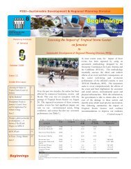
Tropical Storm Nicole - Planning Institute of Jamaica
Tropical Storm Nicole - Planning Institute of Jamaica
Tropical Storm Nicole - Planning Institute of Jamaica

Create successful ePaper yourself
Turn your PDF publications into a flip-book with our unique Google optimized e-Paper software.
Poverty<br />
Generally, there is a direct relationship between the extent <strong>of</strong> disaster impact and the poverty<br />
status <strong>of</strong> residents, with the poor being more likely to be severely impacted than their<br />
wealthier counterparts. The prevalence <strong>of</strong> poverty for <strong>Jamaica</strong> in 2007 was 9.9 per cent<br />
(JSLC 2007). The majority <strong>of</strong> persons (71.3 per cent) classified as poor were located in the<br />
Rural Areas which account for 48 per cent <strong>of</strong> the total population. The areas most affected<br />
by the event were located in rural areas and this could suggest that those most severely<br />
affected were the poor. To examine this assumption, the areas most affected were overlaid<br />
on the most recent Poverty Maps. (See Figure 9 which displays the geographic distribution<br />
<strong>of</strong> poverty using the latest poverty maps). The analysis suggests that with the exception <strong>of</strong> a<br />
few communities, the areas most impacted by the storm were not among the poorest.<br />
However, the vulnerability <strong>of</strong> these communities may be due to their location in areas<br />
susceptible to landslides and flooding, and in some cases, they represent pockets <strong>of</strong> poverty<br />
in areas indicated as having low percentages <strong>of</strong> persons below the poverty line.<br />
18