Montague Background_Paper.pdf - City of Port Phillip
Montague Background_Paper.pdf - City of Port Phillip
Montague Background_Paper.pdf - City of Port Phillip

Create successful ePaper yourself
Turn your PDF publications into a flip-book with our unique Google optimized e-Paper software.
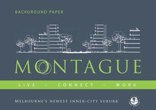
BACKGROUND PAPER<br />
L I V E – C O N N E C T – W O R K<br />
Melbourne’s newest inner-city suburb<br />
1
MONTAGUE<br />
The <strong>Background</strong> <strong>Paper</strong> has been prepared by the <strong>City</strong> <strong>of</strong> <strong>Port</strong> <strong>Phillip</strong> with<br />
input from David Lock Associates and Charter Keck Cramer.<br />
June 2012<br />
2
Table <strong>of</strong> Contents<br />
1.0 Introduction<br />
2.0 History <strong>of</strong> the Precinct<br />
3.0 Urban Context<br />
4.0 Policy Context<br />
5.0 Existing Conditions<br />
5.1 Planning Scheme Controls<br />
5.2 Existing Land Use Conditions<br />
5.3 Community Facilities<br />
5.4 Urban Structure and Built Form<br />
5.5 <strong>Montague</strong>’s Public Realm<br />
5.6 Access and Movement<br />
5.7 Essential Infrastructure<br />
5.8 Contamination and Geology<br />
6.0 Market Analysis<br />
7.0 Key Implications for Structure Plan<br />
8.0 Stakeholder Consultation<br />
9.0 Capacity Analysis<br />
10.0 Glossary<br />
11.0 References<br />
1<br />
3<br />
6<br />
8<br />
19<br />
19<br />
23<br />
33<br />
35<br />
42<br />
45<br />
48<br />
51<br />
52<br />
59<br />
64<br />
70<br />
79<br />
81
List <strong>of</strong> Figures<br />
Introduction<br />
1. <strong>Montague</strong> Study Area and Surrounds<br />
Historical Context<br />
2. Buildings and Houses in Buckhurst,<br />
Thistlethwaite and Gladstone Streets circa<br />
1930 (<strong>Port</strong> <strong>Phillip</strong> Collection)<br />
3. Clockwise: South Melbourne Fire Survey<br />
Map, a Fine grain subdivision and an Aerial<br />
photo circa 1940 (<strong>Port</strong> <strong>Phillip</strong> Collection)<br />
Urban Context<br />
4. Site location in relation to Melbourne CBD<br />
and broader context<br />
Existing Conditions<br />
5. Current Zones<br />
6. Current Overlays<br />
7. Number <strong>of</strong> businesses by industry<br />
8. Employment by Industry<br />
9. Existing Land Uses<br />
10. Creative Industries<br />
11. Motor / Auto & Allied industries<br />
12. Planning Permit Applications<br />
13. Predominant Characteristics<br />
14. Lot Sizes<br />
15. Building Heights and Frontages<br />
16. Heritage<br />
17. Public Realm<br />
18. Access & Movement<br />
19. CitiPower Zone Substation Supply Areas and<br />
Sub-transmission Lines<br />
20. Geology<br />
21. Opportunities<br />
22. Constraints<br />
23. Existing Characteristics<br />
24. Potential Land uses as presented to the<br />
community during consultation<br />
25. Potential Land use and Built Form<br />
Typologies as presented to the community<br />
during consultation
1.0 Introduction<br />
1.1 Structure Plan <strong>Background</strong><br />
In January 2011, David Lock Associates (DLA) and<br />
Charter Keck Cramer (CKC) were engaged by the<br />
<strong>City</strong> <strong>of</strong> <strong>Port</strong> <strong>Phillip</strong> (Council) to help prepare a<br />
Structure Plan for <strong>Montague</strong>.<br />
1.2 Preliminary Structure Plan<br />
Objectives<br />
At the outset Council determined a number <strong>of</strong><br />
preliminary strategic objectives for the Precinct with<br />
the aim <strong>of</strong> facilitating urban renewal in the area.<br />
These sought to:<br />
• Achieve a fundamental shift in land use/ intensity<br />
<strong>of</strong> development to capitalize on the Precinct’s<br />
strategic inner regional location.<br />
• Maintain opportunities for a viable business<br />
cluster and ‘creative’ industries.<br />
• Identify potential for new residential<br />
development to <strong>of</strong>fset pressures in established<br />
residential areas with the <strong>City</strong> <strong>of</strong> <strong>Port</strong> <strong>Phillip</strong>.<br />
• Transform the area to an ‘environmentally<br />
sustainable Precinct.’<br />
• Create a strong ‘place identity’ and quality public<br />
realm.<br />
• Strengthen physical and functional connections to<br />
adjoining Precincts/areas, including walking,<br />
cycling and transport links.<br />
1.3 Structure Plan Process<br />
The preparation <strong>of</strong> the Structure has involved a<br />
number <strong>of</strong> key stages, including:<br />
• Stage One - Research and Analysis including<br />
existing conditions audit, opportunities and<br />
constraints analysis and initial stakeholder<br />
consultation; including the assessment <strong>of</strong><br />
potential development scenarios against<br />
established strategic objectives for <strong>Montague</strong>.<br />
• Stage Two - Development <strong>of</strong> the draft Structure<br />
Plan.<br />
• Stage Three – Stakeholder Consultation and<br />
finalisation <strong>of</strong> the Structure Plan (Current Stage).<br />
1.4 <strong>Background</strong> <strong>Paper</strong><br />
This <strong>Background</strong> <strong>Paper</strong> summarises the key research<br />
and analysis undertaken as part <strong>of</strong> Stage One <strong>of</strong> the<br />
project. The information has been collated from a<br />
variety <strong>of</strong> sources, including:<br />
• Existing Conditions and Data Collection –<br />
including a desk-top review <strong>of</strong> recent and<br />
relevant reports, and detailed site analysis and<br />
conditions audit.<br />
• A Census <strong>of</strong> Land Use & Employment (CLUE)<br />
• Stakeholder Workshops – with owners and<br />
occupiers in the Precinct, and adjacent to the<br />
Precinct and key landowners and developers<br />
with an interest in <strong>Montague</strong>.<br />
• Targeted Stakeholder Consultation (specified<br />
below).<br />
• Market Analysis by Charter Keck Cramer<br />
• Residential and workforce population capacity<br />
analysis.<br />
1.5 Consultation<br />
Community consultation has been integral to the<br />
development <strong>of</strong> the Structure Plan, with early<br />
processes defining and clarifying core issues and<br />
strategic objectives for the Precinct.<br />
The first stage <strong>of</strong> community consultation occurred in<br />
May 2011.<br />
• All owners and occupiers in the Precinct and<br />
adjacent to the Precinct were invited to attend a<br />
workshop and / or provide ideas in writing.<br />
• Three workshops were held:<br />
- Workshop 1 - Key land owners and<br />
developers.<br />
- Workshop 2 – Businesses operating in<br />
Precinct.<br />
- Workshop 3 - Property owners and<br />
residents adjoining the Precinct.<br />
• Meetings were held with specific stakeholders<br />
and agencies including VicRoads, VicTrack, the<br />
University <strong>of</strong> Melbourne, the Department <strong>of</strong><br />
Education and Early Childhood Development,<br />
and energy and infrastructure providers.<br />
• A ‘Have your Say’ website was live for duration<br />
<strong>of</strong> the process.<br />
Section 8: Stakeholder Consultation outlines the<br />
findings <strong>of</strong> the consultations process.<br />
The consultation process found that<br />
there was strong stakeholder support for<br />
major change in the Precinct and that a<br />
‘new place’ must be well planned for.<br />
1
Figure 1: <strong>Montague</strong> Study Area and Surrounds<br />
2
2.0 History <strong>of</strong> the Precinct<br />
<strong>Montague</strong> has rich and diverse history<br />
that has seen it transformed from an<br />
area <strong>of</strong> low lying wetlands and swamps,<br />
drained for residential development<br />
before being converted to industrial land<br />
uses.<br />
The estimated 40,000 years <strong>of</strong> indigenous occupation<br />
<strong>of</strong> the area is largely unrecorded and most <strong>of</strong> the oral<br />
history <strong>of</strong> the traditional owners has been lost.<br />
The earliest inhabitants <strong>of</strong> the area now covered by<br />
the <strong>City</strong> <strong>of</strong> <strong>Port</strong> <strong>Phillip</strong> were the Yalukit-willam, one<br />
<strong>of</strong> the five clans <strong>of</strong> the Boon Wurrung, known as the<br />
coastal tribe, and who were members <strong>of</strong> the Kulin<br />
Nation.<br />
They inhabited the swampy areas below Emerald Hill<br />
and the sandy-ridged ti-tree covered coastline, which<br />
extended from St Kilda to Fishermans Bend (<strong>Port</strong><br />
Melbourne). Aboriginal Chief Protector, George<br />
Robinson, in the 1840’s wrote that the territory <strong>of</strong><br />
the Yalukit-willam Clan extended through to the<br />
Werribee River.<br />
South Melbourne was first known as Emerald Hill,<br />
because the hill on which the Town Hall now stands<br />
was a green island surrounded by swamps. The Hill<br />
was a traditional social and ceremonial meeting place<br />
for a number <strong>of</strong> Aboriginal tribes.<br />
A great gathering had been witnessed there in 1840<br />
by a number <strong>of</strong> the early European settlers.<br />
Corroborees were also recorded and painted by<br />
Wilbraham Liardet at Emerald Hill.<br />
The <strong>Montague</strong> Precinct sits at the base <strong>of</strong> north<br />
western flank <strong>of</strong> Emerald Hill where it meets the<br />
ancient river flats.<br />
In 1851 when gold was discovered in Victoria,<br />
fortune seekers flocked to a tent city which had been<br />
erected on the south side <strong>of</strong> the Yarra, between<br />
Emerald Hill and St Kilda Road. This was known as<br />
Canvas Town and was laid out in streets with shops,<br />
residences and pubs, all under canvas. The first land<br />
sales at Emerald Hill took place in 1852. In 1854,<br />
Canvas Town was dispersed and many <strong>of</strong> the<br />
inhabitants moved up to the Hill.<br />
In 1854, a residents' meeting was convened to agitate<br />
for independence from Melbourne. At this time an<br />
act for providing separate municipal boroughs was<br />
drafted and became law on 14 December 1854.<br />
Early in 1855 amendments were made to the Act and<br />
on 26 May 1855, Emerald Hill became the first suburb<br />
outside <strong>of</strong> Geelong, to be declared a municipal<br />
district. This was reflected in the town's motto In<br />
‘Ordine Primum’, translated as 'first in the field'.<br />
On July 4, the first council met and Mr James Service,<br />
later to be Premier <strong>of</strong> Victoria, was elected chairman.<br />
In 1863 Emerald Hill became a borough and in 1872 it<br />
was proclaimed a Town. In 1883, Emerald Hill<br />
became a city and also changed its name to South<br />
Melbourne.<br />
Prior to the proclamation <strong>of</strong> the town, the <strong>Montague</strong><br />
railway station was established in 1853 from which<br />
the residential suburb subsequently derived its name.<br />
The area known as ‘The <strong>Montague</strong>’ was subdivided<br />
and developed later than adjacent residential areas<br />
due its swampy nature.<br />
The area was derisively known as ‘salt lake city’ due<br />
to the low river flats being frequently inundated by a<br />
swollen Yarra River. (During the Royal visit <strong>of</strong> 1927,<br />
the Duke and Duchess stepped <strong>of</strong>f at <strong>Montague</strong><br />
Station but were unable to tour the streets due to<br />
extensive flooding).<br />
The <strong>Montague</strong> was intended for ‘persons <strong>of</strong> the<br />
artisan class’ and this was reflected in the type <strong>of</strong><br />
housing advertised for sale as ‘neat two roomed<br />
cottage and land, plastered 110 pounds, stoke street,<br />
<strong>of</strong>f Gladstone Place’.<br />
By 1875, there were 560 households in The<br />
<strong>Montague</strong>. By 1900, there were 1,000 in the district,<br />
with some 200 in the lanes and little streets. Many <strong>of</strong><br />
the workers attracted to the low cost housing were<br />
labourers, fisherman, boilermakers, mariners and<br />
shipwrights. Owner occupation was approximately 33<br />
per cent.<br />
The majority <strong>of</strong> the houses in the smaller streets<br />
were made <strong>of</strong> timber and had two or three<br />
bedrooms. Almost all <strong>of</strong> the houses had no bathroom<br />
or washroom. By the 1920’s, the majority <strong>of</strong> the<br />
housing stock was falling into disrepair due to regular<br />
flooding and inundation.<br />
The <strong>Montague</strong> was renowned for its close knit<br />
community. The self contained suburb had its own,<br />
school, church, police station, kindergarten, football<br />
team, hotels, post <strong>of</strong>fice, bank and shops. (Figure 2)<br />
By the late 1930’s, The <strong>Montague</strong> had been<br />
earmarked for demolition by the Government’s Slum<br />
Abolition Board. With the enactment <strong>of</strong> the Slum<br />
Reclamation and Housing Act in 1938, the majority <strong>of</strong><br />
the houses were cleared and the residents were<br />
relocated. Until 2010 there were still a few remaining<br />
timber buildings within the Precinct<br />
3
There are also six concrete council houses remaining<br />
on the corner <strong>of</strong> Gladstone and <strong>Montague</strong> Streets.<br />
These houses were prototypes <strong>of</strong> a then ambitious<br />
local government public housing scheme. The<br />
beginning <strong>of</strong> World War Two and the subsequent<br />
austerity measures put an end to the plan.<br />
By the 1960’s, most <strong>of</strong> the residential population was<br />
moved, with a substantial amount moving to the<br />
relatively new Garden <strong>City</strong> Area (itself a unique State<br />
Government Housing Scheme).<br />
The process <strong>of</strong> change accelerated following World<br />
War Two and The <strong>Montague</strong> underwent a dramatic<br />
transformation to become a thriving light industrial<br />
hub.<br />
The area became part <strong>of</strong> the <strong>City</strong> <strong>of</strong> <strong>Port</strong> <strong>Phillip</strong><br />
which was formed in 1994 by the amalgamation <strong>of</strong><br />
the three former cities <strong>of</strong> South Melbourne, St Kilda<br />
and <strong>Port</strong> Melbourne.<br />
Acknowledgement: Special thanks to Kay Rowan, <strong>City</strong><br />
<strong>of</strong> <strong>Port</strong> <strong>Phillip</strong>, Local History Librarian and Meyer Eidelson,<br />
President St Kilda Historical Society for providing<br />
information for the historical background.<br />
Figure 2: Clockwise: Buildings and Houses in Buckhurst,<br />
Thistlethwaite and Gladstone Streets circa 1930 (<strong>Port</strong> <strong>Phillip</strong><br />
Collection)<br />
4
Figure 3: Clockwise: South Melbourne Fire Survey Map<br />
(c1930’s), Map from the Metropolitan Board <strong>of</strong> Works showing<br />
fine grained subdivision pattern (c1885) and an Aerial photo<br />
(c1940, <strong>Port</strong> <strong>Phillip</strong> Collection)<br />
5
3.0 Urban context<br />
<strong>Montague</strong> is well located, being only 2.5<br />
km from the Melbourne CBD and three<br />
stops on the light rail.<br />
The Precinct is located south <strong>of</strong> the Yarra River and<br />
M1 / West Gate Freeway, south west <strong>of</strong> the CBD,<br />
Docklands and Southbank, east <strong>of</strong> the Foreshore and<br />
<strong>Port</strong> Melbourne and northwest <strong>of</strong> South Melbourne<br />
Central.<br />
• <strong>Montague</strong> is strategically located within the<br />
context <strong>of</strong> higher density residential<br />
development including <strong>Port</strong> Melbourne Mixed<br />
Use Zone (south end <strong>of</strong> Bay Street), Docklands<br />
and <strong>City</strong> Road/Southbank.<br />
• The Precinct has immediate proximity to<br />
Fishermans Bend Industrial Precinct, <strong>Port</strong><br />
Melbourne.<br />
Key aspects <strong>of</strong> <strong>Montague</strong> and the surrounding<br />
strategic context, as identified in Figure 4, include:<br />
• <strong>Montague</strong> is located approximately 2.5 km from<br />
Melbourne CBD by foot, bicycle or car and three<br />
stops on the light rail.<br />
• <strong>Montague</strong> is located within one km <strong>of</strong> the South<br />
Melbourne Major Activity Centre (MAC) and<br />
one km from the <strong>Port</strong> Melbourne MAC.<br />
• <strong>Montague</strong> benefits from excellent public<br />
transport accessibility, with the Light Rail Tram<br />
Routes 109 and 96, providing direct access to<br />
Melbourne CBD, Station Pier and St Kilda.<br />
• <strong>Montague</strong> is well connected to the wider<br />
metropolitan area by road, including direct<br />
access to the M1 /West Gate Freeway and the<br />
arterial road network.<br />
• <strong>Montague</strong> is located within easy walking distance<br />
<strong>of</strong> a range <strong>of</strong> facilities including South Wharf, the<br />
South Melbourne Market and <strong>Port</strong> Melbourne.<br />
• <strong>Montague</strong> has great proximity to the Foreshore,<br />
the Yarra River, the Domain and sporting<br />
Precincts.<br />
6
Figure 4: Precinct location in relation to Melbourne CBD<br />
and broader context<br />
7
4.0 Policy Context:<br />
4.1 Planning Scheme Policy<br />
State Planning Policy Framework (SPPF)<br />
The SPPF is the main driver for structure planning.<br />
A key objective <strong>of</strong> Clause 11.02 (Urban Growth)<br />
seeks to ensure a sufficient supply <strong>of</strong> land is available<br />
for residential, commercial, retail, industrial,<br />
recreational, institutional and other community uses.<br />
Strategies seek to ensure that planning for urban<br />
growth should consider:<br />
• Opportunities for the consolidation,<br />
redevelopment and intensification <strong>of</strong> existing<br />
urban areas.<br />
• Neighbourhood character and landscape<br />
considerations.<br />
• The limits <strong>of</strong> land capability and natural hazards<br />
and environmental quality.<br />
• Service limitations and the costs <strong>of</strong> providing<br />
infrastructure.<br />
Clause 11.02-3 facilitates the orderly development<br />
<strong>of</strong> urban areas to ensure the effective planning and<br />
management <strong>of</strong> the land use and development <strong>of</strong> an<br />
area, through the preparation <strong>of</strong> strategic plans,<br />
statutory plans, development and conservation plans,<br />
development contribution plans and other relevant<br />
plans.<br />
The Clause outlines that Structure Plans should:<br />
• Take into account the strategic and physical<br />
context <strong>of</strong> the location.<br />
• Provide the broad planning framework for an<br />
area as well as the more detailed planning<br />
requirements for neighbourhoods and Precincts,<br />
where appropriate.<br />
• Provide for the development <strong>of</strong> sustainable and<br />
liveable urban areas in the integrated manner.<br />
• Assist the development <strong>of</strong> walkable<br />
neighbourhoods.<br />
• Facilitate the logical and efficient provision <strong>of</strong><br />
infrastructure and use <strong>of</strong> existing infrastructure<br />
and services.<br />
A key objective <strong>of</strong> Clause 15.02-1 (Sustainable<br />
development) is to<br />
• Encourage land use and development that is<br />
consistent with the efficient use <strong>of</strong> energy and<br />
the minimisation <strong>of</strong> greenhouse gas emissions.<br />
Key objectives <strong>of</strong> Clause 16.01 (Housing) include:<br />
• To promote a housing market that meets<br />
community needs.<br />
• To locate new housing in or close to activity<br />
centres and employment corridors and at other<br />
strategic redevelopment sites that <strong>of</strong>fer good<br />
access to services and transport.<br />
• To identify strategic redevelopment sites for<br />
large residential development in Metropolitan<br />
Melbourne.<br />
• Ensuring land supply continues to be sufficient to<br />
meet demand.<br />
• To provide a range <strong>of</strong> housing types to meet<br />
increasingly diverse needs.<br />
• To deliver more affordable housing closer to<br />
jobs, transport and services.<br />
• To increase choice in housing type, tenure and<br />
cost to meet the needs <strong>of</strong> households as they<br />
move through life cycle changes and to support<br />
diverse communities.<br />
• To promote good housing and urban design to<br />
minimise negative environmental impacts and<br />
keep down costs for residents and the wider<br />
community.<br />
• To encourage a significant proportion <strong>of</strong> new<br />
development, including development at activity<br />
centres and strategic redevelopment sites to be<br />
affordable for households on low to moderate<br />
incomes.<br />
• To make better use <strong>of</strong> existing infrastructure.<br />
• To improve energy efficiency <strong>of</strong> housing.<br />
Key objectives <strong>of</strong> Clause 17.02 (Industry) seek:<br />
• To ensure availability <strong>of</strong> land for industry.<br />
• To facilitate the sustainable development and<br />
operation <strong>of</strong> industry and research and<br />
development activity.<br />
Local Planning Policy Framework (LPPF)<br />
Municipal Strategic Statement – Clause 21<br />
The MSS provides broad policy direction on<br />
ecologically sustainable development, land use, built<br />
form and <strong>Port</strong> <strong>Phillip</strong>’s seven neighbourhoods.<br />
The MSS contains objectives, strategies, and<br />
implementation actions for the key environmental,<br />
social, and economic elements, including strategies<br />
dealing with Ecologically Sustainable Development<br />
(21.03), Land Use (Clause 21.04) and Built Form<br />
(Clause 21.05).<br />
8
The MSS also provides detail on key challenges and<br />
strategies for individual neighbourhoods, including<br />
South Melbourne.<br />
Local Planning Policies - Clause 22<br />
Local Planning Policies provide an additional level <strong>of</strong><br />
guidance in the Planning Scheme on specific uses /<br />
issues or geographic areas and are one <strong>of</strong> the tools<br />
available for implementing objectives and strategies in<br />
the MSS. Local policies must be taken into account<br />
when preparing amendments to the planning scheme<br />
or making decisions under the Scheme.<br />
Key Local Policy Context for <strong>Montague</strong><br />
The following section identifies key policy in the <strong>Port</strong><br />
<strong>Phillip</strong> Planning Scheme providing context to the<br />
Structure Plan.<br />
The key objectives <strong>of</strong> Clause 21.03 (Ecologically<br />
Sustainable Development) are:<br />
• To encourage resource-efficient design, material<br />
selection and construction techniques.<br />
• To promote ecologically sustainable development<br />
through the use <strong>of</strong> environmental performance<br />
assessment tools.<br />
• To encourage innovative landscape design that<br />
minimises water consumption.<br />
• To encourage water sensitive urban design in all<br />
new developments.<br />
• To encourage the retention <strong>of</strong> buildings or<br />
building elements that have significant potential<br />
for on-site reuse or and can be adapted to a<br />
variety <strong>of</strong> uses.<br />
• To ensure commercial and retail uses are<br />
planned to allow environmental best practice<br />
methods <strong>of</strong> operation, including waste recycling,<br />
water-wise use and reuse, and more renewable<br />
sources <strong>of</strong> power.<br />
• To facilitate the use <strong>of</strong> sustainable transport<br />
modes in preference to private vehicle use.<br />
• To create a walking network that is integrated,<br />
safe and accessible and encourages more people<br />
to walk more <strong>of</strong>ten.<br />
• To create a cycling network that is integrated,<br />
safe and accessible and encourages more people<br />
to cycle more <strong>of</strong>ten.<br />
• To facilitate an increase in the use <strong>of</strong> public<br />
transport.<br />
• To reduce the impact <strong>of</strong> vehicles on local areas.<br />
The key objectives <strong>of</strong> Clause 21.04 (Land Use)<br />
are:<br />
• To provide significant opportunities for new<br />
residential development in designated locations<br />
which have the capacity for change, and which<br />
<strong>of</strong>fer highest accessibility to public transport,<br />
shops, and social infrastructure.<br />
• To ensure that new residential development<br />
does not compromise the heritage,<br />
neighbourhood character and amenity values <strong>of</strong><br />
established residential areas.<br />
• To support a diverse range <strong>of</strong> housing types to<br />
suit the needs <strong>of</strong> <strong>Port</strong> <strong>Phillip</strong>’s community.<br />
• To maintain and enhance a network <strong>of</strong><br />
sustainable and viable activity centres.<br />
• To ensure new uses in activity centres do not<br />
adversely affect the amenity <strong>of</strong> adjacent<br />
residential areas.<br />
• To ensure the location <strong>of</strong> community services<br />
and facilities are equitable and accessible, and<br />
meet community needs.<br />
• To facilitate viable and vibrant business activity in<br />
<strong>of</strong>fice and mixed-use precincts.<br />
• To create a public open space network that<br />
caters for a diverse range <strong>of</strong> users and is<br />
accessible to all.<br />
The key objectives <strong>of</strong> Clause 21.05 (Built Form)<br />
are:<br />
• To conserve and enhance the architectural and<br />
cultural heritage <strong>of</strong> <strong>Port</strong> <strong>Phillip</strong>.<br />
• To reinforce key elements <strong>of</strong> the <strong>City</strong>’s overall<br />
urban structure.<br />
• To ensure that the height and scale <strong>of</strong> new<br />
development is appropriate to the identified<br />
preferred character <strong>of</strong> an area.<br />
• To require design responses to show how<br />
contributory heritage buildings outside the<br />
Heritage Overlay have been considered.<br />
• To ensure new higher density development is<br />
responsive to the existing scale and form <strong>of</strong><br />
neighbouring sites<br />
• To ensure the design <strong>of</strong> new development is <strong>of</strong> a<br />
high quality and enhances the amenity, comfort,<br />
safety and visual amenity <strong>of</strong> the public realm.<br />
• To encourage the provision <strong>of</strong> universal access in<br />
new development.<br />
• To ensure new development provides a positive<br />
contribution to the public realm.<br />
• To ensure existing and new infrastructure is<br />
sustainable and meets the needs <strong>of</strong> residents,<br />
workers and visitors – current and future.<br />
• To improve the quality <strong>of</strong> all stormwater<br />
discharged into <strong>Port</strong> <strong>Phillip</strong> Bay and to reduce<br />
the effects <strong>of</strong> stormwater discharge, in terms <strong>of</strong><br />
pollution and flooding.<br />
9
Clause 21.06-5 (South Melbourne) outlines<br />
current policy for the two precincts within <strong>Montague</strong>.<br />
For Boundary Street Industrial 3 Zone, policy seeks<br />
to encourage light industrial, service business and<br />
warehouses uses.<br />
For South Melbourne West Industrial Precinct,<br />
relevant policy seeks to encourage new uses that<br />
support the important strategic role <strong>of</strong> this area in<br />
providing a location for a range <strong>of</strong> industrial and<br />
warehouse activities.<br />
Key objectives <strong>of</strong> Clause 22.04 (Heritage Policy)<br />
(including the <strong>Port</strong> <strong>Phillip</strong> Heritage Review and<br />
Heritage Policy Map) seeks to:<br />
• To retain and conserve all significant and<br />
contributory heritage places.<br />
• To discourage the demolition <strong>of</strong> significant and<br />
contributory heritage places.<br />
• To ensure all new development and<br />
redevelopment <strong>of</strong> significant and contributory<br />
places is respectfully and harmoniously integrated<br />
with the surrounding character.<br />
• To ensure that reconstruction and repair <strong>of</strong><br />
significant heritage bluestone kerb and<br />
channelling, bluestone laneways and significant<br />
concrete kerb and channel is carried out in a way<br />
that reflects as closely as possible the original<br />
appearance.<br />
Key objectives <strong>of</strong> Clause 22.05 (Subdivision<br />
Policy) include:<br />
• To ensure public open space contributions are<br />
made at the point <strong>of</strong> subdivision.<br />
Clause 22.06 (Urban Design Policy) includes<br />
pertinent objectives for <strong>Montague</strong> relating to Public<br />
Realm, Street Level Frontages, Landmarks, Views<br />
and Vistas, Large Sites, Energy and Resource<br />
Efficiency, Building Design., Landscape, Public Open<br />
Spaces, Private and Communal Open Space,<br />
Residential Amenity and Car Parking and Pedestrian<br />
Access.<br />
Key objectives include to:<br />
• Achieve high quality urban design and<br />
architecture that responds to the context <strong>of</strong> the<br />
place.<br />
• Encourage new development to protect and<br />
enhance pedestrian spaces, streets, squares,<br />
parks, public space and walkways.<br />
• Minimise adverse micro-climatic impacts such as<br />
overshadowing and wind tunnelling.<br />
• Encourage the design <strong>of</strong> building frontages at<br />
footpath level to <strong>of</strong>fer visual interest, passive<br />
surveillance, social interaction, safety, shelter and<br />
convenience.<br />
• Require pedestrian entrances to buildings to be<br />
clearly visible and easily identifiable from streets<br />
and other public areas.<br />
• Encourage windows, terraces and balconies at<br />
lower building levels to <strong>of</strong>fer surveillance <strong>of</strong><br />
adjacent public areas.<br />
• Require all buildings to be accessible at groundfloor<br />
level to people with limited mobility.<br />
• Require pedestrian amenities including seating,<br />
lighting and public art to create a safe and<br />
interesting pedestrian environment.<br />
• Encourage large sites to be developed and<br />
subdivided in a manner that provides pedestrian<br />
permeability through the block.<br />
• Require all new developments where the Total<br />
Project Cost exceeds two million dollars to<br />
provide an urban art contribution.<br />
• Require that new private or communal open<br />
space areas receive a minimum <strong>of</strong> four hours <strong>of</strong><br />
sunlight between the hours <strong>of</strong> 9.00am and<br />
3.00pm on 22 September.<br />
• Ensure that existing habitable room windows and<br />
private open space areas <strong>of</strong> neighbouring<br />
residential properties are protected from direct<br />
overlooking/<br />
Policy for Areas Adjoining <strong>Montague</strong><br />
The MSS also provides policy relating to the areas<br />
adjoining <strong>Montague</strong>.<br />
<strong>City</strong> Road Wedge (within South Melbourne<br />
Central):<br />
Clause 21.06-5 (South Melbourne) seeks to:<br />
• Direct quality, higher density residential<br />
development to this Precinct, with retail and<br />
commercial at ground level (e.g. conference,<br />
function or exhibition centre, school or<br />
university campus, indoor recreation or leisure<br />
facilities or a health club).<br />
• Encourage a mixture <strong>of</strong> land uses, both across<br />
the Precinct and vertically.<br />
• Support ‘out <strong>of</strong> centre’ and restricted retail<br />
premises where they will not detrimentally<br />
impact on the core retailing role <strong>of</strong> the activity<br />
centre (SMC) and an appropriate built form can<br />
be achieved consistent with the Design and<br />
Development Overlay.<br />
• Ensure that business activity does not result in an<br />
undue loss <strong>of</strong> amenity to nearby residential<br />
properties.<br />
10
• Ensure development respects the consistent zero<br />
setbacks to front and side boundaries creating a<br />
hard edged built environment.<br />
• Ensure the height <strong>of</strong> new buildings provide a<br />
transition from the low to medium rise buildings<br />
in SMC to the high rise towers in Southbank and<br />
the CAD to the north.<br />
Fishermans Bend Core Industrial Precinct<br />
Clause 21.06-4 (<strong>Port</strong> Melbourne and Garden <strong>City</strong>)<br />
seeks to:<br />
• Direct core industrial and manufacturing uses to<br />
this area to support the important role <strong>of</strong><br />
Fishermans Bend as the industrial hub <strong>of</strong> <strong>Port</strong><br />
<strong>Phillip</strong>.<br />
• Support the development <strong>of</strong> new industrial uses<br />
which are employment intensive, clean and<br />
sustainable, including high technology uses.<br />
• Support the development <strong>of</strong> Fishermans Bend as<br />
the preferred location for clean, high pr<strong>of</strong>ile,<br />
value added advanced manufacturing, research<br />
and development, and ancillary services.<br />
• Encourage light industrial / service business and<br />
warehouse uses where they support the primary<br />
core industrial role.<br />
• Discourage <strong>of</strong>fice and commercial uses which are<br />
not ancillary to the industrial use.<br />
4.2 Industrial strategies and Policy context<br />
(Non-Statutory)<br />
Recent strategic work by Council identifies<br />
Fishermans Bend as a regionally significant industrial,<br />
business and employment precinct.<br />
Council research indicates that Fishermans Bend<br />
continues to be a vibrant and successful employment<br />
area with long term economic potential.<br />
Consequently, it is considered important that the<br />
State Government consider the regional and State<br />
economic significance <strong>of</strong> the area before any<br />
decisions are made which may compromise the<br />
future <strong>of</strong> Fishermans Bend and its current economic<br />
role.<br />
This consideration must be undertaken as part <strong>of</strong> the<br />
development <strong>of</strong> the Metropolitan Strategy which is<br />
currently underway.<br />
Council’s strategic work also identified that there are<br />
significant renewal opportunities in the South<br />
Melbourne Industrial Precinct (<strong>Montague</strong>) and that<br />
opportunity exists for a change in land use and built<br />
form which capitalises on its proximity to the CBD,<br />
Docklands and South Melbourne.<br />
Fishermans Bend Planning and Economic<br />
Development Strategy (2010)<br />
The purpose <strong>of</strong> the Fishermans Bend Planning and<br />
Economic Development Strategy is to identify the future<br />
role <strong>of</strong> the Fishermans Bend Industrial Precinct and<br />
to recommend economic development and planning<br />
initiatives that will facilitate development.<br />
The Strategy identified that Fishermans Bend<br />
represents two distinct precincts:<br />
• <strong>Port</strong> Melbourne<br />
• South Melbourne (<strong>Montague</strong>).<br />
It identified different futures for the two precincts<br />
reflecting current land use patterns and future land<br />
use and development opportunities.<br />
The Strategy’s vision is that:<br />
Fishermans Bend will continue to evolve into Melbourne’s<br />
pre-eminent high technology industrial precinct delivering<br />
increasing opportunities for employment and business<br />
development within an environmental industry business<br />
cluster while redefining the role <strong>of</strong> industrial land in the<br />
South Melbourne to accommodate a shift in land use to<br />
better utilise existing infrastructure.<br />
The Strategy was adopted by Council in 2010 but is<br />
not yet reflected in the <strong>Port</strong> <strong>Phillip</strong> Planning Scheme.<br />
The Strategy’s vision for the <strong>Port</strong> Melbourne portion<br />
<strong>of</strong> Fishermans Bend is that:<br />
The <strong>Port</strong> Melbourne area will continue to evolve into<br />
Melbourne’s preeminent high technology industrial<br />
precinct delivering unparalleled employment and<br />
economic development opportunities for businesses and<br />
residents in the <strong>City</strong> <strong>of</strong> <strong>Port</strong> <strong>Phillip</strong>. Reflecting its unique<br />
attributes, <strong>Port</strong> Melbourne will continue to attract<br />
progressive high value adding industrial organisations<br />
focussing upon production, services and distribution<br />
activities requiring high tech industrial facilities within a<br />
high amenity and environmentally sustainable industrial<br />
environment.<br />
The Strategy outlines a vision for <strong>Montague</strong>:<br />
‘The South Melbourne area presents a significant<br />
opportunity for future redevelopment, representing a shift<br />
from the traditional industrial service businesses that<br />
currently occupy the area to any number <strong>of</strong> higher order<br />
land uses. Given the area’s location attributes, good<br />
access to public transport and strong urban structure with<br />
a tight, grid street pattern, South Melbourne could provide<br />
an ideal location for more intensive <strong>of</strong>fice and residential<br />
activities in the long term, subject to further investigation.’<br />
The Strategy makes a series <strong>of</strong> key recommendations<br />
that seek to redefine the role <strong>of</strong> the <strong>Montague</strong><br />
Precinct. A key objective <strong>of</strong> the Strategy is:<br />
11
• To facilitate appropriate redevelopment and<br />
change to achieve a pattern <strong>of</strong> land uses and an<br />
enhanced built form that capitalises on the area’s<br />
accessibility and its proximity to major<br />
metropolitan features such as Docklands, the<br />
CBD, the Convention Centre, the Exhibition<br />
Centre, the Casino and Southbank.<br />
The Strategy outlined a number <strong>of</strong> preliminary<br />
observations to ‘inform’ any future study. These<br />
include:<br />
• The opportunity to create something different in<br />
this part <strong>of</strong> South Melbourne.<br />
• Immediate to medium term opportunities to<br />
revitalise the area. Opportunities may include:<br />
- Rezoning the whole area to a Business 3<br />
Zone, to allow a mix <strong>of</strong> industrial and<br />
business uses.<br />
- Stimulating redevelopment along Normanby<br />
Road and <strong>City</strong> Road.<br />
• The potential for a mix <strong>of</strong> uses, including the<br />
possibility <strong>of</strong> residential uses, within that part <strong>of</strong><br />
the Precinct to the south <strong>of</strong> the light rail.<br />
Rezoning to a Business 2 or a Mixed Use zone<br />
could facilitate this outcome.<br />
• Opportunities for redevelopment beneath the<br />
M1 Undercr<strong>of</strong>t.<br />
The Strategy recommended a series <strong>of</strong> actions:<br />
• Council prepare a Structure Plan and Urban<br />
Design Framework for the Precinct.<br />
• Involve property owners, investors and the<br />
community in determining future planning<br />
opportunities for the area.<br />
• Consider future land use and built form options<br />
for Crockford Street as part <strong>of</strong> the Bay Street<br />
Structure Plan.<br />
4.3 Southbank Structure Plan<br />
(<strong>City</strong> <strong>of</strong> Melbourne 2010)<br />
The Southbank Structure Plan 2010 provides<br />
direction for the area within the <strong>City</strong> <strong>of</strong> Melbourne,<br />
to the east <strong>of</strong> <strong>Montague</strong>.<br />
It provides a new vision and strategy for the future<br />
development <strong>of</strong> Southbank that will lead to a more<br />
lively, accessible, liveable and sustainable<br />
neighbourhood.<br />
The Structure Plan 2010 proposes a suite <strong>of</strong> short,<br />
medium and long term initiatives which seek to<br />
achieve:<br />
• Three new local activity nodes<br />
• Connect and integrate Southbank with the<br />
Central <strong>City</strong> and the Yarra River<br />
• A high quality, expanded public realm<br />
• A new streetscape vision<br />
• A connected and permeable neighbourhood<br />
• Sustainable buildings and sustainable<br />
infrastructure.<br />
4.4 Council Plan (2009 – 2013)<br />
The Council Plan establishes four key directions for<br />
the municipality:<br />
• Engaging and governing the city.<br />
• Taking action on climate change.<br />
• Strengthening our diverse and inclusive<br />
community.<br />
• Enhancing liveability.<br />
The Plan emphasises liveability through creating a<br />
strong sense <strong>of</strong> place, preserving heritage assets and<br />
creating new public open spaces across the <strong>City</strong>’s<br />
neighbourhoods.<br />
The Council Plan emphasises taking action on climate<br />
change through prioritising sustainable travel modes,<br />
promoting ESD in new development and identifying<br />
opportunities for sustainable infrastructure.<br />
The Plan seeks to create a diverse and inclusive<br />
community through encouraging housing diversity,<br />
prioritising the delivery <strong>of</strong> community facilities hubs<br />
and emphasising the delivery <strong>of</strong> affordable and<br />
community housing.<br />
The following Strategic Directions are relevant to the<br />
development <strong>of</strong> the Structure Plan for <strong>Montague</strong>:<br />
• Take Action on Climate Change<br />
- Facilitate community action in reducing<br />
potable water and non-renewable energy<br />
use.<br />
- Promote transport modes that minimise<br />
energy use.<br />
- Investigate and manage the impact <strong>of</strong> climate<br />
change on the city’s assets and infrastructure<br />
- Encourage and support community<br />
gardening initiatives in the city.<br />
- Seek opportunities for Council and the<br />
community to produce renewable energy.<br />
• Strengthen our Diverse and Inclusive<br />
Community<br />
- Maintain and seek new emerging<br />
opportunities for affordable housing that<br />
meets community needs.<br />
- Build on local strengths to develop active,<br />
connected communities.<br />
12
- Provide for equitable access to a range <strong>of</strong><br />
services.<br />
- Ensure the quality and accessibility <strong>of</strong><br />
children’s and family services.<br />
• Enhancing Liveability<br />
- Maintain and build upon the unique<br />
character <strong>of</strong> the city’s neighbourhoods.<br />
- Preserve our heritage, valuing the past and<br />
planning for the future.<br />
4.5 Relevant Council Policy and Strategies<br />
Public Realm and Open Space<br />
Greening <strong>Port</strong> <strong>Phillip</strong>: An urban forest<br />
approach (2010) – <strong>City</strong> <strong>of</strong> <strong>Port</strong> <strong>Phillip</strong><br />
An urban forest is the sum total <strong>of</strong> all trees and<br />
associated vegetation growing within an urban area.<br />
Trees and other vegetation in public and private<br />
spaces can be thought <strong>of</strong> as an urban forest that<br />
provides shelter, shade, beauty, cleans the air,<br />
regulates the temperature (heat island effect),<br />
reduces energy needs <strong>of</strong> nearby spaces, treats and<br />
cleans stormwater, reduces loads on stormwater<br />
drains, protects and increases the life <strong>of</strong><br />
infrastructure and provides habitat.<br />
The Urban Forest Strategy sets out the following<br />
Vision:<br />
“The <strong>City</strong> <strong>of</strong> <strong>Port</strong> <strong>Phillip</strong> will have a healthy and<br />
diverse urban forest that uses innovative greening<br />
solutions to enhance the community’s daily<br />
experience, ensuring environmental, economic,<br />
cultural and social sustainability for future<br />
generations.”<br />
Council’s emphasis on greening <strong>Port</strong> <strong>Phillip</strong> is driven<br />
by two primary objectives:<br />
1. Enhancing liveability:<br />
Creating a sense <strong>of</strong> place, shaping the future <strong>of</strong><br />
<strong>Port</strong> <strong>Phillip</strong> and caring for our natural<br />
environment.<br />
2. Adapting and sustaining:<br />
Preparing the <strong>Port</strong> <strong>Phillip</strong>’s community and<br />
council assets for a different climatic future<br />
The <strong>City</strong> <strong>of</strong> <strong>Port</strong> <strong>Phillip</strong> is well positioned to achieve<br />
its vision because:<br />
• The municipality is located in a landscape <strong>of</strong><br />
natural beauty – <strong>Port</strong> <strong>Phillip</strong> Bay, right next to<br />
the heart <strong>of</strong> Melbourne, creating a unique and<br />
desirable place to live and work.<br />
• Good planning in the past has left a legacy <strong>of</strong><br />
beautiful and green historic parks, public and<br />
private gardens and many tree lined streets that<br />
contribute to a mature tree canopy cover and<br />
greening across most <strong>of</strong> our neighbourhoods.<br />
• There is a high level <strong>of</strong> awareness and<br />
commitment within the community <strong>of</strong> the need<br />
to take action now to ensure the current<br />
liveability is enhanced into the future.<br />
Renewal areas, such as <strong>Montague</strong>, have the potential<br />
(and the responsibility) to make a significant<br />
contribution to creating an urban forest, through the<br />
combined actions <strong>of</strong> Council, developers and<br />
ultimately the local community.<br />
More specifically the following elements can<br />
contribute to greening in a higher density setting:<br />
• Balcony gardens<br />
• Ro<strong>of</strong>top gardens and green ro<strong>of</strong>s<br />
• Vertical gardens – vegetation growing up the<br />
walls <strong>of</strong> buildings and fences<br />
• Street trees, shrubs and ground covers on nature<br />
strips /median strips.<br />
• Trees and gardens in public open space.<br />
All <strong>of</strong> these green spaces form an urban forest that<br />
can provide an essential balance to a highly urbanised<br />
environment and have a direct impact on the daily<br />
lives <strong>of</strong> residents and visitors, as well as to the<br />
liveability <strong>of</strong> the place long term.<br />
Open Space Strategy (2006 – Revised 2009)<br />
The Open Space Strategy guides the management and<br />
upgrade <strong>of</strong> open space in the city to achieve the<br />
Council’s vision for open space being:<br />
“A <strong>City</strong> where public open spaces define the city’s<br />
character and respond to its people’s need for<br />
places to rest, recreate and be inspired.”<br />
The Strategy recognises that the <strong>City</strong>’s public open<br />
space resources will face continuing pressure in the<br />
context <strong>of</strong>; on-going development and scarce land<br />
resources; increasing regional-level use; higher<br />
population densities and a growing dominance <strong>of</strong><br />
apartment style development with limited private<br />
open space.<br />
The Strategy sets out Open Space Principles. The<br />
following aspects are <strong>of</strong> particular relevance to<br />
<strong>Montague</strong>:<br />
• Optimising the provision <strong>of</strong> open space by<br />
increasing the amount <strong>of</strong> useable space in<br />
appropriate locations to <strong>of</strong>fset increases in<br />
population.<br />
• The use <strong>of</strong> urban design strategies that provide<br />
functional and pleasing spaces irrespective <strong>of</strong> size.<br />
13
• Strong design elements in the creation <strong>of</strong> open<br />
space to inspire people and develop parks that<br />
respond to community needs.<br />
• Creating connections between spaces to<br />
maximise use and functionality.<br />
• Ensuring new (adjoining) residential development<br />
maintains/enhances the values <strong>of</strong> open space.<br />
• Ensuring that public open space is accessible for<br />
all.<br />
• Including streetscapes as open space by designing<br />
and treating streetscapes that respond to a range<br />
<strong>of</strong> potential uses.<br />
• Creating sustainable open spaces.<br />
The Strategy defines Minimum Requirements for Open<br />
Space as follows:<br />
• A social family recreation space and an <strong>of</strong>f-road<br />
trail within 400 metres.<br />
• Outdoor playing fields within 800 metres.<br />
• Easy access to dog walking spaces, including dog<br />
<strong>of</strong>f-lead spaces.<br />
• Access to outdoor spaces for relaxation within<br />
easy access <strong>of</strong> all places <strong>of</strong> work.<br />
These Open Space Principles and the Minimum<br />
Requirements for open space have been reflected in<br />
the <strong>Port</strong> <strong>Phillip</strong> Planning Scheme as Local Policy<br />
(Clause 21 - MSS) and also through establishing a citywide<br />
mandatory 5% public open space contribution<br />
(via Clause 52.01).<br />
Clause 21.04-5 <strong>of</strong> the <strong>Port</strong> <strong>Phillip</strong> Planning Scheme<br />
relates to open space and sets a vision for:<br />
“A city where public open spaces define the city’s<br />
character and respond to its people’s need for places to<br />
rest, recreate and be inspired.”<br />
“Streetscapes provide opportunities for public use,<br />
particularly for communal meeting and exercise. The<br />
design and treatment <strong>of</strong> streetscapes should respond to<br />
these uses”’.<br />
Specific objectives and strategies seek to:<br />
• Provide all residents with access to high quality<br />
open space within walking distance <strong>of</strong> their home<br />
(400-500 metres).<br />
• Ensure that public open space <strong>of</strong>fers a diversity<br />
<strong>of</strong> functions and experiences and continues to<br />
host a range <strong>of</strong> leisure, tourism, recreation,<br />
cultural, social and sporting activities to meet the<br />
needs <strong>of</strong> all users.<br />
• Ensure public open space areas and facilities are<br />
accessible for use by people <strong>of</strong> all ages and<br />
abilities.<br />
• Maximise public safety within all public open<br />
space areas, through applying Crime Prevention<br />
through Environmental Design principles to the<br />
design <strong>of</strong> all spaces and connections.<br />
• Identify and support the establishment <strong>of</strong> new<br />
open space linkages, and the improvement <strong>of</strong><br />
existing linkages, to connect public open space<br />
areas throughout <strong>Port</strong> <strong>Phillip</strong> and to the regional<br />
open space network.<br />
Clause 52.01 <strong>of</strong> the <strong>Port</strong> <strong>Phillip</strong> Planning Scheme<br />
includes a city-wide requirement for a 5% public open<br />
space contribution upon the subdivision <strong>of</strong> a lot /<br />
building.<br />
In the case <strong>of</strong> <strong>Montague</strong>, where new intensive<br />
development forms will generally not include private<br />
open space, it is anticipated that a contribution<br />
proportion higher than 5% will be applied to ensure<br />
an adequate provision <strong>of</strong> high quality open space can<br />
be achieved.<br />
Open Space Standards for Higher Density<br />
Urban Areas:<br />
The ‘standards’ for the provision <strong>of</strong> public open space<br />
(including size, distance from dwellings, location,<br />
design and functionality) will differ depending on the<br />
context <strong>of</strong> the urban environment, demographics, and<br />
locational constraints and opportunities.<br />
In planning for large scale inner urban renewal areas<br />
such as <strong>Montague</strong>, the standards for public open<br />
space provision must recognise the creation <strong>of</strong> a<br />
more intensive urban environment than found more<br />
generally across the inner region and in other parts <strong>of</strong><br />
<strong>Port</strong> <strong>Phillip</strong>.<br />
The provision <strong>of</strong> sufficient, high quality open space is<br />
critical in a dense urban setting where few dwellings<br />
will have any private open space beyond balconies,<br />
and therefore where demands on public open space<br />
will be high.<br />
There are currently no National or State agreed<br />
‘standards’ for the provision <strong>of</strong> public open space in<br />
inner areas (unlike growth areas located on the<br />
fringe).<br />
Standards set for growth areas are a starting point<br />
only, as it must be recognised that these standards<br />
are based on urban forms which include the existence<br />
<strong>of</strong> significant private open space but also greater land<br />
availability.<br />
Standards set by the Growth Areas Authority (GAA)<br />
through its Precinct Structure Planning Guidelines<br />
require that:<br />
14
• 10% <strong>of</strong> the net developable area should set aside<br />
for public open space, with 6% for active uses.<br />
• 3ha per 1,000 persons, <strong>of</strong> which 1.5ha is for<br />
organised recreation.<br />
• Open space should be within a ‘walkable<br />
distance’ for every resident.<br />
The Planning for Community Infrastructure in Growth<br />
Areas report (2008) established delivery models for<br />
public open space which recommend that for a<br />
population <strong>of</strong> between 10,000 and 30,000, 8ha <strong>of</strong><br />
indoor and outdoor active recreation facilities and<br />
1ha <strong>of</strong> passive open space should be provided.<br />
A number <strong>of</strong> documents do establish principles and<br />
propose standards for public open space provision in<br />
higher density environments. This can be used as an<br />
indication <strong>of</strong> current ‘best practice’ for application to<br />
<strong>Montague</strong>.<br />
Higher Density Residential Development<br />
Guidelines (2004) – Department <strong>of</strong> Sustainability<br />
and Environment:<br />
These Guidelines were created to help ensure<br />
appropriate standards are applied to higher density<br />
housing developments as more Victorians choose to<br />
live in apartments and units across Melbourne.<br />
The guidelines do not stipulate or regulate specific<br />
standards for open space, but rather encourage the<br />
creation <strong>of</strong> space appropriate to its context and to<br />
ensure new public open spaces contribute to a safe,<br />
attractive and well used public environment.<br />
The standards identify that open space can take a<br />
variety <strong>of</strong> forms including neighbourhood parks,<br />
squares or plazas. These are stated as being most<br />
successful if they are relatively small (not larger than a<br />
block), lined with active edges, with access to sun and<br />
shade and opportunities for passive recreation. They<br />
can provide a focus for community activity and should<br />
be located in prominent, important, easily accessible<br />
places. Direct access to important pedestrian routes<br />
integrated with an area’s wider circulation network<br />
will support the regular use <strong>of</strong> such open spaces, and<br />
will assist in supporting their vitality and safety.<br />
Best Practice Open Space in Higher Density<br />
Development (2012) - <strong>City</strong> <strong>of</strong> Charles Sturt:<br />
This document was prepared to inform wider Local<br />
Government planning practice in relation to open<br />
space planning, provision, design and management. It<br />
has establishes a set <strong>of</strong> principles and guidelines for<br />
the provision <strong>of</strong> open space in higher density<br />
environments as follows:<br />
• Planning must provide more public open space to<br />
compensate for less private open space being<br />
provided with individual dwellings.<br />
• Benchmarks for growth areas are difficult to<br />
achieve in dense areas. There is a need to<br />
balance the provision <strong>of</strong> public, private and<br />
communal open space and that robust, quality<br />
and highly functional open space is <strong>of</strong>ten more<br />
important than quantity.<br />
• Open space must balance hard and s<strong>of</strong>t spaces,<br />
and to ensure wellbeing it must have a ‘green’<br />
settings. It should be pleasurable, interwoven<br />
into the urban fabric and linked to community<br />
facilities.<br />
Key recommended standards include:<br />
• Total provision <strong>of</strong> open space within a higher<br />
density urban development to be 2ha per 1,000<br />
people, or 25% <strong>of</strong> the developable land.<br />
• At least one space <strong>of</strong> 0.5ha should be established.<br />
• All residents should be within 250m <strong>of</strong> an open<br />
space that is at least 0.25ha in size.<br />
• Residents should within 2-3 minutes walk <strong>of</strong> park<br />
or plaza space that facilitates activity.<br />
• A wide boulevard that provides pedestrian or<br />
cycle connection and has a verge width <strong>of</strong> 8<br />
metres minimum, could be part <strong>of</strong> open space<br />
provision.<br />
• Open space should have the potential to be<br />
integrated with community facilities.<br />
• Linear walking and cycling connections should<br />
connect surrounding space and places.<br />
• Open space for district level sport should be<br />
located within 5km.<br />
A core principle is that detailed planning should define<br />
the required provision, and location <strong>of</strong> open space, prior<br />
to development.<br />
Vertical Living Kids (2009) - Vic Health and<br />
University <strong>of</strong> Melbourne:<br />
Planning open space for a demographic and age<br />
diverse community, and promoting child friendly high<br />
rise environments were the research drivers for the<br />
Vertical Living Kids report. The key findings <strong>of</strong> the<br />
report were that:<br />
• Children value all spaces as social spaces, not<br />
only playgrounds.<br />
• The public realm should be designed as a space<br />
<strong>of</strong> play; as both a destination and link to primary<br />
open space if children are use the space.<br />
• Children prefer a hierarchy <strong>of</strong> play spaces,<br />
including formal spaces and informal adventure<br />
spaces.<br />
• Alleys (lanes) and streets are popular play spaces.<br />
15
• Delivering a spatial hierarchy <strong>of</strong> interesting play<br />
spaces is fundamental to child and adolescent<br />
development, as well as providing an outlet for<br />
healthy exercise.<br />
• Reducing the distance to open space and play<br />
spaces supports children in high rise<br />
environments.<br />
• Having schools within walking distance is<br />
particularly important, and that children within<br />
800m <strong>of</strong> schools were 5-10 times more likely to<br />
travel to school by active travel modes.<br />
• Widening sidewalks, reducing traffic speeds and<br />
volumes and introducing street furniture<br />
encourages children to use the streets.<br />
The study recommended adopting Singapore’s<br />
Standards for the provision <strong>of</strong> child friendly open<br />
space in high density environments as follows:<br />
• One children’s playground per 1-2,000 dwellings<br />
• One hard court per per1-2,000 dwellings<br />
• One precinct garden <strong>of</strong> at least 0.02 ha per 3,000<br />
dwellings<br />
• One neighbourhood park <strong>of</strong> at least 1-1.5ha, plus<br />
one playing field for every 6,000 dwellings<br />
• One town park <strong>of</strong> 5-10ha, including swimming<br />
and sports complex for every 150,000 residents.<br />
Access and Movement<br />
<strong>City</strong> <strong>of</strong> <strong>Port</strong> <strong>Phillip</strong>’s Sustainable Transport<br />
Strategy 2011 – A Connected and Liveable <strong>City</strong><br />
Council’s vision is for a connected and liveable city<br />
where residents, visitors and workers can live and<br />
travel car free by improving the convenience, safety,<br />
accessibility and range <strong>of</strong> sustainable travel choices<br />
across our <strong>City</strong>.<br />
To achieve this vision, Council is committed to<br />
making decisions based on a Road User Hierarchy<br />
that prioritises walking, bike riding and public<br />
transport above private car use.<br />
This strategy sets out plans to achieve:<br />
• An aspirational 50% reduction in community<br />
greenhouse gas emissions per person by 2020<br />
(based on 2006 levels).<br />
• Reduced private vehicle travel by residents from<br />
78% to 53% <strong>of</strong> total distance travelled<br />
• Increased travel by residents using walking and<br />
bike riding from 9% to 20% <strong>of</strong> total distance<br />
travelled.<br />
• Increased travel by residents catching public<br />
transport from 13% to 28% <strong>of</strong> total distance<br />
travelled.<br />
The Sustainable Transport Strategy aims to meet the<br />
needs <strong>of</strong> residents, visitors and commuters while<br />
minimising the negative impacts that cars have on our<br />
community.<br />
In planning for a safe and well connected transport<br />
system, <strong>Montague</strong> reflects the Road User Hierarchy<br />
and will give priority to transport modes in the<br />
following order:<br />
• Walking<br />
• Bike Riding<br />
• Public transport<br />
• Vehicles.<br />
The Sustainable Transport Strategy has informed the<br />
Access and Movement and Public Realm Plans for<br />
<strong>Montague</strong> and will enable Council to make decisions<br />
within the context <strong>of</strong> the long term vision.<br />
The Plan has applied the Road User Hierarchy in<br />
determining the role and function <strong>of</strong> each street and<br />
in developing an access and movement network<br />
across the <strong>Montague</strong> Precinct.<br />
Walk Plan 2011–2020 - Feet First: Making<br />
pedestrians the priority<br />
The Walk Plan aims to make walking the first and<br />
best way to get around <strong>Port</strong> <strong>Phillip</strong>, with more people<br />
<strong>of</strong> all ages choosing to walk more <strong>of</strong>ten and to more<br />
places. Achieving this vision means walking in <strong>Port</strong><br />
<strong>Phillip</strong> must be convenient and accessible, safe and<br />
enjoyable.<br />
The Walk Plan has twelve strategies:<br />
1. Develop a Principal Pedestrian Network (PPN)<br />
2. Prioritise the crossing <strong>of</strong> roads and local streets<br />
3. Improve the walking environment at key<br />
destinations<br />
4. Improve walking directions<br />
5. Improve the accessibility and safety <strong>of</strong> our<br />
streets<br />
6. Create places for people<br />
7. Integrate walking with public transport<br />
8. Advocate for walking improvements<br />
9. Improve coordination across Council<br />
10. Promote and raise the pr<strong>of</strong>ile <strong>of</strong> walking<br />
11. Improving walking through behaviour change<br />
12. Measure and monitor walking levels.<br />
16
Council is currently developing the PPN. Strategies<br />
have informed the <strong>Montague</strong> Access and Movement<br />
Strategies.<br />
Making pedestrians the priority is vital if <strong>Montague</strong> is<br />
to develop as a great place to live, work and visit.<br />
With a projected growing population and increased<br />
density this will mean more cars on the road and<br />
more people on our streets. In response, the Plan for<br />
<strong>Montague</strong> will need to challenge the traditional<br />
hierarchy <strong>of</strong> road users which emphasises the<br />
dominance <strong>of</strong> motor vehicles.<br />
Bike Plan 2011-2020<br />
The <strong>City</strong> <strong>of</strong> <strong>Port</strong> <strong>Phillip</strong> is one <strong>of</strong> Australia’s most<br />
popular spots for bike riding. The Bike Plan seeks to<br />
develop biking infrastructure, so riding is convenient,<br />
safe, efficient and enjoyable for all. The plan also<br />
seeks to motivate more people <strong>of</strong> all ages and from<br />
all backgrounds to get on their bikes more <strong>of</strong>ten.<br />
Although <strong>Montague</strong> has wide streets capable <strong>of</strong><br />
accommodating bike riding infrastructure it does not<br />
currently have the on or <strong>of</strong>f-road infrastructure for<br />
bike riding to be conducted as either a recreational<br />
or commuter experience.<br />
Within <strong>Montague</strong> bike riding could <strong>of</strong>fer the quickest<br />
and most efficient mode <strong>of</strong> travelling for short and<br />
medium distances. Riding will also assist in connecting<br />
the community and deferring the need for further<br />
road upgrades – thus delivering a substantial<br />
economic benefit.<br />
The most tangible benefit <strong>of</strong> planning for a bike riding<br />
network is that it is the only mode <strong>of</strong> transport that<br />
generates zero carbon emissions. This aligns with<br />
CoPP’s ambitious target <strong>of</strong> reducing its community<br />
greenhouse gas emissions 50% by 2020.<br />
Built Form<br />
Activating Laneways Strategy (2011)<br />
Laneways provide opportunities for unique public<br />
spaces. Away from the hustle and bustle <strong>of</strong> streets<br />
and main roads, lanes can <strong>of</strong>fer intimate spaces for<br />
pedestrians and allow for convenient short cut routes<br />
to adjoining streets and key destinations.<br />
The <strong>City</strong> <strong>of</strong> <strong>Port</strong> <strong>Phillip</strong> has over 42 kilometres <strong>of</strong><br />
laneways and Rights <strong>of</strong> Way (R.O.W).<br />
The Strategy was prepared to provide a framework<br />
for Council to manage laneways and identify and<br />
make strategic improvements where necessary. The<br />
Strategy also seeks to identify a selection <strong>of</strong> lanes<br />
within and/or close to areas such as Activity Centres,<br />
regionally significant open spaces and public transport<br />
networks and provide a framework to promote<br />
future activity within them.<br />
Laneway designations were determined by a range <strong>of</strong><br />
factors including (but not limited to) their land use<br />
zoning, heritage significance, through-block pedestrian<br />
access, interface sensitivities, laneway edge conditions<br />
and physical attributes.<br />
‘Activation’ can be in many forms, whether its<br />
enhancement <strong>of</strong> the public realm to improve<br />
pedestrian connectivity, promoting quality building<br />
edges to provide better engagement with the lane<br />
and/or to allow for gathering spaces and possibly<br />
events within laneways.<br />
The Strategy classifies lanes as:<br />
• Destination Laneways<br />
• Active Laneways<br />
• Connecting Laneways<br />
• Maintain or Enhance Laneways (Access<br />
Laneways).<br />
<strong>Montague</strong> contains a network <strong>of</strong> existing lanes and<br />
right <strong>of</strong> ways, some <strong>of</strong> the lanes are in their original<br />
bluestone from whilst others have been substantially<br />
altered. The lanes within <strong>Montague</strong> were not<br />
included in the Strategy.<br />
As part <strong>of</strong> the Plan and to enhance permeability,<br />
provide access and create distinctive and intimate<br />
spaces, Council will apply the Activating Laneways<br />
Strategy in the development <strong>of</strong> an Access and<br />
Movement Plan and Public Realm Plan for <strong>Montague</strong>.<br />
Heritage Kerbs, Channels & Laneways (2005)<br />
Heritage Kerbs, Channels and Laneways are<br />
guidelines that inform the conservation and<br />
enhancement <strong>of</strong> laneways located within Heritage<br />
Overlay precincts <strong>of</strong> the <strong>City</strong> <strong>of</strong> <strong>Port</strong> <strong>Phillip</strong>.<br />
The Guidelines identified the following types <strong>of</strong> kerb<br />
and channelling and laneways that are <strong>of</strong> cultural<br />
significance to the <strong>City</strong> <strong>of</strong> <strong>Port</strong> <strong>Phillip</strong>:<br />
• Bluestone kerb and channelling constructed up<br />
to the 1930s<br />
• Bluestone pitched crossovers<br />
• Kerb and channel furniture such as pit grates<br />
installed up to the 1930s<br />
• Fully pitched bluestone laneways with channels<br />
17
• Laneways containing bluestone channels and<br />
furniture such as manhole covers installed up to<br />
the 1930s.<br />
These guidelines have informed the development <strong>of</strong><br />
<strong>Montague</strong> Precinct Structure Plan to ensure that the<br />
fine grained active heritage and character laneways<br />
within the Precinct are revitalised and preserved.<br />
Community Facilities<br />
Community Hubs Strategy (2004)<br />
The Community Hubs Strategy recognises the value<br />
and potential community facilities to provide<br />
opportunities for community participation and to<br />
contribute to social cohesion and well-being.<br />
A community hub is described as a hive <strong>of</strong> related<br />
activities that are located together or close to each<br />
other in order to share resources, audiences and<br />
target groups.<br />
Community hubs can contribute to an accessible<br />
service and activity network linked to other major<br />
activity areas within the city.<br />
Council’s policy goal is to lead and promote the<br />
development <strong>of</strong> a sustainable network <strong>of</strong> planned,<br />
integrated and flexible community hubs providing<br />
services, activities and community spaces, in identified<br />
areas across the municipality.<br />
Principles<br />
The Strategy is guided by the following principles:<br />
• Accessible and equitable service provision for all<br />
ages, abilities and social and cultural backgrounds.<br />
• Improved opportunities for social cohesion and<br />
well-being through our community hubs.<br />
• Maximized community engagement and<br />
effectiveness <strong>of</strong> community facilities.<br />
• Maximized functionality <strong>of</strong> community facilities.<br />
• Optimized use <strong>of</strong> existing Council and other<br />
community infrastructure.<br />
These principles have informed the development <strong>of</strong><br />
the Plan. A key aim in the Precinct is to ensure that<br />
the accessible and diverse community services and<br />
facilities are available to contribute to liveability and<br />
foster community connections.<br />
Environmental Sustainability<br />
Toward Zero – Sustainable Environment Strategy<br />
(2007)<br />
Toward Zero is a strategic framework outlining<br />
Council’s responsibilities in enabling and fostering<br />
local sustainability outcomes. It includes the<br />
following performance targets:<br />
Reduction in<br />
Greenhouse<br />
Gas (GHG)<br />
emissions by<br />
2020<br />
Reduction in<br />
potable<br />
water use<br />
Waste<br />
Community<br />
Targets:<br />
50%<br />
reduction in<br />
GHG<br />
emissions by<br />
2020<br />
50%<br />
reduction per<br />
capita potable<br />
water use<br />
Towards<br />
Council<br />
Operations<br />
and Services<br />
Targets<br />
Zero net GHG<br />
emissions by<br />
2020<br />
70% reduction<br />
in potable water<br />
use by 2020<br />
Towards zero<br />
waste<br />
zero waste<br />
Materials (No target) 70% reduction<br />
in the use <strong>of</strong><br />
“unsustainable”<br />
products or<br />
materials.<br />
Toward Zero informs the Structure Plan with an aim<br />
to adopt targets to reduce emissions and<br />
unsustainable resource use through the entire life<br />
cycle <strong>of</strong> buildings and infrastructure within the<br />
Precinct.<br />
18
5.0 Existing Conditions<br />
This section provides an analysis <strong>of</strong> the existing<br />
conditions within the Precinct. This includes existing<br />
planning controls, land use, community facilities, built<br />
form, physical conditions, heritage, open space, the<br />
public realm and transport / access.<br />
A Census <strong>of</strong> Land Use and Employment (CLUE) <strong>of</strong> all<br />
properties in the Precinct was undertaken in<br />
February 2011 to provide comprehensive information<br />
about land use, employment and economic activity<br />
and trends. Council undertook a similar survey <strong>of</strong><br />
the area in 2007 which provides a basis for<br />
comparison, and the identification <strong>of</strong> trends and<br />
changes.<br />
This section outlines the general findings <strong>of</strong> the data<br />
review. Implications for the <strong>Montague</strong> Precinct<br />
Structure Plan are summarised in Section 7 –<br />
Analysis: Key Implications.<br />
5.1 Planning Scheme Controls<br />
Zoning<br />
The Industrial 1 Zone currently applies to a large<br />
proportion <strong>of</strong> land within <strong>Montague</strong>. The exceptions<br />
are the land fronting Boundary Street, which is<br />
currently zoned Industrial 3, a small number <strong>of</strong><br />
properties around the <strong>City</strong> Road and <strong>Montague</strong><br />
Street intersection which are zoned Business 1 and<br />
the <strong>Montague</strong> Continuing Education Centre and part<br />
<strong>of</strong> the <strong>Port</strong> Melbourne Light Rail (both zoned for<br />
Public Use).<br />
Industrial 1 Zone (IN1Z)<br />
• The IN1Z primarily provides for manufacturing<br />
industry and the storage and distribution <strong>of</strong><br />
goods.<br />
• A freestanding <strong>of</strong>fice in an Industrial 1 Zone is<br />
subject to a planning permit; however the<br />
maximum allowable floor area is restricted to<br />
500 square metres.<br />
• Residential uses (other than Caretaker's Houses)<br />
are prohibited.<br />
• A number <strong>of</strong> retail uses are subject to a permit<br />
(Section 2 use). These include convenience shop,<br />
restricted retail premises, food and drink<br />
premises, landscape gardening supplies, and trade<br />
supplies.<br />
• A shop (other than an adult sex bookshop,<br />
convenience shop and restricted retail premises)<br />
is a prohibited use.<br />
Industrial 3 Zone (IN3Z)<br />
• The IN3Z aims to provide a buffer between the<br />
Industrial 1 Zone and local residential<br />
communities.<br />
• The main difference between the Industrial 1 and<br />
the Industrial 3 Zones is that industry and<br />
warehouse uses require a planning permit in the<br />
Industrial 3 Zone.<br />
19
Figure 5: Current Zones<br />
20
Overlays<br />
• Design and Development Overlay<br />
(Schedule 2) (DDO2) applies to 11-31<br />
<strong>Montague</strong> Street specifying a maximum building<br />
height <strong>of</strong> 45 metres with a 12 metre street-wall.<br />
The objectives are to encourage development<br />
that is <strong>of</strong> sufficient scale and design quality to<br />
contribute positively to the West Gate Freeway<br />
viewscape, surrounds and to contribute to the<br />
diversity <strong>of</strong> the urban character. (Introduced by<br />
Amendment C5, 2000)<br />
• Design and Development Overlay<br />
Schedule 9 (DDO9) Docklands Buffer applies<br />
to a triangle <strong>of</strong> land between Normanby Road,<br />
Boundary Street and Johnson Street. DDO9<br />
seeks ensure that the redevelopment <strong>of</strong> the<br />
Docklands area is not prejudiced by the<br />
development <strong>of</strong> high structures on nearby land<br />
which may detract from the appearance <strong>of</strong> the<br />
area. It requires applications <strong>of</strong> over seven<br />
metres to be referred to VicUrban (now Places<br />
Victoria). (Amendment C5, 2000)<br />
• Heritage Overlay applies to a number <strong>of</strong><br />
properties in <strong>Montague</strong>. The Heritage Overlay<br />
seeks to conserve and enhance heritage places <strong>of</strong><br />
natural or cultural significance. (See Section 4.5)<br />
• Special Building Overlay applies to land<br />
between <strong>Montague</strong> Street, Gladstone Street and<br />
Woodgate Street. It identifies land in urban<br />
areas liable to inundation by overland flows from<br />
the urban drainage system. The purpose <strong>of</strong> this<br />
overlay is to set appropriate conditions and floor<br />
levels to address any flood risk to developments.<br />
21
Figure 6: Current Overlays<br />
22
5.2 Existing Land Use Conditions<br />
There is a broad mix and diversity <strong>of</strong> land uses in the<br />
study area, the following section outlines the findings<br />
<strong>of</strong> the Census <strong>of</strong> Land Use and Employment<br />
undertaken in 2011 (CLUE) and also an analysis <strong>of</strong><br />
planning permit applications.<br />
The CLUE survey collected information, including:<br />
• Industry structure and type (Australia and New<br />
Zealand Standard Industry - ANZSIC code and<br />
number <strong>of</strong> establishments or business<br />
locations)<br />
• Floorspace type and use (<strong>of</strong>fice, retail, industrial,<br />
accommodation, entertainment, <strong>of</strong>fice vacancy<br />
rates etc)<br />
• Employment type and status (Full time, part time,<br />
casual, contractor, male and female)<br />
• Building information (Number <strong>of</strong> floors and floor<br />
area)<br />
• Size and capacity <strong>of</strong> different uses (including the<br />
number <strong>of</strong> seats in cafés, the size <strong>of</strong> schools and<br />
child care centres and the number <strong>of</strong> <strong>of</strong>f street<br />
car parking spaces)<br />
• Number <strong>of</strong> residential dwellings.<br />
Summary <strong>of</strong> land uses in the Precinct<br />
Although different land uses are scattered throughout<br />
the Precinct, there are distinct clusters <strong>of</strong> industries:<br />
• There is a cluster <strong>of</strong> car-related industries (which<br />
includes panel beaters and wholesalers) in the<br />
Southern Neighbourhood and a cluster <strong>of</strong><br />
creative industries especially in the eastern<br />
portion <strong>of</strong> the Southern Neighbourhood and<br />
<strong>City</strong> Road Corridor.<br />
• Heavy industrial use is almost absent from the<br />
Precinct, whilst light industrial, service industry,<br />
machining and assembly is scattered throughout.<br />
• Office uses are dispersed although there is a<br />
distinct concentration along Normanby Road.<br />
• Retail and commercial business are<br />
predominantly located on <strong>City</strong> Road and<br />
<strong>Montague</strong> Street to take advantage <strong>of</strong> the high<br />
volume passing traffic.<br />
• There is a small amount <strong>of</strong> remaining residential<br />
dwellings and caretakers’ dwellings throughout<br />
the Precinct.<br />
• There are few community and education uses in<br />
the Precinct, except The <strong>Montague</strong> Continuing<br />
Education School (located on <strong>Montague</strong> Street)<br />
and a private childcare centre on Normanby<br />
Road.<br />
• There is no activity centre within the Precinct.<br />
Businesses in <strong>Montague</strong><br />
At the time <strong>of</strong> the CLUE survey there were 311<br />
businesses in the Precinct. There was a small decline<br />
in businesses between 2007 and 2011 (from 304 to<br />
290).<br />
NB - The precinct in 2007 did not include the triangle<br />
<strong>of</strong> land bounded by <strong>City</strong> Road, York Street and<br />
Ferrars Street.<br />
Size <strong>of</strong> businesses<br />
Businesses in <strong>Montague</strong> are mostly small and medium<br />
sized businesses. 85% <strong>of</strong> businesses have less than 20<br />
employees. 41% have less than five. Only five<br />
businesses have more than 100 employees.<br />
Figure 7 shows the number <strong>of</strong> businesses in the<br />
Precinct by ANZSIC code (source CLUE 2007 and<br />
2011).<br />
Key business trends:<br />
• The Business Services sector (includes<br />
accounting, legal, advertising, architectural,<br />
market research and other services to business)<br />
has the highest number <strong>of</strong> businesses (69 or<br />
22%). This has remained static between 2007 and<br />
2011.<br />
• Other Services (includes automotive repair and<br />
maintenance, machinery and equipment repair,<br />
personal services e.g. hairdressing and beauty,<br />
laundries, photo processing, brothel keeping) has<br />
the second-highest number <strong>of</strong> businesses (45 or<br />
14%) but only employs 255 people. This sector<br />
saw a small decrease (5%) between 2007 and<br />
2011.<br />
• Wholesale Trade (which includes materials,<br />
motor vehicle and grocery wholesaling) has the<br />
third highest number <strong>of</strong> businesses in the<br />
Precinct (35 or 11%) This sector saw a decrease<br />
<strong>of</strong> 27 per cent between 2007 and 2011.<br />
23
Figure 7 - Number <strong>of</strong> businesses by industry<br />
Employment<br />
Key employment trends:<br />
Others, 27<br />
Food and Beverage<br />
Services, 19<br />
Other Services, 45<br />
Manufacturing, 23<br />
Electricity, Gas, Water<br />
and Waste Services, 7<br />
Construction, 20<br />
Wholesale Trade, 35<br />
At the time <strong>of</strong> CLUE, 4,119 people were employed in<br />
the Precinct. Employment within the Precinct has<br />
declined since 2007 1 , from 4,034 employees in 2007<br />
to 3,849 employees in 2011.<br />
Figure 8 shows employment in the Precinct by<br />
ANZSIC code (source CLUE 2007 and 2011).<br />
Figure 8 - Employment by industry<br />
• Business Services (includes accounting, legal,<br />
advertising, architectural, market research and<br />
other services to business) is the biggest<br />
employer (884 employees or 21%). The number<br />
<strong>of</strong> employees increased by 23% from 2007 to<br />
2011.<br />
• Transport, Postal and Storage is second biggest<br />
employer. It employs 557 people in the Precinct<br />
or 13.5% <strong>of</strong> the workforce. Employees in this<br />
sector increased by 13% from 2007 to 2011.<br />
Admin and Support<br />
Services, 14<br />
Business Services, 69<br />
Retail Trade, 28<br />
Transport, Postal and<br />
Storage, 6<br />
Information Media and<br />
Telecommunications,<br />
18<br />
Food and Beverage<br />
Services<br />
129<br />
Other Services,<br />
255<br />
Admin and Support<br />
Services<br />
301<br />
Others<br />
256<br />
Manufacturing<br />
209<br />
Electricity, Gas,<br />
Water and Waste<br />
Services<br />
270<br />
Construction<br />
237<br />
Wholesale Trade<br />
436<br />
• Wholesale Trade (includes materials, motor<br />
vehicle and grocery wholesaling) is the third<br />
largest employer (436 or 11% <strong>of</strong> the workforce).<br />
The workforce in this sector decreased by 36<br />
percent between 2007 and 2011.<br />
* Other Services sector (which includes automotive<br />
repair and maintenance, machinery and equipment<br />
repair, personal services e.g. hairdressing and beauty,<br />
laundries, photo processing, brothel keeping) has<br />
second-most businesses (45) but only employs 255<br />
people.<br />
Business Services,<br />
884<br />
Retail Trade<br />
288<br />
Information Media<br />
and Telecomms<br />
297<br />
Transport, Postal<br />
and Storage<br />
557<br />
1 The Precinct in 2007 did not include the triangle <strong>of</strong> land bounded by <strong>City</strong><br />
Road, York Street and Ferrars Street.<br />
24
Key land uses in <strong>Montague</strong><br />
Manufacturing and warehousing<br />
The <strong>Montague</strong> Precinct has traditionally been part <strong>of</strong><br />
a cluster <strong>of</strong> manufacturing, trade and industry in <strong>Port</strong><br />
<strong>Phillip</strong> with activity clustered in the northern parts <strong>of</strong><br />
the municipality around <strong>Port</strong> Melbourne, South<br />
Melbourne and Melbourne (St Kilda Road). Uses<br />
include manufacturing, warehouses (and distribution)<br />
and lighter industrial uses and car workshops (Figure<br />
9).<br />
In <strong>Montague</strong>, 29% (91) <strong>of</strong> businesses were in this<br />
sector, accounting for 41% <strong>of</strong> employees (1,709<br />
employees). (Note – these figures include car-related<br />
businesses discussed in the following section.)<br />
As highlighted in Section 4.2, the Fishermans Bend<br />
Planning and Economic Development Strategy identified<br />
that <strong>Montague</strong>, characterised by smaller industrial<br />
lots and proximity to the Melbourne CBD and good<br />
public transport access, provides an opportunity to<br />
be redeveloped for non-industrial uses in the future.<br />
The Strategy recommended that future development<br />
in the Precinct needs to be considered within a<br />
broader context than simply as an industrial area.<br />
The Strategy found that the area is no longer a core<br />
industrial area and it is likely that development should<br />
move away from industrial uses in order to maximise<br />
future business and employment outcomes.<br />
Car-related businesses / service industries<br />
A noticeable characteristic <strong>of</strong> <strong>Montague</strong> is the high<br />
number <strong>of</strong> car-related businesses located throughout<br />
the Precinct in the form <strong>of</strong> crash repairs, mechanics,<br />
tyre supplies, and showrooms. (Figure 11)<br />
45 businesses in the Precinct are car-related (14% <strong>of</strong><br />
businesses).<br />
There is a substantial cluster <strong>of</strong> car businesses in the<br />
Southern Neighbourhood - particularly in Buckhurst,<br />
Thistlethwaite and <strong>Montague</strong> Streets.<br />
ANZSIC Code Industry Number <strong>of</strong><br />
businesses<br />
Automotive Manufacturing 1<br />
Electrical<br />
Component<br />
Manufacturing<br />
Other Motor Manufacturing 1<br />
Vehicle Parts<br />
Manufacturing<br />
Car Wholesaling Wholesale 6<br />
Trade<br />
Car Retailing Retail Trade 8<br />
Motor Vehicle Retail Trade 2<br />
Parts Retailing<br />
Tyre Retailing Retail Trade 3<br />
Automotive Other Services 2<br />
Electrical Services<br />
Automotive Body, Other Services 12<br />
Paint and Interior<br />
Repair<br />
Other Automotive Other Services 10<br />
Repair and<br />
Maintenance<br />
Total 45<br />
businesses<br />
14% <strong>of</strong><br />
businesses<br />
Source: CLUE 2011<br />
Motor-related businesses are located in the Precinct<br />
due to natural agglomeration and clustering over time<br />
and because it is convenient for their customers to<br />
drop <strong>of</strong>f their car and have easy access their<br />
workplace in the CBD / South Melbourne by public<br />
transport.<br />
During consultation (in May 2011), a few businesses<br />
expressed concern about whether a change <strong>of</strong> zoning<br />
would force their relocation.<br />
The Plan will need to take into account the continued<br />
operation <strong>of</strong> existing light industry, service industry<br />
and warehousing uses in the Precinct in the short to<br />
medium term while they remain viable. However a<br />
portion will decline over time in preference for<br />
residential, <strong>of</strong>fice and other service business uses.<br />
Some businesses may be integrated into mixed use<br />
developments or continue to exist alongside<br />
residential and commercial development, a trend in<br />
Cremorne and Collingwood.<br />
Creative industries<br />
A unique element <strong>of</strong> <strong>Montague</strong> is its thriving creative<br />
cluster. Creative industries are defined as those<br />
producing product[s] or service[s] contain[ing] a<br />
substantial element <strong>of</strong> artistic or creative endeavour.<br />
Strategic Direction 6 -The Creative <strong>City</strong> <strong>of</strong> Council’s<br />
Economic Development Strategy 2012-16 seeks for the<br />
<strong>City</strong> <strong>of</strong> <strong>Port</strong> <strong>Phillip</strong> to be renowned within Victoria<br />
and nationally as the ‘creative city’.<br />
The Strategy identifies three major clusters <strong>of</strong><br />
creative industries in the municipality:<br />
25
• Music and Performing Arts cluster in St Kilda<br />
• Advertising and Marketing cluster in South<br />
Melbourne<br />
• Writing, Publishing and Print Media cluster, also<br />
in South Melbourne.<br />
It also identifies other smaller clusters in South<br />
Melbourne including:<br />
• Architecture, Design and Visual Arts<br />
• Music and Sound Recording<br />
• S<strong>of</strong>tware Development and Interactive Content<br />
• Architectural Services.<br />
NB - South Melbourne includes South Melbourne<br />
Central and the <strong>Montague</strong> Precinct.<br />
The CLUE survey assigned ANZSIC Classification to<br />
every business in the Precinct. The following industry<br />
classifications were identified as creative industries in<br />
the <strong>Montague</strong> Precinct.<br />
Segment ANZSIC 2006<br />
Music and • 5521: Music publishing<br />
performing arts • 5522: Music and other<br />
sound recording activities<br />
• 9001. Performing arts<br />
operation<br />
• 9003. Performing arts<br />
Film, television<br />
and radio<br />
venue operation<br />
• 5511: Motion picture and<br />
video production<br />
• 5514: Post-production<br />
services other than<br />
motion picture and video<br />
activities<br />
• 5610: Radio broadcasting<br />
• 5621: Free-to-air<br />
television broadcasting<br />
Advertising and<br />
marketing<br />
S<strong>of</strong>tware<br />
development and<br />
interactive<br />
content<br />
Writing,<br />
publishing and<br />
print media<br />
Architecture,<br />
design and visual<br />
arts<br />
• 5622: Cable and other<br />
subscription television<br />
broadcasting<br />
• 6940: Advertising<br />
services<br />
• 7000: Computer system<br />
design and & related<br />
services<br />
• 5420: S<strong>of</strong>tware publishing<br />
• 5700: Internet publishing<br />
and broadcasting<br />
• 5411. Newspaper<br />
publishing<br />
• 5412. Magazine and other<br />
periodical publishing<br />
• 5413. Book publishing<br />
• 5419. Other publishing<br />
(except s<strong>of</strong>tware, music,<br />
internet)<br />
• 2591: Jewellery and<br />
silverware manufacturing<br />
• 6921. Architectural<br />
services<br />
• 9002: Creative artists,<br />
musicians, writers and<br />
performers<br />
• 6924: Other specialised<br />
design services<br />
• 6991: Pr<strong>of</strong>essional<br />
photographic services<br />
Based on this definition, 61 business or 19.6% <strong>of</strong><br />
businesses in <strong>Montague</strong> are classified as ‘creative’<br />
industries (Figure 10).<br />
The most prevalent creative industries were:<br />
• Computer system design and related services<br />
(12)<br />
• Other specialised design services (related to<br />
architectural, engineering and technical services)<br />
(10)<br />
• Advertising services (9)<br />
• Architectural services (9).<br />
The majority are located in the <strong>City</strong> Road Corridor<br />
and the Southern Neighbourhood. Of the 61<br />
businesses:<br />
• 50 were located in the Southern Neighbourhood<br />
(82 per cent)<br />
• Ten in the <strong>City</strong> Road Corridor (16.4 percent)<br />
• One in the Northern Neighbourhood (1.6%).<br />
These industries employed 739 workers. (671 were<br />
fulltime employees). This accounts for 17.9% <strong>of</strong><br />
employees in the Precinct.<br />
The biggest employers in the Precinct are:<br />
• Computer system design and related services<br />
(183)<br />
• Advertising services (140)<br />
• Book publishing (120 employees in one business).<br />
Creative industries are located in the area due to<br />
affordable rents, vibrant and gritty inner city location,<br />
easy access to potential clients located in the CBD<br />
and good public transport accessibility and the colocation<br />
<strong>of</strong> like businesses.<br />
However rises in land values due to the potential<br />
renewal <strong>of</strong> Precinct may have an adverse impact on<br />
the cluster. A challenge is to ensure that affordable<br />
space is available for businesses in this sector.<br />
26
Further work is being undertaken to identify<br />
strategies and actions for retaining and enhancing the<br />
sector. Council is currently undertaking an economic<br />
benefit analysis for creative industries in <strong>Port</strong> <strong>Phillip</strong>,<br />
which will also look more closely at creative<br />
industries in <strong>Montague</strong>.<br />
Offices<br />
The CLUE survey identified that 81,836 square<br />
metres <strong>of</strong> floor space in the Precinct is used as <strong>of</strong>fice<br />
space. This accounts for 26% <strong>of</strong> total building floor<br />
area.<br />
CLUE also identified that 38% <strong>of</strong> vacant space is <strong>of</strong>fice<br />
space. This has increased from the 2007 survey<br />
where vacant <strong>of</strong>fice space was 18% <strong>of</strong> all vacant space<br />
(5,692 square metres).<br />
Given the Industrial 1 zoning, there are no large<br />
<strong>of</strong>fice developments in the Precinct. (The area <strong>of</strong><br />
<strong>of</strong>fices is limited in the Industrial 1 Zone to 500<br />
square metres.)<br />
The most significant cluster <strong>of</strong> <strong>of</strong>fices occurs in the<br />
northern section <strong>of</strong> the Precinct along Normanby<br />
Road. The southern section <strong>of</strong> the Precinct also<br />
accommodates a dispersed pattern <strong>of</strong> <strong>of</strong>fices.<br />
Offices in the Precinct have been developed as standalone<br />
<strong>of</strong>fices in some <strong>of</strong> the small existing buildings<br />
and as part <strong>of</strong> an industrial use.<br />
Section 6.0 Market Analysis identifies that <strong>Montague</strong><br />
has the potential to provide a different <strong>of</strong>fice<br />
‘product’ than <strong>of</strong>fered by alternative locations. It<br />
found that there is a demand for <strong>of</strong>fice space which is<br />
smaller scale and more affordable than current supply<br />
in the CBD, Docklands and Southbank.<br />
Given its strategic location, the Precinct will continue<br />
to be attractive to small and medium businesses.<br />
There is likely to be growing demand driven by the<br />
pr<strong>of</strong>essional services sector and further demand is<br />
also anticipated from the creative industries sector.<br />
The Precinct also <strong>of</strong>fers considerable opportunities to<br />
grow home-based businesses in the Precinct.<br />
Retail Uses<br />
Convenience retailing shops are dispersed<br />
throughout the Precinct. Milk bars and cafes serve<br />
the needs <strong>of</strong> the local workers and are open 9-5.<br />
There are no supermarkets in the Precinct. The<br />
Coles, Woolworths and ALDI supermarkets in<br />
South Melbourne and Coles Supermarket in Bay<br />
Street, <strong>Port</strong> Melbourne are the most accessible<br />
supermarkets to the Precinct. (See 6.0 Market<br />
Analysis for a discussion on retail provision in the<br />
Precinct.)<br />
A few wholesale retail stores are found in the<br />
Precinct (e.g. Laura Ashley) as well as a few specialist<br />
stores such as hardware and craft and trade supplies<br />
especially along <strong>City</strong> Road (e.g. uniform suppliers).<br />
Given the current lack <strong>of</strong> convenience retailing in the<br />
Precinct and projected growth in the resident and<br />
worker population, the Structure Plan should identify<br />
a location(s) for a retail activity centre, including a<br />
small supermarket (see 6.0 Market Analysis).<br />
Cafes, restaurants and bars<br />
There are a number <strong>of</strong> food and beverage premises in<br />
Precinct, including cafes, take away, bars and pubs.<br />
These mainly serve the working population and are<br />
mainly only open during the day. Others such as<br />
Neverland Nightclub serve a metropolitan market.<br />
The 2011 CLUE survey identified one pub in the<br />
Precinct and 19 cafes / restaurants / bistros. The<br />
number <strong>of</strong> cafes/ restaurants/ bistros increased from<br />
13 in 2007 to 19 in 2011.<br />
CLUE found that the capacity (or number <strong>of</strong> patrons)<br />
<strong>of</strong> bars, taverns and pubs in the Precinct increased<br />
from 50 seats in 2007 to 120 seats in 2011. The<br />
capacity <strong>of</strong> cafes, restaurants and bistros increased<br />
from 248 seats to 418 in the same period.<br />
The increase in cafes, restaurants and bars reflects<br />
the changes in other land uses in the Precinct (e.g.<br />
the growth in creative industries and the changing<br />
nature <strong>of</strong> the Precinct).<br />
Residential uses<br />
There are a small amount <strong>of</strong> remaining residential<br />
dwellings in the Precinct, include heritage houses on<br />
the corner <strong>of</strong> Gladstone and <strong>Montague</strong> Streets, and<br />
several dwellings at the southern ends <strong>of</strong> Buckhurst,<br />
Thistlethwaite, Gladstone Streets and along Boundary<br />
Street. As highlighted earlier, many <strong>of</strong> these houses<br />
are remnants <strong>of</strong> the Precincts residential past. There<br />
are also caretakers’ dwellings throughout the<br />
Precinct.<br />
27
There has been an increase in the number <strong>of</strong><br />
dwellings within the study area – mainly in the form<br />
<strong>of</strong> caretakers’ dwellings. CLUE identified that the<br />
number <strong>of</strong> houses / townhouses increased from 26 in<br />
2007 to 27 in 2011. Residential apartments have<br />
increased from 19 to 52.<br />
Planning Permit Applications<br />
An analysis <strong>of</strong> planning permit applications from 2000<br />
to 2010 was undertaken in the Precinct.<br />
Since 2000, there has been pressure for <strong>of</strong>fice and<br />
other non-industrial uses such as an education centre,<br />
retail motor vehicle sales, brothel, caretakers house<br />
and dwellings. It is interesting to note that these uses<br />
are not typically associated with an Industrial 1 Zone<br />
(Figure 12).<br />
The largest planning application was for 15-87<br />
Gladstone Street – MAB’s ‘Industry’ development. In<br />
2006, a permit was granted for the use <strong>of</strong> land as<br />
<strong>of</strong>fices, warehouses, a 30 seat convenience<br />
restaurant, gymnasium and car parking.<br />
In total, 267 planning permit applications were<br />
received for the Precinct between 2000 and 2010.<br />
86% <strong>of</strong> the applications were approved.<br />
Trends<br />
• The range <strong>of</strong> uses applied for has expanded since<br />
2000.<br />
• In 2000, there were four applications for trade<br />
supplies with a few applications received more<br />
recently in 2010. (Seven in total in 10 years).<br />
• Applications for motor vehicle sales have been<br />
constant since 2002 (four applications) with at<br />
least two a year to 2010. There were 20 in total<br />
between 2000 and 2010.<br />
• Education centres are a newer trend. Six have<br />
been applied for in last five years (2005-2010).<br />
• A further new trend is for recreation facilities.<br />
Four applications for recreation facilities (e.g.<br />
dance studio, exercise studios) since 2005 but all<br />
were withdrawn / lapsed.<br />
• Applications for stand alone <strong>of</strong>fices have been<br />
consistent over the 10 years. There were 16 in<br />
total since 2000. These applications have mainly<br />
related to smaller building and sites in the<br />
Southern Neighbourhood. This is as a result <strong>of</strong><br />
the 500 square metre limitation on <strong>of</strong>fice space<br />
in the Industrial Zone. Office uses have also<br />
been applied for as part <strong>of</strong> industry / showroom<br />
(nine applications.)<br />
• There were eight applications for caretakers’<br />
dwellings over the 10 years. Four in 2001, two<br />
in 2003, one in 2006 and a further application in<br />
2007.<br />
Planning permits by location<br />
• Buckhurst and Thistlethwaite Streets are key<br />
locations for car related businesses e.g. motor<br />
vehicle sales.<br />
• Applications in <strong>City</strong> Road have been for a mix <strong>of</strong><br />
uses including a laundrette, medical centre and<br />
education centre.<br />
• In Normanby Road, where there are larger sites,<br />
applications were mainly for motor vehicle sales,<br />
trade supplies and education centres.<br />
Strategic Redevelopment sites and<br />
Underutilised Land<br />
The Northern Neighbourhood has large vacant lots<br />
bound by the M1 / West Gate Freeway, Munro<br />
Street and <strong>Montague</strong> Street; on Johnson Street<br />
abutting the industrial land to the west and the<br />
remainder <strong>of</strong> the MAB site at 15-87 Gladstone Street<br />
in the Southern Neighbourhood.<br />
28
Figure 9: Existing Land Uses<br />
29
Figure 10: Creative Industries<br />
30
Figure 11: Motor / Auto & Allied industries<br />
31
Figure 12: Planning Permit Applications<br />
32
5.3 Community Facilities<br />
Given the Precinct’s industrial zoning and land uses,<br />
there are few community facilities and services<br />
currently located within <strong>Montague</strong>.<br />
Education<br />
The <strong>Montague</strong> Continuing Education Centre is<br />
located within the Precinct on <strong>Montague</strong> Street,<br />
south <strong>of</strong> the Light Rail. It is a specialist school serving<br />
metropolitan Melbourne catering for 15-18yr olds<br />
with a mild intellectual disability.<br />
The closest kindergarten and primary schools are the<br />
<strong>Port</strong> Melbourne Primary School (1.45km to the west<br />
<strong>of</strong> <strong>Montague</strong>) and Albert Park Primary School (1.2km<br />
to the south).<br />
<strong>Port</strong> Melbourne is a zoned school, the catchment<br />
area includes <strong>Montague</strong>. Albert Park Primary School<br />
is also a zoned school; however <strong>Montague</strong> is not<br />
within this catchment.<br />
Current primary school zonings mean that students<br />
living in South Melbourne need to travel to <strong>Port</strong><br />
Melbourne Primary School.<br />
The newly built Albert Park College (secondary<br />
school) is 1.7km to the south. The school is already<br />
at capacity and the Department <strong>of</strong> Education and<br />
Early Childhood Development (DEECD) is currently<br />
considering options to tighten the catchment zone<br />
for the College.<br />
There is a private childcare centre (on Normanby<br />
Road) and two other private training centres within<br />
the Precinct. Three long day care centres are located<br />
in South and <strong>Port</strong> Melbourne (outside <strong>of</strong> the<br />
Precinct).<br />
DEECD is currently undertaking a review <strong>of</strong><br />
education facilities within the area and is investigating<br />
opportunities for new inner city school sites (see<br />
Section 8.0 Stakeholder Consultation).<br />
Healthcare<br />
The Precinct is not well serviced by healthcare<br />
pr<strong>of</strong>essionals. There are no hospitals or general<br />
practice clinics. The closest clinics are located within<br />
2 km with a range <strong>of</strong> clinical service available in the<br />
South Melbourne and <strong>Port</strong> Melbourne Activity<br />
Centres. The Precinct also contains no dental,<br />
psychological or physical remediation services.<br />
Maternal and Child Health<br />
The closest maternal and child care health services<br />
are operated by the <strong>City</strong> <strong>of</strong> <strong>Port</strong> <strong>Phillip</strong> out <strong>of</strong> the<br />
<strong>Port</strong> Melbourne and South Melbourne Town Halls<br />
(approximately 700m and 1km respectively from<br />
<strong>Montague</strong> Street).<br />
One nurse is located at the South Melbourne Town<br />
Hall. This service is at capacity and Council is seeking<br />
to increase the service to two nurses. The service<br />
provides resources for a wide catchment. Residents<br />
from St Kilda Road also currently use the South<br />
Melbourne service.<br />
Two nurses are located at the <strong>Port</strong> Melbourne Town<br />
Hall. There are some residents in Docklands who<br />
use the <strong>Port</strong> Melbourne service. Neither <strong>of</strong> these<br />
services would have the capacity to deal with<br />
additional population increase - especially in the short<br />
term.<br />
Community Meeting Spaces<br />
The Precinct has no formal community meeting<br />
spaces. The forecast population represents a clear<br />
demand for these spaces to be provided.<br />
Community Support Services<br />
The Precincts contain no Home and Community<br />
Care (HACC), youth, and counselling, crisis or<br />
homelessness services.<br />
Other forms <strong>of</strong> community infrastructure, such as<br />
healthcare and community centres, are generally<br />
located within Bay Street or South Melbourne<br />
Activity Centres.<br />
Religious Services<br />
There are no known religious services or centres<br />
within the Precinct. The surrounding residential areas<br />
<strong>of</strong> South Melbourne and <strong>Port</strong> Melbourne contain a<br />
range <strong>of</strong> religious facilities and services.<br />
Emergency Services<br />
The SES St Kilda (<strong>Port</strong> <strong>Phillip</strong>) Unit is located at the<br />
<strong>Port</strong> Melbourne Depot approximately 1km to the<br />
south along Williamstown Road. There are no local<br />
police, fire or ambulance services within the Precinct.<br />
33
Opportunity for a Community Hub<br />
With a projected residential population <strong>of</strong> over<br />
20,000, there will be significant demand for the<br />
delivery <strong>of</strong> a wide range <strong>of</strong> community services. It will<br />
be essential to provide well located and resourced<br />
community facilities in a centrally located hub that<br />
will need to be planned for and delivered early in the<br />
renewal process.<br />
Although a prediction <strong>of</strong> the precise demographic<br />
make-up for <strong>Montague</strong> has not been undertaken,<br />
current trends for similar Precincts (based upon<br />
demographic data for St Kilda Road, Docklands and<br />
the Bay Street MUZ) show a population mix<br />
dominated by young pr<strong>of</strong>essionals and retirees, but<br />
with a rising proportion <strong>of</strong> families with children, key<br />
workers and international students. (Pr<strong>of</strong>ile i.d 2011).<br />
A hub should be developed with multi-purpose,<br />
flexible and adaptable community facilities and be able<br />
to provide opportunities to share or co-locate<br />
community services and facilities (for example with<br />
schools).<br />
The hub would be flexible in its design and use, but<br />
must meet essential space and service standards in<br />
order to:<br />
• meet the community infrastructure needs and<br />
demands <strong>of</strong> the ultimate population<br />
• provide a level <strong>of</strong> services and facilities as<br />
considered appropriate by Council and the<br />
community<br />
• provide accessible, integrated, well-designed and<br />
connected facilities providing for a broad range<br />
<strong>of</strong> services<br />
• provide a mix <strong>of</strong> community infrastructure that<br />
will stand the test <strong>of</strong> time and be able to cater<br />
for a change in the service environment and<br />
demographics <strong>of</strong> the community.<br />
Drawing on desktop studies into higher density<br />
communities and the following reports: Future Needs<br />
Analysis <strong>of</strong> St Kilda Road (2011), the Docklands<br />
Community Infrastructure Planning (2008) and<br />
Planning for Community Infrastructure in Growth<br />
Areas (GAA 2008, a benchmark level <strong>of</strong> community<br />
services and infrastructure can be determined.<br />
Community consultation undertaken as part <strong>of</strong> the<br />
Docklands Community Infrastructure Planning (2008)<br />
report found that the highest priorities were for:<br />
• Spaces for recreation and leisure<br />
• Community meeting spaces<br />
• Learning and education spaces<br />
• Arts and Culture Places<br />
• Community wellbeing services.<br />
Using benchmarks from these studies, and based on a<br />
community <strong>of</strong> up to 25,000 residents, <strong>Montague</strong> will<br />
exceed the critical threshold for provisions <strong>of</strong> the<br />
following services:<br />
• Kindergarten, pre-schools and child care centres<br />
– 30-85 places per 100 children<br />
• Long Day Care – 15 places per 100 children<br />
• Prep to grade 6 school – 1 per 475 children<br />
• High School – long term enrolment <strong>of</strong> 1,000<br />
• Multi purpose community centre / space<br />
• Maternal and Child Health Nurses – 1 dual<br />
facility per 280 births<br />
• Occasional care<br />
• Space for playgroups / toy library<br />
• Library – 1 per 30,000.<br />
Working with the State Government, private and<br />
community service providers, a hub would provide<br />
social and community facilities in the Precinct<br />
including:<br />
• Child care & Long Day Care centre<br />
• Library<br />
• Community centre incorporating: Maternal &<br />
Child health, dual session kindergarten, HACC,<br />
family services, meeting spaces and informal<br />
spaces including sessional youth services.<br />
34
5.4 Urban Structure and Built Form<br />
Built form refers to the height, scale, massing and<br />
detailed design <strong>of</strong> the buildings and their relationship<br />
to other buildings and the streetscape. A good built<br />
form reinforces and sustains community well-being<br />
and contributes to sense <strong>of</strong> community place and<br />
vitality.<br />
Urban Structure and Context<br />
The urban structure <strong>of</strong> a place is a key determinant <strong>of</strong><br />
the way it is perceived, the uses it supports and its<br />
character and identity. The pattern <strong>of</strong> development,<br />
the framework <strong>of</strong> streets and the associated access<br />
and movement and open space infrastructure are the<br />
building blocks that influence the use and form <strong>of</strong> any<br />
urban area.<br />
The surrounding context and road and light rail<br />
transport infrastructure creates a reasonably welldefined,<br />
self contained and legible urban structure in<br />
<strong>Montague</strong>. <strong>Montague</strong> Street, <strong>City</strong> Road and the light<br />
rail corridor help divide <strong>Montague</strong> into distinct sub-<br />
Precincts or neighbourhoods.<br />
The key elements <strong>of</strong> the urban structure <strong>of</strong> <strong>Montague</strong><br />
and immediate surrounds include:<br />
• A strong rectilinear street pattern<br />
• The Light Rail corridor that bisects <strong>Montague</strong><br />
east to west, defining two broad sub-precincts to<br />
the north and south <strong>of</strong> the corridor<br />
• Clearly defined and distinguishable character<br />
areas within the Precinct including (Fig 13)<br />
- The finer grain gridded street pattern <strong>of</strong><br />
development to the south <strong>of</strong> the rail<br />
corridor with lot sizes less than 1,000m²<br />
(punctuated by larger lots).<br />
- The coarser subdivision pattern <strong>of</strong> land to<br />
the north <strong>of</strong> the light rail corridor with<br />
predominant lot sizes greater that 1,000m²<br />
(including a number <strong>of</strong> lots greater than<br />
5,000m²).<br />
• Landmark buildings from a heritage and built<br />
form perspective including the Dunlop Building at<br />
66 <strong>Montague</strong> Street, the Former Laycock Son<br />
and Co Woollen Mills on Normanby Road and<br />
some remaining heritage dwellings / buildings<br />
scattered throughout the Precinct.<br />
• The major arterial roads <strong>of</strong> <strong>City</strong> Road, <strong>Montague</strong><br />
Street and Normanby Road connecting<br />
<strong>Montague</strong> to the Melbourne CBD, <strong>Port</strong> <strong>Phillip</strong><br />
Bay and the M1 / West Gate Freeway.<br />
• Key movement nodes focussed around the <strong>City</strong><br />
Road and <strong>Montague</strong> Street intersection, the<br />
Normanby Road and <strong>Montague</strong> Street<br />
intersection and the <strong>Montague</strong> Street and West<br />
Gate Freeway intersection.<br />
• Key bike riding routes that dissect the Precinct<br />
and provide access to the CBD and the<br />
foreshore.<br />
• Wide streets - <strong>Montague</strong>, Johnson, Ferrars, <strong>City</strong>,<br />
Normanby and Buckhurst are 30m wide, whilst<br />
Thistlethwaite, Gladstone, Boundary and Munro<br />
Street are 20m in width (measure at the building<br />
line).<br />
• The established residential areas to the south<br />
and west <strong>of</strong> <strong>Montague</strong> consisting <strong>of</strong> traditional<br />
fine-grained development pattern.<br />
• The existing Fishermans Bend Industrial Precinct<br />
to the north west <strong>of</strong> <strong>Montague</strong>.<br />
• The existing retail and tourism precinct at South<br />
Wharf, to the north <strong>of</strong> the M1 / West Gate<br />
Freeway.<br />
• Southbank and Yarra’s Edge mixed use precincts<br />
to the east and north east <strong>of</strong> <strong>Montague</strong> that are<br />
experiencing or designated for moderate and/or<br />
substantial land use and built form change.<br />
• Views to the <strong>City</strong>, Southbank and Docklands<br />
skyline.<br />
• The existing laneways that provide access and<br />
movement routes and potential for active uses<br />
and upgrades.<br />
Building Stock<br />
<strong>Montague</strong> consists <strong>of</strong> a diverse mix <strong>of</strong> old and new<br />
buildings (predominantly post 1950’s) with a variety<br />
<strong>of</strong> building forms, types and styles. The majority <strong>of</strong><br />
brick buildings in the area south <strong>of</strong> the light rail line<br />
were built from the 1940’s through to the 1980’s.<br />
The façade and external materials (bricks etc) used,<br />
clearly reflect the time and place when buildings were<br />
constructed and highlight the past uses. The colours<br />
<strong>of</strong> the bricks (blonde, red and brown) indicate the<br />
predominance <strong>of</strong> particular Melbourne clay quarried<br />
at the time <strong>of</strong> construction.<br />
While substantial redevelopment is envisaged in the<br />
Precinct, in some locations (eg south <strong>of</strong> the Light Rail<br />
Line) a key aspect <strong>of</strong> the Plan will be to ensure valued<br />
aspects <strong>of</strong> the existing character are respected (see<br />
also the sections on subdivision and building grain and<br />
heritage and character buildings).<br />
There is also significant scope to re-use and adapt<br />
some <strong>of</strong> the existing buildings in the Precinct in<br />
innovative ways such as redeveloping vacant<br />
warehouse space for art or cultural uses.<br />
35
Building heights<br />
The existing built form character <strong>of</strong> <strong>Montague</strong> is<br />
predominantly low-rise (2-3 storeys), punctuated by<br />
higher heritage buildings up to five storeys (Figure 15)<br />
and the new MAB building <strong>of</strong> six storeys in Gladstone<br />
Street.<br />
Active frontages<br />
There are only a few active street frontages that<br />
provide a high degree <strong>of</strong> visual interaction between<br />
the private and public realm. These are focussed<br />
around the corner <strong>of</strong> <strong>City</strong> Road and <strong>Montague</strong> Street,<br />
south <strong>of</strong> the light rail corridor. (Figure 15)<br />
There are various examples <strong>of</strong> relatively poor edge<br />
conditions, including inactive frontages with limited<br />
visual interaction between buildings and the public<br />
realm.<br />
Street-Walls<br />
Across the Northern and Southern Neighbourhoods,<br />
the predominant street-wall form consists <strong>of</strong> a zero<br />
front and side setback. This creates a hard edge built<br />
form to the street, particularly south <strong>of</strong> the rail<br />
corridor.<br />
Along both sides <strong>of</strong> Normanby Road there is a<br />
predominantly two to three street wall form, along<br />
with a 1980’s ‘<strong>of</strong>fice park’ development typology<br />
where buildings are setback behind car parking and<br />
car sales.<br />
Subdivision and building grain<br />
The built form character and grain <strong>of</strong> development<br />
varies across <strong>Montague</strong>, creating distinct sub-<br />
Precincts to the north and south <strong>of</strong> the light rail<br />
corridor.<br />
The largest lots are located in the Northern<br />
Neighbourhood whilst the Southern is predominantly<br />
finer grain:<br />
• Land to the north <strong>of</strong> the Light Rail Corridor<br />
includes a coarser grain <strong>of</strong> lots ranging in height<br />
from single to three storeys with a generally<br />
consistent building style <strong>of</strong> late 1980’s early<br />
1990’s commercial/warehouse properties with<br />
on-site car parking. There are also some<br />
significant strategic redevelopment sites located<br />
in this sub-precinct.<br />
• Land to the south <strong>of</strong> the light rail corridor is<br />
predominantly <strong>of</strong> a finer grain street pattern,<br />
particularly around <strong>City</strong> Road and Boundary<br />
Street. The prevailing built form <strong>of</strong> the area is<br />
predominantly single and two storey small<br />
industrial warehouses and <strong>of</strong>fice/commercial<br />
buildings.<br />
Heritage Buildings<br />
Following the Slum Reclamation and Housing Act <strong>of</strong><br />
1938 the vast majority <strong>of</strong> the Precinct’s buildings<br />
were demolished during the transition to industrial<br />
uses.<br />
There is a sprinkling <strong>of</strong> heritage buildings throughout<br />
the Precinct. Although dispersed, these remaining<br />
heritage assets echo the past and contribute to the<br />
character and identity <strong>of</strong> <strong>Montague</strong>.<br />
The Heritage Overlay applies to sites and buildings <strong>of</strong><br />
heritage significance (Figure 16). A summary is<br />
included overleaf. Many <strong>of</strong> these overlays relate to<br />
former factories that are considered to have an<br />
architectural quality that is significant within the<br />
history <strong>of</strong> the area and will be retained.<br />
Some <strong>of</strong> the outstanding heritage places include:<br />
• The Laycock Woollen Mill on Normanby Road<br />
and Dunlop Pneumatic tyre buildings on<br />
<strong>Montague</strong> Street are both <strong>of</strong> historical and<br />
aesthetic importance. Each are prominent five<br />
and four storey (respectively) brick building with<br />
commanding presence on prime street corners.<br />
• Houses at 108-116 Gladstone Street and 83-89<br />
<strong>Montague</strong> Street are included on the Victorian<br />
Heritage Register. They were built in 1935 and<br />
they are described in the Statement <strong>of</strong><br />
Significance as follows:<br />
“The houses at 83-89 <strong>Montague</strong> and 108-116<br />
Gladstone Streets, South Melbourne are an<br />
extraordinary example <strong>of</strong> council initiated action into<br />
public housing under the provision <strong>of</strong> the Housing<br />
Reclamation Act and the site <strong>of</strong> the first attempt at<br />
slum reclamation, the only known one which occurred<br />
in the history <strong>of</strong> public housing in Victoria. The houses<br />
are <strong>of</strong> historical significance because <strong>of</strong> their links<br />
with the port area, a centre for housing reform<br />
agitation between the early 1900's and 1930's,<br />
partly due to the strength <strong>of</strong> the Labor Party in the<br />
area.”<br />
• HO4 South Melbourne <strong>City</strong> Road Industrial Area<br />
includes surviving early industrial buildings in<br />
Ferrars Street, including the former premises <strong>of</strong><br />
the Union Can Company Pty. Ltd and a stores<br />
building for Elder Smith and Co. Ltd (at 129-161<br />
Ferrars Street).<br />
36
HO4 is historically important for its capacity to<br />
demonstrate South Melbourne’s industrial<br />
growth on the low lying land south <strong>of</strong> the Yarra<br />
River during the first four decades <strong>of</strong> this<br />
century. Some <strong>of</strong> the buildings demonstrate<br />
South Melbourne’s pre-eminence as a location<br />
for Melbourne’s leading manufacturing companies<br />
during this period.<br />
• The former state school in <strong>Montague</strong> Street is <strong>of</strong><br />
significance as a substantially intact timber<br />
building from the 1880’s that stands mostly free<br />
<strong>of</strong> latter additions and alterations<br />
• Other buildings include the Victorian era pubs on<br />
Buckhurst, <strong>Montague</strong> and Ferrars Streets and<br />
<strong>City</strong> Road.<br />
There are a number <strong>of</strong> other buildings identified in<br />
the Precinct that are considered to add significant<br />
character to the Precinct, but are not appropriate for<br />
inclusion in the Heritage Overlay.<br />
Heritage<br />
Overlay<br />
HO4<br />
HO93<br />
HO131-<br />
135<br />
HO196<br />
HO197-<br />
200<br />
HO202<br />
Description Address<br />
<strong>City</strong> Road<br />
Industrial<br />
Area<br />
Wayside Inn<br />
Hotel<br />
House<br />
Rail<br />
overbridge<br />
House<br />
Golden<br />
Fleece Hotel<br />
South Melbourne<br />
448 <strong>City</strong> Rd, South<br />
Melbourne<br />
108-116 Gladstone St,<br />
South Melbourne<br />
<strong>Montague</strong> St, South<br />
Melbourne<br />
83-89 <strong>Montague</strong> St,<br />
South Melbourne<br />
120 <strong>Montague</strong> St, South<br />
Melbourne<br />
These building are generally post war brick industrial<br />
and warehouse buildings. The <strong>Port</strong> <strong>Phillip</strong> Planning<br />
Scheme (Neighbourhood Character Map) identifies<br />
many <strong>of</strong> these buildings as being graded as<br />
Contributory outside <strong>of</strong> the Heritage Overlay.<br />
Clause 21.05 Built Form <strong>of</strong> the Municipal Strategic<br />
Statement seeks to protect, conserve and enhance all<br />
identified significant and contributory places, including<br />
buildings, trees and streetscapes. It also requires<br />
design responses to show how contributory heritage<br />
buildings outside the Heritage Overlay have been<br />
considered.<br />
HO203<br />
HO217<br />
HO218<br />
HO272<br />
Former<br />
Talbot Inn<br />
Former<br />
Laycock Son<br />
and Co.<br />
woollen mill<br />
Former<br />
Dunlop<br />
Pneumatic<br />
Tyre Co. mill<br />
Former<br />
residence<br />
and shop<br />
144 <strong>Montague</strong> St, South<br />
Melbourne<br />
179-185 Normanby Rd,<br />
South Melbourne<br />
66 <strong>Montague</strong> Street,<br />
South Melbourne<br />
146 <strong>Montague</strong> St, South<br />
Melbourne<br />
37
Figure13: Predominant Characteristics<br />
38
Figure 14: Lot Sizes<br />
39
Figure 15: Building Heights and Frontages<br />
40
Figure 16: Heritage<br />
41
5.5 <strong>Montague</strong>’s Public Realm<br />
The public realm is the shared meeting and living<br />
spaces within the community and includes road<br />
reserves, parks and semi-public spaces such as<br />
footpaths and schools.<br />
High quality, high amenity urban environments are<br />
rewarding places to live and work in, and<br />
improvements to the public realm can help attract<br />
private investment as well as fostering positive social<br />
interactions between diverse members <strong>of</strong> the<br />
community.<br />
The design and quality <strong>of</strong> the public realm influences<br />
both the experience people have, and they way they<br />
behave within it. Well designed public spaces creates<br />
the necessary amenity for residents and workers,<br />
while poorly conceived public spaces can discourage<br />
visitors and create numerous other anti-social issues<br />
within an area.<br />
Public Open Space<br />
The <strong>City</strong> <strong>of</strong> <strong>Port</strong> <strong>Phillip</strong> contains 4.3 ha <strong>of</strong> public open<br />
space per 100 people (2006). With population<br />
growth, this is projected to fall to 3.3ha per 100<br />
people by 2026.<br />
There is limited provision <strong>of</strong> high quality public open<br />
space within <strong>Montague</strong> or within a 400m walkable<br />
catchment. Provision is limited to the <strong>Port</strong><br />
Melbourne Light Rail Reserve along the Light Rail<br />
Corridor (west <strong>of</strong> <strong>Montague</strong>) and the small Sol Green<br />
Reserve (south <strong>of</strong> <strong>City</strong> Road) (Figure 17).<br />
The lack <strong>of</strong> available public open space reflects the<br />
current industrial zoning and land uses within<br />
<strong>Montague</strong>.<br />
The elevated West Gate Freeway is a barrier to<br />
connectivity and provides a series <strong>of</strong> unpleasant<br />
spaces where pedestrian amenity is seriously<br />
compromised.<br />
In the local region there are high quality public open<br />
spaces within a 2km radius <strong>of</strong> the Precinct including JL<br />
Murphy reserve (playing fields), Gasworks Park and<br />
Lagoon Reserve.<br />
Further away, the Foreshore is accessible along the<br />
light rail linear park, and the Yarra River is accessible<br />
along <strong>Montague</strong> Street and under the M1 Freeway.<br />
In the event <strong>of</strong> a transition to higher order land uses;<br />
the potential for a high number <strong>of</strong> residents living in<br />
medium to high density housing with limited private<br />
open space presents challenges for the provision <strong>of</strong><br />
public open space in <strong>Montague</strong>.<br />
Activities and spaces more usually provided for in<br />
private backyards such as child’s play, dog exercise,<br />
contemplation space, BBQ’s, entertainment areas,<br />
large shade trees and green space, will need to be<br />
provided in the public realm, and where possible in<br />
shared communal private open space in new<br />
residential developments.<br />
The plan for <strong>Montague</strong> should ensure that a diverse<br />
range <strong>of</strong> public spaces are considered that can be<br />
utilised by different users groups who may have<br />
different and <strong>of</strong>ten competing needs and desires.<br />
There are a number <strong>of</strong> measures in which Council<br />
can influence improvements to the public realm. The<br />
development <strong>of</strong> the Structure Plan will seek to plan<br />
for and provide new spaces and general public realm<br />
and streetscape improvements.<br />
Mechanisms to secure private sector contributions to<br />
public realm improvements will need to be<br />
investigated and identified. A clear and transparent<br />
process for both Council and prospective developers<br />
is required.<br />
It is essential that provision for such facilities is<br />
planned at an early stage in order to deal with the<br />
transition <strong>of</strong> the area to a more intensive residential /<br />
business precinct.<br />
Street Trees<br />
Street trees are generally well established throughout<br />
<strong>Montague</strong>. Normanby Road has a mature avenue <strong>of</strong><br />
elm trees whilst other streets have a reasonable mix<br />
<strong>of</strong> indigenous and exotic street trees. Boundary<br />
Street has a mature planting <strong>of</strong> mixed native and<br />
exotic tree spaces.<br />
There are examples, such as along <strong>Montague</strong> Street,<br />
where street tree planting is sporadic and fails to<br />
significantly contribute to a pleasant pedestrian<br />
environment.<br />
Despite many trees being limited in height by the<br />
presence <strong>of</strong> overhead power lines, the street trees<br />
and nature strips do play a role in ‘s<strong>of</strong>tening’ the<br />
relatively hard urban environment.<br />
Council’s Urban Forest Strategy has identified streets<br />
within <strong>Montague</strong> for both infill planting and complete<br />
renewal. These plantings were designed for an<br />
industrial area and in the light <strong>of</strong> a transition to higher<br />
order land uses for the Plan will need to be revised<br />
for <strong>Montague</strong>.<br />
42
The <strong>Montague</strong> Precinct Structure Plan has detailed<br />
which streets will have augmented infill planting and<br />
where wholesale change will occur. These plantings<br />
will complement other urban greening initiatives such<br />
as green / vegetated ro<strong>of</strong>s and walls, upgraded nature<br />
strips and WSUD interventions e.g. 100 Rain<br />
Gardens.<br />
Open space in proximity to <strong>Montague</strong>:<br />
Sol Green Reserve<br />
Sol Green Reserve is small reserve located directly<br />
south <strong>of</strong> the Precinct (corner <strong>of</strong> Coventry and<br />
<strong>Montague</strong> Streets, South Melbourne). The reserve<br />
serves a local function. The reserve includes a<br />
playground and the Sol Green Community Centre.<br />
The use <strong>of</strong> Sol Green Reserve is compromised by its<br />
limited size and location adjacent to <strong>City</strong> Road, a<br />
heavily trafficked arterial road.<br />
North <strong>Port</strong> Oval<br />
The North <strong>Port</strong> Oval is located at 525 Williamstown<br />
Road, <strong>Port</strong> Melbourne, 500 metres from the centre<br />
<strong>of</strong> <strong>Montague</strong>. The Oval serves a regional and state<br />
function. It is used a pr<strong>of</strong>essional playing field for<br />
football and cricket and is currently unavailable for<br />
general public use.<br />
<strong>Port</strong> Melbourne Light Rail Reserve<br />
The linear reserve <strong>of</strong>fers opportunities for informal<br />
recreation and some smaller playground facilities. The<br />
park serves a local function. The park also performs<br />
an important function as bike riding corridor and<br />
buffer to the light rail. The linear reserve runs from<br />
the southern edge <strong>of</strong> <strong>Montague</strong>, through <strong>Port</strong><br />
Melbourne to Station Pier.<br />
Freeway Undercr<strong>of</strong>t<br />
The Department <strong>of</strong> Planning and Community<br />
Development, <strong>City</strong> <strong>of</strong> Melbourne and <strong>City</strong> <strong>of</strong> <strong>Port</strong><br />
<strong>Phillip</strong> are investigating the development <strong>of</strong> an open<br />
space corridor below the M1 / West Gate Freeway<br />
(north <strong>of</strong> <strong>Montague</strong>).<br />
The corridor could include an <strong>of</strong>f-street cycling and<br />
walking route linking a series <strong>of</strong> active recreational<br />
facilities such as a netball courts, and enhanced<br />
streetscapes linking Southbank with South Melbourne<br />
and Docklands.<br />
Gas Works Park and Art Park<br />
Gas Works is a larger park and art centre located<br />
1.4km from the centre <strong>of</strong> <strong>Montague</strong>. The reserve<br />
serves a primarily local function for recreation and a<br />
local and regional function for the arts.<br />
Gasworks has an arts precinct producing a range <strong>of</strong><br />
arts programs and workshops, two theatres, three<br />
gallery spaces, a café, as well as function and<br />
workshop spaces and hosts a Farmers Market once a<br />
month. The Precinct houses four hectares <strong>of</strong> open<br />
passive recreation space with BBQs, a playground and<br />
public toilets.<br />
Lagoon Reserve<br />
Lagoon Reserve is a larger park located 1.5km from<br />
the centre <strong>of</strong> <strong>Montague</strong>. The reserve serves a<br />
primarily local function. The reserve has a cricket<br />
pitch and practice nets, <strong>of</strong>f leash dog walking (part),<br />
BBQs, playground and toilet facilities.<br />
JL Murphy Reserve<br />
JL Murphy Reserve is the largest Council managed<br />
reserve within the <strong>City</strong> <strong>of</strong> <strong>Port</strong> <strong>Phillip</strong> and provides<br />
key sport and recreation facilities for the city. JL<br />
Murphy Reserve is located 1.7 km from the centre <strong>of</strong><br />
<strong>Montague</strong>. JL Murphy serves a local and regional<br />
function. It <strong>of</strong>fers a range <strong>of</strong> formal sporting fields<br />
including AFL, soccer and baseball. Facilities are<br />
provided for community vegetable gardens,<br />
playgrounds, dog walking, informal recreation, BBQ’s<br />
and public toilets.<br />
A review <strong>of</strong> the reserve has recently been completed<br />
resulting in a new JL Murphy Masterplan which was<br />
adopted by Council in 2011. The Masterplan<br />
provides for upgrades to existing facilities, expansions<br />
and new opportunities for active and passive<br />
recreation, new landscaping and tree planting and<br />
WSUD wetland / retarding basin.<br />
43
Figure 17: Public Realm<br />
44
5.6 Access and Movement<br />
Access and movement refers to the way that people<br />
and goods move into, through and within an area, and<br />
how the physical environment influences this. The<br />
significant existing transport infrastructure, quality <strong>of</strong><br />
the public realm and treatments <strong>of</strong> surfaces has a key<br />
influence on the physical environment <strong>of</strong> the Precinct.<br />
Road Network and Traffic<br />
The existing transport infrastructure i.e. road and<br />
light rail network within and abutting <strong>Montague</strong><br />
creates a well-defined and legible urban structure.<br />
The light rail corridor divides <strong>Montague</strong> into two<br />
recognisable neighbourhoods.<br />
<strong>Montague</strong> Street, Normanby Road and <strong>City</strong> Road are<br />
30 metre wide arterial roads (managed by VicRoads)<br />
which fulfil key traffic roles.<br />
• <strong>City</strong> Road, forming the southern boundary <strong>of</strong> the<br />
Precincts, connects <strong>Montague</strong> to <strong>Port</strong><br />
Melbourne, <strong>Port</strong> <strong>Phillip</strong> Bay, Melbourne CBD, the<br />
Arts Precinct and through to Swan Street,<br />
Richmond and the Sports Precinct.<br />
• <strong>Montague</strong> Street which bisects the site south to<br />
north provides a direct access to the M1 / West<br />
Gate Freeway. This road suffers from a high<br />
degree <strong>of</strong> congestion particularly during peak<br />
hours. East/west pedestrian movement is<br />
severely restricted by the heavy traffic at peak<br />
times.<br />
The heritage listed light rail bridge on <strong>Montague</strong><br />
Street limits the heights <strong>of</strong> vehicles on <strong>Montague</strong><br />
Street, limiting the amount <strong>of</strong> heavy freight traffic<br />
though the Precinct.<br />
• Normanby Road, travels east west and links<br />
Fishermans Bend and Williamstown Road with<br />
Southbank and Whiteman Street.<br />
Maintaining the traffic function <strong>of</strong> these routes is<br />
considered paramount by VicRoads. These roads<br />
dissect the Precinct and act as a barrier to movement<br />
especially to bike riders and pedestrians.<br />
As arterial roads, <strong>Montague</strong> Street, <strong>City</strong> Road and<br />
Normanby Road carry considerable numbers <strong>of</strong><br />
vehicles per day (Figure 18).<br />
Based on 2010 traffic counts provided by VicRoads:<br />
• <strong>Montague</strong> Street carries approximately 28,000<br />
vehicles per day (vpd)<br />
• <strong>City</strong> Road carries 20,000 - 24,000 vpd<br />
• Normanby Road carries 25,000 vpd.<br />
Intersections <strong>of</strong> these key routes also carry<br />
substantial traffic volumes. Council’s traffic engineers<br />
have highlighted that the intersection <strong>of</strong> Normanby<br />
Road and <strong>Montague</strong> Street is already nearing capacity.<br />
Considerable increases in traffic movements, created<br />
by an increasing resident or employee population may<br />
have potential ramifications for the inner<br />
metropolitan arterial road network, particularly at<br />
peak hours and will need to be managed.<br />
Further investigation is needed to determine the<br />
traffic impacts <strong>of</strong> <strong>Montague</strong>. Given the potential<br />
development <strong>of</strong> Fishermans Bend and current<br />
development <strong>of</strong> Southbank and Docklands, further<br />
investigations into traffic impacts are required for the<br />
Precinct and its surrounds.<br />
The high levels <strong>of</strong> congestion along these major<br />
arterial roads also creates detrimental impacts on the<br />
overall pedestrian environment. Normanby Road and<br />
<strong>Montague</strong> Street are generally unpleasant<br />
environments for pedestrians from both a public<br />
realm and air/noise pollution perspective. Both roads<br />
are significant barriers to pedestrian permeability<br />
through <strong>Montague</strong>. <strong>City</strong> Road also acts as barrier to<br />
the South Melbourne Major Activity Centre.<br />
The M1 / West Gate Freeway is elevated along the<br />
northern boundary <strong>of</strong> <strong>Montague</strong>. This creates<br />
significant public realm issues regarding the<br />
pedestrian environment within these spaces.<br />
The other streets in the Precinct are local streets and<br />
carry local traffic mainly visiting businesses / dwellings.<br />
The network <strong>of</strong> streets features wide footpaths and<br />
nature strips, on-street parking and a substantial<br />
carriageway. Johnson, Ferrars and Buckhurst Streets<br />
are 30m wide, whilst Thistlethwaite, Gladstone,<br />
Boundary and Munro Streets are 20m in width<br />
(measured at the building line).<br />
Both Boundary and Ferrars Streets have traffic<br />
management infrastructure in place to prevent<br />
industrial traffic from entering the surrounding<br />
residential areas. These will need to be maintained<br />
to ensure traffic generated in the Precinct is selfcontained<br />
and not funnelled into established<br />
residential areas.<br />
There is a generous supply <strong>of</strong> on-street parking south<br />
<strong>of</strong> the light rail. Most <strong>of</strong> the parking is metered with a<br />
two hour maximum. There is potential to reduce the<br />
demand for, and supply <strong>of</strong> parking, and to return<br />
roadspace for bike, pedestrian and passive<br />
recreational uses.<br />
45
Public Transport<br />
<strong>Montague</strong> has good public transport access. 95% <strong>of</strong><br />
the Precinct is within 400 metres <strong>of</strong> a light rail stop<br />
or a bus stop.<br />
The Precinct is generally well serviced by light rail,<br />
with Route 109 bisecting the Precinct and Route 96<br />
traversing the eastern edge. Both routes provide<br />
direct access to the CBD and <strong>Port</strong> Melbourne and St<br />
Kilda beaches respectively. There are two light rail<br />
stops within <strong>Montague</strong> and a third abutting the<br />
boundary.<br />
However, access and the quality <strong>of</strong> the pedestrian<br />
environment around the tram stops is poor. The<br />
legibility <strong>of</strong> these stops and access to them are poor<br />
with both stops within <strong>Montague</strong> being difficult to<br />
find. Although the stops are lit, the raised nature and<br />
placement in the M1Undercr<strong>of</strong>t means there is a lack<br />
<strong>of</strong> opportunities for passive surveillance. In turn this<br />
can cause the stops to feel unsafe and unwelcoming<br />
particularly after dark.<br />
Capacity issues with the public transport network<br />
have also been identified. The <strong>City</strong> <strong>of</strong> <strong>Port</strong> <strong>Phillip</strong> –<br />
Public Transport Advocacy Statement (2009) identified<br />
that between 2002 and 2008 patronage on Route 109<br />
achieved average annual growth <strong>of</strong> 8.6%. Simular<br />
factors can be seen with Melbourne’s most popular<br />
tram route, the 96. In 2009, Yarra Trams estimated<br />
patronage on this route at 13.1 million trips per year.<br />
Making public transport more attractive and efficient<br />
is paramount to actively encouraging residents and<br />
workers to use sustainable modes <strong>of</strong> transport (see<br />
Council’s Sustainable Transport Strategy and Road User<br />
Hierarchy).<br />
Improving the overall attractiveness <strong>of</strong> public<br />
transport services, as an alternative to the car, will<br />
require current capacity issues to be addressed.<br />
Currently the 109 Light Rail Route is at capacity<br />
during peak hours.<br />
Bus Routes 250, 251 and 253 (Garden <strong>City</strong> to<br />
Northland) travel along <strong>City</strong> Road and Routes 235,<br />
237 and 238 <strong>City</strong> to Fishermans Bend) travel along<br />
Normanby Road. More frequent bus services, bus<br />
priority, accessible DDA stops and real time bus<br />
information will assist in making bus trips a more<br />
viable transport option.<br />
Walking and Bike Riding<br />
<strong>Montague</strong> displays a relatively generous pedestrian<br />
environment with wide footpaths, nature strips and<br />
both significant and intermittent street planting<br />
providing an attractive secondary street network.<br />
The general overall pedestrian environment is heavily<br />
influenced by the existing road network with a<br />
number <strong>of</strong> roads within the carrying significant levels<br />
<strong>of</strong> traffic.<br />
<strong>Montague</strong> is not well served by both on and <strong>of</strong>f-road<br />
cycle paths and the volume <strong>of</strong> traffic and congestion<br />
creates an unpleasant cycling environment. The only<br />
<strong>of</strong>f-road route is located at along the linear bike path<br />
(parallel) to the light rail. The linear path runs from<br />
Clarendon Street in Southbank to Beach Street, <strong>Port</strong><br />
Melbourne (Figure 18).<br />
The plan for <strong>Montague</strong>’s street network will need to<br />
develop a safe and attractive environment for bike<br />
riding and walking. This will need to include on-street<br />
bike lanes on busy streets, where possible separated<br />
from traffic, as well as quiet routes linking<br />
destinations across the city.<br />
Laneways and links<br />
The existing street network has a reasonably high<br />
level <strong>of</strong> permeability, particularly in the Southern<br />
Neighbourhood. There is a network <strong>of</strong> laneways<br />
linking Thistlethwaite to Buckhurst Street and<br />
Buckhurst to Gladstone Street.<br />
The Northern Neighbourhood contains large, full<br />
block lots and lacks permeability.<br />
A key characteristic <strong>of</strong> the Precinct, south <strong>of</strong> the light<br />
rail is the fine grain pattern <strong>of</strong> subdivision and<br />
network <strong>of</strong> lanes and small streets. The<br />
consolidation <strong>of</strong> sites in development and<br />
construction <strong>of</strong> large building footprints could reduce<br />
pedestrian permeability and erode this character if<br />
not managed well. This could also diminish<br />
opportunities for lanes serving a variety <strong>of</strong> active and<br />
passive uses.<br />
Linkages to destinations outside the Precinct<br />
Connections outside <strong>of</strong> the Precinct such as South<br />
Wharf, the Convention Centre and South Melbourne<br />
Market are confusing and unattractive from a<br />
pedestrian perspective and the pedestrian<br />
environment is dominated by vehicles. There is a<br />
distinct lack <strong>of</strong> legibility and paths and trails <strong>of</strong>ten<br />
come to a dead end or end in places that could be<br />
perceived to be dangerous.<br />
Opportunities exist to improve connections to key<br />
destinations outside the Precinct. Investigating links<br />
to key destinations such as the neighbouring major<br />
activity centres will be an essential component <strong>of</strong> an<br />
Access and Movement Plan.<br />
46
Figure 18: Access & Movement<br />
47
5.7 Essential Infrastructure<br />
Utility providers were approached in March 2011 to<br />
ascertain the capacity <strong>of</strong> essential infrastructure in the<br />
Precinct to accommodate future growth and land use<br />
change.<br />
NB - The comments provided are preliminary<br />
comments. At the time <strong>of</strong> the information request,<br />
capacity figures were not available for <strong>Montague</strong>.<br />
Further detailed analysis will be required.<br />
Statutory authorities and companies responsible for<br />
infrastructure are:<br />
Utility<br />
Gas<br />
Electricity<br />
Water<br />
Drainage<br />
Utility provider<br />
The gas distribution network is<br />
owned by ‘Multinet Gas’ but<br />
currently operated, maintained,<br />
and expanded by Jemena.<br />
CitiPower is the asset manager<br />
for electricity in those areas from<br />
66kV down to LV (low voltage).<br />
South East Water is responsible<br />
for water and sewerage.<br />
Melbourne Water is responsible<br />
for most trunk drainage systems,<br />
whilst local government is<br />
generally responsible for all local<br />
and minor drainage systems.<br />
Providers were asked:<br />
• Who is responsible for the delivery <strong>of</strong> the<br />
service?<br />
• Are there any existing capacity issues for this<br />
service?<br />
• Would the service be able to cope with a<br />
significant increase in demand?<br />
• Are there any plans to increase service capacity?<br />
• How would any increase in service capacity be<br />
funded?<br />
• Should there be any restrictions on future<br />
development based on the ability to properly<br />
service new development?<br />
• Are there any opportunities to plan for more<br />
integrated and sustainable outcomes?<br />
Gas – Advice from Jemena (March 2011)<br />
• The availability <strong>of</strong> gas is always dependant on the<br />
gas flow rate required, the location it is required<br />
at and the pressure at which a particular<br />
consumer wishes to meter at for fitting line<br />
supply pressure.<br />
• In general terms, all residential level loads can be<br />
accommodated by connection to proximal gas<br />
mains or by extensions from them to supply<br />
point locations in the areas being assessed.<br />
• Large commercial and industrial loads would be<br />
case specifically assessed for network<br />
reinforcement requirements. It is envisaged that<br />
any level <strong>of</strong> proposed load, even multiple trigeneration,<br />
or embedded generation applications,<br />
could be cost effectively provided for through<br />
moderate augmentation.<br />
• It would be expected the network load would<br />
increase incrementally and correspondingly the<br />
infrastructure necessary to support the load<br />
would also expand to service the loads. Most <strong>of</strong><br />
this expansion is funded by gas tariffs.<br />
• There is no immediate plan to augment capacity<br />
in these areas beyond accommodating load<br />
applications as they are received, once supply<br />
<strong>of</strong>fers to retailers have been accepted.<br />
• Applications relating to supply points where<br />
Annual Qty is >10 TJ/a or the hourly flow rate is<br />
>10GJ/h are considered “Demand” consumers,<br />
i.e. Tariff D, for which all dedicated local<br />
infrastructure consisting <strong>of</strong> service, service<br />
regulator, and meter are chargeable, and<br />
upstream reinforcement cost is economically<br />
tested against estimated hourly load derived<br />
revenue.<br />
• All other consumers are “Volume” based<br />
consumers (Tariff V), and all related<br />
infrastructure is economically tested against<br />
estimated annual load derived revenue unless<br />
higher gas pressure requires mains extensions<br />
that duplicate existing infrastructure, the cost <strong>of</strong><br />
which is then chargeable.<br />
• No gas supply restriction is envisaged.<br />
• Any level <strong>of</strong> centralised provision <strong>of</strong> services is<br />
able to be met by appropriate gas distribution<br />
infrastructure design.<br />
• Co-construction synergies are more difficult to<br />
realise in areas where existing infrastructure is in<br />
place. Nonetheless in areas where new ‘ground<br />
up’ road work redesign is intended, common<br />
trenching with water utility contractors is<br />
typically undertaken and the works are most<br />
<strong>of</strong>ten extensively co-ordinated with all other<br />
construction parties involved.<br />
48
Electricity – Advice from Citipower (March<br />
2011)<br />
• The Precinct is supplied by the SB (Southbank),<br />
MG (<strong>Montague</strong>) and WG (West Gate)<br />
substations.<br />
• The zone substations and high voltage feeders<br />
which supply distribution substations also supply<br />
areas outside the Precinct boundaries. All zone<br />
substations are supplied from Fishermans Bend<br />
Terminal Station (FBTS). Figure 19 shows the<br />
location <strong>of</strong> substations (Source - Distribution<br />
System Planning Report (December 2010).<br />
• Southbank was commissioned during 2010 and<br />
<strong>of</strong>floaded the adjacent zone substations. Hence<br />
there are no immediate capacity restrictions at<br />
the zone substations.<br />
• In the <strong>Montague</strong> Precinct, 23 feeders supply<br />
distribution substations and high voltage<br />
customers. Three <strong>of</strong> these feeders are over their<br />
planning rating. The planning rating <strong>of</strong> the feeders<br />
allows for load transfers during contingencies.<br />
• With Southbank recently commissioned with 2 x<br />
55MVA transformers, and the option to install a<br />
third transformer and double the station N-1<br />
rating as the load grows, there is certainly scope<br />
to cope with an increase in demand.<br />
• The next logical augmentation in the area would<br />
be a third transformer at Southbank. The timing<br />
for this will be dictated by load growth on the<br />
network, but it will likely occur in the later half<br />
<strong>of</strong> this decade.<br />
• Increases in service capacity are funded<br />
according to ESC Guideline 14, which<br />
determines how much the customer funds and<br />
how much the network funds.<br />
• CitiPower does not foresee any restrictions that<br />
would be placed on future developments.<br />
Water and sewerage – Advice from SE Water<br />
(March 2011)<br />
• Specific development enquiries are responded to<br />
as they arise.<br />
• SE Water requires assistance from Council as to<br />
what is the long term likely growth scenario.<br />
• South East Water (with Melbourne Water, the<br />
Cities <strong>of</strong> Melbourne and <strong>Port</strong> <strong>Phillip</strong>) are<br />
undertaking a project to develop integrated<br />
water servicing master plans for water, sewer,<br />
drainage and recycled water servicing <strong>of</strong> the<br />
Southbank Precinct and surrounding areas.<br />
• The project is examining two scenarios:<br />
- Scenario 1- based on the Southbank<br />
Structure Plan Integrated Water initiatives.<br />
- Scenario 2 - a base case <strong>of</strong> conventional<br />
water, sewer and drainage servicing.<br />
• Further work is being undertaken to examine the<br />
<strong>Montague</strong> Precinct.<br />
Stormwater – Advice from Melbourne Water<br />
(August 2011)<br />
• The historical demarcation <strong>of</strong> responsibilities has<br />
been the 60ha catchment area mark (i.e.<br />
upstream <strong>of</strong> the 60ha point, local government<br />
assumes responsibility).<br />
• Within the study area, Melbourne Water is<br />
responsible for the Johnson Street Main Drain<br />
(MD 4804), which commences near Raglan<br />
Street and discharges to the Yarra River adjacent<br />
to <strong>Montague</strong> Street (to the west).<br />
• Flood modelling <strong>of</strong> the catchment was<br />
undertaken in 1997. This modelling focussed on<br />
the 1% Annual Exceedance Probability (AEP)<br />
event, and showed that no parts <strong>of</strong> the<br />
catchment (around the trunk drainage system)<br />
are subject to flooding. Note, this modelling<br />
focussed on identifying flooding associated with<br />
the trunk drainage system only. Flooding<br />
associated with the local drainage systems may<br />
be available via Council as indicated via the<br />
Special Building Overlay (SBO) covering parts <strong>of</strong><br />
<strong>Montague</strong>.<br />
Extent <strong>of</strong> Special Building Overlay (SBO)<br />
• Melbourne Water’s <strong>Port</strong> <strong>Phillip</strong> and Westernport<br />
Region Flood Management and Drainage Strategy<br />
(2007) outlines Melbourne Water’s current<br />
flooding and flood risk management objectives.<br />
The strategy states that Melbourne Water will<br />
develop and implement a program to eliminate<br />
or reduce all intolerable flood risks to an<br />
acceptable standard, where an “intolerable” flood<br />
risk is defined via Melbourne Water’s Flood Risk<br />
Assessment Framework (2010) as an area subject<br />
to an Extreme Risk <strong>of</strong> Flooding.<br />
• An assessment <strong>of</strong> the Johnson Street catchment<br />
shows there to be no [trunk drainage related]<br />
overlanding flooding in the area, hence no<br />
current flood risk. This means that there are no<br />
immediate plans to undertake flood (risk)<br />
mitigation works in the area.<br />
• However, if an opportunistic or high-value (in<br />
regards to community benefit) project is<br />
proposed to be undertaken by Council or<br />
another stakeholder, then Melbourne Water<br />
would be willing to discuss the project and<br />
consider working together to achieve the project<br />
outcomes.<br />
• The area is heavily developed already, with a high<br />
percentage <strong>of</strong> hard impervious surfaces.<br />
49
• Any future redevelopment or changes to land<br />
uses are unlikely to worsen the existing flooding<br />
situation.<br />
• Melbourne Water considers that any increase in<br />
service capacity would be funded via Melbourne<br />
Water’s flood mitigation program which is<br />
funded via a drainage levy on all rateable<br />
properties. The rate is subject to approval via<br />
the Essential Services Commission (ESC) as part<br />
<strong>of</strong> Melbourne Water’s 5-year Water Planning<br />
process.<br />
• Any developments located within an SBO will be<br />
subject to appropriate development advice re<br />
floor levels and/or the acceptability <strong>of</strong> the<br />
proposed development within the flood extent,<br />
and this information would need to be<br />
considered at the relevant time.<br />
• It is also highly recommended that Water<br />
Sensitive Urban Design (WSUD) and Integrated<br />
Water Management opportunities (IWM) be fully<br />
considered as part <strong>of</strong> any redevelopment. The<br />
use <strong>of</strong> WSUD measures and interventions would<br />
ameliorate impacts <strong>of</strong> stormwater flows and<br />
improve permeability.<br />
• WSUD and IWM opportunities, if fully<br />
considered as part <strong>of</strong> any redevelopment, could<br />
not only improve water quality and waterway<br />
health, but could also cumulatively improve the<br />
existing local flooding situation (particularly<br />
nuisance flooding), whilst also contributing to the<br />
overall liveability <strong>of</strong> the area (i.e. via greener and<br />
cooler landscapes).<br />
.<br />
Figure 19: CitiPower Zone Substation Supply Areas and Subtransmission<br />
Lines Source - Distribution System Planning Report<br />
(December 2010)<br />
50
5.8 Contamination and Geology<br />
<strong>Montague</strong> is an existing industrial area with potential<br />
for significant levels <strong>of</strong> soil and watertable<br />
contamination to exist.<br />
The Northern Neighbourhood has had a mix <strong>of</strong><br />
heavy and light industrial uses for close to a century,<br />
whilst the Southern Neighbourhood transitioned<br />
from residential to industrial in the mid 20th century<br />
following the Slum Reclamation and Housing Act <strong>of</strong><br />
1938. A mixture <strong>of</strong> light industry has been in place<br />
since then.<br />
The Precinct’s soil structure is predominantly Coode<br />
Island Silt and <strong>Port</strong> Melbourne Sand 2 .<br />
The presence <strong>of</strong> Coode Island Silt in this part <strong>of</strong><br />
Melbourne could significantly influence built form<br />
outcomes across <strong>Montague</strong>. Coode Island Silt is a<br />
relatively s<strong>of</strong>t soil and is prevalent in this area as it is<br />
in Docklands (Figure 20).<br />
Potential contamination issues relating to former land<br />
uses will require more detailed investigation.<br />
However, given the industrial history <strong>of</strong> the area<br />
there is likely to be some issues relating to land<br />
contamination that may require significant land<br />
remediation costs that will influence development<br />
outcomes.<br />
Places Victoria is currently undertaking a desktop<br />
contamination audit <strong>of</strong> the Precinct. At May 2012,<br />
this work was nearing completion.<br />
2<br />
Source: ML Cupper and S While (Co-ordinators) and JL Neilson.<br />
2003. Quaternary – Ice Ages – Environments <strong>of</strong> Change,<br />
Geology <strong>of</strong> Victoria, Geological Society <strong>of</strong> Australia (Victoria<br />
Division), 348-354<br />
51
Figure 20: Geology<br />
52
6.0 Market analysis<br />
A Market Analysis was undertaken by Charter Keck<br />
Cramer (CKC) to assess market conditions and<br />
evaluate the likely market segments and demand for<br />
the Precinct.<br />
CKC reported the following key issues relating to:<br />
• The Melbourne apartment market<br />
• Retail opportunities and the implications.<br />
Advice for the apartment market is from both a<br />
round table discussion in February 2011 with CKC<br />
and written advice. The retail advice was provided at<br />
a later date and was informed by preliminary Precinct<br />
land use scenarios and opportunities.<br />
6.1 Residential market<br />
The precinct is ideally located with potential for<br />
significant residential development opportunities. The<br />
locational advantage is reinforced by sitting centrally<br />
within the Richmond – <strong>Port</strong> Melbourne Axis that<br />
extends along Swan Street, <strong>City</strong> Road and Bay Street.<br />
The Precinct’s proximity to the CBD, South Wharf,<br />
South Melbourne Market, the Foreshore and other<br />
amenities will outweigh the issue <strong>of</strong> having to live<br />
with the existing diverse service industries in the<br />
short term, as it transitions to other uses. This is<br />
demonstrated by similar transitions occurring in<br />
Oxford Street, Collingwood; Nicholson Street,<br />
Abbotsford; and Cremorne, Richmond.<br />
Market Conditions<br />
Melbourne’s apartment market is closely tied to the<br />
wider housing market through representing an<br />
affordable alternative to traditional detached<br />
dwellings. In particular, apartments represent a<br />
means through which the impact <strong>of</strong> high land values<br />
may be largely eliminated, as private open space is<br />
traded for public open space and greater accessibility<br />
to facilities such as public transport. As a result,<br />
demand for apartments is typically greatest in<br />
Melbourne’s higher priced inner suburbs.<br />
Declining housing affordability has not only resulted<br />
in a shift from traditional housing to apartments, but<br />
also a move towards increasingly smaller apartments<br />
as a means <strong>of</strong> maintaining affordability.<br />
Developments are increasingly targeting key price<br />
points across the market spectrum in order to<br />
maximise their market appeal, particularly for the<br />
investment market which represents the vast<br />
majority <strong>of</strong> sales in new projects.<br />
While Melbourne’s apartment market has<br />
strengthened following the initial onset <strong>of</strong> the Global<br />
Financial Crisis (GFC), developers still face difficulties<br />
in obtaining finance. As a result, many prospective<br />
purchasers are now cautious <strong>of</strong> developer's ability to<br />
deliver projects. Similarly, the extended timeframe<br />
for delivering larger projects may discourage<br />
purchasers from putting down deposits that do not<br />
earn income.<br />
Market Segments - Overview<br />
While older homeowners downsizing from their<br />
family home represent an emerging market for<br />
apartments, investors (and their associated tenants)<br />
still dominate the apartment market. This is largely a<br />
result <strong>of</strong> the appeal <strong>of</strong> apartments to younger<br />
households seeking affordable rental accommodation,<br />
and the opportunity for investors to depreciate<br />
apartments against income.<br />
Similarly, apartments primarily appeal to couples<br />
without children and lone person households.<br />
However, while many families would prefer a house,<br />
the attractiveness <strong>of</strong> locations that <strong>of</strong>fer access to<br />
activity centres, community facilities, high amenity<br />
and rail connections to the CBD may increasingly<br />
attract some families to apartments.<br />
Investors will continue to be an important segment as<br />
they are more likely to purchase apartments ‘<strong>of</strong>f the<br />
plan’ than owner-occupiers are. In doing so, they<br />
provide the necessary pre-sales to enable developers<br />
to obtain funding for projects. The absolute level <strong>of</strong><br />
interest from investors at an individual project level is<br />
largely determined by the channels through which<br />
apartments are marketed, apartment size and price<br />
points more so than where developments are<br />
located.<br />
Owner Occupier and Investor Markets<br />
The distribution <strong>of</strong> apartment ownership between<br />
investors and owner occupiers at an individual<br />
project level is determined by a number <strong>of</strong> nonlocational<br />
factors, such as the quality and size <strong>of</strong><br />
apartments and importantly the channels through<br />
which projects are marketed.<br />
Projects marketed through local real estate agents<br />
are likely to attract a greater proportion <strong>of</strong> owner<br />
occupiers than if it were marketed through specialist<br />
project marketers with links to investors via the<br />
financial planning industry.<br />
53
However, in order to achieve pre-sales for larger<br />
projects, marketing is typically carried out by the<br />
latter and targets the investor market.<br />
Some indication <strong>of</strong> the relative importance <strong>of</strong><br />
investors and owner occupiers may be gained from<br />
ABS Census data on dwelling tenure. Investors<br />
owned 63% <strong>of</strong> apartments across metropolitan<br />
Melbourne as at the 2006 Census. There was only a<br />
slight differential between their representation within<br />
the inner Melbourne region (69%) and suburban<br />
Melbourne (60%).<br />
While this information relates to all apartments, new<br />
apartments would be expected to have greater appeal<br />
to investors given the depreciation allowances that<br />
they are able to claim, as well as a number <strong>of</strong> issues<br />
that result in owner-occupiers favouring previously<br />
occupied apartments.<br />
Owner Occupiers Market<br />
There are a number <strong>of</strong> factors that limit the capacity<br />
for owner-occupiers to account for a significant share<br />
<strong>of</strong> demand for new apartments at either an individual<br />
project level or generally across the market. These<br />
are discussed briefly below.<br />
• Off the Plan Marketing<br />
The current approach <strong>of</strong> selling apartments ‘<strong>of</strong>f<br />
the plan’ in order to obtain development finance<br />
results in a considerable delay <strong>of</strong> up to 3-4 years<br />
before purchasers settle on an apartment. For<br />
owner-occupiers this will <strong>of</strong>ten represent an<br />
unreasonable period <strong>of</strong> time, particularly for first<br />
home owners.<br />
As financiers have increased the required level <strong>of</strong><br />
pre-sales in the wake <strong>of</strong> the GFC, the role <strong>of</strong><br />
owner occupiers as a source <strong>of</strong> demand for new<br />
apartment projects has been further diminished.<br />
• Apartment Size / Quality / Location<br />
Owner-occupiers typically prefer larger, higher<br />
quality apartments in well-established and vibrant<br />
precincts such as <strong>Port</strong> Melbourne, Chapel Street<br />
and St. Kilda. However, in order to maintain the<br />
affordability <strong>of</strong> new apartment projects, the size<br />
and quality <strong>of</strong> apartments has been reduced<br />
thereby reducing their attractiveness to owner<br />
occupiers.<br />
• Previously Occupied Apartment Market<br />
Owner-occupiers are in many cases more astute<br />
about market conditions and the benefits <strong>of</strong><br />
purchasing previously occupied apartments which<br />
include:<br />
- The option to purchase larger previously<br />
occupied apartments at a discount to comparable<br />
new apartments.<br />
- The ability to identify the mix <strong>of</strong> owneroccupiers<br />
and tenants within a development<br />
prior to purchasing.<br />
- The opportunity to purchase in better<br />
established apartment precincts with the<br />
necessary services and facilities.<br />
- The opportunity to refurbish apartment to their<br />
own taste if necessary.<br />
Conclusion<br />
Due to factors discussed above, owner-occupiers<br />
typically only account for around 10% <strong>of</strong> sales within<br />
new apartment projects, and up to 20-25% in highly<br />
sought after precincts. With the current pre-sales<br />
requirement <strong>of</strong> financiers expected to continue into<br />
the foreseeable future, combined with an increasing<br />
number <strong>of</strong> previously occupied apartments available<br />
to owner-occupiers, any growth in this group<br />
purchasing into new apartment developments will be<br />
modest.<br />
CKC Market research has identified the potential for<br />
significant residential development opportunities<br />
within <strong>Montague</strong>. The research has identified that<br />
the main gap in the market in this region is the lack <strong>of</strong><br />
owner occupied properties. The Mirvac<br />
development at <strong>Port</strong> Melbourne/Albert Park<br />
demonstrates a demand for owner occupier<br />
‘townhouse’ style developments in the region.<br />
Investor grade stock is being delivered in Southbank,<br />
whilst a mix <strong>of</strong> both is being delivered in St Kilda<br />
Road, Docklands and the <strong>Port</strong> Melbourne Mixed Use<br />
Zone.<br />
The owner occupier market seeks higher amenity<br />
than generally sought by investor grade market i.e.<br />
lifestyle choices, cafes, bars, restaurants, schools and<br />
community services. The area south <strong>of</strong> the light rail<br />
line benefits from access to South Melbourne Market<br />
and Bay Street.<br />
It is suggested that owner occupier dwellings on<br />
Boundary Street and <strong>City</strong> Road will be a catalyst for<br />
change in the Precinct with investor grade<br />
apartments likely to follow.<br />
54
6.2 Office Market<br />
The main potential for <strong>of</strong>fices in the Precinct is<br />
focussed around small corporate, start-up and<br />
creative enterprises. An extension <strong>of</strong> existing<br />
media/design/creative cluster is likely to occur.<br />
Providing flexible spaces and a diversity <strong>of</strong> <strong>of</strong>fice sizes,<br />
combined with an industrial vibe and excellent<br />
opportunities for conversion <strong>of</strong> existing heritage<br />
buildings will assist in retaining and attracting new<br />
tenants.<br />
Research has shown that the characteristic demand<br />
would be for small and medium leases <strong>of</strong> up to<br />
500sqm. The new MAB development in Gladstone<br />
Street is a good example <strong>of</strong> the current market<br />
preference for <strong>of</strong>fice space.<br />
Office location would need to be primarily focussed<br />
around the tram stops. There is some market<br />
maturity in terms <strong>of</strong> vertical mixing. It is becoming<br />
more common.<br />
6.3 Retail Market<br />
Supermarket Floorspace<br />
The South Melbourne / <strong>Port</strong> Melbourne area is<br />
currently serviced by the major supermarket chains<br />
including:<br />
• Coles – Clarendon Street South Melbourne and<br />
Bay Street, <strong>Port</strong> Melbourne<br />
• Woolworths – Cecil Street South Melbourne<br />
• Aldi – Market Street, South Melbourne.<br />
These supermarkets service a well defined trade area<br />
which covers the suburbs <strong>of</strong> Albert Park, South<br />
Melbourne and <strong>Port</strong> Melbourne which in 2008/09 was<br />
estimated to have a population <strong>of</strong> 31,244. With three<br />
full-line supermarkets this equates to a provision rate<br />
<strong>of</strong> one full-line supermarket for every 10,400<br />
residents.<br />
By comparison, similar locations such as St. Kilda and<br />
Prahran / South Yarra have a relatively lower rate <strong>of</strong><br />
supermarket provision with only one major<br />
supermarket for every 18,690 residents and 13,325<br />
residents respectively.<br />
While both <strong>of</strong> these areas also have more convenient<br />
access to supermarkets immediately beyond the local<br />
area at Balaclava and Elsternwick, and Toorak and<br />
Hawksburn, this is balanced by the potential to also<br />
attract shoppers from the trade areas <strong>of</strong> these other<br />
centres.<br />
The key conclusion that may be drawn from this<br />
benchmarking <strong>of</strong> supermarket provision is that<br />
<strong>Montague</strong> is already relatively well serviced by fullline<br />
supermarkets. This is reinforced by the option<br />
for residents to also shop at an Aldi supermarket in<br />
South Melbourne.<br />
Another potential limitation will be the level <strong>of</strong><br />
competition from the well established Bay Street<br />
(<strong>Port</strong> Melbourne) and Clarendon Street (South<br />
Melbourne) centres which <strong>of</strong>fer not only a wide<br />
range <strong>of</strong> retailers but also a more organic shopping<br />
experience which is likely to <strong>of</strong>fer more appeal to<br />
residents seeking an inner city lifestyle.<br />
Any retail floorspace within the area will need to<br />
directly appeal to local residents, workers and passing<br />
trade through <strong>of</strong>fering a level <strong>of</strong> convenience above<br />
that <strong>of</strong>fered by nearby centres.<br />
This will be most likely to be achieved in the form <strong>of</strong><br />
a convenience store such as a 7-Eleven, small format<br />
IGA supermarket or similar with a total floor area <strong>of</strong><br />
500-750 sqm.<br />
There is likely to be limited opportunity to support<br />
an independent supermarket given the extent <strong>of</strong><br />
competition from conveniently located supermarkets<br />
nearby and potential difficulties in providing easily<br />
accessed car parking for passing motorists which is a<br />
key requirement <strong>of</strong> independent supermarkets in<br />
order to compete with larger supermarkets.<br />
Allowance for other convenience style retailing such<br />
as a newsagent, bakery, liquor store or pharmacy may<br />
be considered with 300-500 sqm, an appropriate<br />
provision.<br />
Hospitality<br />
Unlike traditional retailing which relies upon the<br />
presence <strong>of</strong> an anchor retailer such as a supermarket<br />
and an immediate population base, hospitality related<br />
activities such as cafes, restaurants, bars and take<br />
away food outlets have a greater capacity to attract<br />
customers from wider area.<br />
Whereas households will <strong>of</strong>ten shop at the same<br />
supermarket each week they are unlikely to visit the<br />
same cafe or restaurant every time they eat out.<br />
Similarly, as eating out is a social activity involving a<br />
number <strong>of</strong> friends or family members living in<br />
different locations it is common for people to dine<br />
out some distance from where they live.<br />
The Precinct <strong>of</strong>fers the opportunity for a hospitality<br />
precinct to be established by <strong>of</strong>fering:<br />
55
• convenient access via the M1 / West Gate<br />
Freeway and light rail<br />
• an immediate residential and working population<br />
to service<br />
• the opportunity for cafes and restaurants to be<br />
incorporated into ground level floorspace within<br />
new apartment developments<br />
• the potential for a critical mass <strong>of</strong> cafes and<br />
restaurants to enable a recognised precinct to be<br />
established.<br />
While café and restaurant precincts are common<br />
within inner city locations, suburban activity centres<br />
also <strong>of</strong>fer good examples <strong>of</strong> the potential for such<br />
precincts to be established.<br />
Such examples include Eaton Mall in Oakleigh and<br />
Kingsway in Glen Waverley. Similarly, the<br />
gentrification <strong>of</strong> inner city locations such as Elwood<br />
has transformed largely redundant retail strips and<br />
partly facilitated through new apartment<br />
developments providing more functional space for<br />
cafes and restaurants.<br />
The amount <strong>of</strong> hospitality related floorspace that may<br />
be supported will depend upon the pr<strong>of</strong>ile and appeal<br />
<strong>of</strong> any future precinct and as a result is difficult to<br />
determine. As a guide, it may be reasonable to make<br />
allowance for 8-12 cafes, restaurants and bars with a<br />
total combined floor area <strong>of</strong> 1,500 – 2,500 sqm.<br />
Location<br />
Retail and hospitality uses should ideally be<br />
concentrated in a single precinct in order to<br />
maximise the critical mass <strong>of</strong> activity required to<br />
compete with other locations.<br />
In addition, the opportunity to leverage <strong>of</strong>f any period<br />
style buildings that may support the amenity <strong>of</strong> the<br />
precinct and accommodate cafes and restaurants<br />
should be seized upon. Importantly, these activities<br />
should also be initially promoted in locations where<br />
they are able to benefit from an existing residential<br />
population within walking distance.<br />
Finally, given that new apartment developments will<br />
play a key role in facilitating the supply <strong>of</strong> ground<br />
level floorspace suitable for retail and hospitality uses,<br />
there should be appropriate development sites<br />
available within the preferred location.<br />
Within the Precinct, the section <strong>of</strong> <strong>Montague</strong> Street<br />
between <strong>City</strong> Road and Thistlethwaite Street<br />
represents the most appropriate location for retail<br />
and hospitality uses to be encouraged based upon:<br />
• Its proximity to the existing residential area<br />
south <strong>of</strong> <strong>City</strong> Road / York Street while still being<br />
easily accessible to businesses within the<br />
immediate area.<br />
• The presence <strong>of</strong> a number <strong>of</strong> period style<br />
buildings and hotels that may accommodate cafes<br />
and restaurants.<br />
• Its location between the light rail station /<br />
primary school and the existing residential area<br />
which <strong>of</strong>fers greater exposure to pedestrian<br />
traffic.<br />
• There being a number <strong>of</strong> potential apartment<br />
development sites which currently have minimal<br />
physical improvements and <strong>of</strong>fer the greatest<br />
likelihood <strong>of</strong> being redeveloped in the future.<br />
While there is the potential for a retail precinct to<br />
also be established north <strong>of</strong> the light rail line, this will<br />
be dependent upon there significant residential<br />
development occurring within the Precinct and<br />
therefore represents a longer-term proposition. It is<br />
recommended that promoting retail and hospitality<br />
within this area should only occur once a sufficiently<br />
large population is in place.<br />
Conclusions<br />
• There is a sufficient supply <strong>of</strong> supermarket<br />
floorspace within the surrounding area i.e. <strong>Port</strong><br />
Melbourne and South Melbourne to meet the<br />
needs <strong>of</strong> existing and likely future residents,<br />
although there will be the opportunity for small<br />
convenience style retailing totalling around 500-<br />
750 square metres in the form <strong>of</strong> a 7 Eleven,<br />
small format IGA supermarket or similar.<br />
• Additional retail floorspace for other<br />
convenience retailing such as a newsagent,<br />
bakery, liquor store or pharmacy may be allowed<br />
for with 300-500 sqm considered an appropriate<br />
provision.<br />
• <strong>Montague</strong> <strong>of</strong>fers significantly stronger<br />
opportunities for a café and restaurant precinct<br />
(<strong>of</strong> approximately 1,500 – 2,500 sqm floor area)<br />
to be established based upon:<br />
- its inner city location<br />
- accessibility via road and public transport<br />
(thereby encouraging a destination-style<br />
precinct)<br />
- proximity to an established residential<br />
precinct south <strong>of</strong> <strong>City</strong> Road<br />
- the opportunity for new ground floor space<br />
to be incorporated into new apartment<br />
developments.<br />
56
• The section <strong>of</strong> <strong>Montague</strong> Street between <strong>City</strong><br />
Road and Thistlethwaite Street <strong>of</strong>fers the<br />
strongest opportunities for the establishment <strong>of</strong><br />
a café and restaurant precinct.<br />
Inner metropolitan locations such as <strong>Montague</strong> <strong>of</strong>fer<br />
significant opportunities for retail floorspace across a<br />
number <strong>of</strong> different retail formats including:<br />
As a result, benchmark provision rates derived at a<br />
metropolitan level or for suburban locations are not<br />
applicable to these inner city locations. It is therefore<br />
necessary to adopt a combination <strong>of</strong> both quantitative<br />
and qualitative approaches.<br />
• Traditional neighbourhood style centres<br />
incorporating a supermarket and supporting<br />
speciality stores primarily catering for the needs<br />
<strong>of</strong> local residents.<br />
• Non-food specialities such as fashion retailing.<br />
• Hospitality related formats such as restaurants,<br />
cafes and take away food outlets.<br />
The amount <strong>of</strong> retail floorspace that may be<br />
supported across these formats is determined by a<br />
wider range <strong>of</strong> factors than is the case for typical<br />
suburban locations reflecting:<br />
• The greater diversity <strong>of</strong> resident household types<br />
which impacts upon consumption patterns. For<br />
example, international students have significantly<br />
different expenditure patterns to higher income<br />
pr<strong>of</strong>essionals.<br />
• The potential for a destination retail precinct to<br />
be established which attracts visitors from<br />
outside the immediate area.<br />
• Demand from local workers for retail and<br />
hospitality related activities.<br />
• Competition from other nearby precincts which<br />
results in escape expenditure from the<br />
immediate area.<br />
57
7.0 Existing Conditions Analysis<br />
- Key Implications for the<br />
Structure Plan<br />
The following section outlines the key implications<br />
for the Structure Plan identified through the policy<br />
context review, existing conditions analysis and<br />
market analysis.<br />
7.1 Land Use<br />
• The nature <strong>of</strong> business in the Precinct has<br />
changed over time with an increasing diversity <strong>of</strong><br />
businesses and <strong>of</strong>fices. Theses changes recognise<br />
the proximity <strong>of</strong> the Precinct to the CBD,<br />
Docklands and Southbank and renewal <strong>of</strong> the<br />
Precinct <strong>of</strong>fers an opportunity to build on this.<br />
• <strong>Montague</strong>’s strategic location means that the<br />
Precinct has the potential to accommodate<br />
substantial housing growth and new business<br />
forms.<br />
• Residential growth must be managed and<br />
sustainable to provide for a lively, inclusive and<br />
diverse new community, create a genuine mix <strong>of</strong><br />
uses in the Precinct and address housing needs<br />
(such as affordable and accessible housing.)<br />
• Encouraging housing forms (such as townhouses)<br />
which are attractive to owner-occupiers on<br />
Boundary Street and <strong>City</strong> Road could act as<br />
anchors and attractors for the Precinct. This<br />
could be a catalyst for change in the Precinct<br />
with investor grade apartments likely to follow.<br />
• A challenge for the development <strong>of</strong> the Precinct<br />
is to ensure it represents a true mix <strong>of</strong> uses.<br />
Employment and jobs need to be provided<br />
alongside residential development opportunities.<br />
• <strong>Montague</strong> <strong>of</strong>fers the opportunity to further<br />
strengthen the creative industry sector within<br />
<strong>Port</strong> <strong>Phillip</strong>, building on the competitive edge <strong>of</strong><br />
the <strong>City</strong> to attract, and grow businesses within<br />
this sector.<br />
• The Precinct currently has few local services or<br />
community facilities (with exception <strong>of</strong> the<br />
<strong>Montague</strong> Continuing Education Centre, cafes<br />
and pubs and some milk bars open during the day<br />
to service the workers in the Precinct). A<br />
significant increase in the employment and<br />
residential population will require appropriate<br />
services and facilities to service the population<br />
and make the Precinct an attractive place to live<br />
and work.<br />
• Retail and hospitality uses in the Precinct should<br />
be clustered to create a critical mass <strong>of</strong> activity,<br />
enhance access to goods and services for<br />
residents and workers and create a community<br />
heart. The Precinct could support a retail /<br />
hospitality precinct(s) containing a small-medium<br />
sized supermarket, an additional floor space for<br />
other convenience retailing and a cluster<br />
restaurant / cafes.<br />
7.2 Community Facilities<br />
• Providing community infrastructure such as<br />
schools, healthcare, meeting spaces and other<br />
facilities is vital to provide the necessary<br />
residential amenity for prospective new residents<br />
and workers.<br />
• Lessons should be learnt from areas such as<br />
Southbank and Docklands that have undergone a<br />
rapid transition from predominantly<br />
employment/industrial precincts to a more<br />
residential focus. In these areas, the provision <strong>of</strong><br />
community facilities has lagged behind the<br />
growing residential population.<br />
• Community facilities must be planned and<br />
provided for early in the development process.<br />
• A community facilities hub should be created in<br />
the Precinct as part <strong>of</strong> the development <strong>of</strong> a<br />
community heart. A community hub would<br />
provide opportunities to co-locate and cluster<br />
community services and share facilities such as<br />
open space or meeting rooms.<br />
• There is an opportunity to centre the community<br />
hub on the existing <strong>Montague</strong> Continuing<br />
Education Centre, creating opportunities for<br />
synergies between the school, community hub<br />
and open space.<br />
• Mechanisms for funding and establishing a<br />
thriving community heart and hub should be<br />
developed.<br />
7.3 Built Form and Heritage<br />
• Distinct built form characters should be created<br />
across different parts <strong>of</strong> the Precinct to reflect<br />
the differences in subdivision patterns, lot sizes,<br />
interfaces with established residential areas,<br />
presence <strong>of</strong> heritage buildings and to capitalise<br />
on the Precinct’s proximity to Docklands,<br />
Southbank and the CBD:<br />
- The fine grained subdivision pattern,<br />
prevalence <strong>of</strong> smaller lots and heritage<br />
character, south <strong>of</strong> the light rail line and in<br />
<strong>City</strong> Road presents a more moderate<br />
development opportunity for intensification<br />
than north <strong>of</strong> the light rail line.<br />
- Large scale redevelopment in the Northern<br />
Neighbourhood (due to its large lot sizes,<br />
context <strong>of</strong> higher built forms and lack <strong>of</strong><br />
development constraints) provides the<br />
opportunity to create a new built<br />
58
environment that is consciously designed for<br />
people and community.<br />
• New development should minimise the impacts<br />
on adjoining sensitive established residential<br />
interfaces along Boundary, York and Ferrars<br />
Streets.<br />
• New development should address the street and<br />
public realm to create a high quality urban<br />
environment with a unique identity. Active edges<br />
can sensitively engage with the interfaces, and<br />
contribute to lively, attractive and safe streets.<br />
• Renewal <strong>of</strong>fers the opportunity to develop<br />
cutting edge environmentally and socially<br />
sustainable neighbourhoods. These can include<br />
well-designed new buildings that make more<br />
efficient use <strong>of</strong> energy, water and materials,<br />
• The preservation and restoration <strong>of</strong> significant<br />
heritage and character buildings for<br />
contemporary uses will add to the diversity <strong>of</strong><br />
building stock and contribute to maintaining a<br />
sense <strong>of</strong> history and enriching <strong>Montague</strong>’s place<br />
identity.<br />
7.4 Public Realm and Public Open Space<br />
• The existing wide streets, nature strips and<br />
street tree planting provide an excellent<br />
foundation for the renewal <strong>of</strong> the public realm.<br />
• The existing pattern <strong>of</strong> laneways, south <strong>of</strong> the<br />
Light Rail Line provides a good framework for<br />
the development high quality people orientated<br />
spaces. Where possible, the creation <strong>of</strong> new<br />
lanes to maintain the ‘fine urban grain’ <strong>of</strong> the<br />
Precinct should be a priority, particularly in the<br />
Northern Neighbourhood where large blocks<br />
are present.<br />
• Although there is insufficient land to meet a per<br />
capita standard <strong>of</strong> 3ha per 1,000 residents 3 (to<br />
apply this standard to <strong>Montague</strong> would utilise<br />
over 60% <strong>of</strong> all land and would be prohibitively<br />
expensive), the Plan must ensure public open<br />
spaces, recreation space and an active child<br />
friendly space is within a 400 metre catchment <strong>of</strong><br />
every residential dwelling.<br />
• The Plan can provide accessible and functional<br />
public open space to the new community.<br />
Identifying appropriate sites within <strong>Montague</strong> will<br />
form the central part <strong>of</strong> the Open Space<br />
Framework.<br />
• The Plan should use innovative urban design<br />
strategies to create functional and pleasing open<br />
spaces. Open spaces should <strong>of</strong>fer a diversity <strong>of</strong><br />
functions and experiences, and be accessible to<br />
all age groups.<br />
• Creating connections between open spaces to<br />
maximise use and functionality will be a priority<br />
for <strong>Montague</strong>.<br />
• The use <strong>of</strong> redundant road space can provide<br />
innovative opportunities for open space,<br />
particularly for facilitating access and movement,<br />
communal meeting and passive recreation.<br />
• The Structure Plan must deliver mechanisms<br />
such as subdivision contributions, private sector<br />
contributions and capital works to secure the<br />
provision <strong>of</strong> new public open spaces as well as<br />
public realm and streetscape improvements.<br />
This will enable a clear and transparent process<br />
for both Council and prospective developers.<br />
7.5 Access and Movement<br />
• Priority should be given to the use <strong>of</strong> sustainable<br />
transport modes including walking, bike riding<br />
and public transport.<br />
• The subdivision pattern from the 1880’s,<br />
including wide roads and wide footpaths, nature<br />
strips and intimate lanes, has left a legacy that the<br />
plan can further enhance.<br />
• Given the Precinct’s great location, wide streets<br />
and network <strong>of</strong> lanes, opportunities exist to<br />
enhance <strong>Montague</strong> as a highly walkable place and<br />
develop the Precinct’s streets and open space as<br />
safe and attractive places for bike riding.<br />
• The plan will enhance walking and bike riding<br />
within the Precinct and connections to key<br />
destinations outside the Precinct such as the<br />
CBD, Southbank, Docklands, neighbouring<br />
activity centres and the Foreshore.<br />
• There is a high level <strong>of</strong> public transport in and<br />
around the Precinct. To promote sustainable<br />
transport use and reduce reliance on the car,<br />
public transport services and infrastructure in the<br />
Precinct will need to be upgraded to support the<br />
significant residential and worker population.<br />
• Traffic in and around the Precinct will need to be<br />
managed from a local and metropolitan<br />
perspective (for example ensuring traffic impacts<br />
on neighbouring established residential areas are<br />
minimised.)<br />
• The three arterial roads in the Precinct form<br />
major links in the metropolitan network.<br />
However, these roads can also need to fulfil a<br />
local role.<br />
3<br />
Growth Area Authority (2008)<br />
59
• Given <strong>Montague</strong>’s proximity to the Melbourne<br />
CBD and public transport, a reduced car parking<br />
rate could be applied to development in the<br />
Precinct.<br />
• Key opportunities for enhancements include:<br />
- Greening and improving walking and bike<br />
riding route along the <strong>Port</strong> Melbourne light<br />
rail route.<br />
- Improving the accessibility and amenity <strong>of</strong><br />
the light rail stops.<br />
- Developing bike routes throughout the<br />
Precinct (both on-road and <strong>of</strong>f-road).<br />
- Developing bus priority lanes and improving<br />
bus infrastructure.<br />
7.6 Essential Infrastructure<br />
• Although existing infrastructure in <strong>Montague</strong> is<br />
ageing, there is sufficient capacity for the near<br />
future. <strong>Montague</strong>’s significant residential and<br />
worker population will require a considerable<br />
level <strong>of</strong> investment in new, sustainable<br />
infrastructure to meet future expectations.<br />
• A large precinct like <strong>Montague</strong> provides a good<br />
scale for innovation in delivering energy, water<br />
and waste services to communities at a<br />
neighbourhood level.<br />
• The Precinct <strong>of</strong>fers opportunities to work with<br />
utility providers and the <strong>City</strong> <strong>of</strong> Melbourne to<br />
investigate distributed energy systems and<br />
integrated water management options for inner<br />
urban renewal areas (such as Southbank).<br />
• The incorporation <strong>of</strong> Water Sensitive Urban<br />
Design (WSUD) into both the public and private<br />
realm to can reduce the burden on<br />
infrastructure, reduce the need for infrastructure<br />
upgrades and contribute to mitigating the effect<br />
<strong>of</strong> local overland flooding.<br />
7.7 Contamination and Geology<br />
• An audit is being undertaken to identify if land in<br />
the Precinct is potentially contaminated, and<br />
what level <strong>of</strong> assessment <strong>of</strong> contamination is<br />
necessary. The audit is near finalisation.<br />
• Planning scheme controls will require any<br />
potential contamination to be addressed and<br />
provide mechanisms for remediation ensuring<br />
the land will subsequently be fit for higher order<br />
uses.<br />
• Although the presence <strong>of</strong> Coode Island Silt has<br />
implications for the development <strong>of</strong> basement<br />
levels, sleeving podium-level car parking with<br />
active uses will ultimately improve the built form<br />
and the public realm.<br />
60
Figure 21: Opportunities identified through existing conditions<br />
analysis<br />
61
)<br />
Figure 22: Constraints identified during the existing conditions<br />
analysis<br />
62
Figure 23: Existing Characteristics<br />
63
8.0 Stakeholder Consultation<br />
Extensive consultation was undertaken in 2011. The<br />
range <strong>of</strong> consultation undertaken is outlined in<br />
Section 1.5 - Consultation.<br />
8.1 Stakeholder Workshops<br />
As part <strong>of</strong> the Research and Analysis Stage, a series <strong>of</strong><br />
stakeholder workshops were held. The workshops<br />
explored the needs, aspirations and future<br />
development plans <strong>of</strong> existing land owners and<br />
occupiers.<br />
Three separate workshops were held during May<br />
2011 providing opportunities for the community,<br />
residents, developers and business and property<br />
owners to identify their key issues and concerns.<br />
The specific goals <strong>of</strong> the workshop included to:<br />
• Provide an overview <strong>of</strong> project and timing.<br />
• Discuss preliminary findings.<br />
• Add to the constraints and opportunities<br />
identified (Figures 21 & 22).<br />
• Provide an overview on existing characteristics<br />
(Figure 23)<br />
• Seek feedback on the broad options (Figures 24<br />
& 25).<br />
A snapshot <strong>of</strong> the materials presented at the<br />
workshops is provided below:<br />
Preliminary strategic objectives<br />
Preliminary strategic objectives for the study are to<br />
facilitate ‘urban renewal’ <strong>of</strong> precinct to:<br />
• Achieve a fundamental ‘shift’ in land use /<br />
intensity <strong>of</strong> development to capitalise on the<br />
precinct’s strategic inner region location (i.e.<br />
transition from primarily ‘industrial’ land use to a<br />
broader and more sustainable ‘mix’ <strong>of</strong> land use<br />
activities).<br />
• Maintain opportunities for a viable business<br />
cluster and ‘creative’ industries.<br />
• Identify potential for new residential<br />
development - to <strong>of</strong>f-set pressures in established<br />
residential areas.<br />
• Transform the area to an ‘environmentally<br />
sustainable precinct’ (i.e. low/no carbon<br />
footprint).<br />
• Create a strong ‘place identity’ and quality public<br />
realm.<br />
• Strengthen physical and functional ‘connections’<br />
to adjoining precincts / areas.<br />
What will the structure plan include?<br />
1. Objectives, strategic directions and framework<br />
plans addressing:<br />
- Sustainability<br />
- Land uses<br />
- Built form<br />
- Public Realm<br />
- Access / transport / parking<br />
- Preferred built form characters / typologies<br />
and building heights (not detailed built form<br />
controls)<br />
- Future streetscape outcomes for key streets<br />
- Strategy / framework for the public realm.<br />
2. Identification <strong>of</strong> key strategic opportunities /<br />
catalyst projects / interventions.<br />
3. Implementation strategy, including short term and<br />
long term strategies:<br />
- Statutory planning framework<br />
- Infrastructure / capital works including<br />
funding options<br />
- Staging <strong>of</strong> rezoning / development<br />
- Marketing and facilitation<br />
- Partnerships.<br />
8.2 Questions for discussion<br />
• If you have bought / are buying a property or<br />
own a business in the area, why have you<br />
invested in the South Melbourne Industrial<br />
Precinct?<br />
• What would be your vision for the Precinct?<br />
What are the key elements <strong>of</strong> this?<br />
Mix <strong>of</strong> uses<br />
• What is an appropriate mix <strong>of</strong> uses for the<br />
Precinct - predominately business, residential or<br />
a mix? E.g.:<br />
- Should there be ‘business only’ areas?<br />
- Should businesses occupy street-level premises<br />
with residential above?<br />
• If you own / operate a business, if things changed<br />
in the Precinct would you stay in your current<br />
location?<br />
• What types <strong>of</strong> businesses should be encouraged<br />
in the Precinct? More ‘creative industries’ /<strong>of</strong>fices<br />
/ warehouses or light industry?<br />
64
Interface areas (i.e. where the Precinct abuts<br />
existing residential areas)<br />
• Are there existing issues we should be aware <strong>of</strong>?<br />
What do we need to consider if land uses in the<br />
Precinct change?<br />
Public transport, walking, cycling and traffic<br />
• What is good and bad now in terms <strong>of</strong> public<br />
transport, walking, cycling and traffic?<br />
• How can we improve public transport, walking<br />
and cycling in the precinct?<br />
Environmental sustainability<br />
• What things would make this a leading edge<br />
environmentally sustainable Precinct?<br />
Community facilities and open space<br />
• If we are encouraging more people to live / work<br />
in the Precinct, what services / facilities and<br />
infrastructure will be needed?<br />
8.3 Summary <strong>of</strong> key issues raised at<br />
workshops<br />
Developers Focus Group Workshop - 5 May<br />
2011<br />
The Focus Group emphasised the strategic attributes<br />
<strong>of</strong> <strong>Montague</strong> as an appropriate and attractive location<br />
for renewal and consolidation.<br />
The potential for a genuinely mixed-use Precinct<br />
building upon existing site characteristics was<br />
acknowledged. Opportunities to build upon existing<br />
business clusters such as the ‘creative’ cluster in the<br />
south eastern quadrant were also acknowledged.<br />
The Focus Group noted the potential to build upon<br />
existing connections with South Wharf, Southbank,<br />
South Melbourne MAC, including the Market, and Bay<br />
Street MAC. Access to employment and other<br />
services are important for the amenity <strong>of</strong> potential<br />
future residential market.<br />
In addition to access to services, the provision <strong>of</strong><br />
public realm improvements should be addressed by<br />
the Structure Plan in order to provide the level <strong>of</strong><br />
amenity for a residential market. The Developer<br />
Focus Group highlighted the need to outline suitable<br />
mechanisms at the Structure Planning stage aimed at<br />
funding and delivering potential public realm<br />
improvements.<br />
In relation to employment uses, the Focus Group<br />
considered <strong>Montague</strong> was suitable for small<br />
corporate business space. This was backed by<br />
empirical evidence suggesting interest in this kind <strong>of</strong><br />
space. It was felt the Precinct was unsuitable for the<br />
larger floor plate <strong>of</strong>fice given the proximity <strong>of</strong><br />
<strong>Montague</strong> to Melbourne CBD. The groups<br />
considered it is important to recognise and market<br />
<strong>Montague</strong> as an alternative <strong>of</strong>fice location to the CBD<br />
rather than to provide a similar product. Potential<br />
for a diverse range <strong>of</strong> spaces and size, including<br />
SoHos (Small Office Home Office) was<br />
acknowledged.<br />
The Focus Group acknowledged the potential for<br />
vertical mixed-use buildings. However, some caution<br />
was placed on the degree <strong>of</strong> vertical mixing that<br />
could be supported by the development market. The<br />
preference was to retain a predominance <strong>of</strong><br />
residential uses with some ancillary commercial<br />
space.<br />
The Focus Group indicated that the Structure Plan,<br />
and any further more detailed work, would need to<br />
consider traffic and car parking issues carefully in light<br />
<strong>of</strong> any potential land use change.<br />
The potential for lower car parking rates in<br />
residential development was acknowledged<br />
particularly given Council’s strategic objectives for<br />
<strong>Montague</strong>. However, concerns were raised that the<br />
existing provision <strong>of</strong> public transport was not<br />
sufficient enough to allow for completely car-free<br />
development.<br />
Business Owners Consultation Workshop<br />
- 12 May 2011<br />
Existing business owners also welcomed the principle<br />
<strong>of</strong> a mixed-use Precinct. Although concerns were<br />
raised as to the potential impact upon existing<br />
businesses in relation to rises in land tax if more<br />
valuable uses are permitted. Economic strategies to<br />
consolidate favourable existing uses, such as ‘creative’<br />
industries were considered appropriate.<br />
Business owners tended to favour a vision <strong>of</strong> lowerscale<br />
Precinct rather than multi-storey residential<br />
apartments such as those found in Southbank and<br />
Docklands. The need to promote a high level <strong>of</strong><br />
architectural quality was considered important in<br />
creating a ‘sense-<strong>of</strong>-place’ for <strong>Montague</strong>.<br />
The potential to promote more residential uses,<br />
particularly south <strong>of</strong> the light rail line, was welcomed.<br />
It was felt that such uses would bring back ‘life’ and<br />
activity throughout the day. It was also considered<br />
that there were opportunities for the development <strong>of</strong><br />
‘boutique’ small <strong>of</strong>fice/commercial spaces.<br />
65
The lack <strong>of</strong> community infrastructure, including<br />
schools, and severe lack <strong>of</strong> public open space was<br />
raised as a potential constraint when considering<br />
proposals for increases in residential population.<br />
Also the quantity and quality <strong>of</strong> the civil infrastructure<br />
was raised as a potential development constraint.<br />
Further potential constraints to development were<br />
raised, such as the existence <strong>of</strong> Coode Island silt as<br />
the main soil type in the area. This limits the<br />
opportunities to construct basement levels. The risk<br />
<strong>of</strong> flooding particularly south <strong>of</strong> the light rail line<br />
along Thistlethwaite Street, east <strong>of</strong> <strong>Montague</strong> and<br />
Ferrars Street, north <strong>of</strong> <strong>City</strong> Road was also<br />
highlighted.<br />
Property Owners and Residents Workshop<br />
- 30 May 2011<br />
The opportunity to develop a genuine, vibrant,<br />
diverse, mixed-use neighbourhood was<br />
acknowledged. Residents and property owners were<br />
keen to retain the lower-scale, fine-grain character <strong>of</strong><br />
<strong>Montague</strong>, particularly in areas south <strong>of</strong> the light rail<br />
line.<br />
While there was a general resistance towards the<br />
high-rise development that typifies Southbank and<br />
Docklands this related predominantly to concerns <strong>of</strong><br />
the potential impact on existing residential amenity<br />
and the lack <strong>of</strong> open space and community services in<br />
those Precincts. However, there were also concerns<br />
that the high-rise form <strong>of</strong> development does not<br />
create the ‘sense <strong>of</strong> community’ that other<br />
neighbourhoods such as <strong>Port</strong> Melbourne and South<br />
Melbourne tend to experience.<br />
Property owners and existing businesses were<br />
concerned about their existing use rights particularly<br />
those who had no immediate desire to move.<br />
Concerns were raised regarding the potential conflict<br />
between existing industrial/business uses and<br />
incoming residential uses.<br />
The provision <strong>of</strong> public realm and community<br />
infrastructure both in terms <strong>of</strong> the quantity and<br />
quality <strong>of</strong> provision were major concerns, particularly<br />
if an increase in the population was envisaged. The<br />
limited provision <strong>of</strong> any quality public open space was<br />
a concern.<br />
The existing traffic conditions, particularly relating to<br />
capacity <strong>of</strong> <strong>Montague</strong> Street, is <strong>of</strong> concern. Concerns<br />
were expressed that more traffic impact upon<br />
potentially sensitive land use scenarios. Residents<br />
wished to maintain the existing road closures at<br />
Thistlethwaite, Alfred and Buckhurst Streets.<br />
All three groups wished to see a high standard set for<br />
the performance <strong>of</strong> buildings against Environmentally<br />
Sustainable Development (ESD) criteria.<br />
Some participants considered there should be<br />
minimal built form control to enable to market to<br />
dictate what form <strong>of</strong> development can take place and<br />
where. Others wanted to see tighter built form<br />
controls particularly around sensitive interfaces.<br />
8.3 Targeted Consultation<br />
In addition to the series <strong>of</strong> stakeholder workshops<br />
outlined above, the Project Team undertook a series<br />
<strong>of</strong> targeted consultation meetings with other key<br />
stakeholders. The key issues identified through these<br />
meetings include:<br />
VicRoads<br />
VicRoads appeared generally supportive <strong>of</strong> a<br />
transition to higher order land uses and associated<br />
built form changes.<br />
The main issue raised was the requirement that<br />
<strong>Montague</strong> Street, Normanby Road and <strong>City</strong> Road<br />
retain their primary function as arterial roads serving<br />
the broader metropolitan Melbourne transport<br />
network.<br />
To ensure the peak hour performance <strong>of</strong> the arterial<br />
roads was maintained VicRoads articulated that they<br />
would not support new crossovers on <strong>Montague</strong><br />
Street and that any new pedestrian and bike riding<br />
initiatives complemented rather that impeded the<br />
primary function <strong>of</strong> the arterial roads.<br />
Department <strong>of</strong> Education & Early Childhood<br />
Development (DEECD)<br />
Consultation was undertaken with the Department <strong>of</strong><br />
Education and Early Childhood Development as part<br />
<strong>of</strong> the development <strong>of</strong> the Structure Plan given<br />
additional residential / worker population would<br />
increase demand for education facilities, existing<br />
facilities are at capacity and the Precinct <strong>of</strong>fers the<br />
opportunity to acquire land for a new school.<br />
Discussions with DEECD indicated that there are<br />
substantial enrolment pressures on primary schools<br />
in the northern half <strong>of</strong> the municipality and on the<br />
<strong>Port</strong> Melbourne Primary School, in particular.<br />
A School Provision Plan for <strong>Port</strong> <strong>Phillip</strong> Schools Network<br />
was prepared for the Department in November<br />
2010. It identified that a new school may be<br />
warranted given significant growth is forecast for the<br />
<strong>Port</strong> Melbourne Primary Catchment area.<br />
66
The study concluded that a new school would be<br />
required in the next 5-10 years.<br />
In response to its 2010 research, the DEECD has<br />
undertaken a feasibility study to determine potential<br />
locations for a new school at Southbank, <strong>Port</strong><br />
Melbourne or South Melbourne. <strong>Montague</strong> Precinct<br />
is one <strong>of</strong> the locations being considered.<br />
The report is being finalised before presentation to<br />
the Education Minister.<br />
8.4 Written Submissions<br />
Four written submissions and three responses to the<br />
on-line survey were received during the consultation<br />
period in May 2011.<br />
Three were from land owners and businesses in the<br />
Precinct and one from a consultant representing a<br />
landowner. One submission was from a community<br />
sector organisation that raised the need to ensure<br />
that social inclusion policies were taken into account<br />
in planning for the Precinct. Another was from a local<br />
cycle club that uses the area who highlighted the<br />
need to ensure continued access for road based<br />
bicycle racing.<br />
The issues raised mirrored the outcomes <strong>of</strong> the<br />
stakeholder workshops.<br />
8.5 Key messages from the consultation<br />
• There was a shared vision from property<br />
owners/businesses, south <strong>of</strong> the light rail:<br />
- opportunity for inner urban vibrant mixeduse<br />
and diverse neighbourhood with<br />
businesses, residential development and<br />
cafes and restaurants.<br />
- strong view that Southbank style <strong>of</strong><br />
development is undesirable.<br />
• There was less clarity from stakeholders in terms<br />
<strong>of</strong> land north <strong>of</strong> the light rail line. A range <strong>of</strong><br />
candidate land uses were discussed including<br />
residential, <strong>of</strong>fice and warehouse and retail.<br />
• A key challenge would be how to retain business<br />
(such as creative industries) given rising land<br />
values / limitations <strong>of</strong> planning tools.<br />
• There was strong support for investment in a<br />
well-planned ‘new place’ (i.e. more than just a<br />
rezoning) incorporating:<br />
- Infrastructure improvements (such as public<br />
realm works and open space) to occur<br />
alongside changes to land use and built form.<br />
- A community ‘hub’ i.e. some shops,<br />
community facilities, schools and open space.<br />
- Innovative sustainability initiatives /<br />
enhancement <strong>of</strong> walking, bike riding and<br />
public transport.<br />
• There was strong stakeholder support for major<br />
change in the Precinct.<br />
• The current industrial zoning is highly restrictive<br />
and property owners find it difficult to tenant<br />
their properties.<br />
67
)<br />
Figure 24: Potential Land Uses (as presented to the community<br />
during consultation)<br />
68
Figure 25: Potential Land use and Built Form Typologies<br />
(as presented to the community during consultation)<br />
69
9.0 Capacity Analysis<br />
A capacity analysis was undertaken to provide an<br />
estimate <strong>of</strong> the maximum number <strong>of</strong> residents,<br />
dwellings and jobs the Precinct could accommodate.<br />
9.1 Built form typologies<br />
The capacity analysis is based on the land use and<br />
built form strategies and actions contained in the<br />
Consultation Draft (June 2012).<br />
Three built form typologies are proposed in the<br />
Structure Plan:<br />
• Lower-rise development (up to five storeys) in<br />
the <strong>City</strong> Road Corridor and along Boundary<br />
Street (with street-wall heights <strong>of</strong> three storeys).<br />
• Mid-rise development generally up to eight<br />
storeys in the Southern Neighbourhood.<br />
• Higher-rise tower / podium style development<br />
potentially ranging from 60 metres to 100 metres<br />
in height in the Northern Neighbourhood.<br />
These typologies will create consistent street-walls<br />
across <strong>Montague</strong> resulting in a unique urban<br />
character. The majority <strong>of</strong> the street-walls will be five<br />
storeys in height.<br />
In more sensitive locations on <strong>City</strong> Road and<br />
Boundary Street, where there is an interface with<br />
surrounding residential areas, the street-wall height is<br />
lower (three storeys).<br />
Lower-rise and mid-rise – <strong>City</strong> Road Corridor<br />
and Southern Neighbourhood<br />
Given the existing pattern <strong>of</strong> subdivision, the<br />
prevalence <strong>of</strong> smaller lots and proximity to low-rise<br />
established residential areas to the south and west,<br />
the Southern Neighbourhood and <strong>City</strong> Road<br />
Corridor present an opportunity for a lower scale <strong>of</strong><br />
development than in the Northern Neighbourhood.<br />
New development will consist <strong>of</strong> a street-wall with<br />
development set back above, architecturally treated<br />
and/or scaled to ensure it is visually recessive.<br />
In the interface areas, the maximum building height is<br />
limited to five storeys. A maximum height <strong>of</strong> eight<br />
storeys is applied to the majority <strong>of</strong> the Southern<br />
Neighbourhood. However some opportunities for<br />
taller 12 storey buildings are acknowledged (See<br />
<strong>Montague</strong> Precinct Structure Plan, Neighbourhoods –<br />
Southern Neighbourhood).<br />
Podium-Tower – Northern Neighbourhood<br />
New development within the Northern<br />
Neighbourhood will primarily consist <strong>of</strong> high-rise<br />
residential towers. This building typology reflects the<br />
relative lack <strong>of</strong> development constraints and<br />
opportunities to maximize opportunities for urban<br />
consolidation.<br />
These new high-rise developments will be expected<br />
to contribute positively to the public realm.<br />
Therefore, they will incorporate a street-wall with a<br />
podium height <strong>of</strong> a maximum five storeys.<br />
A 100 metre height limit is proposed north <strong>of</strong> Munro<br />
Street, whilst along Normanby Road a 60 metre limit<br />
is proposed.<br />
The plan requires the ‘tower’ element <strong>of</strong> the building<br />
to be set back and clearly delineated from the streetwall<br />
to provide a human scale at the street and retain<br />
a reasonable level <strong>of</strong> openness and solar access at<br />
street level.<br />
Towers will be spaced, and will have a maximum<br />
floorplate <strong>of</strong> 35 metres in width and depth to<br />
encourage a slender tower form and optimise access<br />
to outlook and sunlight.<br />
9.2 Land use scenarios<br />
The Structure Plan seeks to deliver a mixture <strong>of</strong><br />
residential and employment uses across the Precinct.<br />
Yields have been calculated based on various land use<br />
mixes. The capacity analysis has been undertaken for<br />
the following land use scenarios in each <strong>of</strong> the<br />
neighbourhoods:<br />
• 100% residential<br />
• 75% residential and 25% commercial<br />
• 50% residential and 50% commercial<br />
• Tailored approach in the <strong>City</strong> Road Corridor and<br />
Northern Neighbourhood based on the specific<br />
land use mix outlined in the Consultation Draft.<br />
9.3 Key assumptions<br />
The following base assumptions were used in the<br />
capacity calculations.<br />
Minimum lot widths<br />
The three development forms envisaged by the Plan<br />
will require different minimum lot widths to enable<br />
their efficient development to the heights proposed.<br />
70
For the purposes <strong>of</strong> the capacity analysis, minimum<br />
lot widths have been assumed. In some cases, this<br />
would involve the consolidation <strong>of</strong> sites.<br />
These minimum lot widths are based on efficient car<br />
parking layouts and are:<br />
• 12 metres in the <strong>City</strong> Road Corridor<br />
• 17 metres in the Southern Neighbourhood<br />
• 31 metres in the Northern Neighbourhood.<br />
Car Parking<br />
In all neighbourhoods, parking will be located at<br />
ground level and above. No basements are expected<br />
due to the presence <strong>of</strong> Coode Island silt.<br />
The analysis assumes that in the:<br />
• <strong>City</strong> Road Corridor and Southern<br />
Neighbourhood - car parking will be provided at<br />
ground floor in stackers and behind a 10 metre<br />
deep sleeve <strong>of</strong> commercial space.<br />
• Northern Neighbourhood – car parking will be<br />
provided at ground floor and on podium levels<br />
behind a 10 metre deep sleeve <strong>of</strong><br />
apartments/commercial space.<br />
The capacity analysis also applies a reduced car<br />
parking rate to development to recognise the<br />
Precinct’s strategic location, proximity to services<br />
and access to public transport and to reduce the<br />
impact <strong>of</strong> car parking and traffic on the public realm.<br />
The following rates have been applied:<br />
• For residential development - a maximum<br />
parking rate <strong>of</strong> 0.5 per dwelling.<br />
• For <strong>of</strong>fice developments – rates <strong>of</strong> between 1.0 -<br />
2.0 spaces per 100 square metres <strong>of</strong> floor area.<br />
The lower <strong>of</strong>fice rate was applied in the Southern<br />
Neighbourhood and <strong>City</strong> Road Corridor due to<br />
development constraints e.g. small lot sizes.<br />
Average apartment size<br />
An average apartment size <strong>of</strong> 61.25m 2 was used in<br />
the calculations. This figure is based on:<br />
• development trends and market expectations.<br />
• a calculation <strong>of</strong> the percentage split <strong>of</strong><br />
apartments and their relative sizes, which<br />
changes depending on the mix.<br />
Average apartment size calculation<br />
No <strong>of</strong> bedrooms<br />
Proportion<br />
(%)<br />
Net area<br />
(m 2 )<br />
1 bed 35% 41<br />
2 bed 55% 68<br />
3 bed 10% 95<br />
Average net area (m 2 ) 61.25<br />
Residents per dwelling<br />
The analysis is based on 1.9 persons per<br />
household/apartment. This rate reflects the current<br />
and projected persons per dwellings for high density<br />
areas including St Kilda Road, Southbank, Docklands<br />
and the CBD.<br />
Jobs per 100 square metres<br />
The analysis assumes 5 jobs per 100m 2 (gross – see<br />
below for a definition).<br />
This rate is based on a number <strong>of</strong> studies for <strong>of</strong>fice<br />
developments, including work by Clive Warren<br />
(2003) (For RICS Facilities Management Faculty &<br />
University <strong>of</strong> NSW) and <strong>City</strong> <strong>of</strong> Melbourne CLUE<br />
data (2008).<br />
Floor areas<br />
Floor areas were calculated as:<br />
• Floorplate to gross area – 90%<br />
(articulation/balcony zone)<br />
• Gross to net – 85% (lifts, lobbies etc)<br />
These percentages reflect the height <strong>of</strong> buildings and<br />
required articulation <strong>of</strong> buildings in the Precinct.<br />
9.4 Basic methodology<br />
1. Development lots in the Precinct were identified<br />
based on minimum lot widths. Lot widths and<br />
depths were calculated to determine site area.<br />
2. Commercial / residential ground floor area – was<br />
calculated by subtracting floor area required for<br />
parking, access and a lobby from the base site<br />
area.<br />
3. Floor area in the podium levels – The ground<br />
floor area was multiplied by the number <strong>of</strong> floors<br />
in the podium (as determined by the street wall<br />
height.)<br />
4. Floor areas <strong>of</strong> upper levels - Upper storey floor<br />
areas were calculated based on the floor area<br />
adjusted by setbacks outlined in the Plan.<br />
5. The floor areas (gross/net) were then used to<br />
determine the number <strong>of</strong> apartments, residents<br />
and jobs that could be accommodated based on<br />
the land use scenarios and key assumptions.<br />
71
9.5 Maximum development capacity<br />
The capacity analysis is based on maximum ‘build out’<br />
i.e. development is constructed to the maximum and<br />
minimum requirements in the Consultation Draft e.g.<br />
building heights, street-wall heights / podium heights<br />
and minimum upper floor setbacks.<br />
Other parameters<br />
9.6 Overall capacity <strong>of</strong> the Precinct<br />
The following table is based on the capacity analysis<br />
scenarios which best represent the land use and built<br />
form strategies and actions contained in the<br />
Consultation Draft (June 2012). The figures below<br />
have been included in the Consultation Draft as the<br />
maximum capacity <strong>of</strong> the Precinct.<br />
The capacity analysis does not include land that has<br />
been identified as potential open space or for the<br />
community hub.<br />
Neighbourhoods<br />
Site area<br />
(m 2 ) Floorspace (m 2 ) Residential Commercial Ground<br />
Ground<br />
Floor<br />
Upper<br />
Levels<br />
Net Total gross<br />
(m 2 )<br />
net<br />
(m 2 )<br />
apartm<br />
ents<br />
(no.)<br />
resident<br />
s<br />
(no.)<br />
gross<br />
(m 2 )<br />
worke<br />
rs<br />
(no.)<br />
workers<br />
(no.)<br />
<strong>City</strong> Road Corridor - 100% residential in wedge<br />
(bound by <strong>City</strong> Road, York Street and Ferrars Street),<br />
75% residential elsewhere 26,558 4,807 82,330 58,817 49,995 816 1,551 17,101 855 100<br />
Southern Neighbourhood - 75% residential 136,763 24,420 700,726 472,990 402,041 6,564 12,471 175,181 8,759 1,221<br />
Northern Neighbourhood - 90% residential 113,642 16,862 536,627 434,668 369,468 6,032 11,461 48,296 2,415 843<br />
TOTALS 13,412 25,483 12,029 2,164<br />
72
9.7 <strong>City</strong> Road Corridor<br />
Summary<br />
Numbers<br />
Population<br />
densities<br />
Residents 1,550 378/ha<br />
Dwellings 816 199/ha<br />
Jobs 955 233/ha<br />
Notes:<br />
• A 10 metre deep sleeve <strong>of</strong> commercial/retail development has been assumed<br />
fronting <strong>City</strong> Road. Access to parking (via <strong>City</strong> Road / rear access ways where<br />
possible) will limit the potential ground floor retail/commercial space in the<br />
Neighbourhood.<br />
• Car parking has been assumed to be provided in twin stackers <strong>of</strong>f a single loaded<br />
driveway (i.e. with parking bays <strong>of</strong>f one side).<br />
• Buildings will be built to the street edge (zero setback to the street frontage)<br />
and are to extend across the full width <strong>of</strong> the property at street level (built to<br />
side boundaries).<br />
• The street-wall <strong>of</strong> buildings will not exceed 12 metres (and a maximum <strong>of</strong> three<br />
storeys).<br />
• Above the street wall, upper floors will be set back a minimum <strong>of</strong> five metres<br />
from the street.<br />
73
<strong>City</strong> Road Corridor - Scenarios<br />
Site area<br />
(m 2 ) Floorspace (m 2 ) Residential Commercial Ground<br />
Ground<br />
Floor<br />
Upper<br />
Levels<br />
net Total gross<br />
(m 2 )<br />
net<br />
(m 2 )<br />
apartme<br />
nts (no.)<br />
residents<br />
(no.)<br />
gross<br />
(m 2 )<br />
worker<br />
s (no.)<br />
workers<br />
(no.)<br />
Scenario A - 100% residential 26,558 4,807 82,330 74,097 62,982 1,028 1,954 - - -<br />
Scenario B - 100% residential in wedge<br />
bound by <strong>City</strong> Rd, York St &<br />
Ferrars St, 75% residential elsewhere 26,558 4,807 82,330 58,817 49,995 816 1,551 17,101 855 100<br />
Scenario C - 75% residential 26,558 4,807 82,330 55,573 47,237 771 1,465 20,582 1,029 240<br />
Scenario D - 50% residential 26,558 4,807 82,330 37,048 31,491 514 977 41,165 2,058 240<br />
74
9.8 Southern Neighbourhood<br />
Summary<br />
Numbers<br />
Population densities<br />
Residents 12,471 519/ha<br />
Dwellings 6,564 273/ha<br />
Jobs 9,980 415/ha<br />
Notes:<br />
• A 10 metre deep sleeve <strong>of</strong> commercial/retail development has been assumed<br />
along each site’s primary frontage. Car parking has been assumed to be provided<br />
in twin stackers <strong>of</strong>f double loaded driveways (i.e. parking bays <strong>of</strong>f each side).<br />
• Buildings will be built to the street edge (zero setback to the street frontage)<br />
and extend across the full width <strong>of</strong> the property at street level (built to side<br />
boundaries).<br />
• Along the eastern side <strong>of</strong> Boundary Street, a three storey street wall (to a<br />
maximum <strong>of</strong> 10.5 metres) is applied with the street-wall not exceeding 19<br />
metres applied elsewhere.<br />
• Overall building heights will not exceed:<br />
• 17.5 metres (and not more than five storeys) along Boundary Street<br />
• 43 metres (and not more than 12 storeys) in the block bounded by<br />
<strong>Montague</strong>, Gladstone, Ferrars and Buckhurst Streets.<br />
• 29 metres (and not more than eight storeys) elsewhere in the<br />
Neighbourhood.<br />
• Above the street wall buildings should be set back a minimum <strong>of</strong> 5 metres<br />
from the street frontage.<br />
• Development should maximize opportunities for active frontages at ground floor<br />
(refer to Strategic Direction 3 Built Form - Strategy 3.4 in the Structure Plan for<br />
street specific requirements).<br />
75
Southern Neighbourhood – Scenarios<br />
Site area<br />
(m 2 ) Floorspace (m 2 ) Residential Commercial Ground<br />
Ground<br />
Floor<br />
Upper<br />
Levels<br />
net Total gross<br />
(m 2 )<br />
net (m 2 )<br />
apartments<br />
(no.)<br />
residents<br />
(no.)<br />
gross<br />
(m 2 )<br />
workers<br />
(no.)<br />
workers<br />
(no.)<br />
Scenario A- 100% residential 136,763 24,420 700,726 630,653 536,055 8,752 16,629 - - -<br />
Scenario B - 75% residential 136,763 24,420 700,726 472,990 402,041 6,564 12,471 175,181 8,759 1,221<br />
Scenario C - 50% residential 136,763 24,420 700,726 315,327 268,028 4,376 8,314 350,363 17,518 1,221<br />
76
9.9 Northern Neighbourhood Summary<br />
Numbers<br />
Population<br />
densities<br />
Residents 12,471 519/ha<br />
Dwellings 6,564 273/ha<br />
Jobs 9,980 415/ha<br />
Notes:<br />
• The assumption <strong>of</strong> lot consolidation to a minimum width <strong>of</strong> 31 metres enables<br />
the most efficient car parking layout to be accommodated within the podium.<br />
• The five levels <strong>of</strong> podium car parking are ‘sleeved’ with a 10 metre deep<br />
wrapping <strong>of</strong> <strong>of</strong>fice/residential space. For the purposes <strong>of</strong> this analysis, this<br />
sleeving has been limited to only one ‘primary’ street frontage.<br />
• Buildings have been assumed to be built to the street edge (zero setback to the<br />
street frontage) and are to extend across the full width <strong>of</strong> the property at street<br />
level (built to side boundaries).<br />
• The street-wall <strong>of</strong> buildings will not exceed 19 metres in height (a maximum <strong>of</strong><br />
five storeys).<br />
• Overall building height does not exceed:<br />
• 60 metres (or not more than 17 storeys) north <strong>of</strong> Woodgate Street but<br />
south <strong>of</strong> Munro Street.<br />
• 100 metres (or not more than 28 storeys) north <strong>of</strong> Munro Street.<br />
• Above the street wall, buildings will be set back a minimum <strong>of</strong> 5 metres from the<br />
street frontage to create a well-defined and consistent podium.<br />
• Towers will be no greater than a maximum <strong>of</strong> 35 metres in width and depth.<br />
• Tower forms will achieve a minimum separation distance <strong>of</strong> 12 metres (from an<br />
adjoining tower on the same site or an adjoining site) to ensure equitable access<br />
to sunlight and outlook.<br />
77
Northern Neighbourhood – Scenarios<br />
Site area (m 2 ) Floorspace (m 2 ) Residential Commercial Ground<br />
Ground Floor<br />
Upper<br />
Levels<br />
net Total gross<br />
(m 2 )<br />
net (m 2 )<br />
apartments<br />
(no.)<br />
residents<br />
(no.)<br />
gross<br />
(m 2 )<br />
workers<br />
(no.)<br />
workers<br />
(no.)<br />
Scenario A- 100%<br />
residential 113,642 16,862 536,627 482,964 410,520 6,702 12,734 - - -<br />
Scenario B - 90%<br />
residential 113,642 16,862 536,627 434,668 369,468 6,032 11,461 48,296 2,415 843<br />
Scenario C - 75%<br />
residential 113,642 16,862 536,627 362,223 307,890 5,027 9,551 120,741 6,037 843<br />
Scenario D - 50%<br />
residential 113,642 16,862 536,627 241,482 205,260 3,351 6,367 241,482 12,074 843<br />
78
10.0 Glossary<br />
Accessible Design: Building and site design which<br />
is accessible to all people, regardless <strong>of</strong> age and<br />
abilities.<br />
Climate change: A significant and lasting change<br />
in the statistical distribution <strong>of</strong> weather patterns<br />
over periods ranging from decades to millions <strong>of</strong><br />
years.<br />
Density: Measurement <strong>of</strong> the number <strong>of</strong> units,<br />
e.g. housing, or person per hectare, which may<br />
indicate the level <strong>of</strong> activity in an area.<br />
Enclosure: An experience in which a pedestrian<br />
feels sheltered with a semi-private realm. Buildings,<br />
trees, landscaping and street widths are all factors<br />
in creating a sense <strong>of</strong> enclosure.<br />
Facades: The exterior wall <strong>of</strong> a building exposed<br />
to public view or that wall viewed by persons not<br />
within the building.<br />
Fine Grained: A fine grained street system is<br />
defined as:<br />
“A street and block pattern that encourages more<br />
intensive pedestrian use by ensuring parallel streets are<br />
spaces not more the 80 – 100 from each other, and<br />
each block has a perimeter no greater than 400<br />
metres”.<br />
Focal Point: A prominent structure, feature or<br />
area <strong>of</strong> interest or activity.<br />
Gateway: The design <strong>of</strong> a building, site or<br />
landscape to symbolize an entrance or arrival to a<br />
special district.<br />
Housing, Affordable: Well-located housing<br />
appropriate to the needs <strong>of</strong> a given household<br />
where the cost (whether mortgage payment or<br />
rent) is no more than 30% <strong>of</strong> that household’s<br />
income. Exceeding that proportion places<br />
households in housing stress particularly in the<br />
lower 40% <strong>of</strong> the income distribution scale.<br />
Housing, Social (Community): Not for pr<strong>of</strong>it<br />
housing owned and managed for the primary<br />
purpose <strong>of</strong> meeting social objectives such as<br />
affordable rents, responsible management, security<br />
<strong>of</strong> tenure and good location in relation to<br />
employment services. The term encompasses<br />
public housing and housing owned or managed by<br />
the community.<br />
Human Scale: The quality <strong>of</strong> the physical<br />
environment which reflects a sympathetic<br />
proportional relationship to human dimensions and<br />
which contributes to the citizen’s perception and<br />
comprehension <strong>of</strong> the size, scale, height, bulk<br />
and/or massing <strong>of</strong> buildings or other features <strong>of</strong> the<br />
built environment.<br />
Infrastructure: Roads, bridges, utilities, rail lines<br />
and similar physical facilities that support and<br />
service urban development.<br />
Landmarks: Buildings, structures and spaces<br />
which create distinct visual orientation points that<br />
provide a sense <strong>of</strong> location to the observer within<br />
the neighbourhood or district.<br />
Land Use: The type <strong>of</strong> activity that occupies a<br />
parcel <strong>of</strong> land.<br />
Legibility: How the qualities <strong>of</strong> the built<br />
environment make a place understandable.<br />
Mixed-Use Development: The combination <strong>of</strong><br />
two or more land uses in a single development<br />
project.<br />
Podium: A base to a building, <strong>of</strong>ten incorporating<br />
above ground car parking or other land uses.<br />
Peak oil: The point in time when the maximum<br />
rate <strong>of</strong> petroleum extraction is reached, after<br />
which the rate <strong>of</strong> production is expected to enter<br />
terminal decline.<br />
Permeability: Accessibility, both in terms <strong>of</strong><br />
visual accessibility and physical accessibility.<br />
Public Realm: The public and semi-public spaces<br />
<strong>of</strong> the city, especially the street spaces <strong>of</strong> the city<br />
from building face to the opposite building face<br />
(including the façade, front yard, footpath and<br />
streets) and open space such as parks and squares.<br />
79
Raingarden: A planted depression that allows<br />
rainwater run<strong>of</strong>f from impervious urban areas like<br />
ro<strong>of</strong>s, driveways, walkways and compacted lawn<br />
areas the opportunity to be absorbed. This<br />
reduces rain run<strong>of</strong>f by allowing stormwater to soak<br />
into the ground.<br />
Roads, Arterial: Major traffic and transit routes,<br />
intended to carry large volumes <strong>of</strong> vehicular traffic<br />
and provide continuous routes across urban areas.<br />
Roads, Collector: Traffic and transit routes<br />
designed to carry lower volumes <strong>of</strong> traffic than<br />
arterial roads, and providing continuous access<br />
across neighbourhoods.<br />
Sleeving <strong>of</strong> car parks: The use <strong>of</strong> façade<br />
materials or active land uses to conceal an above<br />
ground car park.<br />
Streetscape: The distinguishing elements and<br />
character <strong>of</strong> a particular street as created by its<br />
width, paving materials, design <strong>of</strong> the street<br />
furniture, pedestrian amenities and setback and<br />
form <strong>of</strong> surrounding buildings.<br />
Urban heat island effect: Localised warming<br />
due to the increase in the large amounts <strong>of</strong> paved<br />
and dark coloured surfaces like roads, ro<strong>of</strong>s and<br />
car parks.<br />
Utilities: Facilities for gas, electricity, telephone,<br />
cable television, water and waste water.<br />
Walkability: A community where housing,<br />
workplaces, shopping areas, schools and recreation<br />
facilities are laid out in a manner that makes them<br />
relatively accessible by walking as well as by bike<br />
riding.<br />
Water Sensitive Urban Design: The<br />
integration <strong>of</strong> water cycle management into urban<br />
planning and design.<br />
Wayfinding Signage: The information available<br />
to people which they need to find their way<br />
around the city and can be verbal, graphic,<br />
architectural and spatial.<br />
Street-wall: The street-wall is the height <strong>of</strong> the<br />
wall at zero setback from the adjoining pavement.<br />
Urban Design: The planning and design <strong>of</strong> cities<br />
and places focusing on the form and function <strong>of</strong><br />
public and publicly accessible space.<br />
80
11.0 References<br />
Department <strong>of</strong> Sustainability and Environment<br />
(2004), Higher Density Residential Development<br />
Guidelines<br />
Growth Areas Authority (2008), Planning for<br />
Community Infrastructure in Growth Areas<br />
Growth Areas Authority (2009), Precinct Structure<br />
Planning Guidelines<br />
<strong>City</strong> <strong>of</strong> Charles Sturt (2012), Best Practice Open<br />
Space in Higher Density Development<br />
<strong>City</strong> <strong>of</strong> Melbourne (2008), Docklands Community<br />
Infrastructure Planning<br />
<strong>City</strong> <strong>of</strong> Melbourne (2010), Southbank Structure Plan<br />
<strong>City</strong> <strong>of</strong> <strong>Port</strong> <strong>Phillip</strong> (2004), Community Hubs Strategy<br />
<strong>City</strong> <strong>of</strong> <strong>Port</strong> <strong>Phillip</strong> (2005a), Heritage Kerbs,<br />
Channels & Laneways<br />
<strong>City</strong> <strong>of</strong> <strong>Port</strong> <strong>Phillip</strong> (2005b), South Melbourne Central<br />
Structure Plan<br />
<strong>City</strong> <strong>of</strong> <strong>Port</strong> <strong>Phillip</strong> (2006 – Revised 2009), Open<br />
Space Strategy<br />
<strong>City</strong> <strong>of</strong> <strong>Port</strong> <strong>Phillip</strong> (2007), Toward Zero –<br />
Sustainable Environment Strategy<br />
<strong>City</strong> <strong>of</strong> <strong>Port</strong> <strong>Phillip</strong> (2009), Public Transport Advocacy<br />
Statement<br />
<strong>City</strong> <strong>of</strong> <strong>Port</strong> <strong>Phillip</strong> (2010a), Fishermans Bend<br />
Planning and Economic Development Strategy<br />
<strong>City</strong> <strong>of</strong> <strong>Port</strong> <strong>Phillip</strong> (2010b), Greening <strong>Port</strong><br />
<strong>Phillip</strong>: An urban forest approach<br />
<strong>City</strong> <strong>of</strong> <strong>Port</strong> <strong>Phillip</strong> (2011a), Sustainable Transport<br />
Strategy 2011 – A Connected and Liveable <strong>City</strong><br />
<strong>City</strong> <strong>of</strong> <strong>Port</strong> <strong>Phillip</strong> (2011b), Walk Plan 2011–2020 -<br />
Feet First: Making pedestrians the priority<br />
<strong>City</strong> <strong>of</strong> <strong>Port</strong> <strong>Phillip</strong> (2011c), Bike Plan 2011-2020<br />
<strong>City</strong> <strong>of</strong> <strong>Port</strong> <strong>Phillip</strong> (2011d), Activating Laneways<br />
Strategy<br />
<strong>City</strong> <strong>of</strong> <strong>Port</strong> <strong>Phillip</strong> (2011e), Future Needs Analysis <strong>of</strong><br />
St Kilda Road (unpublished)<br />
<strong>City</strong> <strong>of</strong> <strong>Port</strong> <strong>Phillip</strong> (2012), Economic Development<br />
Strategy 2012-16<br />
Inner Region Housing Working Group (2005),<br />
Inner Regional Housing Statement<br />
IMAP (2005), Inner Region Action Plan<br />
Vic Health and University <strong>of</strong> Melbourne (2009),<br />
Vertical Living Kids<br />
81