GUIDELINE - NSW Rural Fire Service
GUIDELINE - NSW Rural Fire Service
GUIDELINE - NSW Rural Fire Service

You also want an ePaper? Increase the reach of your titles
YUMPU automatically turns print PDFs into web optimized ePapers that Google loves.
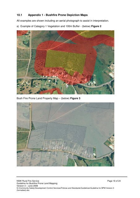
10.1 Appendix 1 - Bushfire Prone Depiction Maps<br />
All examples are shown including an aerial photograph to assist in interpretation.<br />
a) Example of Category 1 Vegetation and 100m Buffer - (below) Figure 2<br />
Bush <strong>Fire</strong> Prone Land Property Map – (below) Figure 3<br />
<strong>NSW</strong> <strong>Rural</strong> <strong>Fire</strong> <strong>Service</strong> Page 16 of 24<br />
Guideline for Bushfire Prone Land Mapping<br />
Version 3 – June 2006<br />
G:\Community Safety\Development Control <strong>Service</strong>s\Policies and Standards\Guidelines\Guideline for BPM Version 3<br />
(formatted).doc