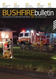
GUIDELINE - NSW Rural Fire Service
GUIDELINE - NSW Rural Fire Service
GUIDELINE - NSW Rural Fire Service

Create successful ePaper yourself
Turn your PDF publications into a flip-book with our unique Google optimized e-Paper software.
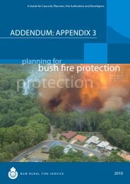
2. Introduction<br />
On 1 August 2002, the <strong>Rural</strong> <strong>Fire</strong>s and Environmental Assessment Legislation Amendment Act<br />
2002 (Amendment Act) came into effect. The Act amends both the Environmental Planning and<br />
Assessment Act 1979 and the <strong>Rural</strong> <strong>Fire</strong>s Act 1997 to ensure that people, property and the<br />
environment are more fully protected against the dangers that may arise from bush fires.<br />
The Amendment Act requires councils to map bush fire prone land within their local government<br />
area, which becomes the basis for planning for bush fire protection.<br />
A Bushfire Prone Area is an area that can support a bushfire or is likely to be subject to<br />
bushfire attack. It is appropriate that people living in such areas are advised of such potential.<br />
Research has shown that 85% of houses are lost in the first 100m from bushland and that<br />
ember attack is a significant form of attack on properties.<br />
This Guideline provides the details for mapping bush fire prone land as required under the<br />
Amendment Act. The Guideline is to be used by both the <strong>NSW</strong> <strong>Rural</strong> <strong>Fire</strong> <strong>Service</strong> and councils.<br />
Bush <strong>Fire</strong> Prone Land Maps act as a trigger mechanism for development of land within bushfire<br />
prone areas to ensure where appropriate the bush fire safety provisions are incorporated into<br />
the development..<br />
The Data Sets described within this document use the guidelines for metadata elements<br />
described in: ANZLIC <strong>GUIDELINE</strong>S: CORE METADATA ELEMENTS Version 1 Metadata for<br />
high level land and geographic data directories in Australia and New Zealand<br />
http://www.anzlic.org.au/asdi/metaelem.htm<br />
The Data Sets described are:<br />
• Bush <strong>Fire</strong> Prone Land Map<br />
• Bush <strong>Fire</strong> Risk Evacuation Map<br />
• Bush <strong>Fire</strong> Prone Properties Map<br />
3. Scope<br />
This Guideline applies to all councils who are required to prepare bush fire prone land maps. It<br />
sets out the requirements to enable councils to accurately and consistently map bush fire prone<br />
land. The methodology is one that is to be applied State wide for comparative purposes.<br />
Covers:<br />
Bush <strong>Fire</strong> Prone Land (principle document)<br />
Bush <strong>Fire</strong> Prone Property Map and<br />
Bush <strong>Fire</strong> Risk Evacuation Map<br />
4. Legislation<br />
On 1 August 2002, the <strong>Rural</strong> <strong>Fire</strong>s and Environmental Assessment Legislation Act 2002<br />
(RF&EALA Act) amended the <strong>Rural</strong> <strong>Fire</strong>s Act 1997 (RF Act) and the Environmental Planning<br />
and Assessment Act 1979 (EP&A Act) to provide significant improvements in bush fire safety.<br />
Section 146 of the EP&A Act requires councils, where a Bush <strong>Fire</strong> Risk Management Plan<br />
applies, to prepare bush fire prone land map after consultation with the Commissioner of the<br />
<strong>NSW</strong> <strong>Rural</strong> <strong>Fire</strong> <strong>Service</strong> Page 4 of 24<br />
Guideline for Bushfire Prone Land Mapping<br />
Version 3 – June 2006<br />
G:\Community Safety\Development Control <strong>Service</strong>s\Policies and Standards\Guidelines\Guideline for BPM Version 3<br />
(formatted).doc