CHAPTER 14: Remote Sensing of Soil, Minerals, and Geomorphology
CHAPTER 14: Remote Sensing of Soil, Minerals, and Geomorphology
CHAPTER 14: Remote Sensing of Soil, Minerals, and Geomorphology
SHOW LESS

Create successful ePaper yourself
Turn your PDF publications into a flip-book with our unique Google optimized e-Paper software.
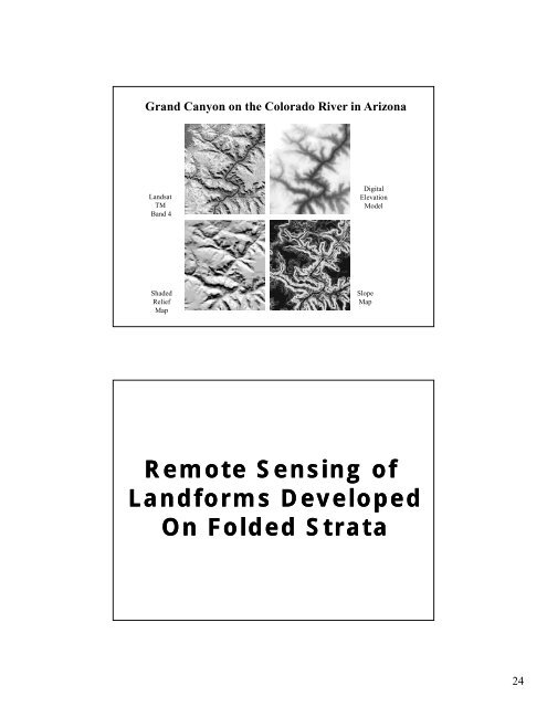
Gr<strong>and</strong> Canyon on the Colorado River in Arizona<br />
L<strong>and</strong>sat<br />
TM<br />
B<strong>and</strong> 4<br />
Digital<br />
Elevation<br />
Model<br />
Shaded<br />
Relief<br />
Map<br />
Slope<br />
Map<br />
<strong>Remote</strong> <strong>Sensing</strong> <strong>of</strong><br />
L<strong>and</strong>forms Developed<br />
On Folded Strata<br />
24