CHAPTER 14: Remote Sensing of Soil, Minerals, and Geomorphology
CHAPTER 14: Remote Sensing of Soil, Minerals, and Geomorphology
CHAPTER 14: Remote Sensing of Soil, Minerals, and Geomorphology

Create successful ePaper yourself
Turn your PDF publications into a flip-book with our unique Google optimized e-Paper software.
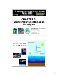
<strong>Remote</strong> <strong>Sensing</strong> <strong>of</strong><br />
Rock <strong>and</strong> <strong>Minerals</strong><br />
<strong>Remote</strong> <strong>Sensing</strong> <strong>of</strong> <strong>Soil</strong>s,<br />
<strong>Minerals</strong>, <strong>and</strong> <strong>Geomorphology</strong><br />
Rocks are assemblages <strong>of</strong> minerals that have<br />
interlocking grains or are bound together by<br />
various types <strong>of</strong> cement (usually silica or<br />
calcium carbonate). When there is minimal<br />
vegetation <strong>and</strong> soil present <strong>and</strong> the rock<br />
material is visible directly by the remote<br />
sensing system, it maybe possible to<br />
differentiate between several rock types <strong>and</strong><br />
obtain information about their characteristics<br />
using remote sensing techniques. Most rock<br />
surfaces consist <strong>of</strong> several types <strong>of</strong> minerals.<br />
8