

Regional Bicycle, Pedestrian, and Trails Master Plan - sacog
Regional Bicycle, Pedestrian, and Trails Master Plan - sacog
Regional Bicycle, Pedestrian, and Trails Master Plan - sacog

Create successful ePaper yourself
Turn your PDF publications into a flip-book with our unique Google optimized e-Paper software.
<strong>Master</strong> <strong>Plan</strong> <strong>Bicycle</strong>, <strong>Pedestrian</strong>, <strong>and</strong> <strong>Trails</strong> 37<br />
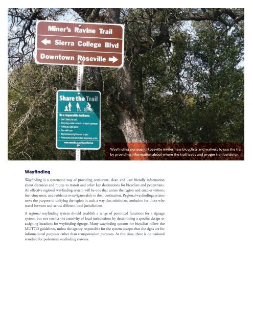
Wayfinding signage in Roseville invites new bicyclists <strong>and</strong> walkers to use the trail<br />
by providing information about where the trail leads <strong>and</strong> proper trail behavior.<br />
Wayfinding<br />
Wayfinding is a systematic way of providing consistent, clear, <strong>and</strong> user-friendly information<br />
about distances <strong>and</strong> routes to transit <strong>and</strong> other key destinations for bicyclists <strong>and</strong> pedestrians.<br />
An effective regional wayfinding system will be one that unites the region <strong>and</strong> enables visitors,<br />
first-time users, <strong>and</strong> residents to navigate safely to their destination. <strong>Regional</strong> wayfinding systems<br />
serve the purpose of unifying the region in such a way that minimizes confusion for those who<br />
travel between <strong>and</strong> across different local jurisdictions.<br />
A regional wayfinding system should establish a range of permitted functions for a signage<br />
system, but not restrict the creativity of local jurisdictions by determining a specific design or<br />
assigning locations for wayfinding signage. Many wayfinding systems for bicyclists follow the<br />
MUTCD guidelines, unless the agency responsible for the system accepts that the signs are for<br />
informational purposes rather than transportation purposes. At this time, there is no national<br />
st<strong>and</strong>ard for pedestrian wayfinding systems.


