

t The California Surveyor - CLSA
t The California Surveyor - CLSA
t The California Surveyor - CLSA

Create successful ePaper yourself
Turn your PDF publications into a flip-book with our unique Google optimized e-Paper software.
Institutional Affiliate of American Congress on Surveying and Mapping.<br />
t <strong>The</strong> <strong>California</strong> <strong>Surveyor</strong><br />
No. 99 <strong>The</strong> Voice of the Land <strong>Surveyor</strong>s of <strong>California</strong> WINTER 1992-93<br />
/<br />
IX<br />
/<br />
/ / i<br />
7 /ivT<br />
/<br />
tr-<br />
IT w.<br />
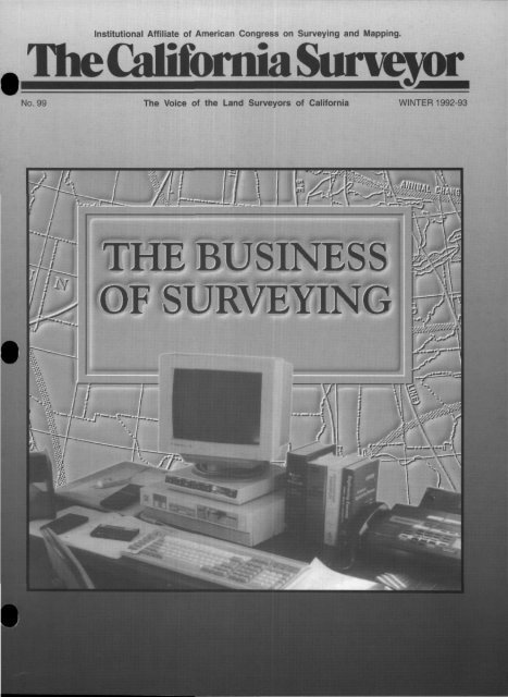
THE BUSINESS<br />
OF SURVEYING<br />
)'<br />
\—^<br />
\<br />
v) \<br />
sx£i<br />
\\<br />
rT!<br />
r/T<br />
pv<br />
Ir<br />
••y.-.i-"<br />
WTS* yf<br />
•W<br />
' vc rrir-
ifc* fife*<br />
•<br />
Sllll ---•<br />
Is ^^M&k<br />
^<br />
IIPIPII<br />
lliilpi<br />
• • •<br />
SMALLER, LIGHTER, FASTER<br />
AND STIIiLYELLOW •<br />
You're looking at the future of surveying. A future<br />
in which a single surveyor can handle more<br />
work, and more kinds of work, than ever before.<br />
Introducing the 4000SE Land <strong>Surveyor</strong> —the next<br />
generation of GPS survey receivers from Trimble.<br />
Smaller, lighter, and faster, the 4000SE is part of<br />
a complete modular survey system that can be<br />
quickly reconfigured to match the changing<br />
demands of your job. From bringing in precise<br />
control points to gathering volumes of contouring<br />
data for maps, it will change the way you work.<br />
For static control and boundary surveys, just<br />
attach the tripod-mounting base with integrated battery<br />
compartments, and snap on the advanced microstrip<br />
antenna. In seconds you're surveying, with no cables or<br />
external modules to connect or worry about.<br />
With our new "walk-about" technology and a receiver<br />
that's 50% smaller and 507o<br />
lighter than previous instruments,<br />
you can carry the Land<br />
<strong>Surveyor</strong> through a site, taking<br />
measurements on the fly as<br />
often as once a second.<br />
Just slip the six pound<br />
receiver into its shoulder pack, attach the new lightweight<br />
rangepole/antenna and you're mobile. <strong>The</strong> new<br />
TRK48 keyboard provides remote control of the receiver<br />
and lets you enter attributes for every point you survey.<br />
HE 9 UTILITY<br />
<strong>The</strong>se attributes are stored with the GPS position data<br />
and will appear on your final map. It's a great way<br />
to collect GIS data.<br />
<strong>The</strong> Land <strong>Surveyor</strong> system also includes TRIMVEC<br />
Plus, the most comprehensive package of survey<br />
software in the industry. It handles every step of<br />
your project from planning to database management<br />
and network adjustment. An optional new<br />
addition to the network adjustment module lets<br />
you incorporate both GPS and<br />
terrestrial observations for a<br />
seamless integration of all<br />
your field data. And now with<br />
TRIMMAP,"* our optional new<br />
mapping software, you can automatically<br />
generate detailed topographic maps.<br />
With the new Land <strong>Surveyor</strong> system we've more than<br />
just streamlined the box, we've streamlined your job.<br />
Call us and we'll show you how...<br />
TrimbleNavigation<br />
<strong>The</strong> Leader in GPS Technology<br />
Survey & Mapping Division<br />
645 North Mary Ave., RO. Box 3642<br />
Sunnyvale, CA 94088-3642<br />
1-800-TRIMBLE, in U.S. and Canada<br />
(1) 408-730-2900, outside U.S.<br />
FAX: 1-408-730-2997<br />
Trimble Europe: (44) 256-760150<br />
Tr.ml.Ic Japan: (81) 472-74-7070<br />
2 <strong>The</strong> <strong>California</strong> <strong>Surveyor</strong> Winter 1993
<strong>The</strong> <strong>California</strong> <strong>Surveyor</strong><br />
is the quarterly publication of the <strong>California</strong> Land <strong>Surveyor</strong>s Association,<br />
Inc. and is published as a service to the land surveying<br />
1<br />
a<br />
rofession of <strong>California</strong>. It is mailed to all Licensed Land <strong>Surveyor</strong>s in<br />
he State of <strong>California</strong> as well as to all members of <strong>California</strong> Land<br />
'i urveyors Association, Inc. <strong>The</strong> <strong>California</strong> <strong>Surveyor</strong> is an open forum<br />
• for all surveyors, with an editorial policy predicated on the preamble<br />
to the Articles of Incorporation of the <strong>California</strong> Land <strong>Surveyor</strong>s Association,<br />
Inc. and its stated aims and objectives which read:<br />
"Recognizing that the true merit of a profession is determined by the<br />
value of its services to society, the '<strong>California</strong> Land <strong>Surveyor</strong>s<br />
Association' does hereby dedicate itself to the promotion and protection<br />
of the profession of land surveying as a social and economic<br />
influence vital to the welfare of society, community, and state."<br />
"<strong>The</strong> purpose of this organization is to promote the common<br />
good and welfare of its members in their activities in the profession<br />
land surveying, to promote and maintain the highest<br />
possible standards of professional ethics and practices, to promote<br />
professional uniformity, to promote public faith and<br />
dependence in the Land <strong>Surveyor</strong>s and their work."<br />
PERSONNEL<br />
OWNER<br />
<strong>California</strong> Land <strong>Surveyor</strong>s Association, Inc.<br />
CENTRAL OFFICE<br />
P.O. Box 9098, Santa Rosa, CA 95405-9990<br />
EDITOR<br />
Thomas B. Mastin, P.L.S.<br />
ASSISTANT EDITORS<br />
Michael McGee, P.L.S. - Linda Richardson, L.S.I.T.<br />
ADVERTISING<br />
Commercial advertising is accepted by Tlie <strong>California</strong> <strong>Surveyor</strong>.<br />
Advertising rates and information can be obtained by contacting<br />
<strong>CLSA</strong> Central Office, P.O. Box 9098, Santa Rosa, CA 95405, (707)<br />
578-6016, Fax (707) 578-4406. Circulation: 5,200.<br />
SUSTAINING MEMBERSHIP<br />
P<br />
(Membership in the <strong>California</strong> Land <strong>Surveyor</strong>s Association, Inc.<br />
as a sustaining member is open to any individual, company, or<br />
corporation who, by their interest in the land surveying profession,<br />
is desirous of supporting the purposes and objectives of this<br />
association. For information regarding sustaining membership,<br />
contact <strong>CLSA</strong> Central Office, P.O. Box 9098, Santa Rosa, CA<br />
95405, (707) 578-6016, Fax (707) 578-4406.<br />
•<br />
EDITORIAL MATERIAL<br />
All articles, reports, letters, and contributions are accepted and will<br />
be considered for publication regardless of the author's affiliation<br />
with the <strong>California</strong> Land <strong>Surveyor</strong>s Association, Inc. Contributions<br />
submitted on floppy diskette medium is encouraged. For compatibility,<br />
disks should be 5.25 or 3.5 inch, MSDOS (IBM compatible)<br />
format. We can accept ASCII text files or word processor files from<br />
the following programs: WordPerfect, Microsoft Word, Windows<br />
Write, Multimate, DCA (Displaywrite III and IV), Wordstar, Xerox<br />
Writer, and Xywrite.<br />
EDITOR'S ADDRESS<br />
Thomas B. Mastin, P.L.S.<br />
1303 Garden Street, 2C, San Luis Obispo, CA 93401<br />
<strong>The</strong> <strong>California</strong> <strong>Surveyor</strong><br />
DEADLINE DATES<br />
Spring January 10,1993 Fall July 10,1993<br />
Summer April 10,1993 Winter October 10,1993<br />
COVER PHOTO:<br />
By Clay Margason, P.L.S.<br />
Articles, reports, letters, etc., received after the above mentioned<br />
date will be considered for the next edition.<br />
Opinions expressed by the editor or individual writers are not necessarily<br />
endorsed by the <strong>California</strong> luind <strong>Surveyor</strong>s Association officers or its<br />
\Board of Directors. Original articles may be reprinted with due credit<br />
moen to the source and written notification to the <strong>California</strong> Land<br />
<strong>Surveyor</strong>s Association.<br />
Copt/right © 1993 <strong>California</strong> Land <strong>Surveyor</strong>s Association<br />
FEATURES<br />
Table of Contents<br />
Automation and the Small Business <strong>Surveyor</strong><br />
by Robert J. Reese, P.L.S 12<br />
In Memory of James Hamblin, P.L.S. 5130 16<br />
G.P.S. - <strong>The</strong> Lazy Man's Astronomy<br />
by David Paul Johnson, P.L.S 18<br />
<strong>California</strong> - <strong>The</strong> Northeast of the '90s<br />
by Tom Mastin, P.L.S 20<br />
George Derby - Prankster of Renown 22<br />
Pheonixia<br />
by George Derby 25<br />
GRS 80, NAD 83, WGS 84 -<br />
What's the Difference<br />
by Michael R. McGee, P.L.S 26<br />
<strong>CLSA</strong> Advanced Technologies Committee (ATC)<br />
by Michael McGee, P.L.S 28<br />
Benefits of <strong>CLSA</strong> 31<br />
DEPARTMENTS<br />
Application for Membership in <strong>CLSA</strong> 33<br />
<strong>CLSA</strong> Conference Information 30<br />
<strong>CLSA</strong> Officers and Board of Directors 4<br />
<strong>CLSA</strong> Publication Order Form 35<br />
From the Editor 8<br />
Letters to the Editor 9<br />
National News 29<br />
New Members of <strong>CLSA</strong> 32<br />
President's Message 6<br />
Index to Advertisers<br />
Association Administrators and Consultants 4<br />
Cross Land Surveying, Inc 31<br />
Desert Engineering Group, Inc 25<br />
Garmin Communication & Navigation 17<br />
Geodimeter 23<br />
Ronald Greenwell & Associates 21<br />
Haselbach Surveying Instruments 27<br />
Kantum Precision 11<br />
McGee Surveying Consulting 4&16<br />
Nikon Surveying Instruments 19<br />
Radman Aerial Surveys 7<br />
SECO Manufacturing Company, Inc 34<br />
Silver Shield 5<br />
StarPlus Software 21<br />
<strong>Surveyor</strong>s Service Company (SERVCO) 24<br />
Surv-Kap 22<br />
Trimble Navigation 2<br />
Carl Zeiss, Inc 7<br />
Winter 1993 <strong>The</strong> <strong>California</strong> <strong>Surveyor</strong> 3
<strong>California</strong> Land <strong>Surveyor</strong>s<br />
are Professionals.<br />
<strong>The</strong>y Deserve Professional<br />
Service.<br />
At AA&C, we view Land Surveying as a<br />
profession with unique insurance needs. Our<br />
Business Insurance Division is ready to provide<br />
you with service-oriented:<br />
• Professional Liability Insurance<br />
• Office Package/General Liability Insurance<br />
• Commercial Automobile Insurance<br />
• Equipment Floaters<br />
Professional Land <strong>Surveyor</strong>s deserve professional<br />
service from a broker with experience.<br />
Call us today<br />
Alicia K Igram. AAI<br />
Assistant Vice President<br />
Association Administrators & Consultants. Inc.<br />
3 Park Plaza Suite 1200<br />
Irvine. <strong>California</strong> 92714<br />
(714)660-4700 • (800)854-0491<br />
USING GPS FOR THE<br />
FIRST TIME<br />
Need Assistance and Assurance<br />
of a Successful Project??<br />
Michael R. McGee, P.L.S., acts as a<br />
consultant to advise and assist surveying &<br />
engineering firms on projects utilizing the<br />
NAVSTAR Global Positioning System (GPS).<br />
Involvement includes equipment specification,<br />
installation of software, project planning,<br />
training crews & project manager, processing,<br />
analyzing and adjusting the GPS<br />
observation data and quality control.<br />
Consultant works with first time users<br />
who wish to gain knowledge and confidence<br />
while being assured of a successful project.<br />
Call for information and references.<br />
McGEE SURVEYING CONSULTING<br />
1826 Chorro Street<br />
San Luis Obispo, CA 93401<br />
(805) 546-9314<br />
<strong>CLSA</strong> Officers 1992<br />
LeRoy C. "Lee" Hennes, P.L.S. • President<br />
Joseph W. Betit, P.L.S. • President-Elect<br />
Kurtis K. Hoehn, P.L.S. • Vice President<br />
Billy Martin, P.L.S. • Secretary<br />
Frederick W. Kett, P.L.S. • Treasurer<br />
Kenny L. Fargen, P.L.S. • Immediate Past President<br />
Dorothy C. Calegari • Executive Director<br />
Board of Directors<br />
Chapter Representatives<br />
Bakersfield<br />
Larry Hubbard, P.L.S.<br />
Central Coast<br />
Timothy Fox, P.L.S. • Clay Margason, P.L.S.<br />
Tom Mastin, P.L.S.<br />
Central Valley<br />
Keith Spencer, P.L.S.<br />
Channel Islands<br />
Robert Hemman, P.L.S.<br />
East Bay<br />
Harold B. Davis, P.L.S. • Patrick Tami, P.L.S.<br />
William Alexander, P.L.S.<br />
Gold Country<br />
Edward "Alan" Hess, P.L.S.<br />
Humboldt<br />
Don Campbell, P.L.S.<br />
Lake/Mendocino<br />
Don McMath, P.L.S.<br />
Los Angeles<br />
Lloyd Cook, P.L.S. • Robert D. Hennon, P.L.S.<br />
Robert Olson, P.L.S.<br />
Marin<br />
Richard Alspach, P.L.S.<br />
Monterey Bay<br />
Steven C Wilson, P.L.S.<br />
Mother Lode<br />
Frederick W. Kett, P.L.S.<br />
Northern Counties<br />
James Herrick, P.L.S.<br />
Orange County<br />
John Canas, P.L.S • Paul A. Cuomo, P.L.S.<br />
Glenn Lake, P.L.S. • Kari Launen, P.L.S.<br />
Lon Maddox, P.L.S. • Richard Ray, P.L.S.<br />
Riverside/San Bernardino<br />
Darrell T. Harness, P.L.S. • Ernest Pintor, P.L.S.<br />
Gerald Stayner, P.L.S.<br />
Sacramento<br />
Gary Leonard, P.L.S. • Chris Russell, P.L.S.<br />
San Diego<br />
Vance Breshears, P.L.S. • G. Howard Dye, P.L.S.<br />
Philip Giurbino, P.L.S. • Greg Helmer, P.L.S.<br />
Jack Roth, P.L.S. • Vince Sincek, P.L.S.<br />
San Joaquin Valley<br />
Glenn Medina, P.L.S.<br />
Santa Clara/San Mateo<br />
Paul W. Lamoreaux, Jr., P.LS.<br />
Martin "Don" Marquett, P.L.S.<br />
Sonoma County<br />
Peter Ehlert, P.L.S. • James Hamblin, P.L.S.<br />
CORRECTION<br />
In Issue No. 98 of <strong>The</strong> <strong>California</strong> <strong>Surveyor</strong>, on the advertisement<br />
on Page 9, the first sentence of the body text should have read:<br />
•<br />
t<br />
Michael R. McGee, P.L.S., acts as a consultant to advise and assist<br />
surveying & engineering firms on projects utilizing the NAVSTAR<br />
Global Positioning System (GPS).<br />
•<br />
(See the correct advertisement to the left.) We regret any<br />
inconvenience this might have caused anyone.<br />
4 <strong>The</strong> <strong>California</strong> <strong>Surveyor</strong> Winter 1993
YORS & ENGINEERS, We've got you covered!<br />
[Pfll(SlMPtlMiEPB8<br />
@ fiKBofafls M B<br />
<strong>The</strong> cover can be driven in any open<br />
converts to camper 8 work shop.<br />
Water cooler<br />
2 Lunch box<br />
3 Salety cones<br />
4 Flagging & 1st aid<br />
5 Chiel party's tools<br />
belt, etc<br />
6 Brief case<br />
7 Blueprints, etc.<br />
8 Steel tapes<br />
9 Nails<br />
10 Instrument/Rod<br />
person's tool belt,<br />
hammer, etc.<br />
11 Prism bags<br />
12. EDM, Transit, etc.<br />
13. Level<br />
14 Hubs: 6", 10", 12"<br />
15 Laths: V, 2', 3'and<br />
stakes<br />
16 Paint cans<br />
1r Stake bag & safety<br />
hat<br />
18 Radio bag<br />
19 Tripods<br />
20 Rod. prism & range<br />
poles<br />
^<br />
21 Frost pin, bar & rebar<br />
2? Magnetic locator,<br />
shovel, etc.<br />
23 Extra space.<br />
"Silver Shield cover<br />
has been extended in<br />
illustration for clarity<br />
Security<br />
Standard Tool Box<br />
Fits Suburban & Van<br />
B Pop-Up Top. Cover<br />
0 Tool Boxes<br />
O" Ladder Rack<br />
O Mobile Workshop<br />
17 Compact Camper<br />
Covers<br />
Since 1962<br />
0 S+curlty 0 Safety M Savings \>* Sarvablllty St Patented<br />
"SILVER SHIELD is as important & necessary as my total station...,"<br />
declares John Pyle of AZ LAYOUT, a full-service survey<br />
]<br />
ing & engineering firm with 25 years experience. Project sizes<br />
& costs range from 1 to 640 acres, & from $500 to $300,000.<br />
Optional<br />
Pulldown Desk<br />
Optional<br />
Camper Conversion<br />
• Models to fit all pickups • Aluminum aircraft construction (cover)<br />
• All sides lock securely (cover) • Paint loc steel (tool boxes)<br />
• Weatherproof (cover) • Converts to camper/workshop (cover)<br />
• Maintenance free<br />
• Easy installation & removal<br />
• Lightweight & durable • Reduces vehicle operating cost (cover)<br />
Unobstructed visibility<br />
FOR FREE BROCHURE<br />
call or write<br />
FREE (800)243-4394 Or (602)243-4394<br />
1710 E. Jefferson • Phoenix, Arizona 85034<br />
Winter 1993 <strong>The</strong> <strong>California</strong> <strong>Surveyor</strong> 5
^w<br />
PRESIDENT'S MESSAGE «<br />
By Joseph W Betit, P.L.S.<br />
THE EARLIEST KNOWN city<br />
map is scribed on a clay tablet<br />
and is of the City of Nippur<br />
(1500 BC), the ancient cultural center<br />
of the Sumerian civilization. <strong>The</strong> map<br />
has been compared to the remains of<br />
Nippur and has been found to be<br />
carefully drawn to scale. <strong>The</strong> earliest<br />
know depiction of a Sumerian surveyors<br />
"rod" and "line" is 2050 BC,<br />
500 years before the map. This depiction<br />
is carved on a panel of a steel<br />
erected to extol the might of a king,<br />
Ur-Nammu. This king is also noted<br />
as the earliest (known to date)<br />
Sumerian ruler to codify and publish<br />
(on a clay tablet) a unified and comprehensive<br />
law code.<br />
From the preceding, one can see<br />
that surveying is a very ancient profession.<br />
<strong>Surveyor</strong>s have been providing<br />
vital services for over 4,000 years<br />
to their respective societies. Yet, until<br />
the last 20 years our surveying technology<br />
has differed in degree but not<br />
in kind from the Sumerian surveyors<br />
of ancient Iraq.<br />
Today's surveyor now has a<br />
choice of many measuring and computation<br />
systems built around the<br />
new technologies of Electronic Distance<br />
Meters, Inertial Navigational<br />
Systems, satellite positions, and electronic<br />
computers. Today, and in the<br />
coming years, surveying will undergo<br />
as remarkable a change as was<br />
brought about by the Sumerian invention<br />
of the standardized line and<br />
tension staff (combo plumb bob and<br />
spring tension). Any member of the<br />
public will have unrestricted access<br />
to the accurate positioning of GPS,<br />
paper and mylar maps of all kinds<br />
will be poured into the rapidly proliferating<br />
GIS databases, new maps will<br />
be delivered in digital form as a matter<br />
of standard practice.<br />
However, the role of the properly<br />
trained and educated surveyor in society<br />
will not change. Furthermore,<br />
societies need for the newly evolved<br />
surveyor will increase dramatically.<br />
To attempt to remain stationary at<br />
this time would invite disaster and<br />
possible destruction of the ancient<br />
core of values and objectives of our<br />
profession. Yet, to press forward into<br />
the electronic age and forget the richness,<br />
strength and practicality of a<br />
1,000 years evolution and adaptions<br />
of English land law that we are an<br />
integral part of would likewise be<br />
folly and a disservice to the society<br />
we serve.<br />
We must strive to strike a balance<br />
while remolding ourselves as a profession<br />
and evolve ourselves so that<br />
we may join the progress of the new<br />
age before us and bring forward with<br />
us the best of the richness and<br />
strengths of the old.<br />
To accomplish this difficult but exciting<br />
task we must look to education<br />
as we never have before. Our college<br />
graduates will be well versed in the<br />
new technologies when they graduate.<br />
This summer Dr. Nader and myself<br />
put in long hours arranging<br />
$500,000 worth of GIS (with full programming<br />
language) to run on the 16<br />
new Sun workstations in the new<br />
Surveying Engineering GIS Lab at<br />
<strong>California</strong> State University, Fresno.<br />
Currently, we are working to form a<br />
new multidisciplinary coalition of the<br />
GIS expertise already on the CSUF<br />
campus. This effort is progressing at<br />
a truly astonishing rate. Local surveyors<br />
are becoming increasingly<br />
involved in surveying education.<br />
<strong>The</strong>re are parallel efforts to ours in<br />
Southern <strong>California</strong>, the Central<br />
Coast, Monterey Bay, San Jose, Sacramento<br />
and the Bay area.<br />
However, the more difficult task<br />
is finding a way for the in-service<br />
practicing professional to participate<br />
in this training and education. <strong>The</strong><br />
practicing surveyor is often geographically<br />
cut off from easy access<br />
Today's surveyor<br />
now has a choice of<br />
many measuring and<br />
computation systems<br />
built around the new<br />
technologies of<br />
Electronic Distance<br />
Meters, Inertial<br />
Navigational<br />
Systems, satellite<br />
positions, and<br />
electronic<br />
computers.<br />
I<br />
to advanced surveying programs.<br />
I believe that the many years of<br />
struggle by the <strong>CLSA</strong> advocates of<br />
Professional Development directed<br />
towards reaching a consensus among<br />
the <strong>California</strong> land surveyors as to<br />
how PD is to be implemented will now<br />
be rewarded. Last year, Rob Hennon<br />
and the committee members of the<br />
Education Committee made great<br />
progress toward finding a common<br />
ground. Rob has agreed to stay on<br />
this year, and I believe he will be able<br />
to bring the PD issue to a successful •<br />
closure. Under the PD umbrella the<br />
<strong>CLSA</strong> will be able to offer or support<br />
6 <strong>The</strong> <strong>California</strong> <strong>Surveyor</strong> Winter 1993
the offering of certification and training<br />
programs in the new technologies<br />
for its members.<br />
Continuing on the committee<br />
theme, many of the committee<br />
chairs are already on board. During<br />
the last year, Howard Brunner as<br />
our <strong>CLSA</strong> Rep. on the <strong>California</strong><br />
GIS Task Force, did a terrific job on<br />
our behalf. Howard has agreed to<br />
scale back his commitments on the<br />
<strong>CLSA</strong> Legislative Committee and<br />
other <strong>CLSA</strong> Committee in order to<br />
concentrate on the impending GIS<br />
legislation to be put forward from<br />
the GIS Task Force recommendations<br />
to the Legislature.<br />
Gary Leonard will stay on as Legislative<br />
Committee Chairman. Gary,<br />
Paul Cuomo, and Chris Russell will<br />
handle the normal legislative matters<br />
while Howard will concentrate on<br />
the GIS component.<br />
I have decided to implement two<br />
ad hoc committees in the coming<br />
year. <strong>The</strong> first, to be chaired by Terry<br />
Hayden, will be to form a committee<br />
to study and report back on the necessity<br />
and the feasibility of forming<br />
a standing Photogrammetry Committee<br />
to better represent the needs<br />
and concerns of the photogrammetry<br />
community within the <strong>CLSA</strong>. <strong>The</strong><br />
second chaired by Aleksi Rapkin,<br />
will continue to study the minority<br />
business situation, the related surveying<br />
business ownership issues<br />
and initiate a preliminary study of<br />
the actual makeup and constitution<br />
of minorities within the surveying<br />
community itself.<br />
Tom Mastin and Michael McGee<br />
are both doing terrific jobs on their<br />
committees and they have both committed<br />
to staying on and continuing<br />
their excellent work in the coming<br />
year.<br />
Kari Launen has agreed to Chair<br />
the Professional Practices Committee.<br />
Kari plans to pick up on Hal<br />
Davis's idea of extending the activities<br />
of the Professional Practice<br />
Committee to addressing the<br />
education of misguided agencies<br />
and to add a new activity related<br />
to the Mini-Brooks Act as well.<br />
<strong>The</strong> Brooks Act misuses and<br />
abuses are an increasing problem.<br />
Rather than throwing<br />
money away on attorneys and<br />
lawsuits, the committee is going to<br />
try a different tack. <strong>The</strong> committee is<br />
going to gather sources materials<br />
(Larry Fenske has graciously offered<br />
to provide the Cal Trans manual of<br />
procedures as a start) and seek out<br />
expertise on both the interviewer/evaluator<br />
and interviewee<br />
side to put together a training series<br />
that would operate similar to "moot"<br />
or mock court. Over the course of a<br />
one or two day seminar, the whole<br />
process would be reviewed for the<br />
benefit of both the intended attendees<br />
— members of public agencies<br />
and the surveying community. Kari<br />
and I both feel that most of the<br />
abuses of the Brooks Act process are<br />
a result of ignorance more than any<br />
other cause.<br />
Finally, but not least, the <strong>CLSA</strong><br />
needs to look at what can be done to<br />
attract new members from the ranks<br />
of those surveyors who have left the<br />
old Cal Council due to its being absorbed<br />
into a much larger and much<br />
more diversified engineering advocacy<br />
organization that feels surveying<br />
is a minor issue.<br />
<strong>The</strong> <strong>CLSA</strong> has come through this<br />
year with increased membership<br />
(with a lot of hard work by Lloyd<br />
Cook helping out) and in a healthy<br />
financial condition. We have a solid<br />
crew of officers and committee members<br />
on board, and as usual, Dorothy<br />
Calegari in Central Office is keeping<br />
close tabs on it all. Even if the<br />
Legislature once again collapses into<br />
a one issue dog fight over the State<br />
Budget, we will still be able to press<br />
ahead on our own issues and try to<br />
pass on the <strong>CLSA</strong> to the next crew<br />
on watch in a little better condition<br />
than we got it, just as the many<br />
crews did before us. I am looking<br />
forward to the coming year and the<br />
opportunities and challenges it will<br />
bring. ©<br />
>Q<br />
Radman Aerial Surveys<br />
6220 24th Street • (916) 391-1651<br />
Sacramento, CA 95822 • FAX (916) 391-6537<br />
• Photogrammetric Mapping<br />
• GIS Database Development<br />
• Aerial Triangulation<br />
• Aerial Photography<br />
Carol Radman - President<br />
Woman-Owned Enterprise<br />
<strong>The</strong> choice<br />
of the pros.<br />
<strong>The</strong> best companies use<br />
the best instruments. Zeiss<br />
has the quality & advanced<br />
performance to make you<br />
a leader.<br />
Series E<br />
Total Stations<br />
Automatic<br />
temperature<br />
& pressure<br />
correction.<br />
Lightweight &<br />
x easy to use.<br />
8 models,<br />
including<br />
economical<br />
Elta 5 &<br />
Rec Elta 5.<br />
Automatic<br />
Levels<br />
• Famous Ni 2 with 0.7mm<br />
accuracy.<br />
• Neweconom- "^ ^ ^<br />
ical Ni 40<br />
with 2mm<br />
accuracy.<br />
• New Carl<br />
Zeiss Jena series,<br />
from geodetic Ni 002<br />
to Ni 040A Builder's Level.<br />
Contact your Zeiss<br />
dealer or:<br />
Carl Zeiss, Inc.<br />
Surveying Division<br />
One Zeiss Drive<br />
Thornwood, NY 10594<br />
914 • 681•7303<br />
Customer Satisfaction—<br />
A Carl Zeiss way of life.<br />
Winter 1993 <strong>The</strong> <strong>California</strong> <strong>Surveyor</strong> 7
FROM THE EDITOR<br />
MAY YOUR '93 BE BETTER THAN MY '92<br />
I<br />
F YOU HAVE READ <strong>The</strong> <strong>California</strong> <strong>Surveyor</strong> before, you<br />
will realize that I am not Brett Jefferson, however I am<br />
the editor of <strong>The</strong> <strong>California</strong> <strong>Surveyor</strong>. Brett left the position<br />
for the lame reason that he moved out of the State.<br />
Brett put quite a bit of effort and energy into the editing of<br />
<strong>The</strong> Cal <strong>Surveyor</strong> and continued the tradition of decisive<br />
editorials that his predecessor, Jeremy Evens started. It is<br />
safe to say that tradition won't continue.<br />
Your first clue that I am not Brett should have been that<br />
Brett's picture is not in the upper left corner there; as a<br />
matter of fact no picture is up there (that is the tradition I<br />
am starting). Your second clue should have been that my<br />
name was under the title. That P.L.S. part I wasn't born<br />
with, it's just sort of been attached there. I think it is important<br />
that I give a short biography on myself so anyone<br />
reading this will understand from where I come. I've been<br />
a Licensed Land <strong>Surveyor</strong> in <strong>California</strong> for a while and<br />
been surveying for even longer. I've been a member of<br />
<strong>CLSA</strong> for some time as well as a member of my local chapter.<br />
I was editor of the <strong>CLSA</strong> News for a short time and<br />
have never before been the editor of a magazine. Most people<br />
who know me are wondering how I got this job. <strong>The</strong><br />
answer is simple, someone like me is born every minute.<br />
This is actually the second issue that I've had to feign<br />
responsibility for. I was lucky enough (as were you) in the<br />
last issue to have enough material so that I did not have to<br />
write a filler such as this. <strong>The</strong> last issue fell into place in<br />
spite of me, not because of me. I want to thank the Advanced<br />
Technologies Committee of <strong>CLSA</strong> and especially its<br />
Chairperson, Michael McGee, for their efforts in putting<br />
together the meat for the last issue. When Michael was<br />
offered the position of editor of the Cal <strong>Surveyor</strong> (Yes, I<br />
realize that means I wasn't first choice as editor, but I was<br />
told I was in the top 100), he turned it down with the<br />
promise of getting articles for the magazine. He has fulfilled<br />
that promise and will be called on again and again to<br />
fulfill that promise. It is critical that the surveying profession<br />
keep on top of Advanced Technologies so that the<br />
technologies don't advance beyond us. Michael Pallamary,<br />
as always, provided the most controversial article on the<br />
court case and the legislative analysis concerning lot line<br />
adjustments, which hopefully will have great impact on the<br />
surveying community for years to come. <strong>The</strong> other <strong>CLSA</strong><br />
committee, which was very responsive to <strong>The</strong> <strong>California</strong><br />
<strong>Surveyor</strong>, was the Membership Committee, whose Chair<br />
and only member is Lloyd Cook. Lloyd has been providing<br />
articles to <strong>The</strong> Cal <strong>Surveyor</strong> and the <strong>CLSA</strong> Neivs and has<br />
been pushing others to do the same.<br />
I have been concerned about writing this editorial ever<br />
since I was given this position back in January of 1992 (we<br />
are hoping you will be getting this issue in January of 1993,<br />
but worse things have happened). So, here I was going to<br />
have to write an editorial that would make abortion look<br />
like a kindergarten topic (Please no letters on abortion pro<br />
or con). So, since January, I've been racking my brain on<br />
By Tom Mastin, P.L.S.<br />
what subject to address. <strong>The</strong> only one, besides when am I<br />
going to get some work, which kept popping up, was how<br />
in the heck did I get this job. Oddly enough, I still haven't<br />
figured that out and I'm sure in a few short issues you'll be<br />
wondering the same. My English skills are maybe not the<br />
best. I was the benchmark for the SAT English test the year<br />
I took it; I was the 0 percentile person. I could never distinguish<br />
between a verb and a proverb in bonehead English.<br />
Although I have difficulty spelling my name, I do have a<br />
spell checker on my computer. I still don't know the difference<br />
between "Than" and "<strong>The</strong>n" or "Affect" and "Effect,"<br />
or for that matter "Left" or "Right." By now you can see<br />
that I do make a perfect surveyor, but an editor for a nationally<br />
renowned magazine? I probably shouldn't even be<br />
editing this magazine.<br />
By now, hopefully, some of you are thinking that there<br />
must be something funny going on, because the people I<br />
mentioned, along with a few others, always seem to have<br />
articles in the magazine. <strong>The</strong> truth is, they all have one<br />
thing in common: they have an idea for an article and they<br />
are able to write it down. That is all it takes. I am happy to<br />
take ideas for articles, but even happier for articles. I can<br />
honestly say that I will take an article on any subject. I can't<br />
honestly say I will print the article, but I will review it and<br />
seriously consider it. If anyone out there has an idea they<br />
want to write on, do it (or "Just Do It," I guess is the proper<br />
way to say it). If you don't feel you are able to make it<br />
shine (like this editorial), then rough it out and send it in. I<br />
will edit it (Editor comes from the Latin words "Edi" meaning<br />
"to Butcher" and "tor" meaning "it up").<br />
Now the ground rules for submitting articles or letters<br />
to <strong>The</strong> <strong>California</strong> <strong>Surveyor</strong>.<br />
1. Write it<br />
2. Send it.<br />
We truly prefer them to be sent on an IBM compatible disk<br />
(5V4 or 3l^») in WordPerfect, ASCII, Wordstar, or any other<br />
common format. We will take it handwritten on the back of a<br />
lunch bag, if that is where you wrote it. <strong>The</strong> <strong>California</strong> <strong>Surveyor</strong><br />
is unique in that it reaches every licensed surveyor in the<br />
State of <strong>California</strong>, whether a member of <strong>CLSA</strong> or not. Letters<br />
to the editor are an easy way to say something that is on your<br />
mind. <strong>The</strong> letter can address something in a previous issue or<br />
broach a whole new topic. <strong>The</strong>re is something to realize about<br />
<strong>The</strong> <strong>California</strong> <strong>Surveyor</strong>: it takes three months from when all<br />
the articles are submitted until it is mailed out. That is just the<br />
way it is, so when you write concerning something in this<br />
issue, it will be two issues later before you see it in print. Your<br />
comments are still just as valid then as they are today, you will<br />
just have forgotten what you said by the time it gets out.<br />
Well, maybe next issue I will editorialize on some emotional<br />
issue, or at least maybe I will have some work coming<br />
in. In fact, if I don't have work coming in, you may be reading<br />
an emotional plea. Our theme for the next issue is getting the<br />
magazine out. Until then, remember: a good surveyor is not<br />
the same as an accurate surveyor. ©<br />
8 <strong>The</strong> <strong>California</strong> <strong>Surveyor</strong> Winter 1993
9 LETTERS TO THE EDITOR<br />
• THE REST OF THE STORY<br />
Back in the mid-seventies a construction worker, in<br />
the course of laying out the slab for a home, used<br />
the wrong stake for the rear corner of a subdivision<br />
lot and the house was thus built in violation of setback<br />
requirements. <strong>The</strong> problem could be cured by<br />
moving the lot line without causing any further violation<br />
of lot area, frontage or setback requirements<br />
because of the size and configuration of the lots on<br />
both sides of the line. With luck, a Parcel Map could<br />
be filed to accomplish this. Optionally, the subdivider<br />
could tear the house down and rebuild it in the<br />
correct location because he still owned it. It was a<br />
close call, but it was decided that (with luck) the<br />
Parcel Map would be a little less costly. And thus<br />
the problem was solved.<br />
<strong>The</strong> surveyor, who had experienced similar<br />
problems a time or two previously, happened to be<br />
on the Legislative Committee of the Cal Council at<br />
the time, and it behooved him to draft a bill that<br />
might forestall these difficulties and put it before the<br />
Committee. This he did, the Committee agreed with<br />
the draft as it was presented, and now all it needed<br />
was a name. One of the other members spoke up,<br />
and thus came to be.<br />
Lot Line Adjustment<br />
<strong>The</strong> guys on this Committee weren't rocket scientists,<br />
rocketry at that time being still unknown, but<br />
they were smart enough to know that initially offering<br />
a bill for consideration by the legislature is<br />
usually nothing more than running it up the proverbial<br />
pole, and that they wouldn't be able to<br />
recognize it when they next saw it after it had<br />
passed through innumerable committees, agencies,<br />
bureaus, associations, coastal people, animal protectors<br />
and a myriad of other rights groups. So it's<br />
understandable why they — and even their legislative<br />
counsel, Jim Corn — didn't consider the<br />
language more carefully before releasing it. Well, as<br />
it finally happened, the draft came back for the<br />
Committee's approval with only one innocuous<br />
change. In their state of shock it still didn't occur to<br />
them of the untold dangers that might lie before them<br />
and before many others, not including lawyers. A<br />
law was enacted. A law originally intended to cure<br />
little problems with little lots has found its way out to<br />
the pastures and into the mountains.<br />
Now you know the rest of it.<br />
Look forward to your retirements, guys. It's nice.<br />
Frank Richardson, Retiree<br />
• MORE RESPONSES TO RIVERSIDE<br />
COUNTY<br />
In response to the letter entitled "Riverside County<br />
<strong>Surveyor</strong> Responds" by Raymond L. Mathe, P.L.S.,<br />
in the Summer issue of <strong>The</strong> <strong>California</strong> <strong>Surveyor</strong>, I would<br />
like to point out a few things:<br />
1. <strong>The</strong> County <strong>Surveyor</strong>'s liability extends ONLY<br />
to his Certificate. At the risk of being redundant<br />
and perhaps in the hope that a few laymen<br />
may read my letter, this certificate states,<br />
"This map has been examined in accordance<br />
with Section 8766 of the Land <strong>Surveyor</strong>'s Act<br />
on....day of 19...". That is the entire statement.<br />
(Emphasis added.)<br />
2. Section 8766 is specific as to WHAT the County<br />
<strong>Surveyor</strong> shall check.<br />
a. Accuracy of mathematical data, which can<br />
only be accomplished if the survey is a "closed"<br />
survey. This is normally accomplished by requiring<br />
the <strong>Surveyor</strong> to submit calculations.<br />
(Time to proofread against map figures, probably<br />
15 minutes is a generous estimate of most<br />
maps.) $11.89<br />
b. Compliance with Section 8762.5. (Only applies<br />
if a division of land is shown). Highly unlikely<br />
on a ROS. (Time to check is estimated at<br />
2 minutes MAXIMUM). If an illegal map is submitted,<br />
back it goes to the author with a rejection<br />
slip. If this check is performed first and the<br />
map is illegal, the cost using Mr. Mathe's figures<br />
is $1.53.<br />
c. Compliance with Section 8763. Outside dimensions<br />
of map are 18" by 26" and has a 1"<br />
inside blank margin all around usually accomplished<br />
by the author drawing a 1" border line<br />
and never exceeding it. (Another estimated<br />
2 minutes MAXIMUM.) $1.53<br />
d. Compliance with Section 8764.5. (To proofread<br />
three short certificates that never vary except<br />
for names and dates cannot possibly take<br />
over 2 minutes each [unless the checker is<br />
dyslexic, in which case he is not competent to<br />
do the job].) $4.76<br />
e. Compliance with Section 8771.5. (Used only<br />
if State Plane Coordinates are shown.) If<br />
shown, the map must show the coordinates of<br />
the control scheme. (Time to check if the control<br />
scheme is shown, 1 minute.) $0.79. If <strong>California</strong><br />
Coordinates are shown, this will greatly<br />
affect paragraph "a" above. (Proofreading<br />
these long strings of numbers from submitted<br />
calculations may triple the cost estimated<br />
in "a".)<br />
f. Compliance with Section 8772. Did the<br />
surveyor either by legend or by statement indicate<br />
that ALL the monuments set by him were<br />
identified with his license or registration number?<br />
(Estimated time to check for statement,<br />
legend, or labels from 1 to 5 minutes depending<br />
on method used by author and complexity<br />
of the map.) $3.96<br />
<strong>The</strong> total cost of checking those items the<br />
County <strong>Surveyor</strong> is charged with checking, (excluding<br />
those maps showing State Plane Coordinates)<br />
is $23.67, using Mr. Mathe's rates. If we allow time<br />
for coffee breaks and BS sessions and quadruple<br />
this figure and add 5V$% for error in estimating, a<br />
maximum figure of $100 MIGHT be explainable (although<br />
not justifiable).<br />
Any other checking is a redundancy that is<br />
unneeded. <strong>The</strong> Record of Survey Map is simply<br />
placing the opinion of the surveyor before the public<br />
eye for their acceptance or rejection as they<br />
see fit. If the County <strong>Surveyor</strong> feels the surveyor's<br />
opinion is a bad opinion, he has every right to<br />
place a statement on the map to that effect. Barring<br />
noncompliance with paragraphs "a" through<br />
"f" above, any other checking desired by the<br />
County <strong>Surveyor</strong> is judgmental and should be<br />
done at his (the county's) expense. Or if the<br />
County <strong>Surveyor</strong> is a gentleman, he might call the<br />
author in after explaining that there would be a<br />
charge of $45.77 per hour for consulting about<br />
what seems to him to be a poorly executed or<br />
inept survey that would probably damage the<br />
author's reputation if such a note was placed on<br />
his map. In a case of that nature, I would expect<br />
the practitioner to pay the bill himself and not burden<br />
his client with added expense. Needless to<br />
say, any allegation such as this had better be on<br />
VERY FIRM GROUND, or the County <strong>Surveyor</strong><br />
will incur exceptional liability.<br />
When I was still active and a County <strong>Surveyor</strong><br />
complained about anything other than the 6 items<br />
he was charged with checking, my comment to<br />
him was, "If you don't like it put a note on my map<br />
explaining what you don't like and file the map.<br />
You have 20 days". As an example I had a County<br />
<strong>Surveyor</strong> tell me that their County required 3/4"<br />
pipes 16 inches long and I had set 1/2" pipes 30<br />
inches long. My reply to him was to place a note<br />
on my map that I hadn't set 3/4" pipes, and file my<br />
map.<br />
What escapes these bureaucrats is the fact that<br />
98% of all maps filed do not benefit the client or the<br />
map's author in any way, shape, or form. <strong>The</strong>y are<br />
filed to comply with the law and to benefit other<br />
surveyors, posterity, and the public at large.... Usually<br />
because the surveyor has set a monument not<br />
shown on any map of record.... ANY FEE, other<br />
than the recording fee is, to my way of thinking,<br />
Winter 1993 <strong>The</strong> <strong>California</strong> <strong>Surveyor</strong> 9
I<br />
I<br />
I<br />
I<br />
criminal. If I were practicing in Riverside County, I<br />
suspect they would see one or two Records of Survey<br />
per year from me, (only when my client<br />
requested one or would benefit from one or where<br />
a material discrepancy was encountered) and<br />
would be faced with bringing me before the Board<br />
of Registration and PROVING that I was in violation<br />
of the Land <strong>Surveyor</strong>'s Act (not necessarily<br />
easy or cheap to do, because I did lots of work<br />
prior to 1982 when no map was required). I would<br />
at the outset of each job, explain to my client what<br />
the law says I should do, what it would cost him<br />
extra to comply, and ask him if he wished me to<br />
file a map (assuming no material discrepancies<br />
were found). I would inform him that ethically I<br />
would be bound to file a map if such<br />
discrepancies were found, and that it would normally<br />
be to his advantage for me to do so.<br />
I would be interested in hearing from any <strong>Surveyor</strong><br />
in private practice, who feels he can justify<br />
these exorbitant checking fees on behalf of any<br />
county. I wish to know why he thinks his client will<br />
benefit to the tune of $300 to $1,500 in fees, plus<br />
his costs of preparing this map.<br />
Everyone seems to be unaware of the fact that<br />
a Record of Survey map is nothing more than the<br />
statement by the author of the map that this is his<br />
opinion of where things are or should be. If his opinions<br />
are good and his survey is proper, everyone<br />
will accept it. If his opinions are bad or his survey<br />
stinks (I've seen some!), then no one will pay any<br />
attention to it anyhow, except to refer to it on their<br />
map along with an explanation as to why they are<br />
ignoring it.<br />
George R. Dunbar, P.L.S.<br />
• RECORD OF SURVEY CHECKING<br />
FEES<br />
Following is a copy of a letter addressing arguments<br />
against charging fees for reviewing Records of<br />
Surveys.<br />
Dear <strong>CLSA</strong> Board of Directors:<br />
<strong>The</strong> recent demise of our legislation to eliminate the<br />
County of <strong>Surveyor</strong> from the Record of Survey<br />
checking process does not end the discussion or<br />
our responsibility as a professional Association. If<br />
we cannot succeed with legislation, then we must<br />
pursue some form of statewide assistance for the<br />
individual chapters in staying and even reducing the<br />
cost of checking Record of Surveys in each of the<br />
58 counties of <strong>California</strong>.<br />
My purpose here is to respectfully request that<br />
the <strong>CLSA</strong> Board of Directors direct the appropriate<br />
committee to update earlier studies of the costs and<br />
number of surveys recorded in the 58 counties of<br />
<strong>California</strong>. <strong>The</strong> survey and any other information<br />
available from our files in Central Office would be<br />
used to create a data base from which an analysis<br />
can be prepared assessing the trends in terms of<br />
checking cost versus the number of recorded maps.<br />
This data should be analyzed in terms of both population<br />
and the number of parcels so that different<br />
; size counties can be compared.<br />
I believe the survey will support the argument<br />
that increased fees lead to a decrease in the number<br />
of surveys performed and maps recorded. A letter,<br />
with supporting data, along the lines of the one enclosed<br />
could then be sent from the State<br />
Association to all of the Board of Supervisors in<br />
<strong>California</strong>. All of the information would be sent to<br />
the individual chapters. <strong>The</strong> state would thereby<br />
provide the support and encouragement to the individual<br />
chapters who would following up on the<br />
letter with personal contacts to educate their<br />
Board of Supervisors as to the benefits of recording<br />
Records of Surveys, now, before the next<br />
budget crisis occurs.<br />
Sincerely,<br />
Michael R. McGee, P.L.S.<br />
Dear Members of the Board of Supervisors:<br />
When a property owner requests a property line survey<br />
to locate their boundaries, the surveyor<br />
expends a considerable effort researching records<br />
and analyzing documents relating to their title.<br />
<strong>The</strong>reafter, the surveyor goes to the field and takes<br />
measurements to relate the documents to the physical<br />
evidence, makes a determination as to the<br />
correct location of their clients property lines and<br />
sets markers at the corners, establishing the lines<br />
for all to see. <strong>The</strong> final task is the preparation of a<br />
Record of Survey map that documents the evidence<br />
found, procedures followed and the monuments set<br />
to mark the property lines. Although the map serves<br />
as important documentation of the survey it is esoteric<br />
in nature, and is of lesser consequence to the<br />
client who is more interested in the physical location<br />
of his property lines as marked by the surveyor's<br />
monuments.<br />
<strong>The</strong> stability of property lines is temporal in nature.<br />
As time passes, original evidence of their intended<br />
location may be lost, and at some distant time in the<br />
future, a surveyor attempting to re-establish the correct<br />
position of a property line may arrive at a location<br />
not in agreement with old lines. <strong>The</strong> result will often<br />
lead to dissension in the neighborhood.<br />
In years past, maps documenting surveys were<br />
not always filed in the public records. <strong>Surveyor</strong>s<br />
who practice boundary location know too well, that<br />
had surveyors in the earlier part of this century recorded<br />
more of their maps, there would be less<br />
problems and less litigation today. Consequently, it<br />
would cost much less in many cases to perform a<br />
proper survey.<br />
By professional accord and legislative efforts of<br />
the <strong>California</strong> Land <strong>Surveyor</strong>s Association we have<br />
encouraged and required that maps of surveys be<br />
recorded and thereby made available to future<br />
surveyors.<br />
<strong>The</strong> additional cost for the Record of Survey<br />
checking fee can be substantial compared to the<br />
actual cost of the survey and presents little added<br />
value to the present property owner. This additional<br />
cost will at times discourage owners from having<br />
their property lines correctly established or verified.<br />
Recording a Record of Survey map does not<br />
benefit the property owner who hires the surveyor<br />
so much as his neighbors who may in the near<br />
future require that their property lines be established<br />
Additionally, their successors twenty year<br />
from now will reap the benefits, when a surveyor<br />
can re-establish the exact location of the present<br />
survey, avoiding turmoil and litigation.<br />
<strong>The</strong> public in general benefits because surveys<br />
often establish the location of Rights-of-Ways for<br />
streets which simplify future public works project.<br />
Record of Survey maps are beneficial in the establishment<br />
and maintenance of Geographical<br />
Information Systems. Record of Surveys make it<br />
possible to accurately map out the location of property<br />
lines and easements based on actual field<br />
surveys and not paper maps that are stretched or<br />
distorted to fit each other.<br />
Studies of the 58 counties in <strong>California</strong> indicate<br />
that where no fees are charged, the average number<br />
of Record of Survey maps filed for every<br />
100,000 population is much greater than when a<br />
checking fee is required. <strong>The</strong> losers are the citizens<br />
who cannot afford to resolve their problems and<br />
their successors who must ultimately deal with<br />
them.<br />
In closing allow me to restate, recording Record<br />
of Survey maps preserves in the public records vital<br />
information that will benefit adjacent and future<br />
property owners and the public. Lowering and eliminating<br />
checking fees for Record of Surveys will, in<br />
the long run, encourage the filing of surveys and<br />
result in a greater savings of time, resources and<br />
money for all.<br />
Sincerely,<br />
Michael R. McGee, P.L.S.<br />
• MORE ON CONTINUING<br />
EDUCATION<br />
More thoughts on continuing education and requirements<br />
for a degree in surveying. Everyone benefits<br />
from continuing education. Regardless of his or her<br />
chosen field, they and their clients benefit. Show me<br />
a person who knows all there is to know in their field<br />
and I will show you a person who cannot see past<br />
the end of their nose.<br />
<strong>Surveyor</strong>s are a strange breed as I am sure you<br />
know. <strong>Surveyor</strong>s don't work in this profession because<br />
it's just an okay job, or it passes the day in a<br />
somewhat pleasant manner. <strong>The</strong>y work as surveyors<br />
because they like it! I have been a surveyor<br />
since 1955 and I cannot honestly think of a day that<br />
I did not enjoy my work. Any surveyor that will talk<br />
about it will admit the same thing. We have fun in<br />
our work whether its beating the brush in the back<br />
country looking for an original corner, or fighting traffic<br />
in the city — we enjoy our work.<br />
<strong>The</strong> problem most surveyors have is they arrive<br />
at a certain level of competence — (either party<br />
chief or licensed). <strong>The</strong>y then start to vegetate. <strong>The</strong>n<br />
along comes someone saying — educate instead of<br />
vegetate! <strong>The</strong> usual response is — "leave me alone<br />
— I'm a surveyor, I know what I'm doing."<br />
This is where we go wrong. <strong>The</strong> world is changing<br />
and without a system of continuing education,<br />
we fall behind a little further every day.<br />
How much are we changing? Who out there<br />
remembers a canyon chain, a gurley transit? Now<br />
we use GPS to measure across the canyon, we use<br />
10 <strong>The</strong> <strong>California</strong> <strong>Surveyor</strong> Winter 1993
digital transits to replace the magnifying glass, and<br />
educated eyeball of the gurley transit days; field<br />
computers instead of log tables.<br />
Continuing education is a must. Mandatory continuing<br />
education, however, is a good question.<br />
I take as many continuing education courses as I<br />
can afford (time and money wise) per year. I have<br />
traveled from San Diego to Pasadena, Pomona,<br />
Riverside and San Bernardino for continuing education<br />
classes. <strong>The</strong>se were all on a voluntary basis. If<br />
a federal or state mandate requires that I must take<br />
certain classes in order to relicense, I will probably<br />
dispute you. I know where my strong points and<br />
weak points lie and I know where I need continuing<br />
education.<br />
On the need for a college degree as a condition<br />
of licensure; I agree it should be a requirement.<br />
I think part of a degree program should be an<br />
apprentice program where a candidate is required to<br />
work for a minimum of two years with a firm specializing<br />
in surveying. I am not talking about the union<br />
apprenticeship program — it's fine for what it does. I<br />
am talking about a list of companies in <strong>California</strong><br />
who are willing to spend the time and effort to train<br />
and grade a person who works for them for a minimum<br />
of two years. <strong>The</strong> grades could be reported to<br />
the college that would offer the apprentice his or her<br />
degree. This would solve two problems. <strong>The</strong> apprentice<br />
would come to the firm with the appropriate<br />
educational background, and the firm would assist<br />
him/her in obtaining the practical field background.<br />
That person, once they serve the two year apprenticeship<br />
would then receive a degree in surveying<br />
and be free to seek employment any place they<br />
desired.<br />
Any interested parties — let's hear from you.<br />
W. Richard, LS 4451<br />
• MORE ON THE LS BLUES!!<br />
When I received my Professional Land <strong>Surveyor</strong><br />
exam results and found that I lacked four points to<br />
pass the exam, I was very disappointed. After the<br />
wake I decided to appeal the results. I'm glad I did (I<br />
think).<br />
I sent in my $10 for a copy of my answers and<br />
an outline of the acceptable answers to the questions<br />
on the exam. I also received a list showing the<br />
number of points I received for each question. It was<br />
up to me to determine which of my answers were<br />
accepted and which were rejected. It was a lot like<br />
solving a jigsaw puzzle. At least all the pieces were<br />
there (I thought).<br />
I spent many an hour trying to determine which<br />
of my answers were rejected and why. I appealed<br />
any possible answer that could have been misconstrued.<br />
Many of the answers I appealed I probably<br />
had already received points for but there was no<br />
way to tell.<br />
After much soul (and reference book) searching<br />
I finally decided I was ready to submit my<br />
appeal (along with an additional $80, of course). I<br />
sent the package certified mail just to make sure it<br />
arrived.<br />
Yesterday, I received my return receipt. Along<br />
with the receipt I received another package from<br />
the Board of Registration. It contained numerous<br />
"alternate acceptable answers to test questions"<br />
and a letter saying "sorry for any inconvenience".<br />
It did not contain any information on how to call<br />
back an appeal that had already been received<br />
and redo it.<br />
One of the alternate acceptable solutions was<br />
an answer I gave on the exam. It was worth four<br />
points. I only need four points to pass. I did not<br />
include this question in my appeal package.<br />
I decided that the only way I had a chance of<br />
this additional appeal being included in my package<br />
was to send it to the attention of the person who<br />
said "sorry for any inconvenience."<br />
We'll see what happens. I won't hold my breath.<br />
(Maybe if I sent another $80 it would get their<br />
attention.)<br />
NOT!!!<br />
Linda Richardson, LSIT 0<br />
• X-PLAN 360C<br />
Digitizer, planimeter, curvimeter & scale ... all in one !<br />
<strong>The</strong> 360C Digitizing Area-Curvimeter has<br />
a built-in microprocessor to measure coordinates<br />
fast and accurately to a resolution<br />
of 0.05 mm, in the fewest steps. Measure<br />
straight lines by merely plotting their intersections;<br />
arcs by plotting the end points and a midpoint.<br />
Area<br />
Line Length<br />
Arc & Radius<br />
(XY) Coordinates<br />
<strong>The</strong> 360tl Area-<br />
Curvimeter allows<br />
you to measure areas and lines<br />
Simultaneously by simply plotting each apex for straight<br />
lines while tracing curves as a planimeter.<br />
KANTUM PRECISION CO.<br />
4093A Oceanside Blvd, Oceanside, CA 92056<br />
TEL 800/241-3163 FAX 619 / 792-0334<br />
Built-in RS232C Interface<br />
standard with the 360C<br />
allows you to connect<br />
directly to your computer.<br />
+ RS232C<br />
Built-in RS232C Interface<br />
standard with the 360C<br />
allows you to connect<br />
directly to your computer.<br />
Winter 1993<br />
<strong>The</strong> <strong>California</strong> <strong>Surveyor</strong>
AUTOMATION AND<br />
THE SMALL BUSINESS<br />
SURVEYOR<br />
Overview<br />
<strong>The</strong>re is no doubt about it, computers<br />
are here to stay. From the timing and<br />
programming chips in your coffee<br />
maker to the complex communication<br />
systems used all over the world,<br />
computers have inextricably become<br />
a part of our lives. It's appropriate,<br />
too, that as a professional surveyor<br />
you keep up with this technological<br />
wave of computing in a way that<br />
makes you feel comfortable. True, the<br />
field of computing changes daily, but<br />
you don't need to have a masters in<br />
Computer Science, or be an Electronics<br />
Engineer to reap the benefits of<br />
proliferating uses and hardware. Actually,<br />
all it takes is patience, forethought,<br />
and the willingness to push<br />
that button!<br />
This is not meant to be a complete<br />
how-to on automation, a comprehensive<br />
software analysis or a<br />
guide to all the acronyms for New<br />
Users of Technological Syntax (that's<br />
NUTS). But if you're considering<br />
buying one of those mystical boxes<br />
with the TV on top, and if you wonder<br />
how it might fit into your business<br />
environment, this article can<br />
help alert you to some of the fundamental<br />
questions that need to be answered<br />
at the beginning of the process.<br />
I'm primarily addressing a first<br />
time user, but the principles are similar<br />
no matter what your level of<br />
technological development. You are<br />
unique, your partner (if you have<br />
one) is unique, and your rodman, instrument<br />
man, technician, administrative<br />
people and your licensed surveyors<br />
are unique, if you have any of<br />
these at all! It follows that your automated<br />
system will be unique. Yet you<br />
can't separate the hardware from the<br />
software, or the people running it<br />
By Robert J. Reese, P.L.S.<br />
from the people designing it. Your<br />
success at handling this interdependency<br />
will probably determine to a<br />
large extent how successful you are<br />
in bringing automation into your<br />
small business.<br />
<strong>The</strong> Basics<br />
<strong>The</strong> big question: is automation for<br />
you? Ask others that use the automated<br />
approach. Let's face it, automation<br />
is not cheap, and I'm not talking<br />
about just dollars. It takes time<br />
and cash, and you have to be willing<br />
to experiment. What once took hours<br />
of toil with traverse sheets, trig tables<br />
(remember those?) and ancient calculators<br />
now is done so fast your coffee<br />
won't even get cold. But certain aspects<br />
of a project are constant<br />
whether you're an automated office<br />
or not, so don't expect computers to<br />
cut your time in half the first time<br />
around. It's in the repetitive chores<br />
that setup and execution are cut drastically.<br />
Say a client would like to<br />
change just a couple of closets and a<br />
bedroom in that two-story house you<br />
designed for Mr. and Mrs. Wallet on<br />
Welltodo Place. Automation can<br />
allow you to perform the changes<br />
seamlessly, plot the plans out and<br />
you can capitalize on your previous<br />
hard work. <strong>The</strong> new folks get a first<br />
rate job in half the time for a good<br />
price that took you one-quarter the<br />
time. And the benefits are directly<br />
proportional to how much you put<br />
into the endeavor. Topographic surveys<br />
that used to take three days to<br />
complete can be ready the same day.<br />
Boundary work can be analyzed and<br />
turned into a plat in half the time.<br />
Spreadsheets can speed up structured<br />
arithmetic data. This all translates<br />
into real client service. However,<br />
if you're comfortable with your<br />
present system and it works for you<br />
and your clients, well, don't fix it if it<br />
ain't broke. But if you are interested<br />
in exploring the possibilities, here's a<br />
few suggestions.<br />
Stick to your niche. If you're successful<br />
at boundary surveys, use the<br />
new tools to enhance that service. If<br />
construction staking is your best suit,<br />
find the products that will adapt to<br />
that work. If you expect automation to<br />
allow you to do things that you don't<br />
normally do, chances are your new<br />
technology will get in the way, and<br />
you won't be giving the public, your<br />
clients or yourself the level of professional<br />
service that you both deserve.<br />
Getting Started<br />
Learn all you can beforehand. If<br />
knowledge is power, then being prepared<br />
is prescient. <strong>The</strong>re are many<br />
reasonably priced resources for learning<br />
computer literacy: spreadsheet<br />
tutorials, word processing classes,<br />
and computer aided drafting courses.<br />
<strong>The</strong> most basic skills needed are<br />
knowledge of the operating system<br />
and typing. If you have some time,<br />
enroll in a class that deals with these.<br />
That way your hunt and peck typing<br />
won't keep you later at the office<br />
than you need to be and simple file<br />
management skills won't have to be<br />
learned concurrently with new application<br />
software. Unfortunately the<br />
local community college doesn't give<br />
TurboSurvey 101 classes. It will be up<br />
to you to make good decisions about<br />
the company you keep while adapting<br />
to a new way of doing things.<br />
Be curious. Be insatiably curious.<br />
Ask questions of yourself, the software,<br />
the hardware, vendors, other<br />
surveyors: ask questions constantly.<br />
So often new software or hardware<br />
looks like so much new ground to be<br />
explored. This ought not to be a<br />
problem as surveyors are continually<br />
asked to become oriented quickly<br />
with unfamiliar territory and then<br />
map it with precision. Use the organizational<br />
skills that you use every<br />
day to map your route to successful<br />
use of automated products.<br />
Have a map. Open ended, unplanned<br />
development is inefficient. A<br />
plan as to what you want will cut the<br />
unnecessary exploration dramatically.<br />
Software vendors are SHOCKED to<br />
have a potential client show them a<br />
12 <strong>The</strong> <strong>California</strong> <strong>Surveyor</strong> Winter 1993
list of requirements and say "Can your<br />
stuff do this? I plan to have these capabilities<br />
on line in six months." If<br />
• their answer is no, don't waste their<br />
time and yours. Probably the best<br />
thing a development plan will allow is<br />
adjustment of an actual schedule so<br />
that you can reach your goals.<br />
Stay flexible. Not everything<br />
plugs in and works. About the only<br />
thing in your automated office<br />
which MIGHT do that is the coffee<br />
maker. You wouldn't be alone if the<br />
software you bought doesn't crank<br />
up due to some setting buried deep<br />
within dark corners of your system.<br />
And you may find that the shiny<br />
new piece of hardware that the salesman<br />
said would outdraft Inky Tom<br />
the Rapidograph Monster needs<br />
more than the on/off switch to operate<br />
properly. Frustration will detract<br />
from your forward progress. Be<br />
willing to adapt to "unforeseen operational<br />
developments" in your hardware<br />
and "undocumented enhancements"<br />
in your software.<br />
Be patient. <strong>The</strong> learning curve that<br />
you've heard about is, at first, not a<br />
curve but a pancake-flat line. Expect<br />
^^k this. As you find out how to manipu-<br />
•P I late your computer, your ability to<br />
j ^ ^ anticipate problems by recognizing<br />
past ones will increase. All this takes<br />
time and effort. To think "today the<br />
drafting arm, tomorrow the plotter"<br />
is a just a little simplistic.<br />
Be willing to spend some money.<br />
Even with the most conservative automation<br />
schedule, there is software,<br />
hardware, training, updates, support,<br />
maintenance. Talk to your accountant.<br />
See how the new equipment is to be<br />
depreciated and budget accordingly.<br />
Whether you're a two-person<br />
business that elects to get a data collector<br />
so that transfer of topo data<br />
can be facilitated or you decide to<br />
provide your twenty-five employees<br />
with computerized tools to produce<br />
full service surveying and engineering,<br />
the hardware, software, and<br />
people are all woven together. <strong>The</strong><br />
more thought that goes into the process<br />
now will enable a better measure<br />
of success as skills develop.<br />
•<br />
Hardware<br />
Of all the things that herald your arrival<br />
at the doorstep of automation,<br />
the most visible is the computer and<br />
all the peripheral machinery that gets<br />
plugged into it. And there are as<br />
many configurations of hardware as<br />
there are people willing to sell it to<br />
you. So what's the best? If you talk to<br />
others that deal with the type of work<br />
you do, you'll start to find predominant<br />
patterns. Don't reinvent the<br />
wheel. If a majority of users have a<br />
certain kind of operating system, or if<br />
they are using software packages that<br />
produce results with a certain level of<br />
computing power, there is probably a<br />
reason why. Ultimately it is your decision<br />
and here are some questions<br />
that ought to be considered when<br />
shopping for your hardware.<br />
What type of computer "platform"<br />
will you be using? Mini-mainframe?<br />
Personal computer? Work station?<br />
What are their physical requirements?<br />
How much do each of these<br />
types of systems cost? What will your<br />
applications be: intensive number<br />
crunching or graphics?<br />
What type of operating system will<br />
run your new machinery? Unix? MS<br />
DOS? OS/2? Macintosh? What is an<br />
operating system anyway? Do you<br />
expect to network a system for the<br />
employees to whom you wish to give<br />
computing power? Does it conform to<br />
EISA specs so that new programs for<br />
: 32 bit processing can be utilized? Ultimately,<br />
the amount of software — or<br />
programs — that is written for your<br />
field of expertise on a particular operating<br />
system will determine how useful<br />
that operating system is for you.<br />
What kind of compatibility will<br />
the computer you're buying have<br />
with things such as video adapters,<br />
memory cards, sound cards, plotters,<br />
printers, modems, scanners, data collectors<br />
or the software you have chosen?<br />
It is not to your advantage to<br />
need a lot of proprietary systems and<br />
hardware to get a job done. Technology<br />
changes so quickly, keeping up<br />
with it is a full time job. You have no<br />
freedom to take advantage of an improvement<br />
that comes along if your<br />
system can only work with one<br />
manufacturer's products.<br />
What kind of support will you<br />
get? Vendors that give you a great<br />
price, a box and a kiss goodbye will<br />
cost you in the long run. Make sure<br />
your supplier is credible, has a good<br />
track record for service, and has<br />
somebody there that knows exactly<br />
what they are doing. Ask for a customer<br />
referral list. Friday afternoon,<br />
just as you hit the key for that<br />
rush job and the screen goes psychedelic,<br />
is no time to begin a tutorial on<br />
video electronics. Having someone<br />
available to help you when you really<br />
need it is worth the higher price you<br />
may have to pay.<br />
Will you have a consultant on-call<br />
for maintenance or will you rely on<br />
your vendor for advice? Or will you<br />
decide to move that roll-a-way cot<br />
into your office after all? Do what you<br />
do best! If you are a surveyor, survey.<br />
<strong>The</strong>re are plenty of consultants that,<br />
for a fee, will answer questions, recover<br />
the disappeared data files, diagnose<br />
a recalcitrant hard drive, find the<br />
right CMOS settings and explain it all<br />
to you while they do it. True, you too<br />
can learn how, but your bookshelf<br />
may end up having more technical<br />
manuals than survey texts. Your supplier<br />
may have a very talented person<br />
available also, but they do have a<br />
vested interest in providing more<br />
than just technical advice.<br />
As always, there is the question of<br />
money. Today's computer systems<br />
have computing speed and power<br />
that would have turned a computer<br />
five years ago into a pile of rubble —<br />
and costs about one-third the price of<br />
that old machine. <strong>The</strong>se are interesting<br />
times in the world of high tech.<br />
Ultimately, the person that benefits<br />
from development is the consumer,<br />
but it exacts a price. <strong>The</strong> system you<br />
just carried out of the store in packing<br />
foam today may be obsolete in<br />
three years. Budget enough money to<br />
keep upgrading your equipment, but<br />
realize that there is a limit to useful<br />
upgrades. Find your computing level<br />
and use it to its fullest.<br />
Software:<br />
How To Get It<br />
Software is programming written by<br />
real people. Hopefully the surveying<br />
and related software you get is written<br />
by real surveyors. It is to their financial<br />
benefit to produce good, intuitive,<br />
organized programs so that<br />
you'll tell everyone how good their<br />
stuff is. But finding software that is<br />
usable and productive, that doesn't<br />
require a four year degree in it and<br />
what will fit your budget will take<br />
some research.<br />
Winter 1993 <strong>The</strong> <strong>California</strong> <strong>Surveyor</strong> 13
Before you send off your check<br />
and wait eagerly for a few small diskettes,<br />
a manual or two and the beginning<br />
of what I hope is a fun and productive<br />
process, consider some of the<br />
items that follow.<br />
What kind of software will you<br />
need? Remember, do what you do<br />
best. If a vendor offers a package that<br />
does everything including making<br />
toast if you slip bread into the floppy<br />
drive, but all you want to do is plot<br />
some cross sections, pass it by. If your<br />
short term goal is to try automation<br />
out with a coordinate geometry program,<br />
review the ones that do exactly<br />
that and ignore those that also do hydrology,<br />
pipe sizing, and legal description<br />
writing. Do you provide architectural<br />
services, engineering,<br />
planning? Software and automation<br />
are not relegated to just technical subjects<br />
either. If your accounts receivable<br />
and bookkeeping need organization,<br />
there are quite a few off-the-shelf<br />
programs that can do the job. Do you<br />
have number crunching, charting and<br />
graphing requirements? Spreadsheets<br />
are available that cover just about any<br />
level of complexity you wish. And almost<br />
every new computer will<br />
already have some sort of word processor<br />
already installed.<br />
Where do you find lists for available<br />
software? Most trade and computer<br />
magazines will get you off to a<br />
good start. And other professionals<br />
will generally be glad to describe<br />
their experiences. Word of mouth is<br />
the most powerful advertisement<br />
there is. Another excellent source of<br />
first hand experience with software is<br />
the A/E/C conventions at which all<br />
these hardware and software companies<br />
put their best foot forward. <strong>The</strong>re<br />
is no better place to see state of the art<br />
software and hardware all in one<br />
place. It is certainly worth the expense<br />
and time and you'll probably<br />
come away with several demo disks<br />
in hand. But go with an agenda, or<br />
you may wander around for two days<br />
dazzled by the world of automation.<br />
When you have decided on the<br />
software packages that seem to fit<br />
your needs, call their salespeople.<br />
Your initial contact can tell you a<br />
great deal. Purveyors of software<br />
range from basement businesses to<br />
huge corporations. You may find<br />
what you want in either place. Have<br />
a checklist ready for each inquiry and<br />
evaluate them on as even a footing as<br />
possible. Most of all, tell THEM what<br />
you want and ask if their software<br />
will do it. If it doesn't, move on.<br />
Ask them how long they have<br />
been in business. Five years is a<br />
pretty good length of time for any<br />
company to be providing a software<br />
product. What kind of user base do<br />
they have for businesses like yours?<br />
Do they sell through dealers or will<br />
you be purchasing through their own<br />
sales network? What operating system^)<br />
is their software written for?<br />
Can you get a free demo disk?<br />
<strong>The</strong>re's nothing like test driving the<br />
software yourself. An on-site demonstration<br />
of a fairly comprehensive<br />
software package is not out of the<br />
question, but the sales rep probably<br />
types faster than your secretary and<br />
is intimate with the program's routines.<br />
Time alone with the demo version<br />
is a good test. Reputable software<br />
companies should also have a<br />
list of references of happy users who<br />
will usually give you a candid assessment<br />
of the product. You may be on<br />
that list some day.<br />
Find out what sort of environment<br />
their software uses. Some software relies<br />
on the graphic capabilities of other<br />
CAD (computer aided drafting) software.<br />
It requires the other package be<br />
bought and installed, so that must be<br />
figured in to your plan. Others have<br />
their own graphics capabilities and are<br />
stand alone installations. This is an<br />
important difference. <strong>The</strong>re are pros<br />
and cons for both types, so make sure<br />
you get an opportunity to see the<br />
strengths and weaknesses of the two<br />
before you've committed to either.<br />
You also have certain ways that<br />
you're used to doing things. Some<br />
programs have attractive customizing<br />
features which will allow you to tailor<br />
output formats, reports and command<br />
structures. If this is important,<br />
ask the salesperson if this is available.<br />
What is their arrangement for support?<br />
Do they even have support?<br />
Can you call anytime or just business<br />
hours? Will the nickel be yours or do<br />
they have an 800 line? Find out what<br />
you get for the price of support. Ask<br />
to get a copy of their license agreement.<br />
Software is generally licensed<br />
to you, not owned by you. So there<br />
will be a contract. It should clearly<br />
and succinctly describe the terms of<br />
the agreement and be acceptable to<br />
you in case either party cannot live<br />
up to the agreement.<br />
What type of copyright protection or<br />
security do they employ? <strong>The</strong>re are<br />
hardware locks, internal program installation<br />
counters, and there are packages<br />
out there with no copyright protection<br />
at all. <strong>The</strong>re is even free<br />
software called public domain software<br />
that is distributed for a donation. Can<br />
the software be installed on more than<br />
one machine? Some protection devices<br />
and agreements don't allow this.<br />
How about their documentation<br />
and manuals? A manual is the first<br />
reference source you have to answer<br />
questions. If the manual is clear and<br />
well organized, you'll save time. But<br />
if not, you may be hampered by having<br />
to call the support line to resolve<br />
some problems. If the software is<br />
worth its price, quality will have<br />
gone into the manual too.<br />
What is the arrangement for updates?<br />
Are there any, and if so, are<br />
they free, do they cost a minimal<br />
amount, or will it be the same as buying<br />
a whole other package and starting<br />
over? Much of your support dollar<br />
goes for product development:<br />
sometimes updates (or new versions<br />
or releases) are done to provide enhanced<br />
capabilities and to keep up<br />
with the times. Some of your support<br />
dollar goes for fixes: keep in mind<br />
just about all software has bugs.<br />
<strong>The</strong>se bugs may be a small inconvenience<br />
or they may be serious<br />
glitches. Also, most software companies<br />
realize that not everyone wants<br />
all the capabilities their software has<br />
to offer, so their software may come<br />
modularized. If so, are modules or<br />
packages upgradeable and do you<br />
get a discount when that happens?<br />
Also ask if there are any special<br />
hardware requirements that their<br />
software has. Although memory,<br />
processors and coprocessors are rapidly<br />
becoming less expensive, cost is<br />
always a factor and hardware intensive<br />
software may not be for you.<br />
Software itself has protocols and<br />
formats for how it handles all the information<br />
it receives and generates. If<br />
you plan to have several facets of your<br />
business automated, try to make sure<br />
that whatever software you do install<br />
will talk to other software packages.<br />
14 <strong>The</strong> <strong>California</strong> <strong>Surveyor</strong> Winter 1993
P<br />
cause<br />
Does the data collector work with<br />
your total station? Can you download<br />
its data to your computer and will it<br />
allow you to adjust the format so your<br />
coordinate geometry program will use<br />
it? Does the terrain modeling software<br />
allow you to plot on the plotter you<br />
had your eye on?<br />
Software:<br />
Now That You Have It,<br />
What's Next?<br />
Try it out! Explore it! But don't let it<br />
sit in the package. Have a few small<br />
successes and think of how you can<br />
put these newfound abilities to productive<br />
use.<br />
As with any tool, how you use it<br />
makes all the difference. After all,<br />
software is only a tool. As an apprentice,<br />
you cannot be expected to become<br />
a journeyman overnight. Nevertheless,<br />
journeyman status can only<br />
come through constant work and improvement.<br />
<strong>The</strong> excuse heard most<br />
often for not using a new approach is<br />
"I don't have time to learn this stuff<br />
right now, I have to get the job done!"<br />
(This is heard from the people who<br />
might benefit the most.) And make<br />
sure you find out what that one obscure<br />
coordinate geometry command<br />
(which you've never used) does. Push<br />
that button. It just might be the thing<br />
you've been looking for to figure<br />
complicated street intersections. <strong>The</strong><br />
potential is great, but not taking the<br />
time to explore, develop and find creative<br />
ways to use automation will defeat<br />
it from the beginning.<br />
What does all this software do? It<br />
produces data. It produces files. It<br />
produces information that can be<br />
transferred, updated, copied... and<br />
LOST! Along with computer automation<br />
comes the necessity to deal with<br />
security and backups. Up till now you<br />
had your desk, your drawings and<br />
the file cabinet for reports. But this<br />
mysterious, invisible, electronic data<br />
is subject to much more than getting<br />
lost on your desk or coffee stains on<br />
the drafting table. Learn to make copies<br />
of your data files and keep them in<br />
a safe place. Learn to save the work<br />
you have been doing frequently, beunlike<br />
those mylars you're used<br />
to inking, some very important mapping<br />
projects can evaporate before<br />
your eyes. If you do have consulting<br />
help, ask that person for guidance on<br />
backups, access security measures<br />
and the most pernicious of all hazards,<br />
computer viruses.<br />
One of the advantages to automated<br />
production of drawings, reports,<br />
plans, etc. is consistency. Your<br />
title sheet can have the same symbols,<br />
the same line types and the<br />
same general notes as the other plans<br />
— you don't have to start from<br />
scratch every project. This means that<br />
each improvement on your presentation<br />
can carry through to the next<br />
one. Unfortunately, the initial tendency<br />
is for everyone in the office to<br />
have their own personal symbols,<br />
colors and standards (Amanda likes<br />
to label her construction plans with<br />
Heavenly Script and pastel colors,<br />
while Roger's Records of Survey look<br />
like newspapers with each line on a<br />
different layer). Develop standards<br />
that everyone can understand, that<br />
can be repeated and that won't cause<br />
wasted time because you have to edit<br />
the legend for every project. In creating<br />
standards, enlist the help of the<br />
people who will use them because<br />
they're the ones who understand the<br />
nuts and bolts of how the standards<br />
fit together.<br />
An issue that highlights today's<br />
high tech questions and one that you<br />
will need to address is that of data<br />
transfer. If you elect to provide your<br />
clients copies of your mapping projects<br />
in an electronic medium, how<br />
will you safeguard the integrity of<br />
that data? You will need to examine<br />
what measures you can use to safeguard<br />
your work.<br />
Implementation<br />
This is the part that has no manual,<br />
no 1-800-DISASTR support number,<br />
and no 1-year/30,000 meg guarantee<br />
to fall back on. But it can be very rewarding.<br />
It is how you put all these<br />
tools — the software, the hardware,<br />
the expert help and the people — to<br />
work. <strong>The</strong> end result can be a professional<br />
service with a product that<br />
looks professional, has a greater degree<br />
of quality control and can be<br />
produced efficiently.<br />
As with procuring hardware and<br />
software, just how smooth the transition<br />
will be depends on your planning<br />
and flexibility. But do make a<br />
plan. Whether your organization has<br />
an occasional helper (who just might<br />
be your spouse) or a couple dozen<br />
full time employees, a plan for the<br />
transition will provide the yardstick<br />
by which you can judge automation's<br />
effectiveness in your company.<br />
People — you and your people —<br />
are going to use this new tool. After<br />
all, they are the heart of an organization<br />
and their productivity is paramount.<br />
Get them involved in the process<br />
from the beginning. Try to look<br />
at your current method of project<br />
management. Is there a well-defined<br />
flow of work? Are there individuals<br />
with specific jobs and proficiencies?<br />
Give those individuals the right tool<br />
to do their job better and faster. If<br />
you don't have a work flow, maybe it<br />
is time to develop one. One or two<br />
employees who become expert in one<br />
or more specific operations of software<br />
will be more useful than several<br />
people marginally acquainted with<br />
the whole package. Who's the artist?<br />
Give that person the drafting software.<br />
Who's the analyst? Let them do<br />
the calculations. Natural talents will<br />
surface quickly. What is surprising is<br />
where the talent lies. Experience has<br />
shown that plans for who would get<br />
on the technological bandwagon<br />
within our company turned out to be<br />
completely opposite. And computer<br />
literacy has no age limitations, either.<br />
Sometimes the people most eager to<br />
try out new technology are the ones<br />
who have had thirty years or more<br />
doing a job, and they see it as freeing<br />
them from the vapid, tedious aspects<br />
of their profession, allowing them to<br />
be more creative.<br />
Assigned jobs for a specific project<br />
can help. If one person can use the<br />
plotting routines for several jobs,<br />
you'll have an individual with a capability<br />
you can call on when the<br />
push is on. Do you have a team type<br />
project management system? If so, a<br />
percentage of the job can be specified<br />
to be computer generated.<br />
Yet try not to put all your automation<br />
eggs in one employee basket. If<br />
Bill's the only person who has<br />
learned to manipulate the least<br />
squares adjustment program, what<br />
happens when Bill is off on a vacation<br />
and several three dimensional<br />
networks need adjustment?<br />
Try to utilize a vertical type of implementation<br />
that builds on top of<br />
(continued on Page 16)<br />
Winter 1993 <strong>The</strong> <strong>California</strong> <strong>Surveyor</strong> 15
IN MEMORY OF<br />
JAMES HAMBLIN<br />
P.LS.5130<br />
JAMES A. HAMBLIN, P.L.S., and his wife DeAnna<br />
L. Hamblin were killed on November 15, 1992, when<br />
their single engine Cessna crashed into a canyon<br />
about two miles east of Clearlake's Pearce Airfield.<br />
Jim and DeAnna were taking their son Michael, 19,<br />
who survived the crash back to school at <strong>California</strong> State<br />
University, Chico. Jim, who owned Aero Cartographer in<br />
Santa Rosa since 1982, was known as an excellent pilot. He<br />
got his pilot training in the Air Force and constantly flew<br />
his Cessna as a part of his business. <strong>The</strong> Hamblins were a<br />
close knit and well liked family who enjoyed the outdoors.<br />
AUTOMATION (continued from Page 15)<br />
small isolated successes. For instance, your first step in a<br />
subdivision improvement project would be the site study<br />
and contour map. You can use computer generated topo<br />
maps for conventional hand plotted cross sections and volumes,<br />
but to expect computer generated volumes while<br />
you're still plotting contours by hand is unreasonable. In<br />
planning out the useable capabilities of your systems, try<br />
to avoid duplication of labor. Remember: "layering," repetition,<br />
and revision are where this stuff shines. Once you<br />
have plotted something from a CADD project, it can be<br />
replotted quickly for many purposes at many scales for<br />
use by many people.<br />
Try to allow yourself and others plenty of time and<br />
chances to steepen the learning curve. Subscribe to trade<br />
magazines. <strong>The</strong>y have all sorts of departments for the<br />
neophyte and the expert. Provide an environment conducive<br />
to experimentation, learning and, most importantly,<br />
communication. Expertise in word processing,<br />
spreadsheets and land design software needs to be made<br />
available to those needing it, so see if there is a common<br />
time at which people can ask questions, offer suggestions<br />
or brainstorm about the software they are using. Study<br />
groups, user groups, tutorial sessions — call it what you<br />
will but it can allow those who have a natural talent for<br />
exploring new tools to share it with others.<br />
Outside training is something that needs to be figured<br />
in to your program because you can't rely on a<br />
Jim was active in coaching local youth sports and the<br />
family was known for their activities. <strong>The</strong>ir last major outing<br />
was a summer sky diving adventure.<br />
Jim Hamblin was a member of the Board of Directors of<br />
the <strong>California</strong> Land <strong>Surveyor</strong>s Association representing<br />
the Sonoma County Chapter as well as past president of<br />
the Sonoma County Chapter. Jim was active on the Board<br />
of Registration's committees for preparation and grading<br />
the State Land <strong>Surveyor</strong>s Exam. Jim was always personable,<br />
easygoing and had a very genuine quality about him.<br />
He always volunteered his time to help the profession and<br />
<strong>CLSA</strong>. Those who knew him will miss him greatly.<br />
A trust has been established for Jim's son. Anyone<br />
wishing to make donations should send them to Mike<br />
Hamblin Trust, c/o Redwood Credit Union, P.O. Box<br />
6104, Santa Rosa, CA 95402. <strong>The</strong> Sonoma County Chapter<br />
of <strong>CLSA</strong> has established a scholarship fund in Jim<br />
Hamblin's name to be given to surveying and/or photogrammetry<br />
students. Terry Hayden and Howard Brunner<br />
are coordinating the scholarship. ®<br />
keen sense of curiosity and dedication to carry everyone<br />
through to technically gifted status. Everyone needs to<br />
grow and learn, and if you have a specific plan and a job<br />
for someone, they can see a purpose in going to a local<br />
high school's class on computer aided drafting and will be<br />
eager to try what they learn.<br />
Finally, the fact that automation and computers will<br />
make you more efficient and faster needs to be offset by<br />
how much more of the market share you'll have because<br />
of faster production, better revision capabilities and<br />
greater flexibility for a client. Be creative. <strong>The</strong>se are cautious<br />
times when it comes to spending and earning<br />
money. On the one hand keen competition in the high<br />
tech world provides you more affordable higher technology.<br />
On the other hand competition thins the margins<br />
earned for the professional services and expertise<br />
you offer and for the liability to which you are exposed.<br />
If automation, on a level that you're comfortable with,<br />
can garner just a little more of those thinner margins for<br />
you, doesn't it deserve a closer look? It probably won't<br />
be long before you're producing perfectly flawless<br />
myx;la kjdfpo!!<br />
As of today, Bob Reese is still the head of the Surveying and<br />
Mapping Department at Garing, Taylor and Associates, Inc. in<br />
Arroyo Grande, <strong>California</strong>. He has had first hand experience in<br />
selecting and test driving hardware and software for that firm.<br />
He has also spent more than one night recovering from smoketesting<br />
components that were thought to be compatible. ®<br />
"TRIAD" BOUNDARY ANALYSIS<br />
SOFTWARE<br />
SAVES TIME -- INCREASES PRODUCTIVITY -- SIMPLIFIES BOUNDARY ANALYSIS<br />
Fit deeds and maps to found monuments instantly without comparing<br />
inverses. Find the rotation & scale that best fits a previous survey.<br />
Automatically rejects bad points. Calculate final boundary coordinates<br />
and statistics. IBM Compatible, $295. CALL (805) 546-9314 FOR BROCI<br />
A<br />
MCGEE SURVEYING CONSULTING<br />
1826 Chorro Street, San Luis Obispo, CA 93401<br />
A<br />
16 <strong>The</strong> <strong>California</strong> <strong>Surveyor</strong> Winter 1993
THE SMALLEST, LIGHTEST, MOST<br />
AFFORDABLE GPS RECEIVER IN<br />
THE SURVEYING FIELD.<br />
$<br />
%<br />
1!<br />
«•.—<br />
Imagine a GPS receiver about the size of a paperback<br />
book! <strong>The</strong> GARMIN GPS 100 Personal<br />
<strong>Surveyor</strong> is smaller and lighter than Trimble's<br />
Pathfinder Basic and Magellan's Nav 1000 Pro*<br />
With the Personal <strong>Surveyor</strong>, you can store up to<br />
17 hours of datalogging. Record selected positions<br />
or your continuous track for a map of your route.<br />
For optimum accuracy, use two units and<br />
GARMIN's differential GPS capability.<br />
Back in the office, download the data to your GIS<br />
or COGO package via ASCII or<br />
DXF formats. Plot a digital map<br />
overlay on your PC. And use<br />
our unique simulation mode to<br />
plan your next job.<br />
You can easily map roads,<br />
streams, and pipelines with<br />
continuous 1-second updates.<br />
Or record locations anytime at<br />
the touch of a button. Or direct<br />
your crew to lost corners and<br />
follow old trails in uncharted<br />
territory.<br />
<strong>The</strong> GARMIN Personal mmnim<br />
<strong>Surveyor</strong> is the most feature-rich, affordable GPS<br />
receiver in the surveying market. That's value. You<br />
can trust GARMIN to provide it - every time.<br />
People trust GARMIN for top GPS performance<br />
and dependability. Based on GARMIN's GPS 100<br />
unit used by NATO forces in the Persian Gulf, the<br />
Personal <strong>Surveyor</strong> is rugged and easy to use.<br />
By anyone. Anywhere.<br />
1-800-800-1020<br />
Call today for the whole story about the Personal<br />
<strong>Surveyor</strong>. Phone 913/599-1515, or fax 913/599-2103.<br />
You can't afford to be without GPS. And<br />
GARMIN is the most affordable GPS there is.<br />
MMUIH<br />
COMMUNICATION & NAVIGATION<br />
WE UNDERSTAND YOUR POSITION<br />
9875 Widmer Rd., Lenexa, Kansas, USA 66215<br />
GPS iOO<br />
and NavlOOO Pro are trad<br />
published specifications.
G.P.S. — THE LAZY MAN'S ASTRONOMY<br />
By David Paul Johnson, P.L.S.<br />
THE GLOBAL POSITIONING<br />
System, commonly known as<br />
G.P.S., is in effect, a man-made<br />
solar system. Yesterday's astronomers,<br />
Kepler, Copernicus, and<br />
Galileo, recorded the motion of the<br />
stars and planets as they moved<br />
across the celestial sphere in what<br />
turned out to be, very consistent and<br />
predictable paths. <strong>The</strong>se planetary<br />
motions were observed with crude<br />
instruments and noted in a book of<br />
tables similar to a bus schedule or<br />
Farmer's Almanac.<br />
Today's astronomers use this solar<br />
almanac, called a Solar Ephemeris, to<br />
locate a desired star on any given day<br />
of the year. Given a known point of<br />
observation, or "position," and accurate<br />
time, an astronomer can use a<br />
Solar Ephemeris to calculate where a<br />
chosen star is in the sky, at any given<br />
time, on any given day. Making a<br />
Solar Observation and noting accurate<br />
time, an astronomer can also calculate<br />
the position of a previously<br />
unknown point of observation anywhere<br />
on the surface of the earth.<br />
Using the Global Positioning System,<br />
today's astronomers have access to<br />
this same kind of position fix information<br />
almost automatically.<br />
<strong>The</strong> G.P.S satellite network (as of<br />
late-1992) is a constellation of 19 manmade<br />
stars (24 upon completion) positioned<br />
in closely monitored orbits<br />
approximately 20,000 kilometers<br />
(12,000 miles) above the Earth. <strong>The</strong>se<br />
G.P.S. satellites are all equipped with<br />
a radio receiver/transmitter, which<br />
allows updated satellite position information<br />
to be transmitted or "uploaded"<br />
into the individual satellites<br />
from Earth-based tracking stations<br />
around the world. This updated satellite<br />
position information is then transmitted<br />
or "downloaded" to G.P.S. receivers<br />
used for general navigation<br />
purposes and for precise, long distance,<br />
Geodetic measurement.<br />
A simplification of the Global Positioning<br />
system would be similar in<br />
theory to the child's game of Blind<br />
Man's Bluff: where a G.P.S. receiver<br />
Graphic<br />
Courtesy of Trimble<br />
Navigation<br />
would be chosen as "It," and in effect,<br />
left blind folded and unaware of its<br />
location or position, in relation to the<br />
constellation of G.P.S. satellites. From<br />
this unknown position, a G.P.S. receiver<br />
will continue to receive satellite<br />
position fix data transmitted from the<br />
precisely monitored satellites, which<br />
in effect, occupy precisely calculated<br />
and thereby known positions. This<br />
process, known as instantaneous or<br />
real-time positioning, must continue<br />
until a G.P.S. receiver is able to collect<br />
enough satellite signal data to determine<br />
a real-time navigational position<br />
fix in relation to the orbiting G.P.S.<br />
satellites. G.P.S. real-time positioning<br />
will define the position fix of a G.P.S.<br />
receiver somewhere within an imaginary<br />
circle having a radius of 100<br />
meters (300 feet) in any direction. This<br />
means the instantaneous position displayed<br />
by a G.P.S. Receiver can be<br />
different from the actual true position<br />
by 100 meters in any direction. Although<br />
it would appear that this positional<br />
error is a significant shortcoming<br />
of the Global Positioning System,<br />
it is actually an intentional degradation<br />
of the real-time position fix<br />
known as SA (Selective Availability).<br />
Only military G.P.S. receivers are<br />
"selectively available" to receive and<br />
process a scrambled second frequency<br />
P-Code (Precise Code) which is able<br />
to render real-time position fixes<br />
within the range of 10 meters. Single<br />
frequency civilian G.P.S receivers are<br />
given access to a less precise radio frequency<br />
code known as CA-Code<br />
(Course Acquisition Code). Generally<br />
speaking, Selective Availability is a<br />
method devised by the Department of<br />
Defense to intentionally downgrade<br />
the CA-Code in order to keep unauthorized<br />
users (the bad guys) from<br />
obtaining precise instantaneous position<br />
fixes and launching mobile nuclear<br />
warheads against authorized<br />
users (the good guys).<br />
A real-time position fix of ±100<br />
meters is certainly accurate enough<br />
to navigate a cruise ship from San<br />
Francisco to Singapore, but it is obviously<br />
not accurate enough for precise<br />
Land Surveying measurement. A<br />
computer procedure known as Post<br />
Processing is used to change the inaccurate<br />
navigational real-time positioning<br />
data into precise geodetic relative<br />
positioning data using a process<br />
similar in theory to a post-dated<br />
check. Regardless of the date on a<br />
check, a check is actually worthless<br />
until the bank processes it and exchanges<br />
the check for cold hard cash.<br />
In much the same way, the G.P.S.<br />
Data collected by a receiver is only<br />
inaccurate navigational data until a<br />
computer is used to process the data<br />
into a form that can be used for precise<br />
geodetic measurement. Because the<br />
magnitude and direction of the positional<br />
error is relatively the same for all<br />
G.P.S. receivers that are simultaneously<br />
collecting satellite signal data,<br />
the real-time positional error can be<br />
isolated as a constant and its affect can<br />
be canceled out of the calculations during<br />
Post Processing. Errors such as<br />
these are commonly known as "systematic<br />
errors" in that such errors are<br />
relatively consistent, and once identified,<br />
can be removed from an entire<br />
"system" of calculations.<br />
While the real-time position fix for<br />
all G.P.S. receivers in an observation<br />
session can be in error up to 100<br />
meters in any direction, the vector<br />
18 <strong>The</strong> <strong>California</strong> <strong>Surveyor</strong> Winter 1993
measurements between observation<br />
points will remain very precise for<br />
vector distances up to 15 kilometers<br />
(about 10 miles) with consistent results<br />
in the range of 1 centimeter<br />
(about .03 of a foot). If a G.P.S. control<br />
survey can be anchored on a control<br />
point with a precise geodetic latitude<br />
and longitude, a computer can be<br />
used to translate the real-time navigational<br />
position fix values onto the<br />
precise record latitude and longitude<br />
values. <strong>The</strong>refore, by way of a<br />
method known as Differential Positioning,<br />
precise vector measurements<br />
between G.P.S. observation points are<br />
applied to a precisely anchored<br />
"Point Of Beginning" rendering precise<br />
position fixes for all the observation<br />
points of a G.P.S. survey. (Simplified<br />
yes, but true.)<br />
Finally, a Land <strong>Surveyor</strong> can transform<br />
G.P.S. 3-dimensional vector<br />
measurements into 2-dimensional distance<br />
measurements based on a common<br />
statewide reference system<br />
known as a state plane coordinate system.<br />
A state plane coordinate system<br />
can be visualized as a large sheet of<br />
graph paper (grid paper) superimposed<br />
over an entire state at some<br />
constant elevation. (Actually, some<br />
states like <strong>California</strong> need several<br />
zones in order to cover the entire<br />
state.) By definition, the "plane" in a<br />
state plane coordinate system is a perfectly<br />
flat, horizontal surface which<br />
does not take into account the curvature<br />
of the Earth. A state plane coordinate<br />
system creates a standardized<br />
reference for all Land <strong>Surveyor</strong>s to<br />
share mapping information similar to<br />
the way standardized highway traffic<br />
signs allow people from Newport<br />
Beach to drive in New York City<br />
(Good Luck!}. Individual Land <strong>Surveyor</strong>s<br />
are able to apply specific multipliers<br />
for project latitude (scale factor)<br />
and project elevation (elevation<br />
factor) in order to adjust any state<br />
plane coordinate map to fit specific<br />
local conditions. <strong>The</strong> combination of<br />
these two factors is often shown on a<br />
map or report as a local project combination<br />
factor. Land <strong>Surveyor</strong>s will use<br />
this combination factor to transform<br />
state plane grid coordinates to local<br />
ground coordinates and visa-versa, in<br />
order to integrate smaller plane surveying<br />
projects with larger geodetic<br />
surveying projects involving measurement<br />
techniques such as G.P.S. ©<br />
<strong>CLSA</strong> member David Paul Johnson is the<br />
GPS Project <strong>Surveyor</strong> for Greiner Inc. Article<br />
transcription by Susan Alosio and Carol<br />
Bazan. Photograph by Sam Snow.<br />
Now get a<br />
TOP GUM<br />
total station<br />
for just<br />
$6,295*<br />
Introducing<br />
TOP GUN® D-50<br />
Ruggedly built and easy to use, the D-50 is ideal<br />
for distances up to 1,640 feet and for use in confined<br />
spaces. For longer distances, Nikon offers the<br />
TOP GUN A-Series with exclusive Lumi-Guide red<br />
tracking light. TOP GUN total stations feature worldrenowned<br />
Nikon optics which provide<br />
exceptionally bright, clear images for<br />
highly accurate distance and angle<br />
measurements.<br />
Ask About Total Surveying Systems<br />
Complete field-to-finish system helps you<br />
take on today's toughest surveying challenges.<br />
Includes TOP GUN electronic total<br />
station, DR-48 electronic data recorder<br />
and DR-Link + mapping software.<br />
For a demonstration, call:<br />
1-800-231-3577<br />
Nikon<br />
SURVEYING INSTRUMENTS<br />
"Suggested list price<br />
Winter 1993 <strong>The</strong> <strong>California</strong> <strong>Surveyor</strong> 19
CALIFORNIA —<br />
THE NORTHEAST<br />
OF THE '90S<br />
AN MBA ISN'T required to<br />
know that the economy of<br />
surveying in this great State is<br />
weaker than Joe Namath's knees.<br />
This State has been jolted by the<br />
worst recession since the 1930s. For<br />
the first time <strong>California</strong>ns are seriously<br />
questioning the long run competitiveness<br />
of the State's economy.<br />
Many economist compare this to the<br />
slump that hit the northeast 20 years<br />
ago, which they are still trying to recover<br />
from.<br />
What causes a recession of this<br />
magnitude to hit the State? Well obviously<br />
there is currently a global recession,<br />
however there are signs that<br />
the rest of the country has not been<br />
hit as hard as <strong>California</strong>. <strong>The</strong> States<br />
GNP fell 3.4 percent last year<br />
whereas the national drop was only<br />
0.7 percent. <strong>The</strong> work force in <strong>California</strong><br />
is down 5 percent of what it<br />
was, which is twice the rate of the<br />
Nation. Three of the biggest industries<br />
in <strong>California</strong> have all been hit<br />
hard. We all know and see what has<br />
happened to real estate development,<br />
especially new building starts which<br />
generates much of the surveying<br />
economy in <strong>California</strong>. Add to that<br />
the deep cuts in defense spending<br />
and the massive layoffs in the electronics<br />
industry and you can see<br />
what the State must overcome.<br />
<strong>The</strong>re are even deeper problems<br />
within <strong>California</strong> that must be overcome.<br />
After last years largest ever tax<br />
increase the State still has a severe<br />
deficit problem. <strong>The</strong> State has tripled<br />
its real per capita spending over the<br />
last three decades while real per capita<br />
income has only doubled. In the<br />
1980s, the rapid population growth<br />
was in the taxpaying ages of 18-64.<br />
By Tom Mastin, P.L.S.<br />
Although the rapid population<br />
growth is expected to continue<br />
through the '90s the growth will be in<br />
the ages 5-17.<br />
<strong>The</strong> State is considered by many to<br />
be anti-business. This is actually fueling<br />
that increase in employment in<br />
the other western states. Public policy<br />
is much less supportive of growth<br />
than in the past. Public services are<br />
deteriorating at an alarming rate.<br />
<strong>The</strong>re are moratoriums throughout<br />
the state due to water and sewer deficiencies.<br />
<strong>The</strong> education system is<br />
being severely tested which is all decreasing<br />
the high quality of life that<br />
has come to be expected in <strong>California</strong>.<br />
Failure to deal with issues of regional<br />
land use and growth have not<br />
stopped the influx of people; it has<br />
only made life less pleasant.<br />
Where is <strong>California</strong> going in the<br />
future? Well, the national economy is<br />
truly dependent on the states economy.<br />
As this is written, the elections<br />
have not been held, so the direction<br />
that the nation intends to go is still<br />
uncertain. It is certain that whoever<br />
wins the seat to the highest office in<br />
the nation has their work cut out for<br />
them over the next couple of years.<br />
<strong>The</strong> State's high technology businesses<br />
should benefit from US trade<br />
with the Pacific Rim and Latin American<br />
economies in the 1990s. However<br />
long range problems need to be<br />
addressed. <strong>The</strong>re needs to be reform<br />
within the public sector. Since Proposition<br />
13, voters have time and again<br />
fought increases in taxes that would<br />
finance maintenance of the infrastructure<br />
and needed improvements<br />
in education. <strong>The</strong> voters are directing<br />
their ire at what they see as a bloated<br />
multilayered behemoth whose main<br />
function is to generate make work to<br />
justify over inflated budgets. This is<br />
no more evident then in the rumblings<br />
of Northern <strong>California</strong>ns who<br />
have no desire to pay, with their<br />
taxes, for services that benefit southern<br />
<strong>California</strong>. <strong>The</strong> frustration has<br />
generated efforts to create two states<br />
out of <strong>California</strong>.<br />
What does this mean to the future<br />
of surveying in this State? <strong>The</strong> only<br />
thing that can be said with great certainty<br />
is that as much as surveying is<br />
changing due to advances in technology,<br />
surveying businesses will<br />
change due to the shattered economy<br />
in <strong>California</strong>. Surveying businesses<br />
can specialize, diversify or stay with<br />
the status quo. Those that stay with<br />
the status quo will suffer the most.<br />
<strong>The</strong> skill in surviving is adaptability.<br />
Those that adapt their businesses to<br />
meet the needs of the '90s will be<br />
those that are still around in the 21st<br />
Century.<br />
<strong>The</strong> larger surveying companies<br />
that will weather the recession will<br />
be those that expand their abilities<br />
and their markets. It is anticipated<br />
that there will be an explosion in the<br />
Pacific Rim economies throughout<br />
the '90s. If the Fair Trade Agreement<br />
takes effect, the Mexican market will<br />
be available. Besides increased markets<br />
for the new technologies of GIS<br />
and GPS, there will be increased need<br />
for environmental hazard surveys.<br />
Also clean-air legislation will mandate<br />
increased alternate transportation<br />
spending which will in turn generate<br />
right-of-way acquisitions, strip<br />
surveys and construction surveying<br />
of bike trails and rail lines. Those<br />
large surveying companies that come<br />
out of the recession will be leaner<br />
then the pre-recession days, enabling<br />
them to more quickly respond to potential<br />
new markets.<br />
<strong>The</strong> smaller surveying companies<br />
also have the opportunity to diversify<br />
their markets. Those who attended<br />
Dr. Fareed Nadar's seminar at<br />
the <strong>CLSA</strong> Spring '92 conference in<br />
Sparks know that there are vast potentials<br />
for surveyors within the real<br />
estate and appraisal professions as<br />
well as the ever increasing role of<br />
20 <strong>The</strong> <strong>California</strong> <strong>Surveyor</strong> Winter 1993
land planners. With the land surveyors<br />
background and training in unbiased<br />
reporting these fields are a natural<br />
extension. Those businesses that<br />
take advantage of these slow times to<br />
acquire the expertise in these fields<br />
will expand their markets and increase<br />
their client base. <strong>The</strong> truly untapped<br />
area that will expand in leaps<br />
in bounds in the '90s is land planning.<br />
With the advent of the <strong>California</strong><br />
Environmental Quality Act and<br />
increase public pressure for more restrictive<br />
growth there is a dire lack of<br />
private planners, especially in the<br />
rural areas. <strong>The</strong>se areas are just beginning<br />
the method of "report justified<br />
growth management." This<br />
method, in use for years within the<br />
larger urban areas, manages growth<br />
by the law of natural selection, where<br />
only those that can provide the myriad<br />
of reports will succeed. This generates<br />
the need of experts in environmental<br />
reports as well as processing<br />
and coordination. <strong>The</strong> best opportunity<br />
to become an expert in the field<br />
is to sit on planning or advisory committees.<br />
Many of these committees<br />
are seeking members with knowledge<br />
of land uses.<br />
<strong>The</strong> other alternative for they<br />
small surveying companies is to specialize.<br />
This process requires a detailed<br />
review of the current work<br />
being performed, the staff abilities<br />
and the company's reputation. Companies<br />
must determine which fields<br />
within surveying they can work in<br />
most efficiently. <strong>The</strong>n the areas<br />
within those fields that the company<br />
wants to work in must be determined.<br />
All other extraneous activities<br />
should be stripped out of the company.<br />
This will create a lean business<br />
that can be efficient and effective<br />
within those selected fields. <strong>The</strong>se<br />
specializations should then be promoted<br />
with the emphasis on the idea<br />
that these are the only fields that the<br />
company will pursue. <strong>The</strong> benefits of<br />
this approach are that although there<br />
may initially be a smaller client base,<br />
it will be a more loyal base. In the<br />
long run the company will prosper if<br />
it does become truly effective and efficient<br />
in those fields as it slowly<br />
build the loyal client base. <strong>The</strong> other<br />
benefit is by cutting out the non-productive<br />
areas of the business a higher<br />
net profit should occur.<br />
In summary, with a recession hitting<br />
<strong>California</strong> harder then anywhere<br />
else, the whole surveying community<br />
is going to have to tighten its belt.<br />
Those companies, however who take<br />
advantage of this time to look at their<br />
current business plan and revise it to<br />
reflect the expected changes in the<br />
<strong>California</strong> economy are the ones who<br />
will weather this storm the best. If a<br />
majority of the surveying companies<br />
can change their structure so they<br />
prosper during the '90s the profession<br />
as a whole will benefit. ©<br />
TRY G.P.S.<br />
RONALD<br />
GREENWELL<br />
& ASSOCIATES<br />
ECONOMIC k EFFICIENT<br />
FOR<br />
AERIAL ROUTE UTILITY CONTROL<br />
SURVEYS<br />
CIS & LIS BASE<br />
GEODETIC k DENSIFICATION<br />
New STAR *NET-PLUS High-Performance Least Squares!<br />
Better Adjustments<br />
For large 3D control networks or everyday 2D traverse<br />
surveys we all do, STAR*NET's best-fit least squares<br />
solution simplifies work and saves money. With full<br />
state plane support and outputs to your COGO, your<br />
job is easier yet. And now our new DOS-Extended<br />
StarNet-Plus sets new performance-capacity standards.<br />
1-800-446-7848<br />
Call today for free technical information on StarNet,<br />
StarNet-Plus or StarLev, our Level Network Package,<br />
or to order $10 full-featured demo programs.<br />
STARPLUS SOFTWARE, INC.<br />
100%<br />
Guarantee<br />
of<br />
Satisfaction<br />
460 Blvd. Way, Oakland, CA 94610, 510-653-4836, Fax 510-653-2727 VISA/MC<br />
•<br />
PROJECT PLANNING AND CONSULTING<br />
AUTOCAD<br />
INTERGRAPH<br />
(510) 778-0626<br />
10 S. Lake Drive Suite 1<br />
Ant inch, CA 94509<br />
1993 PUBLICATIONS NOW AVAILABLE<br />
See <strong>CLSA</strong> Publication Order Form<br />
on page 35<br />
Winter 1993 <strong>The</strong> <strong>California</strong> <strong>Surveyor</strong> 21
GEORGE DERBY—<br />
PRANKSTER<br />
OF RENOWN<br />
HARDSHIP, AVARICE, and isolation. <strong>The</strong>se were<br />
among the companions of the Forty-Niners after<br />
they reached <strong>California</strong>.<br />
In the early Gold Rush years, these grim sidekicks<br />
helped explain why newcomers placed a premium on<br />
humor. And the appreciation of it explains why so many of<br />
them began to enjoy the wit and (when they were played<br />
on others) the practical jokes of Lt. George Horatio Derby.<br />
He was one of <strong>California</strong>'s first humorists. And as with<br />
nearly all luminaries, fictitious stories sprouted about him.<br />
One was the reason for his transfer West.<br />
He was assigned, so the tale goes, to survey the Tombigbee<br />
River "to see how far up it runs." Lt. Derby is supposed<br />
to have responded in great detail how he had studied<br />
the river and its adjoining topography. He even<br />
interviewed settlers along the river's banks in Alabama<br />
and Mississippi. "My conclusion," he wrote, "is that the<br />
Tombigbee River does not run up, but down."<br />
Secretary of War Jefferson Davis reportedly was not<br />
amused. Soon Lt. Derby was sweating with General Bennett<br />
Riley and his men exploring the Sacramento and San<br />
Joaquin valleys. <strong>The</strong>n onto even hotter terrain — Fort<br />
Yuma in <strong>California</strong>'s Imperial County, just across the border<br />
from Yuma, Arizona. His "exile" there didn't diminish<br />
his penchant for practical jokes and witticisms.<br />
"One of our Fort Yuma men died," the lieutenant would<br />
tell newcomers, "and unfortunately went to hell. He wasn't<br />
there one day before he telegraphed for his blankets."<br />
Fort Yuma hens, Derby insisted, laid their eggs hardboiled.<br />
Cooler climates didn't change him. It is said that at<br />
a rousing ball in Sonoma, Derby's brainstorm was to<br />
switch two babies and their toys and blankets into each<br />
others basket, so their parents took home the wrong infants<br />
when the party ended. Owen Wister borrowed the<br />
incident for his novel <strong>The</strong> Virginian.<br />
Derby was transferred to San Diego shortly before he<br />
turned 30. Word soon got around that he'd built a dam<br />
alongside the San Diego River instead of across it, perhaps<br />
as revenge for his transfer. This one wasn't a joke, though.<br />
Derby, a crackerjack engineer in the Corps of Topographical<br />
Engineers, was following orders to try to shift the river<br />
back to its original bed and thus solve the silt buildup in<br />
the city's harbor.<br />
One Derby classic occurred to him while riding in a<br />
carriage with two other passengers. He confided to each of<br />
them in turn, "Oh, by the way. Our other passenger is<br />
almost stone deaf." <strong>The</strong>n he sat back poker-faced during<br />
the shouting match that followed.<br />
Derby was born in Massachusetts in 1823. He wrote<br />
two books of humor — Phoenixiana and <strong>The</strong> Squibob Papers<br />
— and both enjoyed good sales until their characters<br />
and actions became outdated.<br />
His writing skill served Derby well in August 1853<br />
when John Judson Ames, editor of the weekly four-page<br />
San Diego Herald, asked him to keep an eye on things at<br />
the paper while he went to a Democratic party meeting in<br />
San Francisco. Soon, editorial page readers who had been<br />
urged to elect the Democratic candidate for governor<br />
found themselves being asked to switch their support to<br />
the Whig candidate — who later ended up carrying San<br />
Diego, much to Ames' discomfiture.<br />
Derby was sent to Oregon and Washington Territory to<br />
survey military roads. He wrote, "It rains incessantly<br />
twenty-six hours a day for seventeen months of the year..."<br />
Next he headed for New York in 1856 where, despite<br />
illness and partial blindness, he managed to play a few<br />
more pranks. After his death in 1861, a friend had this to<br />
say: "What other men would sacrifice for ambition, for<br />
love, for the attainment of fortune or personal aggrandizement,<br />
he would sacrifice for fun — his best friend would<br />
have no more chance of escape than his worst enemy."<br />
Editor's Note: I want to thank George R. Dunbar, P.L.S. for repeatedly<br />
providing us with the articles, such as the previous one, and having<br />
the time to follow up to make sure we got this and will use it. Mr.<br />
Dunbar is one of those lucky few whose recent retirement is a reward<br />
for his years of hard work and not forced into it by economic factors.<br />
His retirement will be the associations gain as he has even more time<br />
to keep us on the straight and narrow.<br />
(Reprinted with permission from PGandE Progress, Volume 57, San<br />
Francisco, December 1980, Number 12.) ©<br />
SURV-KAP®<br />
LANDMARK DISCOVERIES<br />
22 <strong>The</strong> <strong>California</strong> <strong>Surveyor</strong> Winter 1993
$<br />
CALIFORNIA REPRESENTATIVI<br />
Fred Murray<br />
Geodimeter Souttiu<br />
2910 Norman Strass Road, Suite 101<br />
San Marcos, CA 92069<br />
619-599-6150 plume • 201-599-61<br />
Servo Driven Surveying<br />
Greater Efficiency - Bigger Profits - More Job Satisfaction<br />
Chances are you'll think your total station just became<br />
old fashioned once you've tried a Geodimeter with<br />
servo drive. With servos you'll be more efficient, more<br />
profitable and more satisfied with your work than ever<br />
before, and here are some of the reasons why:<br />
*<br />
Call today for your FREE 1992 Servco Catalog,<br />
including instruments and field supplies.<br />
In Costa Mesa, Ca<br />
1-800-432-8380<br />
In Sacramento, Ca<br />
1 -800-423-8393<br />
In San Diego, Ca<br />
1-800-696-4941<br />
In Phoenix, Az<br />
1-800-351-6035<br />
24 <strong>The</strong> <strong>California</strong> <strong>Surveyor</strong> Winter 1993
PHEONIXIA<br />
By George Derby<br />
^* ON CONSULTING with my assistants, I had determined<br />
I to select, as a base for our operations, a line joining the<br />
^F summit of Telegraph Hill with the extremity of the wharf at<br />
Oakland, and two large iron thirty-two pounders were accordingly<br />
procured, and at great expense imbedded in the<br />
earth, one at each extremity of the line, to mark the initial<br />
points. On placing compasses over these points to determine<br />
the bearing of the base, we were extremely perplexed by the<br />
unaccountable local attraction that prevailed; and were compelled,<br />
in consequence, to select a new position.<br />
•<br />
^^k<br />
B<br />
This we finally concluded to adopt between Fort Point<br />
and Sausalito; but, on attempting to measure the base, we<br />
were deterred by the unexpected depth of the water intervening.<br />
Disliking to abandon our new line, which had been<br />
selected with much care and at great expense, I determined<br />
to employ in its measurement a reflecting instrument, used<br />
very successfully by the United States Coast Survey. I<br />
therefore directed my assistants to procure me a "Heliotrope,"<br />
but after being annoyed by having brought to me<br />
successively a sweet-smelling shrub of that name, and a<br />
box of "Lubin's Extract" to select from, it was finally ascertained,<br />
that no such instrument could be procured in<br />
<strong>California</strong>. In this extremity, I bethought myself of using as<br />
a substitute the flash of gunpowder.<br />
Wishing to satisfy myself of its practicability by an experiment,<br />
I placed Dr. Dunshunner at a distance of forty<br />
paces from my <strong>The</strong>odolite, with a flintlock musket, carefully<br />
primed, and directed him to flash in the pan, when I<br />
should wave my hand.<br />
Having covered the Doctor with the <strong>The</strong>odolite, and by<br />
a movement of the tangent screw placed the intersection of<br />
the cross lines directly over the muzzle of the musket, I<br />
accordingly waved; when I was astounded by a tremendous<br />
report, a violent blow in the eye, and the<br />
instantaneous disappearance of the instrument.<br />
Observing Dr. Dunshunner lying on his back in one direction,<br />
and my hat, which had been violently torn from<br />
my head, at about the same distance in another, I concluded<br />
that the musket had been accidentally loaded. Such<br />
proved to be the case; the marks of three buckshot were<br />
found in my hat, and a shower of screws, broken lenses<br />
and pieces of brass, which shortly fell around us, told<br />
where the ball had struck, and bore fearful testimony to the<br />
accuracy of Dr. Dunshunner's practice. Believing these experiments<br />
more curious than useful, I abandoned the use of<br />
the "Heliotrope" or its substitutes, and determined to reverse<br />
the usual process, and arrive at the length of the base<br />
line by subsequent triangulation. <strong>The</strong> distance from Fort<br />
Point to Sausalito by the solution of a mean of<br />
1,867,434,926,465 triangles, being determined to be exactly<br />
324 feet. This result differed very much from our preconceived<br />
ideas and from the popular opinion; the distance<br />
being generally supposed to be some ten miles; but I will<br />
stake my professional reputation on the accuracy of our<br />
work, and there can, of course, be no disputing the elucidations<br />
of science, or facts demonstrated by mathematical<br />
process, however incredible they may appear per se.<br />
Editor's Note: Excerpts from Phoenixiana, one of George Derby's<br />
books. ©<br />
SURVEY MARKERS & MONUMENTS<br />
A Division of Desert Engineering Group, Inc.<br />
3162 E. 46th Street, Tucson, Arizona, 85713<br />
Winter 1993 <strong>The</strong> <strong>California</strong> <strong>Surveyor</strong> 25
GRS 80, NAD 83, WGS 84<br />
WHAT'S THE DIFFERENCE?<br />
(or how to impress your friends and family)<br />
DATUM, DATUM, what<br />
datum, or will the real one<br />
please stand up. Most surveyors<br />
understand that NAD 27 and<br />
NAD 83 are unrelated datums; however,<br />
often when surveyors get into a<br />
GPS discussion regarding datums,<br />
the question comes up "GRS 80,<br />
NAD 83, WGS 84, what's the difference?"<br />
<strong>The</strong> answer is usually given<br />
speculative as "essentially none,"<br />
that the discrepancy in 1/f (the<br />
Earth's flattening parameter) is a<br />
type-o in the 6th decimal place. Well,<br />
curiosity got the best of me, and after<br />
some research, I'm here to set the record<br />
straight. <strong>The</strong> North American<br />
Datum of 1983 (NAD 83) is the basis<br />
for the National Geodetic Reference<br />
System (NGRS) and the High Accuracy<br />
Reference Network (HARN),<br />
which is the State's High Precision<br />
Geodetic Network (HPGN).<br />
Excerpting from the National<br />
Ocean and Atmospheric Agency's<br />
Manual NOS NGS 5, Titled "State<br />
Plane Coordinate System of 1983," by<br />
James E. Stem, January 1989.<br />
<strong>The</strong> ellipsoid that forms the basis<br />
of NAD 83, and consequently the<br />
SPCS 83, is identified as the Geodetic<br />
Reference System of 1980<br />
(GRS 80)....<br />
<strong>The</strong> parameters of GRS 80 were<br />
adopted by the XVII General Assembly<br />
of the International Union<br />
of Geodesy and Geophysics meeting<br />
in 1989 at Canberra, Australia.<br />
Since only one of the four GRS 80<br />
defining parameters (semimajor<br />
axis "a") is an element of the geometric<br />
ellipsoid, a second geometric<br />
constant ("b", "1/f", or "e 2 ")<br />
must be derived from the three<br />
GRS 80 parameters of physical<br />
geodesy. (Parameters follow.)<br />
Now that the origin of NAD 83 is<br />
clearly understood, let's look at<br />
WGS 84, the basis for the DoD's<br />
Global Positioning System (GPS).<br />
By Michael R. McGee, P.L.S.<br />
Excerpting from Defense Mapping<br />
Agency Technical Report 8350.2,<br />
titled DEPARTMENT OF DEFENSE<br />
WORLD GEODETIC SYSTEM 1984,<br />
ITS DEFINITION AND RELATION<br />
SHIPS WITH LOCAL GEODETIC<br />
SYSTEMS, September 30, 1987,<br />
Reprinted January 1991:<br />
FOREWORD<br />
1. This technical report presents the Department<br />
of Defense (DoD) World Geodetic<br />
System 1984 (WGS 84). <strong>The</strong> development<br />
of WGS 84 was initiated for the purpose of<br />
providing the more accurate geodetic and<br />
gravitational data required by DoD navigation<br />
and weapon systems. <strong>The</strong> new system<br />
represents the Defense Mapping Agency's<br />
(DMA) modeling of the Earth from geometric,<br />
geodetic, and gravitational standpoint<br />
using data, techniques, and technology<br />
available through early 1984.<br />
3. WGS 84 ELLIPSOID<br />
3.1 General<br />
In geodetic applications, three different surfaces<br />
or earth figures are normally involved.<br />
In addition to the earth's natural or physical<br />
surface, these include a geometric or mathematical<br />
reference surface, the ellipsoid, and<br />
an equipotential surface called the geoid. In<br />
determining the WGS 84 Ellipsoid and associated<br />
parameters, the WGS 84 Development<br />
committee, in keeping with DMA guidance,<br />
decided quite early to closely adhere to the<br />
thoughts and approach used by the international<br />
Union of Geodesy and Geophysics<br />
(IUGG) when the latter established and<br />
adopted Geodetic Reference System 1980<br />
(GRS 80). Accordingly, a geocentric equipotential<br />
ellipsoid of revolution was taken as the<br />
form for the WGS 84 Ellipsoid. <strong>The</strong> parameters<br />
selected to define the WGS 84 Ellipsoid<br />
are the semimajor axis (a), the earth's gravitational<br />
constant (GM), the normalized second<br />
degree zonal gravitational coefficient<br />
(CM), and the angular velocity (w) of the<br />
earth. <strong>The</strong>se parameters are identical to<br />
those for the GRS 80 Ellipsoid with one<br />
minor exception. <strong>The</strong> coefficient form used<br />
for the second degree zonal is that of the<br />
WGS 84 Earth Gravitational Model rather<br />
than the notation J 2 used with GRS 80.<br />
3.4 Comments<br />
<strong>The</strong> four defining parameters (a, Czo, co, GM)<br />
of the WGS 84 Ellipsoid were used to calculate<br />
the more commonly used geometric and<br />
physical constants associated with the WGS<br />
84 Ellipsoid. As a result of the use of<br />
Czo, in the form described, the derived<br />
WGS 84 Ellipsoid parameters are sightly<br />
different from their GRS 80 Ellipsoid counterparts.<br />
Although these minute parameter<br />
differences and_t_he conversion of the GRS 80<br />
^-values to Czo are insignificant from a<br />
practical standpoint, it has been more appropriate<br />
to refer to the ellipsoid used with WGS<br />
84 as the WGS 84 Ellipsoid.<br />
In contrast, since NAD 83 does not have an<br />
associated EGM, the Jz to Czo conversion<br />
does not arise and the ellipsoid used with<br />
NAD 83 by the National Geodetic Survey<br />
(NGS) is, in name and in both defined and<br />
derived parameters, the GRS 80 Ellipsoid.<br />
Although it is important to know that these<br />
small undesirable inconsistencies exist<br />
between the WGS 84 and the GRS 80 Ellipsoids,<br />
from a practical application standpoint<br />
they are insignificant. This is<br />
especially true with respect to the defining<br />
parameters. <strong>The</strong>refore, as long as the preceding<br />
is recognized, it can be stated that WGS 84 and<br />
NAD 83 are based on the same ellipsoid.<br />
<strong>The</strong>re, wasn't that simple. <strong>The</strong><br />
parameters for both systems follow:<br />
<strong>The</strong> geometric definition of the WGS<br />
84 is:<br />
a = 6,378,137. m (exact by definition)<br />
1/f = 298.257223563 (to 12 significant<br />
digits by computation)<br />
From these two numbers, any<br />
other desired constants of geometric<br />
geodesy may be derived. For<br />
example:<br />
b= 6,356,752.3142m<br />
e 2 = 0.00669437999013<br />
<strong>The</strong> geometric definition of NAD 83 is:<br />
a = 6,378,137. m (exact by definition)<br />
1/f = 298.25722210088 (to 14<br />
significant digits by computation)<br />
From these two numbers, any<br />
other desired constants of geometric<br />
geodesy may be derived. For example,<br />
to 14 significant digits:<br />
b = 6,356,752.3141403<br />
e 2 = 0.0066943800229034 0<br />
26 <strong>The</strong> <strong>California</strong> <strong>Surveyor</strong> Winter 1993
Isn't It Time You Moved Up To<br />
Today's Technology From Leica?<br />
Take the lead in<br />
Productivity with<br />
Four Great New<br />
Systems from Leica!<br />
WILD GPS-System 200<br />
<strong>The</strong> only GPS System featuring<br />
Rapid Static with or<br />
without P-Code! <strong>The</strong> fastest,<br />
easiest high-accuracy surveying<br />
GPS system ever<br />
developed.<br />
WILD NA3000 Digital<br />
Level<br />
Precise leveling with speed,<br />
accuracy, and automatic<br />
recording.<br />
WILD VIP Total Stations<br />
Versatile, Individual, Programmable<br />
instruments to<br />
make your fieldwork fast,<br />
simple, and accurate.<br />
WILD GPC1 Data<br />
Terminal<br />
A true MS-DOS field computer<br />
with virtually unlimited<br />
storage capacity. Choose<br />
from Leica's library of<br />
powerful software, or add<br />
your own!<br />
Advanced technology at<br />
affordable prices. Your Leica<br />
Representative can show you<br />
the most important and newest<br />
innovations in surveying.<br />
HASELBACH<br />
SURVEYING<br />
INSTRUMENTS<br />
1447 Rollins Road<br />
Burlingame, <strong>California</strong> 94010<br />
In CA: (800) 462-8181<br />
(415)348-7247 "eica<br />
Winter 1993 <strong>The</strong> <strong>California</strong> <strong>Surveyor</strong> 27
ADVANCED TECHNOLOGIES UPDATE<br />
<strong>CLSA</strong><br />
ADVANCED<br />
TECHNOLOGIES<br />
COMMITTEE (ATC)<br />
THE ADVANCED Technologies<br />
Committee of <strong>CLSA</strong> has been directed<br />
to keep abreast of the latest<br />
surveying technologies and keep the<br />
Board of Directors and the Executive<br />
Committee of <strong>CLSA</strong> apprised of the applications<br />
for <strong>CLSA</strong> and its members.<br />
<strong>The</strong> committee's objectives are currently<br />
open to discussion and suggestion.<br />
<strong>The</strong> areas of interest presently<br />
identified are spatial systems, NAD83,<br />
HPGN, NAVD88, GPS, GIS, software,<br />
education and acquisition of a technical<br />
library. Legislation as it relates to GPS,<br />
GIS and advanced technologies will be<br />
of prime interest. It is expected that<br />
committee members will review, write<br />
and publish articles related to technology,<br />
acquire and redistribute software<br />
to the membership and provide seminars.<br />
Timely alerts will be published in<br />
the newsletter and more extensive educational<br />
articles in the Cal <strong>Surveyor</strong>.<br />
<strong>The</strong> committee has acquired the new<br />
NGS Horizontal-Vertical Data Base for<br />
<strong>California</strong>. It is the process of separating<br />
the data out by county and<br />
packaging the data with a program to<br />
search the data. A subcommittee of the<br />
Advanced Technologies Committee<br />
will review the standards for GPS surveying.<br />
This committee will invite other<br />
organizations to participate in a joint<br />
effort to represent <strong>California</strong> and make<br />
recommendations to the Federal Geodetic<br />
Control Subcommittee.<br />
<strong>The</strong> Committee members are presently<br />
Michael McGee, P.L.S.; Will<br />
Finfrock, P.L.S.; Michael Stephens; Bob<br />
Reese, P.L.S.; and Greg Helmer, P.L.S.<br />
Although not a member, the committee<br />
will interact with Tom Mastin as Editor<br />
of <strong>The</strong> Cal <strong>Surveyor</strong>.<br />
By Michael McGee, P.L.S.<br />
TO ALL INTERESTED DM GPS STAN<br />
DARDS AND SPECIFICATIONS<br />
Re: Federal Geodetic Control Subcommittee<br />
GPS Standards and Specifications<br />
for Relative Positioning<br />
<strong>The</strong> Advanced Technologies Committee<br />
of <strong>CLSA</strong> will sponsor a forum at the<br />
Fresno Surveying Conference at 11:30<br />
a.m. on January 30, 1992, at the Centre<br />
Plaza Holiday Inn, Fresno, <strong>California</strong>.<br />
All interested individuals and agencies<br />
are invited to attend. <strong>The</strong> purpose of<br />
this meeting is to initiate discussion<br />
within the surveying community in<br />
<strong>California</strong> as to how we can contribute<br />
to the efforts of the FGCS to update the<br />
GPS Standards and Specifications for<br />
Relative Positioning. <strong>The</strong>re is an important<br />
need to update these standards<br />
and specifications and bring them in<br />
conformance with present practices and<br />
technology. It has been suggested that<br />
<strong>California</strong> consider adopting, through<br />
endorsement by private and public<br />
agencies, "interim" standards and<br />
methods more in line with the present<br />
state of the art and practices. <strong>The</strong> following<br />
letter outlines our concerns in<br />
more detail. If you are interested in attending<br />
and being on the mailing list,<br />
please write to:<br />
<strong>CLSA</strong><br />
Attention: ATCFGCS<br />
P.O. Box 9098<br />
Santa Rosa, CA 95405<br />
Michael McGee, Chair<br />
Rear Admiral J. Austin Yeager, Director<br />
Coast and Geodetic Survey<br />
National Ocean Service, NOAA<br />
Rockville, MD 20852<br />
Subject: Federal Geodetic Control Subcommittee<br />
GPS Standards and Specifications<br />
For the past seven years, the Federal<br />
Geodetic Control Subcommittee, and its<br />
predecessor, have provided valuable leadership,<br />
guiding the surveying and mapping<br />
community in the proper use of GPS for<br />
establishing precise geodetic control networks.<br />
This expert guidance has prevented<br />
the proliferation of geodetic disasters which<br />
could have occurred from the indiscriminate,<br />
unmonitored, use of GPS, and is in<br />
part responsible for the successes of GPS<br />
surveying today. <strong>The</strong> FGCS leadership is<br />
marked by a conservative approach which<br />
we applaud and do not wish compromised<br />
by the proposals we set forth here.<br />
I am writing to you on behalf of the Advanced<br />
Technologies Committee of the<br />
<strong>California</strong> Land <strong>Surveyor</strong>s Association<br />
(<strong>CLSA</strong>) to express our concern regarding the<br />
existing standards and specifications for GPS<br />
geodetic control networks. <strong>The</strong> latest edition<br />
of the subject document, Geometric Geodetic<br />
Accuracy Standards and Specifications for<br />
Using GPS Relative Positioning Techniques,<br />
Version 5.0: May 11, 1988, has become outdated<br />
to the point of being disregarded, or in<br />
some cases completely ignored, in the interest<br />
of exploiting advances in GPS technology.<br />
<strong>CLSA</strong> believes that the credibility of the Standards<br />
and Specifications are in jeopardy, and<br />
that measures should be taken to insure the<br />
continued leadership and guidance which has<br />
shown such success.<br />
Serious deficiencies exist in both the standards<br />
and specifications. <strong>The</strong>se should be<br />
addressed and in that order. We recognize<br />
that the rapid technological advancement of<br />
GPS, together with its experimental status,<br />
make the development of definitive specifications<br />
nearly impossible at this time. This does<br />
not, however; prevent revision of the standards<br />
to address directly the issues which<br />
most seriously limit the effectiveness of the<br />
document. Three critical issues are suggested<br />
for revision:<br />
1. Direct recognition should be given<br />
within the introduction and background<br />
that high-production methods such as<br />
kinematic and fast ambiguity resolution<br />
have the proven capability to achieve results<br />
consistent with at least some of the<br />
accuracy standards. Recognition of the<br />
probability that future advances show<br />
similar promise is also needed.<br />
2. Appendix E. regarding elevation difference<br />
accuracy standards should be incorporated<br />
into the document, with attention<br />
given to accuracy levels using<br />
Geoid 90 and other highprecision geoid<br />
models together with least squares collocation<br />
methods.<br />
3. <strong>The</strong> question regarding positional error<br />
vs. proportional error should be<br />
28 <strong>The</strong> <strong>California</strong> <strong>Surveyor</strong> Winter 1993
esolved. If resolution can not be<br />
achieved, the question should be addressed<br />
in the introduction with appropriate<br />
methods for determining each<br />
• discussed.<br />
Obviously a tremendous amount of research<br />
and discussion is needed to fully<br />
incorporate high-production GPS surveying<br />
techniques and GPS-derived<br />
orthometric heights into a comprehensive<br />
set of standards and specifications. Addressing<br />
these techniques and their<br />
viability within a revision to the existing<br />
standards will allow individuals and agencies<br />
to take advantage of their known<br />
benefits, and will encourage much needed<br />
efforts to better define their capability and<br />
limitations. We feel that the incorporation<br />
of these suggested revisions will help to<br />
support the integrity of the document as a<br />
valid guideline for modern geodetic surveying<br />
methods.<br />
•<br />
•<br />
This committee is charged with pursuing<br />
avenues to inform our membership<br />
regarding advances in surveying and mapping<br />
methods, and to explore areas where<br />
our knowledge and expertise can aid in the<br />
implementation of new technologies. To<br />
this goal, one of our efforts will be to collect<br />
information from our colleagues<br />
regarding the GPS standards and specifi-<br />
cations and to forward this to the FGCS<br />
for consideration. Our initial discussions<br />
I have revealed interest and opinions from<br />
individuals and agencies within as well as<br />
outside of <strong>CLSA</strong>. We hope that our input<br />
icill be found as helpful rather than complicating<br />
an already difficult issue.<br />
It is our sincere desire to encourage the<br />
development and use of appropriate standards<br />
and specifications for geodetic control<br />
networks. In no way do we wish to criticize<br />
the efforts of the FGCS. We fully recognize<br />
the limited resources of the subcommittee<br />
and the formidable task which is at hand.<br />
This discussion is presented to express our<br />
perception of a critical condition and to offer<br />
these suggestions together with our interest<br />
and support.<br />
Thank you for your attention to this<br />
subject.<br />
Greg Helmer, P.L.S.<br />
CALIFORNIA GPS PROJECT<br />
INDEX CONTEMPLATED<br />
Have you ever done a control project<br />
and afterwards found another control<br />
project had just been completed in your<br />
own backyard? Or have you ever examined<br />
local control and tried to work<br />
out an observation schedule that<br />
would allow you rationalize the packin<br />
to that 2nd order monument on the<br />
mountain top? Wouldn't it be great if<br />
you could find out who just surveyed<br />
those two dozen B net control points in<br />
your corner of the county?<br />
If so, perhaps you would be interested<br />
in the proposal set forth at the<br />
October 17,1992, meeting of the <strong>CLSA</strong><br />
Advanced Technologies Committee<br />
(ATC). <strong>The</strong> idea is to create a voluntary<br />
registry for GPS control projects<br />
within or adjacent to the State of <strong>California</strong>.<br />
At present several scenarios<br />
have been proffered for the form and<br />
content of just such an index. Some of<br />
the suggestions have been 1) an extensive<br />
and very complete database<br />
containing data such as locations, descriptions,<br />
coordinate values, control<br />
classifications and SPC zones of the<br />
points in a network, 2) a list of brief<br />
descriptions which contain the approximate<br />
latitude and longitude of the<br />
networks' centers, the number of<br />
points measured and the agency, firm<br />
or individual acting as contact for project<br />
information and 3) graphic<br />
tabulation of project envelopes on a<br />
map of the State which could be available<br />
in hardcopy or .dxf format.<br />
If you are interested in contributing to<br />
this central clearing house for GPS projects<br />
and /or have surveys that you feel<br />
would be of use in network densification,<br />
your ideas and comments would<br />
be greatly appreciated. Further, the<br />
ATC would be interested in your<br />
thoughts on presentation formats, data<br />
you would like to see be available (and<br />
data you would like to see NOT be<br />
available) along with any other pertinent<br />
information or helpful hints.<br />
Communiques need not be fancy: a<br />
post card will do.<br />
Please address all correspondence<br />
to:<br />
GPSINDX.ATC<br />
c/o Robert J. Reese, P.L.S.<br />
6423 Squire Canyon<br />
San Luis Obispo CA 93401<br />
You may FAX your information/<br />
ideas/comments after 1700 hrs PT. to:<br />
GPSINDX.ATC<br />
c/o Robert J. Reese, P.L.S.<br />
(805) 489-6723<br />
Your responses, contributions and<br />
ideas will be compiled and presented<br />
in a future <strong>California</strong> <strong>Surveyor</strong> article. ©<br />
NATIONAL<br />
NEWS<br />
August 27,1992<br />
Richard E. Lomax<br />
President, NSPS<br />
243 South Sheldon<br />
Charlotte, MI 48813<br />
Dear Mr. Lomax:<br />
I am pleased to advise you that the<br />
delegates to the NCEES 1992 Annual<br />
Meeting voted to ratify the<br />
membership of the National Society<br />
of Professional <strong>Surveyor</strong>s in<br />
the Participating Organizations Liaison<br />
Council (POLC). <strong>The</strong> membership<br />
is effective as of August<br />
13,1992.<br />
You indicated in your letter of<br />
March 1, 1992, that Ralph Harris<br />
has been designated as NSPS' representative<br />
to the POLC. Unless I<br />
hear otherwise, I will assume that<br />
Ralph will continue as the representative.<br />
<strong>The</strong> next meeting of the<br />
POLC is scheduled for March 13-<br />
14, 1993, at Salt Lake City, Utah.<br />
<strong>The</strong> site for the meeting has not<br />
been selected yet. <strong>The</strong> travel expenses<br />
for your representative to<br />
attend the meeting are the responsibility<br />
of NSPS.<br />
<strong>The</strong> annual membership fees<br />
for 1993 will be $200.00. NSPS will<br />
be billed for the fees in January<br />
1993.<br />
<strong>The</strong> NCEES Constitution and<br />
Bylaws, Policy Manual, and Model<br />
law were revised by the actions of<br />
the delegates at the 1992 Annual<br />
Meeting and the revised editions<br />
will be provided to NSPS headquarters<br />
and your representative<br />
as soon as they are available.<br />
NCEES looks forward to a long<br />
and mutually beneficial relationship<br />
with NSPS.<br />
Respectfully,<br />
Roger B. Stricklin, Jr.<br />
Executive Director, NCEES ©<br />
Winter 1993<br />
<strong>The</strong> <strong>California</strong> <strong>Surveyor</strong> 29
.CtfC* ^ # 4^<br />
«<br />
o<br />
s^cc$<br />
(In Affiliation with ACSM, So. <strong>California</strong> Section)<br />
TOWN AND COUNTRY HOTEL<br />
San Diego, <strong>California</strong><br />
Hotel Rates: $75 (Single/Double)<br />
Preliminary Program<br />
9<br />
(Thursday, Friday & Saturday)<br />
Wednesday<br />
Pre-Conference Workshops:<br />
AM: Programming the HP48 for<br />
Surveying & Engineering Solutions<br />
PM: Business Practices<br />
Thursday<br />
New Technology:<br />
Keynote Address: Jack Dangerman, President, E.S.R.I.<br />
<strong>The</strong> <strong>California</strong> HPGN: What is the Next Step?<br />
<strong>Surveyor</strong>'s Luncheon<br />
North American Vertical Datum '88<br />
Photogrammetry- State of the Industry<br />
Exhibitor Sponsored Cocktail Party<br />
2nd Annual <strong>CLSA</strong> Scholarship Auction<br />
Friday<br />
Mapping Practices:<br />
Phasing of Condominium CADME Projects<br />
Solar and View Easements<br />
Joint Luncheon<br />
GIS Elements-City of Riverside CADME Project<br />
Subdivision Map Act: Issues for the 90's<br />
Dinner / Live Entertainment<br />
Saturday<br />
Business Practices:<br />
Effective Presentations at Selection Interviews<br />
Small Business Practices for <strong>Surveyor</strong>s<br />
Hand-held Calculators in the Field: An Overview<br />
Closing / Grand Prize Drawing<br />
Tijuana "Jai Alai" Tour<br />
l<br />
Visitor Activities:<br />
Information:<br />
Poolside Hospitality Suite<br />
La Jolla Walking Tour<br />
Museum & Shopping Excursions<br />
Child Care / Activities<br />
Registration/ Exhibits<br />
<strong>CLSA</strong> Central Office<br />
P.O. Box 9098 • Santa Rosa, CA 95405<br />
Telephone: 707-578-6016<br />
t<br />
Door Prizes at All Sessions & Grand Prize Drawing
BENEFITS OF <strong>CLSA</strong><br />
BENEFITS I GAINED<br />
FROM BEING A<br />
MEMBER OF <strong>CLSA</strong><br />
By Gary Leonard, LS 5303<br />
In 1986, I became a corporate member<br />
of <strong>CLSA</strong>. <strong>The</strong> following year, I<br />
joined the Sacramento Chapter<br />
serving as chapter secretary, then<br />
vice-president and president over<br />
the following two years. In 1990, I<br />
was asked to join the Legislative<br />
Committee, which I did. Since my<br />
involvement, I have had the pleasure<br />
of developing both working as<br />
well as personal friendships with<br />
other surveyors in the chapter and<br />
the state association. <strong>The</strong>se relationships<br />
have allowed me the opportunity<br />
of contacting these individuals<br />
to ask for advice and opinions on<br />
various problems that I have been<br />
faced with. In some instances it has<br />
been reassuring to find that their<br />
solution to the problem was identical<br />
to mine. In other instances it<br />
was educational to learn a new solution<br />
to a problem that seemed to<br />
have only one solution.<br />
Membership offers other benefits<br />
such as access to the various publications,<br />
reduced rates for copies of the<br />
Subdivision Map Act, Land <strong>Surveyor</strong>s<br />
Act, and other items. As a result<br />
of my involvement with the Legislative<br />
Committee my knowledge of the<br />
Map Act and the LS Act have increased.<br />
I know all the other members<br />
read the Map Act and the LS Act<br />
several times a year from cover to<br />
cover without encouragement. <strong>The</strong>y<br />
review the acts for the pure reading<br />
enjoyment it provides as well as the<br />
cerebral stimulation. Sure, there are<br />
always one or two surveyors who<br />
read these acts as a cure for insomnia,<br />
but they are the exception and not<br />
the rule. I just happen to need the<br />
motivation of commitment to insure<br />
that I review these stimulating<br />
documents on a regular basis.<br />
Some individuals may say that the<br />
association really hasn't done anything<br />
for them. I feel these statements<br />
are made by people who do not realize<br />
the accomplishments made by the<br />
active individuals in the Association<br />
on behalf of the entire membership.<br />
I believe that the greatest benefits<br />
that I received from the organization<br />
have been in the form of friendships,<br />
personal satisfaction, a sense of accomplishment,<br />
and recognition for<br />
my efforts. <strong>The</strong>se benefits are a result<br />
of my participation. What I have received<br />
both professionally and personally<br />
has been far greater than<br />
what I have given.<br />
BENEFITS OF<br />
C.L.S.A.<br />
MEMBERSHIP<br />
By James A. Hamblin<br />
In response to your request of benefits<br />
of <strong>CLSA</strong> membership, I have<br />
listed the following:<br />
A) State legislative representation<br />
(very important to review and introduce<br />
bills and laws)<br />
B) Introduction to new methods and<br />
equipment (articles in magazines<br />
CJL<br />
and at conferences)<br />
C) Collective voice on local politics<br />
(chapters can write letters or have<br />
personnel attend chapter meetings<br />
to resolve problems)<br />
D) Chapter meetings (exchange of<br />
ideas and friendship — can be<br />
beneficial for employment)<br />
E) As a group, <strong>CLSA</strong> is representing<br />
surveyors on a higher professional<br />
level.<br />
* It is with great regret that the editor must<br />
report that Jim and his wife died in November.<br />
His passing will be a great loss to the<br />
profession and to <strong>CLSA</strong> — see article on<br />
Page 16.<br />
WHY DO I BELONG<br />
TO C.L.S.A.?<br />
By R. Bruce Quinn, P.L.S.,<br />
President Sonoma County Chapter<br />
<strong>CLSA</strong> membership has allowed me<br />
to meet and discuss survey related issues<br />
with both the private and public<br />
sector of my profession. Your input<br />
will make a difference when you belong<br />
to <strong>CLSA</strong>. As a bonus, your state<br />
membership provides you with a fine<br />
quarterly publication.<br />
I have belonged to <strong>CLSA</strong> for many<br />
years and find it an enlightening<br />
experience. ©<br />
CROSS LAND SURVEYING, INC.<br />
cir<br />
Consulting Land <strong>Surveyor</strong>s<br />
GPS-Global Positioning System Surveys<br />
Earl R. Cross, President<br />
Calif. P.L.S. 3242<br />
2210 Mt. Pleasant Rd.<br />
Nevada R.L.S. 3623<br />
San Jose, Calif. 95148<br />
Arizona R.L.S. 26052<br />
(408) 274-7994<br />
Winter 1993 <strong>The</strong> <strong>California</strong> <strong>Surveyor</strong> 31
AFFILIATE<br />
TTTTTTT<br />
Linda Lee Miller<br />
Bend, OR<br />
ASSOCIATE<br />
TTTTfTT<br />
Lyn T. Bockmiller<br />
Garden Grove<br />
Thomas K. Brungs<br />
Rancho Cordova<br />
Joan E. Carr<br />
Lafayette<br />
Jeffrey G. Dillberg<br />
Napa<br />
Marianne Jeffers<br />
Altadena<br />
Tak Po Lau<br />
Richmond<br />
Timothy J. Reid<br />
Sacramento<br />
Anthony C. Yinger<br />
Walnut Creek<br />
CORPORATE<br />
wviii viini !•<br />
•TTTTTT<br />
William Kenneth Anderson, P.L.S.<br />
Fresno<br />
James West Arnold, P.L.S.<br />
San Diego<br />
<strong>The</strong>odore 1. Back, P.L.S.<br />
Gold Run<br />
Donald Grant Baker, P.L.S.<br />
Chula Vista<br />
Kenneth Eden Baker, P.L.S.<br />
Nevada City<br />
Frank Charles Bellecci, P.L.S.<br />
Concord<br />
Bill Berdanis<br />
Westminster<br />
John Martin Bettes, P.L.S.<br />
Central Valley<br />
Ronald F. Brandt, P.L.S.<br />
Vista<br />
Larry Dean Breistig, P.L.S.<br />
Big Bear City<br />
David Ray Brown, P.L.S.<br />
Bakersfield<br />
Brian Erwin Bullock, P.L.S.<br />
Sacramento<br />
Kevin Dale Burgess, P.LS.<br />
Orangevale<br />
Thomas C. Buswell, P.L.S.<br />
Tahoma<br />
Camden C. Cabrinha, P.L.S.<br />
Durarte<br />
Philip Richard Calvert, P.L.S.<br />
Yucaipa<br />
Jose Virgen Cardenas, P.L.S.<br />
San Luis Obispo<br />
Frank Thomas Carey, P.L.S.<br />
Shingle Springs<br />
Joseph Patrick Carey, P.L.S.<br />
Lompoc<br />
David Lee Contreras, P.L.S.<br />
Novato<br />
^^ •<br />
W CL<br />
^^ ^<br />
J^^ A<br />
/^3k?^<br />
SA CSi<br />
^^m<br />
NEW MEMBERS<br />
William Allen Cowell, P.L.S.<br />
Los Angeles<br />
Barton Floyd Crews, P.L.S.<br />
Fortuna<br />
Worthington Earl Detwiler, P.L.S.<br />
Oakland<br />
Samuel Diaz, P.L.S.<br />
Santa Margarita<br />
Jack Lee Ellis, P.L.S.<br />
Half Moon Bay<br />
Robert Charles Fredericks, P.L.S.<br />
Atascadero<br />
Russell Wade Geer, P.L.S.<br />
Orange<br />
Robert Lee Giggy, P.L.S.<br />
Bakersfield<br />
Tony Giacinto Giovannoni, P.L.S.<br />
Cupertino<br />
Daniel Christopher Gomez, P.L.S.<br />
Gavilan Hills<br />
William Dean Goodwin, P.L.S.<br />
Lemon Grove<br />
David Louis Grassel, P.L.S.<br />
Santa Barbara<br />
Charles Bradford Groth, P.L.S.<br />
Red Bluff<br />
William J. Hanks, P.L.S.<br />
Indio<br />
Jan Ray Higginbotham, P.L.S.<br />
Vallejo<br />
Kevin Ronald Hills, P.LS.<br />
Valencia<br />
Clive J. Hopwood, P.L.S.<br />
San Diego<br />
John P. Home, P.L.S.<br />
Santa Rosa<br />
Lawrence H. Hustedt, P.L.S.<br />
Boulder Creek<br />
Nolan Vaughn Jex, P.L.S.<br />
San Marcos<br />
David Paul Johnson, P.L.S.<br />
Huntington Beach<br />
Lorin James Jordan, P.L.S.<br />
Sonora<br />
Susan Barbara Jordan, P.L.S.<br />
Fresno<br />
Steven Bennett Kahn, P.L.S.<br />
Paso Robles<br />
Stanford Kirkwood, P.L.S.<br />
Jamestown<br />
Steve Knodell, P.L.S.<br />
Fountain Valley<br />
Thomas Lee Laakso, P.L.S.<br />
Venice<br />
Brett Nathaniel Lane, P.L.S.<br />
Las Vegas, NV<br />
James Wesley Lawson, P.L.S.<br />
Rocklin<br />
m<br />
Daniel Lipiec, P.L.S.<br />
Steamboat Springs, CO<br />
James Irvin McGurrin, P.L.S.<br />
Fresno<br />
Keith Alan McMillan, P.L.S.<br />
San Luis Obispo<br />
Gerald Lawrence Michael, P.L.S.<br />
San Luis Obispo<br />
L. James Mode, P.L.S.<br />
Lancaster<br />
David Allen Nelson, P.L.S.<br />
Sacramento<br />
Bill Louis Nielson, P.L.S.<br />
Orange<br />
Jerry Carl Olson, P.L.S.<br />
Vancouver, WA<br />
Paul Alfred Perea, P.L.S.<br />
Moreno Valley<br />
Peter Thomas Pfander, P.L.S.<br />
Valley Center<br />
Loren C. Phillips, P.L.S.<br />
Diamond Bar<br />
Wayne Sheldon Reep, P.L.S.<br />
El Monte<br />
Robert Bruce Richardson, P.L.S.<br />
Redding<br />
David Gilbert Robin, P.L.S.<br />
Riverside<br />
Bogdan M. Rzadkowolski, P.L.S.<br />
Laguna Niguel<br />
Charles Robert Sage, P.L.S.<br />
Truckee<br />
Michael Gerard Sanchez, P.L.S.<br />
San Mateo<br />
Robert Thomas Serrao, P.L.S.<br />
Calistoga<br />
Randall James Smith, P.L.S.<br />
Glendale<br />
Robert Dale Snodgrass, P.L.S.<br />
La Habra<br />
Ronald Daines Snow, P.L.S.<br />
Visalia<br />
Carl A. Steffens, P.L.S.<br />
San Diego<br />
John Gordon Stuber, P.L.S.<br />
Novato<br />
Mark Allen Taylor, P.L.S.<br />
Stockton<br />
Donald G. Thomas, P.L.S.<br />
San Francisco<br />
Rick Thompson, P.L.S.<br />
Ben Lomond<br />
Everett Edward Thome, P.L.S.<br />
Rancho Cordova<br />
Davis Romaine Thresh, P.L.S.<br />
Lafayette<br />
Leonard Rollan Turnbeaugh, P.L.S.<br />
Markleeville<br />
John Eldon Turner, P.L.S.<br />
Riverbank<br />
Bruce Cameron Urquhart, P.L.S.<br />
San Diego<br />
Carol Jo Vandegrift, P.L.S.<br />
Sebastopol<br />
Frederick Benjamin Weber, P.L.S.<br />
Visalia<br />
Wayne Warren Wheeler, P.L.S.<br />
Escondido<br />
Michael Francis Williams, P.L.S.<br />
Carmichael<br />
L.E.Luke Wilson, P.L.S.<br />
Sacramento<br />
Jerry Charles Woodrow, P.L.S.<br />
Redlands<br />
David Frederick Yarrington, P.L.S.<br />
Pleasant Hill<br />
Craig Richard Yates, P.L.S.<br />
Templeton<br />
Neil Zerlang, P.L.S.<br />
Visalia<br />
STUDENT<br />
•••TVVV<br />
Giana Cardoza<br />
Fresno<br />
Alan D. Frank<br />
Fresno<br />
Tama D. Gonzalez<br />
Fresno<br />
Dominic P. Griggs<br />
Livermore<br />
Shelia M. Hedrick<br />
Fresno<br />
Dan Hooper<br />
Fallbrook<br />
David R. Hoover<br />
Sebastopol<br />
Greg C. Lienhard<br />
Clovis<br />
Sherry Y. Louie<br />
Clovis<br />
Elaine Luty<br />
Fresno<br />
Richard F. Mather<br />
Fresno<br />
Jeremy Packard<br />
Rocklin<br />
Derrick S. Peckham<br />
Clovis<br />
Erik Andrew Potter<br />
Fresno<br />
John B. Raznatovich<br />
San Jose<br />
Rochelle D. Rohdes<br />
Clovis<br />
Susan 0 Sarantopoulos<br />
Meadow Vista<br />
John W. Simmons<br />
Clovis<br />
Thomas Lee Singleton<br />
Huntington Beach<br />
Bryan Gregory Taylor<br />
Fresno<br />
Mauro R. Weyant<br />
Clovis<br />
32 <strong>The</strong> <strong>California</strong> <strong>Surveyor</strong> Winter 1993
E<br />
B<br />
I<br />
resentation<br />
ducation Opportunities<br />
Here's Some Important<br />
Information About <strong>CLSA</strong><br />
<strong>The</strong> goal of the <strong>California</strong> Land <strong>Surveyor</strong>s Association is to promote and enhance the<br />
profession of surveying, to promote the common good and welfare of its members, to<br />
promote and maintain the highest possible standards of professional ethics and practice, and<br />
to elevate the public's understanding of our profession. <strong>CLSA</strong> represents all land surveyors,<br />
whether they are employees or proprietors, whether in the public or the private sector.<br />
LOCAL: Your local chapter represents you in local issues. Through your chapter representative<br />
to the State Board of Directors, the individual member can direct the course <strong>CLSA</strong><br />
will take. STATE: <strong>The</strong> surveyor is represented at the state level through an active<br />
legislative program, legislative advocate, and liaison with the State Board of Registration.<br />
REGIONAL: <strong>CLSA</strong> is an active member of the Western Federation of Professional Land<br />
<strong>Surveyor</strong>s. This federation is composed of associations throughout the western United<br />
States and addresses regional issues. NATIONAL: Through institutional affiliation<br />
with the National Society of Professional <strong>Surveyor</strong>s and the American Congress on Surveying<br />
and Mapping, <strong>CLSA</strong> is represented at the national level.<br />
<strong>CLSA</strong> presents annual conferences which provide technical and business programs, as well<br />
as exhibits of the latest in surveying and computing technology. Seminars and workshops<br />
are presented to assist in continuing education. <strong>CLSA</strong> publishes the <strong>California</strong> <strong>Surveyor</strong><br />
magazine and the <strong>CLSA</strong> News to keep the membership abreast of changing legislation, legal<br />
opinions, and other items which affect our profession.<br />
usiness and Professional Services<br />
oin <strong>CLSA</strong> Today!<br />
Application for<br />
Membership in<br />
the <strong>California</strong><br />
Land <strong>Surveyor</strong>s<br />
Association<br />
Mail Your Completed<br />
Application To:<br />
<strong>CLSA</strong> Central Office<br />
P.O. Box 9098<br />
Santa Rosa, CA 95405-9990<br />
I Questions?<br />
<strong>CLSA</strong> provides a fully staffed central office which is available to answer questions or to<br />
provide up-to-date referrals concerning legislation, educational opportunities, job opportunities,<br />
or other issues concerning our membership. Health and professional liability<br />
insurance programs are available to members.<br />
Name<br />
Firm or Agency<br />
Mailing Address<br />
City<br />
Signature<br />
Work Phone<br />
I Phone (707) 578-6016<br />
Dues (prorated* from above) $ + Entrance Fee $15.00 = Total Amount $<br />
1<br />
Fax (707)578-4406<br />
• Check enclosed I authorize charge to my D Master Card • Visa Expiration Date<br />
* First year's annual dues are to be<br />
prorated from date of application<br />
Card Number<br />
Signature<br />
L-<br />
3<br />
Winter 1993 <strong>The</strong> <strong>California</strong> <strong>Surveyor</strong> 33<br />
County<br />
(_<br />
Home Phone (<br />
Suite or Apartment No. _<br />
State<br />
Recommended by (Affiliate and Student Memberships only)<br />
Mailing Address (above) is: • Home • Business<br />
Employment: • Private (principal) • Private (employee) • Public • Retired<br />
Zip<br />
PLS , PS, CE, or LSIT No.<br />
• $132.00 CORPORATE MEMBER: Shall have a valid Calif. Professional Land <strong>Surveyor</strong> or Photogrammetric license.<br />
• $ 66.00 AFFILIATE MEMBER: Any person, who in their profession, relies upon the fundamentals of land surveying.<br />
• $ 66.00 ASSOCIATE MEMBER: Any person who holds a valid certificate as a Land <strong>Surveyor</strong> in Training.<br />
D $ 13.20 STUDENT MEMBER: A student in a college or university actively pursuing the study of land surveying.<br />
• $264.00 SUSTAINING MEMBER: Any individual, company, or corporation desirous of supporting the association.
MAGNETIC LOCATOR<br />
Visual Display.<br />
Headphones not required!<br />
<strong>The</strong><br />
NUMEC<br />
MAGNETIC LOCATOR<br />
is a quick and efficient method of finding<br />
underground ferrous material such as PK<br />
nails and rebar. It features an audio tone<br />
and visual display, eliminating the need<br />
for head phones. <strong>The</strong> Numec has a<br />
convenient fold-up handle and is available<br />
with either a padded soft case (Model<br />
900-001) or a heavy-duty aluminum case<br />
(Model 900-000).<br />
•'<br />
NUM £C<br />
By """*=» ^ %<br />
USA<br />
us* W 1XX<br />
i\\<br />
o<br />
°o°o°<br />
OOOOO<br />
L 0CATI<br />
° 0 o ON<br />
o PP o o o *<br />
Nulling Device to find<br />
markers near steel fences.<br />
D-TEC® HEAVY DUTY<br />
UNDERGROUND DETECTABLE<br />
TRACER TAPE<br />
Convenient<br />
Retractable<br />
Handle<br />
'Available for gas, sewer, water, telephone<br />
and electric. Comes in 2" X 1000' rolls.<br />
nsr<br />
•m<br />
MANUFACTURING CO.. INC.<br />
SECO Manufacturing Co., Inc.<br />
2608 Hartnell Avenue • Redding, <strong>California</strong> 96002<br />
(916)222-1440 • (800)824-4744 • FAX (916)221-7540<br />
Heavy Duty Aluminum Case<br />
^.<br />
Made in the<br />
USA<br />
<strong>The</strong> <strong>California</strong> <strong>Surveyor</strong> Winter 1 993
<strong>CLSA</strong> PUBLICATION ORDER FORM<br />
<strong>CLSA</strong> Member<br />
Prices<br />
Non-Member<br />
Prices<br />
Quantity<br />
Total<br />
1993 Complete Package including PLS Roster, Pre-'82 CE<br />
Numerical Listing, PLS Act & Board Rules, Subdivision Map<br />
L Act, and Binder<br />
1<br />
1993 Refill Package including PLS Roster, PLS Act &<br />
Board Rules, and Subdivision Map Act<br />
PLS Act and Board Rules - (1993 publication) (5V&" x 8 1 /2")<br />
Subdivision Map Act - (1993 publication) (5W x 8V2")<br />
$ 22.00<br />
$ 16.00<br />
$ 5.00<br />
$ 6.00<br />
$ 38.00<br />
$ 32.00<br />
$ 10.00<br />
$ 12.00<br />
Binder with index tabs for PLS Roster, Pre-'82 CEs,<br />
PLS Act & Board Rulles, Subdivision Map Act, and<br />
Misc. Statutes (text of Misc. Statutes will be available at later date)<br />
<strong>California</strong> Coordinate Projection Tables - NAD '83<br />
Right of Entry Cards (minimum order is 2)<br />
Corner Record Forms (min. order is 25) (FORM PWA-102) (8/88)<br />
Land Surveying Brochure (minimum order is too)<br />
Standard Contract - Agreement for Prof. Services<br />
$ 6.00<br />
$ 6.00<br />
2/$ 3.00<br />
25/$ 10.00<br />
100/$ 15.00<br />
$6.00 / pad of 25<br />
$ 6.00<br />
$ 12.00<br />
2/$ 6.00<br />
25/$ 15.00<br />
100/$ 30.00<br />
$12.00/pad of 25<br />
Land Surveying for the Land Owner and Real Estate<br />
Professional<br />
Easement and Related Land Use Law in <strong>California</strong>,<br />
Second Edition<br />
by Donald E. Bender, J.D., L.S.<br />
$ 3.00<br />
$ 20.00<br />
$ 6.00<br />
$ 30.00<br />
Cadastral Survey Measurement Management System<br />
Three-ring binder documentation & three disks<br />
NGS 1983 <strong>California</strong> Horizontal Control Coordinates,<br />
Data Disk<br />
$ 50.00/set<br />
$ 35.00/set<br />
$100.00/set<br />
$ 70.00/set<br />
NGS Search Program (for use with NGS data disk)<br />
$ 20.00<br />
$ 40.00<br />
I<br />
MEMBERSHIP ITEMS<br />
(not available to non-members)<br />
Label Pin with <strong>CLSA</strong> logo<br />
Decal Of <strong>CLSA</strong> logo {minimum order is 2)<br />
Shareware Disk #2 - BLM - SPC & UTM Conversion<br />
$ 6.00<br />
2/$ 1.50<br />
$ 3.50<br />
SHIPPING CHARGES<br />
Up to $10.00 $ 2.50 $30.01 to $40.00 $ 4.50<br />
$10.01 to $20.00 $ 2.75 $40.01 to $50.00 . . . . . $ 5.00<br />
$20 01 to $30 00 $ 3 75 Over $50 00<br />
Add 10%*<br />
'Add 10% to a maximum of $10.00 shipping<br />
not available<br />
not available<br />
not available<br />
Subtotal<br />
7Vfe% Sales Tax<br />
Shipping Charge<br />
TOTAL<br />
$<br />
• Make your check or money order payable to • Minimum order for Master Card or Visa is $20.00.<br />
<strong>California</strong> Land <strong>Surveyor</strong>s Association (<strong>CLSA</strong>) B , f you are payin g by Master Card or Visai you may fax<br />
• Mail your order form and payment to: your order to (707) 578-4406 between 9:00 a.m. and<br />
<strong>CLSA</strong> Central Office<br />
5:00 p.m., Monday through Friday.<br />
P.O. Box 9098, Santa Rosa, CA 95405-9990 a Member prices are only available to members of the<br />
Phone: (707) 578-6016 Fax: (707) 578-4406 State <strong>California</strong> Land <strong>Surveyor</strong>s Association.<br />
NAME<br />
COMPANY NAME (if company is mailing address below)<br />
PAYMENT ENCLOSED: • CHECK • MASTERCARD • VISA<br />
SHAREWARE DISK SIZE: • IBM 5-1/4" • IBM 3-1/2"<br />
CHARGE CARD ACCOUNT NUMBER (minimum charge card order is $20.00)<br />
STREET ADDRESS (we cannot ship to P.O. Box)<br />
EXPIRATION DATE<br />
I<br />
CITY/STATE/ZIP CODE<br />
DAYTIME TELEPHONE<br />
NAME ON CARD<br />
AUTHORIZED SIGNATURE<br />
Winter 1993 <strong>The</strong> <strong>California</strong> <strong>Surveyor</strong> 35
Sustaining Members<br />
ASSOCIATION ADMINISTRATORS<br />
& CONSULTANTS, INC.<br />
Serving the Business Insurance needs<br />
of Land <strong>Surveyor</strong>s since 1972.<br />
3 Park Plaza, Suite 1200<br />
Irvine, <strong>California</strong> 92714<br />
-f<br />
(714)660-4700<br />
(800)854-0491<br />
PHOTO GEODETIC CORP.<br />
AERWl MAPMNG PROFESSIONALS<br />
»EP,IAl PHOTOGRAPHY • DIGITAL DATABASE MAPPING<br />
• ORTHOPHOTO MAPPING • DIGITIZING SERVICES<br />
• CONVENTIONAL TOPOGRAPHIC MAPPING<br />
JOHN G. ING<br />
PRESIDENT<br />
'840 CONVOY COURT<br />
SAN DIEGO CA<br />
CERTIFIED lASPRSi PHOTOGRAMMETHIST 92111-1210<br />
m<br />
SURVEYORS SERVICE CO<br />
800-432-8380<br />
P.O. Box 1500 COSTA MESA.CA 92628<br />
K<br />
HASELBACH<br />
SURVEYING<br />
INSTRUMENTS<br />
HANS I. HASELBACH (Jr<br />
SALES • SERVICE • SUPPLIES • RENTALS<br />
(800)462-8181<br />
(415) 348-7247<br />
1447 Rollins Road<br />
Burhngame, CA 94010<br />
©Geodimeter<br />
Nothing else quite measures up<br />
Geotronics of No. America<br />
55 Leveroni Ct.<br />
Novato, CA 94949 415/883-2367<br />
L<br />
ENGINEERING SUPPLY COMPANY<br />
I —L —^^3 Surveying Systems. Equipment and Supplies<br />
\ ~f~"^ SI Builders Instruments and Laser Systems<br />
£y TOPCON Authorized Sales and Service!<br />
Concord, Ca<br />
(415)680-4701<br />
SALES • SERVICE • RENTALS • REPAIRS<br />
Sacramento, Ca<br />
(916)331-0372<br />
LEWIS & LEWIS<br />
Ventura, <strong>California</strong><br />
JON CLARK<br />
Branch Manager<br />
WESTERN SURVEYING<br />
INSTRUMENT CO.<br />
4511 Willow Road, Suite #2<br />
Pleasanlon. CA 94588-2709<br />
Tel: (501) 734-0234<br />
(800) 762-6880<br />
Fax: (501)734-0266<br />
Hunsaker & Associates<br />
Riverside/San Bernardino, Inc.<br />
Planning • Engineering • Surveying • GPS<br />
Bruce F. Hunsaker<br />
Vice President<br />
->}2 East Carnegie Drit


