

t The California Surveyor - CLSA
t The California Surveyor - CLSA
t The California Surveyor - CLSA

You also want an ePaper? Increase the reach of your titles
YUMPU automatically turns print PDFs into web optimized ePapers that Google loves.
Institutional Affiliate of American Congress on Surveying and Mapping.<br />
t <strong>The</strong> <strong>California</strong> <strong>Surveyor</strong><br />
No. 99 <strong>The</strong> Voice of the Land <strong>Surveyor</strong>s of <strong>California</strong> WINTER 1992-93<br />
/<br />
IX<br />
/<br />
/ / i<br />
7 /ivT<br />
/<br />
tr-<br />
IT w.<br />
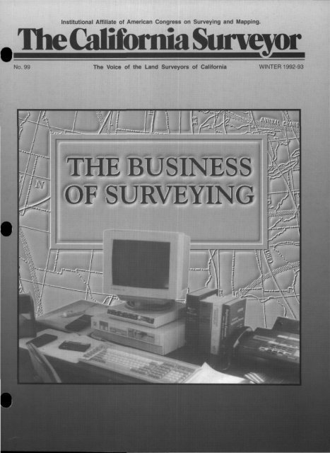
THE BUSINESS<br />
OF SURVEYING<br />
)'<br />
\—^<br />
\<br />
v) \<br />
sx£i<br />
\\<br />
rT!<br />
r/T<br />
pv<br />
Ir<br />
••y.-.i-"<br />
WTS* yf<br />
•W<br />
' vc rrir-
ifc* fife*<br />
•<br />
Sllll ---•<br />
Is ^^M&k<br />
^<br />
IIPIPII<br />
lliilpi<br />
• • •<br />
SMALLER, LIGHTER, FASTER<br />
AND STIIiLYELLOW •<br />
You're looking at the future of surveying. A future<br />
in which a single surveyor can handle more<br />
work, and more kinds of work, than ever before.<br />
Introducing the 4000SE Land <strong>Surveyor</strong> —the next<br />
generation of GPS survey receivers from Trimble.<br />
Smaller, lighter, and faster, the 4000SE is part of<br />
a complete modular survey system that can be<br />
quickly reconfigured to match the changing<br />
demands of your job. From bringing in precise<br />
control points to gathering volumes of contouring<br />
data for maps, it will change the way you work.<br />
For static control and boundary surveys, just<br />
attach the tripod-mounting base with integrated battery<br />
compartments, and snap on the advanced microstrip<br />
antenna. In seconds you're surveying, with no cables or<br />
external modules to connect or worry about.<br />
With our new "walk-about" technology and a receiver<br />
that's 50% smaller and 507o<br />
lighter than previous instruments,<br />
you can carry the Land<br />
<strong>Surveyor</strong> through a site, taking<br />
measurements on the fly as<br />
often as once a second.<br />
Just slip the six pound<br />
receiver into its shoulder pack, attach the new lightweight<br />
rangepole/antenna and you're mobile. <strong>The</strong> new<br />
TRK48 keyboard provides remote control of the receiver<br />
and lets you enter attributes for every point you survey.<br />
HE 9 UTILITY<br />
<strong>The</strong>se attributes are stored with the GPS position data<br />
and will appear on your final map. It's a great way<br />
to collect GIS data.<br />
<strong>The</strong> Land <strong>Surveyor</strong> system also includes TRIMVEC<br />
Plus, the most comprehensive package of survey<br />
software in the industry. It handles every step of<br />
your project from planning to database management<br />
and network adjustment. An optional new<br />
addition to the network adjustment module lets<br />
you incorporate both GPS and<br />
terrestrial observations for a<br />
seamless integration of all<br />
your field data. And now with<br />
TRIMMAP,"* our optional new<br />
mapping software, you can automatically<br />
generate detailed topographic maps.<br />
With the new Land <strong>Surveyor</strong> system we've more than<br />
just streamlined the box, we've streamlined your job.<br />
Call us and we'll show you how...<br />
TrimbleNavigation<br />
<strong>The</strong> Leader in GPS Technology<br />
Survey & Mapping Division<br />
645 North Mary Ave., RO. Box 3642<br />
Sunnyvale, CA 94088-3642<br />
1-800-TRIMBLE, in U.S. and Canada<br />
(1) 408-730-2900, outside U.S.<br />
FAX: 1-408-730-2997<br />
Trimble Europe: (44) 256-760150<br />
Tr.ml.Ic Japan: (81) 472-74-7070<br />
2 <strong>The</strong> <strong>California</strong> <strong>Surveyor</strong> Winter 1993
<strong>The</strong> <strong>California</strong> <strong>Surveyor</strong><br />
is the quarterly publication of the <strong>California</strong> Land <strong>Surveyor</strong>s Association,<br />
Inc. and is published as a service to the land surveying<br />
1<br />
a<br />
rofession of <strong>California</strong>. It is mailed to all Licensed Land <strong>Surveyor</strong>s in<br />
he State of <strong>California</strong> as well as to all members of <strong>California</strong> Land<br />
'i urveyors Association, Inc. <strong>The</strong> <strong>California</strong> <strong>Surveyor</strong> is an open forum<br />
• for all surveyors, with an editorial policy predicated on the preamble<br />
to the Articles of Incorporation of the <strong>California</strong> Land <strong>Surveyor</strong>s Association,<br />
Inc. and its stated aims and objectives which read:<br />
"Recognizing that the true merit of a profession is determined by the<br />
value of its services to society, the '<strong>California</strong> Land <strong>Surveyor</strong>s<br />
Association' does hereby dedicate itself to the promotion and protection<br />
of the profession of land surveying as a social and economic<br />
influence vital to the welfare of society, community, and state."<br />
"<strong>The</strong> purpose of this organization is to promote the common<br />
good and welfare of its members in their activities in the profession<br />
land surveying, to promote and maintain the highest<br />
possible standards of professional ethics and practices, to promote<br />
professional uniformity, to promote public faith and<br />
dependence in the Land <strong>Surveyor</strong>s and their work."<br />
PERSONNEL<br />
OWNER<br />
<strong>California</strong> Land <strong>Surveyor</strong>s Association, Inc.<br />
CENTRAL OFFICE<br />
P.O. Box 9098, Santa Rosa, CA 95405-9990<br />
EDITOR<br />
Thomas B. Mastin, P.L.S.<br />
ASSISTANT EDITORS<br />
Michael McGee, P.L.S. - Linda Richardson, L.S.I.T.<br />
ADVERTISING<br />
Commercial advertising is accepted by Tlie <strong>California</strong> <strong>Surveyor</strong>.<br />
Advertising rates and information can be obtained by contacting<br />
<strong>CLSA</strong> Central Office, P.O. Box 9098, Santa Rosa, CA 95405, (707)<br />
578-6016, Fax (707) 578-4406. Circulation: 5,200.<br />
SUSTAINING MEMBERSHIP<br />
P<br />
(Membership in the <strong>California</strong> Land <strong>Surveyor</strong>s Association, Inc.<br />
as a sustaining member is open to any individual, company, or<br />
corporation who, by their interest in the land surveying profession,<br />
is desirous of supporting the purposes and objectives of this<br />
association. For information regarding sustaining membership,<br />
contact <strong>CLSA</strong> Central Office, P.O. Box 9098, Santa Rosa, CA<br />
95405, (707) 578-6016, Fax (707) 578-4406.<br />
•<br />
EDITORIAL MATERIAL<br />
All articles, reports, letters, and contributions are accepted and will<br />
be considered for publication regardless of the author's affiliation<br />
with the <strong>California</strong> Land <strong>Surveyor</strong>s Association, Inc. Contributions<br />
submitted on floppy diskette medium is encouraged. For compatibility,<br />
disks should be 5.25 or 3.5 inch, MSDOS (IBM compatible)<br />
format. We can accept ASCII text files or word processor files from<br />
the following programs: WordPerfect, Microsoft Word, Windows<br />
Write, Multimate, DCA (Displaywrite III and IV), Wordstar, Xerox<br />
Writer, and Xywrite.<br />
EDITOR'S ADDRESS<br />
Thomas B. Mastin, P.L.S.<br />
1303 Garden Street, 2C, San Luis Obispo, CA 93401<br />
<strong>The</strong> <strong>California</strong> <strong>Surveyor</strong><br />
DEADLINE DATES<br />
Spring January 10,1993 Fall July 10,1993<br />
Summer April 10,1993 Winter October 10,1993<br />
COVER PHOTO:<br />
By Clay Margason, P.L.S.<br />
Articles, reports, letters, etc., received after the above mentioned<br />
date will be considered for the next edition.<br />
Opinions expressed by the editor or individual writers are not necessarily<br />
endorsed by the <strong>California</strong> luind <strong>Surveyor</strong>s Association officers or its<br />
\Board of Directors. Original articles may be reprinted with due credit<br />
moen to the source and written notification to the <strong>California</strong> Land<br />
<strong>Surveyor</strong>s Association.<br />
Copt/right © 1993 <strong>California</strong> Land <strong>Surveyor</strong>s Association<br />
FEATURES<br />
Table of Contents<br />
Automation and the Small Business <strong>Surveyor</strong><br />
by Robert J. Reese, P.L.S 12<br />
In Memory of James Hamblin, P.L.S. 5130 16<br />
G.P.S. - <strong>The</strong> Lazy Man's Astronomy<br />
by David Paul Johnson, P.L.S 18<br />
<strong>California</strong> - <strong>The</strong> Northeast of the '90s<br />
by Tom Mastin, P.L.S 20<br />
George Derby - Prankster of Renown 22<br />
Pheonixia<br />
by George Derby 25<br />
GRS 80, NAD 83, WGS 84 -<br />
What's the Difference<br />
by Michael R. McGee, P.L.S 26<br />
<strong>CLSA</strong> Advanced Technologies Committee (ATC)<br />
by Michael McGee, P.L.S 28<br />
Benefits of <strong>CLSA</strong> 31<br />
DEPARTMENTS<br />
Application for Membership in <strong>CLSA</strong> 33<br />
<strong>CLSA</strong> Conference Information 30<br />
<strong>CLSA</strong> Officers and Board of Directors 4<br />
<strong>CLSA</strong> Publication Order Form 35<br />
From the Editor 8<br />
Letters to the Editor 9<br />
National News 29<br />
New Members of <strong>CLSA</strong> 32<br />
President's Message 6<br />
Index to Advertisers<br />
Association Administrators and Consultants 4<br />
Cross Land Surveying, Inc 31<br />
Desert Engineering Group, Inc 25<br />
Garmin Communication & Navigation 17<br />
Geodimeter 23<br />
Ronald Greenwell & Associates 21<br />
Haselbach Surveying Instruments 27<br />
Kantum Precision 11<br />
McGee Surveying Consulting 4&16<br />
Nikon Surveying Instruments 19<br />
Radman Aerial Surveys 7<br />
SECO Manufacturing Company, Inc 34<br />
Silver Shield 5<br />
StarPlus Software 21<br />
<strong>Surveyor</strong>s Service Company (SERVCO) 24<br />
Surv-Kap 22<br />
Trimble Navigation 2<br />
Carl Zeiss, Inc 7<br />
Winter 1993 <strong>The</strong> <strong>California</strong> <strong>Surveyor</strong> 3
<strong>California</strong> Land <strong>Surveyor</strong>s<br />
are Professionals.<br />
<strong>The</strong>y Deserve Professional<br />
Service.<br />
At AA&C, we view Land Surveying as a<br />
profession with unique insurance needs. Our<br />
Business Insurance Division is ready to provide<br />
you with service-oriented:<br />
• Professional Liability Insurance<br />
• Office Package/General Liability Insurance<br />
• Commercial Automobile Insurance<br />
• Equipment Floaters<br />
Professional Land <strong>Surveyor</strong>s deserve professional<br />
service from a broker with experience.<br />
Call us today<br />
Alicia K Igram. AAI<br />
Assistant Vice President<br />
Association Administrators & Consultants. Inc.<br />
3 Park Plaza Suite 1200<br />
Irvine. <strong>California</strong> 92714<br />
(714)660-4700 • (800)854-0491<br />
USING GPS FOR THE<br />
FIRST TIME<br />
Need Assistance and Assurance<br />
of a Successful Project??<br />
Michael R. McGee, P.L.S., acts as a<br />
consultant to advise and assist surveying &<br />
engineering firms on projects utilizing the<br />
NAVSTAR Global Positioning System (GPS).<br />
Involvement includes equipment specification,<br />
installation of software, project planning,<br />
training crews & project manager, processing,<br />
analyzing and adjusting the GPS<br />
observation data and quality control.<br />
Consultant works with first time users<br />
who wish to gain knowledge and confidence<br />
while being assured of a successful project.<br />
Call for information and references.<br />
McGEE SURVEYING CONSULTING<br />
1826 Chorro Street<br />
San Luis Obispo, CA 93401<br />
(805) 546-9314<br />
<strong>CLSA</strong> Officers 1992<br />
LeRoy C. "Lee" Hennes, P.L.S. • President<br />
Joseph W. Betit, P.L.S. • President-Elect<br />
Kurtis K. Hoehn, P.L.S. • Vice President<br />
Billy Martin, P.L.S. • Secretary<br />
Frederick W. Kett, P.L.S. • Treasurer<br />
Kenny L. Fargen, P.L.S. • Immediate Past President<br />
Dorothy C. Calegari • Executive Director<br />
Board of Directors<br />
Chapter Representatives<br />
Bakersfield<br />
Larry Hubbard, P.L.S.<br />
Central Coast<br />
Timothy Fox, P.L.S. • Clay Margason, P.L.S.<br />
Tom Mastin, P.L.S.<br />
Central Valley<br />
Keith Spencer, P.L.S.<br />
Channel Islands<br />
Robert Hemman, P.L.S.<br />
East Bay<br />
Harold B. Davis, P.L.S. • Patrick Tami, P.L.S.<br />
William Alexander, P.L.S.<br />
Gold Country<br />
Edward "Alan" Hess, P.L.S.<br />
Humboldt<br />
Don Campbell, P.L.S.<br />
Lake/Mendocino<br />
Don McMath, P.L.S.<br />
Los Angeles<br />
Lloyd Cook, P.L.S. • Robert D. Hennon, P.L.S.<br />
Robert Olson, P.L.S.<br />
Marin<br />
Richard Alspach, P.L.S.<br />
Monterey Bay<br />
Steven C Wilson, P.L.S.<br />
Mother Lode<br />
Frederick W. Kett, P.L.S.<br />
Northern Counties<br />
James Herrick, P.L.S.<br />
Orange County<br />
John Canas, P.L.S • Paul A. Cuomo, P.L.S.<br />
Glenn Lake, P.L.S. • Kari Launen, P.L.S.<br />
Lon Maddox, P.L.S. • Richard Ray, P.L.S.<br />
Riverside/San Bernardino<br />
Darrell T. Harness, P.L.S. • Ernest Pintor, P.L.S.<br />
Gerald Stayner, P.L.S.<br />
Sacramento<br />
Gary Leonard, P.L.S. • Chris Russell, P.L.S.<br />
San Diego<br />
Vance Breshears, P.L.S. • G. Howard Dye, P.L.S.<br />
Philip Giurbino, P.L.S. • Greg Helmer, P.L.S.<br />
Jack Roth, P.L.S. • Vince Sincek, P.L.S.<br />
San Joaquin Valley<br />
Glenn Medina, P.L.S.<br />
Santa Clara/San Mateo<br />
Paul W. Lamoreaux, Jr., P.LS.<br />
Martin "Don" Marquett, P.L.S.<br />
Sonoma County<br />
Peter Ehlert, P.L.S. • James Hamblin, P.L.S.<br />
CORRECTION<br />
In Issue No. 98 of <strong>The</strong> <strong>California</strong> <strong>Surveyor</strong>, on the advertisement<br />
on Page 9, the first sentence of the body text should have read:<br />
•<br />
t<br />
Michael R. McGee, P.L.S., acts as a consultant to advise and assist<br />
surveying & engineering firms on projects utilizing the NAVSTAR<br />
Global Positioning System (GPS).<br />
•<br />
(See the correct advertisement to the left.) We regret any<br />
inconvenience this might have caused anyone.<br />
4 <strong>The</strong> <strong>California</strong> <strong>Surveyor</strong> Winter 1993
YORS & ENGINEERS, We've got you covered!<br />
[Pfll(SlMPtlMiEPB8<br />
@ fiKBofafls M B<br />
<strong>The</strong> cover can be driven in any open<br />
converts to camper 8 work shop.<br />
Water cooler<br />
2 Lunch box<br />
3 Salety cones<br />
4 Flagging & 1st aid<br />
5 Chiel party's tools<br />
belt, etc<br />
6 Brief case<br />
7 Blueprints, etc.<br />
8 Steel tapes<br />
9 Nails<br />
10 Instrument/Rod<br />
person's tool belt,<br />
hammer, etc.<br />
11 Prism bags<br />
12. EDM, Transit, etc.<br />
13. Level<br />
14 Hubs: 6", 10", 12"<br />
15 Laths: V, 2', 3'and<br />
stakes<br />
16 Paint cans<br />
1r Stake bag & safety<br />
hat<br />
18 Radio bag<br />
19 Tripods<br />
20 Rod. prism & range<br />
poles<br />
^<br />
21 Frost pin, bar & rebar<br />
2? Magnetic locator,<br />
shovel, etc.<br />
23 Extra space.<br />
"Silver Shield cover<br />
has been extended in<br />
illustration for clarity<br />
Security<br />
Standard Tool Box<br />
Fits Suburban & Van<br />
B Pop-Up Top. Cover<br />
0 Tool Boxes<br />
O" Ladder Rack<br />
O Mobile Workshop<br />
17 Compact Camper<br />
Covers<br />
Since 1962<br />
0 S+curlty 0 Safety M Savings \>* Sarvablllty St Patented<br />
"SILVER SHIELD is as important & necessary as my total station...,"<br />
declares John Pyle of AZ LAYOUT, a full-service survey<br />
]<br />
ing & engineering firm with 25 years experience. Project sizes<br />
& costs range from 1 to 640 acres, & from $500 to $300,000.<br />
Optional<br />
Pulldown Desk<br />
Optional<br />
Camper Conversion<br />
• Models to fit all pickups • Aluminum aircraft construction (cover)<br />
• All sides lock securely (cover) • Paint loc steel (tool boxes)<br />
• Weatherproof (cover) • Converts to camper/workshop (cover)<br />
• Maintenance free<br />
• Easy installation & removal<br />
• Lightweight & durable • Reduces vehicle operating cost (cover)<br />
Unobstructed visibility<br />
FOR FREE BROCHURE<br />
call or write<br />
FREE (800)243-4394 Or (602)243-4394<br />
1710 E. Jefferson • Phoenix, Arizona 85034<br />
Winter 1993 <strong>The</strong> <strong>California</strong> <strong>Surveyor</strong> 5
^w<br />
PRESIDENT'S MESSAGE «<br />
By Joseph W Betit, P.L.S.<br />
THE EARLIEST KNOWN city<br />
map is scribed on a clay tablet<br />
and is of the City of Nippur<br />
(1500 BC), the ancient cultural center<br />
of the Sumerian civilization. <strong>The</strong> map<br />
has been compared to the remains of<br />
Nippur and has been found to be<br />
carefully drawn to scale. <strong>The</strong> earliest<br />
know depiction of a Sumerian surveyors<br />
"rod" and "line" is 2050 BC,<br />
500 years before the map. This depiction<br />
is carved on a panel of a steel<br />
erected to extol the might of a king,<br />
Ur-Nammu. This king is also noted<br />
as the earliest (known to date)<br />
Sumerian ruler to codify and publish<br />
(on a clay tablet) a unified and comprehensive<br />
law code.<br />
From the preceding, one can see<br />
that surveying is a very ancient profession.<br />
<strong>Surveyor</strong>s have been providing<br />
vital services for over 4,000 years<br />
to their respective societies. Yet, until<br />
the last 20 years our surveying technology<br />
has differed in degree but not<br />
in kind from the Sumerian surveyors<br />
of ancient Iraq.<br />
Today's surveyor now has a<br />
choice of many measuring and computation<br />
systems built around the<br />
new technologies of Electronic Distance<br />
Meters, Inertial Navigational<br />
Systems, satellite positions, and electronic<br />
computers. Today, and in the<br />
coming years, surveying will undergo<br />
as remarkable a change as was<br />
brought about by the Sumerian invention<br />
of the standardized line and<br />
tension staff (combo plumb bob and<br />
spring tension). Any member of the<br />
public will have unrestricted access<br />
to the accurate positioning of GPS,<br />
paper and mylar maps of all kinds<br />
will be poured into the rapidly proliferating<br />
GIS databases, new maps will<br />
be delivered in digital form as a matter<br />
of standard practice.<br />
However, the role of the properly<br />
trained and educated surveyor in society<br />
will not change. Furthermore,<br />
societies need for the newly evolved<br />
surveyor will increase dramatically.<br />
To attempt to remain stationary at<br />
this time would invite disaster and<br />
possible destruction of the ancient<br />
core of values and objectives of our<br />
profession. Yet, to press forward into<br />
the electronic age and forget the richness,<br />
strength and practicality of a<br />
1,000 years evolution and adaptions<br />
of English land law that we are an<br />
integral part of would likewise be<br />
folly and a disservice to the society<br />
we serve.<br />
We must strive to strike a balance<br />
while remolding ourselves as a profession<br />
and evolve ourselves so that<br />
we may join the progress of the new<br />
age before us and bring forward with<br />
us the best of the richness and<br />
strengths of the old.<br />
To accomplish this difficult but exciting<br />
task we must look to education<br />
as we never have before. Our college<br />
graduates will be well versed in the<br />
new technologies when they graduate.<br />
This summer Dr. Nader and myself<br />
put in long hours arranging<br />
$500,000 worth of GIS (with full programming<br />
language) to run on the 16<br />
new Sun workstations in the new<br />
Surveying Engineering GIS Lab at<br />
<strong>California</strong> State University, Fresno.<br />
Currently, we are working to form a<br />
new multidisciplinary coalition of the<br />
GIS expertise already on the CSUF<br />
campus. This effort is progressing at<br />
a truly astonishing rate. Local surveyors<br />
are becoming increasingly<br />
involved in surveying education.<br />
<strong>The</strong>re are parallel efforts to ours in<br />
Southern <strong>California</strong>, the Central<br />
Coast, Monterey Bay, San Jose, Sacramento<br />
and the Bay area.<br />
However, the more difficult task<br />
is finding a way for the in-service<br />
practicing professional to participate<br />
in this training and education. <strong>The</strong><br />
practicing surveyor is often geographically<br />
cut off from easy access<br />
Today's surveyor<br />
now has a choice of<br />
many measuring and<br />
computation systems<br />
built around the new<br />
technologies of<br />
Electronic Distance<br />
Meters, Inertial<br />
Navigational<br />
Systems, satellite<br />
positions, and<br />
electronic<br />
computers.<br />
I<br />
to advanced surveying programs.<br />
I believe that the many years of<br />
struggle by the <strong>CLSA</strong> advocates of<br />
Professional Development directed<br />
towards reaching a consensus among<br />
the <strong>California</strong> land surveyors as to<br />
how PD is to be implemented will now<br />
be rewarded. Last year, Rob Hennon<br />
and the committee members of the<br />
Education Committee made great<br />
progress toward finding a common<br />
ground. Rob has agreed to stay on<br />
this year, and I believe he will be able<br />
to bring the PD issue to a successful •<br />
closure. Under the PD umbrella the<br />
<strong>CLSA</strong> will be able to offer or support<br />
6 <strong>The</strong> <strong>California</strong> <strong>Surveyor</strong> Winter 1993
the offering of certification and training<br />
programs in the new technologies<br />
for its members.<br />
Continuing on the committee<br />
theme, many of the committee<br />
chairs are already on board. During<br />
the last year, Howard Brunner as<br />
our <strong>CLSA</strong> Rep. on the <strong>California</strong><br />
GIS Task Force, did a terrific job on<br />
our behalf. Howard has agreed to<br />
scale back his commitments on the<br />
<strong>CLSA</strong> Legislative Committee and<br />
other <strong>CLSA</strong> Committee in order to<br />
concentrate on the impending GIS<br />
legislation to be put forward from<br />
the GIS Task Force recommendations<br />
to the Legislature.<br />
Gary Leonard will stay on as Legislative<br />
Committee Chairman. Gary,<br />
Paul Cuomo, and Chris Russell will<br />
handle the normal legislative matters<br />
while Howard will concentrate on<br />
the GIS component.<br />
I have decided to implement two<br />
ad hoc committees in the coming<br />
year. <strong>The</strong> first, to be chaired by Terry<br />
Hayden, will be to form a committee<br />
to study and report back on the necessity<br />
and the feasibility of forming<br />
a standing Photogrammetry Committee<br />
to better represent the needs<br />
and concerns of the photogrammetry<br />
community within the <strong>CLSA</strong>. <strong>The</strong><br />
second chaired by Aleksi Rapkin,<br />
will continue to study the minority<br />
business situation, the related surveying<br />
business ownership issues<br />
and initiate a preliminary study of<br />
the actual makeup and constitution<br />
of minorities within the surveying<br />
community itself.<br />
Tom Mastin and Michael McGee<br />
are both doing terrific jobs on their<br />
committees and they have both committed<br />
to staying on and continuing<br />
their excellent work in the coming<br />
year.<br />
Kari Launen has agreed to Chair<br />
the Professional Practices Committee.<br />
Kari plans to pick up on Hal<br />
Davis's idea of extending the activities<br />
of the Professional Practice<br />
Committee to addressing the<br />
education of misguided agencies<br />
and to add a new activity related<br />
to the Mini-Brooks Act as well.<br />
<strong>The</strong> Brooks Act misuses and<br />
abuses are an increasing problem.<br />
Rather than throwing<br />
money away on attorneys and<br />
lawsuits, the committee is going to<br />
try a different tack. <strong>The</strong> committee is<br />
going to gather sources materials<br />
(Larry Fenske has graciously offered<br />
to provide the Cal Trans manual of<br />
procedures as a start) and seek out<br />
expertise on both the interviewer/evaluator<br />
and interviewee<br />
side to put together a training series<br />
that would operate similar to "moot"<br />
or mock court. Over the course of a<br />
one or two day seminar, the whole<br />
process would be reviewed for the<br />
benefit of both the intended attendees<br />
— members of public agencies<br />
and the surveying community. Kari<br />
and I both feel that most of the<br />
abuses of the Brooks Act process are<br />
a result of ignorance more than any<br />
other cause.<br />
Finally, but not least, the <strong>CLSA</strong><br />
needs to look at what can be done to<br />
attract new members from the ranks<br />
of those surveyors who have left the<br />
old Cal Council due to its being absorbed<br />
into a much larger and much<br />
more diversified engineering advocacy<br />
organization that feels surveying<br />
is a minor issue.<br />
<strong>The</strong> <strong>CLSA</strong> has come through this<br />
year with increased membership<br />
(with a lot of hard work by Lloyd<br />
Cook helping out) and in a healthy<br />
financial condition. We have a solid<br />
crew of officers and committee members<br />
on board, and as usual, Dorothy<br />
Calegari in Central Office is keeping<br />
close tabs on it all. Even if the<br />
Legislature once again collapses into<br />
a one issue dog fight over the State<br />
Budget, we will still be able to press<br />
ahead on our own issues and try to<br />
pass on the <strong>CLSA</strong> to the next crew<br />
on watch in a little better condition<br />
than we got it, just as the many<br />
crews did before us. I am looking<br />
forward to the coming year and the<br />
opportunities and challenges it will<br />
bring. ©<br />
>Q<br />
Radman Aerial Surveys<br />
6220 24th Street • (916) 391-1651<br />
Sacramento, CA 95822 • FAX (916) 391-6537<br />
• Photogrammetric Mapping<br />
• GIS Database Development<br />
• Aerial Triangulation<br />
• Aerial Photography<br />
Carol Radman - President<br />
Woman-Owned Enterprise<br />
<strong>The</strong> choice<br />
of the pros.<br />
<strong>The</strong> best companies use<br />
the best instruments. Zeiss<br />
has the quality & advanced<br />
performance to make you<br />
a leader.<br />
Series E<br />
Total Stations<br />
Automatic<br />
temperature<br />
& pressure<br />
correction.<br />
Lightweight &<br />
x easy to use.<br />
8 models,<br />
including<br />
economical<br />
Elta 5 &<br />
Rec Elta 5.<br />
Automatic<br />
Levels<br />
• Famous Ni 2 with 0.7mm<br />
accuracy.<br />
• Neweconom- "^ ^ ^<br />
ical Ni 40<br />
with 2mm<br />
accuracy.<br />
• New Carl<br />
Zeiss Jena series,<br />
from geodetic Ni 002<br />
to Ni 040A Builder's Level.<br />
Contact your Zeiss<br />
dealer or:<br />
Carl Zeiss, Inc.<br />
Surveying Division<br />
One Zeiss Drive<br />
Thornwood, NY 10594<br />
914 • 681•7303<br />
Customer Satisfaction—<br />
A Carl Zeiss way of life.<br />
Winter 1993 <strong>The</strong> <strong>California</strong> <strong>Surveyor</strong> 7
FROM THE EDITOR<br />
MAY YOUR '93 BE BETTER THAN MY '92<br />
I<br />
F YOU HAVE READ <strong>The</strong> <strong>California</strong> <strong>Surveyor</strong> before, you<br />
will realize that I am not Brett Jefferson, however I am<br />
the editor of <strong>The</strong> <strong>California</strong> <strong>Surveyor</strong>. Brett left the position<br />
for the lame reason that he moved out of the State.<br />
Brett put quite a bit of effort and energy into the editing of<br />
<strong>The</strong> Cal <strong>Surveyor</strong> and continued the tradition of decisive<br />
editorials that his predecessor, Jeremy Evens started. It is<br />
safe to say that tradition won't continue.<br />
Your first clue that I am not Brett should have been that<br />
Brett's picture is not in the upper left corner there; as a<br />
matter of fact no picture is up there (that is the tradition I<br />
am starting). Your second clue should have been that my<br />
name was under the title. That P.L.S. part I wasn't born<br />
with, it's just sort of been attached there. I think it is important<br />
that I give a short biography on myself so anyone<br />
reading this will understand from where I come. I've been<br />
a Licensed Land <strong>Surveyor</strong> in <strong>California</strong> for a while and<br />
been surveying for even longer. I've been a member of<br />
<strong>CLSA</strong> for some time as well as a member of my local chapter.<br />
I was editor of the <strong>CLSA</strong> News for a short time and<br />
have never before been the editor of a magazine. Most people<br />
who know me are wondering how I got this job. <strong>The</strong><br />
answer is simple, someone like me is born every minute.<br />
This is actually the second issue that I've had to feign<br />
responsibility for. I was lucky enough (as were you) in the<br />
last issue to have enough material so that I did not have to<br />
write a filler such as this. <strong>The</strong> last issue fell into place in<br />
spite of me, not because of me. I want to thank the Advanced<br />
Technologies Committee of <strong>CLSA</strong> and especially its<br />
Chairperson, Michael McGee, for their efforts in putting<br />
together the meat for the last issue. When Michael was<br />
offered the position of editor of the Cal <strong>Surveyor</strong> (Yes, I<br />
realize that means I wasn't first choice as editor, but I was<br />
told I was in the top 100), he turned it down with the<br />
promise of getting articles for the magazine. He has fulfilled<br />
that promise and will be called on again and again to<br />
fulfill that promise. It is critical that the surveying profession<br />
keep on top of Advanced Technologies so that the<br />
technologies don't advance beyond us. Michael Pallamary,<br />
as always, provided the most controversial article on the<br />
court case and the legislative analysis concerning lot line<br />
adjustments, which hopefully will have great impact on the<br />
surveying community for years to come. <strong>The</strong> other <strong>CLSA</strong><br />
committee, which was very responsive to <strong>The</strong> <strong>California</strong><br />
<strong>Surveyor</strong>, was the Membership Committee, whose Chair<br />
and only member is Lloyd Cook. Lloyd has been providing<br />
articles to <strong>The</strong> Cal <strong>Surveyor</strong> and the <strong>CLSA</strong> Neivs and has<br />
been pushing others to do the same.<br />
I have been concerned about writing this editorial ever<br />
since I was given this position back in January of 1992 (we<br />
are hoping you will be getting this issue in January of 1993,<br />
but worse things have happened). So, here I was going to<br />
have to write an editorial that would make abortion look<br />
like a kindergarten topic (Please no letters on abortion pro<br />
or con). So, since January, I've been racking my brain on<br />
By Tom Mastin, P.L.S.<br />
what subject to address. <strong>The</strong> only one, besides when am I<br />
going to get some work, which kept popping up, was how<br />
in the heck did I get this job. Oddly enough, I still haven't<br />
figured that out and I'm sure in a few short issues you'll be<br />
wondering the same. My English skills are maybe not the<br />
best. I was the benchmark for the SAT English test the year<br />
I took it; I was the 0 percentile person. I could never distinguish<br />
between a verb and a proverb in bonehead English.<br />
Although I have difficulty spelling my name, I do have a<br />
spell checker on my computer. I still don't know the difference<br />
between "Than" and "<strong>The</strong>n" or "Affect" and "Effect,"<br />
or for that matter "Left" or "Right." By now you can see<br />
that I do make a perfect surveyor, but an editor for a nationally<br />
renowned magazine? I probably shouldn't even be<br />
editing this magazine.<br />
By now, hopefully, some of you are thinking that there<br />
must be something funny going on, because the people I<br />
mentioned, along with a few others, always seem to have<br />
articles in the magazine. <strong>The</strong> truth is, they all have one<br />
thing in common: they have an idea for an article and they<br />
are able to write it down. That is all it takes. I am happy to<br />
take ideas for articles, but even happier for articles. I can<br />
honestly say that I will take an article on any subject. I can't<br />
honestly say I will print the article, but I will review it and<br />
seriously consider it. If anyone out there has an idea they<br />
want to write on, do it (or "Just Do It," I guess is the proper<br />
way to say it). If you don't feel you are able to make it<br />
shine (like this editorial), then rough it out and send it in. I<br />
will edit it (Editor comes from the Latin words "Edi" meaning<br />
"to Butcher" and "tor" meaning "it up").<br />
Now the ground rules for submitting articles or letters<br />
to <strong>The</strong> <strong>California</strong> <strong>Surveyor</strong>.<br />
1. Write it<br />
2. Send it.<br />
We truly prefer them to be sent on an IBM compatible disk<br />
(5V4 or 3l^») in WordPerfect, ASCII, Wordstar, or any other<br />
common format. We will take it handwritten on the back of a<br />
lunch bag, if that is where you wrote it. <strong>The</strong> <strong>California</strong> <strong>Surveyor</strong><br />
is unique in that it reaches every licensed surveyor in the<br />
State of <strong>California</strong>, whether a member of <strong>CLSA</strong> or not. Letters<br />
to the editor are an easy way to say something that is on your<br />
mind. <strong>The</strong> letter can address something in a previous issue or<br />
broach a whole new topic. <strong>The</strong>re is something to realize about<br />
<strong>The</strong> <strong>California</strong> <strong>Surveyor</strong>: it takes three months from when all<br />
the articles are submitted until it is mailed out. That is just the<br />
way it is, so when you write concerning something in this<br />
issue, it will be two issues later before you see it in print. Your<br />
comments are still just as valid then as they are today, you will<br />
just have forgotten what you said by the time it gets out.<br />
Well, maybe next issue I will editorialize on some emotional<br />
issue, or at least maybe I will have some work coming<br />
in. In fact, if I don't have work coming in, you may be reading<br />
an emotional plea. Our theme for the next issue is getting the<br />
magazine out. Until then, remember: a good surveyor is not<br />
the same as an accurate surveyor. ©<br />
8 <strong>The</strong> <strong>California</strong> <strong>Surveyor</strong> Winter 1993
9 LETTERS TO THE EDITOR<br />
• THE REST OF THE STORY<br />
Back in the mid-seventies a construction worker, in<br />
the course of laying out the slab for a home, used<br />
the wrong stake for the rear corner of a subdivision<br />
lot and the house was thus built in violation of setback<br />
requirements. <strong>The</strong> problem could be cured by<br />
moving the lot line without causing any further violation<br />
of lot area, frontage or setback requirements<br />
because of the size and configuration of the lots on<br />
both sides of the line. With luck, a Parcel Map could<br />
be filed to accomplish this. Optionally, the subdivider<br />
could tear the house down and rebuild it in the<br />
correct location because he still owned it. It was a<br />
close call, but it was decided that (with luck) the<br />
Parcel Map would be a little less costly. And thus<br />
the problem was solved.<br />
<strong>The</strong> surveyor, who had experienced similar<br />
problems a time or two previously, happened to be<br />
on the Legislative Committee of the Cal Council at<br />
the time, and it behooved him to draft a bill that<br />
might forestall these difficulties and put it before the<br />
Committee. This he did, the Committee agreed with<br />
the draft as it was presented, and now all it needed<br />
was a name. One of the other members spoke up,<br />
and thus came to be.<br />
Lot Line Adjustment<br />
<strong>The</strong> guys on this Committee weren't rocket scientists,<br />
rocketry at that time being still unknown, but<br />
they were smart enough to know that initially offering<br />
a bill for consideration by the legislature is<br />
usually nothing more than running it up the proverbial<br />
pole, and that they wouldn't be able to<br />
recognize it when they next saw it after it had<br />
passed through innumerable committees, agencies,<br />
bureaus, associations, coastal people, animal protectors<br />
and a myriad of other rights groups. So it's<br />
understandable why they — and even their legislative<br />
counsel, Jim Corn — didn't consider the<br />
language more carefully before releasing it. Well, as<br />
it finally happened, the draft came back for the<br />
Committee's approval with only one innocuous<br />
change. In their state of shock it still didn't occur to<br />
them of the untold dangers that might lie before them<br />
and before many others, not including lawyers. A<br />
law was enacted. A law originally intended to cure<br />
little problems with little lots has found its way out to<br />
the pastures and into the mountains.<br />
Now you know the rest of it.<br />
Look forward to your retirements, guys. It's nice.<br />
Frank Richardson, Retiree<br />
• MORE RESPONSES TO RIVERSIDE<br />
COUNTY<br />
In response to the letter entitled "Riverside County<br />
<strong>Surveyor</strong> Responds" by Raymond L. Mathe, P.L.S.,<br />
in the Summer issue of <strong>The</strong> <strong>California</strong> <strong>Surveyor</strong>, I would<br />
like to point out a few things:<br />
1. <strong>The</strong> County <strong>Surveyor</strong>'s liability extends ONLY<br />
to his Certificate. At the risk of being redundant<br />
and perhaps in the hope that a few laymen<br />
may read my letter, this certificate states,<br />
"This map has been examined in accordance<br />
with Section 8766 of the Land <strong>Surveyor</strong>'s Act<br />
on....day of 19...". That is the entire statement.<br />
(Emphasis added.)<br />
2. Section 8766 is specific as to WHAT the County<br />
<strong>Surveyor</strong> shall check.<br />
a. Accuracy of mathematical data, which can<br />
only be accomplished if the survey is a "closed"<br />
survey. This is normally accomplished by requiring<br />
the <strong>Surveyor</strong> to submit calculations.<br />
(Time to proofread against map figures, probably<br />
15 minutes is a generous estimate of most<br />
maps.) $11.89<br />
b. Compliance with Section 8762.5. (Only applies<br />
if a division of land is shown). Highly unlikely<br />
on a ROS. (Time to check is estimated at<br />
2 minutes MAXIMUM). If an illegal map is submitted,<br />
back it goes to the author with a rejection<br />
slip. If this check is performed first and the<br />
map is illegal, the cost using Mr. Mathe's figures<br />
is $1.53.<br />
c. Compliance with Section 8763. Outside dimensions<br />
of map are 18" by 26" and has a 1"<br />
inside blank margin all around usually accomplished<br />
by the author drawing a 1" border line<br />
and never exceeding it. (Another estimated<br />
2 minutes MAXIMUM.) $1.53<br />
d. Compliance with Section 8764.5. (To proofread<br />
three short certificates that never vary except<br />
for names and dates cannot possibly take<br />
over 2 minutes each [unless the checker is<br />
dyslexic, in which case he is not competent to<br />
do the job].) $4.76<br />
e. Compliance with Section 8771.5. (Used only<br />
if State Plane Coordinates are shown.) If<br />
shown, the map must show the coordinates of<br />
the control scheme. (Time to check if the control<br />
scheme is shown, 1 minute.) $0.79. If <strong>California</strong><br />
Coordinates are shown, this will greatly<br />
affect paragraph "a" above. (Proofreading<br />
these long strings of numbers from submitted<br />
calculations may triple the cost estimated<br />
in "a".)<br />
f. Compliance with Section 8772. Did the<br />
surveyor either by legend or by statement indicate<br />
that ALL the monuments set by him were<br />
identified with his license or registration number?<br />
(Estimated time to check for statement,<br />
legend, or labels from 1 to 5 minutes depending<br />
on method used by author and complexity<br />
of the map.) $3.96<br />
<strong>The</strong> total cost of checking those items the<br />
County <strong>Surveyor</strong> is charged with checking, (excluding<br />
those maps showing State Plane Coordinates)<br />
is $23.67, using Mr. Mathe's rates. If we allow time<br />
for coffee breaks and BS sessions and quadruple<br />
this figure and add 5V$% for error in estimating, a<br />
maximum figure of $100 MIGHT be explainable (although<br />
not justifiable).<br />
Any other checking is a redundancy that is<br />
unneeded. <strong>The</strong> Record of Survey Map is simply<br />
placing the opinion of the surveyor before the public<br />
eye for their acceptance or rejection as they<br />
see fit. If the County <strong>Surveyor</strong> feels the surveyor's<br />
opinion is a bad opinion, he has every right to<br />
place a statement on the map to that effect. Barring<br />
noncompliance with paragraphs "a" through<br />
"f" above, any other checking desired by the<br />
County <strong>Surveyor</strong> is judgmental and should be<br />
done at his (the county's) expense. Or if the<br />
County <strong>Surveyor</strong> is a gentleman, he might call the<br />
author in after explaining that there would be a<br />
charge of $45.77 per hour for consulting about<br />
what seems to him to be a poorly executed or<br />
inept survey that would probably damage the<br />
author's reputation if such a note was placed on<br />
his map. In a case of that nature, I would expect<br />
the practitioner to pay the bill himself and not burden<br />
his client with added expense. Needless to<br />
say, any allegation such as this had better be on<br />
VERY FIRM GROUND, or the County <strong>Surveyor</strong><br />
will incur exceptional liability.<br />
When I was still active and a County <strong>Surveyor</strong><br />
complained about anything other than the 6 items<br />
he was charged with checking, my comment to<br />
him was, "If you don't like it put a note on my map<br />
explaining what you don't like and file the map.<br />
You have 20 days". As an example I had a County<br />
<strong>Surveyor</strong> tell me that their County required 3/4"<br />
pipes 16 inches long and I had set 1/2" pipes 30<br />
inches long. My reply to him was to place a note<br />
on my map that I hadn't set 3/4" pipes, and file my<br />
map.<br />
What escapes these bureaucrats is the fact that<br />
98% of all maps filed do not benefit the client or the<br />
map's author in any way, shape, or form. <strong>The</strong>y are<br />
filed to comply with the law and to benefit other<br />
surveyors, posterity, and the public at large.... Usually<br />
because the surveyor has set a monument not<br />
shown on any map of record.... ANY FEE, other<br />
than the recording fee is, to my way of thinking,<br />
Winter 1993 <strong>The</strong> <strong>California</strong> <strong>Surveyor</strong> 9
I<br />
I<br />
I<br />
I<br />
criminal. If I were practicing in Riverside County, I<br />
suspect they would see one or two Records of Survey<br />
per year from me, (only when my client<br />
requested one or would benefit from one or where<br />
a material discrepancy was encountered) and<br />
would be faced with bringing me before the Board<br />
of Registration and PROVING that I was in violation<br />
of the Land <strong>Surveyor</strong>'s Act (not necessarily<br />
easy or cheap to do, because I did lots of work<br />
prior to 1982 when no map was required). I would<br />
at the outset of each job, explain to my client what<br />
the law says I should do, what it would cost him<br />
extra to comply, and ask him if he wished me to<br />
file a map (assuming no material discrepancies<br />
were found). I would inform him that ethically I<br />
would be bound to file a map if such<br />
discrepancies were found, and that it would normally<br />
be to his advantage for me to do so.<br />
I would be interested in hearing from any <strong>Surveyor</strong><br />
in private practice, who feels he can justify<br />
these exorbitant checking fees on behalf of any<br />
county. I wish to know why he thinks his client will<br />
benefit to the tune of $300 to $1,500 in fees, plus<br />
his costs of preparing this map.<br />
Everyone seems to be unaware of the fact that<br />
a Record of Survey map is nothing more than the<br />
statement by the author of the map that this is his<br />
opinion of where things are or should be. If his opinions<br />
are good and his survey is proper, everyone<br />
will accept it. If his opinions are bad or his survey<br />
stinks (I've seen some!), then no one will pay any<br />
attention to it anyhow, except to refer to it on their<br />
map along with an explanation as to why they are<br />
ignoring it.<br />
George R. Dunbar, P.L.S.<br />
• RECORD OF SURVEY CHECKING<br />
FEES<br />
Following is a copy of a letter addressing arguments<br />
against charging fees for reviewing Records of<br />
Surveys.<br />
Dear <strong>CLSA</strong> Board of Directors:<br />
<strong>The</strong> recent demise of our legislation to eliminate the<br />
County of <strong>Surveyor</strong> from the Record of Survey<br />
checking process does not end the discussion or<br />
our responsibility as a professional Association. If<br />
we cannot succeed with legislation, then we must<br />
pursue some form of statewide assistance for the<br />
individual chapters in staying and even reducing the<br />
cost of checking Record of Surveys in each of the<br />
58 counties of <strong>California</strong>.<br />
My purpose here is to respectfully request that<br />
the <strong>CLSA</strong> Board of Directors direct the appropriate<br />
committee to update earlier studies of the costs and<br />
number of surveys recorded in the 58 counties of<br />
<strong>California</strong>. <strong>The</strong> survey and any other information<br />
available from our files in Central Office would be<br />
used to create a data base from which an analysis<br />
can be prepared assessing the trends in terms of<br />
checking cost versus the number of recorded maps.<br />
This data should be analyzed in terms of both population<br />
and the number of parcels so that different<br />
; size counties can be compared.<br />
I believe the survey will support the argument<br />
that increased fees lead to a decrease in the number<br />
of surveys performed and maps recorded. A letter,<br />
with supporting data, along the lines of the one enclosed<br />
could then be sent from the State<br />
Association to all of the Board of Supervisors in<br />
<strong>California</strong>. All of the information would be sent to<br />
the individual chapters. <strong>The</strong> state would thereby<br />
provide the support and encouragement to the individual<br />
chapters who would following up on the<br />
letter with personal contacts to educate their<br />
Board of Supervisors as to the benefits of recording<br />
Records of Surveys, now, before the next<br />
budget crisis occurs.<br />
Sincerely,<br />
Michael R. McGee, P.L.S.<br />
Dear Members of the Board of Supervisors:<br />
When a property owner requests a property line survey<br />
to locate their boundaries, the surveyor<br />
expends a considerable effort researching records<br />
and analyzing documents relating to their title.<br />
<strong>The</strong>reafter, the surveyor goes to the field and takes<br />
measurements to relate the documents to the physical<br />
evidence, makes a determination as to the<br />
correct location of their clients property lines and<br />
sets markers at the corners, establishing the lines<br />
for all to see. <strong>The</strong> final task is the preparation of a<br />
Record of Survey map that documents the evidence<br />
found, procedures followed and the monuments set<br />
to mark the property lines. Although the map serves<br />
as important documentation of the survey it is esoteric<br />
in nature, and is of lesser consequence to the<br />
client who is more interested in the physical location<br />
of his property lines as marked by the surveyor's<br />
monuments.<br />
<strong>The</strong> stability of property lines is temporal in nature.<br />
As time passes, original evidence of their intended<br />
location may be lost, and at some distant time in the<br />
future, a surveyor attempting to re-establish the correct<br />
position of a property line may arrive at a location<br />
not in agreement with old lines. <strong>The</strong> result will often<br />
lead to dissension in the neighborhood.<br />
In years past, maps documenting surveys were<br />
not always filed in the public records. <strong>Surveyor</strong>s<br />
who practice boundary location know too well, that<br />
had surveyors in the earlier part of this century recorded<br />
more of their maps, there would be less<br />
problems and less litigation today. Consequently, it<br />
would cost much less in many cases to perform a<br />
proper survey.<br />
By professional accord and legislative efforts of<br />
the <strong>California</strong> Land <strong>Surveyor</strong>s Association we have<br />
encouraged and required that maps of surveys be<br />
recorded and thereby made available to future<br />
surveyors.<br />
<strong>The</strong> additional cost for the Record of Survey<br />
checking fee can be substantial compared to the<br />
actual cost of the survey and presents little added<br />
value to the present property owner. This additional<br />
cost will at times discourage owners from having<br />
their property lines correctly established or verified.<br />
Recording a Record of Survey map does not<br />
benefit the property owner who hires the surveyor<br />
so much as his neighbors who may in the near<br />
future require that their property lines be established<br />
Additionally, their successors twenty year<br />
from now will reap the benefits, when a surveyor<br />
can re-establish the exact location of the present<br />
survey, avoiding turmoil and litigation.<br />
<strong>The</strong> public in general benefits because surveys<br />
often establish the location of Rights-of-Ways for<br />
streets which simplify future public works project.<br />
Record of Survey maps are beneficial in the establishment<br />
and maintenance of Geographical<br />
Information Systems. Record of Surveys make it<br />
possible to accurately map out the location of property<br />
lines and easements based on actual field<br />
surveys and not paper maps that are stretched or<br />
distorted to fit each other.<br />
Studies of the 58 counties in <strong>California</strong> indicate<br />
that where no fees are charged, the average number<br />
of Record of Survey maps filed for every<br />
100,000 population is much greater than when a<br />
checking fee is required. <strong>The</strong> losers are the citizens<br />
who cannot afford to resolve their problems and<br />
their successors who must ultimately deal with<br />
them.<br />
In closing allow me to restate, recording Record<br />
of Survey maps preserves in the public records vital<br />
information that will benefit adjacent and future<br />
property owners and the public. Lowering and eliminating<br />
checking fees for Record of Surveys will, in<br />
the long run, encourage the filing of surveys and<br />
result in a greater savings of time, resources and<br />
money for all.<br />
Sincerely,<br />
Michael R. McGee, P.L.S.<br />
• MORE ON CONTINUING<br />
EDUCATION<br />
More thoughts on continuing education and requirements<br />
for a degree in surveying. Everyone benefits<br />
from continuing education. Regardless of his or her<br />
chosen field, they and their clients benefit. Show me<br />
a person who knows all there is to know in their field<br />
and I will show you a person who cannot see past<br />
the end of their nose.<br />
<strong>Surveyor</strong>s are a strange breed as I am sure you<br />
know. <strong>Surveyor</strong>s don't work in this profession because<br />
it's just an okay job, or it passes the day in a<br />
somewhat pleasant manner. <strong>The</strong>y work as surveyors<br />
because they like it! I have been a surveyor<br />
since 1955 and I cannot honestly think of a day that<br />
I did not enjoy my work. Any surveyor that will talk<br />
about it will admit the same thing. We have fun in<br />
our work whether its beating the brush in the back<br />
country looking for an original corner, or fighting traffic<br />
in the city — we enjoy our work.<br />
<strong>The</strong> problem most surveyors have is they arrive<br />
at a certain level of competence — (either party<br />
chief or licensed). <strong>The</strong>y then start to vegetate. <strong>The</strong>n<br />
along comes someone saying — educate instead of<br />
vegetate! <strong>The</strong> usual response is — "leave me alone<br />
— I'm a surveyor, I know what I'm doing."<br />
This is where we go wrong. <strong>The</strong> world is changing<br />
and without a system of continuing education,<br />
we fall behind a little further every day.<br />
How much are we changing? Who out there<br />
remembers a canyon chain, a gurley transit? Now<br />
we use GPS to measure across the canyon, we use<br />
10 <strong>The</strong> <strong>California</strong> <strong>Surveyor</strong> Winter 1993
digital transits to replace the magnifying glass, and<br />
educated eyeball of the gurley transit days; field<br />
computers instead of log tables.<br />
Continuing education is a must. Mandatory continuing<br />
education, however, is a good question.<br />
I take as many continuing education courses as I<br />
can afford (time and money wise) per year. I have<br />
traveled from San Diego to Pasadena, Pomona,<br />
Riverside and San Bernardino for continuing education<br />
classes. <strong>The</strong>se were all on a voluntary basis. If<br />
a federal or state mandate requires that I must take<br />
certain classes in order to relicense, I will probably<br />
dispute you. I know where my strong points and<br />
weak points lie and I know where I need continuing<br />
education.<br />
On the need for a college degree as a condition<br />
of licensure; I agree it should be a requirement.<br />
I think part of a degree program should be an<br />
apprentice program where a candidate is required to<br />
work for a minimum of two years with a firm specializing<br />
in surveying. I am not talking about the union<br />
apprenticeship program — it's fine for what it does. I<br />
am talking about a list of companies in <strong>California</strong><br />
who are willing to spend the time and effort to train<br />
and grade a person who works for them for a minimum<br />
of two years. <strong>The</strong> grades could be reported to<br />
the college that would offer the apprentice his or her<br />
degree. This would solve two problems. <strong>The</strong> apprentice<br />
would come to the firm with the appropriate<br />
educational background, and the firm would assist<br />
him/her in obtaining the practical field background.<br />
That person, once they serve the two year apprenticeship<br />
would then receive a degree in surveying<br />
and be free to seek employment any place they<br />
desired.<br />
Any interested parties — let's hear from you.<br />
W. Richard, LS 4451<br />
• MORE ON THE LS BLUES!!<br />
When I received my Professional Land <strong>Surveyor</strong><br />
exam results and found that I lacked four points to<br />
pass the exam, I was very disappointed. After the<br />
wake I decided to appeal the results. I'm glad I did (I<br />
think).<br />
I sent in my $10 for a copy of my answers and<br />
an outline of the acceptable answers to the questions<br />
on the exam. I also received a list showing the<br />
number of points I received for each question. It was<br />
up to me to determine which of my answers were<br />
accepted and which were rejected. It was a lot like<br />
solving a jigsaw puzzle. At least all the pieces were<br />
there (I thought).<br />
I spent many an hour trying to determine which<br />
of my answers were rejected and why. I appealed<br />
any possible answer that could have been misconstrued.<br />
Many of the answers I appealed I probably<br />
had already received points for but there was no<br />
way to tell.<br />
After much soul (and reference book) searching<br />
I finally decided I was ready to submit my<br />
appeal (along with an additional $80, of course). I<br />
sent the package certified mail just to make sure it<br />
arrived.<br />
Yesterday, I received my return receipt. Along<br />
with the receipt I received another package from<br />
the Board of Registration. It contained numerous<br />
"alternate acceptable answers to test questions"<br />
and a letter saying "sorry for any inconvenience".<br />
It did not contain any information on how to call<br />
back an appeal that had already been received<br />
and redo it.<br />
One of the alternate acceptable solutions was<br />
an answer I gave on the exam. It was worth four<br />
points. I only need four points to pass. I did not<br />
include this question in my appeal package.<br />
I decided that the only way I had a chance of<br />
this additional appeal being included in my package<br />
was to send it to the attention of the person who<br />
said "sorry for any inconvenience."<br />
We'll see what happens. I won't hold my breath.<br />
(Maybe if I sent another $80 it would get their<br />
attention.)<br />
NOT!!!<br />
Linda Richardson, LSIT 0<br />
• X-PLAN 360C<br />
Digitizer, planimeter, curvimeter & scale ... all in one !<br />
<strong>The</strong> 360C Digitizing Area-Curvimeter has<br />
a built-in microprocessor to measure coordinates<br />
fast and accurately to a resolution<br />
of 0.05 mm, in the fewest steps. Measure<br />
straight lines by merely plotting their intersections;<br />
arcs by plotting the end points and a midpoint.<br />
Area<br />
Line Length<br />
Arc & Radius<br />
(XY) Coordinates<br />
<strong>The</strong> 360tl Area-<br />
Curvimeter allows<br />
you to measure areas and lines<br />
Simultaneously by simply plotting each apex for straight<br />
lines while tracing curves as a planimeter.<br />
KANTUM PRECISION CO.<br />
4093A Oceanside Blvd, Oceanside, CA 92056<br />
TEL 800/241-3163 FAX 619 / 792-0334<br />
Built-in RS232C Interface<br />
standard with the 360C<br />
allows you to connect<br />
directly to your computer.<br />
+ RS232C<br />
Built-in RS232C Interface<br />
standard with the 360C<br />
allows you to connect<br />
directly to your computer.<br />
Winter 1993<br />
<strong>The</strong> <strong>California</strong> <strong>Surveyor</strong>
AUTOMATION AND<br />
THE SMALL BUSINESS<br />
SURVEYOR<br />
Overview<br />
<strong>The</strong>re is no doubt about it, computers<br />
are here to stay. From the timing and<br />
programming chips in your coffee<br />
maker to the complex communication<br />
systems used all over the world,<br />
computers have inextricably become<br />
a part of our lives. It's appropriate,<br />
too, that as a professional surveyor<br />
you keep up with this technological<br />
wave of computing in a way that<br />
makes you feel comfortable. True, the<br />
field of computing changes daily, but<br />
you don't need to have a masters in<br />
Computer Science, or be an Electronics<br />
Engineer to reap the benefits of<br />
proliferating uses and hardware. Actually,<br />
all it takes is patience, forethought,<br />
and the willingness to push<br />
that button!<br />
This is not meant to be a complete<br />
how-to on automation, a comprehensive<br />
software analysis or a<br />
guide to all the acronyms for New<br />
Users of Technological Syntax (that's<br />
NUTS). But if you're considering<br />
buying one of those mystical boxes<br />
with the TV on top, and if you wonder<br />
how it might fit into your business<br />
environment, this article can<br />
help alert you to some of the fundamental<br />
questions that need to be answered<br />
at the beginning of the process.<br />
I'm primarily addressing a first<br />
time user, but the principles are similar<br />
no matter what your level of<br />
technological development. You are<br />
unique, your partner (if you have<br />
one) is unique, and your rodman, instrument<br />
man, technician, administrative<br />
people and your licensed surveyors<br />
are unique, if you have any of<br />
these at all! It follows that your automated<br />
system will be unique. Yet you<br />
can't separate the hardware from the<br />
software, or the people running it<br />
By Robert J. Reese, P.L.S.<br />
from the people designing it. Your<br />
success at handling this interdependency<br />
will probably determine to a<br />
large extent how successful you are<br />
in bringing automation into your<br />
small business.<br />
<strong>The</strong> Basics<br />
<strong>The</strong> big question: is automation for<br />
you? Ask others that use the automated<br />
approach. Let's face it, automation<br />
is not cheap, and I'm not talking<br />
about just dollars. It takes time<br />
and cash, and you have to be willing<br />
to experiment. What once took hours<br />
of toil with traverse sheets, trig tables<br />
(remember those?) and ancient calculators<br />
now is done so fast your coffee<br />
won't even get cold. But certain aspects<br />
of a project are constant<br />
whether you're an automated office<br />
or not, so don't expect computers to<br />
cut your time in half the first time<br />
around. It's in the repetitive chores<br />
that setup and execution are cut drastically.<br />
Say a client would like to<br />
change just a couple of closets and a<br />
bedroom in that two-story house you<br />
designed for Mr. and Mrs. Wallet on<br />
Welltodo Place. Automation can<br />
allow you to perform the changes<br />
seamlessly, plot the plans out and<br />
you can capitalize on your previous<br />
hard work. <strong>The</strong> new folks get a first<br />
rate job in half the time for a good<br />
price that took you one-quarter the<br />
time. And the benefits are directly<br />
proportional to how much you put<br />
into the endeavor. Topographic surveys<br />
that used to take three days to<br />
complete can be ready the same day.<br />
Boundary work can be analyzed and<br />
turned into a plat in half the time.<br />
Spreadsheets can speed up structured<br />
arithmetic data. This all translates<br />
into real client service. However,<br />
if you're comfortable with your<br />
present system and it works for you<br />
and your clients, well, don't fix it if it<br />
ain't broke. But if you are interested<br />
in exploring the possibilities, here's a<br />
few suggestions.<br />
Stick to your niche. If you're successful<br />
at boundary surveys, use the<br />
new tools to enhance that service. If<br />
construction staking is your best suit,<br />
find the products that will adapt to<br />
that work. If you expect automation to<br />
allow you to do things that you don't<br />
normally do, chances are your new<br />
technology will get in the way, and<br />
you won't be giving the public, your<br />
clients or yourself the level of professional<br />
service that you both deserve.<br />
Getting Started<br />
Learn all you can beforehand. If<br />
knowledge is power, then being prepared<br />
is prescient. <strong>The</strong>re are many<br />
reasonably priced resources for learning<br />
computer literacy: spreadsheet<br />
tutorials, word processing classes,<br />
and computer aided drafting courses.<br />
<strong>The</strong> most basic skills needed are<br />
knowledge of the operating system<br />
and typing. If you have some time,<br />
enroll in a class that deals with these.<br />
That way your hunt and peck typing<br />
won't keep you later at the office<br />
than you need to be and simple file<br />
management skills won't have to be<br />
learned concurrently with new application<br />
software. Unfortunately the<br />
local community college doesn't give<br />
TurboSurvey 101 classes. It will be up<br />
to you to make good decisions about<br />
the company you keep while adapting<br />
to a new way of doing things.<br />
Be curious. Be insatiably curious.<br />
Ask questions of yourself, the software,<br />
the hardware, vendors, other<br />
surveyors: ask questions constantly.<br />
So often new software or hardware<br />
looks like so much new ground to be<br />
explored. This ought not to be a<br />
problem as surveyors are continually<br />
asked to become oriented quickly<br />
with unfamiliar territory and then<br />
map it with precision. Use the organizational<br />
skills that you use every<br />
day to map your route to successful<br />
use of automated products.<br />
Have a map. Open ended, unplanned<br />
development is inefficient. A<br />
plan as to what you want will cut the<br />
unnecessary exploration dramatically.<br />
Software vendors are SHOCKED to<br />
have a potential client show them a<br />
12 <strong>The</strong> <strong>California</strong> <strong>Surveyor</strong> Winter 1993
list of requirements and say "Can your<br />
stuff do this? I plan to have these capabilities<br />
on line in six months." If<br />
• their answer is no, don't waste their<br />
time and yours. Probably the best<br />
thing a development plan will allow is<br />
adjustment of an actual schedule so<br />
that you can reach your goals.<br />
Stay flexible. Not everything<br />
plugs in and works. About the only<br />
thing in your automated office<br />
which MIGHT do that is the coffee<br />
maker. You wouldn't be alone if the<br />
software you bought doesn't crank<br />
up due to some setting buried deep<br />
within dark corners of your system.<br />
And you may find that the shiny<br />
new piece of hardware that the salesman<br />
said would outdraft Inky Tom<br />
the Rapidograph Monster needs<br />
more than the on/off switch to operate<br />
properly. Frustration will detract<br />
from your forward progress. Be<br />
willing to adapt to "unforeseen operational<br />
developments" in your hardware<br />
and "undocumented enhancements"<br />
in your software.<br />
Be patient. <strong>The</strong> learning curve that<br />
you've heard about is, at first, not a<br />
curve but a pancake-flat line. Expect<br />
^^k this. As you find out how to manipu-<br />
•P I late your computer, your ability to<br />
j ^ ^ anticipate problems by recognizing<br />
past ones will increase. All this takes<br />
time and effort. To think "today the<br />
drafting arm, tomorrow the plotter"<br />
is a just a little simplistic.<br />
Be willing to spend some money.<br />
Even with the most conservative automation<br />
schedule, there is software,<br />
hardware, training, updates, support,<br />
maintenance. Talk to your accountant.<br />
See how the new equipment is to be<br />
depreciated and budget accordingly.<br />
Whether you're a two-person<br />
business that elects to get a data collector<br />
so that transfer of topo data<br />
can be facilitated or you decide to<br />
provide your twenty-five employees<br />
with computerized tools to produce<br />
full service surveying and engineering,<br />
the hardware, software, and<br />
people are all woven together. <strong>The</strong><br />
more thought that goes into the process<br />
now will enable a better measure<br />
of success as skills develop.<br />
•<br />
Hardware<br />
Of all the things that herald your arrival<br />
at the doorstep of automation,<br />
the most visible is the computer and<br />
all the peripheral machinery that gets<br />
plugged into it. And there are as<br />
many configurations of hardware as<br />
there are people willing to sell it to<br />
you. So what's the best? If you talk to<br />
others that deal with the type of work<br />
you do, you'll start to find predominant<br />
patterns. Don't reinvent the<br />
wheel. If a majority of users have a<br />
certain kind of operating system, or if<br />
they are using software packages that<br />
produce results with a certain level of<br />
computing power, there is probably a<br />
reason why. Ultimately it is your decision<br />
and here are some questions<br />
that ought to be considered when<br />
shopping for your hardware.<br />
What type of computer "platform"<br />
will you be using? Mini-mainframe?<br />
Personal computer? Work station?<br />
What are their physical requirements?<br />
How much do each of these<br />
types of systems cost? What will your<br />
applications be: intensive number<br />
crunching or graphics?<br />
What type of operating system will<br />
run your new machinery? Unix? MS<br />
DOS? OS/2? Macintosh? What is an<br />
operating system anyway? Do you<br />
expect to network a system for the<br />
employees to whom you wish to give<br />
computing power? Does it conform to<br />
EISA specs so that new programs for<br />
: 32 bit processing can be utilized? Ultimately,<br />
the amount of software — or<br />
programs — that is written for your<br />
field of expertise on a particular operating<br />
system will determine how useful<br />
that operating system is for you.<br />
What kind of compatibility will<br />
the computer you're buying have<br />
with things such as video adapters,<br />
memory cards, sound cards, plotters,<br />
printers, modems, scanners, data collectors<br />
or the software you have chosen?<br />
It is not to your advantage to<br />
need a lot of proprietary systems and<br />
hardware to get a job done. Technology<br />
changes so quickly, keeping up<br />
with it is a full time job. You have no<br />
freedom to take advantage of an improvement<br />
that comes along if your<br />
system can only work with one<br />
manufacturer's products.<br />
What kind of support will you<br />
get? Vendors that give you a great<br />
price, a box and a kiss goodbye will<br />
cost you in the long run. Make sure<br />
your supplier is credible, has a good<br />
track record for service, and has<br />
somebody there that knows exactly<br />
what they are doing. Ask for a customer<br />
referral list. Friday afternoon,<br />
just as you hit the key for that<br />
rush job and the screen goes psychedelic,<br />
is no time to begin a tutorial on<br />
video electronics. Having someone<br />
available to help you when you really<br />
need it is worth the higher price you<br />
may have to pay.<br />
Will you have a consultant on-call<br />
for maintenance or will you rely on<br />
your vendor for advice? Or will you<br />
decide to move that roll-a-way cot<br />
into your office after all? Do what you<br />
do best! If you are a surveyor, survey.<br />
<strong>The</strong>re are plenty of consultants that,<br />
for a fee, will answer questions, recover<br />
the disappeared data files, diagnose<br />
a recalcitrant hard drive, find the<br />
right CMOS settings and explain it all<br />
to you while they do it. True, you too<br />
can learn how, but your bookshelf<br />
may end up having more technical<br />
manuals than survey texts. Your supplier<br />
may have a very talented person<br />
available also, but they do have a<br />
vested interest in providing more<br />
than just technical advice.<br />
As always, there is the question of<br />
money. Today's computer systems<br />
have computing speed and power<br />
that would have turned a computer<br />
five years ago into a pile of rubble —<br />
and costs about one-third the price of<br />
that old machine. <strong>The</strong>se are interesting<br />
times in the world of high tech.<br />
Ultimately, the person that benefits<br />
from development is the consumer,<br />
but it exacts a price. <strong>The</strong> system you<br />
just carried out of the store in packing<br />
foam today may be obsolete in<br />
three years. Budget enough money to<br />
keep upgrading your equipment, but<br />
realize that there is a limit to useful<br />
upgrades. Find your computing level<br />
and use it to its fullest.<br />
Software:<br />
How To Get It<br />
Software is programming written by<br />
real people. Hopefully the surveying<br />
and related software you get is written<br />
by real surveyors. It is to their financial<br />
benefit to produce good, intuitive,<br />
organized programs so that<br />
you'll tell everyone how good their<br />
stuff is. But finding software that is<br />
usable and productive, that doesn't<br />
require a four year degree in it and<br />
what will fit your budget will take<br />
some research.<br />
Winter 1993 <strong>The</strong> <strong>California</strong> <strong>Surveyor</strong> 13
Before you send off your check<br />
and wait eagerly for a few small diskettes,<br />
a manual or two and the beginning<br />
of what I hope is a fun and productive<br />
process, consider some of the<br />
items that follow.<br />
What kind of software will you<br />
need? Remember, do what you do<br />
best. If a vendor offers a package that<br />
does everything including making<br />
toast if you slip bread into the floppy<br />
drive, but all you want to do is plot<br />
some cross sections, pass it by. If your<br />
short term goal is to try automation<br />
out with a coordinate geometry program,<br />
review the ones that do exactly<br />
that and ignore those that also do hydrology,<br />
pipe sizing, and legal description<br />
writing. Do you provide architectural<br />
services, engineering,<br />
planning? Software and automation<br />
are not relegated to just technical subjects<br />
either. If your accounts receivable<br />
and bookkeeping need organization,<br />
there are quite a few off-the-shelf<br />
programs that can do the job. Do you<br />
have number crunching, charting and<br />
graphing requirements? Spreadsheets<br />
are available that cover just about any<br />
level of complexity you wish. And almost<br />
every new computer will<br />
already have some sort of word processor<br />
already installed.<br />
Where do you find lists for available<br />
software? Most trade and computer<br />
magazines will get you off to a<br />
good start. And other professionals<br />
will generally be glad to describe<br />
their experiences. Word of mouth is<br />
the most powerful advertisement<br />
there is. Another excellent source of<br />
first hand experience with software is<br />
the A/E/C conventions at which all<br />
these hardware and software companies<br />
put their best foot forward. <strong>The</strong>re<br />
is no better place to see state of the art<br />
software and hardware all in one<br />
place. It is certainly worth the expense<br />
and time and you'll probably<br />
come away with several demo disks<br />
in hand. But go with an agenda, or<br />
you may wander around for two days<br />
dazzled by the world of automation.<br />
When you have decided on the<br />
software packages that seem to fit<br />
your needs, call their salespeople.<br />
Your initial contact can tell you a<br />
great deal. Purveyors of software<br />
range from basement businesses to<br />
huge corporations. You may find<br />
what you want in either place. Have<br />
a checklist ready for each inquiry and<br />
evaluate them on as even a footing as<br />
possible. Most of all, tell THEM what<br />
you want and ask if their software<br />
will do it. If it doesn't, move on.<br />
Ask them how long they have<br />
been in business. Five years is a<br />
pretty good length of time for any<br />
company to be providing a software<br />
product. What kind of user base do<br />
they have for businesses like yours?<br />
Do they sell through dealers or will<br />
you be purchasing through their own<br />
sales network? What operating system^)<br />
is their software written for?<br />
Can you get a free demo disk?<br />
<strong>The</strong>re's nothing like test driving the<br />
software yourself. An on-site demonstration<br />
of a fairly comprehensive<br />
software package is not out of the<br />
question, but the sales rep probably<br />
types faster than your secretary and<br />
is intimate with the program's routines.<br />
Time alone with the demo version<br />
is a good test. Reputable software<br />
companies should also have a<br />
list of references of happy users who<br />
will usually give you a candid assessment<br />
of the product. You may be on<br />
that list some day.<br />
Find out what sort of environment<br />
their software uses. Some software relies<br />
on the graphic capabilities of other<br />
CAD (computer aided drafting) software.<br />
It requires the other package be<br />
bought and installed, so that must be<br />
figured in to your plan. Others have<br />
their own graphics capabilities and are<br />
stand alone installations. This is an<br />
important difference. <strong>The</strong>re are pros<br />
and cons for both types, so make sure<br />
you get an opportunity to see the<br />
strengths and weaknesses of the two<br />
before you've committed to either.<br />
You also have certain ways that<br />
you're used to doing things. Some<br />
programs have attractive customizing<br />
features which will allow you to tailor<br />
output formats, reports and command<br />
structures. If this is important,<br />
ask the salesperson if this is available.<br />
What is their arrangement for support?<br />
Do they even have support?<br />
Can you call anytime or just business<br />
hours? Will the nickel be yours or do<br />
they have an 800 line? Find out what<br />
you get for the price of support. Ask<br />
to get a copy of their license agreement.<br />
Software is generally licensed<br />
to you, not owned by you. So there<br />
will be a contract. It should clearly<br />
and succinctly describe the terms of<br />
the agreement and be acceptable to<br />
you in case either party cannot live<br />
up to the agreement.<br />
What type of copyright protection or<br />
security do they employ? <strong>The</strong>re are<br />
hardware locks, internal program installation<br />
counters, and there are packages<br />
out there with no copyright protection<br />
at all. <strong>The</strong>re is even free<br />
software called public domain software<br />
that is distributed for a donation. Can<br />
the software be installed on more than<br />
one machine? Some protection devices<br />
and agreements don't allow this.<br />
How about their documentation<br />
and manuals? A manual is the first<br />
reference source you have to answer<br />
questions. If the manual is clear and<br />
well organized, you'll save time. But<br />
if not, you may be hampered by having<br />
to call the support line to resolve<br />
some problems. If the software is<br />
worth its price, quality will have<br />
gone into the manual too.<br />
What is the arrangement for updates?<br />
Are there any, and if so, are<br />
they free, do they cost a minimal<br />
amount, or will it be the same as buying<br />
a whole other package and starting<br />
over? Much of your support dollar<br />
goes for product development:<br />
sometimes updates (or new versions<br />
or releases) are done to provide enhanced<br />
capabilities and to keep up<br />
with the times. Some of your support<br />
dollar goes for fixes: keep in mind<br />
just about all software has bugs.<br />
<strong>The</strong>se bugs may be a small inconvenience<br />
or they may be serious<br />
glitches. Also, most software companies<br />
realize that not everyone wants<br />
all the capabilities their software has<br />
to offer, so their software may come<br />
modularized. If so, are modules or<br />
packages upgradeable and do you<br />
get a discount when that happens?<br />
Also ask if there are any special<br />
hardware requirements that their<br />
software has. Although memory,<br />
processors and coprocessors are rapidly<br />
becoming less expensive, cost is<br />
always a factor and hardware intensive<br />
software may not be for you.<br />
Software itself has protocols and<br />
formats for how it handles all the information<br />
it receives and generates. If<br />
you plan to have several facets of your<br />
business automated, try to make sure<br />
that whatever software you do install<br />
will talk to other software packages.<br />
14 <strong>The</strong> <strong>California</strong> <strong>Surveyor</strong> Winter 1993
P<br />
cause<br />
Does the data collector work with<br />
your total station? Can you download<br />
its data to your computer and will it<br />
allow you to adjust the format so your<br />
coordinate geometry program will use<br />
it? Does the terrain modeling software<br />
allow you to plot on the plotter you<br />
had your eye on?<br />
Software:<br />
Now That You Have It,<br />
What's Next?<br />
Try it out! Explore it! But don't let it<br />
sit in the package. Have a few small<br />
successes and think of how you can<br />
put these newfound abilities to productive<br />
use.<br />
As with any tool, how you use it<br />
makes all the difference. After all,<br />
software is only a tool. As an apprentice,<br />
you cannot be expected to become<br />
a journeyman overnight. Nevertheless,<br />
journeyman status can only<br />
come through constant work and improvement.<br />
<strong>The</strong> excuse heard most<br />
often for not using a new approach is<br />
"I don't have time to learn this stuff<br />
right now, I have to get the job done!"<br />
(This is heard from the people who<br />
might benefit the most.) And make<br />
sure you find out what that one obscure<br />
coordinate geometry command<br />
(which you've never used) does. Push<br />
that button. It just might be the thing<br />
you've been looking for to figure<br />
complicated street intersections. <strong>The</strong><br />
potential is great, but not taking the<br />
time to explore, develop and find creative<br />
ways to use automation will defeat<br />
it from the beginning.<br />
What does all this software do? It<br />
produces data. It produces files. It<br />
produces information that can be<br />
transferred, updated, copied... and<br />
LOST! Along with computer automation<br />
comes the necessity to deal with<br />
security and backups. Up till now you<br />
had your desk, your drawings and<br />
the file cabinet for reports. But this<br />
mysterious, invisible, electronic data<br />
is subject to much more than getting<br />
lost on your desk or coffee stains on<br />
the drafting table. Learn to make copies<br />
of your data files and keep them in<br />
a safe place. Learn to save the work<br />
you have been doing frequently, beunlike<br />
those mylars you're used<br />
to inking, some very important mapping<br />
projects can evaporate before<br />
your eyes. If you do have consulting<br />
help, ask that person for guidance on<br />
backups, access security measures<br />
and the most pernicious of all hazards,<br />
computer viruses.<br />
One of the advantages to automated<br />
production of drawings, reports,<br />
plans, etc. is consistency. Your<br />
title sheet can have the same symbols,<br />
the same line types and the<br />
same general notes as the other plans<br />
— you don't have to start from<br />
scratch every project. This means that<br />
each improvement on your presentation<br />
can carry through to the next<br />
one. Unfortunately, the initial tendency<br />
is for everyone in the office to<br />
have their own personal symbols,<br />
colors and standards (Amanda likes<br />
to label her construction plans with<br />
Heavenly Script and pastel colors,<br />
while Roger's Records of Survey look<br />
like newspapers with each line on a<br />
different layer). Develop standards<br />
that everyone can understand, that<br />
can be repeated and that won't cause<br />
wasted time because you have to edit<br />
the legend for every project. In creating<br />
standards, enlist the help of the<br />
people who will use them because<br />
they're the ones who understand the<br />
nuts and bolts of how the standards<br />
fit together.<br />
An issue that highlights today's<br />
high tech questions and one that you<br />
will need to address is that of data<br />
transfer. If you elect to provide your<br />
clients copies of your mapping projects<br />
in an electronic medium, how<br />
will you safeguard the integrity of<br />
that data? You will need to examine<br />
what measures you can use to safeguard<br />
your work.<br />
Implementation<br />
This is the part that has no manual,<br />
no 1-800-DISASTR support number,<br />
and no 1-year/30,000 meg guarantee<br />
to fall back on. But it can be very rewarding.<br />
It is how you put all these<br />
tools — the software, the hardware,<br />
the expert help and the people — to<br />
work. <strong>The</strong> end result can be a professional<br />
service with a product that<br />
looks professional, has a greater degree<br />
of quality control and can be<br />
produced efficiently.<br />
As with procuring hardware and<br />
software, just how smooth the transition<br />
will be depends on your planning<br />
and flexibility. But do make a<br />
plan. Whether your organization has<br />
an occasional helper (who just might<br />
be your spouse) or a couple dozen<br />
full time employees, a plan for the<br />
transition will provide the yardstick<br />
by which you can judge automation's<br />
effectiveness in your company.<br />
People — you and your people —<br />
are going to use this new tool. After<br />
all, they are the heart of an organization<br />
and their productivity is paramount.<br />
Get them involved in the process<br />
from the beginning. Try to look<br />
at your current method of project<br />
management. Is there a well-defined<br />
flow of work? Are there individuals<br />
with specific jobs and proficiencies?<br />
Give those individuals the right tool<br />
to do their job better and faster. If<br />
you don't have a work flow, maybe it<br />
is time to develop one. One or two<br />
employees who become expert in one<br />
or more specific operations of software<br />
will be more useful than several<br />
people marginally acquainted with<br />
the whole package. Who's the artist?<br />
Give that person the drafting software.<br />
Who's the analyst? Let them do<br />
the calculations. Natural talents will<br />
surface quickly. What is surprising is<br />
where the talent lies. Experience has<br />
shown that plans for who would get<br />
on the technological bandwagon<br />
within our company turned out to be<br />
completely opposite. And computer<br />
literacy has no age limitations, either.<br />
Sometimes the people most eager to<br />
try out new technology are the ones<br />
who have had thirty years or more<br />
doing a job, and they see it as freeing<br />
them from the vapid, tedious aspects<br />
of their profession, allowing them to<br />
be more creative.<br />
Assigned jobs for a specific project<br />
can help. If one person can use the<br />
plotting routines for several jobs,<br />
you'll have an individual with a capability<br />
you can call on when the<br />
push is on. Do you have a team type<br />
project management system? If so, a<br />
percentage of the job can be specified<br />
to be computer generated.<br />
Yet try not to put all your automation<br />
eggs in one employee basket. If<br />
Bill's the only person who has<br />
learned to manipulate the least<br />
squares adjustment program, what<br />
happens when Bill is off on a vacation<br />
and several three dimensional<br />
networks need adjustment?<br />
Try to utilize a vertical type of implementation<br />
that builds on top of<br />
(continued on Page 16)<br />
Winter 1993 <strong>The</strong> <strong>California</strong> <strong>Surveyor</strong> 15
IN MEMORY OF<br />
JAMES HAMBLIN<br />
P.LS.5130<br />
JAMES A. HAMBLIN, P.L.S., and his wife DeAnna<br />
L. Hamblin were killed on November 15, 1992, when<br />
their single engine Cessna crashed into a canyon<br />
about two miles east of Clearlake's Pearce Airfield.<br />
Jim and DeAnna were taking their son Michael, 19,<br />
who survived the crash back to school at <strong>California</strong> State<br />
University, Chico. Jim, who owned Aero Cartographer in<br />
Santa Rosa since 1982, was known as an excellent pilot. He<br />
got his pilot training in the Air Force and constantly flew<br />
his Cessna as a part of his business. <strong>The</strong> Hamblins were a<br />
close knit and well liked family who enjoyed the outdoors.<br />
AUTOMATION (continued from Page 15)<br />
small isolated successes. For instance, your first step in a<br />
subdivision improvement project would be the site study<br />
and contour map. You can use computer generated topo<br />
maps for conventional hand plotted cross sections and volumes,<br />
but to expect computer generated volumes while<br />
you're still plotting contours by hand is unreasonable. In<br />
planning out the useable capabilities of your systems, try<br />
to avoid duplication of labor. Remember: "layering," repetition,<br />
and revision are where this stuff shines. Once you<br />
have plotted something from a CADD project, it can be<br />
replotted quickly for many purposes at many scales for<br />
use by many people.<br />
Try to allow yourself and others plenty of time and<br />
chances to steepen the learning curve. Subscribe to trade<br />
magazines. <strong>The</strong>y have all sorts of departments for the<br />
neophyte and the expert. Provide an environment conducive<br />
to experimentation, learning and, most importantly,<br />
communication. Expertise in word processing,<br />
spreadsheets and land design software needs to be made<br />
available to those needing it, so see if there is a common<br />
time at which people can ask questions, offer suggestions<br />
or brainstorm about the software they are using. Study<br />
groups, user groups, tutorial sessions — call it what you<br />
will but it can allow those who have a natural talent for<br />
exploring new tools to share it with others.<br />
Outside training is something that needs to be figured<br />
in to your program because you can't rely on a<br />
Jim was active in coaching local youth sports and the<br />
family was known for their activities. <strong>The</strong>ir last major outing<br />
was a summer sky diving adventure.<br />
Jim Hamblin was a member of the Board of Directors of<br />
the <strong>California</strong> Land <strong>Surveyor</strong>s Association representing<br />
the Sonoma County Chapter as well as past president of<br />
the Sonoma County Chapter. Jim was active on the Board<br />
of Registration's committees for preparation and grading<br />
the State Land <strong>Surveyor</strong>s Exam. Jim was always personable,<br />
easygoing and had a very genuine quality about him.<br />
He always volunteered his time to help the profession and<br />
<strong>CLSA</strong>. Those who knew him will miss him greatly.<br />
A trust has been established for Jim's son. Anyone<br />
wishing to make donations should send them to Mike<br />
Hamblin Trust, c/o Redwood Credit Union, P.O. Box<br />
6104, Santa Rosa, CA 95402. <strong>The</strong> Sonoma County Chapter<br />
of <strong>CLSA</strong> has established a scholarship fund in Jim<br />
Hamblin's name to be given to surveying and/or photogrammetry<br />
students. Terry Hayden and Howard Brunner<br />
are coordinating the scholarship. ®<br />
keen sense of curiosity and dedication to carry everyone<br />
through to technically gifted status. Everyone needs to<br />
grow and learn, and if you have a specific plan and a job<br />
for someone, they can see a purpose in going to a local<br />
high school's class on computer aided drafting and will be<br />
eager to try what they learn.<br />
Finally, the fact that automation and computers will<br />
make you more efficient and faster needs to be offset by<br />
how much more of the market share you'll have because<br />
of faster production, better revision capabilities and<br />
greater flexibility for a client. Be creative. <strong>The</strong>se are cautious<br />
times when it comes to spending and earning<br />
money. On the one hand keen competition in the high<br />
tech world provides you more affordable higher technology.<br />
On the other hand competition thins the margins<br />
earned for the professional services and expertise<br />
you offer and for the liability to which you are exposed.<br />
If automation, on a level that you're comfortable with,<br />
can garner just a little more of those thinner margins for<br />
you, doesn't it deserve a closer look? It probably won't<br />
be long before you're producing perfectly flawless<br />
myx;la kjdfpo!!<br />
As of today, Bob Reese is still the head of the Surveying and<br />
Mapping Department at Garing, Taylor and Associates, Inc. in<br />
Arroyo Grande, <strong>California</strong>. He has had first hand experience in<br />
selecting and test driving hardware and software for that firm.<br />
He has also spent more than one night recovering from smoketesting<br />
components that were thought to be compatible. ®<br />
"TRIAD" BOUNDARY ANALYSIS<br />
SOFTWARE<br />
SAVES TIME -- INCREASES PRODUCTIVITY -- SIMPLIFIES BOUNDARY ANALYSIS<br />
Fit deeds and maps to found monuments instantly without comparing<br />
inverses. Find the rotation & scale that best fits a previous survey.<br />
Automatically rejects bad points. Calculate final boundary coordinates<br />
and statistics. IBM Compatible, $295. CALL (805) 546-9314 FOR BROCI<br />
A<br />
MCGEE SURVEYING CONSULTING<br />
1826 Chorro Street, San Luis Obispo, CA 93401<br />
A<br />
16 <strong>The</strong> <strong>California</strong> <strong>Surveyor</strong> Winter 1993
THE SMALLEST, LIGHTEST, MOST<br />
AFFORDABLE GPS RECEIVER IN<br />
THE SURVEYING FIELD.<br />
$<br />
%<br />
1!<br />
«•.—<br />
Imagine a GPS receiver about the size of a paperback<br />
book! <strong>The</strong> GARMIN GPS 100 Personal<br />
<strong>Surveyor</strong> is smaller and lighter than Trimble's<br />
Pathfinder Basic and Magellan's Nav 1000 Pro*<br />
With the Personal <strong>Surveyor</strong>, you can store up to<br />
17 hours of datalogging. Record selected positions<br />
or your continuous track for a map of your route.<br />
For optimum accuracy, use two units and<br />
GARMIN's differential GPS capability.<br />
Back in the office, download the data to your GIS<br />
or COGO package via ASCII or<br />
DXF formats. Plot a digital map<br />
overlay on your PC. And use<br />
our unique simulation mode to<br />
plan your next job.<br />
You can easily map roads,<br />
streams, and pipelines with<br />
continuous 1-second updates.<br />
Or record locations anytime at<br />
the touch of a button. Or direct<br />
your crew to lost corners and<br />
follow old trails in uncharted<br />
territory.<br />
<strong>The</strong> GARMIN Personal mmnim<br />
<strong>Surveyor</strong> is the most feature-rich, affordable GPS<br />
receiver in the surveying market. That's value. You<br />
can trust GARMIN to provide it - every time.<br />
People trust GARMIN for top GPS performance<br />
and dependability. Based on GARMIN's GPS 100<br />
unit used by NATO forces in the Persian Gulf, the<br />
Personal <strong>Surveyor</strong> is rugged and easy to use.<br />
By anyone. Anywhere.<br />
1-800-800-1020<br />
Call today for the whole story about the Personal<br />
<strong>Surveyor</strong>. Phone 913/599-1515, or fax 913/599-2103.<br />
You can't afford to be without GPS. And<br />
GARMIN is the most affordable GPS there is.<br />
MMUIH<br />
COMMUNICATION & NAVIGATION<br />
WE UNDERSTAND YOUR POSITION<br />
9875 Widmer Rd., Lenexa, Kansas, USA 66215<br />
GPS iOO<br />
and NavlOOO Pro are trad<br />
published specifications.
G.P.S. — THE LAZY MAN'S ASTRONOMY<br />
By David Paul Johnson, P.L.S.<br />
THE GLOBAL POSITIONING<br />
System, commonly known as<br />
G.P.S., is in effect, a man-made<br />
solar system. Yesterday's astronomers,<br />
Kepler, Copernicus, and<br />
Galileo, recorded the motion of the<br />
stars and planets as they moved<br />
across the celestial sphere in what<br />
turned out to be, very consistent and<br />
predictable paths. <strong>The</strong>se planetary<br />
motions were observed with crude<br />
instruments and noted in a book of<br />
tables similar to a bus schedule or<br />
Farmer's Almanac.<br />
Today's astronomers use this solar<br />
almanac, called a Solar Ephemeris, to<br />
locate a desired star on any given day<br />
of the year. Given a known point of<br />
observation, or "position," and accurate<br />
time, an astronomer can use a<br />
Solar Ephemeris to calculate where a<br />
chosen star is in the sky, at any given<br />
time, on any given day. Making a<br />
Solar Observation and noting accurate<br />
time, an astronomer can also calculate<br />
the position of a previously<br />
unknown point of observation anywhere<br />
on the surface of the earth.<br />
Using the Global Positioning System,<br />
today's astronomers have access to<br />
this same kind of position fix information<br />
almost automatically.<br />
<strong>The</strong> G.P.S satellite network (as of<br />
late-1992) is a constellation of 19 manmade<br />
stars (24 upon completion) positioned<br />
in closely monitored orbits<br />
approximately 20,000 kilometers<br />
(12,000 miles) above the Earth. <strong>The</strong>se<br />
G.P.S. satellites are all equipped with<br />
a radio receiver/transmitter, which<br />
allows updated satellite position information<br />
to be transmitted or "uploaded"<br />
into the individual satellites<br />
from Earth-based tracking stations<br />
around the world. This updated satellite<br />
position information is then transmitted<br />
or "downloaded" to G.P.S. receivers<br />
used for general navigation<br />
purposes and for precise, long distance,<br />
Geodetic measurement.<br />
A simplification of the Global Positioning<br />
system would be similar in<br />
theory to the child's game of Blind<br />
Man's Bluff: where a G.P.S. receiver<br />
Graphic<br />
Courtesy of Trimble<br />
Navigation<br />
would be chosen as "It," and in effect,<br />
left blind folded and unaware of its<br />
location or position, in relation to the<br />
constellation of G.P.S. satellites. From<br />
this unknown position, a G.P.S. receiver<br />
will continue to receive satellite<br />
position fix data transmitted from the<br />
precisely monitored satellites, which<br />
in effect, occupy precisely calculated<br />
and thereby known positions. This<br />
process, known as instantaneous or<br />
real-time positioning, must continue<br />
until a G.P.S. receiver is able to collect<br />
enough satellite signal data to determine<br />
a real-time navigational position<br />
fix in relation to the orbiting G.P.S.<br />
satellites. G.P.S. real-time positioning<br />
will define the position fix of a G.P.S.<br />
receiver somewhere within an imaginary<br />
circle having a radius of 100<br />
meters (300 feet) in any direction. This<br />
means the instantaneous position displayed<br />
by a G.P.S. Receiver can be<br />
different from the actual true position<br />
by 100 meters in any direction. Although<br />
it would appear that this positional<br />
error is a significant shortcoming<br />
of the Global Positioning System,<br />
it is actually an intentional degradation<br />
of the real-time position fix<br />
known as SA (Selective Availability).<br />
Only military G.P.S. receivers are<br />
"selectively available" to receive and<br />
process a scrambled second frequency<br />
P-Code (Precise Code) which is able<br />
to render real-time position fixes<br />
within the range of 10 meters. Single<br />
frequency civilian G.P.S receivers are<br />
given access to a less precise radio frequency<br />
code known as CA-Code<br />
(Course Acquisition Code). Generally<br />
speaking, Selective Availability is a<br />
method devised by the Department of<br />
Defense to intentionally downgrade<br />
the CA-Code in order to keep unauthorized<br />
users (the bad guys) from<br />
obtaining precise instantaneous position<br />
fixes and launching mobile nuclear<br />
warheads against authorized<br />
users (the good guys).<br />
A real-time position fix of ±100<br />
meters is certainly accurate enough<br />
to navigate a cruise ship from San<br />
Francisco to Singapore, but it is obviously<br />
not accurate enough for precise<br />
Land Surveying measurement. A<br />
computer procedure known as Post<br />
Processing is used to change the inaccurate<br />
navigational real-time positioning<br />
data into precise geodetic relative<br />
positioning data using a process<br />
similar in theory to a post-dated<br />
check. Regardless of the date on a<br />
check, a check is actually worthless<br />
until the bank processes it and exchanges<br />
the check for cold hard cash.<br />
In much the same way, the G.P.S.<br />
Data collected by a receiver is only<br />
inaccurate navigational data until a<br />
computer is used to process the data<br />
into a form that can be used for precise<br />
geodetic measurement. Because the<br />
magnitude and direction of the positional<br />
error is relatively the same for all<br />
G.P.S. receivers that are simultaneously<br />
collecting satellite signal data,<br />
the real-time positional error can be<br />
isolated as a constant and its affect can<br />
be canceled out of the calculations during<br />
Post Processing. Errors such as<br />
these are commonly known as "systematic<br />
errors" in that such errors are<br />
relatively consistent, and once identified,<br />
can be removed from an entire<br />
"system" of calculations.<br />
While the real-time position fix for<br />
all G.P.S. receivers in an observation<br />
session can be in error up to 100<br />
meters in any direction, the vector<br />
18 <strong>The</strong> <strong>California</strong> <strong>Surveyor</strong> Winter 1993
measurements between observation<br />
points will remain very precise for<br />
vector distances up to 15 kilometers<br />
(about 10 miles) with consistent results<br />
in the range of 1 centimeter<br />
(about .03 of a foot). If a G.P.S. control<br />
survey can be anchored on a control<br />
point with a precise geodetic latitude<br />
and longitude, a computer can be<br />
used to translate the real-time navigational<br />
position fix values onto the<br />
precise record latitude and longitude<br />
values. <strong>The</strong>refore, by way of a<br />
method known as Differential Positioning,<br />
precise vector measurements<br />
between G.P.S. observation points are<br />
applied to a precisely anchored<br />
"Point Of Beginning" rendering precise<br />
position fixes for all the observation<br />
points of a G.P.S. survey. (Simplified<br />
yes, but true.)<br />
Finally, a Land <strong>Surveyor</strong> can transform<br />
G.P.S. 3-dimensional vector<br />
measurements into 2-dimensional distance<br />
measurements based on a common<br />
statewide reference system<br />
known as a state plane coordinate system.<br />
A state plane coordinate system<br />
can be visualized as a large sheet of<br />
graph paper (grid paper) superimposed<br />
over an entire state at some<br />
constant elevation. (Actually, some<br />
states like <strong>California</strong> need several<br />
zones in order to cover the entire<br />
state.) By definition, the "plane" in a<br />
state plane coordinate system is a perfectly<br />
flat, horizontal surface which<br />
does not take into account the curvature<br />
of the Earth. A state plane coordinate<br />
system creates a standardized<br />
reference for all Land <strong>Surveyor</strong>s to<br />
share mapping information similar to<br />
the way standardized highway traffic<br />
signs allow people from Newport<br />
Beach to drive in New York City<br />
(Good Luck!}. Individual Land <strong>Surveyor</strong>s<br />
are able to apply specific multipliers<br />
for project latitude (scale factor)<br />
and project elevation (elevation<br />
factor) in order to adjust any state<br />
plane coordinate map to fit specific<br />
local conditions. <strong>The</strong> combination of<br />
these two factors is often shown on a<br />
map or report as a local project combination<br />
factor. Land <strong>Surveyor</strong>s will use<br />
this combination factor to transform<br />
state plane grid coordinates to local<br />
ground coordinates and visa-versa, in<br />
order to integrate smaller plane surveying<br />
projects with larger geodetic<br />
surveying projects involving measurement<br />
techniques such as G.P.S. ©<br />
<strong>CLSA</strong> member David Paul Johnson is the<br />
GPS Project <strong>Surveyor</strong> for Greiner Inc. Article<br />
transcription by Susan Alosio and Carol<br />
Bazan. Photograph by Sam Snow.<br />
Now get a<br />
TOP GUM<br />
total station<br />
for just<br />
$6,295*<br />
Introducing<br />
TOP GUN® D-50<br />
Ruggedly built and easy to use, the D-50 is ideal<br />
for distances up to 1,640 feet and for use in confined<br />
spaces. For longer distances, Nikon offers the<br />
TOP GUN A-Series with exclusive Lumi-Guide red<br />
tracking light. TOP GUN total stations feature worldrenowned<br />
Nikon optics which provide<br />
exceptionally bright, clear images for<br />
highly accurate distance and angle<br />
measurements.<br />
Ask About Total Surveying Systems<br />
Complete field-to-finish system helps you<br />
take on today's toughest surveying challenges.<br />
Includes TOP GUN electronic total<br />
station, DR-48 electronic data recorder<br />
and DR-Link + mapping software.<br />
For a demonstration, call:<br />
1-800-231-3577<br />
Nikon<br />
SURVEYING INSTRUMENTS<br />
"Suggested list price<br />
Winter 1993 <strong>The</strong> <strong>California</strong> <strong>Surveyor</strong> 19
CALIFORNIA —<br />
THE NORTHEAST<br />
OF THE '90S<br />
AN MBA ISN'T required to<br />
know that the economy of<br />
surveying in this great State is<br />
weaker than Joe Namath's knees.<br />
This State has been jolted by the<br />
worst recession since the 1930s. For<br />
the first time <strong>California</strong>ns are seriously<br />
questioning the long run competitiveness<br />
of the State's economy.<br />
Many economist compare this to the<br />
slump that hit the northeast 20 years<br />
ago, which they are still trying to recover<br />
from.<br />
What causes a recession of this<br />
magnitude to hit the State? Well obviously<br />
there is currently a global recession,<br />
however there are signs that<br />
the rest of the country has not been<br />
hit as hard as <strong>California</strong>. <strong>The</strong> States<br />
GNP fell 3.4 percent last year<br />
whereas the national drop was only<br />
0.7 percent. <strong>The</strong> work force in <strong>California</strong><br />
is down 5 percent of what it<br />
was, which is twice the rate of the<br />
Nation. Three of the biggest industries<br />
in <strong>California</strong> have all been hit<br />
hard. We all know and see what has<br />
happened to real estate development,<br />
especially new building starts which<br />
generates much of the surveying<br />
economy in <strong>California</strong>. Add to that<br />
the deep cuts in defense spending<br />
and the massive layoffs in the electronics<br />
industry and you can see<br />
what the State must overcome.<br />
<strong>The</strong>re are even deeper problems<br />
within <strong>California</strong> that must be overcome.<br />
After last years largest ever tax<br />
increase the State still has a severe<br />
deficit problem. <strong>The</strong> State has tripled<br />
its real per capita spending over the<br />
last three decades while real per capita<br />
income has only doubled. In the<br />
1980s, the rapid population growth<br />
was in the taxpaying ages of 18-64.<br />
By Tom Mastin, P.L.S.<br />
Although the rapid population<br />
growth is expected to continue<br />
through the '90s the growth will be in<br />
the ages 5-17.<br />
<strong>The</strong> State is considered by many to<br />
be anti-business. This is actually fueling<br />
that increase in employment in<br />
the other western states. Public policy<br />
is much less supportive of growth<br />
than in the past. Public services are<br />
deteriorating at an alarming rate.<br />
<strong>The</strong>re are moratoriums throughout<br />
the state due to water and sewer deficiencies.<br />
<strong>The</strong> education system is<br />
being severely tested which is all decreasing<br />
the high quality of life that<br />
has come to be expected in <strong>California</strong>.<br />
Failure to deal with issues of regional<br />
land use and growth have not<br />
stopped the influx of people; it has<br />
only made life less pleasant.<br />
Where is <strong>California</strong> going in the<br />
future? Well, the national economy is<br />
truly dependent on the states economy.<br />
As this is written, the elections<br />
have not been held, so the direction<br />
that the nation intends to go is still<br />
uncertain. It is certain that whoever<br />
wins the seat to the highest office in<br />
the nation has their work cut out for<br />
them over the next couple of years.<br />
<strong>The</strong> State's high technology businesses<br />
should benefit from US trade<br />
with the Pacific Rim and Latin American<br />
economies in the 1990s. However<br />
long range problems need to be<br />
addressed. <strong>The</strong>re needs to be reform<br />
within the public sector. Since Proposition<br />
13, voters have time and again<br />
fought increases in taxes that would<br />
finance maintenance of the infrastructure<br />
and needed improvements<br />
in education. <strong>The</strong> voters are directing<br />
their ire at what they see as a bloated<br />
multilayered behemoth whose main<br />
function is to generate make work to<br />
justify over inflated budgets. This is<br />
no more evident then in the rumblings<br />
of Northern <strong>California</strong>ns who<br />
have no desire to pay, with their<br />
taxes, for services that benefit southern<br />
<strong>California</strong>. <strong>The</strong> frustration has<br />
generated efforts to create two states<br />
out of <strong>California</strong>.<br />
What does this mean to the future<br />
of surveying in this State? <strong>The</strong> only<br />
thing that can be said with great certainty<br />
is that as much as surveying is<br />
changing due to advances in technology,<br />
surveying businesses will<br />
change due to the shattered economy<br />
in <strong>California</strong>. Surveying businesses<br />
can specialize, diversify or stay with<br />
the status quo. Those that stay with<br />
the status quo will suffer the most.<br />
<strong>The</strong> skill in surviving is adaptability.<br />
Those that adapt their businesses to<br />
meet the needs of the '90s will be<br />
those that are still around in the 21st<br />
Century.<br />
<strong>The</strong> larger surveying companies<br />
that will weather the recession will<br />
be those that expand their abilities<br />
and their markets. It is anticipated<br />
that there will be an explosion in the<br />
Pacific Rim economies throughout<br />
the '90s. If the Fair Trade Agreement<br />
takes effect, the Mexican market will<br />
be available. Besides increased markets<br />
for the new technologies of GIS<br />
and GPS, there will be increased need<br />
for environmental hazard surveys.<br />
Also clean-air legislation will mandate<br />
increased alternate transportation<br />
spending which will in turn generate<br />
right-of-way acquisitions, strip<br />
surveys and construction surveying<br />
of bike trails and rail lines. Those<br />
large surveying companies that come<br />
out of the recession will be leaner<br />
then the pre-recession days, enabling<br />
them to more quickly respond to potential<br />
new markets.<br />
<strong>The</strong> smaller surveying companies<br />
also have the opportunity to diversify<br />
their markets. Those who attended<br />
Dr. Fareed Nadar's seminar at<br />
the <strong>CLSA</strong> Spring '92 conference in<br />
Sparks know that there are vast potentials<br />
for surveyors within the real<br />
estate and appraisal professions as<br />
well as the ever increasing role of<br />
20 <strong>The</strong> <strong>California</strong> <strong>Surveyor</strong> Winter 1993
land planners. With the land surveyors<br />
background and training in unbiased<br />
reporting these fields are a natural<br />
extension. Those businesses that<br />
take advantage of these slow times to<br />
acquire the expertise in these fields<br />
will expand their markets and increase<br />
their client base. <strong>The</strong> truly untapped<br />
area that will expand in leaps<br />
in bounds in the '90s is land planning.<br />
With the advent of the <strong>California</strong><br />
Environmental Quality Act and<br />
increase public pressure for more restrictive<br />
growth there is a dire lack of<br />
private planners, especially in the<br />
rural areas. <strong>The</strong>se areas are just beginning<br />
the method of "report justified<br />
growth management." This<br />
method, in use for years within the<br />
larger urban areas, manages growth<br />
by the law of natural selection, where<br />
only those that can provide the myriad<br />
of reports will succeed. This generates<br />
the need of experts in environmental<br />
reports as well as processing<br />
and coordination. <strong>The</strong> best opportunity<br />
to become an expert in the field<br />
is to sit on planning or advisory committees.<br />
Many of these committees<br />
are seeking members with knowledge<br />
of land uses.<br />
<strong>The</strong> other alternative for they<br />
small surveying companies is to specialize.<br />
This process requires a detailed<br />
review of the current work<br />
being performed, the staff abilities<br />
and the company's reputation. Companies<br />
must determine which fields<br />
within surveying they can work in<br />
most efficiently. <strong>The</strong>n the areas<br />
within those fields that the company<br />
wants to work in must be determined.<br />
All other extraneous activities<br />
should be stripped out of the company.<br />
This will create a lean business<br />
that can be efficient and effective<br />
within those selected fields. <strong>The</strong>se<br />
specializations should then be promoted<br />
with the emphasis on the idea<br />
that these are the only fields that the<br />
company will pursue. <strong>The</strong> benefits of<br />
this approach are that although there<br />
may initially be a smaller client base,<br />
it will be a more loyal base. In the<br />
long run the company will prosper if<br />
it does become truly effective and efficient<br />
in those fields as it slowly<br />
build the loyal client base. <strong>The</strong> other<br />
benefit is by cutting out the non-productive<br />
areas of the business a higher<br />
net profit should occur.<br />
In summary, with a recession hitting<br />
<strong>California</strong> harder then anywhere<br />
else, the whole surveying community<br />
is going to have to tighten its belt.<br />
Those companies, however who take<br />
advantage of this time to look at their<br />
current business plan and revise it to<br />
reflect the expected changes in the<br />
<strong>California</strong> economy are the ones who<br />
will weather this storm the best. If a<br />
majority of the surveying companies<br />
can change their structure so they<br />
prosper during the '90s the profession<br />
as a whole will benefit. ©<br />
TRY G.P.S.<br />
RONALD<br />
GREENWELL<br />
& ASSOCIATES<br />
ECONOMIC k EFFICIENT<br />
FOR<br />
AERIAL ROUTE UTILITY CONTROL<br />
SURVEYS<br />
CIS & LIS BASE<br />
GEODETIC k DENSIFICATION<br />
New STAR *NET-PLUS High-Performance Least Squares!<br />
Better Adjustments<br />
For large 3D control networks or everyday 2D traverse<br />
surveys we all do, STAR*NET's best-fit least squares<br />
solution simplifies work and saves money. With full<br />
state plane support and outputs to your COGO, your<br />
job is easier yet. And now our new DOS-Extended<br />
StarNet-Plus sets new performance-capacity standards.<br />
1-800-446-7848<br />
Call today for free technical information on StarNet,<br />
StarNet-Plus or StarLev, our Level Network Package,<br />
or to order $10 full-featured demo programs.<br />
STARPLUS SOFTWARE, INC.<br />
100%<br />
Guarantee<br />
of<br />
Satisfaction<br />
460 Blvd. Way, Oakland, CA 94610, 510-653-4836, Fax 510-653-2727 VISA/MC<br />
•<br />
PROJECT PLANNING AND CONSULTING<br />
AUTOCAD<br />
INTERGRAPH<br />
(510) 778-0626<br />
10 S. Lake Drive Suite 1<br />
Ant inch, CA 94509<br />
1993 PUBLICATIONS NOW AVAILABLE<br />
See <strong>CLSA</strong> Publication Order Form<br />
on page 35<br />
Winter 1993 <strong>The</strong> <strong>California</strong> <strong>Surveyor</strong> 21
GEORGE DERBY—<br />
PRANKSTER<br />
OF RENOWN<br />
HARDSHIP, AVARICE, and isolation. <strong>The</strong>se were<br />
among the companions of the Forty-Niners after<br />
they reached <strong>California</strong>.<br />
In the early Gold Rush years, these grim sidekicks<br />
helped explain why newcomers placed a premium on<br />
humor. And the appreciation of it explains why so many of<br />
them began to enjoy the wit and (when they were played<br />
on others) the practical jokes of Lt. George Horatio Derby.<br />
He was one of <strong>California</strong>'s first humorists. And as with<br />
nearly all luminaries, fictitious stories sprouted about him.<br />
One was the reason for his transfer West.<br />
He was assigned, so the tale goes, to survey the Tombigbee<br />
River "to see how far up it runs." Lt. Derby is supposed<br />
to have responded in great detail how he had studied<br />
the river and its adjoining topography. He even<br />
interviewed settlers along the river's banks in Alabama<br />
and Mississippi. "My conclusion," he wrote, "is that the<br />
Tombigbee River does not run up, but down."<br />
Secretary of War Jefferson Davis reportedly was not<br />
amused. Soon Lt. Derby was sweating with General Bennett<br />
Riley and his men exploring the Sacramento and San<br />
Joaquin valleys. <strong>The</strong>n onto even hotter terrain — Fort<br />
Yuma in <strong>California</strong>'s Imperial County, just across the border<br />
from Yuma, Arizona. His "exile" there didn't diminish<br />
his penchant for practical jokes and witticisms.<br />
"One of our Fort Yuma men died," the lieutenant would<br />
tell newcomers, "and unfortunately went to hell. He wasn't<br />
there one day before he telegraphed for his blankets."<br />
Fort Yuma hens, Derby insisted, laid their eggs hardboiled.<br />
Cooler climates didn't change him. It is said that at<br />
a rousing ball in Sonoma, Derby's brainstorm was to<br />
switch two babies and their toys and blankets into each<br />
others basket, so their parents took home the wrong infants<br />
when the party ended. Owen Wister borrowed the<br />
incident for his novel <strong>The</strong> Virginian.<br />
Derby was transferred to San Diego shortly before he<br />
turned 30. Word soon got around that he'd built a dam<br />
alongside the San Diego River instead of across it, perhaps<br />
as revenge for his transfer. This one wasn't a joke, though.<br />
Derby, a crackerjack engineer in the Corps of Topographical<br />
Engineers, was following orders to try to shift the river<br />
back to its original bed and thus solve the silt buildup in<br />
the city's harbor.<br />
One Derby classic occurred to him while riding in a<br />
carriage with two other passengers. He confided to each of<br />
them in turn, "Oh, by the way. Our other passenger is<br />
almost stone deaf." <strong>The</strong>n he sat back poker-faced during<br />
the shouting match that followed.<br />
Derby was born in Massachusetts in 1823. He wrote<br />
two books of humor — Phoenixiana and <strong>The</strong> Squibob Papers<br />
— and both enjoyed good sales until their characters<br />
and actions became outdated.<br />
His writing skill served Derby well in August 1853<br />
when John Judson Ames, editor of the weekly four-page<br />
San Diego Herald, asked him to keep an eye on things at<br />
the paper while he went to a Democratic party meeting in<br />
San Francisco. Soon, editorial page readers who had been<br />
urged to elect the Democratic candidate for governor<br />
found themselves being asked to switch their support to<br />
the Whig candidate — who later ended up carrying San<br />
Diego, much to Ames' discomfiture.<br />
Derby was sent to Oregon and Washington Territory to<br />
survey military roads. He wrote, "It rains incessantly<br />
twenty-six hours a day for seventeen months of the year..."<br />
Next he headed for New York in 1856 where, despite<br />
illness and partial blindness, he managed to play a few<br />
more pranks. After his death in 1861, a friend had this to<br />
say: "What other men would sacrifice for ambition, for<br />
love, for the attainment of fortune or personal aggrandizement,<br />
he would sacrifice for fun — his best friend would<br />
have no more chance of escape than his worst enemy."<br />
Editor's Note: I want to thank George R. Dunbar, P.L.S. for repeatedly<br />
providing us with the articles, such as the previous one, and having<br />
the time to follow up to make sure we got this and will use it. Mr.<br />
Dunbar is one of those lucky few whose recent retirement is a reward<br />
for his years of hard work and not forced into it by economic factors.<br />
His retirement will be the associations gain as he has even more time<br />
to keep us on the straight and narrow.<br />
(Reprinted with permission from PGandE Progress, Volume 57, San<br />
Francisco, December 1980, Number 12.) ©<br />
SURV-KAP®<br />
LANDMARK DISCOVERIES<br />
22 <strong>The</strong> <strong>California</strong> <strong>Surveyor</strong> Winter 1993
$<br />
CALIFORNIA REPRESENTATIVI<br />
Fred Murray<br />
Geodimeter Souttiu<br />
2910 Norman Strass Road, Suite 101<br />
San Marcos, CA 92069<br />
619-599-6150 plume • 201-599-61<br />
Servo Driven Surveying<br />
Greater Efficiency - Bigger Profits - More Job Satisfaction<br />
Chances are you'll think your total station just became<br />
old fashioned once you've tried a Geodimeter with<br />
servo drive. With servos you'll be more efficient, more<br />
profitable and more satisfied with your work than ever<br />
before, and here are some of the reasons why:<br />
*<br />
Call today for your FREE 1992 Servco Catalog,<br />
including instruments and field supplies.<br />
In Costa Mesa, Ca<br />
1-800-432-8380<br />
In Sacramento, Ca<br />
1 -800-423-8393<br />
In San Diego, Ca<br />
1-800-696-4941<br />
In Phoenix, Az<br />
1-800-351-6035<br />
24 <strong>The</strong> <strong>California</strong> <strong>Surveyor</strong> Winter 1993
PHEONIXIA<br />
By George Derby<br />
^* ON CONSULTING with my assistants, I had determined<br />
I to select, as a base for our operations, a line joining the<br />
^F summit of Telegraph Hill with the extremity of the wharf at<br />
Oakland, and two large iron thirty-two pounders were accordingly<br />
procured, and at great expense imbedded in the<br />
earth, one at each extremity of the line, to mark the initial<br />
points. On placing compasses over these points to determine<br />
the bearing of the base, we were extremely perplexed by the<br />
unaccountable local attraction that prevailed; and were compelled,<br />
in consequence, to select a new position.<br />
•<br />
^^k<br />
B<br />
This we finally concluded to adopt between Fort Point<br />
and Sausalito; but, on attempting to measure the base, we<br />
were deterred by the unexpected depth of the water intervening.<br />
Disliking to abandon our new line, which had been<br />
selected with much care and at great expense, I determined<br />
to employ in its measurement a reflecting instrument, used<br />
very successfully by the United States Coast Survey. I<br />
therefore directed my assistants to procure me a "Heliotrope,"<br />
but after being annoyed by having brought to me<br />
successively a sweet-smelling shrub of that name, and a<br />
box of "Lubin's Extract" to select from, it was finally ascertained,<br />
that no such instrument could be procured in<br />
<strong>California</strong>. In this extremity, I bethought myself of using as<br />
a substitute the flash of gunpowder.<br />
Wishing to satisfy myself of its practicability by an experiment,<br />
I placed Dr. Dunshunner at a distance of forty<br />
paces from my <strong>The</strong>odolite, with a flintlock musket, carefully<br />
primed, and directed him to flash in the pan, when I<br />
should wave my hand.<br />
Having covered the Doctor with the <strong>The</strong>odolite, and by<br />
a movement of the tangent screw placed the intersection of<br />
the cross lines directly over the muzzle of the musket, I<br />
accordingly waved; when I was astounded by a tremendous<br />
report, a violent blow in the eye, and the<br />
instantaneous disappearance of the instrument.<br />
Observing Dr. Dunshunner lying on his back in one direction,<br />
and my hat, which had been violently torn from<br />
my head, at about the same distance in another, I concluded<br />
that the musket had been accidentally loaded. Such<br />
proved to be the case; the marks of three buckshot were<br />
found in my hat, and a shower of screws, broken lenses<br />
and pieces of brass, which shortly fell around us, told<br />
where the ball had struck, and bore fearful testimony to the<br />
accuracy of Dr. Dunshunner's practice. Believing these experiments<br />
more curious than useful, I abandoned the use of<br />
the "Heliotrope" or its substitutes, and determined to reverse<br />
the usual process, and arrive at the length of the base<br />
line by subsequent triangulation. <strong>The</strong> distance from Fort<br />
Point to Sausalito by the solution of a mean of<br />
1,867,434,926,465 triangles, being determined to be exactly<br />
324 feet. This result differed very much from our preconceived<br />
ideas and from the popular opinion; the distance<br />
being generally supposed to be some ten miles; but I will<br />
stake my professional reputation on the accuracy of our<br />
work, and there can, of course, be no disputing the elucidations<br />
of science, or facts demonstrated by mathematical<br />
process, however incredible they may appear per se.<br />
Editor's Note: Excerpts from Phoenixiana, one of George Derby's<br />
books. ©<br />
SURVEY MARKERS & MONUMENTS<br />
A Division of Desert Engineering Group, Inc.<br />
3162 E. 46th Street, Tucson, Arizona, 85713<br />
Winter 1993 <strong>The</strong> <strong>California</strong> <strong>Surveyor</strong> 25
GRS 80, NAD 83, WGS 84<br />
WHAT'S THE DIFFERENCE?<br />
(or how to impress your friends and family)<br />
DATUM, DATUM, what<br />
datum, or will the real one<br />
please stand up. Most surveyors<br />
understand that NAD 27 and<br />
NAD 83 are unrelated datums; however,<br />
often when surveyors get into a<br />
GPS discussion regarding datums,<br />
the question comes up "GRS 80,<br />
NAD 83, WGS 84, what's the difference?"<br />
<strong>The</strong> answer is usually given<br />
speculative as "essentially none,"<br />
that the discrepancy in 1/f (the<br />
Earth's flattening parameter) is a<br />
type-o in the 6th decimal place. Well,<br />
curiosity got the best of me, and after<br />
some research, I'm here to set the record<br />
straight. <strong>The</strong> North American<br />
Datum of 1983 (NAD 83) is the basis<br />
for the National Geodetic Reference<br />
System (NGRS) and the High Accuracy<br />
Reference Network (HARN),<br />
which is the State's High Precision<br />
Geodetic Network (HPGN).<br />
Excerpting from the National<br />
Ocean and Atmospheric Agency's<br />
Manual NOS NGS 5, Titled "State<br />
Plane Coordinate System of 1983," by<br />
James E. Stem, January 1989.<br />
<strong>The</strong> ellipsoid that forms the basis<br />
of NAD 83, and consequently the<br />
SPCS 83, is identified as the Geodetic<br />
Reference System of 1980<br />
(GRS 80)....<br />
<strong>The</strong> parameters of GRS 80 were<br />
adopted by the XVII General Assembly<br />
of the International Union<br />
of Geodesy and Geophysics meeting<br />
in 1989 at Canberra, Australia.<br />
Since only one of the four GRS 80<br />
defining parameters (semimajor<br />
axis "a") is an element of the geometric<br />
ellipsoid, a second geometric<br />
constant ("b", "1/f", or "e 2 ")<br />
must be derived from the three<br />
GRS 80 parameters of physical<br />
geodesy. (Parameters follow.)<br />
Now that the origin of NAD 83 is<br />
clearly understood, let's look at<br />
WGS 84, the basis for the DoD's<br />
Global Positioning System (GPS).<br />
By Michael R. McGee, P.L.S.<br />
Excerpting from Defense Mapping<br />
Agency Technical Report 8350.2,<br />
titled DEPARTMENT OF DEFENSE<br />
WORLD GEODETIC SYSTEM 1984,<br />
ITS DEFINITION AND RELATION<br />
SHIPS WITH LOCAL GEODETIC<br />
SYSTEMS, September 30, 1987,<br />
Reprinted January 1991:<br />
FOREWORD<br />
1. This technical report presents the Department<br />
of Defense (DoD) World Geodetic<br />
System 1984 (WGS 84). <strong>The</strong> development<br />
of WGS 84 was initiated for the purpose of<br />
providing the more accurate geodetic and<br />
gravitational data required by DoD navigation<br />
and weapon systems. <strong>The</strong> new system<br />
represents the Defense Mapping Agency's<br />
(DMA) modeling of the Earth from geometric,<br />
geodetic, and gravitational standpoint<br />
using data, techniques, and technology<br />
available through early 1984.<br />
3. WGS 84 ELLIPSOID<br />
3.1 General<br />
In geodetic applications, three different surfaces<br />
or earth figures are normally involved.<br />
In addition to the earth's natural or physical<br />
surface, these include a geometric or mathematical<br />
reference surface, the ellipsoid, and<br />
an equipotential surface called the geoid. In<br />
determining the WGS 84 Ellipsoid and associated<br />
parameters, the WGS 84 Development<br />
committee, in keeping with DMA guidance,<br />
decided quite early to closely adhere to the<br />
thoughts and approach used by the international<br />
Union of Geodesy and Geophysics<br />
(IUGG) when the latter established and<br />
adopted Geodetic Reference System 1980<br />
(GRS 80). Accordingly, a geocentric equipotential<br />
ellipsoid of revolution was taken as the<br />
form for the WGS 84 Ellipsoid. <strong>The</strong> parameters<br />
selected to define the WGS 84 Ellipsoid<br />
are the semimajor axis (a), the earth's gravitational<br />
constant (GM), the normalized second<br />
degree zonal gravitational coefficient<br />
(CM), and the angular velocity (w) of the<br />
earth. <strong>The</strong>se parameters are identical to<br />
those for the GRS 80 Ellipsoid with one<br />
minor exception. <strong>The</strong> coefficient form used<br />
for the second degree zonal is that of the<br />
WGS 84 Earth Gravitational Model rather<br />
than the notation J 2 used with GRS 80.<br />
3.4 Comments<br />
<strong>The</strong> four defining parameters (a, Czo, co, GM)<br />
of the WGS 84 Ellipsoid were used to calculate<br />
the more commonly used geometric and<br />
physical constants associated with the WGS<br />
84 Ellipsoid. As a result of the use of<br />
Czo, in the form described, the derived<br />
WGS 84 Ellipsoid parameters are sightly<br />
different from their GRS 80 Ellipsoid counterparts.<br />
Although these minute parameter<br />
differences and_t_he conversion of the GRS 80<br />
^-values to Czo are insignificant from a<br />
practical standpoint, it has been more appropriate<br />
to refer to the ellipsoid used with WGS<br />
84 as the WGS 84 Ellipsoid.<br />
In contrast, since NAD 83 does not have an<br />
associated EGM, the Jz to Czo conversion<br />
does not arise and the ellipsoid used with<br />
NAD 83 by the National Geodetic Survey<br />
(NGS) is, in name and in both defined and<br />
derived parameters, the GRS 80 Ellipsoid.<br />
Although it is important to know that these<br />
small undesirable inconsistencies exist<br />
between the WGS 84 and the GRS 80 Ellipsoids,<br />
from a practical application standpoint<br />
they are insignificant. This is<br />
especially true with respect to the defining<br />
parameters. <strong>The</strong>refore, as long as the preceding<br />
is recognized, it can be stated that WGS 84 and<br />
NAD 83 are based on the same ellipsoid.<br />
<strong>The</strong>re, wasn't that simple. <strong>The</strong><br />
parameters for both systems follow:<br />
<strong>The</strong> geometric definition of the WGS<br />
84 is:<br />
a = 6,378,137. m (exact by definition)<br />
1/f = 298.257223563 (to 12 significant<br />
digits by computation)<br />
From these two numbers, any<br />
other desired constants of geometric<br />
geodesy may be derived. For<br />
example:<br />
b= 6,356,752.3142m<br />
e 2 = 0.00669437999013<br />
<strong>The</strong> geometric definition of NAD 83 is:<br />
a = 6,378,137. m (exact by definition)<br />
1/f = 298.25722210088 (to 14<br />
significant digits by computation)<br />
From these two numbers, any<br />
other desired constants of geometric<br />
geodesy may be derived. For example,<br />
to 14 significant digits:<br />
b = 6,356,752.3141403<br />
e 2 = 0.0066943800229034 0<br />
26 <strong>The</strong> <strong>California</strong> <strong>Surveyor</strong> Winter 1993
Isn't It Time You Moved Up To<br />
Today's Technology From Leica?<br />
Take the lead in<br />
Productivity with<br />
Four Great New<br />
Systems from Leica!<br />
WILD GPS-System 200<br />
<strong>The</strong> only GPS System featuring<br />
Rapid Static with or<br />
without P-Code! <strong>The</strong> fastest,<br />
easiest high-accuracy surveying<br />
GPS system ever<br />
developed.<br />
WILD NA3000 Digital<br />
Level<br />
Precise leveling with speed,<br />
accuracy, and automatic<br />
recording.<br />
WILD VIP Total Stations<br />
Versatile, Individual, Programmable<br />
instruments to<br />
make your fieldwork fast,<br />
simple, and accurate.<br />
WILD GPC1 Data<br />
Terminal<br />
A true MS-DOS field computer<br />
with virtually unlimited<br />
storage capacity. Choose<br />
from Leica's library of<br />
powerful software, or add<br />
your own!<br />
Advanced technology at<br />
affordable prices. Your Leica<br />
Representative can show you<br />
the most important and newest<br />
innovations in surveying.<br />
HASELBACH<br />
SURVEYING<br />
INSTRUMENTS<br />
1447 Rollins Road<br />
Burlingame, <strong>California</strong> 94010<br />
In CA: (800) 462-8181<br />
(415)348-7247 "eica<br />
Winter 1993 <strong>The</strong> <strong>California</strong> <strong>Surveyor</strong> 27
ADVANCED TECHNOLOGIES UPDATE<br />
<strong>CLSA</strong><br />
ADVANCED<br />
TECHNOLOGIES<br />
COMMITTEE (ATC)<br />
THE ADVANCED Technologies<br />
Committee of <strong>CLSA</strong> has been directed<br />
to keep abreast of the latest<br />
surveying technologies and keep the<br />
Board of Directors and the Executive<br />
Committee of <strong>CLSA</strong> apprised of the applications<br />
for <strong>CLSA</strong> and its members.<br />
<strong>The</strong> committee's objectives are currently<br />
open to discussion and suggestion.<br />
<strong>The</strong> areas of interest presently<br />
identified are spatial systems, NAD83,<br />
HPGN, NAVD88, GPS, GIS, software,<br />
education and acquisition of a technical<br />
library. Legislation as it relates to GPS,<br />
GIS and advanced technologies will be<br />
of prime interest. It is expected that<br />
committee members will review, write<br />
and publish articles related to technology,<br />
acquire and redistribute software<br />
to the membership and provide seminars.<br />
Timely alerts will be published in<br />
the newsletter and more extensive educational<br />
articles in the Cal <strong>Surveyor</strong>.<br />
<strong>The</strong> committee has acquired the new<br />
NGS Horizontal-Vertical Data Base for<br />
<strong>California</strong>. It is the process of separating<br />
the data out by county and<br />
packaging the data with a program to<br />
search the data. A subcommittee of the<br />
Advanced Technologies Committee<br />
will review the standards for GPS surveying.<br />
This committee will invite other<br />
organizations to participate in a joint<br />
effort to represent <strong>California</strong> and make<br />
recommendations to the Federal Geodetic<br />
Control Subcommittee.<br />
<strong>The</strong> Committee members are presently<br />
Michael McGee, P.L.S.; Will<br />
Finfrock, P.L.S.; Michael Stephens; Bob<br />
Reese, P.L.S.; and Greg Helmer, P.L.S.<br />
Although not a member, the committee<br />
will interact with Tom Mastin as Editor<br />
of <strong>The</strong> Cal <strong>Surveyor</strong>.<br />
By Michael McGee, P.L.S.<br />
TO ALL INTERESTED DM GPS STAN<br />
DARDS AND SPECIFICATIONS<br />
Re: Federal Geodetic Control Subcommittee<br />
GPS Standards and Specifications<br />
for Relative Positioning<br />
<strong>The</strong> Advanced Technologies Committee<br />
of <strong>CLSA</strong> will sponsor a forum at the<br />
Fresno Surveying Conference at 11:30<br />
a.m. on January 30, 1992, at the Centre<br />
Plaza Holiday Inn, Fresno, <strong>California</strong>.<br />
All interested individuals and agencies<br />
are invited to attend. <strong>The</strong> purpose of<br />
this meeting is to initiate discussion<br />
within the surveying community in<br />
<strong>California</strong> as to how we can contribute<br />
to the efforts of the FGCS to update the<br />
GPS Standards and Specifications for<br />
Relative Positioning. <strong>The</strong>re is an important<br />
need to update these standards<br />
and specifications and bring them in<br />
conformance with present practices and<br />
technology. It has been suggested that<br />
<strong>California</strong> consider adopting, through<br />
endorsement by private and public<br />
agencies, "interim" standards and<br />
methods more in line with the present<br />
state of the art and practices. <strong>The</strong> following<br />
letter outlines our concerns in<br />
more detail. If you are interested in attending<br />
and being on the mailing list,<br />
please write to:<br />
<strong>CLSA</strong><br />
Attention: ATCFGCS<br />
P.O. Box 9098<br />
Santa Rosa, CA 95405<br />
Michael McGee, Chair<br />
Rear Admiral J. Austin Yeager, Director<br />
Coast and Geodetic Survey<br />
National Ocean Service, NOAA<br />
Rockville, MD 20852<br />
Subject: Federal Geodetic Control Subcommittee<br />
GPS Standards and Specifications<br />
For the past seven years, the Federal<br />
Geodetic Control Subcommittee, and its<br />
predecessor, have provided valuable leadership,<br />
guiding the surveying and mapping<br />
community in the proper use of GPS for<br />
establishing precise geodetic control networks.<br />
This expert guidance has prevented<br />
the proliferation of geodetic disasters which<br />
could have occurred from the indiscriminate,<br />
unmonitored, use of GPS, and is in<br />
part responsible for the successes of GPS<br />
surveying today. <strong>The</strong> FGCS leadership is<br />
marked by a conservative approach which<br />
we applaud and do not wish compromised<br />
by the proposals we set forth here.<br />
I am writing to you on behalf of the Advanced<br />
Technologies Committee of the<br />
<strong>California</strong> Land <strong>Surveyor</strong>s Association<br />
(<strong>CLSA</strong>) to express our concern regarding the<br />
existing standards and specifications for GPS<br />
geodetic control networks. <strong>The</strong> latest edition<br />
of the subject document, Geometric Geodetic<br />
Accuracy Standards and Specifications for<br />
Using GPS Relative Positioning Techniques,<br />
Version 5.0: May 11, 1988, has become outdated<br />
to the point of being disregarded, or in<br />
some cases completely ignored, in the interest<br />
of exploiting advances in GPS technology.<br />
<strong>CLSA</strong> believes that the credibility of the Standards<br />
and Specifications are in jeopardy, and<br />
that measures should be taken to insure the<br />
continued leadership and guidance which has<br />
shown such success.<br />
Serious deficiencies exist in both the standards<br />
and specifications. <strong>The</strong>se should be<br />
addressed and in that order. We recognize<br />
that the rapid technological advancement of<br />
GPS, together with its experimental status,<br />
make the development of definitive specifications<br />
nearly impossible at this time. This does<br />
not, however; prevent revision of the standards<br />
to address directly the issues which<br />
most seriously limit the effectiveness of the<br />
document. Three critical issues are suggested<br />
for revision:<br />
1. Direct recognition should be given<br />
within the introduction and background<br />
that high-production methods such as<br />
kinematic and fast ambiguity resolution<br />
have the proven capability to achieve results<br />
consistent with at least some of the<br />
accuracy standards. Recognition of the<br />
probability that future advances show<br />
similar promise is also needed.<br />
2. Appendix E. regarding elevation difference<br />
accuracy standards should be incorporated<br />
into the document, with attention<br />
given to accuracy levels using<br />
Geoid 90 and other highprecision geoid<br />
models together with least squares collocation<br />
methods.<br />
3. <strong>The</strong> question regarding positional error<br />
vs. proportional error should be<br />
28 <strong>The</strong> <strong>California</strong> <strong>Surveyor</strong> Winter 1993
esolved. If resolution can not be<br />
achieved, the question should be addressed<br />
in the introduction with appropriate<br />
methods for determining each<br />
• discussed.<br />
Obviously a tremendous amount of research<br />
and discussion is needed to fully<br />
incorporate high-production GPS surveying<br />
techniques and GPS-derived<br />
orthometric heights into a comprehensive<br />
set of standards and specifications. Addressing<br />
these techniques and their<br />
viability within a revision to the existing<br />
standards will allow individuals and agencies<br />
to take advantage of their known<br />
benefits, and will encourage much needed<br />
efforts to better define their capability and<br />
limitations. We feel that the incorporation<br />
of these suggested revisions will help to<br />
support the integrity of the document as a<br />
valid guideline for modern geodetic surveying<br />
methods.<br />
•<br />
•<br />
This committee is charged with pursuing<br />
avenues to inform our membership<br />
regarding advances in surveying and mapping<br />
methods, and to explore areas where<br />
our knowledge and expertise can aid in the<br />
implementation of new technologies. To<br />
this goal, one of our efforts will be to collect<br />
information from our colleagues<br />
regarding the GPS standards and specifi-<br />
cations and to forward this to the FGCS<br />
for consideration. Our initial discussions<br />
I have revealed interest and opinions from<br />
individuals and agencies within as well as<br />
outside of <strong>CLSA</strong>. We hope that our input<br />
icill be found as helpful rather than complicating<br />
an already difficult issue.<br />
It is our sincere desire to encourage the<br />
development and use of appropriate standards<br />
and specifications for geodetic control<br />
networks. In no way do we wish to criticize<br />
the efforts of the FGCS. We fully recognize<br />
the limited resources of the subcommittee<br />
and the formidable task which is at hand.<br />
This discussion is presented to express our<br />
perception of a critical condition and to offer<br />
these suggestions together with our interest<br />
and support.<br />
Thank you for your attention to this<br />
subject.<br />
Greg Helmer, P.L.S.<br />
CALIFORNIA GPS PROJECT<br />
INDEX CONTEMPLATED<br />
Have you ever done a control project<br />
and afterwards found another control<br />
project had just been completed in your<br />
own backyard? Or have you ever examined<br />
local control and tried to work<br />
out an observation schedule that<br />
would allow you rationalize the packin<br />
to that 2nd order monument on the<br />
mountain top? Wouldn't it be great if<br />
you could find out who just surveyed<br />
those two dozen B net control points in<br />
your corner of the county?<br />
If so, perhaps you would be interested<br />
in the proposal set forth at the<br />
October 17,1992, meeting of the <strong>CLSA</strong><br />
Advanced Technologies Committee<br />
(ATC). <strong>The</strong> idea is to create a voluntary<br />
registry for GPS control projects<br />
within or adjacent to the State of <strong>California</strong>.<br />
At present several scenarios<br />
have been proffered for the form and<br />
content of just such an index. Some of<br />
the suggestions have been 1) an extensive<br />
and very complete database<br />
containing data such as locations, descriptions,<br />
coordinate values, control<br />
classifications and SPC zones of the<br />
points in a network, 2) a list of brief<br />
descriptions which contain the approximate<br />
latitude and longitude of the<br />
networks' centers, the number of<br />
points measured and the agency, firm<br />
or individual acting as contact for project<br />
information and 3) graphic<br />
tabulation of project envelopes on a<br />
map of the State which could be available<br />
in hardcopy or .dxf format.<br />
If you are interested in contributing to<br />
this central clearing house for GPS projects<br />
and /or have surveys that you feel<br />
would be of use in network densification,<br />
your ideas and comments would<br />
be greatly appreciated. Further, the<br />
ATC would be interested in your<br />
thoughts on presentation formats, data<br />
you would like to see be available (and<br />
data you would like to see NOT be<br />
available) along with any other pertinent<br />
information or helpful hints.<br />
Communiques need not be fancy: a<br />
post card will do.<br />
Please address all correspondence<br />
to:<br />
GPSINDX.ATC<br />
c/o Robert J. Reese, P.L.S.<br />
6423 Squire Canyon<br />
San Luis Obispo CA 93401<br />
You may FAX your information/<br />
ideas/comments after 1700 hrs PT. to:<br />
GPSINDX.ATC<br />
c/o Robert J. Reese, P.L.S.<br />
(805) 489-6723<br />
Your responses, contributions and<br />
ideas will be compiled and presented<br />
in a future <strong>California</strong> <strong>Surveyor</strong> article. ©<br />
NATIONAL<br />
NEWS<br />
August 27,1992<br />
Richard E. Lomax<br />
President, NSPS<br />
243 South Sheldon<br />
Charlotte, MI 48813<br />
Dear Mr. Lomax:<br />
I am pleased to advise you that the<br />
delegates to the NCEES 1992 Annual<br />
Meeting voted to ratify the<br />
membership of the National Society<br />
of Professional <strong>Surveyor</strong>s in<br />
the Participating Organizations Liaison<br />
Council (POLC). <strong>The</strong> membership<br />
is effective as of August<br />
13,1992.<br />
You indicated in your letter of<br />
March 1, 1992, that Ralph Harris<br />
has been designated as NSPS' representative<br />
to the POLC. Unless I<br />
hear otherwise, I will assume that<br />
Ralph will continue as the representative.<br />
<strong>The</strong> next meeting of the<br />
POLC is scheduled for March 13-<br />
14, 1993, at Salt Lake City, Utah.<br />
<strong>The</strong> site for the meeting has not<br />
been selected yet. <strong>The</strong> travel expenses<br />
for your representative to<br />
attend the meeting are the responsibility<br />
of NSPS.<br />
<strong>The</strong> annual membership fees<br />
for 1993 will be $200.00. NSPS will<br />
be billed for the fees in January<br />
1993.<br />
<strong>The</strong> NCEES Constitution and<br />
Bylaws, Policy Manual, and Model<br />
law were revised by the actions of<br />
the delegates at the 1992 Annual<br />
Meeting and the revised editions<br />
will be provided to NSPS headquarters<br />
and your representative<br />
as soon as they are available.<br />
NCEES looks forward to a long<br />
and mutually beneficial relationship<br />
with NSPS.<br />
Respectfully,<br />
Roger B. Stricklin, Jr.<br />
Executive Director, NCEES ©<br />
Winter 1993<br />
<strong>The</strong> <strong>California</strong> <strong>Surveyor</strong> 29
.CtfC* ^ # 4^<br />
«<br />
o<br />
s^cc$<br />
(In Affiliation with ACSM, So. <strong>California</strong> Section)<br />
TOWN AND COUNTRY HOTEL<br />
San Diego, <strong>California</strong><br />
Hotel Rates: $75 (Single/Double)<br />
Preliminary Program<br />
9<br />
(Thursday, Friday & Saturday)<br />
Wednesday<br />
Pre-Conference Workshops:<br />
AM: Programming the HP48 for<br />
Surveying & Engineering Solutions<br />
PM: Business Practices<br />
Thursday<br />
New Technology:<br />
Keynote Address: Jack Dangerman, President, E.S.R.I.<br />
<strong>The</strong> <strong>California</strong> HPGN: What is the Next Step?<br />
<strong>Surveyor</strong>'s Luncheon<br />
North American Vertical Datum '88<br />
Photogrammetry- State of the Industry<br />
Exhibitor Sponsored Cocktail Party<br />
2nd Annual <strong>CLSA</strong> Scholarship Auction<br />
Friday<br />
Mapping Practices:<br />
Phasing of Condominium CADME Projects<br />
Solar and View Easements<br />
Joint Luncheon<br />
GIS Elements-City of Riverside CADME Project<br />
Subdivision Map Act: Issues for the 90's<br />
Dinner / Live Entertainment<br />
Saturday<br />
Business Practices:<br />
Effective Presentations at Selection Interviews<br />
Small Business Practices for <strong>Surveyor</strong>s<br />
Hand-held Calculators in the Field: An Overview<br />
Closing / Grand Prize Drawing<br />
Tijuana "Jai Alai" Tour<br />
l<br />
Visitor Activities:<br />
Information:<br />
Poolside Hospitality Suite<br />
La Jolla Walking Tour<br />
Museum & Shopping Excursions<br />
Child Care / Activities<br />
Registration/ Exhibits<br />
<strong>CLSA</strong> Central Office<br />
P.O. Box 9098 • Santa Rosa, CA 95405<br />
Telephone: 707-578-6016<br />
t<br />
Door Prizes at All Sessions & Grand Prize Drawing
BENEFITS OF <strong>CLSA</strong><br />
BENEFITS I GAINED<br />
FROM BEING A<br />
MEMBER OF <strong>CLSA</strong><br />
By Gary Leonard, LS 5303<br />
In 1986, I became a corporate member<br />
of <strong>CLSA</strong>. <strong>The</strong> following year, I<br />
joined the Sacramento Chapter<br />
serving as chapter secretary, then<br />
vice-president and president over<br />
the following two years. In 1990, I<br />
was asked to join the Legislative<br />
Committee, which I did. Since my<br />
involvement, I have had the pleasure<br />
of developing both working as<br />
well as personal friendships with<br />
other surveyors in the chapter and<br />
the state association. <strong>The</strong>se relationships<br />
have allowed me the opportunity<br />
of contacting these individuals<br />
to ask for advice and opinions on<br />
various problems that I have been<br />
faced with. In some instances it has<br />
been reassuring to find that their<br />
solution to the problem was identical<br />
to mine. In other instances it<br />
was educational to learn a new solution<br />
to a problem that seemed to<br />
have only one solution.<br />
Membership offers other benefits<br />
such as access to the various publications,<br />
reduced rates for copies of the<br />
Subdivision Map Act, Land <strong>Surveyor</strong>s<br />
Act, and other items. As a result<br />
of my involvement with the Legislative<br />
Committee my knowledge of the<br />
Map Act and the LS Act have increased.<br />
I know all the other members<br />
read the Map Act and the LS Act<br />
several times a year from cover to<br />
cover without encouragement. <strong>The</strong>y<br />
review the acts for the pure reading<br />
enjoyment it provides as well as the<br />
cerebral stimulation. Sure, there are<br />
always one or two surveyors who<br />
read these acts as a cure for insomnia,<br />
but they are the exception and not<br />
the rule. I just happen to need the<br />
motivation of commitment to insure<br />
that I review these stimulating<br />
documents on a regular basis.<br />
Some individuals may say that the<br />
association really hasn't done anything<br />
for them. I feel these statements<br />
are made by people who do not realize<br />
the accomplishments made by the<br />
active individuals in the Association<br />
on behalf of the entire membership.<br />
I believe that the greatest benefits<br />
that I received from the organization<br />
have been in the form of friendships,<br />
personal satisfaction, a sense of accomplishment,<br />
and recognition for<br />
my efforts. <strong>The</strong>se benefits are a result<br />
of my participation. What I have received<br />
both professionally and personally<br />
has been far greater than<br />
what I have given.<br />
BENEFITS OF<br />
C.L.S.A.<br />
MEMBERSHIP<br />
By James A. Hamblin<br />
In response to your request of benefits<br />
of <strong>CLSA</strong> membership, I have<br />
listed the following:<br />
A) State legislative representation<br />
(very important to review and introduce<br />
bills and laws)<br />
B) Introduction to new methods and<br />
equipment (articles in magazines<br />
CJL<br />
and at conferences)<br />
C) Collective voice on local politics<br />
(chapters can write letters or have<br />
personnel attend chapter meetings<br />
to resolve problems)<br />
D) Chapter meetings (exchange of<br />
ideas and friendship — can be<br />
beneficial for employment)<br />
E) As a group, <strong>CLSA</strong> is representing<br />
surveyors on a higher professional<br />
level.<br />
* It is with great regret that the editor must<br />
report that Jim and his wife died in November.<br />
His passing will be a great loss to the<br />
profession and to <strong>CLSA</strong> — see article on<br />
Page 16.<br />
WHY DO I BELONG<br />
TO C.L.S.A.?<br />
By R. Bruce Quinn, P.L.S.,<br />
President Sonoma County Chapter<br />
<strong>CLSA</strong> membership has allowed me<br />
to meet and discuss survey related issues<br />
with both the private and public<br />
sector of my profession. Your input<br />
will make a difference when you belong<br />
to <strong>CLSA</strong>. As a bonus, your state<br />
membership provides you with a fine<br />
quarterly publication.<br />
I have belonged to <strong>CLSA</strong> for many<br />
years and find it an enlightening<br />
experience. ©<br />
CROSS LAND SURVEYING, INC.<br />
cir<br />
Consulting Land <strong>Surveyor</strong>s<br />
GPS-Global Positioning System Surveys<br />
Earl R. Cross, President<br />
Calif. P.L.S. 3242<br />
2210 Mt. Pleasant Rd.<br />
Nevada R.L.S. 3623<br />
San Jose, Calif. 95148<br />
Arizona R.L.S. 26052<br />
(408) 274-7994<br />
Winter 1993 <strong>The</strong> <strong>California</strong> <strong>Surveyor</strong> 31
AFFILIATE<br />
TTTTTTT<br />
Linda Lee Miller<br />
Bend, OR<br />
ASSOCIATE<br />
TTTTfTT<br />
Lyn T. Bockmiller<br />
Garden Grove<br />
Thomas K. Brungs<br />
Rancho Cordova<br />
Joan E. Carr<br />
Lafayette<br />
Jeffrey G. Dillberg<br />
Napa<br />
Marianne Jeffers<br />
Altadena<br />
Tak Po Lau<br />
Richmond<br />
Timothy J. Reid<br />
Sacramento<br />
Anthony C. Yinger<br />
Walnut Creek<br />
CORPORATE<br />
wviii viini !•<br />
•TTTTTT<br />
William Kenneth Anderson, P.L.S.<br />
Fresno<br />
James West Arnold, P.L.S.<br />
San Diego<br />
<strong>The</strong>odore 1. Back, P.L.S.<br />
Gold Run<br />
Donald Grant Baker, P.L.S.<br />
Chula Vista<br />
Kenneth Eden Baker, P.L.S.<br />
Nevada City<br />
Frank Charles Bellecci, P.L.S.<br />
Concord<br />
Bill Berdanis<br />
Westminster<br />
John Martin Bettes, P.L.S.<br />
Central Valley<br />
Ronald F. Brandt, P.L.S.<br />
Vista<br />
Larry Dean Breistig, P.L.S.<br />
Big Bear City<br />
David Ray Brown, P.L.S.<br />
Bakersfield<br />
Brian Erwin Bullock, P.L.S.<br />
Sacramento<br />
Kevin Dale Burgess, P.LS.<br />
Orangevale<br />
Thomas C. Buswell, P.L.S.<br />
Tahoma<br />
Camden C. Cabrinha, P.L.S.<br />
Durarte<br />
Philip Richard Calvert, P.L.S.<br />
Yucaipa<br />
Jose Virgen Cardenas, P.L.S.<br />
San Luis Obispo<br />
Frank Thomas Carey, P.L.S.<br />
Shingle Springs<br />
Joseph Patrick Carey, P.L.S.<br />
Lompoc<br />
David Lee Contreras, P.L.S.<br />
Novato<br />
^^ •<br />
W CL<br />
^^ ^<br />
J^^ A<br />
/^3k?^<br />
SA CSi<br />
^^m<br />
NEW MEMBERS<br />
William Allen Cowell, P.L.S.<br />
Los Angeles<br />
Barton Floyd Crews, P.L.S.<br />
Fortuna<br />
Worthington Earl Detwiler, P.L.S.<br />
Oakland<br />
Samuel Diaz, P.L.S.<br />
Santa Margarita<br />
Jack Lee Ellis, P.L.S.<br />
Half Moon Bay<br />
Robert Charles Fredericks, P.L.S.<br />
Atascadero<br />
Russell Wade Geer, P.L.S.<br />
Orange<br />
Robert Lee Giggy, P.L.S.<br />
Bakersfield<br />
Tony Giacinto Giovannoni, P.L.S.<br />
Cupertino<br />
Daniel Christopher Gomez, P.L.S.<br />
Gavilan Hills<br />
William Dean Goodwin, P.L.S.<br />
Lemon Grove<br />
David Louis Grassel, P.L.S.<br />
Santa Barbara<br />
Charles Bradford Groth, P.L.S.<br />
Red Bluff<br />
William J. Hanks, P.L.S.<br />
Indio<br />
Jan Ray Higginbotham, P.L.S.<br />
Vallejo<br />
Kevin Ronald Hills, P.LS.<br />
Valencia<br />
Clive J. Hopwood, P.L.S.<br />
San Diego<br />
John P. Home, P.L.S.<br />
Santa Rosa<br />
Lawrence H. Hustedt, P.L.S.<br />
Boulder Creek<br />
Nolan Vaughn Jex, P.L.S.<br />
San Marcos<br />
David Paul Johnson, P.L.S.<br />
Huntington Beach<br />
Lorin James Jordan, P.L.S.<br />
Sonora<br />
Susan Barbara Jordan, P.L.S.<br />
Fresno<br />
Steven Bennett Kahn, P.L.S.<br />
Paso Robles<br />
Stanford Kirkwood, P.L.S.<br />
Jamestown<br />
Steve Knodell, P.L.S.<br />
Fountain Valley<br />
Thomas Lee Laakso, P.L.S.<br />
Venice<br />
Brett Nathaniel Lane, P.L.S.<br />
Las Vegas, NV<br />
James Wesley Lawson, P.L.S.<br />
Rocklin<br />
m<br />
Daniel Lipiec, P.L.S.<br />
Steamboat Springs, CO<br />
James Irvin McGurrin, P.L.S.<br />
Fresno<br />
Keith Alan McMillan, P.L.S.<br />
San Luis Obispo<br />
Gerald Lawrence Michael, P.L.S.<br />
San Luis Obispo<br />
L. James Mode, P.L.S.<br />
Lancaster<br />
David Allen Nelson, P.L.S.<br />
Sacramento<br />
Bill Louis Nielson, P.L.S.<br />
Orange<br />
Jerry Carl Olson, P.L.S.<br />
Vancouver, WA<br />
Paul Alfred Perea, P.L.S.<br />
Moreno Valley<br />
Peter Thomas Pfander, P.L.S.<br />
Valley Center<br />
Loren C. Phillips, P.L.S.<br />
Diamond Bar<br />
Wayne Sheldon Reep, P.L.S.<br />
El Monte<br />
Robert Bruce Richardson, P.L.S.<br />
Redding<br />
David Gilbert Robin, P.L.S.<br />
Riverside<br />
Bogdan M. Rzadkowolski, P.L.S.<br />
Laguna Niguel<br />
Charles Robert Sage, P.L.S.<br />
Truckee<br />
Michael Gerard Sanchez, P.L.S.<br />
San Mateo<br />
Robert Thomas Serrao, P.L.S.<br />
Calistoga<br />
Randall James Smith, P.L.S.<br />
Glendale<br />
Robert Dale Snodgrass, P.L.S.<br />
La Habra<br />
Ronald Daines Snow, P.L.S.<br />
Visalia<br />
Carl A. Steffens, P.L.S.<br />
San Diego<br />
John Gordon Stuber, P.L.S.<br />
Novato<br />
Mark Allen Taylor, P.L.S.<br />
Stockton<br />
Donald G. Thomas, P.L.S.<br />
San Francisco<br />
Rick Thompson, P.L.S.<br />
Ben Lomond<br />
Everett Edward Thome, P.L.S.<br />
Rancho Cordova<br />
Davis Romaine Thresh, P.L.S.<br />
Lafayette<br />
Leonard Rollan Turnbeaugh, P.L.S.<br />
Markleeville<br />
John Eldon Turner, P.L.S.<br />
Riverbank<br />
Bruce Cameron Urquhart, P.L.S.<br />
San Diego<br />
Carol Jo Vandegrift, P.L.S.<br />
Sebastopol<br />
Frederick Benjamin Weber, P.L.S.<br />
Visalia<br />
Wayne Warren Wheeler, P.L.S.<br />
Escondido<br />
Michael Francis Williams, P.L.S.<br />
Carmichael<br />
L.E.Luke Wilson, P.L.S.<br />
Sacramento<br />
Jerry Charles Woodrow, P.L.S.<br />
Redlands<br />
David Frederick Yarrington, P.L.S.<br />
Pleasant Hill<br />
Craig Richard Yates, P.L.S.<br />
Templeton<br />
Neil Zerlang, P.L.S.<br />
Visalia<br />
STUDENT<br />
•••TVVV<br />
Giana Cardoza<br />
Fresno<br />
Alan D. Frank<br />
Fresno<br />
Tama D. Gonzalez<br />
Fresno<br />
Dominic P. Griggs<br />
Livermore<br />
Shelia M. Hedrick<br />
Fresno<br />
Dan Hooper<br />
Fallbrook<br />
David R. Hoover<br />
Sebastopol<br />
Greg C. Lienhard<br />
Clovis<br />
Sherry Y. Louie<br />
Clovis<br />
Elaine Luty<br />
Fresno<br />
Richard F. Mather<br />
Fresno<br />
Jeremy Packard<br />
Rocklin<br />
Derrick S. Peckham<br />
Clovis<br />
Erik Andrew Potter<br />
Fresno<br />
John B. Raznatovich<br />
San Jose<br />
Rochelle D. Rohdes<br />
Clovis<br />
Susan 0 Sarantopoulos<br />
Meadow Vista<br />
John W. Simmons<br />
Clovis<br />
Thomas Lee Singleton<br />
Huntington Beach<br />
Bryan Gregory Taylor<br />
Fresno<br />
Mauro R. Weyant<br />
Clovis<br />
32 <strong>The</strong> <strong>California</strong> <strong>Surveyor</strong> Winter 1993
E<br />
B<br />
I<br />
resentation<br />
ducation Opportunities<br />
Here's Some Important<br />
Information About <strong>CLSA</strong><br />
<strong>The</strong> goal of the <strong>California</strong> Land <strong>Surveyor</strong>s Association is to promote and enhance the<br />
profession of surveying, to promote the common good and welfare of its members, to<br />
promote and maintain the highest possible standards of professional ethics and practice, and<br />
to elevate the public's understanding of our profession. <strong>CLSA</strong> represents all land surveyors,<br />
whether they are employees or proprietors, whether in the public or the private sector.<br />
LOCAL: Your local chapter represents you in local issues. Through your chapter representative<br />
to the State Board of Directors, the individual member can direct the course <strong>CLSA</strong><br />
will take. STATE: <strong>The</strong> surveyor is represented at the state level through an active<br />
legislative program, legislative advocate, and liaison with the State Board of Registration.<br />
REGIONAL: <strong>CLSA</strong> is an active member of the Western Federation of Professional Land<br />
<strong>Surveyor</strong>s. This federation is composed of associations throughout the western United<br />
States and addresses regional issues. NATIONAL: Through institutional affiliation<br />
with the National Society of Professional <strong>Surveyor</strong>s and the American Congress on Surveying<br />
and Mapping, <strong>CLSA</strong> is represented at the national level.<br />
<strong>CLSA</strong> presents annual conferences which provide technical and business programs, as well<br />
as exhibits of the latest in surveying and computing technology. Seminars and workshops<br />
are presented to assist in continuing education. <strong>CLSA</strong> publishes the <strong>California</strong> <strong>Surveyor</strong><br />
magazine and the <strong>CLSA</strong> News to keep the membership abreast of changing legislation, legal<br />
opinions, and other items which affect our profession.<br />
usiness and Professional Services<br />
oin <strong>CLSA</strong> Today!<br />
Application for<br />
Membership in<br />
the <strong>California</strong><br />
Land <strong>Surveyor</strong>s<br />
Association<br />
Mail Your Completed<br />
Application To:<br />
<strong>CLSA</strong> Central Office<br />
P.O. Box 9098<br />
Santa Rosa, CA 95405-9990<br />
I Questions?<br />
<strong>CLSA</strong> provides a fully staffed central office which is available to answer questions or to<br />
provide up-to-date referrals concerning legislation, educational opportunities, job opportunities,<br />
or other issues concerning our membership. Health and professional liability<br />
insurance programs are available to members.<br />
Name<br />
Firm or Agency<br />
Mailing Address<br />
City<br />
Signature<br />
Work Phone<br />
I Phone (707) 578-6016<br />
Dues (prorated* from above) $ + Entrance Fee $15.00 = Total Amount $<br />
1<br />
Fax (707)578-4406<br />
• Check enclosed I authorize charge to my D Master Card • Visa Expiration Date<br />
* First year's annual dues are to be<br />
prorated from date of application<br />
Card Number<br />
Signature<br />
L-<br />
3<br />
Winter 1993 <strong>The</strong> <strong>California</strong> <strong>Surveyor</strong> 33<br />
County<br />
(_<br />
Home Phone (<br />
Suite or Apartment No. _<br />
State<br />
Recommended by (Affiliate and Student Memberships only)<br />
Mailing Address (above) is: • Home • Business<br />
Employment: • Private (principal) • Private (employee) • Public • Retired<br />
Zip<br />
PLS , PS, CE, or LSIT No.<br />
• $132.00 CORPORATE MEMBER: Shall have a valid Calif. Professional Land <strong>Surveyor</strong> or Photogrammetric license.<br />
• $ 66.00 AFFILIATE MEMBER: Any person, who in their profession, relies upon the fundamentals of land surveying.<br />
• $ 66.00 ASSOCIATE MEMBER: Any person who holds a valid certificate as a Land <strong>Surveyor</strong> in Training.<br />
D $ 13.20 STUDENT MEMBER: A student in a college or university actively pursuing the study of land surveying.<br />
• $264.00 SUSTAINING MEMBER: Any individual, company, or corporation desirous of supporting the association.
MAGNETIC LOCATOR<br />
Visual Display.<br />
Headphones not required!<br />
<strong>The</strong><br />
NUMEC<br />
MAGNETIC LOCATOR<br />
is a quick and efficient method of finding<br />
underground ferrous material such as PK<br />
nails and rebar. It features an audio tone<br />
and visual display, eliminating the need<br />
for head phones. <strong>The</strong> Numec has a<br />
convenient fold-up handle and is available<br />
with either a padded soft case (Model<br />
900-001) or a heavy-duty aluminum case<br />
(Model 900-000).<br />
•'<br />
NUM £C<br />
By """*=» ^ %<br />
USA<br />
us* W 1XX<br />
i\\<br />
o<br />
°o°o°<br />
OOOOO<br />
L 0CATI<br />
° 0 o ON<br />
o PP o o o *<br />
Nulling Device to find<br />
markers near steel fences.<br />
D-TEC® HEAVY DUTY<br />
UNDERGROUND DETECTABLE<br />
TRACER TAPE<br />
Convenient<br />
Retractable<br />
Handle<br />
'Available for gas, sewer, water, telephone<br />
and electric. Comes in 2" X 1000' rolls.<br />
nsr<br />
•m<br />
MANUFACTURING CO.. INC.<br />
SECO Manufacturing Co., Inc.<br />
2608 Hartnell Avenue • Redding, <strong>California</strong> 96002<br />
(916)222-1440 • (800)824-4744 • FAX (916)221-7540<br />
Heavy Duty Aluminum Case<br />
^.<br />
Made in the<br />
USA<br />
<strong>The</strong> <strong>California</strong> <strong>Surveyor</strong> Winter 1 993
<strong>CLSA</strong> PUBLICATION ORDER FORM<br />
<strong>CLSA</strong> Member<br />
Prices<br />
Non-Member<br />
Prices<br />
Quantity<br />
Total<br />
1993 Complete Package including PLS Roster, Pre-'82 CE<br />
Numerical Listing, PLS Act & Board Rules, Subdivision Map<br />
L Act, and Binder<br />
1<br />
1993 Refill Package including PLS Roster, PLS Act &<br />
Board Rules, and Subdivision Map Act<br />
PLS Act and Board Rules - (1993 publication) (5V&" x 8 1 /2")<br />
Subdivision Map Act - (1993 publication) (5W x 8V2")<br />
$ 22.00<br />
$ 16.00<br />
$ 5.00<br />
$ 6.00<br />
$ 38.00<br />
$ 32.00<br />
$ 10.00<br />
$ 12.00<br />
Binder with index tabs for PLS Roster, Pre-'82 CEs,<br />
PLS Act & Board Rulles, Subdivision Map Act, and<br />
Misc. Statutes (text of Misc. Statutes will be available at later date)<br />
<strong>California</strong> Coordinate Projection Tables - NAD '83<br />
Right of Entry Cards (minimum order is 2)<br />
Corner Record Forms (min. order is 25) (FORM PWA-102) (8/88)<br />
Land Surveying Brochure (minimum order is too)<br />
Standard Contract - Agreement for Prof. Services<br />
$ 6.00<br />
$ 6.00<br />
2/$ 3.00<br />
25/$ 10.00<br />
100/$ 15.00<br />
$6.00 / pad of 25<br />
$ 6.00<br />
$ 12.00<br />
2/$ 6.00<br />
25/$ 15.00<br />
100/$ 30.00<br />
$12.00/pad of 25<br />
Land Surveying for the Land Owner and Real Estate<br />
Professional<br />
Easement and Related Land Use Law in <strong>California</strong>,<br />
Second Edition<br />
by Donald E. Bender, J.D., L.S.<br />
$ 3.00<br />
$ 20.00<br />
$ 6.00<br />
$ 30.00<br />
Cadastral Survey Measurement Management System<br />
Three-ring binder documentation & three disks<br />
NGS 1983 <strong>California</strong> Horizontal Control Coordinates,<br />
Data Disk<br />
$ 50.00/set<br />
$ 35.00/set<br />
$100.00/set<br />
$ 70.00/set<br />
NGS Search Program (for use with NGS data disk)<br />
$ 20.00<br />
$ 40.00<br />
I<br />
MEMBERSHIP ITEMS<br />
(not available to non-members)<br />
Label Pin with <strong>CLSA</strong> logo<br />
Decal Of <strong>CLSA</strong> logo {minimum order is 2)<br />
Shareware Disk #2 - BLM - SPC & UTM Conversion<br />
$ 6.00<br />
2/$ 1.50<br />
$ 3.50<br />
SHIPPING CHARGES<br />
Up to $10.00 $ 2.50 $30.01 to $40.00 $ 4.50<br />
$10.01 to $20.00 $ 2.75 $40.01 to $50.00 . . . . . $ 5.00<br />
$20 01 to $30 00 $ 3 75 Over $50 00<br />
Add 10%*<br />
'Add 10% to a maximum of $10.00 shipping<br />
not available<br />
not available<br />
not available<br />
Subtotal<br />
7Vfe% Sales Tax<br />
Shipping Charge<br />
TOTAL<br />
$<br />
• Make your check or money order payable to • Minimum order for Master Card or Visa is $20.00.<br />
<strong>California</strong> Land <strong>Surveyor</strong>s Association (<strong>CLSA</strong>) B , f you are payin g by Master Card or Visai you may fax<br />
• Mail your order form and payment to: your order to (707) 578-4406 between 9:00 a.m. and<br />
<strong>CLSA</strong> Central Office<br />
5:00 p.m., Monday through Friday.<br />
P.O. Box 9098, Santa Rosa, CA 95405-9990 a Member prices are only available to members of the<br />
Phone: (707) 578-6016 Fax: (707) 578-4406 State <strong>California</strong> Land <strong>Surveyor</strong>s Association.<br />
NAME<br />
COMPANY NAME (if company is mailing address below)<br />
PAYMENT ENCLOSED: • CHECK • MASTERCARD • VISA<br />
SHAREWARE DISK SIZE: • IBM 5-1/4" • IBM 3-1/2"<br />
CHARGE CARD ACCOUNT NUMBER (minimum charge card order is $20.00)<br />
STREET ADDRESS (we cannot ship to P.O. Box)<br />
EXPIRATION DATE<br />
I<br />
CITY/STATE/ZIP CODE<br />
DAYTIME TELEPHONE<br />
NAME ON CARD<br />
AUTHORIZED SIGNATURE<br />
Winter 1993 <strong>The</strong> <strong>California</strong> <strong>Surveyor</strong> 35
Sustaining Members<br />
ASSOCIATION ADMINISTRATORS<br />
& CONSULTANTS, INC.<br />
Serving the Business Insurance needs<br />
of Land <strong>Surveyor</strong>s since 1972.<br />
3 Park Plaza, Suite 1200<br />
Irvine, <strong>California</strong> 92714<br />
-f<br />
(714)660-4700<br />
(800)854-0491<br />
PHOTO GEODETIC CORP.<br />
AERWl MAPMNG PROFESSIONALS<br />
»EP,IAl PHOTOGRAPHY • DIGITAL DATABASE MAPPING<br />
• ORTHOPHOTO MAPPING • DIGITIZING SERVICES<br />
• CONVENTIONAL TOPOGRAPHIC MAPPING<br />
JOHN G. ING<br />
PRESIDENT<br />
'840 CONVOY COURT<br />
SAN DIEGO CA<br />
CERTIFIED lASPRSi PHOTOGRAMMETHIST 92111-1210<br />
m<br />
SURVEYORS SERVICE CO<br />
800-432-8380<br />
P.O. Box 1500 COSTA MESA.CA 92628<br />
K<br />
HASELBACH<br />
SURVEYING<br />
INSTRUMENTS<br />
HANS I. HASELBACH (Jr<br />
SALES • SERVICE • SUPPLIES • RENTALS<br />
(800)462-8181<br />
(415) 348-7247<br />
1447 Rollins Road<br />
Burhngame, CA 94010<br />
©Geodimeter<br />
Nothing else quite measures up<br />
Geotronics of No. America<br />
55 Leveroni Ct.<br />
Novato, CA 94949 415/883-2367<br />
L<br />
ENGINEERING SUPPLY COMPANY<br />
I —L —^^3 Surveying Systems. Equipment and Supplies<br />
\ ~f~"^ SI Builders Instruments and Laser Systems<br />
£y TOPCON Authorized Sales and Service!<br />
Concord, Ca<br />
(415)680-4701<br />
SALES • SERVICE • RENTALS • REPAIRS<br />
Sacramento, Ca<br />
(916)331-0372<br />
LEWIS & LEWIS<br />
Ventura, <strong>California</strong><br />
JON CLARK<br />
Branch Manager<br />
WESTERN SURVEYING<br />
INSTRUMENT CO.<br />
4511 Willow Road, Suite #2<br />
Pleasanlon. CA 94588-2709<br />
Tel: (501) 734-0234<br />
(800) 762-6880<br />
Fax: (501)734-0266<br />
Hunsaker & Associates<br />
Riverside/San Bernardino, Inc.<br />
Planning • Engineering • Surveying • GPS<br />
Bruce F. Hunsaker<br />
Vice President<br />
->}2 East Carnegie Drit


