Kenosha State of Downtown Report.indd - The Lakota Group
Kenosha State of Downtown Report.indd - The Lakota Group
Kenosha State of Downtown Report.indd - The Lakota Group

Create successful ePaper yourself
Turn your PDF publications into a flip-book with our unique Google optimized e-Paper software.
STATE OF THE DOWNTOWN REPORT<br />
APRIL 2012<br />
CITY OF KENOSHA, WISCONSIN<br />
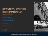
DOWNTOWN<br />
STRATEGIC<br />
DEVELOPMENT<br />
PLAN<br />
PREPARED BY:<br />
THE LAKOTA GROUP<br />
TY LIN<br />
CLUE GROUP<br />
GOODMAN WILLIAMS GROUP
KENOSHA DOWNTOWN STRATEGIC DEVELOPMENT PLAN: STATE OF THE DOWNTOWN<br />
CITY OF KENOSHA, WISCONSIN<br />
1: INTRODUCTION<br />
Plan Mission 06<br />
Planning Process 07<br />
Plan Purpose 08<br />
2: LAND USE AND PHYSICAL CONDITIONS<br />
Overview 10<br />
Land Use 14<br />
Existing Zoning 18<br />
Physical Conditions 25<br />
Vacant Buildings and Sites 26<br />
Roadways/Streetscape 28<br />
Historic Resources 30<br />
National Register <strong>of</strong> Historic Places 34<br />
Landmark Properties 35<br />
Historic Resource Surveys and Inventories 35<br />
Historic Preservation Code 35<br />
3: PARKING AND TRANSPORTATION<br />
Introduction 38<br />
<strong>Downtown</strong> Access and Gateways 39<br />
Complete Streets 42<br />
Pedestrian Network 42<br />
Bicycle Network 48<br />
Transit Network 50<br />
Automobile Network 56<br />
Parking 58<br />
Conclusions 61<br />
4: MARKET ANALYSIS<br />
<strong>Kenosha</strong>’s Demographics 64<br />
<strong>Kenosha</strong>’s Economy 68<br />
Major Employers 70<br />
Office Worker Spending 70<br />
Retail Market Overview 71<br />
Visitors 77<br />
Residential Market 79<br />
5: SETTING A COURSE<br />
Public Input Summary 86<br />
Preliminary Implementation Strategy 95<br />
Catalytic Sites and Projects 97<br />
Branding and Marketing 100<br />
Organizational Development 101<br />
Funding 102<br />
6: APPENDICES<br />
Visual Preference Survey Results<br />
Community Survey Summary<br />
<strong>Kenosha</strong> Workshop “Big Idea” Responses<br />
A2<br />
A34<br />
A51<br />
CITY OF KENOSHA, WISCONSIN<br />
KENOSHA DOWNTOWN STRATEGIC DEVELOPMENT PLAN: STATE OF THE DOWNTOWN<br />
TABLE OF CONTENTS<br />
toc
INTRODUCTION<br />
SECTION 1
SECTION 1: INTRODUCTION<br />
INTRODUCTION<br />
PLANNING MISSION<br />
In January <strong>of</strong> 2012, the <strong>Kenosha</strong> Area Business Alliance (KABA)<br />
and the City <strong>of</strong> <strong>Kenosha</strong> engaged <strong>The</strong> <strong>Lakota</strong> <strong>Group</strong> (planning<br />
and design), Goodman Williams <strong>Group</strong> (market and economic<br />
analysis) and T.Y. Lin International (transportation planning)<br />
to initiate a planning process to develop a strategic revitalization<br />
and implementation strategy for <strong>Kenosha</strong>’s downtown. <strong>The</strong><br />
last full <strong>Downtown</strong> Master Plan was prepared in 1991 and<br />
established the plan for reclaiming the lakefront, which was<br />
accomplished through the HarborPark development. While<br />
additional studies have been conducted in the years since, the<br />
timing is right to develop a new downtown plan that establishes<br />
the goals and priorities for the next 20 years.<br />
<strong>The</strong> City’s goal for this planning mission is to create a clear,<br />
documented and shared vision, or “game plan,” for the<br />
<strong>Downtown</strong> that sets the stage for funding strategies, capital<br />
improvement programming, new development and retention/<br />
attraction <strong>of</strong> new and existing businesses. <strong>The</strong>se goals will<br />
be shaped by evaluating the <strong>Downtown</strong>’s land use, physical<br />
conditions, zoning, real estate market and infrastructure and<br />
transportation system helping to create a “sense <strong>of</strong> place” for<br />
<strong>Downtown</strong> <strong>Kenosha</strong>.<br />
<strong>The</strong> City considers this planning process as an important<br />
opportunity to:<br />
Recent Planning Studies & <strong>Report</strong>s<br />
■ <strong>Kenosha</strong> <strong>Downtown</strong> Plan (1991)<br />
■ ULI - <strong>Downtown</strong> Lakefront Site Study (1996)<br />
■<br />
■<br />
■<br />
■<br />
Civic Center Historic District Preservation<br />
Plan (1997)<br />
Library Park Historic District Preservation<br />
Plan (1997)<br />
Third Avenue Historic District Neighborhood<br />
Plan (1997)<br />
Pearl Street Historic District Neighborhood<br />
Plan (1998)<br />
■ HarborPark Neighborhood Code (1999)<br />
■ Library Park Preservation Plan (2000)<br />
■<br />
City <strong>of</strong> <strong>Kenosha</strong> Bicycle and Pedestrian<br />
Facilities Plan (2005)<br />
■ <strong>Downtown</strong>/Uptown Parking Study (2008)<br />
■ <strong>Kenosha</strong> First (2009)<br />
■<br />
■<br />
■<br />
<strong>Kenosha</strong> Lakeshore Business Improvement<br />
District Strategic Planning Session <strong>Report</strong><br />
(2009)<br />
A Comprehensive Plan for the City <strong>of</strong><br />
<strong>Kenosha</strong>: 2035 (2011)<br />
A Vision <strong>of</strong> Bicycling in <strong>Kenosha</strong> County,<br />
Wisconsin (2010)<br />
■ Simmons Island Master Plan (2011)<br />
■<br />
■<br />
■<br />
■<br />
■<br />
■<br />
■<br />
■<br />
Create and test a range <strong>of</strong> alternative development<br />
concepts that enhance and revitalize the <strong>Downtown</strong>.<br />
Develop a plan that will attract land uses and<br />
development compatible with the needs, infrastructure<br />
and character <strong>of</strong> the <strong>Downtown</strong> and will meet realistic<br />
market conditions, expectations and capacities.<br />
Develop an optimal short-term and long-range land use<br />
strategy and development framework for the <strong>Downtown</strong>.<br />
Establish a framework for future changes to development<br />
regulations that emphasizes high quality, sustainable site<br />
and building design.<br />
Create retail and business development strategies to help<br />
existing businesses benefit from future development.<br />
Identify sensitive or historic areas/sites <strong>of</strong> the <strong>Downtown</strong><br />
that should be maintained due to their character, scale<br />
and contribution to the immediate neighborhood and<br />
history <strong>of</strong> the area.<br />
Maximize the <strong>Downtown</strong>’s transit-oriented development<br />
potential by improving traffic, pedestrian and bicycle<br />
circulation, detailing potential improvements to the<br />
transit services within the <strong>Downtown</strong> and by identifying<br />
appropriate sites for a land use mix and density supportive<br />
<strong>of</strong> these transit and multi-modal goals.<br />
Incorporate the preservation and reuse <strong>of</strong> historic and<br />
cultural resources into the overall <strong>Downtown</strong> Strategic<br />
Development Plan.<br />
CITY OF KENOSHA, WISCONSIN<br />
6 KENOSHA DOWNTOWN STRATEGIC DEVELOPMENT PLAN: STATE OF THE DOWNTOWN<br />
INTRODUCTION
PLANNING PROCESS<br />
<strong>The</strong> first phase <strong>of</strong> this planning process involved an overall<br />
assessment <strong>of</strong> the <strong>Downtown</strong>’s existing land use mix, physical<br />
conditions, transportation network and access, infrastructure<br />
and real estate market. This phase also focused on extensive<br />
public participation through interviews, focus group sessions,<br />
an online community survey, discussions with City staff and<br />
agencies, as well as a Community Open House. <strong>The</strong> process,<br />
which began in January 2012, includes the following phases:<br />
Phase 1: <strong>State</strong> <strong>of</strong> the <strong>Downtown</strong><br />
Phase 1 involved an inventory <strong>of</strong> existing <strong>Downtown</strong> conditions<br />
and included team fieldwork and assessments, a meeting with<br />
the project’s Steering Committee, numerous Focus <strong>Group</strong><br />
discussions and stakeholder interviews, a Community Open<br />
House and this <strong>State</strong> <strong>of</strong> the <strong>Downtown</strong> report. Community<br />
outreach and public awareness methods included a project<br />
website, a KABA run Facebook page, an online survey and<br />
email blasts announcing major events in the process.<br />
PHASE 1<br />
STATE<br />
OF THE<br />
DOWNTOWN<br />
PHASE 2<br />
COMMUNITY<br />
VISIONING<br />
STATE<br />
OF THE<br />
DOWNTOWN<br />
Phase 2: Community Visioning<br />
Phase 2 will involve generating a range <strong>of</strong> development strategies<br />
for the <strong>Downtown</strong>, as well as concepts for enhancing the area’s<br />
land use mix, physical conditions, transit, transportation,<br />
pedestrian and bike circulation, parking and streetscape. After<br />
review by the Steering Committee, a Community Visioning<br />
Workshop will be held to review the <strong>State</strong> <strong>of</strong> the <strong>Downtown</strong><br />
findings, development strategies and design concepts.<br />
Phase 3: <strong>Downtown</strong> Strategy<br />
Phase 3 will involve crafting a more specific Strategic<br />
Development Plan direction for the <strong>Downtown</strong>, as well as<br />
a set <strong>of</strong> strategies for its implementation. This information<br />
will be reviewed with the Steering Committee, and a third<br />
Community Workshop will be held to discuss final plan<br />
outcomes. <strong>Downtown</strong> revitalization strategies will outline<br />
optimal and achievable short-term and long-range development<br />
scenarios and clear, concise methods for evaluating future<br />
development funding opportunities and required development<br />
control improvements. Key implementation action strategies<br />
will address land use policy and zoning issues, as well as public<br />
and private actions that can be taken to advance City and<br />
<strong>Downtown</strong> objectives.<br />
PHASE 3<br />
DOWNTOWN<br />
STRATEGY<br />
DOWNTOWN<br />
STRATEGIC<br />
DEVELOPMENT<br />
PLAN<br />
CITY OF KENOSHA, WISCONSIN<br />
KENOSHA DOWNTOWN STRATEGIC DEVELOPMENT PLAN: STATE OF THE DOWNTOWN<br />
INTRODUCTION<br />
7
SECTION 1: INTRODUCTION<br />
PLAN PURPOSE<br />
<strong>The</strong> City, as well as KABA, the <strong>Kenosha</strong> Chamber <strong>of</strong> Commerce,<br />
the <strong>Kenosha</strong> Lakeshore Business Improvement District (BID),<br />
community leaders, property owners and developers will use the<br />
Revitalization Strategy for evaluating and promoting planning<br />
and development decisions over the next 20 years. <strong>The</strong> Plan will<br />
serve many purposes depending on the needs <strong>of</strong> the ultimate<br />
user, which may include:<br />
Development Framework<br />
<strong>The</strong> Revitalization Strategy will provide a focused framework<br />
for potential development and revitalization activities within<br />
the <strong>Downtown</strong>. City staff will review development projects for<br />
conformance with the goals, objectives and guidelines set forth<br />
by the Strategy.<br />
Public Investment Guide<br />
<strong>The</strong> City will use the Revitalization Strategy to prioritize<br />
public investment initiatives and improvement projects. <strong>The</strong><br />
information on existing conditions and future land use and<br />
transportation/transit needs will also be used to seek grants at<br />
the regional, state and federal levels.<br />
Private Investment Guide<br />
<strong>The</strong> Strategy report will provide a base <strong>of</strong> information about<br />
the area’s constraints and potential for both local and outside<br />
investors interested in developing within <strong>Downtown</strong> <strong>Kenosha</strong>.<br />
It can also be used as a tool to attract outside developers by<br />
highlighting the unrealized potential <strong>of</strong> the area.<br />
Future Vision<br />
<strong>The</strong> Strategy will act as a local or regional marketing tool to<br />
inform current and future residents, businesses and private<br />
investors about the adopted shared vision for this key City<br />
and County location. This plan will further support the many<br />
other local and regional initiatives that focus on economic<br />
development for <strong>Kenosha</strong>.<br />
CITY OF KENOSHA, WISCONSIN<br />
8 KENOSHA DOWNTOWN STRATEGIC DEVELOPMENT PLAN: STATE OF THE DOWNTOWN<br />
INTRODUCTION
LAND USE<br />
AND PHYSICAL<br />
CONDITIONS<br />
SECTION 2
SECTION 2: LAND USE AND PHYSICAL CONDITIONS<br />
OVERVIEW<br />
<strong>The</strong> City <strong>of</strong> <strong>Kenosha</strong> is a large, primarily suburban community<br />
located along Lake Michigan about halfway between the Cities<br />
<strong>of</strong> Milwaukee, Wisconsin and Chicago, Illinois. <strong>Kenosha</strong> is<br />
bordered by Lake Michigan to the east, <strong>The</strong> Village <strong>of</strong> Pleasant<br />
Prairie to the south, the Village <strong>of</strong> Bristol and the Town <strong>of</strong><br />
Paris to the west and the Town <strong>of</strong> Somers to the north. <strong>The</strong><br />
City is approximately 24 square miles and has major roadway<br />
access provided by Interstate 94 which connects Milwaukee<br />
and Chicago and passes through the west edge <strong>of</strong> the City – see<br />
Figure 2-3.<br />
<strong>Kenosha</strong>’s <strong>Downtown</strong> is adjacent to Lake Michigan and is the<br />
home to the central business district, several museums, the<br />
United Hospital campus, <strong>Kenosha</strong> County facilities and the<br />
City’s Municipal Building. For the purposes <strong>of</strong> this study, the<br />
<strong>Downtown</strong> has been defined by the following limits:<br />
■<br />
■<br />
■<br />
■<br />
North: 45th Street<br />
East: Lake Michigan<br />
South: 65th Street<br />
West: Union Pacific Railroad<br />
<strong>The</strong>se boundaries were developed through a City led survey <strong>of</strong><br />
the public, in which they were asked to define “<strong>Downtown</strong>.”<br />
Within this study area, there is a range <strong>of</strong> land uses, building<br />
types, zoning districts and character; all <strong>of</strong> which create the<br />
ability to further sub-divide the area into different districts.<br />
<strong>The</strong> 1991 <strong>Downtown</strong> Master Plan suggested eight different<br />
districts as shown in Figure 2-2. As part <strong>of</strong> this planning process,<br />
the community was asked to comment on the districts identified<br />
in the 1991 plan to see if they were still applicable. <strong>The</strong> public<br />
still generally identified with these districts, with some slight<br />
modifications. Based on the input received, a proposed district<br />
map has been developed to help steer development priorities<br />
and implementation strategies within the <strong>Downtown</strong> and help<br />
in the analysis <strong>of</strong> the overall <strong>Downtown</strong> – see Figure 2-3.<br />
Major Milestones in <strong>Downtown</strong> <strong>Kenosha</strong>’s History<br />
In 1835, Pike Village was the first western<br />
settlement to be located on the site <strong>of</strong><br />
the current <strong>Downtown</strong>. <strong>The</strong> name came<br />
from the translation <strong>of</strong> the Potowatomi<br />
Indians name for the area, which was<br />
“Kenozia.” Pike Village was later changed<br />
to “Southport” and then to <strong>Kenosha</strong> in<br />
1850 when it became incorporated as a city.<br />
<strong>Kenosha</strong> grew rapidly between 1890<br />
and 1920 as manufacturing increased,<br />
capitalizing on the City’s advantageous<br />
location. From 1920 to 1950 growth<br />
was slowed by the Great Depression and<br />
World War II. In 1954 the American<br />
Motors Corporation was formed with a<br />
large lakefront plant located in the City.<br />
This led to a period <strong>of</strong> economic ups and<br />
downs related to the American Motors. In<br />
1987 the Chrysler Corporation purchased<br />
American Motors and closed down the<br />
<strong>Kenosha</strong> plant.<br />
Following the closure <strong>of</strong> the plant, the City<br />
made a significant effort to reinvigorate the<br />
<strong>Downtown</strong>. In 1991 the City completed<br />
a Master Plan for the <strong>Downtown</strong> that<br />
laid out ambitious plans for reclaiming<br />
the lakefront through new development.<br />
<strong>The</strong> completed HarborPark development<br />
included new multi-family housing, harbor<br />
oriented commercial development, two<br />
museums, public open space and a street<br />
car system providing public transit.<br />
Bird’s Eye View <strong>of</strong> <strong>Downtown</strong> <strong>Kenosha</strong>, circa 1880<br />
source: <strong>Kenosha</strong> County Historical Society<br />
American Motors Plant, circa 1950<br />
source: <strong>Kenosha</strong> County Historical Society<br />
Street Car, present day<br />
10<br />
CITY OF KENOSHA, WISCONSIN<br />
KENOSHA DOWNTOWN STRATEGIC DEVELOPMENT PLAN: STATE OF THE DOWNTOWN<br />
LAND USE AND PHYSICAL CONDITIONS
Figure 2-1: <strong>Kenosha</strong> Regional Context Map<br />
CITY OF KENOSHA, WISCONSIN<br />
KENOSHA DOWNTOWN STRATEGIC DEVELOPMENT PLAN: STATE OF THE DOWNTOWN<br />
LAND USE AND PHYSICAL CONDITIONS<br />
11
SECTION 2: LAND USE AND PHYSICAL CONDITIONS<br />
Figure 2-2: 1991 <strong>Downtown</strong> Master Plan District Map<br />
12<br />
CITY OF KENOSHA, WISCONSIN<br />
KENOSHA DOWNTOWN STRATEGIC DEVELOPMENT PLAN: STATE OF THE DOWNTOWN<br />
LAND USE AND PHYSICAL CONDITIONS
Figure 2-3: 2012 <strong>Downtown</strong> Strategic Development Plan District Map<br />
CITY OF KENOSHA, WISCONSIN<br />
KENOSHA DOWNTOWN STRATEGIC DEVELOPMENT PLAN: STATE OF THE DOWNTOWN<br />
LAND USE AND PHYSICAL CONDITIONS<br />
13
13th Avenue<br />
10th Avenue<br />
7th Avenue<br />
7th Avenue<br />
Sheridan<br />
SECTION 2: LAND USE AND PHYSICAL CONDITIONS<br />
LAND USE<br />
Land uses for the planning district described herein start on the<br />
northern portion <strong>of</strong> the study area and work their way south –<br />
see Figure 2-4.<br />
Near Northside<br />
This area is bound by 45th Street on the north, <strong>Kenosha</strong><br />
harbor on the east and then wraps around the harbor to 50th<br />
Street, extending down Sheridan Road to 52nd Street on the<br />
south, then upward to the railroad tracks on the west. This<br />
area is characterized as primarily an older, stable residential<br />
neighborhood consisting <strong>of</strong> single-family and two family<br />
dwelling units. Slightly higher density residential development,<br />
consisting <strong>of</strong> two to three story town homes and flats exist near<br />
the harbor. Small neighborhood commercial uses exist along<br />
Sheridan Road and 6th Avenue, which support the surrounding<br />
residential neighborhood. Neighborhood bars dot the corner <strong>of</strong><br />
45th Street and 7th Avenue. <strong>The</strong> primary open space in this<br />
area is Union Park located between 45th and 44th Streets and<br />
7th and 8th Avenue and the institutional uses <strong>of</strong> St. Elizabeth’s<br />
Catholic Church and school, as well as Harborside Academy<br />
occupy the block between 7th and 8th Avenues, and 48th and<br />
49th Streets. Industrial users comprise the area along the train<br />
tracks, and consist <strong>of</strong> a vacant parcel and railroad right-<strong>of</strong>-way,<br />
marine related industrial use, and Ashmus Belting, a distributor<br />
<strong>of</strong> new and used conveyor belts.<br />
46th Street<br />
47th Street<br />
48th Street<br />
49th Street<br />
50th Street<br />
<strong>Downtown</strong> Study Area<br />
Sheridan Road<br />
45th Street<br />
Sheridan Road<br />
8th Avenue<br />
52nd Street<br />
8th Avenue<br />
Union<br />
Park<br />
51st Street<br />
7th Avenue<br />
51st Place<br />
Near North Side Land Uses<br />
<strong>Downtown</strong> Study Area<br />
46th Street<br />
47th Street<br />
48th Street<br />
49th Street<br />
h Street<br />
Sheridan Road<br />
45th Street<br />
8th Avenue<br />
Union<br />
Park<br />
7th Avenue<br />
5th Avenue<br />
50th Street<br />
<strong>Kenosha</strong><br />
Harbor<br />
5th Avenue<br />
50th Street<br />
6th Avenue<br />
<strong>Kenosha</strong><br />
Harbor<br />
Simmons<br />
Island<br />
<strong>Kenosha</strong><br />
Harbor<br />
Simmons<br />
Island<br />
Street<br />
Lake<br />
Michigan<br />
Lake<br />
Michigan<br />
Ce<br />
Simmons Island<br />
<strong>The</strong> Simmonds Island area is bound by <strong>Kenosha</strong> Harbor on the<br />
west and south, 45th Street on the north, and Lake Michigan to<br />
the east. This area is dominated by open space and recreational<br />
use, comprising the park and beach on Simmons Island, a<br />
historic center, three single family houses, coast guard facilities,<br />
marina related commercial uses along the harbor, and a water<br />
production plant.<br />
Sheridan Road<br />
8th Avenue<br />
52nd Street<br />
51st Street<br />
51st Place<br />
Simmons Island Land Uses<br />
53rd Street<br />
6th Avenue<br />
52nd Street<br />
54th Street<br />
<strong>Kenosha</strong><br />
Harbor<br />
4th Avenue<br />
54th Street<br />
2nd Avenue<br />
3rd Avenue<br />
1st Avenue<br />
Celebraon<br />
Pl<br />
C<br />
Civic Center<br />
<strong>The</strong> Civic Center District is bound by 52nd Street to the north,<br />
the railroad tracks to the west, 60th Street to the south, and<br />
Sheridan Road to the west. It also includes the three blocks<br />
on the east side <strong>of</strong> Sheridan Road between 55th Street and<br />
58th Street which house the Library Administration building<br />
and the Post Office. <strong>The</strong> Post Office, County Courthouse,<br />
Central High School and Dinosaur Discovery Museum, which<br />
surround a central plaza, all form the core <strong>of</strong> this primarily<br />
civic use district. <strong>The</strong>se buildings were all constructed in the<br />
<strong>Downtown</strong> Study Area<br />
10th Avenue<br />
11th Avenue<br />
55th Street<br />
57th Street<br />
57th Street<br />
58th Street<br />
10th Avenue<br />
11th Avenue<br />
59th Street<br />
Sheridan Road<br />
56th Street<br />
56th Street<br />
58th Street<br />
59th Street<br />
59th Street<br />
60th Street 60th Street<br />
Civic Center Land Uses<br />
6th Avenue<br />
7th Avenue<br />
8th Avenue<br />
8th Avenue<br />
6th Avenue 'A'<br />
7th Avenue<br />
5th Avenue<br />
58th Street<br />
57th Street<br />
Wolfenbuel<br />
Park<br />
Eichelman<br />
Park<br />
56th Street<br />
Southport<br />
Marina<br />
14<br />
CITY OF KENOSHA, WISCONSIN<br />
KENOSHA DOWNTOWN STRATEGIC DEVELOPMENT PLAN: STATE OF THE DOWNTOWN<br />
LAND USE AND PHYSICAL CONDITIONS
13th Avenue<br />
10th Avenue<br />
10th Avenue<br />
11th Avenue<br />
12th Avenue<br />
7th Avenue<br />
<strong>Downtown</strong> Study Area<br />
46th Street<br />
47th Street<br />
45th Street<br />
Union<br />
Park<br />
5th Avenue<br />
Lake<br />
Michigan<br />
LEGEND<br />
Single-family<br />
Residenal<br />
Mul-family<br />
Residenal<br />
Mixed Use<br />
7th Avenue<br />
8th Avenue<br />
Sheridan Road<br />
48th Street<br />
<strong>Kenosha</strong><br />
Harbor<br />
Commercial<br />
49th Street<br />
Simmons<br />
Island<br />
Government &<br />
Instuonal<br />
50th Street<br />
50th Street<br />
Industrial<br />
Sheridan Road<br />
8th Avenue<br />
51st Street<br />
51st Place<br />
6th Avenue<br />
<strong>Kenosha</strong><br />
Harbor<br />
Transportaon,<br />
Communicaon & Ulity<br />
Parks & Recreaon<br />
Vacant<br />
53rd Street<br />
52nd Street<br />
54th Street<br />
Celebraon<br />
Place<br />
Project Area Boundary<br />
2nd Avenue<br />
1st Avenue<br />
3rd Avenue<br />
54th Street<br />
4th Avenue<br />
5th Avenue<br />
Sheridan Road<br />
10th Avenue<br />
55th Street<br />
56th Street<br />
11th Avenue<br />
56th Street<br />
57th Street<br />
6th Avenue<br />
56th Street<br />
57th Street<br />
58th Street<br />
Southport<br />
Marina<br />
7th Avenue<br />
57th Street<br />
<strong>Downtown</strong> Study Area<br />
10th Avenue<br />
11th Avenue<br />
8th Avenue<br />
58th Street<br />
58th Street<br />
59th Street<br />
59th Street<br />
6th Avenue 'A'<br />
59th Street<br />
Wolfenbuel<br />
Park<br />
60th Street<br />
7th Avenue<br />
60th Street<br />
8th Avenue<br />
Sheridan Road<br />
Eichelman<br />
Park<br />
61st Street<br />
61st Street<br />
3rd Avenue<br />
5th Avenue<br />
62nd Street<br />
Bain<br />
Park<br />
13th Avenue<br />
63rd Street<br />
7th Avenue<br />
Lake<br />
Michigan<br />
8th Avenue<br />
65th Street<br />
Sheridan Road<br />
<strong>Downtown</strong> Study<br />
Area<br />
64th Street<br />
Baker<br />
Park<br />
65th Street<br />
Map information based on March<br />
2012 field observations and City <strong>of</strong><br />
<strong>Kenosha</strong>’s existing land use data.<br />
Figure 2-4; <strong>Downtown</strong> Existing Land Use Map<br />
CITY OF KENOSHA, WISCONSIN<br />
KENOSHA DOWNTOWN STRATEGIC DEVELOPMENT PLAN: STATE OF THE DOWNTOWN<br />
LAND USE AND PHYSICAL CONDITIONS<br />
15
13th Avenue<br />
e<br />
Sheridan Road<br />
7th Avenue<br />
h Avenue<br />
8<br />
SECTION 2: LAND USE AND PHYSICAL CONDITIONS<br />
late 1920’s to the mid 1930’s, and comprise the Civic Center<br />
Historic District. Other public uses include the police station<br />
and the train station. <strong>The</strong> Pearl Street Historic District, due<br />
south <strong>of</strong> the train station, consists <strong>of</strong> four renovated historic<br />
buildings into <strong>of</strong>fice use. A more recently constructed town<br />
home development, Stationside Village is located along 13th<br />
Avenue between 52nd and 54th Street. Older single family<br />
and two family dwellings occupy the area between the railroad<br />
tracks and 10th Avenue and 57th to 58th Streets. Commercial<br />
Uses are located along the north side <strong>of</strong> 60th Street and are<br />
comprised primarily <strong>of</strong> automobile related services.<br />
49th Street<br />
50th Street<br />
Sheridan Road<br />
8th Avenue<br />
51st Street<br />
51st Place<br />
50th Street<br />
6th Avenue<br />
<strong>Kenosha</strong><br />
Harbor<br />
Island<br />
<strong>Downtown</strong> Core<br />
<strong>The</strong> <strong>Downtown</strong> Core is bound by 50th Street on the north,<br />
Library Park on the south, 5th Avenue on the east, and 8th<br />
Avenue and Sheridan Road on the West. This section <strong>of</strong> the<br />
downtown consists primarily <strong>of</strong> two to three story structures<br />
with retail storefronts on the first floor and <strong>of</strong>fice uses or, in<br />
some cases, residential uses on the second and third floors.<br />
Other commercial uses dominate this area, and include a ten<br />
story <strong>of</strong>fice building at 57th and 7th Avenue, the <strong>Kenosha</strong><br />
News building, at 59th and 8th Avenue and three historic<br />
theaters: <strong>The</strong> Orpheum, <strong>Kenosha</strong>, and Rhode <strong>The</strong>aters. <strong>The</strong><br />
Rhode is the only theater that is still operating. Institutional<br />
uses include special housing for veterans (Dayton Residential<br />
Care Facility) at 59th Street and 6th Avenue and the <strong>Kenosha</strong><br />
Municipal Building located on 52nd Street between 6th and<br />
7th Avenues. <strong>The</strong> Municipal building is surrounded by three<br />
vacant parcels, to the west, north and southeast. An industrial<br />
site, which consists <strong>of</strong> yacht sales and harbor mechanics is<br />
located at 50th Street between Sheridan Road and 8th Avenue<br />
and a four-story multi-family residential development is located<br />
at 51st Place and 8th Avenue.<br />
<strong>Downtown</strong> Study A<br />
Street<br />
oad<br />
52nd Street<br />
Sheridan Road<br />
11th Avenue<br />
56th Street<br />
57th Street<br />
58th Street<br />
11th Avenue<br />
59th Street<br />
51st Place<br />
53rd Street<br />
10th Avenue<br />
54th Street<br />
55th Street<br />
56th Street<br />
52nd Street<br />
Avenue<br />
54th Street<br />
58th Street<br />
55th Street<br />
59th Street<br />
5th Avenue<br />
57th Street<br />
60th Street 60th Street<br />
<strong>Downtown</strong> Core Land Uses<br />
10th Avenue<br />
Sheridan Road<br />
56th Street<br />
8th Avenue<br />
<strong>Kenosha</strong><br />
Harbor<br />
7th Avenue<br />
4th Avenue<br />
7t<br />
6th Avenue<br />
6th Avenue 'A'<br />
54th Street<br />
3rd Avenue<br />
57th Street<br />
5th Avenue<br />
59th Street<br />
2nd Avenue<br />
4th Avenue<br />
58th Street<br />
1st Avenue<br />
54th Street<br />
3rd Avenue<br />
57th Street<br />
56th Street<br />
2nd Avenue<br />
Wolfenbuel<br />
Park<br />
Eichelman<br />
1st Avenue<br />
Celebraon<br />
Place<br />
56th Street<br />
Southport<br />
Marina<br />
C<br />
6th Avenue<br />
Marina Development<br />
57th Street<br />
58th Street<br />
Southport<br />
Marina<br />
7th Avenue<br />
8th Avenue<br />
<strong>The</strong> Marina Development area is bound by <strong>Kenosha</strong> Harbor<br />
on the north, Lake Michigan to the east, Eichelman Park<br />
on the south and 5th Avenue on the west excluding the<br />
residential portion just south <strong>of</strong> 59th street to 60th Street<br />
from Wolfenbuttel Park to 4th Avenue. <strong>The</strong> majority <strong>of</strong> recent<br />
downtown redevelopment efforts have been located in this area<br />
<strong>of</strong> the <strong>Downtown</strong>. <strong>The</strong> Marina Development area consists <strong>of</strong><br />
a 250-boat marina, an indoor winter boat storage facility, new<br />
parks and open space that wrap around the harbor and marina,<br />
and a multi-family residential development called HarborPark.<br />
10th Avenue<br />
61st Street<br />
62nd Street<br />
Bain<br />
Park<br />
58th Street<br />
59th Street<br />
8th Avenue<br />
6th Avenue 'A'<br />
7th Avenue<br />
59th Street<br />
60th Street<br />
61st Street<br />
Marina Development Land Uses<br />
5th Avenue<br />
3rd Avenue<br />
Wolfenbuel<br />
Park<br />
Eichelman<br />
Park<br />
16<br />
CITY OF KENOSHA, WISCONSIN<br />
KENOSHA DOWNTOWN STRATEGIC DEVELOPMENT PLAN: STATE OF THE DOWNTOWN<br />
LAND USE AND PHYSICAL CONDITIONS
h Avenue<br />
h Avenue<br />
10th Avenue<br />
11th Avenue<br />
12th Avenue<br />
10th Avenue<br />
11th Avenue<br />
12th Avenue<br />
Sheridan Road<br />
Sheridan Road<br />
This area also includes two museums, <strong>The</strong> Civil War Museum<br />
and Public Museum, a boat storage facility, and the historic<br />
Eagles Club, which is currently operating as a banquet facility.<br />
<strong>The</strong> southwest portion <strong>of</strong> this area encompasses Lakeside<br />
Towers, a government senior citizen apartment building, a<br />
vacant historic warehouse, and a recent partially constructed,<br />
but vacant 10-story condominium building, Virginia Towers,<br />
at 57th Street between 4th and 5th Avenues. Specific open<br />
space and recreational land uses include Celebration Place,<br />
Wolfenbuttel Park, and Eichelman Park.<br />
Allendale<br />
57th Street<br />
10th Avenue<br />
58th Street<br />
venue<br />
ue<br />
11th Avenue<br />
Allendale is bound by portions <strong>of</strong> 59th street to 60th Street<br />
on the north, Sheridan Road on the west, 65th Street on the<br />
south and Lake Michigan and Eichelman Park on the east.<br />
Allendale consists <strong>of</strong> large historic single-family and two-family<br />
homes, many <strong>of</strong> which are included in the Third Street Historic<br />
District. <strong>The</strong> Kemper Center, a historic school, which is<br />
currently being used as a meeting and banquet facility, anchors<br />
the southeast corner <strong>of</strong> the District. Institutional uses include<br />
the vacant Masonic Temple, the <strong>Kenosha</strong> Medical Center and<br />
the Simmons Library and park. Commercial land uses consist<br />
<strong>of</strong> a bank and pr<strong>of</strong>essional <strong>of</strong>fices at the corner <strong>of</strong> 60th Street<br />
and 7th Avenue. <strong>The</strong> northern portion <strong>of</strong> this site towards the<br />
lakefront includes medium density residential development<br />
comprised <strong>of</strong> single and two- family units and two to four story<br />
apartment buildings. A vacant parcel exists, just south <strong>of</strong> 59th<br />
street adjacent to Lakeside Towers.<br />
S d A<br />
13th Avenue<br />
58th Street<br />
59th Street<br />
60th Street<br />
61st Street<br />
62nd Street<br />
Bain<br />
Park<br />
63rd Street<br />
65th Street<br />
Sheridan Road<br />
59th Street<br />
<strong>Downtown</strong> Study<br />
Area<br />
Allendale Land Uses<br />
8th Avenue<br />
64th Street<br />
Baker<br />
Park<br />
8th Avenue<br />
6th Avenue 'A'<br />
7th Avenue<br />
7th Avenue<br />
59th Street<br />
60th Street<br />
61st Street<br />
5th Avenue<br />
65th Street<br />
3rd Avenue<br />
Wolfenbuel<br />
Park<br />
Eichelman<br />
Park<br />
Lake<br />
Michigan<br />
Bain Park<br />
57th Street<br />
10th Avenue<br />
58th Street<br />
venue<br />
ue<br />
<strong>The</strong> Bain Park area is bound by 60th Street on the north,<br />
Sheridan Road on the east, 65th Street on the south and the<br />
railroad tracks on the west. <strong>The</strong> dominant land use is older<br />
and smaller single-family bungalows, which surround the area’s<br />
primary open space, Bain Park. Institutional uses include a<br />
Christian child care center on the east side <strong>of</strong> Bain Park, First<br />
Methodist Church at the corner <strong>of</strong> 60th Street and Sheridan<br />
Road and a smaller church at the corner <strong>of</strong> 61st Street and 12th<br />
Avenue. Commercial uses include a gas station at the corner <strong>of</strong><br />
63rd Street and Sheridan Road and strip commercial uses along<br />
the south side <strong>of</strong> 60th Street. Small commercial and industrial<br />
users, as well as smaller vacant properties dot the area along the<br />
train tracks.<br />
13th Avenue<br />
58th Street<br />
59th Street<br />
60th Street<br />
61st Street<br />
62nd Street<br />
Bain<br />
Park<br />
63rd Street<br />
65th Street<br />
Sheridan Road<br />
59th Street<br />
<strong>Downtown</strong> Study<br />
Area<br />
8th Avenue<br />
64th Street<br />
Baker<br />
Park<br />
8th Avenue<br />
6th Avenue 'A'<br />
7th Avenue<br />
7th Avenue<br />
59th Street<br />
60th Street<br />
61st Street<br />
5th Avenue<br />
65th Street<br />
3rd Avenue<br />
Wolfenbuel<br />
Park<br />
Eichelman<br />
Park<br />
Lake<br />
Michiga<br />
owntown Study Area<br />
11th Avenue<br />
Bain Park Land Uses<br />
CITY OF KENOSHA, WISCONSIN<br />
KENOSHA DOWNTOWN STRATEGIC DEVELOPMENT PLAN: STATE OF THE DOWNTOWN<br />
LAND USE AND PHYSICAL CONDITIONS<br />
17
13th Avenue<br />
10th Avenue<br />
10th Avenue<br />
11th Avenue<br />
12th Avenue<br />
Sheridan Road<br />
7th Avenue<br />
SECTION 2: LAND USE AND PHYSICAL CONDITIONS<br />
EXISTING ZONING<br />
<strong>The</strong>re are ten City <strong>of</strong> <strong>Kenosha</strong> Zoning Districts, and two overlay districts located within the study area – see Figure 2-5.<br />
<strong>The</strong>se districts include:<br />
<strong>Downtown</strong> Study Area<br />
46th Street<br />
47th Street<br />
48th Street<br />
Sheridan Road<br />
45th Street<br />
8th Avenue<br />
Union<br />
Park<br />
7th Avenue<br />
5th Avenue<br />
<strong>Kenosha</strong><br />
Harbor<br />
Lake<br />
Michigan<br />
LEGEND<br />
RS-1: Single Family<br />
Residenal<br />
RS-2: Single Family<br />
Residenal<br />
RS-3: Single Family<br />
Residenal<br />
RG-1: General<br />
Residenal<br />
49th Street<br />
Simmons<br />
Island<br />
RG-2: General<br />
Residenal<br />
50th Street<br />
50th Street<br />
RD: Two-Family<br />
Residenal<br />
53rd Street<br />
Sheridan Road<br />
8th Avenue<br />
52nd Street<br />
51st Street<br />
51st Place<br />
54th Street<br />
6th Avenue<br />
<strong>Kenosha</strong><br />
Harbor<br />
54th Street<br />
3rd Avenue<br />
Celebraon<br />
Place<br />
RM-1: Mul-Family<br />
Residenal<br />
RM-2: Mul-Family<br />
Residenal<br />
B-1: Neighborhood<br />
Business<br />
B-2: Community<br />
Business<br />
B-3: Central Business<br />
1st Avenue<br />
2nd Avenue<br />
4th Avenue<br />
5th Avenue<br />
55th Street<br />
56th Street<br />
B-4: Mixed Use<br />
Sheridan Road<br />
10th Avenue<br />
<strong>Downtown</strong> Study Area<br />
11th Avenue<br />
56th Street<br />
57th Street<br />
58th Street<br />
11th Avenue<br />
59th Street<br />
10th Avenue<br />
8th Avenue<br />
58th Street<br />
59th Street<br />
56th Street<br />
57th Street<br />
7th Avenue<br />
6th Avenue<br />
6th Avenue 'A'<br />
59th Street<br />
58th Street<br />
57th Street<br />
Wolfenbuel<br />
Park<br />
Southport<br />
Marina<br />
M-1: Light<br />
Manufacturing<br />
M-2: Heavy<br />
Manufacturing<br />
IP: Instuonal /<br />
Park<br />
HRPO: Harbor Park<br />
Overlay<br />
Project Area<br />
Boundary<br />
60th Street<br />
60th Street<br />
Eichelman<br />
Park<br />
7th Avenue<br />
8th Avenue<br />
61st Street<br />
61st Street<br />
3rd Avenue<br />
5th Avenue<br />
62nd Street<br />
Bain<br />
Park<br />
13th Avenue<br />
63rd Street<br />
7th Avenue<br />
Lake<br />
Michigan<br />
8th Avenue<br />
65th Street<br />
Sheridan Road<br />
<strong>Downtown</strong> Study<br />
Area<br />
64th Street<br />
Baker<br />
Park<br />
Figure 2-5: Existing Zoning in <strong>Downtown</strong> <strong>Kenosha</strong><br />
65th Street<br />
18<br />
CITY OF KENOSHA, WISCONSIN<br />
KENOSHA DOWNTOWN STRATEGIC DEVELOPMENT PLAN: STATE OF THE DOWNTOWN<br />
LAND USE AND PHYSICAL CONDITIONS
COMMERCIAL ZONING<br />
<strong>The</strong>re are two parcels zoned B-2 Community Business District<br />
towards the south end <strong>of</strong> the study area at 60th and Sheridan<br />
Road and at 63rd and Sheridan Road. and one parcel zoned<br />
B-4 Mixed Use towards the north end <strong>of</strong> the study area at 8th<br />
Avenue and 51st Place. <strong>The</strong> majority <strong>of</strong> the commercial property<br />
in the study area is zoned B-3 Central Business District. All <strong>of</strong><br />
these business districts allow for multi-family residential above<br />
the first floor with a graduated increase in side yards, as the<br />
height increases.<br />
B-2 Community Business District<br />
<strong>The</strong> B-2 Community Zoning District is designed to serve a<br />
population that is geared towards both neighborhoods and<br />
community-wide shoppers. Permitted land uses include<br />
standard convenience and retail service but also include<br />
home improvement and gardening supply stores, tool and<br />
equipment stores and medical clinics. Conditional uses include<br />
automobile service related uses, outdoor commercial uses;<br />
brew pubs, recycling centers and self-storage facilities. <strong>The</strong>re<br />
are no minimum lot size requirements, except for residential<br />
uses above the first floor. <strong>The</strong>se minimum lot size/density<br />
requirements are as follows:<br />
■ Multifamily residential use prior to date <strong>of</strong> code: 500<br />
square feet <strong>of</strong> lot area per dwelling unit<br />
■<br />
Two story building: 2,000 square feet <strong>of</strong> lot area per<br />
dwelling unit<br />
■<br />
■<br />
Three story building: 1,000 square feet <strong>of</strong> lot area per<br />
dwelling unit<br />
Four (or more) story building: 500 square feet <strong>of</strong> lot<br />
area per dwelling unit<br />
<strong>The</strong>re are no front yard requirements, rear yard is 25 feet and<br />
maximum height is 45 feet. Side yard requirements vary based<br />
on circumstances. Parking requirements are 1 space per 250<br />
feet <strong>of</strong> gross floor area for commercial uses, and a minimum <strong>of</strong><br />
two spaces per unit for multifamily residential.<br />
B-3 Central Business District<br />
This zoning district is designed to accommodate the commercial<br />
uses typical <strong>of</strong> an urban downtown. <strong>The</strong>se uses include many <strong>of</strong><br />
the uses which are in the B-2 Community Business District but<br />
include marina use, and cultural institutions such as museums<br />
and libraries. Amusement and recreational uses are limited to an<br />
approximate seven block area <strong>of</strong> the <strong>Downtown</strong> core. <strong>The</strong>re are<br />
no minimum lot size requirements or yard requirements unless<br />
they abut a residential district, except for a rear yard requirement<br />
<strong>of</strong> 9 feet. <strong>The</strong> maximum height extends to 100 feet. Density<br />
requirements for multi-family above the first floor are the same as<br />
the B-2 Community Business District:<br />
<strong>Downtown</strong> parking regulations were reduced to 50% <strong>of</strong> the<br />
standard parking requirements for commercial uses as an incentive<br />
to encourage redevelopment. <strong>The</strong> <strong>Downtown</strong> parking regulations<br />
are however limited to the area bound by 54th to 58th Streets /<br />
8th to 5th Avenues, and 58th to 59th Streets / 7th to 5th Avenues.<br />
Generally there is significant unused height potential within the <strong>Downtown</strong>’s B-3 Zoning District 100 foot envelope.<br />
CITY OF KENOSHA, WISCONSIN<br />
KENOSHA DOWNTOWN STRATEGIC DEVELOPMENT PLAN: STATE OF THE DOWNTOWN<br />
LAND USE AND PHYSICAL CONDITIONS<br />
19
SECTION 2: LAND USE AND PHYSICAL CONDITIONS<br />
B-4 Mixed- Use<br />
This zoning district was designed to include commercial and<br />
multi-family uses that are consistent with a neighborhood or<br />
site development plan. It includes height regulations which<br />
range from a minimum <strong>of</strong> 25 feet to a maximum <strong>of</strong> 50 feet,<br />
and incorporates building and spatial guidelines to encourage<br />
pedestrian activity and open space. <strong>The</strong> parking regulations<br />
in this district also allow for a 50% reduction in parking for<br />
commercial and institutional uses. District regulations also<br />
allow 10% <strong>of</strong> the required <strong>of</strong>f-street parking to be on the street,<br />
and require bike racks every 50 spaces. Multiple family parking<br />
regulations are reduced to one space for one bedroom units and<br />
two spaces for two or more units.<br />
<strong>The</strong>re is only one parcel in the <strong>Downtown</strong> zoned B-4 (red block).<br />
Business District Analysis<br />
<strong>The</strong> B-2 Community District is generally appropriate and the<br />
concept <strong>of</strong> a B-3 Central Business District and a B-4 Mixed<br />
Use district are also appropriate. <strong>The</strong> regulations for the B-3<br />
Central Business District in their current form however are<br />
not necessarily appropriate for an urban downtown center. <strong>The</strong><br />
list <strong>of</strong> commercial uses is very broad, showing little distinction<br />
between the downtown core and the B-2 district. <strong>The</strong> use<br />
list should be evaluated to actually determine which types <strong>of</strong><br />
commercial uses are actually desired and appropriate for the<br />
Village core.<br />
<strong>The</strong> multi-family regulations in the B-3 Central<br />
Business District have not and are not likely to result<br />
in an appropriate type <strong>of</strong> multi-family residential<br />
development for the <strong>Downtown</strong>.<br />
<strong>The</strong> generous height requirement coupled with limited density<br />
and the graduated setback requirements, result in an actual<br />
product type that is either unfeasible to build, or result in an<br />
unattractive building type, that does not fit within the context<br />
<strong>of</strong> the <strong>Downtown</strong>. <strong>The</strong> community should determine whether<br />
multi-family above commercial beyond the existing structures<br />
is desirable for the downtown core, and/or if the 100 foot<br />
height requirement is appropriate for multi-family use. Overall<br />
the B-3 regulations should be adjusted to a community vision<br />
for what it would like to see <strong>Downtown</strong>, and the regulations<br />
crafted in a way that results in the uses and building types that<br />
will be not only be compatible with the existing fabric <strong>of</strong> the<br />
<strong>Downtown</strong>, but can actually be built.<br />
In addition, the B-3 Zoning District incorporates a significantly<br />
large area <strong>of</strong> the <strong>Downtown</strong>, limiting its effectiveness as a<br />
district designed for the <strong>Downtown</strong> core. Some <strong>of</strong> the uses that<br />
are currently zoned B-3 may be more appropriately zoned for a<br />
B-2, B-4 or an RM-2 Multifamily zoning classification.<br />
<strong>The</strong> B-4 Mixed-Use district encompasses zoning, design and<br />
parking regulations that emphasize a density and pedestrian<br />
oriented approach, which is very desirable for areas around the<br />
<strong>Downtown</strong> core, but it is plan based and site plan derived, and<br />
to date, only one site in the study area has been built in this<br />
Zoning District. Consideration should be given to expanding<br />
the use <strong>of</strong> the B-4 district in what is now the B-3 District based<br />
on a community planning effort.<br />
t<br />
eet<br />
Street<br />
11th Avenue<br />
53rd Street<br />
10th Avenue<br />
10th Avenue<br />
Sheridan Road<br />
54th Street 54th Street<br />
58th Street<br />
55th Street<br />
8th Avenue<br />
59th Street<br />
56th Street<br />
57th Street<br />
7th Avenue<br />
6th Avenue<br />
h Avenue 'A'<br />
5th Avenue<br />
59th Street<br />
<strong>Downtown</strong> parking regulations area (red outline)<br />
4th Avenue<br />
58th Street<br />
3rd Avenue<br />
57th Street<br />
2nd Avenue<br />
Wolfenbuel<br />
1s<br />
20<br />
CITY OF KENOSHA, WISCONSIN<br />
KENOSHA DOWNTOWN STRATEGIC DEVELOPMENT PLAN: STATE OF THE DOWNTOWN<br />
LAND USE AND PHYSICAL CONDITIONS
CIVIC ZONING<br />
IP Institutional Park District<br />
This district is designed for any public, institutional and<br />
recreational use <strong>of</strong> a civic nature. It includes a broad range <strong>of</strong><br />
uses from golf courses and marinas, to hospitals, <strong>of</strong>fice buildings,<br />
museums and educational uses. <strong>The</strong>re are no lot area, or yard<br />
requirements except a rear yard <strong>of</strong> 9 feet. <strong>The</strong> maximum height<br />
requirement is 45 feet, except the general section <strong>of</strong> the zoning<br />
ordinance indicates that public buildings may be extended to<br />
75 feet.<br />
Institutional / Park District Analysis<br />
A significant portion <strong>of</strong> the downtown is zoned Institutional<br />
Park, including the civic campus on the west side <strong>of</strong> the study<br />
area and the park land and marina on the east. Consideration<br />
should be given to incorporating the actual institutional uses<br />
into the surrounding zoning districts, so that their regulations<br />
are consistent with the surrounding land uses, and changing<br />
the Institutional Park District to more <strong>of</strong> an open space/<br />
recreational district.<br />
<strong>The</strong> IP District encompasses a large portion <strong>of</strong> the <strong>Downtown</strong> Area<br />
(green blocks).<br />
RESIDENTIAL ZONING<br />
<strong>The</strong> study area includes five residential zoning districts, two<br />
single family districts, two multiple family districts and one<br />
general residential district. <strong>The</strong> single family districts are<br />
concentrated at the southeastern portion <strong>of</strong> the study area; the<br />
RM-1 Multi-family district is located on 47th Street adjacent<br />
to the railroad tracks. <strong>The</strong> RG-2 and RM-2 districts are<br />
scattered in various locations around the downtown core. All<br />
single family and general residential zoning districts include a<br />
provision <strong>of</strong> maximum lot coverage <strong>of</strong> impervious surface <strong>of</strong><br />
60%, and there are special side yard requirements for existing<br />
buildings in all residential districts. All residential districts<br />
include educational uses, religious uses, and park/playground<br />
uses as permitted uses.<br />
RS-1 and RS-3 Single- Family Districts<br />
<strong>The</strong>se zoning districts are designed for single family development<br />
on lot sizes within the downtown area. <strong>The</strong> bulk requirements<br />
for these districts are summarized in Table 1.<br />
RS-1<br />
RS-3<br />
Lot Area 8,000 square feet 5,000 square feet- Single-family<br />
6,000 square feet- Two-Family<br />
(3,000 square feet per dwelling unit)<br />
Lot Width 70 feet 40 feet-Single-family<br />
50 feet- Two-Family<br />
Building Height 35 feet 35 feet<br />
Yards:<br />
Front 25 feet 15 feet- build-to line<br />
Side 8 feet 5 feet<br />
Rear 30 feet 25 feet<br />
Table 1: Single family bulk requirements.<br />
CITY OF KENOSHA, WISCONSIN<br />
KENOSHA DOWNTOWN STRATEGIC DEVELOPMENT PLAN: STATE OF THE DOWNTOWN<br />
LAND USE AND PHYSICAL CONDITIONS<br />
21
SECTION 2: LAND USE AND PHYSICAL CONDITIONS<br />
RG-2 General Residence<br />
This district is designed for a mix <strong>of</strong> single family, two family<br />
and smaller multi-family buildings which are characterized<br />
by smaller lots. Multi family units are not to exceed five per<br />
lot. <strong>The</strong> maximum building height is 35 feet and minimum<br />
lot width 40 feet. Minimum lot area is 6,000 square feet for<br />
two family dwellings, and 5,000 square feet for single family<br />
dwellings. Yard requirements are a build-to line <strong>of</strong> 15 feet for<br />
the front, 25 feet for the rear, and side yards ranging from 5 feet<br />
for one story to 8 feet for two or more stories.<br />
RM-1 and RM-2 Multi-family<br />
<strong>The</strong>se multi-family districts are designed for the construction<br />
<strong>of</strong> multi-family uses <strong>of</strong> various densities, which are considered<br />
conditional uses. <strong>The</strong> bulk requirements for these districts are<br />
summarized in Table 2.<br />
Several residential designations are found in the Allendale Districts<br />
(yellow and orange blocks).<br />
Residential Zoning Analysis<br />
<strong>The</strong> residential regulations generally mirror the types <strong>of</strong> housing<br />
constructed in the areas that they are located. However,<br />
multi-family dwellings in the multi-family zoning districts are<br />
conditional uses as opposed to permitted uses in the RM-1 and<br />
RM-2 districts, whereas uses such as fraternity and sorority<br />
houses are permitted uses.<br />
If the intent <strong>of</strong> these districts is to provide multifamily<br />
housing, then consideration should be given<br />
to allowing multi-family development as <strong>of</strong> right<br />
in these districts, especially if more multi-family is<br />
desired around the <strong>Downtown</strong> core.<br />
In addition, consideration should be given to lowering the<br />
maximum height requirement in the RM-2 district, and<br />
analyzed with regards to its practicality and feasibility.<br />
RM-1<br />
Maximum Density 11 d.u. per lot 12 d.u. per acre*<br />
RM-2<br />
Lot Area 8,000 square feet 25,000 square feet- Single-family<br />
Lot Width 70 feet 100 feet<br />
Building Height 45 feet 100 feet<br />
Yards:<br />
Front 25 feet 25 feet<br />
Side 15-25 feet 15-25 feet<br />
Rear 25 feet 25 feet<br />
* Note: Maximum density for the RM-2 District is 12 dwelling units per acre, except<br />
that the density may be exceeded for the downtown area from 50th to 60th Street, the<br />
railroad tracks to Lake Michigan, and selected blocks from the original Plat <strong>of</strong> the Town<br />
<strong>of</strong> Southport, if approved by the review authority.<br />
Table 2: Multi-family bulk requirements.<br />
22<br />
CITY OF KENOSHA, WISCONSIN<br />
KENOSHA DOWNTOWN STRATEGIC DEVELOPMENT PLAN: STATE OF THE DOWNTOWN<br />
LAND USE AND PHYSICAL CONDITIONS
INDUSTRIAL ZONING<br />
M-1 Light and M-2 Heavy Manufacturing Districts<br />
Two manufacturing districts exist in <strong>Kenosha</strong>; M-1 Light<br />
Manufacturing; designed for lighter industry including<br />
warehousing and wholesale uses; and M-2 Heavy Manufacturing<br />
allowing for the heavier manufacturing uses. <strong>The</strong>re is one<br />
section <strong>of</strong> the study area zoned M-2 at the north end <strong>of</strong> the<br />
study area along the railroad tracks and various smaller sites<br />
that are zoned M-1 scattered throughout the downtown area.<br />
Bulk requirements are summarized below in Table 3.<br />
M-1 M-2<br />
Lot Area None None<br />
Lot Width None None<br />
Building Height 75 feet 100 feet<br />
Yards:<br />
Front None None<br />
Side None None<br />
Rear 9 feet 9 feet<br />
Table 3: Industrial zoning bulk requirements.<br />
Manufacturing District Analysis<br />
<strong>The</strong> existing land uses that are zoned M-2 and M-1 include an<br />
active plant, vacant property, and small quasi-manufacturing<br />
and commercial land uses located on smaller parcels throughout<br />
the <strong>Downtown</strong>.<br />
<strong>The</strong>se smaller parcels should be rezoned to either a<br />
commercial or multi-family land use classification<br />
to be more consistent with surrounding land uses<br />
and zoning.<br />
Consideration should also be given to eventually rezoning the<br />
larger industrial parcels as they become vacant to be redeveloped<br />
into more compatible land uses.<br />
Bird’s eye view <strong>of</strong> <strong>Downtown</strong> manufacturing areas looking East.<br />
CITY OF KENOSHA, WISCONSIN<br />
KENOSHA DOWNTOWN STRATEGIC DEVELOPMENT PLAN: STATE OF THE DOWNTOWN<br />
LAND USE AND PHYSICAL CONDITIONS<br />
23
SECTION 2: LAND USE AND PHYSICAL CONDITIONS<br />
OVERLAY DISTRICT ZONING<br />
HRPO Overlay District<br />
This overlay district was formed to guide the development <strong>of</strong><br />
HarborPark in accordance with the HarborPark Plan. Goals<br />
<strong>of</strong> the HarborPark Plan include minimization <strong>of</strong> the impact<br />
<strong>of</strong> the automobile, integration <strong>of</strong> new architecture within<br />
the existing urban fabric and construction <strong>of</strong> appropriate<br />
residential structures. <strong>The</strong> HarborPark Neighborhood Code<br />
provides regulations for this overlay district and outlines various<br />
multi-family residential structures which consist <strong>of</strong> 3 levels<br />
<strong>of</strong> residences around centralized parking. Additionally, the<br />
code addresses mixed use <strong>of</strong>fice/retail and civic uses. Design<br />
regulations are provided regarding garages, planning and<br />
screening <strong>of</strong> surface parking. Parking requirement are at 1 space<br />
per 500 square feet <strong>of</strong> floor area for commercial uses, 1 space<br />
per 1 bedroom unit, and 2 spaces per 2-3 bedroom unit. <strong>The</strong>se<br />
regulations overlay the RM-2 and B-3 zoning designation in<br />
the HarborPark area.<br />
HarborPark residential units<br />
HRPO Overlay Analysis<br />
<strong>The</strong> form-based code style is based on goals and objectives<br />
outlined in the HarborPark plan and has lead to the most<br />
successful redevelopment within the <strong>Downtown</strong> area. A similar<br />
process should be implemented regarding the remaining areas<br />
<strong>of</strong> <strong>Downtown</strong> and the code adjusted accordingly.<br />
FFO Overlay District<br />
<strong>The</strong>se regulations apply to all areas which are in the floodway<br />
fringe according to the flood maps. A portion <strong>of</strong> the lakeshore<br />
along the harbor and Simmons Island is located within this<br />
overlay district, which simply requires additional regulations<br />
that relate to potential flooding and include regulations<br />
regarding construction requirements, flood pro<strong>of</strong>ing <strong>of</strong> utilities<br />
and provision <strong>of</strong> adequate emergency access in case <strong>of</strong> a flood.<br />
Housing prototypes chart from HarborPark’s form-based code<br />
Parts <strong>of</strong> the harbor area and Simmons Island are within the FFO Overlay<br />
District.<br />
24<br />
CITY OF KENOSHA, WISCONSIN<br />
KENOSHA DOWNTOWN STRATEGIC DEVELOPMENT PLAN: STATE OF THE DOWNTOWN<br />
LAND USE AND PHYSICAL CONDITIONS
PHYSICAL CONDITIONS<br />
GENERAL CONDITIONS<br />
<strong>The</strong> physical appearance <strong>of</strong> buildings and structures is a key<br />
component in maintaining and creating a vibrant downtown<br />
and contributes towards the ability to attract redevelopment<br />
and reinvestment. <strong>Downtown</strong> <strong>Kenosha</strong> has many positive<br />
characteristics, which contribute to its attractiveness including<br />
well designed, and well-maintained parks and kept-up and<br />
preserved residential and civic uses. <strong>The</strong> majority <strong>of</strong> the<br />
commercial structures however, are generally in good physical<br />
condition, with outdated storefronts and signage and facades<br />
with a tired appearance.<br />
<strong>The</strong> appearance and condition <strong>of</strong> the residential areas that are in<br />
and around the <strong>Downtown</strong> core are generally in good condition<br />
and are an asset to the <strong>Downtown</strong> in providing it with a stable<br />
population base. <strong>The</strong> areas <strong>of</strong> the Near North Side, Bain Park,<br />
the southern portion <strong>of</strong> the Civic Center District and Allendale<br />
are all well maintained residential neighborhoods. <strong>The</strong> homes in<br />
these areas are older, constructed from the 1920’s to the 1960’s.<br />
<strong>The</strong> newer residential development <strong>of</strong> HarborPark<br />
along the marina is well designed and makes a<br />
positive contribution to the <strong>Downtown</strong>.<br />
<strong>The</strong> new construction <strong>of</strong> the Virginia Tower condominium<br />
building at 57th Street and 5th Avenue, however, has not<br />
been a success, neither economically, nor aesthetically. <strong>The</strong><br />
building sits vacant and was not designed in a manner that was<br />
complimentary to the existing downtown fabric.<br />
<strong>Downtown</strong> <strong>Kenosha</strong> is blessed with magnificent historic civic<br />
buildings which are well preserved and in good condition,<br />
and the City has appropriately designated historic districts to<br />
regulate and maintain these facilities. <strong>The</strong> buildings and plaza in<br />
the Civic Center Historic District make a positive contribution<br />
to the appearance <strong>of</strong> <strong>Downtown</strong>, along with other renovated<br />
historic structures such as the Rhode <strong>The</strong>ater and the Eagles<br />
Club. More detailed information on the <strong>Downtown</strong> historic<br />
structures is provided in the historic resources section <strong>of</strong> this<br />
report.<br />
<strong>The</strong> industrial portion <strong>of</strong> the <strong>Downtown</strong> concentrated along the<br />
railroad tracks on the north side is in generally good condition.<br />
By their nature, industrial uses are not attractive, and therefore<br />
do not contribute aesthetically to the downtown.<br />
<strong>The</strong> commercial core <strong>of</strong> the <strong>Downtown</strong>, the axis <strong>of</strong> which is<br />
6th Avenue, however, shows signs <strong>of</strong> neglect. <strong>The</strong> majority <strong>of</strong><br />
the commercial buildings are two to four story commercial<br />
structures that have commercial store fronts on the first floor<br />
and house <strong>of</strong>fice or residential uses on the second floor. Many<br />
<strong>of</strong> the buildings and storefronts are vacant and have outdated or<br />
poorly maintained facades. Two <strong>of</strong> the three theaters <strong>Downtown</strong><br />
are vacant. This tired appearance <strong>of</strong> the buildings extends<br />
northward to the buildings around the harbor, along 6th<br />
Avenue. <strong>The</strong>re are also large vacant sites, which in conjunction<br />
with the vacant buildings have a significant negative impact on<br />
the <strong>Downtown</strong>.<br />
Virginia Tower<br />
CITY OF KENOSHA, WISCONSIN<br />
KENOSHA DOWNTOWN STRATEGIC DEVELOPMENT PLAN: STATE OF THE DOWNTOWN<br />
LAND USE AND PHYSICAL CONDITIONS<br />
25
SECTION 2: LAND USE AND PHYSICAL CONDITIONS<br />
VACANT BUILDINGS AND SITES<br />
<strong>The</strong>re are twenty vacant buildings in the <strong>Downtown</strong> study<br />
area, with the majority <strong>of</strong> them located in the heart between<br />
56th and 59th Street and 5th and 8th Avenues – see Figure<br />
2-6. Seven <strong>of</strong> the vacant buildings are located between 50th<br />
and 51st Streets along 6th Avenue adjacent to the harbor. <strong>The</strong><br />
remaining vacant buildings are scattered around the perimeter.<br />
Several <strong>of</strong> the vacant buildings have historic significance and<br />
are discussed in more detail in the historic resources section <strong>of</strong><br />
this report.<br />
<strong>The</strong> <strong>Downtown</strong> is also dotted with approximately seventeen<br />
vacant sites, many occupying entire blocks <strong>of</strong> the downtown.<br />
While these vacant sites can contribute to creating a desolate<br />
feeling downtown, they also provide opportunity for potential<br />
redevelopment. <strong>The</strong> most significant vacant parcels located<br />
downtown both in terms <strong>of</strong> a negative visual impact as well as<br />
potential redevelopment are as listed below:<br />
Vacant commercial building at 7th Avenue and 58th Street<br />
■<br />
■<br />
■<br />
■<br />
■<br />
■<br />
<strong>The</strong> block bound by 51st Place and 52nd Street and 7th<br />
and 8th Avenues.<br />
<strong>The</strong> block bound by 54th and 55th Streets and 6th and<br />
5th Avenues.<br />
<strong>The</strong> block bound by 52nd and 54th Streets and Sheridan<br />
Road and 8th Avenue.<br />
<strong>The</strong> parcel bound just south <strong>of</strong> the Senior Citizen<br />
Building at 59th Street adjacent tot Wolfenbuttel Park.<br />
<strong>The</strong> parcel occupying the southeast corner <strong>of</strong> 58th Street<br />
and 4th Avenue.<br />
<strong>The</strong> parcel just south <strong>of</strong> the <strong>Kenosha</strong> <strong>The</strong>ater along 6th<br />
Avenue at 60th Street.<br />
Bird’s eye view <strong>of</strong> the vacant parcel between 54th and 55th Streets<br />
Through this planning process the City needs to<br />
develop a strategy for vacant land and properties.<br />
Potential options include targeted development initiatives,<br />
selective acquisition and demolition, and adaptive reuse funded<br />
through Historic tax credits in order to make a significant<br />
impact on the perception <strong>of</strong> the <strong>Downtown</strong><br />
Vacant warehouse building at 59th St. and 5th Ave.<br />
26<br />
CITY OF KENOSHA, WISCONSIN<br />
KENOSHA DOWNTOWN STRATEGIC DEVELOPMENT PLAN: STATE OF THE DOWNTOWN<br />
LAND USE AND PHYSICAL CONDITIONS
13th Avenue<br />
10th Avenue<br />
10th Avenue<br />
11th Avenue<br />
12th Avenue<br />
7th Avenue<br />
<strong>Downtown</strong> Study Area<br />
46th Street<br />
47th Street<br />
48th Street<br />
Sheridan Road<br />
45th Street<br />
8th Avenue<br />
Union<br />
Park<br />
7th Avenue<br />
5th Avenue<br />
<strong>Kenosha</strong><br />
Harbor<br />
Lake<br />
Michigan<br />
LEGEND<br />
Vacant Building<br />
Potenal for<br />
street/parkway trees<br />
Wide street<br />
condion<br />
Poor street condion<br />
49th Street<br />
Simmons<br />
Island<br />
50th Street<br />
50th Street<br />
Sheridan Road<br />
8th Avenue<br />
51st Street<br />
51st Place<br />
6th Avenue<br />
<strong>Kenosha</strong><br />
Harbor<br />
53rd Street<br />
52nd Street<br />
54th Street<br />
Celebraon<br />
Place<br />
2nd Avenue<br />
1st Avenue<br />
3rd Avenue<br />
54th Street<br />
4th Avenue<br />
5th Avenue<br />
Sheridan Road<br />
10th Avenue<br />
55th Street<br />
56th Street<br />
11th Avenue<br />
56th Street<br />
57th Street<br />
6th Avenue<br />
56th Street<br />
57th Street<br />
58th Street<br />
Southport<br />
Marina<br />
7th Avenue<br />
57th Street<br />
<strong>Downtown</strong> Study Area<br />
10th Avenue<br />
11th Avenue<br />
8th Avenue<br />
58th Street<br />
58th Street<br />
59th Street<br />
59th Street<br />
6th Avenue 'A'<br />
59th Street<br />
Wolfenbuel<br />
Park<br />
60th Street<br />
7th Avenue<br />
60th Street<br />
8th Avenue<br />
Sheridan Road<br />
Eichelman<br />
Park<br />
61st Street<br />
61st Street<br />
3rd Avenue<br />
5th Avenue<br />
62nd Street<br />
Bain<br />
Park<br />
13th Avenue<br />
63rd Street<br />
7th Avenue<br />
Lake<br />
Michigan<br />
8th Avenue<br />
65th Street<br />
Sheridan Road<br />
<strong>Downtown</strong> Study<br />
Area<br />
64th Street<br />
Baker<br />
Park<br />
65th Street<br />
Figure 2-6: <strong>Downtown</strong> Existing Conditions Map<br />
CITY OF KENOSHA, WISCONSIN<br />
KENOSHA DOWNTOWN STRATEGIC DEVELOPMENT PLAN: STATE OF THE DOWNTOWN<br />
LAND USE AND PHYSICAL CONDITIONS<br />
27
SECTION 2: LAND USE AND PHYSICAL CONDITIONS<br />
ROADWAYS/STREETSCAPE<br />
<strong>The</strong> following is a brief description <strong>of</strong> the current streetscape<br />
conditions in the area. A more detailed description <strong>of</strong> the street<br />
system can be found in the Parking and Transportation section<br />
<strong>of</strong> this report.<br />
<strong>The</strong> streets in <strong>Downtown</strong> <strong>Kenosha</strong> are generally well maintained<br />
and streetscape improvements were installed along 6th Avenue,<br />
from 52nd to 60th Street. <strong>The</strong>se streetscape improvements<br />
include brick paves, defined crosswalks, period street lighting<br />
and street fixtures. Newer streetscape improvements were also<br />
implemented as part <strong>of</strong> the HarborPark redevelopment.<br />
Outside <strong>of</strong> these areas, the streets are urban in character<br />
with sidewalks, but limited street trees. Parkway tree infill<br />
opportunities were identified in the study area and shown on<br />
Figure 2-6.<br />
Street sections within the study area have been identified, which<br />
are in poor condition in terms <strong>of</strong> potholes, cracked pavement,<br />
and poor maintenance. <strong>The</strong> majority is in the <strong>Downtown</strong> core<br />
or on main arterials, as follows:<br />
■<br />
■<br />
■<br />
■<br />
■<br />
■<br />
■<br />
■<br />
56th Street from 13th Avenue to Sheridan Road<br />
57th Street from 8th Avenue to 5th Avenue<br />
6th Avenue from 57th Street to 59th Street<br />
58th Street from 7th Avenue to 5th Avenue<br />
59th Street from 7th Avenue to 5th Avenue<br />
60th Street from 13th Avenue to 8th Avenue<br />
8th Avenue from 48th Street to 50th Street<br />
5th Avenue from 45th Street to 49th Street<br />
In addition, several streets sections in the <strong>Downtown</strong> area have<br />
been identified as excessively wide for the purpose they serve.<br />
<strong>The</strong>se street sections include:<br />
■<br />
■<br />
■<br />
■<br />
■<br />
7th Avenue from 52nd Street to 6th Avenue.<br />
8th Avenue from 45th Street to 58th Street.<br />
54th Street from 13th Avenue to 6th Avenue.<br />
55th Street from Sheridan Road to 6th Avenue.<br />
60th Street from 7th Avenue to 3rd Avenue.<br />
28<br />
CITY OF KENOSHA, WISCONSIN<br />
KENOSHA DOWNTOWN STRATEGIC DEVELOPMENT PLAN: STATE OF THE DOWNTOWN<br />
LAND USE AND PHYSICAL CONDITIONS
13th Avenue<br />
10th Avenue<br />
10th Avenue<br />
11th Avenue<br />
12th Avenue<br />
7th Avenue<br />
<strong>Downtown</strong> Study Area<br />
46th Street<br />
47th Street<br />
45th Street<br />
Union<br />
Park<br />
5th Avenue<br />
Lake<br />
Michigan<br />
LEGEND<br />
Exisng Building<br />
Footprint<br />
Right <strong>of</strong> Way Line<br />
7th Avenue<br />
8th Avenue<br />
Sheridan Road<br />
<strong>Kenosha</strong><br />
Harbor<br />
48th Street<br />
49th Street<br />
Simmons<br />
Island<br />
50th Street<br />
50th Street<br />
Sheridan Road<br />
8th Avenue<br />
51st Street<br />
51st Place<br />
6th Avenue<br />
<strong>Kenosha</strong><br />
Harbor<br />
53rd Street<br />
52nd Street<br />
54th Street<br />
Celebraon<br />
Place<br />
2nd Avenue<br />
1st Avenue<br />
3rd Avenue<br />
54th Street<br />
4th Avenue<br />
5th Avenue<br />
Sheridan Road<br />
10th Avenue<br />
55th Street<br />
56th Street<br />
11th Avenue<br />
56th Street<br />
57th Street<br />
6th Avenue<br />
56th Street<br />
57th Street<br />
58th Street<br />
Southport<br />
Marina<br />
7th Avenue<br />
57th Street<br />
<strong>Downtown</strong> Study Area<br />
10th Avenue<br />
11th Avenue<br />
8th Avenue<br />
58th Street<br />
58th Street<br />
59th Street<br />
59th Street<br />
6th Avenue 'A'<br />
59th Street<br />
Wolfenbuel<br />
Park<br />
60th Street<br />
7th Avenue<br />
60th Street<br />
8th Avenue<br />
Sheridan Road<br />
Eichelman<br />
Park<br />
61st Street<br />
61st Street<br />
3rd Avenue<br />
5th Avenue<br />
62nd Street<br />
Bain<br />
Park<br />
13th Avenue<br />
63rd Street<br />
7th Avenue<br />
Lake<br />
Michigan<br />
8th Avenue<br />
65th Street<br />
Sheridan Road<br />
<strong>Downtown</strong> Study<br />
Area<br />
64th Street<br />
Baker<br />
Park<br />
65th Street<br />
Figure 2-7: <strong>Kenosha</strong>’s Urban Structure<br />
CITY OF KENOSHA, WISCONSIN<br />
KENOSHA DOWNTOWN STRATEGIC DEVELOPMENT PLAN: STATE OF THE DOWNTOWN<br />
LAND USE AND PHYSICAL CONDITIONS<br />
29
SECTION 2: LAND USE AND PHYSICAL CONDITIONS<br />
HISTORIC RESOURCES<br />
<strong>Downtown</strong> <strong>Kenosha</strong> has a rich and diverse collection <strong>of</strong><br />
historically and architecturally significant resources, including<br />
many outstanding individual examples <strong>of</strong> commercial and<br />
residential architecture dating from the late 1800’s to the<br />
mid-20th Century – see Figure 2-8. This collection, ranging<br />
from the monumental Classical Revival buildings <strong>of</strong> the Civic<br />
Center Historic District, to the “high-style” and vernacular<br />
commercial and residential architecture along 3rd, 6th, 7th and<br />
8th Avenues, is a physical testament to the <strong>Downtown</strong> area’s<br />
economic and social importance during a time when <strong>Kenosha</strong><br />
became a leading Midwestern industrial center. In recent<br />
decades, the citizens <strong>of</strong> <strong>Kenosha</strong> have taken active measures<br />
to protect and preserve many <strong>of</strong> <strong>Downtown</strong>’s significant<br />
historic resources, from the adoption <strong>of</strong> a historic preservation<br />
ordinance to the designation <strong>of</strong> four local historic districts and<br />
many individual landmarks.<br />
Today, cities and local communities recognize<br />
that preserving important historic buildings and<br />
sites is an essential component to developing and<br />
maintaining a strong “sense <strong>of</strong> place”, which is key to<br />
attracting today’s workers and industries in the new<br />
“creative economy”.<br />
Historic commercial districts and neighborhoods also<br />
contribute to a sense <strong>of</strong> identity, authenticity and community<br />
that other places cannot. Historic preservation is also a key<br />
economic development too to be used to help revitalize cities.<br />
<strong>The</strong> following section provides an overview and description <strong>of</strong><br />
downtown historic districts and significant resources as well as an<br />
assessment <strong>of</strong> current downtown preservation planning activities.<br />
Reuther Central High School Auditorium - Civic Center Historic District<br />
HISTORIC DISTRICTS<br />
<strong>Downtown</strong> <strong>Kenosha</strong> has four City (local) Historic Districts<br />
– Civic Center, Library Park, Third Avenue, and Pearl Street–<br />
comprising approximately 110 commercial and residential<br />
buildings and their associated accessory buildings and<br />
structures. All four districts were established by the City’s<br />
Historic Preservation Commission and Common Council<br />
under the provisions <strong>of</strong> Section 15 <strong>of</strong> the City’s Zoning<br />
Ordinance, which outlines the procedures for nominating and<br />
designating historic districts (see below).<br />
Within Section 15, a Historic District is defined as an:<br />
“… area composed <strong>of</strong> two or more improvement parcels<br />
that together possess special character, historic interest,<br />
aesthetic interest, or other significant value which refl ects the<br />
City’s cultural, social, economic, political, engineering and<br />
architectural history, and which has been designated and<br />
approved as a Historic District pursuant to the provisions <strong>of</strong><br />
this Section.”<br />
<strong>The</strong> overall purpose <strong>of</strong> establishing historic districts, as<br />
defined in Section 15, is to: “…accomplish the protection,<br />
enhancement, and perpetuation <strong>of</strong> such historic districts,<br />
structures and sites which exemplify or refl ect elements <strong>of</strong> the<br />
City’s cultural, social, economic, political, engineering and<br />
architectural history.”<br />
Buildings within a local Historic District are defined under<br />
Section 15 as a “Historic Structure.”<br />
Historic Structures located within City Historic Districts<br />
are subject to design review by the Historic Preservation<br />
Commission for any work involving the construction <strong>of</strong> new<br />
addition(s) to an existing Historic Structure or new principal<br />
structure or accessory building, demolition <strong>of</strong> all or part <strong>of</strong> an<br />
existing Historic Structure, exterior alteration or rehabilitation<br />
work, and any façade cleaning conducted through chemical<br />
or abrasive cleaning methods. Additionally, any public<br />
improvement conducted by any unit <strong>of</strong> government that<br />
impacts the visual character <strong>of</strong> a Historic District’s streetscape,<br />
including sidewalks, lighting, walls, or fencing, are also subject<br />
to Commission design review. Projects that are reviewed and<br />
approved by the Commission are then issued a Certificate <strong>of</strong><br />
Appropriateness (COA), a permit that is in addition to other<br />
permits that may be required by the City’s Department <strong>of</strong><br />
Community Development and Inspection.<br />
30<br />
CITY OF KENOSHA, WISCONSIN<br />
KENOSHA DOWNTOWN STRATEGIC DEVELOPMENT PLAN: STATE OF THE DOWNTOWN<br />
LAND USE AND PHYSICAL CONDITIONS
13th Avenue<br />
10th Avenue<br />
10th Avenue<br />
11th Avenue<br />
12th Avenue<br />
7th Avenue<br />
<strong>Downtown</strong> Study Area<br />
46th Street<br />
47th Street<br />
48th Street<br />
Sheridan Road<br />
45th Street<br />
8th Avenue<br />
Union<br />
Park<br />
7th Avenue<br />
5th Avenue<br />
<strong>Kenosha</strong><br />
Harbor<br />
Lake<br />
Michigan<br />
LEGEND<br />
Designated Historic<br />
Building or Property<br />
Signicant Historic<br />
Building<br />
Exisng Building<br />
Footprint<br />
Historic District<br />
49th Street<br />
Simmons<br />
Island<br />
50th Street<br />
50th Street<br />
Sheridan Road<br />
8th Avenue<br />
51st Street<br />
51st Place<br />
6th Avenue<br />
Best<br />
Western<br />
<strong>Kenosha</strong><br />
Harbor<br />
History<br />
Center<br />
Water<br />
Producon<br />
Plant<br />
Train<br />
Staon<br />
11th Avenue<br />
56th Street<br />
57th Street<br />
58th Street<br />
P<br />
S<br />
H<br />
D<br />
Police<br />
Dept.<br />
11th Avenue<br />
59th Street<br />
53rd Street<br />
10th Avenue<br />
Dinosaur<br />
Museum<br />
52nd Street<br />
C<br />
C<br />
H<br />
D<br />
10th Avenue<br />
Sheridan Road<br />
County<br />
Courthouse<br />
Central<br />
High<br />
School<br />
Library<br />
Admin.<br />
Post<br />
Oce<br />
Municipal<br />
Building<br />
54th Street<br />
58th Street<br />
55th Street<br />
8th Avenue<br />
59th Street<br />
56th Street<br />
57th Street<br />
7th Avenue<br />
<strong>Kenosha</strong><br />
News<br />
KABA/<br />
Jockey<br />
6th Avenue<br />
6th Avenue 'A'<br />
5th Avenue<br />
Orpheum<br />
<strong>The</strong>ater<br />
59th Street<br />
<strong>Kenosha</strong><br />
<strong>The</strong>ater<br />
4th Avenue<br />
58th Street<br />
Harbor<br />
Park<br />
54th Street<br />
3rd Avenue<br />
57th Street<br />
2nd Avenue<br />
Wolfenbuel<br />
Park<br />
Civil War<br />
Museum<br />
1st Avenue<br />
Public<br />
Museum<br />
56th Street<br />
Southport<br />
Marina<br />
Celebraon<br />
Place<br />
<strong>Downtown</strong> Study Area<br />
60th Street<br />
8th Avenue<br />
Simmons<br />
Library<br />
60th Street<br />
Eichelman<br />
Park<br />
7th Avenue<br />
Sheridan Road<br />
61st Street<br />
L P<br />
H D<br />
61st Street<br />
62nd Street<br />
3rd Avenue<br />
5th Avenue<br />
13th Avenue<br />
Bain<br />
Park<br />
63rd Street<br />
<strong>Kenosha</strong><br />
Medical<br />
Center<br />
7th Avenue<br />
T<br />
A<br />
H<br />
D<br />
Lake<br />
Michigan<br />
8th Avenue<br />
65th Street<br />
Sheridan Road<br />
<strong>Downtown</strong> Study<br />
Area<br />
64th Street<br />
Baker<br />
Park<br />
65th Street<br />
Kemper<br />
Center<br />
Figure 2-8: Historic Resources Map<br />
CITY OF KENOSHA, WISCONSIN<br />
KENOSHA DOWNTOWN STRATEGIC DEVELOPMENT PLAN: STATE OF THE DOWNTOWN<br />
LAND USE AND PHYSICAL CONDITIONS<br />
31
SECTION 2: LAND USE AND PHYSICAL CONDITIONS<br />
Each <strong>of</strong> the four local Historic Districts seek to preserve<br />
<strong>Downtown</strong>’s unique diversity <strong>of</strong> historic architecture as well as<br />
manage, appropriately and effectively, design changes that may<br />
occur to buildings and landscape setting within each District.<br />
Some <strong>of</strong> the unique architectural and historical characteristic <strong>of</strong><br />
each Historic District is as follows:<br />
Pearl Street Historic District<br />
Located adjacent to the Metra Station at the corner <strong>of</strong> 11th<br />
Avenue and 55th Street, the Pearl Street Historic District was<br />
established in 1998 to preserve several <strong>of</strong> the earliest commercial<br />
and residential buildings in downtown <strong>Kenosha</strong>. Pearl Street is<br />
the smallest <strong>of</strong> the four downtown historic districts comprising<br />
just four buildings and ranging in architectural styles from<br />
the Greek Revival William Seymour House, to the Italianate/<br />
Romanesque Maple House, which housed an operating hotel<br />
from the 1880s to the 1930s. <strong>The</strong> commercial building at 1100-<br />
1106 55th Street features a cast-iron façade that allowed for<br />
more elaborate building ornamentation and detailing as well as<br />
a larger storefront area. <strong>The</strong> majority <strong>of</strong> the Historic District’s<br />
buildings have been recently adapted and rehabilitated for new<br />
<strong>of</strong>fice space.<br />
Maple House - Pearl Street Historic District<br />
Civic Center Historic District<br />
<strong>The</strong> buildings that comprise the Civic Center Historic District<br />
represent an outstanding collection <strong>of</strong> Classical Revival and<br />
Beaux Arts-styled civic architecture, a style that became popular<br />
in many cities across the country due to the influence <strong>of</strong> the<br />
1893 Chicago World’s Columbian Exhibition and the advent<br />
<strong>of</strong> the City Beautiful planning movement during the 1910s and<br />
20s. <strong>Kenosha</strong>’s own City Beautiful plan, prepared by planning<br />
pioneer Harland Bartholomew in 1925, recommended the<br />
development <strong>of</strong> a new civic center in an area between 8th and<br />
13th Avenues along the Chicago and Northwestern Railroad<br />
tracks. Six buildings comprise the Historic District, including<br />
the U.S. Post Office at 5605 Sheridan Road and the <strong>Kenosha</strong><br />
County Courthouse at 912 56th Street. <strong>The</strong> Dinosaur Discovery<br />
Museum at 5608 10th Avenue, designed by noted architect<br />
James Knox Taylor and constructed in 1908, once housed the<br />
community’s Post Office until it moved to its current location<br />
in 1933. <strong>The</strong> former Moose Lodge Building, constructed in<br />
1926 and located at 1010 56th Street, is currently used as as<br />
adjunct <strong>Kenosha</strong> County administrative space.<br />
Beaux Arts U.S. Post Office - Civic Center Historic District<br />
Classical Revival, Dinosaur Discovery Museum - Civic Center Historic District<br />
32<br />
CITY OF KENOSHA, WISCONSIN<br />
KENOSHA DOWNTOWN STRATEGIC DEVELOPMENT PLAN: STATE OF THE DOWNTOWN<br />
LAND USE AND PHYSICAL CONDITIONS
Library Park Historic District<br />
Located at the southern edge <strong>of</strong> the downtown core, the Library<br />
Park Historic District, like the Civic Center District, contains<br />
several prominent civic and institutional buildings, including<br />
the Neo Classical Gilbert Simmons Memorial Library and<br />
Park, designed both by Daniel H. Burnham and noted Prairie<br />
School landscape architect Ossian Cole Simonds; the Masonic<br />
Temple at 807 61st Street; and the Jewish Community Center-<br />
Beth Hillel Temple at 6050 8th Avenue. Other important<br />
institutional buildings include the Tudor Revival YMCA<br />
building at 720 59th Place, the Gothic Revival Episcopal<br />
and First Congregational Churches at 5900 7th and 5934<br />
8th Avenues respectively, and the Colonial Revival Church <strong>of</strong><br />
Christ Scientist at 6032 8th Avenue. Other notable buildings,<br />
structures and objects within the District include several large<br />
high-style homes ranging from the Italianate, Queen Anne,<br />
Colonial Revival styles, and the Abraham Lincoln statue and<br />
“Winged Victory” monument in Library Park, the latter <strong>of</strong><br />
which was designed by Daniel Burnham.<br />
Beaux Arts, Simmons Memorial Library - Library Park Historic District<br />
Third Avenue Historic District<br />
Along Lake Michigan at the southeastern edge <strong>of</strong> downtown<br />
<strong>Kenosha</strong> is the Third Avenue Historic District, which includes<br />
<strong>Kenosha</strong>’s best collection <strong>of</strong> historic residential architecture<br />
designed in high style Queen Anne, Georgian, Tudor and<br />
Spanish Colonial Revival styles. <strong>The</strong>se homes were home to<br />
several <strong>of</strong> <strong>Kenosha</strong>’s early industrialists, including Thomas<br />
B. Jeffery and Charles W. Nash, both prominent automobile<br />
executives during the City’s rapid industrial growth at the<br />
early part <strong>of</strong> the last century. Perhaps, the most important<br />
historic resource within the Historic District is the Kemper<br />
Center complex, which includes four prominent buildings in<br />
the Gothic Revival and Italianate styles, once housing a private<br />
girls’ school sponsored by the Episcopal Church. <strong>The</strong> complex<br />
is currently owned by <strong>Kenosha</strong> County.<br />
Gothic Revival, St. Matthews Episcopal Church - Third Avenue Historic District<br />
Colonial Revival House - Third Avenue Historic District<br />
CITY OF KENOSHA, WISCONSIN<br />
KENOSHA DOWNTOWN STRATEGIC DEVELOPMENT PLAN: STATE OF THE DOWNTOWN<br />
LAND USE AND PHYSICAL CONDITIONS<br />
33
SECTION 2: LAND USE AND PHYSICAL CONDITIONS<br />
NATIONAL REGISTER OF HISTORIC PLACES<br />
In addition to local Historic District designation, three <strong>of</strong> the<br />
four districts – Library Park, Third Avenue and Civic Center–<br />
are listed as districts in the National Register <strong>of</strong> Historic<br />
Places, which is this nation’s <strong>of</strong>ficial list <strong>of</strong> historic buildings,<br />
structures and places worthy <strong>of</strong> preservation. <strong>The</strong> National<br />
Register is maintained by the National Park Service (NPS) and<br />
administered in Wisconsin by the Wisconsin <strong>State</strong> Historical<br />
Society (<strong>State</strong> Historic Preservation Office-SHPO) in Madison.<br />
<strong>The</strong> National Register was established under provisions <strong>of</strong><br />
the National Historic Preservation Act, passed by the U.S.<br />
Congress in 1966. It is unclear why the Pearl Street Historic<br />
District remains the only local district not listed in the National<br />
Register.<br />
To be listed in the National Register <strong>of</strong> Historic Places, a group<br />
<strong>of</strong> properties that may comprise a district must meet one <strong>of</strong> four<br />
criteria for historic and architectural significance established by<br />
the National Park Service. <strong>The</strong> criteria recognizes properties<br />
that have made significant contributions to the broad patterns<br />
<strong>of</strong> our nation’s history; those that are associated with the<br />
lives <strong>of</strong> significant persons; or that embody the distinctive<br />
characteristics <strong>of</strong> a type, period, or method <strong>of</strong> construction, or<br />
that represents the work <strong>of</strong> a master and possess high artistic<br />
values. Other properties or sites may be significant for yielding,<br />
or may likely to yield, information important in prehistory or<br />
history.<br />
Unlike City <strong>of</strong> <strong>Kenosha</strong> Historic District designation, National<br />
Register listing provides no protection or design review for<br />
alterations or demolitions to properties within a District, unless<br />
federally funded, licensed or permitted actions are involved.<br />
For example, if a road improvement project financed partially<br />
through Federal dollars significantly impacts historic resources<br />
within a National Register District, a mediation process is<br />
required between the project sponsor and the Wisconsin SHPO<br />
to mitigate against adverse impacts with alternative solutions.<br />
For commercial and income-producing properties, one<br />
significant benefit <strong>of</strong> National Register listing is eligibility in<br />
the Federal Historic Preservation Tax Credit Program (HPTC).<br />
<strong>The</strong> program provides a 20 percent credit against income<br />
taxes for substantial rehabilitation <strong>of</strong> a historic building in<br />
which rehabilitation costs must be equal to or greater than<br />
the adjusted basis <strong>of</strong> the property (determined by subtracting<br />
the cost <strong>of</strong> the land, improvements already made, and any<br />
depreciation already taken). Property owners and developers<br />
considering a tax credit project must also follow a three-part<br />
application process with the Wisconsin SHPO and NPS to<br />
determine if the building is a “certified historic structure”<br />
(individually eligible to the National Register or located in<br />
a National Register District) and eligible to take the credit.<br />
Projects must also conform to the Secretary <strong>of</strong> the Interior’s<br />
Standard for Rehabilitation – standards that ensure a given<br />
property’s architectural significance is maintained through the<br />
preservation <strong>of</strong> historic materials and features. In addition to<br />
the 20 percent credit, a 10 percent tax credit is available for the<br />
rehabilitation <strong>of</strong> non-historic buildings placed in service before<br />
1936. <strong>The</strong> Wisconsin SHPO administers a 5 percent <strong>State</strong> tax<br />
credit that may be combined with the Federal tax credits for<br />
qualified rehabilitation expenditures<br />
<strong>The</strong> Federal and <strong>State</strong> <strong>of</strong> Wisconsin Tax Credit<br />
programs are significant incentives to encourage the<br />
rehabilitation and adaptive use <strong>of</strong> eligible historic<br />
commercial buildings in downtown <strong>Kenosha</strong>. However,<br />
according to the Wisconsin SHPO, no tax credit project<br />
has been undertaken in <strong>Kenosha</strong> since 1989, and only<br />
four projects have been documented since the Federal<br />
program was started in 1986. Nationally, the Federal<br />
HPTC has leveraged $63 billion in rehabilitated historic<br />
commercial buildings.<br />
Elks Club Building<br />
34<br />
CITY OF KENOSHA, WISCONSIN<br />
KENOSHA DOWNTOWN STRATEGIC DEVELOPMENT PLAN: STATE OF THE DOWNTOWN<br />
LAND USE AND PHYSICAL CONDITIONS
LANDMARK PROPERTIES<br />
In addition to local Historic Districts, Section 15 also allows<br />
for the designation <strong>of</strong> individual “Historic Structures” (local<br />
landmark), or “Historic Sites”, which may contain a Historic<br />
Structure and objects, and:<br />
“which has historic significance due to identification with<br />
historic personages, with important events in the City’s history<br />
or has substantive value in tracing the history or pre-history <strong>of</strong><br />
man.”<br />
Historic Structures and Sites are designated by the Historic<br />
Preservation Commission upon approval <strong>of</strong> the <strong>Kenosha</strong><br />
Common Council, and are subject to the same design review<br />
and Certificate <strong>of</strong> Appropriateness procedures as buildings<br />
located in local Historic Districts. <strong>The</strong>re are currently 83<br />
properties designated as City Historic Structures and Sites in<br />
the City, <strong>of</strong> which 43 are located in the <strong>Downtown</strong> Study Area.<br />
<strong>The</strong>se landmarks are some <strong>of</strong> the downtown <strong>Kenosha</strong>’s more<br />
prominent buildings, including the United <strong>State</strong> Coast Guard<br />
and <strong>Kenosha</strong> Light Stations, Old First National Bank Building,<br />
the Orpheum and <strong>Kenosha</strong> <strong>The</strong>aters, the Rhode Opera House,<br />
the Elk’s and Eagles Clubs, Frank’s Diner, Library Park and St.<br />
James Catholic Church. In addition to being city landmarks,<br />
the <strong>Kenosha</strong> Light Station, Simmon’s Memorial Church, and<br />
the Simmon’s Island Beach House are individually listed in the<br />
National Register <strong>of</strong> Historic Places.<br />
A majority <strong>of</strong> <strong>Downtown</strong> landmarks buildings are in relatively<br />
good condition and retain much <strong>of</strong> their architectural integrity.<br />
However, the Elks Club and the <strong>Kenosha</strong> <strong>The</strong>ater, buildings<br />
that have high architectural and historic significance to<br />
<strong>Kenosha</strong>, are vacant and in varying states <strong>of</strong> condition and<br />
repair. Of particular focus is the Elks Club, which is in need<br />
<strong>of</strong> significant repairs, including stabilization. <strong>The</strong> Elks Club<br />
specifically would be eligible for listing in the National Register<br />
<strong>of</strong> Historic Places and considered a potential tax credit project.<br />
HISTORIC RESOURCE SURVEYS AND INVENTORIES<br />
According to the Wisconsin SHPO, no comprehensive<br />
survey and inventory <strong>of</strong> <strong>Kenosha</strong>’s significant historic and<br />
architectural resources have been undertaken, although smaller<br />
reconnaissance level surveys were undertaken in 1980s and<br />
90s as part <strong>of</strong> various <strong>State</strong>-funded transportation related<br />
projects. <strong>The</strong>se surveys have been compiled in the Wisconsin<br />
Architecture and History Inventory (AHI Database), which<br />
documented ten to eleven commercial properties in addition<br />
to the ones that have already been landmarked, and significant<br />
among them is the William H. Anserge Fish Market Store at<br />
5159 6th Avenue. <strong>The</strong>se properties should be evaluated for<br />
potential City landmark status going forward.<br />
HISTORIC PRESERVATION CODE<br />
Section 15 <strong>of</strong> the <strong>Kenosha</strong> Zoning Ordinance comprises the<br />
City’s historic preservation code and outlines the Historic<br />
Preservation Commission’s functions and powers; the<br />
process and criteria for nominating and designating Historic<br />
Districts, Structures and Sites; and the procedures for COA<br />
reviews for building rehabilitation, alterations and additions,<br />
and demolitions. <strong>The</strong>se provisions are standard elements in<br />
most municipal historic preservation ordinances. However,<br />
unlike some ordinances, Section 15 does include procedures<br />
for designating Historic Signs and requires all properties and<br />
districts listed in the National Register <strong>of</strong> Historic Places to be<br />
automatically designated as City Historic Districts, Structures<br />
or Sites. It also requires that a Historic District Preservation<br />
Plan be prepared by the City before formal designation<br />
proceedings take place so that other City departments can<br />
prepare “guidelines for the construction <strong>of</strong> public improvements and<br />
a statement <strong>of</strong> preservation objectives within the Historic District.”<br />
Over half <strong>of</strong> the City’s historic<br />
structures are located within<br />
the <strong>Downtown</strong> Study Area.<br />
YMCA<br />
CITY OF KENOSHA, WISCONSIN<br />
KENOSHA DOWNTOWN STRATEGIC DEVELOPMENT PLAN: STATE OF THE DOWNTOWN<br />
LAND USE AND PHYSICAL CONDITIONS<br />
35
SECTION 2: LAND USE AND PHYSICAL CONDITIONS<br />
<strong>The</strong> Code makes no reference to separate design guidelines<br />
for use in COA reviews but incorporates defined standards<br />
within the text for granting and denying COA applications.<br />
<strong>The</strong>se standards are based on the Secretary <strong>of</strong> Interior Standards<br />
for Rehabilitation, which are used as a basis for most historic<br />
district design guidelines in other communities.<br />
Overall, <strong>Kenosha</strong>’s historic preservation code is relatively<br />
strong and comprehensive in that no owner consent provisions<br />
for designating local landmarks and districts have been<br />
incorporated and National Register Districts and properties are<br />
given priority for local designation and protection. <strong>The</strong> code<br />
also requires preservation plans be prepared prior to district<br />
designations. Between 1997 and 1998, each Historic District<br />
adopted preservation plans that define guidelines for COA<br />
reviews to be used by property owners and commissioners.<br />
While the preservation code is comprehensive in the<br />
way it approaches the preservation and maintenance<br />
<strong>of</strong> individual buildings and districts, there are<br />
several ways in which it could be strengthened.<br />
First, the code should allow the development <strong>of</strong> a more<br />
detailed, illustrated set <strong>of</strong> design guidelines, either on a<br />
citywide basis or by individual districts, which could assist<br />
the Commission in its COA reviews and property owners<br />
as they plan their rehabilitation projects. In effect, design<br />
guidelines describe with both images and text how one can<br />
meet the design review standards presented in the preservation<br />
code. Secondly, demolition by neglect provisions, which are<br />
becoming more prevalent in historic preservation ordinances,<br />
could be incorporated into Section 15 to equip the Historic<br />
Preservation Commission with the adequate tools to remedy<br />
demolition by neglect situations, either through enforced<br />
minimum maintenance requirements or a defined use <strong>of</strong><br />
municipal condemnation powers.<br />
However, a majority <strong>of</strong> existing historic buildings may just<br />
need a smaller incentive program for projects that have smaller<br />
cost-value gaps, such as façade and storefront improvements<br />
that can make a significant difference in downtown’s overall<br />
appearance. While a Historic Property Revolving Loan Fund<br />
was established in 1994, it was discontinued due to lack <strong>of</strong><br />
interest. Additionally, the Business Improvement District also<br />
provided facade improvement loans at one time.<br />
<strong>The</strong>re no longer appears to be organized efforts,<br />
on the part <strong>of</strong> the City or any private sector<br />
organizations, to work with properties owners on<br />
building rehabilitation projects and improvement<br />
initiatives.<br />
In addition to the lack <strong>of</strong> local historic preservation incentives,<br />
the City <strong>of</strong> <strong>Kenosha</strong> is currently not a designated Wisconsin<br />
Certified Local Government (CLG). <strong>The</strong> Certified Local<br />
Government Program, established by the National Historic<br />
Preservation Act <strong>of</strong> 1980 and managed by Wisconsin SHPO,<br />
provides local municipalities and counties opportunities to<br />
apply for matching grants for survey and other preservation<br />
planning activities. Other benefits <strong>of</strong> the program include<br />
eligibility to use the Wisconsin Historic Building Code for<br />
locally designated historic buildings, which can provide costs<br />
savings for rehabilitation projects.<br />
OTHER OBSERVATIONS<br />
Currently, beyond the Federal and <strong>State</strong> Tax Credit programs,<br />
there are no locally financed incentives to encourage the<br />
rehabilitation and maintenance <strong>of</strong> downtown <strong>Kenosha</strong>’s<br />
historic resources. <strong>The</strong> tax credit programs are suited, ideally,<br />
for more substantive rehabilitation projects where large gaps<br />
exist between the rehabilitation cost and the value <strong>of</strong> the<br />
completed development, or what is sometimes defined as “the<br />
present worth <strong>of</strong> future benefits”. In even some cases, the tax<br />
credit incentive may not be enough to close in gap in financing.<br />
Mid-century Modern storefront<br />
36<br />
CITY OF KENOSHA, WISCONSIN<br />
KENOSHA DOWNTOWN STRATEGIC DEVELOPMENT PLAN: STATE OF THE DOWNTOWN<br />
LAND USE AND PHYSICAL CONDITIONS
PARKING AND<br />
TRANSPORTATION<br />
SECTION 3
SECTION 3: PARKING AND TRANSPORTATION<br />
INTRODUCTION<br />
This section describes the transportation and transit features<br />
that make <strong>Downtown</strong> <strong>Kenosha</strong> unique. <strong>Kenosha</strong> has geographic<br />
and transportation advantages that set it aside from other cities.<br />
<strong>Kenosha</strong> is situated between two major metropolitan areas -<br />
60 miles north <strong>of</strong> <strong>Downtown</strong> Chicago and 40 miles south <strong>of</strong><br />
downtown Milwaukee. Figure 3-1 illustrates <strong>Kenosha</strong> within<br />
the context <strong>of</strong> larger urban area. It has benefited from the<br />
growth <strong>of</strong> the Milwaukee and Chicago metropolitan areas.<br />
fully developed. <strong>The</strong> transportation modes: walking, bicycling,<br />
transit, trolley, vehicles and parking are presented individually.<br />
<strong>The</strong>se sections highlight the automobile, bicycle, pedestrian,<br />
and transit components that comprise <strong>Kenosha</strong>’s transportation<br />
network. By analyzing each component <strong>of</strong> the transportation<br />
network, it is possible to identify opportunities to achieve<br />
Complete Streets in downtown <strong>Kenosha</strong>. Finally, overall<br />
conclusions about the transportation system are presented.<br />
<strong>Kenosha</strong>’s most significant geographic feature is its proximity<br />
to Lake Michigan. <strong>The</strong> City originally developed using the lake<br />
for shipping and industry as well as a natural resource. Over<br />
time the industry has declined, population has increased, and<br />
the automobile has made it easier for the City to spread out<br />
towards the west. Lake Michigan remains an important feature,<br />
but less so as transportation feature. A large amount <strong>of</strong> open<br />
space and parkland along the lakefront and two marinas in<br />
the downtown area accentuate the recreational benefits <strong>of</strong> the<br />
lakefront.<br />
<strong>Kenosha</strong> residents can easily travel to the west and be in the<br />
country side in less than twenty minutes. <strong>The</strong> most significant<br />
regional transportation connection is Interstate 94 (I-94),<br />
which is almost seven miles from the downtown.<br />
Milwaukee<br />
General Mitchell<br />
International Airport<br />
40 MILES<br />
<strong>The</strong> table below shows that 80% <strong>of</strong> residents living in <strong>Kenosha</strong><br />
drive alone to work and 12% carpool. <strong>The</strong> breakdown <strong>of</strong> other<br />
modes is shown, as well.<br />
<strong>Kenosha</strong> Regional<br />
Airport<br />
<strong>Kenosha</strong><br />
Means <strong>of</strong> Transportaon To Work, <strong>Kenosha</strong><br />
Drive Alone 34,219 80.91%<br />
Carpool 5,008 11.84%<br />
Bus 410 0.97%<br />
Train 160 0.38%<br />
Bicycle 52 0.12%<br />
Walk 1,204 2.85%<br />
Work At Home 775 1.83%<br />
Other 465 1.10%<br />
Total 42,293 100%<br />
Source: 2000 United <strong>State</strong>s Census<br />
O’Hare International<br />
Airport<br />
94<br />
Metra Union Pacific North Line<br />
60 MILES<br />
This section reviews the transportation features that affect<br />
the <strong>Downtown</strong>. First, the downtown transportation access is<br />
reviewed. Second, the planning concept <strong>of</strong> Complete Streets is<br />
presented. <strong>Downtown</strong> <strong>Kenosha</strong> is already well-connected and<br />
shows signs <strong>of</strong> a Complete Streets network that should be more<br />
Midway International<br />
Airport<br />
Figure 3-1. Regional Transportation Context<br />
Chicago<br />
38<br />
CITY OF KENOSHA, WISCONSIN<br />
KENOSHA DOWNTOWN STRATEGIC DEVELOPMENT PLAN: STATE OF THE DOWNTOWN<br />
PARKING AND TRANSPORTATION
DOWNTOWN ACCESS AND GATEWAYS<br />
<strong>The</strong>re are several Wisconsin state and <strong>Kenosha</strong> County roadways<br />
that lead into downtown <strong>Kenosha</strong> as illustrated in Figure 3-2.<br />
Sheridan Road, Wisconsin <strong>State</strong> Highway 32 (STH32), is<br />
the primary north-south access to and through downtown.<br />
<strong>The</strong>re are three interchanges on I- 94 that provide access from<br />
the larger Chicago and Milwaukee metropolitan areas to the<br />
<strong>Downtown</strong> via Burlington Road/38th Street/Washington<br />
Road/ 41st Street, <strong>Kenosha</strong> County Highway SS(CTH S),<br />
52nd Street (STH 158), and 75thStreet/Roosevelt Road/63rd<br />
Street (STH 50). To a lesser extent, 60th Street (CTH K) also<br />
provides local east-west access to the <strong>Downtown</strong>.<br />
Figure 3-2 shows the general transportation network. Average<br />
daily traffic (ADT) volumes are highest near I-94 and the<br />
major commercial areas located on 75th Street and 60th Street<br />
near Green Bay Road. I-94 is more than seven miles from<br />
<strong>Downtown</strong> <strong>Kenosha</strong>, which creates both positive and negative<br />
impacts. It frees the <strong>Downtown</strong> from having an interstate with<br />
its environmental burdens <strong>of</strong> air pollution, noise and visual<br />
effects; but is also does not allow for quick vehicle access from<br />
the interstate. <strong>The</strong> Table 3-1 illustrates the distance and times<br />
from the three I-94 interchanges to downtown <strong>Kenosha</strong> at 58th<br />
Street and Sheridan Road.<br />
Table 3-1: Travel Distance & Time<br />
from I-94 Interchanges to 58th St. & Sheridan Rd.<br />
Distance<br />
(miles)<br />
Driving Time<br />
(minutes)<br />
Washington Road (CTH S) 8.2 19<br />
52nd Street (STH 158) 7.2 15<br />
75th Street (STH 50) 7.5 15<br />
Eastbound 52nd Street (STH 158) is the only main roadway from I-90 that<br />
goes to the lakefront. At Sheridan Road, 52nd Street fails to visually<br />
draw you into <strong>Downtown</strong>.<br />
94<br />
87,000 95,400<br />
91,900 74,000<br />
Burlington Road<br />
52nd Street<br />
75th Street<br />
S<br />
<strong>Kenosha</strong> Regional<br />
Airport<br />
158<br />
K<br />
50<br />
9,400<br />
38th Street<br />
31<br />
Retail<br />
Commercial<br />
District<br />
22nd Avenue<br />
15,000<br />
60th Street<br />
158<br />
Roosevelt Road<br />
12,400<br />
Washington Road<br />
17,000 19,900 14,400<br />
7,000<br />
24,800<br />
34,600<br />
31<br />
29,200<br />
23,100<br />
32,600<br />
13,500<br />
11,000<br />
32<br />
32<br />
50<br />
63rd Street<br />
Sheridan Road<br />
15,700<br />
14,600<br />
16,900 19,800<br />
<strong>Downtown</strong><br />
<strong>Kenosha</strong><br />
< 15,000<br />
15,000 - 30,000<br />
30,000+<br />
<strong>State</strong> Highway<br />
County Highway<br />
Interchange<br />
24,300<br />
Figure 3-2. Average Daily Traffic Map<br />
Data Sources: 2008 City <strong>of</strong> <strong>Kenosha</strong> & <strong>Kenosha</strong> County Annual Average<br />
Daily Traffi c; 2010 <strong>Kenosha</strong> County Interstate Average Daily Traffi c<br />
CITY OF KENOSHA, WISCONSIN<br />
KENOSHA DOWNTOWN STRATEGIC DEVELOPMENT PLAN: STATE OF THE DOWNTOWN<br />
PARKING AND TRANSPORTATION<br />
39
SECTION 3: PARKING AND TRANSPORTATION<br />
Figure 3-3 illustrates the improvements that are currently planned for<br />
the transportation system as listed in the City <strong>of</strong> <strong>Kenosha</strong> five-year<br />
capital improvement program. <strong>The</strong>se programmed improvements<br />
largely affect the gateways into <strong>Downtown</strong> more so than the<br />
<strong>Downtown</strong> itself. <strong>The</strong>re are some proposed capital improvements to<br />
the bicycle and trolley systems and a railroad viaduct that are discussed<br />
later in this section.<br />
Community members expressed issues with some <strong>of</strong> the automobile<br />
gateways.<br />
First, it was felt that 52nd Street (STH 158) should be<br />
promoted as the main gateway into the <strong>Downtown</strong> since it<br />
provides the quickest and most direct access.<br />
In addition, it has the highest level <strong>of</strong> traffic immediately west <strong>of</strong><br />
the <strong>Downtown</strong>. However, there is no information or signage at the<br />
interchange or along this roadway to draw attention to this gateway<br />
into the <strong>Downtown</strong>. In addition, when one gets to Sheridan Road<br />
there is a lack <strong>of</strong> signage or visual orientation as to where to go. Gateway<br />
designations, visual orientations, and signage would be beneficial to let<br />
visitors know that they have arrived and where they should go next.<br />
<strong>The</strong> city has recently undertaken a way finding and signage planning<br />
process that should accommodate these issues.<br />
Eastbound 52nd Street (STH 158) is the only main roadway from I-90 that<br />
goes to the lakefront. At Sheridan Road, 52nd Street fails to visually<br />
draw you into <strong>Downtown</strong>.<br />
2012-2016 Capital Improvement Plan that will occur in<br />
<strong>Downtown</strong> <strong>Kenosha</strong><br />
1. I-94 interchange upgrade<br />
2. I-94 interchange upgrade<br />
3. 52nd St. roadway expansion, 99th Ave. to Green Bay Rd.<br />
4. Bicycle Improvements (city-wide)<br />
5. Overpass painting (<strong>Downtown</strong>)<br />
94<br />
22nd Avenue<br />
Sheridan Road<br />
31<br />
32<br />
Burlington Road<br />
<strong>Kenosha</strong> Regional<br />
Airport<br />
52nd Street<br />
75th Street<br />
158<br />
K<br />
50<br />
38th Street<br />
2 3<br />
1<br />
Retail<br />
Commercial<br />
District<br />
60th Street<br />
158<br />
Roosevelt Road<br />
Washington Road<br />
63rd Street<br />
5<br />
<strong>Downtown</strong><br />
<strong>Kenosha</strong><br />
4<br />
(City-wide)<br />
32<br />
Figure 3-3. 2012-16 <strong>Kenosha</strong> Capital Improvements Plan elements affecting <strong>Downtown</strong> <strong>Kenosha</strong><br />
40<br />
CITY OF KENOSHA, WISCONSIN<br />
KENOSHA DOWNTOWN STRATEGIC DEVELOPMENT PLAN: STATE OF THE DOWNTOWN<br />
PARKING AND TRANSPORTATION
County Highway K (60th Street) ends at Sheridan Road. At this<br />
intersection there is no signage or visual clue to indicate where a visitor<br />
should proceed next. If a driver goes straight on 60th Street the road<br />
ends in one block at Library Park. Again, without signage or visual<br />
cues, the visitor becomes disoriented as to where to go next.<br />
75th Street (STH 50) is the most traveled east-west gateway through<br />
the City <strong>of</strong> <strong>Kenosha</strong>. This is because it is the first interchange for vehicles<br />
traveling north on I-94. Additionally, there is a large amount <strong>of</strong> retail<br />
commercial along this roadway. <strong>The</strong> highest traffic levels are near 75th<br />
Street (STH 50) and 22nd Avenue (STH 31) illustrating how that this<br />
retail area is another significant destination within <strong>Kenosha</strong>.<br />
Community members also expressed concern that the STCT - STH<br />
50 gateway into the downtown is not clearly designated. At 39th<br />
Avenue, STH 50 makes a jog to the left along Roosevelt and then a<br />
right along 63rd Street to enter the <strong>Downtown</strong>. 63rd Street ends at<br />
Sheridan Road (STH32). At this intersection no signage or cues are<br />
provided to indicate where one should go next.<br />
A driver travelling eastbound on 60th Street (Ch K) approaching Sheridan<br />
Road is provided no way-finding information related to <strong>Downtown</strong>.<br />
In addition, some drivers entering the downtown along 75th Street<br />
(STH 50) get disoriented regarding directions. <strong>The</strong>y continue straight<br />
on 75th Street rather than making the slight left at Roosevelt Road.<br />
<strong>The</strong>re is a large volume <strong>of</strong> traffic on Sheridan Road that goes through<br />
the <strong>Downtown</strong>.<br />
Community members expressed concern that there are few<br />
visual cues to let drivers know that the <strong>Downtown</strong> commercial<br />
area is just blocks away to the east.<br />
A driver travelling eastbound on 63rd Street (STH 50) at Sheridan Road<br />
is provided no way-finding information related to <strong>Downtown</strong>.<br />
CITY OF KENOSHA, WISCONSIN<br />
KENOSHA DOWNTOWN STRATEGIC DEVELOPMENT PLAN: STATE OF THE DOWNTOWN<br />
PARKING AND TRANSPORTATION<br />
41
SECTION 3: PARKING AND TRANSPORTATION<br />
COMPLETE STREETS<br />
Figure 3-4 illustrates the transportation gateways into the <strong>Downtown</strong>.<br />
<strong>Downtown</strong> <strong>Kenosha</strong> is accessible by automobile, bicycle, boat, bus,<br />
commuter train, and walking. <strong>The</strong>se gateways are discussed in more<br />
detail in the individual transportation sections below.<br />
<strong>The</strong> <strong>Downtown</strong> area is defined by a well-developed street grid that<br />
maintains its connectivity even in the presence <strong>of</strong> the Union Pacific<br />
Railroad tracks that run along the west side <strong>of</strong> 13th Avenue. Because<br />
<strong>Downtown</strong> <strong>Kenosha</strong> was well developed by the time the railroad<br />
tracks were elevated on an embankment, there are viaducts for nearly<br />
every major east-west street in the <strong>Downtown</strong>, preserving the roadway<br />
grid. <strong>The</strong> large number <strong>of</strong> viaducts through the Union Pacific Railroad<br />
embankment tends to negate the potential connectivity barrier that<br />
could be created between the downtown and the western parts <strong>of</strong><br />
<strong>Kenosha</strong>. Still, the railroad viaducts provide important cues that<br />
vehicles are entering or leaving <strong>Downtown</strong> <strong>Kenosha</strong>.<br />
Planned improvements to the roadway network do not directly<br />
affect downtown <strong>Kenosha</strong>. However, there are improvements that<br />
will increase capacity <strong>of</strong> I-94 as well as 52nd Street, both <strong>of</strong> which<br />
are important points <strong>of</strong> access to downtown. Improvements to I-94<br />
include upgrades to ramp exits both at 75th Street (CTH 50) and<br />
at 52nd Street (CTH 158). 52nd Street, between 104th Avenue and<br />
Green Bay Road will be expanded from two to four lanes, and include<br />
new round-abouts at certain intersections.<br />
Complete Streets is a term used to describe transportation<br />
networks that are created for all users. This includes motorists,<br />
bicyclists, pedestrians, and transit riders. <strong>The</strong>y are accessible to<br />
persons <strong>of</strong> all ages and abilities and provide safe and comfortable<br />
access to every destination. Complete Streets consist <strong>of</strong> traveled<br />
ways as well as intersections, traffic control, crossings, parking<br />
for all modes, and streetscape.<br />
Complete Streets is a concept that is gaining<br />
momentum through the United <strong>State</strong>s as it provides<br />
for fair and equitable transportation options for all<br />
residents and visitors.<br />
It is an especially useful concept for a place like <strong>Downtown</strong><br />
<strong>Kenosha</strong> where multi-modal connectivity and alternative forms<br />
<strong>of</strong> transportation (bicycling, transit and walking) are important.<br />
<strong>The</strong> following sections highlight the automobile, bicycle,<br />
pedestrian, transit and parking components that comprise<br />
<strong>Kenosha</strong>’s transportation network. By analyzing each<br />
component <strong>of</strong> the transportation network, it is possible<br />
to identify opportunities to achieve Complete Streets in<br />
<strong>Downtown</strong> <strong>Kenosha</strong>.<br />
PEDESTRIAN NETWORK<br />
Land uses known to be generators <strong>of</strong> pedestrian activity, such<br />
as parks, museums, and concentrated areas <strong>of</strong> employment, are<br />
indicators <strong>of</strong> pedestrian activity. <strong>Downtown</strong> <strong>Kenosha</strong> contains<br />
many <strong>of</strong> these land uses which suggests that there is notable<br />
pedestrian traffic downtown.<br />
In its current condition, the <strong>Downtown</strong> street network provides<br />
good basic elements for pedestrian accessibility. Its blocks are<br />
small, pedestrian crossings are frequent, and every street has<br />
sidewalks. Pedestrian crossing treatments, like the pedestrian<br />
refuge island on Sheridan Road and 59th Street and the<br />
crosswalks that extend through the median, help to provide a<br />
continuous, connected pedestrian network. <strong>The</strong>re are additional<br />
walkways and plazas which extend the pedestrian network all<br />
the way to the lakefront. This includes the shared use trail that<br />
connects HarborPark, Lakefront Park, and Eichelman Park.<br />
42<br />
CITY OF KENOSHA, WISCONSIN<br />
KENOSHA DOWNTOWN STRATEGIC DEVELOPMENT PLAN: STATE OF THE DOWNTOWN<br />
PARKING AND TRANSPORTATION
12th Avenue<br />
10th Avenue<br />
11th Avenue<br />
10th Avenue<br />
8th Avenue<br />
å<br />
7th Avenue<br />
åå<br />
To<br />
Via<br />
94<br />
S<br />
Washington Road<br />
45th Street<br />
å<br />
Union<br />
Park<br />
46th Street<br />
7th Avenue<br />
bike lanes<br />
å<br />
Gateways<br />
Major Automobile Gateway<br />
Railroad Overpass<br />
Marine/Harbor Gateway<br />
Bicycle Gateway<br />
Transit Gateway<br />
Sheridan Road<br />
47th Street<br />
5th Avenue<br />
48th Street<br />
Simmons<br />
Island Park<br />
49th Street<br />
50th Street<br />
51st Street<br />
51st Place<br />
13th Avenue<br />
To<br />
Via<br />
94<br />
158<br />
52nd Street<br />
Navy<br />
Memorial Park<br />
Veterans<br />
Memorial Park<br />
1st Avenue<br />
2nd Avenue<br />
3rd Avenue<br />
Metra<br />
<strong>Kenosha</strong><br />
Station<br />
54th Street<br />
55th Street<br />
5th Avenue<br />
4th Avenue<br />
56th Street<br />
10th Avenue<br />
13th Avenue<br />
11th Avenue<br />
3rd Avenue<br />
4th Avenue<br />
5th Avenue<br />
Civic<br />
Center Park<br />
57th Street<br />
Lake Front Park<br />
and Southport Marina<br />
6th Avenue<br />
7th Avenue<br />
8th Avenue<br />
Sheridan Road<br />
10th Avenue<br />
11th Avenue<br />
58th Street<br />
Union Pacific Railroad Tracks<br />
59th Street<br />
59th Place<br />
<strong>Downtown</strong> Core<br />
60th Street<br />
To<br />
Via<br />
94<br />
K<br />
60th Street<br />
Library<br />
Park<br />
Eichelman<br />
Park<br />
61st Street<br />
61st Street<br />
62nd Street<br />
Bain<br />
Park<br />
3rd Avenue<br />
To<br />
Via<br />
94<br />
50<br />
63rd Street<br />
13th Avenue<br />
5th Avenue<br />
Sheridan Road<br />
64th Street<br />
3rd Avenue bikeway to<br />
Eichelman Park bike path<br />
65th Street<br />
Baker<br />
Park<br />
N O R T H<br />
NOT TO SCALE<br />
Figure 3-4. Transportation Gateway Map<br />
CITY OF KENOSHA, WISCONSIN<br />
KENOSHA DOWNTOWN STRATEGIC DEVELOPMENT PLAN: STATE OF THE DOWNTOWN<br />
PARKING AND TRANSPORTATION<br />
43
SECTION 3: PARKING AND TRANSPORTATION<br />
<strong>The</strong> pedestrian environment or walkability <strong>of</strong> <strong>Downtown</strong> is<br />
illustrated by Walk Score®. Walk Score is an internet based<br />
program that uses algorithms to measure the proximity <strong>of</strong> land<br />
use and transportation features to suggest how walkable an<br />
area is. As illustrated in Figure 3-5, downtown <strong>Kenosha</strong> is very<br />
walkable as represented by Walk Score.<br />
Walk Score<br />
Highly Walkable<br />
Automobile-dependent<br />
Walkable areas can add value to downtown <strong>Kenosha</strong>.<br />
Features <strong>of</strong> a walkable area include:<br />
■<br />
A walkable center that includes a main street or a public<br />
space<br />
■<br />
■<br />
■<br />
■<br />
■<br />
■<br />
Enough residents and visitors for businesses to flourish<br />
and for public transit to run frequently<br />
Mixed incomes and mixed land use<br />
Public places to gather and play<br />
Buildings that are close to the street, parking lots are<br />
relegated to the back<br />
Schools and workplaces that are close enough that<br />
residents can walk from their homes<br />
Complete Streets that are designed for bicyclists,<br />
pedestrians, and transit in addition to the automobile<br />
Figure 3-5. <strong>Kenosha</strong>’s Walk Score Analysis<br />
Pedestrian barriers and connectivity issues are illustrated<br />
in Figure 3-6. <strong>The</strong> UP Railroad tends to create a barrier for<br />
pedestrians as viaducts are <strong>of</strong>ten uninviting to pedestrians.<br />
<strong>The</strong>y can be perceived as a tunnel or unsafe place. Lighting<br />
and streetscape improvements can help to improve pedestrian<br />
comfort and perceptions about walking through the viaduct.<br />
Westbound 52nd Street (STH 15) approaching the Union Pacific railroad<br />
overpass. Pedestrians generally do not fell comfortable walking through<br />
viaducts.<br />
44<br />
CITY OF KENOSHA, WISCONSIN<br />
KENOSHA DOWNTOWN STRATEGIC DEVELOPMENT PLAN: STATE OF THE DOWNTOWN<br />
PARKING AND TRANSPORTATION
12th Avenue<br />
10th Avenue<br />
11th Avenue<br />
10th Avenue<br />
8th Avenue<br />
7th Avenue<br />
Washington Road<br />
?<br />
Barriers and Connectivity Issues<br />
Unclear Route to <strong>Downtown</strong><br />
45th Street<br />
!<br />
Uncomfortable Pedestrian Environment<br />
Union<br />
Park<br />
Railroad Overpass<br />
46th Street<br />
Dead End Street<br />
47th Street<br />
5th Avenue<br />
!<br />
Bicycle Connections Lacking<br />
Sheridan Road<br />
48th Street<br />
Simmons<br />
Island Park<br />
Connectivity Barrier<br />
49th Street<br />
?<br />
!<br />
!<br />
!<br />
50th Street<br />
51st Street<br />
51st Place<br />
13th Avenue<br />
!<br />
!<br />
52nd Street<br />
Navy<br />
Memorial Park<br />
Veterans<br />
Memorial Park<br />
Connectivity Barrier<br />
Metra<br />
<strong>Kenosha</strong><br />
Station<br />
<strong>Kenosha</strong><br />
Transportation<br />
Center<br />
!<br />
54th Street<br />
55th Street<br />
5th Avenue<br />
4th Avenue<br />
3rd Avenue<br />
2nd Avenue<br />
1st Avenue<br />
!<br />
56th Street<br />
10th Avenue<br />
13th Avenue<br />
11th Avenue<br />
4th Avenue<br />
!<br />
Civic<br />
Center Park<br />
57th Street<br />
!<br />
3rd Avenue<br />
Lake Front Park<br />
and Southport Marina<br />
5th Avenue<br />
6th Avenue<br />
7th Avenue<br />
8th Avenue<br />
Sheridan Road<br />
10th Avenue<br />
!<br />
58th Street<br />
11th Avenue<br />
Union Pacific Railroad Tracks<br />
59th Street<br />
59th Place<br />
<strong>Downtown</strong> Core<br />
!<br />
?<br />
60th Street<br />
!<br />
60th Street<br />
Library<br />
Park<br />
Eichelman<br />
Park<br />
!<br />
61st Street<br />
61st Street<br />
62nd Street<br />
Bain<br />
Park<br />
?<br />
3rd Avenue<br />
!<br />
63rd Street<br />
13th Avenue<br />
5th Avenue<br />
Sheridan Road<br />
64th Street<br />
!<br />
65th Street<br />
Baker<br />
Park<br />
N O R T H<br />
NOT TO SCALE<br />
Figure 3-6. Barriers & Connectivity Issues Map<br />
CITY OF KENOSHA, WISCONSIN<br />
KENOSHA DOWNTOWN STRATEGIC DEVELOPMENT PLAN: STATE OF THE DOWNTOWN<br />
PARKING AND TRANSPORTATION<br />
45
SECTION 3: PARKING AND TRANSPORTATION<br />
<strong>The</strong> major north-south roadway, Sheridan Road,<br />
acts as a barrier between the east and west sides <strong>of</strong><br />
<strong>Downtown</strong>.<br />
It is a four-lane roadway with left-turn lanes at signalized<br />
intersections. Between 53rd Street and 60th Street, a barrier<br />
median planted with grass separates opposing lanes <strong>of</strong> traffic.<br />
However, pedestrian accessibility is preserved at a few locations<br />
where the crosswalk continues across the median. When<br />
approaching Sheridan Road as a bicyclist or a pedestrian, the<br />
street is imposing to cross and pedestrians appear insignificant<br />
or unwelcome compared to the amount <strong>of</strong> space and<br />
infrastructure dedicated to automobiles.<br />
Some community members expressed concern that there is<br />
an uncomfortable feeling when departing the Metra Station<br />
because the exit lets out into a parking lot. <strong>The</strong>re is little in<br />
terms <strong>of</strong> streetscape or gateway entrance that suggests this is<br />
a warm and inviting place. Wayfinding signage is lacking in<br />
terms <strong>of</strong> providing direction as to where to turn next. <strong>The</strong>re<br />
is a designated streetcar stop nearby but without enough<br />
informations to communicate that this stop provides a<br />
connection to the <strong>Downtown</strong>.<br />
A waiting shelter for the streetcar is provided at the Metra Station.<br />
Streetcar signage (on the street light pole) is small and mounted too<br />
high to be easily seen.<br />
Birds eye vies <strong>of</strong> Sheridan Road at 60th Street - looking east<br />
46<br />
CITY OF KENOSHA, WISCONSIN<br />
KENOSHA DOWNTOWN STRATEGIC DEVELOPMENT PLAN: STATE OF THE DOWNTOWN<br />
PARKING AND TRANSPORTATION
Pedestrian crossings at intersections are lacking and could be<br />
improved. Pedestrian crosswalk markings are faded in some<br />
places and many do not exist. Intersections without traffic<br />
control devices do not have crosswalks.<br />
<strong>The</strong> <strong>Kenosha</strong> 2012-2016 Capital Improvements Plan (CIP)<br />
includes funding to maintain the existing sidewalk system and<br />
keep it in a good state <strong>of</strong> repair.<br />
However, there are no major investments in<br />
pedestrian infrastructure planned.<br />
Existing pavement markings along Sheridan Road. Crosswalks are not<br />
aligned with curb ramps.<br />
<strong>The</strong>re are pedestrian signals at signalized intersections along Sheridan<br />
Road. Pedestrian countdown clocks have become standard, and should<br />
be considered.<br />
White crosswalk markings would provide better visual notifications<br />
alerting drivers to watch out for pedestrians,<br />
Existing curb ramps are constructed with a diagonal ramp. Where<br />
possible, one ramp should be provided for each crosswalk, and<br />
crosswalk markings should be added.<br />
CITY OF KENOSHA, WISCONSIN<br />
KENOSHA DOWNTOWN STRATEGIC DEVELOPMENT PLAN: STATE OF THE DOWNTOWN<br />
PARKING AND TRANSPORTATION<br />
47
SECTION 3: PARKING AND TRANSPORTATION<br />
BICYCLE NETWORK<br />
As shown in Figure 3-7, there are two designated bicycle<br />
facilities that travel through <strong>Downtown</strong>; the 7th Avenue bike<br />
lane on the north side <strong>of</strong> <strong>Downtown</strong> and the Eichelman Park<br />
path and 3rd Avenue bike route located at the south end <strong>of</strong><br />
<strong>Downtown</strong> along Eichelman Park. While there are no other<br />
designated bicycle facilities, many <strong>of</strong> the streets in <strong>Downtown</strong><br />
<strong>Kenosha</strong> provide a good network for bicycling and multiple<br />
additional bicycle facilities are planned.<br />
Aside from an occasional bicycle rack many areas did not appear<br />
to have bicycle parking. <strong>The</strong> <strong>Kenosha</strong> Bicycle and Pedestrian<br />
Facilities Plan calls for 250 additional bike parking spaces to<br />
be added in the city and to incorporate bicycle parking as part<br />
<strong>of</strong> new commercial development. This will help support a<br />
stronger bicycle network.<br />
A well connected bicycle system would be an asset for <strong>Downtown</strong><br />
<strong>Kenosha</strong>. It would provide an inexpensive and fun means <strong>of</strong><br />
connecting to the <strong>Downtown</strong> for shorter distances <strong>of</strong> up to 8<br />
miles. In addition, bicycle transportation would relate well in the<br />
<strong>Downtown</strong> with its many recreational and cultural pursuits.<br />
Community members expressed concern that the existing<br />
bicycle trails are not connected near 52nd Street and 6th<br />
Avenue. An emphasis should be placed on this connection to<br />
complete the existing network and form a backbone for the<br />
proposed future system.<br />
Between 2012 and 2016, <strong>Kenosha</strong> plans to spend<br />
nearly $1 million improving bicycle facilities, which<br />
includes $50,000 for engineering and $60,000 for<br />
construction in 2012 alone.<br />
While not all <strong>of</strong> these improvements will occur <strong>Downtown</strong>, it is<br />
a significant public investment in multi-modal transportation.<br />
Existing and proposed bicycle facilities, shown in Figure 3-7,<br />
will help to create a system <strong>of</strong> bicycle facilities in downtown<br />
<strong>Kenosha</strong> to enhance its existing street network.<br />
48<br />
CITY OF KENOSHA, WISCONSIN<br />
KENOSHA DOWNTOWN STRATEGIC DEVELOPMENT PLAN: STATE OF THE DOWNTOWN<br />
PARKING AND TRANSPORTATION
12th Avenue<br />
10th Avenue<br />
11th Avenue<br />
10th Avenue<br />
8th Avenue<br />
7th Avenue<br />
Washington Road<br />
Bicycle System<br />
Existing Bike Path<br />
Existing Bike Lane<br />
45th Street<br />
Union<br />
Park<br />
46th Street<br />
!<br />
Planned Bike Lane or Route<br />
Bicycle Connections Lacking<br />
47th Street<br />
5th Avenue<br />
Sheridan Road<br />
48th Street<br />
Simmons<br />
Island Park<br />
49th Street<br />
!<br />
50th Street<br />
51st Street<br />
51st Place<br />
13th Avenue<br />
52nd Street<br />
Navy<br />
Memorial Park<br />
Veterans<br />
Memorial Park<br />
1st Avenue<br />
2nd Avenue<br />
3rd Avenue<br />
Metra<br />
<strong>Kenosha</strong><br />
Station<br />
54th Street<br />
55th Street<br />
5th Avenue<br />
4th Avenue<br />
56th Street<br />
10th Avenue<br />
13th Avenue<br />
11th Avenue<br />
4th Avenue<br />
5th Avenue<br />
Civic<br />
Center Park<br />
57th Street<br />
!<br />
3rd Avenue<br />
Lake Front Park<br />
and Southport Marina<br />
6th Avenue<br />
7th Avenue<br />
8th Avenue<br />
Sheridan Road<br />
10th Avenue<br />
11th Avenue<br />
58th Street<br />
Union Pacific Railroad Tracks<br />
59th Street<br />
59th Place<br />
<strong>Downtown</strong> Core<br />
60th Street<br />
60th Street<br />
Library<br />
Park<br />
Eichelman<br />
Park<br />
61st Street<br />
61st Street<br />
62nd Street<br />
Bain<br />
Park<br />
3rd Avenue<br />
63rd Street<br />
13th Avenue<br />
5th Avenue<br />
Sheridan Road<br />
64th Street<br />
65th Street<br />
Baker<br />
Park<br />
N O R T H<br />
NOT TO SCALE<br />
Figure 3-7. Bicycle System Map<br />
CITY OF KENOSHA, WISCONSIN<br />
KENOSHA DOWNTOWN STRATEGIC DEVELOPMENT PLAN: STATE OF THE DOWNTOWN<br />
PARKING AND TRANSPORTATION<br />
49
SECTION 3: PARKING AND TRANSPORTATION<br />
TRANSIT NETWORK<br />
Public transportation is provided to <strong>Downtown</strong> <strong>Kenosha</strong><br />
through local buses, commuter rail service, Greyhound<br />
intercity bus service and a streetcar trolley service. <strong>The</strong> streetcar<br />
is very unique and is an iconic feature <strong>of</strong> <strong>Kenosha</strong>. As such it is<br />
described below in its own subsection.<br />
City Bus<br />
<strong>The</strong> City <strong>of</strong> <strong>Kenosha</strong> owns and operates the <strong>Kenosha</strong> Area<br />
Transit (KAT). Six <strong>of</strong> the KAT’s regular bus routes are<br />
<strong>Downtown</strong>-oriented (see Figure 3-8) and either begin from,<br />
or pass through the Joseph McCarthy Transit Center (Joseph<br />
McCarthy was the late KAT Director). <strong>The</strong>se buses operate on<br />
a pulse system, which means that the buses “pulse out” from<br />
the transportation center at the same time. This allows for easy<br />
connections to the other routes.<br />
KAT Bus on 58th Street<br />
<strong>The</strong> six routes have similar operating characteristics. <strong>The</strong><br />
routes operate from approximately 6AM to 7:30PM with 18<br />
operations a day at intervals or service gaps between 30 to 65<br />
minutes depending on the time <strong>of</strong> day. Generally, two buses<br />
start at the ends <strong>of</strong> the route, arrive at the same time at the<br />
McCarthy Transportation Center and then continue on for the<br />
balance <strong>of</strong> the route.<br />
Typically, an area is said to have adequate transit coverage if<br />
stops and routes exist within a ¼ to ½-mile walk. While the<br />
majority <strong>of</strong> downtown is well-covered by bus, portions <strong>of</strong> the<br />
beaches at Simmons Island Park and Eichelman Park are more<br />
than ½ mile from existing bus routes.<br />
Bus fare is $1.50 for adults for each trip and includes one free<br />
transfer per trip. Monthly passes are available for $40.00. Bus<br />
stops are marked and passengers also are permitted to board at<br />
any stop sign or signalized intersection.<br />
Some important public amenities remain isolated from city bus service<br />
50<br />
CITY OF KENOSHA, WISCONSIN<br />
KENOSHA DOWNTOWN STRATEGIC DEVELOPMENT PLAN: STATE OF THE DOWNTOWN<br />
PARKING AND TRANSPORTATION
12th Avenue<br />
10th Avenue<br />
11th Avenue<br />
10th Avenue<br />
8th Avenue<br />
7th Avenue<br />
Washington Road<br />
Transit System<br />
Bus Routes<br />
45th Street<br />
Union<br />
Park<br />
46th Street<br />
Metra Station<br />
Greyhound Bus Stop<br />
47th Street<br />
5th Avenue<br />
Sheridan Road<br />
48th Street<br />
Simmons<br />
Island Park<br />
49th Street<br />
4 6<br />
3<br />
50th Street<br />
51st Street<br />
51st Place<br />
13th Avenue<br />
5<br />
1<br />
52nd Street<br />
Navy<br />
Memorial Park<br />
6<br />
Veterans<br />
Memorial Park<br />
Metra<br />
<strong>Kenosha</strong><br />
Station<br />
McCarthy<br />
Transportation<br />
Center<br />
1 4<br />
54th Street<br />
55th Street<br />
3 2<br />
5th Avenue<br />
4th Avenue<br />
3rd Avenue<br />
2nd Avenue<br />
1st Avenue<br />
56th Street<br />
10th Avenue<br />
13th Avenue<br />
11th Avenue<br />
4th Avenue<br />
5th Avenue<br />
2<br />
Civic<br />
Center Park<br />
57th Street<br />
3rd Avenue<br />
Lake Front Park<br />
and Southport Marina<br />
6th Avenue<br />
7th Avenue<br />
8th Avenue<br />
Sheridan Road<br />
10th Avenue<br />
11th Avenue<br />
1<br />
58th Street<br />
Union Pacific Railroad Tracks<br />
59th Street<br />
59th Place<br />
<strong>Downtown</strong> Core<br />
60th Street<br />
4<br />
60th Street<br />
Library<br />
Park<br />
Eichelman<br />
Park<br />
61st Street<br />
61st Street<br />
2<br />
62nd Street<br />
Bain<br />
Park<br />
3rd Avenue<br />
5<br />
63rd Street<br />
13th Avenue<br />
5th Avenue<br />
Sheridan Road<br />
64th Street<br />
3<br />
65th Street<br />
Baker<br />
Park<br />
N O R T H<br />
NOT TO SCALE<br />
Figure 3-8: Transit System Map<br />
CITY OF KENOSHA, WISCONSIN<br />
KENOSHA DOWNTOWN STRATEGIC DEVELOPMENT PLAN: STATE OF THE DOWNTOWN<br />
PARKING AND TRANSPORTATION<br />
51
SECTION 3: PARKING AND TRANSPORTATION<br />
Metra<br />
<strong>Kenosha</strong> is the terminal station on the Metra Union Pacific<br />
(UP) North commuter line. <strong>The</strong> commuter rail station is<br />
located on 13th Avenue at 54th Street. Metra is the commuter<br />
rail division <strong>of</strong> the Regional Transportation Agency (RTA)<br />
in northeast Illinois. Metra has agreements with the UP to<br />
operate on this railroad line. <strong>The</strong> other terminus is the Ogilvie<br />
Transportation Center in <strong>Downtown</strong> Chicago. <strong>The</strong>re are 25<br />
stations between these two terminals. Metra service between<br />
downtown <strong>Kenosha</strong> and downtown Chicago is $8.25 one way<br />
and $235.00 monthly.<br />
<strong>Kenosha</strong> is the only station in the Metra system that is outside<br />
<strong>of</strong> the six-county RTA service area. <strong>The</strong> RTA is partially funded<br />
through sales tax collected in the six-county area. Given that<br />
<strong>Kenosha</strong> is outside <strong>of</strong> the sales tax area, it is very difficult for<br />
Metra and the RTA to place attention or focus on service to<br />
<strong>Kenosha</strong>.<br />
Still, the <strong>Kenosha</strong> Station has a very good level <strong>of</strong><br />
ridership and service.<br />
<strong>The</strong> table below illustrates the number <strong>of</strong> trains that operate<br />
between <strong>Kenosha</strong> and downtown Chicago. In 2006, the<br />
ridership was 431 daily boardings. Figure 3-9 below illustrates<br />
how Metra ridership at the <strong>Kenosha</strong> Station has increased in<br />
relation to the overall UP North line growth.<br />
Metra Commuter Rail Service<br />
Trains<br />
Weekday to Chicago from <strong>Kenosha</strong> 9<br />
Weekday to <strong>Kenosha</strong> from Chicago 9<br />
Saturday to Chicago from <strong>Kenosha</strong> 5<br />
Saturday to <strong>Kenosha</strong> from Chicago 7<br />
Sunday/Holiday to Chicago from <strong>Kenosha</strong> 3<br />
Sunday/Holiday to <strong>Kenosha</strong> from Chicago 3<br />
<br />
<br />
<br />
<br />
<br />
<br />
<br />
<br />
<br />
<br />
<br />
<br />
<br />
<br />
<br />
<br />
<br />
<br />
<br />
<br />
<br />
<br />
<br />
<br />
<br />
<br />
<br />
<br />
<br />
<br />
<br />
<br />
<br />
<br />
<br />
<br />
<br />
<br />
<br />
<br />
<br />
Figure 3-9: Weekday Metra Train Boardings<br />
52<br />
CITY OF KENOSHA, WISCONSIN<br />
KENOSHA DOWNTOWN STRATEGIC DEVELOPMENT PLAN: STATE OF THE DOWNTOWN<br />
PARKING AND TRANSPORTATION
Amtrak<br />
Amtrak provides daily intercity rail service between Milwaukee<br />
and Chicago. Amtrak operates seven daily trains known as the<br />
Hiawatha line. <strong>The</strong>re is also another daily service called the<br />
Empire Builder that continues on to Minneapolis/St. Paul<br />
and Seattle. <strong>The</strong> Amtrak rail line is west <strong>of</strong> the downtown in<br />
the western part <strong>of</strong> the City <strong>of</strong> <strong>Kenosha</strong>. However, the nearest<br />
station for this service is in Sturtevant, WI. Community<br />
members have asked about the possibility <strong>of</strong> adding an Amtrak<br />
stop. However, Amtrak has been very reluctant to add new<br />
stations due to the additional time that would be added to the<br />
schedule for alighting and boarding. <strong>The</strong> Sturtevant is one <strong>of</strong><br />
the newer Amtrak stations having been constructed in the last<br />
decade.<br />
Intercity Bus<br />
Intercity bus service is provided by Greyhound Bus and<br />
Wisconsin Coach. <strong>The</strong> Greyhound bus stop is located at 5414<br />
13th Ave (the Metra Station), but is not a full-service terminal;<br />
that is, there is no ticketing, baggage, or package express service<br />
<strong>of</strong>fered at the stop. Greyhound operates six daily express trips<br />
between Milwaukee and Chicago, with many trips continuing<br />
to/from Madison, Minneapolis, and Green Bay. Two<br />
additional trips make a stop at Cumberland Chicago Transit<br />
Authority Station, providing a connection to Chicago O’Hare<br />
International Airport via CTA Blue Line. Greyhound also<br />
operates two daily Skokie Valley local trips, serving <strong>Kenosha</strong>,<br />
Waukegan, and Skokie.<br />
Potential Regional Commuter Rail<br />
For more than a decade, the southeast Wisconsin region had<br />
been studying the possibility <strong>of</strong> improving commuter rail<br />
service in the Milwaukee to Chicago corridor. This service is<br />
known as the <strong>Kenosha</strong>/Racine/Milwaukee (KRM) Commuter<br />
Rail project. KRM Commuter Rail as planned would be a 33-<br />
mile commuter rail service that would connect nine Wisconsin<br />
communities with 22 northeast Illinois communities and<br />
Chicago on Metra’s Union Pacific North commuter rail line<br />
that currently ends in <strong>Kenosha</strong>. <strong>The</strong> new service would operate<br />
over upgraded existing freight rail lines and end at Milwaukee’s<br />
Amtrak station with a stop in <strong>Kenosha</strong>.<br />
On June 29, 2009 the Wisconsin state budget was signed,<br />
creating the Southeast Regional Transit Authority (SERTA) to<br />
manage KRM Commuter Rail and fund the local share <strong>of</strong> the<br />
costs.<br />
<strong>The</strong> three-county SERTA would have been responsible for<br />
managing and funding the local share <strong>of</strong> KRM Commuter Rail.<br />
However, Wisconsin Governor Doyle vetoed some funding<br />
aspects necessary for the KRM service that effectively stopped<br />
ongoing efforts in regard to creating the new service. Until<br />
the region can work out a funding source for this effort, the<br />
KRM Commuter Rail project will remain on hold. <strong>The</strong>re are<br />
no current plans or initiatives to renew the funding initiative.<br />
However, significant planning groundwork has been performed<br />
and this initiative could emerge again in the future.<br />
Wisconsin Coach provides daily intercity bus service between<br />
<strong>Kenosha</strong>, Racine and Milwaukee and points in between. <strong>The</strong><br />
service is <strong>of</strong>fered seven days per week. In <strong>Kenosha</strong>, there are five<br />
stops: 63rd St. on 22nd Ave (Uptown), <strong>Kenosha</strong> Transit Center<br />
(<strong>Downtown</strong>), the Metra Station, Sheridan and Washington<br />
Road and Carthage College. KAT provides a bus connection<br />
to all these stops.<br />
CITY OF KENOSHA, WISCONSIN<br />
KENOSHA DOWNTOWN STRATEGIC DEVELOPMENT PLAN: STATE OF THE DOWNTOWN<br />
PARKING AND TRANSPORTATION<br />
53
SECTION 3: PARKING AND TRANSPORTATION<br />
Streetcar<br />
KAT also operates a streetcar loop in <strong>Downtown</strong> along 54th and<br />
56th Streets (see Figure 3-10). <strong>The</strong> streetcar loop connects with<br />
the McCarthy Transportation Center and the Metra Station.<br />
During the season the streetcars operate every 15 minutes. <strong>The</strong><br />
service does not operate from January through March. <strong>The</strong> cost<br />
is $1.00 for adults and $0.50 for children.<br />
<strong>The</strong>re are almost 55,000 annual riders.<br />
Daily service is provided using one <strong>of</strong> five refurbished Toronto<br />
streetcars, each painted in a different color scheme. Operating<br />
hours vary by season, with a shorter schedule provided during<br />
the winter months. <strong>The</strong> former Toronto streetcars are 1940’s<br />
vintage that were obtained after Toronto retired its fleet in<br />
1995. All <strong>of</strong> the cars are stored and serviced in McCarthy<br />
Transportation Center, which also provides easy transfers to<br />
local bus routes.<br />
One <strong>of</strong> the features <strong>of</strong> the <strong>Kenosha</strong> system is its attractive right<strong>of</strong>-way<br />
through the city. <strong>Kenosha</strong> <strong>of</strong>fers an excellent example <strong>of</strong><br />
how a streetcar line can blend in very well with its surroundings,<br />
and has the appearance <strong>of</strong> a system that was planned as part <strong>of</strong><br />
the community, not added as an afterthought. Much <strong>of</strong> the<br />
right-<strong>of</strong>-way has been carefully landscaped.<br />
<strong>The</strong> streetcar is as much <strong>of</strong> a cultural, historic and recreation<br />
attraction as it is part <strong>of</strong> the transit system. It is an iconic<br />
feature <strong>of</strong> the <strong>Downtown</strong> that attracts regional, national and<br />
international visitors to <strong>Kenosha</strong>. <strong>The</strong>re is even a <strong>Kenosha</strong><br />
Streetcar Society with members that support the streetcar<br />
system.<br />
<strong>The</strong> streetcar loop is slightly less than two miles in length.<br />
<strong>Kenosha</strong> has secured funding to expand the system and may<br />
be able to double the length <strong>of</strong> the system. System expansion<br />
planning still needs to be initiated, but it is likely that the<br />
streetcar line would be expanded to the north and south. <strong>The</strong><br />
expansion will allow for connections to significant land uses,<br />
especially businesses and cultural institutions.<br />
<strong>The</strong> system expansion would provide opportunities for publicprivate<br />
partnership. <strong>The</strong> addition <strong>of</strong> the streetcar in front <strong>of</strong><br />
a business establishment or cultural institution would add to<br />
the value <strong>of</strong> the business or cultural institution. <strong>The</strong> system<br />
expansion also could be used to encourage redevelopment <strong>of</strong><br />
some properties in the <strong>Downtown</strong>. When the system planning<br />
process is initiated, it will be important to integrate the<br />
transportation planning with land use planning.<br />
A streetcar runs along 56th Street<br />
54<br />
CITY OF KENOSHA, WISCONSIN<br />
KENOSHA DOWNTOWN STRATEGIC DEVELOPMENT PLAN: STATE OF THE DOWNTOWN<br />
PARKING AND TRANSPORTATION
12th Avenue<br />
10th Avenue<br />
11th Avenue<br />
10th Avenue<br />
8th Avenue<br />
7th Avenue<br />
Washington Road<br />
Streetcar & Major Cultural Destinations<br />
Streetcar Route and Stops<br />
45th Street<br />
Union<br />
Park<br />
46th Street<br />
Metra Station<br />
Greyhound Bus Stop<br />
47th Street<br />
5th Avenue<br />
Sheridan Road<br />
48th Street<br />
Simmons<br />
Island Park<br />
49th Street<br />
50th Street<br />
51st Street<br />
<strong>Kenosha</strong> History<br />
Center and<br />
Southport Light Station<br />
51st Place<br />
13th Avenue<br />
52nd Street<br />
McCarthy<br />
Transportation<br />
Center<br />
Veterans<br />
Memorial Park<br />
Navy<br />
Memorial Park<br />
Civil War<br />
Museum<br />
1st Avenue<br />
2nd Avenue<br />
3rd Avenue<br />
Metra<br />
<strong>Kenosha</strong><br />
Station<br />
54th Street<br />
55th Street<br />
5th Avenue<br />
4th Avenue<br />
<strong>Kenosha</strong><br />
Public Museum<br />
56th Street<br />
10th Avenue<br />
13th Avenue<br />
11th Avenue<br />
4th Avenue<br />
5th Avenue<br />
Dinosaur<br />
Discovery<br />
Museum<br />
57th Street<br />
58th Street<br />
Sheridan Road<br />
11th Avenue<br />
Civic<br />
Center Park<br />
10th Avenue<br />
7th Avenue<br />
8th Avenue<br />
6th Avenue<br />
3rd Avenue<br />
Lake Front Park<br />
and Southport Marina<br />
Union Pacific Railroad Tracks<br />
59th Street<br />
59th Place<br />
<strong>Downtown</strong> Core<br />
60th Street<br />
60th Street<br />
Library<br />
Park<br />
Eichelman<br />
Park<br />
61st Street<br />
61st Street<br />
62nd Street<br />
Bain<br />
Park<br />
3rd Avenue<br />
63rd Street<br />
13th Avenue<br />
5th Avenue<br />
Sheridan Road<br />
64th Street<br />
65th Street<br />
Baker<br />
Park<br />
N O R T H<br />
NOT TO SCALE<br />
Figure 3-10: Streetcar & Major Destinations Map<br />
CITY OF KENOSHA, WISCONSIN<br />
KENOSHA DOWNTOWN STRATEGIC DEVELOPMENT PLAN: STATE OF THE DOWNTOWN<br />
PARKING AND TRANSPORTATION<br />
55
SECTION 3: PARKING AND TRANSPORTATION<br />
AUTOMOBILE NETWORK<br />
<strong>The</strong> automobile network in <strong>Downtown</strong> <strong>Kenosha</strong> is a dense,<br />
well developed grid.<br />
<strong>The</strong> grid provides a well-connected system that<br />
provides ample opportunities for motorists to travel<br />
to their destinations.<br />
When the railroad was elevated on an embankment through<br />
<strong>Downtown</strong> <strong>Kenosha</strong>, nearly all <strong>of</strong> the cross streets were kept<br />
intact resulting in a series <strong>of</strong> viaducts that help preserve the<br />
street grid network’s continuity. Because <strong>of</strong> this, access to<br />
<strong>Downtown</strong> <strong>Kenosha</strong> is possible on multiple streets.<br />
As the <strong>Downtown</strong> expands, the expansion <strong>of</strong><br />
alternative forms <strong>of</strong> transportation (bicycling,<br />
transit and walking) will provide better solutions to<br />
move people.<br />
Along this line, it appears that some streets may have capacity to<br />
allow for bicycle lanes and or streetcar expansion. This change<br />
in roadway configuration is sometime referred to as road diet<br />
where the use <strong>of</strong> a road for automobile is reduced for improved<br />
conditions for bicycling, transit or walking.<br />
Given that the <strong>Downtown</strong> is established, there is little<br />
opportunity to expand the automobile network. Some traffic<br />
congestion reduction or mitigation could be provided through<br />
signal timing or intersection improvements. Still, these<br />
improvements would have minimal impact.<br />
Sheridan Road near 47th Street - looking south<br />
56<br />
CITY OF KENOSHA, WISCONSIN<br />
KENOSHA DOWNTOWN STRATEGIC DEVELOPMENT PLAN: STATE OF THE DOWNTOWN<br />
PARKING AND TRANSPORTATION
12th Avenue<br />
10th Avenue<br />
11th Avenue<br />
10th Avenue<br />
8th Avenue<br />
7th Avenue<br />
Washington Road<br />
Parking<br />
45th Street<br />
Union<br />
Park<br />
46th Street<br />
Public Parking<br />
Public Permit Parking<br />
Private or Restricted-Use Parking<br />
Parking Structure<br />
47th Street<br />
5th Avenue<br />
Sheridan Road<br />
48th Street<br />
Simmons<br />
Island Park<br />
49th Street<br />
50th Street<br />
51st Street<br />
51st Place<br />
13th Avenue<br />
52nd Street<br />
Navy<br />
Memorial Park<br />
Veterans<br />
Memorial Park<br />
1st Avenue<br />
2nd Avenue<br />
3rd Avenue<br />
Metra<br />
<strong>Kenosha</strong><br />
Station<br />
54th Street<br />
55th Street<br />
5th Avenue<br />
4th Avenue<br />
56th Street<br />
10th Avenue<br />
13th Avenue<br />
11th Avenue<br />
3rd Avenue<br />
4th Avenue<br />
5th Avenue<br />
Civic<br />
Center Park<br />
57th Street<br />
Lake Front Park<br />
and Southport Marina<br />
6th Avenue<br />
7th Avenue<br />
8th Avenue<br />
Sheridan Road<br />
10th Avenue<br />
11th Avenue<br />
58th Street<br />
Union Pacific Railroad Tracks<br />
59th Street<br />
59th Place<br />
<strong>Downtown</strong> Core<br />
60th Street<br />
60th Street<br />
Library<br />
Park<br />
Eichelman<br />
Park<br />
61st Street<br />
61st Street<br />
62nd Street<br />
Bain<br />
Park<br />
3rd Avenue<br />
63rd Street<br />
13th Avenue<br />
5th Avenue<br />
Sheridan Road<br />
64th Street<br />
65th Street<br />
Baker<br />
Park<br />
N O R T H<br />
NOT TO SCALE<br />
Figure 3-11. Parking Network Map<br />
CITY OF KENOSHA, WISCONSIN<br />
KENOSHA DOWNTOWN STRATEGIC DEVELOPMENT PLAN: STATE OF THE DOWNTOWN<br />
PARKING AND TRANSPORTATION<br />
57
SECTION 3: PARKING AND TRANSPORTATION<br />
PARKING<br />
<strong>The</strong> <strong>Downtown</strong>/Uptown Parking Study prepared in November<br />
2008 provided a comprehensive evaluation <strong>of</strong> parking. <strong>The</strong><br />
study indicated that approximately 95% <strong>of</strong> <strong>Downtown</strong><br />
workers commute by automobile and 5% walk to work. <strong>The</strong><br />
study provided recommendations to improve transportation<br />
alternatives, increase public parking, and encourage more land<br />
use density and diversity.<br />
Figure 3-11 shows the parking locations in the <strong>Downtown</strong> and<br />
illustrates that there is a large amount <strong>of</strong> private parking and<br />
a lack <strong>of</strong> <strong>of</strong>f-street public parking in the <strong>Downtown</strong> core. <strong>The</strong><br />
table below provides a summary <strong>of</strong> the overall parking spaces.<br />
Of note, a quick field survey <strong>of</strong> the <strong>Downtown</strong> identified some<br />
changes in parking that are not reflected in the table below.<br />
<strong>Downtown</strong> Parking Supply<br />
Percentage Number Type<br />
26.7% 2,523 on-street<br />
55.7% 5,240 <strong>of</strong>f-street private<br />
17.7% 1,672 <strong>of</strong>f-street public<br />
Total 9,435<br />
Community members gave mixed opinions about the<br />
availability <strong>of</strong> parking. Some said indicated no issues, and<br />
others said there was not enough. It appears that there may be<br />
a perceived surplus or deficit <strong>of</strong> parking depending on one’s<br />
knowledge <strong>of</strong> the location <strong>of</strong> the parking lots, and the time <strong>of</strong><br />
day or season <strong>of</strong> the year when parking.<br />
However, there is actually a surplus <strong>of</strong> parking in the <strong>Downtown</strong>.<br />
In the short-term this surplus could be addressed through<br />
management strategies that include better enforcement,<br />
restricted on-street parking, improved marketing <strong>of</strong> the public<br />
parking, and wayfinding signage to the public parking.<br />
Using turnover and occupancy studies, a parking demand<br />
analysis and a parking demand model, the parking study<br />
suggested that additional parking spaces are needed. <strong>The</strong><br />
parking study recommended using parking structures and<br />
reducing private individual parking lots and overall surface<br />
parking.<br />
<strong>The</strong> study states that supply is adequate given the current level<br />
<strong>of</strong> development. However, since much <strong>of</strong> <strong>Downtown</strong> <strong>Kenosha</strong><br />
is vacant or not fully developed, it is believed that parking<br />
demand will exceed supply as the downtown grows.<br />
<strong>The</strong> greatest demand for parking in the future is<br />
expected to be in the core <strong>of</strong> downtown where space<br />
will be in greatest demand.<br />
Many public parking lots have no signage making them hard to identify.<br />
Signage clearly identifies parking availability.<br />
58<br />
CITY OF KENOSHA, WISCONSIN<br />
KENOSHA DOWNTOWN STRATEGIC DEVELOPMENT PLAN: STATE OF THE DOWNTOWN<br />
PARKING AND TRANSPORTATION
<strong>The</strong> parking study identified a need for a new public parking<br />
structure in the <strong>Downtown</strong> in order to support greater economic<br />
development and accommodate parking needs associated with<br />
new construction and infill <strong>of</strong> vacant building space. Given<br />
the large amount <strong>of</strong> vacant building space and the desire to<br />
increase land use density and diversity, additional parking<br />
will be needed. <strong>The</strong> parking study suggested three sites along<br />
56th Street that were candidates for a parking structure. All<br />
three sites provided a close connection to the streetcar system.<br />
Given that it has been more than four years since the study was<br />
prepared, an update <strong>of</strong> the site selection would be warranted.<br />
A key policy issue is whether the additional parking is provided<br />
as development occurs or ahead <strong>of</strong> development. Companies<br />
that are looking to move into the <strong>Downtown</strong> want to know if<br />
there is adequate parking. Having a surplus <strong>of</strong> parking can be<br />
a promotional tool to stimulate new development. With new<br />
construction the developer could have an option <strong>of</strong> paying a<br />
fee-in-lieu <strong>of</strong> providing the parking. <strong>The</strong> fee would be used to<br />
finance public parking. Another option to increase supply is to<br />
encourage public-private partnerships.<br />
On-street parking is allowed along many streets in the<br />
downtown. It is free, but limited to two hours. More than<br />
25% <strong>of</strong> the supply in the <strong>Downtown</strong> is <strong>of</strong>f-street parking. An<br />
employee survey done as part <strong>of</strong> the parking study indicated<br />
that as many as 36% <strong>of</strong> the employees are parking on-street.<br />
During the <strong>of</strong>f-peak season, this would be okay. However,<br />
during the peak season, employees should be encouraged to<br />
use <strong>of</strong>f-street parking and allow shoppers or visitors to use the<br />
closer on-street parking. Also, given the large amount <strong>of</strong> onstreet<br />
parking availability there may be opportunities to use<br />
on-street parking for bicycle improvements, streetcar system<br />
expansion, streetscape, sidewalk widening and bus stops.<br />
Two-hour parking is the predominant form <strong>of</strong> time restricted, on-street<br />
parking in <strong>Downtown</strong> <strong>Kenosha</strong>.<br />
Another recommendation was to discourage future development<br />
<strong>of</strong> private surface parking lots in the <strong>Downtown</strong>. Small surface<br />
lots disrupt pedestrian activity. Surface lots and large breaks<br />
between buildings can discourage walking. People tend to<br />
walk farther with an enjoyable and comfortable environment.<br />
Landscaping, lack <strong>of</strong> driveways, streetscape, and interesting<br />
store fronts create a more interesting environment for walking.<br />
Many parts <strong>of</strong> the <strong>Downtown</strong> include these features.<br />
A surface parking lot along 55th Street creates a gap in the building line,<br />
and introduces a driveway that interrupts the sidewalk. This reduces<br />
visual unity and detracts from the walking environment.<br />
CITY OF KENOSHA, WISCONSIN<br />
KENOSHA DOWNTOWN STRATEGIC DEVELOPMENT PLAN: STATE OF THE DOWNTOWN<br />
PARKING AND TRANSPORTATION<br />
59
SECTION 3: PARKING AND TRANSPORTATION<br />
Individual private surface lots reduce the<br />
potential for shared use parking since it is<br />
generally intended to be used by one land use on<br />
the lot or property. Shared-use parking and help<br />
reduce the overall amount <strong>of</strong> parking needed.<br />
Surface lots also reduce the amount <strong>of</strong> land or<br />
floor area that can be developed on a property.<br />
Higher land use densities can be achieved with<br />
parking structures rather than surface parking<br />
lots.<br />
400<br />
350<br />
300<br />
250<br />
200<br />
Residential<br />
Office<br />
Retail<br />
Restaurant<br />
Privately developed parking supply can be<br />
inefficient in an urban environment. Parking<br />
structures can allow for increased densities and<br />
mixed land use. Figures 3-12 and 3-13 suggest<br />
how publicly provided shared parking can<br />
be more cost effective by providing less area<br />
devoted to parking.<br />
150<br />
100<br />
50<br />
Privately supplied parking can be discouraged<br />
through amendments or changes to the parking<br />
requirements in the zoning. <strong>The</strong> parking study<br />
provides a recommendation for minimum/<br />
maximum parking ratios based on land use<br />
categories.<br />
<strong>The</strong> parking study also identified a need for<br />
additional parking at the <strong>Kenosha</strong> Hospital. <strong>The</strong><br />
<strong>Kenosha</strong> Hospital needs additional parking to<br />
serve current and future needs. It was suggested<br />
that the City negotiate with the Hospital for<br />
additional parking when that facility needs to<br />
expand its facility.<br />
0<br />
Morning Afternoon Evening Night<br />
Figure 3-12: Traditional Parking Requirements<br />
400<br />
Residential Retail<br />
Office<br />
Restaurant<br />
350<br />
300<br />
250<br />
200<br />
150<br />
100<br />
50<br />
0<br />
Morning Afternoon Evening Night<br />
Figure 3-13: Shared Parking Requirements<br />
60<br />
CITY OF KENOSHA, WISCONSIN<br />
KENOSHA DOWNTOWN STRATEGIC DEVELOPMENT PLAN: STATE OF THE DOWNTOWN<br />
PARKING AND TRANSPORTATION
CONCLUSIONS<br />
<strong>Downtown</strong> <strong>Kenosha</strong> has an established street grid that provides<br />
a strong foundation for Complete Streets. Due to its short<br />
blocks and frequent pedestrian crossings, <strong>Downtown</strong> <strong>Kenosha</strong><br />
is accessible to many people in its current state.<br />
However, there are gaps and barriers in the network that limit<br />
access and mobility for pedestrians and bicyclists. Additional<br />
pedestrian crossing enhancements, bicycle lanes or routes,<br />
and bicycle parking is needed. While sidewalks may be<br />
provided on nearly every street, the quality <strong>of</strong> the sidewalk<br />
and lack <strong>of</strong> streetscape makes walking an undesirable mode <strong>of</strong><br />
transportation on some streets.<br />
Parking in the downtown is an issue that has been mentioned<br />
by many different stakeholders. In the future, demand likely<br />
will exceed supply as <strong>Downtown</strong> develops. However, parking<br />
supply will need to be coordinated and calibrated with new<br />
development and land use mixes so as to be convenient to<br />
<strong>Downtown</strong> destinations, regulated in a way that supports<br />
short- and long-term parking activities, and <strong>of</strong>fers cost effective<br />
solutions over time. Perhaps most importantly, customers,<br />
residents and visitors all stated that parking information is<br />
lacking and that improved parking and wayfinding information<br />
may help to address perceptions about inadequate supply.<br />
<strong>Downtown</strong> <strong>Kenosha</strong> has a very well established<br />
transportation system that provides for all modes<br />
<strong>of</strong> transportation in a continuous, connected grid<br />
network.<br />
<strong>The</strong> public parking lot north <strong>of</strong> the Metra Station includes one side for<br />
restaurant users and another side for permit parking. This is unclear<br />
and confusing to motorists.<br />
Bicycle parking is needed and should be coordinated with<br />
automobile parking and land uses that generate pedestrian<br />
activity. Bicycle parking, like automobile parking, is an<br />
important transportation component that allows a quick<br />
change to another mode. Bicycle parking should be a standard<br />
component <strong>of</strong> future streetscape and other roadway projects.<br />
Gateway improvements would help travelers know that they<br />
have reached the <strong>Downtown</strong>. <strong>The</strong> gateway improvements could<br />
include wayfinding signage, streetscape features or other visual<br />
cues to help orient travelers that they have arrived.<br />
Many permit signs are small and difficult to identify. It is also unclear<br />
how someone would obtain a permit.<br />
CITY OF KENOSHA, WISCONSIN<br />
KENOSHA DOWNTOWN STRATEGIC DEVELOPMENT PLAN: STATE OF THE DOWNTOWN<br />
PARKING AND TRANSPORTATION<br />
61
SECTION 3: PARKING AND TRANSPORTATION<br />
<strong>The</strong> on-line survey indicated that visitors to the <strong>Downtown</strong><br />
frequently parked 2 to 3 times during a visit. This is an<br />
indication that it is very easy to park in the <strong>Downtown</strong> and<br />
there is not an incentive for people to walk. Another possible<br />
explanation is that there is a lack <strong>of</strong> long-term public parking.<br />
It appears there is a disconnect for visitors to <strong>Downtown</strong><br />
because visitors to the beach don’t go into <strong>Downtown</strong>, and<br />
visitors to <strong>Downtown</strong> don’t go to the beach.<br />
Improvements in the pedestrian realm would help to make<br />
walking a more enjoyable alternative transportation mode.<br />
Better streetscape and urban design, Complete Streets concepts,<br />
bicycle improvements, wayfinding signage, and encouragement<br />
<strong>of</strong> the streetcar system would help to get more people to<br />
use alternative forms <strong>of</strong> transportation and rely less on the<br />
automobile.<br />
Stakeholders have mentioned the idea <strong>of</strong> working with Metra<br />
to support special events to provide extras trains from Chicago<br />
to get people up to <strong>Kenosha</strong>’s summer festivals. While this is<br />
a very good idea and worthy <strong>of</strong> merit, Metra may be reluctant<br />
to expand service a community outside <strong>of</strong> northeast Illinois.<br />
<strong>Kenosha</strong> may want to look at directly subsidizing a special train<br />
for these events.<br />
Stakeholders mentioned marketing the streetcar for special<br />
events. This would include encouraging visitors to use easy<br />
and plentiful parking on the west side <strong>of</strong> the downtown to<br />
access festivals near the lakefront. It would have the benefits<br />
<strong>of</strong> avoiding headaches and parking problems. This idea will be<br />
further investigated as part <strong>of</strong> this planning process.<br />
Stakeholders mentioned that people visiting Simmons Island<br />
are disconnected from the <strong>Downtown</strong> commercial and cultural<br />
areas. Previous plans have suggested a pedestrian bridge over<br />
the waterway to connect the two. While this is a good idea,<br />
the expense <strong>of</strong> a new bridge and need to maintain the open<br />
waterway would make this alternative expensive. Alternatives<br />
should be considered, including a marine taxi during festival<br />
and peak periods. Additionally, the Simmons Island Master<br />
Plan suggested adding a multi-use path and bicycle ramp to<br />
the 50th Street Bridge. A shuttle bus is another option, as well<br />
as extending a bus route or the streetcar system. Lighting and<br />
other design improvements could make this a very attractive<br />
connection.<br />
62<br />
CITY OF KENOSHA, WISCONSIN<br />
KENOSHA DOWNTOWN STRATEGIC DEVELOPMENT PLAN: STATE OF THE DOWNTOWN<br />
PARKING AND TRANSPORTATION
MARKET<br />
ANALYSIS<br />
SECTION 4
SECTION 4: MARKET ANALYSIS<br />
KENOSHA’S DEMOGRAPHICS<br />
POPULATION AND HOUSEHOLDS<br />
With a population <strong>of</strong> nearly 100,000, <strong>Kenosha</strong> is Wisconsin’s<br />
fourth largest city, ranking behind Milwaukee, Madison, and<br />
Green Bay.<br />
<strong>Kenosha</strong>’s population grew by 9.8% between 2000<br />
and 2010, while the Wisconsin population increased<br />
by 6.0%.<br />
<strong>Kenosha</strong> represents 59.6% <strong>of</strong> the population <strong>of</strong> <strong>Kenosha</strong><br />
County. <strong>The</strong> next largest communities in the county are the<br />
Village <strong>of</strong> Pleasant Prairie (population 19,719) and the Town<br />
<strong>of</strong> Salem (population 12,067).<br />
<strong>Kenosha</strong> County grew from 149,577 to 166,420 between 2000<br />
and 2010, an 11.3% increase. While the portion <strong>of</strong> the County<br />
outside the City <strong>of</strong> <strong>Kenosha</strong> grew at a faster rate than the City,<br />
the City <strong>of</strong> <strong>Kenosha</strong> still accounted for 52.6% <strong>of</strong> the County’s<br />
population growth.<br />
<strong>The</strong> number <strong>of</strong> households grew by 6.6% in the City and 11.8%<br />
in the County. <strong>Kenosha</strong> accounted for 35.2% <strong>of</strong> household<br />
growth in the county, with the majority <strong>of</strong> the household<br />
growth occurring in smaller villages and towns in the county.<br />
Detailed population and household characteristics as reported<br />
in the 2010 Census are presented on the following pages.<br />
Table 4-1: Population & Household Growth 2000-2010<br />
Population and Household Growth 2000-2010<br />
Population<br />
Households<br />
2000 2010 Change 2000 2010 Change<br />
City <strong>of</strong> <strong>Kenosha</strong> 90,352 99,218 9.8% 35,053 37,376 6.6%<br />
<strong>Kenosha</strong> County 149,577 166,426 11.3% 56,057 62,650 11.8%<br />
<strong>Kenosha</strong> County<br />
excluding City<br />
59,225 67,208 13.5% 21,004 25,274 20.3%<br />
Source: U.S. Census Bureau 2010<br />
Table 4-2: Population & Households by Race<br />
Population and Households by Race<br />
City <strong>of</strong> <strong>Kenosha</strong><br />
<strong>Kenosha</strong> County<br />
(excl. City)<br />
Population by Race Number Percent Number Percent<br />
Total 99,218 100.0% 67208 100.0%<br />
Population <strong>Report</strong>ing One Race 95,466 96.2% 66178 97.1%<br />
White 76,519 77.1% 62897 83.8%<br />
Black 9,876 10.0% 1176 6.6%<br />
American Indian 578 0.6% 236 0.5%<br />
Asian 1,671 1.7% 722 1.4%<br />
Pacific Islander 61 0.1% 28 0.1%<br />
Some Other Race 6,761 6.8% 1119 4.7%<br />
Population <strong>Report</strong>ing Two or More Races 3,752 3.8% 1030 2.9%<br />
Total Hispanic Population 16,130<br />
Households by Race <strong>of</strong> Householder<br />
Total 37,376<br />
Householder is White Alone 30,960<br />
Householder is Black Alone 3,219<br />
Householder is American Indian Alone 201<br />
Householder is Asian Alone 517<br />
Householder is Pacific Islander Alone 21<br />
Householder is Some Other Race Alone 1,792<br />
Householder is Two or More Races 666<br />
Households with Hispanic Householder 4,005<br />
Data Note: Hispanic population can be <strong>of</strong> any race.<br />
Source: U.S. Census Bureau, Census 2010 Summary File 1.<br />
Household Types and Characteristics<br />
16.3% 3462 11.8%<br />
100.0% 25274 100.0%<br />
82.8% 24147 88.0%<br />
8.6% 316 5.6%<br />
0.5% 79 0.4%<br />
1.4% 217 1.2%<br />
0.1% 13 0.1%<br />
4.8% 286 3.3%<br />
1.8% 216 1.4%<br />
10.7% 781 7.6%<br />
Table 4-3: Household Types & Characteristics<br />
City <strong>of</strong> <strong>Kenosha</strong> <strong>Kenosha</strong> County<br />
Households by Type Number Percent Number Percent<br />
Total 37,376 100.0% 25,274 100.0%<br />
Households with 1 Person 10,763 28.8% 5,625 22.3%<br />
Households with 2+ People 26,613 71.2% 19,649 77.7%<br />
Family Households 24,090 64.5% 18,153 71.8%<br />
Husband-wife Families 16,031 42.9% 14,699 58.2%<br />
With Own Children 7,488 20.0% 5,991 23.7%<br />
Other Family (No Spouse Present) 8,059 21.6% 3,454 13.7%<br />
With Own Children 5,089 13.6% 1,817 7.2%<br />
Nonfamily Households 2,523 6.8% 1,496 5.9%<br />
All Households with Children 13,742 36.8% 8,538 33.8%<br />
Multigenerational Households 1,270 3.4% 855 3.4%<br />
Unmarried Partner Households 3,079 8.2% 1,744 6.9%<br />
Male-female 2,852 7.6% 1,577 6.2%<br />
Same-sex 227 0.6% 167 0.7%<br />
Average Household Size 2.56 2.58<br />
Population by Relationship and Household Type<br />
Total 99,218 100.0% 67,208 100.0%<br />
In Households 95,730 96.5% 66,095 98.3%<br />
In Family Households 79,225 79.8% 57,147 85.0%<br />
Householder 24,090 24.3% 18,153 27.0%<br />
Spouse 16,031 16.2% 14,699 21.9%<br />
Child 32,984 33.2% 21,329 31.7%<br />
Other relative 3,316 3.3% 1,630 2.4%<br />
Nonrelative 2,804 2.8% 1,336 2.0%<br />
In Nonfamily Households 16,505 16.6% 8,948 13.3%<br />
In <strong>Group</strong> Quarters 3,488 3.5% 1,113 1.7%<br />
Institutionalized Population 1,620 1.6% 217 0.3%<br />
Noninstitutionalized Population 1,868 1.9% 896 1.3%<br />
Data Note: Households with children include any households with people under age 18, related or not.<br />
Multigenerational households are families with 3 or more parent-child relationships. Unmarried partner<br />
households are usually classified as nonfamily households unless there is another member <strong>of</strong> the household<br />
related to the householder. Multigenerational and unmarried partner households are reported only to the tract level.<br />
Esri estimated block group data, which is used to estimate polygons or non-standard geography. Average family<br />
size excludes nonrelatives.<br />
Source: U.S. Census Bureau, Census 2010 Summary File 1.<br />
64<br />
CITY OF KENOSHA, WISCONSIN<br />
KENOSHA DOWNTOWN STRATEGIC DEVELOPMENT PLAN: STATE OF THE DOWNTOWN<br />
MARKET ANALYSIS
DOWNTOWN POPULATION<br />
<strong>Downtown</strong> <strong>Kenosha</strong>, as defined for this study, has a population<br />
<strong>of</strong> 4,682 and 2,090 households. Both population and<br />
households increased since 2000.<br />
Table 4-6: <strong>Downtown</strong> <strong>Kenosha</strong> Population & Households by Type<br />
Racial and ethnic characteristics reported in the <strong>Downtown</strong> are<br />
generally in proportion to those <strong>of</strong> the City as a whole.<br />
A few data items on the table on Table 4-6 are notable from a<br />
market point <strong>of</strong> view:<br />
■ 48% <strong>of</strong> all households have one person.<br />
■<br />
■<br />
Only 23.1% <strong>of</strong> households contain children.<br />
8.8% <strong>of</strong> the population lives in group quarters, which<br />
may include the jail, Dayton Hotel residence, or dorm<br />
rooms (at the time) at the Best Western.<br />
This pr<strong>of</strong>ile, which is quite typical <strong>of</strong> <strong>Downtown</strong>s, indicates that<br />
the <strong>Downtown</strong> environment <strong>of</strong>ten attracts smaller households<br />
and households without children.<br />
Table Population 4-4: Population and Household & Household Growth Growth 2000-2010 2000-2010<br />
<strong>Downtown</strong> <strong>Kenosha</strong><br />
2000 2010 Change<br />
Population 4,387 4,682 6.7%<br />
Households 1,850 2,090 13.0%<br />
Source: U.S. Census Bureau 2010<br />
Table 4-5: <strong>Downtown</strong> <strong>Kenosha</strong> Population & Household by Race<br />
CITY OF KENOSHA, WISCONSIN<br />
KENOSHA DOWNTOWN STRATEGIC DEVELOPMENT PLAN: STATE OF THE DOWNTOWN<br />
MARKET ANALYSIS<br />
65
SECTION 4: MARKET ANALYSIS<br />
ALL HOUSEHOLDS BY AGE AND INCOME<br />
Tables on the following two pages present estimates <strong>of</strong><br />
households by age and income in <strong>Kenosha</strong> and <strong>Kenosha</strong><br />
County. Median and average household incomes in the city<br />
are less than those in the county across all age groups except<br />
seniors. As shown on Figure 4-1, the City contains significantly<br />
more households in all income categories under $100,000. <strong>The</strong><br />
density in the city and solid household incomes provide the<br />
aggregate income base that appeals to retailers.<br />
As shown on Figre 4-2, the City <strong>of</strong> <strong>Kenosha</strong> has more households<br />
in all age groups than the county. In the 55 to 64 and 65 to 74<br />
age categories, however, the difference in totals is less significant<br />
than in the other categories.<br />
9000<br />
Households by Income Category<br />
8000<br />
7000<br />
6000<br />
5000<br />
4000<br />
3000<br />
2000<br />
1000<br />
0<br />
City <strong>of</strong> <strong>Kenosha</strong><br />
County excluding City<br />
Figure 4-1: Households by Income Category<br />
9000<br />
Households by Age Category<br />
8000<br />
7000<br />
6000<br />
5000<br />
4000<br />
3000<br />
2000<br />
1000<br />
0<br />
Table City 4-7: <strong>of</strong> <strong>Kenosha</strong> City <strong>of</strong> <strong>Kenosha</strong> 2010 Households 2010 Households by Income by Income and Age & Age <strong>of</strong> <strong>of</strong> Householder<br />
City <strong>of</strong> <strong>Kenosha</strong><br />
SECTION 4: MARKET ANALYSIS<br />
KENOSHA’S ECONOMY<br />
JOB TRENDS<br />
<strong>Kenosha</strong> County has fared relatively well in the current<br />
recession. In 2005, employment in all industries reached<br />
55,591 before falling in each <strong>of</strong> the following four years. In<br />
2010, the number <strong>of</strong> jobs grew by 1,198 to reach 53,150.<br />
Job losses in the manufacturing sector made the largest<br />
contribution to the overall decline – see Figure 4-3 and Table<br />
4-9. Between 2005 and 2010, the number <strong>of</strong> manufacturing<br />
jobs in <strong>Kenosha</strong> County decreased by 3,663. <strong>The</strong> closing <strong>of</strong><br />
the Chrysler Engine Plant was among the contributors to the<br />
loss <strong>of</strong> jobs in this sector. Construction also accounted for a<br />
significant share <strong>of</strong> the lost jobs.<br />
On the positive side, the Health Care & Social Assistance<br />
industry has steadily added jobs, while Education Services,<br />
Retail Trade, and Accommodation & Food Services have been<br />
stable sectors.<br />
13000<br />
11000<br />
9000<br />
7000<br />
5000<br />
3000<br />
1000<br />
Employment Trends in Five Largest Industries in <strong>Kenosha</strong> County<br />
2002 2003 2004 2005 2006 2007 2008 2009 2010<br />
Health Care & Social<br />
Assistance<br />
Education Services<br />
Retail Trade<br />
Manufacturing<br />
Accommodation & Food<br />
Services<br />
Figure 4-3: Employment Trends in Five Largest Industries in <strong>Kenosha</strong><br />
County<br />
Table 4-9: gAverage yMonthly p yEmployment in <strong>Kenosha</strong> yCounty y by yIndustry<br />
NAICS Industry 2002 2003 2004 2005 2006 2007 2008 2009 2010<br />
All Industries 50,720 51,602 52,961 55,591 54,973<br />
11 Ag Forestry Fishing & Hunting S S S S S<br />
21 Mining Quarrying & Oil & Gas Ext S S S S S<br />
22 Utilities 349 355 355 351 350<br />
23 Construction 2,197 2,298 2,314 2,526 2,484<br />
31-33 Manufacturing 10,829 10,507 10,231 10,464 9,887<br />
42 Whls Trade<br />
1,988 2,018 2,344 2,102 2,338<br />
44-45 Retail Trade 6,415 6,425 6,301 6,146 6,518<br />
48-49 Transportation & Warehousing 1,473 1,505 1,657 1,878 1,922<br />
51 Information S S S S 427<br />
52 Finance & Insurance 1,027 1,008 1,017 1,058 1,145<br />
53 Real Estate & Rental & Leasing 464 553 538 568 592<br />
54 Pr<strong>of</strong>essional & Technical Services 922 984 924 1,040 1,052<br />
55 Mgt Of Companies & Enterprises<br />
412 429 699 693 666<br />
56 Admin & Waste Services 1,552 1,518 1,804 3,708 3,192<br />
61 Education Services 5,561 5,787 5,961 5,954 5,867<br />
62 Health Care & Social Assistance 6,169 6,775 6,947 7,128 7,231<br />
71 Arts Entertainment & Recreation 1,043 1,055 1,148 1,124 1,034<br />
72 Accommodation & Food Services 5,140 5,082 5,245 5,391 5,254<br />
81 Other Services Exc Public Admin 1,781 1,833 1,840 1,801 1,831<br />
92 Public Admin 2,802 2,883 3,045 3,045 3,002<br />
99 Unclassified S S S S S<br />
54,656 54,615 51,952 53,150<br />
S S S S<br />
S S S S<br />
345 324 316 303<br />
2,098 1,857 1,614 1,566<br />
9,317 8,597 6,954 6,801<br />
2,350 2,492 2,190 2,306<br />
6,624 6,532 6,681 6,807<br />
1,894 1,774 1,649 1,746<br />
407 S S 288<br />
1,056 1,053 1,018 961<br />
604 539 468 478<br />
1,062 1,089 1,105 1,104<br />
773 681 785 986<br />
3,300 4,015 3,238 3,887<br />
5,953 6,095 6,202 6,301<br />
7,394 7,657 7,963 8,148<br />
1,165 1,119 1,085 964<br />
5,143 5,208 5,229 5,264<br />
1,840 1,746 1,669 1,612<br />
3,130 3,228 3,232 3,404<br />
0 S S 8<br />
S=Suppressed Data<br />
Source: Wisconsin Department <strong>of</strong> Workforce Development<br />
Bureau <strong>of</strong> Workforce Training - Labor Market Information<br />
http://WORKnet.Wisconsin.gov<br />
68<br />
CITY OF KENOSHA, WISCONSIN<br />
KENOSHA DOWNTOWN STRATEGIC DEVELOPMENT PLAN: STATE OF THE DOWNTOWN<br />
MARKET ANALYSIS
PLACE OF WORK<br />
Nearly two out <strong>of</strong> five workers who live in the City <strong>of</strong> <strong>Kenosha</strong><br />
commute to jobs outside the County. For workers living in<br />
<strong>Kenosha</strong> County but outside <strong>of</strong> the City, 56.4% work outside<br />
the County.<br />
<strong>The</strong> data in Table 4-10 indicate that more <strong>Kenosha</strong><br />
County workers are more likely to commute to<br />
Illinois than to Racine County or other Wisconsin<br />
counties north and west <strong>of</strong> <strong>Kenosha</strong> County.<br />
While this data reveals a strength <strong>of</strong> the <strong>Kenosha</strong> location—<br />
access to regional employment opportunities— it also suggests<br />
a drawback for the <strong>Downtown</strong>.<br />
MEANS OF TRANSPORTATION<br />
<strong>The</strong> large majority, 93%, <strong>of</strong> <strong>Kenosha</strong> workers get to work by<br />
driving alone or carpooling. Table 4-11 presents a breakdown<br />
<strong>of</strong> means <strong>of</strong> transportation.<br />
Only 1.4% <strong>of</strong> workers living in the County use public<br />
transportation. Biking and walking to work is more common<br />
among workers who live in the City, representing 2.3% <strong>of</strong><br />
workers.<br />
A more vital <strong>Downtown</strong> <strong>Kenosha</strong> has the potential<br />
to shift more workers away from driving to work.<br />
In their daily lives, nearly 47% <strong>of</strong> workers in<br />
<strong>Kenosha</strong> County are commuting to a job outside the<br />
county.<br />
<strong>Downtown</strong> stores, restaurants, and entertainment venues are<br />
less likely to be a part <strong>of</strong> the day-to-day life <strong>of</strong> workers travelling<br />
in other directions to their jobs.<br />
Table 4-10: Workers Age Age 16+ Years 16+ by Years Place <strong>of</strong> by Work Place <strong>of</strong> Work<br />
City <strong>of</strong> <strong>Kenosha</strong><br />
Number Percent Number Percent<br />
Total Workers 16+ 43,453 100.0% 34,491 100.0%<br />
Worked in state and in county <strong>of</strong> residence 26,414 60.8% 15,030 43.6%<br />
Worked in state and outside county <strong>of</strong> residence 6,688 15.4% 6,686 19.4%<br />
Worked outside state <strong>of</strong> residence 10,351 23.8% 12,775 37.0%<br />
Source: American Community Survey 2005-2009, U.S. Census Bureau<br />
<strong>Kenosha</strong> County<br />
(excl. City)<br />
Table 4-11: Workers Age 16+ Years by Means <strong>of</strong> Transportation<br />
Workers Age 16+ Years by Means <strong>of</strong> Transportation<br />
City <strong>of</strong> <strong>Kenosha</strong><br />
<strong>Kenosha</strong> County<br />
(excl. City)<br />
Number Percent Number Percent<br />
Total 43,453 100.0% 34,491 100.0%<br />
Drove Alone 35,391 81.4% 29,028 84.2%<br />
Carpooled 4,730 10.9% 3,294 9.6%<br />
Public Transportation 735 1.7% 345 1.0%<br />
Bus or Trolley Bus 554 1.3% 145 0.4%<br />
Streetcar or Trolley Car 0 0.0% 0 0.0%<br />
Subway or Elevated 27 0.1% 15 0.0%<br />
Railroad 154 0.4% 185 0.5%<br />
Motorcycle 155 0.4% 145 0.4%<br />
Bicycle 152 0.3% 9 0.0%<br />
Walked 888 2.0% 391 1.1%<br />
Other Means 328 0.8% 200 0.6%<br />
Worked at Home 1,074 2.5% 1,079 3.1%<br />
Source: American Community Survey 2005-2009, U.S. Census Bureau<br />
CITY OF KENOSHA, WISCONSIN<br />
KENOSHA DOWNTOWN STRATEGIC DEVELOPMENT PLAN: STATE OF THE DOWNTOWN<br />
MARKET ANALYSIS<br />
69
SECTION 4: MARKET ANALYSIS<br />
MAJOR EMPLOYERS<br />
Table 4-12 lists the 25 largest employers in <strong>Kenosha</strong> County<br />
and indicates those with <strong>Downtown</strong> locations. <strong>The</strong> main<br />
<strong>of</strong>fices <strong>of</strong> both the City and County are <strong>Downtown</strong>, and<br />
two employment firms and one social services agency have<br />
<strong>Downtown</strong> <strong>of</strong>fices. United Hospital System, the second largest<br />
employer in the county, maintains a <strong>Downtown</strong> campus.<br />
<strong>Kenosha</strong> Medical Center Campus, with an address <strong>of</strong> 6308<br />
Eighth Avenue, is bounded by 62nd Street (north), 8th Avenue<br />
(east), 64th Street (south), and Route 50 (west), with a bridged<br />
parking deck located on the east side <strong>of</strong> 8th Avenue. <strong>The</strong> 1,600<br />
health care workers include about 200 physicians. <strong>The</strong> hospital<br />
serviced about 364,000 outpatient visits in a recent year.<br />
<strong>Kenosha</strong> Medical Center Campus is part <strong>of</strong> United Hospital<br />
System, which was created 15 years ago by the <strong>Kenosha</strong> Hospital<br />
and St. Catherine’s Hospital. In 2002, a new St. Catherine’s<br />
Medical Center Campus opened on a 50-acre site in the Village<br />
<strong>of</strong> Pleasant Prairie. <strong>The</strong> <strong>Downtown</strong> campus retained all “back<strong>of</strong>-the<br />
house” services, and investments and expansions have<br />
continued, including a fitness and cardio rehab center.<br />
Largest Employers in <strong>Kenosha</strong> County<br />
Table 4-12: Largest Employers in <strong>Kenosha</strong> County<br />
Rank Employer Sector<br />
1 <strong>Kenosha</strong> Public Schools Education<br />
2 United Hospital System * Healthcare<br />
3 County <strong>of</strong> <strong>Kenosha</strong>** Government<br />
4 City <strong>of</strong> <strong>Kenosha</strong> ** Government<br />
5 Uline Corporate Offices<br />
6 Simplified Staffing Business Service<br />
7 Aurora Health Care Healthcare<br />
8 U W Parkside Education<br />
9 Walmart Retail<br />
10 Gateway Technical College Education<br />
11 Village <strong>of</strong> Pleasant Prairie Government<br />
12 Carthage College Education<br />
13 Ocean Spray Cranberries Food Processing<br />
14 Supervalu Retail<br />
15 <strong>Kenosha</strong> Beef Food Processing<br />
16 Halpin Personnel*** Business Service<br />
17 Employment Solutions Network*** Business Service<br />
18 Society's Assets*** Healthcare/Social Service<br />
19 Aurora Medical Healthcare<br />
20 Q P S Business Service<br />
21 Jockey International Corporate Offices<br />
22 Fair Oaks Farms Food Processing<br />
23 WE Energies Utility<br />
24 Rust-Oleum Manufacturing<br />
25 Albany-Chicago Manufacturing<br />
* Main campus in downtown <strong>Kenosha</strong><br />
** Most employees are located downtown<br />
*** <strong>Downtown</strong> headquarters<br />
OFFICE WORKER SPENDING<br />
<strong>The</strong> International Council <strong>of</strong> Shopping Centers (ICSC) recently<br />
released their updated research on spending by <strong>of</strong>fice workers,<br />
Offi ce-Worker Retail Spending in a Digital Age. As ICSC states<br />
in their introduction:<br />
“Knowing something about the shopping behavior <strong>of</strong> <strong>of</strong>fi ce<br />
workers is important market information to understand this<br />
potential source <strong>of</strong> consumer demand by retailers, restaurants<br />
and other support services. This information also is useful for<br />
city planners and economic development analysts who strive<br />
to better understand mixed‐use developments, retail needs<br />
surrounding <strong>of</strong>fi ce buildings and plan for the future <strong>of</strong> their<br />
cities. “<br />
<strong>The</strong> ICSC study reports that 62% <strong>of</strong> <strong>of</strong>fice workers patronize<br />
full-service restaurants and fast food, deli, and lunch eateries,<br />
and 53% <strong>of</strong> <strong>of</strong>fice workers spend money for goods and services.<br />
On a national basis, workers spend an average <strong>of</strong><br />
$129.18 per week in the immediate vicinity <strong>of</strong> their<br />
place <strong>of</strong> work.<br />
21% <strong>of</strong> the expenditures are at eating establishments, an 79%<br />
are for goods and services. <strong>The</strong>se figures include workers who<br />
reported that they spent nothing, so they represent an average<br />
per worker.<br />
Some <strong>of</strong> the categories that benefit from spending by downtown<br />
workers include clothing, shoes, sporting goods, electronics,<br />
jewelry, and <strong>of</strong>fice supplies as well as personal care and services<br />
and entertainment. <strong>Downtown</strong> <strong>Kenosha</strong> does not have some<br />
<strong>of</strong> the categories <strong>of</strong> stores and services included in the survey.<br />
<strong>The</strong> highest average weekly expenditure, for example, is for<br />
grocery stores ($19.79 per week). <strong>The</strong> ICSC research suggests<br />
that a downtown worker is likely to spend roughly $1,000 per<br />
year near their place <strong>of</strong> work for grocery items. A drug store<br />
captures an average <strong>of</strong> about $330 <strong>of</strong> annual spending from<br />
each worker.<br />
Community Input<br />
Throughout the stakeholder interviews and in the survey, the<br />
importance <strong>of</strong> the <strong>Downtown</strong> workforce was recognized as a<br />
way to increase the “headcount”. A small-business incubator is<br />
one approach to bringing more workers <strong>Downtown</strong>. Another<br />
approach, on a much larger scale, would be to attract a national<br />
or regional headquarters to the <strong>Downtown</strong>. <strong>The</strong> <strong>of</strong>fering <strong>of</strong><br />
a prime site and financial incentives would be part <strong>of</strong> this<br />
headquarters strategy. Business retention efforts for large and<br />
small businesses are also key to maintaining momentum.<br />
Source: Wisconsin Labor Market Information<br />
70<br />
CITY OF KENOSHA, WISCONSIN<br />
KENOSHA DOWNTOWN STRATEGIC DEVELOPMENT PLAN: STATE OF THE DOWNTOWN<br />
MARKET ANALYSIS
RETAIL MARKET OVERVIEW<br />
RETAIL SALES TRENDS<br />
<strong>The</strong> state’s retail sales tax rate in <strong>Kenosha</strong> County is 5.5%, with<br />
a half-percent returned to the county. <strong>Kenosha</strong> is currently one<br />
<strong>of</strong> 62 Wisconsin counties out <strong>of</strong> a total 72 counties that collects a<br />
sales tax. <strong>The</strong> tax applies to retail sales, lodging, and amusements<br />
as well as selectively to services and telecommunications.<br />
<strong>The</strong> state’s report on tax collections reflects trends in retail sales.<br />
In recent years, <strong>Kenosha</strong> County has ranked third in Wisconsin<br />
in levied sales and use taxes. First-place Milwaukee County<br />
typically receives taxes that are about six times those <strong>of</strong> <strong>Kenosha</strong><br />
County. Dane County ranks second, with tax receipts roughly<br />
four times those <strong>of</strong> <strong>Kenosha</strong> County. Over ten years, <strong>Kenosha</strong><br />
County has consistently been ranked in a cluster with Rock,<br />
LaCrosse, and Marathon Counties.<br />
<strong>The</strong> graphic below shows <strong>Kenosha</strong> County’s half-percent<br />
collection for the last 10 years.<br />
Sales fell in 2009 and 2010 before rebounding in<br />
2011 to a historic high.<br />
$10,500,000<br />
$10,000,000<br />
$9,500,000<br />
$9,000,000<br />
$8,500,000<br />
$8,000,000<br />
<strong>Kenosha</strong> County Sales Tax Collections<br />
EXPENDITURE POTENTIAL AND RETAIL SALES<br />
Table 4-13 on the next page presents estimates <strong>of</strong> retail demand<br />
and supply. Demand is estimated from typical household<br />
expenditures in various retail categories. Esri Business Analyst,<br />
the source <strong>of</strong> these data, considers household income among<br />
many other factors. For the City <strong>of</strong> <strong>Kenosha</strong>, Esri estimates<br />
retail demand or household expenditure potential <strong>of</strong> $888.5<br />
million. <strong>The</strong> demand estimate for the County (including the<br />
City) is $1.6 billion. <strong>The</strong> demand estimate only is derived<br />
from households living in the defined area and does not include<br />
visitors or workers who may live elsewhere.<br />
Retail sales are estimated by Esri from many sources, including<br />
the Census <strong>of</strong> Retail Trade, the Bureau <strong>of</strong> Labor Statistics’<br />
annual Consumer Expenditure Survey, the Census Bureau’s<br />
Nonemployer Statistics and Infogroup business database. Retail<br />
sales are estimated at $831 million for <strong>Kenosha</strong> and $1.4 billion<br />
for the county.<br />
For both the City and County, total expenditure potential<br />
exceeds total retail sales. <strong>The</strong> difference between expenditure<br />
potential and sales creates a gap that, in this case, represents<br />
leakage.<br />
According to this model, the City and County are<br />
losing or leaking retail sales.<br />
An objective <strong>of</strong> economic development is to capture lost sales<br />
and turn the gap into a surplus wherever possible. A surplus<br />
is accomplished when outsiders come to the trade area to shop<br />
and dine.<br />
$7,500,000<br />
2002 2003 2004 2005 2006 2007 2008 2009 2010 2011<br />
Esri identifies potential opportunities—categories with<br />
leakage—in furniture and home furnishings; electronics and<br />
appliances; clothing and clothing accessories; and food services<br />
and drinking places. With one exception, these categories<br />
lend themselves to independent retailers and are a good fit in<br />
the <strong>Downtown</strong>. While a Best Buy or other large-format store<br />
in the electronics and appliances category may not suit the<br />
character <strong>of</strong> <strong>Downtown</strong>, a Radio Shack, for example, would be<br />
appropriate. Radio Shack, which has three <strong>Kenosha</strong> stores, has<br />
a typical store size <strong>of</strong> 2,500 square feet.<br />
CITY OF KENOSHA, WISCONSIN<br />
KENOSHA DOWNTOWN STRATEGIC DEVELOPMENT PLAN: STATE OF THE DOWNTOWN<br />
MARKET ANALYSIS<br />
71
SECTION 4: MARKET ANALYSIS<br />
Industry Summary<br />
Table 4-13: Retail Expenditures & Retail Sales, City <strong>of</strong> <strong>Kenosha</strong> & <strong>Kenosha</strong> County<br />
Retail Expenditures and Retail Sales, City <strong>of</strong> <strong>Kenosha</strong> and <strong>Kenosha</strong> County<br />
<strong>Kenosha</strong> County, WI<br />
Demand<br />
(Retail<br />
Potential)<br />
City <strong>of</strong> <strong>Kenosha</strong>, WI<br />
Supply<br />
(Retail<br />
Sales)<br />
Retail Gap<br />
(Demand -<br />
Suppy)<br />
Demand<br />
(Retail<br />
Potential)<br />
Supply<br />
(Retail Sales)<br />
Retail Gap<br />
(Demand -<br />
Suppy)<br />
Total Retail Trade and Food & Drink $888,468,863 $831,059,123 $57,409,740 $1,630,013,051 $1,382,056,287 $247,956,764<br />
Total Retail Trade $757,970,922 $709,312,718 $48,658,204 $1,392,602,639 $1,185,154,732 $207,447,907<br />
Total Food & Drink $130,497,941 $121,746,405 $8,751,536 $237,410,412 $196,901,555 $40,508,857<br />
Furniture & Home Furnishings $28,223,744 $25,855,121 $2,368,623 $52,842,721 $46,672,661 $6,170,060<br />
Furniture $20,391,686 $19,887,457 $504,229 $38,120,013 $36,267,162 $1,852,851<br />
Home Furnishings $7,832,058 $5,967,664 $1,864,394 $14,722,708 $10,405,499 $4,317,209<br />
Electronics & Appliance $18,828,420 $13,270,130 $5,558,290 $34,910,083 $18,609,634 $16,300,449<br />
Bldg Materials, Garden Equip. & Supply $31,792,422 $34,540,698 -$2,748,276 $61,336,211 $47,919,295 $13,416,916<br />
Food & Beverage $172,043,717 $202,253,739 -$30,210,022 $311,065,070 $258,372,900 $52,692,170<br />
Grocery $167,124,921 $198,795,950 -$31,671,029 $302,170,615 $251,042,164 $51,128,451<br />
Specialty Food $2,875,375 $1,503,704 $1,371,671 $5,189,910 $4,633,548 $556,362<br />
Beer, Wine, and Liquor $2,043,421 $1,954,085 $89,336 $3,704,545 $2,697,188 $1,007,357<br />
Health & Personal Care $38,454,433 $35,139,759 $3,314,674 $70,255,370 $68,324,827 $1,930,543<br />
Clothing and Clothing Accessories $35,648,179 $7,313,302 $28,334,877 $64,883,669 $39,711,271 $25,172,398<br />
Clothing $27,084,533 $4,695,213 $22,389,320 $49,288,909 $29,803,020 $19,485,889<br />
Shoe $5,422,463 $1,456,020 $3,966,443 $9,785,642 $7,939,025 $1,846,617<br />
Jewelry, Luggage, and Leather Goods $3,141,183 $1,162,069 $1,979,114 $5,809,118 $1,969,226 $3,839,892<br />
Sporting Goods, Hobby, Book, and Music $16,299,046 $20,313,526 -$4,014,480 $29,746,536 $25,458,552 $4,287,984<br />
Sporting Goods/Hobby/Musical Instrument $7,408,845 $4,901,401 $2,507,444 $13,742,974 $9,740,749 $4,002,225<br />
Book, Periodical, and Music $8,890,201 $15,412,125 -$6,521,924 $16,003,562 $15,717,803 $285,759<br />
General Merchandise $65,448,373 $76,283,857 -$10,835,484 $119,914,108 $123,928,184 -$4,014,076<br />
Department Excluding Leased Depts. $42,780,353 $19,842,574 $22,937,779 $78,615,212 $59,048,866 $19,566,346<br />
Other General Merchandise $22,668,020 $56,441,283 -$33,773,263 $41,298,896 $64,879,318 -$23,580,422<br />
Miscellaneous Store Retailers $15,641,529 $10,138,389 $5,503,140 $28,990,512 $23,005,964 $5,984,548<br />
Florists $1,370,849 $2,493,612 -$1,122,763 $2,659,986 $2,629,212 $30,774<br />
Office Supplies, Stationery, and Gift $3,179,809 $2,957,094 $222,715 $5,891,356 $3,707,888 $2,183,468<br />
Used Merchandise $718,436 $1,200,594 -$482,158 $1,325,677 $1,515,960 -$190,283<br />
Other Miscellaneous Store Retailers $10,372,435 $3,487,089 $6,885,346 $19,113,493 $15,152,904 $3,960,589<br />
Food Services & Drinking Places $130,497,941 $121,746,405 $8,751,536 $237,410,412 $196,901,555 $40,508,857<br />
Full-Service Restaurants $44,088,558 $41,711,388 $2,377,170 $80,182,009 $70,867,782 $9,314,227<br />
Limited-Service Eating Places $67,055,451 $63,255,989 $3,799,462 $122,208,459 $98,738,523 $23,469,936<br />
Special Food Services $8,602,649 $6,036,326 $2,566,323 $15,666,283 $11,865,807 $3,800,476<br />
Drinking Places - Alcoholic Beverages $10,751,283 $10,742,702 $8,581 $19,353,661 $15,429,443 $3,924,218<br />
Nonstore Retailers $18,500,774 $13,787,943 $4,712,831 $33,834,936 $17,774,031 $16,060,905<br />
Motor Vehicle & Parts Dealers $176,127,638 $101,733,144 $74,394,494 $328,563,084 $209,526,665 $119,036,419<br />
Gasoline Stations $140,962,647 $168,683,110 -$27,720,463 $256,260,339 $305,850,748 -$49,590,409<br />
Source: ESRI Business Analyst<br />
72<br />
CITY OF KENOSHA, WISCONSIN<br />
KENOSHA DOWNTOWN STRATEGIC DEVELOPMENT PLAN: STATE OF THE DOWNTOWN<br />
MARKET ANALYSIS
DOWNTOWN KENOSHA BUSINESSES<br />
<strong>The</strong> types <strong>of</strong> businesses located in <strong>Downtown</strong> <strong>Kenosha</strong> have been estimated<br />
in two ways. <strong>The</strong> first is based on customized data from Esri – see Table<br />
4-14, and the second snapshot is provided by data from the City <strong>of</strong> <strong>Kenosha</strong><br />
as collected for the business improvement district (BID) – see Table 4-15.<br />
Esri estimates that <strong>Downtown</strong> <strong>Kenosha</strong> is home to over 500<br />
businesses with over 9,000 employees.<br />
<strong>The</strong> most significant categories in terms <strong>of</strong> both the number <strong>of</strong> businesses<br />
and number <strong>of</strong> employees are health care and social assistance; public<br />
administration; retail trade; pr<strong>of</strong>essional, scientific, and technical services;<br />
and accommodation and food services.<br />
A similar pr<strong>of</strong>ile is obtained from an analysis <strong>of</strong> the data collected for the<br />
BID and provided by the city. Restaurants, bars and specialty food; retail<br />
stores; and personal services / healthcare are the top categories.<br />
In the recent survey for this plan, 37.0% <strong>of</strong> respondents said that dining<br />
was the purpose <strong>of</strong> their last visit <strong>Downtown</strong>, making it by far the largest<br />
draw. While the <strong>Downtown</strong> has a strong <strong>of</strong>fering <strong>of</strong> restaurants, suggestions<br />
from the survey for expansions include: family-friendly dining, more<br />
opportunities for outdoor eating, and ethnic restaurants such as Middle<br />
Eastern, Thai, Indian, and Japanese.<br />
Survey respondents suggested a number <strong>of</strong> businesses that they would like<br />
to see in the <strong>Downtown</strong>. <strong>The</strong> list includes a hardware store, <strong>of</strong>fice supplies,<br />
sports equipment and hobby store, and pet supplies with related services.<br />
Each <strong>of</strong> these is suitable to the <strong>Downtown</strong> and can be successfully operated<br />
by an independent owner. A bookstore was a very popular suggestion.<br />
Unfortunately, chain bookstores are not in an expansion mode and most<br />
independents are struggling.<br />
Table 4-15: <strong>Downtown</strong> <strong>Kenosha</strong><br />
<strong>Downtown</strong> <strong>Kenosha</strong> Businesses by Category<br />
Businesses by Category<br />
Restaurants / Bars / Specialty Food 49<br />
Retail Stores 45<br />
Personal Services / Healthcare 44<br />
Attorneys 33<br />
Business Services 29<br />
Financial / Real Estate 28<br />
Cultural / Arts / Entertainment 22<br />
Public 17<br />
Churches 14<br />
Social Services 12<br />
Boats/Storage 5<br />
Lodging 3<br />
Total 301<br />
Source: City <strong>of</strong> <strong>Kenosha</strong><br />
Cultural / Arts /<br />
Entertainment<br />
7%<br />
Boats/Storage<br />
2% Social Services<br />
Churches 4%<br />
5%<br />
Public<br />
6%<br />
Financial / Real<br />
Estate<br />
9%<br />
Business<br />
Services<br />
10%<br />
Attorneys<br />
11%<br />
Lodging<br />
1%<br />
Restaurants / Bars /<br />
Specialty Food<br />
16%<br />
Retail Stores<br />
15%<br />
Personal Services /<br />
Healthcare<br />
14%<br />
Table 4-14: <strong>Downtown</strong> <strong>Kenosha</strong> Businesses by NAICS Code<br />
<strong>Downtown</strong> <strong>Kenosha</strong> Businesses by NAICS Code<br />
Businesses<br />
Employees<br />
By NAICS Codes Number Percent Number Percent<br />
Construction 12 2.4% 143 1.6%<br />
Manufacturing 9 1.8% 141 1.6%<br />
Wholesale Trade 6 1.2% 22 0.2%<br />
Retail Trade 64 12.7% 376 4.2%<br />
Transportation & Warehousing 5 1.0% 166 1.8%<br />
Information 10 2.0% 295 3.3%<br />
Finance & Insurance 37 7.4% 129 1.4%<br />
Real Estate, Rental & Leasing 22 4.4% 44 0.5%<br />
Pr<strong>of</strong>essional, Scientific & Tech Services 64 12.6% 285 3.2%<br />
Admin & Support & Waste Mgt & Remediation Services 15 3.0% 90 1.0%<br />
Educational Services 15 3.0% 196 2.2%<br />
Health Care & Social Assistance 57 11.4% 3,868 43.0%<br />
Arts, Entertainment & Recreation 20 3.9% 166 1.8%<br />
Accommodation & Food Services 46 9.1% 470 5.2%<br />
Other Services (except Public Administration) 48 9.5% 342 3.8%<br />
Public Administration 68 13.5% 2,267 25.2%<br />
Unclassified Establishments 5 1.0% 3 0.0%<br />
Total 504 100% 9,002 100%<br />
Source: Business data provided by Infogroup, Omaha NE Copyright 2010, all rights reserved. Esri forecasts for 2010.<br />
CITY OF KENOSHA, WISCONSIN<br />
KENOSHA DOWNTOWN STRATEGIC DEVELOPMENT PLAN: STATE OF THE DOWNTOWN<br />
MARKET ANALYSIS<br />
73
SECTION 4: MARKET ANALYSIS<br />
GROCERY STORES<br />
Despite the recent addition <strong>of</strong> a Pick ‘n Save on the Brass Site<br />
just outside the <strong>Downtown</strong>, some <strong>Downtown</strong> residents would<br />
like to see a grocery store within a walkable distance. <strong>The</strong> gap<br />
analysis indicates that the City <strong>of</strong> <strong>Kenosha</strong> is theoretically over<br />
supplied with grocery stores, while the County is theoretically<br />
under-served. Figure 4-4 shows the locations <strong>of</strong> chain grocers<br />
in <strong>Kenosha</strong>. This table does not include chain and independent<br />
convenience stores or “Mom and Pop” grocery stores.<br />
Looking just at the <strong>Downtown</strong> study area, Esri estimates<br />
household expenditure potential <strong>of</strong> $7.2 million for food<br />
and beverage sales. Another gauge <strong>of</strong> potential demand for a<br />
grocery store is to use the annual average expenditure <strong>of</strong> $6,000<br />
per household. <strong>The</strong> <strong>Downtown</strong>’s 2,090 households would then<br />
generate sales <strong>of</strong> $12.5 million, a significantly higher number.<br />
With this scenario, and assuming that every <strong>Downtown</strong><br />
household spent all $6,000 at one store, a Trader Joe’s could, in<br />
theory, be supported.<br />
More likely scenarios, however, are as follows:<br />
■<br />
Attract a local store such as Spiegelh<strong>of</strong>f’s to open a<br />
secondary, smaller location in the <strong>Downtown</strong>, or bring<br />
in Milwaukee-based Sendik’s.<br />
■ Retailers such as Walmart and Roundy’s are<br />
experimenting with smaller urban stores and may have a<br />
format suitable to <strong>Downtown</strong>.<br />
■<br />
Bring in a cluster <strong>of</strong> specialty food stores, perhaps spin<strong>of</strong>fs<br />
<strong>of</strong> Harbor Market or relocations or second locations<br />
<strong>of</strong> existing stores. A bakery, butcher, wine shop, and deli<br />
might be include in the mix.<br />
Table 4-16: Chain Grocery Stores & Pharmacies<br />
Chain Grocery Stores and Pharmacies<br />
Name Address Location<br />
Chain Grocery Stores<br />
Aldi 6404 75th Sreet <strong>Kenosha</strong><br />
GFS Marketplace<br />
Pick 'n Save<br />
6905 75th Plase<br />
1901 63rd Street<br />
<strong>Kenosha</strong><br />
Pick 'n Save<br />
2811 18th Street<br />
Pick 'n Save<br />
5710 75th Street<br />
7600 Pershing Plaza<br />
2215 80th Street<br />
2801 14th Place<br />
Piggly Wiggly<br />
<strong>Kenosha</strong><br />
Piggly Wiggly<br />
<strong>Kenosha</strong><br />
Piggly Wiggly<br />
<strong>Kenosha</strong><br />
Sam's Club 3300 Brumback Boulevard <strong>Kenosha</strong><br />
Save-A-Lot<br />
4216 52nd Street<br />
<strong>Kenosha</strong><br />
Target 9777 76th Street Pleasant Prairie<br />
Walmart 3500 Brumback Boulevard <strong>Kenosha</strong><br />
Woodman's<br />
7145 120th Avenue<br />
<strong>Kenosha</strong><br />
Pharmacies<br />
CVS<br />
3726 N 22nd Street<br />
<strong>Kenosha</strong><br />
CVS<br />
3710 57th Avenue<br />
<strong>Kenosha</strong><br />
CVS<br />
2207 80th Street<br />
<strong>Kenosha</strong><br />
Pick 'n Save<br />
1901 63rd Street<br />
<strong>Kenosha</strong> - Uptown<br />
Pick 'n Save<br />
2811 18th Street<br />
<strong>Kenosha</strong><br />
Pick 'n Save<br />
5710 75th Street<br />
<strong>Kenosha</strong><br />
Target 9777 76th Street Pleasant Prairie<br />
Walgreens<br />
Walgreens<br />
Walgreens<br />
7525 Sheridan Road<br />
3820 52nd Street<br />
7520 118th Street<br />
<strong>Kenosha</strong><br />
<strong>Kenosha</strong><br />
Pleasant Prairie<br />
Walgreens<br />
Walgreens<br />
Walgreens<br />
7535 Green Bay Road<br />
3805 80th Street<br />
1810 30th Avenue<br />
<strong>Kenosha</strong><br />
<strong>Kenosha</strong><br />
<strong>Kenosha</strong><br />
Walmart 3500 Brumback Boulevard <strong>Kenosha</strong><br />
Source: Goodman Williams <strong>Group</strong><br />
<strong>Kenosha</strong> - Uptown<br />
<strong>Kenosha</strong><br />
<strong>Kenosha</strong><br />
<strong>The</strong> key in determining the viability <strong>of</strong> a grocery store lies with<br />
a strong site and co-tenants.<br />
Trader Joe’s<br />
A typical Trader Joe’s has 10,000 square feet and<br />
<strong>of</strong>fers 4,000 products compared to 50,000 that a<br />
larger grocery store would carry.<br />
Sales per square foot average about $1,300,<br />
producing annual sales <strong>of</strong> $13 million per store.<br />
Walgreens<br />
A typical Walgreens has 14,500 square feet,<br />
including 11,000 square feet <strong>of</strong> sales floor space.<br />
A drive-drive thru is a requirement<br />
Annual store sales average about $9 million.<br />
74<br />
CITY OF KENOSHA, WISCONSIN<br />
KENOSHA DOWNTOWN STRATEGIC DEVELOPMENT PLAN: STATE OF THE DOWNTOWN<br />
MARKET ANALYSIS
120th<br />
I 94<br />
I 94<br />
51st<br />
Cooper<br />
Pershing<br />
39th<br />
County Hwy G<br />
31st<br />
County Hwy G<br />
30th<br />
22nd<br />
22nd<br />
20th<br />
7th<br />
7th<br />
PHARMACY<br />
<strong>The</strong> closing <strong>of</strong> the <strong>Downtown</strong> Walgreens was a considered<br />
a setback by <strong>Downtown</strong> residents and workers, leaving the<br />
<strong>Downtown</strong> without a convenient pharmacy. Esri estimates in<br />
the Health & Personal Care category show that both the City<br />
and County are slightly under-served by pharmacies. <strong>The</strong> City’s<br />
leakage <strong>of</strong> $3.3 million would not, however, support a new<br />
store. <strong>Downtown</strong> households have an estimated expenditure<br />
potential <strong>of</strong> about $1.5 million, which alone would provide<br />
only a small share <strong>of</strong> the needed support for a chain pharmacy.<br />
An attractive downtown site for a pharmacy would be one that<br />
provides the safe environment and types <strong>of</strong> activity needed by a<br />
pharmacy that is open for long hours or perhaps 24 hours a day.<br />
14th<br />
Birch<br />
<strong>State</strong> Hwy 142<br />
Exit 340<br />
<strong>State</strong> Hwy 31<br />
") ")<br />
Sheridan<br />
120th<br />
Exit 340<br />
<strong>State</strong> Hwy 142<br />
")<br />
")<br />
<strong>State</strong> Hwy 142<br />
County Hwy G<br />
")<br />
Ruffolo<br />
International<br />
Foods<br />
<strong>State</strong> Hwy 32<br />
<strong>Kenosha</strong><br />
Grocery<br />
45th<br />
120th<br />
§¨¦ 94<br />
Ramp<br />
County Hwy K<br />
<strong>State</strong> Hwy 50<br />
Legend<br />
120th<br />
<strong>State</strong> Hwy 158<br />
County Hwy Hh<br />
<strong>State</strong> Hwy 158<br />
")<br />
") ") ")<br />
")<br />
Prairie Ridge<br />
County Hwy C<br />
County Hwy H<br />
County Hwy K<br />
Ramp<br />
52nd<br />
60th<br />
Grocery Stores<br />
¯<br />
") Pharmacy<br />
67th<br />
85th<br />
60th<br />
")<br />
")<br />
32nd<br />
52nd<br />
Roosevelt<br />
89th<br />
Lincoln<br />
80th<br />
")<br />
85th<br />
")<br />
63rd<br />
50th<br />
<strong>State</strong> Hwy 32<br />
<strong>State</strong> Hwy 32<br />
91st<br />
57th<br />
52nd<br />
75th<br />
8th<br />
6th<br />
85th<br />
Lakeshore<br />
56th<br />
3rd<br />
0 0.5 1 2 3<br />
Miles<br />
1:63,360<br />
Produced by Goodman Williams <strong>Group</strong><br />
Using ArcGIS 10.0<br />
March 7, 2012<br />
Figure 4-4: Grocery Stores and Pharmacy Locations Map<br />
CITY OF KENOSHA, WISCONSIN<br />
KENOSHA DOWNTOWN STRATEGIC DEVELOPMENT PLAN: STATE OF THE DOWNTOWN<br />
MARKET ANALYSIS<br />
75
SECTION 4: MARKET ANALYSIS<br />
HARBOR MARKET<br />
Harbor Market, operated by the not-for-pr<strong>of</strong>it <strong>Kenosha</strong><br />
Common Markets, is a weekly market now in its 10th year.<br />
Located along 2nd Avenue, the market operates outdoors for<br />
22 weeks <strong>of</strong> the year and inside the Rhode <strong>The</strong>ater during the<br />
colder part <strong>of</strong> the year.<br />
Sales in 2011 reached $1.2 million, and economic<br />
impact is estimated to be another $1.8 million.<br />
Its organizers estimate that the market typically draws between<br />
3,000 and 5,000 shoppers in good weather, with record<br />
attendance estimated to be 6,500. <strong>The</strong> market has about 300<br />
vendors, and several <strong>Downtown</strong> businesses have been launched<br />
from the market.<br />
An expanded market may be a focal point for creating a brand<br />
around a food culture and promoting agri-tourism, serving the<br />
needs <strong>of</strong> downtown residents, and continuing to incubate new<br />
businesses.<br />
COMMERCIAL RENTS<br />
While lease rates vary, the typical commercial rate is $8 gross for<br />
a non-credit tenant, which would characterize many downtown<br />
businesses. Achievable gross rents generally top out at about<br />
$11 to $12. While these rates are competitive from a tenant’s<br />
point <strong>of</strong> view, they do not encourage reinvestment by landlords.<br />
COMMUNITY INPUT<br />
Highlights from one-on-one and small-group interviews with<br />
key stakeholders and from the community open house include<br />
the following:<br />
Many stakeholders commented on their desire for a<br />
more cohesive entertainment district with additional<br />
restaurants, entertainment venues, and stores.<br />
■<br />
■<br />
■<br />
■<br />
Specific suggestions from the survey included movies<br />
and a comedy club as well as providing more venues for<br />
local talent.<br />
While the <strong>Kenosha</strong> <strong>The</strong>atre restoration project is seen as<br />
having merit and has strong supporters, others are not<br />
convinced that it is worth the cost.<br />
With a critical mass <strong>of</strong> stores and restaurants, which<br />
is currently missing, the <strong>Downtown</strong> could become a<br />
“shopping trip” and drive more targeted and individual<br />
visits.<br />
<strong>Downtown</strong> residents, in particular, want a small grocery<br />
and a pharmacy within the walkable <strong>Downtown</strong>. <strong>The</strong> loss<br />
<strong>of</strong> Walgreens frustrated many users <strong>of</strong> the <strong>Downtown</strong>.<br />
■ Local/organic food-related businesses have good<br />
potential to serve all demand segments as well as boost<br />
tourism.<br />
■<br />
■<br />
<strong>The</strong> Harbor Market is valued, and many support its<br />
future growth.<br />
It is important to have at least one hotel within the<br />
<strong>Downtown</strong>, and many stakeholders would like to see<br />
the Best Western upgraded and capitalize on its prime<br />
location.<br />
<strong>Kenosha</strong> Harbor Market<br />
Birds eye view <strong>of</strong> Best Western looking east<br />
76<br />
CITY OF KENOSHA, WISCONSIN<br />
KENOSHA DOWNTOWN STRATEGIC DEVELOPMENT PLAN: STATE OF THE DOWNTOWN<br />
MARKET ANALYSIS
VISITORS<br />
VISITOR CHARACTERISTICS<br />
<strong>The</strong> <strong>Kenosha</strong> Area Convention & Visitors Bureau (KACVB)<br />
produces well documented annual reports that reveal<br />
characteristics <strong>of</strong> <strong>Kenosha</strong> visitors. Because the KACVB serves<br />
the entire County, their research does not isolate the city from<br />
the rest <strong>of</strong> the county.<br />
<strong>The</strong> KACVB tracks requests for their Visitor Guide, providing<br />
an important source <strong>of</strong> information about households interested<br />
in visiting the <strong>Kenosha</strong> area. Another source <strong>of</strong> data is an annual<br />
survey sent to a sampling <strong>of</strong> consumers who had requested<br />
the Visitors Guide. <strong>The</strong> survey informs the development <strong>of</strong><br />
its Visitors Guide, advertising campaigns, and marketing and<br />
communication strategies.<br />
<strong>The</strong> tables presented on the following pages are based on<br />
analyses <strong>of</strong> data covering the years from 2007 to 2010. (<strong>The</strong><br />
2011 annual report will be available in May 2012.) Highlights<br />
<strong>of</strong> and conclusions drawn from the data include the following:<br />
■<br />
Roughly half <strong>of</strong> requests for a Visitor Guide came from<br />
Illinois and Wisconsin. <strong>Kenosha</strong> has found a niche as a<br />
regional destination.<br />
■<br />
■<br />
■<br />
■<br />
When asked the purpose <strong>of</strong> their visit, 38% <strong>of</strong> survey<br />
respondents said they were taking a weekend getaway, 23%<br />
were vacationing, and 19% were attending a special event.<br />
<strong>The</strong> <strong>Kenosha</strong> marketing campaign has been successful,<br />
and continued emphasis on special events will pay<br />
dividends.<br />
Nearly half <strong>of</strong> visitors (47%) come in the months <strong>of</strong> June,<br />
July, and August. Seasonality is the primary challenge for<br />
tourism and many <strong>Downtown</strong> businesses.<br />
Visitors age 63 and older are the largest age segment.<br />
Certain types <strong>of</strong> stores and restaurants will appeal to<br />
this demographic that has the time for leisurely travel<br />
throughout the year.<br />
Some <strong>of</strong> the top attractions <strong>of</strong> <strong>Kenosha</strong> County, such as<br />
the Lakefront and museums, are located <strong>Downtown</strong>. <strong>The</strong><br />
popularity <strong>of</strong> the second most popular attraction, Jelly<br />
Belly warehouse in Pleasant Prairie, may suggest a more<br />
modest spin-<strong>of</strong>f for the <strong>Downtown</strong>. Antique shops,<br />
perhaps in an antique mall, may have potential to draw<br />
people <strong>Downtown</strong>.<br />
g q p<br />
Table 4-17: Origin <strong>of</strong> Visitor Guide Requests - Top Seven <strong>State</strong>s<br />
2007 2008 2009 2010<br />
<strong>State</strong> Total Percent Total Percent Total Percent Total Percent<br />
Illinois 3,682 36% 4,340 37% 3,488 30% 4,324 30%<br />
Wisconsin 2,215 22% 2,729 23% 1,921 16% 2,454 17%<br />
Michigan 781 8% 699 6% 999 8% 2,225 16%<br />
Minnesota 657 6% 944 8% 609 5% 1,129 8%<br />
Indiana 584 6% 727 6% 724 6% 713 5%<br />
Ohio 526 5% 387 3% 654 6% 735 5%<br />
Iowa 445 4% 656 6% 537 5% 987 7%<br />
All Other 1,304 13% 1,250 11% 2,885 24% 1,693 12%<br />
Total Requests 10,194 11,732 11,817 14,260<br />
Source: <strong>Kenosha</strong> Area Convention & Visitors Bureau Annual <strong>Report</strong>s 2007-2010<br />
CITY OF KENOSHA, WISCONSIN<br />
KENOSHA DOWNTOWN STRATEGIC DEVELOPMENT PLAN: STATE OF THE DOWNTOWN<br />
MARKET ANALYSIS<br />
77
SECTION 4: MARKET ANALYSIS<br />
Purpose <strong>of</strong> Visiting <strong>Kenosha</strong><br />
Business<br />
2%<br />
Business<br />
2%<br />
0.5<br />
0.45<br />
0.4<br />
Age <strong>of</strong> <strong>Kenosha</strong> Visitors<br />
Visit Family/Friends<br />
18%<br />
u pose o s t g e os a<br />
Visit Family/Friends<br />
18%<br />
Special Event<br />
19%<br />
Special Event<br />
19%<br />
Visit Family/Friends<br />
18%<br />
Business Weekend Getaway<br />
2% 38%<br />
Vacation<br />
23% Weekend Getaway<br />
38%<br />
rce: <strong>Kenosha</strong> Area Convention & Visitors Special Bureau Event Annual <strong>Report</strong>s 2007-2010, Average for 2007-2010 based on survey<br />
onses<br />
19%<br />
Vacation<br />
23%<br />
Vacation<br />
23%<br />
Weekend Getaway<br />
38%<br />
0.35<br />
0.3<br />
0.25<br />
0.2<br />
0.15<br />
0.1<br />
0.05<br />
0<br />
2007 2008 2009 2010<br />
Figure 4-7: Age <strong>of</strong> <strong>Kenosha</strong> Visitors<br />
18 - 25<br />
26 - 33<br />
34 - 45<br />
46 - 54<br />
55 - 62<br />
63+<br />
Source: <strong>Kenosha</strong> Area Convention & Visitors Bureau Annual <strong>Report</strong>s 2007-2010, Average for 2007-2010 based on survey<br />
responses<br />
Figure 4-5: Purpose <strong>of</strong> Visiting <strong>Kenosha</strong><br />
Table 4-18: Participation in Activities by <strong>Kenosha</strong> Area Visitors<br />
Participation in Activities by <strong>Kenosha</strong> Area Visitors<br />
2007 2008 2009 2010<br />
4-Year<br />
Average<br />
Survey Responses 700 804 1,062 391 739<br />
<strong>Kenosha</strong><br />
tion by Month<br />
October<br />
10%<br />
September<br />
9%<br />
<strong>Kenosha</strong><br />
Visitation by Month<br />
November<br />
6%<br />
December<br />
6%<br />
January<br />
3%<br />
February<br />
3%<br />
March<br />
4%<br />
April<br />
5%<br />
May<br />
7%<br />
June<br />
14%<br />
Restaurants & Cafes 64% 69% 74% 70% 70%<br />
Prime Outlets/Pleasant Prairie Premium Outlets 53% 55% 64% 58% 58%<br />
Jelly Belly Center 43% 53% 52% 54% 50%<br />
Lakefront Beaches & Parks 36% 38% 42% 42% 39%<br />
<strong>Kenosha</strong> Public Museum 29% 36% 35% 34% 34%<br />
Specialty Shops 28% 33% 35% 32% 33%<br />
Parks & Nature Areas 29% 35% 34% 25% 32%<br />
Electric Streetcar 28% 34% 33% 32% 32%<br />
Historic Districts 23% 26% 29% 32% 27%<br />
Civil War Museum 0% 26% 32% 34% 23%<br />
Dinosaur Discovery Museum 16% 20% 21% 23% 20%<br />
<strong>Kenosha</strong> History Center 13% 20% 22% 19% 19%<br />
Gurnee Mills 28% 30% 0% 0% 15%<br />
Bristol Renaissance Faire 11% 14% 16% 12% 14%<br />
Special Events 14% 8% 11% 14% 11%<br />
Dairyland Greyhound Park 9% 10% 11% 0% 9%<br />
Lake Michigan Fishing 7% 6% 6% 10% 7%<br />
RecPlex 6% 6% 6% 7% 6%<br />
Lake Michigan Boating 4% 5% 6% 8% 6%<br />
<strong>Kenosha</strong> HarborMarket 0% 0% 0% 39% 5%<br />
Six Flags 7% 8% 0% 0% 4%<br />
Antique Shops 14% 0% 0% 0% 3%<br />
Inland Fishing 2% 2% 4% 6% 3%<br />
Golf 2% 2% 4% 3% 3%<br />
August<br />
17%<br />
Figure 4-6: <strong>Kenosha</strong> Visitation by Month<br />
July<br />
16%<br />
Southport Lighthouse 0% 0% 0% 18% 2%<br />
Inland Boating 2% 2% 2% 4% 2%<br />
Country Thunder 3% 2% 2% 0% 2%<br />
IcePlex 2% 2% 3% 0% 2%<br />
Velodrome 1% 2% 2% 4% 2%<br />
Skiing 1% 1% 1% 2% 1%<br />
<strong>The</strong>ater / Arts 0% 0% 0% 8% 1%<br />
Source: <strong>Kenosha</strong> Area Convention & Visitors Bureau Annual <strong>Report</strong>s 2007-2010<br />
78<br />
CITY OF KENOSHA, WISCONSIN<br />
KENOSHA DOWNTOWN STRATEGIC DEVELOPMENT PLAN: STATE OF THE DOWNTOWN<br />
MARKET ANALYSIS
RESIDENTIAL MARKET<br />
OCCUPANCY AND TENURE<br />
Table 4-19 shows the number <strong>of</strong> occupied and vacant houses in<br />
<strong>Kenosha</strong> and the balance <strong>of</strong> <strong>Kenosha</strong> County. Additional details<br />
from the Census Bureau reveal that vacant rental units account<br />
for many <strong>of</strong> the vacant units in the City, while vacant units in<br />
the County are typically those for seasonal or recreational use.<br />
YEAR BUILT<br />
<strong>The</strong> housing stock in the City <strong>of</strong> <strong>Kenosha</strong> is somewhat older<br />
than the housing stock in the outlying county. Judging from<br />
Table 4-20, housing development in the City outpaced the rest<br />
<strong>of</strong> the County until 1980. From 1980 through 2004, however,<br />
more <strong>Kenosha</strong> County units were built outside the City.<br />
Table 4-19: Housing Housing Occupancy Occupancy and Tenure & Tenure<br />
City <strong>of</strong> <strong>Kenosha</strong><br />
<strong>Kenosha</strong> County<br />
(excl. City)<br />
Housing Units by Occupancy Number Percent Number Percent<br />
Total Housing Units 40,643 100.0% 28,645 100.0%<br />
Occupied Housing Units 37,376 92.0% 25,274 88.2%<br />
Vacant Housing Units 3,267 8.0% 3,371 11.8%<br />
Tenure in Occupied Units<br />
Owner Occupied 22,157 59.3% 20,424 80.8%<br />
Average Household Size 2.68 2.67<br />
Renter Occupied 15,219 40.7% 4,850 19.2%<br />
Average Household Size 2.39 2.39<br />
Source: American Community Survey Estimates 2005-2009, U.S. Census Bureau<br />
Table 4-20: Housing Housing Units Units by Year by Structure Year Structure Built Built<br />
City <strong>of</strong> <strong>Kenosha</strong><br />
Number Percent Number Percent<br />
Total 38,979 100.0% 28,150 100.0%<br />
Built 2005 or Later 964 2.5% 858 3.0%<br />
Built 2000 to 2004 2,852 7.3% 3,833 13.6%<br />
Built 1990 to 1999 5,027 12.9% 5,715 20.3%<br />
Built 1980 to 1989 2,414 6.2% 2,541 9.0%<br />
Built 1970 to 1979 5,398 13.8% 3,917 13.9%<br />
Built 1960 to 1969 4,063 10.4% 2,683 9.5%<br />
Built 1950 to 1959 5,692 14.6% 3,445 12.2%<br />
Built 1940 to 1949 3,076 7.9% 1,881 6.7%<br />
Built 1939 or earlier 9,493 24.4% 3,277 11.6%<br />
Median Year Built 1963 1970<br />
<strong>Kenosha</strong> County<br />
(excl. City)<br />
Source: American Community Survey 2005-2009, U.S. Census Bureau<br />
CITY OF KENOSHA, WISCONSIN<br />
KENOSHA DOWNTOWN STRATEGIC DEVELOPMENT PLAN: STATE OF THE DOWNTOWN<br />
MARKET ANALYSIS<br />
79
SECTION 4: MARKET ANALYSIS<br />
HOUSING PERMIT ACTIVITY<br />
Over the 10-year period from 2001 to 2010, the City <strong>of</strong><br />
<strong>Kenosha</strong> permitted 3,976 housing units, <strong>of</strong> which 58.3% were<br />
for detached single-family housing. Activity peaked in 2004,<br />
when a total <strong>of</strong> 700 units were permitted. <strong>The</strong> number <strong>of</strong> units<br />
fell in each year thereafter before picking up modestly in 2010<br />
– see Table 4-21 and Figure 4-8.<br />
<strong>Kenosha</strong> County excluding the City <strong>of</strong> <strong>Kenosha</strong> permitted 6%<br />
more housing than the City <strong>of</strong> <strong>Kenosha</strong>, with a total <strong>of</strong> 4,227<br />
units in 10 years. <strong>The</strong> majority <strong>of</strong> units, 82.8%, were singlefamily<br />
detached. Pleasant Prairie accounted for 37.3% <strong>of</strong> the<br />
permitted housing units in the county (excluding the City <strong>of</strong><br />
<strong>Kenosha</strong>). Somers, with 11.6% <strong>of</strong> the new units, was the only<br />
other community representing more than 10% <strong>of</strong> the permit<br />
activity in the county.<br />
Housing Units Permitted by Year<br />
900<br />
800<br />
700<br />
600<br />
500<br />
400<br />
300<br />
200<br />
100<br />
0<br />
2001 2002 2003 2004 2005 2006 2007 2008 2009 2010<br />
City <strong>of</strong> <strong>Kenosha</strong> <strong>Kenosha</strong> County (excluding City <strong>of</strong> <strong>Kenosha</strong>)<br />
Source: U.S. Census Bureau Censtats Database<br />
Figure 4-8: Housing Units Permitted by Year<br />
When reported, 2011 figures are likely to show very limited<br />
housing permit activity.<br />
Table Housing 4-21: Housing Units Permitted Units Permitted in <strong>Kenosha</strong> in <strong>Kenosha</strong><br />
City <strong>of</strong> <strong>Kenosha</strong><br />
2001 2002 2003 2004 2005 2006 2007 2008 2009 2010 Total<br />
Annual<br />
Avg. 2001-<br />
2010<br />
Single-Family Detached 209 227 222 326 375 358 295 144 98 65 2,319 232<br />
Buildings with 2-4 Units 4 4 20 34 26 10 3 0 3 0 104 10<br />
Buildings with 5 or more units 262 188 435 340 124 99 9 0 7 89 1,553 155<br />
Total 475 419 677 700 525 467 307 144 108 154 3,976 398<br />
<strong>Kenosha</strong> County (excluding City <strong>of</strong> <strong>Kenosha</strong>)<br />
Single-Family 523 586 586 508 487 314 202 133 67 94 3,500 350<br />
Buildings with 2-4 Units 15 32 33 34 16 56 0 12 0 0 198 20<br />
Buildings with 5 or more units 40 124 150 64 72 71 8 0 0 0 529 53<br />
Total 578 742 769 606 575 441 210 145 67 94 4,227 423<br />
Note: Data shows Census estimates with imputation.<br />
Source: U.S. Census Bureau Censtats Database<br />
80<br />
CITY OF KENOSHA, WISCONSIN<br />
KENOSHA DOWNTOWN STRATEGIC DEVELOPMENT PLAN: STATE OF THE DOWNTOWN<br />
MARKET ANALYSIS
DOWNTOWN HOUSING<br />
Pockets <strong>of</strong> older single-family homes are found throughout the<br />
<strong>Downtown</strong> study area, and single-family homes <strong>of</strong> all descriptions<br />
are predominant in the south portion <strong>of</strong> the <strong>Downtown</strong>, down to its<br />
65th Street boundary.<br />
A few multi-family rental buildings were constructed in the 1960s<br />
and 70s, while some vintage buildings continued to provide desirable<br />
apartments. In 1990, Stationside Village brought 151 rental flats<br />
and townhomes to the west edge <strong>of</strong> the <strong>Downtown</strong>, near the Metra<br />
station. <strong>The</strong> flats have a patio or garden, and the townhomes have<br />
a washer/dryer and an attached garage. Because Stationside was<br />
originally financed with housing tax credits, 20% were affordable to<br />
households with incomes at 60% <strong>of</strong> the local area median income.<br />
<strong>The</strong> compliance period ended, and all the units are now market-rate.<br />
<strong>The</strong> unit mix and rents are shown in Table 4-22. Stationside’s typical<br />
rent <strong>of</strong> $0.80 per square foot is well below the rate that would be<br />
required to support new construction.<br />
Some upper floors <strong>of</strong> commercial buildings contain rental apartments.<br />
A typical rent for second floor apartments with one bedroom in a<br />
commercial building in the <strong>Downtown</strong> would be about $450. <strong>The</strong><br />
asking rent for a fully renovated unit with features such as hardwood<br />
flooring, new appliances, and a granite countertop would be up<br />
to $650. A recently renovated upper-floor apartment with two<br />
bedrooms and two bathrooms might fetch a monthly rent <strong>of</strong> $850.<br />
A typical rent for a remodeled unit in an apartment building around<br />
Library Square might be $675. Such upper-floor development<br />
is likely to be economically feasible for many building owners,<br />
particularly those with a low basis in the property, and should be<br />
encouraged. Demand for quality rentals will be increased with more<br />
<strong>Downtown</strong> workers and an environment that attracts students.<br />
A developer has applied to the Wisconsin Housing and Economic<br />
Development Authority (WHEDA) for tax credits to help finance<br />
the adaptive-use development <strong>of</strong> the former KYF building. <strong>The</strong> plan<br />
calls for 42 rental units including 33 affordable and nine market-rate<br />
apartments.<br />
Development <strong>of</strong> HarborPark commenced in 2001, adding<br />
condominium flats and townhomes. Original sales prices for the<br />
largest well-located units were in the range <strong>of</strong> $500,000 to $600,000.<br />
Indicative <strong>of</strong> current conditions, HarborPark units may be <strong>of</strong>fered at<br />
prices below those paid by the seller. Listings with Realtors show<br />
the following asking prices as <strong>of</strong> the end <strong>of</strong> February 2012 – see Table<br />
4-23.<br />
Table 4-22: Stationside Stationside Village Village Rents Rents<br />
Type Bedrooms Baths Sq Ft Rent<br />
Flats 2 2 900 $760<br />
2 2 885 $725<br />
2 1 854 $690<br />
2 2 965 $800<br />
2 2 965 $745<br />
2 2 1,044 $750<br />
2 2 1,044 $750<br />
2 2 1,057 $765<br />
Townhouses 2 1.5 1,116 $925<br />
2 1.5 1,173 $899<br />
2 1.5 1,057 $900<br />
Source: Legacy Property Management<br />
Table 4-23: HarborParks Units Offered for Sale<br />
List Price Bedrooms Baths Sq Ft<br />
Flats<br />
$51,900 1 1 550<br />
$72,000 1 1 605<br />
$79,900 1 1 740<br />
$89,000 1 1 550<br />
$90,000 1 1 740<br />
$99,900 1 1 740<br />
$110,000 2 1.5 1,003<br />
$124,000 2 2 1,201<br />
$124,900 2 2 1,201<br />
$134,900 2 2 1,381<br />
$139,900 2 1.5 997<br />
$155,000 2 2 1,279<br />
$355,000 2 2 1,900<br />
$376,900 3 3 2,911<br />
Townhouses<br />
$152,900 2 1.5 1,601<br />
$157,000 3 2 1,601<br />
$159,400 2 2.5 1,810<br />
$169,500 2 2 1,810<br />
$215,000 2 2.5 1,938<br />
$249,900 2 2.5 2,486<br />
$116 Average price per square foot<br />
Source: Realtor.com, February 29, 2012<br />
CITY OF KENOSHA, WISCONSIN<br />
KENOSHA DOWNTOWN STRATEGIC DEVELOPMENT PLAN: STATE OF THE DOWNTOWN<br />
MARKET ANALYSIS<br />
81
SECTION 4: MARKET ANALYSIS<br />
<strong>The</strong> potential impact <strong>of</strong> HarborPark on downtown businesses<br />
has been diminished by market conditions, as some <strong>of</strong> the<br />
unsold units are vacant. Other factors lead to empty units.<br />
HarborPark is a second home for some owners, while other<br />
owners are snowbirds. Restrictions on renting by the<br />
condominium associations also contribute to vacancies and<br />
reduces the number <strong>of</strong> households who could be patronizing<br />
<strong>Downtown</strong> businesses and energizing the streets.<br />
Lakeview Virginia Towers is one <strong>of</strong> the developments to go<br />
forward in the last round <strong>of</strong> new housing developed in 2007.<br />
Due to a number <strong>of</strong> internal and external problems, this 34-<br />
unit building remains unoccupied. A turn-around for this<br />
situation may be found in an alternative use such as housing<br />
for hospital employees or student apartments.<br />
<strong>The</strong> final <strong>Downtown</strong> housing project was completed in 2011.<br />
Harborside Commons, 716 51st Place, provides 89 units <strong>of</strong><br />
affordable housing for seniors and is in its initial lease-up<br />
period. Another senior building is located downtown: Lakeside<br />
Towers is a 182-unit, Section 8 project developed in 1980.<br />
Table 4-23 on the following page presents an inventory <strong>of</strong><br />
selected residential properties located in the downtown.<br />
Of note among the <strong>Downtown</strong> housing inventory is Dayton<br />
Residential Care Facility (DRCF). This 1925 building,<br />
originally a hotel, became an SRO in 1965 and a Community<br />
Based Residential Facility in 1974. <strong>The</strong> project contains 90<br />
private furnished rooms, most with a private bathroom. DRCF<br />
is licensed through the <strong>State</strong> <strong>of</strong> Wisconsin and approved for<br />
placement <strong>of</strong> veterans in the VA CRC program. <strong>The</strong> VA Mental<br />
Health Intensive Case Management team from North Chicago<br />
provides programming at Dayton two days a week. A daily<br />
shuttle provided by the VA takes residents to North Chicago<br />
for doctor’s appointments, day treatment, and sheltered<br />
workshops. Other contractual partners <strong>of</strong> DRCF are <strong>Kenosha</strong><br />
County and Community Care & Family Care Partnership<br />
based in Milwaukee.<br />
82<br />
CITY OF KENOSHA, WISCONSIN<br />
KENOSHA DOWNTOWN STRATEGIC DEVELOPMENT PLAN: STATE OF THE DOWNTOWN<br />
MARKET ANALYSIS
Project Location Housing Type Year Units<br />
Landmark Apartments 5918 8th Ave Historic Nathan R. Allen Mansion 1895 5<br />
512 57th St Apartments 512 57th St Historic hotel building 1907 4<br />
5917 1/2 6th Avenue 5917 1/2 6th Avenue Fully renovated upper floor units 1920s 4<br />
Terrace Court Apartments 6207 7th Ave Historic 3-story courtyard building 1928 48<br />
Garden Court Apartments 5902 5th Ave 2-story building 1963 12<br />
Imperial House Apartments 6225-6235 7th Ave 3-story buildings 1963, 1973 51<br />
Dayton Residential Care 521 59th St 1925 hotel building / VA services 1965 90<br />
Harbor Villa 5th Ave and 48th St on Harbor Townhouses 1972 21<br />
Library Park Apartments 5947 7th Ave 4-story building 1972 46<br />
12-Unit Building (Rental) 6018 8th Ave 3 stories over parking 1978 12<br />
Lakeside Towers (Rental) 58th St and 3rd Ave 10-story building, seniors, Section 8 1980 182<br />
Stationside Village (Rental) 5215 11th Ave Townhouses and flats 1990 151<br />
Olde Town Avenue Condos 48th Street and 10th Ave Townhouses 1992 5<br />
<strong>Kenosha</strong> Harborview 45th Street, E <strong>of</strong> 5th Ave Townhouses 1995 8<br />
Harbor Park - Parcel G 55th St, 2nd Ave, 56th St, 3rd Ave Townhouses and flats 2001 38<br />
Harbor Park - Parcel B 54th St, 4th Ave, 55th St, 5th Ave Townhouses and flats 2002 28<br />
Harbor Park - Parcel C 54th St, 3rd Ave, 55th St, 4th Ave Townhouses and flats 2002 28<br />
Harbor Park - Parcel E 55th St, 4th Ave, 56th St, 5th Ave Flats 2002 60<br />
Harbor Park - Parcel F 55th St, 3rd Ave, 56th St, 4th Ave Flats 2003 35<br />
Harbor Park - Parcel D 54th St, 2nd Ave, 55th St, 3rd Ave Flats 2004 40<br />
Harbor Park - Parcel H 56th St, 4th Ave, 57th St, 5th Ave Flats over retail 2005 41<br />
Harbor Park - Parcel I 56th St, 3rd Ave, 57th St, 4th Townhouses and flats 2005 35<br />
Lakeview Virginia Towers 4th / 57th St 9-story building, not occupied 2007 34<br />
Harbor Place East B/ 56th and 57th Sts, at 1st Ave Townhouses 2007 16<br />
Harbor Place Central 56th St, E <strong>of</strong> 2nd Ave Townhouses 2007 6<br />
Harborside Commons 716 51st Place Affordable senior housing 2011 89<br />
Total Housing Units in Selected Inventory 1,089<br />
Units added before 1990 475<br />
Units added since 2000 614<br />
Rental units 694<br />
Condo units 395<br />
Affordable units 361<br />
Senior Units 271<br />
Source: Goodman Williams <strong>Group</strong><br />
Selected Multi-Family Housing in <strong>Downtown</strong> <strong>Kenosha</strong><br />
Table 4-24: Selected Multi-family Housing in <strong>Downtown</strong> <strong>Kenosha</strong><br />
CITY OF KENOSHA, WISCONSIN<br />
KENOSHA DOWNTOWN STRATEGIC DEVELOPMENT PLAN: STATE OF THE DOWNTOWN<br />
MARKET ANALYSIS<br />
83
SECTION 4: MARKET ANALYSIS<br />
SUMMARY OF DEMAND SEGMENTS<br />
Demand segments in the <strong>Downtown</strong> include residents,<br />
workers, and visitors. <strong>The</strong> accompanying table summarizes the<br />
sources <strong>of</strong> demand.<br />
As Table 4-25 shows, <strong>Downtown</strong> <strong>Kenosha</strong> has<br />
substantial residential and worker populations on<br />
which to build.<br />
More housing will be feasible when the market recovers.<br />
Expanding employment opportunities and the number <strong>of</strong><br />
<strong>Downtown</strong> workers, however, is likely to happen only with<br />
supportive planning and programs.<br />
Tourism is strong and has the potential to expand. <strong>The</strong><br />
challenging seasonality <strong>of</strong> tourism, however, indicates the<br />
importance <strong>of</strong> balance among all the demand segments. To<br />
thrive, restaurants and stores must draw from the yearround<br />
population in the <strong>Downtown</strong> and attract people from<br />
throughout the City as well as visitors.<br />
<strong>Downtown</strong> <strong>Kenosha</strong> Demand Segments<br />
Table 4-25: <strong>Downtown</strong> <strong>Kenosha</strong> Demand Segments<br />
On a Daily Basis:<br />
Residential population 4,682<br />
Households 2,090<br />
Workers<br />
Metra riders<br />
9,002<br />
431<br />
Weekly:<br />
Harbor Market (peak Saturday) Up to 5,000<br />
Seasonal:<br />
Boat slip owners 567<br />
Hotel guests (full occupancy on weekends) 111 rooms<br />
Streetcar riders (daily average in July) 358<br />
Special Events (examples):<br />
Taste <strong>of</strong> Wisconsin 32,000<br />
Wisconsin Marathon<br />
2,500 athletes<br />
Note: Categories may not be mutually exclusive.<br />
Source: Goodman Williams <strong>Group</strong><br />
84<br />
CITY OF KENOSHA, WISCONSIN<br />
KENOSHA DOWNTOWN STRATEGIC DEVELOPMENT PLAN: STATE OF THE DOWNTOWN<br />
MARKET ANALYSIS
SETTING A<br />
COURSE<br />
SECTION 5
SECTION 5: SETTING A COURSE<br />
PUBLIC INPUT SUMMARY<br />
A critical or fundamental component <strong>of</strong> a successful Strategic<br />
Planning Phase 1 process is the engagement <strong>of</strong> stakeholders<br />
through a multi-layered public process to identify and establish<br />
the priorities and character <strong>of</strong> the community. It is important<br />
that this process achieve both a wide breadth <strong>of</strong> stakeholders as<br />
well as garner a deep understanding <strong>of</strong> the community issues and<br />
opportunities. To achieve these goals, the process established<br />
the following three structures for engaging the public:<br />
■ One-on-one and Small <strong>Group</strong> Interviews: Over 100<br />
<strong>Downtown</strong> stakeholders were interviewed during 60 to<br />
90 minutes sessions representing a variety <strong>of</strong> backgrounds<br />
and special interests, such as:<br />
○<br />
○<br />
○<br />
○<br />
○<br />
○<br />
○<br />
○<br />
○<br />
○<br />
○<br />
○<br />
○<br />
○<br />
○<br />
○<br />
○<br />
○<br />
City Elected Officials<br />
City Staff<br />
City Police & Fire<br />
City Committee & Commission Members<br />
County<br />
<strong>Downtown</strong> Business Owners<br />
Chamber <strong>of</strong> Commerce<br />
<strong>Kenosha</strong> Area Convention & Visitors Bureau<br />
<strong>Downtown</strong> Property Owners<br />
Area Developers<br />
<strong>Kenosha</strong> Area CEOs & Business Owners<br />
Social Service Representatives<br />
Arts/Cultural Organizations<br />
Harbor Market<br />
Carthage College<br />
City Museums<br />
Business Pr<strong>of</strong>essionals<br />
Local Residents<br />
■<br />
Community Open House: Over 150 community<br />
members participated in an evening Open House format<br />
workshop on February 22nd, 2012. Participants were<br />
asked to provide input at five stations on the following<br />
topics:<br />
○<br />
○<br />
○<br />
○<br />
○<br />
Station 1 – Planning Process & Orientation: Participants<br />
were asked to mark the location <strong>of</strong> their residence and<br />
employment on a map.<br />
Station 2 – Neighborhood Context: Participants<br />
commented on the different neighborhood characters or<br />
personalities within the <strong>Downtown</strong> and identified key<br />
sites susceptible to change within the <strong>Downtown</strong>.<br />
Station 3 – Transportation & Transit: Participants<br />
commented on key routes into the <strong>Downtown</strong>, critical<br />
gateways and existing transit and transportation<br />
opportunities and constraints.<br />
Station 4 – Retail Market Character: Participants<br />
commented on the <strong>Downtown</strong> retail shopping<br />
environment, marked the locations that they like to visit<br />
on a map as well as identified areas that were in need <strong>of</strong><br />
improvement or new <strong>of</strong>ferings.<br />
Station 5 – Visual Preference Survey: Participants rated a<br />
series <strong>of</strong> 94 images covering a range <strong>of</strong> urban design and<br />
character concepts.<br />
■ Online Survey: Over 500 members <strong>of</strong> the public<br />
participated in a 37 question online survey that asked<br />
for input on <strong>Downtown</strong> character, retail and service<br />
mix, and transit and transportation.<br />
<strong>The</strong> results <strong>of</strong> these three outreach structures allow for what we<br />
call the “triangulation <strong>of</strong> data” on common themes and ideas.<br />
While the full results <strong>of</strong> all the surveys and input is detailed in<br />
this report’s appendix, the following summary aggregates these<br />
commonalities or theme discussions. <strong>The</strong>se themes and ideas<br />
will be shared and confirmed with the Steering Committee<br />
before moving into Phase 2 Visioning.<br />
Stakeholder Interviews<br />
Community<br />
Input &<br />
Direcon<br />
Community Open House<br />
<strong>Downtown</strong> <strong>Kenosha</strong>’s Community Open House<br />
On-Line Survey<br />
86<br />
CITY OF KENOSHA, WISCONSIN<br />
KENOSHA DOWNTOWN STRATEGIC DEVELOPMENT PLAN: STATE OF THE DOWNTOWN<br />
SETTING A COURSE
General<br />
■<br />
■<br />
■<br />
■<br />
■<br />
■<br />
■<br />
■<br />
■<br />
■<br />
■<br />
<strong>Downtown</strong> <strong>Kenosha</strong> is a “diamond in the rough” with a<br />
significant potential and a pending renaissance.<br />
<strong>The</strong> community is generally positive and excited about a<br />
more vibrant <strong>Downtown</strong>.<br />
<strong>The</strong>re is a high quality <strong>of</strong> life within <strong>Kenosha</strong> at a cost <strong>of</strong><br />
living that is very reasonable relative to other shoreline<br />
communities within Wisconsin and Illinois<br />
While several participants do not feel safe walking<br />
around the <strong>Downtown</strong> at night, there is a general<br />
acknowledgement that crime is low.<br />
Most participants had a hard time identifying the<br />
symbolic “heart” <strong>of</strong> the <strong>Downtown</strong> – indicating that the<br />
<strong>Downtown</strong> lacks focus or any one key community space<br />
or landmark.<br />
Most everyone acknowledged the lakefront as one <strong>of</strong> the<br />
defining elements <strong>of</strong> the <strong>Downtown</strong>.<br />
<strong>Kenosha</strong> has a strong regional location, with access to<br />
the lake and two major metropolitan areas.<br />
Potential exists to market the qualities <strong>of</strong> <strong>Kenosha</strong> to a<br />
much larger audience.<br />
Some members <strong>of</strong> the community do not recognize what<br />
has been accomplished over the last 20 years related to<br />
the reclamation <strong>of</strong> the lakefront for public benefit.<br />
<strong>The</strong> current political environment can be polarized and<br />
volatile creating challenges to accomplishing change.<br />
<strong>The</strong>re are dated ordinances and regulations that are not<br />
supportive <strong>of</strong> small businesses and new development.<br />
Results <strong>of</strong> a Community Open House exercise where participants were<br />
asked to identify the “center <strong>of</strong> <strong>Downtown</strong>” (green dots), and the top<br />
priority area to focus on (yellow dots).<br />
CITY OF KENOSHA, WISCONSIN<br />
KENOSHA DOWNTOWN STRATEGIC DEVELOPMENT PLAN: STATE OF THE DOWNTOWN<br />
SETTING A COURSE<br />
87
SECTION 5: SETTING A COURSE<br />
<strong>Downtown</strong> Character & Aesthetics<br />
■<br />
■<br />
■<br />
■<br />
■<br />
■<br />
■<br />
<strong>The</strong> general aesthetics <strong>of</strong> the <strong>Downtown</strong> area are poor<br />
and in need <strong>of</strong> improvement.<br />
<strong>The</strong> vacant buildings and perceived “absentee landlords”<br />
create a challenge to the character <strong>of</strong> the <strong>Downtown</strong>.<br />
<strong>The</strong>re seems to be a desire for direction on which vacant<br />
buildings should be saved and what to do with the ones<br />
not worth saving.<br />
While there are many vacancies and lack <strong>of</strong> upkeep<br />
on certain properties, the foundation <strong>of</strong> buildings and<br />
businesses along 6th Avenue creates strong opportunities<br />
for a main street, mixed-use character.<br />
<strong>The</strong> City lacks strong wayfinding to direct visitors<br />
from the Interstate to the <strong>Downtown</strong> and to specific<br />
destinations and parking within the <strong>Downtown</strong>.<br />
<strong>The</strong>re is generally an acceptance for taller buildings<br />
within the <strong>Downtown</strong>, as long as they are designed and<br />
located appropriately.<br />
Several stakeholders commented on a desire for multiblock<br />
walkability within the <strong>Downtown</strong> by creating a<br />
strong cluster <strong>of</strong> retail uses.<br />
In the Visual Preference Survey, workshop participants heavily favored<br />
scenes with outdoor cafes. This image <strong>of</strong> Lockport Street in Plainfield,<br />
Illinois was the Community’s most preferred image overall.<br />
88<br />
CITY OF KENOSHA, WISCONSIN<br />
KENOSHA DOWNTOWN STRATEGIC DEVELOPMENT PLAN: STATE OF THE DOWNTOWN<br />
SETTING A COURSE
Business Mix<br />
■<br />
■<br />
■<br />
■<br />
■<br />
■<br />
■<br />
■<br />
Many stakeholders commented on the desire for creating<br />
more <strong>of</strong> an entertainment district with additional<br />
restaurants, live music and shopping opportunities<br />
within the <strong>Downtown</strong>.<br />
A critical mass <strong>of</strong> stores and restaurants is missing which<br />
takes away from the ability to make a “shopping trip”<br />
and drives more targeted and individual visits.<br />
<strong>The</strong> Harbor Market is valued and its future growth<br />
seems to be supported.<br />
<strong>The</strong>re is a desire for a smaller grocery store venue within<br />
the walkable <strong>Downtown</strong> to support local residents.<br />
Potential was identified for local/organic food related<br />
business/tourism.<br />
Stakeholders are frustrated by the loss <strong>of</strong> Walgreens from<br />
the <strong>Downtown</strong> and would like to see a pharmacy return<br />
to the central core.<br />
<strong>The</strong> <strong>Kenosha</strong> <strong>The</strong>atre restoration project is seen as having<br />
merit, but many are unsure if it is worth the cost or will<br />
be successful.<br />
It is important to have at least one hotel within the<br />
<strong>Downtown</strong>, but stakeholders would generally like to see<br />
the existing Best Western upgraded and capitalize on its<br />
prime location.<br />
Transportation & Transit<br />
■<br />
■<br />
■<br />
■<br />
■<br />
■<br />
Of the three access points from the interstate, <strong>State</strong><br />
Route 158/52nd Street is seen as the primary path into<br />
the <strong>Downtown</strong> and should be improved through signal<br />
coordination and beautification and signage to provide<br />
an efficient and aesthetically pleasing route into the<br />
<strong>Downtown</strong>.<br />
<strong>The</strong> Metra station is a positive element for the<br />
<strong>Downtown</strong>, even though the schedule is not ideal or<br />
convenient for many users.<br />
<strong>The</strong> street cars are a unique element that should be<br />
expanded and marketed for use during festivals to take<br />
better use <strong>of</strong> them as a form <strong>of</strong> public transit to other<br />
area institutions.<br />
While finding parking on a typical day is not a problem, if<br />
the vacant buildings and sites were fully developed, there<br />
would be a parking “problem” within the <strong>Downtown</strong>.<br />
Many stakeholders are sorry that the initiative to extend<br />
train service through Racine to Milwaukee failed.<br />
Several commented on lack <strong>of</strong> on-street bike lanes<br />
and other bicycle amenities, particularly related to<br />
increased bike tours, tourism and alternate modes <strong>of</strong><br />
transportation.<br />
Results <strong>of</strong> a Community Open House exercise where participants were<br />
asked to identify redevelopment opportunities.<br />
Photos <strong>of</strong> bicycle amenities. including bike lanes and racks, were strongly<br />
favored in the Visual Preference Survey.<br />
CITY OF KENOSHA, WISCONSIN<br />
KENOSHA DOWNTOWN STRATEGIC DEVELOPMENT PLAN: STATE OF THE DOWNTOWN<br />
SETTING A COURSE<br />
89
SECTION 5: SETTING A COURSE<br />
Residential Uses<br />
■<br />
■<br />
Lack <strong>of</strong> quality rental apartments within the <strong>Downtown</strong>.<br />
Many commented on the lack <strong>of</strong> winter and weekday<br />
residents within HarborPark.<br />
Civic & Institutional Uses<br />
■<br />
■<br />
■<br />
■<br />
■<br />
<strong>The</strong> City Hall is located on one <strong>of</strong> the most valuable sites<br />
within the <strong>Downtown</strong> and could be relocated to allow<br />
for a catalytic project to occur on this gateway site.<br />
<strong>The</strong> local colleges are an amenity to the City, and have<br />
the potential to play a role in the increased vibrancy <strong>of</strong><br />
the <strong>Downtown</strong>.<br />
<strong>Downtown</strong> Museums are generally seen as a positive<br />
amenity that brings visitors to <strong>Kenosha</strong>.<br />
<strong>The</strong> <strong>Kenosha</strong> Medical Center should be supported and<br />
ways to integrate the campus better into the <strong>Downtown</strong><br />
should be pursued.<br />
While the Dayton Residential Care Facility is<br />
acknowledged as an important social service, many<br />
raised concerns that the use had a strong negative effect<br />
on the <strong>Downtown</strong> and raised the question <strong>of</strong> if it could<br />
be relocated or modified to diminish its impact.<br />
<strong>Kenosha</strong> Public Museum<br />
<strong>Kenosha</strong> Medical Center<br />
Dayton Residential Care Facility at street level<br />
90<br />
CITY OF KENOSHA, WISCONSIN<br />
KENOSHA DOWNTOWN STRATEGIC DEVELOPMENT PLAN: STATE OF THE DOWNTOWN<br />
SETTING A COURSE
Open Space & Festivals<br />
Desired Planning Goals & Outcomes<br />
■<br />
■<br />
■<br />
■<br />
■<br />
<strong>The</strong> growing number <strong>of</strong> strong seasonal festivals creates<br />
vibrancy in the <strong>Downtown</strong>.<br />
○<br />
○<br />
○<br />
○<br />
○<br />
○<br />
○<br />
○<br />
○<br />
○<br />
○<br />
○<br />
Harbor Market – Outdoors every Saturday from May<br />
through October (2nd Avenue)<br />
Taste <strong>of</strong> Wisconsin – Last weekend in July (Lakefront/<br />
Celebration Place?) put on by Kiwanis Club <strong>of</strong> Western<br />
<strong>Kenosha</strong><br />
Spokes & Folks – 3rd Friday in July (Library Park) put<br />
on by YMCA<br />
Peanut Butter and Jams – Thursdays in July and August<br />
(Veteran’s Park)<br />
Independence Day Fireworks – July 4th (HarborPark)<br />
Salute to Freedom – 2nd Saturday in June (Civil War<br />
Museum)<br />
Mayor’s Turkey Day Run – Thanksgiving Day<br />
(throughout <strong>Downtown</strong>)<br />
Art Fair – 3rd Sunday in July (Library Park)<br />
Second Saturdays – 2nd Saturday <strong>of</strong> each month<br />
(throughout <strong>Downtown</strong>) organized by <strong>Kenosha</strong> Art<br />
Association.<br />
Grill Games – 4th weekend in August (Celebration<br />
Place) put on by the Chamber <strong>of</strong> Commerce<br />
Pike River Rendezvous – 1st weekend in August<br />
(Simmons Island)<br />
Christmas Tree Lighting Ceremony – 1st Saturday in<br />
December (Civil War Museum)<br />
Lakefront park/open spaces are missing some utilities<br />
including electricity which makes it more difficult for<br />
hosting festivals.<br />
<strong>The</strong>re is potential for additional outdoor events like<br />
movies in the park or a more centralized band shell for<br />
regular weekend concerts.<br />
Many stakeholders suggested more active uses <strong>of</strong> the<br />
lake, including dinner cruises, water taxis, increased<br />
transient boat slips and boat tours connecting to Chicago<br />
or Milwaukee.<br />
Due to the summer lakefront use and festivals, the<br />
activity levels in <strong>Downtown</strong> are strongly seasonal in<br />
character.<br />
■<br />
■<br />
■<br />
Many participants noted that a strong vision for the<br />
<strong>Downtown</strong> that helps unify the community and build<br />
momentum as the one thing they would like to have<br />
come out <strong>of</strong> the planning process.<br />
<strong>The</strong>re are many different active organizations affecting<br />
the direction <strong>of</strong> the <strong>Downtown</strong> (City, BID, Chamber<br />
<strong>of</strong> Commerce, KABA, etc.) and strong leadership and<br />
clearly defined roles will be critical to make progress<br />
once this study is complete.<br />
While some larger ideas have been contemplated (e.g.<br />
convention center, hockey arena), most participants<br />
would like to see smaller “baby” steps be taken resulting in<br />
measurable success that helps build positive momentum<br />
for change.<br />
■ Certain ordinances, perceived inconsistent code<br />
enforcement and lack <strong>of</strong> flexibility for creativity are seen<br />
as not supportive to small businesses.<br />
A few “Big Ideas” from Community Members...<br />
■<br />
■<br />
■<br />
■<br />
■<br />
Widen 52nd St. from 39th Ave. to the<br />
lakefront, add a tree-lined boulevard and<br />
turning lanes. Make it the Champs Elysees <strong>of</strong><br />
<strong>Kenosha</strong>.<br />
Make <strong>Kenosha</strong> a healthy & fun destination!<br />
Lots <strong>of</strong> activities from bicycling to swimming,<br />
fishing to snowfest/winterfest.<br />
Semi-permanent structure for market place on<br />
vacant land south <strong>of</strong> the museums.<br />
Support affordable housing and workspace for<br />
artists and creative people... people that could<br />
potentially contribute significantly to cultural<br />
life and add vibrancy to downtown.<br />
Partner with the Colleges to rehab some <strong>of</strong><br />
the <strong>Downtown</strong> buildings for housing. Living<br />
there could be part <strong>of</strong> an urban studies, urban<br />
ecology, anthropology program.<br />
CITY OF KENOSHA, WISCONSIN<br />
KENOSHA DOWNTOWN STRATEGIC DEVELOPMENT PLAN: STATE OF THE DOWNTOWN<br />
SETTING A COURSE<br />
91
SECTION 5: SETTING A COURSE<br />
In addition to the public input, the following is a summary <strong>of</strong> the constraints and opportunities identified during the fieldwork and<br />
analysis portions <strong>of</strong> the planning process:<br />
Weaknesses/Challenges/Issues<br />
■<br />
Physical Conditions<br />
■<br />
Commercial<br />
○<br />
○<br />
○<br />
<strong>The</strong> City lacks a sense <strong>of</strong> arrival, both in regards to<br />
signage and gateways and to established character.<br />
Some building facades need improvement. <strong>The</strong><br />
architecture <strong>of</strong> individual storefronts is not coordinated<br />
across the building façade. Several buildings have long<br />
solid walls without windows.<br />
A clustering <strong>of</strong> several vacant buildings within the<br />
<strong>Downtown</strong> core impacts the appearance and activity.<br />
○<br />
○<br />
○<br />
Within the <strong>Downtown</strong> area there is a significant amount<br />
<strong>of</strong> commercially zoned land, along with vacancies creates<br />
a lack <strong>of</strong> critical mass.<br />
<strong>The</strong> surrounding commercial corridors provide for many<br />
<strong>of</strong> the regional commercial desires.<br />
<strong>The</strong> <strong>Downtown</strong> lacks critical daytime and evening<br />
populations to support certain additional commercial<br />
uses.<br />
○<br />
○<br />
○<br />
○<br />
○<br />
Some crosswalks could be better defined and visible to<br />
motorists and pedestrians.<br />
<strong>The</strong> width <strong>of</strong> several roadways is larger than appears<br />
necessary, creating the appearance <strong>of</strong> large uninterrupted<br />
paving areas.<br />
Some business signage is dated, aging or unattractive.<br />
Portions <strong>of</strong> the streetscape have few street trees.<br />
<strong>The</strong> 6th Street infrastructure is in need <strong>of</strong> repair or<br />
replacement<br />
■<br />
■<br />
Residential<br />
○<br />
○<br />
Other<br />
Inflated land values and rental price points make second<br />
floor rental challenging. However, there is solid demand<br />
for quality downtown rental apartments.<br />
<strong>The</strong>re is a high percentage <strong>of</strong> seasonal residents within<br />
HarborPark which leads to a lack <strong>of</strong> year-around activity<br />
in the <strong>Downtown</strong>.<br />
■<br />
Transportation<br />
○<br />
○<br />
<strong>The</strong> distance from the I-94 to <strong>Downtown</strong> <strong>Kenosha</strong><br />
makes drawing visitors from the interstate challenging.<br />
<strong>The</strong>re are several potential routes into the <strong>Downtown</strong><br />
without clear wayfinding to guide visitors on the best<br />
route.<br />
○<br />
<strong>The</strong> <strong>Downtown</strong> has numerous parcels and a variety<br />
<strong>of</strong> owners, some <strong>of</strong> whom may have an inflated sense<br />
<strong>of</strong> land value or financial challenges affecting their<br />
property, which could inhibit future development or<br />
redevelopment.<br />
○<br />
Sheridan Road by-passes the <strong>Downtown</strong> commercial<br />
area, causing many motorists to overlook the <strong>Downtown</strong>.<br />
○<br />
Several roadways within the <strong>Downtown</strong> are in need <strong>of</strong><br />
repair or resurfacing.<br />
○<br />
<strong>The</strong> Metra commuter rail’s service schedule makes using<br />
the train a less attractive option for some types <strong>of</strong> trips.<br />
■<br />
Parking<br />
○<br />
○<br />
○<br />
<strong>The</strong>re is a perception that parking is difficult to find in<br />
some locations at peak times. Other concerns have been<br />
raised that if vacant buildings were to become occupied,<br />
there would be a significant parking shortage.<br />
While the City has improved the parking lot at 57th<br />
Street and 7th Avenue with new landscape and lighting,<br />
many parking lots are unattractive and poorly screened<br />
from adjacent roadways and uses.<br />
Due to the size <strong>of</strong> the <strong>Downtown</strong> and the location <strong>of</strong><br />
different key destinations, many visitors park multiple<br />
times within one visit to the <strong>Downtown</strong> as opposed to<br />
parking once and walking.<br />
92<br />
CITY OF KENOSHA, WISCONSIN<br />
KENOSHA DOWNTOWN STRATEGIC DEVELOPMENT PLAN: STATE OF THE DOWNTOWN<br />
SETTING A COURSE
Strengths/Opportunities/Ideas<br />
■<br />
Physical Conditions<br />
○<br />
○<br />
○<br />
<strong>The</strong> City has effectively reclaimed its lakefront over the<br />
last 20 years creating a series <strong>of</strong> quality open spaces that<br />
provide access for the public to the waterfront.<br />
New development associated with HarborPark is well<br />
done and maintained, setting a positive standard for new<br />
development.<br />
<strong>The</strong> City has clusters <strong>of</strong> quality buildings with historic<br />
character and value that creates an authentic environment<br />
for a strong mixed-use <strong>Downtown</strong>.<br />
■ Transportation<br />
■<br />
○<br />
○<br />
○<br />
○<br />
○<br />
○<br />
○<br />
Parking<br />
○<br />
○<br />
○<br />
<strong>Kenosha</strong> is uniquely positioned between Chicago and<br />
Milwaukee with easy travel times to both cities.<br />
<strong>Kenosha</strong> has a solid grid system <strong>of</strong> streets that supports<br />
a permeable city with Complete Streets opportunities.<br />
Metra provides commuter rail service between Chicago<br />
and <strong>Kenosha</strong>.<br />
<strong>The</strong> City has invested in their street car system to create<br />
a unique transit amenity.<br />
<strong>The</strong> City has budgeted funds for expanding and<br />
improving the street car system.<br />
<strong>The</strong> bus system links the <strong>Downtown</strong> with the<br />
surrounding neighborhoods.<br />
<strong>The</strong> City has funds budgeted for improving the bike<br />
facilities throughout the community.<br />
Current parking demands are being accommodated<br />
through a variety <strong>of</strong> parking lots, decks and on-street<br />
parking opportunities.<br />
<strong>The</strong> City made improvements to the public lot at the<br />
corner <strong>of</strong> 56th Street and 5th Avenue which creates a<br />
visual example for future improvements to follow.<br />
<strong>The</strong> City has plans to install additional bike parking<br />
as recommended in the parking <strong>Downtown</strong>/Uptown<br />
Parking Study to encourage a balance in transportation<br />
use.<br />
■<br />
■<br />
■<br />
Commercial<br />
○<br />
○<br />
○<br />
○<br />
A range <strong>of</strong> key businesses and restaurants continue to<br />
succeed in the <strong>Downtown</strong> and draw loyal patrons.<br />
<strong>The</strong>re is a current retail leakage that indicates that the<br />
<strong>Downtown</strong> would support additional stores.<br />
<strong>The</strong> Harbor Market has had the benefit <strong>of</strong> being an<br />
incubator for new businesses within the <strong>Downtown</strong>.<br />
<strong>The</strong> daytime population <strong>of</strong> the <strong>Downtown</strong> is increasing,<br />
which will have the added benefit <strong>of</strong> supporting<br />
additional retail and restaurant uses.<br />
Residential<br />
○<br />
Other<br />
○<br />
○<br />
○<br />
○<br />
<strong>The</strong>re appears to be a growing demand for <strong>Downtown</strong><br />
apartments and residential units.<br />
Proximity to Carthage College <strong>of</strong>fers potential to create<br />
partnerships that will increase the vibrancy <strong>of</strong> the<br />
<strong>Downtown</strong>.<br />
<strong>The</strong> <strong>Kenosha</strong> Medical Center campus brings significant<br />
employees and visitors to the greater downtown area,<br />
which could be capitalized on to increase business in the<br />
<strong>Downtown</strong>.<br />
<strong>The</strong> City has in place or has the ability to establish several<br />
funding mechanisms that could be used to further<br />
various <strong>Downtown</strong> initiatives.<br />
A growing number <strong>of</strong> festivals energizes the <strong>Downtown</strong><br />
throughout the summer.<br />
CITY OF KENOSHA, WISCONSIN<br />
KENOSHA DOWNTOWN STRATEGIC DEVELOPMENT PLAN: STATE OF THE DOWNTOWN<br />
SETTING A COURSE<br />
93
SECTION 5: SETTING A COURSE<br />
Activity Generators<br />
<strong>Downtown</strong> <strong>Kenosha</strong> has numerous activity generators that<br />
attract people to the area. <strong>The</strong>se activity generators add to the<br />
<strong>Downtown</strong>’s vitality by attracting employees, students, and<br />
visitors on a regular basis and by attracting people from outside<br />
<strong>Kenosha</strong>. <strong>The</strong>se activity generators include:<br />
Institutions:<br />
■ Municipal Office Building/City Hall<br />
■ <strong>Kenosha</strong> County Facilities<br />
■ County Courthouse<br />
■ Central High School<br />
■ U.S. Post Office<br />
■ Dinosaur Discovery Museum<br />
■ <strong>Kenosha</strong> Public Museum<br />
■ Civil War Museum<br />
■ History Center<br />
■ Simmons Library<br />
■ Kemper Center<br />
Simmons Library<br />
Open Space:<br />
■ Simmons Island<br />
■ Library Park<br />
■ Union Park<br />
■ Celebration Place<br />
■ Wolfenbuttel Park<br />
■ Eichelman Park<br />
■ Bain Park<br />
Municipal Office Building/City Hall<br />
Wolfenbuttel Park<br />
94<br />
CITY OF KENOSHA, WISCONSIN<br />
KENOSHA DOWNTOWN STRATEGIC DEVELOPMENT PLAN: STATE OF THE DOWNTOWN<br />
SETTING A COURSE
PRELIMINARY IMPLEMENTATION STRATEGY<br />
A sustained commitment and participation by several different<br />
stakeholder groups, including the City <strong>of</strong> <strong>Kenosha</strong>, the <strong>Kenosha</strong><br />
Area Business Alliance, the <strong>Kenosha</strong> Lakeshore Business<br />
Improvement District, among others, will be required to bring<br />
the vision <strong>of</strong> a revitalized downtown <strong>Kenosha</strong> to fruition.<br />
Working together as partners, the community will need to<br />
consider the following as critical Strategic Plan implementation<br />
action steps and strategies:<br />
Funding Sources<br />
Diverse sets <strong>of</strong> funding sources will need to be secured from<br />
both the public and private sectors to underwrite and support<br />
various Strategic Plan implementation initiatives. Pursuit <strong>of</strong><br />
funding sources must be consistent in effort and flexible when<br />
changes in funding sources and eligibility occur inevitably over<br />
time. In addition, multiple funding sources will be required for<br />
more complex Strategic Plan initiatives such as catalytic sites<br />
and adaptive use projects, business development activities, and<br />
urban design and infrastructure improvements. Local capacity<br />
and organization resources must also be in place to assist in<br />
researching and securing grants and funding sources, and to<br />
package them efficiently for certain revitalization and planning<br />
initiatives. A list <strong>of</strong> potential funding sources is provided later<br />
in this chapter.<br />
Capacity Building<br />
Priority should be given to enhancing the organizational<br />
capacity <strong>of</strong> several different entities and agencies to assist the<br />
City in various implementation activities. Thus far, Both the<br />
City and KABA have played critical roles in the early stages<br />
<strong>of</strong> the downtown revitalization process; however, going<br />
forward, other organizations such as the BID, the Chamber<br />
<strong>of</strong> Commerce and other relevant entities, could play more<br />
expanded and different roles in implementing the strategies<br />
and recommendations presented in this Strategic Plan. For<br />
instance, the BID, if properly funded and staffed, could assume<br />
responsibility for regular streetscape maintenance activities or<br />
developing an expanded, more enhanced downtown branding<br />
and marketing program. Preliminary suggested organizational<br />
and capacity-building strategies and recommendations are also<br />
presented.<br />
<strong>The</strong> <strong>Kenosha</strong> <strong>The</strong>atre has been identified as an important catalytic site<br />
and has potential for adaptive reuse.<br />
CITY OF KENOSHA, WISCONSIN<br />
KENOSHA DOWNTOWN STRATEGIC DEVELOPMENT PLAN: STATE OF THE DOWNTOWN<br />
SETTING A COURSE<br />
95
SECTION 5: SETTING A COURSE<br />
Community-initiated development<br />
To facilitate and build momentum for the downtown<br />
revitalization process, some implementation actions may<br />
require citizen or community-led financing and development<br />
efforts if the private sector is reluctant or fails to come forward.<br />
This may be especially important during the early phases <strong>of</strong><br />
master plan implementation where new financing tools will<br />
be needed to catalyze investment in businesses, buildings and<br />
adjoining blocks. Such tools could comprise a downtown<br />
venture fund for new small business start-ups or community<br />
stock corporations or cooperatives to pool monies for larger<br />
scale commercial undertakings, including, for example, the<br />
re-opening the Orpheum <strong>The</strong>ater or the establishment <strong>of</strong> a<br />
downtown grocery store. Existing organizations and entities<br />
may need to play new roles in facilitating property development<br />
and adaptive use projects, including the purchase <strong>of</strong> buildings<br />
and sites participating as co-developers with the private sector<br />
and the City in the development process.<br />
<strong>The</strong> Elks Club<br />
Master Plan implementation activities presented in this chapter<br />
include the following:<br />
■<br />
■<br />
■<br />
■<br />
Catalytic Sites or Projects.<br />
Marketing and Branding Activities<br />
Organization Development<br />
Funding<br />
Areas in poor physical condition exist throughout <strong>Downtown</strong><br />
A lack <strong>of</strong> public amenities can inhibit private sector investment<br />
96<br />
CITY OF KENOSHA, WISCONSIN<br />
KENOSHA DOWNTOWN STRATEGIC DEVELOPMENT PLAN: STATE OF THE DOWNTOWN<br />
SETTING A COURSE
CATALYTIC SITES AND PROJECTS<br />
<strong>The</strong> City, KABA and other entities will need to work together<br />
to initiate the redevelopment and adaptive use <strong>of</strong> the key<br />
opportunity sites and buildings in <strong>Downtown</strong> <strong>Kenosha</strong>. Each<br />
site or building may necessitate a slightly different approach to<br />
its redevelopment depending on site or building size, developer<br />
interest, ownership issues, and available financial resources and<br />
incentives. However, two basic approaches are suggested.<br />
Vacant Opportunity Site<br />
For vacant opportunity sites or lots, a pro-active approach<br />
to redevelopment would involve meeting with the property<br />
owners to discuss the Strategic Plan redevelopment concepts<br />
and needs as well as developer/investor interest and available<br />
financing. If funding becomes available for the City to<br />
purchase the targeted development sites, requests-for-proposals<br />
(RFP) for interested developers could be issued. Potential<br />
opportunity sites include vacant and under-utilized lots along<br />
55th, 56th and 57th Streets along the 7th and 8th corridors.<br />
Funding tools such as Tax-Increment Financing can be used<br />
for property assembly and infrastructure costs to help facilitate<br />
vacant property development.<br />
Catalytic Site Marketing<br />
Marketing packages, similar to those produced for business<br />
attraction purposes, could be prepared to provide potential<br />
developers and investors with information regarding the<br />
Strategic Plan, opportunity sites, available development<br />
incentives, funding programs and community market data.<br />
<strong>The</strong> package could be used to promote the <strong>Downtown</strong> directly<br />
to local and regional developers as well as to businesses and<br />
developers at meetings <strong>of</strong> the International Council <strong>of</strong><br />
Shopping Centers or the International <strong>Downtown</strong> Association,<br />
which is a national organization focused on revitalization and<br />
development <strong>of</strong> commercial centers and districts.<br />
Adaptive Use<br />
As with vacant and under-utilized sites, the City or other<br />
agency or entity could purchase key historic buildings to<br />
initiate adaptive use process and issue a request-for-proposals<br />
(RFP) for interested developers. Alternatively, the City could<br />
take different roles depending again on circumstances such<br />
as the property’s condition, developer/investor interest and<br />
available financing. <strong>The</strong> City or other partners could <strong>of</strong>fer<br />
financing assistance in the form <strong>of</strong> loans or grants, based<br />
through tax-increment financing or other sources, to assist<br />
a developer/investor team in closing any financing gaps. In<br />
such cases, the City can leverage its investment by requiring<br />
the developer/investor team to secure other funding/incentive<br />
sources such as the Federal and <strong>State</strong> <strong>of</strong> Wisconsin HPTC. Or<br />
the community, through a non-pr<strong>of</strong>it development corporation<br />
or other entity(ies), could undertake the adaptive use process<br />
through its own initiative and spearhead efforts to conduct predevelopment<br />
analysis, including the preparation <strong>of</strong> feasibility<br />
studies and pro-formas as well as begin packaging financing<br />
sources. Potential adaptive use projects include the Elks Club<br />
building and several <strong>of</strong> the other significant downtown historic<br />
resources.<br />
HarborPark parcel ‘J’<br />
HarborPark parcel ‘A’<br />
CITY OF KENOSHA, WISCONSIN<br />
KENOSHA DOWNTOWN STRATEGIC DEVELOPMENT PLAN: STATE OF THE DOWNTOWN<br />
SETTING A COURSE<br />
97
SECTION 5: SETTING A COURSE<br />
Preliminary Catalytic Sites<br />
Both through team analysis and stakeholder input, several<br />
properties have been identified that show potential as catalytic<br />
sites or projects that could help create momentum for further<br />
revitalization activities within <strong>Downtown</strong> <strong>Kenosha</strong>. While not<br />
an exhaustive list, the following sites represent the major sites<br />
and projects that will be further studied in the next phase <strong>of</strong> the<br />
planning process – See also Figure 5-1.<br />
■<br />
■<br />
■<br />
■<br />
■<br />
■<br />
City Hall: Many stakeholders indicated that the key<br />
location and prime views <strong>of</strong> the City Hall site could be<br />
better used for development that adds vibrancy to the<br />
<strong>Downtown</strong> and helps to connect the retail areas portions<br />
<strong>of</strong> 6th Avenue to the north and south <strong>of</strong> the site.<br />
HarborPark Parcel A: This site, between 54th and 55th<br />
Streets and 5th and 6th Avenues plays a similar role to the<br />
City Hall site in that it could help connect the different<br />
areas within the <strong>Downtown</strong>. Due to the success <strong>of</strong> the<br />
Peanut Butter N’ Jams concerts, this space has taken on<br />
a public open space character in some resident’s minds<br />
and could be formalized into a key civic space similar to<br />
the Block 400 project in Wausau, Wisconsin.<br />
HarborPark Parcel J: At the corner <strong>of</strong> 56th Street and<br />
3rd Avenue, this space is intended to be mixed-use with<br />
a commercial component and frame up a plaza space<br />
across from the building Ashling on the Lough is in.<br />
Some stakeholders have indicated that this may be a<br />
good permanent location for an indoor/outdoor Harbor<br />
Market in the future.<br />
Vacant Parcel: <strong>The</strong> block bound by 51st Place and<br />
52nd Street and 7th and 8th Avenues, as well as the<br />
underdeveloped block to the north is highly visible from<br />
the 52nd Street corridor and proximate to the harbor.<br />
Vacant Parcel: <strong>The</strong> block bound by 52nd and 54th<br />
Streets and Sheridan Road and 8th Avenue could be<br />
folded into a larger redevelopment opportunity with the<br />
City Hall site. However, there are some environmental<br />
and utility issues that would need to be addressed as part<br />
<strong>of</strong> any redevelopment.<br />
Surface Parking Lots: <strong>The</strong> lots at the southwest corner<br />
<strong>of</strong> 54th Street and 6th help support the local businesses<br />
such as Jockey, however, they take away from the<br />
vibrancy <strong>of</strong> 6th and create a disconnect between the<br />
entrance to the <strong>Downtown</strong> at 52nd Street, the harbor<br />
and the commercial uses along 6th Avenue.<br />
■<br />
■<br />
■<br />
■<br />
<strong>Kenosha</strong> <strong>The</strong>ater: This building has received significant<br />
attention for the potential to restore the theater and<br />
create an entertainment anchor in the <strong>Downtown</strong>. Due<br />
to the potential costs <strong>of</strong> this project, it should be tested<br />
with the public to understand its position and priority<br />
relative to other catalytic projects.<br />
<strong>Kenosha</strong> Visitor Bureau: This building at the northeast<br />
corner <strong>of</strong> 56th Street and Sheridan Road is adjacent to<br />
the Civic Center. However, stakeholders have indicated<br />
the building is dated and is challenging for reuse, mostly<br />
serving as storage space currently. Some stakeholders<br />
have suggested it may be a good location to relocate<br />
City Hall to, which would keep align with the Civic<br />
Center character and keep the City Hall use within the<br />
<strong>Downtown</strong>.<br />
Elk’s Club Building: This building has received<br />
attention recently due to the condition <strong>of</strong> the building.<br />
As discussed in the Historic Resources section <strong>of</strong> this<br />
report, the building needs significant repairs to its<br />
ro<strong>of</strong> and building envelop, but it would be eligible for<br />
listing in the National Register <strong>of</strong> Historic Places and<br />
considered for a tax credit project if an appropriate reuse<br />
<strong>of</strong> the building can be determined.<br />
58th Street Vacant Storefronts: <strong>The</strong> collection <strong>of</strong><br />
adjacent, vacant storefronts along 58th Street – near<br />
the intersections <strong>of</strong> 6th and 7th Avenues – could be the<br />
focus <strong>of</strong> rehabilitation and adaptive reuse effots to create<br />
a stronger retail core within the <strong>Downtown</strong>.<br />
98<br />
CITY OF KENOSHA, WISCONSIN<br />
KENOSHA DOWNTOWN STRATEGIC DEVELOPMENT PLAN: STATE OF THE DOWNTOWN<br />
SETTING A COURSE
13th Avenue<br />
10th Avenue<br />
10th Avenue<br />
11th Avenue<br />
12th Avenue<br />
7th Avenue<br />
<strong>Downtown</strong> Study Area<br />
46th Street<br />
47th Street<br />
45th Street<br />
Union<br />
Park<br />
5th Avenue<br />
Lake<br />
Michigan<br />
LEGEND<br />
Potenal Catalyc<br />
Sites<br />
Exisng Building<br />
Footprints<br />
7th Avenue<br />
8th Avenue<br />
Sheridan Road<br />
<strong>Kenosha</strong><br />
Harbor<br />
48th Street<br />
49th Street<br />
Simmons<br />
Island<br />
50th Street<br />
50th Street<br />
Sheridan Road<br />
8th Avenue<br />
51st Street<br />
51st Place<br />
6th Avenue<br />
<strong>Kenosha</strong><br />
Harbor<br />
53rd Street<br />
52nd Street<br />
54th Street<br />
Celebraon<br />
Place<br />
2nd Avenue<br />
1st Avenue<br />
3rd Avenue<br />
54th Street<br />
4th Avenue<br />
5th Avenue<br />
Sheridan Road<br />
10th Avenue<br />
55th Street<br />
56th Street<br />
11th Avenue<br />
56th Street<br />
57th Street<br />
6th Avenue<br />
56th Street<br />
57th Street<br />
58th Street<br />
Southport<br />
Marina<br />
7th Avenue<br />
57th Street<br />
<strong>Downtown</strong> Study Area<br />
10th Avenue<br />
11th Avenue<br />
8th Avenue<br />
58th Street<br />
58th Street<br />
59th Street<br />
59th Street<br />
6th Avenue 'A'<br />
59th Street<br />
Wolfenbuel<br />
Park<br />
60th Street<br />
7th Avenue<br />
60th Street<br />
8th Avenue<br />
Sheridan Road<br />
Eichelman<br />
Park<br />
61st Street<br />
61st Street<br />
3rd Avenue<br />
5th Avenue<br />
62nd Street<br />
Bain<br />
Park<br />
13th Avenue<br />
63rd Street<br />
7th Avenue<br />
Lake<br />
Michigan<br />
8th Avenue<br />
65th Street<br />
Sheridan Road<br />
<strong>Downtown</strong> Study<br />
Area<br />
64th Street<br />
Baker<br />
Park<br />
65th Street<br />
Figure 5-1: Catalytic Sites Map<br />
CITY OF KENOSHA, WISCONSIN<br />
KENOSHA DOWNTOWN STRATEGIC DEVELOPMENT PLAN: STATE OF THE DOWNTOWN<br />
SETTING A COURSE<br />
99
SECTION 5: SETTING A COURSE<br />
BRANDING AND MARKETING<br />
Going forward, downtown <strong>Kenosha</strong> is envisioned to be a<br />
unique destination within the greater Chicago-Milwaukee<br />
metropolitan regions and on-going efforts to brand and<br />
market its retail, service, recreational and cultural <strong>of</strong>ferings and<br />
attractions, as we’ll as promote the area’s revitalization potential<br />
to investors, developers, new businesses and future residents,<br />
will be critically important. Such activities will be critical to<br />
communicating the <strong>Downtown</strong>’s characteristics as well as the<br />
goods and services it <strong>of</strong>fers to shoppers, visitors and potential<br />
investors. <strong>The</strong>refore, an over-arching branding/marketing<br />
strategy for downtown <strong>Kenosha</strong> can be used to develop<br />
marketing materials and advertising campaigns, organize<br />
targeted promotional/special events, conduct more effective<br />
public relations activities and coordinate with the planned<br />
<strong>Downtown</strong> signage and wayfinding system.<br />
Image Building Marketing<br />
Marketing <strong>Downtown</strong>’s commercial, cultural and recreational<br />
assets will be a key focus <strong>of</strong> an effective <strong>Downtown</strong> branding<br />
and marketing program. Just as important is promoting<br />
<strong>Downtown</strong>’s progress in the revitalization process and creating<br />
a heightened awareness and “buzz” about new business<br />
openings, living opportunities, entertainment <strong>of</strong>ferings, and<br />
special events and festivals. “Image building” advertisements<br />
in targeted publications, including those in nearby areas and<br />
in the broader Chicago-Milwaukee metropolitan areas, might<br />
be effective in informing those who might not know about<br />
<strong>Downtown</strong>’s progress and its assets and attractions.<br />
Given its mission, the <strong>Kenosha</strong> Lakeshore BID would be<br />
the most appropriate organization to develop and manage<br />
an effective branding and marketing program focused on<br />
enhancing downtown’s overall image and increasing sales for<br />
existing businesses and restaurants. Organizations that could<br />
play partnership roles in such program include the City, the<br />
Convention and Visitors Bureau, the City and the Chamber<br />
<strong>of</strong> Commerce. Implementation action steps in developing the<br />
program may include:<br />
Branding Study<br />
It is recommended that a branding and marketing strategy for<br />
<strong>Downtown</strong> <strong>Kenosha</strong> be prepared by a pr<strong>of</strong>essional consultant.<br />
A graphic design for a new downtown brand image, and the<br />
different types <strong>of</strong> marketing and promotion activities that could<br />
be undertaken to attract certain customer segments, can be<br />
prepared as part <strong>of</strong> the study. Roles and responsibilities <strong>of</strong> who<br />
will manage and support the <strong>Downtown</strong> marketing program<br />
can also be determined.<br />
Some <strong>of</strong> the Community’s most popular destinations<br />
100<br />
CITY OF KENOSHA, WISCONSIN<br />
KENOSHA DOWNTOWN STRATEGIC DEVELOPMENT PLAN: STATE OF THE DOWNTOWN<br />
SETTING A COURSE
ORGANIZATIONAL DEVELOPMENT<br />
Establishing effective public/private partnerships and building<br />
local organizational capacity and leadership will be critical<br />
to long-term success in implementing the Strategic Plan.<br />
Partnerships between the City and entities such as KABA, the<br />
BID, the Chamber and other groups, will be especially vital<br />
in leveraging financial and human resources to accomplish<br />
more complex revitalization initiatives, such as facilitating<br />
new development, recruiting new businesses, and in managing<br />
ongoing marketing and promotion activities. Such partnerships<br />
can also maximize the leadership necessary from both the<br />
private and public sectors to help steward Strategic Plan<br />
implementation from its early stages to the long term. Key<br />
partnership and organizational development implementation<br />
steps that should be considered include:<br />
<strong>Kenosha</strong> Lakeshore BID<br />
<strong>The</strong> BID was formed initially to market downtown as a<br />
shopping destination as well as to support businesses through<br />
promotional activities and special initiatives. Going forward,<br />
the BID could assume several Strategic Plan implementation<br />
tasks and downtown management responsibilities, including<br />
streetscape construction and maintenance, business attraction<br />
and retention, and building enhancements and other physical<br />
improvements, activities that are typical <strong>of</strong> other BID’s in<br />
Wisconsin. It is important to note that to become a strong<br />
implementation partner, the BID will first need to develop<br />
its organizational capacity by hiring staff and expanding its<br />
operational budget and membership. If organized and funded<br />
properly, the BID can effectively supplement the City by being<br />
the “boots on the ground” staff /volunteers that work directly<br />
with local property and business owners.<br />
<strong>Kenosha</strong> Area Business Alliance<br />
Currently, the Association has the staff capacity, and the proven<br />
competency, in facilitating various economic development<br />
initiatives throughout the County and in the downtown itself.<br />
It could also play expanded roles in downtown development by<br />
conducting targeted business and corporate attraction activities,<br />
convening and recruiting developers for new development<br />
and adaptive use projects, create and manage new incentive<br />
programs, and facilitate key community-initiated development<br />
projects, such as the re-opening the Orpheum <strong>The</strong>ater or the<br />
starting up a downtown grocery store.<br />
<strong>Kenosha</strong> Area Chamber <strong>of</strong> Commerce.<br />
<strong>The</strong> <strong>Kenosha</strong> Area Chamber <strong>of</strong> Commerce provides several<br />
small business support programs aimed at assisting small<br />
businesses market themselves more effectively and become<br />
more competitive in the market place. Going forward,<br />
the Chamber could play expanded roles in the <strong>Downtown</strong><br />
revitalization process by undertaking active efforts in business<br />
attraction, retention and expansion, including the creation<br />
<strong>of</strong> new incentive and financial programs. However, as most<br />
chambers are concerned with community wide development,<br />
focusing predominately on the <strong>Downtown</strong> may contradict its<br />
direct mission. Additionally, if the Lakeshore BID decides<br />
at some point to expand its capacity and mission to include<br />
downtown business development, especially if it repositions<br />
itself as Main Street revitalization program, the appropriate role<br />
for the Chamber in downtown economic development may<br />
need to be further considered and refined.<br />
<strong>Kenosha</strong> Commission on the Arts.<br />
With the recent City <strong>of</strong> <strong>Kenosha</strong> action to form the new<br />
Commission on the Arts, the City and <strong>Downtown</strong> are poised to<br />
launch another key economic development “creative” avenue.<br />
This commission, while still in its early stages <strong>of</strong> formation, can<br />
be a vital outreach, promotion and cottage industry opportunity<br />
if appropriately funded, staffed and managed. <strong>Kenosha</strong> has<br />
long experienced a diverse group <strong>of</strong> arts and cultural leaders<br />
who have invested time, money and sweat equity into setting<br />
up shops, studios, galleries and cultural entertainment venues<br />
on a “grass roots” basis. This commission is seen as giving<br />
these groups a new collective voice in shaping the future <strong>of</strong><br />
<strong>Downtown</strong> <strong>Kenosha</strong>.<br />
To further this “creative forum”, the arts should continue to<br />
build strong relationships with the area institutions, particularly<br />
UW-Parkside and Carthage College. Cross fertilization <strong>of</strong><br />
ideas and potential venues for art programs, facilities and<br />
exhibitions should be shared on a regular basis to create yearround<br />
continuity and avoid duplication <strong>of</strong> efforts. This strong<br />
commitment to the arts will be essential to strengthening the<br />
fundamental backbone <strong>of</strong> rebuilding <strong>Downtown</strong> <strong>Kenosha</strong>. In<br />
many successful city rebuilding initiatives, the arts community<br />
has provided the “baby-steps” and most cost-effective solutions<br />
and initiatives to moving a Strategic Plan and new brand<br />
forward. <strong>The</strong> obvious energy <strong>of</strong> this <strong>Kenosha</strong> group <strong>of</strong> leaders<br />
should be tapped to its full potential.<br />
CITY OF KENOSHA, WISCONSIN<br />
KENOSHA DOWNTOWN STRATEGIC DEVELOPMENT PLAN: STATE OF THE DOWNTOWN<br />
SETTING A COURSE<br />
101
SECTION 5: SETTING A COURSE<br />
Main Street Revitalization Program<br />
Several stakeholder groups have expressed interest in adopting<br />
the Main Street Four-Point revitalization program as a vehicle<br />
for facilitating downtown revitalization and management.<br />
<strong>The</strong> Main Street Four-Point Approach is a comprehensive<br />
historic preservation-based commercial district revitalization<br />
methodology developed by the National Trust for Historic<br />
Preservation and administered by the Wisconsin Main Street<br />
Program/Wisconsin Economic Development Corporation.<br />
Currently, there are thirty-five Wisconsin communities that<br />
have operating Main Street programs, including several that have<br />
experienced dramatic success by undertaking consistent efforts<br />
in downtown marketing, business development and historic<br />
building rehabilitation. A Main Street organization must be<br />
established to enter the Wisconsin Main Street Program, which<br />
will provide regular training and supportive services to help the<br />
local Main Street program develop its resources and capacity<br />
to implement various revitalization projects and initiatives.<br />
Alternatively, the Lakeshore BID could reposition itself as a<br />
Main Street program rather than pursue the establishment <strong>of</strong> a<br />
new separate Main Street organization.<br />
FUNDING<br />
Funding from municipal, county, state and Federal sources<br />
as well as local foundations, corporate, and civic and business<br />
organizations will be needed to finance Strategic Plan elements.<br />
Public infrastructure, lakefront and streetscape improvements,<br />
and the creation <strong>of</strong> new incentive programs will be the<br />
most significant expenditures and thus should be prioritized<br />
according to the Strategic Plan strategies and recommendations.<br />
Key funding sources and incentive programs that should be<br />
explored further as critical Strategic Plan implementation tools<br />
include:<br />
Tax Increment Financing (TIF)<br />
Tax Increment Financing is a <strong>State</strong> authorized program<br />
administered by a municipality that allocates future increases<br />
in property taxes from a designated area for improvements<br />
dedicated to that area. While TIF is typically used for<br />
infrastructure and urban design improvement, it can be used for<br />
specific economic development activities, such as gap financing<br />
for new development or adaptive use projects.<br />
<strong>The</strong> Tax Increment Financing District #4 (TID 4) was<br />
established in the <strong>Downtown</strong> along the harbor and lakefront in<br />
1989 and is set to expire in 2031. Funds have been designated<br />
for acquisition, demolition, public utility improvements, as<br />
well as public parking, street and plaza improvement. See<br />
also Figure 5-2. Funds from the TID can be used within<br />
an established ½ mile service radius, but any improvements<br />
outside <strong>of</strong> the TID will not generate additional increment for<br />
the District. Major projects completed with the assistance <strong>of</strong><br />
TID 4 funds include the Civil War Museum and the new Boys<br />
& Girls Club facility. As <strong>of</strong> 2008, the new value <strong>of</strong> TID 4 was<br />
estimated at $119.6 million.<br />
Business Improvement District (BID)<br />
A Business Improvement District has already been established<br />
in the downtown but the special tax levy could be increased to<br />
underwrite a specific set <strong>of</strong> additional services to be delivered<br />
in the downtown as well as underwriting staff support for the<br />
BID. Building improvement efforts, wayfinding signage design<br />
and installation, streetscape design and maintenance, business<br />
retention/attraction programs, and branding, marketing and<br />
promotion activities can be supported through the BID.<br />
102<br />
CITY OF KENOSHA, WISCONSIN<br />
KENOSHA DOWNTOWN STRATEGIC DEVELOPMENT PLAN: STATE OF THE DOWNTOWN<br />
SETTING A COURSE
13th Avenue<br />
10th Avenue<br />
11th Avenue<br />
12th Avenue<br />
7th Avenue<br />
<strong>Downtown</strong> Study Area<br />
45th Street<br />
Union<br />
Park<br />
LEGEND<br />
Tax Increment<br />
Financing District #4<br />
46th Street<br />
47th Street<br />
5th Avenue<br />
Lake<br />
Michigan<br />
7th Avenue<br />
8th Avenue<br />
Sheridan Road<br />
10th Avenue<br />
<strong>Kenosha</strong><br />
Harbor<br />
48th Street<br />
49th Street<br />
Simmons<br />
Island<br />
50th Street<br />
50th Street<br />
Sheridan Road<br />
8th Avenue<br />
51st Street<br />
51st Place<br />
6th Avenue<br />
<strong>Kenosha</strong><br />
Harbor<br />
53rd Street<br />
52nd Street<br />
T.I.F.<br />
District<br />
54th Street<br />
54th Street<br />
3rd Avenue<br />
T.I.F.<br />
District<br />
Celebraon<br />
Place<br />
1st Avenue<br />
2nd Avenue<br />
4th Avenue<br />
5th Avenue<br />
Sheridan Road<br />
10th Avenue<br />
55th Street<br />
56th Street<br />
11th Avenue<br />
56th Street<br />
57th Street<br />
6th Avenue<br />
56th Street<br />
57th Street<br />
58th Street<br />
Southport<br />
Marina<br />
7th Avenue<br />
57th Street<br />
<strong>Downtown</strong> Study Area<br />
10th Avenue<br />
11th Avenue<br />
8th Avenue<br />
58th Street<br />
58th Street<br />
59th Street<br />
59th Street<br />
6th Avenue 'A'<br />
59th Street<br />
Wolfenbuel<br />
Park<br />
60th Street<br />
7th Avenue<br />
60th Street<br />
8th Avenue<br />
Sheridan Road<br />
Eichelman<br />
Park<br />
61st Street<br />
61st Street<br />
3rd Avenue<br />
5th Avenue<br />
62nd Street<br />
Bain<br />
Park<br />
13th Avenue<br />
63rd Street<br />
7th Avenue<br />
Lake<br />
Michigan<br />
8th Avenue<br />
65th Street<br />
Sheridan Road<br />
<strong>Downtown</strong> Study<br />
Area<br />
64th Street<br />
Baker<br />
Park<br />
65th Street<br />
Figure 5-2: District 4 Tax Increment Financing Map<br />
CITY OF KENOSHA, WISCONSIN<br />
KENOSHA DOWNTOWN STRATEGIC DEVELOPMENT PLAN: STATE OF THE DOWNTOWN<br />
SETTING A COURSE<br />
103
SECTION 5: SETTING A COURSE<br />
Equity Fund/Community Supported Financing<br />
A private sector equity fund, capitalized by private individuals,<br />
or local and regional foundations, specifically for downtown<br />
business capitalization, expansion and stabilization could be<br />
explored. It may also take the form <strong>of</strong> a small group <strong>of</strong> investors<br />
pooling funds to create one or more needed businesses, perhaps<br />
as a limited stock corporation or cooperative.<br />
Historic Preservation Tax Credit Program<br />
Since 1976, the National Park Service, in partnership with the<br />
Internal Revenue Service and the Wisconsin <strong>State</strong> Historical<br />
Society (SHPO), has administered the Federal Historic<br />
Preservation Tax Credit Program to encourage rehabilitation<br />
and reinvestment in historic buildings. A 20 percent tax credit<br />
is provided to owners and developers <strong>of</strong> income-producing<br />
historic buildings who undertake a substantial rehabilitation<br />
project in which rehabilitation costs must be equal to or greater<br />
than the property’s adjusted basis. <strong>The</strong> <strong>State</strong> <strong>of</strong> Wisconsin <strong>of</strong>fers<br />
a companion 5 percent tax credit that can used in conjunction<br />
with the Federal program. Both incentives can be used to<br />
finance the adaptive use <strong>of</strong> some <strong>of</strong> downtown larger historic<br />
buildings.<br />
New Market Tax Credits<br />
<strong>The</strong> New Markets Tax Credit (NMTC) Program, administered<br />
by the U.S. Treasury, was established in 2000 with the goal<br />
<strong>of</strong> spurring the revitalization <strong>of</strong> low-income and impoverished<br />
communities and neighborhoods across the United <strong>State</strong>s and<br />
Territories. <strong>The</strong> NMTC Program provides tax credit incentives<br />
to investors for equity investments in certified Community<br />
Development Entities (CDEs), which invest in low-income<br />
communities. <strong>The</strong> credit equals 39 percent <strong>of</strong> the investment<br />
paid out (5 percent in each <strong>of</strong> the first three years, then 6 percent<br />
in the final four years, for a total <strong>of</strong> 39 percent) over seven years<br />
(more accurately, six years and one day <strong>of</strong> the seventh year) . A<br />
Community Development Entity must have a primary mission<br />
<strong>of</strong> investing in low-income communities and persons.<br />
Alberta Co-Op Grocery - Portland Oregon<br />
Alberta Street is the main commercial thoroughfare that<br />
traverses the King, Concordia, and Vernon neighborhoods<br />
in northeast Portland, Oregon. During the 1960s and<br />
70s, Alberta Street, like many urban commercial districts<br />
across the country, experienced economic decline due to<br />
neighborhood population shifts, a rise in crime and the loss<br />
<strong>of</strong> long-time established businesses. Today, Alberta Street<br />
is one <strong>of</strong> Portland’s most thriving neighborhood districts<br />
with restaurants and arts-related and specialty retail stores<br />
being the primary drivers <strong>of</strong> economic activity.<br />
One catalyst business in Alberta Street’s recent<br />
revitalization was the establishment <strong>of</strong> the Alberta Co-<br />
Op Grocery in 2001 by a group <strong>of</strong> local neighborhood<br />
residents and investors. <strong>The</strong> Grocery first started in 1997<br />
as a local “buyer’s club” among a group <strong>of</strong> 30 households<br />
to make it easier and more affordable to purchase healthy<br />
and organic products in bulk from area distributors. <strong>The</strong><br />
buyer’s club then decided to become a grocery cooperative<br />
and raised sufficient revenues through a “Founders Fund”<br />
campaign, where more than 250 households purchased<br />
five year memberships in the cooperative at $100.00 each.<br />
Membership revenues were used to purchase start-up<br />
inventory and cover costs for building rehabilitation and<br />
staffing. <strong>The</strong> Grocery occupies a once vacant commercial<br />
building on Alberta Street. According to its most recent<br />
annual report (2009), the Co-Op generated more $2.5<br />
million in revenues with over 2,000 members in the<br />
cooperative.<br />
104<br />
CITY OF KENOSHA, WISCONSIN<br />
KENOSHA DOWNTOWN STRATEGIC DEVELOPMENT PLAN: STATE OF THE DOWNTOWN<br />
SETTING A COURSE
APPENDICES<br />
SECTION 6
SECTION 6: APPENDICES<br />
VISUAL PREFERENCE SURVEY RESULTS<br />
<br />
<br />
• <br />
• <br />
<br />
• <br />
– <br />
– <br />
– <br />
– <br />
– <br />
<br />
• “” “”<br />
• <br />
MAIN STREET RETAIL: R<br />
<br />
R-1<br />
Strongly<br />
Like<br />
Like Neutral Dislike<br />
Strongly<br />
Dislike<br />
Not<br />
Clear<br />
Response<br />
Count<br />
41.4%<br />
(29)<br />
27.1%<br />
(19)<br />
18.6%<br />
(13)<br />
5.7% (4) 7.1% (5) 0.0% (0) 70<br />
Comments<br />
3<br />
answered question 70<br />
skipped question 1<br />
R-2<br />
Strongly<br />
Like<br />
Like Neutral Dislike<br />
Strongly<br />
Dislike<br />
Not<br />
Clear<br />
Response<br />
Count<br />
55.2%<br />
(37)<br />
31.3%<br />
(21)<br />
11.9% (8) 0.0% (0) 1.5% (1) 0.0% (0) 67<br />
Comments<br />
3<br />
answered question 67<br />
skipped question 4<br />
A2<br />
CITY OF KENOSHA, WISCONSIN<br />
KENOSHA DOWNTOWN STRATEGIC DEVELOPMENT PLAN: STATE OF THE DOWNTOWN<br />
APPENDICES
R-3<br />
Strongly<br />
Like<br />
Like Neutral Dislike<br />
Strongly<br />
Dislike<br />
Not<br />
Clear<br />
Response<br />
Count<br />
40.6%<br />
(28)<br />
31.9%<br />
(22)<br />
11.6% (8) 10.1% (7) 5.8% (4) 0.0% (0) 69<br />
Comments<br />
2<br />
answered question 69<br />
skipped question 2<br />
R-4<br />
Strongly<br />
Like<br />
Like Neutral Dislike<br />
Strongly<br />
Dislike<br />
Not<br />
Clear<br />
Response<br />
Count<br />
10.4% (7)<br />
32.8%<br />
(22)<br />
22.4%<br />
(15)<br />
20.9%<br />
(14)<br />
13.4% (9) 0.0% (0) 67<br />
Comments<br />
4<br />
answered question 67<br />
skipped question 4<br />
R-5<br />
Strongly<br />
Like<br />
Like Neutral Dislike<br />
Strongly<br />
Dislike<br />
Not<br />
Clear<br />
Response<br />
Count<br />
36.2%<br />
(25)<br />
39.1%<br />
(27)<br />
14.5%<br />
(10)<br />
7.2% (5) 2.9% (2) 0.0% (0) 69<br />
Comments<br />
3<br />
answered question 69<br />
skipped question 2<br />
CITY OF KENOSHA, WISCONSIN<br />
KENOSHA DOWNTOWN STRATEGIC DEVELOPMENT PLAN: STATE OF THE DOWNTOWN<br />
APPENDICES<br />
A3
SECTION 6: APPENDICES<br />
R-6<br />
Strongly<br />
Like<br />
Like Neutral Dislike<br />
Strongly<br />
Dislike<br />
Not<br />
Clear<br />
Response<br />
Count<br />
10.4% (7)<br />
19.4%<br />
(13)<br />
31.3%<br />
(21)<br />
17.9%<br />
(12)<br />
20.9%<br />
(14)<br />
0.0% (0) 67<br />
Comments<br />
3<br />
answered question 67<br />
skipped question 4<br />
R-7<br />
Strongly<br />
Like<br />
Like Neutral Dislike<br />
Strongly<br />
Dislike<br />
Not<br />
Clear<br />
Response<br />
Count<br />
48.5%<br />
(32)<br />
39.4%<br />
(26)<br />
7.6% (5) 3.0% (2) 1.5% (1) 0.0% (0) 66<br />
Comments<br />
2<br />
answered question 66<br />
skipped question 5<br />
R-8<br />
Strongly<br />
Like<br />
Like Neutral Dislike<br />
Strongly<br />
Dislike<br />
Not<br />
Clear<br />
Response<br />
Count<br />
44.1%<br />
(30)<br />
25.0%<br />
(17)<br />
14.7%<br />
(10)<br />
8.8% (6) 5.9% (4) 1.5% (1) 68<br />
Comments<br />
5<br />
answered question 68<br />
skipped question 3<br />
A4<br />
CITY OF KENOSHA, WISCONSIN<br />
KENOSHA DOWNTOWN STRATEGIC DEVELOPMENT PLAN: STATE OF THE DOWNTOWN<br />
APPENDICES
R-9<br />
Strongly<br />
Like<br />
Like Neutral Dislike<br />
Strongly<br />
Dislike<br />
Not<br />
Clear<br />
Response<br />
Count<br />
58.0%<br />
(40)<br />
27.5%<br />
(19)<br />
10.1% (7) 2.9% (2) 1.4% (1) 0.0% (0) 69<br />
Comments<br />
6<br />
answered question 69<br />
skipped question 2<br />
R-10<br />
Strongly<br />
Like<br />
Like Neutral Dislike<br />
Strongly<br />
Dislike<br />
Not<br />
Clear<br />
Response<br />
Count<br />
20.6%<br />
(14)<br />
26.5%<br />
(18)<br />
20.6%<br />
(14)<br />
22.1%<br />
(15)<br />
10.3% (7) 0.0% (0) 68<br />
Comments<br />
4<br />
answered question 68<br />
skipped question 3<br />
R-11<br />
Strongly<br />
Like<br />
Like Neutral Dislike<br />
Strongly<br />
Dislike<br />
Not<br />
Clear<br />
Response<br />
Count<br />
49.3%<br />
(33)<br />
25.4%<br />
(17)<br />
11.9% (8) 11.9% (8) 1.5% (1) 0.0% (0) 67<br />
Comments<br />
4<br />
answered question 67<br />
skipped question 4<br />
CITY OF KENOSHA, WISCONSIN<br />
KENOSHA DOWNTOWN STRATEGIC DEVELOPMENT PLAN: STATE OF THE DOWNTOWN<br />
APPENDICES<br />
A5
SECTION 6: APPENDICES<br />
R-12<br />
Strongly<br />
Like<br />
Like Neutral Dislike<br />
Strongly<br />
Dislike<br />
Not<br />
Clear<br />
Response<br />
Count<br />
22.1%<br />
(15)<br />
29.4%<br />
(20)<br />
30.9%<br />
(21)<br />
10.3% (7) 7.4% (5) 0.0% (0) 68<br />
Comments<br />
1<br />
answered question 68<br />
skipped question 3<br />
R-13<br />
Strongly<br />
Like<br />
Like Neutral Dislike<br />
Strongly<br />
Dislike<br />
Not<br />
Clear<br />
Response<br />
Count<br />
16.2%<br />
(11)<br />
32.4%<br />
(22)<br />
27.9%<br />
(19)<br />
16.2%<br />
(11)<br />
7.4% (5) 0.0% (0) 68<br />
Comments<br />
1<br />
answered question 68<br />
skipped question 3<br />
R-14<br />
Strongly<br />
Like<br />
Like Neutral Dislike<br />
Strongly<br />
Dislike<br />
Not<br />
Clear<br />
Response<br />
Count<br />
13.0% (9)<br />
36.2%<br />
(25)<br />
30.4%<br />
(21)<br />
8.7% (6) 11.6% (8) 0.0% (0) 69<br />
Comments<br />
2<br />
answered question 69<br />
skipped question 2<br />
A6<br />
CITY OF KENOSHA, WISCONSIN<br />
KENOSHA DOWNTOWN STRATEGIC DEVELOPMENT PLAN: STATE OF THE DOWNTOWN<br />
APPENDICES
R-15<br />
Strongly<br />
Like<br />
Like Neutral Dislike<br />
Strongly<br />
Dislike<br />
Not<br />
Clear<br />
Response<br />
Count<br />
35.8%<br />
(24)<br />
44.8%<br />
(30)<br />
10.4% (7) 6.0% (4) 3.0% (2) 0.0% (0) 67<br />
Comments<br />
1<br />
answered question 67<br />
skipped question 4<br />
R-16<br />
Strongly<br />
Like<br />
Like Neutral Dislike<br />
Strongly<br />
Dislike<br />
Not<br />
Clear<br />
Response<br />
Count<br />
31.8%<br />
(21)<br />
31.8%<br />
(21)<br />
16.7%<br />
(11)<br />
12.1% (8) 7.6% (5) 0.0% (0) 66<br />
Comments<br />
1<br />
answered question 66<br />
skipped question 5<br />
R-17<br />
Strongly<br />
Like<br />
Like Neutral Dislike<br />
Strongly<br />
Dislike<br />
Not<br />
Clear<br />
Response<br />
Count<br />
20.6%<br />
(14)<br />
35.3%<br />
(24)<br />
23.5%<br />
(16)<br />
10.3% (7) 10.3% (7) 0.0% (0) 68<br />
Comments<br />
3<br />
answered question 68<br />
skipped question 3<br />
CITY OF KENOSHA, WISCONSIN<br />
KENOSHA DOWNTOWN STRATEGIC DEVELOPMENT PLAN: STATE OF THE DOWNTOWN<br />
APPENDICES<br />
A7
SECTION 6: APPENDICES<br />
R-18<br />
Strongly<br />
Like<br />
Like Neutral Dislike<br />
Strongly<br />
Dislike<br />
Not<br />
Clear<br />
Response<br />
Count<br />
14.5%<br />
(10)<br />
18.8%<br />
(13)<br />
24.6%<br />
(17)<br />
26.1%<br />
(18)<br />
15.9%<br />
(11)<br />
0.0% (0) 69<br />
Comments<br />
3<br />
answered question 69<br />
skipped question 2<br />
R-19<br />
Strongly<br />
Like<br />
Like Neutral Dislike<br />
Strongly<br />
Dislike<br />
Not<br />
Clear<br />
Response<br />
Count<br />
7.4% (5)<br />
22.1%<br />
(15)<br />
27.9%<br />
(19)<br />
23.5%<br />
(16)<br />
17.6%<br />
(12)<br />
1.5% (1) 68<br />
Comments<br />
2<br />
answered question 68<br />
skipped question 3<br />
R-20<br />
Strongly<br />
Like<br />
Like Neutral Dislike<br />
Strongly<br />
Dislike<br />
Not<br />
Clear<br />
Response<br />
Count<br />
4.4% (3) 4.4% (3)<br />
14.7%<br />
(10)<br />
39.7%<br />
(27)<br />
35.3%<br />
(24)<br />
1.5% (1) 68<br />
Comments<br />
5<br />
answered question 68<br />
skipped question 3<br />
A8<br />
CITY OF KENOSHA, WISCONSIN<br />
KENOSHA DOWNTOWN STRATEGIC DEVELOPMENT PLAN: STATE OF THE DOWNTOWN<br />
APPENDICES
MIXED-USE /RESIDENTIAL: MU<br />
MU-1<br />
Strongly<br />
Like<br />
Like Neutral Dislike<br />
Strongly<br />
Dislike<br />
Not<br />
Clear<br />
Response<br />
Count<br />
47.8%<br />
(33)<br />
27.5%<br />
(19)<br />
14.5%<br />
(10)<br />
4.3% (3) 5.8% (4) 0.0% (0) 69<br />
Comments<br />
3<br />
answered question 69<br />
skipped question 2<br />
MU-2<br />
Strongly<br />
Like<br />
Like Neutral Dislike<br />
Strongly<br />
Dislike<br />
Not<br />
Clear<br />
Response<br />
Count<br />
20.6%<br />
(14)<br />
32.4%<br />
(22)<br />
25.0%<br />
(17)<br />
17.6%<br />
(12)<br />
4.4% (3) 0.0% (0) 68<br />
Comments<br />
5<br />
answered question 68<br />
skipped question 3<br />
MU-3<br />
Strongly<br />
Like<br />
Like Neutral Dislike<br />
Strongly<br />
Dislike<br />
Not<br />
Clear<br />
Response<br />
Count<br />
45.6%<br />
(31)<br />
35.3%<br />
(24)<br />
11.8% (8) 4.4% (3) 2.9% (2) 0.0% (0) 68<br />
Comments<br />
2<br />
answered question 68<br />
skipped question 3<br />
CITY OF KENOSHA, WISCONSIN<br />
KENOSHA DOWNTOWN STRATEGIC DEVELOPMENT PLAN: STATE OF THE DOWNTOWN<br />
APPENDICES<br />
A9
SECTION 6: APPENDICES<br />
MU-4<br />
Strongly<br />
Like<br />
Like Neutral Dislike<br />
Strongly<br />
Dislike<br />
Not<br />
Clear<br />
Response<br />
Count<br />
4.3% (3) 2.9% (2) 10.0% (7)<br />
27.1%<br />
(19)<br />
55.7%<br />
(39)<br />
0.0% (0) 70<br />
Comments<br />
6<br />
answered question 70<br />
skipped question 1<br />
MU-5<br />
Strongly<br />
Like<br />
Like Neutral Dislike<br />
Strongly<br />
Dislike<br />
Not<br />
Clear<br />
Response<br />
Count<br />
10.1% (7)<br />
27.5%<br />
(19)<br />
36.2%<br />
(25)<br />
17.4%<br />
(12)<br />
8.7% (6) 0.0% (0) 69<br />
Comments<br />
1<br />
answered question 69<br />
skipped question 2<br />
MU-6<br />
Strongly<br />
Like<br />
Like Neutral Dislike<br />
Strongly<br />
Dislike<br />
Not<br />
Clear<br />
Response<br />
Count<br />
10.1% (7) 13.0% (9)<br />
33.3%<br />
(23)<br />
29.0%<br />
(20)<br />
14.5%<br />
(10)<br />
0.0% (0) 69<br />
Comments<br />
1<br />
answered question 69<br />
skipped question 2<br />
A10<br />
CITY OF KENOSHA, WISCONSIN<br />
KENOSHA DOWNTOWN STRATEGIC DEVELOPMENT PLAN: STATE OF THE DOWNTOWN<br />
APPENDICES
MU-7<br />
Strongly<br />
Like<br />
Like Neutral Dislike<br />
Strongly<br />
Dislike<br />
Not<br />
Clear<br />
Response<br />
Count<br />
23.2%<br />
(16)<br />
36.2%<br />
(25)<br />
21.7%<br />
(15)<br />
11.6% (8) 7.2% (5) 0.0% (0) 69<br />
Comments<br />
2<br />
answered question 69<br />
skipped question 2<br />
MU-8<br />
Strongly<br />
Like<br />
Like Neutral Dislike<br />
Strongly<br />
Dislike<br />
Not<br />
Clear<br />
Response<br />
Count<br />
30.4%<br />
(21)<br />
33.3%<br />
(23)<br />
18.8%<br />
(13)<br />
11.6% (8) 5.8% (4) 0.0% (0) 69<br />
Comments<br />
2<br />
answered question 69<br />
skipped question 2<br />
MU-9<br />
Strongly<br />
Like<br />
Like Neutral Dislike<br />
Strongly<br />
Dislike<br />
Not<br />
Clear<br />
Response<br />
Count<br />
19.4%<br />
(13)<br />
38.8%<br />
(26)<br />
20.9%<br />
(14)<br />
17.9%<br />
(12)<br />
3.0% (2) 0.0% (0) 67<br />
Comments<br />
1<br />
answered question 67<br />
skipped question 4<br />
CITY OF KENOSHA, WISCONSIN<br />
KENOSHA DOWNTOWN STRATEGIC DEVELOPMENT PLAN: STATE OF THE DOWNTOWN<br />
APPENDICES<br />
A11
SECTION 6: APPENDICES<br />
MU-10<br />
Strongly<br />
Like<br />
Like Neutral Dislike<br />
Strongly<br />
Dislike<br />
Not<br />
Clear<br />
Response<br />
Count<br />
36.9%<br />
(24)<br />
38.5%<br />
(25)<br />
15.4%<br />
(10)<br />
7.7% (5) 1.5% (1) 0.0% (0) 65<br />
Comments<br />
3<br />
answered question 65<br />
skipped question 6<br />
MU-11<br />
Strongly<br />
Like<br />
Like Neutral Dislike<br />
Strongly<br />
Dislike<br />
Not<br />
Clear<br />
Response<br />
Count<br />
19.7%<br />
(13)<br />
21.2%<br />
(14)<br />
28.8%<br />
(19)<br />
18.2%<br />
(12)<br />
12.1% (8) 0.0% (0) 66<br />
Comments<br />
1<br />
answered question 66<br />
skipped question 5<br />
MU-12<br />
Strongly<br />
Like<br />
Like Neutral Dislike<br />
Strongly<br />
Dislike<br />
Not<br />
Clear<br />
Response<br />
Count<br />
8.8% (6) 5.9% (4) 11.8% (8) 11.8% (8)<br />
60.3%<br />
(41)<br />
1.5% (1) 68<br />
Comments<br />
13<br />
answered question 68<br />
skipped question 3<br />
A12<br />
CITY OF KENOSHA, WISCONSIN<br />
KENOSHA DOWNTOWN STRATEGIC DEVELOPMENT PLAN: STATE OF THE DOWNTOWN<br />
APPENDICES
MU-13<br />
Strongly<br />
Like<br />
Like Neutral Dislike<br />
Strongly<br />
Dislike<br />
Not<br />
Clear<br />
Response<br />
Count<br />
7.5% (5)<br />
25.4%<br />
(17)<br />
23.9%<br />
(16)<br />
34.3%<br />
(23)<br />
9.0% (6) 0.0% (0) 67<br />
Comments<br />
2<br />
answered question 67<br />
skipped question 4<br />
MU-14<br />
Strongly<br />
Like<br />
Like Neutral Dislike<br />
Strongly<br />
Dislike<br />
Not<br />
Clear<br />
Response<br />
Count<br />
10.3% (7)<br />
27.9%<br />
(19)<br />
17.6%<br />
(12)<br />
30.9%<br />
(21)<br />
13.2% (9) 0.0% (0) 68<br />
Comments<br />
3<br />
answered question 68<br />
skipped question 3<br />
MU-15<br />
Strongly<br />
Like<br />
Like Neutral Dislike<br />
Strongly<br />
Dislike<br />
Not<br />
Clear<br />
Response<br />
Count<br />
19.4%<br />
(13)<br />
43.3%<br />
(29)<br />
20.9%<br />
(14)<br />
11.9% (8) 4.5% (3) 0.0% (0) 67<br />
Comments<br />
1<br />
answered question 67<br />
skipped question 4<br />
CITY OF KENOSHA, WISCONSIN<br />
KENOSHA DOWNTOWN STRATEGIC DEVELOPMENT PLAN: STATE OF THE DOWNTOWN<br />
APPENDICES<br />
A13
SECTION 6: APPENDICES<br />
MU-16<br />
Strongly<br />
Like<br />
Like Neutral Dislike<br />
Strongly<br />
Dislike<br />
Not<br />
Clear<br />
Response<br />
Count<br />
36.9%<br />
(24)<br />
38.5%<br />
(25)<br />
15.4%<br />
(10)<br />
7.7% (5) 1.5% (1) 0.0% (0) 65<br />
Comments<br />
3<br />
answered question 65<br />
skipped question 6<br />
MU-17<br />
Strongly<br />
Like<br />
Like Neutral Dislike<br />
Strongly<br />
Dislike<br />
Not<br />
Clear<br />
Response<br />
Count<br />
19.7%<br />
(13)<br />
21.2%<br />
(14)<br />
28.8%<br />
(19)<br />
18.2%<br />
(12)<br />
12.1% (8) 0.0% (0) 66<br />
Comments<br />
1<br />
answered question 66<br />
skipped question 5<br />
MU-18<br />
Strongly<br />
Like<br />
Like Neutral Dislike<br />
Strongly<br />
Dislike<br />
Not<br />
Clear<br />
Response<br />
Count<br />
8.8% (6) 5.9% (4) 11.8% (8) 11.8% (8)<br />
60.3%<br />
(41)<br />
1.5% (1) 68<br />
Comments<br />
13<br />
answered question 68<br />
skipped question 3<br />
A14<br />
CITY OF KENOSHA, WISCONSIN<br />
KENOSHA DOWNTOWN STRATEGIC DEVELOPMENT PLAN: STATE OF THE DOWNTOWN<br />
APPENDICES
MU-19<br />
Strongly<br />
Like<br />
Like Neutral Dislike<br />
Strongly<br />
Dislike<br />
Not<br />
Clear<br />
Response<br />
Count<br />
11.6% (8)<br />
26.1%<br />
(18)<br />
31.9%<br />
(22)<br />
20.3%<br />
(14)<br />
8.7% (6) 1.4% (1) 69<br />
Comments<br />
1<br />
answered question 69<br />
skipped question 2<br />
MU-20<br />
Strongly<br />
Like<br />
Like Neutral Dislike<br />
Strongly<br />
Dislike<br />
Not<br />
Clear<br />
Response<br />
Count<br />
17.6%<br />
(12)<br />
33.8%<br />
(23)<br />
22.1%<br />
(15)<br />
20.6%<br />
(14)<br />
5.9% (4) 0.0% (0) 68<br />
Comments<br />
2<br />
answered question 68<br />
STREETSCAPE & IDENTITY: S<br />
skipped question 3<br />
S-1<br />
Strongly<br />
Like<br />
Like Neutral Dislike<br />
Strongly<br />
Dislike<br />
Not<br />
Clear<br />
Response<br />
Count<br />
23.5%<br />
(16)<br />
41.2%<br />
(28)<br />
23.5%<br />
(16)<br />
4.4% (3) 5.9% (4) 1.5% (1) 68<br />
Comments<br />
3<br />
answered question 68<br />
skipped question 3<br />
CITY OF KENOSHA, WISCONSIN<br />
KENOSHA DOWNTOWN STRATEGIC DEVELOPMENT PLAN: STATE OF THE DOWNTOWN<br />
APPENDICES<br />
A15
SECTION 6: APPENDICES<br />
S-2<br />
Strongly<br />
Like<br />
Like Neutral Dislike<br />
Strongly<br />
Dislike<br />
Not<br />
Clear<br />
Response<br />
Count<br />
80.9%<br />
(55)<br />
16.2%<br />
(11)<br />
1.5% (1) 0.0% (0) 1.5% (1) 0.0% (0) 68<br />
Comments<br />
4<br />
answered question 68<br />
skipped question 3<br />
S-3<br />
Strongly<br />
Like<br />
Like Neutral Dislike<br />
Strongly<br />
Dislike<br />
Not<br />
Clear<br />
Response<br />
Count<br />
53.7%<br />
(36)<br />
13.4% (9)<br />
14.9%<br />
(10)<br />
7.5% (5) 9.0% (6) 1.5% (1) 67<br />
Comments<br />
2<br />
answered question 67<br />
skipped question 4<br />
S-4<br />
Strongly<br />
Like<br />
Like Neutral Dislike<br />
Strongly<br />
Dislike<br />
Not<br />
Clear<br />
Response<br />
Count<br />
33.3%<br />
(22)<br />
21.2%<br />
(14)<br />
25.8%<br />
(17)<br />
15.2%<br />
(10)<br />
3.0% (2) 1.5% (1) 66<br />
Comments<br />
2<br />
answered question 66<br />
skipped question 5<br />
A16<br />
CITY OF KENOSHA, WISCONSIN<br />
KENOSHA DOWNTOWN STRATEGIC DEVELOPMENT PLAN: STATE OF THE DOWNTOWN<br />
APPENDICES
S-5<br />
Strongly<br />
Like<br />
Like Neutral Dislike<br />
Strongly<br />
Dislike<br />
Not<br />
Clear<br />
Response<br />
Count<br />
10.4% (7)<br />
25.4%<br />
(17)<br />
31.3%<br />
(21)<br />
19.4%<br />
(13)<br />
13.4% (9) 0.0% (0) 67<br />
Comments<br />
2<br />
answered question 67<br />
skipped question 4<br />
S-6<br />
Strongly<br />
Like<br />
Like Neutral Dislike<br />
Strongly<br />
Dislike<br />
Not<br />
Clear<br />
Response<br />
Count<br />
35.3%<br />
(24)<br />
27.9%<br />
(19)<br />
11.8% (8)<br />
14.7%<br />
(10)<br />
8.8% (6) 1.5% (1) 68<br />
Comments<br />
2<br />
answered question 68<br />
skipped question 3<br />
S-7<br />
Strongly<br />
Like<br />
Like Neutral Dislike<br />
Strongly<br />
Dislike<br />
Not<br />
Clear<br />
Response<br />
Count<br />
16.7%<br />
(11)<br />
30.3%<br />
(20)<br />
24.2%<br />
(16)<br />
12.1% (8) 12.1% (8) 4.5% (3) 66<br />
Comments<br />
2<br />
answered question 66<br />
skipped question 5<br />
CITY OF KENOSHA, WISCONSIN<br />
KENOSHA DOWNTOWN STRATEGIC DEVELOPMENT PLAN: STATE OF THE DOWNTOWN<br />
APPENDICES<br />
A17
SECTION 6: APPENDICES<br />
S-8<br />
Strongly<br />
Like<br />
Like Neutral Dislike<br />
Strongly<br />
Dislike<br />
Not<br />
Clear<br />
Response<br />
Count<br />
64.2%<br />
(43)<br />
22.4%<br />
(15)<br />
11.9% (8) 0.0% (0) 0.0% (0) 1.5% (1) 67<br />
Comments<br />
2<br />
answered question 67<br />
skipped question 4<br />
S-9<br />
Strongly<br />
Like<br />
Like Neutral Dislike<br />
Strongly<br />
Dislike<br />
Not<br />
Clear<br />
Response<br />
Count<br />
56.5%<br />
(39)<br />
31.9%<br />
(22)<br />
7.2% (5) 2.9% (2) 0.0% (0) 1.4% (1) 69<br />
Comments<br />
2<br />
answered question 69<br />
skipped question 2<br />
S-10<br />
Strongly<br />
Like<br />
Like Neutral Dislike<br />
Strongly<br />
Dislike<br />
Not<br />
Clear<br />
Response<br />
Count<br />
30.8%<br />
(20)<br />
46.2%<br />
(30)<br />
15.4%<br />
(10)<br />
6.2% (4) 1.5% (1) 0.0% (0) 65<br />
Comments<br />
1<br />
answered question 65<br />
skipped question 6<br />
A18<br />
CITY OF KENOSHA, WISCONSIN<br />
KENOSHA DOWNTOWN STRATEGIC DEVELOPMENT PLAN: STATE OF THE DOWNTOWN<br />
APPENDICES
S-11<br />
Strongly<br />
Like<br />
Like Neutral Dislike<br />
Strongly<br />
Dislike<br />
Not<br />
Clear<br />
Response<br />
Count<br />
10.8% (7) 13.8% (9)<br />
29.2%<br />
(19)<br />
29.2%<br />
(19)<br />
13.8% (9) 3.1% (2) 65<br />
Comments 0<br />
answered question 65<br />
skipped question 6<br />
S-12<br />
Strongly<br />
Like<br />
Like Neutral Dislike<br />
Strongly<br />
Dislike<br />
Not<br />
Clear<br />
Response<br />
Count<br />
18.2%<br />
(12)<br />
24.2%<br />
(16)<br />
43.9%<br />
(29)<br />
7.6% (5) 6.1% (4) 0.0% (0) 66<br />
Comments<br />
3<br />
answered question 66<br />
skipped question 5<br />
S-13<br />
Strongly<br />
Like<br />
Like Neutral Dislike<br />
Strongly<br />
Dislike<br />
Not<br />
Clear<br />
Response<br />
Count<br />
13.6% (9)<br />
22.7%<br />
(15)<br />
24.2%<br />
(16)<br />
25.8%<br />
(17)<br />
13.6% (9) 0.0% (0) 66<br />
Comments<br />
2<br />
answered question 66<br />
skipped question 5<br />
CITY OF KENOSHA, WISCONSIN<br />
KENOSHA DOWNTOWN STRATEGIC DEVELOPMENT PLAN: STATE OF THE DOWNTOWN<br />
APPENDICES<br />
A19
SECTION 6: APPENDICES<br />
S-14<br />
Strongly<br />
Like<br />
Like Neutral Dislike<br />
Strongly<br />
Dislike<br />
Not<br />
Clear<br />
Response<br />
Count<br />
12.1% (8)<br />
27.3%<br />
(18)<br />
30.3%<br />
(20)<br />
24.2%<br />
(16)<br />
6.1% (4) 0.0% (0) 66<br />
Comments<br />
1<br />
answered question 66<br />
skipped question 5<br />
S-15<br />
Strongly<br />
Like<br />
Like Neutral Dislike<br />
Strongly<br />
Dislike<br />
Not<br />
Clear<br />
Response<br />
Count<br />
33.3%<br />
(22)<br />
39.4%<br />
(26)<br />
19.7%<br />
(13)<br />
4.5% (3) 3.0% (2) 0.0% (0) 66<br />
Comments 0<br />
answered question 66<br />
skipped question 5<br />
S-16<br />
Strongly<br />
Like<br />
Like Neutral Dislike<br />
Strongly<br />
Dislike<br />
Not<br />
Clear<br />
Response<br />
Count<br />
26.9%<br />
(18)<br />
50.7%<br />
(34)<br />
16.4%<br />
(11)<br />
3.0% (2) 3.0% (2) 0.0% (0) 67<br />
Comments<br />
3<br />
answered question 67<br />
skipped question 4<br />
A20<br />
CITY OF KENOSHA, WISCONSIN<br />
KENOSHA DOWNTOWN STRATEGIC DEVELOPMENT PLAN: STATE OF THE DOWNTOWN<br />
APPENDICES
S-17<br />
Strongly<br />
Like<br />
Like Neutral Dislike<br />
Strongly<br />
Dislike<br />
Not<br />
Clear<br />
Response<br />
Count<br />
17.9%<br />
(12)<br />
28.4%<br />
(19)<br />
38.8%<br />
(26)<br />
10.4% (7) 4.5% (3) 0.0% (0) 67<br />
Comments<br />
2<br />
answered question 67<br />
skipped question 4<br />
S-18<br />
Strongly<br />
Like<br />
Like Neutral Dislike<br />
Strongly<br />
Dislike<br />
Not<br />
Clear<br />
Response<br />
Count<br />
8.8% (6)<br />
23.5%<br />
(16)<br />
27.9%<br />
(19)<br />
20.6%<br />
(14)<br />
19.1%<br />
(13)<br />
0.0% (0) 68<br />
Comments<br />
3<br />
answered question 68<br />
skipped question 3<br />
S-19<br />
Strongly<br />
Like<br />
Like Neutral Dislike<br />
Strongly<br />
Dislike<br />
Not<br />
Clear<br />
Response<br />
Count<br />
16.4%<br />
(11)<br />
20.9%<br />
(14)<br />
35.8%<br />
(24)<br />
14.9%<br />
(10)<br />
11.9% (8) 0.0% (0) 67<br />
Comments<br />
1<br />
answered question 67<br />
skipped question 4<br />
CITY OF KENOSHA, WISCONSIN<br />
KENOSHA DOWNTOWN STRATEGIC DEVELOPMENT PLAN: STATE OF THE DOWNTOWN<br />
APPENDICES<br />
A21
SECTION 6: APPENDICES<br />
S-20<br />
Strongly<br />
Like<br />
Like Neutral Dislike<br />
Strongly<br />
Dislike<br />
Not<br />
Clear<br />
Response<br />
Count<br />
53.7%<br />
(36)<br />
34.3%<br />
(23)<br />
7.5% (5) 1.5% (1) 3.0% (2) 0.0% (0) 67<br />
Comments<br />
3<br />
answered question 67<br />
OPEN SPACE: OS<br />
skipped question 4<br />
OS-1<br />
Strongly<br />
Like<br />
Like Neutral Dislike<br />
Strongly<br />
Dislike<br />
Not<br />
Clear<br />
Response<br />
Count<br />
70.0%<br />
(49)<br />
21.4%<br />
(15)<br />
4.3% (3) 4.3% (3) 0.0% (0) 0.0% (0) 70<br />
Comments<br />
2<br />
answered question 70<br />
skipped question 1<br />
OS-2<br />
Strongly<br />
Like<br />
Like Neutral Dislike<br />
Strongly<br />
Dislike<br />
Not<br />
Clear<br />
Response<br />
Count<br />
62.9%<br />
(44)<br />
25.7%<br />
(18)<br />
4.3% (3) 5.7% (4) 1.4% (1) 0.0% (0) 70<br />
Comments<br />
2<br />
answered question 70<br />
skipped question 1<br />
A22<br />
CITY OF KENOSHA, WISCONSIN<br />
KENOSHA DOWNTOWN STRATEGIC DEVELOPMENT PLAN: STATE OF THE DOWNTOWN<br />
APPENDICES
OS-3<br />
Strongly<br />
Like<br />
Like Neutral Dislike<br />
Strongly<br />
Dislike<br />
Not<br />
Clear<br />
Response<br />
Count<br />
69.1%<br />
(47)<br />
23.5%<br />
(16)<br />
4.4% (3) 0.0% (0) 1.5% (1) 1.5% (1) 68<br />
Comments<br />
1<br />
answered question 68<br />
skipped question 3<br />
OS-4<br />
Strongly<br />
Like<br />
Like Neutral Dislike<br />
Strongly<br />
Dislike<br />
Not<br />
Clear<br />
Response<br />
Count<br />
69.1%<br />
(47)<br />
23.5%<br />
(16)<br />
4.4% (3) 2.9% (2) 0.0% (0) 0.0% (0) 68<br />
Comments<br />
3<br />
answered question 68<br />
skipped question 3<br />
OS-5<br />
Strongly<br />
Like<br />
Like Neutral Dislike<br />
Strongly<br />
Dislike<br />
Not<br />
Clear<br />
Response<br />
Count<br />
63.6%<br />
(42)<br />
22.7%<br />
(15)<br />
10.6% (7) 1.5% (1) 0.0% (0) 1.5% (1) 66<br />
Comments<br />
3<br />
answered question 66<br />
skipped question 5<br />
CITY OF KENOSHA, WISCONSIN<br />
KENOSHA DOWNTOWN STRATEGIC DEVELOPMENT PLAN: STATE OF THE DOWNTOWN<br />
APPENDICES<br />
A23
SECTION 6: APPENDICES<br />
OS-3 OS-6<br />
Strongly<br />
Like<br />
Like Neutral Dislike<br />
Strongly<br />
Dislike<br />
Not<br />
Clear<br />
Response<br />
Count<br />
69.1% 63.1%<br />
(47) (41)<br />
23.5% 18.5%<br />
(16) (12)<br />
12.3% 4.4% (3) (8) 0.0% 6.2% (0) (4) 1.5% 0.0% (1) (0) 1.5% 0.0% (1) (0) 68 65<br />
Comments<br />
12<br />
answered question 68 65<br />
skipped question 36<br />
OS-4 OS-7<br />
Strongly<br />
Like<br />
Like Neutral Dislike<br />
Strongly<br />
Dislike<br />
Not<br />
Clear<br />
Response<br />
Count<br />
69.1% 23.5%<br />
(47) (16)<br />
23.5% 38.2%<br />
(16) (26)<br />
23.5%<br />
4.4% (3) 2.9% 8.8% (2) (6) 0.0% 5.9% (0) (4) 0.0% (0) 68<br />
(16)<br />
Comments<br />
32<br />
answered question 68<br />
skipped question 3<br />
OS-5<br />
OS-8<br />
Strongly<br />
Like<br />
Like Neutral Dislike<br />
Strongly<br />
Dislike<br />
Not<br />
Clear<br />
Response<br />
Count<br />
63.6% 62.1%<br />
(42) (41)<br />
22.7% 21.2%<br />
(15) (14)<br />
15.2%<br />
10.6% (7) 1.5% 0.0% (1) (0) 0.0% 1.5% (0) (1) 1.5% 0.0% (1) (0) 66<br />
(10)<br />
Comments<br />
32<br />
answered question 66<br />
skipped question 5<br />
A24<br />
CITY OF KENOSHA, WISCONSIN<br />
KENOSHA DOWNTOWN STRATEGIC DEVELOPMENT PLAN: STATE OF THE DOWNTOWN<br />
APPENDICES
OS-3 OS-9<br />
Strongly<br />
Like<br />
Like Neutral Dislike<br />
Strongly<br />
Dislike<br />
Not<br />
Clear<br />
Response<br />
Count<br />
69.1% 14.7%<br />
(47) (10)<br />
23.5% 38.2%<br />
(16) (26)<br />
22.1% 16.2%<br />
4.4% (3) 0.0% (0) 1.5% 8.8% (1) (6) 1.5% 0.0% (1) (0) 68<br />
(15) (11)<br />
Comments<br />
1<br />
answered question 68<br />
skipped question 3<br />
OS-4 OS-10<br />
Strongly<br />
Like<br />
Like Neutral Dislike<br />
Strongly<br />
Dislike<br />
Not<br />
Clear<br />
Response<br />
Count<br />
69.1% 35.3%<br />
(47) (24)<br />
23.5% 39.7%<br />
(16) (27)<br />
16.2%<br />
4.4% (3) 2.9% 5.9% (2) (4) 0.0% 2.9% (0) (2) 0.0% (0) 68<br />
(11)<br />
OS-5 OS-11<br />
Comments 0<br />
3<br />
answered question 68<br />
answered question 68<br />
skipped question 3<br />
skipped question 3<br />
Strongly<br />
Strongly Like<br />
Like<br />
35.8%<br />
63.6% (24)<br />
(42)<br />
Strongly Not Response<br />
Like Neutral Dislike<br />
Strongly Dislike Clear Not Response Count<br />
Like Neutral Dislike<br />
Dislike Clear Count<br />
29.9% 19.4%<br />
9.0% (6) 4.5% (3) 1.5% (1) 67<br />
22.7% (20) (13)<br />
10.6% (7) 1.5% (1) 0.0% (0) 1.5% (1) 66<br />
(15)<br />
Comments<br />
1<br />
Comments<br />
3<br />
answered question 67<br />
answered question 66<br />
skipped question 4<br />
skipped question 5<br />
CITY OF KENOSHA, WISCONSIN<br />
KENOSHA DOWNTOWN STRATEGIC DEVELOPMENT PLAN: STATE OF THE DOWNTOWN<br />
APPENDICES<br />
A25
SECTION 6: APPENDICES<br />
OS-3 OS-12<br />
Strongly<br />
Like<br />
Like Neutral Dislike<br />
Strongly<br />
Dislike<br />
Not<br />
Clear<br />
Response<br />
Count<br />
69.1% 50.0%<br />
(47) (33)<br />
23.5% 36.4%<br />
(16) (24)<br />
4.4% 7.6% (3) (5) 0.0% 3.0% (0) (2) 1.5% (1) 1.5% (1) 68 66<br />
Comments<br />
13<br />
answered question 68 66<br />
skipped question 35<br />
OS-4 OS-13<br />
Strongly<br />
Like<br />
Like Neutral Dislike<br />
Strongly<br />
Dislike<br />
Not<br />
Clear<br />
Response<br />
Count<br />
69.1% 35.3%<br />
(47) (24)<br />
23.5% 27.9%<br />
(16) (19)<br />
23.5%<br />
4.4% (3) 2.9% 8.8% (2) (6) 0.0% 4.4% (0) (3) 0.0% (0) 68<br />
(16)<br />
Comments<br />
31<br />
answered question 68<br />
skipped question 3<br />
OS-5<br />
OS-14<br />
Strongly<br />
Like<br />
Like Neutral Dislike<br />
Strongly<br />
Dislike<br />
Not<br />
Clear<br />
Response<br />
Count<br />
63.6% 77.1%<br />
(42) (54)<br />
22.7% 18.6%<br />
(15) (13)<br />
10.6% 1.4% (1) (7) 1.5% 2.9% (1) (2) 0.0% (0) 1.5% 0.0% (1) (0) 66 70<br />
Comments<br />
32<br />
answered question 66 70<br />
skipped question 51<br />
A26<br />
CITY OF KENOSHA, WISCONSIN<br />
KENOSHA DOWNTOWN STRATEGIC DEVELOPMENT PLAN: STATE OF THE DOWNTOWN<br />
APPENDICES
OS-3 OS-15<br />
Strongly<br />
Like<br />
Like Neutral Dislike<br />
Strongly<br />
Dislike<br />
Not<br />
Clear<br />
Response<br />
Count<br />
69.1% 47.1%<br />
(47) (32)<br />
23.5% 33.8%<br />
(16) (23)<br />
11.8% 4.4% (3) (8) 0.0% 5.9% (0) (4) 1.5% 0.0% (1) (0) 1.5% (1) 68<br />
Comments<br />
12<br />
answered question 68<br />
skipped question 3<br />
OS-4 OS-16<br />
Strongly<br />
Like<br />
Like Neutral Dislike<br />
Strongly<br />
Dislike<br />
Not<br />
Clear<br />
Response<br />
Count<br />
69.1% 60.0%<br />
(47) (39)<br />
23.5% 18.5%<br />
(16) (12)<br />
16.9%<br />
4.4% (3) 2.9% 3.1% (2) 0.0% 1.5% (0) (1) 0.0% (0) 68 65<br />
(11)<br />
OS-5 OS-17<br />
Comments 0<br />
3<br />
answered question 65<br />
answered question 68<br />
skipped question 6<br />
skipped question 3<br />
Strongly<br />
Strongly Like<br />
Like<br />
38.8%<br />
63.6% (26)<br />
(42)<br />
Strongly Not Response<br />
Like Neutral Dislike<br />
Strongly Dislike Clear Not Response Count<br />
Like Neutral Dislike<br />
Dislike Clear Count<br />
38.8% 16.4%<br />
3.0% (2) 3.0% (2) 0.0% (0) 67<br />
22.7% (26) (11)<br />
10.6% (7) 1.5% (1) 0.0% (0) 1.5% (1) 66<br />
(15)<br />
Comments 0<br />
Comments<br />
3<br />
answered question 67<br />
answered skipped question 664<br />
skipped question 5<br />
CITY OF KENOSHA, WISCONSIN<br />
KENOSHA DOWNTOWN STRATEGIC DEVELOPMENT PLAN: STATE OF THE DOWNTOWN<br />
APPENDICES<br />
A27
SECTION 6: APPENDICES<br />
OS-3 OS-18<br />
Strongly<br />
Like<br />
Like Neutral Dislike<br />
Strongly<br />
Dislike<br />
Not<br />
Clear<br />
Response<br />
Count<br />
69.1% 76.1%<br />
(47) (51)<br />
23.5% 14.9%<br />
(16) (10)<br />
4.4% 7.5% (3) (5) 0.0% 1.5% (0) (1) 1.5% 0.0% (1) (0) 1.5% 0.0% (1) (0) 68 67<br />
Comments<br />
12<br />
answered question 68 67<br />
skipped question 34<br />
OS-4 OS-19<br />
Strongly<br />
Like<br />
Like Neutral Dislike<br />
Strongly<br />
Dislike<br />
Not<br />
Clear<br />
Response<br />
Count<br />
69.1% 65.7%<br />
(47) (44)<br />
23.5% 26.9%<br />
(16) (18)<br />
4.4% 4.5% (3) 2.9% 1.5% (2) (1) 0.0% (0) 0.0% 1.5% (0) (1) 68 67<br />
Comments<br />
31<br />
answered question 68 67<br />
skipped question 34<br />
OS-5<br />
OS-20<br />
Strongly<br />
Like<br />
Like Neutral Dislike<br />
Strongly<br />
Dislike<br />
Not<br />
Clear<br />
Response<br />
Count<br />
63.6% 44.9%<br />
(42) (31)<br />
22.7% 26.1%<br />
(15) (18)<br />
17.4%<br />
10.6% (7) 1.5% 7.2% (1) (5) 0.0% 2.9% (0) (2) 1.5% 1.4% (1) 66 69<br />
(12)<br />
Comments<br />
32<br />
answered question 66 69<br />
skipped question 52<br />
A28<br />
CITY OF KENOSHA, WISCONSIN<br />
KENOSHA DOWNTOWN STRATEGIC DEVELOPMENT PLAN: STATE OF THE DOWNTOWN<br />
APPENDICES
MULTI-MODAL TRANSIT: T<br />
OS-3 T-1<br />
Strongly<br />
Like<br />
Like Neutral Dislike<br />
Strongly<br />
Dislike<br />
Not<br />
Clear<br />
Response<br />
Count<br />
69.1% 52.2%<br />
(47) (35)<br />
23.5% 25.4%<br />
(16) (17)<br />
13.4% 4.4% (3) (9) 0.0% 4.5% (0) (3) 1.5% 4.5% (1) (3) 1.5% 0.0% (1) (0) 68 67<br />
Comments<br />
13<br />
answered question 68 67<br />
skipped question 34<br />
OS-4 T-2<br />
Strongly<br />
Like<br />
Like Neutral Dislike<br />
Strongly<br />
Dislike<br />
Not<br />
Clear<br />
Response<br />
Count<br />
69.1% 25.4%<br />
(47) (17)<br />
23.5% 38.8%<br />
(16) (26)<br />
20.9%<br />
4.4% (3) 11.9% 2.9% (2) (8) 0.0% 3.0% (0) (2) 0.0% (0) 68 67<br />
(14)<br />
Comments<br />
32<br />
answered question 68 67<br />
skipped question 34<br />
OS-5<br />
T-3<br />
Strongly<br />
Like<br />
Like Neutral Dislike<br />
Strongly<br />
Dislike<br />
Not<br />
Clear<br />
Response<br />
Count<br />
63.6% 42.0%<br />
(42) (29)<br />
22.7% 34.8%<br />
(15) (24)<br />
10.6% 13.0% (7) (9) 1.5% 7.2% (1) (5) 0.0% 2.9% (0) (2) 1.5% 0.0% (1) (0) 66 69<br />
Comments<br />
32<br />
answered question 66 69<br />
skipped question 52<br />
CITY OF KENOSHA, WISCONSIN<br />
KENOSHA DOWNTOWN STRATEGIC DEVELOPMENT PLAN: STATE OF THE DOWNTOWN<br />
APPENDICES<br />
A29
SECTION 6: APPENDICES<br />
OS-3 T-4<br />
Strongly<br />
Like<br />
Like Neutral Dislike<br />
Strongly<br />
Dislike<br />
Not<br />
Clear<br />
Response<br />
Count<br />
69.1% 50.0%<br />
(47) (33)<br />
23.5% 34.8%<br />
(16) (23)<br />
10.6% 4.4% (3) (7) 0.0% 4.5% (0) (3) 1.5% 0.0% (1) (0) 1.5% 0.0% (1) (0) 68 66<br />
Comments<br />
1<br />
answered question 68 66<br />
skipped question 35<br />
OS-4 T-5<br />
Strongly<br />
Like<br />
Like Neutral Dislike<br />
Strongly<br />
Dislike<br />
Not<br />
Clear<br />
Response<br />
Count<br />
69.1% 52.9%<br />
(47) (36)<br />
23.5% 20.6%<br />
(16) (14)<br />
13.2% 4.4% (3) (9) 2.9% (2) 10.3% 0.0% (0) (7) 0.0% (0) 68<br />
Comments<br />
34<br />
answered question 68<br />
skipped question 3<br />
OS-5<br />
T-6<br />
Strongly<br />
Like<br />
Like Neutral Dislike<br />
Strongly<br />
Dislike<br />
Not<br />
Clear<br />
Response<br />
Count<br />
63.6% 40.9%<br />
(42) (27)<br />
22.7% 33.3%<br />
(15) (22)<br />
21.2%<br />
10.6% (7) 1.5% (1) 0.0% 1.5% (0) (1) 1.5% (1) 66<br />
(14)<br />
Comments<br />
31<br />
answered question 66<br />
skipped question 5<br />
A30<br />
CITY OF KENOSHA, WISCONSIN<br />
KENOSHA DOWNTOWN STRATEGIC DEVELOPMENT PLAN: STATE OF THE DOWNTOWN<br />
APPENDICES
OS-3 T-7<br />
Strongly<br />
Like<br />
Like Neutral Dislike<br />
Strongly<br />
Dislike<br />
Not<br />
Clear<br />
Response<br />
Count<br />
69.1%<br />
8.8% (6)<br />
(47)<br />
23.5% 32.4%<br />
(16) (22)<br />
26.5% 14.7% 16.2%<br />
4.4% (3) 0.0% (0) 1.5% (1) 1.5% (1) 68<br />
(18) (10) (11)<br />
Comments<br />
12<br />
answered question 68<br />
skipped question 3<br />
OS-4 T-8<br />
Strongly<br />
Like<br />
Like Neutral Dislike<br />
Strongly<br />
Dislike<br />
Not<br />
Clear<br />
Response<br />
Count<br />
69.1% 54.7%<br />
(47) (35)<br />
23.5% 26.6%<br />
(16) (17)<br />
10.9% 4.4% (3) (7) 2.9% 4.7% (2) (3) 0.0% 3.1% (0) (2) 0.0% (0) 68 64<br />
Comments<br />
32<br />
answered question 68 64<br />
skipped question 37<br />
OS-5<br />
T-9<br />
Strongly<br />
Like<br />
Like Neutral Dislike<br />
Strongly<br />
Dislike<br />
Not<br />
Clear<br />
Response<br />
Count<br />
63.6% 26.5%<br />
(42) (18)<br />
22.7% 22.1%<br />
(15)<br />
25.0%<br />
14.7%<br />
10.6% (7) 11.8% 1.5% (1) (8) 0.0% (0) 1.5% 0.0% (1) (0) 66 68<br />
(17)<br />
(10)<br />
Comments<br />
32<br />
answered question 66 68<br />
skipped question 53<br />
CITY OF KENOSHA, WISCONSIN<br />
KENOSHA DOWNTOWN STRATEGIC DEVELOPMENT PLAN: STATE OF THE DOWNTOWN<br />
APPENDICES<br />
A31
SECTION 6: APPENDICES<br />
OS-3 T-10<br />
Strongly<br />
Like<br />
Like Neutral Dislike<br />
Strongly<br />
Dislike<br />
Not<br />
Clear<br />
Response<br />
Count<br />
69.1% 51.5%<br />
(47) (35)<br />
23.5% 26.5%<br />
(16) (18)<br />
16.2%<br />
4.4% (3) 0.0% 4.4% (0) (3) 1.5% (1) 1.5% 0.0% (1) (0) 68<br />
(11)<br />
Comments<br />
1<br />
answered question 68<br />
skipped question 3<br />
OS-4 T-11<br />
Strongly<br />
Like<br />
Like Neutral Dislike<br />
Strongly<br />
Dislike<br />
Not<br />
Clear<br />
Response<br />
Count<br />
69.1% 72.3%<br />
(47)<br />
23.5% 24.6%<br />
(16)<br />
4.4% 1.5% (3) (1) 2.9% 0.0% (2) (0) 0.0% 1.5% (0) (1) 0.0% (0) 68 65<br />
Comments<br />
31<br />
answered question 68 65<br />
skipped question 36<br />
OS-5<br />
T-12<br />
Strongly<br />
Like<br />
Like Neutral Dislike<br />
Strongly<br />
Dislike<br />
Not<br />
Clear<br />
Response<br />
Count<br />
63.6% 66.2%<br />
(42) (45)<br />
22.7% 19.1%<br />
(15) (13)<br />
10.6% 8.8% (6) (7) 1.5% 0.0% (1) (0) 0.0% 4.4% (0) (3) 1.5% (1) 66 68<br />
Comments<br />
34<br />
answered question 66 68<br />
skipped question 53<br />
A32<br />
CITY OF KENOSHA, WISCONSIN<br />
KENOSHA DOWNTOWN STRATEGIC DEVELOPMENT PLAN: STATE OF THE DOWNTOWN<br />
APPENDICES
OS-3 T-13<br />
Strongly<br />
Like<br />
Like Neutral Dislike<br />
Strongly<br />
Dislike<br />
Not<br />
Clear<br />
Response<br />
Count<br />
69.1% 35.8%<br />
(47) (24)<br />
23.5% 25.4%<br />
(16) (17)<br />
25.4%<br />
4.4% (3) 0.0% 6.0% (0) (4) 1.5% 4.5% (1) (3) 1.5% 3.0% (1) (2) 68 67<br />
(17)<br />
Comments<br />
1<br />
answered question 68 67<br />
skipped question 34<br />
OS-4 T-14<br />
Strongly<br />
Like<br />
Like Neutral Dislike<br />
Strongly<br />
Dislike<br />
Not<br />
Clear<br />
Response<br />
Count<br />
69.1% 64.7%<br />
(47) (44)<br />
23.5% 19.1%<br />
(16) (13)<br />
10.3% 4.4% (3) (7) 2.9% 1.5% (2) (1) 0.0% 4.4% (0) (3) 0.0% (0) 68<br />
Comments<br />
3<br />
answered question 68<br />
skipped question 3<br />
OS-5<br />
Strongly<br />
Like<br />
Like Neutral Dislike<br />
Strongly<br />
Dislike<br />
Not<br />
Clear<br />
Response<br />
Count<br />
63.6%<br />
(42)<br />
22.7%<br />
(15)<br />
10.6% (7) 1.5% (1) 0.0% (0) 1.5% (1) 66<br />
Comments<br />
3<br />
answered question 66<br />
skipped question 5<br />
CITY OF KENOSHA, WISCONSIN<br />
KENOSHA DOWNTOWN STRATEGIC DEVELOPMENT PLAN: STATE OF THE DOWNTOWN<br />
APPENDICES<br />
A33
SECTION 6: APPENDICES<br />
COMMUNITY SURVEY SUMMARY<br />
1. What is your relationship to <strong>Kenosha</strong>? (Select all that apply)<br />
Response<br />
Percent<br />
Response<br />
Count<br />
Live here 87.4% 424<br />
Work here 53.4% 259<br />
Study here 12.2% 59<br />
Play here 55.9% 271<br />
Other 9.9% 48<br />
answered question 485<br />
skipped question 5<br />
2. If a resident, how long have your lived in <strong>Kenosha</strong>?<br />
Response<br />
Percent<br />
Response<br />
Count<br />
0-5 years 11.5% 50<br />
5-10 years 13.3% 58<br />
10-20 years 18.6% 81<br />
20-30 years 16.3% 71<br />
30-40 years 12.6% 55<br />
40-50 years 9.4% 41<br />
over 50 years 18.2% 79<br />
answered question 435<br />
skipped question 55<br />
A34<br />
CITY OF KENOSHA, WISCONSIN<br />
KENOSHA DOWNTOWN STRATEGIC DEVELOPMENT PLAN: STATE OF THE DOWNTOWN<br />
APPENDICES
3. If you work in <strong>Kenosha</strong>, how long have you worked here?<br />
Response<br />
Percent<br />
Response<br />
Count<br />
0-5 years 24.6% 89<br />
5-10 years 20.2% 73<br />
10-15 years 13.8% 50<br />
15-20 years 10.8% 39<br />
20-30 years 12.2% 44<br />
over 30 years 18.5% 67<br />
answered question 362<br />
skipped question 128<br />
4. In what ZIP code is your home located? (enter 5-digit ZIP code; for example, 00544 or<br />
94305)<br />
Response<br />
Count<br />
471<br />
answered question 471<br />
skipped question 19<br />
5. In what ZIP code is your work located? (enter 5-digit ZIP code; for example, 00544 or<br />
94305)<br />
Response<br />
Count<br />
414<br />
answered question 414<br />
skipped question 76<br />
CITY OF KENOSHA, WISCONSIN<br />
KENOSHA DOWNTOWN STRATEGIC DEVELOPMENT PLAN: STATE OF THE DOWNTOWN<br />
APPENDICES<br />
A35
SECTION 6: APPENDICES<br />
6. When you think <strong>of</strong> <strong>Downtown</strong> <strong>Kenosha</strong>, what comes to mind?<br />
Response<br />
Count<br />
421<br />
answered question 421<br />
skipped question 69<br />
7. How <strong>of</strong>ten do you visit <strong>Downtown</strong> <strong>Kenosha</strong>?<br />
Response<br />
Percent<br />
Response<br />
Count<br />
Everyday 18.1% 80<br />
Several days a week 28.6% 126<br />
Once a week 22.0% 97<br />
Once a month 16.8% 74<br />
A few times a year 13.6% 60<br />
Never 0.9% 4<br />
answered question 441<br />
skipped question 49<br />
A36<br />
CITY OF KENOSHA, WISCONSIN<br />
KENOSHA DOWNTOWN STRATEGIC DEVELOPMENT PLAN: STATE OF THE DOWNTOWN<br />
APPENDICES
8. What was your purpose <strong>of</strong> your last visit <strong>Downtown</strong>?<br />
Response<br />
Percent<br />
Response<br />
Count<br />
Work 19.0% 76<br />
Shopping 19.3% 77<br />
Dining 37.0% 148<br />
Entertainment 12.0% 48<br />
Recreation 10.5% 42<br />
Education 2.3% 9<br />
Other (please specify)<br />
80<br />
answered question 400<br />
skipped question 90<br />
9. Name your top three favorite stores, restaurants or businesses within <strong>Downtown</strong>.<br />
Response<br />
Count<br />
425<br />
answered question 425<br />
skipped question 65<br />
10. Please identify the last three personal or household items you purchased <strong>Downtown</strong><br />
and where you purchased them from.<br />
Response<br />
Count<br />
384<br />
answered question 384<br />
skipped question 106<br />
CITY OF KENOSHA, WISCONSIN<br />
KENOSHA DOWNTOWN STRATEGIC DEVELOPMENT PLAN: STATE OF THE DOWNTOWN<br />
APPENDICES<br />
A37
SECTION 6: APPENDICES<br />
11. When looking for evening entertainment, where do you go?<br />
Response<br />
Count<br />
398<br />
answered question 398<br />
skipped question 92<br />
12. What do you think are the important <strong>Downtown</strong> landmarks, buildings, institutions and<br />
attractions in the area?<br />
Response<br />
Count<br />
411<br />
answered question 411<br />
skipped question 79<br />
13. What businesses and amenities do you think are missing from the <strong>Downtown</strong>?<br />
Response<br />
Count<br />
385<br />
answered question 385<br />
skipped question 105<br />
A38<br />
CITY OF KENOSHA, WISCONSIN<br />
KENOSHA DOWNTOWN STRATEGIC DEVELOPMENT PLAN: STATE OF THE DOWNTOWN<br />
APPENDICES
14. What personal service businesses you would you like to see in the <strong>Downtown</strong>? (select<br />
all that apply)<br />
Response<br />
Percent<br />
Response<br />
Count<br />
Hair and nail salons 41.4% 103<br />
Day care 24.1% 60<br />
Dry cleaner 40.6% 101<br />
Fitness/massage 39.8% 99<br />
Healthcare 38.6% 96<br />
Martial arts 16.5% 41<br />
Pet care 31.7% 79<br />
Travel agency 21.7% 54<br />
Other (please specify)<br />
146<br />
answered question 249<br />
skipped question 241<br />
CITY OF KENOSHA, WISCONSIN<br />
KENOSHA DOWNTOWN STRATEGIC DEVELOPMENT PLAN: STATE OF THE DOWNTOWN<br />
APPENDICES<br />
A39
SECTION 6: APPENDICES<br />
15. What business services would you like to see in the <strong>Downtown</strong>? (select all that apply)<br />
Response<br />
Percent<br />
Response<br />
Count<br />
Architectural, Engineering, Related<br />
Services<br />
55.6% 140<br />
Financial Services 56.7% 143<br />
Management & Consulting Services 56.0% 141<br />
Graphic Arts 72.6% 183<br />
Accountants 46.0% 116<br />
Other (please specify)<br />
93<br />
answered question 252<br />
skipped question 238<br />
16. What do you think <strong>of</strong> the general appearance and aesthetics <strong>of</strong> the <strong>Downtown</strong>?<br />
Response<br />
Percent<br />
Response<br />
Count<br />
Very good 2.6% 11<br />
Good 18.7% 79<br />
Neutral 27.7% 117<br />
Poor 40.0% 169<br />
Very poor 10.9% 46<br />
answered question 422<br />
skipped question 68<br />
A40<br />
CITY OF KENOSHA, WISCONSIN<br />
KENOSHA DOWNTOWN STRATEGIC DEVELOPMENT PLAN: STATE OF THE DOWNTOWN<br />
APPENDICES
17. How <strong>of</strong>ten do you attend festivals or special events within the <strong>Downtown</strong>?<br />
Response<br />
Percent<br />
Response<br />
Count<br />
Once a year 9.7% 41<br />
Two to three times a year 27.8% 117<br />
Three to five times a year 24.7% 104<br />
Five or more times a year 34.0% 143<br />
Never 3.8% 16<br />
answered question 421<br />
skipped question 69<br />
18. How safe or unsafe do you feel in <strong>Downtown</strong> <strong>Kenosha</strong>?<br />
Response<br />
Percent<br />
Response<br />
Count<br />
Very safe 32.2% 137<br />
Somewhat safe 37.4% 159<br />
Neither safe nor unsafe 16.7% 71<br />
Somewhat unsafe 11.5% 49<br />
Very Unsafe 2.1% 9<br />
answered question 425<br />
skipped question 65<br />
CITY OF KENOSHA, WISCONSIN<br />
KENOSHA DOWNTOWN STRATEGIC DEVELOPMENT PLAN: STATE OF THE DOWNTOWN<br />
APPENDICES<br />
A41
SECTION 6: APPENDICES<br />
19. What is your experience accessing <strong>Downtown</strong> <strong>Kenosha</strong> from the Interstate or local<br />
highways?<br />
Response<br />
Percent<br />
Response<br />
Count<br />
Very good 17.5% 74<br />
Good 37.0% 156<br />
Neutral 25.6% 108<br />
Poor 17.1% 72<br />
Very poor 2.8% 12<br />
answered question 422<br />
skipped question 68<br />
20. When coming to <strong>Downtown</strong> <strong>Kenosha</strong> by car, what is your experience navigating the<br />
local streets?<br />
Response<br />
Percent<br />
Response<br />
Count<br />
Very good 25.3% 107<br />
Good 46.6% 197<br />
Neutral 18.9% 80<br />
Poor 7.3% 31<br />
Very poor 1.9% 8<br />
answered question 423<br />
skipped question 67<br />
A42<br />
CITY OF KENOSHA, WISCONSIN<br />
KENOSHA DOWNTOWN STRATEGIC DEVELOPMENT PLAN: STATE OF THE DOWNTOWN<br />
APPENDICES
21. How would you rate the usefulness <strong>of</strong> the existing directional signs to key sites<br />
(municipal buildings, museums, waterfront, parking garages, etc.)?<br />
Response<br />
Percent<br />
Response<br />
Count<br />
Very good 9.3% 39<br />
Good 33.3% 140<br />
Neutral 33.5% 141<br />
Poor 17.3% 73<br />
Very poor 6.7% 28<br />
answered question 421<br />
skipped question 69<br />
22. Do you think any improvements are needed to existing <strong>Downtown</strong> roadways?<br />
Response<br />
Percent<br />
Response<br />
Count<br />
No 53.7% 211<br />
Yes 46.3% 182<br />
If yes, which ones?<br />
175<br />
answered question 393<br />
skipped question 97<br />
CITY OF KENOSHA, WISCONSIN<br />
KENOSHA DOWNTOWN STRATEGIC DEVELOPMENT PLAN: STATE OF THE DOWNTOWN<br />
APPENDICES<br />
A43
SECTION 6: APPENDICES<br />
23. Is the amount and location <strong>of</strong> parking in the <strong>Downtown</strong> acceptable on an average day?<br />
Response<br />
Percent<br />
Response<br />
Count<br />
Yes 71.8% 295<br />
No 28.2% 116<br />
If no, please specify any problematic areas<br />
114<br />
answered question 411<br />
skipped question 79<br />
24. How many times (on average) do you park when you visit the <strong>Downtown</strong>?<br />
Response<br />
Percent<br />
Response<br />
Count<br />
Once 41.1% 172<br />
Twice 16.5% 69<br />
Three or more 33.9% 142<br />
Does not apply 8.6% 36<br />
answered question 419<br />
skipped question 71<br />
A44<br />
CITY OF KENOSHA, WISCONSIN<br />
KENOSHA DOWNTOWN STRATEGIC DEVELOPMENT PLAN: STATE OF THE DOWNTOWN<br />
APPENDICES
25. How would you rate the <strong>Downtown</strong> walking environment (including the condition <strong>of</strong><br />
existing sidewalks)?<br />
Response<br />
Percent<br />
Response<br />
Count<br />
Very good 12.6% 53<br />
Good 55.0% 231<br />
Neutral 23.3% 98<br />
Poor 7.4% 31<br />
Very poor 1.7% 7<br />
If improvements are needed, specifically where?<br />
58<br />
answered question 420<br />
skipped question 70<br />
26. How would you rate the <strong>Downtown</strong> bicycle amenities (on-street/<strong>of</strong>f-street trails, bike<br />
racks, etc.)?<br />
Response<br />
Percent<br />
Response<br />
Count<br />
Very good 5.6% 22<br />
Good 19.2% 76<br />
Neutral 46.3% 183<br />
Poor 23.5% 93<br />
Very poor 5.3% 21<br />
If improvements are needed, specifically where?<br />
88<br />
answered question 395<br />
skipped question 95<br />
CITY OF KENOSHA, WISCONSIN<br />
KENOSHA DOWNTOWN STRATEGIC DEVELOPMENT PLAN: STATE OF THE DOWNTOWN<br />
APPENDICES<br />
A45
SECTION 6: APPENDICES<br />
27. What is your general impression <strong>of</strong> public transportation in <strong>Kenosha</strong>?<br />
Response<br />
Percent<br />
Response<br />
Count<br />
Very good 4.8% 20<br />
Good 27.7% 116<br />
Neutral 44.2% 185<br />
Poor 18.4% 77<br />
Very poor 5.0% 21<br />
answered question 419<br />
skipped question 71<br />
28. Have you ever used public transportation in <strong>Downtown</strong> <strong>Kenosha</strong>? (check all that apply)<br />
Response<br />
Percent<br />
Response<br />
Count<br />
Yes - Metra 53.3% 224<br />
Yes - Trolley 58.8% 247<br />
Yes - Bus 21.7% 91<br />
No 25.5% 107<br />
answered question 420<br />
skipped question 70<br />
A46<br />
CITY OF KENOSHA, WISCONSIN<br />
KENOSHA DOWNTOWN STRATEGIC DEVELOPMENT PLAN: STATE OF THE DOWNTOWN<br />
APPENDICES
29. If you answered no, why not?<br />
Response<br />
Percent<br />
Response<br />
Count<br />
No transit available near my<br />
origin/destination<br />
46.2% 36<br />
Do not feel transit is safe or<br />
comfortable<br />
26.9% 21<br />
Transit does not provide service<br />
at the times needed<br />
53.8% 42<br />
Other (please specify)<br />
74<br />
answered question 78<br />
skipped question 412<br />
30. How <strong>of</strong>ten do you use the Metra Train either to or from <strong>Kenosha</strong>?<br />
Response<br />
Percent<br />
Response<br />
Count<br />
Never 20.4% 86<br />
Occasionally 76.2% 321<br />
1-2 days a week 1.2% 5<br />
3-5 days a week 1.9% 8<br />
7 days a week 0.2% 1<br />
Unaware <strong>of</strong> service 0.0% 0<br />
answered question 421<br />
skipped question 69<br />
CITY OF KENOSHA, WISCONSIN<br />
KENOSHA DOWNTOWN STRATEGIC DEVELOPMENT PLAN: STATE OF THE DOWNTOWN<br />
APPENDICES<br />
A47
SECTION 6: APPENDICES<br />
31. How would you describe the amount <strong>of</strong> service provided by Metra to and from <strong>Kenosha</strong>?<br />
Response<br />
Percent<br />
Response<br />
Count<br />
Acceptable 31.8% 130<br />
Does not <strong>of</strong>fer frequent enough<br />
service<br />
39.1% 160<br />
Does not <strong>of</strong>fer service at<br />
necessary times/days<br />
14.2% 58<br />
Not applicable 14.9% 61<br />
Please feel free to provide additional detail<br />
100<br />
answered question 409<br />
skipped question 81<br />
32. How would you describe the trolley service provided in <strong>Kenosha</strong>?<br />
Response<br />
Percent<br />
Response<br />
Count<br />
Acceptable 50.0% 172<br />
Does not <strong>of</strong>fer frequent enough<br />
service<br />
7.6% 26<br />
Does not <strong>of</strong>fer service at<br />
necessary times/days<br />
9.0% 31<br />
Not applicable 33.4% 115<br />
Please feel free to provide additional detail<br />
196<br />
answered question 344<br />
skipped question 146<br />
A48<br />
CITY OF KENOSHA, WISCONSIN<br />
KENOSHA DOWNTOWN STRATEGIC DEVELOPMENT PLAN: STATE OF THE DOWNTOWN<br />
APPENDICES
33. Please list destination(s) (place or closest intersection) within or near <strong>Kenosha</strong> that you<br />
would like to travel to using public transportation.<br />
Response<br />
Count<br />
223<br />
answered question 223<br />
skipped question 267<br />
34. If you want to be contacted about upcoming events and workshops regarding this<br />
process, please provide us your email address:<br />
Response<br />
Count<br />
207<br />
answered question 207<br />
skipped question 283<br />
35. How would you like to receive information on <strong>Downtown</strong> <strong>Kenosha</strong> in the future? (check<br />
all that apply)<br />
Response<br />
Percent<br />
Response<br />
Count<br />
Web-site 46.3% 161<br />
US Mailed Newsletter 14.1% 49<br />
E-mailed Newsletter 63.2% 220<br />
Facebook 40.5% 141<br />
Twitter 4.9% 17<br />
Text Messages 3.4% 12<br />
answered question 348<br />
skipped question 142<br />
CITY OF KENOSHA, WISCONSIN<br />
KENOSHA DOWNTOWN STRATEGIC DEVELOPMENT PLAN: STATE OF THE DOWNTOWN<br />
APPENDICES<br />
A49
SECTION 6: APPENDICES<br />
36. What type <strong>of</strong> information would you like to receive from the <strong>Downtown</strong> <strong>Kenosha</strong> in the<br />
future?<br />
Response<br />
Count<br />
252<br />
answered question 252<br />
skipped question 238<br />
37. Please feel free to provide any other comments regarding this planning process:<br />
Response<br />
Count<br />
187<br />
answered question 187<br />
skipped question 303<br />
A50<br />
CITY OF KENOSHA, WISCONSIN<br />
KENOSHA DOWNTOWN STRATEGIC DEVELOPMENT PLAN: STATE OF THE DOWNTOWN<br />
APPENDICES
KENOSHA WORKSHOP “BIG IDEA” RESPONSES<br />
INFRASTRUCTURE/DEVELOPMENT<br />
■<br />
■<br />
■<br />
■<br />
■<br />
■<br />
■<br />
■<br />
■<br />
■<br />
■<br />
■<br />
■<br />
■<br />
Some kind <strong>of</strong> bridge (walking or bicycle only) across<br />
the harbor so that people could walk from Simmons<br />
Island to HarborPark Market Place.<br />
Semi-permanent structure for market place on vacant<br />
land South <strong>of</strong> the museums.<br />
To build a Trump Tower. It was once proposed and<br />
denied in nearby Somers, bring something like that<br />
downtown.<br />
Convention Center. Restaurants in the Elks Club.<br />
Restore <strong>Kenosha</strong> <strong>The</strong>ater.<br />
Centralized parking garage – multi-level – designed<br />
to fit into a historic downtown setting.<br />
Dig a canal through downtown and have a river walk<br />
and ice skating.<br />
Open up Pike River and create a river walk along the<br />
river.<br />
Boat casino.<br />
Open air market<br />
Ski hill at the Chrysler site with trolley to skiing.<br />
Put a foot bridge (one that turns or is high enough<br />
for sail boats) across the harbor. Unite the light<br />
house and history museum with the Public & Civil<br />
War Museums.<br />
Large sports arena convention center.<br />
Indoor waterpark where Mayor’s Office Building is.<br />
Tear down & give land to corporations who will<br />
bring <strong>of</strong>fice/mixed use buildings.<br />
■ Multi-floor parking garage just west <strong>of</strong> HarborPark –<br />
maybe vacant land on 6th Ave. & 55th St.<br />
■<br />
■<br />
Lets look at some <strong>of</strong> the big empty buildings as<br />
potential city owned indoor parks – dog parks…<br />
<strong>The</strong> city should take over some buildings – like<br />
the (Alford) or the Candlefactory Building; and<br />
encourage some community focused ventures like<br />
a food co-op. Other cities much smaller than ours<br />
have supported such projects.<br />
■<br />
Support affordable housing and workspace for artists,<br />
craftspeople. Creative people, who don’t earn much<br />
money but could potentially contribute significantly to<br />
cultural life.<br />
BUSINESS RELATED<br />
■<br />
■<br />
■<br />
■<br />
■<br />
■<br />
■<br />
■<br />
■<br />
■<br />
■<br />
Consulting services and financial help to small businesses.<br />
Those that are well run do well, but too many are not<br />
well run or started without enough funding.<br />
More retail. City government needs to be more<br />
conducive to new business. <strong>The</strong> go overboard and make<br />
it too hard to open a new business.<br />
Trader Joes.<br />
Hold landlords accountable.<br />
Inviting way-finding signage with tri-fold (or similar)<br />
brochure size maps for people to easily navigate and be<br />
introduced to businesses they may have otherwise been<br />
unaware <strong>of</strong>.<br />
Big ideas are great and I hope you have some bold ones.<br />
But <strong>Downtown</strong> needs to pay attention to details: 1.<br />
<strong>Downtown</strong> retail is only as strong as its natural market<br />
area. What is the plan for residential within walking<br />
distance <strong>of</strong> retail? 2. <strong>Downtown</strong> will never have as large<br />
a market as it used to. What is the plan or consolidating<br />
and concentrating the geographic limits <strong>of</strong> the retail<br />
districts? 3. What is the plan for that huge strip <strong>of</strong><br />
open land that separates <strong>Downtown</strong> into two parts? It’s<br />
a barrier and hinders walking between retail areas. Pick<br />
one area to support and let the other do what its going<br />
to do. 4. Incorporate more New Urbanist principles.<br />
We don’t need big public facilities like arenas, theatres,<br />
stadiums, etc. 5. Thanks for doing this, and good luck<br />
(Yes, I’m a planner – AICP, CNU-A).<br />
Magazine focus. <strong>Downtown</strong> – a great place for your<br />
next home/<strong>of</strong>fice.<br />
Impose a heavy fine on landlords who would rather have<br />
buildings stand empty than lower rents.<br />
Move municipal building to Bane location.<br />
Retail! Retail! Retail! Large variety <strong>of</strong> shops bring in a<br />
large variety <strong>of</strong> shoppers.<br />
Hold absentee landlords responsible!!<br />
CITY OF KENOSHA, WISCONSIN<br />
KENOSHA DOWNTOWN STRATEGIC DEVELOPMENT PLAN: STATE OF THE DOWNTOWN<br />
APPENDICES<br />
A51
SECTION 6: APPENDICES<br />
■<br />
■<br />
■<br />
■<br />
■<br />
Make landowners accountable or all <strong>of</strong> <strong>Downtown</strong> will<br />
be bought by outsiders. Who will be accountable.<br />
Working with business district to make it easier to locate<br />
<strong>Downtown</strong> than it is now.<br />
Make starting a business downtown less <strong>of</strong> a series <strong>of</strong><br />
headaches!!<br />
Make sure that the buildings owned by people outside<br />
<strong>of</strong> <strong>Kenosha</strong> actually participate in this – tired <strong>of</strong> building<br />
owners that don’t care.<br />
I think before the city rushes to fund anymore big<br />
projects they should take a chance on seeing if they<br />
might harness some local energy, businesses, and ideas<br />
to deal with some <strong>of</strong> these empty buildings and open<br />
spaces. Support some community garden projects on<br />
empty land rather than trying to build more housing<br />
with City money. See if some housing cooperatives or<br />
mixed-use – with smaller co-op investors might work.<br />
But pressure needs to be given for speculators to play<br />
fair. Be reasonable.<br />
TRANSPORTATION<br />
■<br />
■<br />
■<br />
■<br />
■<br />
■<br />
■<br />
Expand the trolley.<br />
Widen 52nd St. from 39th Ave. to the lakefront, add<br />
tree-lined boulevard and turning lanes. Make it the<br />
Champs Elysees <strong>of</strong> <strong>Kenosha</strong>.<br />
Streetcar line expansion.<br />
Do away with 2 hour parking from 8am to 6pm, 6 days<br />
a week!! That’s what is killing <strong>Downtown</strong>!<br />
Streetcar expansion north to 46th – Union Park; south<br />
to 59th – Library park. $10 million available.<br />
1. Bring Trolley west. 2. Create a better connection<br />
from 94 to <strong>Downtown</strong> – harbor drive – 52nd St.<br />
Whatever it takes to bring express or faster train from<br />
Chicago to <strong>Kenosha</strong>.<br />
CULTURAL/ENTERTAINMENT<br />
■<br />
■<br />
<strong>The</strong>ater District.<br />
Stock more salmon.<br />
■<br />
■<br />
■<br />
■<br />
■<br />
■<br />
■<br />
■<br />
■<br />
■<br />
Play up the retro eclectic vibe <strong>of</strong> <strong>Downtown</strong> – Franks,<br />
C<strong>of</strong>fee Pot, Trolley, Mike Bjorn’s, Rendezvous Lounge…<br />
To use the talent being cultivated at area schools, by<br />
increasing youth involvement in <strong>Downtown</strong>. Create<br />
attractions that keep talent here.<br />
Move all municipal statues by museums.<br />
<strong>The</strong>atre district with the Rhode center for the Arts,<br />
Orpheum and <strong>Kenosha</strong> <strong>The</strong>atre.<br />
Family focused venues, such as moderately priced<br />
restaurant, Recplex type facility, groceries, drugstore.<br />
Make <strong>Kenosha</strong> a healthy & fun destination! Lots<br />
<strong>of</strong> activities from bicycling to swimming, fishing to<br />
snowfest/winterfest.<br />
Promote the harbor to attract boaters, including quality<br />
hotel and entertainment.<br />
Embrace – Art, Music, Festivals, Community<br />
Outdoor movies on the backside <strong>of</strong> the Rhode <strong>The</strong>ater<br />
– turn that whole lot into a park for a while…. A fitness<br />
park from adults. <strong>The</strong>y are all over Europe!<br />
Yacht Club with membership and boats for rent.<br />
HISTORIC PRESERVATION<br />
■<br />
■<br />
■<br />
■<br />
■<br />
■<br />
■<br />
See if you can get developers to rebuild the old buildings.<br />
Try to sell them at a low price and give rehab loans at a<br />
low interest rate to get them occupied again.<br />
Landlords <strong>of</strong> large empty buildings need to be compelled<br />
to either FIX or SELL those buildings, so <strong>Downtown</strong><br />
can progress.<br />
Please restore all historical buildings instead <strong>of</strong> tearing<br />
them down. History is in the architecture. I do not<br />
want a “cookie cutter” downtown. Thanks.<br />
Keep good buildings – knock down bad.<br />
Save the historic properties starting with the Heritage<br />
House (former Elks Club).<br />
Start reusing the existing large buildings downtown<br />
instead <strong>of</strong> building new ones!<br />
Put Heritage House (the old Elks Club) in your plan.<br />
Have City sell it from $1.00 to whoever will restore it.<br />
A52<br />
CITY OF KENOSHA, WISCONSIN<br />
KENOSHA DOWNTOWN STRATEGIC DEVELOPMENT PLAN: STATE OF THE DOWNTOWN<br />
APPENDICES
■<br />
■<br />
■<br />
■<br />
■<br />
■<br />
■<br />
Tear down all buildings that are beyond repair and start<br />
with (Garbs?).<br />
Hold an open <strong>Kenosha</strong> event where the buildings are<br />
open and people are there to give the history. Milwaukee<br />
just had one – it was great.<br />
Rehab the Elks Club to include: 1. Ballroom. 2. Bed<br />
& Breakfast. 3. Culinary school. 4. Epicurian Center!<br />
Restore the <strong>Kenosha</strong> <strong>The</strong>atre – bring in people to see<br />
national acts.<br />
Partner with the Colleges to rehab some <strong>of</strong> the<br />
<strong>Downtown</strong> buildings for housing. Living there could<br />
be part <strong>of</strong> an urban studies, urban ecology, anthropology<br />
program..<br />
Restore the <strong>Kenosha</strong> <strong>The</strong>ater for live entertainment.<br />
Save and restore the <strong>Kenosha</strong> theatre, built by Universal,<br />
and named after the City!<br />
MISCELLANEOUS<br />
■<br />
■<br />
■<br />
■<br />
■<br />
■<br />
■<br />
■<br />
■<br />
■<br />
■<br />
Bring back crazy days.<br />
Check out Cedarburg, Wisconsin as an example <strong>of</strong> what<br />
<strong>Kenosha</strong> could be.<br />
Make it happen.<br />
Clean up downtown – trash, grime, curb appeal<br />
Demolish decaying old buildings – replace with paved<br />
city square for festivals, etc.<br />
Watring building – put light on top (safety issue for<br />
helicopters), Turn into hotel or convention center with<br />
high-quality top floor restaurant, and grocery store plus<br />
small merchants on lower levels.<br />
Farmer’s market – if moved, put it in empty lot on 6th<br />
Ave.<br />
Public Museum – c<strong>of</strong>fee shop on second floor to get<br />
views <strong>of</strong> lake<br />
Prevent drag racing on 55th & 56th St.<br />
Trolley – runs empty so fill it with musicians, parties,<br />
special events, etc.; start earlier in the morning (6am)<br />
for commuters<br />
Clean up train station<br />
■<br />
■<br />
■<br />
■<br />
■<br />
■<br />
■<br />
■<br />
■<br />
■<br />
No more bars<br />
Get local landmark businesses to move to city – provide<br />
financial enticement (tenuta’s, Andria’s, Chiapetta shoes,<br />
Gerhards restaurant, Bartley House, Jockey, etc.).<br />
Create cobble stone town square – place to be seen,<br />
gathering area, seasonal event space<br />
Show movies at downtown theaters<br />
Lake Michigan Boardwalk (from Pennoyer Park to<br />
Eichelman Park) – close lakefront road in Pennoyer<br />
park; pedestrian bridge over harbor entrance to connect<br />
museum campus.<br />
Transporation – ferry service, expand trolley service to<br />
Carthage and Parkside<br />
Do not allow substandard housing to be developed<br />
within immediate area – more low cost, multi-unit<br />
housing developments aren’t needed. Whats up with<br />
YMCA.<br />
Connect with local businesses and others – connect with<br />
United Hospital, court house. Connect with Kemper<br />
Center and Anderson Art Center<br />
Alternative Entertainment Ideas – Merry-go-round<br />
(Chattanooga, TN), Old Fashion Train Ride or roller<br />
coaster, fishing hole for kids (not lake Michigan).<br />
Create marketing plan for <strong>Kenosha</strong> – target Chicago<br />
area residents<br />
CITY OF KENOSHA, WISCONSIN<br />
KENOSHA DOWNTOWN STRATEGIC DEVELOPMENT PLAN: STATE OF THE DOWNTOWN<br />
APPENDICES<br />
A53